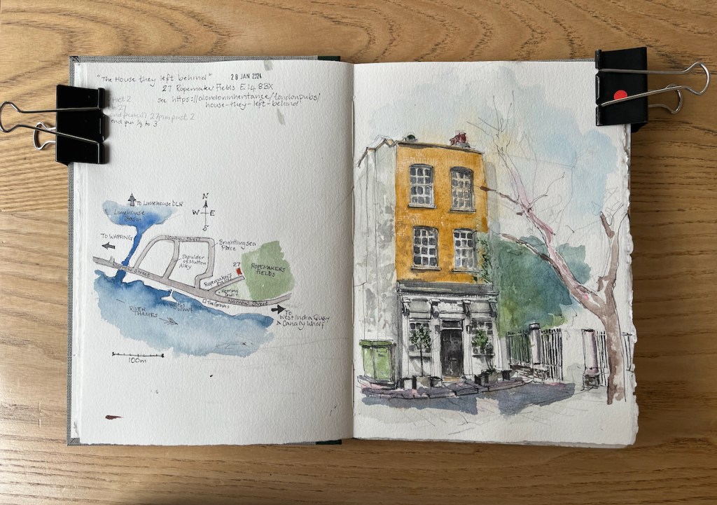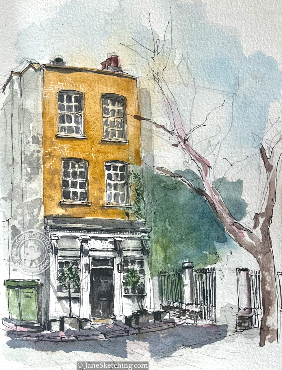
I read an article in “A London Inheritance” about this house, and went off on an expedition to find it.

The London Inheritance article shows a 1986 photo taken by the author’s father. Painted on the side of the building was the sign:
THE HOUSE THEY LEFT BEHIND
BUILT 1857
RESTORED 1985
The sign has now been painted over. The wall, which is on the left of my drawing, is now completely white. But the name lives on and appears on current maps. Here is a map showing where the house is.


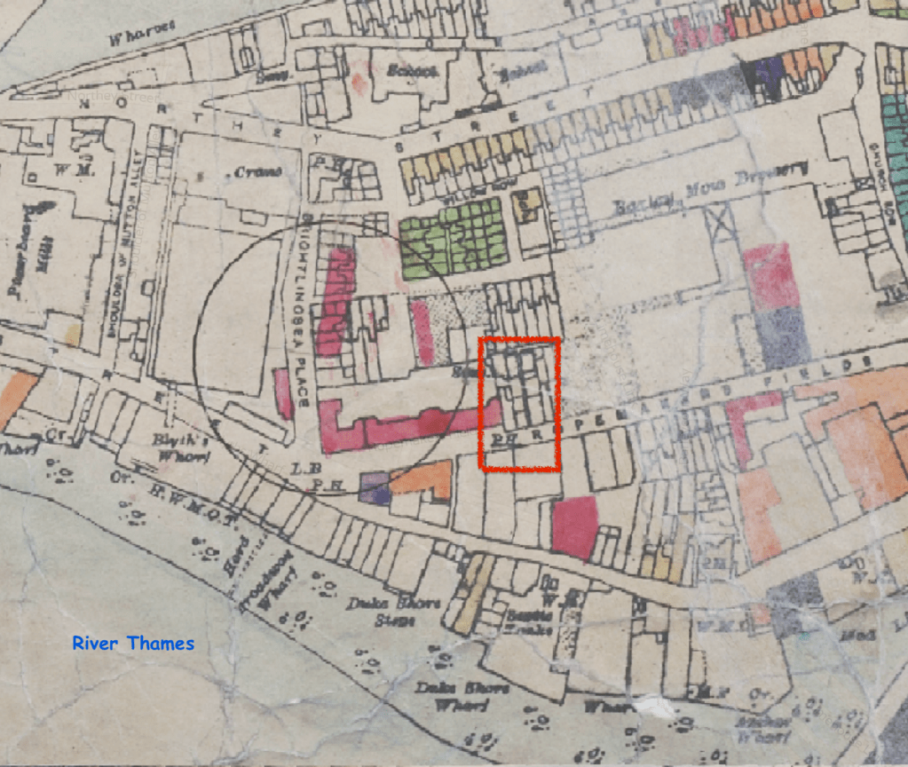
The building is now residential, but was previously a pub. It was “left behind” by the bombs dropped on London by the Luftwaffe in the 1939-45 conflict. The website “Layers of London” provides maps of bomb damage in London. Here is the area.
credit:
https://www.layersoflondon.org/map/overlays/bomb-damage-1945
Map provided by London Metropolitan Archives. Geo-referenced with the support of the National Library of Scotland
The map is based on 1:2500 Ordnance Survey sheets originally published in 1916. The bomb damage was recorded on these maps by hand soon after it happened. The circle represents where a V2 rocket landed. The red area shows buildings that were classified as “seriously damaged – doubtful if repairable”. As you see, the pub, labelled “P.H.”and outlined in red, is shown as undamaged.
I found more information on Bomb Damage Maps from a National Geographic article on a book about the maps. This article also provides a detailed key to the colours on the map. The book is “The London County Council Bomb Damage Maps” by Laurence Ward.
“A diary entry included in the book, from architect Andrew Butler on April 20, 1941, gives an idea of what the work was like:
For the block I have started on—eight floors high with two flats on each floor—has had its whole face ripped off … I found it possible to stand on part of the roof. So, clutching a broken chimney, I surveyed the damage there. My notebook became very messy. What with the dust and soot, wet filth and the perspiration of fluster on my hands, it was difficult to read what I wrote. The notes served their purpose however when, after drying the book, I had to transcribe them into a report.”
https://www.nationalgeographic.com/science/article/bomb-damage-maps-reveal-londons-world-war-ii-devastation
The original maps are in the London Metropolitan Archives.
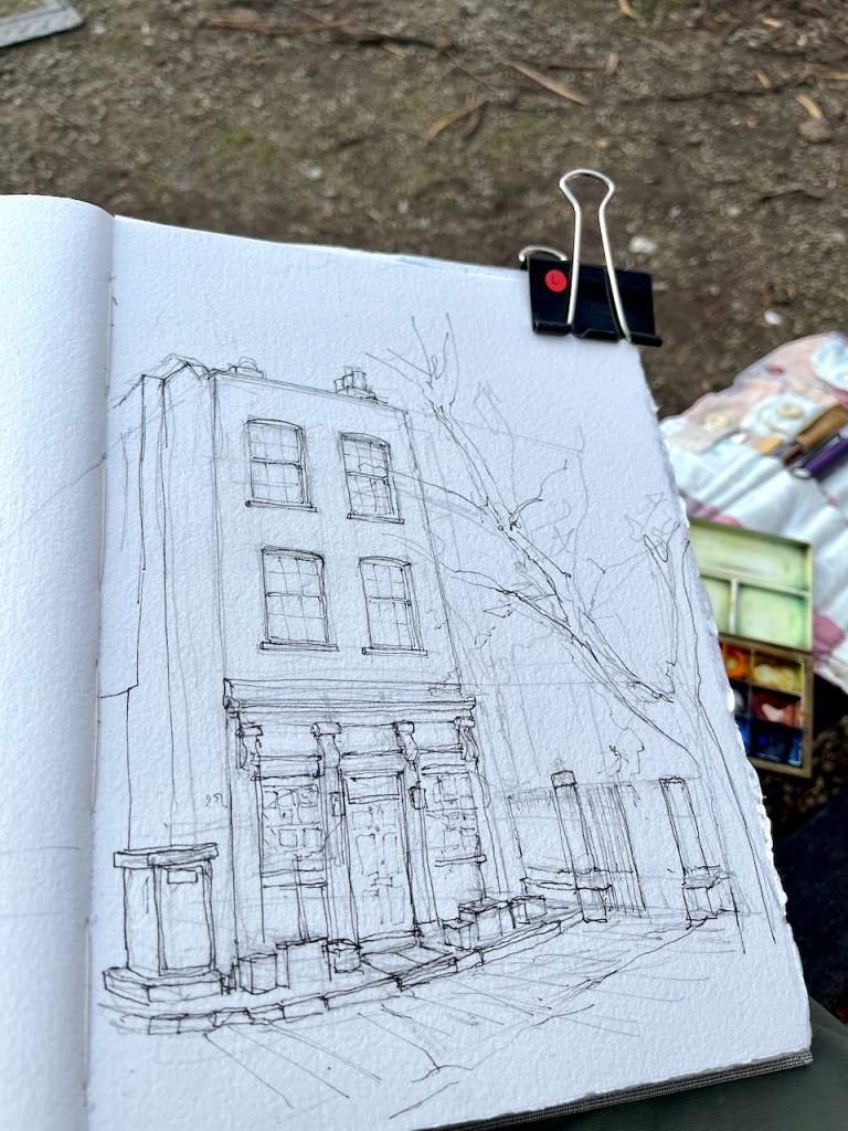
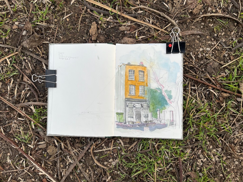
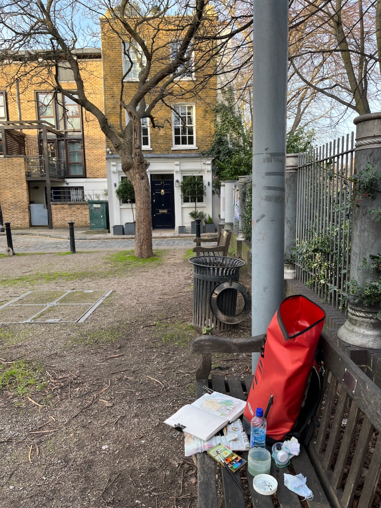
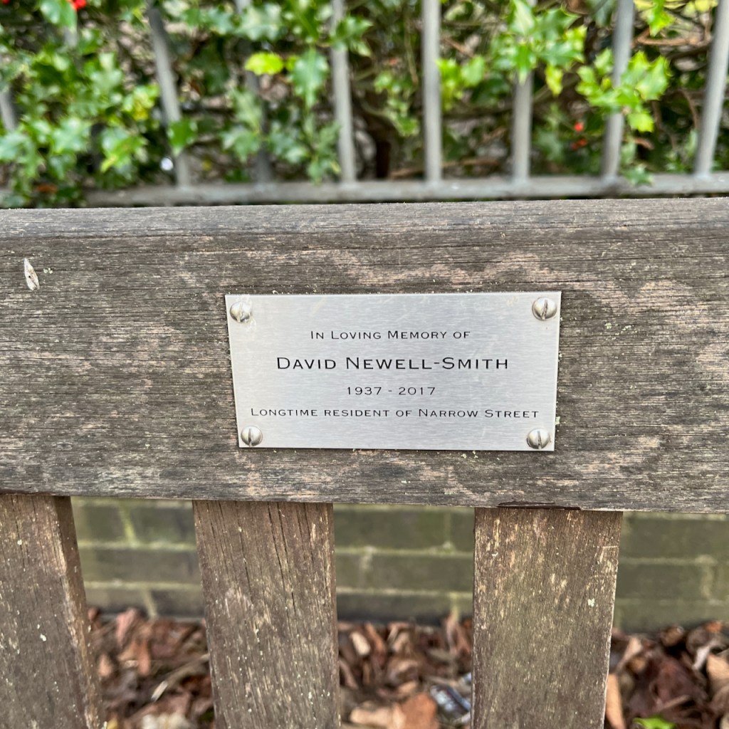
Here is my work in progress on the sketch. Thank you to the author of “A London Inheritance” for providing the stimulus for this expedition. Thank you also to the friends and family of local resident David Newell-Smith, on whose memorial bench I completed the sketch. His dates are given as 1937-2017. He would have been a boy when the bombs were falling.