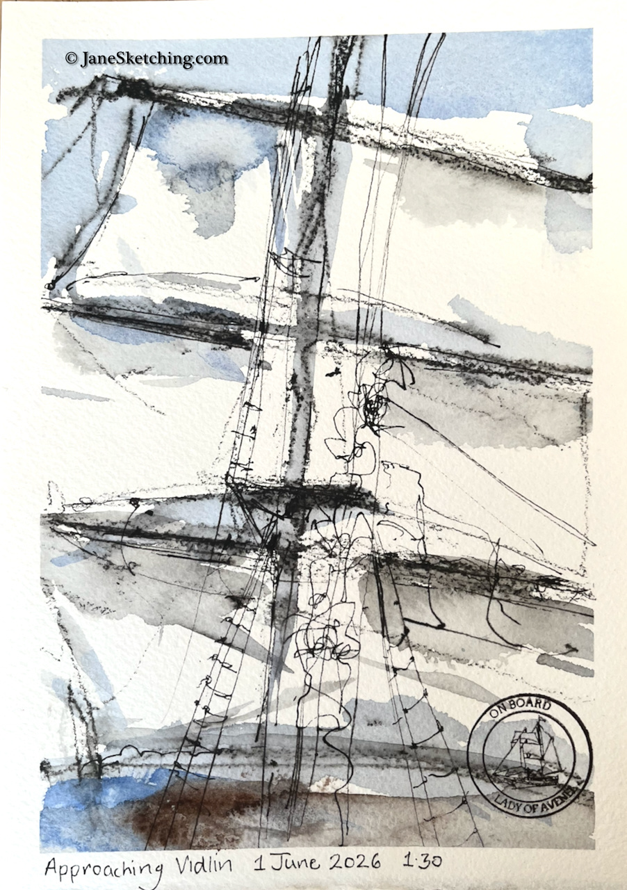
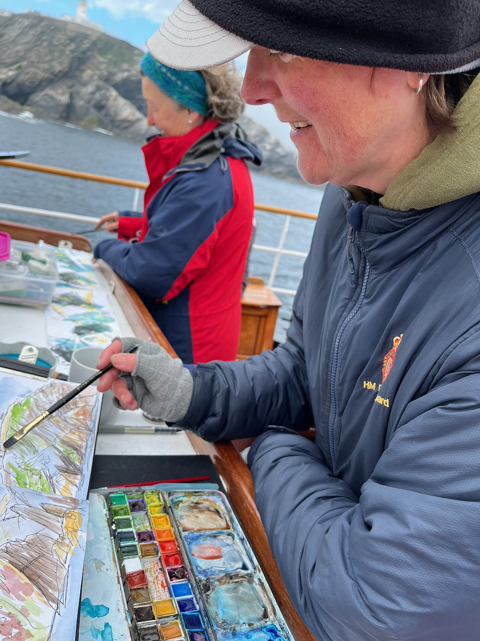
I love boats, and the sea, and I draw pictures. So I found myself in the company of an enthusiastic group of artist-sailors, on board the Lady of Avenel, in Lerwick in Shetland, about to set off for a week’s sketching and sailing.
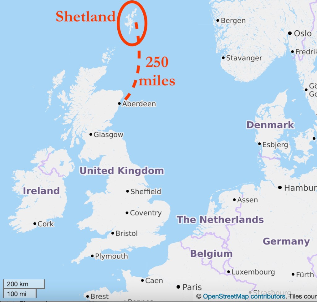
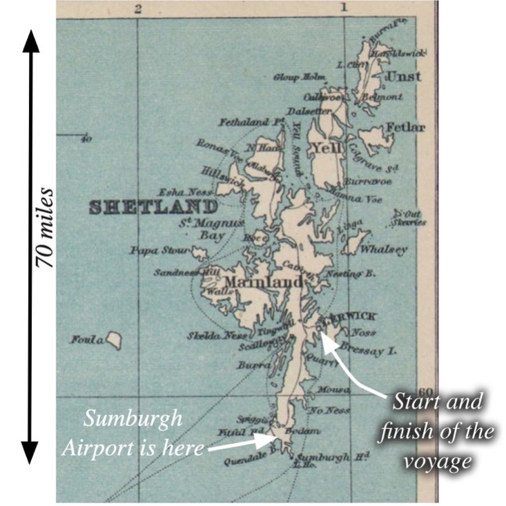
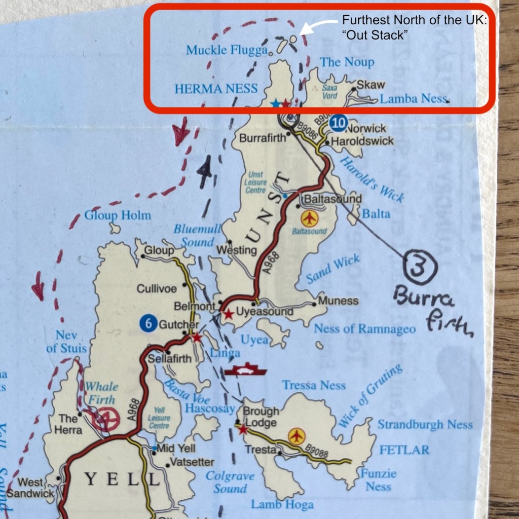
Shetland, for those who are a bit hazy about it, is a group of islands 100 miles or so off the North coast of Scotland. It is part of the UK. Our voyage took us to the most Northerly part of the UK, and I swam at the most northerly beach. But that was later. We set off from Lerwick, which is about half way up the biggest island of the Shetland group.
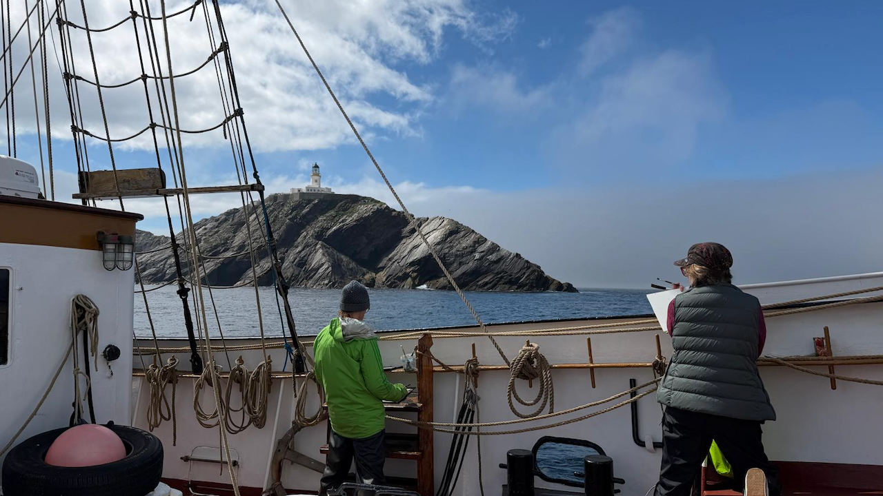
Our voyage took us up the east side of the islands, between the islands of Whalsay, Yell and Unst, and up to the most Northerly lighthouse, Muckle Flugga.
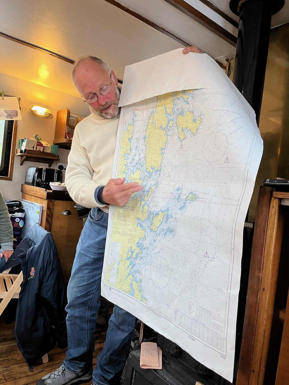
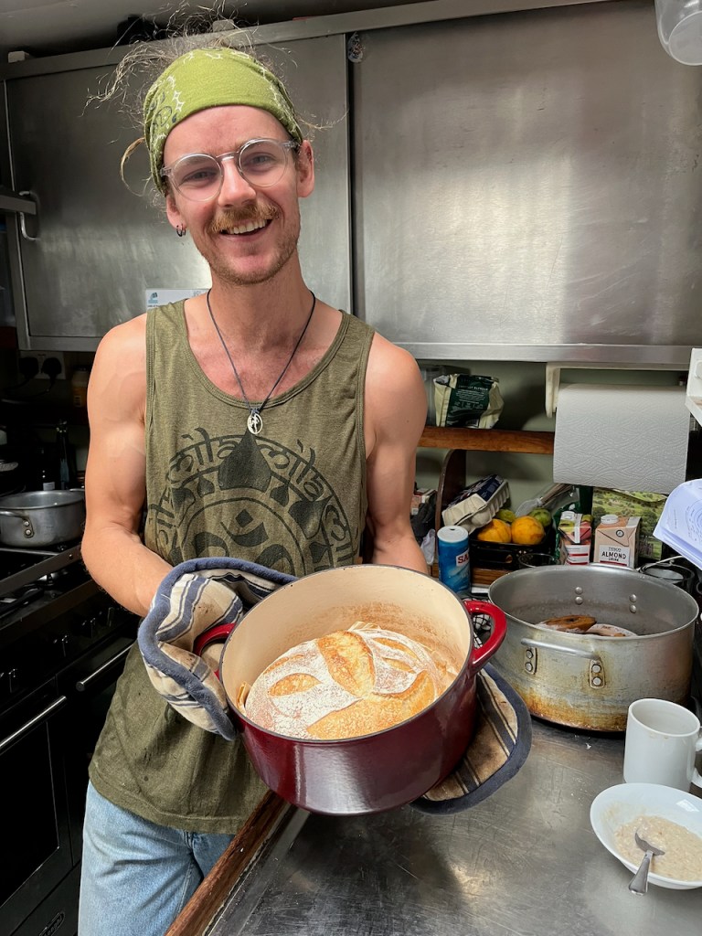
We had a full professional crew: Charles the skipper, Nessie the mate, Tom the cook, and Lyn the second mate.
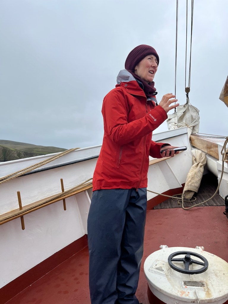
Here is Charles, the captain, describing the next day’s route.Here is Tom, the ship’s cook, who baked fresh sourdough bread every day
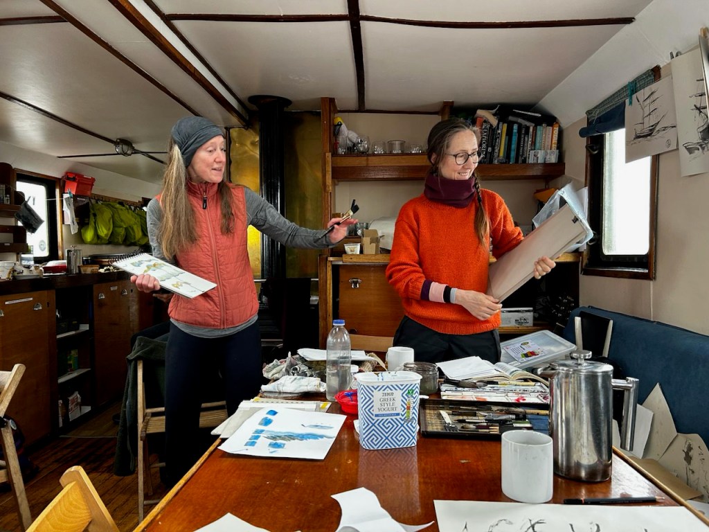
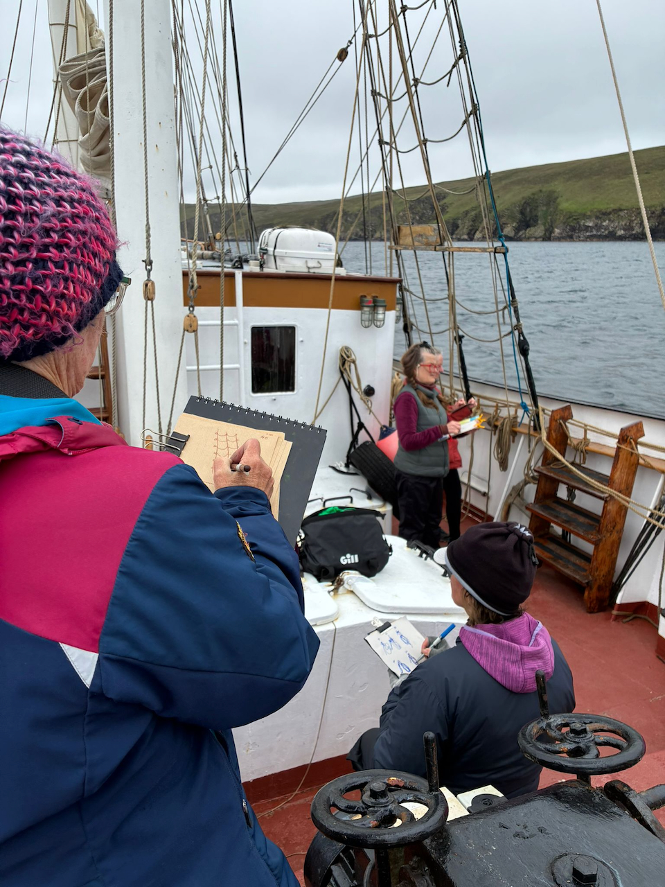
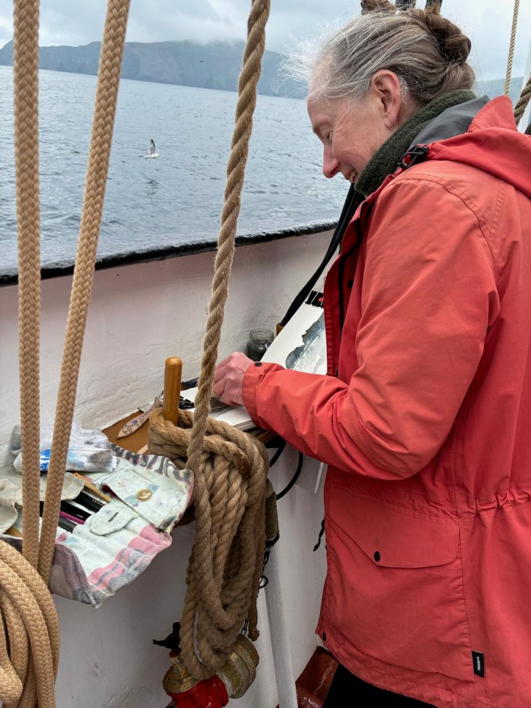
Alice and I were leading the art workshops. We did colour mixing, painting sea and sky, brushmarks, colour layering, distance, and all sorts of exercises and experiments with techniques appropriate for the landscape.
Here are Alice (right) and me (left) on the boat, demonstrating brushstrokesAlice explaining “outline drawing”Alice on the foredeck, during a workshop
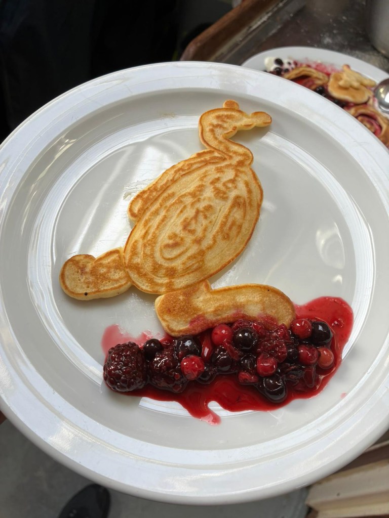
It was a lot of fun, and everyone was very productive. The cook Tom was inspired to produce art too in his special medium. He produced amazing “pancake art” in addition to all the other meals and cakes. His cooking was an outstanding creative production.
Pancake art
If you also are inspired (by the sketching, the sailing …or the cake…) and would like to join such a voyage, have a look at the “Lady of Avenel” site: https://www.ladyofavenel.com/sketchandsail
I filled a sketchbook with drawings. Here’s a quick video:
Sketchbook flick-through (36 seconds – no audio) (video may not play on mobile version)
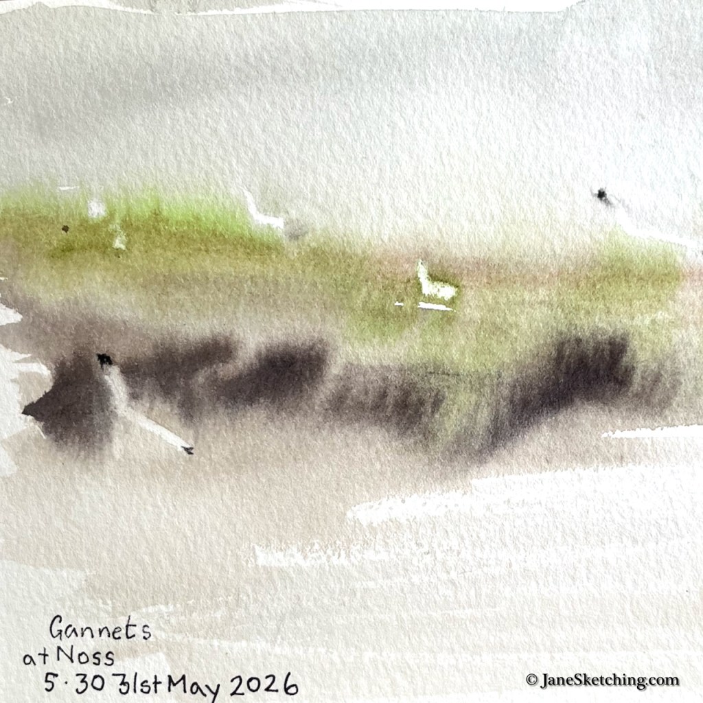
On the very first day, our skipper steered us up to the cliffs of the island of Noss, so we could have a go at sketching the seabirds.
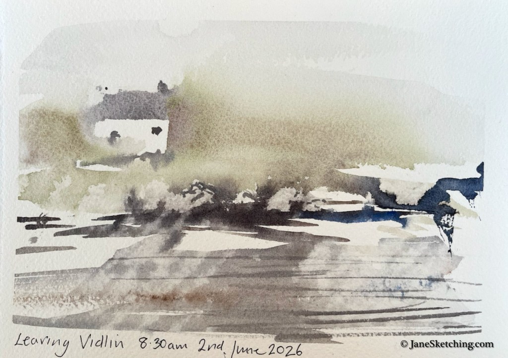
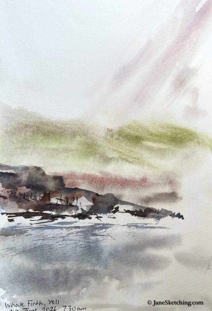
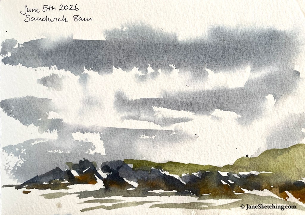
On some days there was fog. It’s possible to paint in the fog. It produces amazing atmospheric effects.
This is a particular Shetland phenomenon: when you look horizontally you see fog, but the light from above is still bright, and seems to make the fog glow. Here’s another fog painting.
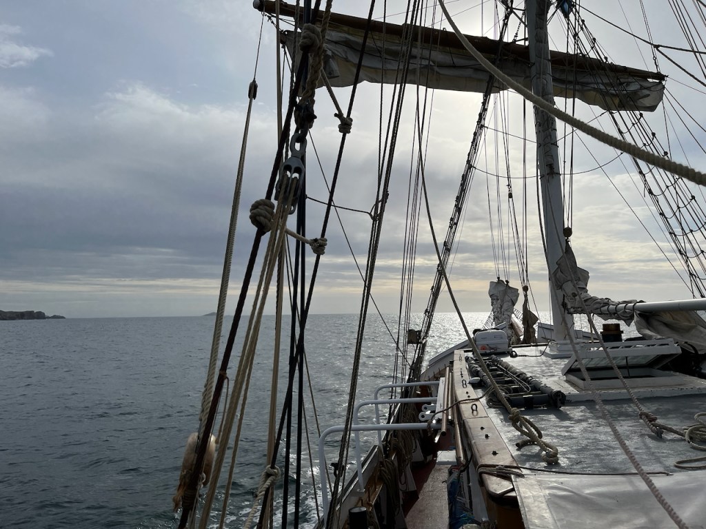
The wind soon blew the fog away. Shetland is famous for its wind, and we were on a sailing boat.
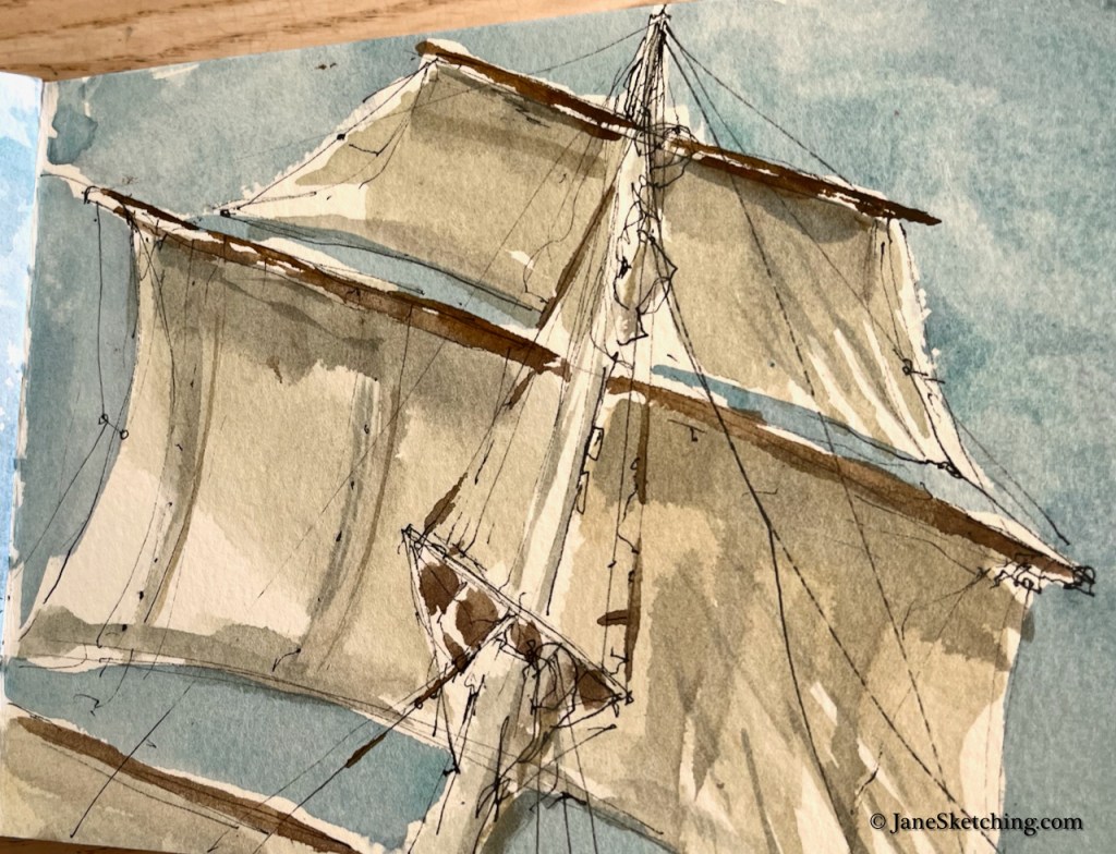
There are a lot of ropes to control those sails. I couldn’t get them all in. It’s a challenge to do these sketches on a moving boat – and of course the crew are trimming those sails all the time and shifting them about, and liable to take one of them down altogether, or put another one up. So you have to be quick. Perhaps a little accuracy is lost.
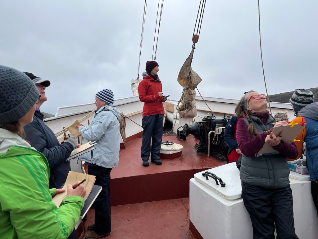
Alice ran a great workshop on speed sketching, which was just as well.
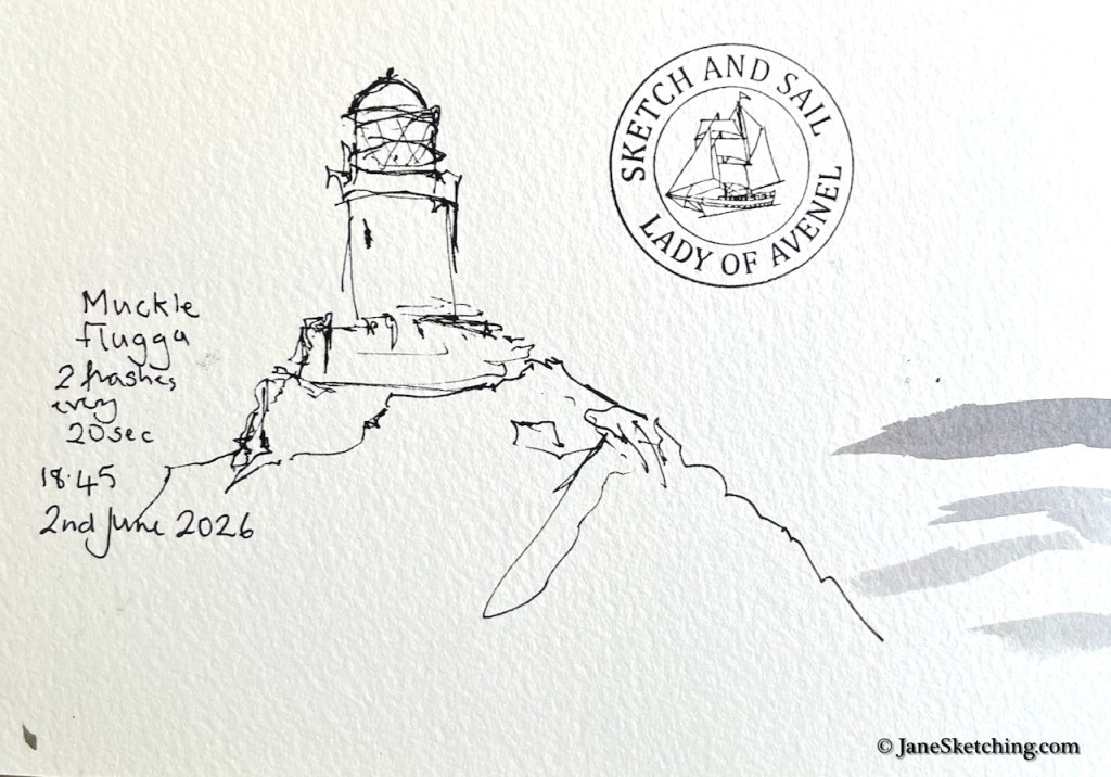
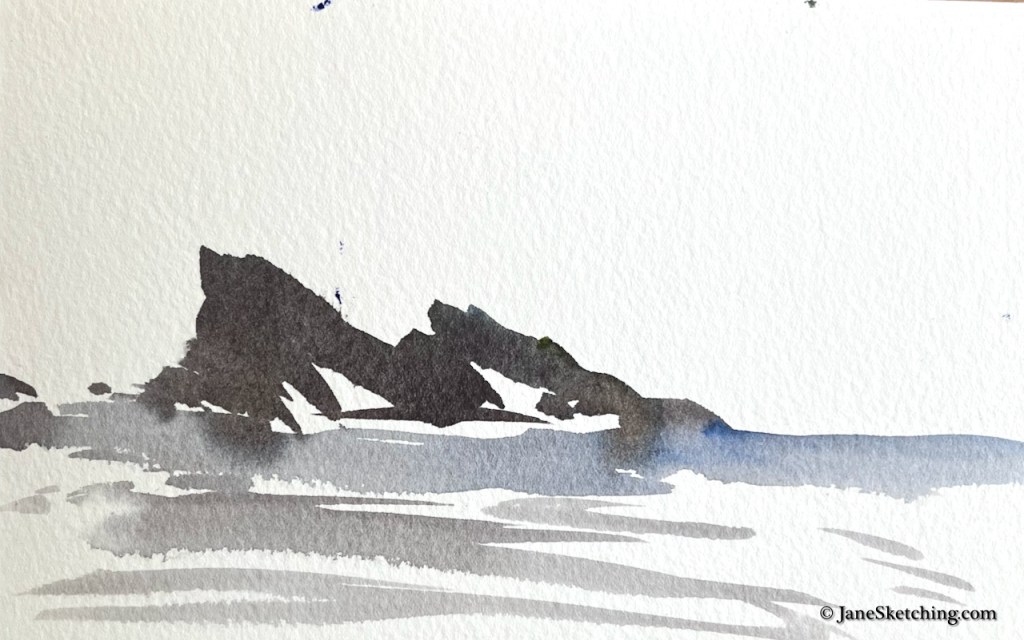
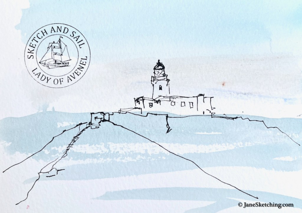
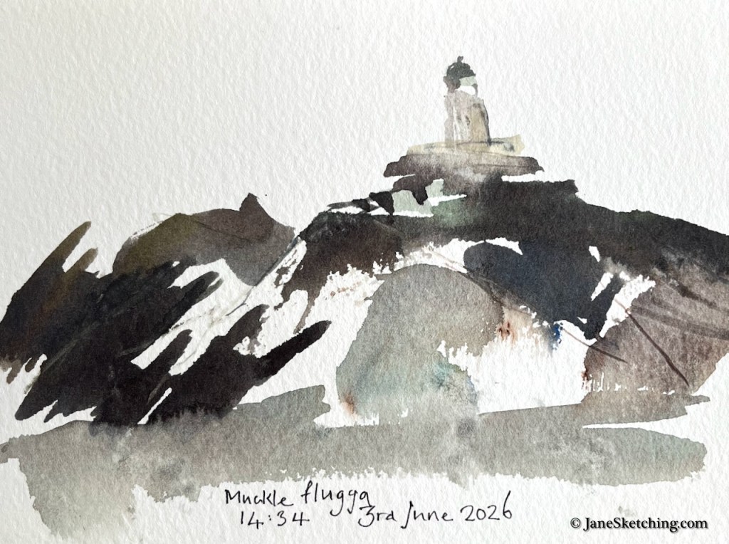
At the northern point of our voyage is the lighthouse at Muckle Flugga. Charles the skipper accepted our request to sail round in small circles so that we could have a good chance to sketch it.
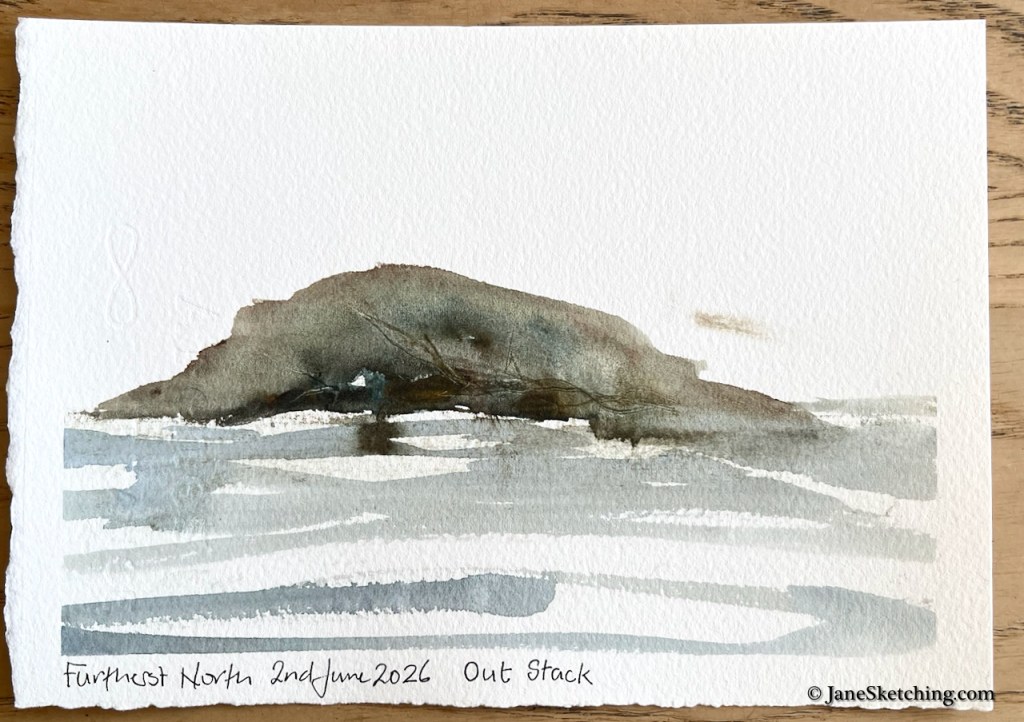
Even further north than Muckle Flugga is a little island: Out Stack.
Here is what that furthest north point of the UK looks like:
Out Stack 60.8603°N 0.8741°W
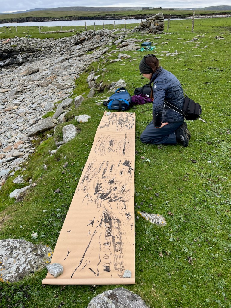
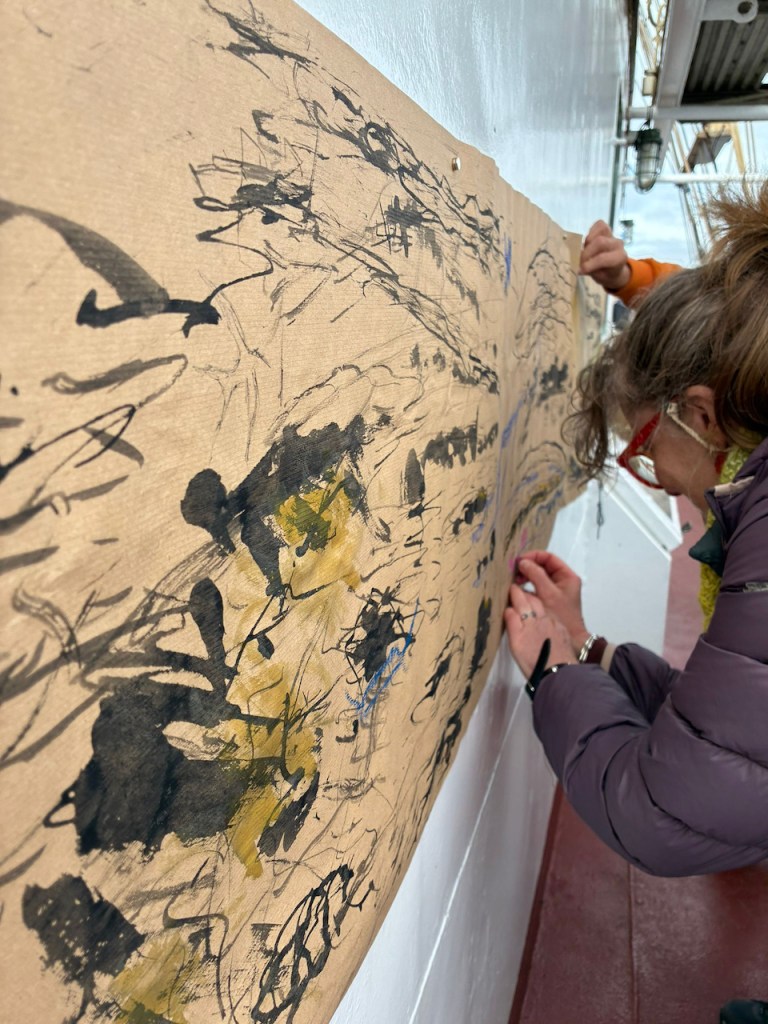
We landed at some magical remote beaches.
We made big pictures as well as sketches in sketchbooks.
On one beach, Alice organised a huge picture made by many people. ….….who then added to it on board. We found we could fasten the picture to the cabin of the boat with magnets.
…and all the participants in the 2026 Shetland Sketch and Sail. Thank you for your enthusiasm, your inventiveness, and your companionship on the journey.
Click a button below to share this post online, email it, or print it:
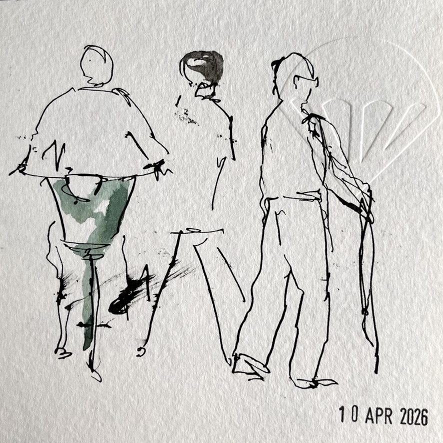
On a sunny day in April, I walked across London Fields. I had a paper bag in my hand containing a cheesy snack from E5 bakery.
I ate my snack on a bench, watching the people walk past on their way to Borough Market.
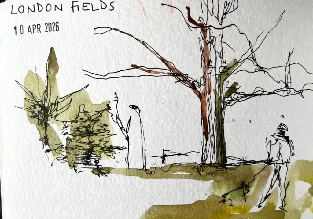
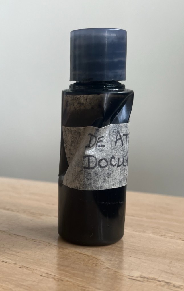
Then I thought I would draw some of the trees, and the people. Already translating the scene in front of me into ink sketches in my mind, I extracted from my bag the bottle of ink I had brought for this purpose. This ink bottle is a repurposed plastic shampoo bottle, small size, from a hotel.
I could not get the top off the ink bottle. The ink had dried. The top was stuck. My hands were not strong enough.
Help was needed. Fortunately, help was going to be readily available in the stream of passers-by. I waited. I discounted the slim woman in the smart white skirt. She would not want to engage with ink. Several older people, though probably interested and willing, would likely have the same issue I had. Then a young man came by. He had the physique of Jack Reacher: a blond man in a tight T-shirt, walking easily and with purpose. I smiled and I said, “You look like a strong guy. Can you get the top off my ink bottle?” I held out the small bottle. He stopped, and assessed the situation. He had not only the physique of Reacher, but also his attitude: never walk past a damsel in distress. Although I am hardly a damsel. “ I am a strong guy,” he told me with a smile. “You got the right man here!” In his muscular hand, the bottle looked tiny. “It’s ink,” I reminded him, “keep it the right way up.” “Got it”, he said, and applied himself to the problem.
The top did not move. “Hmmph” he said, and put down his carrier bag. Now he applied his muscular arms and his huge torso into the twisting movement. I had visions of the bottle bursting, ink going everywhere, including into his carrier bag. De Atramentis Document ink is notable for its intense blackness, and archival quality. That means you can’t wash it out. But within seconds he was handing me back the bottle and picking up his undamaged carrier bag. I thanked him and he went on his way, the action a small blip in his smooth stride across the park.
He had released the top. I undid it cautiously and all was well. No leakage. But this incredibly strong individual had contorted the ink bottle. It now took on the irregular shape of a crumpled can: an art object, perhaps. It sits on my desk, testament to the extraordinary strength of this kind stranger in the park.
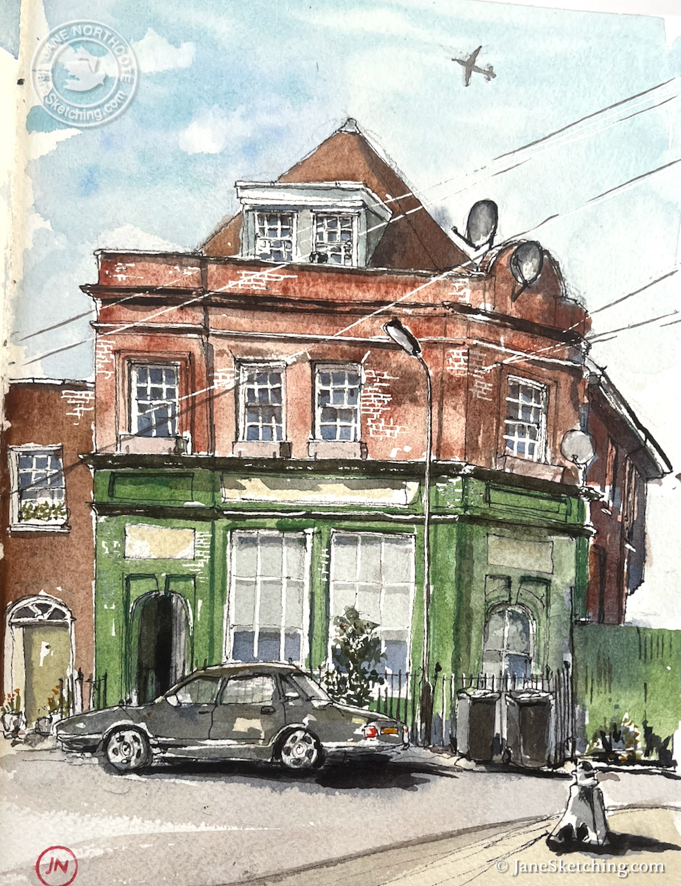
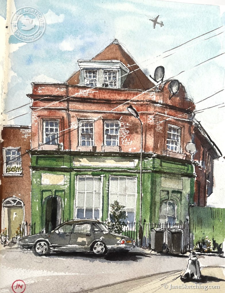
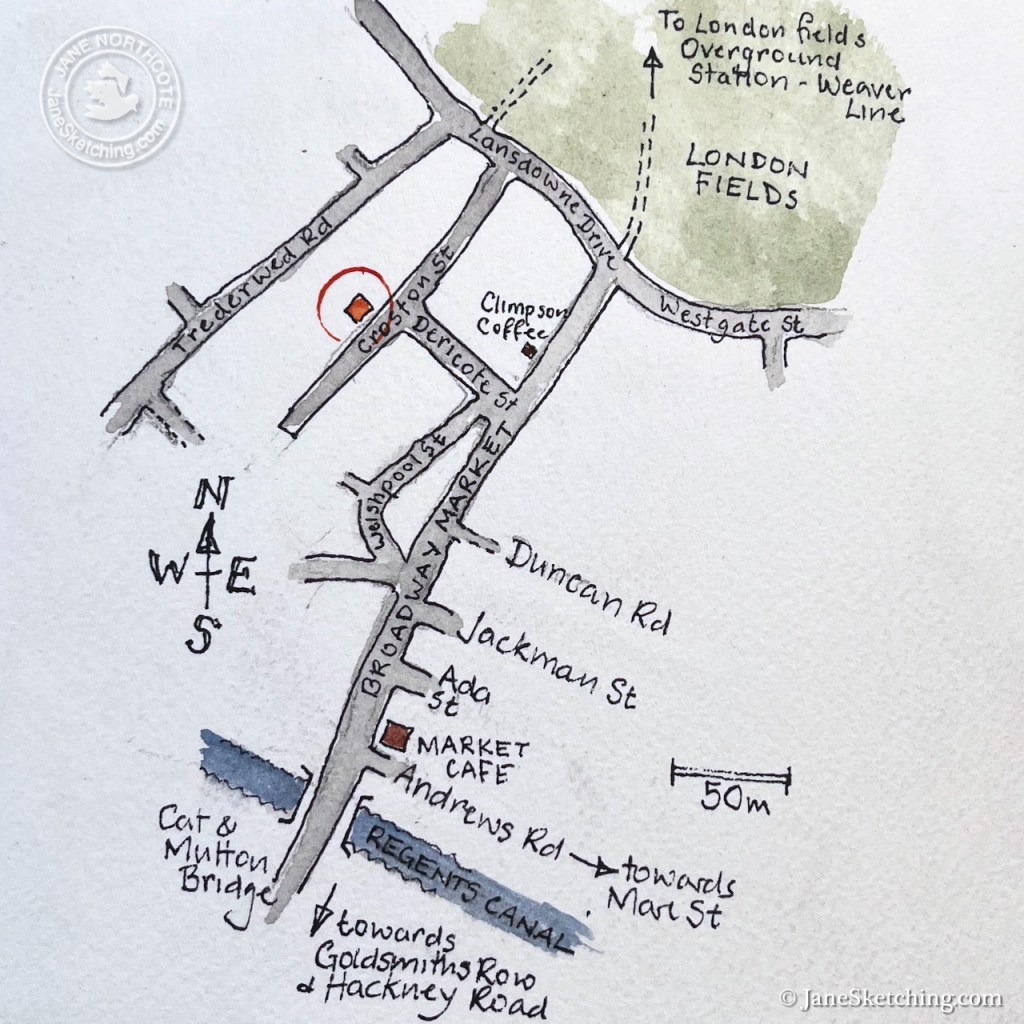
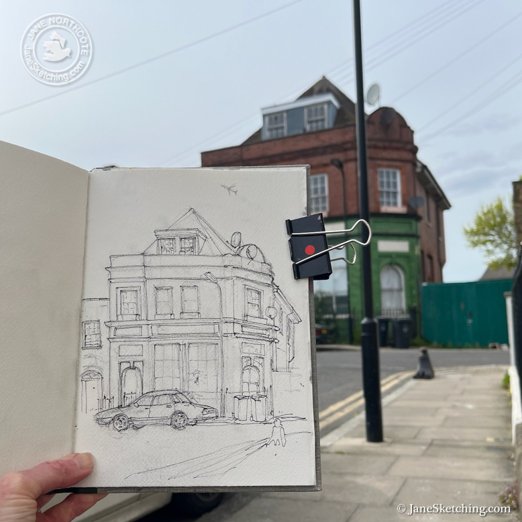
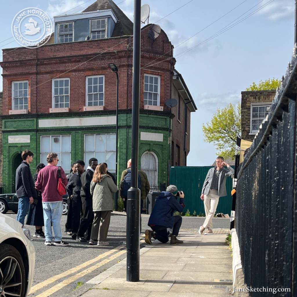
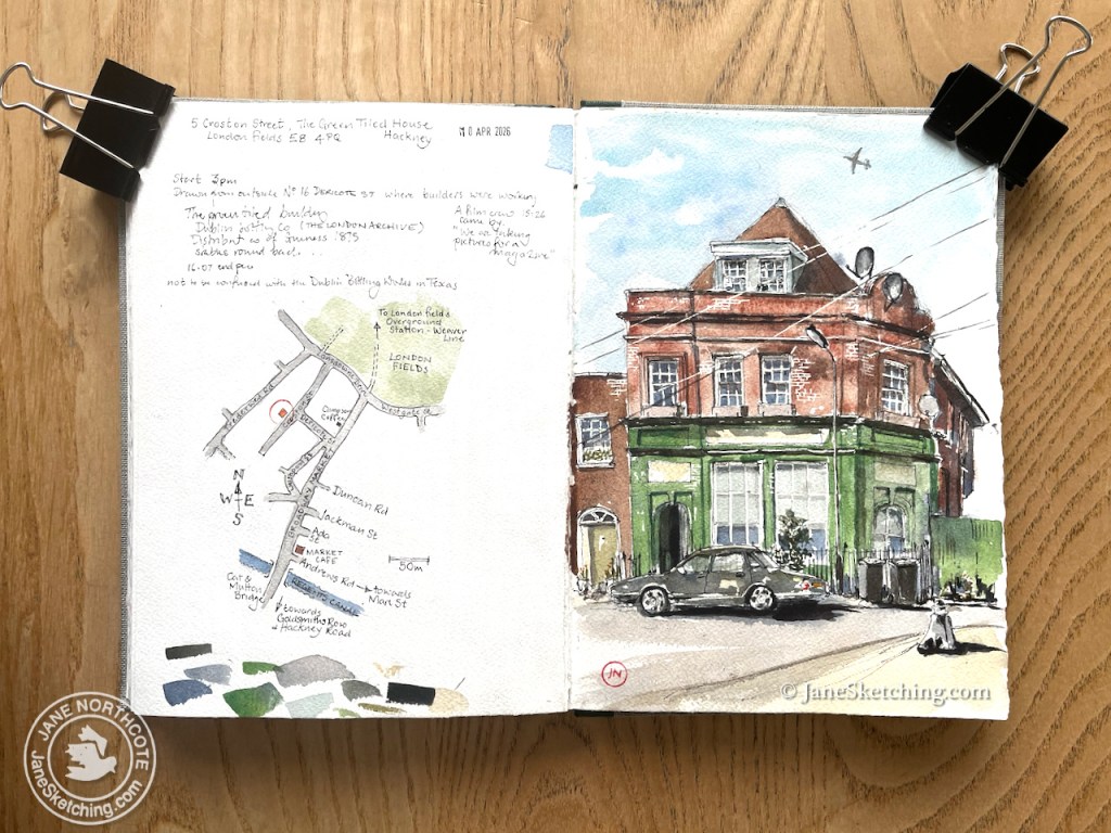
Later, I followed the stream of people towards Broadway Market. I procured coffee from Climpson Coffee and looked for a quiet place to drink it. Round a corner, down a side street, was the perfect place: a silent street, a stone step in the sun, and an interesting house to draw.
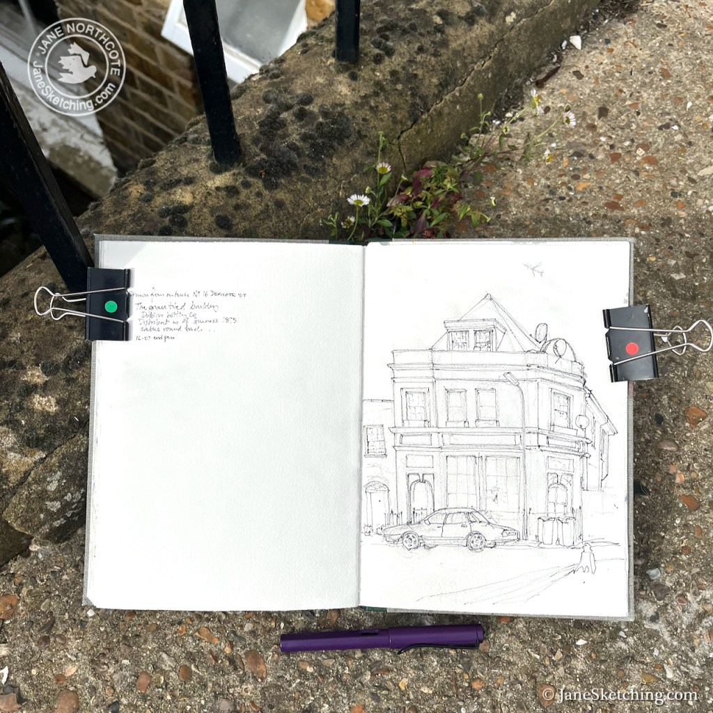
The Green Tiled House, 5 Croston Street, London Fields, E8 4PQ. Sketched 10 April 2026 in Sketchbook 16.
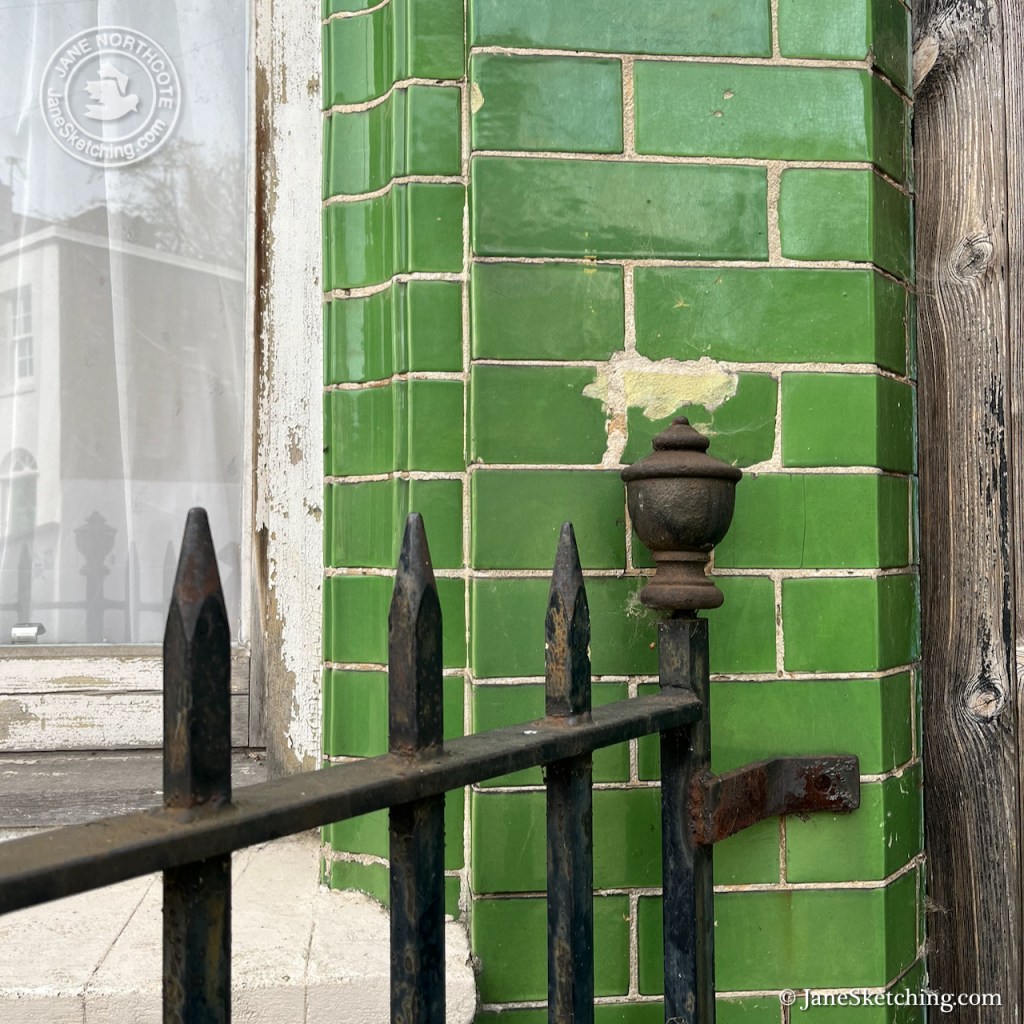
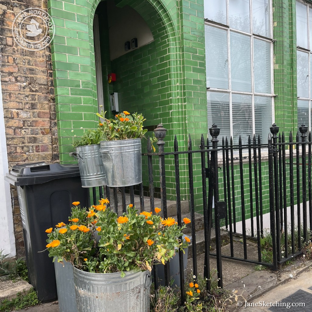
This building had clearly been something. Not a pub: the windows were too low. Pubs of that vintage were built with high windows and stained glass, so children (and others?) could not see the goings-on within1. Also, if it had been a pub, the door would have been on the corner. But the glazed green tiles spoke of a pub. It is apparently residential now. I saw three bell-pushes by the front door and there are three satellite dishes. The bars of the windows were dried up and flaking. That car outside was dented. A mystery.
I was sketching from a doorstep on Dericote Street. It was not so quiet as I had thought. Groups of people walked past. I received many encouraging comments on the picture, including from children. One passer-by asked me if I knew what the building was. I said I didn’t and asked if he knew. He didn’t know either.
Then the house behind me, which I had thought was boarded up and empty, turned out to contain building workers, who emerged from the front door into the sunlight and all around me. I apologised for sitting on their doorstep and made to leave, but they waved away my apologies, and examined my picture with interest. They spoke a language I did not recognise. I could not decipher exactly what they were saying, but they seemed to be comparing my work with another artist they knew. A fellow building worker drove up in his van, totally blocking my view. As politely as I could, I asked him if he would please consider parking elsewhere. This suggestion was reviewed in rapid conversation with his colleagues from indoors. He leapt back into the van, put it in gear, and moved up the street.
Then the photo shoot arrived. At first I saw a man standing in the middle of the road, shifting sideways, oddly. He was staring, not at me, but round about, in a peculiarly intense manner. He went away, and I thought no more about him. London is full of people moving oddly, myself included. Five minutes later, a whole group arrived, equipped with heavy cameras and silver umbrellas. They were all young and all beautiful. The man who had been moving oddly was amongst them. They took up a position exactly in my field of view. One of the beautiful people noticed me immediately and came across to assure me that “we will only be five minutes”. I said it was a great location, which it was. He agreed, and told me they were making pictures for a magazine.
I watched while one of the beautiful men leaned meaningfully on the railing and everyone else watched and commented.
Then, after five minutes as promised, they moved off around the corner and out of sight.
I finished the pen drawing. It was getting cold.
As I was packing up, the man who had approached me earlier, asking about the building, came back, walking briskly. He was flourishing his mobile phone. “It’s called ‘The Green Tiled Building’“, he told me triumphantly. Reading from his phone he continued “It was ‘The Dublin Bottling Company’, distributors of Guinness, 1875. There were stables round the back.” I wrote it all down. Having dispensed this information, he rushed off again before I could thank him. I looked around to say goodbye to the construction workers but they had gone, and the house behind me was silent.
Back at home, I finished the picture, and researched the Dublin Bottling Company2.
A building is shown at this position in the OS Map of 1891-5, with the same layout and plan as later maps of 5 Croston Street. At that time, Croston Street was called “Hamburg Street” and Dericote Street was “Breman Street”. A building whose roof is remarkably similar to the existing one is shown on the “RAF Aerial Map of London 1945-48”.
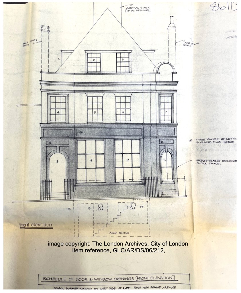
My researches took me to the London Archive, where I was able to trace some of the story of this building, via Planning Applications. In the marvellous “Archive Study Room” I spread out plans and saw architects’ drawings showing younger versions of the building I had sketched.3
1977 architects’ drawing for the GLC, Department of Architecture and City Design, Sir Roger Walters, KBE, FRIBA . Note the chimney stacks. None of the chimney stacks are there now in 2026. Image copyright: The London Archives, City of London, Reference: GLC/AR/DS/06/212. Reproduced under licence.
The “Dublin Bottling Company” owned the site by 1951. I know this because there was a building application dated 1951, for the proposed installation of a cold water tank, with the owner cited as the Dublin Bottling Company Ltd. By this time the address was 5 Croston Street. A plan of this date shows storage areas for Guinness, cider and “Bass” inside the building, and a big yard with sheds, accessed by a side road to the right of the building.
The Dublin Bottling Company continued to enhance its facilities. In October 1960 they paid a T Whyman and Sons £75 to “form a door through the existing brick wall from open yard store space to storage department and supply and fix rolling shutter.” Mr Wyman must have done a good job because in February the next year, for a fee of £375, he is erecting glazed partitions in the office and removing a “wrot iron gate” to fix another roller shutter.
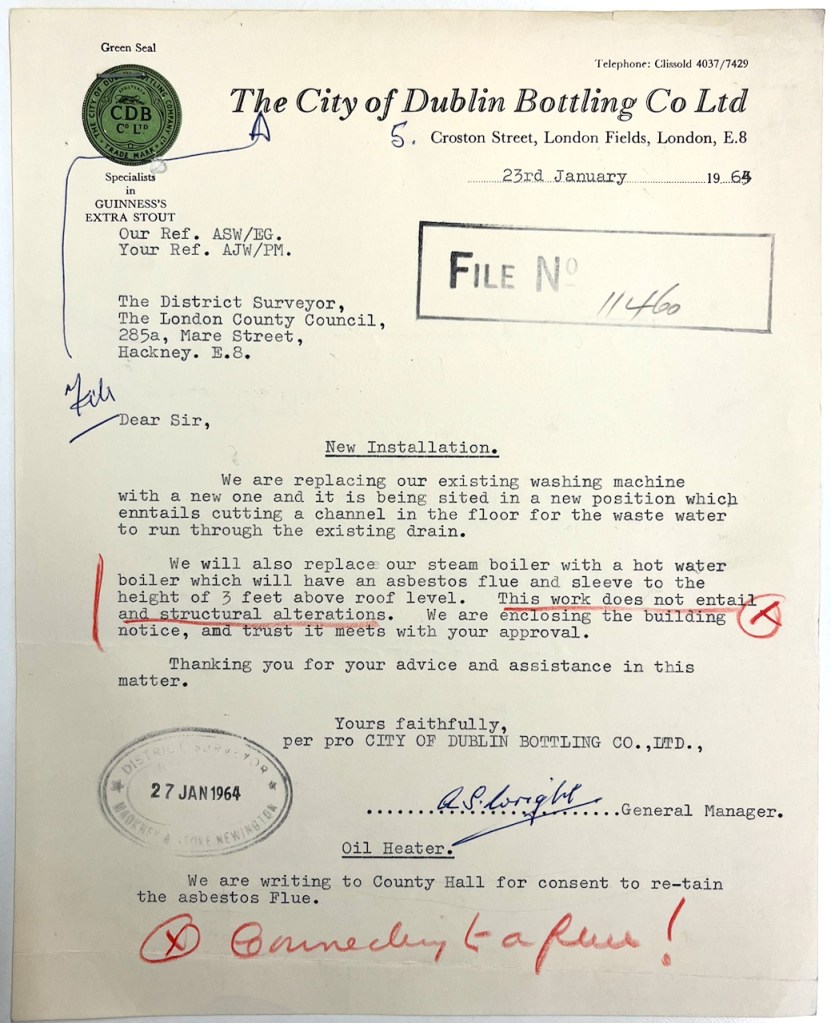
However in 1964 they started to encounter problems. They applied to install a new steam boiler.
Letter from Mr Wright General Manager of the The City of Dublin Bottling Company Ltd to the London County Council District Surveyor in Hackney. This letter is in the London Archive ref GLC/AR/DS/06/212, and is reproduced here by kind permission of the Guinness Archive. The letter tells the Surveyor that they want to make some modifications to install a washing machine, and to install a hot water boiler. They claim there will be no structural modifications. But the annotations in red show that someone has a concern about the flue to the steam boiler. Image copyright: Guinness Archive
The proposed flue for this boiler was “asbestos cement”. The Superintending Architect at the London County Council did his homework. He told them: “It has been ascertained from the makers of the boiler (Berings, Ltd.) that the flue throat temperature is 550°-7000 F. which is 200°F. above the permitted maximum for asbestos cement.” 4
He demanded a cast iron flue. “Please re-submit your application”. I could find no such resubmitted application in the parcel of documents at the London Archive.
By 1975 they found themselves struggling to continue, as the area had been zoned for residential use, and they were not residential. They applied for:
“continued use as a depot for storage purposes and the retention of a storage shed”
However the council was reluctant.
“the building hereby permitted shall be removed at the expiration of the period ending 31st December 1976”
There were to be no vehicle repairs. They had to maintain an 8 foot fence all around the perimeter of this industrial activity.
“The proposal does not accord with the Initial Development Plan for Greater London in which the area is zoned for residential use”
commented the planning officer.
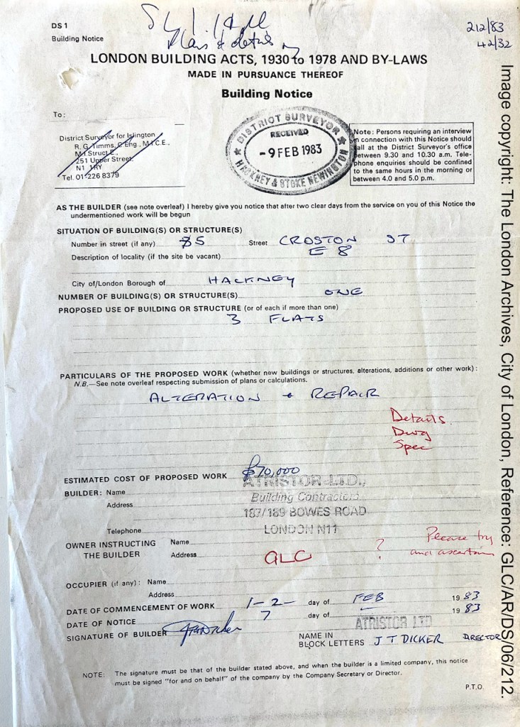
So then some change of ownership must have occurred, because in April 1978 someone, probably the Greater London Council (GLC), was submitting plans to redevelop the property into three residential flats. See the architects drawing above. This was approved on 3rd August 19785. But no redevelopment happened. There was a further application in 1983, now with a builder involved, Atristor Ltd. The planning officer at the time, like me today, wanted to find out who owned the site. In the “owner” field they wrote in red “GLC?” with a note “please try and ascertain”.
7 February 1983: part of the planning application correspondence between the builder, “Atristor Ltd” on behalf of (we assume) the GLC, and the district surveyor, regarding the conversion of the building into three flats. See the red annotations, where someone is querying the ownership. Image copyright: The London Archives, City of London, Reference: GLC/AR/DS/06/212. Reproduced under licence.
It seems that the owner was indeed the GLC, however, because in another bundle there were beautiful architectural drawings for the three flats, marked “GLC ILEA, DEPARTMENT OF ARCHITECTURE AND CIVIC DESIGN, County Hall SE1 7PB, Architect Sir Roger Walters KBE FRIBA FIStructE”.
Do we still have a “Department of Architecture and Civic Design”?
On 9th February 1983 Atristor Ltd notified the District Surveyor they were going to start work in two days. However something went wrong, because on 15th September 1983 the GLC was again submitting plans, this time for replacement of a “fire damaged roof”. They proposed to use steel beams to hold up the tiled roof. This time the work was to be done by the GLC Department of Architecture and design, Engineering Division.
At this point, the archive record stops.
I can only assume that the work to replace the fire-damaged roof went ahead, and that the conversion into flats was completed. Because here is the building, with a roof, and with three flats inside.
Page spread, Sketchbook 16
It’s a wonderful location, and an intriguing building. I’d love to hear from anyone who knows more about it.
Victorian pubs have high windows and stained glass to obscure the inside from the view of children and passers-by: I can’t find a reference for this. I have always assumed it is so. If anyone can confirm – please let me know. ↩︎
This is not the “Dublin Bottling Company” of Texas which makes drinks including “Dr. Pepper” ↩︎
All the quotations, documents and plans I have reproduced come from London Archive document packs with this reference: GLC/AR/DS/06/212, see this link – https://search.lma.gov.uk/scripts/mwimain.dll/144/LMA_OPAC/web_detail?SESSIONSEARCH&exp=refd%20GLC/AR/DS/06/212 The documents are not online, but are available for perusal at the London Archive Study Room. The London Archive kindly gave me permission to photograph the documents and publish them here. The letter from the Dublin Bottling Company appears by kind permission of the Guinness Archive (email from Sarah Mai Kavanagh, 20 My 2026) ↩︎
Letter in the London Archive pack GLC/AR/DS/06/212, dated 20 April 1964 from Hubert Bennet, Superintending Architect London County Council, to the Dublin Bottling Company, copied to the Hackney District Surveyor. Mr Hubert writes, “I would confirm my assistant’s telephone conversation with Mr. Wright on 19 March 1964, when the above matter was discussed and the installation of a cast iron flue pipe complying with By-law 10.05 agreed.I would be pleased to receive a reply confirming the installation of the cast iron flue pipe and the cancelling of the application at your earliest opportunity.” ↩︎
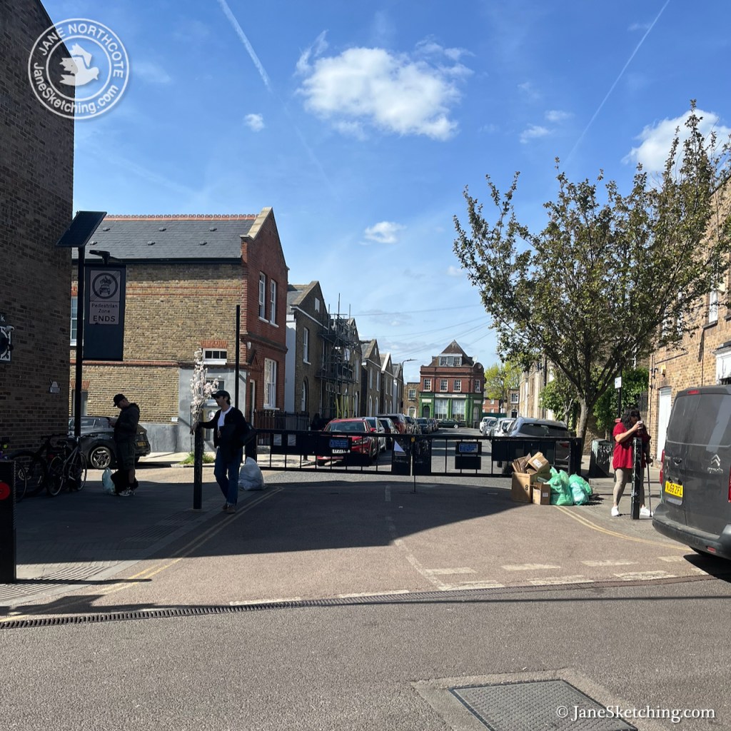
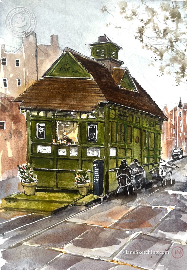
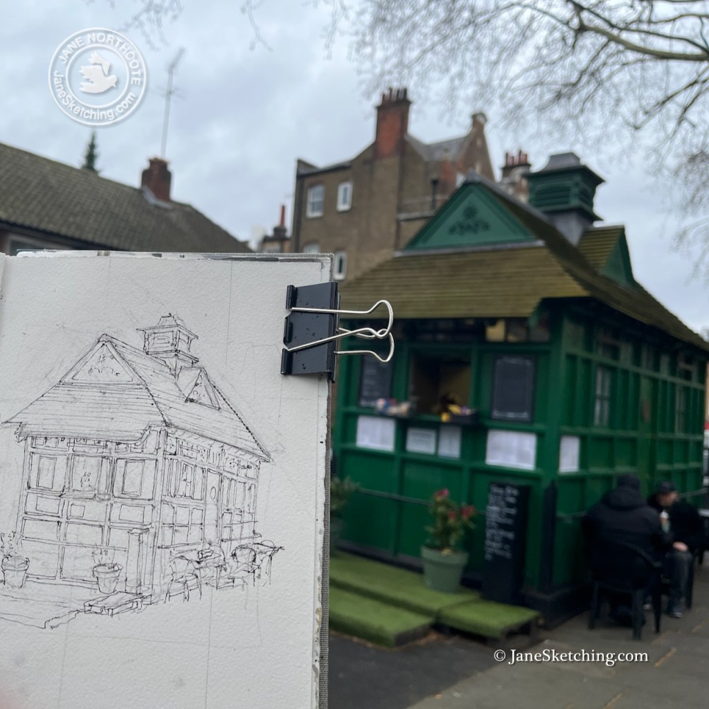
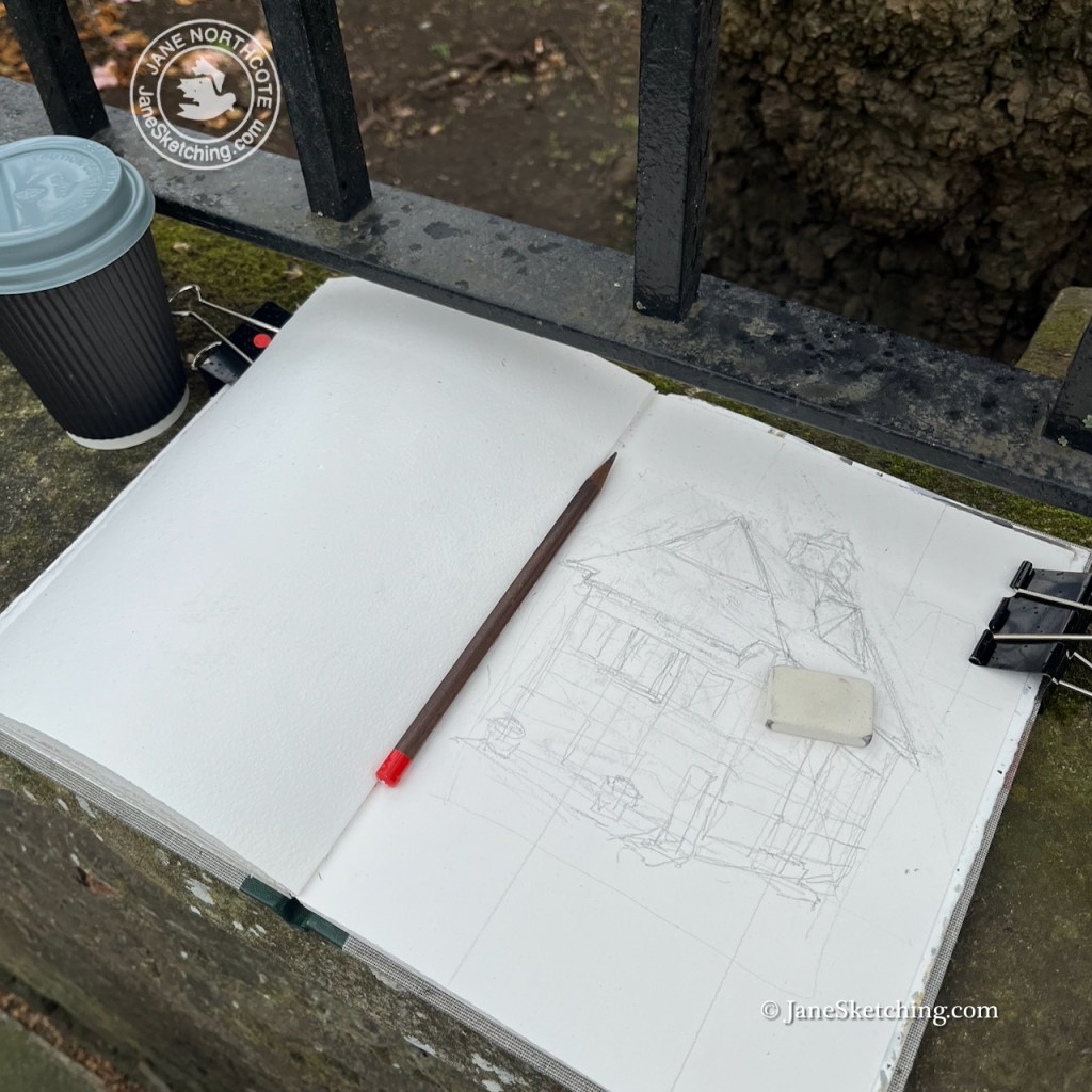
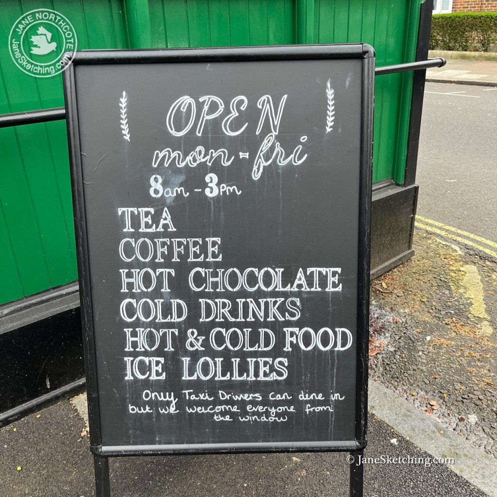
According to the cab driver sitting at one of the tables, this is “the oldest, and the last to be listed”. It was built in 1875, and listed in 2024 (listing ref 1488223).
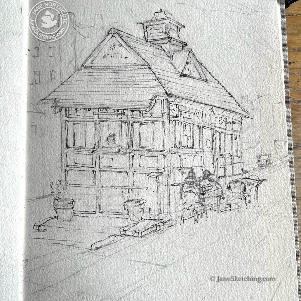
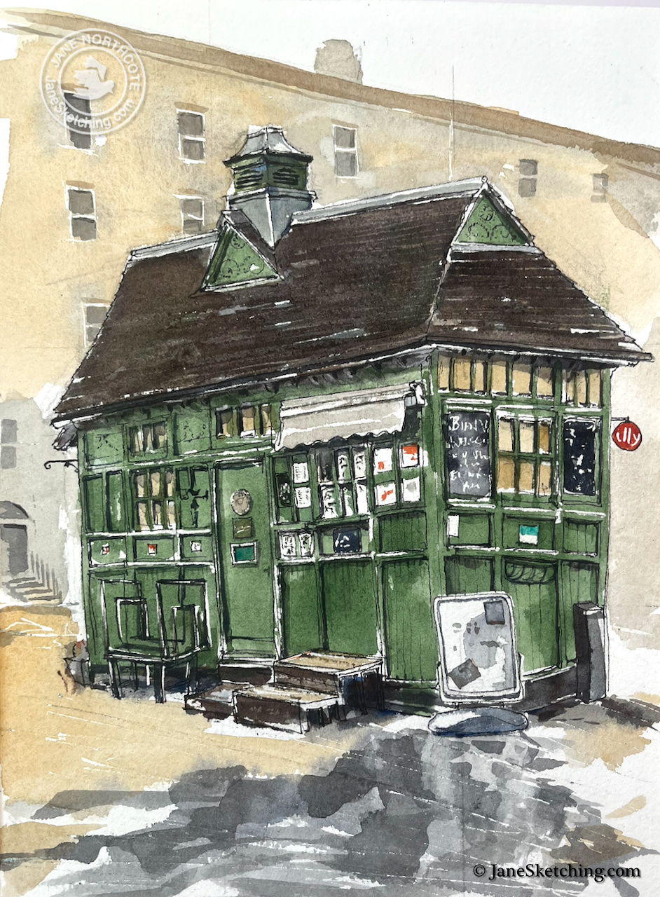
“The Chapel” Cab Drivers’ shelter, Wellington Place, St John’s Wood, NW8 7PE Sketched 27 March 2026, in Sketchbook 16
As I was sketching, the manager of the shelter came out and kindly brought me a cup of tea. She was very welcoming, and interested in the drawing. She told me that the rail running round the shelter, shown in my drawing, was for drivers to tether their horses.
Cup of tea courtesy of the manager of the shelter.
A former cab driver came by in his mobility scooter. He evidently still had dining rights, as he was seated at the tables by the hut. Only cab drivers can sit there, I understood. Cab drivers also went inside the shelter, through the door which you see on the right of the hut, with a circular plate on it. The ex-Cab Driver told me he was a photographer now. “Street Photography”, he said. But he told me he was going to take up birdwatching. This was something it was convenient to do from a mobility scooter. He had no teeth, and it was hard to understand what he said. But nonetheless we enjoyed an extended conversation and listened to the birds we could hear in the park. He went off, waving from his vehicle, steering a confident route along the uneven pavement.
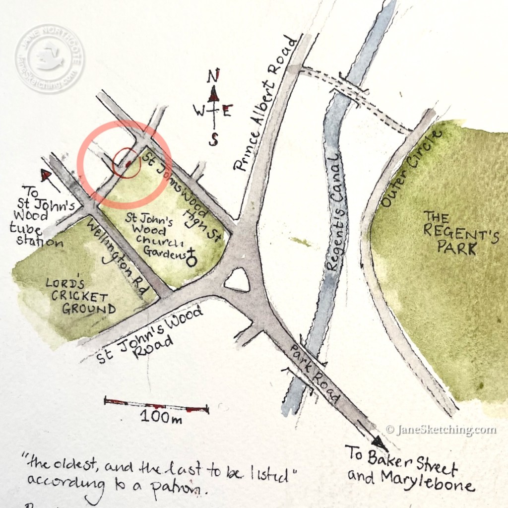
This shelter is called “the Chapel” because it is right next to St John’s Wood Chapel Gardens.
The St John’s Wood Cab Driver’s shelter is next to the Church
It started to rain and I stopped sketching. I bought a bacon sandwich from the woman in the shelter and went to eat it in the garden.
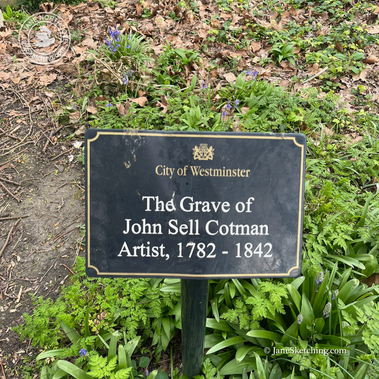
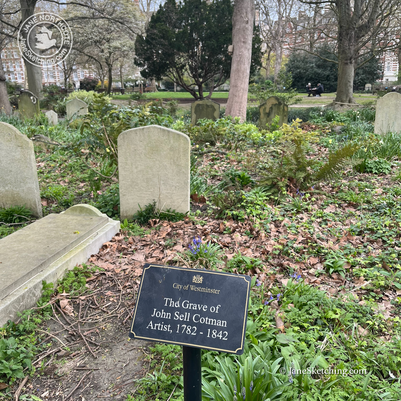
The gardens are the Chapel graveyard. The watercolour artist John Sell Cotman is buried there. I have seen a large exhibition of his work at the British Museum.
Back at my desk, trying to channel my inner John Sell Cotman, I struggled to match the green colour of the shelter. It is called “Dulux Buckingham Paradise Green I”. 1 It exists in the Dulux Trade Paint range2, but not as a watercolour.
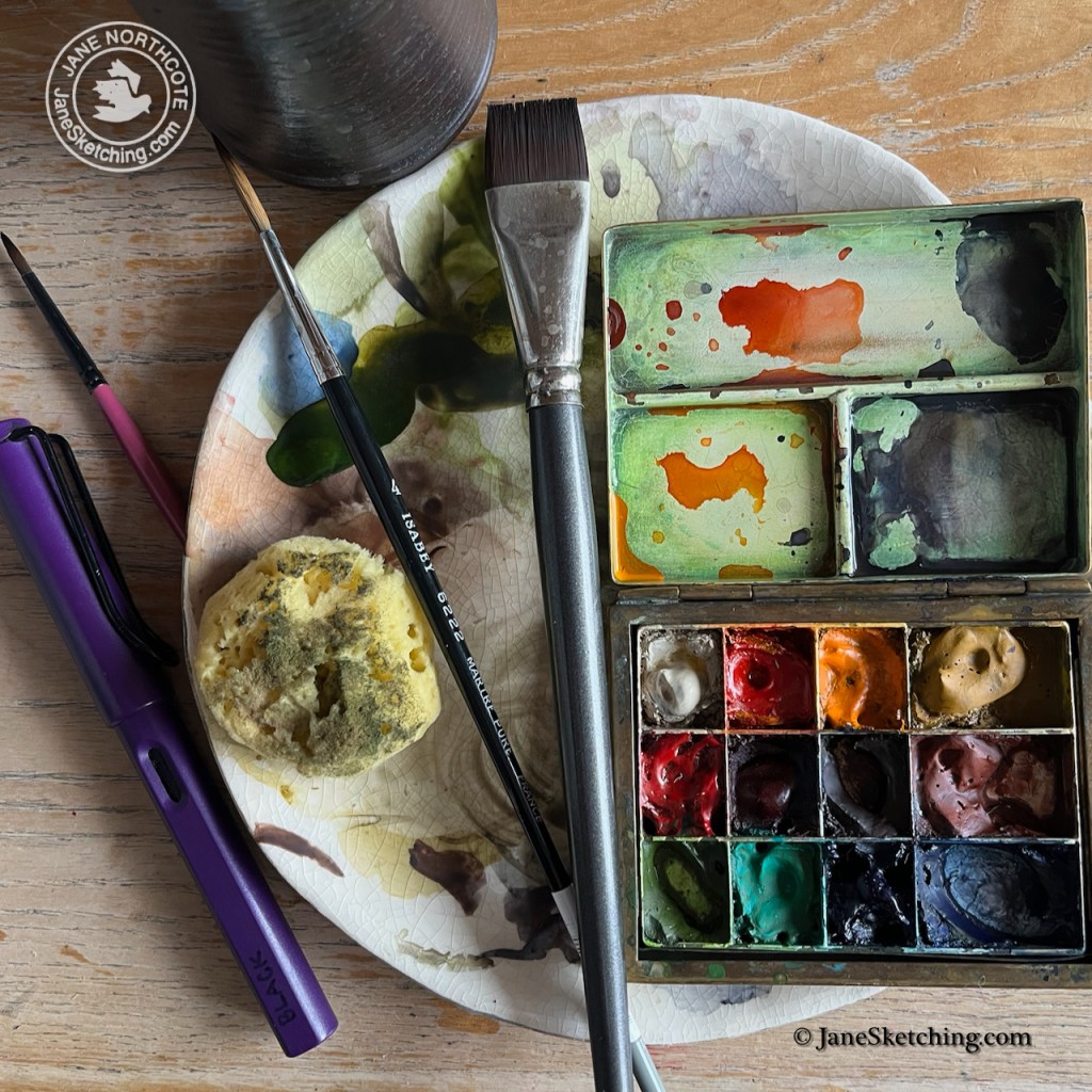
I tried to mix it myself, with partial success. Any colour varies depending on the light conditions, and the surroundings, so I forgive myself for not making an exact technical match. My green is made from Serpentine Genuine (Daniel Smith watercolour ) with touches of Mars Yellow and Ultramarine Blue.
Equipment for this picture. The sponge is for making the tree. Serpentine Genuine is the colour in the palette at the bottom left. It looks quite similar to Dulux Paradise Green I.
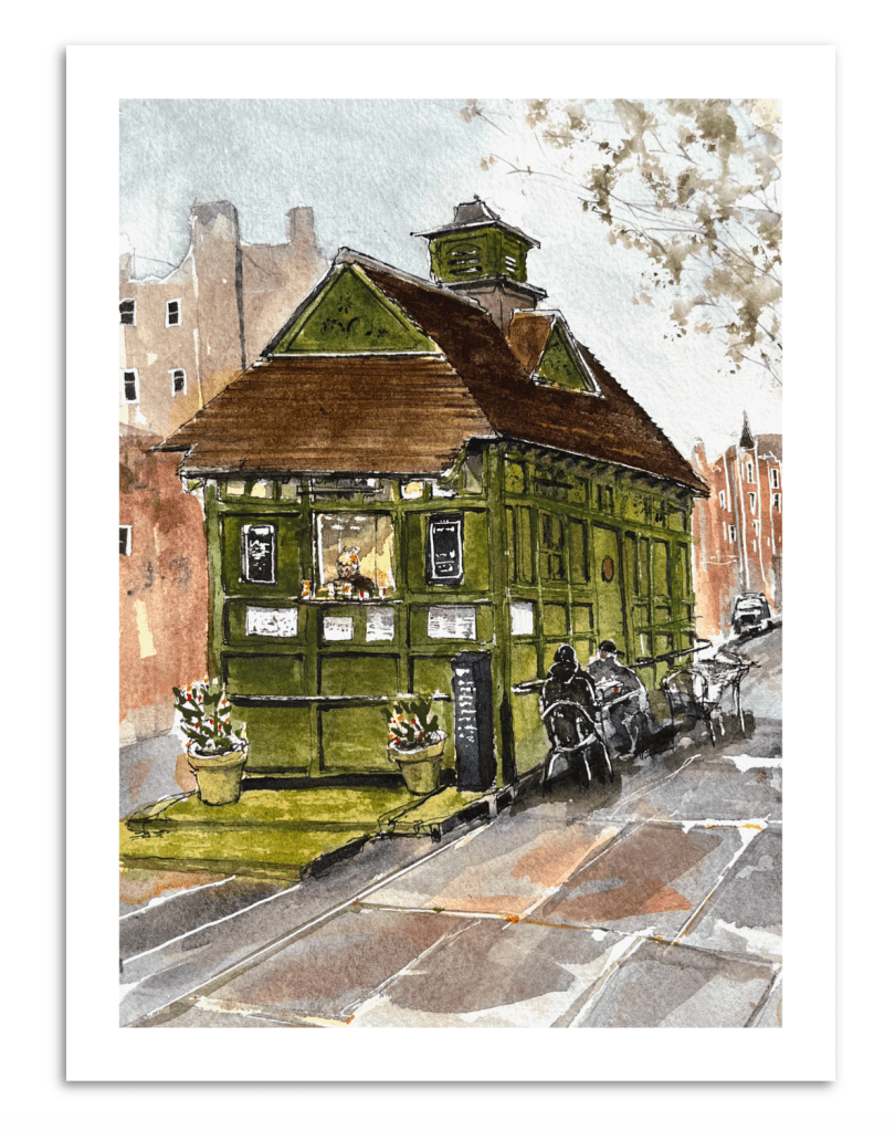
When the picture was finished I ordered a digital print of it, and returned to the shelter to gift the print to the manager who had been so kind and welcoming. It will hang inside her shelter.
The St Johns Wood Cab Drivers’ Shelter, digital print (c) JaneSketching
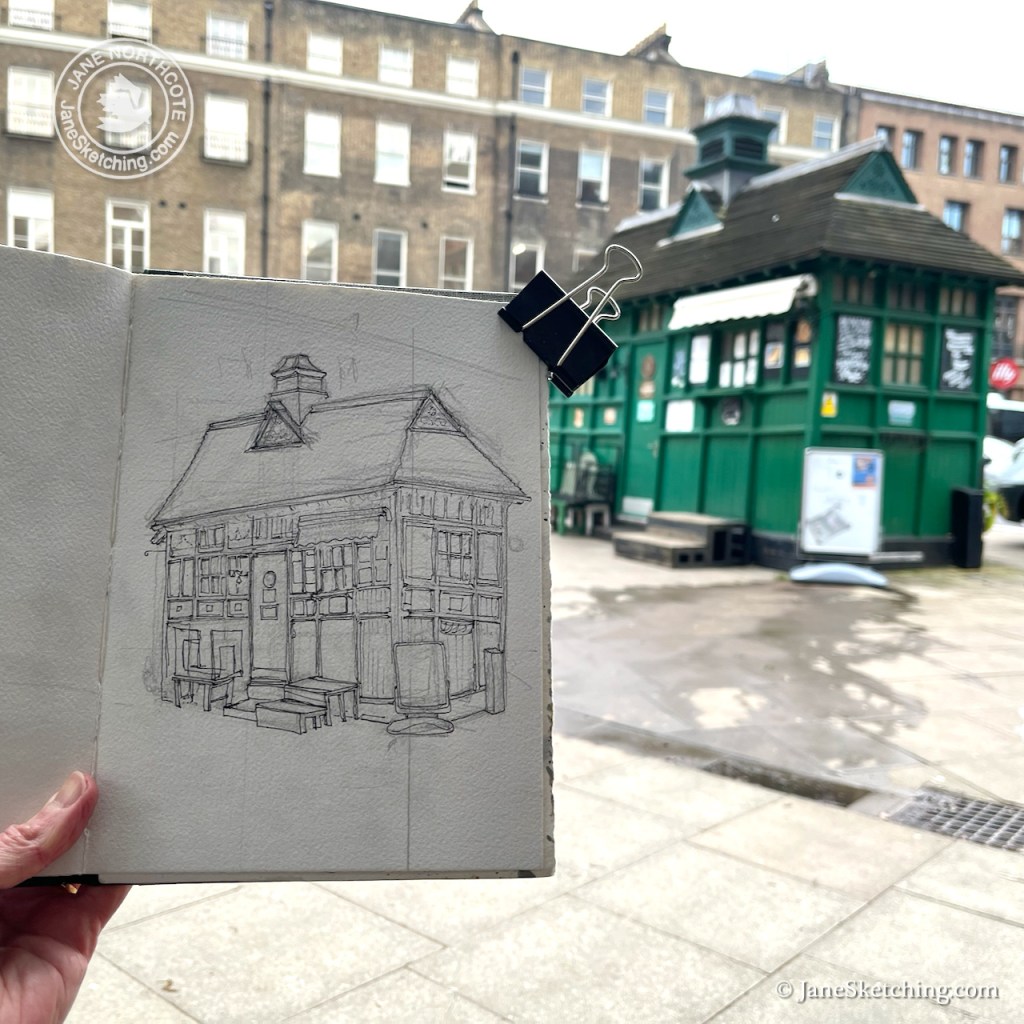
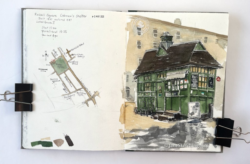
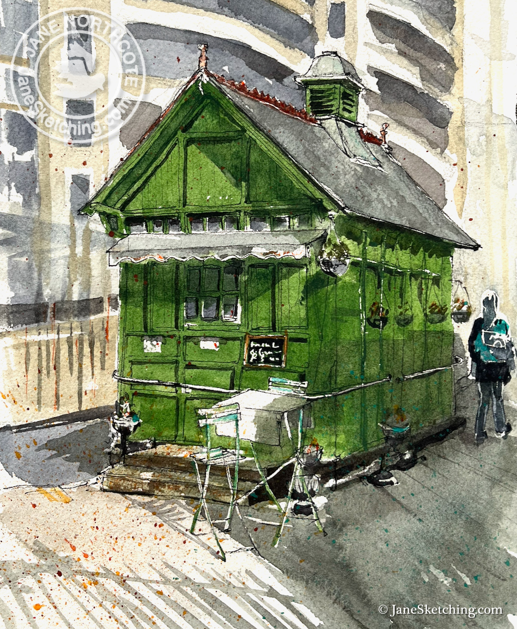
Continuing my series on Cab Drivers’ Shelters, here is the shelter on Russell Square. It was built in 1897, restored in 1987, and listed in 1988.
Russell Square Cab Drivers’ shelter, WC1, sketched 9th March 2026, in Sketchbook 16
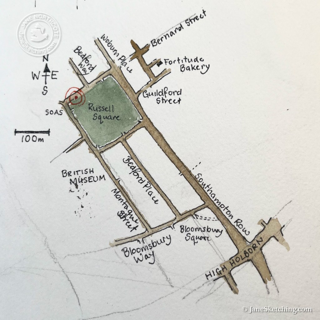
This little building is on the North side of Russell Square, not far from the British Museum.
Location of the Russell Square Cab Drivers’ Shelter
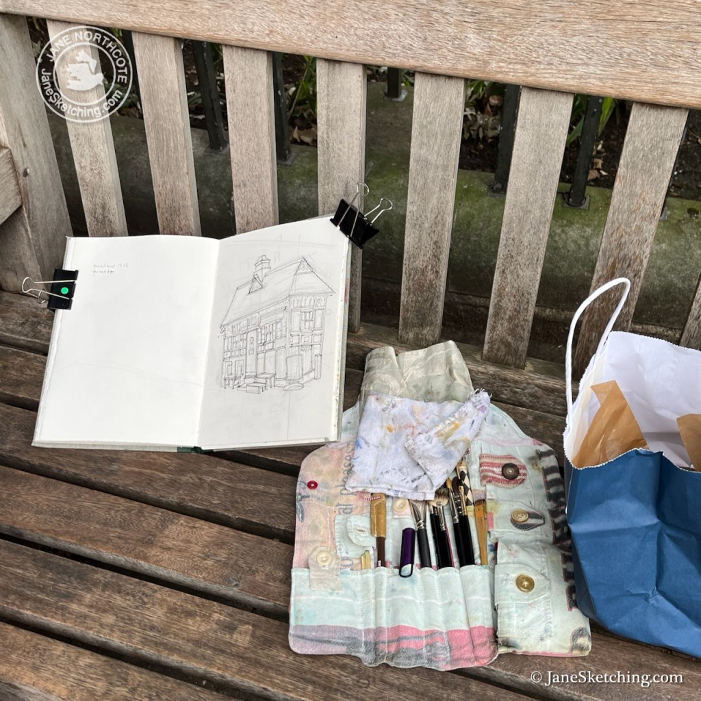
I sketched from a convenient bench, fortified by a sandwich and cake from the marvellous Fortitude Bakery, just to the east – marked on the map above (and recommended).
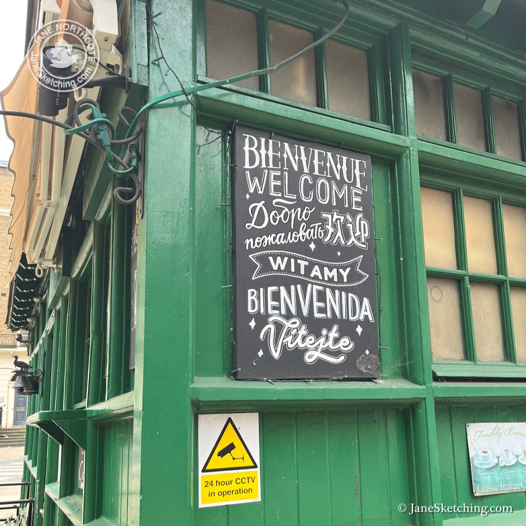
On the other side of the road is a school for young children. Adults stood about, ready to collect the school children. Between them flowed a current of workers, students and people of all nations. “SOAS”, the School of Oriental and African Studies, is nearby, as is the London School of Hygiene and Tropical Medicine, and many other academic institutions of the University of London.
A cheerful woman swathed in scarves bustled up to me and examined the picture. She glanced up to to the shelter and looked back down again at my picture, comparing. She then delivered what I took to be a speech of encouragement and admiration. But it may equally have been closely argued constructive criticism. Her words sounded garbled, she had no teeth, and I think she was speaking a language unknown to me. However we smiled at each other, I held up the picture so she could better compare it to the building. She nodded curtly, as though putting a confirmatory flourish at the end of her expressed opinion. We smiled again, she waved, and off she went.
A woman with a large handbag came and sat down right next to me on the bench. She placed the handbag on her lap, and took no interest in my picture whatsoever. After a few minutes she took off again. Perhaps she had spotted the pupil she had come to collect.
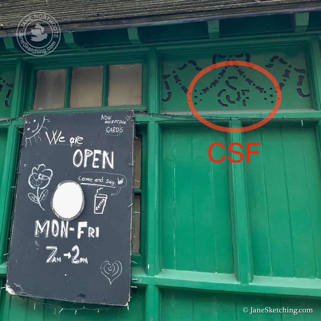
I photographed various details of the shelter. Note the bird on top of the bell. I had tried very hard to show it in my drawing, but at that distance it was very small.
The shelters were built by The Cabmen’s Shelter Fund. Its monogram “CSF” is in the fretwork. This charity set up the shelters in the 19th century, and still exists.
Russell Square Cab Drivers’ Shelter – fretwork showing “CSF” for “Cabmens’ Shelter Fund”
I finished the drawing back at my desk. Here is the sketchbook spread.
Russell Square Cab Drivers’ shelter in Sketchbook 16
Click a button below to share this post online, email it, or print it:
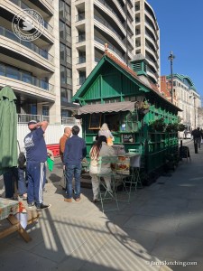
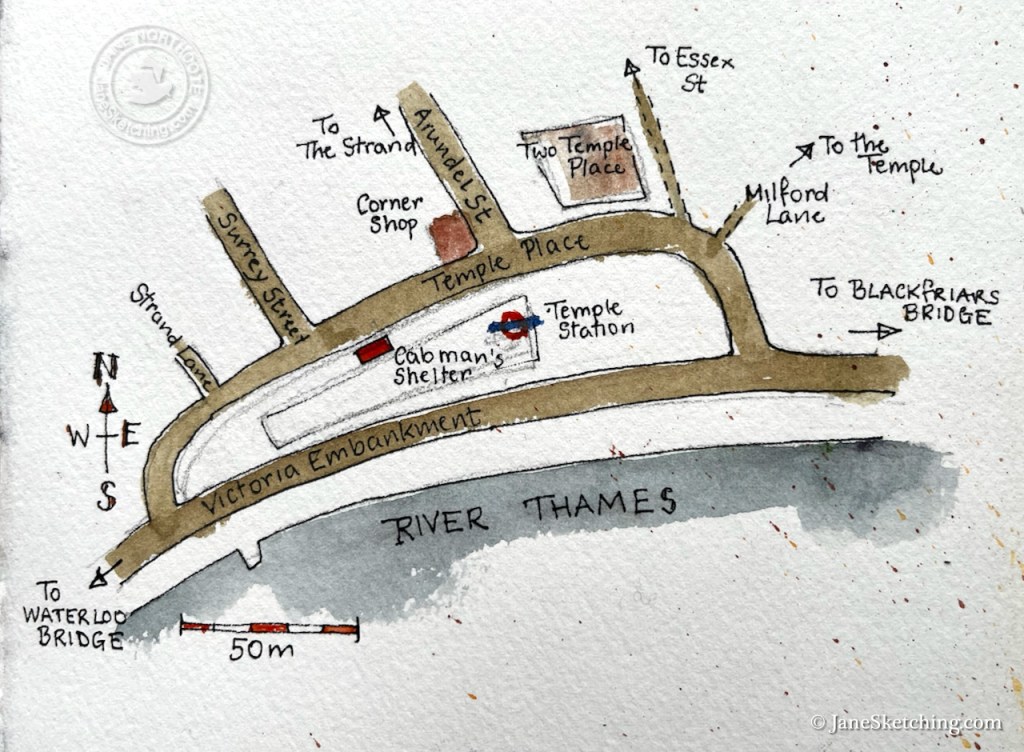
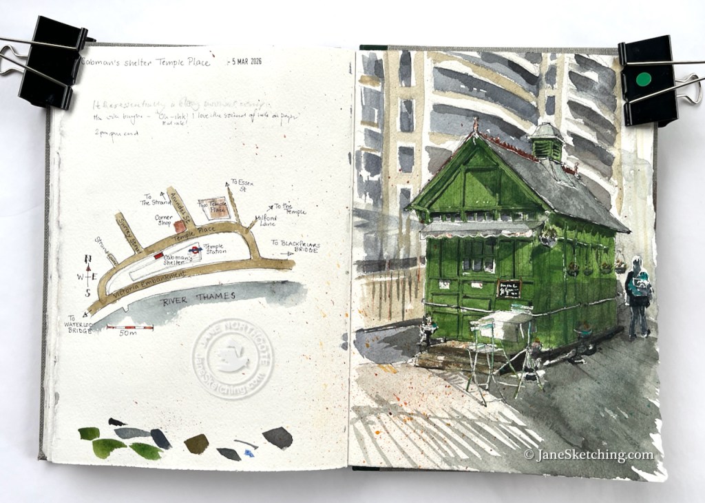
Here is the Cab Drivers Shelter near Temple Station.
Cab drivers’ shelter, Temple Place. Sketched 5th March 2026 2pm in Sketchbook 16
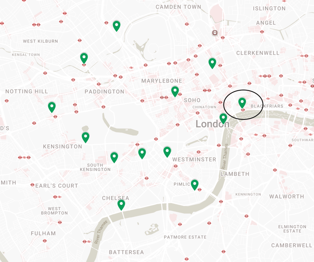
There are 13 of these shelters surviving. All are now listed. This one was built in around 1900 and listed in 19871. Here’s a map from the Historic England site showing the location of all the shelters in London. interestingly they are all to the North of the river.
Eager diners queue at the shelter before it closes.
I sketched this one on the first sunny day in spring. I’d arrived there at around 1:30pm. There was a long line of people outside and several tables. While I was doing the sketch, the manager closed the window and the queue dissipated. Then she came out and packed up all the tables. I just managed to sketch one table before they all disappeared. This shelter closes at 2pm.
Two men walked past me, engrossed in a conversation about a colleague. “He has a strong survival component” observed one of them, somewhat ruefully.
Then there was a man pushing a bicycle. “Ah!” he said, noticing me, “ink. Real ink!” I was indeed using real ink. I held up the fountain pen to show him. “I love the sound of ink on paper!” he said. I hadn’t thought about the sound of ink on paper. I noticed it, from that moment on.
Here’s a map showing the location of the shelter. As you see, it is near Temple Station, which accounts for the flux of people passing.
Here is the sketchbook spread. My aim is to sketch more of these shelters – maybe even to sketch all of them.
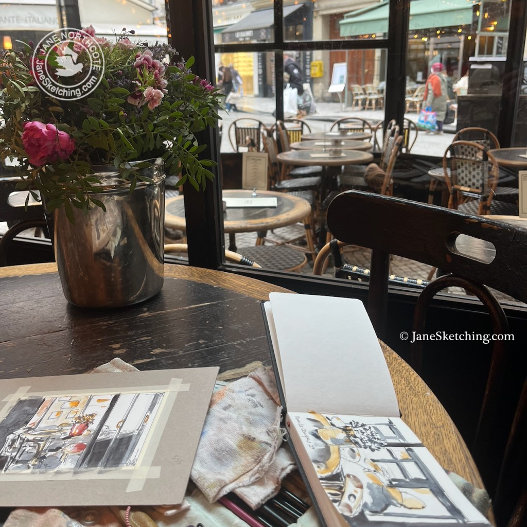
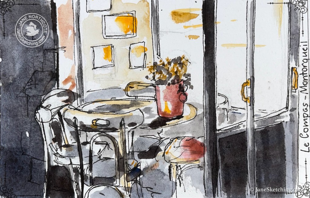
The waitress in the Paris café was tolerant. My painting things were all over the table. I’d finished my meal some time ago. But she did not hurry me away.
Sketching in a cafe, Rue Montorgueil Paris 2e
I was travelling by train, arriving many hours later in Geneva.
From café “Oh! Martine” next to Geneva Cornavin railway station
Trains from Geneva to Lausanne were disrupted because Swiss football supporters had, I learned later, thrown lighted fireworks out of the train windows, onto the tracks. These fireworks had landed in the one place they could do damage: communications cables temporarily exposed while track works were carried out. In local papers there was much finger pointing: the train company condemning irresponsible football supporters, the football club maintaining that it was foolish to have train windows that opened on such a train, and then the train company pointing out that the it was the person behind the lighted firework that was the problem, not the open window.
I reached my destination by a zigzag route involving unfamiliar buses through increasing fog.
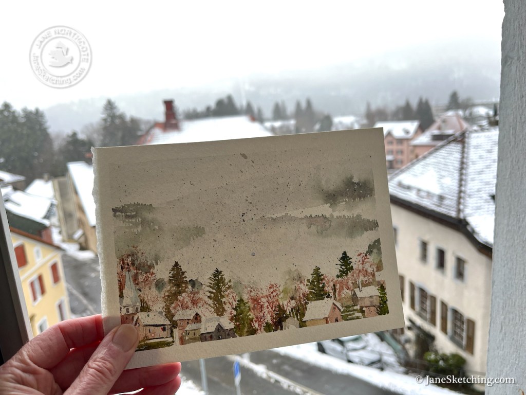
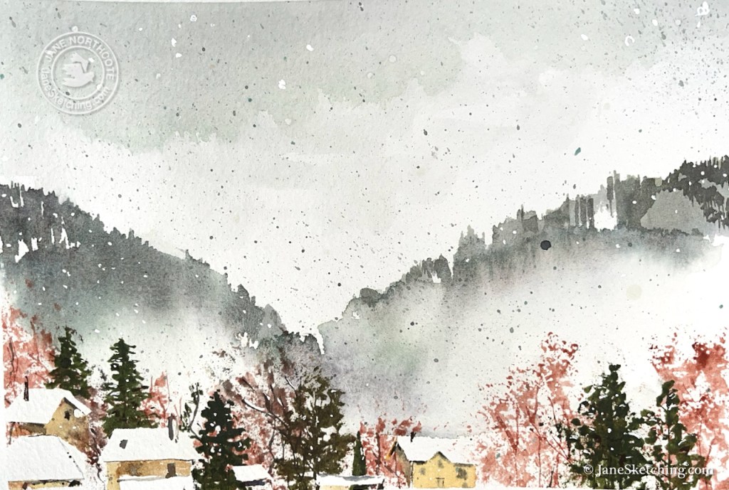
Sainte-Croix, Vaud, in the fog. The streets were littered with damp confetti. It had just been Carnival. Some of this confetti found its way onto my picture.
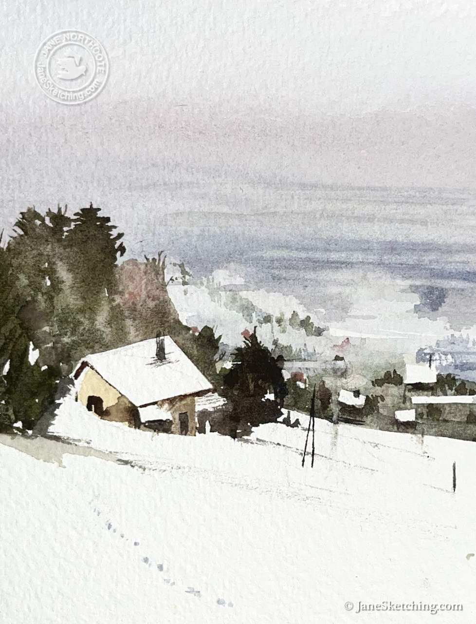
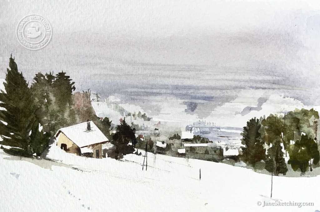
Higher up, it was snowing.
Looking towards Lake Geneva, from the Jura hills above Sainte-Croix. The Alps are invisible.
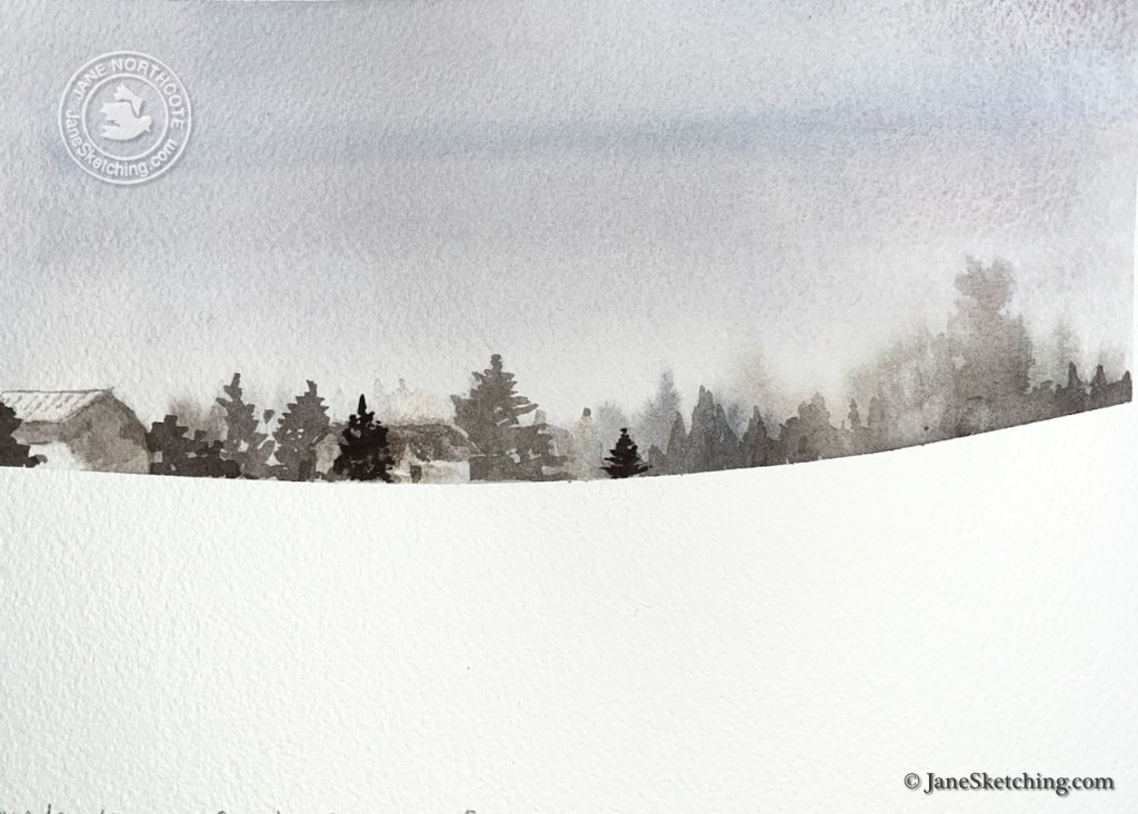
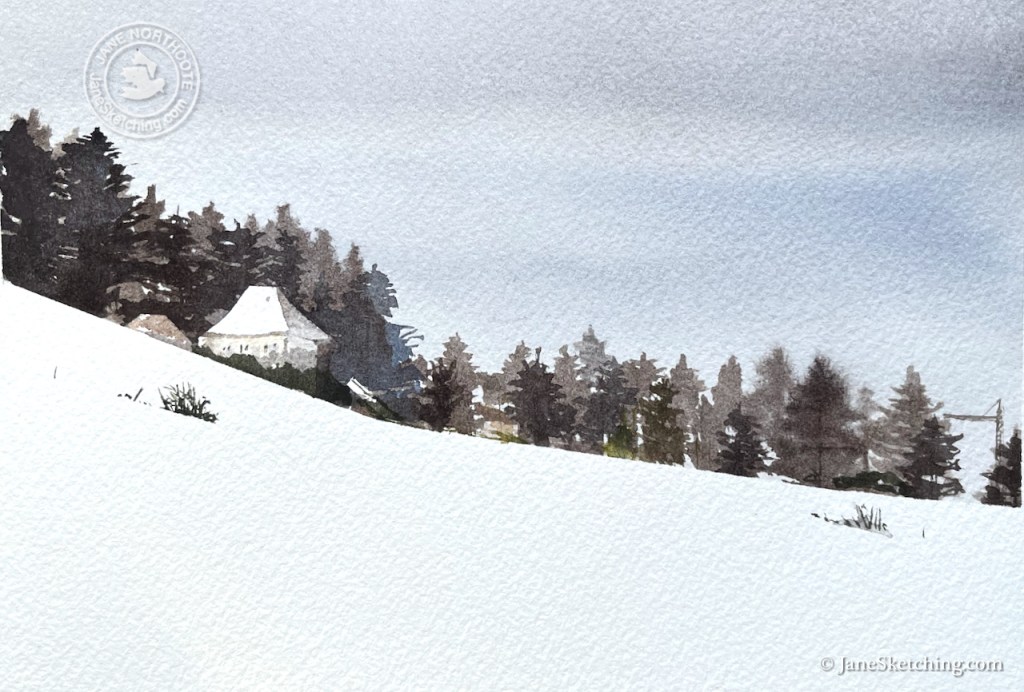
The snow fields had geometric simplicity.
The snow field above the sports stadium, Sainte-Croix, VaudRue des Chalets, Sainte-Croix. See the crane, right-hand side.
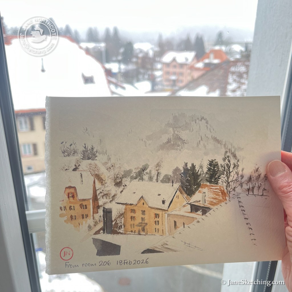
Sometimes, sketching from my room was a better idea.
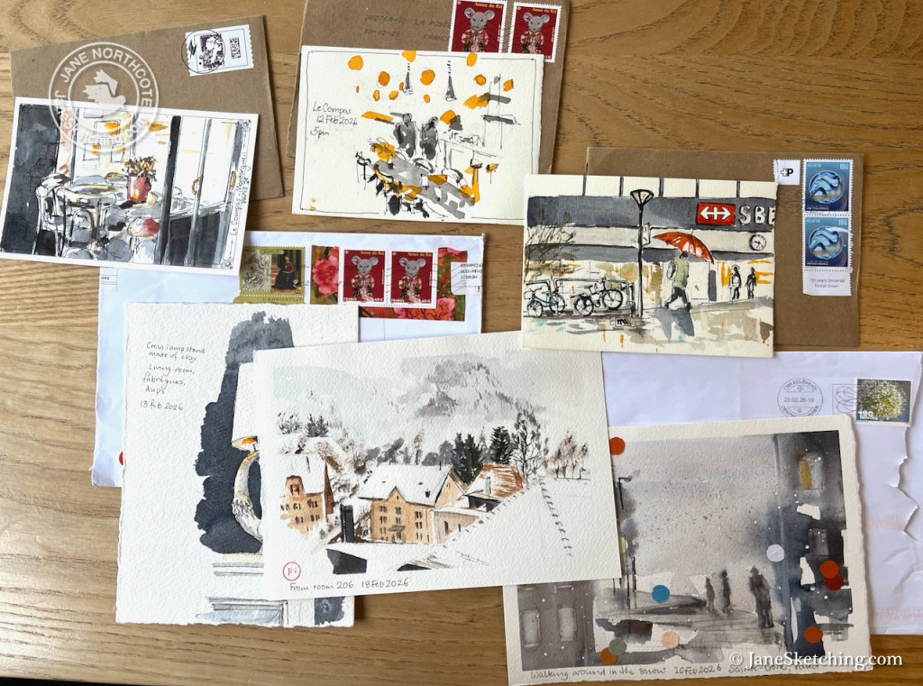
These sketches are all postcards, which I dropped into letterboxes as I travelled. My friend kept them all, and the envelopes.
Postcard selection: February 2026
Click a button below to share this post online, email it, or print it:
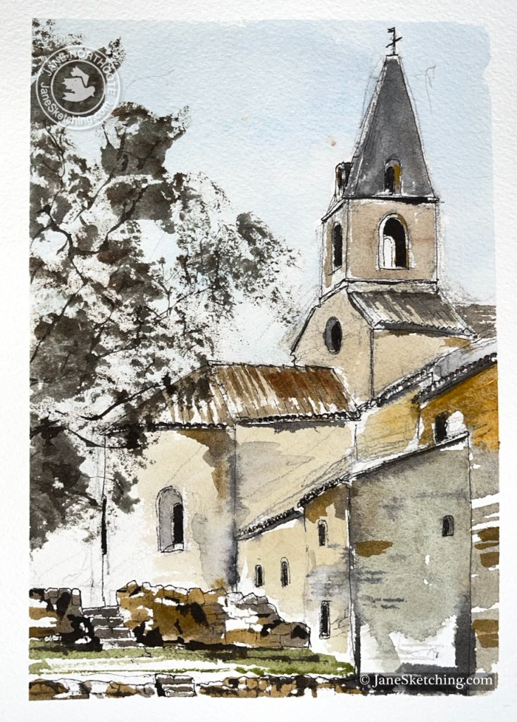
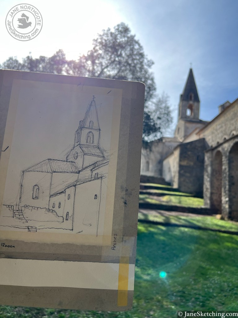
On a perfect day in Provence, I leaned against a wall and sketched a view of Le Thoronet.
Le Thoronet Abbey, Var, Provence, 83340 France sketched 15th February 2026 on Arches 300gsm watercolour paper, size A5
I loved this place because of its mathematical precision. As I sketched, I noticed that the tower is an isosceles triangle on top of a square. The windows are semicircles on top of rectangles. Some of the windows are circular.
The whole building has similar satisfying geometry.
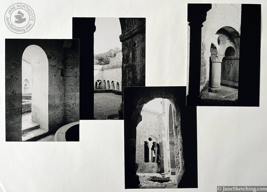
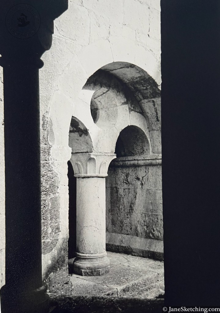
Le Thoronet Abbey, 7×5 photographs on Ilford XP2 film with an Olympus XA2 point-and-shoot camera, film developed by filmprocessing.co.uk. Film reference 201.
This is a Cistercian abbey, founded in 1136. It was built between 1160 and 1230. “restoration work began in 1841 and continues today” says the leaflet. The building is now State-owned. While we were there, a service was taking place in its austere geometric chapel.
Le Corbusier visited the Abbey in 1953.
He wrote of the Abbey of Le Thoronet: ” Light and shadow are the loudspeakers of this architecture of truth, calm and strength “.
Le Thoronet Abbey, photograph on Ilford XP2 film with an Olympus XA2 point-and-shoot camera, film developed by filmprocessing.co.uk. Film reference 201.
References and links:
Novel, by Fernand Pouillon (1912-1986), about the building of the Abbey, and the struggles faced by the construction workers: “Les Pierres Sauvages” (1960)
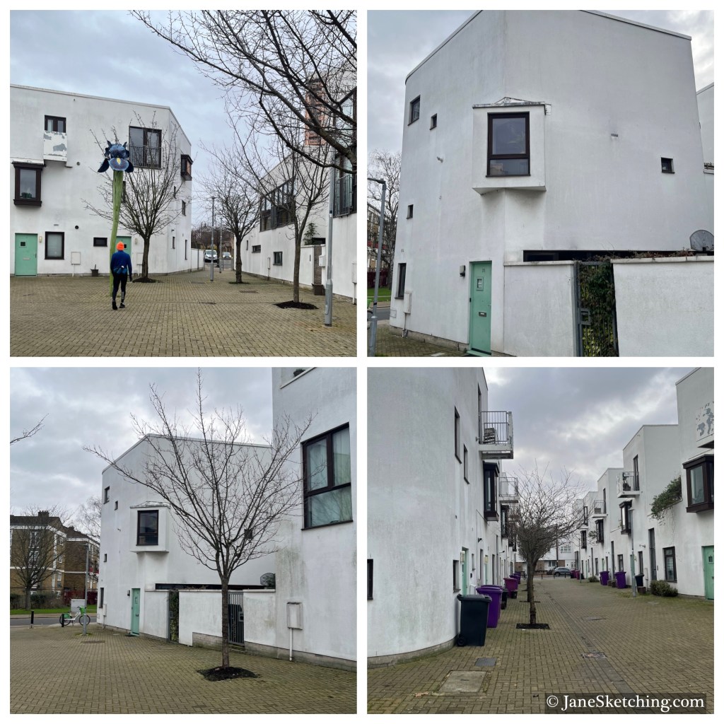
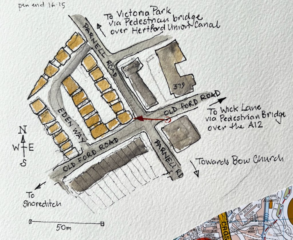
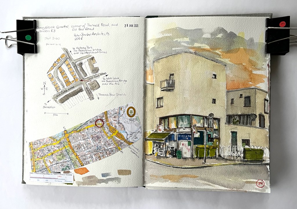
I saw this group of Mediterranean-style buildings on a long peregrination around East London. I went back to have a closer look. This is the “Donnybrook Quarter” which stands on a corner of Parnell Road, in Tower Hamlets. I arrived just as the sun was setting.
Part of the Donnybrook Quarter, Parnell Road, Tower Hamlets London E3, sketched 29 January 2026 in Sketchbook 16
The Donnybrook Quarter was completed ready for occupation in 2006. The architects were Peter Barber Architects.
The architects write: “The scheme is laid out around two new tree lined streets which cross the site creating very strong spatial connections with adjacent neighborhoods and a handy cut through for their residents” (Peter Barber Architects.)
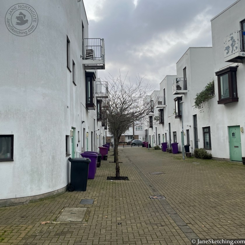
Here are snapshots of the tree-lined streets they mention. These pictures were taken in January 2026, so the trees aren’t perhaps as flourishing as they might be in the summer.
A photo-essay on the “Tower Hamlets Slice” website has some beautiful pictures by Yev Kazannik from April 2000. The essay provides interesting background to the development. It quotes Peter Barber as saying:
“…the style came about at the request of local residents during community consultations in the early to mid-2000s before the project was finished in 2006. ‘The residents were thinking, “Spain! Holidays! Marbella!” I’m completely happy with that,’ Barber said in an interview.”
Peter Barber goes on to say:
“…’This project is a celebration of the public social life of the street,’ .. ‘A worrying amount of building in London is done as a gated community. This is a counter-blast to that.’ “
Yez Kazannik comments:
“Walking through the lanes of Donnybrook, you will feel this neighbourly intimacy. Uniquely, the building units themselves have no corridors, entrances or ‘connecting’ spaces. Each room simply opens out into another. The streets themselves are meant to be the corridors, where neighbours can amble across each other. “
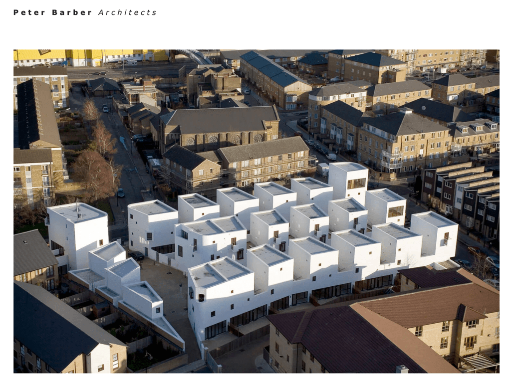
The concept is perhaps better understood from the air. Here’s an image from the architects’ website:
“We are one of the few streets in the country composed of sixty independent shops. Small art galleries sit next to cup cake shops, vintage clothes stores, English and Italian delis, garden and antique shops. There is also a wealth of great pubs, cafes and restaurants.”
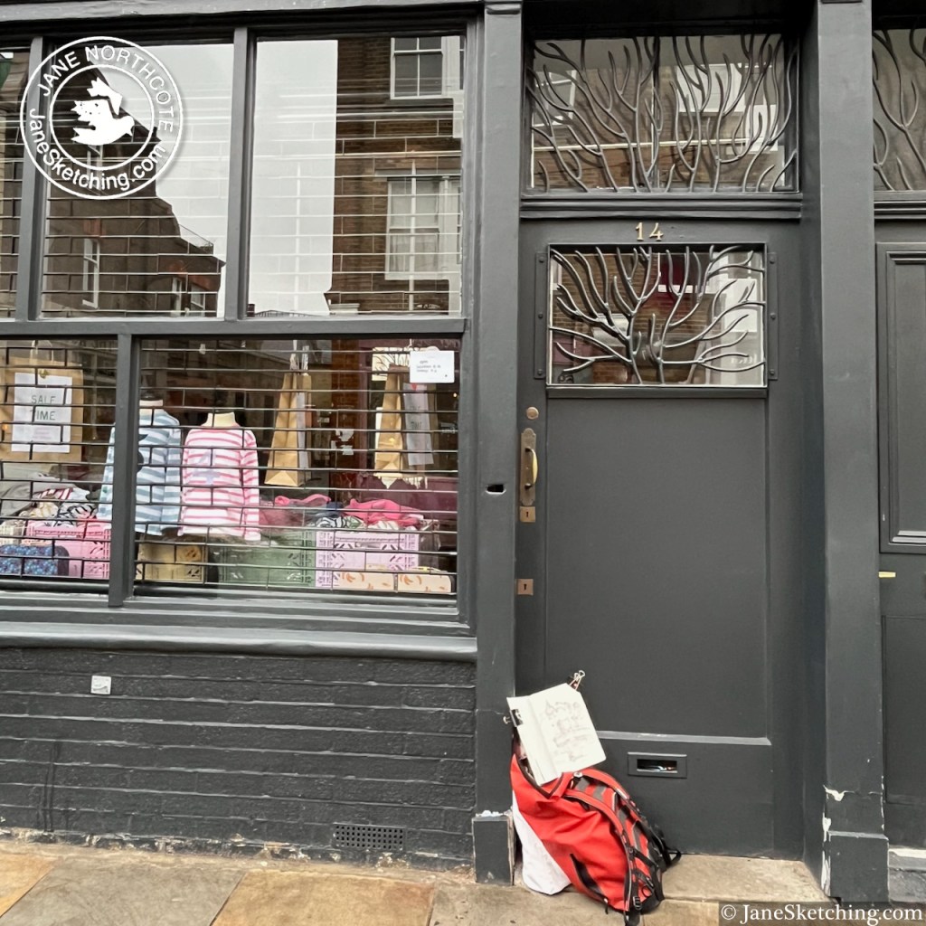
This is true, although you need to know that many of these shops are open only Friday-Sunday. I was there on a rainy Thursday. This was probably just as well, because it meant I had a good view of the pub from the doorway of the shop opposite.
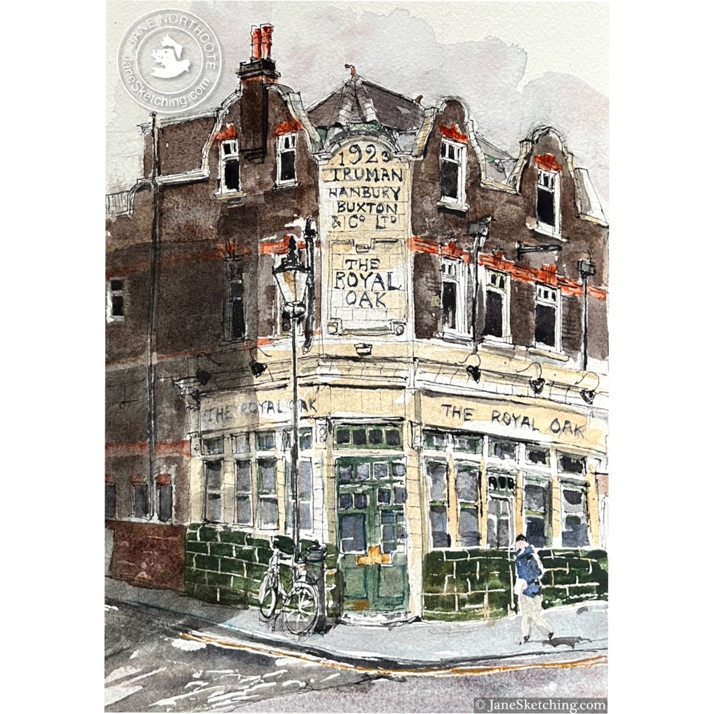
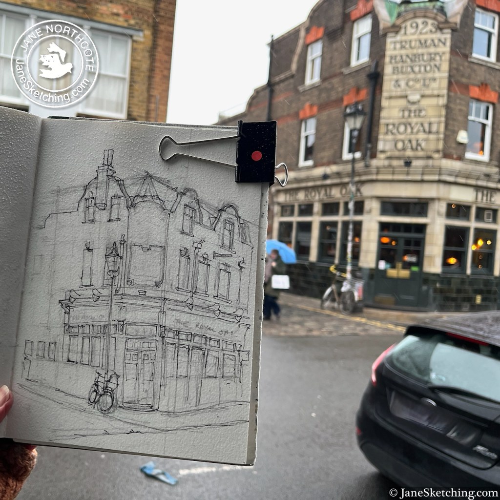
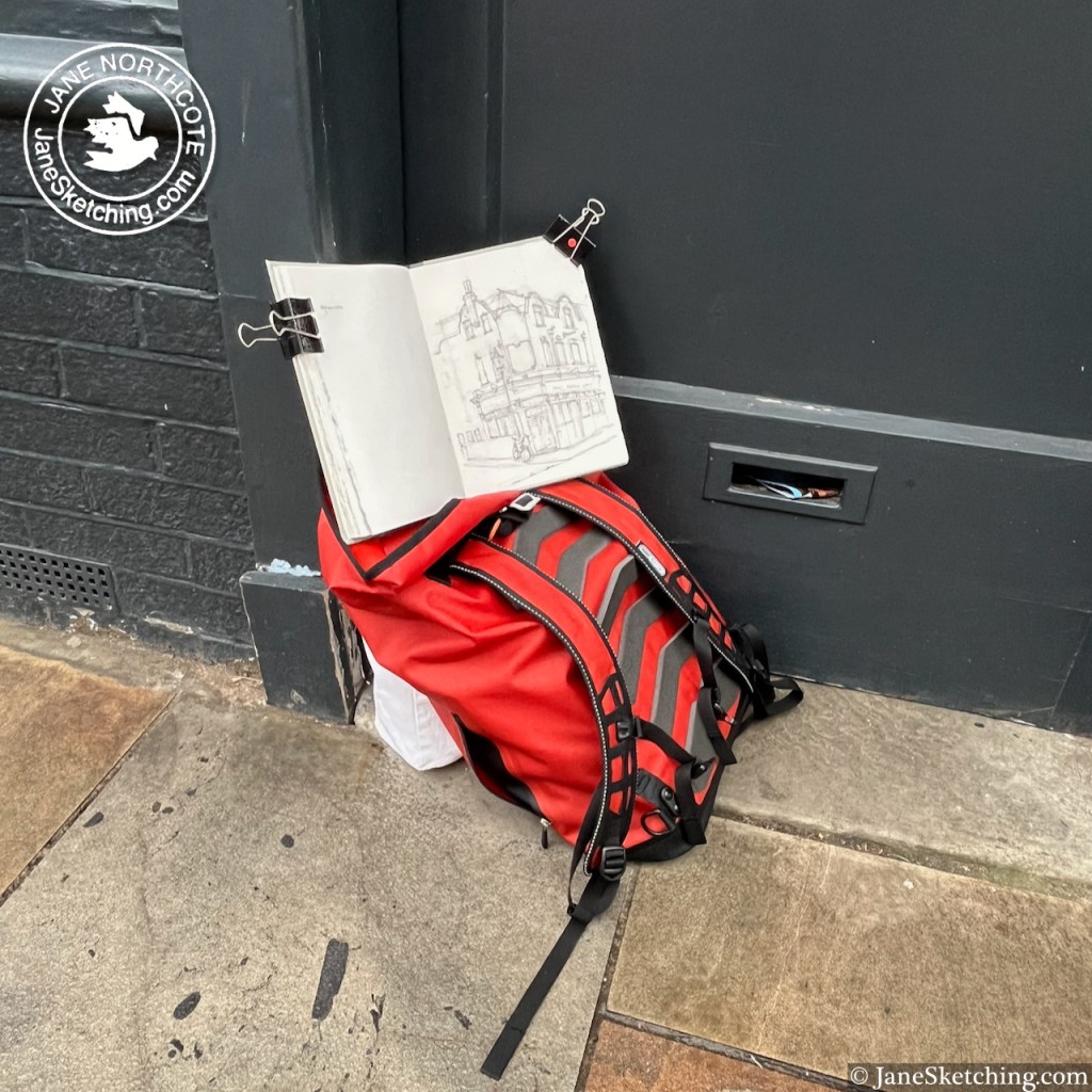
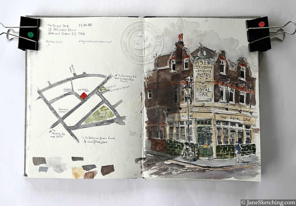
Sketching “The Royal Oak” from outside “Bob and Blossom” on Columbia Road
It was the nicest-smelling location for sketching. There was a coffee shop opposite distributing coffee-and-croissant aromas into the damp air, and somewhere nearby must have been selling soap, because there were wafts of tangerine, cedar, and lavender, smelling clean and unusual.
The pub is Grade II listed, listing reference 1426765. The present building is from 1923, built to the designs of Arthur Edward Sewell, for Trumans Brewery. The listing notes “Trumans distinctive green mottled tiling” which you can see in my sketch. According to the listing, there was a previous pub here, of the same name, from before 1842. The listing also maintains that this is an “early pub” with a licence to open from 9am on Sundays to serve the market-goers. This doesn’t seem to be the case any more, according to the pub website. But if you know different, or if you are the pub, please correct me!
It is now a Youngs pub, open every day from 12 noon.
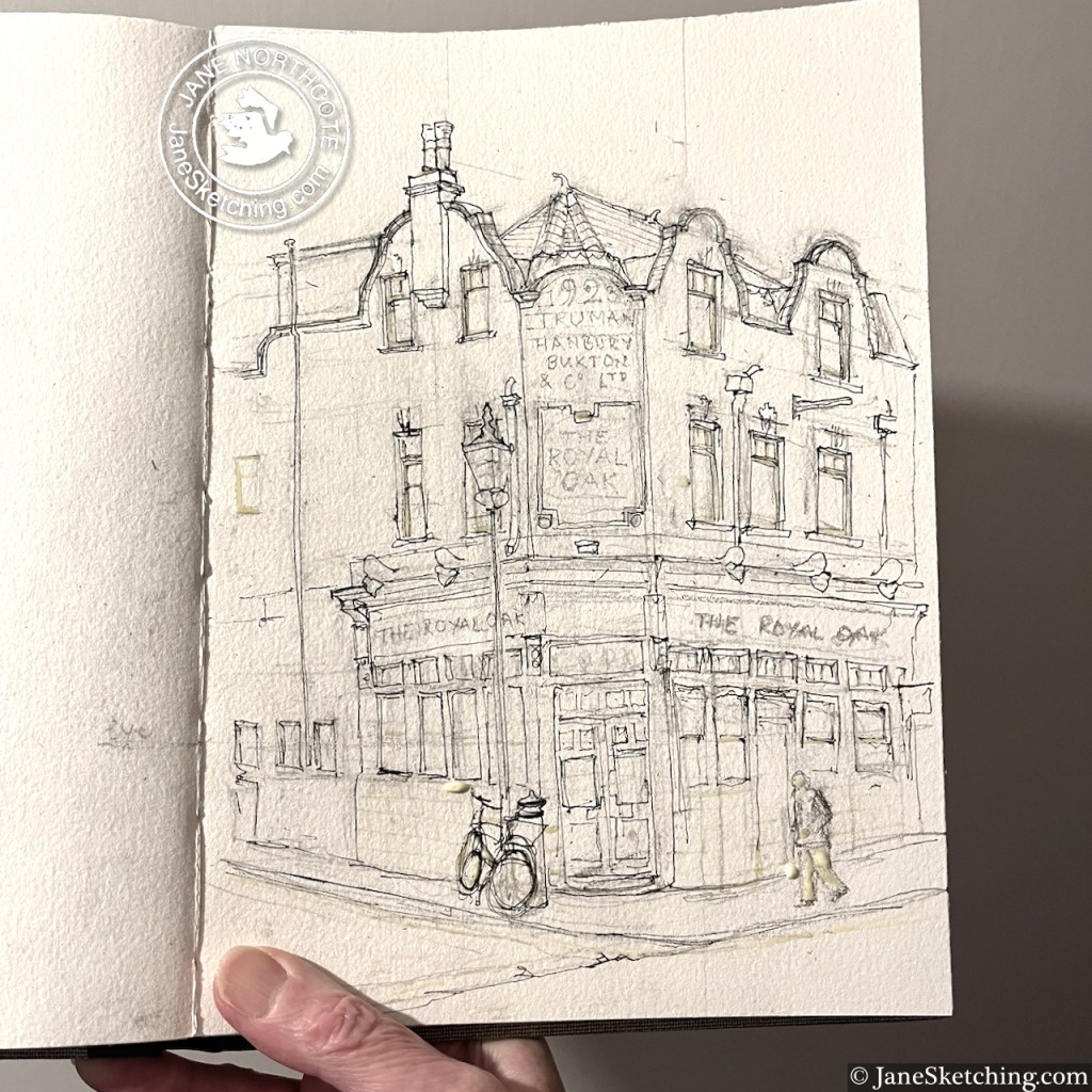
The Royal Oak, sketchbook spread, Sketchbook 16What it looked like before the colour went on
Click a button below to share this post online, email it, or print it:
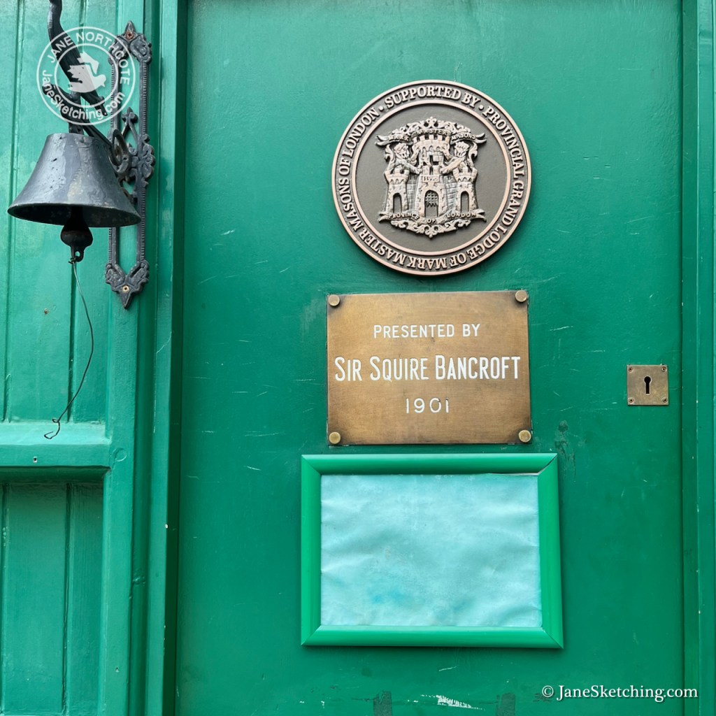
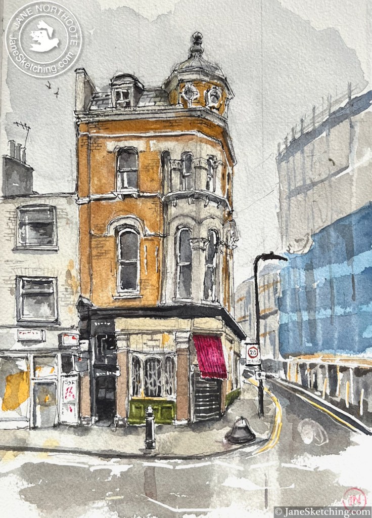
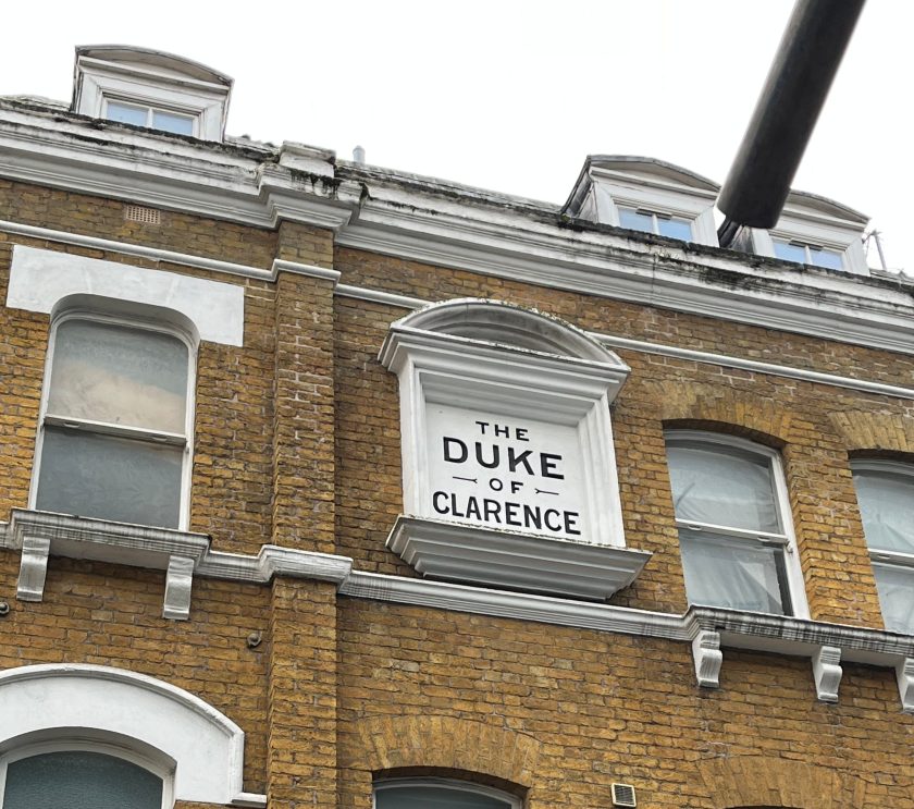
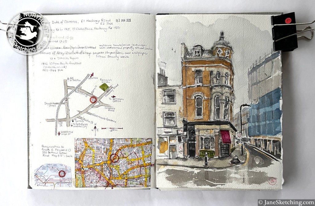
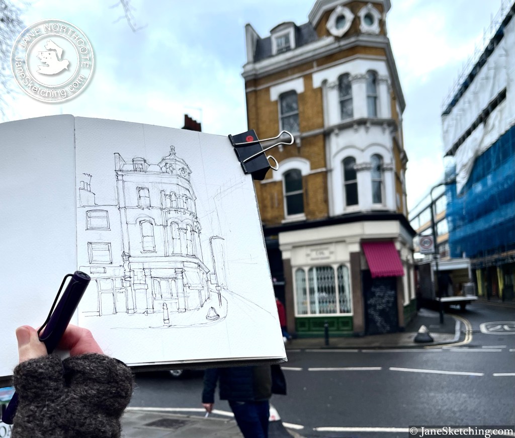
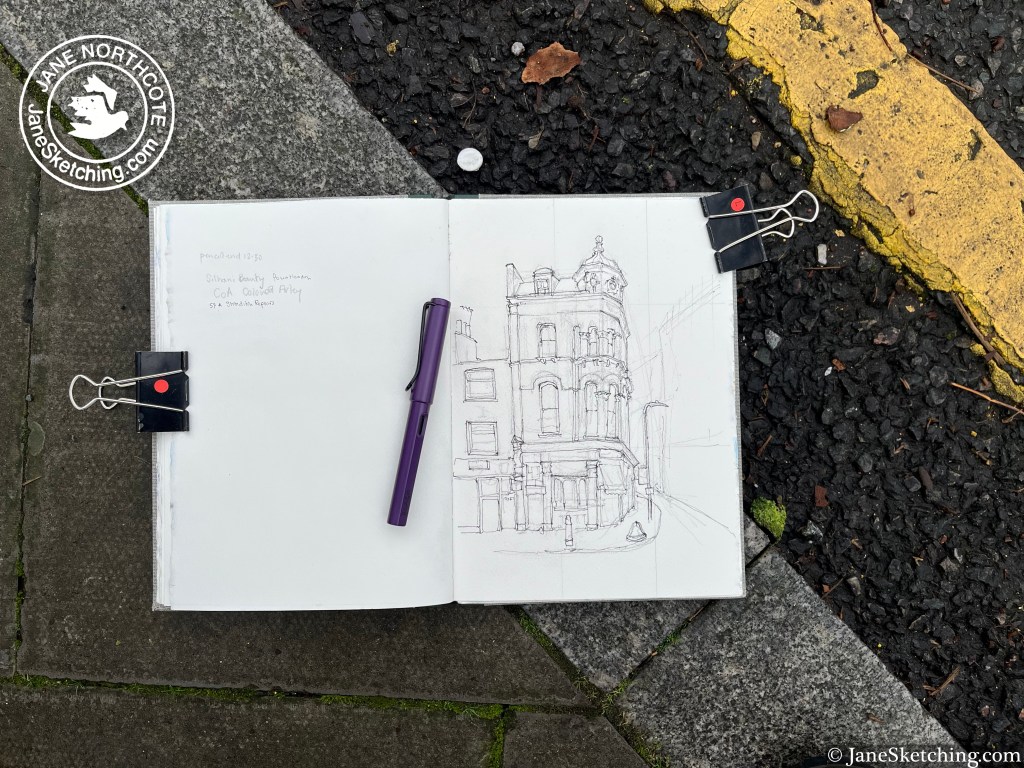
Along the Hackney Road stands this building with a turret:
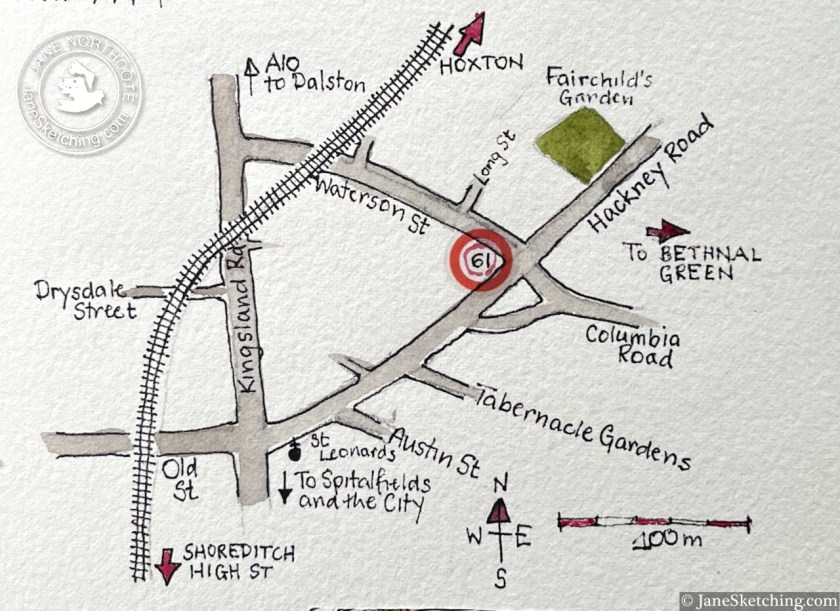
61 Hackney Road, E2 7NX, sketched 12 January 2026 in sketchbook 16
This on the corner of Waterson Street and Hackney Road, at the western end of Columbia Road.
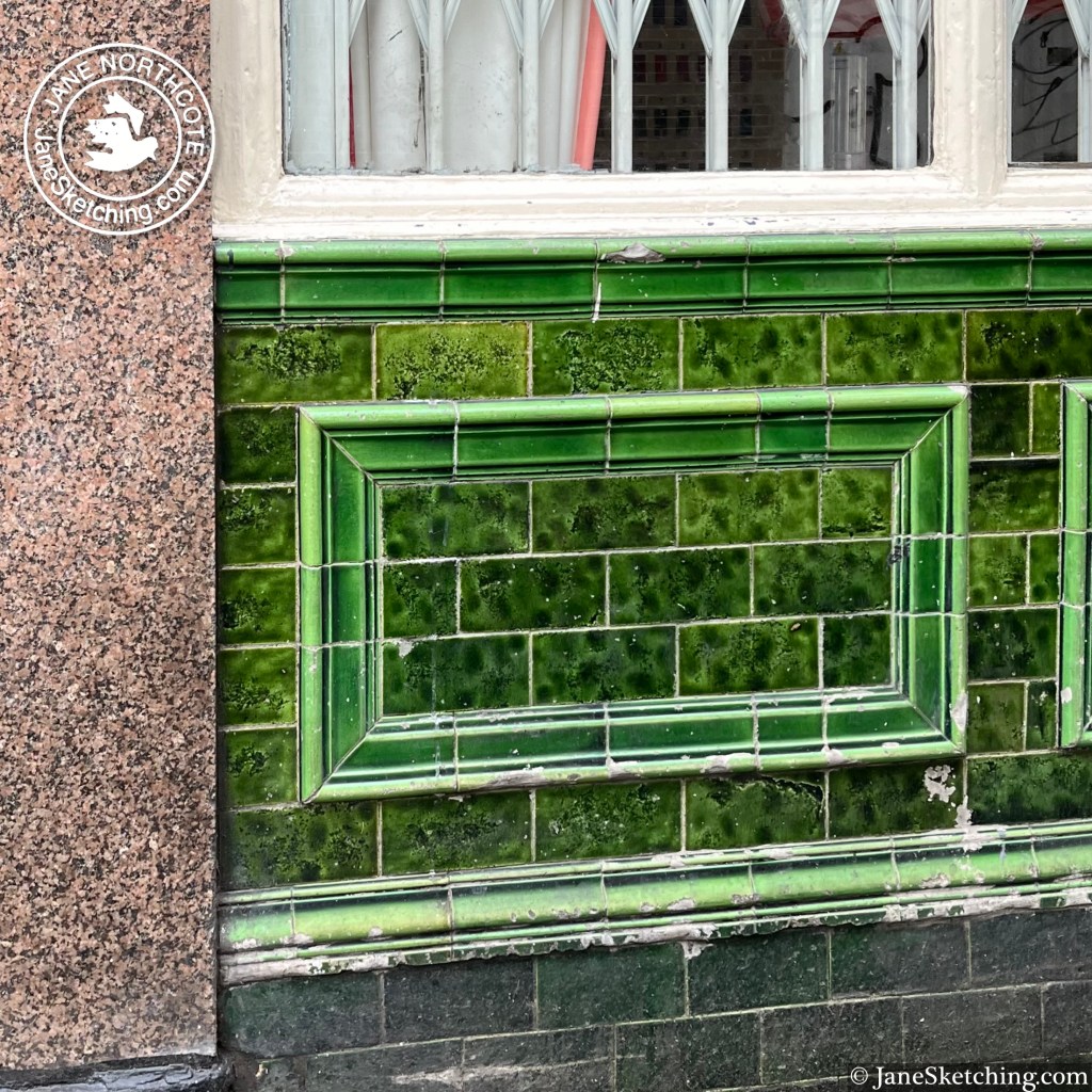
After I’d sketched it, I walked into the picture, and had a look at the building from the Waterson Street side. It was a pub called the Duke of Clarence.
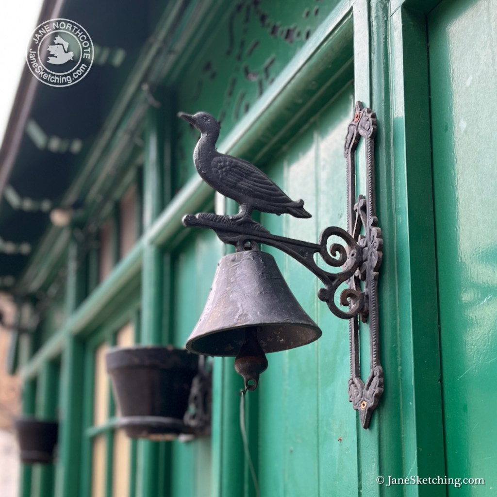
There is deep green tiling, characteristic of 19th century London pubs.
Now it is home to “Colours of Arley” on the ground floor, which offers “bespoke striped fabric and wallpaper”. Other floors are occupied by tenants of “Fount London”, which provides small office spaces in quirky buildings.
It’s still standing on its corner, still noble, still useful, while the businesses and the district change around it.
Click a button below to share this post online, email it, or print it: