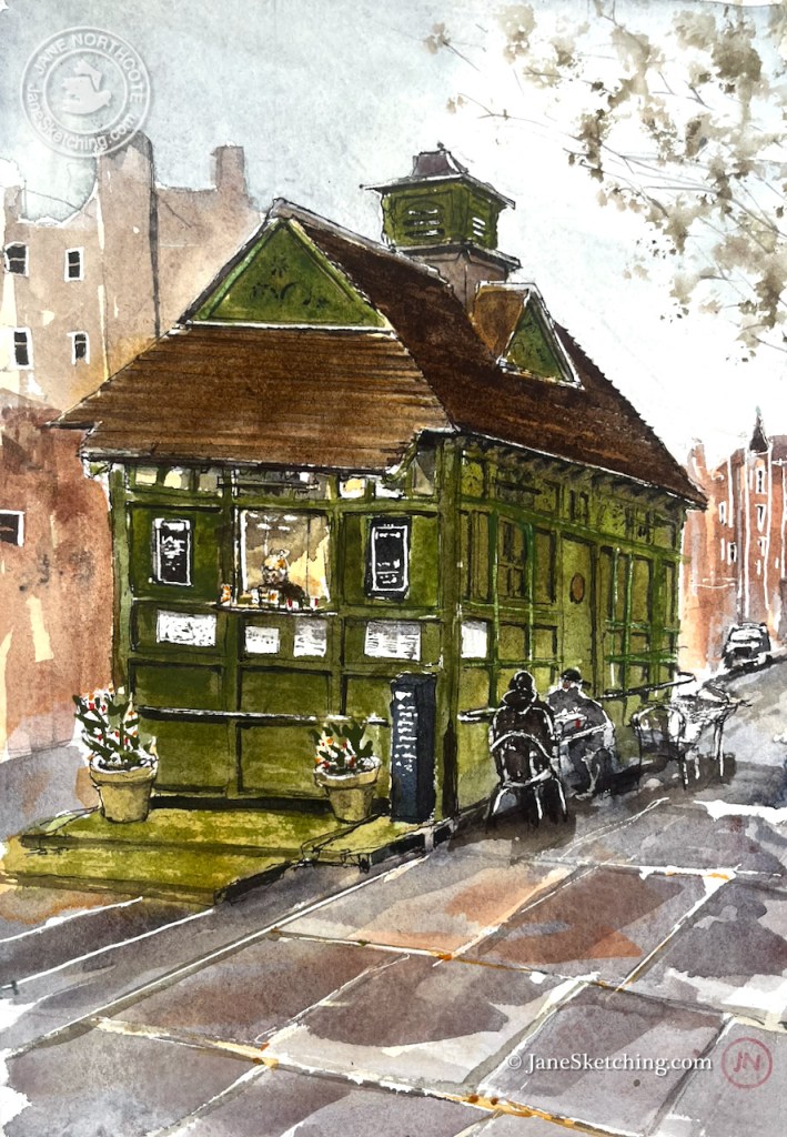
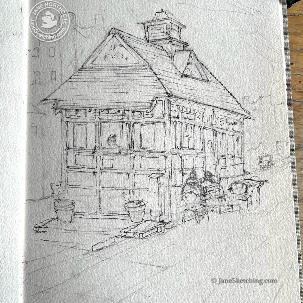
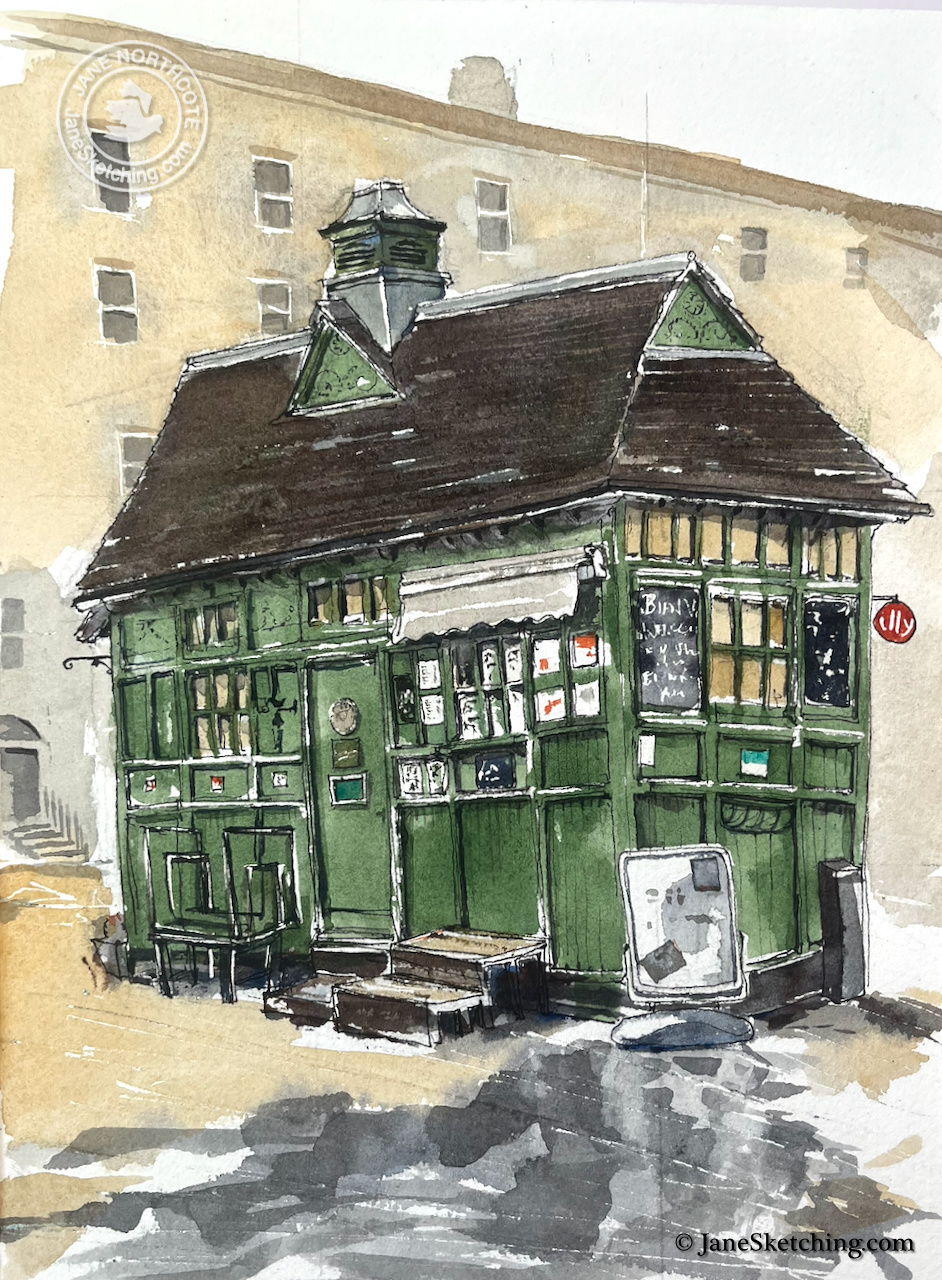
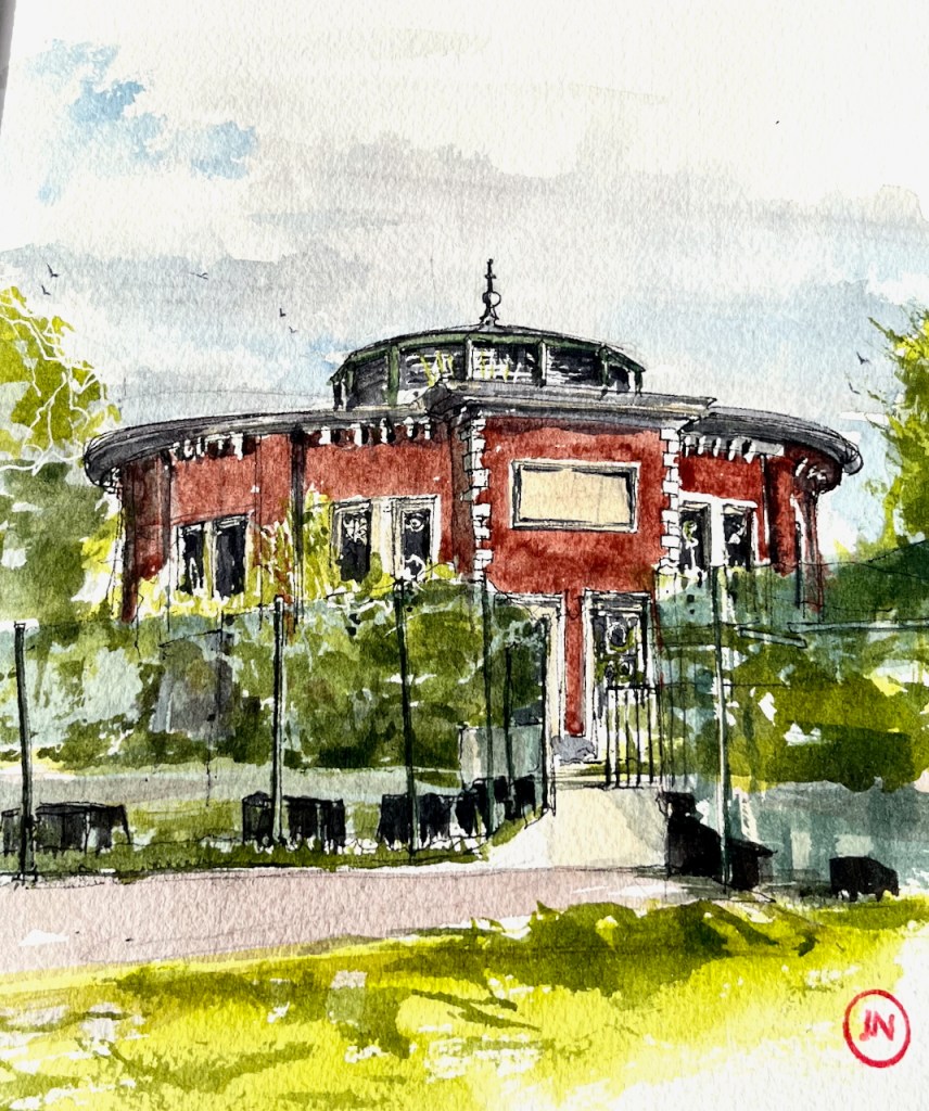
According to the cab driver sitting at one of the tables, this is “the oldest, and the last to be listed”. It was built in 1875, and listed in 2024 (listing ref 1488223).
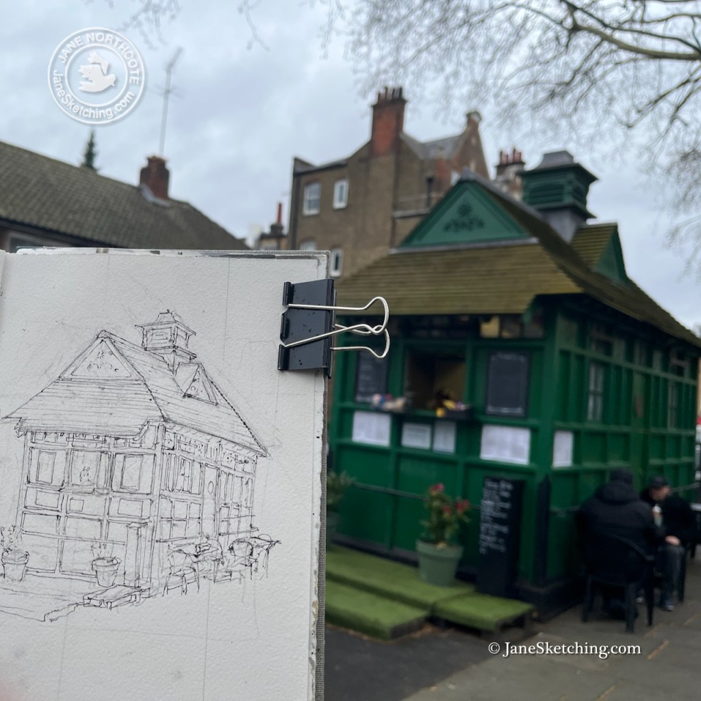
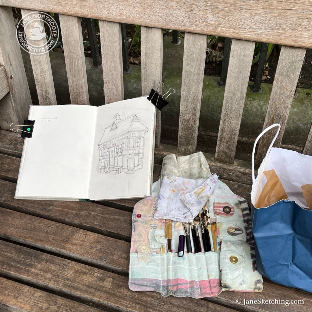
“The Chapel” Cab Drivers’ shelter, Wellington Place, St John’s Wood, NW8 7PE Sketched 27 March 2026, in Sketchbook 16
As I was sketching, the manager of the shelter came out and kindly brought me a cup of tea. She was very welcoming, and interested in the drawing. She told me that the rail running round the shelter, shown in my drawing, was for drivers to tether their horses.
Cup of tea courtesy of the manager of the shelter.
A former cab driver came by in his mobility scooter. He evidently still had dining rights, as he was seated at the tables by the hut. Only cab drivers can sit there, I understood. Cab drivers also went inside the shelter, through the door which you see on the right of the hut, with a circular plate on it. The ex-Cab Driver told me he was a photographer now. “Street Photography”, he said. But he told me he was going to take up birdwatching. This was something it was convenient to do from a mobility scooter. He had no teeth, and it was hard to understand what he said. But nonetheless we enjoyed an extended conversation and listened to the birds we could hear in the park. He went off, waving from his vehicle, steering a confident route along the uneven pavement.
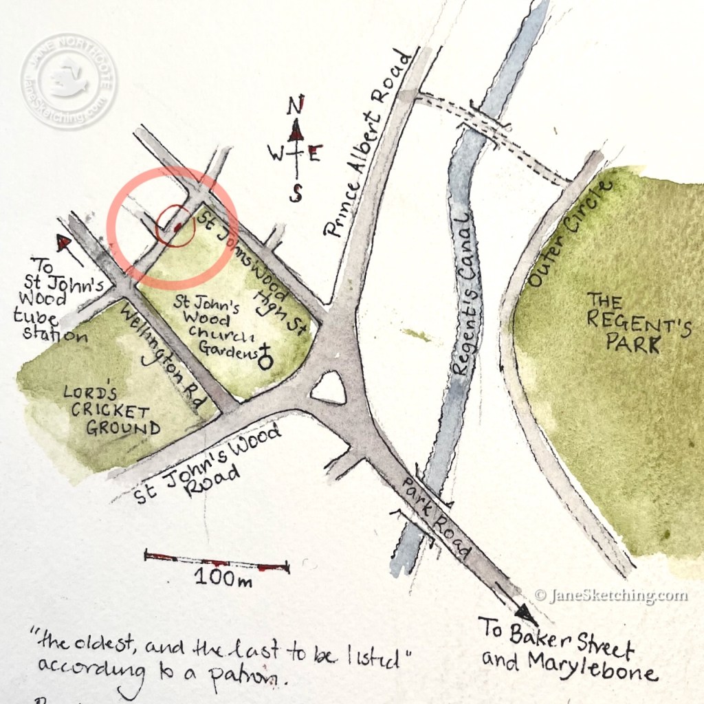
This shelter is called “the Chapel” because it is right next to St John’s Wood Chapel Gardens.
The St John’s Wood Cab Driver’s shelter is next to the Church
It started to rain and I stopped sketching. I bought a bacon sandwich from the woman in the shelter and went to eat it in the garden.
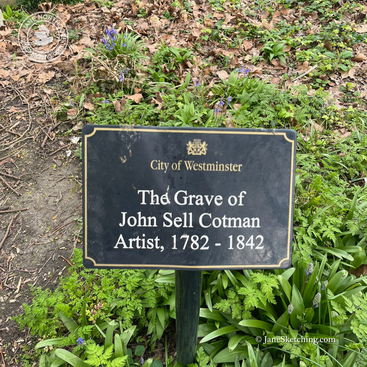
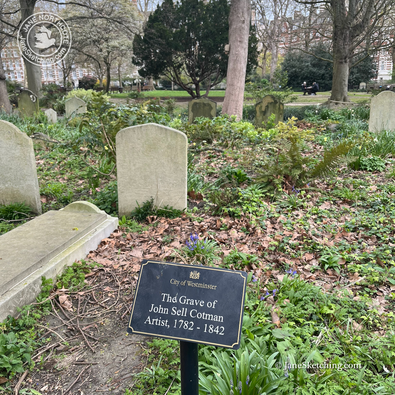
The gardens are the Chapel graveyard. The watercolour artist John Sell Cotman is buried there. I have seen a large exhibition of his work at the British Museum.
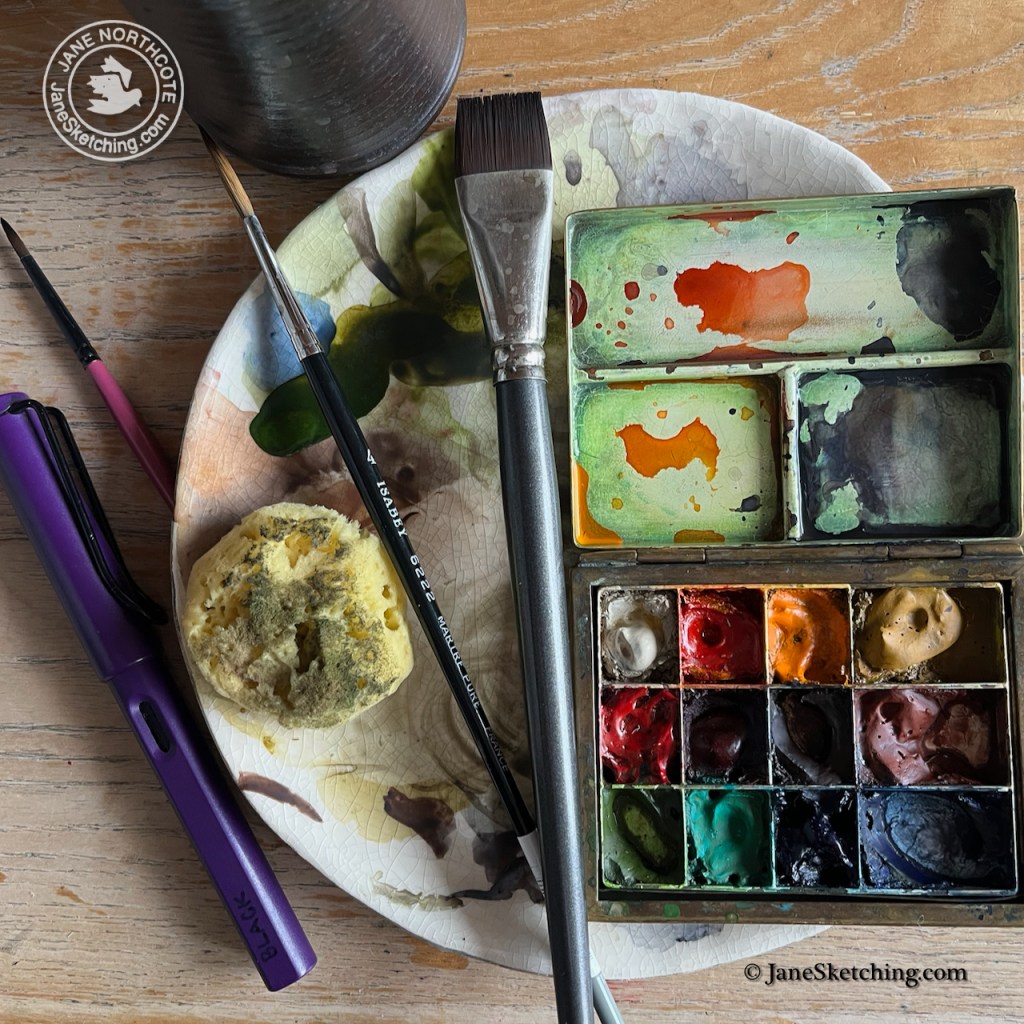
Back at my desk, trying to channel my inner John Sell Cotman, I struggled to match the green colour of the shelter. It is called “Dulux Buckingham Paradise Green I”. 1 It exists in the Dulux Trade Paint range2, but not as a watercolour.
I tried to mix it myself, with partial success. Any colour varies depending on the light conditions, and the surroundings, so I forgive myself for not making an exact technical match. My green is made from Serpentine Genuine (Daniel Smith watercolour ) with touches of Mars Yellow and Ultramarine Blue.
Equipment for this picture. The sponge is for making the tree. Serpentine Genuine is the colour in the palette at the bottom left. It looks quite similar to Dulux Paradise Green I.
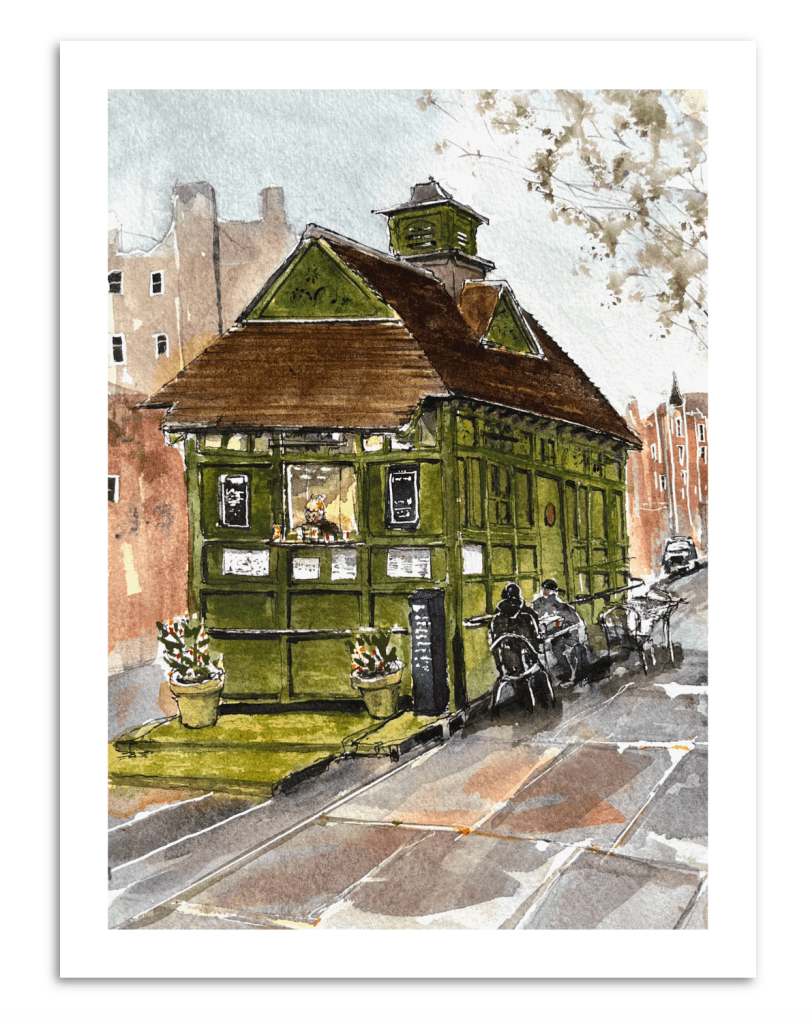
When the picture was finished I ordered a digital print of it, and returned to the shelter to gift the print to the manager who had been so kind and welcoming. It will hang inside her shelter.
The St Johns Wood Cab Drivers’ Shelter, digital print (c) JaneSketching
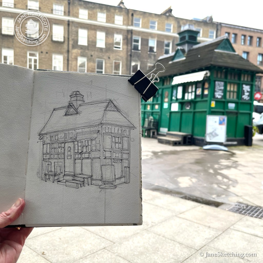
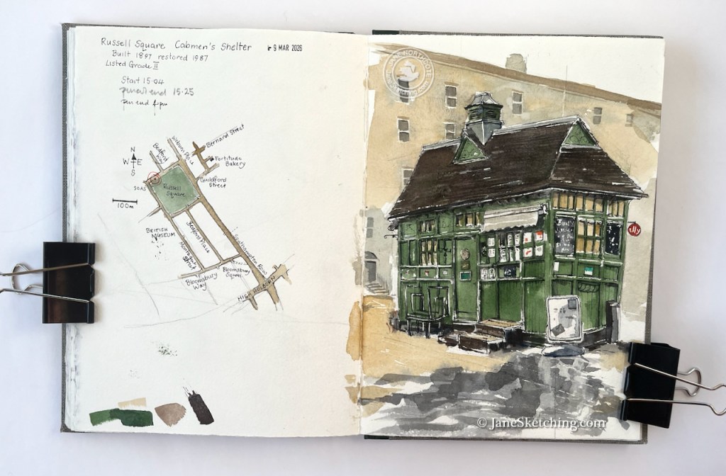
Continuing my series on Cab Drivers’ Shelters, here is the shelter on Russell Square. It was built in 1897, restored in 1987, and listed in 1988.
Russell Square Cab Drivers’ shelter, WC1, sketched 9th March 2026, in Sketchbook 16
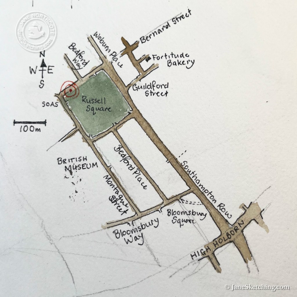
This little building is on the North side of Russell Square, not far from the British Museum.
Location of the Russell Square Cab Drivers’ Shelter
I sketched from a convenient bench, fortified by a sandwich and cake from the marvellous Fortitude Bakery, just to the east – marked on the map above (and recommended).
On the other side of the road is a school for young children. Adults stood about, ready to collect the school children. Between them flowed a current of workers, students and people of all nations. “SOAS”, the School of Oriental and African Studies, is nearby, as is the London School of Hygiene and Tropical Medicine, and many other academic institutions of the University of London.
A cheerful woman swathed in scarves bustled up to me and examined the picture. She glanced up to to the shelter and looked back down again at my picture, comparing. She then delivered what I took to be a speech of encouragement and admiration. But it may equally have been closely argued constructive criticism. Her words sounded garbled, she had no teeth, and I think she was speaking a language unknown to me. However we smiled at each other, I held up the picture so she could better compare it to the building. She nodded curtly, as though putting a confirmatory flourish at the end of her expressed opinion. We smiled again, she waved, and off she went.
A woman with a large handbag came and sat down right next to me on the bench. She placed the handbag on her lap, and took no interest in my picture whatsoever. After a few minutes she took off again. Perhaps she had spotted the pupil she had come to collect.
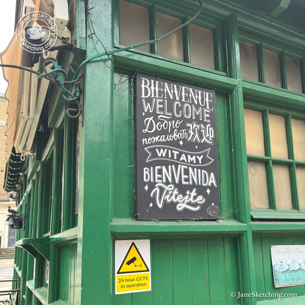
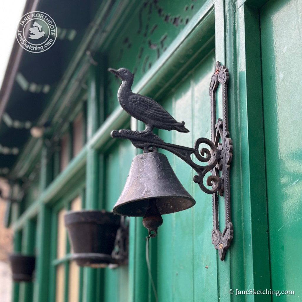
I photographed various details of the shelter. Note the bird on top of the bell. I had tried very hard to show it in my drawing, but at that distance it was very small.
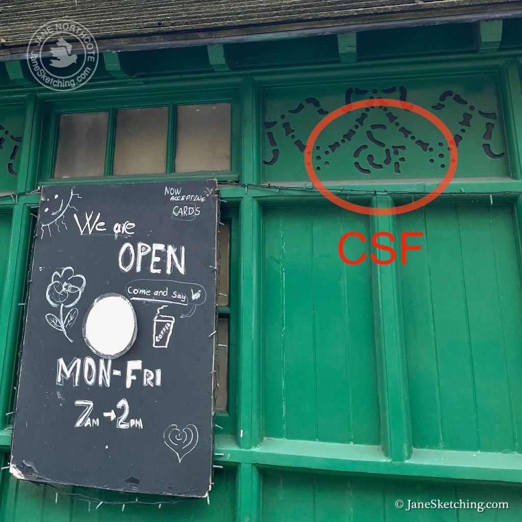
The shelters were built by The Cabmen’s Shelter Fund. Its monogram “CSF” is in the fretwork. This charity set up the shelters in the 19th century, and still exists.
Russell Square Cab Drivers’ Shelter – fretwork showing “CSF” for “Cabmens’ Shelter Fund”
I finished the drawing back at my desk. Here is the sketchbook spread.
Russell Square Cab Drivers’ shelter in Sketchbook 16
Click a button below to share this post online, email it, or print it:
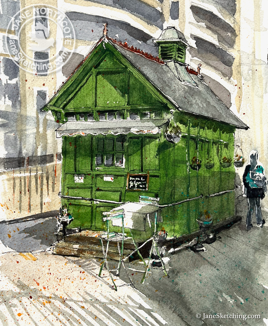
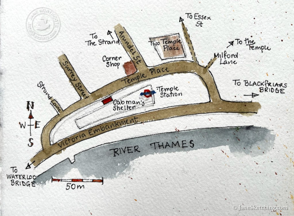
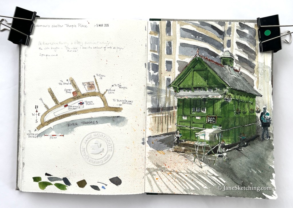
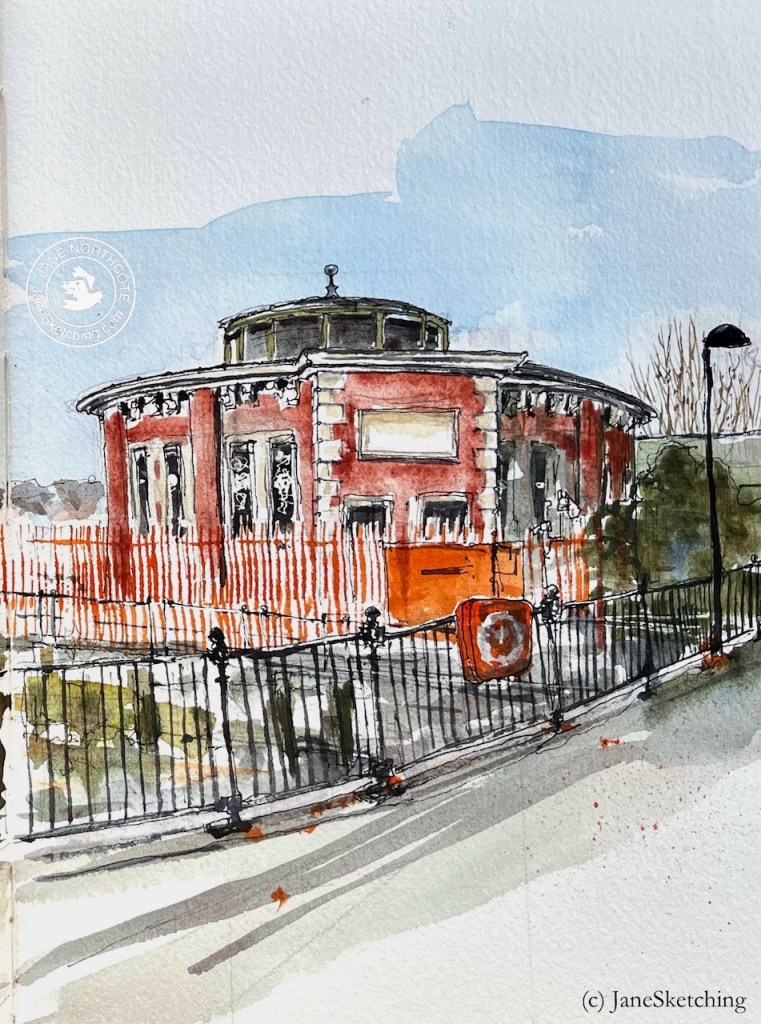
Here is the Cab Drivers Shelter near Temple Station.
Cab drivers’ shelter, Temple Place. Sketched 5th March 2026 2pm in Sketchbook 16
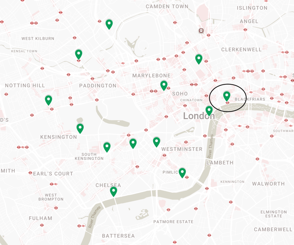
There are 13 of these shelters surviving. All are now listed. This one was built in around 1900 and listed in 19871. Here’s a map from the Historic England site showing the location of all the shelters in London. interestingly they are all to the North of the river.
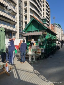
Eager diners queue at the shelter before it closes.
I sketched this one on the first sunny day in spring. I’d arrived there at around 1:30pm. There was a long line of people outside and several tables. While I was doing the sketch, the manager closed the window and the queue dissipated. Then she came out and packed up all the tables. I just managed to sketch one table before they all disappeared. This shelter closes at 2pm.
Two men walked past me, engrossed in a conversation about a colleague. “He has a strong survival component” observed one of them, somewhat ruefully.
Then there was a man pushing a bicycle. “Ah!” he said, noticing me, “ink. Real ink!” I was indeed using real ink. I held up the fountain pen to show him. “I love the sound of ink on paper!” he said. I hadn’t thought about the sound of ink on paper. I noticed it, from that moment on.
Here’s a map showing the location of the shelter. As you see, it is near Temple Station, which accounts for the flux of people passing.
Here is the sketchbook spread. My aim is to sketch more of these shelters – maybe even to sketch all of them.
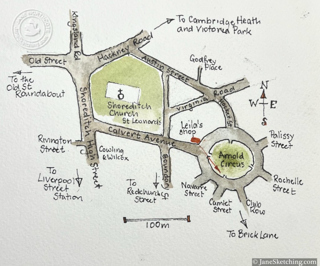
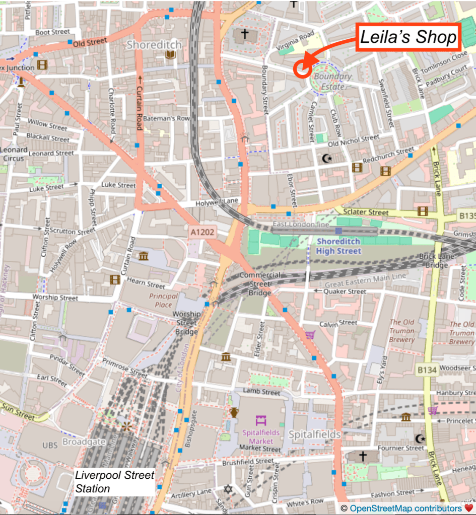
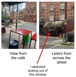
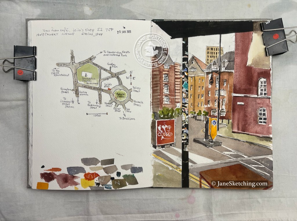
On a very cold day in January I stopped for lunch in Leila’s shop in Calvert Avenue. My table at the window offered a view along a tangent of Arnold Circus.
View from Leila’s, 15-17 Calvert Avenue E2 7JP 29 January 2026 10″ x 7″in Sketchbook 16
I enjoyed all the lines and curves, and the hundreds of notices stuck to the lamppost, and the trees in boxes, and the transitional feel of this area, between the City and Hackney, between the trendy shops of Redchurch Street and the social housing of the Boundary Estate.
Then lunch arrived, which was a kind of a goulash and very good.
The woman serving said “It’s so cold, I’m offering cups of hot water. Would you like one?”. This was a good idea. She placed the cup of hot water in amongst my drawing things, and the plate of goulash, on the table. They are very tolerant and understanding in this café.
Next door is the deli of the same name, where I procured a slice of malt loaf to sustain me on my walk. I’d eaten it before I reached the other side of Arnold Circus.
Here is St Leonard Shoreditch, which stands at the intersection of Shoreditch High St and the Hackney Road, postcode E1 6JN. There has been a Christian church here since medieval times. The present building dates from 1741 and was designed by George Dance the Elder (1695-1768). George Dance the Elder was the City of London surveyor at the time, and designed, amongst other buildings, Mansion House at Bank Junction. The current church is active in the community. On the day I was sketching, a Thursday, they were offering meals to local people. This is the Lighthouse Project, “providing practical help,…
This is the “Boundary Estate”, Britain’s first council estate, opened in 1900. It was built to the design of Owen Fleming and his team. Fleming was a member of the Housing of the Working Classes branch of the LCC’s* Architecture department. He was 26 years old. The aim of Boundary Estate project was to replace slums, in an area of disease, want, squalor and crime known as “Old Nicol”. The slums were pulled down, and replaced by dwellings that were more healthy, and more pleasant to live in. The area was also provided with schools, a laundry, shops and clubrooms.…
Jolene bakery is on the corner of Redchurch Street and Club Row. This is a lively corner in a street on various edges: on the edge of the City, at the boundary between a new London and an old one, at the intersection of 21st century entrepreneurial culture and 19th century housing projects. Redchurch Street is just North and West of Brick Lane. There are restaurants, independent clothes designers, hairdressers, and various 21st century businesses I couldn’t identify but categorised in my mind as broadly “creative”. It’s a good place to walk around, and Jolene is a great place to…
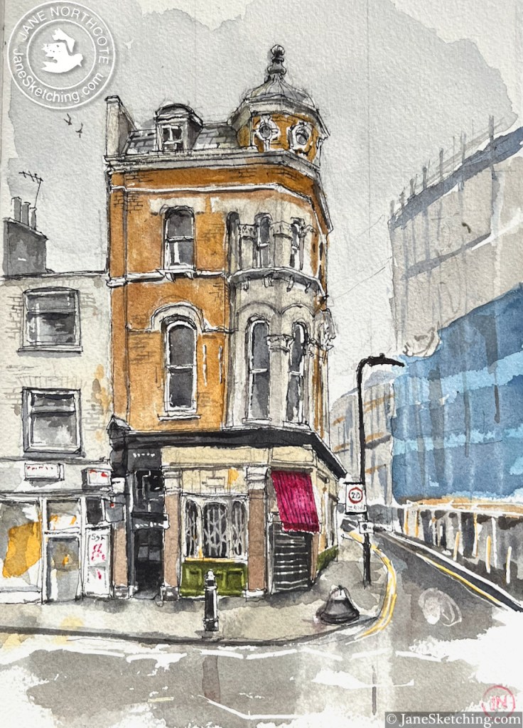
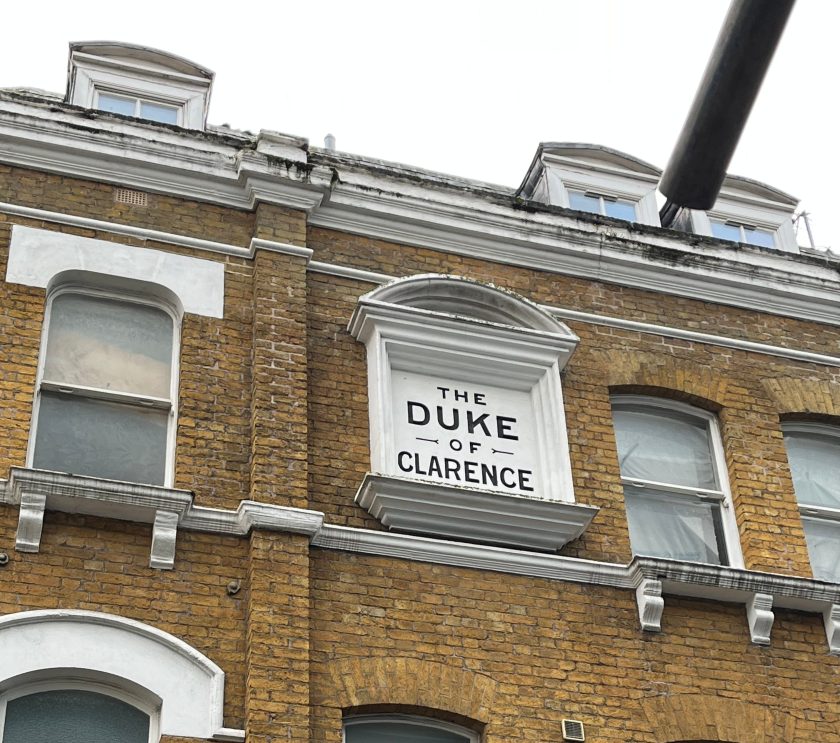
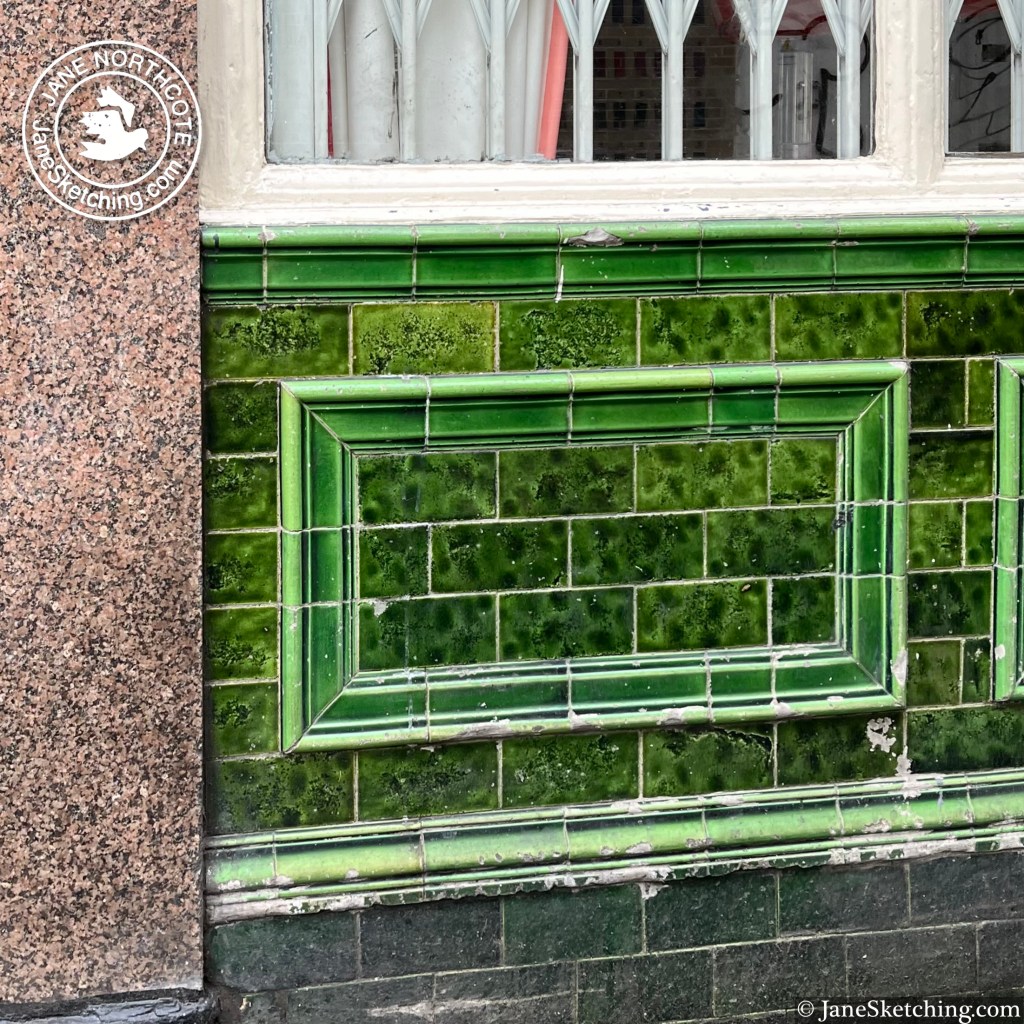
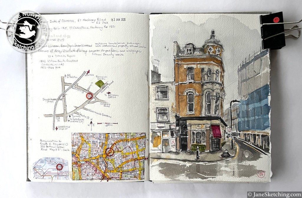
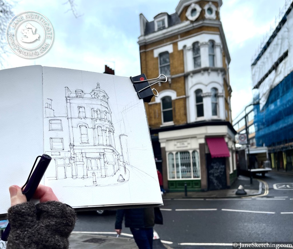
Along the Hackney Road stands this building with a turret: This on the corner of Waterson Street and Hackney Road, at the western end of Columbia Road. After I’d sketched it, I walked into the picture, and had a look at the building from the Waterson Street side. It was a pub called the Duke of Clarence. There is deep green tiling, characteristic of 19th century London pubs. It was listed in the London Street Directory of 1940 as a pub. Other online references have it trading from 1802 up to 1944. For many decades it’s had retail premises on…
Along the Hackney Road stands this building with a turret:
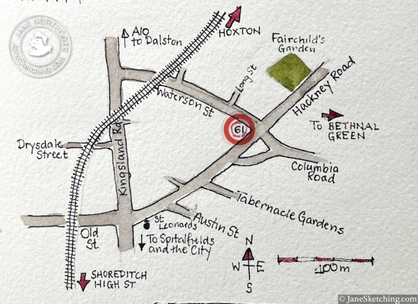
61 Hackney Road, E2 7NX, sketched 12 January 2026 in sketchbook 16
This on the corner of Waterson Street and Hackney Road, at the western end of Columbia Road.
After I’d sketched it, I walked into the picture, and had a look at the building from the Waterson Street side. It was a pub called the Duke of Clarence.
There is deep green tiling, characteristic of 19th century London pubs.
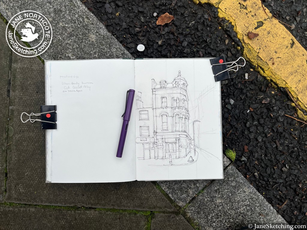
Now it is home to “Colours of Arley” on the ground floor, which offers “bespoke striped fabric and wallpaper”. Other floors are occupied by tenants of “Fount London”, which provides small office spaces in quirky buildings.
It’s still standing on its corner, still noble, still useful, while the businesses and the district change around it.
Click a button below to share this post online, email it, or print it:
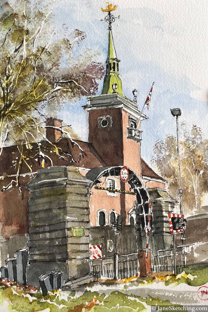
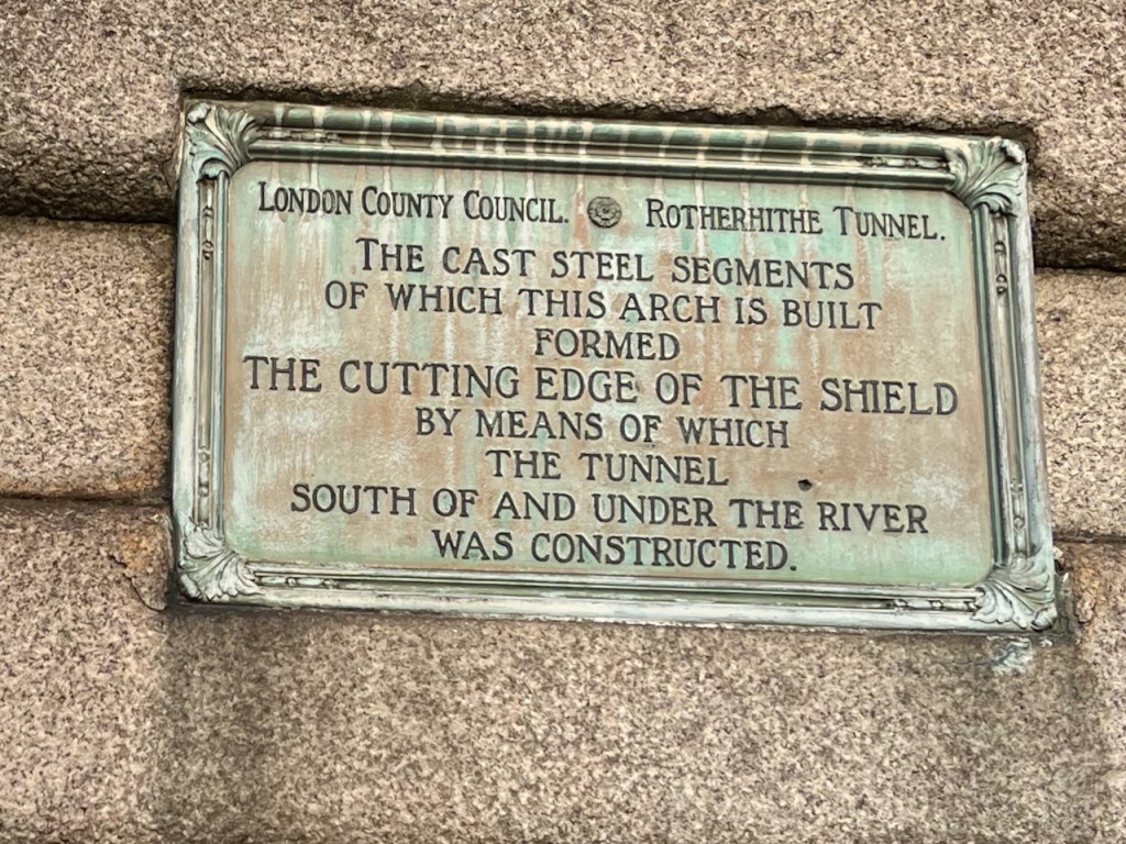
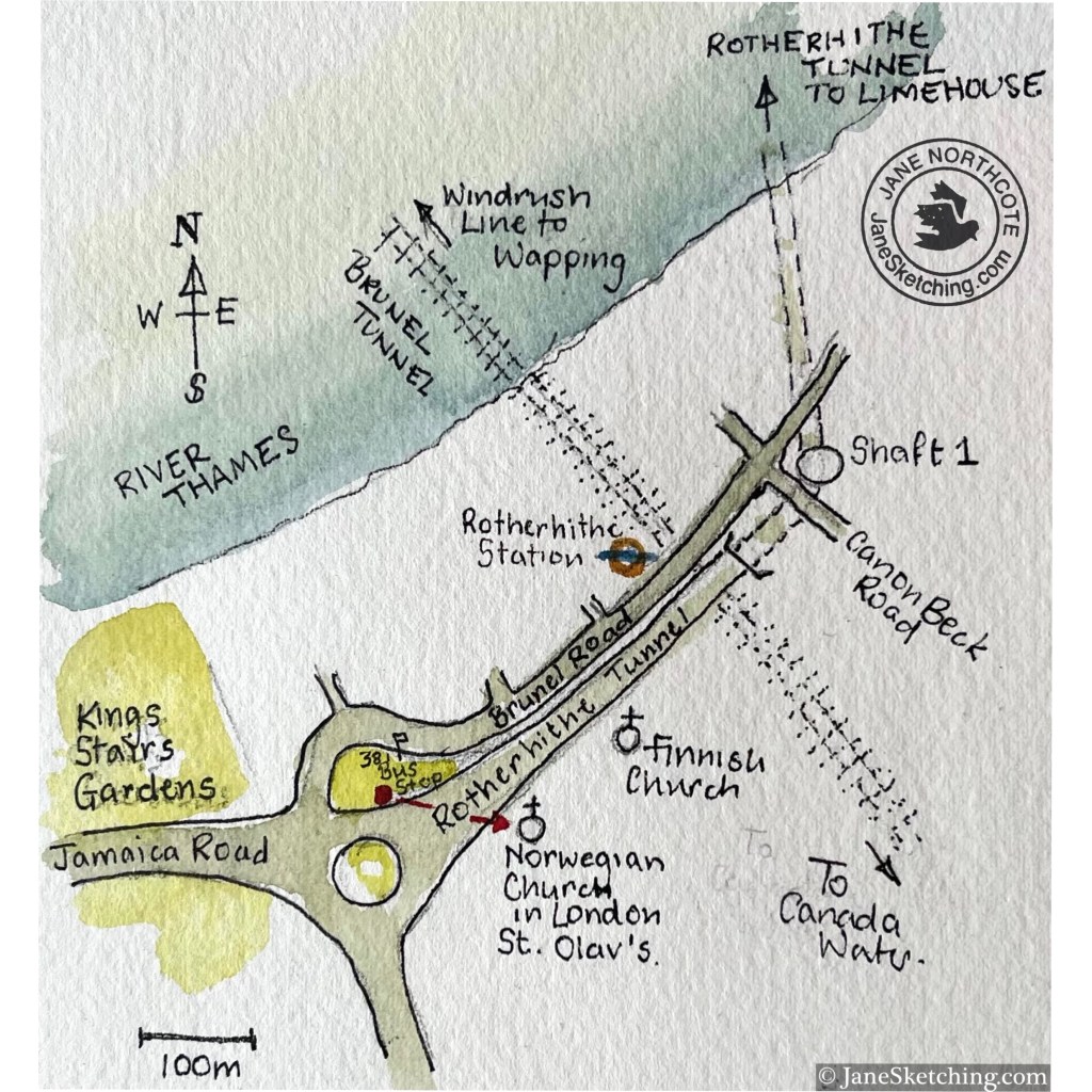
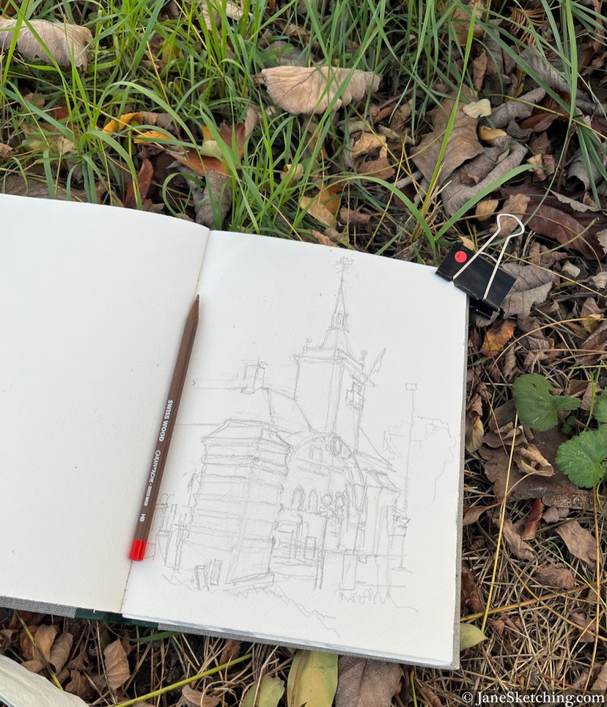
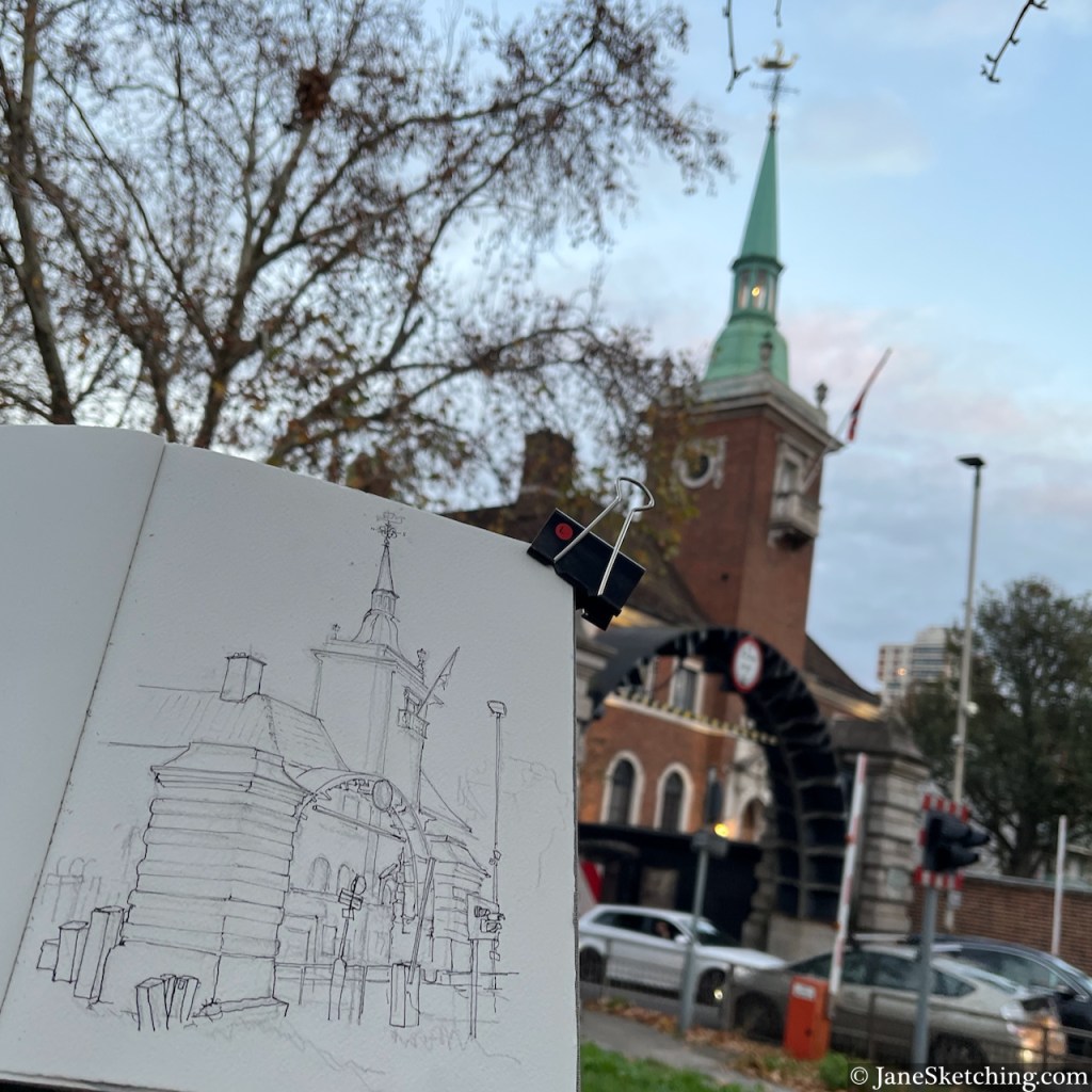
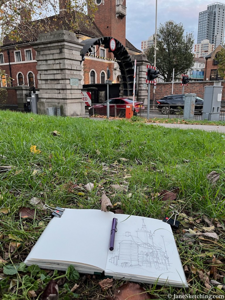
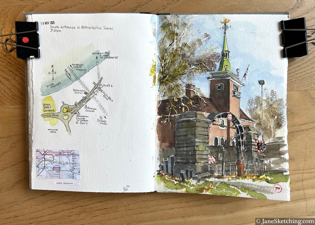
Rotherhithe Tunnel South Entrance, and St Olav’s Church, Rotherhithe, London SE 16 7JB, sketched 18th November 2025
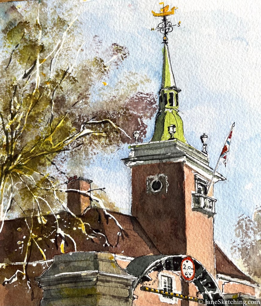
The church is St Olav’s, the Norwegian Church in London. It was designed by John Love Seaton Dahl, and the foundation stone was laid in 1926 by Prince Olav, later King Olav V, of Norway.
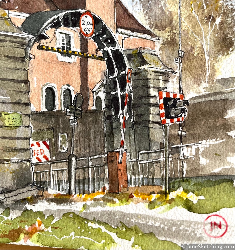
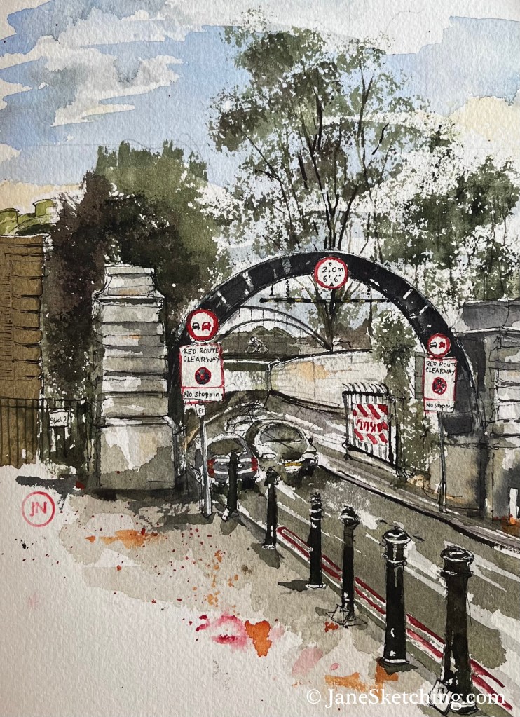
The steel arch over the tunnel approach road is part of the equipment used to cut the tunnel, as on the North side.
Sketch detail showing the steel arch.
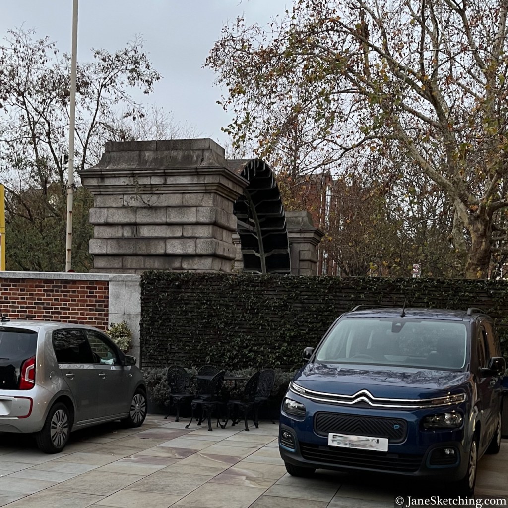
Below is a photo taken from the front courtyard of the church, looking back towards my sketching location. You can see the steel arch above the wall of the Church courtyard.
View of the arch above the Rotherhithe Tunnel Approach road, from the front courtyard of St Olave’s church
As you see, there were many trees. I was sketching from a traffic island, between major roads.
Map showing my sketching location (red dot and arrow)
Above me there were parakeets, the green ones. I think this is the furthest east I have heard parakeets. They seem to be migrating slowly across London, West to East, and North to South.
Sketching amongst greenery, Rotherhithe Tunnel South entrance
I enjoyed the weathervane on the church: a viking boat.
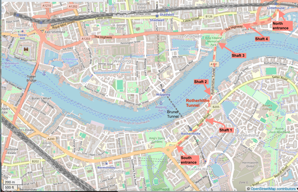
For completeness, here is a map showing the entire route of the Rotherhithe tunnel.
Background map (c) OpenStreetMap contributors
I reached the South entrance via the “Brunel Tunnel”, which is now used by the Windrush Line.
I’ve now sketched both entrances and two of the shafts. Here are the other posts. Click on the image to go to my article about it on this website.
North EntranceShaft 3Shaft 2
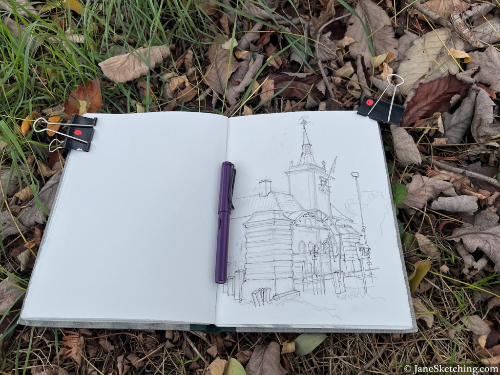
Here’s my sketchbook with this sketch:
Sketchbook 16 page spread
Sketchbook: Arches Aquarelle 300gsm, book made by Wyvern Bindery
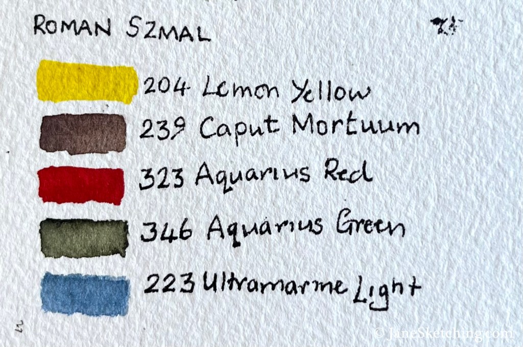
Paints: Roman Szmal
Pen and ink: De Atramentis Document Ink, Black, in a Lamy Safari fountain pen with Extra-Fine nib.
Click a button below to share this post online, email it, or print it:
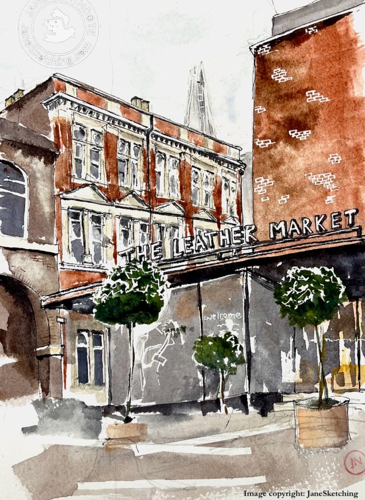
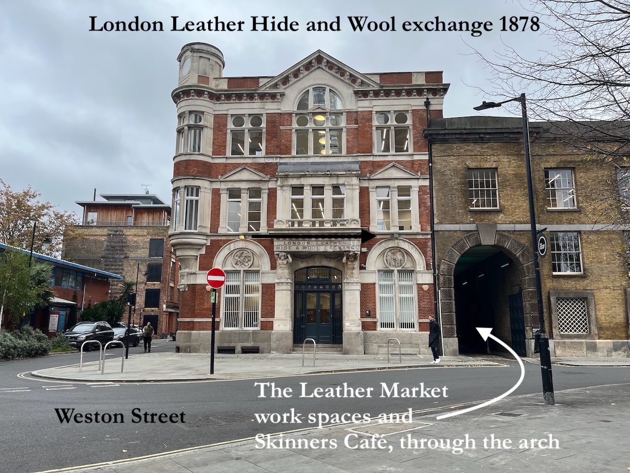
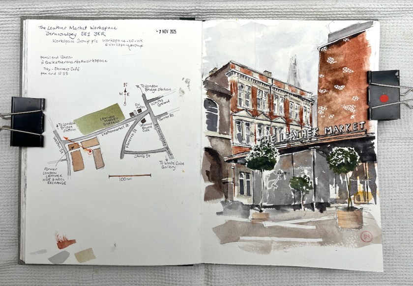
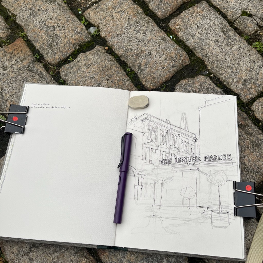
Here is The Leather Market Workspace. The Victorian building on the left is the back of the Grade II listed former “London Leather, Hide & Wool Exchange”, 1878, designed by George Elkington and Sons.
The Leather Market, Bermondsey, sketched 7th November 2025 in Sketchbook 16
My idea had been to sketch the front of the Victorian building from Weston Street. But the front was obscured by delivery vans.
We were on the point of abandoning the project, when Toby appeared.
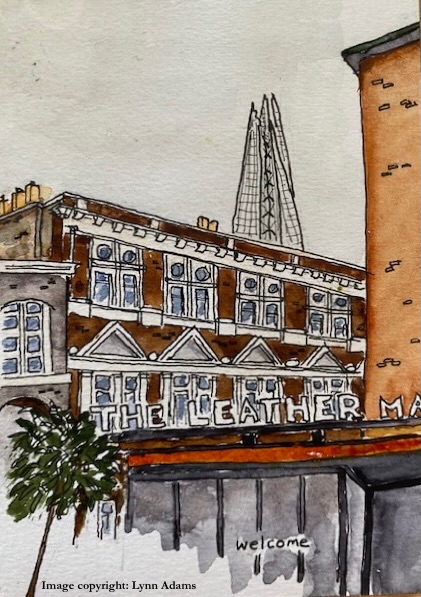
Lynn’s sketch of the same view (c) Lynn Adams, used with permission.
Toby, it turns out, is in charge of a café. He was standing on the pavement next to a huge arch by the Victorian frontage. Come in! he suggested. Lynn and I followed him through the arch. The space opened out into a large yard, with seats. Toby went into his café and we walked around the yard, sizing up the artistic possibilities. Lynn uttered a shriek of delight. She had discovered a point at the edge of the courtyard with an unexpected view of The Shard. And trees. This was her quest. She settled down to sketch while I went to procure coffee from Toby and his team. Then I started sketching too.
“The Leather Market” is one of a collection of co-working spaces managed by Workspace Group plc. We sketched and drank our coffee in the calm yard. Workers passed by and made encouraging comments.
Working on a sketch of The Leather Market. Pen: Lamy Safari fountain pen
We returned our coffee cups to the friendly café, and set off to explore more of Bermondsey. By the time we emerged out through the arch, the delivery vans had gone from the front of the building.
Thank you to Toby and his team from Skinners Café for making us so welcome!
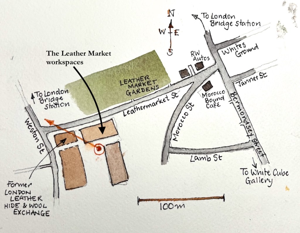
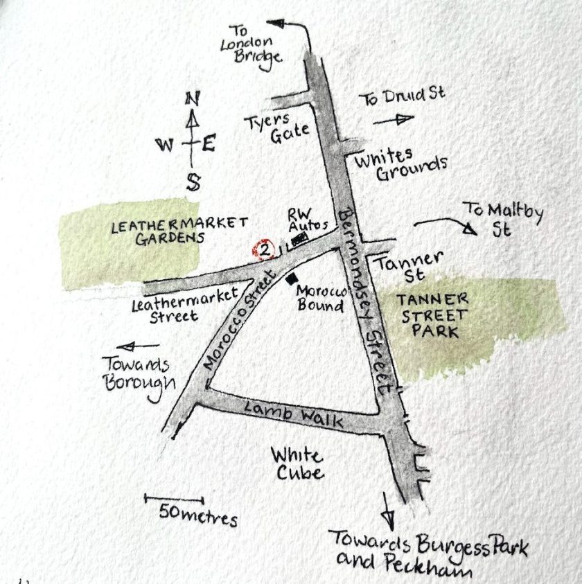
Here’s a map:
Map showing the viewpoint in the sketchThe Leather Market workspaces – page spread, Sketchbook 16
Colours, all Daniel Smith watercolours:
Fired Gold Ochre for the bricks
Burnt Umber and Ultramarine Blue for the grey and blacks
Serpentine Genuine for the greens
Some Transparent Pyrrol Orange and Mars Yellow for the light indoors
all the whites are the paper, fine lines achieved using masking tape and rubber resist.
My pen is a Lamy Safari with EF nib, and De Atramentis Document Black waterproof ink. Paper is Arches Aquarelle 300gsm CP, in a book made by Wyvern Bindery of Hoxton
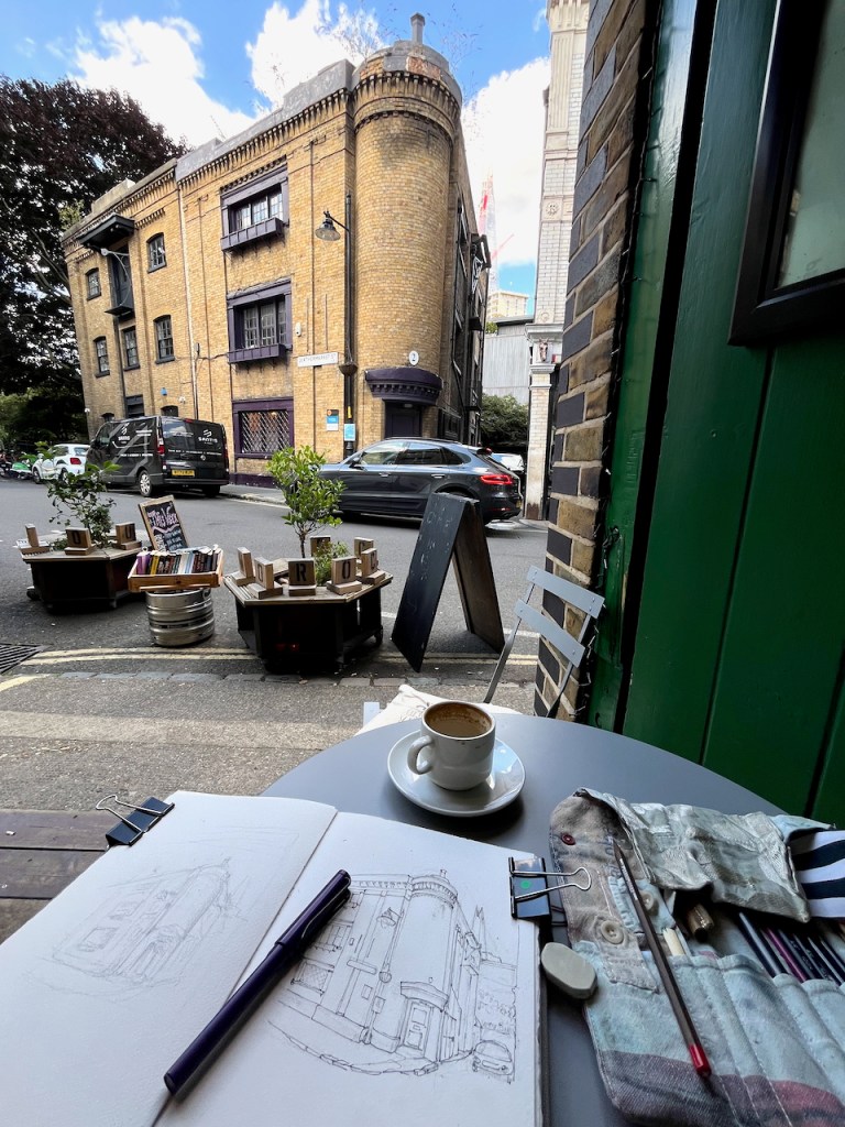
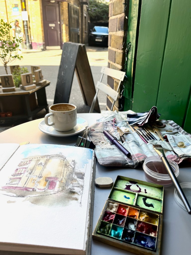
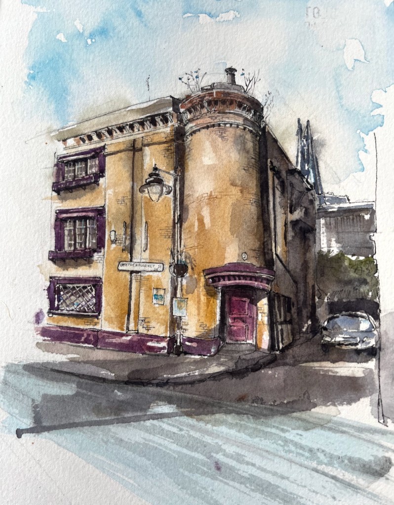
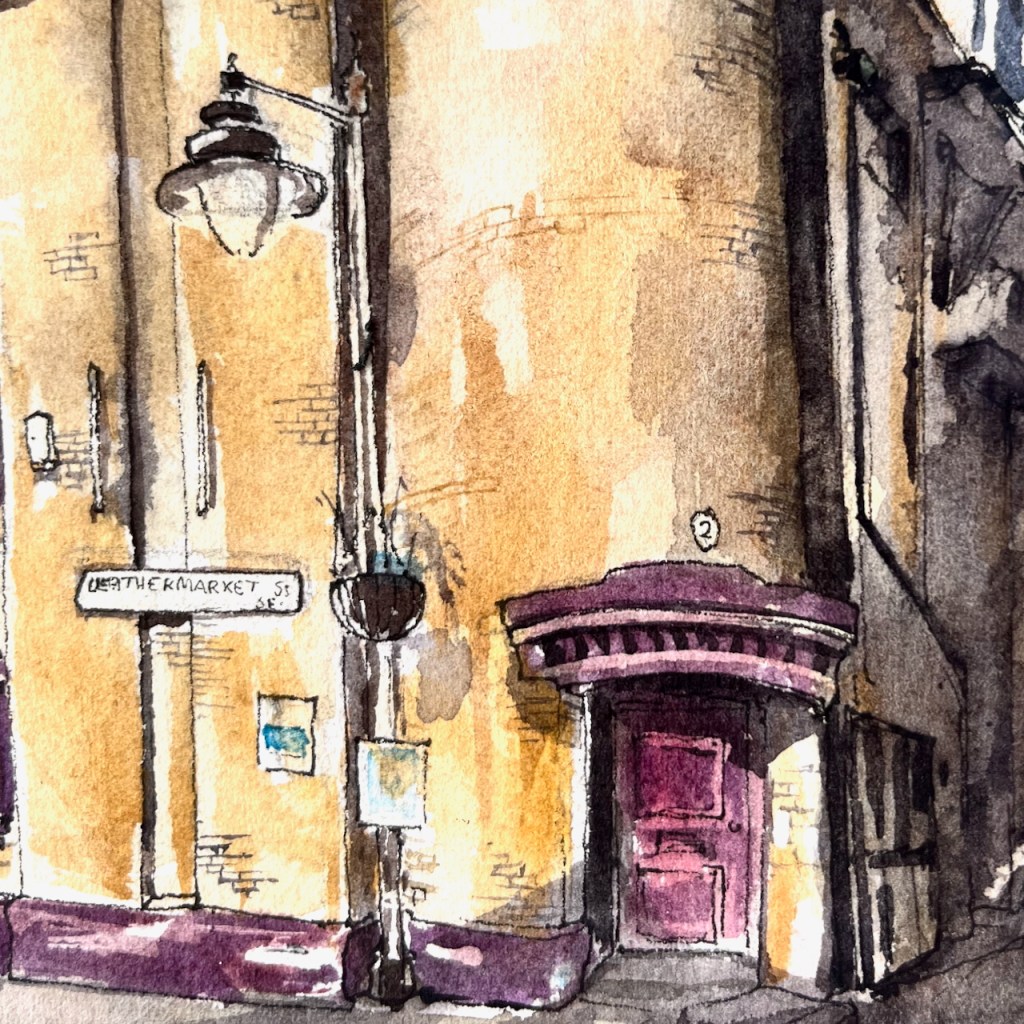
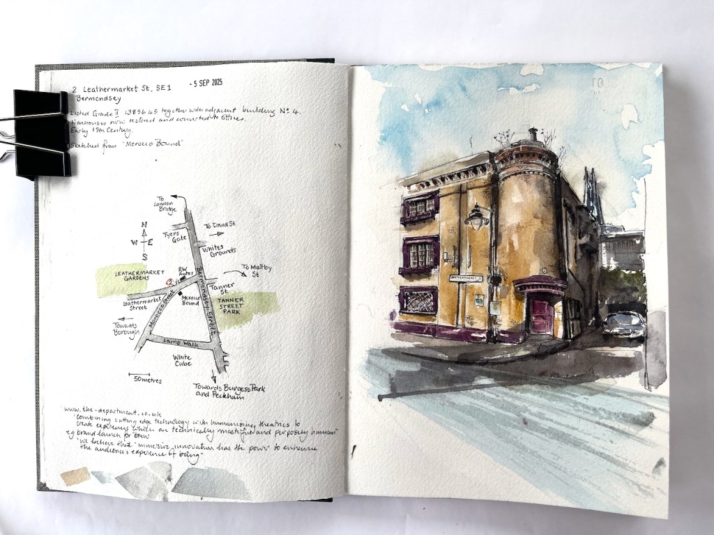
From the café “Morocco Bound” I sketched the distinctive building across the street. This is 2 Leathermarket Street: In the distance you see The Shard, at London…
From the café “Morocco Bound” I sketched the distinctive building across the street.
This is 2 Leathermarket Street:
2 Leathermarket Street, London SE1 3HN. Sketched 5th September 2025 in Sketchbook 16
In the distance you see The Shard, at London Bridge Station.
This was the leathermaking district up to the beginning of the twentieth century. We have Leathermarket St, Morocco St, and Tanner St. The former “Leather Hide and Wool Exchange” is further up Leathermarket Street, towards Borough, to the west.
The building was listed Grade II in 1972. It is early 19th century, according to the listing.
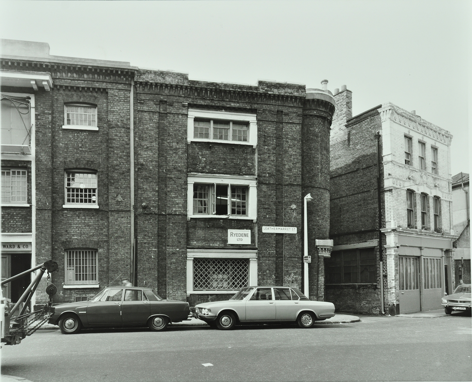
Here is the area in 1976, in a picture from the London Archives, used with permission:
The windows are all still there as in 1976, with the same window frames, now painted purple. Even the weird little chimneypot on the top of the turret is still there, as it was 50 years ago. In this 1976 picture the placard between the windows says “Ryedene Ltd” but I have been unable to discover if this company was in the leather business. There is no placard now.
“The Department” now occupies this building. Their business, according to their website, is:
combining cutting edge technology with humanising theatrics to create experiences which are technically masterful and purposely human”
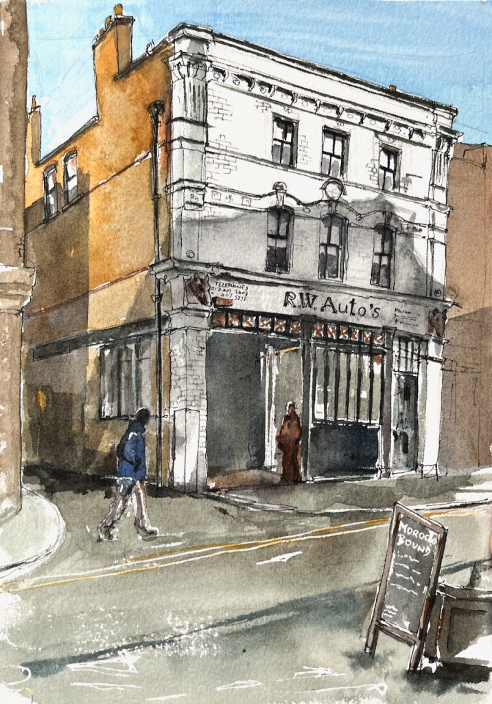
To the right of 2 Leathermarket Street is a garage, “R.W. Auto’s” which I have sketched previously:
2 Morocco Street, sketched from “Morocco Bound”, 18th October 2024, 2pm in Sketchbook 15
Thank you to “Morocco Bound” for their hospitality while I sketched these pictures. It’s a calm and welcoming bookshop and café in an interesting location. I’ll be back!
Page spread, Sketchbook 16
Click a button below to share this post online, email it, or print it:
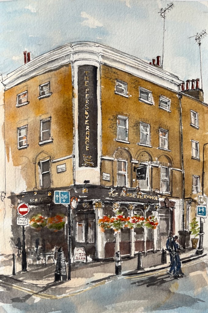
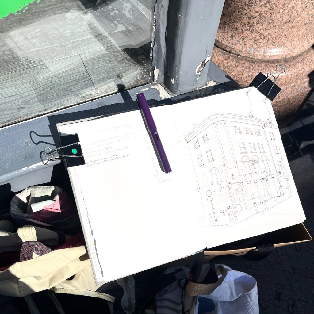
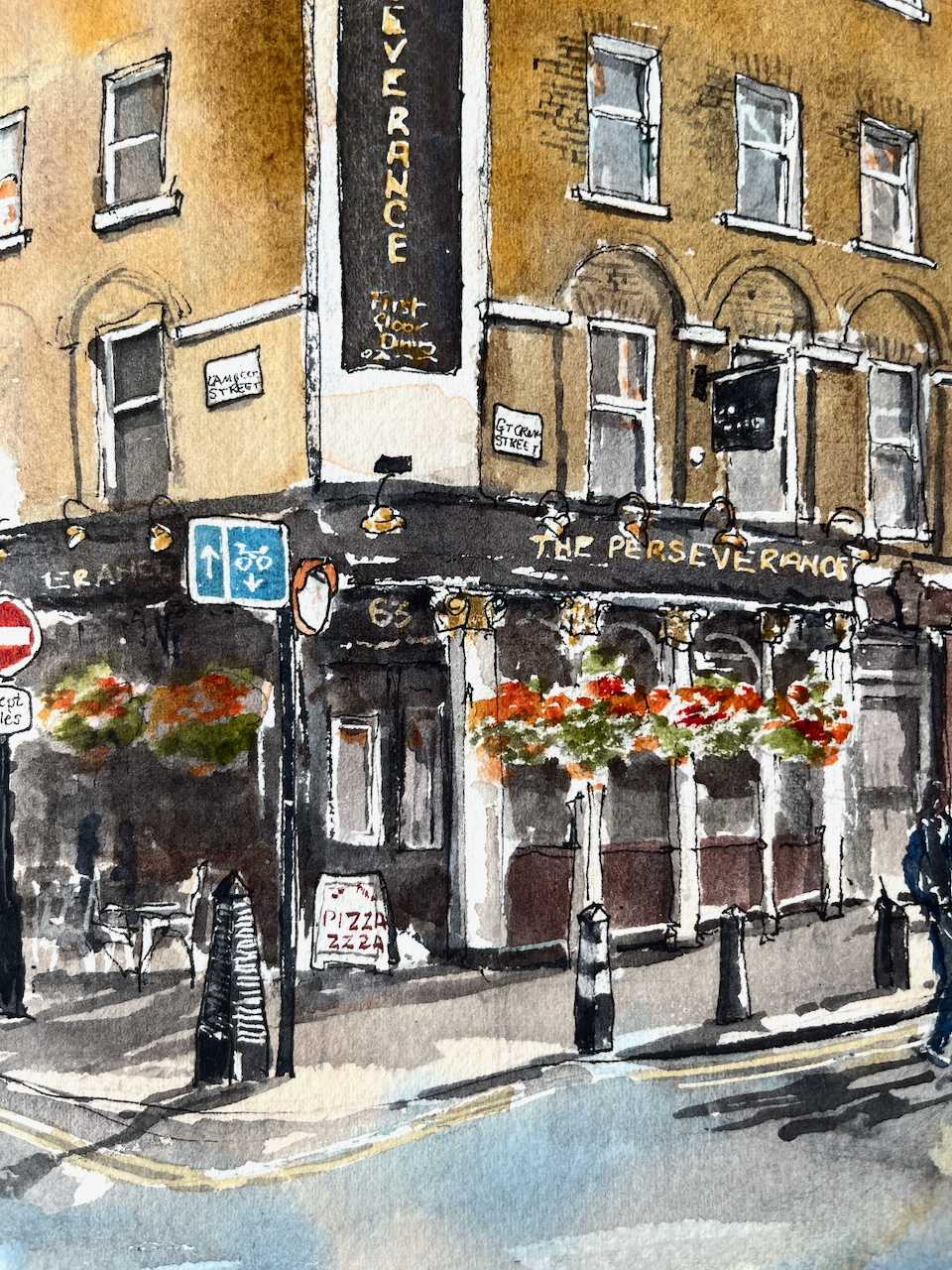
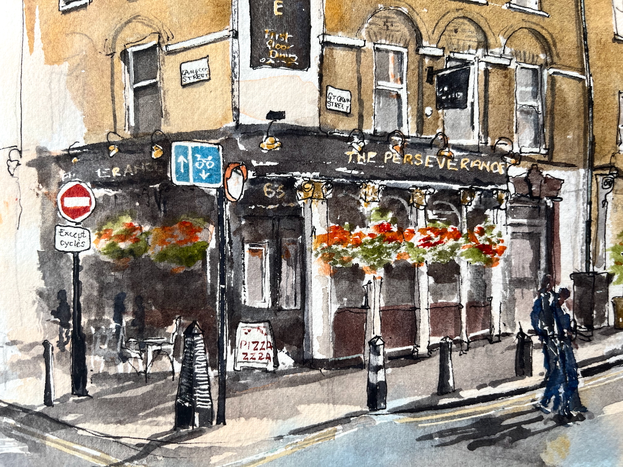
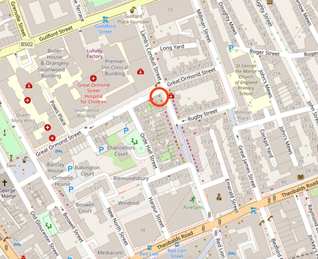
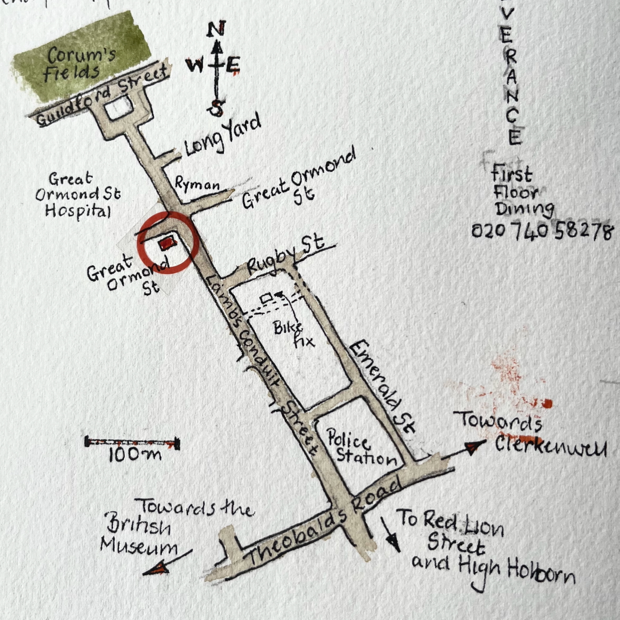
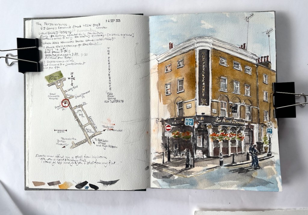
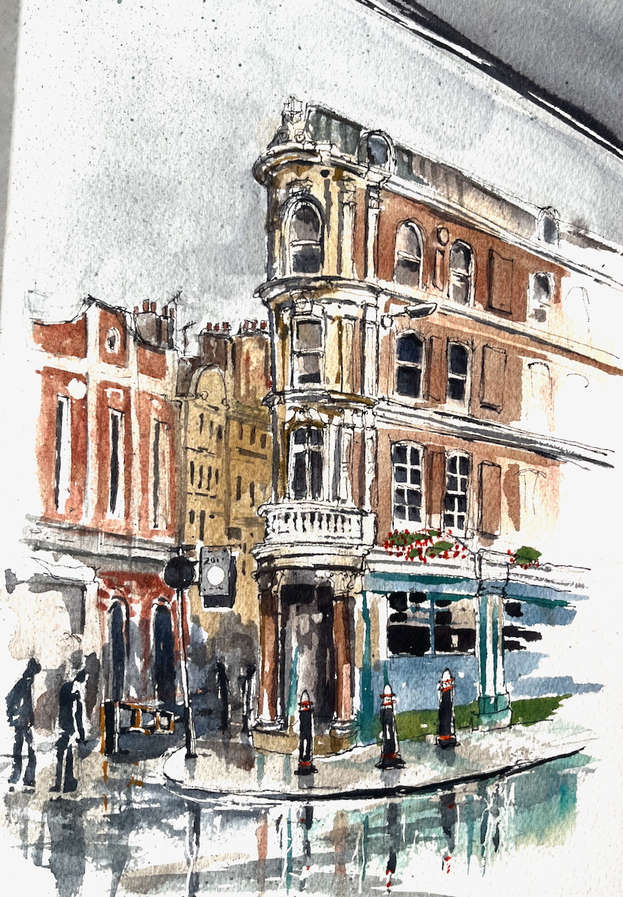
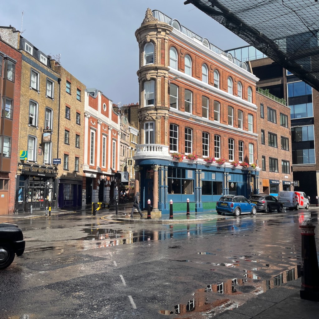
Here is The Perseverance, on the corner of Great Ormond Street and Lamb’s Conduit Street.
The Perseverance, 63 Lamb’s Conduit Street WC1N 3NB, sketched 4th September 2025 in Sketchbook 16
This pub was formerly The Sun, and had a magnificent painting on the corner. There are pictures and history on this detailed post from The London Inheritance. The many comments on the London Inheritance blog post describe happy memories of The Sun and its numerous Real Ale pumps.
The pub is listed Grade II reference 1379274. It was built in the early 18th century and the front was renewed in the 19th century. It was The Sun until the 1990s when the name was changed a few times, becoming the Perseverance around 2005/6.
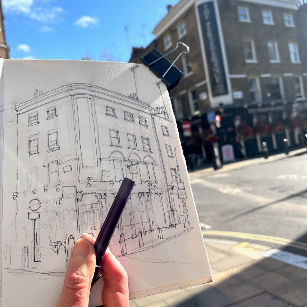
I sketched it from the “Rymans” stationery shop which is on the opposite corner of the crossroads. People walked past me, deep in conversation, casting shadows in the afternoon sun. But one elderly man stopped, and looked up at me. His back was slightly bent. “Are you alright standing there?” he asked. I said I was, wondering what he meant. “Because,” he continued, “I could go up and get you a stool from my flat. It’s just up there.” He pointed heavenwards, to the windows above the shops. People are so kind. This man was so kind. It’s moments like this which make the sun rise on humanity. I was in fact quite tired, and would have liked to sit down, but my drawing was very nearly finished. I hesitated to send this helpful individual back up his stairs. So I declined his thoughtful offer, as politely as I knew how, and continued my drawing standing upright in the sun.
This drawing took 1 hour and 20 mins on location, plus another hour and a half at my desk later. The colours are:
Mars Yellow (brickwork)
Ultramarine Blue and Burnt Umber (mixed, for the greys and blacks)
Phthalo Blue Turquoise and Ultramarine Blue for the sky and the street, and the street signs
Transparent Pyrrol Orange for the “No Entry” sign and the flowers
Serpentine Genuine Green for the plants
A tiny bit of Permanent Yellow deep for the yellow line on the road, and other small touches
All whites are the paper.
Ink lines are De Atramentis Document black ink in an Extrafine Lamy Safari fountain pen
Paper is Arches Aquarelle 300gsm Cold pressed in a sketchbook made by the Wyvern Bindery in Hoxton.
Here are maps (click to enlarge):
(c) OpenstreetMap Contributors
Here is the sketchbook, size 7″ x 10″.
Click a button below to share this post online, email it, or print it:
My idea that day was to sketch some interesting corner pubs in Bloomsbury.
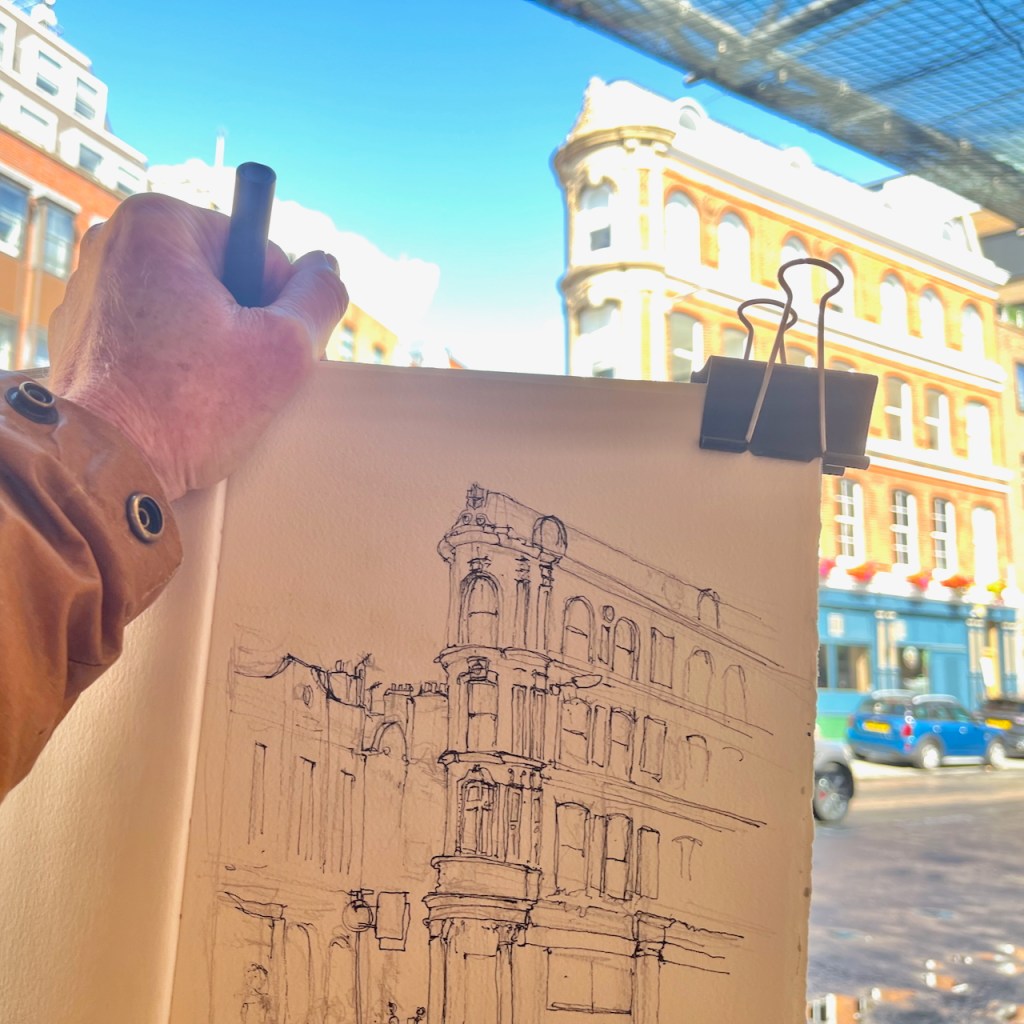
By the time I had emerged from my flat and was on the street, the bright autumn day had turned stormy. After a few paces, the rain started falling. Everyone dashed for cover. I sheltered in a doorway, together with another woman, two strangers in a refuge, grinning and rolling our eyes. “Well, it is September”. At a pause in the deluge, we both emerged and went our separate ways. I went doggedly towards the West, but no, the rain returned, seemingly even more torrential. I dashed from doorway to doorway, like a fugitive in a spy novel, finding cover where I could. Then I spotted the generous overhang of Smithfield Market and rushed underneath, the rain spattering on the glass above. There was no sign of the deluge ceasing, so I considered, as you do in these strange interim conditions: to go on? to go back? Or to stay where you are?
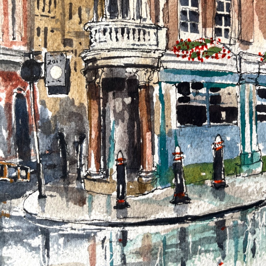
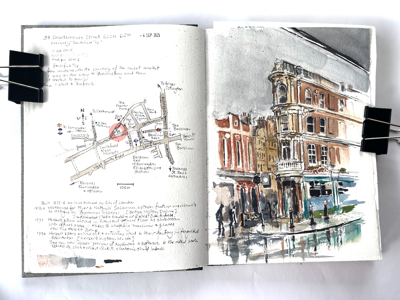
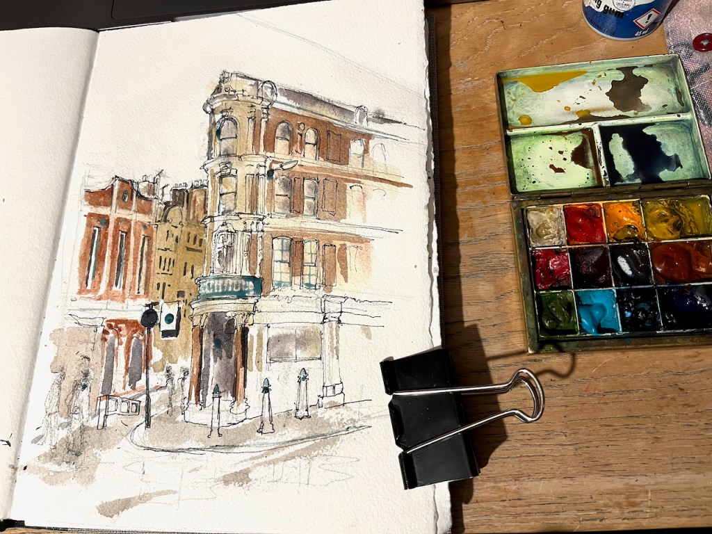
Why not do the drawing right here? Over the other side of the road is a building occupying an acute angle between roads. It wasn’t in my plan, but by this time I had abandoned my plan. So here is 38 Charterhouse Street, sketched from the shelter of the Smithfield Meat Market canopy.
38 Charterhouse Street, EC1M 6JH sketched 4th September 2025 in Sketchbook 16
I sketched it in pen on location. Part way through the process, a group of workers started to clean the area behind me, using high-pressure water hoses. A fine mist appeared in the air, adding to the general dampness. I finished the drawing later that evening, in my warm dry room.
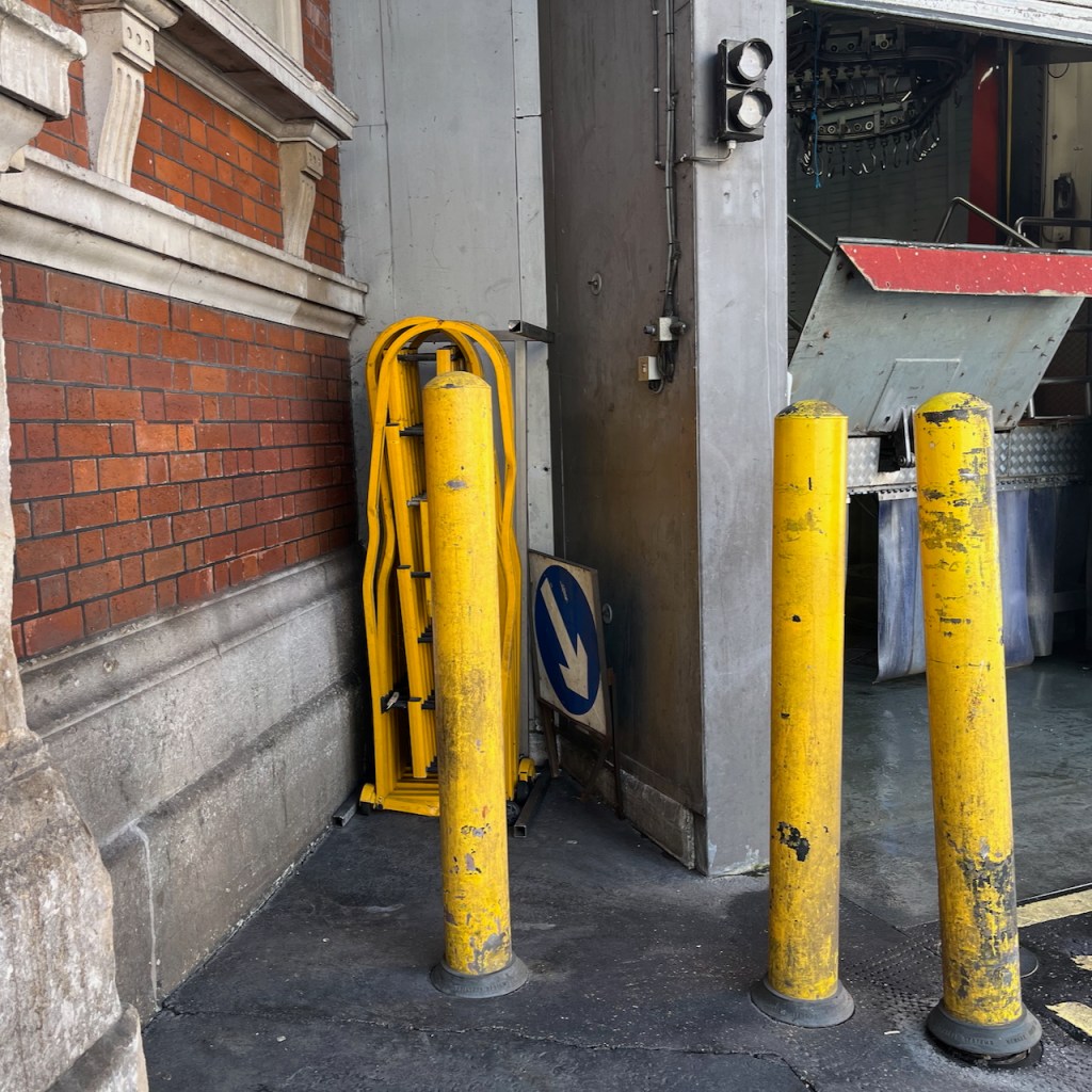
38 Charterhouse Street, photoDrawing in progress on locationDetail of finished drawingThis was where I was standing to sketch, this area was cleaned with high-pressure water hoses.
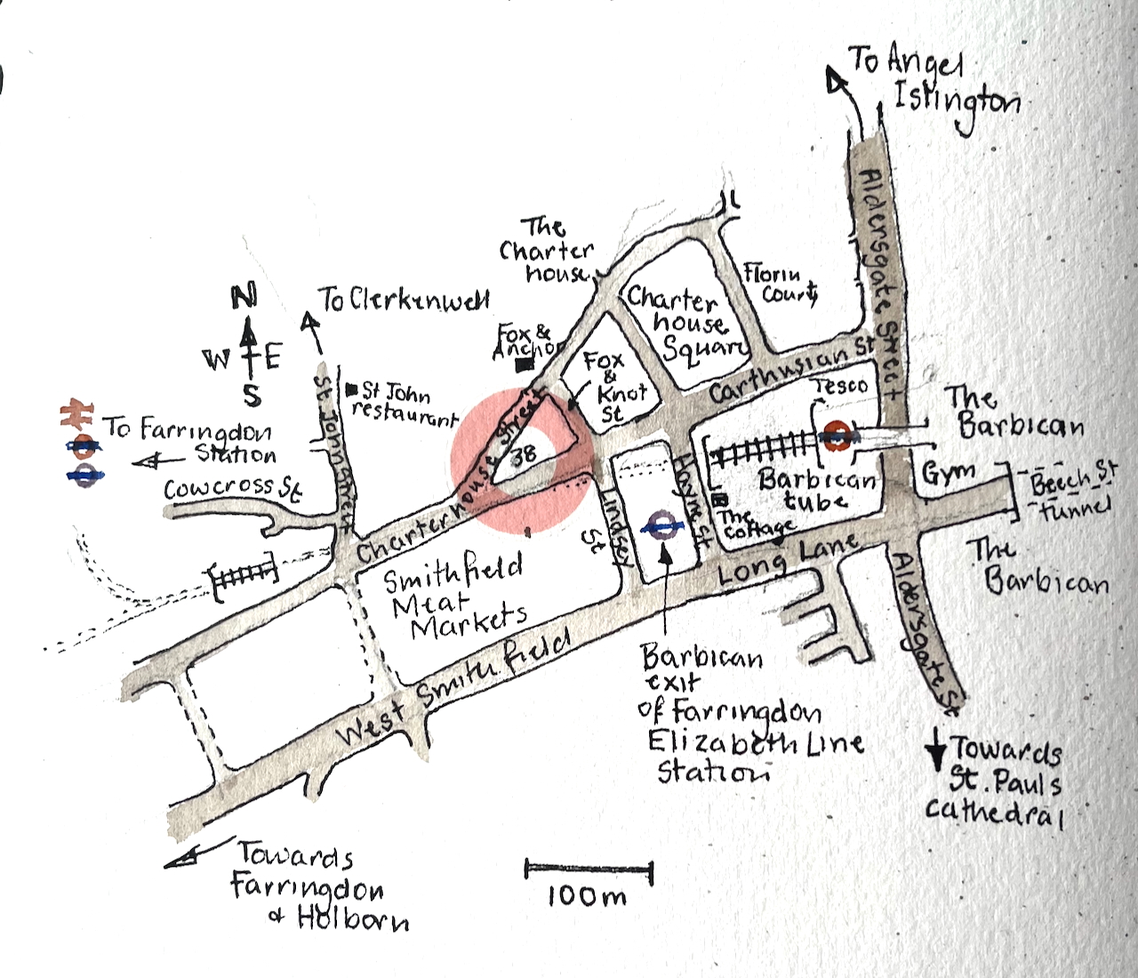
Here is a map.
As you see, number 38 stands on a little triangle of land, bounded by Charterhouse Street, Carthusian Street and the tiny alley called Fox and Knot Street.
British History Online offers some history for this triangular plot. In the 1860s the City of London redeveloped the Smithfield Meat Market. At the time it had been mostly an open-air market. The City turned it into the covered market it is today. The surrounding lanes and buildings were also affected, both by the redevelopment and the increased trade.
In 1869–70, with the new market building complete, it was resolved to take the new road along the north side of the market further east into the square itself, carried out in 1873–4. The road was called Charterhouse Street, apparently at the suggestion of the Charterhouse, Whereas in 1860 Charterhouse Lane enjoyed a mix of businesses, in 1876 half of the sixteen surviving houses were occupied by meat and poultry traders. The same trades dominated the new buildings put up, though there were also coffee rooms to rival the two remaining pubs and a large bank at the corner with St John Street. By the time of the Second World War most of the buildings west of the Fox and Anchor at No. 115 were purpose-built cold stores. Only with the decline of Smithfield Market did the grip of the meat trades loosen. Today restaurants and bars have largely supplanted them.
The Fox and Anchor pub and the former cold stores are on the left of my drawing. I’ve drawn the marvellous frontage of the Fox and Anchor here.
British History Online describes the block on the corner, number 38:
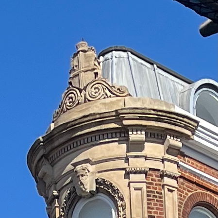
The City of London arms on the building today.
The remnant of ground at the angle between the old and new roads was laid out for a small block of buildings and allotted the numbers 38–42 (even) Charterhouse Street, behind which a tiny street, Fox and Knot Street, was cut through in 1871. The name was taken from Fox and Knot Yard, a court obliterated by the new market.
The small triangular block west of Fox and Knot Street […] just within the City boundary, belongs to the land acquired by the Corporation of London in the 1860s for the Smithfield Market development. Set out for building in 1871–2, it remained empty until 1875–6. At the apex a warehouse (No. 38), was then built for Myer and Nathan Salaman, ostrich-feather merchants, to designs by Benjamin Tabberer. […] It is four storeys high, of red brick with regular fenestration; all the ornamentation is concentrated on the narrow corner. For many years there were coffee-rooms here.
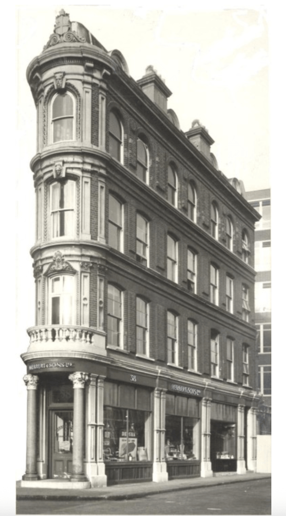
So, in 1875 it was an ostrich-feather warehouse, which must have been a great place to visit. The next mention of the building is on the website of Herbert, a present-day supplier of technology to retail businesses. They have a section of their website devoted to their long history. In the early twentieth century they were supplying weighing machines and balances from their offices in West Smithfield and a factory in Edmonton.
Herbert and Son moved out in 1956 and consolidated their operations into their Edmonton site. Since then, the building has been a coffee house, and, more recently, various bars. It is now the “Smithfield Tap”.