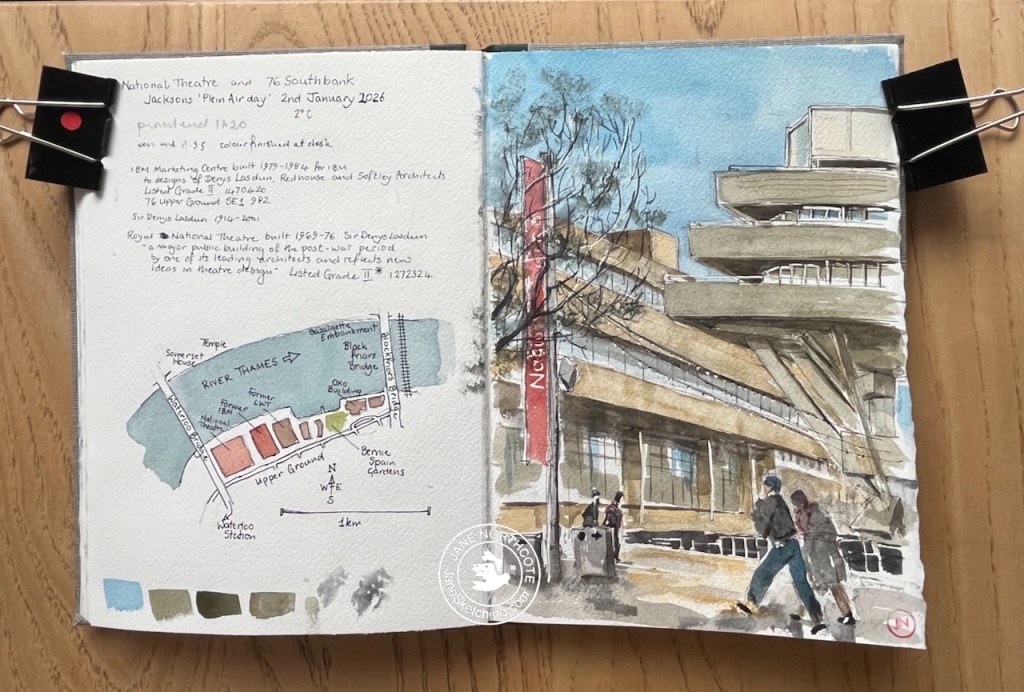
On the 2nd January I joined a group of other artists sketching on London’s South Bank. This was an event organised by Jackson’s Art Supplies of Dalston.
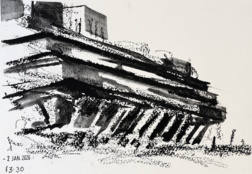
The first picture I attempted was of the National Theatre.
Sketching the National Theatre – 2nd January 2026
It was extremely cold and there was an unforgiving wind.
I managed to finish the pen-and-ink but at this point I abandoned the idea of putting the watercolour on the picture, and hurried into the National Theatre to thaw out. The staff there patiently inspected my bag of art equipment. In the café I found a group of other artists from the event, drinking coffee, testing the operation of their fingers and talking about art materials.
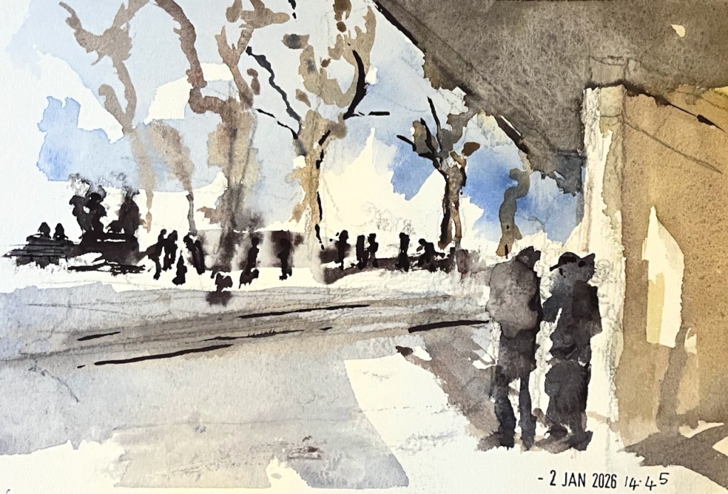
Coffee and company warmed me up. I decided to try simpler drawings using big crayons that I could wield in gloves. Here’s a flick through the sketchbook:
South Bank sketchbook flick-through
The black marks are made with a Derwent “inktense” stick. These sticks make charcoal-like marks, which you can then darken or spread out with water.
The National Theatre – inktense stick on Arches cold-pressed paper
Here’s my last picture of the day. I was determined to use the watercolours, and found a spot where the wind was attenuated by a concrete wall.
At 3pm we all congregated and shared our pictures. I was really impressed at how many of us had persisted, in the cold, right to the end of the event, and at the wonderful work everyone had done. I mean, doing anything at that temperature was an achievement, I thought. You can see a picture of the assembled participants in the Jackson’s newsletter on this link.
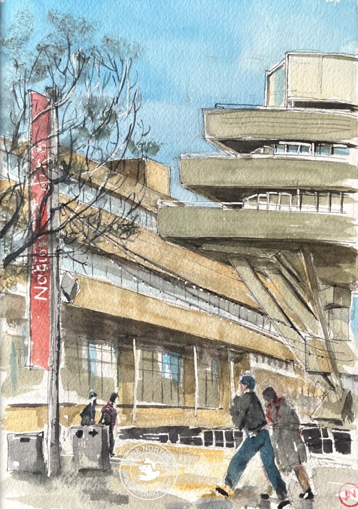
Later, at home in the warm, I added the watercolour to my initial sketch of the National Theatre.
National Theatre and 76 South Bank – 2nd January 2026 in sketchbook 16
It was an inspiring day out. Thank you to the Jackson’s team for the initiative and the organisation. And thanks to the wonderful National Theatre for the warm and welcoming spaces, the café, and the toilets…..!
Click a button below to share this post online, email it, or print it:
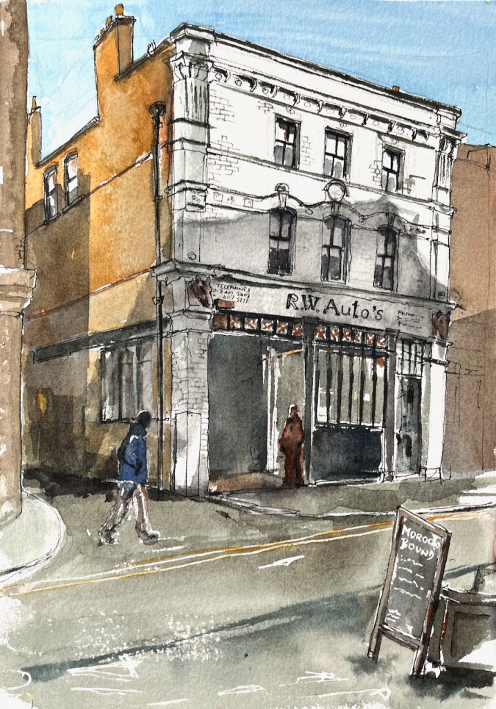
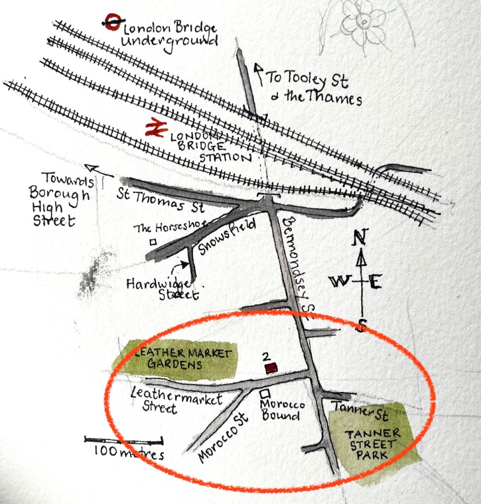
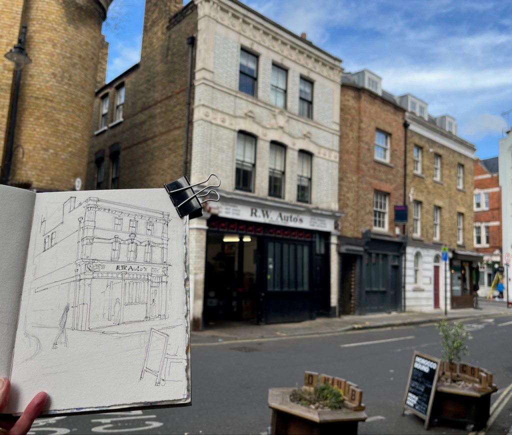
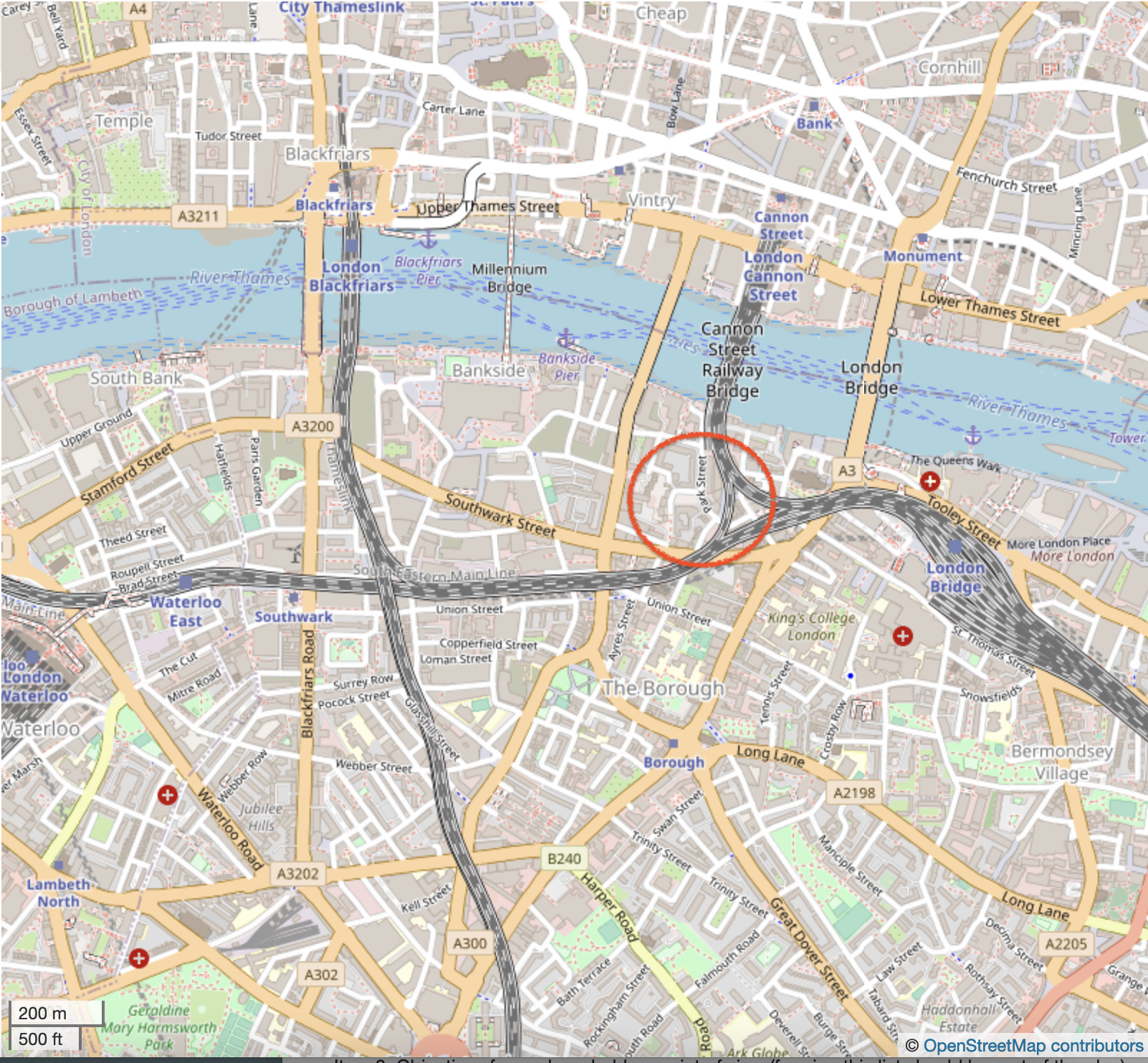
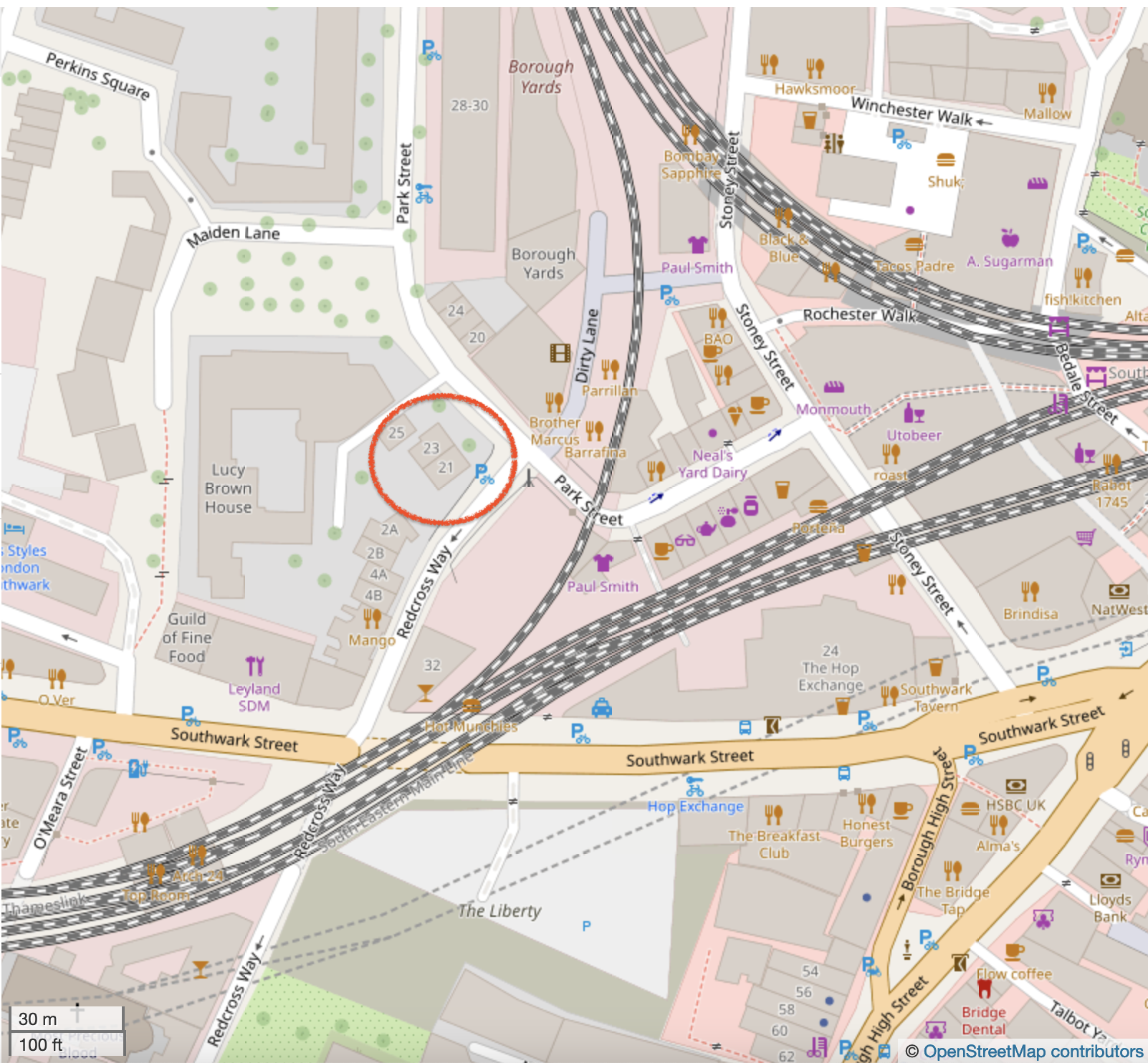
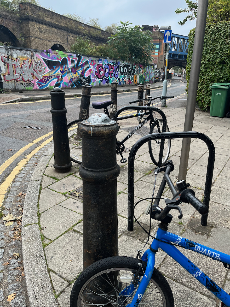
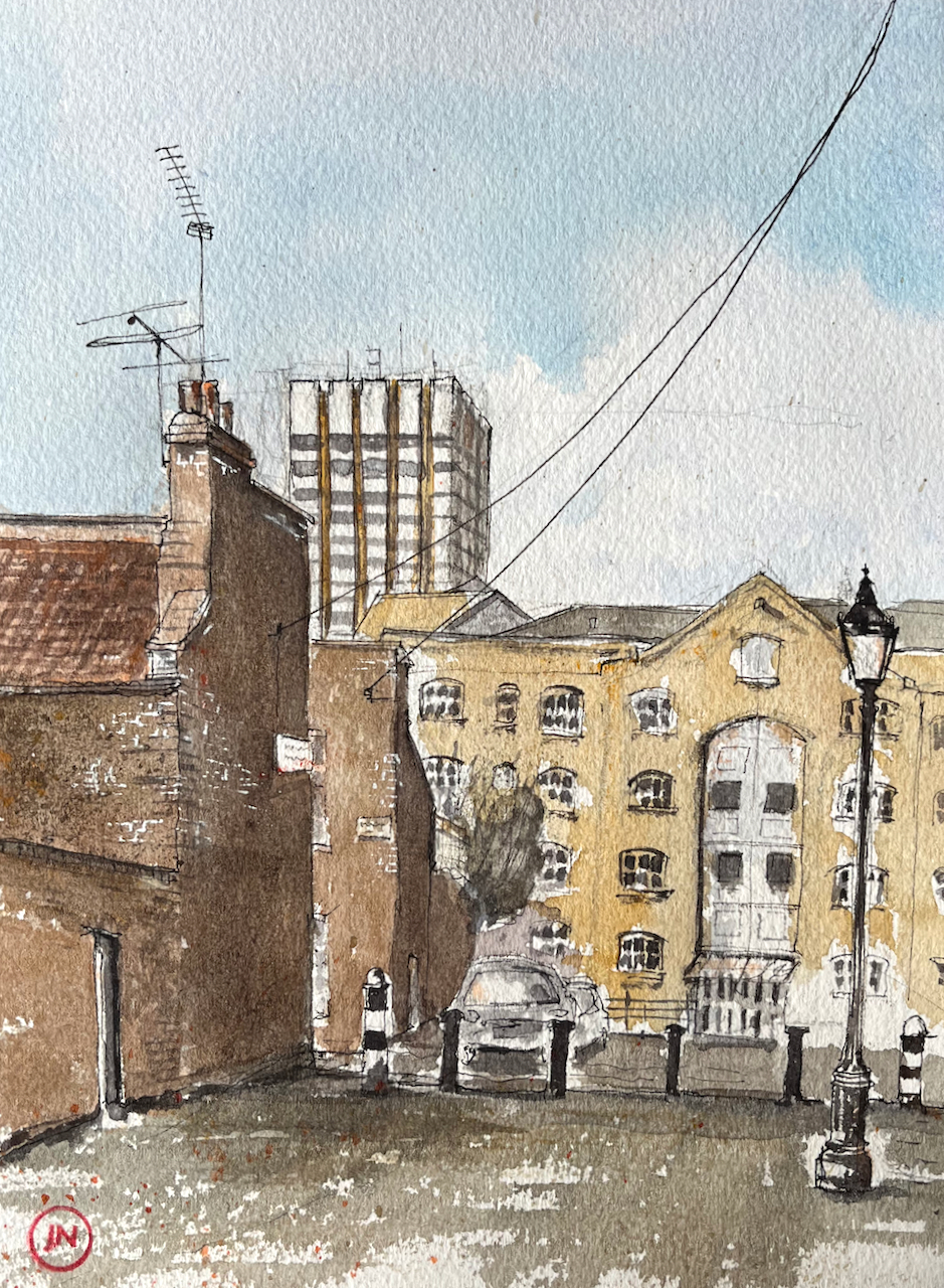
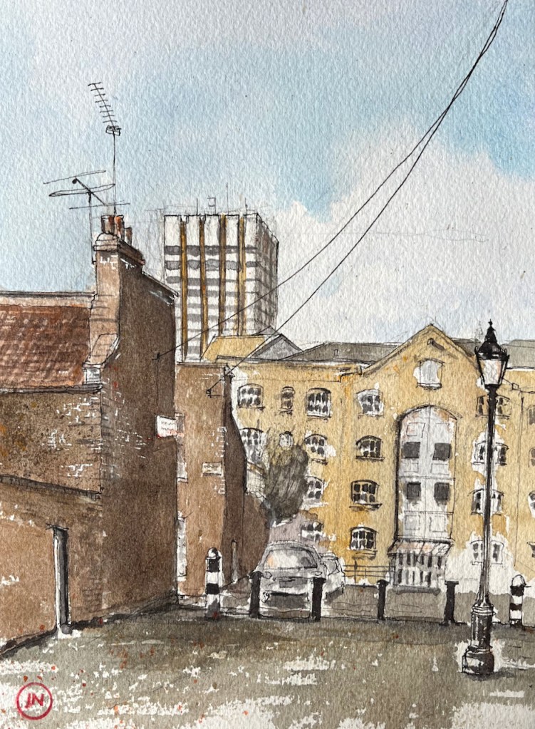
Bermondsey is an area of London just to the south of London Bridge. I had tea at the bookshop and café called “Morocco Bound”. From a table outside Morocco Bound, I sketched the building opposite.
2 Morocco Street, sketched from “Morocco Bound”, 18th October 2024, 2pm in Sketchbook 15
As you see, on the ground floor there is a motor repair shop, “R.W. Auto’s”.
RW Autos is Southwark’s top garage offering a range of car services including MOT’s, repairs and servicing. Our Southwark garage has been established since 1969 and serves a plethora of private and corporate clients. Our team provide you with a friendly, reliable, personal, efficient, and affordable service.
The names of the streets round here indicate the historic industry of the area: tanning and leather making: Leathermarket Street, Tanner Street, Morocco Street.
A 1967 Webster’s dictionary, morocco bound. Source: for sale on James Cummins bookseller website (30 Oct 2024)
I was sketching on Morocco Street. Morocco is a type of soft leather. It is used for gloves and wallets, for example. It is also used for book bindings, hence the name of the café: ‘Morocco Bound”. According to the “Medieval and Early Modern Orients (MEMOs)” scholarly site1, Morocco leather was originally “a kind of extremely fine, soft, hard-wearing, and richly dyed sumac-tanned goatskin, originating in the Sokoto region of northern Nigeria, transported across the Sahara and exported to Europe by Maghrebi, particularly Moroccan, merchants.”. This was in the 16th and 17th centuries.
This luxury product was greatly imitated over the following years, so that “by the turn of the nineteenth century, nearly all obvious distinctions between imported and locally produced morocco leather had been erased, and to many modern curators, ‘morocco’ refers either to the distinctive grain, or simply to goat leather bindings, whatever their origin.”
Books are still bound in “morocco leather” today.
The phrase “Morocco bound” occurs in a song from the 1942 film “Road to Morocco” with Bing Crosby, Bob Hope and Dorothy Lamour. Here is an extract:
We may run into villains but we're not afraid to roam
Because we read the story and we end up safe at home
Certainly do get around
Like Webster's Dictionary we're Morocco bound

We certainly do get around
Like a complete set of Shakespeare that you get
In the corner drugstore for a dollar ninety-eight
We're Morocco bound

Or, like a volume of Omar Khayyam that you buy in the
Department store at Christmas time for your cousin Julia
We're Morocco bound....
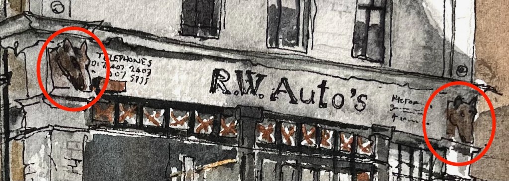
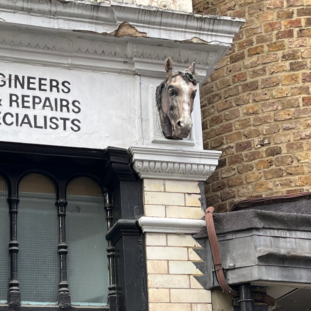
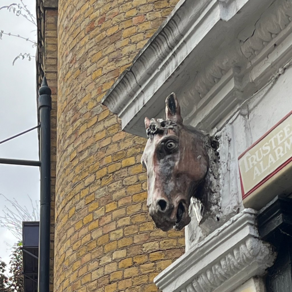
It was only when I started looking at the building carefully that I noticed the horses’ heads. It turns out these are a bit of a mystery.
The mystery of the Horses’ Heads
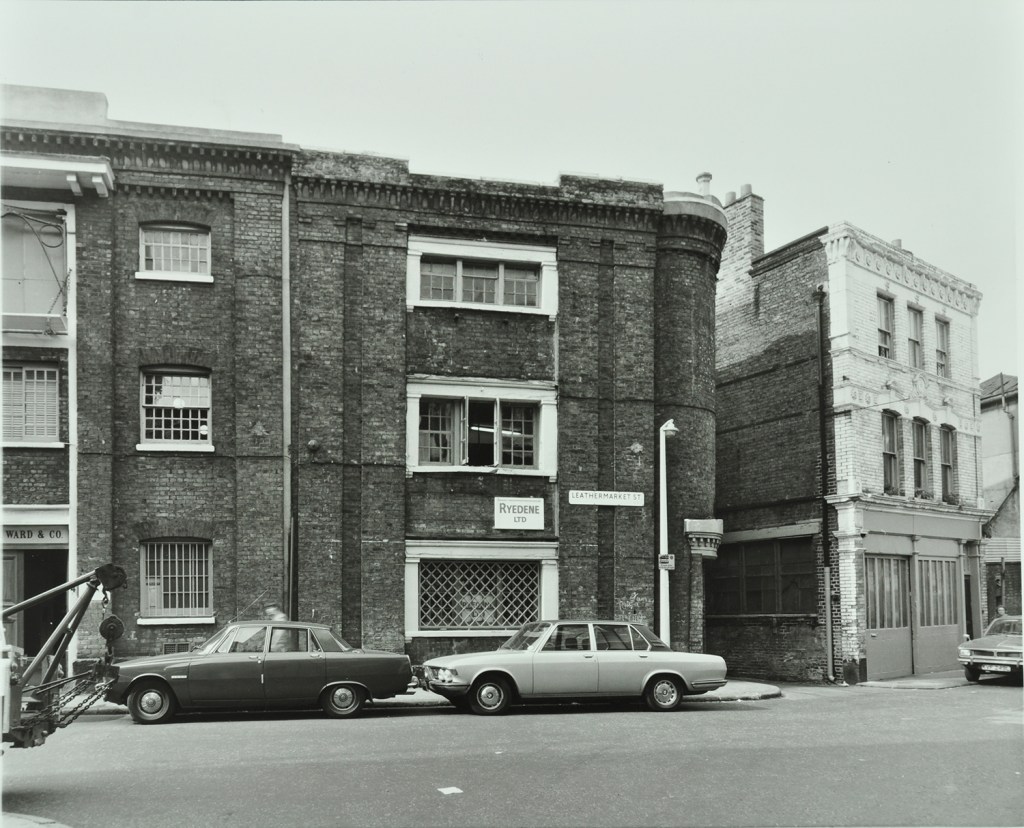
I found this 1976 photo in the London Picture Archives, reproduced here with permission:
You see Number 2 on the right of the photo, looking very much as it does today. Except that there are no horses’ heads. When did they appear?
Various websites2 suggest that Number 2 Morocco Street was “once a smithy”. If this was a smithy with horses’ heads in (say) the early twentieth century, then someone removed them before the photo was taken in 1976, and has put them back some time afterwards. Or the building became a smithy after 1976, in which case it must have been one of the very few left in London at that time. Or the horses’ heads are a recent decorative addition and not related to the original purpose of the building atall. It’s a mystery. Next time I am in the area I will go and enquire at R.W. Auto’s.
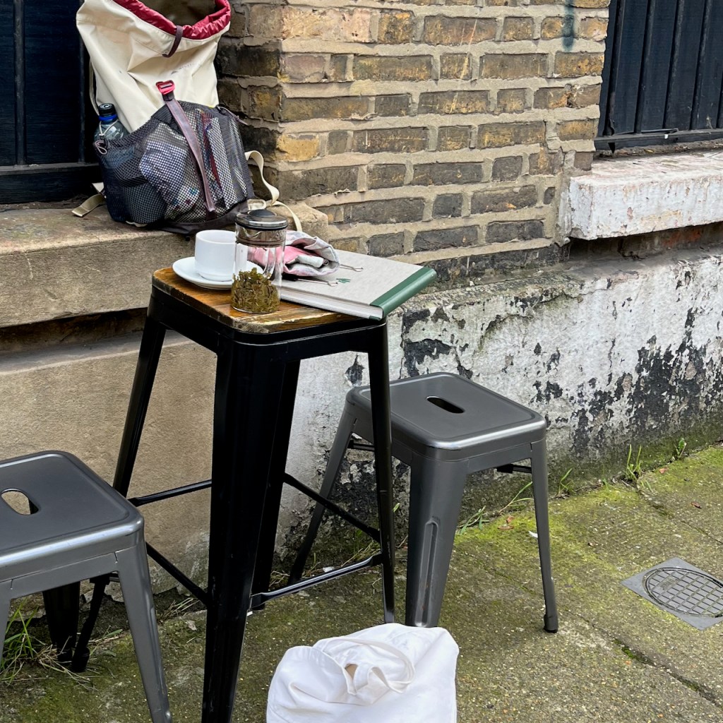
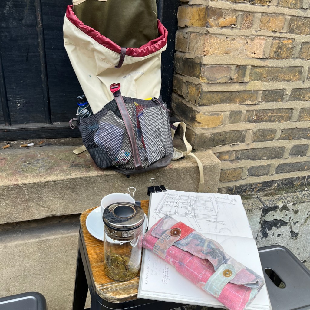
Photos of work in progress on the drawing, and the mysterious horses’ heads.
Medieval and Early Modern Orients (MEMOs) is an AHRC-funded decolonial project that seeks to further knowledge and understanding of the early interactions between England and the Islamic Worlds. AHRC is the Arts and Humanities Research Council. The quotations come from an article on their site entitled “Morocco Leather and Material Understandings of the Maghreb in Early Modern Britain” dated 14 November 2022 on this link: https://memorients.com/articles/morocco-leather-and-material-understandings-of-the-maghreb-in-early-modern-britain↩︎
Various websites suggest that this building was once a smithy. Here are the links: Layers of London:https://www.layersoflondon.org/map/records/morocco-street. “2a R.W.Autos with horses heads was a smithy/farrier” Bermondsey Boy:http://www.bermondseyboy.net/viewtopic.php?t=260. This website includes a photo from 2015 – with horses heads, and the commentary. “RW AUTO’S The two horse heads above the front of this garage workshop are the last clue that is was once a smithy – a blacksmiths.” This website also includes a 1968 photo which has no horses heads. ↩︎
Sketchbook 15 page spread
Click a button below to share this post online, email it, or print it:
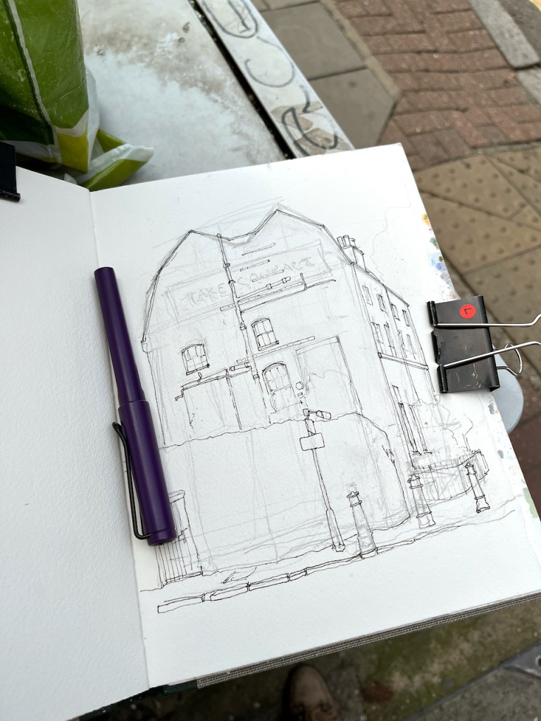
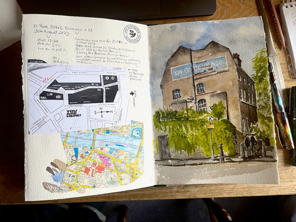
I enjoy the marvellous trigonometry of this roof, and the encouraging slogan on the wall.
21 and 23 Park Street, Borough, Southwark, London SE1. Sketched 30th August 2023, 2pm.
The slogan is for a brewery, Courage. This house was built in 1820 for the managers of the Anchor Brewery, then on this site. The Anchor pub is on the river Thames nearby.
Map from “Borough Yards” poster (rotated to put North at the top)
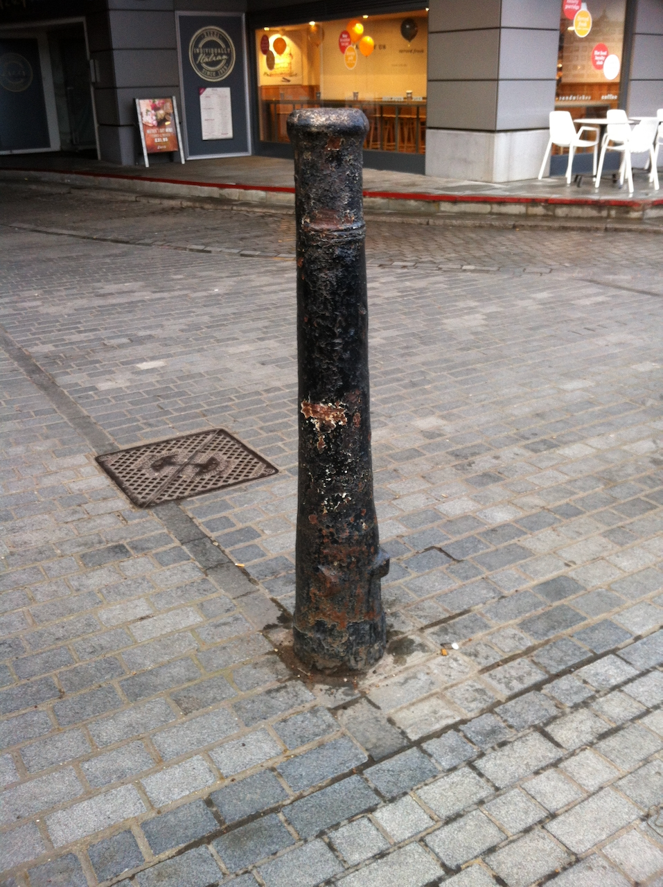
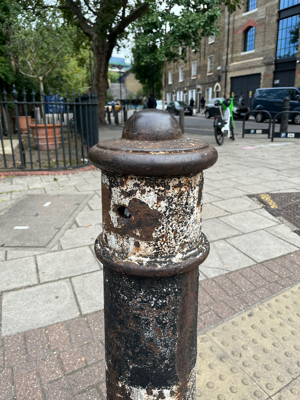
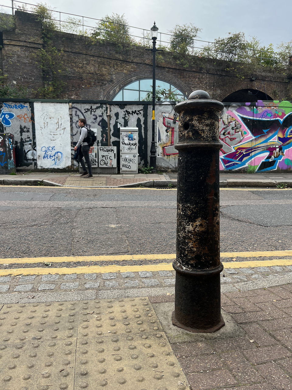
The building, and its cast iron railing, is listed Grade II, number 1385752. When I searched for the list entry in the Historic England register, I found, to my surprise, that the bollards in my picture have their own special listing, number 1385753 “
So I had to go back and have a closer look at them. Why were they listed? The list entry does not say. There are some bollards in London which are former cannon. It’s always a delight to discover them. They can be positively identified because you can see the indentation or hole near the base, which is where the gunpowder used to be poured in. Also they sometimes have protrusions about two-thirds down where they used to pivot on their gun-carriage. Sometimes the base is flattened on one side. Here are some examples of cannon (click the image to enlarge and see location):
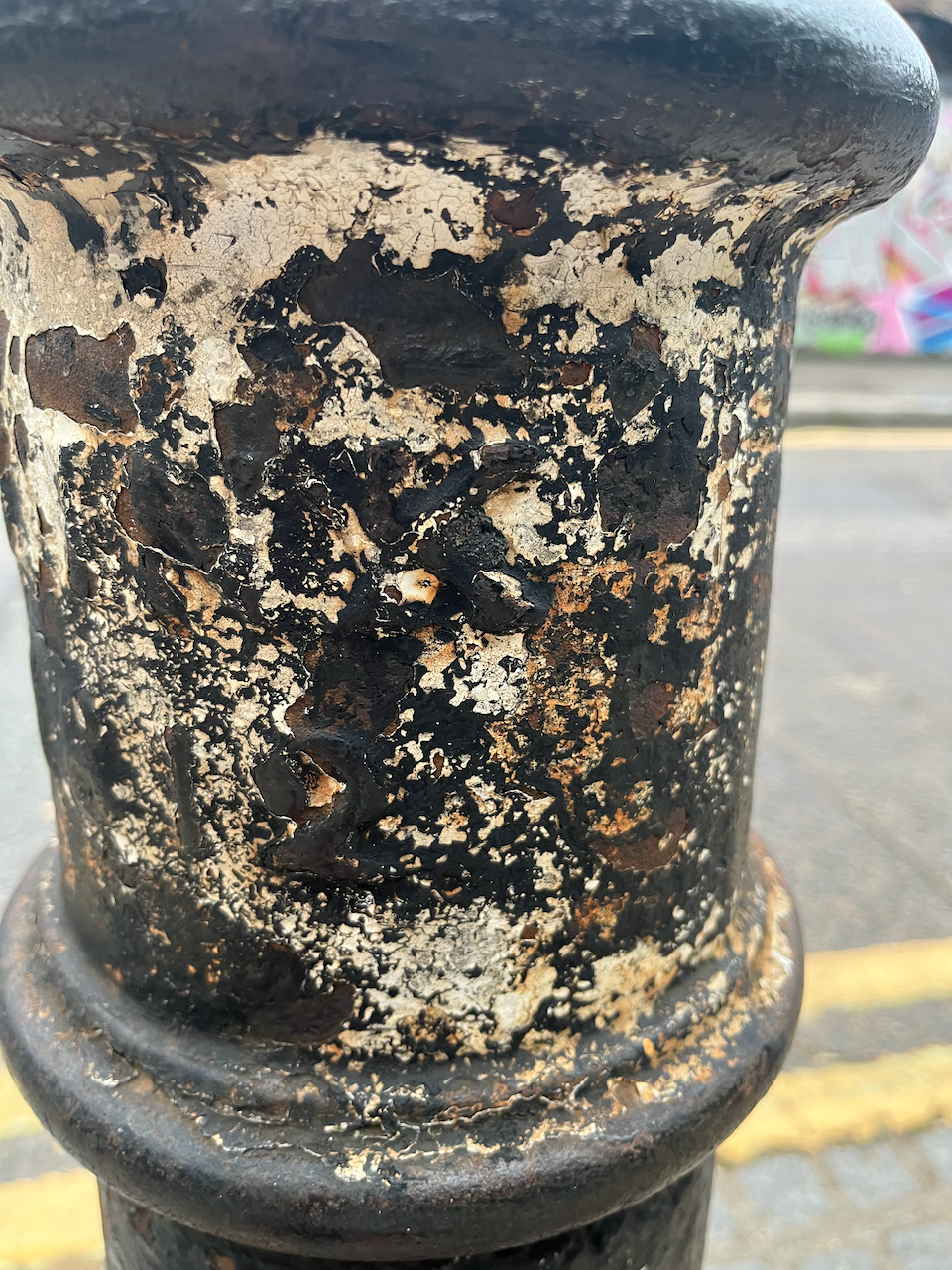
I was unable to find on these 21 Park Street bollards any characteristic which confirmed they might have been cannon. The listing says they are “canon posts” – “canon” spelt like that – not “cannon”. The words “CLINK 1812” were still just about visible on the bollard which is on the right in my drawing. Here are some photos of the posts outside 21 Park Street. Click to enlarge and see captions. Do you think they might be real cannon, or perhaps the word “canon” simply describes a design of post.
“Clink” was the name of the area, from about 1127. It was called the “Liberty of Clink”. The designation “Liberty” implied that it was a civic area under the jurisdiction of the local manor, rather than the King, or the City of London. Famously, certain activities, including theatres, which were forbidden in the City of London were permitted here. The Liberty of Clink was abolished in 1889 and amalgamated into the Southwark in the County of London.
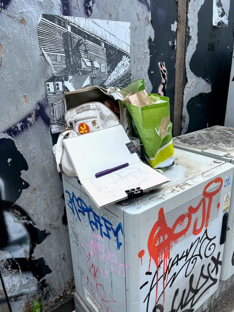
Here are some photos of work in progress on the drawing:
Drawing size 10″ x 8″ on Arches papers 300gsm NOT watercolour paper, in a sketchbook made by Wyvern Bindery.
Watercolours by Daniel Smith:
ultramarine blue
fired gold ochre
green gold
burnt umber
yellow line is naples yellow
All blacks and greys are Ultramarine Blue plus Burnt Umber
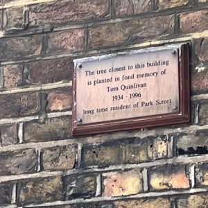
A notice on 21 Park Street reads:
The tree closest to this building
 is planted in fond memory of
Tom Quinlivan 1934-1996
long time resident of Park Street.
Click a button below to share this post online, email it, or print it:
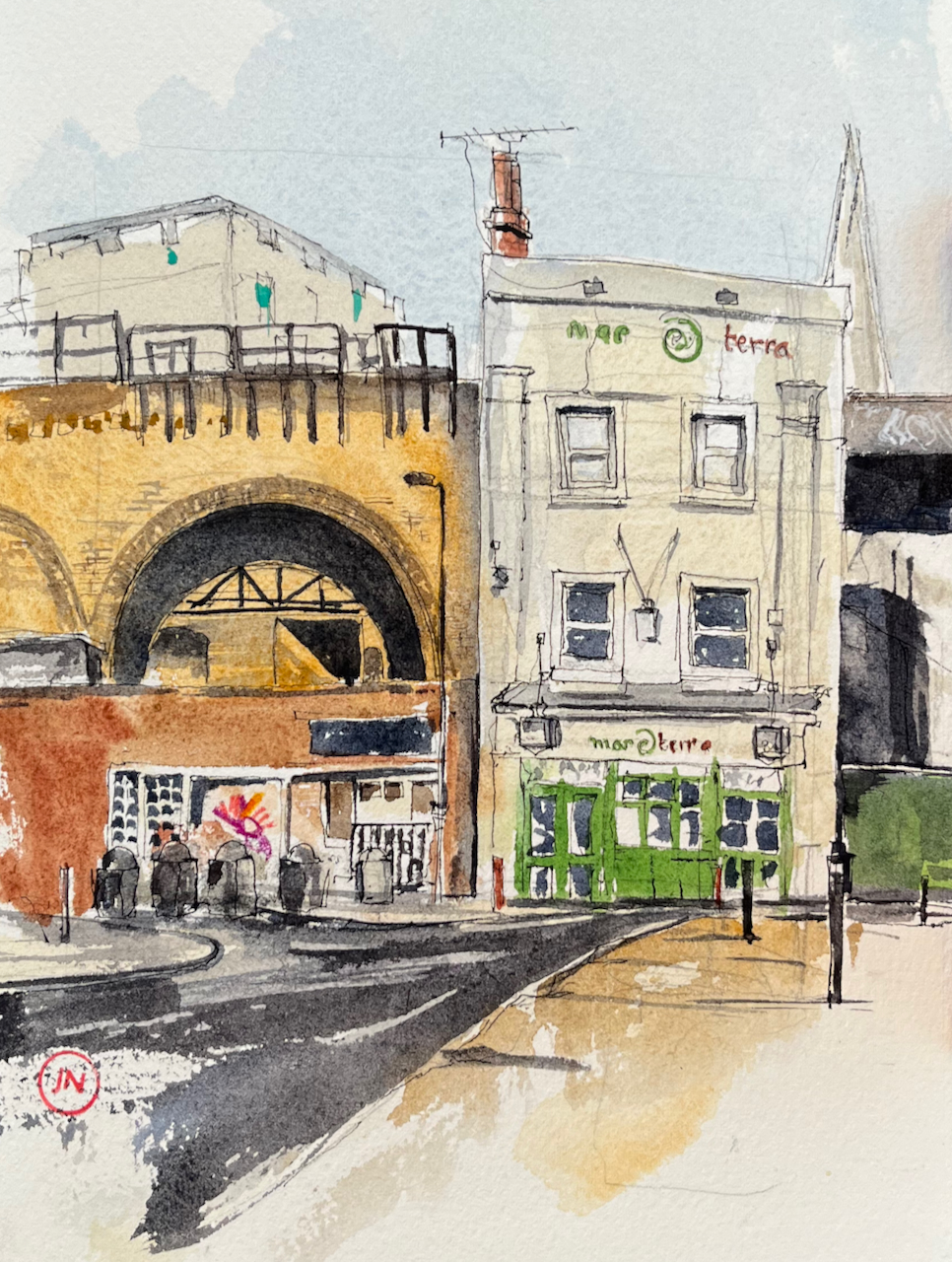
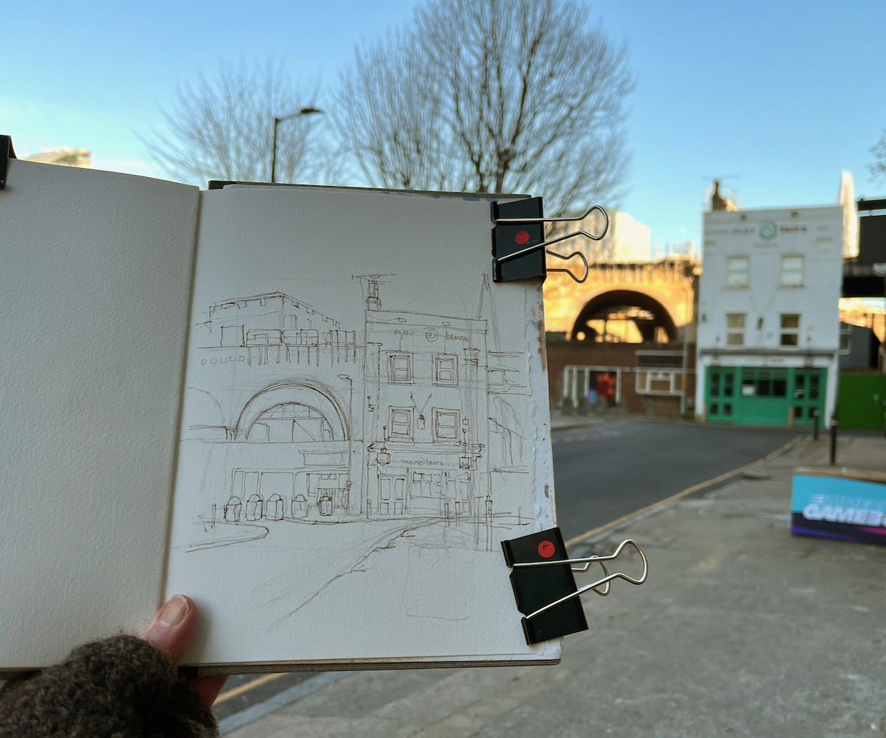
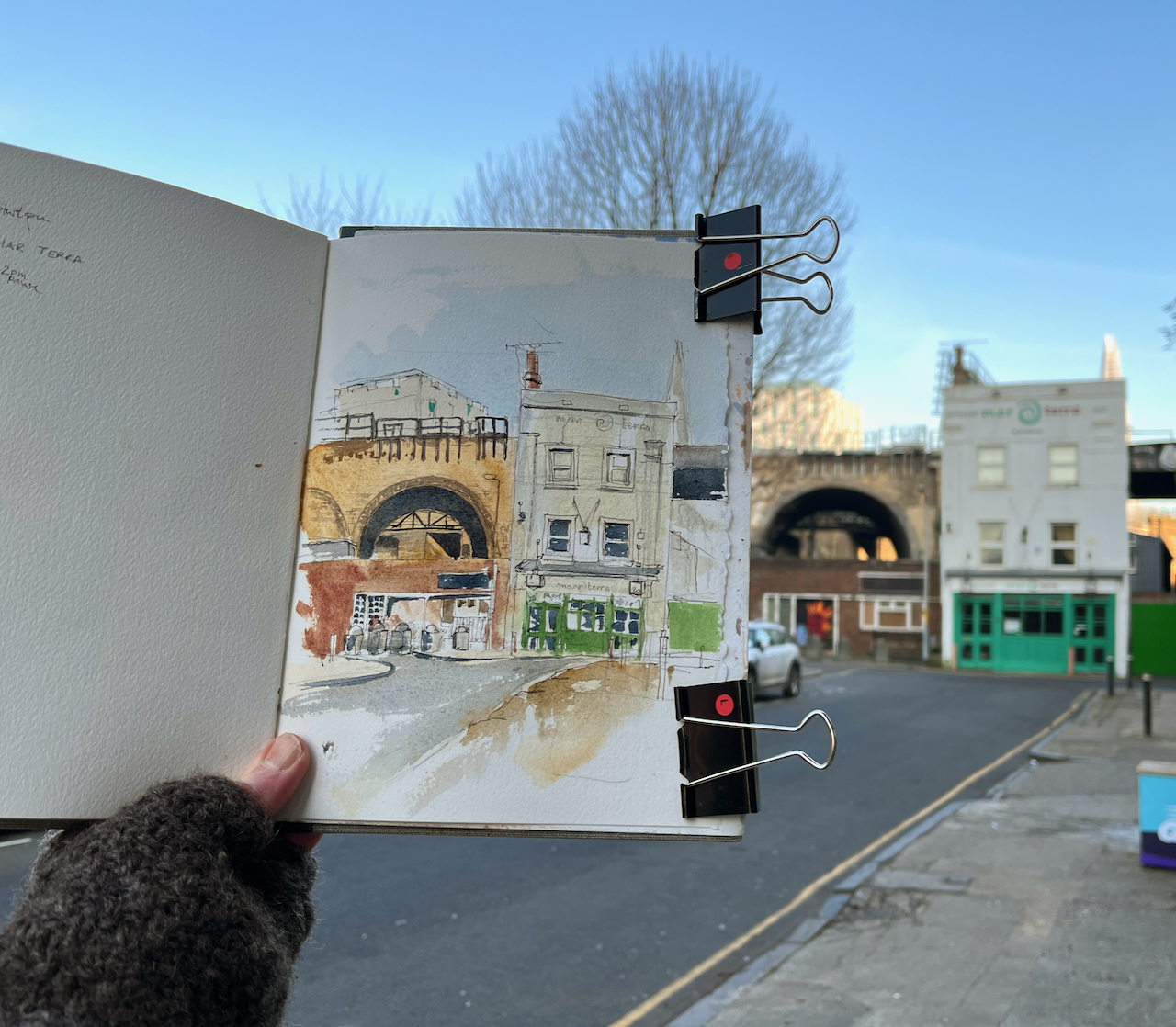
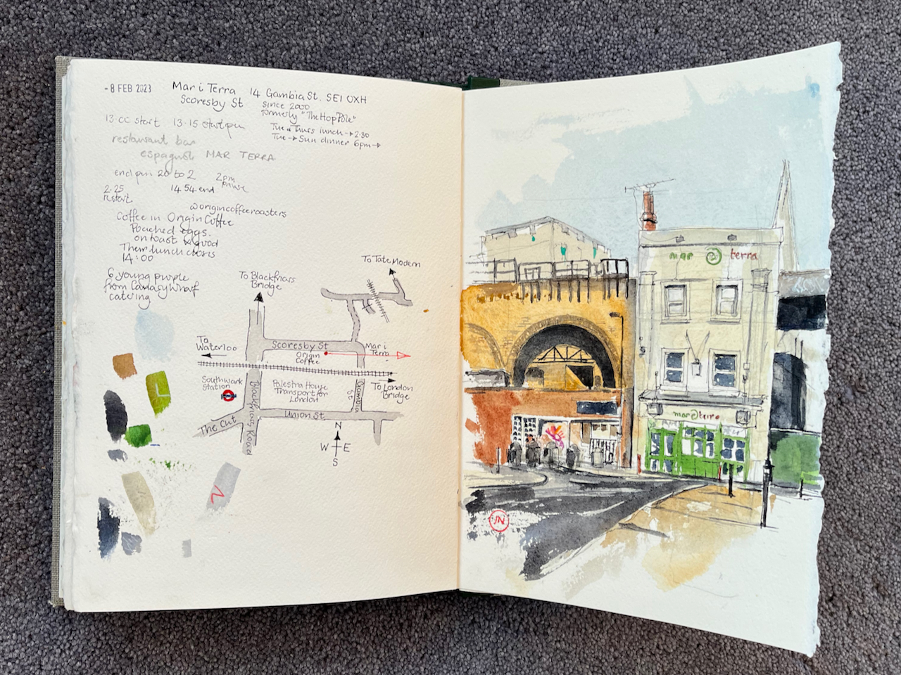
Here is the bar and tapas restaurant “Mar i Terra”, cosily tucked away in a back street near Southwark Station.
“Mar i Terra” Gambia Street SE1, sketched from Scoresby Street. 7″ x 9″ in Sketchbook 12.
There are magnificent Victorian railway arches looping all around, and 21st century buildings in the background, but this building stands defiantly, self-contained and functional.
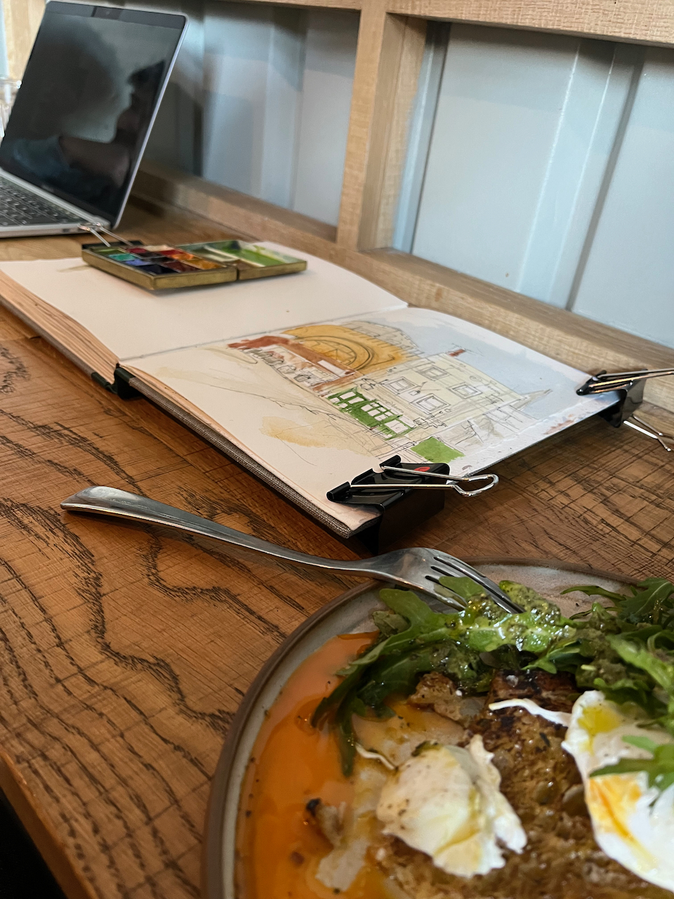
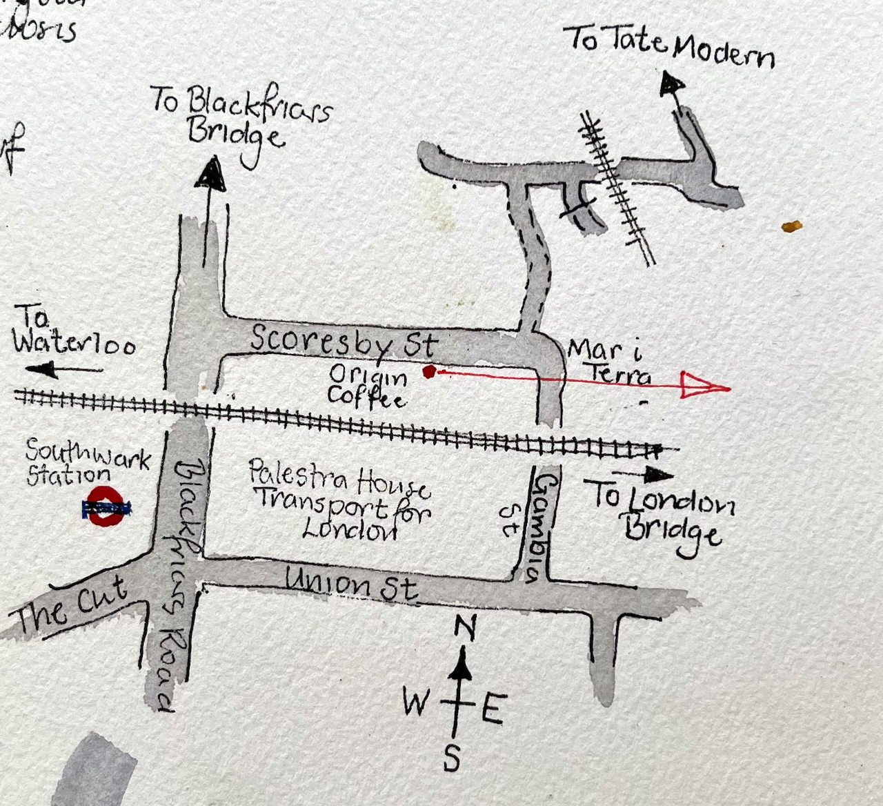
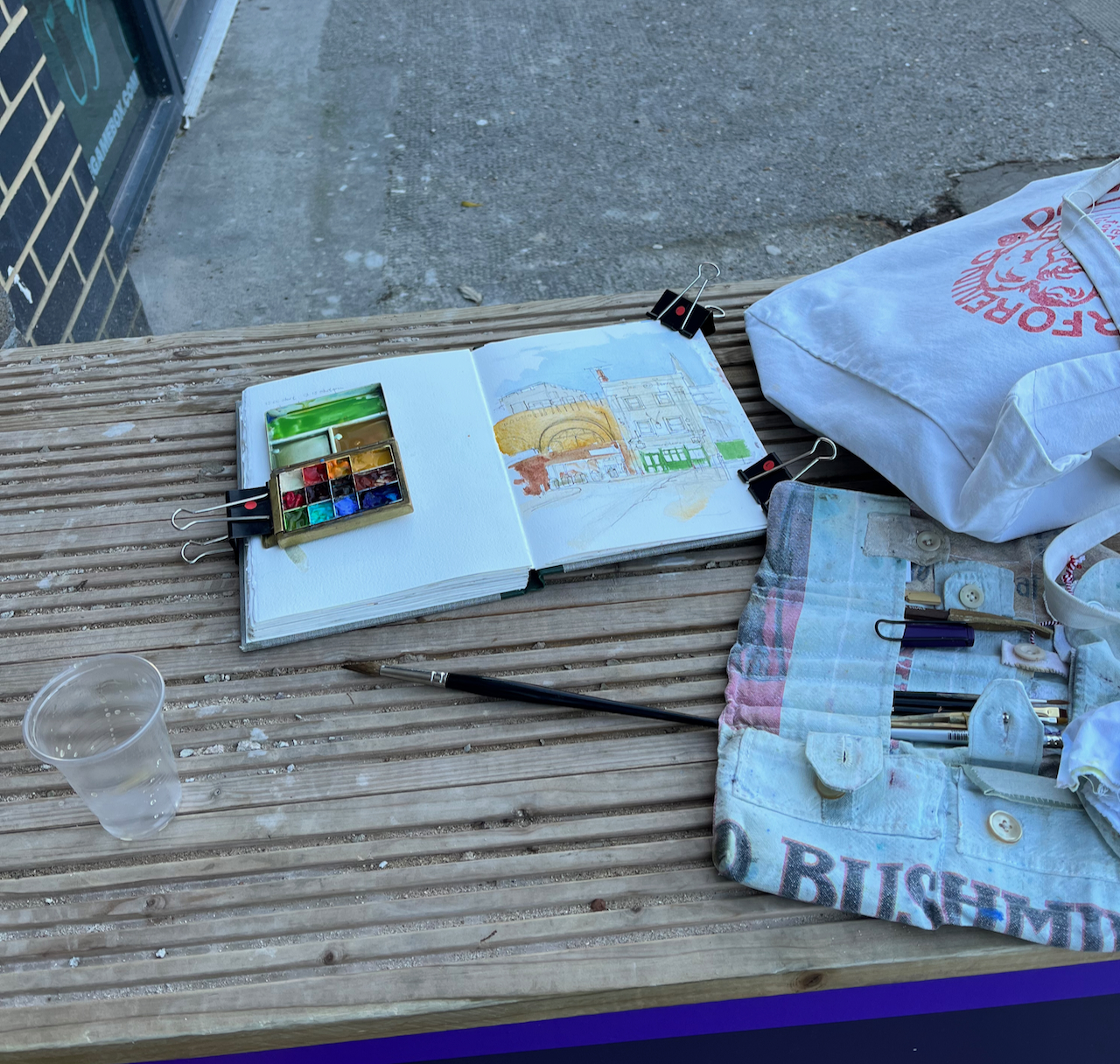
The restaurant is open Tuesday to Sunday for dinner. It also serves lunch on Tuesdays and Thursdays. I was sketching it on a Wednesday so I sought lunch elsewhere, and discovered the wonderful “Origin Coffee” in Scoresby Street.
Poached eggs on toast in Origin Coffee, while the first wash dries on the picture.Map showing location of the sketch
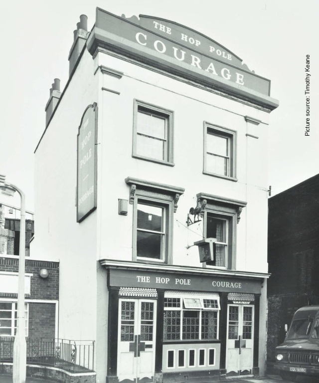
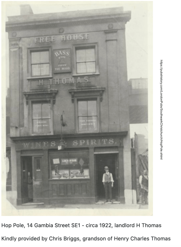
According to their website “Mar i Terra” has been serving the people of the neighbourhood since the year 2000. Up until 1999 this building was “The Hop Pole” pub.
According to the “Pub History” site, victuallers were recorded at this site in 1791. So it was a pub for nearly 200 years.
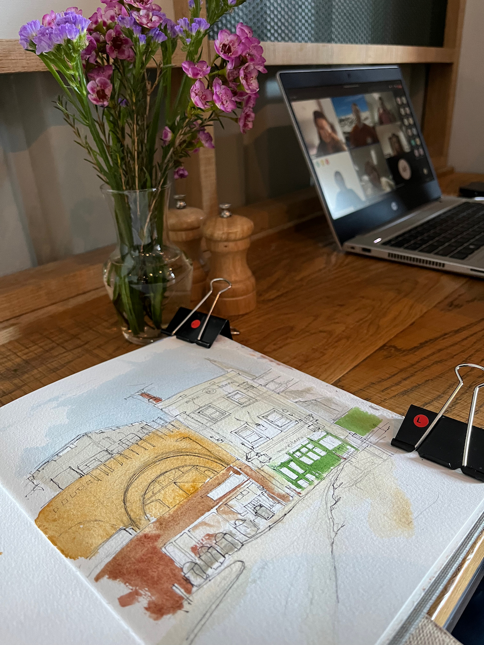
Here is work on progress on the drawing.
PenPainting on locationPaint drying in Origin coffeeSketchbook 12
Colours:
Sky: Ultramarine Blue and Cobalt teal blue
Brickwork: Mars Yellow with some Fired Gold Ochre
Greys and blacks: Ultramarine Blue and Burnt Umber
Green paintwork: Serpentine Genuine moderated with Cobalt Teal Blue
Graffiti added with a red crayon
Here’s an image from the Pub History website. I can just read that the notice on the big window says “Luncheon Room”. So the Mar i Terra continues the tradition, on Tuesdays and Thursdays. The railway bridge behind, on the right of the photo, is still there, too, as well as many of the features of the front of the pub. Amazingly, the door layout seems to have endured. Is that Mrs H Thomas standing behind the door on the left?
Click a button below to share this post online, email it, or print it:
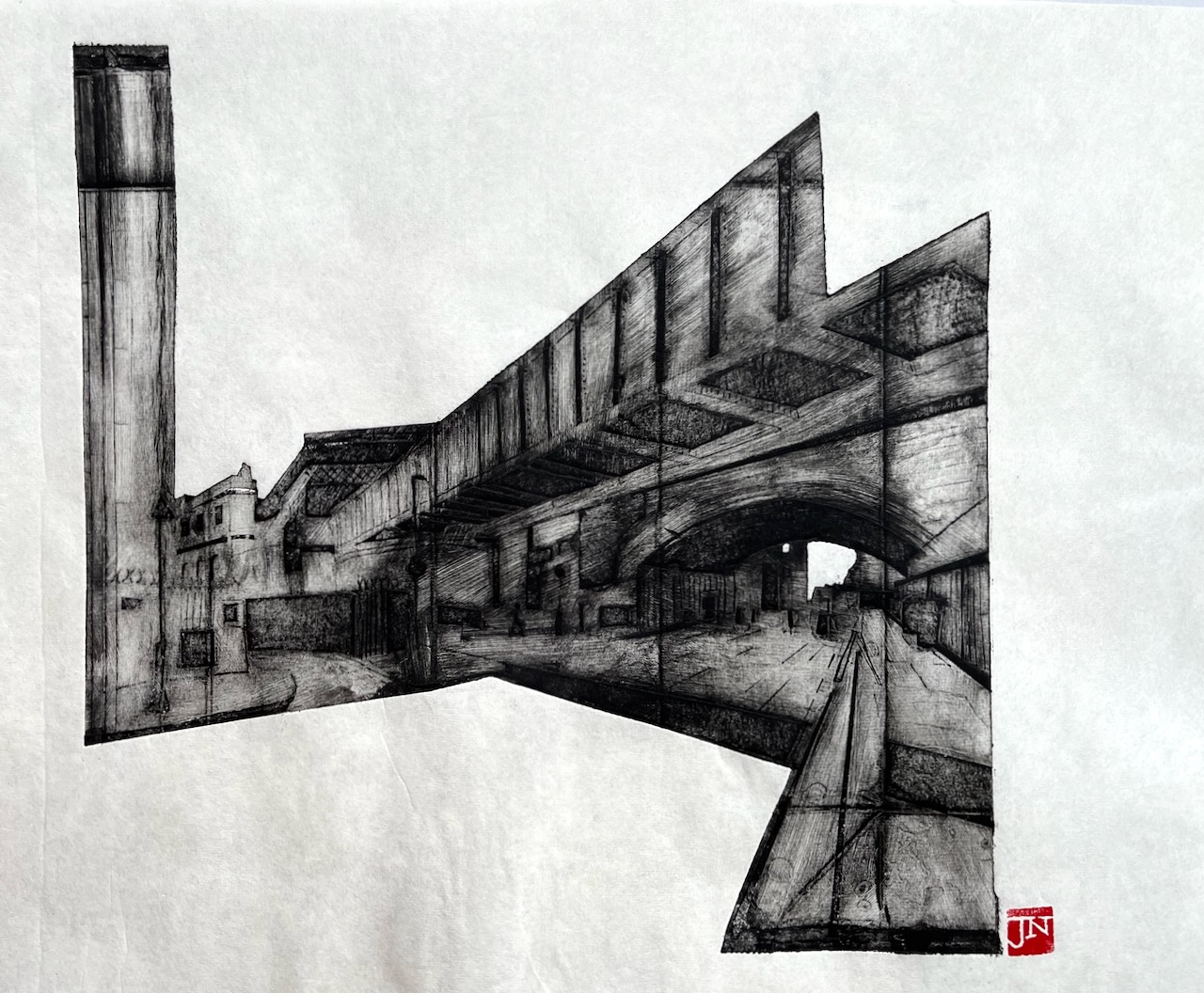
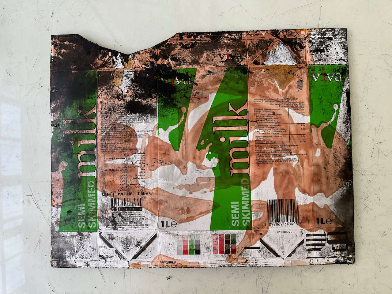
Here is another packaging print. This one shows Bridge ELR-XTD Structure 20 on Cornwall Road (N) between Charing Cross and Waterloo East, South East London. The road that leads off to the left is Sandell Street SE1. The road under the bridge is Cornwall Road.
The print is made using the intaglio process. The plate is a milk carton.
Railway bridge on Cornwall Road, SE1, Packaging print made on 3rd September 2022, about A3 size
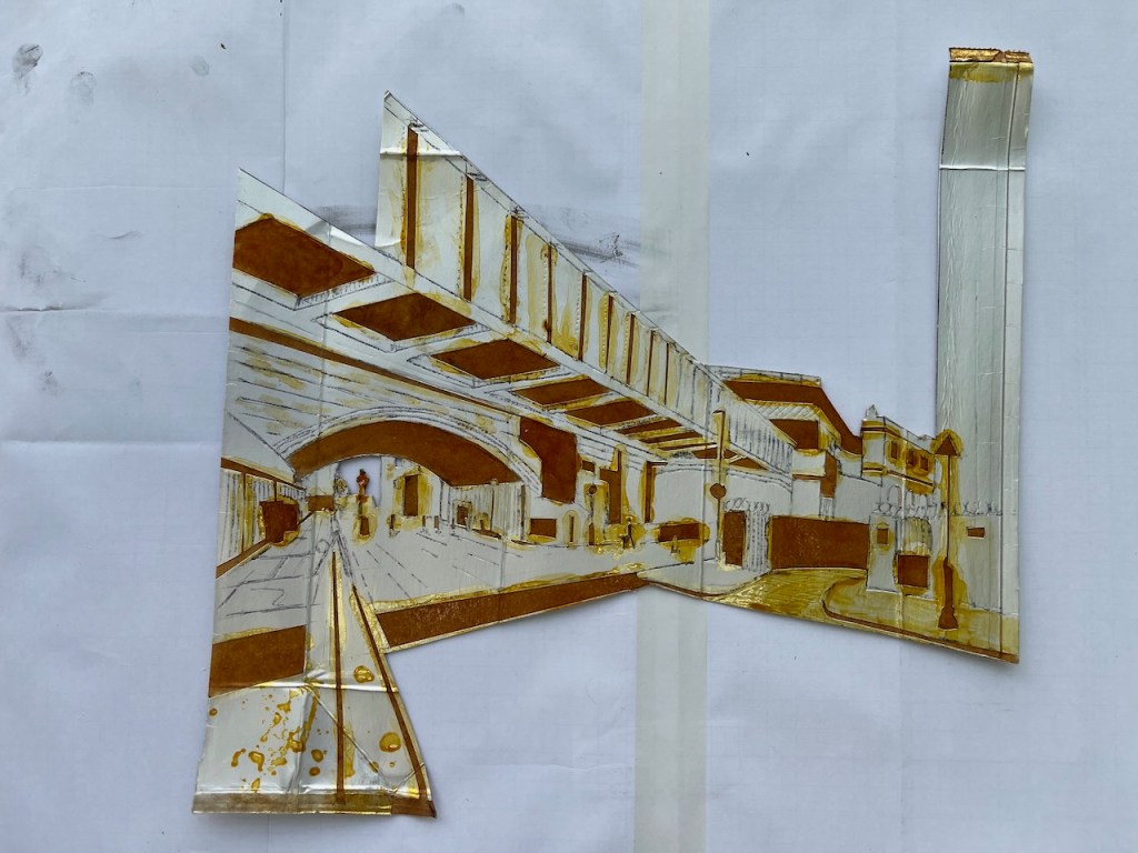
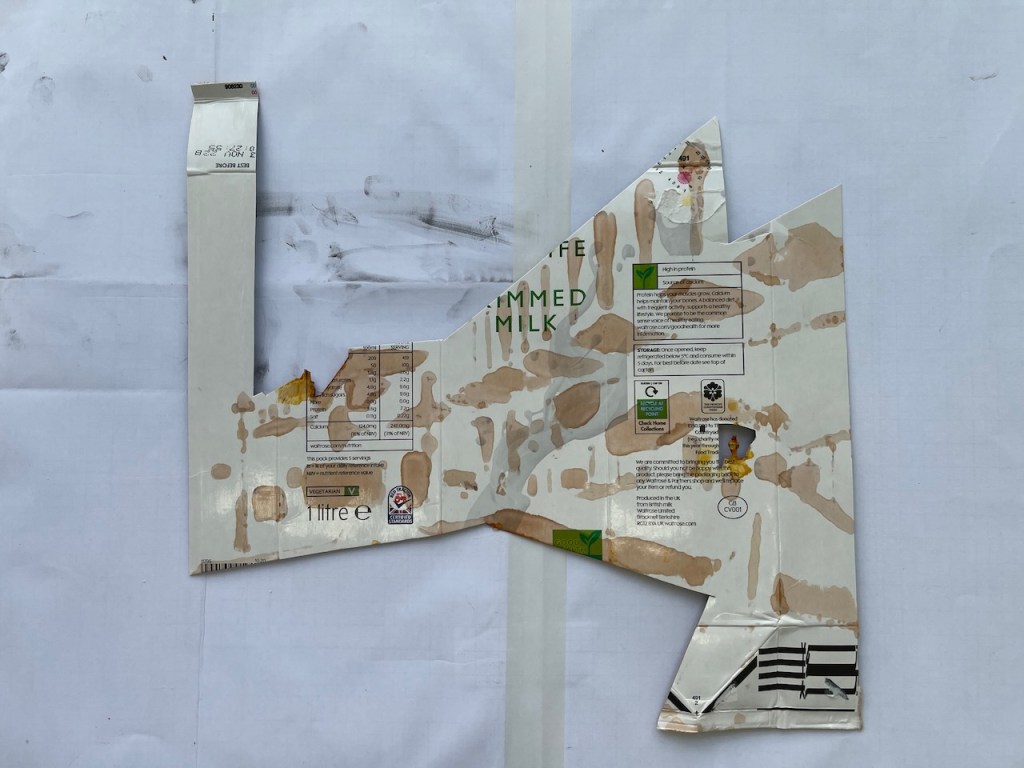
Here is the plate, front and back:
Plate: print sidePlate: back
The plate is made by peeling away the metallic substance inside the milk carton, then painting it with shellac to make it stronger. I describe the process in this post.
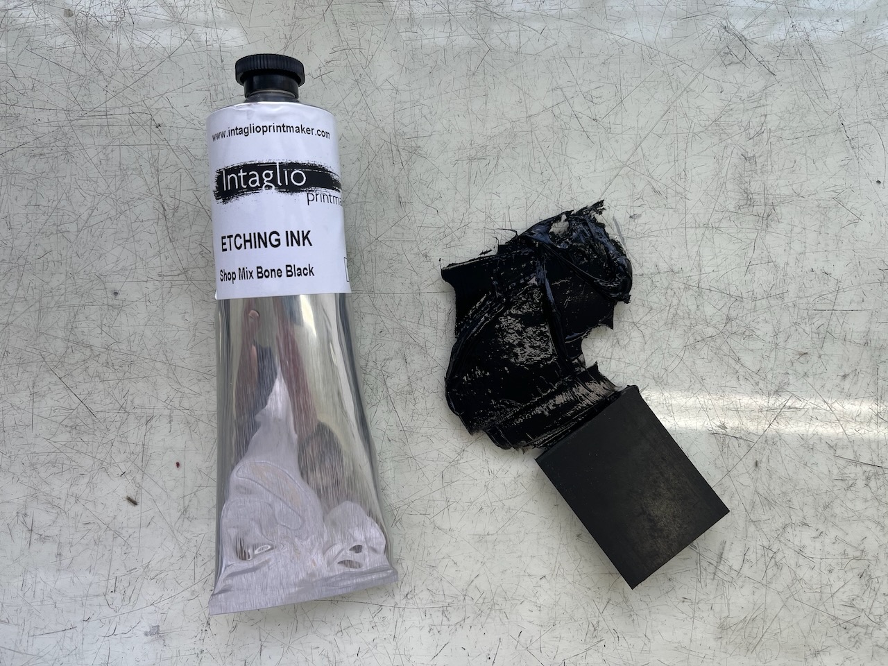
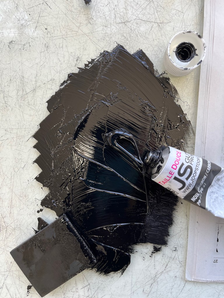
I used traditional etching ink, “Shop mix – Bone Black” from Intaglio Printmaker, whose shop, as it happens, is not far from this railway bridge.
Here’s a video of the print being peeled away:
Here is the print and the plate:
Plate (left) and print (right)
Print (left) and plate (right)
The plate made 8 prints.
Here is detail of the print:
For more of my prints made with packaging material, click on this link:
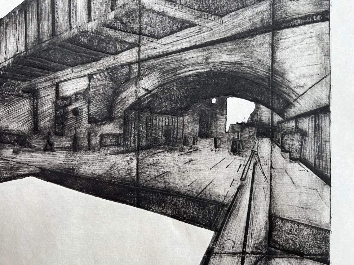
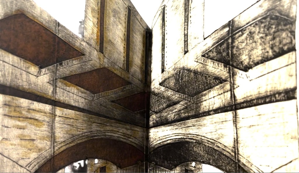
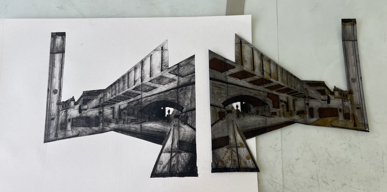
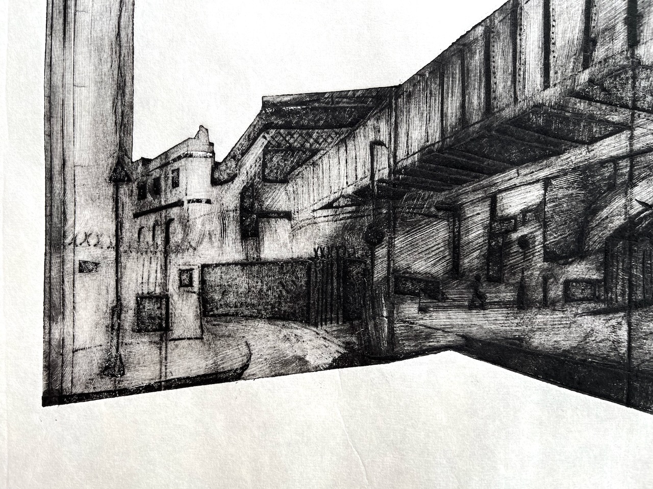
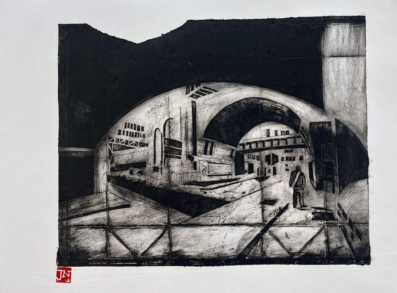
Huge brick arches carry the railway lines into Waterloo Station. Here is a view looking North up Great Suffolk Street.
Great Suffolk Street railway arch, monoprint #3 of 6. Printed image size 12″ x 9″. On Fabriano Unica paper, 20″ x14″
This is a packaging monoprint. It is an intaglio print from a “plate” made from a milk carton. Here is the plate:
Inked plate (front)Inked plate (back)
I’ve described the process in this blog post: Print plates made of packaging. The basic method is to use the shiny metallic surface inside the carton. I cut out the shapes I want and peel back the shiny surface to reveal a rougher surface which takes the ink. The yellow colour you see on the plate is shellac, a varnish that I paint on to make the plate last a little longer.
The plates are quite fragile, and can only make a limited number of prints. Here is number 6:
Great Suffolk Street railway arch, monoprint #6 of 6. Printed image size 12″ x 9″. On Agawami Washi Kitakata Japanese paper, 20″ x1 4″
I made all the prints on the Henderson press at East London Printmakers, Stepney. I used Chabonnel F66 traditional oil-based etching ink.
Click a button below to share this post online, email it, or print it:
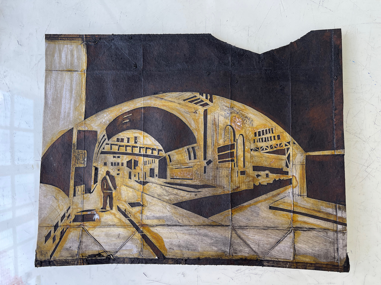
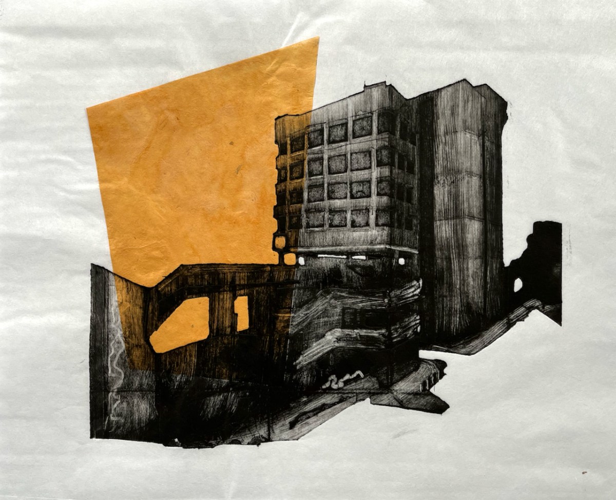
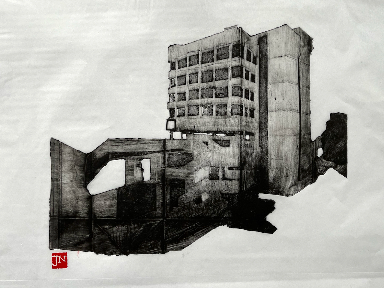
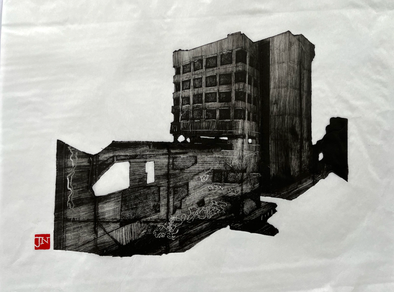
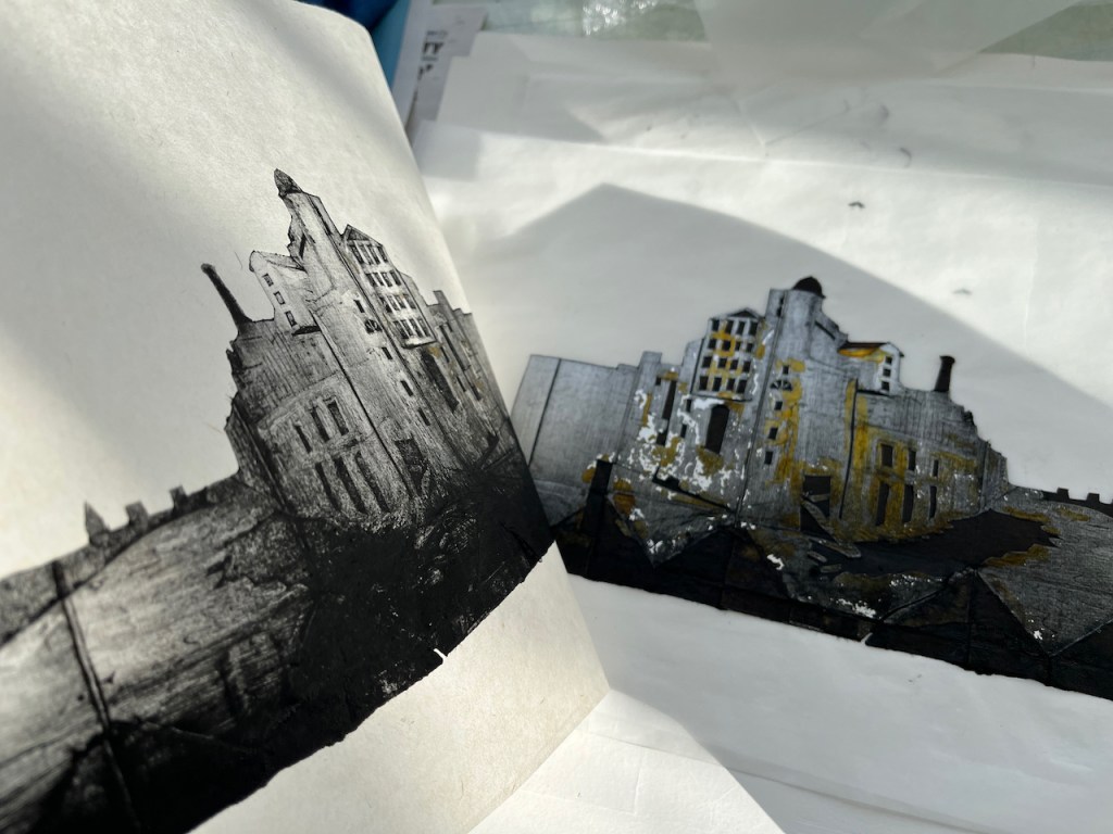
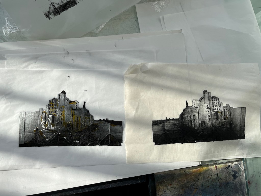
Colechurch House on the South Bank is a brutalist office block. It makes a good subject for a packaging print. Since it is a a 1960s block, I added a 1960s type shape in chine collé.
Colechurch House – monoprint and chine collé, paper size,15″ x 12″ Shoji Baku Japanese Paper
The chine collé paper is Khadi Lokta Coloured saffron washi paper from Atlantis Art (ref: KPNI SA). The background paper for this print is Shoji Baku paper from Shepherds Bookbinders (ref: LRG 1859). The ink is Charbonnel traditional etching ink. I printed this on the Henderson Press at East London Printmakers. Here is a video of the “print reveal” (17seconds, silent):
Thanks to Evonne at East London Printmakers for filming me!
Here are the other 4 prints from this plate. They are all on a different, but similar paper: Tosa Washi from Shepherds, (ref: J632180)
The print was based on a sketch of Colechurch House last year. See this post:
Aficionados of 20th Century brutalist architecture need to hasten to appreciate Colechurch House. It is due for demolition and redevelopment. This month’s post in the marvellous “London Inheritance” site informed me about the planning application, so I rushed over there to draw a picture before the building became swathed in plastic. I drew this picture looking over the railings from London Bridge. This position commanded an excellent view of Colechurch House, but…
Here are more examples of the technique using a plate made from packaging material. I have written about the process here.
Here is another packaging print. This one shows Bridge ELR-XTD Structure 20 on Cornwall Road (N) between Charing Cross and Waterloo East, South East London. The road that leads off to the left is Sandell…
Huge brick arches carry the railway lines into Waterloo Station. Here is a view looking North up Great Suffolk Street. This is a packaging monoprint. It is an intaglio print from a “plate” made from…
Colechurch House on the South Bank is a brutalist office block. It makes a good subject for a packaging print. Since it is a a 1960s block, I added a 1960s type shape in chine…
The Boston Arms is in Tufnell Park, London, 178 Junction Road N19. I love the way this building presides over the junction. This is one of five prints I made with this plate made from…
Here is an image of The Museum of London, in the south west corner of the Barbican: The “plate” is made from a UHT milk carton. Here is the back of the used plate: Here…
Here’s another “packaging” monoprint. This was made using an empty box of tissues. This is a tower block on the South bank of the river Thames, seen from the North bank. That’s the river in…
Here is a “packaging” monoprint I made of the huts in Walberswick. The print is made using a discarded carton from a box of aspirin. It looks like this: The brown colour is shellac, a…
I am trying an experimental monoprint technique. The idea is to use packaging material to make intaglio “plates” which are then printed using an etching press. This is the first one. I printed it yesterday…
Click a button below to share this post online, email it, or print it:
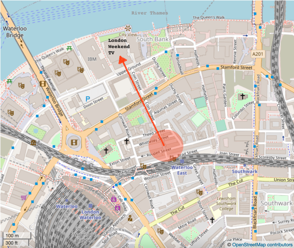
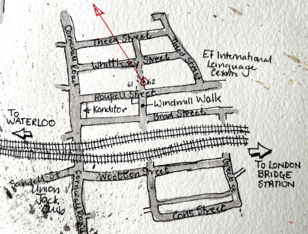
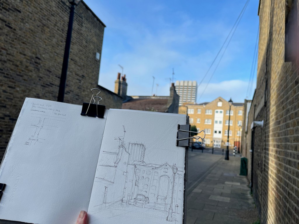
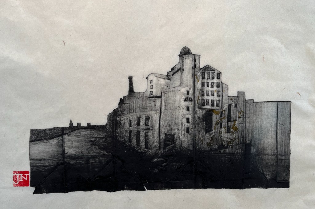
Here is a view of the tower of former London Television Centre building, seen from Windmill Walk, off Roupell Street near Waterloo Station.
LWT Building from Windmill Walk, 7th Feb 2022, in sketchbook 11
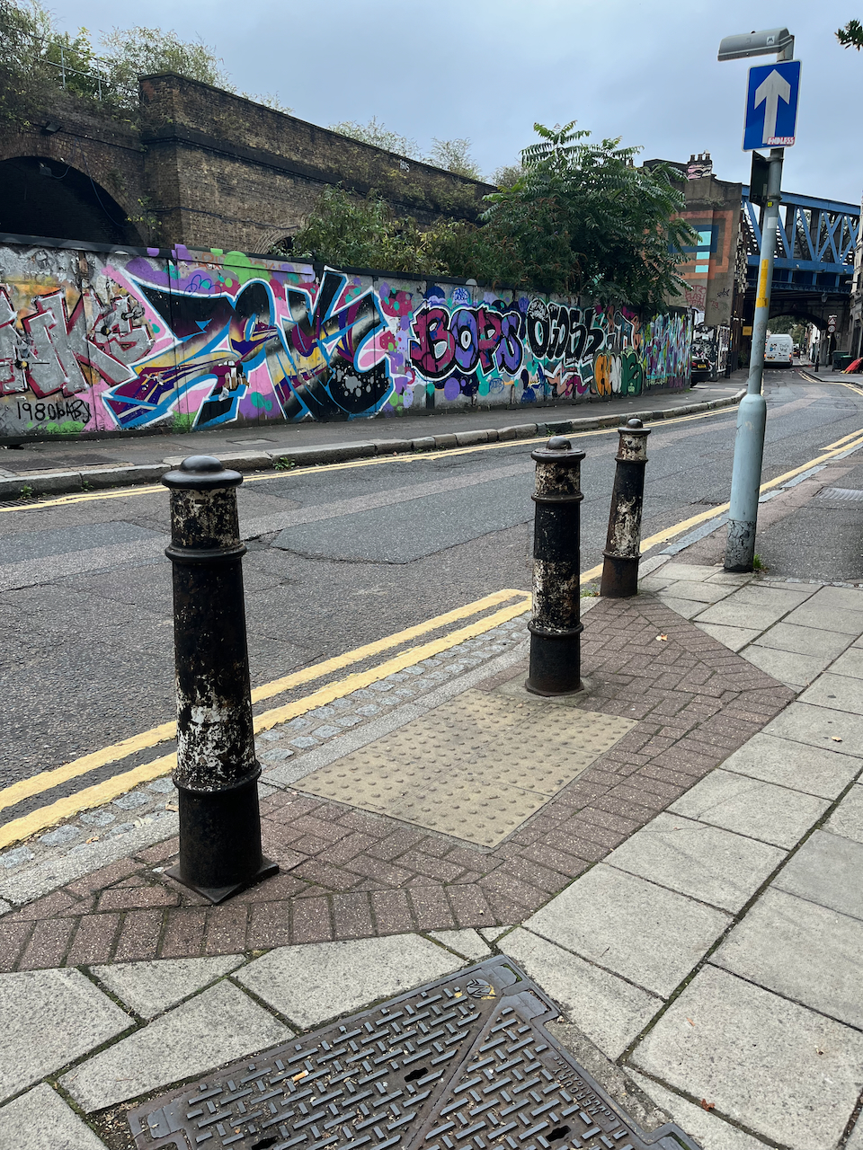
Bollard with stars.
I enjoyed all the wires and aerials! The swooping wire from the top right is a telephone wire or electrical cable. It’s unusual to see them above ground in London. Note also the marvellous bollards, which are mentioned in the Conservation Area Statement (Note 1).
Here you see layers of London development. In the foreground is Windmill Walk, part of the Roupell Street residential area built around 1824, and still residential. The paler building in the mid-distance is on Theed Street. It is a converted factory. It now contains some residential properties which I found listed on a holiday lettings site, and some offices listed on an estate agents’ site. Different accounts list it as a Violin Factory and/or a “Komptulicon Works”. Komptulicon was a sort of floor covering made of cork and rubber.
On the skyline is the London Television Centre, 1972, which I have drawn previously:
Here is a view of the London Television Centre, 60-72 Upper Ground, SE1. It is on the South Bank of the river Thames, a little to the East of the National Theatre and the Royal Festival Hall. It was completed in 1972 to the design of…
“[Roupell] street was laid out and construction started around 1824….. Roupell had built the street for what were described as “artisan workers” and the 1841 census provides a view of the professions of what must have been some of the first people living in the street. This included; painters, labourers, clerks, printers, bakers, carpenters, bricklayers, compositors, paper hanger, hatter, an excise officer, lighterman, warehouseman – all the typical jobs that you expect to find in such a street in 1840s London.” (A London Inheritance)
“Roupell Street Conservation Area” statement by Lambeth Council, 2007, describes the streets and details what can and cannot be done in modifications to the houses. It also mentions the “Komptulicon Works”, north of Windmill Walk.
I am trying an experimental monoprint technique. The idea is to use packaging material to make intaglio “plates” which are then printed using an etching press. This is the first one. I printed it yesterday on the Henderson Press at East London Printmakers.
Anchor Brewhouse and Horselydown Old Steps, Monoprint. Image size 10″ x 6″
This is a real building, a former brewery, just to the South and East of Tower Bridge. That’s the river Thames you see on the left of the picture.
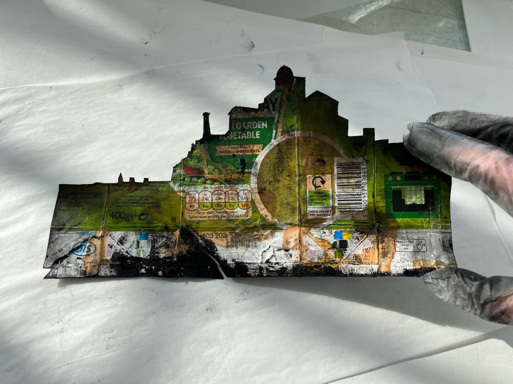
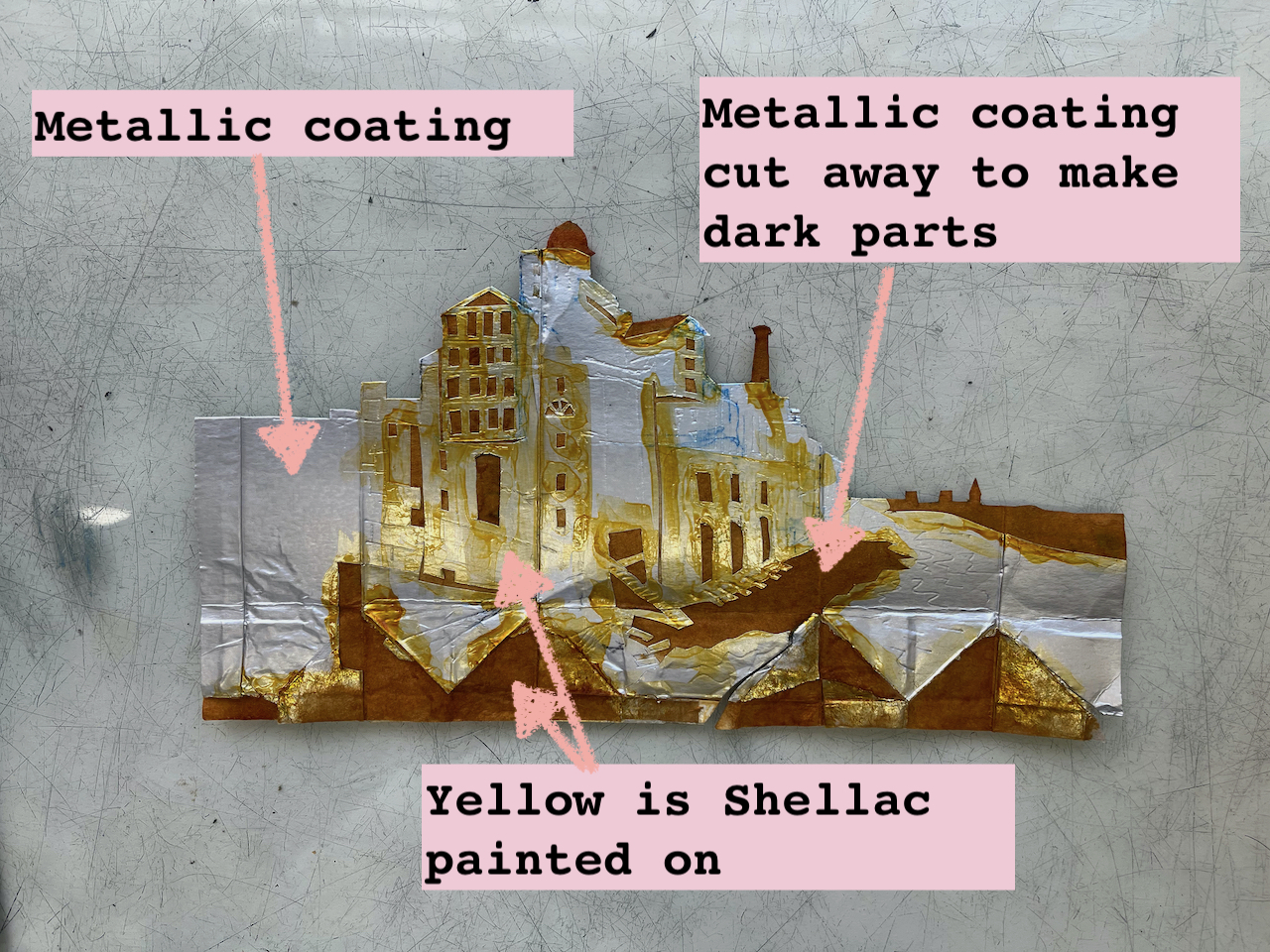
The “plates” are fragile, so I could only make 6 prints before the plate started deteriorating and the contrast started to go. Here is a picture of the plate, front and back. It is made out of a box of soup. I made the picture on the shiny, metallic-looking side, which is the former inside of the soup box.
Back of the plateFront (print side) of the plate, after inking and printing
The parts which print dark are made by cutting out the metallic coating of the soup box, leaving the rough cardboard underneath. I painted the plate with button varnish (shellac in alcohol) to make it a bit stiffer and more durable. Here’s what the plate looked like before printing:
Plate before printing, with annotations
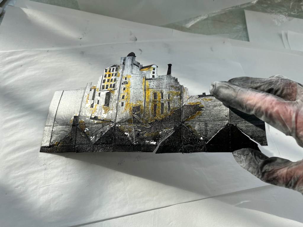
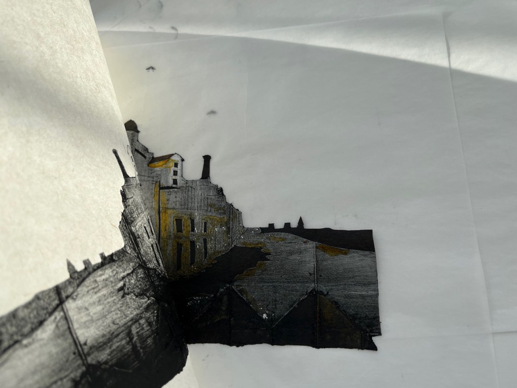
Here is one of the prints peeling off the plate:
Plate (left) and print (right)
I tried making a video, but it was too difficult to hold the plate, the paper and the phone all at once. And there’s ink everywhere which I was trying to avoid getting on my phone. Next time I’ll see if I can get a fellow printmaker to hold the phone.
Ink: “JS”carbon black
The ink is traditional black etching ink from Intaglio Printmaker in Southwark. The paper is Zhao Zhe Chinese paper ref 11369 from Great Art on the Kingsland Road. The red seal on the finished print is made with a Japanese stone seal with red ink gifted to me by my friend and mentor Katsuhisa Toda 戸田勝久.
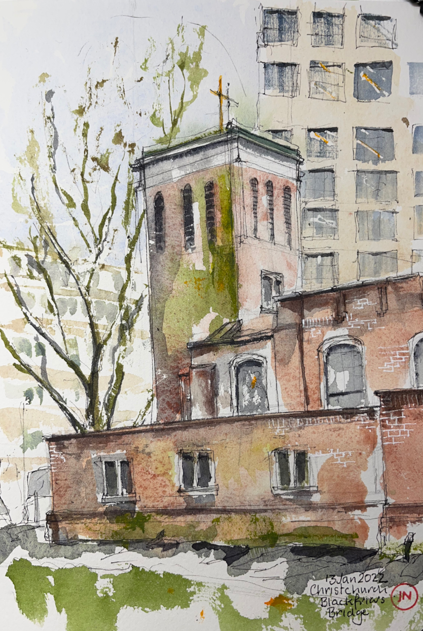
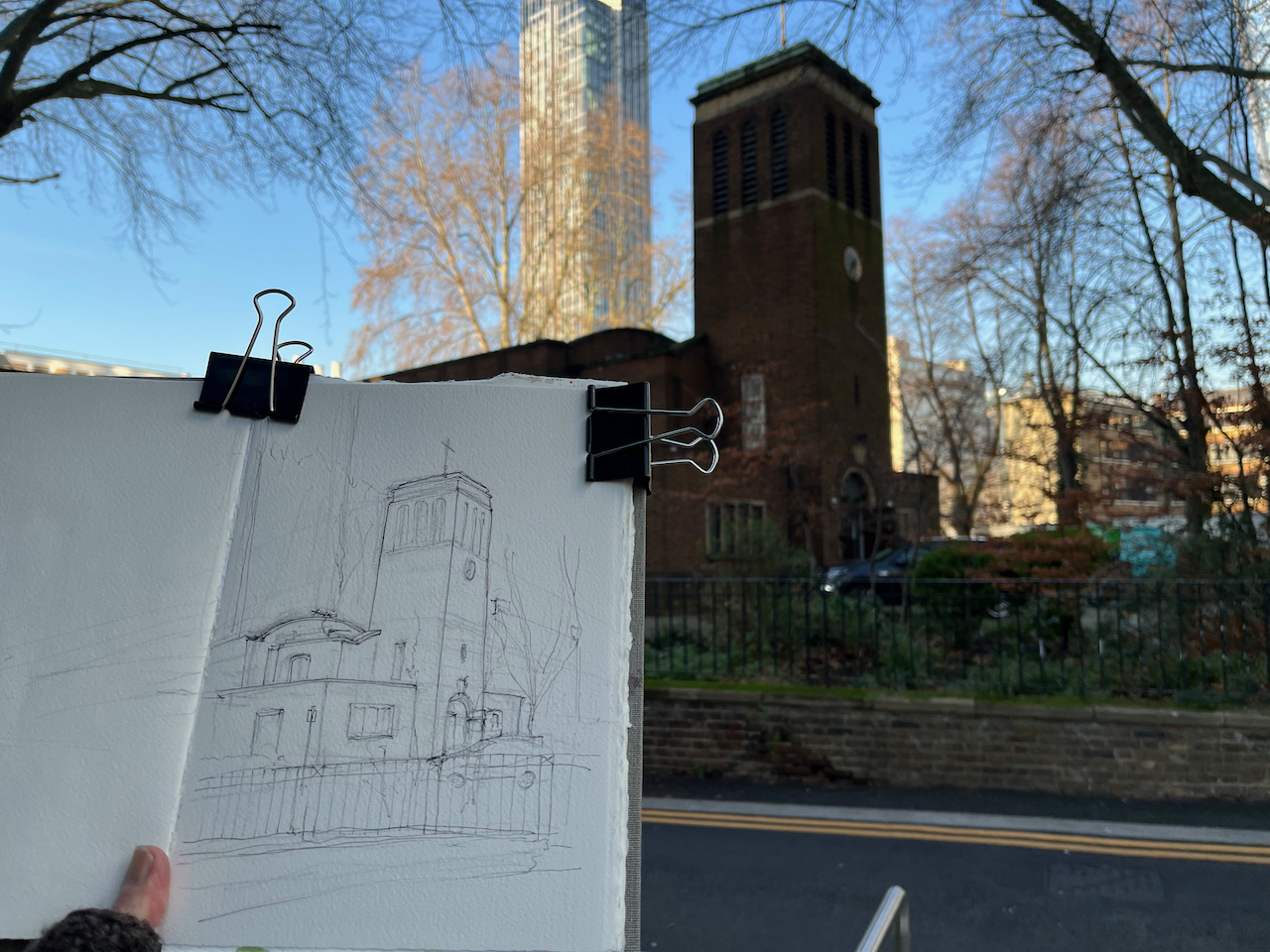
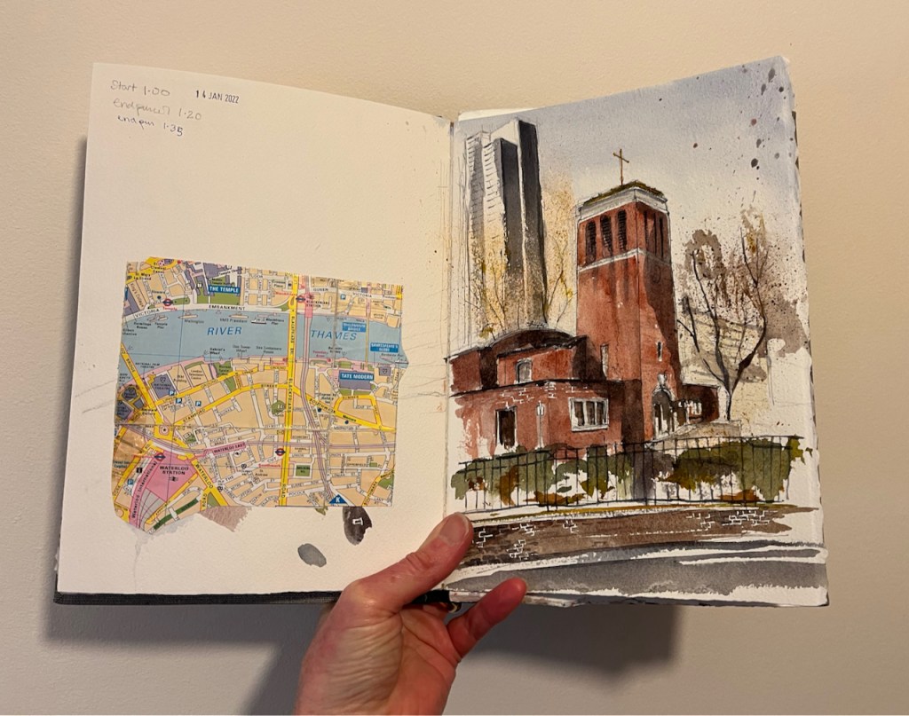
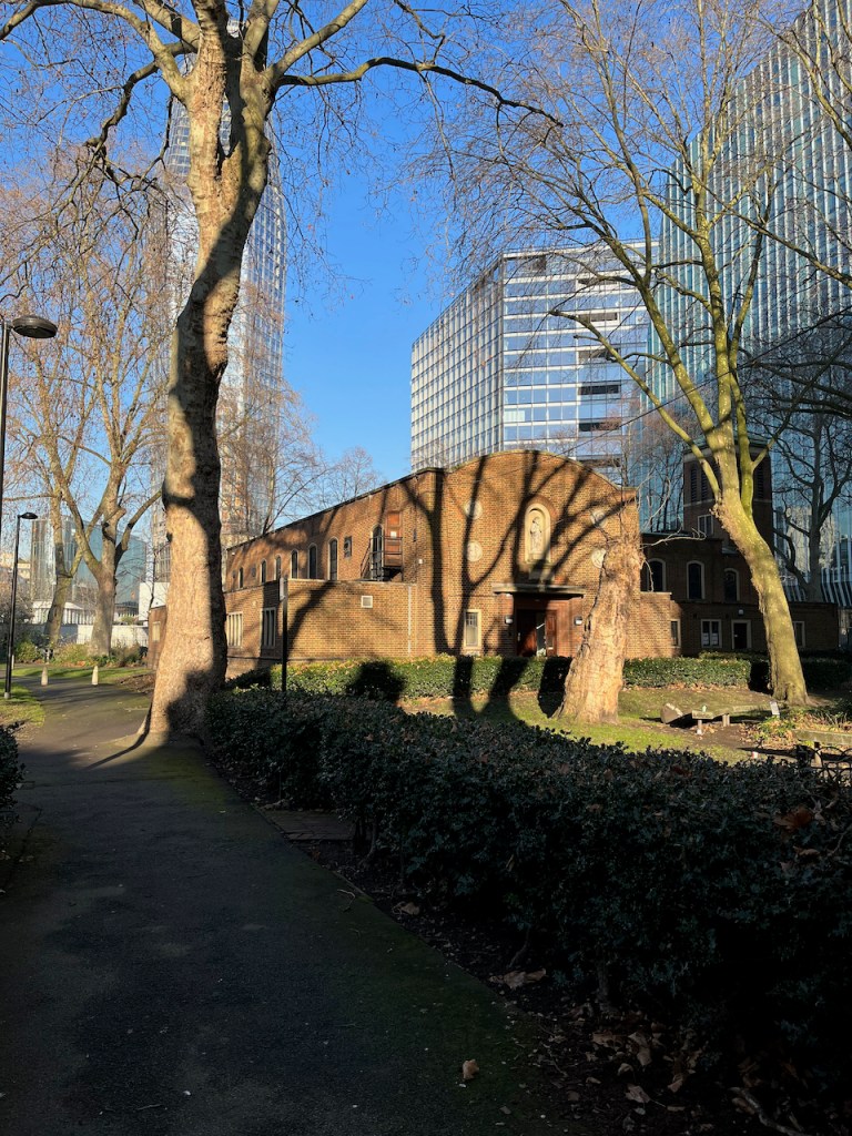
On the South side of Blackfriars Bridge there is a church amongst trees. This is Christchurch Blackfriars Bridge.
Christchurch Blackfriars Bridge, 14th January 2022, 2pm 10″ x 7″ in Sketchbook 11
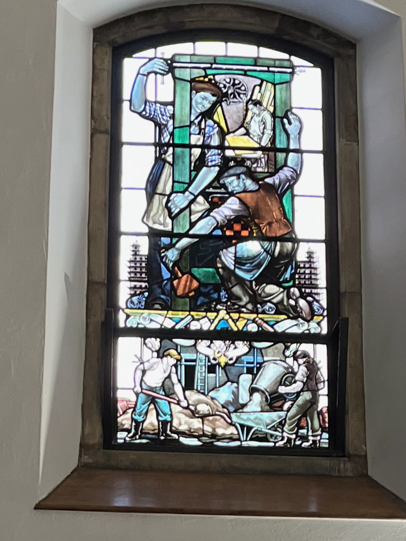
A window showing construction workers
This is the south side of the church, showing its open door. I went in. This is a very welcoming church. I passed three separate notices telling me I was welcome. Inside it is calm, warm and light. There are benches to sit on. There are marvellous stained glass windows. They show not saints and Bible stories, but Londoners. They show builders and printers, river workers, and engineers. There is a power station worker looking at a bank of rotary dial telephones, and a queue of people waiting for a red London bus. All these are beautifully done in stained glass.
This church accepts the idea that people might be “spiritual not religious”. Between 12noon and 2pm: they offer a “lunch time silent space”, and there are other events that include meditation and silence.
A detailed history of the church is in British History Survey of London: ‘Christ Church’, in Survey of London: Volume 22, Bankside (The Parishes of St. Saviour and Christchurch Southwark), ed. Howard Roberts and Walter H Godfrey (London, 1950), pp. 101-107. British History Onlinehttp://www.british-history.ac.uk/survey-london/vol22/pp101-107 [accessed 16 January 2022].
Here is how it looked before 1941.
‘Plate 67: Christ Church. Exterior and watchhouse’, in Survey of London: Volume 22, Bankside (The Parishes of St. Saviour and Christchurch Southwark), ed. Howard Roberts and Walter H Godfrey (London, 1950), p. 67. British History Onlinehttp://www.british-history.ac.uk/survey-london/vol22/plate-67 [accessed 16 January 2022].
It was completely gutted by incendiary bombing in April 1941. The 1950 “Survey of London” cited above describes it as a “shell”. The present church was completed in 1960, according to Pevsner (The Buildings of England, London 2: South, by Nicolaus Pevsner and Bridget Cherry, page 275). The architects were R Paxton Watson & B Costin.
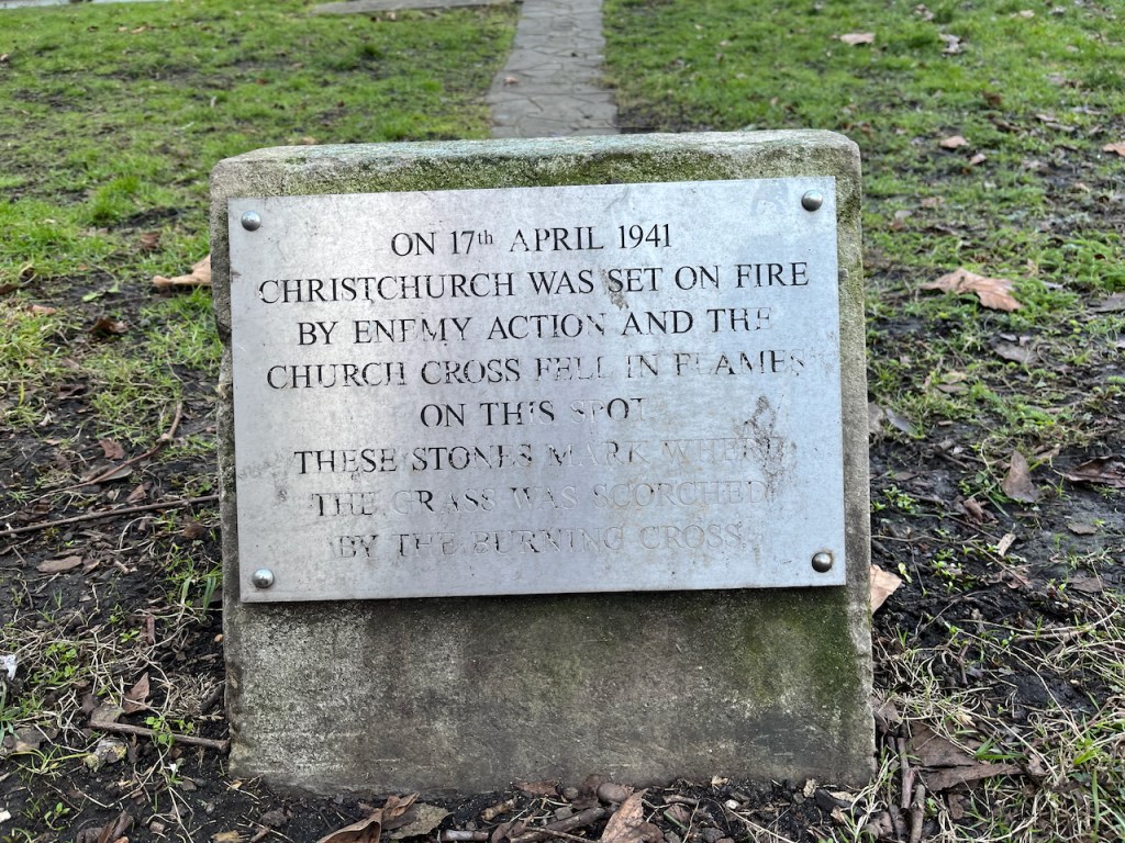
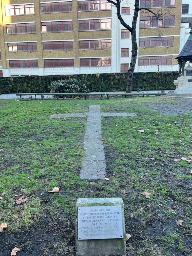
“On 17th April 1941 Christchurch was set on fire by enemy action and the church Cross fell on this spot. These stones mark where the grass was scorched by the burning Cross”A monument on the West side of the church, photographed 6th March 2025. The cross referenced here can be seen in the black and white 1941 photo above.
The church is now surrounded by buildings and trees and is very much alive. Here is the view from the North:
Christchurch Blackfriars Bridge, 13th January 2022, 12:30pm 10″ x 7″ in Sketchbook 11
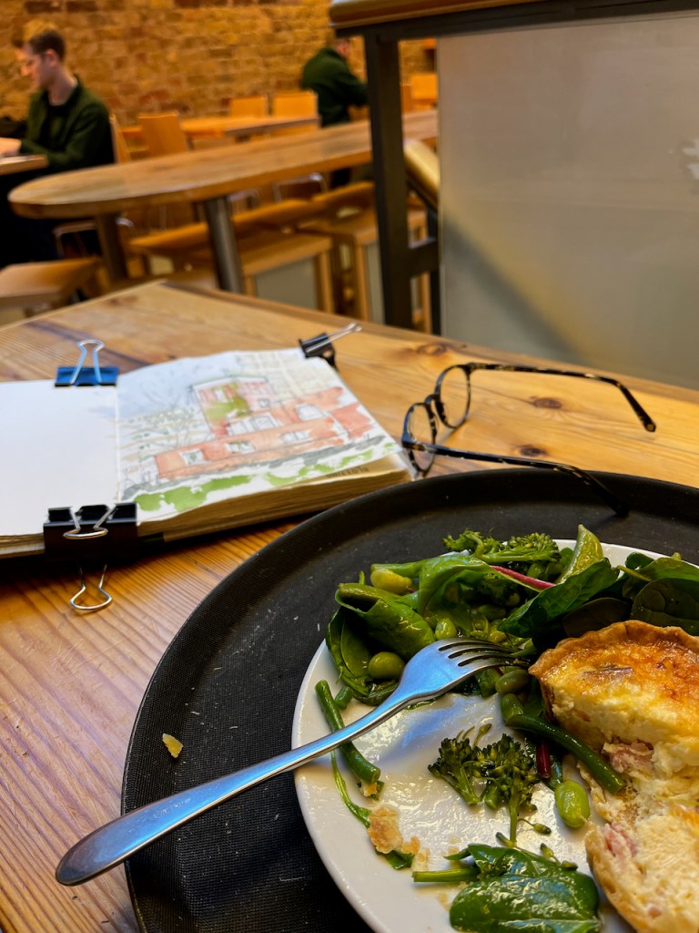
The outside air temperature was 3 degrees C and the paint wasn’t drying. Also I was very cold. I went for lunch in “Greensmiths”in Lower Marsh, and finished the painting there.
“Greensmiths” in Lower Marsh Waterloo.
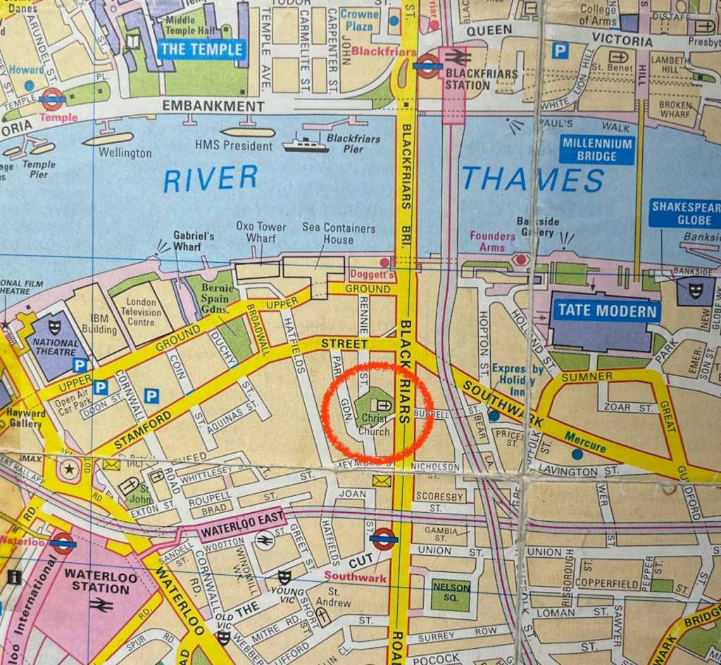
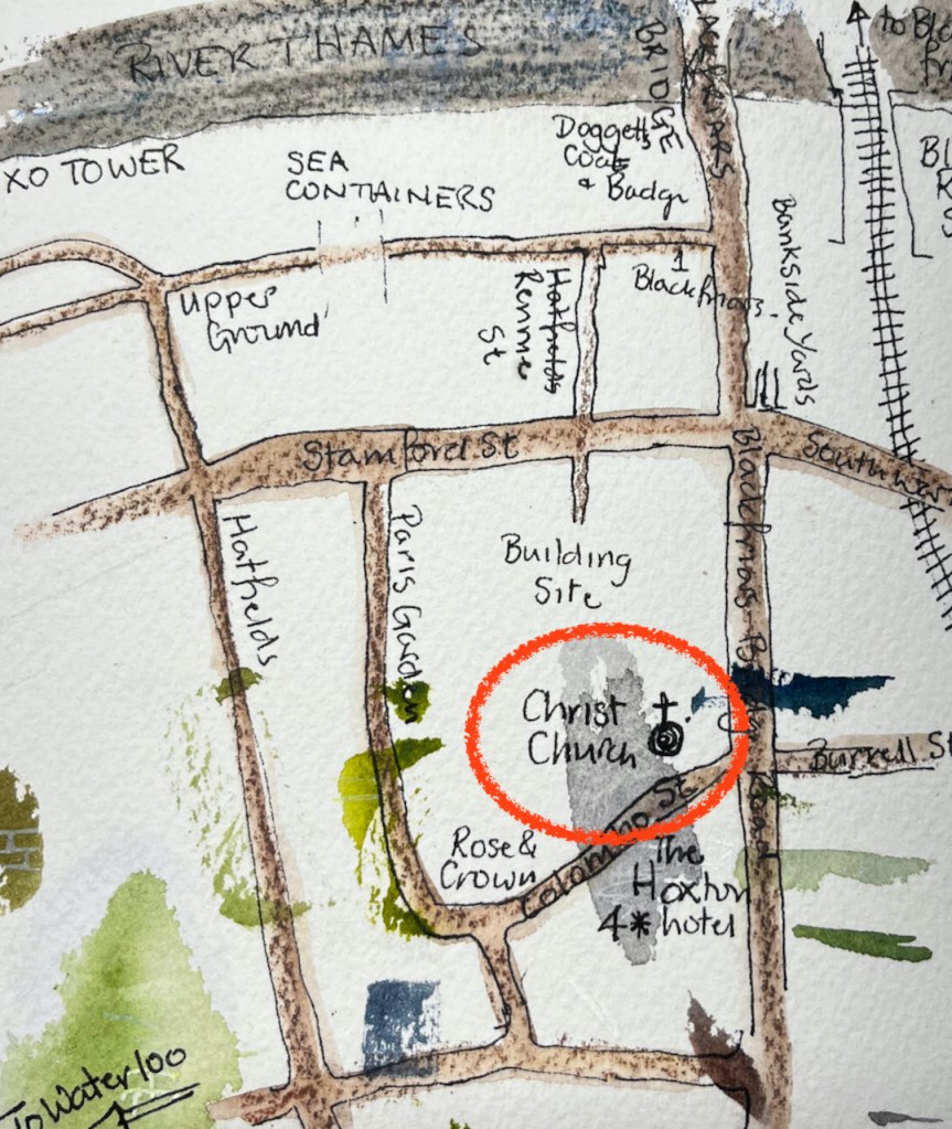
Here is work in progress on the sketches, and some maps to show where this church is.
There were some spectacular shadows that day:
Christchurch Blackfriars Bridge, from the South, 14th January 2022 about 2pm.
The church community hold some of their events in the adjacent pub, the Rose and Crown: