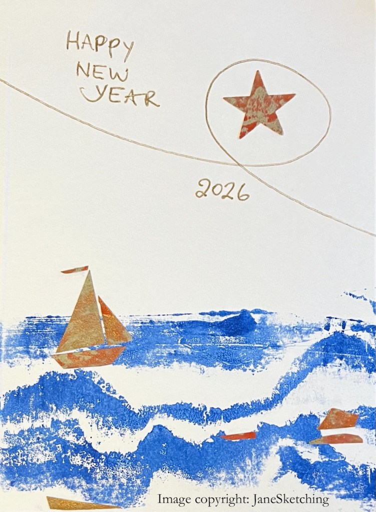
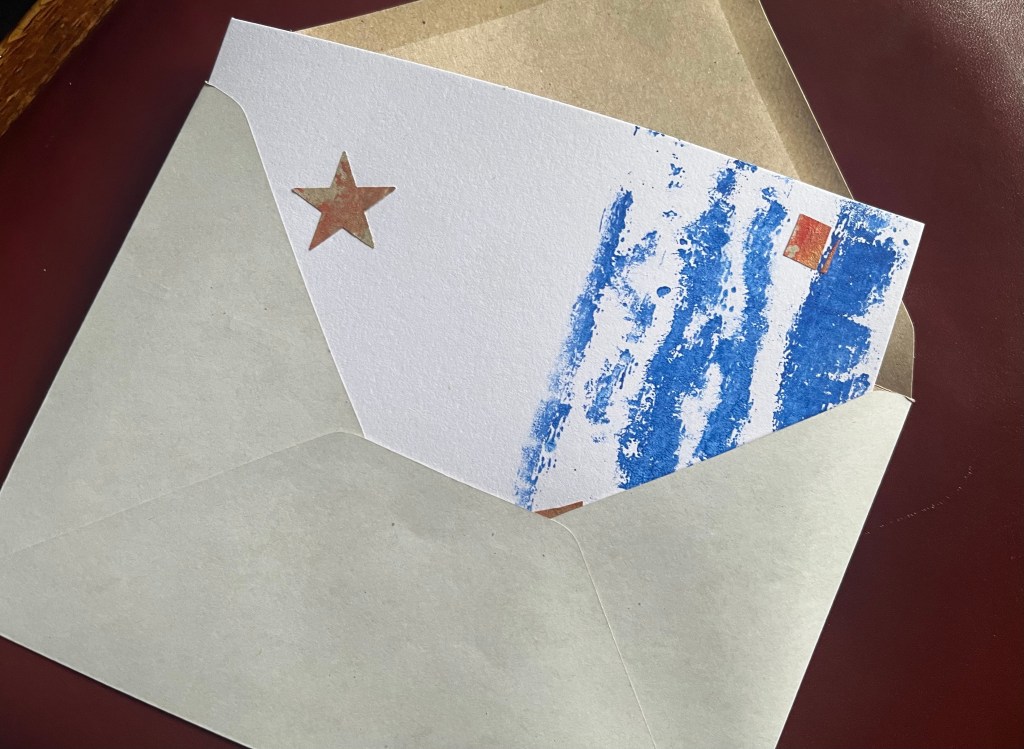
And for those interested in technique: the blue background of this card is made by printing. The printing “plate” was torn cardboard, stuck onto cardboard. Here’s an example. Each “plate” made about a dozen cards, before it became too deteriorated to work properly.
The boat and the star are cut from wrapping paper.
This is a card, sent by post to people, snail mail, in an envelope with a postage stamp. Why? Because it seems to me that material connection matters. I make real objects in the real world, and spend real time making material things. Even if only out of paper and cardboard. Even in 2026……
Click a button below to share this post online, email it, or print it:
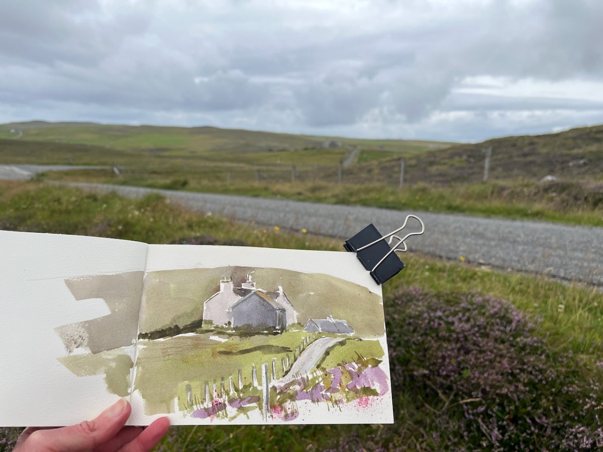
I sketched some of the characteristic houses on the West side of Shetland.
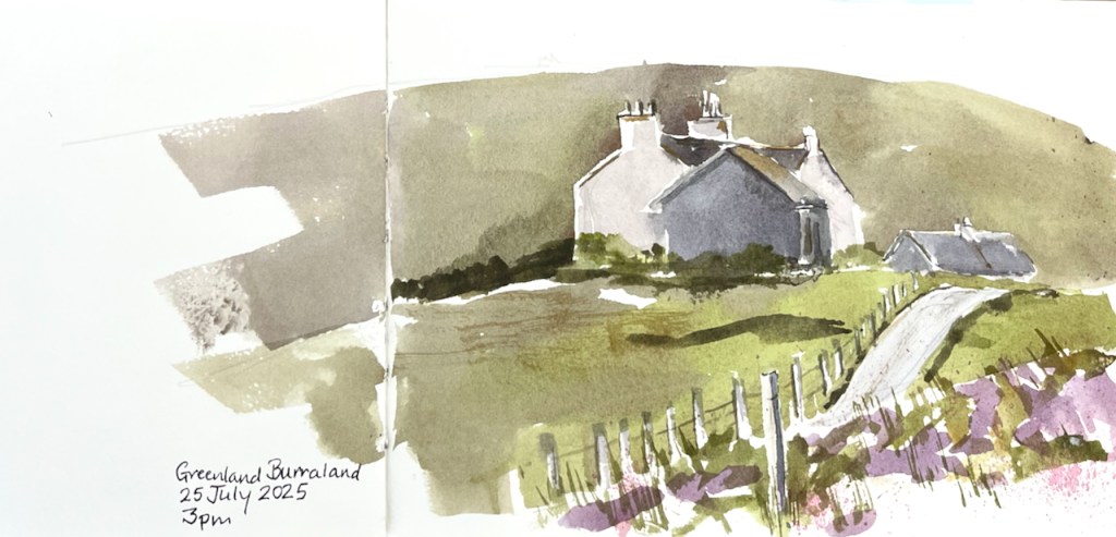
Houses at Greenland Burraland, Shetland West side. July 2025Sketching by the side of the road. The houses I am sketching are in the centre distance.
The houses above in Greenland Burraland are working farms and family homes.
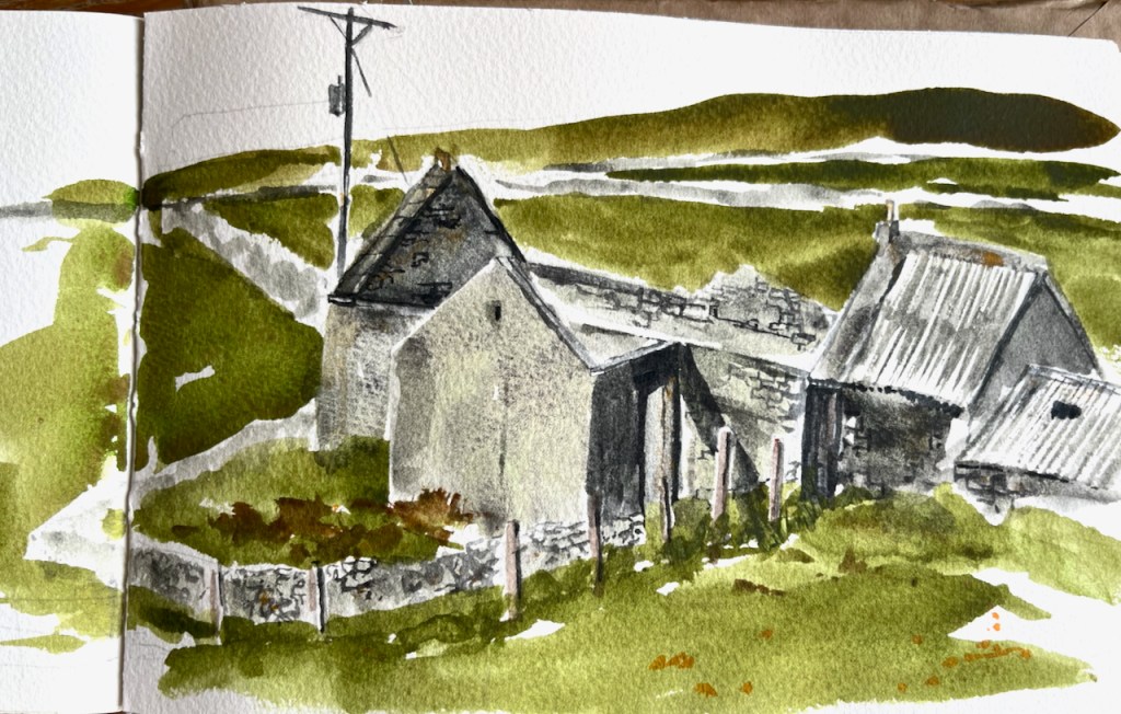
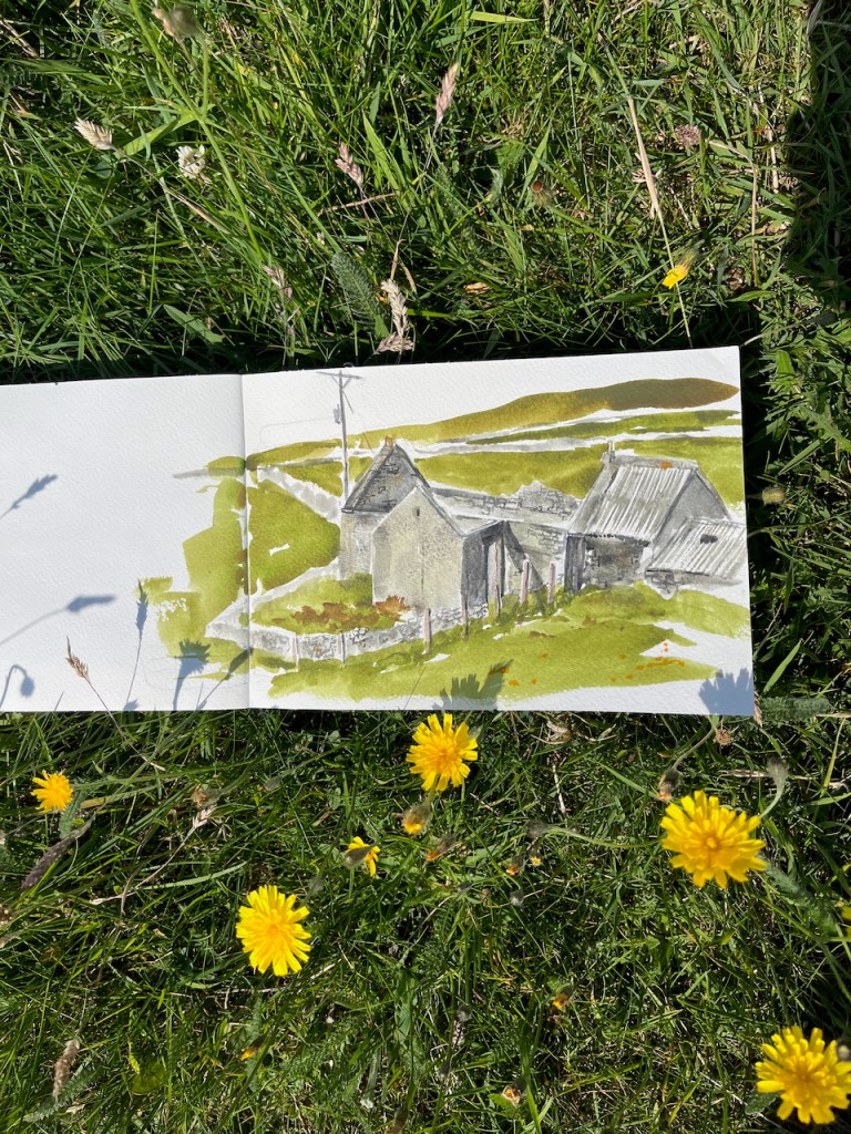
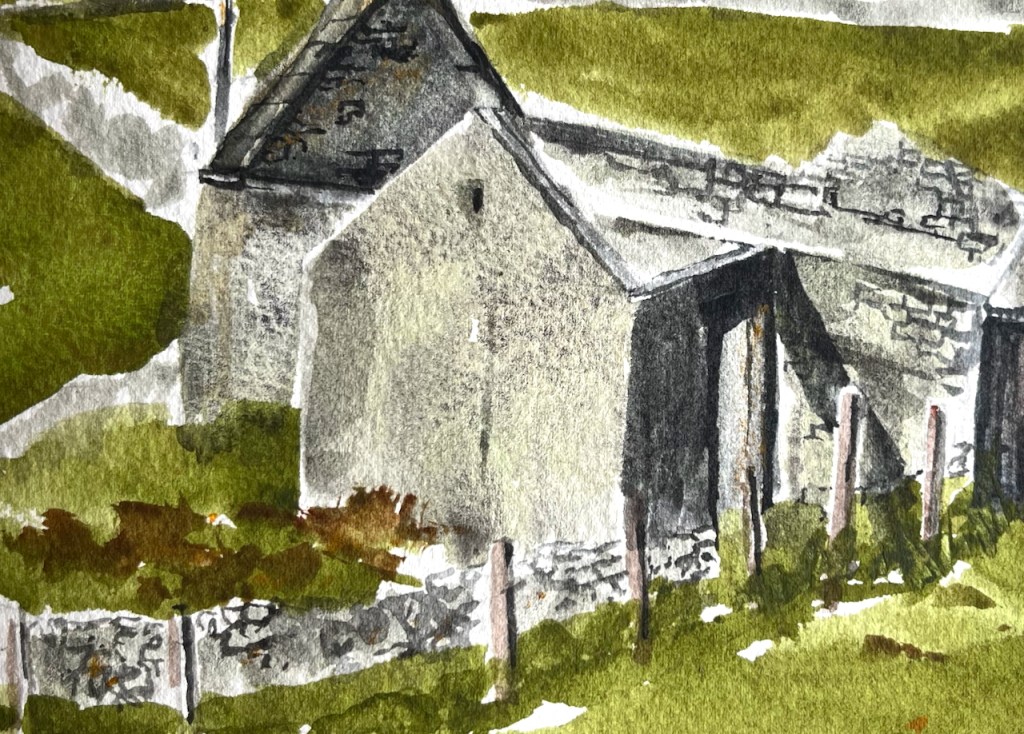
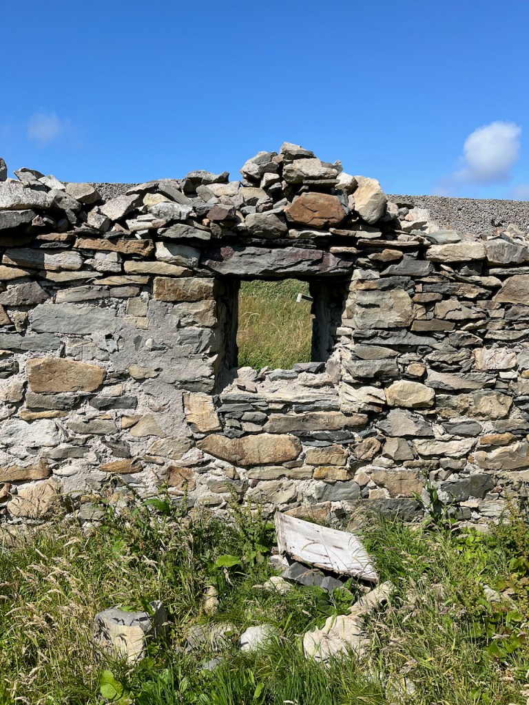
Some of the croft houses are abandoned, and starting to fall down. Here is a ruined croft house near the standing stone at Vesquoy, Shetland West side.
House by the standing stone, July 2025
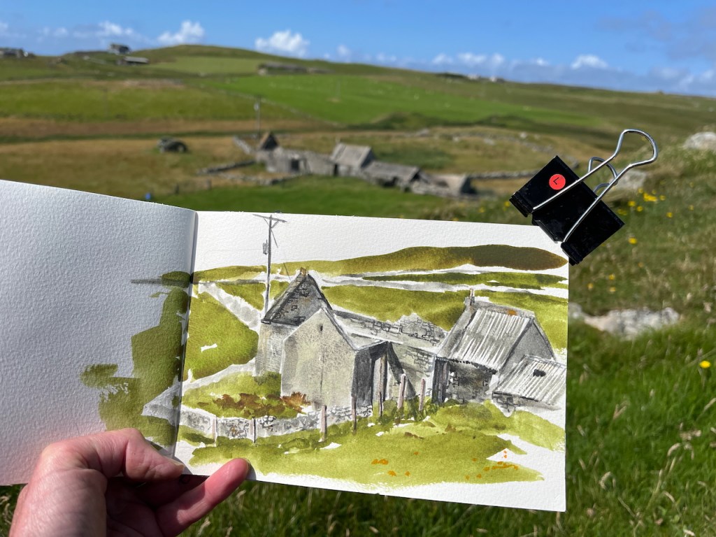
I sketched it from the hill above.
Sketching the house by the standing stone.
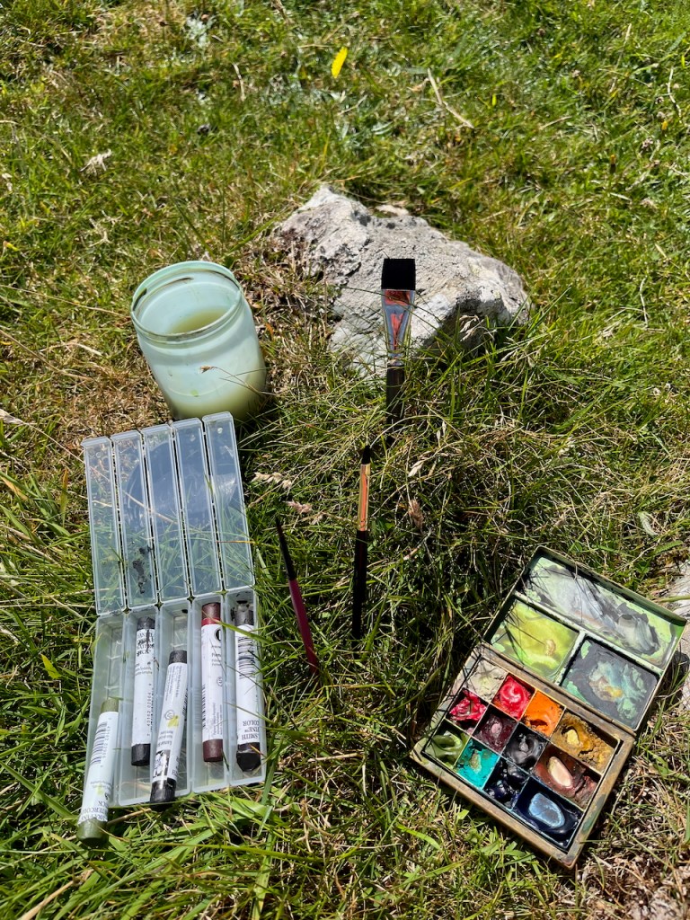
I used heavily granulating colours to show the walls.
This is Daniel Smith Hematite Genuine: a mineral watercolour which breaks into gritty particles when you put it on the paper with lots of water.
Then I walked down to have a look.
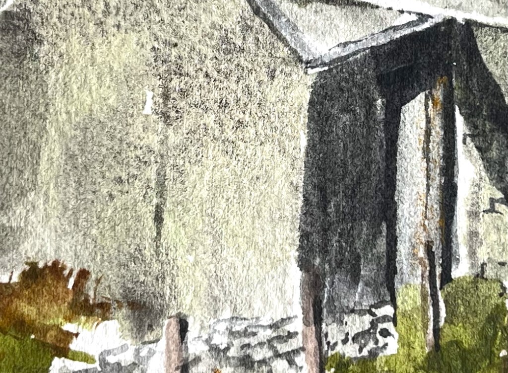
Looking up towards the hill where I was sketchingPatchwork barnThe variety of colours in the walls
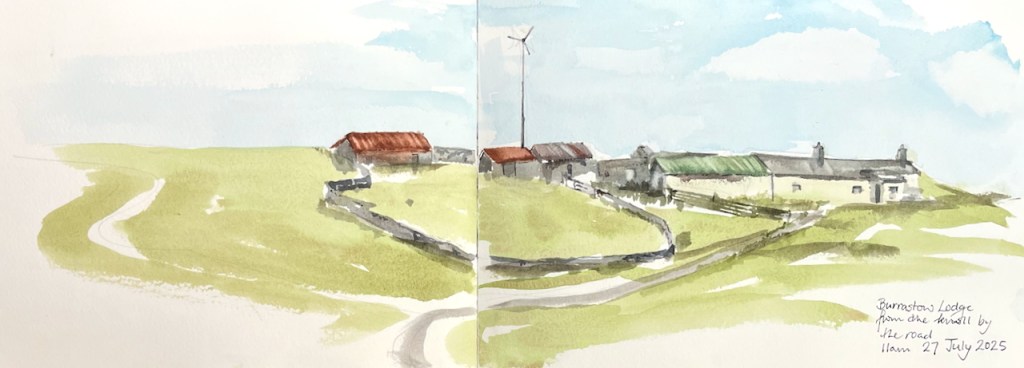
On the same day, here I am looking up at a string of dwellings and barns on the brow of another hill.
Burrastow Lodge, July 2025
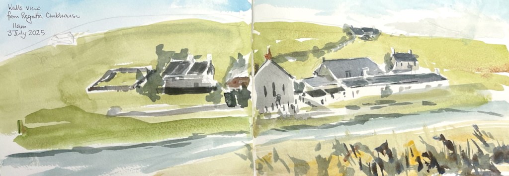
At the beginning of July I did this sketch (below) of some buildings in Walls.
Walls, across the Voe, July 2025
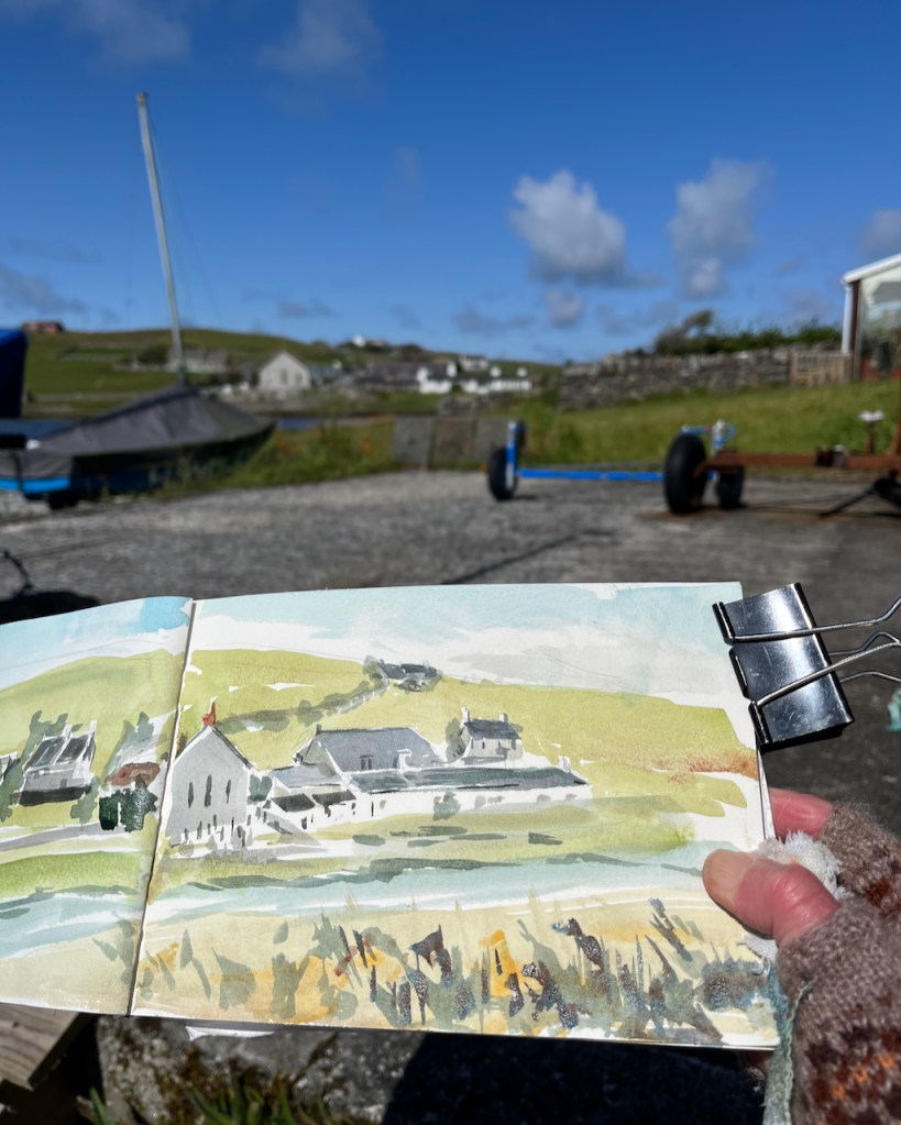
I was sitting on an uncomfortable stone ledge next to the Regatta Clubhouse. I was wondering, for the umpteenth time, whether it is worth the effort to carry a seat around with me.
Sketching in Walls
Despite that blue sky, it was cold, and very windy. Note the gloves. I had just done some grocery shopping at the Walls Shop and here I was, resting, before the long walk back up the hill, up several hills.
One of the reasons I sketch is to imprint moments in my mind. This sketch brings back to me the sensation of the clear moving air. My eyes were watering from the cold and wind, so the view became unfocussed. My eyes were watering from the bright light also. I had only recently arrived from London and my eyes were still acclimatising to the brightness. I put on sunglasses. It was an effort to see, and an effort to continue, and the picture came out somewhat…..approximate. But I keep it as a reminder of that moment of arrival, that determination.
Click a button below to share this post online, email it, or print it:
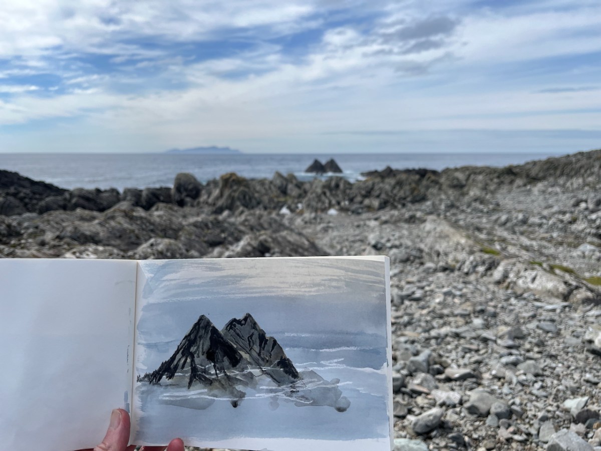
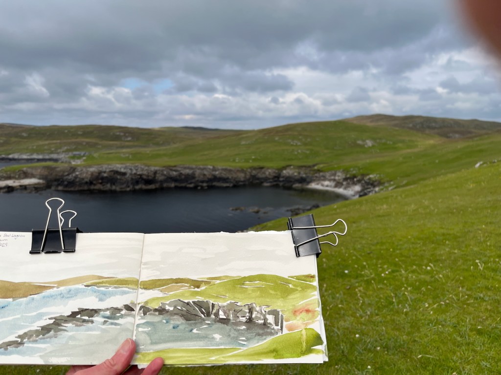
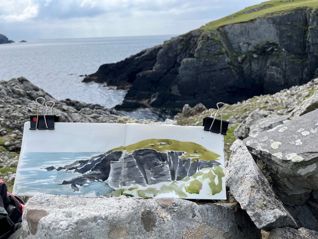
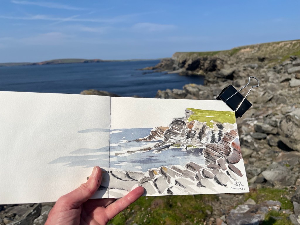
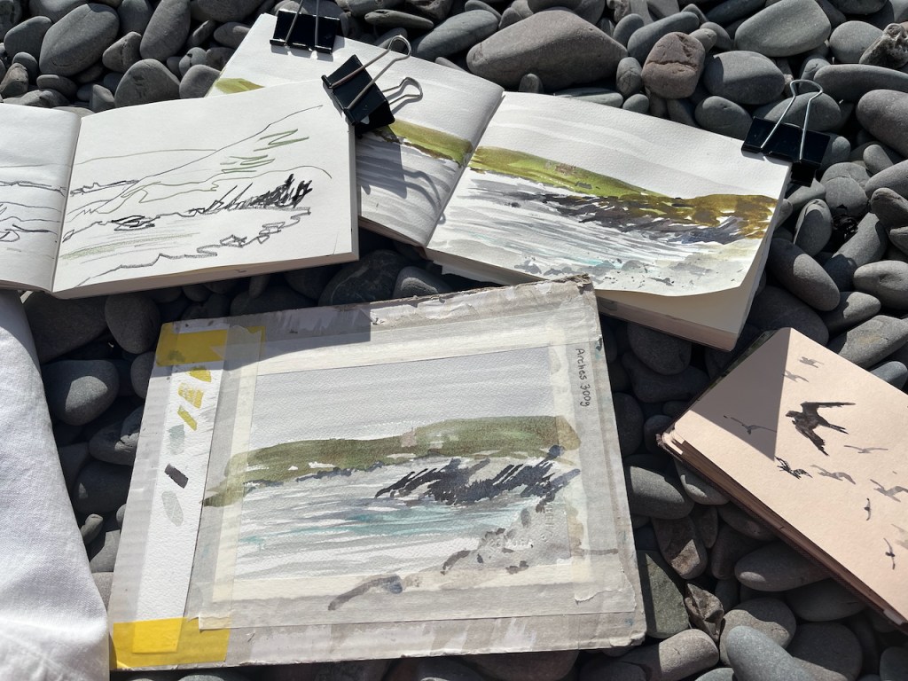
Skerries of Easter Paill, see Foula in the distanceRocks of the Seal LagoonPoint of the HusFootabroughBeach near the Seal Lagoon, from the high cairn.Where fulmars nestSandness
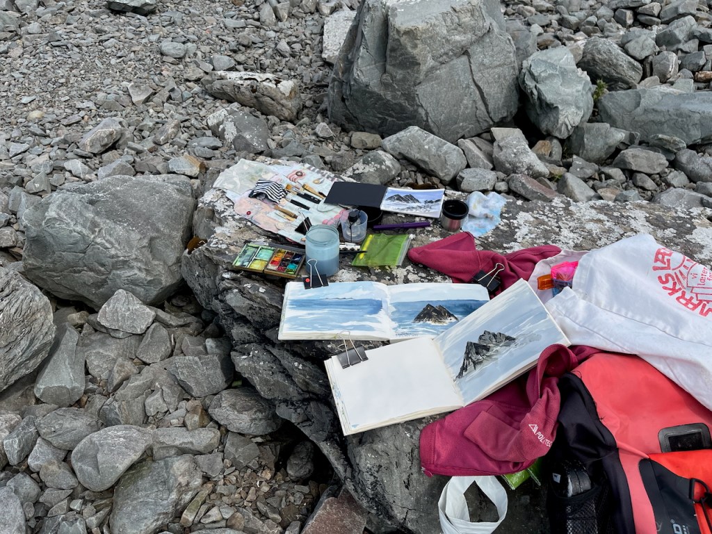
These pictures make it all look calm. It’s not calm. Shetland is a very windy place. While I am sketching, unseen forces turn the pages, move the paint palette around and tip my water over.
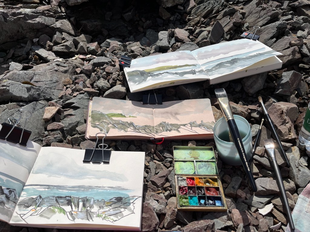
Sketching location: brushes, palette, water, …
It is also damp. Paint takes a while to dry. So I do several paintings at once: I put the first wash on, and while that dries, I start another picture.
Multiple drawings on the go. Dragon Beach: 3 sketchbooks and a postcardMultiple Sketchbooks: Littlure.
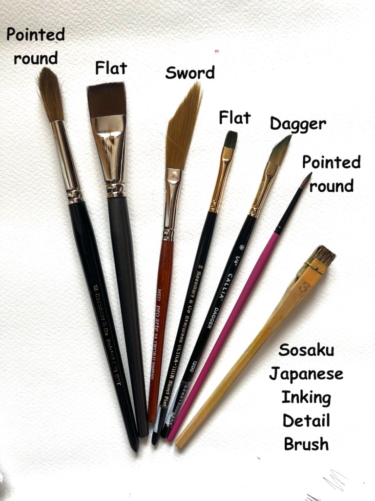
In the picture above you see my basic equipment. The paintbox is brass, which makes it heavy so it doesn’t blow away. The paintboxes I use are described here. The brushes are from Rosemary Brushes. The big one on the water pot is one of their Evergreen Short Flat brushes, size 12. It’s about an inch across, very handy for drawing quickly.
The sketchbooks are, from top to bottom:
JP Purcell 190gsm watercolour sketchbook A5
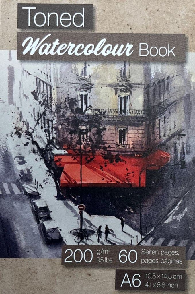
Hahnemühle Toned Watercolour book A6
JP Purcell cartridge paper sketchbook A5 – Stockwell Cartridge 130gsm
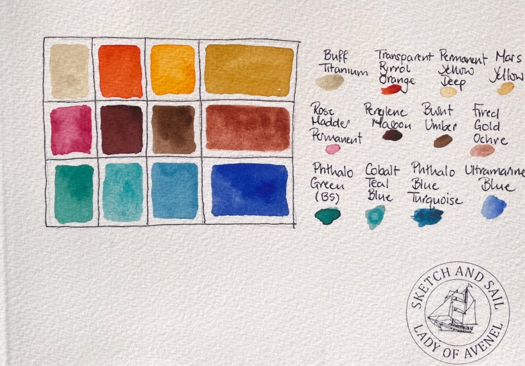
Here are the twelve colours in the paintbox. They are all Daniel Smith except the Ultramarine Blue, which is Schmincke Horadam.
Let me know if you have any other questions!
In my next post I will show sketches of Shetland croft houses.
Click a button below to share this post online, email it, or print it:
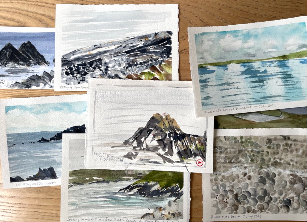
Glorious Shetland! I make postcards when I am there, to communicate what I see.
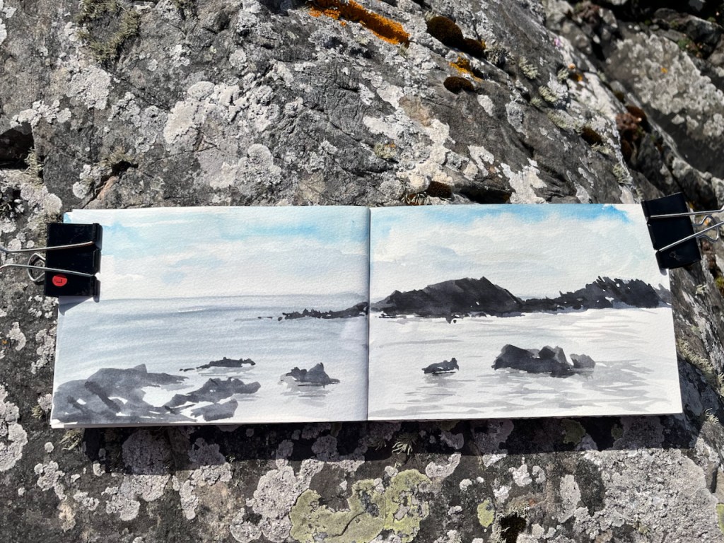
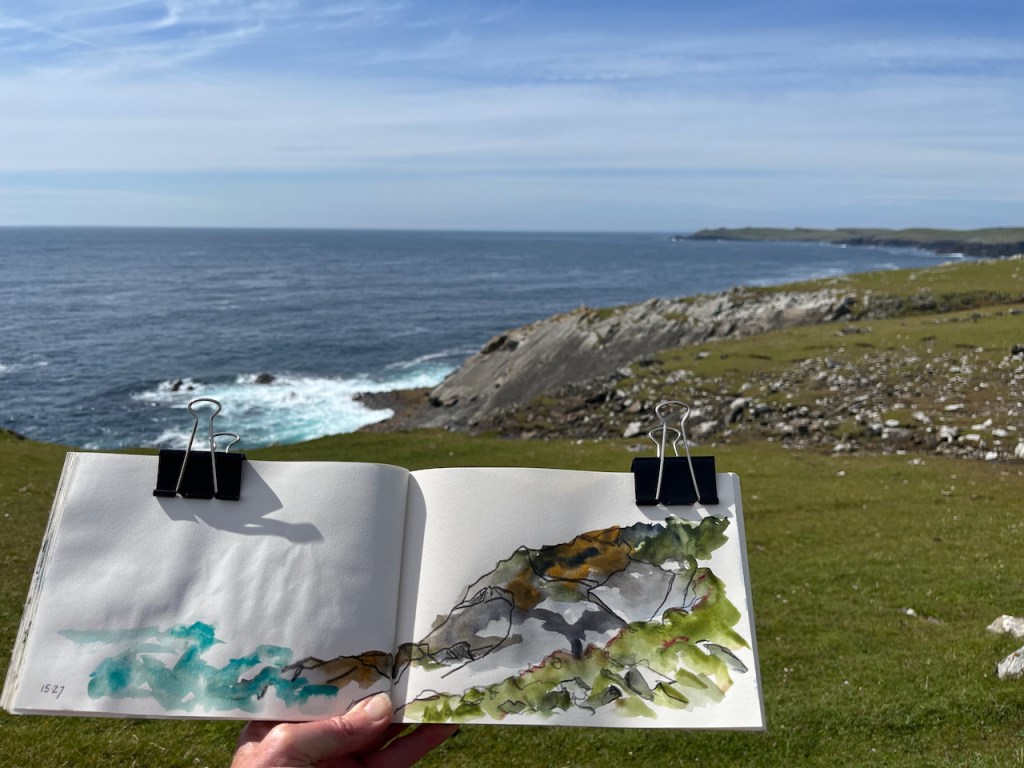
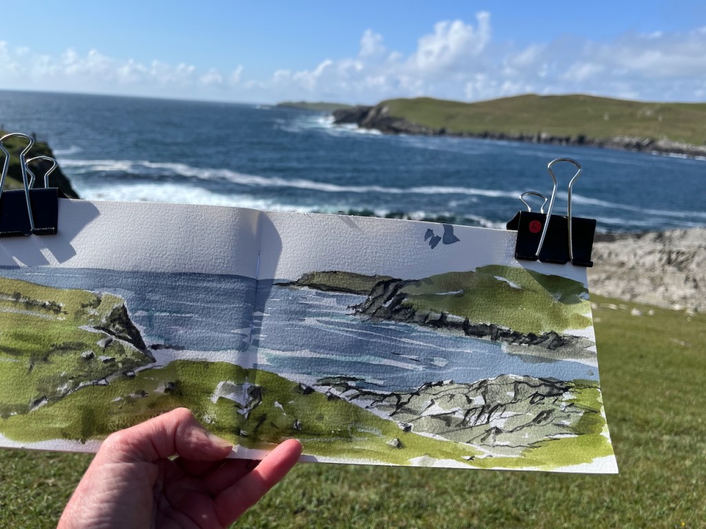
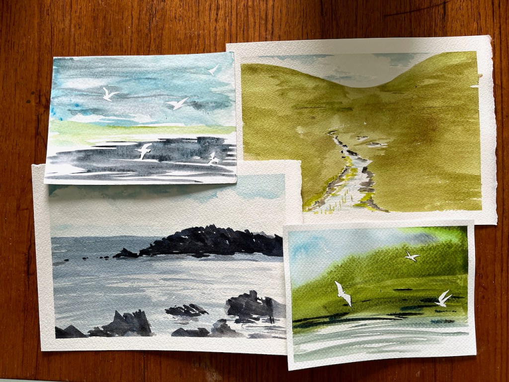
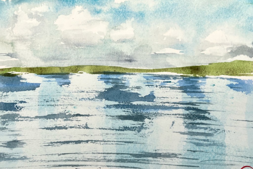
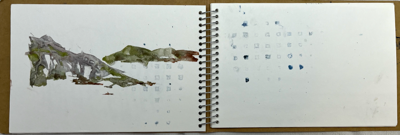
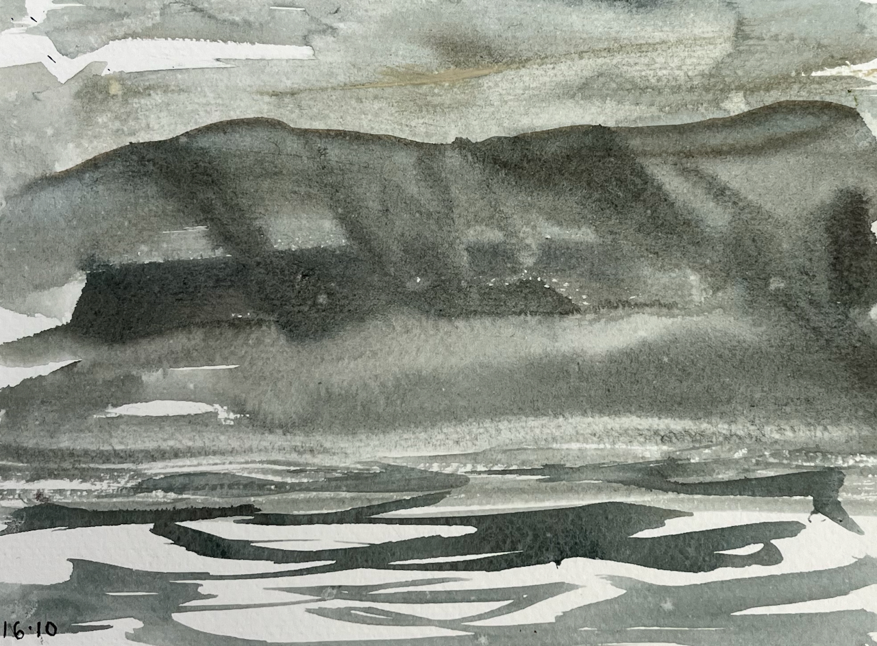
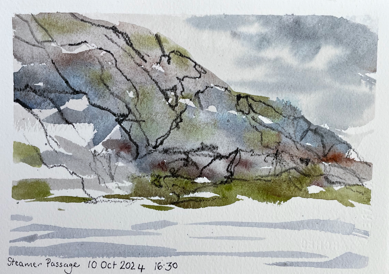
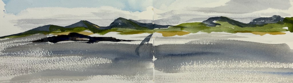
Here are small sketches of the landscapes on the West side of Shetland.
They are A5 size or smaller, on watercolour paper.
The smaller postcards are 6″x 4″. The birds are done using masking tape.
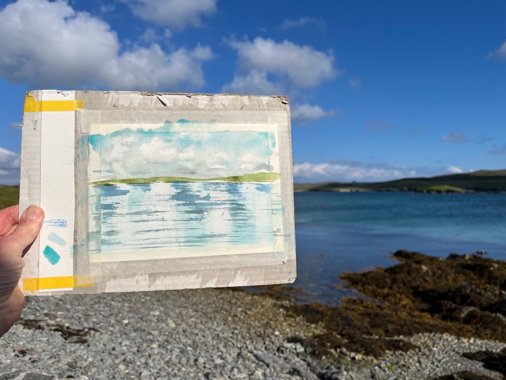
Here is work in progress on the “reflections” postcard.
The A5 postcard is fastened to the backing board with masking tape. The backing board is cardboard: the back of a pad of paper. On the left is a strip of watercolour paper to try out the colours and the brush strokes before I put them on the card.
Then when the drawing is finished I remove the masking tape, which leaves a neat edge.
Colours are Daniel Smith watercolours, on Arches Aquarelle 300gsm paper. All whites are the white of the paper.
NEXT YEAR, 2026 – “Sketch and Sail” is going to Shetland! I will be on board the sailing vessel “Lady of Avenel” with a group of fellow artists. Would you like to join us? We’ll be living on board for a week, sailing round the coast of Shetland. It will be a marvellous opportunity to see the magnificent cliffs from below, and the land from afar. No experience of sailing or sketching necessary. Sunday 31st of May to Saturday 6th June 2026. See this page for more information, or contact me.
Click a button below to share this post online, email it, or print it:
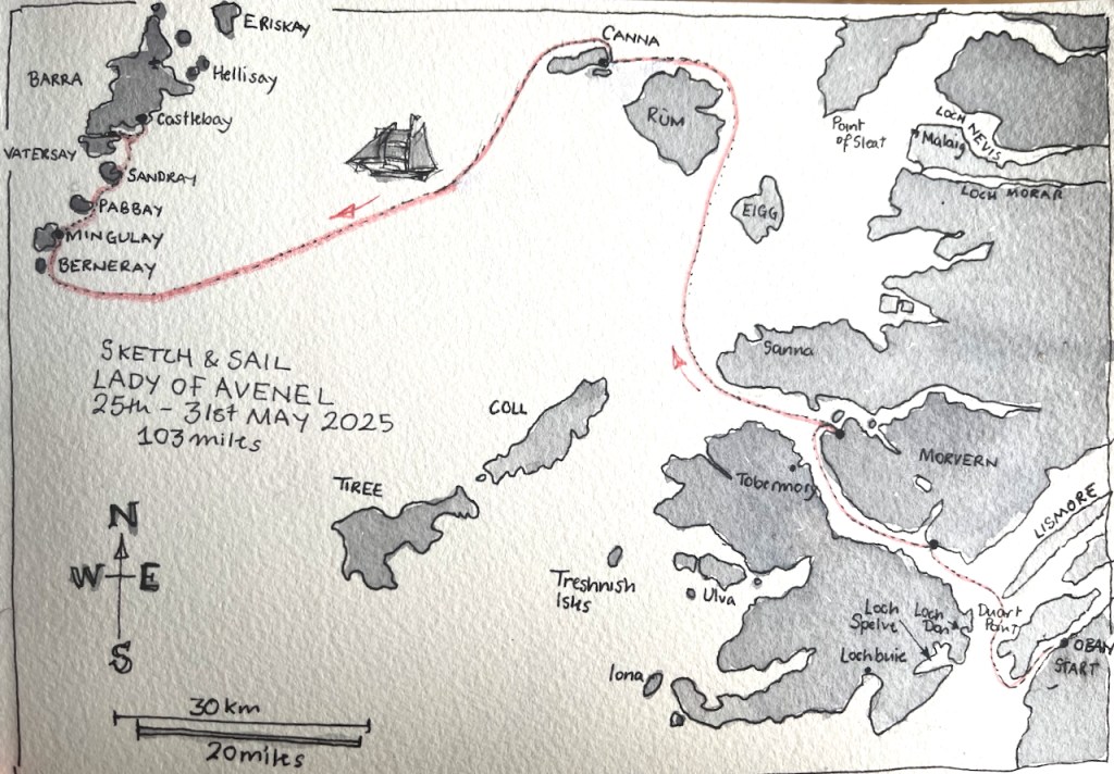
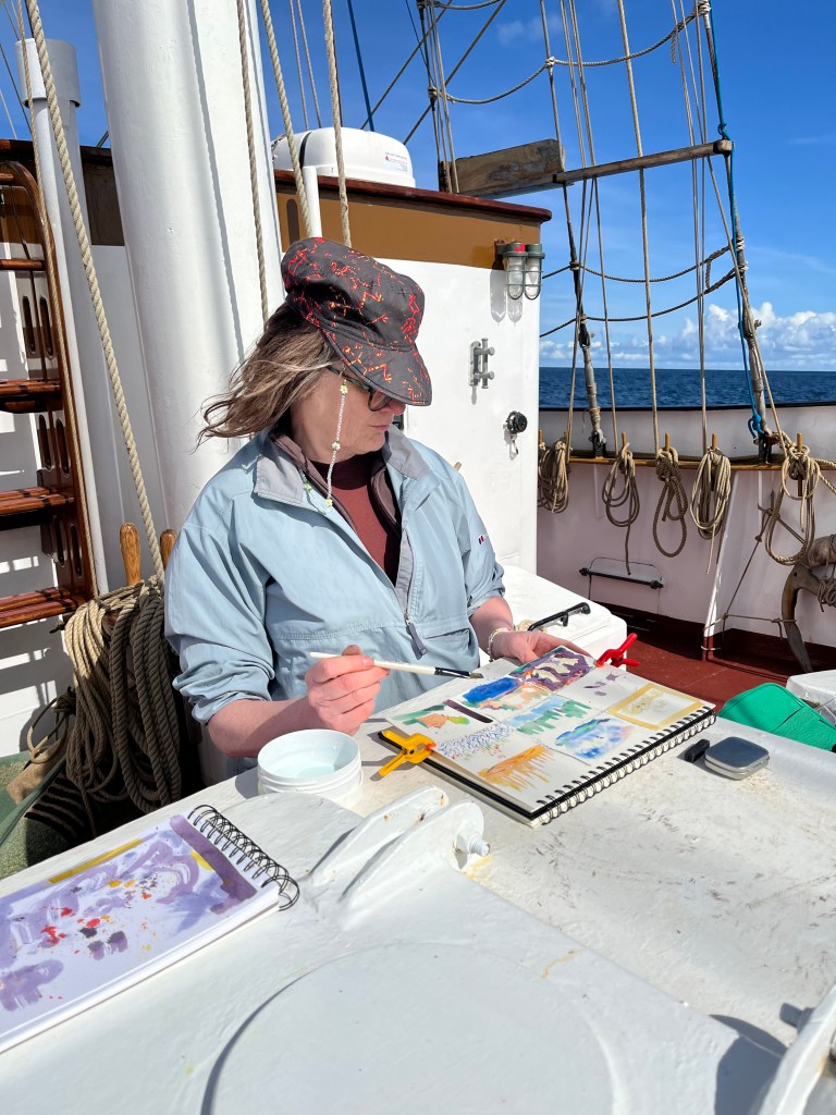
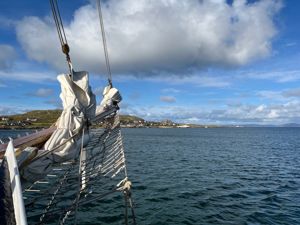
I’m thrilled to be one of the tutors on the Lady of Avenel “Sketch and Sail” adventure. I have just returned from the May 2025 voyage in the Scottish western isles.
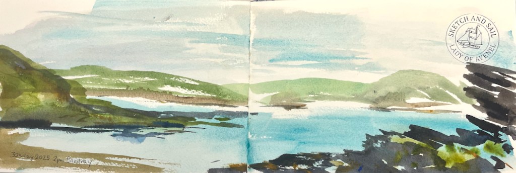
Postcards from Sketch and Sail May 2025
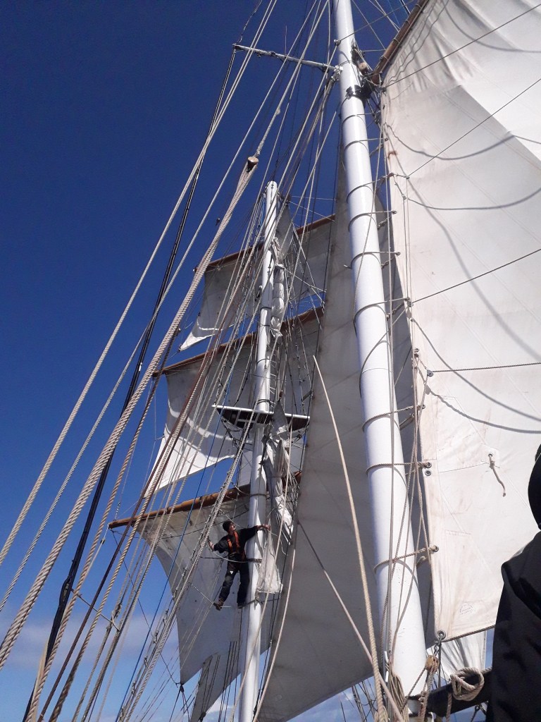
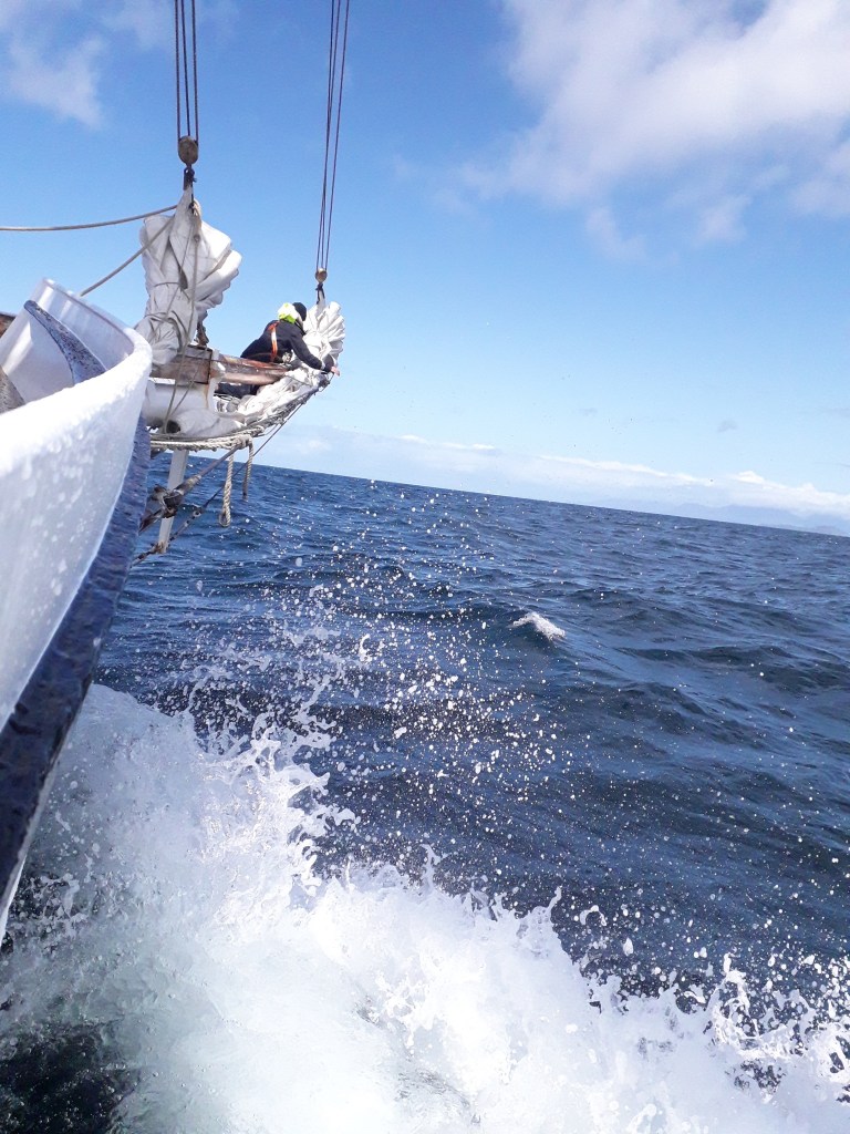
We travelled over 100 miles, much of it under sail. Fellow artist Alice Angus and I delivered sketching workshops to a companionable group of participants, and everyone made lots of sketches. Some people also steered the boat, managed the sails, swam on the sandy beaches, and a few brave participants went up the mast.
If you would like to join us on a future trip, there is another date in August – and two more voyages are planned for 2026. See this link for more information or contact me.
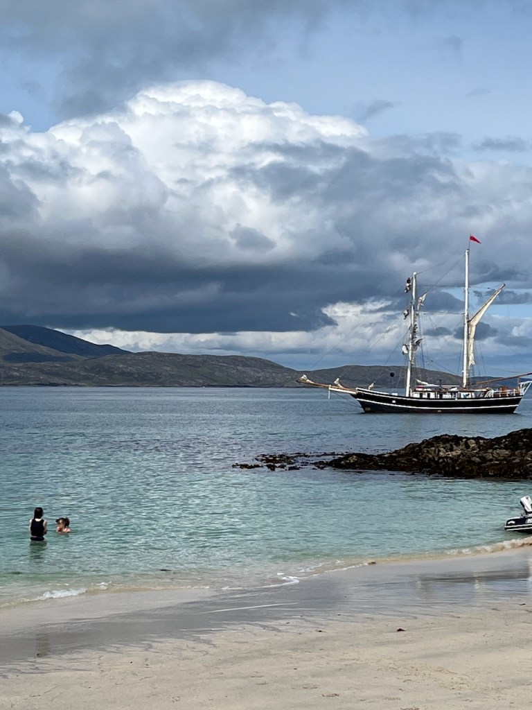
Here are a few of the many photographs from the May 2025 trip:
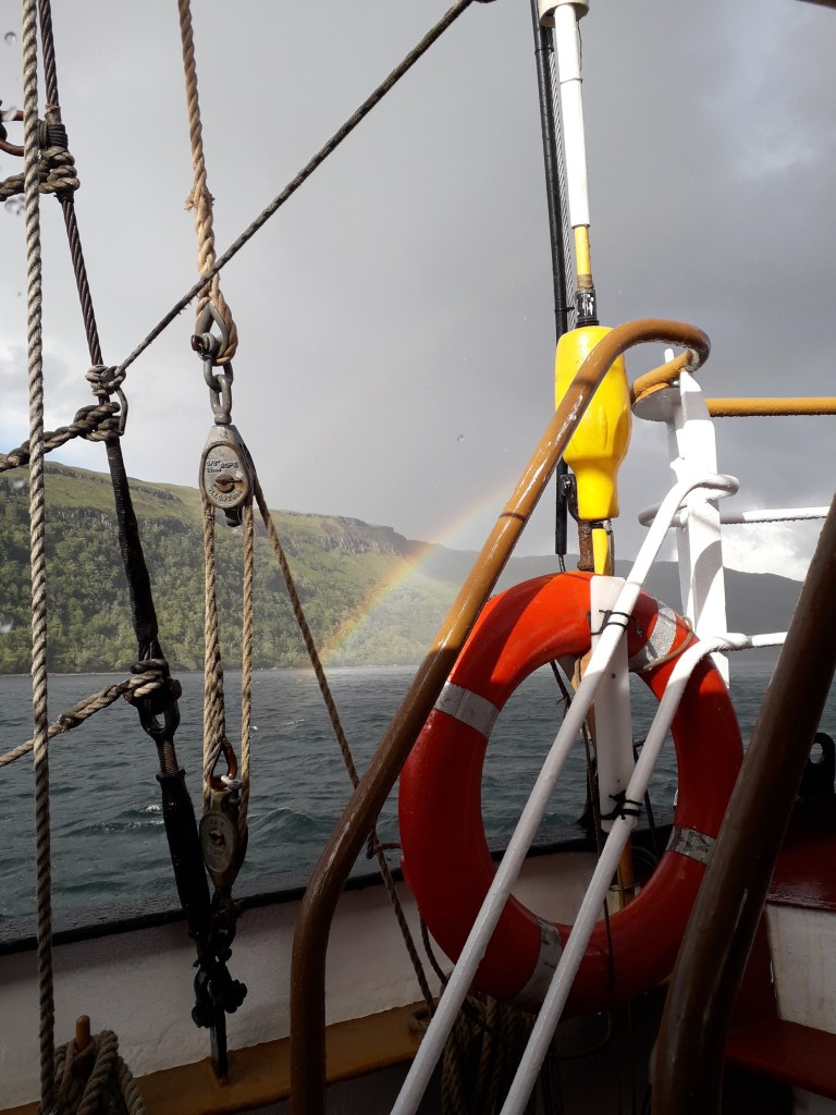
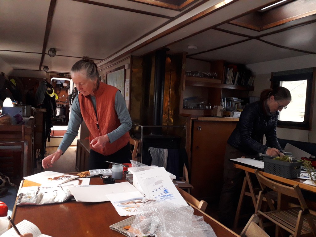
Swimming at SandrayA postcard of distant islandsArt workshop on the foredeckThe sails and a crew memberRainbow near CannaCrew member furling the sailJane and Alice preparing for an art workshop in the saloonNathalie sketching on the foredeckShore partyaction shots: Lady of Avenel May 2025 (photo credits: janesketching and Natalie)
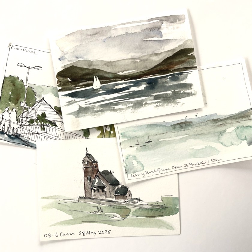
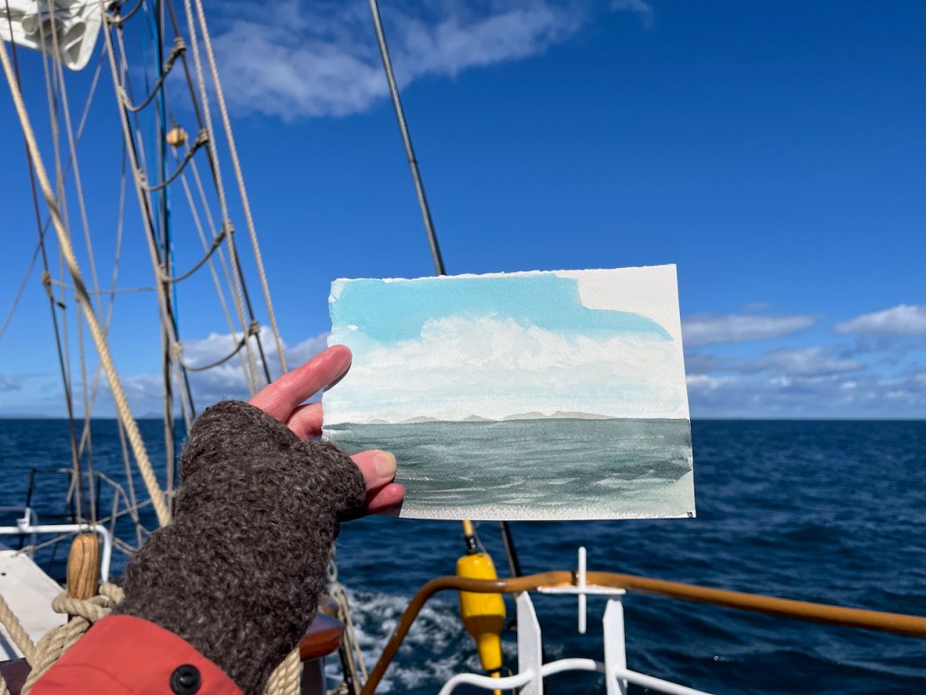
Here are some of my sketches from the trip.
I took an A5 sketchbook from JP Purcell, and sometimes sketched the landscape view across two pages:
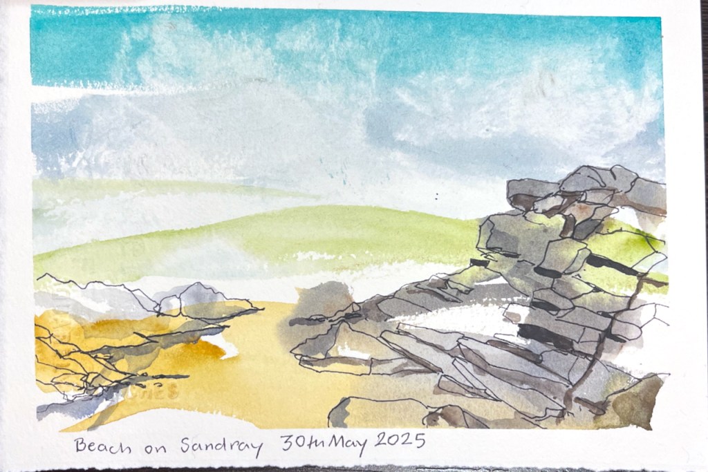
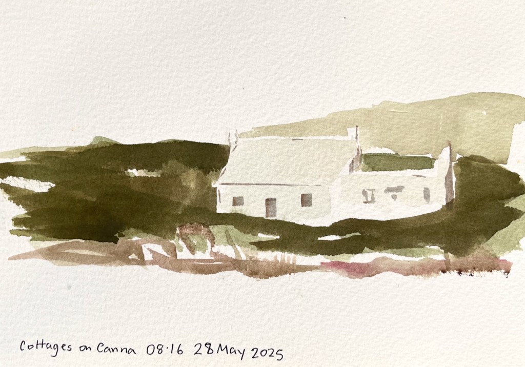
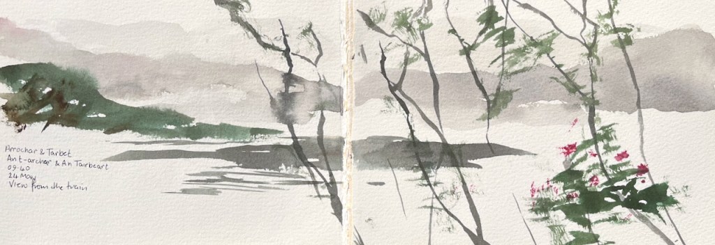
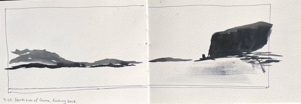
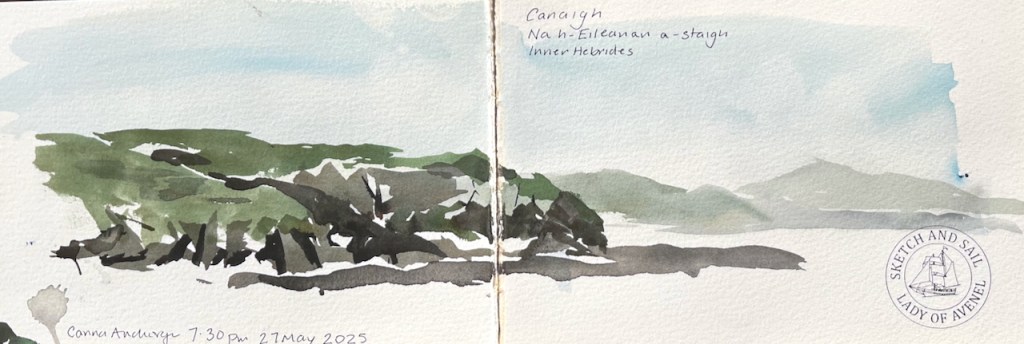
A quick sketch from the train northThe impressive cliffs and stacks of CannaA quiet anchorage at CannaFrom the sandy beach on Sandray
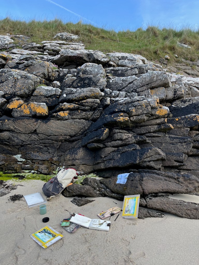
The beach at Sandray was a great sketching location. Here is a photo of my sketching spot.
Here is one of the drawings I made here:
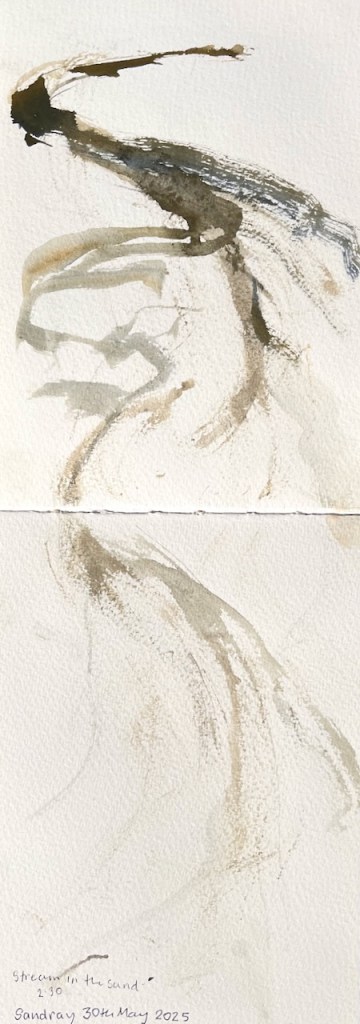
There was a stream running down the beach.
The stream on the beach, sketch made using seaweed and sea water.
The other sketchbook I took was a small A6 toned watercolour book made by Hahnemühle.
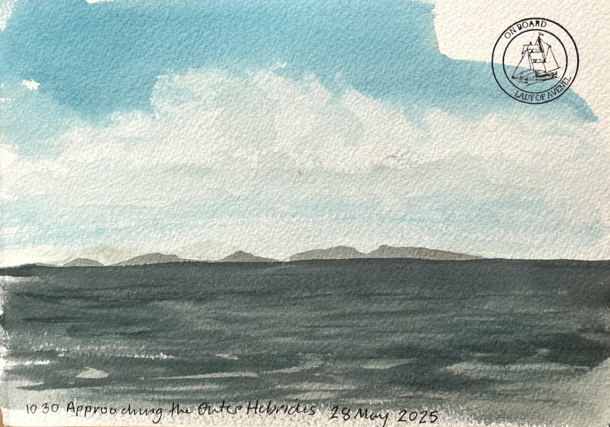
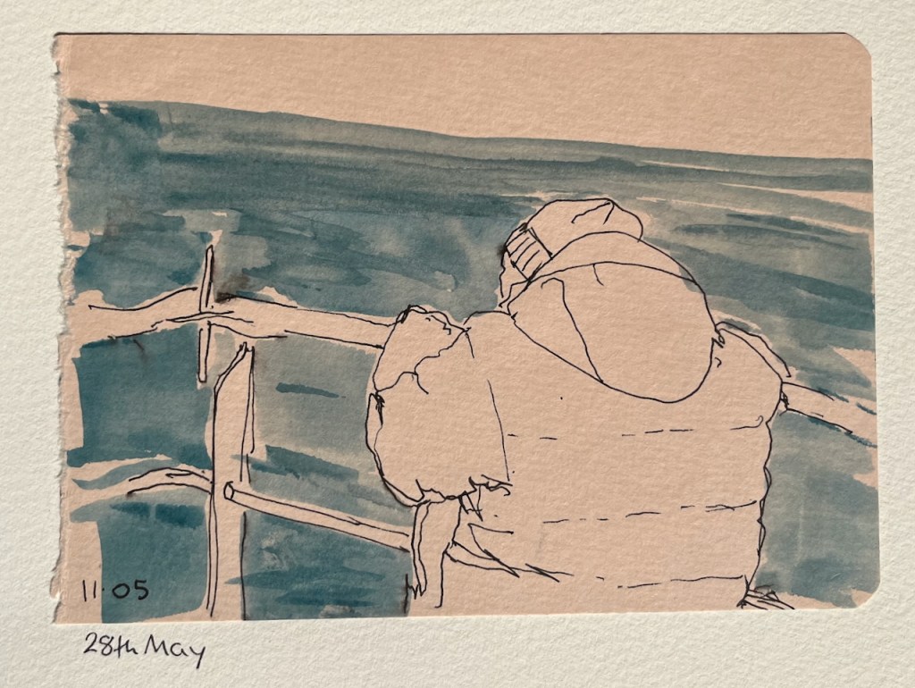
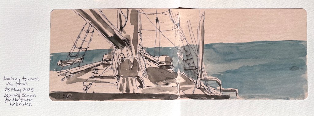
The toned sketchbookTony looking at the Outer HebridesA sketch of the ship, looking towards the prow.
On the way back to London I had a few hours walking and sketching in Glasgow – I’ll put those sketches in another post.
Meanwhile, here is a sketchbook flick-through so you can see the whole week in seven seconds of silent video. [videos might not play properly on mobiles or emails – please try the web-based version]
Sketchbook flick-through.
Materials:
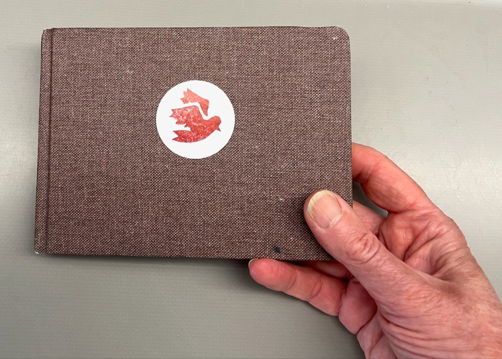
My main sketchbook was 300gsm watercolour paper, A5, from JP Purcell in Southwark, London. The bird sticker on the front is my design, printed by Vistaprint.
A well-used sketchbook: A5 watercolour paper, from JP Purcell.
I also used a small toned sketchbook from Hahnemühle.
Here is my colour palette, all traditional watercolours:
Colours used this week: all Daniel Smith except the Ultramarine Blue which is Schmincke Horadam
Here are the brushes I use. Mostly I used the large flat brush, which is from Rosemary Brushes. It is about an inch across.
Any other questions? If you’re interested in the Sketch and Sail adventure in August, or next year, do get in touch.
Click a button below to share this post online, email it, or print it:
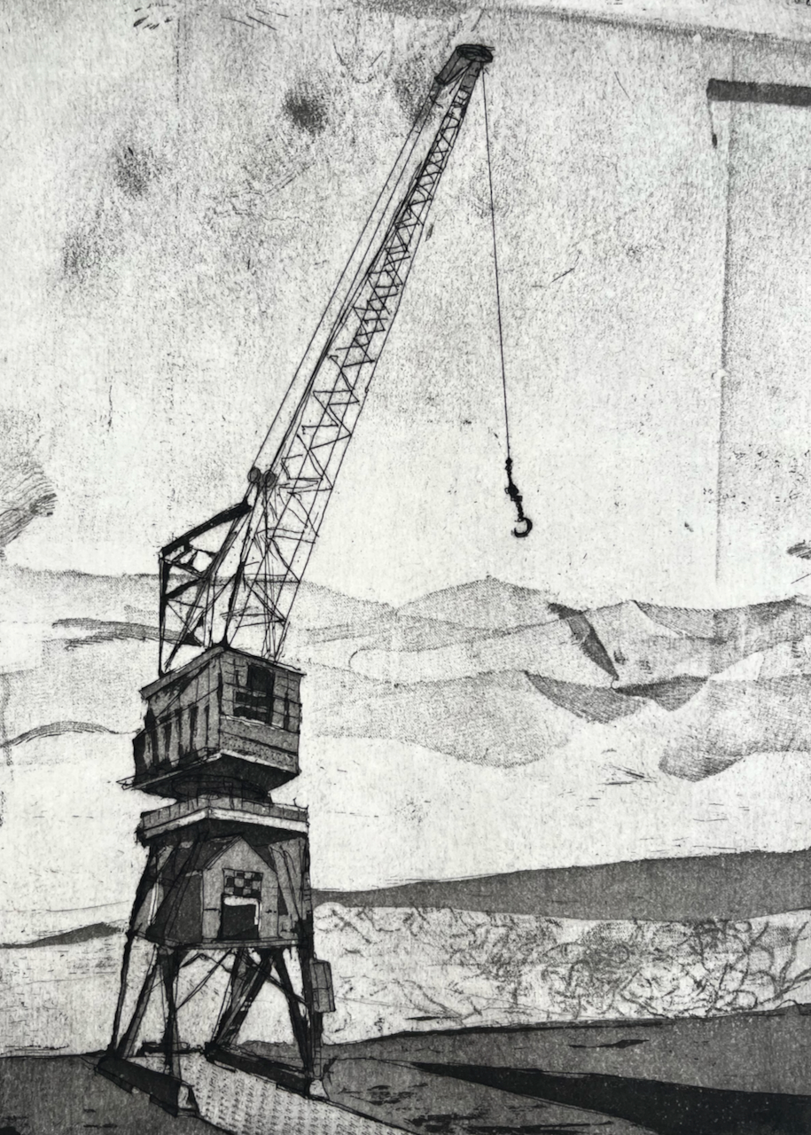
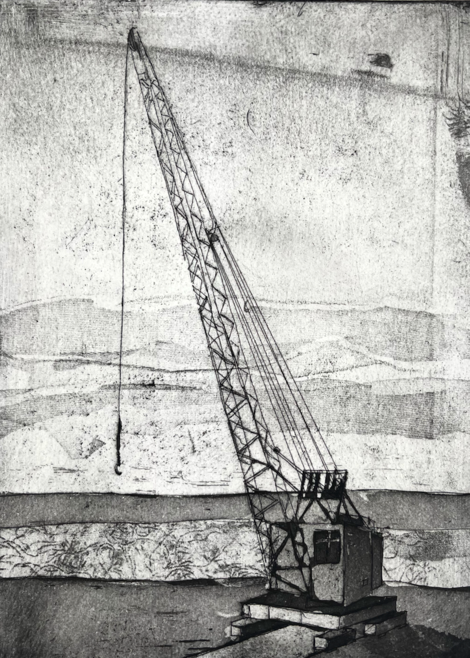
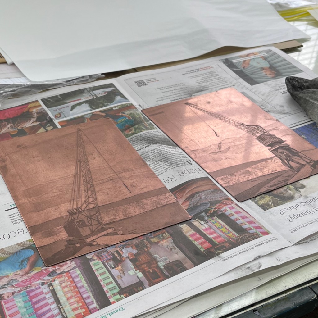
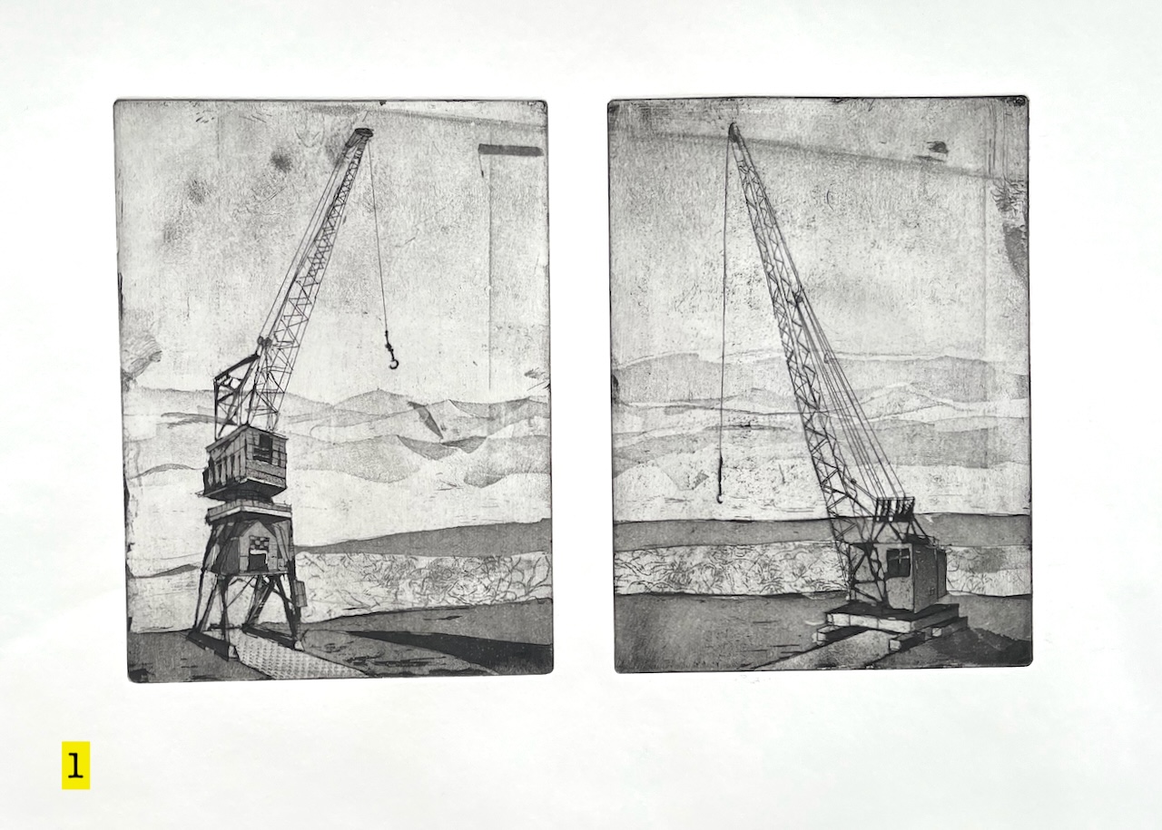
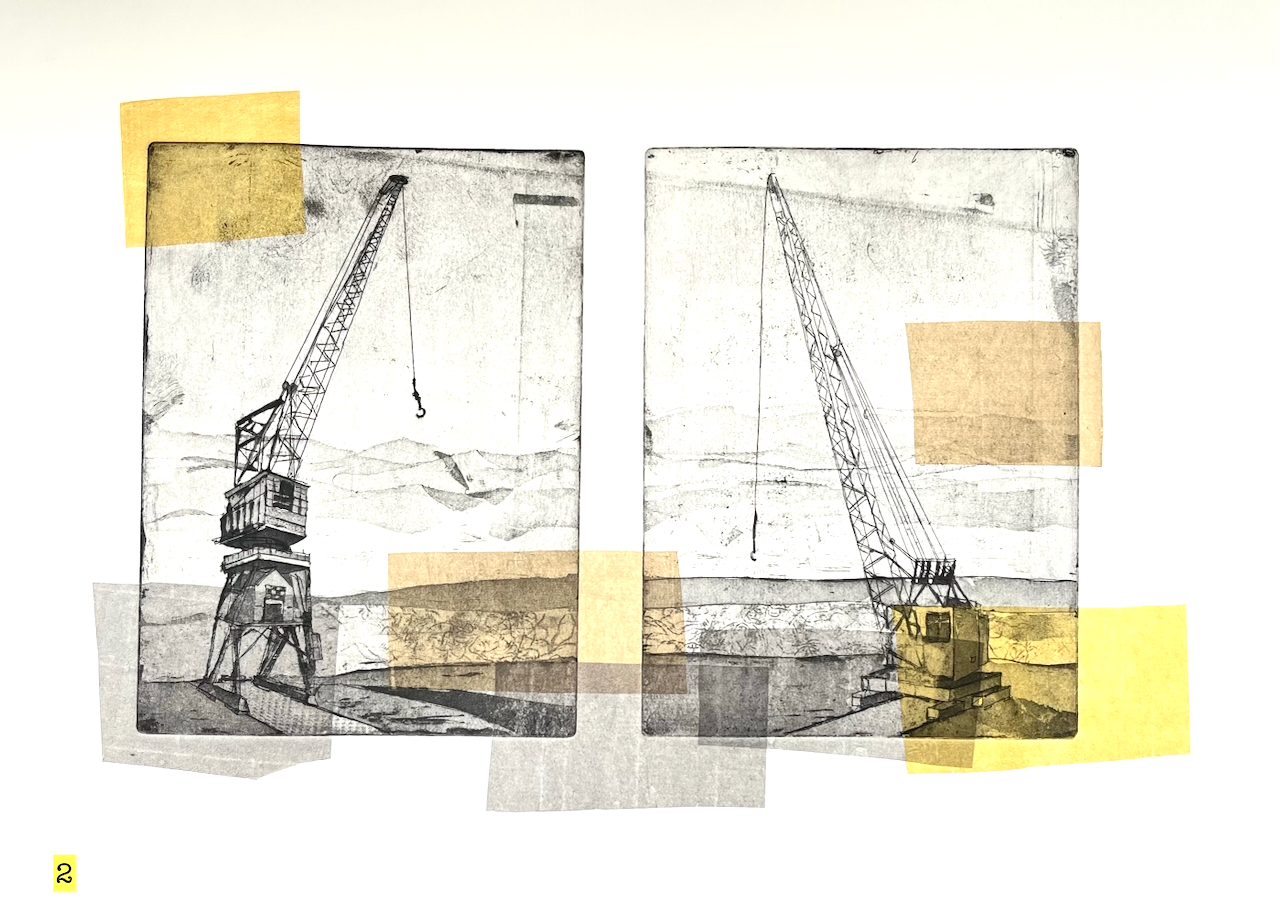
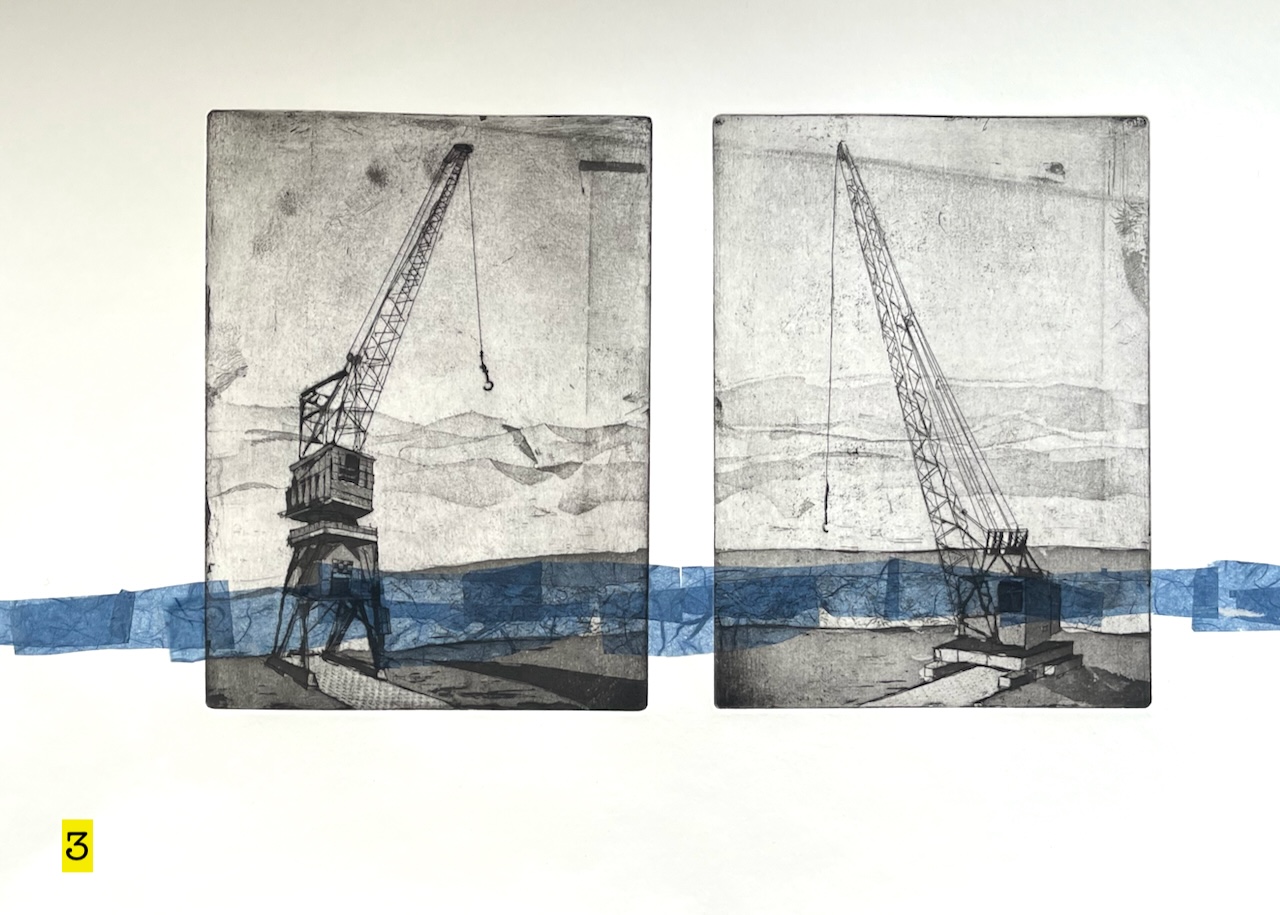
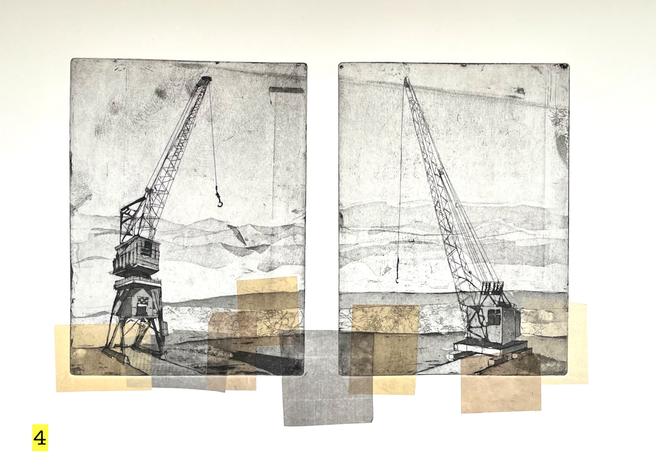
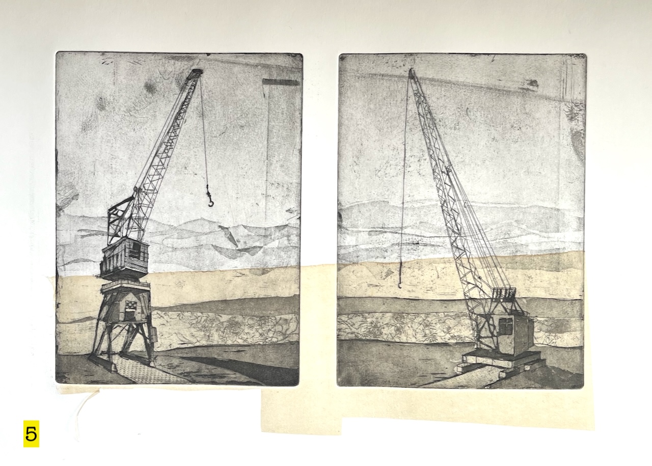
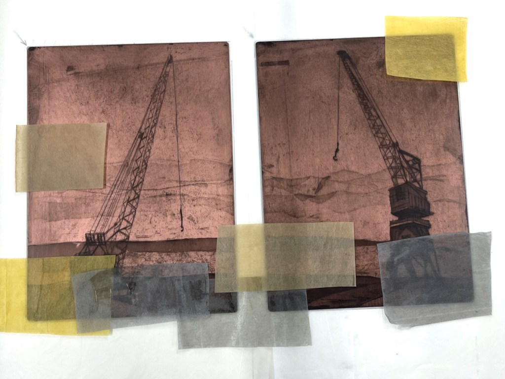
They stand by the river, ready for work. They are old cranes. It’s a long time since they lifted loads. But they hold themselves ready, should the call come. While they wait, they talk to each other.
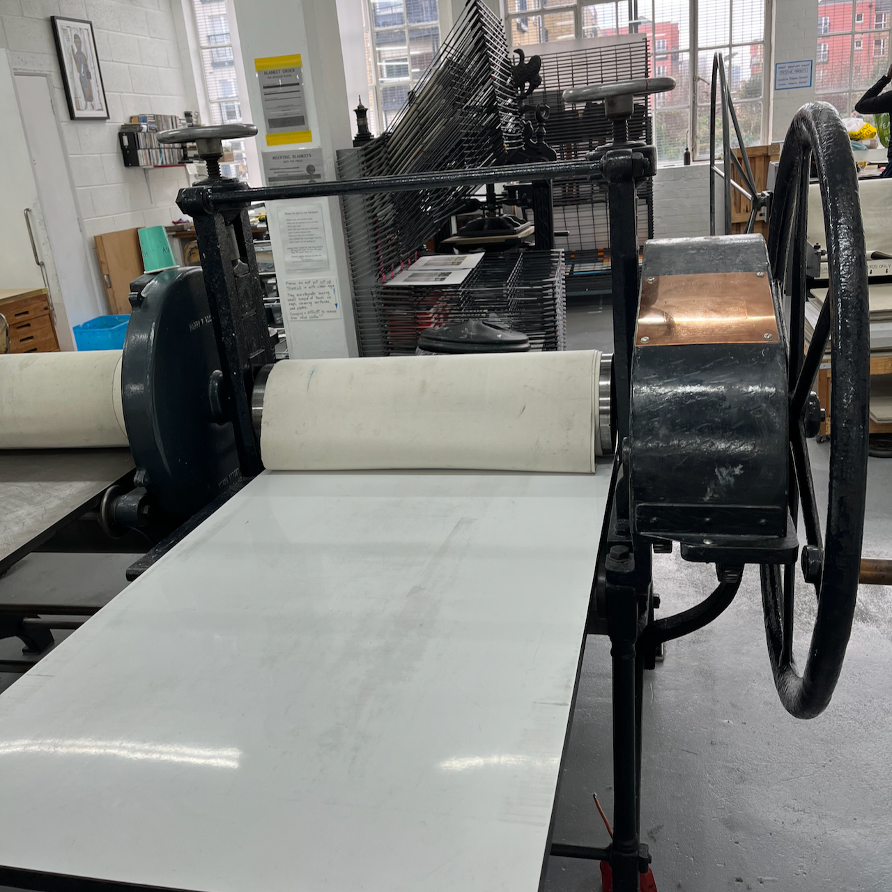
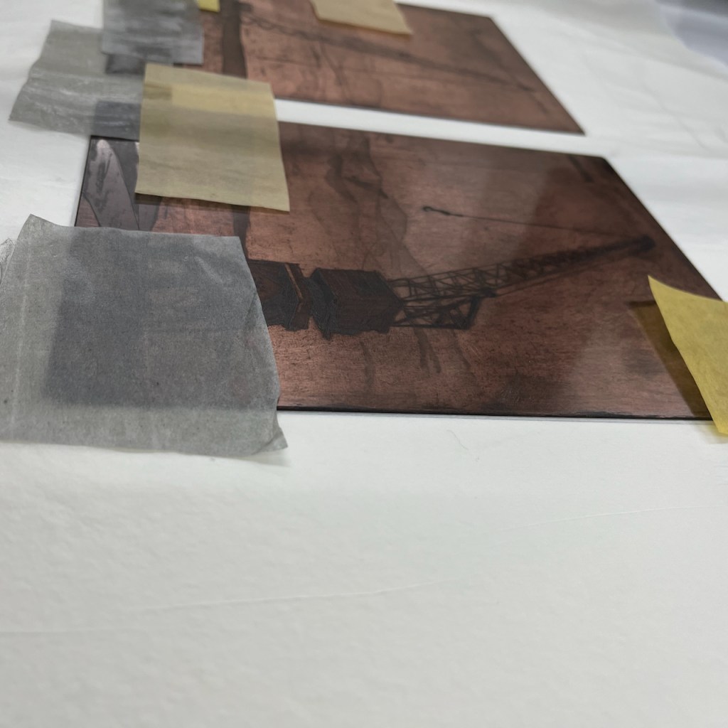
So I put them on the same sheet, they go together through the etching press.
Copper platesPrinting pressPlates on the press (print #2)print #5 drying
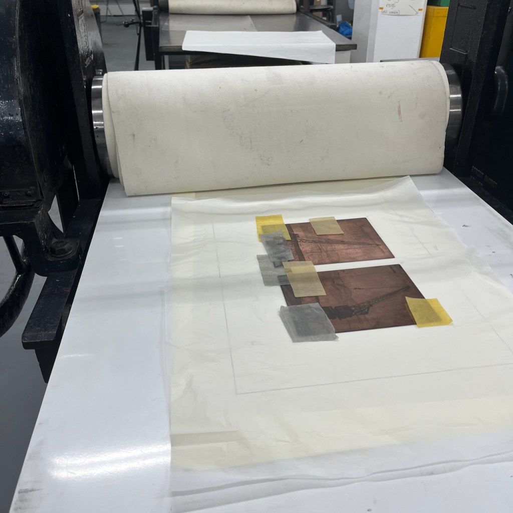
I made five prints of these cranes. The colour is added using the “chine colle” technique.
“Chine collé” means putting paper on top of the plate before it goes into the press. I have written about it on this page.
Here is the paper on top of the plate. It has glue on the top surface. The paper is very lightweight Japanese paper. It’s quite hard to get it to stay in position.
Here is a video of this plate after it’s been through the press:
Printing “Two Cranes”: thanks to friends at East London Printmakers for helping me with the video
I etched the plates and made these prints at East London Printmakers, Stepney. The techniques for making the plates are hard ground, soft ground, aquatint and dry point. The ink is Intaglio Printmakers Shop Mix Bone Black.
The cranes are at The Historic Dockyard, Chatham, Kent ME4 4TE
Let me know if you’d like a “Two Cranes” print? The sheet is about A2 size.
Click a button below to share this post online, email it, or print it:
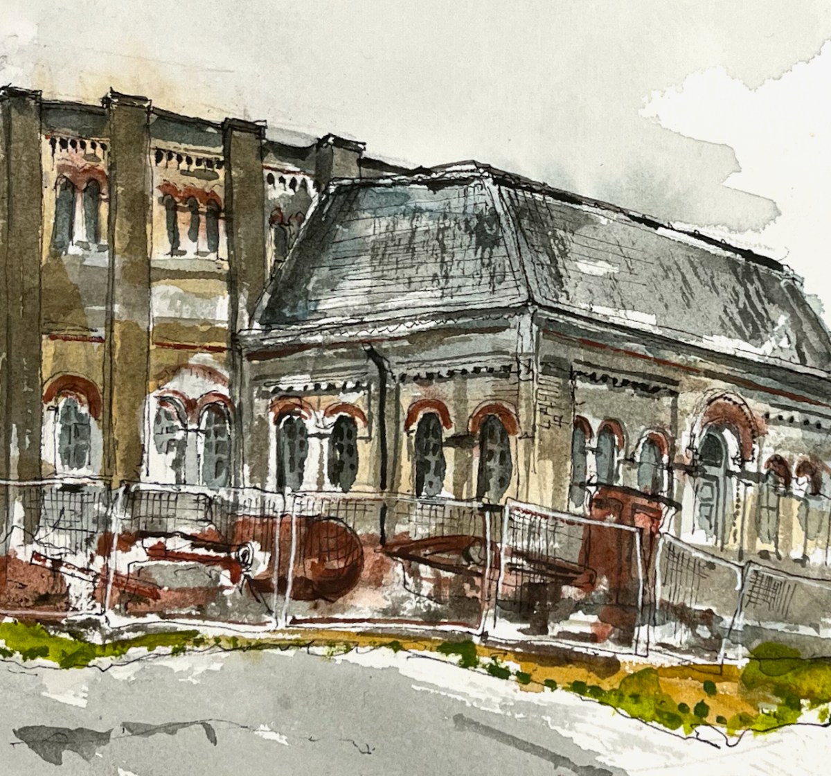
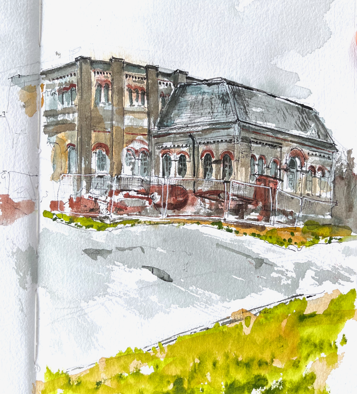
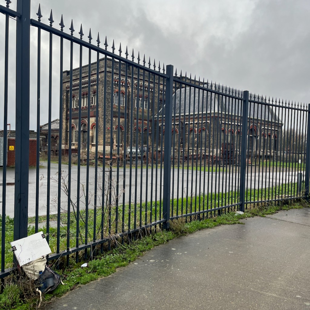
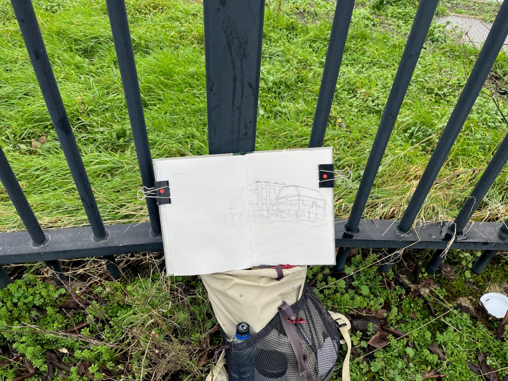
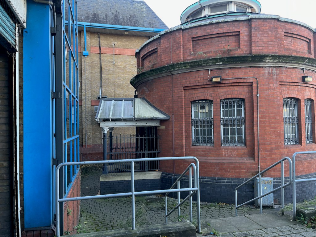
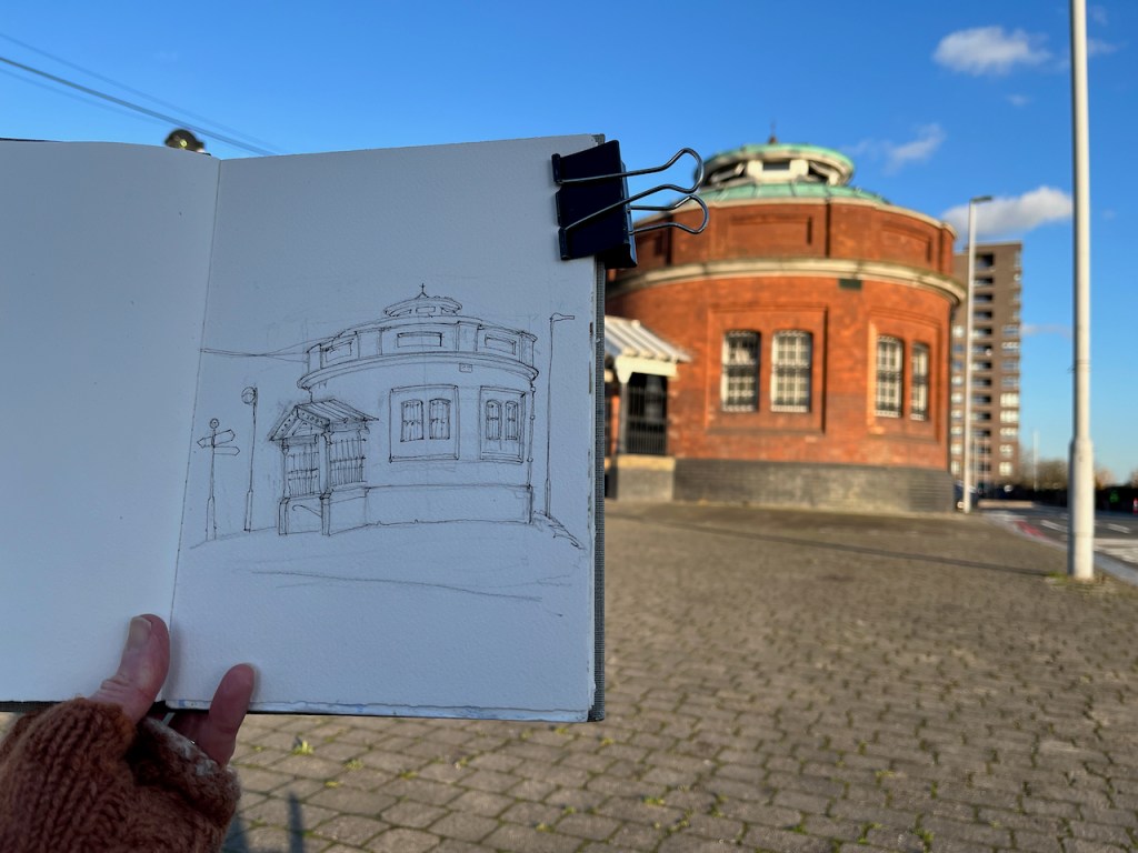
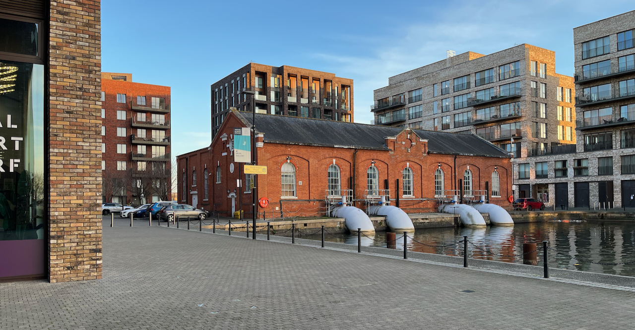
Here is a view of the old engine house of Crossness Pumping Station, on the South bank of the River Thames.
Crossness Engine House, sketched 5th January 2025 from the Thames Path
This is a former sewage pumping station. It was designed by the engineer Joseph Bazalgette and opened on the 4th April 18651 . It is the equivalent for South London of the Abbey Mills sewage pumping station on the North side of the Thames, which I have sketched previously.
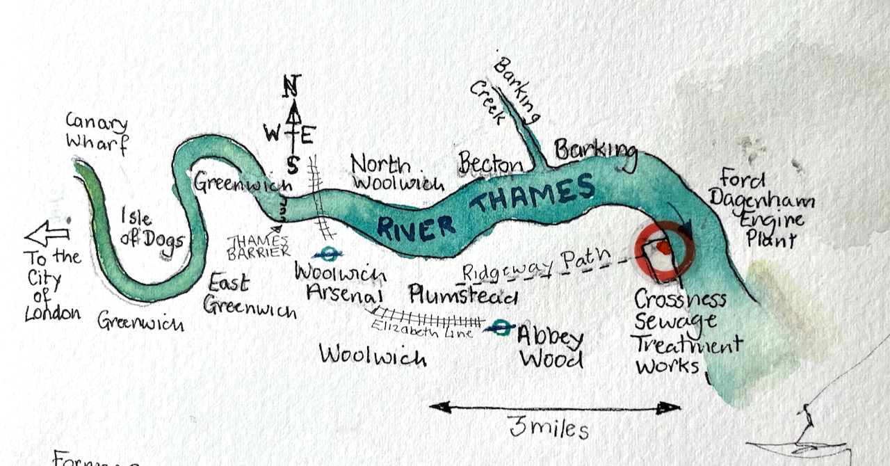
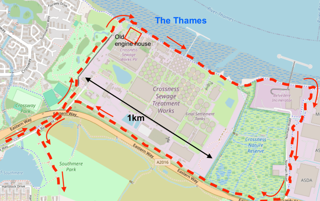
Sketch map showing the location of Crossness Sewage Treatment Works
These two pumping stations were important components of Bazalgette’s plan to rid London of cholera by removing sewage from central London. His idea was to pump the sewage from the conurbations in central London and shift it to Crossness and Beckton. This did indeed solve the problem of cholera in the city. It did not solve the problem of untreated sewage in the Thames: it just moved it downstream and away from the main residential areas of the time. Untreated sewage was pumped into the river at Crossness and Beckton on the ebb tide.
The exact number of passengers on board the Princess Alice during that fatal voyage is unknown, as is the number lost, but it is thought that around 640 people drowned, making this Britain’s worst inland waterway disaster.
This terrible tragedy and the consequent public outcry prompted the authorities to shift the problem even further downstream. Sewage boats were used to transport raw sewage into the Thames estuary and dump it in the North Sea. Amazingly, this continued until 1998:
The tragedy prompted the introduction of what became known as ‘Bovril boats’ (due to the unfortunate colour and consistency of their cargo), which carried sewage sludge out to the Thames Estuary and North Sea, disposing of it there.This continued until 1998, when EU legislation forbade it due to contamination of beaches.
These days the sewage is treated3 (mostly). Next to the Victorian pumping station I sketched, there is a vast modern sewage treatment works belonging to Thames Water. Sewage is transformed by bacterial action and filtering. It becomes water and “sludge”. The water goes into the Thames. The sludge is used as agricultural fertiliser or burned for electrical power generation.
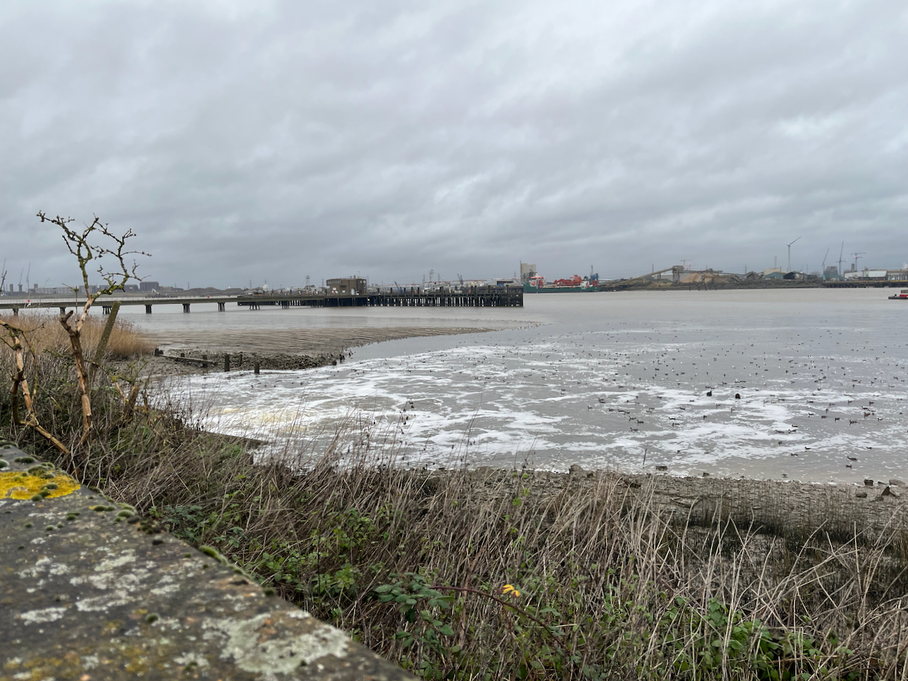
Modern sewage treatment works, Crossness, seen from the Thames path.
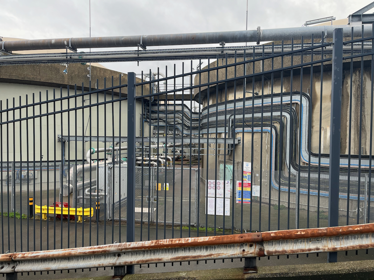
On my walk I circumnavigated this enormous treatment plant. It hardly smelt atall.
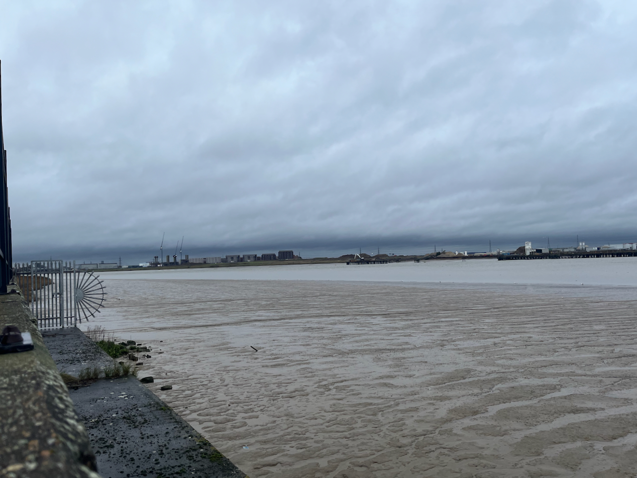
The Thames is vast here.
Looking across to North WoolwichBirds flock on the outfall from the treatment worksViews from the Thames path at Crossness Sewage works
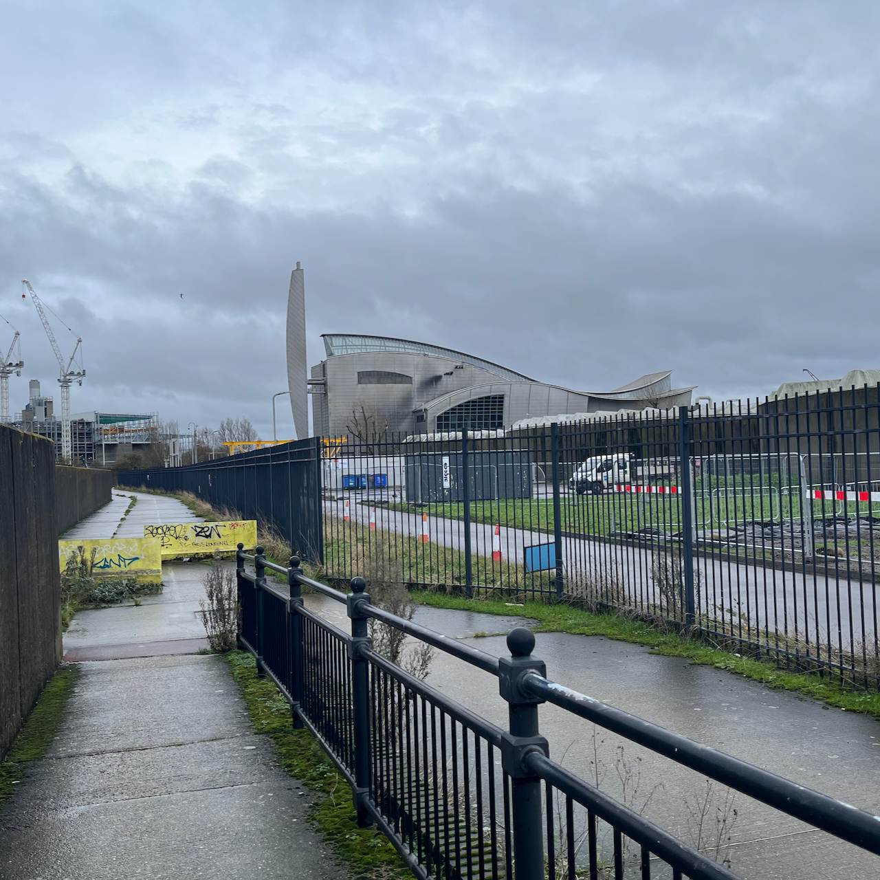
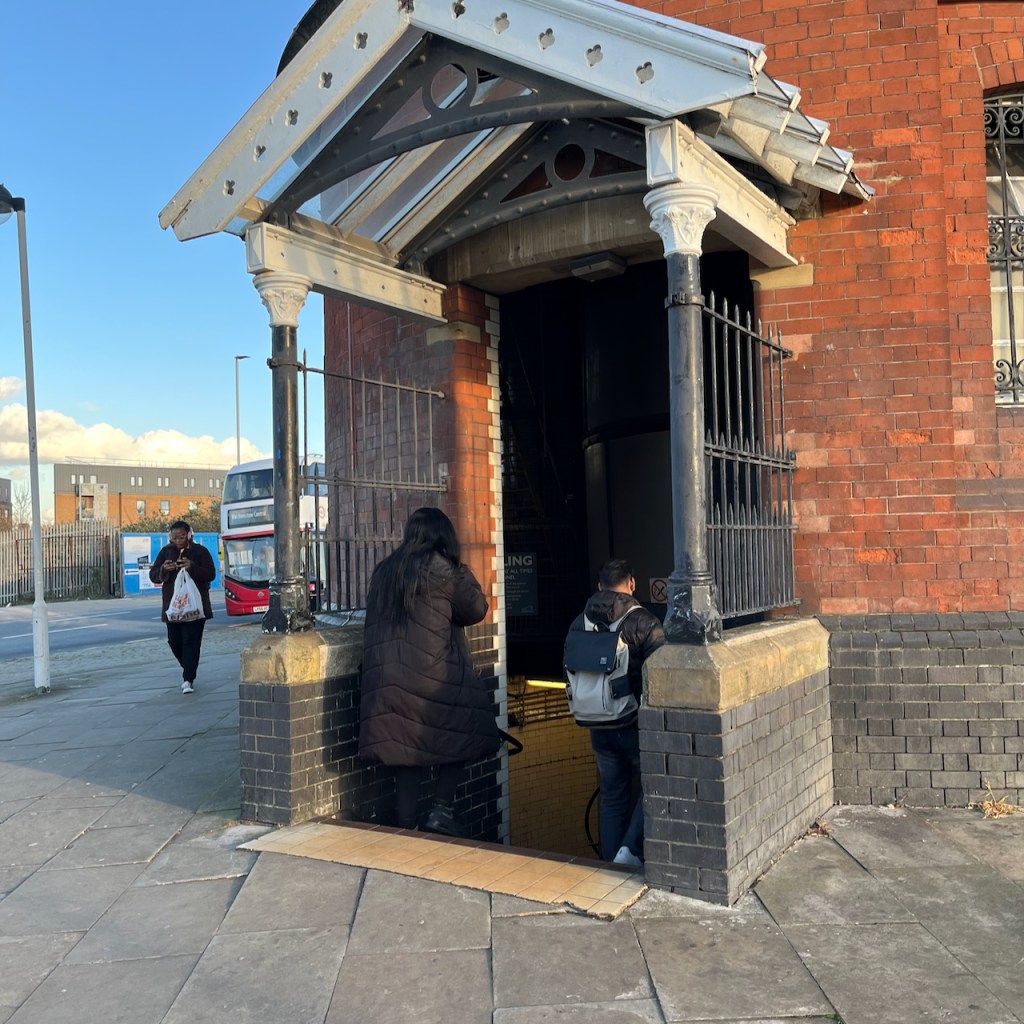
I sketched the Engine House from the Thames Path. It is behind some tall and strong fencing, which I did not put in the picture.
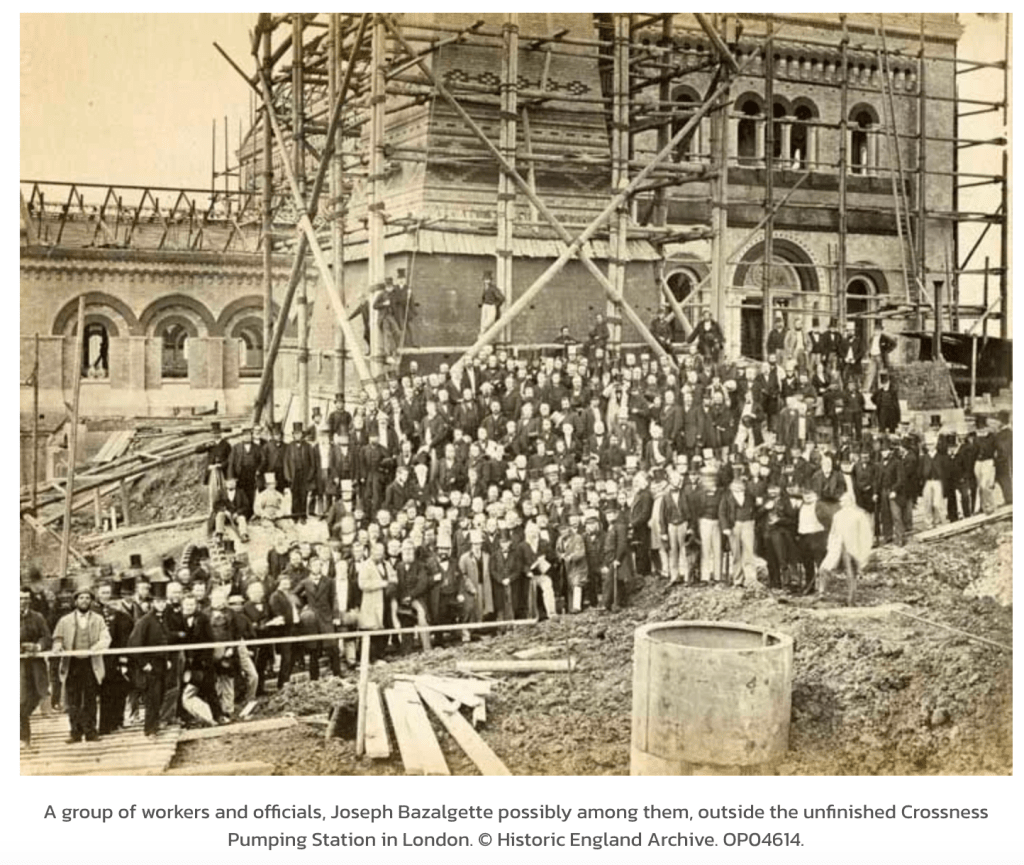
Source: Historic England Archive, used with permission.
The photo is more-or-less the same viewpoint as my sketch. I hope that the workers in this picture felt proud of their achievement, and would be glad to know that their work has been honoured, and building continues on the site.
20th century sludge incinerator, Crossness, and a further incinerator plant under construction, far left
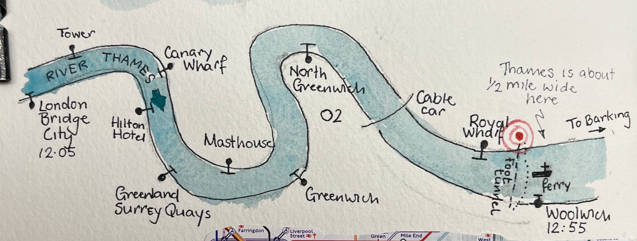
My expedition started at London Bridge pier, with a trip down the Thames on the riverboat. This seemed the simplest way to get to the docks. It takes about 50 minutes to go from London Bridge to Woolwich.
The route of the riverboat from London Bridge to Woolwich.
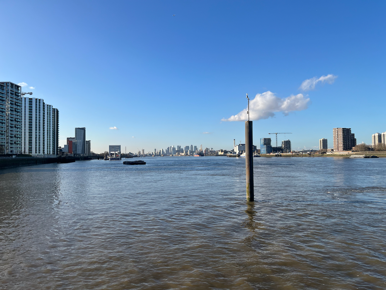
Everyone gets out at Greenwich, but it’s well worth going a bit further. The boat is empty, the Thames is huge, and the sky opens out.
The City of London seen in the distance, from the Woolwich Royal Arsenal Pier
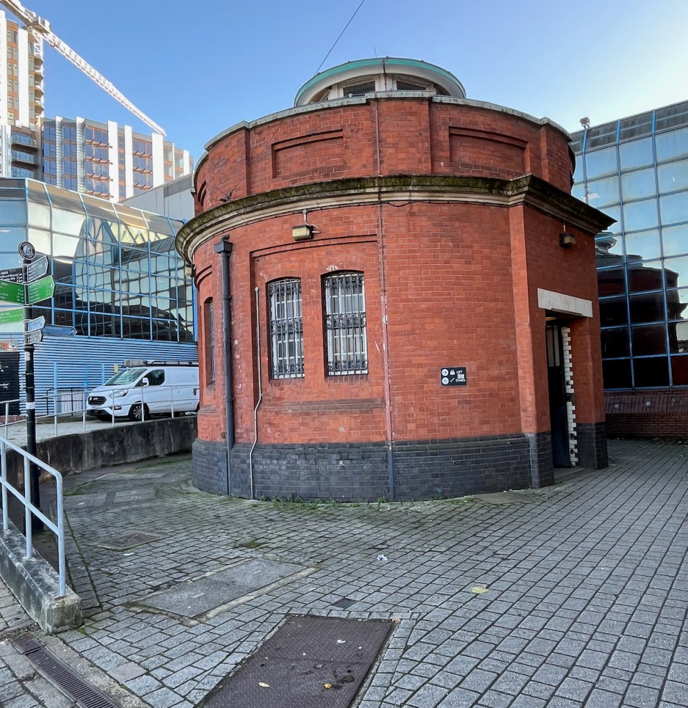
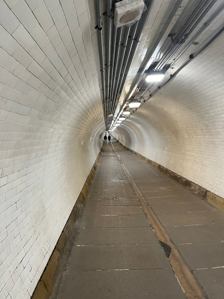
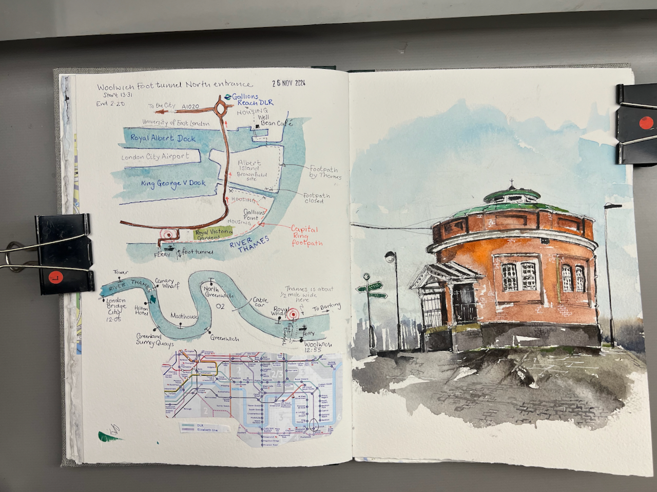
The river boat pier at Woolwich is on the South side of the river. I was keen to explore the North side, so I walked a little way to find the entrance to the foot tunnel. There is also a ferry, but I wanted to experience the foot tunnel.
The South entrance to the foot tunnel is hard to find. It’s crammed into a dark space behind the leisure centre. It looks somewhat dingy and derelict.
South entrance of the Woolwich Foot tunnel, hemmed in by 1970s buildings.
You have the option of the lift or the stairs. I followed the arrow to the stairs. The stairs are round the back. You have to find your way in, sidling between the wall of the leisure centre and the columned entrance to the tunnel. I can’t help feeling that the constructors of the tunnel would be appalled that their ornate entrance had been obstructed in this way.
Entrance to the stairs, under the canopy. Leisure Centre is the blue part on the left.
By this time I was rather doubting the wisdom of this undertaking, as the old building seemed so abandoned, and the entrance was so dark. However, the stairs were brightly lit, and it all seemed feasible. So down I went.
The tunnel itself is marvellous: all bright and clean, with amazing acoustics. I could hear the distant voices of people ahead of me.
Inside the Woolwich Foot Tunnel
On the North side there is a different world. The North entrance, unlike its Southern counterpart, stands proud and isolated on an expanse of concrete. I sat down and sketched it.
The building stands on a traffic island which is a junction of many routes. The A117 takes heavy traffic onto the pier, to load onto the Woolwich Ferry. There’s a bus, the Superloop SL2 ,which goes to Walthamstow. People walk from the bus to the foot tunnel.
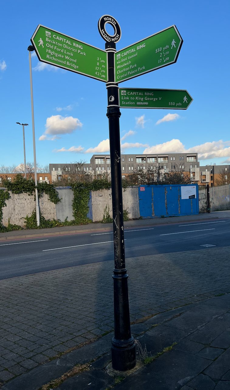
North entrance to the foot tunnel. The Superloop bus from Walthamstow is in the background.
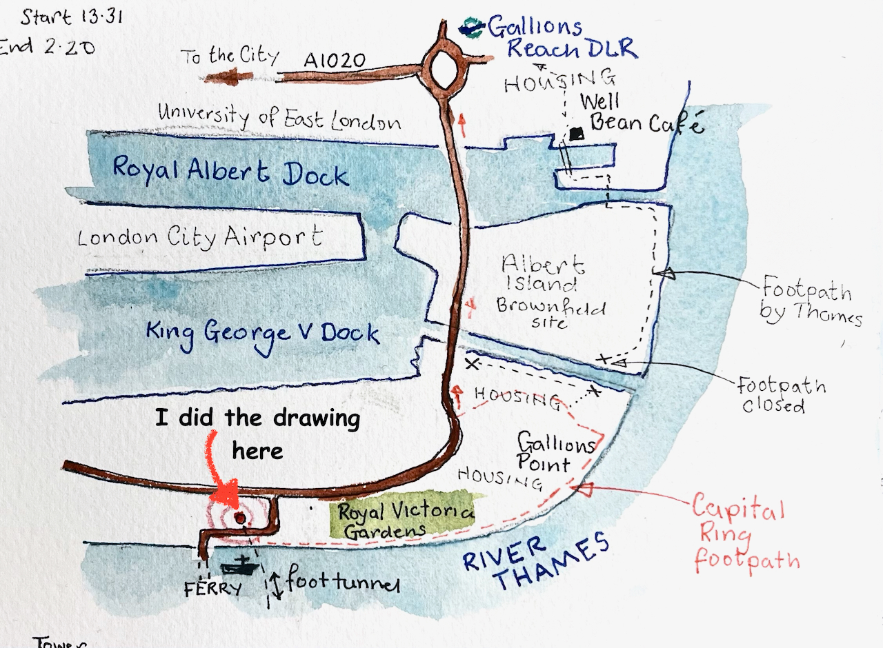
The signpost on the left of my drawing indicates the long distance footpath “The Capital Ring”. I followed this route along the Thames a little way. The path is cut off after the Galleons Point Housing development. Signs say that the lock gates are being maintained. So the route returns to the main road and passes over the spectacular bridges across the docks.
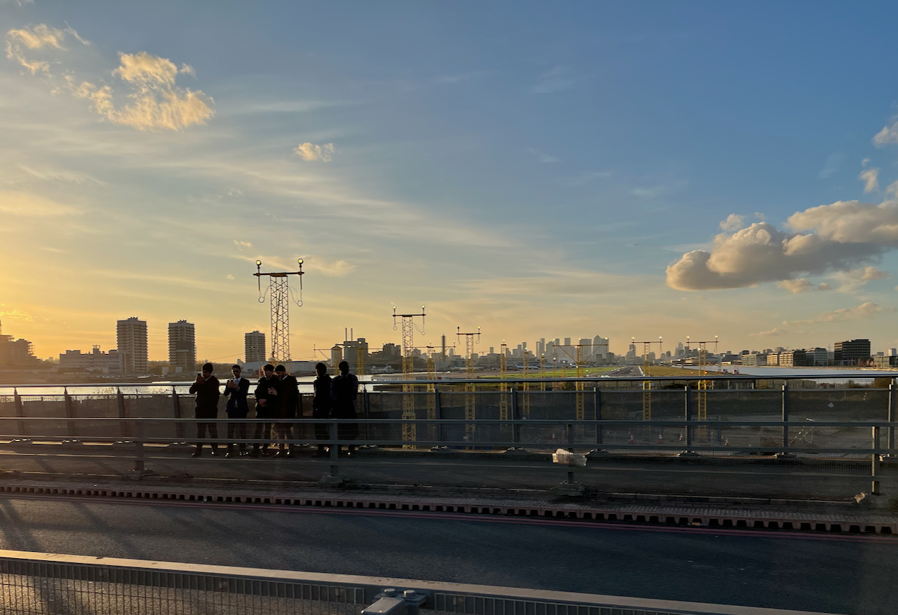
The bridges offer a view directly down the runway of London City Airport. When I walked past, some boys were enthusiastically photographing the aircraft on their mobile phones.
Plane spotters on the bridge over the Royal Albert Dock. City of London in the distance.
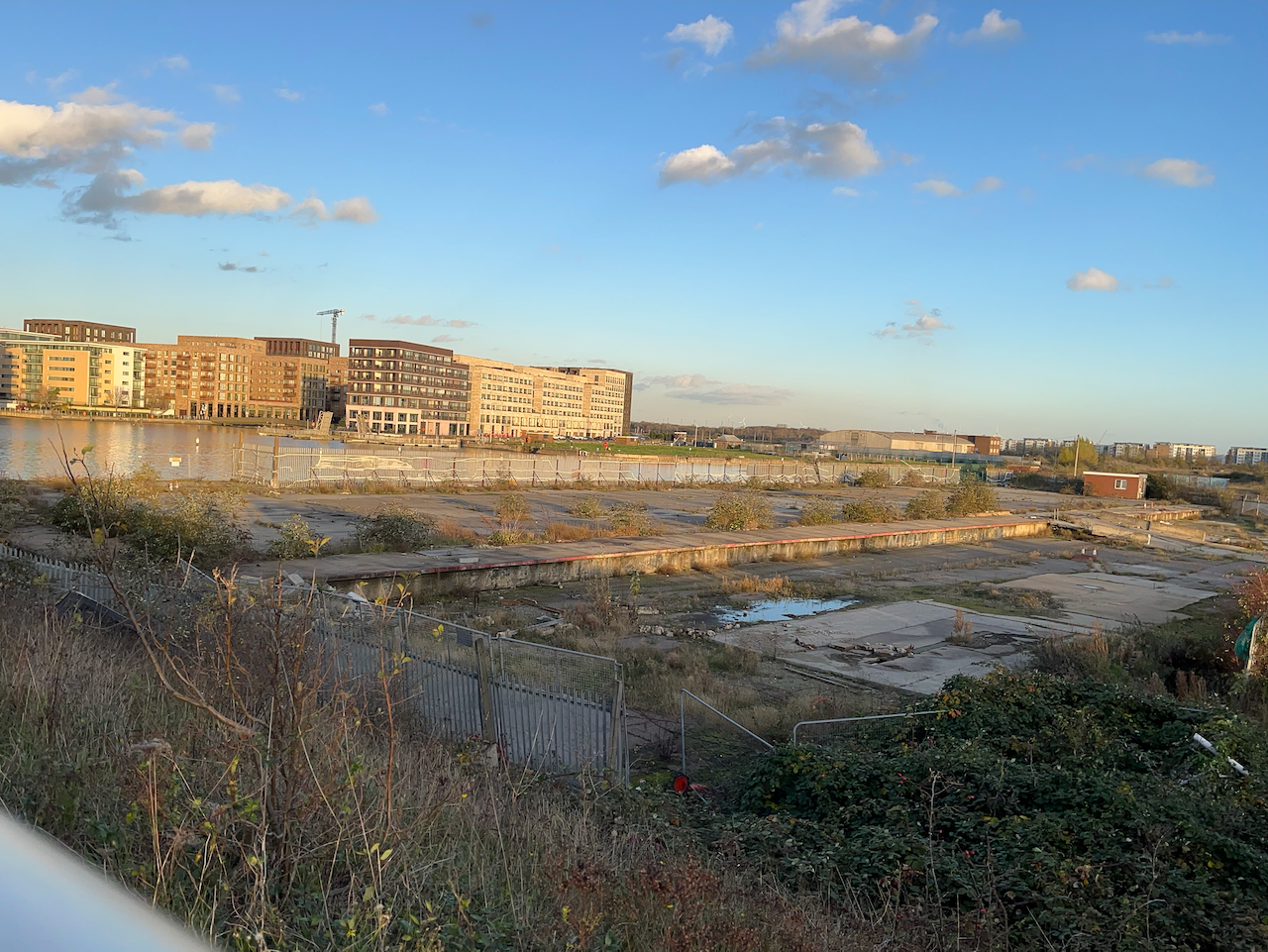
The other direction from the airport, looking toward the Thames, is a scene which seems to define what we mean by “brown field site”.
A brown field site: Albert Island, North Woolwich. This photo was taken from the same spot as the one above, but looking the other way.
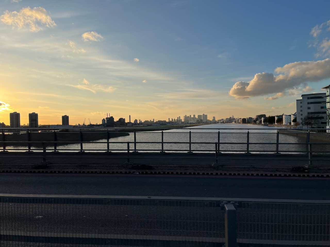
In the distance on the left, you see the housing developments round Gallions Reach. The quantity of space round here is astounding. And the docks are enormous.
Royal Albert Dock from the Steve Redgrave Bridge. The dock is about a mile long. The University of East London is on the right, City Airport on the left, City of London towers in the distance.
I walked on over these immense bridges over the docks. An oncoming bus tooted cheerfully. I looked up to see the driver smiling a friendly greeting. Perhaps I looked a little lonely and cold. The bus rushed on. I felt warmer.
On the other side of the bridge I warmed up in the “Wild Bean Café” (recommended) and then made my way to Gallions Reach DLR station and thence to central London.
If in need of wide open spaces and a bit of distance from the problems of the City, then a trip downriver is definitely the thing.
Sketching the North entrance to the foot tunnelSignpost by the North EntranceThe river at North WoolwichLooking downstream, North WoolwichPumphouse in Gallions ReachSketchbook 15 spread
Click a button below to share this post online, email it, or print it:
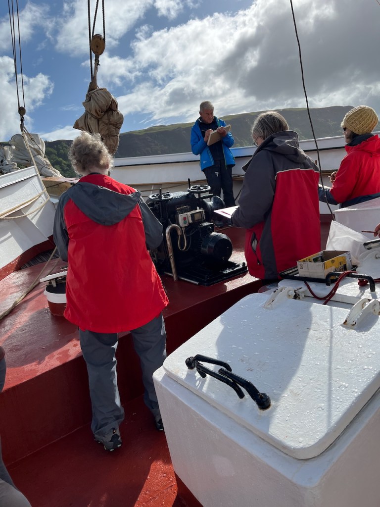
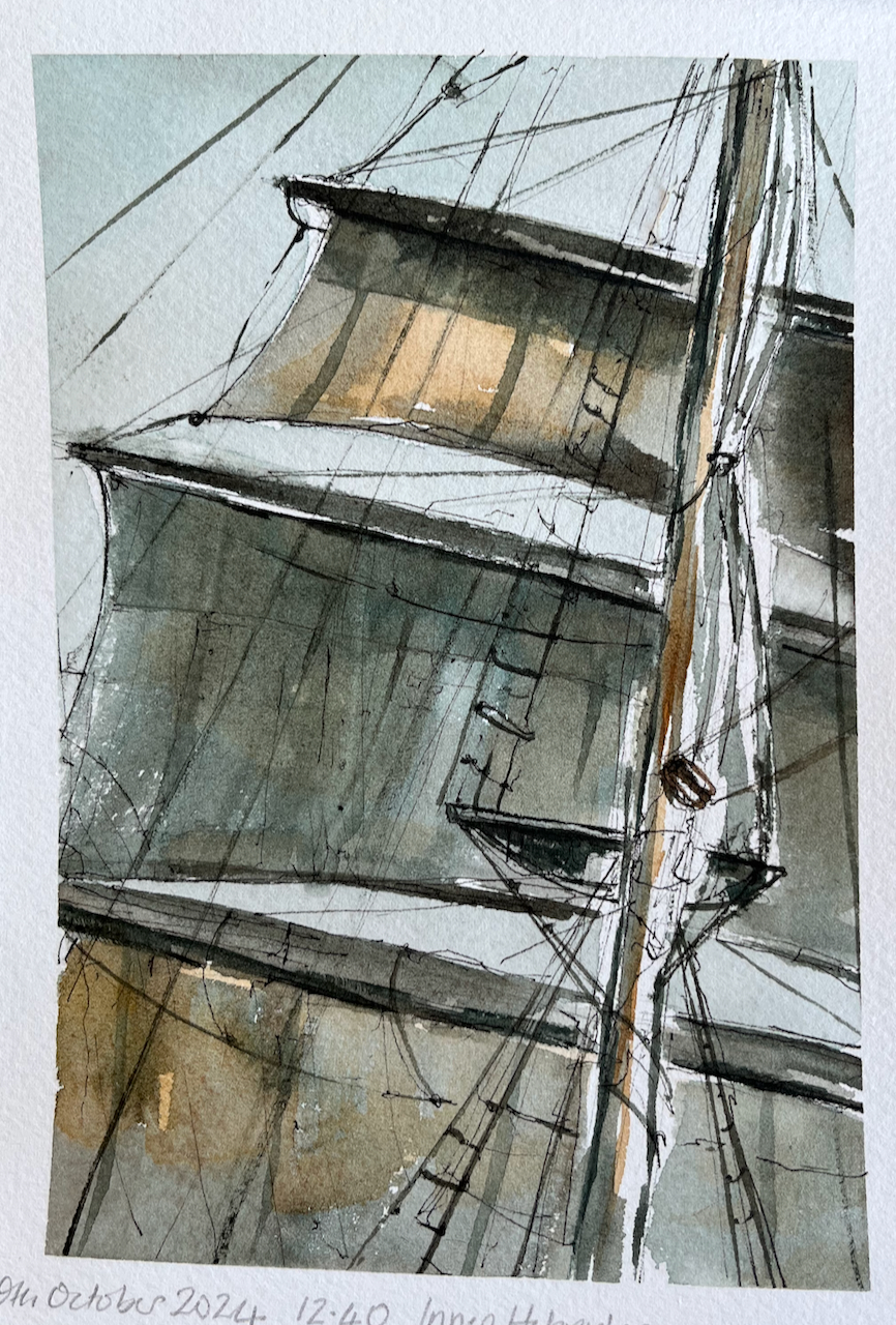
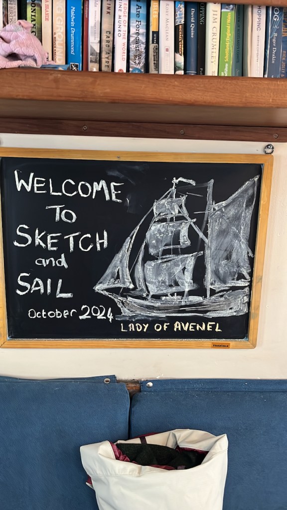
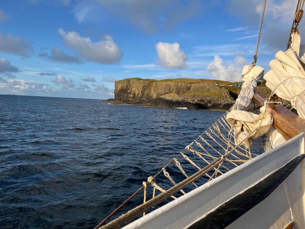
I’m just back from an invigorating week on “Sketch and Sail”with fellow artist Alice Angus and a group of guests, all sketching and learning. We were hosted by the marvellous crew of the Lady of Avenel, who managed the ship and provided all our meals. Our voyage was around the Isle of Mull in the Inner Hebrides, see maps below. We had amazing fun, laughed a lot, got wet, got dry again, got blown about, and enthusiastically sketched the experience. Everyone was very productive: lots of pictures were made, sketchbooks were filled, postcards were painted and sent.
Alice and I ran workshops on brushstrokes, rapid sketching, outline drawing, sketching kit, painting sea and sky and many other exercises. We all shared thoughts and ideas on tools and techniques, and everyone learned a lot, including me. We also did an experimental workshop on sketching in the dark.
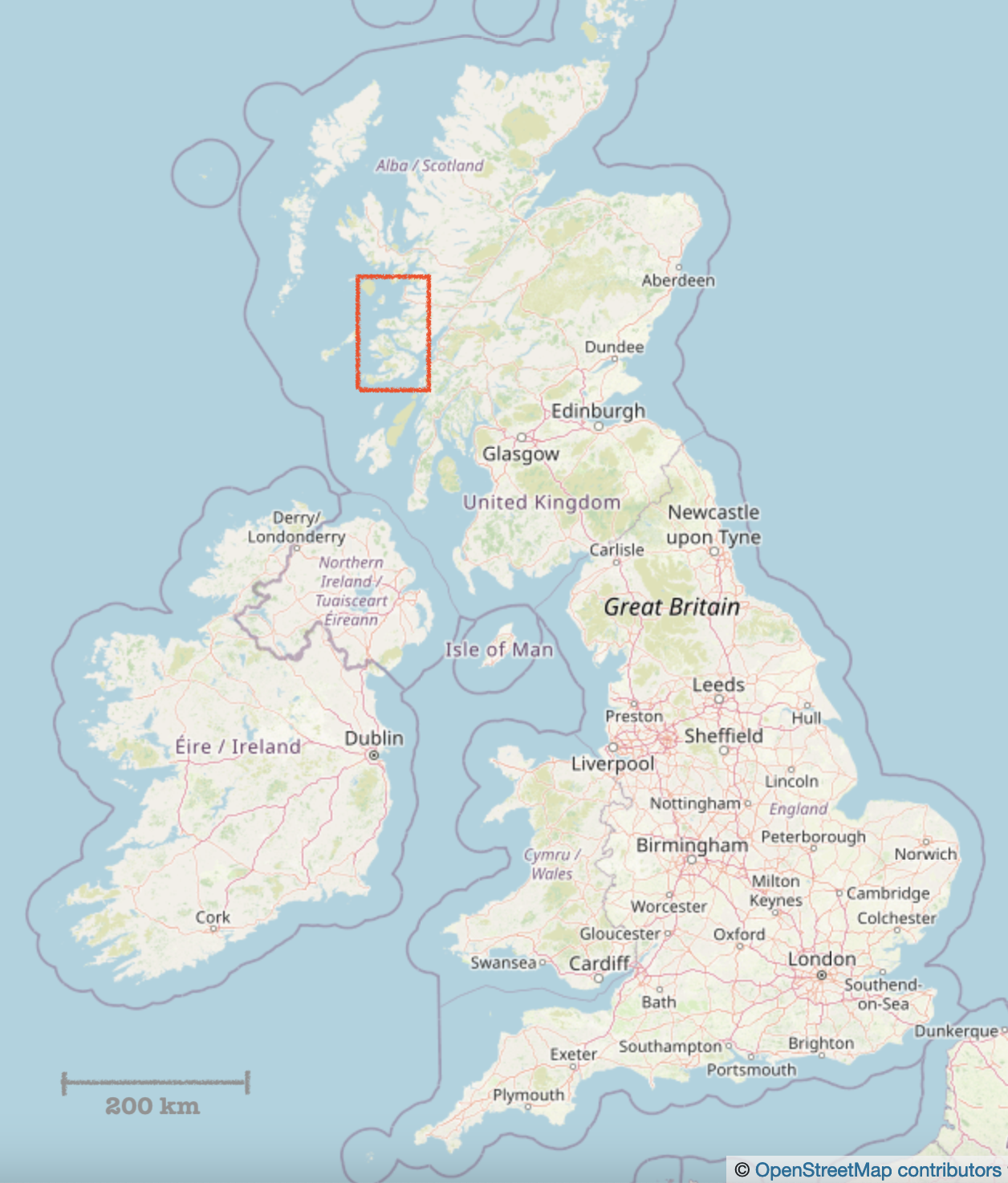
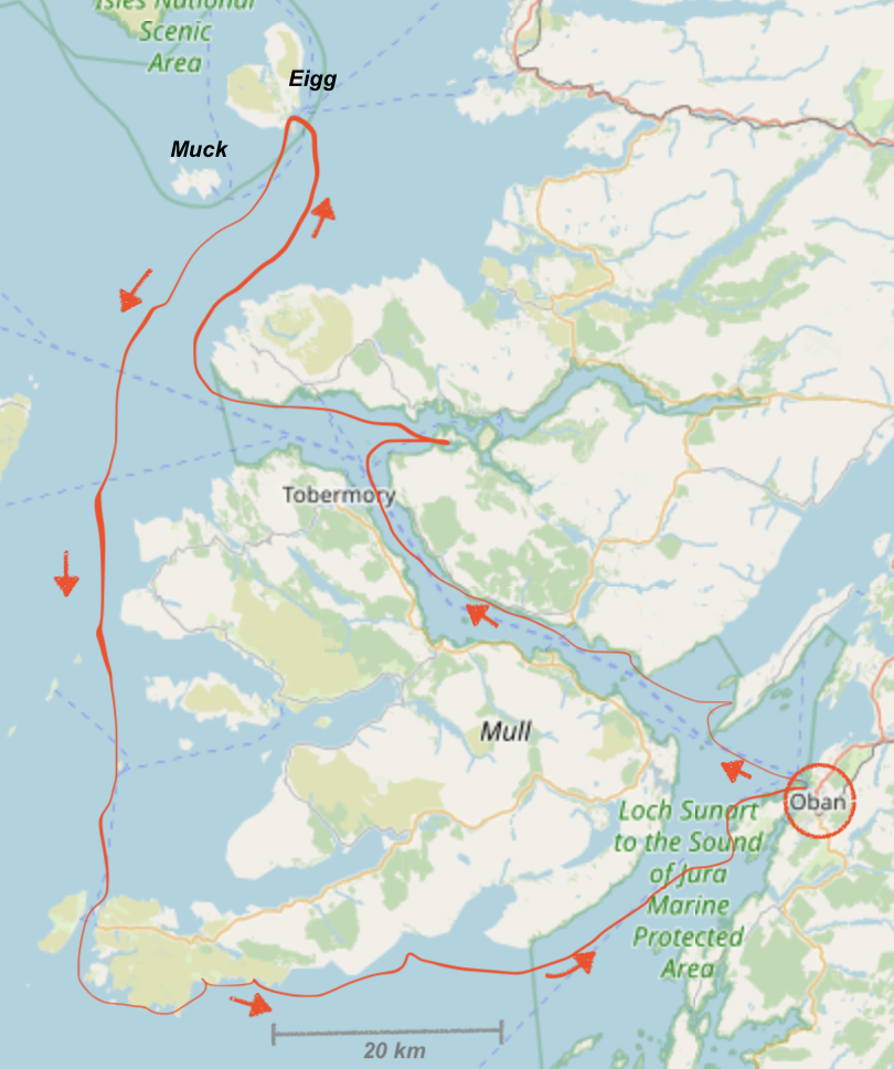
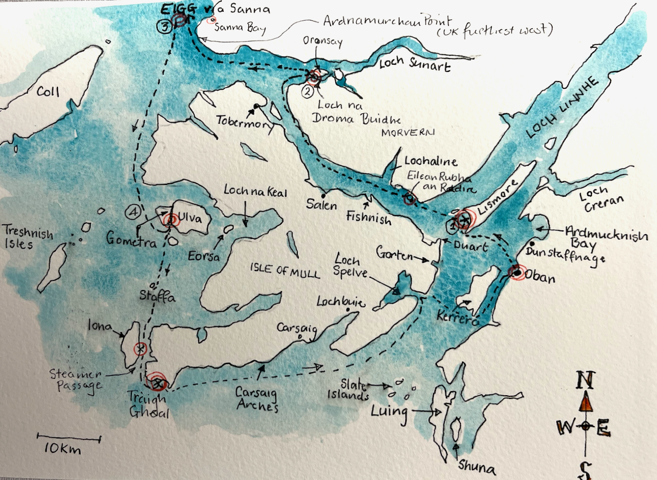
Here is a map of where we went.
Maps showing our route [map (c) Open Street Map contributors]
On this post is a selection of my work from this voyage. For more about the ship, and future plans, see the Lady of Avenel website.
I travelled North on the Caledonian Sleeper, and did some sketching on the train.
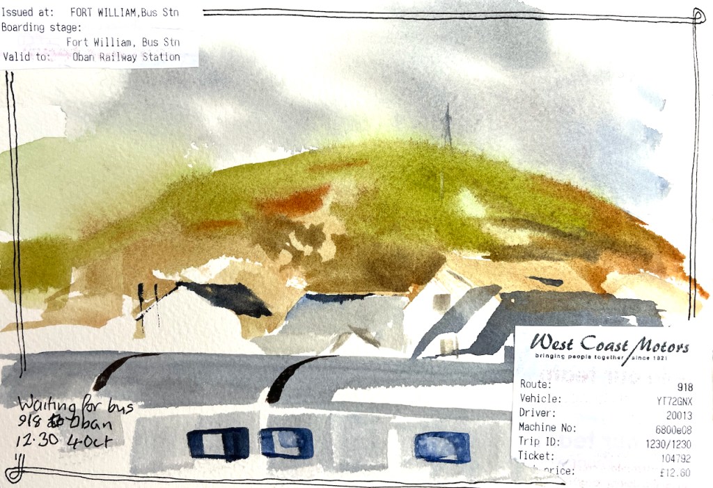
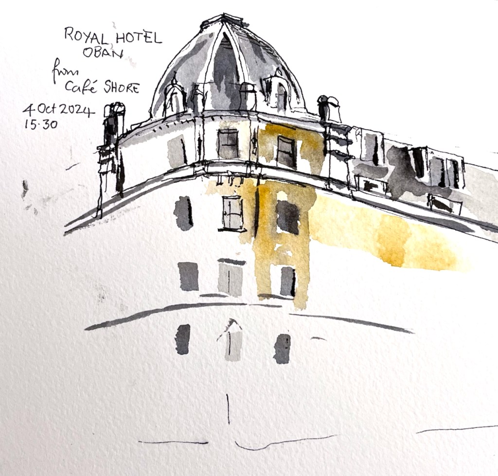
Scottish highlands, sketched in the sleeping cabin on the train.Waiting for the bus from Fort William to ObanQuick sketch in a café in ObanSketching on the journey to Oban
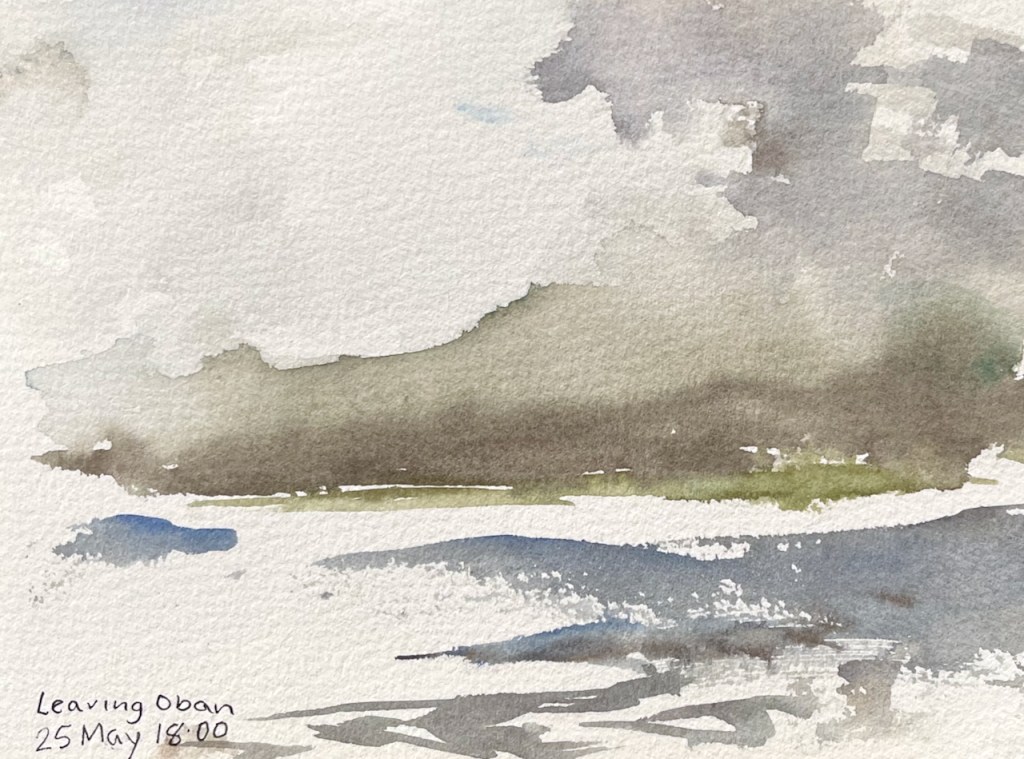
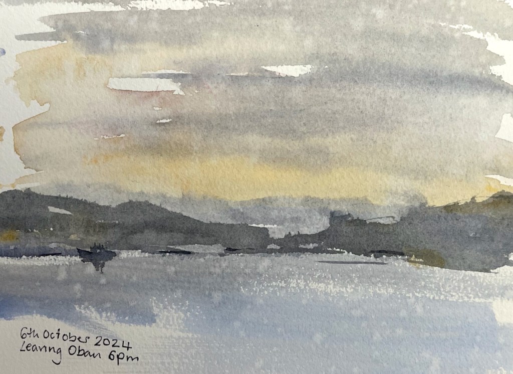
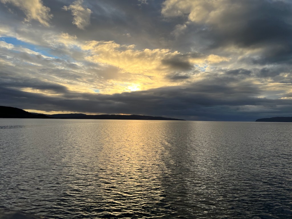
The guests came on board in Oban, and we set off in the evening for the week’s voyage.
Leaving Oban, 6th October 2024. There was fine rain, some of which landed on the picture.Sketch map
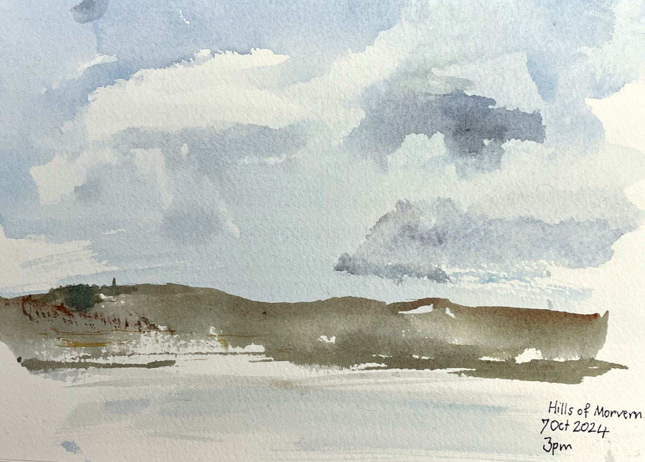
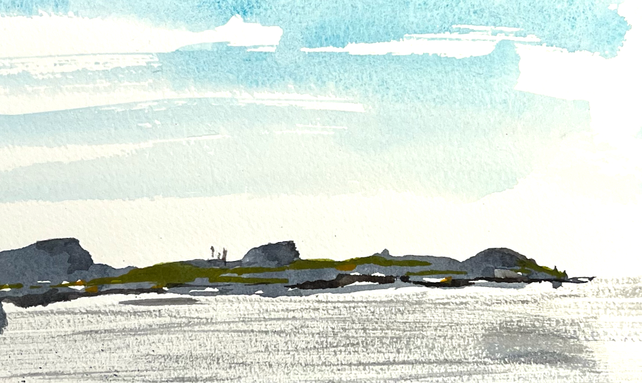
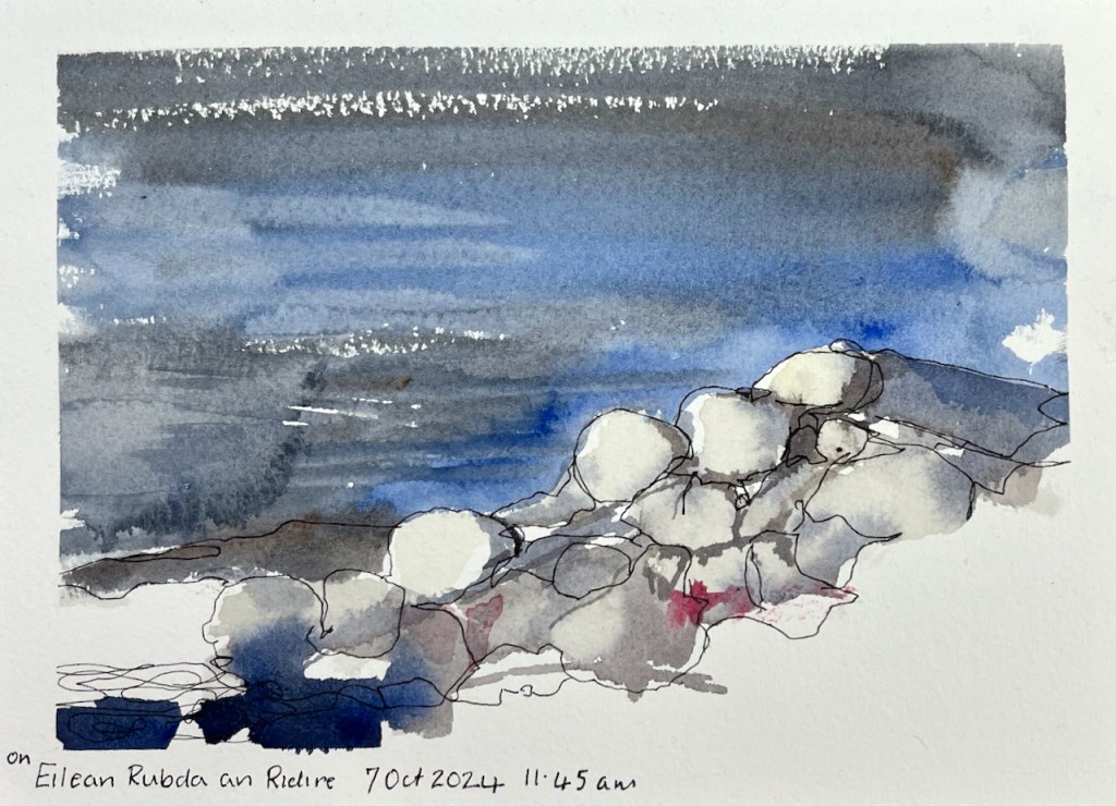
Here is a selection of my sketches from the voyage.
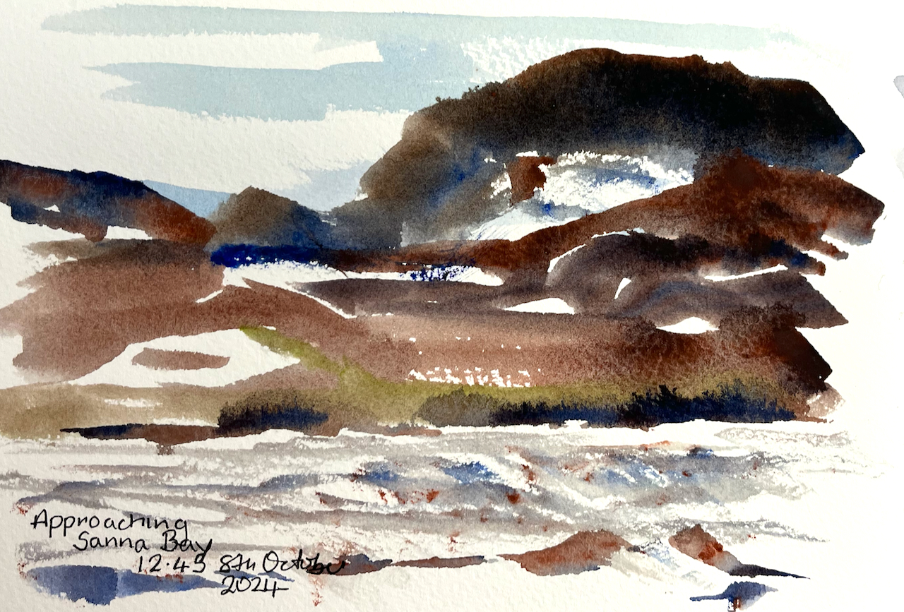
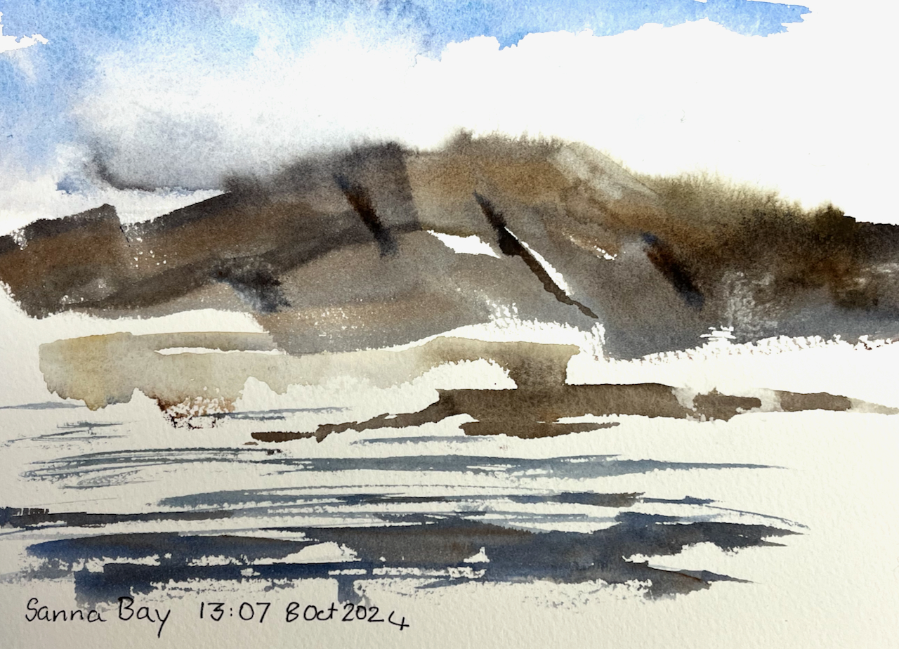
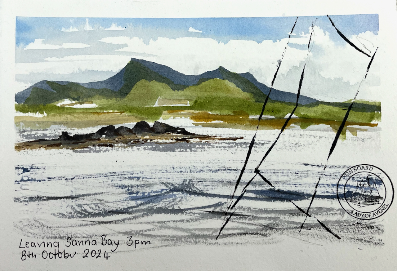
At Sanna Bay there is a large sandy beach, and a settlement of a dozen or so cottages. Here is a sketch made as we approached Sanna Bay:
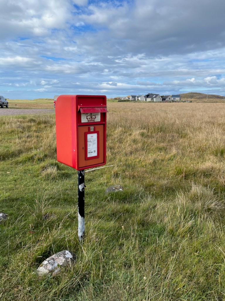
I walked into that scene, through the sand-dunes, in search of a post box. Against all expectations, I found one.
Here is the post box at Sanna Bay. Collections 9am Monday to Friday, and 7am on Saturday.Here is the card I posted, which reached London in two days.
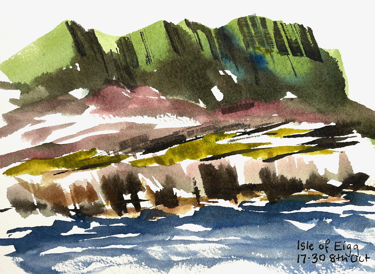
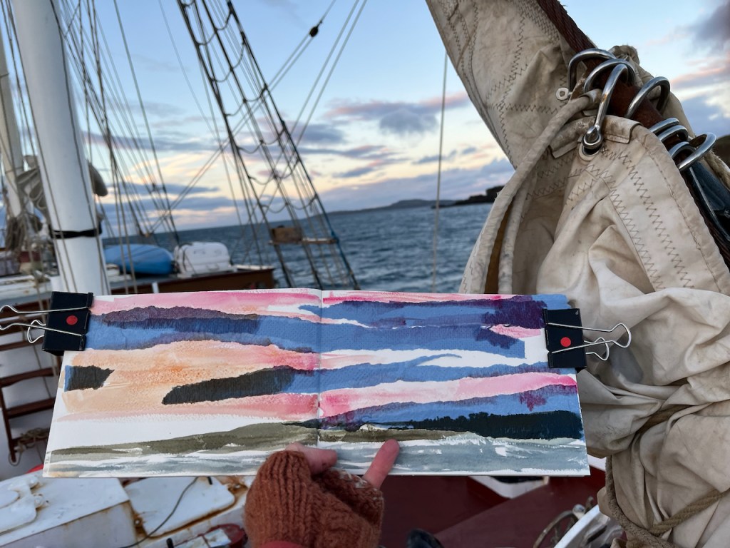
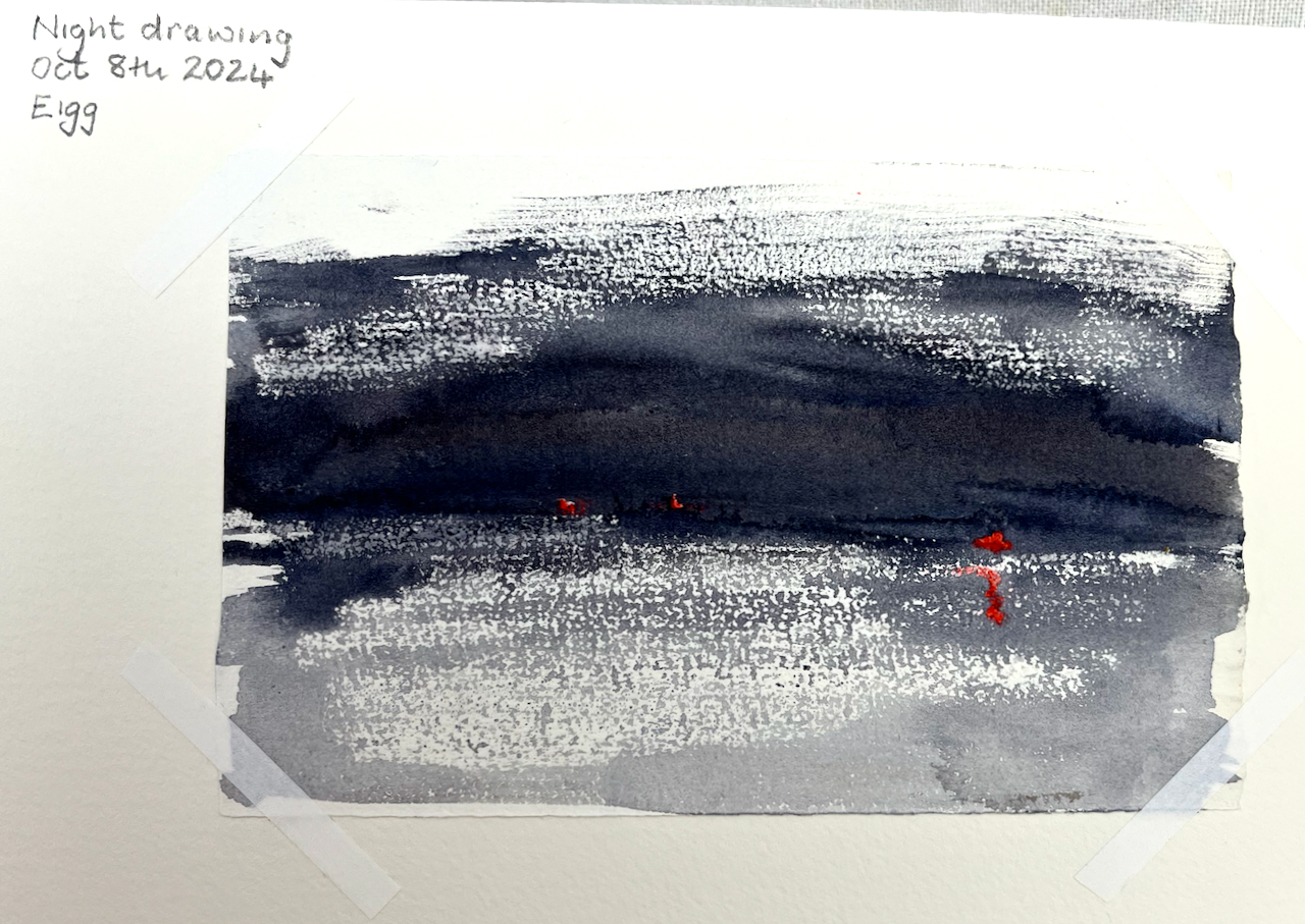
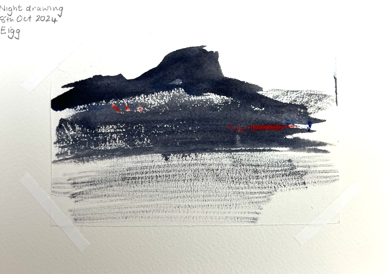
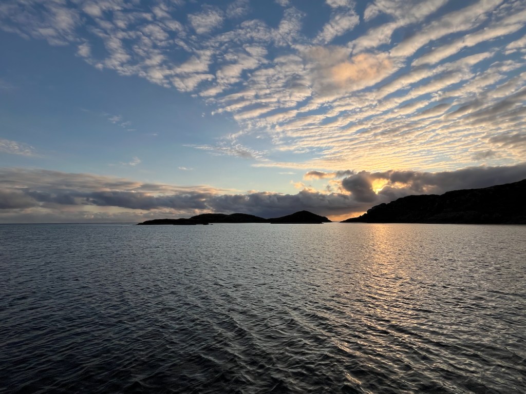
At Eigg there was a spectacular sunrise.
Sunrise over the Isle of Eigg, watercolour and collage.
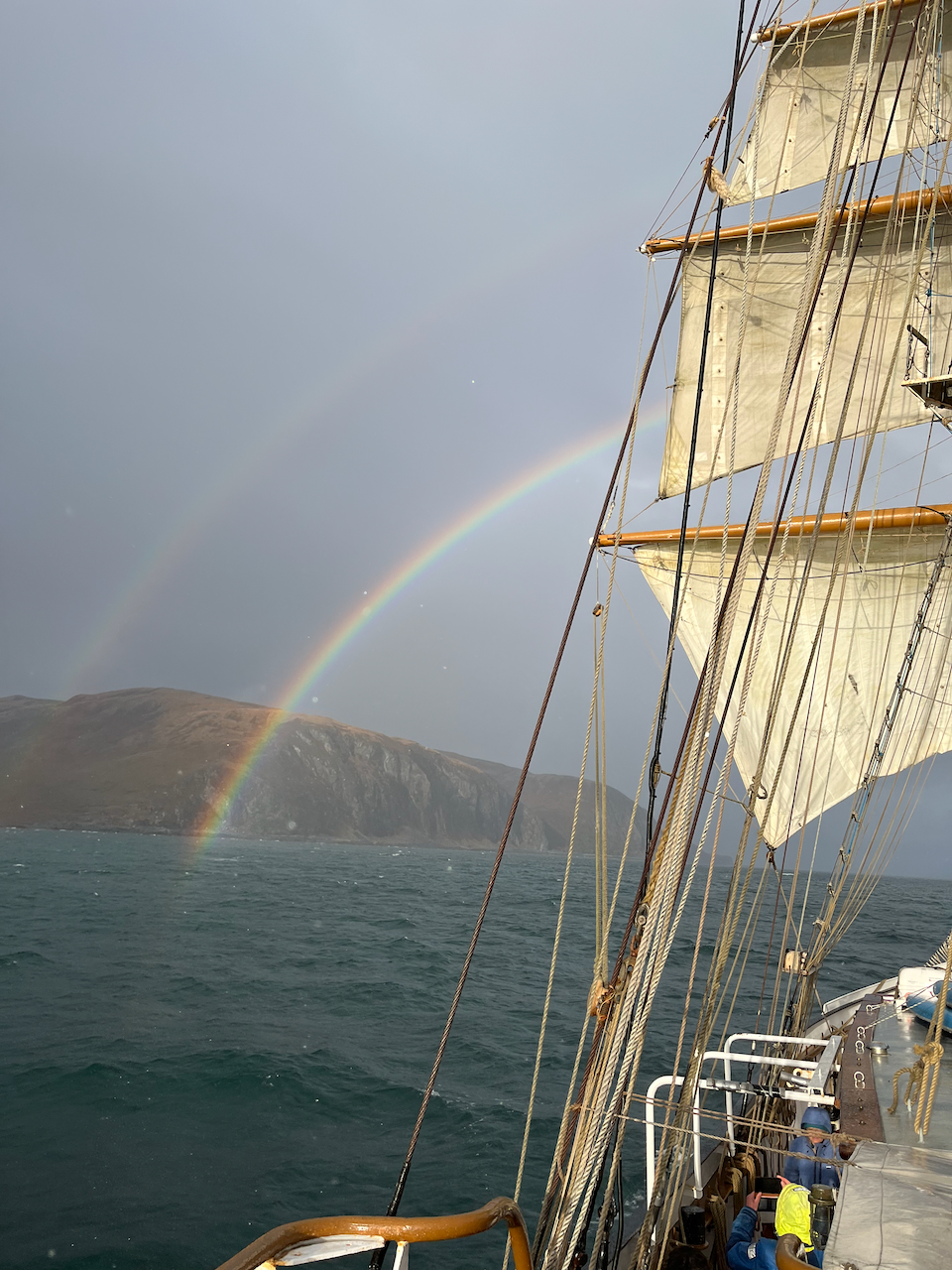
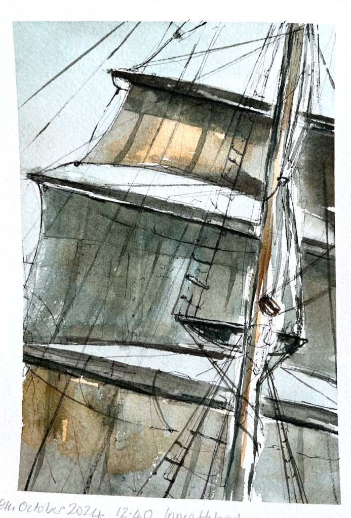
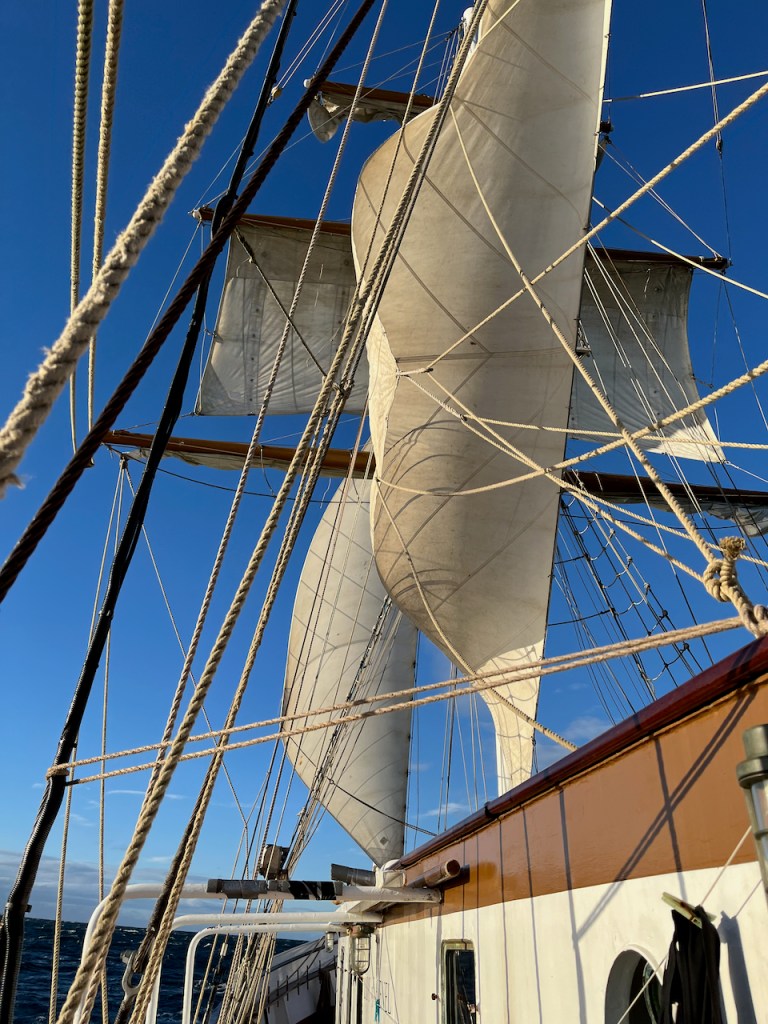
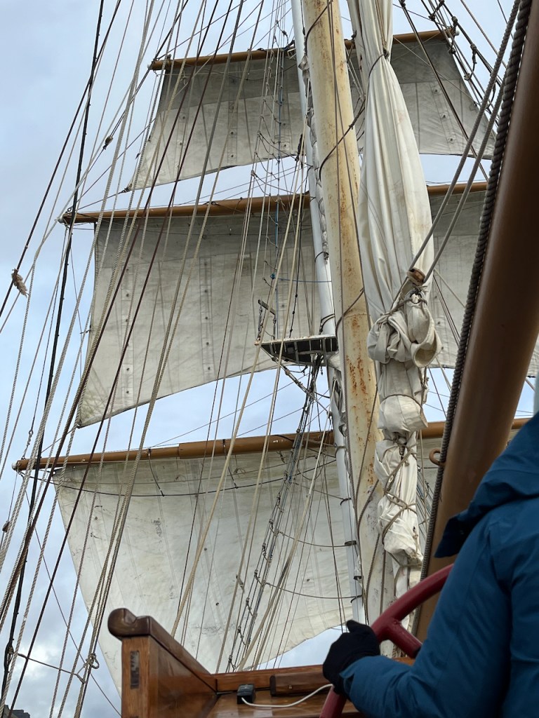
With a strong wind in our sails we reached 8 knots on the journey south from Eigg to Iona.
The sails are full on the journey from Eigg to Iona.
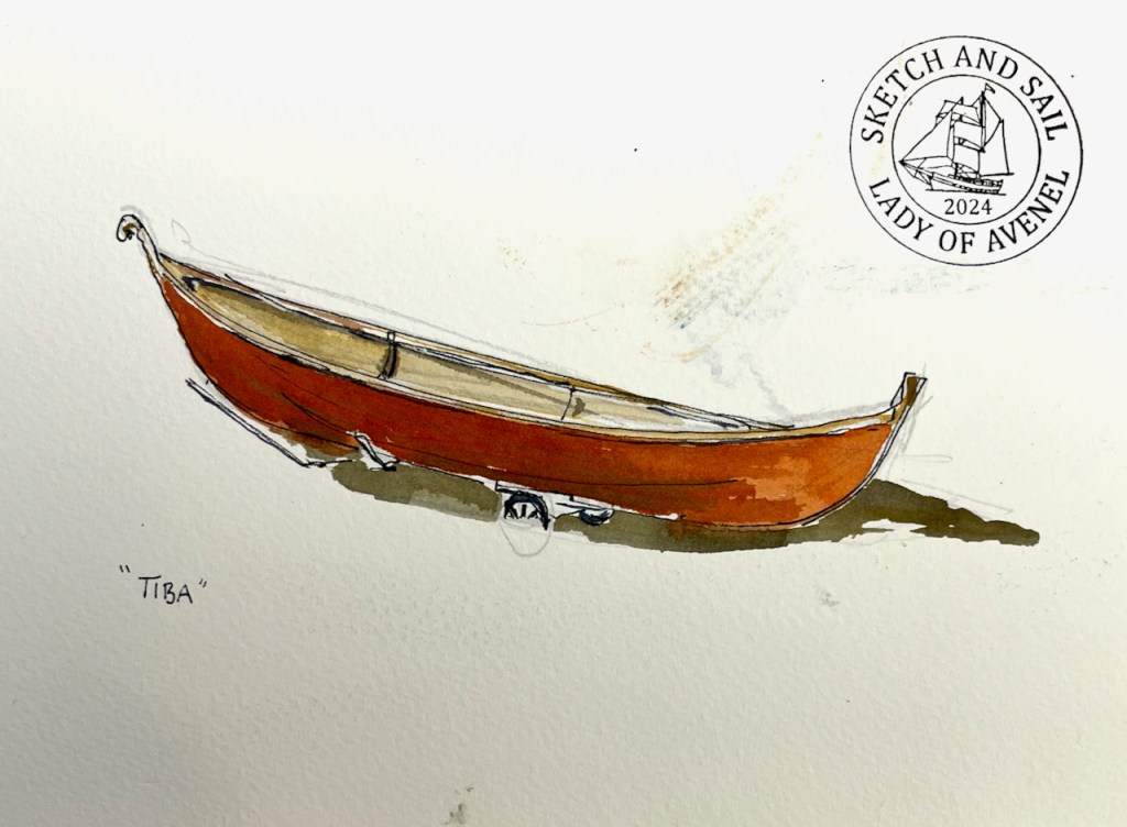
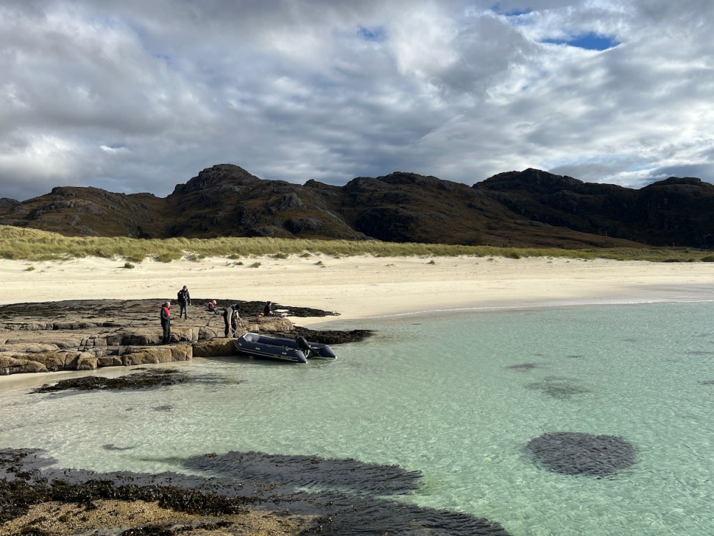
On the island of Iona, I sketched a boat on the beach.
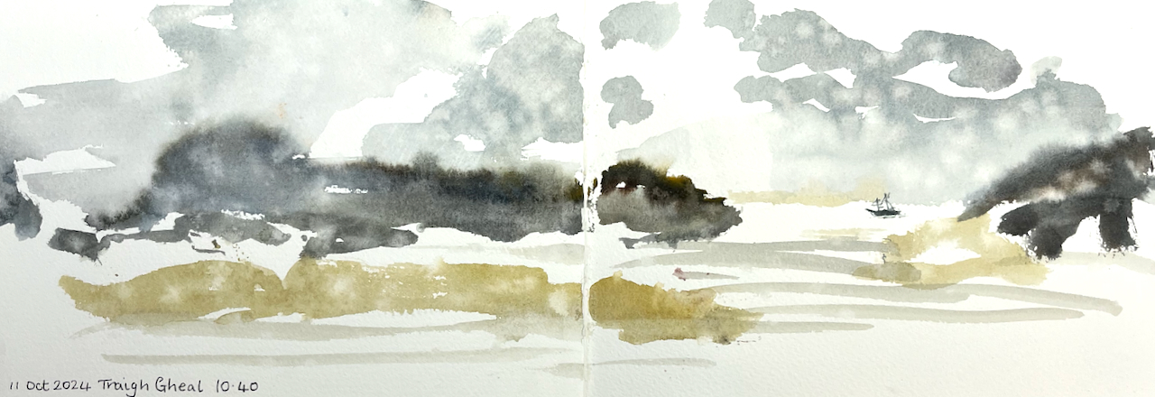
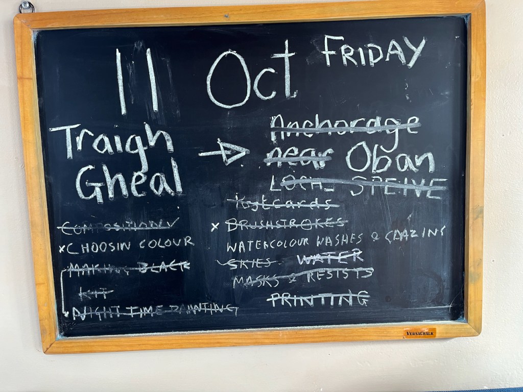
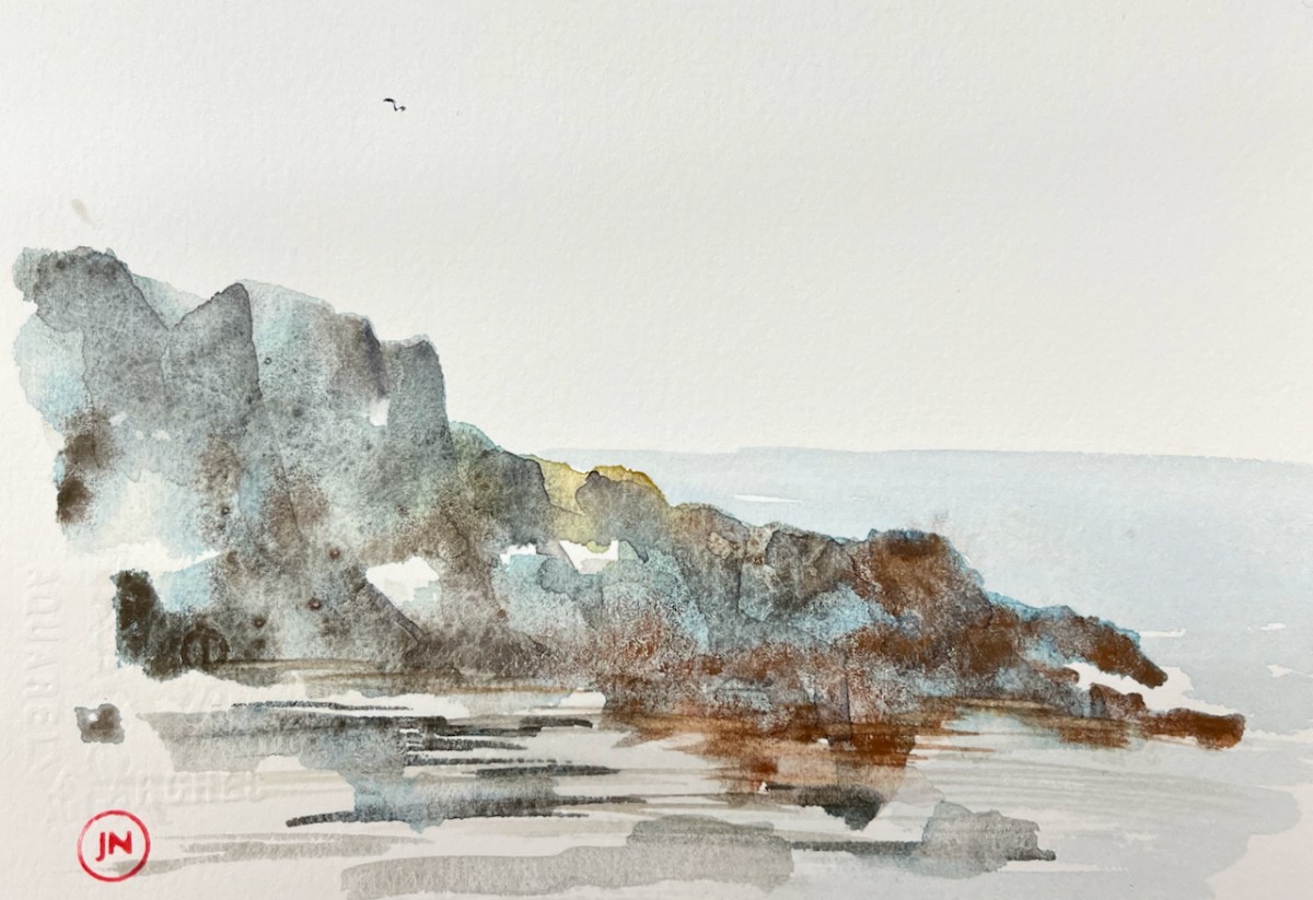
On the way back to Oban from Iona we landed at a vast sandy beach called Tràigh Gheal. There were showers of rain.
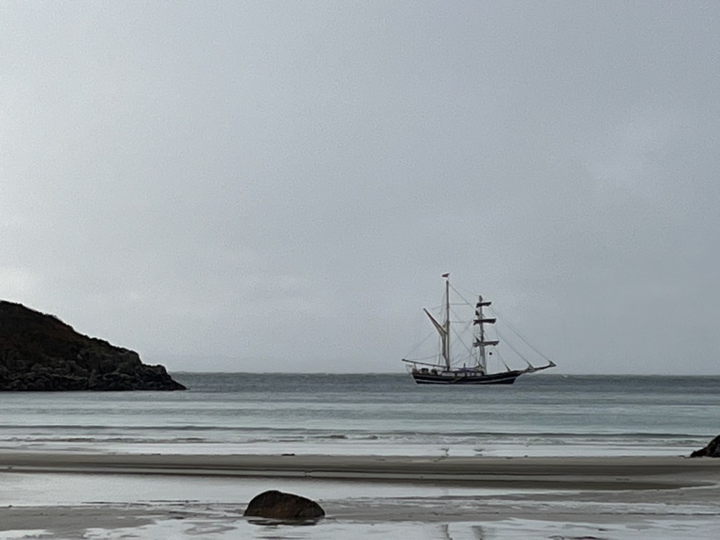
Here’s a photo, showing the Lady of Avenel at the anchorage at Tràigh Gheal. We reached the beach by rubber dinghy.
Lady of Avenel at Tràigh Gheal
I used a JP Purcell sketchbook. Here’s a quick flick-through:
Sketchbook flick-through
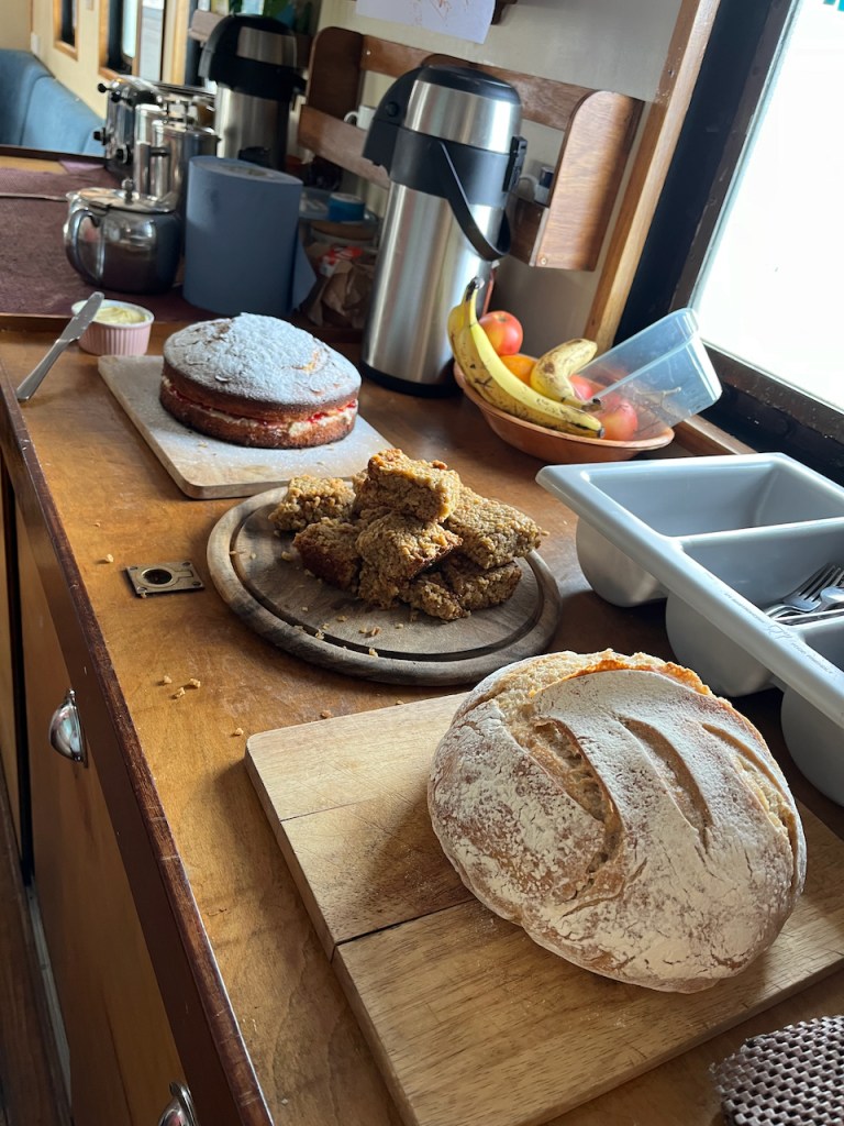
All of this was powered by a strong North Westerly wind, and Tom’s cooking. Tom continued cooking even as the North Westerly gusted Force 7, and produced a hot meal for hungry sailors every evening, soup for lunch and cooked breakfasts. He made the sour dough bread every day in the ship’s galley. I found this hugely impressive.
Tom’s cooking on the ship: cake for hungry sailing sketchers: and sourdough!
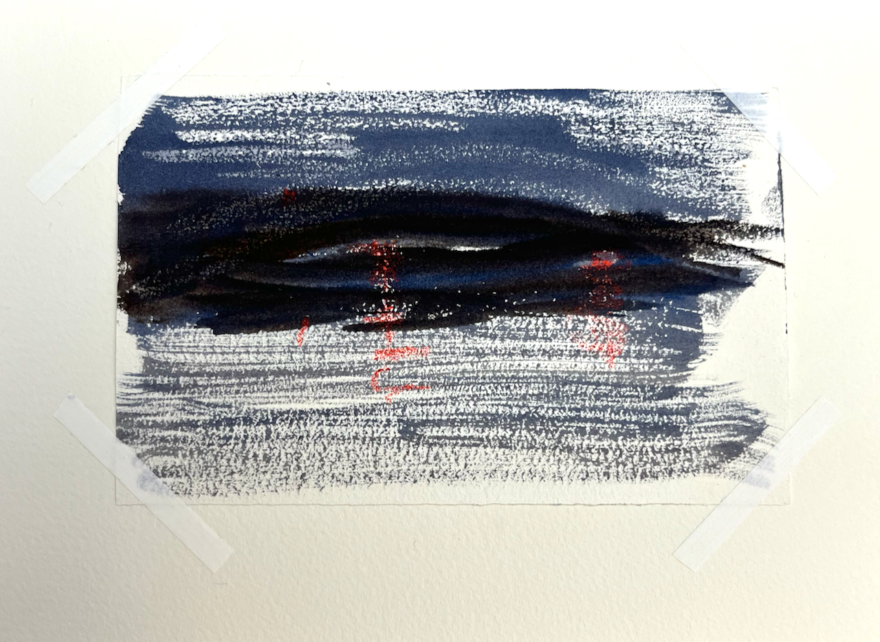
In case you are curious, here are night sketches. The lights are done using wax crayon.
Here are some snapshots from the voyage.
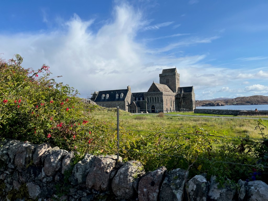
The art gallery on GometraApproaching Staffa, Fingal’s CaveThe abbey on IonaLady of Avenel off Sanna BayWorkshops done and crossed off the list!
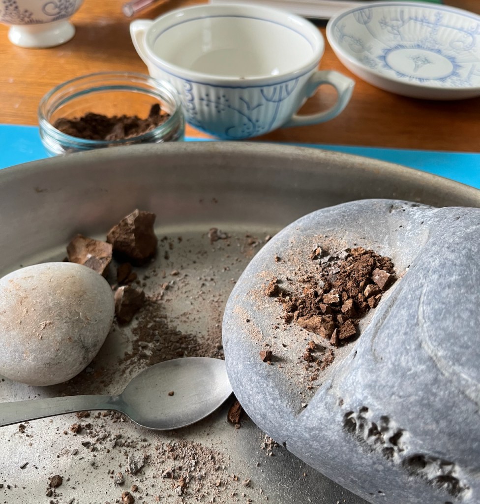
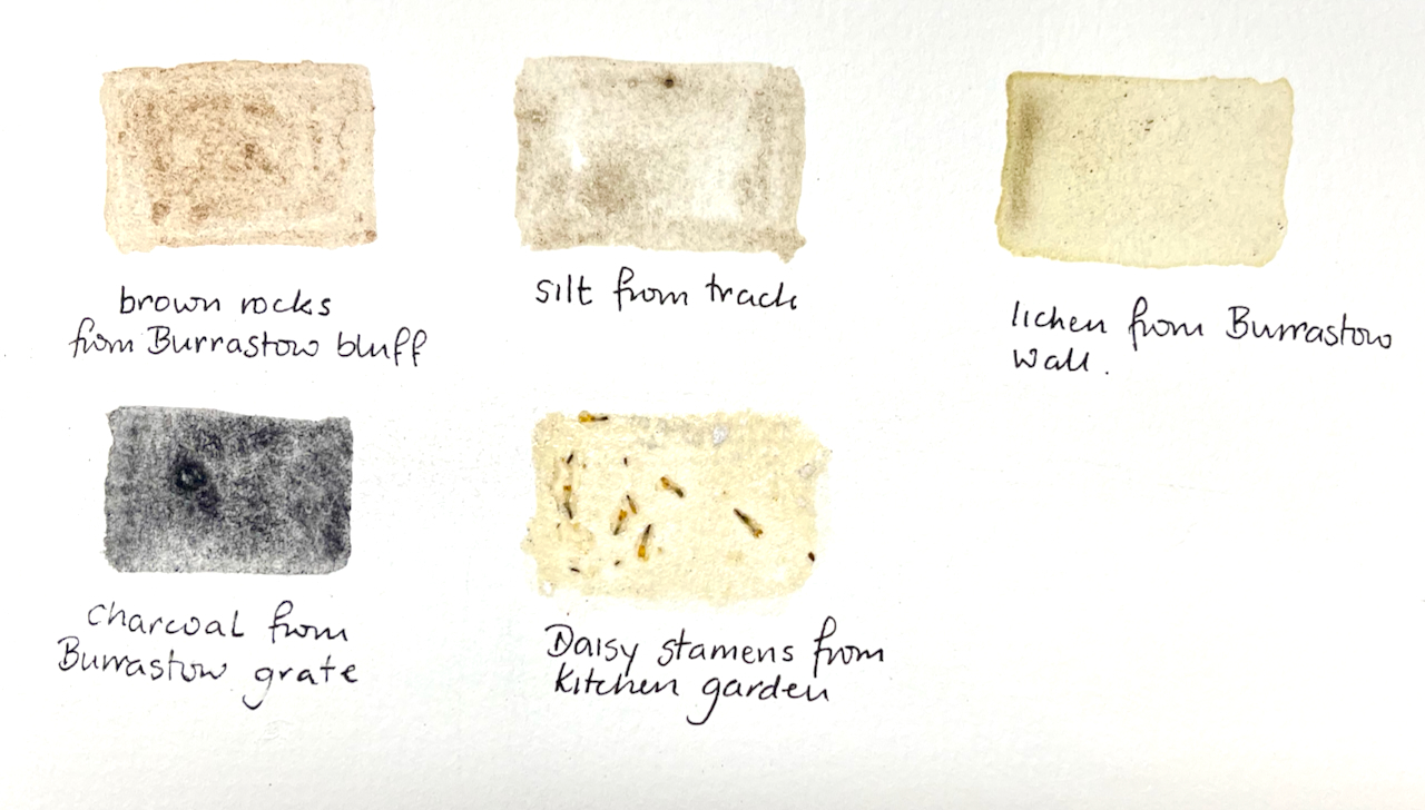
It was foggy, cold and wet outside. I made pigments.
I collected earth from round about. I know from previous attempts that it works best if you have fine earth. So I went up the road in the rain and scooped up the fine silt running off a track. I dried it indoors, and then crushed it to what I hoped was a fine powder.
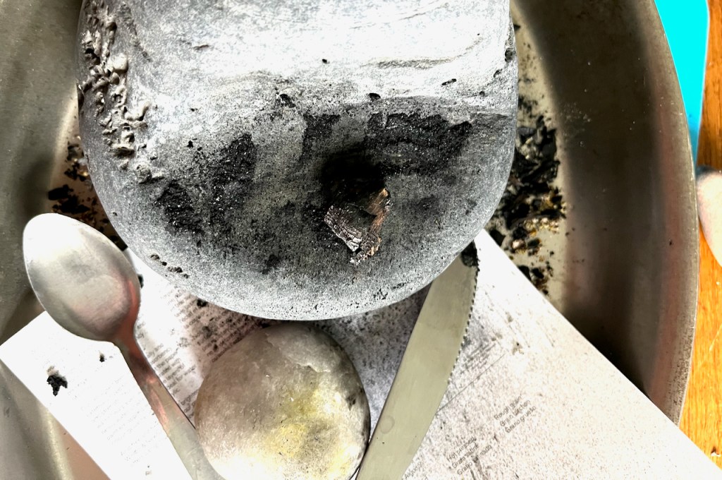
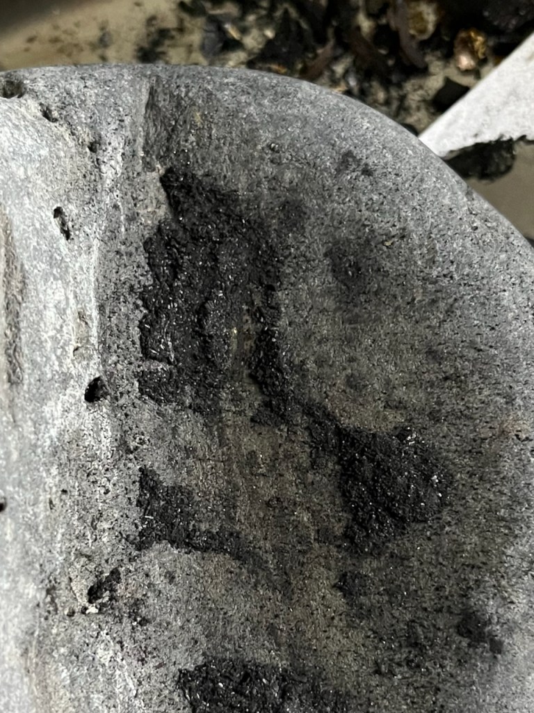
As you see I had an excellent beach stone for this purpose.
Then to grind it finer I had a pestle and mortar. This is a beautiful home-made item.
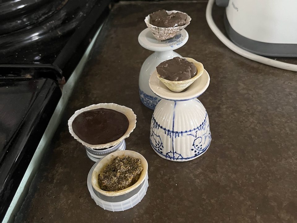
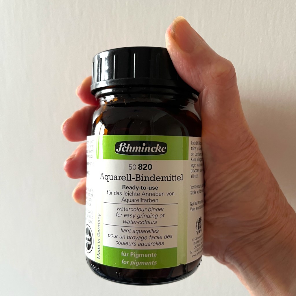
Now I have earth pigment. To make watercolour I add Schmincke Watercolour Binder in the ration of 2 parts binder to 1 part pigment. Mix and put in a limpet shell. It’s ready to use immediately as a paste, or it dries and can be rewetted like normal pan watercolours. Here are the paints drying:
Pigment mixes in limpet shells, drying on eggs cups (to keep them level).
Above you see paints made of earth from different places. At the front is a paint made from yellow lichen. The lichen was bright yellow on the stone wall. I couldn’t find a way to separate out the bright yellow surface from the grey underneath, so the pigment is a grey/yellow mix.
Here is a selection of pigment experiments, to show how they look when painted:
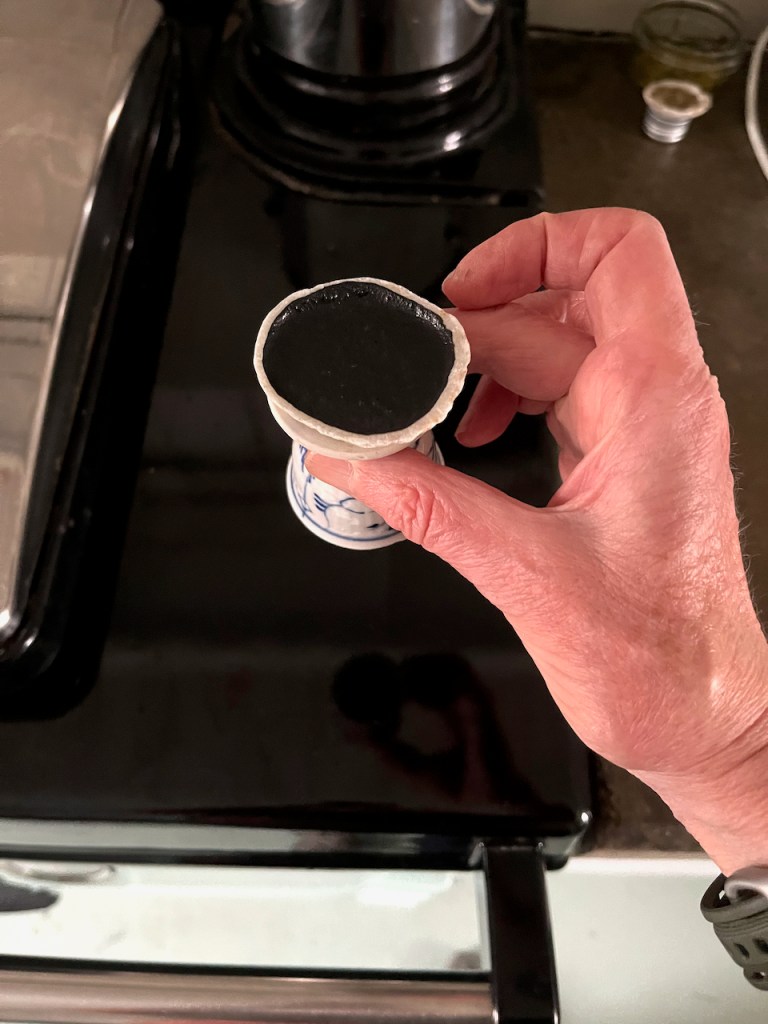
Making the charcoal pigment was not so effective as I thought it would be. I found a small chunk of black charcoal from the grate and proceeded to crush it. This produced skittering fragments and airborne dust which settled everywhere. It did not produce a fine powder in my pestle and mortar. It produced hard, flaky, bits. As you see above, the paint it produced was granular and not very black.
Trying to grind the charcoalGround charcoal: bitsCharcoal paint
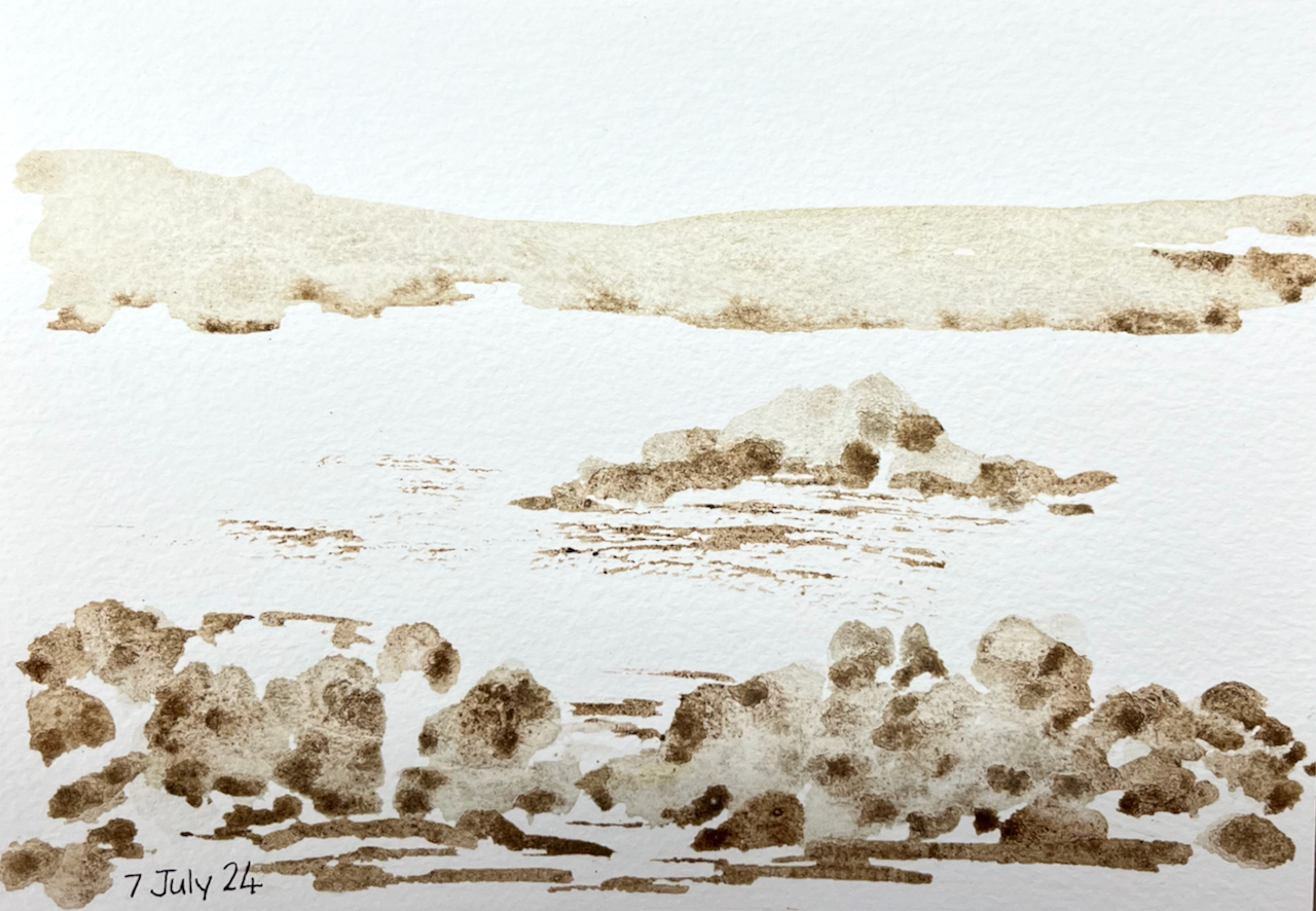
Here is a picture painted entirely with home-made pigments:
Coastal scene: painted with home-made pigments.
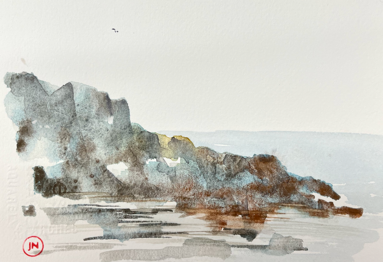
Here is a picture painted with home-made pigments and shop-bought watercolours:
“Promontory”. Painted with home-made watercolours with shop-bought watercolour (blue).
This is the binder I used:
Click a button below to share this post online, email it, or print it: