Sutton Arms, Great Sutton St, EC1

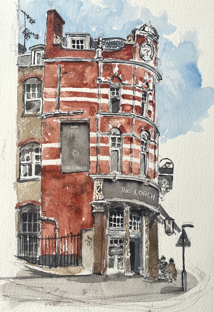
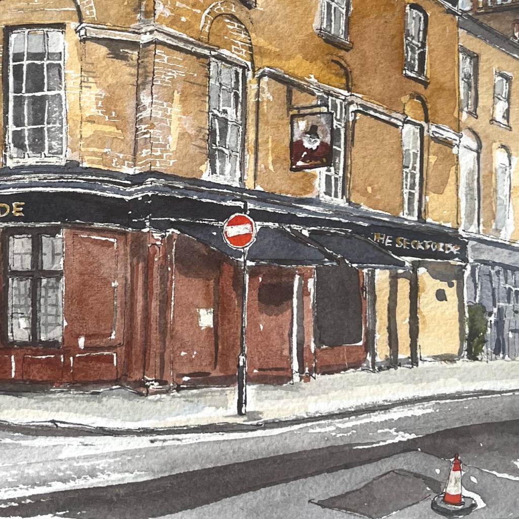
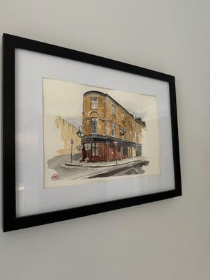
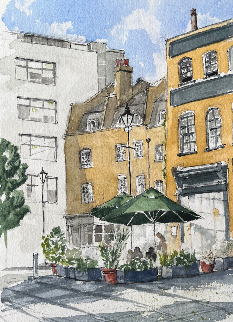
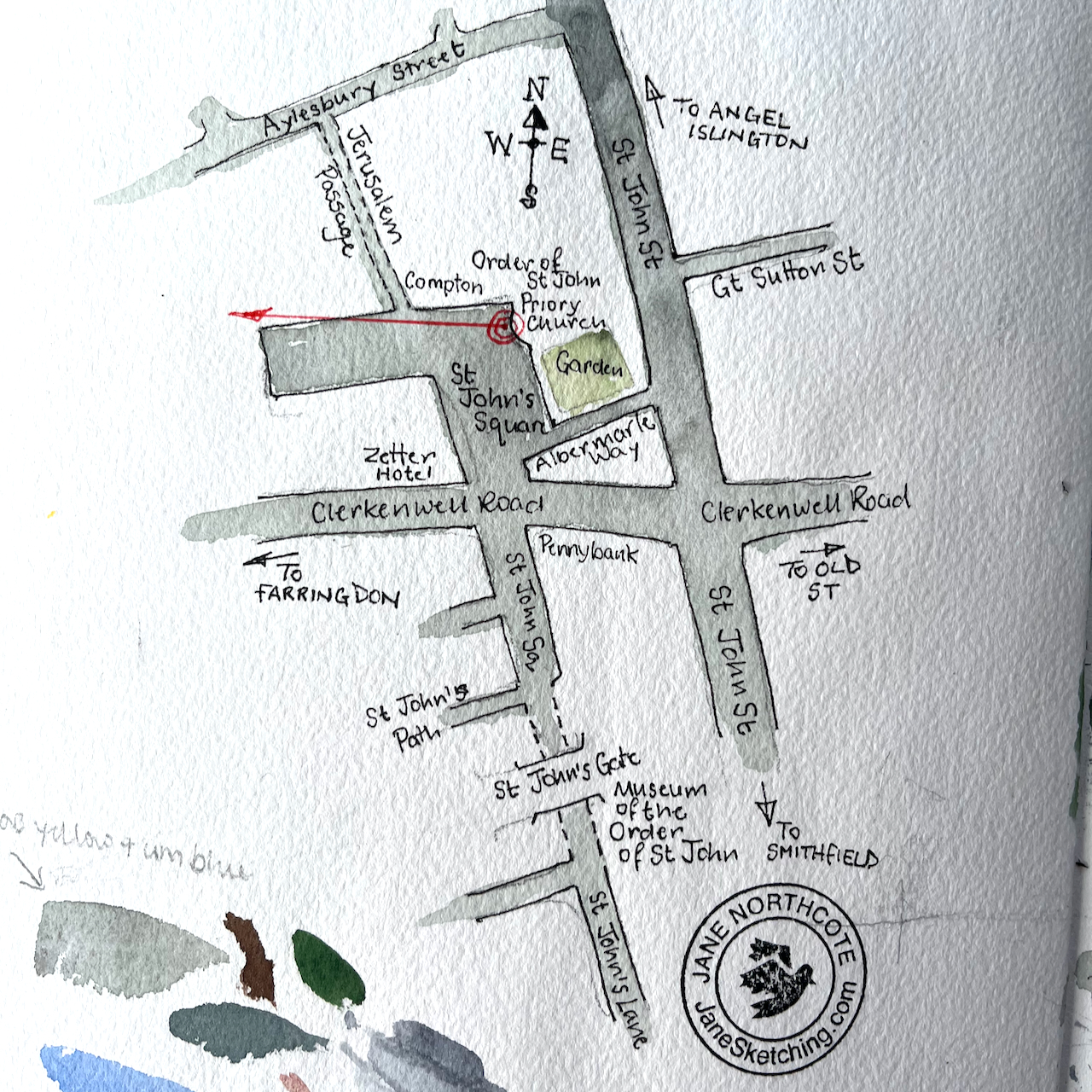
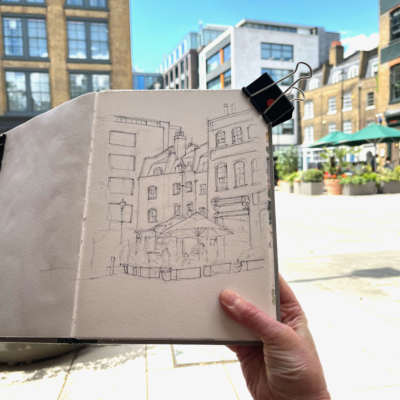
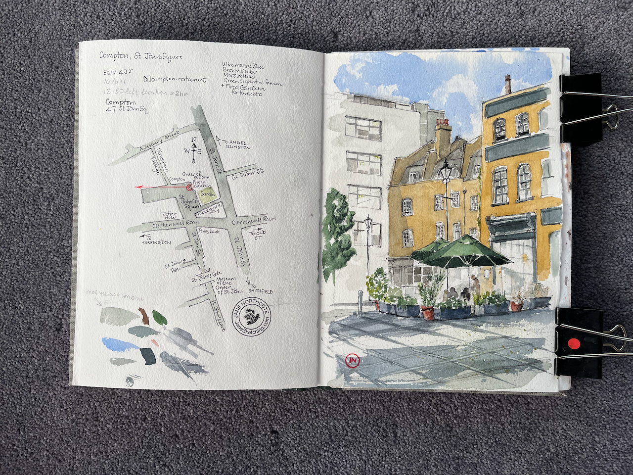
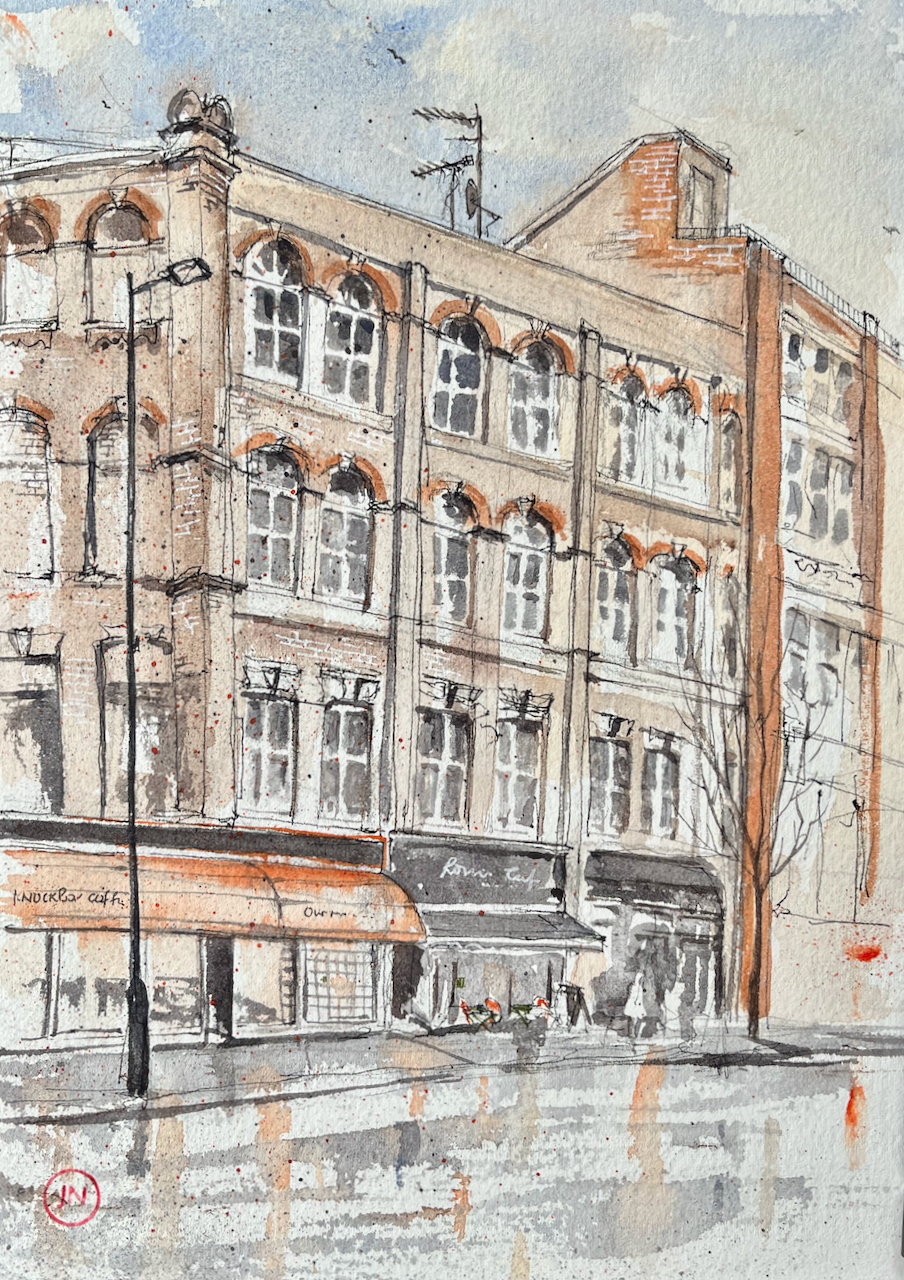
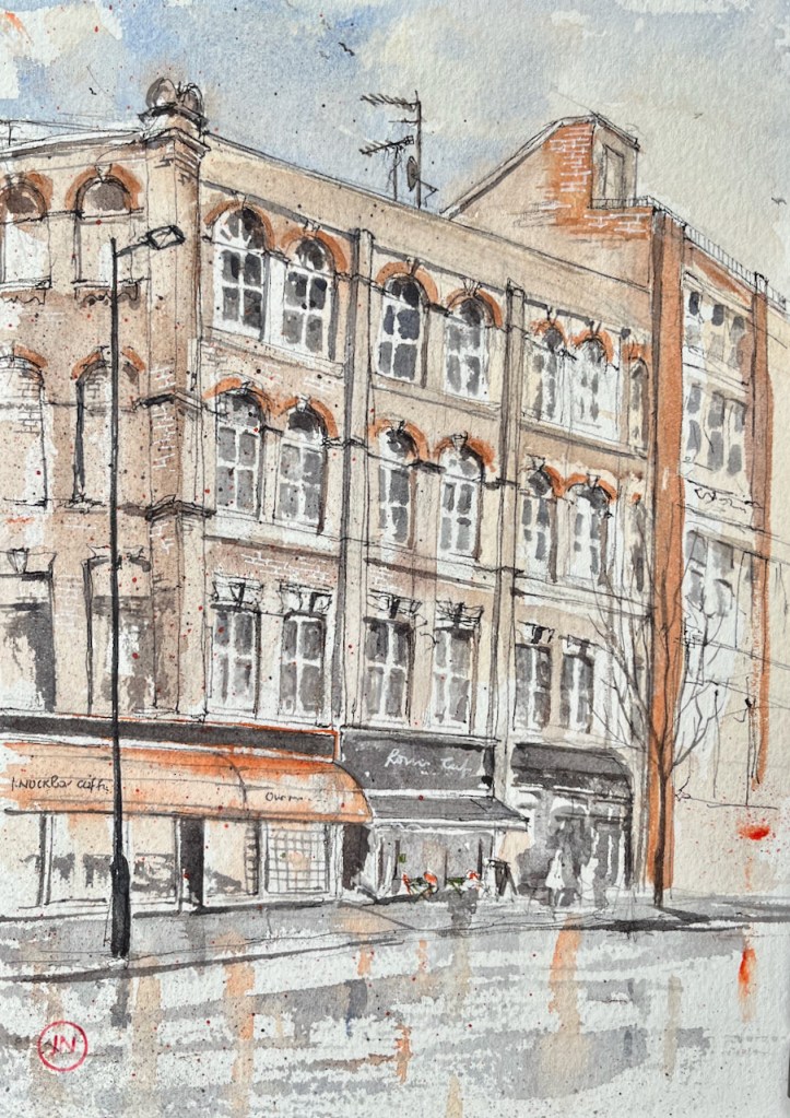
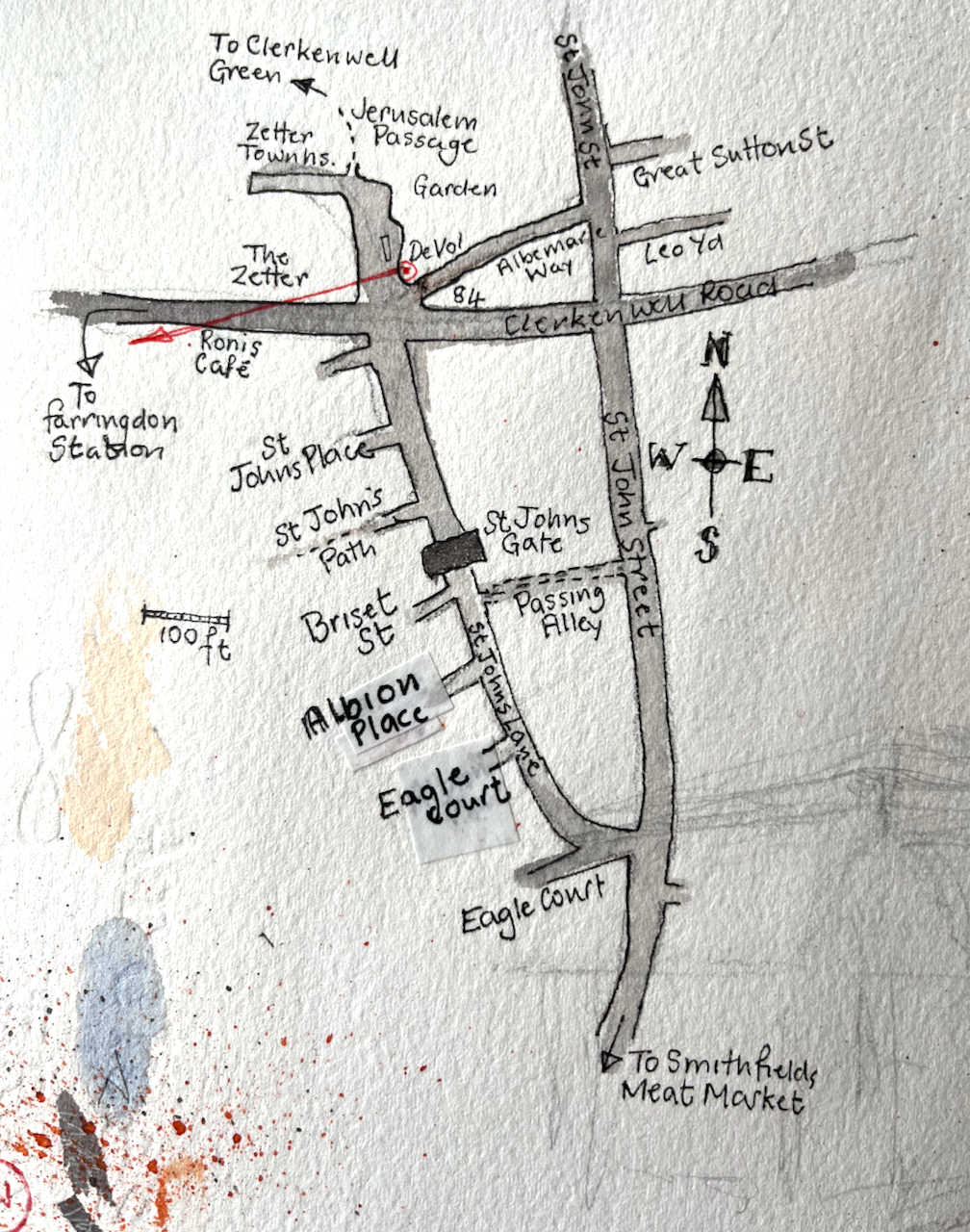
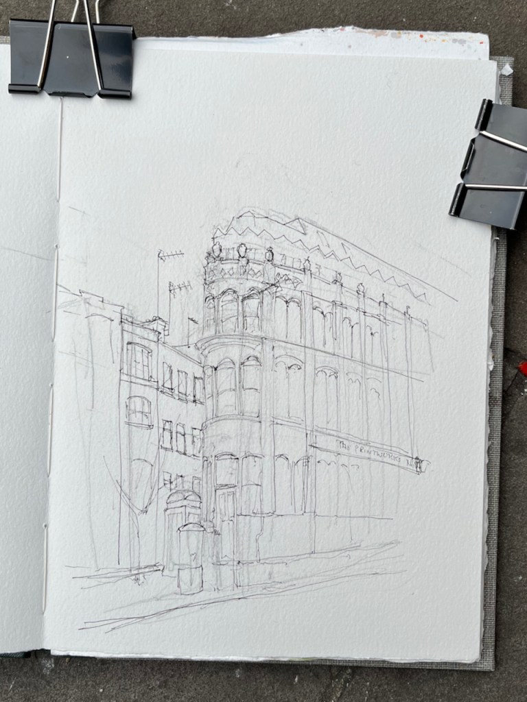
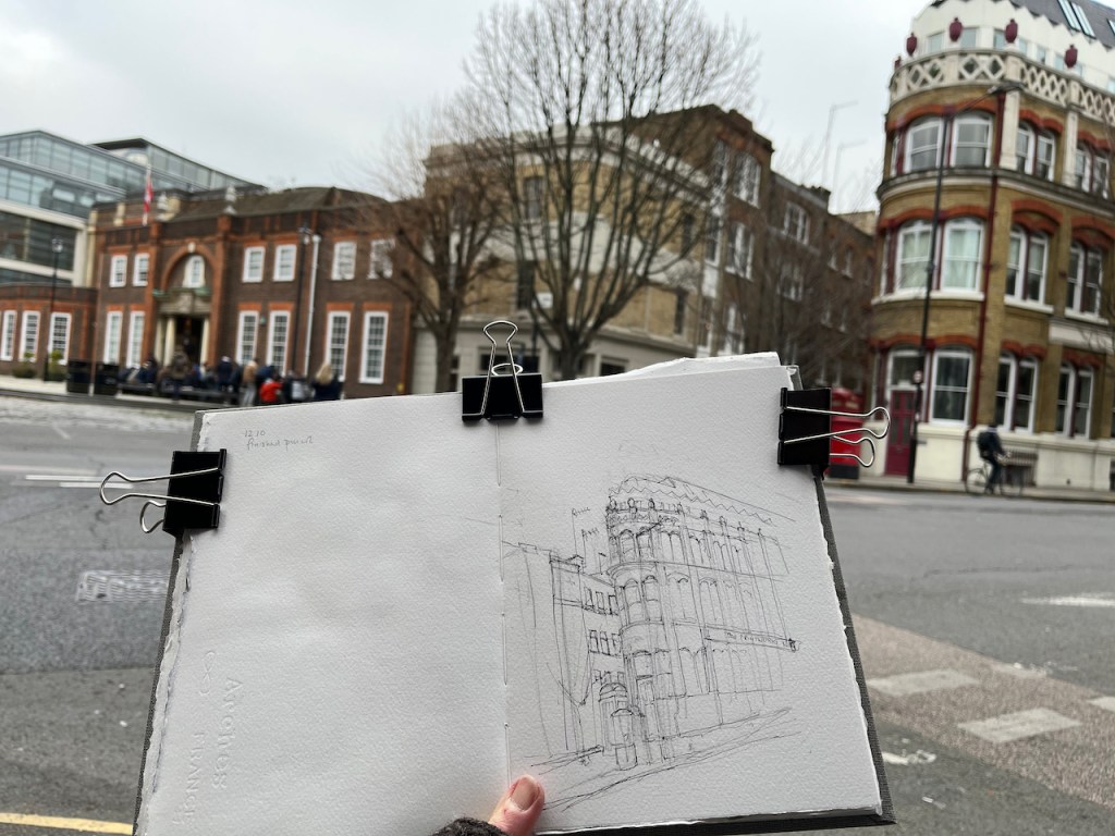
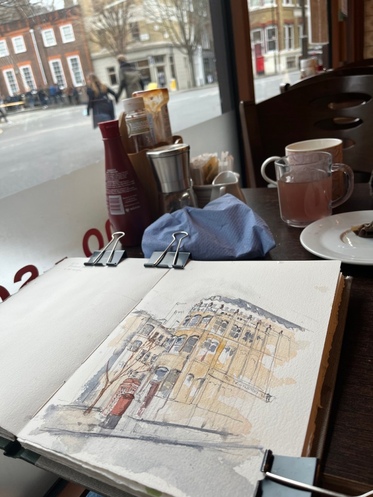
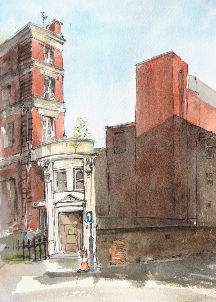
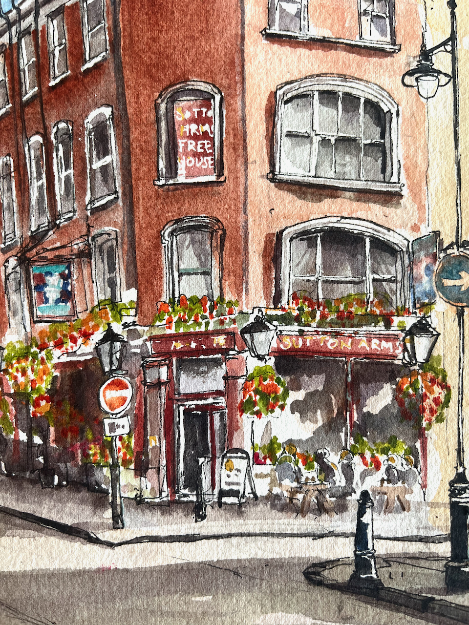
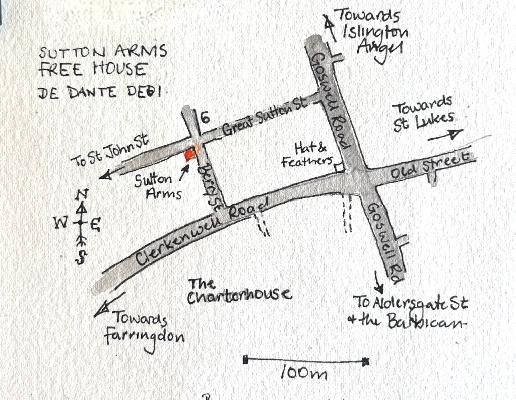
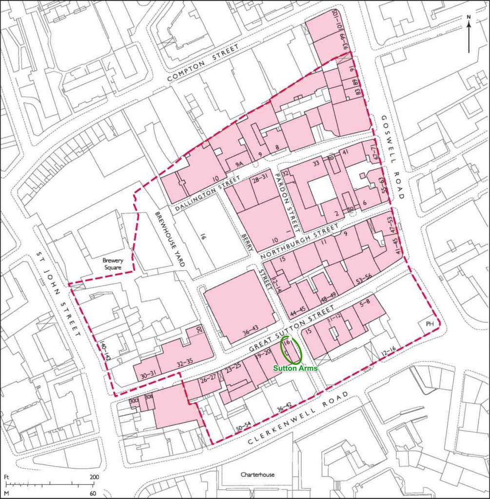
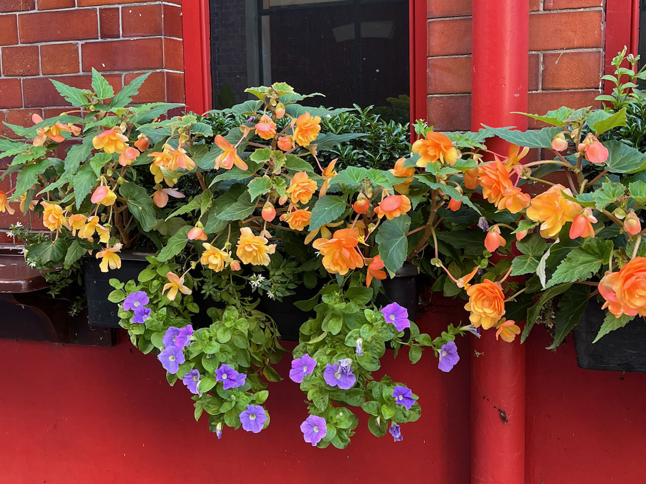
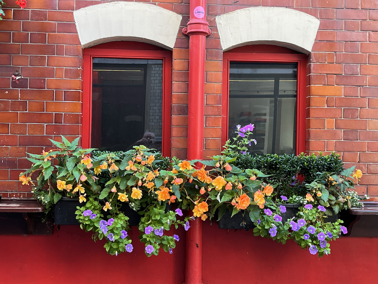
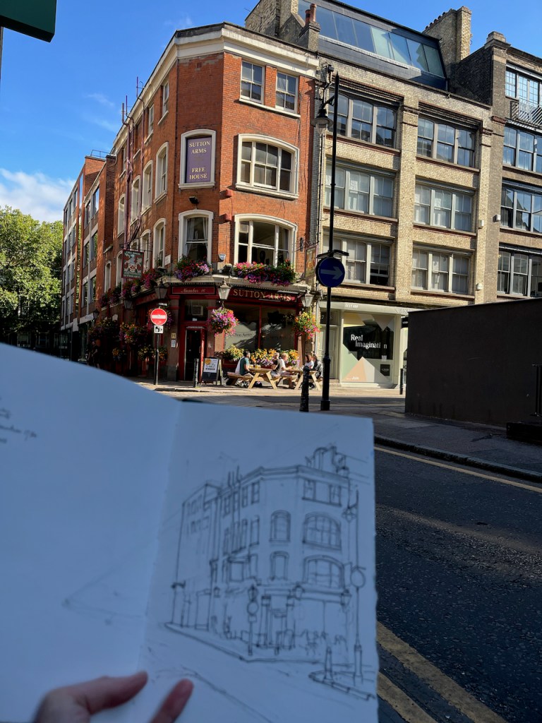
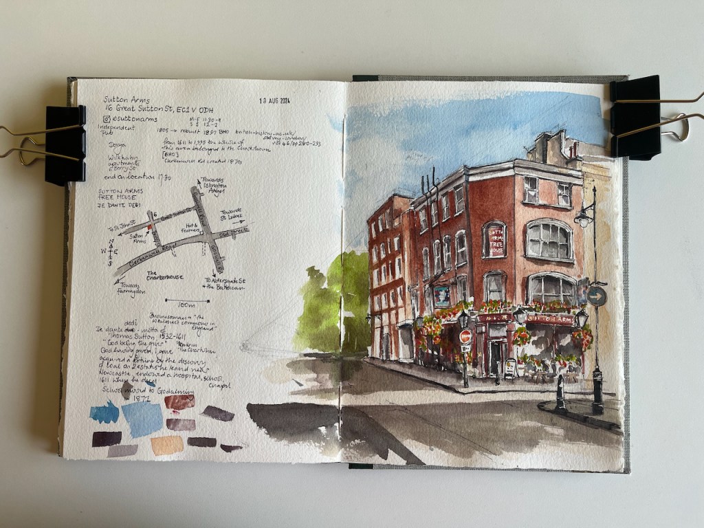
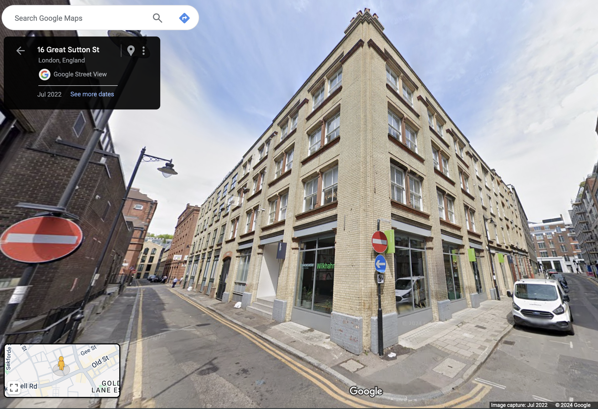
This is the Sutton Arms in Clerkenwell, 16 Great Sutton Street, EC1.

Sutton Arms, 16 Great Sutton Street, EC1V 0DH, sketched 10 August 2024 in Sketchbook 14

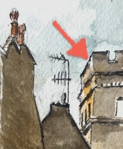
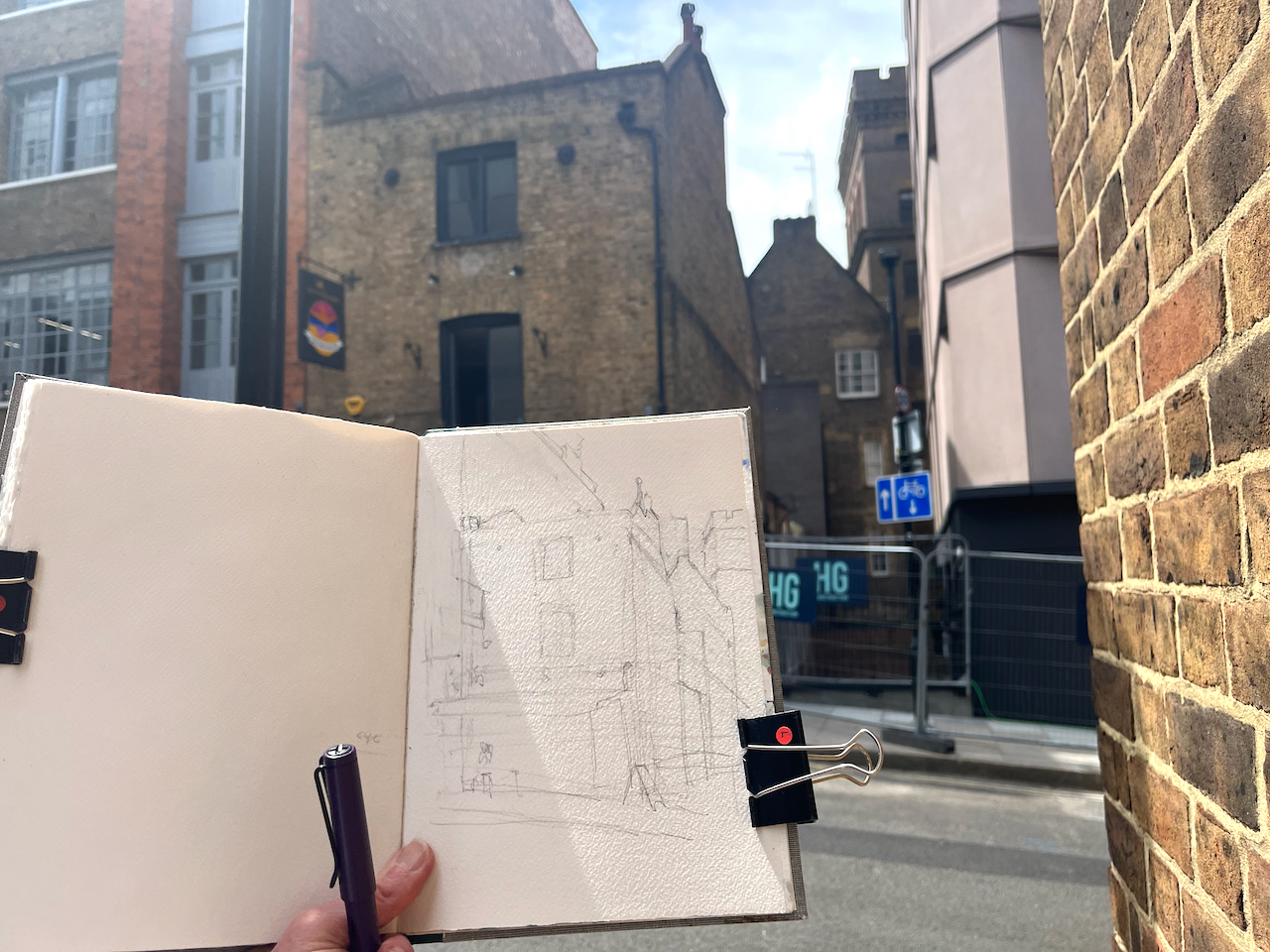
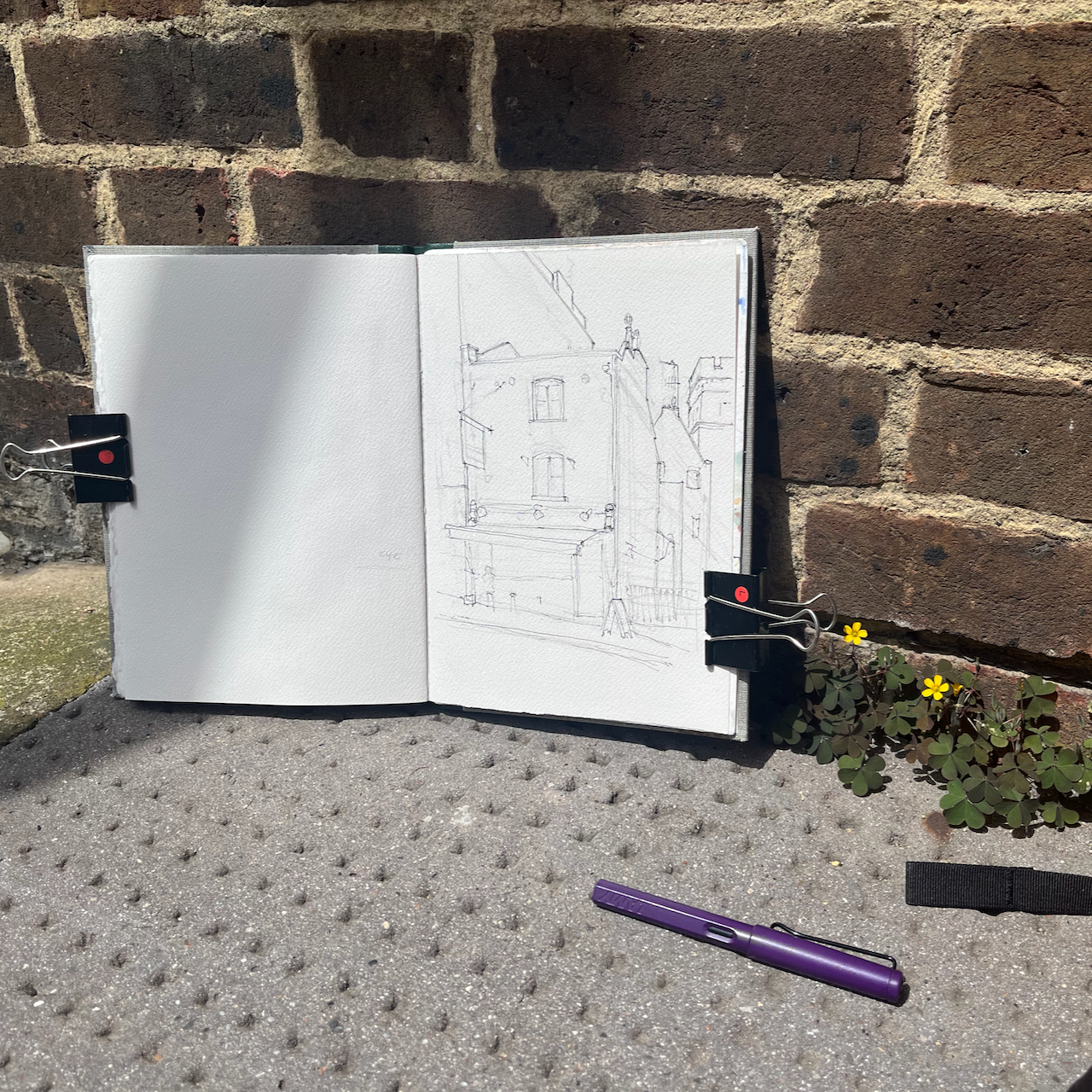
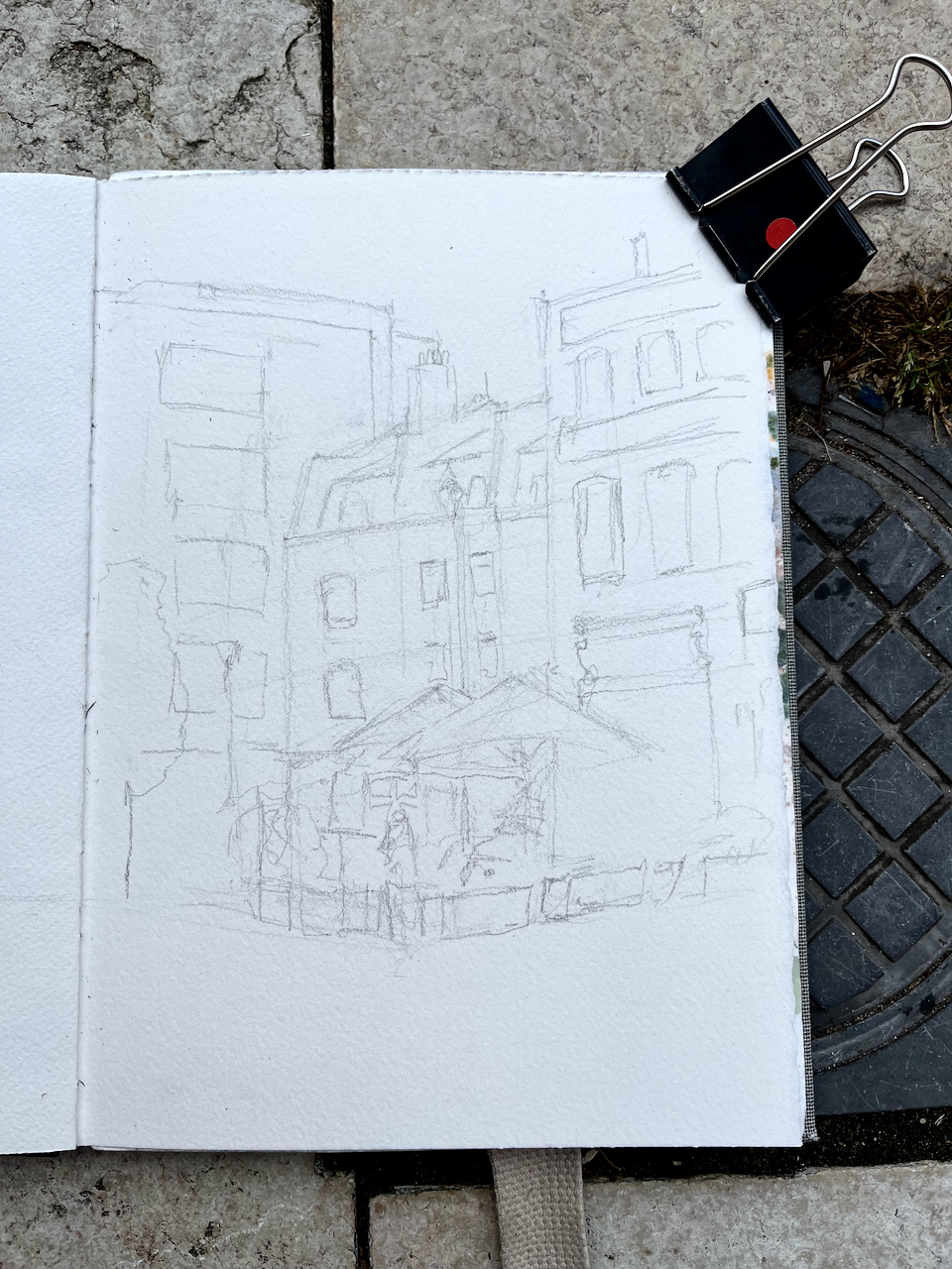
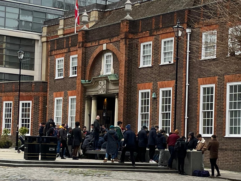
I sketched it towards the end of a sunny afternoon in August, sitting on steps outside number 6 Berry Street. As you see, the sun streamed in from the west. The trees in the distance, on the left of the drawing, are on Clerkenwell Road. Behind them is The Charterhouse, fulfilling its ancient tradition as an arms house and sanctuary for the elderly and frail.

From 1611 to 1995, The Charterhouse owned the whole of this area.

Great Sutton Street area. The broken red line indicates the extent of the former Charterhouse estate. Image from British History Online [reference 2] annotated.

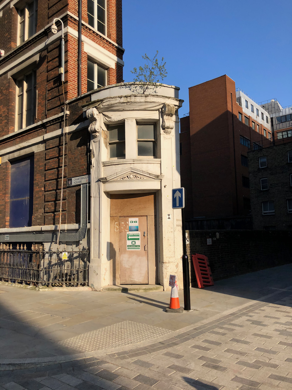
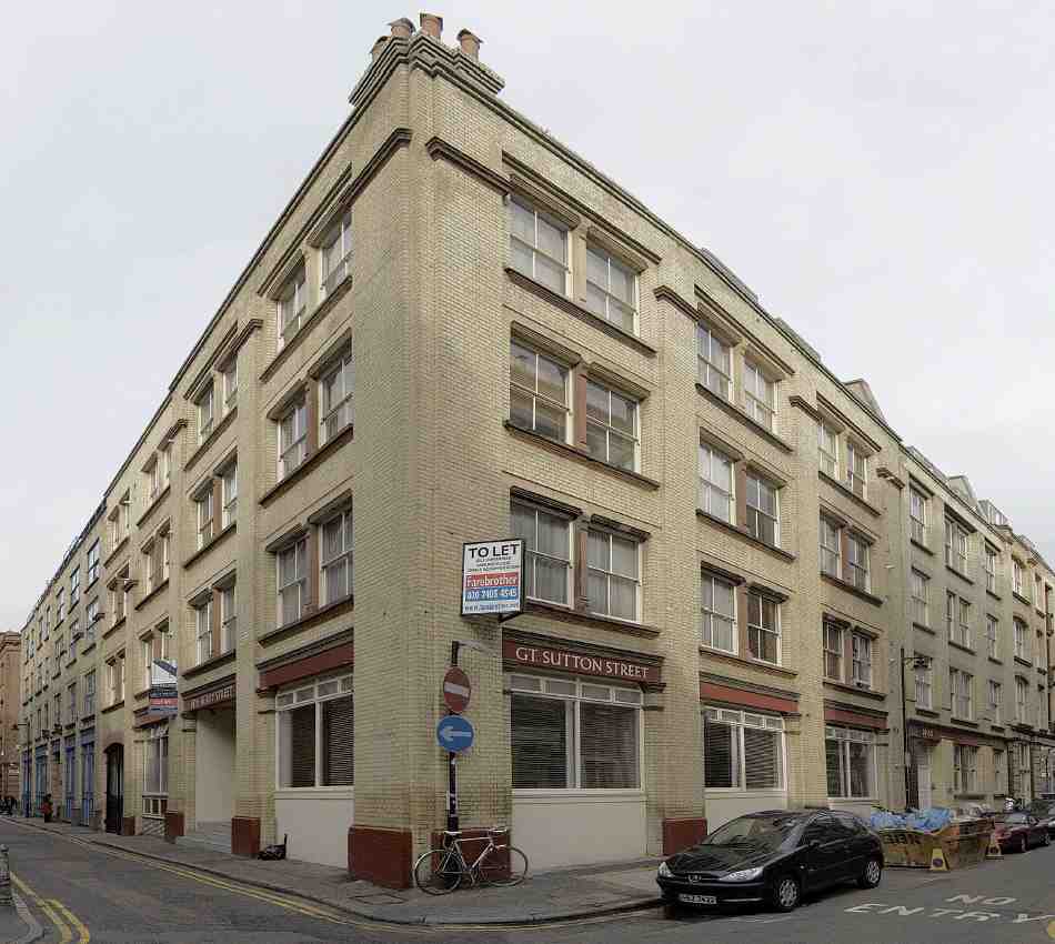
The Charterhouse sold this land in 1995. A developer bought up the land and built factories and warehouses. In the 21st century a new wave of developers transformed former warehouse blocks into apartments and offices. I sketched sitting outside one such: 6 Berry Street is residential apartments. This is now an area for architects and interior designers.

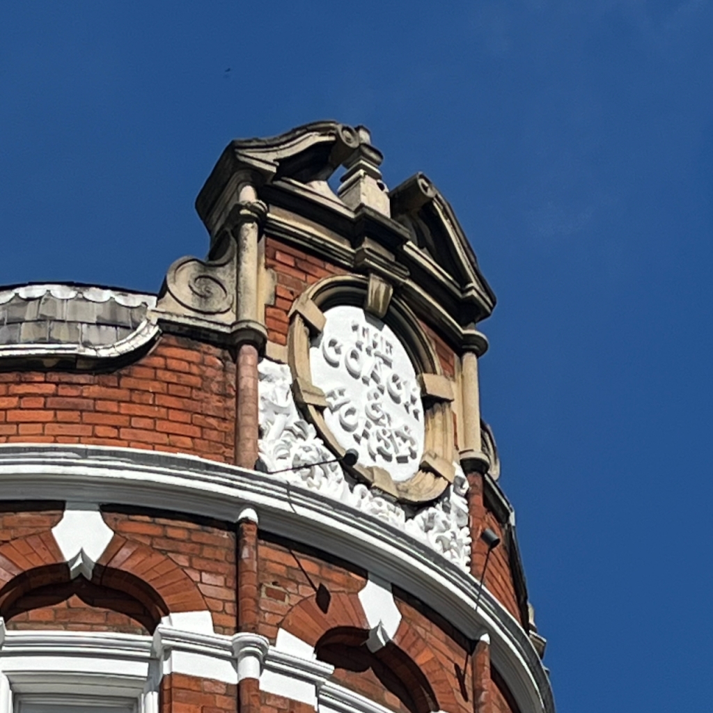
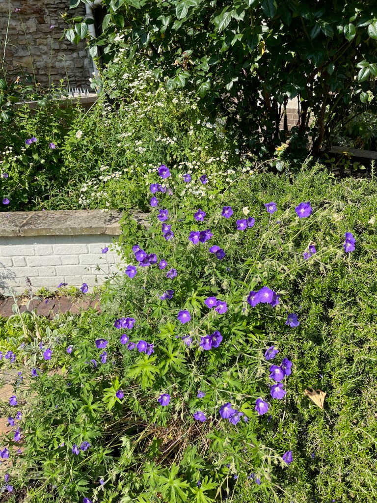
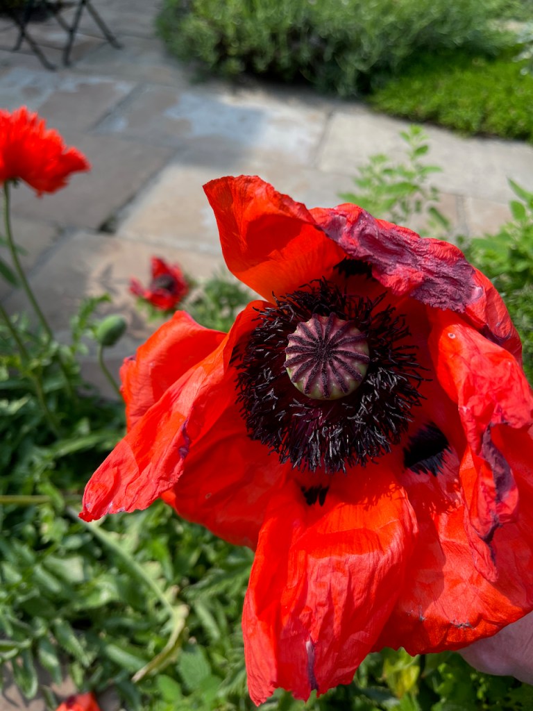
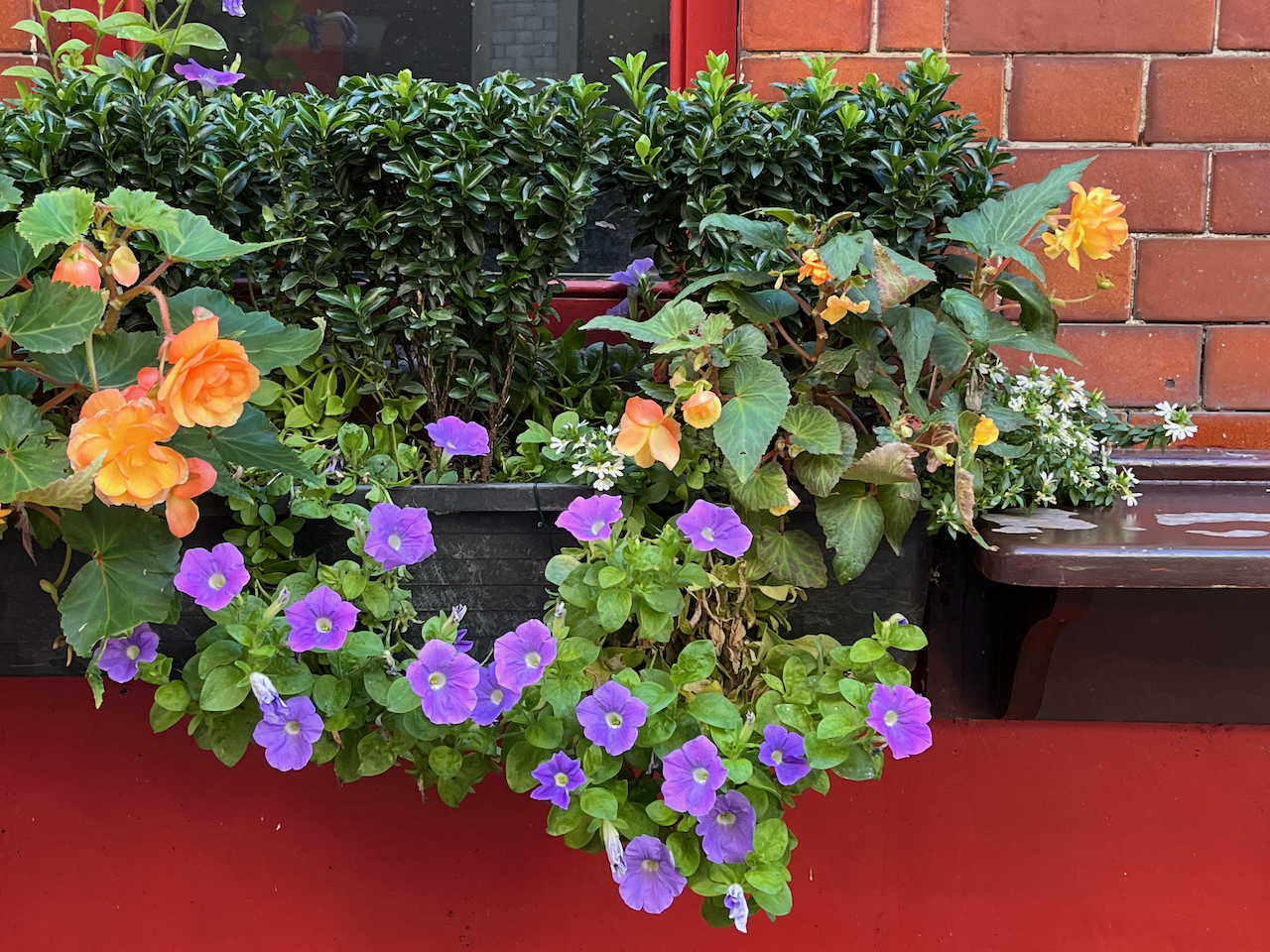
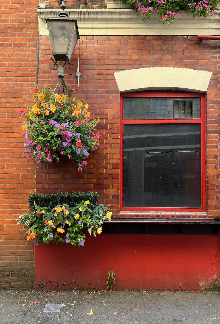
There was a pub here by 1825 [1]. It was rebuilt in 1897 [2]. It’s now a Free House. It’s clearly well looked after and well patronised. Definitely to be visited! The flowers are spectacular.

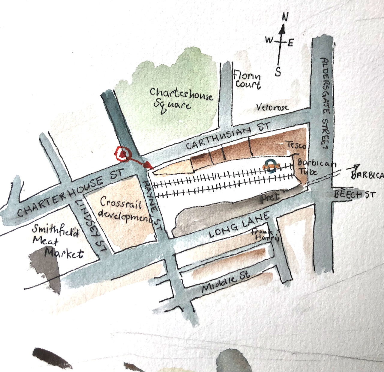
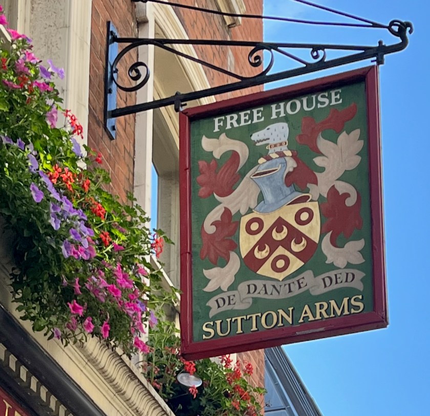
Thomas Sutton (1532-1611) was the founder of the Charterhouse, hence the name of the road and the name of the pub. This is the Sutton Arms in Clerkenwell, north of The Charterhouse. There is also a Sutton Arms south of The Charterhouse, in Carthusian Street, near Barbican tube.

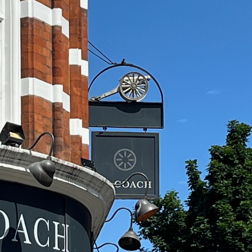
The pub sign is Sutton’s coat of arms. His motto is:

DEO DANTE DEDI

The translation is “God having given, I give”, or
“As God has given to me, so I give in my turn”,
a good motto for the benefactor that he was. The pub sign misses off the “O” in DEO and the “I” in DEDI.

Sutton Arms pub sign: “DE[o] DANTE DED[i]”
Thomas Sutton’s Coat of Arms. See the greyhound. Source: Charterhouse School on Wikipedia

The “Survey of London ” [2] gives a detailed history of this area, which has alternately flourished and decayed over the centuries. It is currently flourishing.

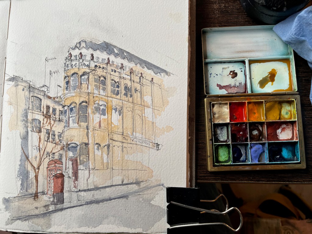
I completed the ink on location and finished the colour at my desk. The colours are:

  • Fired Gold Ochre (bricks)
  • Ultramarine Blue and Phthalo Blu (Green shade) (sky)
  • Serpentine Genuine (trees)
  • Mars Yellow (road and bricks)
  • Ultramarine Blue plus Burnt Umber (blacks and greys)
  • Transparent Pyrrole Orange (flowers, street signs)

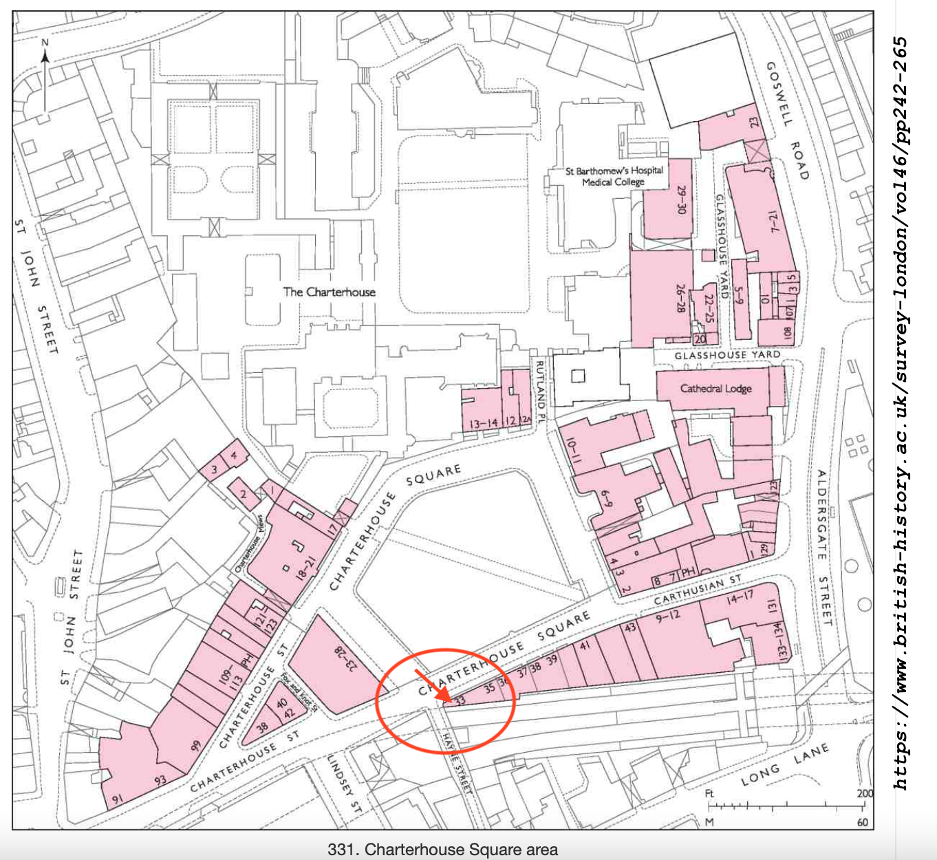
The changing fortunes of the Great Sutton Street area.


In the 14th century this area was fields, owned by a Carthusian Priory. There was a mortuary chapel, called “Pardon Chapel” for saying the last rites for criminals and suicides.
Henry VIII eradicated the Carthusian Priory in 1538 (“Dissolution of the Monasteries”) and it passed into private hands, along with the land. It became known at “The Charterhouse”.
Thomas Sutton, a wealthy businessman, bought the Charterhouse in 1611. He died that year. His will provided for the hospital and almshouse that are still there. The Charterhouse leased the land outside its walls to developers, who built houses.
“By 1687, when the Charterhouse estate was thoroughly mapped by William Mar, almost the whole had been laid out in streets of small terrace houses—242 houses in all, with yards, gardens and sheds.” [2] These terraces set the street pattern for the small streets that are there today. The lattice continued to the walls of The Charterhouse. Clerkenwell Road was cut through much later, in the 1870s.
Then commerce moved in and a hundred years passed. By the 1700s, the area was a mix of residences and industries: “In 1731 Philip Humphreys, the Charterhouse gardener [..]complained of the adverse effect on his crops of smoke ‘from so many neighbouring Brewhouses, Distillers and Pipe-makers lately set up’ in the vicinity.” Thus we see that NIMBYism is not a new phenomenon.
A new developer (Pullin) came in and rebuilt, and more and larger factories were built. Again, the neighbours complained: “Already by the 1820s some houses were giving way to further industrial developments, including slaughterhouses, a dye-house, breweries, and vinegar, vitriol and gas works. Complaints were made to the Charterhouse in 1832 about the nuisance of these works and their steam engines, and to the Vestry in the 1850s about the ‘boiling of putrid meat and other offal’ and blood running into the drains.”
Building continued.
Eventually government intervened: “Extensive redevelopment of the Charterhouse estate followed remarks in 1884–5 by the Royal Commission on the Housing of the Working Classes as to the badness of the houses there. […] Charterhouse was criticized for allowing [..]the incidence of house-farmers, severe overcrowding and badly constructed, poorly ventilated housing to continue on its property. One house in Allen Street was found to be occupied by thirty-eight people, eleven of them in one small room; similar conditions were found in the cottages of Slade’s Place. Many of these properties were occupied by costermongers with ‘very precarious’ earnings (whom the Commission felt would do better ‘if they kept from drink’).[2]”
The Charterhouse governors eventually took action. The small houses were demolished, and replaced by factories and warehouses. This time the trades were less polluting: “Among early occupants were clothing manufacturers: milliners, mantle-makers and collar-makers, leather manufacturers, glove-makers and furriers. The printing trade was also well represented, along with book-binding, engraving and stationery manufacture. Continuing a long-standing tradition were several butchers and tripedressers.” By now we are in the early 1900s.
About a dozen buildings were destroyed by bombing in the 1939-45 conflict, and replaced in the 1950 and 1960s by factories and warehouses.
The Survey of London [2] reports that the area was “considerably run down” in 1995 when the Charterhouse sold it to developers. The developers started a programme of warehouse conversions, to apartments and offices, which transformed the area, and moved it back upmarket. And that’s where we are today.
(The above is my summary of the more detailed description in reference [2])

[1] List of licensees in
https://londonwiki.co.uk/LondonPubs/Aldersgate/SuttonArms.shtml
First licensee recorded in their list is 1825.

[2] British History Online: ‘Great Sutton Street area’, in Survey of London: Volume 46, South and East Clerkenwell, ed. Philip Temple( London, 2008), British History Online https://www.british-history.ac.uk/survey-london/vol46/pp280-293 [accessed 2 September 2024].

[3] History of The Charterhouse https://thecharterhouse.org/explore-the-charterhouse/history/

The Coach, Clerkenwell, EC1

Here is “The Coach” on Ray Street in Clerkenwell.

“The Coach” Clerkenwell, Sketched 20th June 2024 in Sketchbook 14

I sketched this after I had sketched “Gunmakers” in nearby Eyre Street Hill. Above the pub sign is a model, just visible on the right of my drawing.

The Coach pub sign: a gun carriage?

The model is a gun carriage. I wondered what the connection was to The Coach, and if there was any connection to Gunmakers on Eyre Street Hill. But no, it is the symbol of The Cannon Brewery. This brewery was founded 1720, in nearby St John Street. It was acquired by Taylor Walker in 1930. I have this information from http://breweryhistory.com. So that explains the cannon.

At the top of the pub, the medallion names the pub as “The Coach and Horses” in white relief work.

The pub website says: “The Coach was established in 1790, and has been at the heart of the lively Clerkenwell community for generations.”

British History Online describes a pub called The Cock Inn, which was part of a sale in 1695:

At the time of the sale [1695], the land was mostly taken up by two fields of pasture: Gardiner’s Field to the north and the larger Sir John Oldcastle’s Field to the south. There was a cluster of buildings and a large rubbish dump or laystall in the south-eastern corner, in the area of Hockley-in-the-Hole. Chief of these buildings was the Cock inn, the forerunner of the present-day Coach and Horses in Ray Street.

https://www.british-history.ac.uk/survey-london/vol47/pp22-51

The current building dates from 1897 according to this source:

All the eighteenth-century public houses in the area have been rebuilt or have disappeared entirely. The Apple Tree in Mount Pleasant was rebuilt in the 1870s, and the Coach and Horses in Ray Street in 1897

https://www.british-history.ac.uk/survey-london/vol47/pp22-51

So it looks as though the pub was there already in 1695 as the Cock Inn, was established as The Coach and Horses in 1790 (according to the pub website) and rebuilt in 1897. It was renamed The Coach in 2018.

Having closed on 31st July 2015, this pub reopened on 16th January 2018 as the Coach with its Taylor Walker/Cannon Brewery sign frame retained.

https://londonwiki.co.uk/LondonPubs/Clerkenwell/CoachHorses.shtml

People sometimes ask me how I determine the viewpoint in my sketches. Often, as here, it is determined by practical rather than artistic considerations. I need somewhere to sketch, out of the way, not in the road, and with a clear view. I don’t carry a seat, though sometimes I wish that I did. But here, like a miracle, a seat presented itself.

This perhaps had been a phone junction box, but no more. Now it was a seat. I commandeered it.

I did the pen-and-ink on location and then added the colour back at my desk.

The colours here are:

  • Fired Gold Ochre for the bricks
  • Ultramarine Blue plus Phthalo Blue Turquoise for the sky
  • All greys and blacks are Burnt Umber with the blues
  • There’s a bit of Mars Yellow in some of the brickwork and the pillars.

All watercolours from Daniel Smith.

Sketchbook spread

Here are maps to show where it is. It looks like a great pub, with a serious gastronomy menu. https://thecoachclerkenwell.co.uk/

Click here to see more pubs that I’ve drawn.

Gunmakers, Eyre Street Hill EC1R

Here is the pub “Gunmakers” in Eyre Street Hill, Farringdon.

“Gunmakers” in Eyre Street Hill EC1R, sketched 20th June 2024 in sketchbook 14

Eyre Street Hill is a small sloping street in Farringdon, within the triangle made by Rosebery Avenue, Clerkenwell Road, and the Farringdon Road.

It slopes down to the River Fleet which is now below ground. I marked the approximate route of the Fleet on the map below:

It is a very old street, laid out in the 1720s as “Little Bath Street”. “British History Online” contains a detailed history of the area. This tells me that here and to the north was called “Coldbath Fields” in around 1719. The small houses in Eyre St were beside the Cold Bath, “a privately run hydropathic establishment opened in the late 1690”. This was on the edge of town. But then the came a distillery, a smallpox hospital and a workhouse.

“On the north-western ground, now largely occupied by Mount Pleasant Sorting Office, a distillery was built in the 1730s, and a smallpox hospital in the 1750s. These were joined towards the end of the eighteenth century by the prison, the Middlesex House of Correction, which became notorious for the brutality of its regime. South of the Cold Bath, near the old and insalubrious quarter called Hockley-in-the-Hole, the parish workhouse, built in the 1720s, was greatly enlarged in 1790.”

British History Online (see reference below)

Then Rosebery Avenue and Farringdon Road were built, with much demolition and reconstruction. By the beginning of the twentieth century, this area became part of “Little Italy”, a centre of the Italian Community. St Peter’s Church, on Clerkenwell Road, is still “the Italian Church”.

I can find no reference to this pub, or to gunmaking in the area. The building looks like one of the ones built in 1812:

The sun catches the castellated building.

“Today the oldest structures are the small, single-bay houses with shopfronts at Nos 33–37, dating from the early nineteenth century and fairly typical of the rebuilding that took place in the area at that time. Nos 33 and 35 were erected as a pair around 1812 by Thomas Abbott, builder, of Leather Lane.”

British History Online (see reference below)

In the right background of my drawing is a magnificent castellated building, now obscured by the newly-built “Ruby Stella Hotel” .

I was sketching, appropriately enough, in “Summers Street”. It was 20 June and the first sun of summer arrived. The pub was doing a brisk trade.

After about an hour of drawing on location, I added the colour at my desk later.

Sketchbook 14

All quotes are from British History Online Volume 47, pages 22-51 with this reference:

‘West of Farringdon Road’, Survey of London: Volume 47, Northern Clerkenwell and Pentonville, (London, 2008), pp. 22-51. British History Online https://www.british-history.ac.uk/survey-london/vol47/pp22-51 [accessed 22 June 2024].

The Sekforde – a commission

The Sekforde EC1R 0HA, Clerkenwell, sketched March 2024 12″ x 9″ [commission]

This watercolour was specially commissioned to celebrate a happy event.

The colours are:

  • Mars Yellow
  • Fired Gold Ochre
  • Ultramarine Blue
  • Burnt Umber
  • plus some Horadam Random Grey, some Daniel Smith Green Serpentine Genuine, and Pyrrol Red for the street sign and road marker.
  • Gold paint for the lettering.

Admire the bricks! I am very pleased with this effect. It was done by applying a rubber resist, “pebeo drawing gum” to the paper before I did any painting. The paint does not adhere to the rubber resist. When I had done all the colour, I rubbed off the rubber resist and hey presto! bricks.

Thank you to my client for their encouraging words and for inspiring me to make this picture of The Sekforde. Here are some details of the drawing.

I have sketched The Sekforde previously, see this link: The Sekforde, Clerkenwell

UPDATE:

My client kindly sent me photos of the framed picture!

Compton, St John’s Square, London EC1

Clerkenwell has many interesting corners. Here is a view across St John’s Square. I sketched it earlier today, sitting on the step of the Priory Church of the Order of St John. The restaurant is called “Compton”.

View across St John’s Square, Compton restaurant, 21 June 2023, in sketchbook 13

Here’s a map:

Thank you to the kind person from the Priory Church. They emerged from the door behind me. There I was, low down on the step, at the pen-and-ink stage, with my materials laid out neatly on the stone. They obviously had not expected anyone to be sitting on the step. I had not expected anyone to come out of the dark door. It had looked as if it had been closed shut for millennia. After a moment of surprise, politeness prevailed and we both said hello. Thereafter, I grouped my materials into a compact heap, and they came and went, tolerating me amiably, and skirting around me to operate the card key system.

This picture has just four main colours: Ultramarine blue, Brown umber, Mars yellow, and Green Serpentine Genuine. The only other colour is Fired Gold Ochre for the terracotta: the chimneys and the flowerpots. All colours are Daniel Smith watercolours.

Here is work in progress:

Garden of the Museum of the Order of St John, Clerkenwell, London EC1

On a hot day, in need of healing, I re-discovered this herb garden. It is hidden away the other side of a gate off St John’s Square in Clerkenwell. The gate is open and you can walk right in. There are benches, and aromatic plants. At the back, there’s.a cloister.

I went in the cloister, and found the ideal place to sketch: cool, still, and quiet, with a view from those windows.

Here’s the view:

From the Cloister, looking into the garden, 15th June 2023, 10″ x 8″ in Sketchbook 13

The Order of St John has a long history.

By 1080, a hospital had been established in Jerusalem by a group of monks under the guidance of Brother Gerard. Its purpose was to care for the many pilgrims who had become ill on their travels to the Holy Land. The men and women who worked there were members of a new religious order, officially recognised by the Church in 1113. Known as the Hospitallers, they cared for anyone, without distinction of race or faith.

website of the Museum of the Order of St John [https://museumstjohn.org.uk/our-story/history-of-the-order/]

These days, this is the organisation behind St John Ambulance.

The garden is wonderful. A place of solace. People from the offices around go there to eat their lunches and also to discuss office politics I realised. But also to read books, dream, doze, and of course, to sketch. There is a book stand by the gate as you go in, with secondhand books you can borrow or buy.

I’ve sketched in this garden a few years ago, from a slightly different viewpoint:

My sketch shows the backs of houses on Albemarle Way. This street and others nearby feature in the novel “Troubled Blood” by Robert Galbraith.

I looked back at the houses as I walked through the garden on my way out. I saw that one of them claims “Ancient Lights”. That’s asserting the right to light, and was a way in law to prevent anyone constructing a tall building which obstructed your windows. It’s “ancient” because you had to have enjoyed the benefit of the light for 20 years or more before you could assert “Ancient Lights”. This has now been superseded by “modern planning laws” I read. But maybe we should put some “ancient lights” notices on the windows of our flat, just to be sure.

Here are maps:

The drawing took three hours. By the end of that time, my mood had transformed itself, and I walked out healthier than I walked in.

77 St John St EC1M: the ASLEF building

Next time you are walking along St John St, look out for this dome, with the elephant wind vane. It’s on the West side, just a bit further North than the White Bear pub.

77 St John St EC1M, 9″ x 7″ in Sketchbook 13, 17th March 2023

I can’t find out anything about why there’s an elephant up there. The wind vane is on number 77 St John St, currently occupied by, amongst others, ASLEF the train drivers union, and “Liberation – Justice for Colombia”

JFC was set up in 2002 by the British trade union movement to support Colombian civil society in its struggle for human rights, labour rights, peace and social justice.

All JFC work is carried out in response to the demands of our partners in Colombia: the political activists, trade unionists, peasant organisations, human rights defenders, and other civil society groups who are on the front line in demanding peace and social justice.

JFC promotes links of solidarity between British and Irish trade unions and organisations in Colombia and gives a political voice internationally to Colombian civil society through our work in the British, Irish and EU Parliaments

“Justice for Colombia website: https://justiceforcolombia.org

The building in the centre of my drawing is numbers 69, 71 and 73 St John St. These buildings are listed Grade II, list entry no: 1195730.

In 2015 there was an application to build another floor on top of number 69, for residential use. As part of the planning submission, the applicant commissioned a detailed historical study from Paul Edwards, Dip Arch (Oxford) IHBC, Historic Environment Specialist. His 15-page report provides fascinating information about the houses. For example:

Nos 69-73 are depicted in Tallis London Street View, drawn 1838-1840,
… There were three bays, at the centre an alley leading to an internal yard flanked by buildings of
three storeys and attics, each with two windows each side of the alley.
The facades had classical Georgian or Regency proportions, with tall
sash windows at 1st and second floor levels and continuous small pane shop windows at ground floor level. A gambrel roof was set behind an eaves parapet.
The northern house was leased by John Newton a cork manufacturer
who took over the whole premises and whose firm remained there
until the First World War.
The ground floor front of No 69 was re-modelled in the mid-19th century with arched openings and Ionic pilasters in stucco. The shop front of No 73 dates from 1884. There had been a fire in the cork
warehouse in 1882 which was then partly rebuilt with No 69 being extended over the alley between the two houses. In 1896 the two buildings were made into one.

Paul Edwards, 69 St John Street, Islington, Historic Asset Assessment (Version 1) February 2015.

The proposal was rejected by the Islington planning officer in 2018, after appeal.

Here is a sketch map showing where I was standing and my view-line:

St John Street is a fascinating area, with layers of history, and still evolving. I’ve sketched here a number of times.

39 Clerkenwell Road, EC1

Here is a row of shops on the Clerkenwell Road.

Roni’s Café, 39 Clerkenwell Road, 15th Feb 2022, 10″ x 8″ in Sketchbook 11

In the centre of the picture is Roni’s Café, where I sheltered to finish my drawing of 84 Clerkenwell Road.

My idea was to draw the view looking West along the Clerkenwell Road, from number 84. By the time I reached the spot, the rain was falling heavily. I spotted a large window. The people inside kindly agreed to host me for 45 minutes while I sketched my lines. Then I went out into the rain. I finished the picture at my desk.

Colours are: Ultramarine Blue, Burnt Umber, Transparent Pyrrol Orange.

84 Clerkenwell Road, EC1

This building is at the junction of Clerkenwell Road and Albermarle Way.

84 Clerkenwell Road, EC1M, 21st January 2022, 14:30, 7″x 10″ in Sketchbook 11

The land, on the recently established Clerkenwell Road, was bought in 1879 by a jeweller, Edward Culver, who funded a new factory for his business on in this rapidly developing area. The building cost £11,ooo, and was finished in October 1879. His business occupied it until about 1894. (from British History online, see Note 1)

In 1915, the ground floor and basement were converted for use by the “London County & Westminster Bank” (Note 1). This turned out to be a long tenancy. A photo in the London Picture Archives shows that a descendant of the same bank, the National Westminster Bank, was there in 1976. (Notes 2 and 3).

The ground floor is now a design company, “Frem”. Before that, it was a hairdressers. The building is labelled “The Printworks” but I am unable to discover when, or indeed if, it was a printworks.

I sketched the building from the corner of the Clerkenwell Road and St John’s Lane. On the other side of the road, I saw a man come and lay out a large flexible chess mat on the stone bench in St John’s Square.

Later, a woman appeared at my elbow carrying a green metal chair. “Would you like to sit down while you draw?” she asked. I would indeed. She told me she was from the café just up the road. Very grateful, I sat down and continued sketching. By the time I’d finished the pen sketch, there were several dozen people clustered round the bench in St John’s Square. There were now many chess sets laid out. And I was very cold.

Roni’s Cafe: warm and friendly

I picked up the green chair and went to the café to give it back. It was warm and friendly in there, so I stopped for a coffee. I learned that the chess players come every Saturday. First there were just a few, now there are dozens. The youngest is 7 years old. As I drank my coffee, some of the chess players came into the café, hopping from one leg to the other with the cold, as I had done earlier. They bought takeaway coffee or hot chocolate, left a phone to charge up by the till, and took off again to join the fray.

The friendly proprietor of the café admired my picture and pointed out that I could see the building, if I took a certain table by the window. “Then you can do the colour”, she said. I could. She brought a cup of water, a porcelain saucer, and a large amount of paper towel. This is a lady who knows what watercolour painters need. A mug of tea arrived as well. Comfortable and warm, I continued my sketch.

If some of these road names seem familiar to you, it might be because this area is the setting for much of the story in the novel “Troubled Blood” by Robert Galbraith aka JK Rowling.

————————————————————–

Note 1: 84 Clerkenwell Road, early history: ‘Clerkenwell Road’, in Survey of London: Volume 46, South and East Clerkenwell, ed. Philip Temple (London, 2008), pp. 385-406. British History Online http://www.british-history.ac.uk/survey-london/vol46/pp385-406 [accessed 22 January 2022].

Note 2: 1976 photo: London Picture Archive, Record 60792, on this link

Note 3: NatWest Group has an excellent History section on its website: https://www.natwestgroup.com/heritage.html?intcam=. The current “NatWest” is the result of the acquisition of over 250 banks over several centuries. The London County and Westminster Bank was one of them.

London & Westminster Bank Ltd (1833-1909) opened in 1834 with a head office at 38 Throgmorton Street and a branch at 9 Waterloo Place. It acquired a succession of other banks, then in 1909 it amalgamated with London & County Banking Co to form London County & Westminster Bank Ltd. London County and Westminster Bank underwent a number of amalgamations and mergers, notably merging with the National Provincial Bank in 1968 eventually to form the National Westminster Bank in 1970.

No. 33 Charterhouse Square EC1

This is a little white building I always enjoy walking past. It is the westernmost end of a thin terrace of warehouses and showrooms, lodged in a triangle between the road and the railway. As I passed it the other day I saw that the tree which has taken root above the door was putting out leaves, and flourishing in its unlikely place.

On the bottom right is Hayne Street, which forms a bridge over the railway lines. There is a dark deep gap. The buildings on the right are the other side of the railway. The railway lines are the Hammersmith and City, Circle, and Metropolitan underground lines, which emerge briefly into the open air at this point . This is good to know, in case you are trying to send a text message from the tube train.

33 Charterhouse Square (left) and Hayne Street EC1. 10″ x 7″ in sketchbook 9. 19 April 2021

Recently this building has been used as some sort of office or headquarters of the Farringdon Crossrail development which is now completed. The construction workers have left, and this building looks vacated and rather sad, but noble in its sadness.

Here are some maps1 (click to enlarge):

Here are some photos of the location and work in progress.

The drawing was done at about 17:30 at the end of a gloriously sunny day. The colours here are: Transparent Brown Oxide, Fire Gold Ochre, Phthalo Blue Turquoise, Buff Titanium, Mars Yellow. There is Transparent Pyrrol Orange for the road sign and the leaves of the tree are Green Gold. The paper is Arches Aquarelle 300gsm.

This building was completed in 1875-6. The architect was the aptly named Coutts Stone. This and other fascinating and detailed information is in the scholarly “Survey of London” 2008 edition.

Here is their entry on the row of houses on the South side of Charterhouse Square. I have drawn number 33, the westernmost section.

Nos 33–43

The Metropolitan Railway acquired the whole of the south side of Charterhouse Square and emptied the properties in order to construct their extension from Farringdon to Moorgate in 1864–5. The cutting of the railway entailed the demolition of Nos 32–38 on the south side of the square, along with the whole of Thomas Neale’s Charterhouse Street. Nos 39–43 were briefly left standing, but the operation left the whole south side as an awkward set of narrow sites whose amenities were further diminished by the new east—west thoroughfare completed in front of them in 1873–4 (Ill. 338).

In 1875 the railway company sold the whole frontage to Tubbs, Lewis & Co., manufacturers of elastic fabric, silk throwsters, warehousemen and ‘smallware agents’, with premises in the City, Birmingham and Manchester, and a manufacturing base in Gloucestershire. The firm also had a line in the speculative building of warehouses at this period, on which they spent about a quarter of a million pounds. The row which they erected here was one of several local developments they carried out during the mid-1870s, including Charterhouse Buildings at the corner of Goswell and Clerkenwell Roads . The company chose as its architect Coutts Stone, a friend of George Devey. Early drawings suggest there was some thought of rebuilding from No. 38 eastwards with houses , but in the event the whole block became warehousing. Construction took place in 1876–7. Andrew Killby was the builder for Nos 33–42, with interior structural ironwork provided by H. Young & Co.; Scrivener & White took on the separate No. 43.

Nos 33–42 (Ill. 341) stand four storeys above a basement protected by heavy iron railings. The block is divided into three sections. The front elevation, faced in red brick, has a strong horizontal emphasis, with broad banks of mullioned windows relieved by some minor brick detailing. No. 43 has a narrower frontage and an extra storey topped by a pediment, while its main windows are of iron and flanked by decorated pilasters.

Tenants for these warehouses were mainly involved in the textile trades. At No. 41 one of the original occupants was Griswold & Hainworth Ltd, early specialists in portable knitting machines for domestic use.  In the early 1890s the whole of No. 40 was occupied by David Marcus, importer and agent of Eastern manufactured goods: ‘The basement is reserved as a show-room for Oriental carpets and furniture; the ground floor is divided in front into a splendid show-room, and at the rear forms the wellappointed office; while the upper floors are fully utilised as show and stock-rooms’. In 1917 No. 42 became the first premises of J. Collett Ltd, ladies’ hat makers; they gradually took in Nos 41 and 43 and spread elsewhere in the square. The projecting clock which survives at No. 43 was put up by them in 1930. Though there were still four clothing firms here in the mid-1970s, there had been a shift towards printing, illustration and white-collar work. Since then most of the row has been fitted out as offices and studios, including No. 41 by Campbell Zogolovitch Wilkinson Gough (CZWG) in 1980 for the pop artist Allen Jones. “

1 Citation for text above and map:   BHO  Chicago  MLA ‘Charterhouse Square area: Introduction; Charterhouse Square’, in Survey of London: Volume 46, South and East Clerkenwell, ed. Philip Temple (London, 2008), pp. 242-265. British History Online http://www.british-history.ac.uk/survey-london/vol46/pp242-265 [accessed 20 April 2021].

Update: here is a tweet from @nicholas_sack, (4th Sept 2021) with a wonderful photo of the same building, 20 years ago.