North entrance to the Woolwich Foot Tunnel, E16

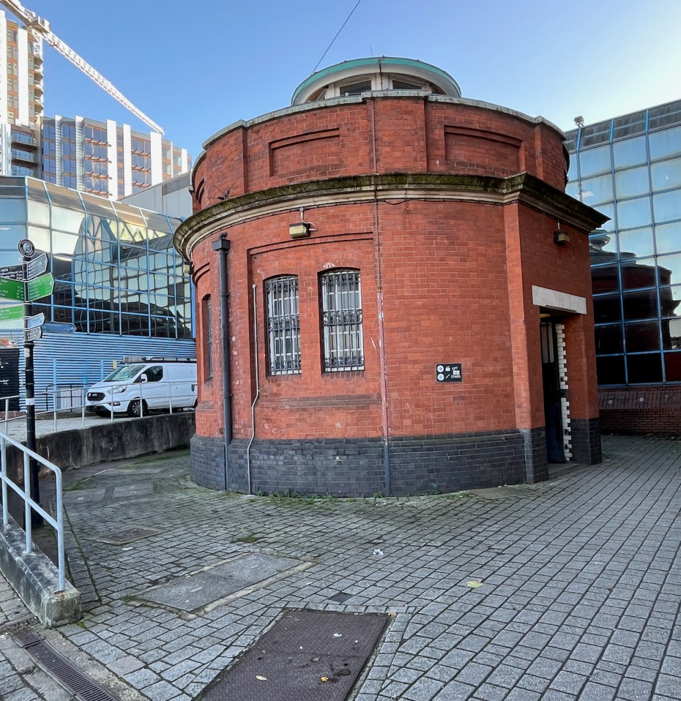
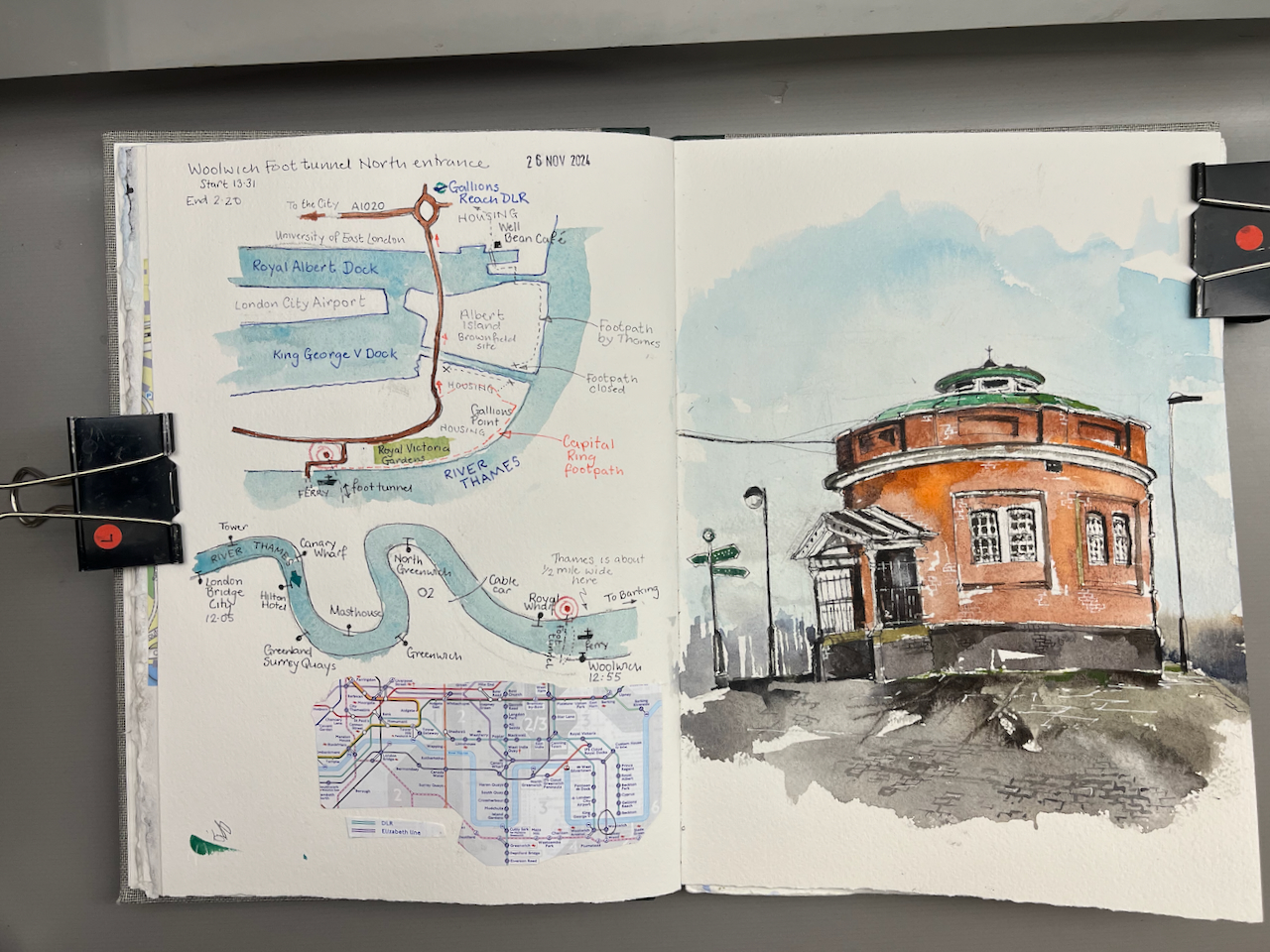
The North entrance to the Woolwich foot tunnel stands isolated on a traffic island.

North entrance to the Woolwich Foot Tunnel, sketched 26th November 2024 in Sketchbook 15

The Woolwich Foot Tunnel opened in 1912, and is still open today, 24 hours a day. It connects the North and South sides of the River Thames.

I walked through the tunnel on an adventure exploring Docklands, inspired (once again!) by a fascinating article on the “London Inheritance” site.

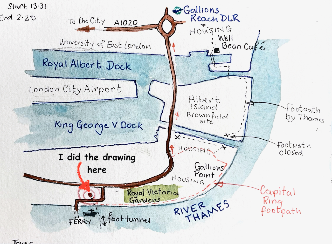
My expedition started at London Bridge pier, with a trip down the Thames on the riverboat. This seemed the simplest way to get to the docks. It takes about 50 minutes to go from London Bridge to Woolwich.

The route of the riverboat from London Bridge to Woolwich.

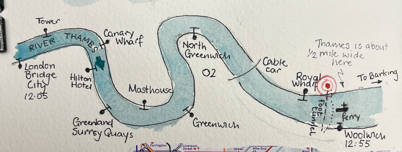
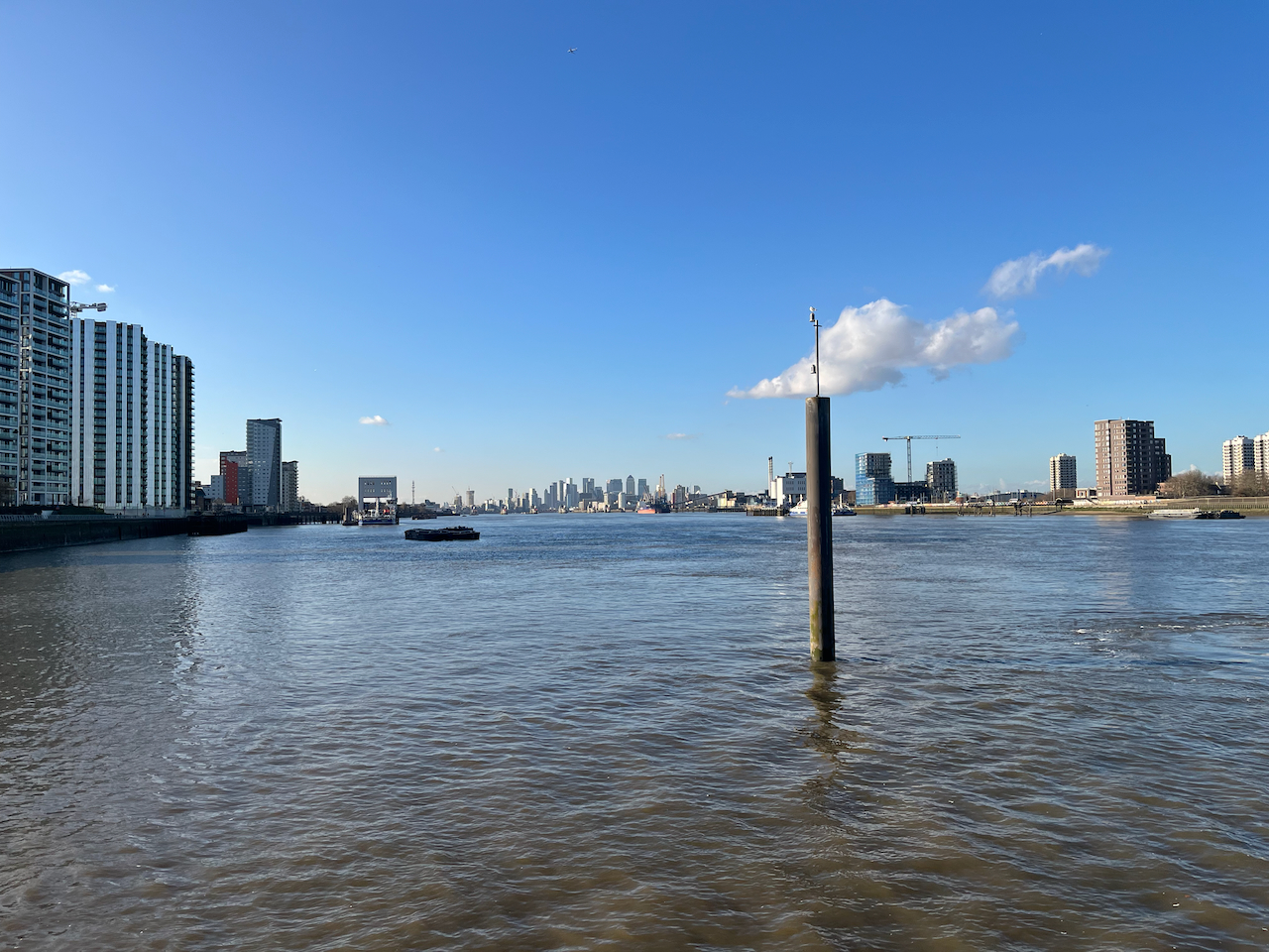
Everyone gets out at Greenwich, but it’s well worth going a bit further. The boat is empty, the Thames is huge, and the sky opens out.

The City of London seen in the distance, from the Woolwich Royal Arsenal Pier

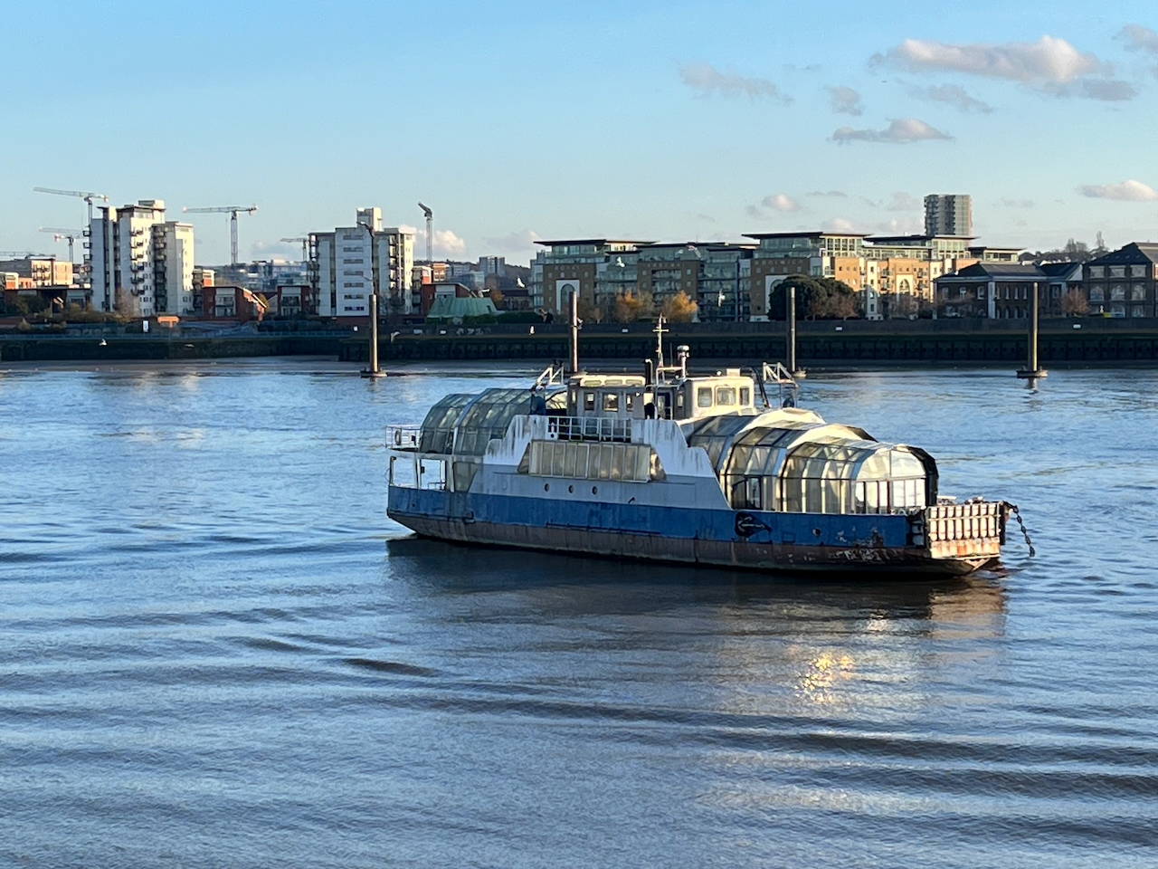
The river boat pier at Woolwich is on the South side of the river. I was keen to explore the North side, so I walked a little way to find the entrance to the foot tunnel. There is also a ferry, but I wanted to experience the foot tunnel.

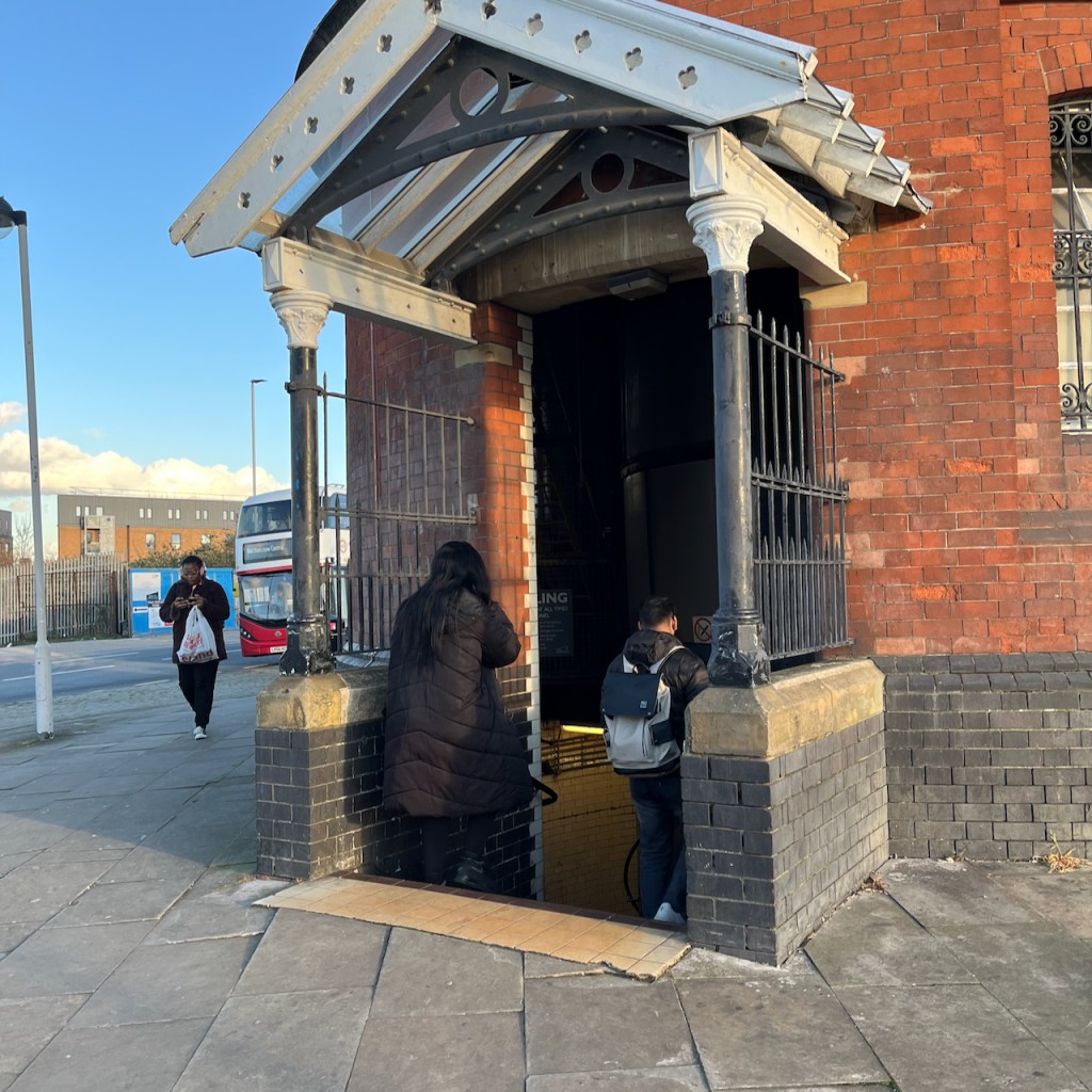
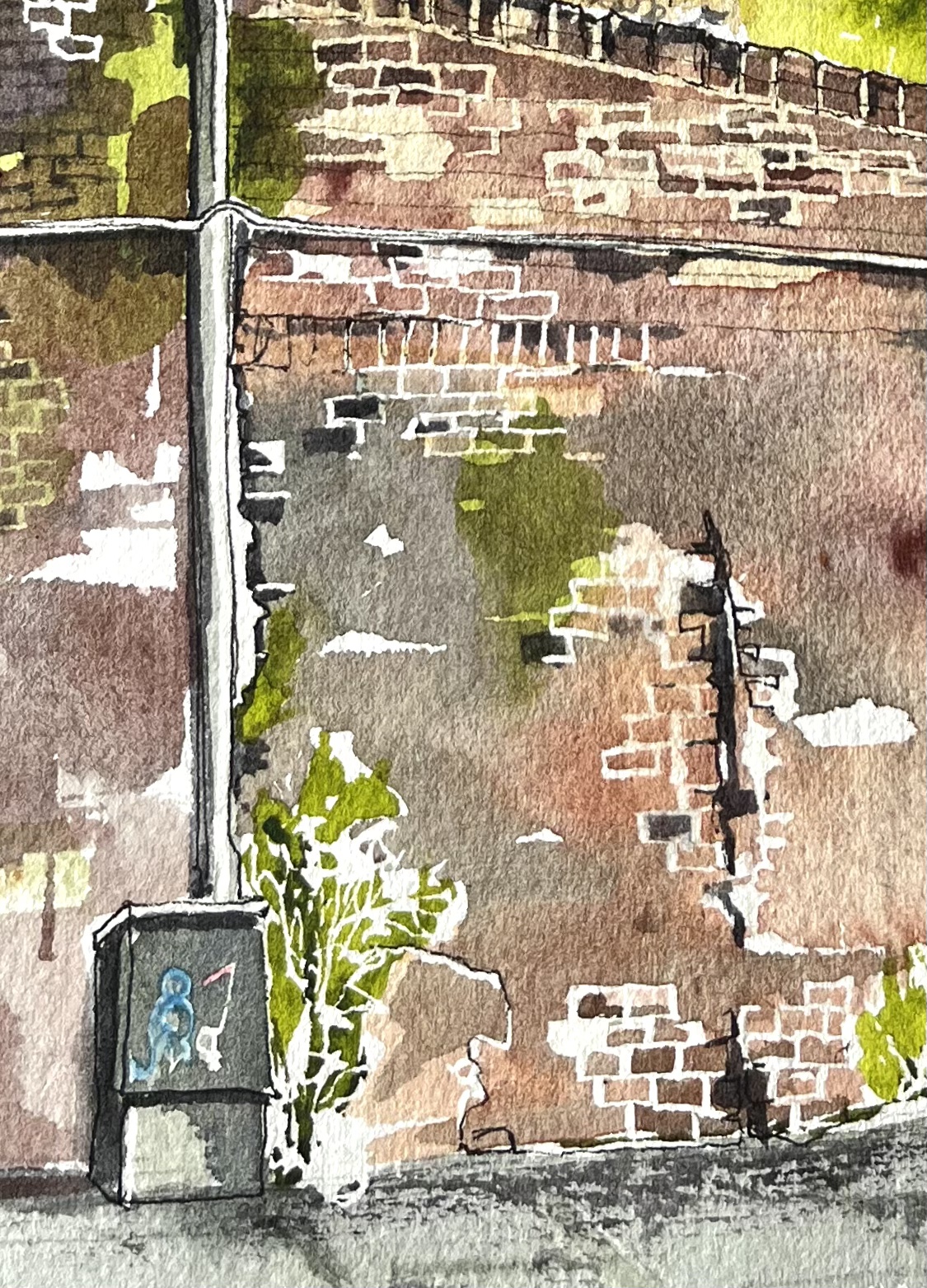
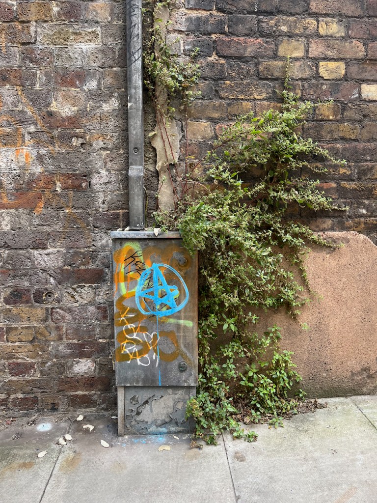
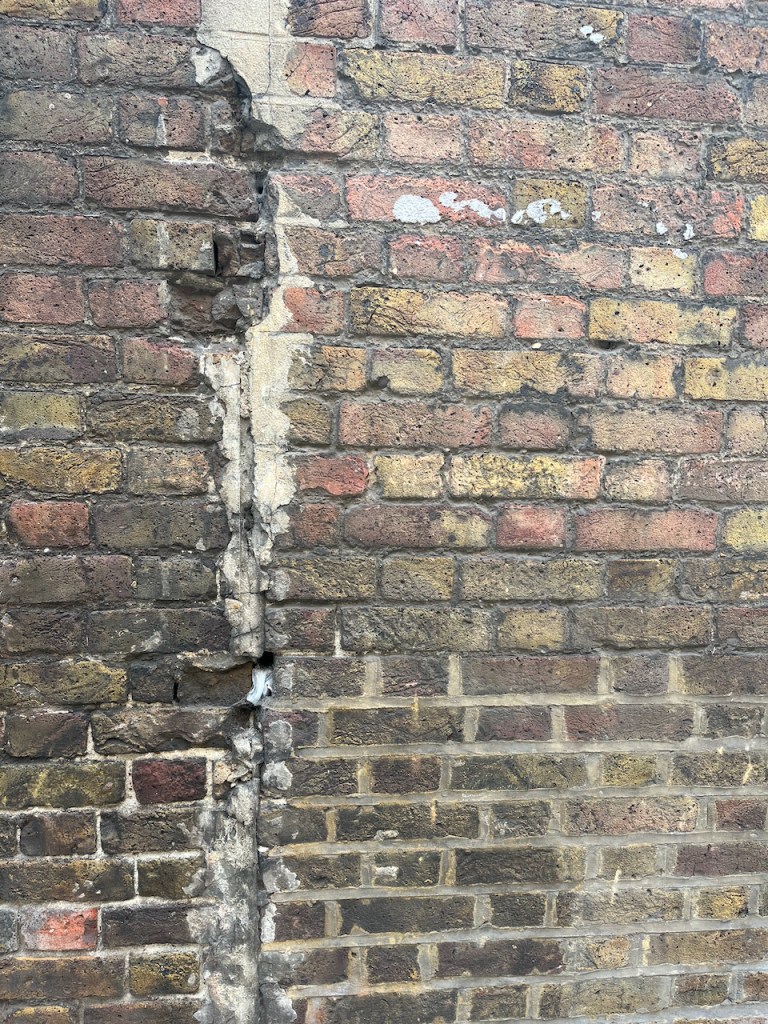
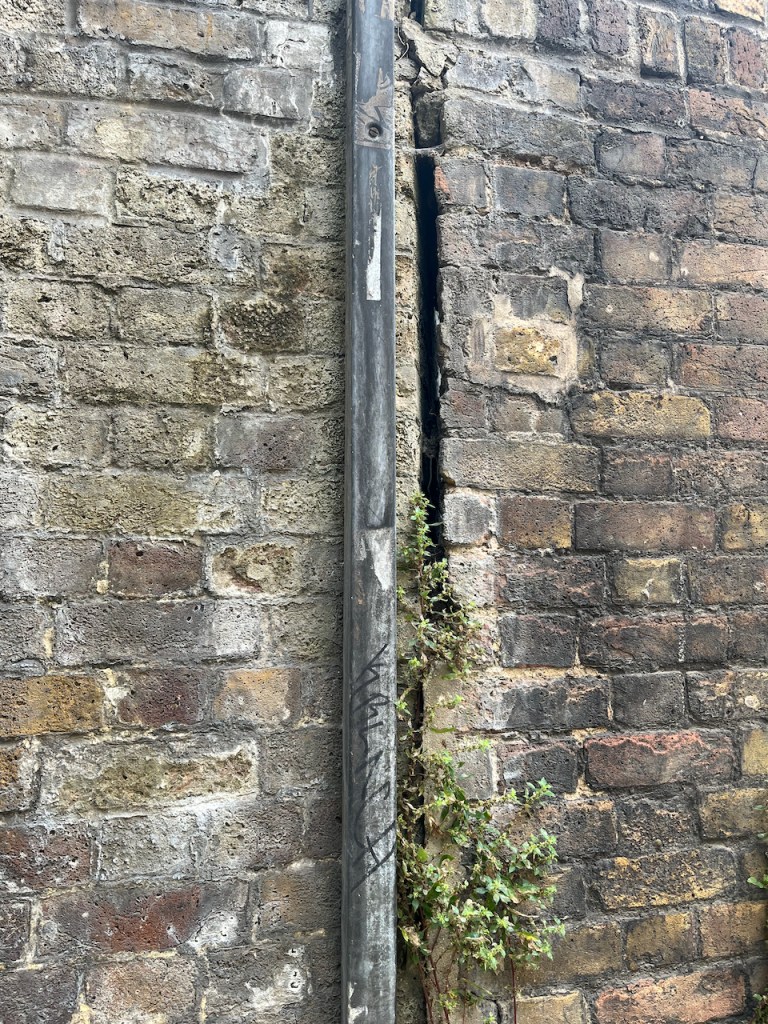
The South entrance to the foot tunnel is hard to find. It’s crammed into a dark space behind the leisure centre. It looks somewhat dingy and derelict.

South entrance of the Woolwich Foot tunnel, hemmed in by 1970s buildings.

You have the option of the lift or the stairs. I followed the arrow to the stairs. The stairs are round the back. You have to find your way in, sidling between the wall of the leisure centre and the columned entrance to the tunnel. I can’t help feeling that the constructors of the tunnel would be appalled that their ornate entrance had been obstructed in this way.

Entrance to the stairs, under the canopy. Leisure Centre is the blue part on the left.

By this time I was rather doubting the wisdom of this undertaking, as the old building seemed so abandoned, and the entrance was so dark. However, the stairs were brightly lit, and it all seemed feasible. So down I went.

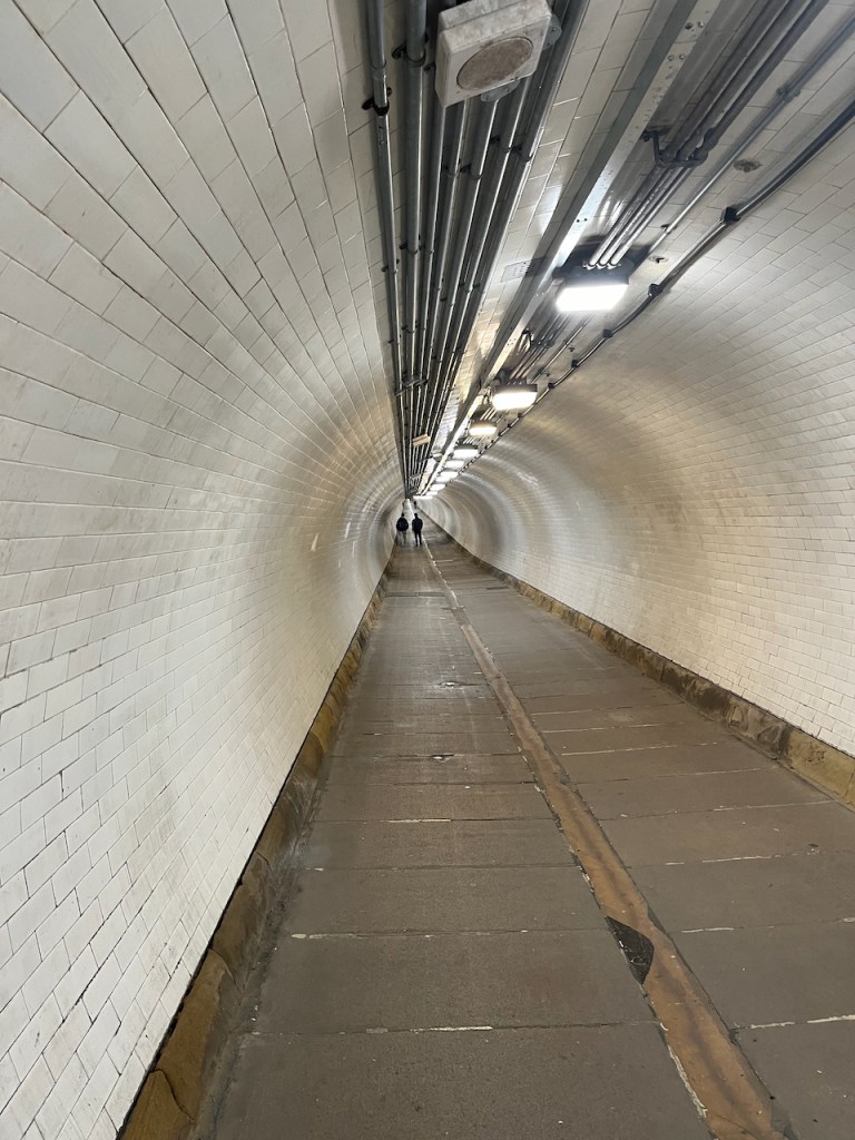
The tunnel itself is marvellous: all bright and clean, with amazing acoustics. I could hear the distant voices of people ahead of me.

Inside the Woolwich Foot Tunnel

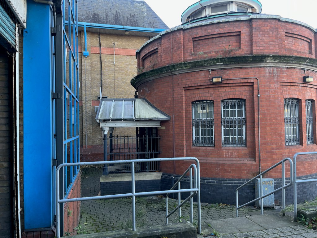
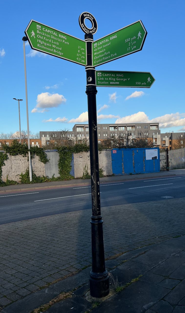
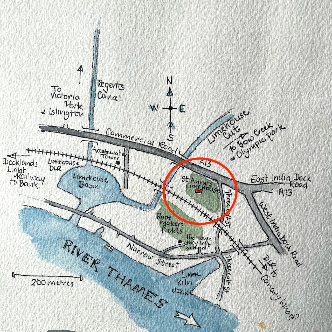
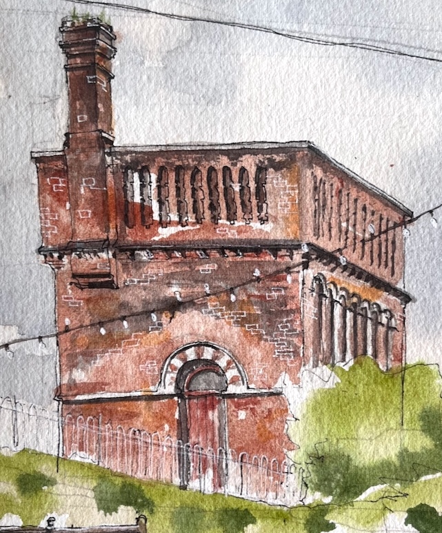
On the North side there is a different world. The North entrance, unlike its Southern counterpart, stands proud and isolated on an expanse of concrete. I sat down and sketched it.

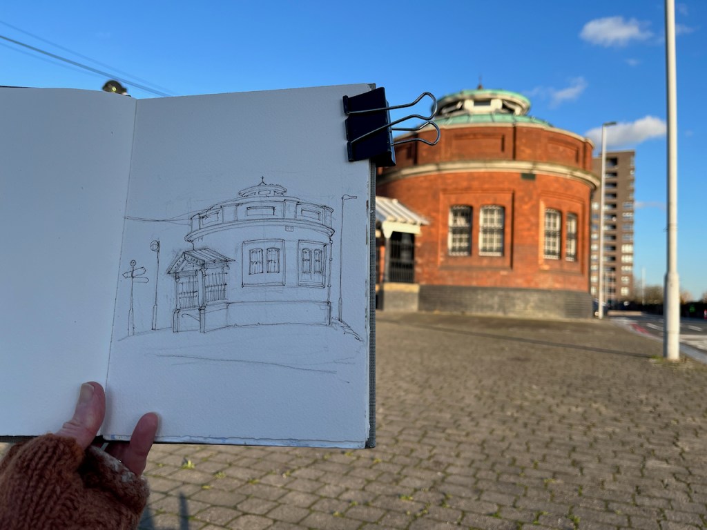
The building stands on a traffic island which is a junction of many routes. The A117 takes heavy traffic onto the pier, to load onto the Woolwich Ferry. There’s a bus, the Superloop SL2 ,which goes to Walthamstow. People walk from the bus to the foot tunnel.

North entrance to the foot tunnel. The Superloop bus from Walthamstow is in the background.

The signpost on the left of my drawing indicates the long distance footpath “The Capital Ring”. I followed this route along the Thames a little way. The path is cut off after the Galleons Point Housing development. Signs say that the lock gates are being maintained. So the route returns to the main road and passes over the spectacular bridges across the docks.

The bridges offer a view directly down the runway of London City Airport. When I walked past, some boys were enthusiastically photographing the aircraft on their mobile phones.

Plane spotters on the bridge over the Royal Albert Dock. City of London in the distance.

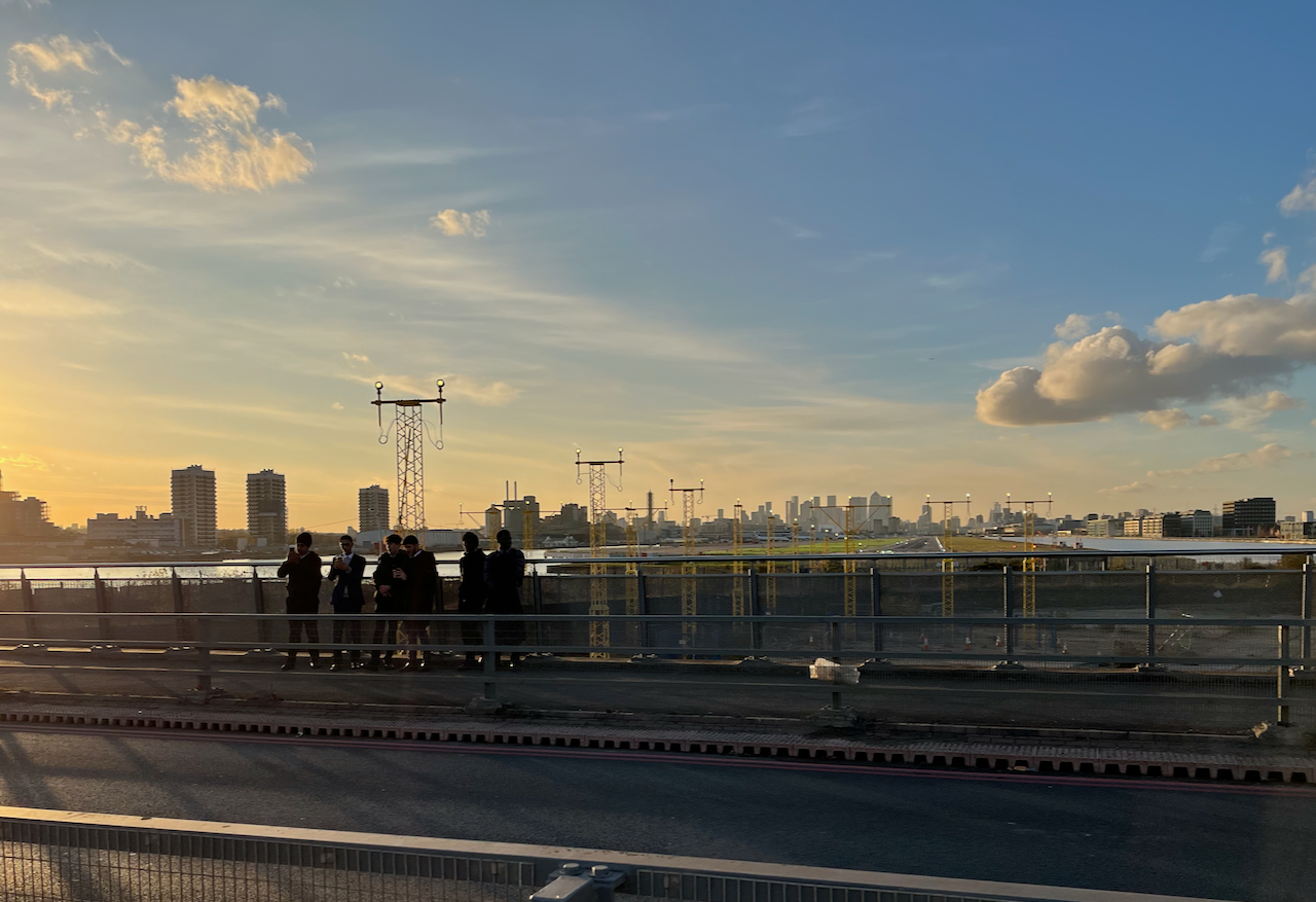
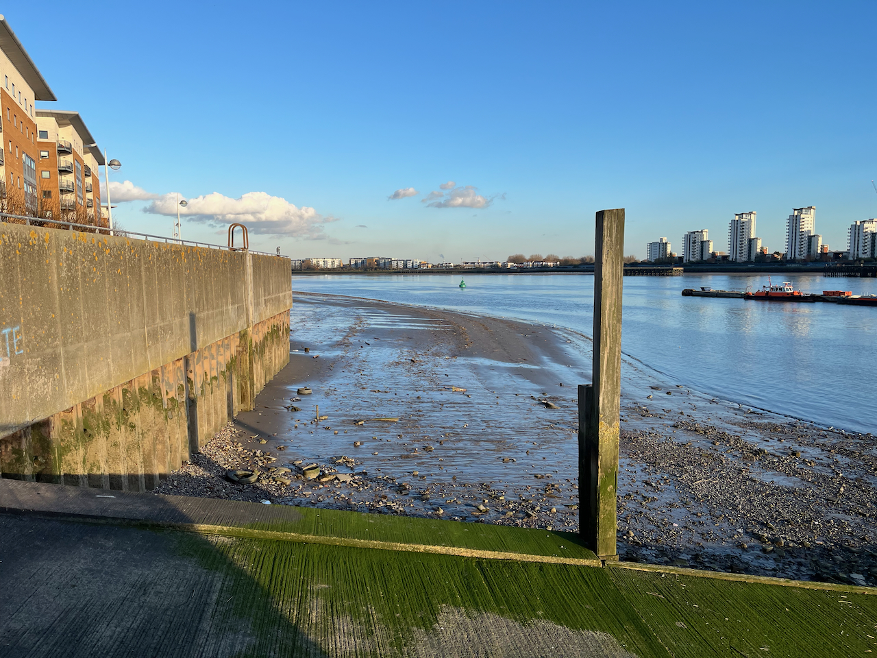
The other direction from the airport, looking toward the Thames, is a scene which seems to define what we mean by “brown field site”.

A brown field site: Albert Island, North Woolwich. This photo was taken from the same spot as the one above, but looking the other way.

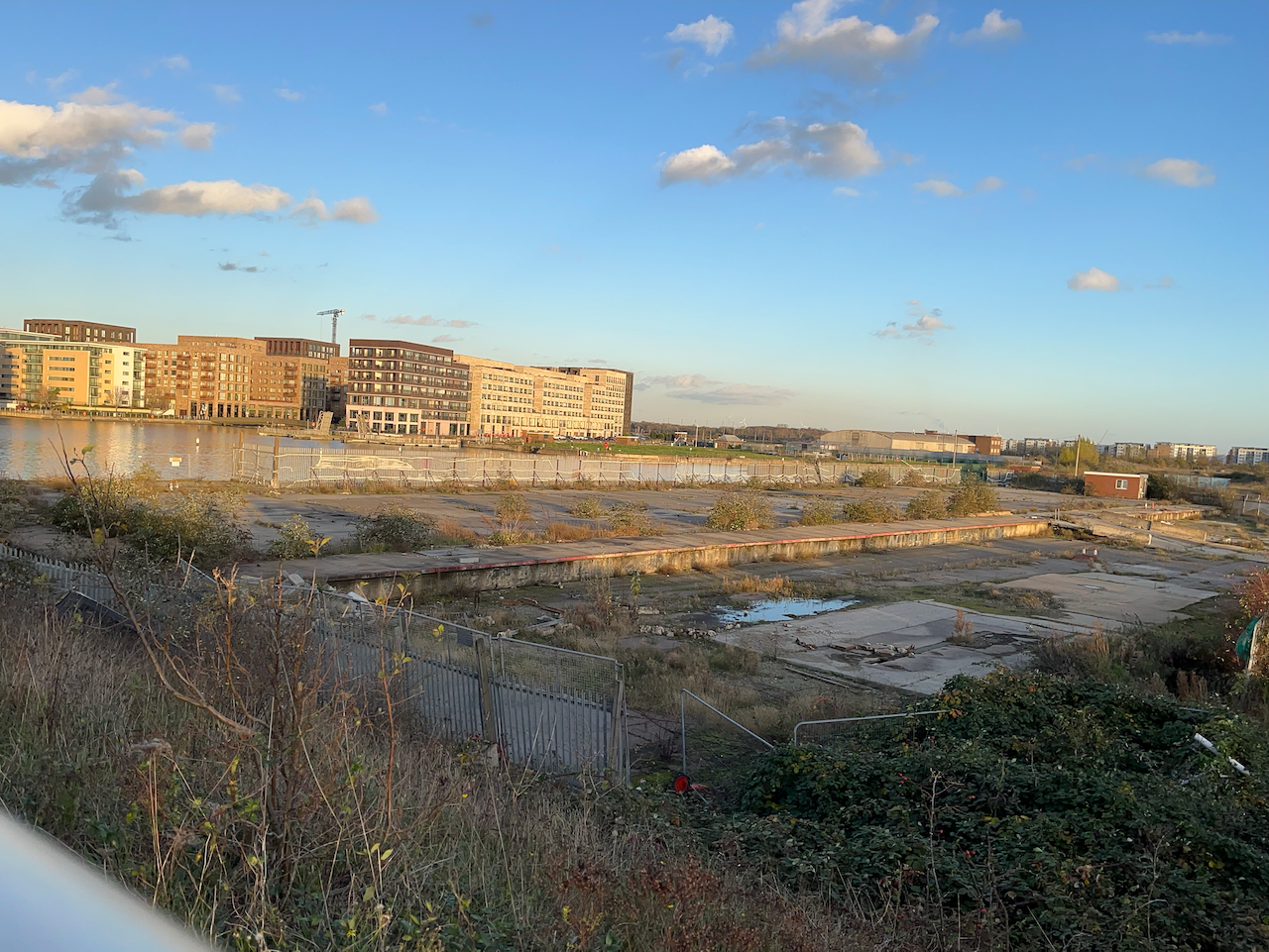
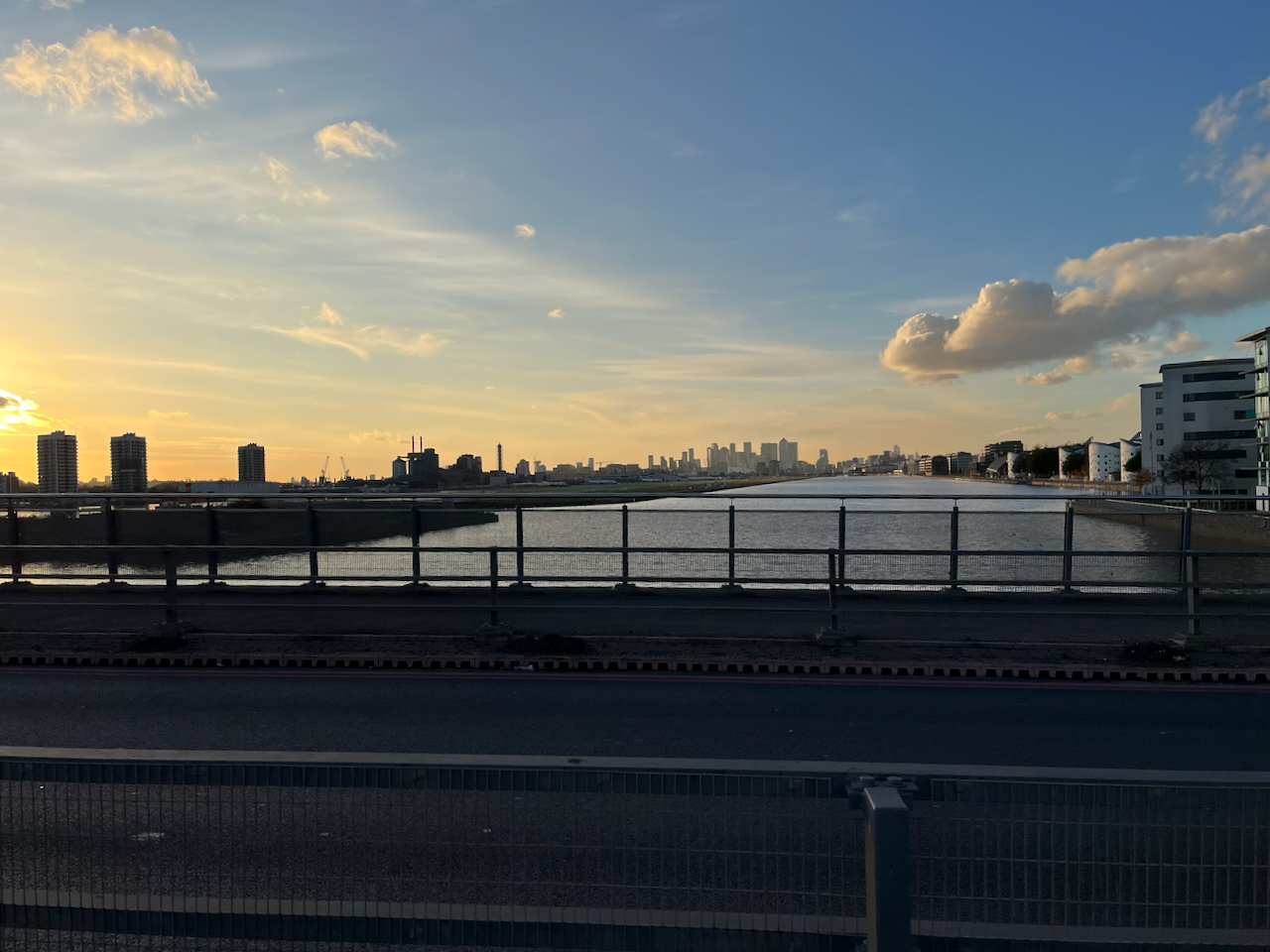
In the distance on the left, you see the housing developments round Gallions Reach. The quantity of space round here is astounding. And the docks are enormous.

Royal Albert Dock from the Steve Redgrave Bridge. The dock is about a mile long. The University of East London is on the right, City Airport on the left, City of London towers in the distance.

I walked on over these immense bridges over the docks. An oncoming bus tooted cheerfully. I looked up to see the driver smiling a friendly greeting. Perhaps I looked a little lonely and cold. The bus rushed on. I felt warmer.

On the other side of the bridge I warmed up in the “Wild Bean Café” (recommended) and then made my way to Gallions Reach DLR station and thence to central London.

If in need of wide open spaces and a bit of distance from the problems of the City, then a trip downriver is definitely the thing.

Nyon, view from the castle

Standing on the ramparts of the castle at Nyon, I look towards Lake Geneva.

Rooftops from Nyon Castle, 29 October 2024 in Sketchbook 15

The tower in the picture is at the junction of Rue de Rive and Passage des Pirates, Place Abraham HERMANJAT 1862-1932. I can find its position on a map, but it is unremarked and seems not to have a name. If there is any citizen of Nyon out there who can identify it, I’d be very grateful.

Lake Geneva is in mist, in the background of the picture. The mist came and went as I was sketching. It was extremely cold.

Map from Nyon tourist office, showing the sightline of the drawing.

Nyon is easy to navigate because it is on a slope, from the train station at the top of the map down to Lake Geneva at the bottom of the map.

The map above came from the Nyon Tourist Office who also offered a leaflet reminding me that part of the action in the Tintin book “L’Affaire Tournesol” took place in Nyon. This book is called “The Calculus Affair” in English. On page 21, you can see the the white car which takes Tintin and Haddock along the lake. It has Vaud number plates (“VD”).1 The fire engine which rescues them from the ruins of the house on page 27 is, according to the tourist office, carefully preserved in a local museum.

I read the Tintin books assiduously as a child, and again, in French, years later. I think the pictures influenced my drawing style, and may be why I like to draw in pen and wash today. So as well as being a record of a moment spent on the freezing battlements of Nyon Castle, the drawing above is my small homage to the great Hergé.

Sketchbook 15, with items from the leaflet “Tintin in Nyon”, and a leaf.
  1. The images from the Tintin books are protected by copyright, so I am not including them here. But do have a look if you have a copy of the book at home. ↩︎

Climpson & Sons – Broadway Market E8

Here is a sketch of the coffee merchant Climpson & Sons, on Broadway Market in Hackney.

Climpson & Sons, 67 Broadway Market, London E8, sketched 22 October 2024 in Sketchbook 15

I was sitting at a table in the café opposite, which is called “Route”.

Climpsons are a coffee merchant and roastery based in East London. They roast their coffee in Walthamstow, and their HQ is just the other side of London Fields from Broadway Market.

They were doing a brisk trade as I sketched, and people drank their coffees on the benches outside.

I did most of the sketch on location and finished it at my desk.

Sketchbook 15

Vauxhall Tea House Theatre, SE11

The Vauxhall Tea House Theatre is one on my favourite places. It is a “tea house by day, theatre by night”. Here is a sketch of the outside:

Vauxhall Tea House Theatre, 12″ x 9″ pen and wash original. [sold]

Here is a sketch of the interior by day:

Vauxhall Tea House Theatre, interior with cat. 12″ x 9″ pen and wash original. [Sold]

There are winged chairs you can sink into, wooden tables you can work at, magazines and newspapers you can read. There is tea. There is cake. There is at least one cat.

It’s a short walk from Vauxhall station. Definitely worth a visit.

Above is from their Summer 2024 programme.

From the Tea House Theatre website:

“We are trying to be different. We will not hurry you. If you visit us on your lunch break, then have one, you will be more productive in the afternoon. If you want to have a meeting, we will not disturb you. If you are ‘working from home’, we have wifi. If you have children, we have highchairs, a chest of toys, and milkshakes. We always have the daily papers, so please, relax, and share in what we are trying to create, take a load off, and have a cuppa.”

Magnificent!

Hoxton Trust Community Garden – Clock Tower, London N1

Hoxton Street is busy with market stalls, shops, cafés. People walk to and fro. If you walk North, there’s a small garden on the right, behind a fence. Above the trees there’s this odd white tower. What is it? The gate is open and you can go in.

Hoxton Trust Community Garden N1- Clock Tower, sketched 29 August 2024 in Sketchbook 15

This is the Hoxton Trust Community Garden. Their website tells me that the Clock Tower was rescued from the Eastern Fever Hospital which was built 1869-1871. It is made of wood, and is possibly older than the hospital.

The clock tower sits on a framework made of steel girders. On the day I was there, the clock had stopped at half-past six. So in a timeless interlude, I sketched from a wooden bench amongst the trees.

Near the bench is a small monument to the “Hoxton Five”. Who were they?

“One was stabbed, and his four friends were killed in a car crash returning from the funeral.”

The Hoxton Community Trust is a registered charity “working to make Hoxton and Shoreditch a better place”. According to their website, they provide free legal advice and assistance to people who need it. They maintain this community garden for the benefit of everyone. The charity was established in 1983: “At the time, Hoxton was very unfashionable, with high levels of poverty and a very poor quality urban realm”, their website says. They bought and renovated three buildings, 150-156 Hoxton Street, adjacent to the garden. These buildings are now let out. Rents from these buildings supplement the income of the Hoxton Trust, which is also funded by grants from the National Lottery, Hackney Council, and other sources (2023). The work of the Trust is also supported by volunteers, some of whom work in the garden.

The garden is lovely. There are fruit trees and a herb garden, and plenty of seats. A sanctuary.

Sketching in the Hoxton Community Trust Garden.
Sketchbook 15

Tower of St Anne’s Church Limehouse, E14

This is the tower of St Anne’s Church Limehouse, seen from the south.
St Anne’s is a church designed by Nicholas Hawksmoor, consecrated in 1730.

St Anne’s Church Limehouse tower, sketched 28 August 2024 in sketchbook 15

This tower shows the marine connections of this church:

The prominent tower with its golden ball on the flagpole became a Trinity House “sea mark” on navigational charts and the Queens Regulations still permit St Anne’s Limehouse to display the White Ensign”.

Wikipedia (1 October 2024)
White ensign

The White Ensign is definitely flying. In my drawing the flag is blowing away from me, so you can’t see it well. It is the flag flown by British Navy ships and certain navy-related buildings on land, of which St Anne’s in one.

The golden ball is clearly visible on the flagpole, the “sea mark” mentioned in articles about the church. I had a look to see if I could find St Anne’s on a navigational chart. The Port of London Authority offers navigational maps of the Thames – but sadly St Anne’s is not shown as a “sea mark” on any of them.

Detail from Chart 319 from the Port of London Authority. The red circle where St Anne’s is, but it’s not shown as a “sea mark”.

The church has a lovely quiet garden. I sketched from the wooden seat, watched by a robin.

Sketchbook 15

Here are other sketches I’ve done around Limehouse and Wapping, near here:

Limehouse Accumulator Tower, E14

This is the Limehouse Accumulator Tower, seen from Mill Place, London E14.

Limehouse Accumulator Tower, sketched 21 August 2024, in Sketchbook 15

In the 19th century, this building provided hydraulic power to machinery in the Limehouse docks. Hydraulic power is a way of transmitting energy from one place to another.

The problem at the time was that steam engines could generate motive force, but only where they were. You could build a big powerful steam engine, but you couldn’t put a steam engine next to every crane, capstan, or set of lock gates. You also didn’t want to fire up a steam engine every time someone wanted to use the lock gates. So you had to find a way of transmitting the power from the steam engine to the machinery which used it. And you had to find a way of storing the power so it was available on demand. Before the use of electricity was common, power was transmitted using pressurized water.

The steam engine located in this building was used to pump water into the adjacent accumulator tower, by lifting a heavy weight. The heavy weight was a neat fit on top of the water inside the tower and pushed the water down. Water does not compress. So the weight just sat there, applying pressure to the water. The pressurised water was distributed around the docks in thick cast-iron pipes. When the lock-keeper wanted to operate the lock gates they opened a tap and the force of the pressurized water opened the gates. Then they closed the taps. Far away, the weight moved down very slightly in the accumulator tower. Eventually the steam engine was used to pull the weight up to the top again.

That’s 19th century hydraulic power. Power is transmitted by pressurised water in cast-iron pipes: the original, functional, steam-punk.

I find it marvellous. I’ve drawn the much bigger London Hydraulic Power station here. The Limehouse building is smaller. It was built in 1869, one of several in the area at the time. It was restored in 1994/5, but sadly the weight and machinery are removed. There is a detailed history of the building on this link from the Greater London Industrial Archaeology Society.

Sketching the Limehouse Accumulator Tower. The modern Docklands Light Railway lines run over the Victorian bridge to the left, the bridge to the right is disused.

Standing in Mill Place to make this sketch, I became aware of all the history that is embedded in walls. The one in front of me had been altered, rebuilt, and amended several times. A bit had been added on top. Plants lived there. A graffiti artist had made their mark on the crumbling stone.

I was standing under two bridges, both 19th century. Both survivors. One holds the modern Docklands Light Railway. The other had wonderful strong vaulting. But it held no railway. I walked around trying to find out where it went. The Google aerial view confirms what I suspected: it is a ghost railway. On the bridge there is verdant greenery where the railway used to be. It goes across a second sturdy bridge, over the A13, and then stops.

Here are some maps which show the position of the Accumulator Tower and the absence of a railway (click to enlarge).

In this whole area the works of Victorian engineers make themselves felt. Each bridge is a triumph of the bricklayers’ skill: not only strikingly beautiful, with clean curves and neat detailing, but also enduring, powerful and functional 150 years later.

Sketchbook 15
map (c) OpenStreetMap contributors: click to go to the map

The Prospect of Whitby, Wapping E1

Here is the “Prospect of Whitby” pub by the Thames in Wapping.

“The Prospect of Whitby” sketched 21 August 2024 at 2pm, the first picture in Sketchbook 15

The “Prospect of Whitby” is the name of a ship.

The coal boat, “Prospect of Whitby”, from the pub sign.

There is an informative entry about the whole area in “The London Inheritance” website. He writes:

“The pub was originally called The Pelican and the alley and stairs down to the river at the side of the pub to the right are still named Pelican Stairs.

The pub is listed Grade II.

Nearby is the Wapping Hydraulic Power Station, which I have sketched previously.

I sketched The Prospect of Whitby sitting against the wall opposite, and then finished off the picture on the convenient bench outside the pub.

Sketchbook 15

Waterpoint, St Pancras, London N1

This structure is visible from the North side of the Regents Canal at Coal Drops yard. It was a “water point” for replenishing the boilers of steam engines. The top housed a water tank.

Waterpoint, seen from the Regents Canal towpath at Coal Drops. August 14th 2024, in sketch book 14

Here’s a map to show where it is. I’ve seen this structure often when walking along the canal, and it’s been on my “sketch-list” for a while, so I was glad that a co-incidence of weather and time gave me the opportunity to sketch it.

Waterpoint, circled.

I was sketching from the Regents Canal towpath right next to St Pancras Lock.

Sketching Waterpoint, looking south across St Pancras Lock.

It turns out that this structure is open to visitors from time to time. By an amazing co-incidence, one of the visiting days was the weekend after I did my sketch. The kind and informative guides there patiently answered the many questions I had, and allowed me to photograph their video and their display boards.

For me, the really fascinating thing about this structure is that it has moved. It was not always in this location. It used to be next to St Pancras Station. It was built around the same time as the station, 1870. In 2001 it was moved North, to its current location.

It was designed by team of Sir George Gilbert Scott, who designed the St Pancras Hotel. Since its purpose was to fill the tanks of steam trains, it was right next to the railway lines. You can see it here:

Photo of a video shown at the Waterpoint.

Here it is on an 1871 map: (click to enlarge)

I think I can spot it on this archive aerial photo from 1964. Here is the link to the picture:

https://historicengland.org.uk/images-books/archive/collections/aerial-photos/record/eaw143766#

The water point is just beyond the far right hand edge of the St Pancras train shed, in the centre left of the photo on the link above.

Here are some low resolution images to help you find it.

Here are modern maps annotated to show the original position and the current position:

To move it, the original Water Point was cut horizontally into three sections. The lower section was left behind. A new lower section was built in the new location. The middle and upper sections went by road to the new location and were stacked on top of the newly built lower section. You can see, by changes in the bricks, the joins between the sections.

On the side of the Waterpoint visible from the canal, there is a clear “roof” pattern in the bricks, which I noticed when sketching it.

This marks the position of a shed that was fastened to the structure in its original position. See the pictures below.

These photos and maps show how much the area has changed. See all the gas holders! They were constructed on the south side of the Regents Canal, because that’s where the gas works was. They originally held coal gas, which is carbon monoxide and hydrogen, manufactured from coal. Until 2010 they were a landmark for anyone who made this journey into Kings Cross regularly.

Here’s a frame from the 1963 film “Alfie” captured by @runningthenorthernheights, showing the gasholders in their original position.

Thanks to @runningthenorthernheights

The gasholders were decommissioned in 2000, but several of them couldn’t be destroyed because they were listed, so they just stood there for ten years. Then they were dismantled, stored, preserved and reconstructed in the years 2010-2015. They are now on the north side of the Regents Canal. Gas holder No. 8 was the first to be reconstructed, in 2015. It surrounds a small park. Gas holders 10, 11 and 12 followed, surrounding luxury apartments, part of the Kings Cross development. (https://www.kingscross.co.uk/gasholder-park)

Gasholders seen from the top of the Waterpoint, August 2024. I did the sketch from the far side of the canal.

Here are more photos from my visit to Waterpoint in August 2024.

I was very glad to have the opportunity to visit this quirky building. Recommended!

Imperial War Museum North, Manchester, M17

Across the water from Media City UK, is this striking building.

IWM North, sketched from Media City UK in Sketchbook 15

This is “IWM North“. I enjoyed the way the vast curves of the building were echoed in the humble shape of the deckchairs.

The architect is Daniel Libeskind. It was his first UK building, constructed in 2002. It represents a shattered globe: it’s been put back together, but it will never be the same again.

From the IWM North website

Here is work in progress on the sketch, the view across the water:

The marvellous curves of Media City UK

On the radio many years ago, I heard a director of the Imperial War Museum say that he was director of an establishment whose name contained three words each with negative connotations: “Imperial” “War” and “Museum”.
I note with interest, therefore, that it is now branded “IWM”.
“Imperial War Museums” has 5 sites: IWM London (in Lambeth), HMS Belfast on the Thames, the aircraft museum in Duxford, The Churchill War Rooms in Whitehall, and this one, the IWM North.

Sketchbook 15

Tragedy, for me, is not a conflict between right and wrong, but between two different kinds of right.

Peter Shaffer, playwright.