Oxford Nuclear Physics Building

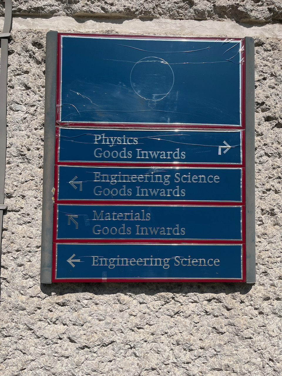
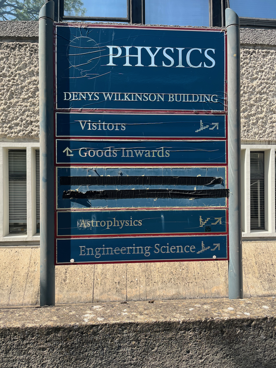
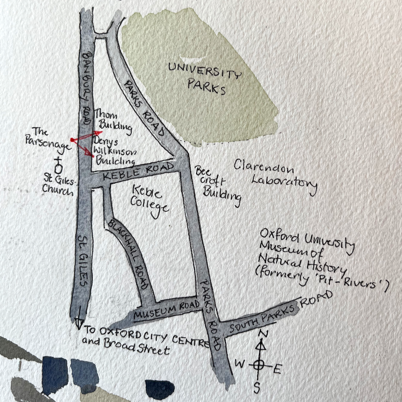
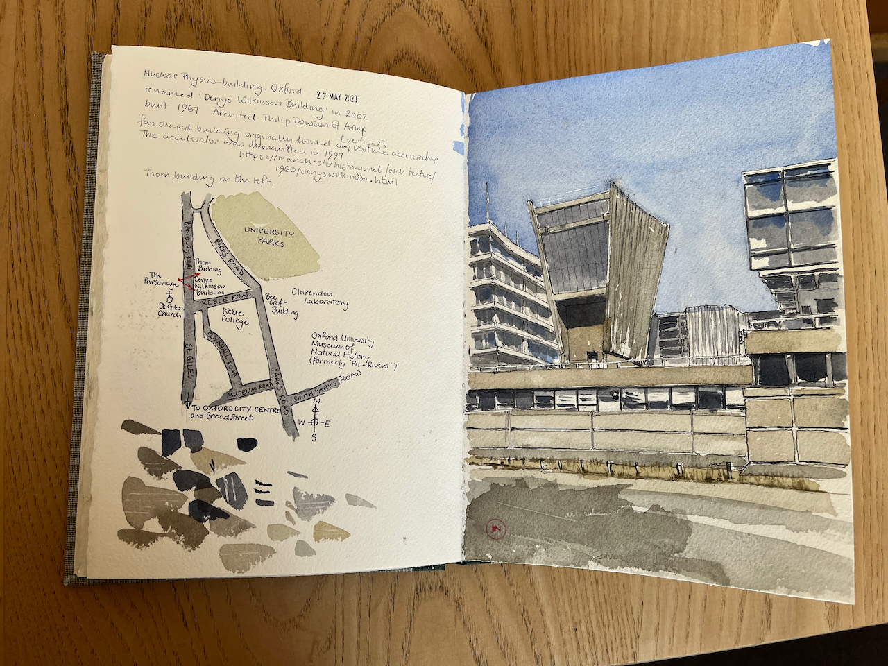
Here is the University of Oxford Nuclear Physics building, seen from the Banbury Road.

The Nuclear Physics building, now the Denys Wilkinson building, University of Oxford. Sketched 27 May 2023, in Sketchbook 13

The building was renamed the “Denys Wilkinson Building” in 2002. It was built in 1967 to the designs of architect Philip Dowson of Arup. The fan-shaped structure originally housed a Van der Graff particle accelerator, now dismantled. [https://manchesterhistory.net/architecture/1960/denyswilkinson.html]

Professor Wilkinson (1922-2016) was the Head of the Nuclear Physics Department from 1962-1976.

The building on the left is the “Thom Building” which houses the Engineering Department. This building had a marvellous “paternoster” lift in the 1970s. (Note 1). This is a lift with single compartments, which operates in a continuous loop, like rosary beads, hence the name. You simply stepped into one of the slowly moving compartments and were carried up or down.

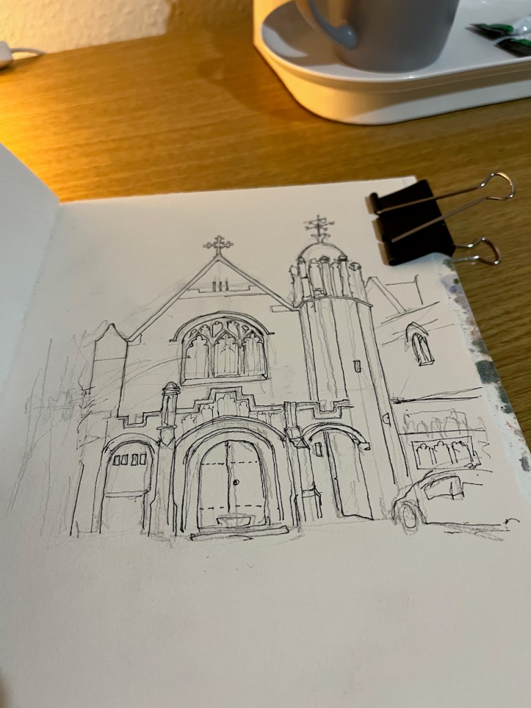
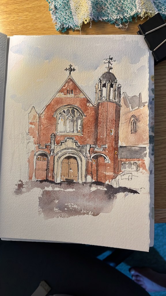
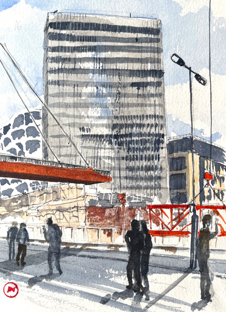
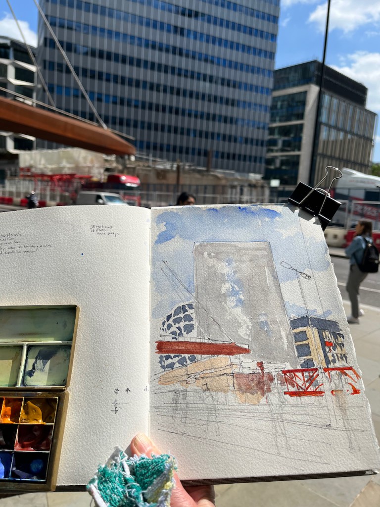
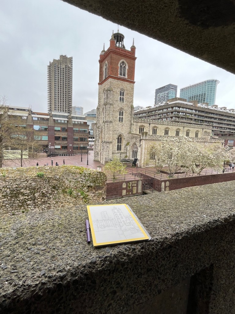
Here is work in progress on the drawing:

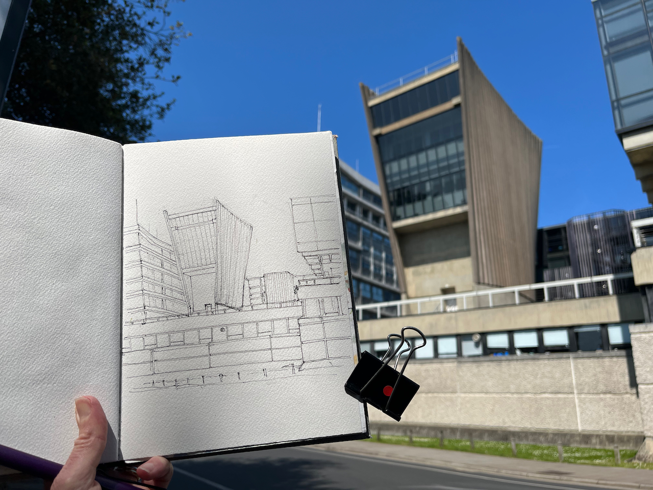
The fan-shaped structure is a rare example of brutalism in Oxford. St Catherine’s College is another example.

Ought we to treat the Denys Wilkinson building and St. Catherine’s College as a celebrated chapter in Oxford’s aesthetic history, or as evidence of a period better forgotten?

Caitriona Dowden -writing in the Cherwell, 26th October 2020 [https://cherwell.org/2020/10/26/oxfords-eyesores-brutalisms-place-among-the-dreaming-spires/]

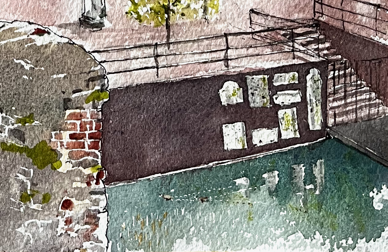
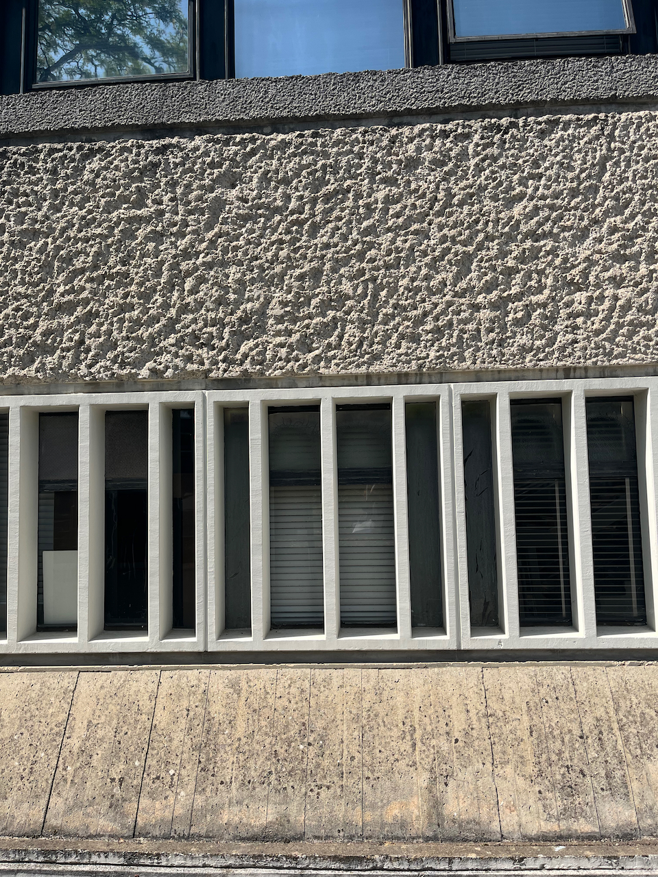
A celebrated chapter in Oxford’s aesthetic history, I think. here are some details of the design, for brutalism enthusiasts like me:

Note 1: Alan Knight writing of his memories of the department confirms my recollection: https://www.soue.org.uk/souenews/issue2/jottings.html. The paternoster was replaced by two ordinary lifts in the 1980s.

Wycliffe Hall Chapel, Oxford OX2

On a visit to Oxford recently, I stayed at Wycliffe Hall as a Bed and Breakfast guest. Wycliffe Hall is on the Banbury Road in North Oxford. It offers theological training to women and men who wish to become ordained or lay ministers in the Church of England. The hall was established in 1877, on the current site, and is named for John Wycliffe, bible translator and master of Balliol College in the 14th century.

I sketched the chapel which was added in 1896, designed by architect George Wallace.

Wycliffe Hall Chapel, 54 Banbury Road, Oxford, sketched 26 May 2023, in Sketchbook 13

There are amazing trees in this part of Oxford. The houses are large, but the trees are larger. I had my breakfast outdoors in the garden at Wycliffe Hall, looking at a gigantic London Plane. The view from my bedroom was filled with beech tree.

I sketched the chapel in the evening and finished the sketch the next morning.


For a sketch of the west side of the Hall, see this post.

Roofscape from Macklin Street, London WC2

Walking through the back streets of Covent Garden, I came across a row of Victorian brick-built houses. This is Macklin Street. I made a quick sketch of the roofs.

Roofscape from Macklin Street, 5th June 2023 in Sketchbook 13

While sketching I noticed a peculiar thing. There are no doors onto the street. It turns out the entrance to this row of buildings is on the nearby Newton Street, overhung by greenery and climbing plants.

The brick building in my sketch is Wimbledon Buildings, formerly Wimbledon House, built in 1893.

In 1893 the Parker Street Lodging House was
completed for 345 people. In 1896 Aldwych, Cotterell
and Lindsey (demolished in the 1960s), Powis and
Wimbledon buildings were completed for 284 people.
Twenty workshops were also provided. The scheme also
widened Parker Street and Macklin Street.

page 9, Camden Conservation Area Statement (undated) [https://www.camden.gov.uk/documents/20142/7905860/Seven+Dials+Estate+CAS.pdf]

It is now part of a “Central London residential street with a community of social housing and owner occupying flats”, with its own Twitter account. Here is a interesting picture from that Twitter feed, showing the roof gable I sketched. This is the view from Newton Street, with Macklin Street going off to the right. Note the absence of front doors. The entrances are through a gate at the left of the photo.

St Joseph’s Primary School is on Macklin Street. Its former name, Macklin Street Catholic School, is still clearly inscribed in the stonework high up. As I sketched, the children came out into the street at the end of their school day.

The Camden Conservation Area statement mentioned above is on this link . If that doesn’t work, you can download it from the link below. It is 36 pages.

London Wall EC2: the hanging bridge

Here is an amazing sight: the hanging bridge over London Wall.

London Wall, hanging bridge. 24 May 2023, about 1pm, 7″ x 10″ in Sketchbook 13

The large building in the centre of the picture is City Tower, 40 London Wall. In front of it is a demolition site where City Place House used to be. The bridge used to connect to City Place House. Now this building has gone, the bridge hangs in space.

In my previous drawing I sketched while listening to the guitar music of Hidè Takemoto. For this drawing, the acoustic accompaniment was mostly percussion. The building site was active. Spasmodic grinding and crashing signalled the removal of concrete. Metallic hammering came from scaffolding under construction.

The big red grid on the right of my picture was hauled upwards and out of sight before I finished drawing it. It was going to be part of a second crane. It arrived on a large lorry which would also have been in the picture if it had stayed still long enough. Immediately it arrived, workers secured chains to the red structure and it was manoeuvred off the lorry. Hardly anyone on the pavement paid any attention to all this thrilling activity across the road. One person, the slim figure to the right of my picture, stopped and took a selfie.

GoogleMaps allows us to travel not only in space but also in time. Here are some screengrabs so you can see the City Place House (on the right) which has now disappeared.

As you see, City Tower used to be obscured by City Place House. It will be obscured again when the next huge building goes up.

The bridge in the pictures above is the “new bridge”. It was installed as part of the London Wall Place development (off the picture to the left). The “old bridge” took a slightly different route. Again, GoogleMaps provides an image. Notice the previous lampposts, with the flying saucer lights.

The “old bridge” across London Wall, July 2008.
City Place House, on the right, is the building which is now being demolished.

I sketched City Place House before it was demolished. This post (click below) gives information about the old building which has been demolished and the new building which is planned.

City Place House

An email from an ever-vigilant neighbour alerted me to the Planning Application for City Place House and the adjacent tower, City Tower. This application is currently under consideration. I hastened to go and have a look at the buildings, before they get swathed in white plastic. City Tower has been there since 1967. It is…

Click here to read this post..

City Tower is not being demolished. This is of interest because its sister building Bastion House, constructed at the same time, is deemed “unsafe” by the City of London, and is scheduled for demolition to make way for the “London Wall West” project. It’s curious that City Tower is evidently not “unsafe” and is standing proud, in use into the future.

I made a special tool to draw the many windows on City Tower.

City Tower has 35 verticals. I made a special comb from cocktail sticks to scrape the paint into the required number of vertical lines.

The colours are:

  • Ultramarine Blue and Lavender for the sky.
  • All the greys are Ultramarine Blue and Burnt Umber
  • The bridge is Fired Gold Ochre, with some Transparent Pyrrol Orange
  • The red is Transparent Pyrrol Orange
  • Mars Yellow is on the distant building and the scaffolding plastic

I put down the first wash on site and finished the picture at my desk.

St Giles from Wallside, Barbican EC2

Here is St Giles’ Church, Cripplegate, seen from the public walkway at Wallside. The church is surrounded by the Barbican Estate. Cromwell Tower is in the background. The City of London School for Girls is the lower building, centre and left. Through the gap between the church and the school, you can just glimpse the Barbican Centre.

The magnolia was in bloom!

St Giles from Wallside, Barbican, 1 April 2023 12″ x 9″ [Commission]

I painted this as a commission, for some clients who wanted this particular view. A special request for this commission was that I showed two ducks. These are small, but they are there!

Ducks on the lake.

The white shapes on the lakeside wall are gravestones.

Old London Wall is on the left: part stone, part brick. This is the old Roman wall round the City of London.

Thank you to my clients for this commission and for their permission to post the picture here online. It was a real pleasure to do.

The colours I used are:

For the sky: a pale yellow wash of permanent yellow deep, followed by a grey made from ultramarine blue and burnt umber, with some ultramarine blue for the blue bits.

For the church: the stone is a pale yellow wash of permanent yellow deep, then a dilute buff titanium wash. I put salt on it to get some texture. Then the dark areas are a grey made from ultramarine blue and burnt umber.

The top part of the church, St Giles Terrace and all the reddish/purple brickwork is a combination of perylene maroon, burnt umber, fired gold ochre, and a bit of ultramarine blue for the dark areas.

The lake, which really is that green colour, is ultramarine blue, plus some serpentine genuine which makes it granulate.

All concrete is the same mix of burnt umber and ultramarine blue with some mars yellow.

Old London wall is the pale yellow wash of permanent yellow deep, with a second wash of lunar blue with burnt umber. Lunar blue is highly granulating, which gives a wonderful stone effect. The bricks are fired gold ochre.

All green plants are green gold, and there’s also some green gold on the stonework of the church, to show the lichen.

The weathervane is Liquitex gold ink, applied with a fine brush.

The line drawing is done with a Lamy Safari fountain pen, using De Atramentis Black ink, which is waterproof.

The white parts of the picture, for example the lines between the bricks on Old London Wall, (and the ducks) are done using a resist. This is a rubbery substance, applied before putting on any paint. The resist I use is called Pebeo Drawing Gum. I put it on using a dip pen to get the fine lines. After the paint is dry, I rub it off, and the parts where it was show up white. There are also a few tiny dots of white gouache paint on the magnolia tree.

The paper is Arches Aquarelle 300gsm 12″ x 9″ in a block.

Work in progress. Arches Aquarelle block, Lamy Safari pen. The yellow is masking tape, which I put round to make the picture easier to handle and to give a crisp edge to the work. The people on St Giles Terrace were practising Tai Chi. It was very relaxing to watch them. See the green lichen on the concrete. And the magnolia.

Handyside Gardens, Kings Cross, N1

Here’s the view from Handyside Garden, which is just north of the canal, part of the new Kings Cross development, Coal Drops Yard.

From Handyside Gardens, 30th April 2023, in Sketchbook 13, 10″ x 7″

People rested on the grass eating takeaway food from containers. Children toddled under supervision. I painted.

On the roof of the barge “Word on the Water”, Hidè Takemoto played detailed guitar tunes. I recognised “Recuerdos de la Alhambra” by Tarrega, which I hadn’t heard for years. Each thread of the tune was insistent: the low climbing bass, the vibrating tremolo and the soaring high points, speaking clearly. It was perfect on that warm evening. He went on to play tunes I did not recognise: navigating his way through rhythms and moods. He gave us controlled and technical melodies and then, suddenly, wild abstract rock. A really talented musician.

Sketching in Crete, May 2023

There was a bit of a delay at Gatwick.

When we arrived in Crete, there were thunderstorms. As the storm clouds cleared, we saw the red streaks where soft earth had been washed into the sea.

I sketched the headlands.

Eventually the sun came out.

Up the hill is the Roman city of Ancient Aptera. Here is Aptera theatre.

It is still in use. A piano was wheeled in, tuned and prepared for use, while I sketched.

Then we feasted in the marvellous Aptera Tavern. Here is the view from the Aptera Tavern towards the other side of the street.

There were lovely sunsets

In my notebook I identified and logged the ships that passed.

Logging the ships

On the day we departed, we visited the Agias Triadas Monastery.

Chania airport is a lively place after the tranquillity of the monastery.

The drawings were done in my notebooks and sketchbook and also as postcards sent to people.

  • the postcards were on Fabriano Artistico 300gsm cold-press watercolour paper
  • my sketchbook for this voyage was from the Vintage Paper Company, A5, containing cartridge paper
  • the ship log is in a “Grids and Guides” notebook from Princeton Architectural Press.

All colours are Daniel Smith watercolours. I use a fountain pen with De Atramentis Permanent Black ink.

Coastguard Station and Tynemouth Priory

Here is a view of the Coastguard Station and Tynemouth Priory, seen from across King Edwards Bay, on the North-east coast of England.

Tynemouth Coastguard Station and Tynemouth Priory, 10″ x 7″ Sketched 8th April 2023 in sketchbook 13

They both are, in their own ways, continuations of the cliffs below. The coastguard station with its massive concrete architecture, the priory with its soaring stone columns. And as if to emphasize how transitory are our human constructions: both are now disused, at least for their original functions.

Parts of the original priory which still survive are the West side of the nave, from the 12th century. “..in January 1539 the priory fell victim to the nationwide Dissolution of the Monasteries” says the English Heritage website. The headland then became a military fortification in wars which followed, right up to the 1939-45 conflict, where guns were stationed there. Some of the gun emplacements remain. It is now a tourist attraction managed by English Heritage.

Much less information is available about the Coastguard Station. It was opened in 1980 and closed in 2001, according to a BBC article of 2001. (http://news.bbc.co.uk/1/hi/england/1567195.stm). It is a remarkably solid building in a first class location. Why has nobody converted it into a splendid home, guest house, restaurant, art gallery or place of worship?

While I was sketching, a elderly woman passed by on the path and admired the sketch. She said she was surprised more people weren’t sketching there: it was a splendid view. I agreed, and didn’t point out that it was also windy and very cold. I think such an observation would have revealed me as a soft southerner. She said she didn’t sketch, but she did other things. Tap dancing, she said.

I sketched the Coastguard Station in 2017:

Market Keepers’ House, Newcastle

Near Newcastle Central Station there is a new development called the “Centre for Life” Times Square, Newcastle upon Tyne NE1 4EP. It includes scientific research establishments, an interactive science museum for children, and various cafés and events spaces. It was built 1996-2000 to the designs of Terry Farrell and Partners on parts of an old cattle market. In the centre of the wide windswept space is this delightful building, from another era.

Market Keepers’ House, Times Square, Newcastle NE1, sketched from the Centre for Life museum café, 7th April 2023 in Sketchbook 13. About 9″ x 7″.

It is the Market Keepers’ House, 1840, designed by John Dobson, a prolific Newcastle architect of the time. His work is everywhere in the City. He designed the Church of St Thomas the Martyr, for example, and the Central Station. And he also gave us this miniature masterpiece, with its pleasing curves and symmetry. The building was restored in 1998 by Ainsworth Spark. This information is from “Pevsner Architectural Guides, Newcastle and Gateshead” by Grace McCombie 2009. We arrived at Times Square after following “Walk 5” in the book.

The people in the foreground are refuse collectors and cleaners. The two on the right are just coming off shift and the person on the left is just coming on shift. There is a lively exchange of views about their boss, a comparison of anecdotes concerning the unbelievable behaviour of the general public, and an analysis of recent decisions by the manager of Newcastle United. I couldn’t, of course, hear a word they were saying. Their articulate body language inspired me to pay attention to their conversation and include them in the picture.

St John St EC1M, numbers 55-65, looking south

Here is a sketch looking south down St John St, Islington, towards Smithfield Meat Market, which is off to the left. The building with the pointed gable is the pub “The White Bear”.

55-65 St John St, London EC1M. 18 March 2023 in Sketchbook 13
No. 99: the former “Horns”, no longer a pub.

The White Bear has “1899” written on its tall gable. “British History Online” points to two pubs built around that time on St John St, of which only the White Bear survives as a pub:

.. two public houses from the same period: the White Bear at No. 57 [], rebuilt in 1898–9 by the City of London Brewery Co., along with the adjoining house No. 59; and the former Horns of 1887 at No. 99, by Alexander & Gibson, architects []

British History Online https://www.british-history.ac.uk/survey-london/vol46/pp203-221

Here is a map and a photo of the ink drawing. I was sketching on a somewhat damp day, ‘rain with sunny intervals’. I went home at this point to finish the colours at my desk.

Here are the colours I used in this sketch. As you see, there are only four.

Here are a few other sketches I’ve done in the area.