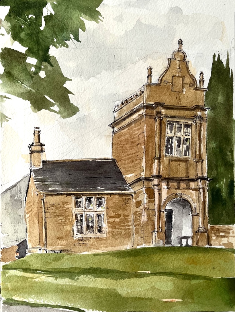
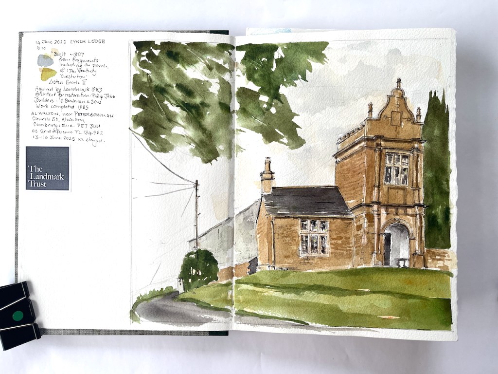
This building was the gatehouse to a stately home, “Chesterton”, now demolished. It is made of fragments of that building and others.
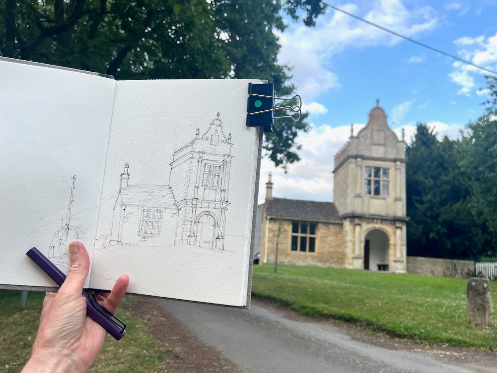
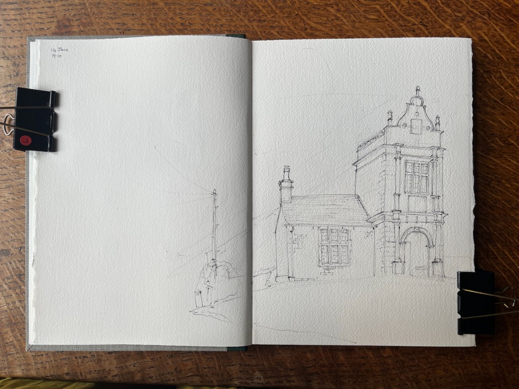
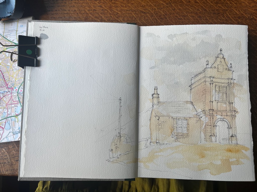
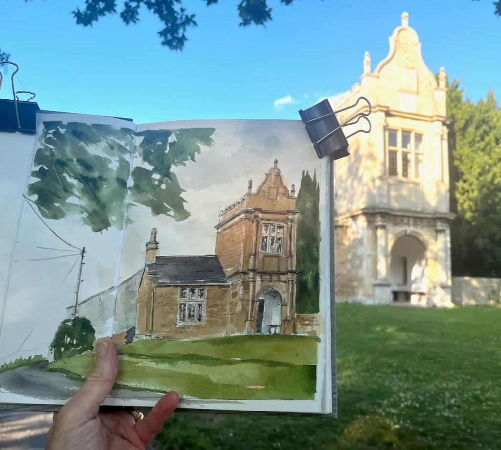
Lynch Lodge near Peterborough, Landmark Trust. June 14th 2025 in Sketchbook 16
The building dates from approximately 1807. It was acquired by The Landmark Trust in 1983. The Trust undertook restoration works completed 1983. The architect for this restoration was Philip Jebb and the builders were C Bowman and Sons.
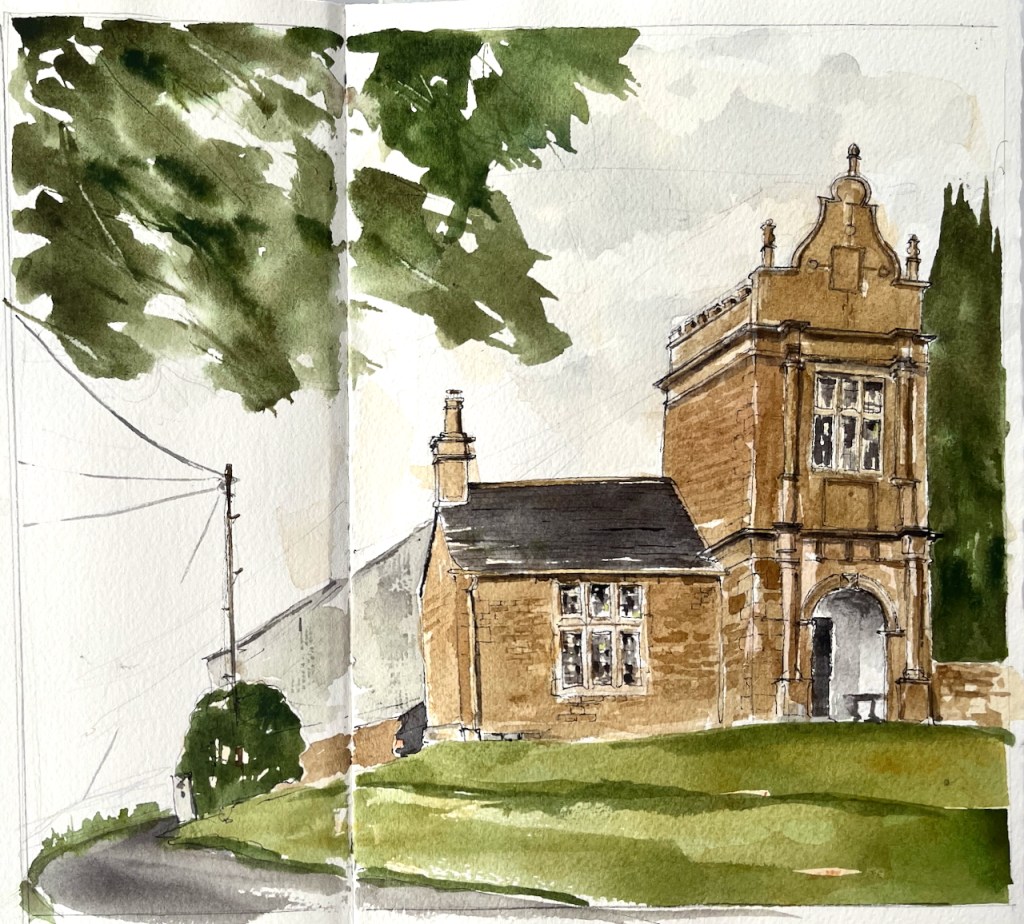
Lynch Lodge is the first picture in my new Sketchbook, Sketchbook 16.
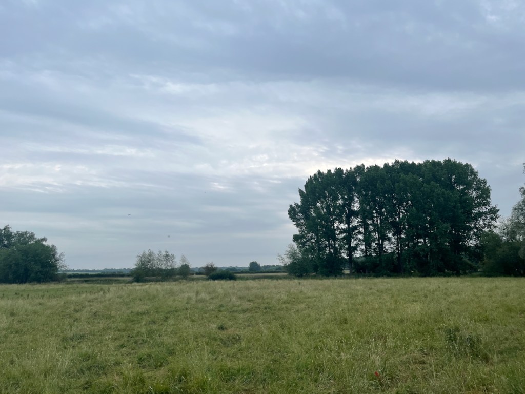
The Lodge is in the midst of countryside which looks as though it is a painting by John Constable.
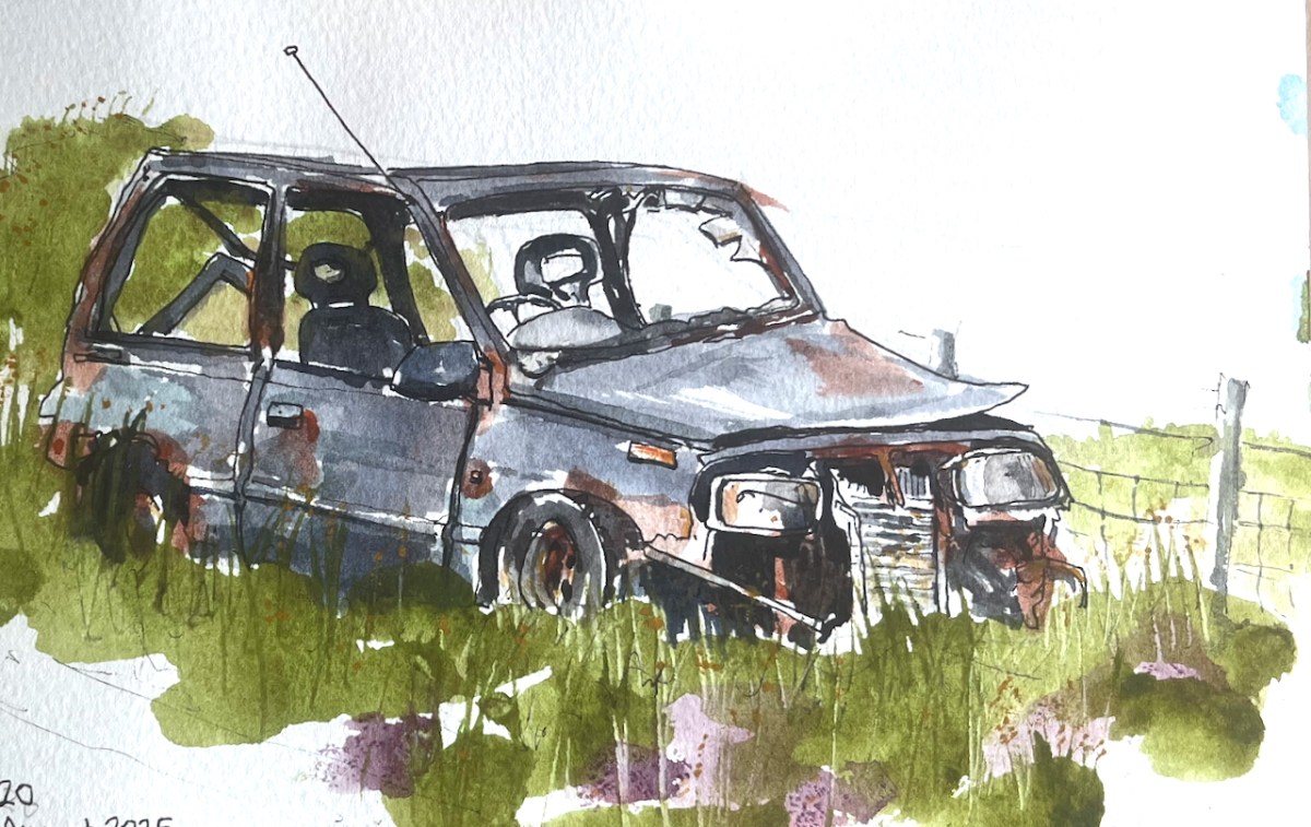
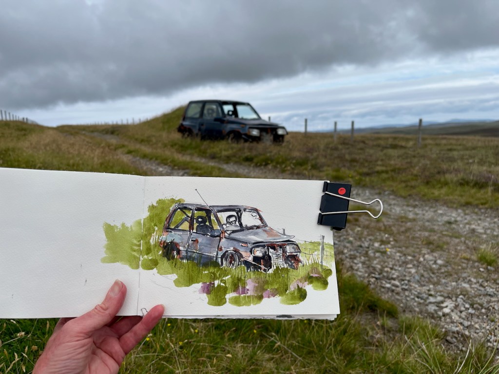
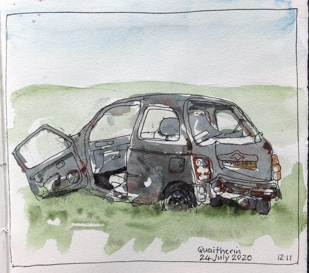
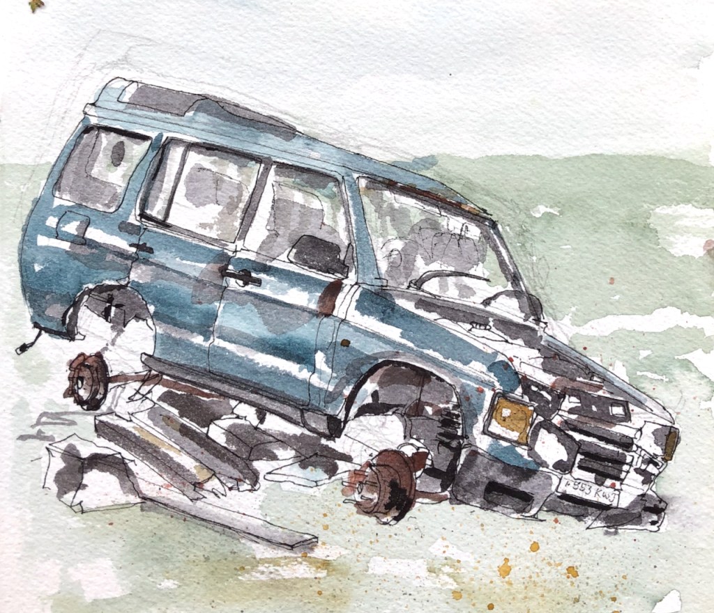
There’s a walk up to the Verda Stane. From up there you can see for miles, a vast undulating landscape. On the walk back down there’s a track. On the track I found an abandoned car, Escudo.
It has become a bit more decrepit. There is more rust. The radiator has fallen off. But it is still there, complete with number plate. This time I saw its name: “Escudo”, on the back door.
Rain was coming.
I managed to complete the sketch, glad to be there. And then I walked back to the road, and along the road, in the fine rain.
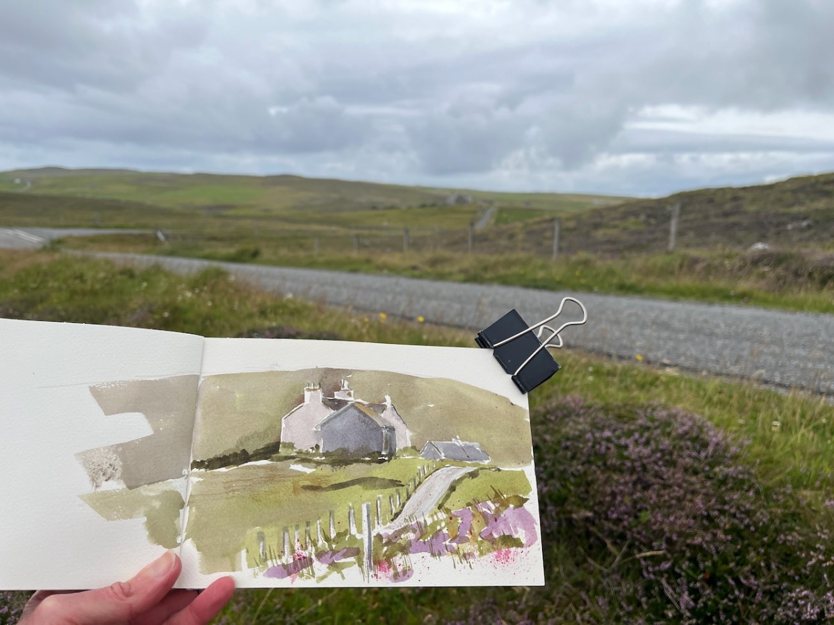
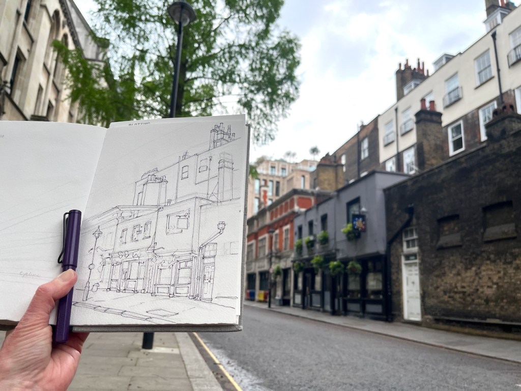
I sketched some of the characteristic houses on the West side of Shetland.
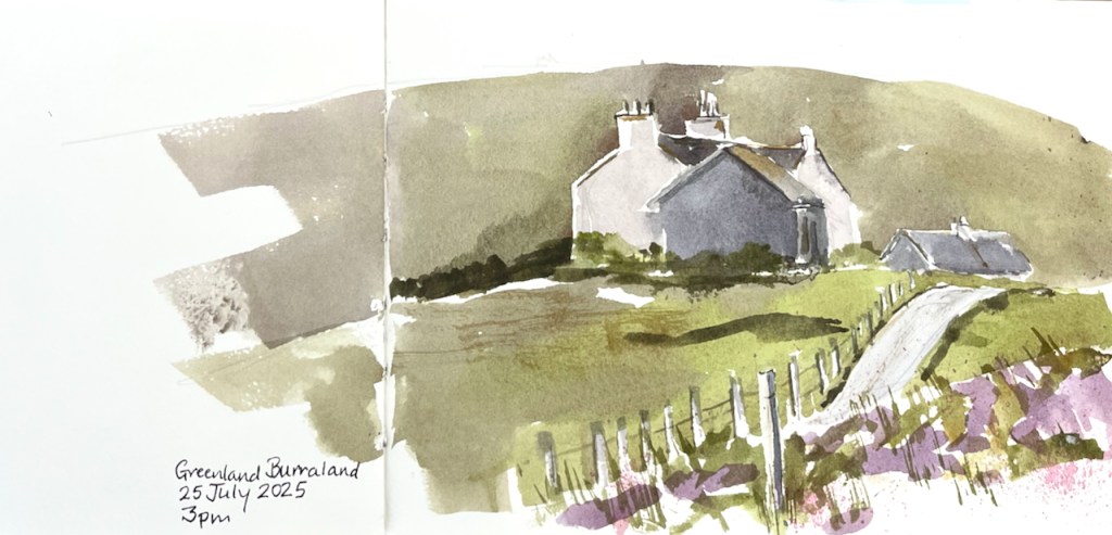
Houses at Greenland Burraland, Shetland West side. July 2025Sketching by the side of the road. The houses I am sketching are in the centre distance.
The houses above in Greenland Burraland are working farms and family homes.
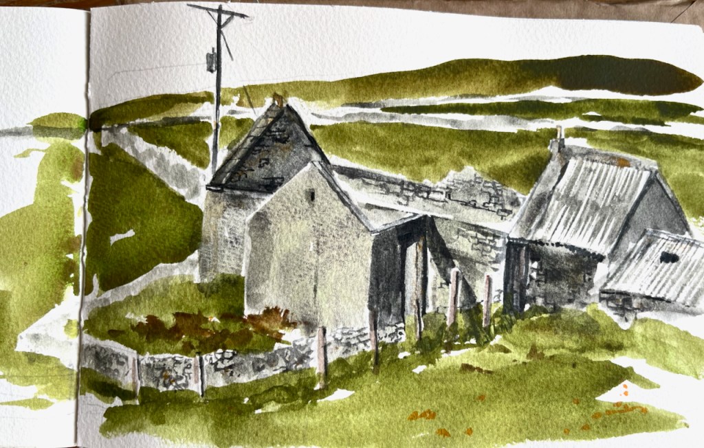
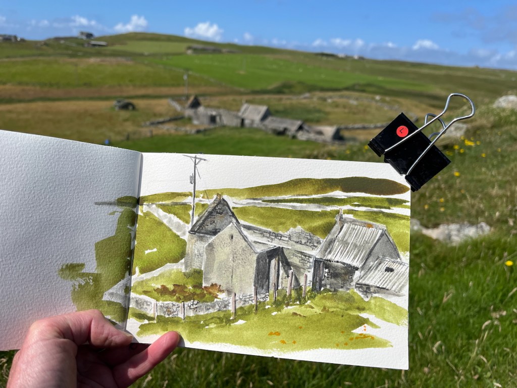
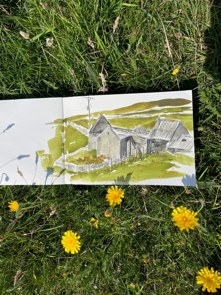
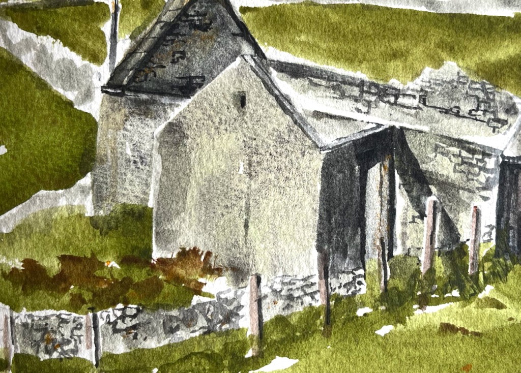
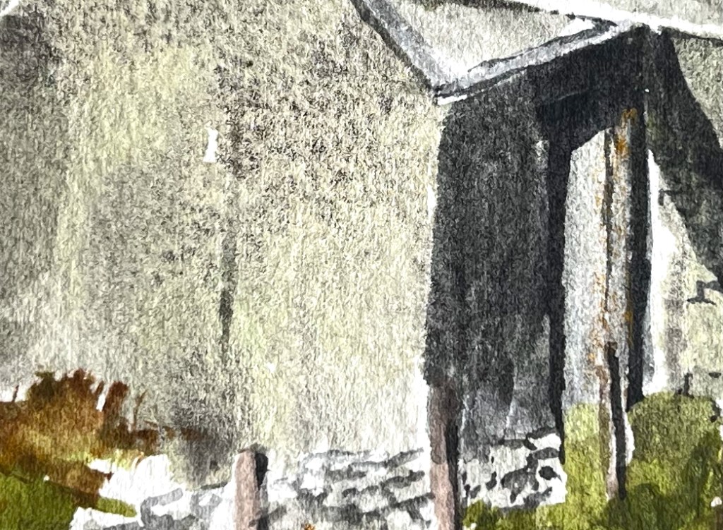
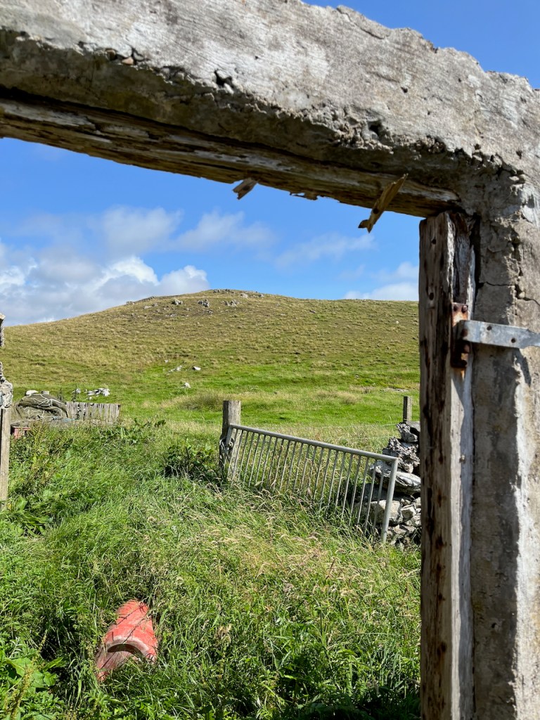
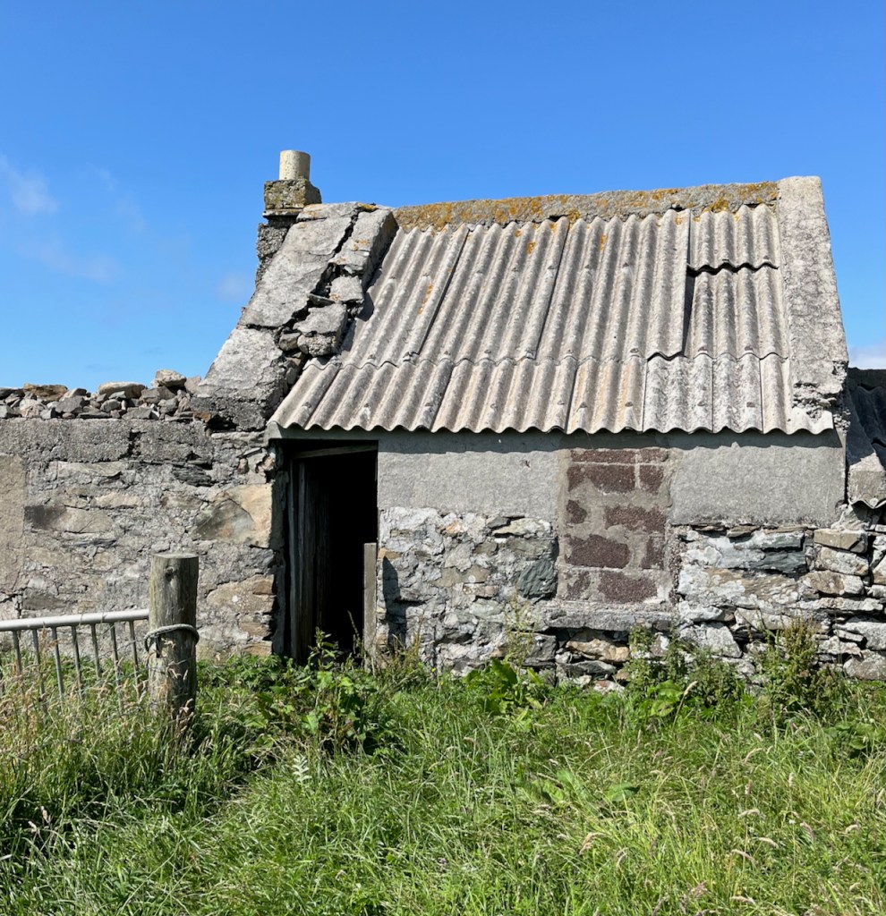
Some of the croft houses are abandoned, and starting to fall down. Here is a ruined croft house near the standing stone at Vesquoy, Shetland West side.
House by the standing stone, July 2025
I sketched it from the hill above.
Sketching the house by the standing stone.
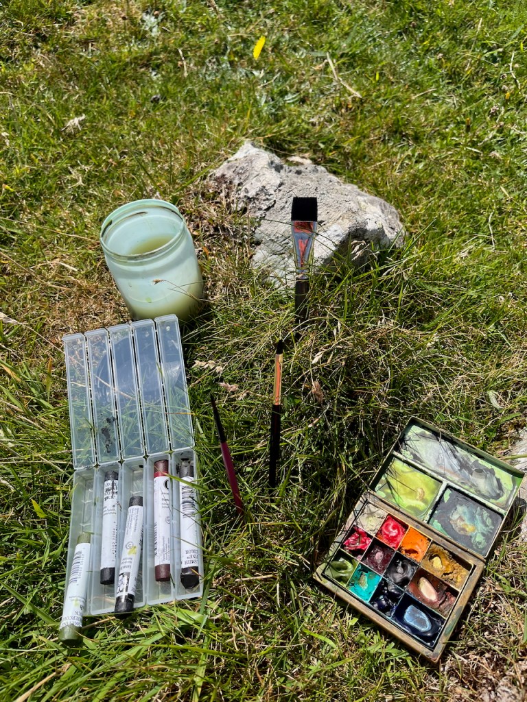
I used heavily granulating colours to show the walls.
This is Daniel Smith Hematite Genuine: a mineral watercolour which breaks into gritty particles when you put it on the paper with lots of water.
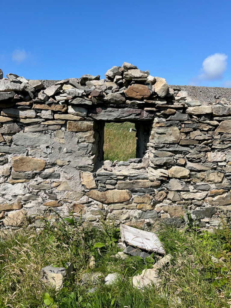
Then I walked down to have a look.
Looking up towards the hill where I was sketchingPatchwork barnThe variety of colours in the walls
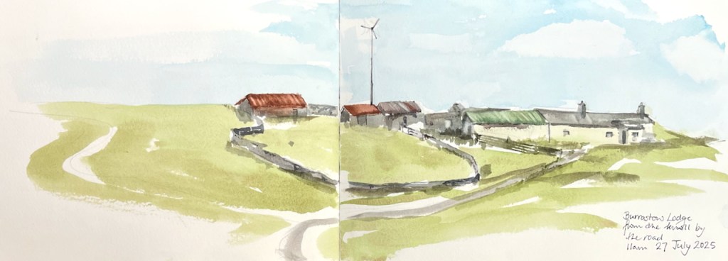
On the same day, here I am looking up at a string of dwellings and barns on the brow of another hill.
Burrastow Lodge, July 2025
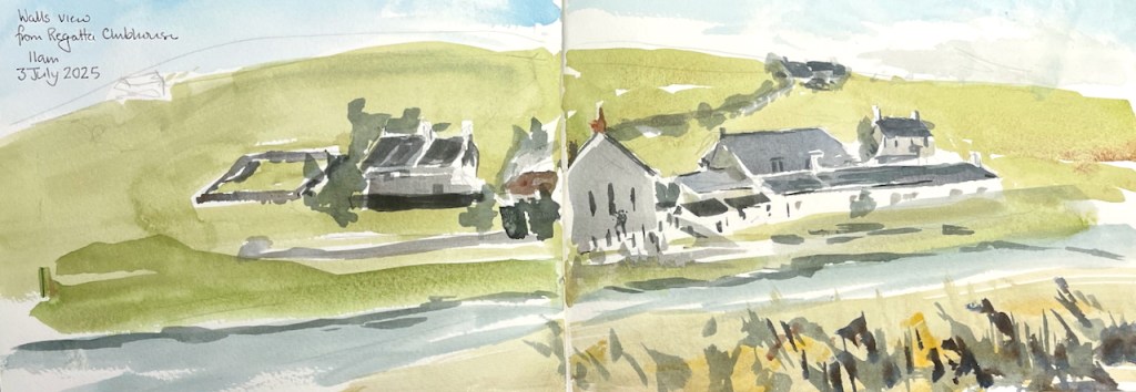
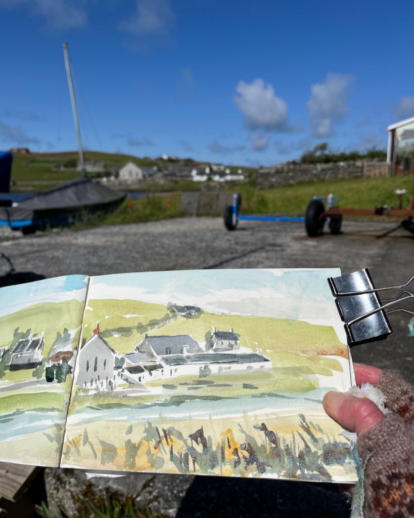
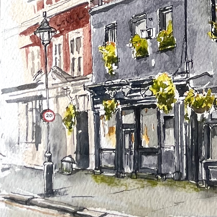
At the beginning of July I did this sketch (below) of some buildings in Walls.
Walls, across the Voe, July 2025
I was sitting on an uncomfortable stone ledge next to the Regatta Clubhouse. I was wondering, for the umpteenth time, whether it is worth the effort to carry a seat around with me.
Sketching in Walls
Despite that blue sky, it was cold, and very windy. Note the gloves. I had just done some grocery shopping at the Walls Shop and here I was, resting, before the long walk back up the hill, up several hills.
One of the reasons I sketch is to imprint moments in my mind. This sketch brings back to me the sensation of the clear moving air. My eyes were watering from the cold and wind, so the view became unfocussed. My eyes were watering from the bright light also. I had only recently arrived from London and my eyes were still acclimatising to the brightness. I put on sunglasses. It was an effort to see, and an effort to continue, and the picture came out somewhat…..approximate. But I keep it as a reminder of that moment of arrival, that determination.
Click a button below to share this post online, email it, or print it:
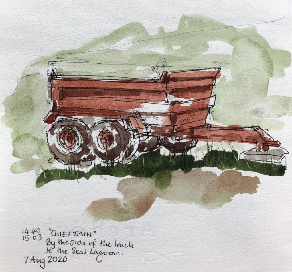
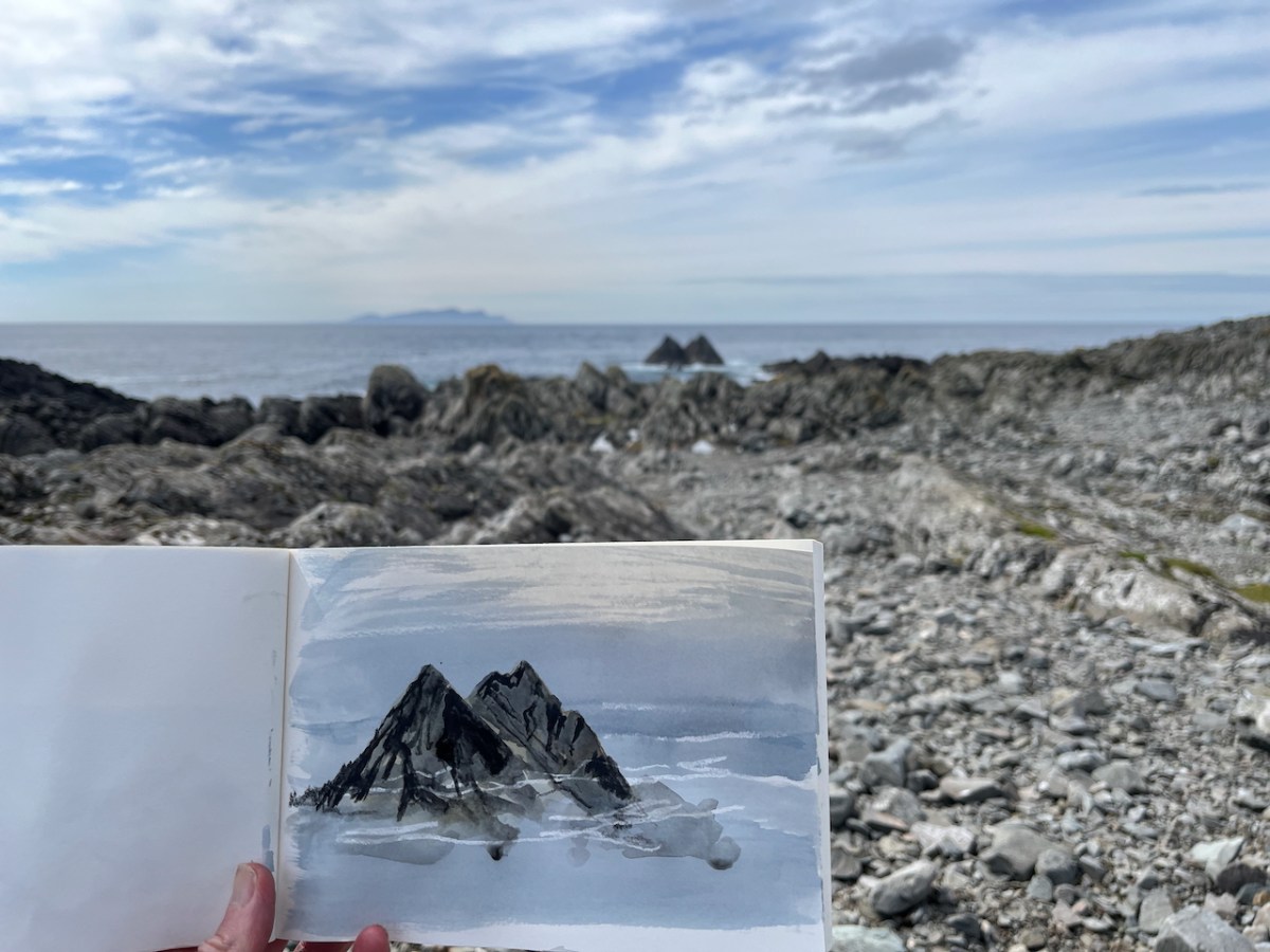
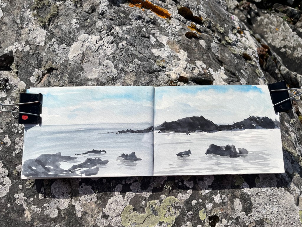
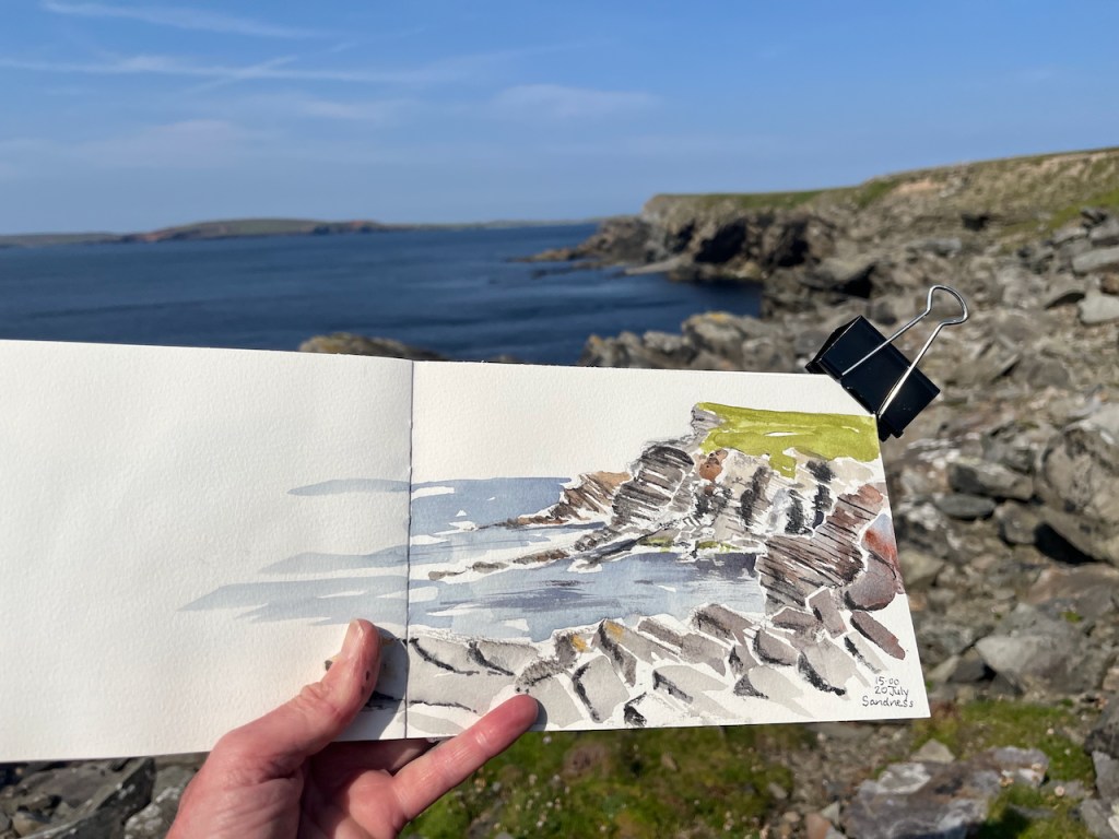
Skerries of Easter Paill, see Foula in the distanceRocks of the Seal LagoonPoint of the HusFootabroughBeach near the Seal Lagoon, from the high cairn.Where fulmars nestSandness
These pictures make it all look calm. It’s not calm. Shetland is a very windy place. While I am sketching, unseen forces turn the pages, move the paint palette around and tip my water over.
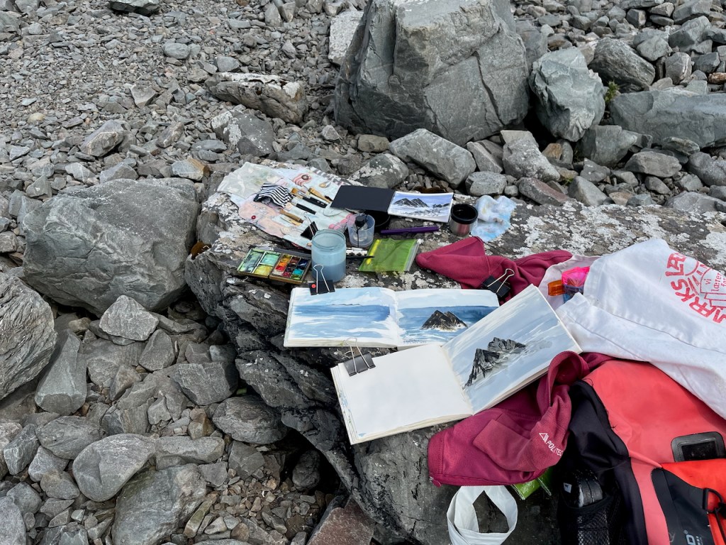
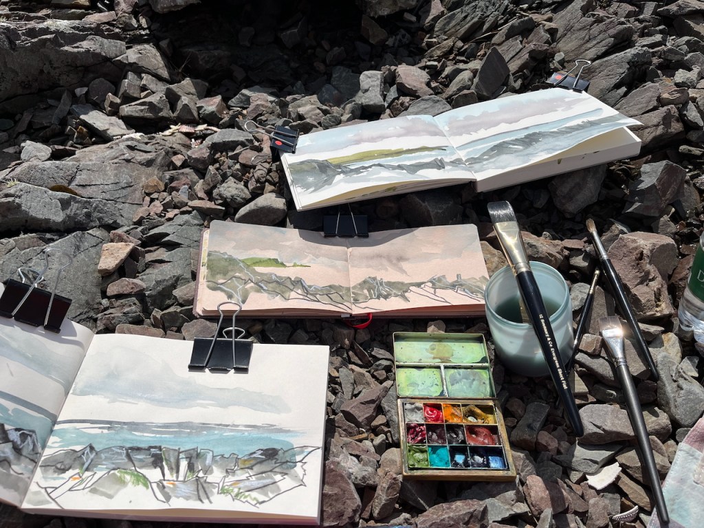
Sketching location: brushes, palette, water, …
It is also damp. Paint takes a while to dry. So I do several paintings at once: I put the first wash on, and while that dries, I start another picture.
Multiple drawings on the go. Dragon Beach: 3 sketchbooks and a postcardMultiple Sketchbooks: Littlure.
In the picture above you see my basic equipment. The paintbox is brass, which makes it heavy so it doesn’t blow away. The paintboxes I use are described here. The brushes are from Rosemary Brushes. The big one on the water pot is one of their Evergreen Short Flat brushes, size 12. It’s about an inch across, very handy for drawing quickly.
The sketchbooks are, from top to bottom:
JP Purcell 190gsm watercolour sketchbook A5
Hahnemühle Toned Watercolour book A6
JP Purcell cartridge paper sketchbook A5 – Stockwell Cartridge 130gsm
Here are the twelve colours in the paintbox. They are all Daniel Smith except the Ultramarine Blue, which is Schmincke Horadam.
Let me know if you have any other questions!
In my next post I will show sketches of Shetland croft houses.
Click a button below to share this post online, email it, or print it:
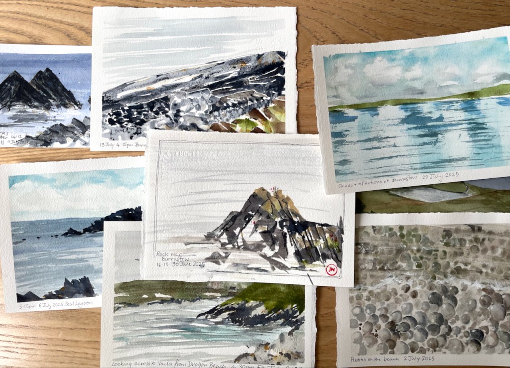
Glorious Shetland! I make postcards when I am there, to communicate what I see.
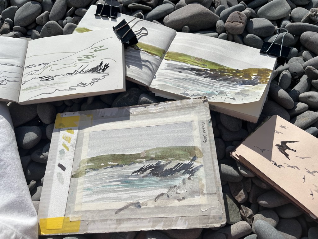
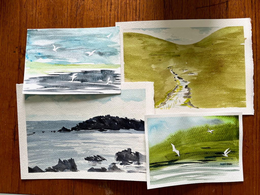
Here are small sketches of the landscapes on the West side of Shetland.
They are A5 size or smaller, on watercolour paper.
The smaller postcards are 6″x 4″. The birds are done using masking tape.
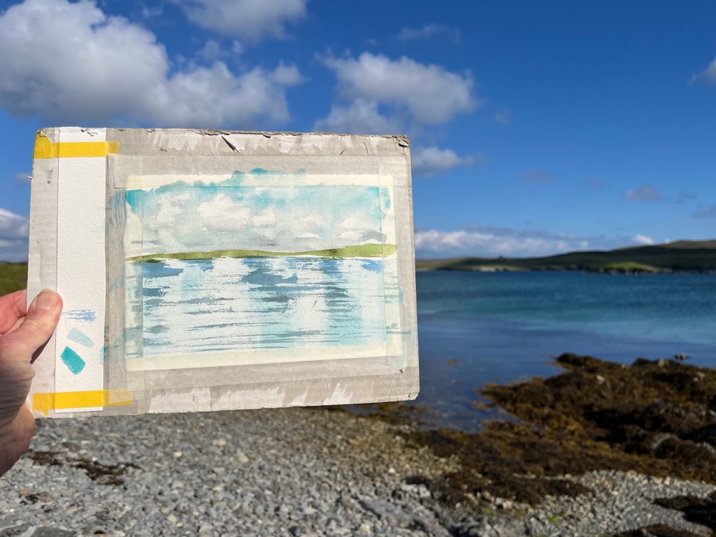
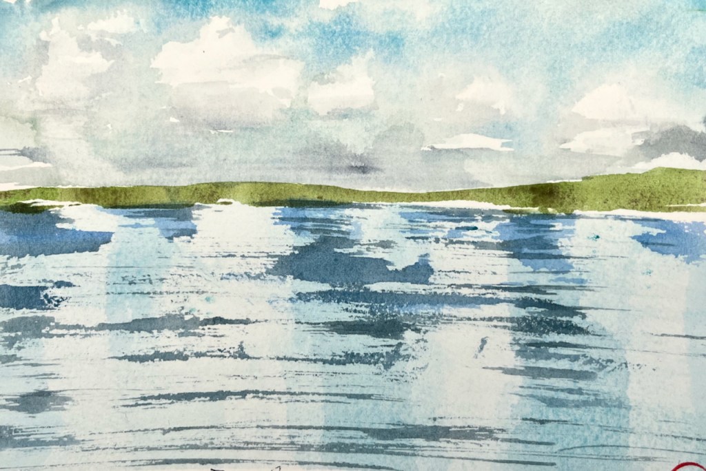
Here is work in progress on the “reflections” postcard.
The A5 postcard is fastened to the backing board with masking tape. The backing board is cardboard: the back of a pad of paper. On the left is a strip of watercolour paper to try out the colours and the brush strokes before I put them on the card.
Then when the drawing is finished I remove the masking tape, which leaves a neat edge.
Colours are Daniel Smith watercolours, on Arches Aquarelle 300gsm paper. All whites are the white of the paper.
NEXT YEAR, 2026 – “Sketch and Sail” is going to Shetland! I will be on board the sailing vessel “Lady of Avenel” with a group of fellow artists. Would you like to join us? We’ll be living on board for a week, sailing round the coast of Shetland. It will be a marvellous opportunity to see the magnificent cliffs from below, and the land from afar. No experience of sailing or sketching necessary. Sunday 31st of May to Saturday 6th June 2026. See this page for more information, or contact me.
Click a button below to share this post online, email it, or print it:
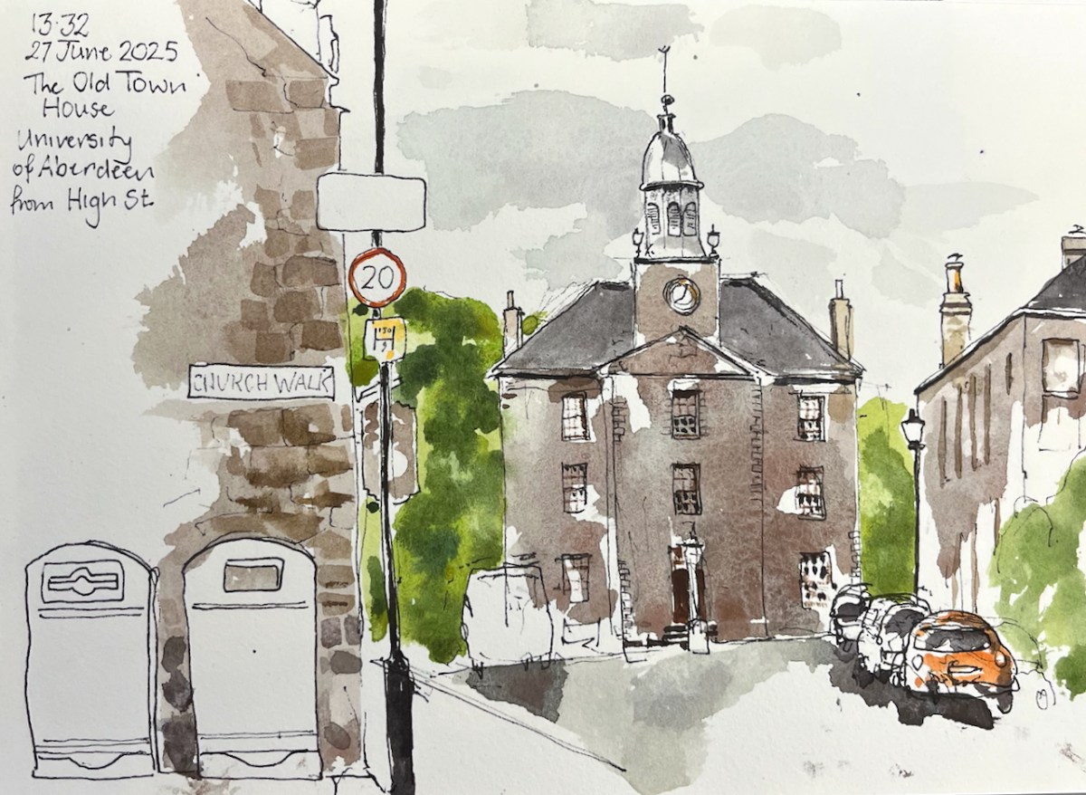
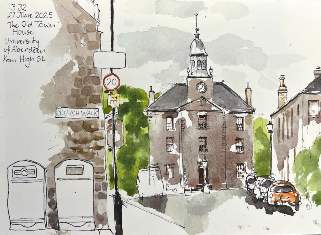
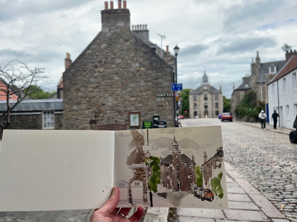
I had been travelling a long time. Reaching Old Aberdeen I sat on a granite kerbstone and sketched The Old Town House. Behind me was a friendly bookshop, where I had bought a map.
The Old Town House, University of Aberdeen, in Shetland 2025 sketchbook, size A5.
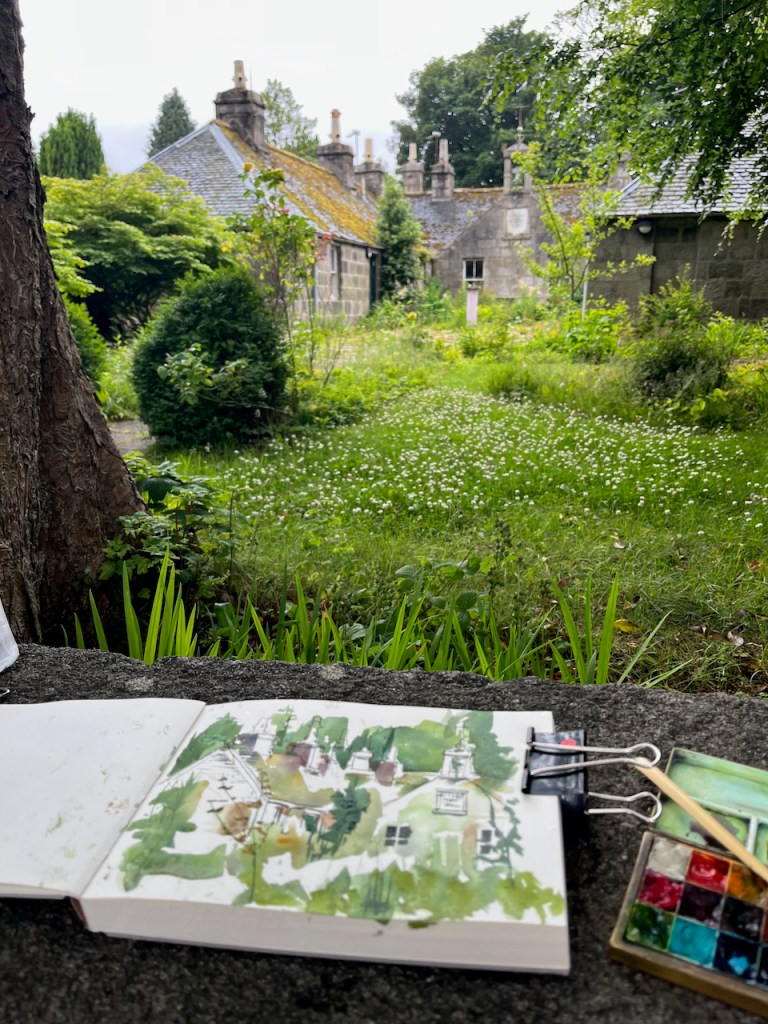
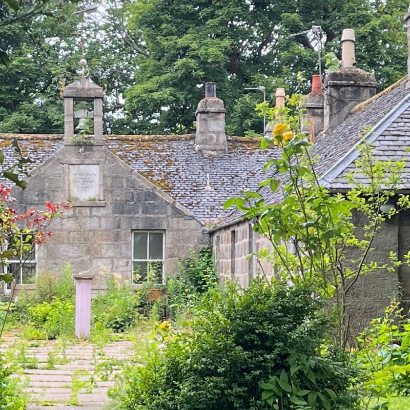
Having sketched, I walked into the picture I had drawn, and towards the trees on the left of the Town House. There I discovered a building being taken over by plants.
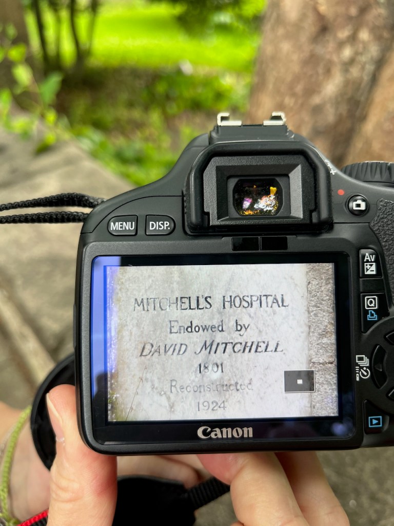
There was a plaque on the building, with writing on. You can see it in the background of the photo above. I couldn’t read the plaque at this distance, and neither could my phone.
Some tourists came by, laden with backpacks and cameras. They paused, curious to see what I was drawing. Since their eyes were younger than mine, I asked if they could read the plaque. They couldn’t, and neither could their phones. My next idea was that they could try using the telephoto lens on one of those formidable-looking cameras. With good grace they shrugged off a hefty block of technology, and removed its canvas housing. It had a fine lens.
“Mitchell’s Hospital, endowed by David Mitchell 1801. Reconstructed 1924.”
So now we know.
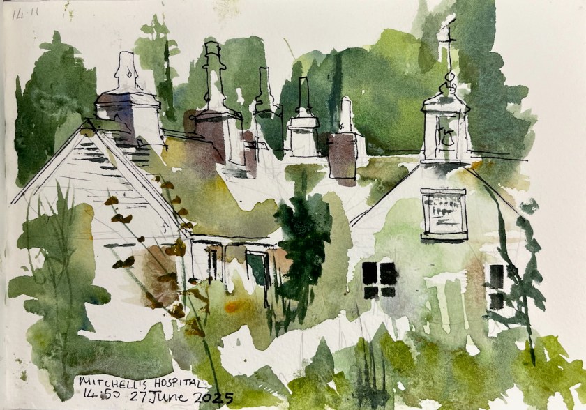
Mitchell’s Hospital, The Chanonry, Old Aberdeen. Sketch in “Shetland 2025” sketchbook, A5
David Mitchell founded the hospital as an almshouse “from a regard for the inhabitants of the city of Old Aberdeen and its ancient college and a desire in these severe times to provide lodging, maintenance and clothing for a few aged relicks and maiden daughters of decayed gentlemen merchants or trade burgesses of the said city..” [Wikipedia entry quoting the deed of mortification of the Hospital]. It was used as such, housing elderly ladies, up to to around 2016 when the final elderly resident, Iona Mathieson-Ross, had to move out.
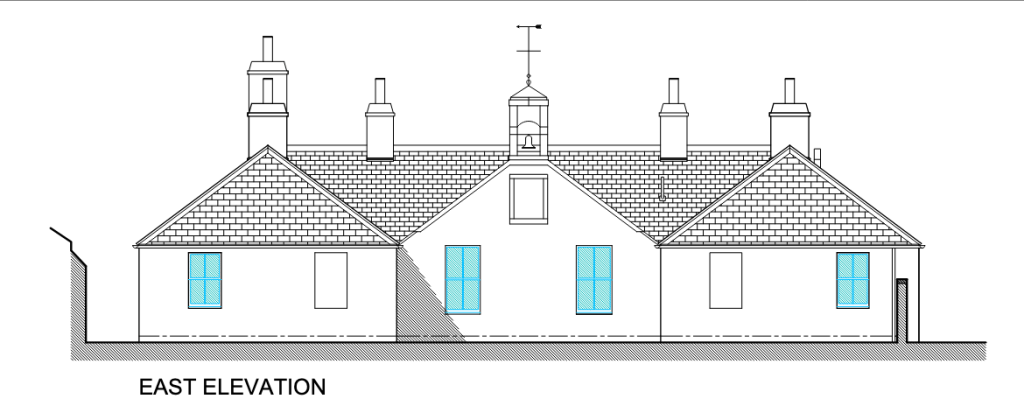
A later article says it has been sold, and that the new owners are refurbishing the building as small residential units to be let, possibly as short-term holiday lets. The planning application on Aberdeen Council’s website shows a building looking identical to the existing one, cleaned up and repaired.
From the planning application 241449/LBC Proposed elevations, North and East
It sounds like a dream come true for this neglected building:
“PROPOSED WORKS Roof: Allow for removal of all moss and vegetation Allow for replacement of missing slates in size, thickness and colour to match existing. Check ridge tiling and re-bed any loose tiles. Chimney stacks pointing to be checked and where missing to be repointed…
…Chimney cans to be reset…
Granite Masonry: Pointing to be checked and where missing to be repointed…
Windows: Existing sash & case windows to be checked & where wet rot is evident timber sections to be replaced with same profile in Redwood. Windows to be refurbished to ensure they are fully operational and fitted with draught stripping internally….
External Doors: Existing external doors to be replaced with external quality Redwood 4 panel doors with double glazed obscure glass in upper 2 panels fully weather stripped primed and painted…
The planning application was approved on the 3rd July 2025, a few days after I was standing there doing my sketch. Perhaps when I next visit Aberdeen the improvement work will be in progress. Maybe, if it becomes holiday lets, I can even stay there.
I’m glad it’s being refurbished, but I shall treasure the view of this graceful building gradually being assimilated into the plant world.
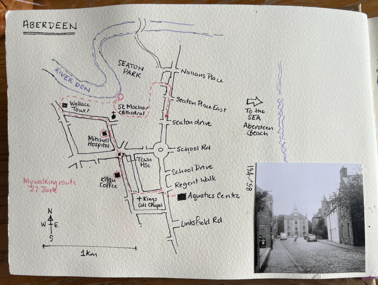
Here is a map showing my walk and Mitchell’s Hospital.
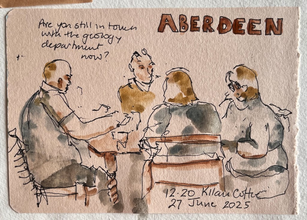
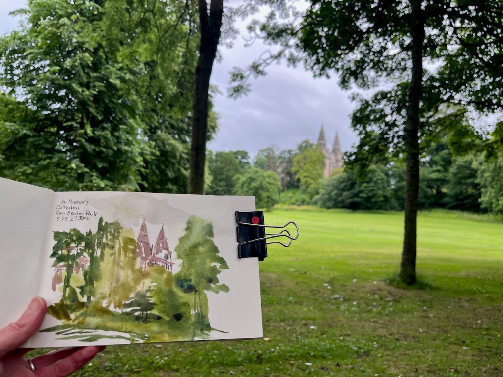
I had coffee in Kilau Coffee – recommended!Sketching in Seaton Park, before the rain. St Machar’s Cathedral.
Click a button below to share this post online, email it, or print it:
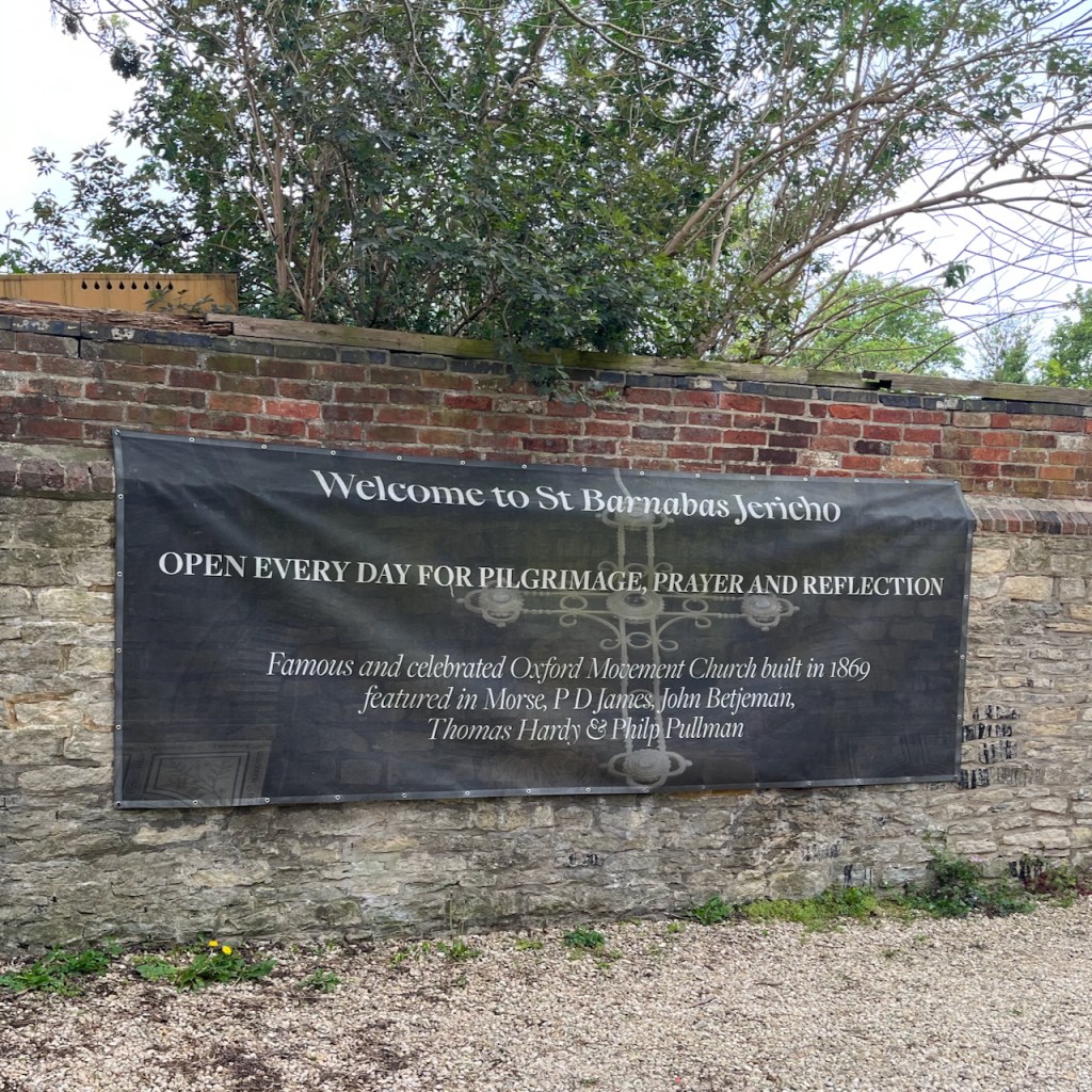
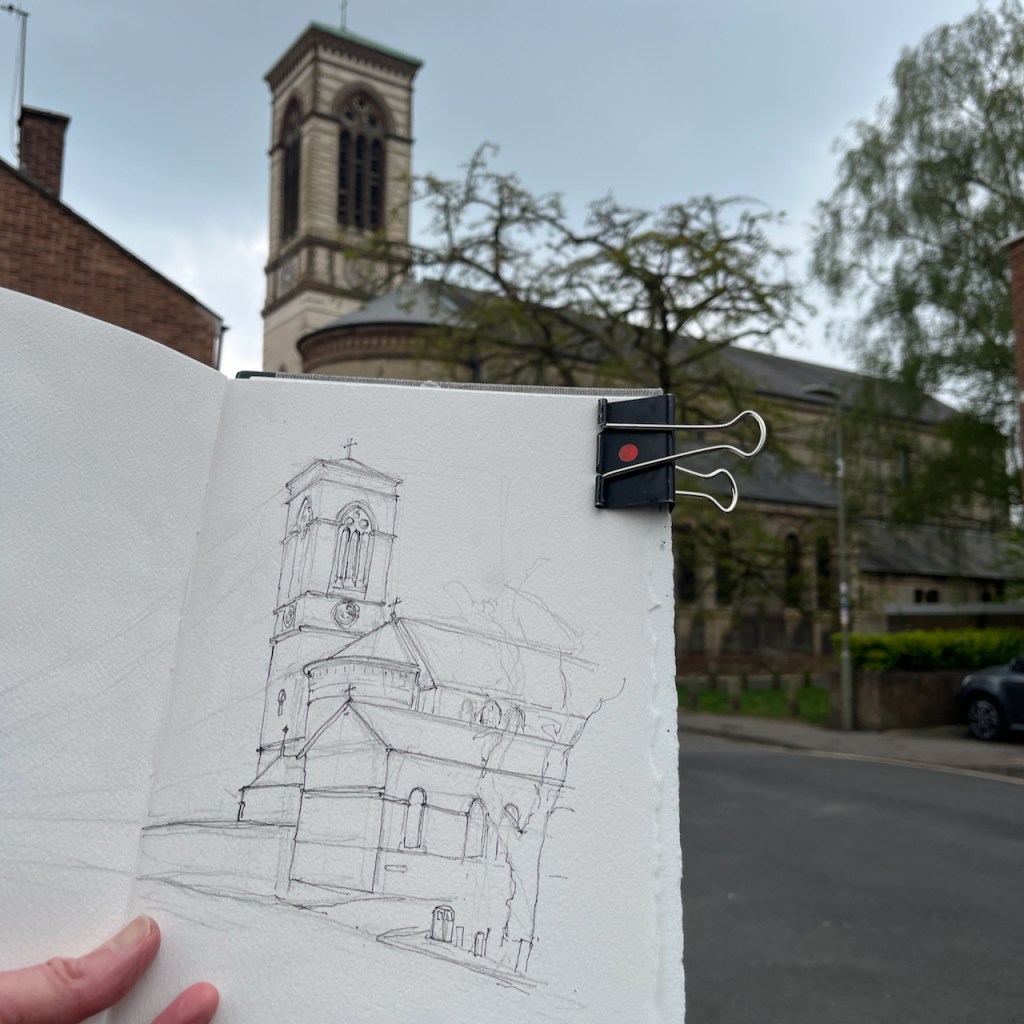
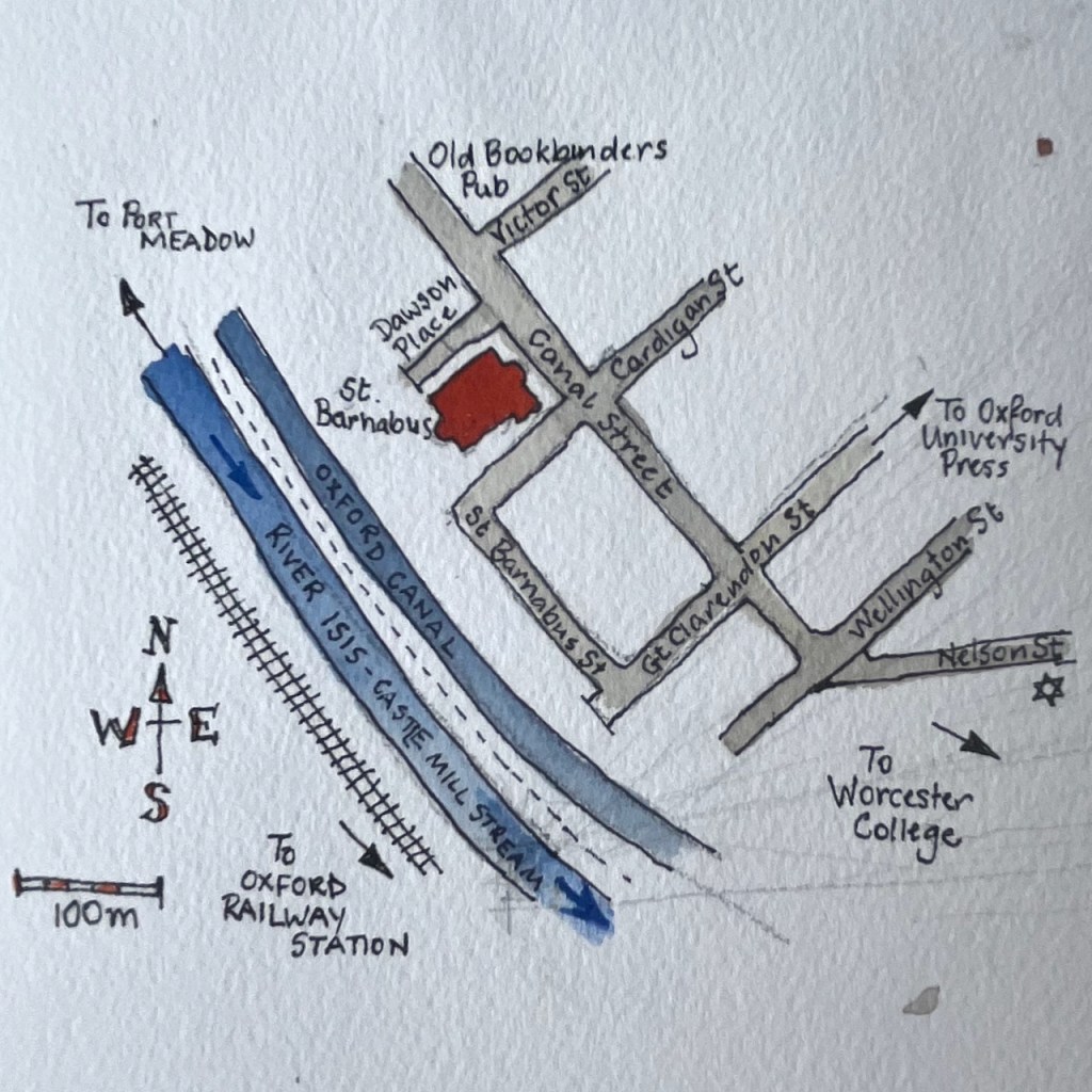
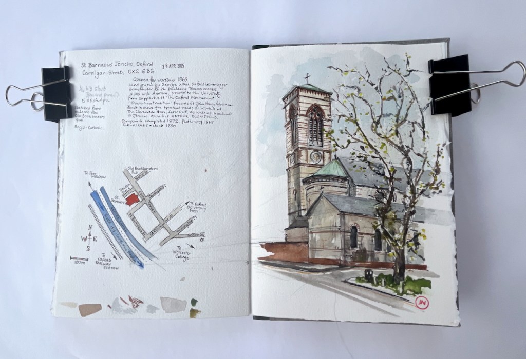
Walking through Jericho on my way to the station, I glimpsed this church tower, and heard its bells. I wove through the small streets until I found it.
St Barnabus Jericho, OX2 6BG, sketched 26 April 2025 in Sketchbook 15.
This is St Barnabus Jericho. Its website says that it is also known as “Oxford Basilica”. It was built as the daughter church of St Paul’s, which is the Grecian-style building on Walton Street, now no longer a church1.
St Paul’s is not far away, just the other side of The Oxford University Press. It was opened in 1836, and became part of the “Oxford Movement”. The Oxford Movement was campaign within the Church of England, led by influential clergymen and theologians in the 1830s. They challenged the contemporary way of thinking in the Church, saying that services were too plain, and that much of value from the Catholic tradition had been left behind. They sought to re-instate some of the theology, pageantry and ritual from the Catholic tradition, and they put it into their services. They also had a social calling, drawn to help working people and the disadvantaged.2
As you can imagine, this was contentious: popular with some people, and regarded as suspicious and un-English by others. In the 1830s, the movement flourished in this part of Oxford. The services at St Paul’s became so crowded that another church was needed. In addition, Oxford University Press moved into its huge site on Walton Street in 1830, which brought many workers to the area. So an additional church was created, and this was St Barnabus.
“The land for St Barnabas was given by George Ward who was an Oxford ironmonger, and the benefactor for the Church building was the generous Thomas Combe, Printer to the University, along his wife Martha.” [https://www.sbarnabas.org.uk/history]
St Barnabus opened for worship in 1869, and is flourishing to this day. Inside it is awe-inspiring and uplifting, with its highly decorated walls and vast size.
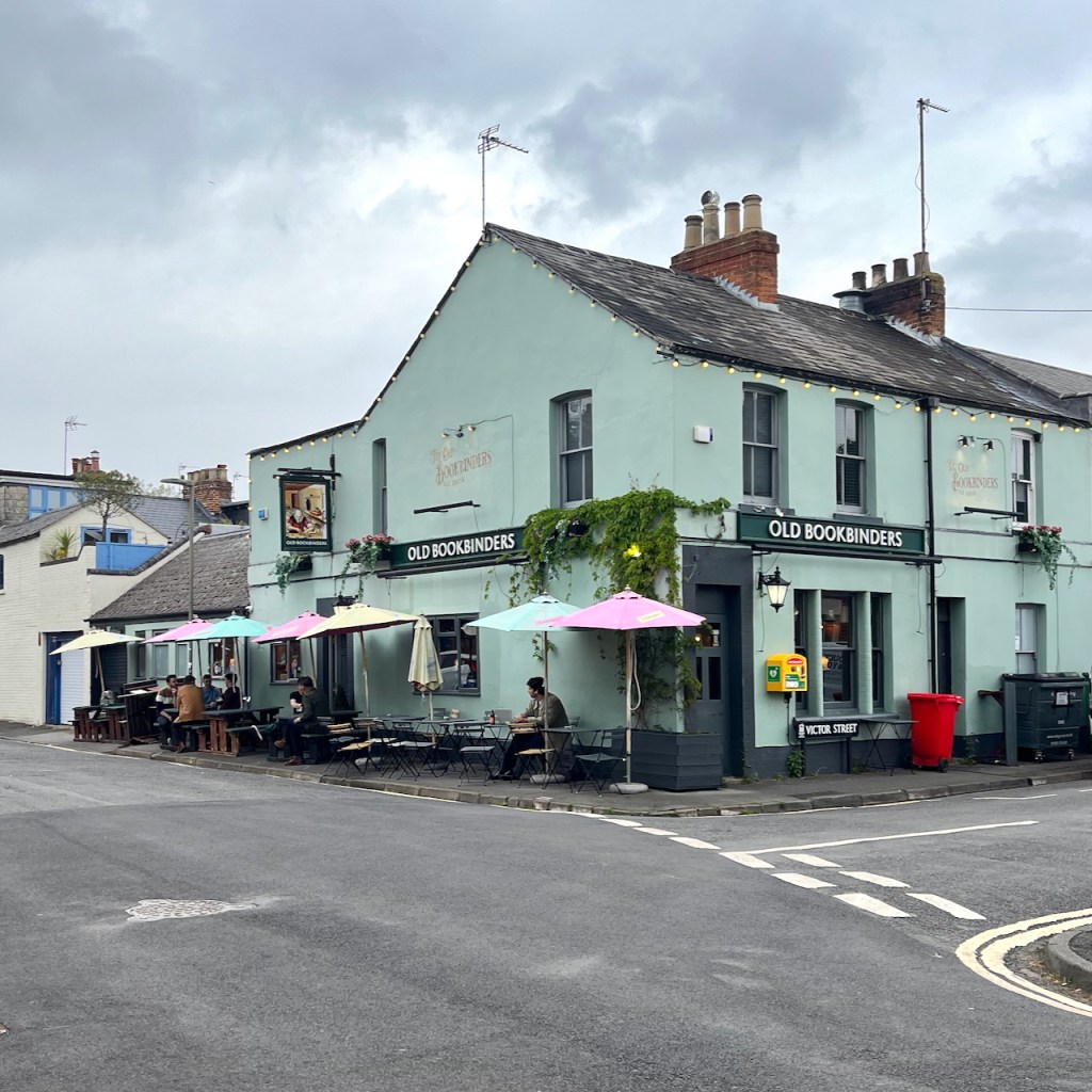
I sketched St Barnabus from outside “The Old Bookbinders” pub, delighted and frustrated in equal measure by the extraordinary detail in that tower. And I was looking at its clock, which informed me of the passing minutes until my train.
I finished the pen-and-ink drawing. Then I walked on, past Worcester College, to the railway station.
Sketchbook spread, St Barnabus Jericho. Sketchbook 15.
Footnotes
St Paul’s: the impressive Grecian temple building on Walton St is no longer a church, but the “St Paul’s” name lives on. I’ve done an earlier sketch which shows St Paul’s Nursery, still very much in operation and part of Somerville College. ↩︎
Oxford Movement: This is my non-specialist summary of a significant and complex theological and social movement. For a proper description see, for example the Wikipedia Article, or this glossary article.↩︎
Click a button below to share this post online, email it, or print it:
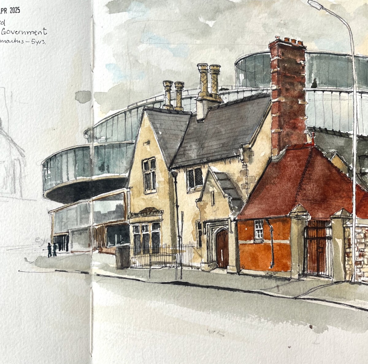
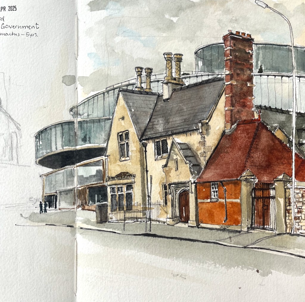
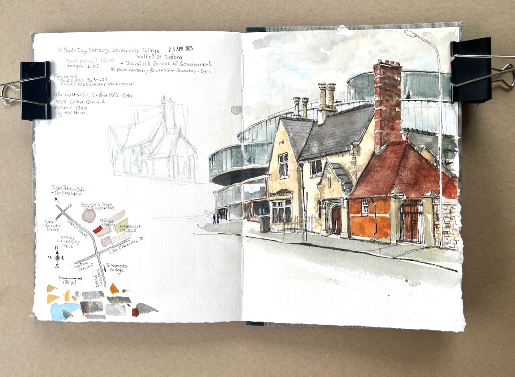
This 19th Century building on Walton Street is a nursery school. It contrasts with the huge sweeping curves of the Blavatnick School of Government behind.
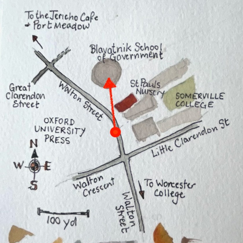
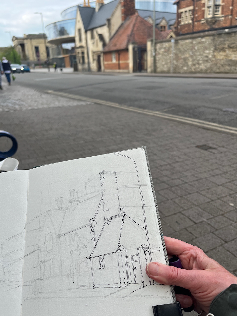
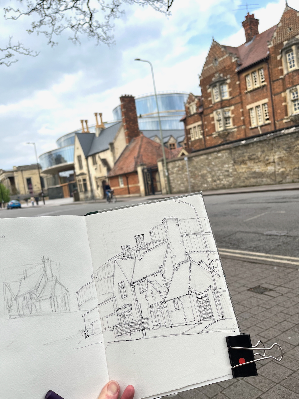
St Paul’s Nursery, 119a Walton Street, Oxford OX2 6AH. Sketched 25 April 2025 in sketchbook 15Map of the sketching location, showing the sight line of the sketch.
The building now houses a co-ed nursery: “St Paul’s Nursery is a 16-place day nursery that caters for children between the ages of 3 months and 5 years. The Nursery was established as a work place nursery for the staff of Somerville College, but now opens its doors to children whose parents work elsewhere.” [note 1]
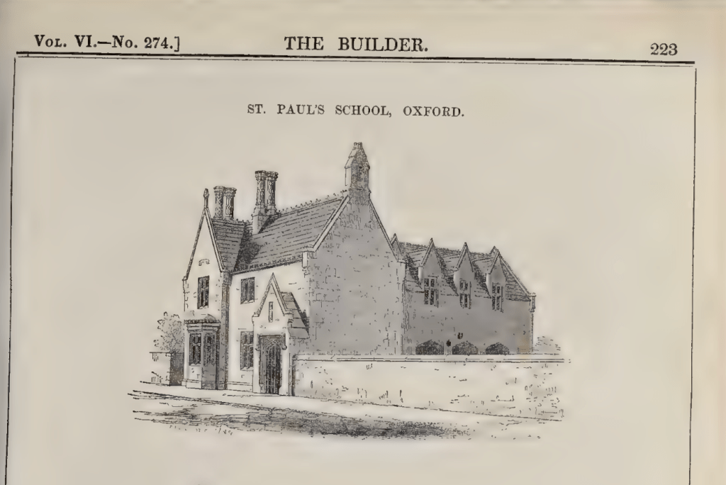
The original building of 1848 is described in “The Builder” magazine of that year. [note2]
Here is what it looked like originally:
According to the (fascinating!) article in The Builder, the school was originally only for girls. Inside the building pictured above was a “dwelling house” for the mistress, a room for the vicar “to conduct his parochial business” , and a school room “55 feet long, 20 feet wide, and 18 feet between the apex and the floor”. Because there was no outdoor playground, the architect placed the school-room on the “second floor” and the lower room became the playground. I take it that by “second floor” the author meant what we now call “first floor”. The author of the article, who seems also to be the architect, describes with pride the construction of the roof:
“In the construction not a particle of wood has been used. The roofs are supported on terra-cotta ribs, with transverse sleepers of the same material, and the floors, arched on geometrical principles, are formed by tiles set in cement ; both are of undoubted strength and durability.” [from “The Builder” article, see note 2]
So the structural elements of the roof are terracotta? Really? If anyone has been inside this excellent building, can they tell me if this is still the case? Did the roof and the floors turn out to be durable, as the article says?
“St Paul’s Nursery” is now part of Somerville College. “St Paul’s Church” is the big building like a Greek temple which is on Walton Street on the other side of the Blavatnik building. It was out-of-use as a church by the early 1970s, and became a wine bar called “Freud”. It now looks sadly dilapidated. Some of its history is on this link.
The Blavatnik School of Government started in 2012. It moved into the new building on Walton Street in 2016. The building is by Herzog and De Meuron. The architects’ drawings of it, and some internal and external photos are on this link.
The Blavatnik School of Government mission statement, as written on the door of the building.
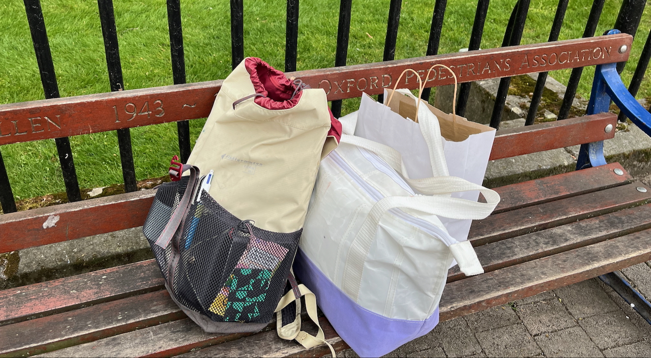
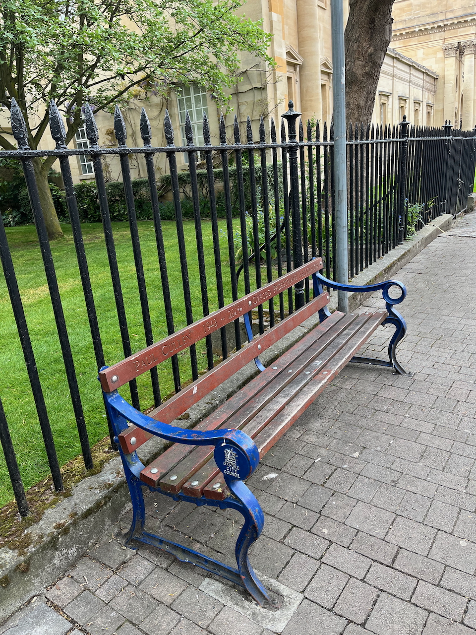
I made the sketch from a convenient bench outside the Oxford University Press. The bench was dedicated to “Paul Cullen 1943-2011 Oxford Pedestrians Association”.
Starting work on the sketchThe bench dedicated to “Paul Cullen 1943-2011 Oxford Pedestrians Association”.
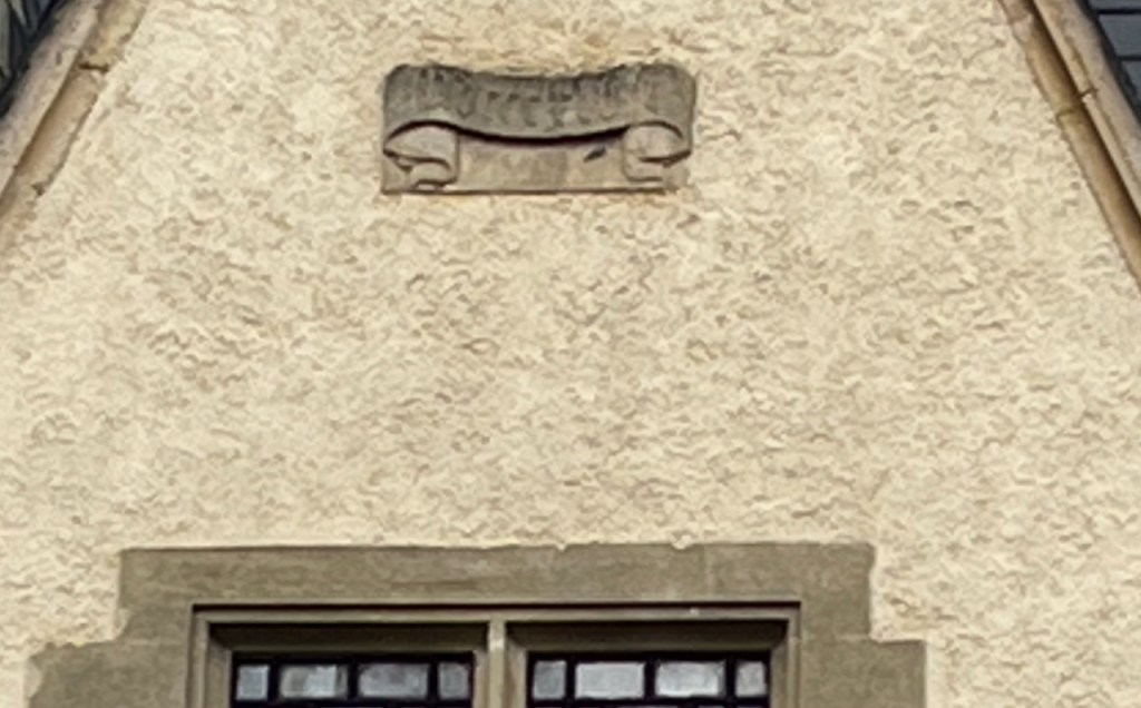
The inscription on the bench was easily read. But there was an inscription on the building I’d been drawing, and I couldn’t read that.
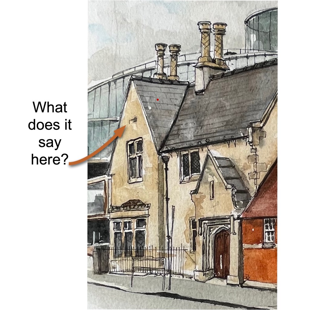
There is a stucco scroll with writing on the gable of the nursery building. Try as I might I could not read it.I assumed my ageing eyes were at fault. So I stopped two young people on the pavement and asked them if they could read it. They took my request seriously, and gave the task their full attention, which was kind of them. However they could not read it either. “Something Something CCC something something” was our joint conclusion. 1848 would be MDCCCXLVIII. Does it say that? If you are walking along Walton Street with a high-powered telescope, or if you have an old photo which shows the building in a less eroded state, then can you tell me what it says?
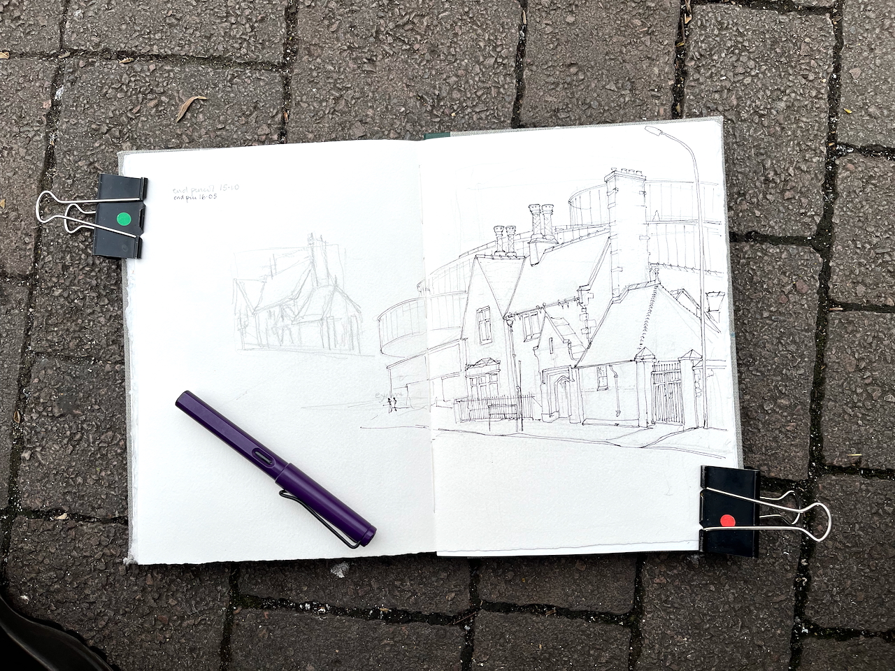
What does it say? (The iPhone can’t read it either….)St Pauls Day Nursery and Blavatnik building. Sketchbook 15 page spread.
The letter is apparently written by the architect. They say, for example, “we have perhaps rather exceeded the bound of usual practice in ornamental detail” and refers to “our site”. But he or she does not sign their name, simply giving initials: “T.C.”. I have not been able to discover who “T.C.” is.
Click a button below to share this post online, email it, or print it:
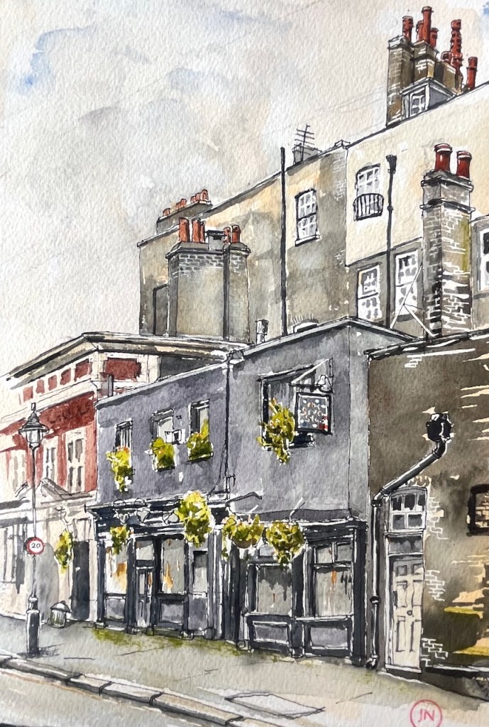
“This tranquil little pub now faces the back of the Royal Courts of Justice, the esteemed Gothic Revival building opened by Queen Victoria in 1882. Within The Seven Stars’ ancient charm of three narrow rooms that make up its public area, drinking in Queer Street (as Carey Street has often been called because of the bankruptcy courts) is contrarily pleasant. One can linger over gastronomic pub food and real ales behind Irish linen lace curtains that are being twitched by litigants, barristers, reporters, LSE students, church musicians, and West End show brass sections. Then, one might navigate to the lavatories up the comically narrow Elizabethan stairs. There are antique Cabinets of Curiosity in the pub’s front windows, and alongside Spy prints of former judges, there are posters of “Brothers in Law,” “A Pair of Briefs,” and other bygone British legal films.”
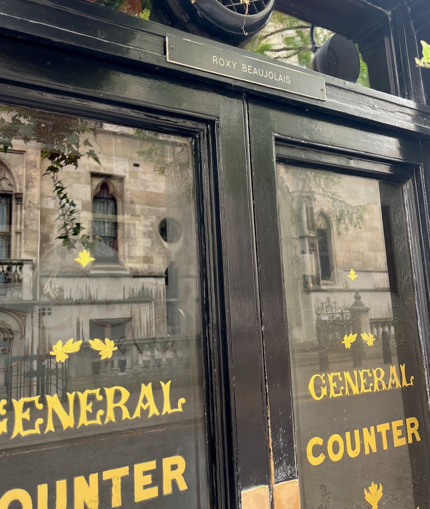
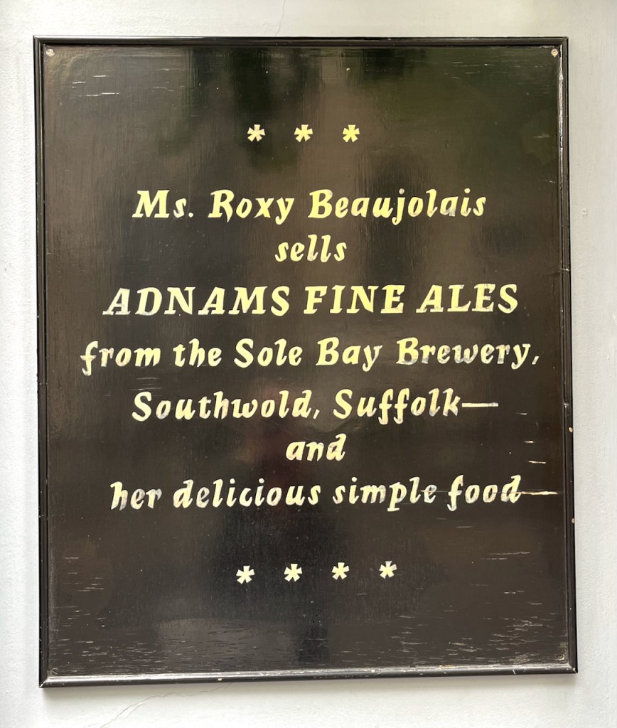
The licensee is the marvellously named Roxy Beaujolais.
Again quoting from the pub website:
In February 2006, FancyAPint listed The Seven Stars as one of “London’s Top Ten Pubs.” A 2006 review in On Trade, a pub industry organ, told it like this:
“We are here to be adored, not ignored,” says Roxy imperiously. “We sell fabulous beer with proper, homecooked food; and I expect my customers to appreciate both of those things.” In the current climate of customer satisfaction at all costs, her words may sound nigh on heretical. But this is a woman utterly qualified to call her own shots, and anyway – her combination of buxom presence, top class conversation, beautifully cared for ale, and sumptuous food is such a winning one that few would feel inclined to argue.
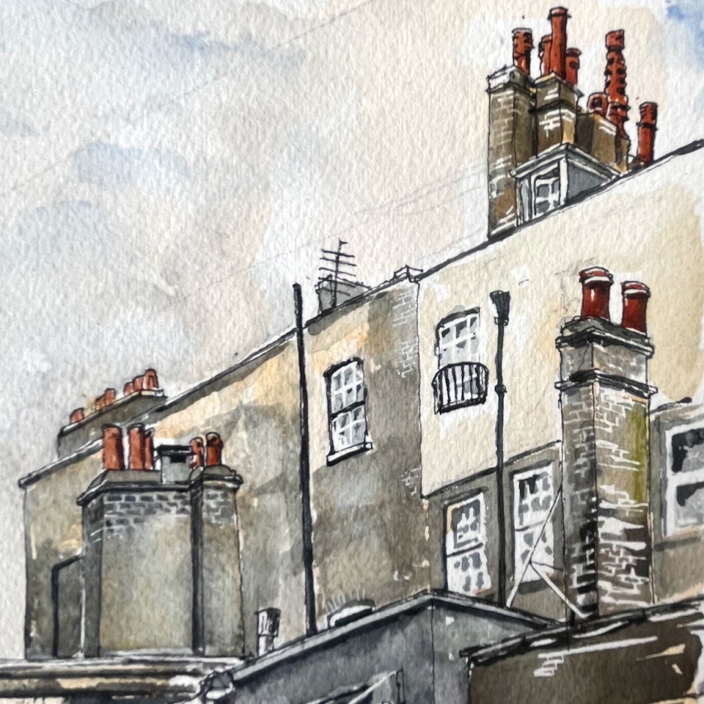
Sketching the pub, I enjoyed the landscape of chimneys. The art of the chimney-maker is not enough noticed. They are unsung sculptors. All those legal offices and chambers behind the Seven Stars must have plenty of fireplaces. Hence the chimneys, here present in great numbers and in extraordinary variety.
Chimneys seen from Carey Street.
This sketch took about an hour and a half on location, and I finished the colour at my desk.
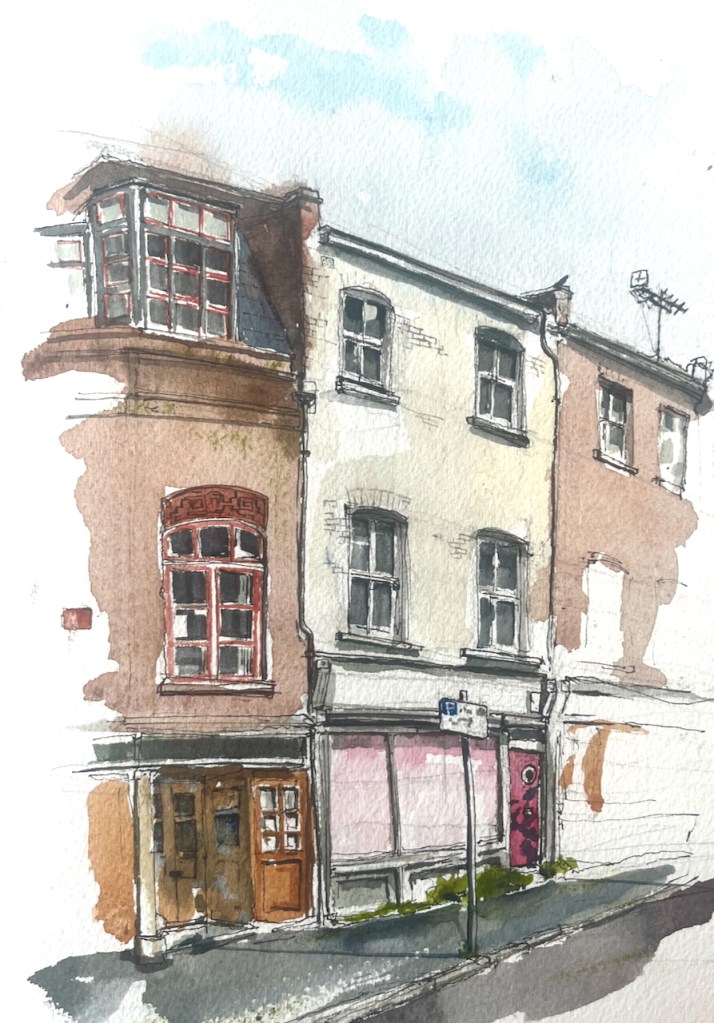
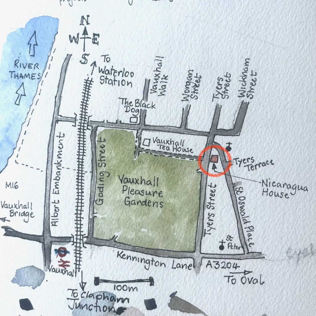
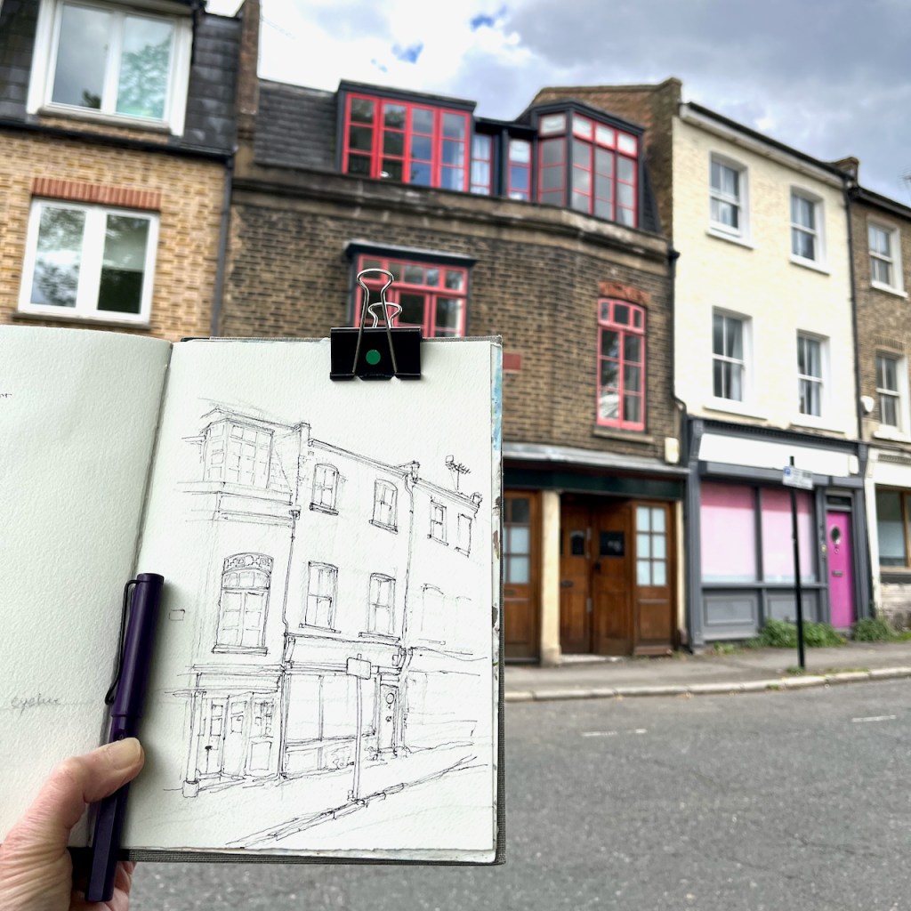
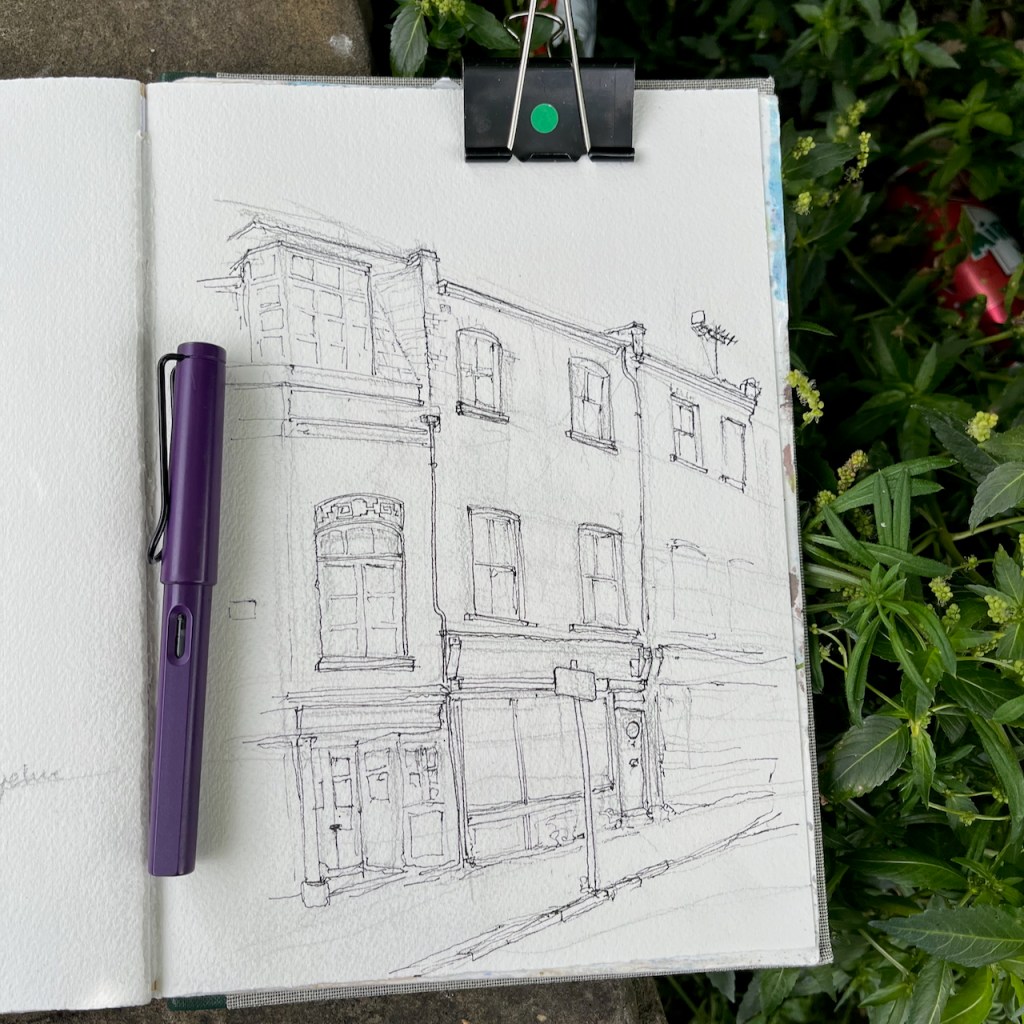
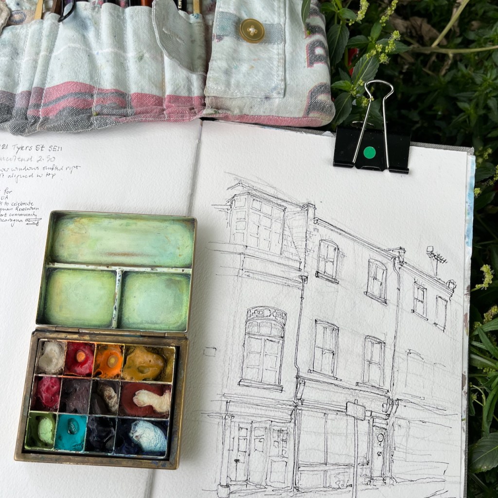
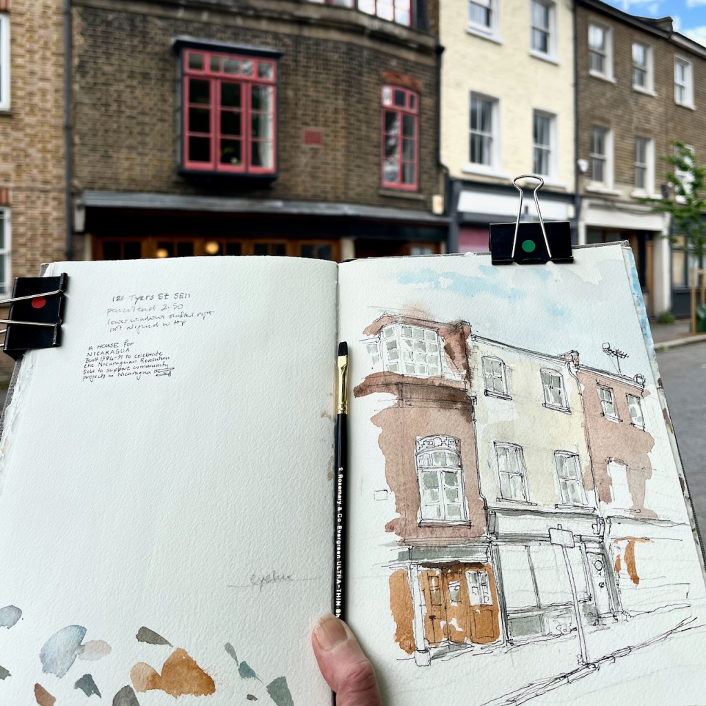
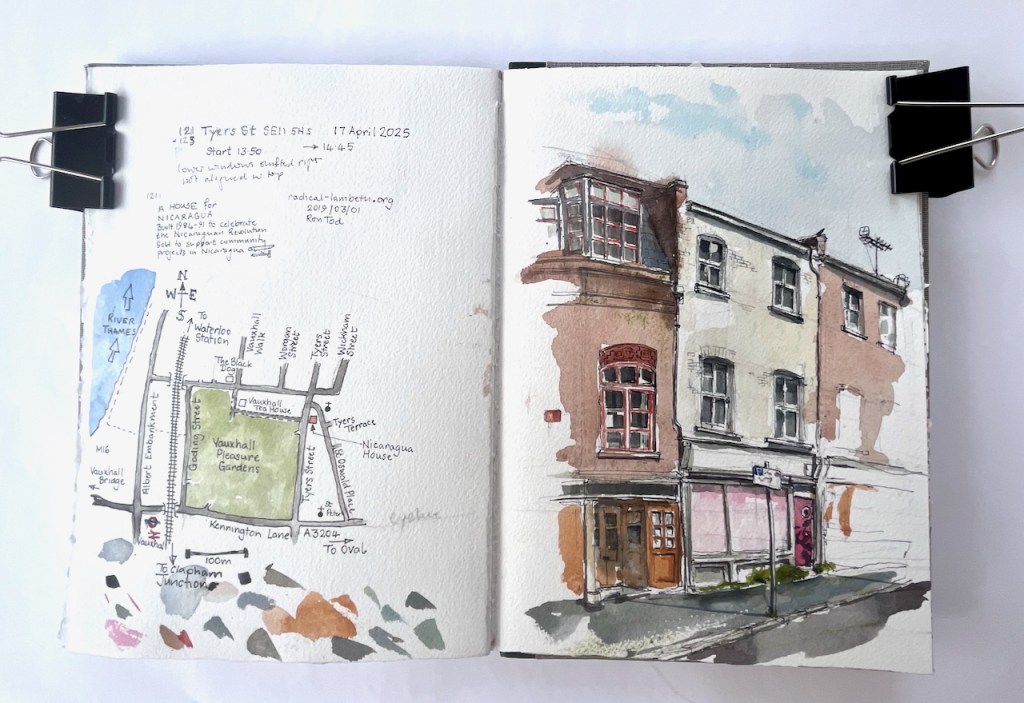
This is an interesting terrace, just to the East of Vauxhall Pleasure Gardens.
121 and 123 Tyers Street, SE11 5HS, sketched 17 April 2025 in Sketchbook 15
The terrace house on the left has a terracotta plaque let into the brickwork:
A HOUSE FOR NICARAGUA
Built 1984-91 to celebrate
the Nicaraguan Revolution
Sold to support community projects in Nicaragua
The website “Radical Lambeth” has an article which tells more. The house was restored as a community endeavour, led by a visionary, Ron Tod (sometimes spelled Todd):
“He had some money from a house he had built out of an old airfield shed in Essex, and he thought some of the people he was living with might help with the work. About 200 people – men and women in their twenties and thirties did…”
“Almost all the materials for 121 Tyers Street came from skips, building sites or dumps. The floors are parquet, retrieved in one great haul from a skip….”
Even from the outside, the house is feels beautiful. The windows are all different, and there is intriguing detail, such as the terracotta frieze above the window shown in my picture. This is a house built to a loose design rather than a rigid plan. Much was created by the people there, as they went along, using materials to hand. Sketching it, I was reminded of the work of the 1970s radical architect Christopher Alexander, “A Pattern Language”.
The house in the centre of my picture is 123 Tyers Street. This is much plainer. But it also is intriguing. The lower windows are not directly below the upper windows, but shifted right.
I sketched sitting on the wall opposite.
Sketchbook spread, Sketchbook 15
Click a button below to share this post online, email it, or print it: