On the 2nd January I joined a group of other artists sketching on London’s South Bank. This was an event organised by Jackson’s Art Supplies of Dalston.
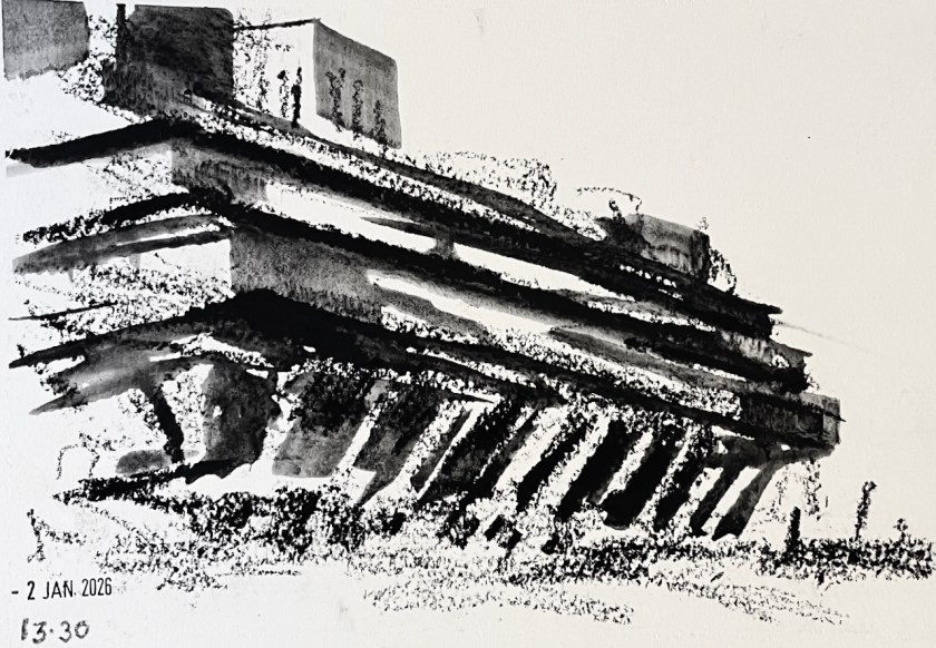
The first picture I attempted was of the National Theatre.
Sketching the National Theatre – 2nd January 2026
It was extremely cold and there was an unforgiving wind.
I managed to finish the pen-and-ink but at this point I abandoned the idea of putting the watercolour on the picture, and hurried into the National Theatre to thaw out. The staff there patiently inspected my bag of art equipment. In the café I found a group of other artists from the event, drinking coffee, testing the operation of their fingers and talking about art materials.
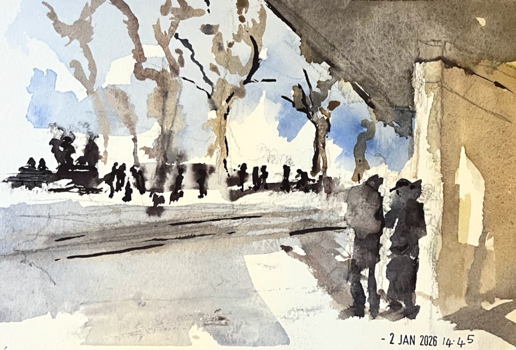
Coffee and company warmed me up. I decided to try simpler drawings using big crayons that I could wield in gloves. Here’s a flick through the sketchbook:
South Bank sketchbook flick-through
The black marks are made with a Derwent “inktense” stick. These sticks make charcoal-like marks, which you can then darken or spread out with water.
The National Theatre – inktense stick on Arches cold-pressed paper
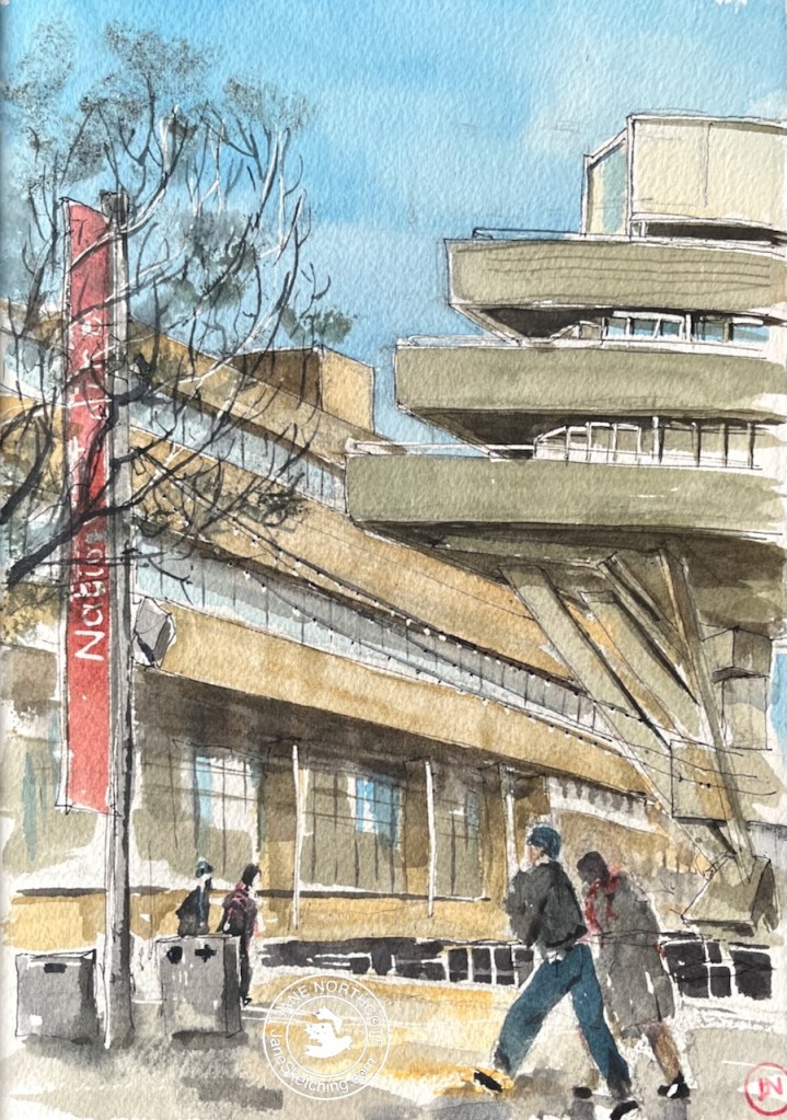
Here’s my last picture of the day. I was determined to use the watercolours, and found a spot where the wind was attenuated by a concrete wall.
At 3pm we all congregated and shared our pictures. I was really impressed at how many of us had persisted, in the cold, right to the end of the event, and at the wonderful work everyone had done. I mean, doing anything at that temperature was an achievement, I thought. You can see a picture of the assembled participants in the Jackson’s newsletter on this link.
Later, at home in the warm, I added the watercolour to my initial sketch of the National Theatre.
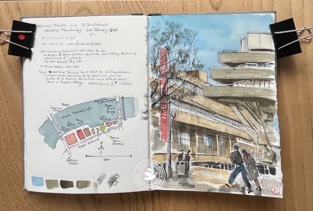
National Theatre and 76 South Bank – 2nd January 2026 in sketchbook 16
It was an inspiring day out. Thank you to the Jackson’s team for the initiative and the organisation. And thanks to the wonderful National Theatre for the warm and welcoming spaces, the café, and the toilets…..!
Click a button below to share this post online, email it, or print it:
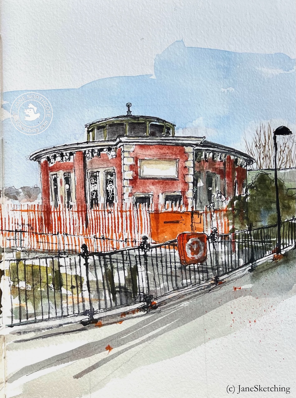
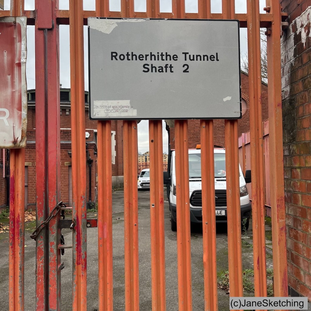
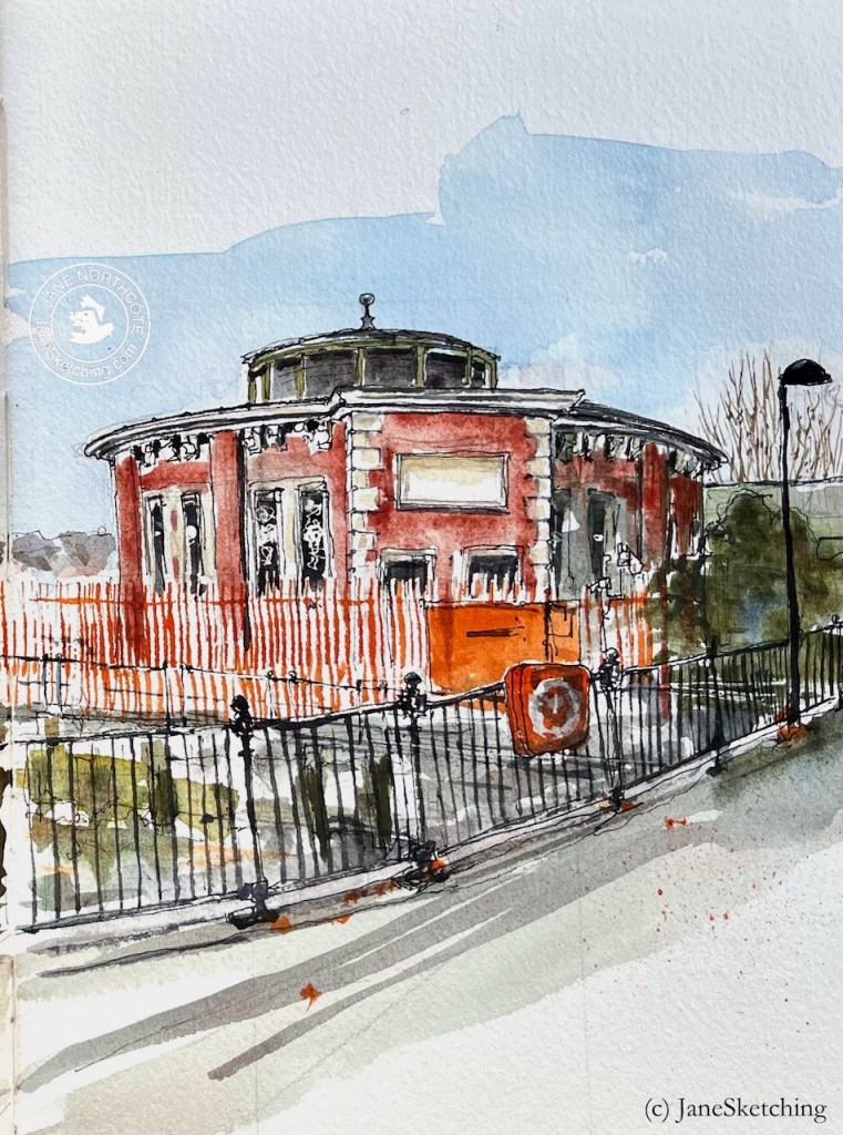
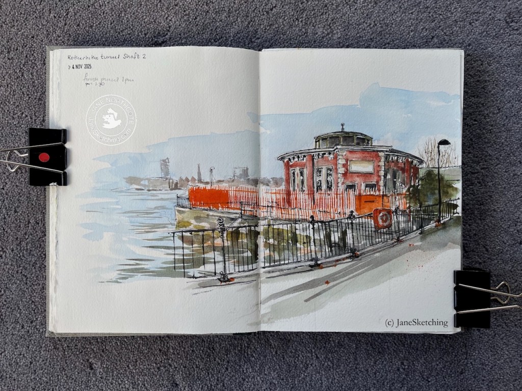
Rotherhithe Tunnel Shaft 2, sketched 4 November 2025 in Sketchbook 16 (c) JaneSketching
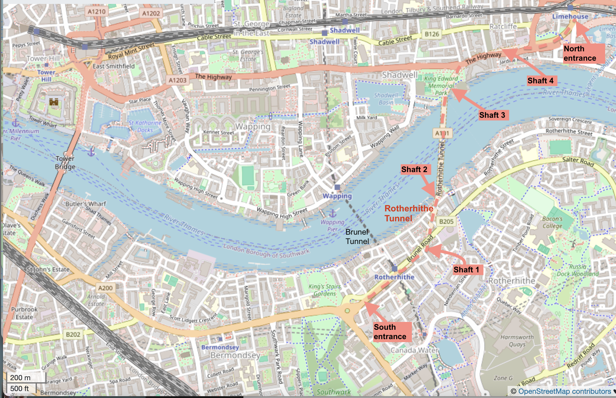
Here’s a map showing the river downstream of Tower Bridge, and the location of these structures. Click to enlarge.
Map showing the Rotherhithe tunnel, all 4 shafts, and the entrances. Click to enlarge. (c) OpenStreetMapcontributors
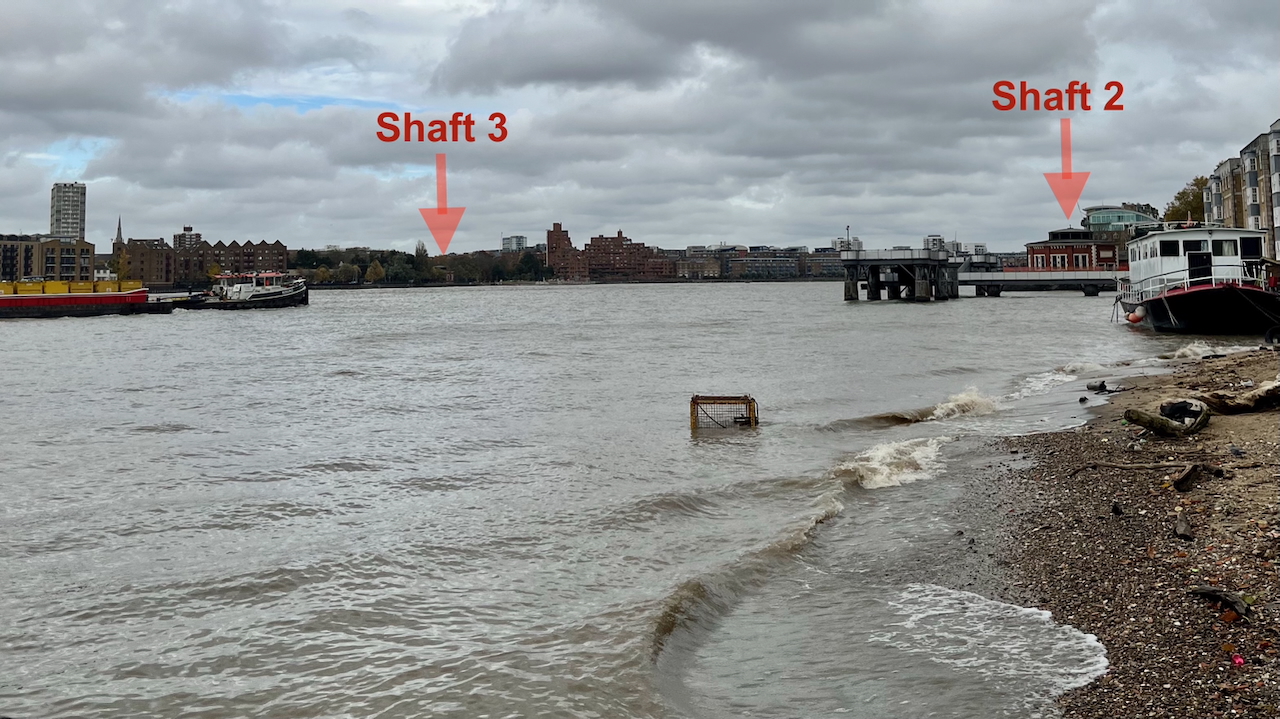
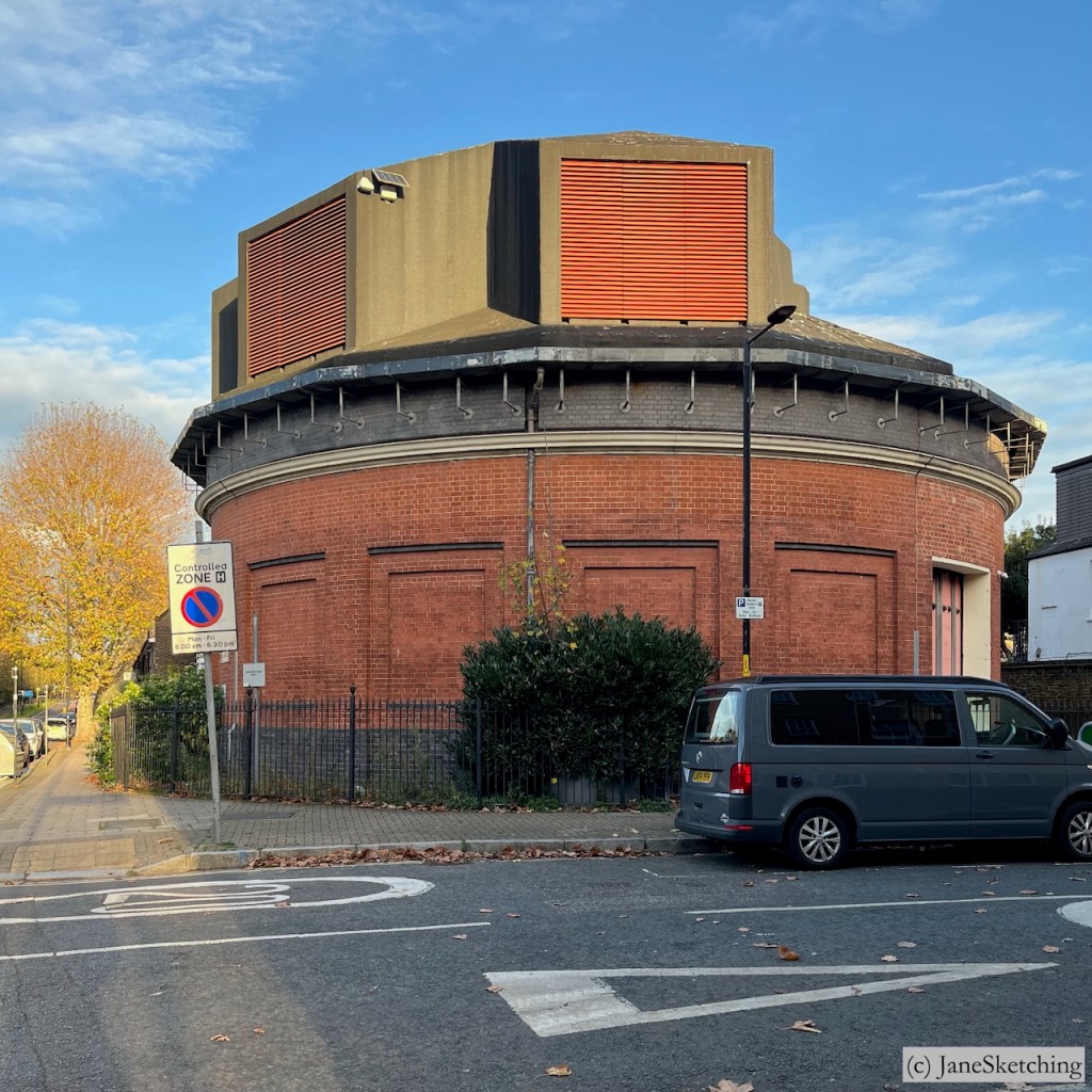
You can see one shaft from the other. Here’s a picture looking North across the Thames, just before I started the sketch. The light wasn’t great, but you can still see both shafts 2 and 3. See how wide the river is at this point! The distance between the two shafts is around 1500ft (500 metres).
Photo looking north across the Thames at Rotherhithe 4th November 2025 (c) JaneSketching
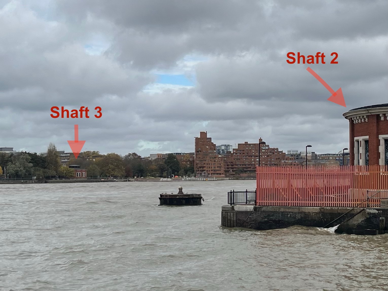
Here’s a photo from closer:
Photo looking north across the Thames at Rotherhithe 4th November 2025 (c) JaneSketching
Shaft 2 is hidden behind high orange fences as you see. On the inland side it is behind a residential building at 157 Rotherhithe Street.
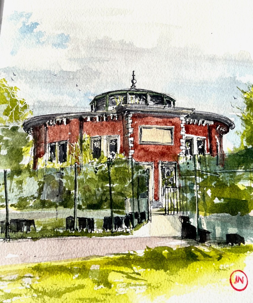
The Rotherhithe tunnel has 4 shafts. Shafts 2 and 3 are the round shapes and resemble each other. Both are Grade II listed.
Shaft 3Shaft 2Sketches of Shafts 3 and 4 (c) JaneSketching
Shafts 1 and 4 have been modernised.
Shaft 1Shaft 4Shafts 1 and 4 (iPhone photos, (c) JaneSketching, November 2025)
My next expedition will be to sketch the entrances to the tunnel.
Sketchbook 16 spread
Watercolours by Daniel Smith : – Burnt Umber – Serpentine Genuine – Phthalo Blue Turquoise – Transparent Pyrrol Orange – Mars Yellow – Fired Gold Ochre
Colours and brushes used for this picture. Colours by Daniel Smith. Brushes by Rosemary Brushes. Ceramic palette by Mary Ling. Brass Palette by Classic Paintboxes.
Click a button below to share this post online, email it, or print it:
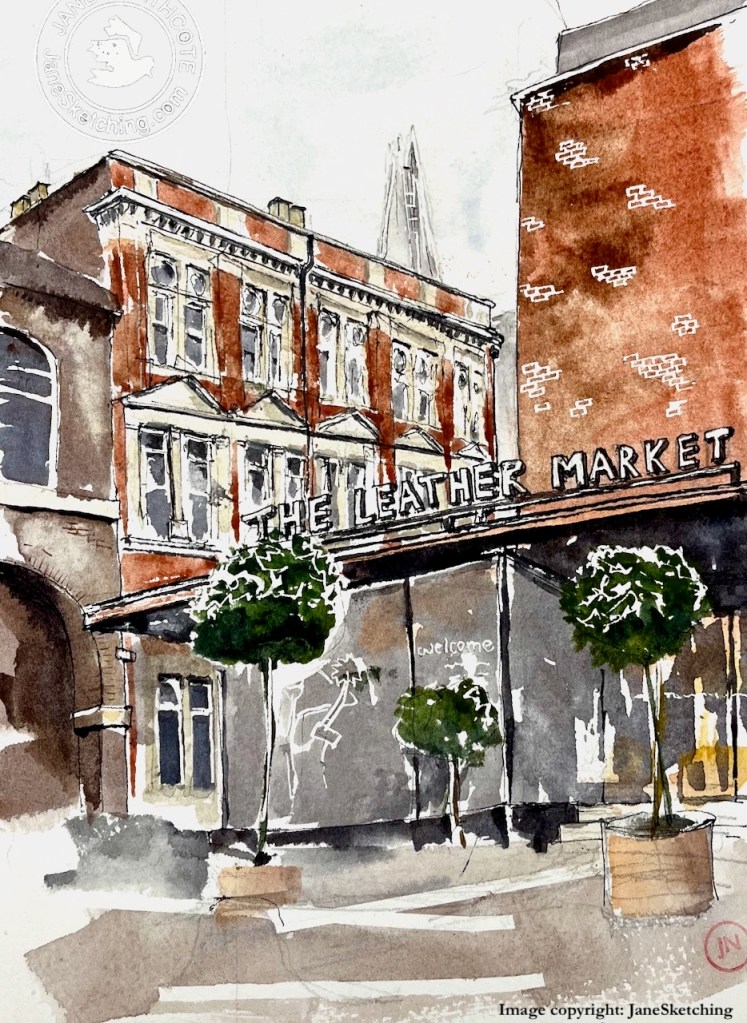
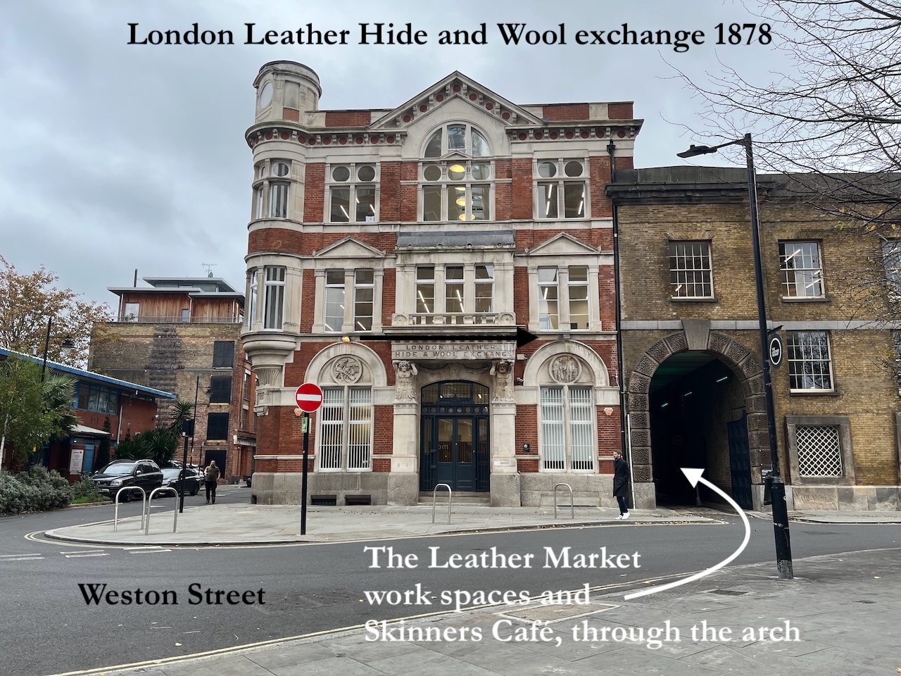
Here is The Leather Market Workspace. The Victorian building on the left is the back of the Grade II listed former “London Leather, Hide & Wool Exchange”, 1878, designed by George Elkington and Sons.
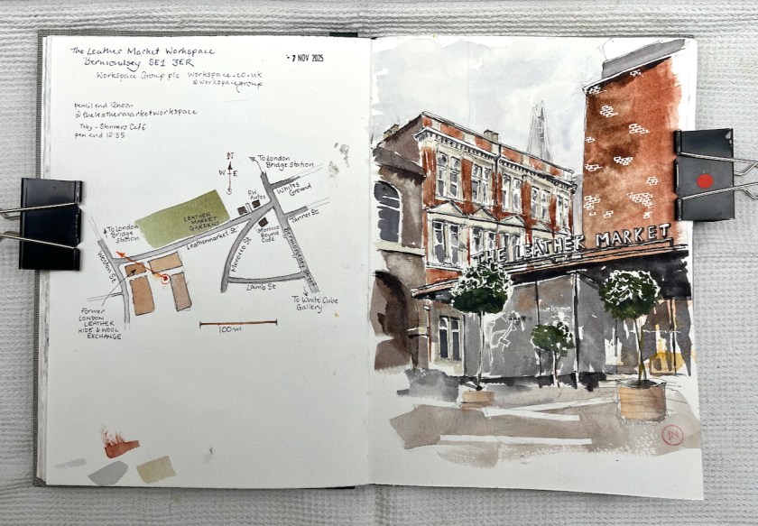
The Leather Market, Bermondsey, sketched 7th November 2025 in Sketchbook 16
My idea had been to sketch the front of the Victorian building from Weston Street. But the front was obscured by delivery vans.
We were on the point of abandoning the project, when Toby appeared.
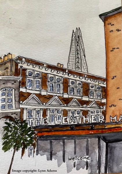
Lynn’s sketch of the same view (c) Lynn Adams, used with permission.
Toby, it turns out, is in charge of a café. He was standing on the pavement next to a huge arch by the Victorian frontage. Come in! he suggested. Lynn and I followed him through the arch. The space opened out into a large yard, with seats. Toby went into his café and we walked around the yard, sizing up the artistic possibilities. Lynn uttered a shriek of delight. She had discovered a point at the edge of the courtyard with an unexpected view of The Shard. And trees. This was her quest. She settled down to sketch while I went to procure coffee from Toby and his team. Then I started sketching too.
“The Leather Market” is one of a collection of co-working spaces managed by Workspace Group plc. We sketched and drank our coffee in the calm yard. Workers passed by and made encouraging comments.
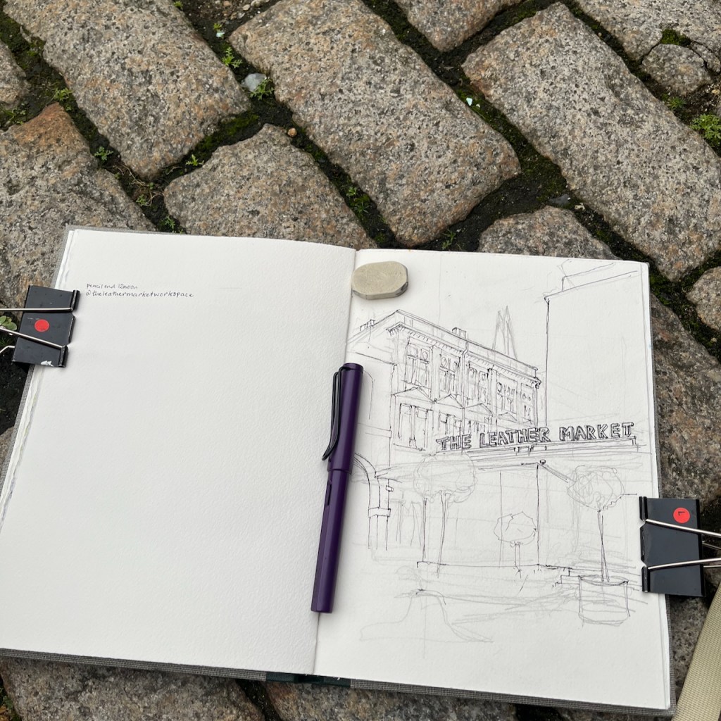
Working on a sketch of The Leather Market. Pen: Lamy Safari fountain pen
We returned our coffee cups to the friendly café, and set off to explore more of Bermondsey. By the time we emerged out through the arch, the delivery vans had gone from the front of the building.
Thank you to Toby and his team from Skinners Café for making us so welcome!
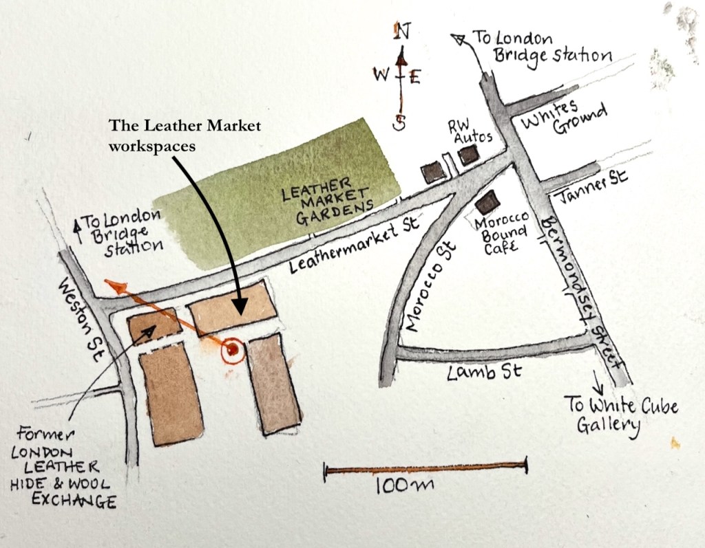
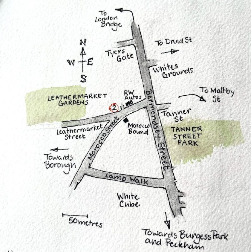
Here’s a map:
Map showing the viewpoint in the sketchThe Leather Market workspaces – page spread, Sketchbook 16
Colours, all Daniel Smith watercolours:
Fired Gold Ochre for the bricks
Burnt Umber and Ultramarine Blue for the grey and blacks
Serpentine Genuine for the greens
Some Transparent Pyrrol Orange and Mars Yellow for the light indoors
all the whites are the paper, fine lines achieved using masking tape and rubber resist.
My pen is a Lamy Safari with EF nib, and De Atramentis Document Black waterproof ink. Paper is Arches Aquarelle 300gsm CP, in a book made by Wyvern Bindery of Hoxton
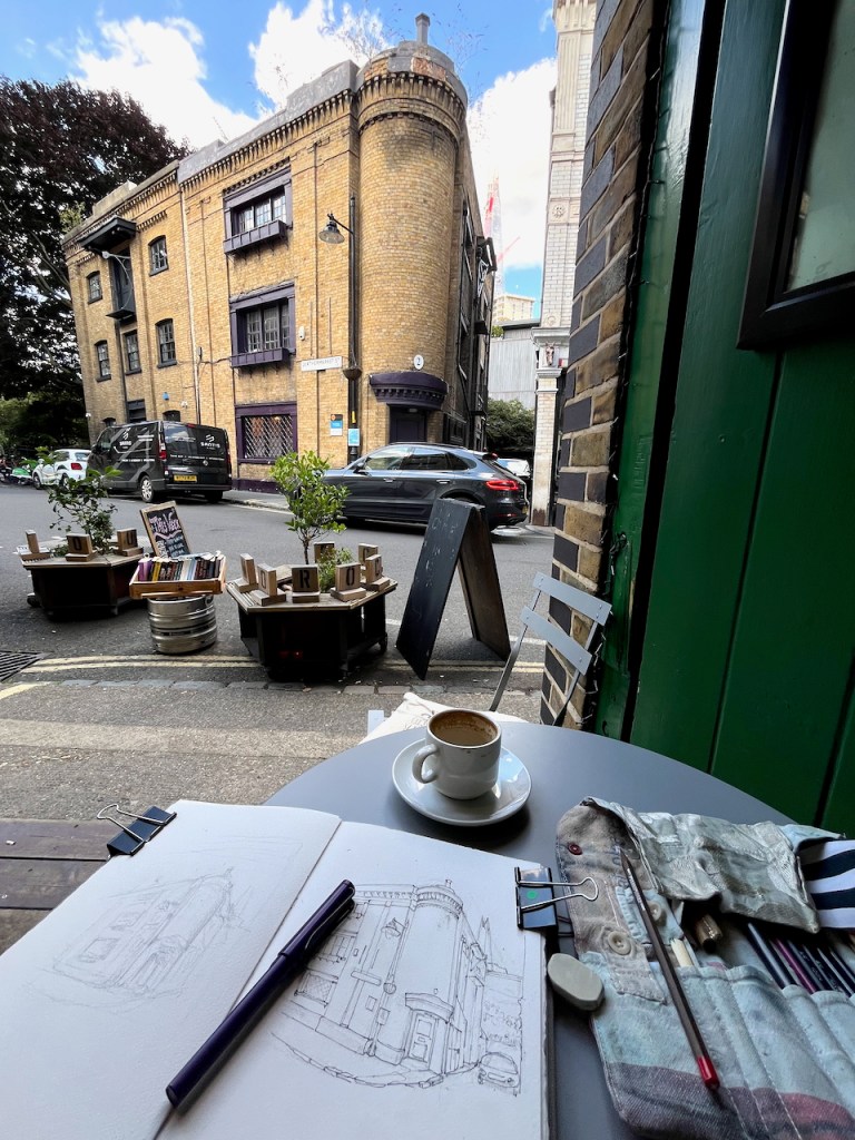
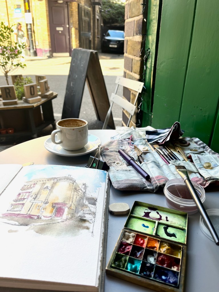
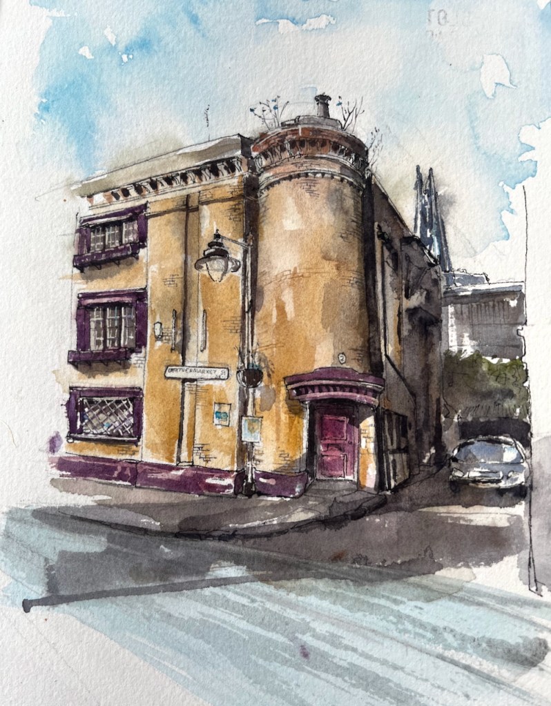
From the café “Morocco Bound” I sketched the distinctive building across the street. This is 2 Leathermarket Street: In the distance you see The Shard, at London…
From the café “Morocco Bound” I sketched the distinctive building across the street.
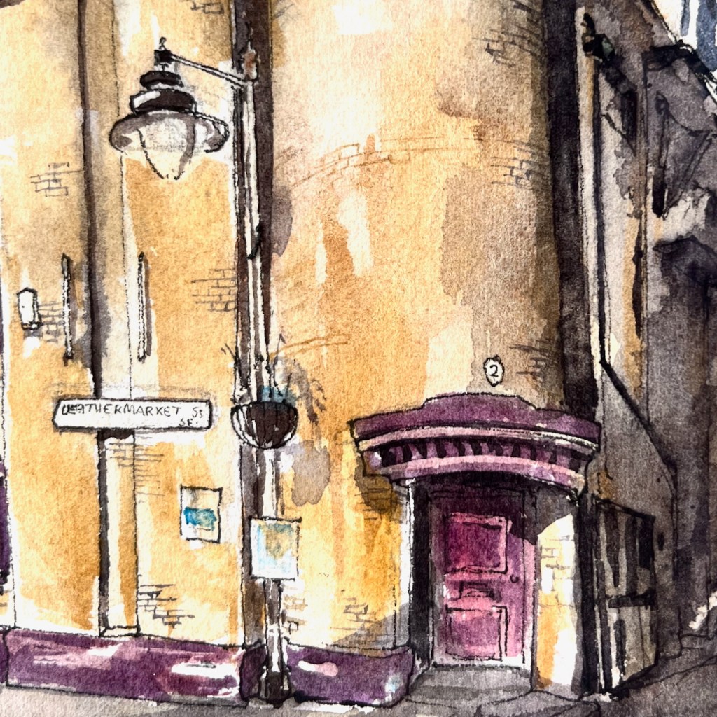
This is 2 Leathermarket Street:
2 Leathermarket Street, London SE1 3HN. Sketched 5th September 2025 in Sketchbook 16
In the distance you see The Shard, at London Bridge Station.
This was the leathermaking district up to the beginning of the twentieth century. We have Leathermarket St, Morocco St, and Tanner St. The former “Leather Hide and Wool Exchange” is further up Leathermarket Street, towards Borough, to the west.
The building was listed Grade II in 1972. It is early 19th century, according to the listing.
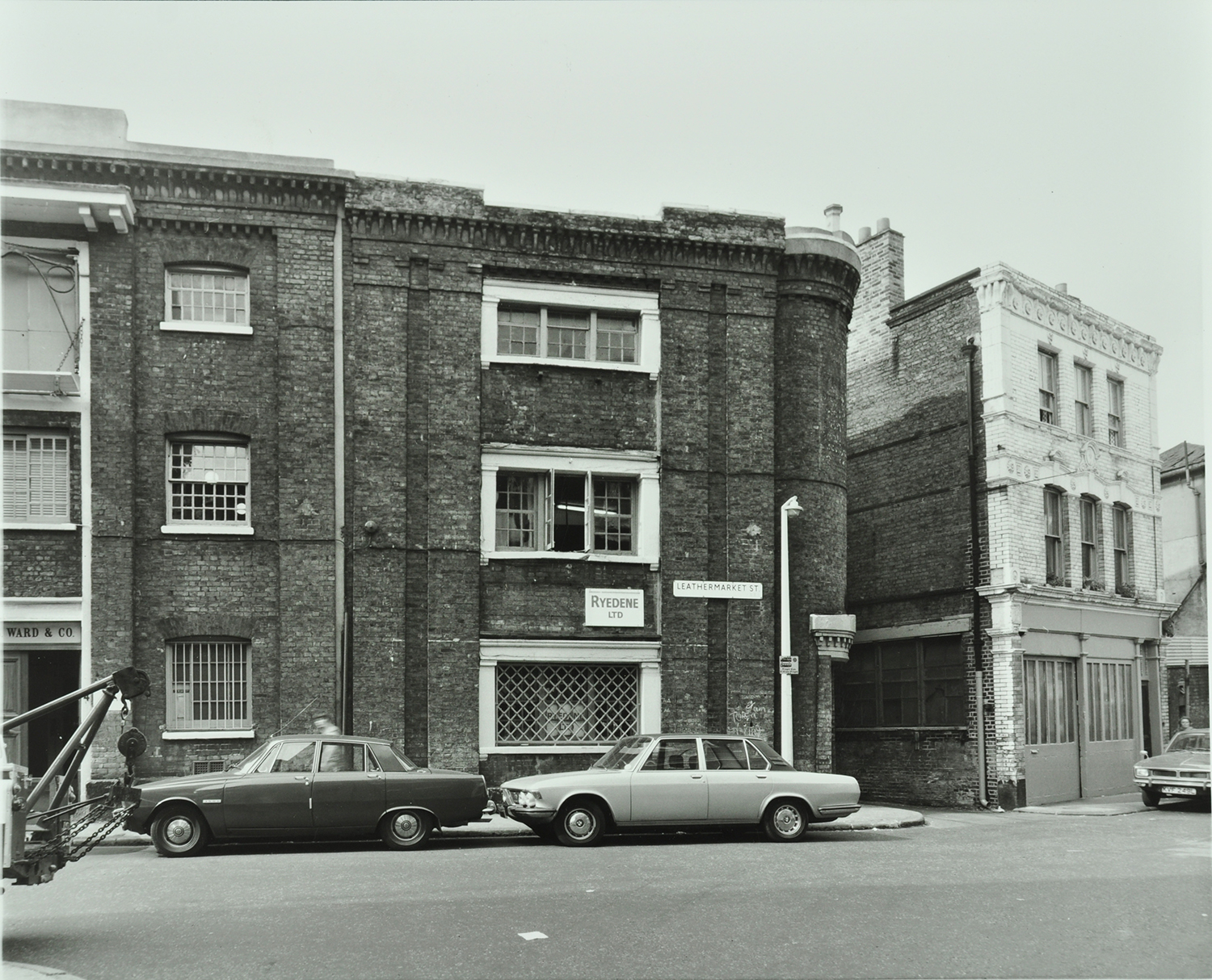
Here is the area in 1976, in a picture from the London Archives, used with permission:
The windows are all still there as in 1976, with the same window frames, now painted purple. Even the weird little chimneypot on the top of the turret is still there, as it was 50 years ago. In this 1976 picture the placard between the windows says “Ryedene Ltd” but I have been unable to discover if this company was in the leather business. There is no placard now.
“The Department” now occupies this building. Their business, according to their website, is:
combining cutting edge technology with humanising theatrics to create experiences which are technically masterful and purposely human”
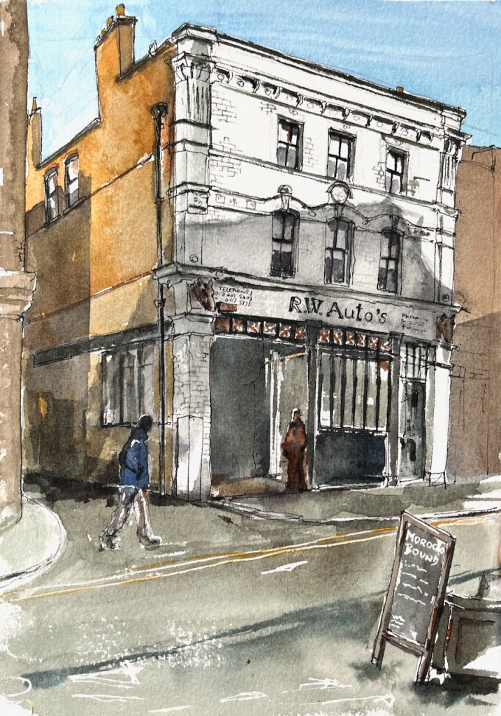
To the right of 2 Leathermarket Street is a garage, “R.W. Auto’s” which I have sketched previously:
2 Morocco Street, sketched from “Morocco Bound”, 18th October 2024, 2pm in Sketchbook 15
Thank you to “Morocco Bound” for their hospitality while I sketched these pictures. It’s a calm and welcoming bookshop and café in an interesting location. I’ll be back!
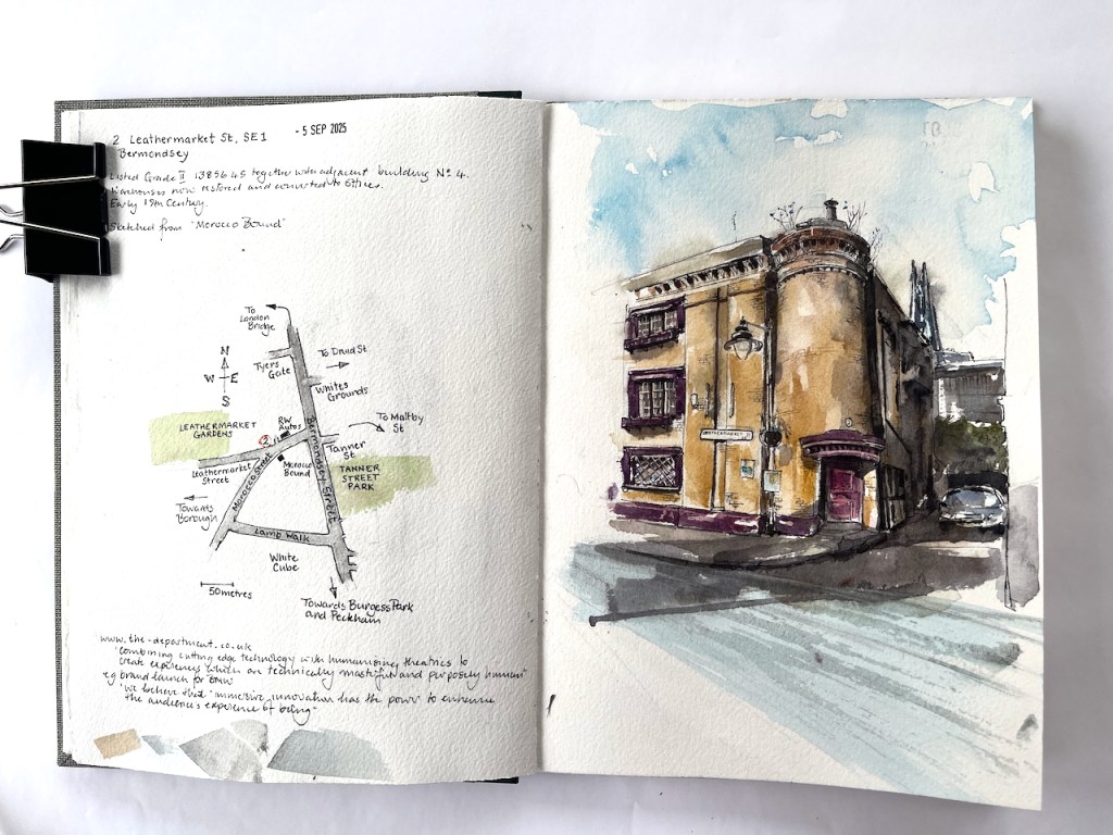
Page spread, Sketchbook 16
Click a button below to share this post online, email it, or print it:
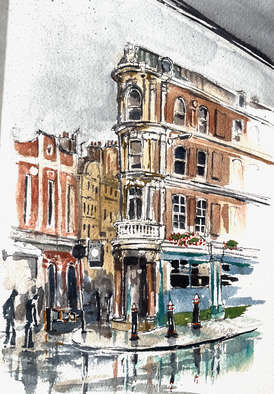
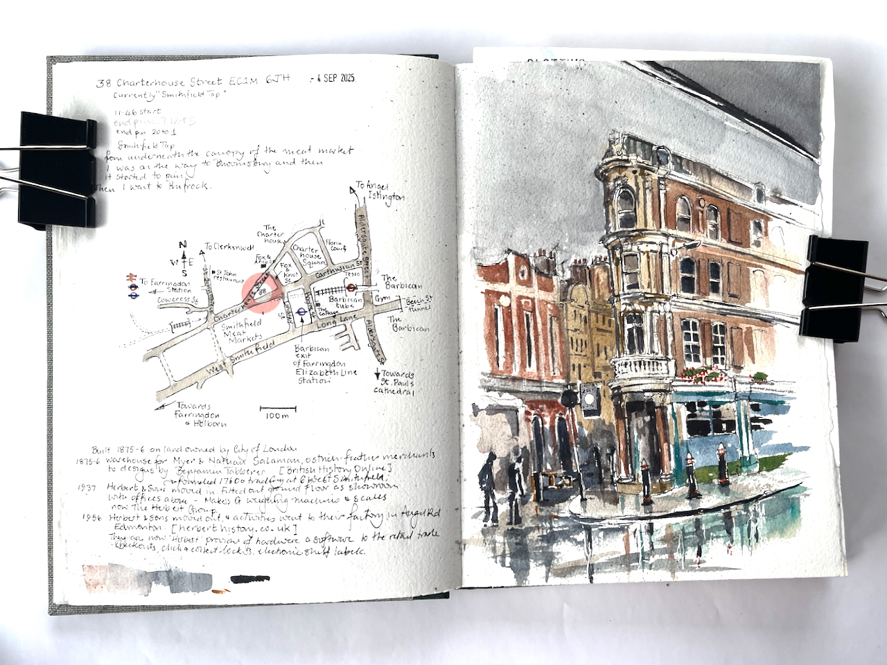
My idea that day was to sketch some interesting corner pubs in Bloomsbury.
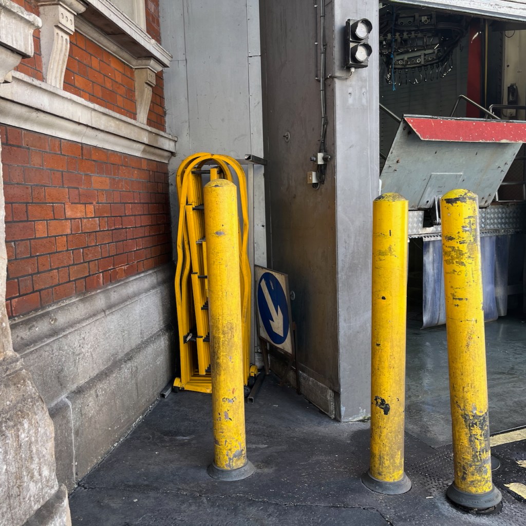
By the time I had emerged from my flat and was on the street, the bright autumn day had turned stormy. After a few paces, the rain started falling. Everyone dashed for cover. I sheltered in a doorway, together with another woman, two strangers in a refuge, grinning and rolling our eyes. “Well, it is September”. At a pause in the deluge, we both emerged and went our separate ways. I went doggedly towards the West, but no, the rain returned, seemingly even more torrential. I dashed from doorway to doorway, like a fugitive in a spy novel, finding cover where I could. Then I spotted the generous overhang of Smithfield Market and rushed underneath, the rain spattering on the glass above. There was no sign of the deluge ceasing, so I considered, as you do in these strange interim conditions: to go on? to go back? Or to stay where you are?
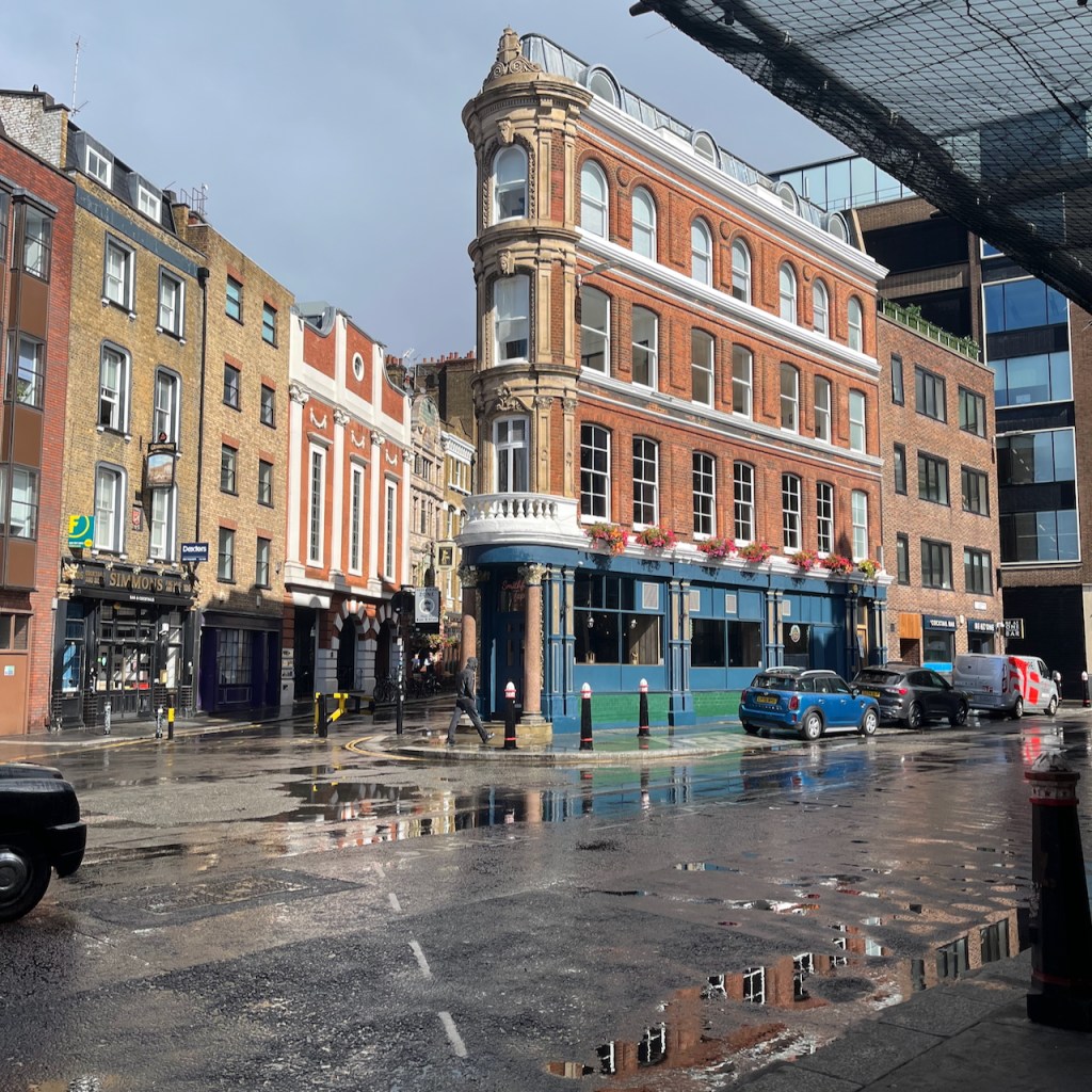
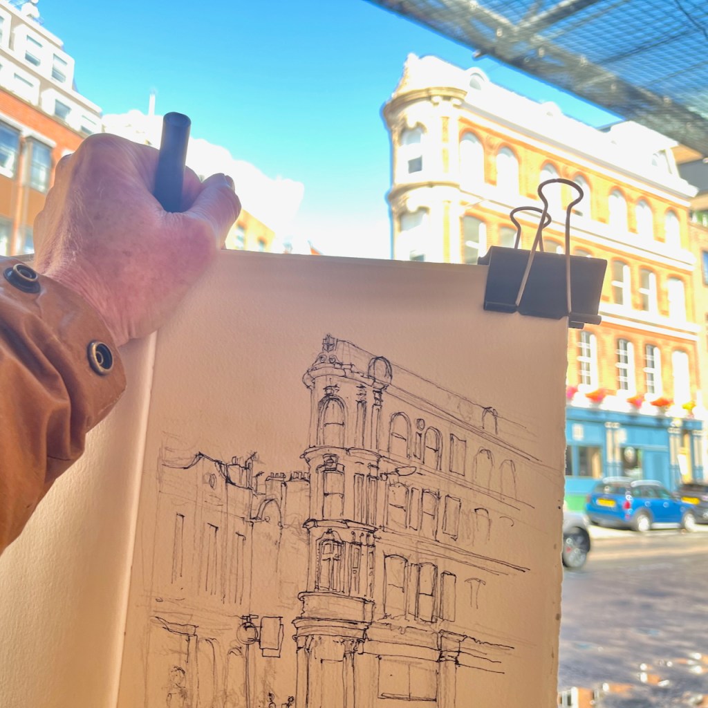
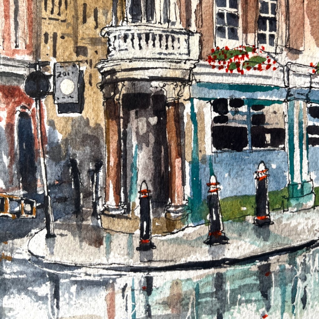
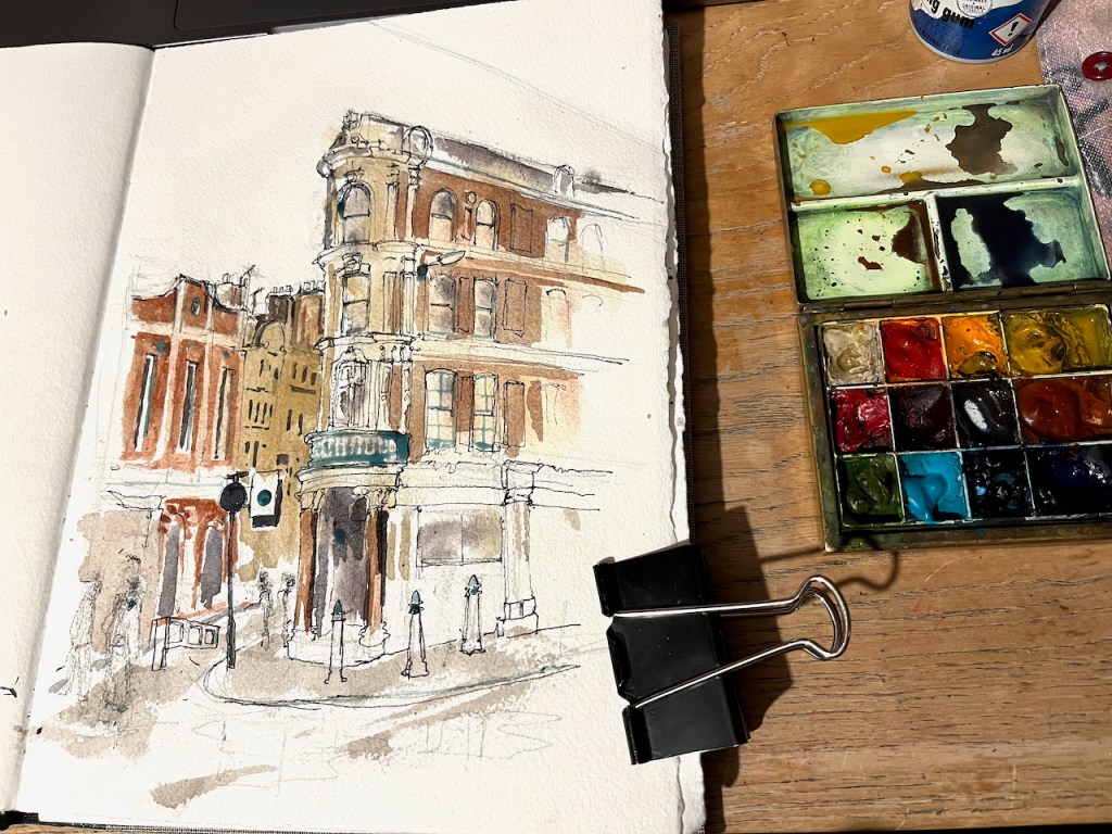
Why not do the drawing right here? Over the other side of the road is a building occupying an acute angle between roads. It wasn’t in my plan, but by this time I had abandoned my plan. So here is 38 Charterhouse Street, sketched from the shelter of the Smithfield Meat Market canopy.
38 Charterhouse Street, EC1M 6JH sketched 4th September 2025 in Sketchbook 16
I sketched it in pen on location. Part way through the process, a group of workers started to clean the area behind me, using high-pressure water hoses. A fine mist appeared in the air, adding to the general dampness. I finished the drawing later that evening, in my warm dry room.
38 Charterhouse Street, photoDrawing in progress on locationDetail of finished drawingThis was where I was standing to sketch, this area was cleaned with high-pressure water hoses.
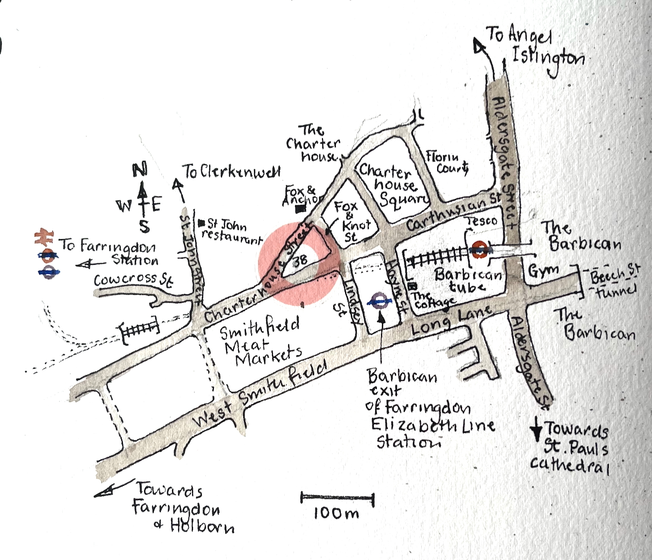
Here is a map.
As you see, number 38 stands on a little triangle of land, bounded by Charterhouse Street, Carthusian Street and the tiny alley called Fox and Knot Street.
British History Online offers some history for this triangular plot. In the 1860s the City of London redeveloped the Smithfield Meat Market. At the time it had been mostly an open-air market. The City turned it into the covered market it is today. The surrounding lanes and buildings were also affected, both by the redevelopment and the increased trade.
In 1869–70, with the new market building complete, it was resolved to take the new road along the north side of the market further east into the square itself, carried out in 1873–4. The road was called Charterhouse Street, apparently at the suggestion of the Charterhouse, Whereas in 1860 Charterhouse Lane enjoyed a mix of businesses, in 1876 half of the sixteen surviving houses were occupied by meat and poultry traders. The same trades dominated the new buildings put up, though there were also coffee rooms to rival the two remaining pubs and a large bank at the corner with St John Street. By the time of the Second World War most of the buildings west of the Fox and Anchor at No. 115 were purpose-built cold stores. Only with the decline of Smithfield Market did the grip of the meat trades loosen. Today restaurants and bars have largely supplanted them.
The Fox and Anchor pub and the former cold stores are on the left of my drawing. I’ve drawn the marvellous frontage of the Fox and Anchor here.
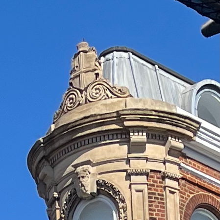
British History Online describes the block on the corner, number 38:
The City of London arms on the building today.
The remnant of ground at the angle between the old and new roads was laid out for a small block of buildings and allotted the numbers 38–42 (even) Charterhouse Street, behind which a tiny street, Fox and Knot Street, was cut through in 1871. The name was taken from Fox and Knot Yard, a court obliterated by the new market.
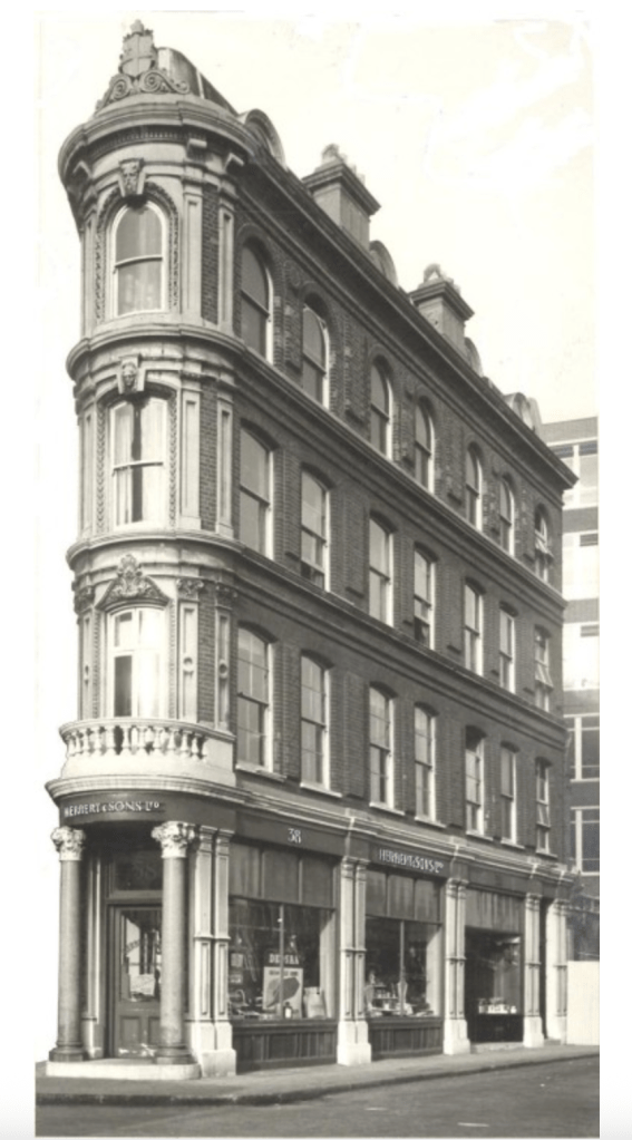
The small triangular block west of Fox and Knot Street […] just within the City boundary, belongs to the land acquired by the Corporation of London in the 1860s for the Smithfield Market development. Set out for building in 1871–2, it remained empty until 1875–6. At the apex a warehouse (No. 38), was then built for Myer and Nathan Salaman, ostrich-feather merchants, to designs by Benjamin Tabberer. […] It is four storeys high, of red brick with regular fenestration; all the ornamentation is concentrated on the narrow corner. For many years there were coffee-rooms here.
So, in 1875 it was an ostrich-feather warehouse, which must have been a great place to visit. The next mention of the building is on the website of Herbert, a present-day supplier of technology to retail businesses. They have a section of their website devoted to their long history. In the early twentieth century they were supplying weighing machines and balances from their offices in West Smithfield and a factory in Edmonton.
Herbert and Son moved out in 1956 and consolidated their operations into their Edmonton site. Since then, the building has been a coffee house, and, more recently, various bars. It is now the “Smithfield Tap”.
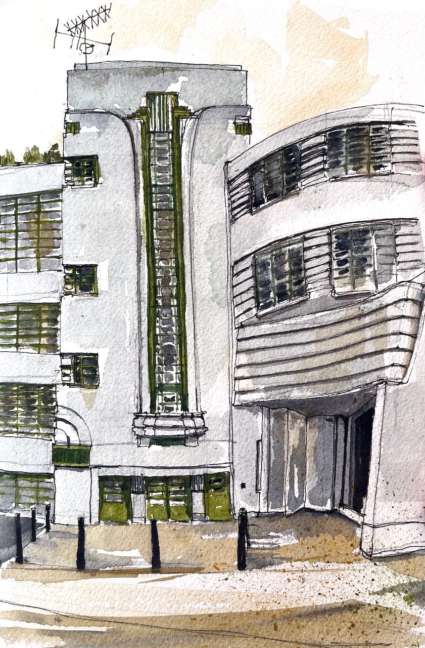
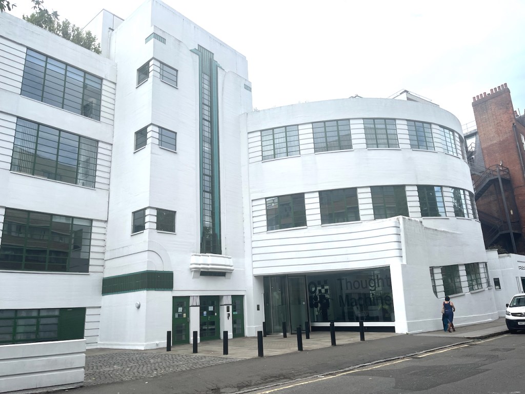
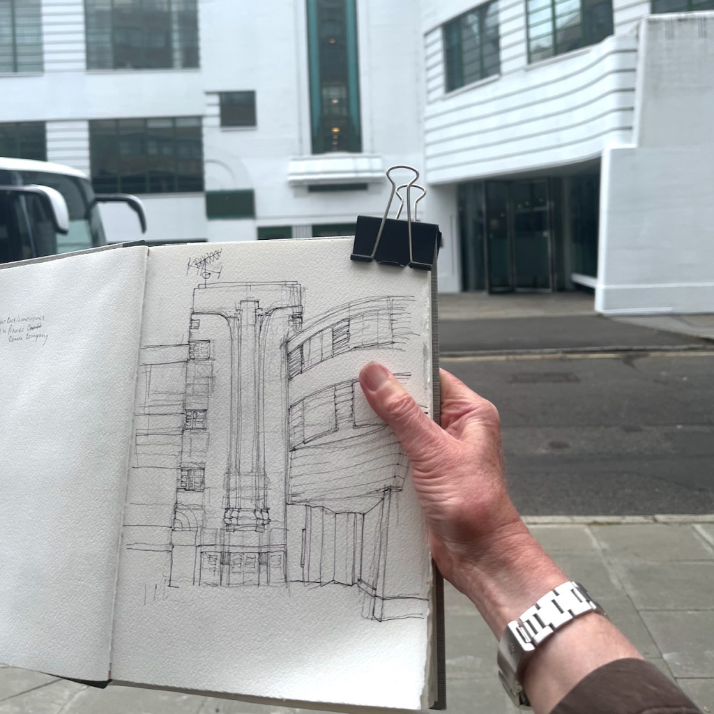
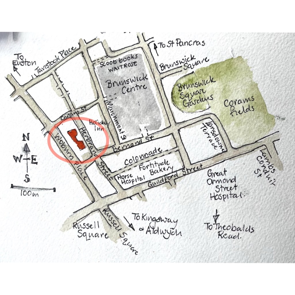
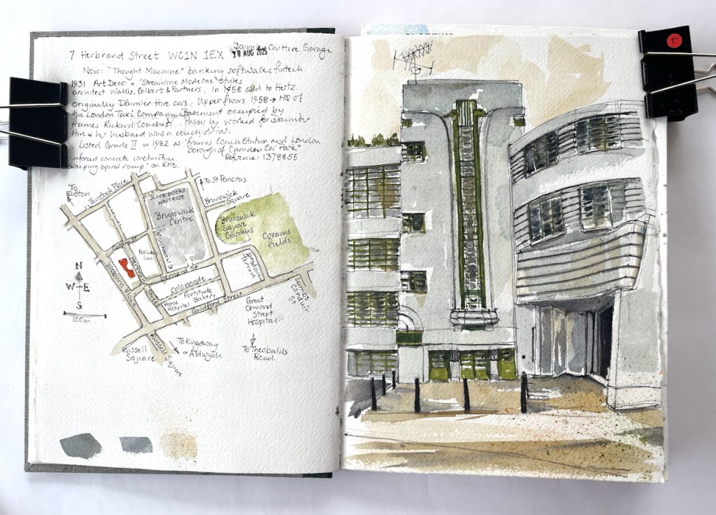
In a backstreet in Camden is a magnificent Art Deco building.
7 Herbrand Street WC1N 1EX, sketched 30 August 2025 in Sketchbook 16
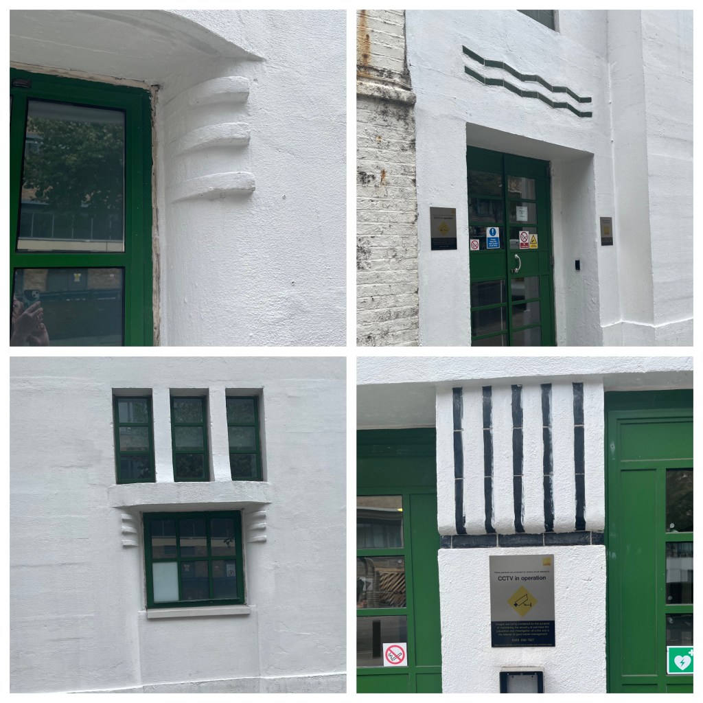
This was built of re-inforced concrete in 1931, to the designs of architects Wallis, Gilbert and Partners. The style is called “Streamline Moderne” and includes fun details.
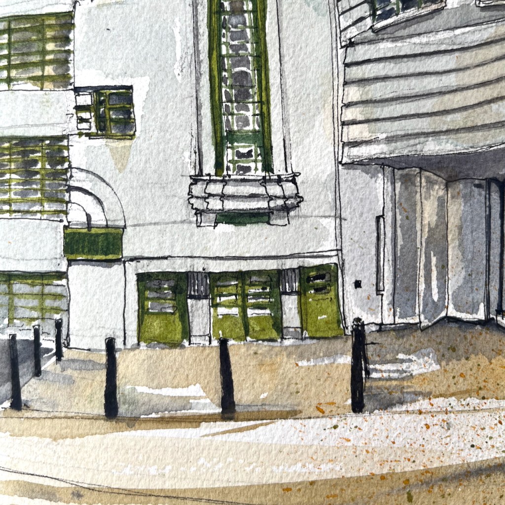
7 Herbrand Street, details
It was originally used as the headquarters of Daimler Hire Cars. It includes a spiral ramp, off to the right of my picture. This was where the cars entered and drove up to the garage.
General view of 7 Herbrand Street showing the former garage entrance (centre right). The spiral ramp was in the curved part of the building to the right.
As I was sketching, a passer-by approached me to tell me the history of the building. She worked for Daimler Hire, in the offices on the upper floors. Her husband was a driver, she told me. Later the building was used as the headquarters of the London Taxi Company, and by Hertz car rentals. The basement was occupied by Frames Rickard Coaches.
The building was listed Grade II in 1982, number 1378855. The listing calls it “Frames Coach Station and London Borough of Camden Car Park”. It is now occupied by a fintech company called “Thought Machine” who provide banking software. The spiral ramp has been removed.
This building with its curves was tricky to draw and took me a long time. The person who had approached me to describe the history returned back up the street. She held out a hand containing fresh hazel nuts she had collected from the pavement. “I don’t think Camden Council realise they have planted hazelnut trees” she said.
Once the pen drawing was finished, I ate a sandwich from nearby Fortitude Bakery, and walked home to finish the drawing at my desk.
Sketchbook 16
Click a button below to share this post online, email it, or print it:
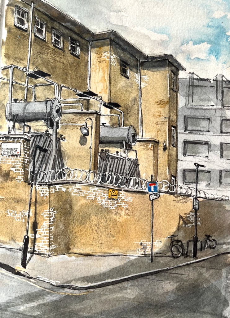
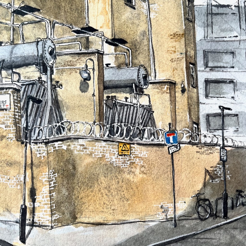
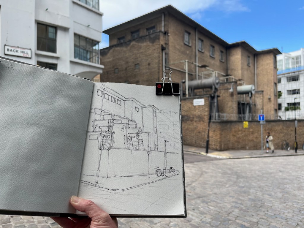
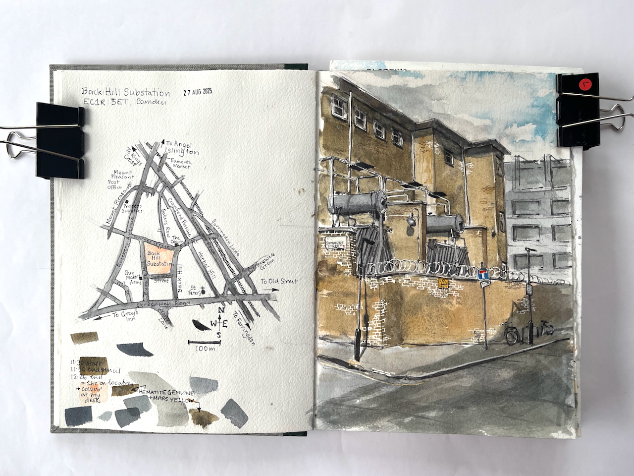
This imposing building presides over an entire block, in the back-streets of Camden. I’ve admired its austerity and unadorned walls, amongst the much more elaborate buildings around. This is an electricity substation, very functional. I’d noticed it while sketching The Coach, a nearby pub.
Back Hill substation, EC1R 5ET, sketched 27 August 2025 in Sketchbook 16
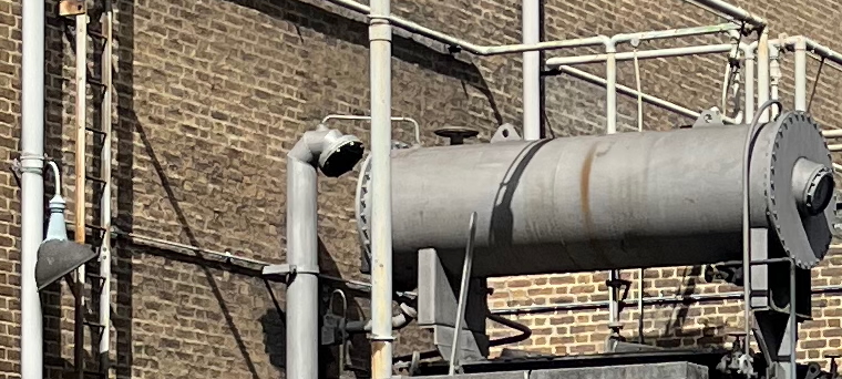
There were many more pipes and connectors than I could fit into the drawing. They all looked important. This is a serious building. The sign on the wall says “Danger of Death”. But the pipework has a certain lighthearted steampunk appeal. The arrangement has lamps, ladders and valves in odd places, and inexplicable vents, as though it might huff and exude puffs of steam. But when I saw it, the whole structure was silent and still.
“silent and still”
The building is from the 1950s.
This complex dates mostly from 1956–7, when the London Electricity Board extended an earlier yard established in the late 1920s by its predecessor, the London County Council’s County of London Electric Supply Co. The 1950s buildings, designed by the LEB’s Architect’s Section, are of reinforced-concrete and steel frame construction with elevations of buff-coloured brick and glass block. They match the original building in the southeastern corner of the site ….
‘West of Farringdon Road’, in Survey of London: Volume 47, Northern Clerkenwell and Pentonville, ed. Philip Temple (London, 2008), British History Online https://www.british-history.ac.uk/survey-london/vol47/pp22-51 [accessed 11 September 2025].
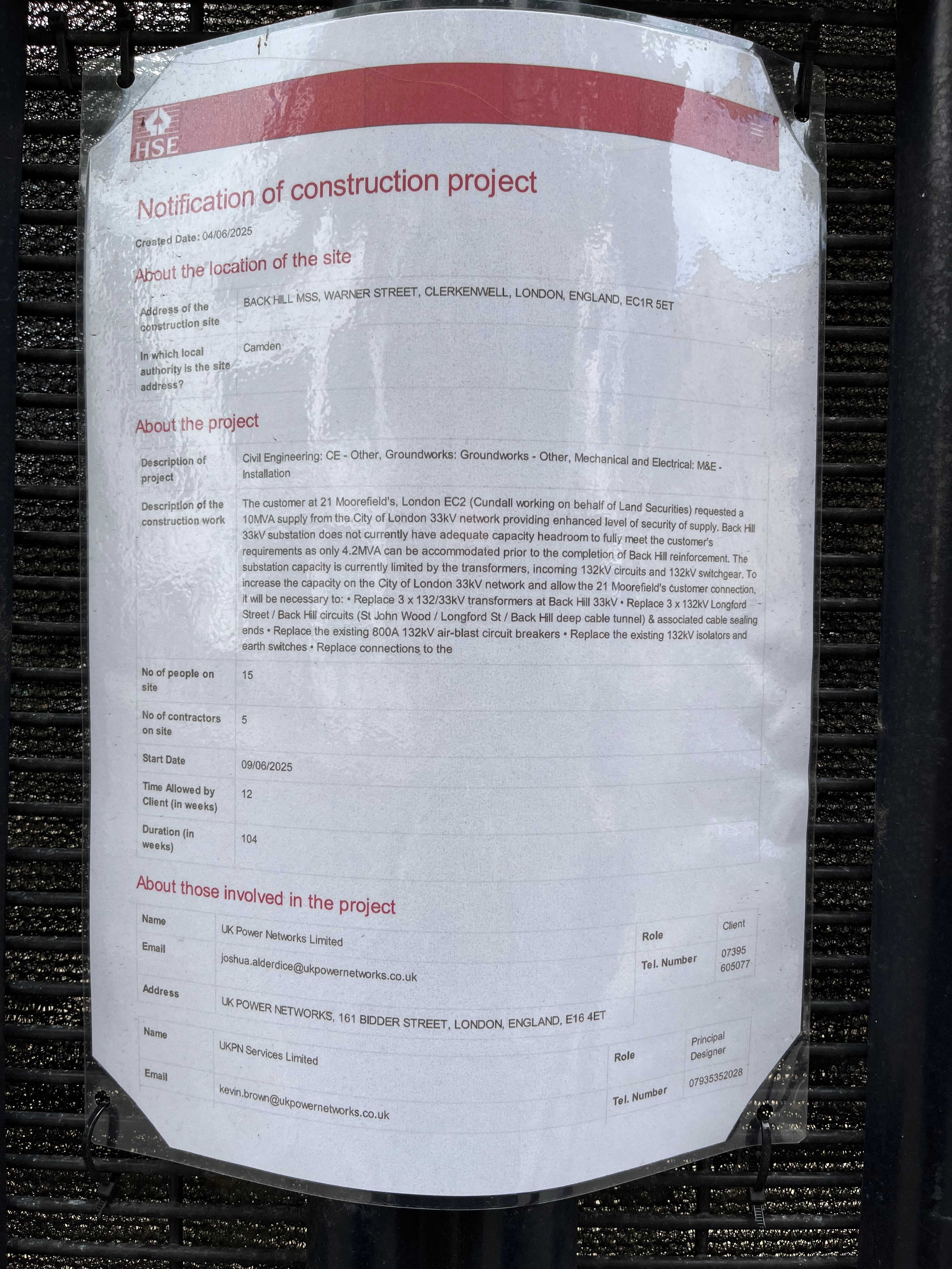
The planning notice on the gate: click to enlarge
It is very much in active use and currently being enhanced. Planning notices fastened to the main gates informed me that: “The customer at 21 Moorefield’s [sic], London EC2… requested a 10MVA supply from the City of London 33kV network providing enhanced level of security of supply.” They don’t want any fluctuation in the power supply, then, and no power cuts.
At the moment: “Back Hill 33KV substation does not currently have adequate capacity headroom to fully meet the customer’s requirements…” and “The substation capacity is currently limited by the transformers, incoming 132kV circuits and 132KV switchgear..”
So they have to replace the transformers, cabling and switchgear, to “allow the 21 Moorefield’s customer connection,” the notice says.
21 Moorfields is the building above Moorgate Elizabeth line station, just to the East of the Barbican.
21 Moorfields, from the Barbican Highwalk under Willoughby House.
“Electrical Contracting News” provides a more general description:
Almost 10,000 customers from Farringdon, Clerkenwell and key buildings in City of London are to benefit from a multi-million pound investment to upgrade the electricity network.
Work is currently underway to install the first of three new transformers – a device which steps down the power voltage so electricity can be safely delivered to local properties. The transformer, along with new switchgear equipment, will be installed at UK Power Networks’ substation to meet greater energy demand in the area. The £24 million project started in October 2021 and is due to finish in early 2026. As part of the scheme, the firm has consulted local councils and other interested parties to ensure that people experience as little disruption as possible while the work takes place. Euan MacRae, Project Manager at UK Power Networks, says: “This substation upgrade is part of our ongoing investment in the network to maintain safe and reliable power supplies and future-proof the network. The City of London is home to some of the capital’s most iconic buildings, so in collaboration with our alliance partner The Clancy Group this project is committed to carrying out a staged replacement of the major electricity assets at Back Hill Substation, some of which date back to 1956 and have been well maintained over the years. “We are excited to be installing innovative equipment which will allow the substation to provide double the previous level of power and will improve the resilience of power supplies across the network in London.”
I was pleased with my sketch of the substation, and I enjoyed trying to follow the lines of the pipes.
I find it fascinating to realise that there is enormous work going on to keep the electricity flowing, with very little fanfare. There are these silent buildings sitting amongst the offices and flats, doing their job.
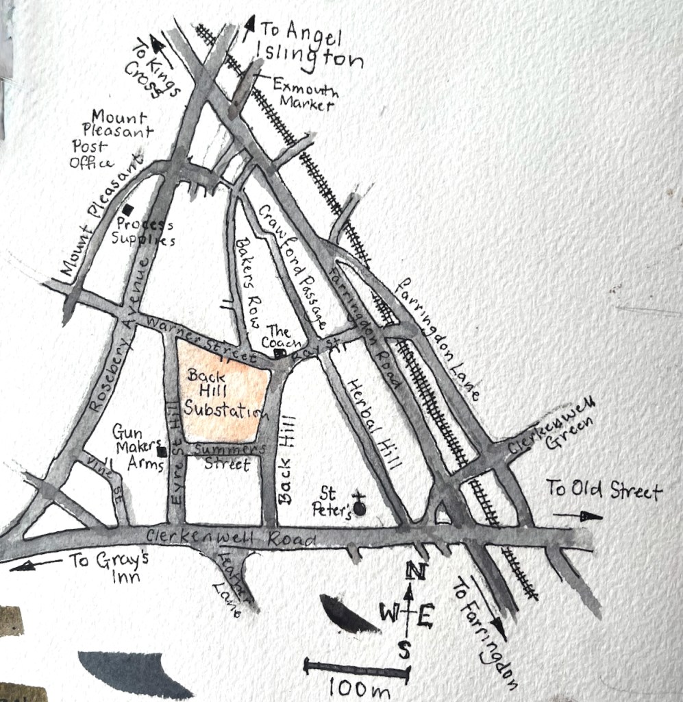
Here is a sketch map to show where the substation is:
The location of Back Hill Substation.Back Hill substation, page spread, Sketchbook 16
I’ve sketched the nearby pubs, the Gunmaker’s Arms here, and The Coach here.
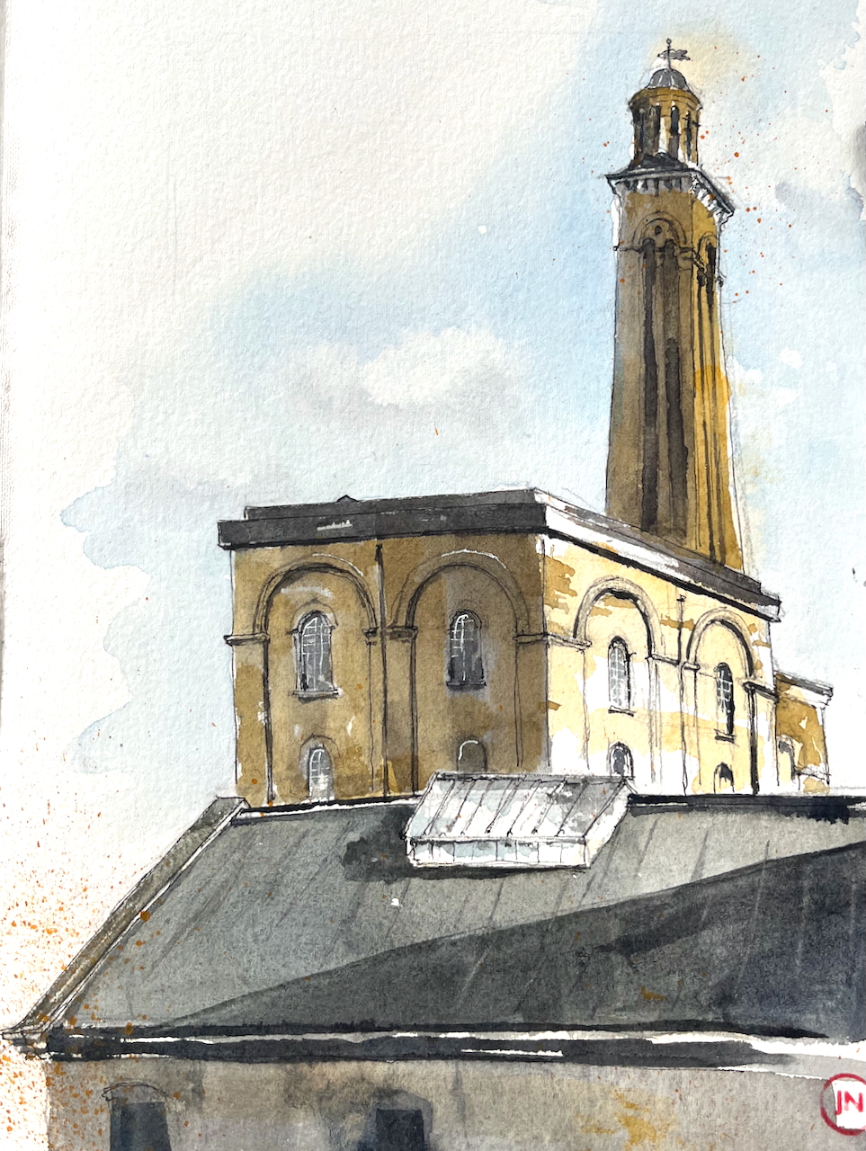
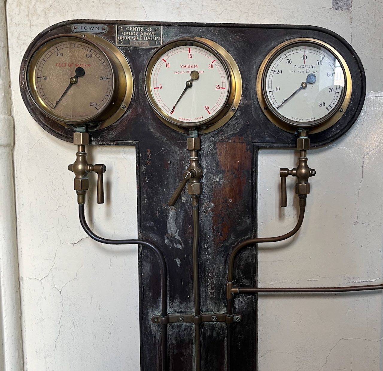
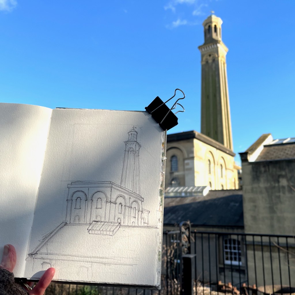
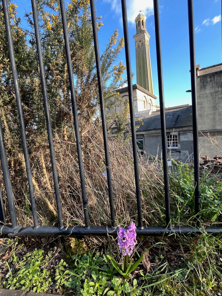
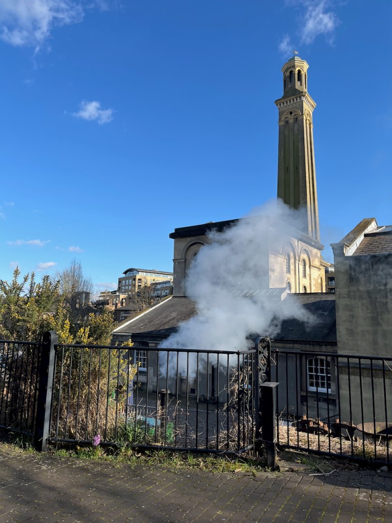
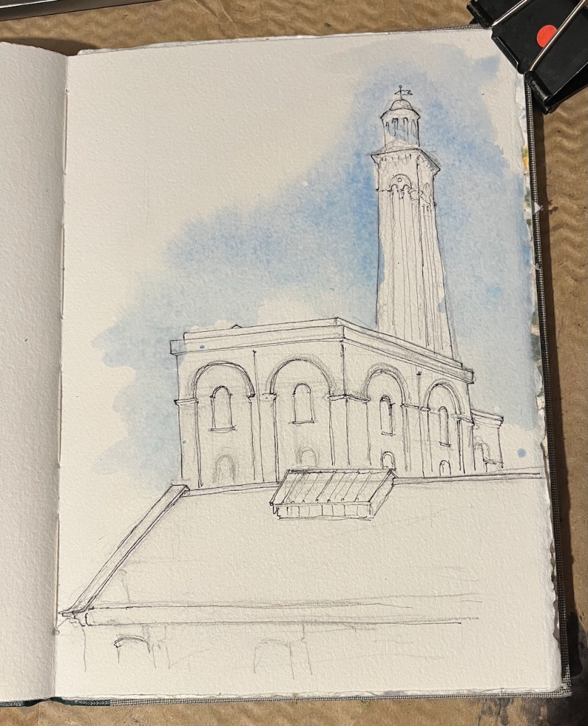
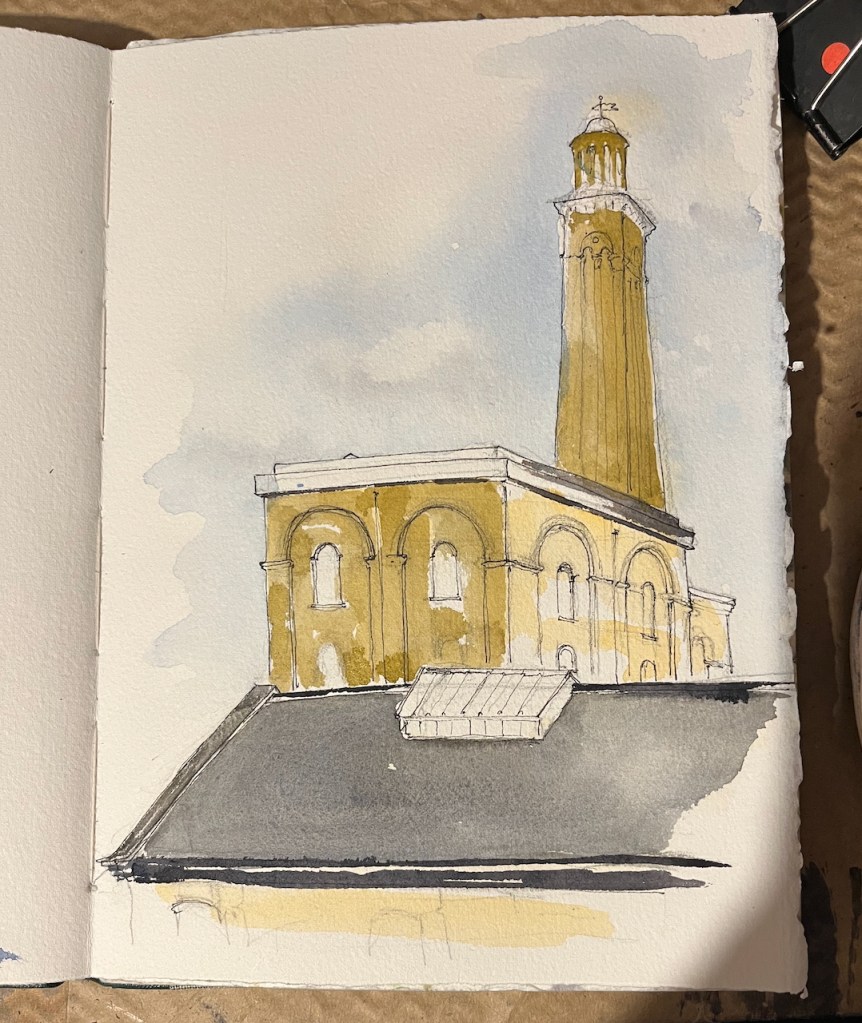
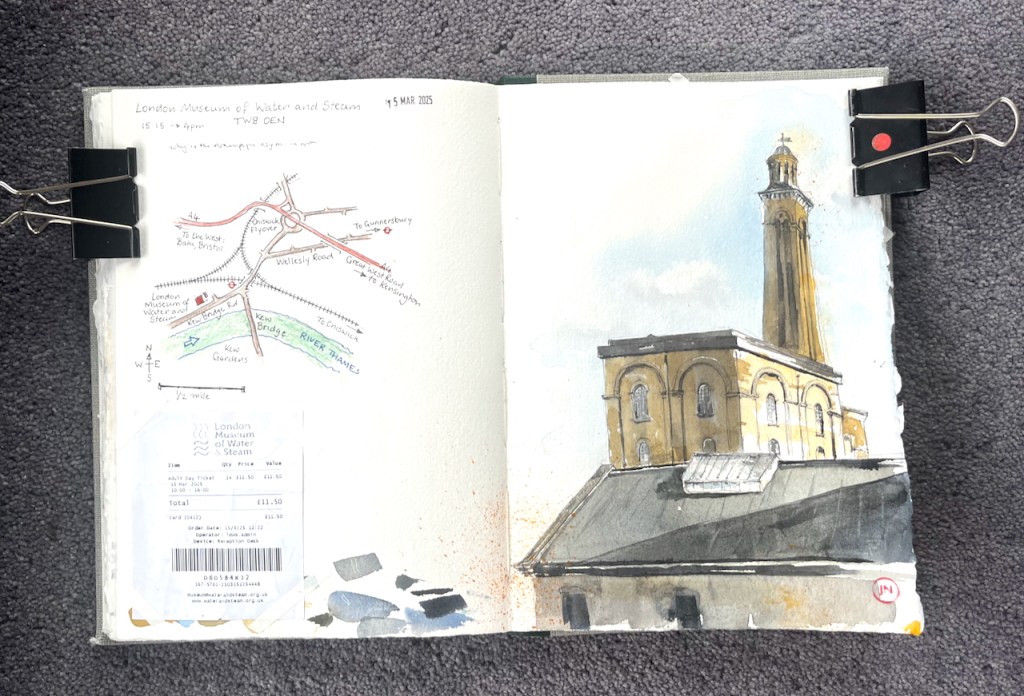
Here is the magnificent London Water and Steam Museum.
London Water and Steam Museum, sketched 15th March 2025, 4pm in sketchbook 15.
It’s definitely worth a visit if like me you are fascinated by steam engines. But there’s more. This museum is a whole education in the London drinking water and sewerage system: past and present.
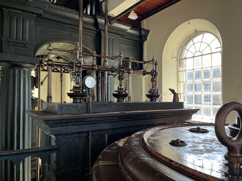
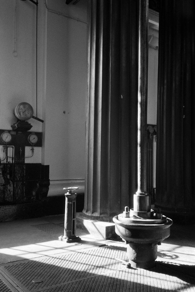
The building I’ve sketched houses the “100 inch pumping engine” and the “90 inch pumping engine”. These are steam pumps over a hundred years old. The inches refer to the diameter of the pump cylinder. Their job was to pump drinking water from the Thames to premises in London. The 90 inch engine started working in 1846 and the 100 inch started in 1871. They both retired in 1943, by which time the 90 inch had been going 97 years. The 100 inch gave a demonstration in 1958, which was the last time it pumped water. The 90 inch was restored to working order by enthusiasts in 1973, and now gives demonstrations in the museum. The 100 inch has yet to be restored.
A glimpse of part of the 100 inch engine
The tower in my sketch is not a chimney. It is a “standpipe tower”. It holds big vertical pipes and a reservoir to store water and regulate the pressure. The strokes from the steam engines created powerful surges of water. You don’t want those powerful surges going directly into the mains water supply, and as they might damage the pipes and surprise consumers. So the steam engines pumped the water up this tower instead. From there, the water flowed out to consumers smoothly.
Providing running water was a whole big problem in the Victorian era. The machines were gigantic so that they could generate sufficient water pressure to get the water up to the second floor of the new Victorian houses which had bathrooms upstairs. That’s not something we normally think about: but I can see it’s an issue.
a glimpse of the 90 inch engine
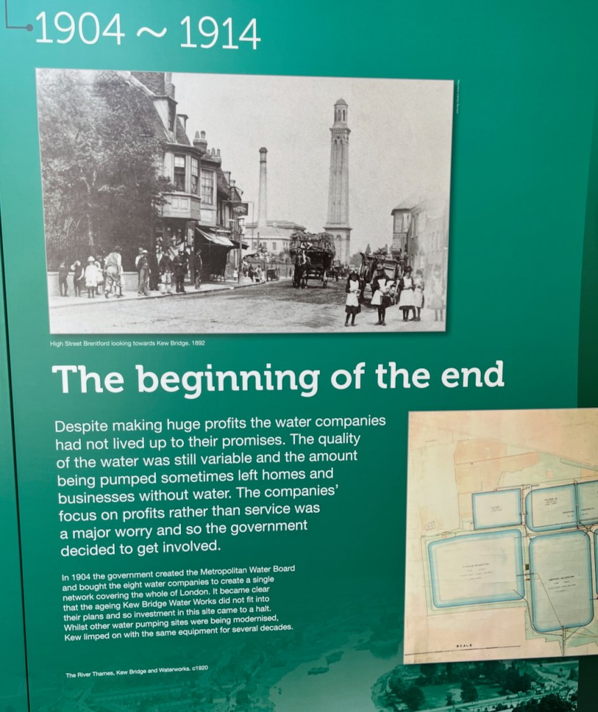
Then there was the whole big issue of the purity of the water, and whether it was actually drinkable. There were a number of private water companies at the time, in competition with each other, and vying for business, making claims for their water quality, and returning dividends to their shareholders. This was the late 19th century – 100 or so years ago.
A display panel soberly tells us:
“Despite making huge profits the water companies had not lived up to their promises. The quality of the water was still variable and the amount being pumped sometimes left homes and businesses without water. The companies’ focus on profits rather than service was a major worry and so the government decided to get involved. In 1904 the government created the Metropolitan Water Board and bought the eight water companies to create a single network covering the whole of London. …
Display panel: “The companies’ focus on profits rather than service was a major worry and so the government decided to get involved.…”
As well as history, I learned about today’s drinking water.
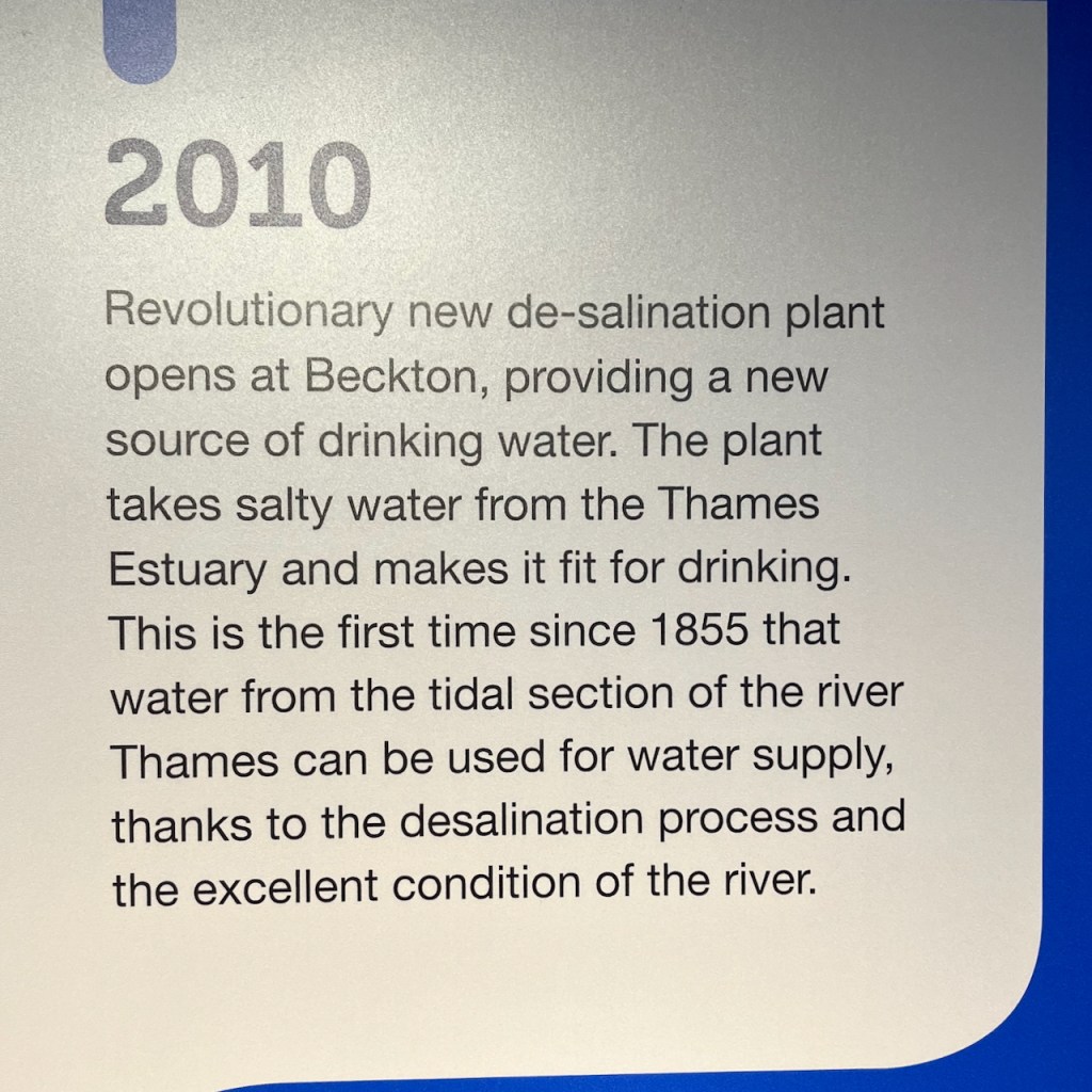
For example: did you know that 10% of London’s drinking water is de-salinated water from the Thames estuary? The “revolutionary new de-salination plant” opened in 2010:
I watched a gripping – and somewhat alarming – video of heroic engineers cautiously making their way down soaking brick-lined pipes in the sewers below London streets. They were down there to inspect and clear blockages. I also saw the “rat” robots that can be sent down the smaller sewers – it’s a tough environment for technology.
As well as all this gripping factual information, there’s much of strange beauty in the machinery. I particularly enjoyed the devices and dials.
Definitely recommended. It’s on the underground. No café: take a picnic to eat at their indoor tables.
It closes at 4pm – I managed to do the sketch from the garden, just before they closed the gates.
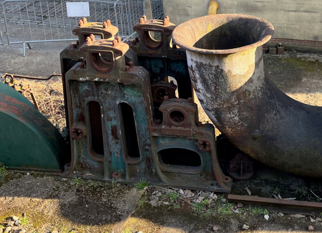
Sculptural debris in yardThe steam train in the grounds: returning to the shed at the end of the day.
I added the colour later.
Sketchbook 15Part of the 90 inch pump: analogue film photo, Olympus XA2 using Kentmere Pan 400 b/w film. 15th March 2025
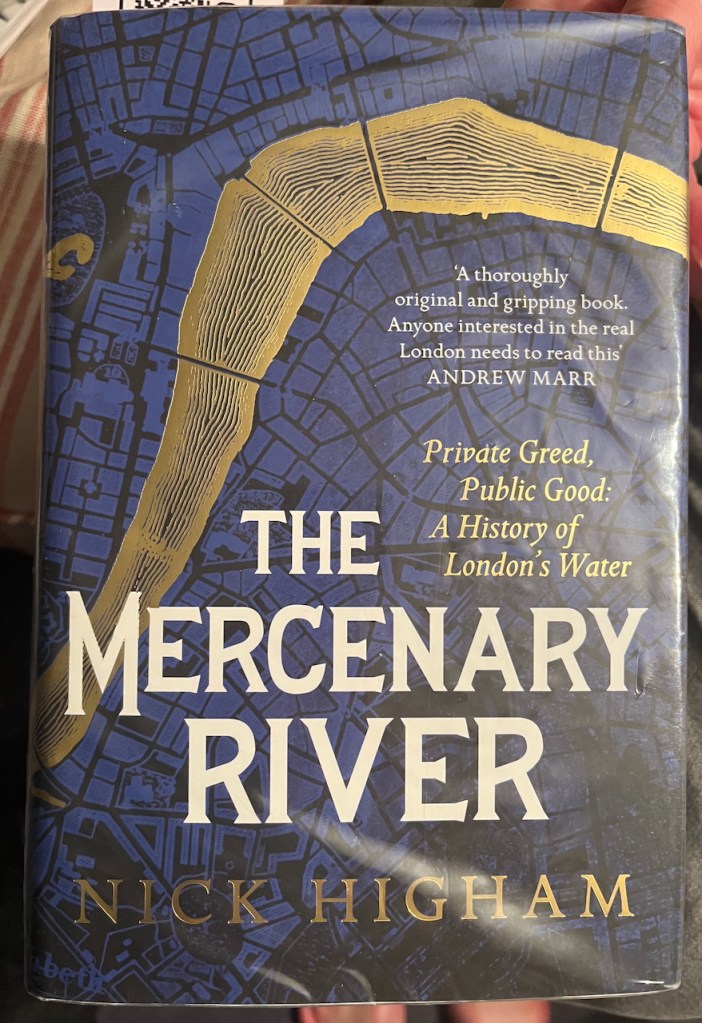
Information in this post is from placards in the museum or from their website. Inspired by my visit to the museum, I read this excellent book about London’s water supply:
“The Mercenary River” by Nick Higham
Click a button below to share this post online, email it, or print it:
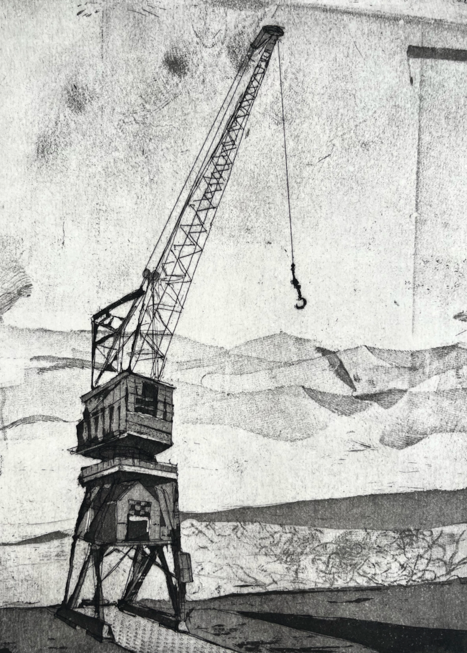
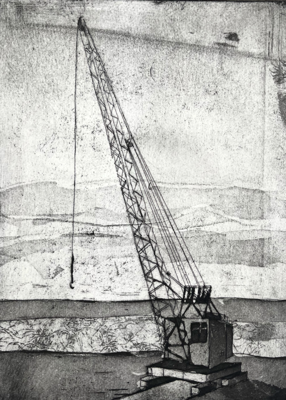
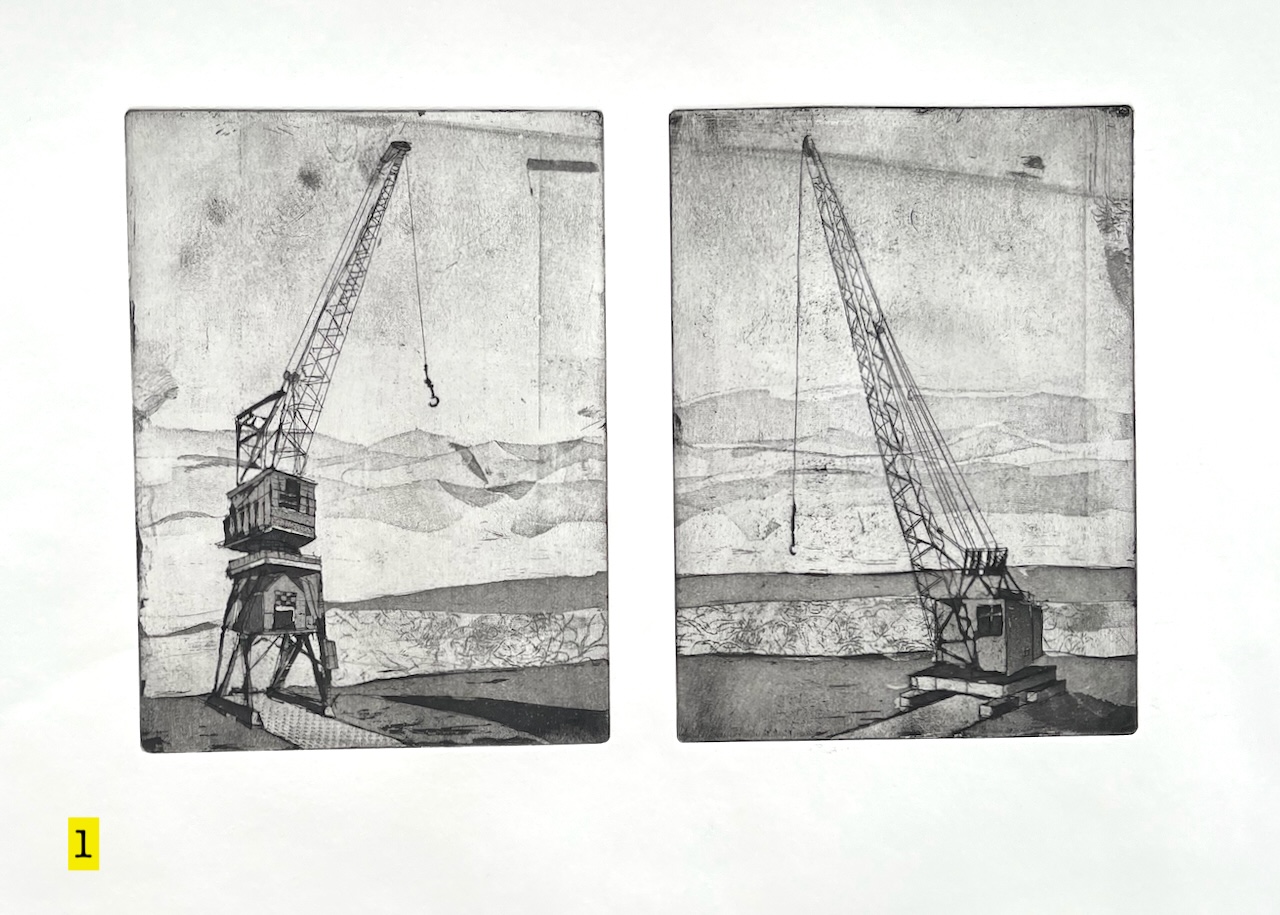
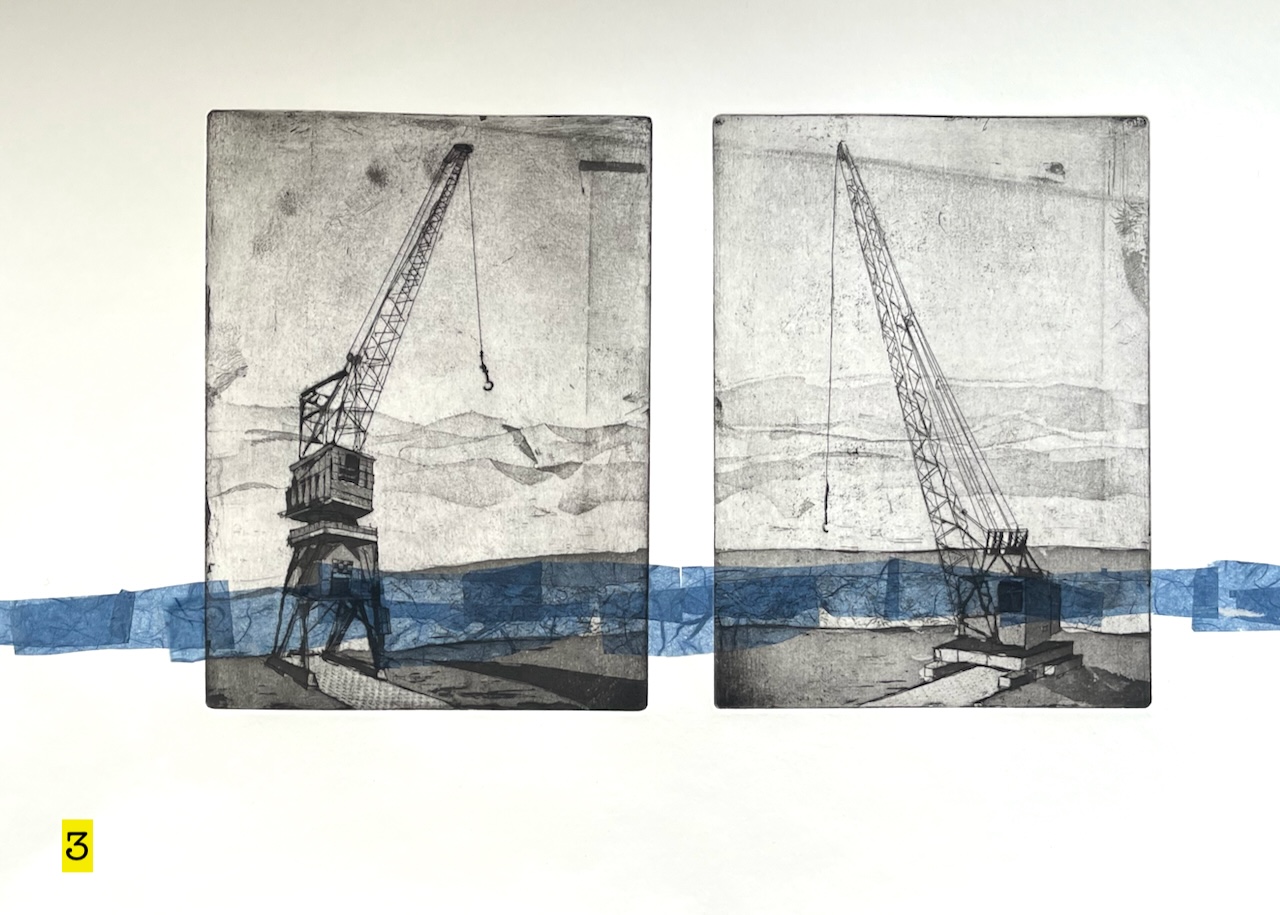
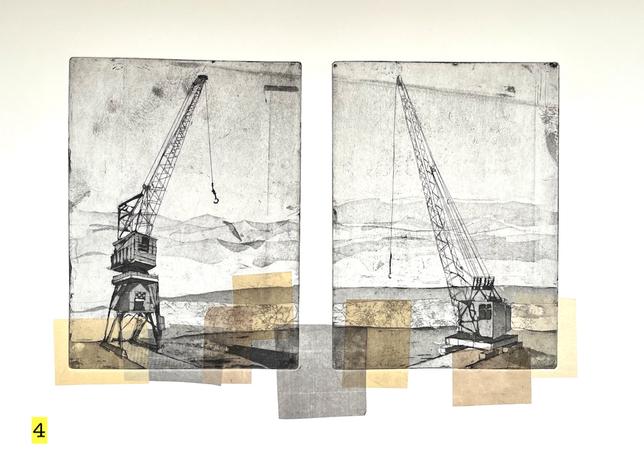
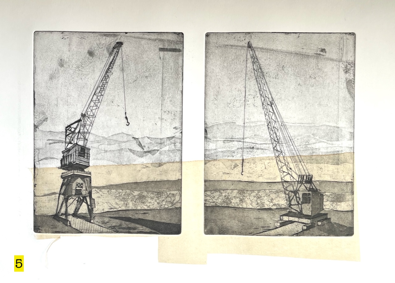
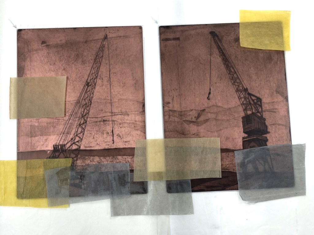
They stand by the river, ready for work. They are old cranes. It’s a long time since they lifted loads. But they hold themselves ready, should the call come. While they wait, they talk to each other.
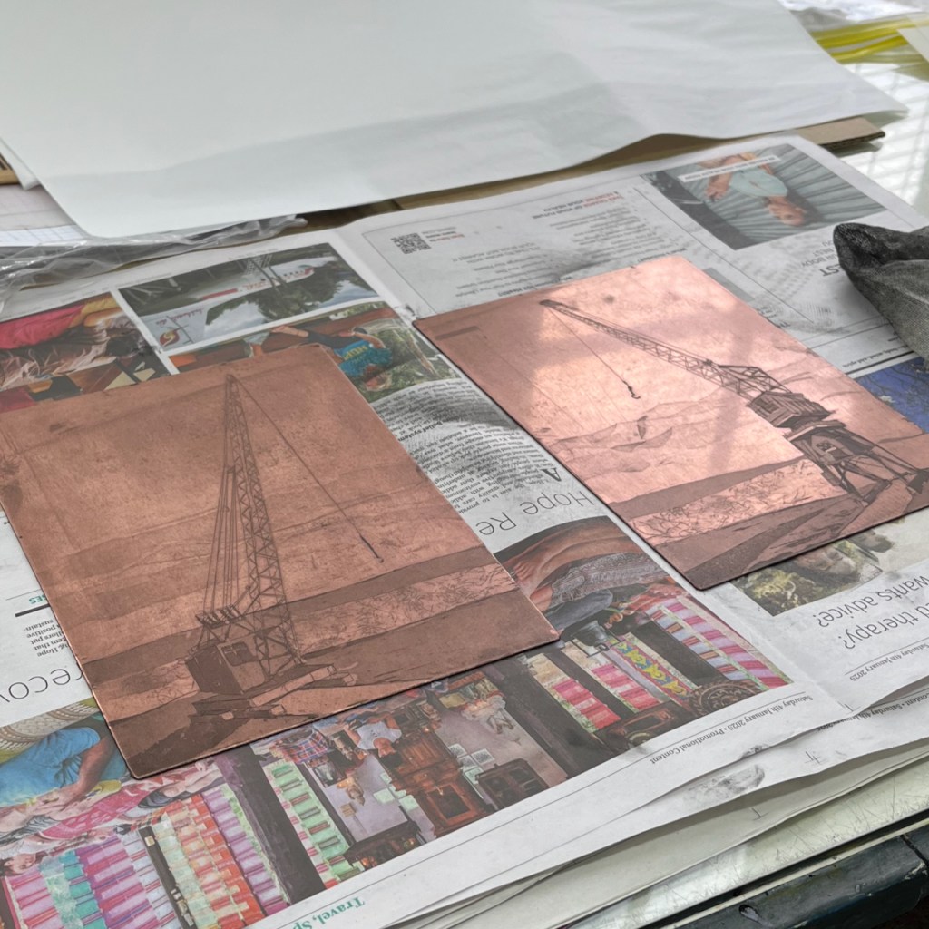
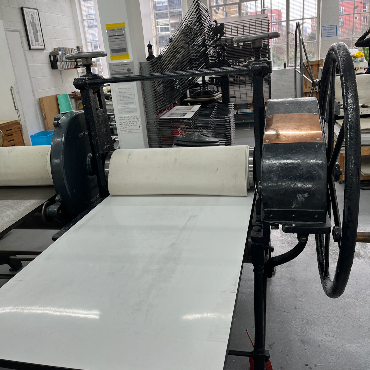
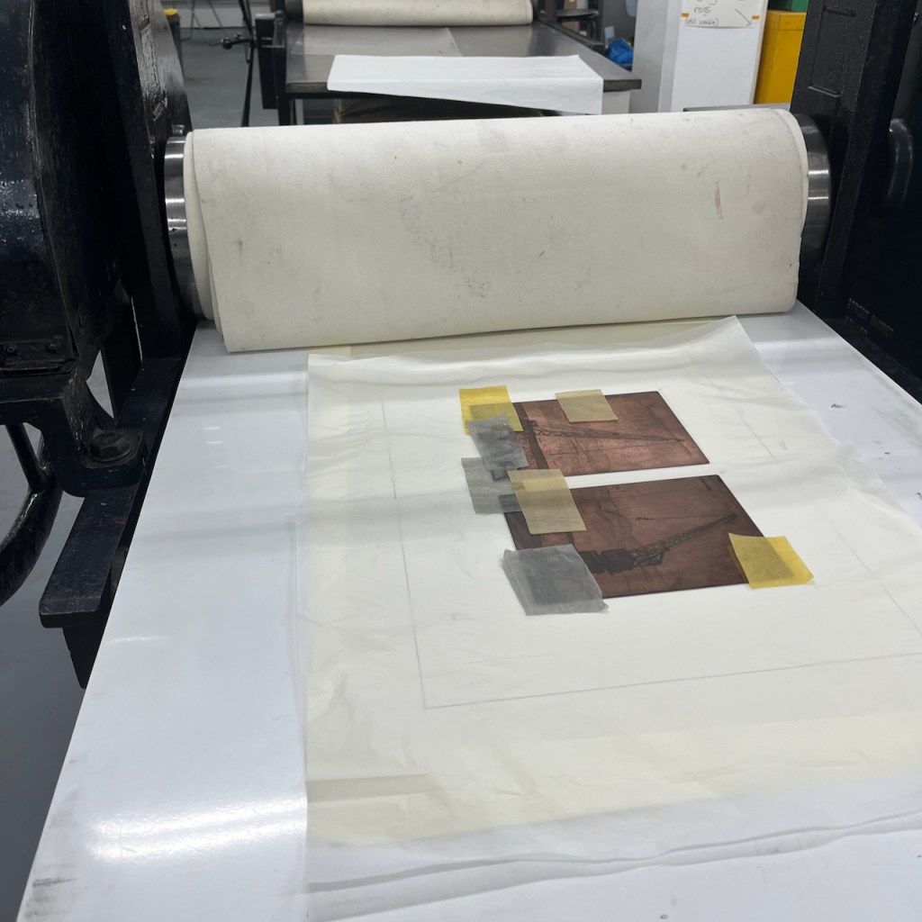
So I put them on the same sheet, they go together through the etching press.
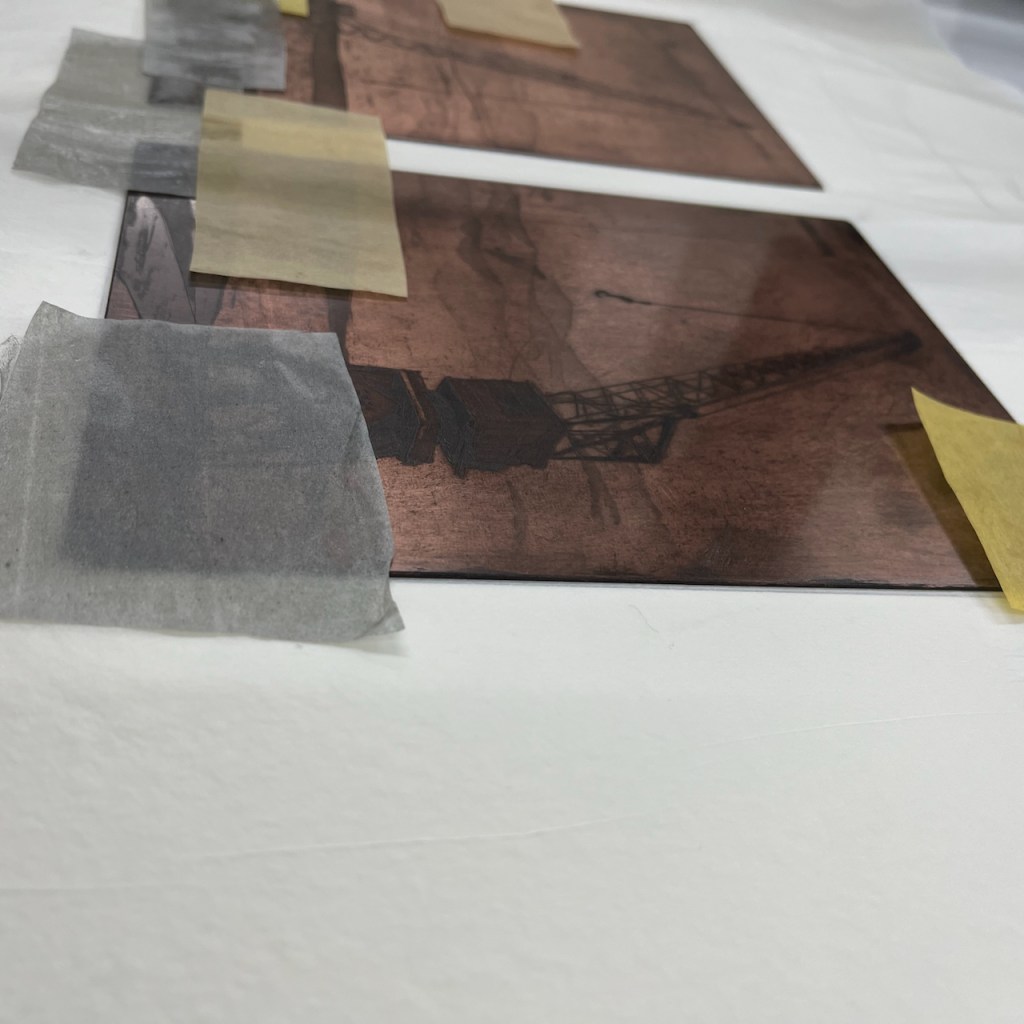
Copper platesPrinting pressPlates on the press (print #2)print #5 drying
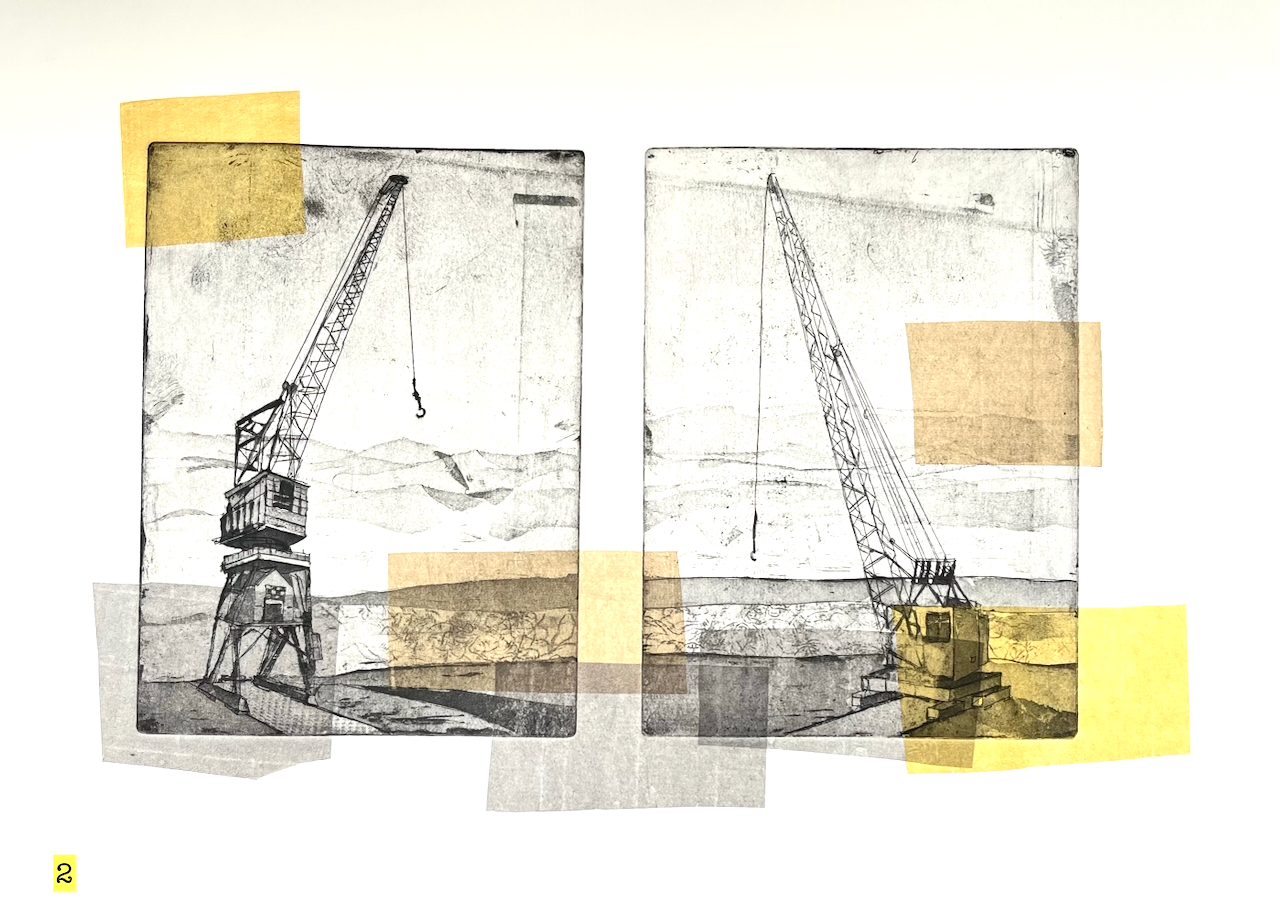
I made five prints of these cranes. The colour is added using the “chine colle” technique.
“Chine collé” means putting paper on top of the plate before it goes into the press. I have written about it on this page.
Here is the paper on top of the plate. It has glue on the top surface. The paper is very lightweight Japanese paper. It’s quite hard to get it to stay in position.
Here is a video of this plate after it’s been through the press:
Printing “Two Cranes”: thanks to friends at East London Printmakers for helping me with the video
I etched the plates and made these prints at East London Printmakers, Stepney. The techniques for making the plates are hard ground, soft ground, aquatint and dry point. The ink is Intaglio Printmakers Shop Mix Bone Black.
The cranes are at The Historic Dockyard, Chatham, Kent ME4 4TE
Let me know if you’d like a “Two Cranes” print? The sheet is about A2 size.
Click a button below to share this post online, email it, or print it:
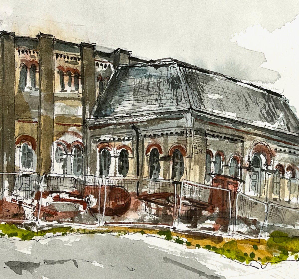
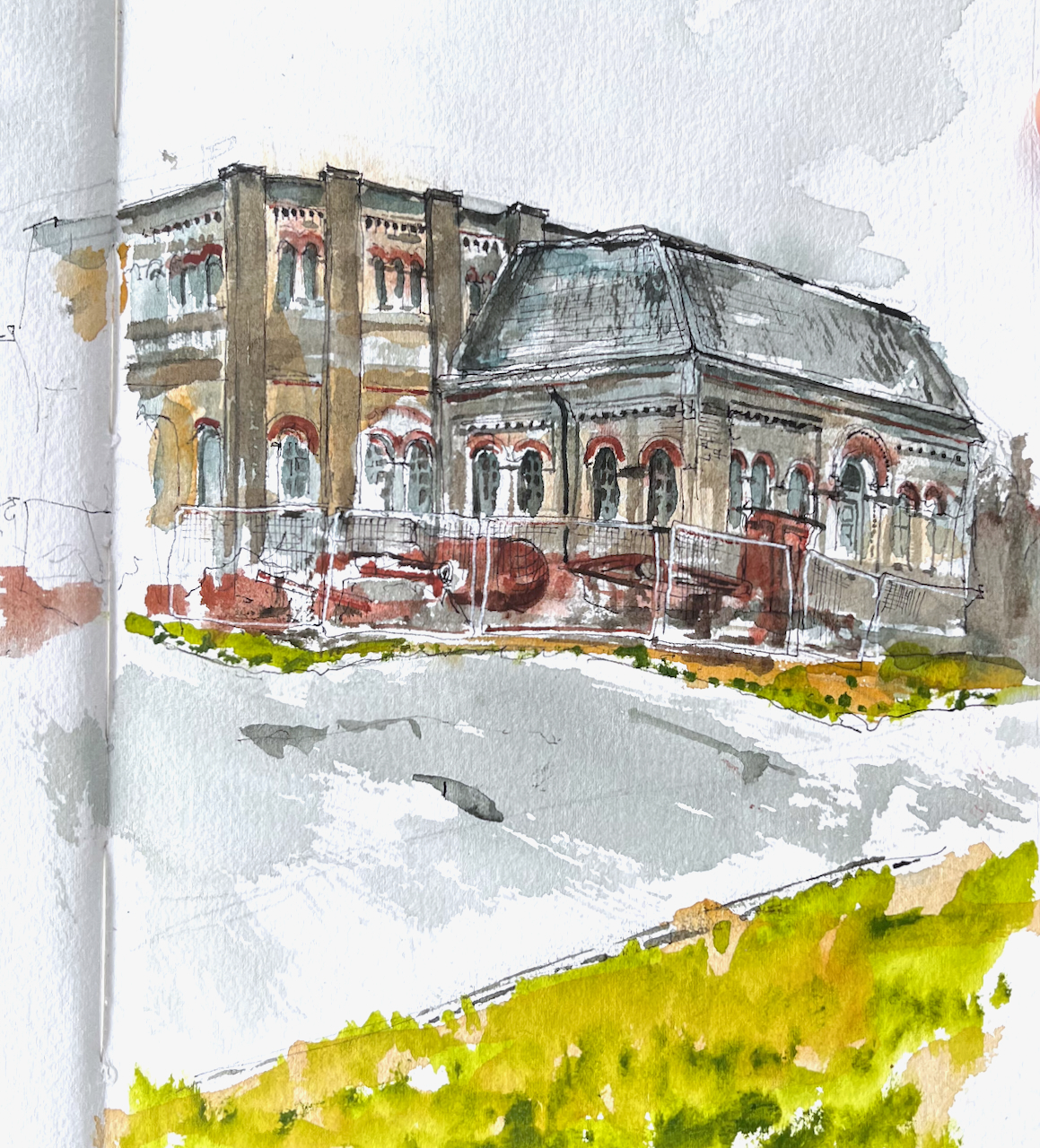
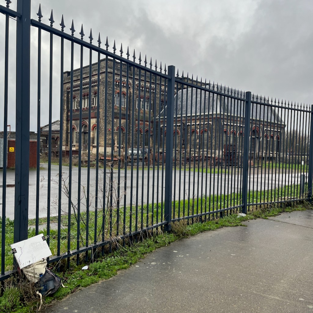
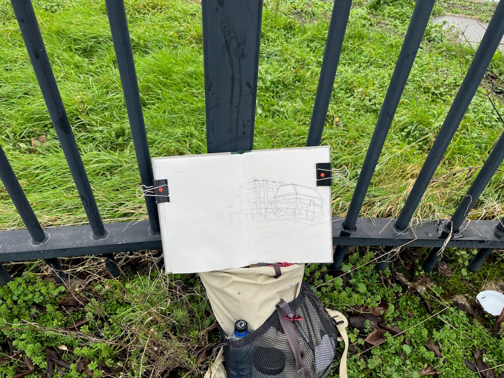
Here is a view of the old engine house of Crossness Pumping Station, on the South bank of the River Thames.
Crossness Engine House, sketched 5th January 2025 from the Thames Path
This is a former sewage pumping station. It was designed by the engineer Joseph Bazalgette and opened on the 4th April 18651 . It is the equivalent for South London of the Abbey Mills sewage pumping station on the North side of the Thames, which I have sketched previously.
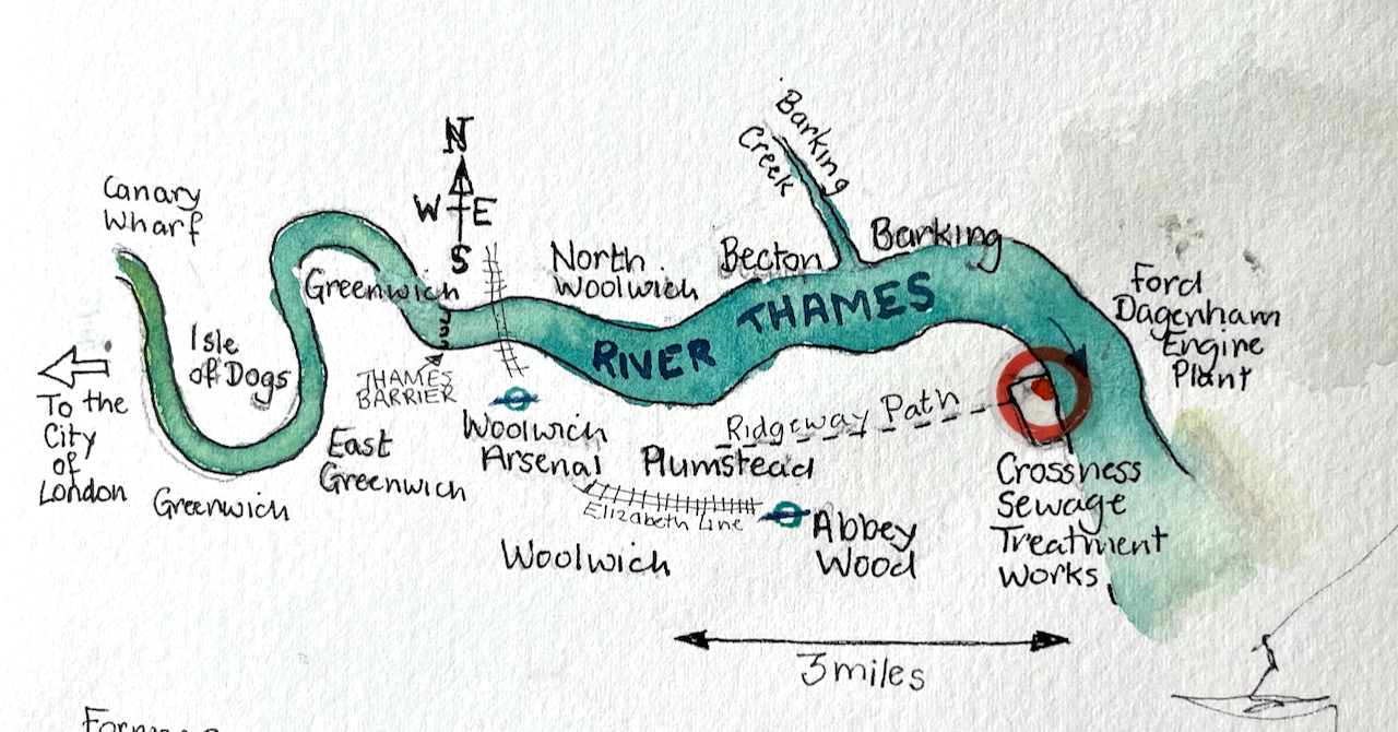
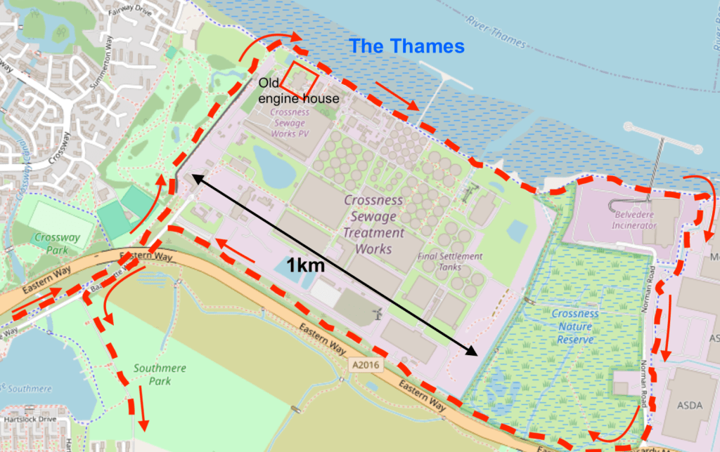
Sketch map showing the location of Crossness Sewage Treatment Works
These two pumping stations were important components of Bazalgette’s plan to rid London of cholera by removing sewage from central London. His idea was to pump the sewage from the conurbations in central London and shift it to Crossness and Beckton. This did indeed solve the problem of cholera in the city. It did not solve the problem of untreated sewage in the Thames: it just moved it downstream and away from the main residential areas of the time. Untreated sewage was pumped into the river at Crossness and Beckton on the ebb tide.
The exact number of passengers on board the Princess Alice during that fatal voyage is unknown, as is the number lost, but it is thought that around 640 people drowned, making this Britain’s worst inland waterway disaster.
This terrible tragedy and the consequent public outcry prompted the authorities to shift the problem even further downstream. Sewage boats were used to transport raw sewage into the Thames estuary and dump it in the North Sea. Amazingly, this continued until 1998:
The tragedy prompted the introduction of what became known as ‘Bovril boats’ (due to the unfortunate colour and consistency of their cargo), which carried sewage sludge out to the Thames Estuary and North Sea, disposing of it there.This continued until 1998, when EU legislation forbade it due to contamination of beaches.
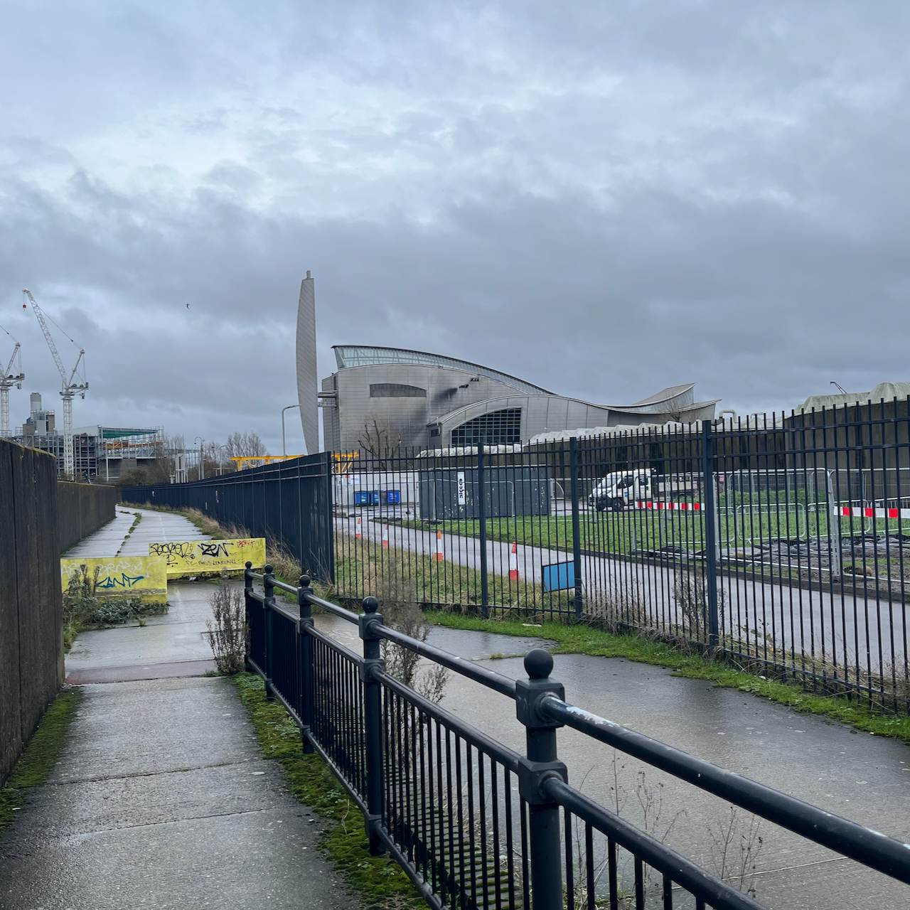
These days the sewage is treated3 (mostly). Next to the Victorian pumping station I sketched, there is a vast modern sewage treatment works belonging to Thames Water. Sewage is transformed by bacterial action and filtering. It becomes water and “sludge”. The water goes into the Thames. The sludge is used as agricultural fertiliser or burned for electrical power generation.
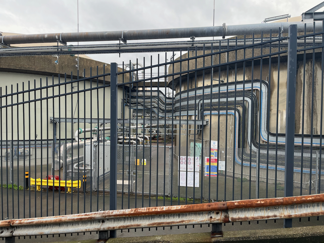
Modern sewage treatment works, Crossness, seen from the Thames path.
On my walk I circumnavigated this enormous treatment plant. It hardly smelt atall.
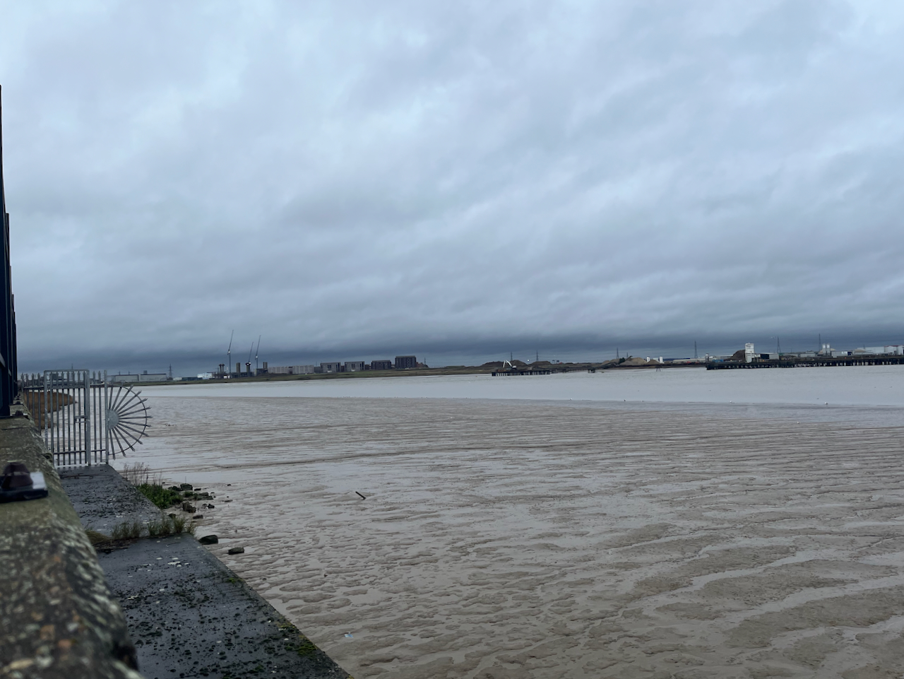
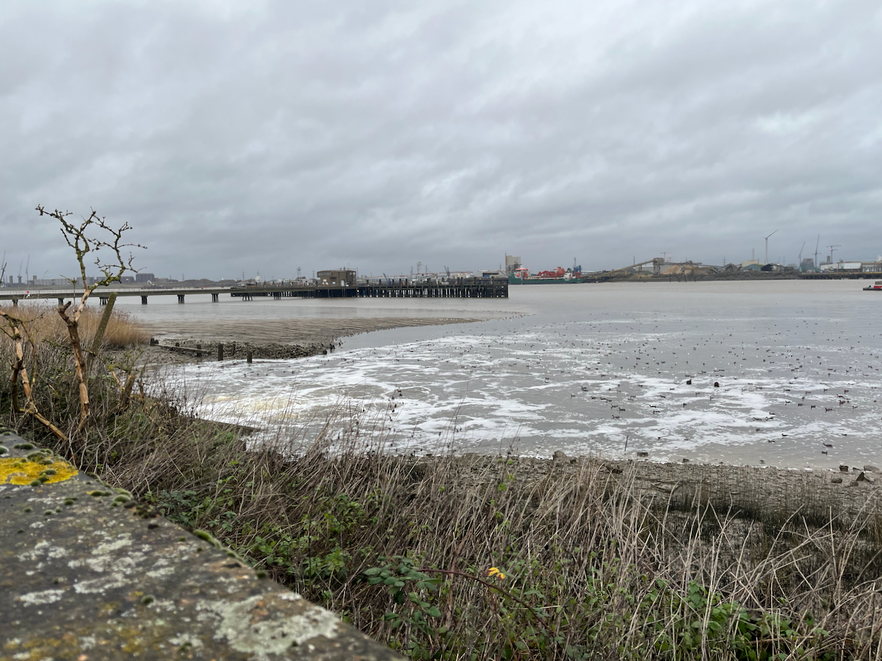
The Thames is vast here.
Looking across to North WoolwichBirds flock on the outfall from the treatment worksViews from the Thames path at Crossness Sewage works
I sketched the Engine House from the Thames Path. It is behind some tall and strong fencing, which I did not put in the picture.
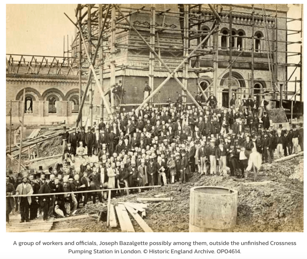
Source: Historic England Archive, used with permission.
The photo is more-or-less the same viewpoint as my sketch. I hope that the workers in this picture felt proud of their achievement, and would be glad to know that their work has been honoured, and building continues on the site.
20th century sludge incinerator, Crossness, and a further incinerator plant under construction, far left