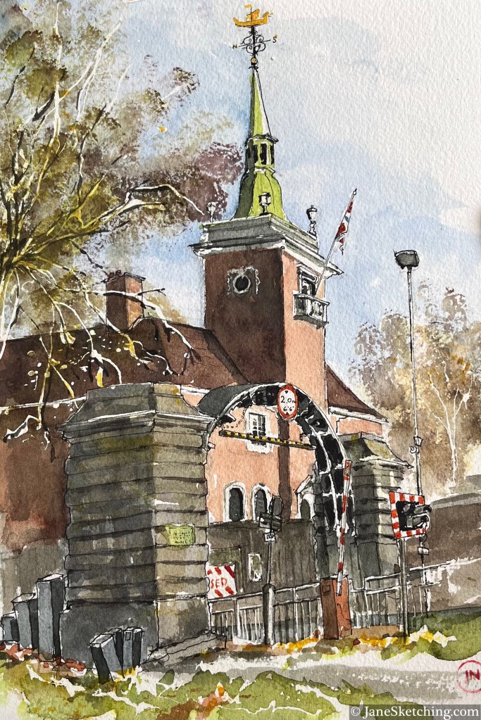
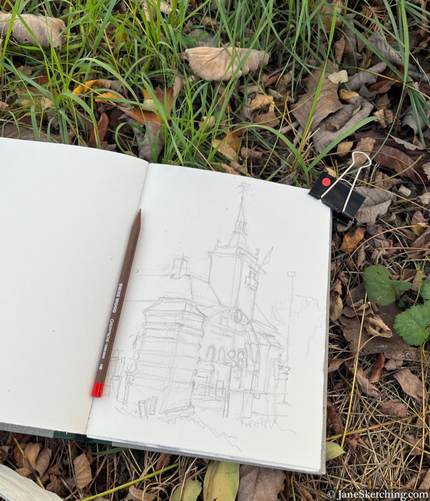
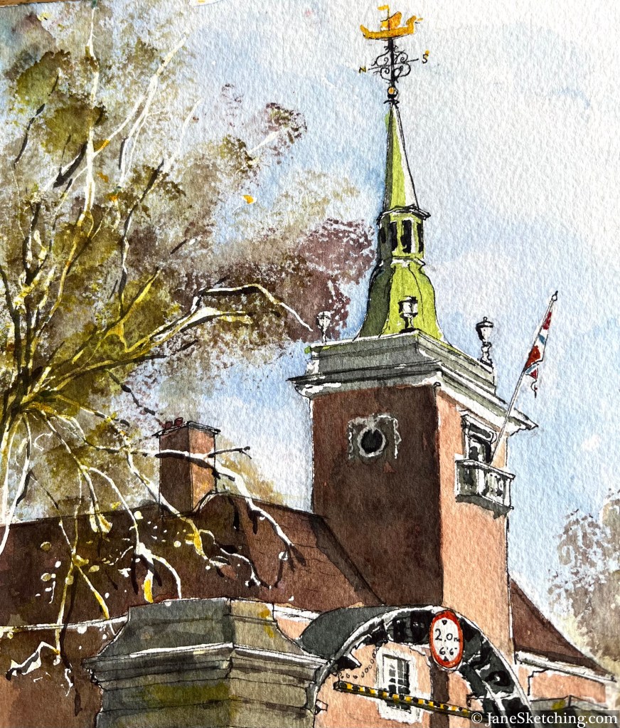
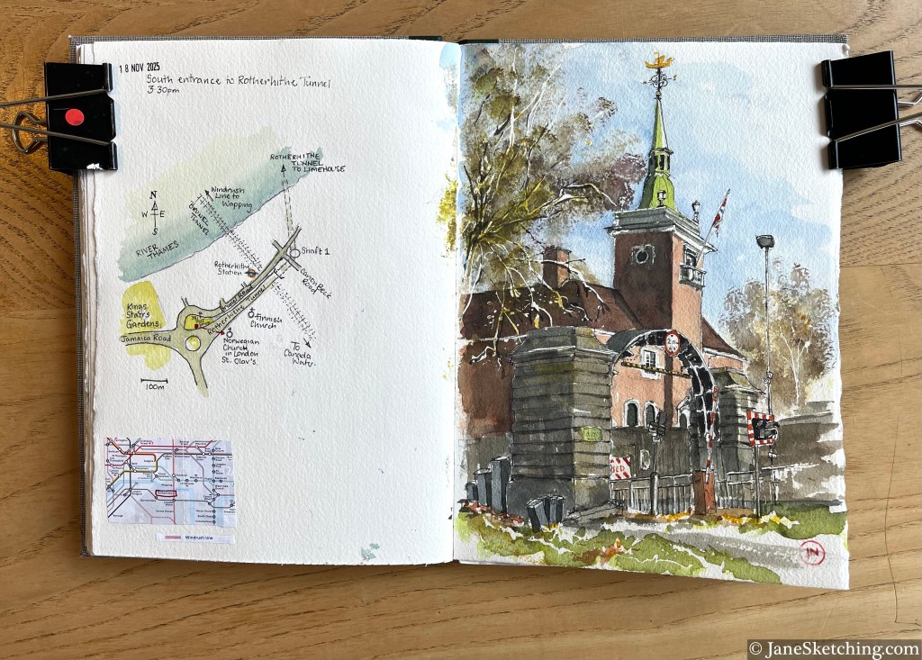
Rotherhithe Tunnel South Entrance, and St Olav’s Church, Rotherhithe, London SE 16 7JB, sketched 18th November 2025
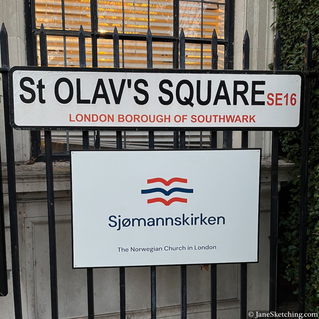
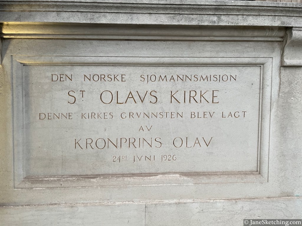
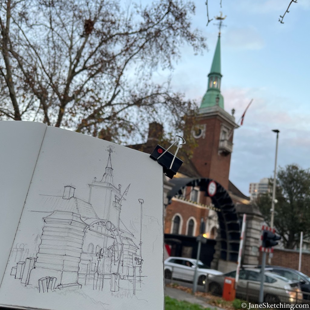
The church is St Olav’s, the Norwegian Church in London. It was designed by John Love Seaton Dahl, and the foundation stone was laid in 1926 by Prince Olav, later King Olav V, of Norway.
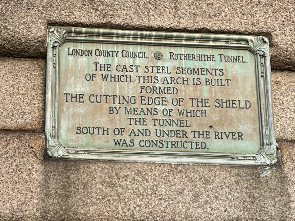
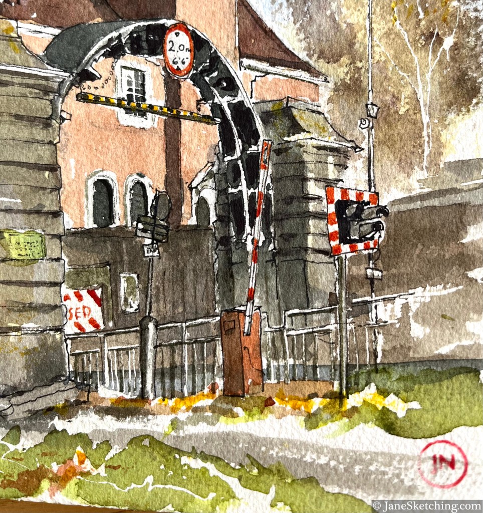
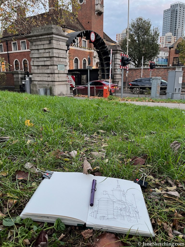
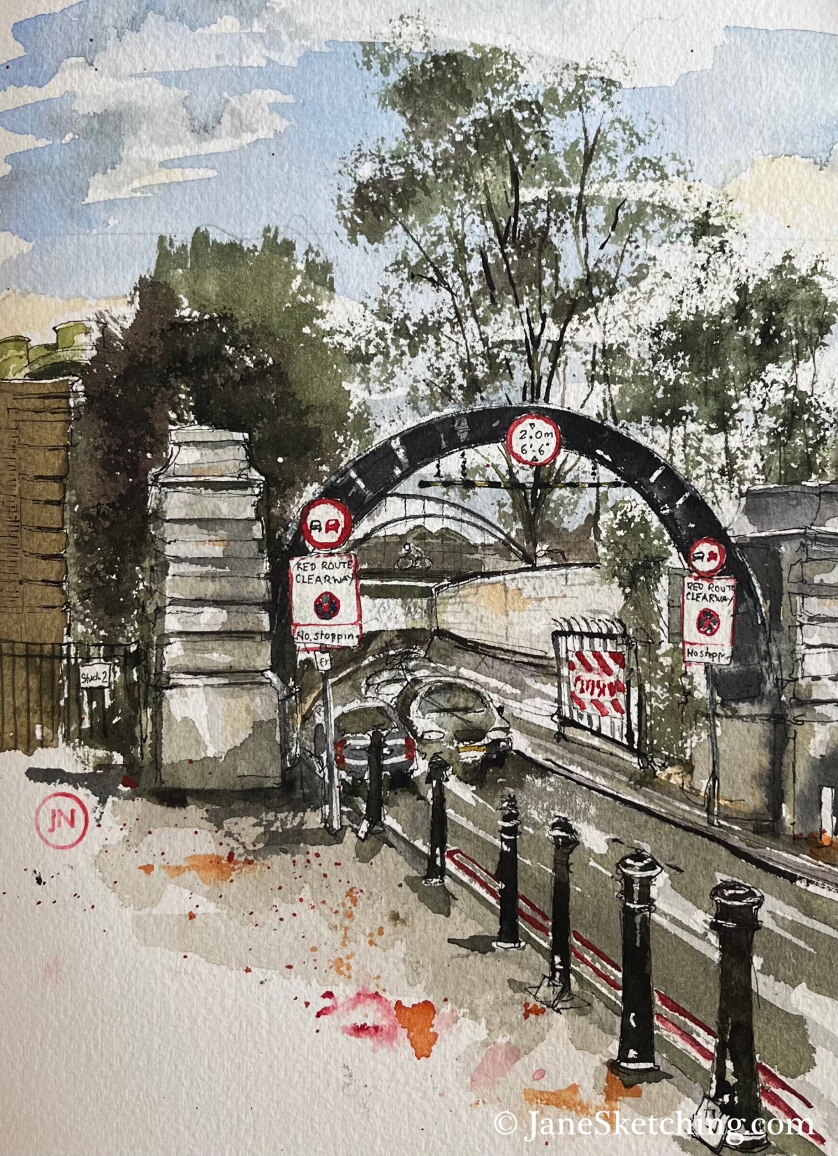
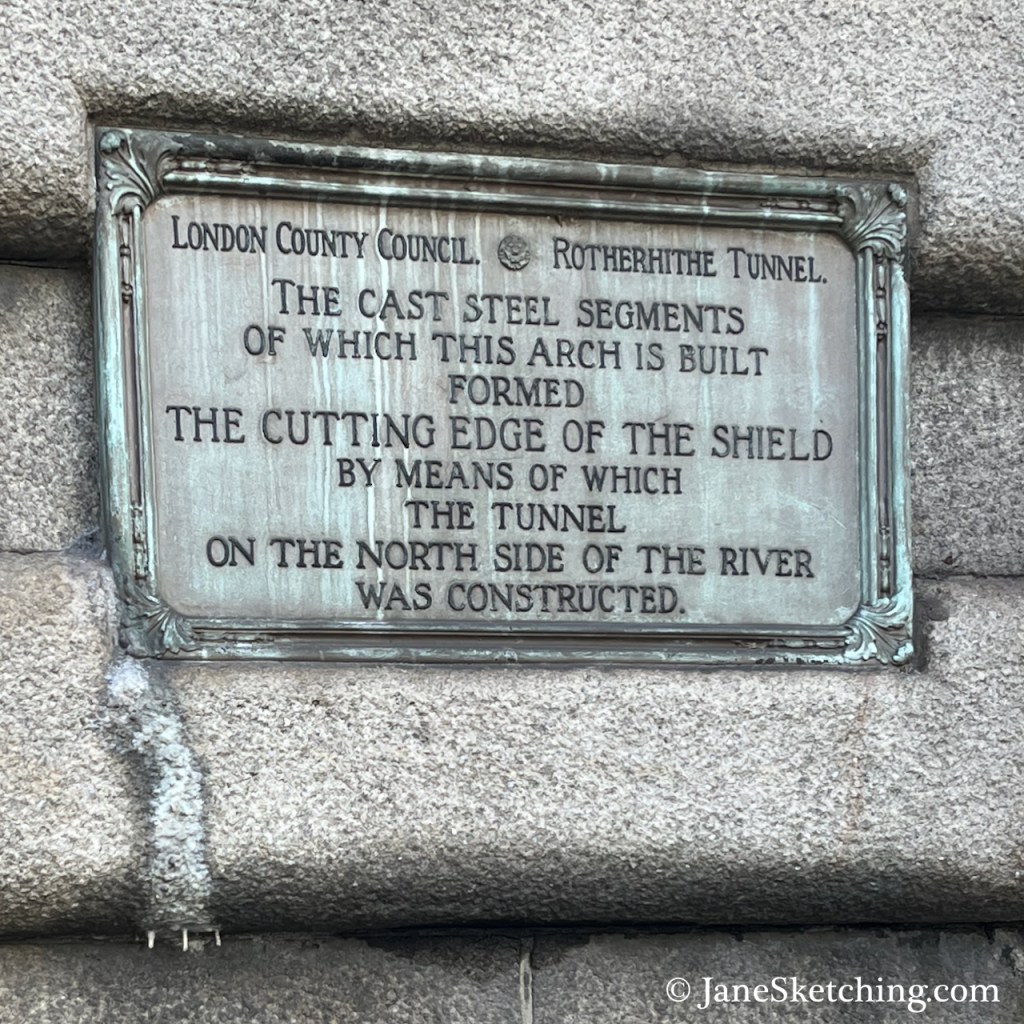
The steel arch over the tunnel approach road is part of the equipment used to cut the tunnel, as on the North side.
Sketch detail showing the steel arch.
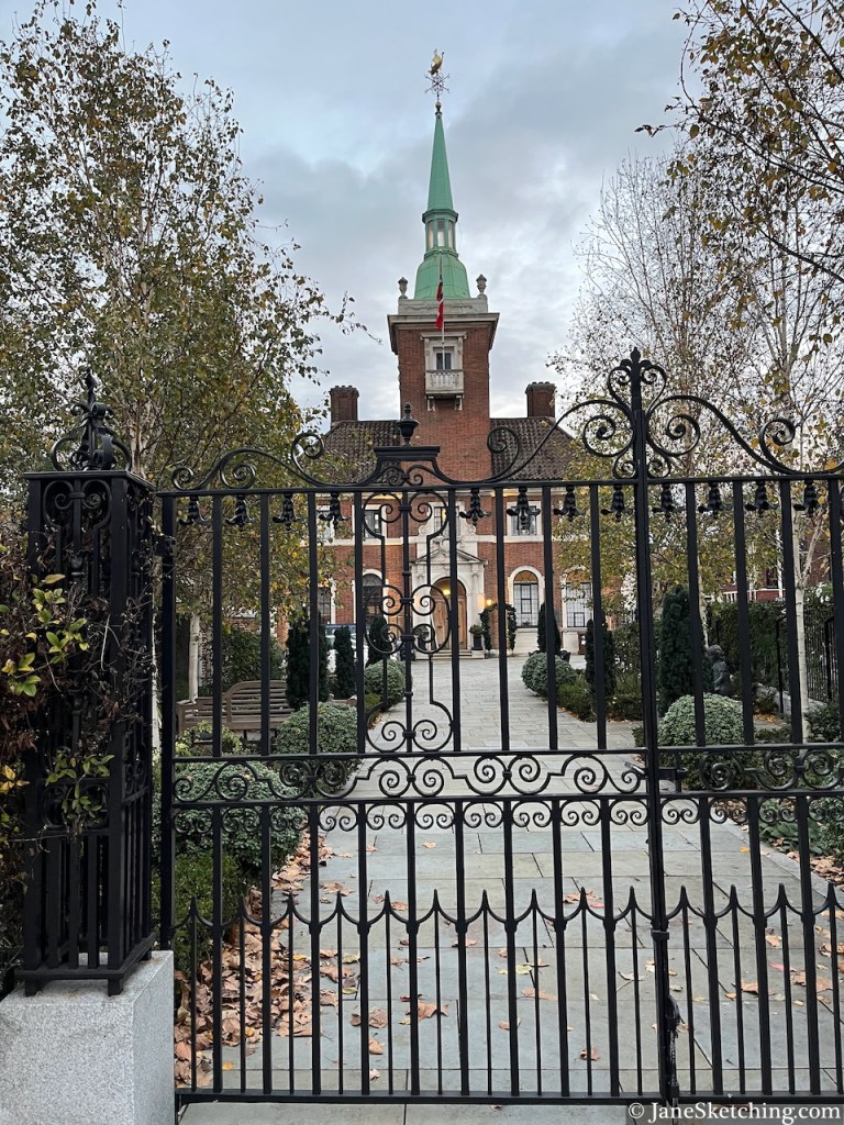
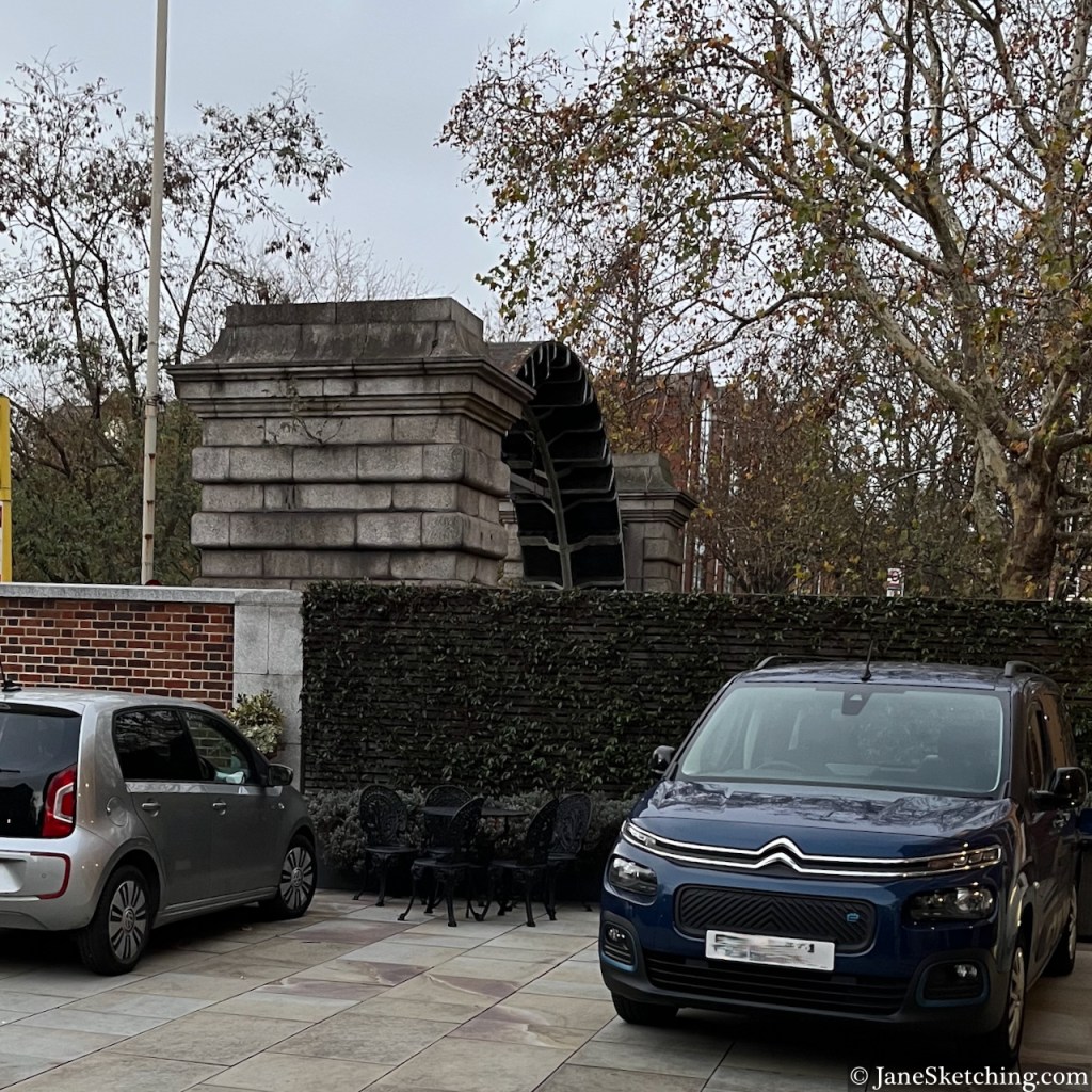
Below is a photo taken from the front courtyard of the church, looking back towards my sketching location. You can see the steel arch above the wall of the Church courtyard.
View of the arch above the Rotherhithe Tunnel Approach road, from the front courtyard of St Olave’s church
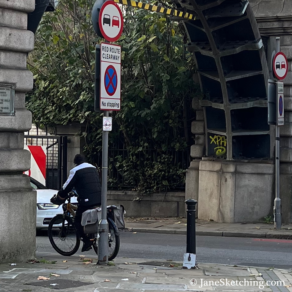
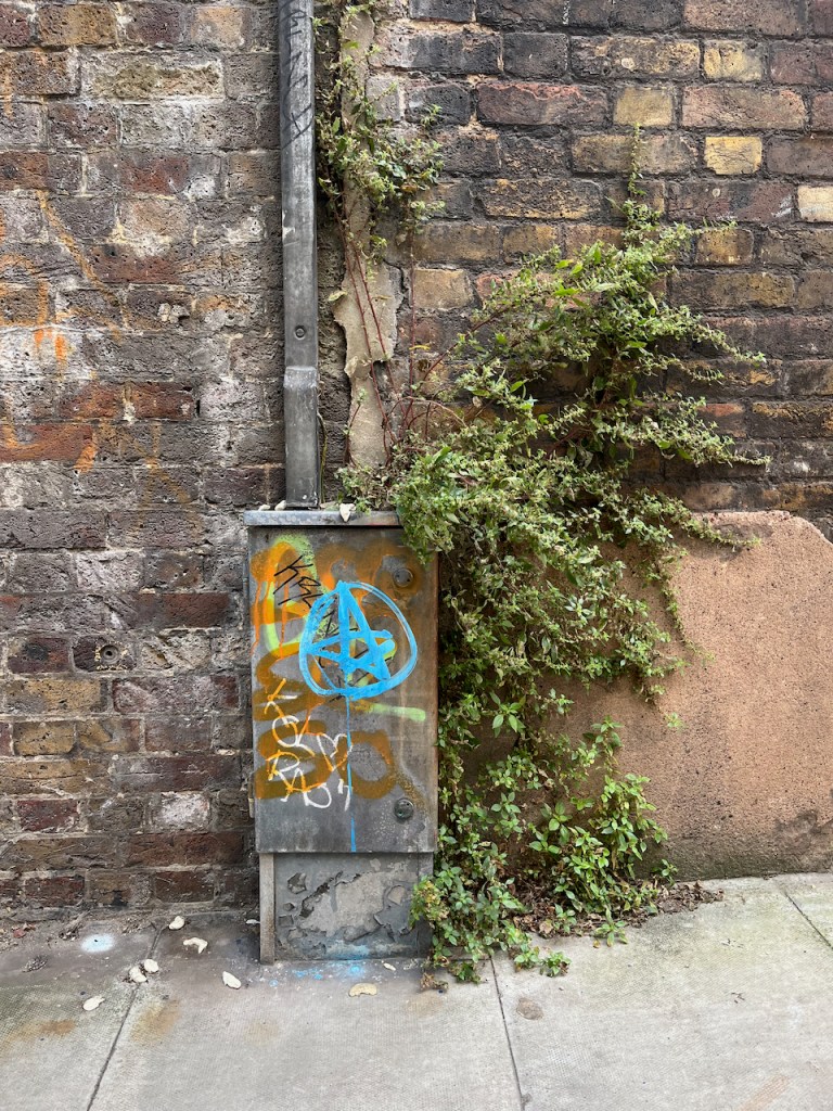
As you see, there were many trees. I was sketching from a traffic island, between major roads.
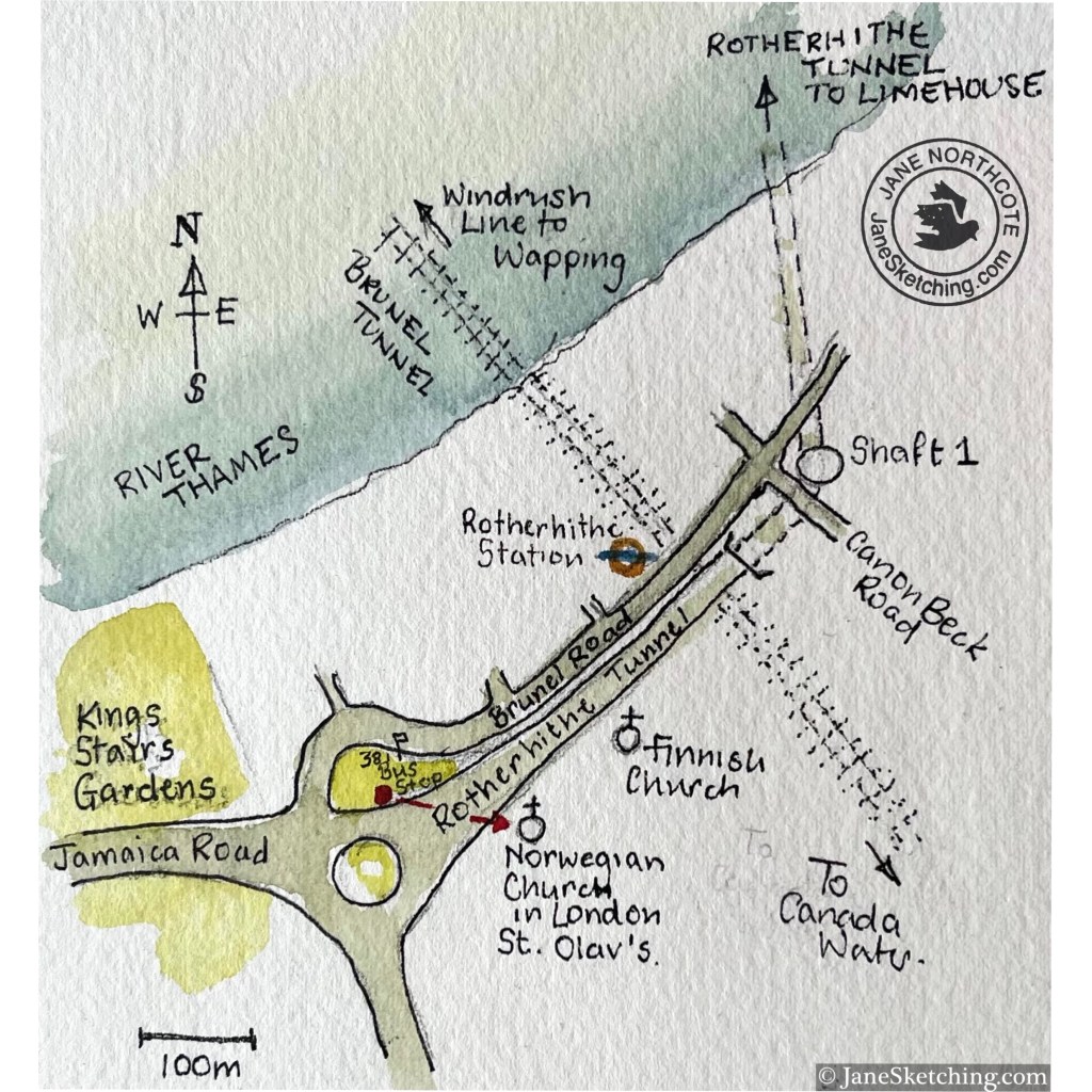
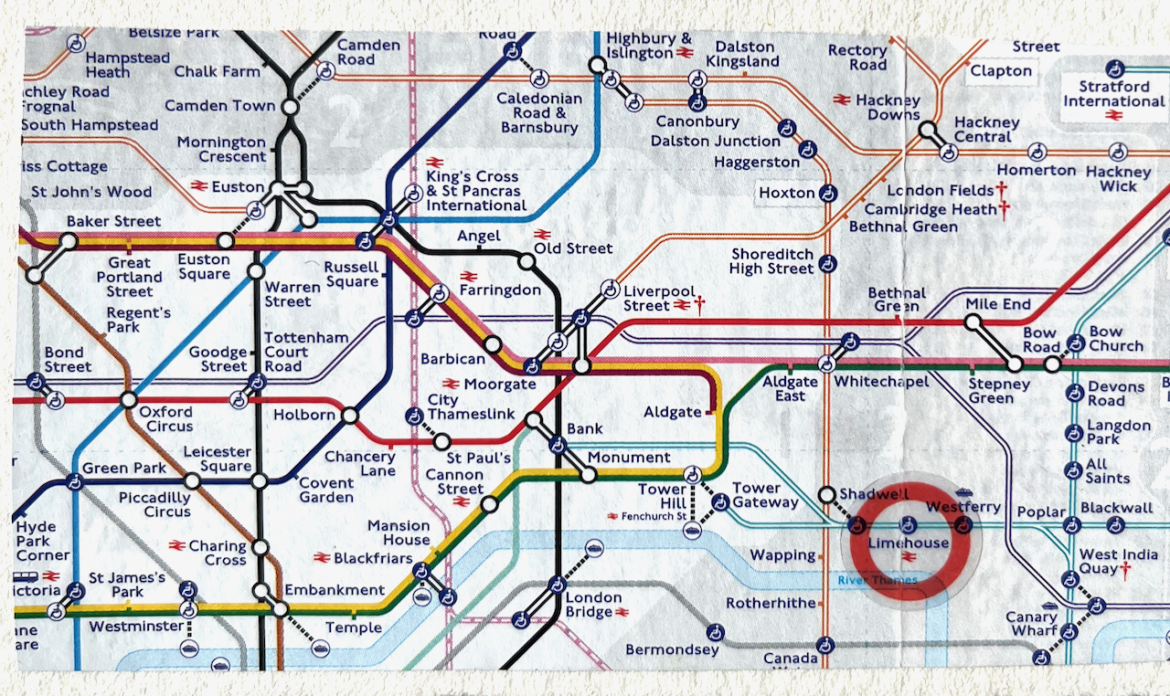
Map showing my sketching location (red dot and arrow)
Above me there were parakeets, the green ones. I think this is the furthest east I have heard parakeets. They seem to be migrating slowly across London, West to East, and North to South.
Sketching amongst greenery, Rotherhithe Tunnel South entrance
I enjoyed the weathervane on the church: a viking boat.
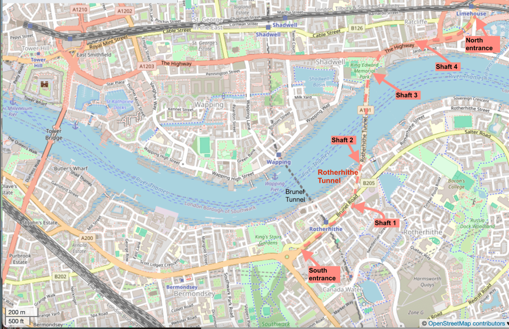
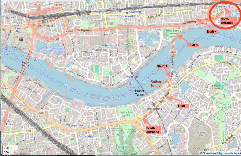
For completeness, here is a map showing the entire route of the Rotherhithe tunnel.
Background map (c) OpenStreetMap contributors
I reached the South entrance via the “Brunel Tunnel”, which is now used by the Windrush Line.
I’ve now sketched both entrances and two of the shafts. Here are the other posts. Click on the image to go to my article about it on this website.
North EntranceShaft 3Shaft 2
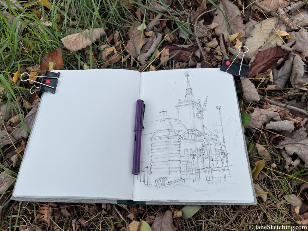
Here’s my sketchbook with this sketch:
Sketchbook 16 page spread
Sketchbook: Arches Aquarelle 300gsm, book made by Wyvern Bindery
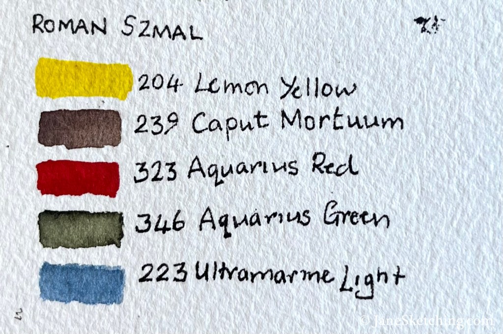
Paints: Roman Szmal
Pen and ink: De Atramentis Document Ink, Black, in a Lamy Safari fountain pen with Extra-Fine nib.
Click a button below to share this post online, email it, or print it:
The Rotherhithe Tunnel carries road traffic in both directions between Limehouse on the north of the River Thames, and Rotherhithe on the south side. It was constructed between 1904 and 1908, for horses and carts. The designer was Sir Maurice Fitzmaurice.
The tunnel links Limehouse on the north of the river to Rotherhithe on the south. Built originally for horse-drawn carriages and pedestrians, the tunnel now carries far more traffic than it was designed for, which requires careful day to day management by TfL to ensure safety.
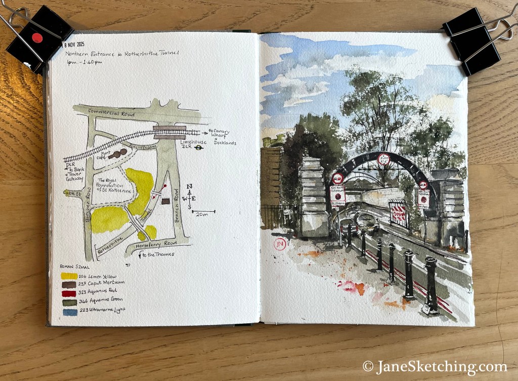
Here is the North Entrance of the Rotherhithe tunnel, near to Limehouse DLR Station in the east of London.
Rotherhithe Tunnel North Entrance, sketched 18 November 2025 in Sketchbook 16
The arch in the picture is made of steel. A notice on one of the columns explains that this arch is part of the equipment used to construct the tunnel.
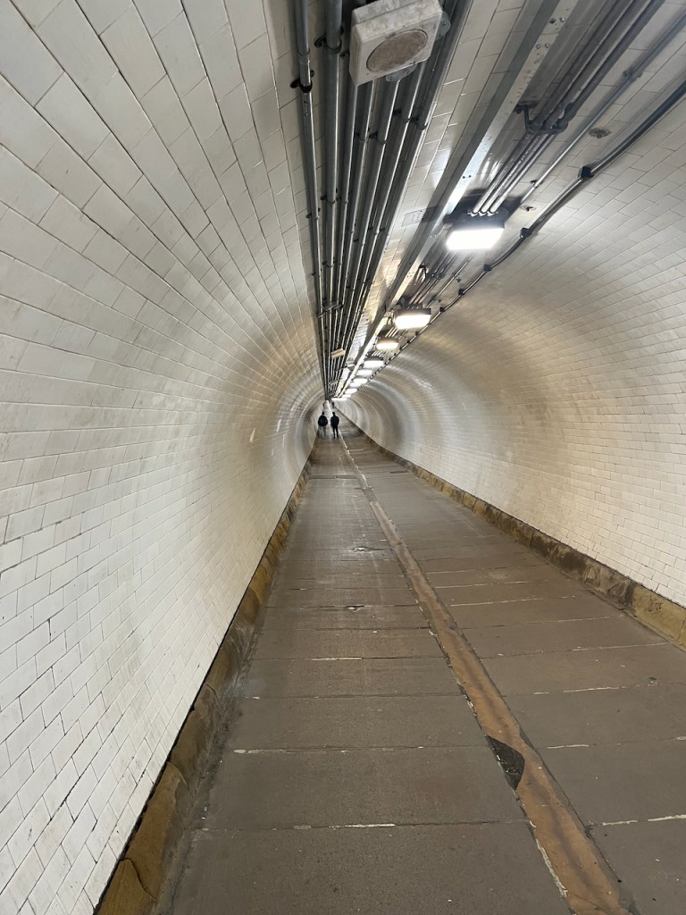
You can see the steel structure in the photo below. The tunnel is narrow. As you see in my sketch, there are just two lanes. The tunnel is heavily polluted from exhaust fumes. Even so, as I sketched, some people cycled into the entrance. Cycling in the tunnel must be very unpleasant and scary. I feared for them.
Cyclist entering the Rotherhithe Tunnel, under the steel arch.
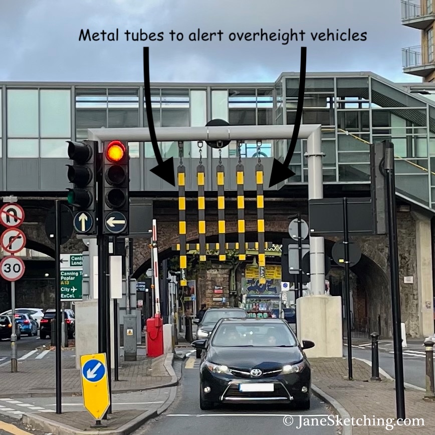
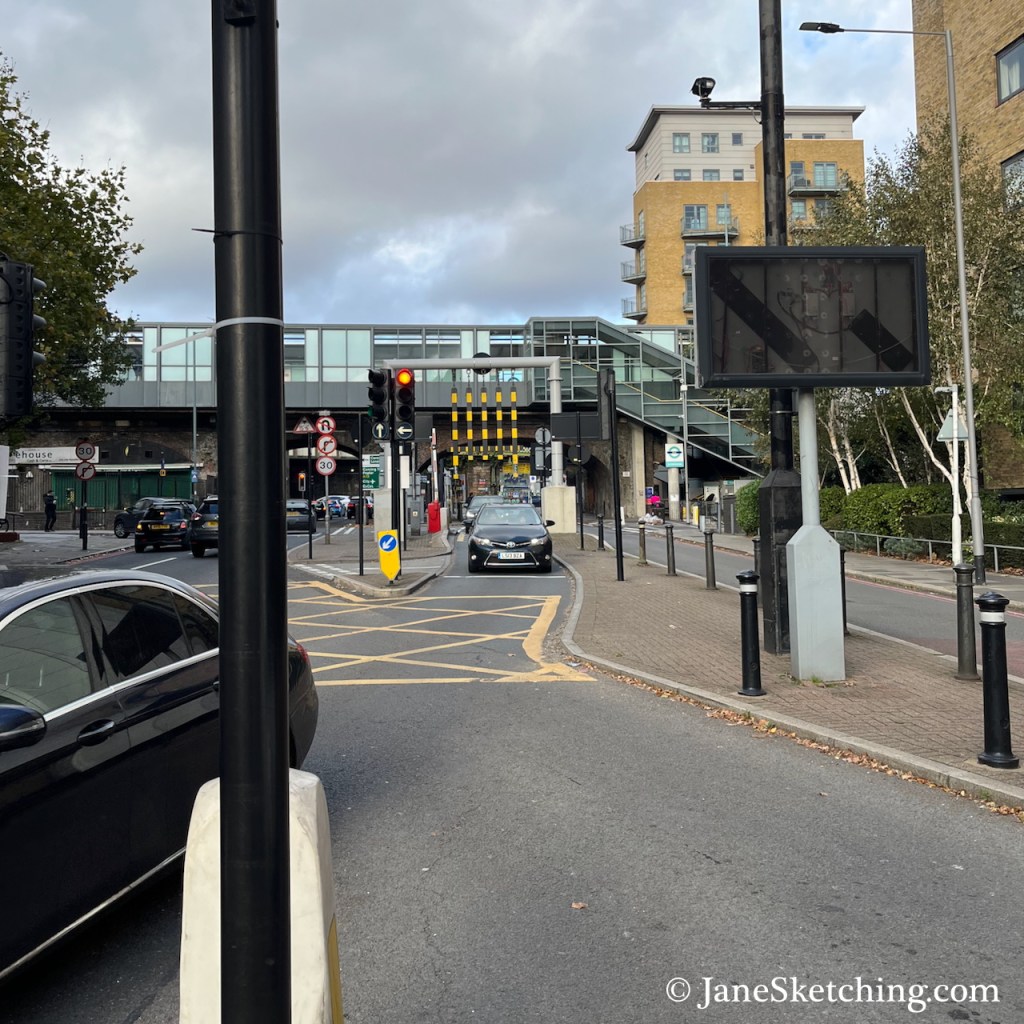
Because of the limited space in the tunnel, there are size restrictions on traffic, including a height restriction. To indicate the safe height, there are long vertical tubes over the approach road, as shown in the photos below. These photos were taken looking back from near the tunnel entrance, towards Limehouse DLR Station, which you can see in the background.
While I was sketching, I heard the banging sound as an overheight van struck the metal tubes. This happened three times during the 45 minutes I was there. Each time, the vehicle carried on past me into the tunnel.
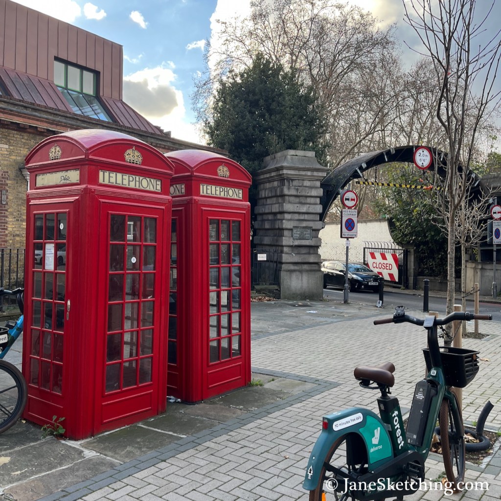
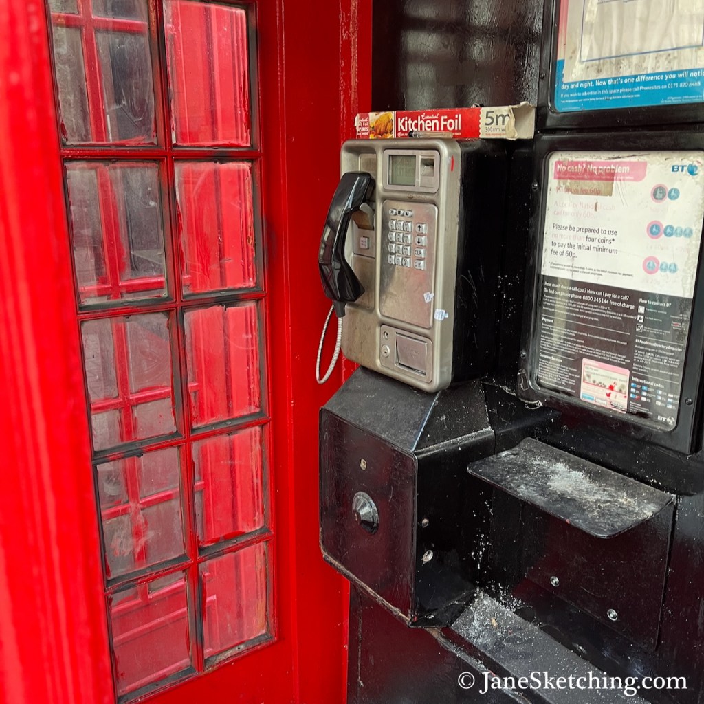
On the road island where I stood to sketch, there are two red telephone boxes. Amazingly, one of them still had the phone inside.
Despite the bright company of the phone boxes, it wasn’t a great place to stand. I could smell the pollution from the tunnel and its approach roads and I didn’t think it was doing me any good. Also it was cold. So having made my pen sketch, I went off to cross the Thames in search of the south entrance.
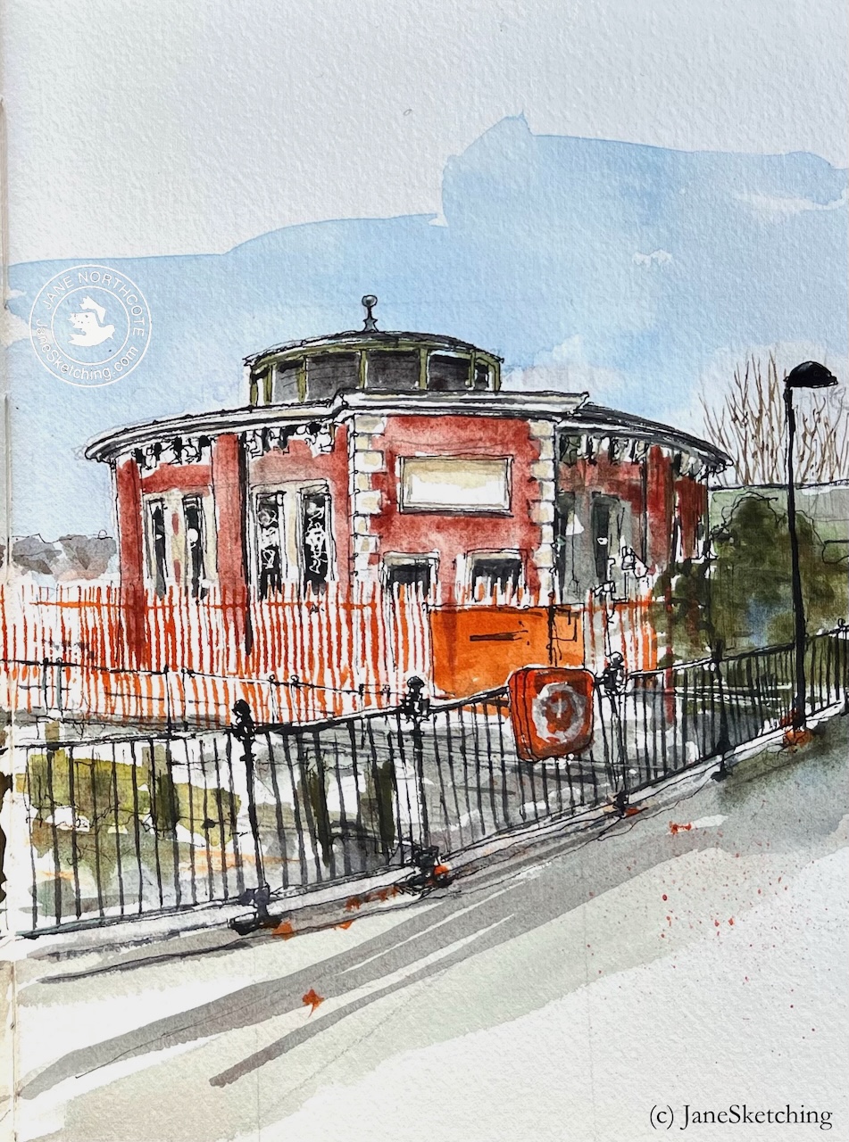
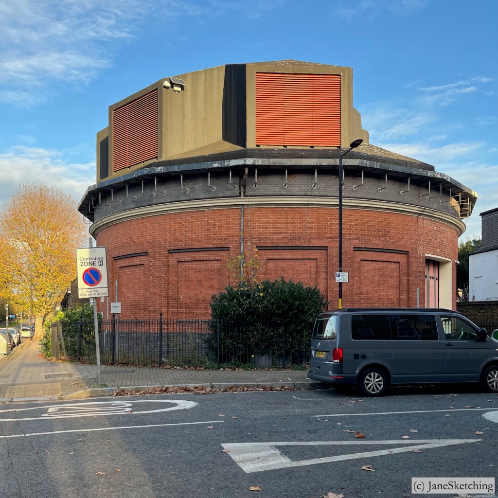
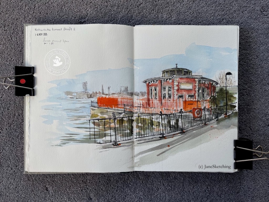
Rotherhithe Tunnel Shaft 2, sketched 4 November 2025 in Sketchbook 16 (c) JaneSketching
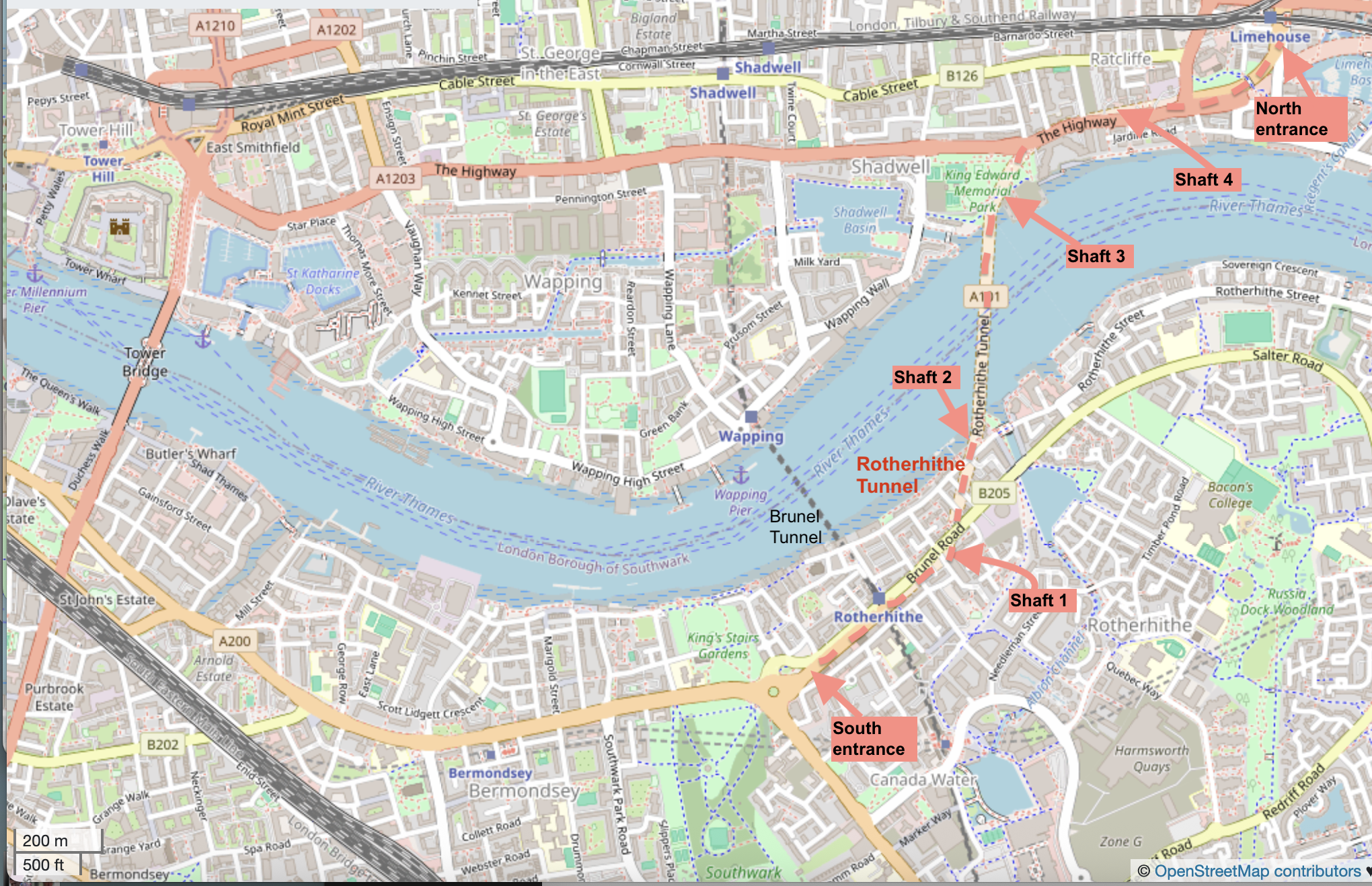
Here’s a map showing the river downstream of Tower Bridge, and the location of these structures. Click to enlarge.
Map showing the Rotherhithe tunnel, all 4 shafts, and the entrances. Click to enlarge. (c) OpenStreetMapcontributors
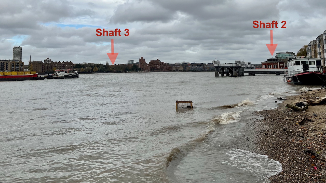
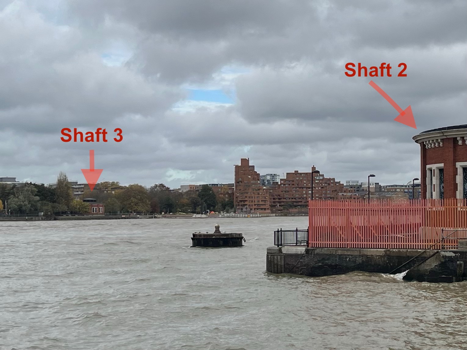
You can see one shaft from the other. Here’s a picture looking North across the Thames, just before I started the sketch. The light wasn’t great, but you can still see both shafts 2 and 3. See how wide the river is at this point! The distance between the two shafts is around 1500ft (500 metres).
Photo looking north across the Thames at Rotherhithe 4th November 2025 (c) JaneSketching
Here’s a photo from closer:
Photo looking north across the Thames at Rotherhithe 4th November 2025 (c) JaneSketching
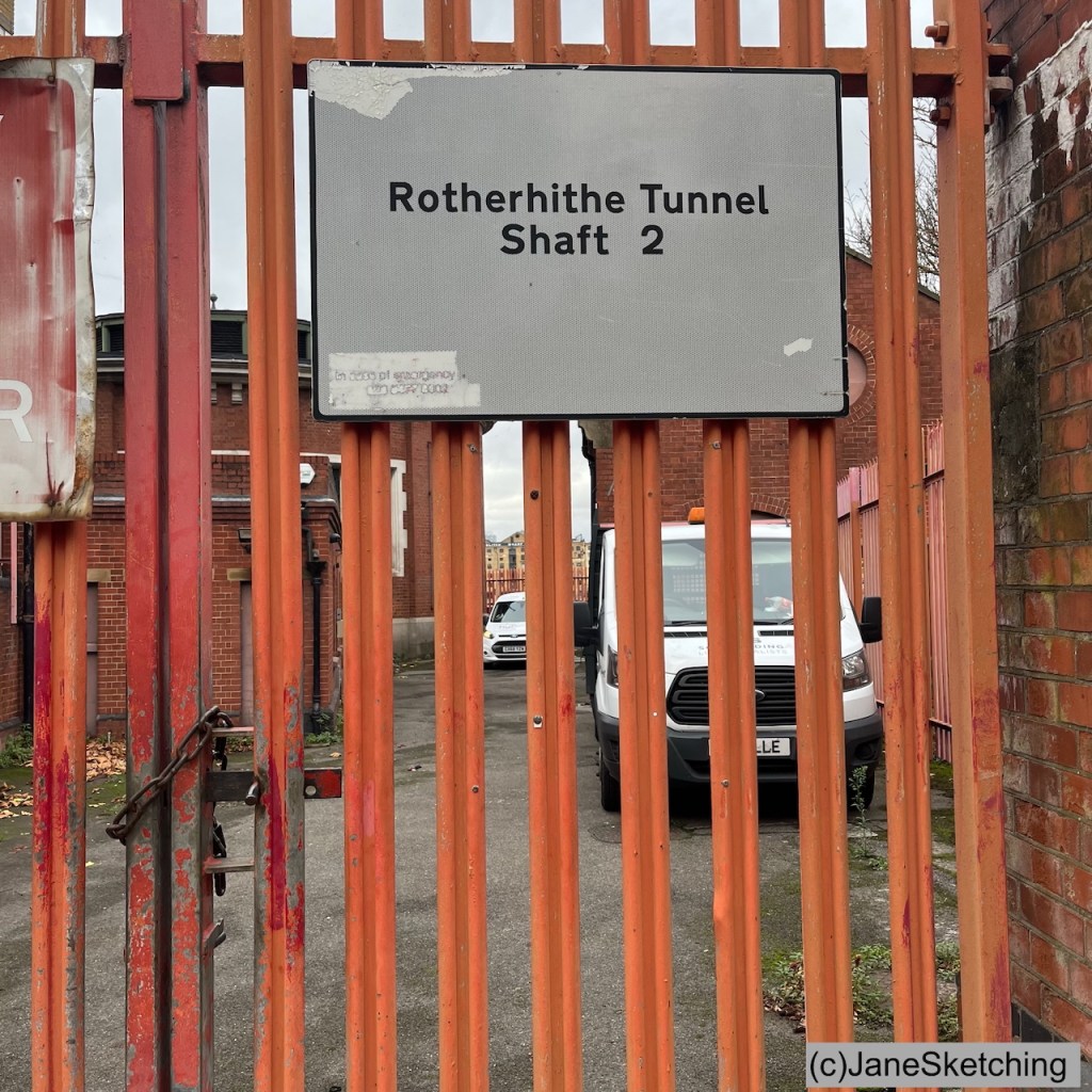
Shaft 2 is hidden behind high orange fences as you see. On the inland side it is behind a residential building at 157 Rotherhithe Street.
The Rotherhithe tunnel has 4 shafts. Shafts 2 and 3 are the round shapes and resemble each other. Both are Grade II listed.
Shaft 3Shaft 2Sketches of Shafts 3 and 4 (c) JaneSketching
Shafts 1 and 4 have been modernised.
Shaft 1Shaft 4Shafts 1 and 4 (iPhone photos, (c) JaneSketching, November 2025)
My next expedition will be to sketch the entrances to the tunnel.
Sketchbook 16 spread
Watercolours by Daniel Smith : – Burnt Umber – Serpentine Genuine – Phthalo Blue Turquoise – Transparent Pyrrol Orange – Mars Yellow – Fired Gold Ochre
Colours and brushes used for this picture. Colours by Daniel Smith. Brushes by Rosemary Brushes. Ceramic palette by Mary Ling. Brass Palette by Classic Paintboxes.
Click a button below to share this post online, email it, or print it:
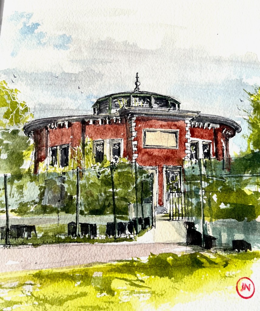
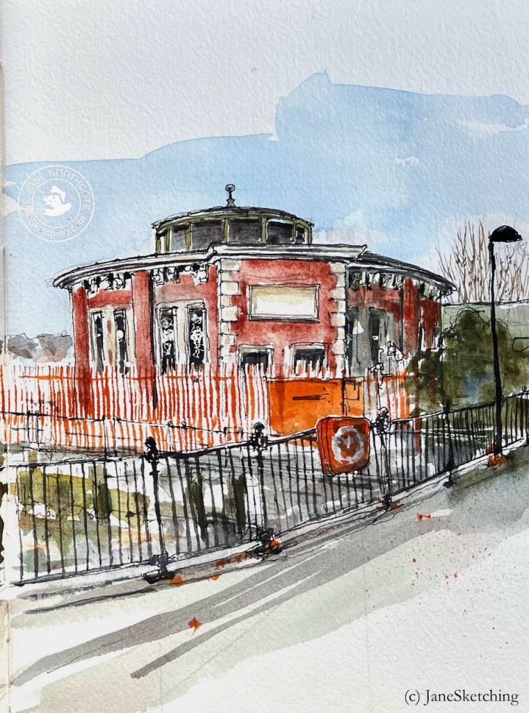
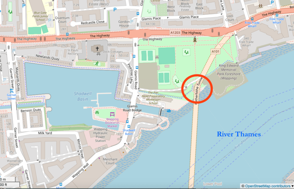
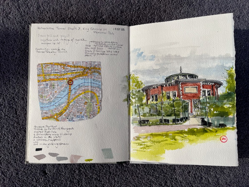
Construction work for the Thames Tideway tunnel surrounds this small round building on the north side of the Thames, near Shadwell.
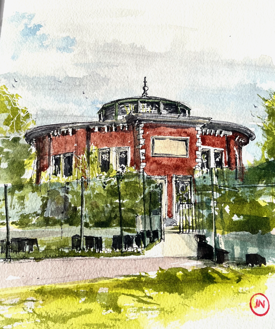
Rotherhithe Tunnel Shaft 3, King Edward VII Memorial Park, sketched 9th September 2025 in Sketchbook 16
This building is an air shaft and access point access for the Rotherhithe tunnel. The Rotherhithe Tunnel carries road traffic between Rotherhithe on the south of the river and Limehouse on the north. It was constructed between 1904 and 1908, for horses and carts. The designer was Sir Maurice Fitzmaurice.
The tunnel links Limehouse on the north of the river to Rotherhithe on the south. Built originally for horse-drawn carriages and pedestrians, the tunnel now carries far more traffic than it was designed for, which requires careful day to day management by TfL to ensure safety.
This circular building is one of four shafts giving access to the tunnel. It contains a spiral staircase, which was in use from when the tunnel was opened in 1908 until the 1970s2. This access is now closed to the public. The shaft building and the staircase are Grade II listed3.
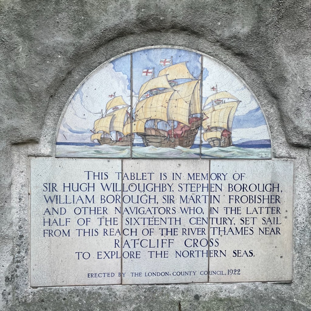
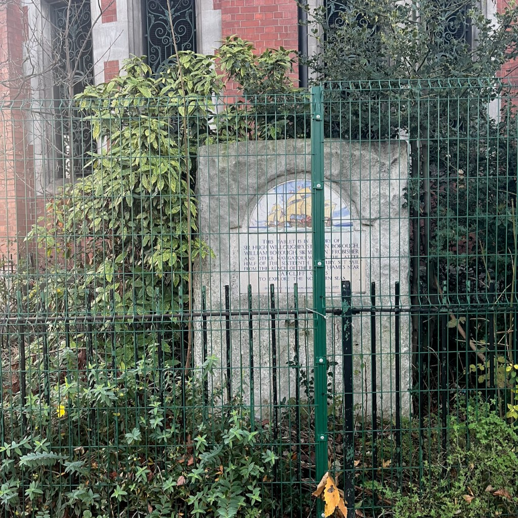
Next to the shaft there is a stone tablet:
THIS TABLET IS IN MEMORY OF SIR HUGH WILLOUGHBY, STEPHEN BOROUGH, WILLIAM BOROUGH, SIR MARTIN FROBISHER AND OTHER NAVIGATORS WHO, IN THE LATTER HALF OF THE SIXTEENTH CENTURY, SET SAIL FROM THIS REACH OF THE RIVER THAMES NEAR RATCLIFF CROSS TO EXPLORE THE NORTHERN SEAS. ERECTED BY THE LONDON. COUNTY COUNCIL, 1922
The roof in my picture dates from a refurbishment in 20074. Originally there was a glass dome5.
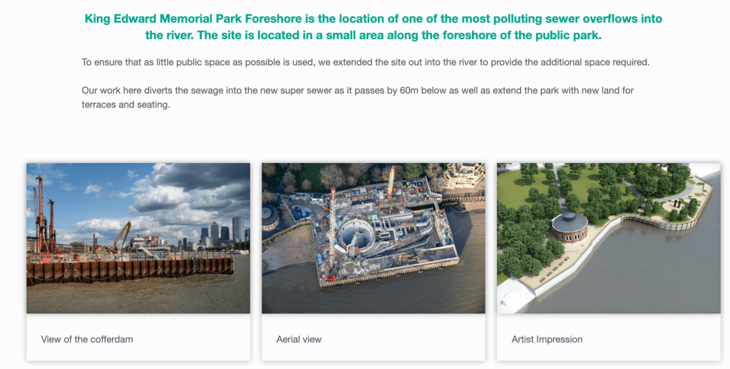
Location of Rotherhithe Tunnel Shaft 3, map (c) OpenStreetMap contributors.
The fences in my drawing are the perimeter of a Thames Tideway tunnel construction site. The Thames Tideway Tunnel carries sewage from central London to Becton Sewage Treatment Works. It runs under the Thames. At various points there is a junction between this main sewer and a local sewerage system. The site at King Edward VII is one such junction.
The Thames Tideway tunnel runs longitudinally along the Thames, so it crosses the Rotherhithe tunnel, which goes across the Thames. But this is not a problem, as the Thames Tideway tunnel is 60m6 below the Thames and the Rotherhithe tunnel is just 23m down7. So they do not bump into each other.
Map showing the position of Shaft 3 at the North end of the Rotherhithe Tunnel. (c) OpenStreetMap Contributors.Sketchbook 16 spread
I’ve read that you can walk through the Rotherhithe Tunnel starting from one of the the tunnel entrances and passing under the shaft I’ve drawn. Those who have tried it8, even during the pandemic, do not recommend the experience. The tunnel is highly polluted from the vehicle fumes, and the pavement is narrow. It’s even pretty terrifying to drive through it in a car. Close the windows and the air vents, and stay alert while driving. If you’d like to walk a Thames tunnel, I recommend the Greenwich Foot Tunnel, or the Woolwich Foot tunnel, both of which I’ve walked. They are fun, eerie and have no traffic to pollute the air. You can read about my excursion to the Woolwich Foot Tunnel here.
Disambiguation: The Rotherhithe Tunnel I’m talking about in this post is not the same as an earlier tunnel built between 1825 and 1843 by Marc Brunel, and his son, Isambard. This Brunel tunnel was a little further upstream, and is now used as a railway tunnel only.
Roof replacement 2007 confirmed by King Edward VII park “Management Plan” 2008 page 15: “The park surrounds the tunnel vent and access shaft to the Rotherhithe Tunnel. The tunnel was opened in 1908, the vent was present before the park was constructed, and early images of the park show that it visually dominated the site. The tunnel vent remains an important feature, but is no longer so visually dominant due to the present day maturity of trees in the park. The Rotherhithe Tunnel was refurbished in 2007 and a replacement roof was installed as part of these works.” Link: https://www.towerhamlets.gov.uk/Documents/Leisure-and-culture/Parks-and-open-spaces/king-edward-management-plan.pdf↩︎
Roof of the shaft: 1908 – glass dome, by 1946 – no roof (removed in the 1930s), from 2007 – current roof as in my drawing. Evidence: London Picture Archive has a picture of the shaft in 1921, where you can see the glass dome that covered the shaft. Record number 118817, Catalogue number SC_PHL_01_392_A360 See this link: https://www.londonpicturearchive.org.uk/view-item?WINID=1762114518393&i=121045. They also have photographs from 1971 where it’s clear that the roof has been removed completely. See photo on this link, record number 237845, catalogue number SC_PHL_02_0666_71_35_217_30A: https://www.londonpicturearchive.org.uk/view-item?i=239938 “A London Inheritance” post contains an aerial picture from 1946 showing that the roof had been removed by that date. See this link. This post says: ” The following photo dated 1946 from Britain from Above shows the park at lower left. Note the round access shaft to the Rotherhithe tunnel. In the photo the shaft has no roof. The original glass roof was removed in the 1930s to improve ventilation. The current roof was installed in 2007.” ↩︎
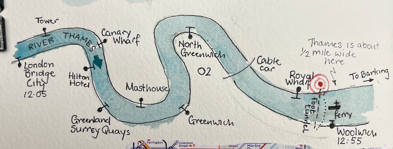
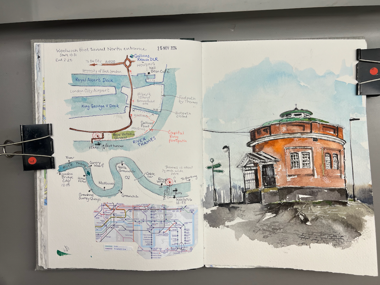
My expedition started at London Bridge pier, with a trip down the Thames on the riverboat. This seemed the simplest way to get to the docks. It takes about 50 minutes to go from London Bridge to Woolwich.
The route of the riverboat from London Bridge to Woolwich.
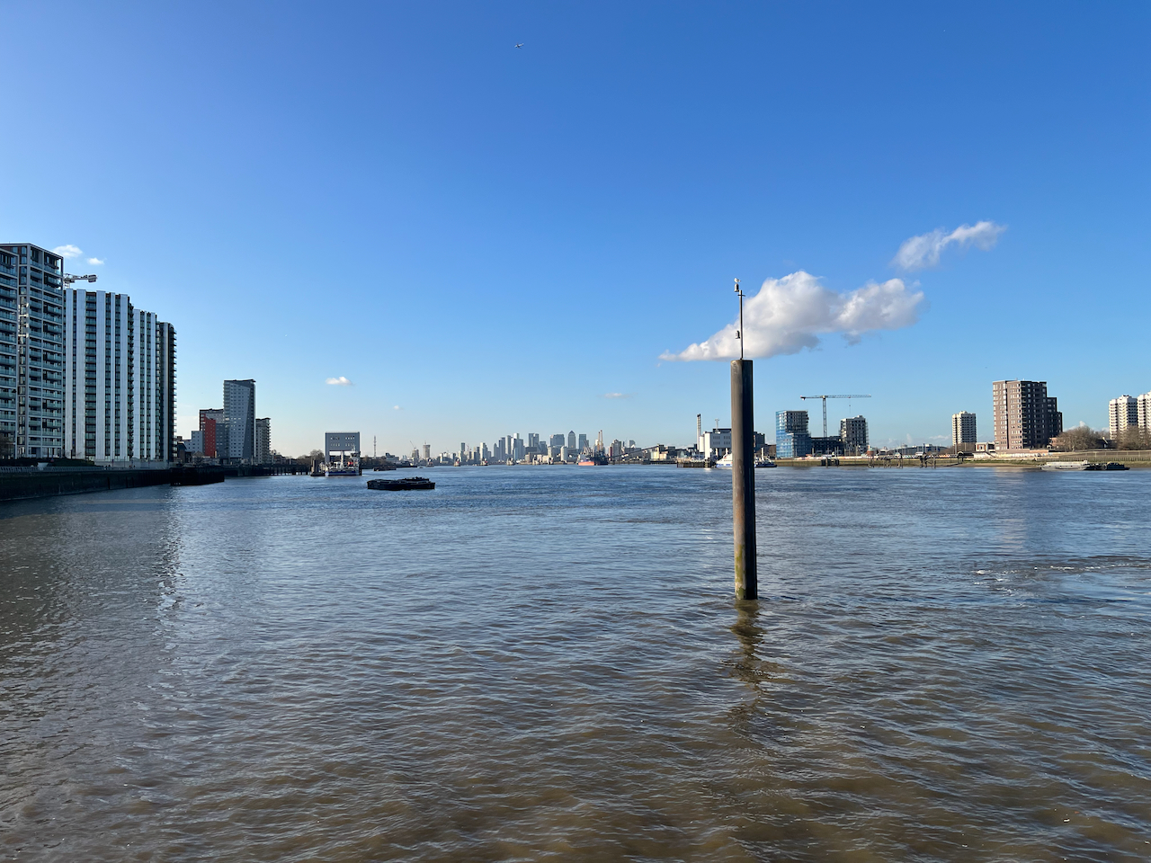
Everyone gets out at Greenwich, but it’s well worth going a bit further. The boat is empty, the Thames is huge, and the sky opens out.
The City of London seen in the distance, from the Woolwich Royal Arsenal Pier
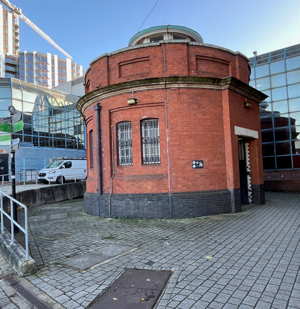
The river boat pier at Woolwich is on the South side of the river. I was keen to explore the North side, so I walked a little way to find the entrance to the foot tunnel. There is also a ferry, but I wanted to experience the foot tunnel.
The South entrance to the foot tunnel is hard to find. It’s crammed into a dark space behind the leisure centre. It looks somewhat dingy and derelict.
South entrance of the Woolwich Foot tunnel, hemmed in by 1970s buildings.
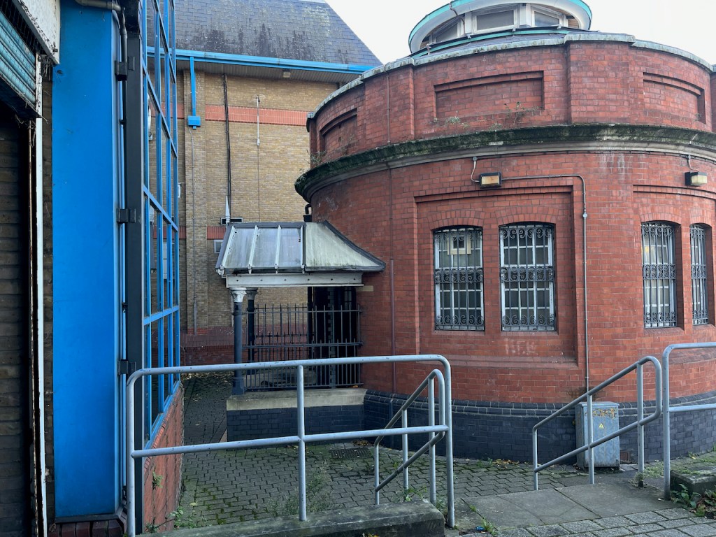
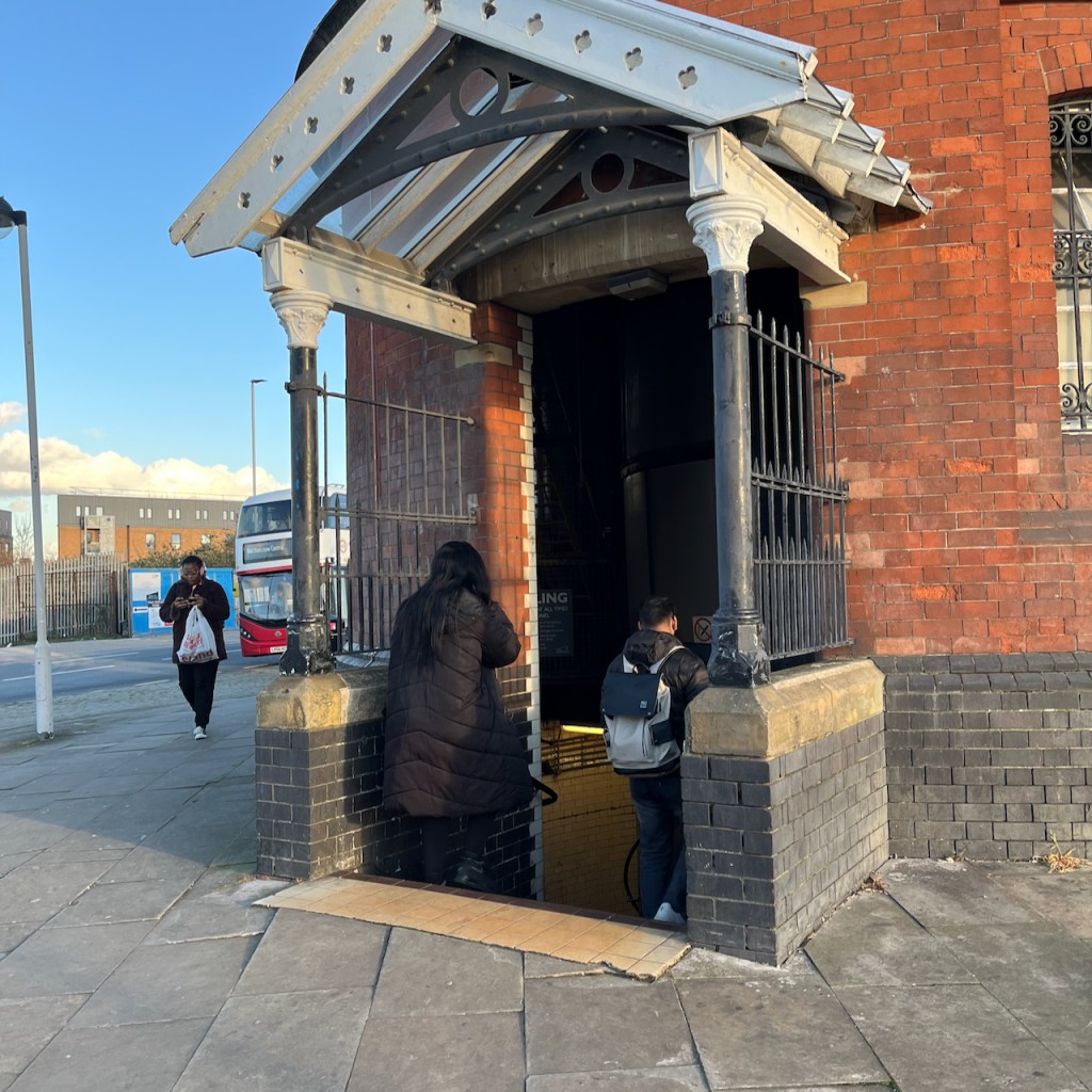
You have the option of the lift or the stairs. I followed the arrow to the stairs. The stairs are round the back. You have to find your way in, sidling between the wall of the leisure centre and the columned entrance to the tunnel. I can’t help feeling that the constructors of the tunnel would be appalled that their ornate entrance had been obstructed in this way.
Entrance to the stairs, under the canopy. Leisure Centre is the blue part on the left.
By this time I was rather doubting the wisdom of this undertaking, as the old building seemed so abandoned, and the entrance was so dark. However, the stairs were brightly lit, and it all seemed feasible. So down I went.
The tunnel itself is marvellous: all bright and clean, with amazing acoustics. I could hear the distant voices of people ahead of me.
Inside the Woolwich Foot Tunnel
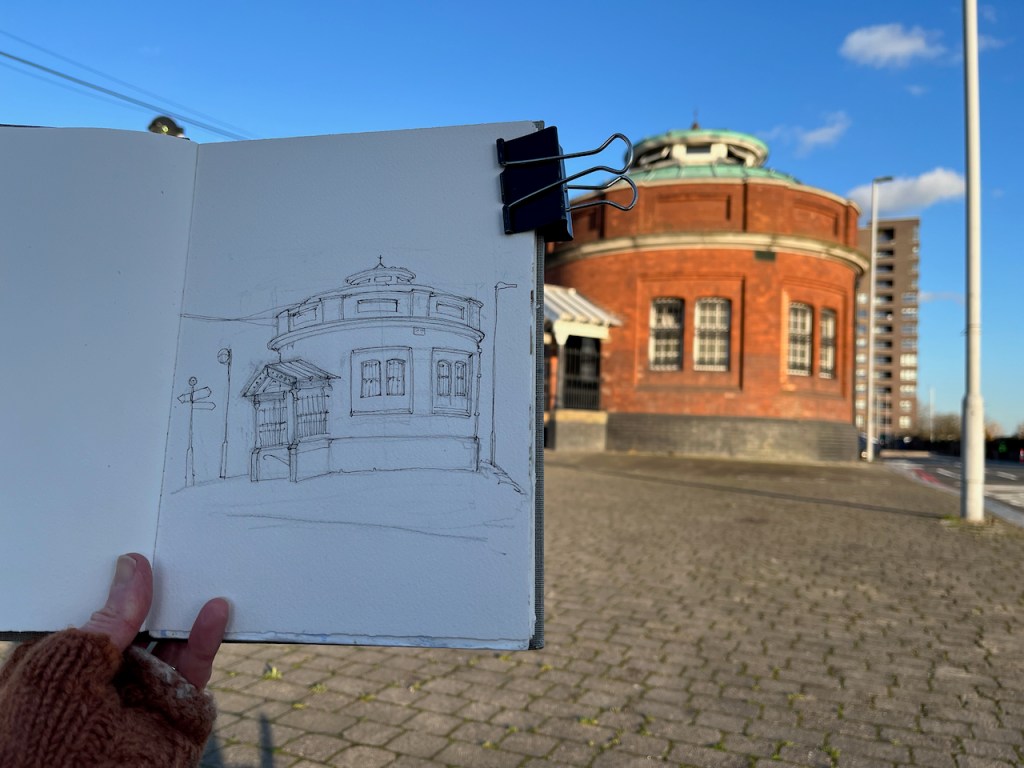
On the North side there is a different world. The North entrance, unlike its Southern counterpart, stands proud and isolated on an expanse of concrete. I sat down and sketched it.
The building stands on a traffic island which is a junction of many routes. The A117 takes heavy traffic onto the pier, to load onto the Woolwich Ferry. There’s a bus, the Superloop SL2 ,which goes to Walthamstow. People walk from the bus to the foot tunnel.
North entrance to the foot tunnel. The Superloop bus from Walthamstow is in the background.
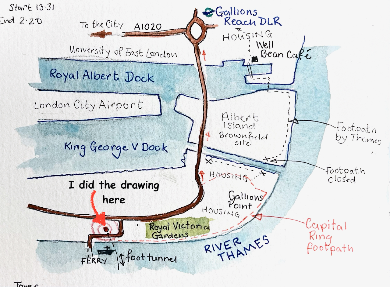
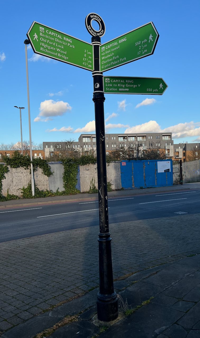
The signpost on the left of my drawing indicates the long distance footpath “The Capital Ring”. I followed this route along the Thames a little way. The path is cut off after the Galleons Point Housing development. Signs say that the lock gates are being maintained. So the route returns to the main road and passes over the spectacular bridges across the docks.
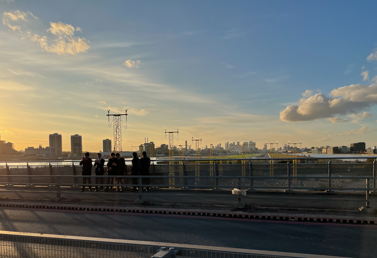
The bridges offer a view directly down the runway of London City Airport. When I walked past, some boys were enthusiastically photographing the aircraft on their mobile phones.
Plane spotters on the bridge over the Royal Albert Dock. City of London in the distance.
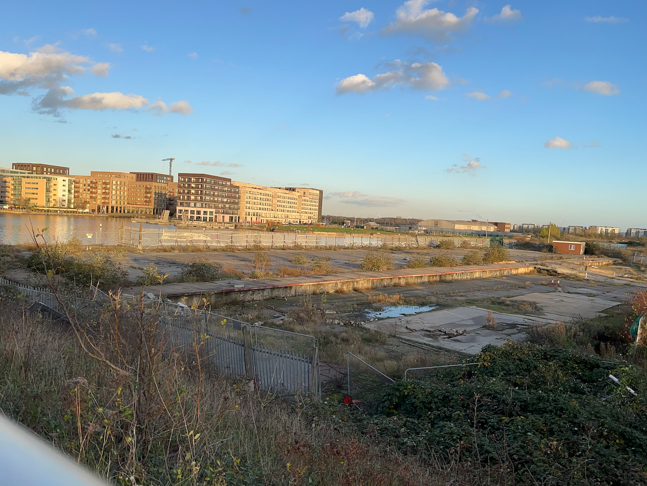
The other direction from the airport, looking toward the Thames, is a scene which seems to define what we mean by “brown field site”.
A brown field site: Albert Island, North Woolwich. This photo was taken from the same spot as the one above, but looking the other way.
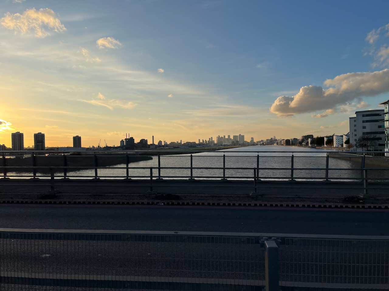
In the distance on the left, you see the housing developments round Gallions Reach. The quantity of space round here is astounding. And the docks are enormous.
Royal Albert Dock from the Steve Redgrave Bridge. The dock is about a mile long. The University of East London is on the right, City Airport on the left, City of London towers in the distance.
I walked on over these immense bridges over the docks. An oncoming bus tooted cheerfully. I looked up to see the driver smiling a friendly greeting. Perhaps I looked a little lonely and cold. The bus rushed on. I felt warmer.
On the other side of the bridge I warmed up in the “Wild Bean Café” (recommended) and then made my way to Gallions Reach DLR station and thence to central London.
If in need of wide open spaces and a bit of distance from the problems of the City, then a trip downriver is definitely the thing.
Sketching the North entrance to the foot tunnelSignpost by the North EntranceThe river at North WoolwichLooking downstream, North WoolwichPumphouse in Gallions ReachSketchbook 15 spread
Click a button below to share this post online, email it, or print it:
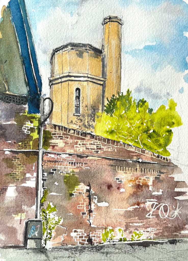
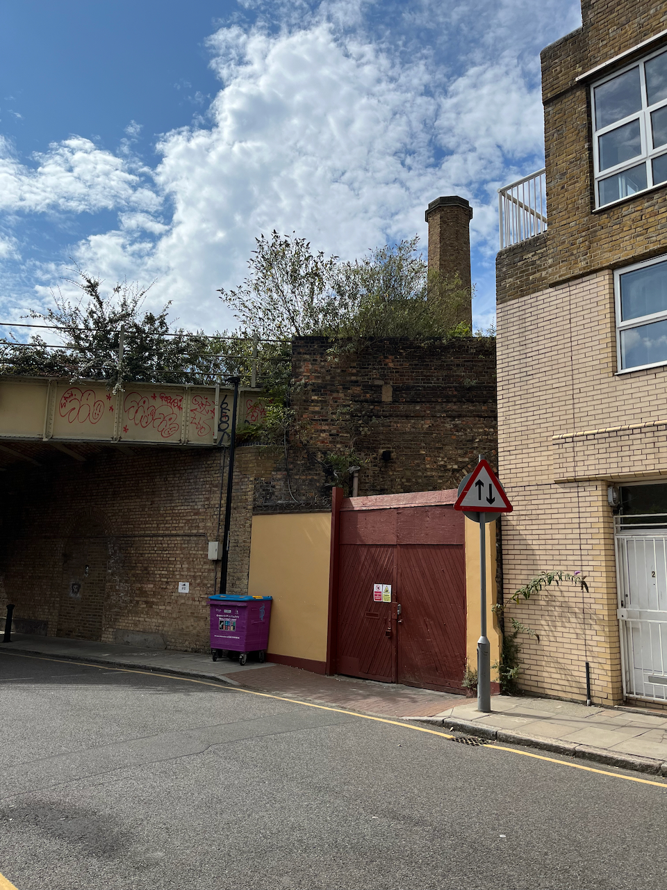
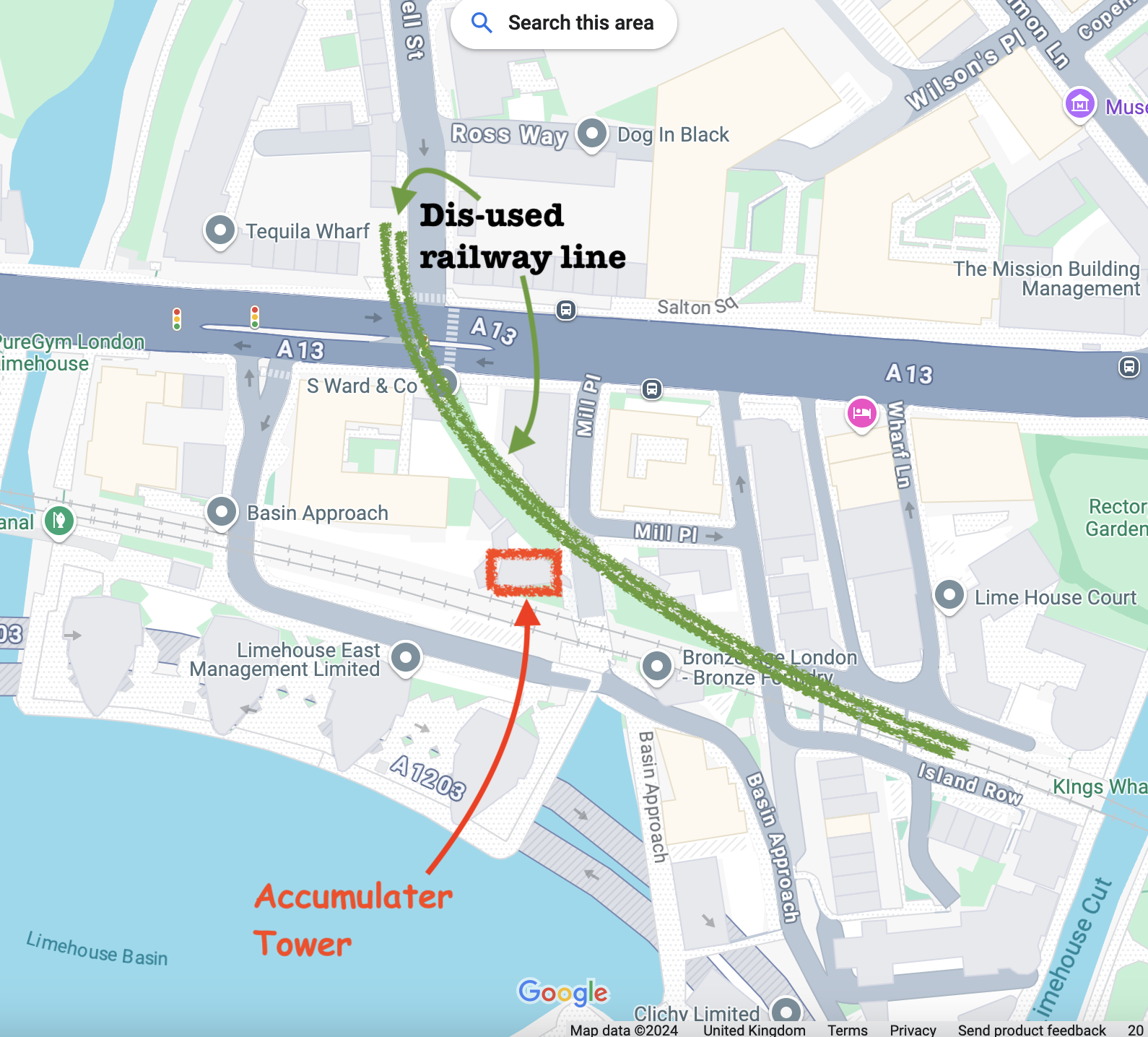
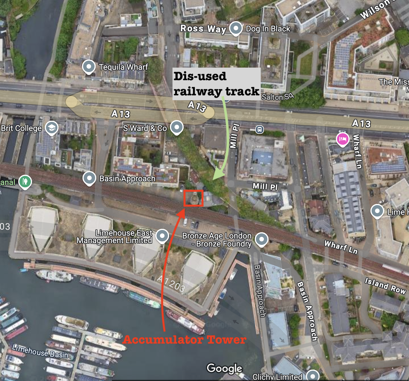
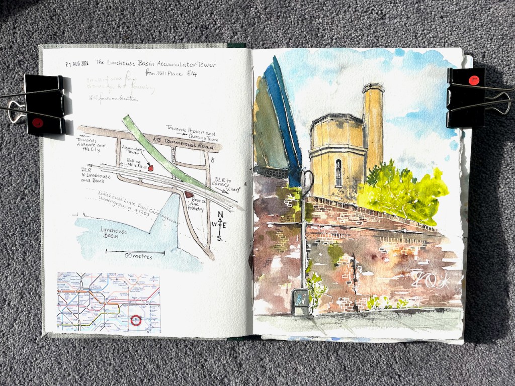
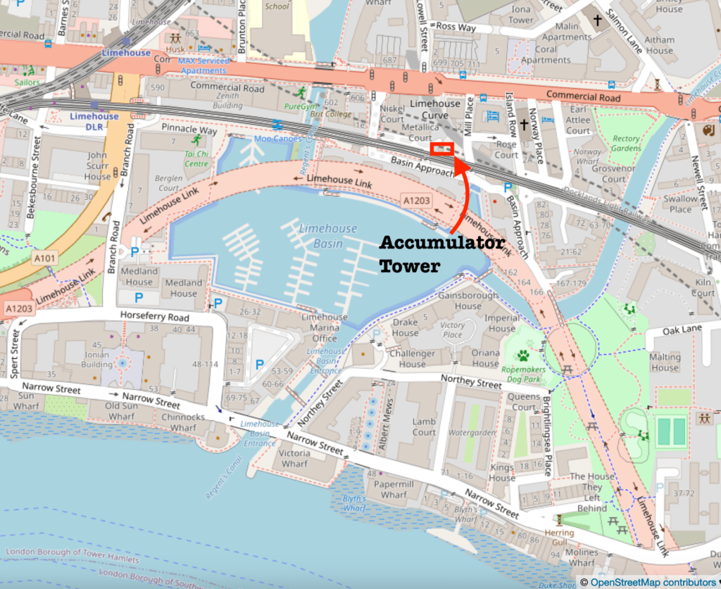
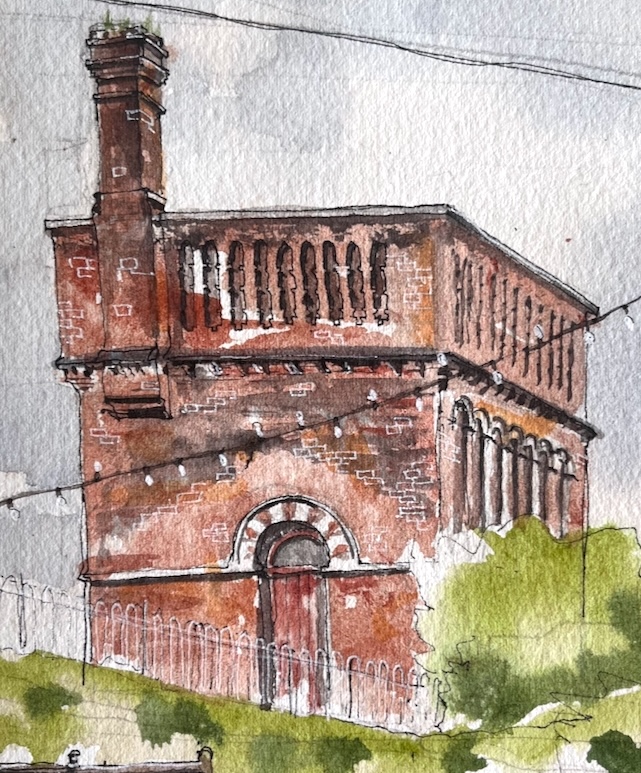
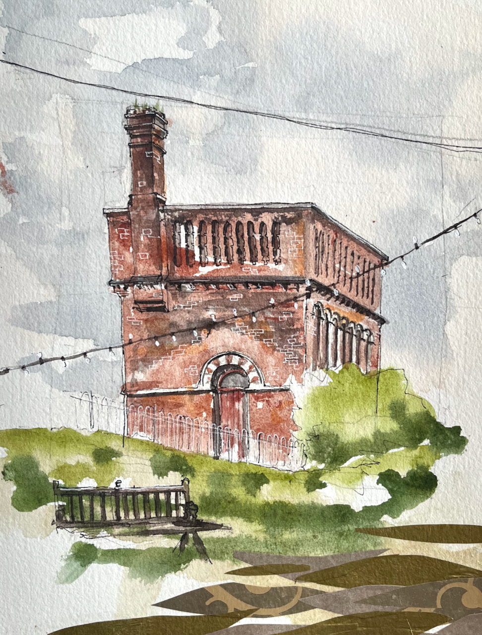
This is the Limehouse Accumulator Tower, seen from Mill Place, London E14.
Limehouse Accumulator Tower, sketched 21 August 2024, in Sketchbook 15
In the 19th century, this building provided hydraulic power to machinery in the Limehouse docks. Hydraulic power is a way of transmitting energy from one place to another.
The problem at the time was that steam engines could generate motive force, but only where they were. You could build a big powerful steam engine, but you couldn’t put a steam engine next to every crane, capstan, or set of lock gates. You also didn’t want to fire up a steam engine every time someone wanted to use the lock gates. So you had to find a way of transmitting the power from the steam engine to the machinery which used it. And you had to find a way of storing the power so it was available on demand. Before the use of electricity was common, power was transmitted using pressurized water.
The steam engine located in this building was used to pump water into the adjacent accumulator tower, by lifting a heavy weight. The heavy weight was a neat fit on top of the water inside the tower and pushed the water down. Water does not compress. So the weight just sat there, applying pressure to the water. The pressurised water was distributed around the docks in thick cast-iron pipes. When the lock-keeper wanted to operate the lock gates they opened a tap and the force of the pressurized water opened the gates. Then they closed the taps. Far away, the weight moved down very slightly in the accumulator tower. Eventually the steam engine was used to pull the weight up to the top again.
That’s 19th century hydraulic power. Power is transmitted by pressurised water in cast-iron pipes: the original, functional, steam-punk.
I find it marvellous. I’ve drawn the much bigger London Hydraulic Power station here. The Limehouse building is smaller. It was built in 1869, one of several in the area at the time. It was restored in 1994/5, but sadly the weight and machinery are removed. There is a detailed history of the building on this link from the Greater London Industrial Archaeology Society.
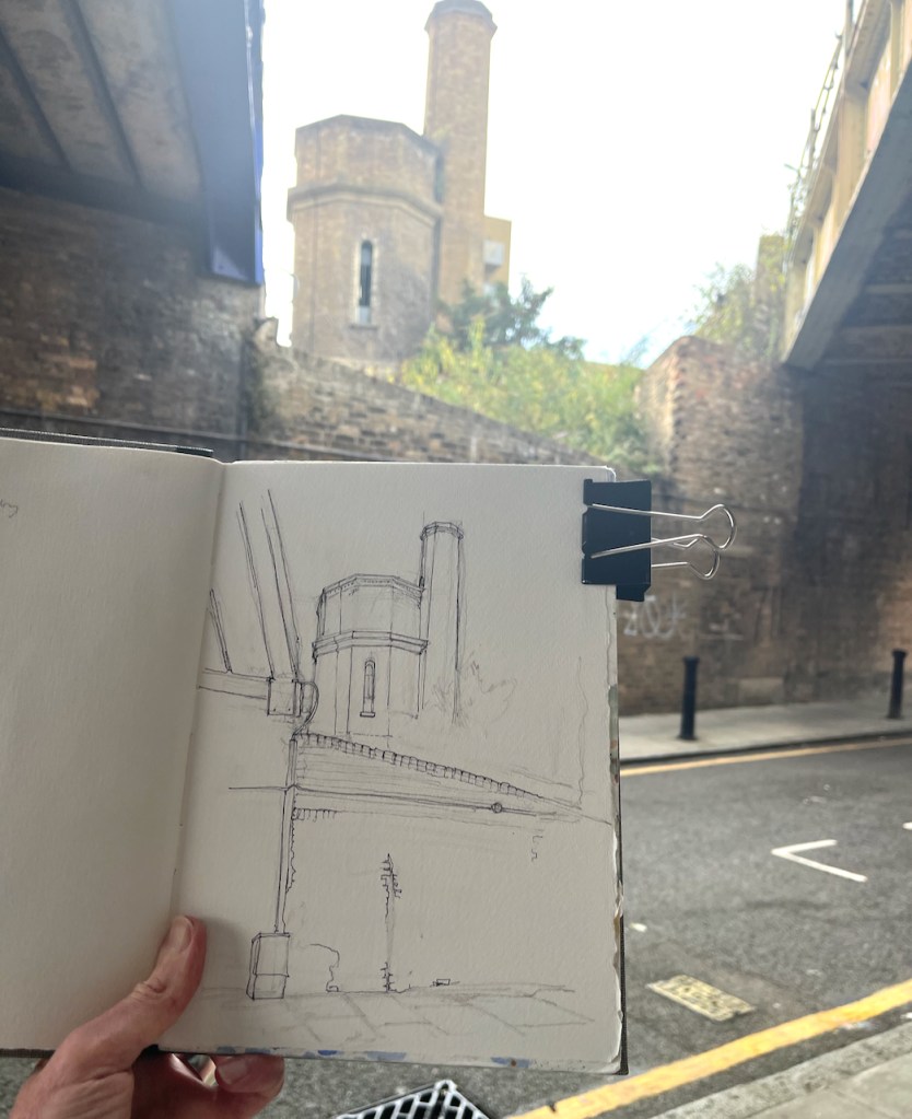
Sketching the Limehouse Accumulator Tower. The modern Docklands Light Railway lines run over the Victorian bridge to the left, the bridge to the right is disused.
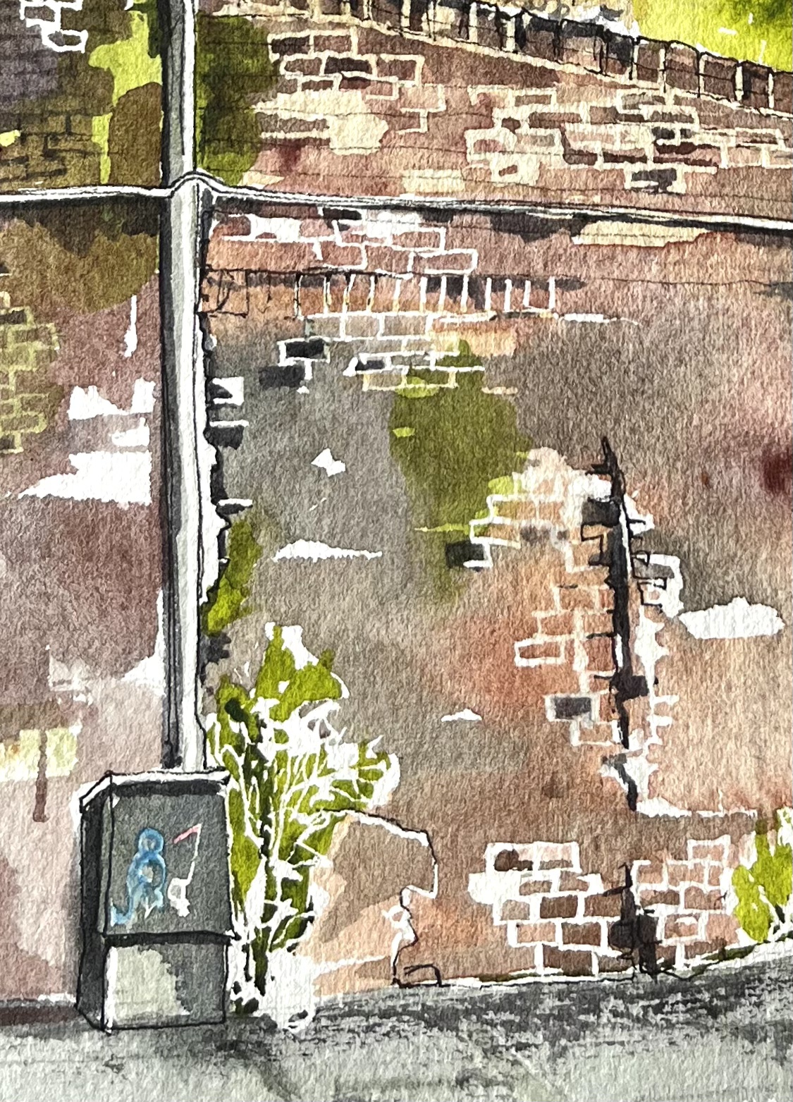
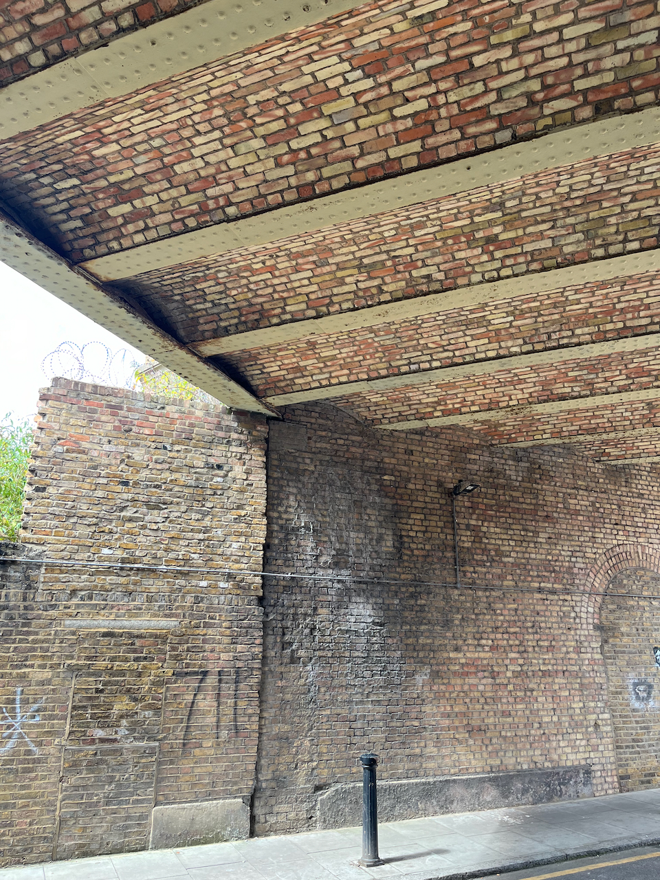
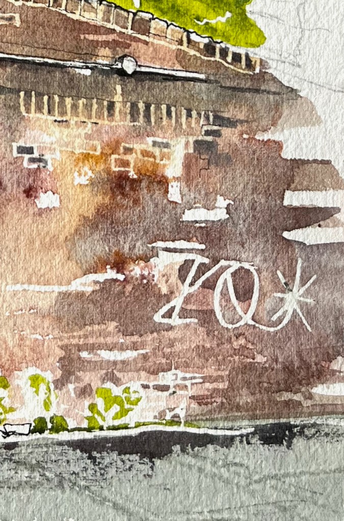
Standing in Mill Place to make this sketch, I became aware of all the history that is embedded in walls. The one in front of me had been altered, rebuilt, and amended several times. A bit had been added on top. Plants lived there. A graffiti artist had made their mark on the crumbling stone.
I was standing under two bridges, both 19th century. Both survivors. One holds the modern Docklands Light Railway. The other had wonderful strong vaulting. But it held no railway. I walked around trying to find out where it went. The Google aerial view confirms what I suspected: it is a ghost railway. On the bridge there is verdant greenery where the railway used to be. It goes across a second sturdy bridge, over the A13, and then stops.
Vaulting on the bridge Verdant greenery, but no railway. (Accumulator tower in the background)A sturdy railway bridge across the A13 carries no railway.The railway bridges with no railway
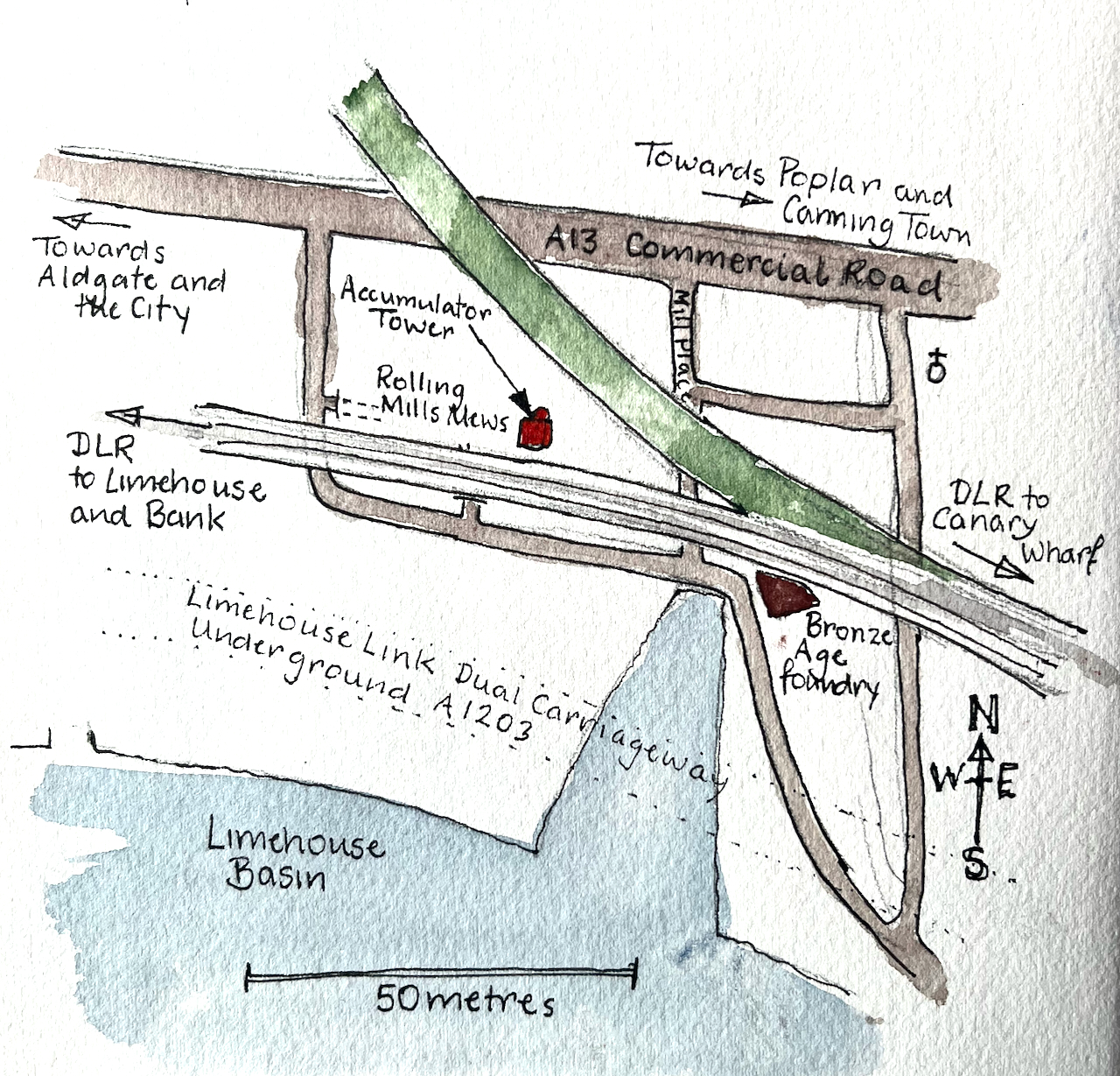
Here are some maps which show the position of the Accumulator Tower and the absence of a railway (click to enlarge).
In this whole area the works of Victorian engineers make themselves felt. Each bridge is a triumph of the bricklayers’ skill: not only strikingly beautiful, with clean curves and neat detailing, but also enduring, powerful and functional 150 years later.
Sketchbook 15map (c) OpenStreetMap contributors: click to go to the map
Click a button below to share this post online, email it, or print it:
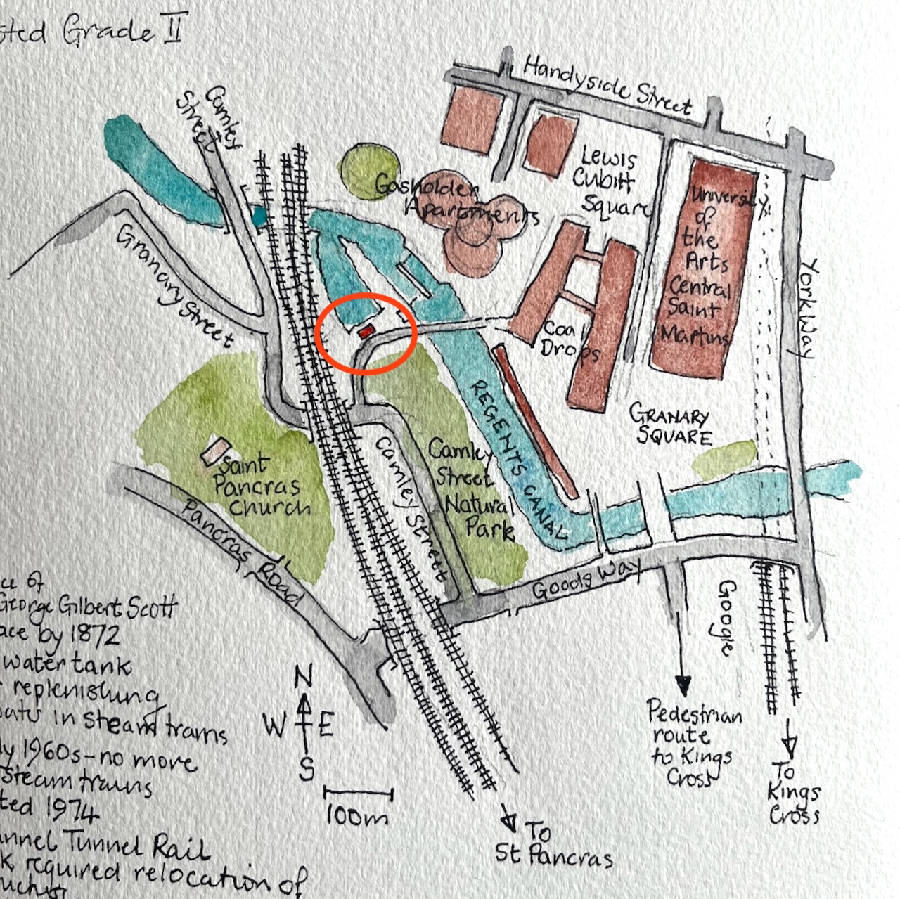
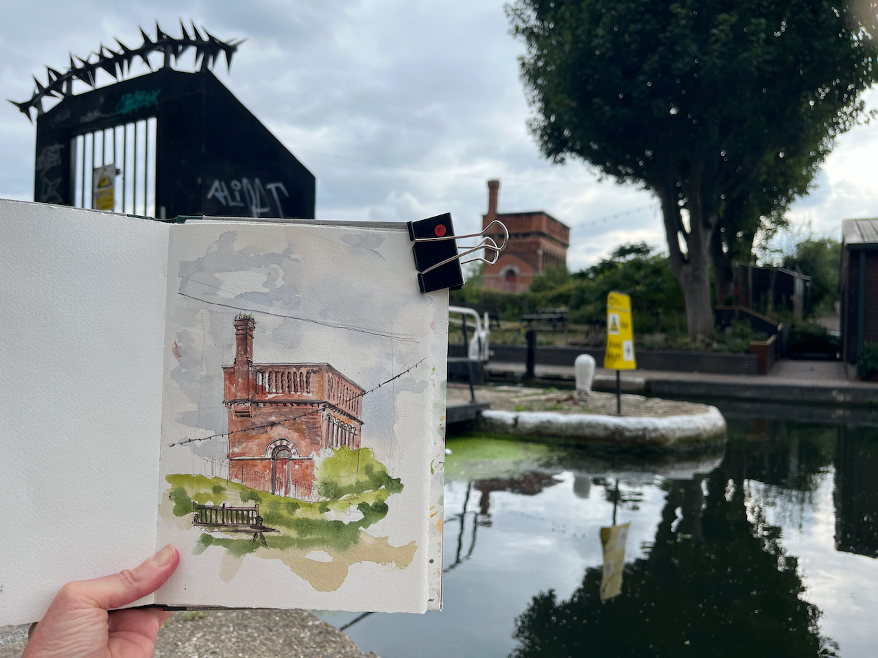
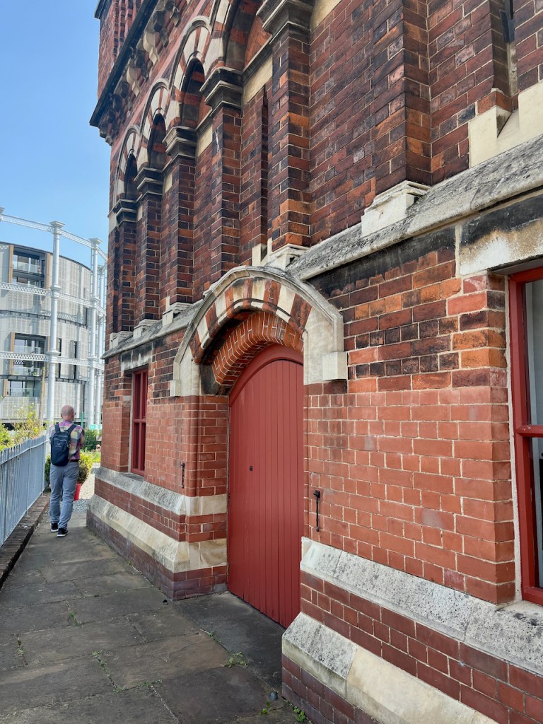
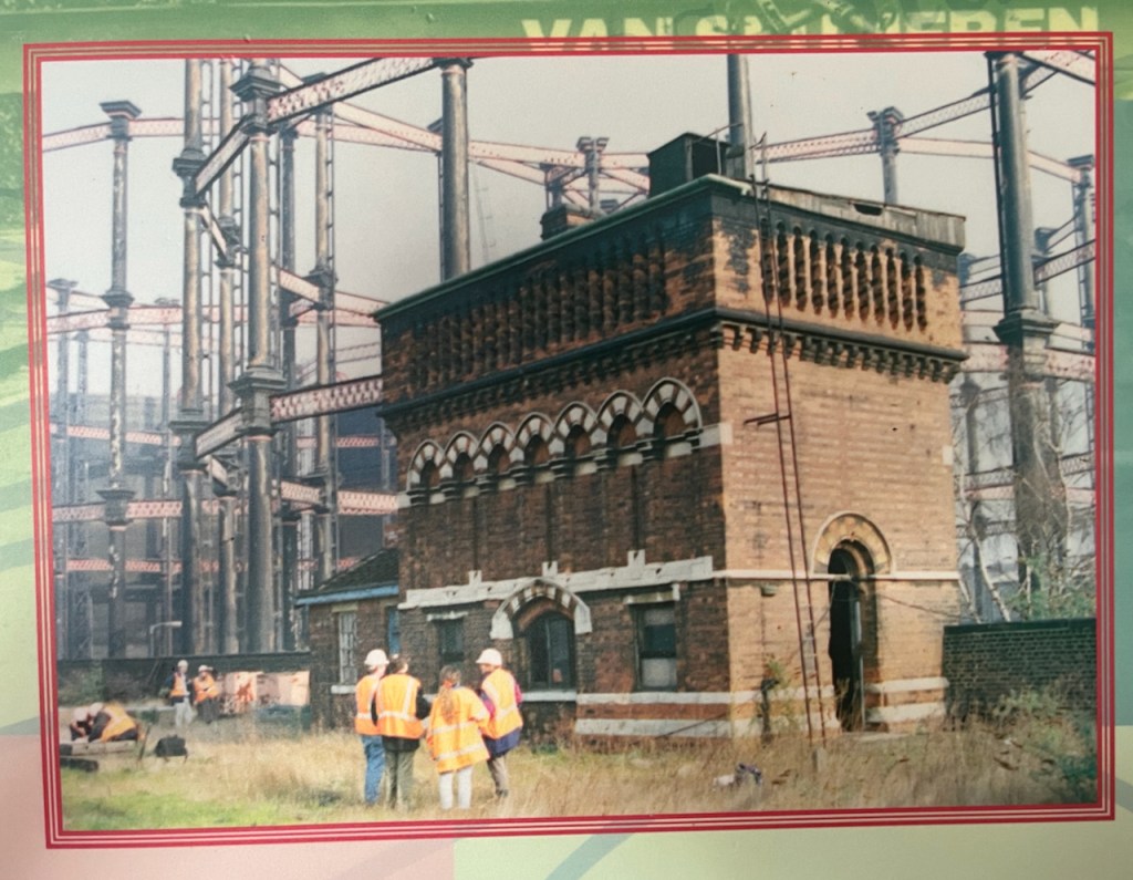
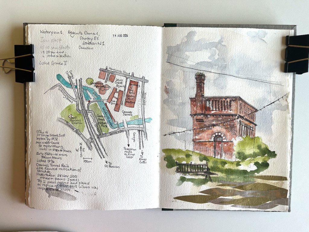
This structure is visible from the North side of the Regents Canal at Coal Drops yard. It was a “water point” for replenishing the boilers of steam engines. The top housed a water tank.
Waterpoint, seen from the Regents Canal towpath at Coal Drops. August 14th 2024, in sketch book 14
Here’s a map to show where it is. I’ve seen this structure often when walking along the canal, and it’s been on my “sketch-list” for a while, so I was glad that a co-incidence of weather and time gave me the opportunity to sketch it.
Waterpoint, circled.
I was sketching from the Regents Canal towpath right next to St Pancras Lock.
Sketching Waterpoint, looking south across St Pancras Lock.
It turns out that this structure is open to visitors from time to time. By an amazing co-incidence, one of the visiting days was the weekend after I did my sketch. The kind and informative guides there patiently answered the many questions I had, and allowed me to photograph their video and their display boards.
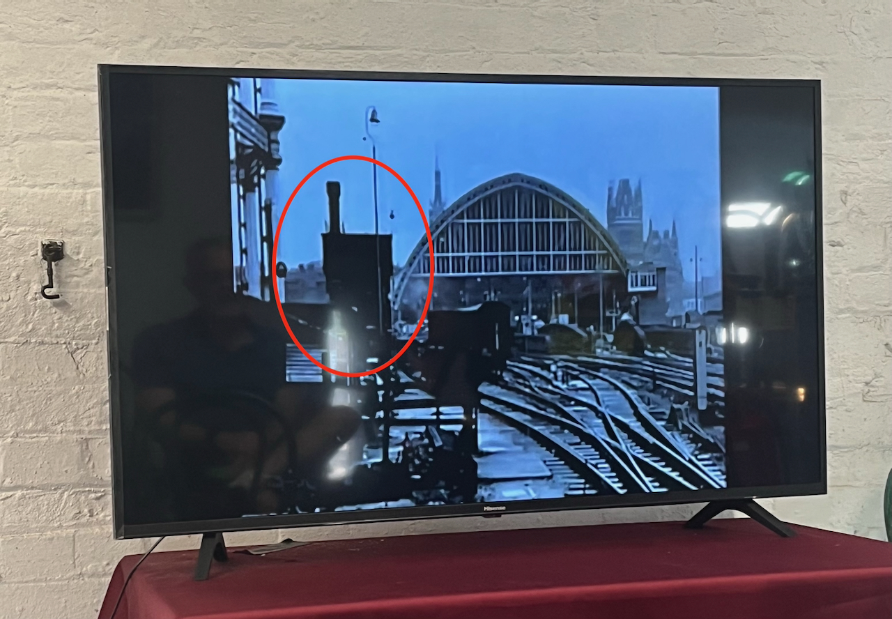
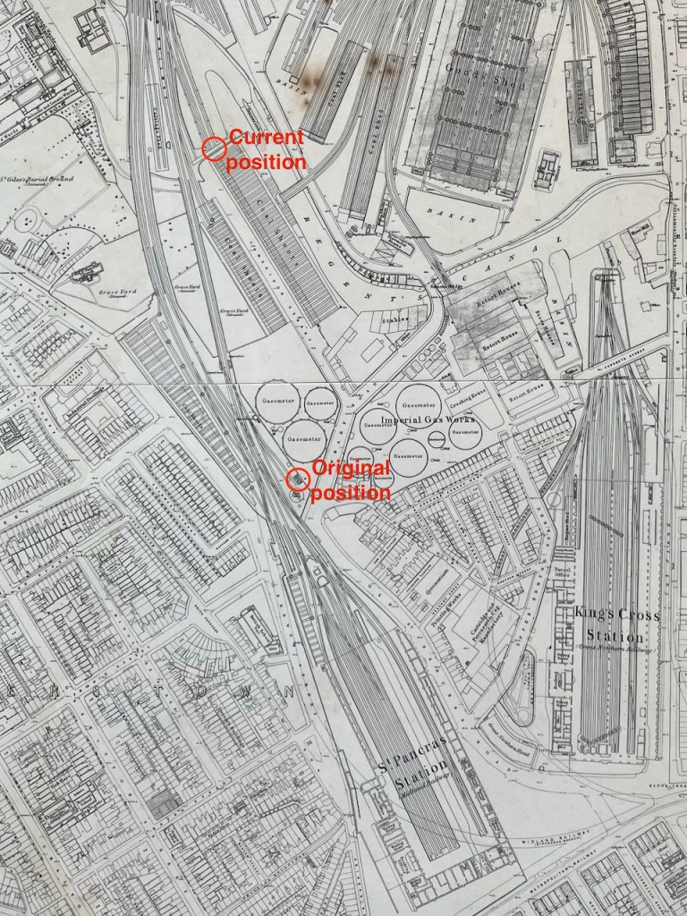
For me, the really fascinating thing about this structure is that it has moved. It was not always in this location. It used to be next to St Pancras Station. It was built around the same time as the station, 1870. In 2001 it was moved North, to its current location.
It was designed by team of Sir George Gilbert Scott, who designed the St Pancras Hotel. Since its purpose was to fill the tanks of steam trains, it was right next to the railway lines. You can see it here:
Photo of a video shown at the Waterpoint.
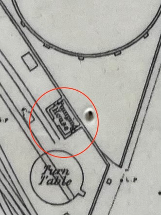
Here it is on an 1871 map: (click to enlarge)
my annotations to show the original position next to St Pancras, and the current positionOn the 1871 map it is labelled “Pumping House”1871 map on display at the Waterpoint (copyright National Library of Scotland)
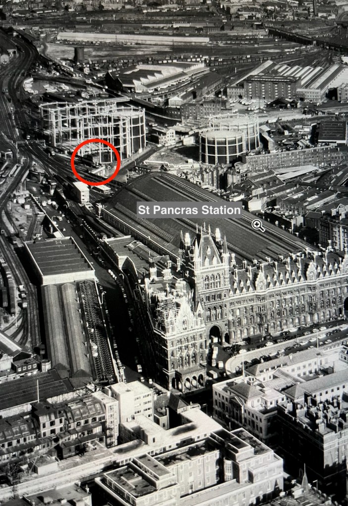
I think I can spot it on this archive aerial photo from 1964. Here is the link to the picture:
The water point is just beyond the far right hand edge of the St Pancras train shed, in the centre left of the photo on the link above.
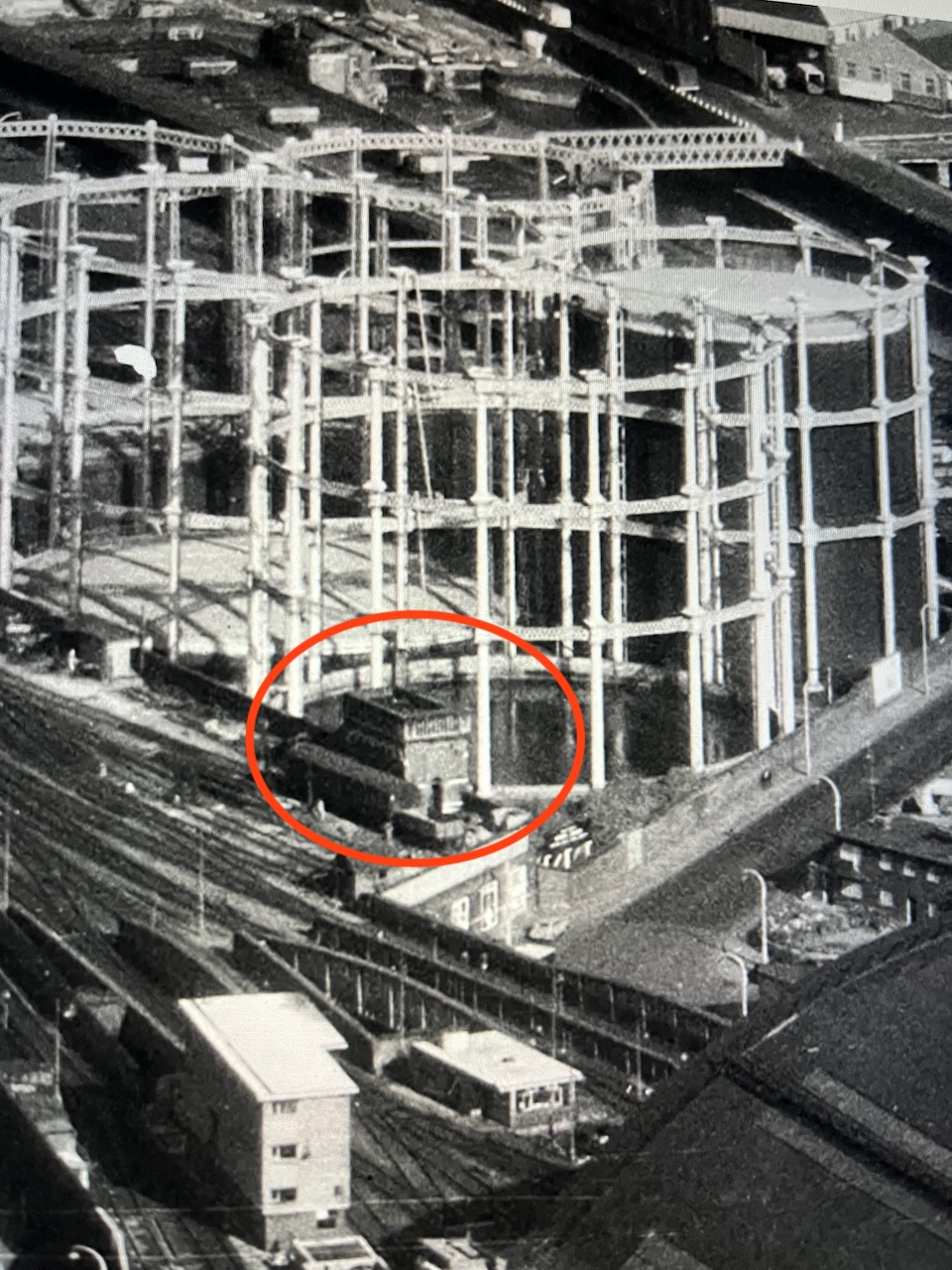
Here are some low resolution images to help you find it.
Detail from the aerial photo above. The gas holders shown in these photos have also moved.
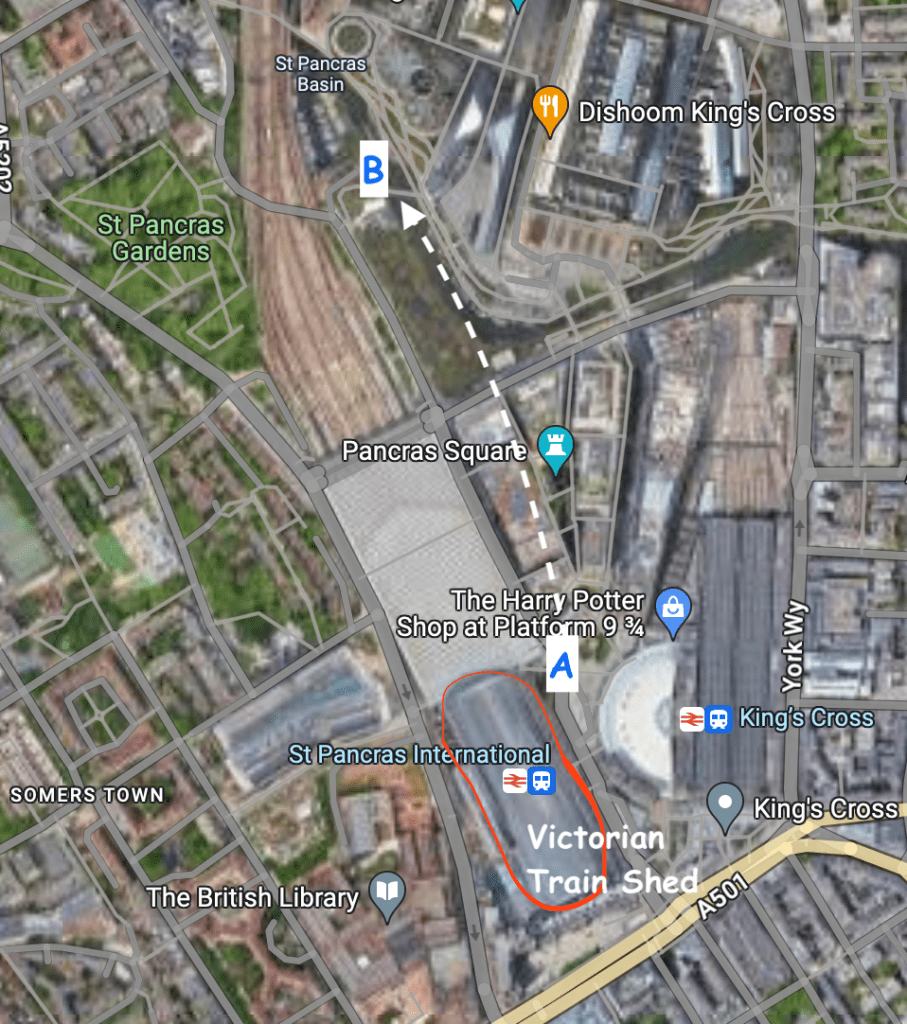
Here are modern maps annotated to show the original position and the current position:
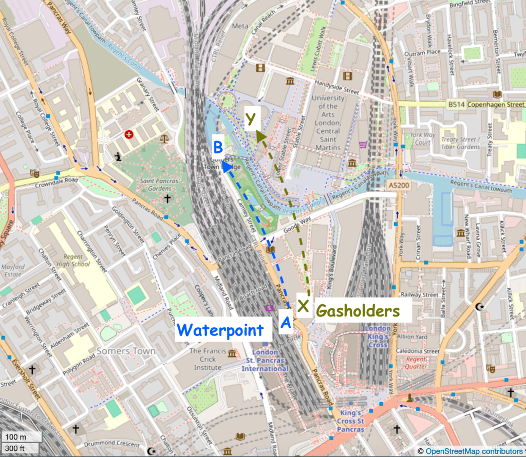
Google map. Waterpoint moved A to B.Waterpoint moved A to B. Gasholders moved X to Y. map (c) openstreetmap contributors
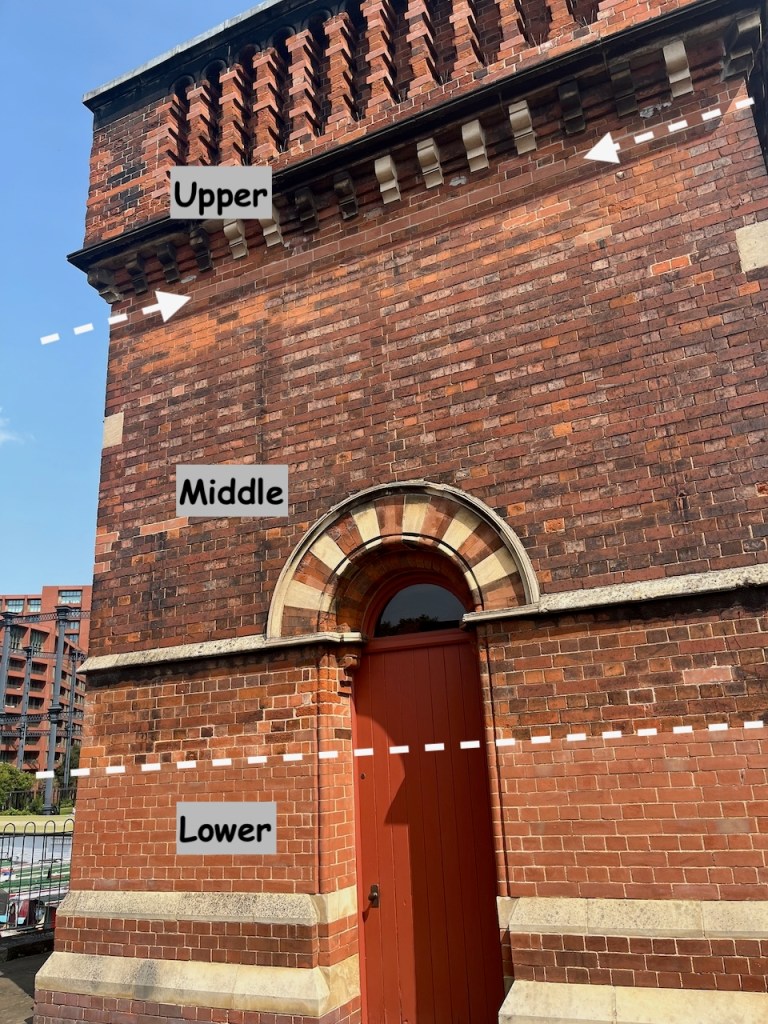
To move it, the original Water Point was cut horizontally into three sections. The lower section was left behind. A new lower section was built in the new location. The middle and upper sections went by road to the new location and were stacked on top of the newly built lower section. You can see, by changes in the bricks, the joins between the sections.
The new lower section is clearly visible.The line of new bricks at the top marks the join between the middle and upper sectionsView of the south side of the Waterpoint, annotated to show the sections
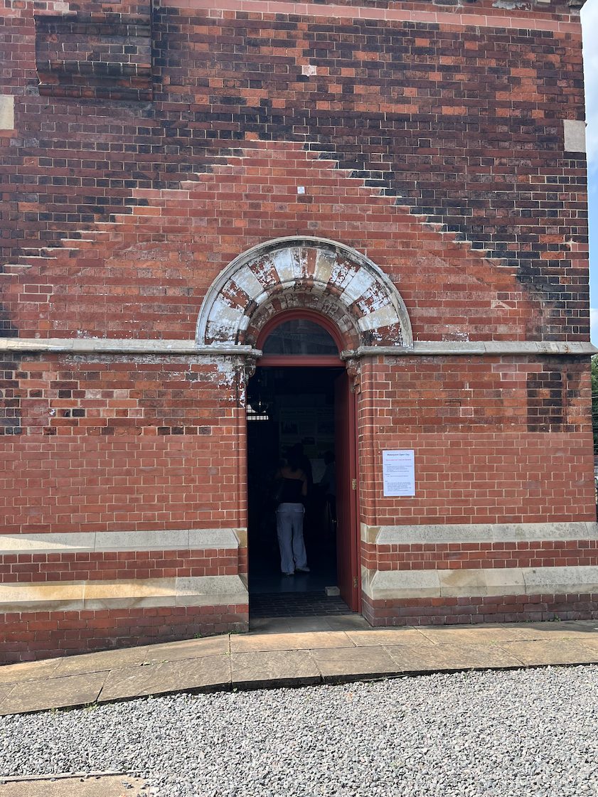
On the side of the Waterpoint visible from the canal, there is a clear “roof” pattern in the bricks, which I noticed when sketching it.
This marks the position of a shed that was fastened to the structure in its original position. See the pictures below.
Original position – note the shed on the left What was left when it was moved.The display boards show the project to move the Water Point. These are 2001 photos.
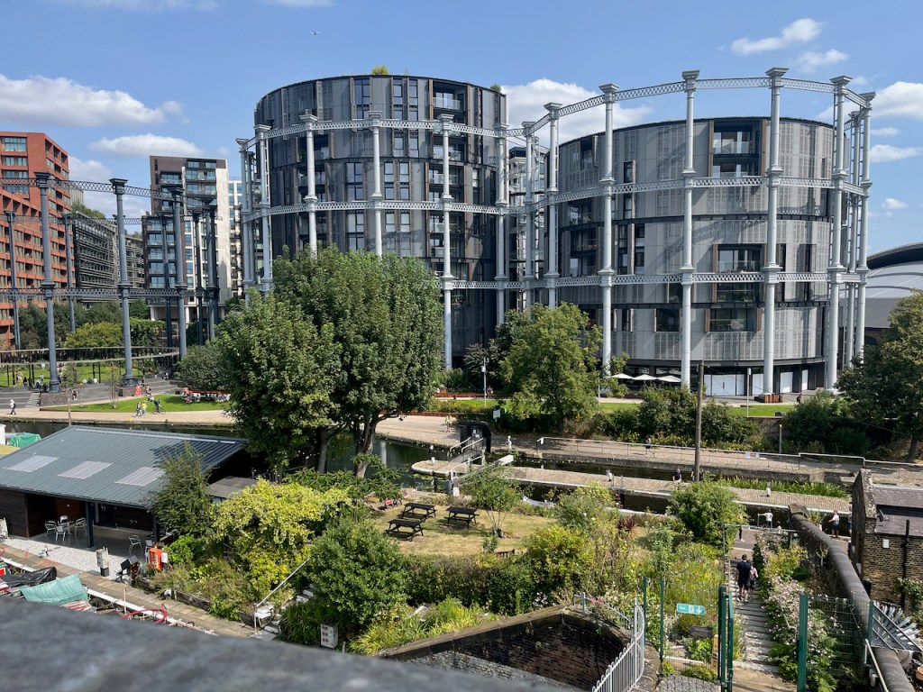
These photos and maps show how much the area has changed. See all the gas holders! They were constructed on the south side of the Regents Canal, because that’s where the gas works was. They originally held coal gas, which is carbon monoxide and hydrogen, manufactured from coal. Until 2010 they were a landmark for anyone who made this journey into Kings Cross regularly.
Here’s a frame from the 1963 film “Alfie” captured by @runningthenorthernheights, showing the gasholders in their original position.
Thanks to @runningthenorthernheights
The gasholders were decommissioned in 2000, but several of them couldn’t be destroyed because they were listed, so they just stood there for ten years. Then they were dismantled, stored, preserved and reconstructed in the years 2010-2015. They are now on the north side of the Regents Canal. Gas holder No. 8 was the first to be reconstructed, in 2015. It surrounds a small park. Gas holders 10, 11 and 12 followed, surrounding luxury apartments, part of the Kings Cross development. (https://www.kingscross.co.uk/gasholder-park)
Gasholders seen from the top of the Waterpoint, August 2024. I did the sketch from the far side of the canal.
Here are more photos from my visit to Waterpoint in August 2024.
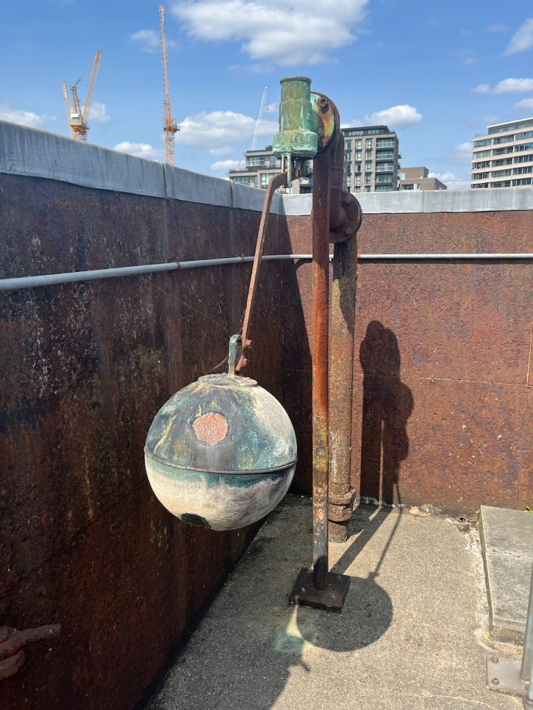
Ball cock in the (now empty!) tank on the topView from the topView from the topThe “chimney” up close. The guide is explaining that it is purely decorative. It is solid: there’s no “chimney”.
I was very glad to have the opportunity to visit this quirky building. Recommended!
Click a button below to share this post online, email it, or print it:
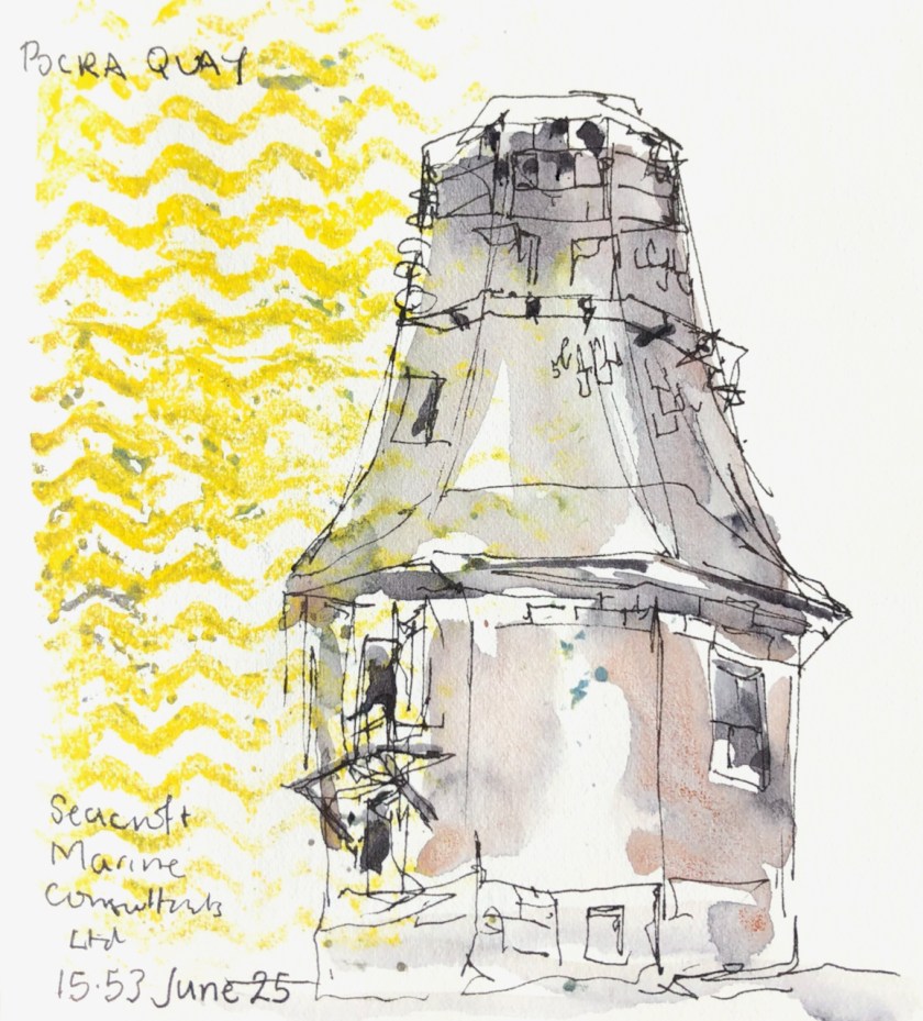
“[built] to guide vessels to port, this was originally carried out by the harbour pilots via loudhailer from a platform built into the roof of the original 2-storey structure, or by a system of wicker balls suspended from a pole rising from the platform.” [1]
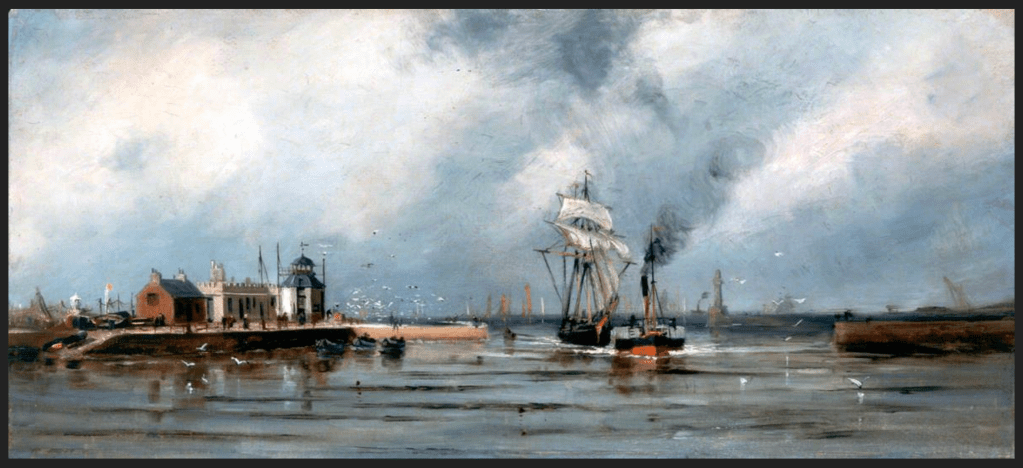
“Entrance to Aberdeen Harbour” by James Cassie (1819–1879) image copyright: Aberdeen Maritime Museum
“The control tower was added in 1966 and a radar system was introduced in 1974. The structure was further updated in 1986 at which time the Queen unveiled a plaque, situated to the right of the main entrance to the tower, commemorating ‘850 years of Harbour History’.” [1]
It was in use until the Marine Operations Centre opened in 2006 [4]. This is nearer the sea, just visible behind the lamp-post in my drawing. It handles about 25000 boat movements a year, which averages at 60 a day [2]. For comparison, Heathrow air traffic control centre handles abut 200000 aircraft movements a year or 500 a day [3]. The area managed by the Marine Control Centre extends 2.3 nautical miles around the headland to the South of the harbour [5]. So the Operations Centre handles not just boats going in and out, but boats moving around inside and outside the harbour as well.
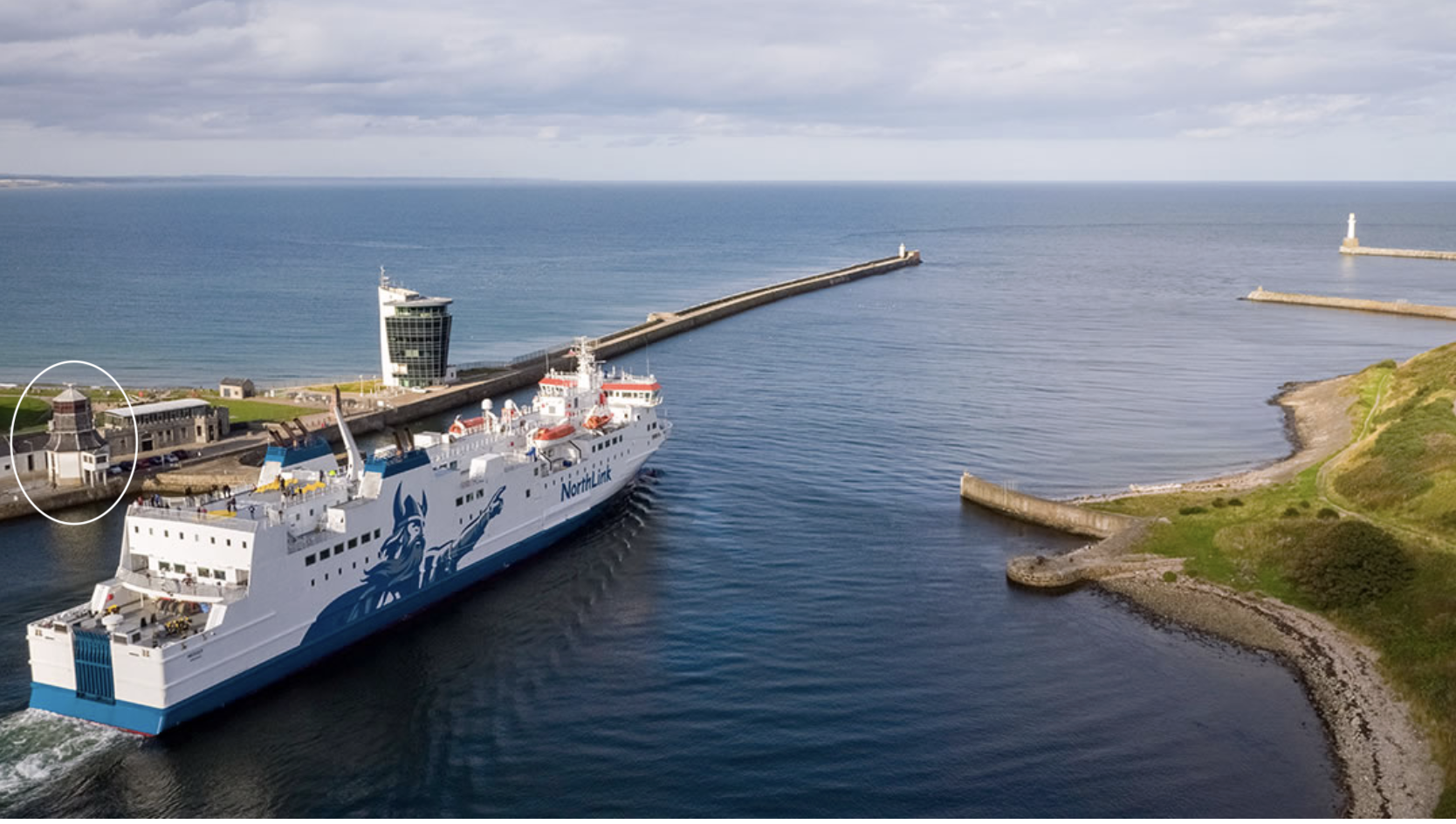
MV Hrossey leaving the port of Aberdeen, photo copyright southspear media, used with permission [6] The Roundhouse, circled, is on the left, and the Marine Operations Centre is above the centre of the ship. This is the Northlink ferry, sailing to the Northern Isles.
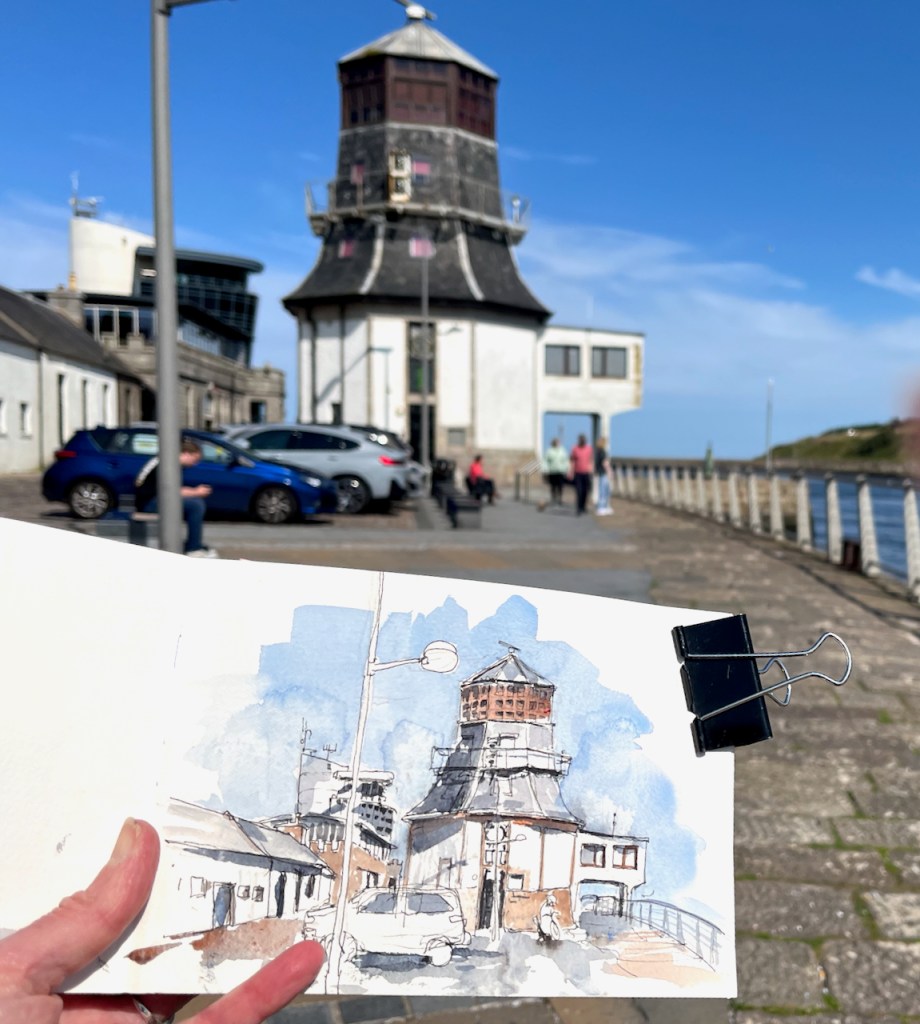
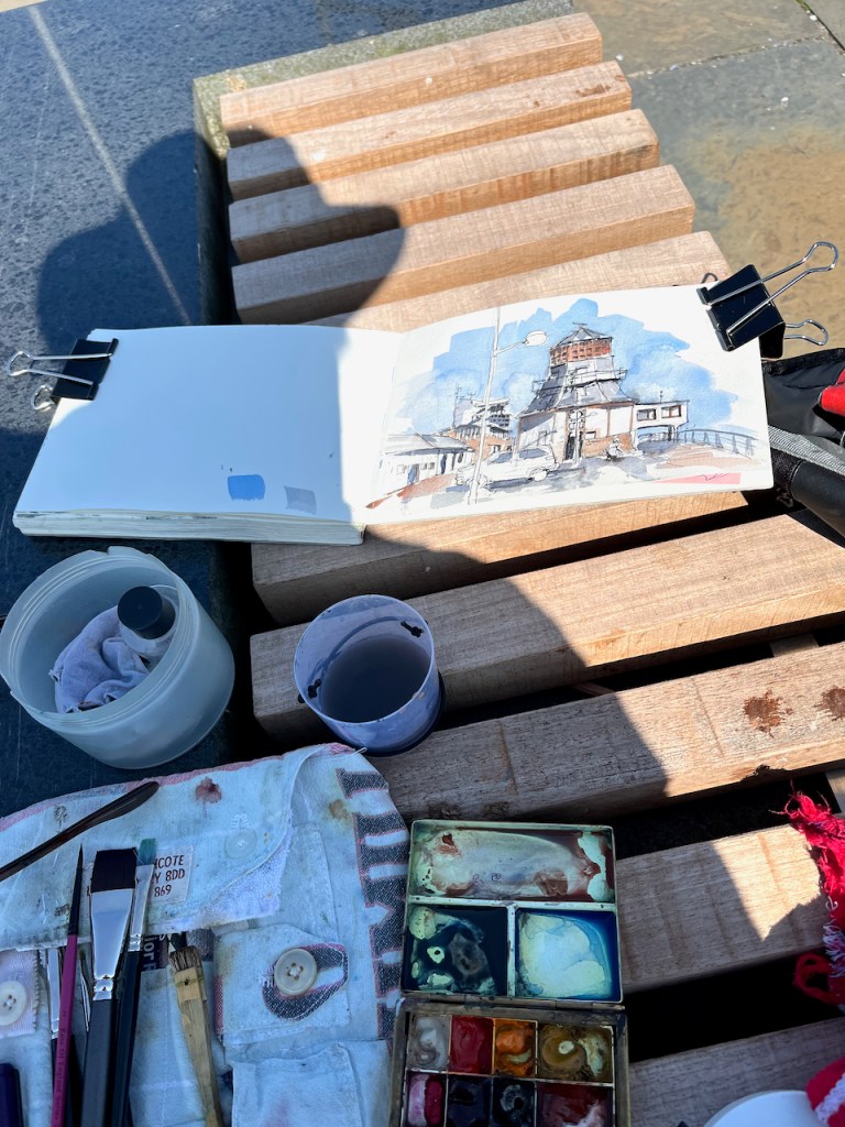
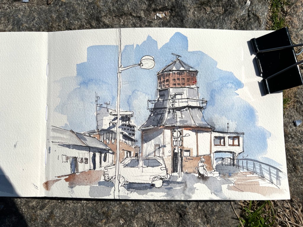
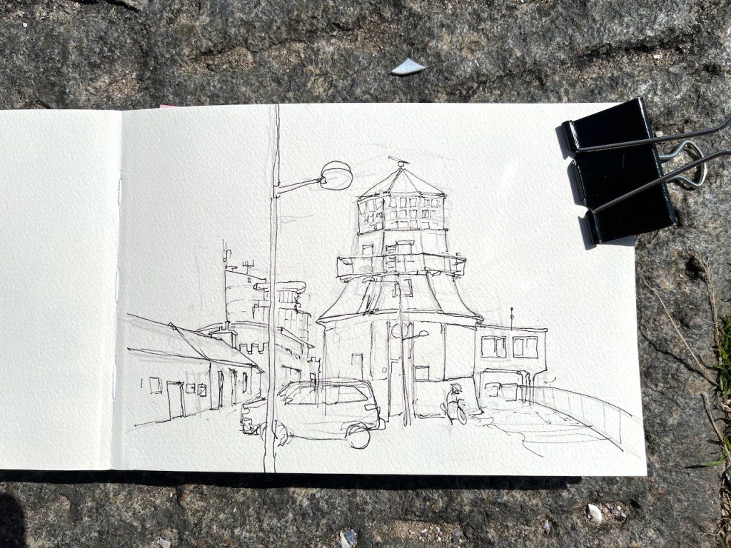
I sketched this on a stunning hot day, sitting on a bench by the quay.
The Roundhouse. The modern Marine Operations Centre is the tall white building behind and to the left. In front of it, and lower down behind the cars, is the restaurant “The Silver Darling”.
Three years ago, on a very different day, I made a much quicker sketch:
A quick sketch on a stormy rainy day, sketching from the shelter of a doorway. June 25th 2021.
[5] Port of Aberdeen Vessel Traffic Services extent: “All shipping movements within the Aberdeen VTS area (within 2.3nm from Girdleness) are controlled by Aberdeen VTS. Participation with VTS is mandatory, for further details please see ALRS Vol.6.” https://www.portofaberdeen.co.uk/port-information/marine
[6] Thank you to Nick McCaffrey of Southspear media for permission to use his amazing photograph of MV Hrossey leaving the port of Aberdeen.
Click a button below to share this post online, email it, or print it:
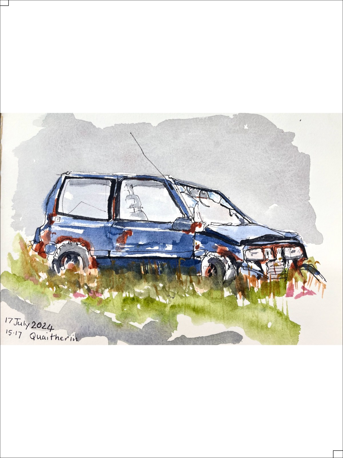
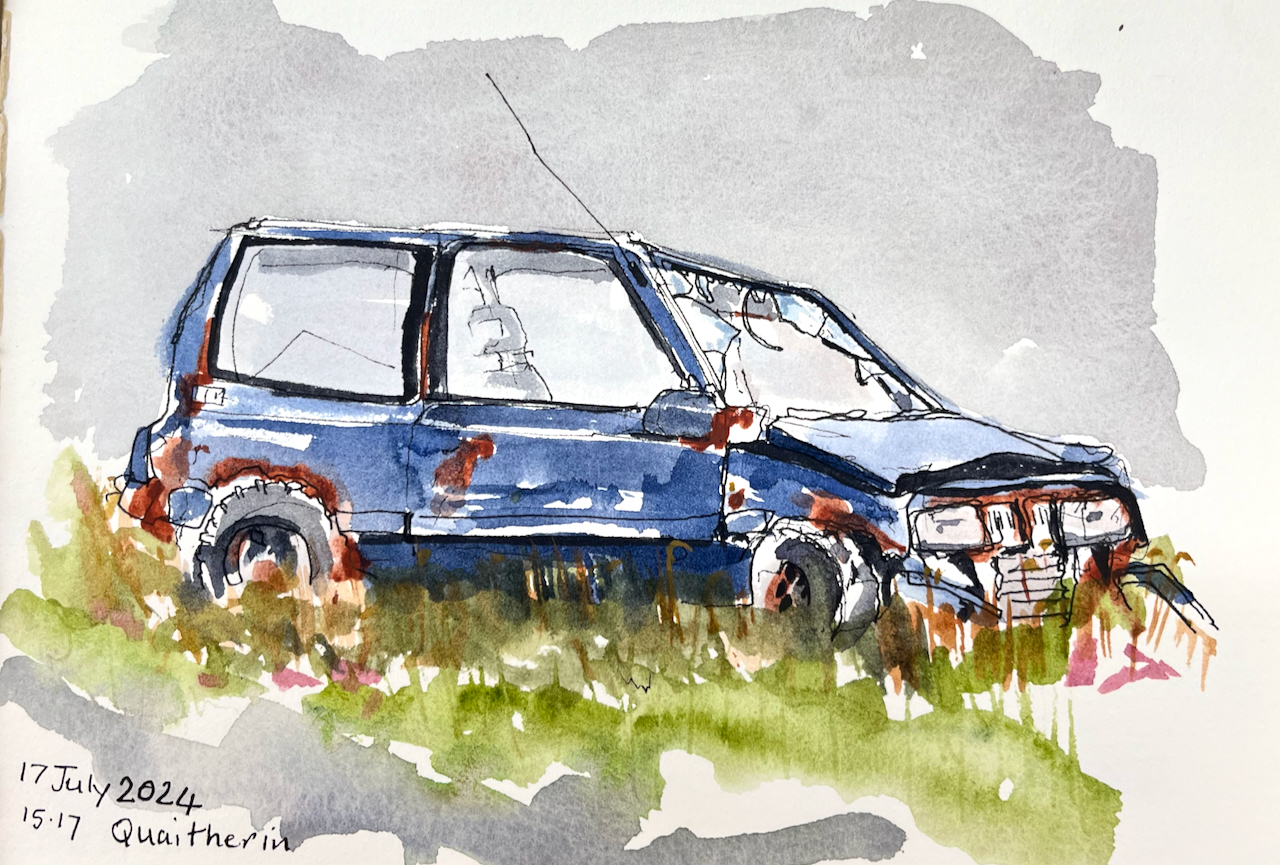
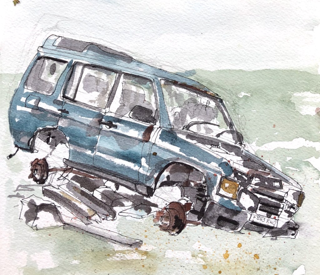
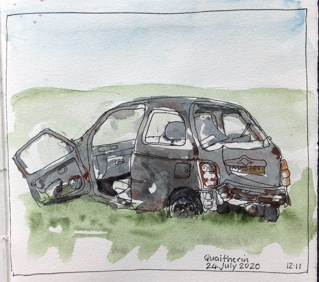
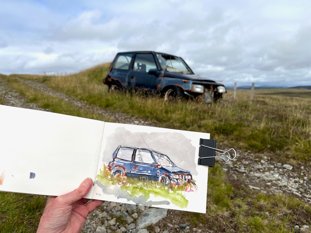
I don’t want to give the impression that Shetland is littered with abandoned cars. It’s not. But there are certain hidden areas I’ve discovered which are car graveyards, and I now go there deliberately. I find something vaguely poetic, evocative, about an abandoned car in a wide pristine landscape. It’s as though the landscape frames it: puts a picture frame around it and says look! This twisted metal is art.
“look! this twisted metal is art.”
Click a button below to share this post online, email it, or print it: