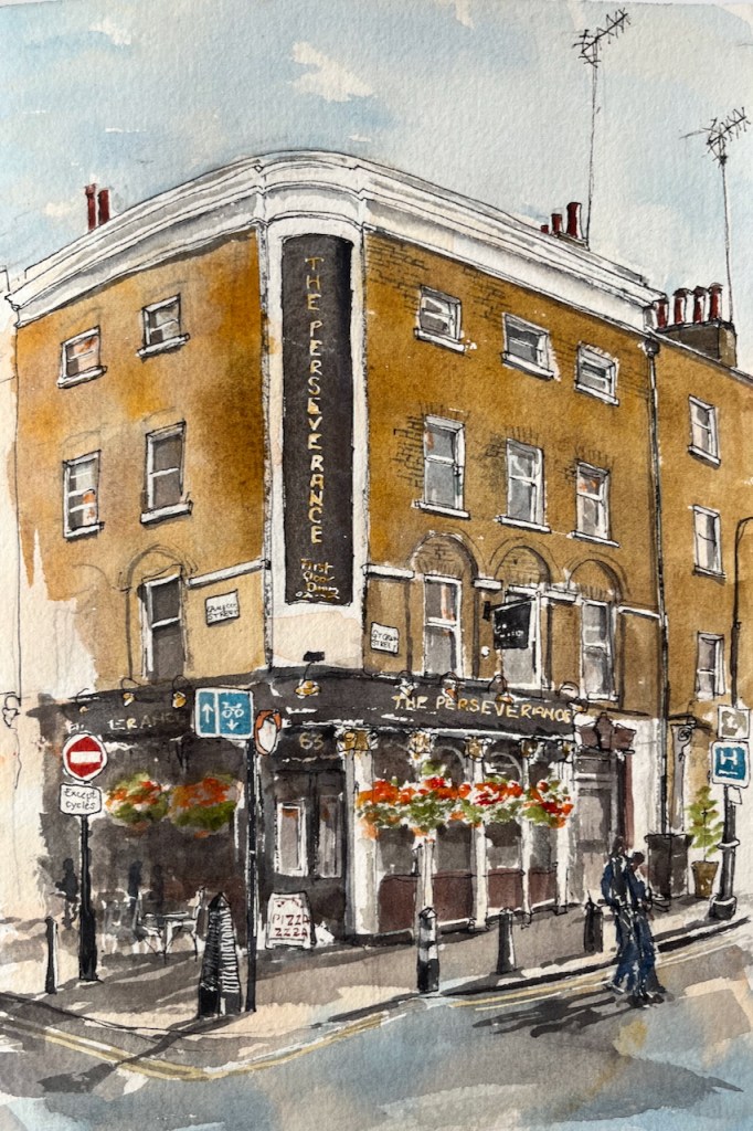
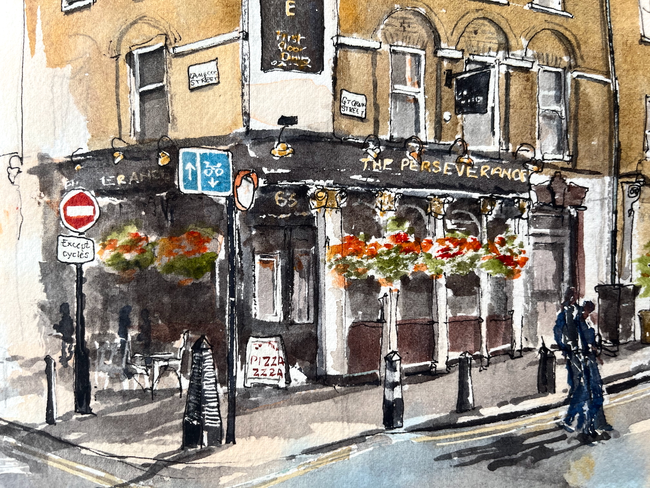
Here is The Perseverance, on the corner of Great Ormond Street and Lamb’s Conduit Street.
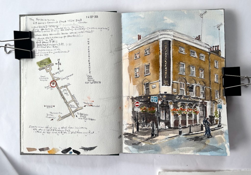
The Perseverance, 63 Lamb’s Conduit Street WC1N 3NB, sketched 4th September 2025 in Sketchbook 16
This pub was formerly The Sun, and had a magnificent painting on the corner. There are pictures and history on this detailed post from The London Inheritance. The many comments on the London Inheritance blog post describe happy memories of The Sun and its numerous Real Ale pumps.
The pub is listed Grade II reference 1379274. It was built in the early 18th century and the front was renewed in the 19th century. It was The Sun until the 1990s when the name was changed a few times, becoming the Perseverance around 2005/6.
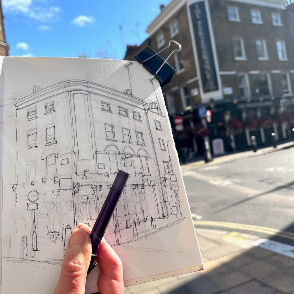
I sketched it from the “Rymans” stationery shop which is on the opposite corner of the crossroads. People walked past me, deep in conversation, casting shadows in the afternoon sun. But one elderly man stopped, and looked up at me. His back was slightly bent. “Are you alright standing there?” he asked. I said I was, wondering what he meant. “Because,” he continued, “I could go up and get you a stool from my flat. It’s just up there.” He pointed heavenwards, to the windows above the shops. People are so kind. This man was so kind. It’s moments like this which make the sun rise on humanity. I was in fact quite tired, and would have liked to sit down, but my drawing was very nearly finished. I hesitated to send this helpful individual back up his stairs. So I declined his thoughtful offer, as politely as I knew how, and continued my drawing standing upright in the sun.
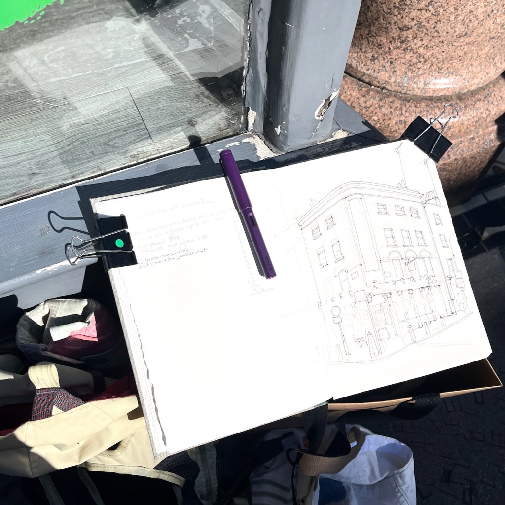
This drawing took 1 hour and 20 mins on location, plus another hour and a half at my desk later. The colours are:
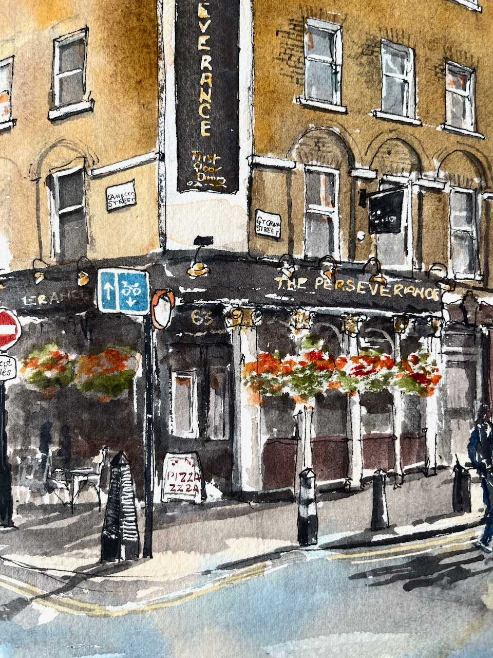
Mars Yellow (brickwork)
Ultramarine Blue and Burnt Umber (mixed, for the greys and blacks)
Phthalo Blue Turquoise and Ultramarine Blue for the sky and the street, and the street signs
Transparent Pyrrol Orange for the “No Entry” sign and the flowers
Serpentine Genuine Green for the plants
A tiny bit of Permanent Yellow deep for the yellow line on the road, and other small touches
All whites are the paper.
Ink lines are De Atramentis Document black ink in an Extrafine Lamy Safari fountain pen
Paper is Arches Aquarelle 300gsm Cold pressed in a sketchbook made by the Wyvern Bindery in Hoxton.
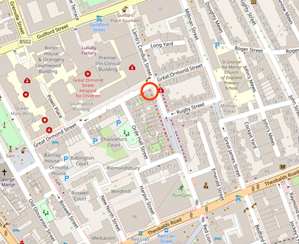
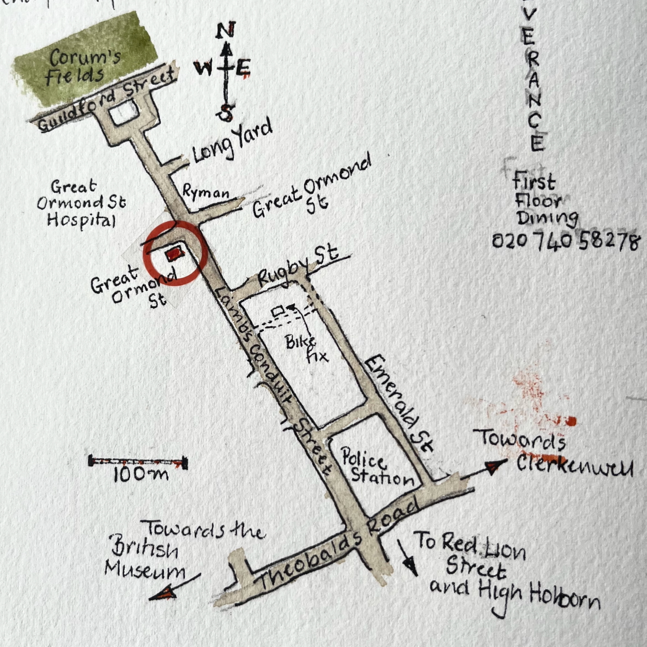
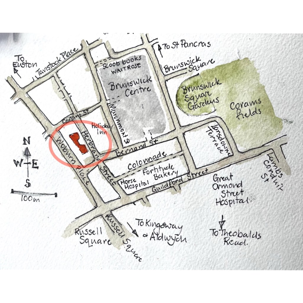
Here are maps (click to enlarge):
(c) OpenstreetMap Contributors
Here is the sketchbook, size 7″ x 10″.
Click a button below to share this post online, email it, or print it:
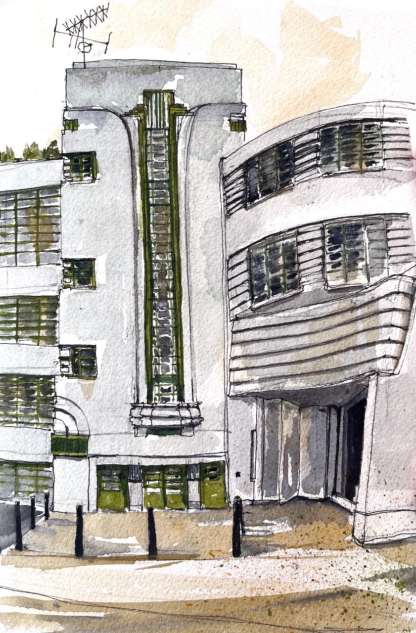
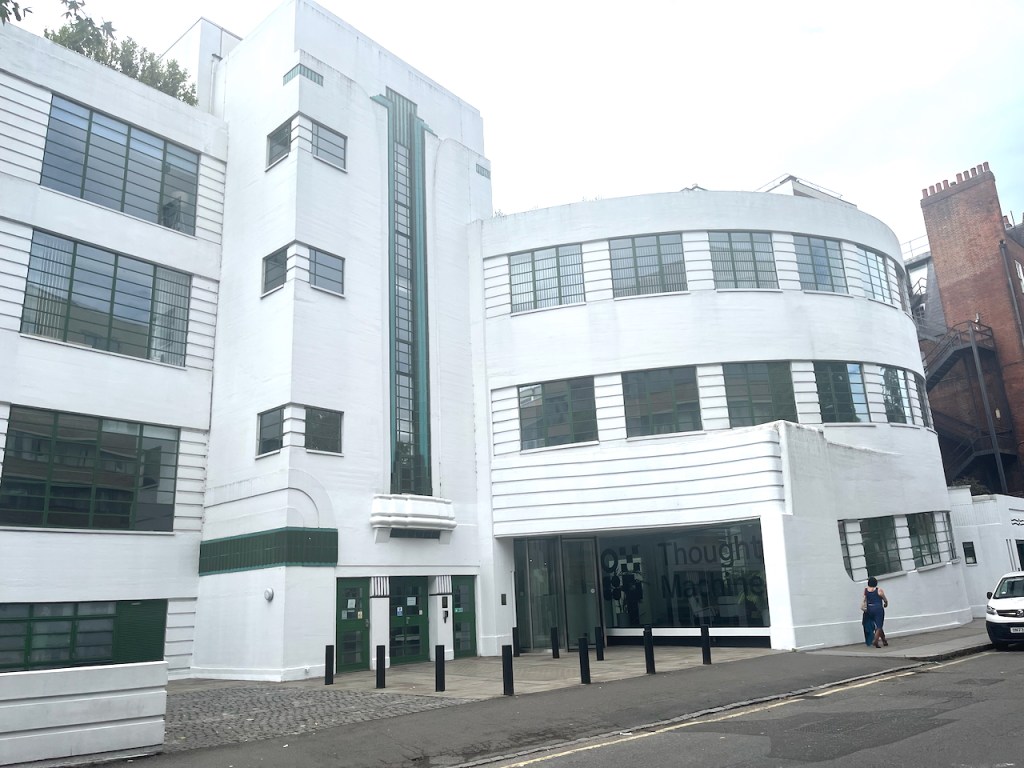
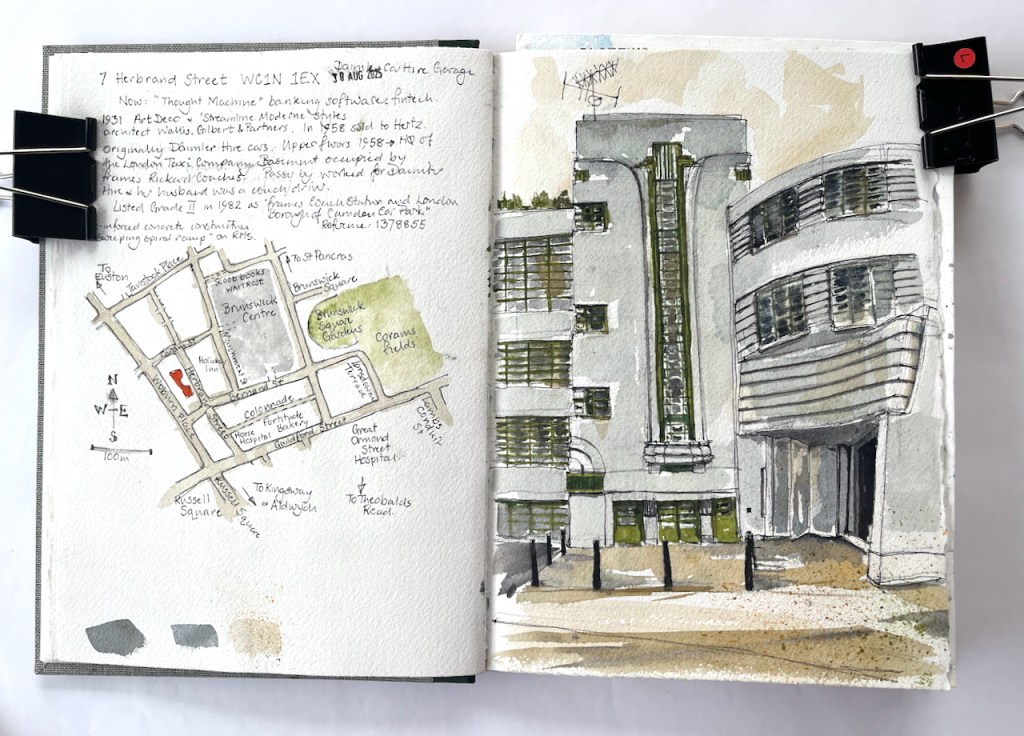
In a backstreet in Camden is a magnificent Art Deco building.
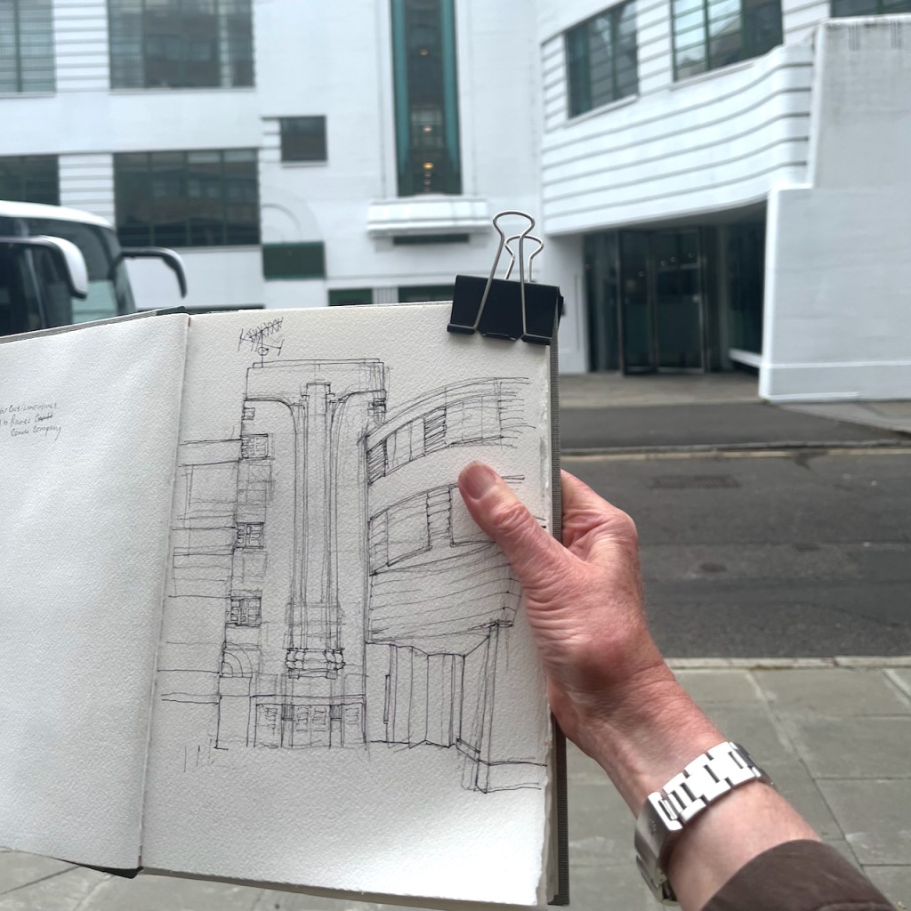
7 Herbrand Street WC1N 1EX, sketched 30 August 2025 in Sketchbook 16
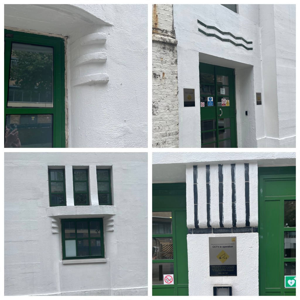
This was built of re-inforced concrete in 1931, to the designs of architects Wallis, Gilbert and Partners. The style is called “Streamline Moderne” and includes fun details.
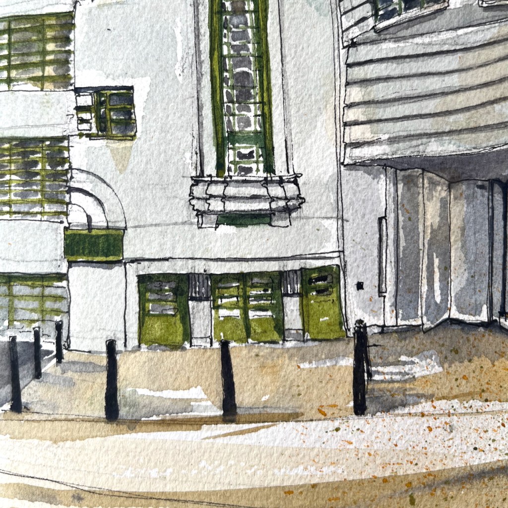
7 Herbrand Street, details
It was originally used as the headquarters of Daimler Hire Cars. It includes a spiral ramp, off to the right of my picture. This was where the cars entered and drove up to the garage.
General view of 7 Herbrand Street showing the former garage entrance (centre right). The spiral ramp was in the curved part of the building to the right.
As I was sketching, a passer-by approached me to tell me the history of the building. She worked for Daimler Hire, in the offices on the upper floors. Her husband was a driver, she told me. Later the building was used as the headquarters of the London Taxi Company, and by Hertz car rentals. The basement was occupied by Frames Rickard Coaches.
The building was listed Grade II in 1982, number 1378855. The listing calls it “Frames Coach Station and London Borough of Camden Car Park”. It is now occupied by a fintech company called “Thought Machine” who provide banking software. The spiral ramp has been removed.
This building with its curves was tricky to draw and took me a long time. The person who had approached me to describe the history returned back up the street. She held out a hand containing fresh hazel nuts she had collected from the pavement. “I don’t think Camden Council realise they have planted hazelnut trees” she said.
Once the pen drawing was finished, I ate a sandwich from nearby Fortitude Bakery, and walked home to finish the drawing at my desk.
Sketchbook 16
Click a button below to share this post online, email it, or print it:
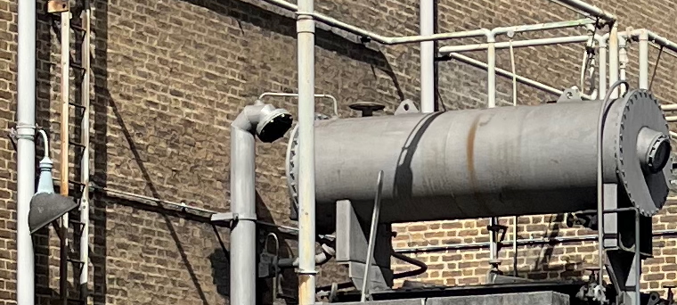
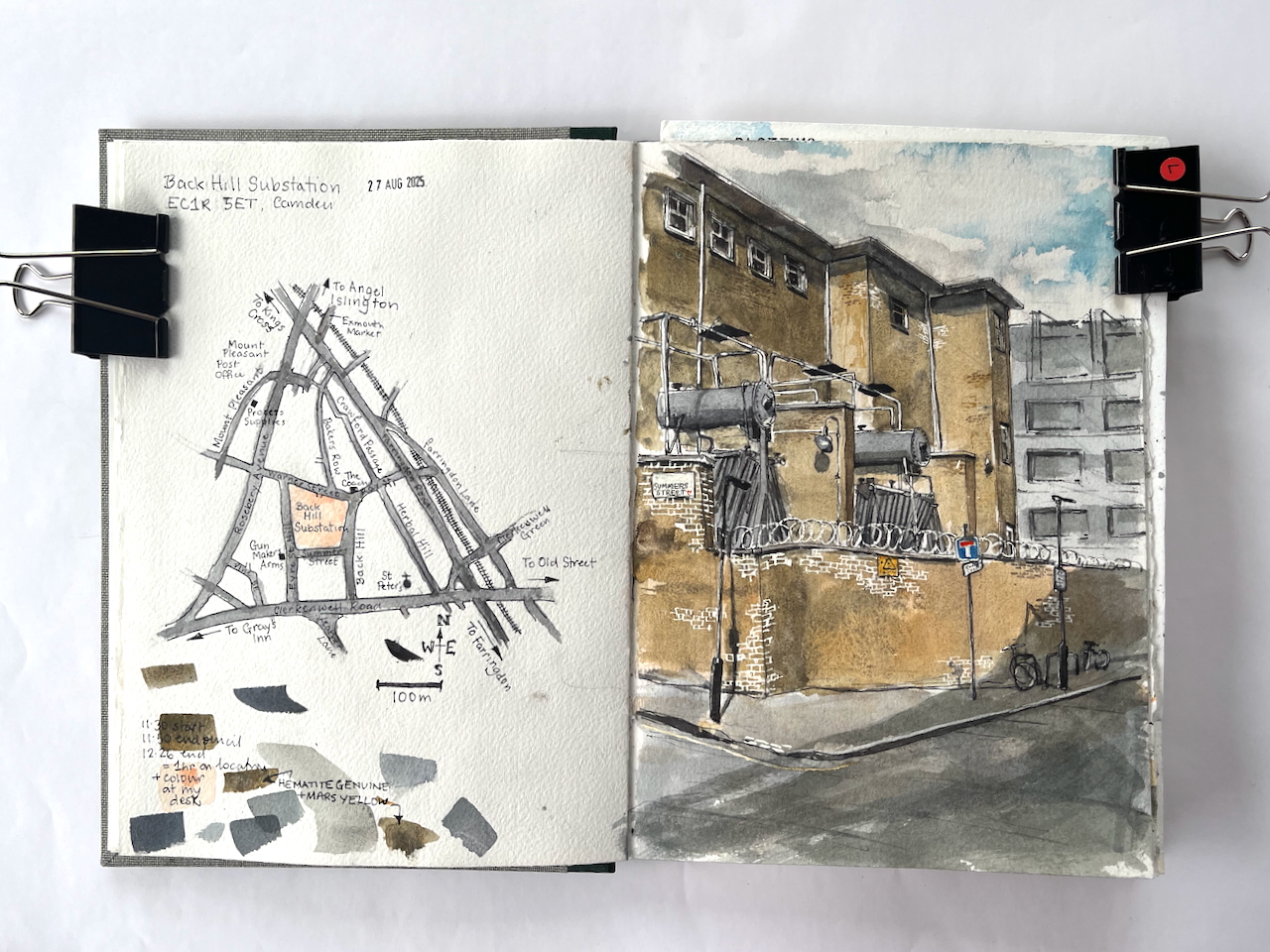
This imposing building presides over an entire block, in the back-streets of Camden. I’ve admired its austerity and unadorned walls, amongst the much more elaborate buildings around. This is an electricity substation, very functional. I’d noticed it while sketching The Coach, a nearby pub.
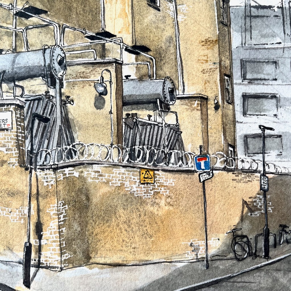
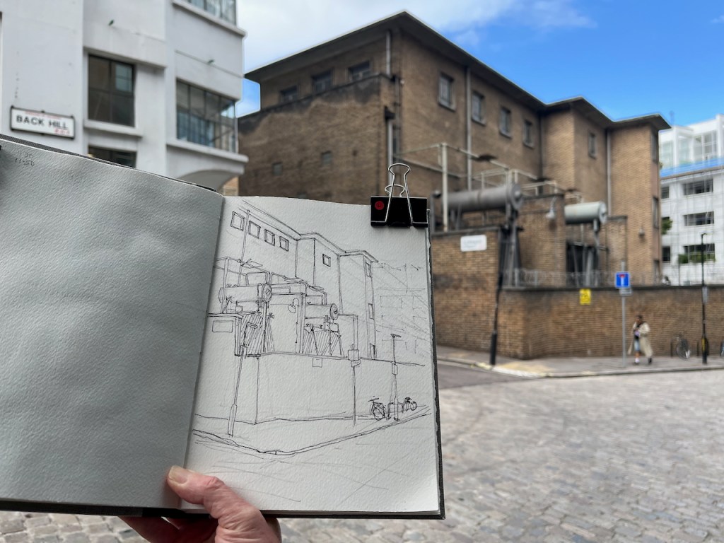
Back Hill substation, EC1R 5ET, sketched 27 August 2025 in Sketchbook 16
There were many more pipes and connectors than I could fit into the drawing. They all looked important. This is a serious building. The sign on the wall says “Danger of Death”. But the pipework has a certain lighthearted steampunk appeal. The arrangement has lamps, ladders and valves in odd places, and inexplicable vents, as though it might huff and exude puffs of steam. But when I saw it, the whole structure was silent and still.
“silent and still”
The building is from the 1950s.
This complex dates mostly from 1956–7, when the London Electricity Board extended an earlier yard established in the late 1920s by its predecessor, the London County Council’s County of London Electric Supply Co. The 1950s buildings, designed by the LEB’s Architect’s Section, are of reinforced-concrete and steel frame construction with elevations of buff-coloured brick and glass block. They match the original building in the southeastern corner of the site ….
‘West of Farringdon Road’, in Survey of London: Volume 47, Northern Clerkenwell and Pentonville, ed. Philip Temple (London, 2008), British History Online https://www.british-history.ac.uk/survey-london/vol47/pp22-51 [accessed 11 September 2025].
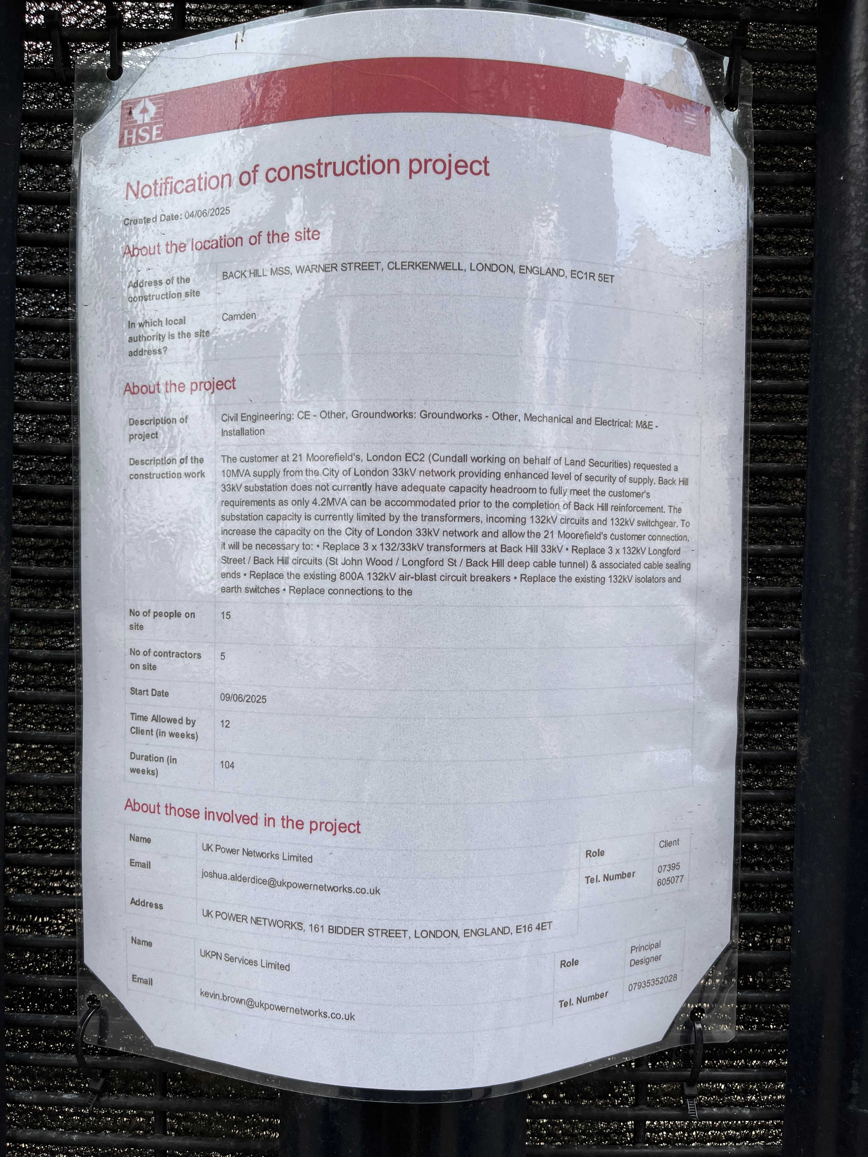
The planning notice on the gate: click to enlarge
It is very much in active use and currently being enhanced. Planning notices fastened to the main gates informed me that: “The customer at 21 Moorefield’s [sic], London EC2… requested a 10MVA supply from the City of London 33kV network providing enhanced level of security of supply.” They don’t want any fluctuation in the power supply, then, and no power cuts.
At the moment: “Back Hill 33KV substation does not currently have adequate capacity headroom to fully meet the customer’s requirements…” and “The substation capacity is currently limited by the transformers, incoming 132kV circuits and 132KV switchgear..”
So they have to replace the transformers, cabling and switchgear, to “allow the 21 Moorefield’s customer connection,” the notice says.
21 Moorfields is the building above Moorgate Elizabeth line station, just to the East of the Barbican.
21 Moorfields, from the Barbican Highwalk under Willoughby House.
“Electrical Contracting News” provides a more general description:
Almost 10,000 customers from Farringdon, Clerkenwell and key buildings in City of London are to benefit from a multi-million pound investment to upgrade the electricity network.
Work is currently underway to install the first of three new transformers – a device which steps down the power voltage so electricity can be safely delivered to local properties. The transformer, along with new switchgear equipment, will be installed at UK Power Networks’ substation to meet greater energy demand in the area. The £24 million project started in October 2021 and is due to finish in early 2026. As part of the scheme, the firm has consulted local councils and other interested parties to ensure that people experience as little disruption as possible while the work takes place. Euan MacRae, Project Manager at UK Power Networks, says: “This substation upgrade is part of our ongoing investment in the network to maintain safe and reliable power supplies and future-proof the network. The City of London is home to some of the capital’s most iconic buildings, so in collaboration with our alliance partner The Clancy Group this project is committed to carrying out a staged replacement of the major electricity assets at Back Hill Substation, some of which date back to 1956 and have been well maintained over the years. “We are excited to be installing innovative equipment which will allow the substation to provide double the previous level of power and will improve the resilience of power supplies across the network in London.”
I was pleased with my sketch of the substation, and I enjoyed trying to follow the lines of the pipes.
I find it fascinating to realise that there is enormous work going on to keep the electricity flowing, with very little fanfare. There are these silent buildings sitting amongst the offices and flats, doing their job.
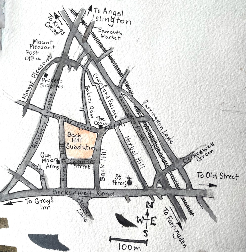
Here is a sketch map to show where the substation is:
The location of Back Hill Substation.Back Hill substation, page spread, Sketchbook 16
I’ve sketched the nearby pubs, the Gunmaker’s Arms here, and The Coach here.
Kenwood House is a mansion at the top of Hampstead Heath, to the North of London. It is managed by English Heritage. At the moment there is an exhibition “Heiress: Sargent’s American Portraits”. Fantastic oil paintings, each woman with a history, echoes of the time of Henry James. Even more than the oil paintings, I enjoyed the charcoal portraits. See the character of the sitter! See the skill of the artist! Recommended: it’s on until 5th October 2025.
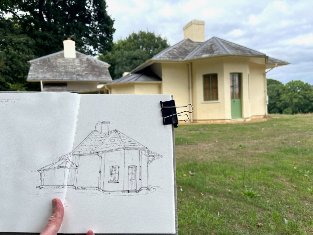
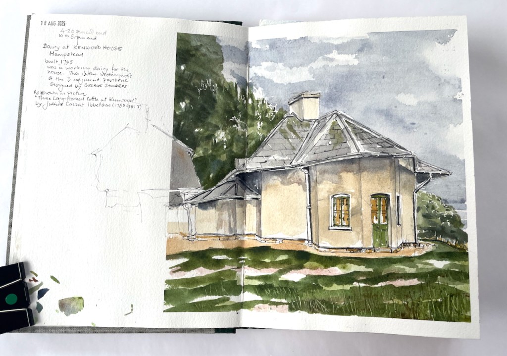
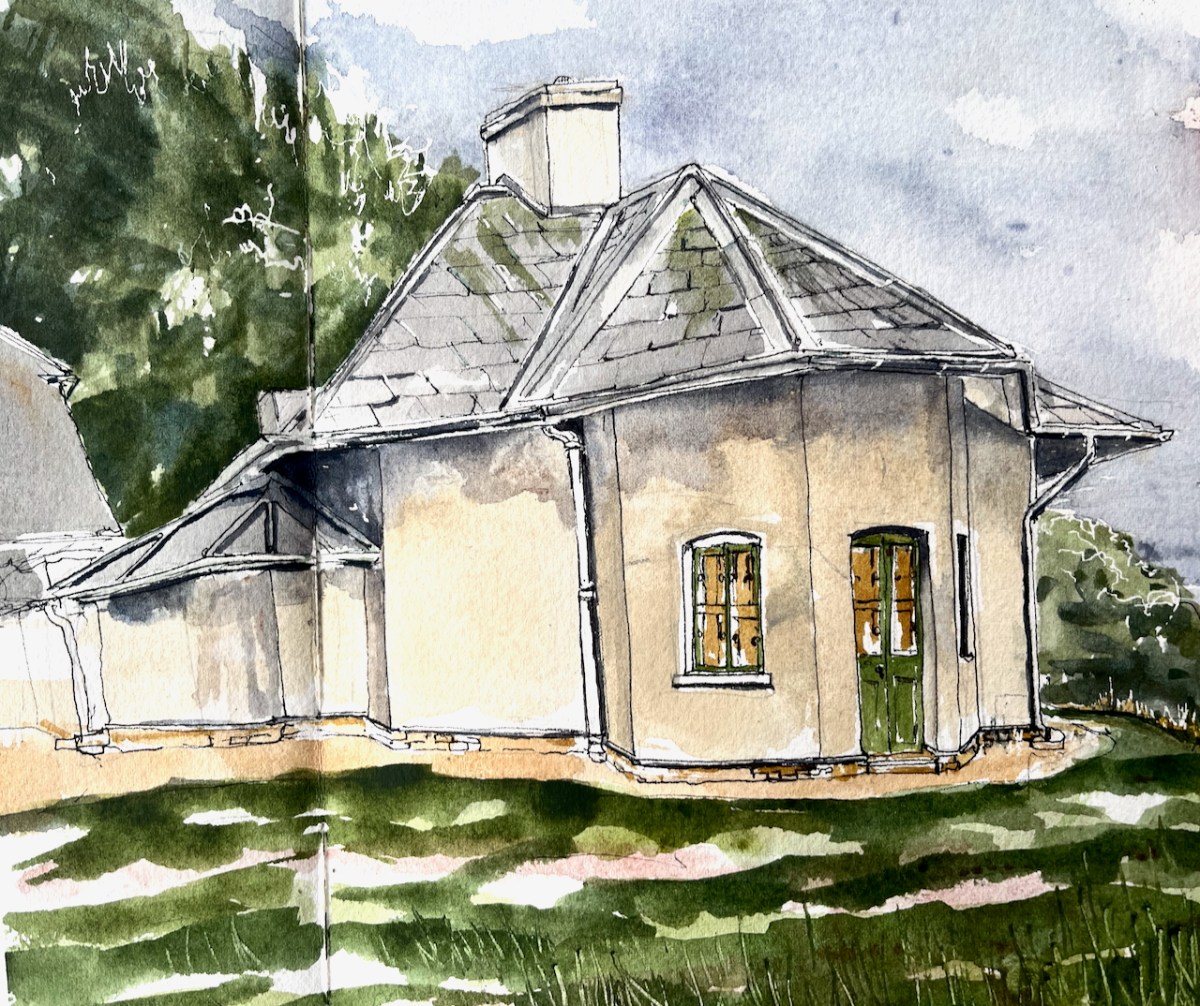
After that, we walked out into the late afternoon sun. Kenwood is a large building. It was too much to take on the house as a sketch project at that time of day. So I sketched a small building I’d spotted on the way in. This is “Kenwood Dairy”. I sketched just a part of it.
Kenwood Dairy, south pavilion, sketched 18 August 2025 in Sketchbook 16, approx size 9″ x 9″.
You can see the whole dairy in this oil painting of 1797 by Julius Caesar Ibbetson:1
The pavilion I sketched is the one on the left. There were sadly no cattle, long-horned or otherwise, for me to put in my sketch.
The dairy was built in 1795, just a two years before Ibbotson’s oil painting. It was a working dairy, built to the designs of George Saunders, for Louisa, the wife of David Murray, 2nd Earl of Mansfield. It was fashionable for 18th century upper-class ladies to run dairies.
a dairymaid.. lived in the cottage and produced the fresh butter, cream, puddings and ice-cream enjoyed by the family and their guests.
English Heritage noticeboard near the dairy
These buildings are now used as a base for volunteers at Kenwood and Hampstead Heath.
Here is work in progress on the drawing:
It was quite tricky to follow the line of that roof. I managed to get the ink lines done, then it was time to go home. I added the colour later at my desk.
Kenwood dairy, finished drawing in Sketchbook 16
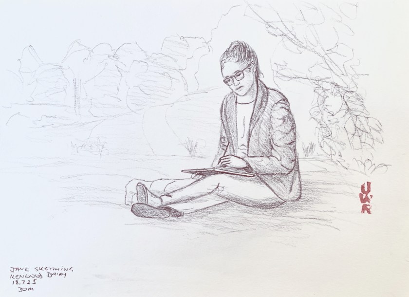
While I was drawing the dairy, John was drawing me, from a nearby bench.
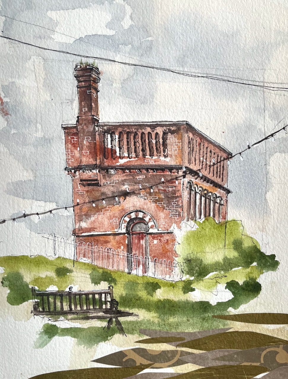
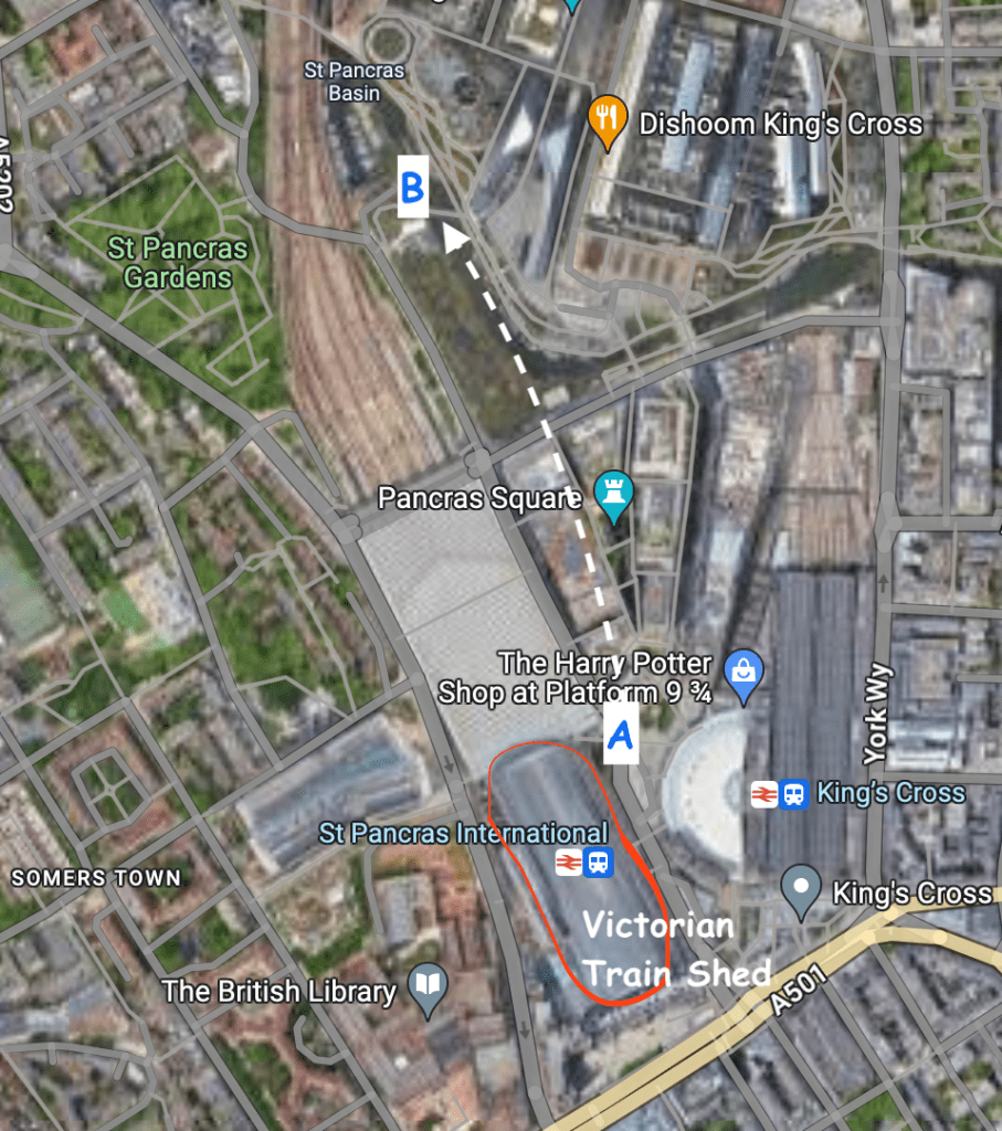
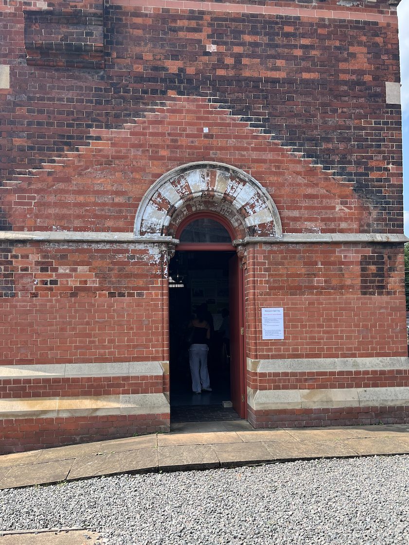
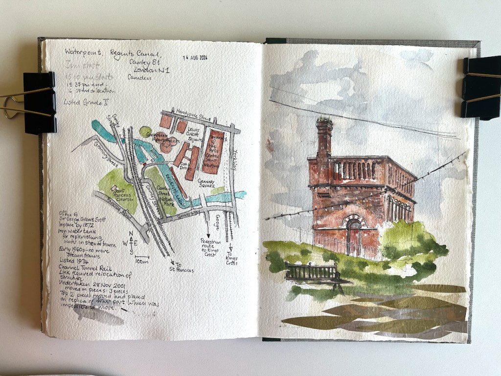
This structure is visible from the North side of the Regents Canal at Coal Drops yard. It was a “water point” for replenishing the boilers of steam engines. The top housed a water tank.
Waterpoint, seen from the Regents Canal towpath at Coal Drops. August 14th 2024, in sketch book 14
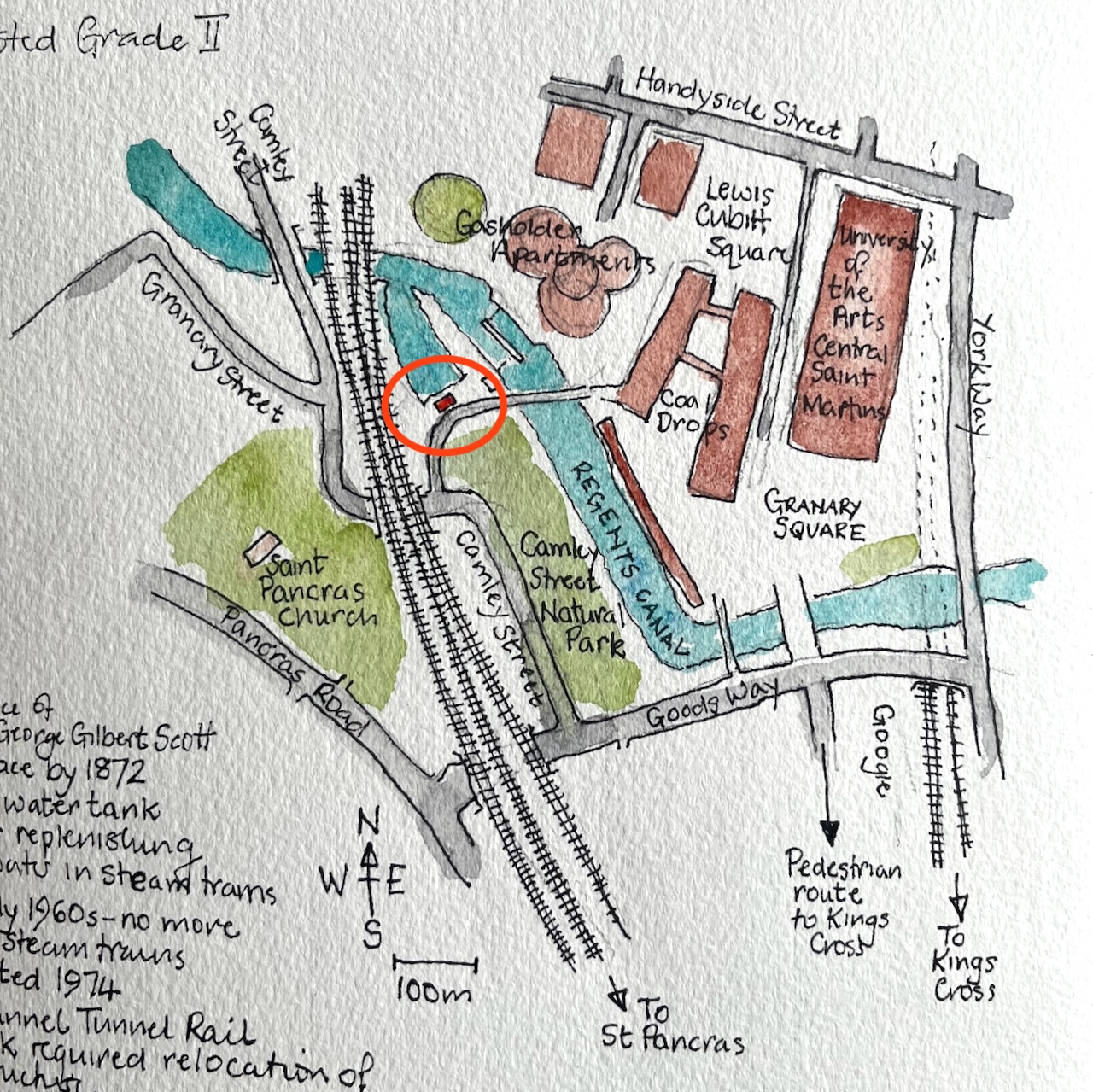
Here’s a map to show where it is. I’ve seen this structure often when walking along the canal, and it’s been on my “sketch-list” for a while, so I was glad that a co-incidence of weather and time gave me the opportunity to sketch it.
Waterpoint, circled.
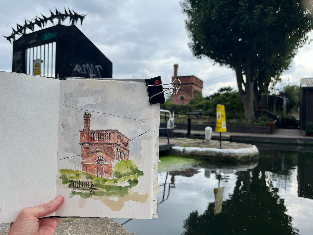
I was sketching from the Regents Canal towpath right next to St Pancras Lock.
Sketching Waterpoint, looking south across St Pancras Lock.
It turns out that this structure is open to visitors from time to time. By an amazing co-incidence, one of the visiting days was the weekend after I did my sketch. The kind and informative guides there patiently answered the many questions I had, and allowed me to photograph their video and their display boards.
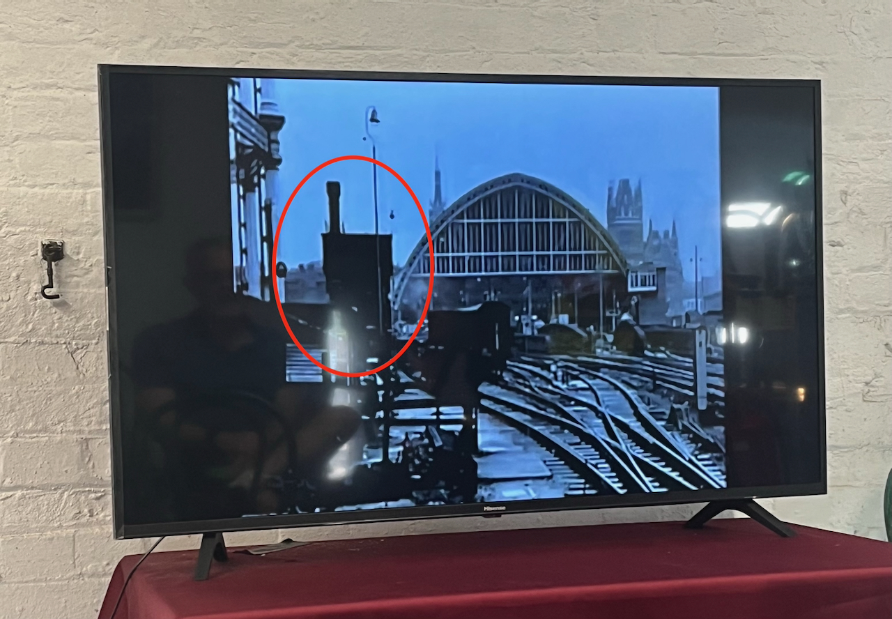
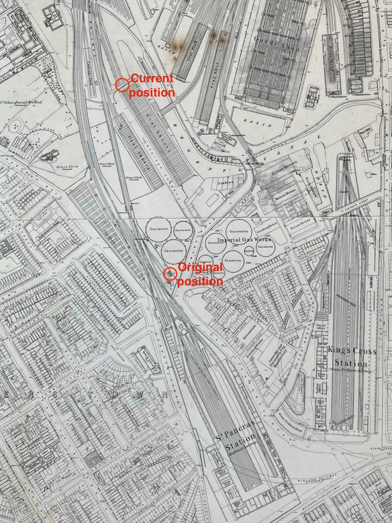
For me, the really fascinating thing about this structure is that it has moved. It was not always in this location. It used to be next to St Pancras Station. It was built around the same time as the station, 1870. In 2001 it was moved North, to its current location.
It was designed by team of Sir George Gilbert Scott, who designed the St Pancras Hotel. Since its purpose was to fill the tanks of steam trains, it was right next to the railway lines. You can see it here:
Photo of a video shown at the Waterpoint.
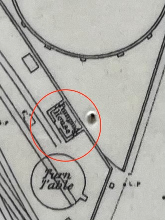
Here it is on an 1871 map: (click to enlarge)
my annotations to show the original position next to St Pancras, and the current positionOn the 1871 map it is labelled “Pumping House”1871 map on display at the Waterpoint (copyright National Library of Scotland)
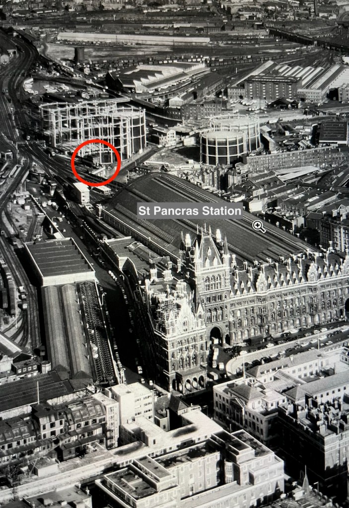
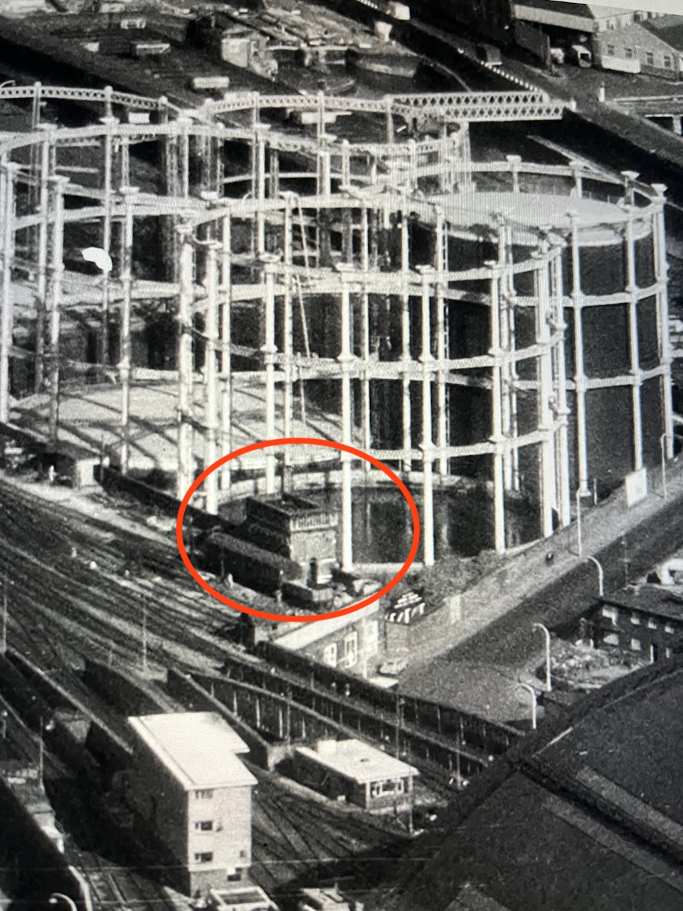
I think I can spot it on this archive aerial photo from 1964. Here is the link to the picture:
The water point is just beyond the far right hand edge of the St Pancras train shed, in the centre left of the photo on the link above.
Here are some low resolution images to help you find it.
Detail from the aerial photo above. The gas holders shown in these photos have also moved.
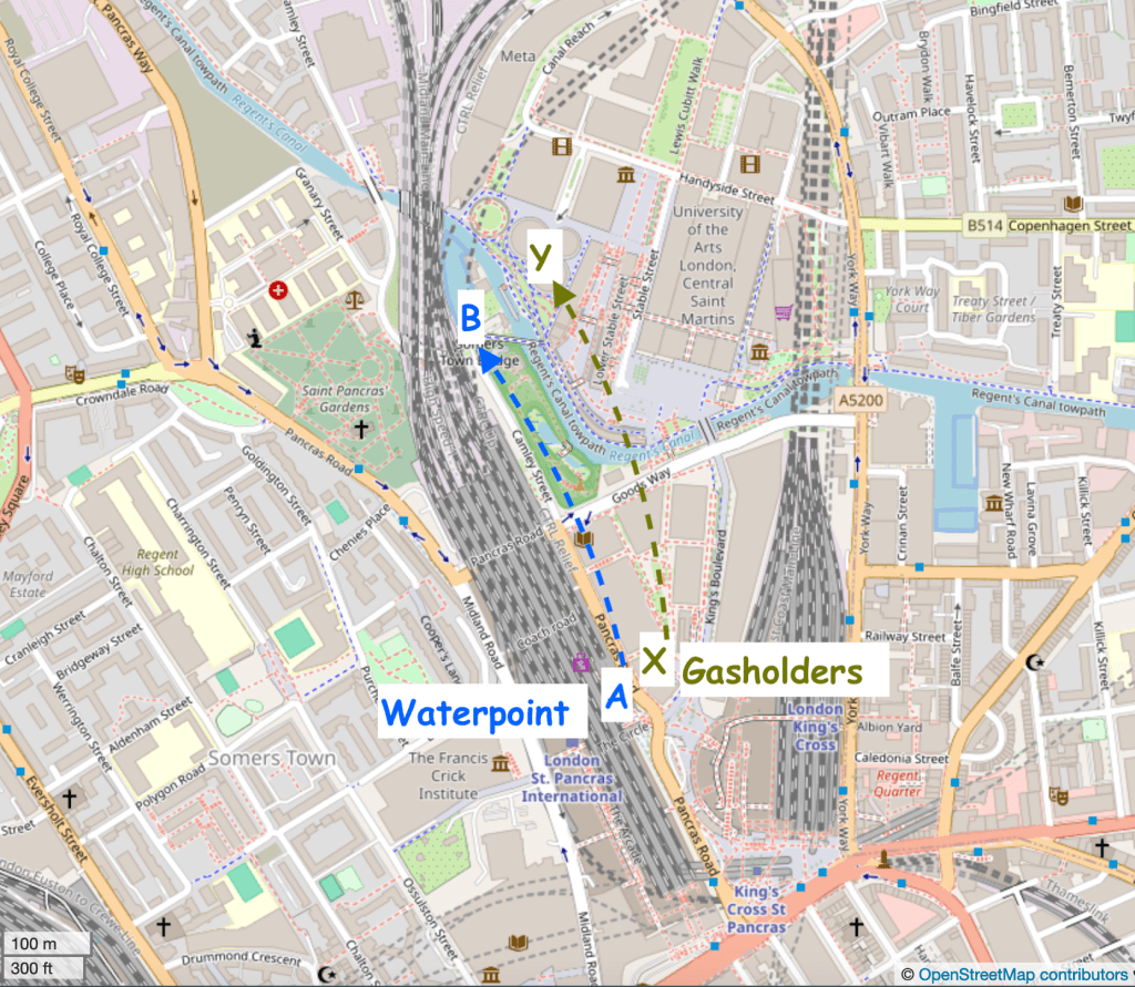
Here are modern maps annotated to show the original position and the current position:
Google map. Waterpoint moved A to B.Waterpoint moved A to B. Gasholders moved X to Y. map (c) openstreetmap contributors
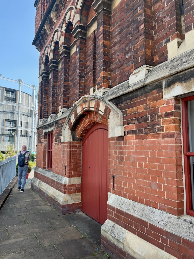
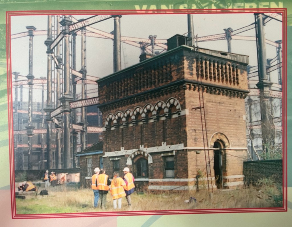
To move it, the original Water Point was cut horizontally into three sections. The lower section was left behind. A new lower section was built in the new location. The middle and upper sections went by road to the new location and were stacked on top of the newly built lower section. You can see, by changes in the bricks, the joins between the sections.
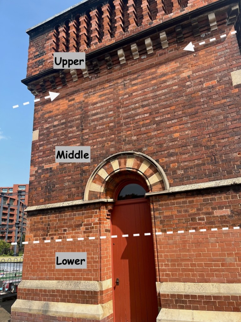
The new lower section is clearly visible.The line of new bricks at the top marks the join between the middle and upper sectionsView of the south side of the Waterpoint, annotated to show the sections
On the side of the Waterpoint visible from the canal, there is a clear “roof” pattern in the bricks, which I noticed when sketching it.
This marks the position of a shed that was fastened to the structure in its original position. See the pictures below.
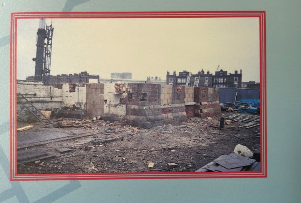
Original position – note the shed on the left What was left when it was moved.The display boards show the project to move the Water Point. These are 2001 photos.
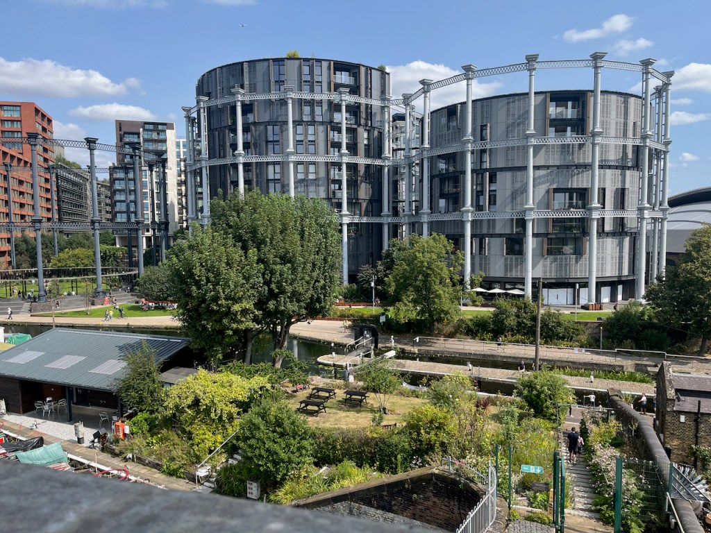
These photos and maps show how much the area has changed. See all the gas holders! They were constructed on the south side of the Regents Canal, because that’s where the gas works was. They originally held coal gas, which is carbon monoxide and hydrogen, manufactured from coal. Until 2010 they were a landmark for anyone who made this journey into Kings Cross regularly.
Here’s a frame from the 1963 film “Alfie” captured by @runningthenorthernheights, showing the gasholders in their original position.
Thanks to @runningthenorthernheights
The gasholders were decommissioned in 2000, but several of them couldn’t be destroyed because they were listed, so they just stood there for ten years. Then they were dismantled, stored, preserved and reconstructed in the years 2010-2015. They are now on the north side of the Regents Canal. Gas holder No. 8 was the first to be reconstructed, in 2015. It surrounds a small park. Gas holders 10, 11 and 12 followed, surrounding luxury apartments, part of the Kings Cross development. (https://www.kingscross.co.uk/gasholder-park)
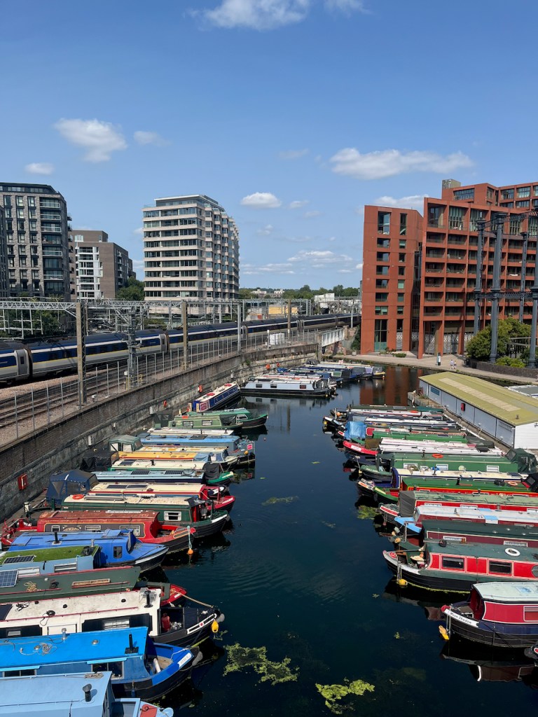
Gasholders seen from the top of the Waterpoint, August 2024. I did the sketch from the far side of the canal.
Here are more photos from my visit to Waterpoint in August 2024.
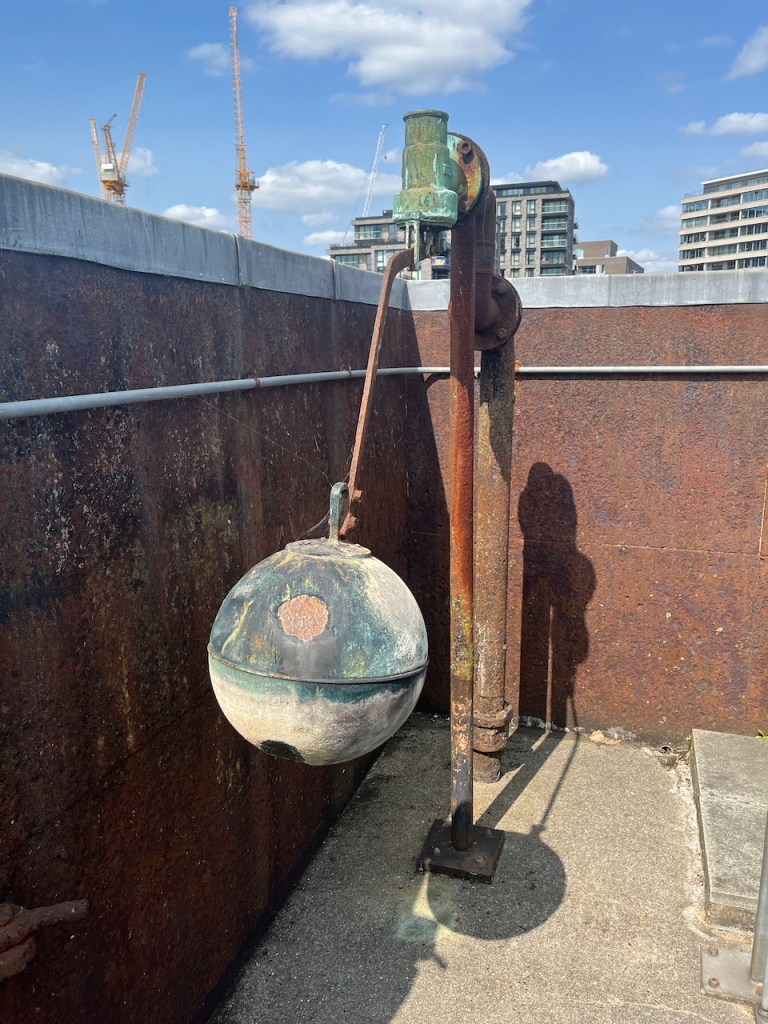
Ball cock in the (now empty!) tank on the topView from the topView from the topThe “chimney” up close. The guide is explaining that it is purely decorative. It is solid: there’s no “chimney”.
I was very glad to have the opportunity to visit this quirky building. Recommended!
Click a button below to share this post online, email it, or print it:
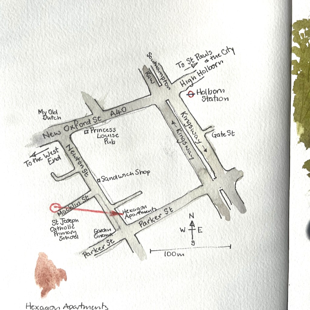
Walking through the back streets of Covent Garden, I came across a row of Victorian brick-built houses. This is Macklin Street. I made a quick sketch of the roofs.
Roofscape from Macklin Street, 5th June 2023 in Sketchbook 13
While sketching I noticed a peculiar thing. There are no doors onto the street. It turns out the entrance to this row of buildings is on the nearby Newton Street, overhung by greenery and climbing plants.
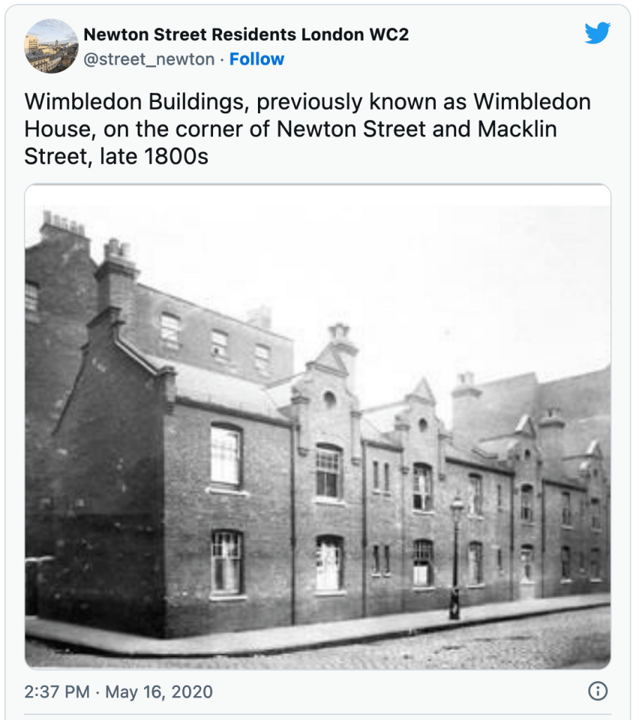
The brick building in my sketch is Wimbledon Buildings, formerly Wimbledon House, built in 1893.
In 1893 the Parker Street Lodging House was completed for 345 people. In 1896 Aldwych, Cotterell and Lindsey (demolished in the 1960s), Powis and Wimbledon buildings were completed for 284 people. Twenty workshops were also provided. The scheme also widened Parker Street and Macklin Street.
It is now part of a “Central London residential street with a community of social housing and owner occupying flats”, with its own Twitter account. Here is a interesting picture from that Twitter feed, showing the roof gable I sketched. This is the view from Newton Street, with Macklin Street going off to the right. Note the absence of front doors. The entrances are through a gate at the left of the photo.
St Joseph’s Primary School is on Macklin Street. Its former name, Macklin Street Catholic School, is still clearly inscribed in the stonework high up. As I sketched, the children came out into the street at the end of their school day.
The Camden Conservation Area statement mentioned above is on this link . If that doesn’t work, you can download it from the link below. It is 36 pages.
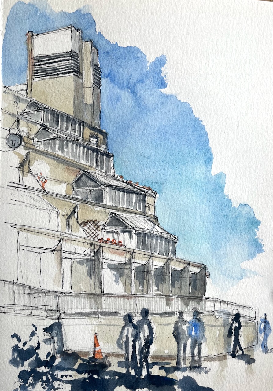
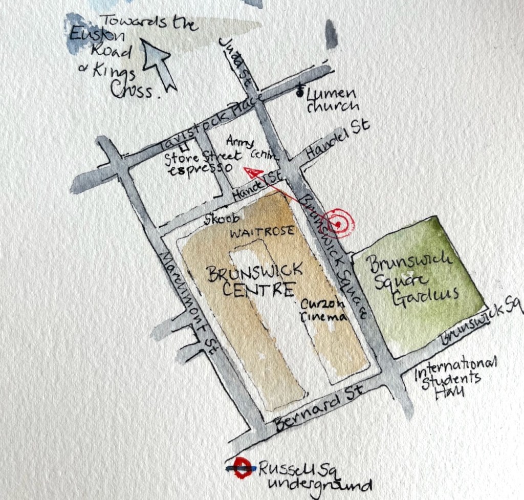
The Brunswick Centre, in Bloomsbury, London has been described as a “heroic prototype for a holistic community” [levittbernstein.co.uk]. There are 560 flats, a cinema, a medical centre and offices in a single development: hence “holistic”. It was radical in that it differs from the Georgian and Victorian houses all around.
Brunswick Centre, Bloomsbury, 13:50 9th August 2022, in Sketchbook 12
It was designed by Peter Hodgkinson during 1966-1970. The original plan was to extend the development all the way up to the Euston Road. There was a significant renovation in 2006 by the architects Levitt Bernstein. They made the shop fronts extend into the plaza in the middle, renovated the flats and added an “anchor supermarket” (Waitrose) at the northern end.
Where I did the drawing
I sketched the pen and ink on location, then repaired to the Store Street espresso on Tavistock Place to do the colour. There are very few colours in the picture: Buff Titanium, Ultramarine Blue, Burnt Umber and a tiny bit of Transparent Pyrrol Orange.
Click a button below to share this post online, email it, or print it:
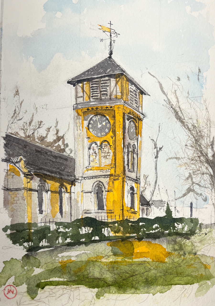
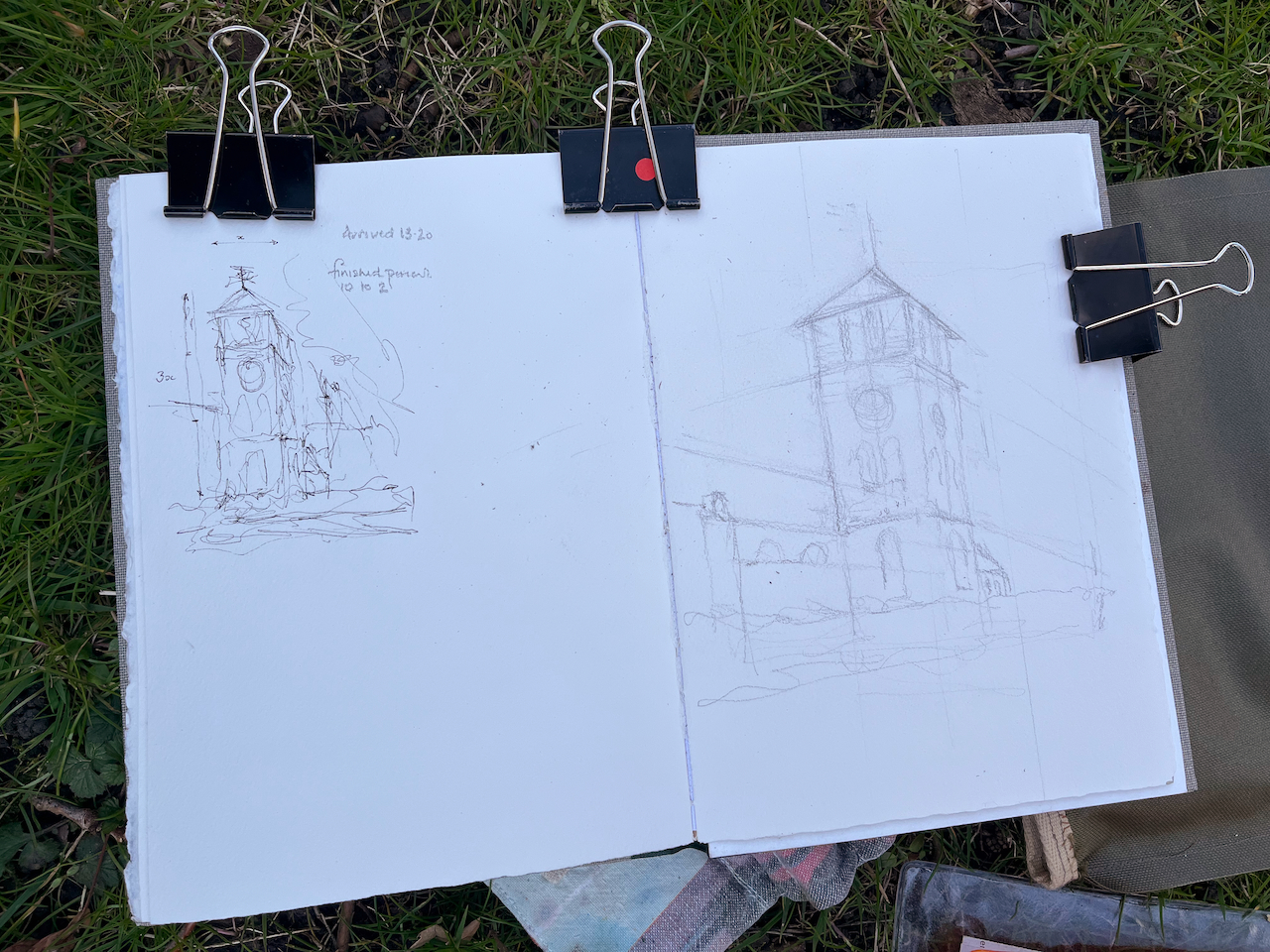
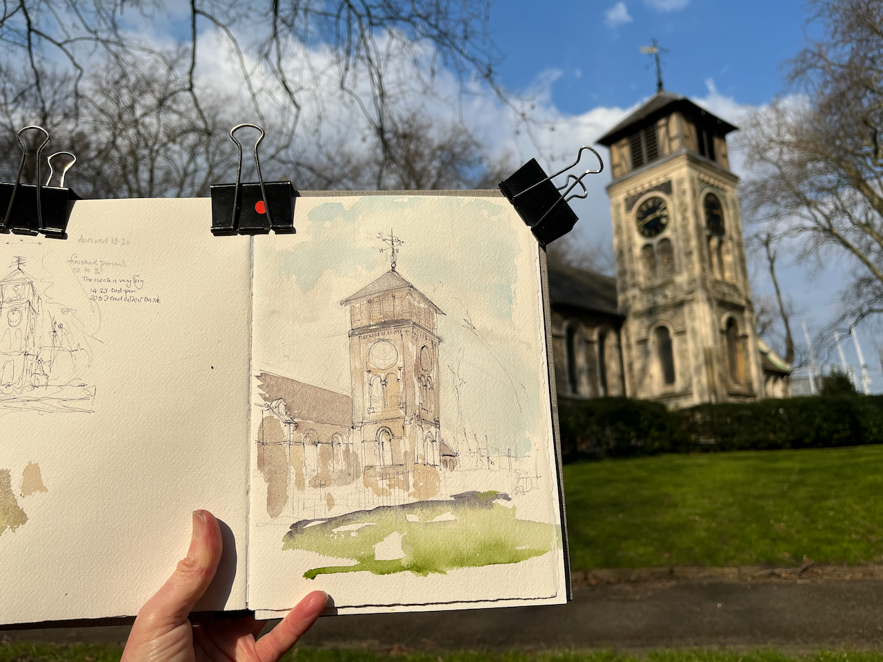
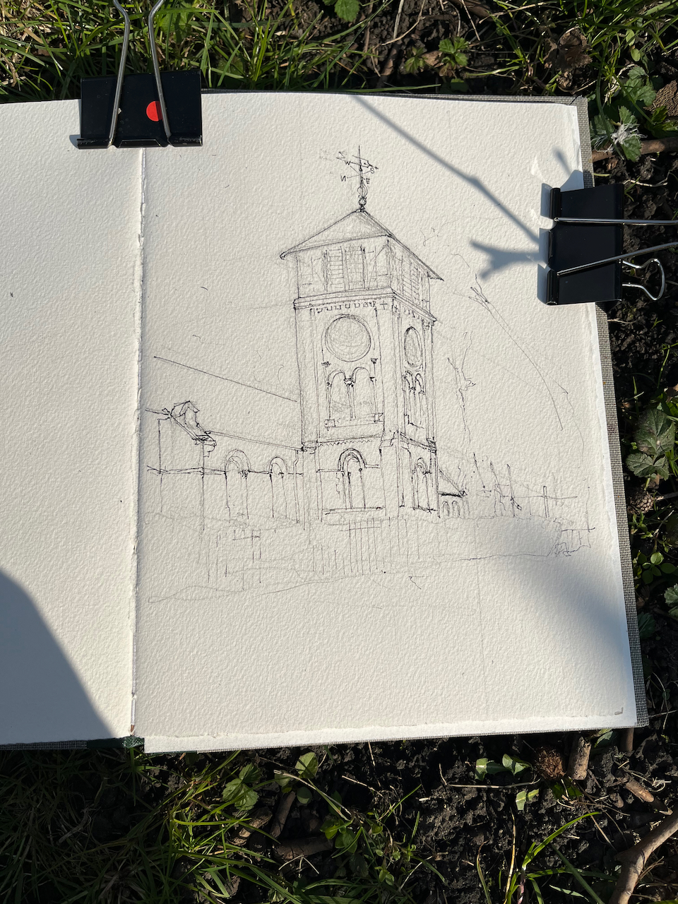
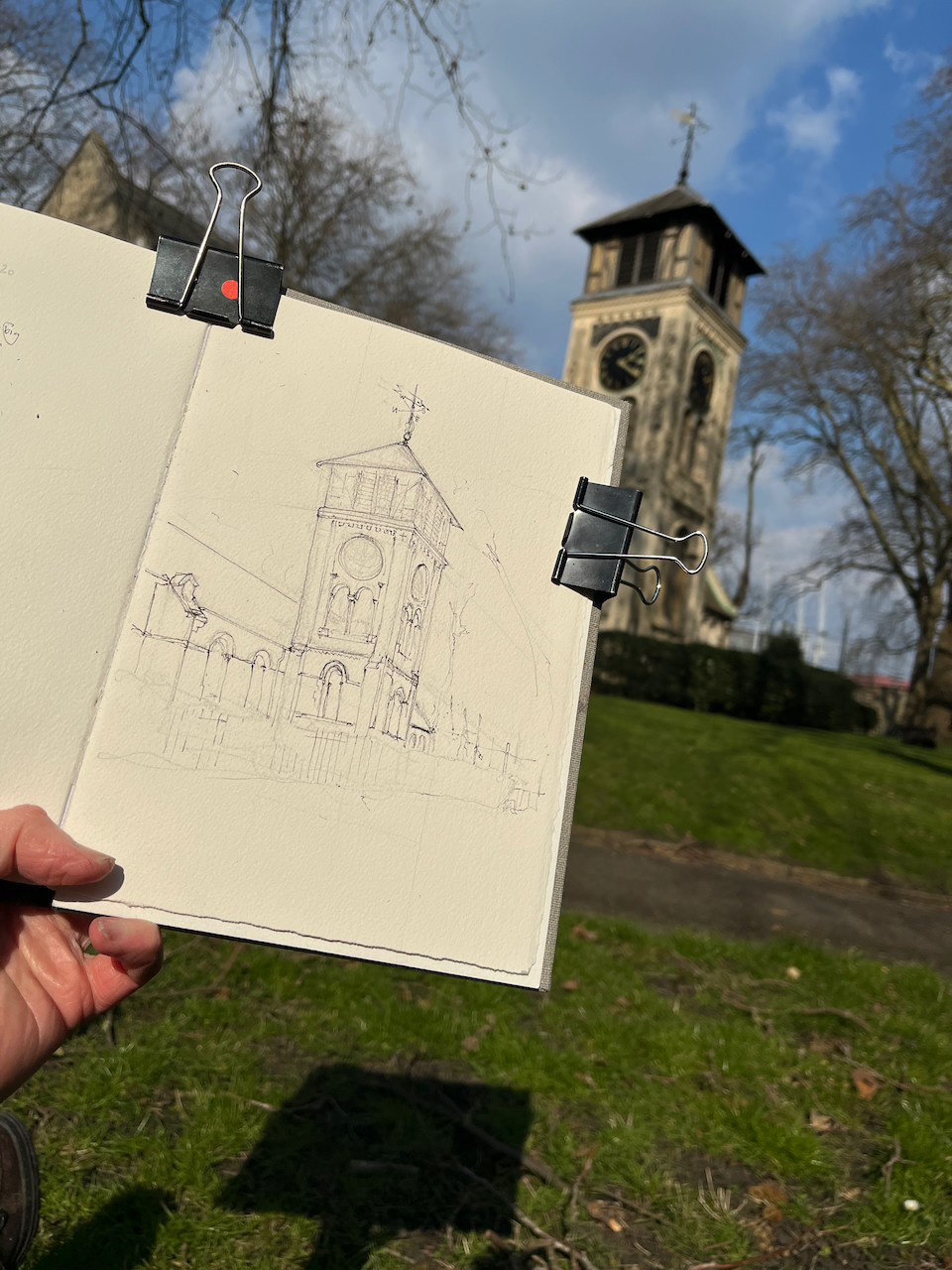
On a sunny day I went to draw a church tower in a country churchyard. The churchyard is near Kings Cross and the church tower is that of St Pancras Old Church.
St Pancras Old Church, tower. 20th March 2022 10″ x 7″ in Sketchbook 11
I sketched sitting on the grass beside the River Fleet, while the river flowed behind me, in my imagination.
It’s a real river though. These days it’s under St Pancras Way. But it used to flow by the church.
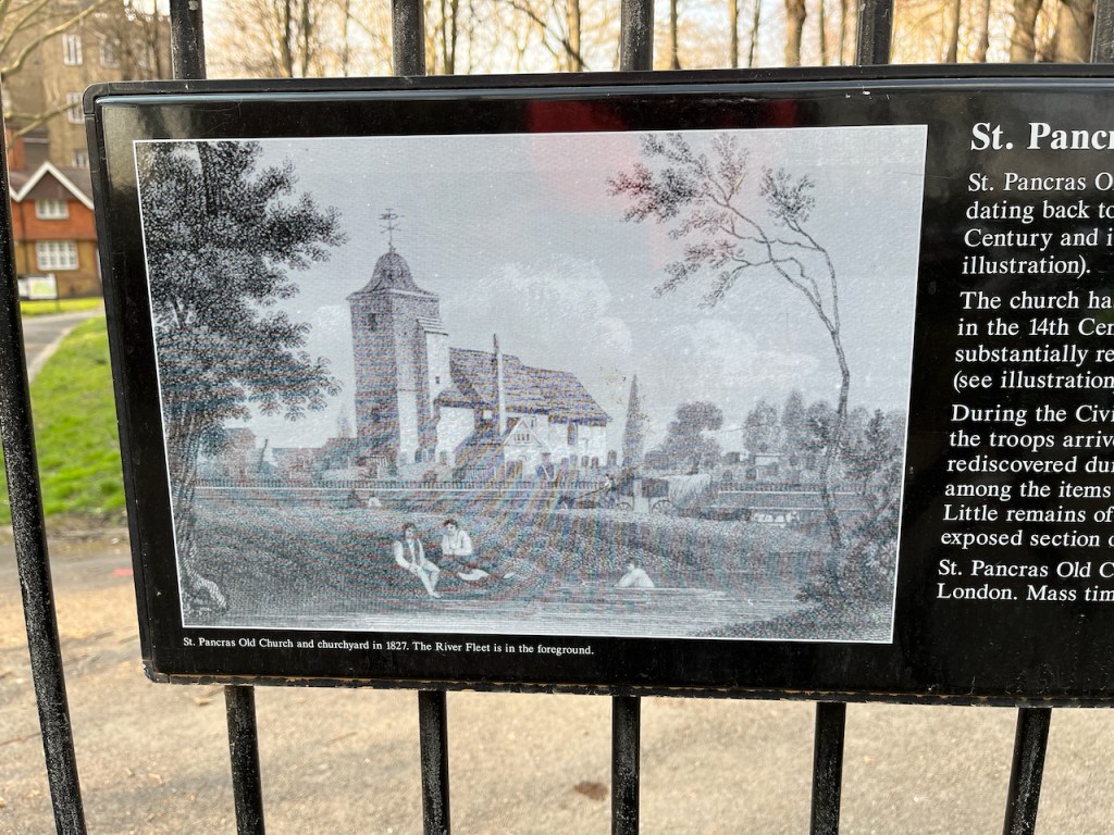
“St Pancras Old Church and churchyard in 1827. The River Fleet is in the foreground.” notice on the railings of the churchyard.
As you see from that picture, in 1827 the church looked very different. The south tower which I sketched is not as ancient as it looks. It was constructed in 1847 to the designs of A.D. Gough.
The church site itself is very ancient. According to the church website, this is one of the oldest sites of Christian worship in London, possibly dating back to the 4th century:
The suggestion that St Pancras Old Church dates back to Roman times has a long tradition, with most suggesting that it was founded in 313 or 314. Most churches in England named for the martyr St Pancras have, or may have, ancient origins, suggesting that veneration of the saint spread quickly after his death in 304.
Today it is an active church, and a music venue. The churchyard is a glorious green space, much used. Many people wandered past on the paths. No-one paid any attention to me drawing. The dogs did though. I was inspected and approved by each dog that went past.
Here is work in progress and a map (click to enlarge the image)
Click a button below to share this post online, email it, or print it:
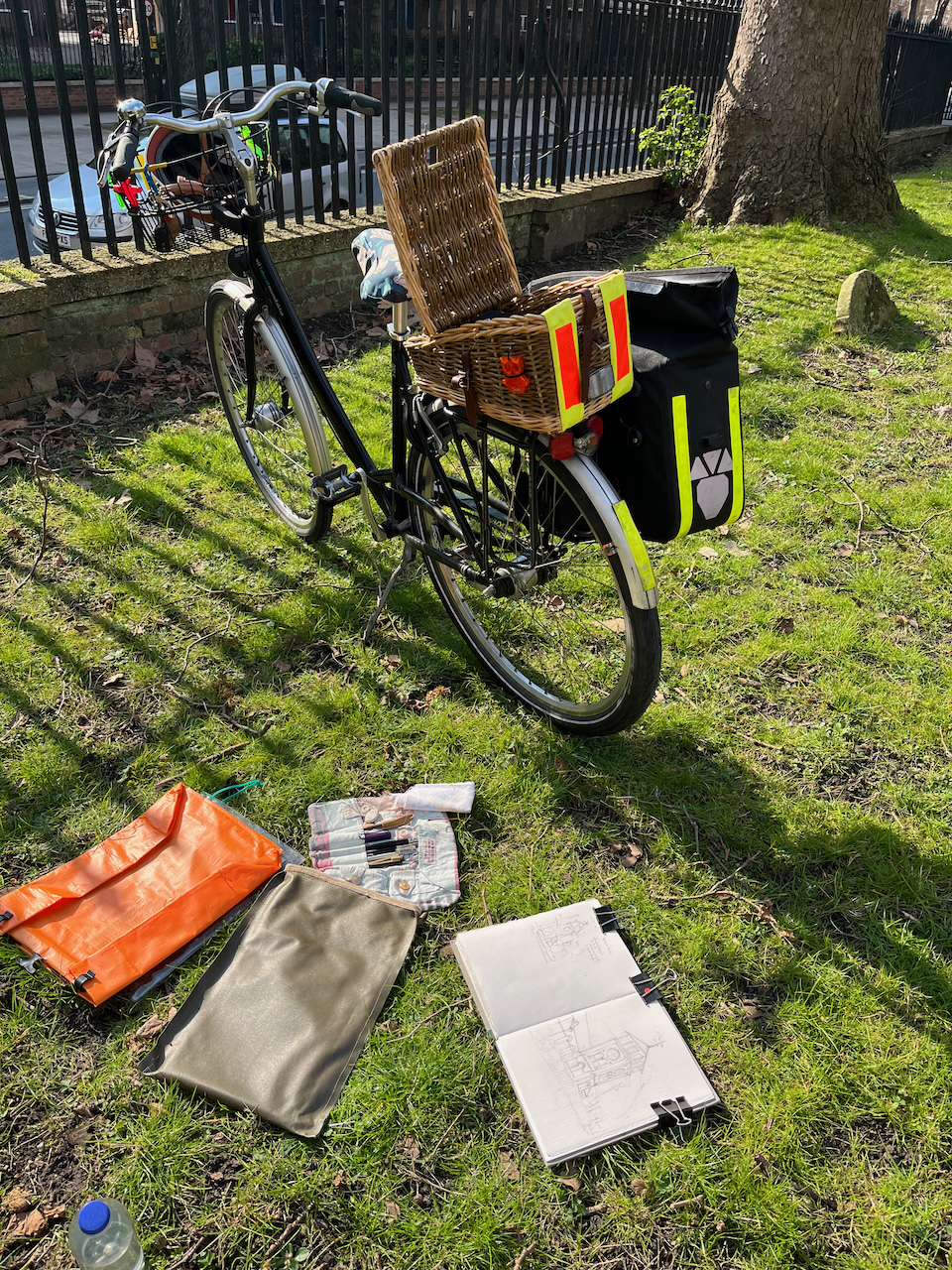
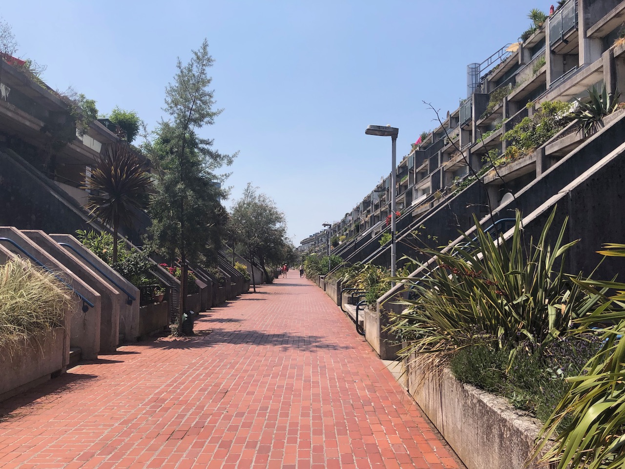
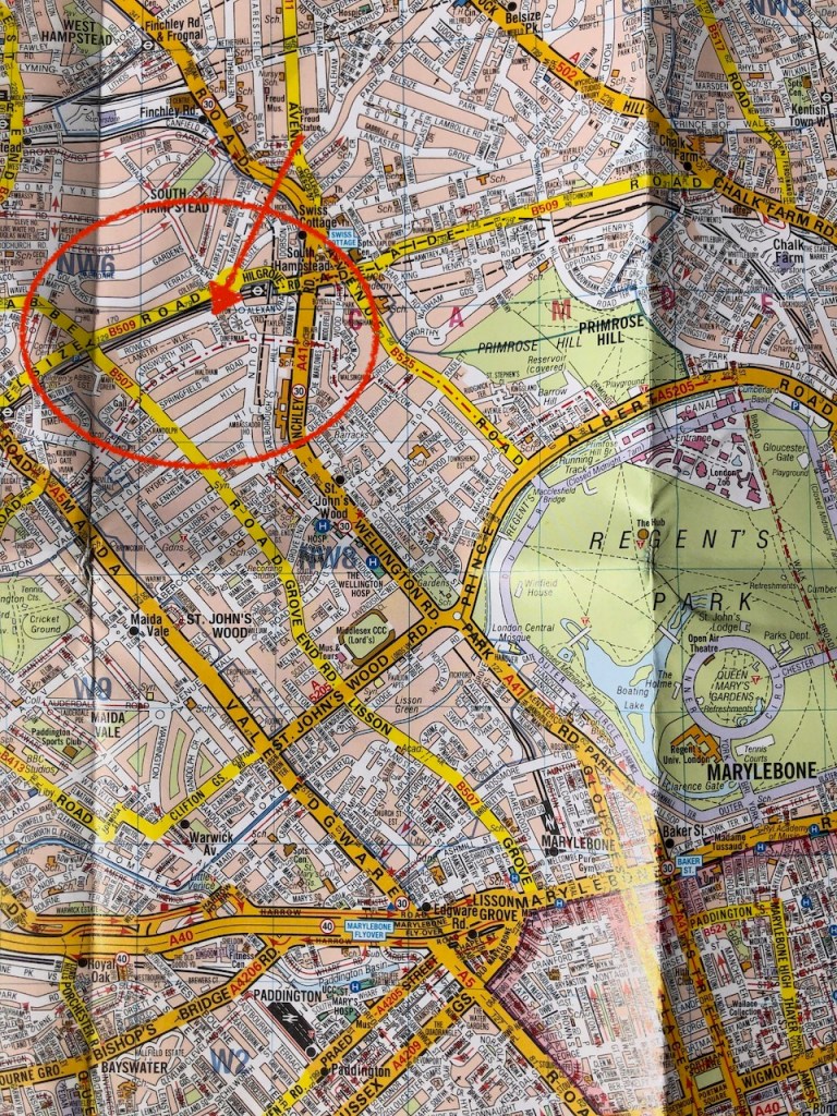
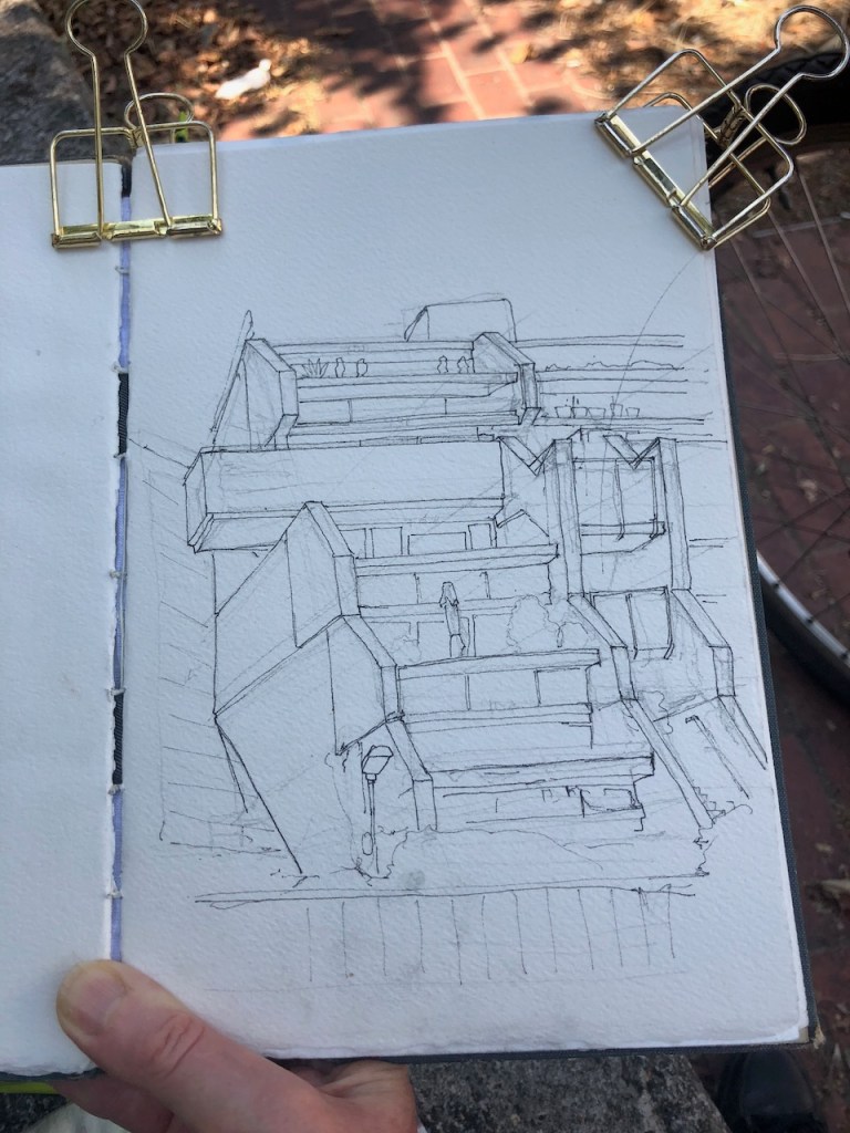
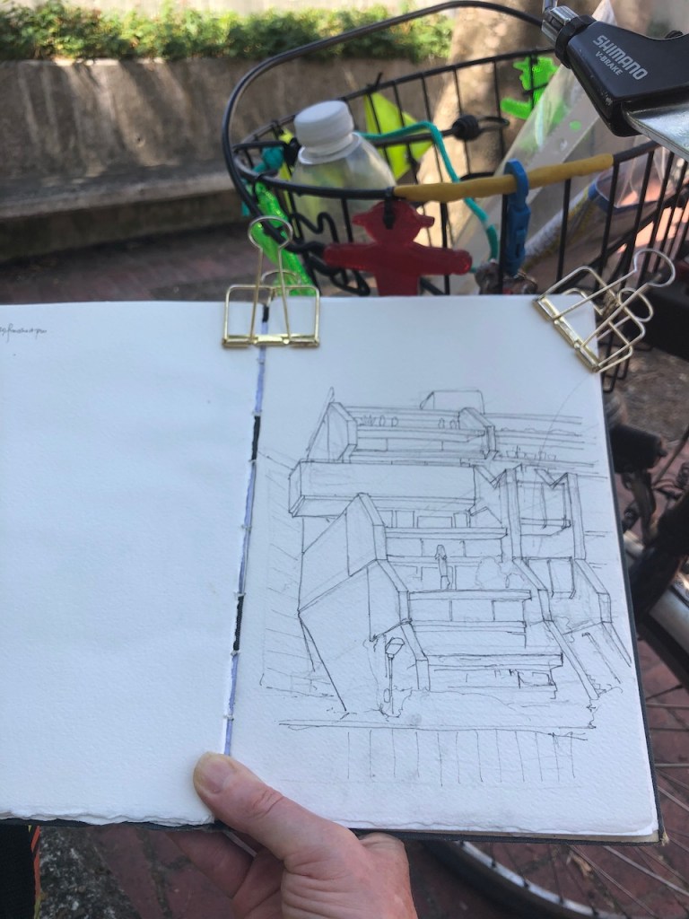
I cycled to the North West of Regent’s Park, in search of the Alexandra Road Estate. This estate is a truly astonishing work, testament to the vision and social ideals of the Camden councillors and architects who made it happen.
I cycled past the large and stately houses of Queens Grove, Marlborough Road, Loudoun Road, going north, uphill. I went left on Boundary Road, which is the north edge of Westminster and the south Edge of Camden. There on the right I glimpsed brutalist concrete. This is it. But the side road I followed, Rowley Way, led downwards into a disappointing loading bay, with barriers, delivery drivers and much disorganised parking. It was hot, and I’d cycled what felt like a long way. Then I remembered that this was a 1960s development. There must be a podium level, above the cars. There was. I looked for, and found, the slope upwards.
Rowley Way, Alexandra Road Estate
At the top of the slope was another world. A long village street led into the distance, with tranquillity, with greenery, and with concrete benches. People walked about immersed in conversation, leading children. Two lads sat on a bench, chatting and looking at their feet. Everywhere, there were trees, bushes and flowers. The street was tiled with red terracotta tiles. Each side the flats sloped up, looking irregular, like houses I have seen built into the hill in Crete.
I walked all along the tiled street, pushing my bike. There were concrete benches, but from those the view would give directly onto someone’s home, so I didn’t feel that would be good manners to sit down and draw there. Many features I recognised as typically 1960s: wood-marked concrete, thick iron railings, slabs of exposed concrete, round stairwells. The flats were all interlocked, so it was not clear where one flat started and the next stopped. It was most intriguing architecture. There were ledges, and low doors, gardens on ledges, and stairways climbing high up right to the roof.
At the end of the street, there was a small tiled public area, with a tree, and a viewpoint, and more concrete benches. Here I had a view of the end of the terrace of flats.
“..monoliths of tower blocks..” behind the Alexandra Road Estate.
I particularly enjoyed the way that the architect had made that walkway protrude at the end of the block, to provide a viewpoint, a special place. I didn’t go up there. To the north, there were the tall monoliths of tower blocks. Trains rumbled. The railway line is immediately behind the terrace I was drawing.
The architect of the Alexandra Road Estate was Neave Brown, of the Camden Architecture Department. It was designed in 1968 and built 1972-78. The construction was controversial. Inflation was 20% at times in the seventies, and so costs went up. Neave Brown fought hard to complete the scheme, and he prevailed.
There is a wonderful description of the estate and its history on the Municipal Dreams website on this link:
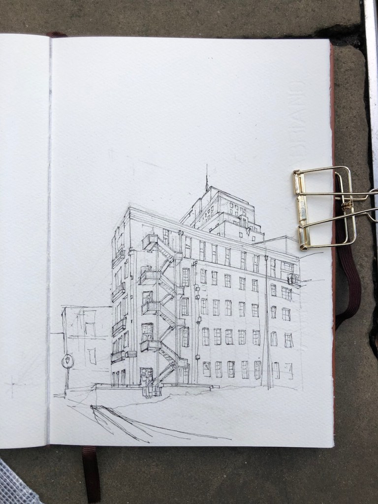
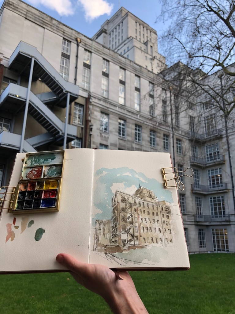
The original plan, by the architect Charles Holden in 1931, proposed University of London buildings which extended all the way up Malet Street, with 17 courtyards and two huge towers. This plan was revised a number of times, becoming less magnificent with each revision. We are left with just three of the original 17 courtyards, and just one of the towers. What I find interesting is that evidently one of these downward revisions of the magnificence must have occurred rather suddenly, while building was in progress. Here are maps:
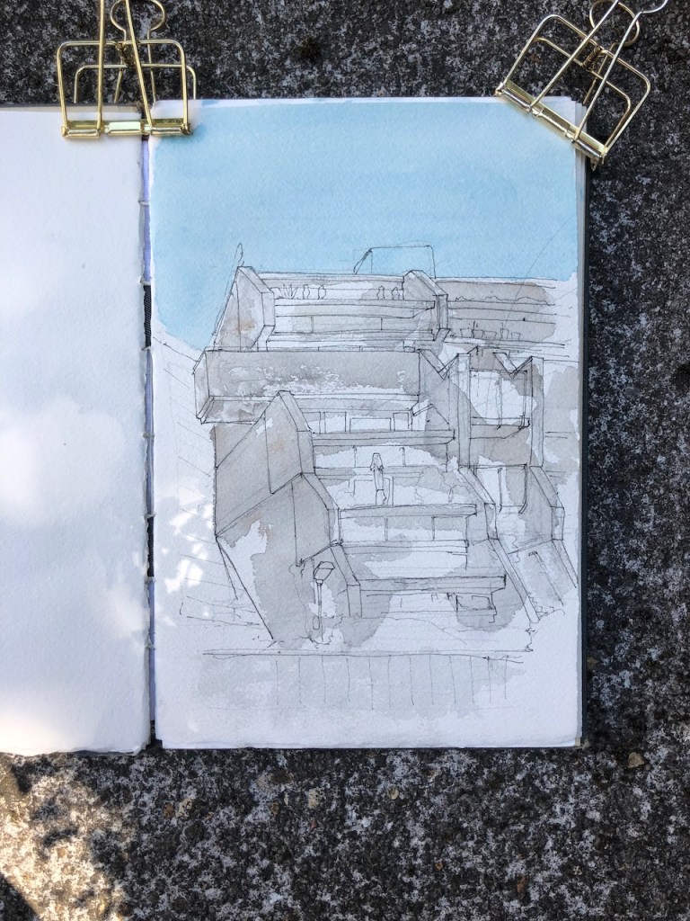
The current Senate House: 3 courtyards, with the vestiges of a fourth.
Location of the Senate House. Sightline of the drawing is in red.
An unfinished fourth courtyard is evident in the fabric of the building, shown in the drawing below. Strange parts of walls just out like ragged lego bricks from the clean white facades. I imagine the construction workers being suddenly told “Stop! We’ve changed our minds about that next courtyard.” And the workers climbed down the ladders and downed their tools, there and then. Eventually grass covered what would have been the courtyard.
The wonderful Senate House library tower is top right. Centre of the picture, either side of the fire escape, are strange unfinished walls, in brick. The grass, dull green in the picture, front centre, is where the courtyard would have been.
I learned about Charles Holden from a walking tour on 5th October 2019, led by Chris Rogers. The title of the walk was “Best Laid Plans….Uncompleted London 1925-1995”. Chris Rogers is a writer and speaker on architecture, film, and on architecture in film. His website is here: http://www.chrismrogers.net. It was Chris Rogers who led us to the place where I made this drawing. He drew my attention to the startling unfinished walls in this otherwise polished building. My thanks to him and to the Twentieth Century Society for organising the walk.
Holden’s plan for the site was abandoned in 1937. The main tower is 210 feet high “at that time [1937] the tallest building in the capital after St Paul’s” comments Chris Rogers. He also points out that the upper floors of the tower were for the book stacks of the library “the London Building Act forbidding permanent occupation of any part of a building over 100 feet in height for fire safety reasons.” The laws were first initiated after the Great Fire of London, and subsequently modified, with sections being repealed, modified and replaced with Building Regulations.
If you want to, you can walk right underneath the tower, West-East from Malet St to Russell Square. Although it looks private, it is a public route. No-one stopped me as I wandered through with my backpack, looking for this vista to draw. It’s worth going through, as you catch a glimpse of the interior.
As I was drawing the picture, two construction workers stopped and admired the picture. Given their trade, I thought they might be interested in the reason why I was drawing here and the story of the unfinished courtyard. They knew it already. Yes, they said, there was going to be two towers. We agreed it was still a magnificent building. “But inside, ” they told me, “it’s all been ripped out.” I was interested. “Yes,” they continued, “all the sinks and taps, all taken out.” With a hand gesture, they conveyed the former beauty of the Art Deco bathroom fittings, marble floors, decorated tiles. “It’s like an airport terminal in there now,” they said, with resignation and sadness. I knew exactly what they meant.
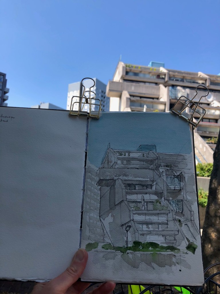
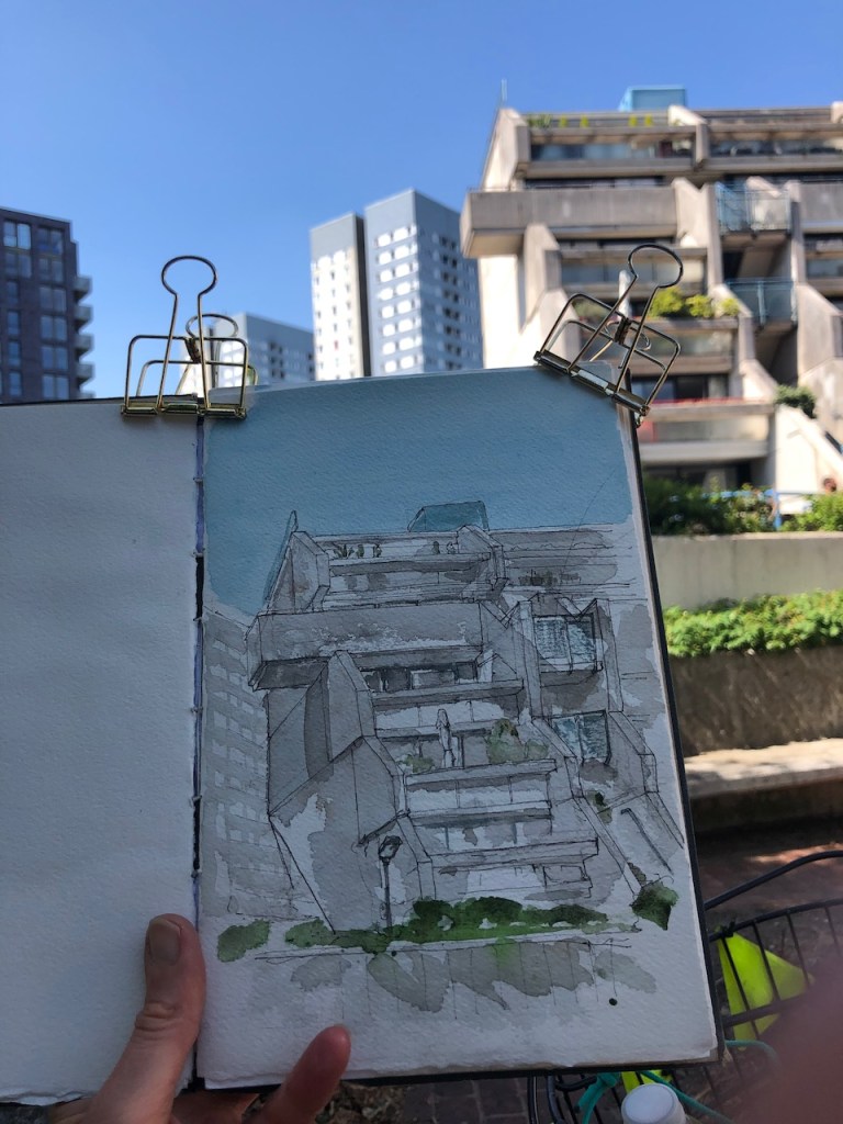
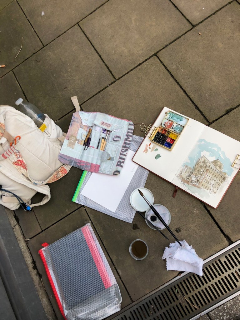
The drawing took 2 hours. Here are some photos of work in progress, and the lettering from the top of the drainpipe.
Work in progress, pen and ink stage
Pen and ink stage, on the pavement.
Drawing kit. The black book (lower left) is for me to sit on.
Coloured on location. Thanks to a passer-by for holding the book.
What it says at the top of the drainpipe.
Click a button below to share this post online, email it, or print it:


_-_Three_Long-Horned_Cattle_at_Kenwood_-_88029298_-_Kenwood_House.jpg)