Russell Square Cab Drivers’ Shelter, WC1

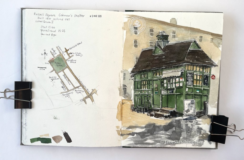
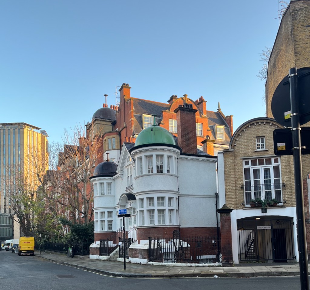
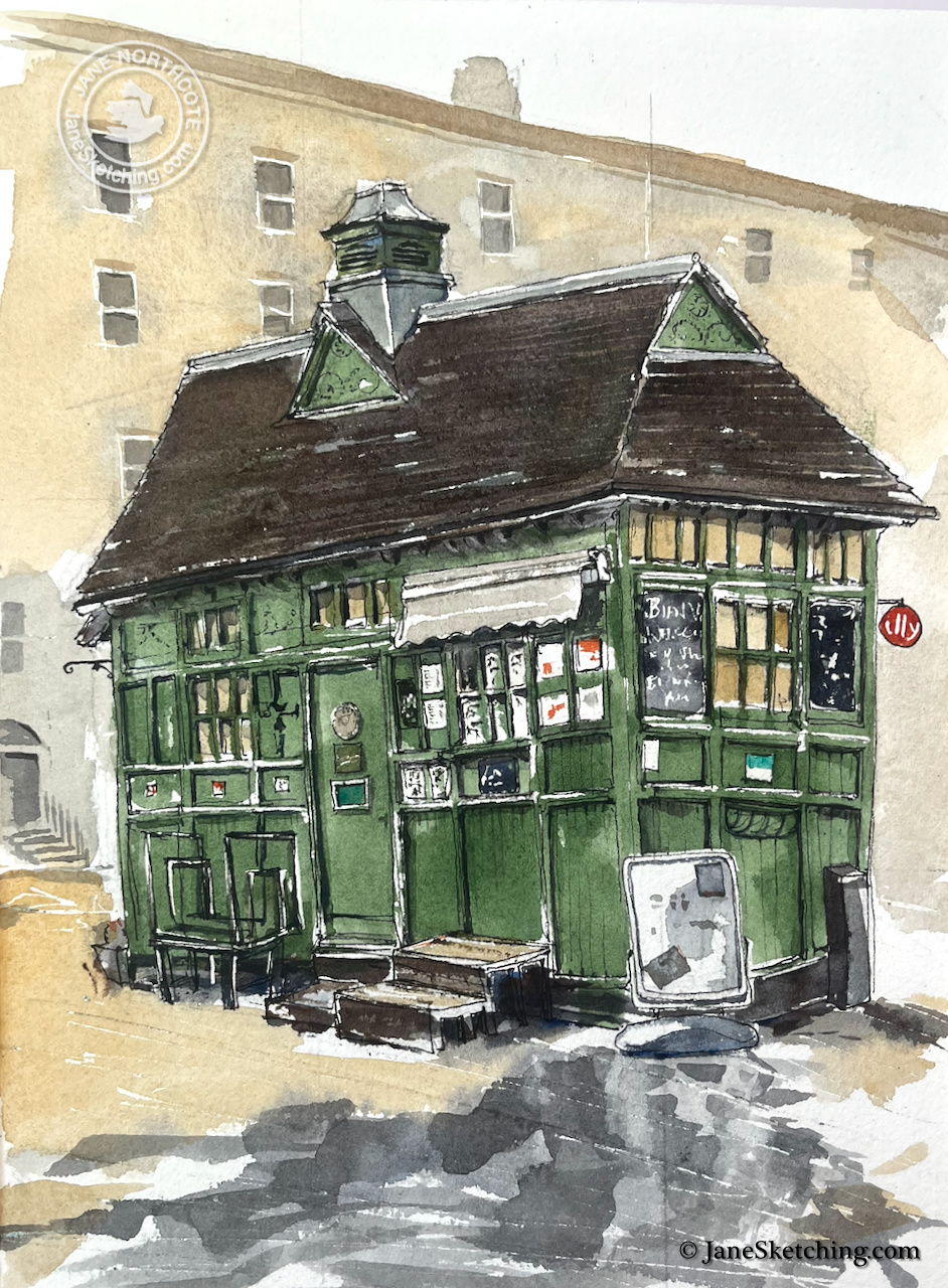
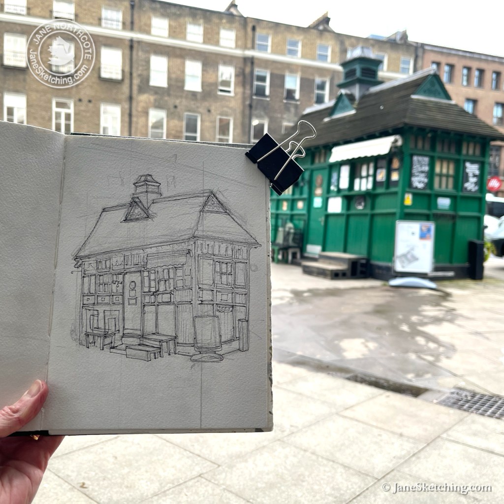
Continuing my series on Cab Drivers’ Shelters, here is the shelter on Russell Square. It was built in 1897, restored in 1987, and listed in 1988.

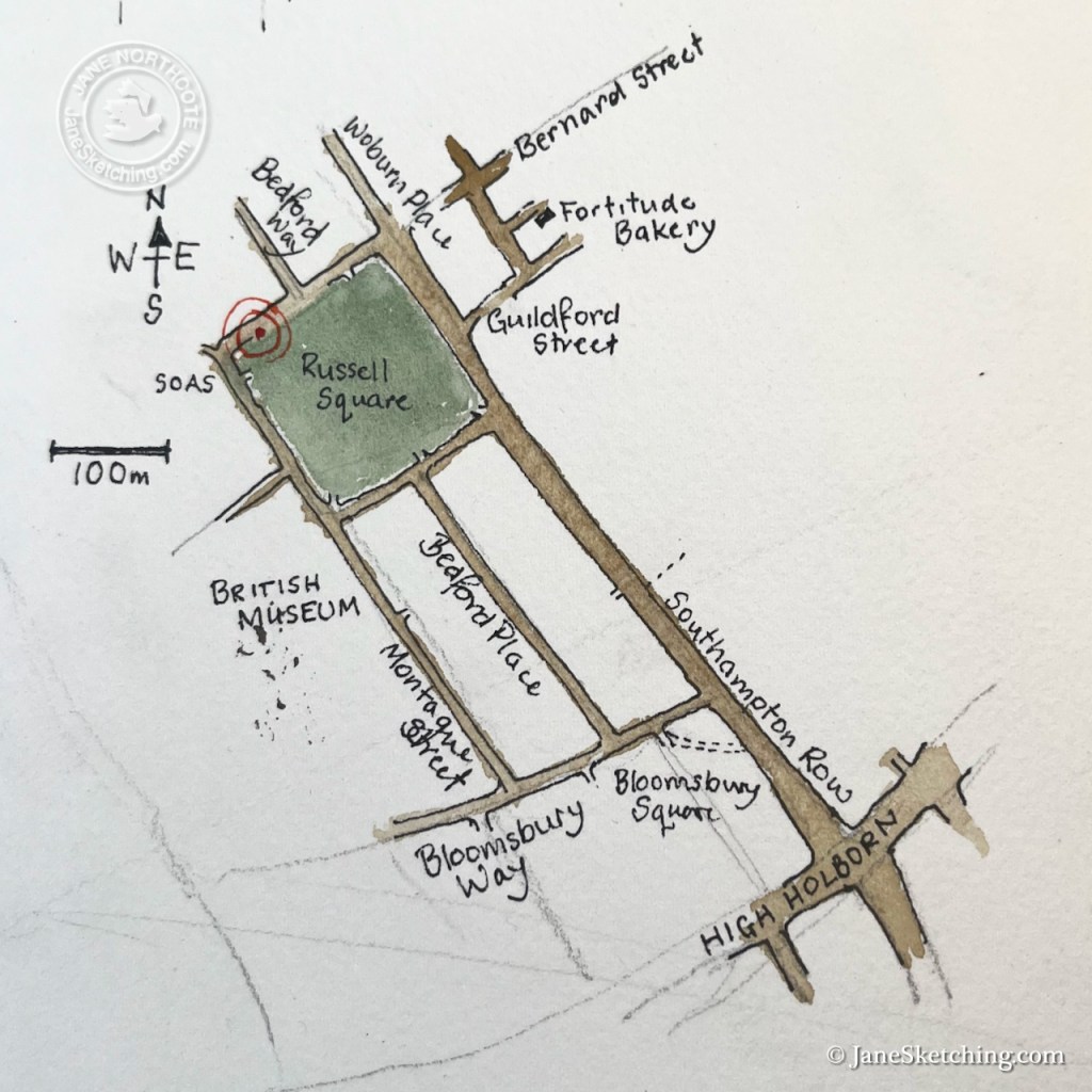
This little building is on the North side of Russell Square, not far from the British Museum.

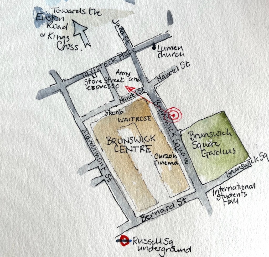
I sketched from a convenient bench, fortified by a sandwich and cake from the marvellous Fortitude Bakery, just to the east – marked on the map above (and recommended).

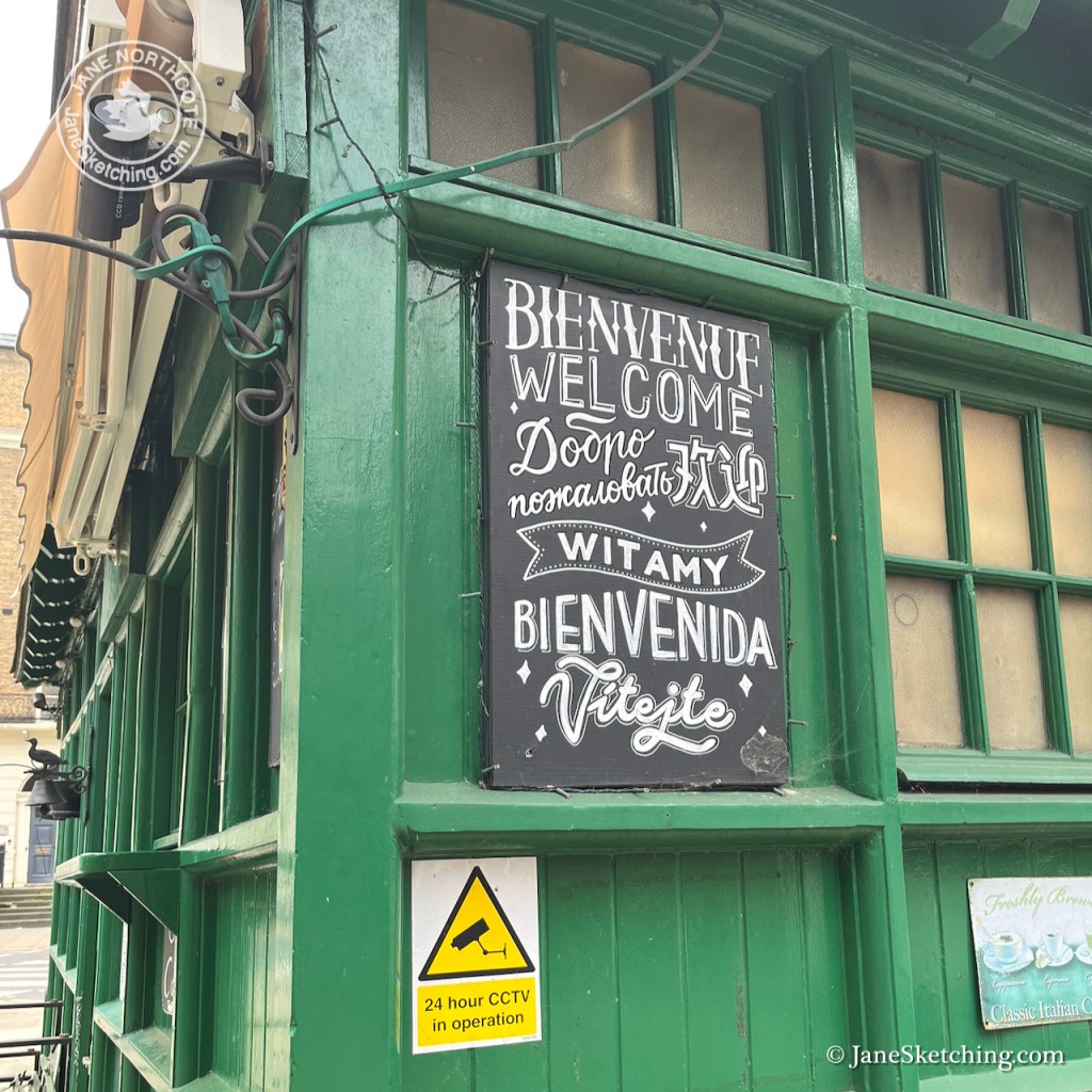
On the other side of the road is a school for young children. Adults stood about, ready to collect the school children. Between them flowed a current of workers, students and people of all nations. “SOAS”, the School of Oriental and African Studies, is nearby, as is the London School of Hygiene and Tropical Medicine, and many other academic institutions of the University of London.

A cheerful woman swathed in scarves bustled up to me and examined the picture. She glanced up to to the shelter and looked back down again at my picture, comparing. She then delivered what I took to be a speech of encouragement and admiration. But it may equally have been closely argued constructive criticism. Her words sounded garbled, she had no teeth, and I think she was speaking a language unknown to me. However we smiled at each other, I held up the picture so she could better compare it to the building. She nodded curtly, as though putting a confirmatory flourish at the end of her expressed opinion. We smiled again, she waved, and off she went.

A woman with a large handbag came and sat down right next to me on the bench. She placed the handbag on her lap, and took no interest in my picture whatsoever. After a few minutes she took off again. Perhaps she had spotted the pupil she had come to collect.

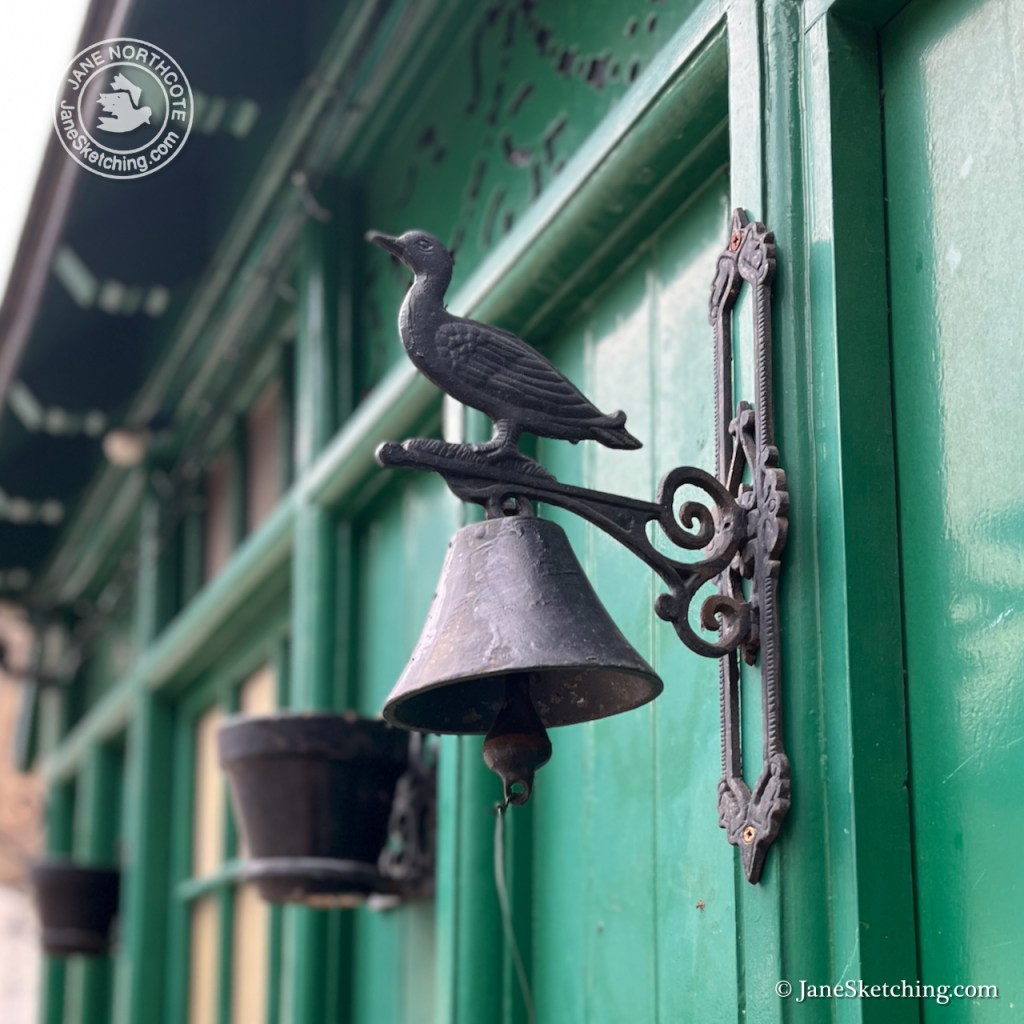
I photographed various details of the shelter. Note the bird on top of the bell. I had tried very hard to show it in my drawing, but at that distance it was very small.

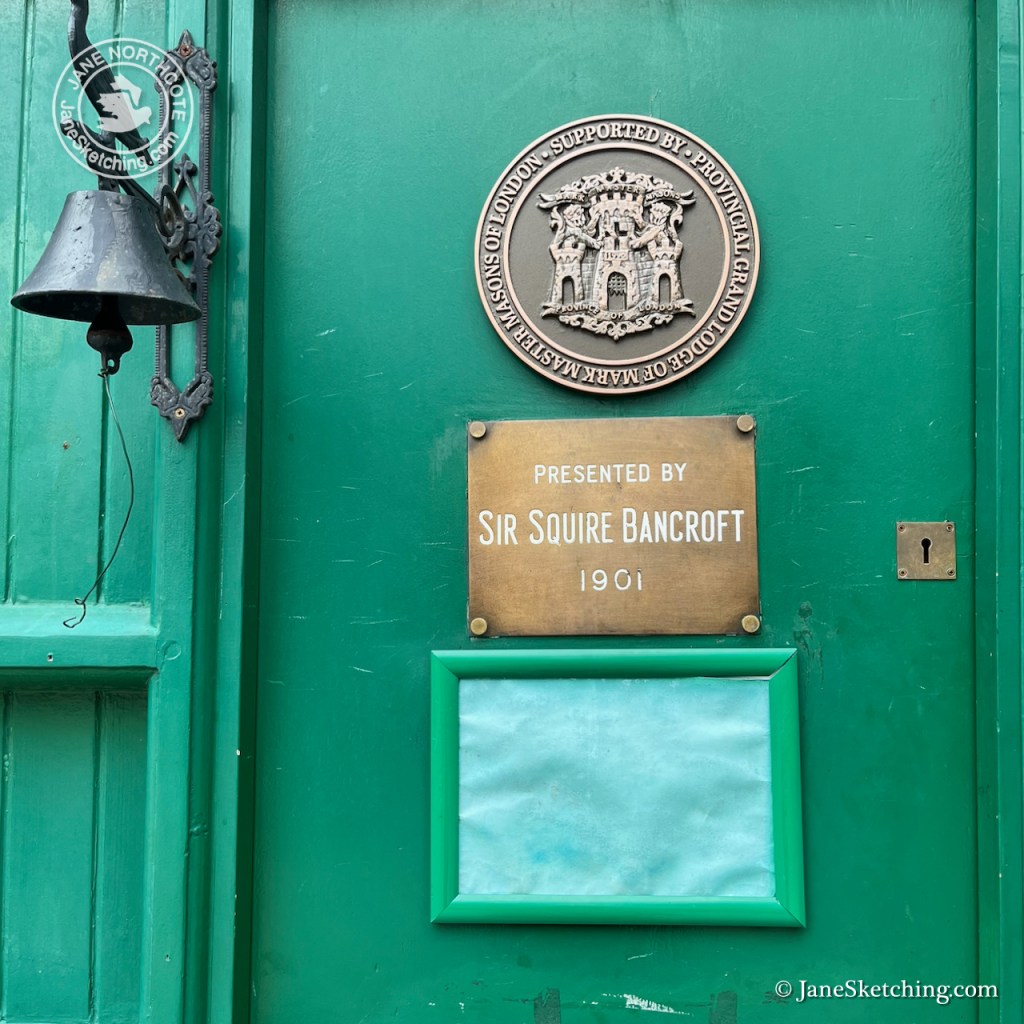
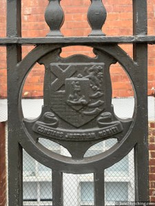
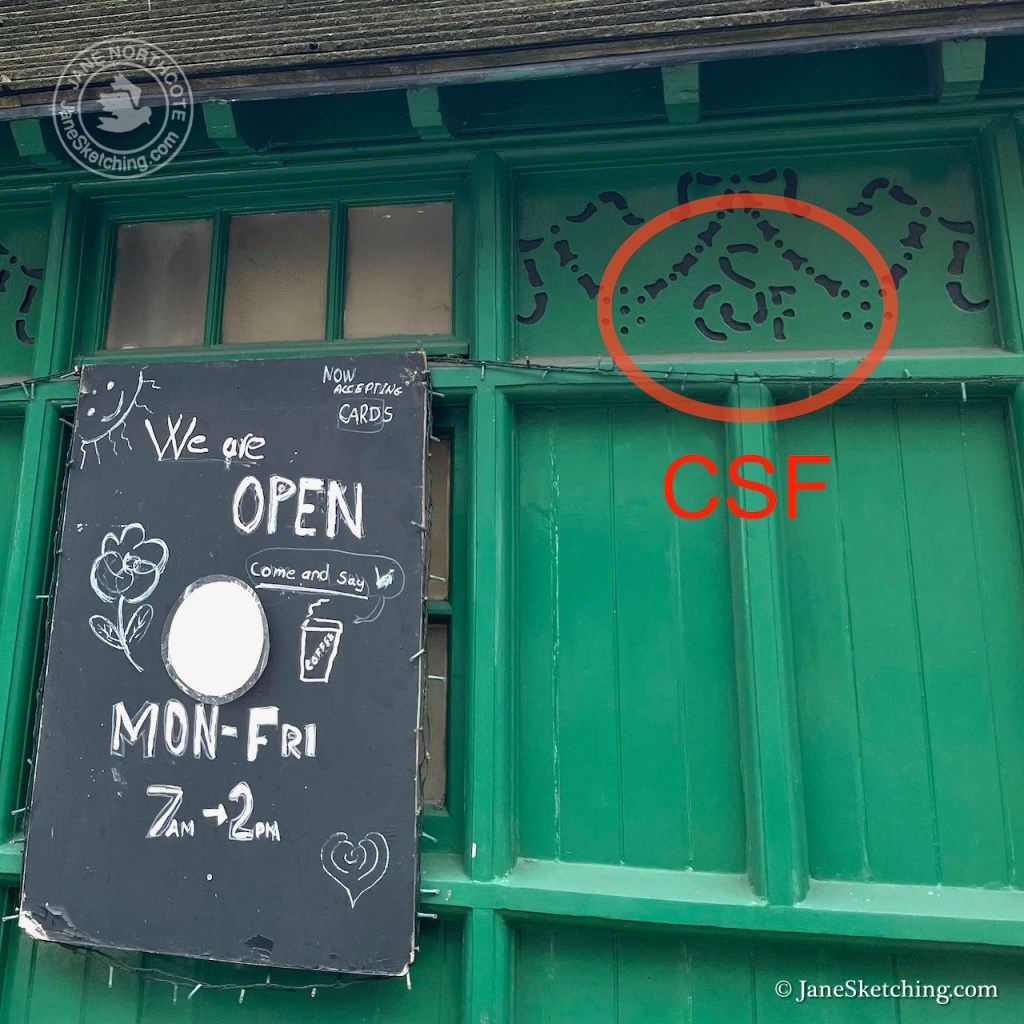
The shelters were built by The Cabmen’s Shelter Fund. Its monogram “CSF” is in the fretwork. This charity set up the shelters in the 19th century, and still exists.

Russell Square Cab Drivers’ Shelter – fretwork showing “CSF” for “Cabmens’ Shelter Fund”

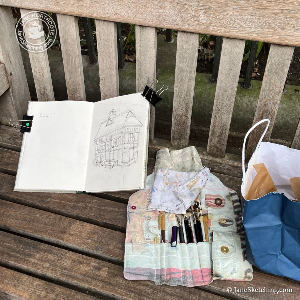
I finished the drawing back at my desk. Here is the sketchbook spread.

Russell Square Cab Drivers’ shelter in Sketchbook 16

Flaxman Lodge, London, WC1

This wonderfully turreted building adorns a street corner in Bloomsbury.

Flaxman Lodge, Flaxman Terrace, London WC1H 9AW sketched 31 Dec 2025 in Sketchbook 16

It is listed Grade II. According to the listing entry it was built in 1907-8 to designs of Joseph and Smitham, “for the Vestry of St Pancras”. St Pancras is a church on the nearby Euston Road.

Map showing the location of the Lodge and St Pancras Church

Pevsner1 takes a different view. He associates this lodge with the terrace behind, which has the same domed turrets. He says:

FLAXMAN TERRACE, early St Pancras Borough Housing, 1907-8 by Joseph & Smithem. 6 storeys, with much conspicuously pretty detail: rough cast top floor and Art Nouveau railings. Similar features on the engaging little caretaker’s lodge at the corner of Burton Street

Pevsner, London 4 NORTH
Pevsner’s “LONDON 4:NORTH” book, describing Flaxman Terrace on page 330.

You can see the redbrick terrace, mentioned by Pevsner, in the photo below, with its domed turret matching the turret on the lodge.

Corner of Flaxman Terrace and Burton Street

So, in Pevsner’s version, the designer Smithem has an “e” not and “a”, and this building is “an engaging little caretaker’s lodge”.

The “e” is correct. The architectural practice of Joseph and Smithem was founded by Nathan Solomon Joseph (1834-1909) and Charles James Smithem (1856-1937)2. The practitioners later included sons and a nephew of the founders. The practice designed a number of buildings in London including social housing, schools and the Egerton Road synagogue in Stamford Hill.

Flaxman Terrace was originally built as social housing by the then Metropolitan Borough of St Pancras, whose coat of arms is in the cast iron railings of Flaxman Lodge.3

Now Flaxman Lodge appears to be a private house. Evidently at one time it was divided into flats. Planning permission to convert the flats into one “4 bed dwelling house” was granted by Camden Council in 2014, application reference 2014/1396/P

The property was last sold for £2,280,000 in 2017 (The Move Market)

I sketched this building standing at the corner of Flaxman Terrace and Woburn Walk. “Woburn” would imply a possible burn or stream. Sure enough, the marvellous “British History Online” site delivers a map showing a stream in this location:

I was standing in roughly the position of the “pond” shown in the 1785 map on the left. At that time, I would have been surrounded by fields. By 1898, urbanisation had arrived, but not yet this Lodge. The routes of old byways and street boundaries are retained. Here’s a 1942 map4, by which time the Lodge has appeared. The street pattern of 100 years previously is still there.

For comparison, here is a modern map:

The former “Drill Hall” has become “The Place” contemporary dance centre, and many of the 19th century terraces have been replaced by larger buildings. But the street pattern is unchanged. Burton Street still follows the angle of a long-gone field fence.

Sketching “the Lodge” at the corner of Flaxman Terrace and Woburn Place.
Sketchbook 16
  1. London 4: North, Bridget Cherry and Nikolaus Pevsner, 2001 reprint, page 330 ↩︎
  2. https://victorianweb.org/art/architecture/joseph/index.html ↩︎
  3. See “Footprints of London” on this link for more information about the Coat of Arms and the Metropolitan Borough of St Pancras. ↩︎
  4. National Library of Scotland OS map:
    “Somers Town Edition of 1911”
    https://maps.nls.uk/view/231272247#zoom=4.2&lat=8319&lon=6377&layers=BT
    ↩︎

The Brunswick Centre, WC1

The Brunswick Centre, in Bloomsbury, London has been described as a “heroic prototype for a holistic community” [levittbernstein.co.uk]. There are 560 flats, a cinema, a medical centre and offices in a single development: hence “holistic”. It was radical in that it differs from the Georgian and Victorian houses all around.

Brunswick Centre, Bloomsbury, 13:50 9th August 2022, in Sketchbook 12

It was designed by Peter Hodgkinson during 1966-1970. The original plan was to extend the development all the way up to the Euston Road. There was a significant renovation in 2006 by the architects Levitt Bernstein. They made the shop fronts extend into the plaza in the middle, renovated the flats and added an “anchor supermarket” (Waitrose) at the northern end.

Where I did the drawing

I sketched the pen and ink on location, then repaired to the Store Street espresso on Tavistock Place to do the colour. There are very few colours in the picture: Buff Titanium, Ultramarine Blue, Burnt Umber and a tiny bit of Transparent Pyrrol Orange.