A very cold and blustery day.
Drawn from Ironmonger Passage, beside St Luke’s Gardens. My watercolour bag blew onto the ground, and the street sweeper, speaking Polish into his mobile phone, swept it up amongst the leaves. I raced after him to retrieve it, and he was very polite and apologetic.
“Gambier House was constructed in 1968 and is a 20 storey tower block, comprising 115 flats. The block is located on a triangular site between Mora Street and Lever Street. A small park is immediately adjacent to the south whilst surrounding properties, of between two and seven storeys, are in both commercial and residential uses. “
Gambier House was subject of a Planning Application in 2014, to install cladding. The above is an extract from this Planning Application. Here is a link to the document:
Last Thursday I made more prints for my “Towers” project.
I improved a plate I made last September, “Skyline”, using a dry point tool, and a marvellous rolling tool called a roulette. The idea was to add more detail.
The drypoint tool, above, and the roulette, below.
I used chine collé to make a yellow shape. Chine collé is paper. It is put on the inked plate, glue side up, which as you can imagine is quite tricky. Then I carry the whole lot to the press, trying not to let the sticky yellow bits float away. The print paper goes on top, then tracing paper to protect the blankets, then the blanket which the press needs, and then I roll it through the press.
Here’s the result:
Skyline, Chine collé, 4th January 2018
This is the view out of my window. When I look out, I can see shadow of my building and other buildings. The yellow outline reminds me of this effect, and of all the other buildings whose metaphorical shadow is here: the buildings demolished or bombed down, and the buildings to come.
I also made Chine collé prints of Towers East and Towers West.
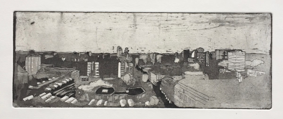
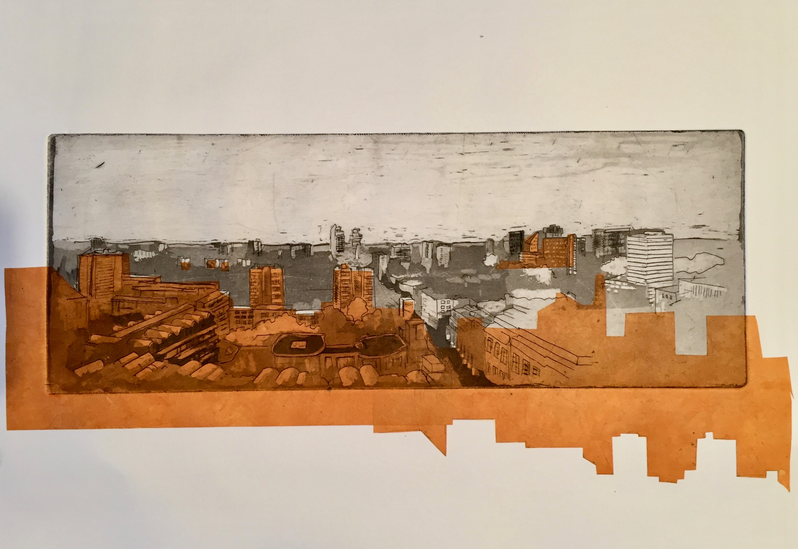
I continue to work on my “Towers Project”. The idea is to document the towers of Finsbury, Islington and Camden, or at least the ones I can see from my window.
I did a “Skyline” previously which you can see on this link.
Here are two smaller etchings, Towers East and Towers West, both 10.5cm by 15cm. I finished Towers West yesterday.
Towers West
Towers East
These two together form a panorama. I used Towers East in a Chine Collé course. See this link.
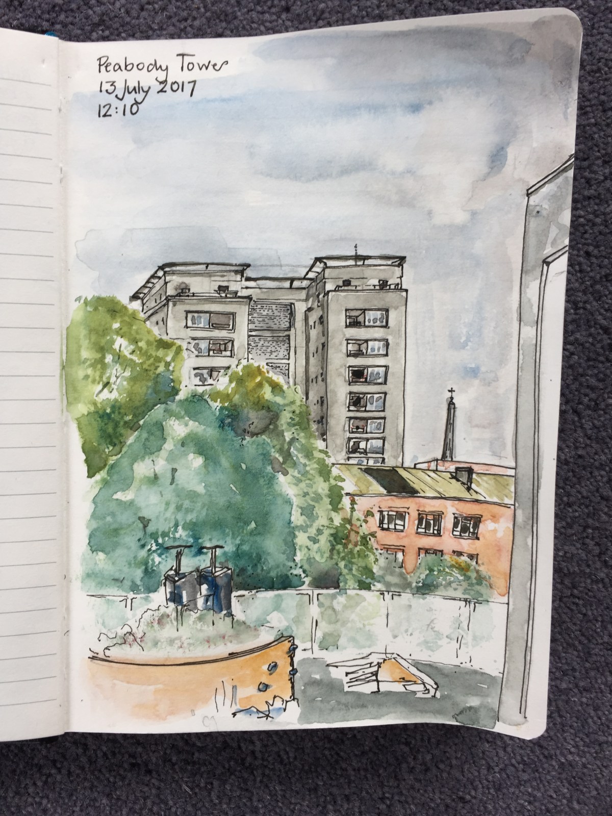
The two prominent towers at the front are part of a Peabody Estate, the “Roscoe Estate” on Roscoe Street. The one on the left is “Peabody Tower” and the one on the right is “St Mary’s Tower”. The low house at the very front on the left is Fortune House, on Fortune Street. I have drawn Peabody Tower in an urban sketch, see this link.
These etchings are aquatint on copper. Here is work in progress on “Towers West”.
Drawing “Towers West” on hard ground using an etching spike.
“Towers West” print: hard ground etching
I drew the picture in hard ground using an etching spike, then etched it in acid called “Edinburgh Etch” for 20minutes. The resulting print is shown above on the right.
Then I put resin dust, called Aquatint, on the plate, and set it with a gas burner. I paint varnish on top of the Aquatint, to make the shapes, then dip in acid, then paint more, then dip. Towers West is 6 dips. The sky is a technique called “spit bite”: I just paint the acid on, wait 20 seconds, and wash it off.
Here’s the copper plate for Towers West:
Towers West, copper plate
Click a button below to share this post online, email it, or print it:
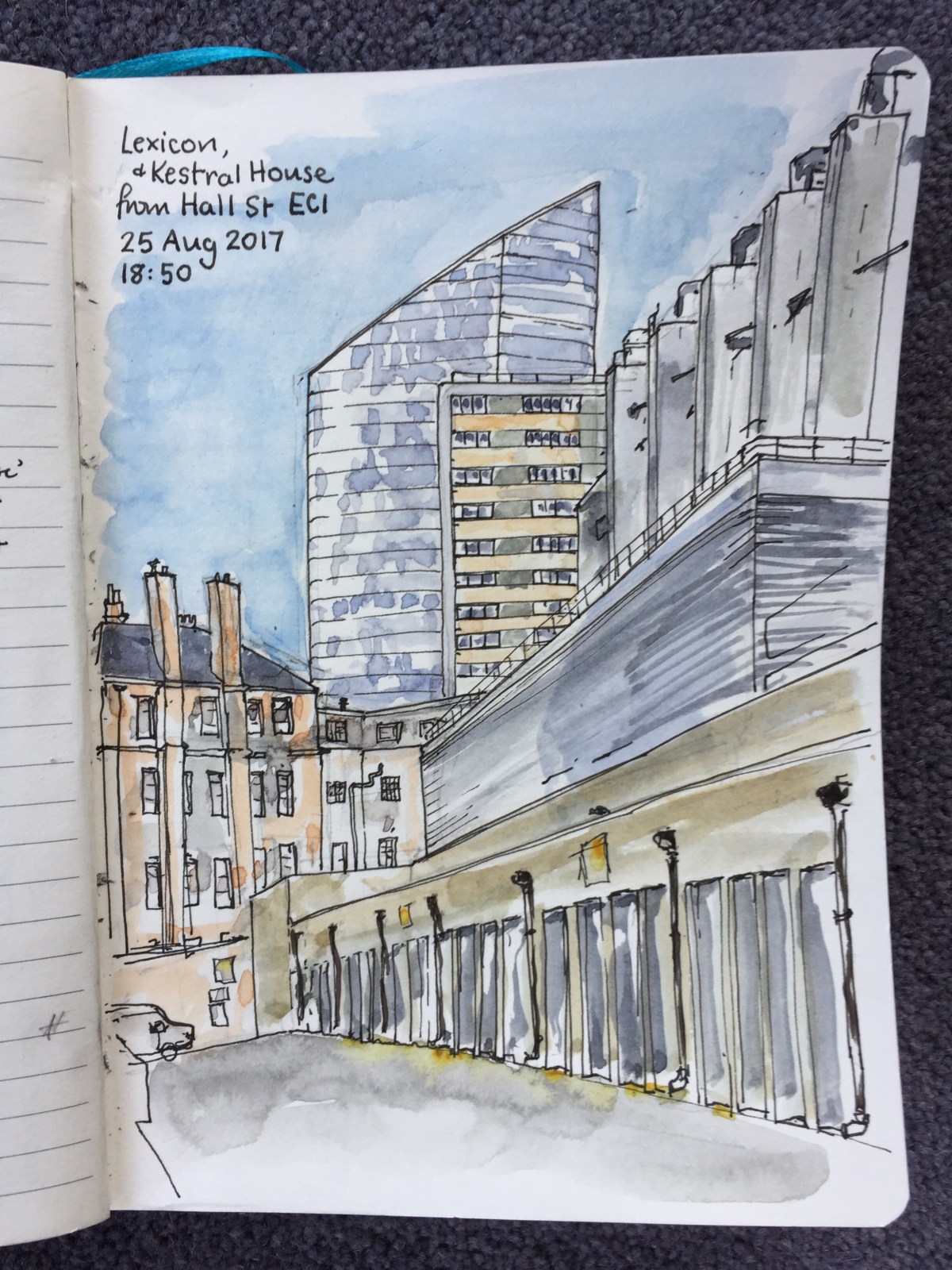
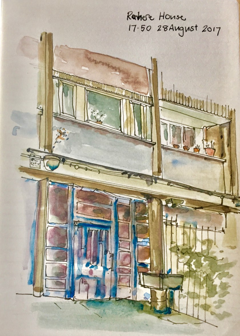
I have been trying to find good views of Rahere and Kestral Houses, two Towers of Finsbury which I can see from my window.
From “King Square Estate Regeneration, Summer 2015 Issue 4” by Islington Council.
Rahere is in the King Square Estate. This estate was built by Islington Council in 1959-61. The architects were Emberton, Franck and Tardew. Franck had worked for Tecton, the firm who designed the Spa Green Estate. King Square Estate is currently subject of improvements including addition of new dwellings.In between all the blocks is St Clements Church.
Rahere House is just visible to the left. The new tower, Lexicon, is above it on the left. Carerra House, of the 250 City Road development, is under construction, visible to the right of the spire.
I couldn’t find a distant view of Rahere House, so here is a close-up.
This is one of the back doors. The architects thoughtfully provided lead-lined troughs, at waist height, for flower pots, I assume. One of these is shown in the drawing, to the right of the door. Off the picture to the left, these continue as long boxes, like water-troughs. None of them are used, presumably because the council don’t do flowers and the temptation for vandals is too great.
Instead, residents have their own plants, inside their windows and out on the balcony. See also the feral plant, growing out of the concrete above the door, top left.
Turnpike House is on the same King Square estate. Turnpike I have drawn before.
Turnpike House, King Square Estate, from the Goswell Road
To the North of Rahere is Kestrel House. This tower is on Moreland Street and City Road. It is currently surrounded by building work associated with the Bunhill Heat and Power. This scheme takes energy from braking Tube trains and uses it to heat local houses and schools.
Kestrel House is on the “City Road Estate”. I found a view of of it from Hall Street: it’s the rectangular tower block in the middle. The Lexicon, otherwise known as “Chronicle Tower”, a new development by “Mount Anvil” is the sloping building behind.
The building which dominates this drawing, on the right, is the premises of “Level(3)”. I walked round the block a couple of times to see what it was. The windows on the street side are high, and there are serious steel shutters over every entrance. Note the huge ventilation shafts. It looks somehow as though it’s ventilating a larger volume than the building, as though it goes down a number of stories below ground. The business of Level(3), according to a web search, is “Connecting and Protecting the Networked World”.
The red-brick building straight ahead was previously “St Marks Hospital Nurses Home”. This is cast into the stone work above a former door on Pickard Street. The door is no longer in use, and fenced off. “Founded 1835, Erected 1853”. The main entrance now is on City Road. It looks disused. Fallen leaves clutter the steps, the grass wafts unmown. But there is a car park, so perhaps there’s another entrance from there that I couldn’t see. It’s “300 City Road”, which appears online as Citidines Serviced apartments.
Behind me when I drew this was Peregrine House, another tower, very high.
Later I went back to try to get views of Peregrine House.
President House, left, Peregrine House, centre.
I forgot to take my drawing book.
I’ll have another go at these towers.
Buildings served by “Bunhill Heat and Power 2” – in green.
Click a button below to share this post online, email it, or print it:
In the foreground is the first-floor playground of the Prior Western Primary School. The building in red brick is Fortune House, built at the same time as Peabody Tower, although it looks very different.
This drawing took 1hr45min. Done from the podium next to Breton House.
Click a button below to share this post online, email it, or print it:
This is from a doorway on Pensioners’ Court, which is the court beyond Preacher’s Court. The Building with the four archways is part of the Brothers’ realm: the infirmary above and the coffee room below. I don’t know what the turret is, very intriguing.
The gardens were magnificent. In front of me was that huge magnolia tree. It moved in the wind and contained darkness much darker than I have drawn it.
I enjoyed the two towers: Barbican and Charterhouse, and the way the view was bracketed by the tree on the right and the lamp-post on the left.
One hour 45 minutes, drawn and coloured on location. The day was overcast and threatened rain. Round me, a gardener was watering the borders.
It should be “Pensioners’” court (plural).
Click a button below to share this post online, email it, or print it:
Those chimneys are hard to draw. They are not simple rectangles, but a complicated geometric shape, a square put at an angle to another square, difficult to see in the light and shadow.
The crest of the roof is not straight. It goes downwards at quite an alarming angle, as drawn. The windows are not in a straight line with each other, which makes me wonder exactly where the floor is, inside.
I drew this from under the shade of the new building, the “Admiral Ashmore Building”. While I was drawing, the gardeners were making the window boxes, and crushed the geranium leaves. The place smelt of geranium, and earth and water.
I like it that you can see the Barbican towers beyond. I made this observation to a Brother who paused to chat. He told me that these brutalist towers are not popular with certain of the Brothers. They have identified a place in the garden where you can sit, so that the towers are obscured by a tree.
About 2 hours (those chimneys!!), drawn and coloured on location.
Here is what it looked like before the colour went on:
Click a button below to share this post online, email it, or print it:
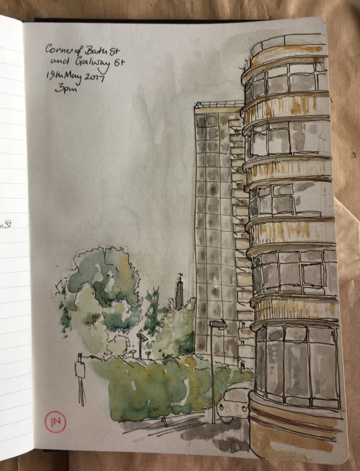
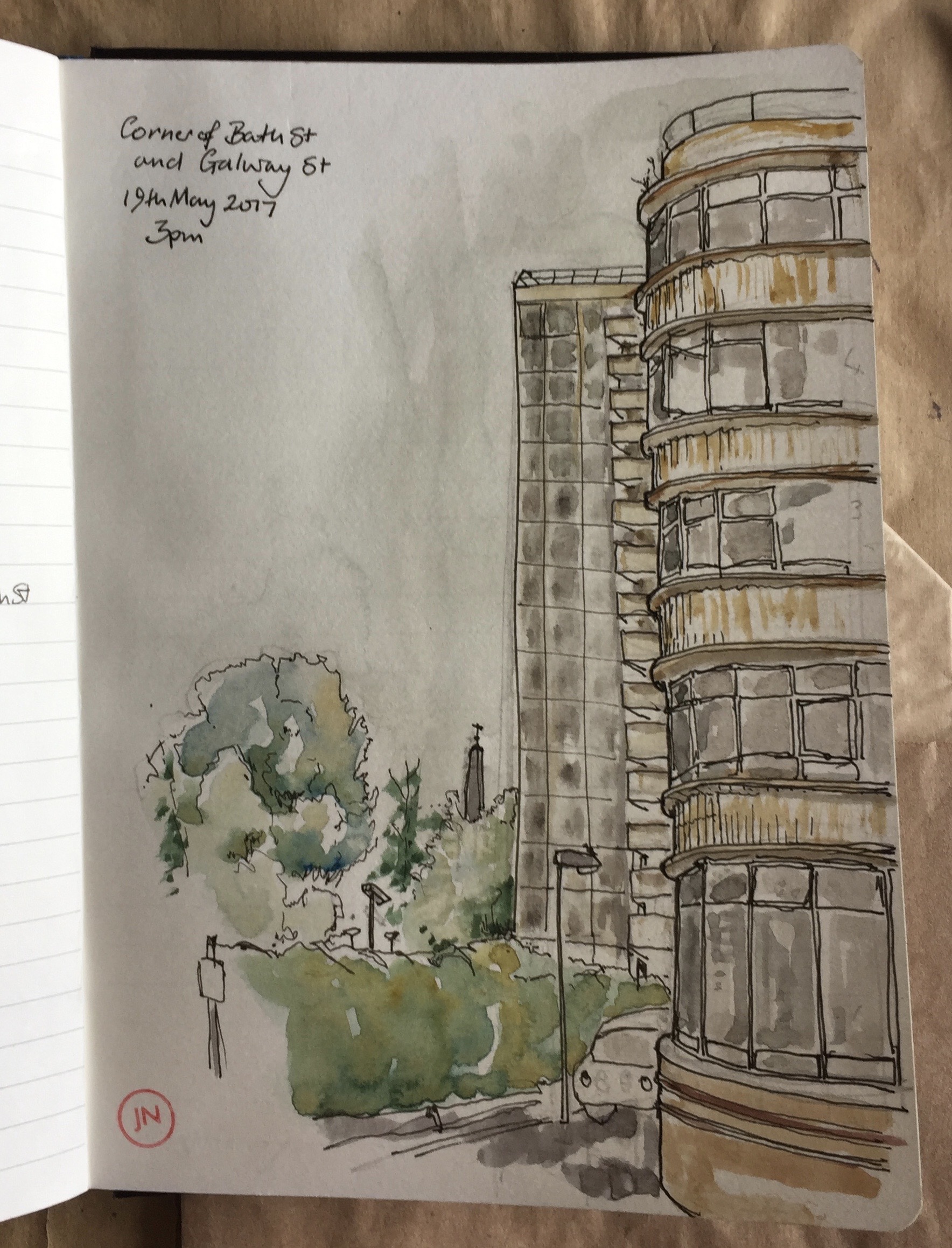
Corner of Galway St and Bath Street, EC1. Willen House is on the right, then in the background is Galway House in the Pleydell Estate. The LSO St Luke’s monument is just visible.
An old man said, “Ah. You are drawing. All little houses, there used to be. I’ve lived here all my life. You know what that [Willen House] used to be? The Income Tax. That primary school? Used to be a pub. Round the corner here, we got bombed out during the war. I’m giving away my age now! And that place – down there – Argos? – you look across the road and what do you see? A bus stop. And that building behind it? Used to be a school. I went there. The man there, conducted during the Cup Final. “Abide With Me”. All dressed in white he was.”
Mostly I did this drawing standing up, leaning on the wall of the “Institute of Ophthalmology, 11-43 Bath Street”. While I was doing the colouring I had to sit down. Two women approached. “You’re drawing,” she told me. Then, “I’m a Community Police Officer”. One of them showed me her badge, in a little case: a metal low-relief sculpture on a blue cloth background. They both admired my drawing, and looked at the view. I said “It’s OK to sit here?” She said, “Oh yes. It’s just, you’ve got your things all round you. Want to be careful you don’t get them swiped. You aren’t in a position to run after them.”. Which was a good point. I moved my bag until I was leaning on it, squeezing it onto the wall behind me.
Willen House is now Student residence, and also home of NTS Fashion Ltd, on the ground floor. I could see their racks of clothes through the window.
About an hour, drawn and coloured on location. The car moved.
Click a button below to share this post online, email it, or print it:


")
")