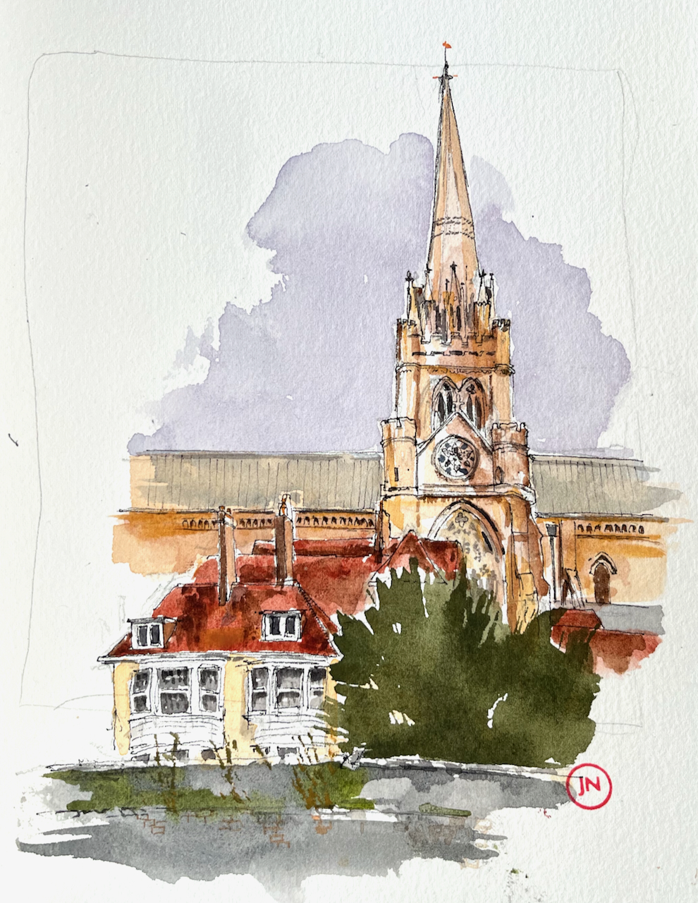
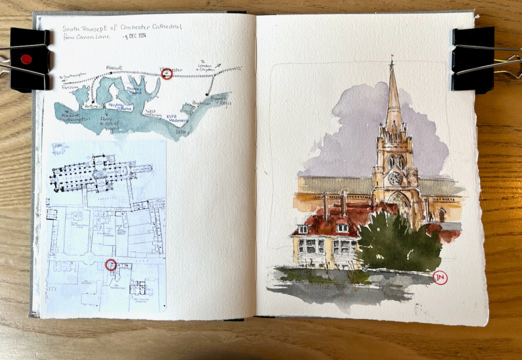
Here is a view of the south transept of Chichester Cathedral.
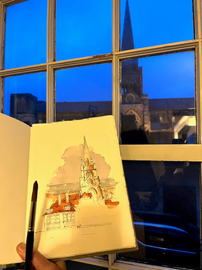
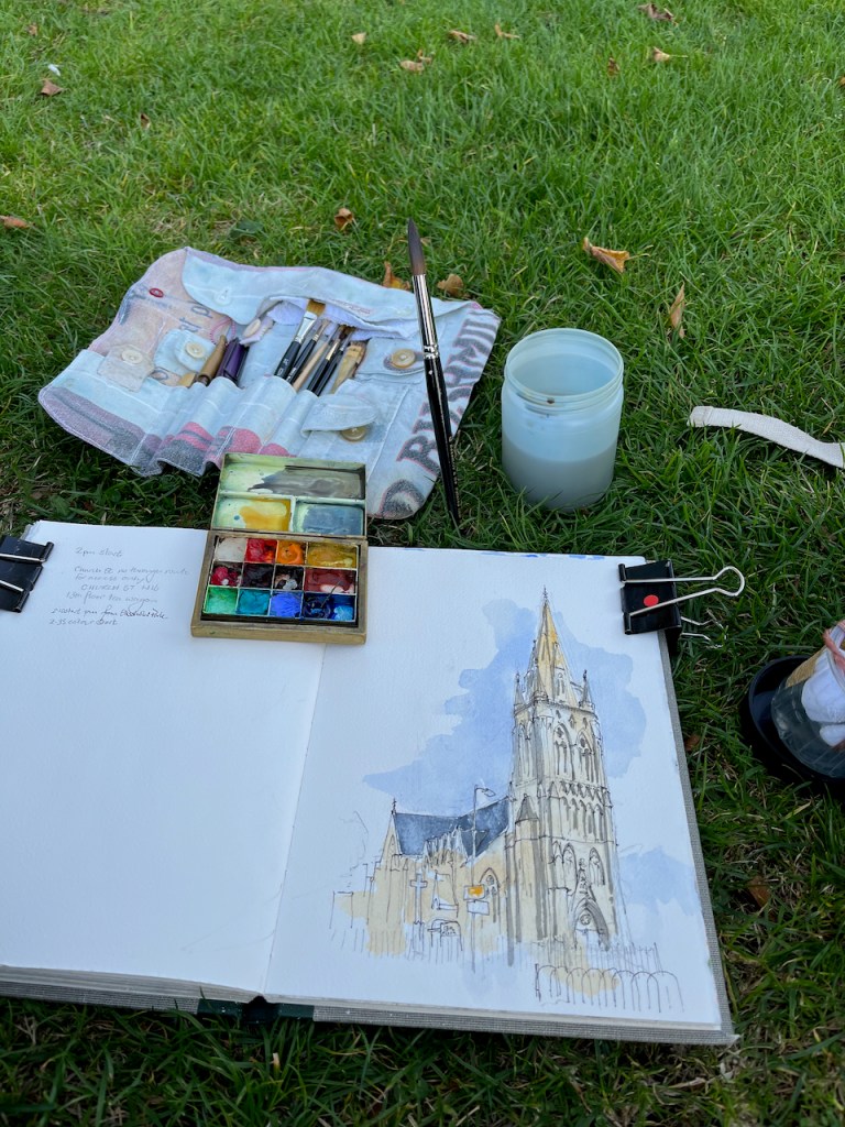
Chichester Cathedral, South transept, sketched 5th December 2024 from Canon Lane, in Sketchbook 15.
The first spire was built around 1500. There are no bells in the spire: the medieval builders put the bells in a separate little building in the cathedral grounds. This was just as well. The spire collapsed in 18611. It was rebuilt to the designs of Sir George Gilbert Scott, and that’s the spire in my drawing.
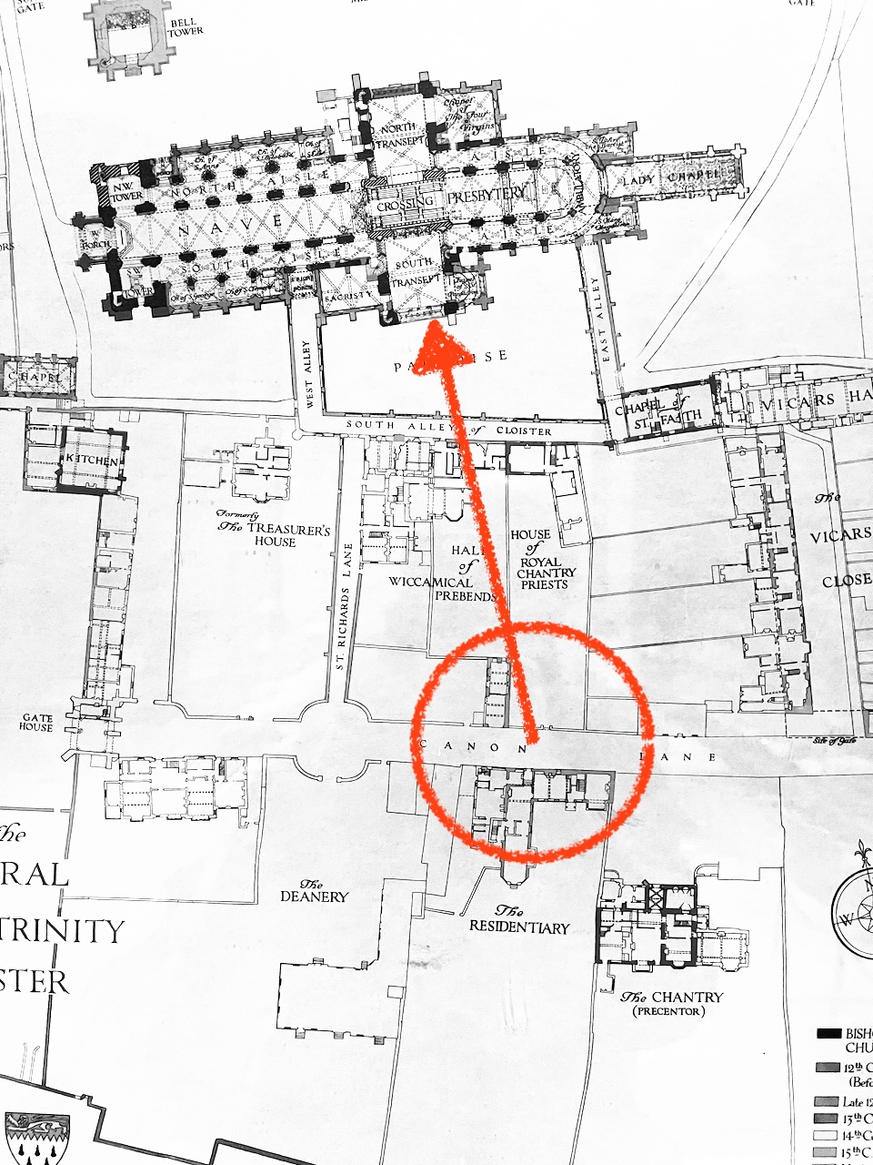
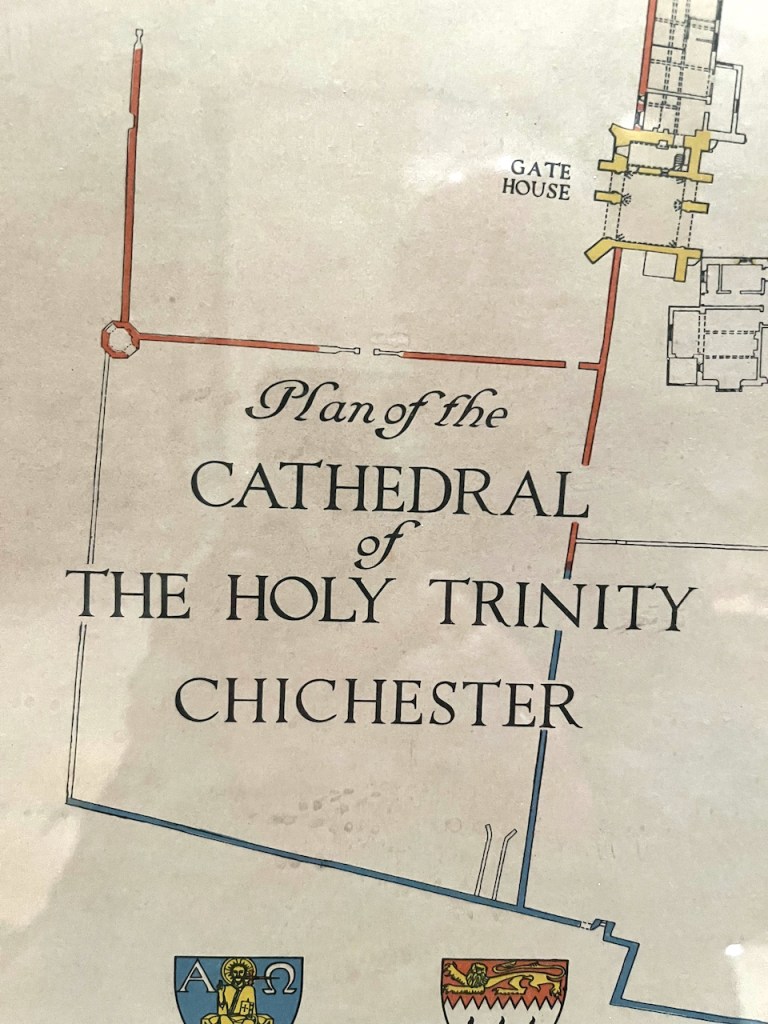
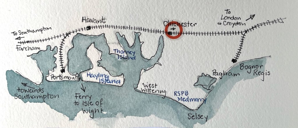
From a beautiful framed plan in the Cathedral, which had no date or artist’s name.Chichester: locationSketchbook 15
George Gilbert Scott was a prolific 19th century architect. I have sketched his work before:
Here is a view of the south transept of Chichester Cathedral. The first spire was built around 1500. There are no bells in the spire: the medieval builders put the…
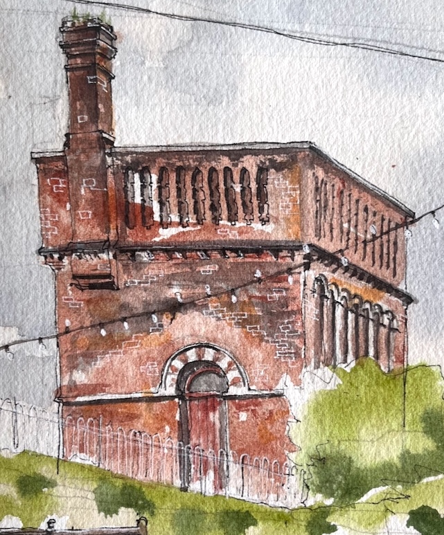
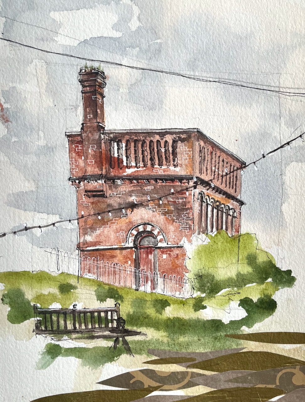
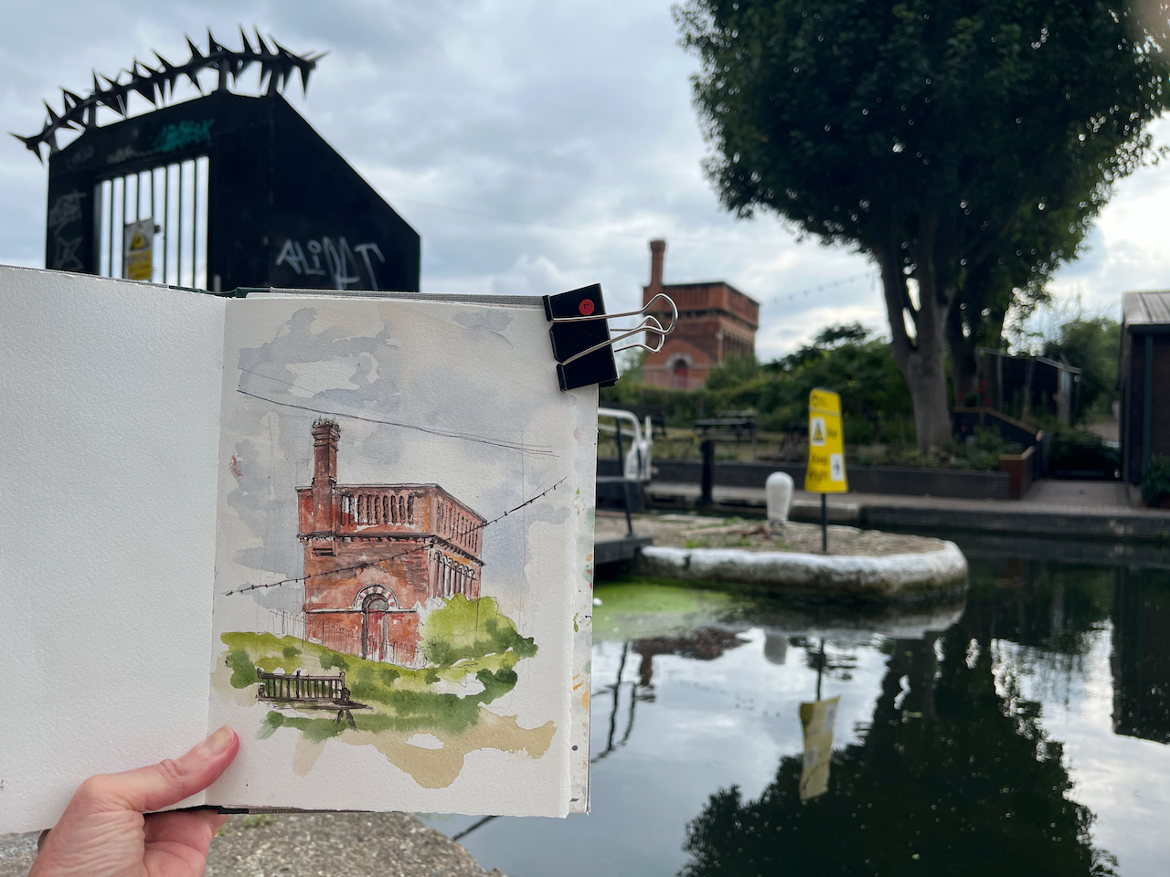
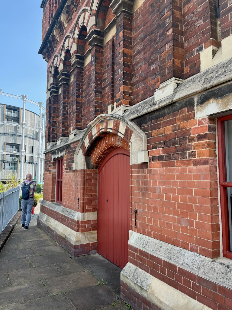
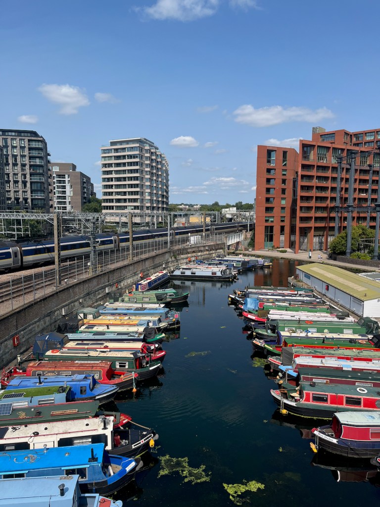
This structure is visible from the North side of the Regents Canal at Coal Drops yard. It was a “water point” for replenishing the boilers of steam engines. The top…
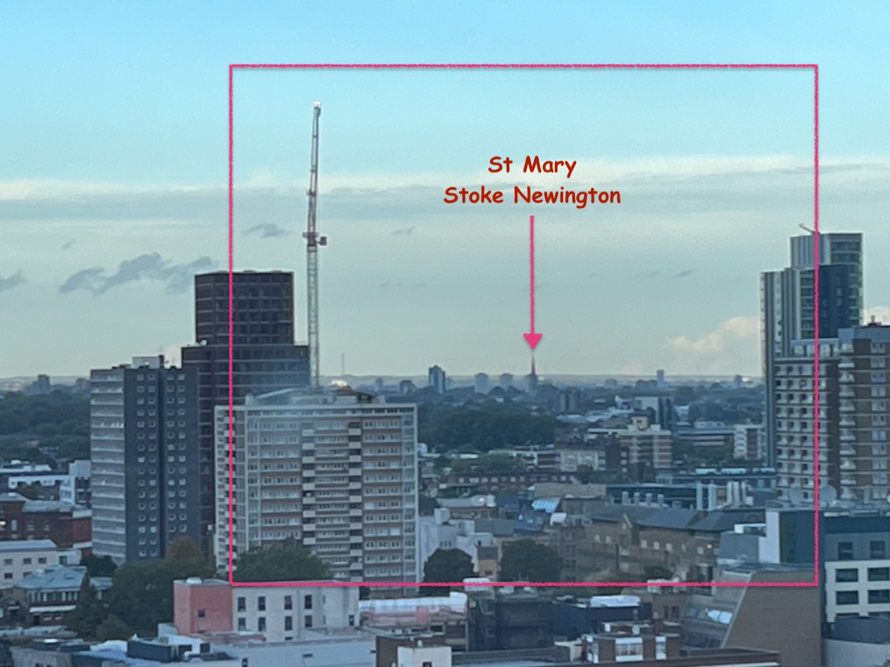
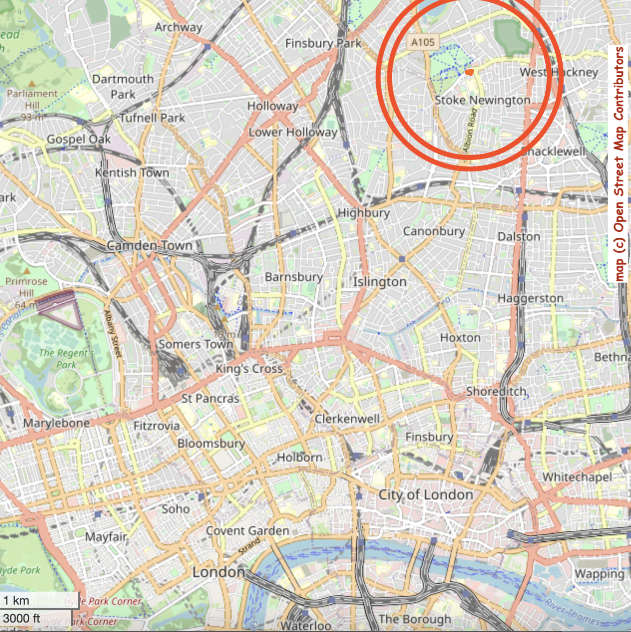
“What is that spire?” It’s just visible, on the horizon between office blocks. Some work with the binoculars and the map established that it must be St Mary Stoke Newington,…
This structure is visible from the North side of the Regents Canal at Coal Drops yard. It was a “water point” for replenishing the boilers of steam engines. The top housed a water tank.
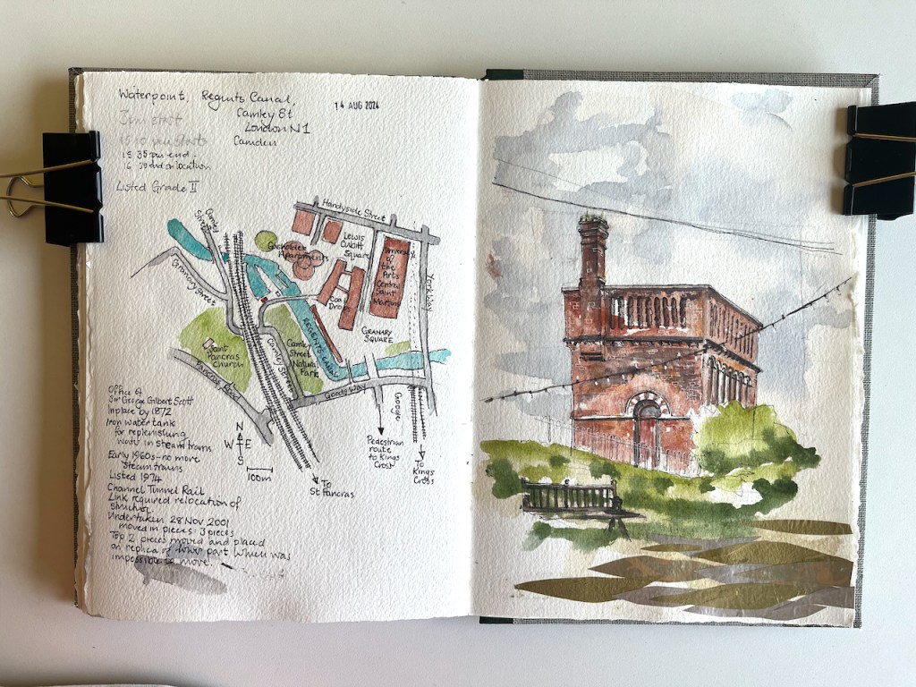
Waterpoint, seen from the Regents Canal towpath at Coal Drops. August 14th 2024, in sketch book 14
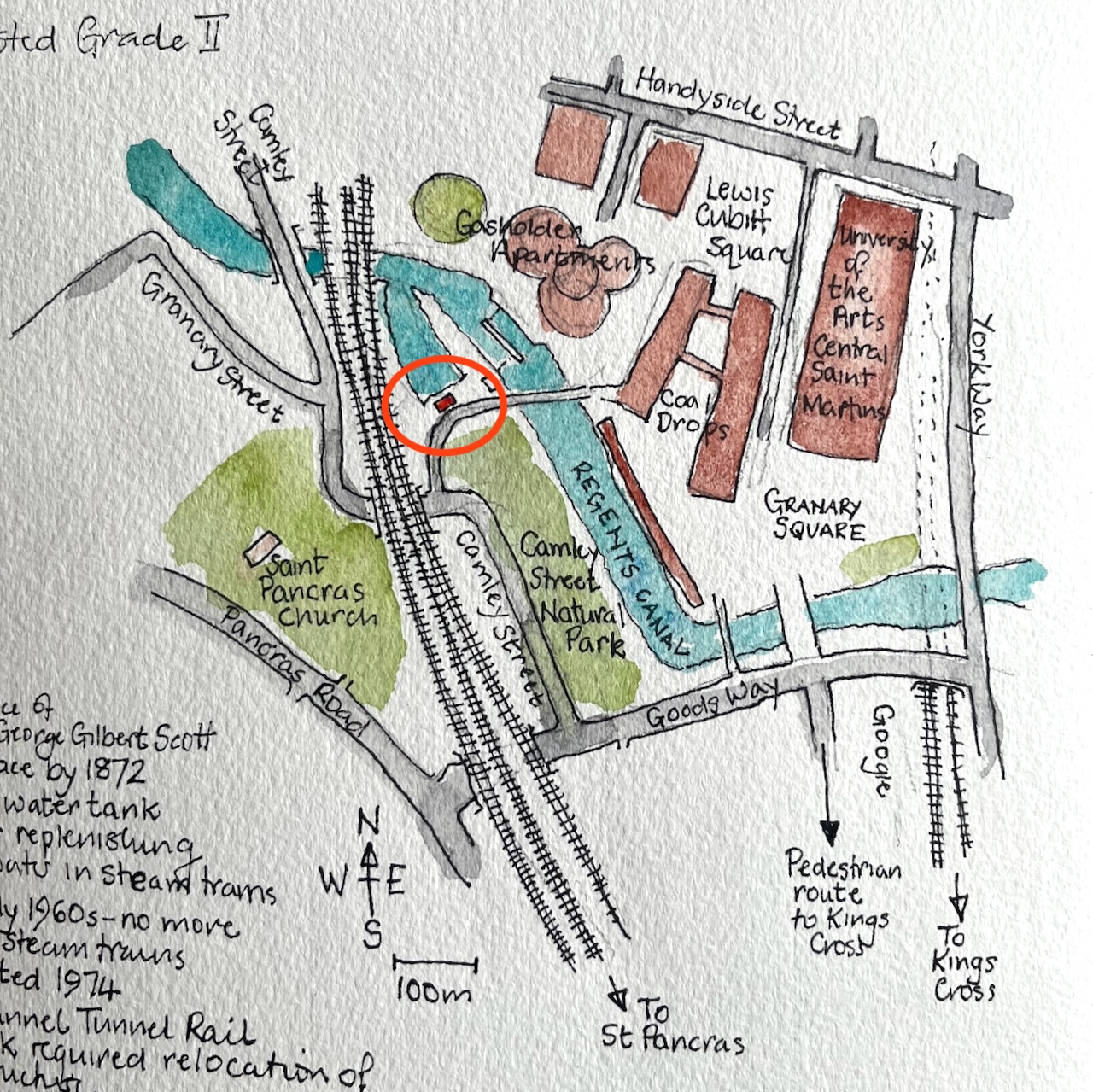
Here’s a map to show where it is. I’ve seen this structure often when walking along the canal, and it’s been on my “sketch-list” for a while, so I was glad that a co-incidence of weather and time gave me the opportunity to sketch it.
Waterpoint, circled.
I was sketching from the Regents Canal towpath right next to St Pancras Lock.
Sketching Waterpoint, looking south across St Pancras Lock.
It turns out that this structure is open to visitors from time to time. By an amazing co-incidence, one of the visiting days was the weekend after I did my sketch. The kind and informative guides there patiently answered the many questions I had, and allowed me to photograph their video and their display boards.
For me, the really fascinating thing about this structure is that it has moved. It was not always in this location. It used to be next to St Pancras Station. It was built around the same time as the station, 1870. In 2001 it was moved North, to its current location.
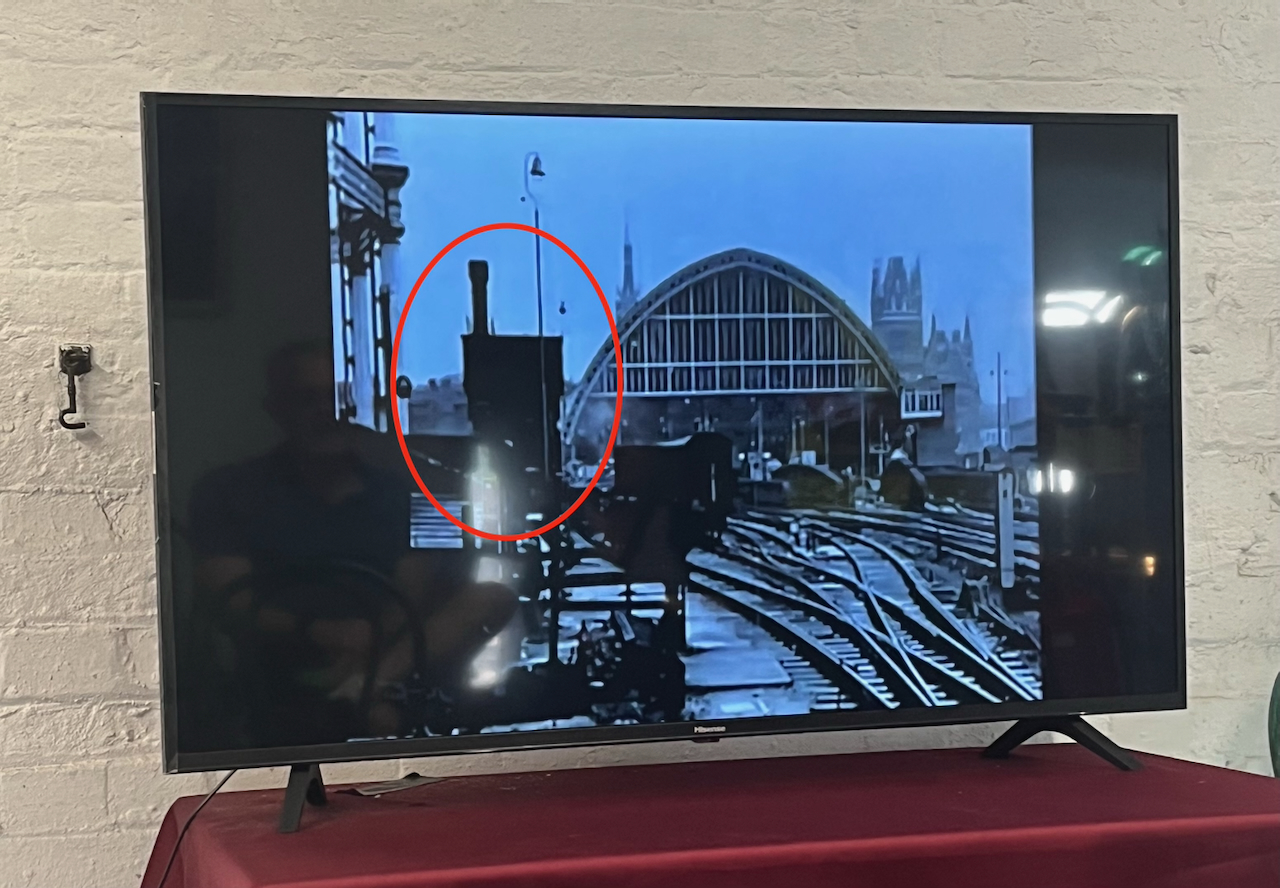
It was designed by team of Sir George Gilbert Scott, who designed the St Pancras Hotel. Since its purpose was to fill the tanks of steam trains, it was right next to the railway lines. You can see it here:
Photo of a video shown at the Waterpoint.
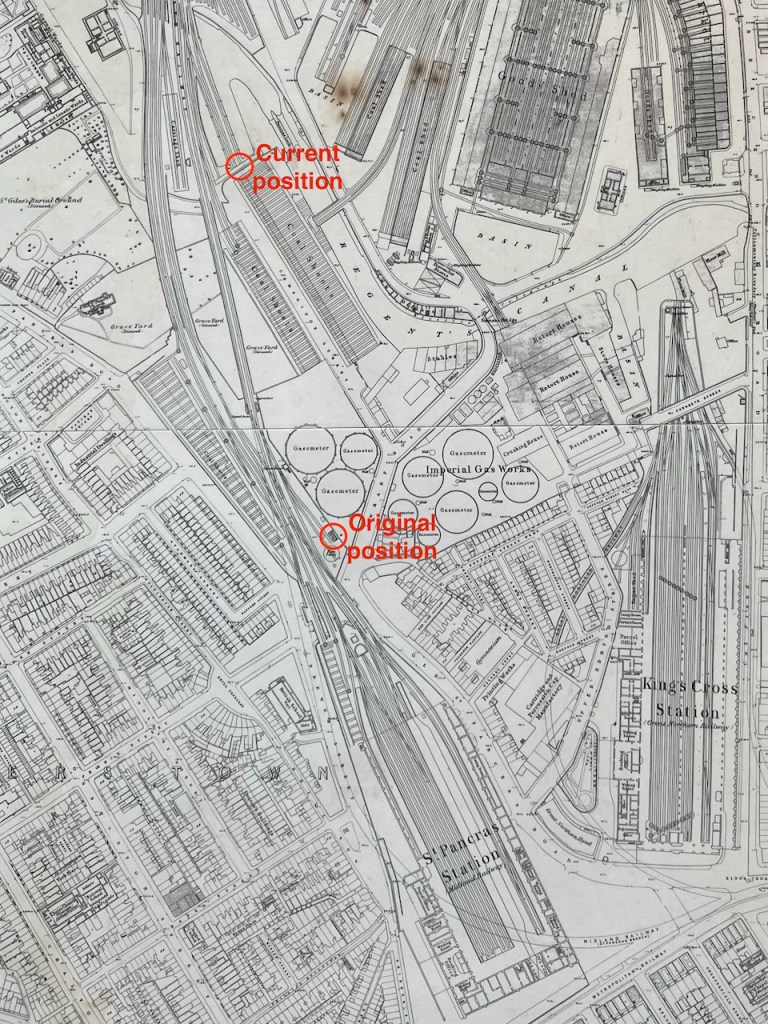
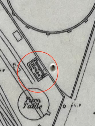
Here it is on an 1871 map: (click to enlarge)
my annotations to show the original position next to St Pancras, and the current positionOn the 1871 map it is labelled “Pumping House”1871 map on display at the Waterpoint (copyright National Library of Scotland)
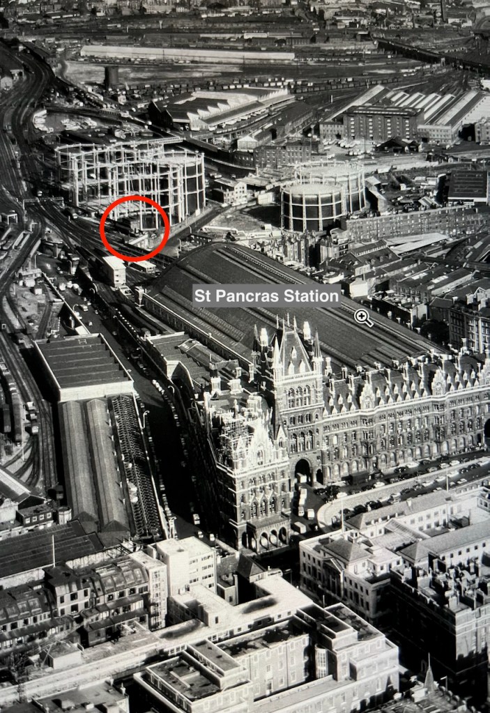
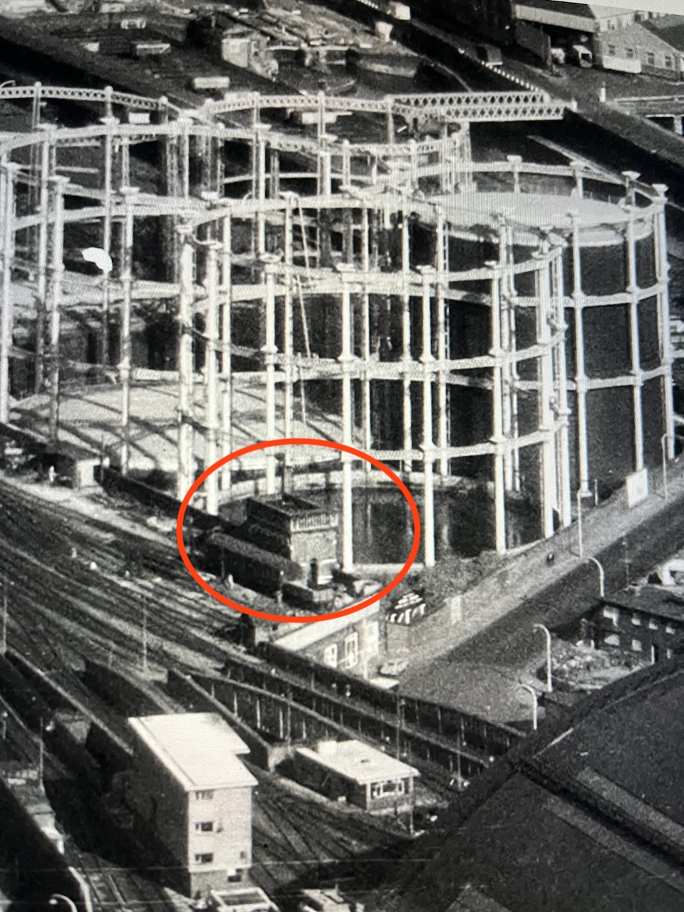
I think I can spot it on this archive aerial photo from 1964. Here is the link to the picture:
The water point is just beyond the far right hand edge of the St Pancras train shed, in the centre left of the photo on the link above.
Here are some low resolution images to help you find it.
Detail from the aerial photo above. The gas holders shown in these photos have also moved.
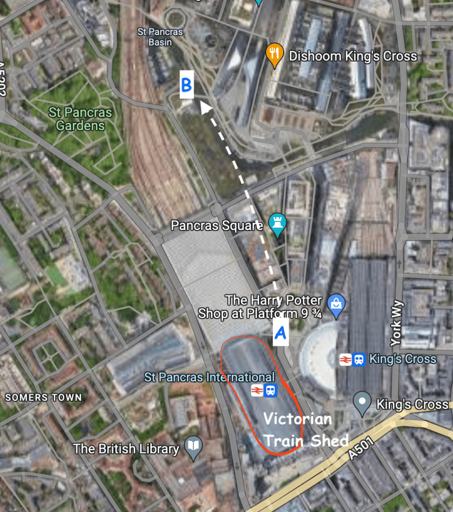
Here are modern maps annotated to show the original position and the current position:
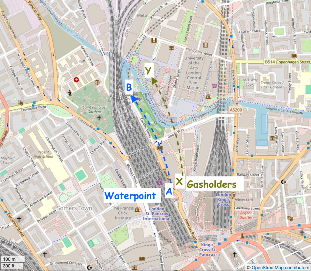
Google map. Waterpoint moved A to B.Waterpoint moved A to B. Gasholders moved X to Y. map (c) openstreetmap contributors
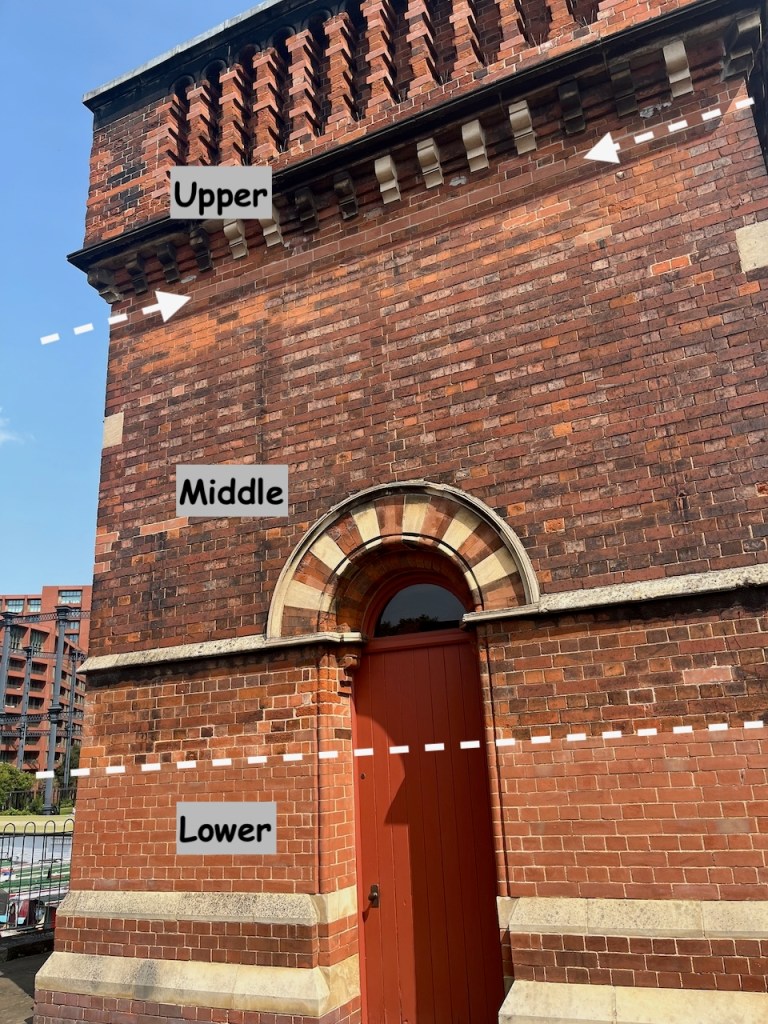
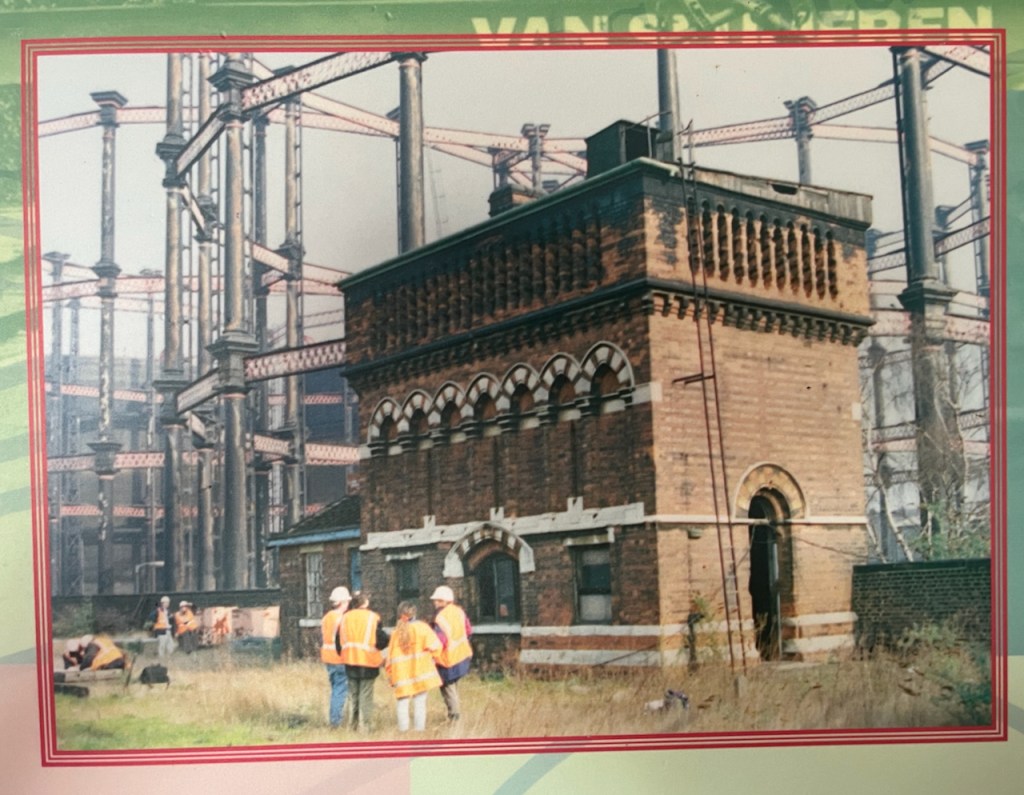
To move it, the original Water Point was cut horizontally into three sections. The lower section was left behind. A new lower section was built in the new location. The middle and upper sections went by road to the new location and were stacked on top of the newly built lower section. You can see, by changes in the bricks, the joins between the sections.
The new lower section is clearly visible.The line of new bricks at the top marks the join between the middle and upper sectionsView of the south side of the Waterpoint, annotated to show the sections
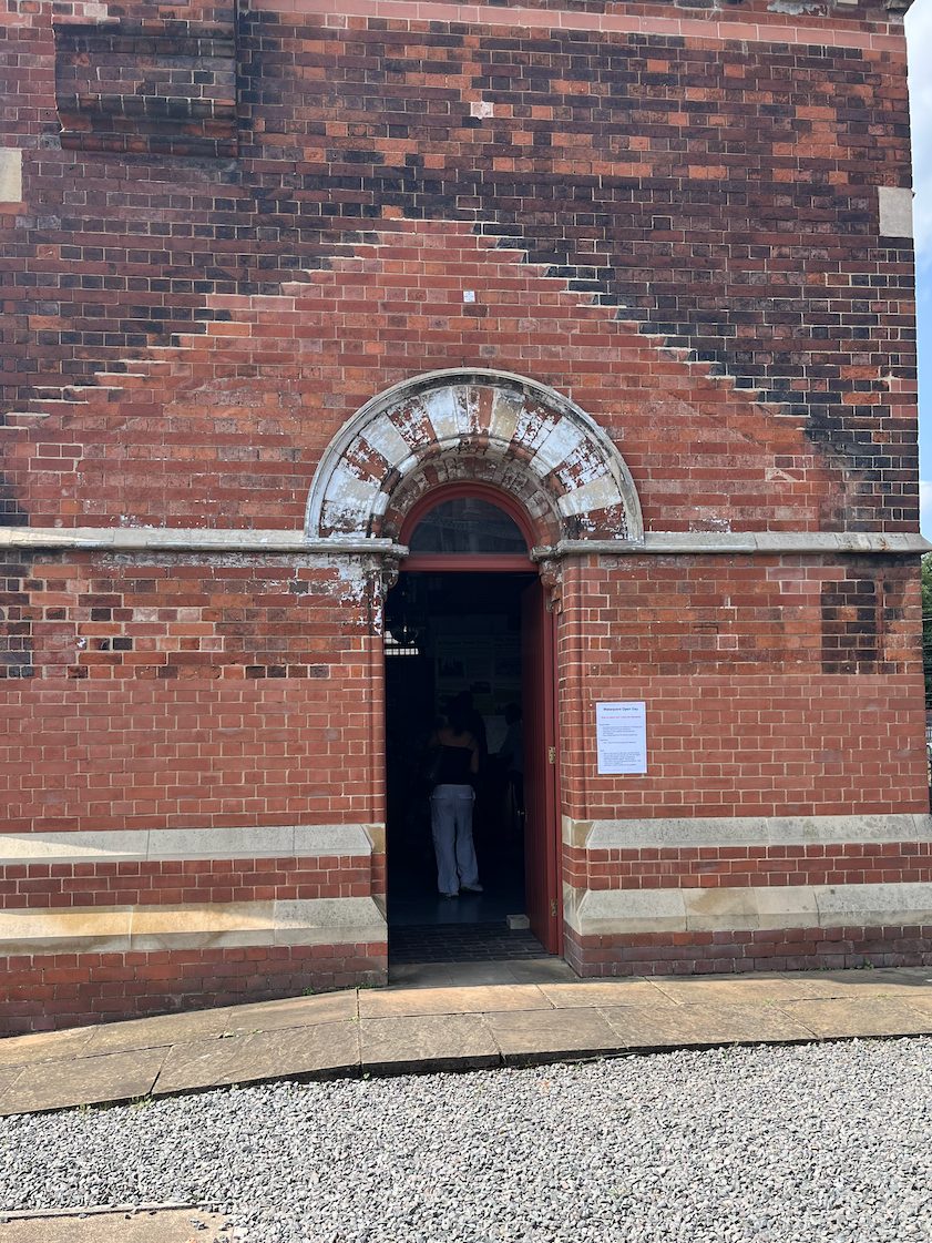
On the side of the Waterpoint visible from the canal, there is a clear “roof” pattern in the bricks, which I noticed when sketching it.
This marks the position of a shed that was fastened to the structure in its original position. See the pictures below.
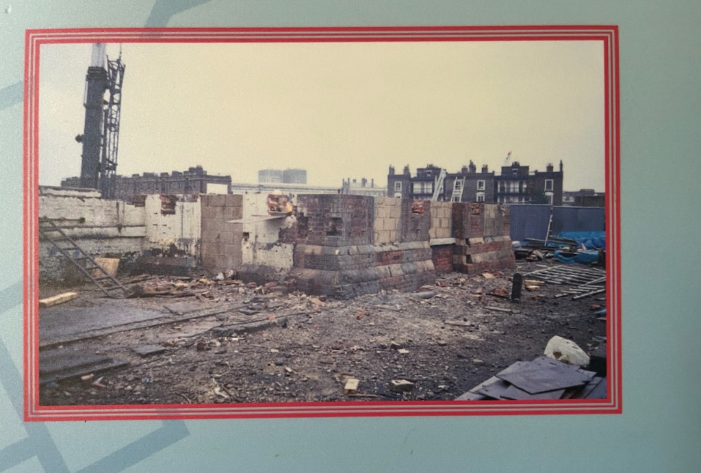
Original position – note the shed on the left What was left when it was moved.The display boards show the project to move the Water Point. These are 2001 photos.
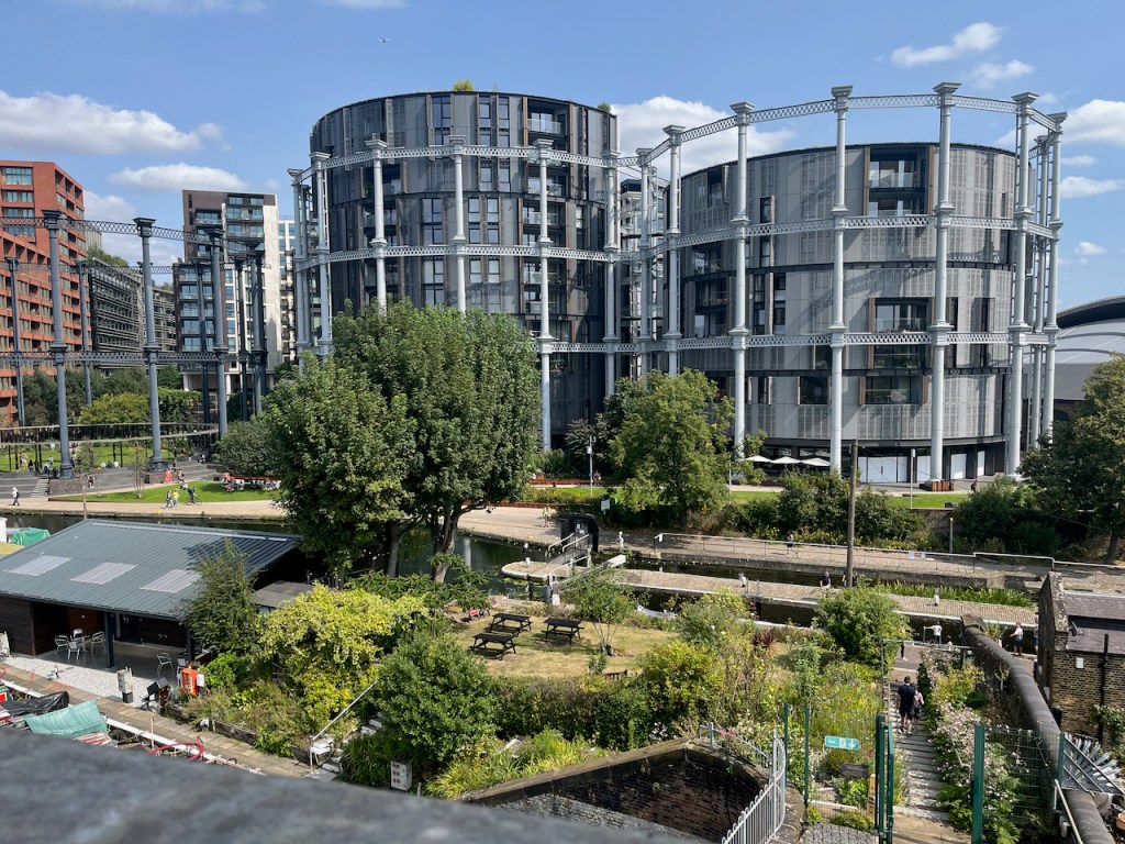
These photos and maps show how much the area has changed. See all the gas holders! They were constructed on the south side of the Regents Canal, because that’s where the gas works was. They originally held coal gas, which is carbon monoxide and hydrogen, manufactured from coal. Until 2010 they were a landmark for anyone who made this journey into Kings Cross regularly.
Here’s a frame from the 1963 film “Alfie” captured by @runningthenorthernheights, showing the gasholders in their original position.
Thanks to @runningthenorthernheights
The gasholders were decommissioned in 2000, but several of them couldn’t be destroyed because they were listed, so they just stood there for ten years. Then they were dismantled, stored, preserved and reconstructed in the years 2010-2015. They are now on the north side of the Regents Canal. Gas holder No. 8 was the first to be reconstructed, in 2015. It surrounds a small park. Gas holders 10, 11 and 12 followed, surrounding luxury apartments, part of the Kings Cross development. (https://www.kingscross.co.uk/gasholder-park)
Gasholders seen from the top of the Waterpoint, August 2024. I did the sketch from the far side of the canal.
Here are more photos from my visit to Waterpoint in August 2024.
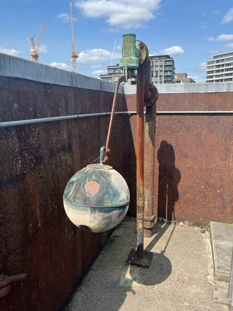
Ball cock in the (now empty!) tank on the topView from the topView from the topThe “chimney” up close. The guide is explaining that it is purely decorative. It is solid: there’s no “chimney”.
I was very glad to have the opportunity to visit this quirky building. Recommended!
Click a button below to share this post online, email it, or print it:
It’s just visible, on the horizon between office blocks. Some work with the binoculars and the map established that it must be St Mary Stoke Newington, some 3 to 4 miles away to the North.
“What is that spire?”
I went up there to make sure, and to have a closer look at this building which was visible at so great a distance.
St Mary Stoke Newington, the “New Church”, London N16. Sketched on October 17th 2023 in sketchbook 13, size: 10″x 8″
I sketched the church from Clissold Park.
Stoke Newington is another world, even though just 4 miles from the City. My sketching location was a few yards from the gate of the park. A succession of people entered the gate and walked along the path: old and young, solitary and in groups, noisy, meditative and with or without dogs. Each person or group carefully opened the gate, then turned round and closed it again behind them. At one point, a very elderly person approached the gate in a wheelchair. Someone who had just passed through noticed them, returned to the gate, and with a respectful flourish, opened both gates wide, to allow the passage of the wheelchair, and then carefully closed the gates again afterwards. It was all very civilised, and restored my faith in the human race.
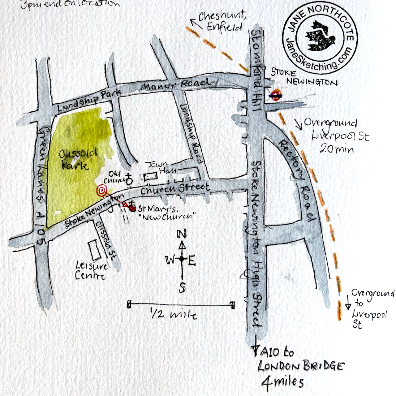
If you wish to visit this church bear in mind that the overground lines are rather complicated in this area. The one to get is the one which goes north from Liverpool Street. The one from Shoreditch, although going in broadly the same direction, takes another route entirely and you end up in Dalston, which is also an interesting place, but different. I walked from there to Hackney Downs to find the right railway line, and discovered more as-yet-unexplored areas of London.
Overground routes in the Stoke Newington area.
St Mary Stoke Newington New Church was built in 1854-8, to the design of Sir George Gilbert Scott. His other works include the Midland Hotel at St Pancras, the Albert Memorial, Westminster Abbey, the Martyr’s Memorial in Oxford and St John’s College Chapel Cambridge, to name but four. So the people of Stoke Newington got a rock-star architect in 1854. This was because Stoke Newington had a hugely popular preacher, the Reverend Thomas Jackson, with people coming across London to hear him preach. The cost of the new church was raised by voluntary contributions1 from this large congregation.
The spire was added by Sir George’s son John Oldrid Scott, in 1890.
Stoke Newington New Church seen from Stoke Newington Church StreetThe impressive interior of Stoke Newington New Church.
Across the road is the much smaller “old church” which this “new church” replaced. The old church is still there, looking like a country village church.
Stoke Newington Old Church, 17th October 2023
Now I know what that spire is, on the horizon, I think I should make another visit, to sketch the old church.