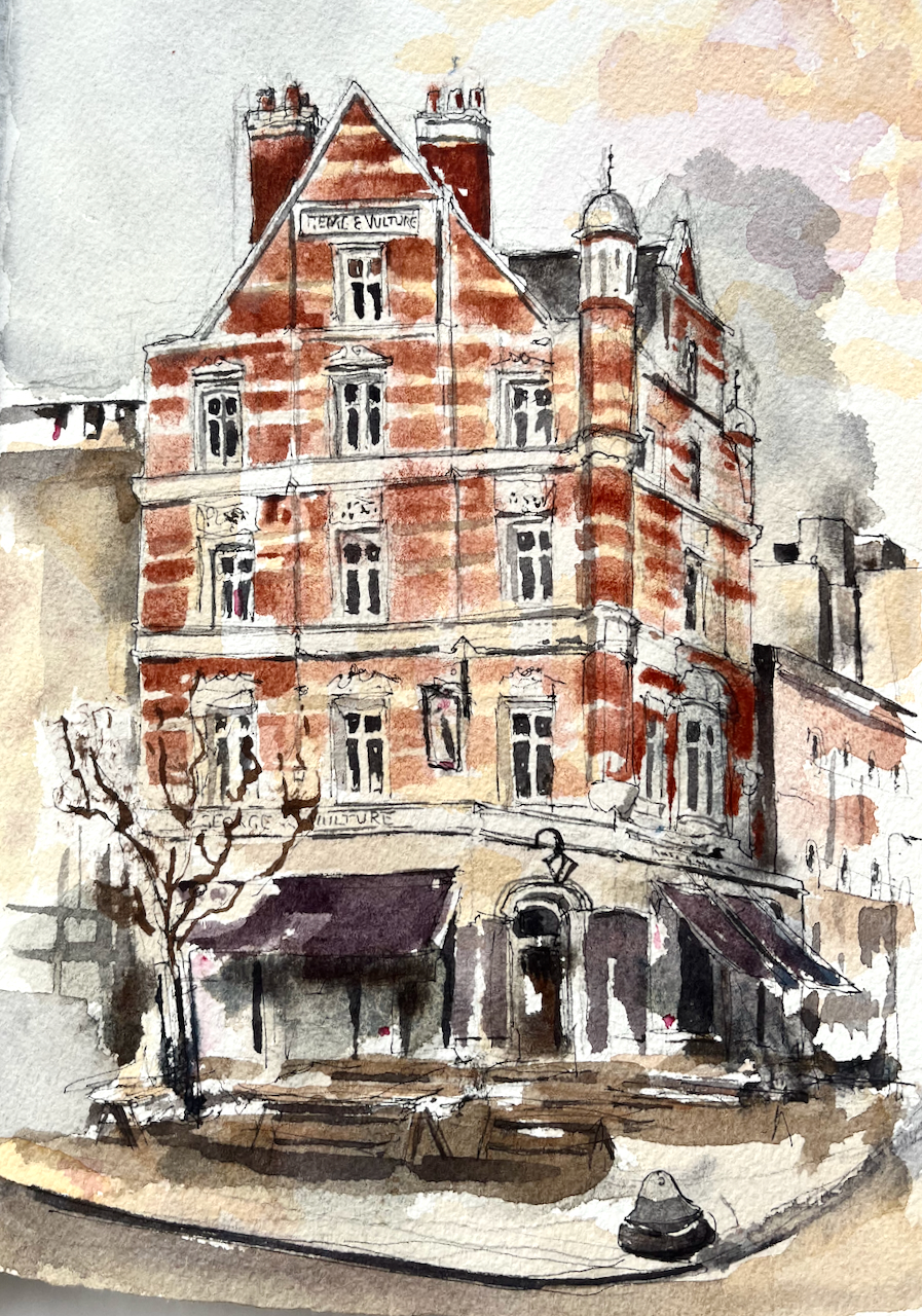
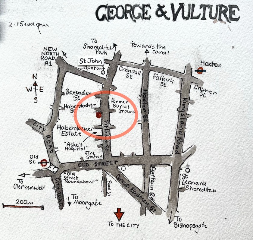
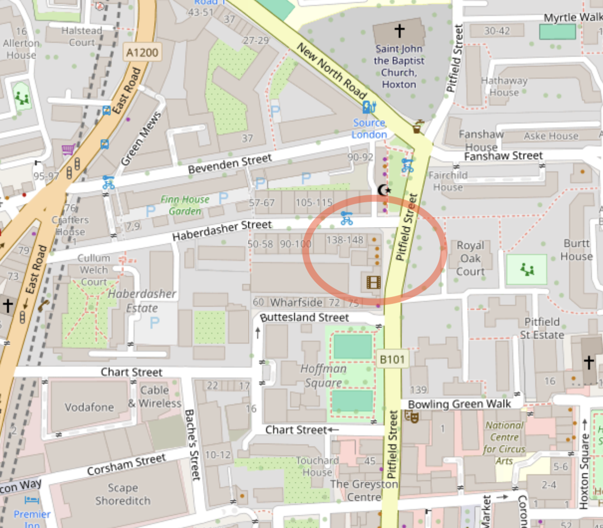
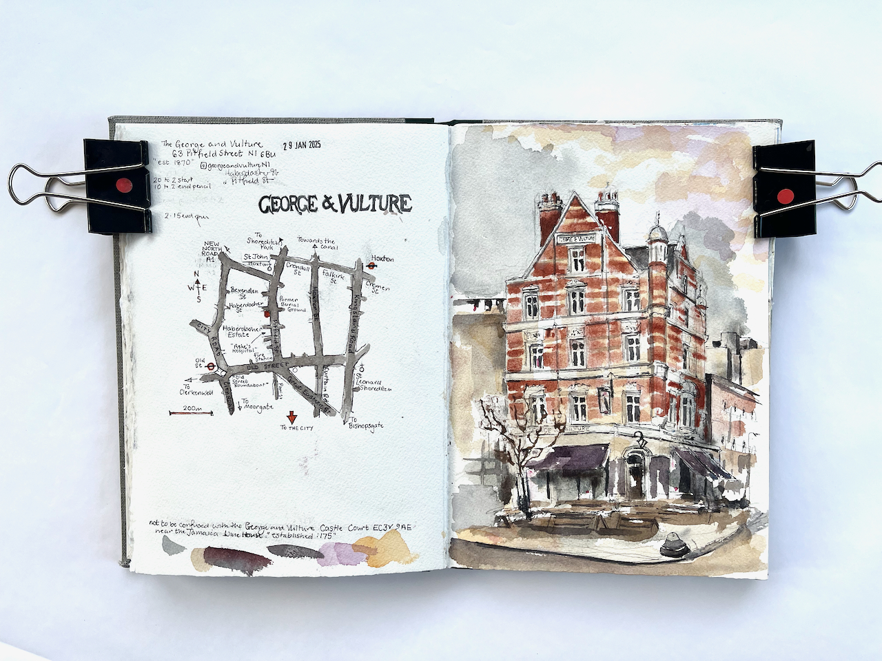
Pitfield Street is a historic London street going north from Old Street. About half-way along is the George and Vulture pub.
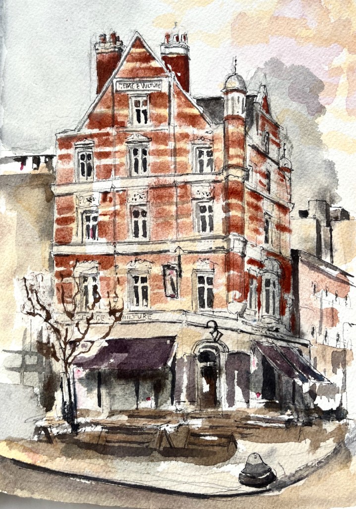
The George and Vulture describes itself as the tallest pub in London. The current building dates from 1870, according to the pub’s website.
The “Pubs History” website lists licenced victuallers from 1827 onwards. Here is a scrap from Robsons Street Directory in 1832.
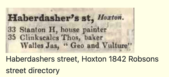
The original address of the pub was 35 Haberdashers Street. Much of the land round here was owned by the Haberdashers Livery company, bequeathed to them by Robert Aske, a merchant (1619-1689). In 1862 the Haberdashers company offered new leases on properties here:
Haberdashers’ Estate, Hoxton.
City of London Livery Companies Commission, ‘Report on the Charities of the Haberdashers’ Company: Appendix’, in City of London Livery Companies Commission. Report; Volume 4(London, 1884), British History Online https://www.british-history.ac.uk/livery-companies-commission/vol4/pp478-486 [accessed 30 January 2025].
A free public-house, adjoining the high road, and 66 dwelling-houses.
To be let, by tender, by the worshipful Company of Haberdashers, Governors of Aske’s Charity Estate, Hoxton, on repairing leases, for 21 years, from Midsummer, 1863:—
The free public-house, known as the “George and Vulture,” situate in Haberdashers’ Street, which might be enlarged so as to form a corner house to the main street.
Also 12 houses, Nos. 1 to 12, Haberdashers’ Place, which may be converted into shops, at the option of the lessee.
Also 19 houses, Nos. 1 to 19, on the south side of Aske’s Terrace; and 35 houses, Nos. 1 to 35, on the north and south sides of Haberdashers’ Street, in the parish of St. Leonard, Shoreditch, in the county of Middlesex.
Plans of the property, and specifications of the repairs to be performed, may be seen at the offices of Mr. William Snooke, the surveyor to the governors, No. 6, Duke Street, London Bridge, between the hours of 10 and 4 o’clock.
Tenders, in writing only, are to be sent in to Haberdashers’ Hall, Gresham Street West, on or before Thursday, the 27th day of November 1862.
One of the properties to be let, as you see, was
“The free public-house, known as the “George and Vulture,” situate in Haberdashers’ Street, which might be enlarged so as to form a corner house to the main street.”
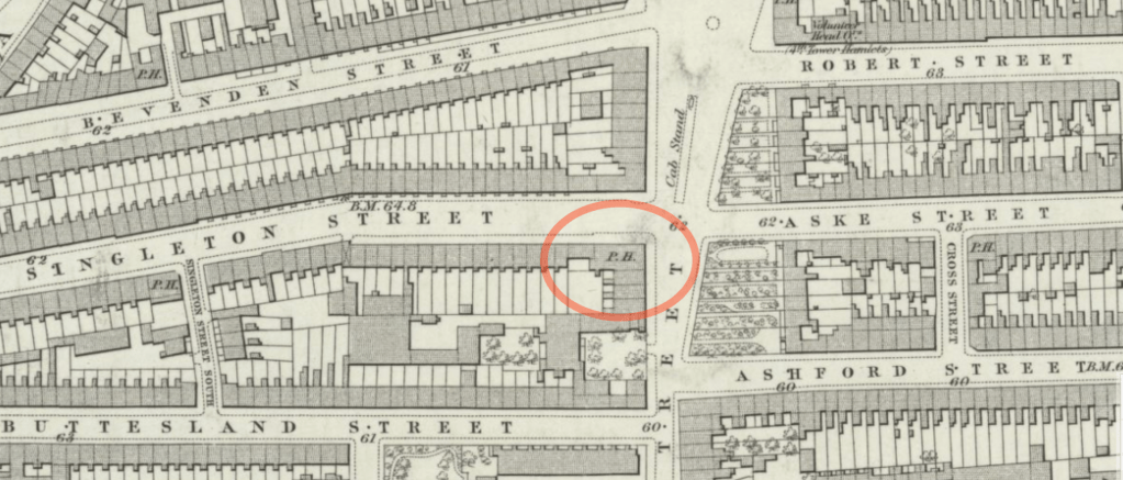
Evidently the lessee enlarged the pub, as the Haberdashers Company suggested, and it does indeed form a corner house to the main street. The address of the pub is now 63 Pitfield Street. Here is the 1877 map which shows the pub as a “corner house”. The road layout on the west of Pitfield Street is largely unchanged. Singleton Street is now called Haberdasher Street.
The area was bombed extensively in the 1939-45 conflict, but the pub survived. Bomb maps show that the area adjoining Aske Street on the other side of Pitfield Street was damaged beyond repair. A plaque on the row of shops just North of the pub describe the re-building.1
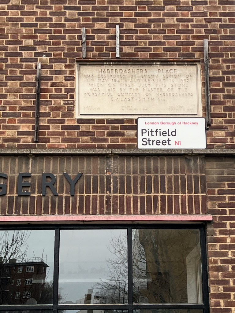
Clerk W B(?)revett – Builder W Philips & Son -Architect Terence C Page”
Photo: January 2025
Here is the 1872 map alongside a modern map. You see that the rows of terraced houses on the east of Pitfield Street have gone, and are replaced by low-level residential housing blocks with a different layout.

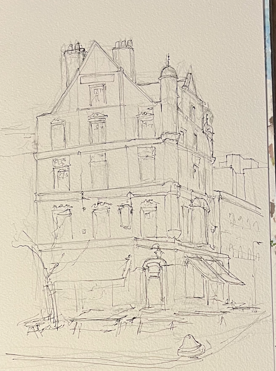
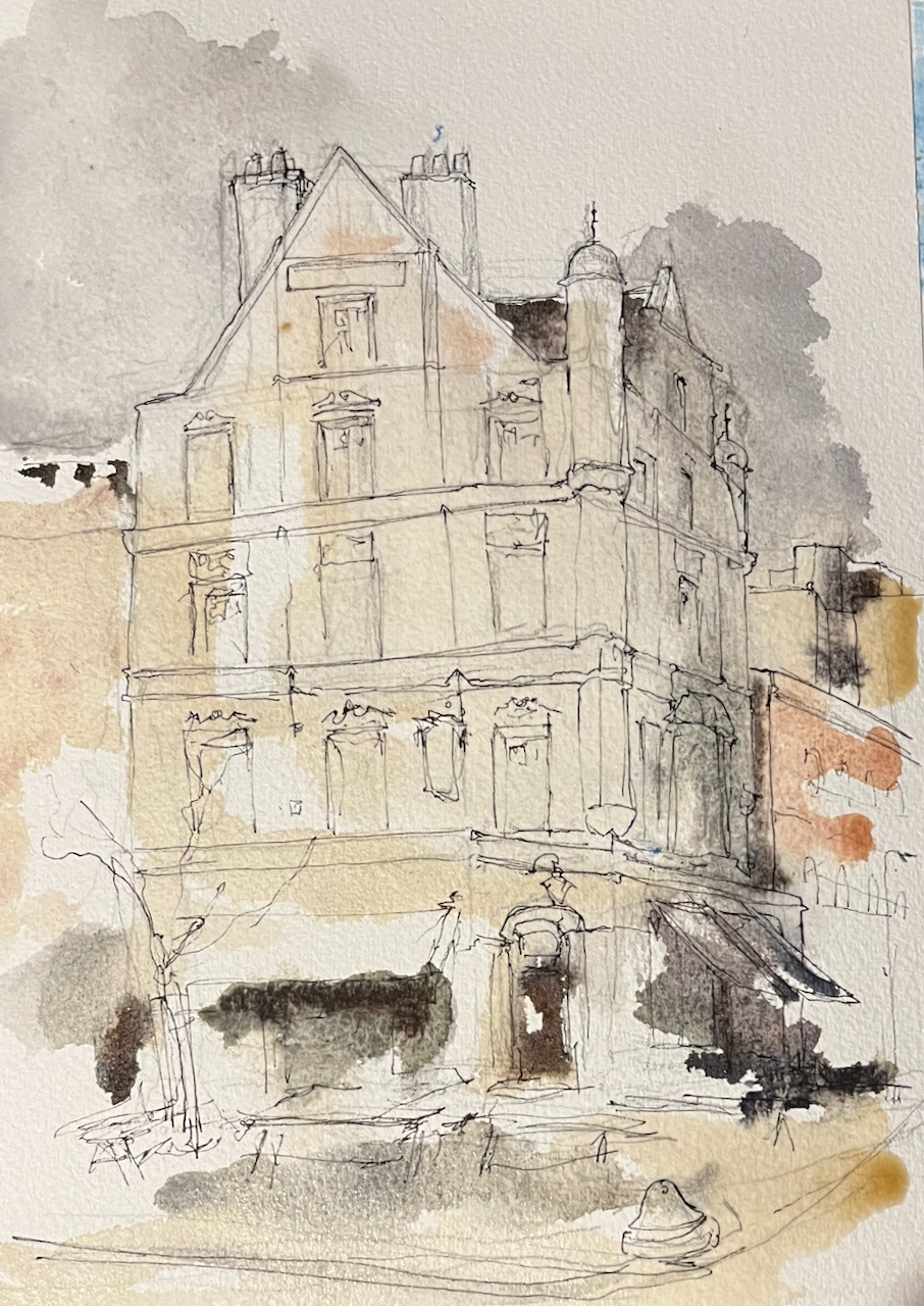
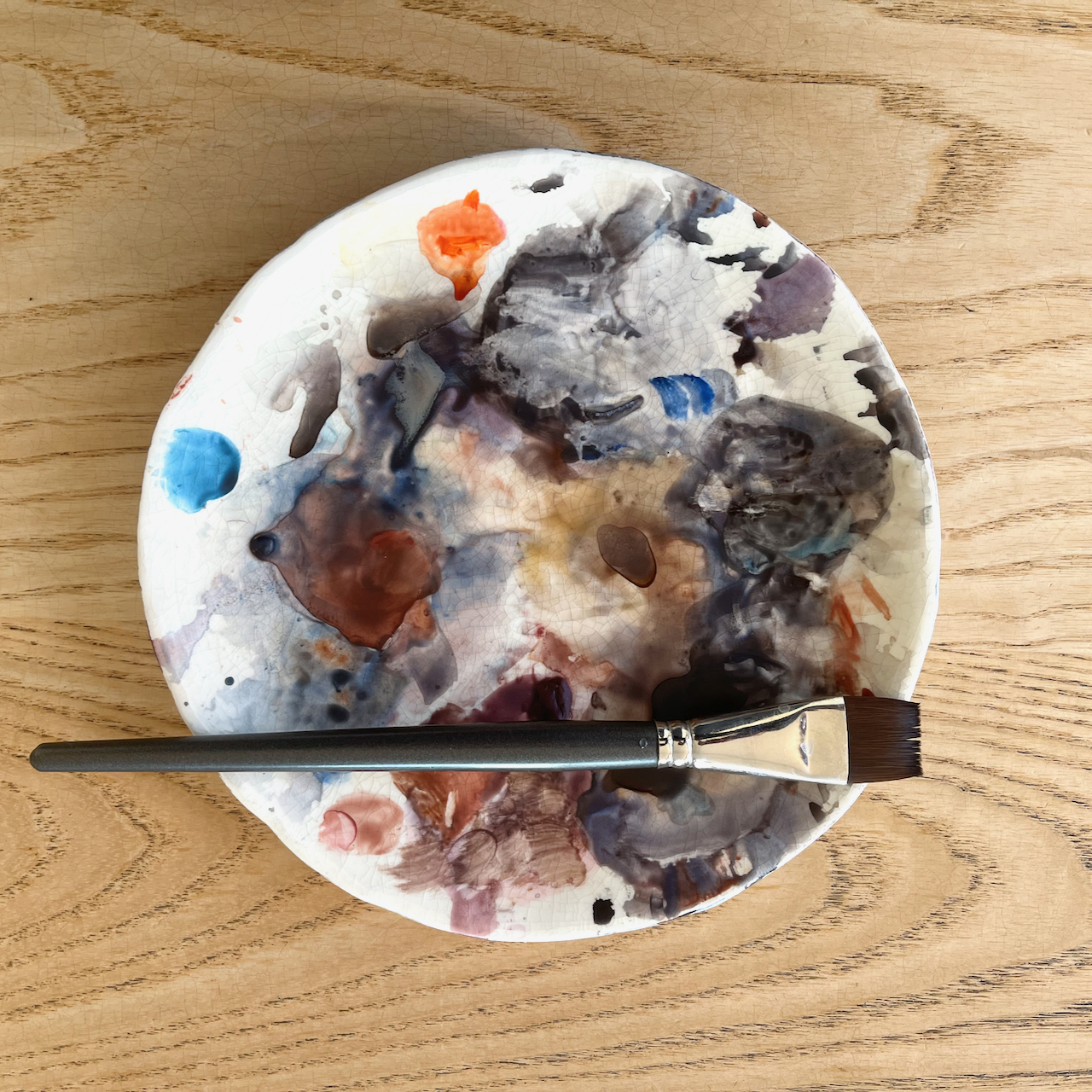
I sketched the pub on a cold January day. I did the pen and ink on location and then retreated to my desk to do the colour.


I cannot discover why the pub is called the “George and Vulture”. Why “vulture”? There is another pub in London of the same name, in the alleys of the City close to the Jamaica Wine House. That one was established in 1175. There was also a George and Vulture in Tottenham, 490 High Road, N172, from around 1759, now demolished.
image from: https://tottenham-summerhillroad.com/old_pubs_of_tottenham.htm
Can anyone throw any light on the meaning of the name?
- The site “urbannarrative” by local architect Steven Smith, comments on this re-building: https://urbannarrative.com/DITCHWATER ↩︎
- Website: “Pubology.co.uk”: https://www.pubology.co.uk/pubs/9402.html ↩︎