The Coach, Clerkenwell, EC1

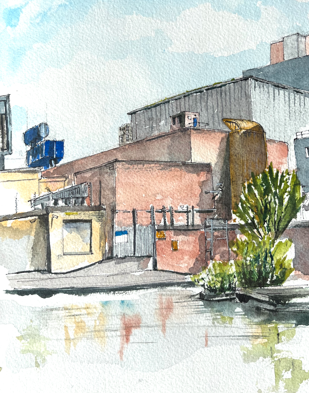
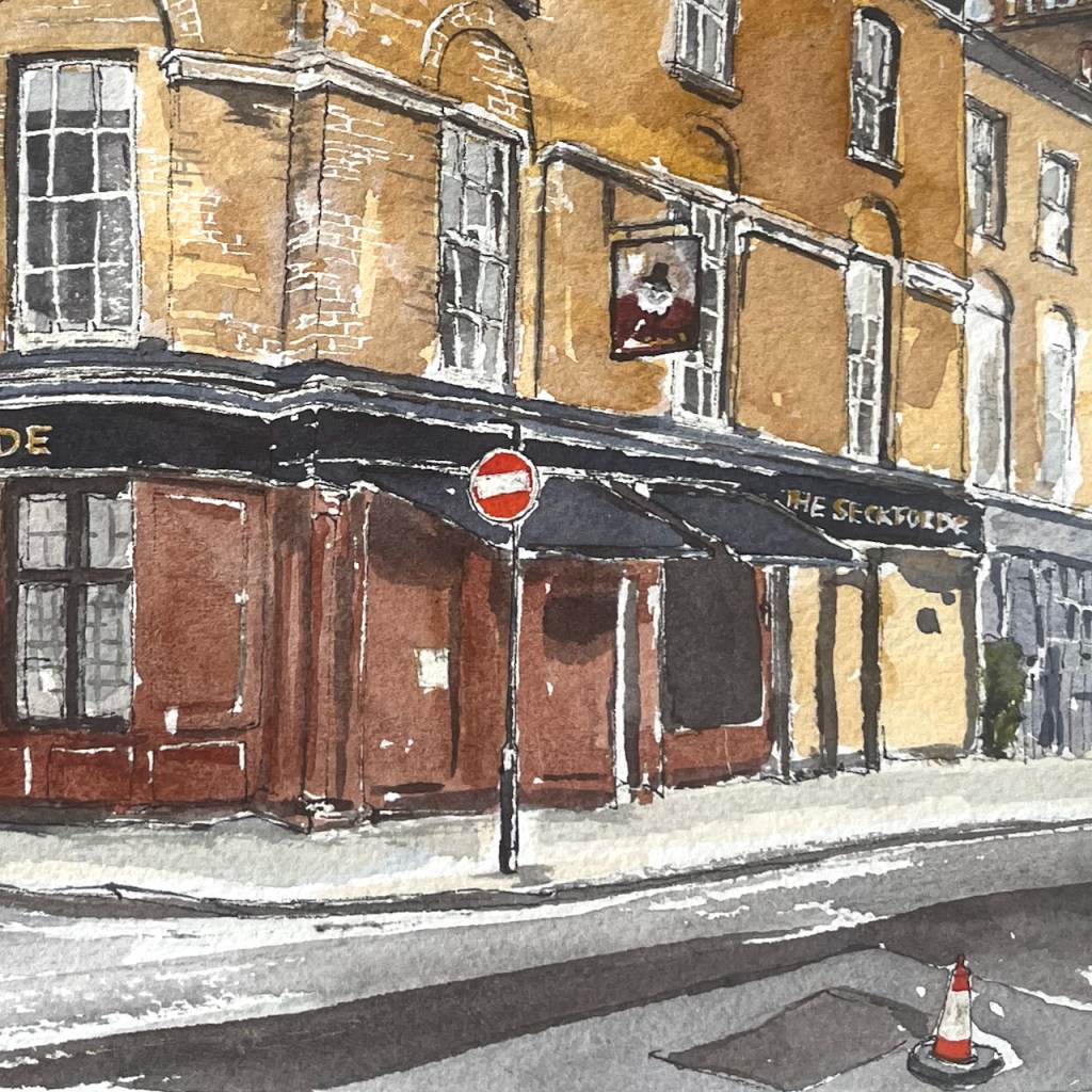
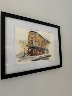
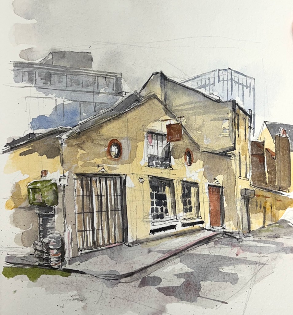
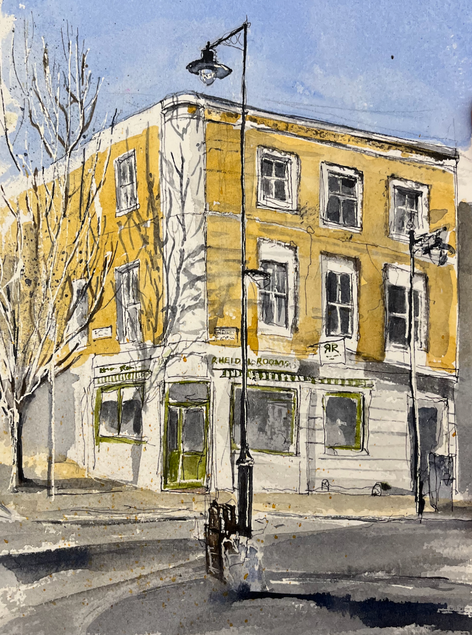
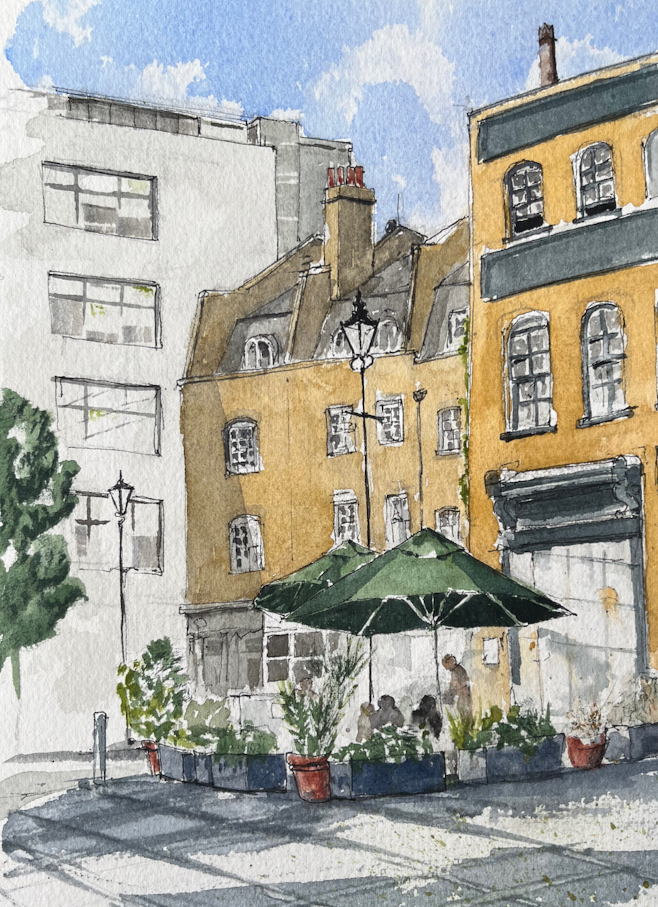
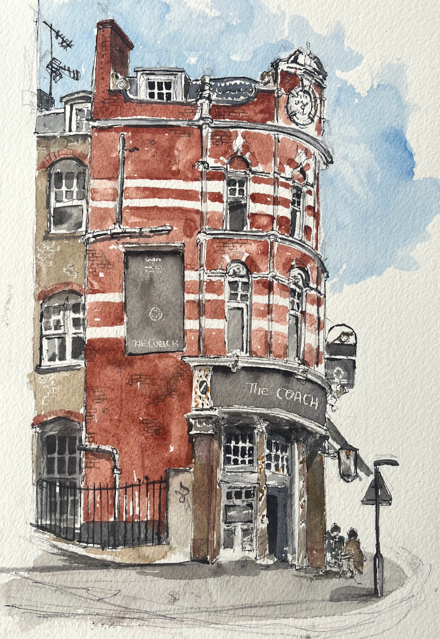
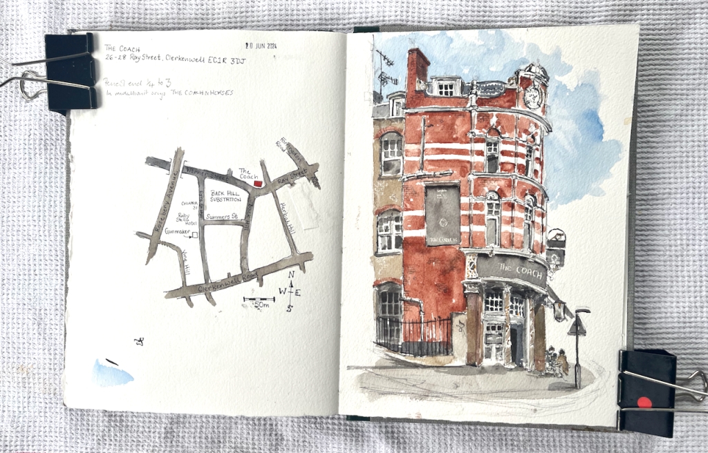
Here is “The Coach” on Ray Street in Clerkenwell.

“The Coach” Clerkenwell, Sketched 20th June 2024 in Sketchbook 14

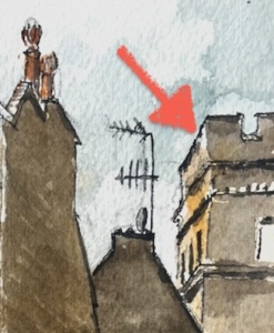
I sketched this after I had sketched “Gunmakers” in nearby Eyre Street Hill. Above the pub sign is a model, just visible on the right of my drawing.

The Coach pub sign: a gun carriage?

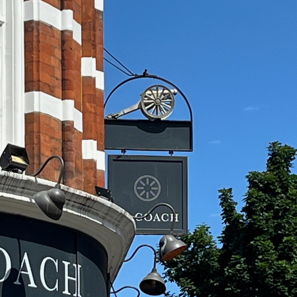
The model is a gun carriage. I wondered what the connection was to The Coach, and if there was any connection to Gunmakers on Eyre Street Hill. But no, it is the symbol of The Cannon Brewery. This brewery was founded 1720, in nearby St John Street. It was acquired by Taylor Walker in 1930. I have this information from http://breweryhistory.com. So that explains the cannon.

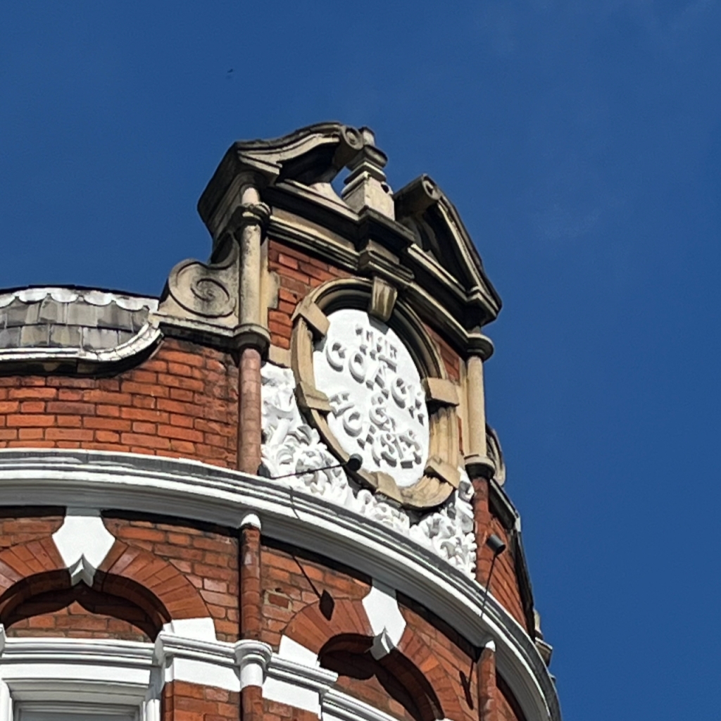
At the top of the pub, the medallion names the pub as “The Coach and Horses” in white relief work.

The pub website says: “The Coach was established in 1790, and has been at the heart of the lively Clerkenwell community for generations.”

British History Online describes a pub called The Cock Inn, which was part of a sale in 1695:

At the time of the sale [1695], the land was mostly taken up by two fields of pasture: Gardiner’s Field to the north and the larger Sir John Oldcastle’s Field to the south. There was a cluster of buildings and a large rubbish dump or laystall in the south-eastern corner, in the area of Hockley-in-the-Hole. Chief of these buildings was the Cock inn, the forerunner of the present-day Coach and Horses in Ray Street.

https://www.british-history.ac.uk/survey-london/vol47/pp22-51

The current building dates from 1897 according to this source:

All the eighteenth-century public houses in the area have been rebuilt or have disappeared entirely. The Apple Tree in Mount Pleasant was rebuilt in the 1870s, and the Coach and Horses in Ray Street in 1897

https://www.british-history.ac.uk/survey-london/vol47/pp22-51

So it looks as though the pub was there already in 1695 as the Cock Inn, was established as The Coach and Horses in 1790 (according to the pub website) and rebuilt in 1897. It was renamed The Coach in 2018.

Having closed on 31st July 2015, this pub reopened on 16th January 2018 as the Coach with its Taylor Walker/Cannon Brewery sign frame retained.

https://londonwiki.co.uk/LondonPubs/Clerkenwell/CoachHorses.shtml

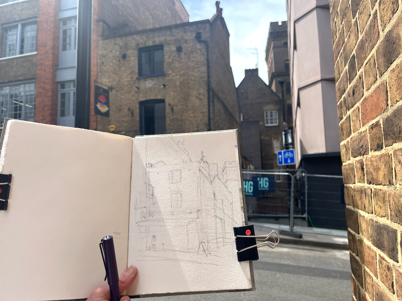
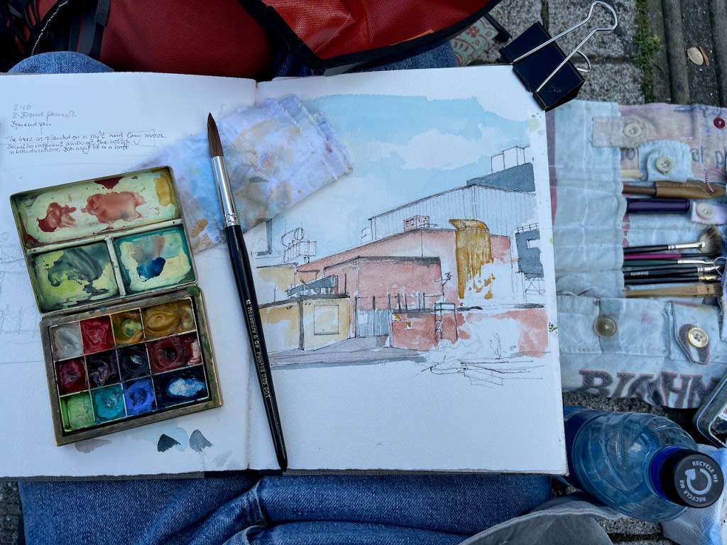
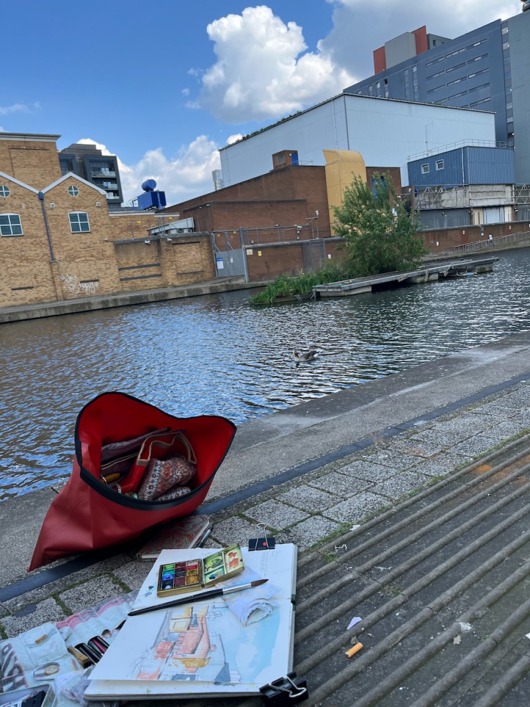
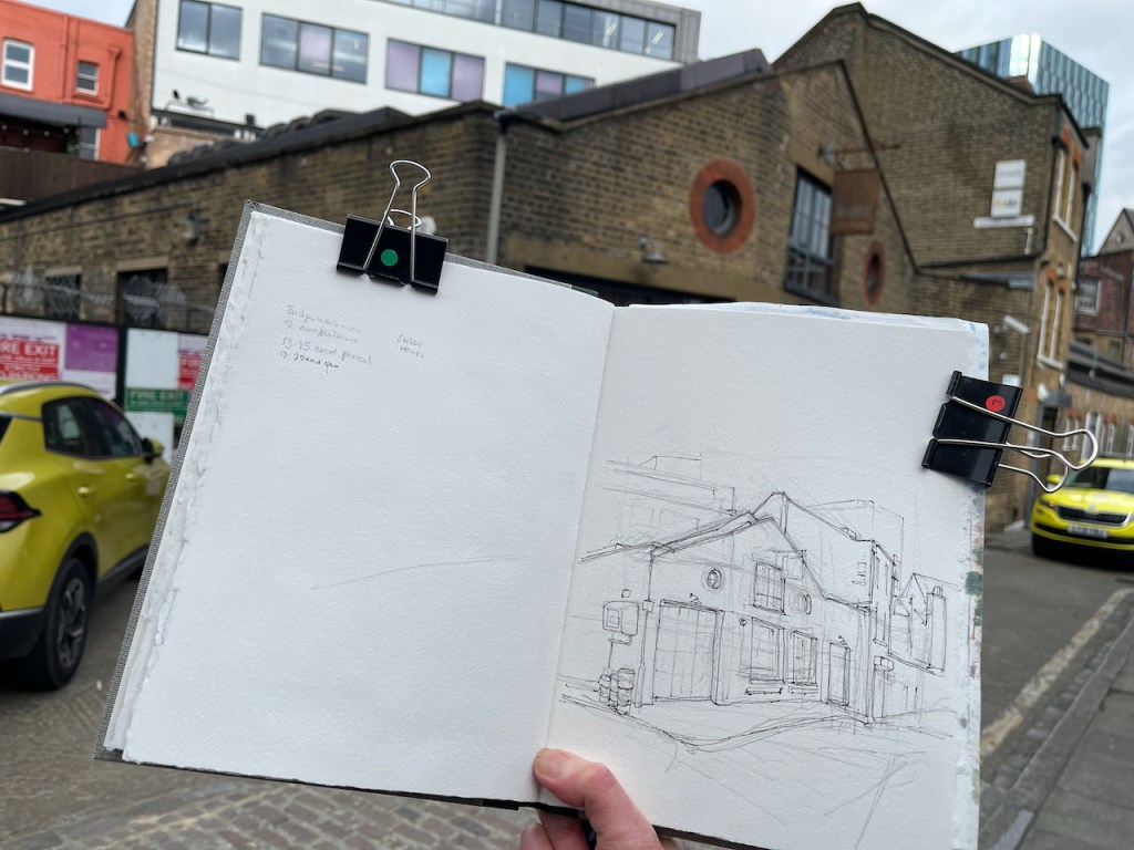
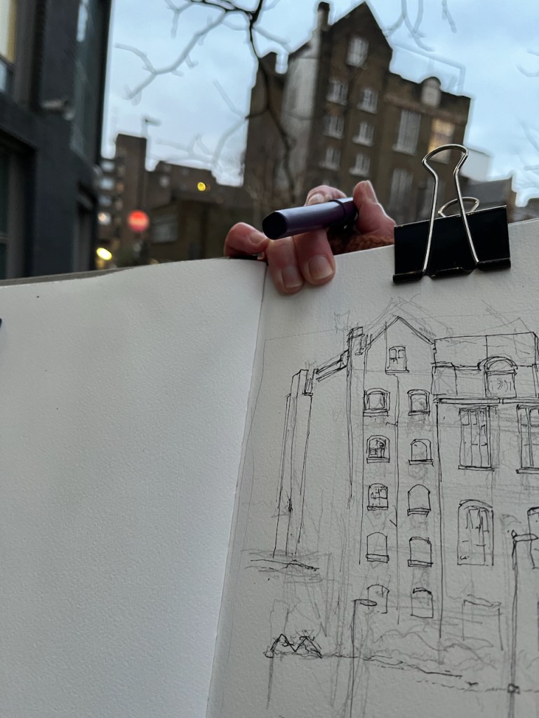
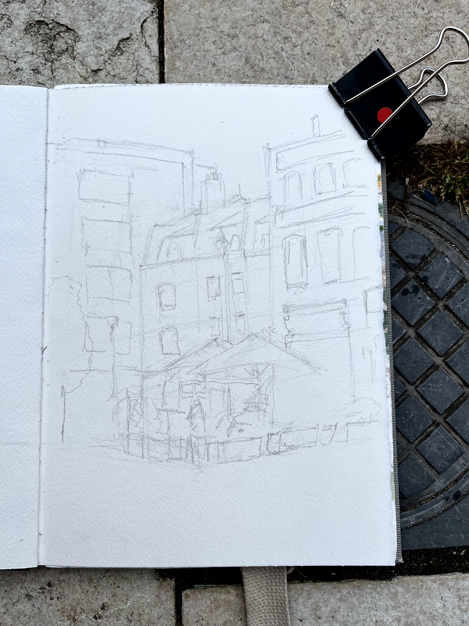
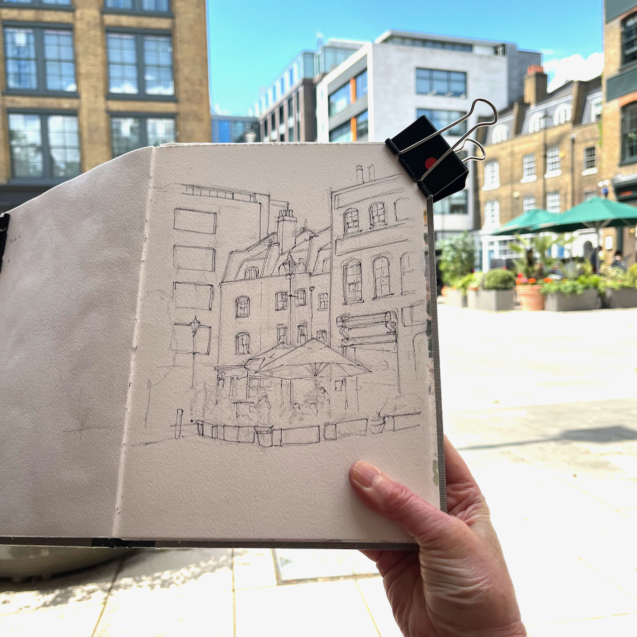
People sometimes ask me how I determine the viewpoint in my sketches. Often, as here, it is determined by practical rather than artistic considerations. I need somewhere to sketch, out of the way, not in the road, and with a clear view. I don’t carry a seat, though sometimes I wish that I did. But here, like a miracle, a seat presented itself.

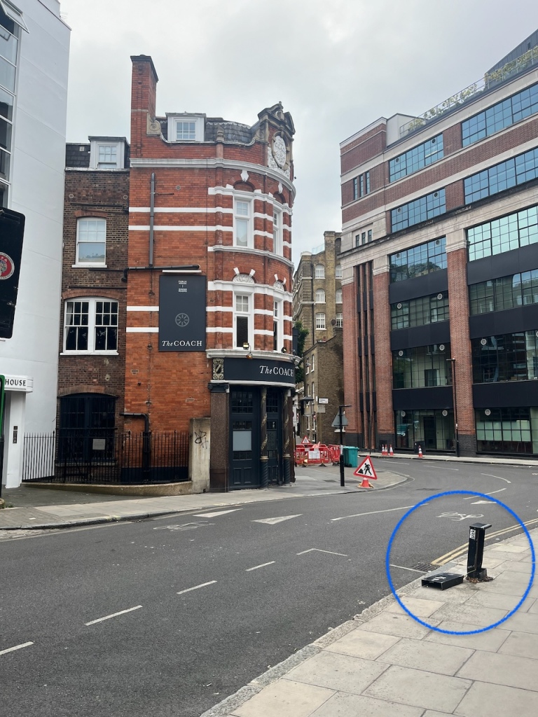
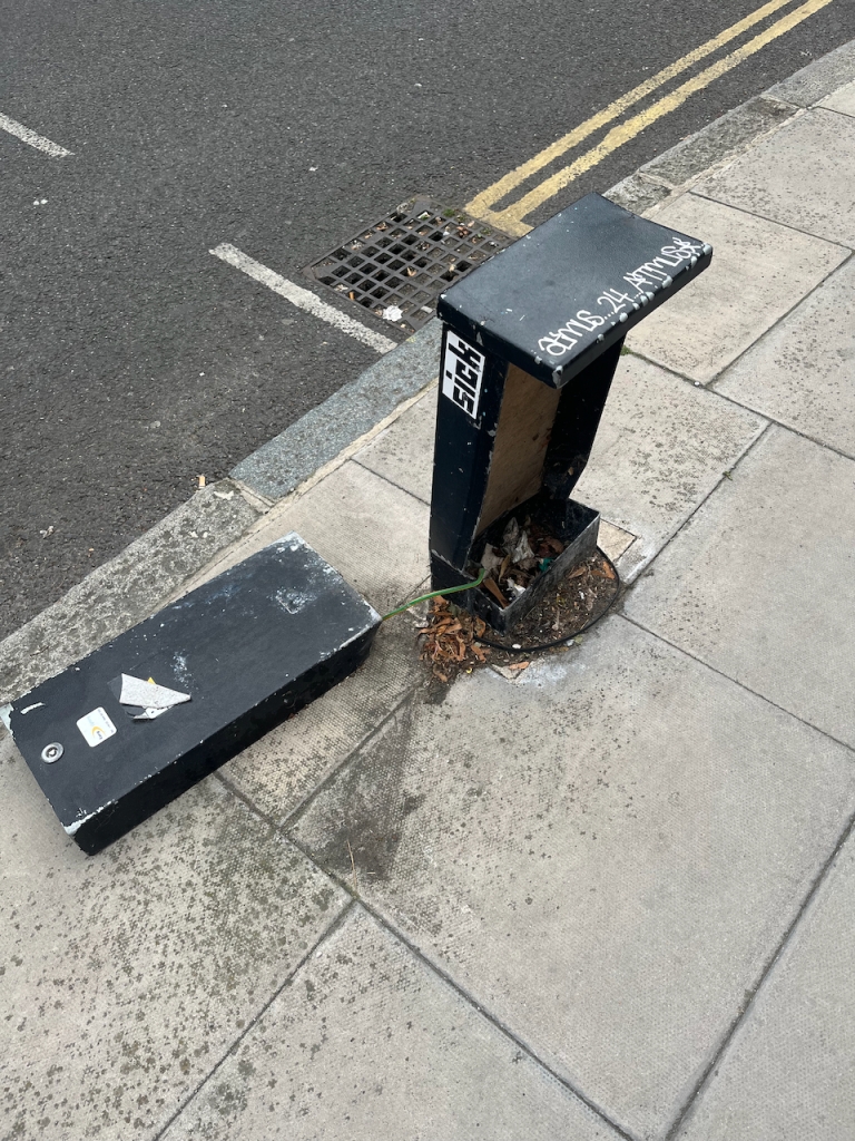
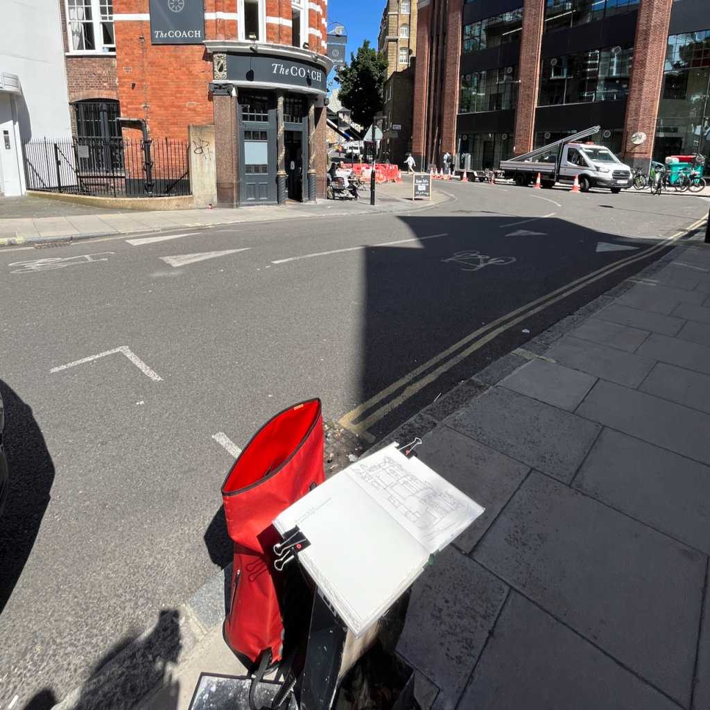
This perhaps had been a phone junction box, but no more. Now it was a seat. I commandeered it.

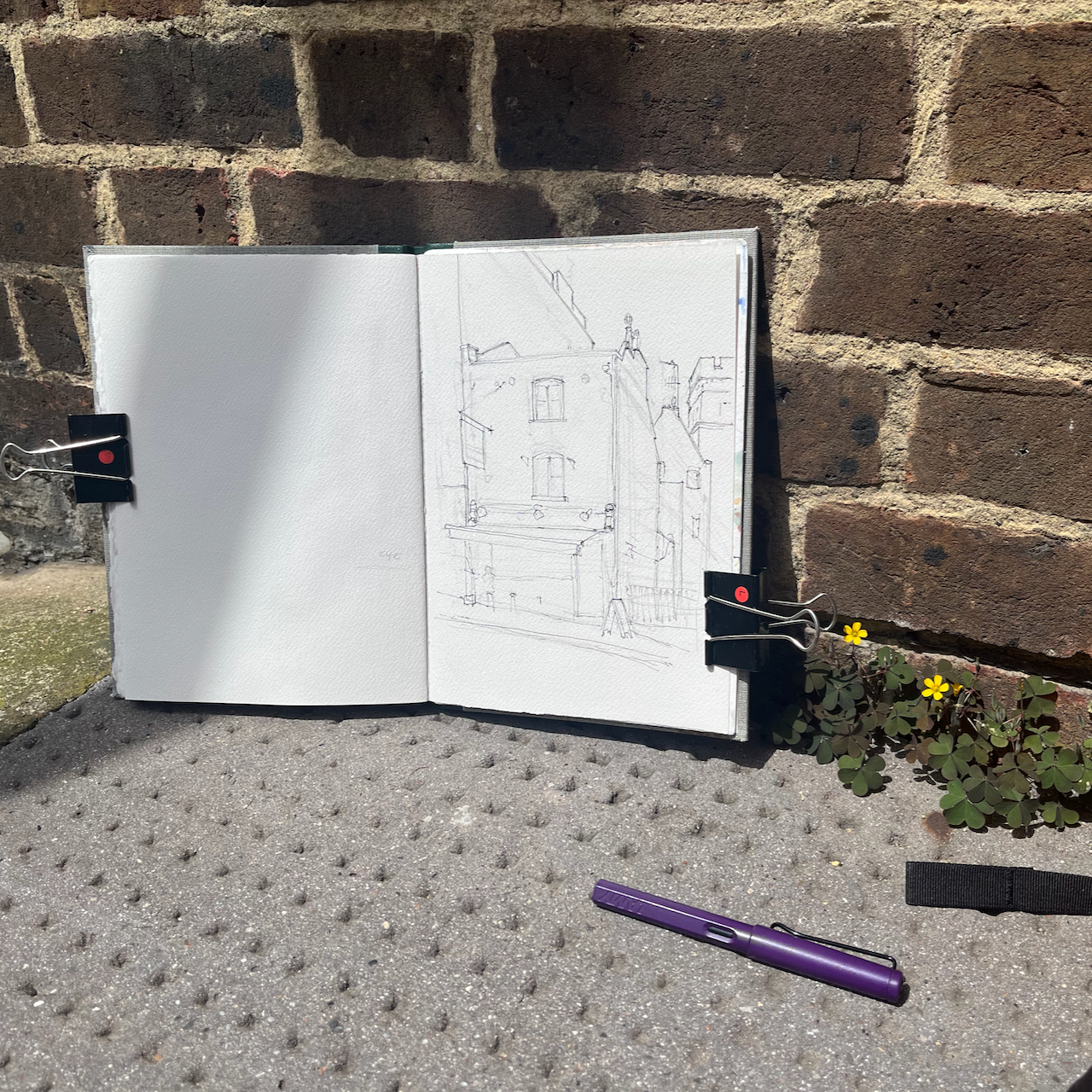
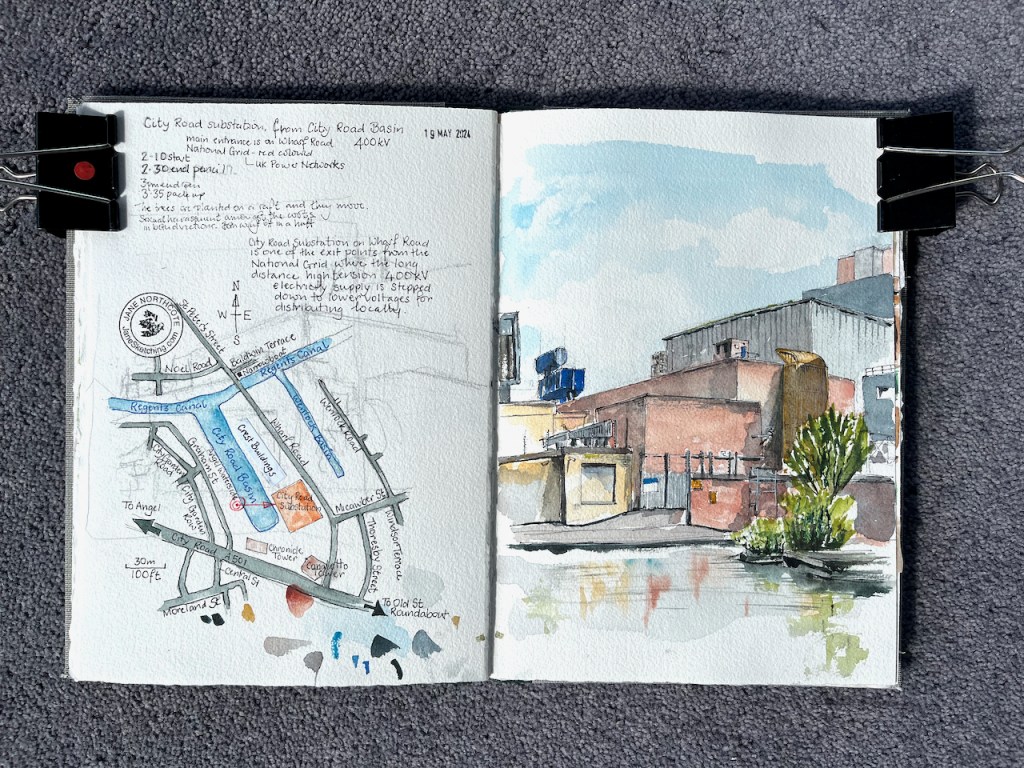
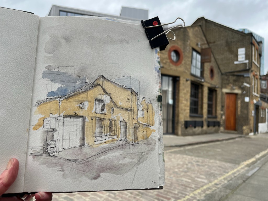
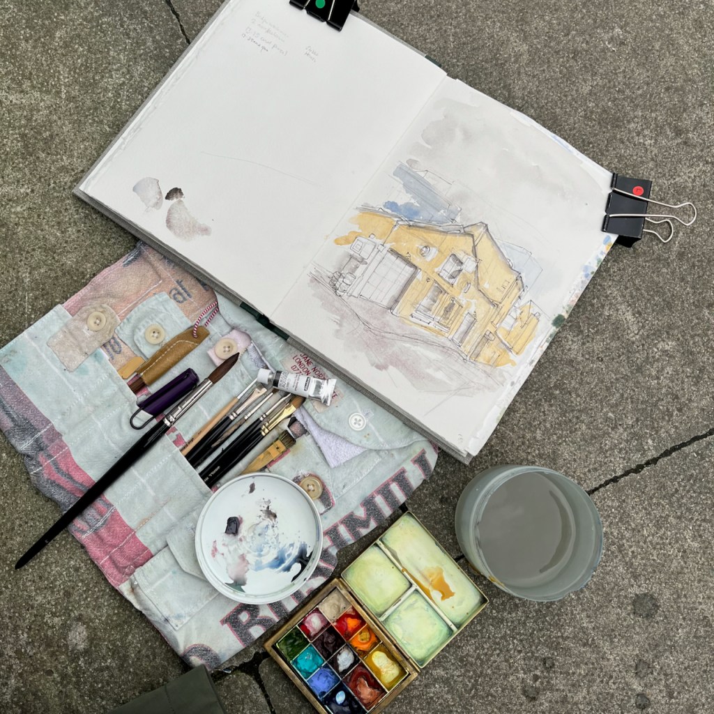
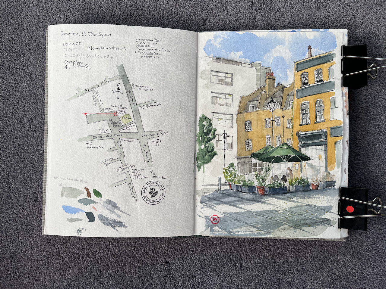
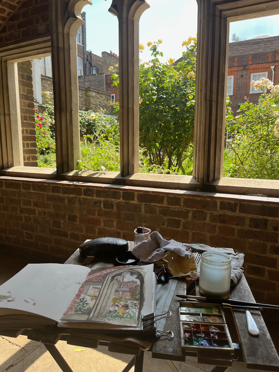
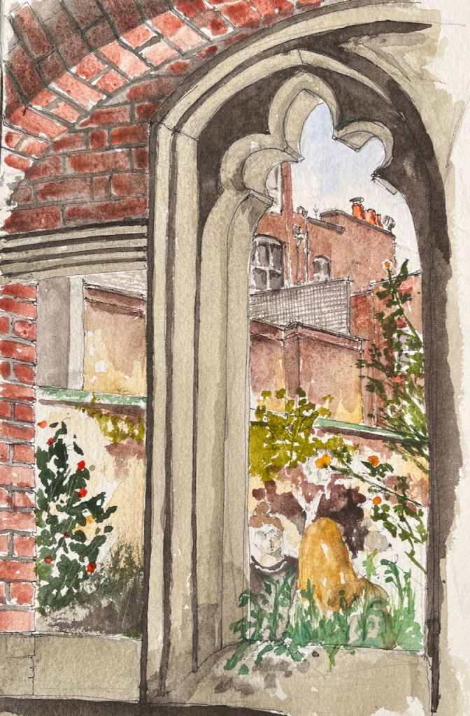
I did the pen-and-ink on location and then added the colour back at my desk.

The colours here are:

  • Fired Gold Ochre for the bricks
  • Ultramarine Blue plus Phthalo Blue Turquoise for the sky
  • All greys and blacks are Burnt Umber with the blues
  • There’s a bit of Mars Yellow in some of the brickwork and the pillars.

All watercolours from Daniel Smith.

Sketchbook spread

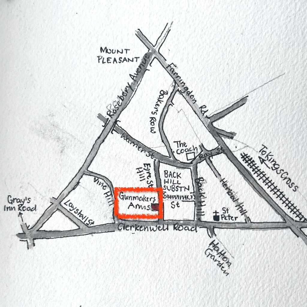
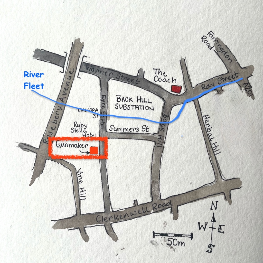
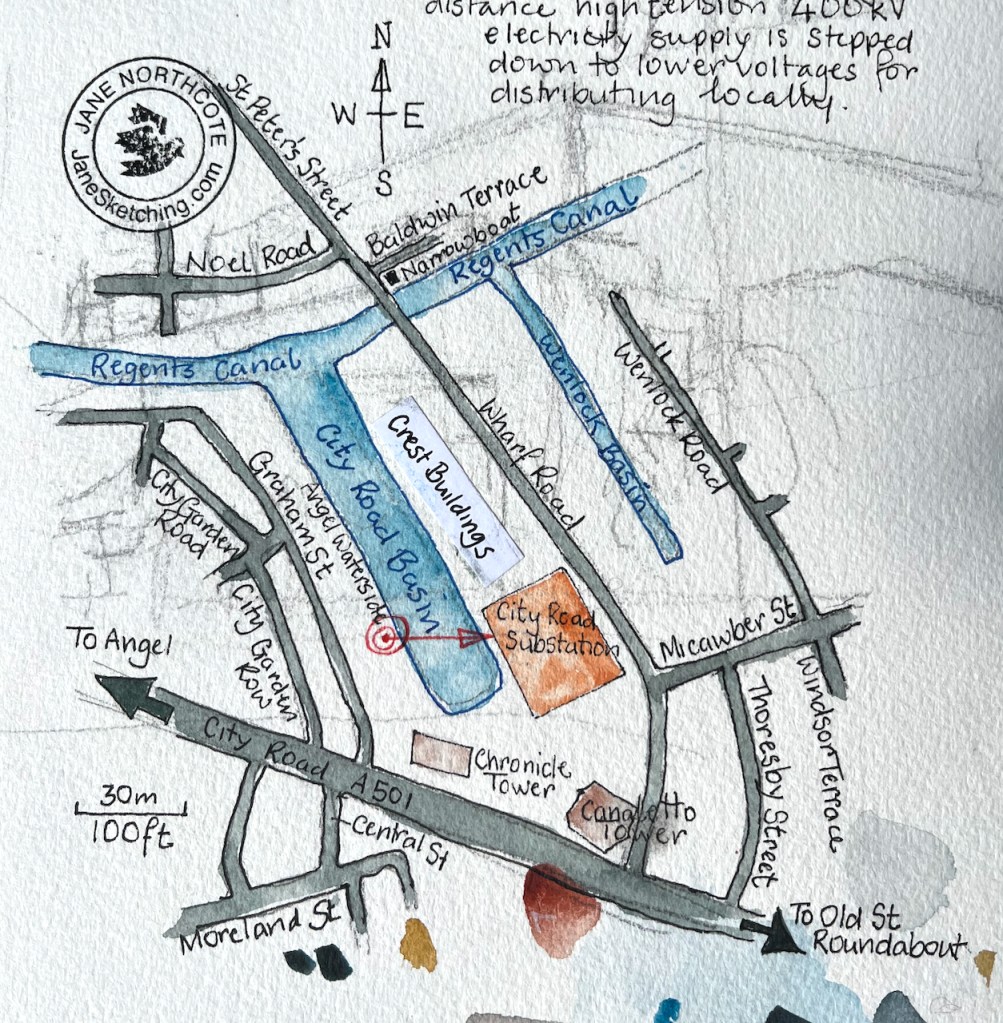
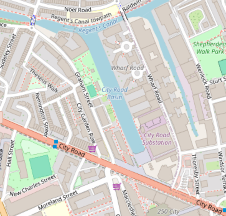
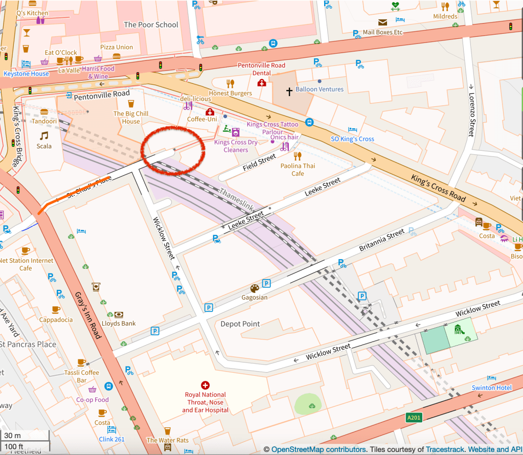
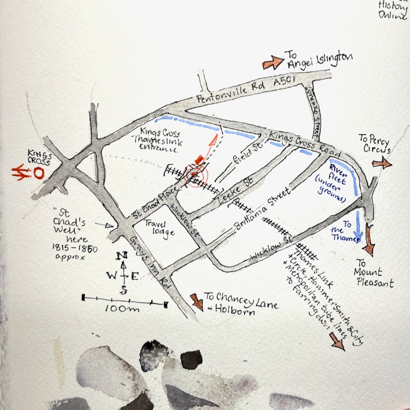
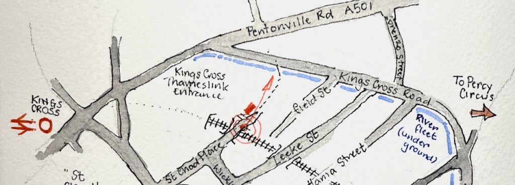
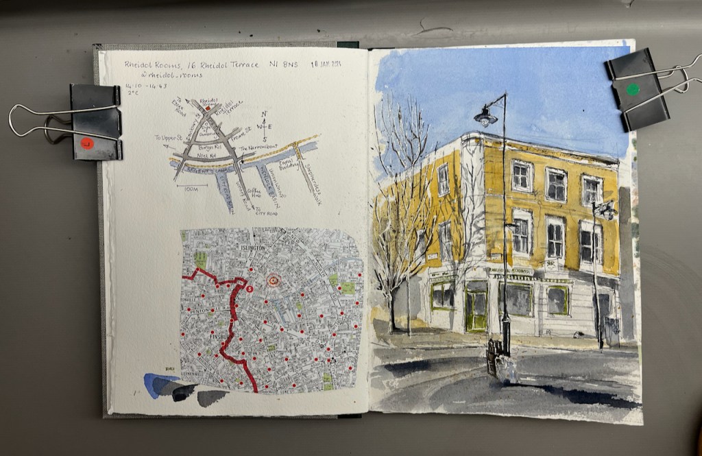
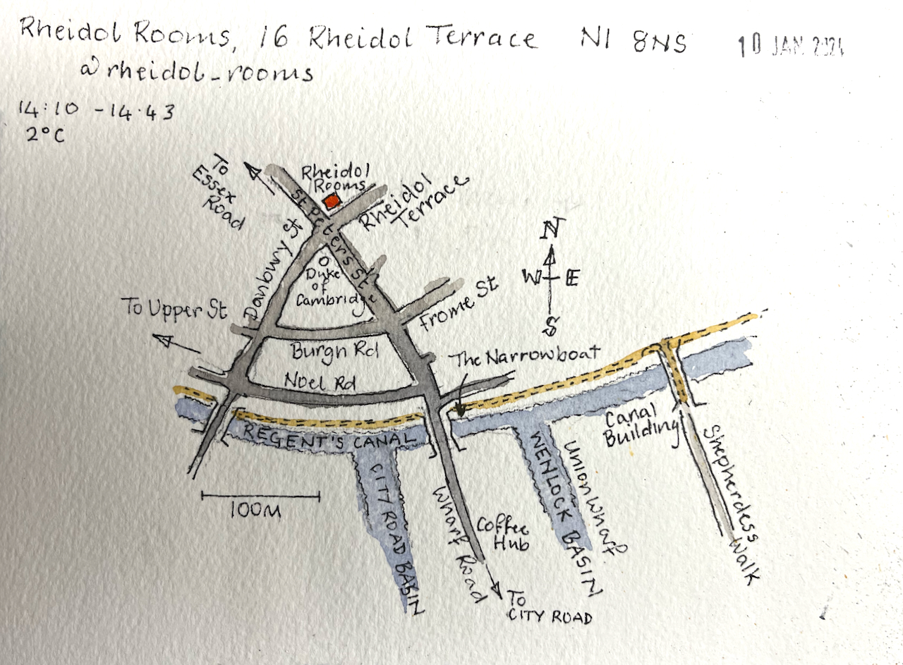
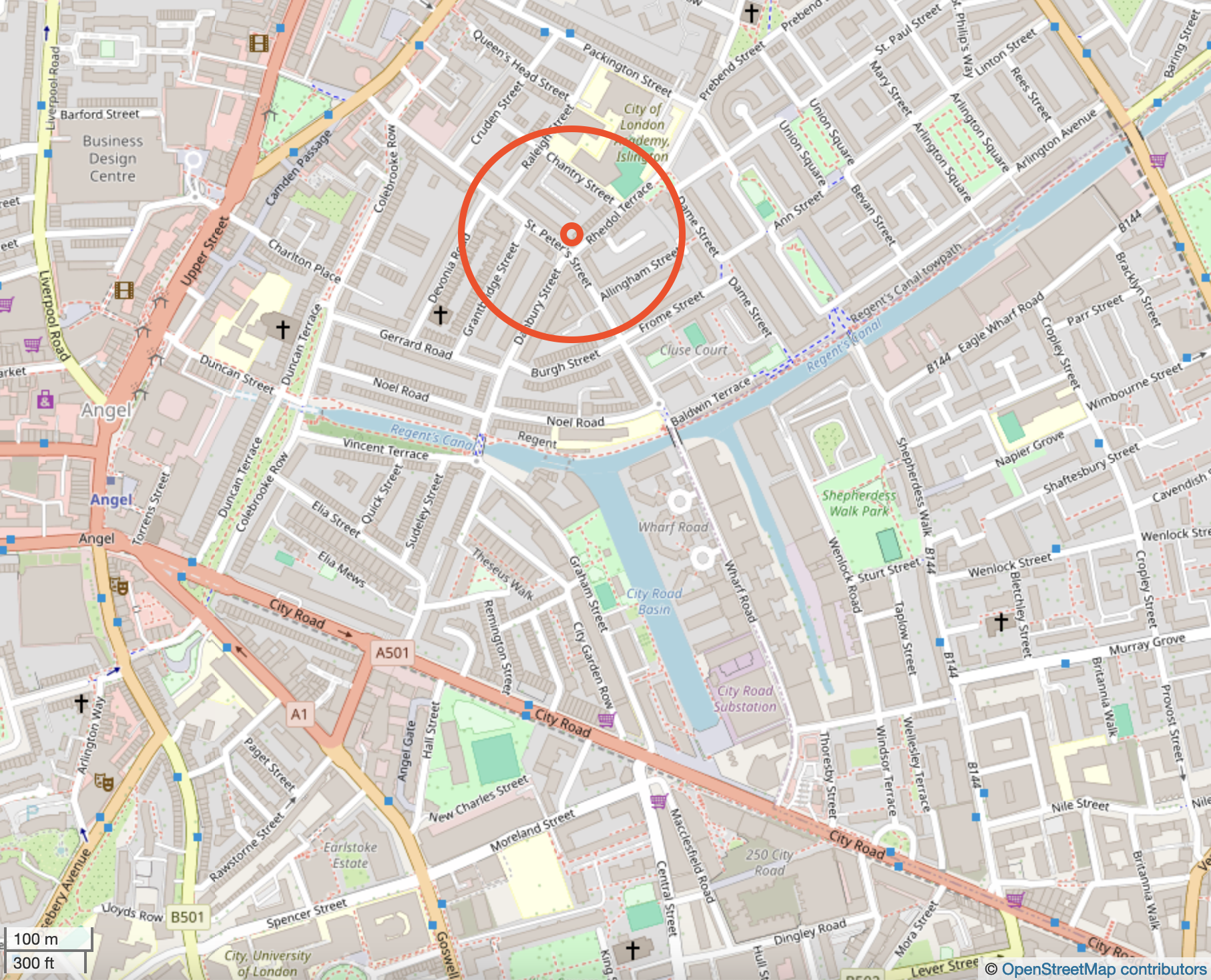
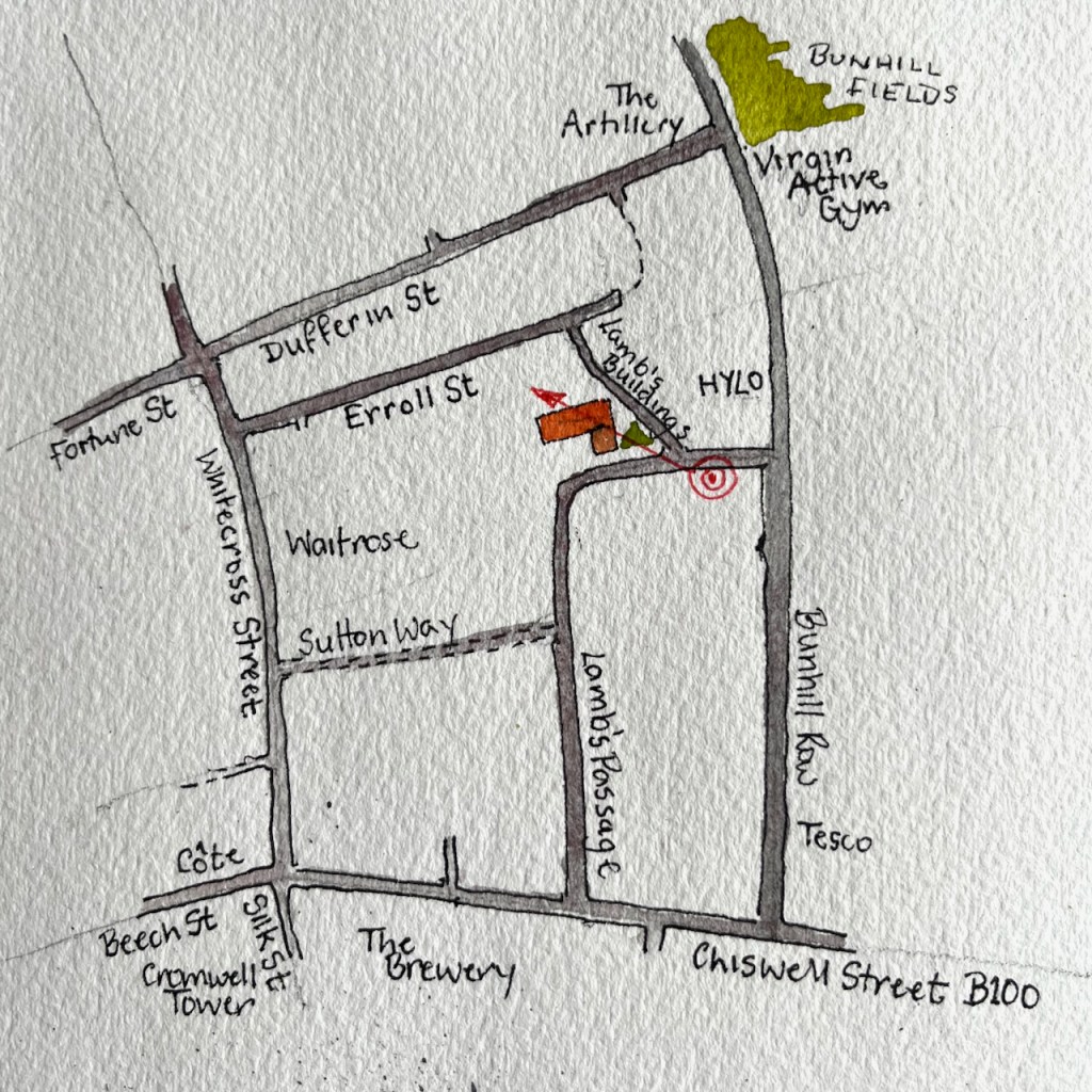
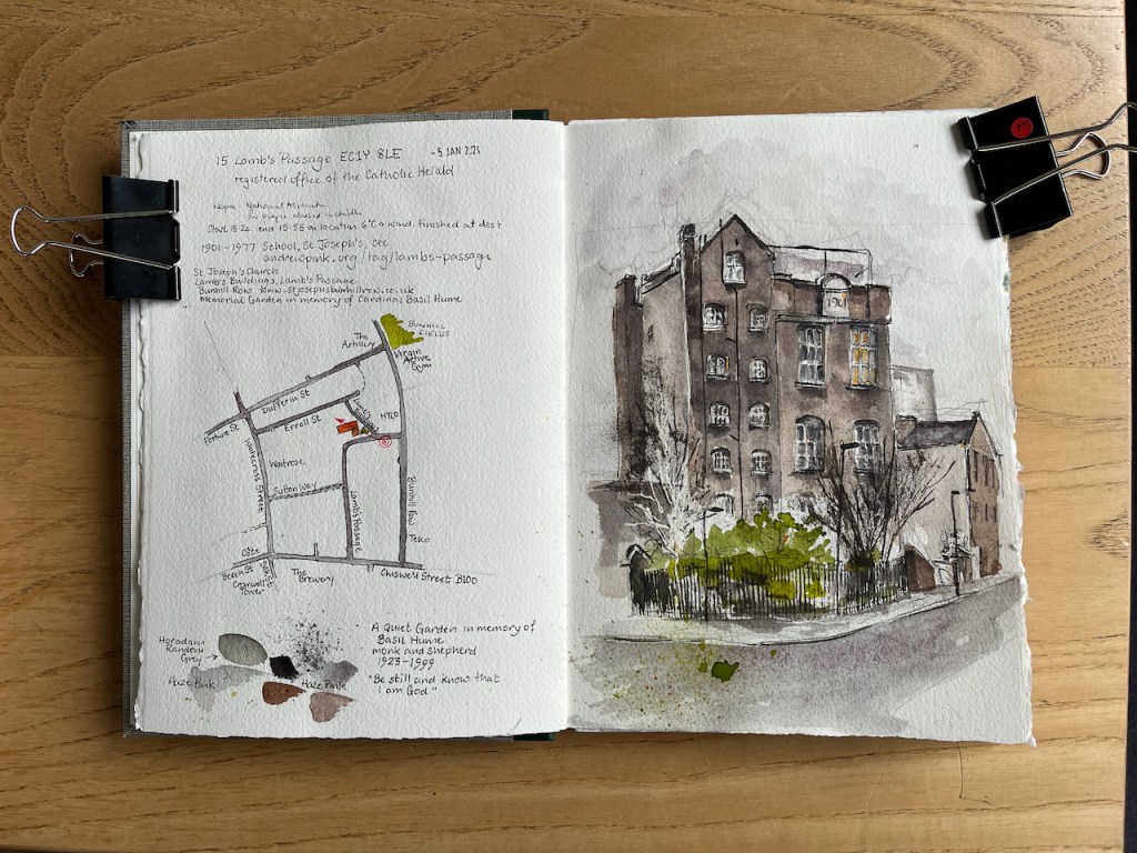
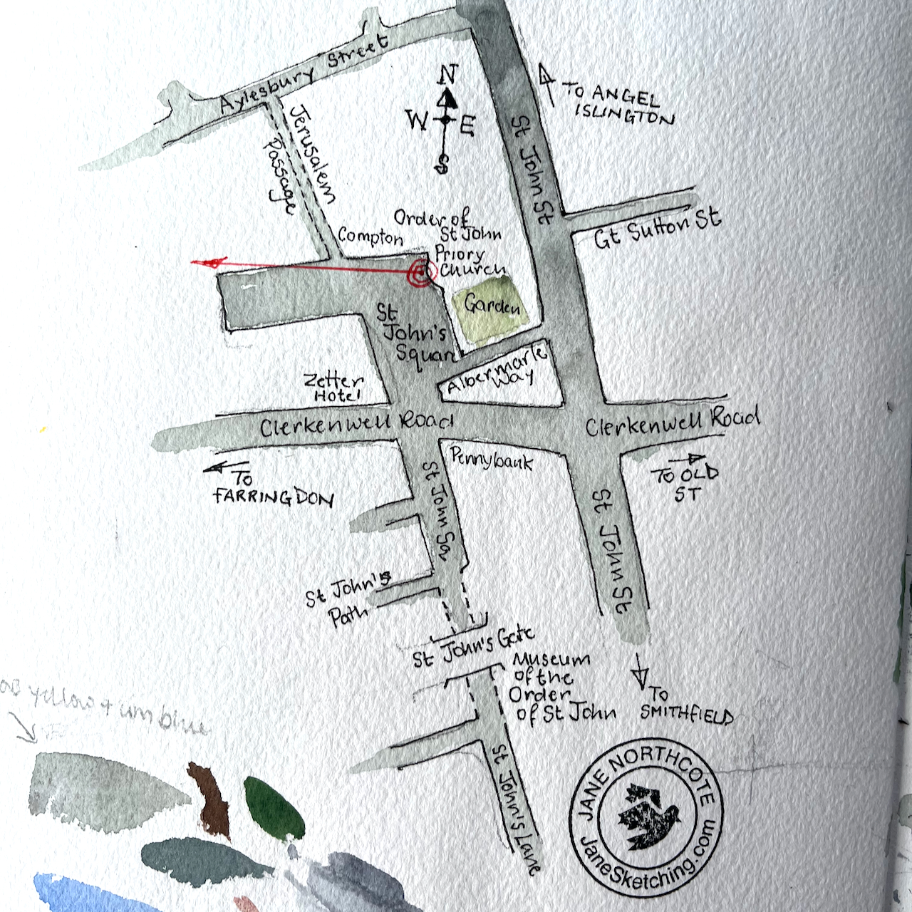
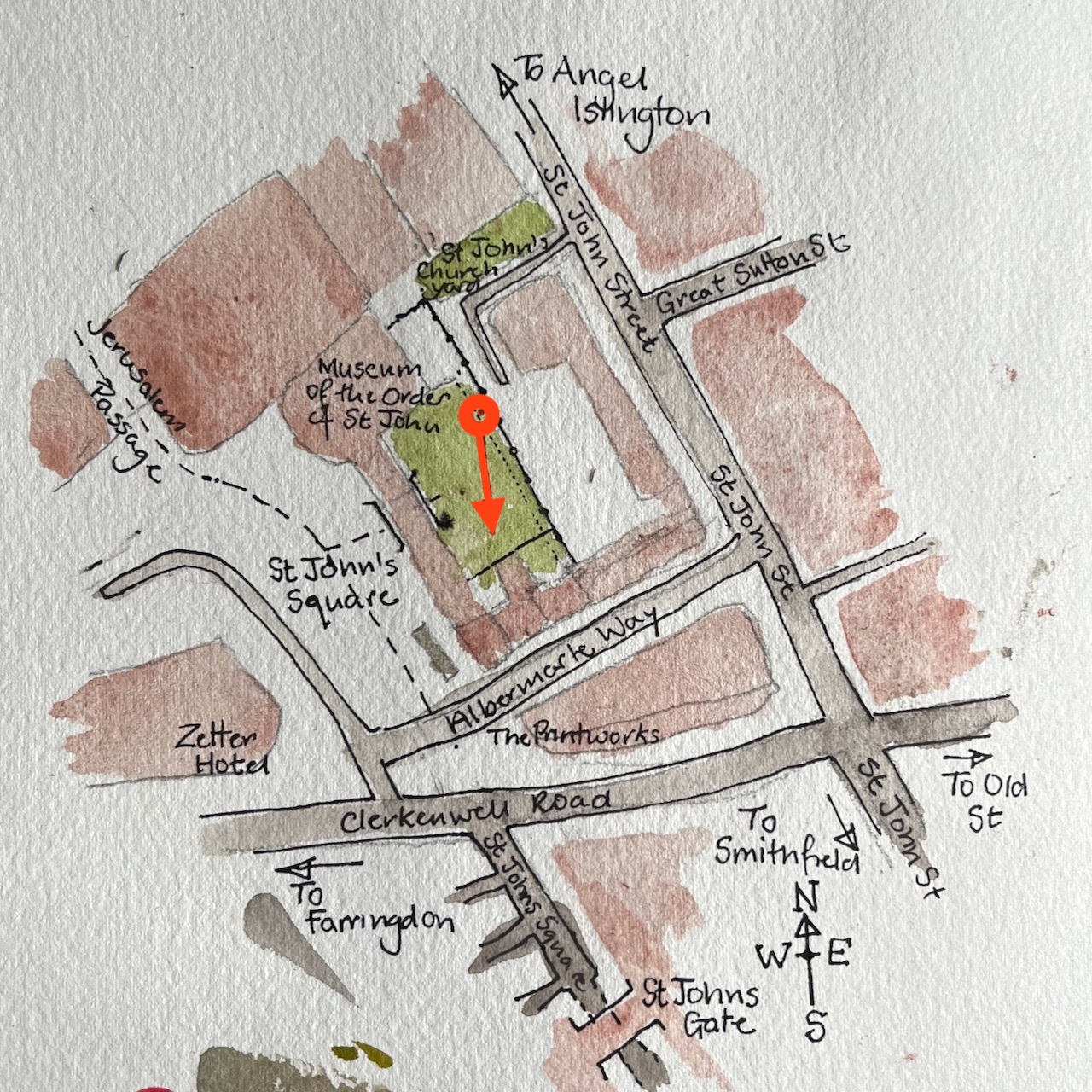
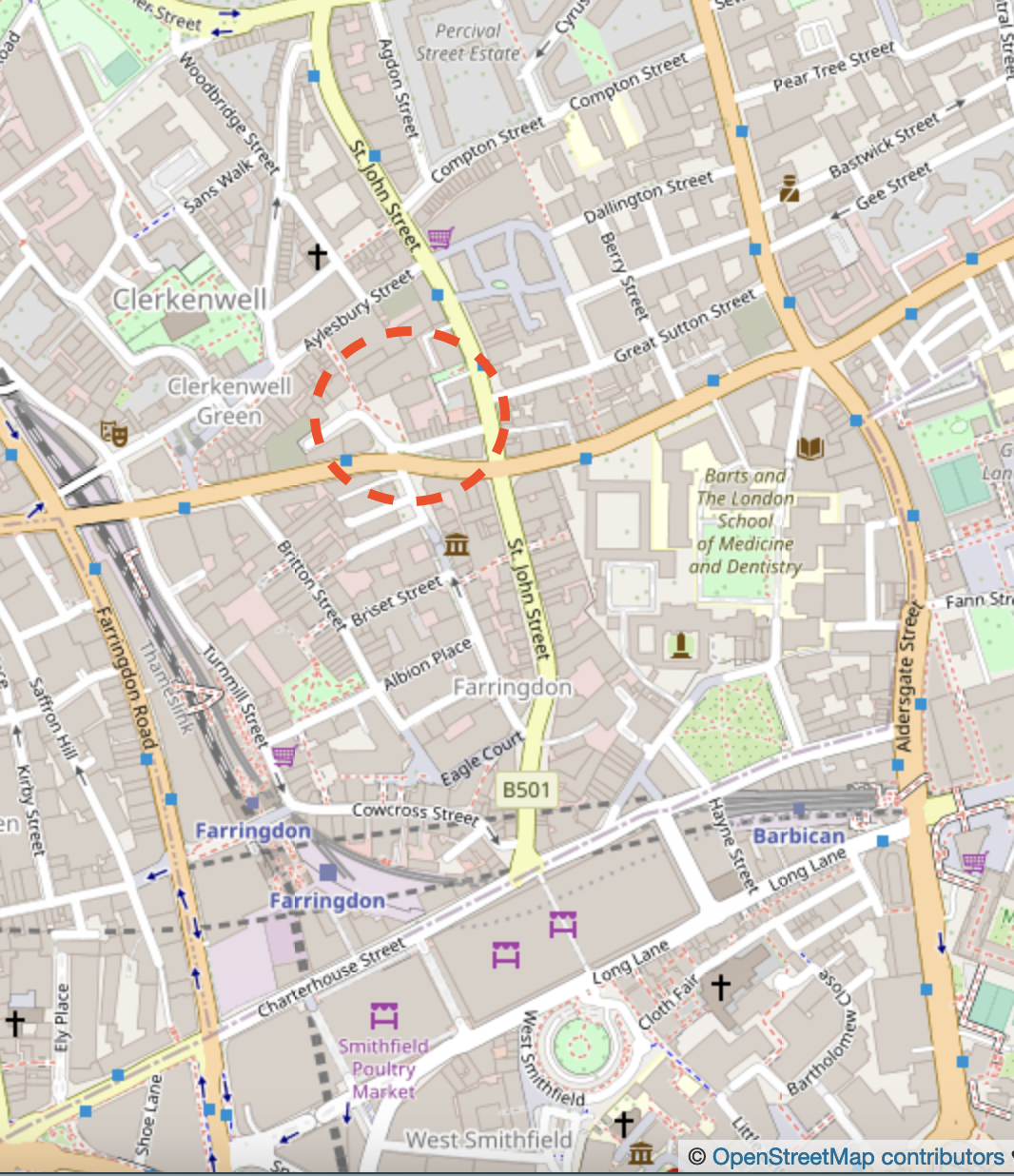
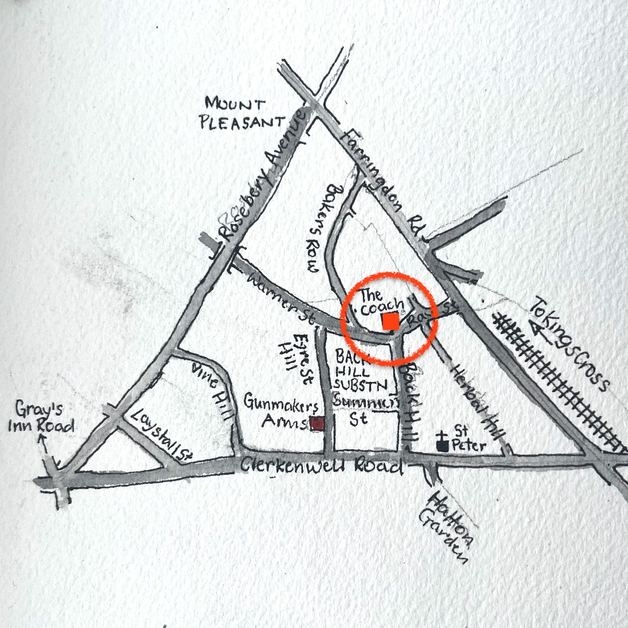
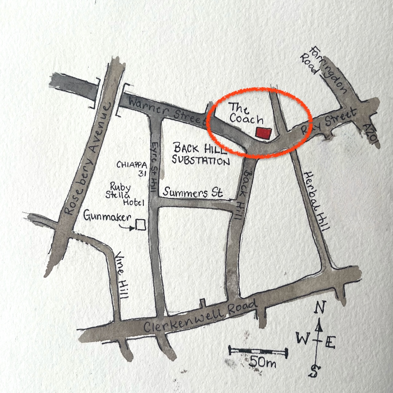
Here are maps to show where it is. It looks like a great pub, with a serious gastronomy menu. https://thecoachclerkenwell.co.uk/

Click here to see more pubs that I’ve drawn.

Gunmakers, Eyre Street Hill EC1R

Here is the pub “Gunmakers” in Eyre Street Hill, Farringdon.

“Gunmakers” in Eyre Street Hill EC1R, sketched 20th June 2024 in sketchbook 14

Eyre Street Hill is a small sloping street in Farringdon, within the triangle made by Rosebery Avenue, Clerkenwell Road, and the Farringdon Road.

It slopes down to the River Fleet which is now below ground. I marked the approximate route of the Fleet on the map below:

It is a very old street, laid out in the 1720s as “Little Bath Street”. “British History Online” contains a detailed history of the area. This tells me that here and to the north was called “Coldbath Fields” in around 1719. The small houses in Eyre St were beside the Cold Bath, “a privately run hydropathic establishment opened in the late 1690”. This was on the edge of town. But then the came a distillery, a smallpox hospital and a workhouse.

“On the north-western ground, now largely occupied by Mount Pleasant Sorting Office, a distillery was built in the 1730s, and a smallpox hospital in the 1750s. These were joined towards the end of the eighteenth century by the prison, the Middlesex House of Correction, which became notorious for the brutality of its regime. South of the Cold Bath, near the old and insalubrious quarter called Hockley-in-the-Hole, the parish workhouse, built in the 1720s, was greatly enlarged in 1790.”

British History Online (see reference below)

Then Rosebery Avenue and Farringdon Road were built, with much demolition and reconstruction. By the beginning of the twentieth century, this area became part of “Little Italy”, a centre of the Italian Community. St Peter’s Church, on Clerkenwell Road, is still “the Italian Church”.

I can find no reference to this pub, or to gunmaking in the area. The building looks like one of the ones built in 1812:

The sun catches the castellated building.

“Today the oldest structures are the small, single-bay houses with shopfronts at Nos 33–37, dating from the early nineteenth century and fairly typical of the rebuilding that took place in the area at that time. Nos 33 and 35 were erected as a pair around 1812 by Thomas Abbott, builder, of Leather Lane.”

British History Online (see reference below)

In the right background of my drawing is a magnificent castellated building, now obscured by the newly-built “Ruby Stella Hotel” .

I was sketching, appropriately enough, in “Summers Street”. It was 20 June and the first sun of summer arrived. The pub was doing a brisk trade.

After about an hour of drawing on location, I added the colour at my desk later.

Sketchbook 14

All quotes are from British History Online Volume 47, pages 22-51 with this reference:

‘West of Farringdon Road’, Survey of London: Volume 47, Northern Clerkenwell and Pentonville, (London, 2008), pp. 22-51. British History Online https://www.british-history.ac.uk/survey-london/vol47/pp22-51 [accessed 22 June 2024].

City Road 400kV Substation EC1

Here is a view of the City Road 400kV Substation, sketched from the other side of City Basin.

City Road 400kV Substation from “Angel Waterside” City Basin, 19th May 2024 in sketchbook 14

This is a monumentally large building, a last remaining representative of heavy industry, in an area now mainly residential. All around are the new tower blocks containing luxury apartments, made of shapes and designs aiming for visual appeal. Chronicle Tower and Canaletto Tower are just off the picture to the right. The sub-station is robustly functional. I enjoyed its forthright no-nonsense appearance.

It’s built like a fortress, as well it should be. It is part of the UK power distribution system, connecting us in London to, amongst other power sources, the off-shore windfarms in the North Sea, an interconnector off across to Europe, and power stations on the Isle of Grain.

These diagrams come from a National Grid document on this link. The document is “Electricity Ten Year Statement 2012, Appendix A1”. It’s over 12 years old so there may be different connections now.

Despite the uncompromising appearance of the substation, the edge of its higher roof was softened with a subtle fringe of grass. I don’t know if this was a deliberate attempt at a “green roof” or if the grass planted itself there of its own volition.

I made this sketch sitting by the water observed by geese. It took me a little while to establish that the tree in the picture was on a raft, and therefore it moved. One does not expect trees to shift around from place to place. I would put it in the sketch, and look up again, and find I had mysteriously got it wrong, again. The geese, obviously, always knew it was a raft, and cackled.

The colours here are:

  • Phthalo Turquoise Blue for the sky (with some Ultramarine Blue)
  • Fired Gold Ochre for the bricks
  • Mars Yellow, with Fired Gold Ochre, for the paler brickwork
  • Ultramarine Blue for the cylindrical construction on the roof (middle left)
  • Serpentine Genuine for the tree
  • All greys and blacks are combinations of the above, plus Burnt Umber.

Colours are all Daniel Smith. The paper is Arches Aquarelle 300gsm in a sketchbook by Wyvern Bindery.

The Sekforde – a commission

The Sekforde EC1R 0HA, Clerkenwell, sketched March 2024 12″ x 9″ [commission]

This watercolour was specially commissioned to celebrate a happy event.

The colours are:

  • Mars Yellow
  • Fired Gold Ochre
  • Ultramarine Blue
  • Burnt Umber
  • plus some Horadam Random Grey, some Daniel Smith Green Serpentine Genuine, and Pyrrol Red for the street sign and road marker.
  • Gold paint for the lettering.

Admire the bricks! I am very pleased with this effect. It was done by applying a rubber resist, “pebeo drawing gum” to the paper before I did any painting. The paint does not adhere to the rubber resist. When I had done all the colour, I rubbed off the rubber resist and hey presto! bricks.

Thank you to my client for their encouraging words and for inspiring me to make this picture of The Sekforde. Here are some details of the drawing.

I have sketched The Sekforde previously, see this link: The Sekforde, Clerkenwell

UPDATE:

My client kindly sent me photos of the framed picture!

6 St Chad’s Place – Jamboree WC1X

I went to sketch this place in a back alley near Kings Cross because I enjoyed the geometry of the roof, spotted on a morning run some time ago.

6 St Chad’s Place, Jamboree, London WC1X 9HH – sketched 6 February 2024 2pm in Sketchbook 14

This is “Jamboree” where there is live music, dancing and events: It is open Tuesday evening to Sunday.

“music forms from around the world, cabaret, European folk, dances.”

(https://www.jamboreevenue.co.uk/)

I was expecting the hidden alleyway to be deserted on a Tuesday lunchtime, and so it was for the first hour. But then it became suddenly busy. A small ambulance backed carefully down the alleyway in front of me and parked. Its doors opened and two paramedics went round to the back of the car. They lifted out their equipment and walked calmly off down the alley. After that excitement, a certain calm returned to the alley, insofar as calm is possible a few hundred metres from Kings Cross.

I carried on sketching, now working on the beer barrels to the left of the picture. But the calm did not last long. Two cars arrived and people dressed in orange hi-vis vests scrambled out. They unlocked a gate off the picture to the left, and went in, leaving their car on the pavement. Then a van arrived, it parked directly in front of me, and a further person in a hi-vis outfit got out. He looked across the bonnet of his van and saw me sketching. “Oh, sorry,” he said, “Am I in your way?” I said that yes, he kind of was. I stood ready, however, to concede the space to him, as he looked important and determined in his bright orange overalls and hard hat. But to my surprise he grinned at me, “Ten minutes! I’ll be just ten minutes!”. He rushed off through the gate where the other people had gone. I abandoned the beer barrels and worked on the roofs.

The roofs were quite a challenge, and they productively occupied the 8 minutes until the driver came rushing back out, looking triumphant, accompanied by a selection of the people who’d arrived earlier. “I told this woman I’d be ten minutes,” he explained to his entourage. He raised a hand to me in greeting, got into his car and rumbled off, leaving the other people standing on the cobbles. I asked them what they were working on. “The bridge,” they said. Oh yes, I was standing on a bridge. The train lines were below.

Annotated Google map of the location.

It’s in a labyrinth of roads and railway lines just to the east of Kings Cross mainline station.Here are some maps to show the location. Walk east from Kings Cross, about 10 minutes.

On the maps, the blue line represents the River Fleet, which is alongside the Kings Cross Road, underground. It flows from left to right across the map (West to East) and then heads South down to join the Thames beneath Blackfriars Bridge.

The river Fleet, before it became an underground sewer in 1825, flowed along the western side of Pancras Road and then eastward along the south side of the common, crossing the old highway (now Gray’s Inn Road) north of St. Chad’s Place.

‘Battle Bridge Estate’, in Survey of London: Volume 24, the Parish of St Pancras Part 4: King’s Cross Neighbourhood, ed. Walter H Godfrey and W McB. Marcham (London, 1952), pp. 102-113. British History Online http://www.british-history.ac.uk/survey-london/vol24/pt4/pp102-113 [accessed 7 February 2024].

St Chad’s Place slopes down towards the River Fleet. This area was once the location of St Chad’s Well, a spring said to have health-giving properties. It operated from about 1815 to 1860. I found a picture in the London Picture Archives, reproduced below with their permission.

Image © London Metropolitan Archives, City of London Metropolitan Prints Collection LPA 006123 St Chads Well Catalogue No: SC_PZ_SP_01_556 Accession No: Saint Pancras P 01688 Date of execution: 1856
Record No: 305367 used with permission under licence dated 08/02/2024

The website “A London Inheritance” has an informative article about St Chad’s Place and the Well: https://alondoninheritance.com/london-streets/st-chads-place-and-a-lost-well/, which is well worth a read.

A river, a bridge, a well, a passage and a music venue. It’s amazing what you find.

Here is work in progress on the sketch:

The colours are:

  • For the sky and pavement – a special new colour, Schminke Horadam “Random grey” – “formulated each year from surplus pigments”. This is the 2022 edition.
  • Rose madder permanent – also on the pavement
  • Mars Yellow
  • Ultramarine Blue
  • Green Serpentine Genuine
  • Buff Titanium
  • Fired Gold Ochre in the brickwork
  • Burnt Umber
Arches Aquarelle paper in a sketchbook made by Wyvern Bindery (Sketchbook 14).

Rheidol Rooms, London N1

Rheidol Rooms is a café in Islington, just North of the Regent’s Canal. I sketched it on a bright cold day.

Rheidol Rooms, 16 Rheidol Terrace, London N1 sketched 3pm 10 January 2024 in Sketchbook 14

The tree cast its image onto the café. The twigs is the shadow were so sharply defined that it was hard to distinguish the shadow from the tree.

Despite that bright blue sky, the temperature was 2 degrees C and there was a wind. I froze, and walked across to the café. Sadly, it was closed, but it looked like a really good café and I will go back. I finished the drawing at my desk.

The colours in the picture are:

  • Mars Yellow
  • Ultramarine Blue
  • Burnt Umber
  • Serpentine Genuine (green, for the window frames)
  • The grey and black is made from a mix of Ultramarine Blue and Burnt Umber

The café is at the junction of St Peter’s Street and Rheidol Terrace. It is in a 19th century row of terraced houses. “British History Online” indicates that this terrace was constructed in 1848-52.

Reference: British History Online: the history of this area is here: A P Baggs, Diane K Bolton and Patricia E C Croot, ‘Islington: Growth, South-east Islington’, in A History of the County of Middlesex: Volume 8, Islington and Stoke Newington Parishes, ed. T F T Baker and C R Elrington (London, 1985), pp. 20-24. British History Online http://www.british-history.ac.uk/vch/middx/vol8/pp20-24 [accessed 11 January 2024].

….the block bounded by St. Peter’s Street, Rheidol Terrace, and Cruden Street as far as the backs of houses in Queen’s Head Lane, with provision for 14 semi-detached and 74 terraced houses, was taken by James and Thomas Ward and built up by James Ward and sublessees. Leases for nos. 7-21 St. Peter’s Street, pairs of stuccoed villas originally called Angell Terrace after the Clothworkers’ surveyor, Samuel Angell, who probably laid out the estate, were granted in 1848 and for the rest of the block from 1848 to 1852.”

15 Lamb’s Passage EC1

An old brick building stands amongst the new-build. The paint on its window frames is flaking, and its brickwork is dark from the smoke of a previous age, yet it retains its dignity: a grandmother of a building.

15 Lamb’s Passage, London EC1, sketched 5th January 2024 in Sketchbook 14, 4pm, 6 degrees C

This is the former St Joseph’s School, built in 1901, which ceased operation as a school in 1977. On its roof you can see the wire netting which once must have surrounded a playground or netball court.

St Joseph’s Church is in the basement, accessed by the porch you can just see to the right of my drawing behind the furthest lamppost.

Entrance to St Joseph’s Catholic Church, Lamb’s Buildings: porch built 1993 to the design of Anthony Delarue (from https://parish.rcdow.org.uk/bunhillrow/about-the-parish/)

The area in front of the building is a quiet garden, in memory of Basil Hume, an English Catholic bishop. Sometimes the gate is open and you can go in. It has been arranged so that, even in this tiny space, it is possible to walk some kind of small pilgrimage, along a path, across a ditch, past a tree, and so round a corner to rest in the shaded hut. On the way you encounter a splendid birch tree with white bark, which I have seen grow from a sapling.

BE 
STILL
AND
KNOW
THAT
I AM
GOD
This quiet garden 
is dedicated to the
memory of BASIL HUME
monk and shepherd
1923-1999

Number 15 Lamb’s Buildings hosts several organisations now. The City Photographic Society uses the Church Hall in this building. It is also the registered office of the Catholic Herald. I have often heard music as I pass by, so it might also be used as a rehearsal space. There is ballroom dancing on Mondays. The smaller building to the south, on the left of my drawing, hosts a pregnancy advice centre. So this is a set of buildings is in use, actively serving the community despite the flaking paint.

I made this drawing quickly as the light faded on a cold and windy evening. After the pen, I retreated back to my desk to apply the colour.

The musician Andrew Pink has written in detail about this building, including a description of the organ in the basement church. His piece is here: https://andrewpink.org/lambs-buildings/. The church website is here: https://parish.rcdow.org.uk/bunhillrow/about-the-parish

Here are some more photos of the building:

Canal Building, 135/7 Shepherdess Walk, N1

Here is The Canal Building, at the north end of Shepherdess Walk, sketched yesterday from the junction with Eagle Wharf Road.

Canal Building, Shepherdess Walk, London N1, sketched 29 December 2023 in Sketchbook 14

The building overhanging, in the top right of the drawing is part of Angel Wharf, 164 Shepherdess Walk. Shepherdess Walk leads over the Regents Canal, the bridge is just behind the cars in the picture. The buildings you see above the cars are on the other sidee of the canal. On the left is the “Wenlock Brewery”.

There is a tiny object on the roof of the Canal Building, next to the flagpole. It was hard to see what it was, but it looked like a wooden owl.

The Canal Building is a former 1930s Art Deco warehouse. In 2000, it was converted into apartments and commercial space to the design of the architects Child Graddon Lewis. This building gained the architects a place amongst the finalists for the 2023 Architecture Today Awards, in the category “Mixed Use and Retail”. There are 35 new apartments, 45 live/work units and 1100 sq metres of commercial space. Here are photos of the building from the canal side.

I did the pen on location and added the colour at my desk later. It was cold outside and I was sitting on a damp stone wall. Many people were out and about in the area, and two of them stopped to say hello and look at the drawing.

There are just three main colours in the sketch: Buff Titanium, Burnt Umber and Ultramarine Blue.

  • Buff Titanium for the Canal Building
  • All greys and blacks are Ultramarine Blue plus Burnt Umber
  • Ultramarine Blue for the blue car, the blue notice, and in the sky
  • The trees are Burnt Umber
  • And that’s it! There is a bit of Mars Yellow for the car number plate.

All colours are Daniel Smith except the blue, which is Schminke Horadam.

This is my first sketch in a new sketchbook!

Sketchbook 14

Here are some other sketches I’ve done in Shepherdess Walk:

The Eagle, 2 Shepherdess Walk

Here is The Eagle. This is a very old pub, located at a significant junction on City Road. In the picture above, the alley on the right of the pub is called “Shepherdess Place”. It leads to a police car park, and several…

Read more…

Plumage House, N1

Here is Plumage House, 106 Shepherdess Walk, London N1. This was a feather factory. According to Spitalfields Life this operated until 1994. The building is now rather shabby, though in a dignified way. I wonder what will happen to it? In the drawing,…

Read more…

Compton, St John’s Square, London EC1

Clerkenwell has many interesting corners. Here is a view across St John’s Square. I sketched it earlier today, sitting on the step of the Priory Church of the Order of St John. The restaurant is called “Compton”.

View across St John’s Square, Compton restaurant, 21 June 2023, in sketchbook 13

Here’s a map:

Thank you to the kind person from the Priory Church. They emerged from the door behind me. There I was, low down on the step, at the pen-and-ink stage, with my materials laid out neatly on the stone. They obviously had not expected anyone to be sitting on the step. I had not expected anyone to come out of the dark door. It had looked as if it had been closed shut for millennia. After a moment of surprise, politeness prevailed and we both said hello. Thereafter, I grouped my materials into a compact heap, and they came and went, tolerating me amiably, and skirting around me to operate the card key system.

This picture has just four main colours: Ultramarine blue, Brown umber, Mars yellow, and Green Serpentine Genuine. The only other colour is Fired Gold Ochre for the terracotta: the chimneys and the flowerpots. All colours are Daniel Smith watercolours.

Here is work in progress:

Garden of the Museum of the Order of St John, Clerkenwell, London EC1

On a hot day, in need of healing, I re-discovered this herb garden. It is hidden away the other side of a gate off St John’s Square in Clerkenwell. The gate is open and you can walk right in. There are benches, and aromatic plants. At the back, there’s.a cloister.

I went in the cloister, and found the ideal place to sketch: cool, still, and quiet, with a view from those windows.

Here’s the view:

From the Cloister, looking into the garden, 15th June 2023, 10″ x 8″ in Sketchbook 13

The Order of St John has a long history.

By 1080, a hospital had been established in Jerusalem by a group of monks under the guidance of Brother Gerard. Its purpose was to care for the many pilgrims who had become ill on their travels to the Holy Land. The men and women who worked there were members of a new religious order, officially recognised by the Church in 1113. Known as the Hospitallers, they cared for anyone, without distinction of race or faith.

website of the Museum of the Order of St John [https://museumstjohn.org.uk/our-story/history-of-the-order/]

These days, this is the organisation behind St John Ambulance.

The garden is wonderful. A place of solace. People from the offices around go there to eat their lunches and also to discuss office politics I realised. But also to read books, dream, doze, and of course, to sketch. There is a book stand by the gate as you go in, with secondhand books you can borrow or buy.

I’ve sketched in this garden a few years ago, from a slightly different viewpoint:

My sketch shows the backs of houses on Albemarle Way. This street and others nearby feature in the novel “Troubled Blood” by Robert Galbraith.

I looked back at the houses as I walked through the garden on my way out. I saw that one of them claims “Ancient Lights”. That’s asserting the right to light, and was a way in law to prevent anyone constructing a tall building which obstructed your windows. It’s “ancient” because you had to have enjoyed the benefit of the light for 20 years or more before you could assert “Ancient Lights”. This has now been superseded by “modern planning laws” I read. But maybe we should put some “ancient lights” notices on the windows of our flat, just to be sure.

Here are maps:

The drawing took three hours. By the end of that time, my mood had transformed itself, and I walked out healthier than I walked in.