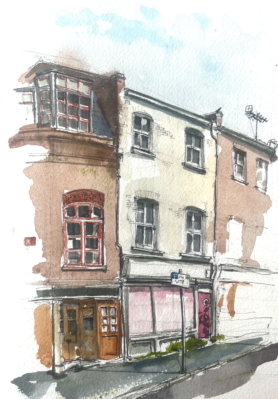
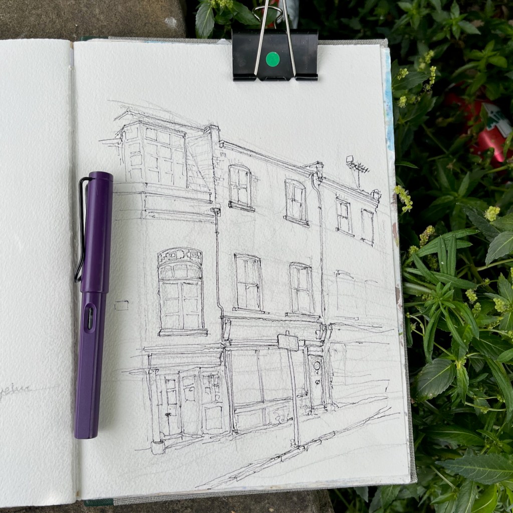
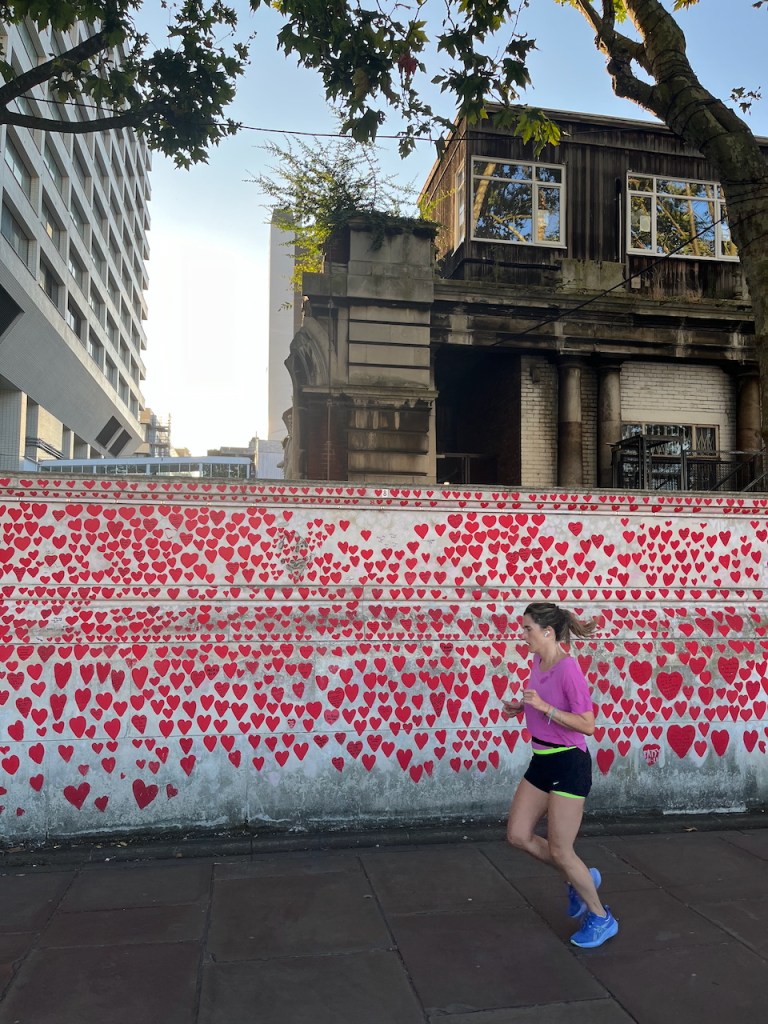
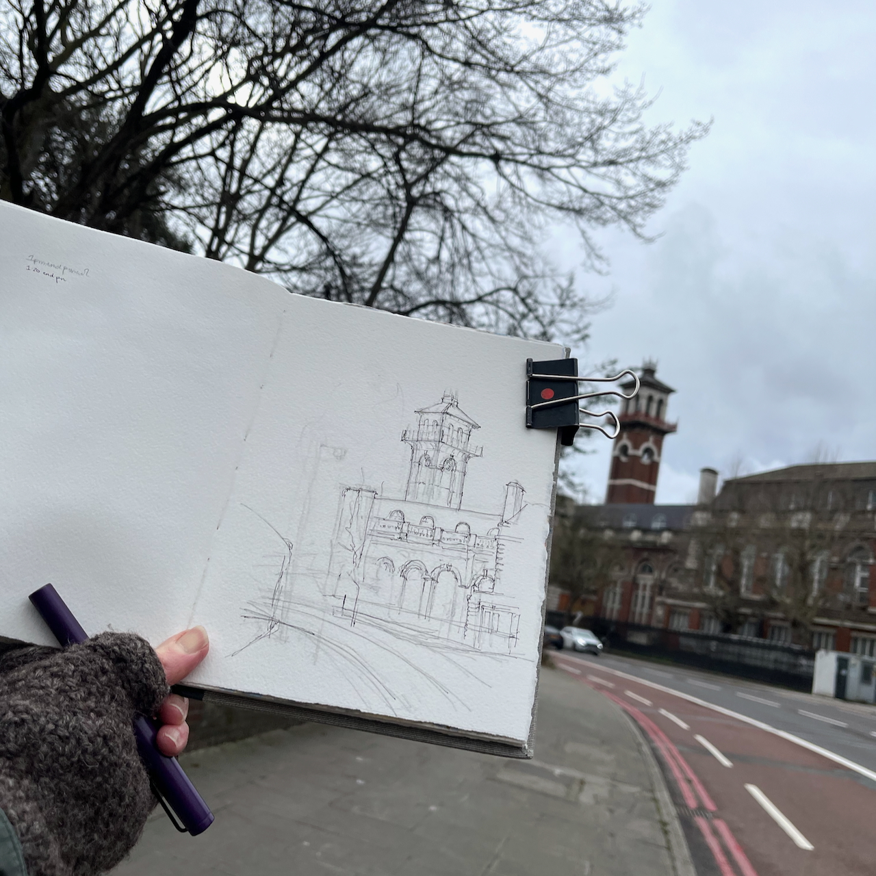
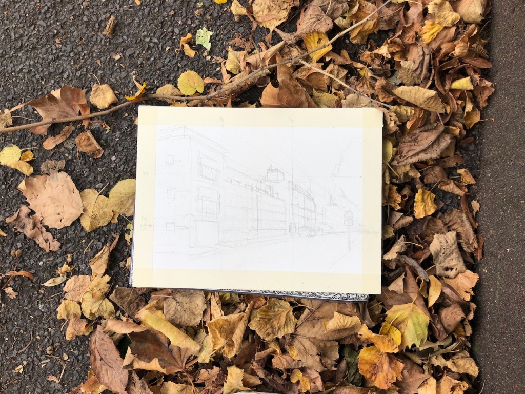
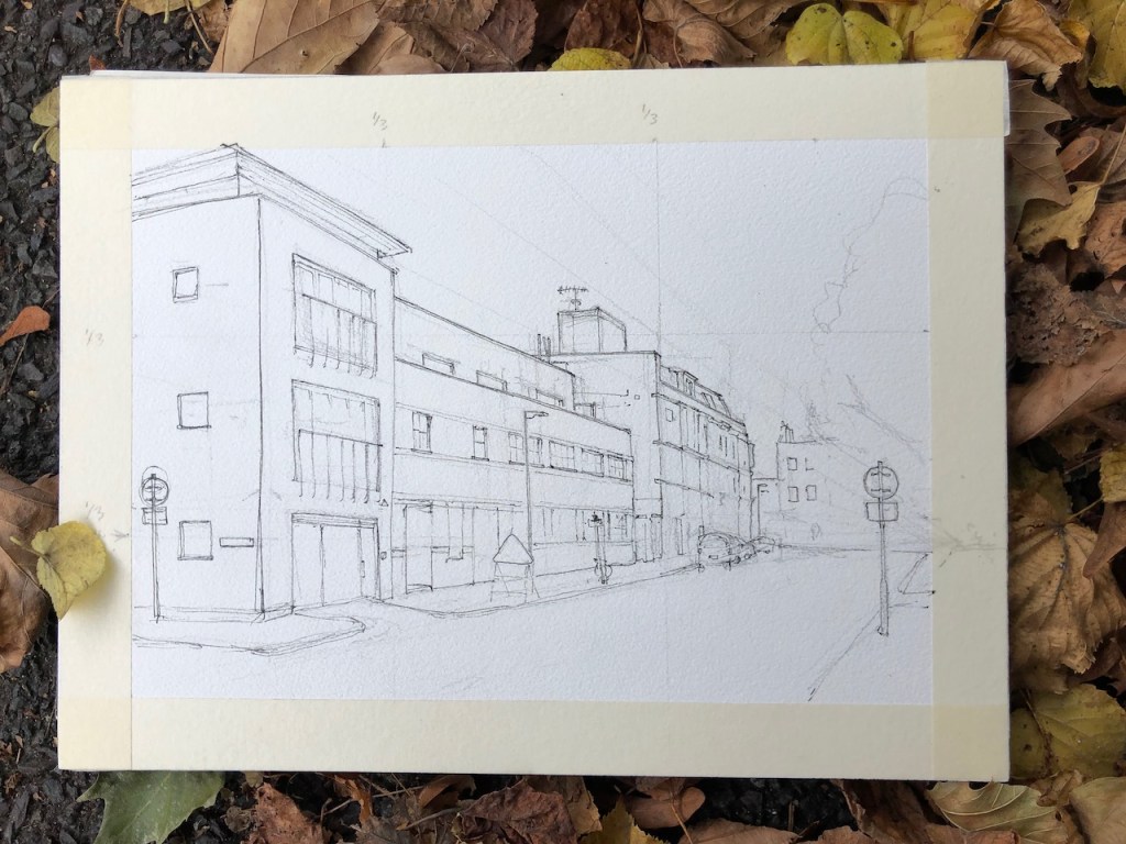
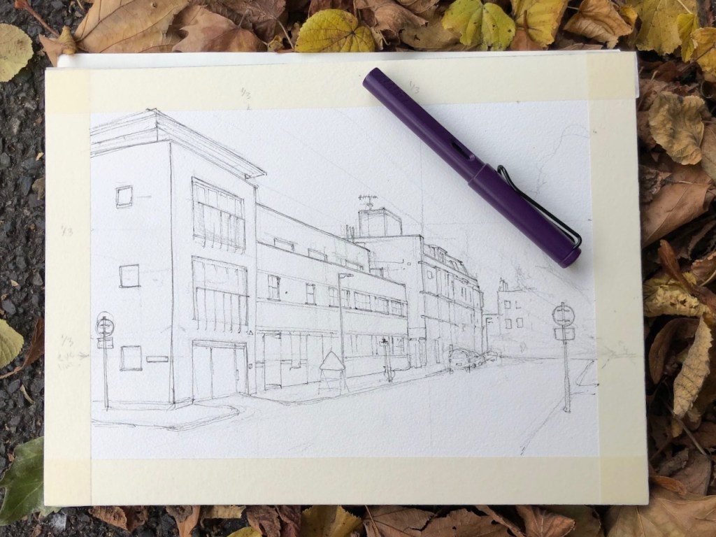
This is an interesting terrace, just to the East of Vauxhall Pleasure Gardens.
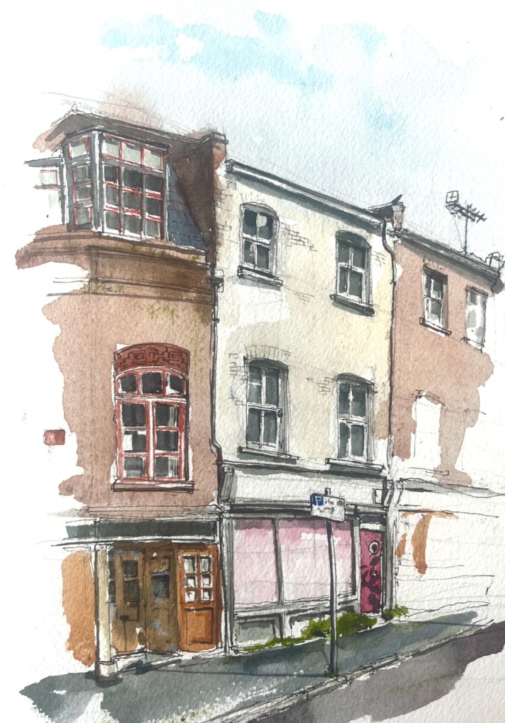
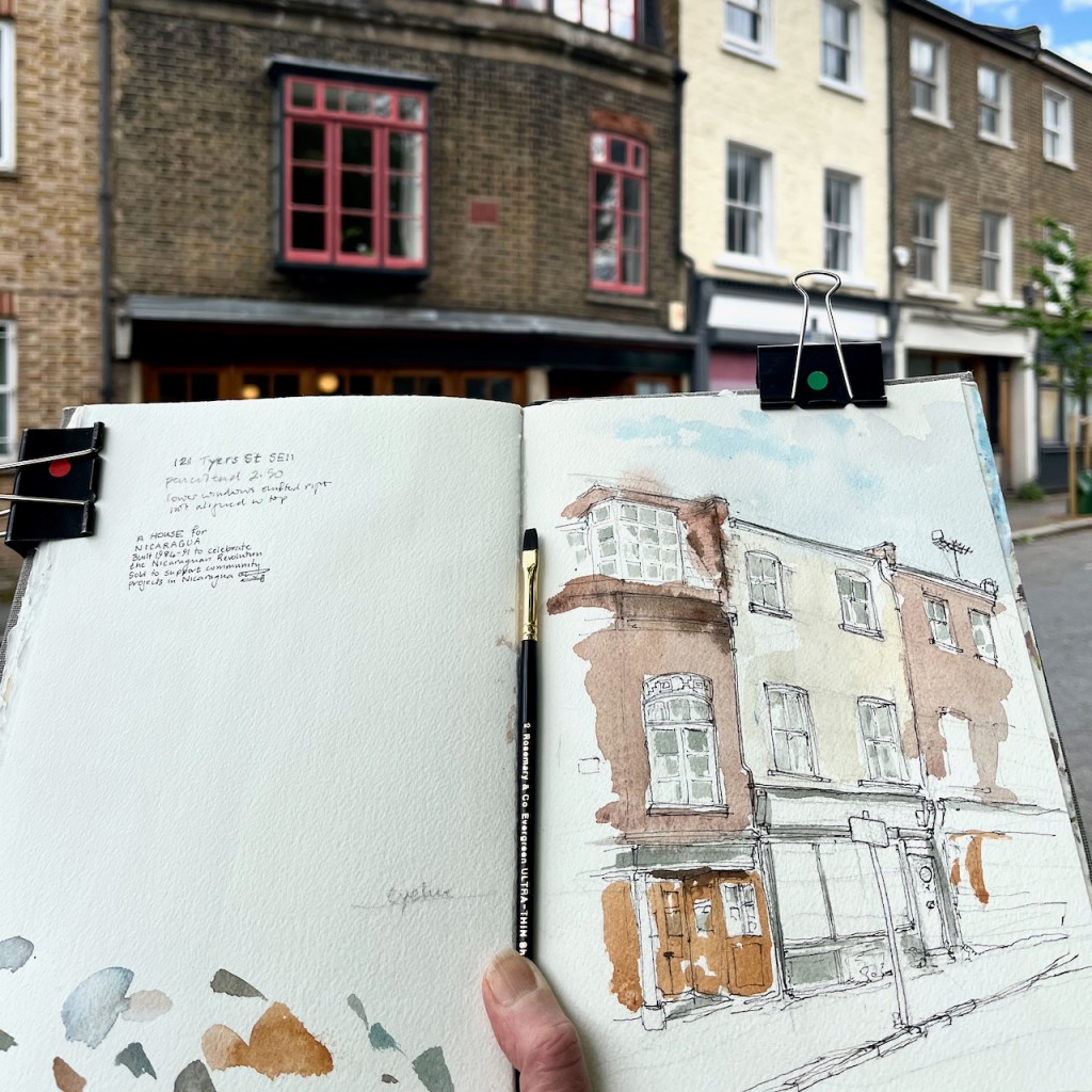
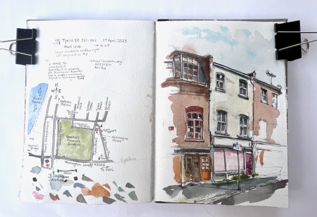
121 and 123 Tyers Street, SE11 5HS, sketched 17 April 2025 in Sketchbook 15
The terrace house on the left has a terracotta plaque let into the brickwork:
A HOUSE FOR NICARAGUA
Built 1984-91 to celebrate
the Nicaraguan Revolution
Sold to support community projects in Nicaragua
The website “Radical Lambeth” has an article which tells more. The house was restored as a community endeavour, led by a visionary, Ron Tod (sometimes spelled Todd):
“He had some money from a house he had built out of an old airfield shed in Essex, and he thought some of the people he was living with might help with the work. About 200 people – men and women in their twenties and thirties did…”
“Almost all the materials for 121 Tyers Street came from skips, building sites or dumps. The floors are parquet, retrieved in one great haul from a skip….”
Even from the outside, the house is feels beautiful. The windows are all different, and there is intriguing detail, such as the terracotta frieze above the window shown in my picture. This is a house built to a loose design rather than a rigid plan. Much was created by the people there, as they went along, using materials to hand. Sketching it, I was reminded of the work of the 1970s radical architect Christopher Alexander, “A Pattern Language”.
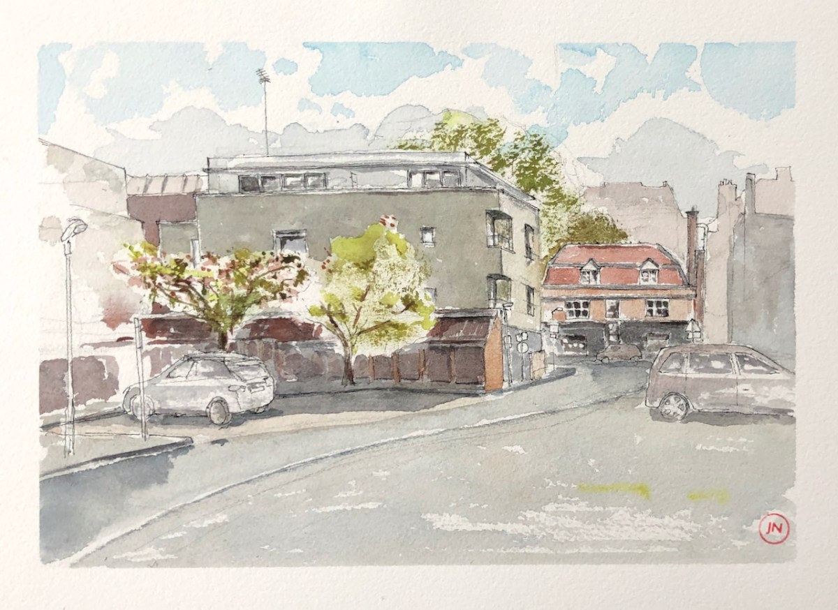
The house in the centre of my picture is 123 Tyers Street. This is much plainer. But it also is intriguing. The lower windows are not directly below the upper windows, but shifted right.
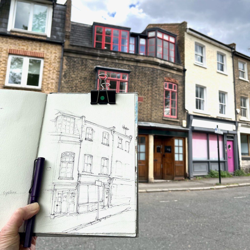
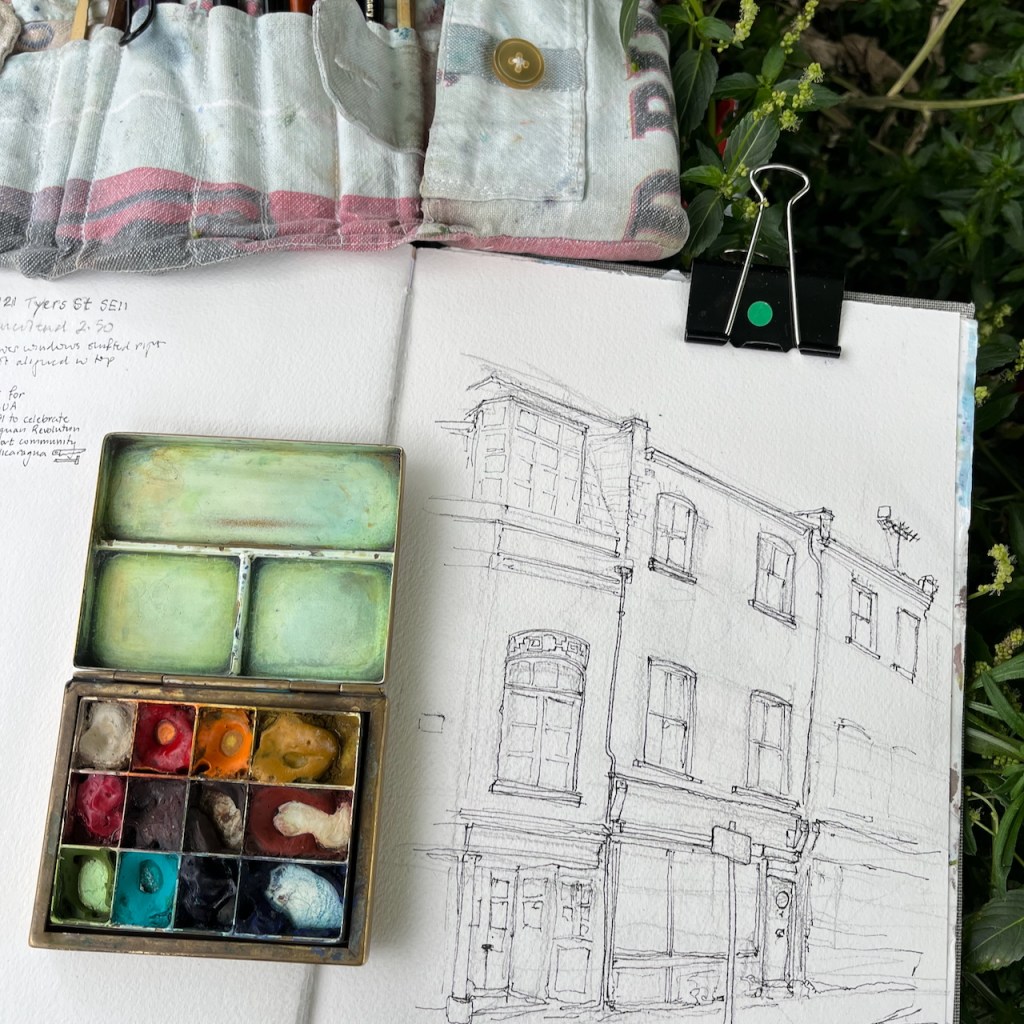
I sketched sitting on the wall opposite.
Sketchbook spread, Sketchbook 15
Click a button below to share this post online, email it, or print it:
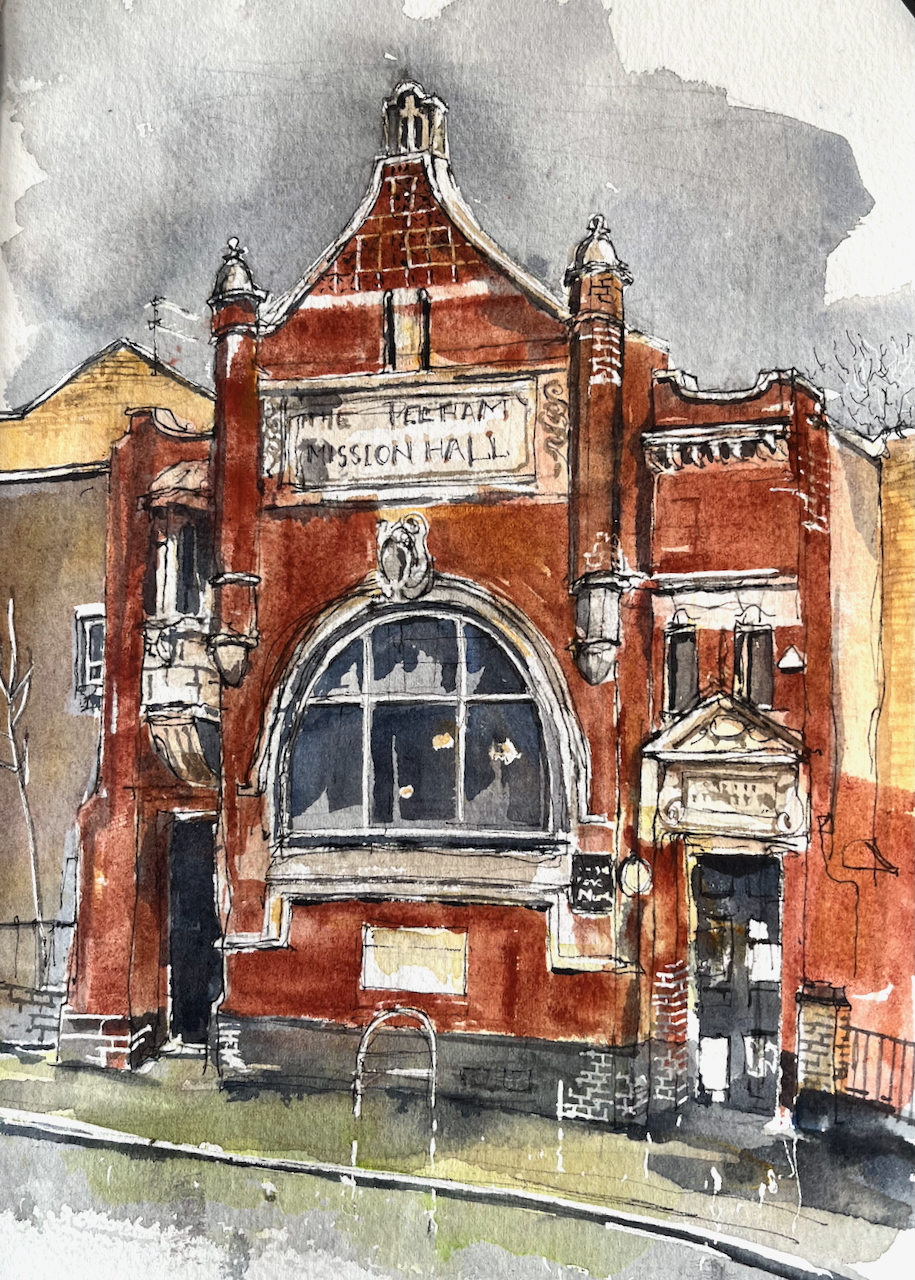
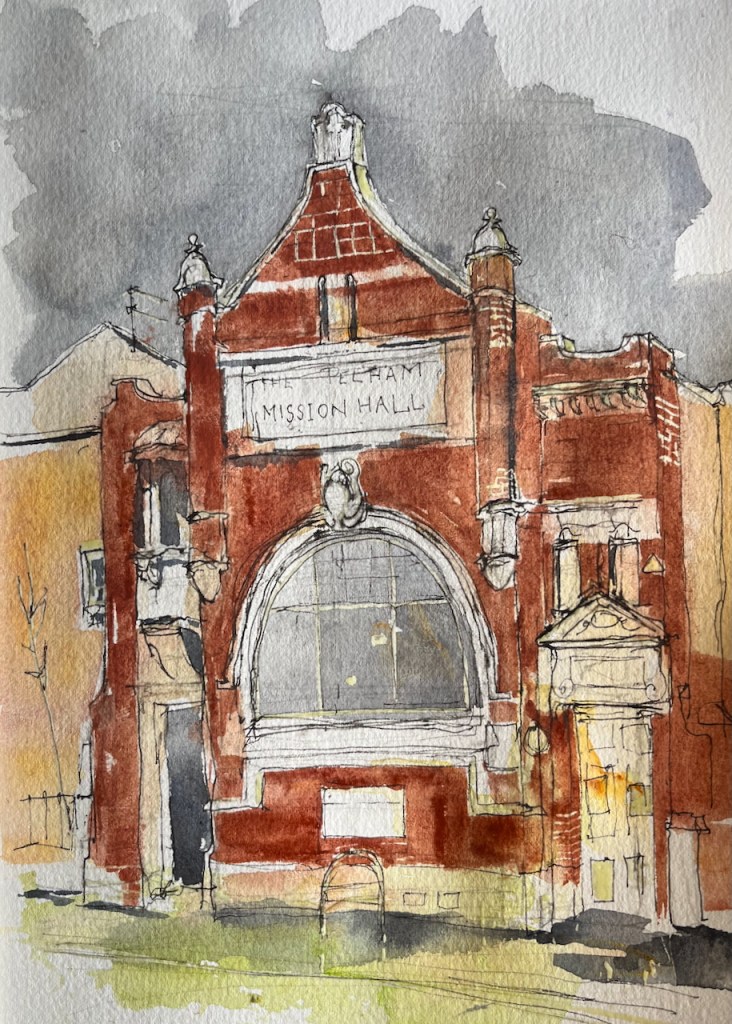
This ornate building stands out amongst the plain and functional housing along Lambeth Walk. I walked past it on my way to the Vauxhall Tea House.
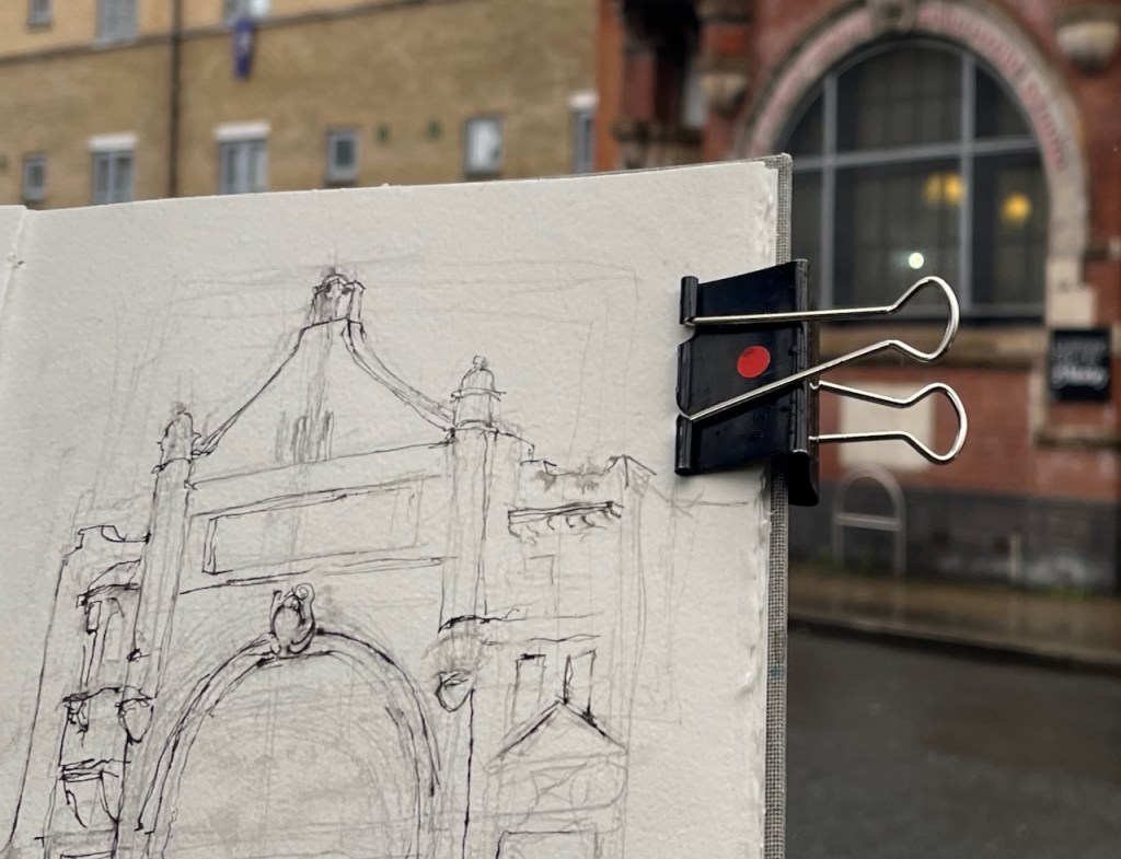
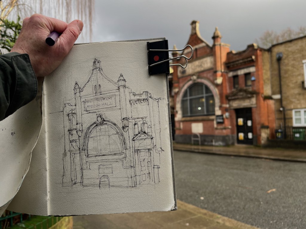
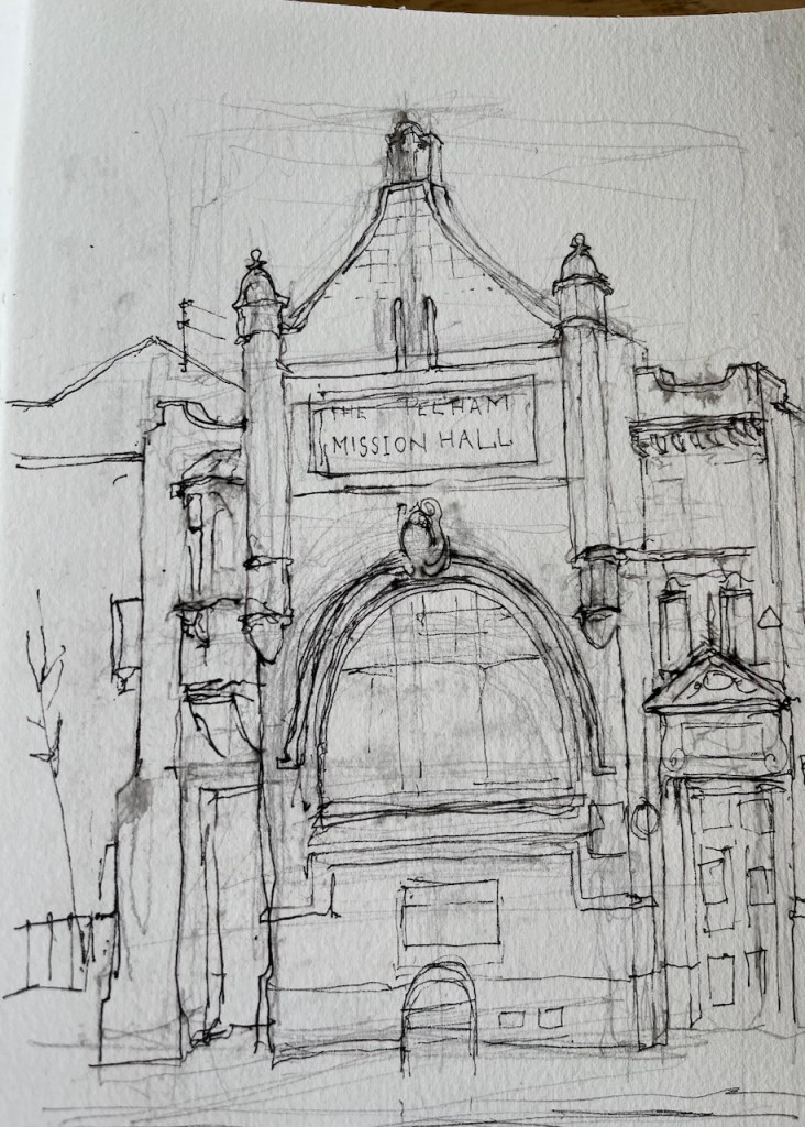
Pelham Mission Hall, Lambeth Walk, Lambeth SE11. in Sketchbook 15, 26 Feb 2025
Canopy
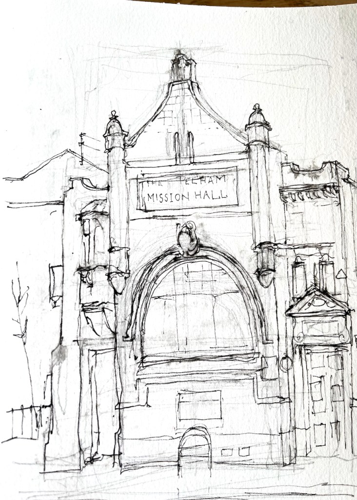
Rain threatened, but I started the sketch anyway. I was sheltering underneath a sort of canopy on the opposite side of the road. This canopy had the significant disadvantage that it was perforated with a pattern of decorative holes.
I sketch using a pen which has waterproof ink. The ink is waterproof once ithas dried. But if I try sketching when the paper is wet, the ink runs. I continued until the pen protested that it couldn’t make marks under these conditions.
The paper I use is Arches Aquarelle. It is “heavily sized”, which means it throws off the water, at least at first. But after sustained drizzle, it starts to become absorbent.
All these things started to happen. The paper became spongy. The pen spluttered. Rain sneaked through the perforated canopy and dripped down the inside of my coat. Water slid off the leaves into my bag. I tried to wrap the sketchbook up and I crammed it into my backpack. I have a waterproof backpack. It was already wet on the outside. Now it was becoming wet on the inside. I stood in the rain and considered. I breathed using a yoga technique. Yoga breathing techniques are quite effective in the rain. There was a rhythm to the drips.
Then the rhythm slowed. Perhaps I could just do a bit more drawing? Slowly, I extracted and unwrapped my book. I flicked the pen to get the ink to flow again. I made each pen stroke count.
The rain eased enough.
This was as far as I got.
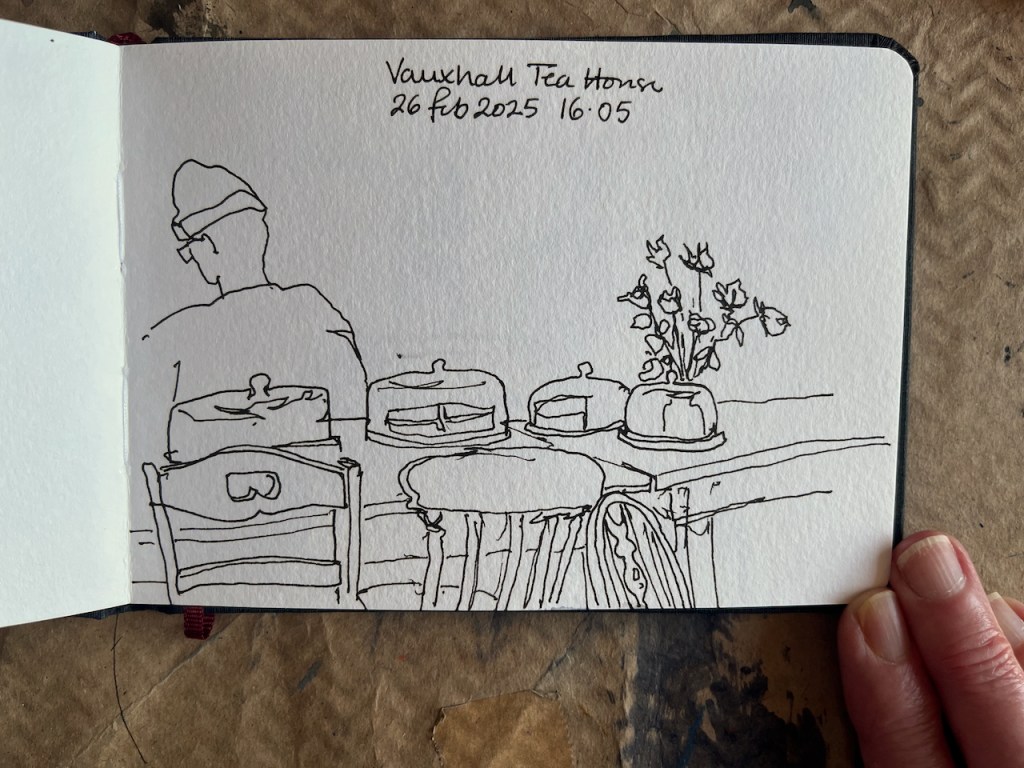
Then I went to the Vauxhall Tea House to warm up.
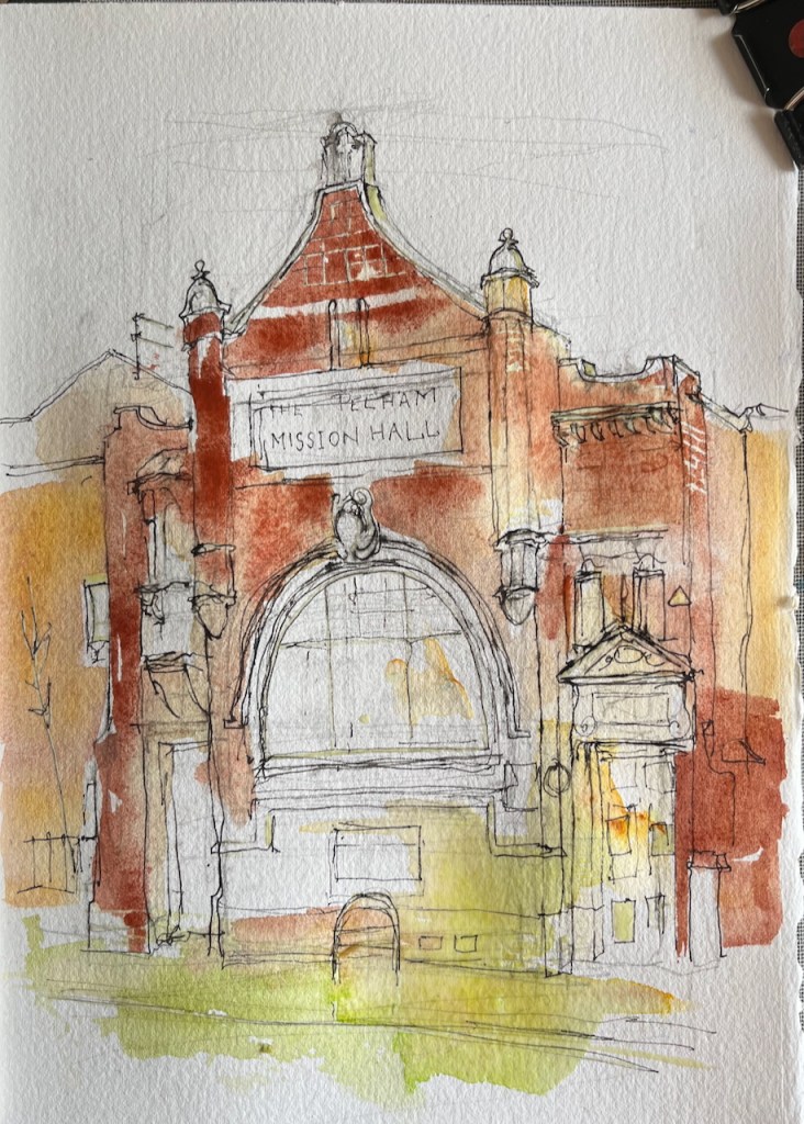
I finished the drawing of Pelham Mission Hall later at my desk.
1.ink2. Early wash3. More washes4. Final detail
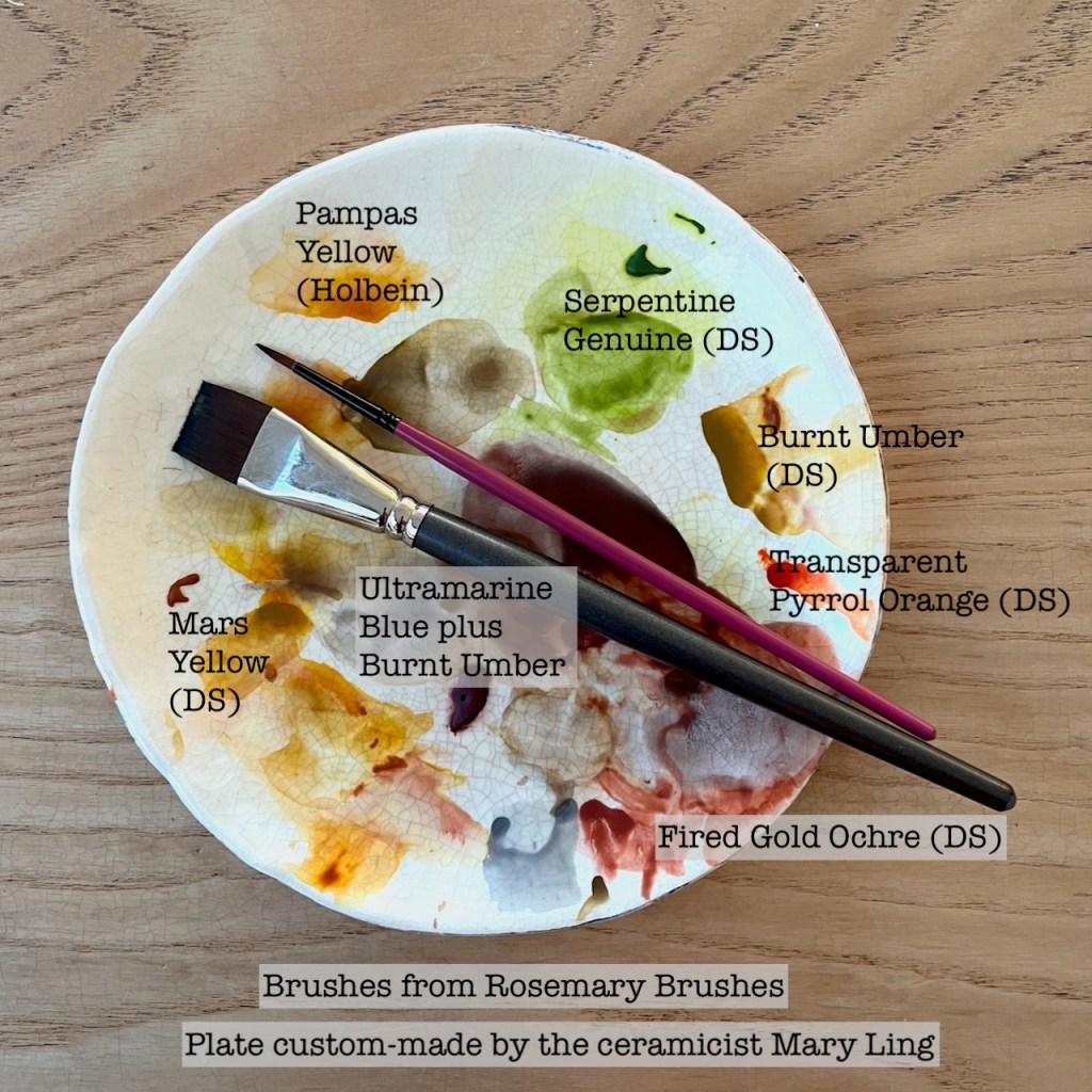
Here are the colours I used:
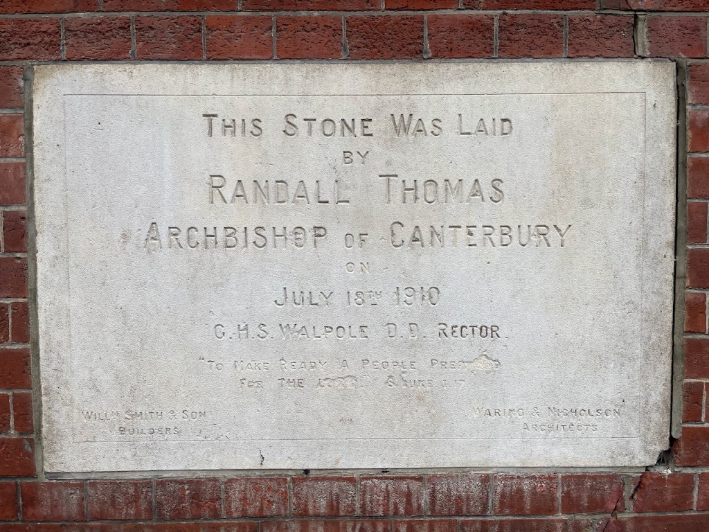
Pelham Mission Hall was completed in 1910. The text on the big stone slab under the window tells me this.
Foundation stone: This stone was laid by Randall Thomas, Archbishop of Canterbury, on July 18th 1910. G.H.S. Walpole D. D. Rector. “To make ready a people for the Lord” Luke 1.17 Waring and Nicholson architects. William Smith and Son Builders.
Buildings often have a foundation stone. Usually they just say who, and when. This one also says why. Its mission, as stated on the stone, was “To make ready a people for the Lord”. This is a line from a verse in St Luke’s gospel in the Christian Bible. The context is this:
And he shall go before him in the spirit and power of Elias, to turn the hearts of the fathers to the children, and the disobedient to the wisdom of the just; to make ready a people prepared for the Lord.
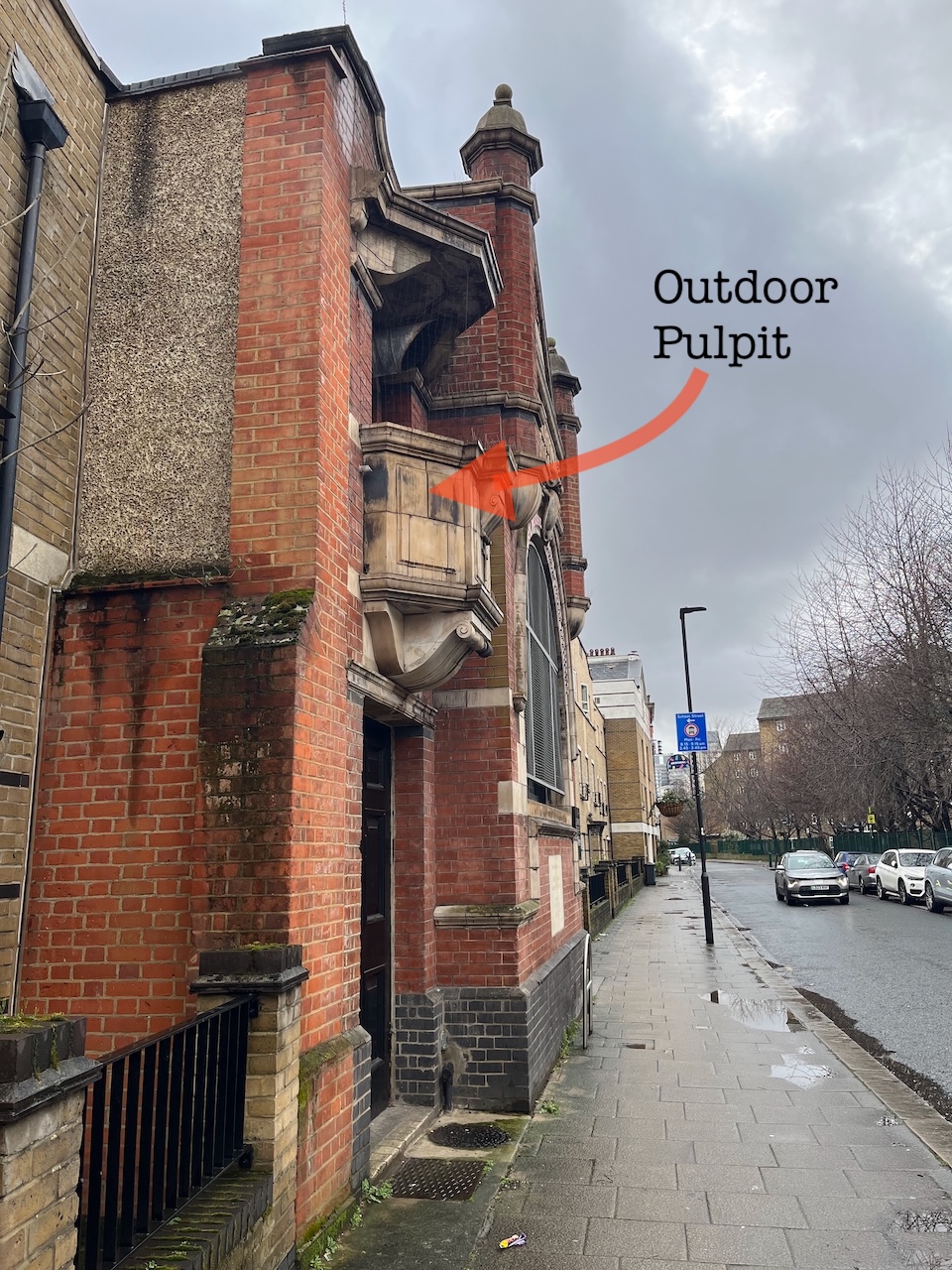
This building was created as an urban missionary post. There was a street market along Lambeth Walk at the time, and up to the 1960s. 2 I imagine the missionaries preaching from their outdoor pulpit to the street traders and their customers. It must have been hard for the preacher to make themselves heard.
View of the Pelham Mission Hall showing the covered outdoor pulpit. Photo (c) JaneSketching, February 2025Picture taken in Lambeth Walk in the 1938, entitled ‘A Crowd Looks on as Miss Dipper Does the Lambeth Walk with Billy Pease the Peanut and Toffee King’. 3
The Hall is named for Francis G. Pelham 1844-1905, 5th Earl of Chichester, educated Eton and Cambridge, who was rector of Lambeth 1884-1894. 4
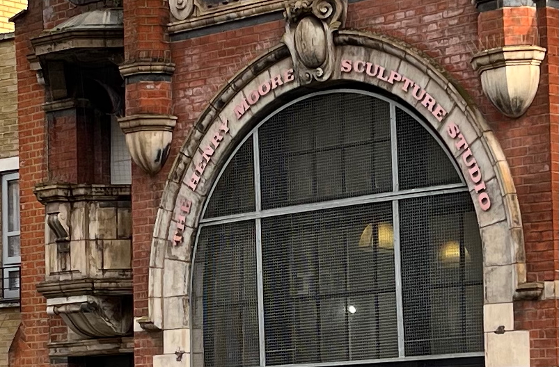
The building is now the “Henry Moore Sculpture Studio at Pelham Hall” part of Morley College. The sculptor Henry Moore donated a small sculpture to Morley College in 1977, which was sold at auction and helped to raise money for the lease of Pelham Hall. In return, the College named the sculpture studio after him, as written on the front of the building5.
Pelham Mission Hall, now The Henry Moore Sculpture Studio. The outdoor pulpit is on the left.
A ventilation pipe from the sculpture studio now exhausts through the outdoor pulpit.
While I was in the Vauxhall Tea House, the sun came out. It was calm in there. A few moments of paradise.
I find the King James’ version here a little ambiguous here in the pronouns. Who is the “he”, who is the “him”? A modern translation: ‘John will prepare the people for the Lord to come to them. The Holy Spirit will lead John as he led Elijah. John will do powerful things as Elijah did. He will help fathers to love their children. He will teach people who do not obey God. Then they will know what things are right. And they will do them. Then they will be ready when the Lord comes.’. Translation: “The Easy Bible”. Thank you to http://www.biblegateway.com for sorting that out. ↩︎
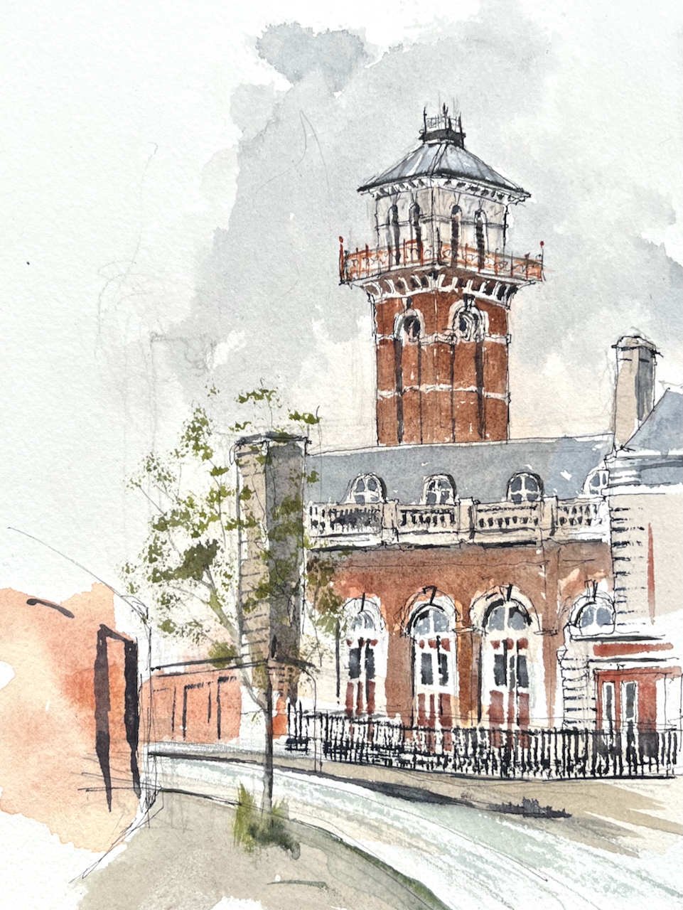
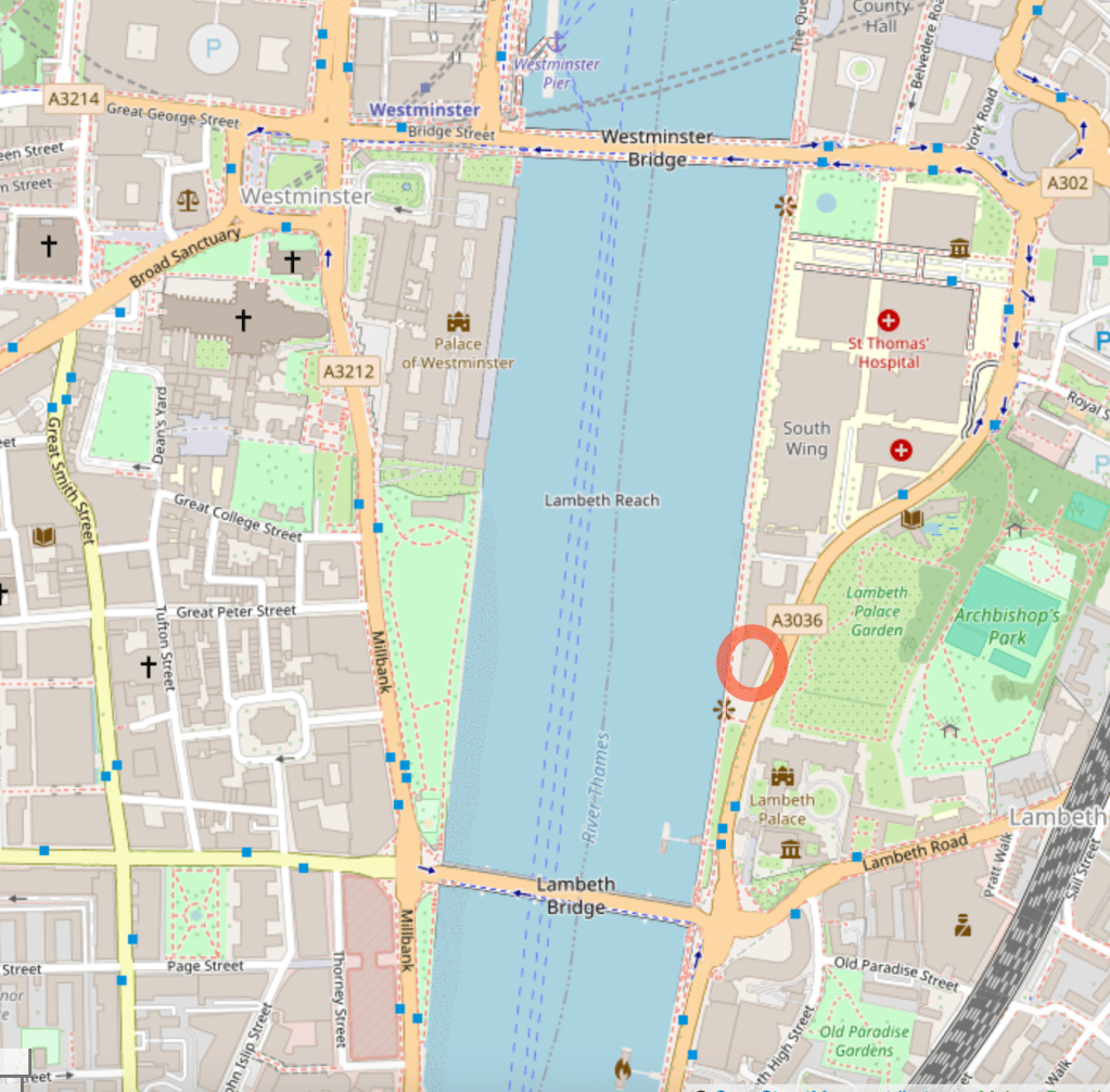
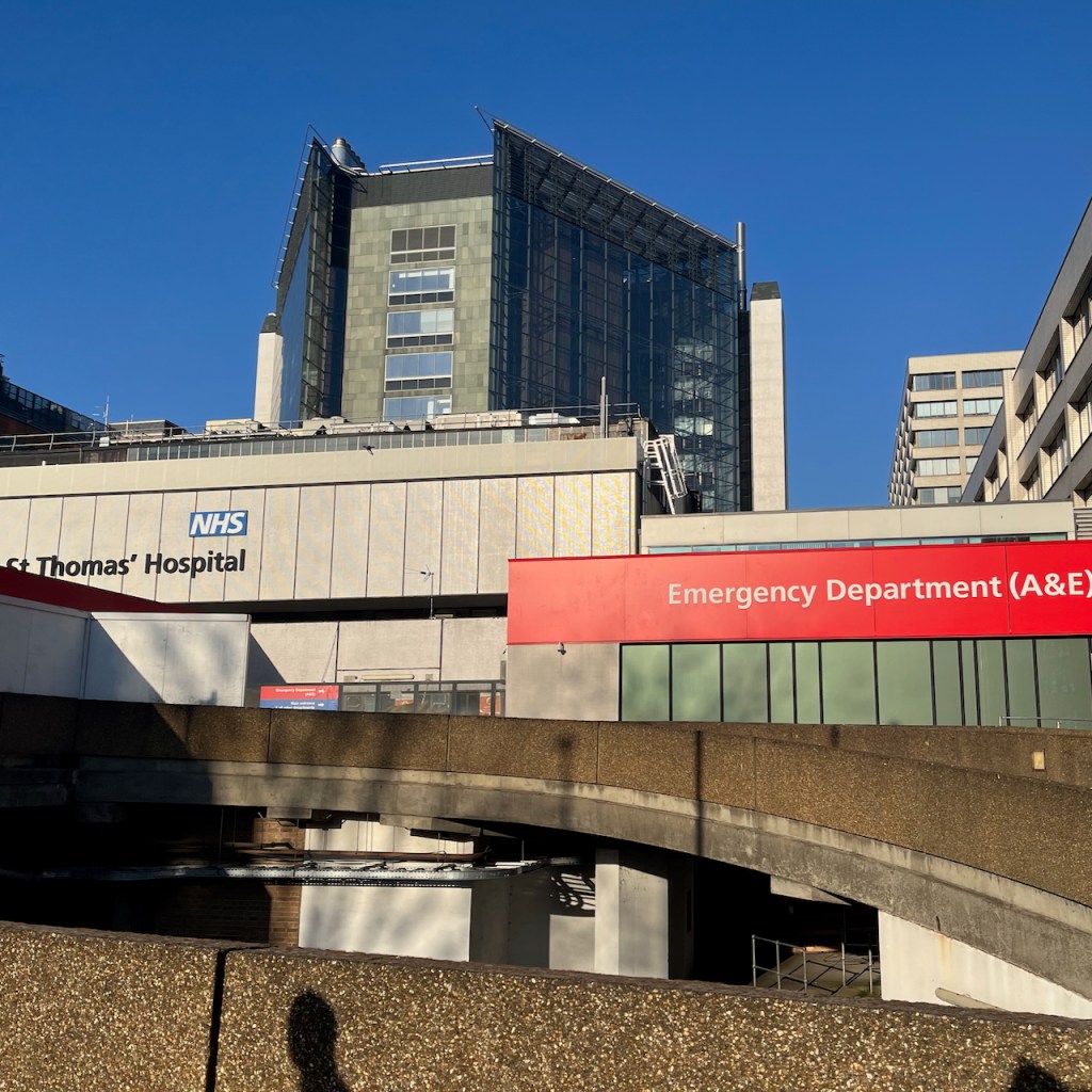
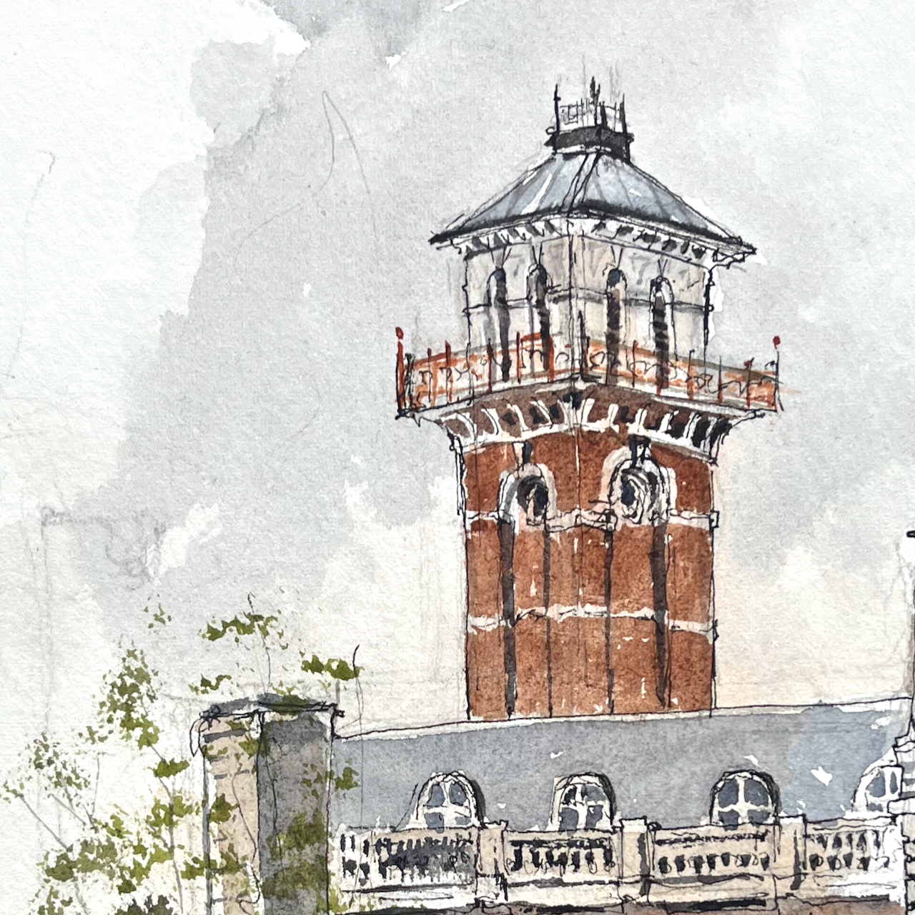
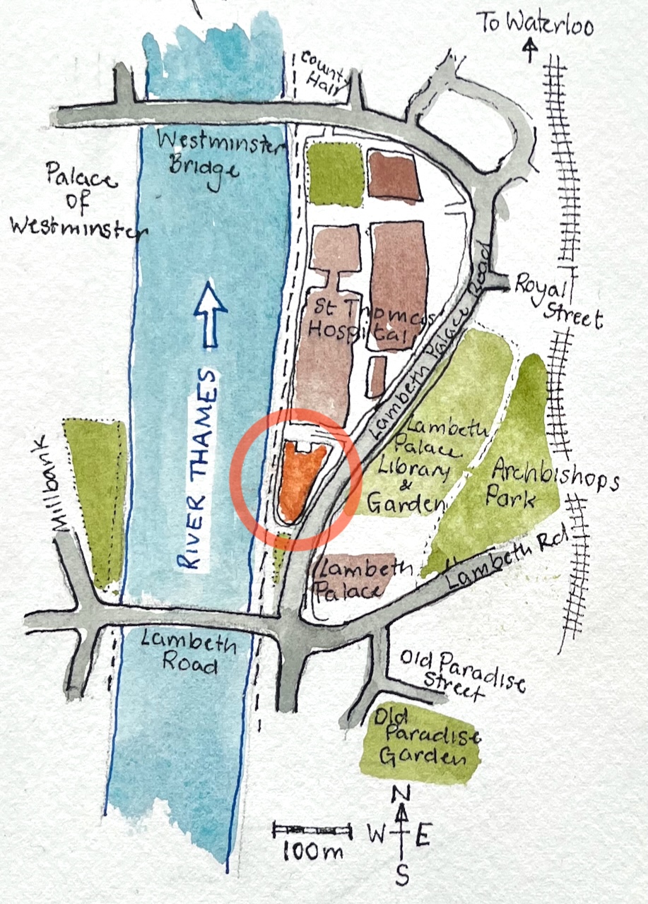
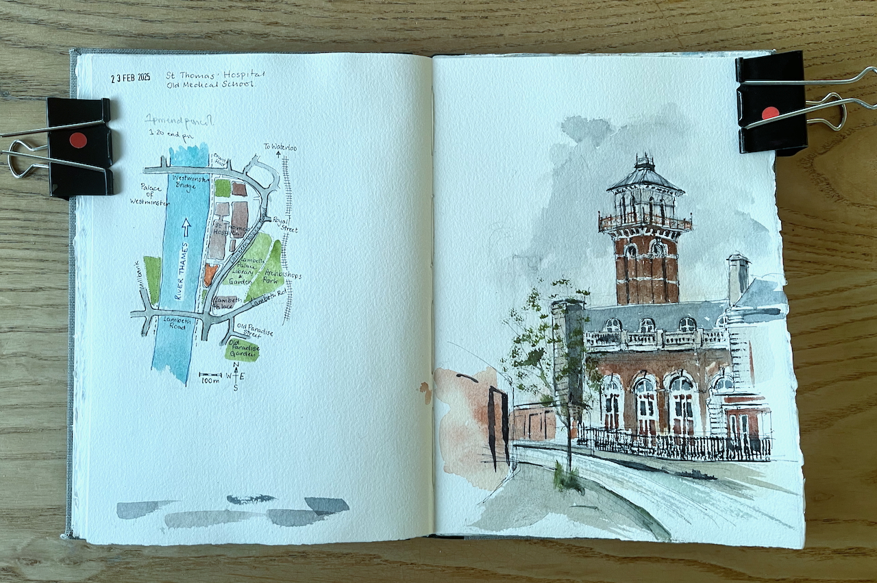
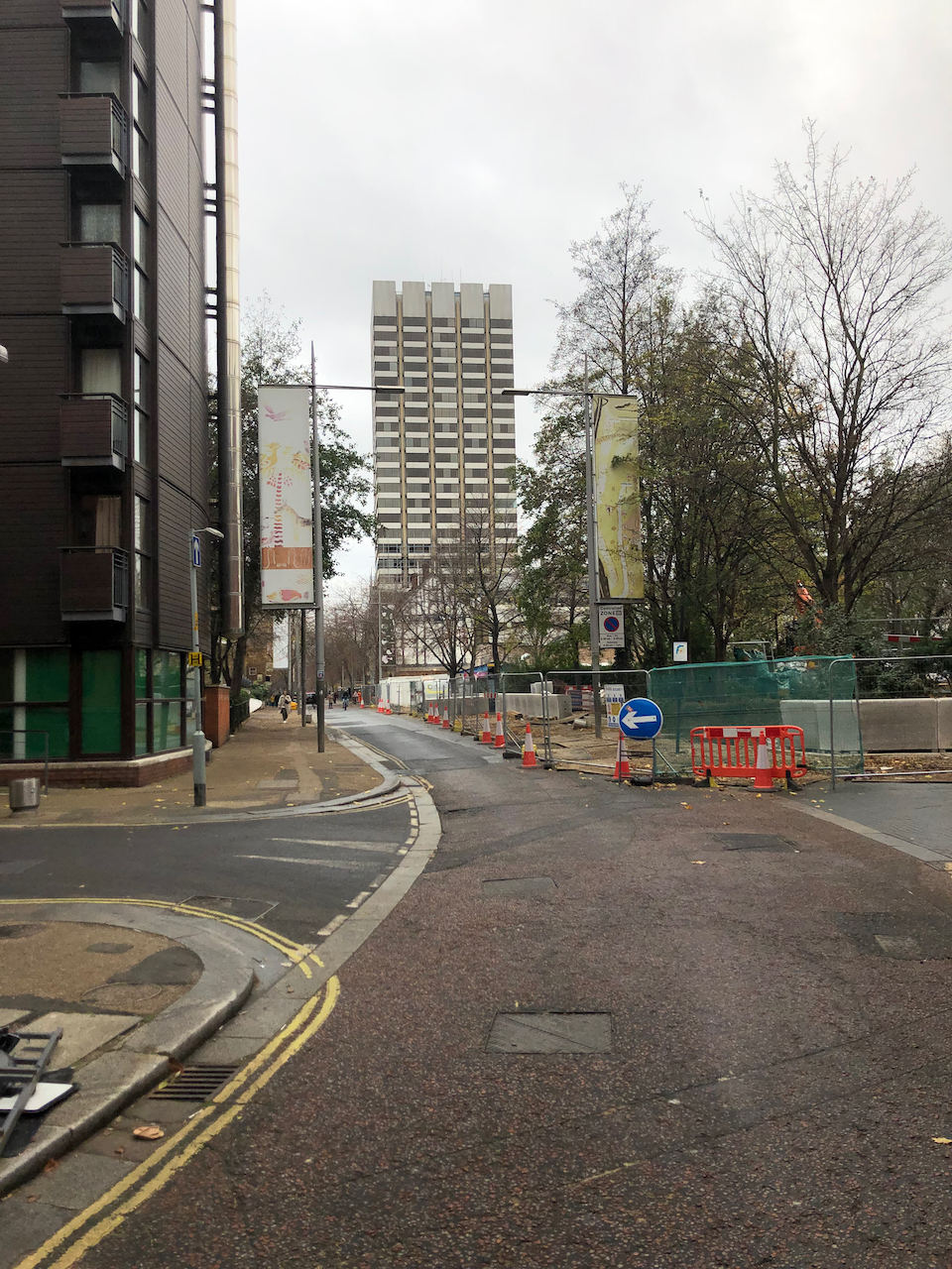
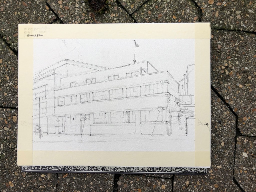
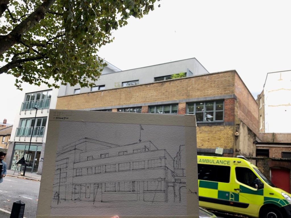
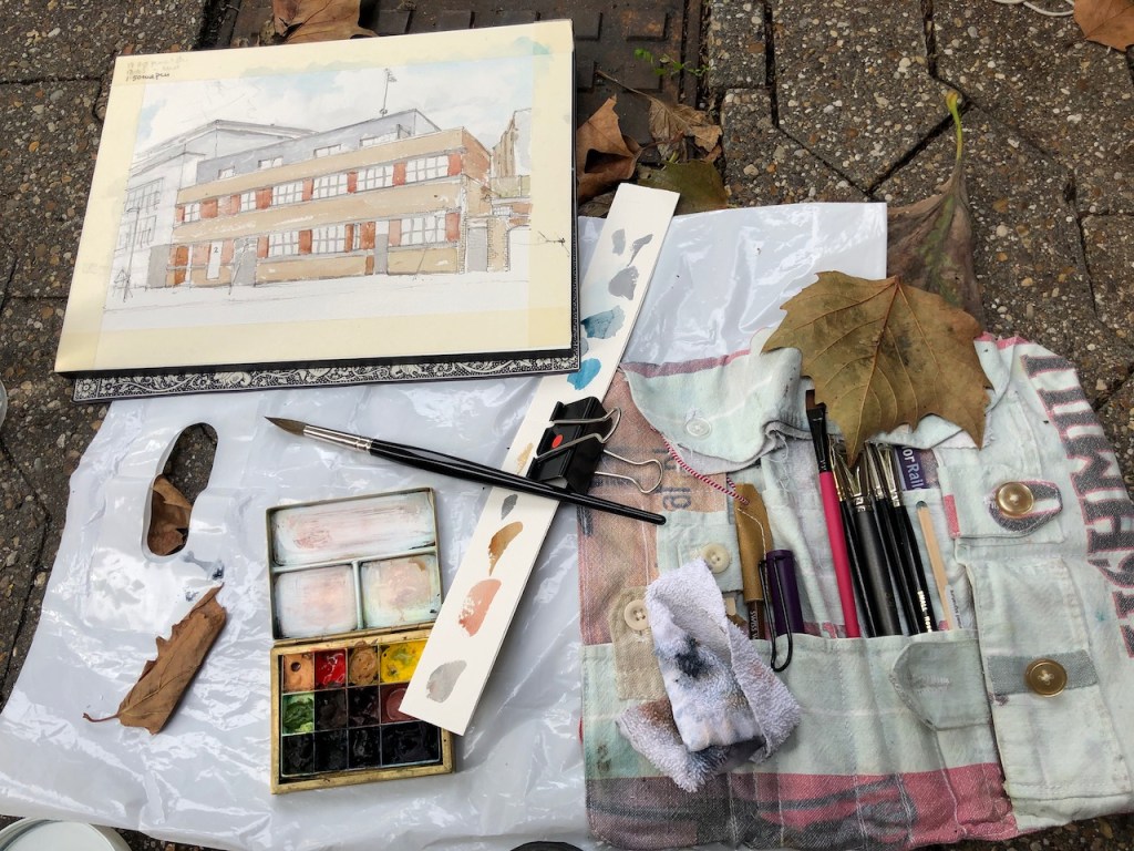
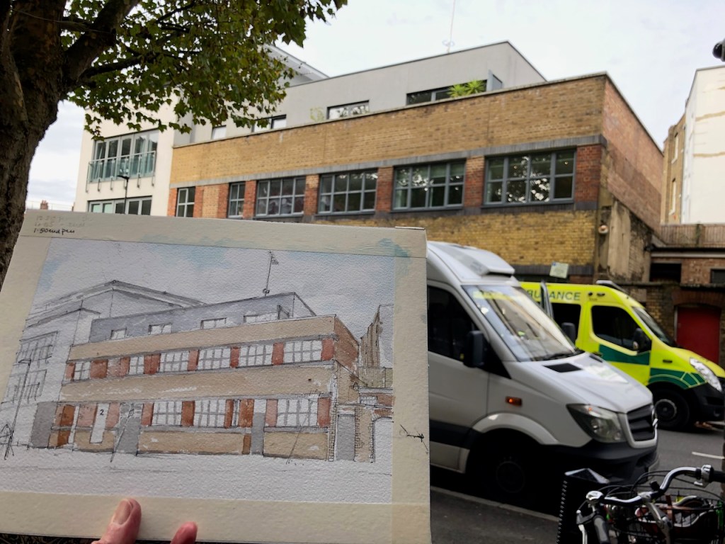
There is a splendid tower south of St Thomas’ Hospital on the South bank of the River Thames. Here it is, sketched from the Lambeth Palace Road.
St Thomas’ hospital medical school, from the Lambeth Palace Road SE1, sketched 23rd February 2025 in sketchbook 15
This tower, and the buildings below it, are right next to the Thames, opposite the Houses of Parliament. It is a splendid position.
Position of St Thomas’ medical school (circled): opposite the Palace of Westminster. Map (c) Openstreetmap contributors. Click to enlarge.
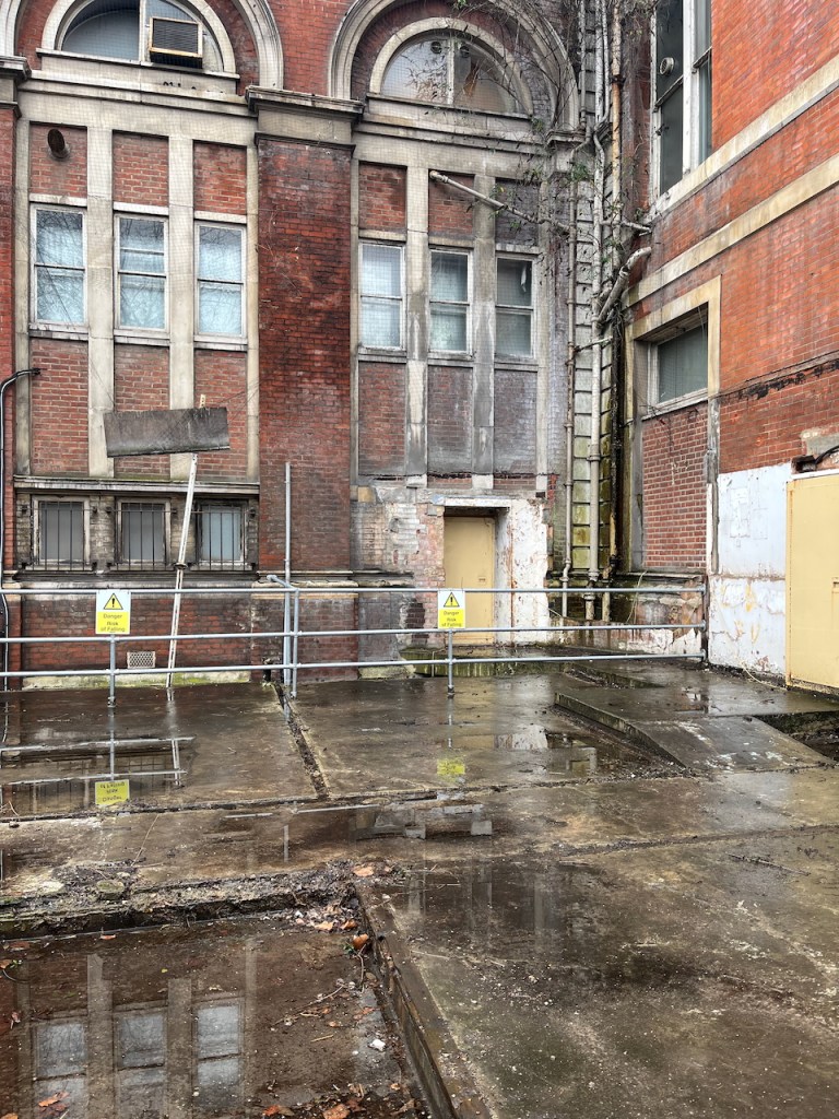
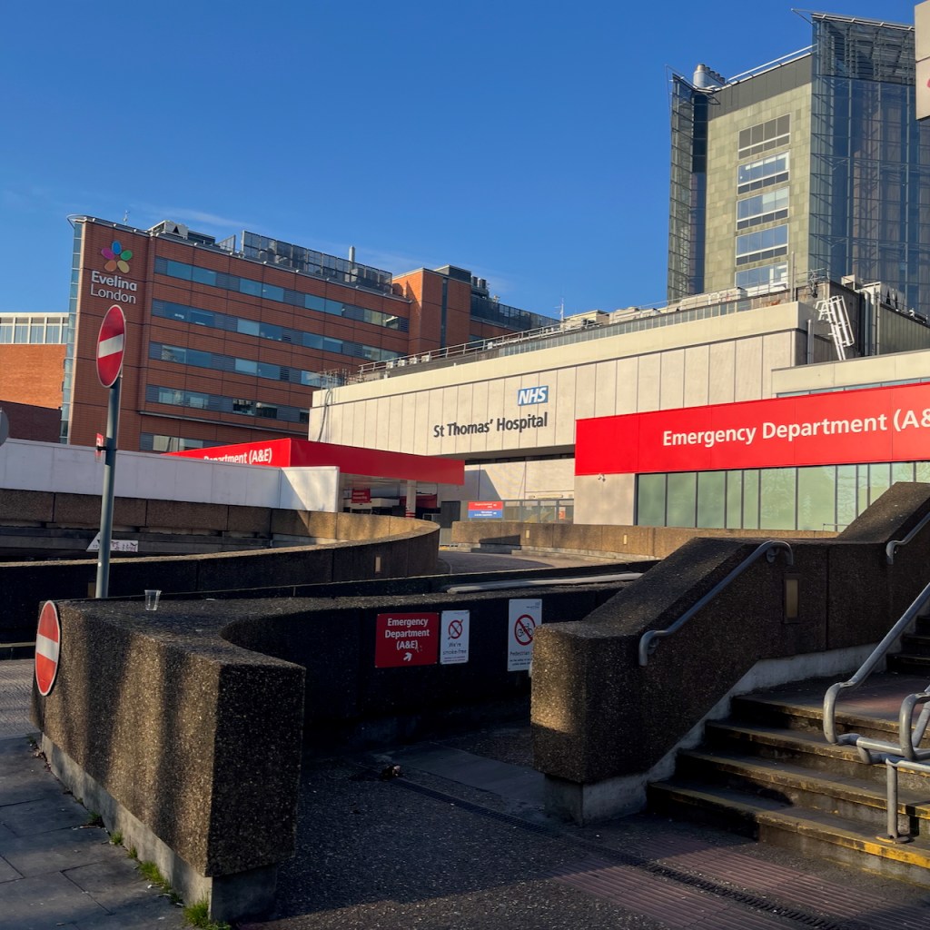
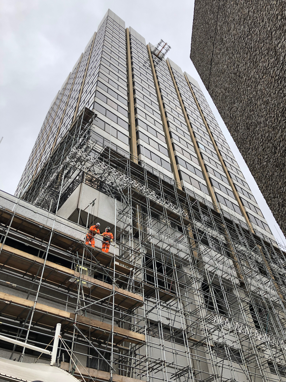
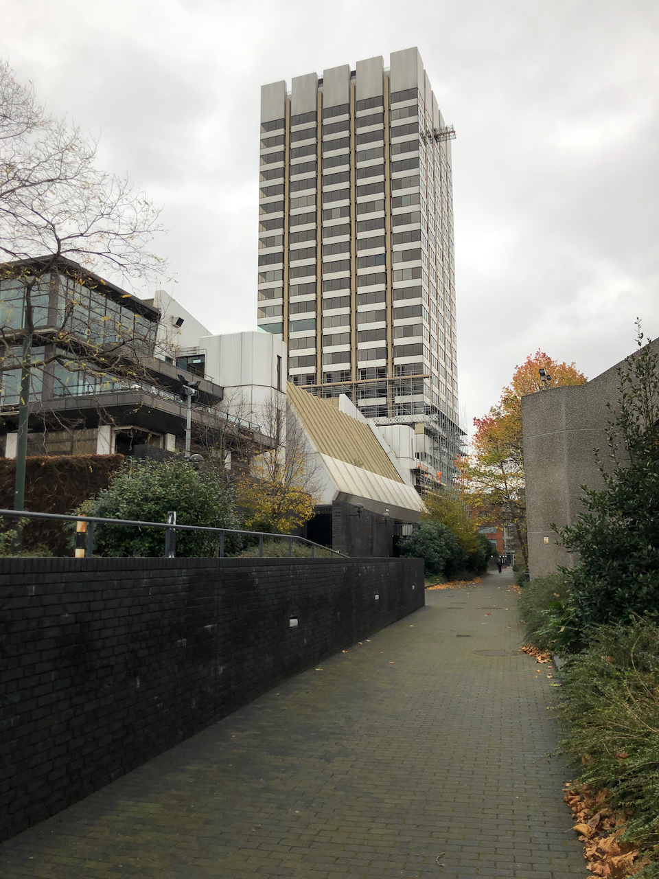
Given this prominent central location, I was astonished to discover that these buildings are derelict.
If you look through the railings which are in my drawing, this is what you see:
Block 9, St Thomas’ Hospital, 23 Feb 2025, photo (c) JaneSketching.
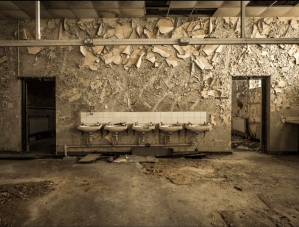
Inside the old medical school: photo from Dibsphotography.com . Click the image to go to their site: many more photos are there.
Urban explorers have posted pictures of the sadly decayed interior. For example on this link and this link and this link. Some have ascended the tower and posted pictures taken from up there. Their photographs show an abandoned lecture theatre, peeling plaster, elegant fireplaces covered in dust and mould, laboratory samples lying about gathering dust, molecule trees in a tangled heap, test tubes and old notes.
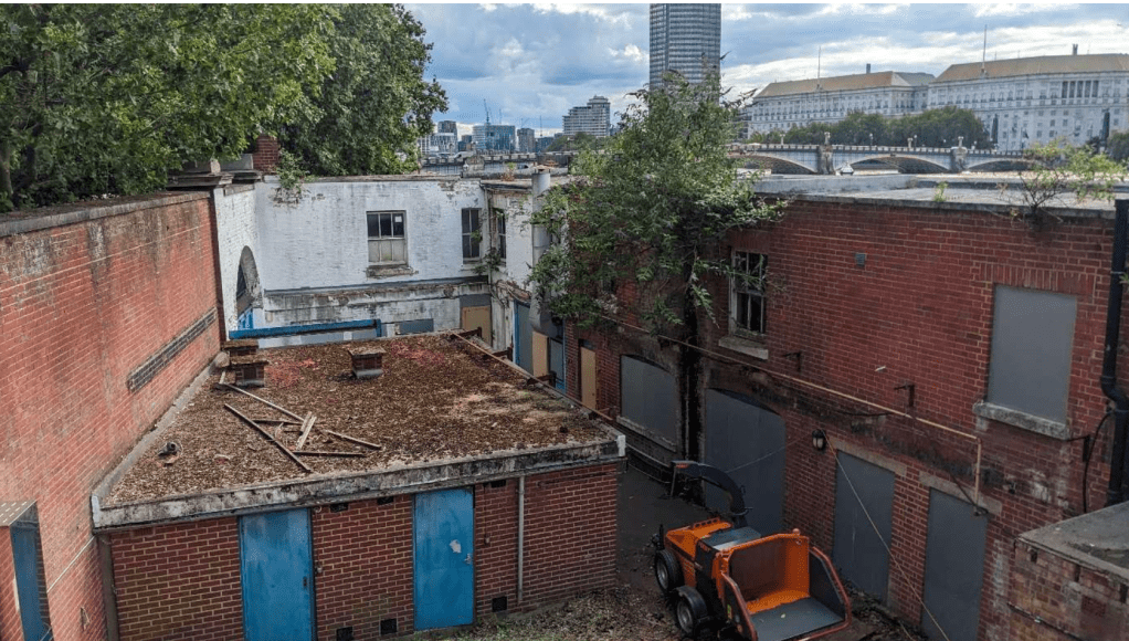
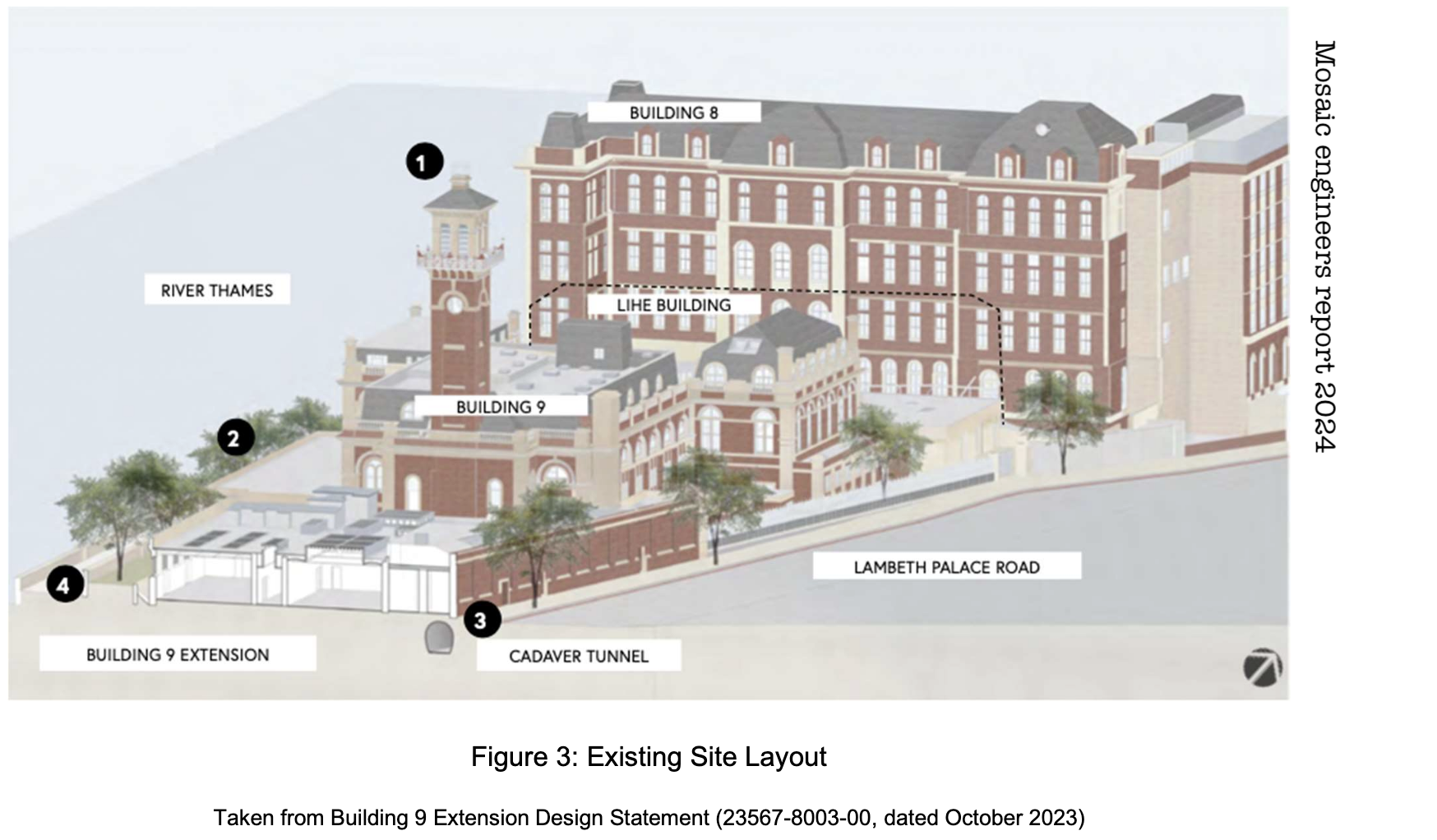
As well as the grand buildings, there are low-level houses within the site.
Looking South, below the tower. Picture from Mosaic Engineers report, see note 1
So what’s going on?
This part of St Thomas’ hospital was a medical school and library since the hospital was built here in around 1870. This part of the site was abandoned 20 years ago, as medical schools moved and merged. Then, it seems, nothing happened for 10 years, as the lecture theatres, laboratories and corridors gradually decayed.
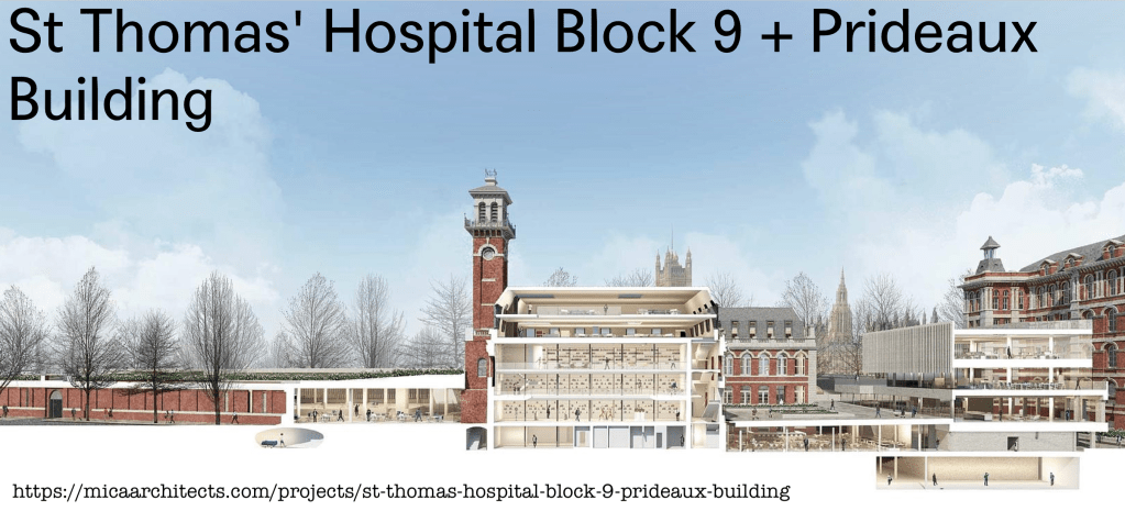
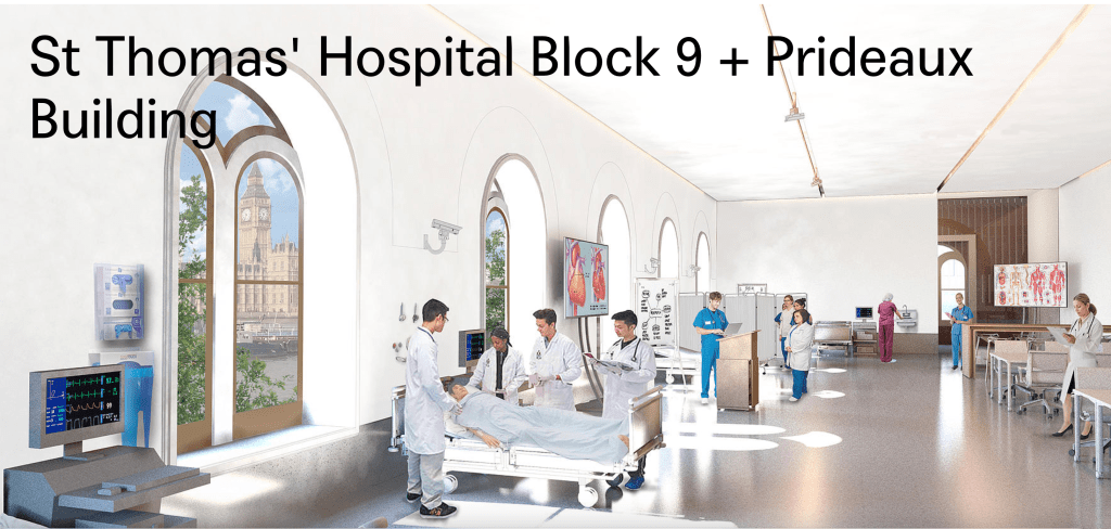
In 2015, there was a plan. The website for MICA architects shows a proposal for a new medical school on this site. This proposal is dated “2015-ongoing”. Click the image below to see their drawings of radical new buildings, and future medical students engaged in lectures and conversations, with spectacular views of the Houses of Parliament through the huge windows.
Lambeth Council granted planning permission in 2016, reference 16/02387/FUL. That was nearly ten years ago. Still the site remains derelict.
However, now it seems that progress is happening. On the Lambeth Council planning site, there is an impressive in-depth survey of the site by Mosaic Civil engineers, dated July 2024. They look at the Geology, Soil Chemistry, Hydrogeology, Hydrology, Flood Risk, Unexploded Ordnance, Ground Stability, and Invasive Weed, to name but a few. Hydrogeology seems to be answering the question: are there any aquifers or wells here? (answer: no). Hydrology is answering the question: how does the water flow around here, and will any sewage or nasty chemicals wash into the site? (answer: well, there is a Thames Water “storm sewage overflow” pipe into the Thames just upstream from here….). This report also contains photos, and a useful history of the site (Note 1).
St. Thomas´ Hospital was constructed in its current location in 1871 following the construction of the Albert Embankment (which required reclamation of land from the River Thames)and the demolition of old boatbuilding and barge house sites which dated back to the 1680s.” (page 6, history of the site)
Mosaic engineers report page 6, history of the site
The volume “London – South” of the Pevsner architectural guides, says that St Thomas’ was..
…built on the current site by Henry Currey 1868-71, one of the first civic hospitals in London to adopt the principle of “Nightingale” wards to allow maximum ventilation and dispersal of foul air.
Florence Nightingale (1820–1910) was a pioneering nurse and reformer of the profession. She had a profound impact on the architecture of hospitals.
“The first principle of hospital construction is to divide the sick among separate pavilions,” she wrote in her 1863 ‘Notes on Hospitals’. Pavilions were large, rectangular, open-plan wards that made it easier for nurses to supervise all patients. These wards became known as Nightingale Wards.”
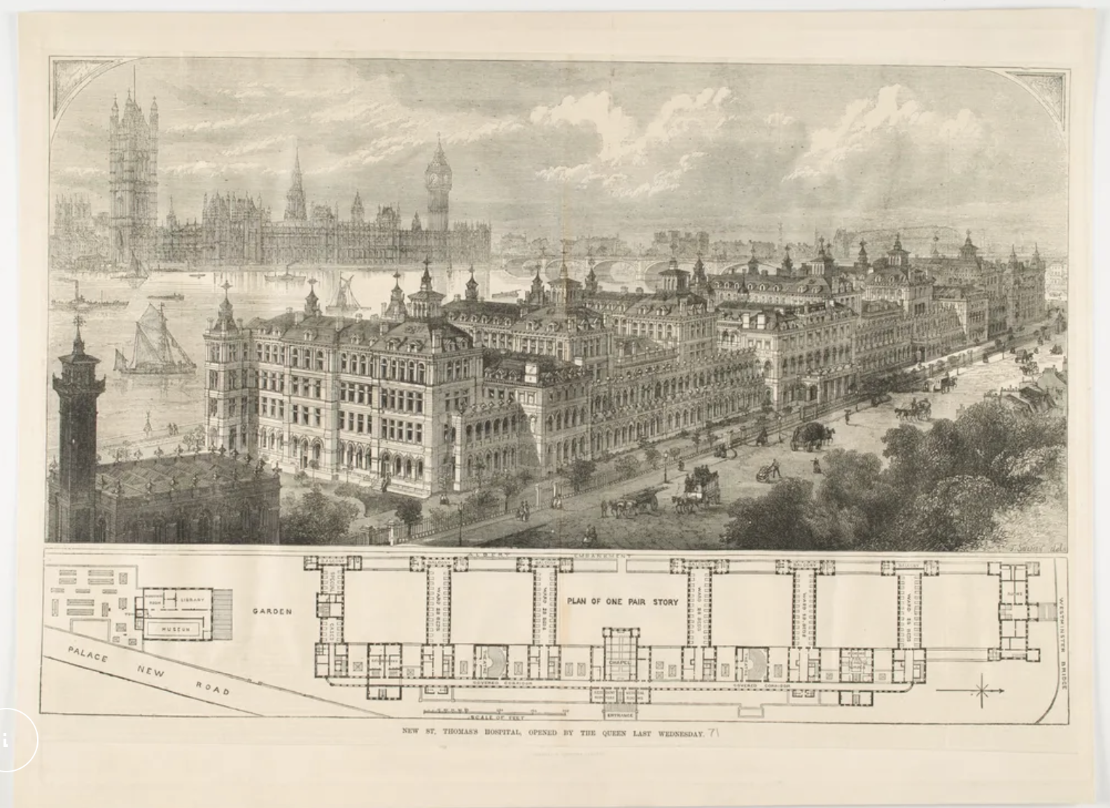
The London Museum website presents a picture of St Thomas’ hospital as an example of this architecture. There were seven such pavilions. As you see in the pictures below, the hospital rivalled the Houses of Parliament in its size and pinnacled magnificence.
“St Thomas’ hospital opened by the Queen last Wednesday”. This picture is from the London Museum website. The Tower I sketched is on the left.
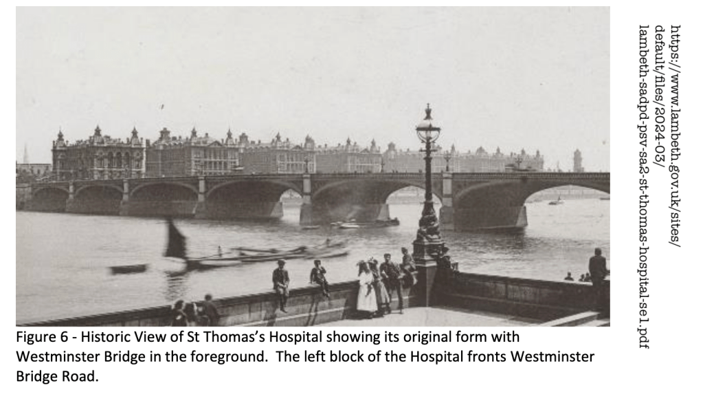
Here is a historic photo from the other side of the river. Westminster Bridge spans the river. The tower I sketched is on the right.
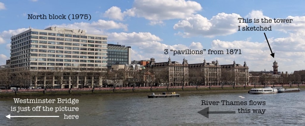
The hospital looks different today. The North pavilion was destroyed by enemy action in the 1939-45 conflict, and other parts of the building were damaged beyond repair. The only part remaining was the Tower to the south, and 3 of the southernmost pavilions. A large block was built in 1975 to replace the north pavilion. The website “Ebb and Flow” has some excellent pictures from 2023, showing the 1975 building in detail, and paying tribute to the dedicated people who work in this building.
View of St Thomas’ Hospital from the North Bank. March 2025. Photo (c) JaneSketching
Below is a photo from August last year. The 1975 buildings are on the left, the original buildings, still derelict, are on the right. In front is the National Covid Memorial Wall.
View of St Thomas’ from the Thames path, August 2024. (Photo (c) JaneSketching. )
Evelina building on the right, close to the old buildingMix of old and new buildings at St Thomas’A&E deptEvelina hospital on the left.St Thomas’ hospital, views of old and new buildings, from Lambeth Palace Road.
Now we can expect the renovation of the southern part of the hospital.
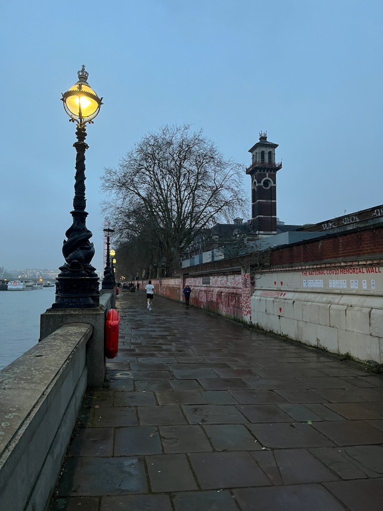
I have run and walked past this building for twenty years. I’m so glad that doing the sketch has prompted me to discover what’s going on behind the high walls. Here are some snapshots from the embankment. The hospital is on the right, behind the wall.
Early morning, 17th March 2025Early morning 12 January 2006. Mobile phones weren’t so great at taking photos then.
I thank the ambulance staff, administrators and medical professionals of St Thomas’ hospital who were there when needed after a terrifying incident. We all have such incidents in our lives. The hospital is more than a building. It is a place of caring, a community and a store of knowledge, from Nightingale to now.Thank you NHS.
Note 1: The report from Mosaic civil engineers is called “Mosaic Civil and Structural engineers report FINAL REPORT PHASE 1 PRELIMINARY CONTAMINATION RISK ASSESSMENT REPORT 01/07/2024″
It is on this link, as part of the ongoing planning proposal.
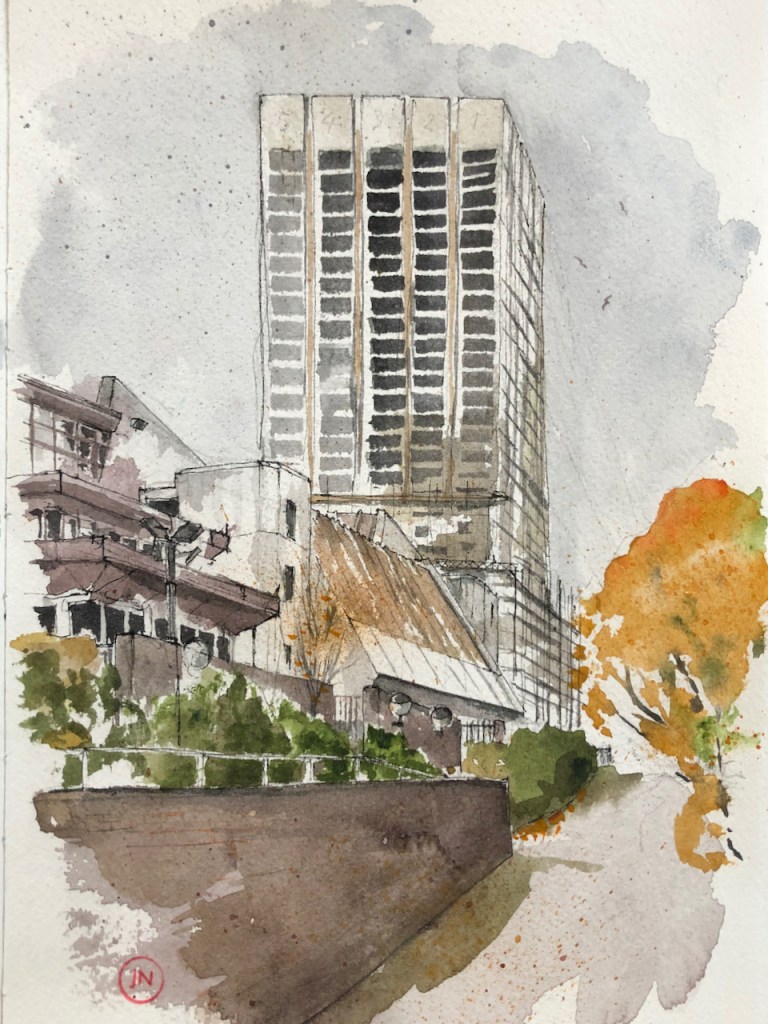
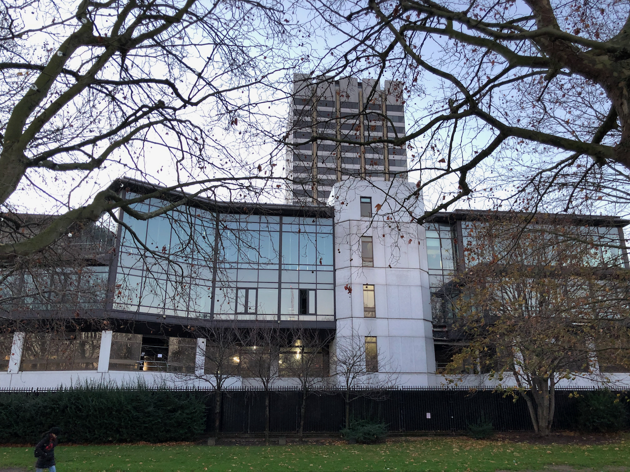
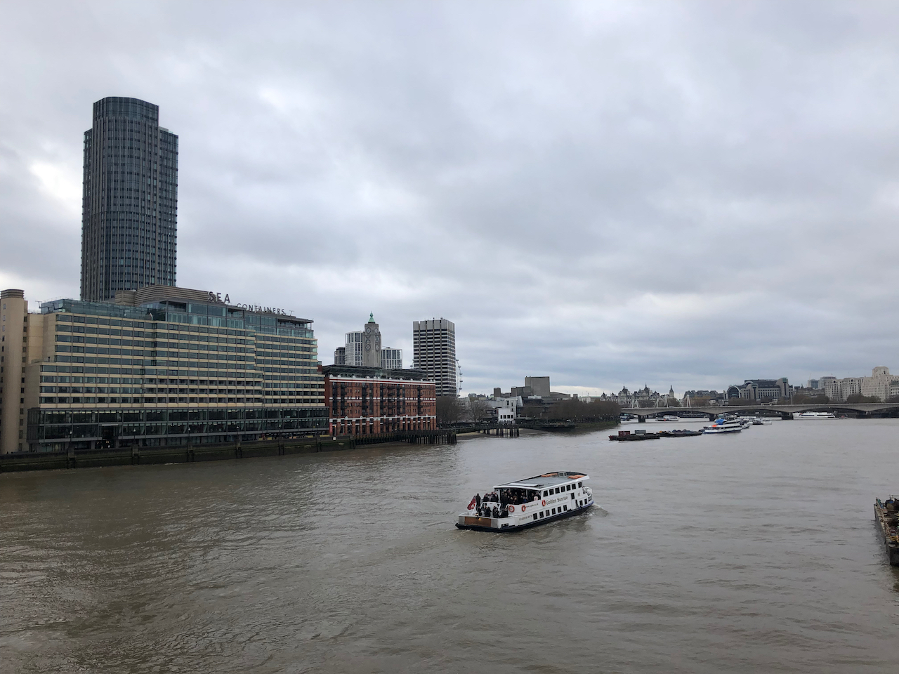
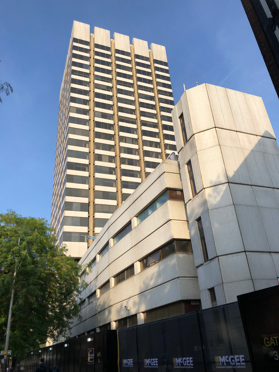
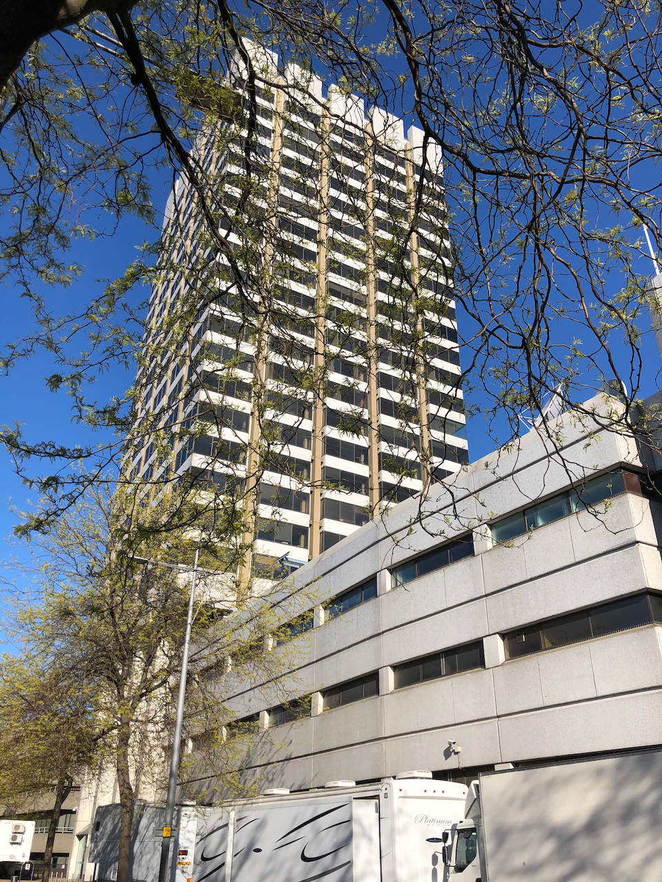
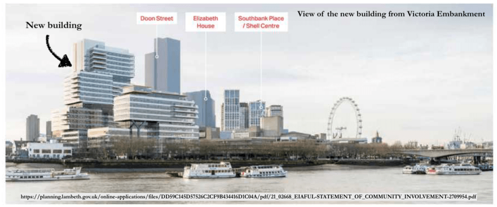
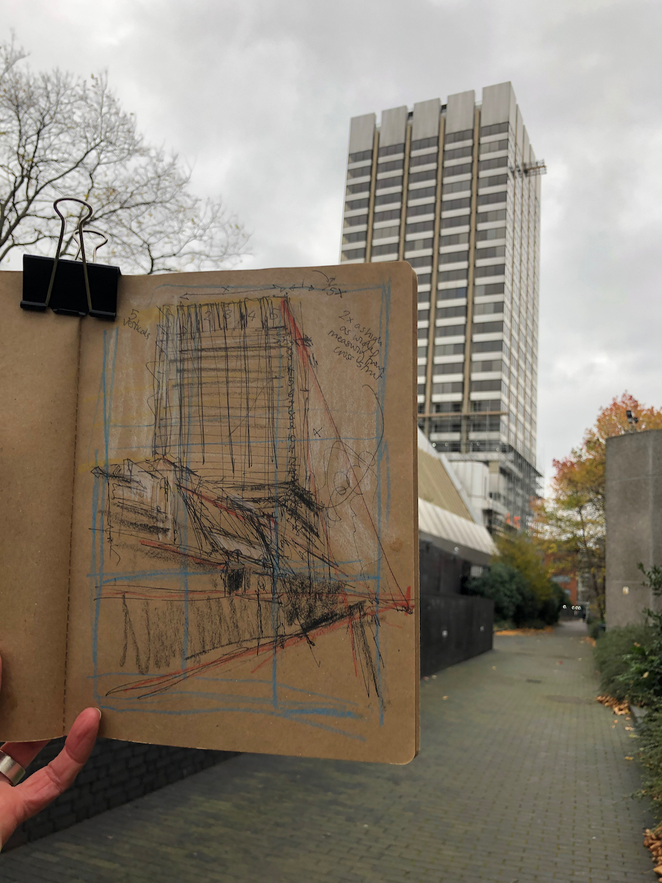
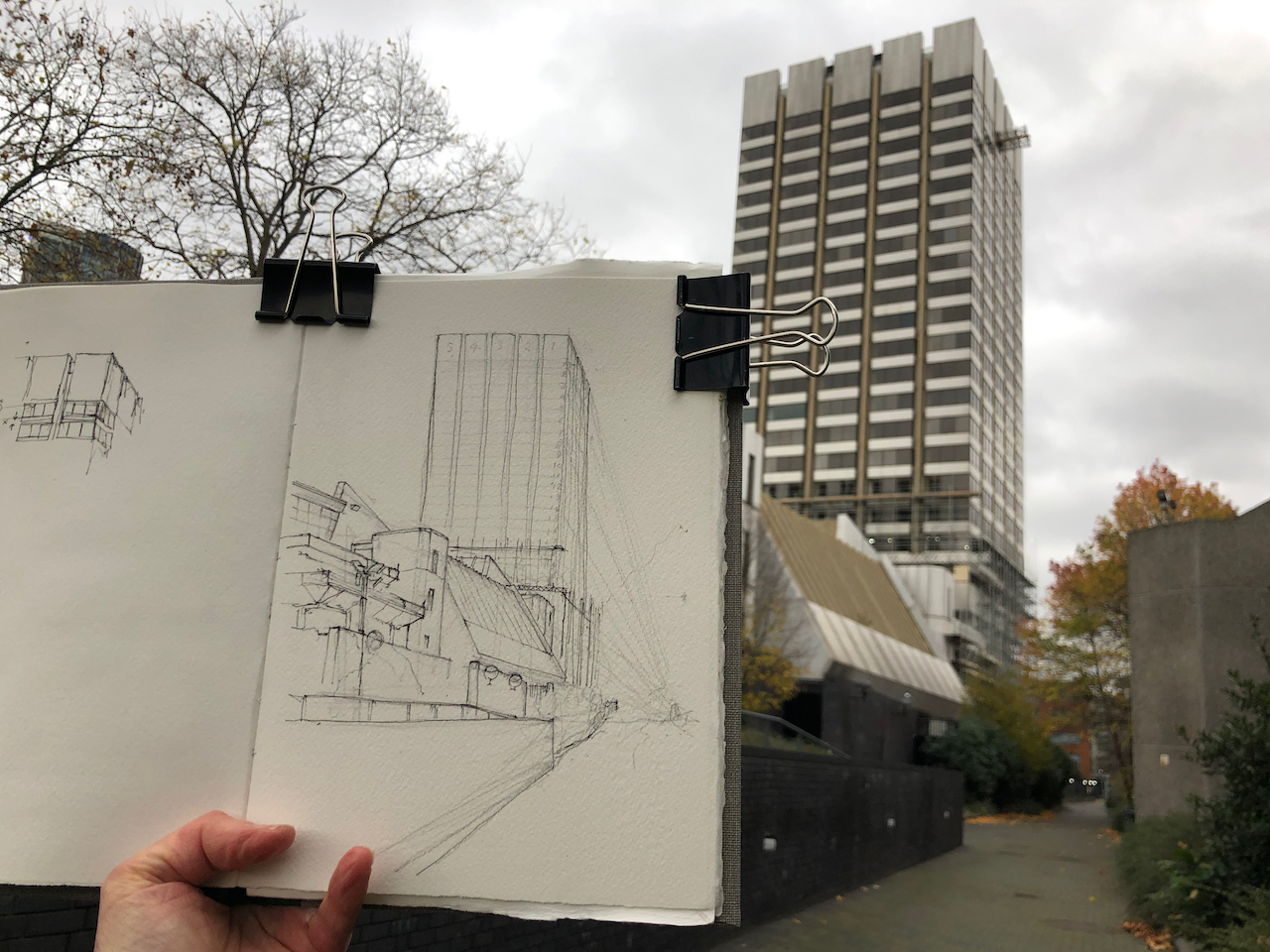
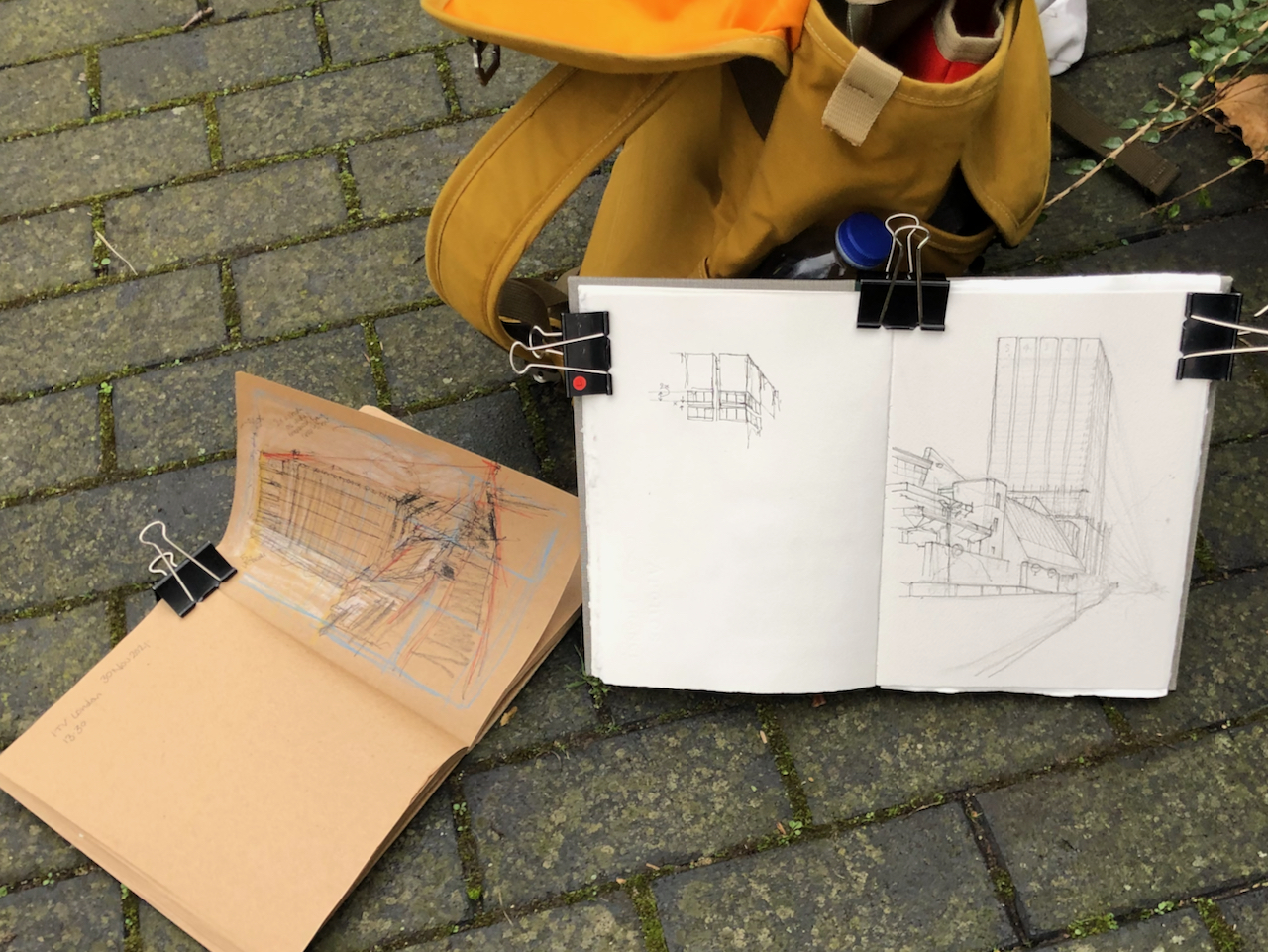
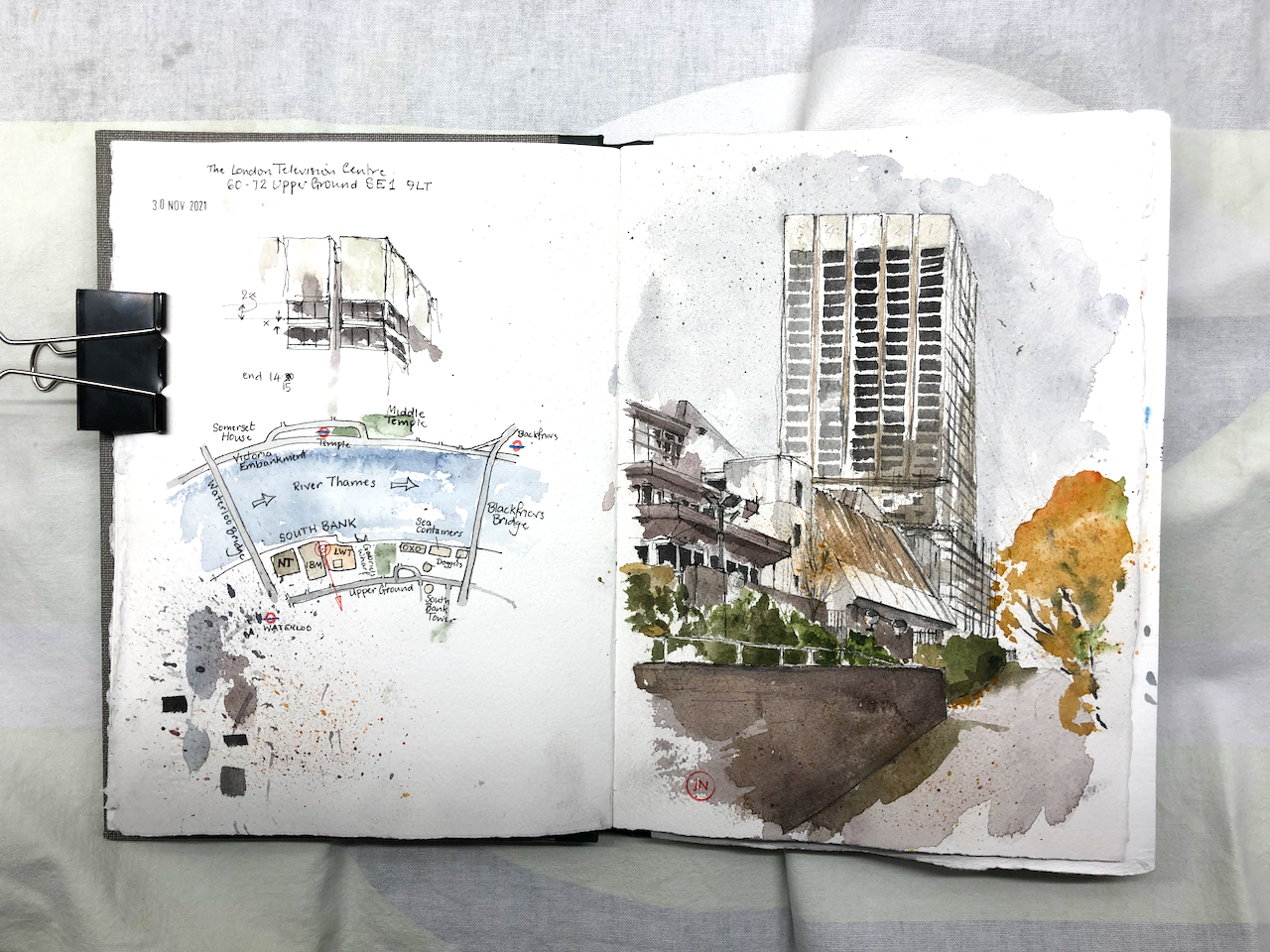
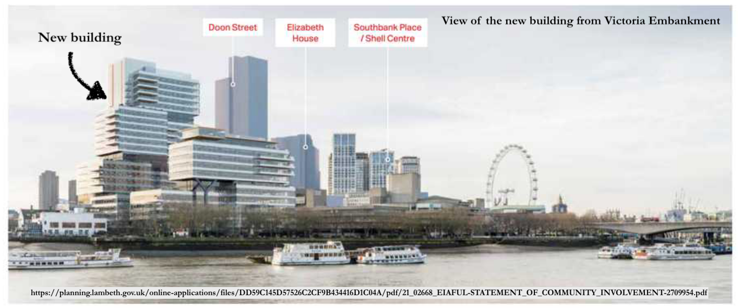
Here is a view of the London Television Centre, 60-72 Upper Ground, SE1. It is on the South Bank of the river Thames, a little to the East of the National Theatre and the Royal Festival Hall. It was completed in 1972 to the design of Elsom Pack & Roberts.1
London Television Centre, 30 November 2021, 10″ x 7″ in Sketchbook 11
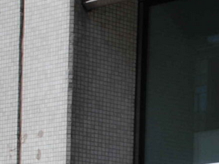
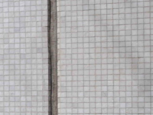
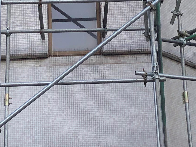
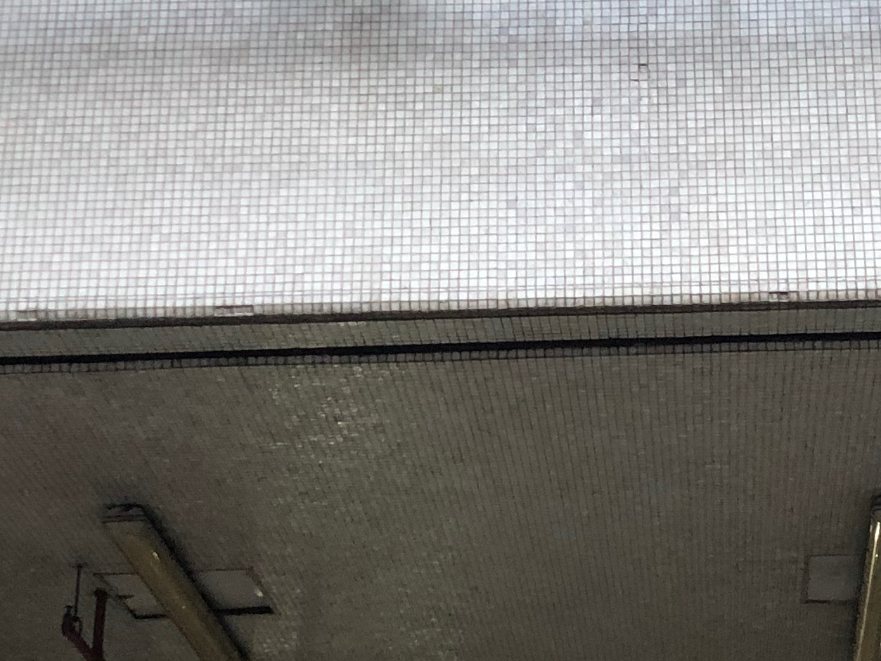
Appreciate this building while you can – it is bring demolished. Admire the variety of the sloping roofs, the unexpected angles, the terraces overlooking the river. Appreciate the unexpected finish: it is covered in tiny, white, glistening tiles.
The planning application reference is “21/02668/EIAFUL” submitted to Lambeth Council on 5th July 2021. It says:
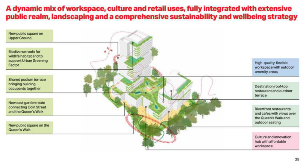
Demolition of all existing buildings and structures for a mixed-use redevelopment comprising offices, cultural spaces and retail uses with associated public realm and landscaping, servicing areas, parking and mechanical plant.
Interestingly the status, as of today, is “awaiting decision”, which is strange because when I was sketching the site earlier this week, demolition was definitely in progress: both visible and audible.
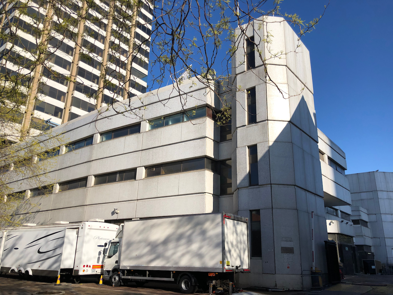
For the record, here are some pictures of the current building (click to enlarge):
View from “the Queens Walk” riversideFrom the riversideThe low level balconies along the riverView from Blackfriars BridgeLooking West along Upper GroundLooking West along Upper GroundNov 30th 2021, demolition in progressLooking South from the riverMay 2021May 2021 – from Upper GroundMay 2021, Upper GroundView from the river, IBM building on the rightExisting building (2021, May and November)
The proposed new building will be taller than the current tower, and the current low-level buildings are to be replaced by a wide block.
The proposed new building will be wider and taller than the existing buildings.It seems as though we will be able to walk through the new development. And there will be cafés and restaurants on the river side. (Picture ref: see Note 2)
Here are some maps to show where this is:
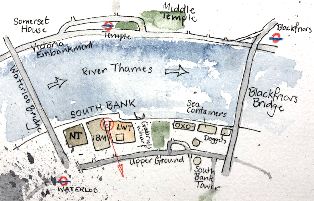
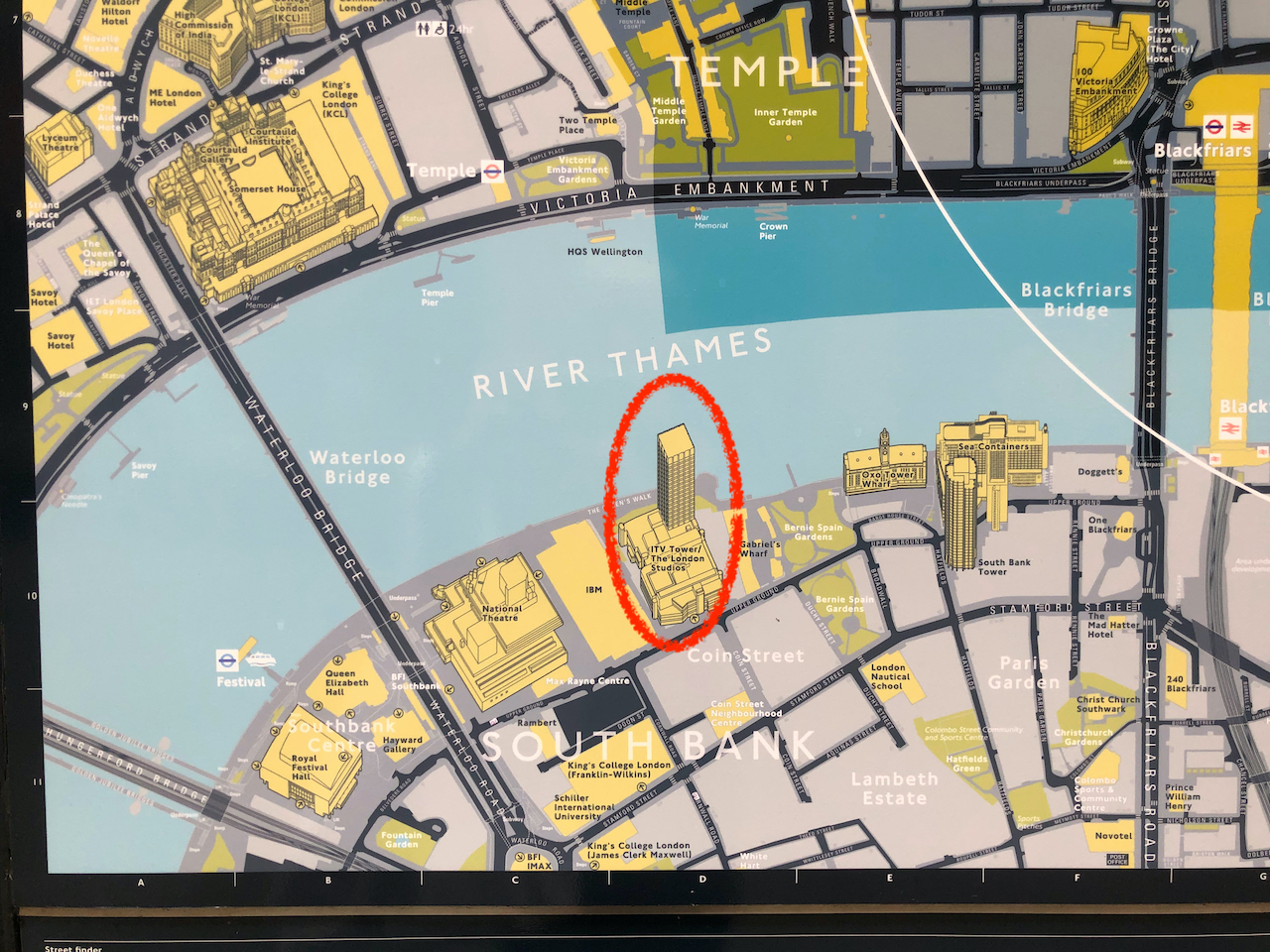
Sketch map showing viewpoint of the drawing. NT= National Theatre, IBM = the IBM building, LWT = London Television building, OXO = the OXO TowerPhoto of a public map in the City of London. [Oddly, they have got the building reversed. The tower is not by the river, as shown on the City of London Map, but on the inland side.]
I drew the picture from the inclined plane leading up to Queens Walk by the river. There must be a splendid view from the adjacent IBM building. If you work there and you’d be prepared to host me so I could draw from the balcony, then do please get in touch.
Here are some photos of my work in progress on the picture. It was cold, wet and windy, and there were a lot of seagulls. I put the seagulls in the picture, to the right of the tower. I finished the colour at my desk.
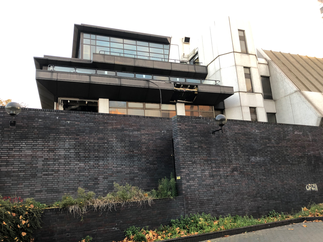
I have also drawn Colechurch House, another 20th Century building in the area due for demolition:
Aficionados of 20th Century brutalist architecture need to hasten to appreciate Colechurch House. It is due for demolition and redevelopment. This month’s post in the marvellous “London Inheritance” site informed me about the planning application, so I rushed over there to draw a picture before the building became swathed…
“When London Weekend Television decided to build its own modern studios, it chose a site on the South Bank close to the National Theatre. The architectural practice of Elsom Pack and Roberts were commissioned to design the building. Originally known as Kent House, their building involved a 21 storey tower rising above a podium that houses the television studios. Construction started in 1970 and the first transmission was in 1972. It became known as The South Bank Television Centre and it was considered to be the most advanced television centre in Europe at that time.”
Note 2: Picture of the new building and plan from the Statement of Community Involvement, downloaded 2 Dec 2021.
For comparison, here are the two views – the proposed development and the current view from Victoria Embankment. The visual of the proposed development shows various tall buildings which do not yet exist. The “Doon St Tower” is a proposed 43 storey tower on the inland side of Upper Ground from the National Theatre. It has planning permission (2010) but has not been built. Another tall building shown on the view of the proposed development is “Elizabeth House” a.k.a “One Waterloo”. This is set of buildings, 15 to 31 floors, next to Waterloo Station. It also has planning permission (19/01477/EIAFUL Feb 2021) but has not been built.
Click a button below to share this post online, email it, or print it:
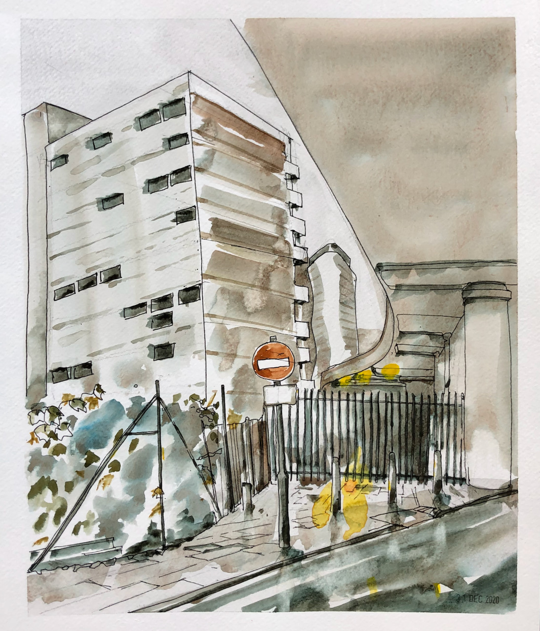
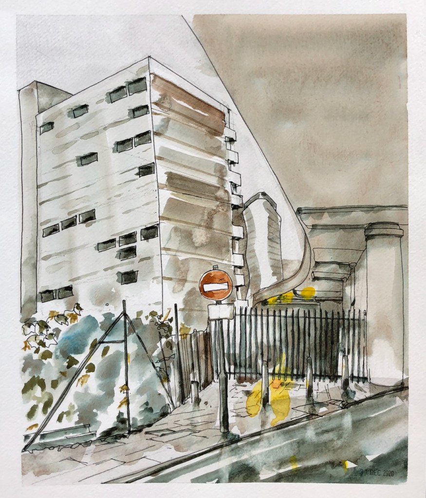
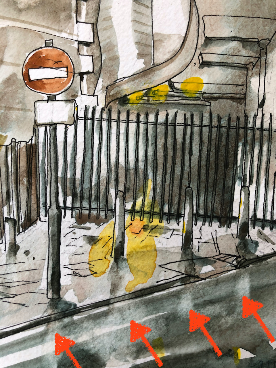
There are some wonderful railway arches near Waterloo. They are architectural marvels, with striking mathematical curves and uncountable numbers of bricks. Here is a view from underneath one such arch, on Carlisle Lane, looking North towards Waterloo.
Carlisle Lane, looking North. 12″ x 10″ From photo reference, 31st Dec 2020
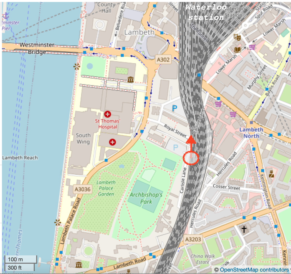
Map showing location of drawing, (c) Open Street Map contributors. Click to enlarge.
The building on the left of the picture is “Canterbury House” on Royal Street, built 1959-1960. The greenery at the front is part of gardens and allotments, adjacent to Archbishop’s Park.
The white notice below the “No Entry” sign says “Except cycles”.
Here is a close up of the picture. The parts marked with arrows show where I lifted the wet paint off the paper to make a white mark.
The main colours are Phthalo Turquoise, Fired Red Ochre and Mars Yellow, with a bit of Transparent Pyrrol Orange for the traffic sign. This is on a sheet of Jackson’s watercolour paper, 12″ x 10″.
Click a button below to share this post online, email it, or print it:
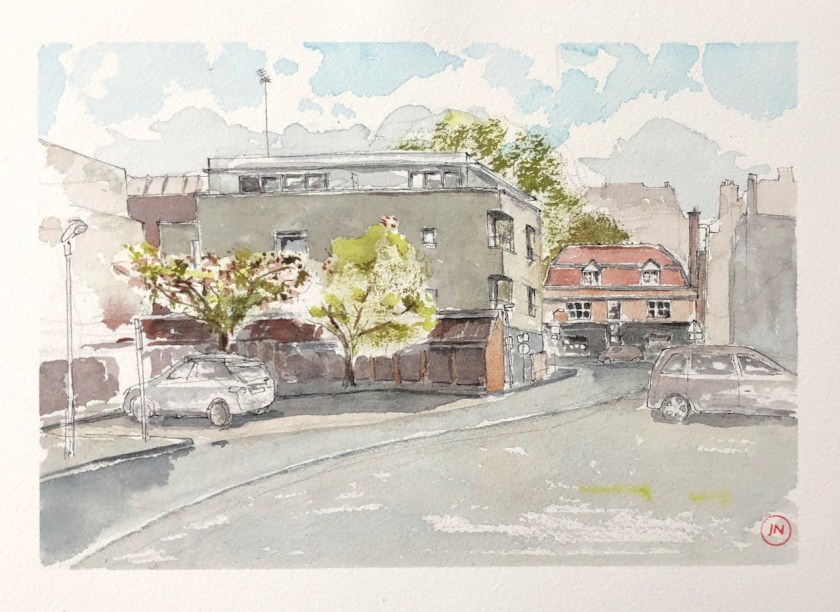
Cosser St SE1 – North West side. 12 inches by 9 inches [SOLD]
It was a blustery day, as you see. In the background are the buildings on the other side of the Kennington Road.
There are many parked cars in this street. They are constantly on the move, coming and going. You can see some ghostly images of them in the distance. The main point of the picture was the building. I didn’t draw all the cars. A Civil Enforcement Officer wove her way amongst them, checking number plates.
A man came by carrying a large musical instrument in a black case on his back. I think it was a ‘cello. Then he came back the other way. Then he went back a third time. I noticed him all three times, and he saw me noticing him. On the third time, he came over and politely asked to see the picture. He obviously felt some explanation was needed for his criss-crossing the street multiple times. He said, “I’ve left my mobile phone at my friend’s house. And you don’t realise….” He trailed off, because it seemed redundant to repeat the modern problem: I can’t even phone him because, obviously, my phone is at his house and…”. “I’ll get it”, he went on, “So long as he’s up.” He grinned and shrugged, and carried on across the road. I was not entirely convinced by this story. Why, then, was he carrying his heavy musical instrument back and forth?
This is the final sketch in a series of three made for a commission. Here are the three. All are 12″ by 9″ on Arches 300gsm watercolour paper.
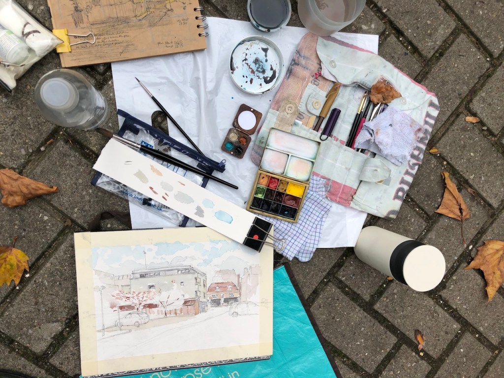
The colours in this picture are: Buff Titanium (DS), Perylene Maroon (DS), Mars Yellow (DS), Fired Gold Ochre (DS) and Phthalo Turquoise (W&N). I did a preliminary sketch, which you see in these work-in-progress pictures.
Here is a building in Cosser St, near Lambeth North tube station. This is the first of three drawings in the area, for a commission. Someone who had enjoyed living here was going to be moving to the country, and asked me make some pictures for them, to remember the locality. Ambulances park in this…
Here is the second sketch of Cosser St. From this angle you can see “The Steam Engine” pub, which is the red-roofed building in the picture, fronting onto Cosser St. The day when I drew this was a surprisingly hot October day. The blue sky is accurate. I was drawing standing up, with a dull…
Click a button below to share this post online, email it, or print it:
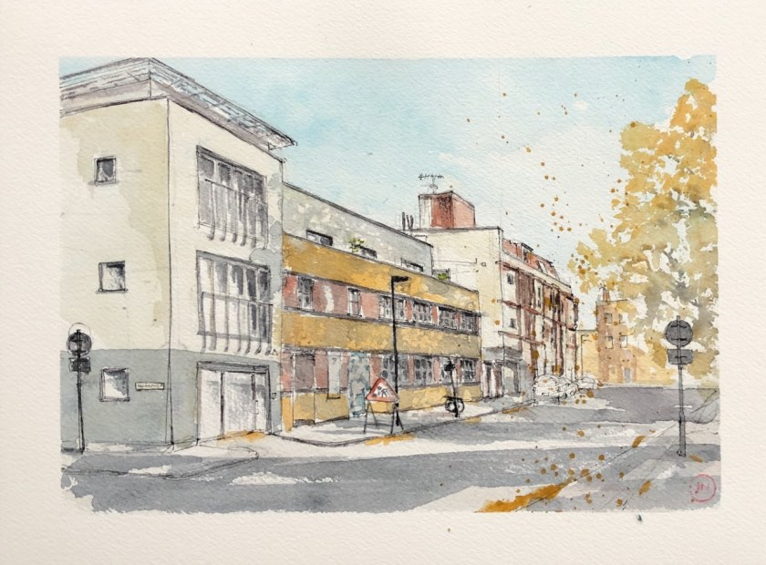
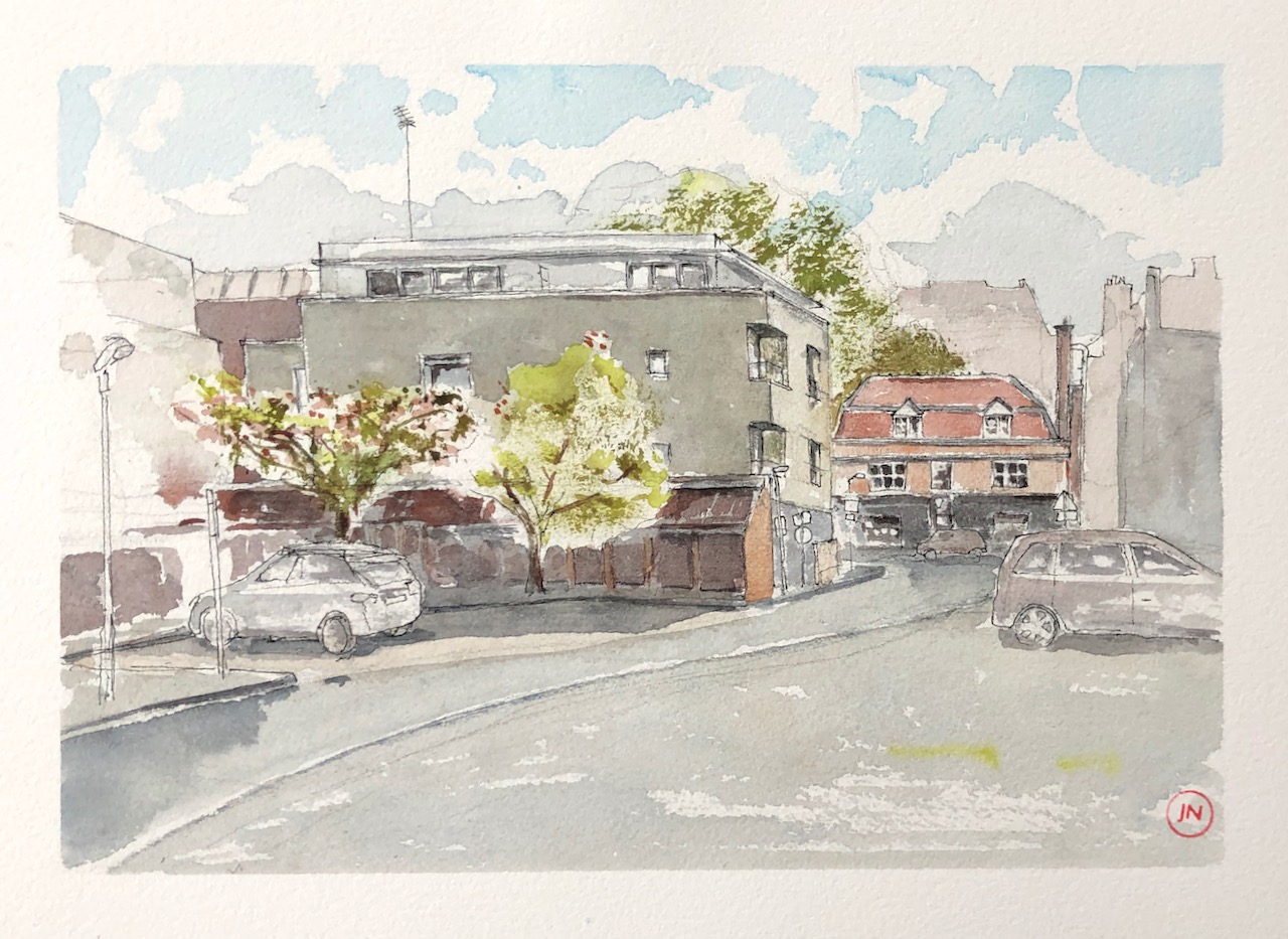
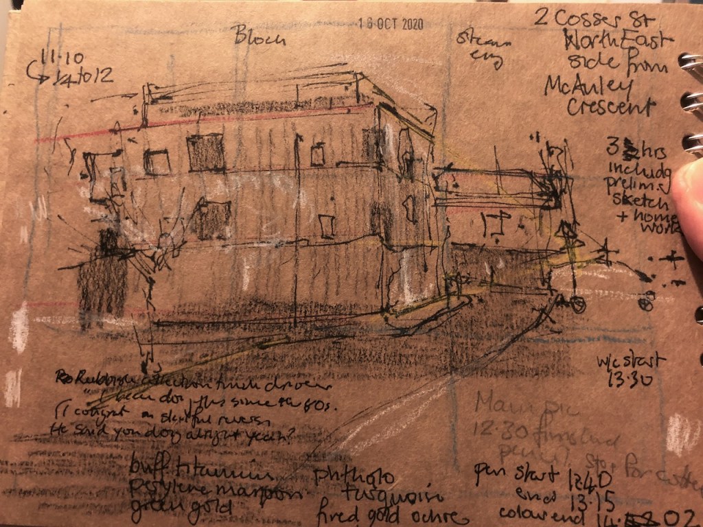
Cosser St SE1 – North East Side, from McAuley Crescent. 12 inches by 9 inches [SOLD]
From this angle you can see “The Steam Engine” pub, which is the red-roofed building in the picture, fronting onto Cosser St.
The day when I drew this was a surprisingly hot October day. The blue sky is accurate.
I was drawing standing up, with a dull red van behind me and my bicycle in front of me. As I drew, a rubbish truck arrived in front of The Steam Engine, and proceeded to reverse slowly down McAuley Crescent towards me. You can see the curve of the Crescent in the drawing. The driver skilfully negotiated that bend in the road, and kept on coming. I must have looked rather nervous, because the driver grinned at me, wound down his window, and called out, “Are you doin’ alright there?” I said that yes I was doing fine, and was I in his way? No no, he assured me. I told him how much I had admired his skilful driving, backwards down the road. He laughed again, and informed me, “I bin doin’ this since the 1980s. I should be good at it!”. Then he continued his smooth reversing, back beyond the red van and out of my line of sight.
I knew he must come back again, so when I heard the lorry engine I paused my drawing to wave. He waved back and called out a greeting, as he and his lorry hurtled confidently back towards Cosser St and their next collection.
The colours in this picture are: Buff Titanium (DS), Perylene Maroon (DS), Green Gold (DS), Fired Gold Ochre (DS) and Phthalo Turquoise (W&N). I did a preliminary sketch, which you see in these work-in-progress pictures.
Preliminary sketch
Work area
The picture is red, because the red van is behind me.
Pen sketch
This was the second picture done in a set of three for a commission.
Here is a building in Cosser St, near Lambeth North tube station. This is the first of three drawings in the area, for a commission. Someone who had enjoyed living here was going to be moving to the country, and asked me make some pictures for them, to remember the locality. Ambulances park in this…
Click a button below to share this post online, email it, or print it:
Here is a building in Cosser St, near Lambeth North tube station.
Cosser Street SE1 – South West view. 12 inches by 9 inches [SOLD]
This is the first of three drawings in the area, for a commission. Someone who had enjoyed living here was going to be moving to the country, and asked me make some pictures for them, to remember the locality.
Ambulances park in this area. The street is not so empty as I have drawn it. Fortunately, they do not always park in the same place, so I could draw the front of the building a bit at a time. You can see the ambulances in the work-in-progress drawings below.
It was very cold, and there was an autumn wind.
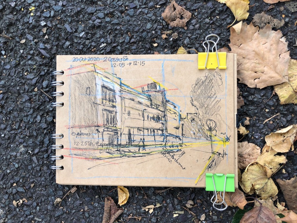
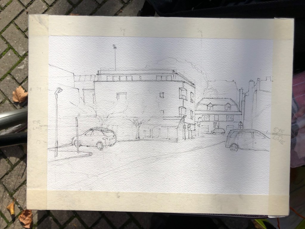
Preliminary drawing to work on the perspective
Bicycle as work station
Pencil underdrawing
Pencil underdrawing
Pen
Pen drawing and ambulance
Tools
Watercolour in progress, and ambulances
Work in progress, Cosser Street South East corner
Plants grow all along the base of the building. I indicated them in the picture.
The colours in this picture are: Phthalo Turquoise (W&N), Perylene Maroon (DS), Fired Gold Ochre (DS), Mars Yellow (DS), and Green Gold (DS).
Click a button below to share this post online, email it, or print it:
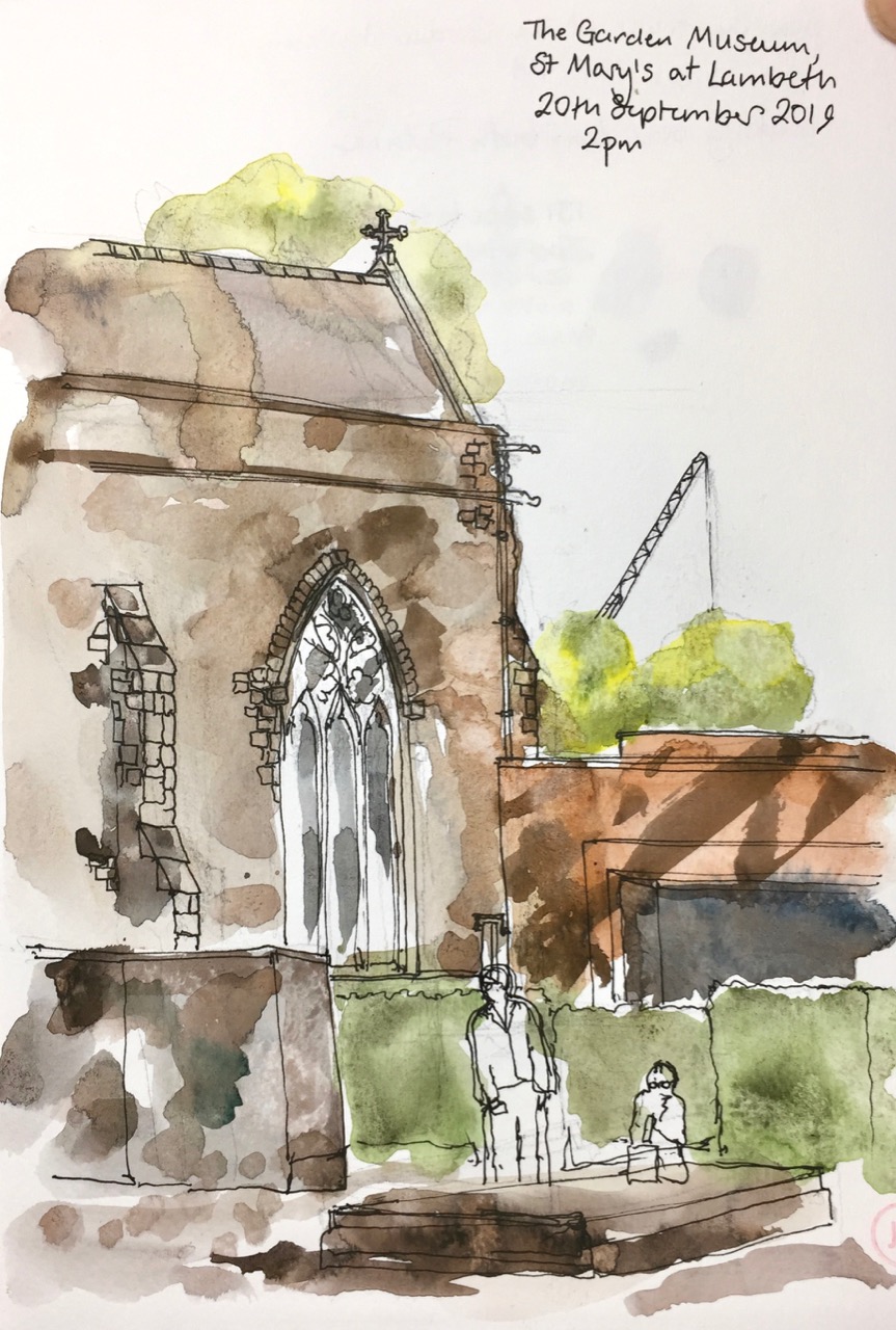
I drew a picture waiting outside the Garden Museum in Lambeth.
The Garden Museum is inside St Mary’s Church. The upmarket restaurant attached to the garden museum is the bronze-coloured cuboid on the right. The slab of stone which the tourist is sitting on is a tomb.
Prompted by an article in a newspaper, we were at the “Garden Museum” in Lambeth to see an exhibition of the art in Ladybird Books. I learned to read with Ladybird Books, as did so many others of my age. Here are pages from “Shopping With Mother”, one I remember with particular clarity. These are photos of the copy I still have, published 1958.
“Shopping With Mother” 1958
“Shopping With Mother” 1958
Note that Mother is wearing a hat and white gloves.
Since the exhibition was at the Garden Museum, they showed the art in the Ladybird Books of Trees, of Garden Flowers, and so on.
From the FT 10th Aug 2019
From the FT 10th Aug 2019
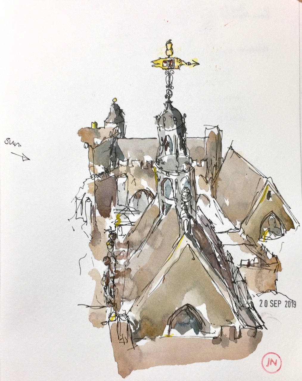
We also went up the tower of St Mary’s Church. It is 131 narrow steps. At the top it was very windy and we had a superb view. Here is what Lambeth Palace looks like from the tower.
In Victoria Tower Gardens, next to the Houses of Parliament, there was a huge demonstration to draw attention to Climate Change. The loudspeakers from speeches at the demonstration were accompanied by car horns and swearing of angry drivers, caught in traffic jams in the surrounding roads, and the wails of sirens as ambulances tried to reach St Thomas’ Hospital which is nearby. It was a soundscape of competing interests.
Click a button below to share this post online, email it, or print it:
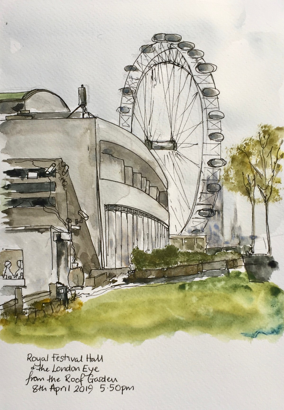
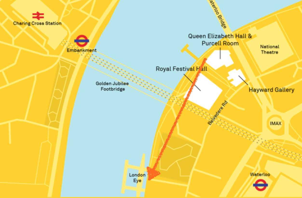
I went up to the marvellous roof garden, on top of the Queen Elizabeth Hall on the South Bank.
Here is a picture of the Royal Festival Hall, with the London Eye behind it. The tower of Westminster looms behind the wheel.
This roof garden seems to be a place for serious discussions. Some people at the next bench were discussing whether to stay employed or not. One of the options was to “go travelling”. Another, as far as I could work out, was to “get married”. It was hard to keep track of their wide ranging conversation, because I had to concentrate on the beautiful curve on the front of the Royal Festival Hall. It was a luxury to be there, and to appreciate the lines of the architecture. The lines were somewhat compromised at this roof level by the many creeping plants, floodlights, and surveillance cameras which you see encrusting the ventilation shaft in the foreground. Also note the prominent mobile phone mast on top of the Royal Festival Hall. I would not have granted planning permission for that.
The roof garden is a wonderful invention, and well done. By the time I’d finished the drawing, many people had made their way up, and were discussing work, and relationships, all very earnest. I discovered that I was sitting in the smoking area, which is adjacent to the vaping area. Marijuana smells wafted up from somewhere, perhaps from the skateboarding area in the Undercroft below. I could hear the crashes and the calls. But there was also a smell of grass, actual green grass, as in the picture.
Here is work in progress and a photo of my sketchbook on the concrete:
The drawing took 1hr30mins.
The London County Council (LCC), as it then was, initiated the building of the Royal Festival Hall as their contribution to the Festival of Britain. The foundation stone was laid by the Prime Minister Clement Atlee in 1949 and a mere 18 months later, in 1951, the concert hall opened with a gala concert, which shows what can be done if you are determined and have a deadline.
The project was initially led by the LCC chief architect Robert Matthew, then later by Leslie Martin, with Edwin Williams and Peter Moro. It was built on the site of the Lion Brewery, which was built in 1837.
[this information from the Royal Festival Hall website, and the Twentieth Century Society]
Click a button below to share this post online, email it, or print it: