Sketching in Aberdeen

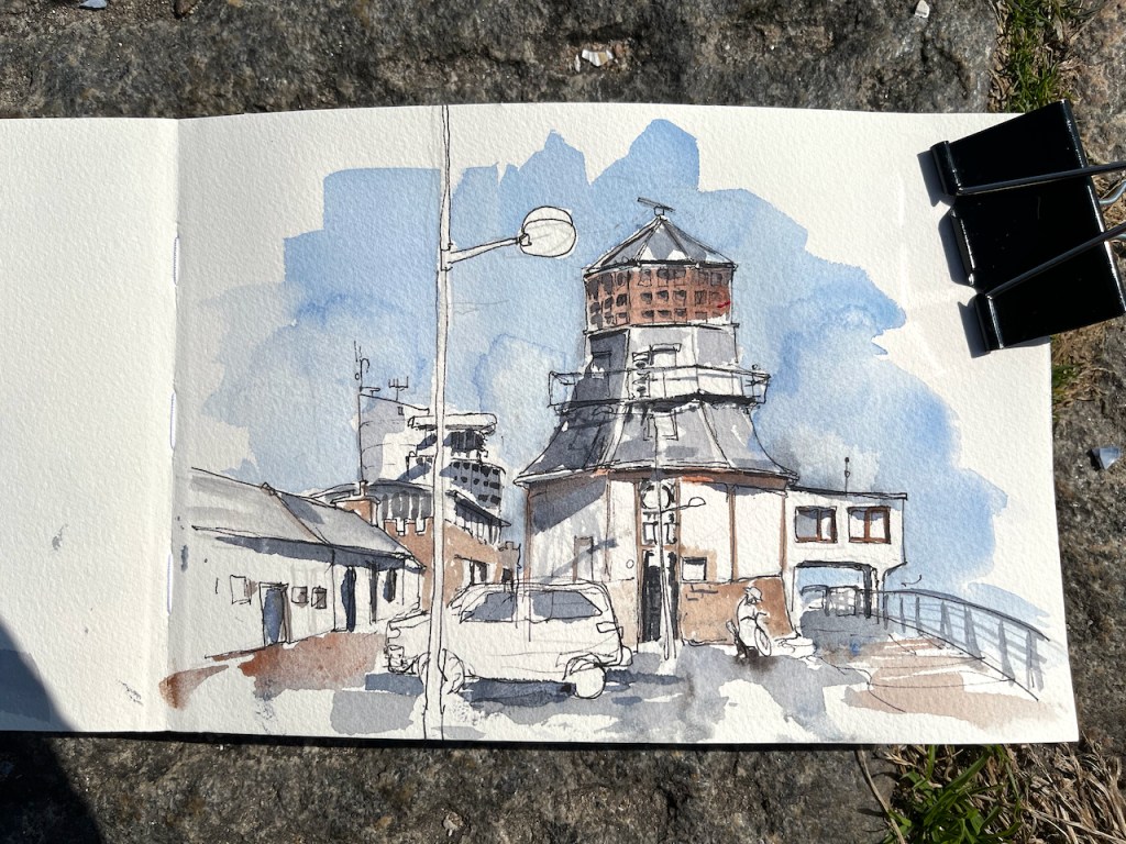
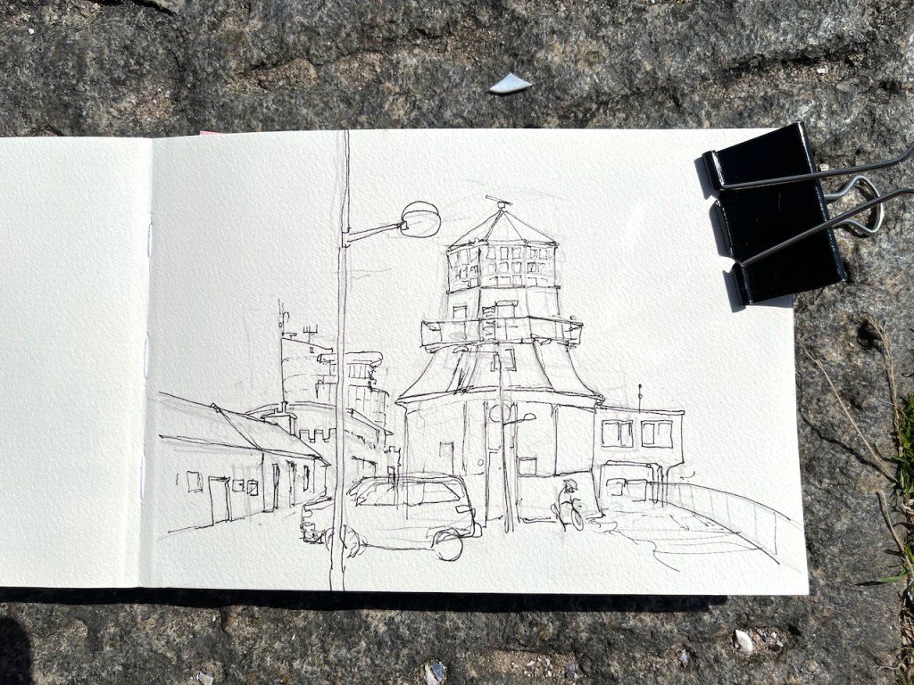
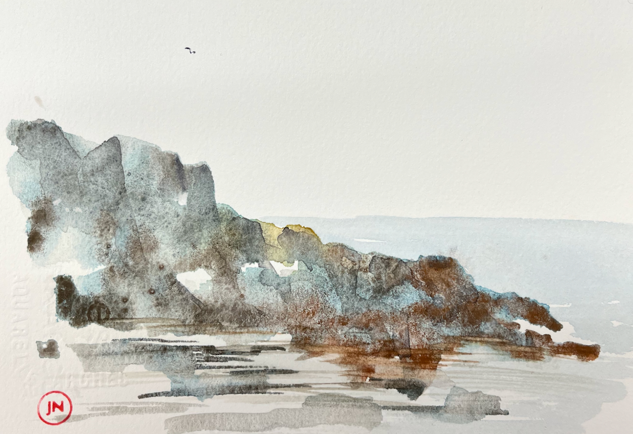
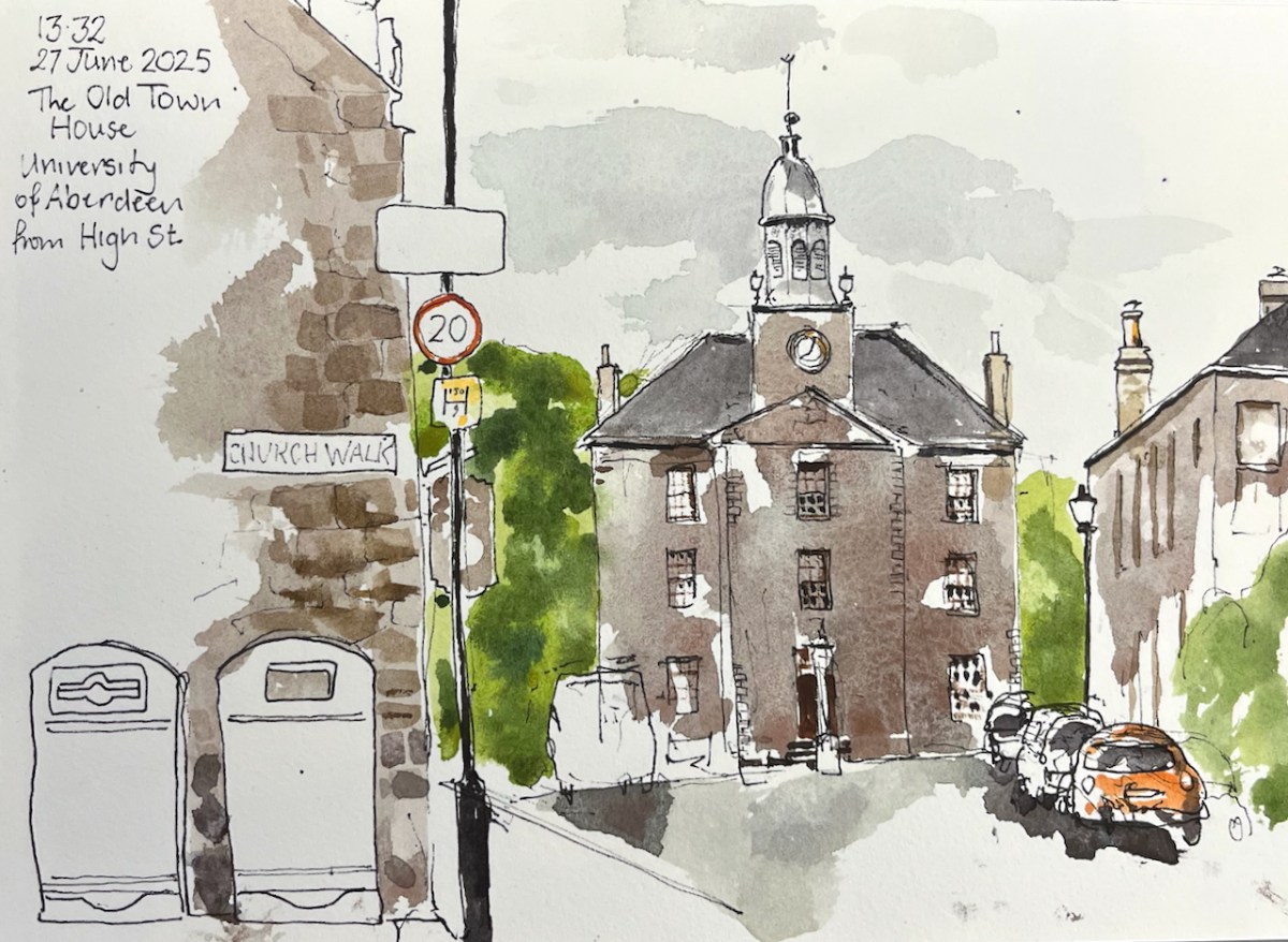
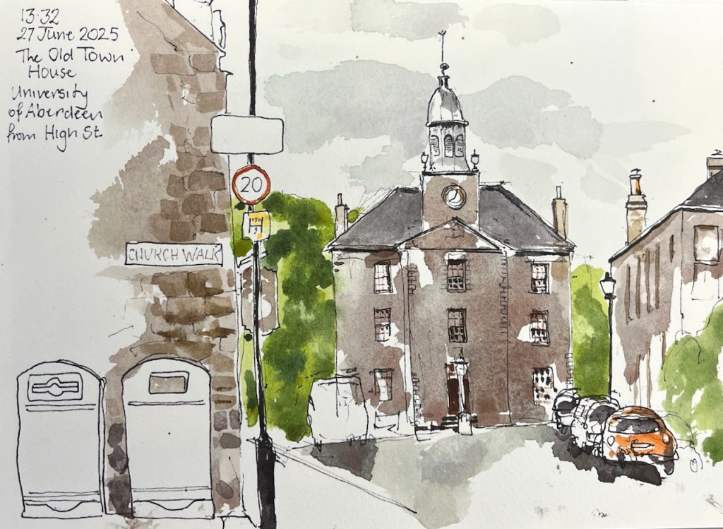
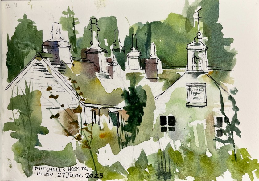
I had been travelling a long time. Reaching Old Aberdeen I sat on a granite kerbstone and sketched The Old Town House. Behind me was a friendly bookshop, where I had bought a map.

The Old Town House, University of Aberdeen, in Shetland 2025 sketchbook, size A5.

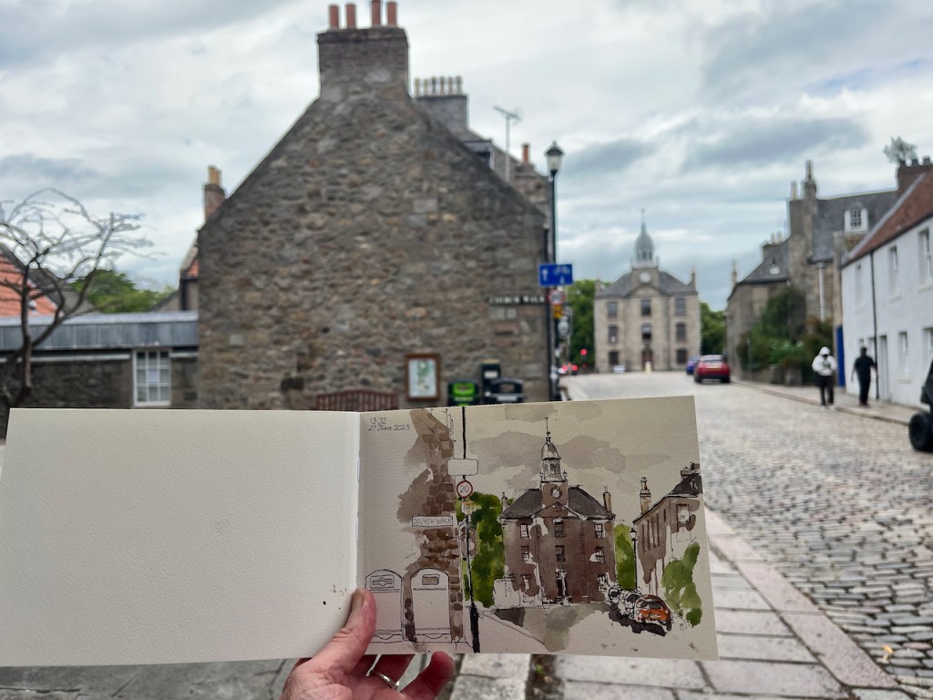
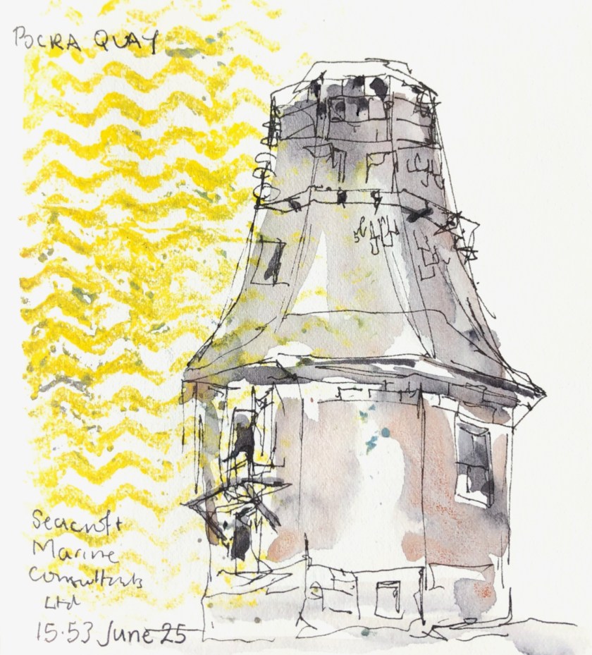
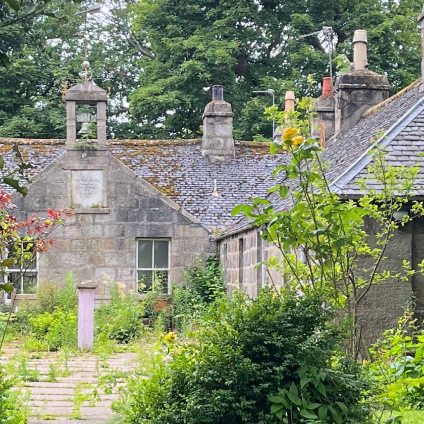
Having sketched, I walked into the picture I had drawn, and towards the trees on the left of the Town House. There I discovered a building being taken over by plants.

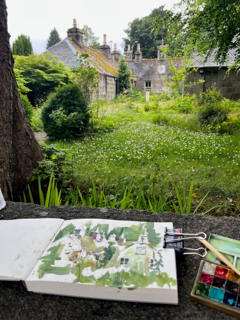
There was a plaque on the building, with writing on. You can see it in the background of the photo above. I couldn’t read the plaque at this distance, and neither could my phone.

Some tourists came by, laden with backpacks and cameras. They paused, curious to see what I was drawing. Since their eyes were younger than mine, I asked if they could read the plaque. They couldn’t, and neither could their phones. My next idea was that they could try using the telephoto lens on one of those formidable-looking cameras. With good grace they shrugged off a hefty block of technology, and removed its canvas housing. It had a fine lens.

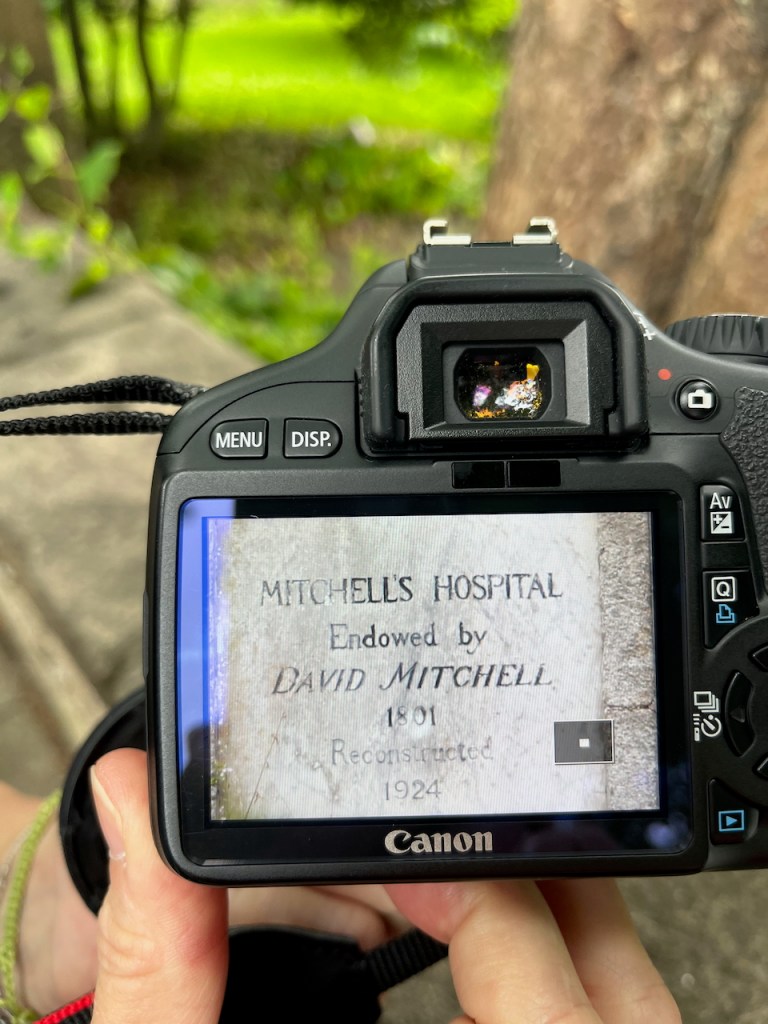
“Mitchell’s Hospital, endowed by David Mitchell 1801. Reconstructed 1924.”

So now we know.

Mitchell’s Hospital, The Chanonry, Old Aberdeen. Sketch in “Shetland 2025” sketchbook, A5

David Mitchell founded the hospital as an almshouse “from a regard for the inhabitants of the city of Old Aberdeen and its ancient college and a desire in these severe times to provide lodging, maintenance and clothing for a few aged relicks and maiden daughters of decayed gentlemen merchants or trade burgesses of the said city..” [Wikipedia entry quoting the deed of mortification of the Hospital]. It was used as such, housing elderly ladies, up to to around 2016 when the final elderly resident, Iona Mathieson-Ross, had to move out.

In April 2024, there was notice of a sale in the local paper:

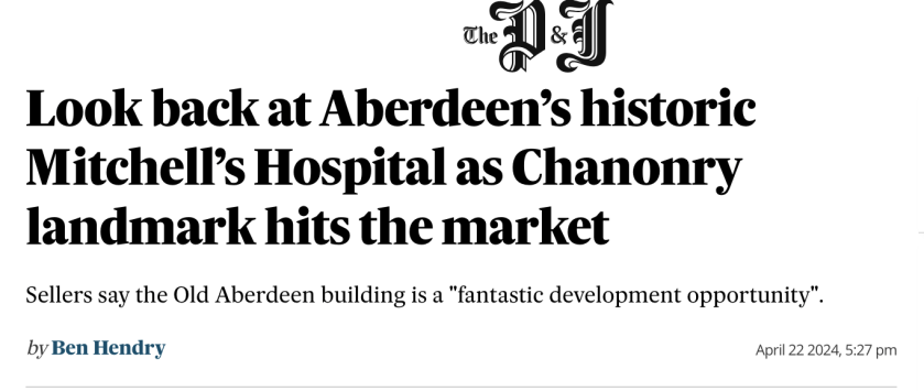
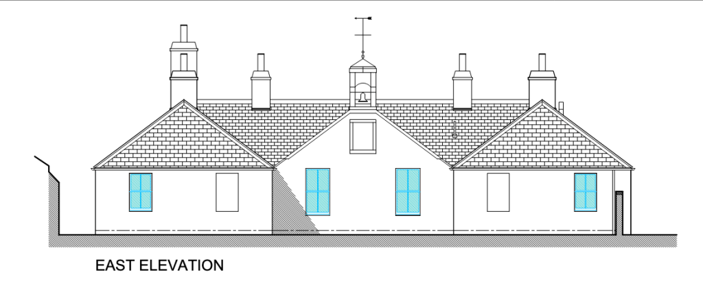
A later article says it has been sold, and that the new owners are refurbishing the building as small residential units to be let, possibly as short-term holiday lets. The planning application on Aberdeen Council’s website shows a building looking identical to the existing one, cleaned up and repaired.

From the planning application 241449/LBC Proposed elevations, North and East

It sounds like a dream come true for this neglected building:

“PROPOSED WORKS
Roof:
Allow for removal of all moss and vegetation
Allow for replacement of missing slates in size, thickness and colour to match existing.
Check ridge tiling and re-bed any loose tiles.
Chimney stacks pointing to be checked and where missing to be repointed…

…Chimney cans to be reset…

Granite Masonry:
Pointing to be checked and where missing to be repointed…

Windows:
Existing sash & case windows to be checked & where wet rot is evident timber sections to be replaced with same profile in Redwood.
Windows to be refurbished to ensure they are fully operational and fitted with draught stripping internally….

External Doors:
Existing external doors to be replaced with external quality Redwood 4 panel doors with double glazed obscure glass in upper 2 panels fully weather stripped primed and painted…

planning application: https://publicaccess.aberdeencity.gov.uk/online-applications/files/D0CA009C52149577D726371114B13754/pdf/241449_LBC-Proposed_Elevations__North__East___Sectional_A-A-2405900.pdf

The planning application was approved on the 3rd July 2025, a few days after I was standing there doing my sketch. Perhaps when I next visit Aberdeen the improvement work will be in progress. Maybe, if it becomes holiday lets, I can even stay there.

I’m glad it’s being refurbished, but I shall treasure the view of this graceful building gradually being assimilated into the plant world.

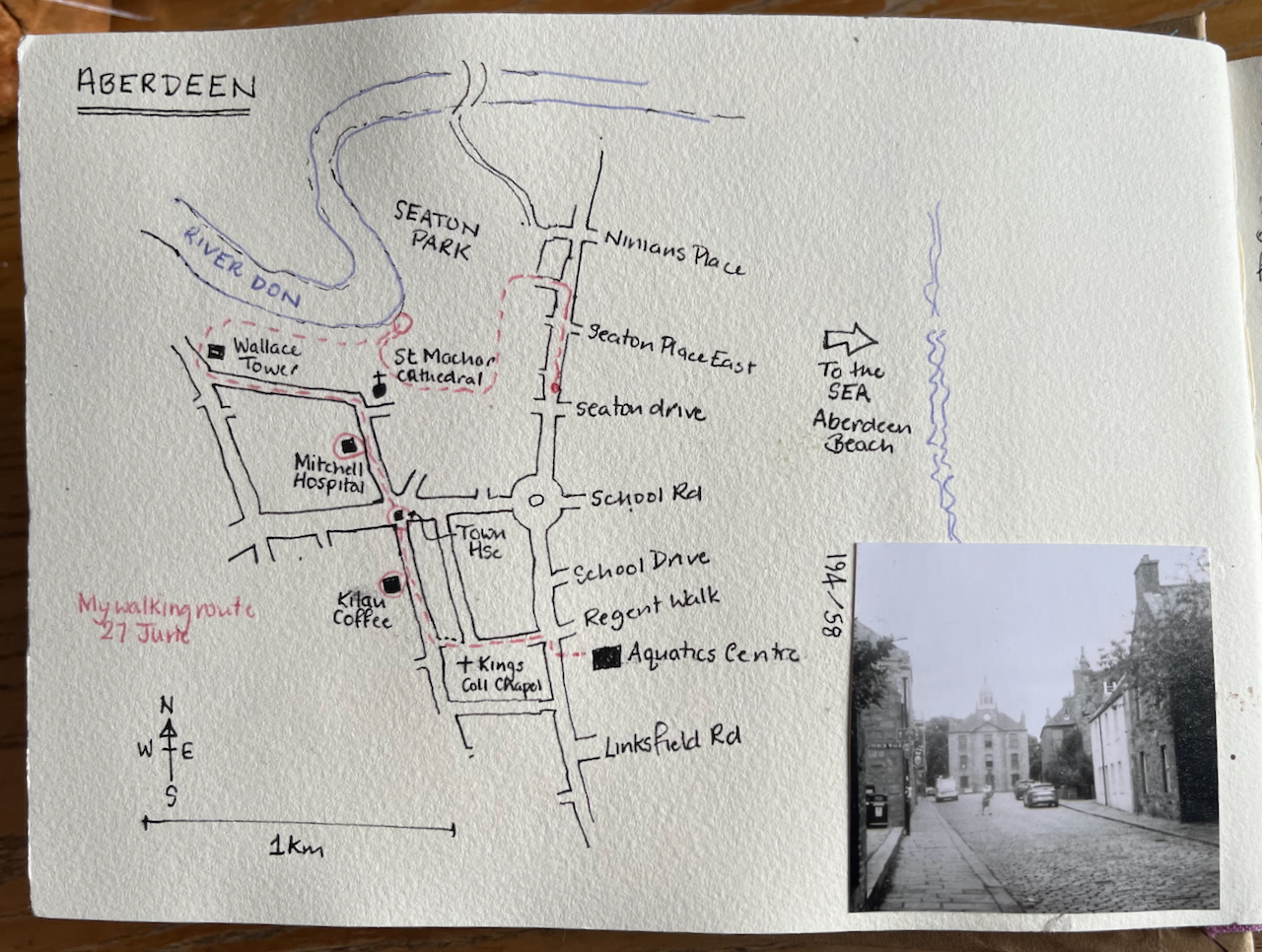
Here is a map showing my walk and Mitchell’s Hospital.

I had coffee in Kilau Coffee – recommended!
Sketching in Seaton Park, before the rain. St Machar’s Cathedral.

Walking around Glasgow

On the way to and from Sketch and Sail last week, my journey took me through Glasgow. I spent a few hours walking around that city, sketchbook in hand.

Here is West George Street, looking east, downhill towards St Georges Tron Church.

This was a Sunday. Glasgow was quiet. Until there was the sound of flutes, or perhaps more accurately fifes. And then a procession. I tried to sketch the people as they walked by.

Who were they? What was it about? I had sort of guessed, before I asked the police officer. “The Grand Orange Lodge” he told me. So this was an Orange March, a procession by Protestant fraternal societies. I had heard of them in the news as taking place in Northern Ireland, but I had not heard of them in Glasgow, or anywhere else. They arouse contention in some contexts. This procession seemed low-key and passed through peacefully, gone almost before I had thought through what I was looking at.

I walked on, in the opposite direction, towards the West End of Glasgow.

In Glasgow there are magnificent Victorian buildings, some of them strangely derelict and empty. Here is the roofscape of the former buildings of Glasgow City Council: huge empty buildings around a vast courtyard.

Here is an eight storey building on Hope Street: “The Lion Chambers”, perhaps a former legal practice.

One of the joys of walking in cities is that you pass through invisible membranes, barely detectable boundaries between the derelict areas and the areas that have been reinvigorated, or between the commercial areas and the residential districts. As I walked West I saw a tower on the horizon, with a parapet.

This looked like the type of tower I have sketched in London at St Thomas’ hospital.

But on closer inspection it turned out to be a church. Or rather, it had been a church. Now it is a residential tower called “Trinity”, looking very smart.

I was sketching between rainstorms. By this time I was high up overlooking the city.

A bit further on there is the botanic gardens. The rain stopped and suddenly the place looked like a sunlit utopia, with people of all kinds and all ages out sitting on benches and chatting to each other amongst flowers and cultivated trees. Further on still, I came to a river.

It was time to turn around and head back East. I became comprehensively lost amongst the pedestrian underpasses knotted around the M8 motorway. But an elderly gentleman put me right, turning around and walking with me to the summit of a bridge, from which vantage point he could indicate the correct route with his walking stick.

It’s a city of many cities, is Glasgow. Wealth and dereliction, renovation and decay. There is a sense of waves of renewal, ups and downs. Or perhaps that was just because I was returning from a sea trip, and the pavement was not yet entirely steady under my feet.

Sketch and Sail – May 2025 -Hebrides

I’m thrilled to be one of the tutors on the Lady of Avenel “Sketch and Sail” adventure. I have just returned from the May 2025 voyage in the Scottish western isles.

Postcards from Sketch and Sail May 2025

We travelled over 100 miles, much of it under sail. Fellow artist Alice Angus and I delivered sketching workshops to a companionable group of participants, and everyone made lots of sketches. Some people also steered the boat, managed the sails, swam on the sandy beaches, and a few brave participants went up the mast.

If you would like to join us on a future trip, there is another date in August – and two more voyages are planned for 2026. See this link for more information or contact me.

Here are a few of the many photographs from the May 2025 trip:

Here are some of my sketches from the trip.

I took an A5 sketchbook from JP Purcell, and sometimes sketched the landscape view across two pages:

The beach at Sandray was a great sketching location. Here is a photo of my sketching spot.

Here is one of the drawings I made here:

There was a stream running down the beach.

The stream on the beach, sketch made using seaweed and sea water.

The other sketchbook I took was a small A6 toned watercolour book made by Hahnemühle.

On the way back to London I had a few hours walking and sketching in Glasgow – I’ll put those sketches in another post.

Meanwhile, here is a sketchbook flick-through so you can see the whole week in seven seconds of silent video. [videos might not play properly on mobiles or emails – please try the web-based version]

Sketchbook flick-through.

Materials:

My main sketchbook was 300gsm watercolour paper, A5, from JP Purcell in Southwark, London. The bird sticker on the front is my design, printed by Vistaprint.

A well-used sketchbook: A5 watercolour paper, from JP Purcell.

I also used a small toned sketchbook from Hahnemühle.

Here is my colour palette, all traditional watercolours:

Colours used this week: all Daniel Smith except the Ultramarine Blue which is Schmincke Horadam

Here are the brushes I use. Mostly I used the large flat brush, which is from Rosemary Brushes. It is about an inch across.

Any other questions? If you’re interested in the Sketch and Sail adventure in August, or next year, do get in touch.

Inner Hebrides: Sketch and Sail – October 2024

On board Lady of Avenel, October 2024

I’m just back from an invigorating week on “Sketch and Sail”with fellow artist Alice Angus and a group of guests, all sketching and learning. We were hosted by the marvellous crew of the Lady of Avenel, who managed the ship and provided all our meals. Our voyage was around the Isle of Mull in the Inner Hebrides, see maps below. We had amazing fun, laughed a lot, got wet, got dry again, got blown about, and enthusiastically sketched the experience. Everyone was very productive: lots of pictures were made, sketchbooks were filled, postcards were painted and sent.

Alice and I ran workshops on brushstrokes, rapid sketching, outline drawing, sketching kit, painting sea and sky and many other exercises. We all shared thoughts and ideas on tools and techniques, and everyone learned a lot, including me. We also did an experimental workshop on sketching in the dark.

Here is a map of where we went.

On this post is a selection of my work from this voyage. For more about the ship, and future plans, see the Lady of Avenel website.

I travelled North on the Caledonian Sleeper, and did some sketching on the train.

The guests came on board in Oban, and we set off in the evening for the week’s voyage.

Leaving Oban, 6th October 2024. There was fine rain, some of which landed on the picture.
Sketch map

Here is a selection of my sketches from the voyage.

At Sanna Bay there is a large sandy beach, and a settlement of a dozen or so cottages. Here is a sketch made as we approached Sanna Bay:

I walked into that scene, through the sand-dunes, in search of a post box. Against all expectations, I found one.

At Eigg there was a spectacular sunrise.

With a strong wind in our sails we reached 8 knots on the journey south from Eigg to Iona.

The sails are full on the journey from Eigg to Iona.

On the island of Iona, I sketched a boat on the beach.

On the way back to Oban from Iona we landed at a vast sandy beach called Tràigh Gheal. There were showers of rain.

Here’s a photo, showing the Lady of Avenel at the anchorage at Tràigh Gheal. We reached the beach by rubber dinghy.

Lady of Avenel at Tràigh Gheal

I used a JP Purcell sketchbook. Here’s a quick flick-through:

Sketchbook flick-through

All of this was powered by a strong North Westerly wind, and Tom’s cooking. Tom continued cooking even as the North Westerly gusted Force 7, and produced a hot meal for hungry sailors every evening, soup for lunch and cooked breakfasts. He made the sour dough bread every day in the ship’s galley. I found this hugely impressive.

Tom’s cooking on the ship: cake for hungry sailing sketchers: and sourdough!

In case you are curious, here are night sketches. The lights are done using wax crayon.

Here are some snapshots from the voyage.


We’ll be running Sketch and Sail twice in 2025.

  • Trip 1: 25th of May to the 31st of May 2025, and
  • Trip 2: 31st August to the 6th of September 2025.

If you are interested or would like more information, please contact me or register your interest via the Lady of Avenel Website.

“The Roundhouse”, Pocra Quay, Aberdeen

This is the watchtower near the entrance to the harbour of Aberdeen, known as “the Roundhouse”.

The Roundhouse, Pocra Quay, 28 July 2024, A5 in JP Purcell Sketchbook

It is octagonal. According to the listing on the Historic Environment Scotland site it was:

“[built] to guide vessels to port, this was originally carried out by the harbour pilots via loudhailer from a platform built into the roof of the original 2-storey structure, or by a system of wicker balls suspended from a pole rising from the platform.” [1]

“Entrance to Aberdeen Harbour” by James Cassie (1819–1879)
image copyright: Aberdeen Maritime Museum


“The control tower was added in 1966 and a radar system was introduced in 1974. The structure was further updated in 1986 at which time the Queen unveiled a plaque, situated to the right of the main entrance to the tower, commemorating ‘850 years of Harbour History’.” [1]

It was in use until the Marine Operations Centre opened in 2006 [4]. This is nearer the sea, just visible behind the lamp-post in my drawing. It handles about 25000 boat movements a year, which averages at 60 a day [2]. For comparison, Heathrow air traffic control centre handles abut 200000 aircraft movements a year or 500 a day [3]. The area managed by the Marine Control Centre extends 2.3 nautical miles around the headland to the South of the harbour [5]. So the Operations Centre handles not just boats going in and out, but boats moving around inside and outside the harbour as well.

MV Hrossey leaving the port of Aberdeen, photo copyright southspear media, used with permission [6]
The Roundhouse, circled, is on the left, and the Marine Operations Centre is above the centre of the ship. This is the Northlink ferry, sailing to the Northern Isles.

I sketched this on a stunning hot day, sitting on a bench by the quay.

The Roundhouse. The modern Marine Operations Centre is the tall white building behind and to the left. In front of it, and lower down behind the cars, is the restaurant “The Silver Darling”.

Three years ago, on a very different day, I made a much quicker sketch:

A quick sketch on a stormy rainy day, sketching from the shelter of a doorway. June 25th 2021.

References:

(1) Historic Environment Scotland listing: http://portal.historicenvironment.scot/designation/LB50941 FOOTDEE, POCRA QUAY, NAVIGATION CONTROL CENTRE (FORMER PILOT HOUSE)LB50941 downloaded 30 August 2024

(2) Aberdeen Maritime Trail leaflet, Aberdeen City Council – 100023401 – 2019: https://www.aberdeencity.gov.uk/sites/default/files/2020-09/Maritime%20Heritage%20Trail.pdf

[3] Heathrow Aircraft movement 2021 numbers from Heathrow facts and figures: https://www.heathrow.com/company/about-heathrow/facts-and-figures

[4] Gazetteer of Scotland https://www.scottish-places.info/features/featurefirst19543.html

[5] Port of Aberdeen Vessel Traffic Services extent: “All shipping movements within the Aberdeen VTS area (within 2.3nm from Girdleness) are controlled by Aberdeen VTS. Participation with VTS is mandatory, for further details please see ALRS Vol.6.” https://www.portofaberdeen.co.uk/port-information/marine

[6] Thank you to Nick McCaffrey of Southspear media for permission to use his amazing photograph of MV Hrossey leaving the port of Aberdeen.

Shetland – pigments

It was foggy, cold and wet outside. I made pigments.

I collected earth from round about. I know from previous attempts that it works best if you have fine earth. So I went up the road in the rain and scooped up the fine silt running off a track. I dried it indoors, and then crushed it to what I hoped was a fine powder.

As you see I had an excellent beach stone for this purpose.

Then to grind it finer I had a pestle and mortar. This is a beautiful home-made item.

Now I have earth pigment. To make watercolour I add Schmincke Watercolour Binder in the ration of 2 parts binder to 1 part pigment. Mix and put in a limpet shell. It’s ready to use immediately as a paste, or it dries and can be rewetted like normal pan watercolours. Here are the paints drying:

Pigment mixes in limpet shells, drying on eggs cups (to keep them level).

Above you see paints made of earth from different places. At the front is a paint made from yellow lichen. The lichen was bright yellow on the stone wall. I couldn’t find a way to separate out the bright yellow surface from the grey underneath, so the pigment is a grey/yellow mix.

Here is a selection of pigment experiments, to show how they look when painted:

Making the charcoal pigment was not so effective as I thought it would be. I found a small chunk of black charcoal from the grate and proceeded to crush it. This produced skittering fragments and airborne dust which settled everywhere. It did not produce a fine powder in my pestle and mortar. It produced hard, flaky, bits. As you see above, the paint it produced was granular and not very black.

Here is a picture painted entirely with home-made pigments:

Coastal scene: painted with home-made pigments.

Here is a picture painted with home-made pigments and shop-bought watercolours:

“Promontory”. Painted with home-made watercolours with shop-bought watercolour (blue).

This is the binder I used:

Shetland – beach finds

"Stoop and discover 
the great in the small"

Here are beach finds.

A limpet shell, crab carapace x 2, seaweed, crab claw x 2
Lobster claw and dried seaweed
Crab claw, beach glass, terracotta, dried seaweed.

Three crab claws.

Shetland – another vehicle in space

I have posted before about the wrecked cars that I sometimes encounter on my hikes around the Shetland landscape.

This year I encountered another one.

Wrecked car, Quaitherin, July 2024

Here are the others I have sketched:

I don’t want to give the impression that Shetland is littered with abandoned cars. It’s not. But there are certain hidden areas I’ve discovered which are car graveyards, and I now go there deliberately. I find something vaguely poetic, evocative, about an abandoned car in a wide pristine landscape. It’s as though the landscape frames it: puts a picture frame around it and says look! This twisted metal is art.

“look! this twisted metal is art.”

Shetland landscapes 2024

It was foggy and cold. I practised drawing clouds.

Islands in clouds

I went for a walk.

In the distance on the left is the island of Vaila. Here is Vaila in the fog.

Vaila in the fog

The speckled effect is the result of fine rain on watercolour.

When the sun shines in Shetland, it is magical. Part of the magic is that you know it is ephemeral. When the sun shines in Shetland, you have to get out there, right now. The clouds come quickly. But while the sun shines, enjoy it.

Footabrough, from the path to the Virda Stane, Shetland West side
Westerwick
Sketching at Meal Beach, West Burra
Minn beach

The sun shone on a visit to Hamnavoe. There is a nearby beach called “Minn Beach”. The water is clear and the sand is white.

The light was dazzling. The water was cold: just over 10 degrees C. Swimming, I could see the grains of sand on the sea bed, perfectly clearly. As I swam on the surface of the water, it was as if I was flying over the sand. Except for the cold.

Minn Beach is on West Burra. See map below.

Further south is St Ninians, an island at the end of a long sand tombolo (sand bridge).

photograph looking towards St Ninians. To get an idea of distances, click to enlarge and find the people at the far end of the sand tombolo.

From the island, sheltering from the wind in the lee of a wall, I sketched Fitful Head.

Fitful Head from St Ninians.
Fitful Head from St Ninians, detail.

Even though the wind shifts the pages and disrupts my lines, even when the rain speckles my colours and blurs the clean edges I drew, even though the view changes by the minute and I find it impossible to catch the glory of the light and the magnificent shape of the land, even though my sketchbook is small and my skills are limited, despite all those things, I think it’s always worth having a go at drawing. The pictures I draw remind me of being there. Of the wind, the rain, the changing clouds, the glorious light and the vast, curving headland.

On St Ninians isle
  • Paint palette by Classic Paintboxes
  • Colours by Daniel Smith and Schmincke
  • Paintbrushes by Rosemary brushes and Seawhite
  • Watercolour sketchbook by JP Purcell (190gsm, A5, cold-pressed)

Foula

Foula is a small island 20 miles off the west coast of mainland Shetland. Shetland is a group of islands about 200 miles north of Scotland.

I had seen Foula, from a distance, on previous visits to Shetland. It floats on the horizon, mysterious.

Foula, seen from Mainland Shetland

So I had to visit. What is it like there?

Here is a Foula scene:

Foula: sketched at Da Punds, between the Wind Turbines and the Airstrip.

I sketched this sitting on one of the stones, on a bit of flat and marshy land towards the south of the island. The road is in front of me, at the foot of those hills.

I had to sketch this in a bit of a rush, because, as I rapidly discovered, this particular area is the province of the Skua. There are Great Skua and Artic Skua: large birds, who do not like sketchers sitting on stones in their neighbourhood. They make their irritation known by aggressive fly-pasts. I could hear the wind in their feathers: it sounded like a chain saw. So I quickly took the hint and made for the road. Locals later told me I should “carry a stick above my head”, to distract the skua. That’s all very well, but finding a stick on Foula is about as likely as finding a branch of Pret. There are no trees atall on this part of the island, so no handy lengths of wood.

Other inhabitants of Foula were more welcoming, including the friendly people. The sheep are unafraid, and came towards me as I walked. The horses too seemed pleased to see me. I met the person who is one of the breeders of these horses on the island. “Pat them, talk to them, but don’t feed them!” she instructed me. Feeding them in the wrong order disrupts their established hierarchy and causes fights, she explained. “And,” she added, with emphasis, “make sure you close the gate!!”. There followed stories of visitors leaving gates open, and the subsequent escapades of the stallion, who visited mares he was not supposed to visit….

Foula is an industrious place, I discovered. As well as horse breeding, and sheep breeding, there is spinning to produce special Foula Wool, peat cutting, and a lot of horticulture. Also there is a school, a lighthouse, a ferry and an airstrip. The air strip needs a fire crew, as well as pilots. The school has a teacher. There are wind turbines and a very effective 5G mobile signal mast, with big dishes directed at mainland Shetland. This is a lot of activity for a place of only 35 inhabitants, especially as six of those inhabitants are primary school children.

The plane and the fire truck on the airstrip at Foula

Horticulture takes place in polytunnels and inside abandoned cars. As on mainland Shetland, vegetables and flowers will grow, so long as you can shelter them from the wind. I was given local raspberries from a polytunnel at the school.

It was rather foggy when I visited, so I opted for lowland routes and did not climb the formidable mountains shown in the picture above. Had I done so, I would have seen the famous 1000ft sea cliff. But I was wary. I did not want to stumble across the famous cliff in the fog.

Sketching in the fog

I was staying at “Ristie self-catering”, in the North of the island. Here is the scenery round there.

The edge of the world.

Foula on the horizon