Bedford House, Quaker Street, London E1

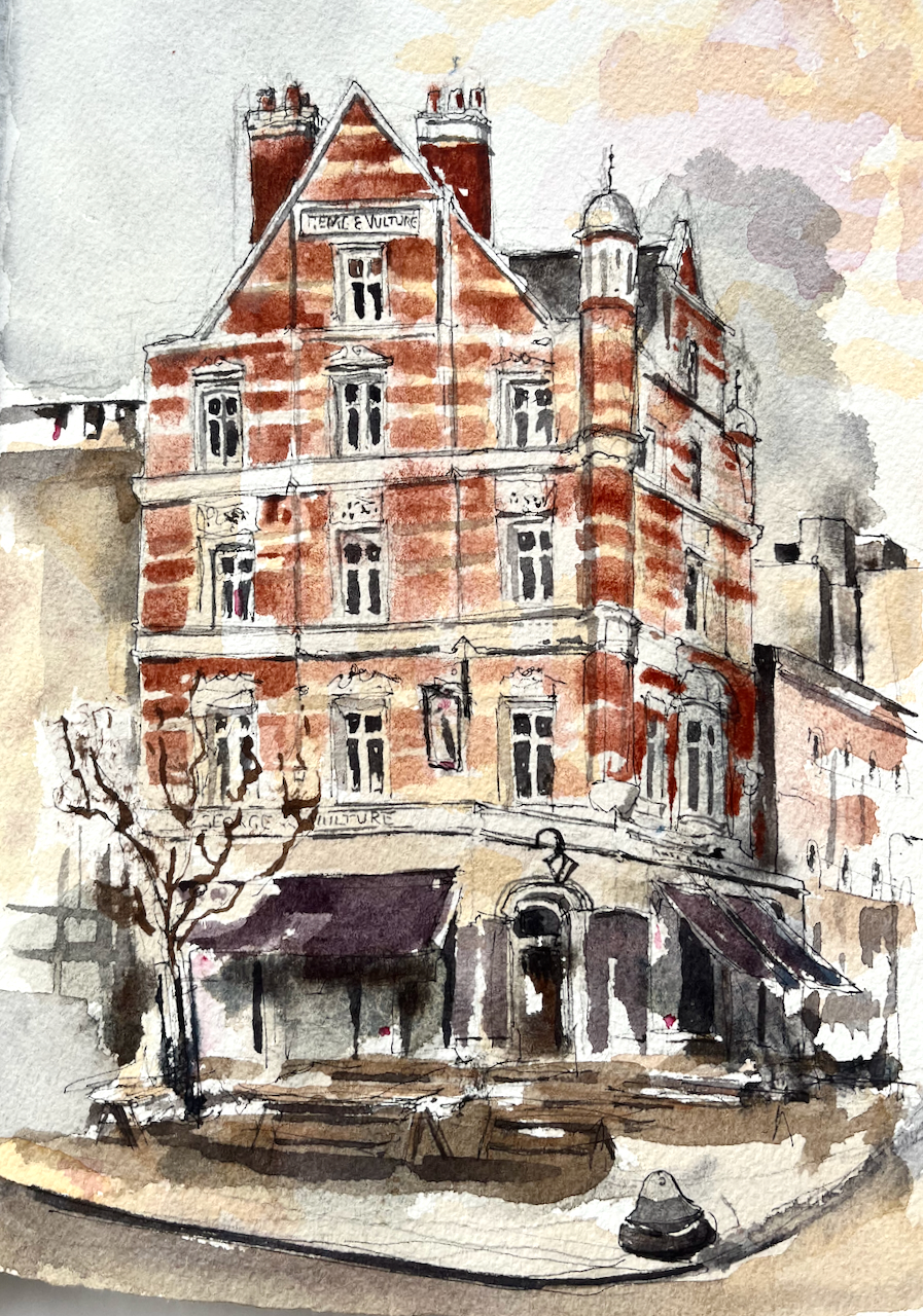
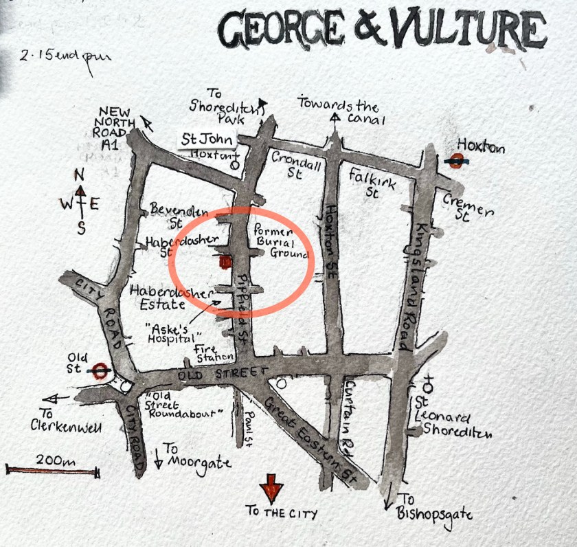
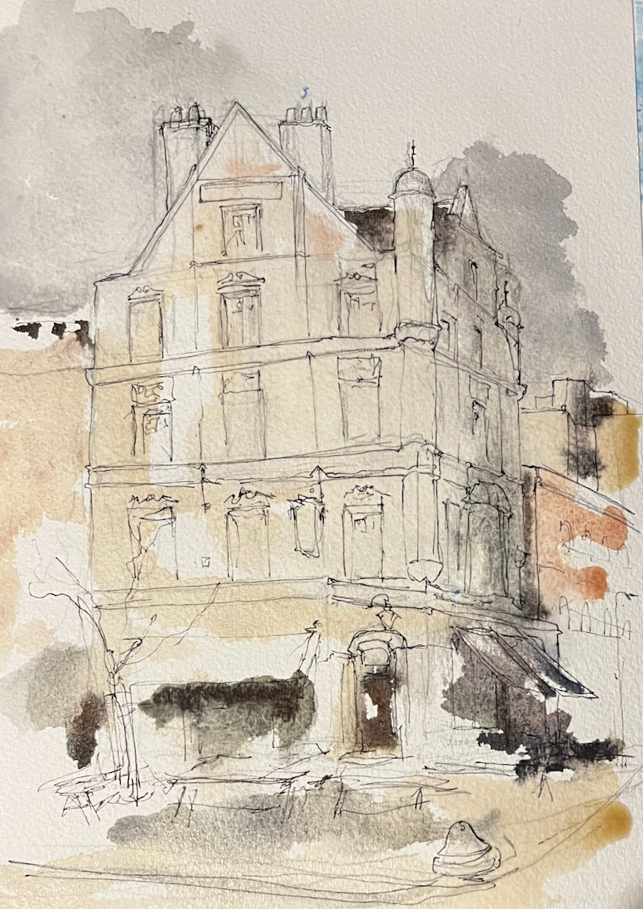
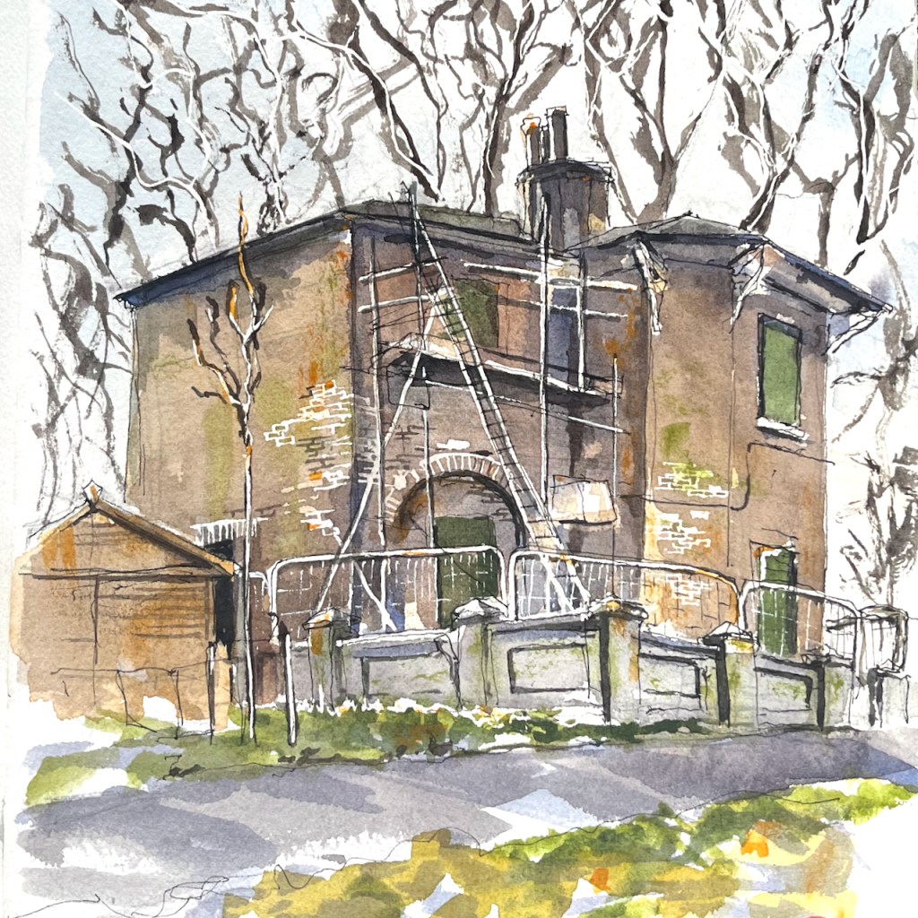
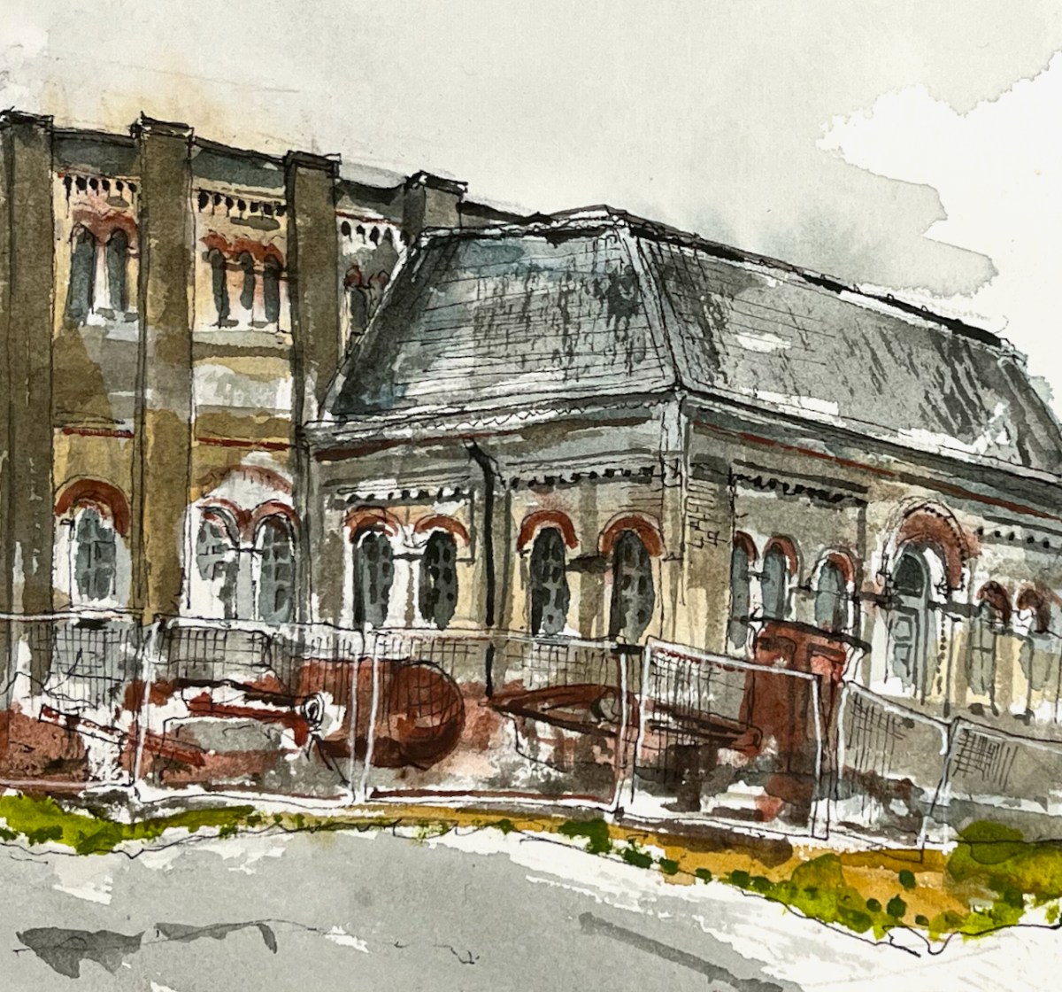
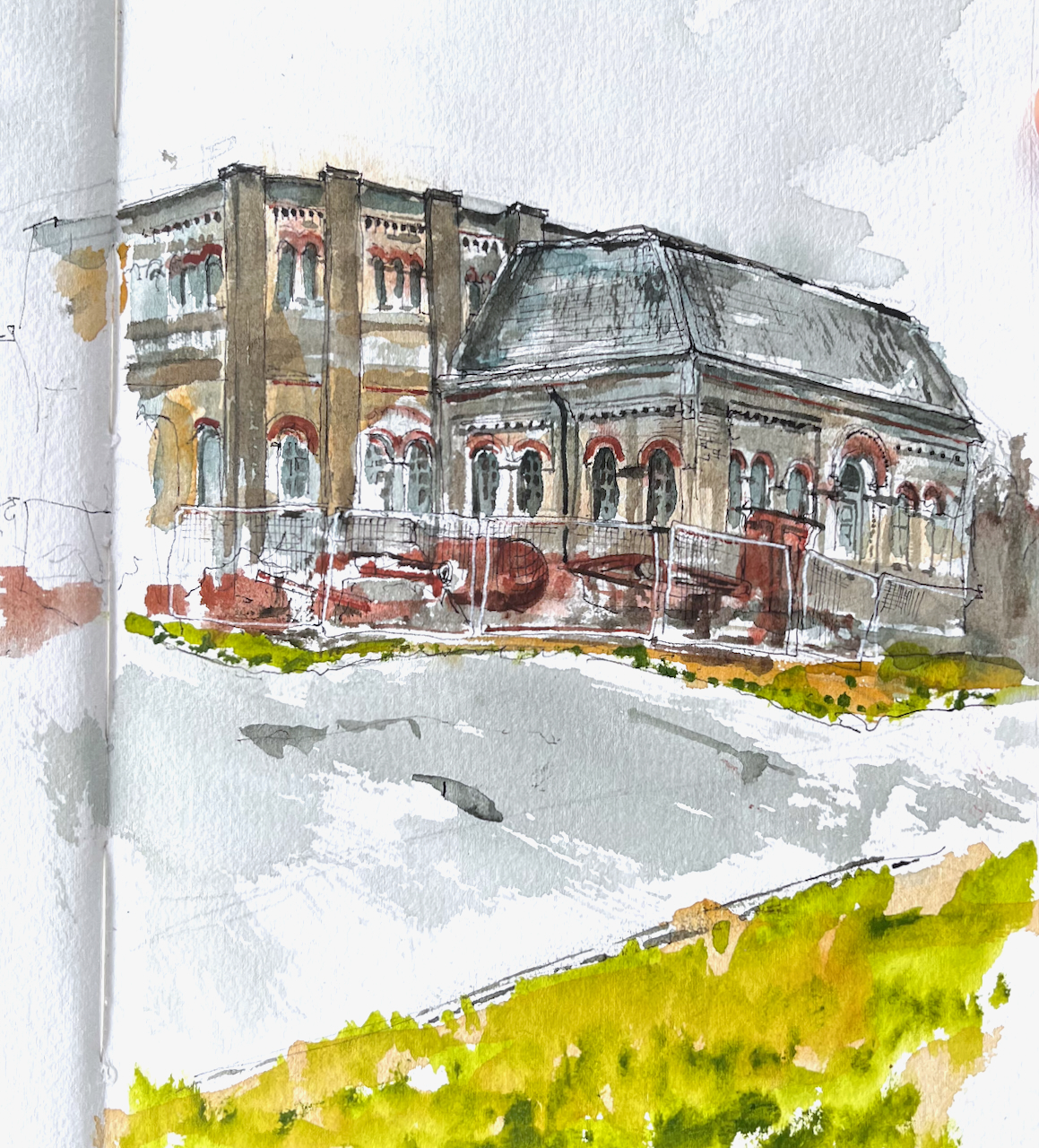
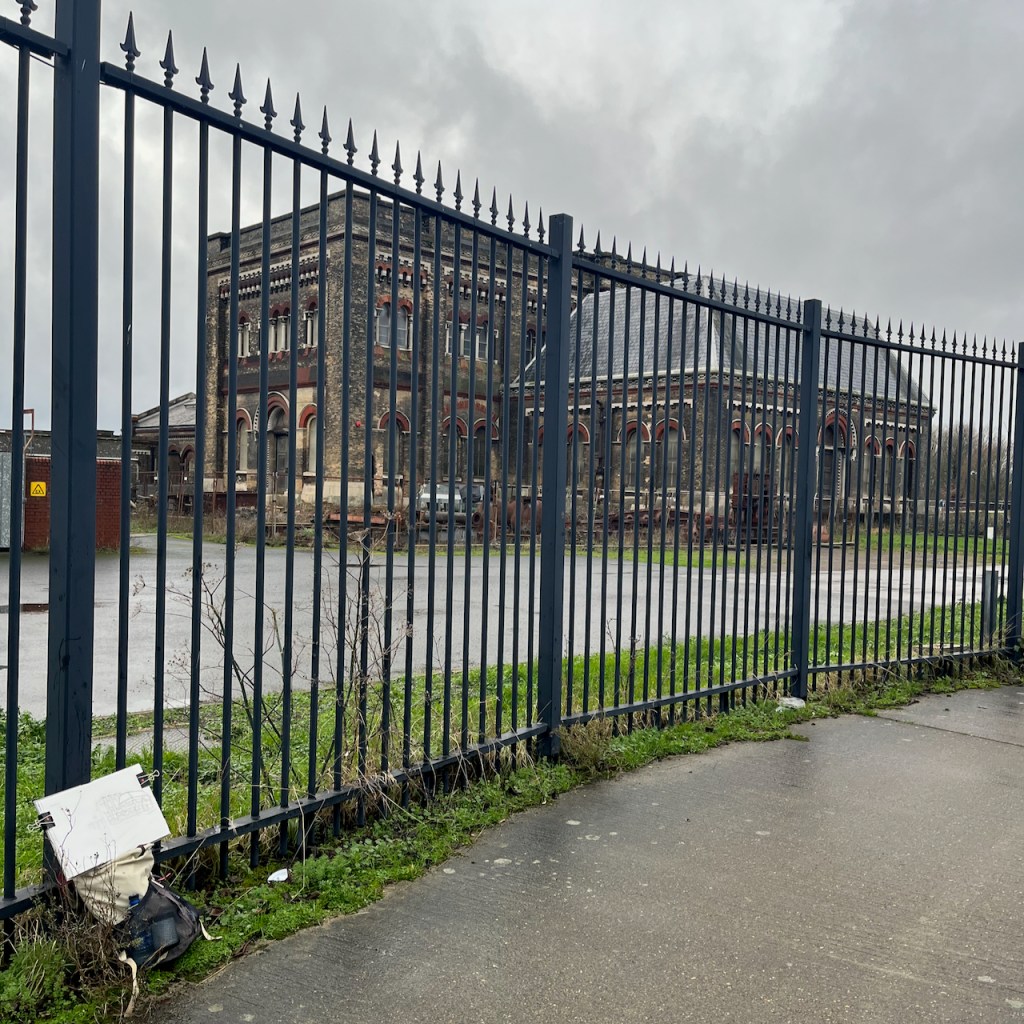
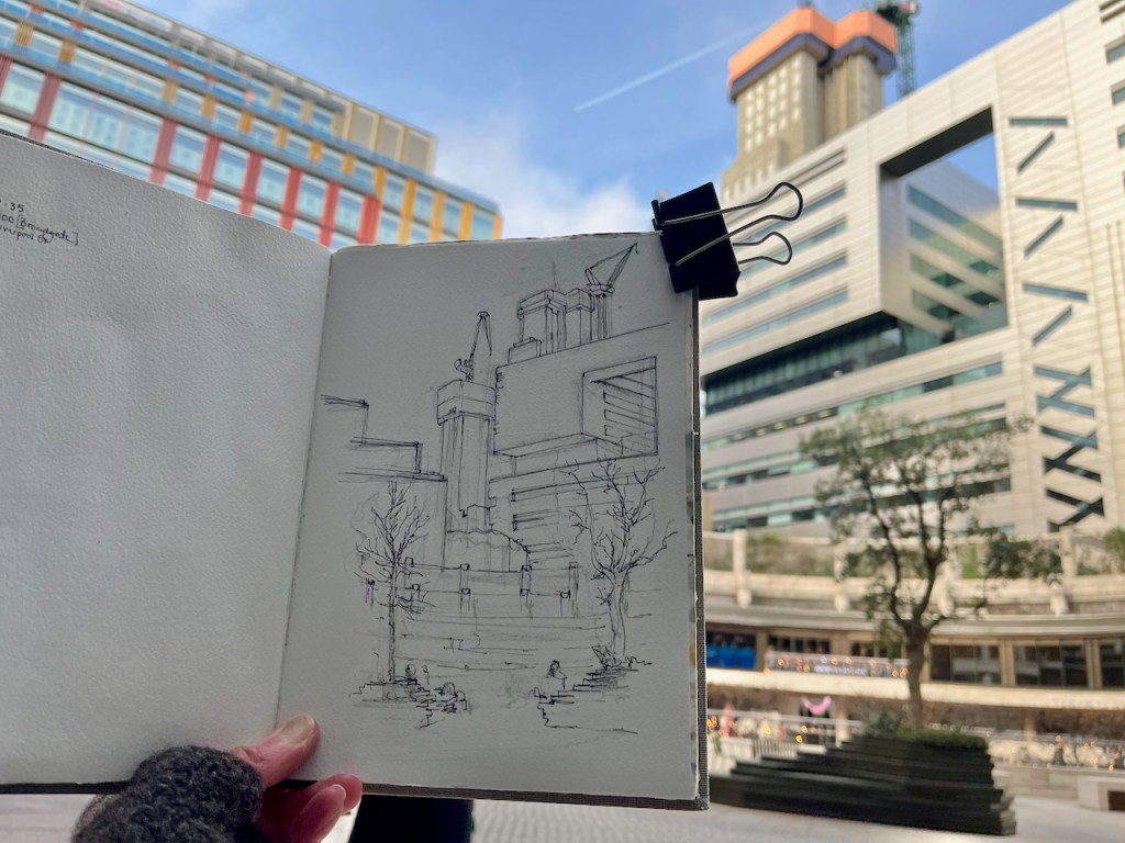
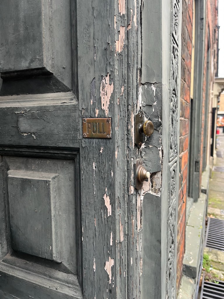
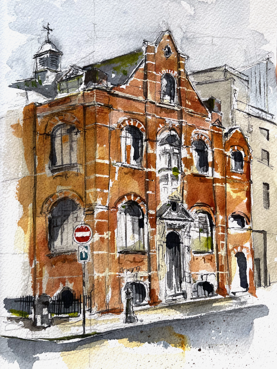
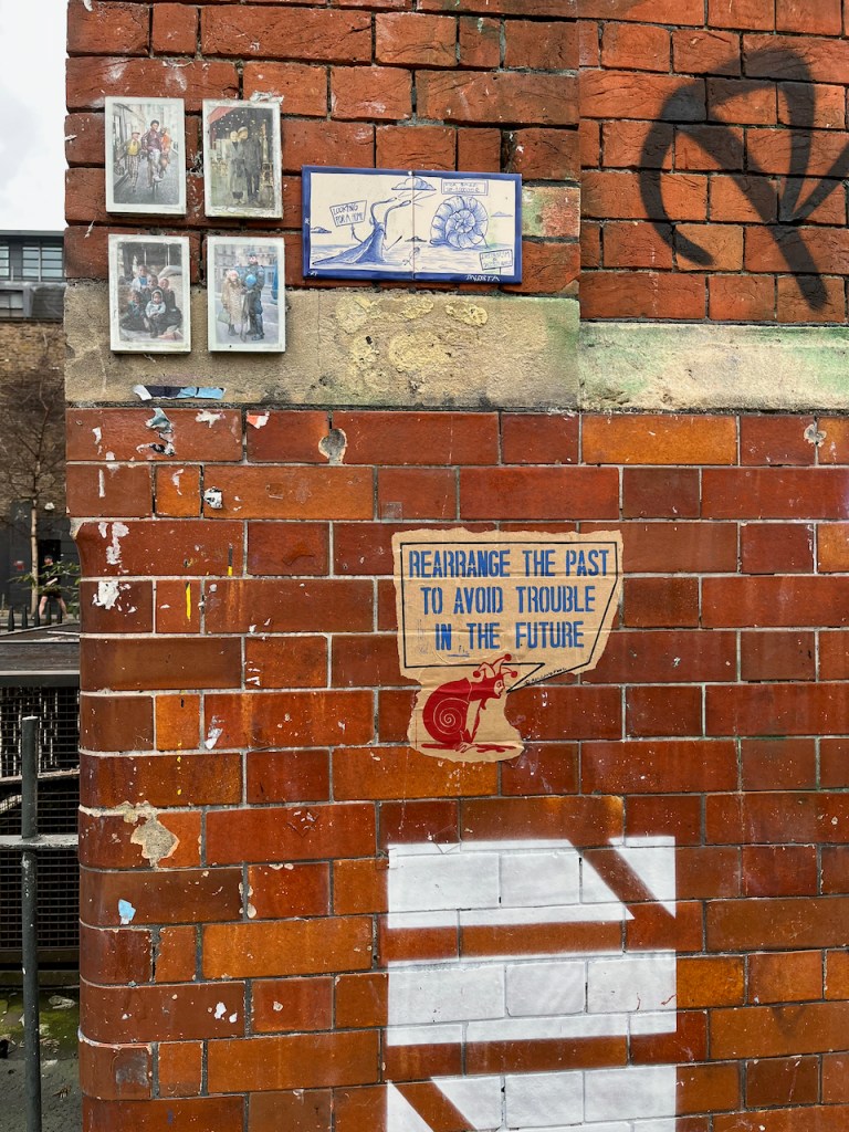
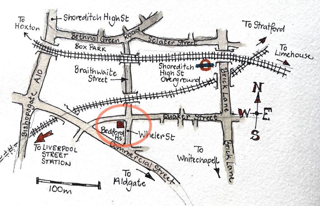
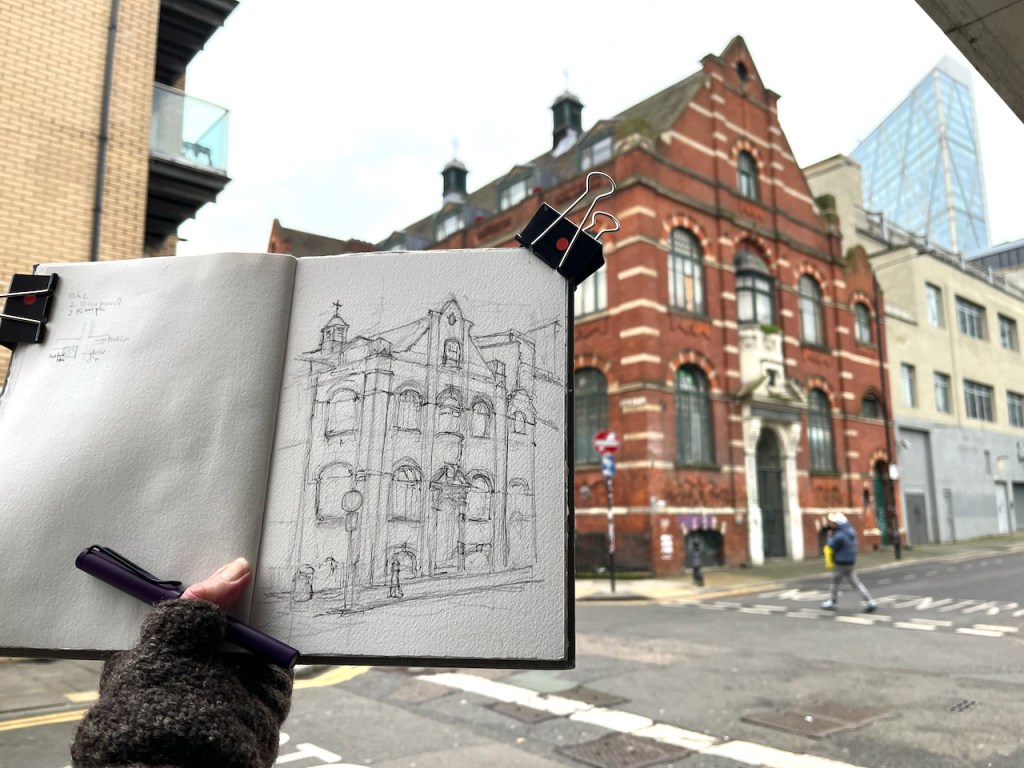
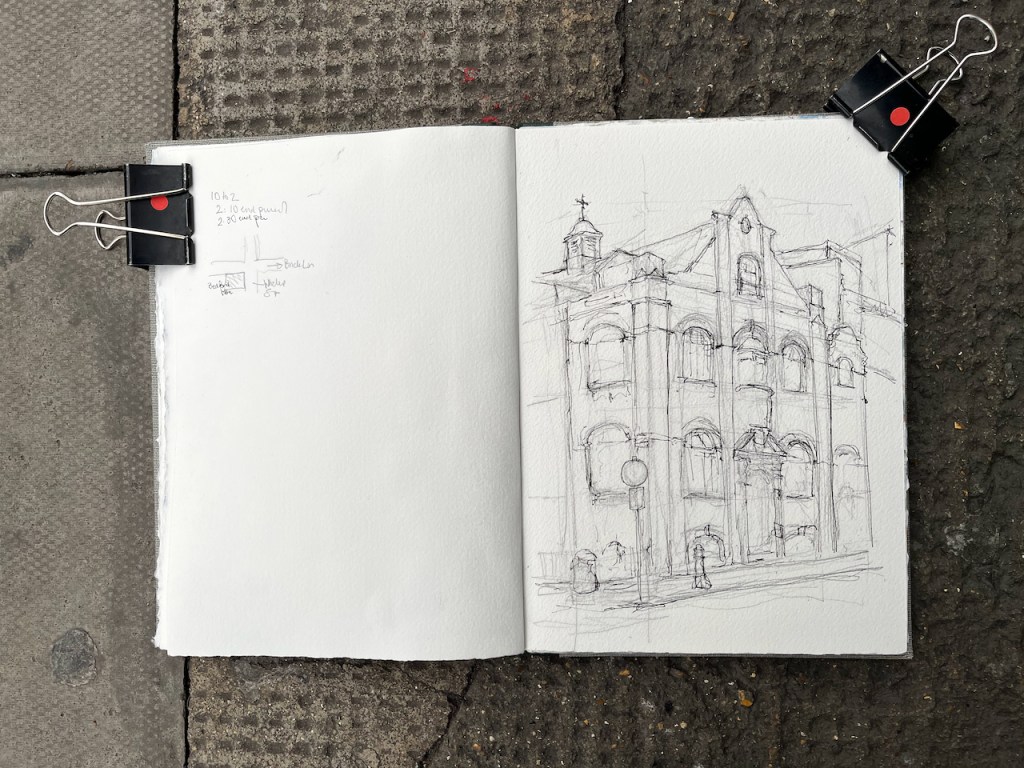
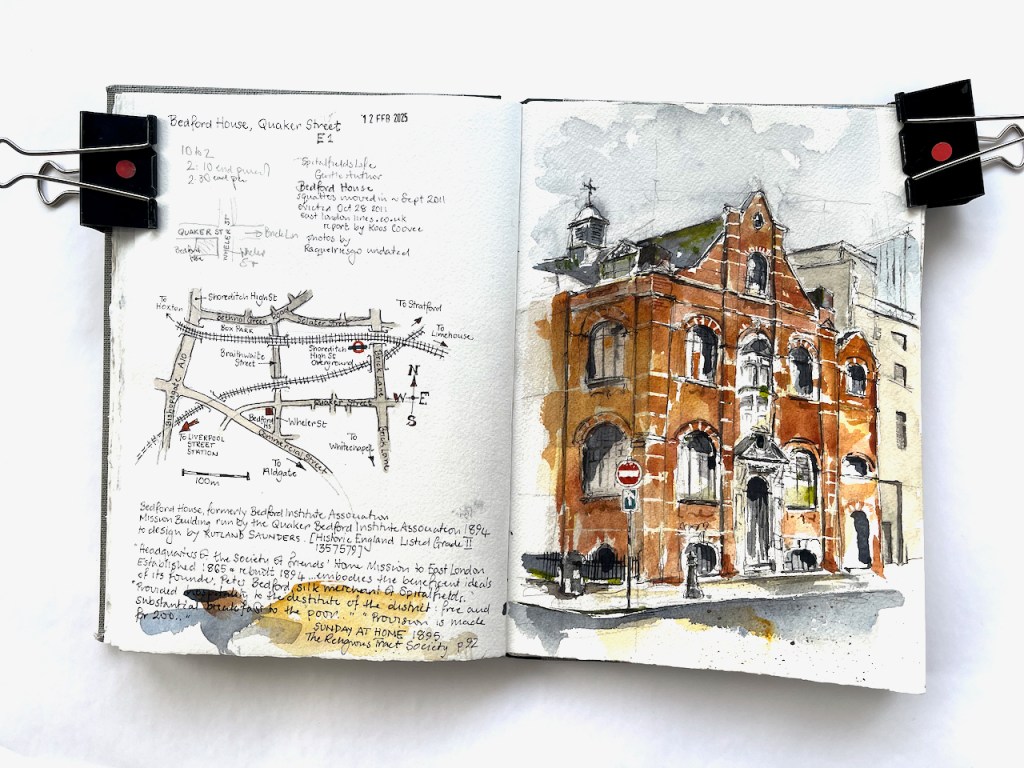
This magnificent building is on the corner of Quaker Street and Wheler Street, in east London, near Liverpool Street Station.

Bedford House, Quaker Street. Sketched 12 February 2025 in Sketchbook 15

It is intriguing: grand but dilapidated. Grass grows from the ledges, windows are broken and patched. The front door is blocked with a waste bin. But it has style.

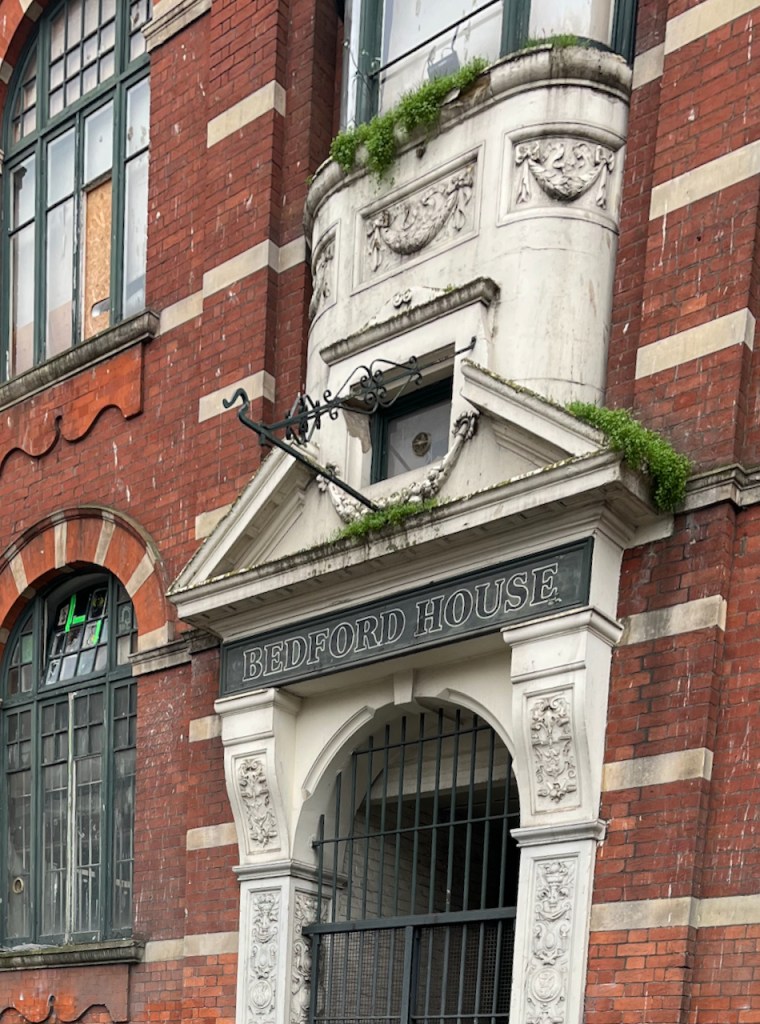
At one time it was bright, new, clean and purposeful. This was the headquarters of a Quaker mission in east London: the Bedford Institute Association. It was built in 1894 replacing a previous building.

The lofty, picturesque, red-brick building, with its gables and tall roof, is constructed and equipped with solidity, and liberality and far-sightedness which distinguish all the admirable buildings erected by the trustees.”

“Sunday at Home” published by the Religious Tract Society, 1895, Volume 42, page 92

This issue of “Sunday at Home” published in 1895, goes on to describe the work which was undertaken in the building, which was less than a year old at the time of writing. Its purpose was to provide hospitality and education for the destitute of the locality.

“The Sunday begins with a well-planned hospitality to the destitute of the district – a free and substantial breakfast to the poor whose poverty is nowhere seen in a more aggravated form than in Spitalfields.

Provision is made for two hundred, who are supplied with tickets of admission by those who well know the district […] The large lower room in which they are received and comfortably seated is built for purpose, and is itself a lesson in cleanly living as well as of hospitality. The needful ventilation of a room crowded by two hundred guests, entirely devoid of any resources for personal cleanliness, is supplied by rapidly revolving steam fans placed over the doorways…

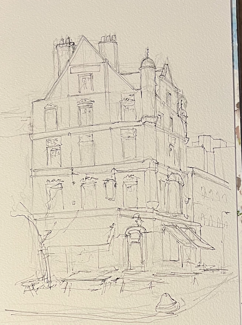
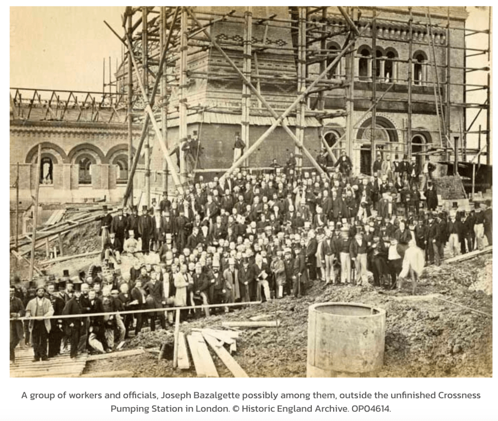
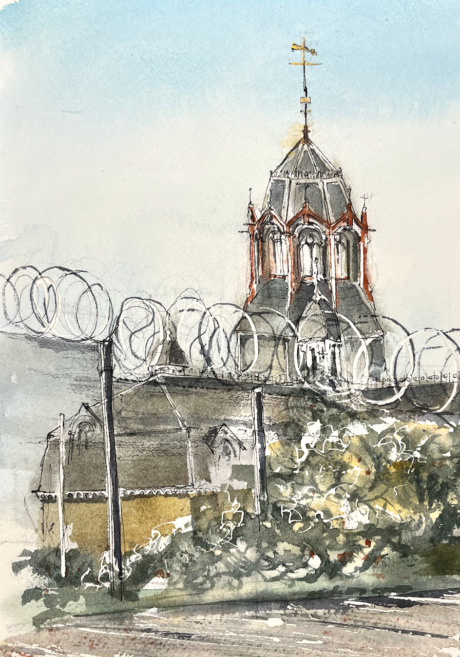
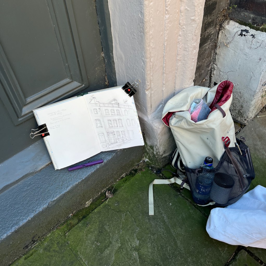
The article contains a picture, drawn from almost exactly the same spot where I was standing:

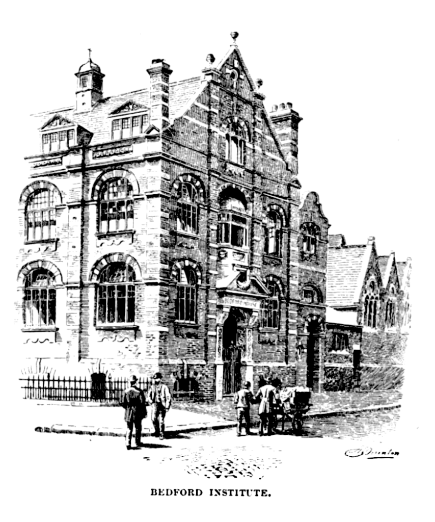
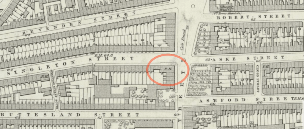
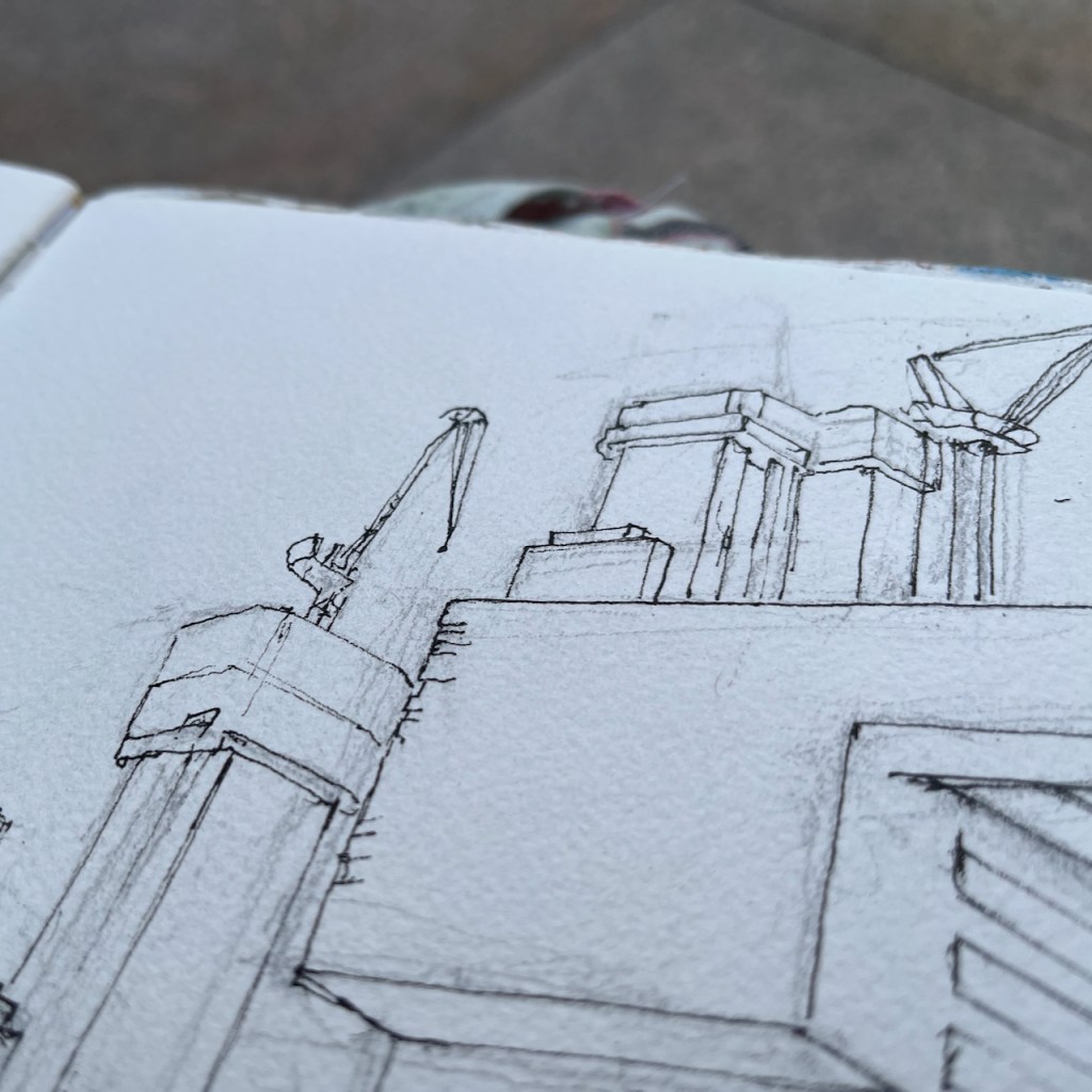
At that time there were tall chimneys on the front corners of the building, now reduced to stumps, as you see in my picture. Otherwise the building looks unchanged, on the outside at least. Even the cast-iron railings, centre left, are still there. The adjacent buildings on the right, with the ecclesiastical pointed windows, have been replaced by modern buildings, taller and boxier, with rectangular windows.

Although I was able to read in detail about the use of the building in 1895, I have been unable to discover much of its more recent history. In 2011, for a few months, squatters lived there. “The Gentle Author” visited the house during their occupation1 A photographer, Raquel Riesgo, documented her life during the squat. The squatters were evicted on October 28th 2011.

But what happened next? This building was created to serve destitute people in Spitalfields. Does it continue its mission?

If anyone knows what’s happening there now, I’d be really interested. Please comment below or get in touch.


I found “Sunday at Home” thanks to a link in a comment by Deidre Murray on the listing in Historic England.
“Sunday at Home – a family magazine for Sabbath reading v.42” is available on the website of the Hathi Trust on this link:
https://babel.hathitrust.org/cgi/pt?id=mdp.39015068375545&seq=108&view=1up
or if that doesn’t work try this link:
https://hdl.handle.net/2027/mdp.39015068375545

The publication is “Public Domain, Google-digitized.

The pages I have referenced start on this link: https://hdl.handle.net/2027/mdp.39015068375545?urlappend=%3Bseq=108%3Bownerid=13510798887051007-112

The name of the author of the article and of the artist who drew the picture are not given.

Click below to read or download the pages relating to the Bedford Institute:


  1. The Gentle Author describes his visit in a blog post: https://spitalfieldslife.com/2011/09/29/at-bedford-house/ Reading the comments on his post, there is a sense of the local mixed opinions surrounding this squat. ↩︎

George and Vulture, Pitfield Street, N1

Pitfield Street is a historic London street going north from Old Street. About half-way along is the George and Vulture pub.

The George and Vulture describes itself as the tallest pub in London. The current building dates from 1870, according to the pub’s website.

The George and Vulture, Pitfield Street. Sketched 29 Jan 2025, in sketchbook 15

The “Pubs History” website lists licenced victuallers from 1827 onwards. Here is a scrap from Robsons Street Directory in 1832.

https://londonwiki.co.uk/streets1832/Haberdashersstreet.shtml

The original address of the pub was 35 Haberdashers Street. Much of the land round here was owned by the Haberdashers Livery company, bequeathed to them by Robert Aske, a merchant (1619-1689). In 1862 the Haberdashers company offered new leases on properties here:

Haberdashers’ Estate, Hoxton.
A free public-house, adjoining the high road, and 66 dwelling-houses.
To be let, by tender, by the worshipful Company of Haberdashers, Governors of Aske’s Charity Estate, Hoxton, on repairing leases, for 21 years, from Midsummer, 1863:—
The free public-house, known as the “George and Vulture,” situate in Haberdashers’ Street, which might be enlarged so as to form a corner house to the main street.
Also 12 houses, Nos. 1 to 12, Haberdashers’ Place, which may be converted into shops, at the option of the lessee.
Also 19 houses, Nos. 1 to 19, on the south side of Aske’s Terrace; and 35 houses, Nos. 1 to 35, on the north and south sides of Haberdashers’ Street, in the parish of St. Leonard, Shoreditch, in the county of Middlesex.
Plans of the property, and specifications of the repairs to be performed, may be seen at the offices of Mr. William Snooke, the surveyor to the governors, No. 6, Duke Street, London Bridge, between the hours of 10 and 4 o’clock.
Tenders, in writing only, are to be sent in to Haberdashers’ Hall, Gresham Street West, on or before Thursday, the 27th day of November 1862.

City of London Livery Companies Commission, ‘Report on the Charities of the Haberdashers’ Company: Appendix’, in City of London Livery Companies Commission. Report; Volume 4(London, 1884), British History Online https://www.british-history.ac.uk/livery-companies-commission/vol4/pp478-486 [accessed 30 January 2025].

One of the properties to be let, as you see, was
“The free public-house, known as the “George and Vulture,” situate in Haberdashers’ Street, which might be enlarged so as to form a corner house to the main street.”

Evidently the lessee enlarged the pub, as the Haberdashers Company suggested, and it does indeed form a corner house to the main street. The address of the pub is now 63 Pitfield Street. Here is the 1877 map which shows the pub as a “corner house”. The road layout on the west of Pitfield Street is largely unchanged. Singleton Street is now called Haberdasher Street.

1972 Ordnance Survey map, from the National Library of Scotland, re-use: CC-BY (NLS)

The area was bombed extensively in the 1939-45 conflict, but the pub survived. Bomb maps show that the area adjoining Aske Street on the other side of Pitfield Street was damaged beyond repair. A plaque on the row of shops just North of the pub describe the re-building.1

“Haberdashers Place was destroyed by enemy action on 11 May 1941 and re-built in 1952 when on first July this stone was laid by the master of the Worshipful Company of Haberdashers S.A. Last-Smith.
Clerk W B(?)revett – Builder W Philips & Son -Architect Terence C Page”
Photo: January 2025

Here is the 1872 map alongside a modern map. You see that the rows of terraced houses on the east of Pitfield Street have gone, and are replaced by low-level residential housing blocks with a different layout.

I sketched the pub on a cold January day. I did the pen and ink on location and then retreated to my desk to do the colour.

Sketchbook 15

I cannot discover why the pub is called the “George and Vulture”. Why “vulture”? There is another pub in London of the same name, in the alleys of the City close to the Jamaica Wine House. That one was established in 1175. There was also a George and Vulture in Tottenham, 490 High Road, N172, from around 1759, now demolished.

The George and Vulture Tottenham in 1950,
image from: https://tottenham-summerhillroad.com/old_pubs_of_tottenham.htm

Can anyone throw any light on the meaning of the name?

  1. The site “urbannarrative” by local architect Steven Smith, comments on this re-building: https://urbannarrative.com/DITCHWATER ↩︎
  2. Website: “Pubology.co.uk”: https://www.pubology.co.uk/pubs/9402.html ↩︎

Jesus Green Lock House, Cambridge

A house stands by Jesus Lock on the River Cam. I have walked by it so many times, over decades, that it holds a magical place in my mind. In the dimness of a childhood memory, I am looking over the wall. I remember flowers in the window boxes, a garden. Then somehow it became ignored, scruffy, derelict, vandalised. Then nothing happened, and it just stood there. Each time I saw it, it was slightly more dilapidated. But it remained in my memory, a beautiful house, in a lovely location. Surely someone will do something with it?

And last time I visited Cambridge, I found that, miraculously, yes!, someone is renovating it.

Jesus Green Lock House being renovated. Sketched from Jesus Lock, 24 January 2025, in sketchbook 15

You can see the progress of their work on their instagram site @uglyduckling_reno

This picture from the website of Michelle Bullivant1 shows Jesus Green in the 1700s. The little house by the river, arrowed, looks to me to be in the same position as the current Lock House, and you can see a bridge or ford across the river Cam at this point. I recognise the houses on the bottom right, which look like the terrace of houses on Chesterton Road which is still there.

Image from Michelle Bullivant, Local Historian

This photo of an old postcard shows that, in 1879, the lock house was single story.

Jesus Lock in 1879 – showing the floods.
Image from capturingcambridge.org licensed under creative commons
CC BY-NC-SA 4.0

During the 19th century, it was rebuilt. This picture shows the two-storey lock-keeper’s house on the left:

Image from capturingcambridge.org licensed under creative commons
CC BY-NC-SA 4.0

It was listed Grade II in 19722. In the 1990’s the final lock keeper moved away3 The house then became a house of multiple occupation (HMO), for students. These was an application in 2016 to turn it into a café, reference 16/0001/FUL. Its use was listed as “HMO” at that time. But this application was refused.

In 2021, the house was bought by its current owners, who have been bravely going ahead with a renovation to transform this listed building once again into a residential dwelling, with an aspiration also to host community events4

“Eventually it will be a beautiful place and a better place”

I sketched the house on a very cold day in January. There was a strong wind which not only threatened to throw my sketchbook into the Cam, but also made my eyes water so I couldn’t see properly. I finished the pen and ink, and decided that was enough. Then, by a happy chance, I encountered the current owner unlocking the fence gate. Hence I learned about the efforts of this mother and daughter team, who are determinedly navigating the difficulties of an old building, listed consents, and many other obstacles. But they make amazing progress! See their instagram account for more information.

References:

  1. Michelle Bullivant, Local Historian. The image is on this page: https://www.michellebullivant.com/cambridgeshirehistory/brief-history-of-jesus-green-cambridge#/ ↩︎
  2. Historic England listing number 1111846: https://historicengland.org.uk/listing/the-list/list-entry/1111846?section=official-list-entry ↩︎
  3. The final lock-keeper moved out in the 1990s according to the Cambridge Edition May 14th 2023. https://cambsedition.co.uk/property/lock-house-and-key/ ↩︎
  4. The renovation reported in the Cambridge Evening News 15th July 2021: https://www.cambridge-news.co.uk/news/cambridge-news/jesus-green-lock-house-getting-21062688 ↩︎

Two cranes

These two cranes are at Chatham Dockyard.

They stand by the river, ready for work. They are old cranes. It’s a long time since they lifted loads. But they hold themselves ready, should the call come. While they wait, they talk to each other.

So I put them on the same sheet, they go together through the etching press.

I made five prints of these cranes. The colour is added using the “chine colle” technique.

“Chine collé” means putting paper on top of the plate before it goes into the press. I have written about it on this page.

Here is the paper on top of the plate. It has glue on the top surface. The paper is very lightweight Japanese paper. It’s quite hard to get it to stay in position.

Here is a video of this plate after it’s been through the press:

Printing “Two Cranes”: thanks to friends at East London Printmakers for helping me with the video

I etched the plates and made these prints at East London Printmakers, Stepney. The techniques for making the plates are hard ground, soft ground, aquatint and dry point. The ink is Intaglio Printmakers Shop Mix Bone Black.

The cranes are at The Historic Dockyard, Chatham, Kent ME4 4TE

Let me know if you’d like a “Two Cranes” print? The sheet is about A2 size.

Crossness Sewage Pumping Station, engine house, Abbey Wood, London SE2

Here is a view of the old engine house of Crossness Pumping Station, on the South bank of the River Thames.

Crossness Engine House, sketched 5th January 2025 from the Thames Path

This is a former sewage pumping station. It was designed by the engineer Joseph Bazalgette and opened on the 4th April 18651 . It is the equivalent for South London of the Abbey Mills sewage pumping station on the North side of the Thames, which I have sketched previously.

Sketch map showing the location of Crossness Sewage Treatment Works

These two pumping stations were important components of Bazalgette’s plan to rid London of cholera by removing sewage from central London. His idea was to pump the sewage from the conurbations in central London and shift it to Crossness and Beckton. This did indeed solve the problem of cholera in the city. It did not solve the problem of untreated sewage in the Thames: it just moved it downstream and away from the main residential areas of the time. Untreated sewage was pumped into the river at Crossness and Beckton on the ebb tide.

In 1878 the passenger steamer Princess Alice collided with another vessel and sank right at the spot where the sewers released their waste into the Thames. People who survived the collision died as a result of immersion in the polluted water .2

The exact number of passengers on board the Princess Alice during that fatal voyage is unknown, as is the number lost, but it is thought that around 640 people drowned, making this Britain’s worst inland waterway disaster.

Royal Museums Greenwich (https://www.rmg.co.uk/stories/blog/library-archive/drowning-sewage-sinking-princess-alice)

This terrible tragedy and the consequent public outcry prompted the authorities to shift the problem even further downstream. Sewage boats were used to transport raw sewage into the Thames estuary and dump it in the North Sea. Amazingly, this continued until 1998:

The tragedy prompted the introduction of what became known as ‘Bovril boats’ (due to the unfortunate colour and consistency of their cargo), which carried sewage sludge out to the Thames Estuary and North Sea, disposing of it there.This continued until 1998, when EU legislation forbade it due to contamination of beaches.

Royal Museums Greenwich https://www.rmg.co.uk/stories/topics/pollution-river-thames-history

These days the sewage is treated3 (mostly). Next to the Victorian pumping station I sketched, there is a vast modern sewage treatment works belonging to Thames Water. Sewage is transformed by bacterial action and filtering. It becomes water and “sludge”. The water goes into the Thames. The sludge is used as agricultural fertiliser or burned for electrical power generation.

Modern sewage treatment works, Crossness, seen from the Thames path.

On my walk I circumnavigated this enormous treatment plant. It hardly smelt atall.

The Thames is vast here.

I sketched the Engine House from the Thames Path. It is behind some tall and strong fencing, which I did not put in the picture.

As you can see, it was raining, on and off.

Here is a photograph of the Pumping Station as it neared completion. It is from a fascinating blog post on the “Historic England” website.

Source: Historic England Archive, used with permission.

The photo is more-or-less the same viewpoint as my sketch. I hope that the workers in this picture felt proud of their achievement, and would be glad to know that their work has been honoured, and building continues on the site.

20th century sludge incinerator, Crossness, and a further incinerator plant under construction, far left

The old engine house is maintained by the Crossness Trust.

Crossness page of Sketchbook 15
  1. Dates of construction from the Historic England listing: https://historicengland.org.uk/services-skills/education/educational-images/crossness-pumping-station-belvedere-road-bexley-8211, and from the Crossness History site: https://crossness.org.uk/timeline/ ↩︎
  2. The problem of pollution in the Thames and disaster of the “Princess Alice” is related on the Royal Museums Greenwich site: https://www.rmg.co.uk/stories/topics/pollution-river-thames-history ↩︎
  3. The Thames Water site has a description of sewage treatment here. There is a detailed description of sludge incineration in this article of 2019: https://greenwichindustrialhistory.blogspot.com/2019/11/crossess-sewage-sludge-incinerator.html
    ↩︎

Absinthe Table: chine collé prints

I made a new series of six prints of The Absinthe Table.

Print 1: single plate, black ink

I used black ink and green ink.

The ink is Intaglio Printmaker etching ink: Bone Black Shop Mix, and Light Green. Print 3 is made from two etched copper plates: first I printed the background pattern using green ink, then I printed the bottles and table, using black ink on another plate.

Then I made some more prints adding chine collé. Here are prints 5 and 6.

Chine collé is thin paper. I put it on the plate before the print roller goes over. The heavy rollers squeeze the coloured paper onto the picture, giving the yellow rectangles on the images of prints 5 and 6. The yellow rectangles give a sense of depth – maybe you are looking at these bottles through a window. Or maybe there is a window above casting a sunlit patch.

Prints 5 and 6 are made using two plates and chine collé. The process is lengthy and fraught with potential error:

  • put the glue on the yellow chine collé paper. Let it dry.
  • ink the green plate, the background
  • ink the black plate, the foreground. (don’t get them the wrong way round)
  • put the green plate on the press, inked side up (not inked side down)
  • put the white paper on top of it (don’t get ink smudges on the white paper)
  • roll the press across the plate, and keep the end of the paper under the roller so it doesn’t move while you….
  • …remove the green plate, and replace it with the black plate (get it oriented exactly where the green plate was, and the right way up, and the right way round)
  • put the glued chine collé paper on the black plate, glue side up (it is very lightweight and drifts about when someone walks past)
  • let the white print paper fall on top (as it falls it wants to dislodge the layers underneath)
  • roll the print press
  • remove the finished print ( examine – did it work?)

The chine collé technique is described on this page of my website.

It is also possible to use the chine collé to provide a background for the whole image. Here is print 4. This is made using chine collé and one plate.

All these prints are made using heavyweight Fabriano Unica printing paper. It can be folded in half to make an A5 card to send to the absinthe enthusiast or wine drinker in your life. Or you can cut it down and frame it to make a small picture for your kitchen. The image itself is about postcard size: 10cm x 15cm. Let me know if you would like one? £25 + postage.

Here is a gallery of all six prints from this second series. These are all handmade prints from the etching press – not digital prints. I’ve numbered the prints in this post for easy reference. The numbers do not appear on the print you will receive. I can sign them if you like or not if you prefer them blank.

Here’s the copper plate I used for the black foreground:

Abbey Mills E15: sewage pumping station

Here is Abbey Mills Pumping Station, seen from The Greenway.

Abbey Mills Pumping Station, London E15, sketched from The Greenway, January 2025 in Sketchbook 15

Abbey Mills is a sewage pumping station1. It lifts the sewage from lower level sewers, and pumps it 40 feet uphill to the Northern Outfall Sewer. The Greenway path is on top of the Northern Outfall Sewer.

This system was created by the visionary Victorian engineer Joseph Bazalgette (1819 – 1891). The pumping stations and the Northern Outfall Sewer are part of a grand construction of sewers and water management works instigated in the 1860s after the “Great Stink” of 1858. The problem of untreated sewerage being discharged into the Thames had been causing disease and bad smells for some time. When the smell and fear of disease affected Parliament, which is located next to the Thames, the government of the day took action.

“On 15 June Disraeli tabled the Metropolis Local Management Amendment Bill, a proposed amendment to the 1855 Act; in the opening debate he called the Thames “a Stygian pool, reeking with ineffable and intolerable horrors”. The Bill put the responsibility to clear up the Thames on the MBW [Metropolitan Board of Works], and stated that “as far as may be possible” the sewerage outlets should not be within the boundaries of London; it also allowed the Board to borrow £3 million, which was to be repaid from a three-penny levy on all London households for the next forty years.”

https://en.wikipedia.org/wiki/Great_Stink

So this loan, and the 3d levy on Londoners was used in 1865 to construct the pumping stations and a new sewerage system.

The Victorian sewers are still in use, and are now gradually being upgraded by Thames Water.2 According to the video on their site, the Northern Outfall Sewer constructed by Bazalgette’s team is being left in place. Thames Water are pushing a lining into it, made of 21st century materials. They reckon this will last another 100 years. 3

I sketched Abbey Mills Pumping Station while exploring the Greenway from Hackney Wick to Becton.

“Thank you Sadiq”

The Greenway is a well-used pathway and running route. While I was sketching, a wiry grey-haired runner stopped to chat. He was a cheerful person, sharing my enthusiasm for the transformation of Hackney Wick. He had much praise for the improvements in London, specifically on air quality. Air quality is much better, he said. “I no longer get asthma,” he told me, “even though I still run!” He surveyed the clean path and the view, ” Thank you Sadiq!” he exclaimed. Sadiq Khan is the Mayor of London, and has introduced and supported air quality improvement measures such as the congestion charge and the Ultra-Low Emission Zone (ULEZ).

My new friend had been a skip-truck driver. He’d worked everywhere, he told me. Constructing the Olympic Park had been a big job. Examining my sketchbook, he saw the sketch of Fournier Street. “I recognise that!” he said. And then, looking closer, “There’s an Express Dairy depot just up the street.”

If you know Fournier Street, you will know that this seems extremely unlikely. Fournier Street is in a residential area, somewhat densely packed, and apparently not a place for a goods yard of any type. However he seemed sure, and I didn’t contradict him. I thought he might have mistaken the location: there are a lot of Georgian terraces in London.

35 Fournier St (1948)

When I was back at my desk I did a search4. Sure enough, just a few houses along from my sketch, there had been an Express Dairy Depot, just as he said. It’s shown in the “history” section of the Express Dairy site. The London Picture Archive shows it. I should not have doubted him. The wide entrance is still there.

I completed the ink sketch on location and then packed up to continue my walk. I still had a good 3 miles to go and it was getting dark, and cold.

It was dark when I reached Beckton. I left the Greenway as it crossed the A13.

Greenway to Beckton DLR. Map (c) OpenStreetMap contributors.

If you’d like to follow my route along the Greenway, in the file below is my idiosyncratic description of the route and my walk. The below file is 6 pages printable pdf. The Greenway is part of the Capital Ring, a long-distance walking route.

  1. Abbey Mills is a working Pumping station and not open to individual visitors. It is open to groups from time to time. The organisation “Subterranea Britannica” was invited for such a visit in 2012, which they wrote up in their journal Subterranea, Issue 30. The article describing their visit is by Martin Williams and Alex Lomas. See this link:
    https://www.subbrit.org.uk/sites/abbey-mills-pumping-station/
    ↩︎
  2. Major £70million upgrade to Stratford’s Victorian sewer system
    Press release from Thames Water: Tuesday 17 January 2023 13:09.
    https://www.thameswater.co.uk/news/70million-stratford-sewer-upgrade
    “A giant Victorian sewer in East London is being upgraded as Thames Water continues its investment in infrastructure across the capital. 
    The UK’s largest water and wastewater company is investing £70million over the next three years to upgrade the Northern Outfall Sewer and ensure its pipes are resilient for future generations. 
    The sewer, which serves over 4 million people, runs from Wick Lane to Beckton Sewage treatment works, the largest in Europe.   ….”

    ↩︎
  3. YouTube video “on Tap” from Thames Water, describes the work being done in 2023 to upgrade the Northern Outfall Sewer. It also contains great photos of the inside of Abbey Mills Pumping Station, and amazing aerial views of the Greenway.
    https://youtu.be/d628Y0dh2sA ↩︎
  4. The Express Dairy depot in Fournier Street is shown in a photo on the Express Dairy site.
    https://expressdairytales.uk/ed-retail-london-and-south-1974-and-before
    1948 Express Dairy depot at 33-35 Fournier Street. Photo by Paul Simm.
    and
    London Picture Archive
    https://www.londonpicturearchive.org.uk/view-item?i=121843&WINID=1735932557537
    1955 view of the same premises. ↩︎

North side of Broadgate Circle, EC2M

Broadgate Circle is undergoing massive redevelopment. Here is the view looking North.

View of the North side of Broadgate Circus, 2 Finsbury Avenue under construction.
Sketched, 30 December 2024 in sketchbook 15.

The concrete cores in the background are 2 Finsbury Avenue under construction. The previous building was demolished. On the left is 1-2 Broadgate, replacing previous buildings. The steel-clad building on the right is 5 Broadgate which replaced 4 and 6 Broadgate and sealed up the access road that led between them.

Building replacement: after 40 years, all change.

Broadgate Circle was constructed in 1985-7 on the site of the former Broad Street station. Here is what the 1980s buildings looked like:

4 and 6 Broadgate, on the North side of Broadgate Circle, before 2012.
From: https://knowyourlondon.wordpress.com/2015/09/14/broadgate-circle/

5 Broadgate, on the right of my sketch, replaced the two buildings in the photo above. It is occupied by the bank UBS. The building has its own Wikipedia page:

The two lowest storeys contain a 200-seat auditorium, restaurants, a gym, and a dry cleaner. Above those are four trading floors which can fit 3,000 people each, as well as seven storeys of offices above. The superstructure is divided into a grid of 13.5-by-12-metre (44 by 39 ft) sections, arranged around the trading floors. Three of the building’s four utility cores are placed along the site perimeter to increase the amount of space on each trading floor.

Wikipedia – https://en.wikipedia.org/wiki/5_Broadgate

The new 2 Finsbury Avenue “consists of a 12-storey podium with a 21-storey West Tower and 36-storey East Tower.”1 It is due to be completed in 20272 and will look like this:

The new 2 Finsbury Avenue, from the website of the architects 3XN.
For scale: 5 Broadgate Circle is on the right of this picture, with the >< signs on the side.

Broadgate Circle is owned as a joint venture between British Land and GIC3. It is adjacent to Liverpool Street Station on the East side of the City of London.

Sketch map showing the location of Broadgate Circle, and my viewing line for the sketch

Here are photos while I was sketching:

Here are links to more views of the 1980s buildings:

Sketchbook 15
  1. Pictures and descriptions of the new 2 Finsbury Avenue are from the architects’ website: https://3xn.com/project/2-finsbury-avenue-broadgate ↩︎
  2. 18 April 2024 Press release from British Land and GIC. See the press release on this link, file attached below in case the link has expired. https://www.britishland.com/news/broadgate-secures-landmark-pre-let-at-2-finsbury-avenue/ ↩︎
  3. British Land is a UK property developer and GIC is “a leading global investment firm established in 1981 to secure Singapore’s financial future”. GIC is “the manager of Singapore’s foreign reserves” Quotes are from press release below. ↩︎

25 Fournier Street, London E1

Fournier Street is a row of 18th century houses in Spitalfields, east London. Here is number 25.

25 Fournier Street, sketched 19th December 2024 in sketchbook 15

The weather was cold, and I was sheltering from the wind in a doorway opposite.

People rushed past on the pavement in front of me. It was nearing Christmas. I caught fragments of conversation. “Everyone’s after money” said a woman to her companion, “and it’s wrong!“.

I enjoyed spending time looking at this elegant house. The tops of the windows are curved. This is quite common in London. What is unusual here is that the wooden window frames are also curved, and the top panes of glass are curved to match. This must make replacing the glass quite a labour, I thought, and the curved sash window frames would need a skilled carpenter.

A woman approached, looking bothered. She caught sight of me in my doorway. I thought she wanted to open the door where I was standing, to enter the house behind me. So I was ready to express my apologies and move my stuff out of the way. But no, she wanted directions to Brick Lane, which is at the end of Fournier Street. “Just there,” I said, pointing. Brick Lane was almost visible, in a straight line from where we were standing.

She was flustered and didn’t seem quite to believe my simple direction. “It’s all changed round here!” she objected. I paused.

This street has hardly changed in 300 years. I’d just spent an hour looking at a house that was built in 1727. But I didn’t say that: a latent voice episode1.

She was an artist too, she told me. She was looking for a gallery. She hurried off, in the direction I’d indicated.

I was left looking at the house, and thinking.

  1. latent voice episodes = “potential communications that may or may not in fact occur”, Harvard Business School paper: Working Knowledge, Q&A with Amy C. Edmondson, author: Sarah Jane Gilbert, March 20, 2006. “Latent voice episodes” is a useful concept, I think. It’s for those times when you might speak, but don’t. ↩︎

Chichester Cathedral

Here is a view of the south transept of Chichester Cathedral.

Chichester Cathedral, South transept, sketched 5th December 2024 from Canon Lane, in Sketchbook 15.

The first spire was built around 1500. There are no bells in the spire: the medieval builders put the bells in a separate little building in the cathedral grounds. This was just as well. The spire collapsed in 18611. It was rebuilt to the designs of Sir George Gilbert Scott, and that’s the spire in my drawing.

Chichester: location
Sketchbook 15

George Gilbert Scott was a prolific 19th century architect. I have sketched his work before:

Chichester Cathedral

Here is a view of the south transept of Chichester Cathedral. The first spire was built around 1500. There are no bells in the spire: the medieval builders put the…

Waterpoint, St Pancras, London N1

This structure is visible from the North side of the Regents Canal at Coal Drops yard. It was a “water point” for replenishing the boilers of steam engines. The top…

St Mary Stoke Newington N16

“What is that spire?” It’s just visible, on the horizon between office blocks. Some work with the binoculars and the map established that it must be St Mary Stoke Newington,…

  1. This history of the cathedral is on their website:
    https://www.chichestercathedral.org.uk/about-us/little-history-cathedral
    ↩︎