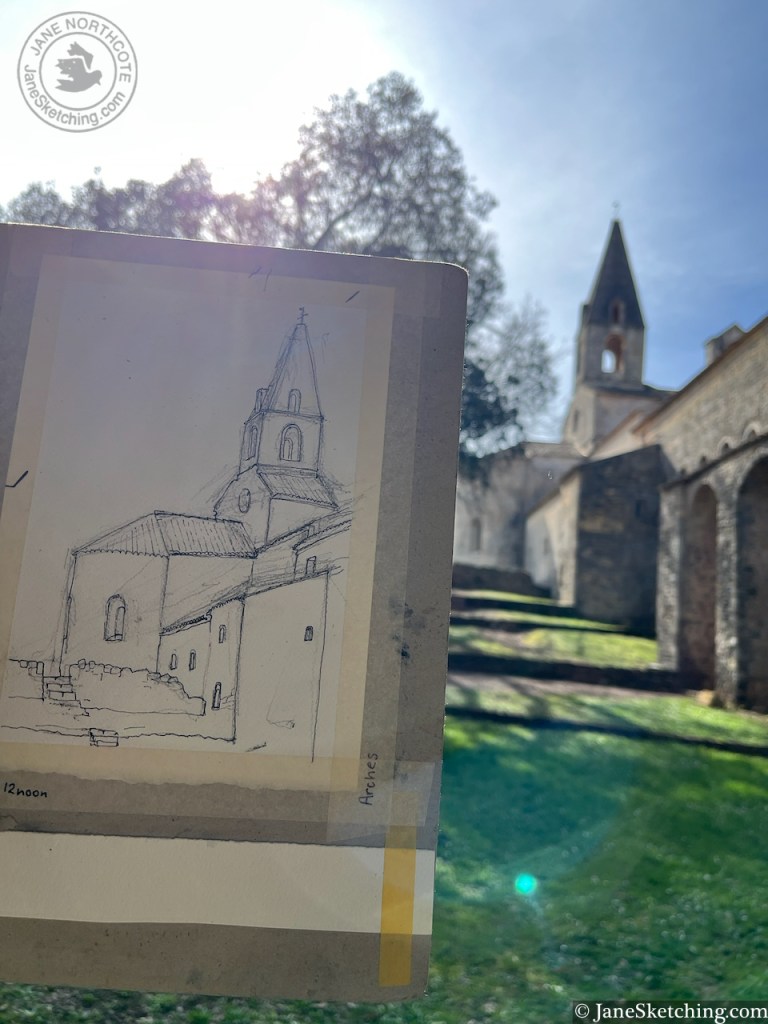
On a perfect day in Provence, I leaned against a wall and sketched a view of Le Thoronet.
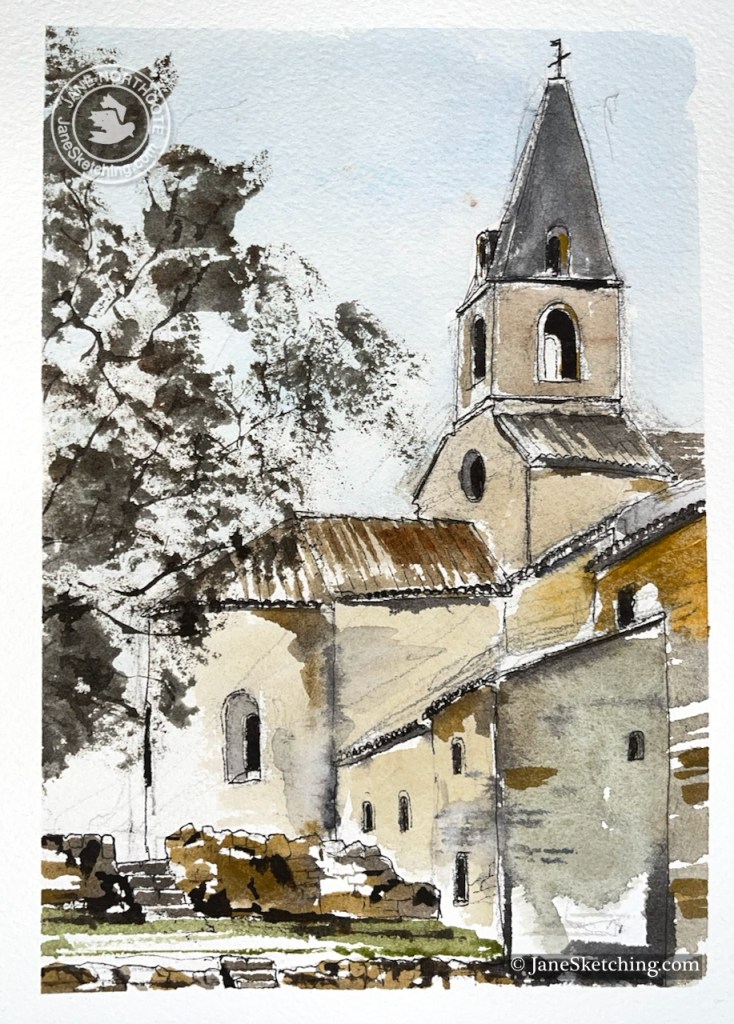
Le Thoronet Abbey, Var, Provence, 83340 France sketched 15th February 2026 on Arches 300gsm watercolour paper, size A5
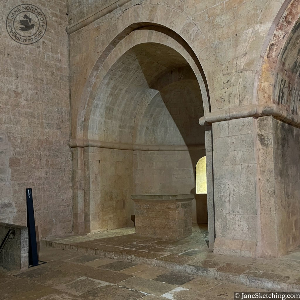
I loved this place because of its mathematical precision. As I sketched, I noticed that the tower is an isosceles triangle on top of a square. The windows are semicircles on top of rectangles. Some of the windows are circular.
The whole building has similar satisfying geometry.
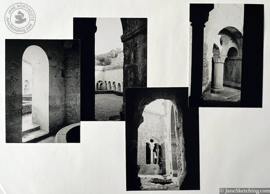
Le Thoronet Abbey, 7×5 photographs on Ilford XP2 film with an Olympus XA2 point-and-shoot camera, film developed by filmprocessing.co.uk. Film reference 201.
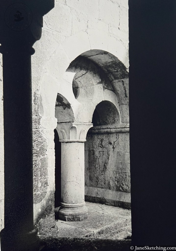
This is a Cistercian abbey, founded in 1136. It was built between 1160 and 1230. “restoration work began in 1841 and continues today” says the leaflet. The building is now State-owned. While we were there, a service was taking place in its austere geometric chapel.
Le Corbusier visited the Abbey in 1953.
He wrote of the Abbey of Le Thoronet: ” Light and shadow are the loudspeakers of this architecture of truth, calm and strength “.
Le Thoronet Abbey, photograph on Ilford XP2 film with an Olympus XA2 point-and-shoot camera, film developed by filmprocessing.co.uk. Film reference 201.
References and links:
Novel, by Fernand Pouillon (1912-1986), about the building of the Abbey, and the struggles faced by the construction workers: “Les Pierres Sauvages” (1960)
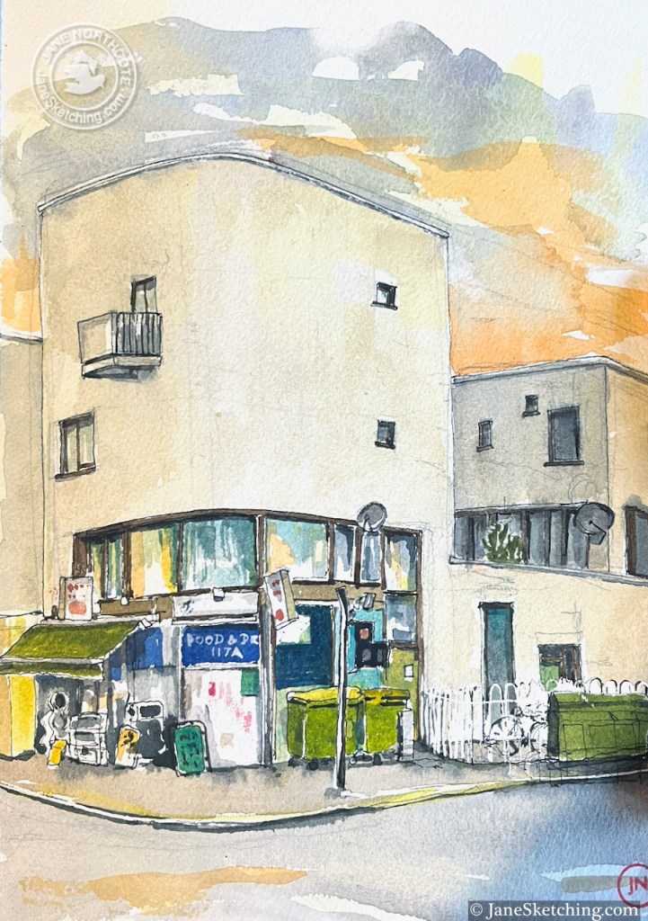
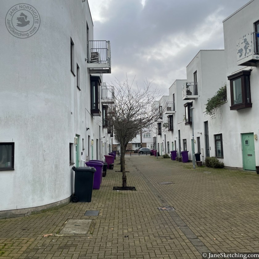
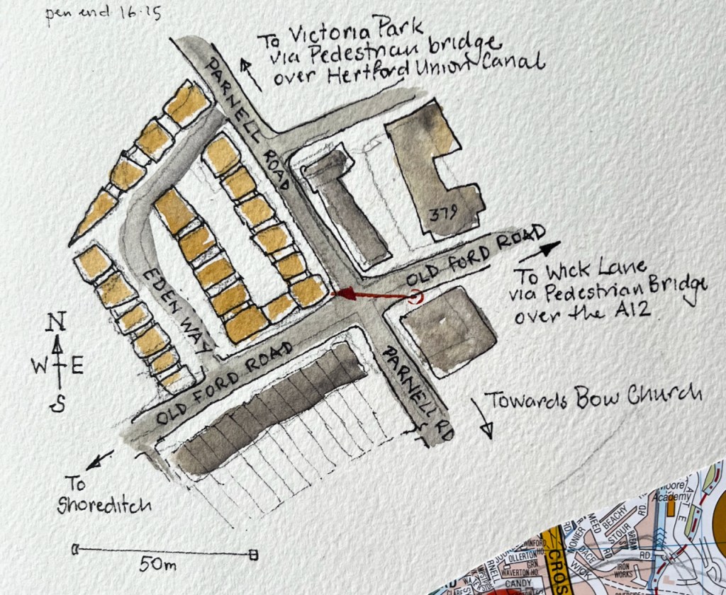
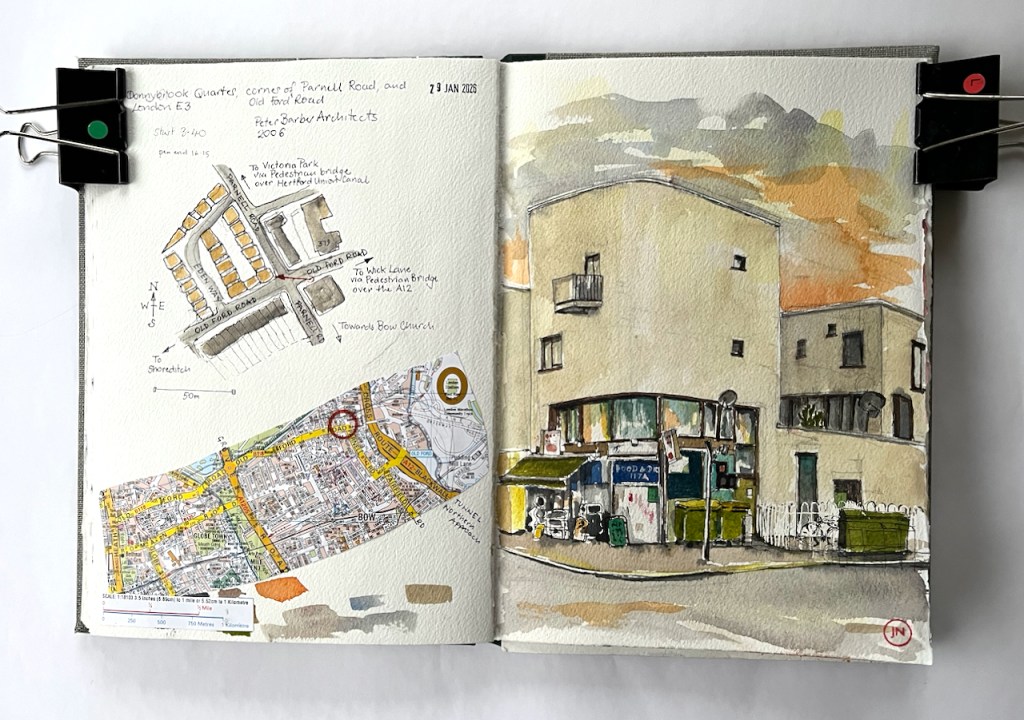
I saw this group of Mediterranean-style buildings on a long peregrination around East London. I went back to have a closer look. This is the “Donnybrook Quarter” which stands on a corner of Parnell Road, in Tower Hamlets. I arrived just as the sun was setting.
Part of the Donnybrook Quarter, Parnell Road, Tower Hamlets London E3, sketched 29 January 2026 in Sketchbook 16
The Donnybrook Quarter was completed ready for occupation in 2006. The architects were Peter Barber Architects.
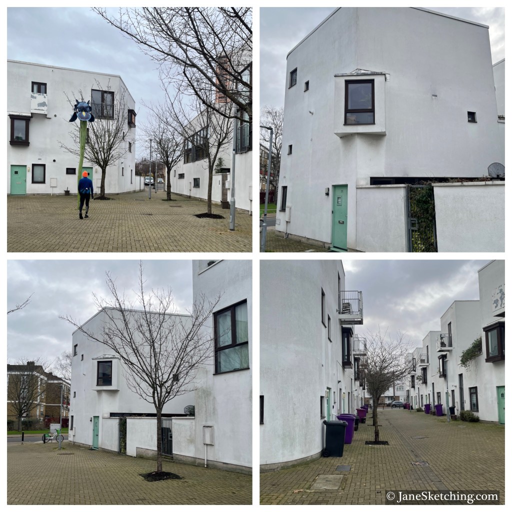
The architects write: “The scheme is laid out around two new tree lined streets which cross the site creating very strong spatial connections with adjacent neighborhoods and a handy cut through for their residents” (Peter Barber Architects.)
Here are snapshots of the tree-lined streets they mention. These pictures were taken in January 2026, so the trees aren’t perhaps as flourishing as they might be in the summer.
A photo-essay on the “Tower Hamlets Slice” website has some beautiful pictures by Yev Kazannik from April 2000. The essay provides interesting background to the development. It quotes Peter Barber as saying:
“…the style came about at the request of local residents during community consultations in the early to mid-2000s before the project was finished in 2006. ‘The residents were thinking, “Spain! Holidays! Marbella!” I’m completely happy with that,’ Barber said in an interview.”
Peter Barber goes on to say:
“…’This project is a celebration of the public social life of the street,’ .. ‘A worrying amount of building in London is done as a gated community. This is a counter-blast to that.’ “
Yez Kazannik comments:
“Walking through the lanes of Donnybrook, you will feel this neighbourly intimacy. Uniquely, the building units themselves have no corridors, entrances or ‘connecting’ spaces. Each room simply opens out into another. The streets themselves are meant to be the corridors, where neighbours can amble across each other. “
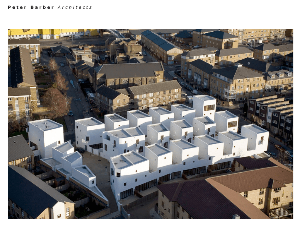
The concept is perhaps better understood from the air. Here’s an image from the architects’ website:
“We are one of the few streets in the country composed of sixty independent shops. Small art galleries sit next to cup cake shops, vintage clothes stores, English and Italian delis, garden and antique shops. There is also a wealth of great pubs, cafes and restaurants.”
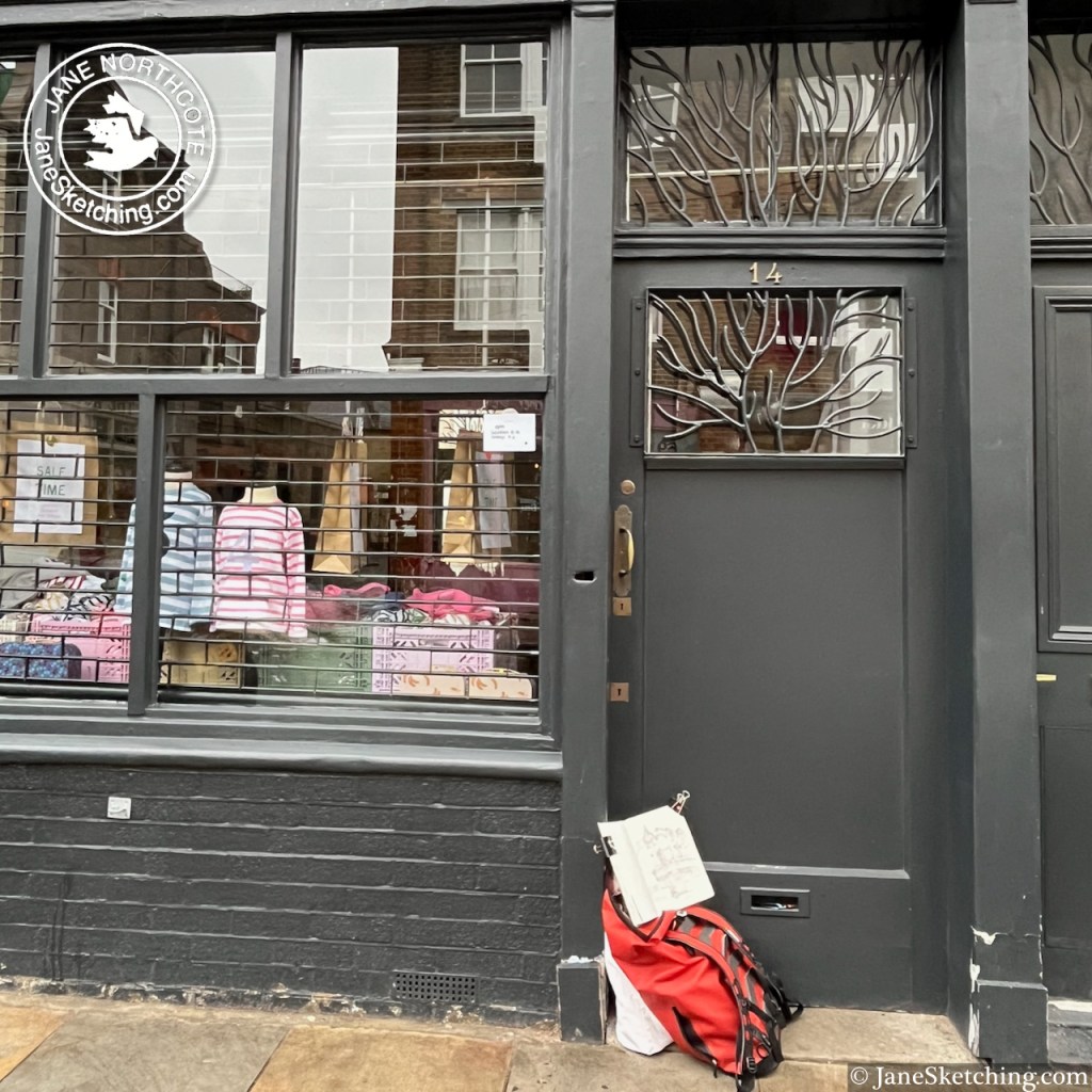
This is true, although you need to know that many of these shops are open only Friday-Sunday. I was there on a rainy Thursday. This was probably just as well, because it meant I had a good view of the pub from the doorway of the shop opposite.
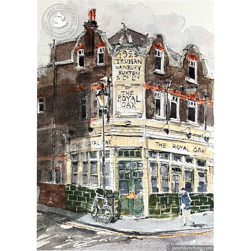
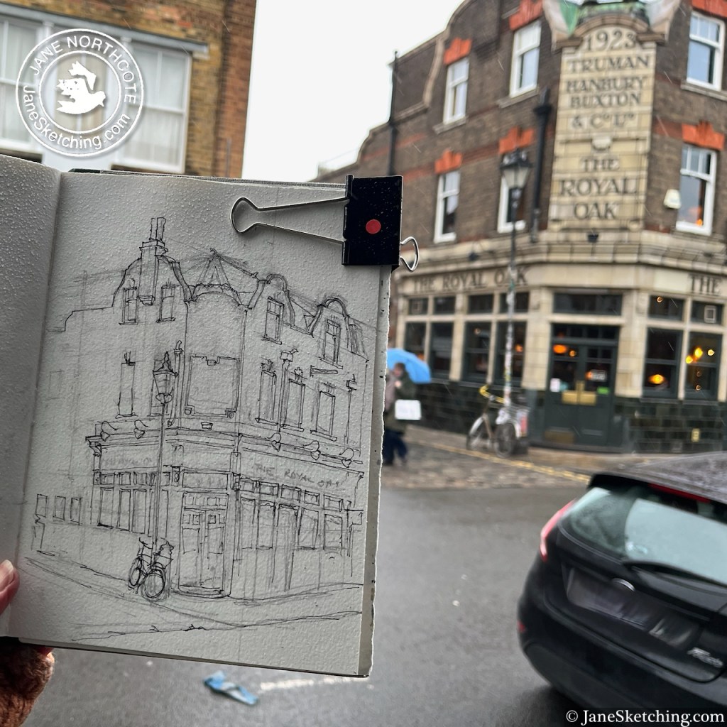
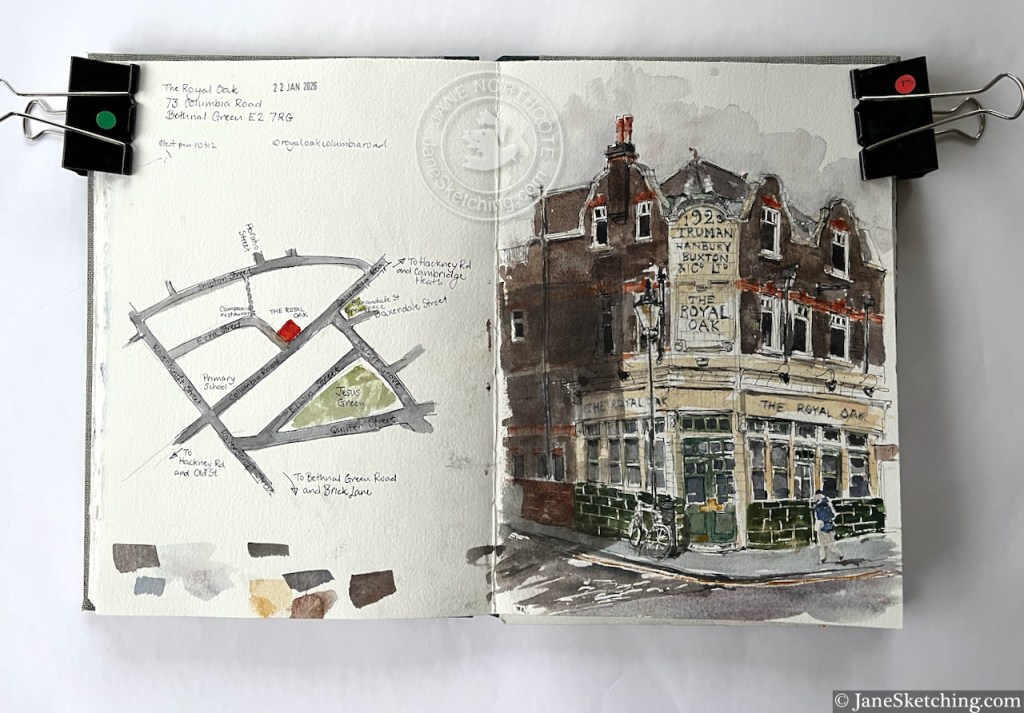
Sketching “The Royal Oak” from outside “Bob and Blossom” on Columbia Road
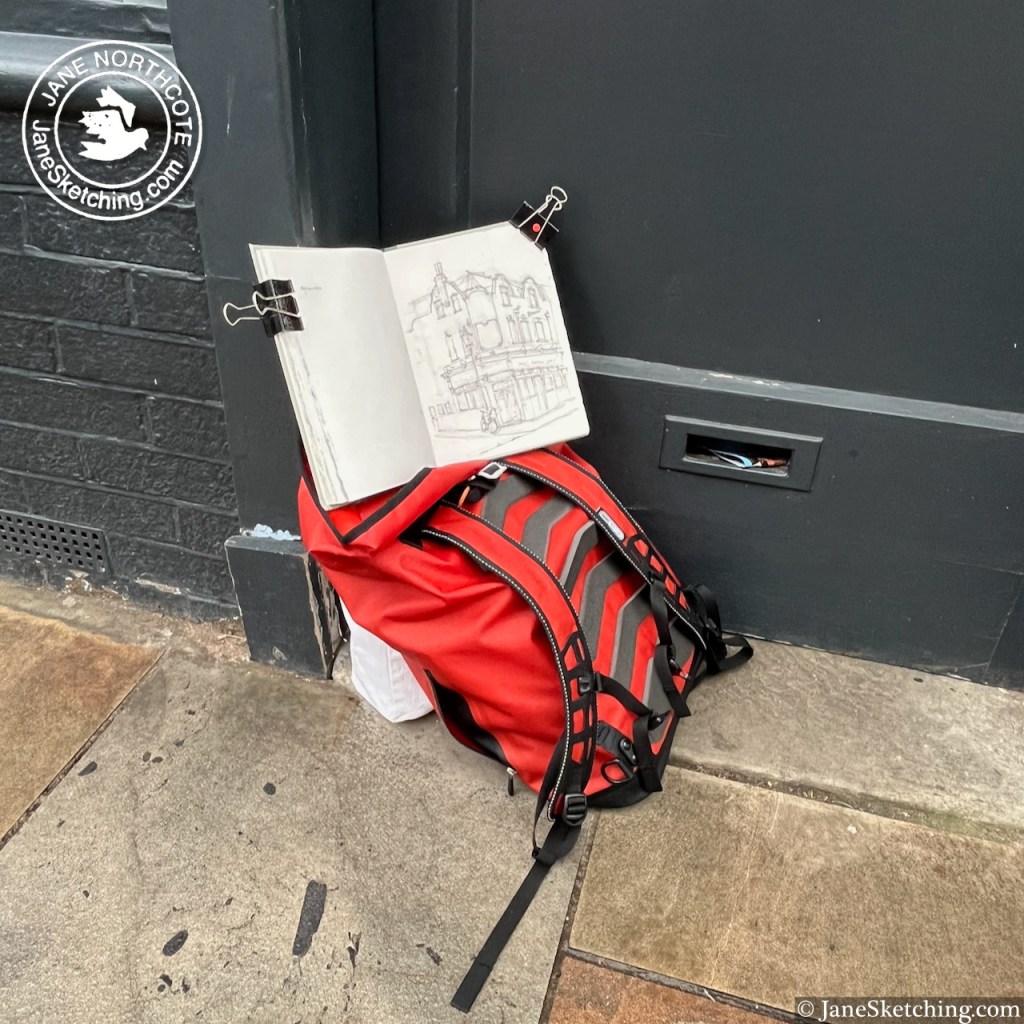
It was the nicest-smelling location for sketching. There was a coffee shop opposite distributing coffee-and-croissant aromas into the damp air, and somewhere nearby must have been selling soap, because there were wafts of tangerine, cedar, and lavender, smelling clean and unusual.
The pub is Grade II listed, listing reference 1426765. The present building is from 1923, built to the designs of Arthur Edward Sewell, for Trumans Brewery. The listing notes “Trumans distinctive green mottled tiling” which you can see in my sketch. According to the listing, there was a previous pub here, of the same name, from before 1842. The listing also maintains that this is an “early pub” with a licence to open from 9am on Sundays to serve the market-goers. This doesn’t seem to be the case any more, according to the pub website. But if you know different, or if you are the pub, please correct me!
It is now a Youngs pub, open every day from 12 noon.
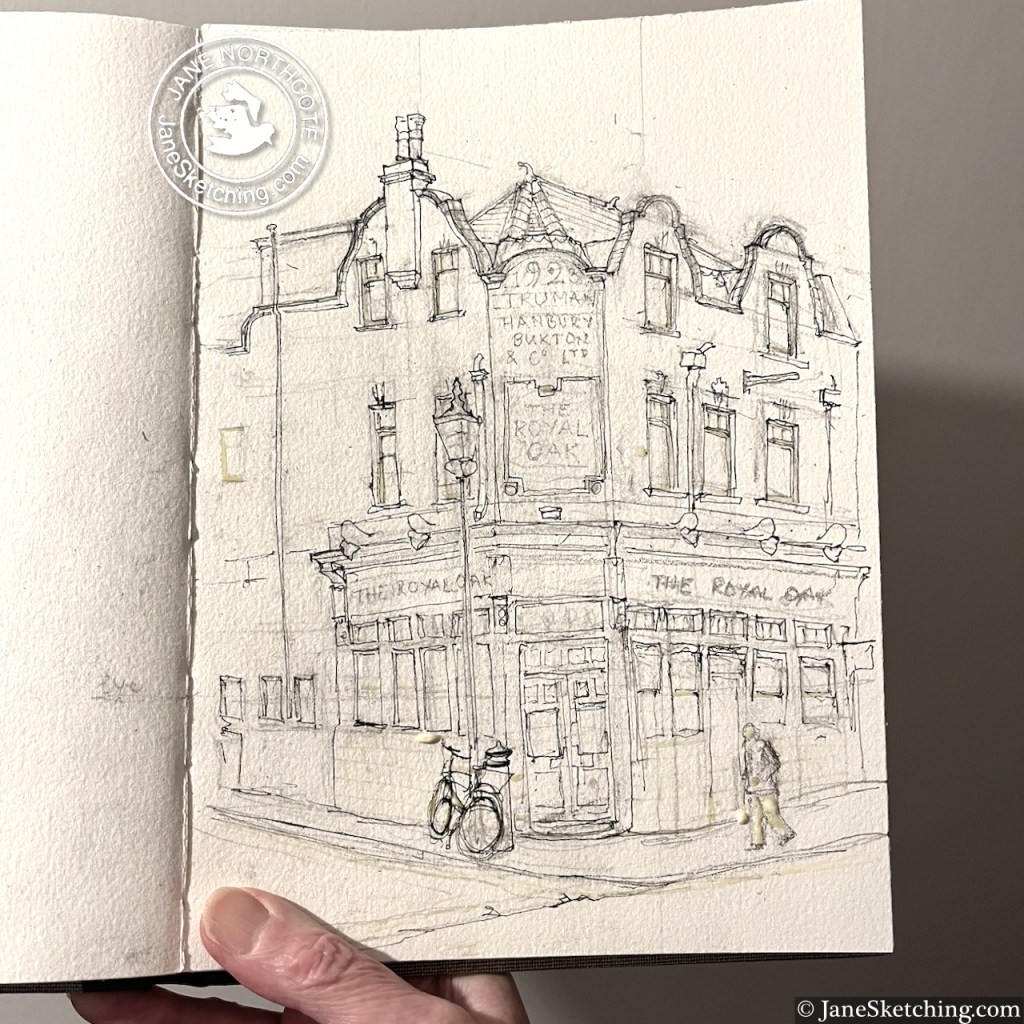
The Royal Oak, sketchbook spread, Sketchbook 16What it looked like before the colour went on
Click a button below to share this post online, email it, or print it:
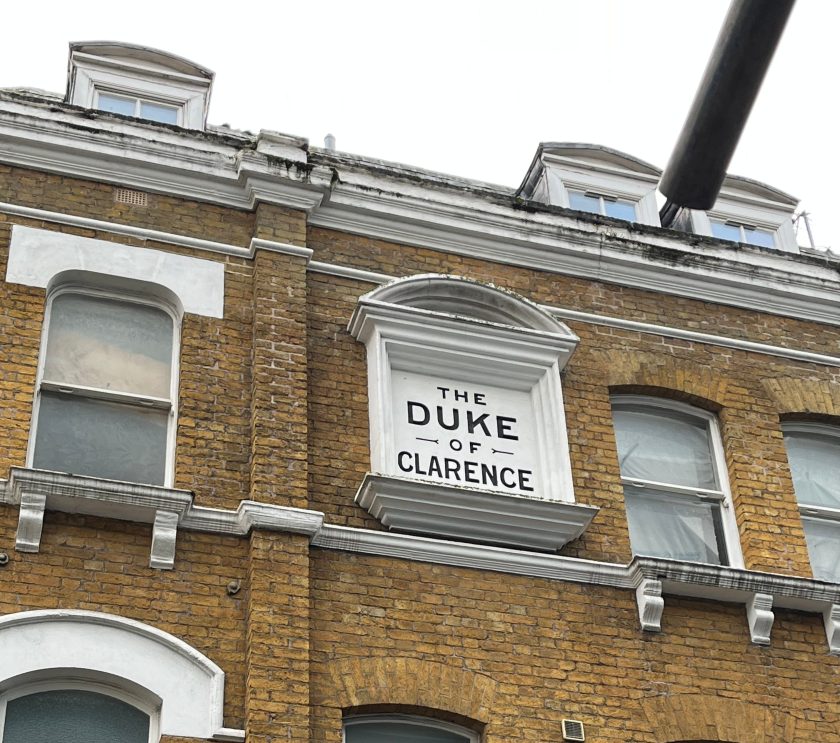
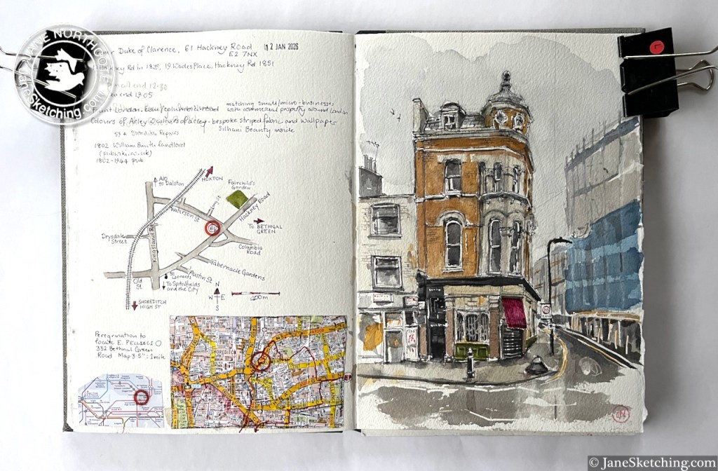
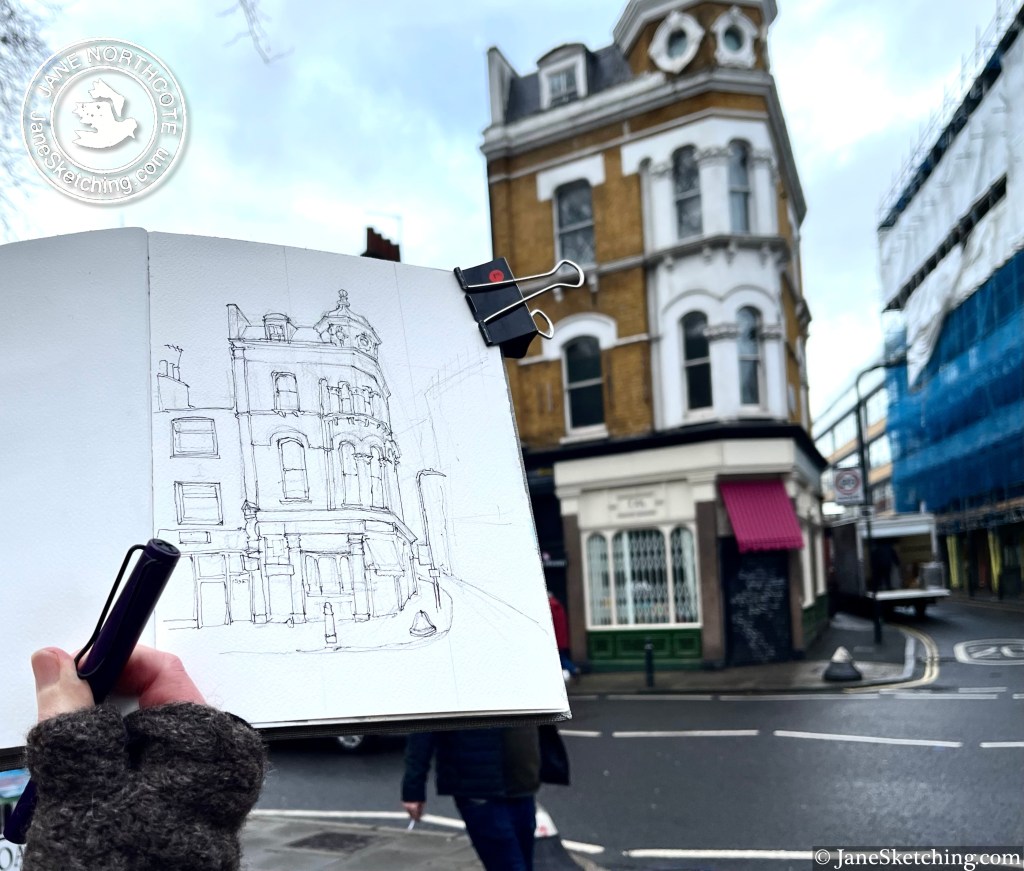
Along the Hackney Road stands this building with a turret:
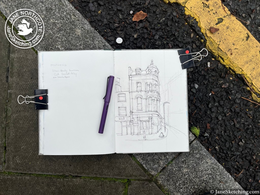
61 Hackney Road, E2 7NX, sketched 12 January 2026 in sketchbook 16
This on the corner of Waterson Street and Hackney Road, at the western end of Columbia Road.
After I’d sketched it, I walked into the picture, and had a look at the building from the Waterson Street side. It was a pub called the Duke of Clarence.
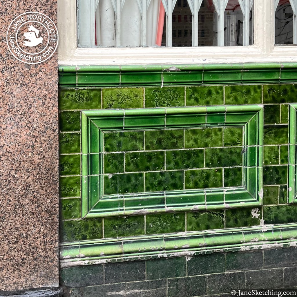
There is deep green tiling, characteristic of 19th century London pubs.
Now it is home to “Colours of Arley” on the ground floor, which offers “bespoke striped fabric and wallpaper”. Other floors are occupied by tenants of “Fount London”, which provides small office spaces in quirky buildings.
It’s still standing on its corner, still noble, still useful, while the businesses and the district change around it.
Click a button below to share this post online, email it, or print it:
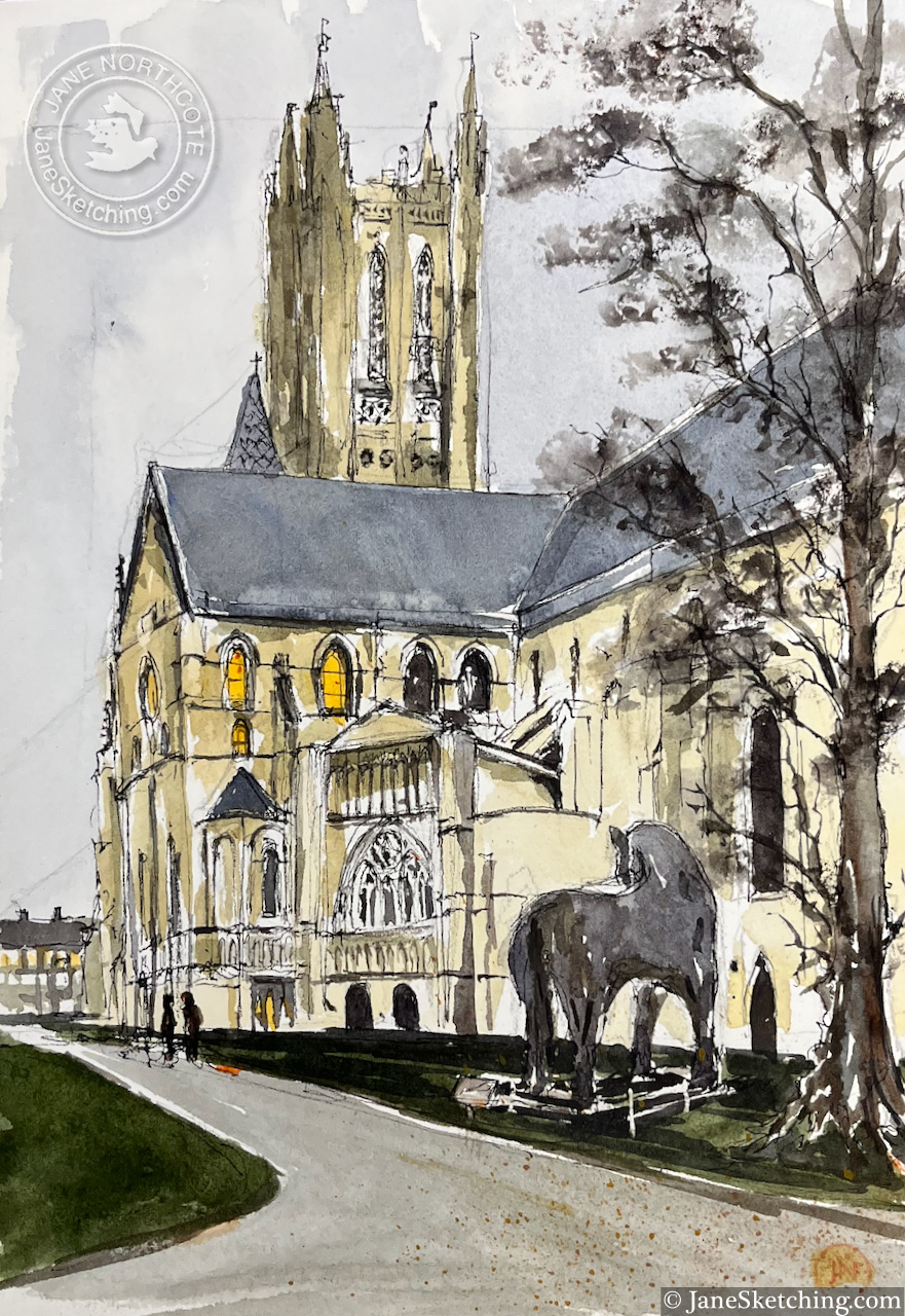
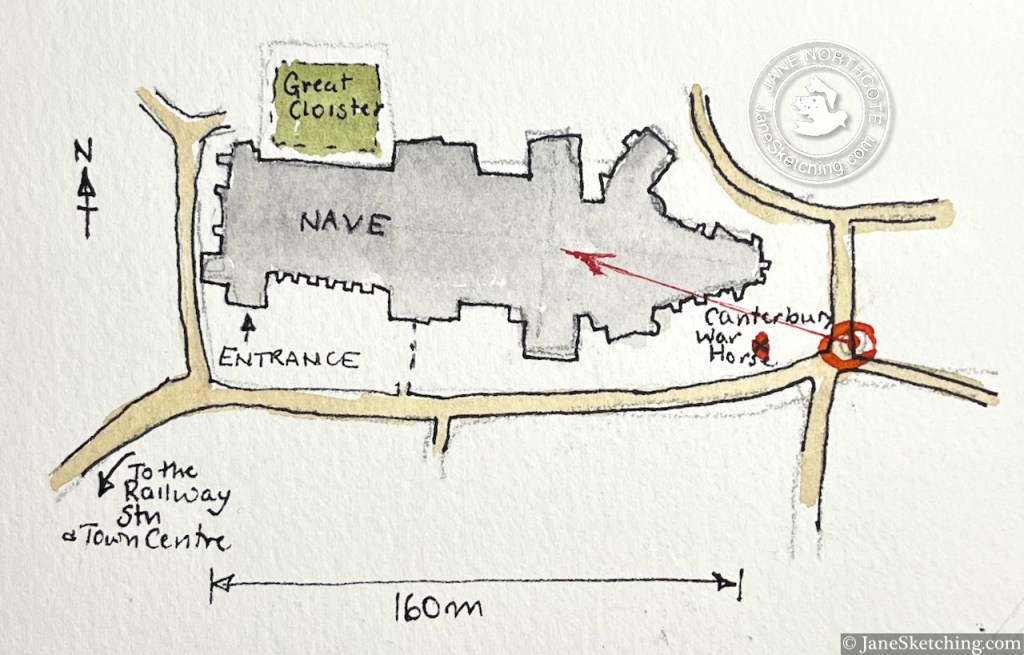
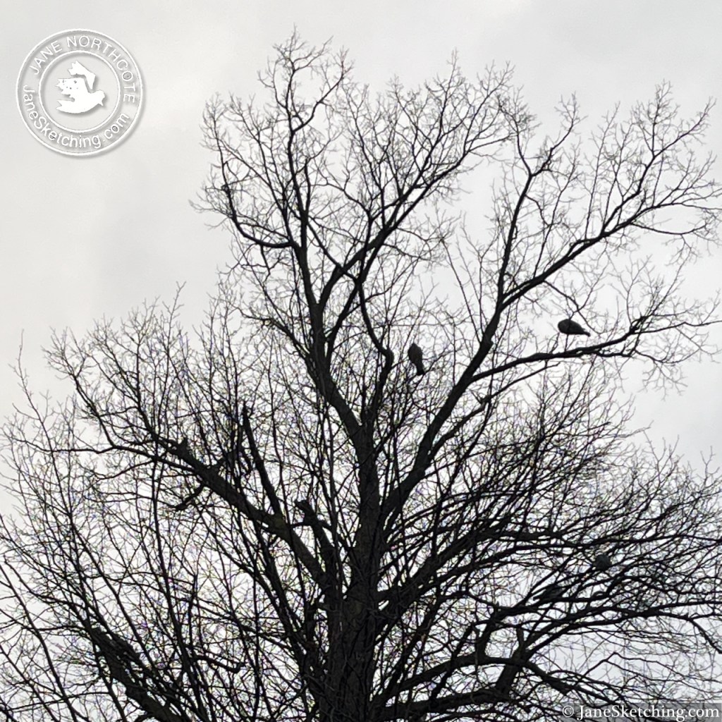
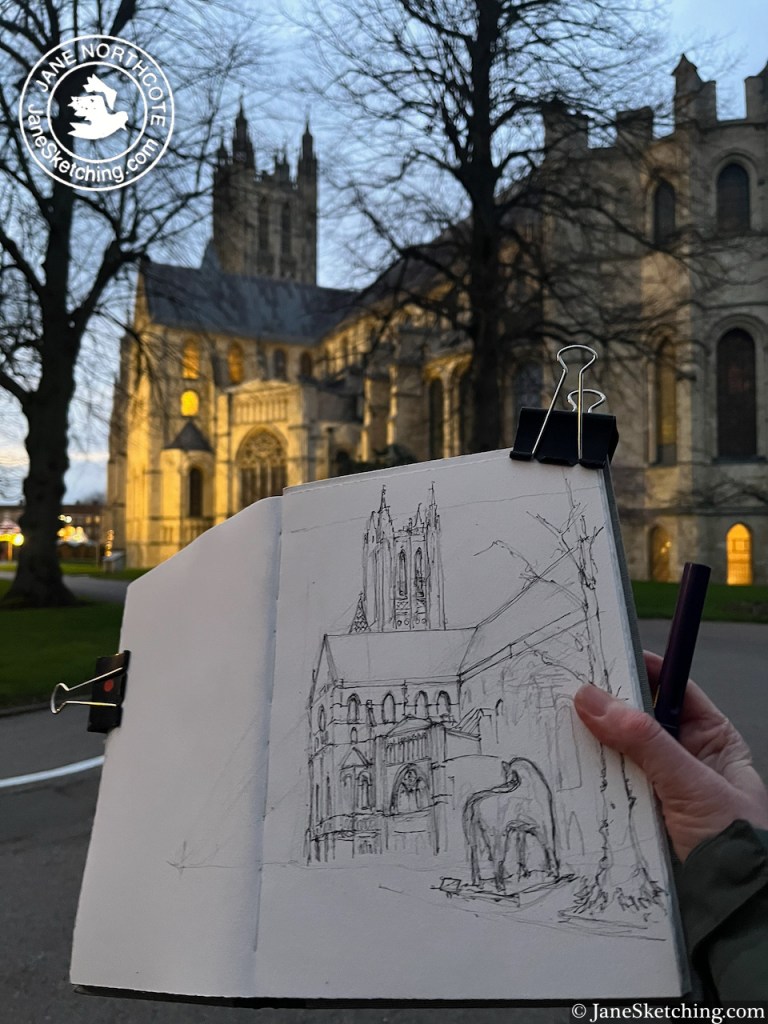
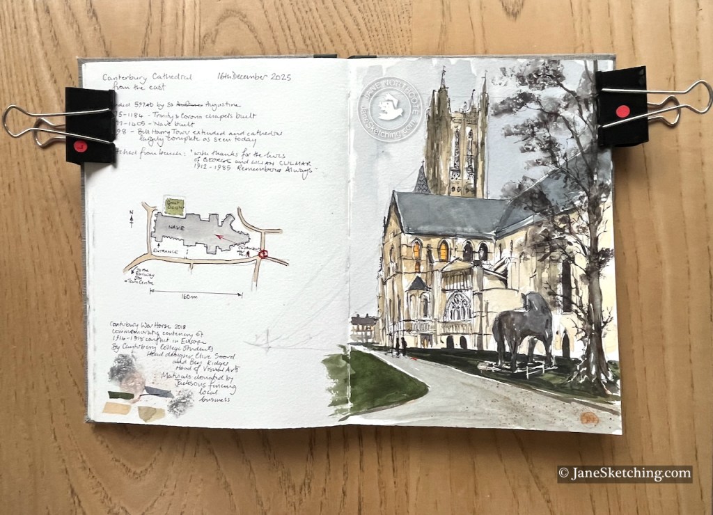
Canterbury Cathedral, sketched 16th December 2025 in Sketchbook 16
I was sketching the cathedral from the south west. The Tower in the centre of my sketch dates from 1478. The Trinity and Corona chapels on the right of the picture were built in 1175 and 1184. The magnificent nave, under the grey roof in the centre of my sketch, was built in 1377-1405. The cathedral was founded in 597 by St Augustine.
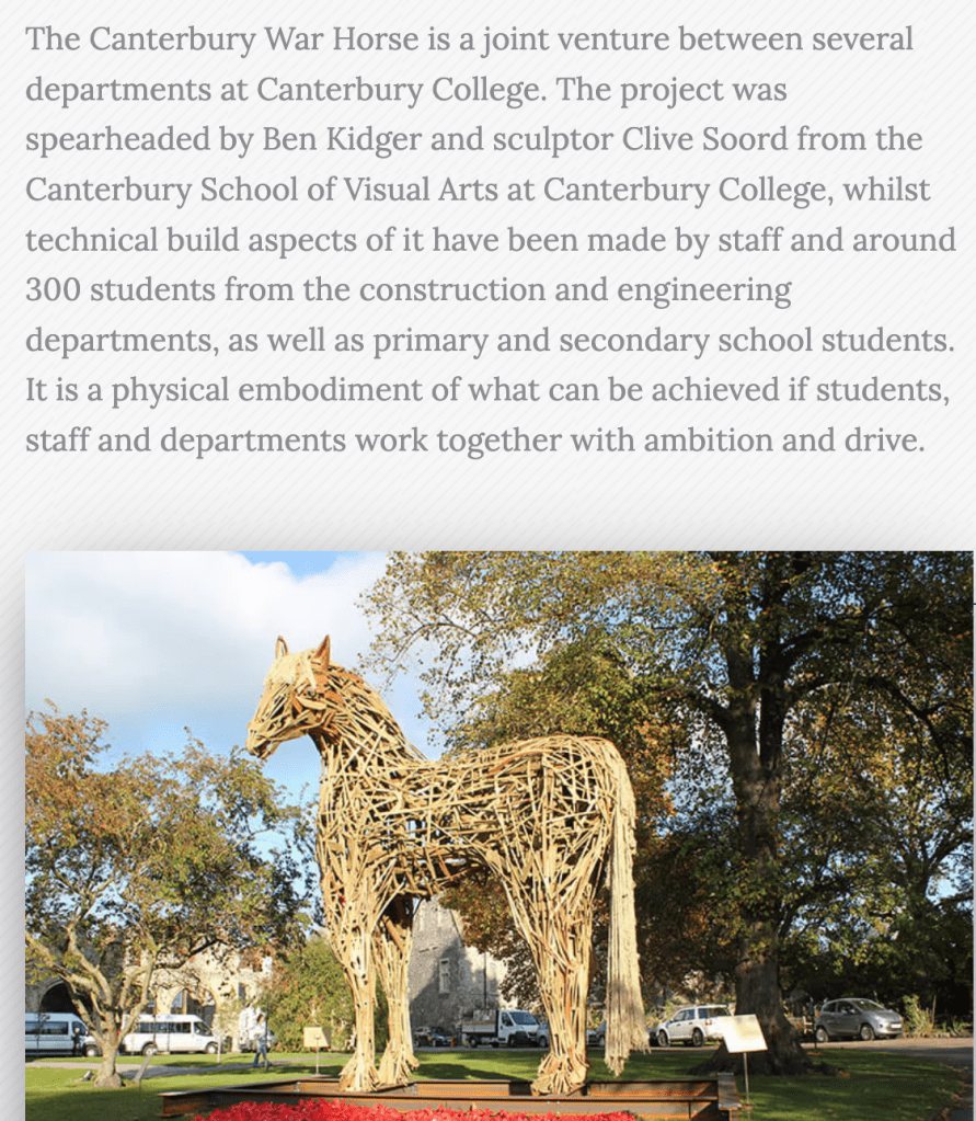
The horse in the foreground of my drawing is the “Canterbury War Horse”. It is made of pieces of wood, offcuts donated by the local fencing business, Jacksons. It was created in November 2018, marking Armistice Day, and the centenary of the end of the 1914-18 conflict.
Image and text from the website of Jacksons Fencing, Kent
The days are short in December and the light was fading while I was sketching.
I managed to get the pen and ink done sitting on the bench outdoors, and added the colour at my desk.
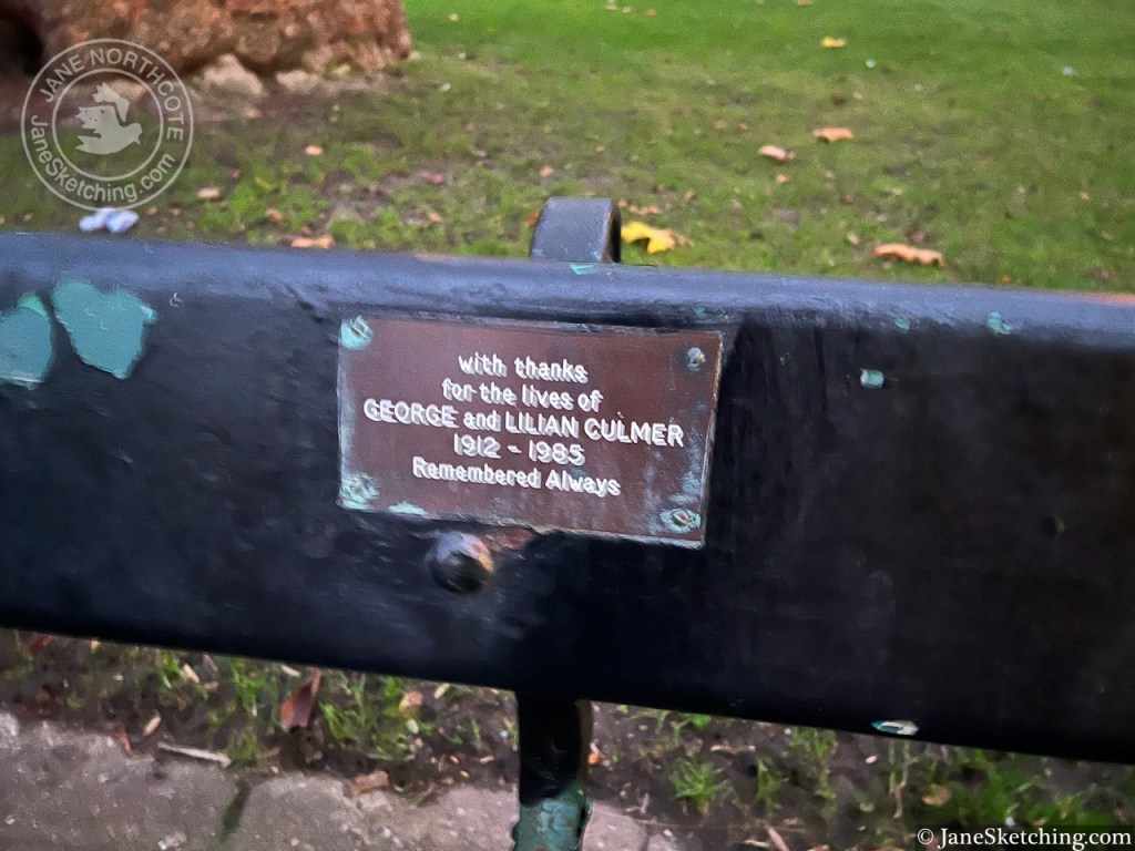
The bench commemorated the lives of George and Lilian Culmar, 1912 -1985.
It was a wonderful experience to sit calmly on this bench and contemplate the cathedral, as night fell.
Sketchbook 16
Click a button below to share this post online, email it, or print it:
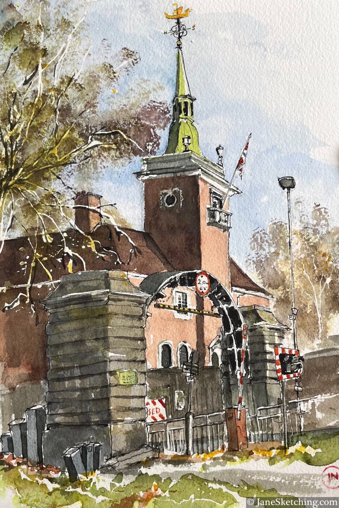
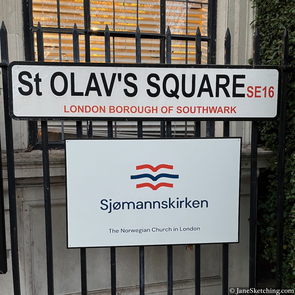
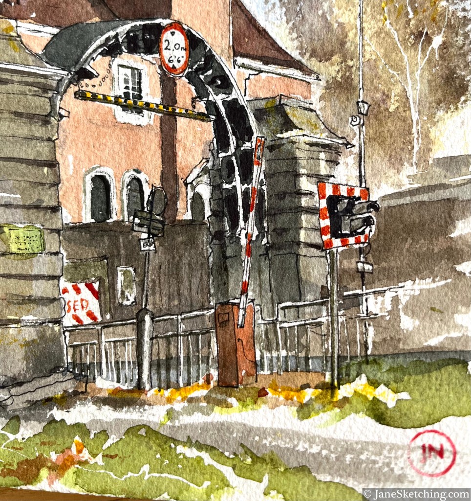
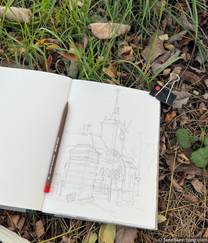
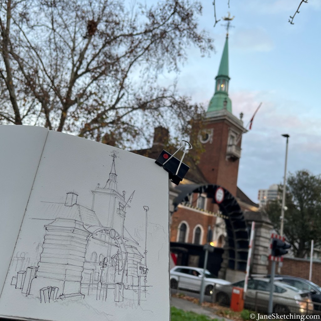
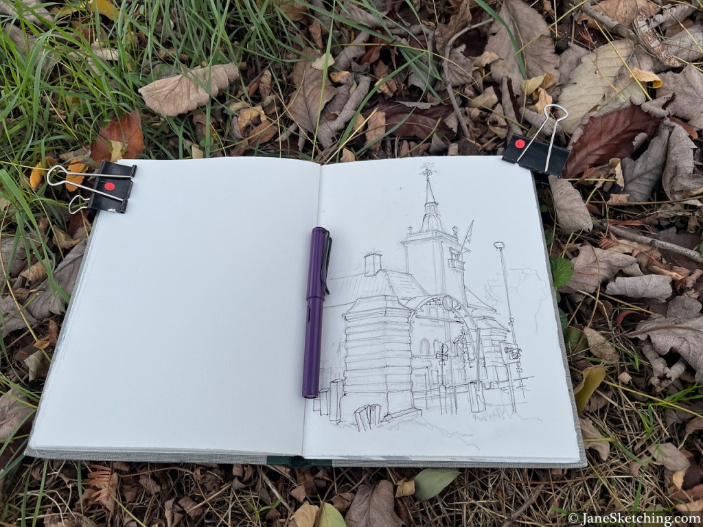
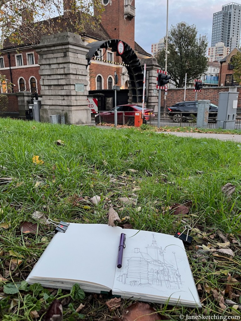
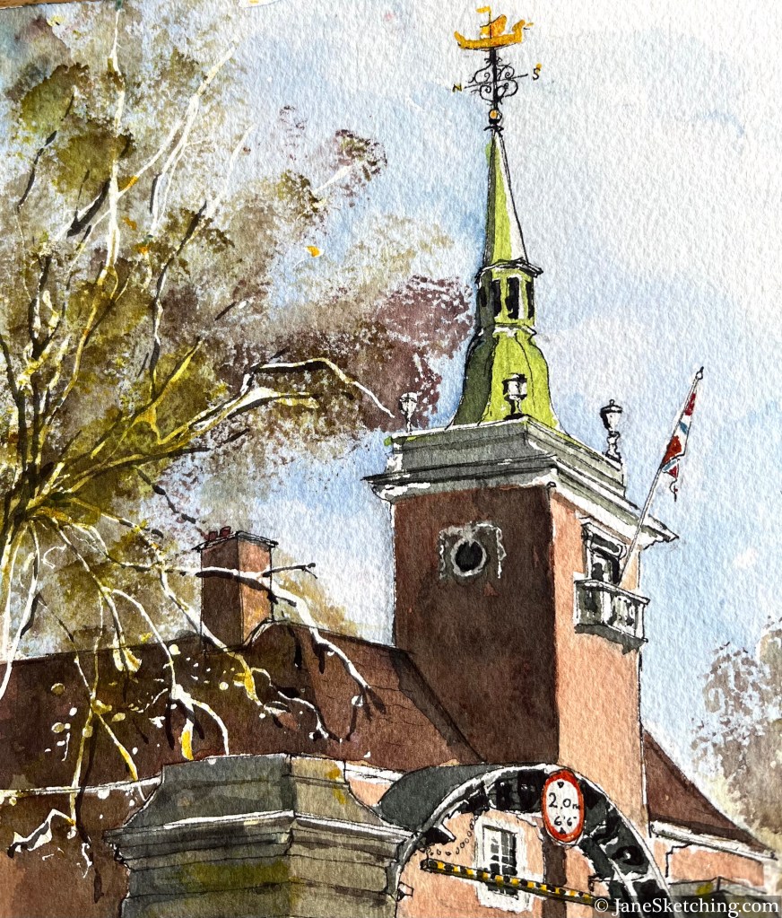
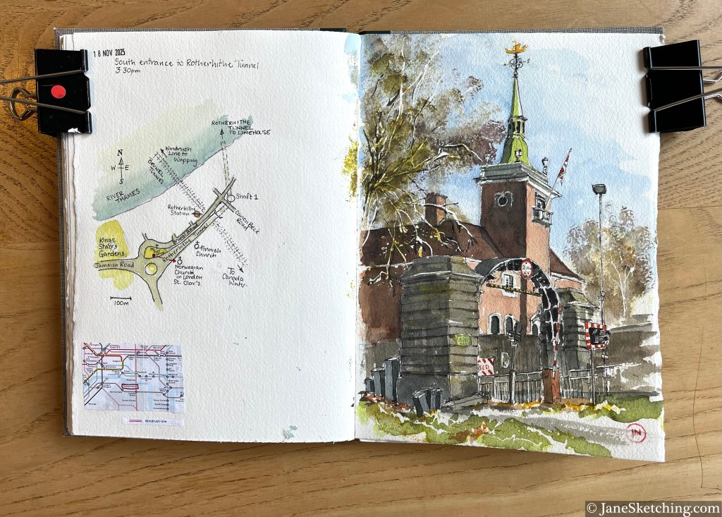
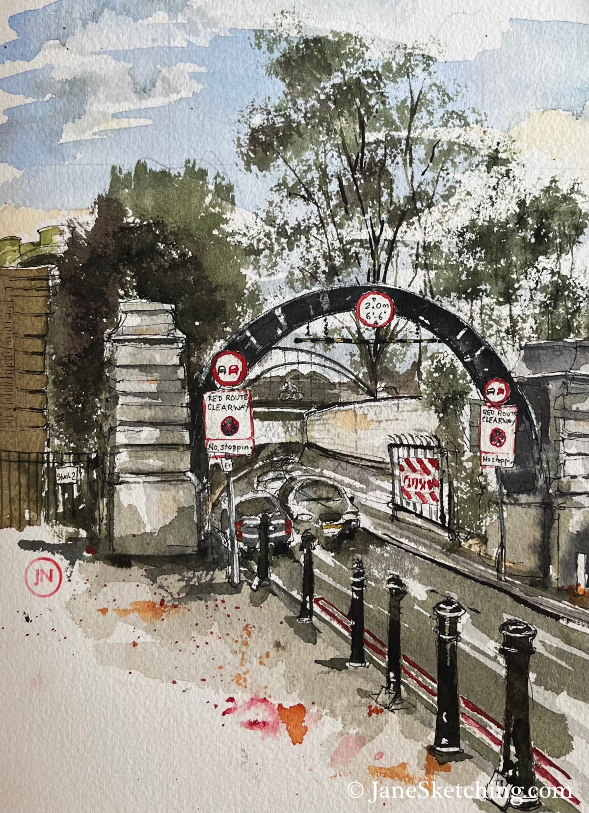
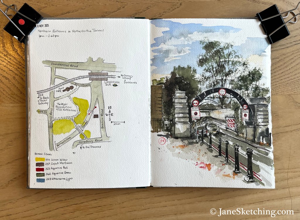
Rotherhithe Tunnel South Entrance, and St Olav’s Church, Rotherhithe, London SE 16 7JB, sketched 18th November 2025
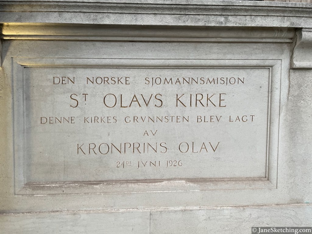
The church is St Olav’s, the Norwegian Church in London. It was designed by John Love Seaton Dahl, and the foundation stone was laid in 1926 by Prince Olav, later King Olav V, of Norway.
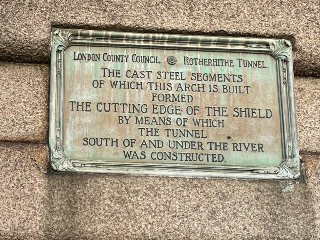
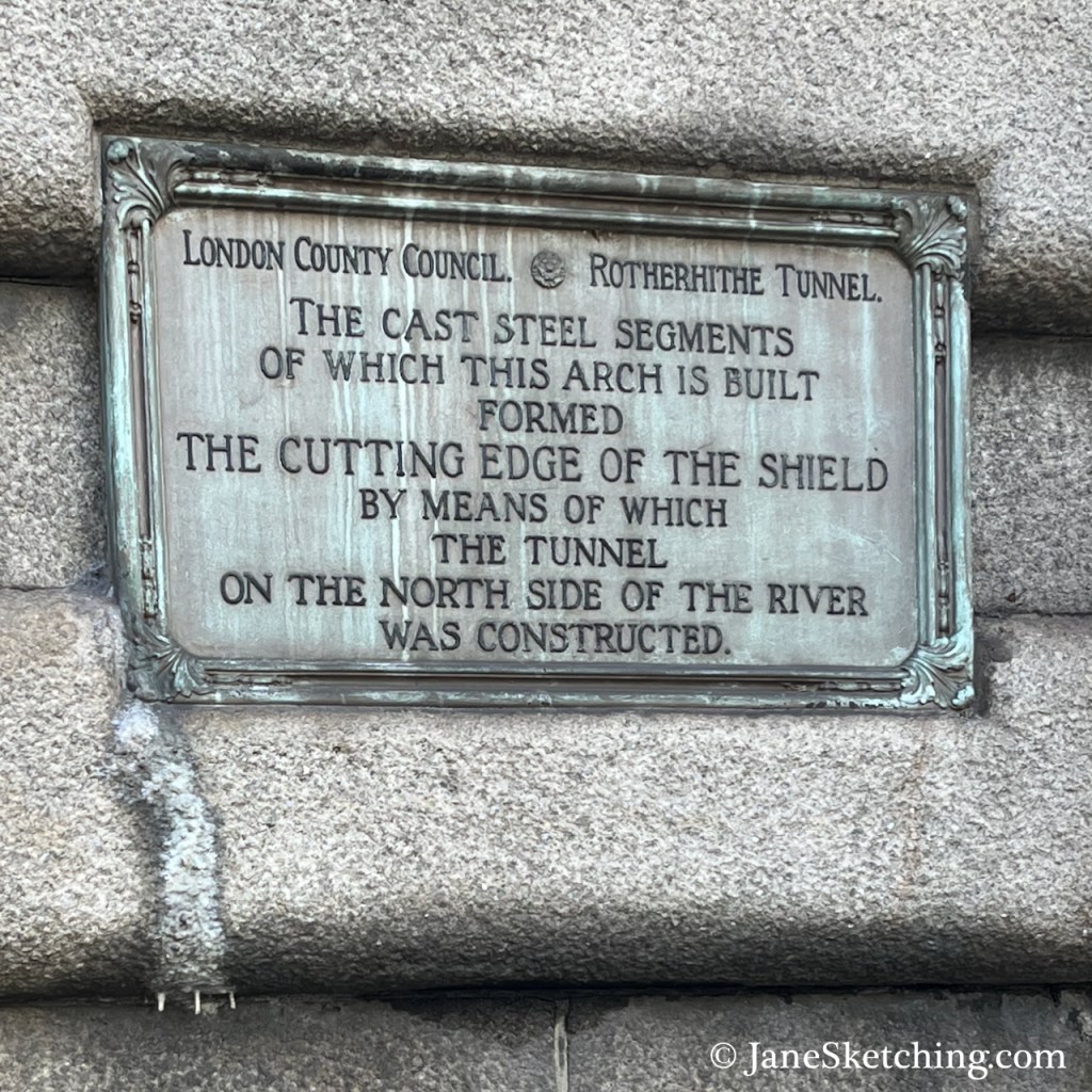
The steel arch over the tunnel approach road is part of the equipment used to cut the tunnel, as on the North side.
Sketch detail showing the steel arch.
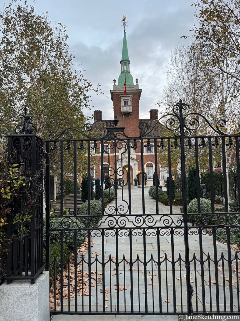
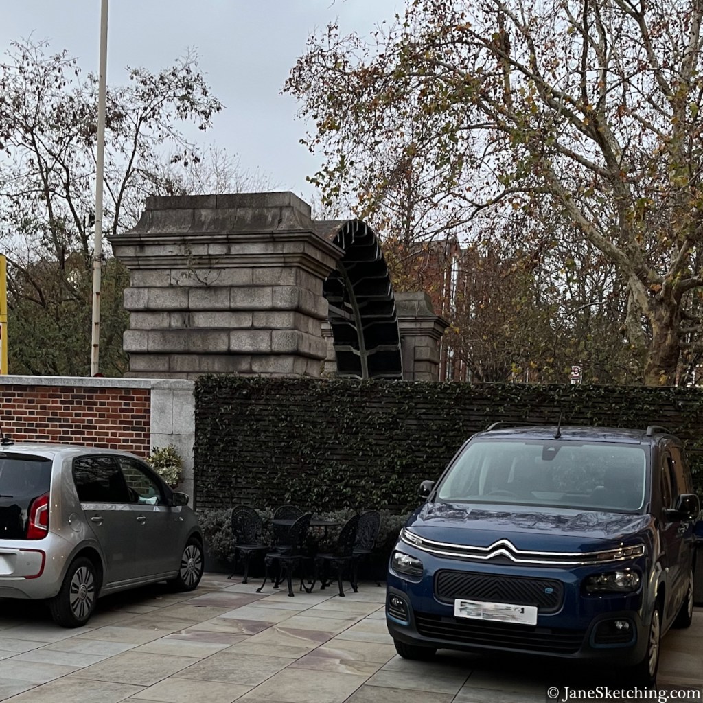
Below is a photo taken from the front courtyard of the church, looking back towards my sketching location. You can see the steel arch above the wall of the Church courtyard.
View of the arch above the Rotherhithe Tunnel Approach road, from the front courtyard of St Olave’s church
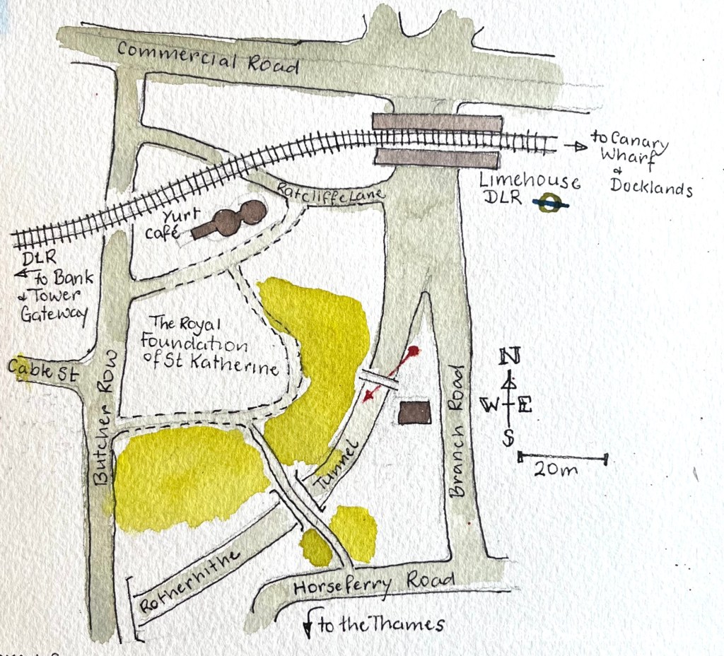
As you see, there were many trees. I was sketching from a traffic island, between major roads.
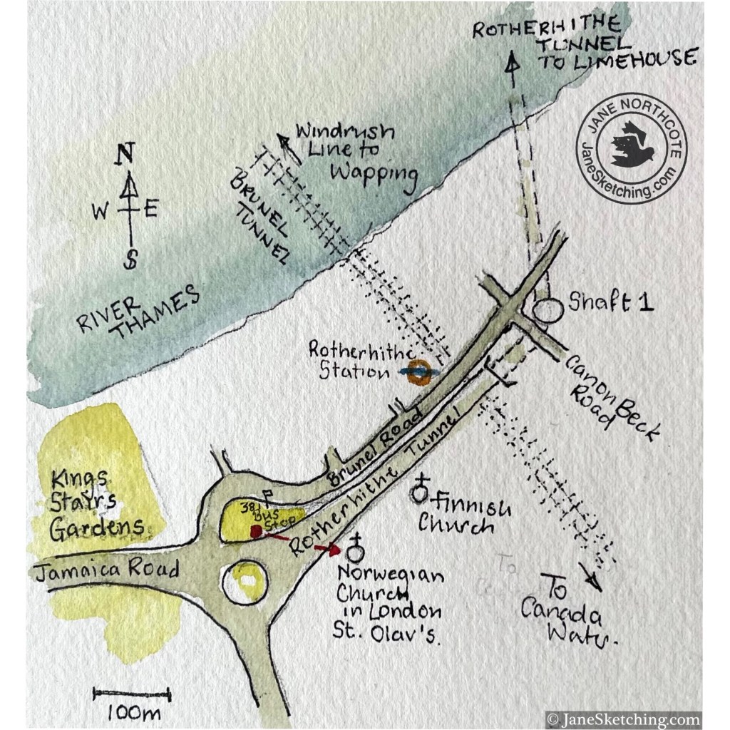
Map showing my sketching location (red dot and arrow)
Above me there were parakeets, the green ones. I think this is the furthest east I have heard parakeets. They seem to be migrating slowly across London, West to East, and North to South.
Sketching amongst greenery, Rotherhithe Tunnel South entrance
I enjoyed the weathervane on the church: a viking boat.
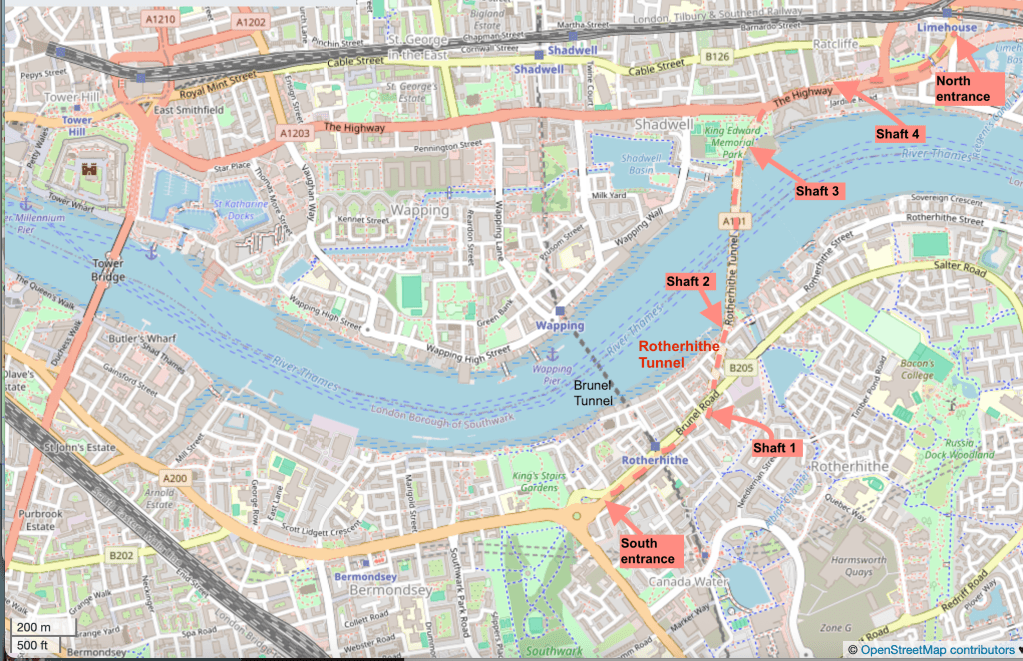
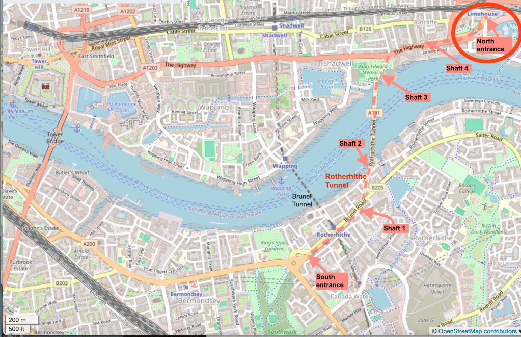
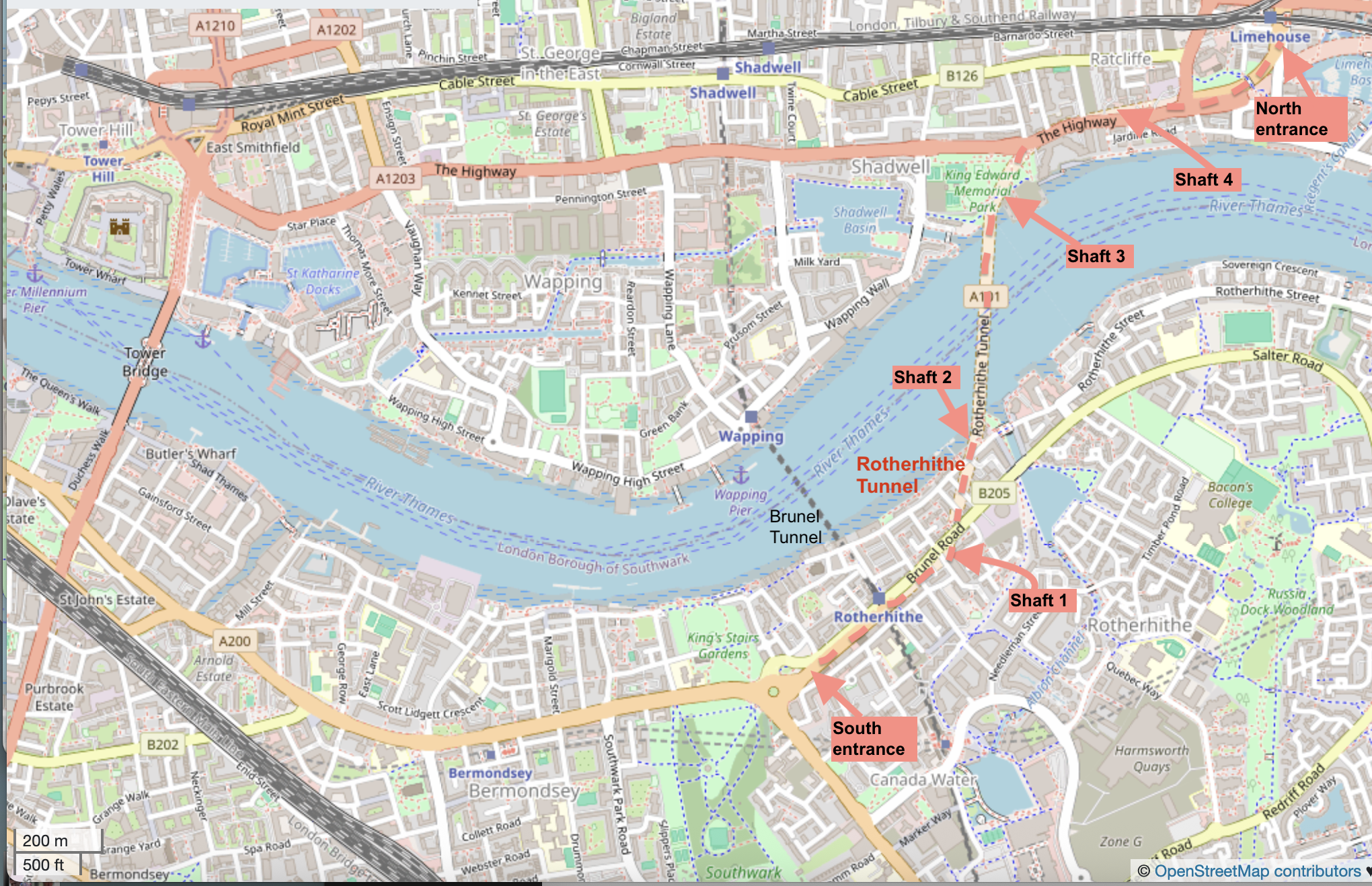
For completeness, here is a map showing the entire route of the Rotherhithe tunnel.
Background map (c) OpenStreetMap contributors
I reached the South entrance via the “Brunel Tunnel”, which is now used by the Windrush Line.
I’ve now sketched both entrances and two of the shafts. Here are the other posts. Click on the image to go to my article about it on this website.
North EntranceShaft 3Shaft 2
Here’s my sketchbook with this sketch:
Sketchbook 16 page spread
Sketchbook: Arches Aquarelle 300gsm, book made by Wyvern Bindery
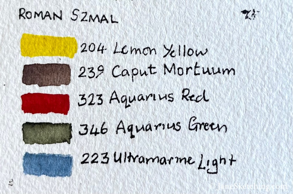
Paints: Roman Szmal
Pen and ink: De Atramentis Document Ink, Black, in a Lamy Safari fountain pen with Extra-Fine nib.
Click a button below to share this post online, email it, or print it:
The Rotherhithe Tunnel carries road traffic in both directions between Limehouse on the north of the River Thames, and Rotherhithe on the south side. It was constructed between 1904 and 1908, for horses and carts. The designer was Sir Maurice Fitzmaurice.
The tunnel links Limehouse on the north of the river to Rotherhithe on the south. Built originally for horse-drawn carriages and pedestrians, the tunnel now carries far more traffic than it was designed for, which requires careful day to day management by TfL to ensure safety.
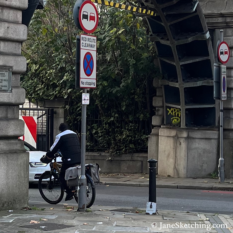
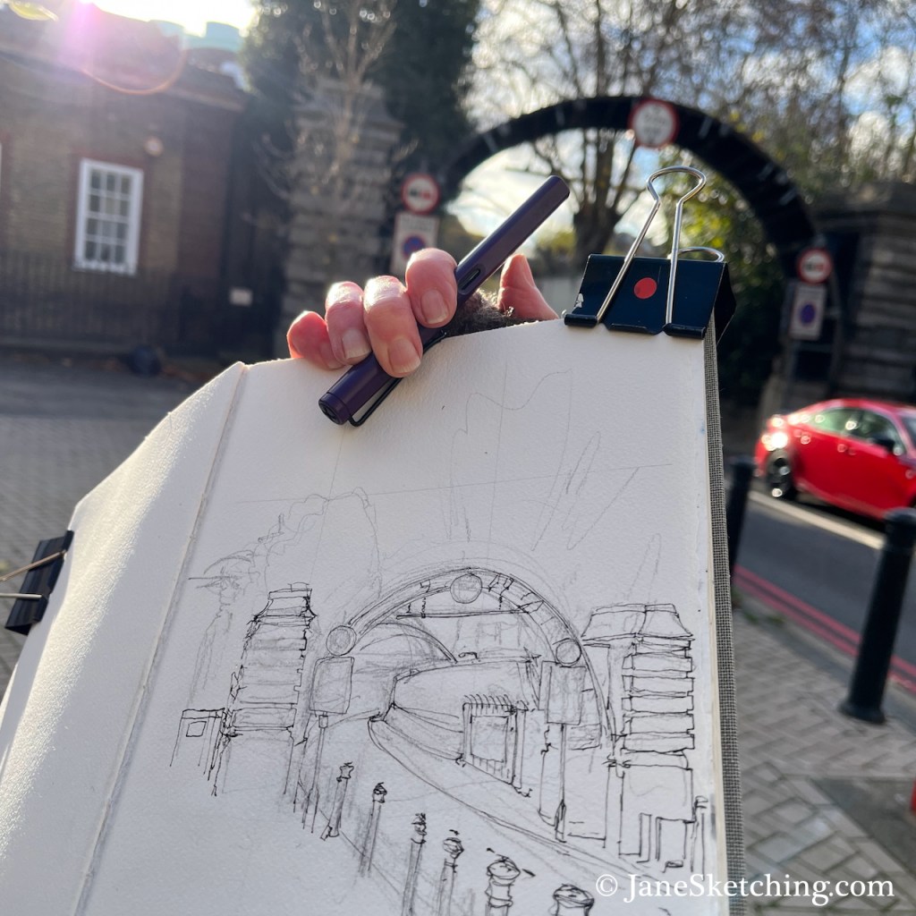
Here is the North Entrance of the Rotherhithe tunnel, near to Limehouse DLR Station in the east of London.
Rotherhithe Tunnel North Entrance, sketched 18 November 2025 in Sketchbook 16
The arch in the picture is made of steel. A notice on one of the columns explains that this arch is part of the equipment used to construct the tunnel.
You can see the steel structure in the photo below. The tunnel is narrow. As you see in my sketch, there are just two lanes. The tunnel is heavily polluted from exhaust fumes. Even so, as I sketched, some people cycled into the entrance. Cycling in the tunnel must be very unpleasant and scary. I feared for them.
Cyclist entering the Rotherhithe Tunnel, under the steel arch.
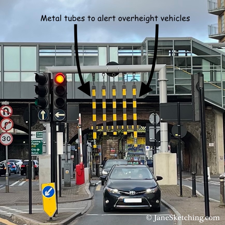
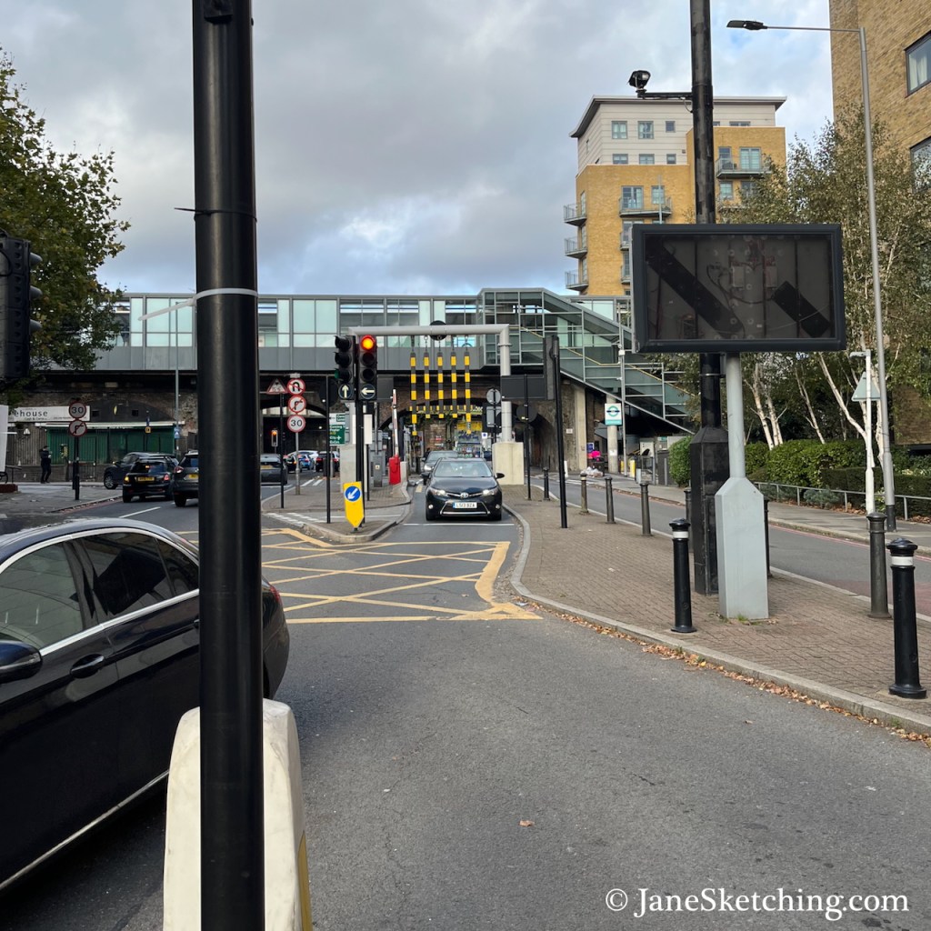
Because of the limited space in the tunnel, there are size restrictions on traffic, including a height restriction. To indicate the safe height, there are long vertical tubes over the approach road, as shown in the photos below. These photos were taken looking back from near the tunnel entrance, towards Limehouse DLR Station, which you can see in the background.
While I was sketching, I heard the banging sound as an overheight van struck the metal tubes. This happened three times during the 45 minutes I was there. Each time, the vehicle carried on past me into the tunnel.
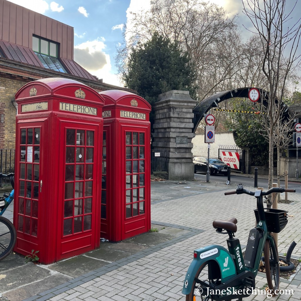
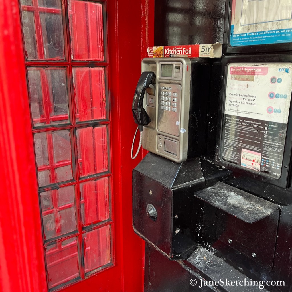
On the road island where I stood to sketch, there are two red telephone boxes. Amazingly, one of them still had the phone inside.
Despite the bright company of the phone boxes, it wasn’t a great place to stand. I could smell the pollution from the tunnel and its approach roads and I didn’t think it was doing me any good. Also it was cold. So having made my pen sketch, I went off to cross the Thames in search of the south entrance.
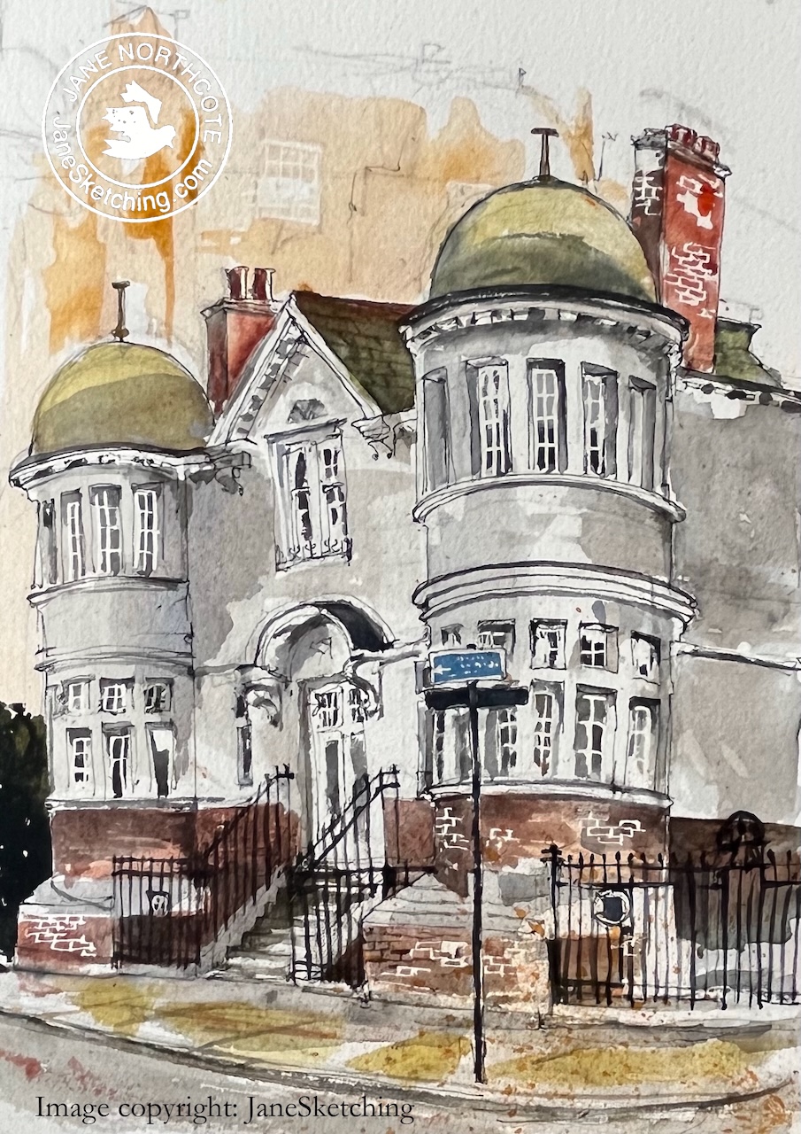
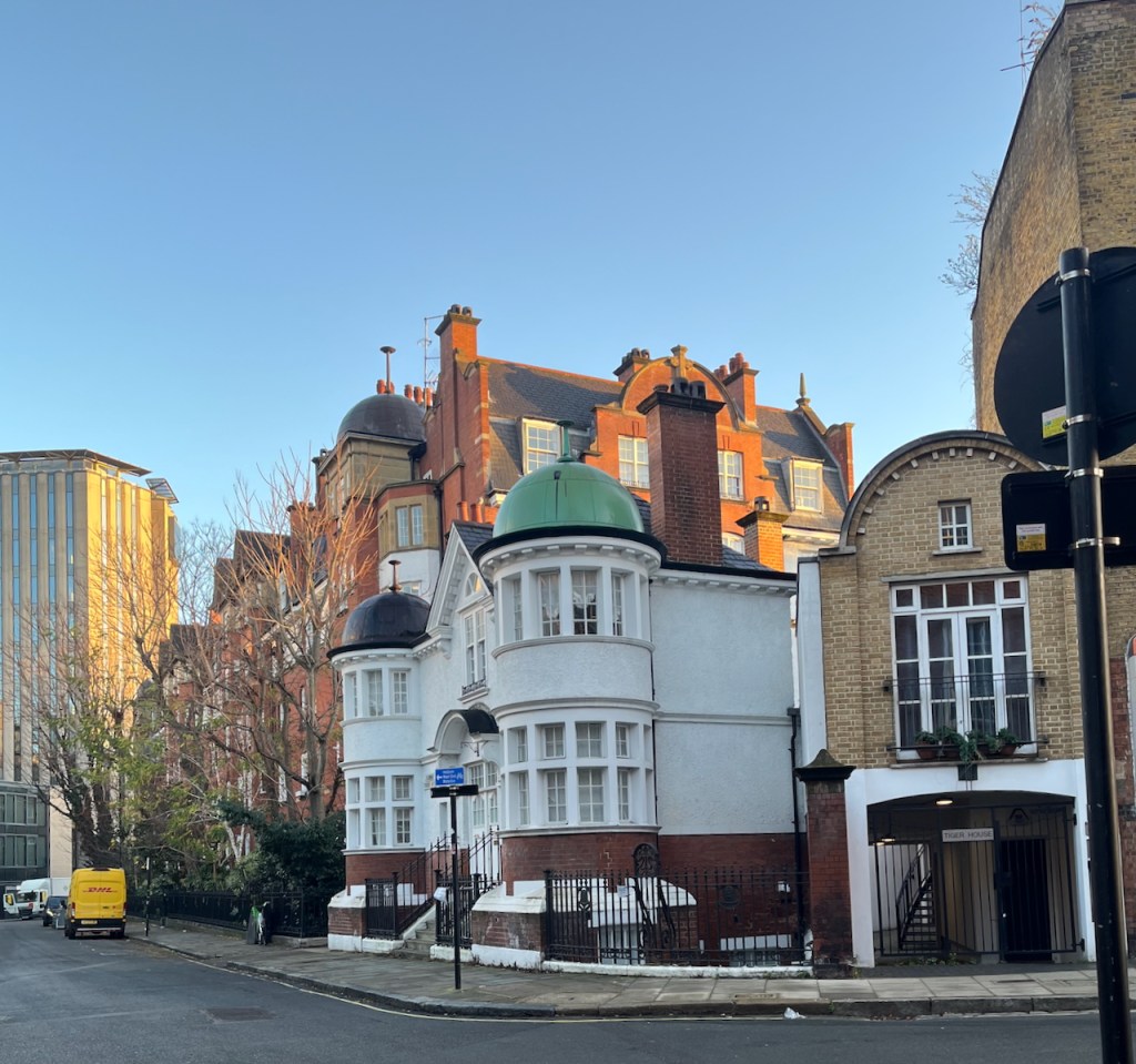
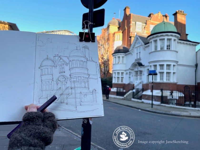
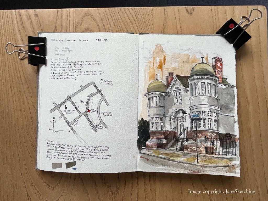
This wonderfully turreted building adorns a street corner in Bloomsbury.
Flaxman Lodge, Flaxman Terrace, London WC1H 9AW sketched 31 Dec 2025 in Sketchbook 16
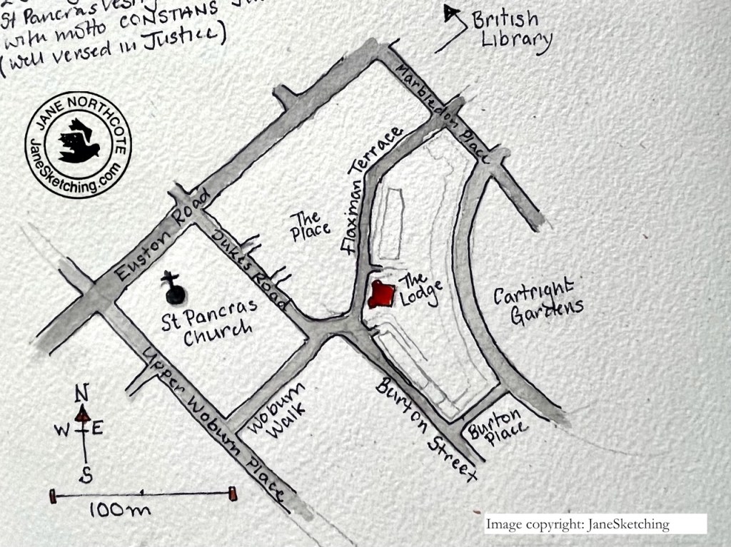
It is listed Grade II. According to the listing entry it was built in 1907-8 to designs of Joseph and Smitham, “for the Vestry of St Pancras”. St Pancras is a church on the nearby Euston Road.
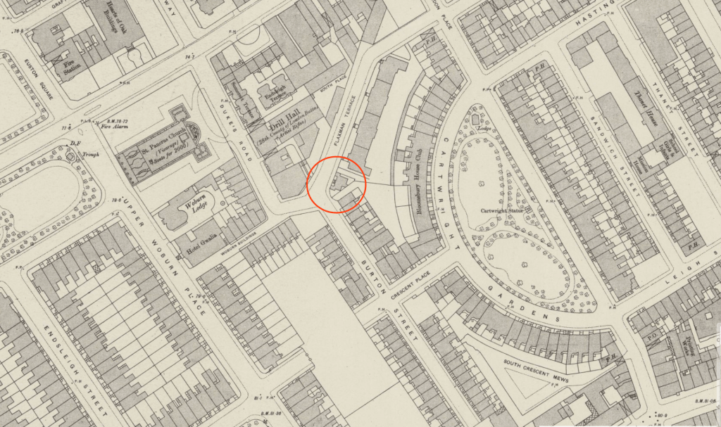
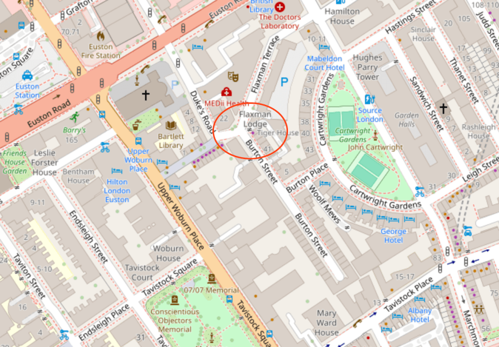
Map showing the location of the Lodge and St Pancras Church
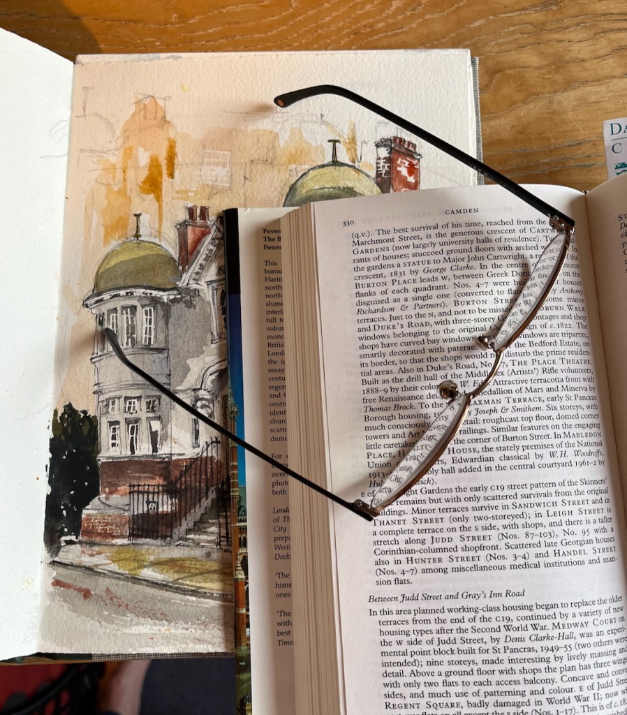
Pevsner1 takes a different view. He associates this lodge with the terrace behind, which has the same domed turrets. He says:
FLAXMAN TERRACE, early St Pancras Borough Housing, 1907-8 by Joseph & Smithem. 6 storeys, with much conspicuously pretty detail: rough cast top floor and Art Nouveau railings. Similar features on the engaging little caretaker’s lodge at the corner of Burton Street
Pevsner, London 4 NORTH
Pevsner’s “LONDON 4:NORTH” book, describing Flaxman Terrace on page 330.
You can see the redbrick terrace, mentioned by Pevsner, in the photo below, with its domed turret matching the turret on the lodge.
Corner of Flaxman Terrace and Burton Street
So, in Pevsner’s version, the designer Smithem has an “e” not and “a”, and this building is “an engaging little caretaker’s lodge”.
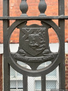
Metropolitan Borough of St Pancras Coat of Arms on Flaxman Terrace railings
The “e” is correct. The architectural practice of Joseph and Smithem was founded by Nathan Solomon Joseph (1834-1909) and Charles James Smithem (1856-1937)2. The practitioners later included sons and a nephew of the founders. The practice designed a number of buildings in London including social housing, schools and the Egerton Road synagogue in Stamford Hill.
Flaxman Terrace was originally built as social housing by the then Metropolitan Borough of St Pancras, whose coat of arms is in the cast iron railings of Flaxman Lodge.3
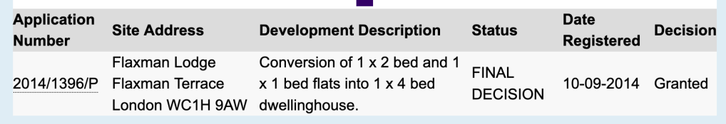
Now Flaxman Lodge appears to be a private house. Evidently at one time it was divided into flats. Planning permission to convert the flats into one “4 bed dwelling house” was granted by Camden Council in 2014, application reference 2014/1396/P
The property was last sold for £2,280,000 in 2017 (The Move Market)
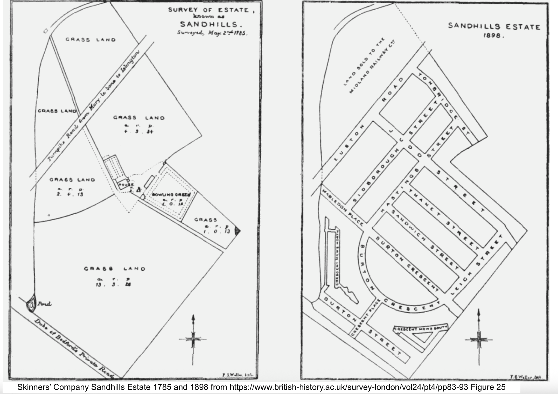
I sketched this building standing at the corner of Flaxman Terrace and Woburn Walk. “Woburn” would imply a possible burn or stream. Sure enough, the marvellous “British History Online” site delivers a map showing a stream in this location:
‘The Skinners’ Company Estate’, in Survey of London: Volume 24, the Parish of St Pancras Part 4: King’s Cross Neighbourhood, ed. Walter H Godfrey, W McB. Marcham (London, 1952), British History Online https://www.british-history.ac.uk/survey-london/vol24/pt4/pp83-93 [accessed 1 January 2026]
I was standing in roughly the position of the “pond” shown in the 1785 map on the left. At that time, I would have been surrounded by fields. By 1898, urbanisation had arrived, but not yet this Lodge. The routes of old byways and street boundaries are retained. Here’s a 1942 map4, by which time the Lodge has appeared. The street pattern of 100 years previously is still there.
OS Map Revised 1894 Published 1911 Reprinted 1942 – Reproduced with the permission of the National Library of Scotland’ under the terms of the Creative Commons Attribution (CC-BY) licence. Link: https://maps.nls.uk/
The former “Drill Hall” has become “The Place” contemporary dance centre, and many of the 19th century terraces have been replaced by larger buildings. But the street pattern is unchanged. Burton Street still follows the angle of a long-gone field fence.
Sketching “the Lodge” at the corner of Flaxman Terrace and Woburn Place.Sketchbook 16
London 4: North, Bridget Cherry and Nikolaus Pevsner, 2001 reprint, page 330 ↩︎
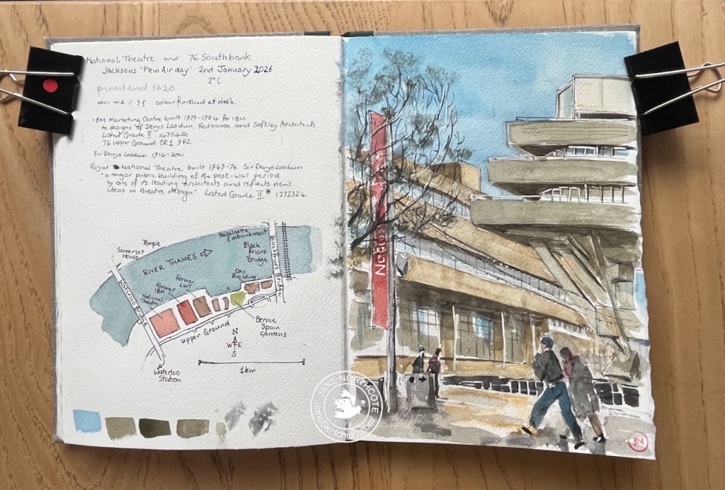
On the 2nd January I joined a group of other artists sketching on London’s South Bank. This was an event organised by Jackson’s Art Supplies of Dalston.
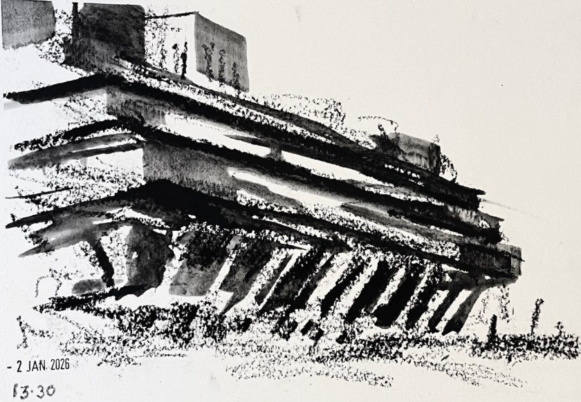
The first picture I attempted was of the National Theatre.
Sketching the National Theatre – 2nd January 2026
It was extremely cold and there was an unforgiving wind.
I managed to finish the pen-and-ink but at this point I abandoned the idea of putting the watercolour on the picture, and hurried into the National Theatre to thaw out. The staff there patiently inspected my bag of art equipment. In the café I found a group of other artists from the event, drinking coffee, testing the operation of their fingers and talking about art materials.
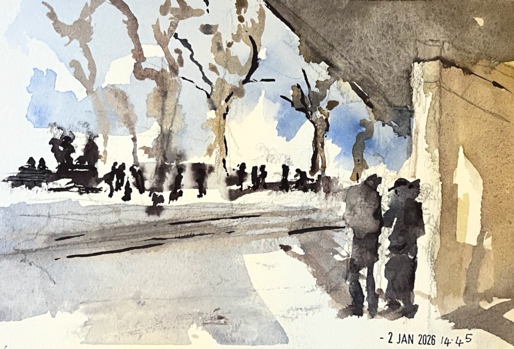
Coffee and company warmed me up. I decided to try simpler drawings using big crayons that I could wield in gloves. Here’s a flick through the sketchbook:
South Bank sketchbook flick-through
The black marks are made with a Derwent “inktense” stick. These sticks make charcoal-like marks, which you can then darken or spread out with water.
The National Theatre – inktense stick on Arches cold-pressed paper
Here’s my last picture of the day. I was determined to use the watercolours, and found a spot where the wind was attenuated by a concrete wall.
At 3pm we all congregated and shared our pictures. I was really impressed at how many of us had persisted, in the cold, right to the end of the event, and at the wonderful work everyone had done. I mean, doing anything at that temperature was an achievement, I thought. You can see a picture of the assembled participants in the Jackson’s newsletter on this link.
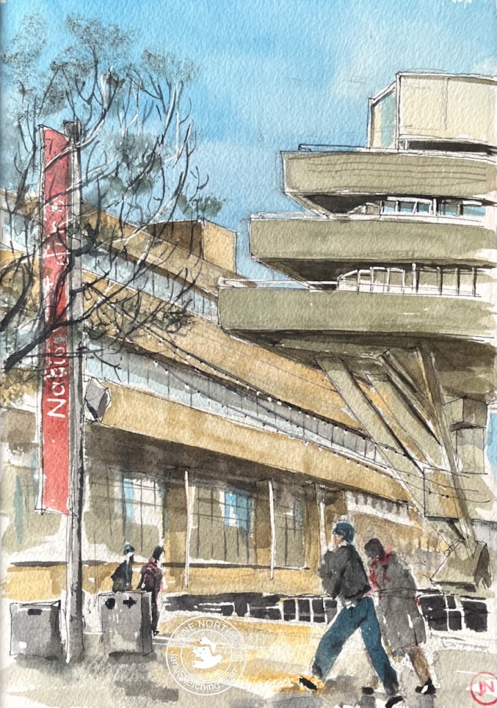
Later, at home in the warm, I added the watercolour to my initial sketch of the National Theatre.
National Theatre and 76 South Bank – 2nd January 2026 in sketchbook 16
It was an inspiring day out. Thank you to the Jackson’s team for the initiative and the organisation. And thanks to the wonderful National Theatre for the warm and welcoming spaces, the café, and the toilets…..!
Click a button below to share this post online, email it, or print it:
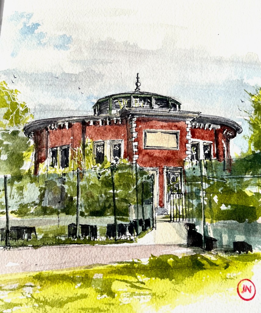
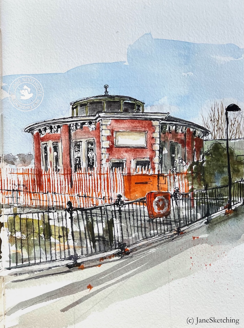
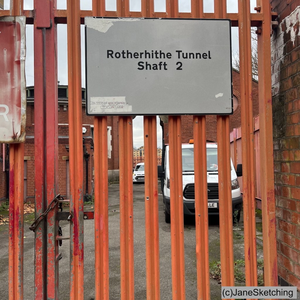
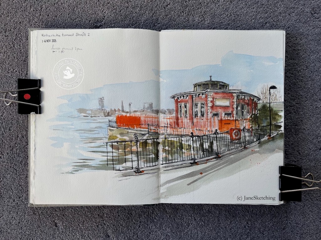
Rotherhithe Tunnel Shaft 2, sketched 4 November 2025 in Sketchbook 16 (c) JaneSketching
Here’s a map showing the river downstream of Tower Bridge, and the location of these structures. Click to enlarge.
Map showing the Rotherhithe tunnel, all 4 shafts, and the entrances. Click to enlarge. (c) OpenStreetMapcontributors
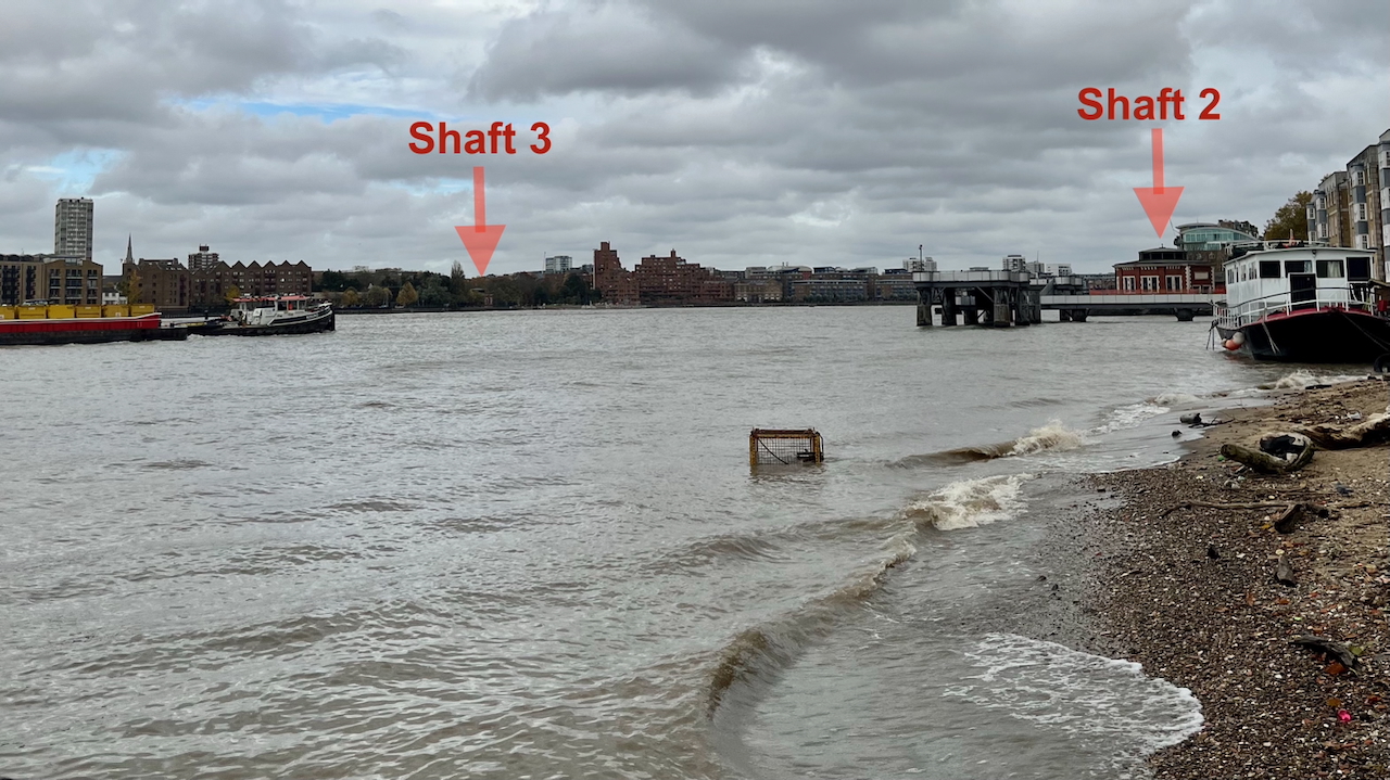
You can see one shaft from the other. Here’s a picture looking North across the Thames, just before I started the sketch. The light wasn’t great, but you can still see both shafts 2 and 3. See how wide the river is at this point! The distance between the two shafts is around 1500ft (500 metres).
Photo looking north across the Thames at Rotherhithe 4th November 2025 (c) JaneSketching
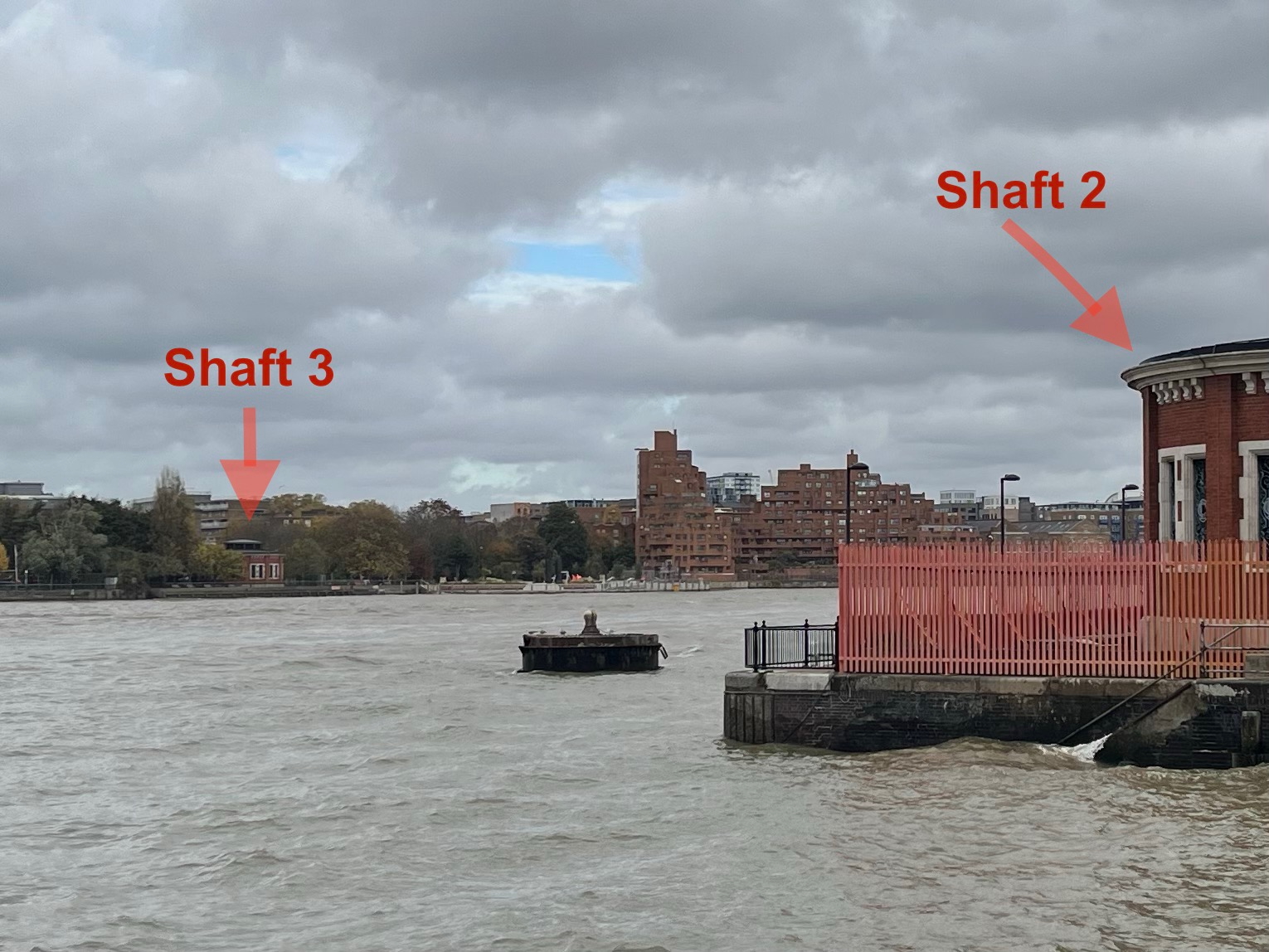
Here’s a photo from closer:
Photo looking north across the Thames at Rotherhithe 4th November 2025 (c) JaneSketching
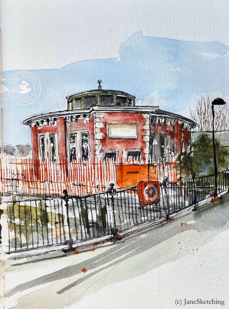
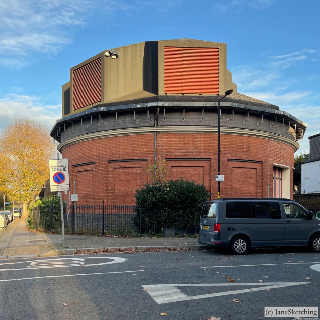
Shaft 2 is hidden behind high orange fences as you see. On the inland side it is behind a residential building at 157 Rotherhithe Street.
The Rotherhithe tunnel has 4 shafts. Shafts 2 and 3 are the round shapes and resemble each other. Both are Grade II listed.
Shaft 3Shaft 2Sketches of Shafts 3 and 4 (c) JaneSketching
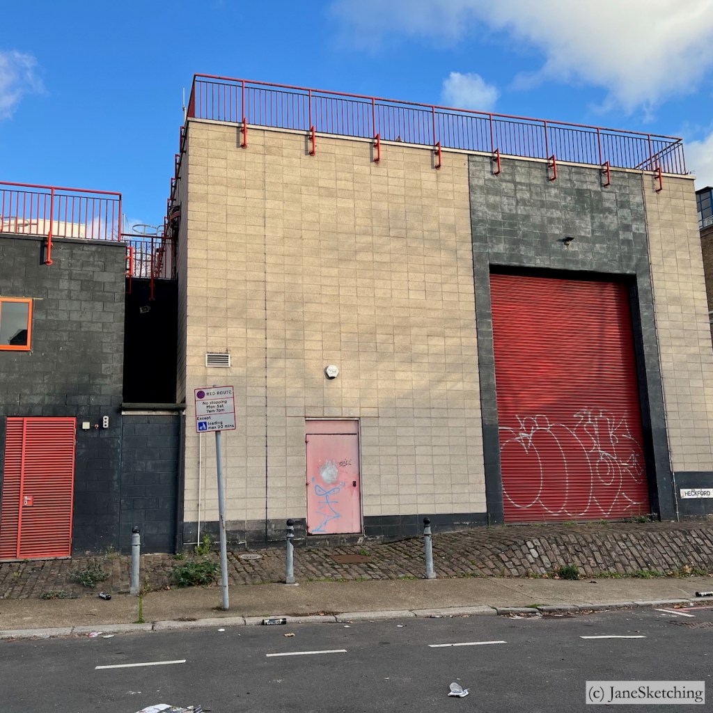
Shafts 1 and 4 have been modernised.
Shaft 1Shaft 4Shafts 1 and 4 (iPhone photos, (c) JaneSketching, November 2025)
My next expedition will be to sketch the entrances to the tunnel.
Sketchbook 16 spread
Watercolours by Daniel Smith : – Burnt Umber – Serpentine Genuine – Phthalo Blue Turquoise – Transparent Pyrrol Orange – Mars Yellow – Fired Gold Ochre
Colours and brushes used for this picture. Colours by Daniel Smith. Brushes by Rosemary Brushes. Ceramic palette by Mary Ling. Brass Palette by Classic Paintboxes.
Click a button below to share this post online, email it, or print it: