From the highwalk on the Rotunda there is a really amazing view of the Museum of London and Bastion House. This whole view going to change radically, if the City of…
I hastened to draw the magnificent Bastion House, on London Wall. It is due for demolition. In the foreground you see the balcony and privacy screen of the flat in Andrewes,…
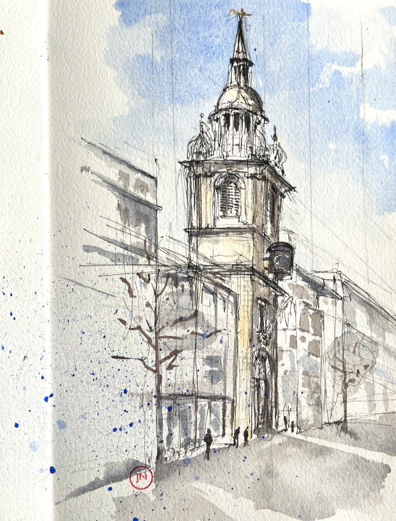
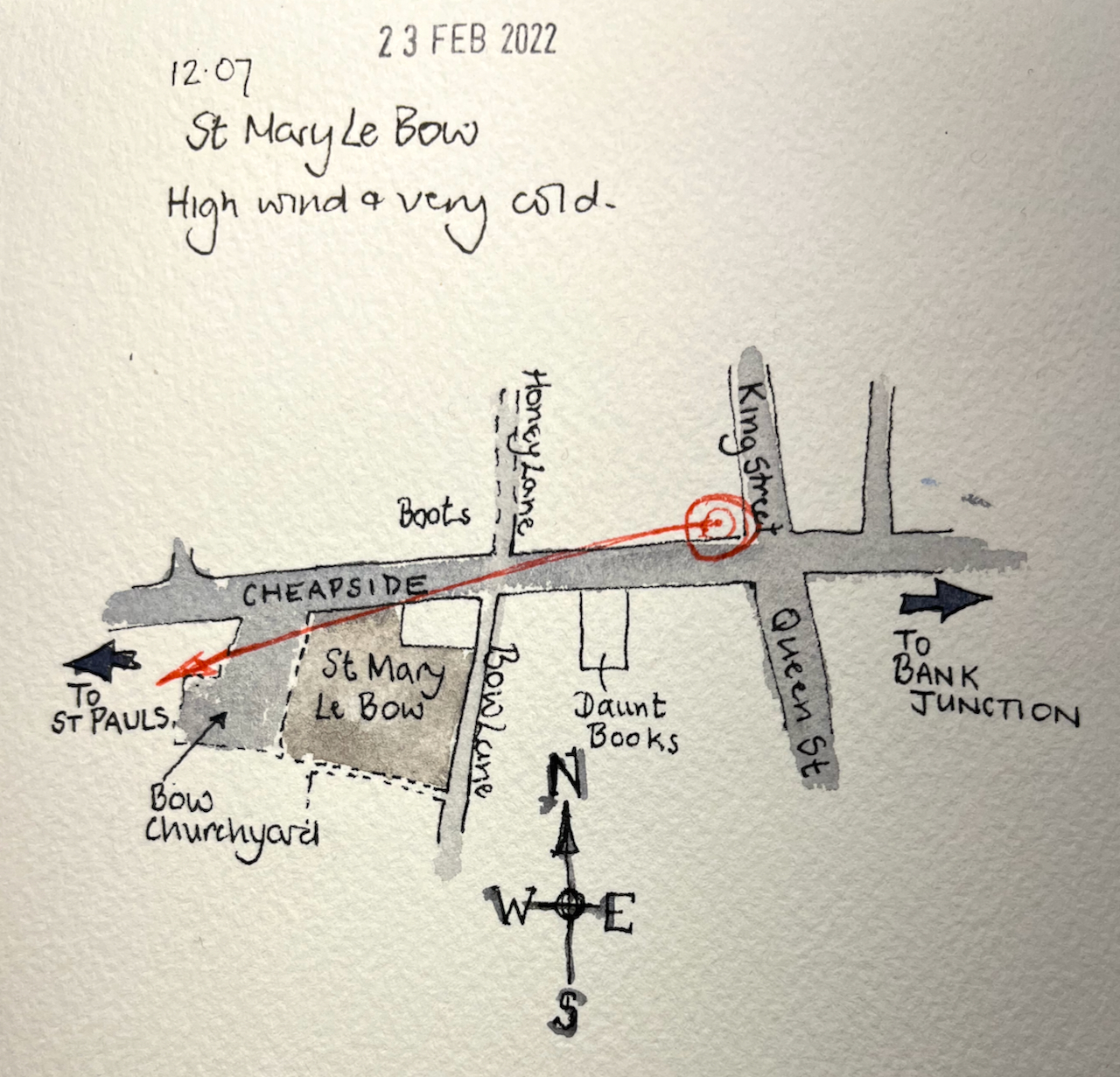
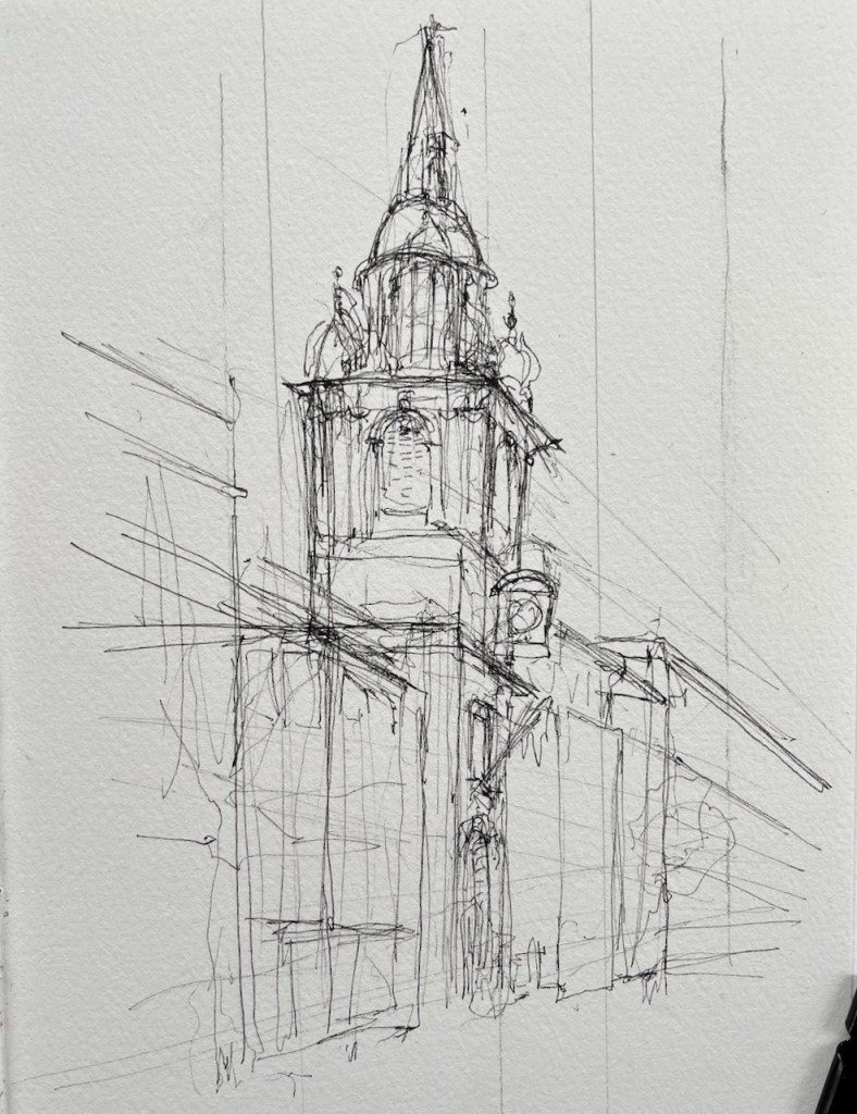
A quick sketch of St Mary Le Bow on Cheapside, London EC2
St Mary Le Bow, from Cheapside 23 Feb 2022 10″ x 7″ in Sketchbook 11
I drew this from the corner of Cheapside and King Street. This seemed like a really good place to stand, since there was a tall junction box next to me, and I could fit myself into a corner of a window. It rapidly became apparent that I chosen the windiest corner in London. My eyes streamed. Everyone coming round the corner took a short cut my side of the junction box, and funnelled past me, their heads down, phones in hand. I felt in the way.
But I persisted. I finished the pen. I did not put the colour on using the convenient top of the junction box, as I had planned, since no paper was going to stay still for a moment in that wind. I retreated, and coloured it at my desk.
Click a button below to share this post online, email it, or print it:
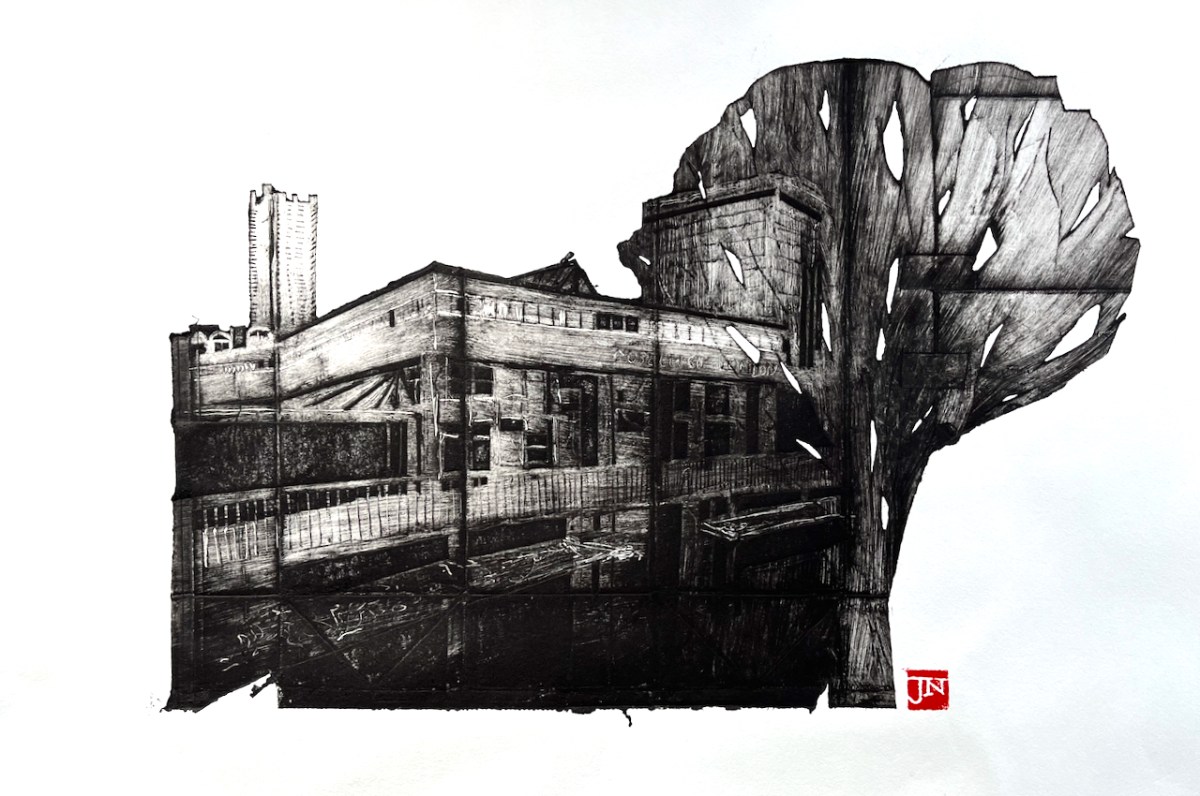
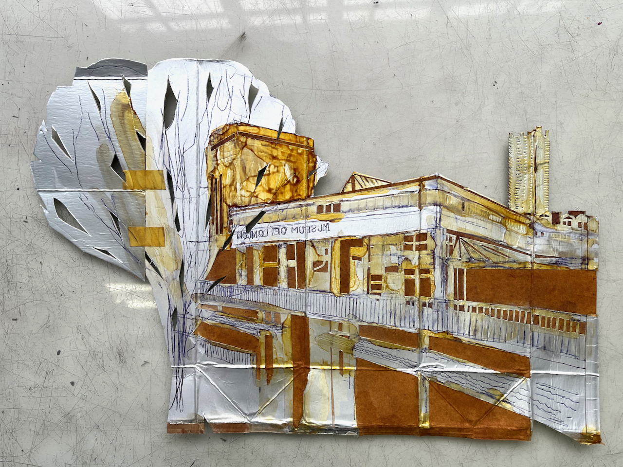
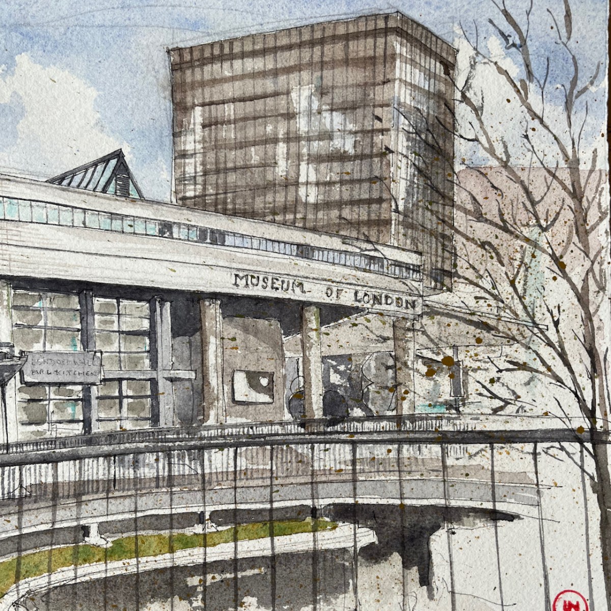
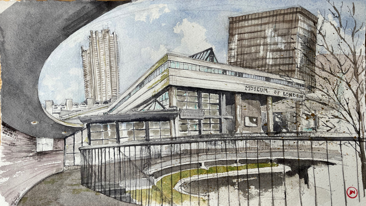
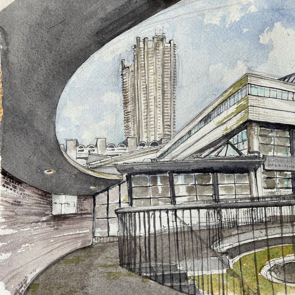
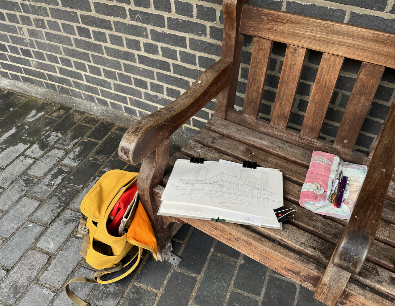
From the highwalk on the Rotunda there is a really amazing view of the Museum of London and Bastion House. This whole view going to change radically, if the City of London plans are approved.
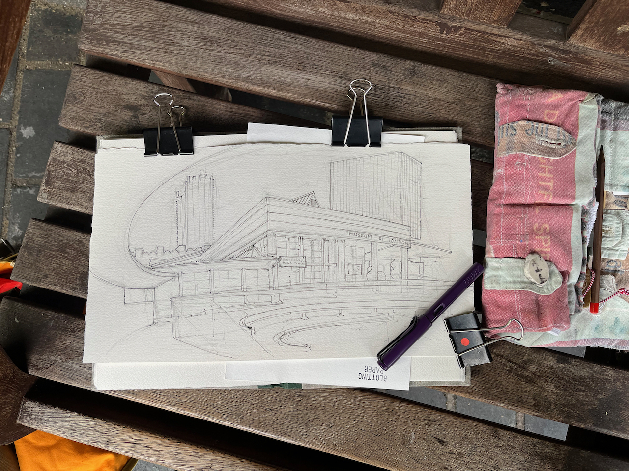
Museum of London from the Rotunda, 15″ x 8.5″ on Arches watercolour paper
The Museum of London is in the South West corner of the Barbican. It was designed by Philip Powell and Hidalgo Moya.
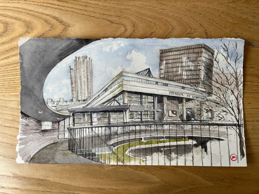
The Museum opened in 1976. The City of London plan to close it in December this year (2022), and then to demolish it, along with the surrounding highwalks and pedestrian bridges over London Wall.
The dark-coloured block in the background on the right is Bastion House. This 17 storey tower block was built to the designs of architects Powell & Moya between 1972 and 1977 as part of the Barbican development. It is on top of part of the Museum of London’s display space.
The City of London now plan to demolish it.
So if the plans go ahead, this view will no longer exist. I rushed to sketch it.
Museum of London and Lauderdale TowerMuseum of London and Bastion House
This drawing is in an aspect ratio new to me: 15″ x 8.5″ or 38cm x 22cm. I wanted to get the whole of the front of the museum in the picture.
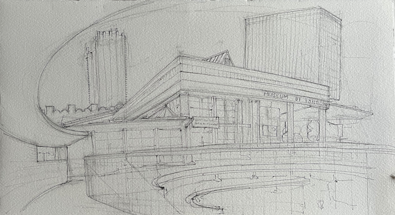
Here is comparison of the pen and ink and the the colour versions:
The architecture practice which designed The Barbican is “Chamberlain, Powell and Bon”. This “Powell” is Geoffrey Powell and not the Philip Powell of the Museum of London. The architects involved in designing the Barbican were:GeoffryPowell, Peter “Joe” Chamberlin, Christoph Bon, and Charles Greenberg.
The architects who designed the Museum of London and Bastion House are Philip Powell and Hidalgo Moya of the architecture practice “Powell and Moya”.
Thank you to the reader who clarified this for me.
Click a button below to share this post online, email it, or print it:
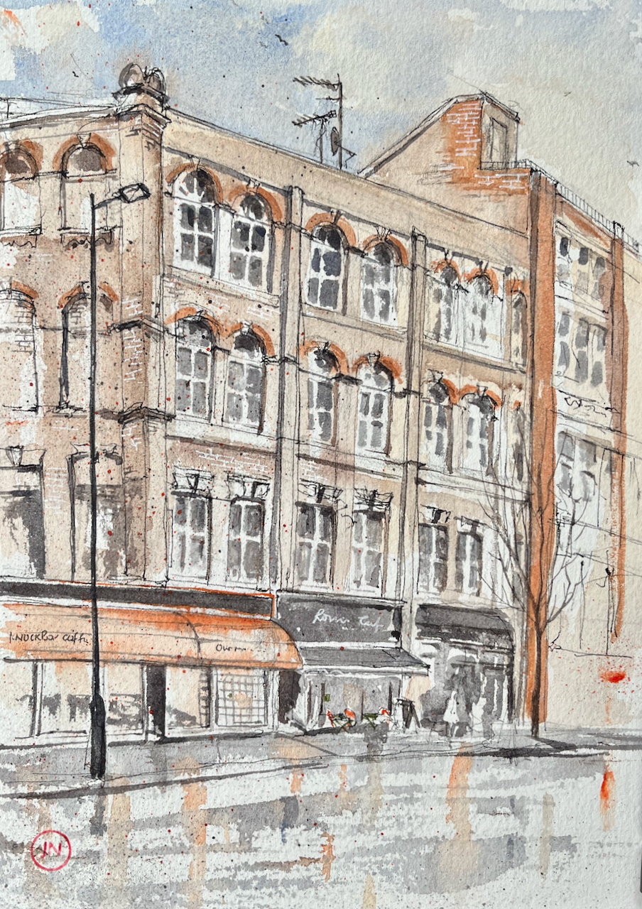
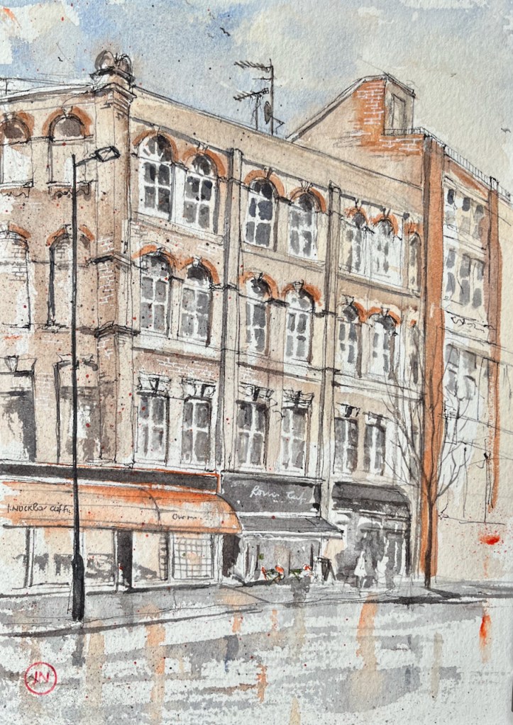
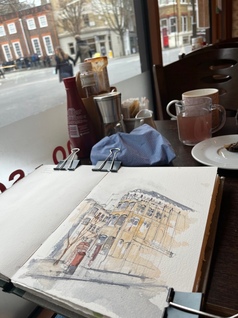
Roni’s Café, 39 Clerkenwell Road, 15th Feb 2022, 10″ x 8″ in Sketchbook 11
In the centre of the picture is Roni’s Café, where I sheltered to finish my drawing of 84 Clerkenwell Road.
My idea was to draw the view looking West along the Clerkenwell Road, from number 84. By the time I reached the spot, the rain was falling heavily. I spotted a large window. The people inside kindly agreed to host me for 45 minutes while I sketched my lines. Then I went out into the rain. I finished the picture at my desk.
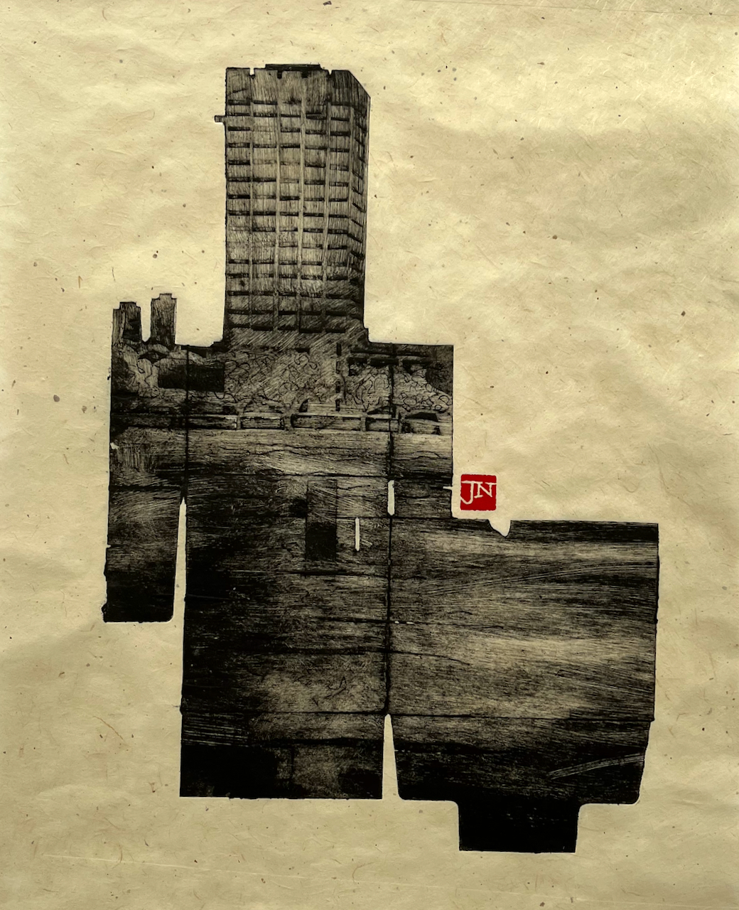
Here is a view of the tower of former London Television Centre building, seen from Windmill Walk, off Roupell Street near Waterloo Station. I…
It’s due for demolition. So using discarded packaging to make an image of this building seemed to be appropriate. The building, though made of concrete and steel, is yet ephemeral, like my fragile plate.
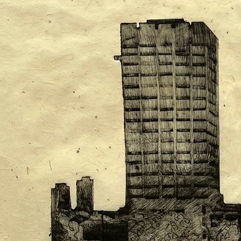
I made the print on “Gampi smooth” paper from Shepherds of London. This handmade paper is thin, translucent, and has small inclusions and imperfections as you see on this detail photo:
The sky in this part of London is never empty. There are always seagulls, falling leaves, windswept paper, aeroplanes, police helicopters. And rain.
The ink for this print is Charbonnel F66 Black traditional etching ink from Intaglio Printmakers. I made the print at East London Printmakers on the Henderson etching press.
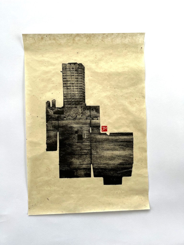
London Weekend Television, London South Bank. Paper is a bit over A3 size.
Here are some other prints made using the same technique:
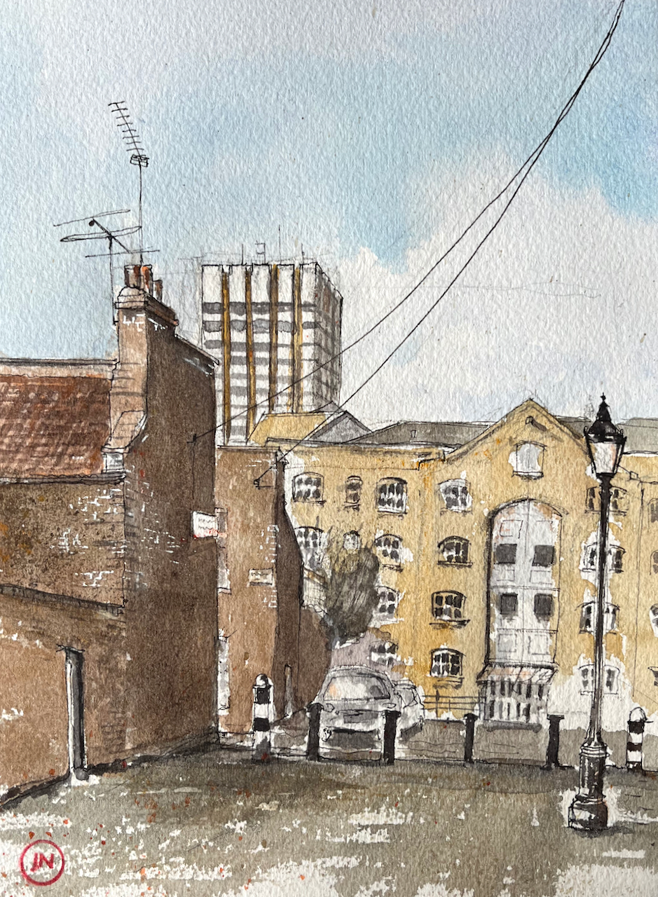
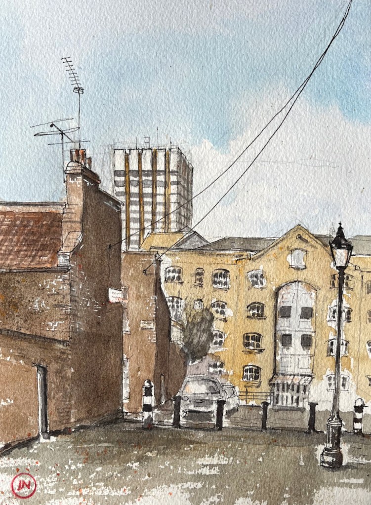
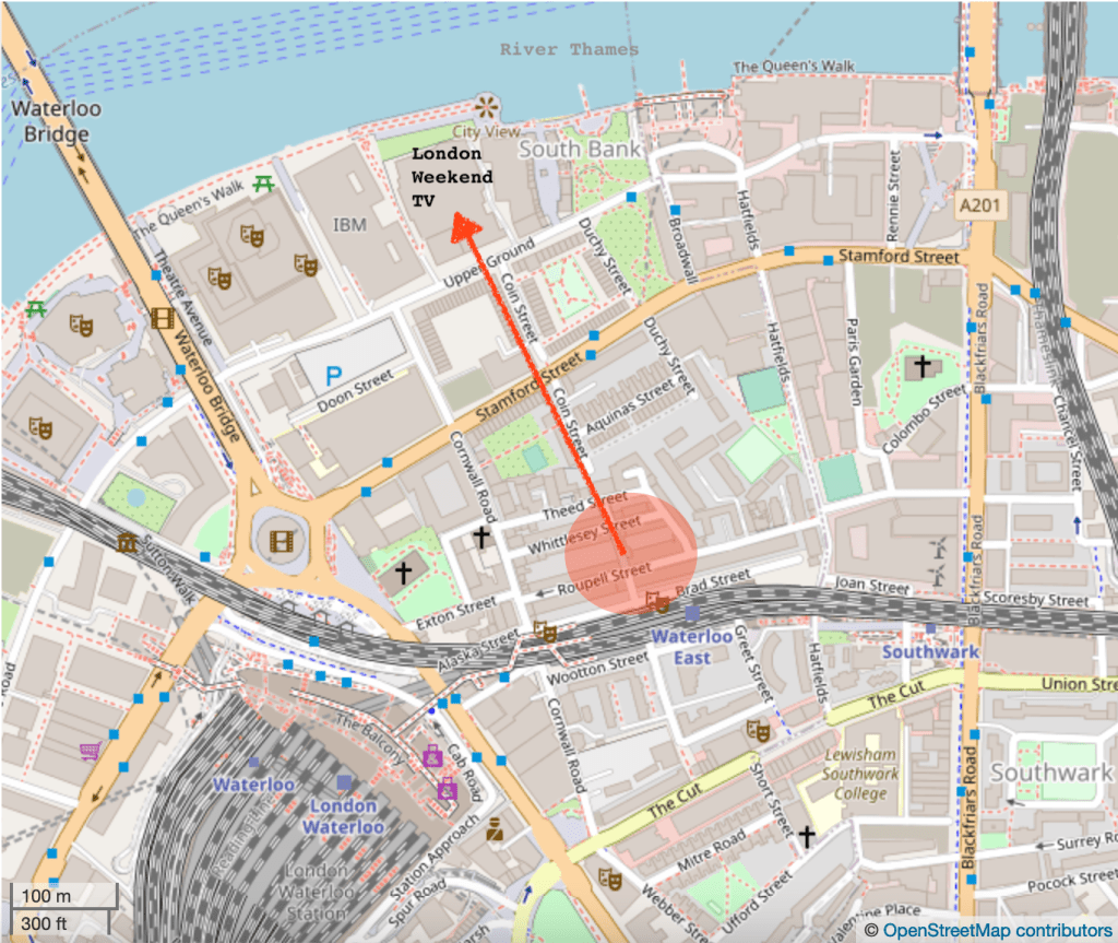
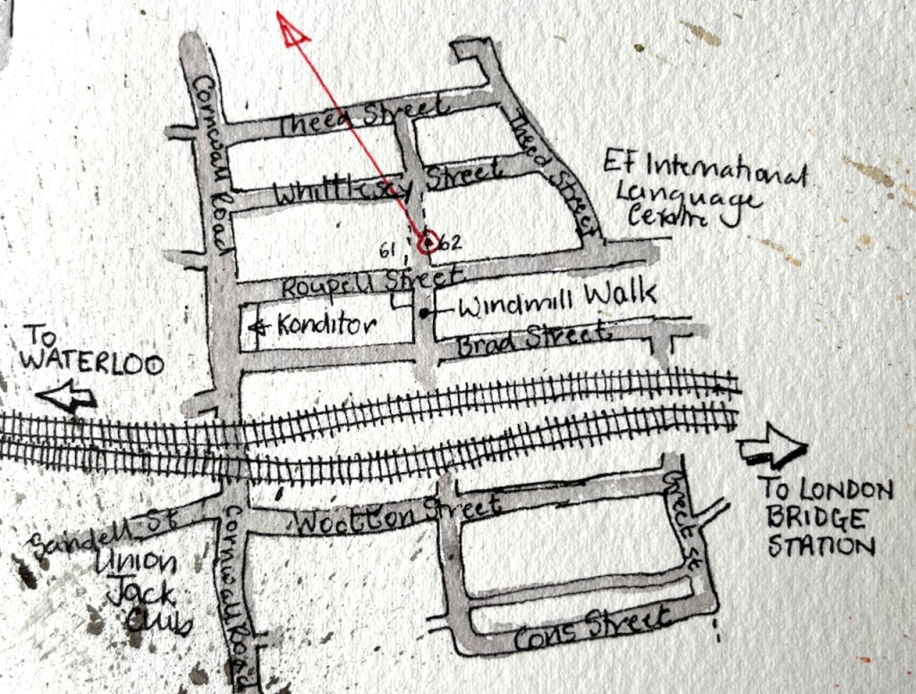
Here is a view of the tower of former London Television Centre building, seen from Windmill Walk, off Roupell Street near Waterloo Station.
LWT Building from Windmill Walk, 7th Feb 2022, in sketchbook 11
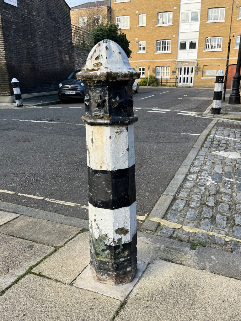
Bollard with stars.
I enjoyed all the wires and aerials! The swooping wire from the top right is a telephone wire or electrical cable. It’s unusual to see them above ground in London. Note also the marvellous bollards, which are mentioned in the Conservation Area Statement (Note 1).
Here you see layers of London development. In the foreground is Windmill Walk, part of the Roupell Street residential area built around 1824, and still residential. The paler building in the mid-distance is on Theed Street. It is a converted factory. It now contains some residential properties which I found listed on a holiday lettings site, and some offices listed on an estate agents’ site. Different accounts list it as a Violin Factory and/or a “Komptulicon Works”. Komptulicon was a sort of floor covering made of cork and rubber.
On the skyline is the London Television Centre, 1972, which I have drawn previously:
Here is a view of the London Television Centre, 60-72 Upper Ground, SE1. It is on the South Bank of the river Thames, a little to the East of the National Theatre and the Royal Festival Hall. It was completed in 1972 to the design of…
“[Roupell] street was laid out and construction started around 1824….. Roupell had built the street for what were described as “artisan workers” and the 1841 census provides a view of the professions of what must have been some of the first people living in the street. This included; painters, labourers, clerks, printers, bakers, carpenters, bricklayers, compositors, paper hanger, hatter, an excise officer, lighterman, warehouseman – all the typical jobs that you expect to find in such a street in 1840s London.” (A London Inheritance)
“Roupell Street Conservation Area” statement by Lambeth Council, 2007, describes the streets and details what can and cannot be done in modifications to the houses. It also mentions the “Komptulicon Works”, north of Windmill Walk.
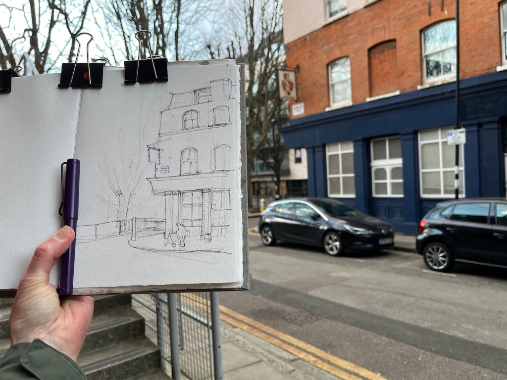
In the late afternoon, I walked round a corner near St Luke’s, and noticed the pub sign.
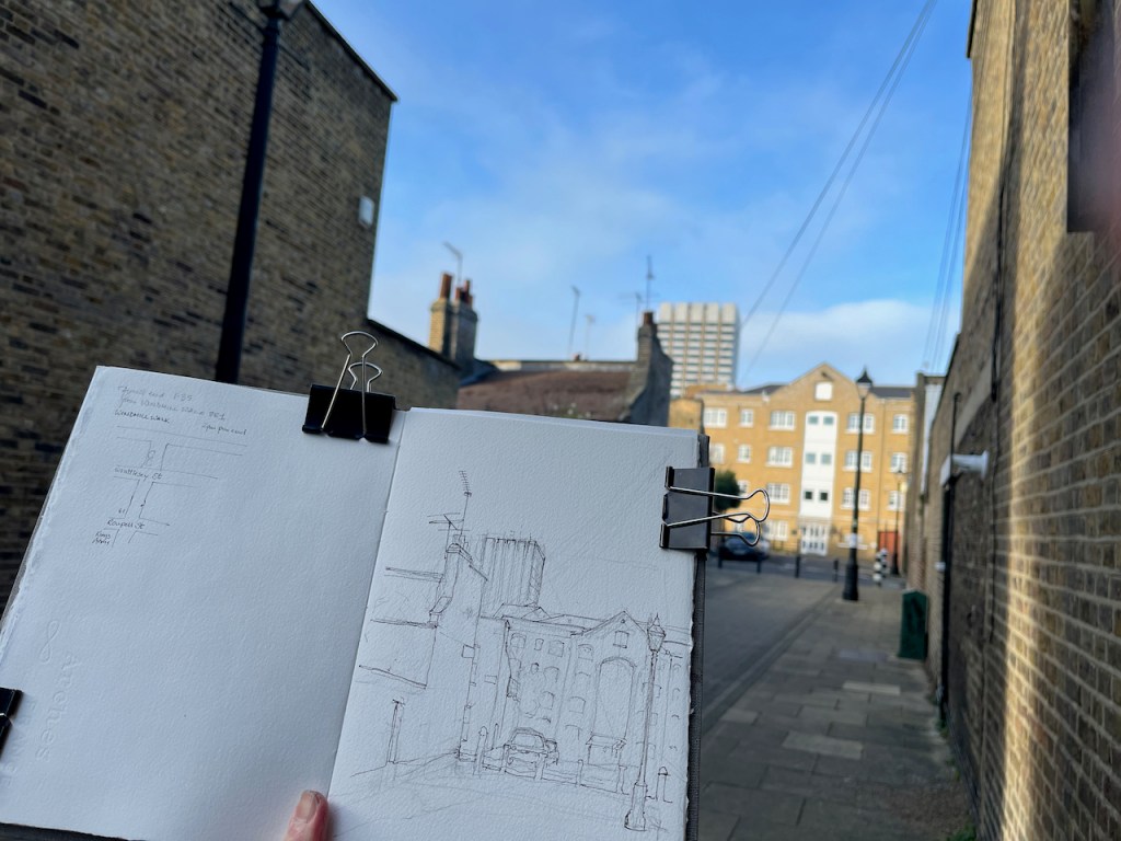
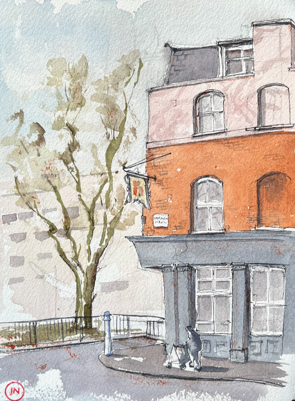
Langton Arms, Norman Street, EC1 sketched 29 Jan 2022, 4:15pm, in Sketchbook 11
The pub closed sometime around 1989, according to https://pubwiki.co.uk. It is now residential flats.
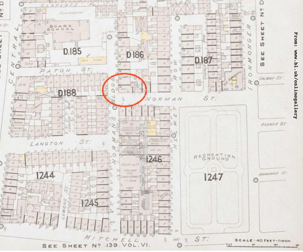
The pub was in existence in 1842, according to “closedpubs.co.uk”. There was a nearby Langton Street, shown on a map from the British Library dated 1901. The Langton Arms is marked “PH”.
1901 map. Langton Arms circled. Insurance Plan of London North District Vol. D: sheet 17 (British Library) Shelf mark: Maps 145.b.23.(.d)
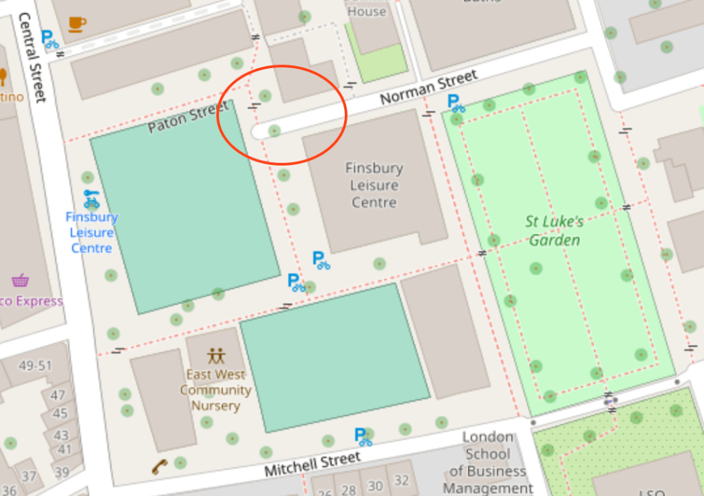
See how dense the housing was in this area in 1901. Here is the same area today. Langton Street has disappeared.
Norman Street area, 2022 (c) Open StreetMap, Langton Arms circled
Pub sign today
I sketched the closed-down pub at around 4:30pm, as the light faded. The pub sign is still there, but eaten away at the lower edge now. The street sign “Norman Street” is the same one as shown in a photo from 1958. It has “Borough of Finsbury” written above the street name. The Borough of Finsbury was absorbed into Islington in 1965.
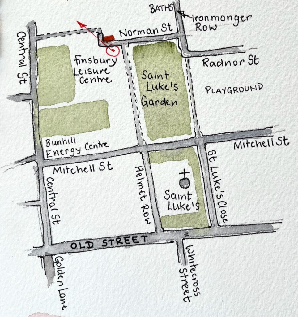
This picture is a story of vanishing: vanishing street, eaten away pub sign, closed down pub, a missing borough, sun setting in January. Behind me as I sketched I could hear the squeak of gym shoes on hard floors, the other side of the closed steel doors to Finsbury Leisure Centre.
1958
Click a button below to share this post online, email it, or print it:
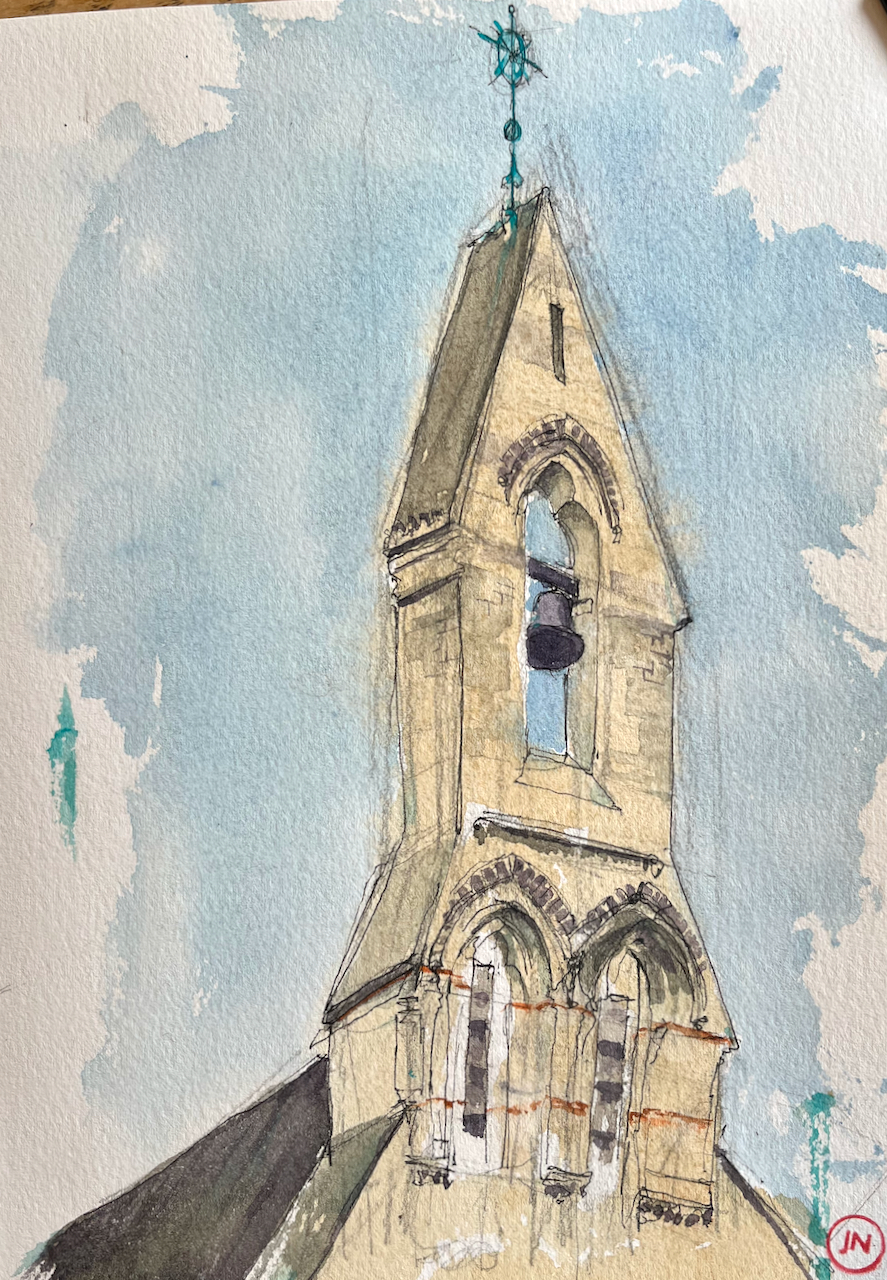
On a cold day, suddenly the sun came out and lit up the stone of St Monica’s Church.
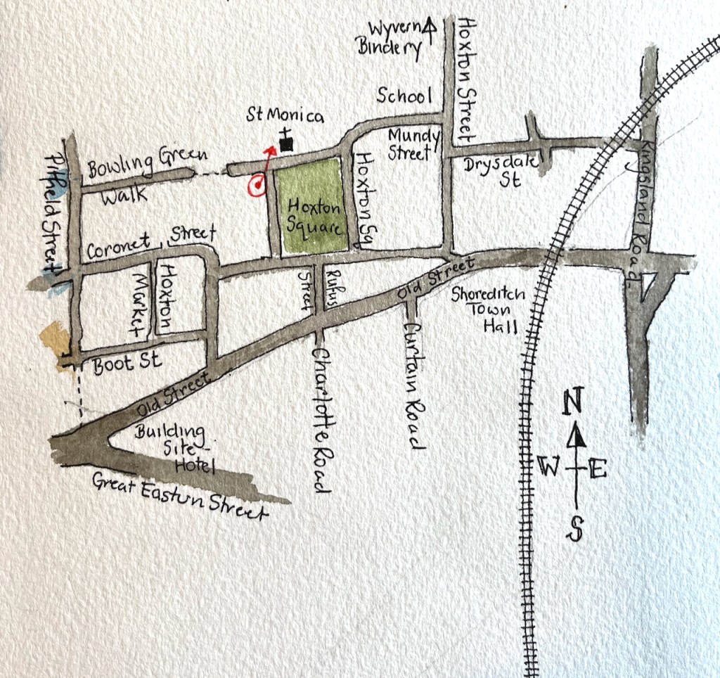
Bell tower of St Monica’s Church, Hoxton Square. 26th January 2022, 13:40 in Sketchbook 11
This church was built in 1866, to the design of E.W. Pugin. It was part of the Augustinian Priory on this side of Hoxton Square.
E.W. Pugin (1834-75) is the son of A.W. Pugin, who collaborated with Charles Barry on the design of the Houses of Parliament. E.W. Pugin designed a large number of churches, 60 English churches are listed in his Wikipedia entry, with another 6 or so in Wales and Scotland and 16 in Ireland.
Click a button below to share this post online, email it, or print it:
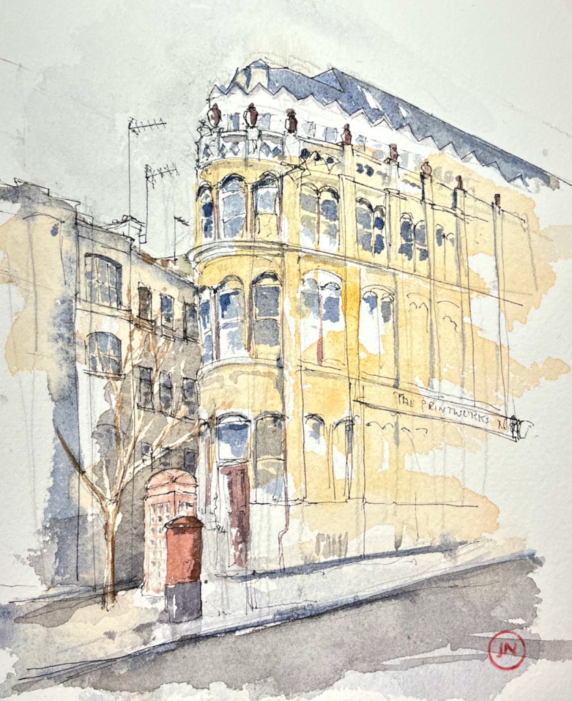
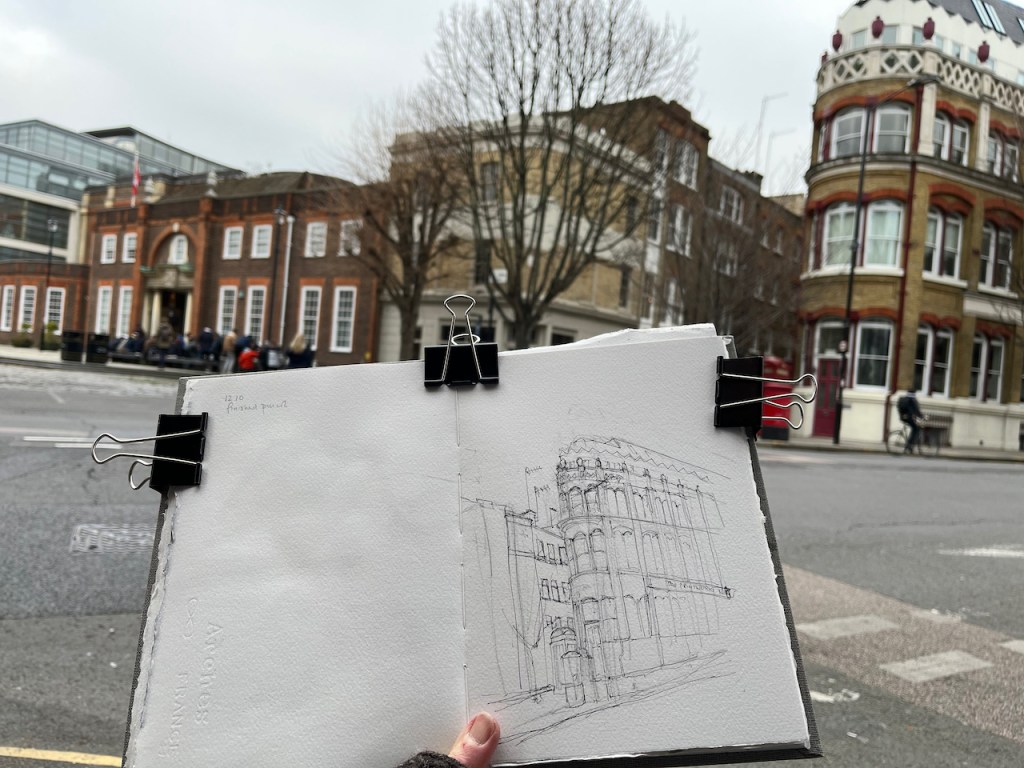
This building is at the junction of Clerkenwell Road and Albermarle Way.
84 Clerkenwell Road, EC1M, 21st January 2022, 14:30, 7″x 10″ in Sketchbook 11
The land, on the recently established Clerkenwell Road, was bought in 1879 by a jeweller, Edward Culver, who funded a new factory for his business on in this rapidly developing area. The building cost £11,ooo, and was finished in October 1879. His business occupied it until about 1894. (from British History online, see Note 1)
In 1915, the ground floor and basement were converted for use by the “London County & Westminster Bank” (Note 1). This turned out to be a long tenancy. A photo in the London Picture Archives shows that a descendant of the same bank, the National Westminster Bank, was there in 1976. (Notes 2 and 3).
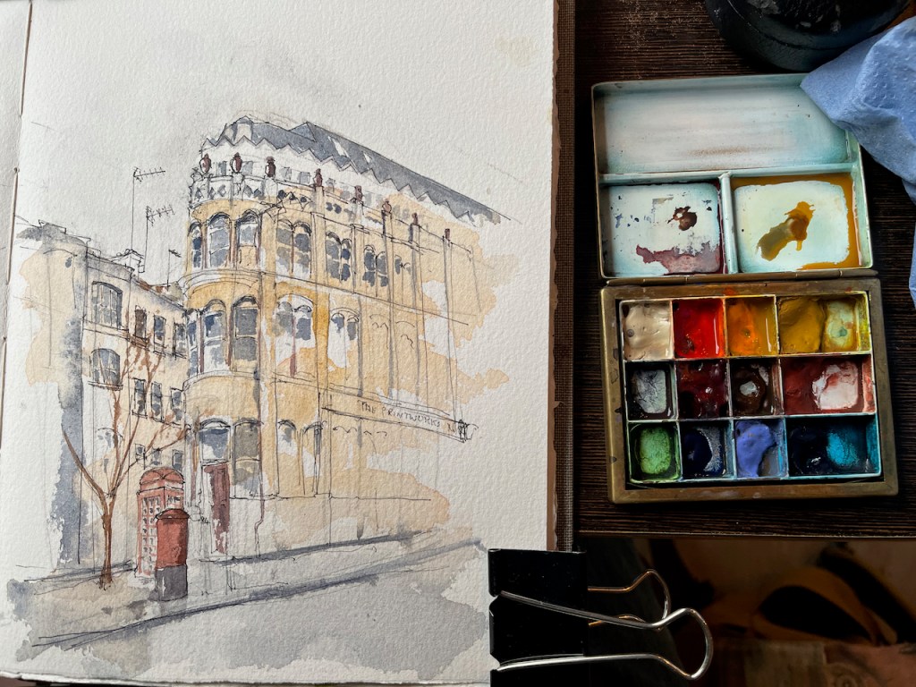
The ground floor is now a design company, “Frem”. Before that, it was a hairdressers. The building is labelled “The Printworks” but I am unable to discover when, or indeed if, it was a printworks.
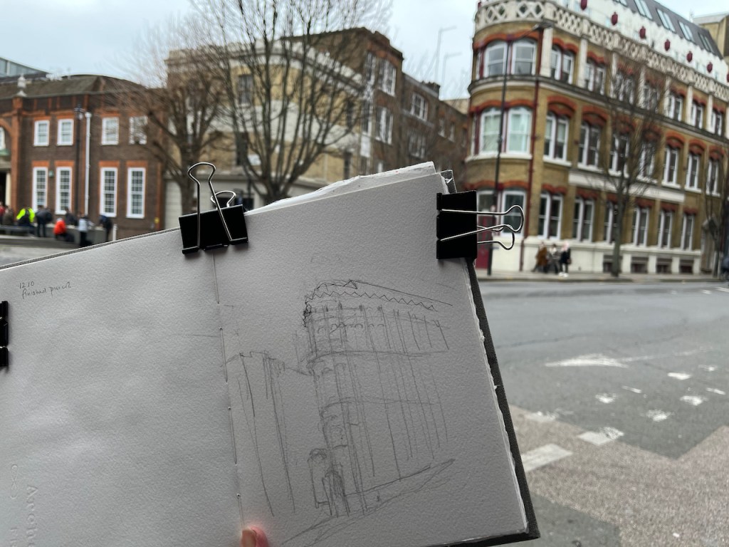
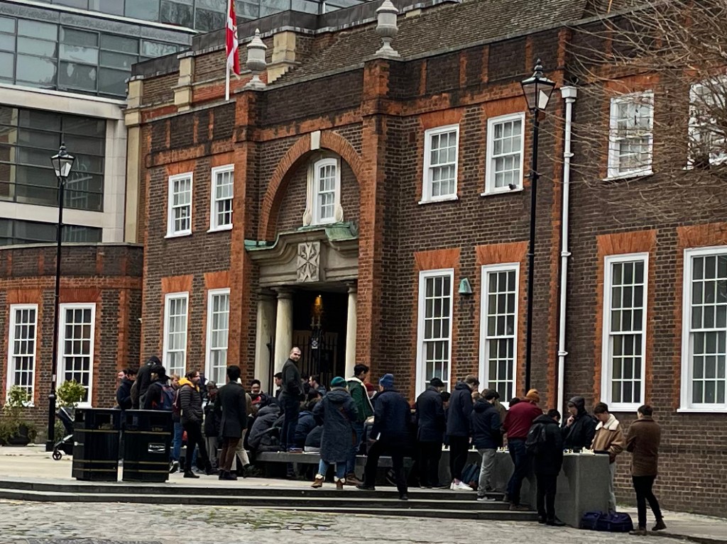
I sketched the building from the corner of the Clerkenwell Road and St John’s Lane. On the other side of the road, I saw a man come and lay out a large flexible chess mat on the stone bench in St John’s Square.
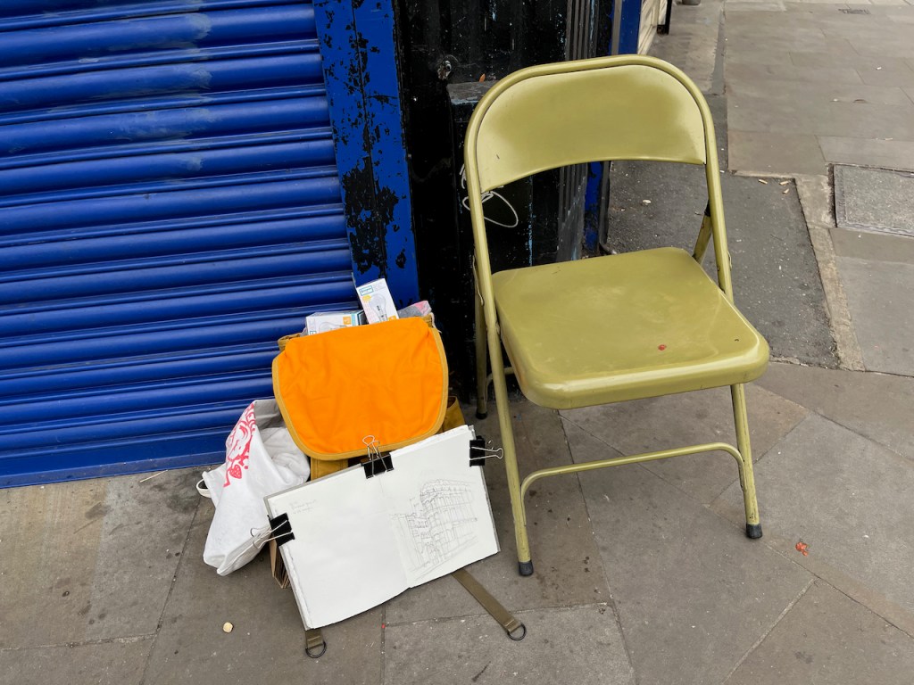
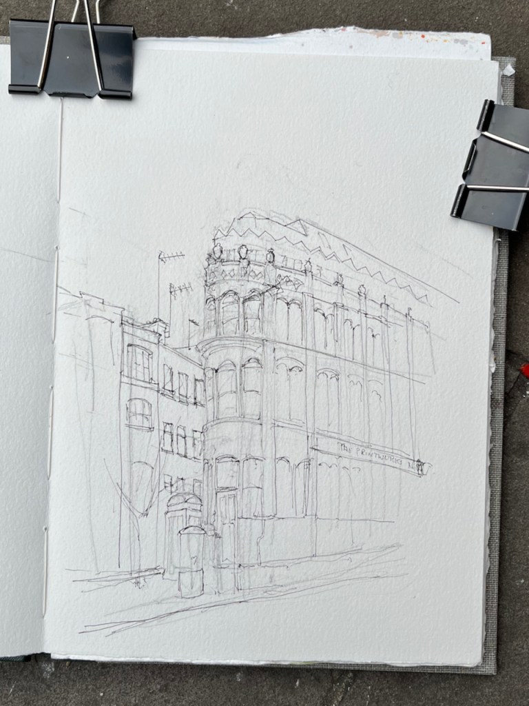
Later, a woman appeared at my elbow carrying a green metal chair. “Would you like to sit down while you draw?” she asked. I would indeed. She told me she was from the café just up the road. Very grateful, I sat down and continued sketching. By the time I’d finished the pen sketch, there were several dozen people clustered round the bench in St John’s Square. There were now many chess sets laid out. And I was very cold.
Pencil underdrawingThe chairPenPen, chess players centre left, just above the book.Chess players on the stone bench.
Roni’s Cafe: warm and friendly
I picked up the green chair and went to the café to give it back. It was warm and friendly in there, so I stopped for a coffee. I learned that the chess players come every Saturday. First there were just a few, now there are dozens. The youngest is 7 years old. As I drank my coffee, some of the chess players came into the café, hopping from one leg to the other with the cold, as I had done earlier. They bought takeaway coffee or hot chocolate, left a phone to charge up by the till, and took off again to join the fray.
The friendly proprietor of the café admired my picture and pointed out that I could see the building, if I took a certain table by the window. “Then you can do the colour”, she said. I could. She brought a cup of water, a porcelain saucer, and a large amount of paper towel. This is a lady who knows what watercolour painters need. A mug of tea arrived as well. Comfortable and warm, I continued my sketch.
Putting on the colour in Roni’s Café
If some of these road names seem familiar to you, it might be because this area is the setting for much of the story in the novel “Troubled Blood” by Robert Galbraith aka JK Rowling.
————————————————————–
Note 1: 84 Clerkenwell Road, early history: ‘Clerkenwell Road’, in Survey of London: Volume 46, South and East Clerkenwell, ed. Philip Temple (London, 2008), pp. 385-406. British History Online http://www.british-history.ac.uk/survey-london/vol46/pp385-406 [accessed 22 January 2022].
Note 2: 1976 photo: London Picture Archive, Record 60792, on this link
Note 3: NatWest Group has an excellent History section on its website: https://www.natwestgroup.com/heritage.html?intcam=. The current “NatWest” is the result of the acquisition of over 250 banks over several centuries. The London County and Westminster Bank was one of them.
London & Westminster Bank Ltd (1833-1909) opened in 1834 with a head office at 38 Throgmorton Street and a branch at 9 Waterloo Place. It acquired a succession of other banks, then in 1909 it amalgamated with London & County Banking Co to form London County & Westminster Bank Ltd. London County and Westminster Bank underwent a number of amalgamations and mergers, notably merging with the National Provincial Bank in 1968 eventually to form the National Westminster Bank in 1970.
Click a button below to share this post online, email it, or print it:
Hayne Street is a North-South lane just to the East of the new Crossrail station at Smithfield. It has been closed for some time, while the station was built and the office block on top of the station was constructed.
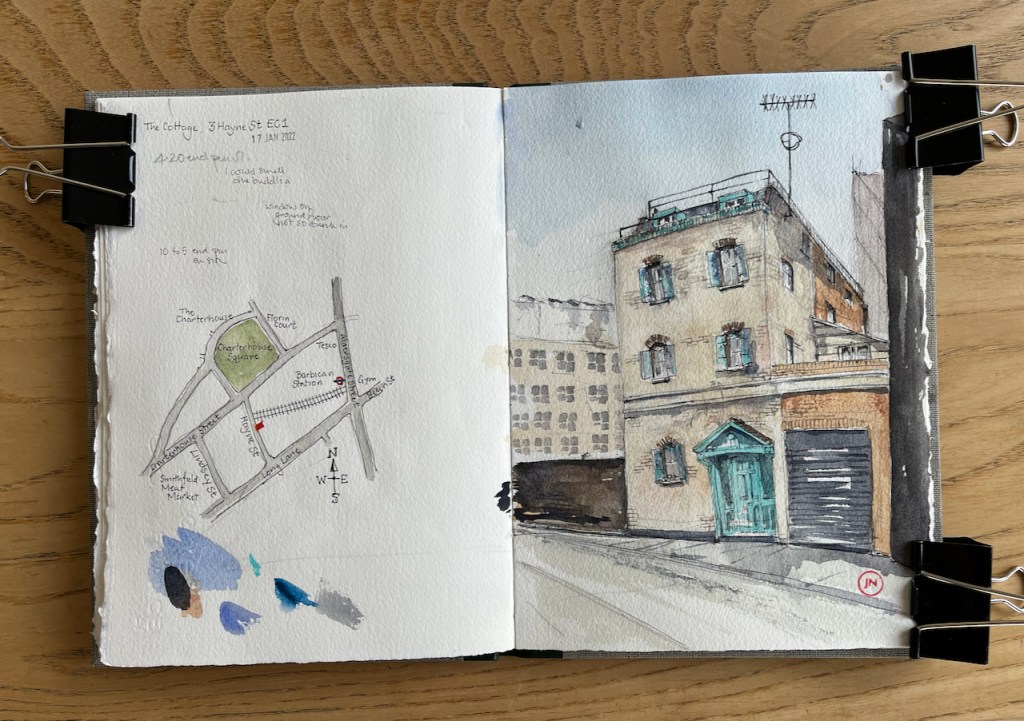
On the west side of Hayne street is this house:
The Cottage, Hayne Street EC1, 17th January 2022, 5pm. 10″ x 7″ in Sketchbook 11
As I sketched, around 4:30 to 5pm, construction workers were coming off shift from the CrossRail site. They walked past me, lighting cigarettes, jostling, and talking in various languages. One person stopped to talk to me: “It’s a funny old building!” he observed. I agreed that it was, and wondered if anyone lived there. “I’ve not seen anyone go in or out,” he told me, “And I’ve been here four weeks.” Another person joined the conversation.
“I’ve seen a car,” said the newcomer. He indicated the black roller door, and made a sweeping gesture, showing how the car went in and out.
We all looked to see if there were lights in the windows at the side of the house. There were none. “It’s railway property,” declared the first person.
“It’s big, isn’t it?” said the second person, “It goes way back!”.
It does go way back. I’ve tried to show this in my drawing.
It’s a bit of a miracle that it has survived. This house is about 150 years old. There are jagged modern offices all around it. The Pevsner guide has a small paragraph on Hayne Street, in the section labelled “Long Lane and Hayne Street”. He says this:
“Long Lane and Hayne Street Long Lane first recorded in 1440[……] The N side, shorter because of the market buildings at the W, is mostly undistinguished medium-sized post-war offices. Not 18-19 are by Morrison, Rose & Partners, 1972-4, brick with smoked gland window bands. The upper storeys step back down Hayne Street, named after its developer in the early 1870s. Of this date the unpretentious brick warehouse at Nos. 8-10 W side and No. 3 opposite, a little house perched on the brink of the railway cutting.”
The Buildings of England London 1: The City of London by Simon Bradley and Nicolaus Pevsner (first published 1997, republished with corrections 1999) page 546
The “unpretentious brick warehouse” which was on the west side of Hayne Street in 1999 has now been replaced by the building above CrossRail. The “little house” remains.
It was there in 1873. At that time it had neighbours! See this map, from the marvellous British History online resource.
‘Charterhouse Square area: Introduction; Charterhouse Square’, in Survey of London: Volume 46, South and East Clerkenwell, ed. Philip Temple (London, 2008), pp. 242-265. British History Online http://www.british-history.ac.uk/survey-london/vol46/pp242-265 [accessed 17 January 2022].
Aldersgate Street Station is now Barbican Station. See the huge number of railway lines in 1873. Today there is just one line on the surface. The new CrossRail line is 40metres below.
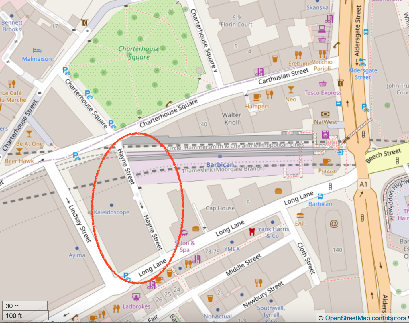
Here is a modern map of the area:
Hayne Street Area 2022, from Open Street Map, (c)OpenStreetMap contributors
Here are some views looking up and down Hayne Street, and my sketch map and sketching location. Click to enlarge.
Sketch map. The small red rectangle shows the location of “The Cottage” Sketching locationSketching in the darkLooking South down Hayne Street towards “The Red Cow”. The new Crossrail building is on the right.Looking North along Hayne Street towards Charterhouse Square, glimpsed on the left. The long wall on the right is above the railway line.
3 Hayne Street has intrigued people. Mr Tim Dunn on Twitter found an “environmental statement” from Crossrail saying they were going to demolish the building. But it doesn’t seem to have happened, so far…..Mr Dunn’s research also contradicts the construction worker’s assertion that the building is “railway property”. From what he’s found, it’s privately owned. Here is his Tweet thread:
Many years ago, I found an odd little house on a @cityoflondon backstreet; The French House, we called it. It’s been hidden by Crossrail works for YEARS but recently 3, Hayne Street has been revealed… and uh-oh! A @Crossrail document says it’s scheduled for demolition… (1/6) pic.twitter.com/Rt2g6KCfES
“The City Gent” published photos of The Cottage in his “Symbols and Secrets” blog on the 6th of January.
I’m glad so many people appreciate this strange building in a back street.
I have sketched in this area before. The building in the back left of my picture is on the other side of the railway line. It is now swathed in plastic and being restored or redeveloped. I sketched the West edge of this building in April last year.
This is a little white building I always enjoy walking past. It is the westernmost end of a thin terrace of warehouses and showrooms, lodged in a triangle between the road and the railway. As I passed it the other day I saw that the tree which has taken root above the door was putting…