Shetland: Rocks and Headlands

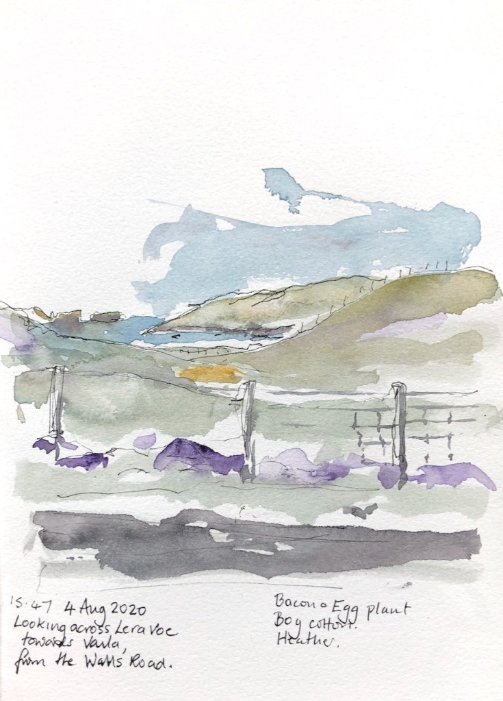
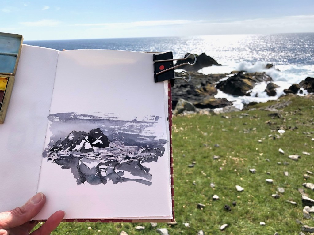
On a long walk to Footabrough, I paused to do a drawing of a distant headland.

From Uskie Geo

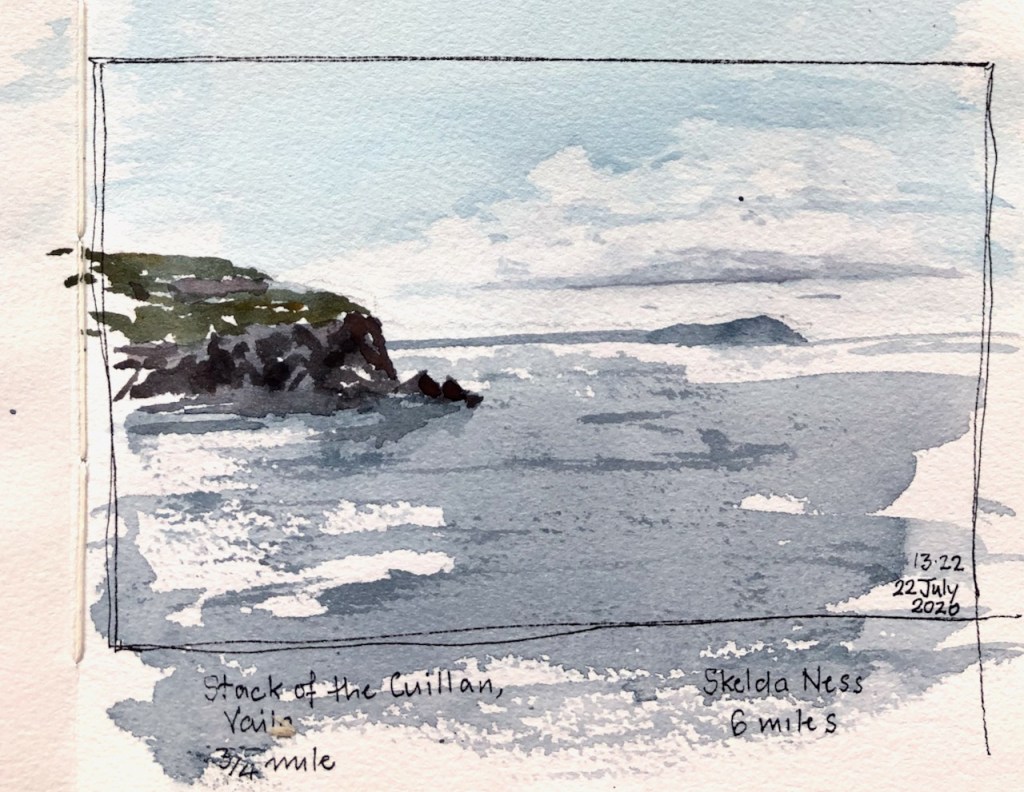
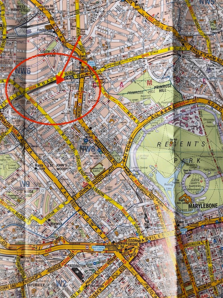
The drawing shows the West corner of the island of Vaila, with the wonderfully named “Stack of the Cuillan”, which are the rocks forming a small island at the base of the cliffs. In the distance is a headland. The question is: what is the headland?

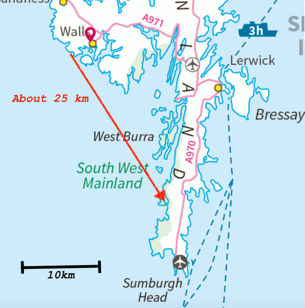
When I was drawing it, I thought it must be Skelda Ness, some 6 or 7 km away. But that might be hidden behind Vaila. So is that distant headland Sumburgh Head, 25km away?

It occurred to me that the phone might know. I have the OS Maps app. But evidently it didn’t think I was interested in any feature so far away.

Screenshot from the OS Maps App. It helpfully identifies the local features, but not the distant headland.
150 degrees bearing from where I drew the picture.

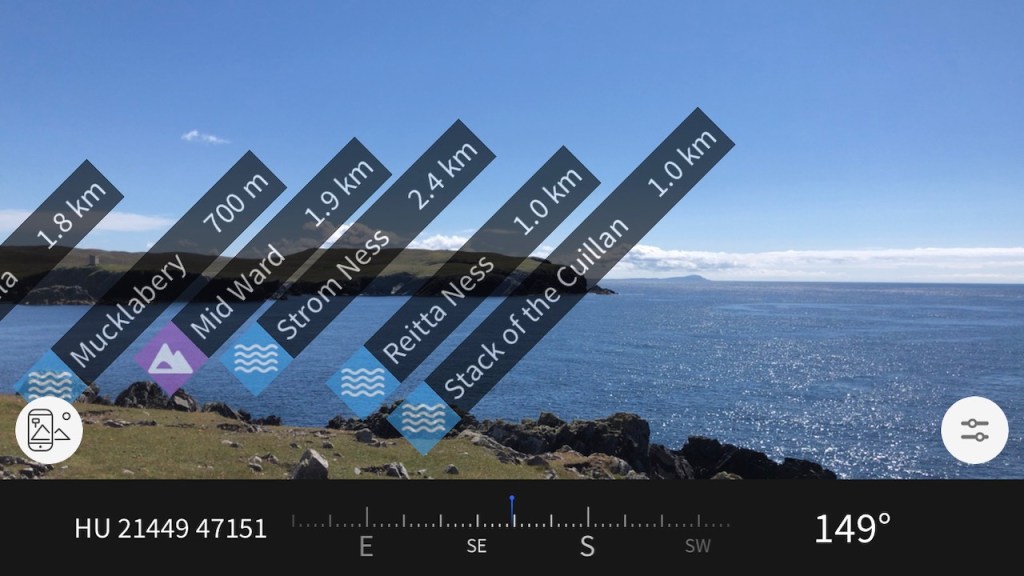
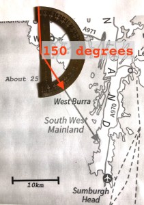
However it did give me the bearing: 149 degrees, as you see. So now back in London I can use my old school protractor.

It’s Sumburgh Head in the picture. I’m glad we sorted that out!

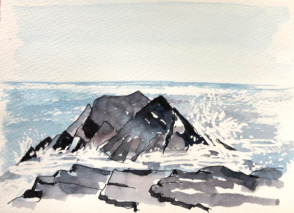
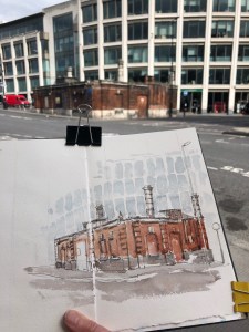
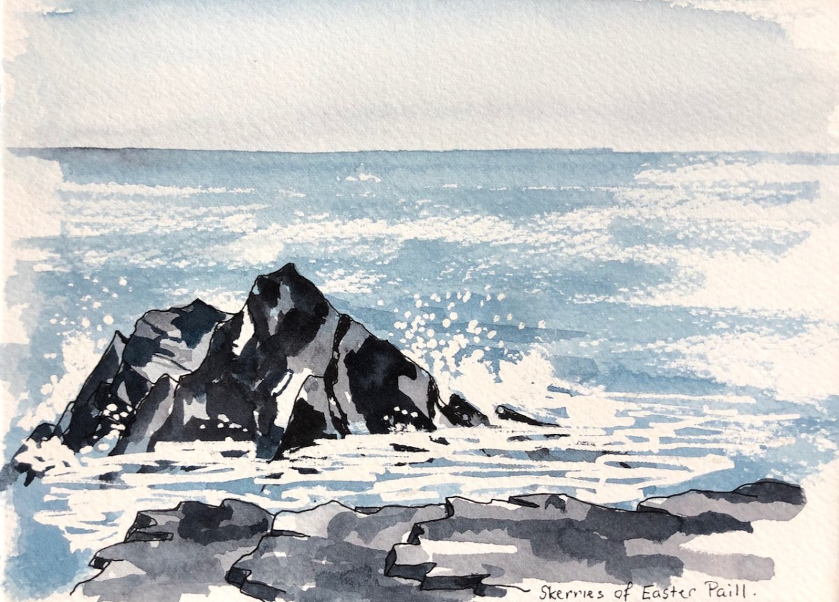
Further on towards Footabrough are the Skerries of Easter Paill.

Skerries of Easter Paill, drawn on location.

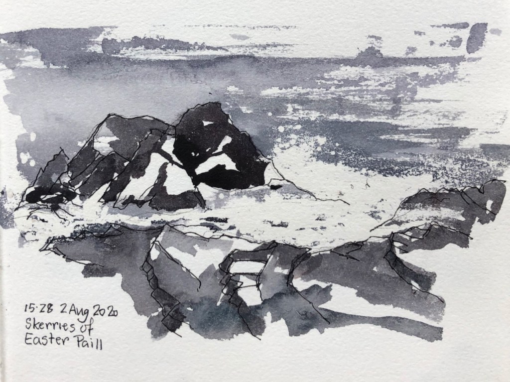
The word “Easter” here does not relate to the Christian festival, but to the fact that these small islands are the ones on the East. I guess this implies there must be a “Wester Paill” somewhere but I haven’t found it.

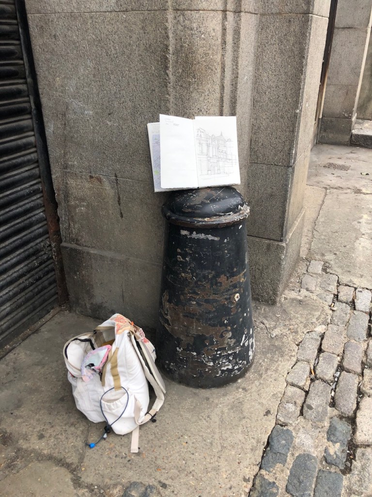
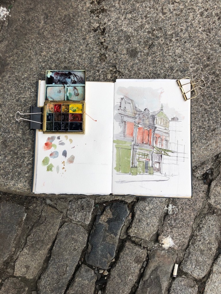
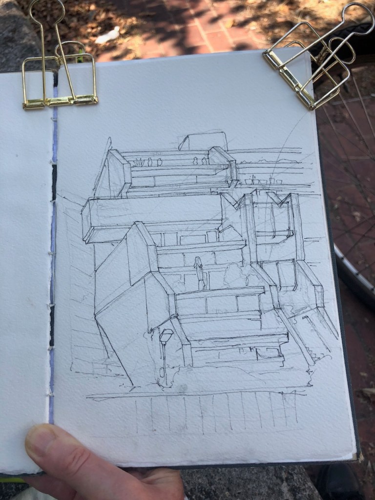
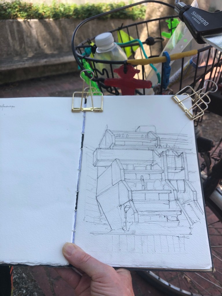
I drew this on location in my sketchbook.

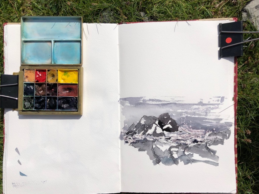
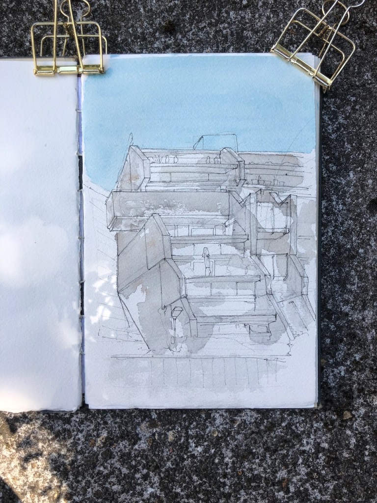
The waves are done with watercolour resist. The resist is a kind of rubber solution a bit like Typex. The air was somewhat damp, despite the fine weather. I applied the resist before the paint was entirely dry, and then the resist didn’t dry properly either. I walked along for while with the sketchbook open, flapping it, much to the consternation of nearby terns. Then the terrain became more complicated, and too rocky to scramble over carrying an open sketchbook in one hand. I sat down on a stone and rubbed the resist off, which reveals the white bits. I was pleased with the result, obtained even in these adverse conditions. The product I was using is “Schminke Rubbelkrepp neutral”, in a tiny 20ml jar, applied with a brush.

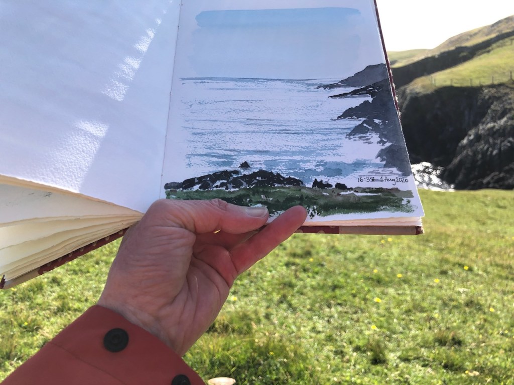
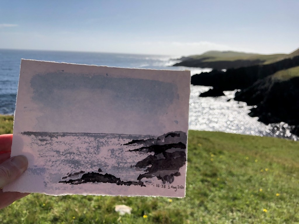
In the evening I had another go, this time trying to describe also the brilliant light of the day, and the clarity of the water, as well as the pointedness of the rocks, and their regular angles.

Skerries of Easter Paill, drawn at my desk, based on the sketch on location.

On another walk, I drew the headlands of Mucklure.

The dark is terrifyingly black, and the glitter from the sea is blindingly bright. It’s impossible to draw. But it’s so arrestingly beautiful that I had to have a go.

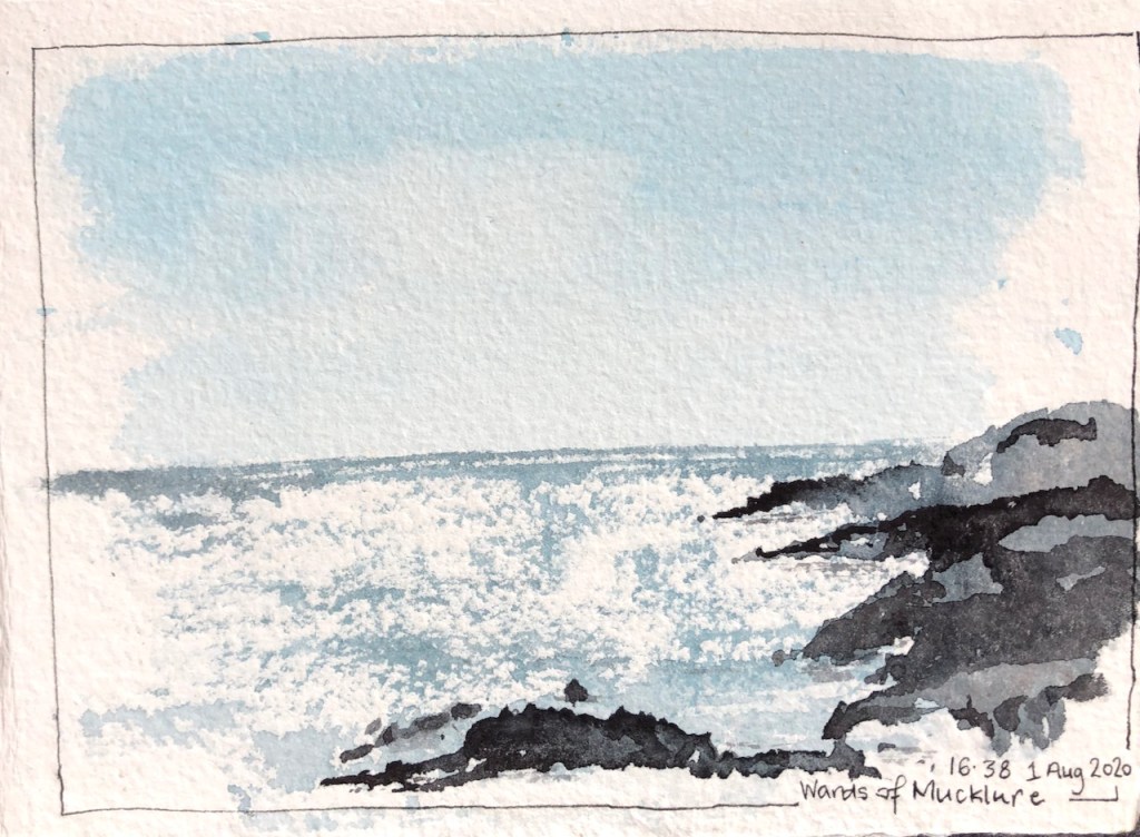
This scenery demands to be drawn.

Here are some blog posts from previous expeditions to Shetland. You can also see a collection of Shetland Landscapes (2017) on this link.

Shetland, Skerries of Easter Paill

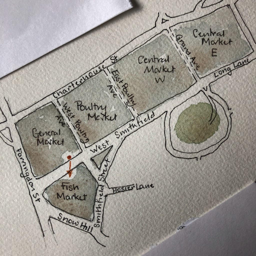
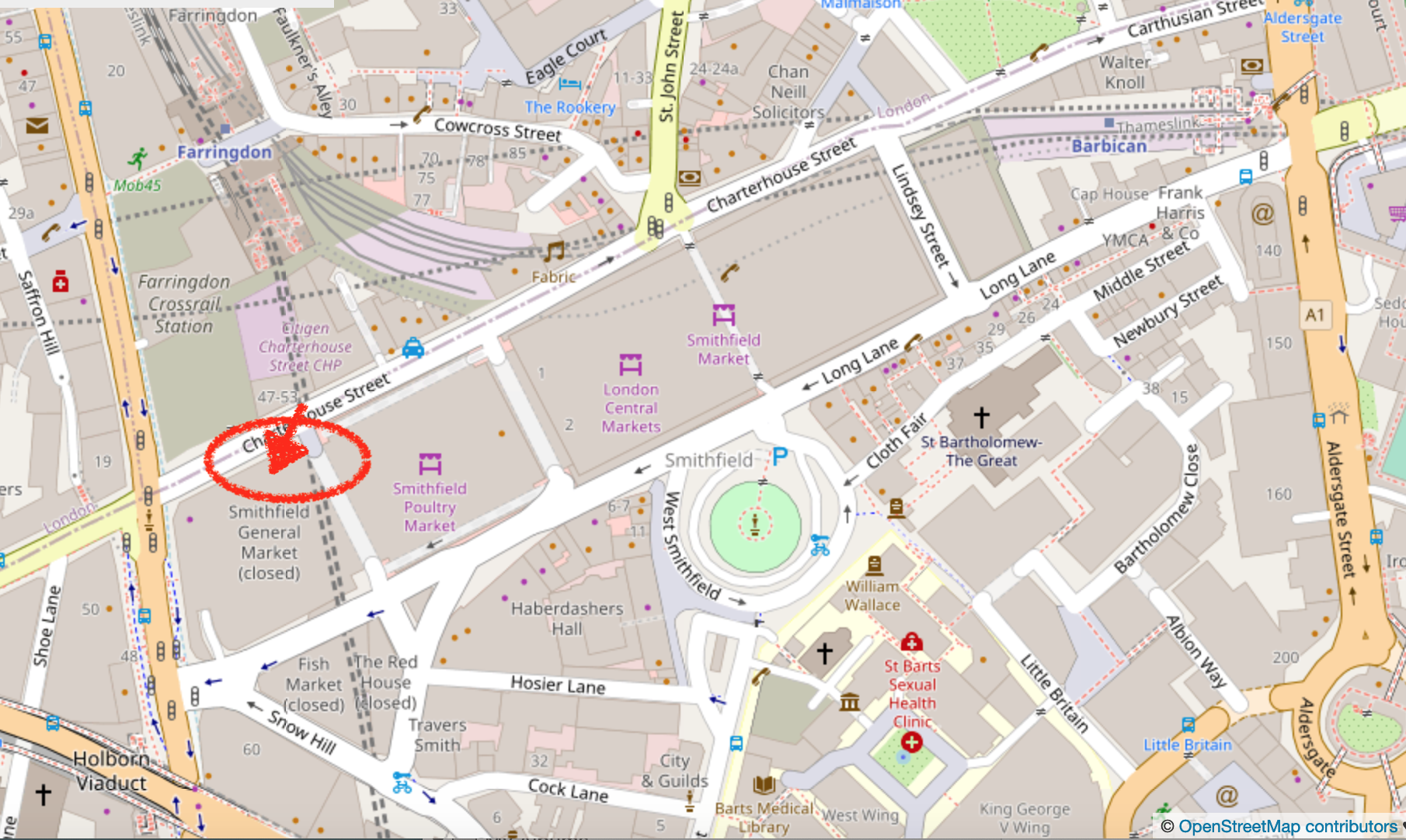
The rocks off the ward of Mucklure are almost geometrical in their formations. They make abrupt right angles. Here are the Skerries of Easter Paill, small rocks in the sea off Dounawall and The Hamar. Here is another drawing of the same location. It’s hard to get an idea of the scale. Here’s a map…

Shetland 2019 – pen and wash

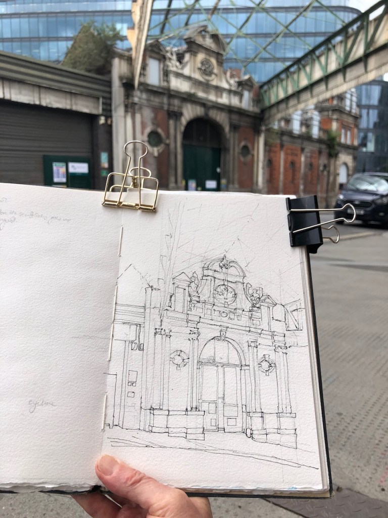
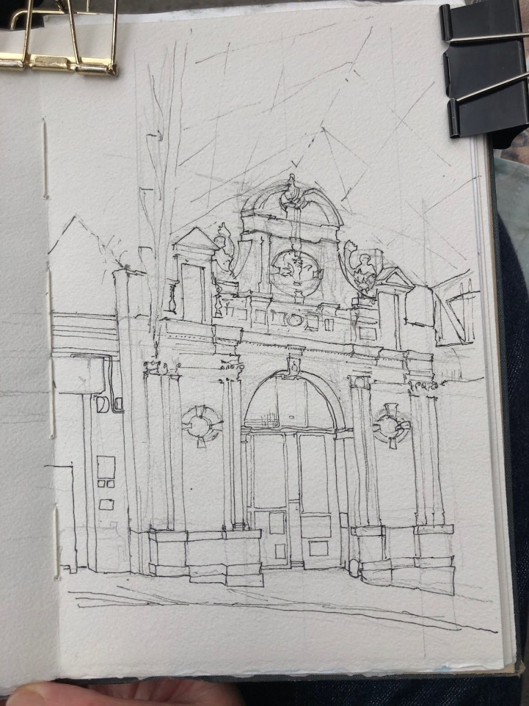
Here are some pictures I drew in pen and wash. I spent a lot of time drawing rocks. The rocks are overwhelming in their detail. Not every thing I saw is in the picture. But every thing in the picture, I saw. Here are some pictures I drew on the journey going back South: And…

Shetland: Towards Vaila

There’s a beach near Burrastow that looks towards the Island of Vaila. Here’s a sketch I made from the cliffs above the beach. Those cliffs look steep and dark. The tower is a “watch tower”, I’m told, built by the Laird back in the day (1700s) to watch over his fishing operations. The story I…

Shetland, Historic site walk

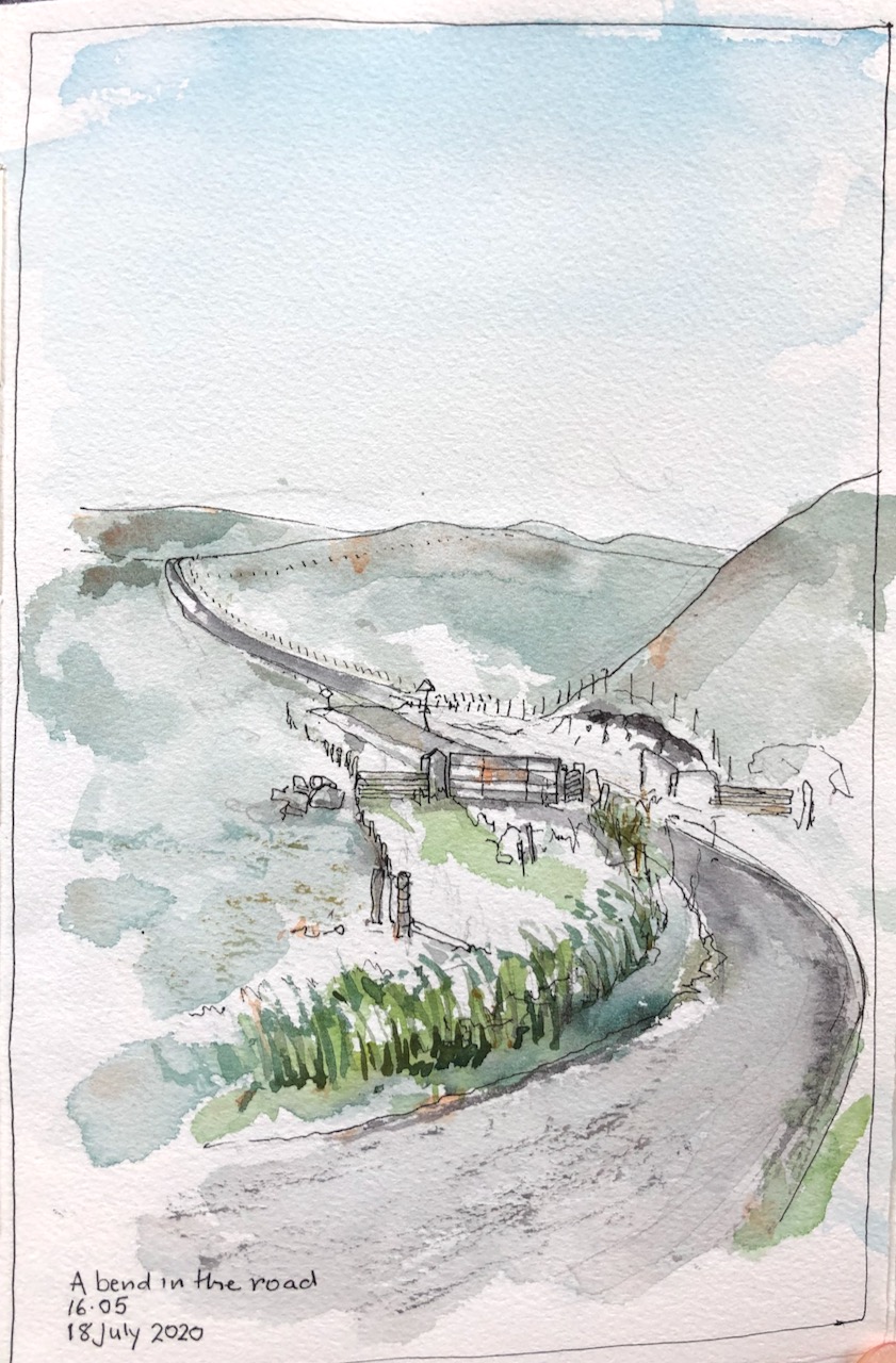
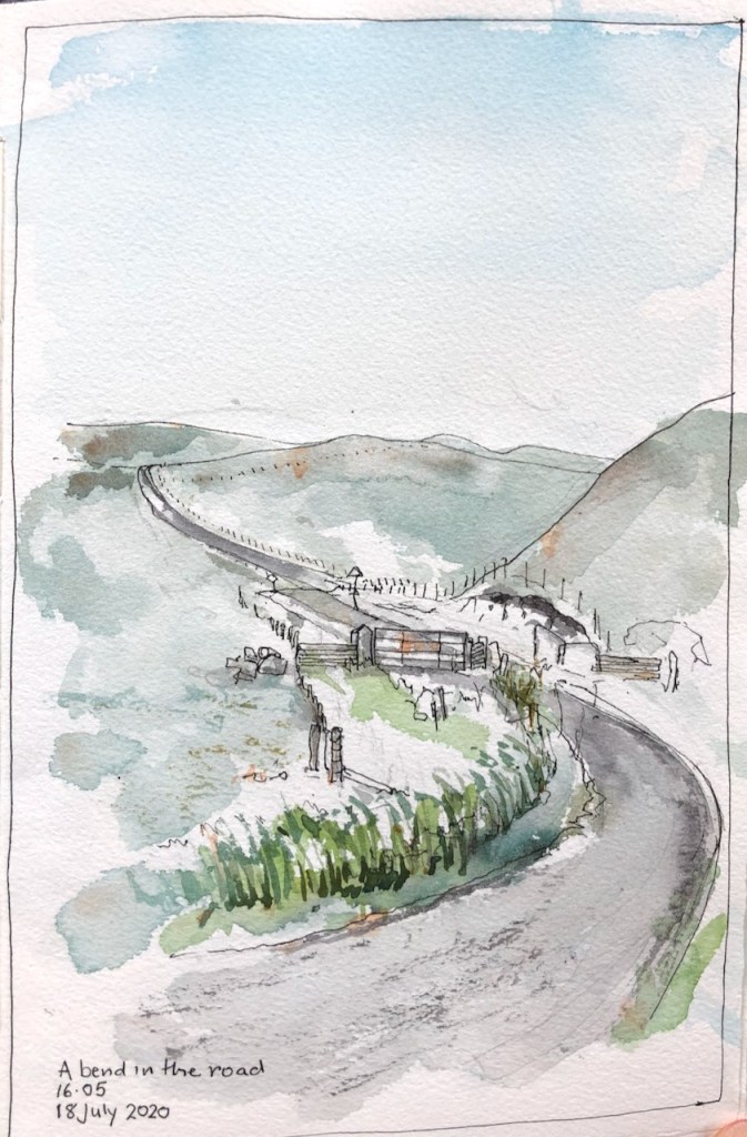
The wooden sign from the main road said “Historic Site”, and pointed up a small road that lead steeply uphill. I was on my morning run and felt energetic, so I set off up there, keen to see the Historic Site. In Shetland, Historic Sites are often at the top of hills. At the top…

Shetland landscapes

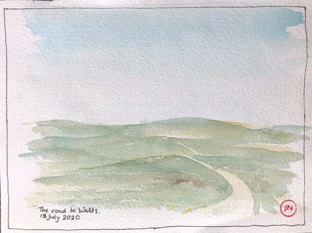
Here is a collection of landscapes all done directly in watercolour with no pen and ink. I am using Daniel Smith Watercolours, and trying different mixing combinations. All of these pictures are done with three or fewer colours, alone or mixed together. It seems to me that the fewer the better. The picture hangs together…

Here’s another attempt at the skerries of Easter Paill:

Shetland: Roads in a landscape

Roads in Shetland trace three-dimensional calligraphy across the landscape. On the West Side, the hills are undulating. The roads loop to and fro, taking a route that yields to the contour, but is not dictated by it. On every visit I try to draw these roads.

Here is a bend in the road. I was walking back from Walls with my groceries. I paused to rest, and draw the route I had just walked. The town of Walls, with its famous Post Office and Shop, is close, but it is not just over the hill you can see, much as you might like it to be when you are walking there. There is yet one more hill after that, and only then you descend to Walls.

A bend in the road: looking towards Walls.

The hill in my drawing, where the road disappears, is owned by the terns. They see you coming and get organised into squadrons. Then as you reach the brow of the hill they start launching themselves at you, in regular swoops, screeching to terrify you. I was there towards the end of the tern season. But they were defending their hill to the end. I feel like an intruder, and walk fast until they are well behind me.

Here is my running route.

Dale -> Walls road, looking east towards Walls

A section of this road falls within the territory of the curlew. He has a different technique from the terns. Rather than terrify you, the curlew’s idea is to entice you away. He flies overhead, making a piping sound, a clear note repeated three times. Having thus secured your attention, he then flies ahead, as much as to say “come this way”. He then courageously lands on the road, and looks conspicuous: “Come and get me!” As you approach, he might bounce up the road a few times, until he is sure you are properly out of his protectorate. Then he goes back home, job done.

Here is another view from the Walls road, not far from the bend in the first drawing. Walking back from Walls, I was arrested by a bright view of the sea, and an array of colours from the flowers. There was a formidable wind blowing. But I had a go. Ten minutes in, the skies darkened, the temperature dropped. I just managed to get my art materials back inside my waterproof rucksack before the rain came down. Welcome to Shetland.

Travelling to Shetland

The Caledonian Sleeper took me North. It’s the most marvellous way to travel – and fulfils the requirement to be socially isolated. I had one of the new cabins, or “rooms” as they call them. It even had a built-in toilet and shower. So I woke up refreshed, approaching Edinburgh.

The modern tap on the sink in my travelling room on the Caledonian Sleeper.

Because of COVID-related timetable alterations, the train didn’t go all the way to Aberdeen, as it normally should. I changed at Edinburgh onto a normal train.

Aberdeen was eerily empty. I drew a picture near the Art Gallery.

This church had been converted into a restaurant.

Then eventually I found somewhere open in Belmont St. I sat outside. The waitress cleaned every table and every chair after customers left. She even sprayed the laminated menu with disinfectant before replacing it on the pile. On a paper form at counter I filled in my contact information for contact tracing. Next to the form was the biro to use. I used it without thinking. I guess everyone had used it. I did remember to wash my hands afterwards though.

While waiting for my food I drew the establishments on the other side of the street, visible through the awning.

Belmont St, Aberdeen.

Both were bars. One was a converted church and was called “Redemption”. The other was a house, called “Revolution”.

The restaurant I was in was called “Books and Beans”. I could see no books, and beans didn’t seem to feature on the menu. I had an excellent huge sandwich.

Maybe we need a campaign for meaningful restaurant names.

St Vedast-alias-Foster, EC2

Here is the Anglican Church of St Vedast-alias-Foster, in the City of London, viewed from Priest’s Court.

St Vedast-alias-Foster
Memorial stone to Petro, Major Wladimir Vassilievitch Petropavlovsky

Before I drew this, I paused a while in the Fountain Court, a tranquil courtyard next to the church. In the shadow, there is a monument to “Petro”, Major Wladimir Vassilievitch Petropavlovsky. His friends awarded him the epitaph “This was a Man”. I had a look online to see if I could find out more about this person.

He was a member of the Special Expeditionary Force in the 1939-45 war in Europe. This was an organisation formed for espionage in Nazi occupied areas. I can find the record quoted, but the “National Archives” link is not working at present. There is little online that I can find.

Downloaded from http://www.academia.edu, from a list compiled by Eliah Meyer.

However he did write a book, under the name, “W Petro”. I have it on order, so I shall find out more about this interesting character.

The drawing took an hour and 45 minutes. Here are some photos of work in progress.

Fountain Court, I found out afterwards, is named not after a fountain, for there is none, but after a pub that used to be in the area.

Triangular Building, North West corner

Here is the Triangular Building, West Smithfield, from the North West.

Triangular Building, North West corner.

From this view, you can see all 3 chimneys. You can also see a rather exotic metal top on what must be another vent, right in the middle, between chimneys 1 and 2. Beyond the black door, on the left, is a neat sign saying “Gentlemen”.

North face of the Triangular building. The sign in the middle, to the left of the chimney, says “Gentlemen”.

Here is work in progress on the drawing:

I have drawn the Triangular Building before. See these articles for other views, maps and more information:

The Red House and The Triangular Building, Smithfield EC1

Here is another view of The Triangular Building, drawn previously. On this view you can see the magnificent cold storage block, behind. The cold storage block is called “The Red House”. It is now dilapidated, but still magnificent. A discordant rail, carrying cables, goes horizontally across the front, function taking severe precedent over aesthetics. There’s…

The Triangular Building, Smithfield EC1

Here is “The Triangular Building” in West Smithfield. I have sketched it from the South. This is its South West corner. The question is: what is it? It has three vertical columns above, which look like chimney stacks, but might be vents of some sort. One is shown on the left of the drawing and…

Here is a complete list of my drawings of Smithfield:

Entrance to the Fish Market

Today I drew the magnificent gate which is the entrance to the Fish Market, Smithfield.

Fish Market, West Smithfield EC1

This gate is adorned with two boys riding huge fish. The fish are equipped with bridles and the boys look as though they are having enormous fun. In the drawing, you can just about make them out at the top of the gate, either side of the central pediment.

Here is the location of the drawing:

Here is work in progress on the drawing:

Here is a collection of my drawings of Smithfield:

“Catering Meats Smithfield”

Here is a section of West Smithfield, at the North West corner.

West Smithfield, North side

Work is in progress to redevelop these buildings. You can see the scaffolding on the right. This is the General Market.

I was standing outside the “Citigen CHP”. This is the unlikely location of a power station.

“The large scale community energy system is made up of a central power station and district heating network.  Natural gas fuelled by the CHP plant is located near Smithfield Market and supplies heat and cooling to ten of the City’s properties by an underground pipe network spanning over two miles.” says the website of Edina, a supplier of specialist equipment to such schemes.

It is also above the railway lines. Trains rumbled, and the pavement vibrated. A concrete mixing lorry arrived and skilfully backed into the space vacated by the previous concrete mixing lorry, who, equally skilfully, moved out of the space and departed, while workers in bright red and yellow clothes moved the barriers, in synchronism with the movement of the lorries.

The building in the centre of my drawing is “Catering Meats Smithfield”. The sign is still legible. On the right is a building that looks a bit more like a music hall than a commercial market. It has wood panels and a marvellous pineapple on the roof. The roundel on the gable says “1881”.

Whilst I was sitting on the kerbstone, putting on the colour, a man jogged past, right to left, wearing running kit. He stopped and came back. He said “It makes me happy to see you painting”. He said it very simply, a statement. The emphasis was on the word “happy”. It makes me happy to see you painting. Happy, as opposed to any other emotion.

I said, “Thank you”. Then he ran on, and I continued painting the colours. It made me happy that by being there I’d somehow given something to someone else. It made me happy that he’d said it, that he’d bothered, that he’d paused in his run and came back to utter his simple sentence. But expressing all that was complicated. So I just said, “Thank you”.

Here is work in progress:

This drawing took just over two hours. 30 min pencil, about an hour pen, and another 30+ min for the colour.

Here is a list of my drawings of Smithfield so far, click the writing to see more information:

Alexandra Road Estate, Camden

I cycled to the North West of Regent’s Park, in search of the Alexandra Road Estate. This estate is a truly astonishing work, testament to the vision and social ideals of the Camden councillors and architects who made it happen.

I cycled past the large and stately houses of Queens Grove, Marlborough Road, Loudoun Road, going north, uphill. I went left on Boundary Road, which is the north edge of Westminster and the south Edge of Camden. There on the right I glimpsed brutalist concrete. This is it. But the side road I followed, Rowley Way, led downwards into a disappointing loading bay, with barriers, delivery drivers and much disorganised parking. It was hot, and I’d cycled what felt like a long way. Then I remembered that this was a 1960s development. There must be a podium level, above the cars. There was. I looked for, and found, the slope upwards.

Rowley Way, Alexandra Road Estate

At the top of the slope was another world. A long village street led into the distance, with tranquillity, with greenery, and with concrete benches. People walked about immersed in conversation, leading children. Two lads sat on a bench, chatting and looking at their feet. Everywhere, there were trees, bushes and flowers. The street was tiled with red terracotta tiles. Each side the flats sloped up, looking irregular, like houses I have seen built into the hill in Crete.

I walked all along the tiled street, pushing my bike. There were concrete benches, but from those the view would give directly onto someone’s home, so I didn’t feel that would be good manners to sit down and draw there. Many features I recognised as typically 1960s: wood-marked concrete, thick iron railings, slabs of exposed concrete, round stairwells. The flats were all interlocked, so it was not clear where one flat started and the next stopped. It was most intriguing architecture. There were ledges, and low doors, gardens on ledges, and stairways climbing high up right to the roof.

At the end of the street, there was a small tiled public area, with a tree, and a viewpoint, and more concrete benches. Here I had a view of the end of the terrace of flats.

“..monoliths of tower blocks..” behind the Alexandra Road Estate.

I particularly enjoyed the way that the architect had made that walkway protrude at the end of the block, to provide a viewpoint, a special place. I didn’t go up there. To the north, there were the tall monoliths of tower blocks. Trains rumbled. The railway line is immediately behind the terrace I was drawing.

The architect of the Alexandra Road Estate was Neave Brown, of the Camden Architecture Department. It was designed in 1968 and built 1972-78. The construction was controversial. Inflation was 20% at times in the seventies, and so costs went up. Neave Brown fought hard to complete the scheme, and he prevailed.

There is a wonderful description of the estate and its history on the Municipal Dreams website on this link:

https://municipaldreams.wordpress.com/2013/06/18/the-alexandra-road-estate-camden-a-magical-moment-for-english-housing/

Here are maps showing where it is, click to enlarge.

Here is work in progress on the drawing:

Here is the map on the entrance to the estate. Click to enlarge it.

Smithfield, North side

Today, approval was given for the redevelopment of the Smithfield site to turn it into the new Museum of London. Whereas some of the architecture will remain on view, the activities of the meat market will cease. So I went out in recent days to try to show some of the activity in the meat market.

Here is the clean-up, in the afternoon.

Grand Avenue, Smithfield. A worker hoses down the floor.

Here is a lorry parked on the North side, ready to deliver meat in the morning. Note the huge meat-loading bays. This one is labelled 5. These loading bays will not be there when it is redeveloped, so I was keen to draw them now.

Meat loading bay 5 and delivery lorry, Smithfield. I forgot my glasses, which is one reason why it is a bit sketchy.

Here is a general view from Charterhouse St, looking East. In this drawing, you can see three eras: the meat market 1880s, the Barbican towers, 1970s, and the new Crossrail station, which is nearly finished, 2020s.

Smithfield, Barbican towers, Crossrail station.

You can see loading bay 5 in the distance, and loading bay 7 nearer.

There is a huge collection of bollards in this area, whose job is to keep the heavy goods vehicles from crushing people on the pavement. Many of them have dates on. The one immediately to the right of the traffic lights is not a bollard, but an imposter. It is a thin metal case and encloses some water-control device. It is labelled “Thames Water”. The real bollards are sturdy cast iron. Many of them have clearly been wounded in action, but they stand firm, doing their job. I hope they are retained when the site is redeveloped.

Here is work in progress on the drawing.

A street sweeper came by at the pen stage. He gave his approval. He said he didn’t paint himself, but he liked to look at paintings and drawings.

Here is a list of my drawings in this area:

Poultry Market, Smithfield EC1

This is a view of the Poultry Market, sketched today from the South side. You see East Poultry Avenue going off to the right.

East Poultry Avenue, Smithfield EC1

This is a working Meat Market. It was completed in 1963 to replace the original 1880s market which had been destroyed by fire in 1958. The “A London Inheritance” site has a moving description of the fire in their article about Smithfield.

The 1960s dome of the Poultry Market, image (c) City of London. My drawing was done from the centre right edge of the photo, looking left.

There is an amazing dome across this part of the market. I tried to find a place where I could see it. It just shows at the top of the buildings in my drawing. It spans the whole of the market area, and is supported only at its edges. Here is a picture taken from articles about redevelopment of the site.

The 1963 design is by TP Bennett and Son.

This whole structure will be refurbished to make the new Museum of London.

The drawing took about and hour and a half. The colours are Phthalo Turquoise, Fired Red Ochre, and Perylene Maroon, with some Mars Yellow for the dome, and Pyrrol Orange for the traffic signs.

The Foundation Stone of the 1960s part of Smithfield. This stone is inside the loading bay on the North side. You can see the hexagonal glazing reflected in the stone, on the right.

Here are other drawings I have done in the area: