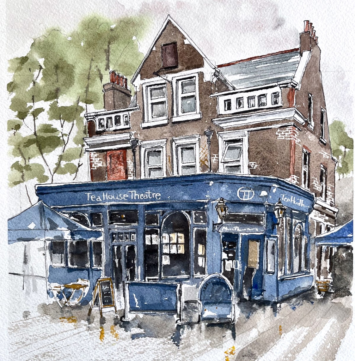
The Vauxhall Tea House Theatre is one on my favourite places. It is a “tea house by day, theatre by night”. Here is a sketch of the outside:
Vauxhall Tea House Theatre, 12″ x 9″ pen and wash original. [sold]
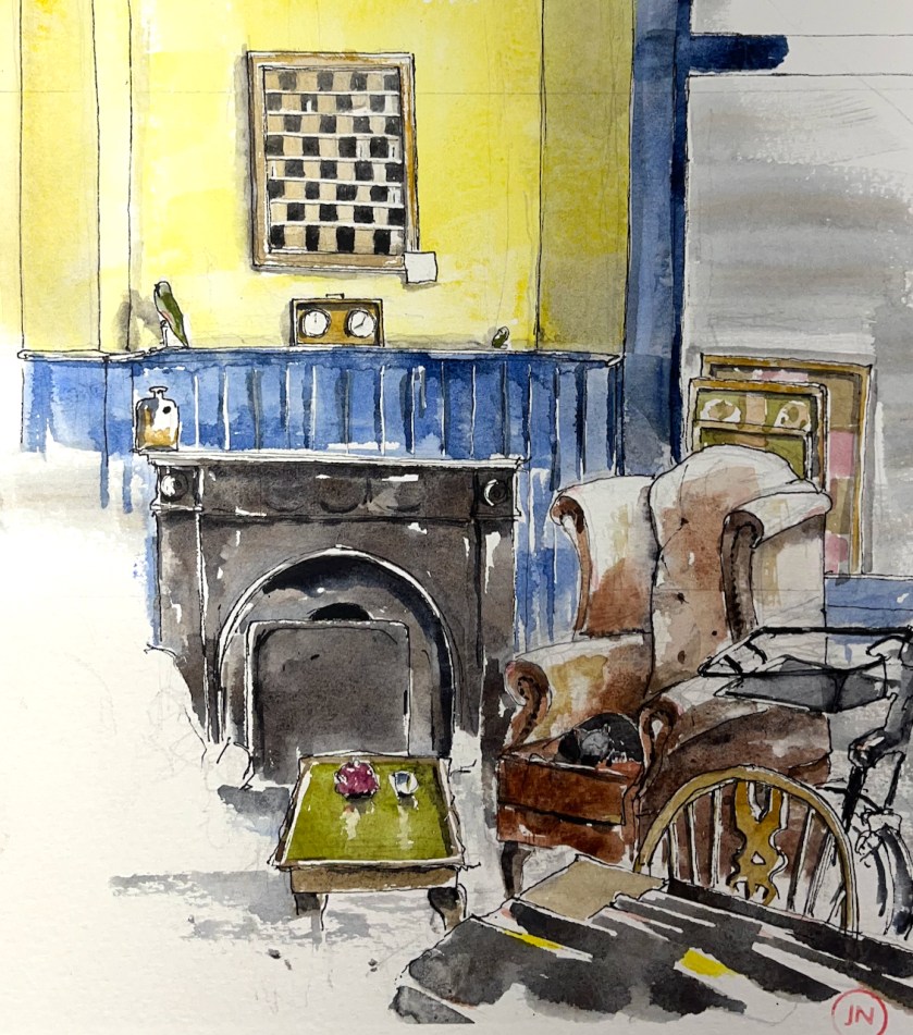
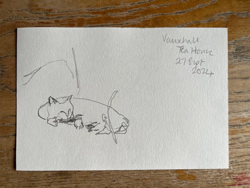
Here is a sketch of the interior by day:
Vauxhall Tea House Theatre, interior with cat. 12″ x 9″ pen and wash original. [Sold]
There are winged chairs you can sink into, wooden tables you can work at, magazines and newspapers you can read. There is tea. There is cake. There is at least one cat.
It’s a short walk from Vauxhall station. Definitely worth a visit.
“We are trying to be different. We will not hurry you. If you visit us on your lunch break, then have one, you will be more productive in the afternoon. If you want to have a meeting, we will not disturb you. If you are ‘working from home’, we have wifi. If you have children, we have highchairs, a chest of toys, and milkshakes. We always have the daily papers, so please, relax, and share in what we are trying to create, take a load off, and have a cuppa.”
Magnificent!
Click a button below to share this post online, email it, or print it:
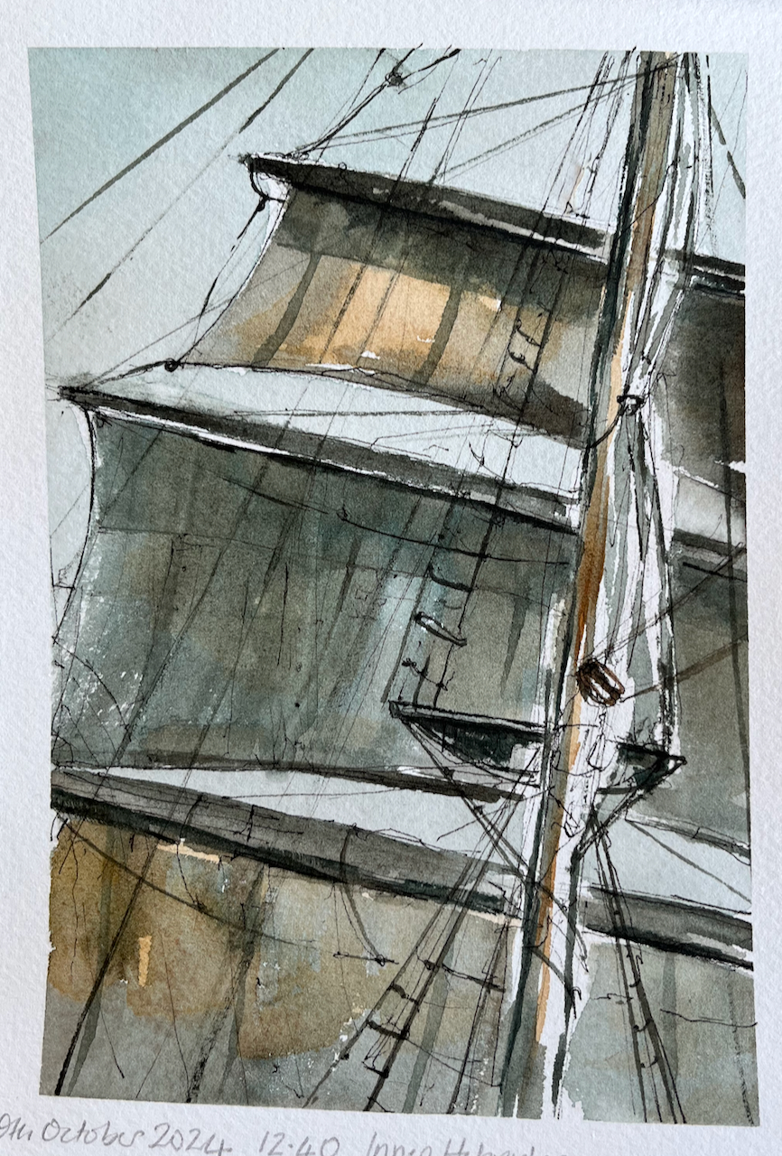
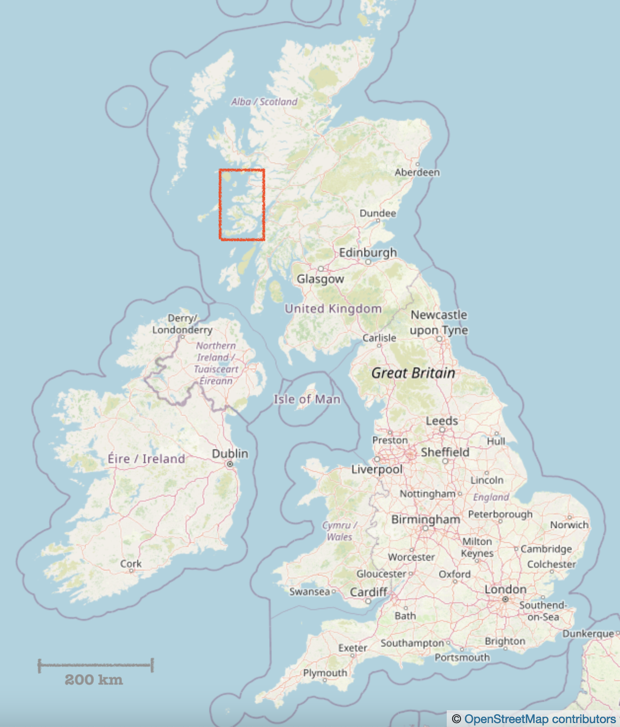
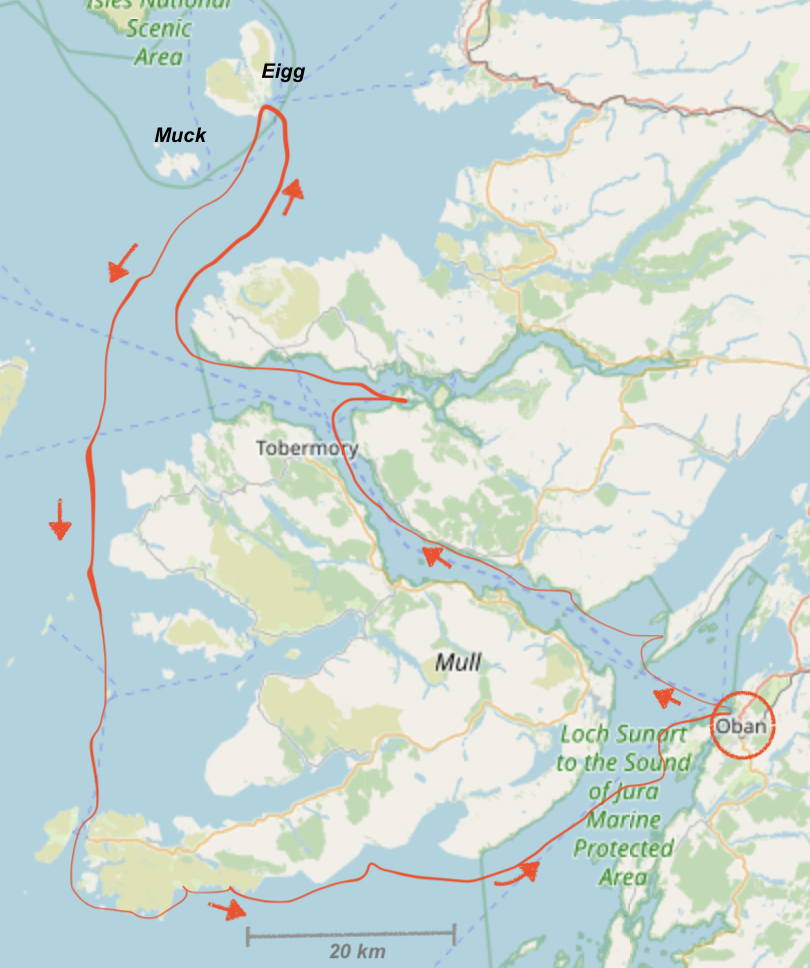
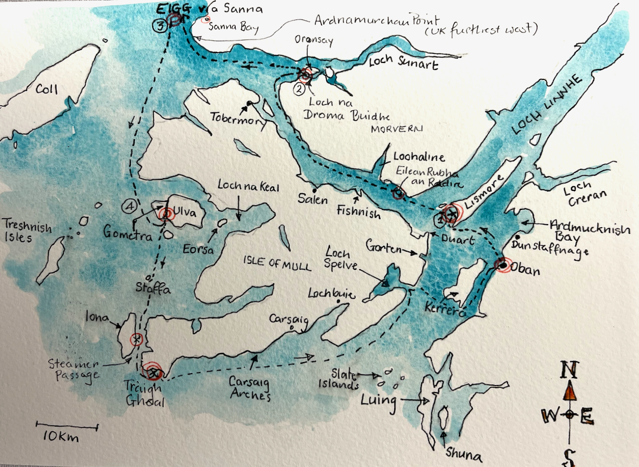
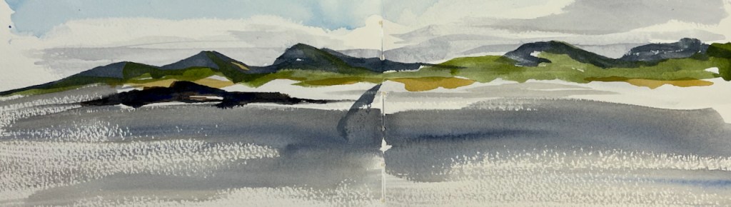
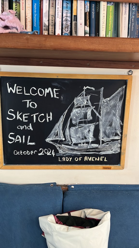
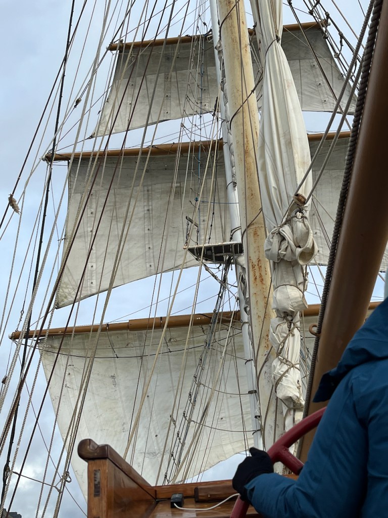
I’m just back from an invigorating week on “Sketch and Sail”with fellow artist Alice Angus and a group of guests, all sketching and learning. We were hosted by the marvellous crew of the Lady of Avenel, who managed the ship and provided all our meals. Our voyage was around the Isle of Mull in the Inner Hebrides, see maps below. We had amazing fun, laughed a lot, got wet, got dry again, got blown about, and enthusiastically sketched the experience. Everyone was very productive: lots of pictures were made, sketchbooks were filled, postcards were painted and sent.
Alice and I ran workshops on brushstrokes, rapid sketching, outline drawing, sketching kit, painting sea and sky and many other exercises. We all shared thoughts and ideas on tools and techniques, and everyone learned a lot, including me. We also did an experimental workshop on sketching in the dark.
Here is a map of where we went.
Maps showing our route [map (c) Open Street Map contributors]
On this post is a selection of my work from this voyage. For more about the ship, and future plans, see the Lady of Avenel website.
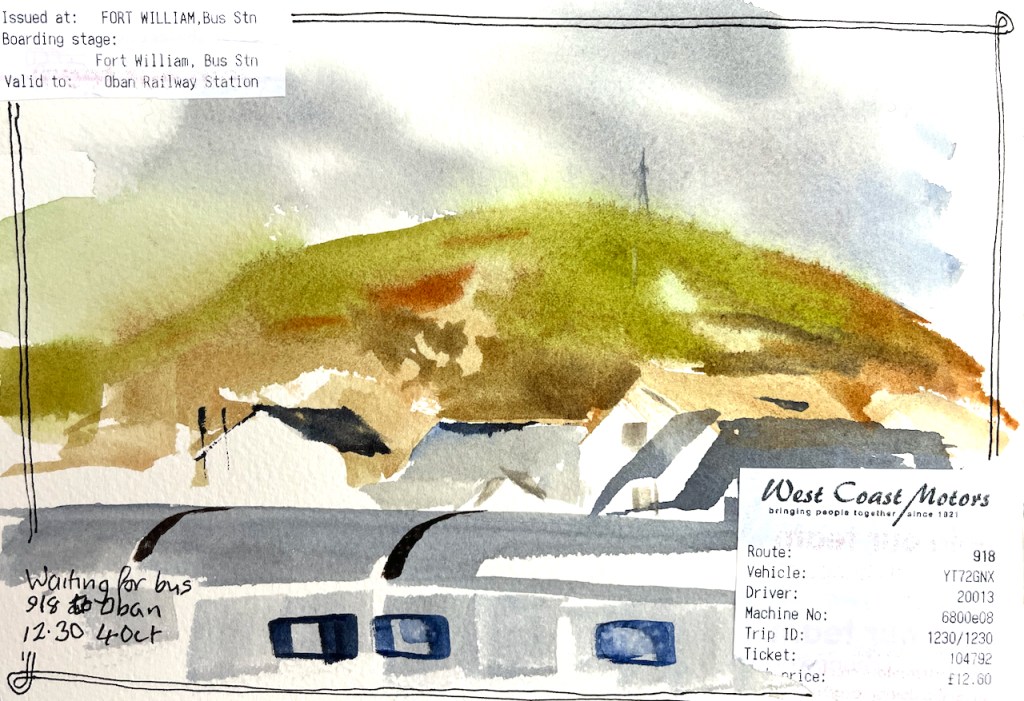
I travelled North on the Caledonian Sleeper, and did some sketching on the train.
Scottish highlands, sketched in the sleeping cabin on the train.Waiting for the bus from Fort William to ObanQuick sketch in a café in ObanSketching on the journey to Oban
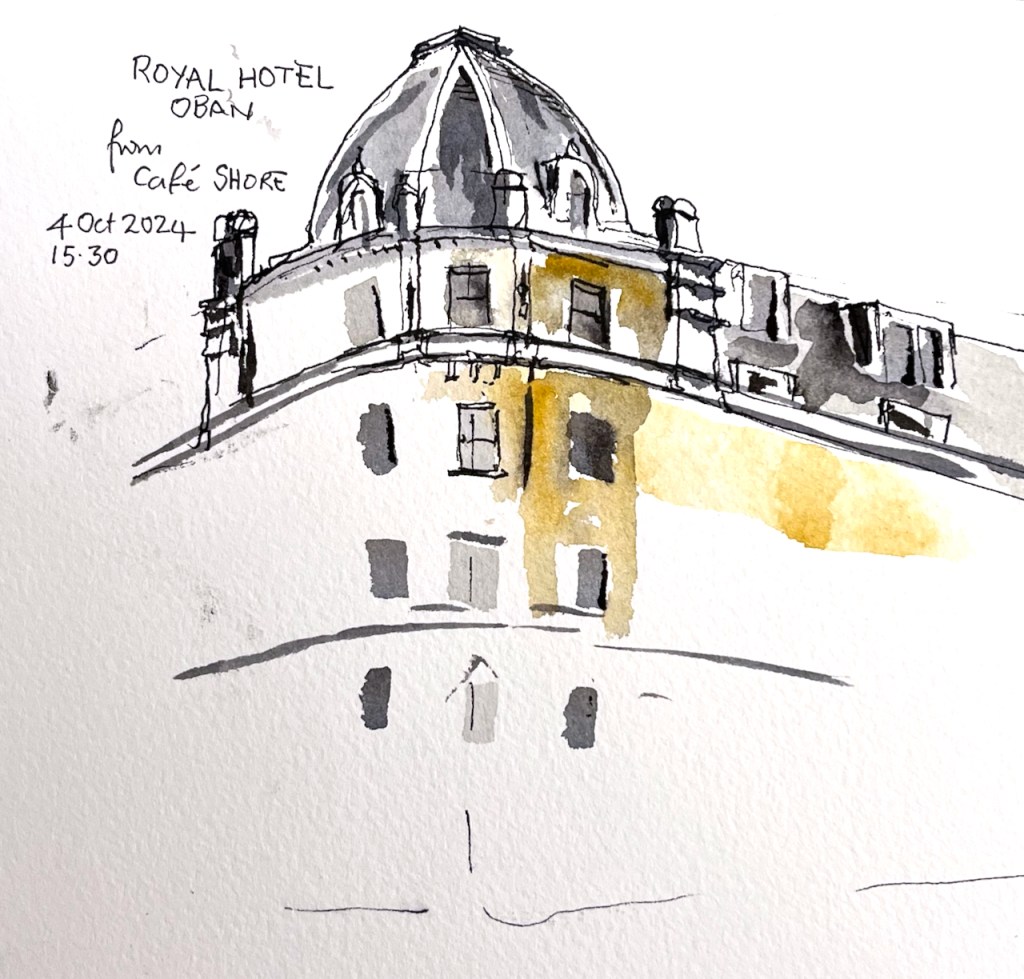
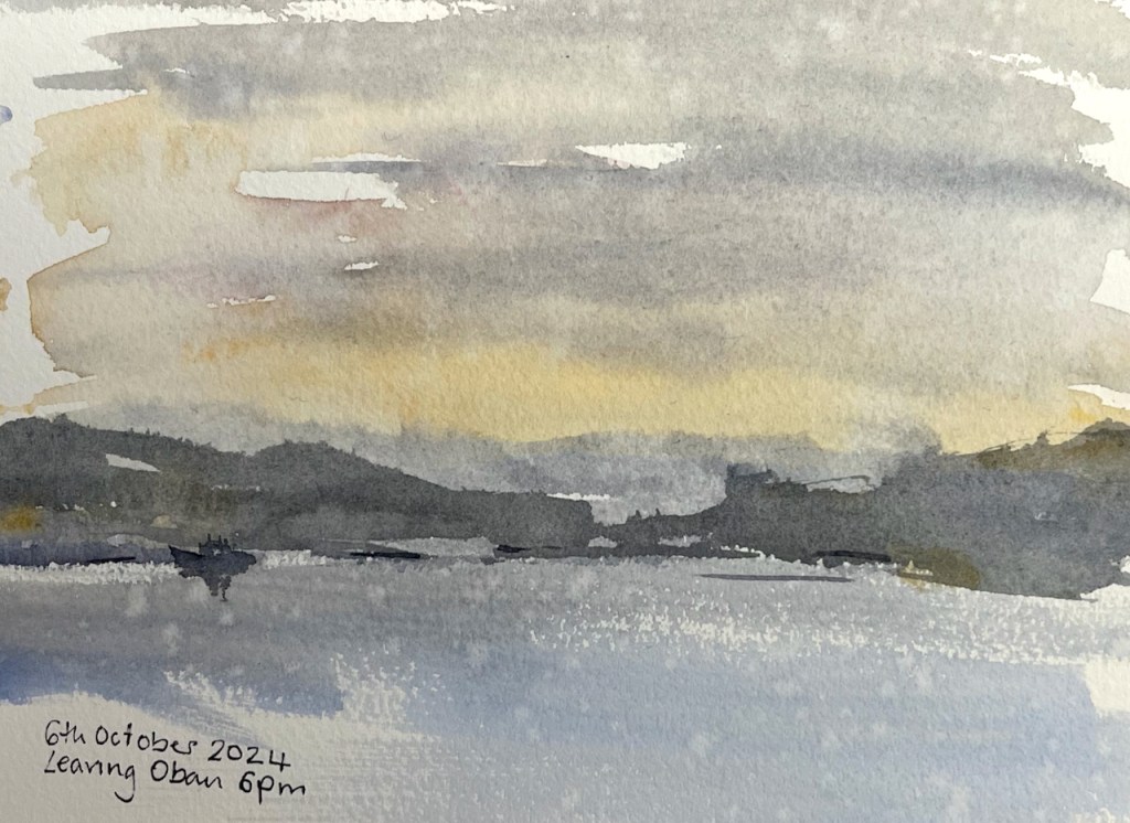
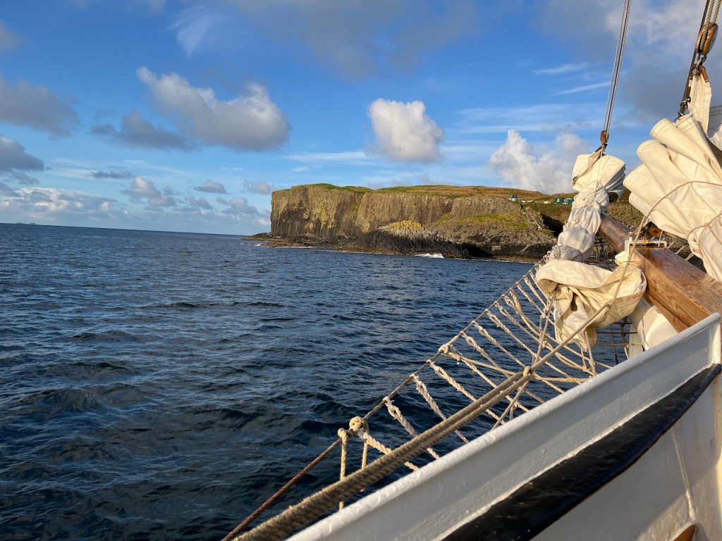
The guests came on board in Oban, and we set off in the evening for the week’s voyage.
Leaving Oban, 6th October 2024. There was fine rain, some of which landed on the picture.Sketch map
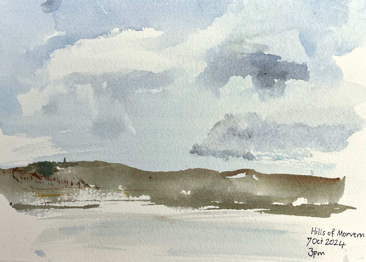
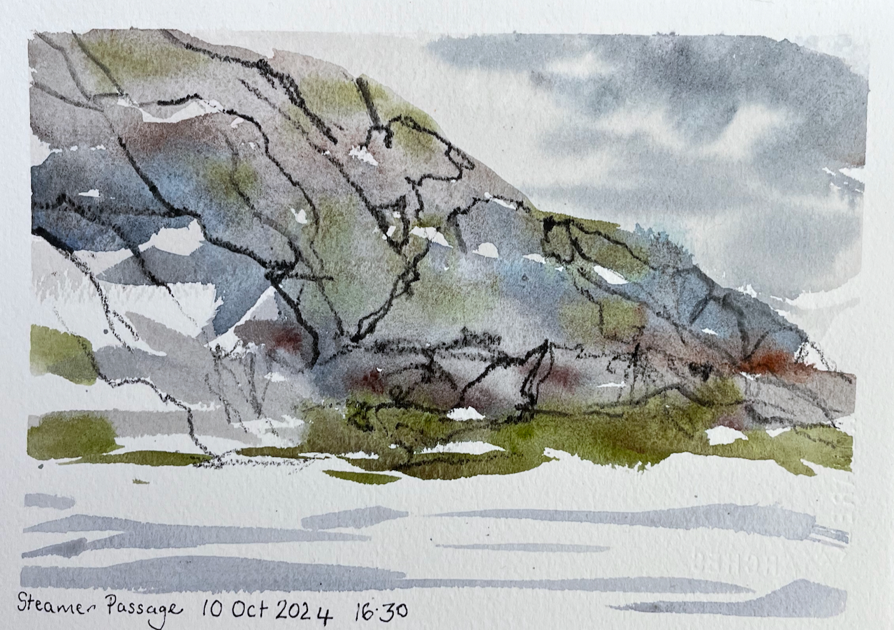
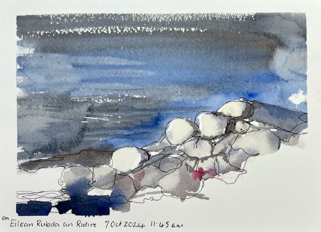
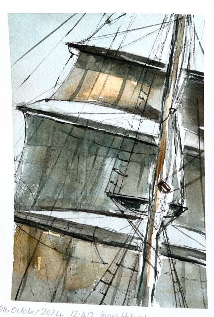
Here is a selection of my sketches from the voyage.
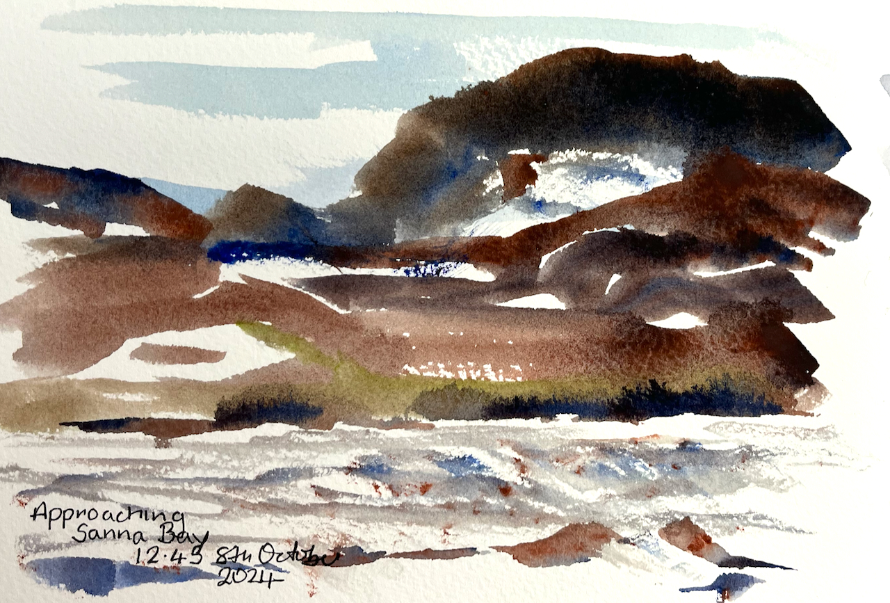
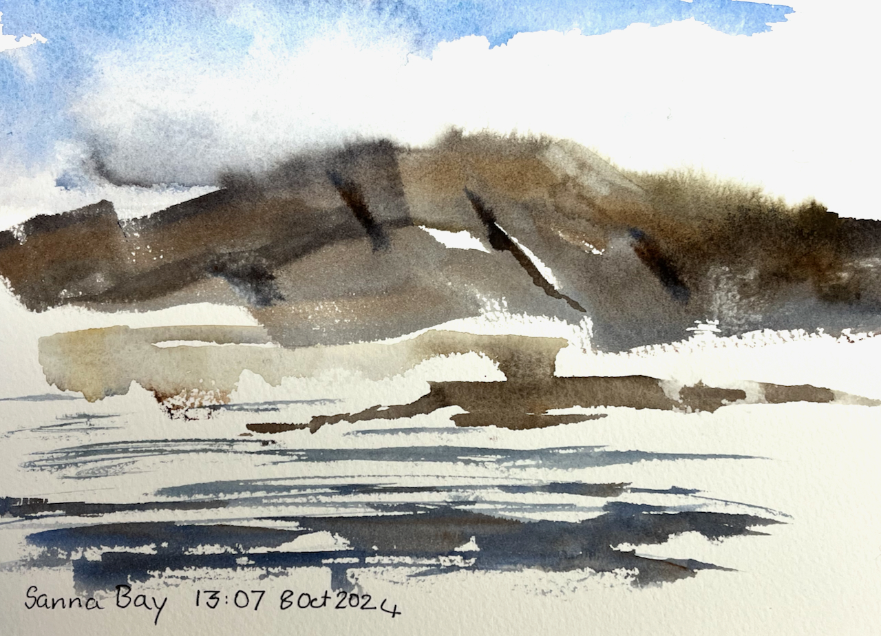
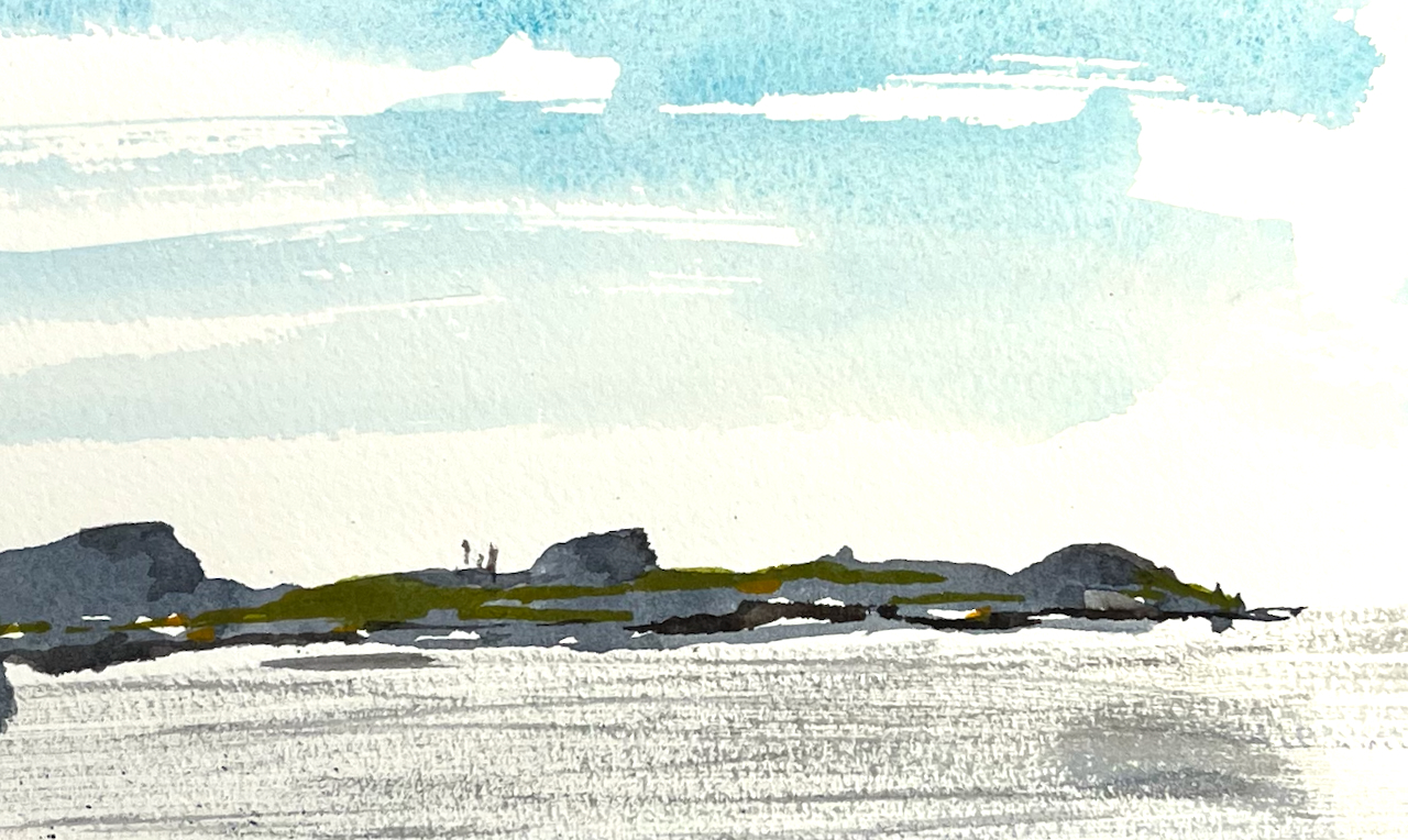
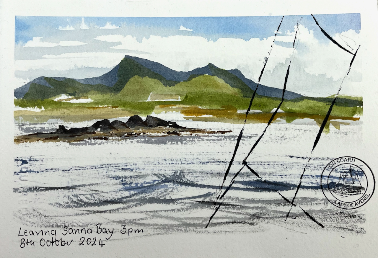
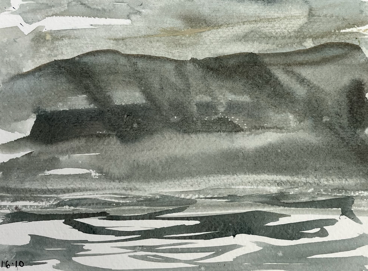
At Sanna Bay there is a large sandy beach, and a settlement of a dozen or so cottages. Here is a sketch made as we approached Sanna Bay:
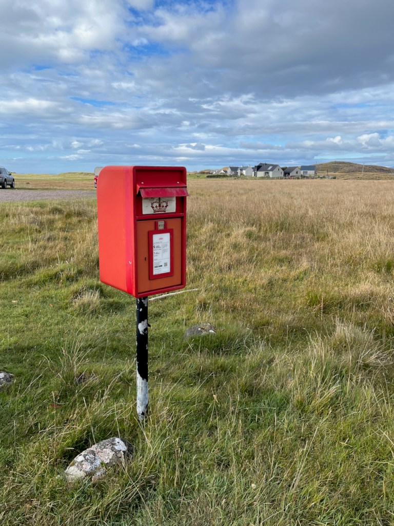
I walked into that scene, through the sand-dunes, in search of a post box. Against all expectations, I found one.
Here is the post box at Sanna Bay. Collections 9am Monday to Friday, and 7am on Saturday.Here is the card I posted, which reached London in two days.
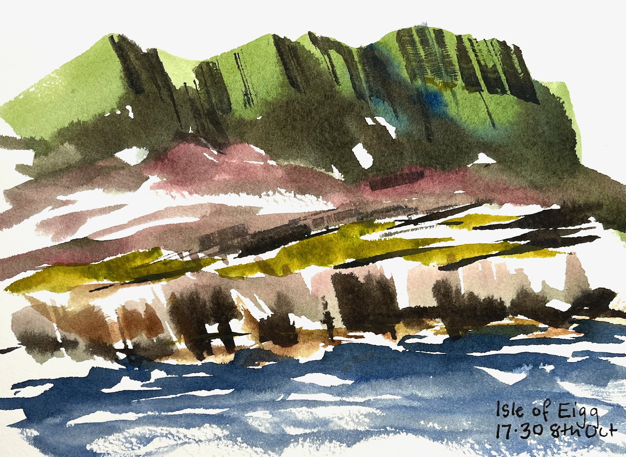
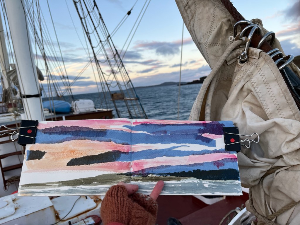
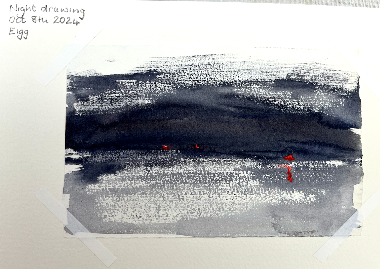
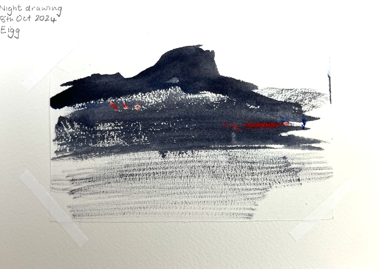
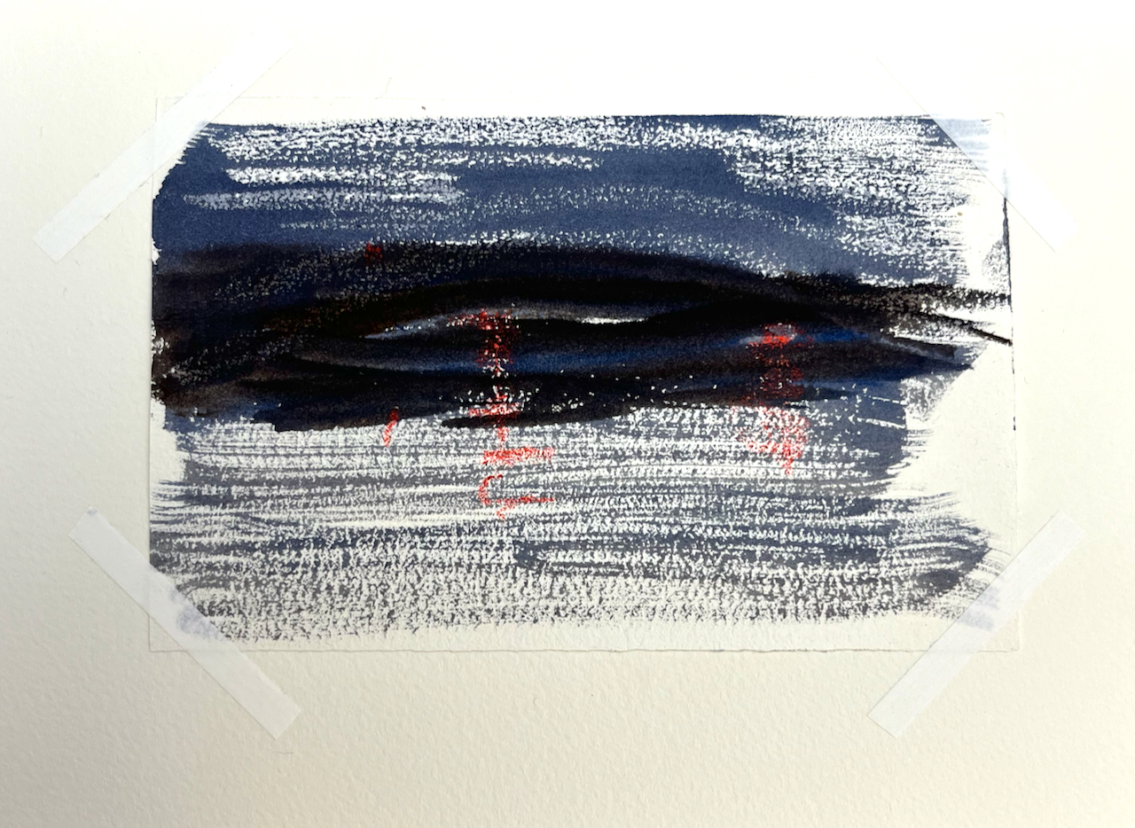
At Eigg there was a spectacular sunrise.
Sunrise over the Isle of Eigg, watercolour and collage.
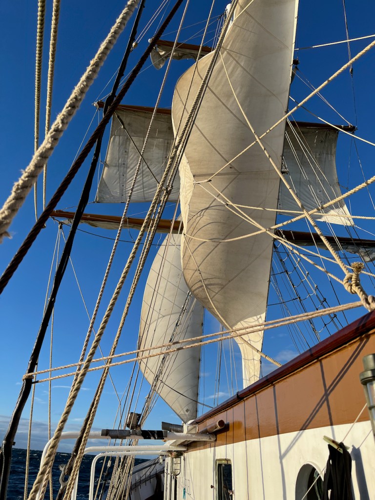
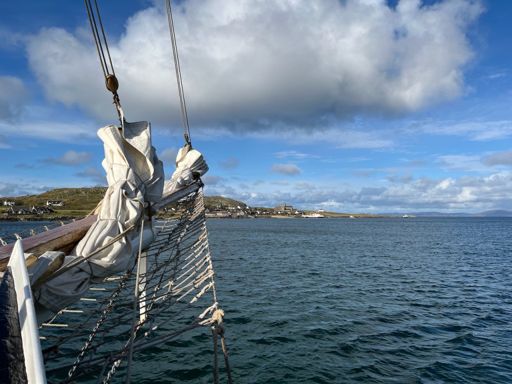
With a strong wind in our sails we reached 8 knots on the journey south from Eigg to Iona.
The sails are full on the journey from Eigg to Iona.
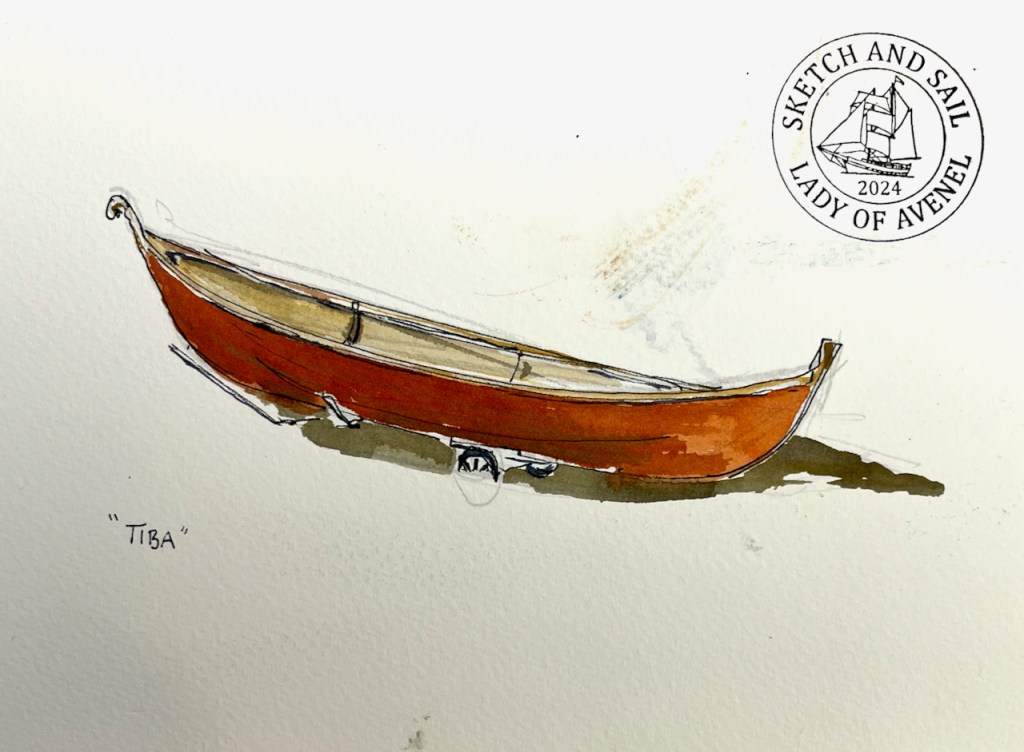
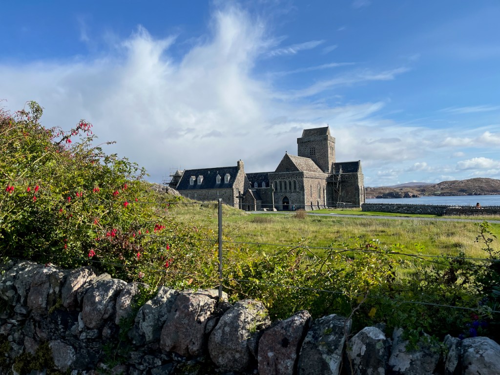
On the island of Iona, I sketched a boat on the beach.
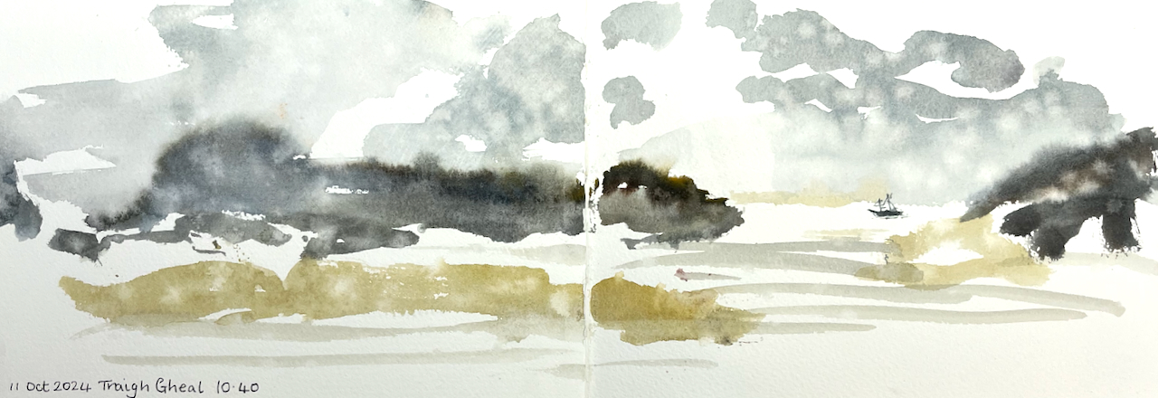
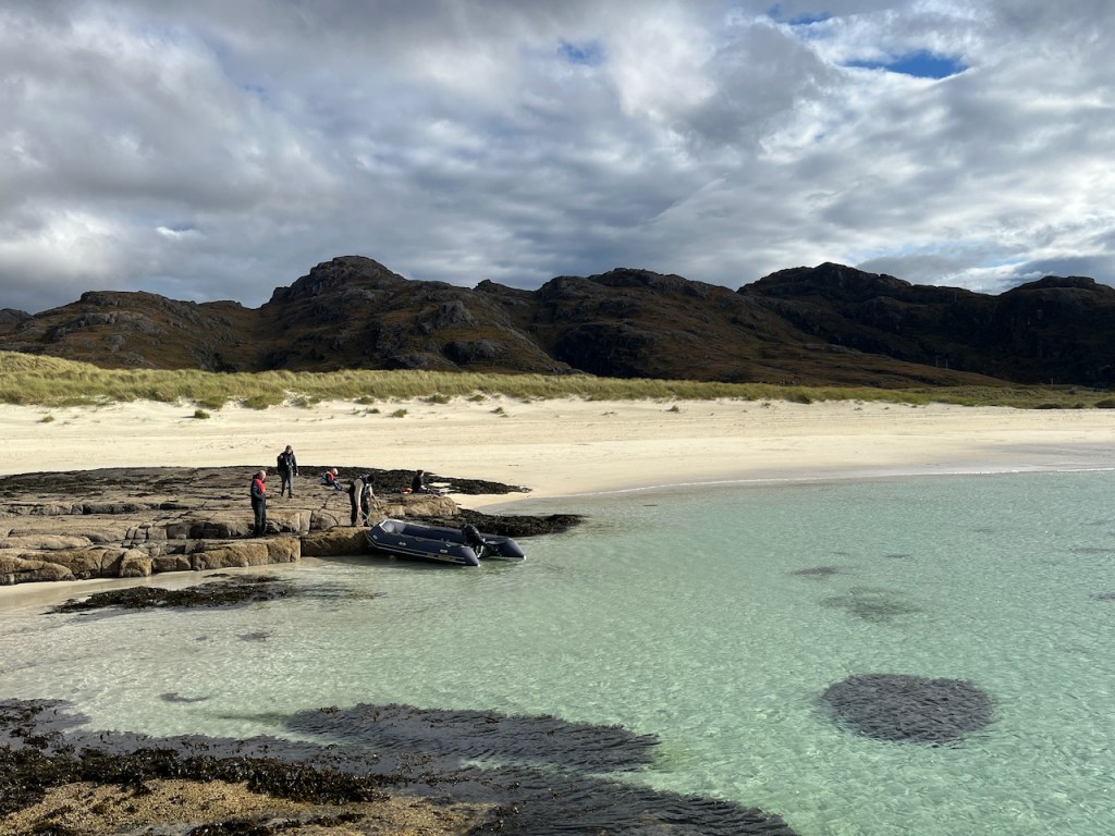
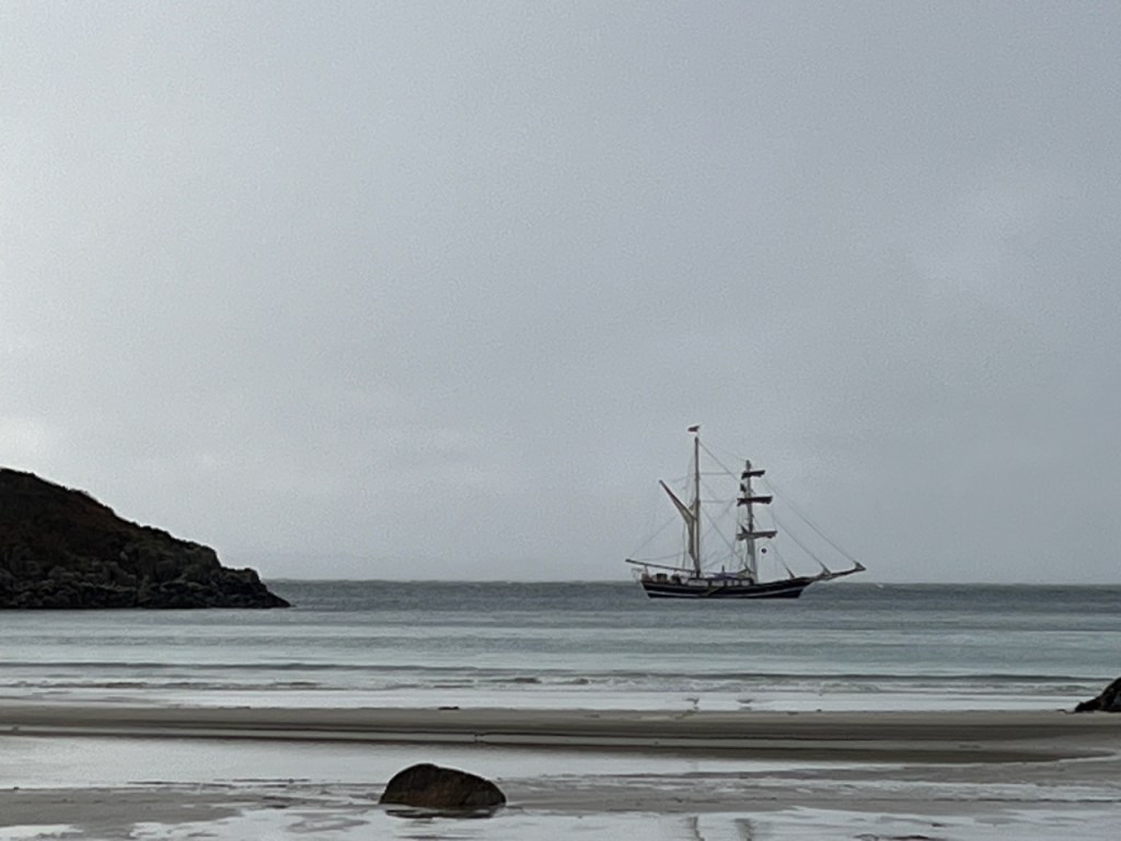
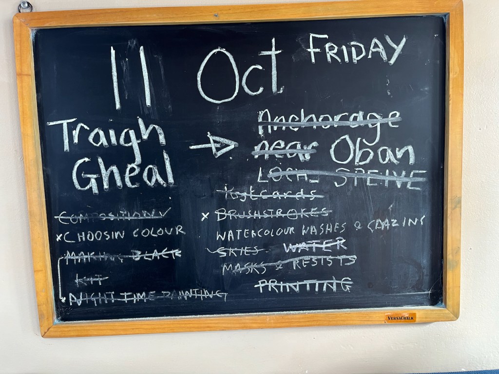
On the way back to Oban from Iona we landed at a vast sandy beach called Tràigh Gheal. There were showers of rain.
Here’s a photo, showing the Lady of Avenel at the anchorage at Tràigh Gheal. We reached the beach by rubber dinghy.
Lady of Avenel at Tràigh Gheal
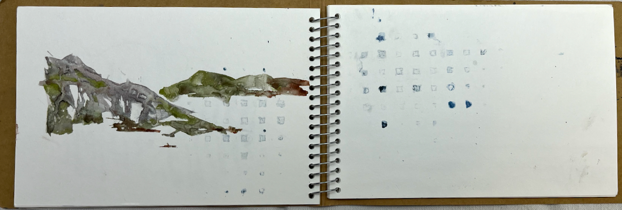
I used a JP Purcell sketchbook. Here’s a quick flick-through:
Sketchbook flick-through
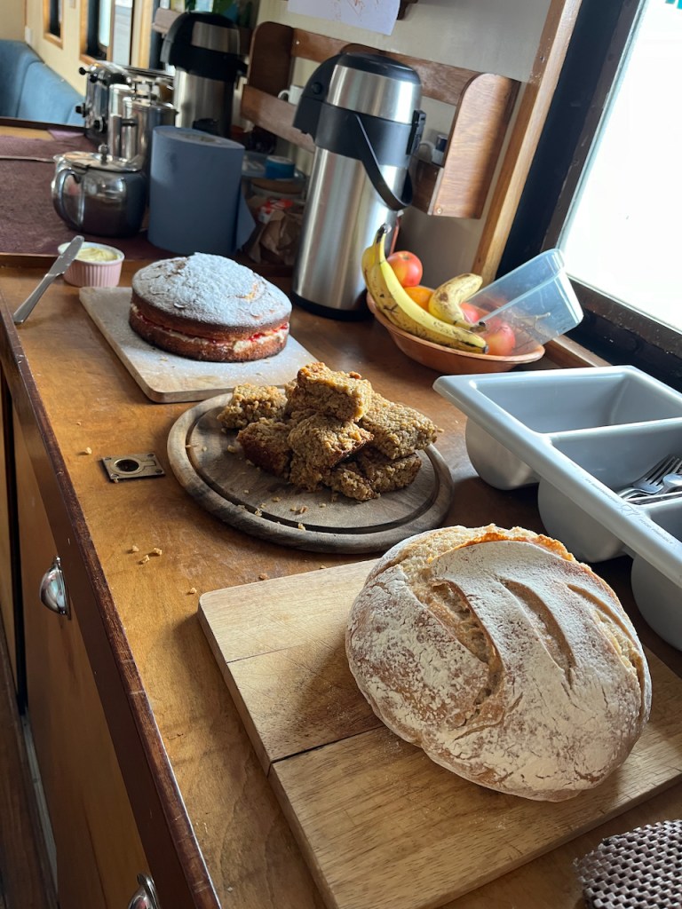
All of this was powered by a strong North Westerly wind, and Tom’s cooking. Tom continued cooking even as the North Westerly gusted Force 7, and produced a hot meal for hungry sailors every evening, soup for lunch and cooked breakfasts. He made the sour dough bread every day in the ship’s galley. I found this hugely impressive.
Tom’s cooking on the ship: cake for hungry sailing sketchers: and sourdough!
In case you are curious, here are night sketches. The lights are done using wax crayon.
Here are some snapshots from the voyage.
The art gallery on GometraApproaching Staffa, Fingal’s CaveThe abbey on IonaLady of Avenel off Sanna BayWorkshops done and crossed off the list!
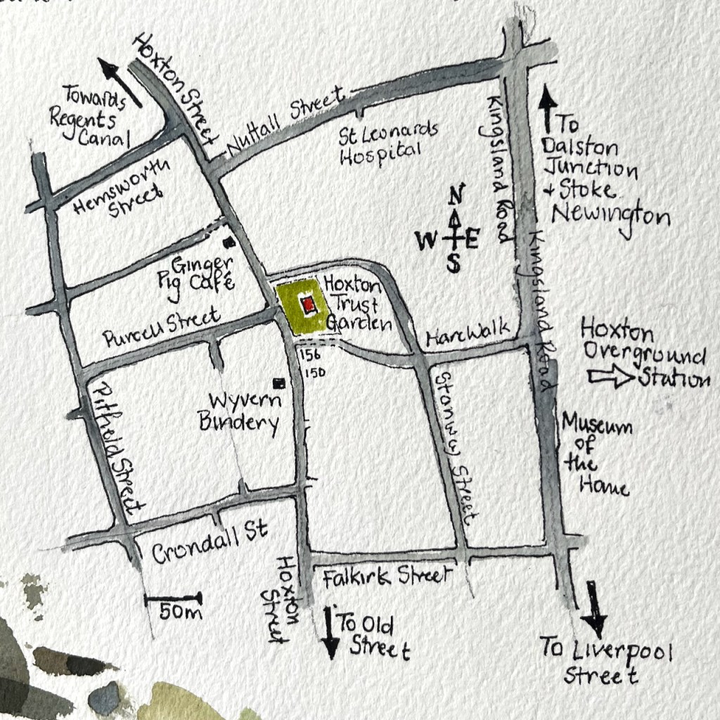
Hoxton Street is busy with market stalls, shops, cafés. People walk to and fro. If you walk North, there’s a small garden on the right, behind a fence. Above the trees there’s this odd white tower. What is it? The gate is open and you can go in.
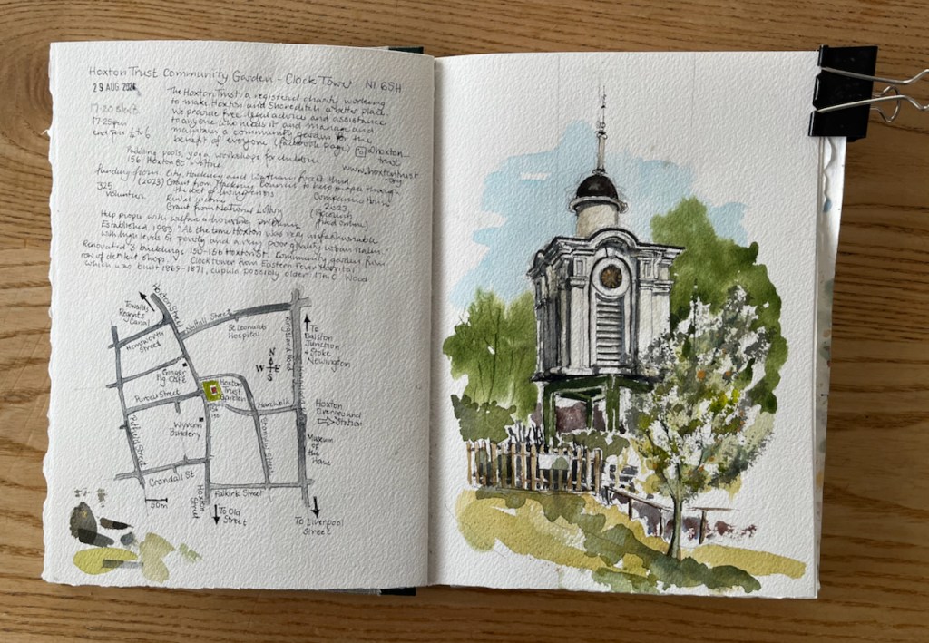
Hoxton Trust Community Garden N1- Clock Tower, sketched 29 August 2024 in Sketchbook 15
This is the Hoxton Trust Community Garden. Their website tells me that the Clock Tower was rescued from the Eastern Fever Hospital which was built 1869-1871. It is made of wood, and is possibly older than the hospital.
The clock tower sits on a framework made of steel girders. On the day I was there, the clock had stopped at half-past six. So in a timeless interlude, I sketched from a wooden bench amongst the trees.
Near the bench is a small monument to the “Hoxton Five”. Who were they?
“One was stabbed, and his four friends were killed in a car crash returning from the funeral.”
The Hoxton Community Trust is a registered charity “working to make Hoxton and Shoreditch a better place”. According to their website, they provide free legal advice and assistance to people who need it. They maintain this community garden for the benefit of everyone. The charity was established in 1983: “At the time, Hoxton was very unfashionable, with high levels of poverty and a very poor quality urban realm”, their website says. They bought and renovated three buildings, 150-156 Hoxton Street, adjacent to the garden. These buildings are now let out. Rents from these buildings supplement the income of the Hoxton Trust, which is also funded by grants from the National Lottery, Hackney Council, and other sources (2023). The work of the Trust is also supported by volunteers, some of whom work in the garden.
The garden is lovely. There are fruit trees and a herb garden, and plenty of seats. A sanctuary.
Sketching in the Hoxton Community Trust Garden.Sketchbook 15
Click a button below to share this post online, email it, or print it:
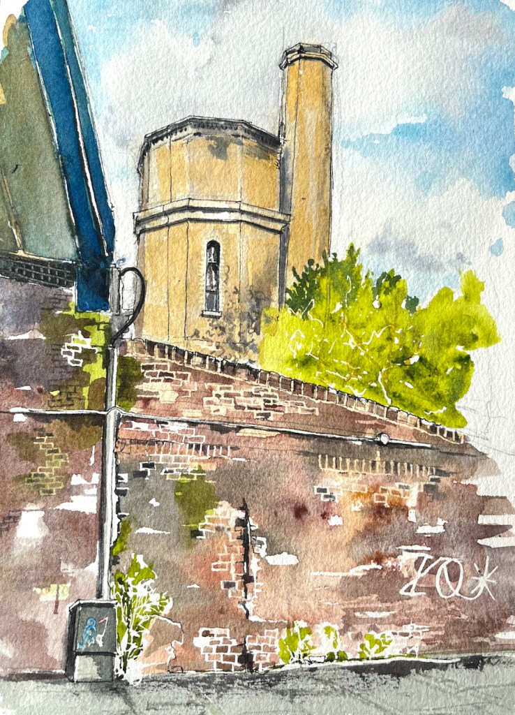
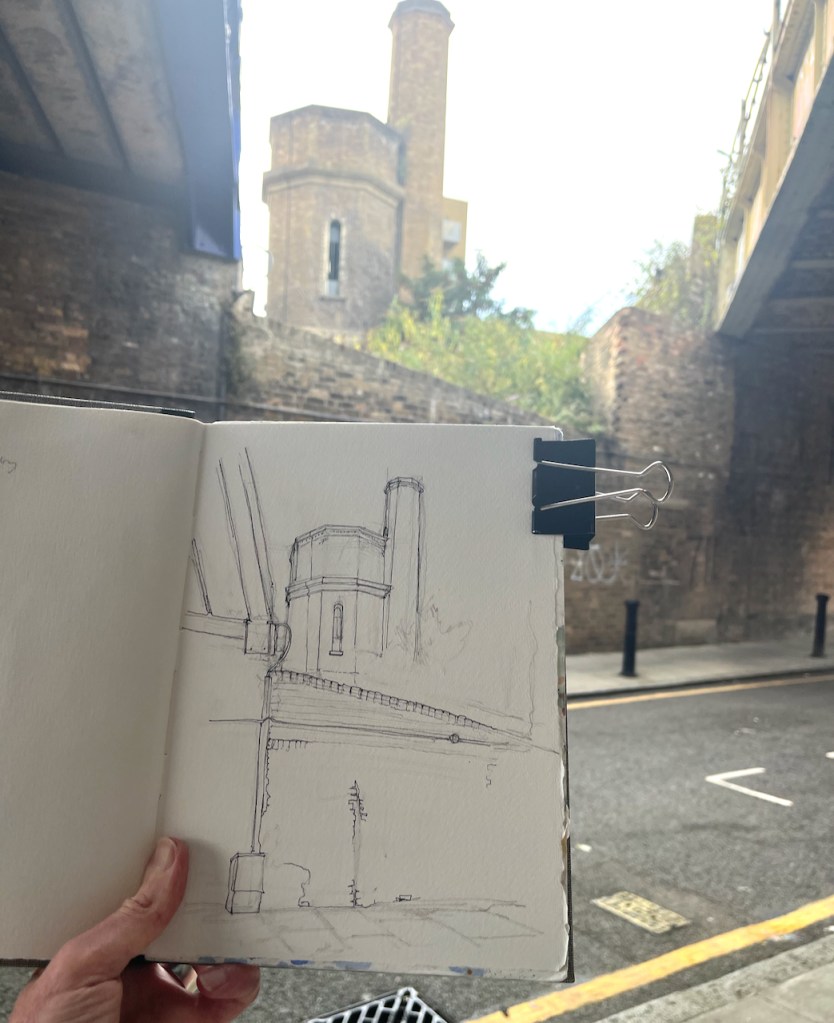
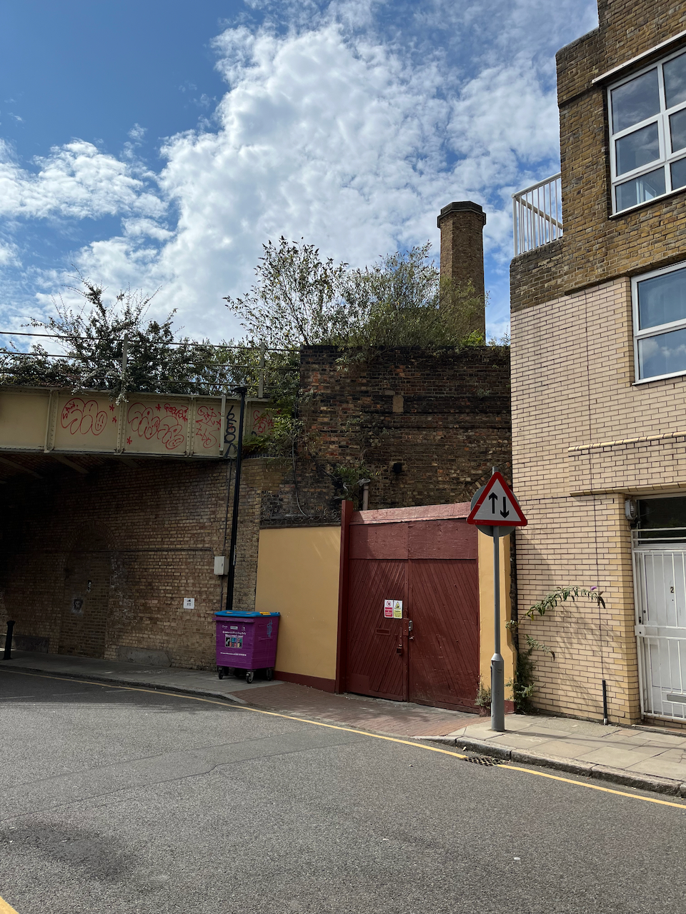
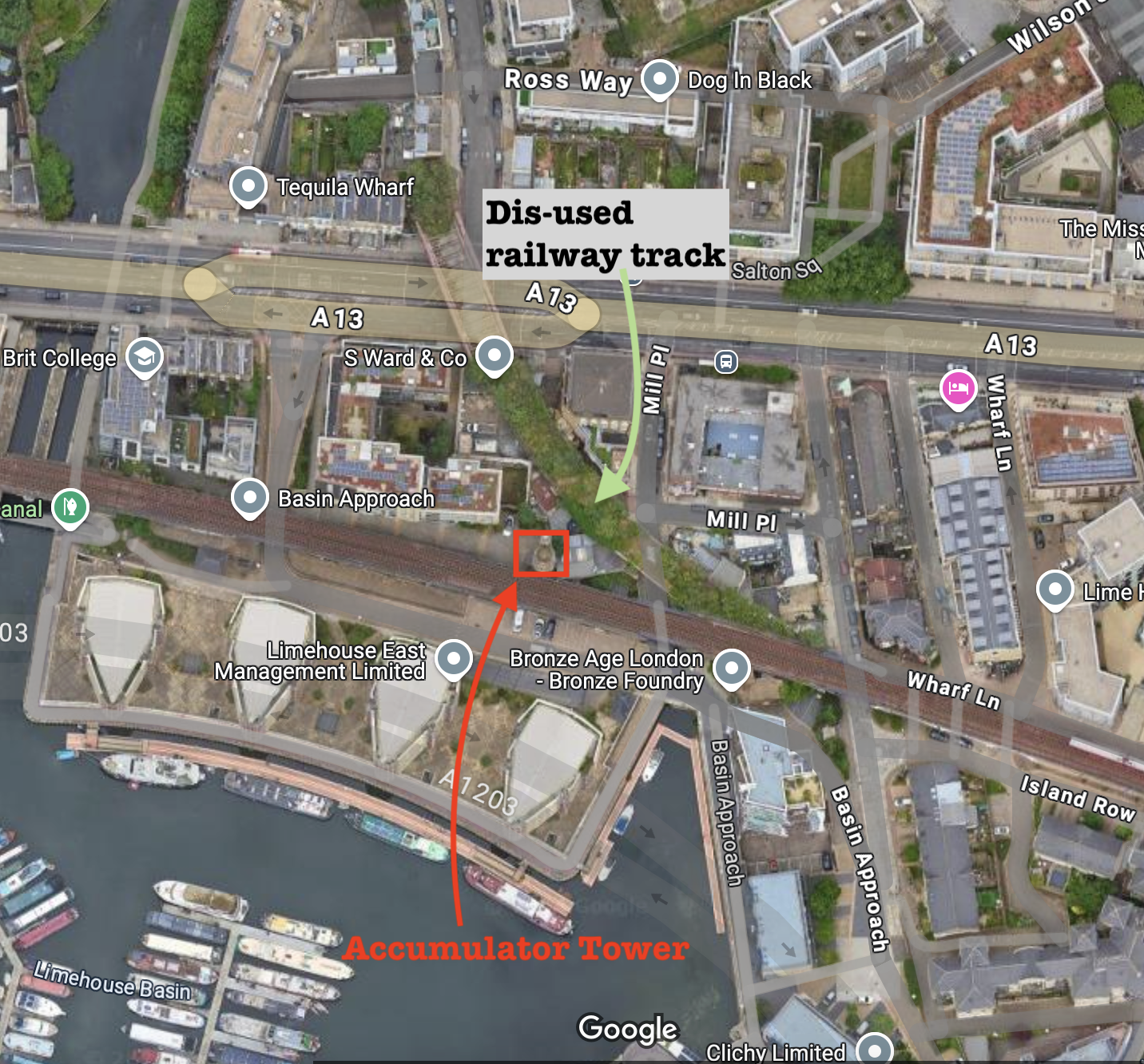
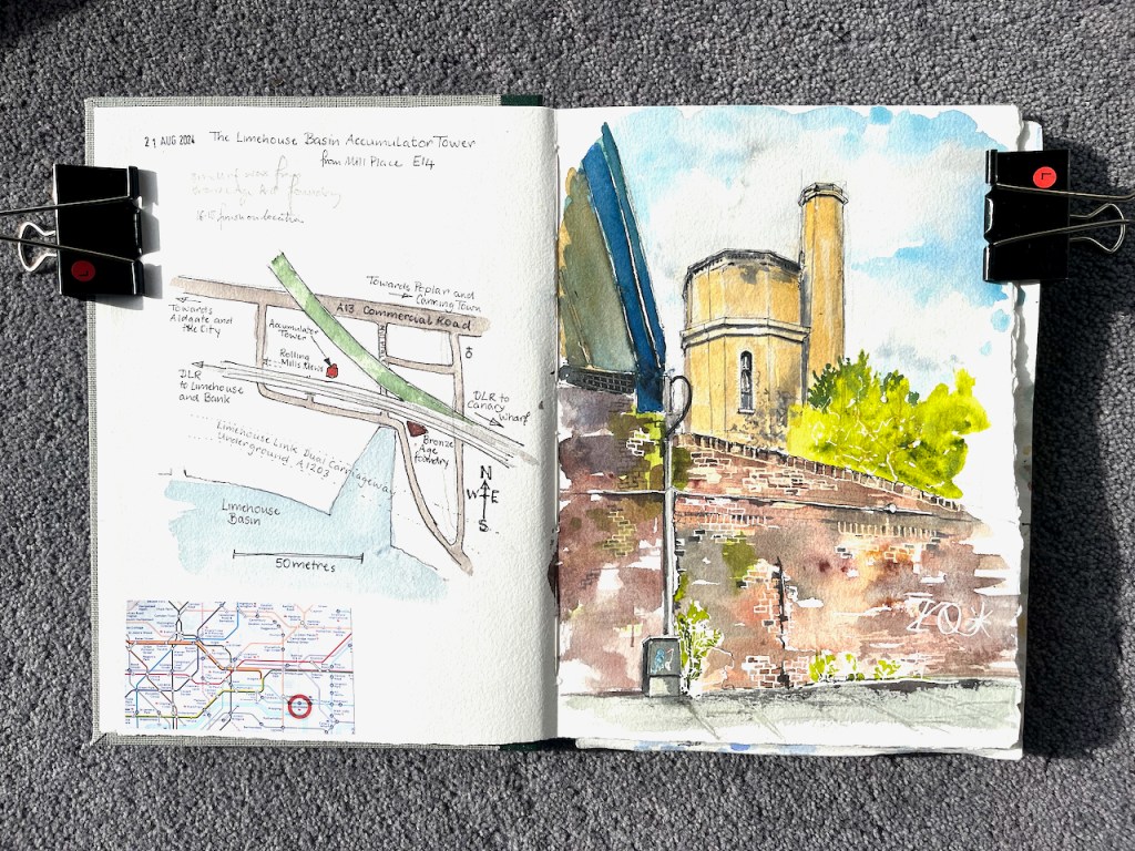
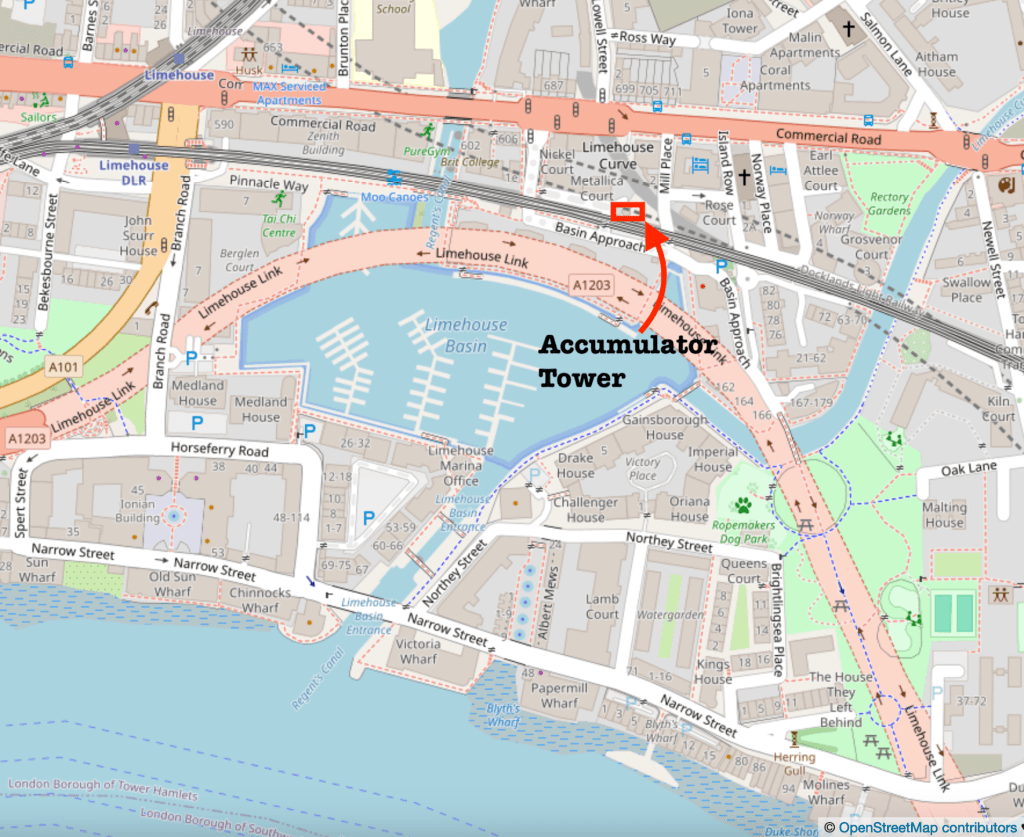
This is the Limehouse Accumulator Tower, seen from Mill Place, London E14.
Limehouse Accumulator Tower, sketched 21 August 2024, in Sketchbook 15
In the 19th century, this building provided hydraulic power to machinery in the Limehouse docks. Hydraulic power is a way of transmitting energy from one place to another.
The problem at the time was that steam engines could generate motive force, but only where they were. You could build a big powerful steam engine, but you couldn’t put a steam engine next to every crane, capstan, or set of lock gates. You also didn’t want to fire up a steam engine every time someone wanted to use the lock gates. So you had to find a way of transmitting the power from the steam engine to the machinery which used it. And you had to find a way of storing the power so it was available on demand. Before the use of electricity was common, power was transmitted using pressurized water.
The steam engine located in this building was used to pump water into the adjacent accumulator tower, by lifting a heavy weight. The heavy weight was a neat fit on top of the water inside the tower and pushed the water down. Water does not compress. So the weight just sat there, applying pressure to the water. The pressurised water was distributed around the docks in thick cast-iron pipes. When the lock-keeper wanted to operate the lock gates they opened a tap and the force of the pressurized water opened the gates. Then they closed the taps. Far away, the weight moved down very slightly in the accumulator tower. Eventually the steam engine was used to pull the weight up to the top again.
That’s 19th century hydraulic power. Power is transmitted by pressurised water in cast-iron pipes: the original, functional, steam-punk.
I find it marvellous. I’ve drawn the much bigger London Hydraulic Power station here. The Limehouse building is smaller. It was built in 1869, one of several in the area at the time. It was restored in 1994/5, but sadly the weight and machinery are removed. There is a detailed history of the building on this link from the Greater London Industrial Archaeology Society.
Sketching the Limehouse Accumulator Tower. The modern Docklands Light Railway lines run over the Victorian bridge to the left, the bridge to the right is disused.
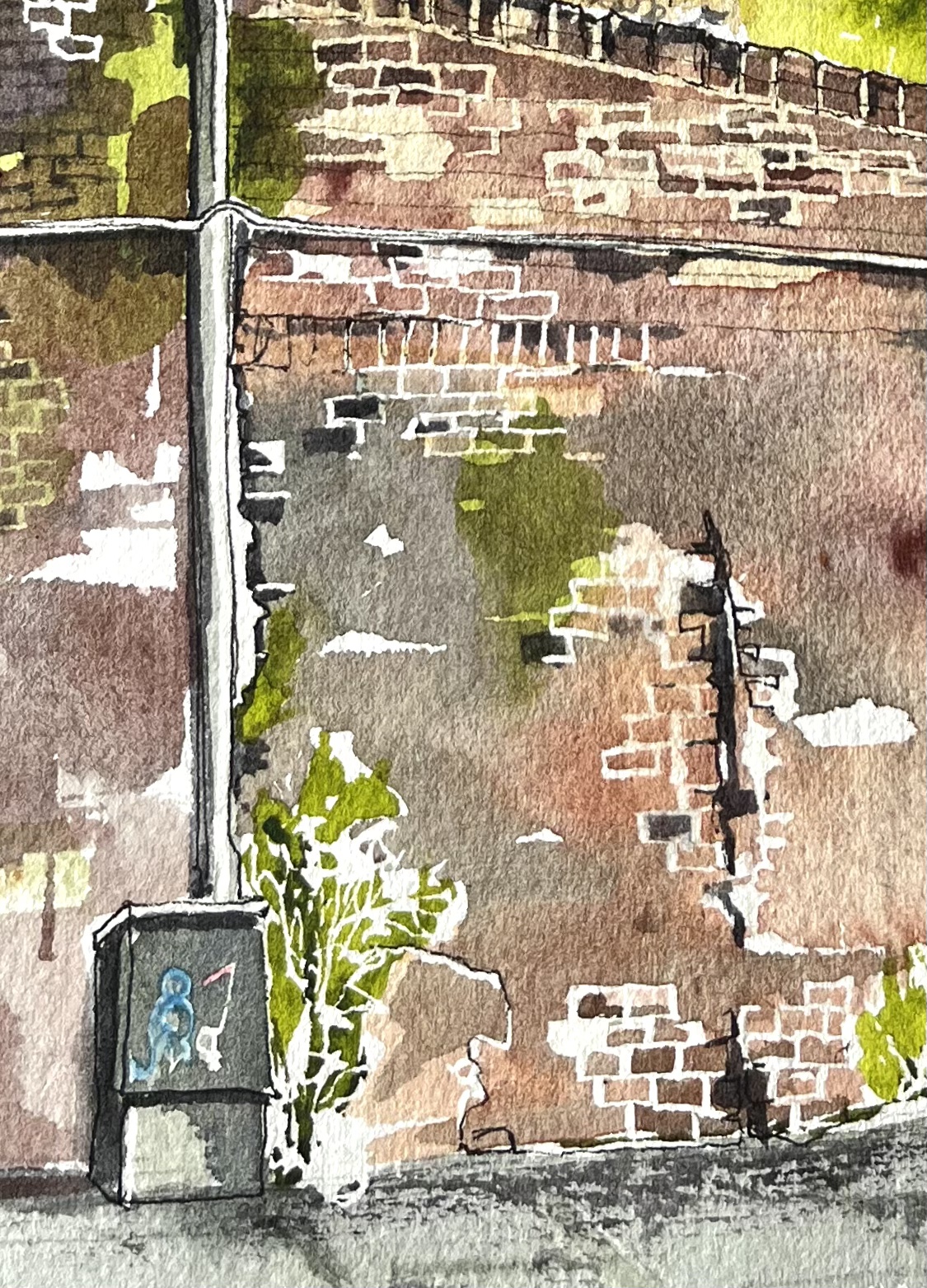
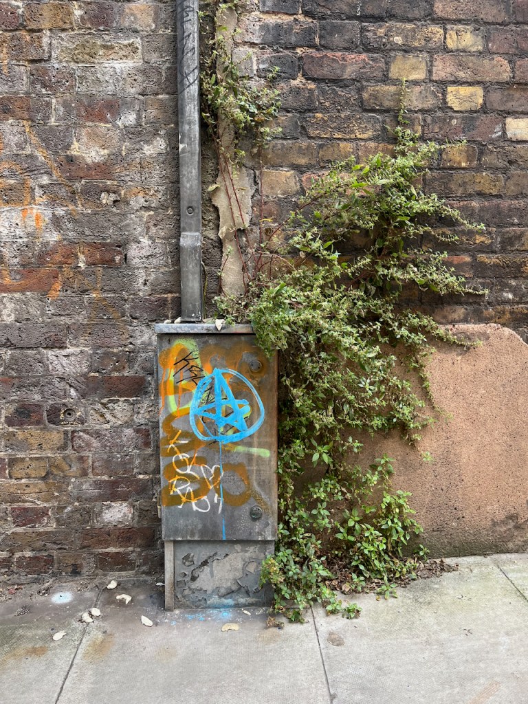
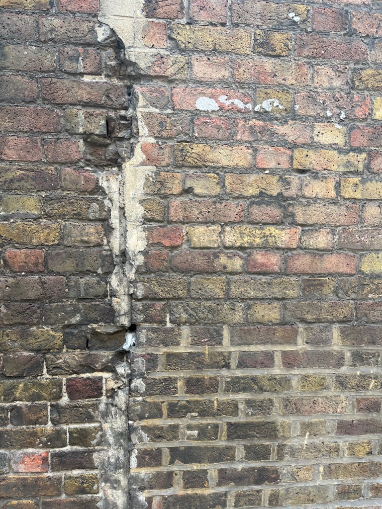
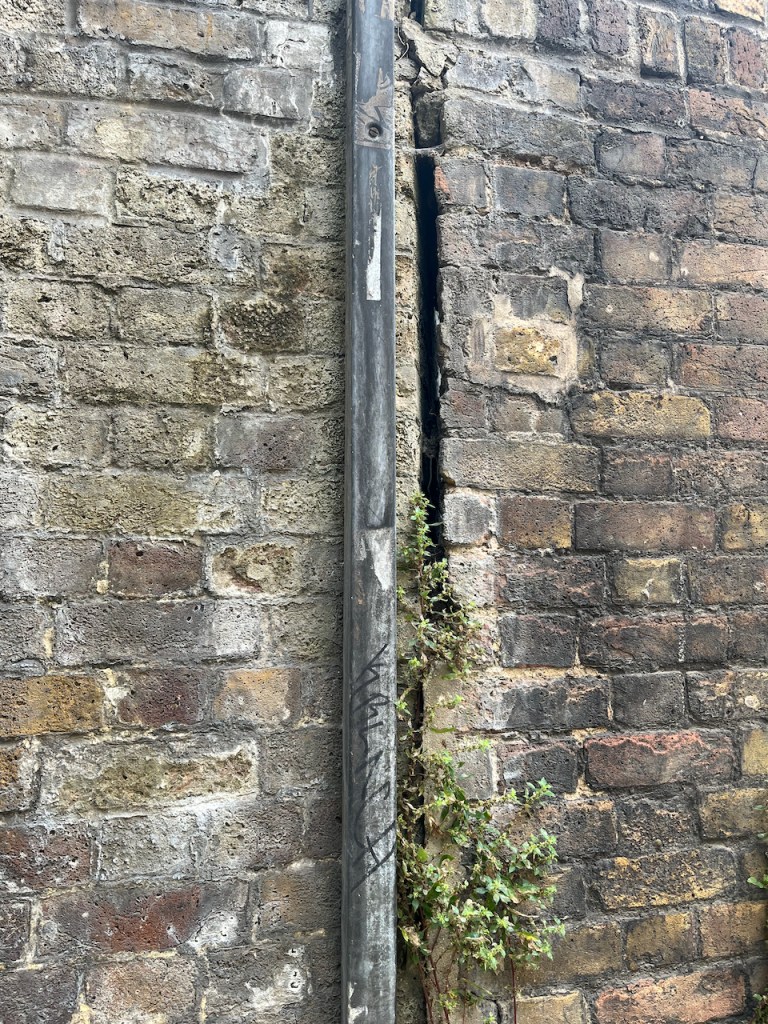
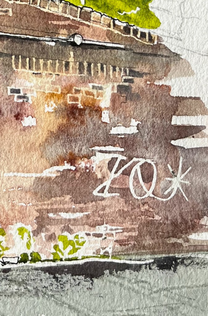
Standing in Mill Place to make this sketch, I became aware of all the history that is embedded in walls. The one in front of me had been altered, rebuilt, and amended several times. A bit had been added on top. Plants lived there. A graffiti artist had made their mark on the crumbling stone.
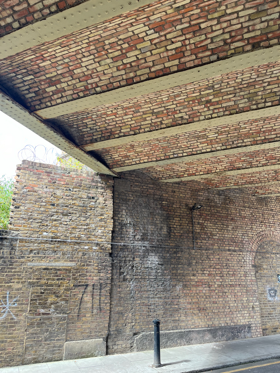
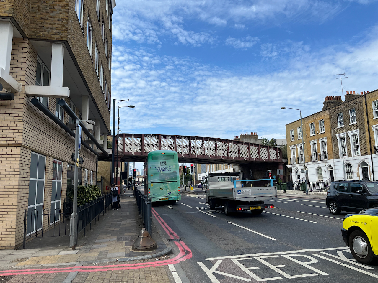
I was standing under two bridges, both 19th century. Both survivors. One holds the modern Docklands Light Railway. The other had wonderful strong vaulting. But it held no railway. I walked around trying to find out where it went. The Google aerial view confirms what I suspected: it is a ghost railway. On the bridge there is verdant greenery where the railway used to be. It goes across a second sturdy bridge, over the A13, and then stops.
Vaulting on the bridge Verdant greenery, but no railway. (Accumulator tower in the background)A sturdy railway bridge across the A13 carries no railway.The railway bridges with no railway
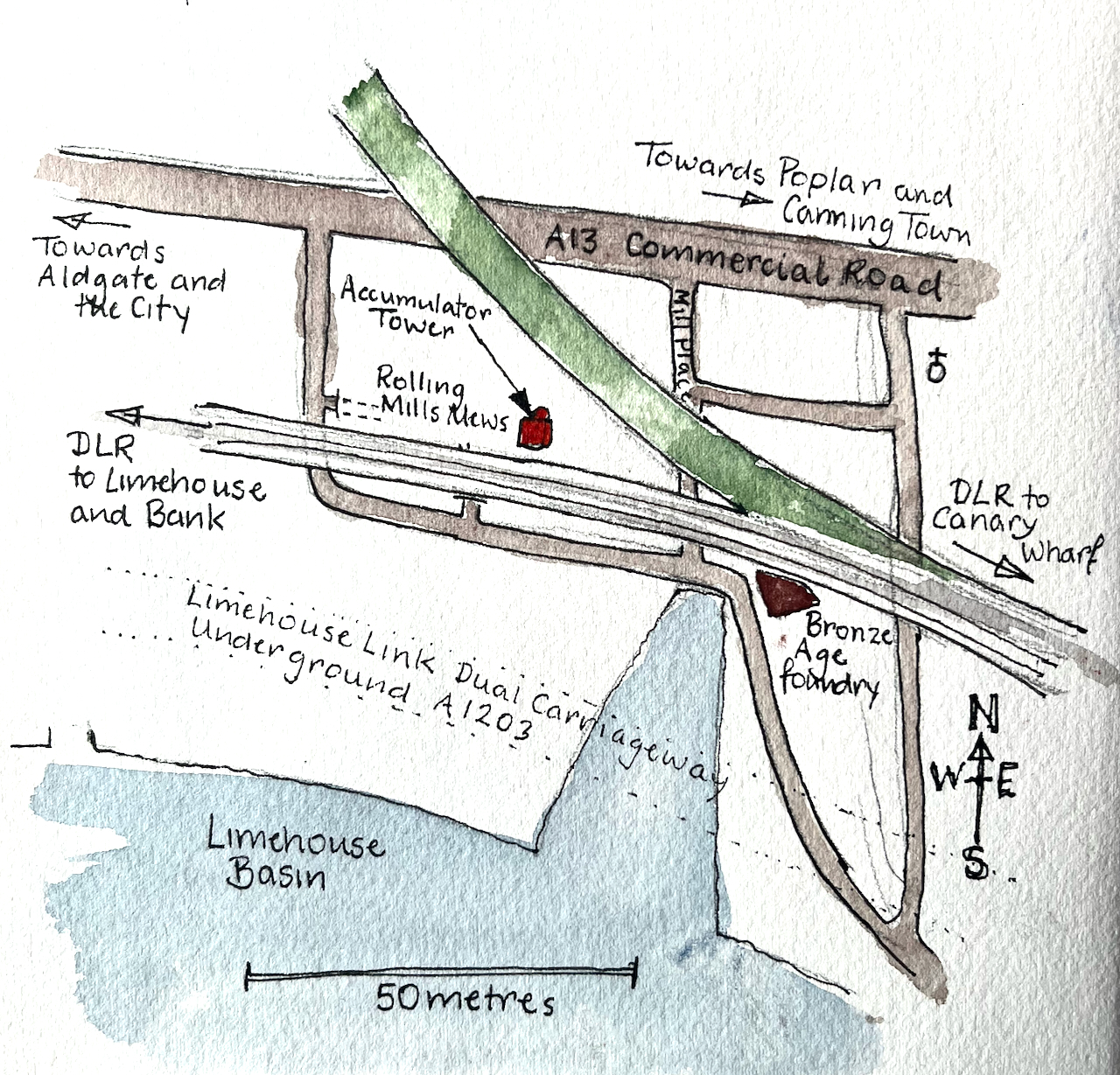
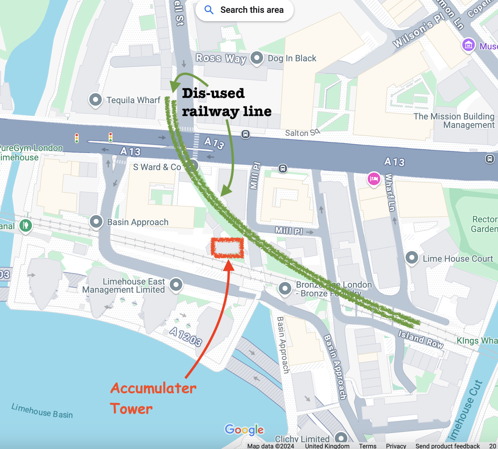
Here are some maps which show the position of the Accumulator Tower and the absence of a railway (click to enlarge).
In this whole area the works of Victorian engineers make themselves felt. Each bridge is a triumph of the bricklayers’ skill: not only strikingly beautiful, with clean curves and neat detailing, but also enduring, powerful and functional 150 years later.
Sketchbook 15map (c) OpenStreetMap contributors: click to go to the map
Click a button below to share this post online, email it, or print it:
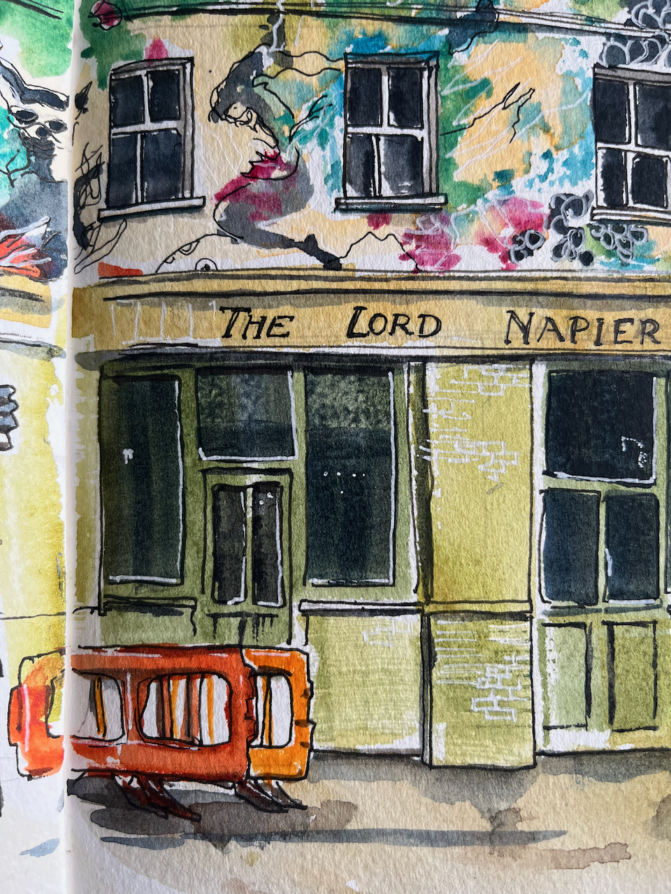
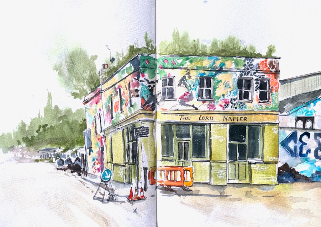
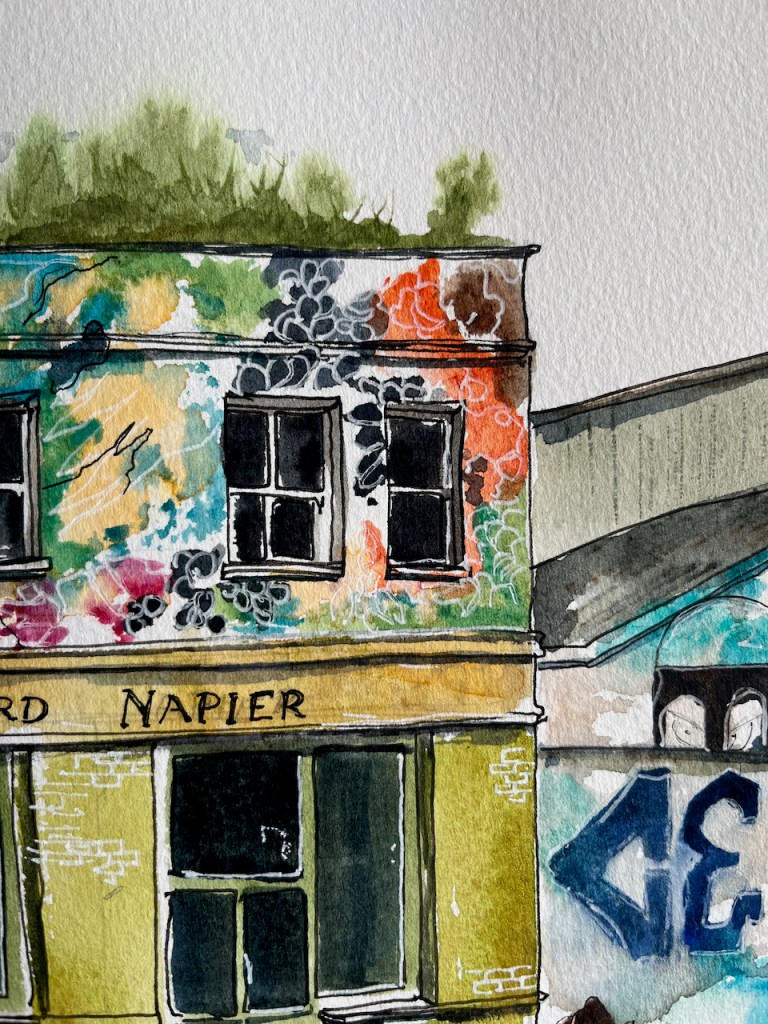
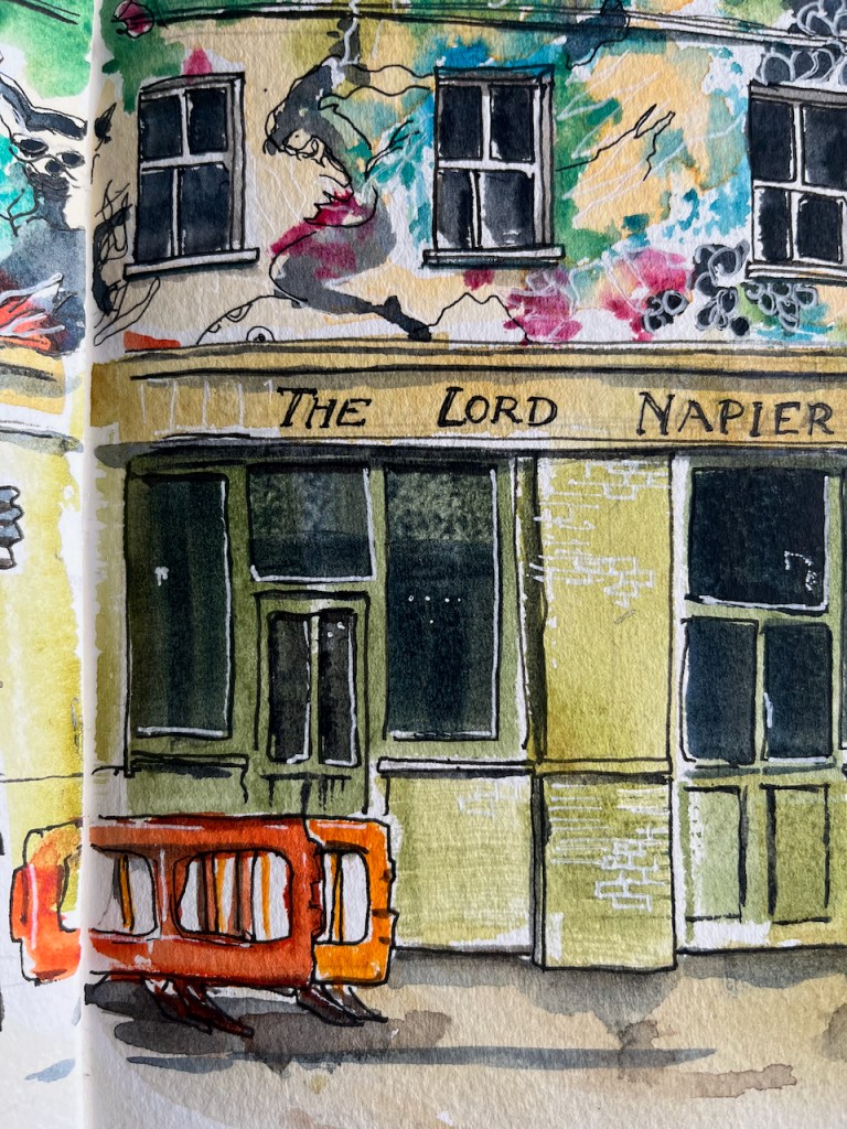
Here is a sketch of the remarkable pub, The Lord Napier, now the Lord Napier Star.
As you see, the top of the pub is covered in street art. I had fun trying to copy it. The original art is done at large scale with a spray can. My drawing is at small scale with watercolour and gel pens.
The pub has history. It has been a working pub, derelict, a rave venue, a squat. Now it is back to being a pub again.
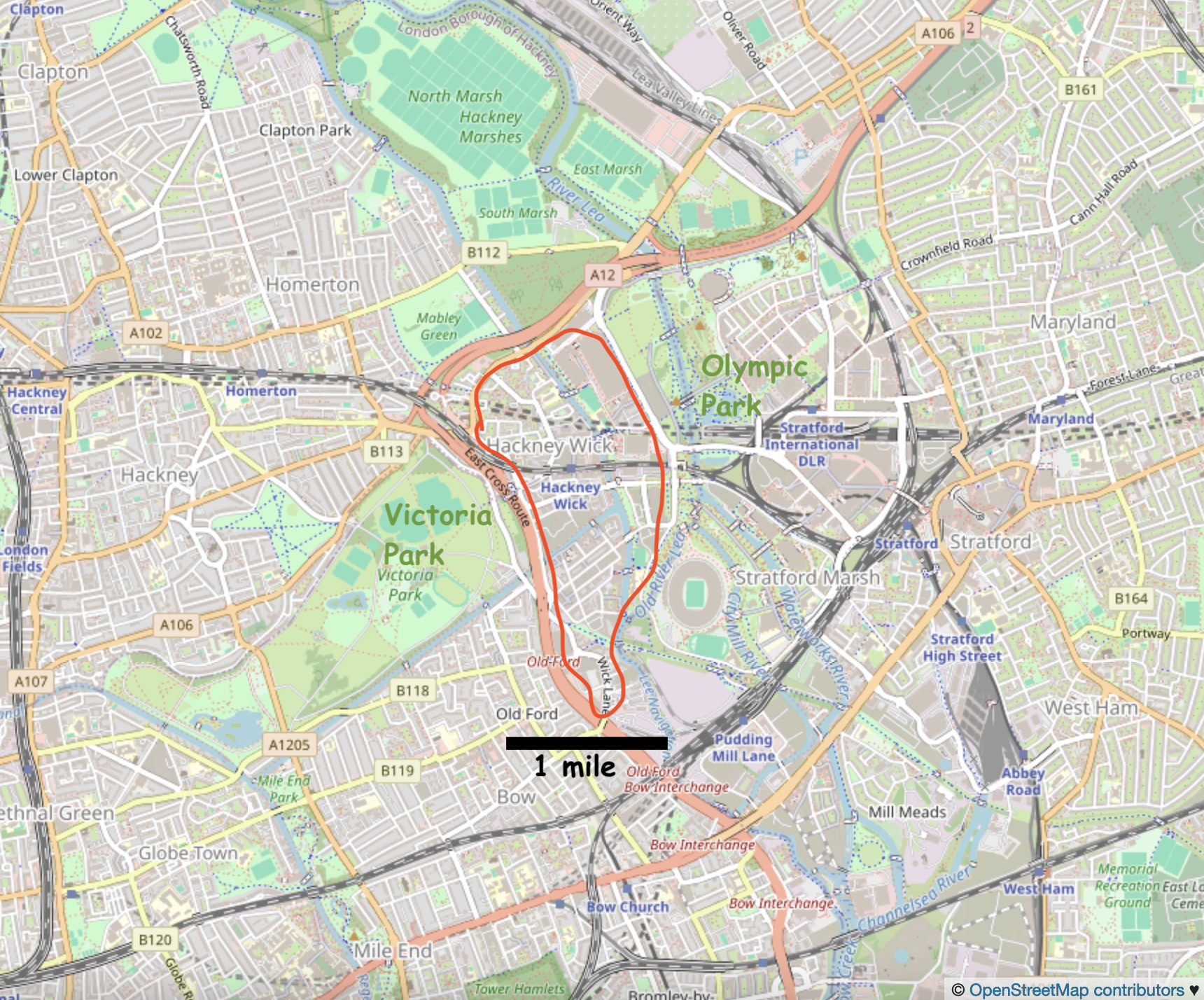
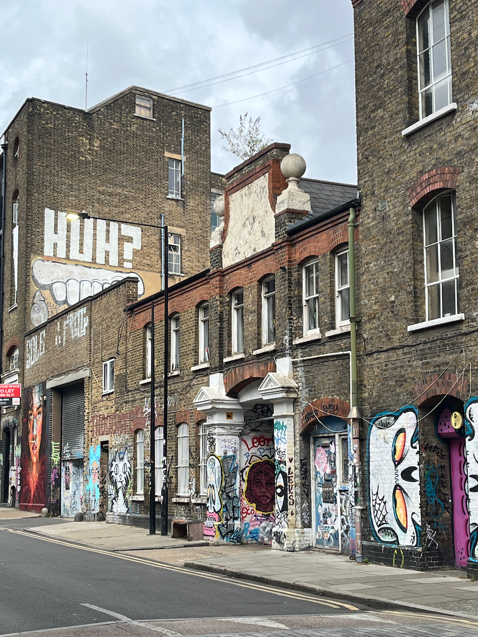
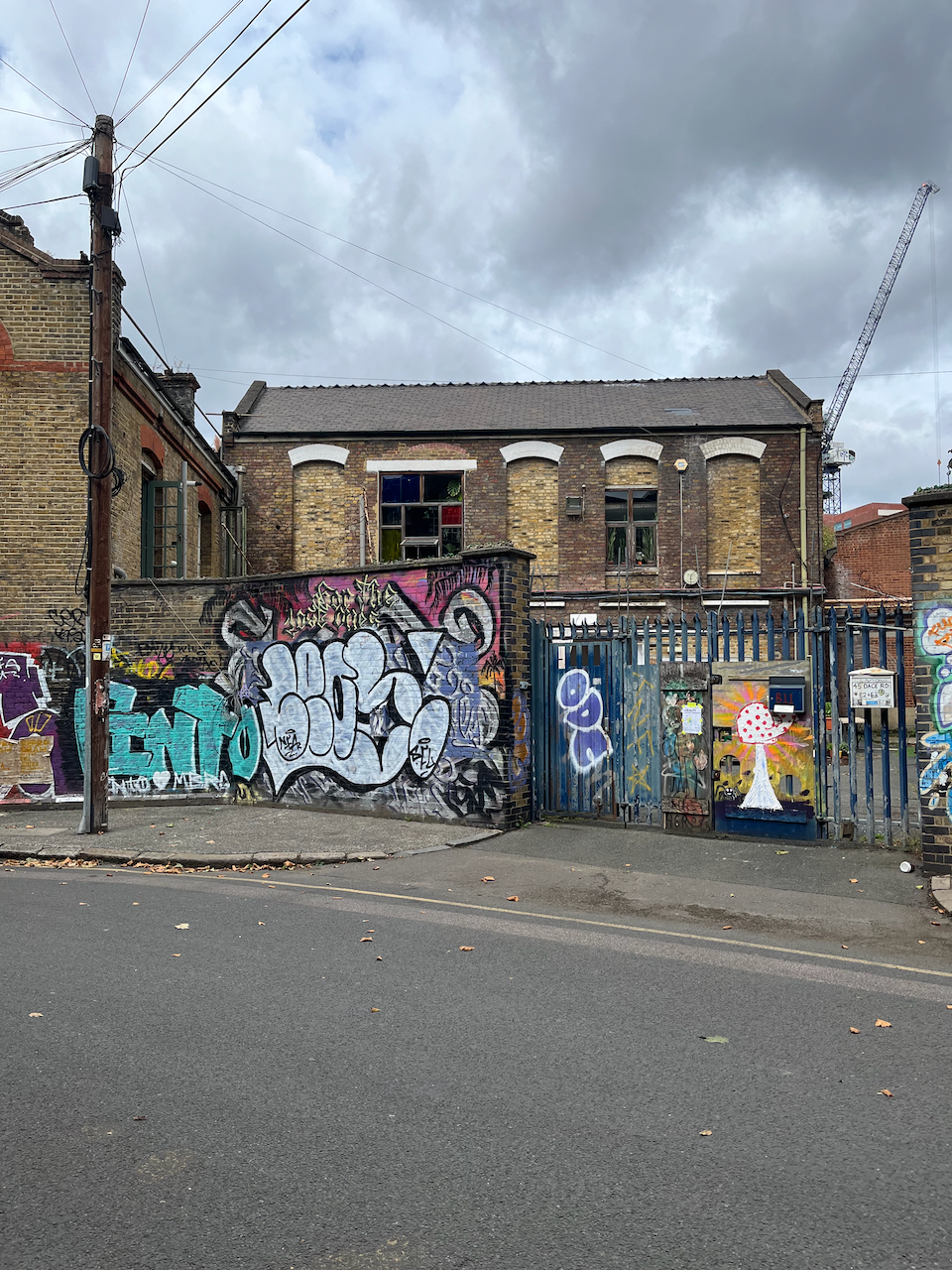
Hackney Wick is in East London between Victoria Park and the Olympic Park.
Hackney Wick is on the East side of London, 20 min walk from the Stratford railway station, and on the Hackney Wick overground.Hackney Wick is between the Olympic Park and Victoria Park.
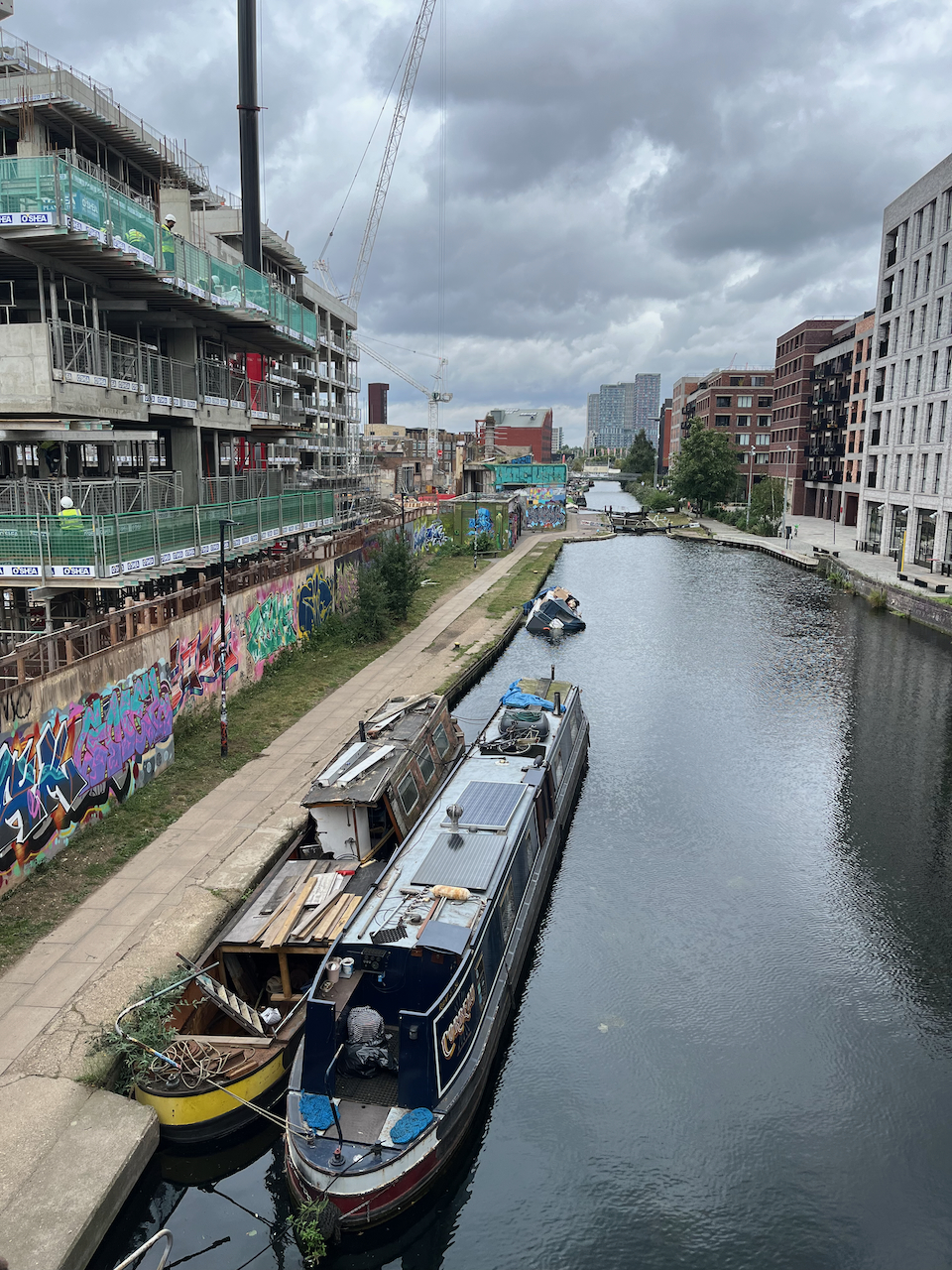
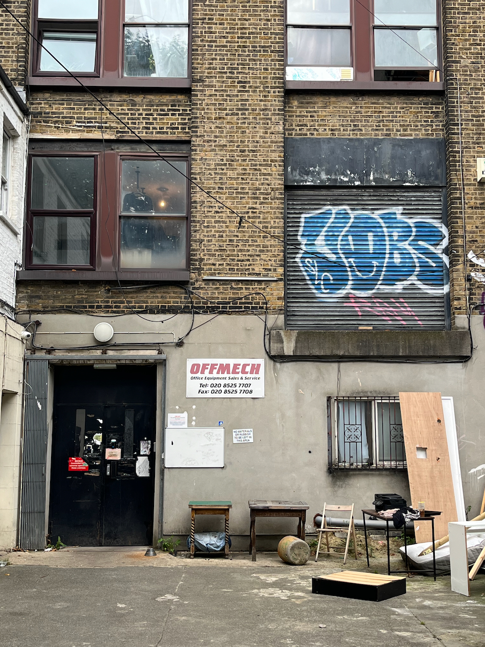
I have walked and run through there at intervals over the last twenty years. It has changed remarkably. The company I use for printing my artwork moved over there about 5 years ago, from a location in central London. I thought “what!” and “why?”. Now I realise that they were at the start of a trend. They were wise. The area is on the up. It used to be somewhat derelict and somewhat dodgy. Now the old buildings are taken over by new businesses, and there are cranes everywhere, constructing buildings where there were coal depots, docks, builders yards, heavy industry.
Map at the bridge to the Olympic Park.
There are new residential buildings, at human scale of 3 to 5 stories, with footpaths and green spaces in between, and commerce at ground level. The commerce is, yes, coffee shops, but also gyms, shared office spaces, businesses to do with the film industry, music and film studios, a bakery, and what looked like scenery painting studios. It felt as though real things happened there, new businesses moving in, people living near where they worked, businesses springing up to serve the people who live there.
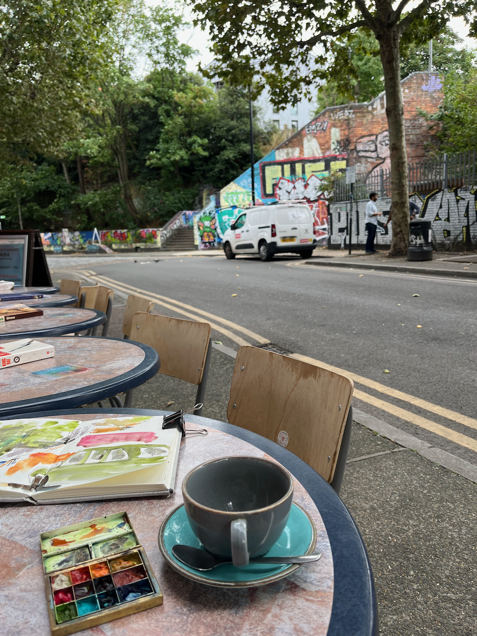
New businesses adapting the spacesNew housing, built and under constructionNew businesses in old buildingsDwellings in old buildingsNew businesses in old buildingsA peaceful cafe “The Ethical Bean” Dace RoadA walk around Hackney Wick
I found it cheering and energising. And I recommend the café I found: “The Ethical Bean” on Dace Road.
Click a button below to share this post online, email it, or print it:
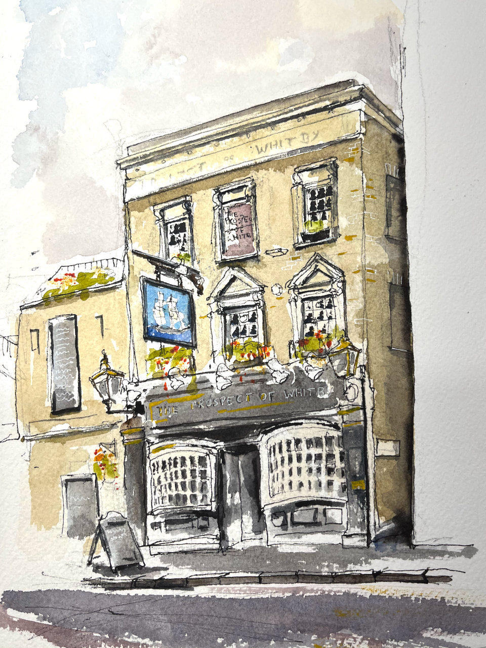
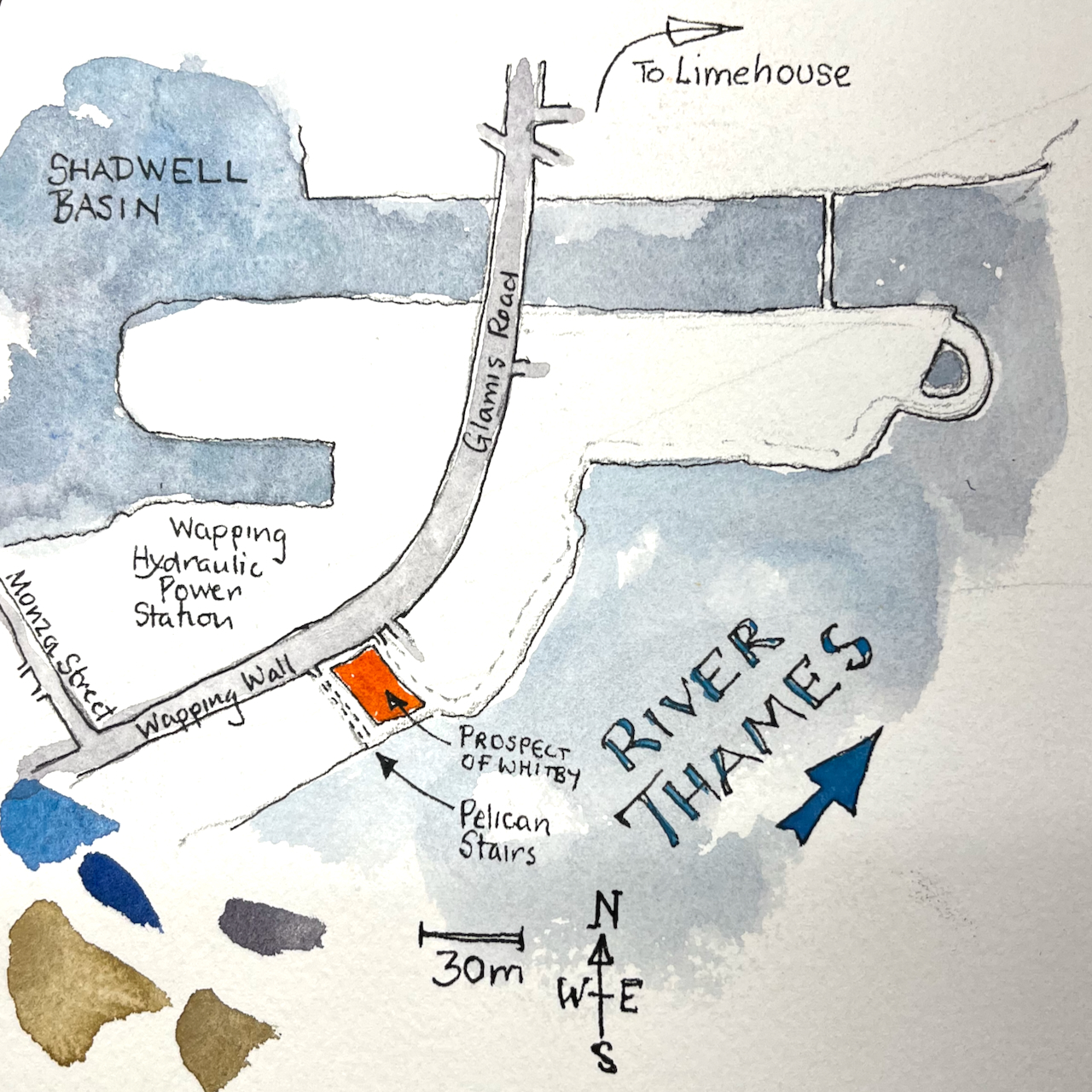
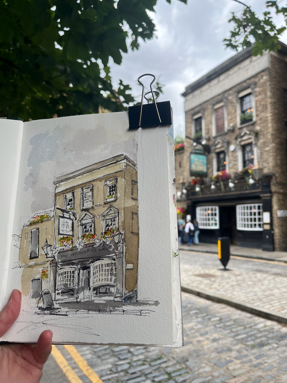
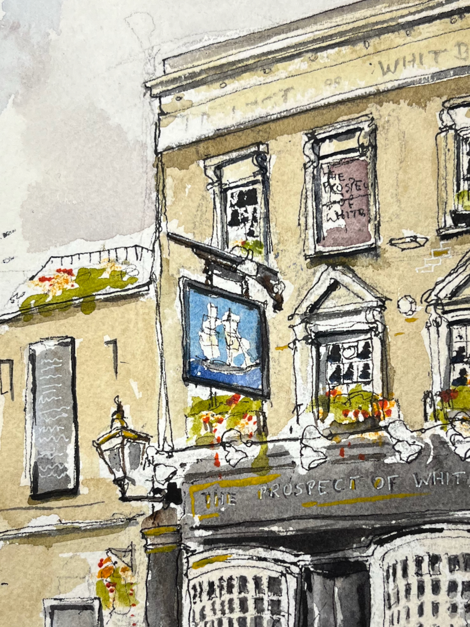
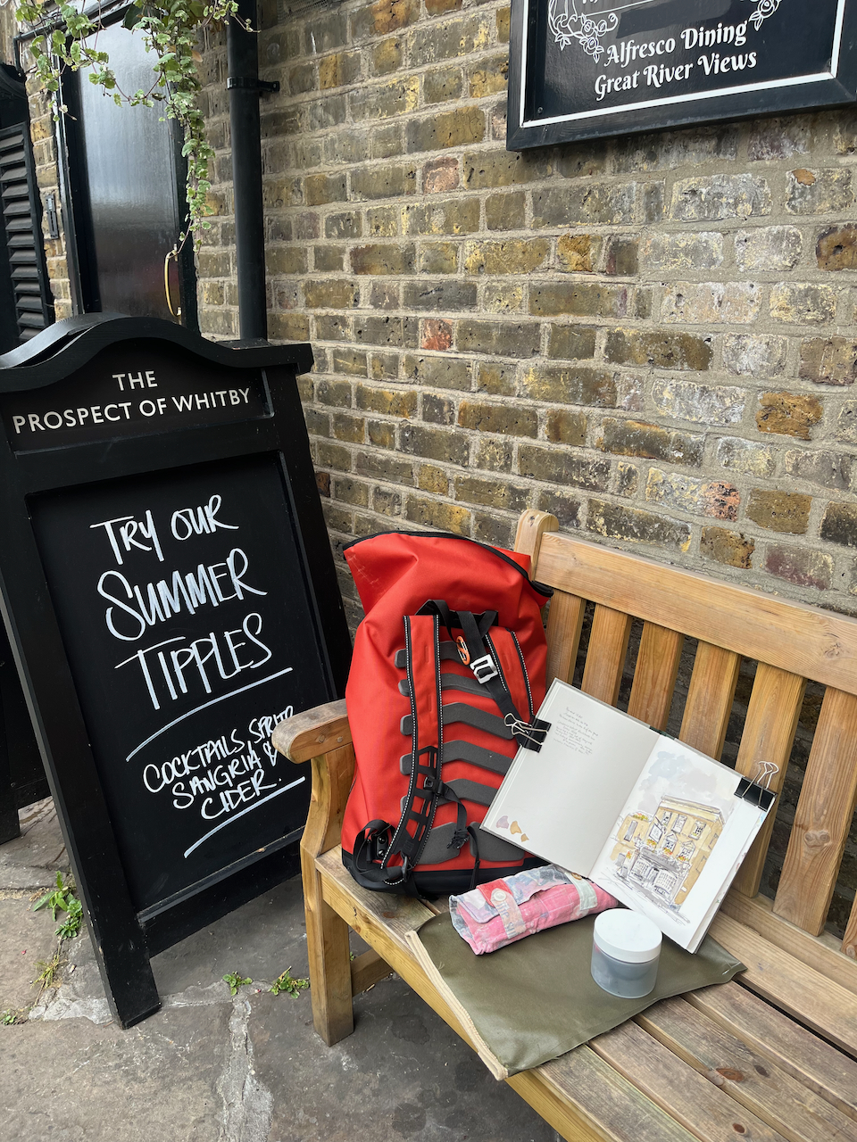
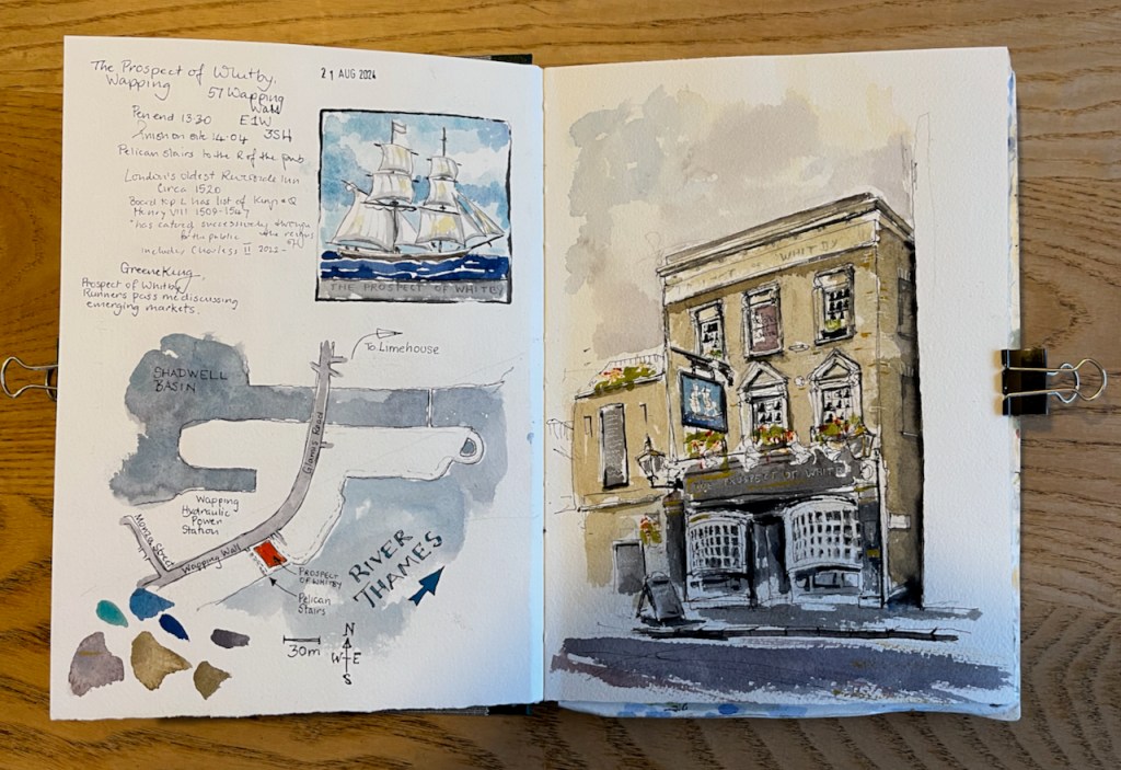
Here is the “Prospect of Whitby” pub by the Thames in Wapping.
“The Prospect of Whitby” sketched 21 August 2024 at 2pm, the first picture in Sketchbook 15
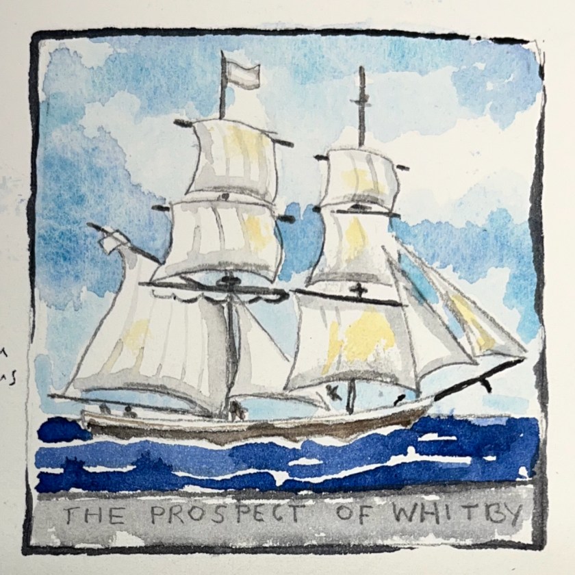
The “Prospect of Whitby” is the name of a ship.
The coal boat, “Prospect of Whitby”, from the pub sign.
There is an informative entry about the whole area in “The London Inheritance” website. He writes:
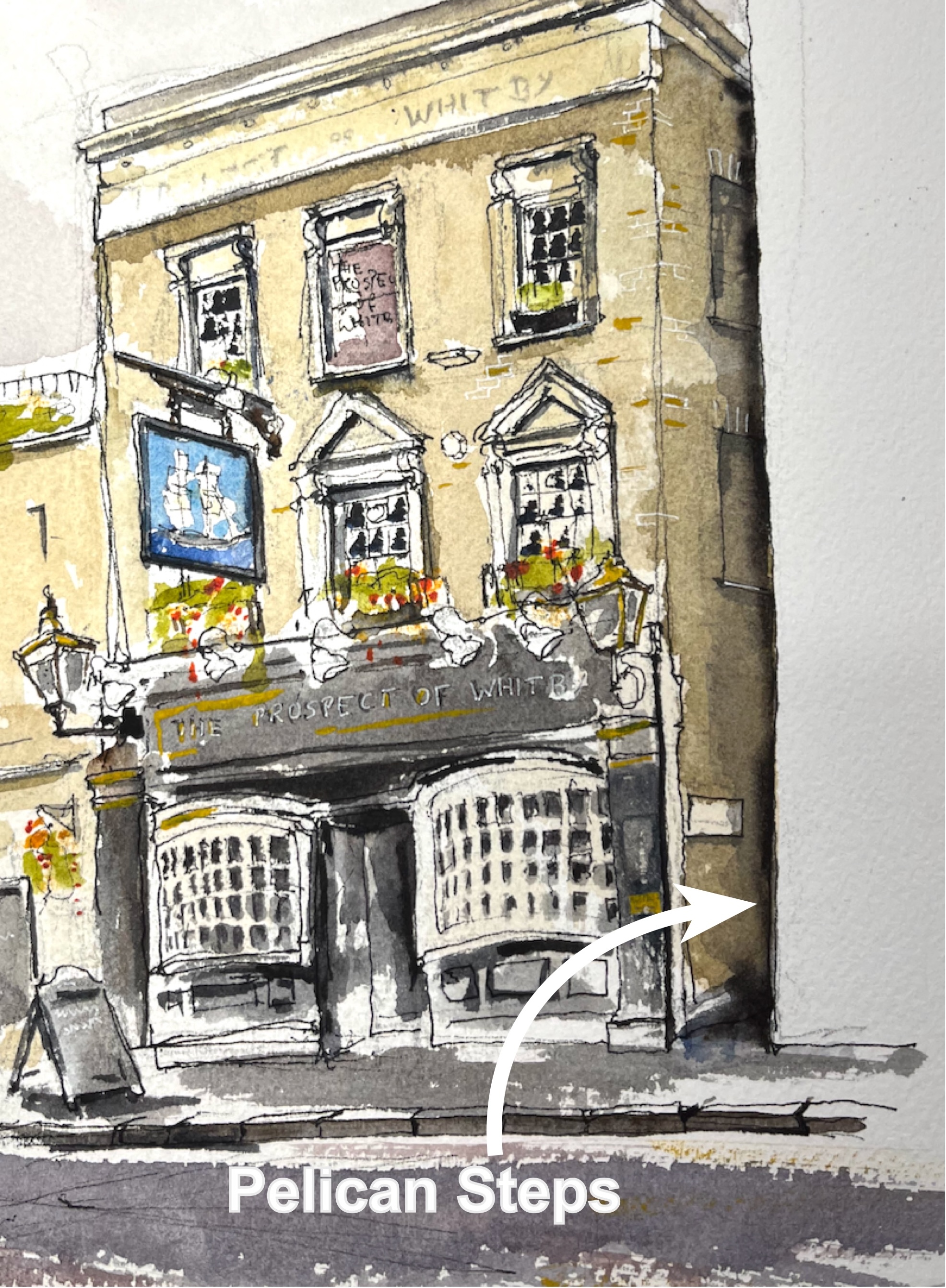
“The pub was originally called The Pelican and the alley and stairs down to the river at the side of the pub to the right are still named Pelican Stairs.“
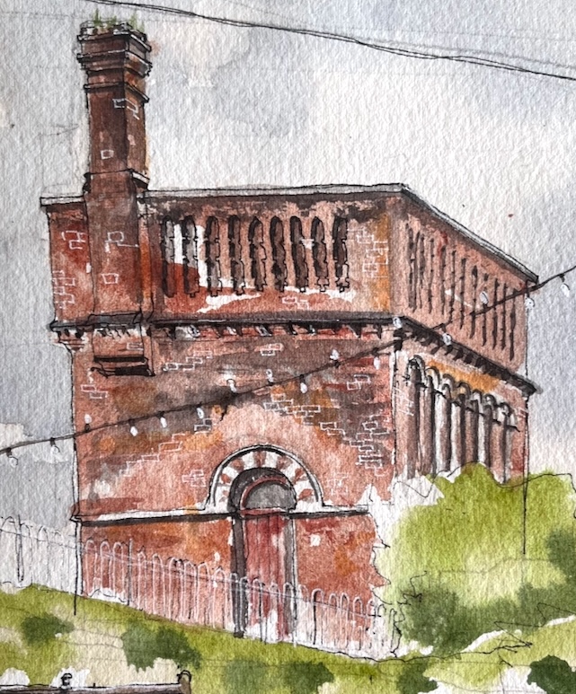
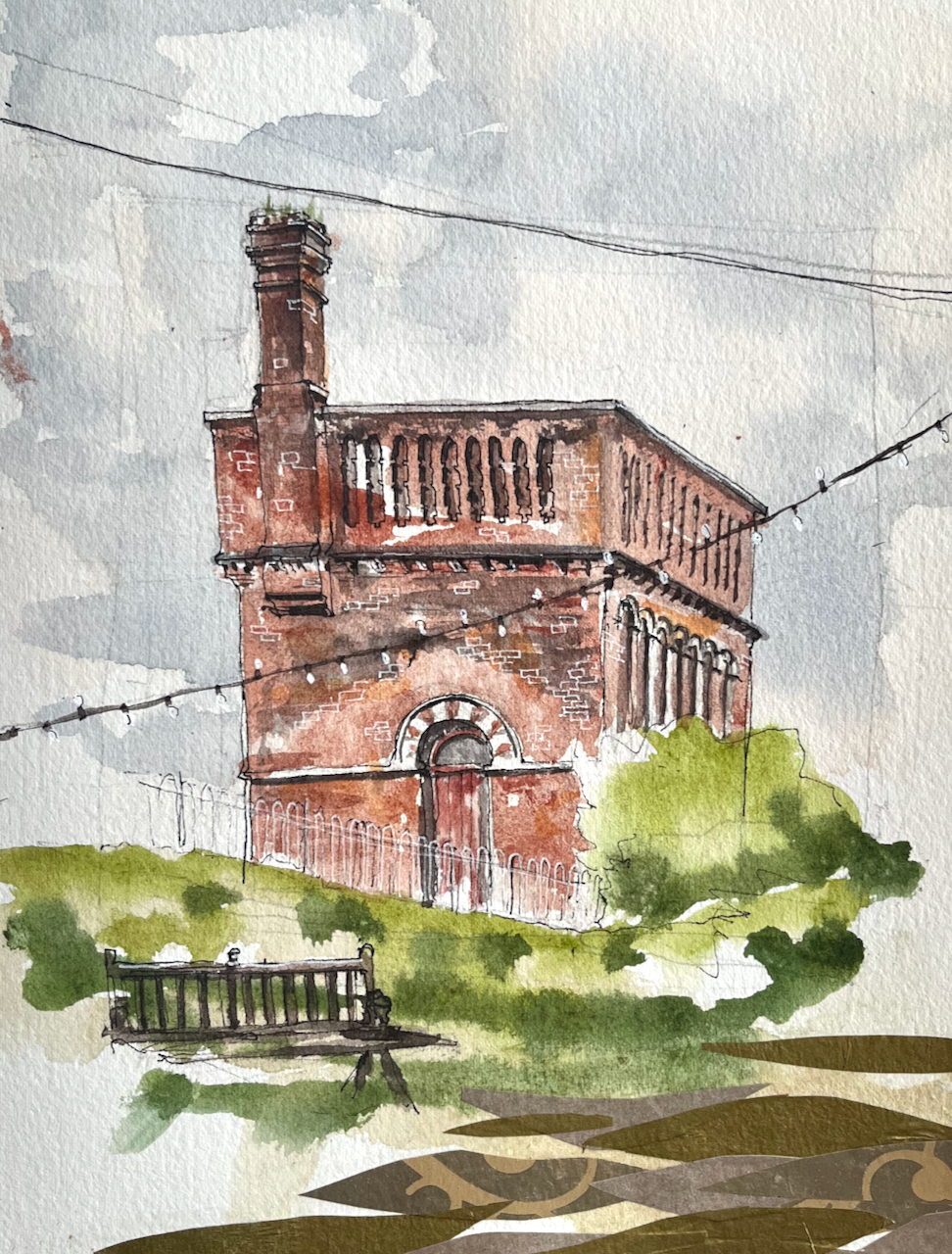
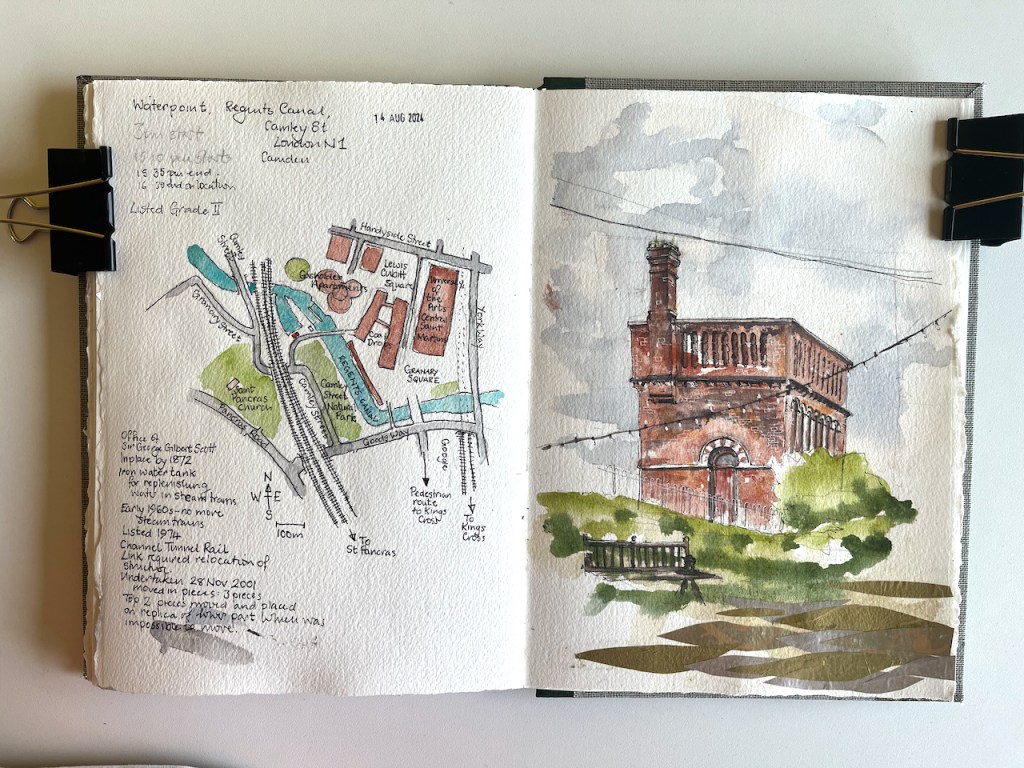
This structure is visible from the North side of the Regents Canal at Coal Drops yard. It was a “water point” for replenishing the boilers of steam engines. The top housed a water tank.
Waterpoint, seen from the Regents Canal towpath at Coal Drops. August 14th 2024, in sketch book 14
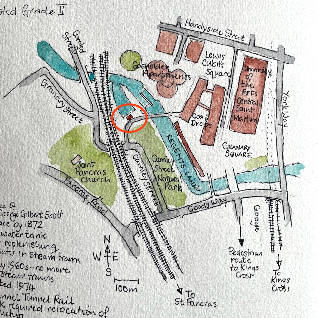
Here’s a map to show where it is. I’ve seen this structure often when walking along the canal, and it’s been on my “sketch-list” for a while, so I was glad that a co-incidence of weather and time gave me the opportunity to sketch it.
Waterpoint, circled.
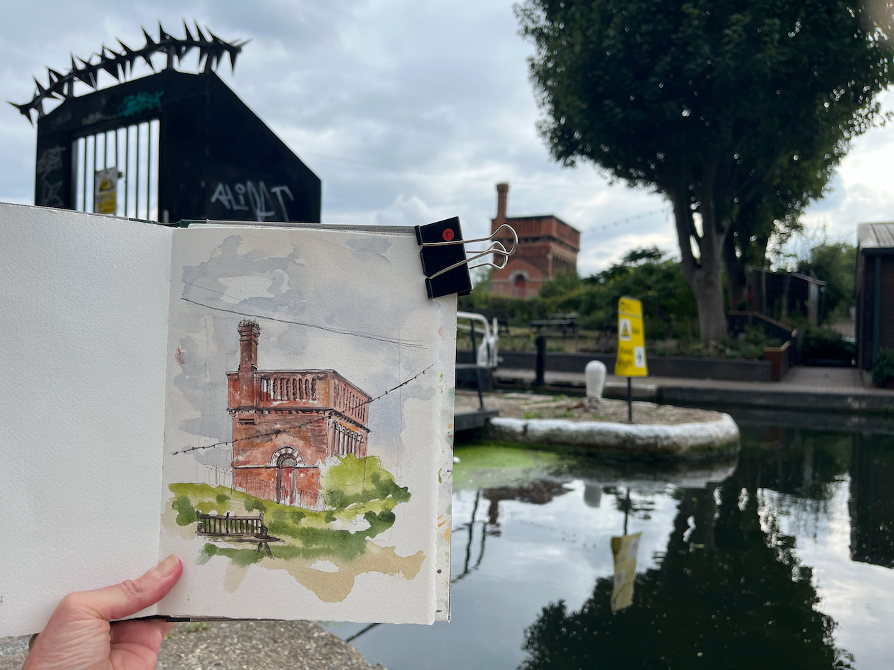
I was sketching from the Regents Canal towpath right next to St Pancras Lock.
Sketching Waterpoint, looking south across St Pancras Lock.
It turns out that this structure is open to visitors from time to time. By an amazing co-incidence, one of the visiting days was the weekend after I did my sketch. The kind and informative guides there patiently answered the many questions I had, and allowed me to photograph their video and their display boards.
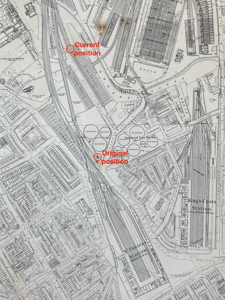
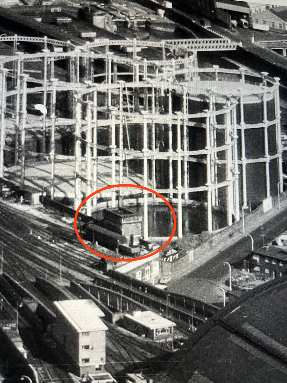
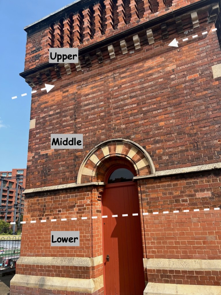
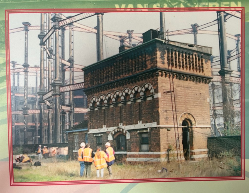
For me, the really fascinating thing about this structure is that it has moved. It was not always in this location. It used to be next to St Pancras Station. It was built around the same time as the station, 1870. In 2001 it was moved North, to its current location.
It was designed by team of Sir George Gilbert Scott, who designed the St Pancras Hotel. Since its purpose was to fill the tanks of steam trains, it was right next to the railway lines. You can see it here:
Photo of a video shown at the Waterpoint.
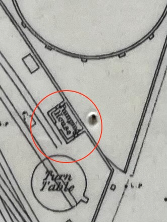
Here it is on an 1871 map: (click to enlarge)
my annotations to show the original position next to St Pancras, and the current positionOn the 1871 map it is labelled “Pumping House”1871 map on display at the Waterpoint (copyright National Library of Scotland)
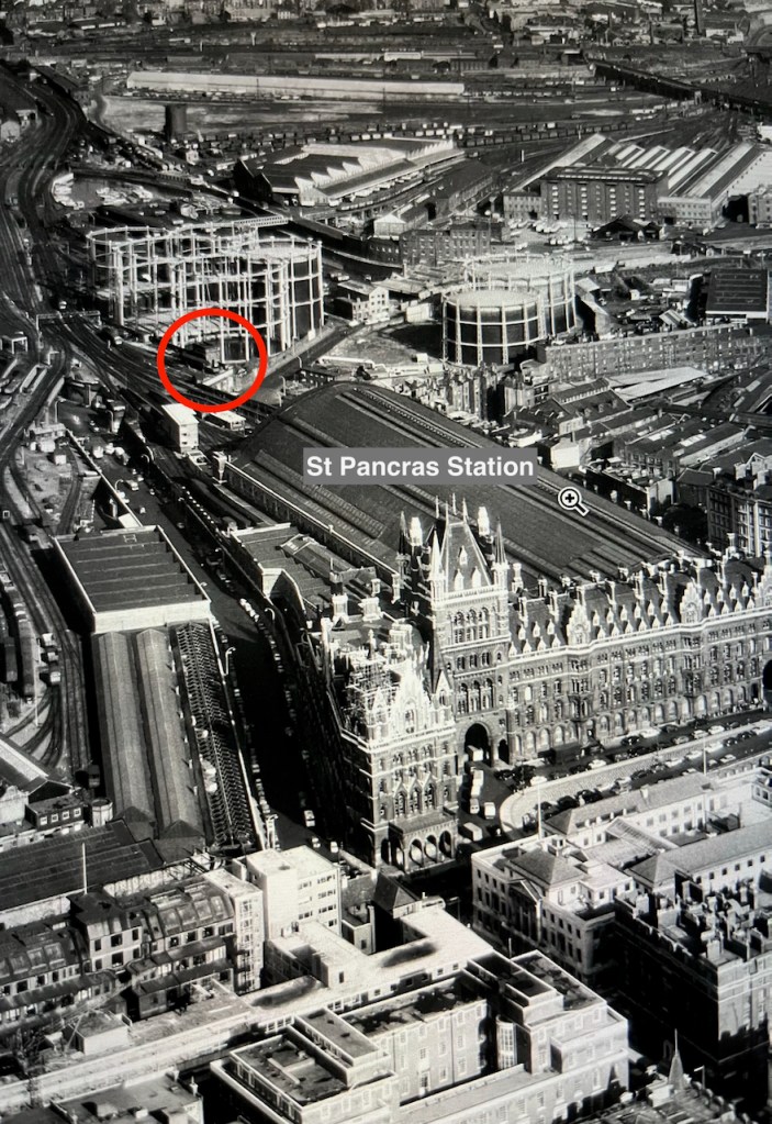
I think I can spot it on this archive aerial photo from 1964. Here is the link to the picture:
The water point is just beyond the far right hand edge of the St Pancras train shed, in the centre left of the photo on the link above.
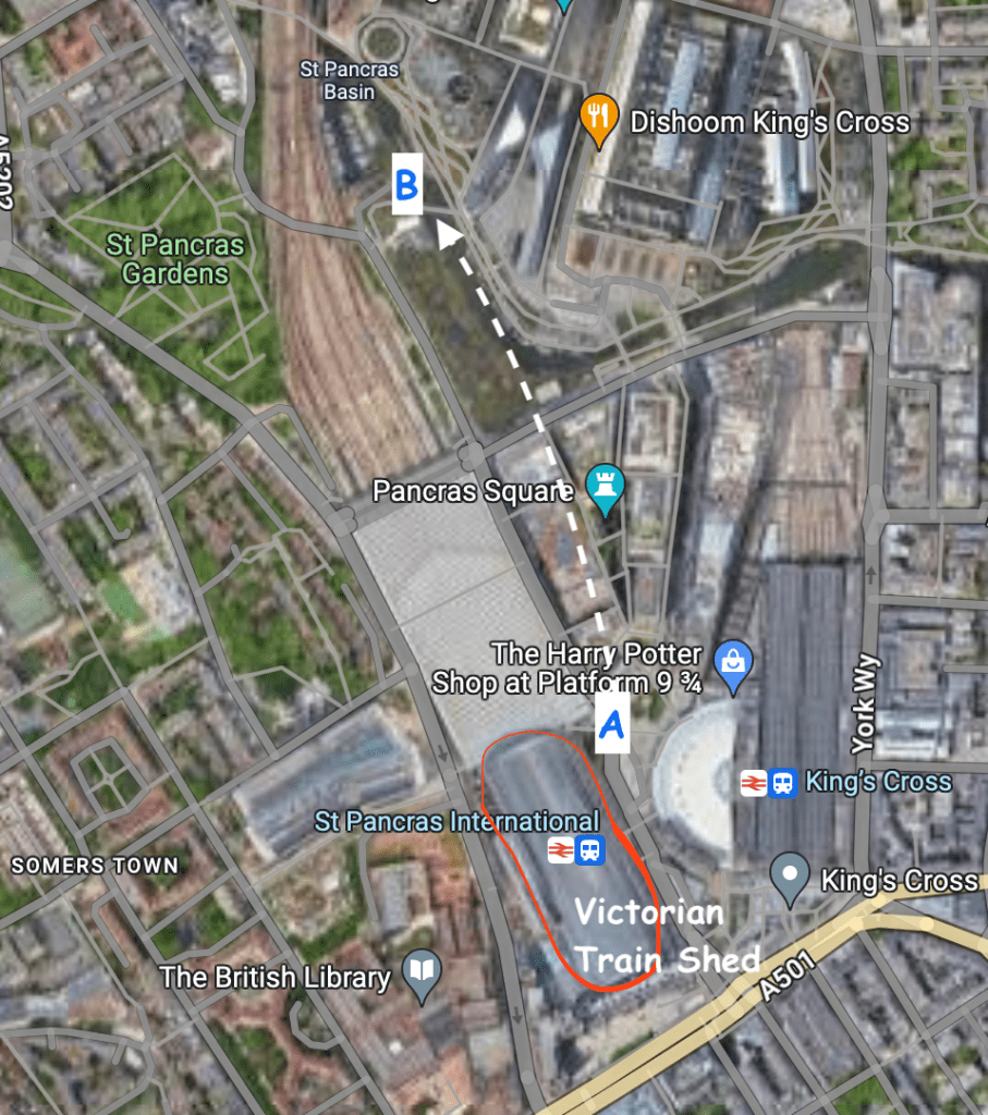
Here are some low resolution images to help you find it.
Detail from the aerial photo above. The gas holders shown in these photos have also moved.
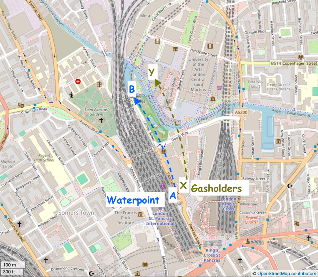
Here are modern maps annotated to show the original position and the current position:
Google map. Waterpoint moved A to B.Waterpoint moved A to B. Gasholders moved X to Y. map (c) openstreetmap contributors
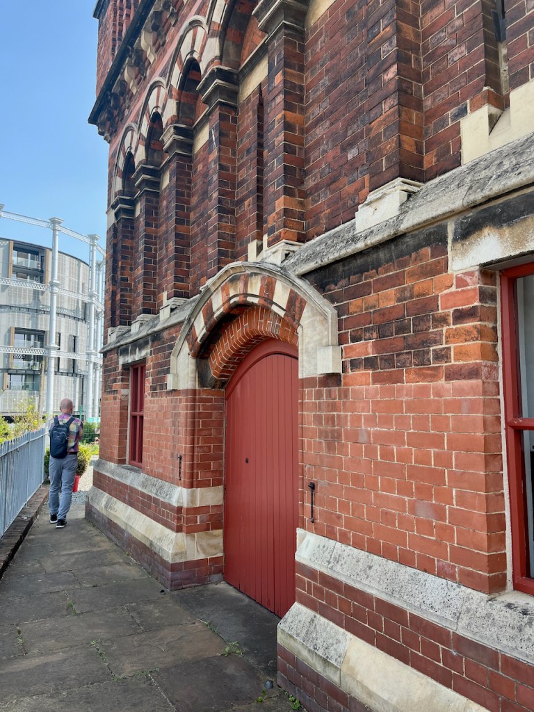
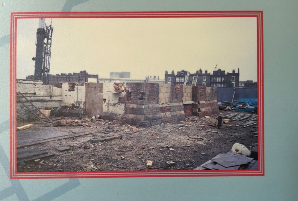
To move it, the original Water Point was cut horizontally into three sections. The lower section was left behind. A new lower section was built in the new location. The middle and upper sections went by road to the new location and were stacked on top of the newly built lower section. You can see, by changes in the bricks, the joins between the sections.
The new lower section is clearly visible.The line of new bricks at the top marks the join between the middle and upper sectionsView of the south side of the Waterpoint, annotated to show the sections
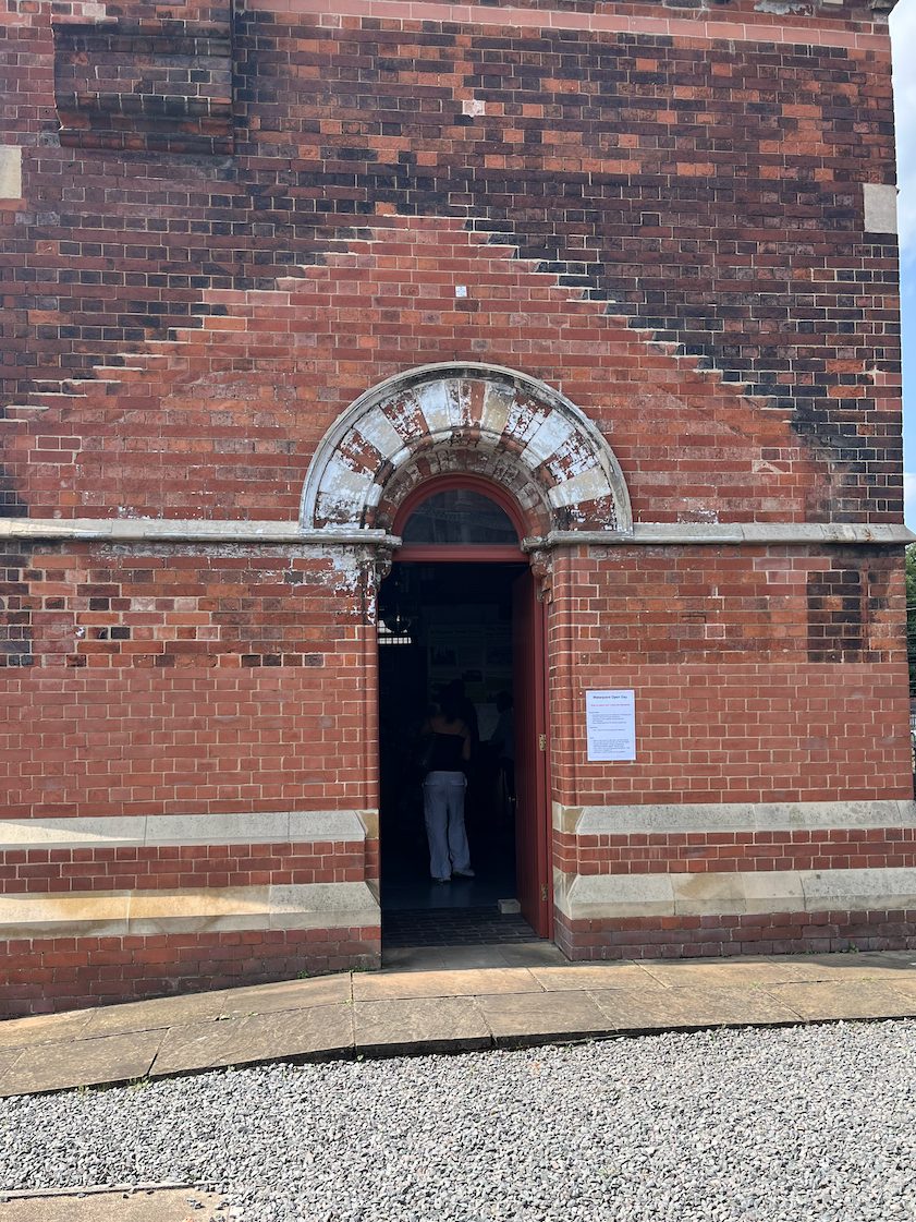
On the side of the Waterpoint visible from the canal, there is a clear “roof” pattern in the bricks, which I noticed when sketching it.
This marks the position of a shed that was fastened to the structure in its original position. See the pictures below.
Original position – note the shed on the left What was left when it was moved.The display boards show the project to move the Water Point. These are 2001 photos.
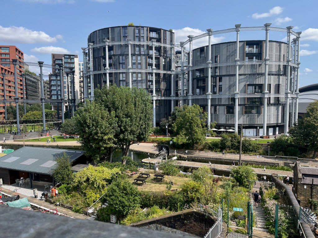
These photos and maps show how much the area has changed. See all the gas holders! They were constructed on the south side of the Regents Canal, because that’s where the gas works was. They originally held coal gas, which is carbon monoxide and hydrogen, manufactured from coal. Until 2010 they were a landmark for anyone who made this journey into Kings Cross regularly.
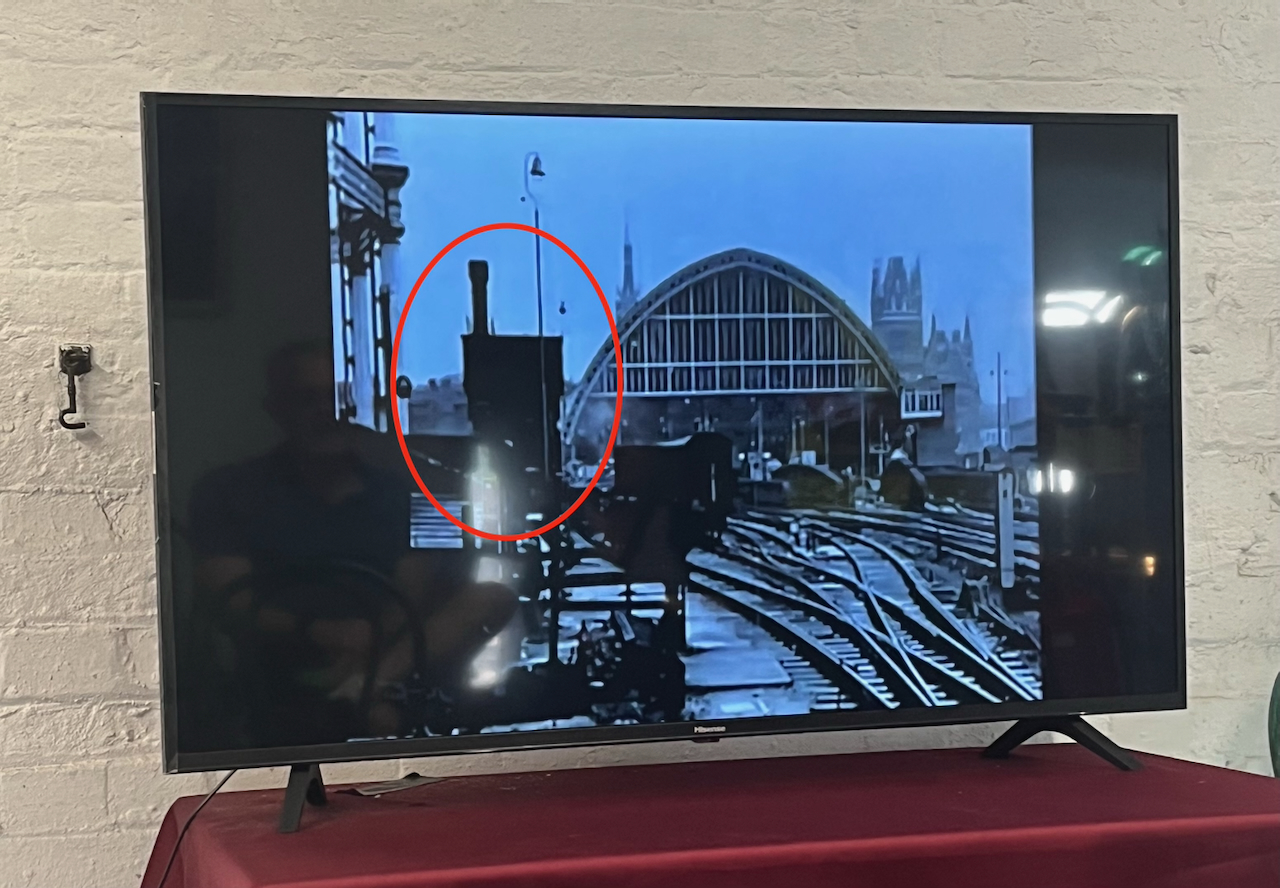
Here’s a frame from the 1963 film “Alfie” captured by @runningthenorthernheights, showing the gasholders in their original position.
Thanks to @runningthenorthernheights
The gasholders were decommissioned in 2000, but several of them couldn’t be destroyed because they were listed, so they just stood there for ten years. Then they were dismantled, stored, preserved and reconstructed in the years 2010-2015. They are now on the north side of the Regents Canal. Gas holder No. 8 was the first to be reconstructed, in 2015. It surrounds a small park. Gas holders 10, 11 and 12 followed, surrounding luxury apartments, part of the Kings Cross development. (https://www.kingscross.co.uk/gasholder-park)
Gasholders seen from the top of the Waterpoint, August 2024. I did the sketch from the far side of the canal.
Here are more photos from my visit to Waterpoint in August 2024.
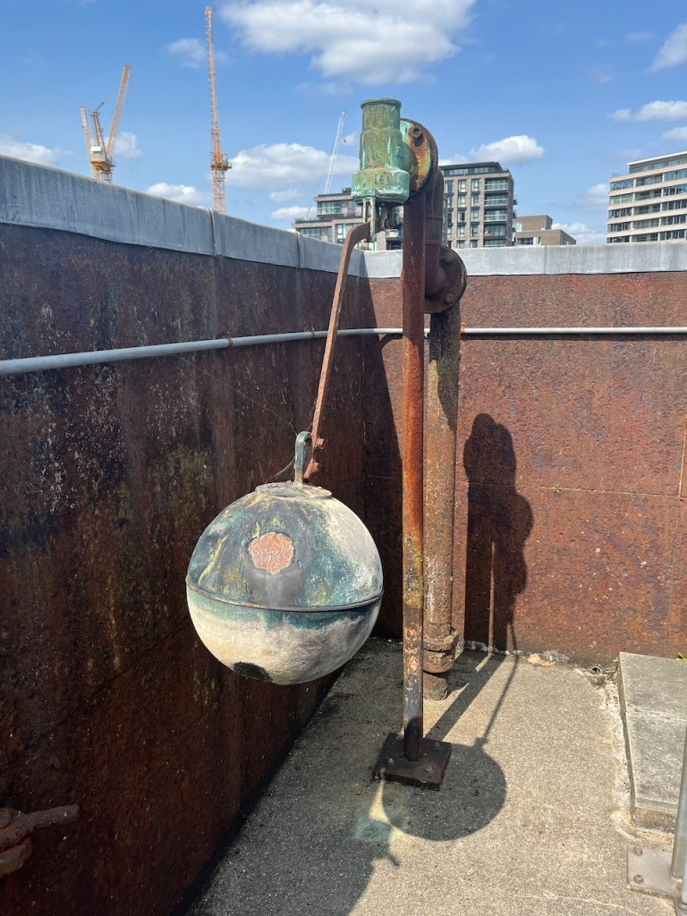
Ball cock in the (now empty!) tank on the topView from the topView from the topThe “chimney” up close. The guide is explaining that it is purely decorative. It is solid: there’s no “chimney”.
I was very glad to have the opportunity to visit this quirky building. Recommended!
Click a button below to share this post online, email it, or print it:
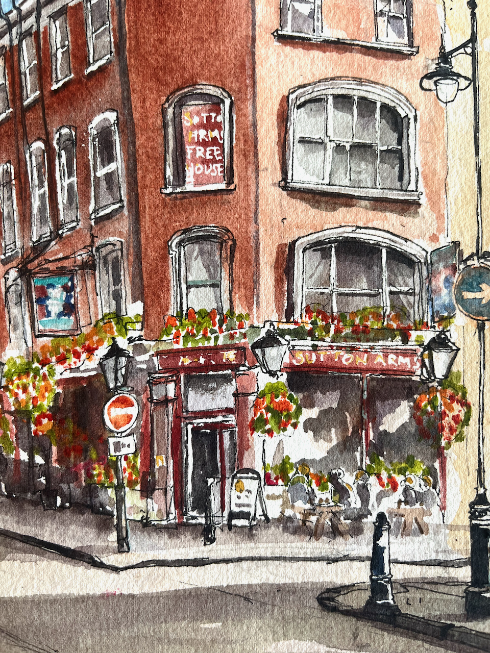
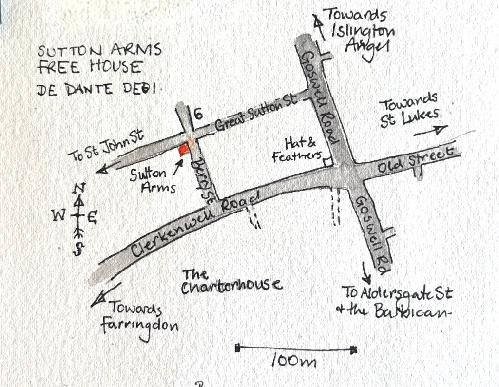
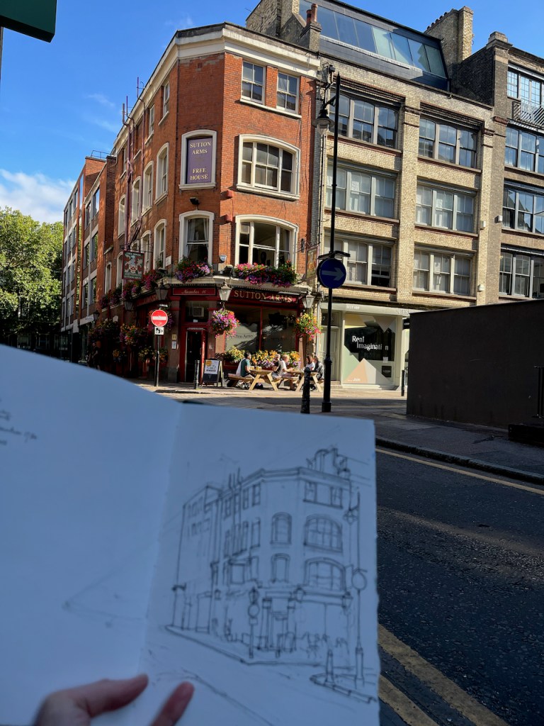
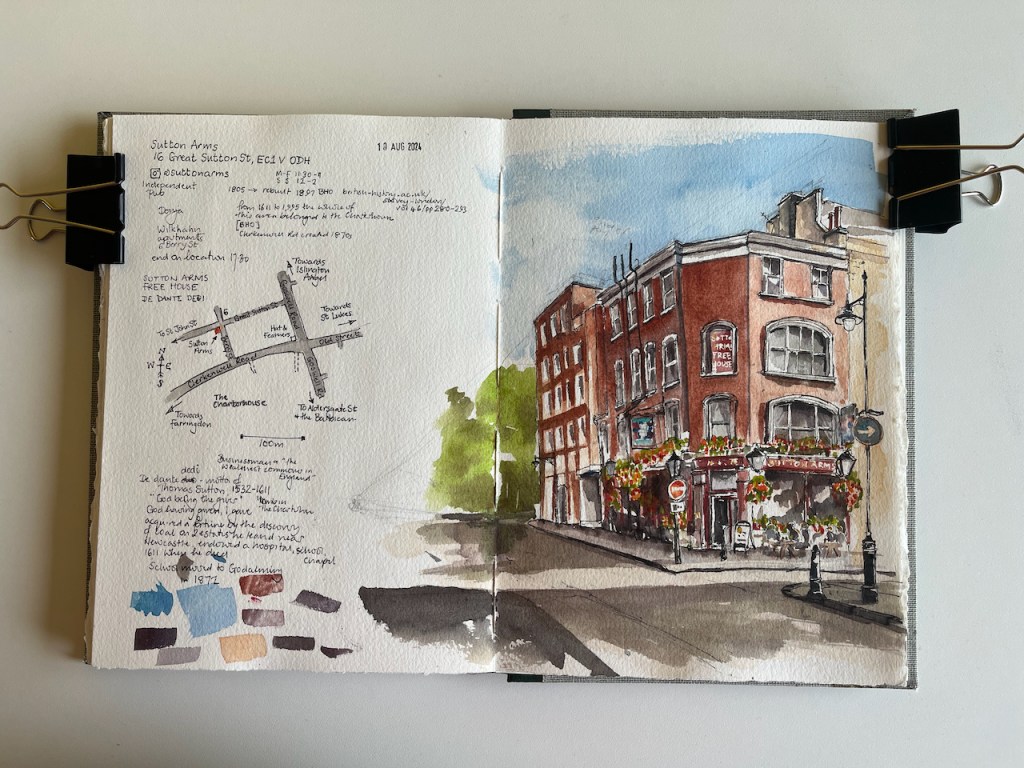
This is the Sutton Arms in Clerkenwell, 16 Great Sutton Street, EC1.
Sutton Arms, 16 Great Sutton Street, EC1V 0DH, sketched 10 August 2024 in Sketchbook 14
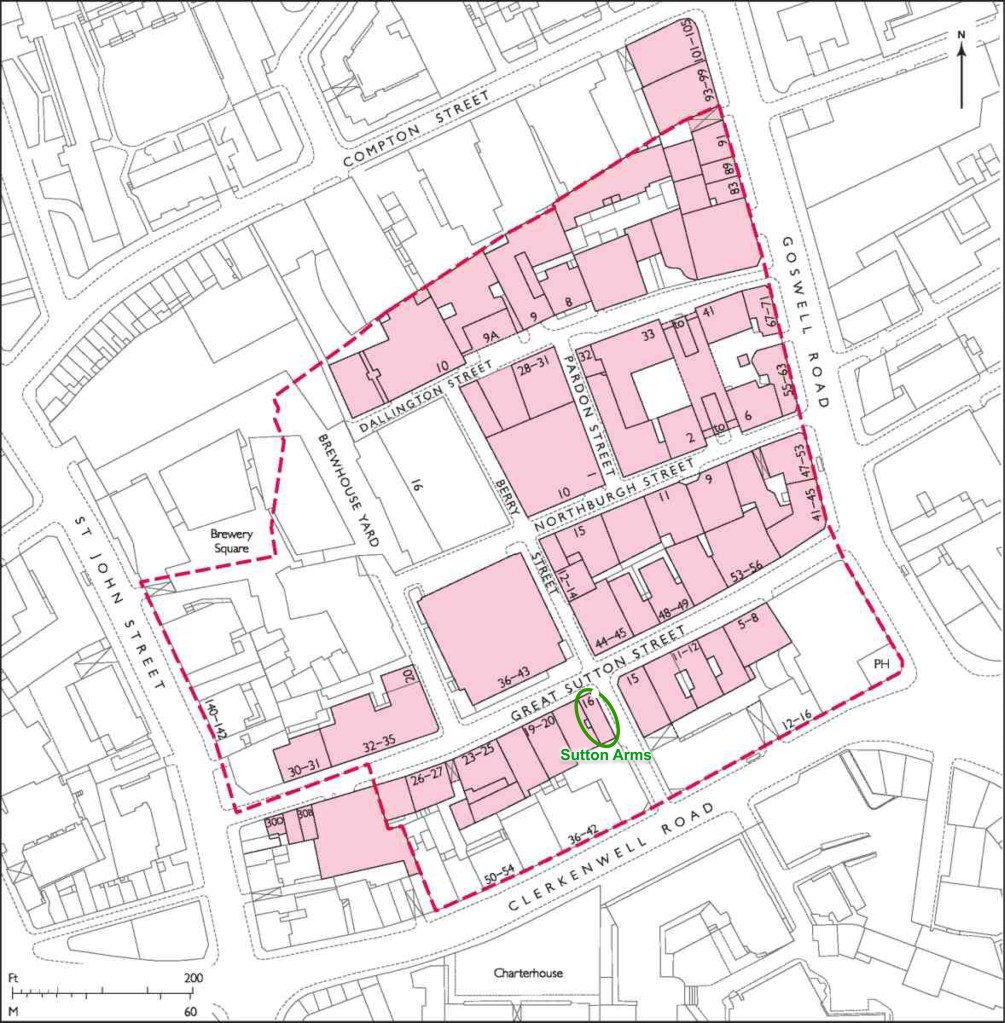
I sketched it towards the end of a sunny afternoon in August, sitting on steps outside number 6 Berry Street. As you see, the sun streamed in from the west. The trees in the distance, on the left of the drawing, are on Clerkenwell Road. Behind them is The Charterhouse, fulfilling its ancient tradition as an arms house and sanctuary for the elderly and frail.
From 1611 to 1995, The Charterhouse owned the whole of this area.
Great Sutton Street area. The broken red line indicates the extent of the former Charterhouse estate. Image from British History Online [reference 2] annotated.
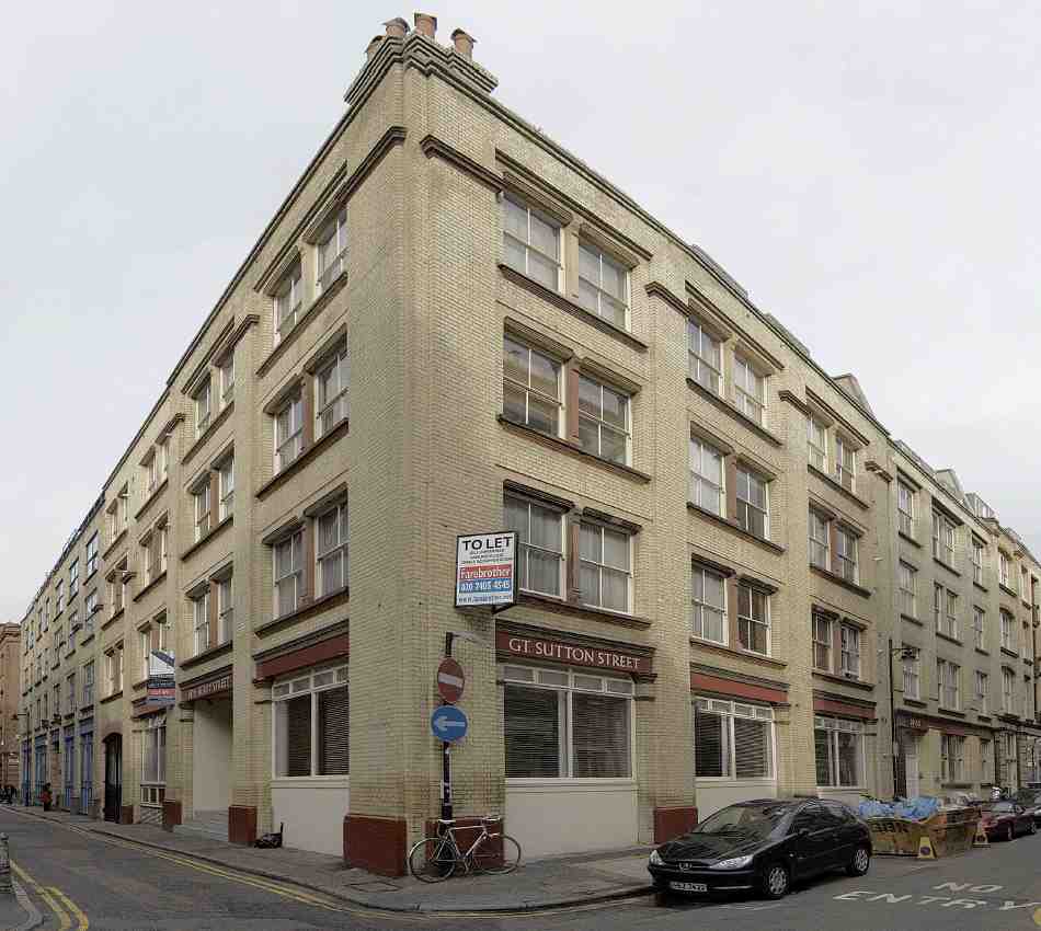
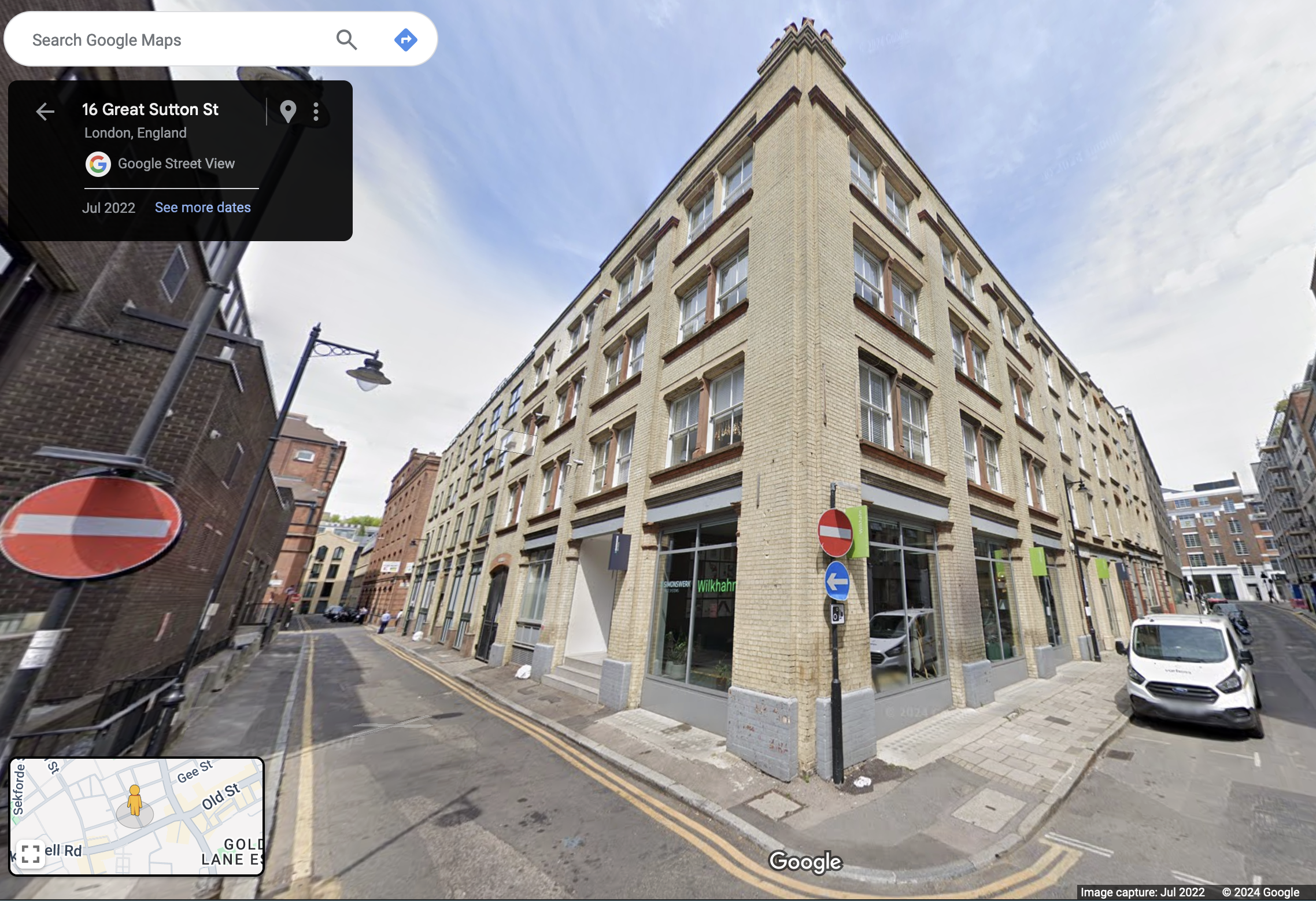
The Charterhouse sold this land in 1995. A developer bought up the land and built factories and warehouses. In the 21st century a new wave of developers transformed former warehouse blocks into apartments and offices. I sketched sitting outside one such: 6 Berry Street is residential apartments. This is now an area for architects and interior designers.
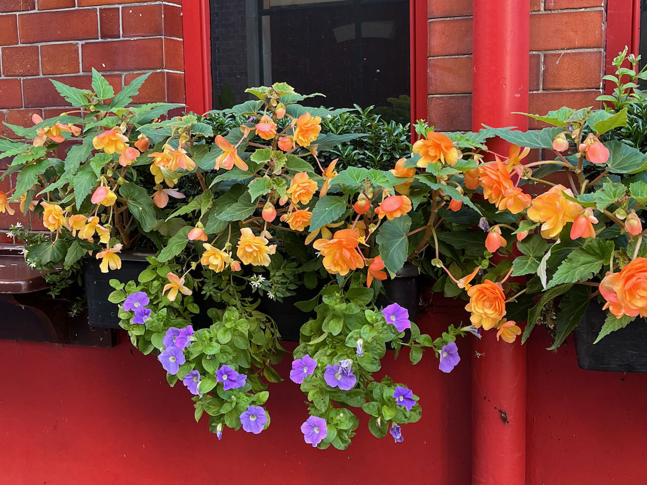
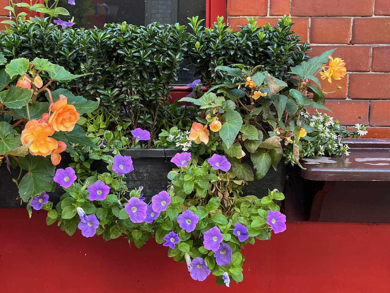
There was a pub here by 1825 [1]. It was rebuilt in 1897 [2]. It’s now a Free House. It’s clearly well looked after and well patronised. Definitely to be visited! The flowers are spectacular.
Spectacular flowers of the Sutton Arms.
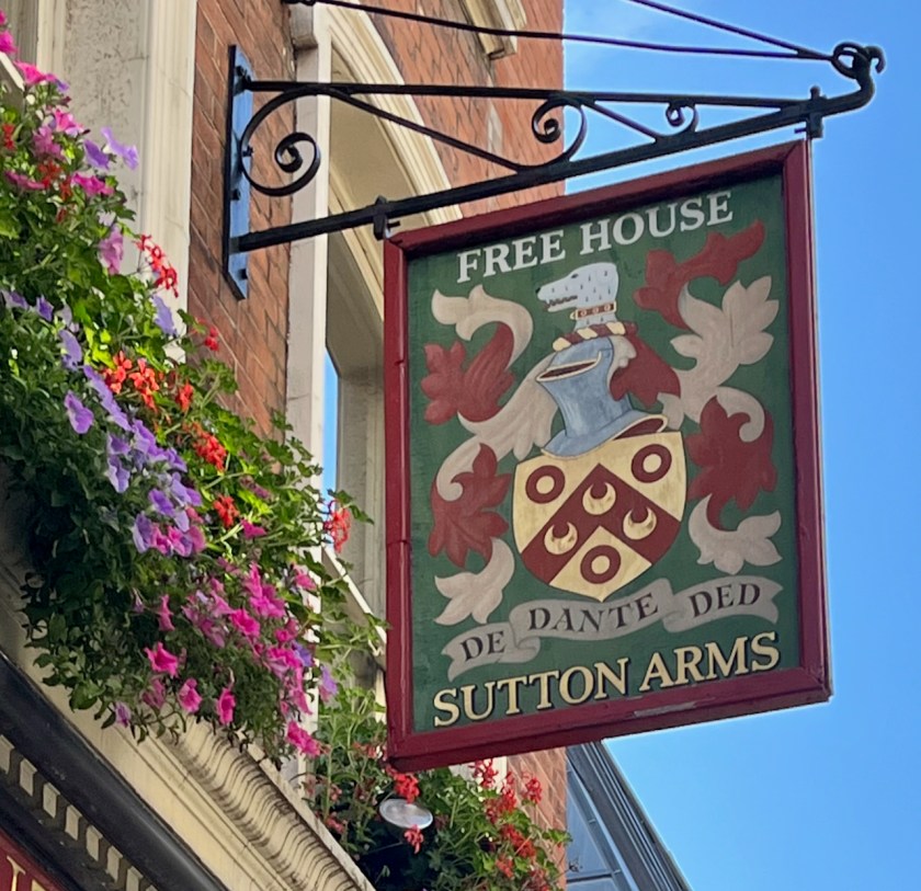
Thomas Sutton (1532-1611) was the founder of the Charterhouse, hence the name of the road and the name of the pub. This is the Sutton Arms in Clerkenwell, north of The Charterhouse. There is also a Sutton Arms south of The Charterhouse, in Carthusian Street, near Barbican tube.
The pub sign is Sutton’s coat of arms. His motto is:
DEO DANTE DEDI
The translation is “God having given, I give”, or “As God has given to me, so I give in my turn”, a good motto for the benefactor that he was. The pub sign misses off the “O” in DEO and the “I” in DEDI.
Sutton Arms pub sign: “DE[o] DANTE DED[i]”Thomas Sutton’s Coat of Arms. See the greyhound. Source: Charterhouse School on Wikipedia
The “Survey of London ” [2] gives a detailed history of this area, which has alternately flourished and decayed over the centuries. It is currently flourishing.
I completed the ink on location and finished the colour at my desk. The colours are:
Fired Gold Ochre (bricks)
Ultramarine Blue and Phthalo Blu (Green shade) (sky)
Serpentine Genuine (trees)
Mars Yellow (road and bricks)
Ultramarine Blue plus Burnt Umber (blacks and greys)
Transparent Pyrrole Orange (flowers, street signs)
The changing fortunes of the Great Sutton Street area.
In the 14th century this area was fields, owned by a Carthusian Priory. There was a mortuary chapel, called “Pardon Chapel” for saying the last rites for criminals and suicides. Henry VIII eradicated the Carthusian Priory in 1538 (“Dissolution of the Monasteries”) and it passed into private hands, along with the land. It became known at “The Charterhouse”. Thomas Sutton, a wealthy businessman, bought the Charterhouse in 1611. He died that year. His will provided for the hospital and almshouse that are still there. The Charterhouse leased the land outside its walls to developers, who built houses. “By 1687, when the Charterhouse estate was thoroughly mapped by William Mar, almost the whole had been laid out in streets of small terrace houses—242 houses in all, with yards, gardens and sheds.” [2] These terraces set the street pattern for the small streets that are there today. The lattice continued to the walls of The Charterhouse. Clerkenwell Road was cut through much later, in the 1870s. Then commerce moved in and a hundred years passed. By the 1700s, the area was a mix of residences and industries: “In 1731 Philip Humphreys, the Charterhouse gardener [..]complained of the adverse effect on his crops of smoke ‘from so many neighbouring Brewhouses, Distillers and Pipe-makers lately set up’ in the vicinity.” Thus we see that NIMBYism is not a new phenomenon. A new developer (Pullin) came in and rebuilt, and more and larger factories were built. Again, the neighbours complained: “Already by the 1820s some houses were giving way to further industrial developments, including slaughterhouses, a dye-house, breweries, and vinegar, vitriol and gas works. Complaints were made to the Charterhouse in 1832 about the nuisance of these works and their steam engines, and to the Vestry in the 1850s about the ‘boiling of putrid meat and other offal’ and blood running into the drains.” Building continued. Eventually government intervened: “Extensive redevelopment of the Charterhouse estate followed remarks in 1884–5 by the Royal Commission on the Housing of the Working Classes as to the badness of the houses there. […] Charterhouse was criticized for allowing [..]the incidence of house-farmers, severe overcrowding and badly constructed, poorly ventilated housing to continue on its property. One house in Allen Street was found to be occupied by thirty-eight people, eleven of them in one small room; similar conditions were found in the cottages of Slade’s Place. Many of these properties were occupied by costermongers with ‘very precarious’ earnings (whom the Commission felt would do better ‘if they kept from drink’).[2]” The Charterhouse governors eventually took action. The small houses were demolished, and replaced by factories and warehouses. This time the trades were less polluting: “Among early occupants were clothing manufacturers: milliners, mantle-makers and collar-makers, leather manufacturers, glove-makers and furriers. The printing trade was also well represented, along with book-binding, engraving and stationery manufacture. Continuing a long-standing tradition were several butchers and tripedressers.” By now we are in the early 1900s. About a dozen buildings were destroyed by bombing in the 1939-45 conflict, and replaced in the 1950 and 1960s by factories and warehouses. The Survey of London [2] reports that the area was “considerably run down” in 1995 when the Charterhouse sold it to developers. The developers started a programme of warehouse conversions, to apartments and offices, which transformed the area, and moved it back upmarket. And that’s where we are today. (The above is my summary of the more detailed description in reference [2])
[Reference 2 fig 402] Warehouse developments of the 1890s by Mark and Albert Bromet and others at the corner of Berry Street (Nos 12–14, left) and Great Sutton Street (Nos 44–49)The same site today. (Google Street view). Above street level, this is residential. I met one of the residents while sketching. I was sitting on the steps of the entrance to her block, centre left.
[2] British History Online: ‘Great Sutton Street area’, in Survey of London: Volume 46, South and East Clerkenwell, ed. Philip Temple( London, 2008), British History Online https://www.british-history.ac.uk/survey-london/vol46/pp280-293 [accessed 2 September 2024].
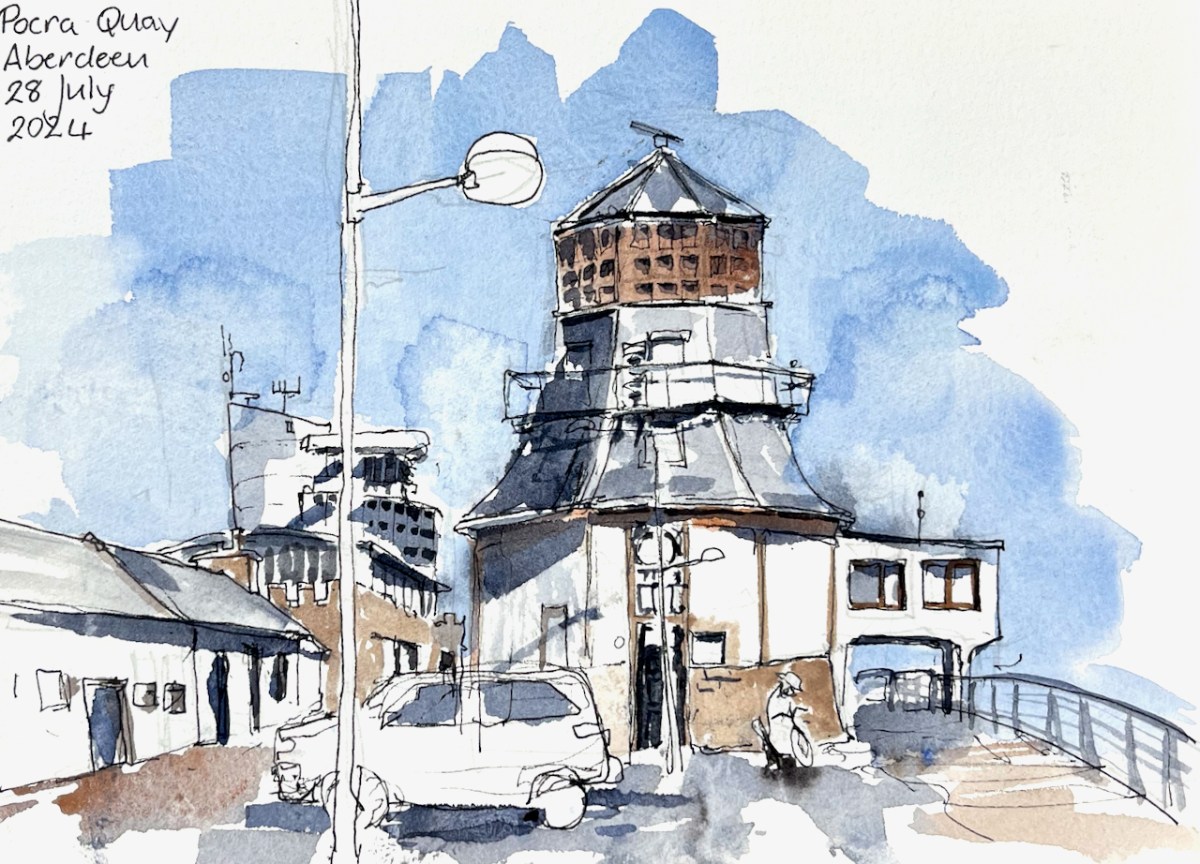
“[built] to guide vessels to port, this was originally carried out by the harbour pilots via loudhailer from a platform built into the roof of the original 2-storey structure, or by a system of wicker balls suspended from a pole rising from the platform.” [1]
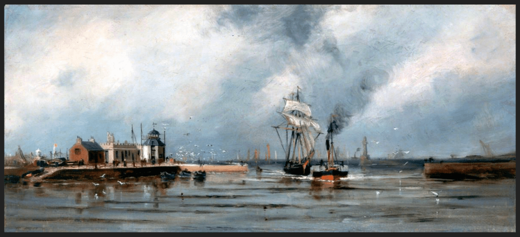
“Entrance to Aberdeen Harbour” by James Cassie (1819–1879) image copyright: Aberdeen Maritime Museum
“The control tower was added in 1966 and a radar system was introduced in 1974. The structure was further updated in 1986 at which time the Queen unveiled a plaque, situated to the right of the main entrance to the tower, commemorating ‘850 years of Harbour History’.” [1]
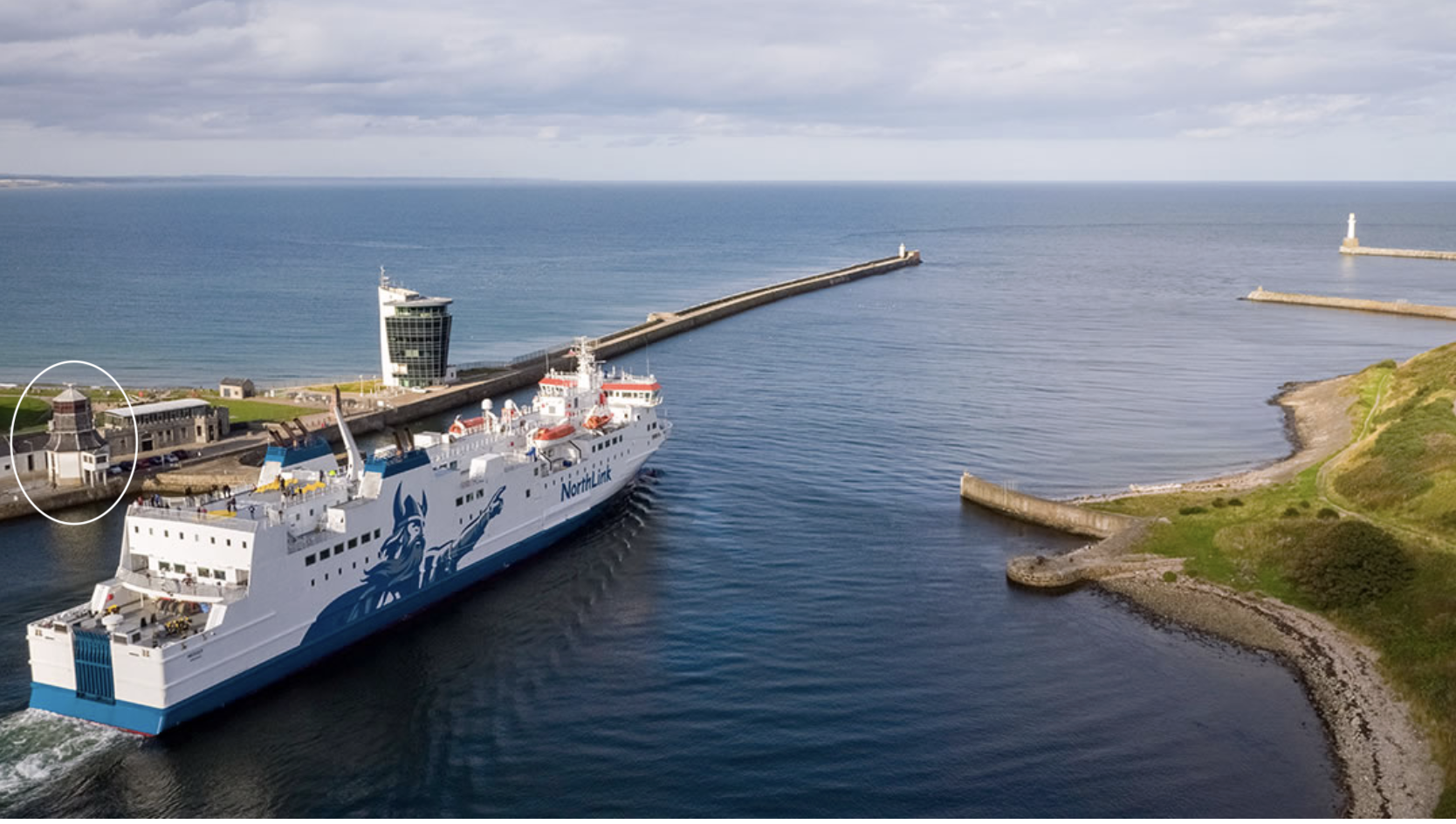
It was in use until the Marine Operations Centre opened in 2006 [4]. This is nearer the sea, just visible behind the lamp-post in my drawing. It handles about 25000 boat movements a year, which averages at 60 a day [2]. For comparison, Heathrow air traffic control centre handles abut 200000 aircraft movements a year or 500 a day [3]. The area managed by the Marine Control Centre extends 2.3 nautical miles around the headland to the South of the harbour [5]. So the Operations Centre handles not just boats going in and out, but boats moving around inside and outside the harbour as well.
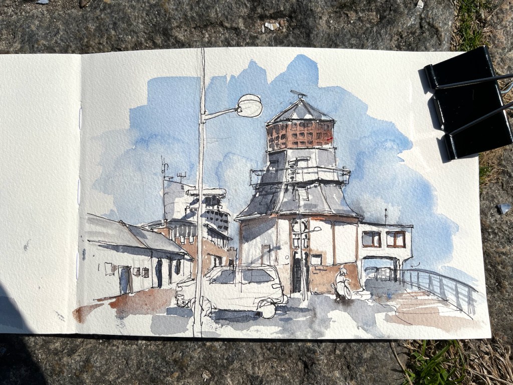
MV Hrossey leaving the port of Aberdeen, photo copyright southspear media, used with permission [6] The Roundhouse, circled, is on the left, and the Marine Operations Centre is above the centre of the ship. This is the Northlink ferry, sailing to the Northern Isles.
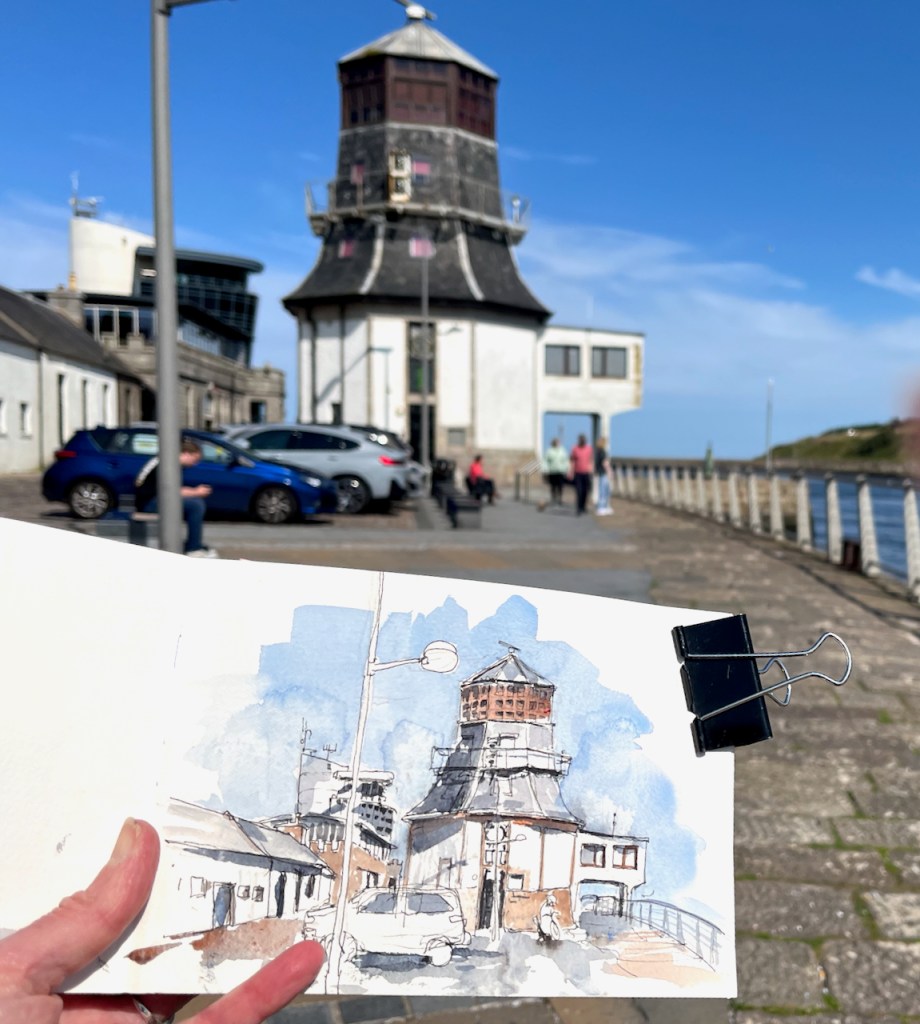
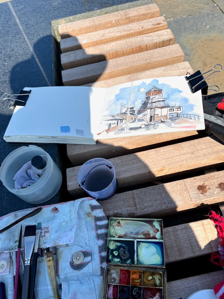
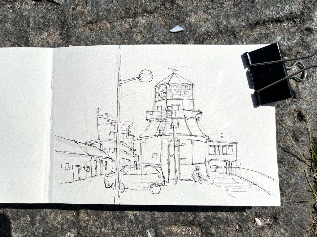
I sketched this on a stunning hot day, sitting on a bench by the quay.
The Roundhouse. The modern Marine Operations Centre is the tall white building behind and to the left. In front of it, and lower down behind the cars, is the restaurant “The Silver Darling”.
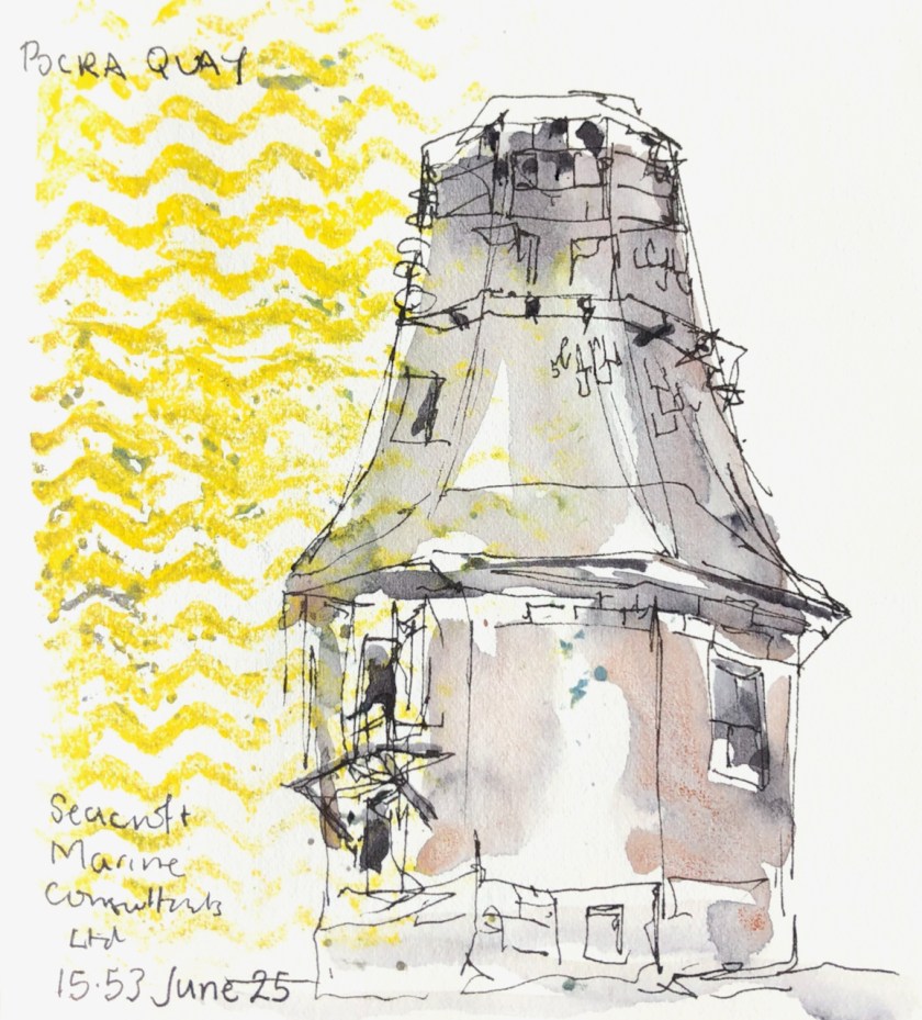
Three years ago, on a very different day, I made a much quicker sketch:
A quick sketch on a stormy rainy day, sketching from the shelter of a doorway. June 25th 2021.
[5] Port of Aberdeen Vessel Traffic Services extent: “All shipping movements within the Aberdeen VTS area (within 2.3nm from Girdleness) are controlled by Aberdeen VTS. Participation with VTS is mandatory, for further details please see ALRS Vol.6.” https://www.portofaberdeen.co.uk/port-information/marine
[6] Thank you to Nick McCaffrey of Southspear media for permission to use his amazing photograph of MV Hrossey leaving the port of Aberdeen.
Click a button below to share this post online, email it, or print it:
It was foggy, cold and wet outside. I made pigments.
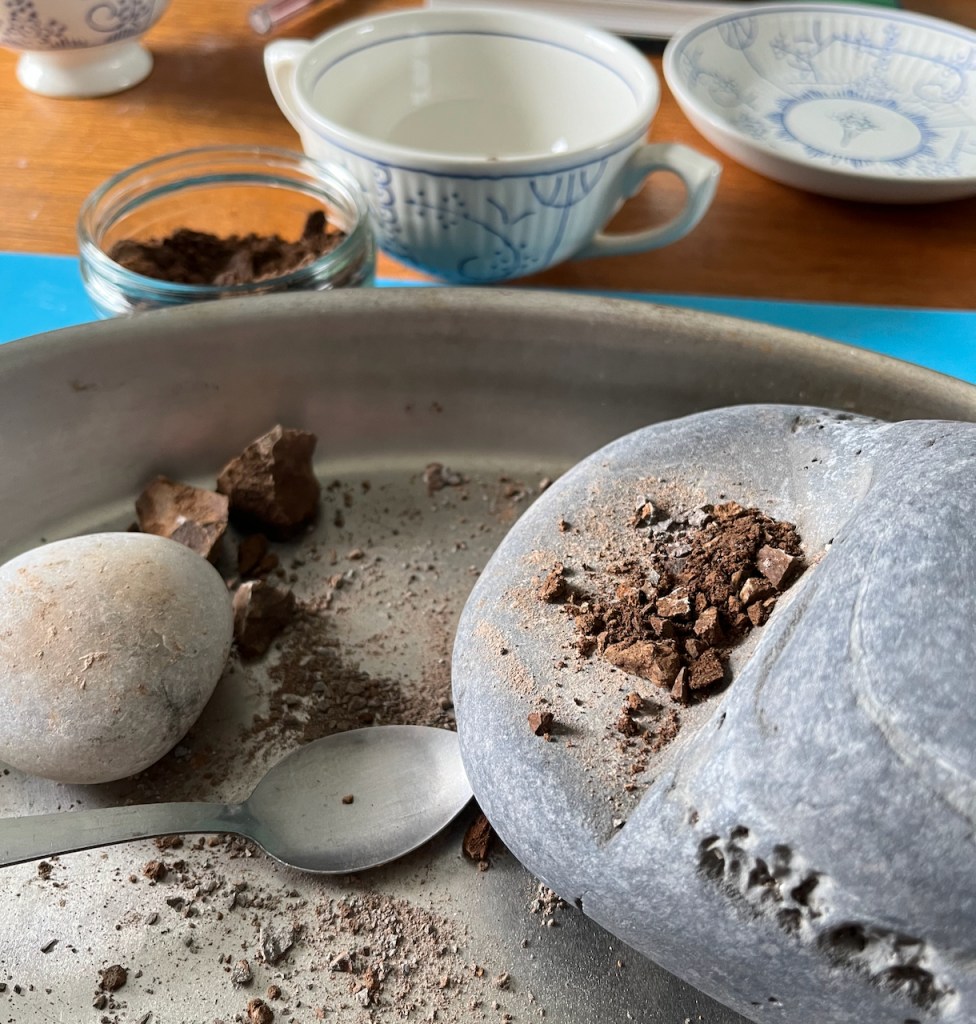
I collected earth from round about. I know from previous attempts that it works best if you have fine earth. So I went up the road in the rain and scooped up the fine silt running off a track. I dried it indoors, and then crushed it to what I hoped was a fine powder.
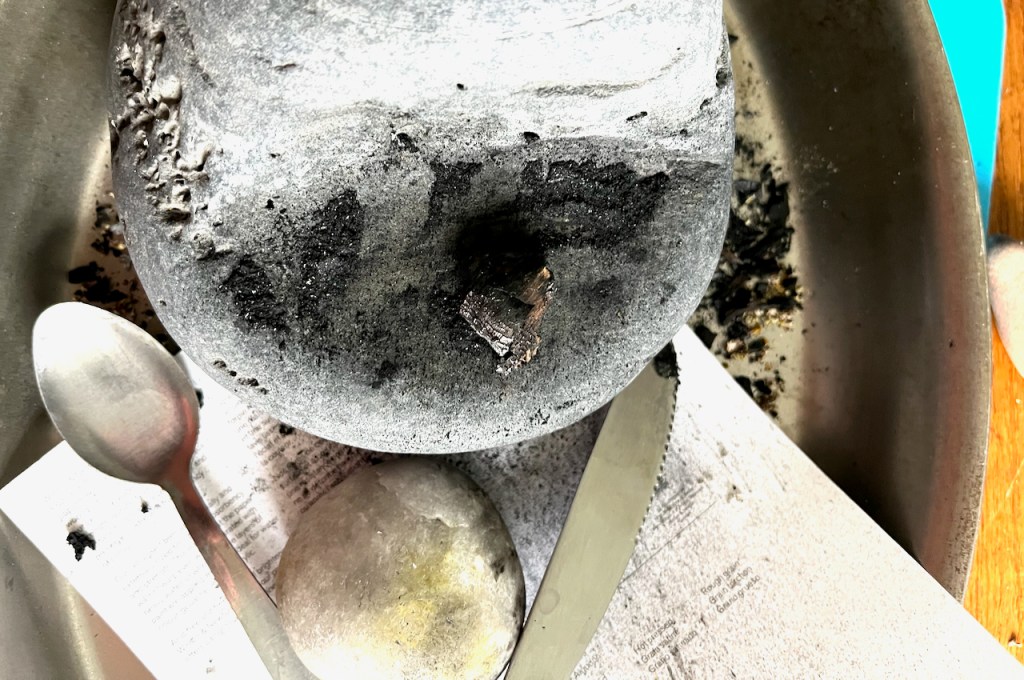
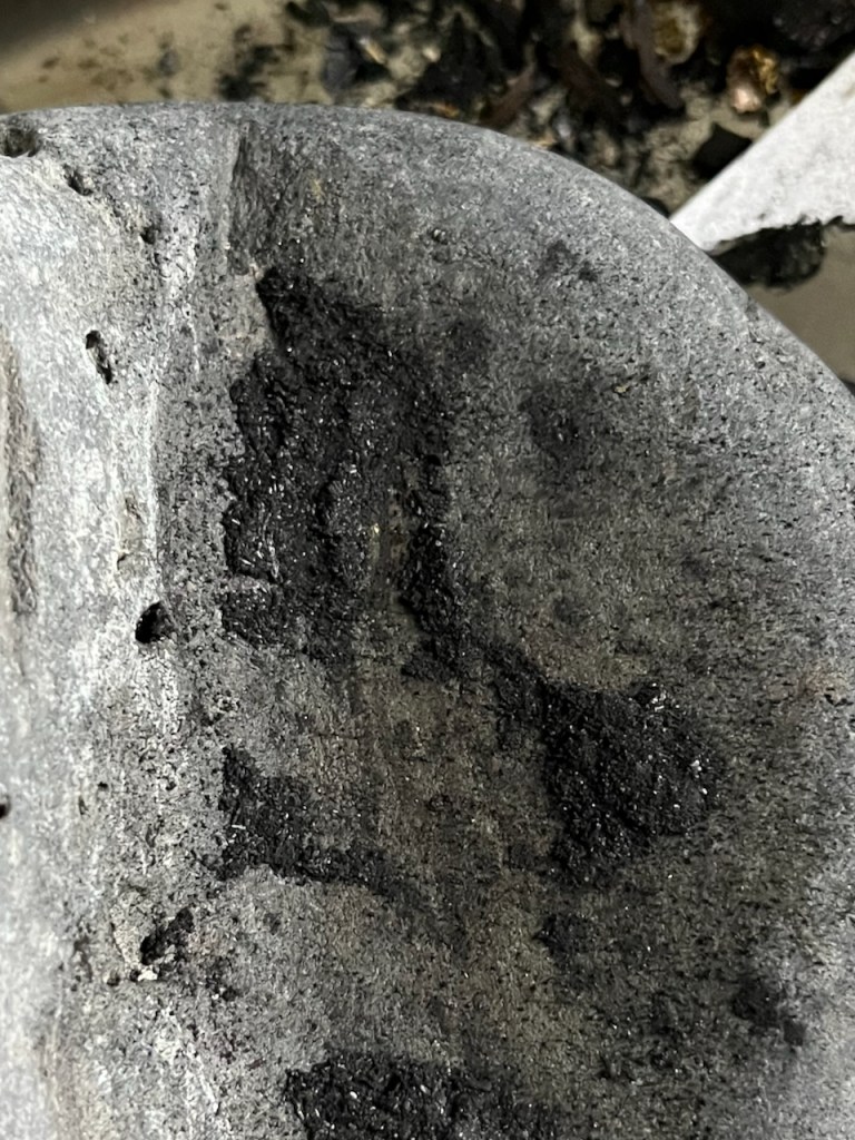
As you see I had an excellent beach stone for this purpose.
Then to grind it finer I had a pestle and mortar. This is a beautiful home-made item.
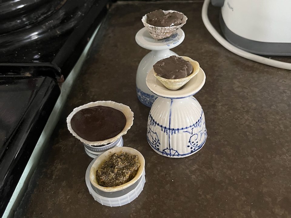
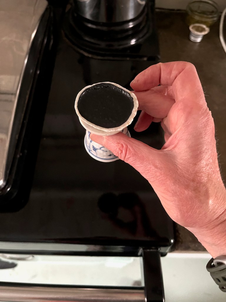
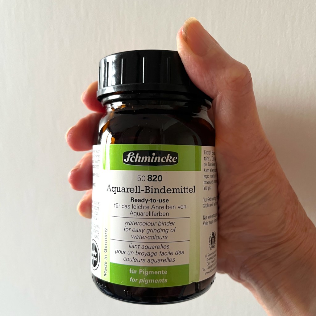
Now I have earth pigment. To make watercolour I add Schmincke Watercolour Binder in the ration of 2 parts binder to 1 part pigment. Mix and put in a limpet shell. It’s ready to use immediately as a paste, or it dries and can be rewetted like normal pan watercolours. Here are the paints drying:
Pigment mixes in limpet shells, drying on eggs cups (to keep them level).
Above you see paints made of earth from different places. At the front is a paint made from yellow lichen. The lichen was bright yellow on the stone wall. I couldn’t find a way to separate out the bright yellow surface from the grey underneath, so the pigment is a grey/yellow mix.
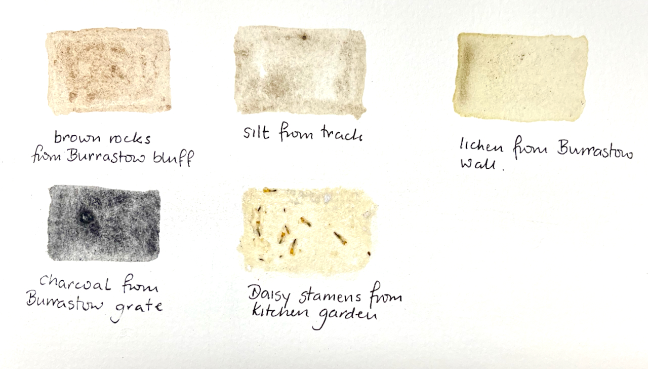
Here is a selection of pigment experiments, to show how they look when painted:
Making the charcoal pigment was not so effective as I thought it would be. I found a small chunk of black charcoal from the grate and proceeded to crush it. This produced skittering fragments and airborne dust which settled everywhere. It did not produce a fine powder in my pestle and mortar. It produced hard, flaky, bits. As you see above, the paint it produced was granular and not very black.
Trying to grind the charcoalGround charcoal: bitsCharcoal paint
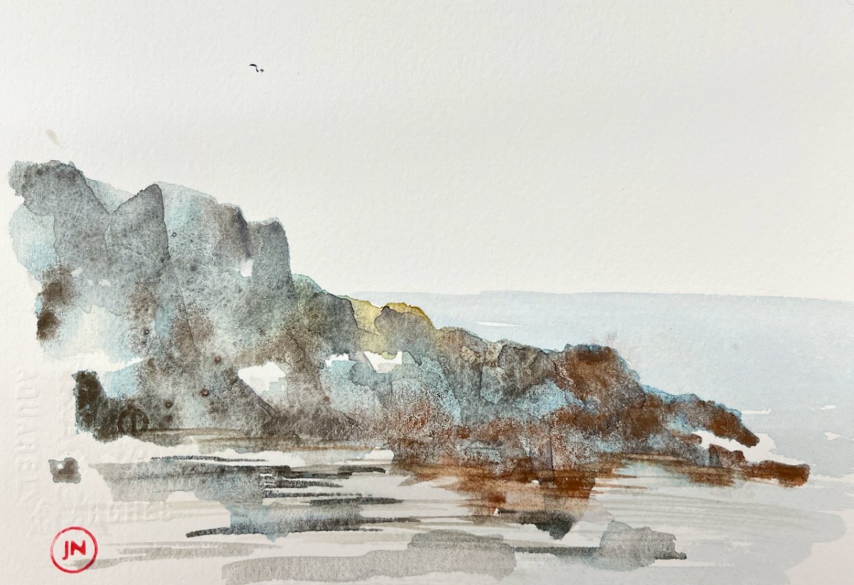
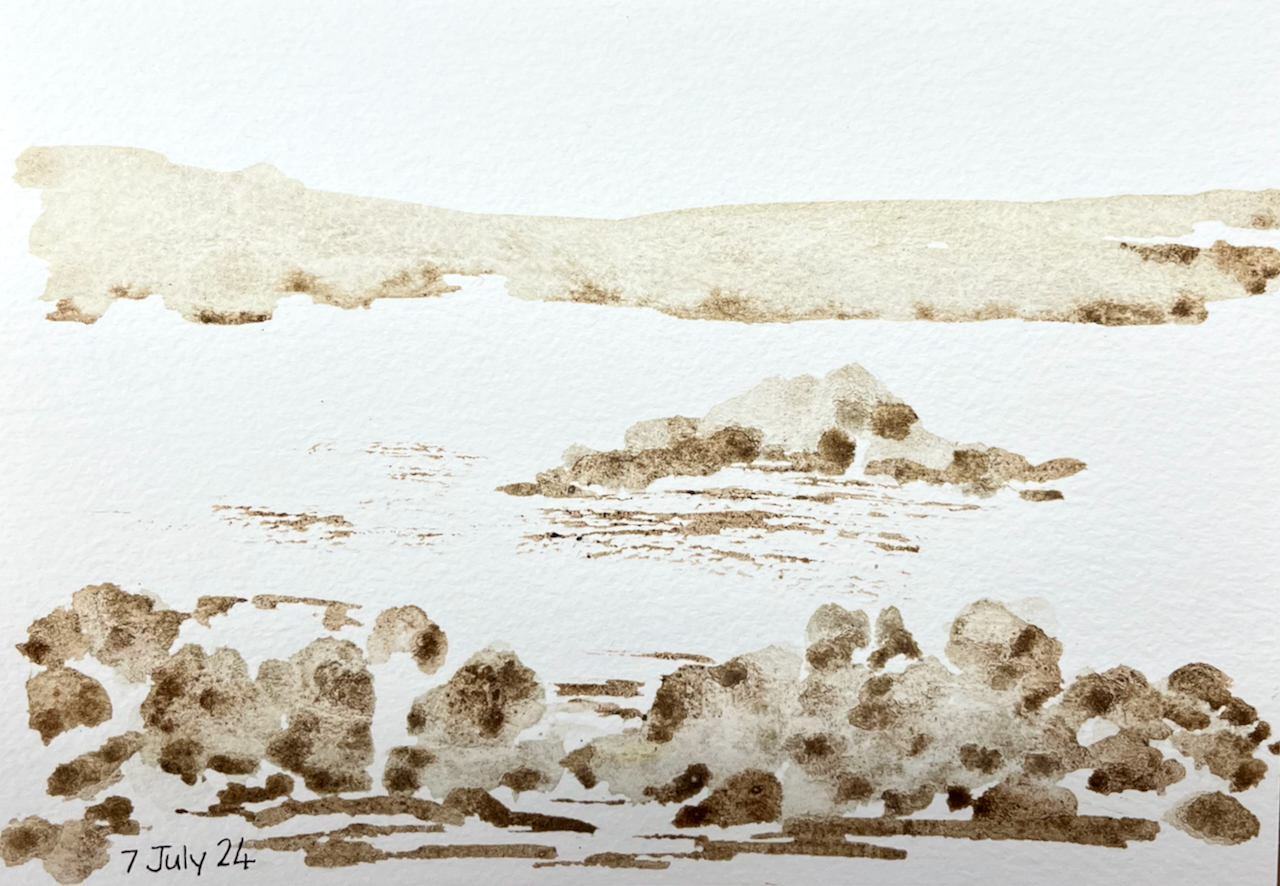
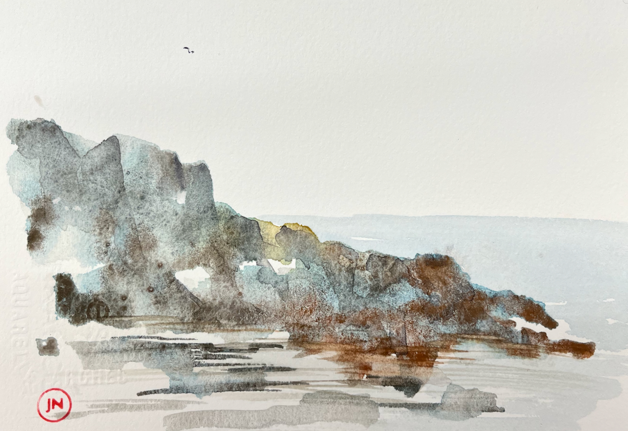
Here is a picture painted entirely with home-made pigments:
Coastal scene: painted with home-made pigments.
Here is a picture painted with home-made pigments and shop-bought watercolours:
“Promontory”. Painted with home-made watercolours with shop-bought watercolour (blue).
This is the binder I used:
Click a button below to share this post online, email it, or print it: