"Stoop and discover
the great in the small"
Here are beach finds.


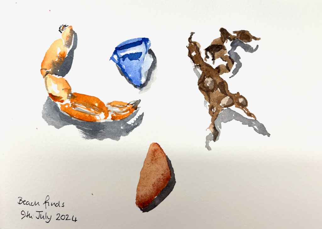

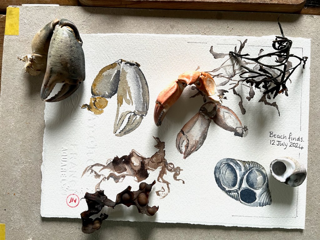


watercolour, pen and wash
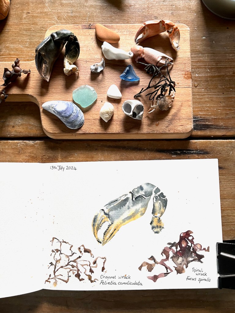
"Stoop and discover
the great in the small"
Here are beach finds.
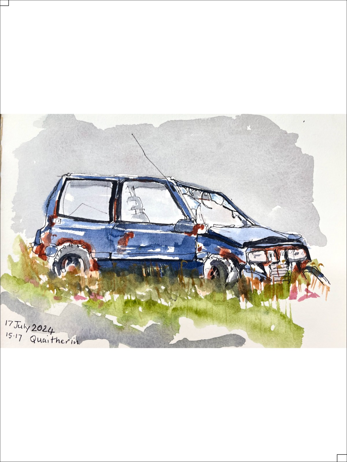
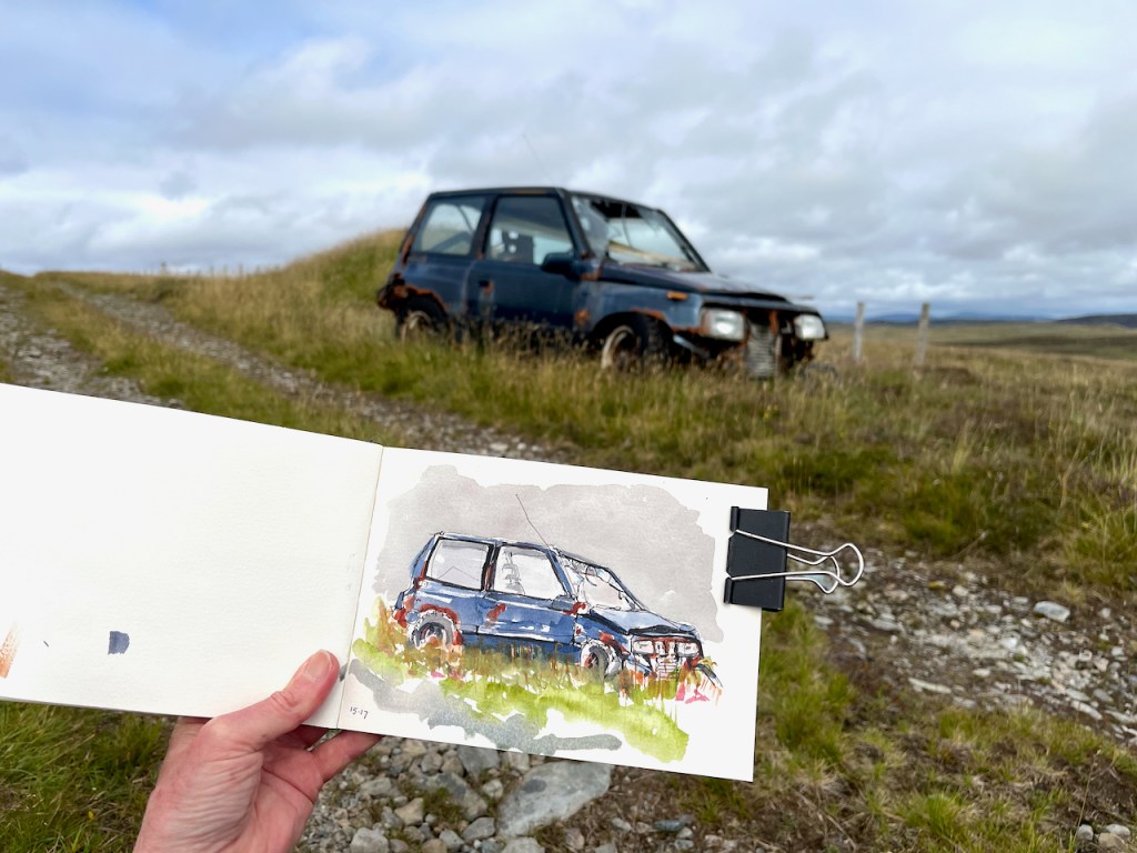
I have posted before about the wrecked cars that I sometimes encounter on my hikes around the Shetland landscape.
This year I encountered another one.
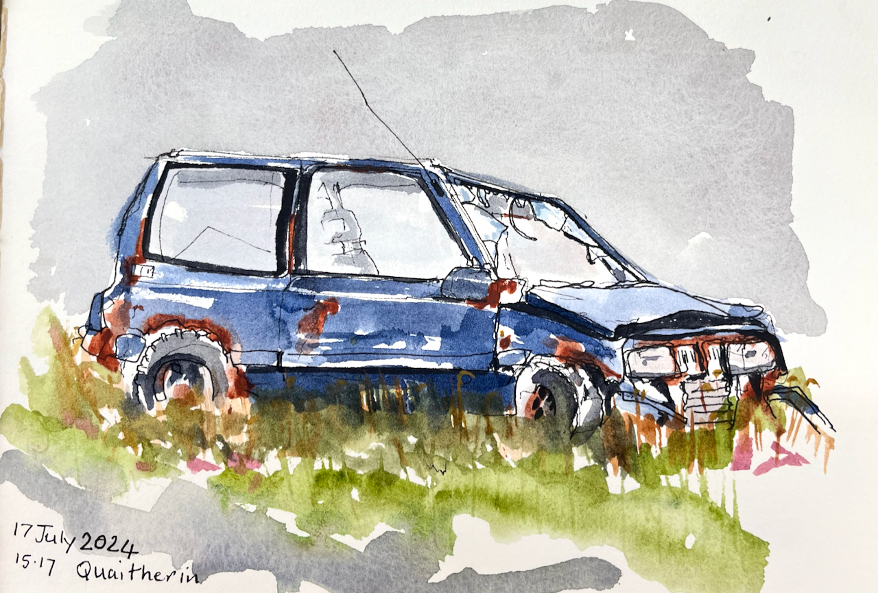
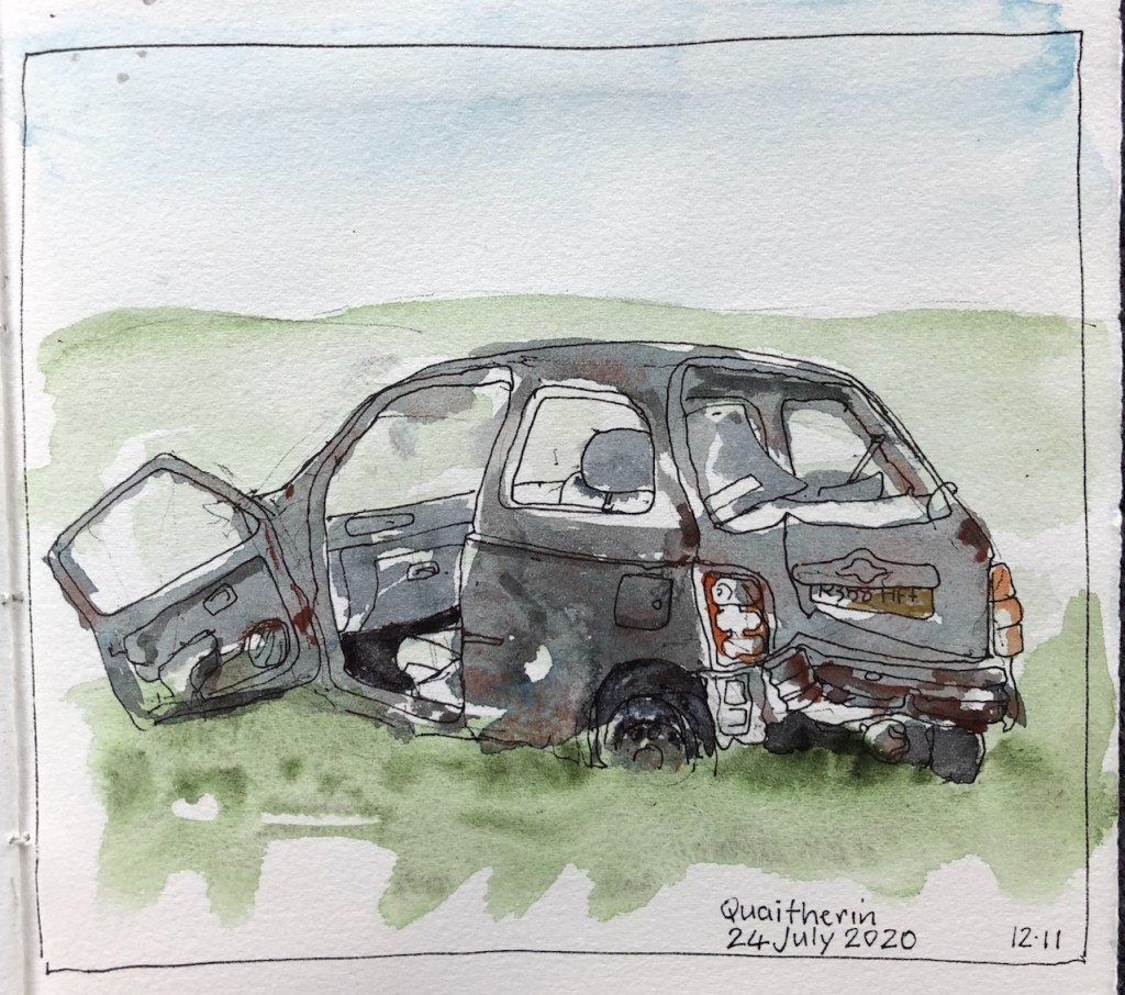
Here are the others I have sketched:
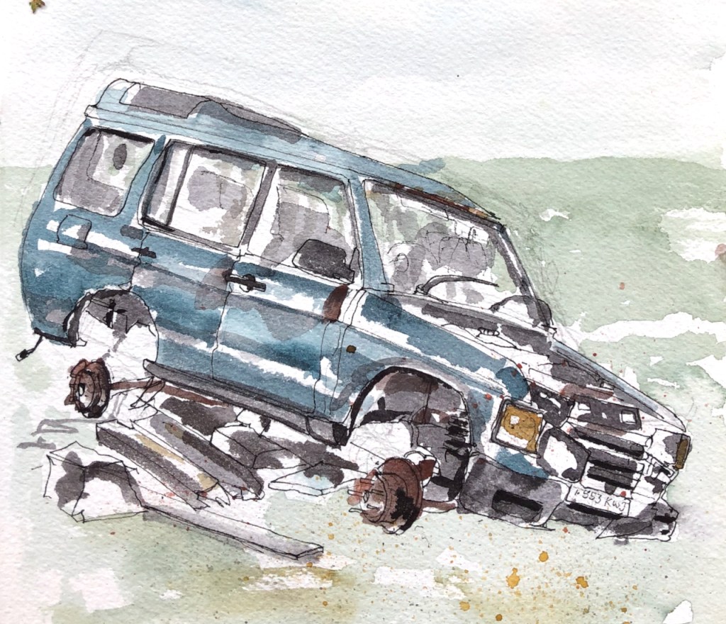
I don’t want to give the impression that Shetland is littered with abandoned cars. It’s not. But there are certain hidden areas I’ve discovered which are car graveyards, and I now go there deliberately. I find something vaguely poetic, evocative, about an abandoned car in a wide pristine landscape. It’s as though the landscape frames it: puts a picture frame around it and says look! This twisted metal is art.
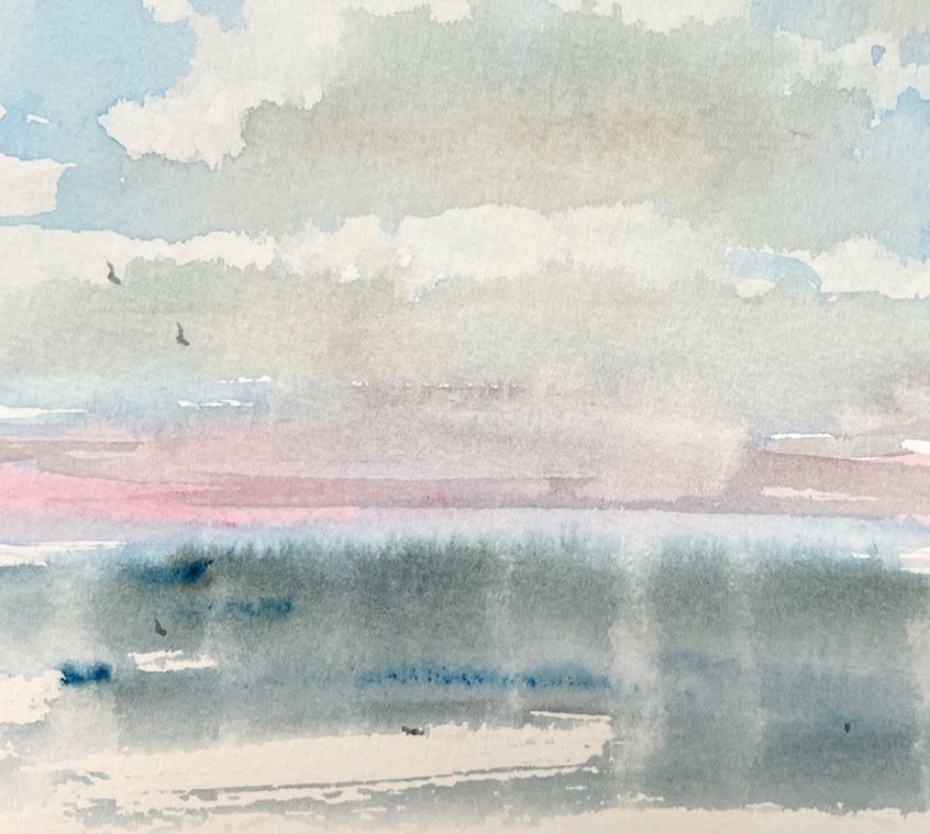
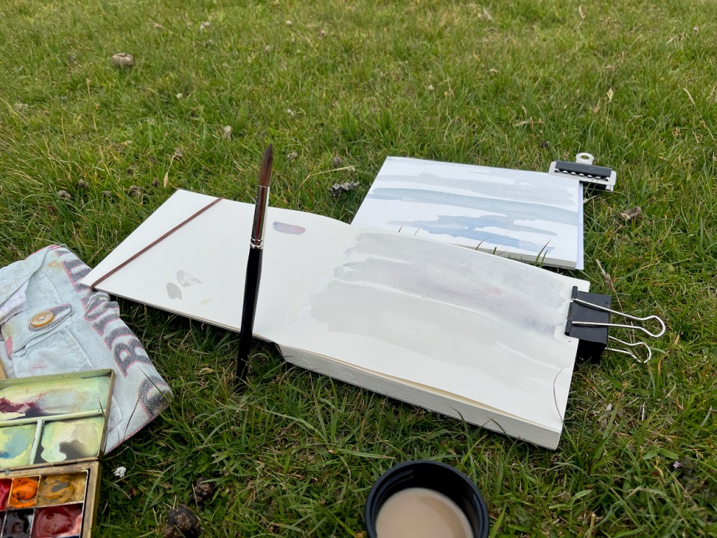
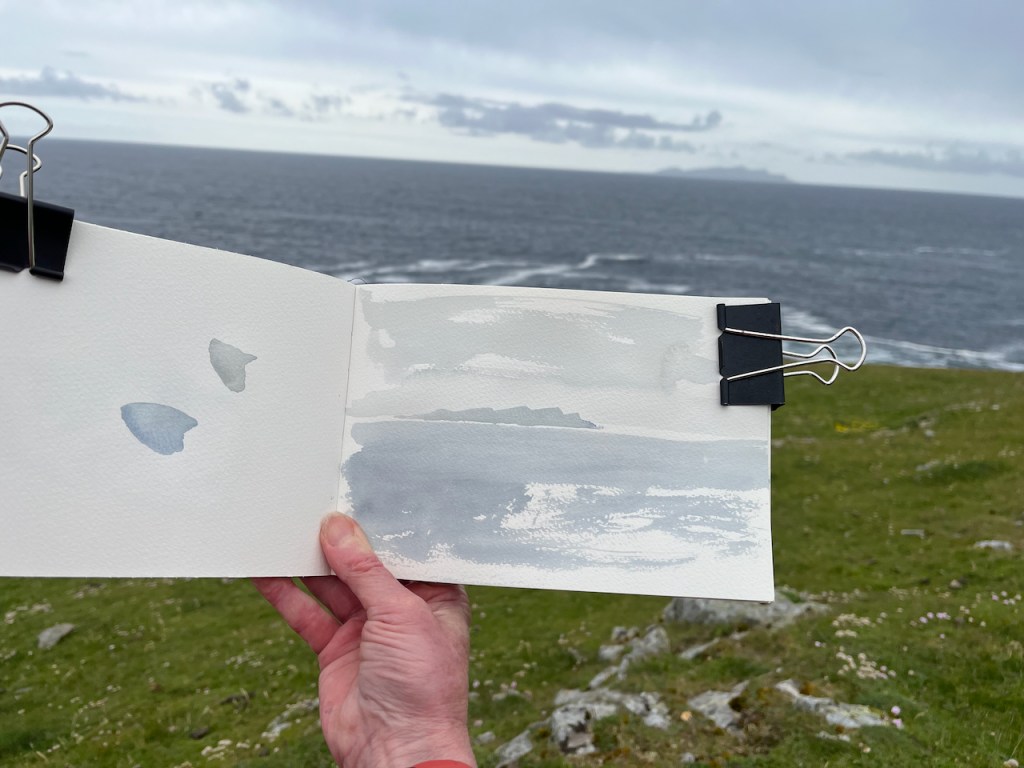
It was foggy and cold. I practised drawing clouds.
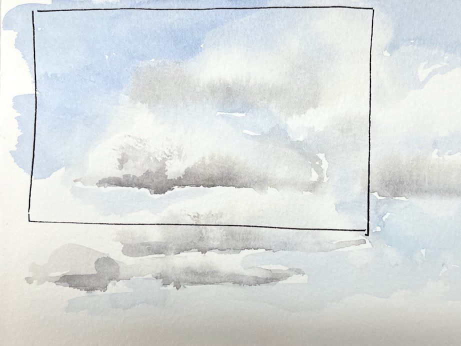
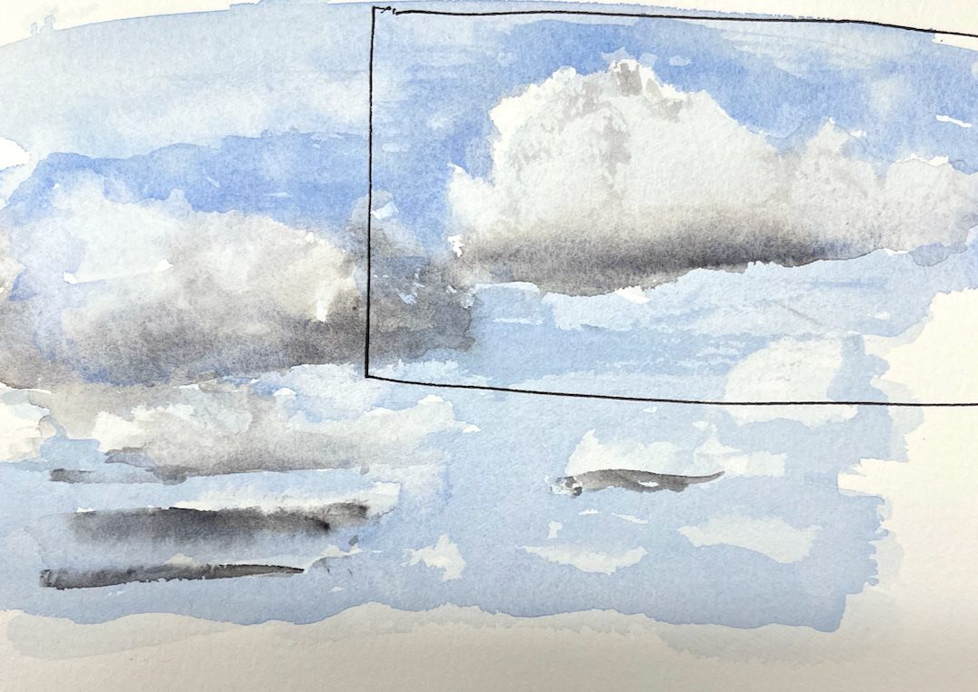
Islands in clouds

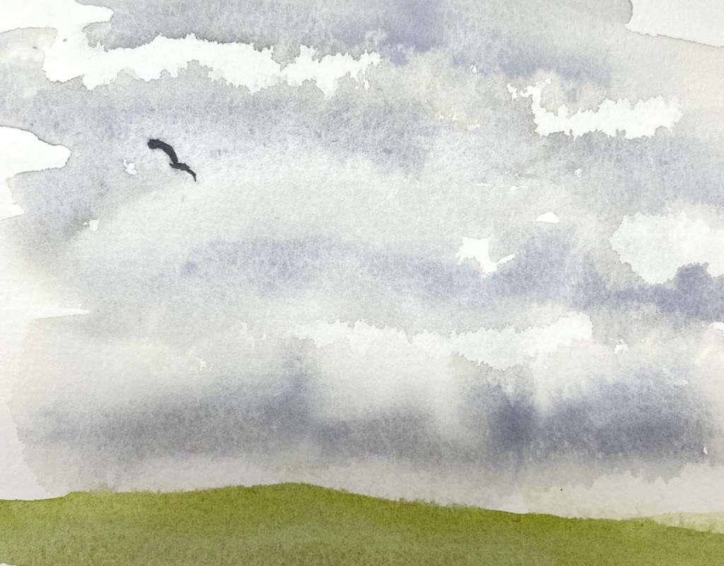
I went for a walk.

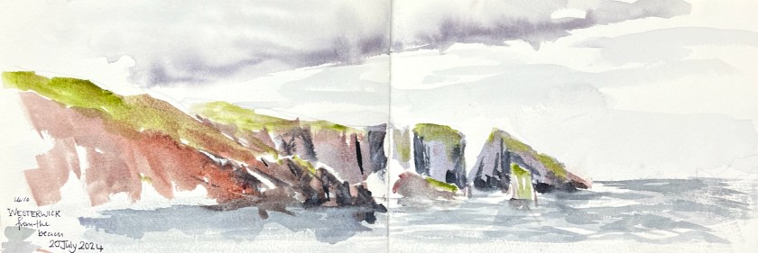
In the distance on the left is the island of Vaila. Here is Vaila in the fog.
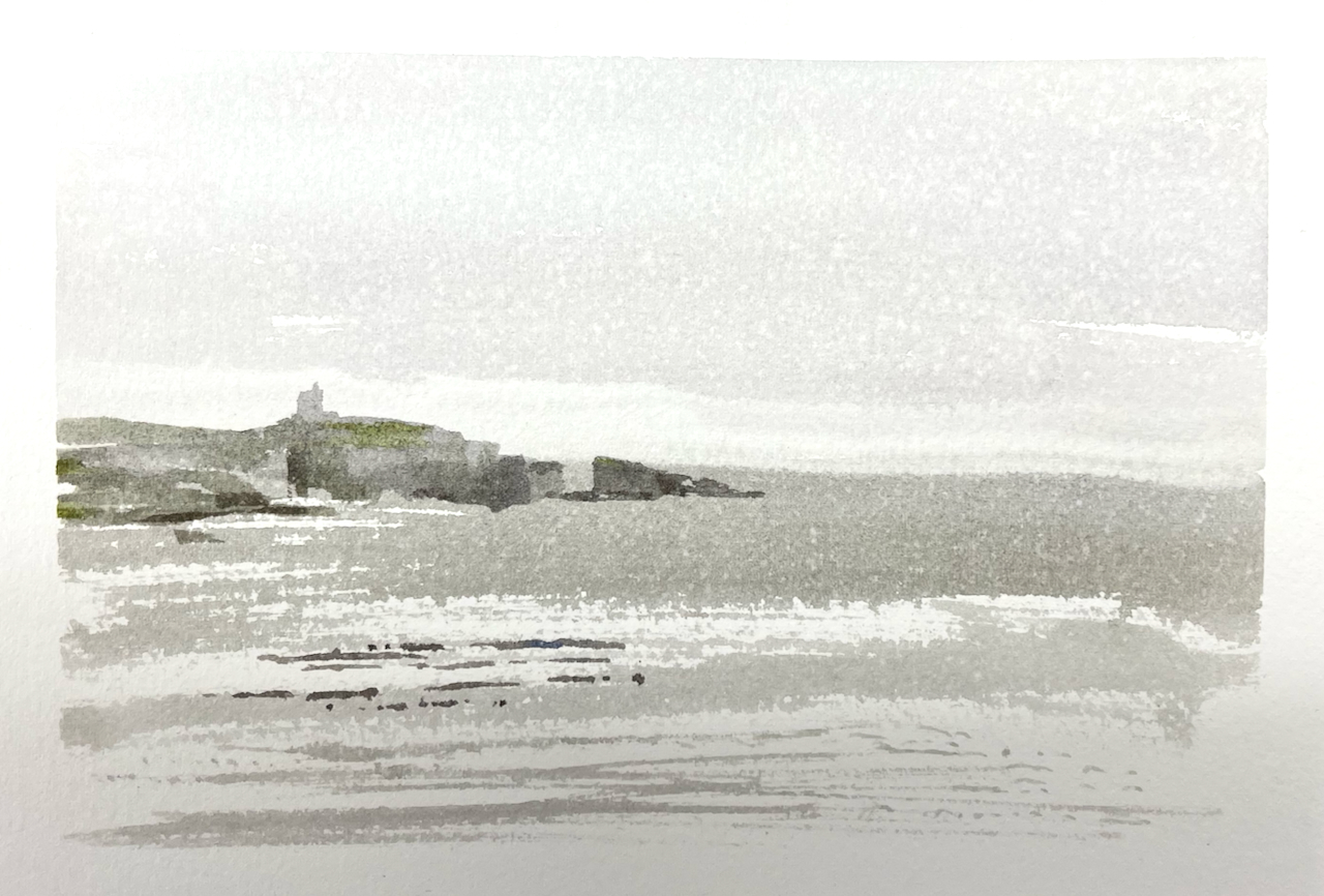
The speckled effect is the result of fine rain on watercolour.
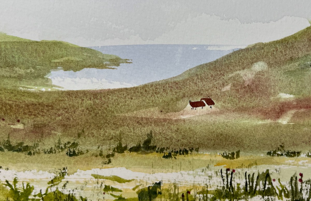
When the sun shines in Shetland, it is magical. Part of the magic is that you know it is ephemeral. When the sun shines in Shetland, you have to get out there, right now. The clouds come quickly. But while the sun shines, enjoy it.


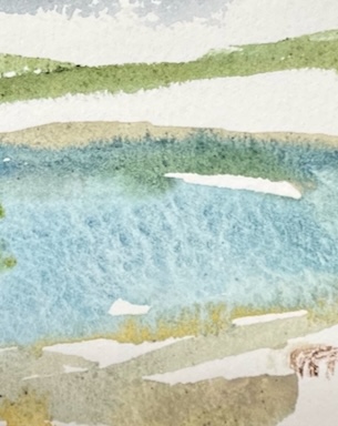
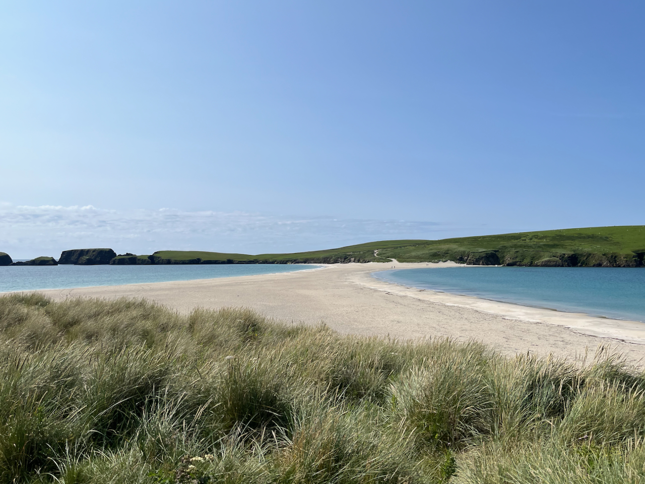
The sun shone on a visit to Hamnavoe. There is a nearby beach called “Minn Beach”. The water is clear and the sand is white.
The light was dazzling. The water was cold: just over 10 degrees C. Swimming, I could see the grains of sand on the sea bed, perfectly clearly. As I swam on the surface of the water, it was as if I was flying over the sand. Except for the cold.
Minn Beach is on West Burra. See map below.
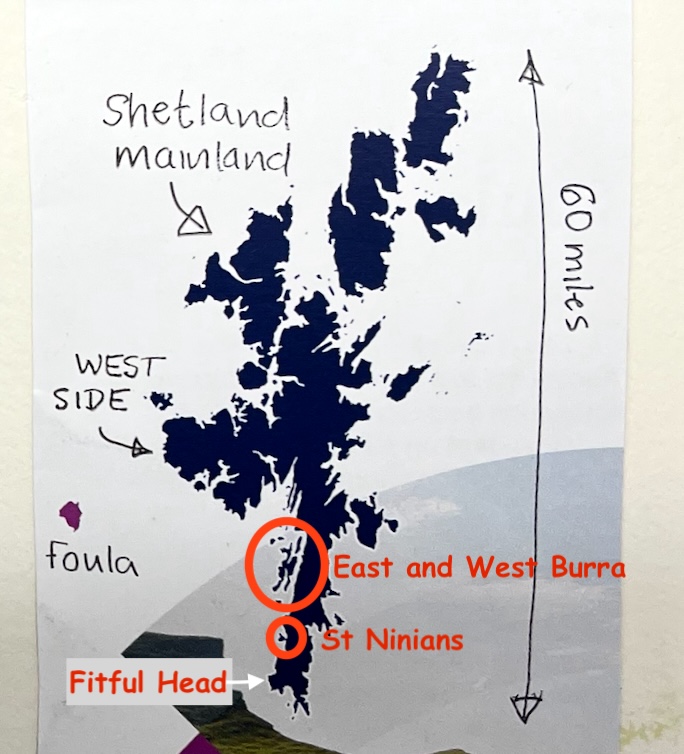
Further south is St Ninians, an island at the end of a long sand tombolo (sand bridge).
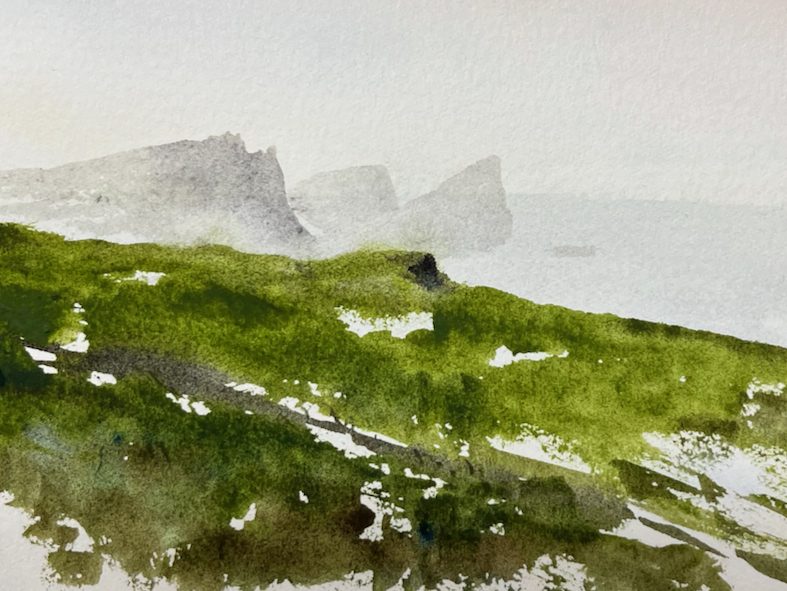
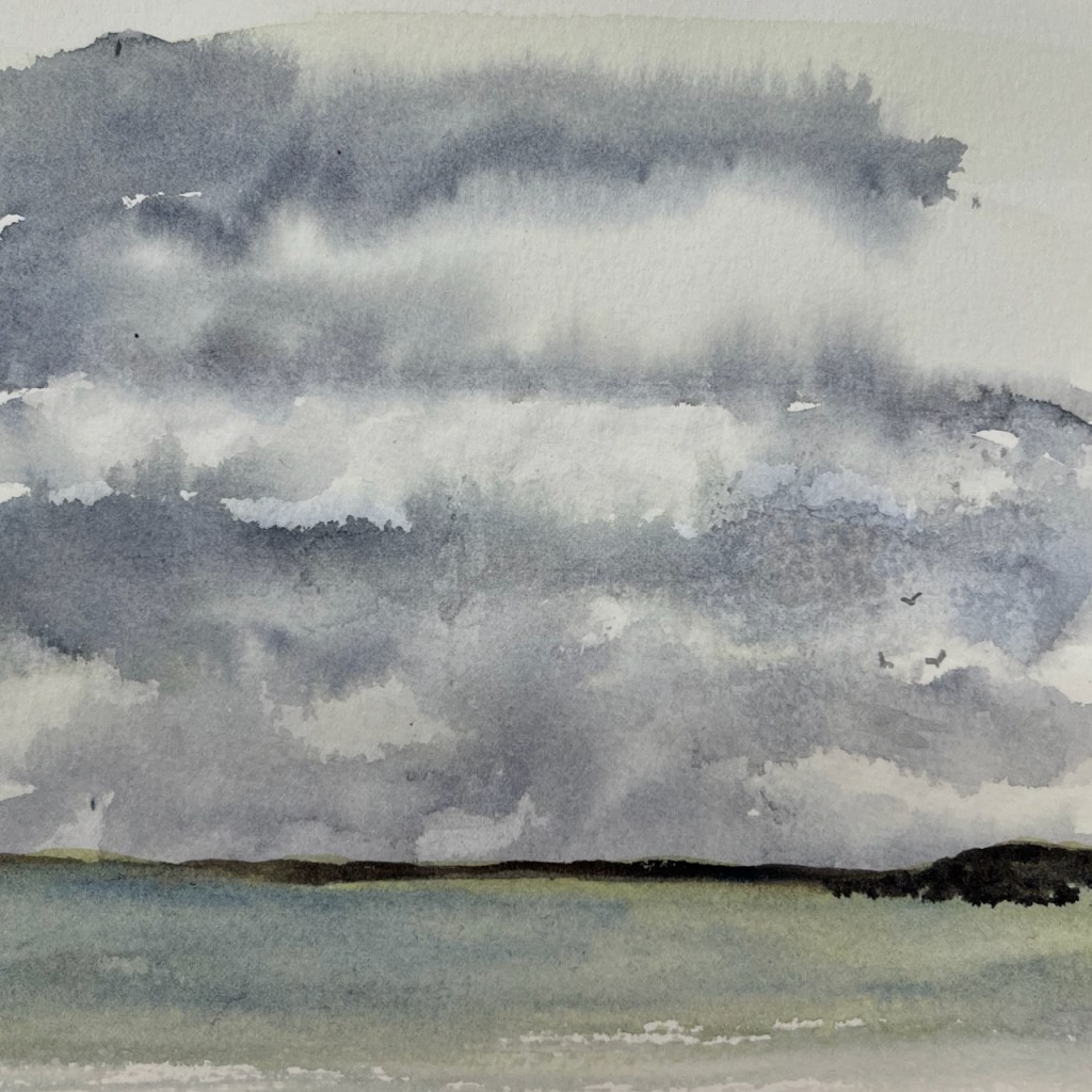
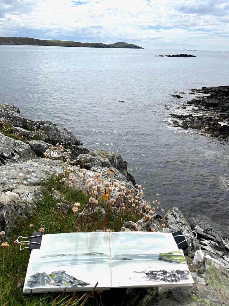
From the island, sheltering from the wind in the lee of a wall, I sketched Fitful Head.
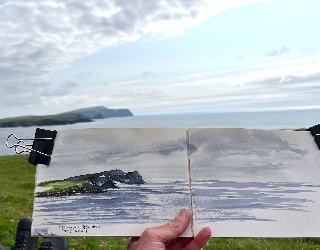
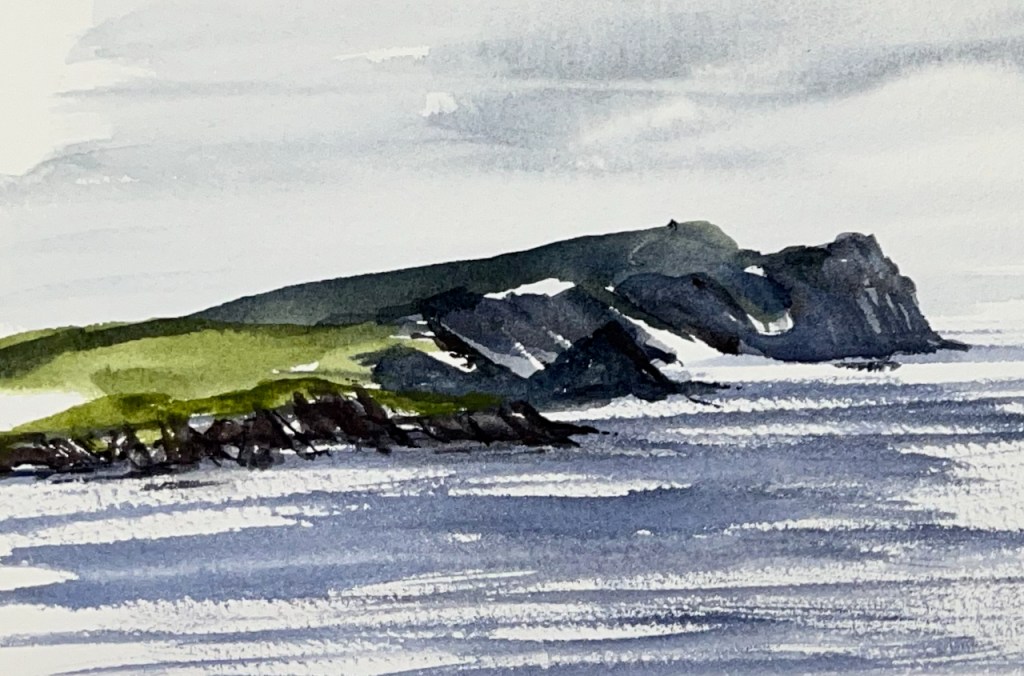
Even though the wind shifts the pages and disrupts my lines, even when the rain speckles my colours and blurs the clean edges I drew, even though the view changes by the minute and I find it impossible to catch the glory of the light and the magnificent shape of the land, even though my sketchbook is small and my skills are limited, despite all those things, I think it’s always worth having a go at drawing. The pictures I draw remind me of being there. Of the wind, the rain, the changing clouds, the glorious light and the vast, curving headland.
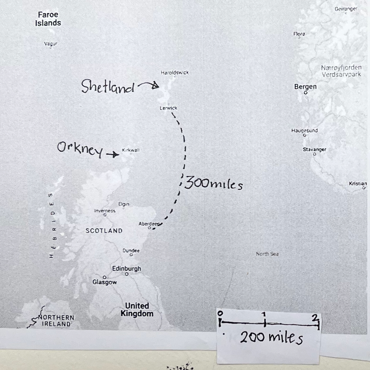
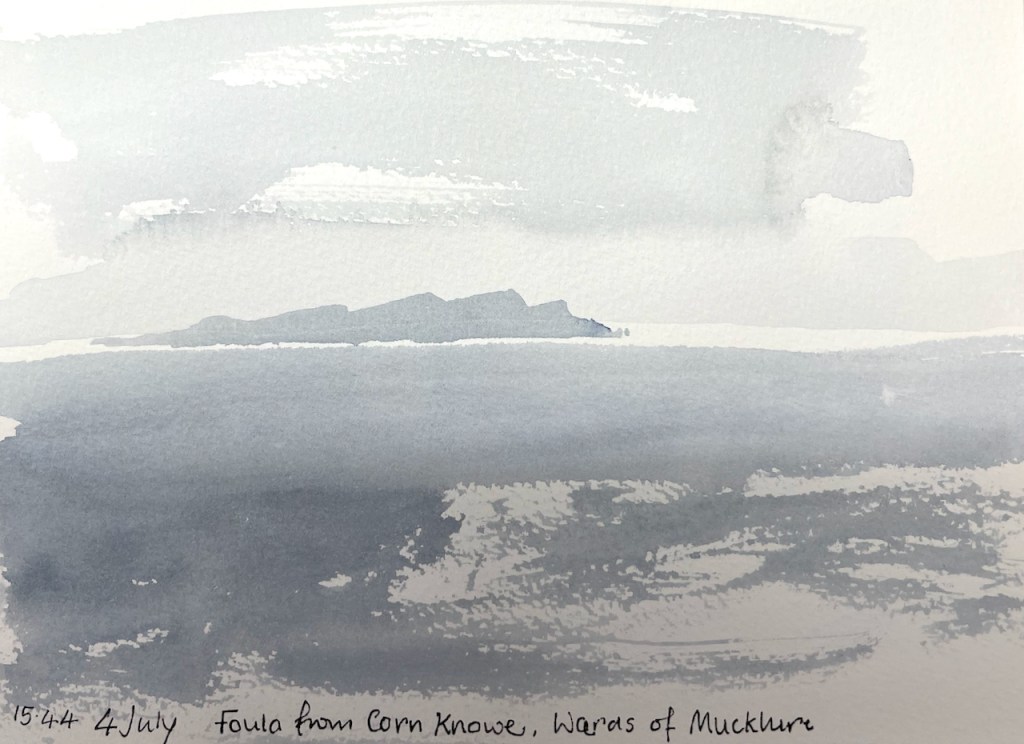
Foula is a small island 20 miles off the west coast of mainland Shetland. Shetland is a group of islands about 200 miles north of Scotland.
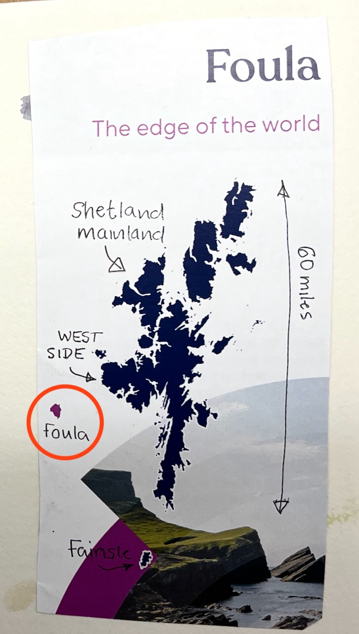
I had seen Foula, from a distance, on previous visits to Shetland. It floats on the horizon, mysterious.
So I had to visit. What is it like there?
Here is a Foula scene:
I sketched this sitting on one of the stones, on a bit of flat and marshy land towards the south of the island. The road is in front of me, at the foot of those hills.
I had to sketch this in a bit of a rush, because, as I rapidly discovered, this particular area is the province of the Skua. There are Great Skua and Artic Skua: large birds, who do not like sketchers sitting on stones in their neighbourhood. They make their irritation known by aggressive fly-pasts. I could hear the wind in their feathers: it sounded like a chain saw. So I quickly took the hint and made for the road. Locals later told me I should “carry a stick above my head”, to distract the skua. That’s all very well, but finding a stick on Foula is about as likely as finding a branch of Pret. There are no trees atall on this part of the island, so no handy lengths of wood.
Other inhabitants of Foula were more welcoming, including the friendly people. The sheep are unafraid, and came towards me as I walked. The horses too seemed pleased to see me. I met the person who is one of the breeders of these horses on the island. “Pat them, talk to them, but don’t feed them!” she instructed me. Feeding them in the wrong order disrupts their established hierarchy and causes fights, she explained. “And,” she added, with emphasis, “make sure you close the gate!!”. There followed stories of visitors leaving gates open, and the subsequent escapades of the stallion, who visited mares he was not supposed to visit….
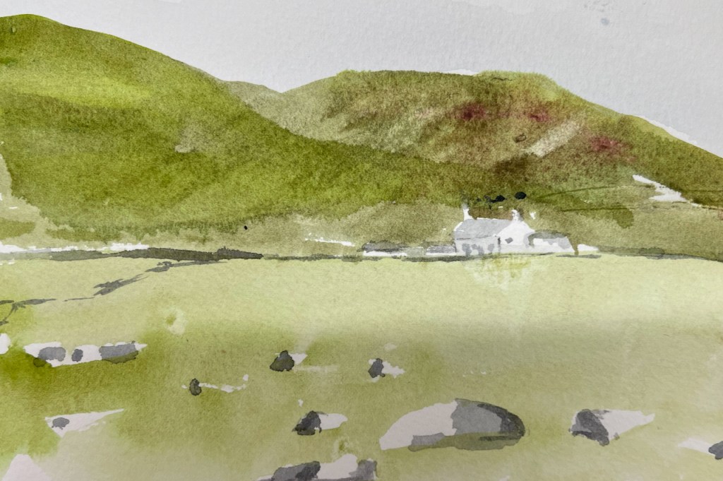
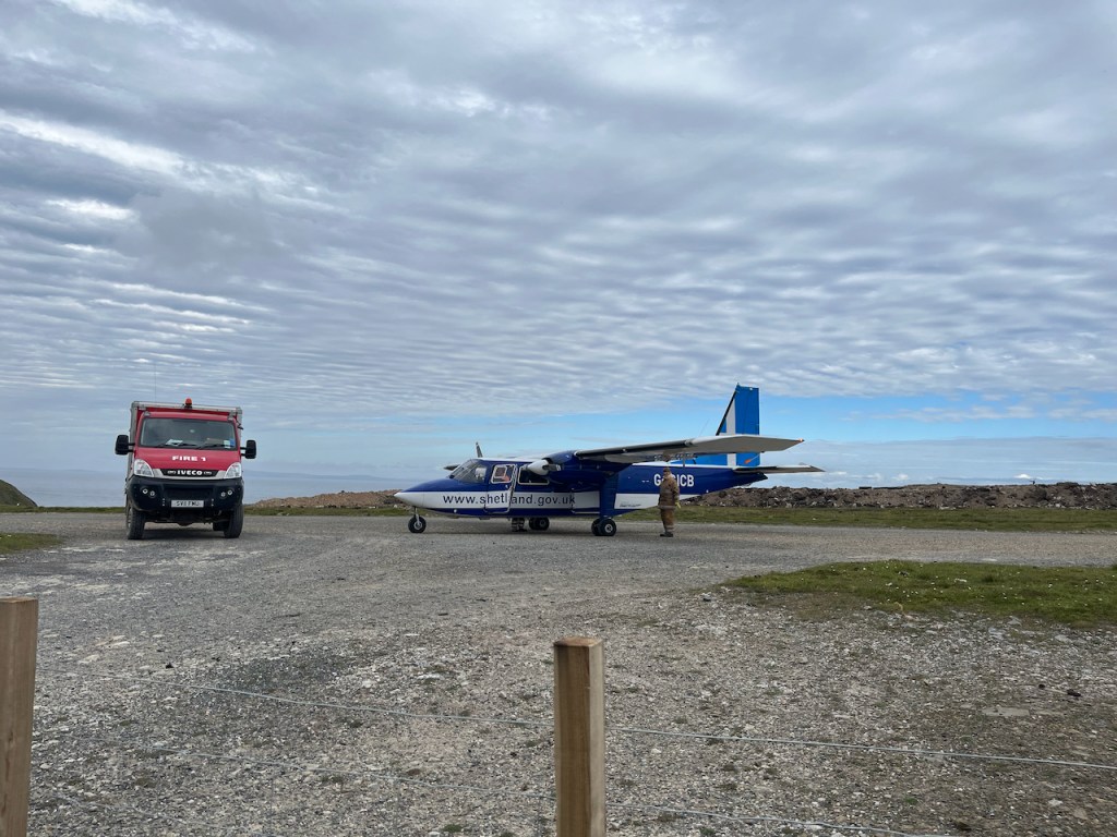
Foula is an industrious place, I discovered. As well as horse breeding, and sheep breeding, there is spinning to produce special Foula Wool, peat cutting, and a lot of horticulture. Also there is a school, a lighthouse, a ferry and an airstrip. The air strip needs a fire crew, as well as pilots. The school has a teacher. There are wind turbines and a very effective 5G mobile signal mast, with big dishes directed at mainland Shetland. This is a lot of activity for a place of only 35 inhabitants, especially as six of those inhabitants are primary school children.
Horticulture takes place in polytunnels and inside abandoned cars. As on mainland Shetland, vegetables and flowers will grow, so long as you can shelter them from the wind. I was given local raspberries from a polytunnel at the school.

It was rather foggy when I visited, so I opted for lowland routes and did not climb the formidable mountains shown in the picture above. Had I done so, I would have seen the famous 1000ft sea cliff. But I was wary. I did not want to stumble across the famous cliff in the fog.
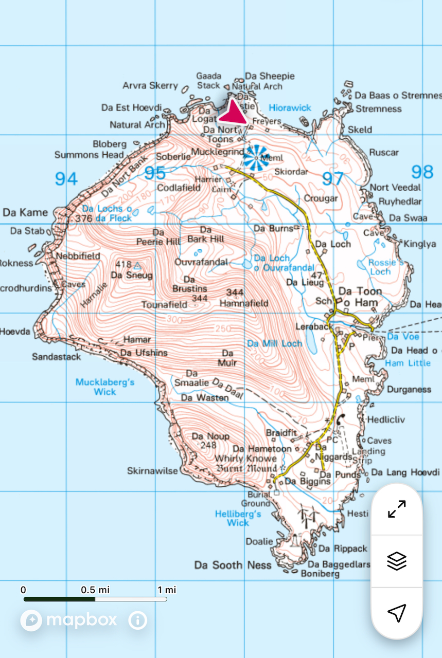
I was staying at “Ristie self-catering”, in the North of the island. Here is the scenery round there.

The edge of the world.
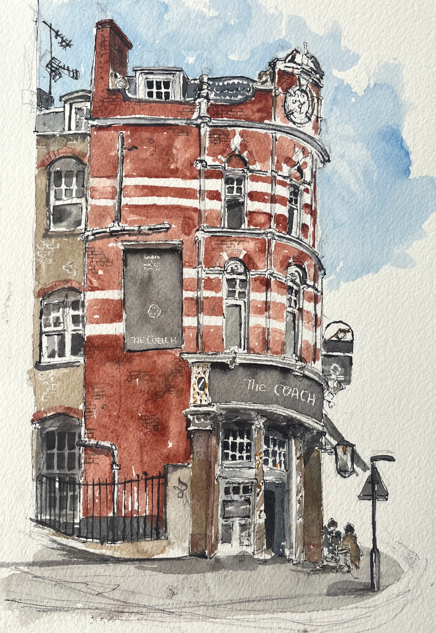
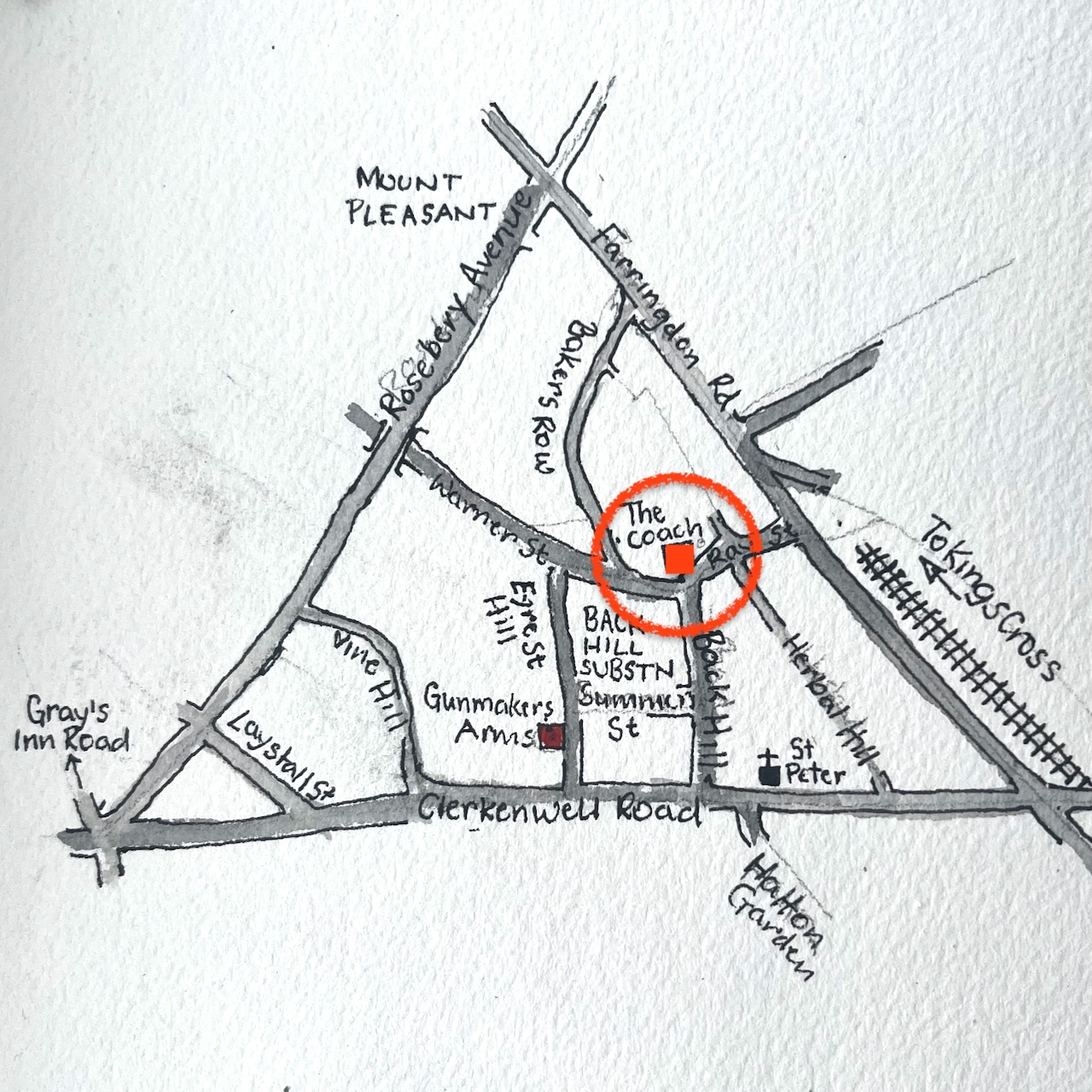
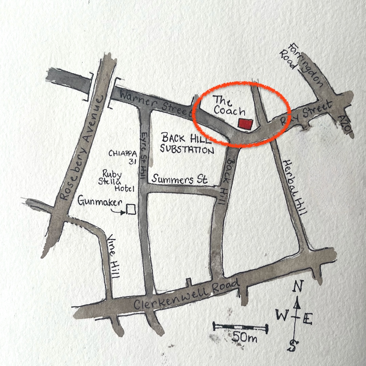
Here is “The Coach” on Ray Street in Clerkenwell.
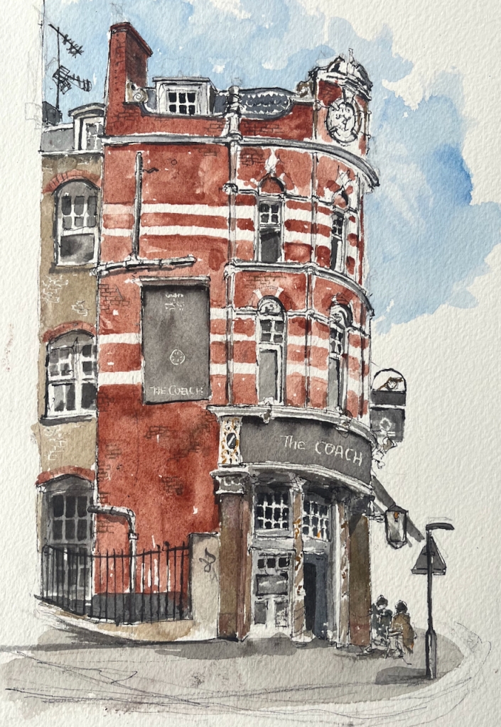
I sketched this after I had sketched “Gunmakers” in nearby Eyre Street Hill. Above the pub sign is a model, just visible on the right of my drawing.
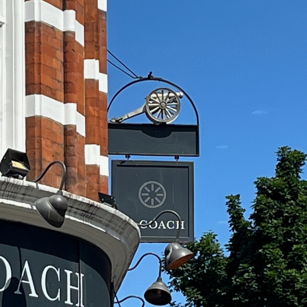
The model is a gun carriage. I wondered what the connection was to The Coach, and if there was any connection to Gunmakers on Eyre Street Hill. But no, it is the symbol of The Cannon Brewery. This brewery was founded 1720, in nearby St John Street. It was acquired by Taylor Walker in 1930. I have this information from http://breweryhistory.com. So that explains the cannon.
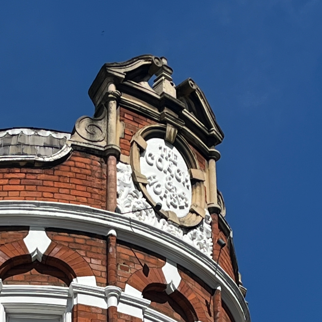
At the top of the pub, the medallion names the pub as “The Coach and Horses” in white relief work.
The pub website says: “The Coach was established in 1790, and has been at the heart of the lively Clerkenwell community for generations.”
British History Online describes a pub called The Cock Inn, which was part of a sale in 1695:
At the time of the sale [1695], the land was mostly taken up by two fields of pasture: Gardiner’s Field to the north and the larger Sir John Oldcastle’s Field to the south. There was a cluster of buildings and a large rubbish dump or laystall in the south-eastern corner, in the area of Hockley-in-the-Hole. Chief of these buildings was the Cock inn, the forerunner of the present-day Coach and Horses in Ray Street.
https://www.british-history.ac.uk/survey-london/vol47/pp22-51
The current building dates from 1897 according to this source:
All the eighteenth-century public houses in the area have been rebuilt or have disappeared entirely. The Apple Tree in Mount Pleasant was rebuilt in the 1870s, and the Coach and Horses in Ray Street in 1897
https://www.british-history.ac.uk/survey-london/vol47/pp22-51
So it looks as though the pub was there already in 1695 as the Cock Inn, was established as The Coach and Horses in 1790 (according to the pub website) and rebuilt in 1897. It was renamed The Coach in 2018.
Having closed on 31st July 2015, this pub reopened on 16th January 2018 as the Coach with its Taylor Walker/Cannon Brewery sign frame retained.
https://londonwiki.co.uk/LondonPubs/Clerkenwell/CoachHorses.shtml
People sometimes ask me how I determine the viewpoint in my sketches. Often, as here, it is determined by practical rather than artistic considerations. I need somewhere to sketch, out of the way, not in the road, and with a clear view. I don’t carry a seat, though sometimes I wish that I did. But here, like a miracle, a seat presented itself.
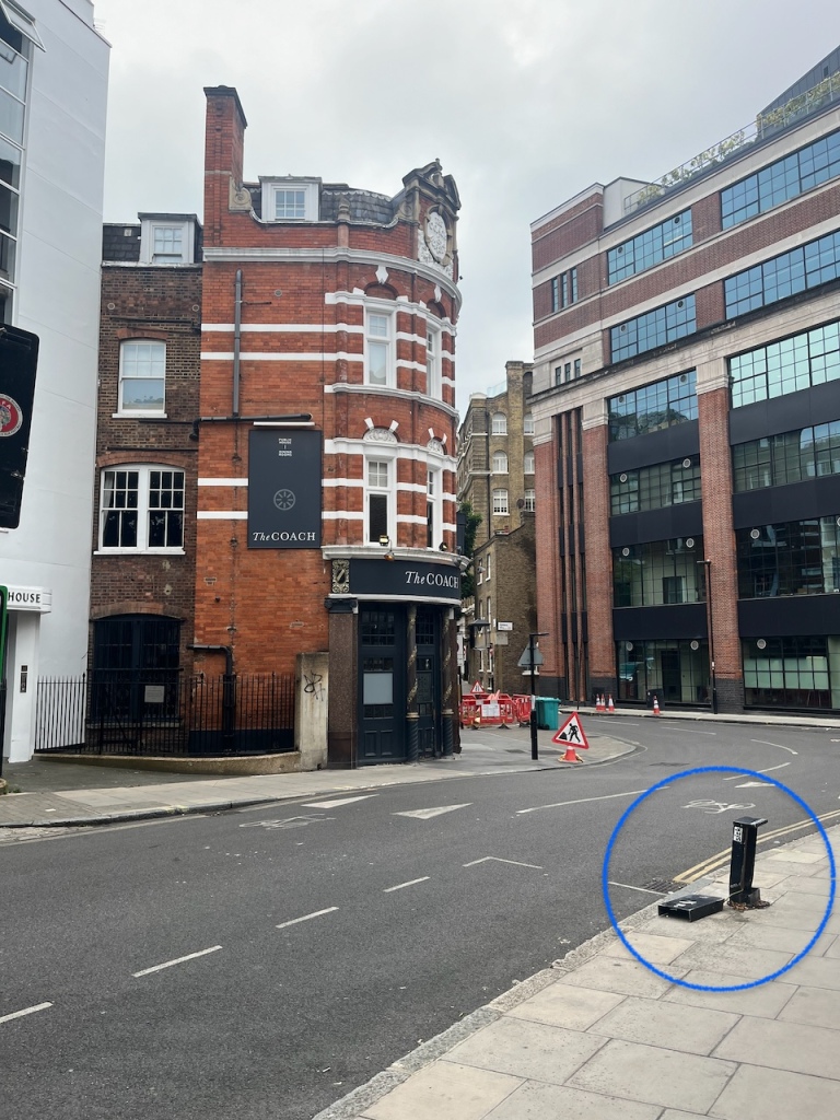
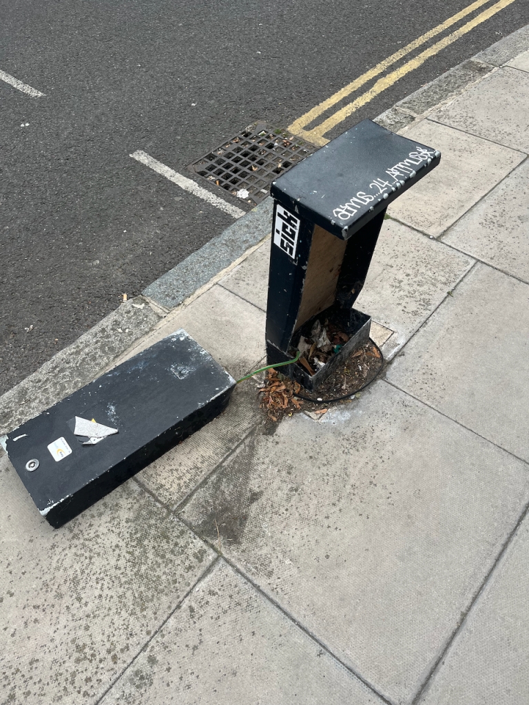
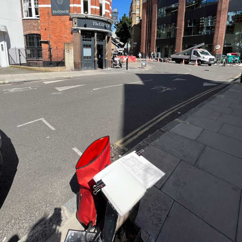
This perhaps had been a phone junction box, but no more. Now it was a seat. I commandeered it.
I did the pen-and-ink on location and then added the colour back at my desk.
The colours here are:
All watercolours from Daniel Smith.
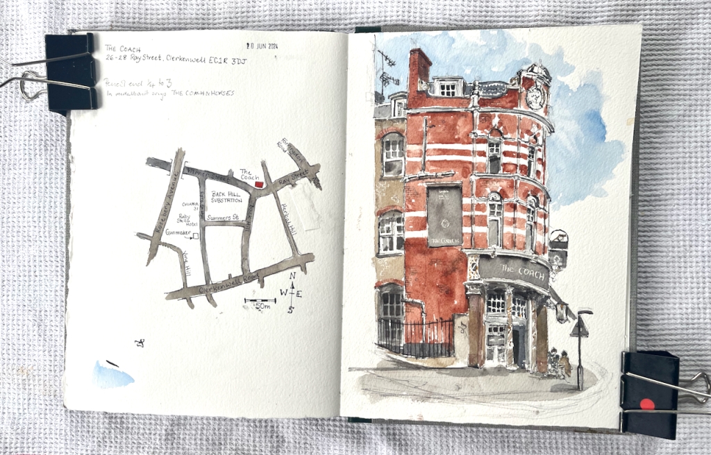
Here are maps to show where it is. It looks like a great pub, with a serious gastronomy menu. https://thecoachclerkenwell.co.uk/
Click here to see more pubs that I’ve drawn.
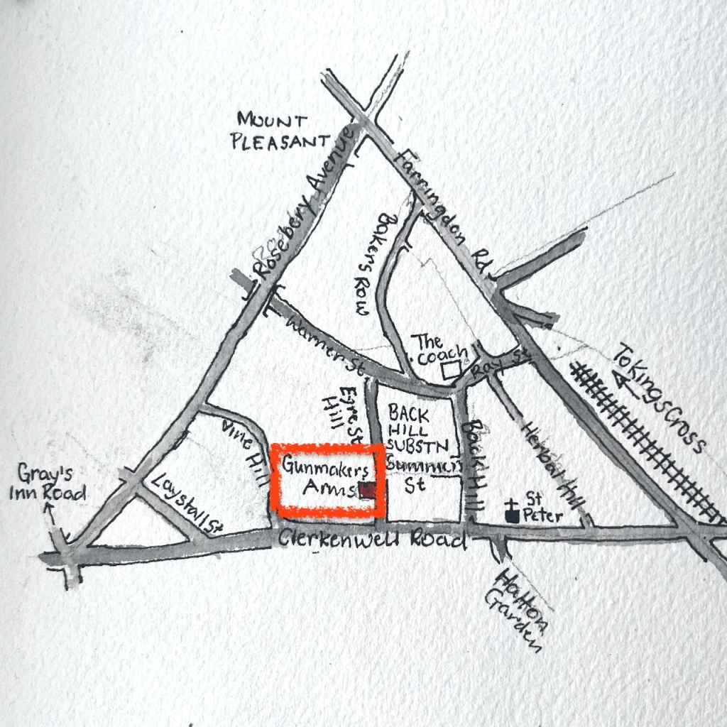
Here is the pub “Gunmakers” in Eyre Street Hill, Farringdon.

Eyre Street Hill is a small sloping street in Farringdon, within the triangle made by Rosebery Avenue, Clerkenwell Road, and the Farringdon Road.
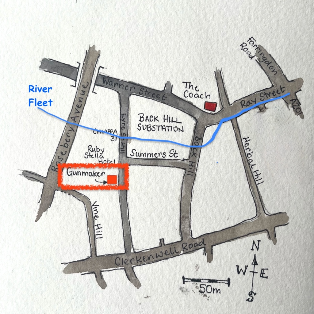
It slopes down to the River Fleet which is now below ground. I marked the approximate route of the Fleet on the map below:
It is a very old street, laid out in the 1720s as “Little Bath Street”. “British History Online” contains a detailed history of the area. This tells me that here and to the north was called “Coldbath Fields” in around 1719. The small houses in Eyre St were beside the Cold Bath, “a privately run hydropathic establishment opened in the late 1690”. This was on the edge of town. But then the came a distillery, a smallpox hospital and a workhouse.
“On the north-western ground, now largely occupied by Mount Pleasant Sorting Office, a distillery was built in the 1730s, and a smallpox hospital in the 1750s. These were joined towards the end of the eighteenth century by the prison, the Middlesex House of Correction, which became notorious for the brutality of its regime. South of the Cold Bath, near the old and insalubrious quarter called Hockley-in-the-Hole, the parish workhouse, built in the 1720s, was greatly enlarged in 1790.”
British History Online (see reference below)
Then Rosebery Avenue and Farringdon Road were built, with much demolition and reconstruction. By the beginning of the twentieth century, this area became part of “Little Italy”, a centre of the Italian Community. St Peter’s Church, on Clerkenwell Road, is still “the Italian Church”.
I can find no reference to this pub, or to gunmaking in the area. The building looks like one of the ones built in 1812:
“Today the oldest structures are the small, single-bay houses with shopfronts at Nos 33–37, dating from the early nineteenth century and fairly typical of the rebuilding that took place in the area at that time. Nos 33 and 35 were erected as a pair around 1812 by Thomas Abbott, builder, of Leather Lane.”
British History Online (see reference below)
In the right background of my drawing is a magnificent castellated building, now obscured by the newly-built “Ruby Stella Hotel” .
I was sketching, appropriately enough, in “Summers Street”. It was 20 June and the first sun of summer arrived. The pub was doing a brisk trade.
After about an hour of drawing on location, I added the colour at my desk later.


All quotes are from British History Online Volume 47, pages 22-51 with this reference:
‘West of Farringdon Road’, Survey of London: Volume 47, Northern Clerkenwell and Pentonville, (London, 2008), pp. 22-51. British History Online https://www.british-history.ac.uk/survey-london/vol47/pp22-51 [accessed 22 June 2024].
Christ Church Esher stands on the top of a hill, near the intersection of roads that marks Esher town centre.
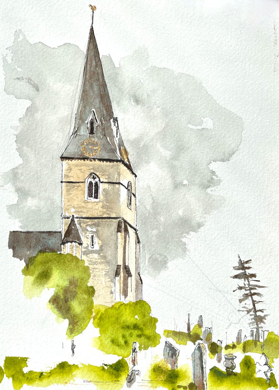
The church has a “splayed foot” spire.
SPLAYED-FOOT: variation of the broach form, found in England principally in the south-east, in which the four cardinal faces are splayed out near their bases, to cover the corners, while oblique (or intermediate) faces taper away to a point.
BROACH: starting from a square base, then carried into an octagonal section by means of triangular faces.
– Pevsner’s Architectural Glossary, page 116, under “SPIRE”
This simple and elegant geometry turned out to be rather tricky to draw. I worked hard to get the shape of the spire correct.

The church was built in 1853-1854 to the design of Benjamin Ferrey (1810-1880) according to its Historic England listing entry. Ferrey studied under A.W.N. Pugin1, and like Pugin, designed in the style known as “Gothic Revival”. Christ Church was built because the growing congregation could no longer be housed in the smaller St George’s, a little way down the hill.
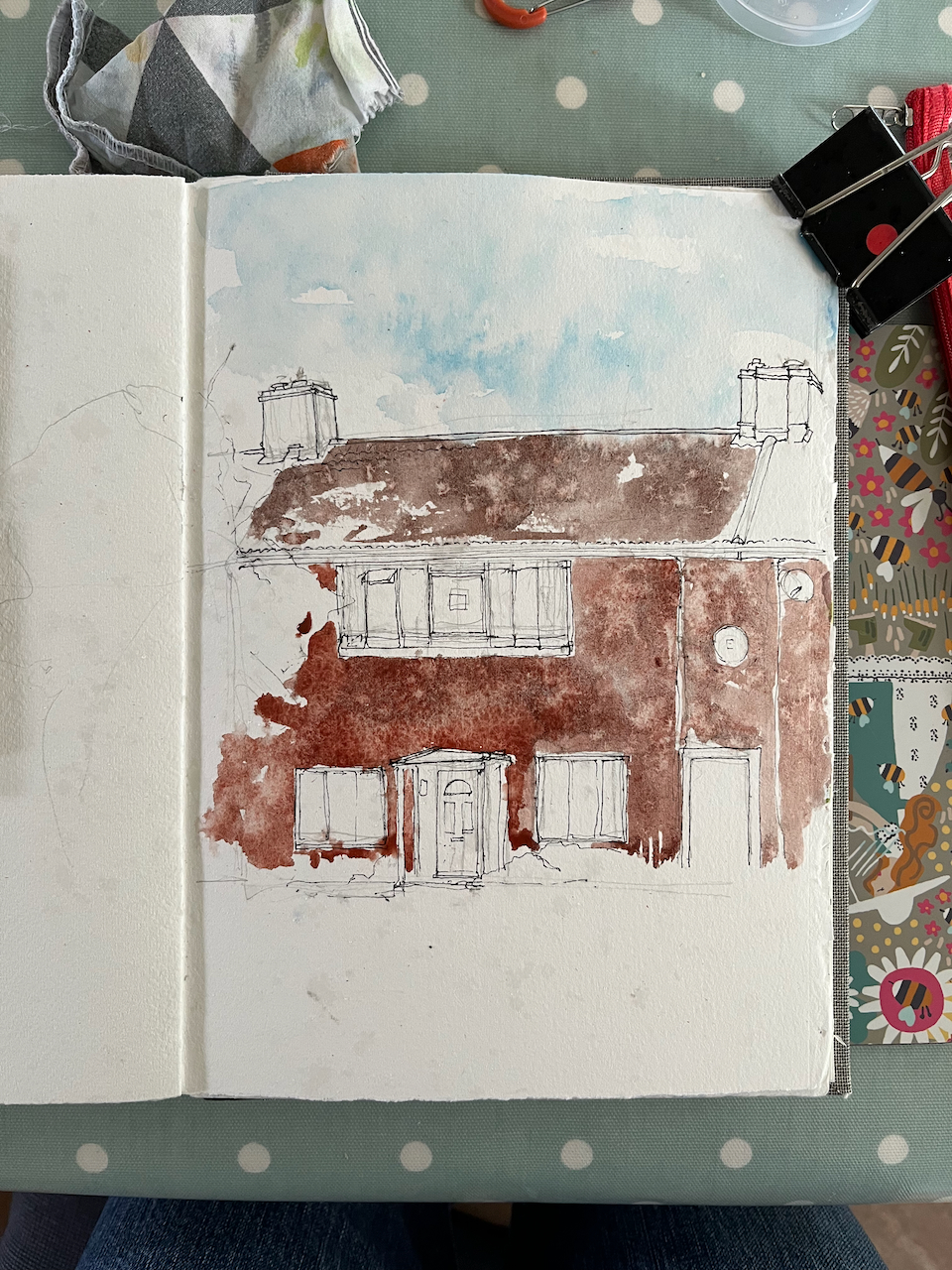
I sketched the church on location and added the colour later. The colours are:
I used just three colours, all Daniel Smith. I used gold paint for the clock. The clock is on the roof of the spire, which is remarkable. Usually the clock is on the tower, below the spire. So I wanted to put it in and show its unusual location.
Here is a sketch map of the area.

See this post for my sketch of St George’s, this post for the Tin Tabernacle in West End Esher, and this post for sketches of the council housing in Lower Green.
References
Historic England Listing Entry: https://historicengland.org.uk/listing/the-list/list-entry/1188268?section=comments-and-photos downloaded 7th June 2024, contains also many photos of the interior of Christ Church.
Ferrey’s biography is on Wikipedia, and also on “The Victorian Web” at this link: https://victorianweb.org/art/architecture/ferrey/
1A.W.N. Pugin designed, amongst other things, the inside of the Houses of Parliament: https://heritagecollections.parliament.uk/stories/the-architects-barry-pugin-and-scott/. The Houses of Parliament are a classic example of Gothic Revival Style. The Houses of Parliament were designed by a team consisting of Charles Barry, A.W.N. Pugin and later Giles Gilbert Scott.


Esher is an area of Greater London, half an hour’s train ride from Waterloo. It is a place of diverse architecture: magnificent Arts-and-Crafts villas, modernist mansions, and a row of “stockbroker Tudor” houses.

On the other side of the railway tracks, in the low ground near the industrial estate and the waterworks, there is a council estate. This is “Lower Green”. It was built towards the end of the 1940s. This was an era of visionary town planning and utopian ideals, eloquently described in the book “Municipal Dreams” by John Boughton, Chapter 3. On page 66 Boughton quotes the town planner Patrick Abercrombie who sought a plan for Plymouth
“which allows for a higher standard of living well within our grasp, with its call for space and beauty rather than for mere economy”
J. Paton Watson and P. Abercrombie “A Plan for Plymouth” 1943.
The new towns were built around this time, including Stevenage, Crawley, Hemel Hempstead, Harlow, Welwyn Garden City, and Hatfield. Lower Green has many characteristics of those new towns: two storey “cottage style” houses with a front garden and a back garden, arranged behind wide verges, with trees and plenty of green space. The houses were designed by the architect George Blair Imrie (1885–1952), for Esher Urban District Council.

My watercolours show houses on Douglas Road, Lower Green. Here, the land was acquired by the council in 1949. It was a compulsory purchase under the 1936 Housing Act. The vendor was the farmer, Sydney Edward Parkes. I have this detailed information thanks to an owner and resident of one of the houses, who kindly showed me their title deeds.
Here is the basic design of the houses.
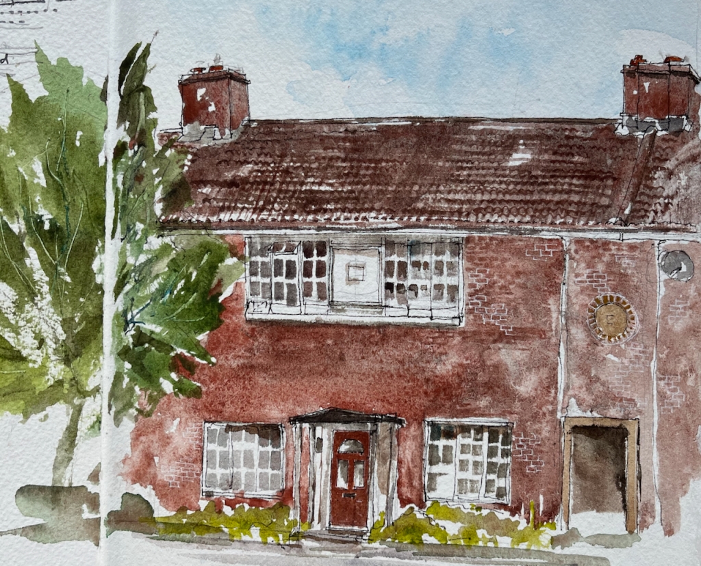

The geometry is perfect: the side edges of the upper windows are aligned with the centres of the lower windows. The upper edges of the lower windows, the door lintel and the passage are all in a neat line.
What you can’t see in my painting is that this house stands behind a wide verge and trees, which separate it from the road.
There is a passage through the terrace of houses, on the right in my picture. This passage takes you through to “the back” where you can store your bicycle, and your dustbins.

Another feature of the estate is the arrangement of houses round a square.
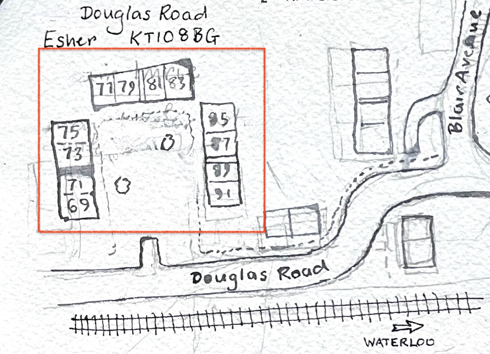
Here is a painting of some of the houses round the corner of a square: numbers 69 to 77 (odd numbers) Douglas Road:


There are three such squares, all large green spaces. It’s one of the “patterns” in this estate, to use the concept described by Christopher Alexander, in the 1977 book “A Pattern Language”.

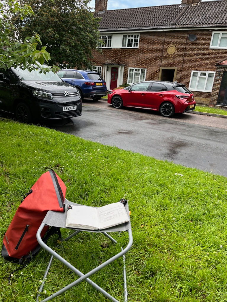
I didn’t see anyone using the green space. But this was a Tuesday afternoon, in term time, and it was raining. Perhaps they were enjoying looking out across it from their windows. If they were, they were probably wondering what the strange woman was doing, sitting there on a metal camping stool under the tree, staring at their house.
This estate was originally intended as rental accommodation. It was owned by Esher Urban District Council and residents paid rent to the council. Nowadays, some of these former council houses are in private freehold ownership, having been sold under the “right to buy” scheme. There are also a lot more cars. The estate was built at a time when most people did not not own cars. The houses do not have garages.
The architect, George Blair Imrie, designed many houses in the area. His wikipedia page lists the large houses he designed for the wealthy. His work on the council housing estate of Lower Green is also remarkable, and not mentioned. So I am glad of the opportunity to draw attention to it here.
I drew these pictures between rainstorms, finally completing them under a borrowed umbrella.


Blair Imrie’s work, including his work on Lower Green, is mentioned the 100th newsletter of the The Esher Residents Association, January 2020. See pages 4 and 5:
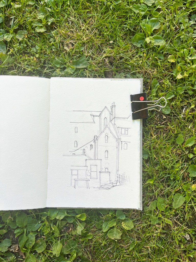
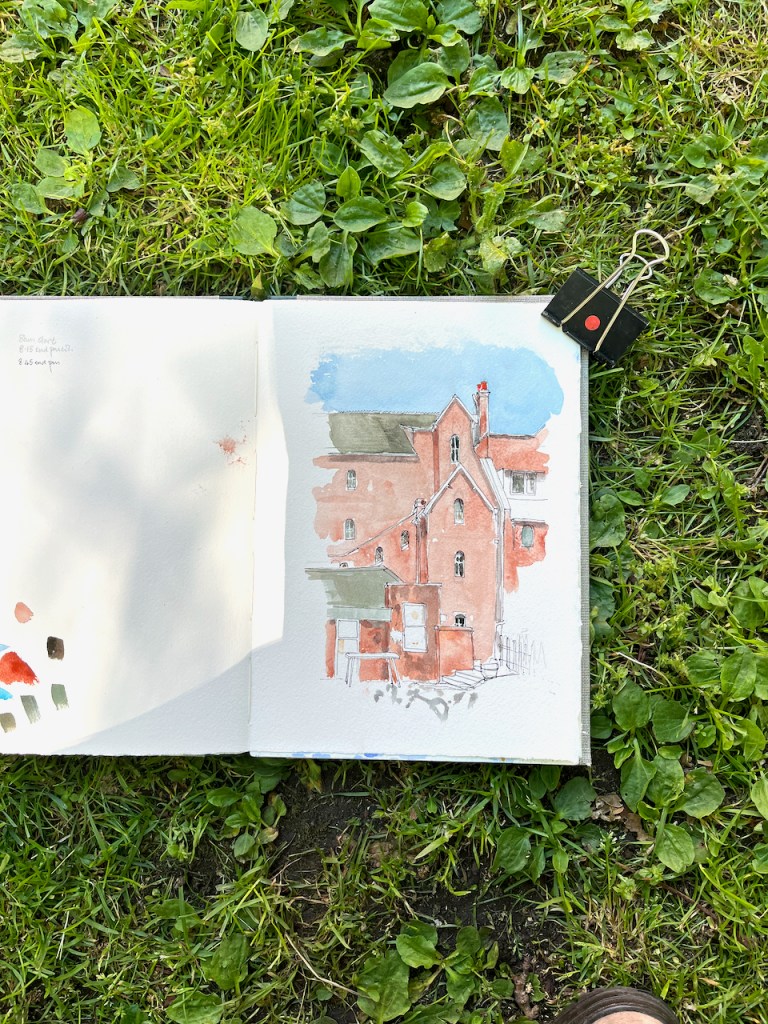
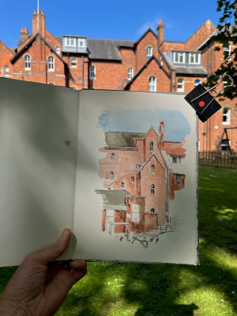
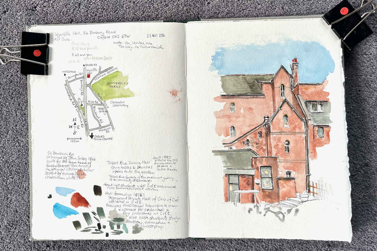
Wycliffe Hall is a “permanent private hall” in the University of Oxford. A permanent private hall is like a college, in that it provides accommodation and tuition for its students. The difference is that a college is governed by its Master and Fellows, whereas the Hall is governed, at least in part, by the Church of England. It is an Anglican theological college, offering courses in philosophy and theology, and preparing people for ordination into the Church of England. John Wycliffe was a 14th century Bible translator, scholar and churchman.
I stayed there as a bed-and-breakfast guest, and sketched this picture from a bench beneath the branches of the plane tree in the gardens. Breakfast is served in the Talbot Rice Dining Room, shown on the bottom left of the picture. I was waiting for it to open.
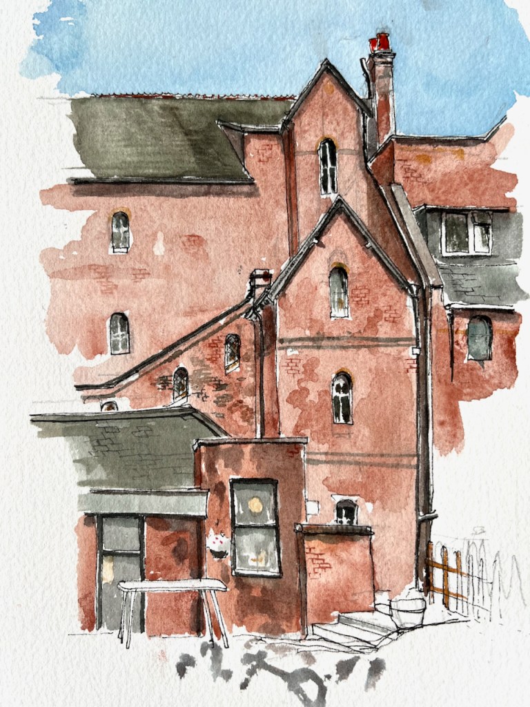
The “Talbot Rice Dining Hall” was built in 1980. The “Bulletin of the Association of British Theological and Philosophical Libraries” volume 16 number 2 dated June 2009*, contains a history of Wycliffe Hall, which informs me that this dining hall is named after Mervyn Talbot Rice (1899-1979), a “friend of Wycliffe”.
When they say “friend of Wycliffe”, they must mean a friend of the the Hall, as John Wycliffe died 600 years ago. The Talbot Rice art gallery in Edinburgh is named after David Talbot Rice, one of Mervyn’s sons.
The breakfast room opened, and I took my place at one of the long tables. Behind me, three, or possibly four, men were already engaged in a serious conversation about Middle Eastern politics. Judging by the various accents, at least one of them was American. They took different points of view, and argued from personal experience, with courtesy. At another table, a group of young men and women were working out complicated logistics to do with rowing. Who was to be cox? Who was rowing? When? Where? Another man engaged the member of staff in a lively conversation on management techniques prevalent in a particular football team and how this may or may not affect their chances.
Between them all, I finished my porridge and headed back out to the plane tree to continue my picture.
I’ve sketched at Wycliffe Hall before. Click the image below to go to the post.

*The link to the Bulletin is here. Or if that doesn’t work, the pdf is below. The history of Wycliffe Hall starts on page 19.
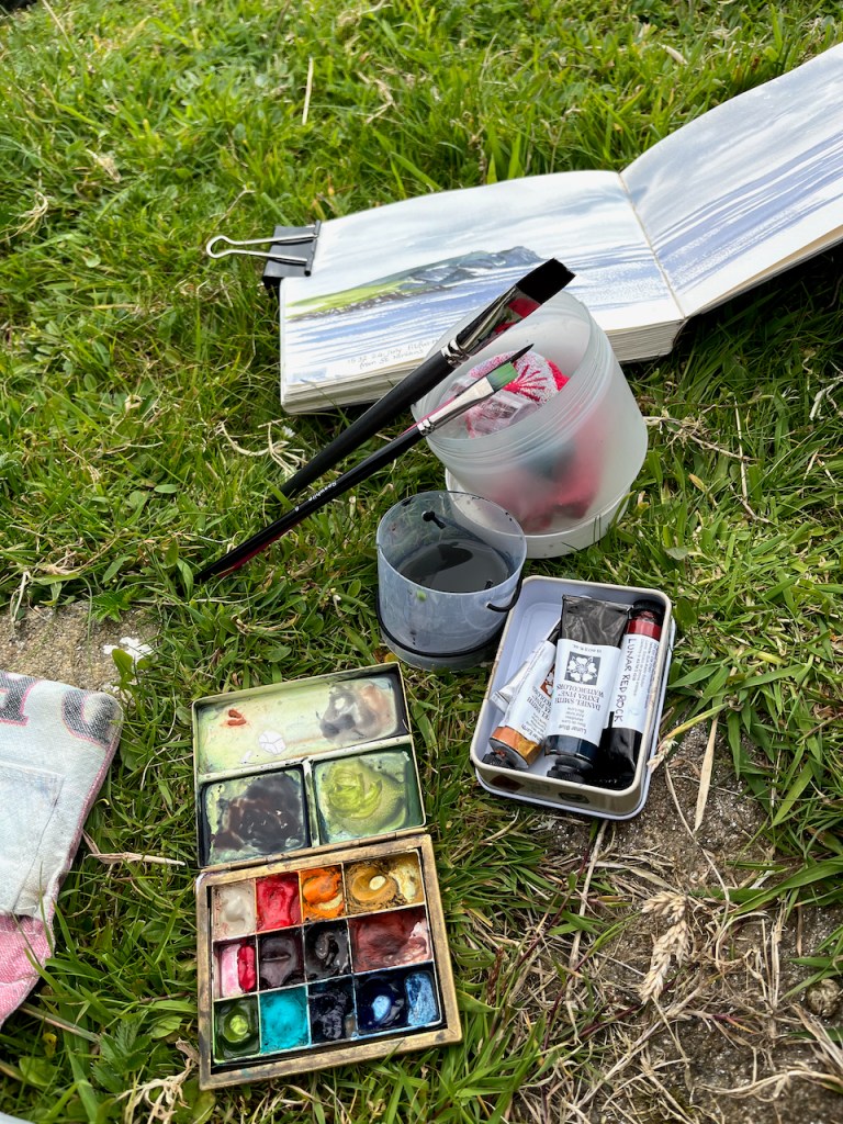
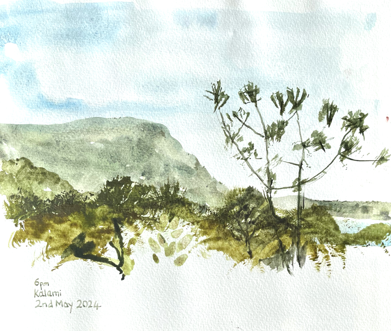
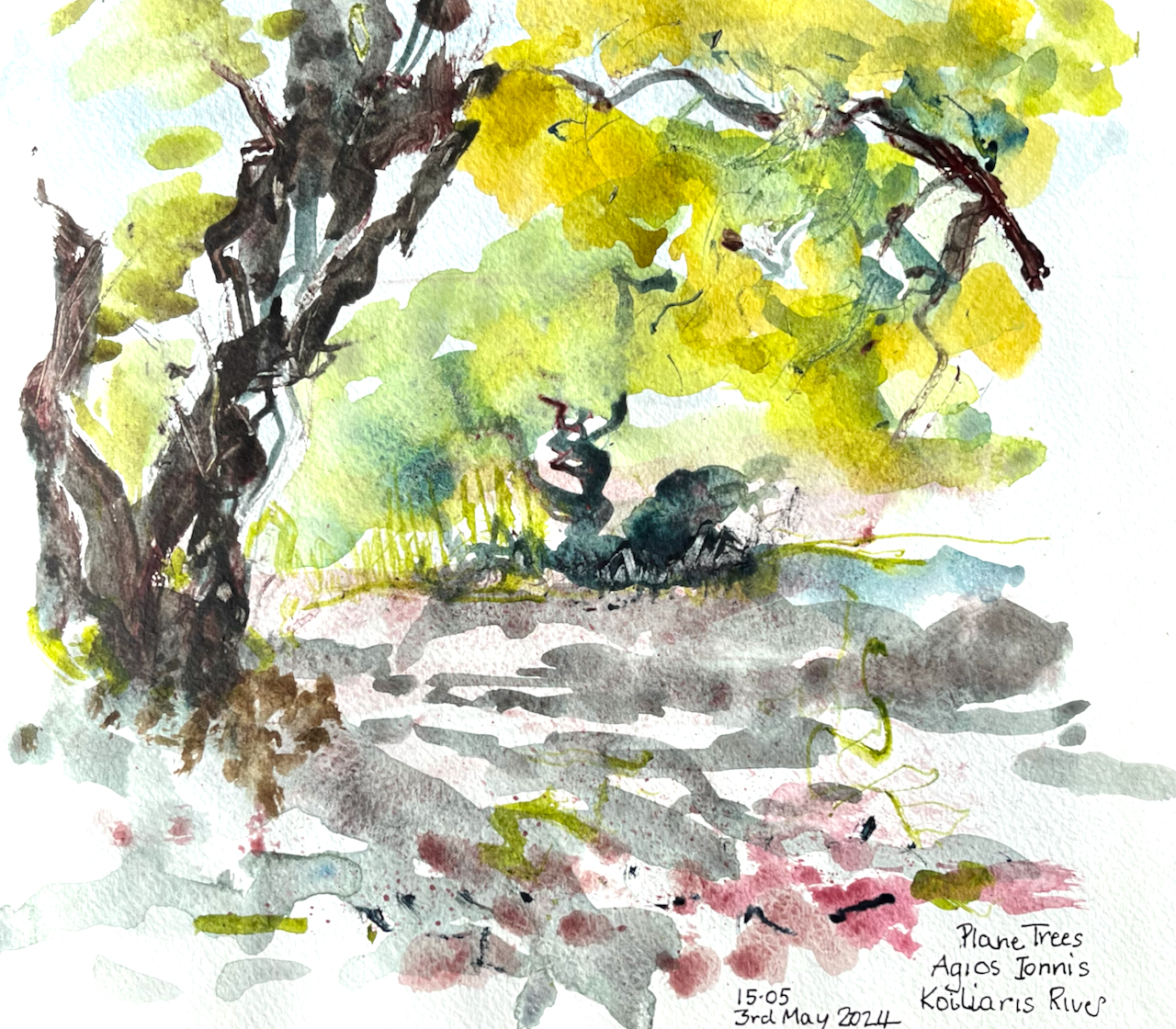
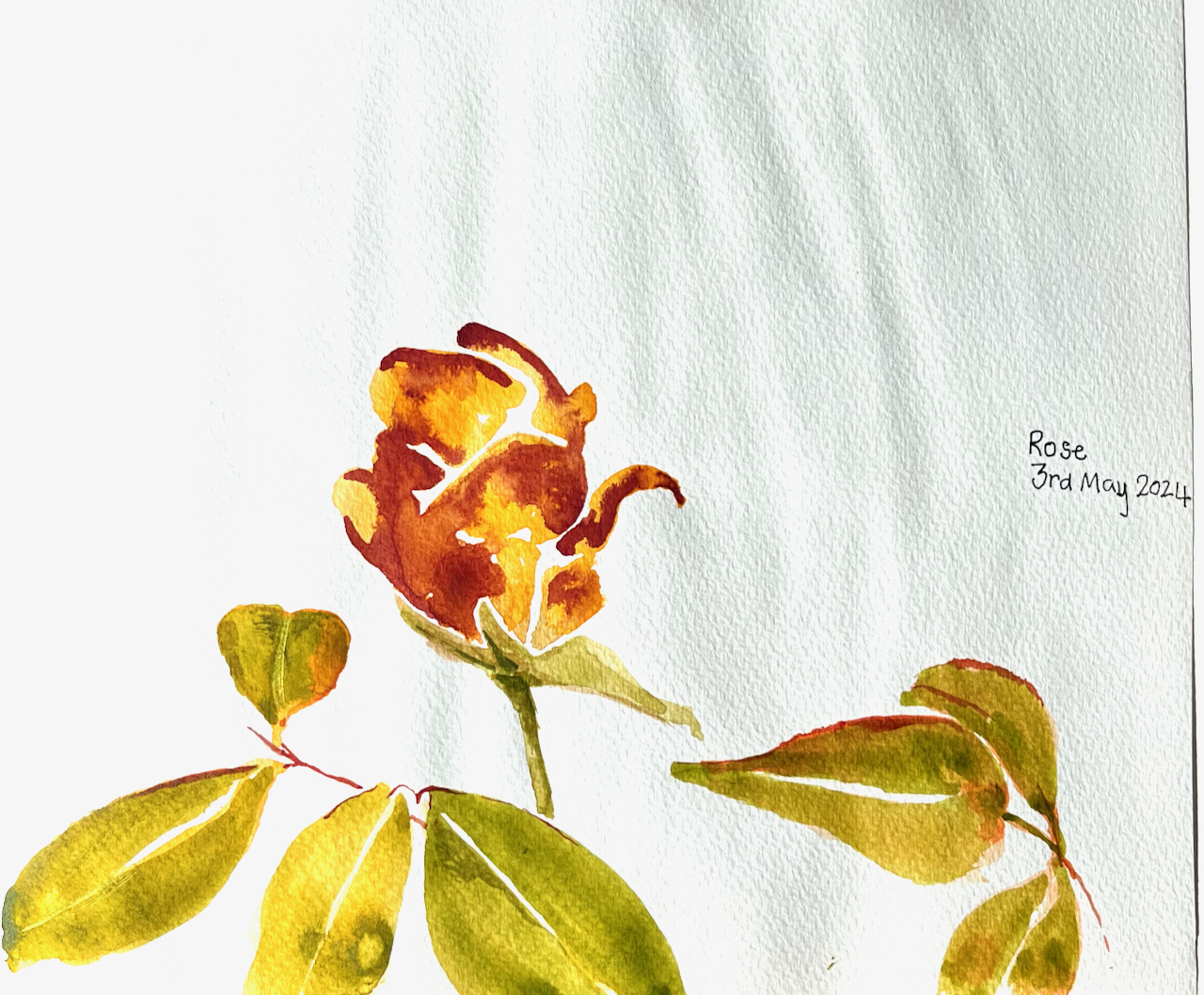
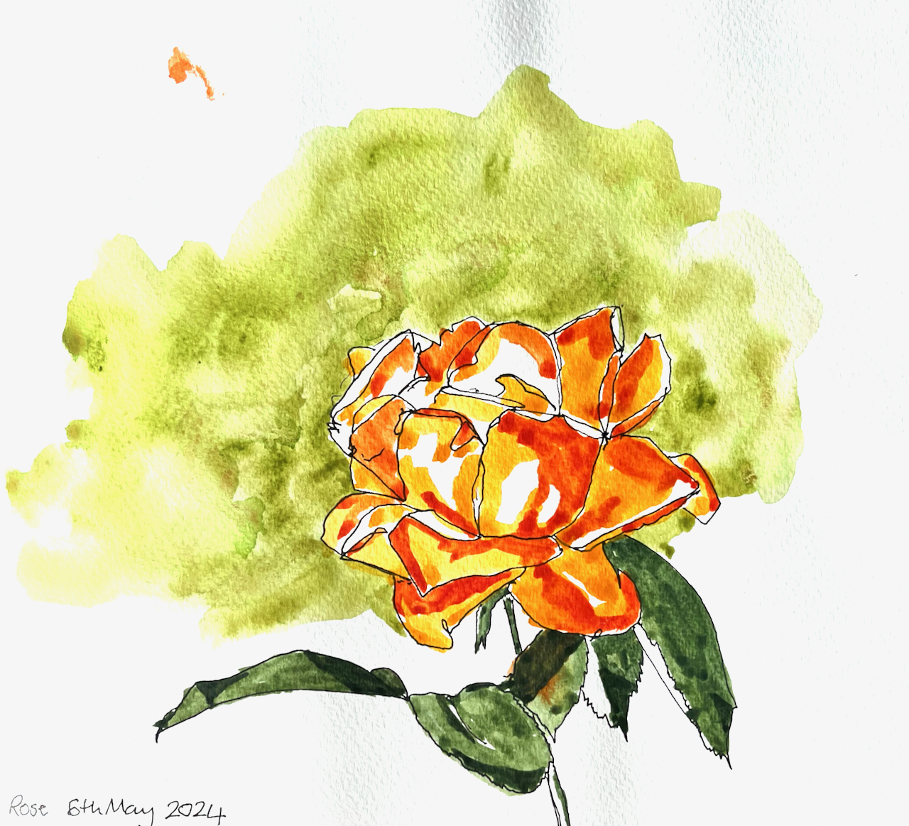
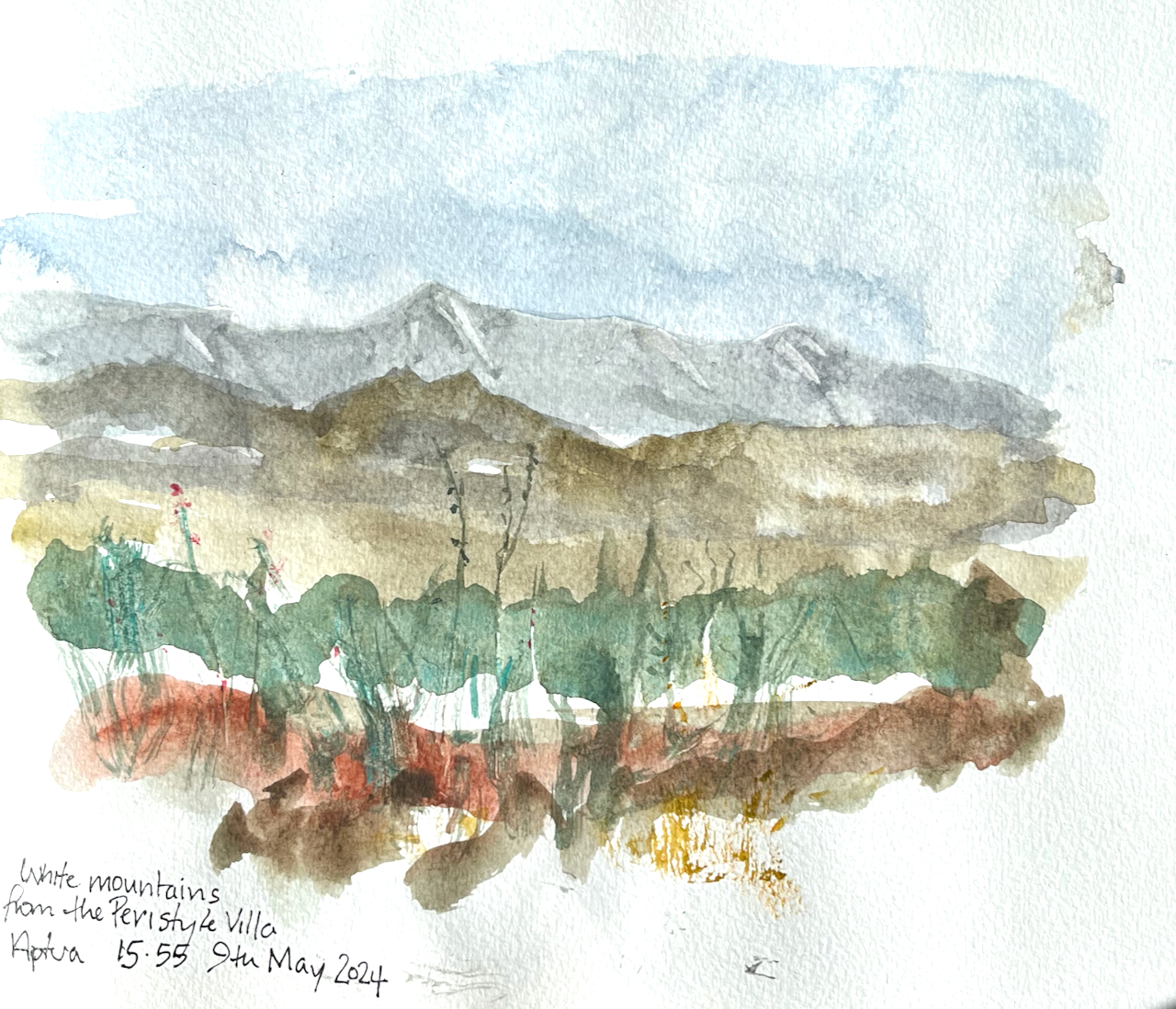
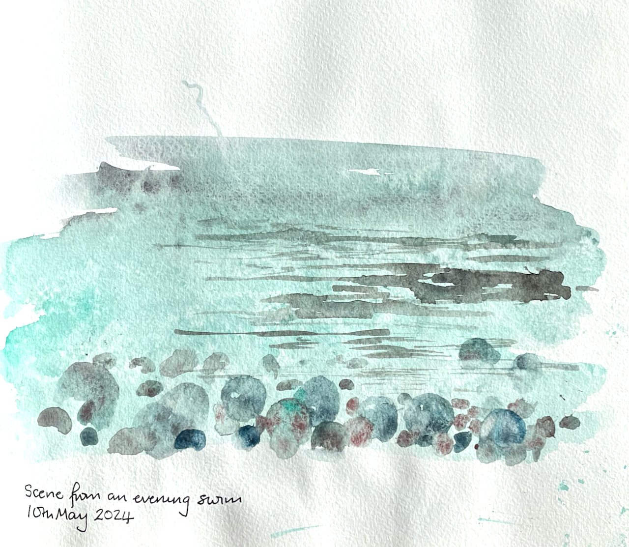
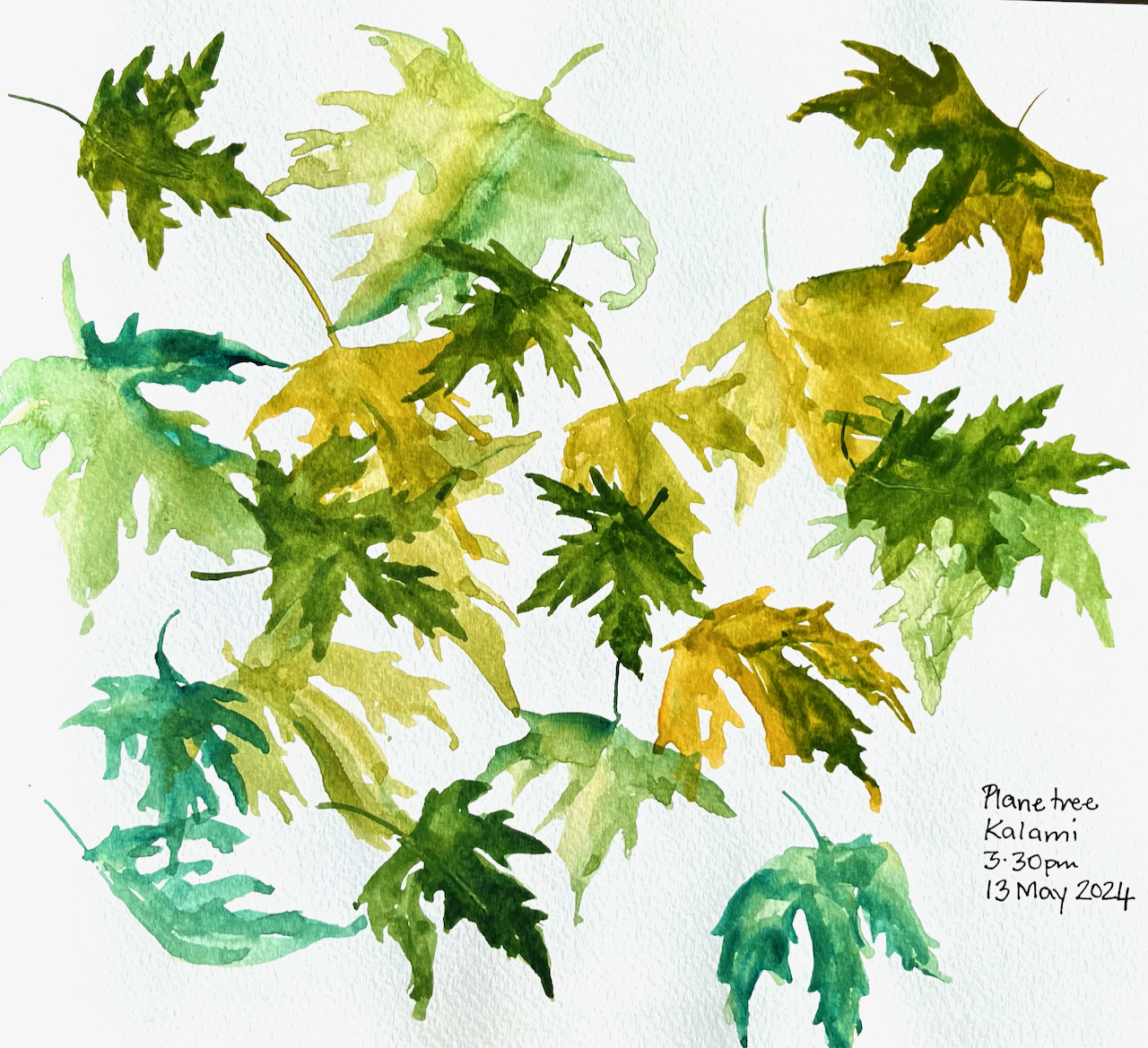
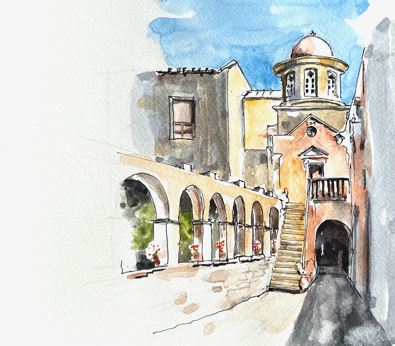
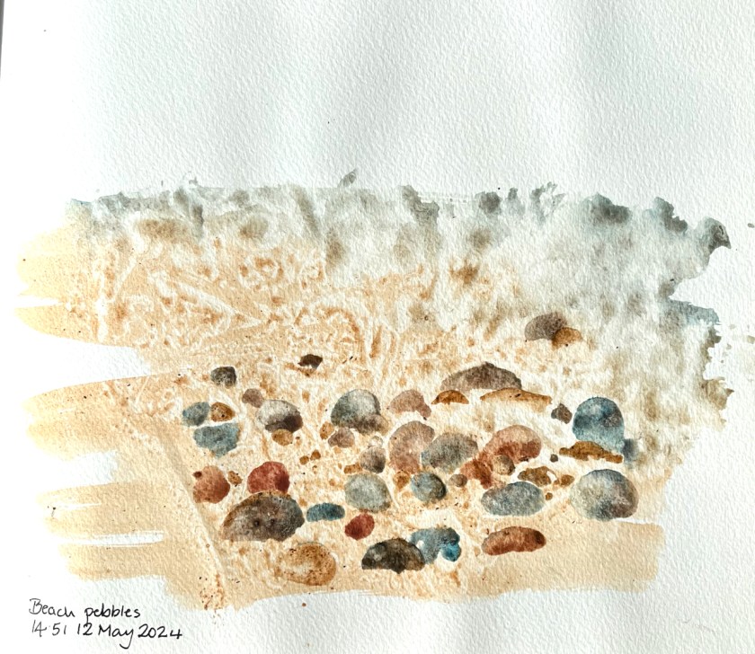
Here are a selection of sketches made in Crete. The sketchbook is Jackson’s Art Supplies’ own brand, 160gsm watercolour paper, cotton blend, about 8″ x 9″.
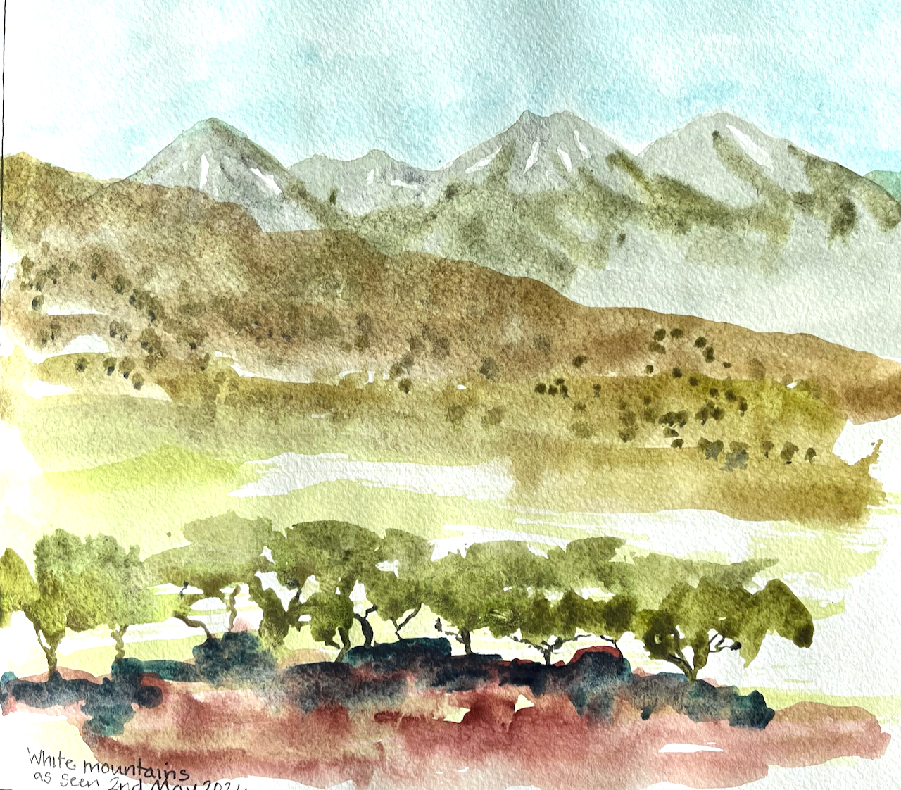
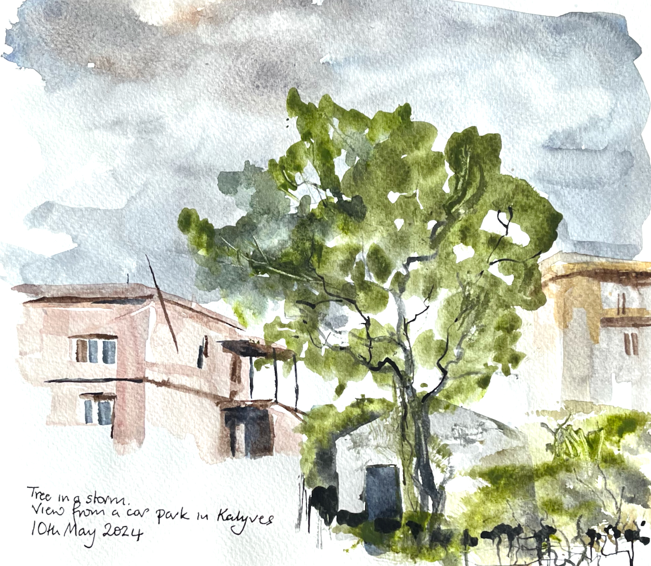
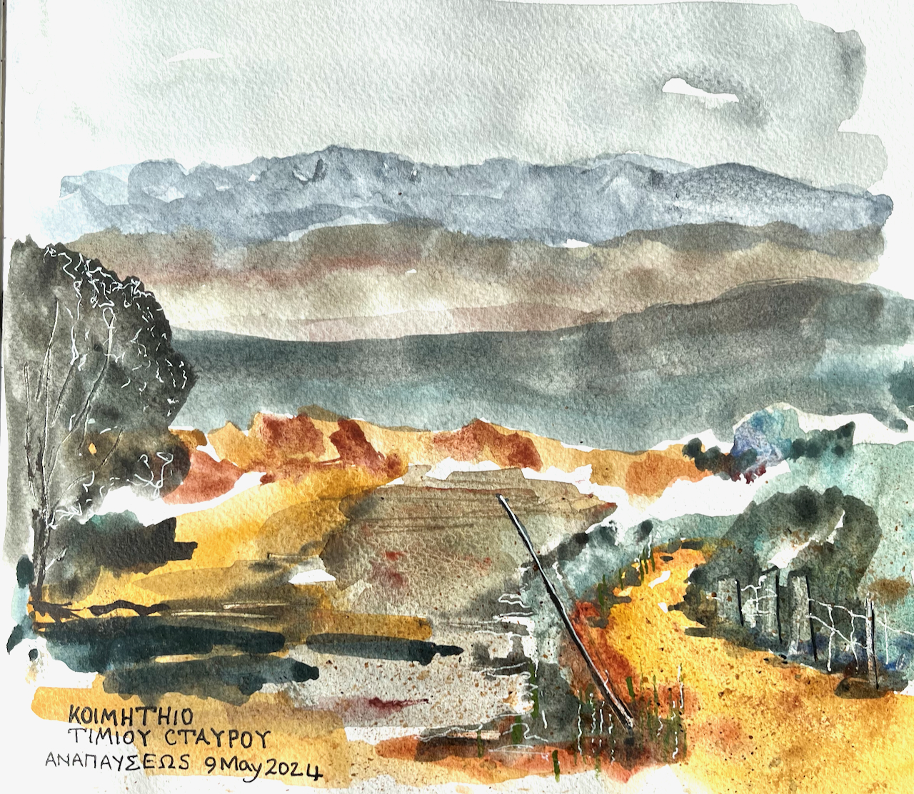

I used some of the local earth as pigment, to make a watercolour, using Schmincke watercolour binder.
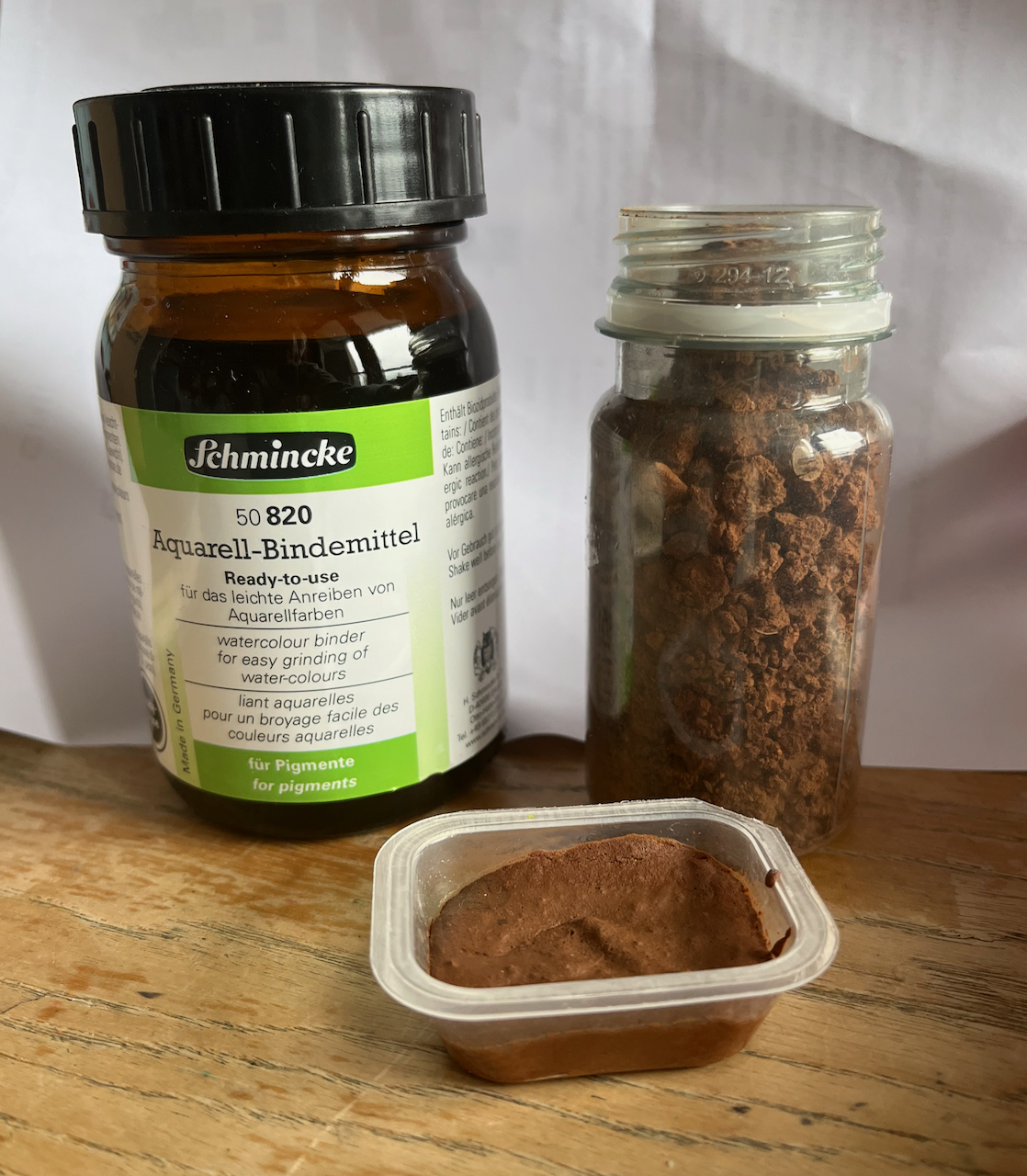
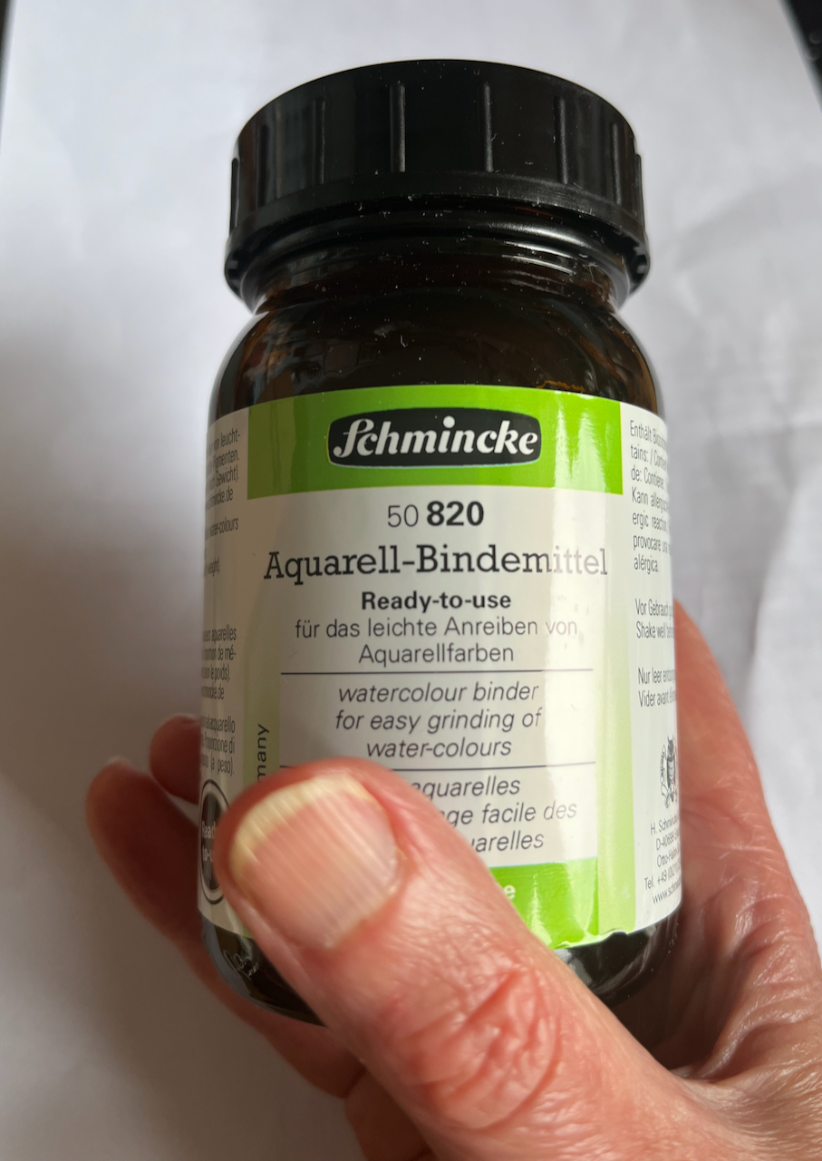
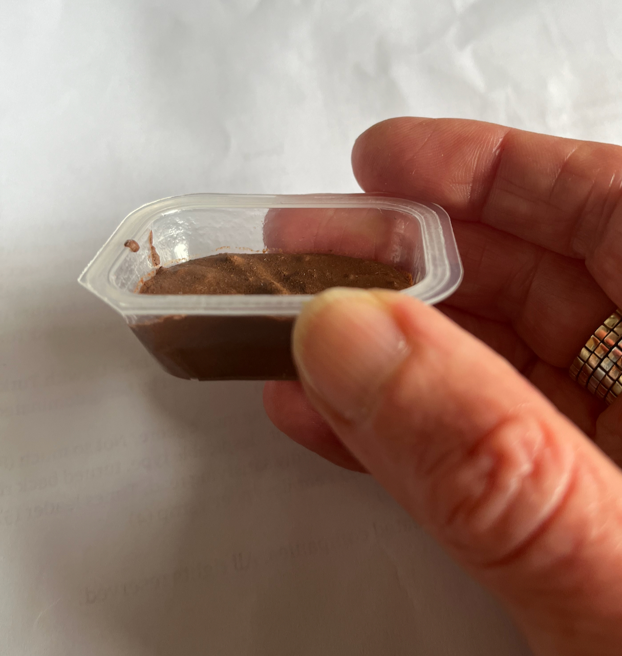
I ground the earth using a stone, breaking it up to make a powder like talcum powder. It still had bits in, but I managed to separate it by shaking, and scooped most of the bits off the top with a teaspoon. Then add an equal quantity, by volume, of the binder, and scoop into a suitable receptacle. It can be used immediately: it has the consistency of paint from a tube. Or. leave it to dry, then it’s like a watercolour pan. The “suitable receptacle” here is an empty butter portion container.
The watercolour works amazing well. It is a rich red-brown colour. Ideal for painting the surrounding scenery.
You can see it, for example, in this picture:
Here is a flick through the sketchbook: