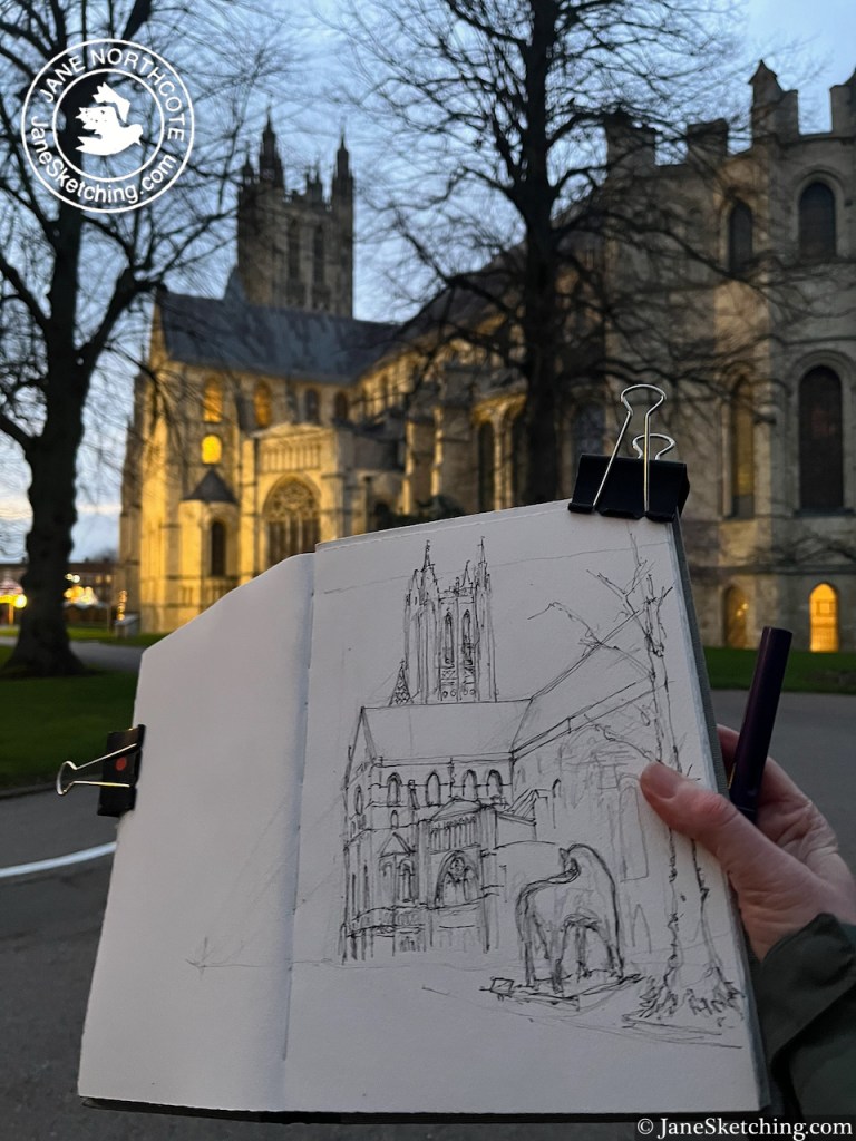
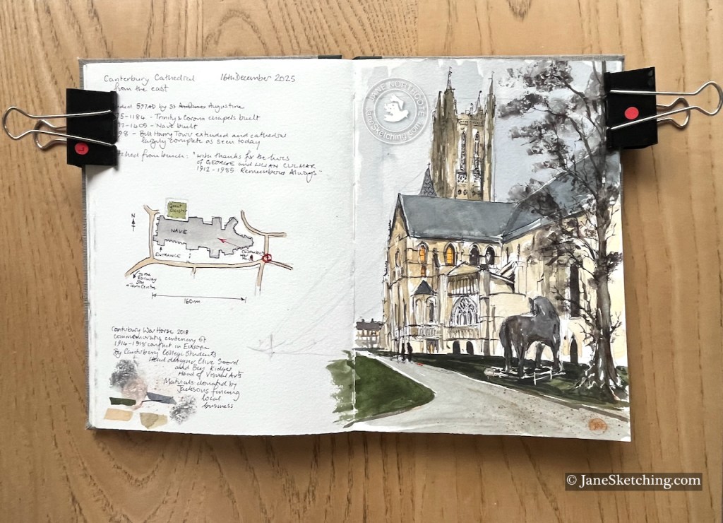
Canterbury Cathedral, sketched 16th December 2025 in Sketchbook 16
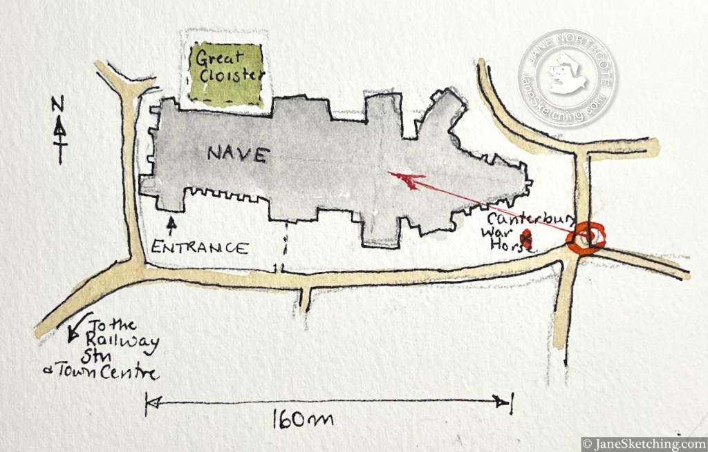
I was sketching the cathedral from the south west. The Tower in the centre of my sketch dates from 1478. The Trinity and Corona chapels on the right of the picture were built in 1175 and 1184. The magnificent nave, under the grey roof in the centre of my sketch, was built in 1377-1405. The cathedral was founded in 597 by St Augustine.
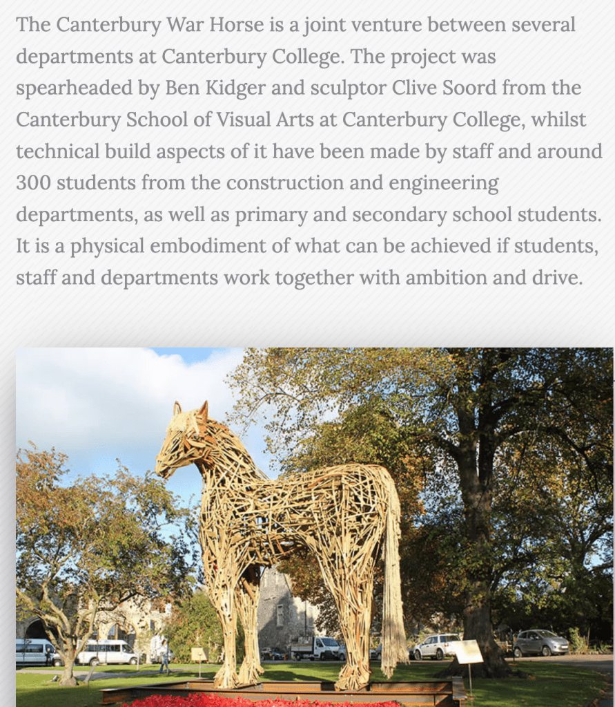
The horse in the foreground of my drawing is the “Canterbury War Horse”. It is made of pieces of wood, offcuts donated by the local fencing business, Jacksons. It was created in November 2018, marking Armistice Day, and the centenary of the end of the 1914-18 conflict.
Image and text from the website of Jacksons Fencing, Kent
The days are short in December and the light was fading while I was sketching.
I managed to get the pen and ink done sitting on the bench outdoors, and added the colour at my desk.
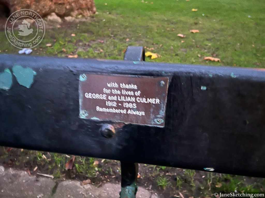
The bench commemorated the lives of George and Lilian Culmar, 1912 -1985.
It was a wonderful experience to sit calmly on this bench and contemplate the cathedral, as night fell.
Sketchbook 16
Click a button below to share this post online, email it, or print it:
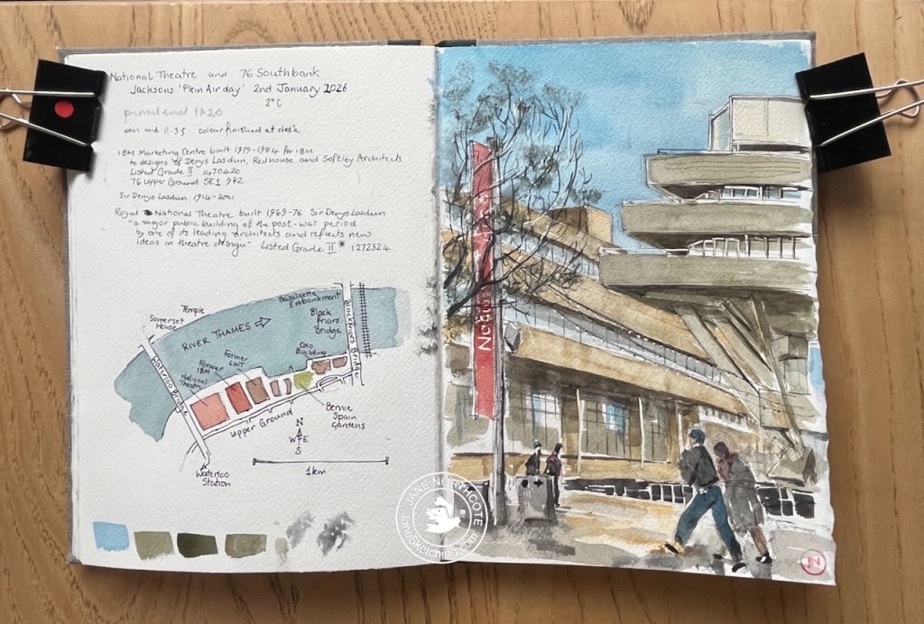
On the 2nd January I joined a group of other artists sketching on London’s South Bank. This was an event organised by Jackson’s Art Supplies of Dalston.
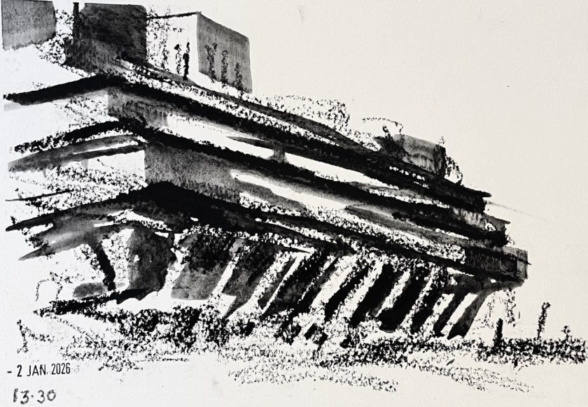
The first picture I attempted was of the National Theatre.
Sketching the National Theatre – 2nd January 2026
It was extremely cold and there was an unforgiving wind.
I managed to finish the pen-and-ink but at this point I abandoned the idea of putting the watercolour on the picture, and hurried into the National Theatre to thaw out. The staff there patiently inspected my bag of art equipment. In the café I found a group of other artists from the event, drinking coffee, testing the operation of their fingers and talking about art materials.
Coffee and company warmed me up. I decided to try simpler drawings using big crayons that I could wield in gloves. Here’s a flick through the sketchbook:
South Bank sketchbook flick-through
The black marks are made with a Derwent “inktense” stick. These sticks make charcoal-like marks, which you can then darken or spread out with water.
The National Theatre – inktense stick on Arches cold-pressed paper
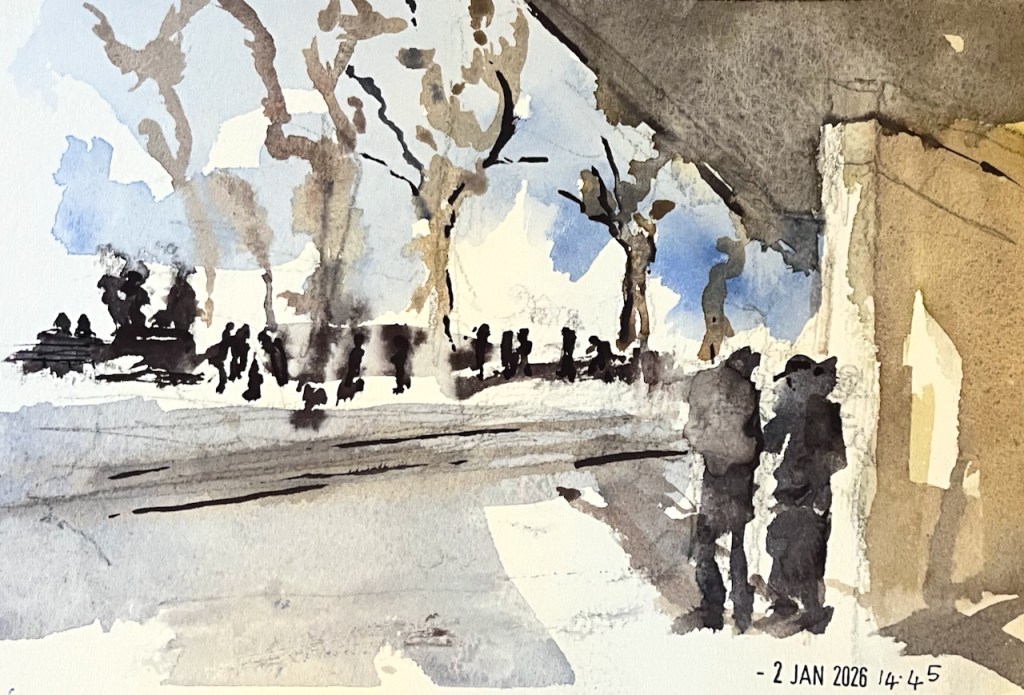
Here’s my last picture of the day. I was determined to use the watercolours, and found a spot where the wind was attenuated by a concrete wall.
At 3pm we all congregated and shared our pictures. I was really impressed at how many of us had persisted, in the cold, right to the end of the event, and at the wonderful work everyone had done. I mean, doing anything at that temperature was an achievement, I thought. You can see a picture of the assembled participants in the Jackson’s newsletter on this link.
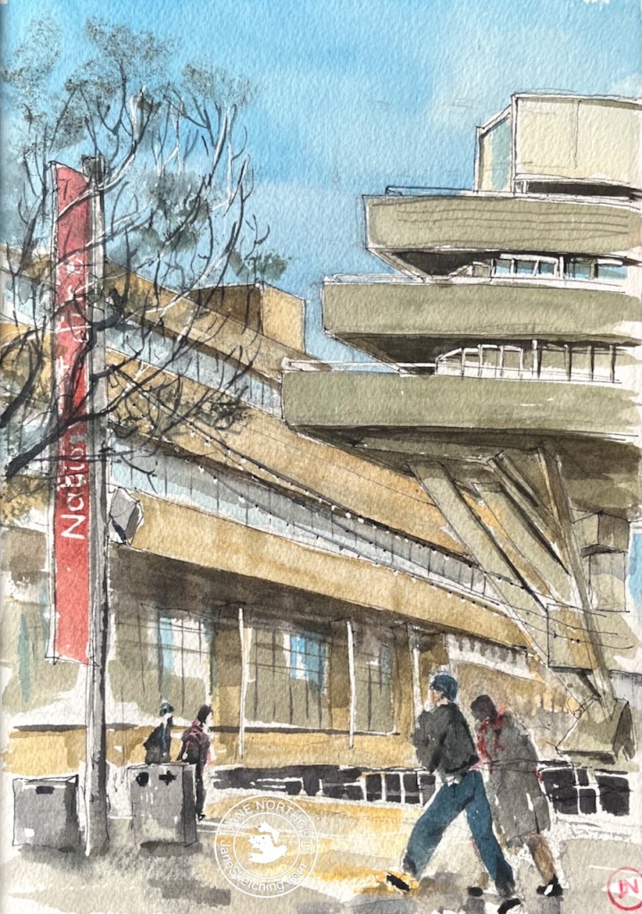
Later, at home in the warm, I added the watercolour to my initial sketch of the National Theatre.
National Theatre and 76 South Bank – 2nd January 2026 in sketchbook 16
It was an inspiring day out. Thank you to the Jackson’s team for the initiative and the organisation. And thanks to the wonderful National Theatre for the warm and welcoming spaces, the café, and the toilets…..!
Click a button below to share this post online, email it, or print it:
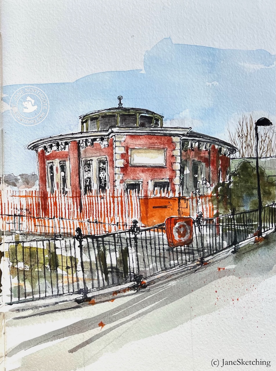
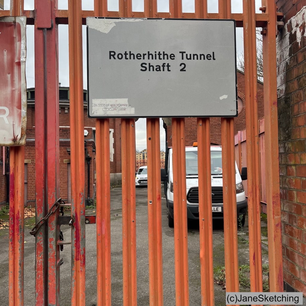
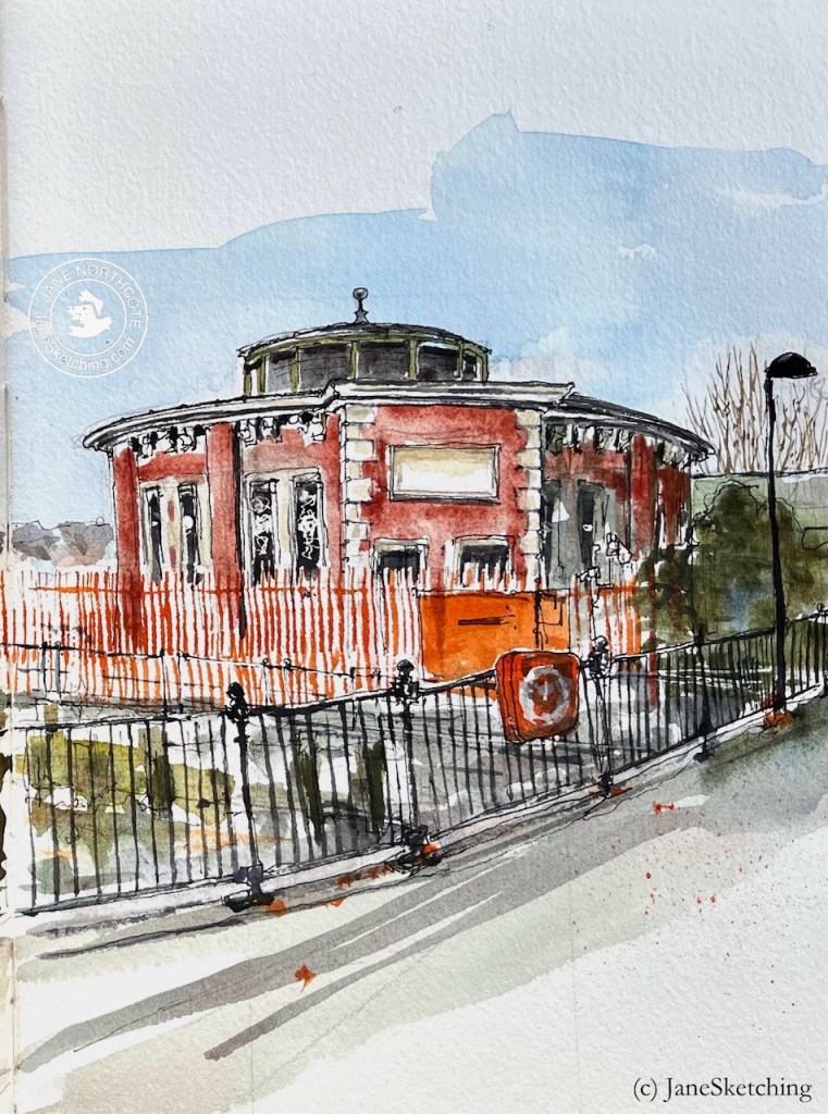
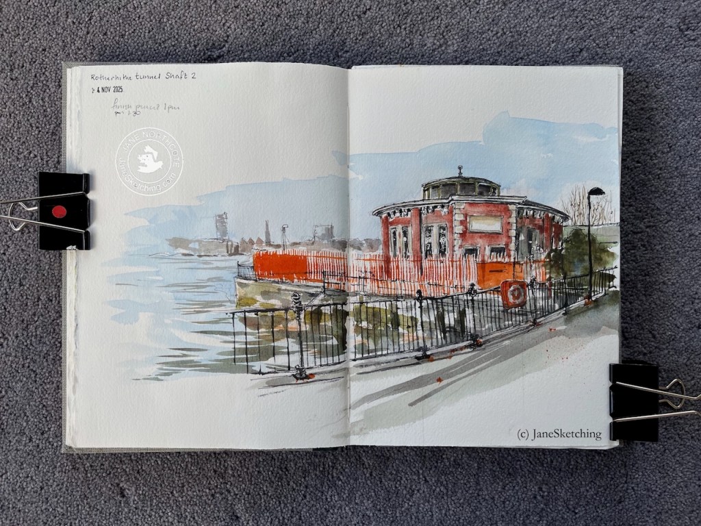
Rotherhithe Tunnel Shaft 2, sketched 4 November 2025 in Sketchbook 16 (c) JaneSketching
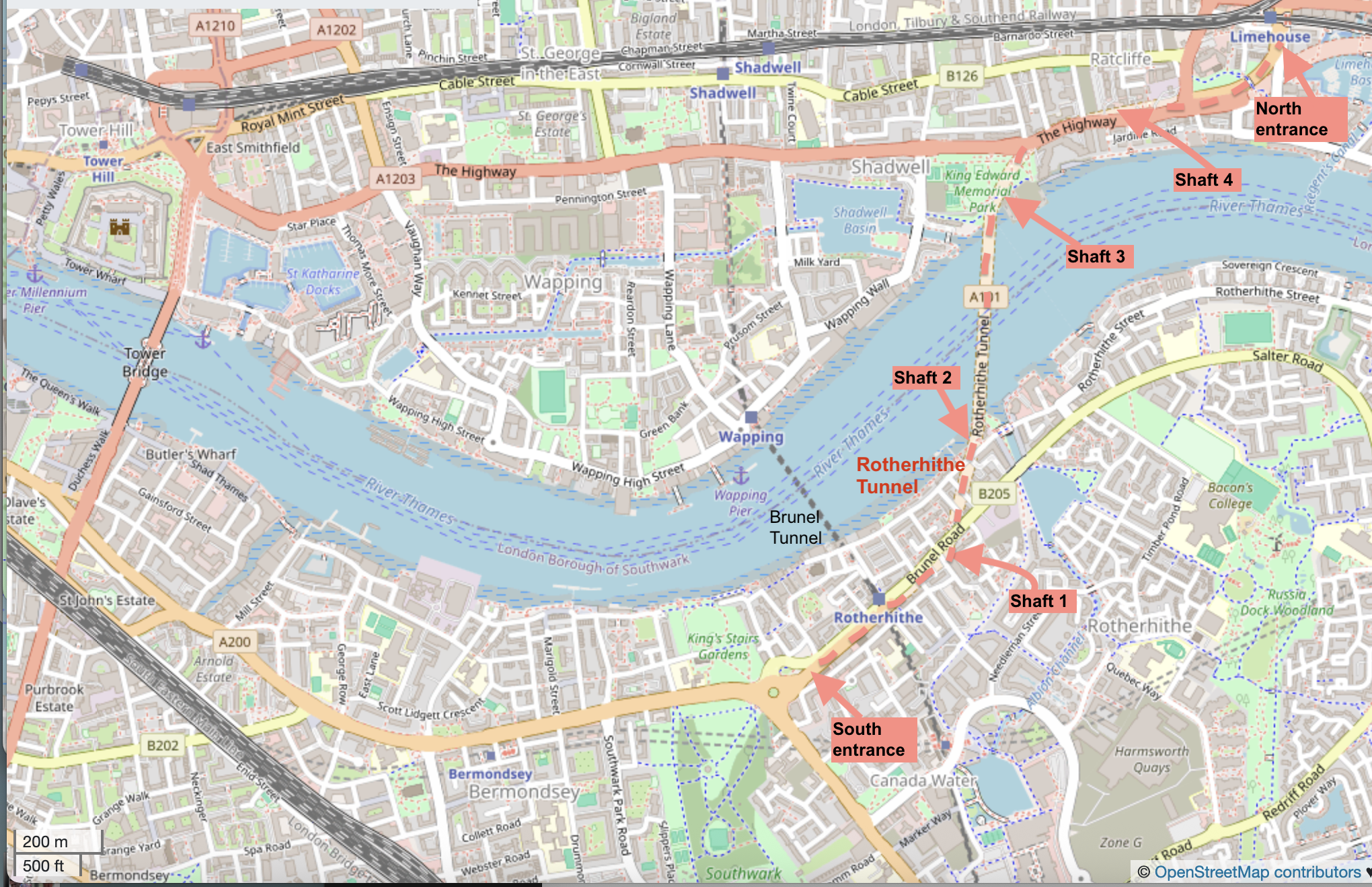
Here’s a map showing the river downstream of Tower Bridge, and the location of these structures. Click to enlarge.
Map showing the Rotherhithe tunnel, all 4 shafts, and the entrances. Click to enlarge. (c) OpenStreetMapcontributors
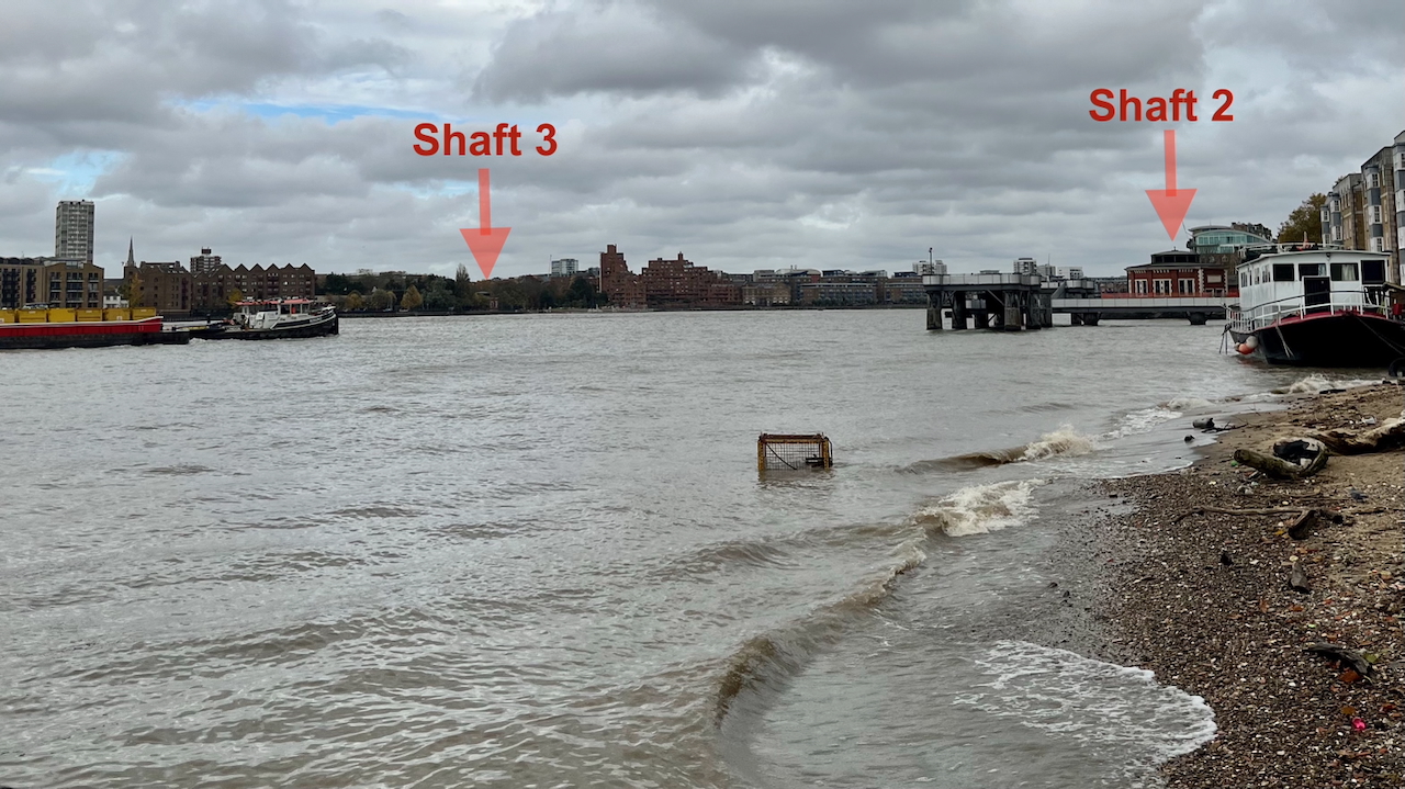
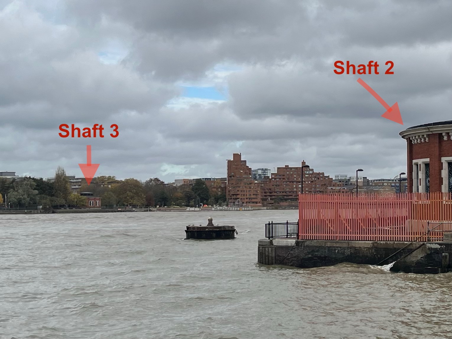
You can see one shaft from the other. Here’s a picture looking North across the Thames, just before I started the sketch. The light wasn’t great, but you can still see both shafts 2 and 3. See how wide the river is at this point! The distance between the two shafts is around 1500ft (500 metres).
Photo looking north across the Thames at Rotherhithe 4th November 2025 (c) JaneSketching
Here’s a photo from closer:
Photo looking north across the Thames at Rotherhithe 4th November 2025 (c) JaneSketching
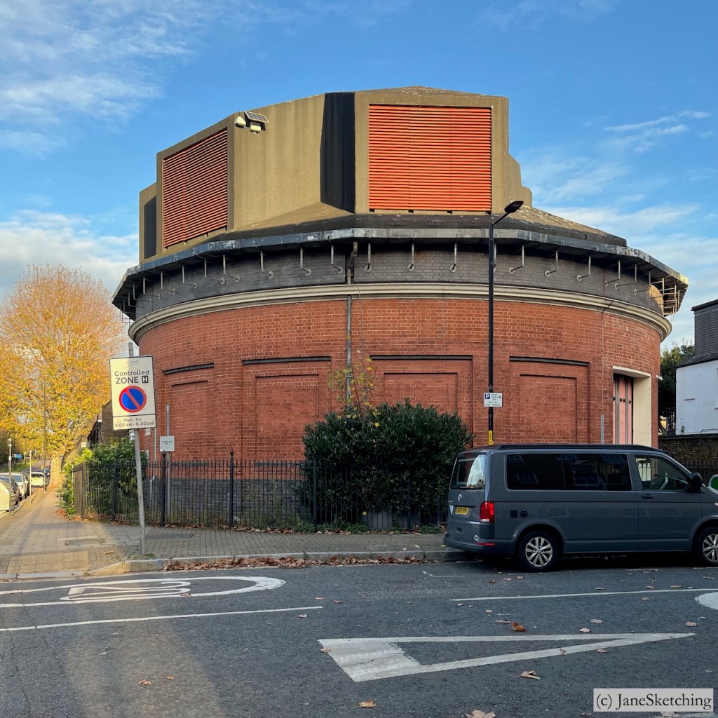
Shaft 2 is hidden behind high orange fences as you see. On the inland side it is behind a residential building at 157 Rotherhithe Street.
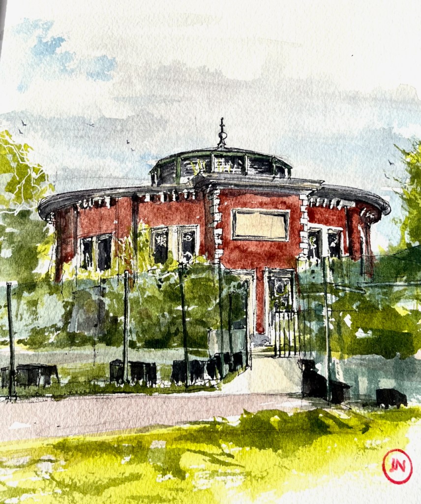
The Rotherhithe tunnel has 4 shafts. Shafts 2 and 3 are the round shapes and resemble each other. Both are Grade II listed.
Shaft 3Shaft 2Sketches of Shafts 3 and 4 (c) JaneSketching
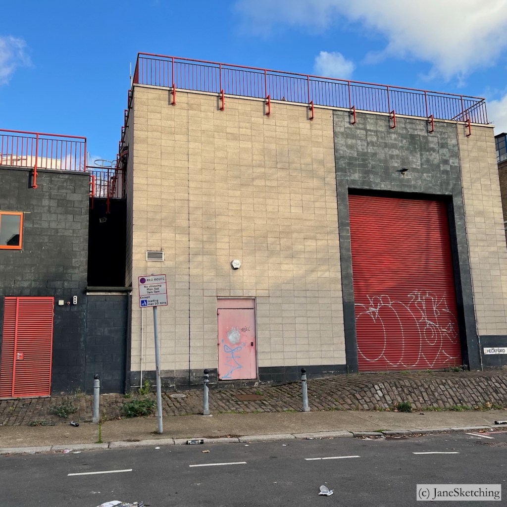
Shafts 1 and 4 have been modernised.
Shaft 1Shaft 4Shafts 1 and 4 (iPhone photos, (c) JaneSketching, November 2025)
My next expedition will be to sketch the entrances to the tunnel.
Sketchbook 16 spread
Watercolours by Daniel Smith : – Burnt Umber – Serpentine Genuine – Phthalo Blue Turquoise – Transparent Pyrrol Orange – Mars Yellow – Fired Gold Ochre
Colours and brushes used for this picture. Colours by Daniel Smith. Brushes by Rosemary Brushes. Ceramic palette by Mary Ling. Brass Palette by Classic Paintboxes.
Click a button below to share this post online, email it, or print it:
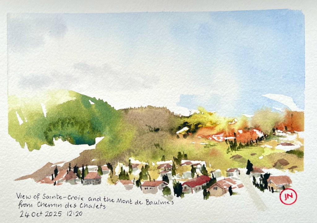
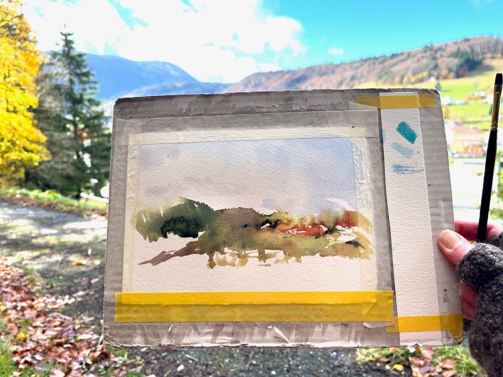
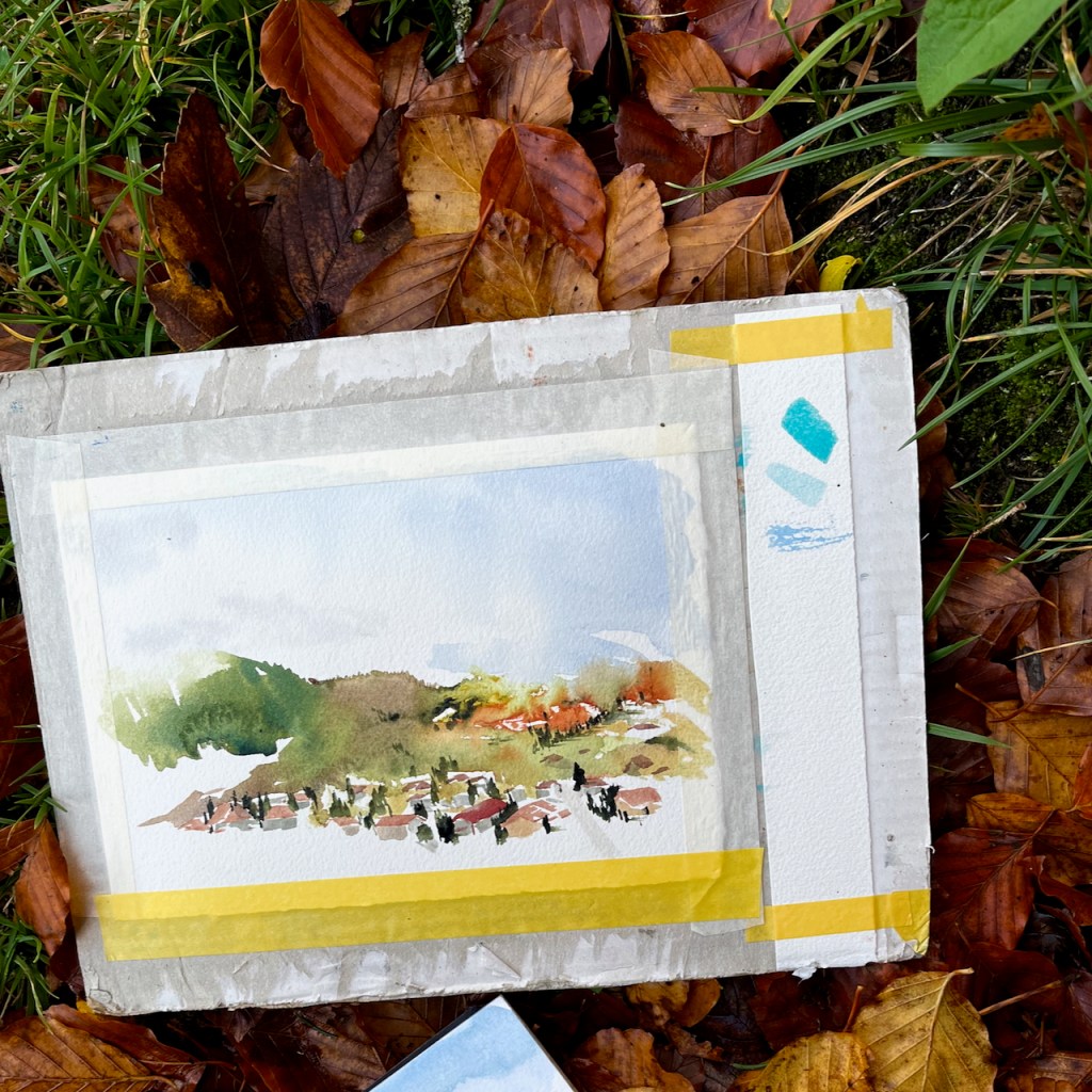
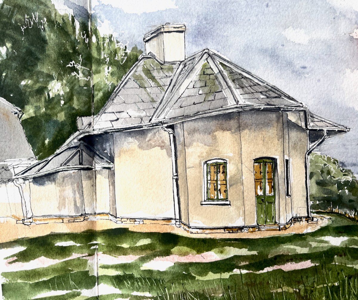
Here is a autumn scene in Sainte-Croix in the canton of Vaud, Switzerland.
View over Sainte-Croix and the Mont de Baulmes, from Chemin des ChaletsWork in progress on the sketch
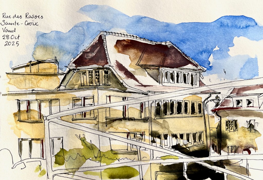
I sketched also in the village.
House, Rue des Rasses, Sainte-Croix
It is a season of clouds.
Jura scenes
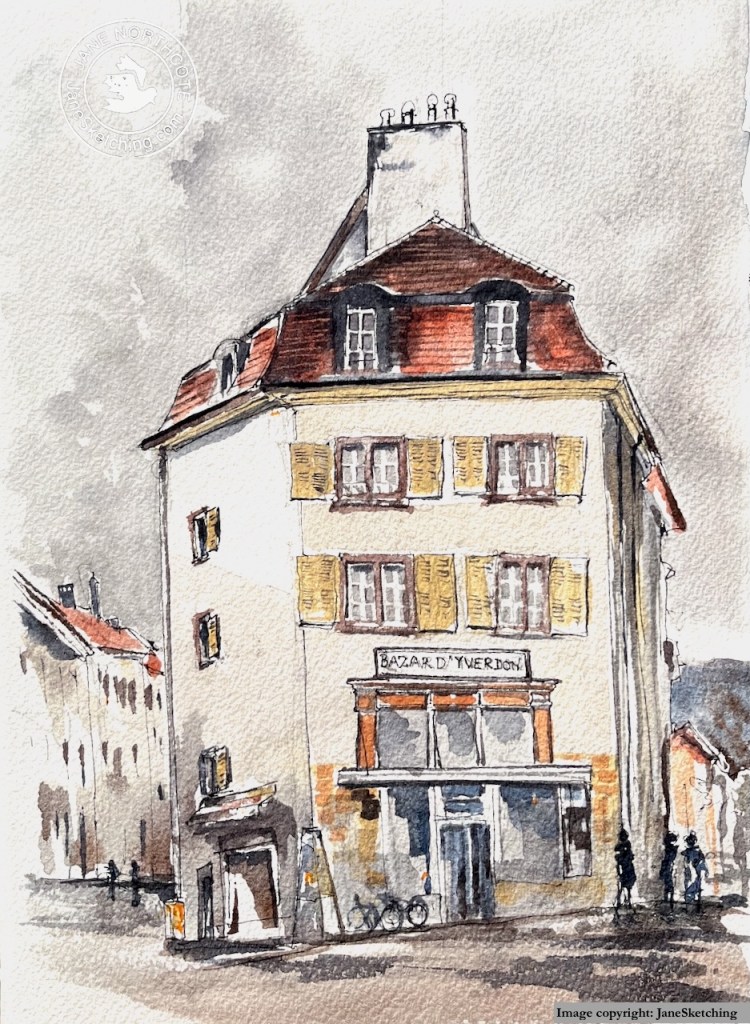
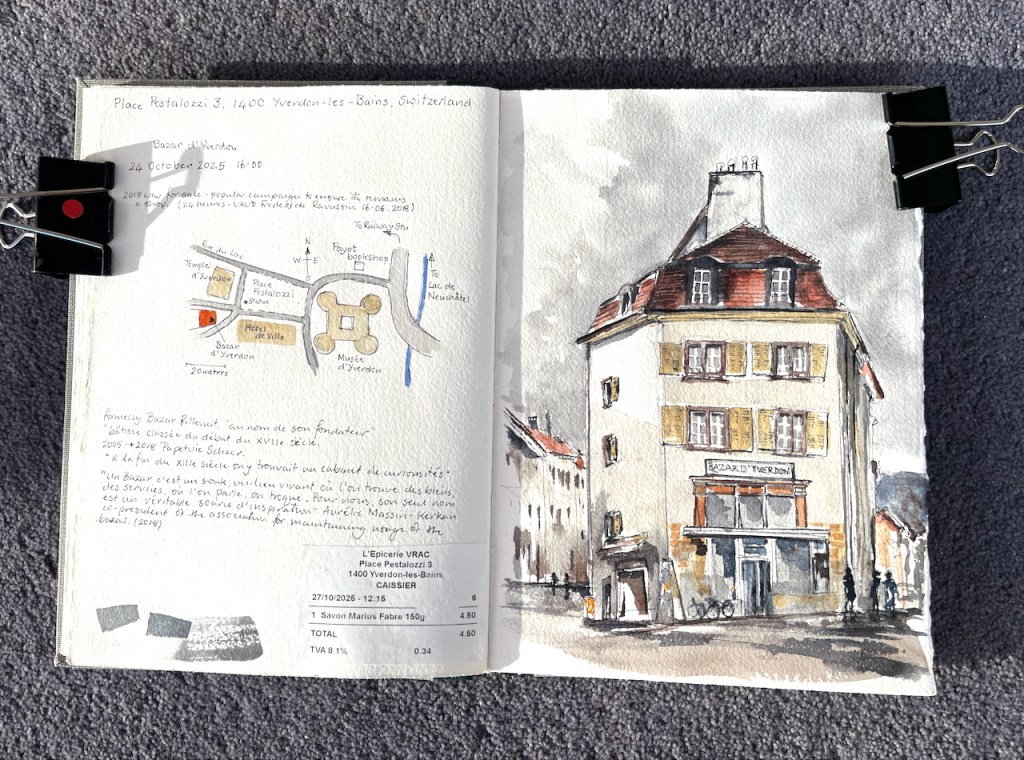
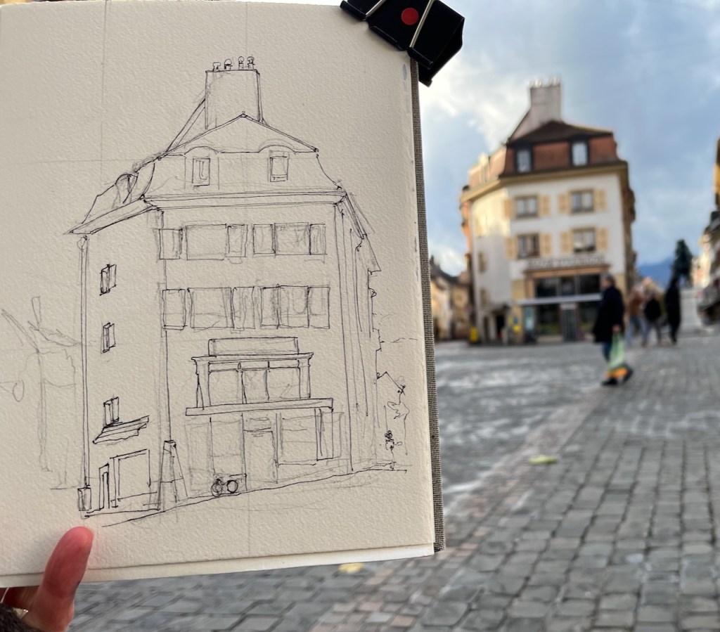
On an expedition to Yverdon-les-Bains I sketched in the Place Pestalozzi.
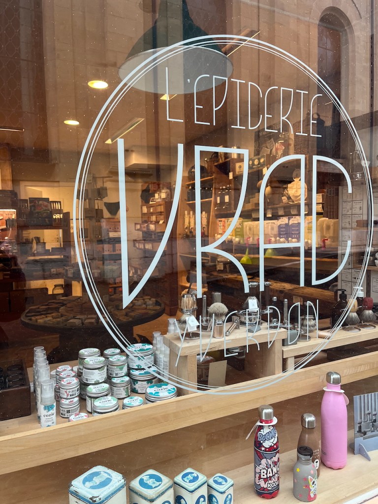
Bazar D’Yverdon, now L’Epicerie Vrac, Place Pestalozzi 3 1400 Yverdon-les-Bains
It was very cold. I just managed to complete the pen and ink sitting in the square. Then I finished the colour in my hotel room.
This building, Bazar D’Yverdon, dates from the beginning of the 17th century. There is an article in the local paper of 2018 (note 1), with some history of the building, and news of a campaign to prevent its being sold and transformed from a retail space into offices. At the time is was a stationary shop, Papeterie Schaer.
A bazaar is a souk, a living place where there are goods and services, where you gossip, trade. For us, the very name “Bazar” is a real source of inspiration.”
Aurélie Massin-Kerkan, co-president of the association for maintaining usage of the Bazar (note 1 – my translation)
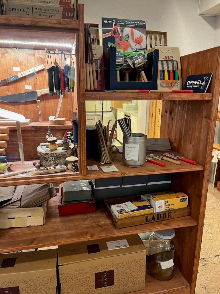
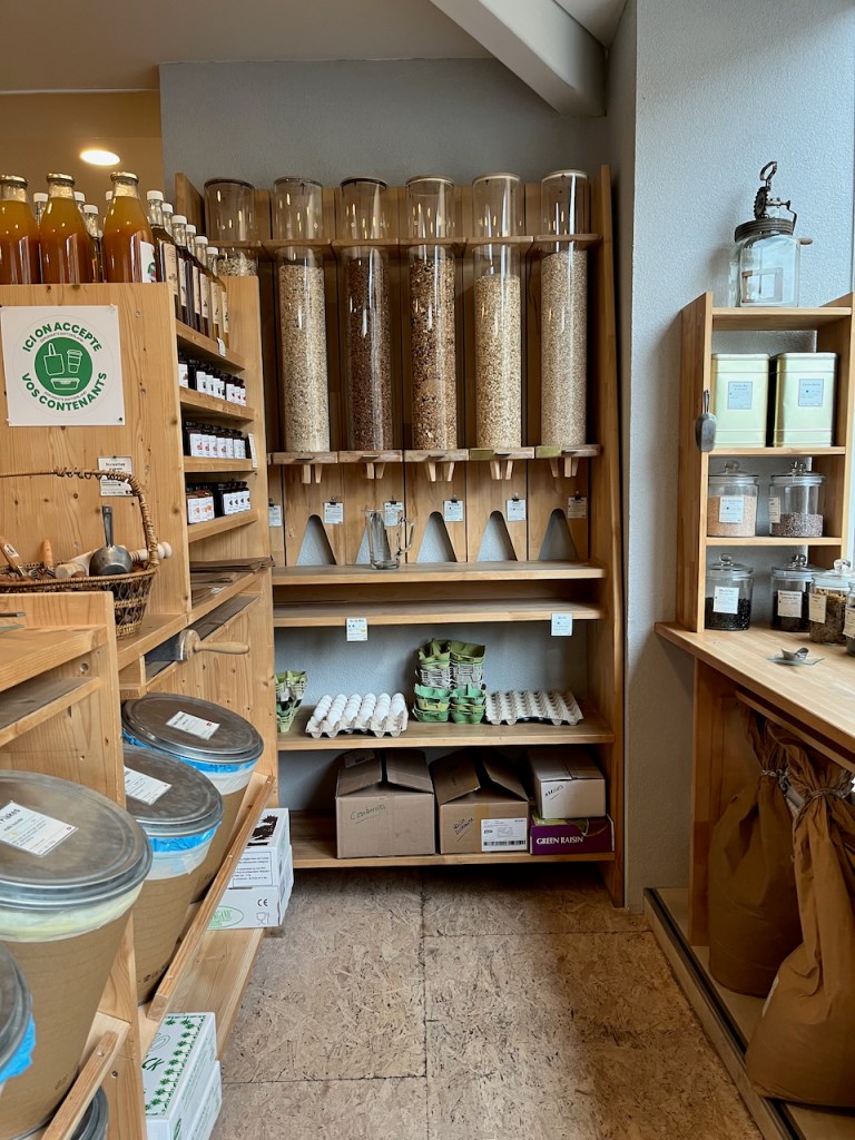
Evidently the campaign was successful. The shop on the ground floor is now a grocer “L’Épicerie VRAC”. I went in to have a look. It sells bulk household goods such as shampoo and muesli, as well as a huge collection of traditional items such as egg timers and kitchen knives and tea towels. The bulk items are displayed in dispensers, so you can fill your own container.
L’Épicerie VRAC
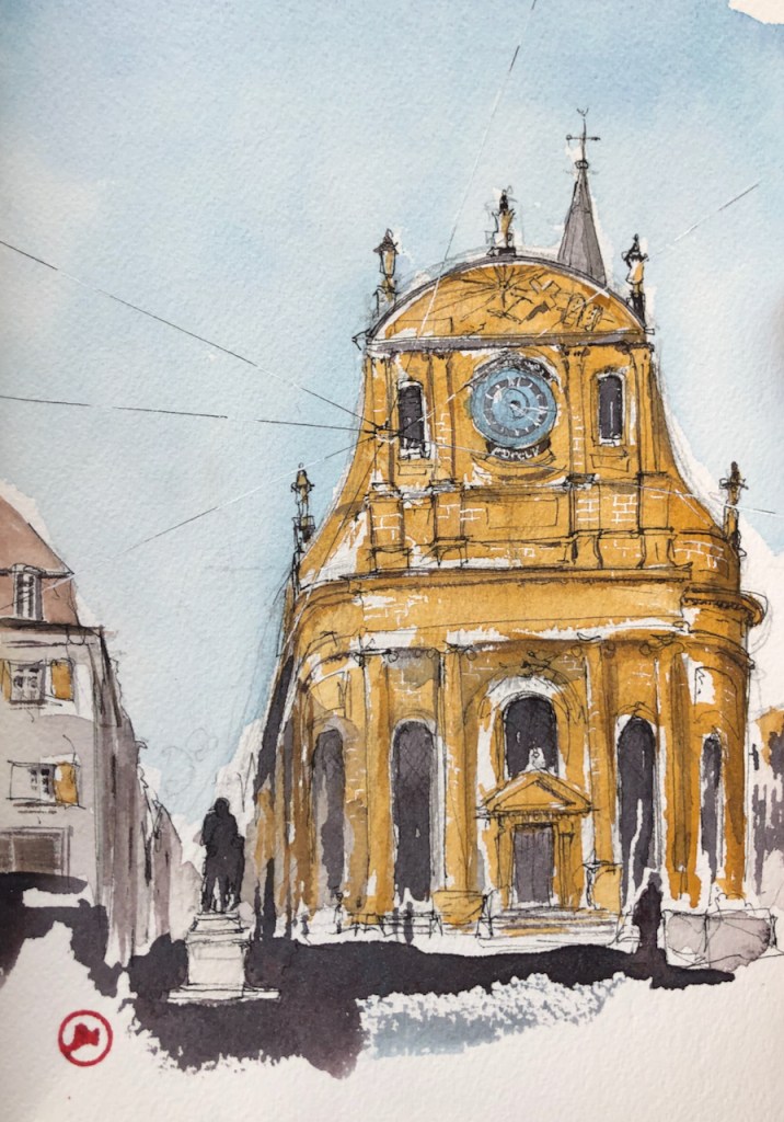
I’ve sketched in Yverdon before. Here is the Temple of Yverdon which is just to the right of the Bazar.
Temple d’Yverdon. The Bazar is the building on the left of this sketch. Click to go to my article about the Temple.
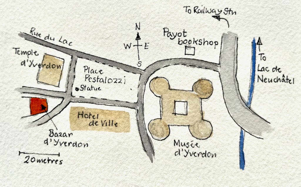
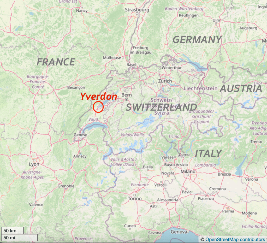
The maps below show the location of Yverdon, in the canton of Vaud.
Canton of Vaud is in the West of SwitzerlandLocation of Yverdon (c) OpenStreetMap contributors
On the Place Pestalozzi
Note 1: The local paper article about the Bazar is in the archives of “24 heures – VAUD”. It is by Frederick Ravissin, 16 June 2018. Read a pdf of the article here (in French) – link below:
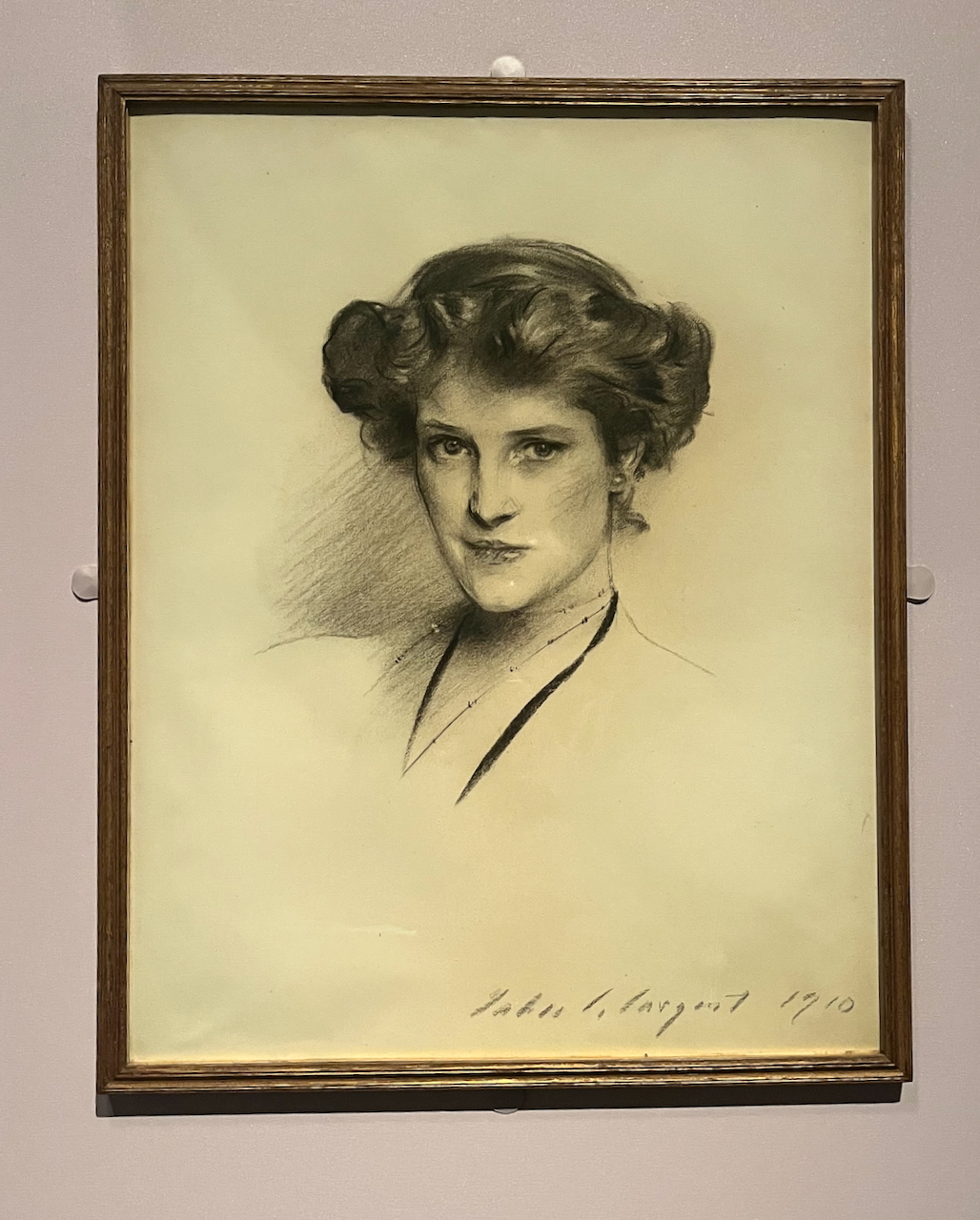
Kenwood House is a mansion at the top of Hampstead Heath, to the North of London. It is managed by English Heritage. At the moment there is an exhibition “Heiress: Sargent’s American Portraits”. Fantastic oil paintings, each woman with a history, echoes of the time of Henry James. Even more than the oil paintings, I enjoyed the charcoal portraits. See the character of the sitter! See the skill of the artist! Recommended: it’s on until 5th October 2025.
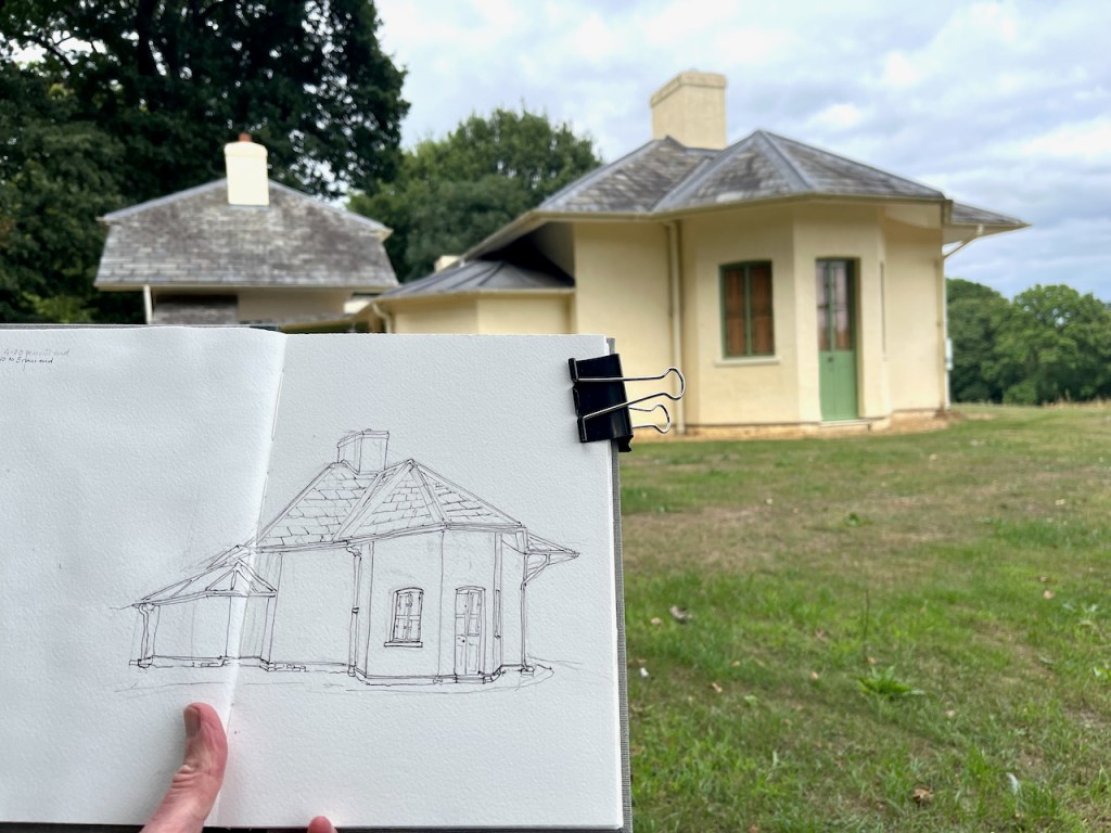
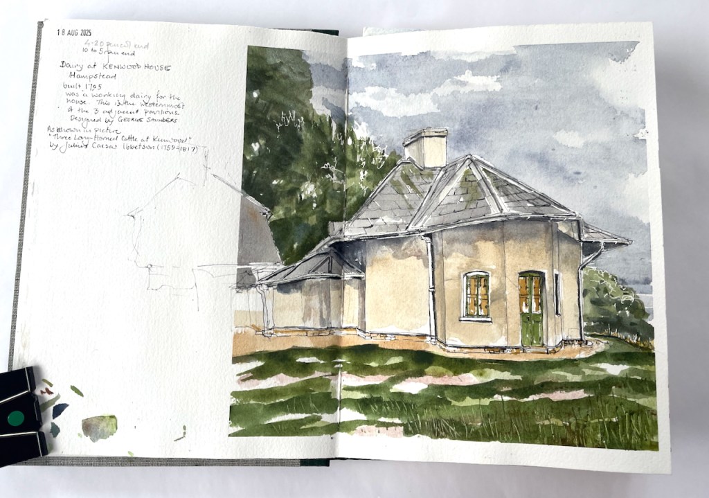
After that, we walked out into the late afternoon sun. Kenwood is a large building. It was too much to take on the house as a sketch project at that time of day. So I sketched a small building I’d spotted on the way in. This is “Kenwood Dairy”. I sketched just a part of it.
Kenwood Dairy, south pavilion, sketched 18 August 2025 in Sketchbook 16, approx size 9″ x 9″.
You can see the whole dairy in this oil painting of 1797 by Julius Caesar Ibbetson:1
The pavilion I sketched is the one on the left. There were sadly no cattle, long-horned or otherwise, for me to put in my sketch.
The dairy was built in 1795, just a two years before Ibbotson’s oil painting. It was a working dairy, built to the designs of George Saunders, for Louisa, the wife of David Murray, 2nd Earl of Mansfield. It was fashionable for 18th century upper-class ladies to run dairies.
a dairymaid.. lived in the cottage and produced the fresh butter, cream, puddings and ice-cream enjoyed by the family and their guests.
English Heritage noticeboard near the dairy
These buildings are now used as a base for volunteers at Kenwood and Hampstead Heath.
Here is work in progress on the drawing:
It was quite tricky to follow the line of that roof. I managed to get the ink lines done, then it was time to go home. I added the colour later at my desk.
Kenwood dairy, finished drawing in Sketchbook 16
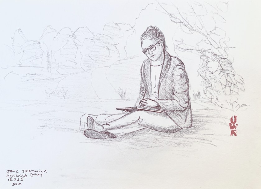
While I was drawing the dairy, John was drawing me, from a nearby bench.
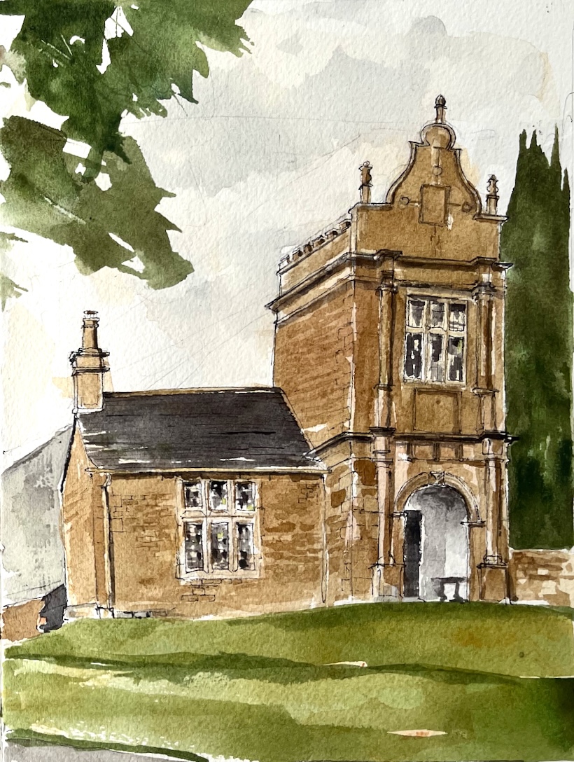
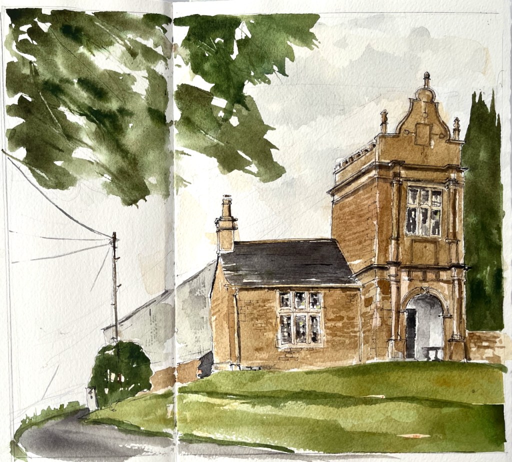
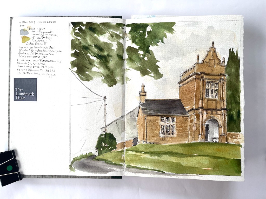
This building was the gatehouse to a stately home, “Chesterton”, now demolished. It is made of fragments of that building and others.
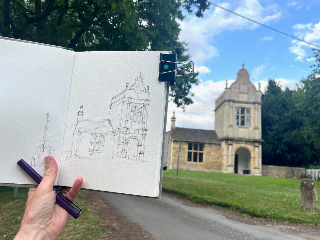
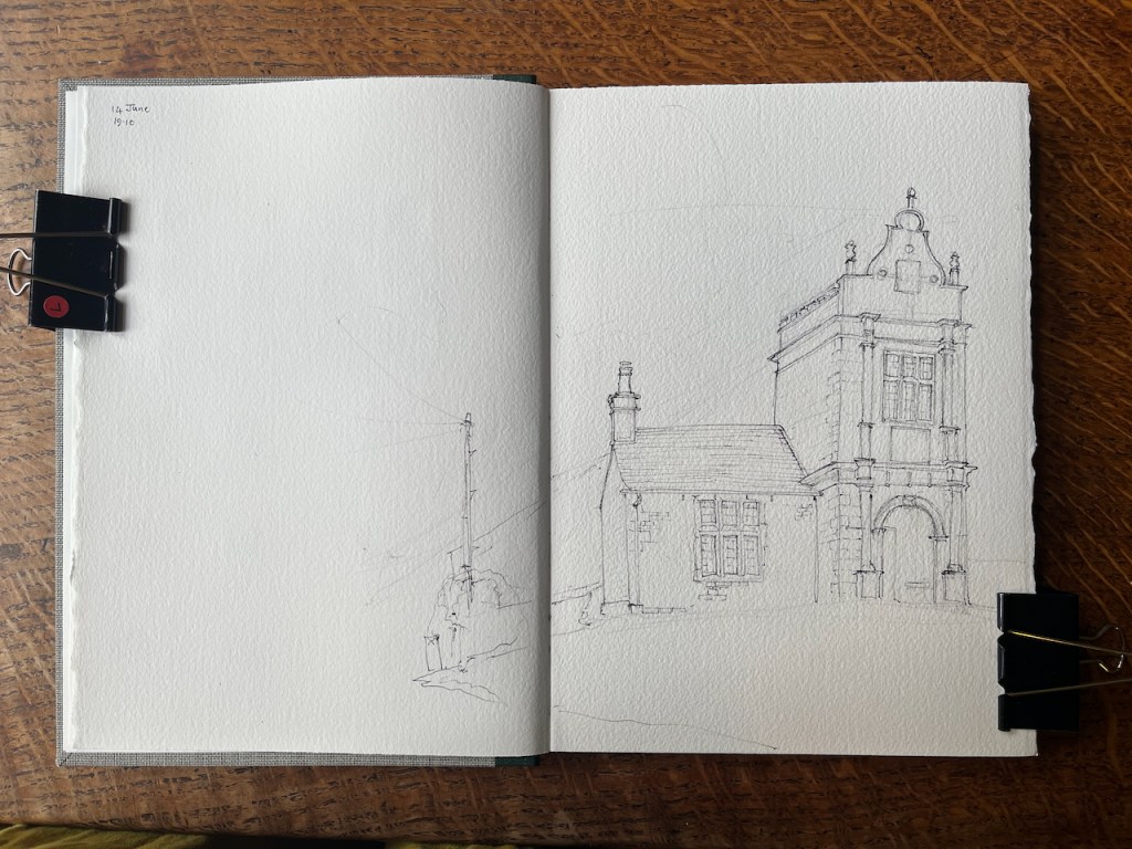
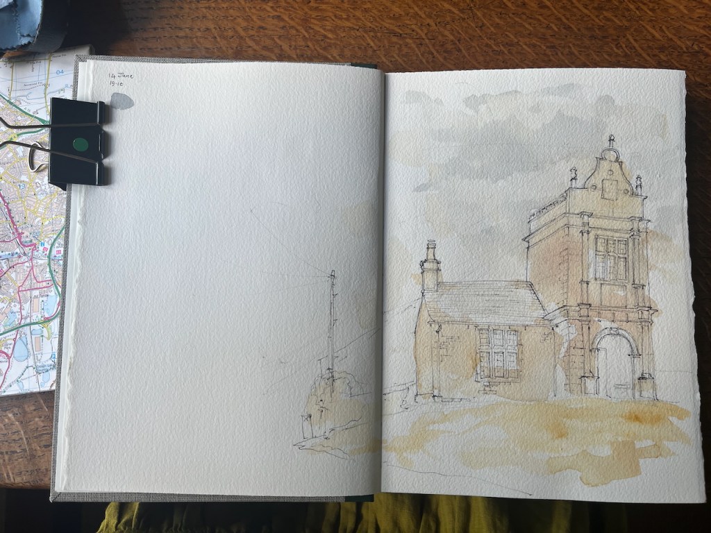
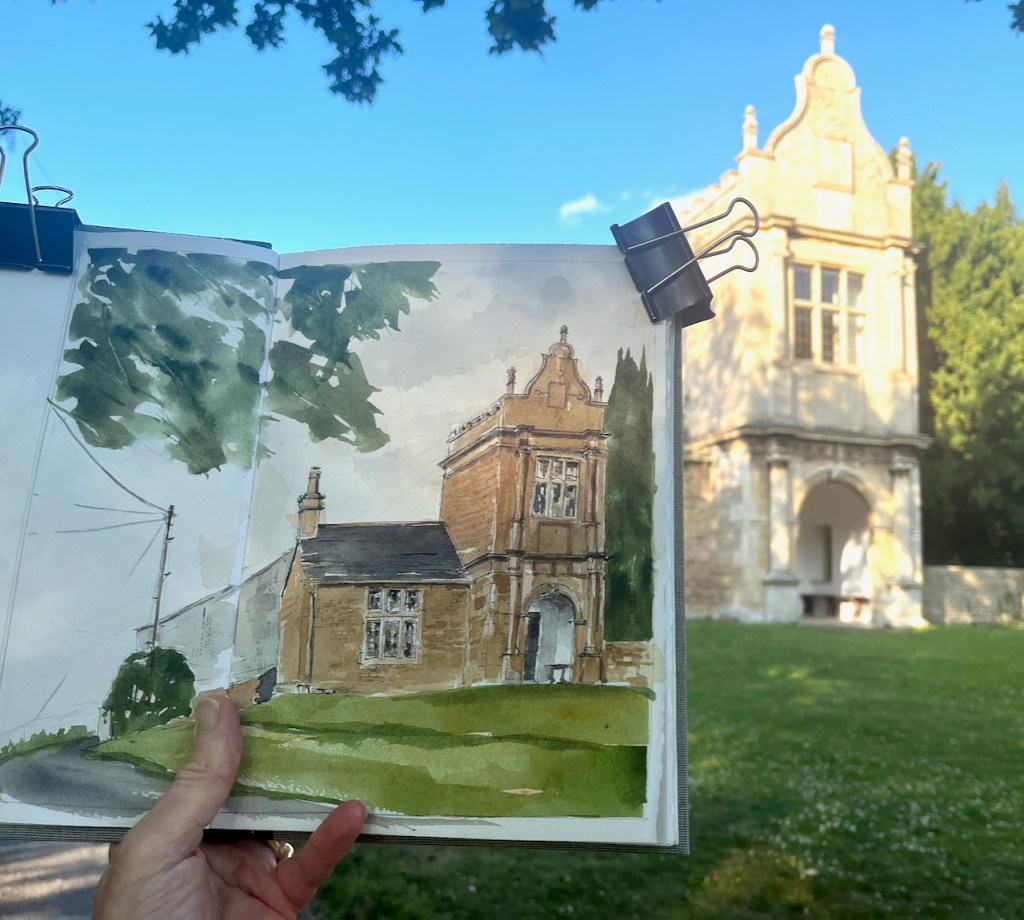
Lynch Lodge near Peterborough, Landmark Trust. June 14th 2025 in Sketchbook 16
The building dates from approximately 1807. It was acquired by The Landmark Trust in 1983. The Trust undertook restoration works completed 1983. The architect for this restoration was Philip Jebb and the builders were C Bowman and Sons.
Lynch Lodge is the first picture in my new Sketchbook, Sketchbook 16.
The Lodge is in the midst of countryside which looks as though it is a painting by John Constable.
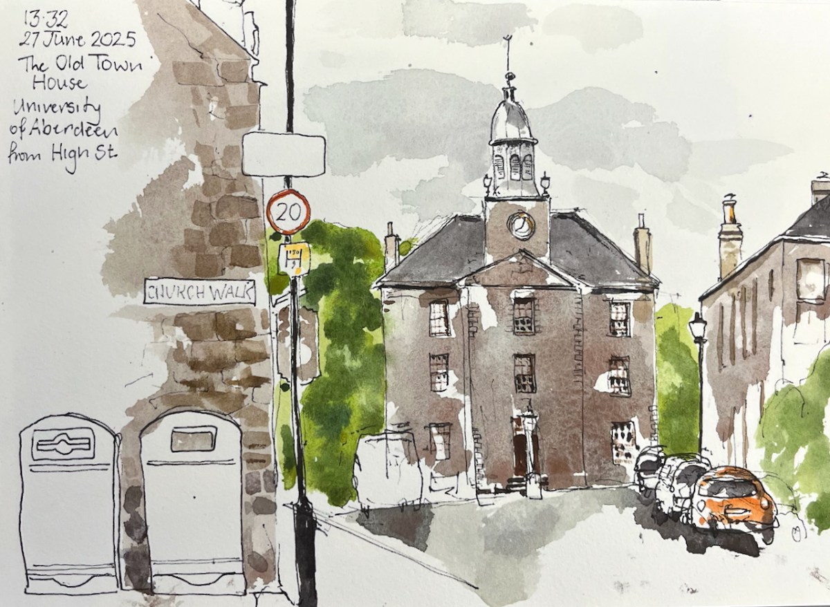
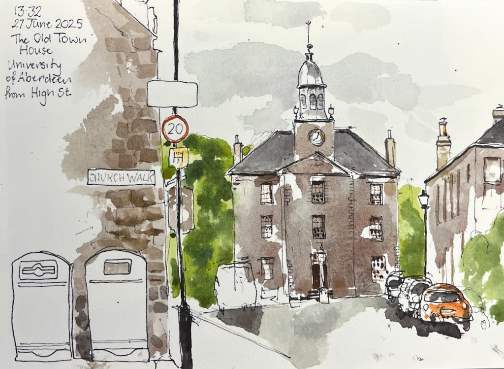
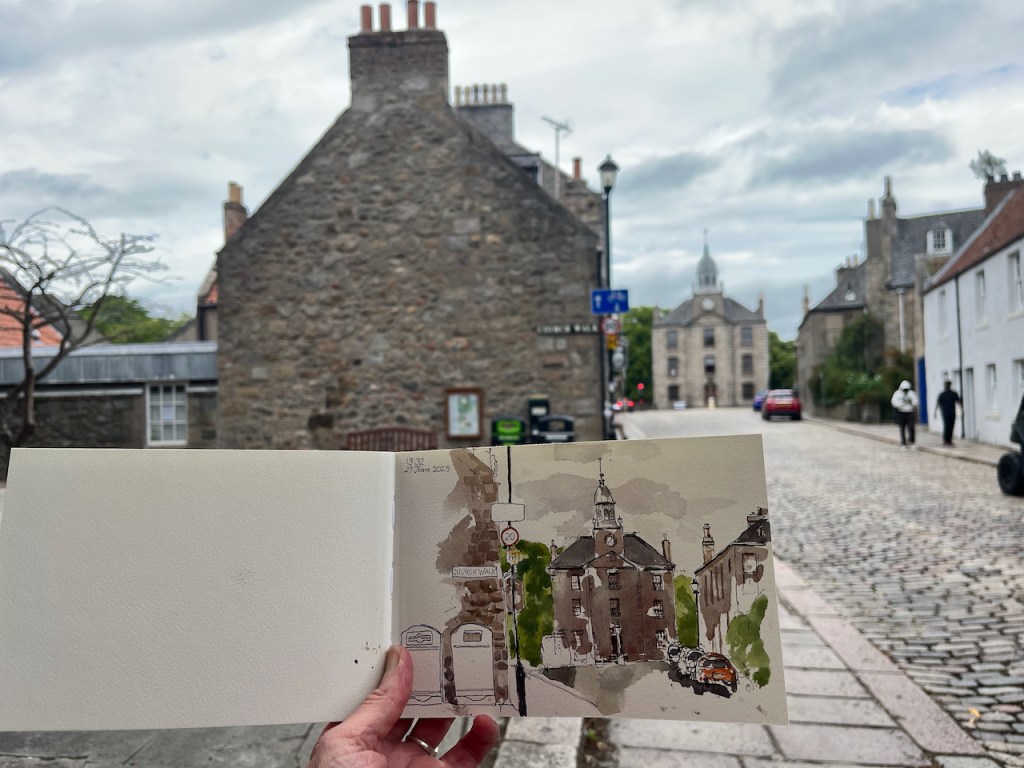
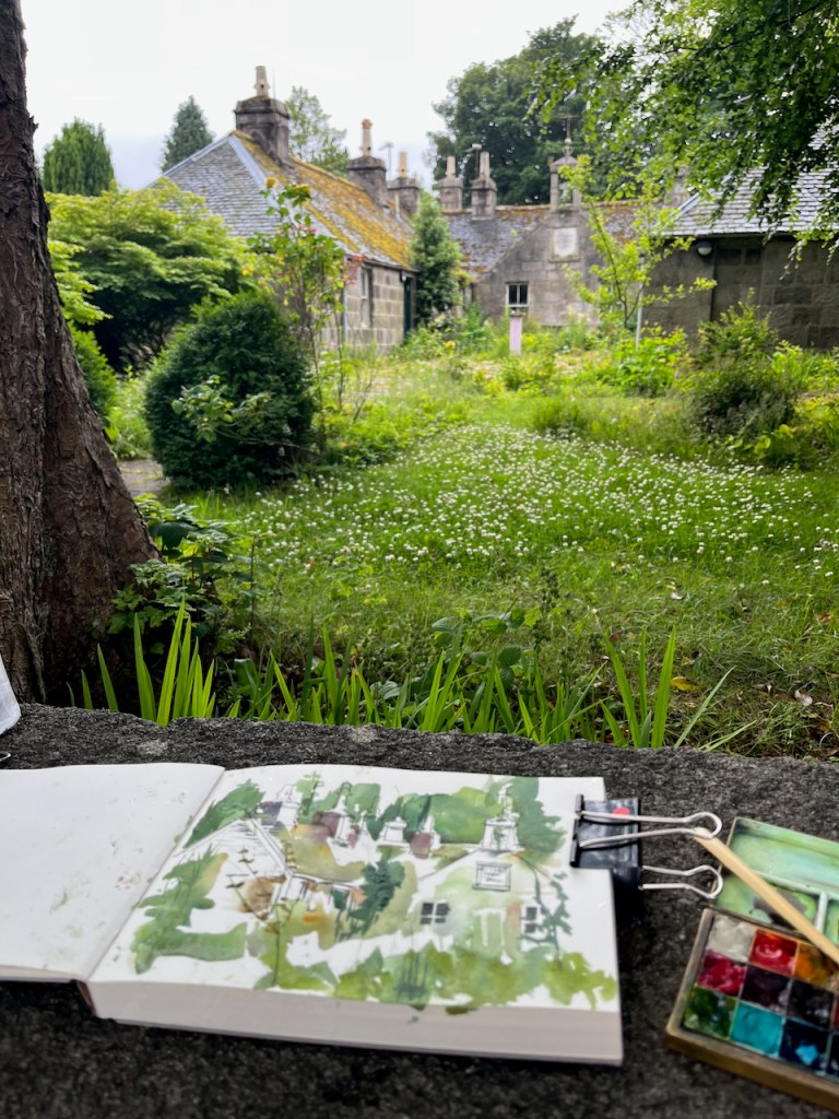
I had been travelling a long time. Reaching Old Aberdeen I sat on a granite kerbstone and sketched The Old Town House. Behind me was a friendly bookshop, where I had bought a map.
The Old Town House, University of Aberdeen, in Shetland 2025 sketchbook, size A5.
Having sketched, I walked into the picture I had drawn, and towards the trees on the left of the Town House. There I discovered a building being taken over by plants.
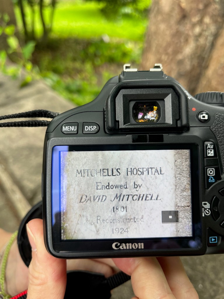
There was a plaque on the building, with writing on. You can see it in the background of the photo above. I couldn’t read the plaque at this distance, and neither could my phone.
Some tourists came by, laden with backpacks and cameras. They paused, curious to see what I was drawing. Since their eyes were younger than mine, I asked if they could read the plaque. They couldn’t, and neither could their phones. My next idea was that they could try using the telephoto lens on one of those formidable-looking cameras. With good grace they shrugged off a hefty block of technology, and removed its canvas housing. It had a fine lens.
“Mitchell’s Hospital, endowed by David Mitchell 1801. Reconstructed 1924.”
So now we know.
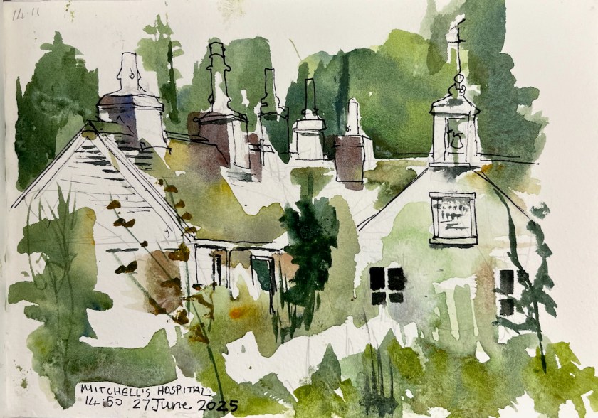
Mitchell’s Hospital, The Chanonry, Old Aberdeen. Sketch in “Shetland 2025” sketchbook, A5
David Mitchell founded the hospital as an almshouse “from a regard for the inhabitants of the city of Old Aberdeen and its ancient college and a desire in these severe times to provide lodging, maintenance and clothing for a few aged relicks and maiden daughters of decayed gentlemen merchants or trade burgesses of the said city..” [Wikipedia entry quoting the deed of mortification of the Hospital]. It was used as such, housing elderly ladies, up to to around 2016 when the final elderly resident, Iona Mathieson-Ross, had to move out.
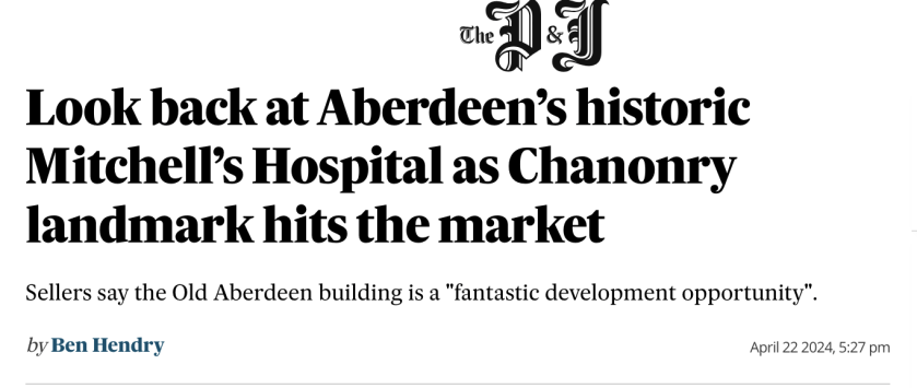
A later article says it has been sold, and that the new owners are refurbishing the building as small residential units to be let, possibly as short-term holiday lets. The planning application on Aberdeen Council’s website shows a building looking identical to the existing one, cleaned up and repaired.
From the planning application 241449/LBC Proposed elevations, North and East
It sounds like a dream come true for this neglected building:
“PROPOSED WORKS Roof: Allow for removal of all moss and vegetation Allow for replacement of missing slates in size, thickness and colour to match existing. Check ridge tiling and re-bed any loose tiles. Chimney stacks pointing to be checked and where missing to be repointed…
…Chimney cans to be reset…
Granite Masonry: Pointing to be checked and where missing to be repointed…
Windows: Existing sash & case windows to be checked & where wet rot is evident timber sections to be replaced with same profile in Redwood. Windows to be refurbished to ensure they are fully operational and fitted with draught stripping internally….
External Doors: Existing external doors to be replaced with external quality Redwood 4 panel doors with double glazed obscure glass in upper 2 panels fully weather stripped primed and painted…
The planning application was approved on the 3rd July 2025, a few days after I was standing there doing my sketch. Perhaps when I next visit Aberdeen the improvement work will be in progress. Maybe, if it becomes holiday lets, I can even stay there.
I’m glad it’s being refurbished, but I shall treasure the view of this graceful building gradually being assimilated into the plant world.
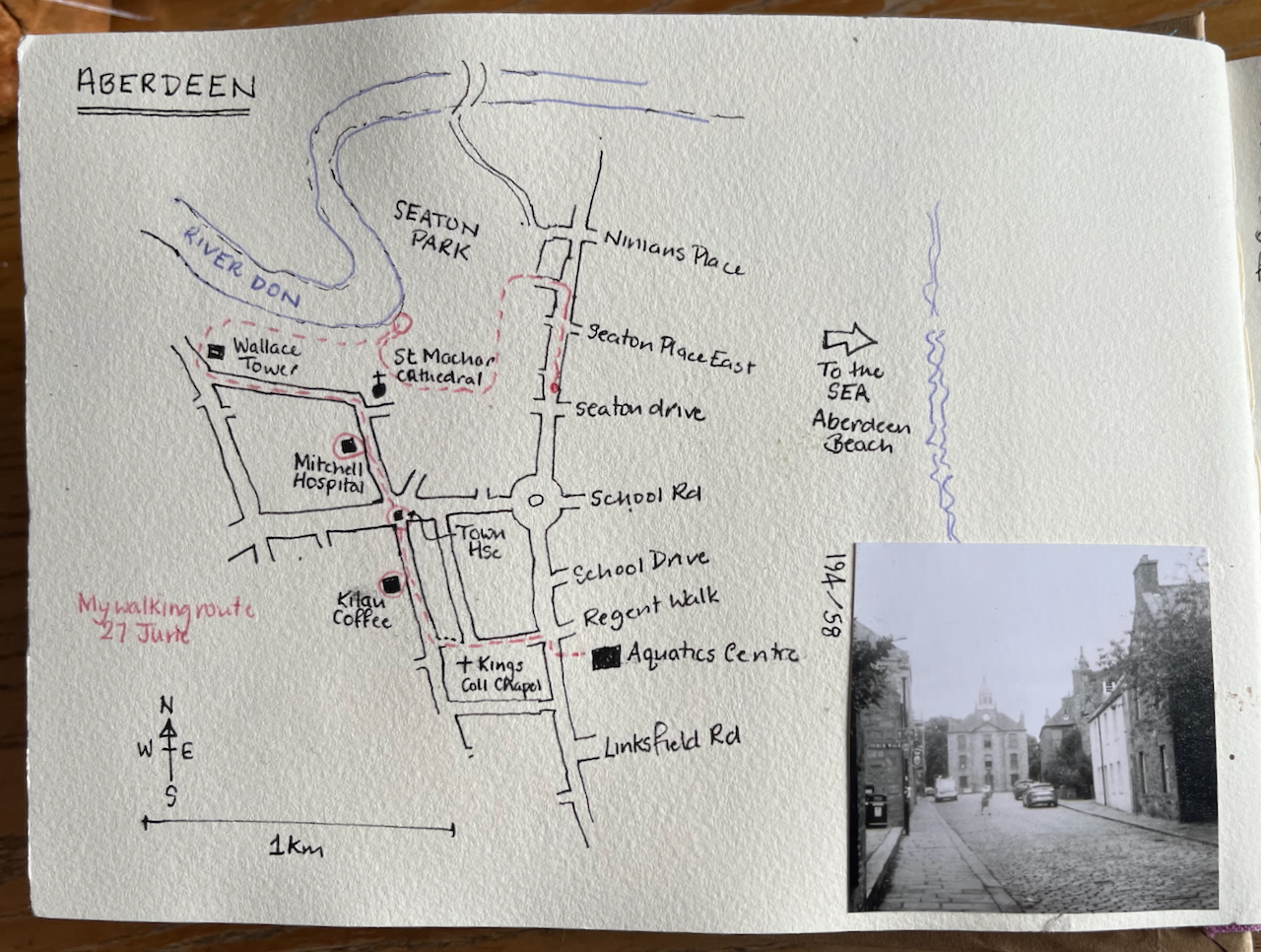
Here is a map showing my walk and Mitchell’s Hospital.
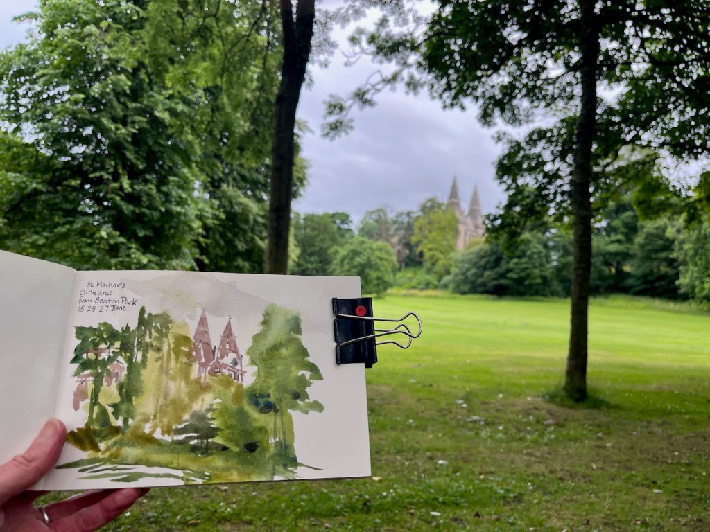
I had coffee in Kilau Coffee – recommended!Sketching in Seaton Park, before the rain. St Machar’s Cathedral.
Click a button below to share this post online, email it, or print it:
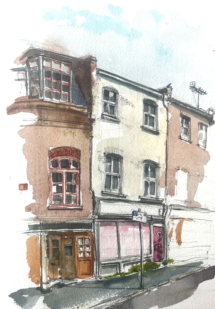
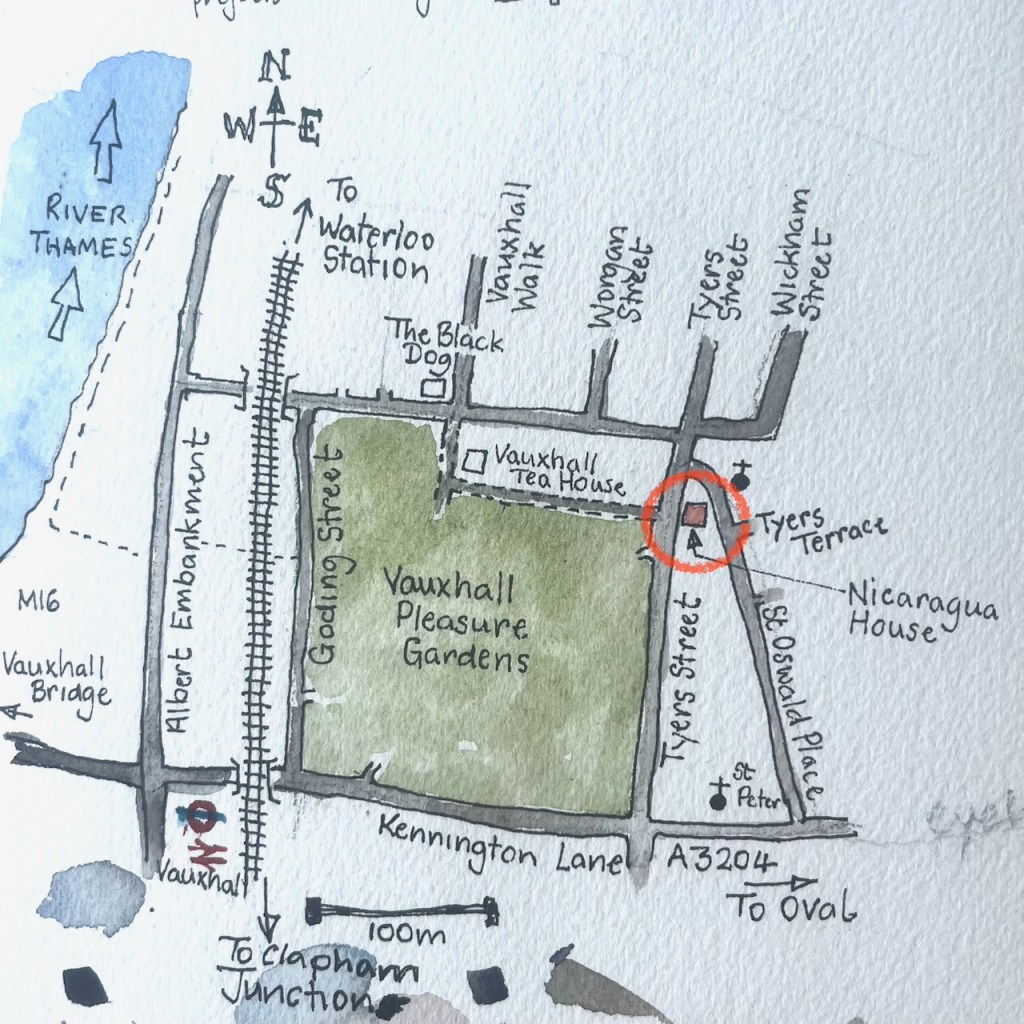
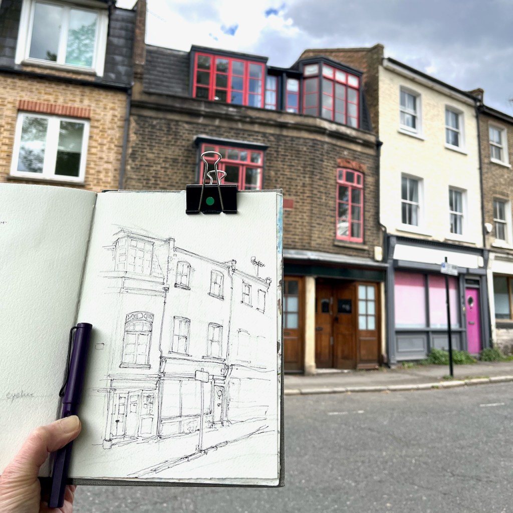
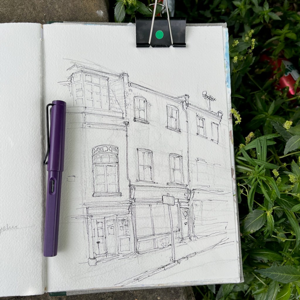
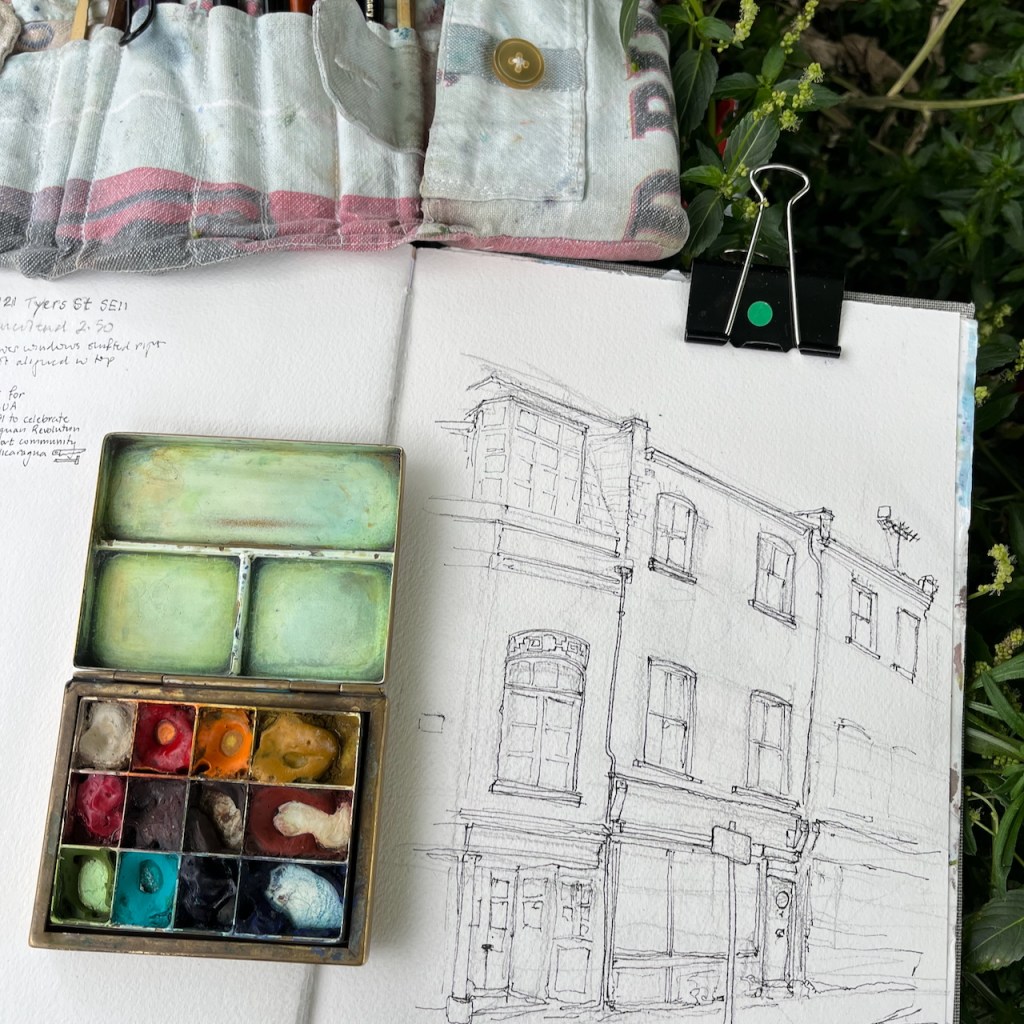
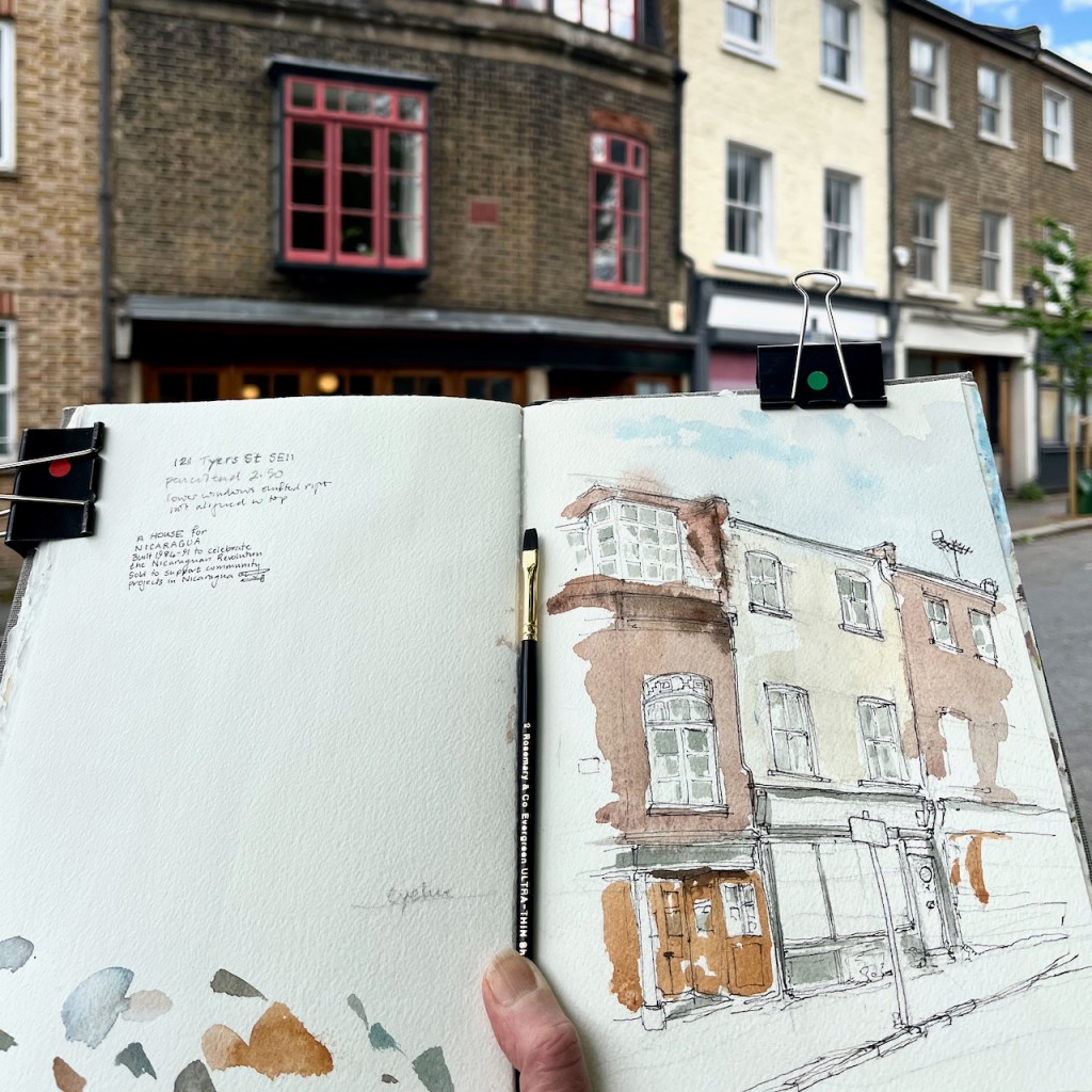
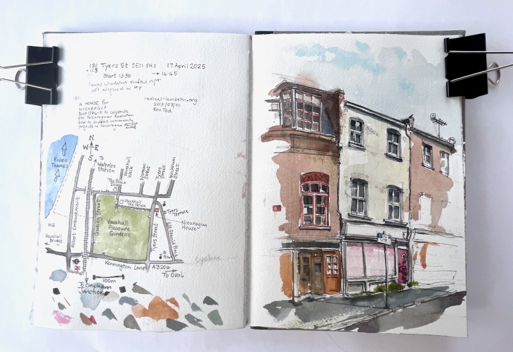
This is an interesting terrace, just to the East of Vauxhall Pleasure Gardens.
121 and 123 Tyers Street, SE11 5HS, sketched 17 April 2025 in Sketchbook 15
The terrace house on the left has a terracotta plaque let into the brickwork:
A HOUSE FOR NICARAGUA
Built 1984-91 to celebrate
the Nicaraguan Revolution
Sold to support community projects in Nicaragua
The website “Radical Lambeth” has an article which tells more. The house was restored as a community endeavour, led by a visionary, Ron Tod (sometimes spelled Todd):
“He had some money from a house he had built out of an old airfield shed in Essex, and he thought some of the people he was living with might help with the work. About 200 people – men and women in their twenties and thirties did…”
“Almost all the materials for 121 Tyers Street came from skips, building sites or dumps. The floors are parquet, retrieved in one great haul from a skip….”
Even from the outside, the house is feels beautiful. The windows are all different, and there is intriguing detail, such as the terracotta frieze above the window shown in my picture. This is a house built to a loose design rather than a rigid plan. Much was created by the people there, as they went along, using materials to hand. Sketching it, I was reminded of the work of the 1970s radical architect Christopher Alexander, “A Pattern Language”.
The house in the centre of my picture is 123 Tyers Street. This is much plainer. But it also is intriguing. The lower windows are not directly below the upper windows, but shifted right.
I sketched sitting on the wall opposite.
Sketchbook spread, Sketchbook 15
Click a button below to share this post online, email it, or print it:
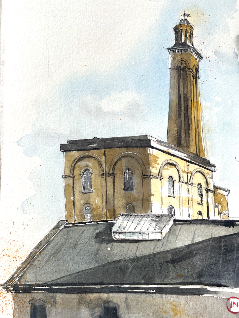
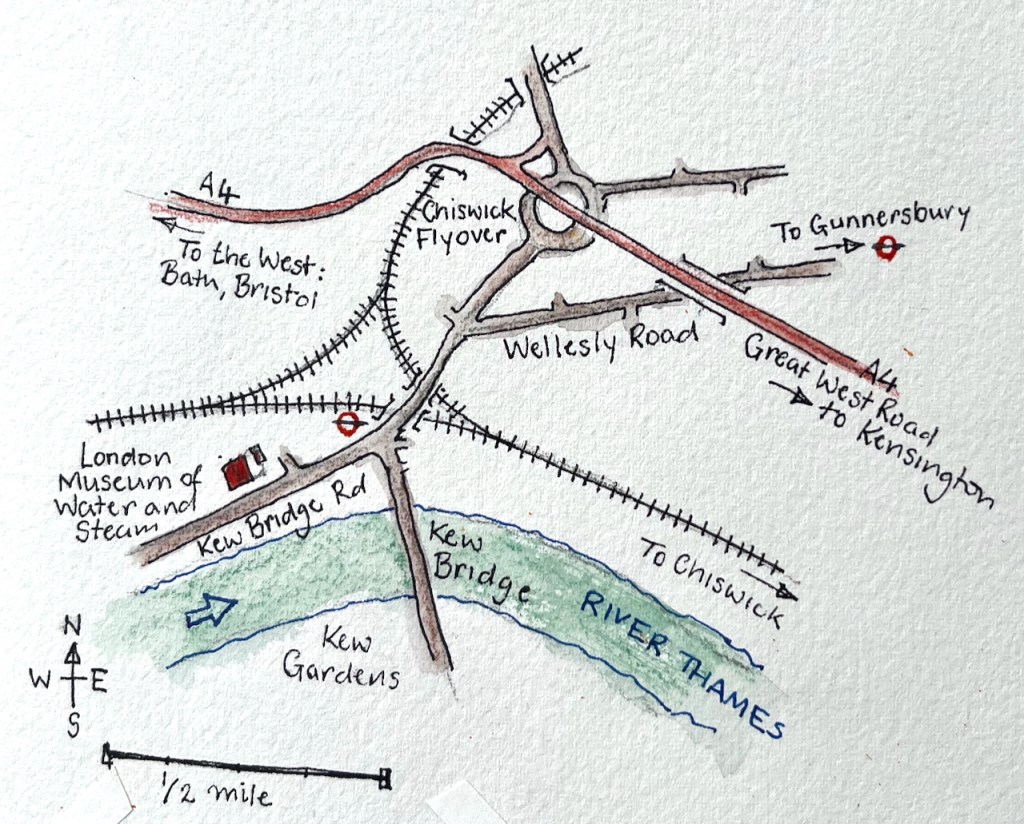
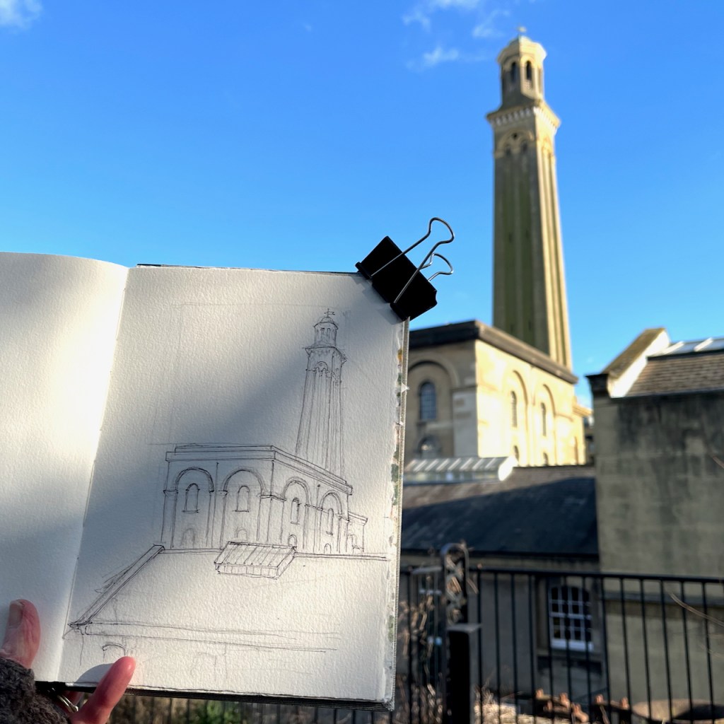
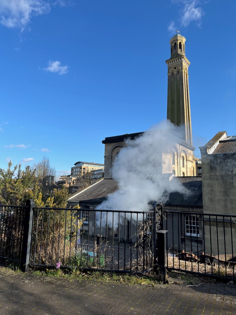
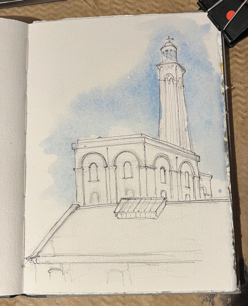
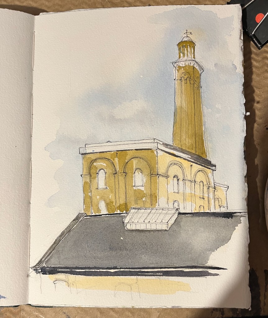
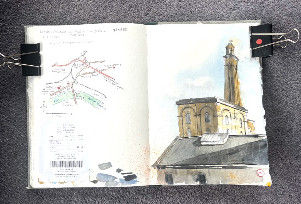
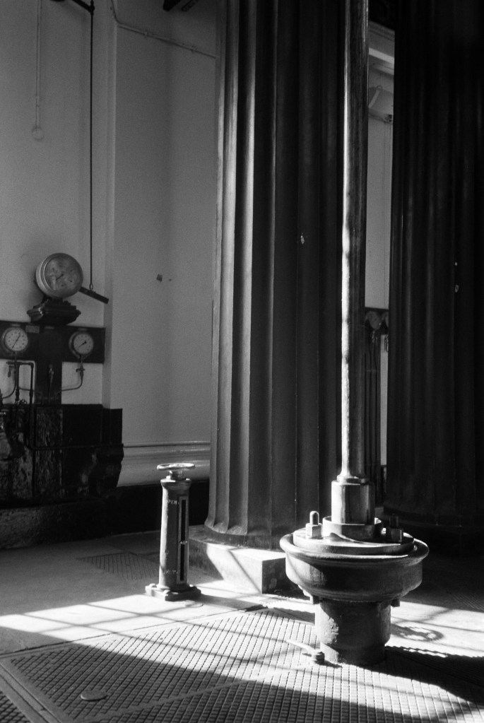
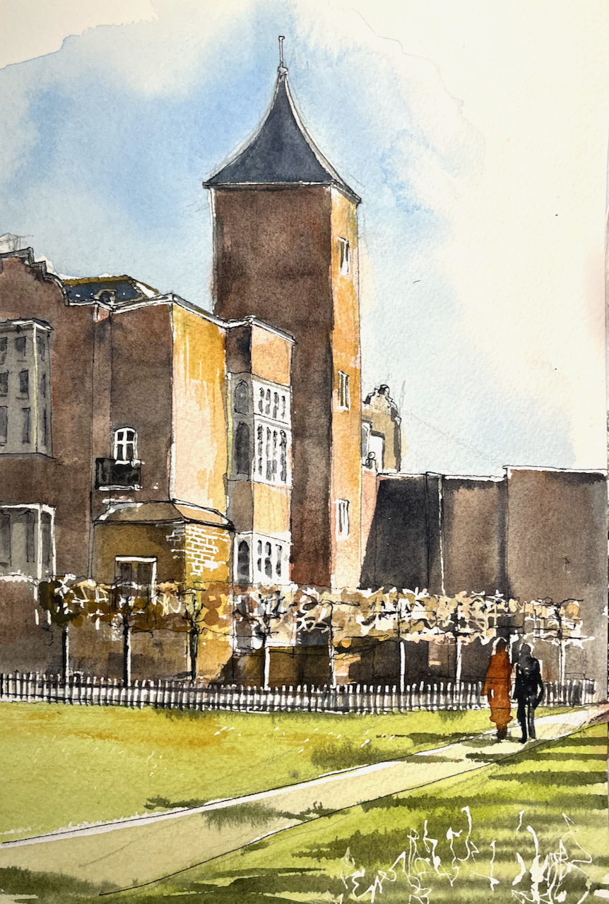
Here is the magnificent London Water and Steam Museum.
London Water and Steam Museum, sketched 15th March 2025, 4pm in sketchbook 15.
It’s definitely worth a visit if like me you are fascinated by steam engines. But there’s more. This museum is a whole education in the London drinking water and sewerage system: past and present.
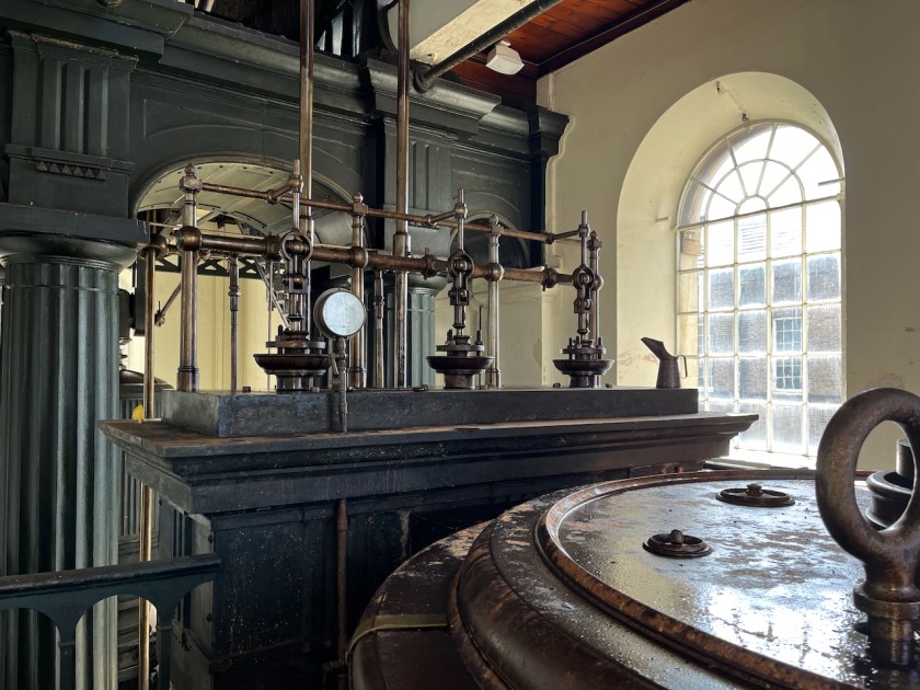
The building I’ve sketched houses the “100 inch pumping engine” and the “90 inch pumping engine”. These are steam pumps over a hundred years old. The inches refer to the diameter of the pump cylinder. Their job was to pump drinking water from the Thames to premises in London. The 90 inch engine started working in 1846 and the 100 inch started in 1871. They both retired in 1943, by which time the 90 inch had been going 97 years. The 100 inch gave a demonstration in 1958, which was the last time it pumped water. The 90 inch was restored to working order by enthusiasts in 1973, and now gives demonstrations in the museum. The 100 inch has yet to be restored.
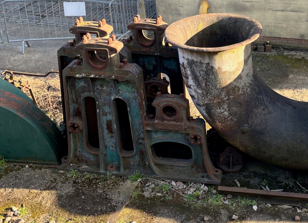
A glimpse of part of the 100 inch engine
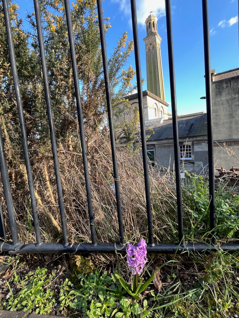
The tower in my sketch is not a chimney. It is a “standpipe tower”. It holds big vertical pipes and a reservoir to store water and regulate the pressure. The strokes from the steam engines created powerful surges of water. You don’t want those powerful surges going directly into the mains water supply, and as they might damage the pipes and surprise consumers. So the steam engines pumped the water up this tower instead. From there, the water flowed out to consumers smoothly.
Providing running water was a whole big problem in the Victorian era. The machines were gigantic so that they could generate sufficient water pressure to get the water up to the second floor of the new Victorian houses which had bathrooms upstairs. That’s not something we normally think about: but I can see it’s an issue.
a glimpse of the 90 inch engine
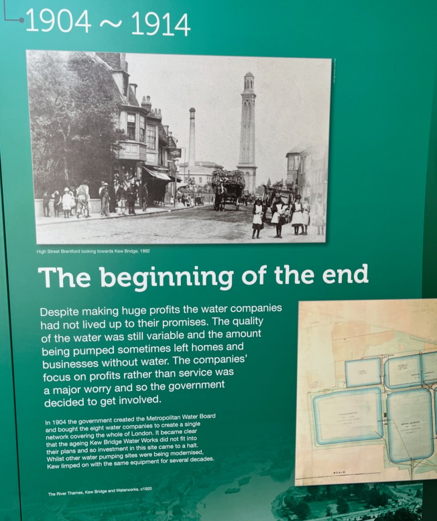
Then there was the whole big issue of the purity of the water, and whether it was actually drinkable. There were a number of private water companies at the time, in competition with each other, and vying for business, making claims for their water quality, and returning dividends to their shareholders. This was the late 19th century – 100 or so years ago.
A display panel soberly tells us:
“Despite making huge profits the water companies had not lived up to their promises. The quality of the water was still variable and the amount being pumped sometimes left homes and businesses without water. The companies’ focus on profits rather than service was a major worry and so the government decided to get involved. In 1904 the government created the Metropolitan Water Board and bought the eight water companies to create a single network covering the whole of London. …
Display panel: “The companies’ focus on profits rather than service was a major worry and so the government decided to get involved.…”
As well as history, I learned about today’s drinking water.
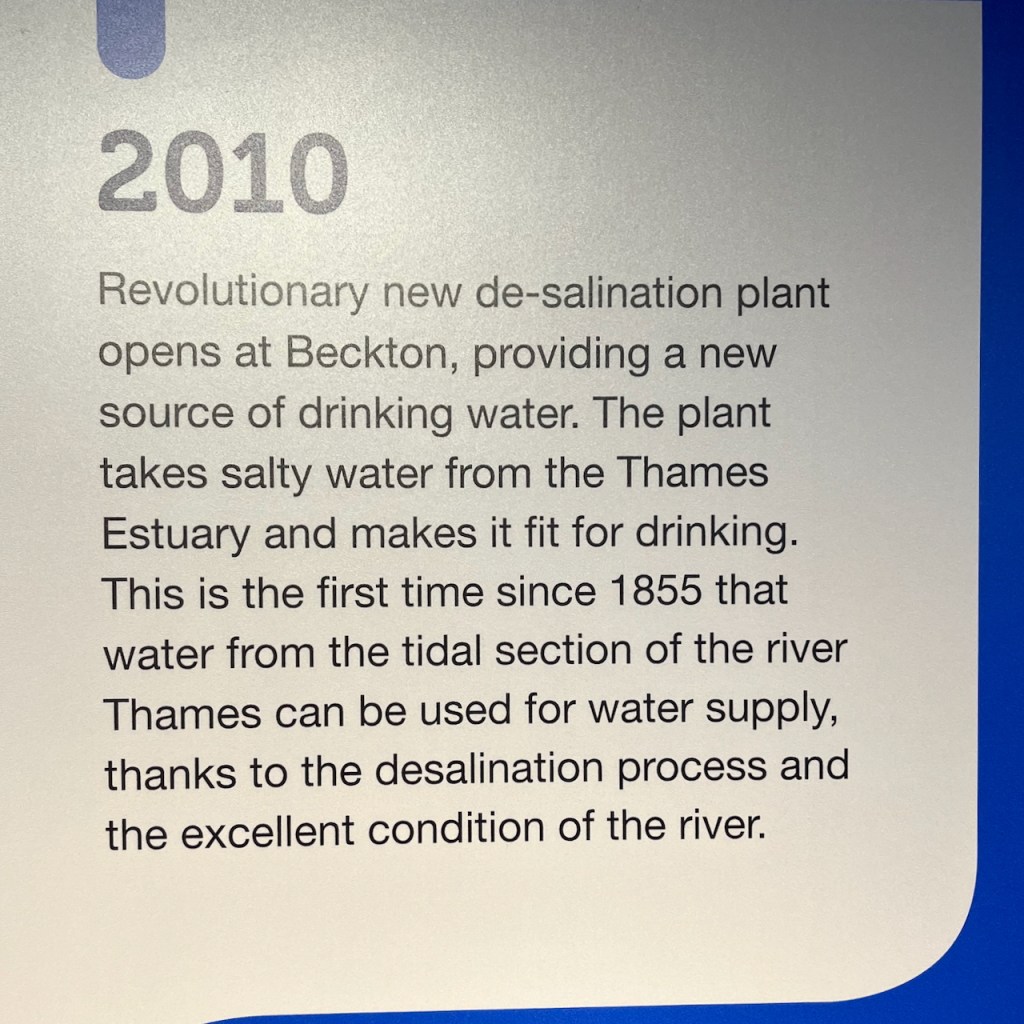
For example: did you know that 10% of London’s drinking water is de-salinated water from the Thames estuary? The “revolutionary new de-salination plant” opened in 2010:
I watched a gripping – and somewhat alarming – video of heroic engineers cautiously making their way down soaking brick-lined pipes in the sewers below London streets. They were down there to inspect and clear blockages. I also saw the “rat” robots that can be sent down the smaller sewers – it’s a tough environment for technology.
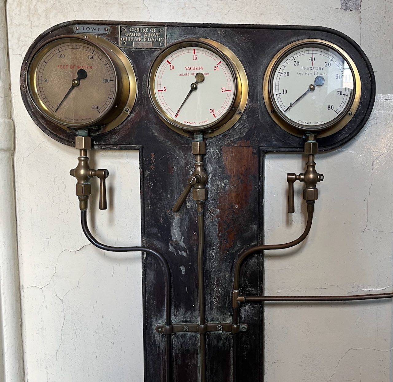
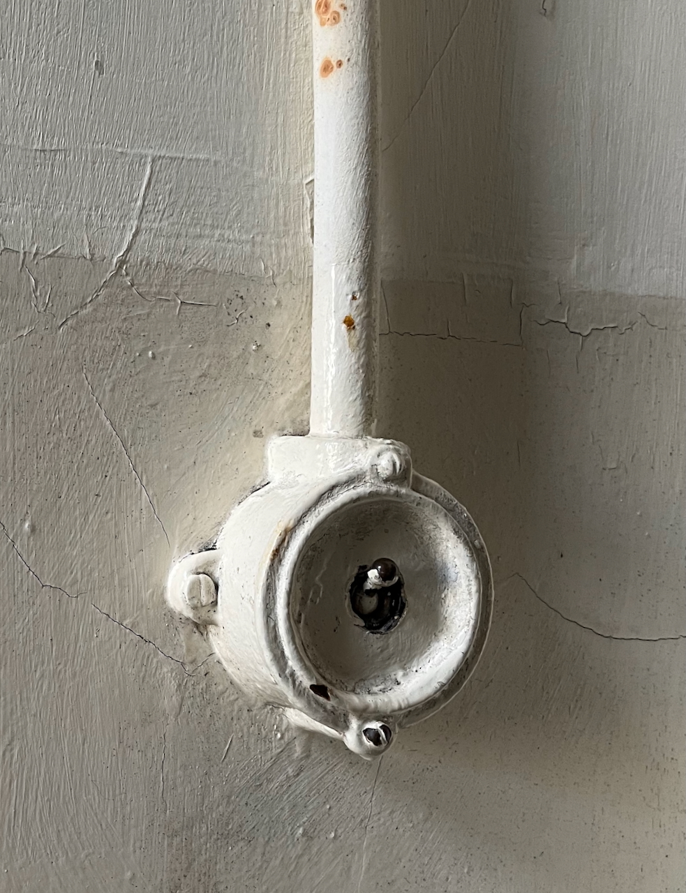
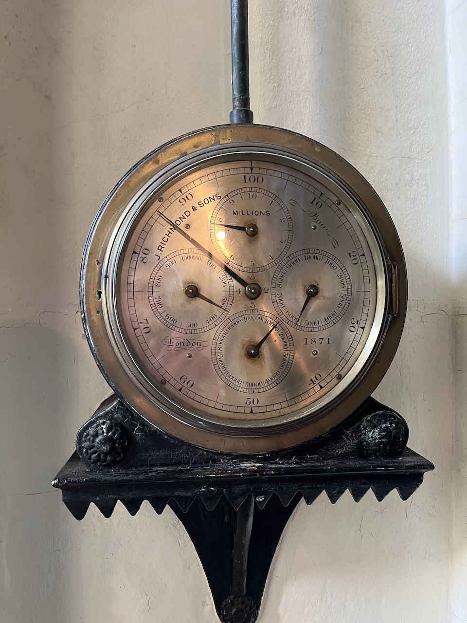
As well as all this gripping factual information, there’s much of strange beauty in the machinery. I particularly enjoyed the devices and dials.
Definitely recommended. It’s on the underground. No café: take a picnic to eat at their indoor tables.
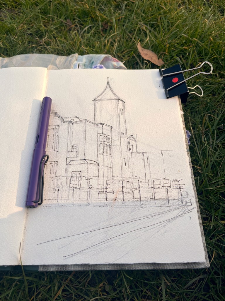
It closes at 4pm – I managed to do the sketch from the garden, just before they closed the gates.
Sculptural debris in yardThe steam train in the grounds: returning to the shed at the end of the day.
I added the colour later.
Sketchbook 15Part of the 90 inch pump: analogue film photo, Olympus XA2 using Kentmere Pan 400 b/w film. 15th March 2025
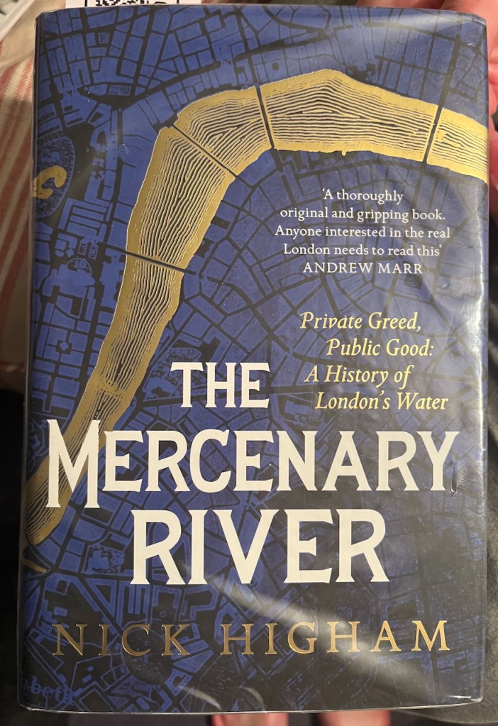
Information in this post is from placards in the museum or from their website. Inspired by my visit to the museum, I read this excellent book about London’s water supply:
“The Mercenary River” by Nick Higham
Click a button below to share this post online, email it, or print it:
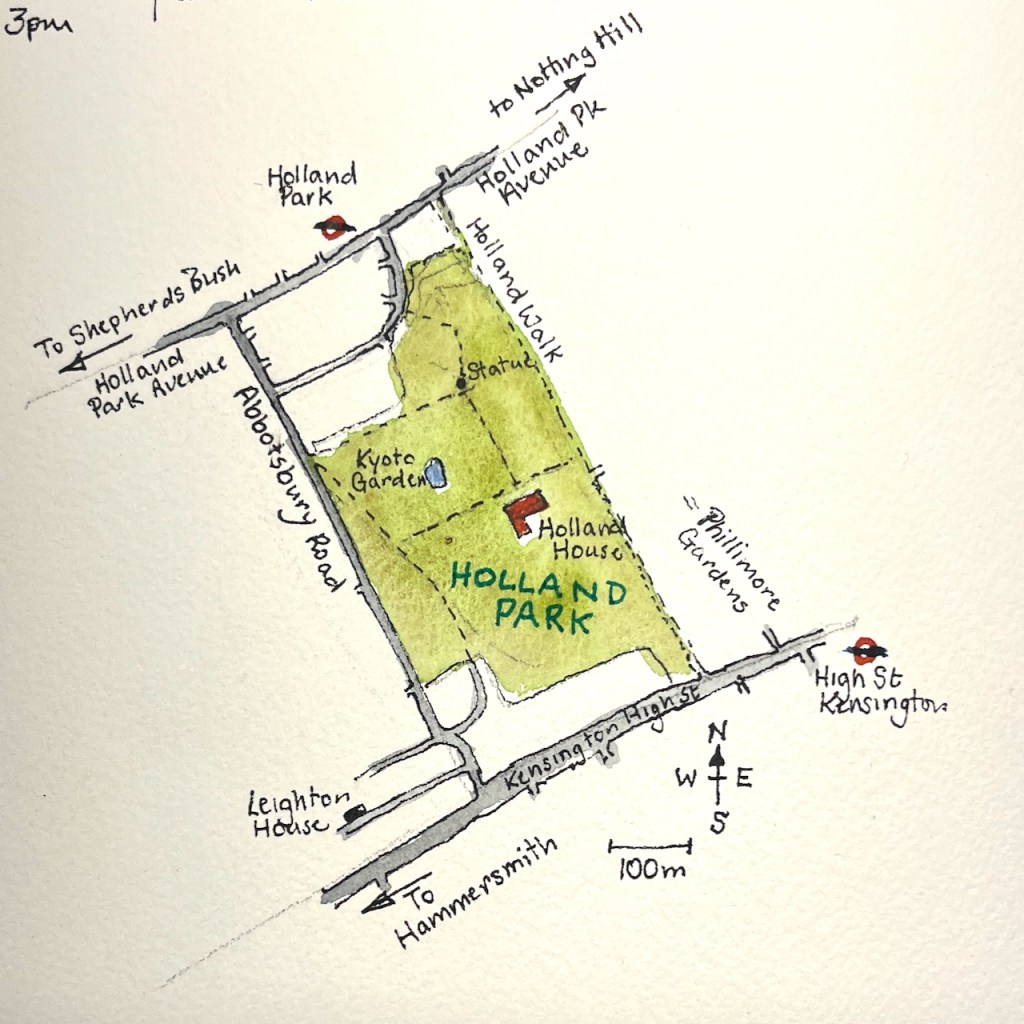
On a freezing day in March, I sketched Holland House.
Holland House from the North, in Sketchbook 15.
The view from the bench wasn’t quite right, so I moved to the grass. The shadows crept after me across the lawn.
The house was built in 1605-7. It originally had two turrets and was much larger than it is now.
It was damaged by aerial bombardment in 194o.
During the night of 27 September, Holland House was hit by twenty-two incendiary bombs during a ten-hour raid. The house was largely destroyed, with only the east wing, and, miraculously, almost all of the library remaining undamaged.
My sketch shows the surviving East wing with its turret. In the 1950s the damaged part was demolished, and the remainder converted to a youth hostel and open-air theatre.
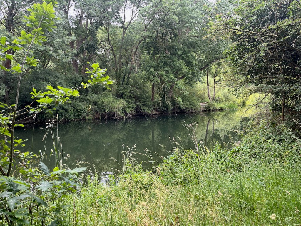
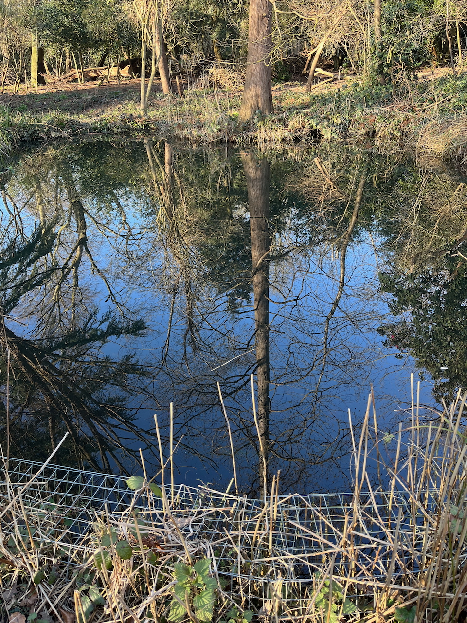
On the way back to the tube station I paused at a still pond.
Click a button below to share this post online, email it, or print it:


_-_Three_Long-Horned_Cattle_at_Kenwood_-_88029298_-_Kenwood_House.jpg)