The Triangular Building, Smithfield EC1

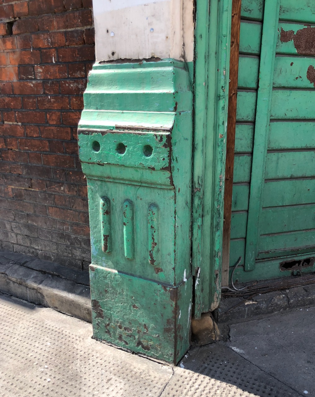
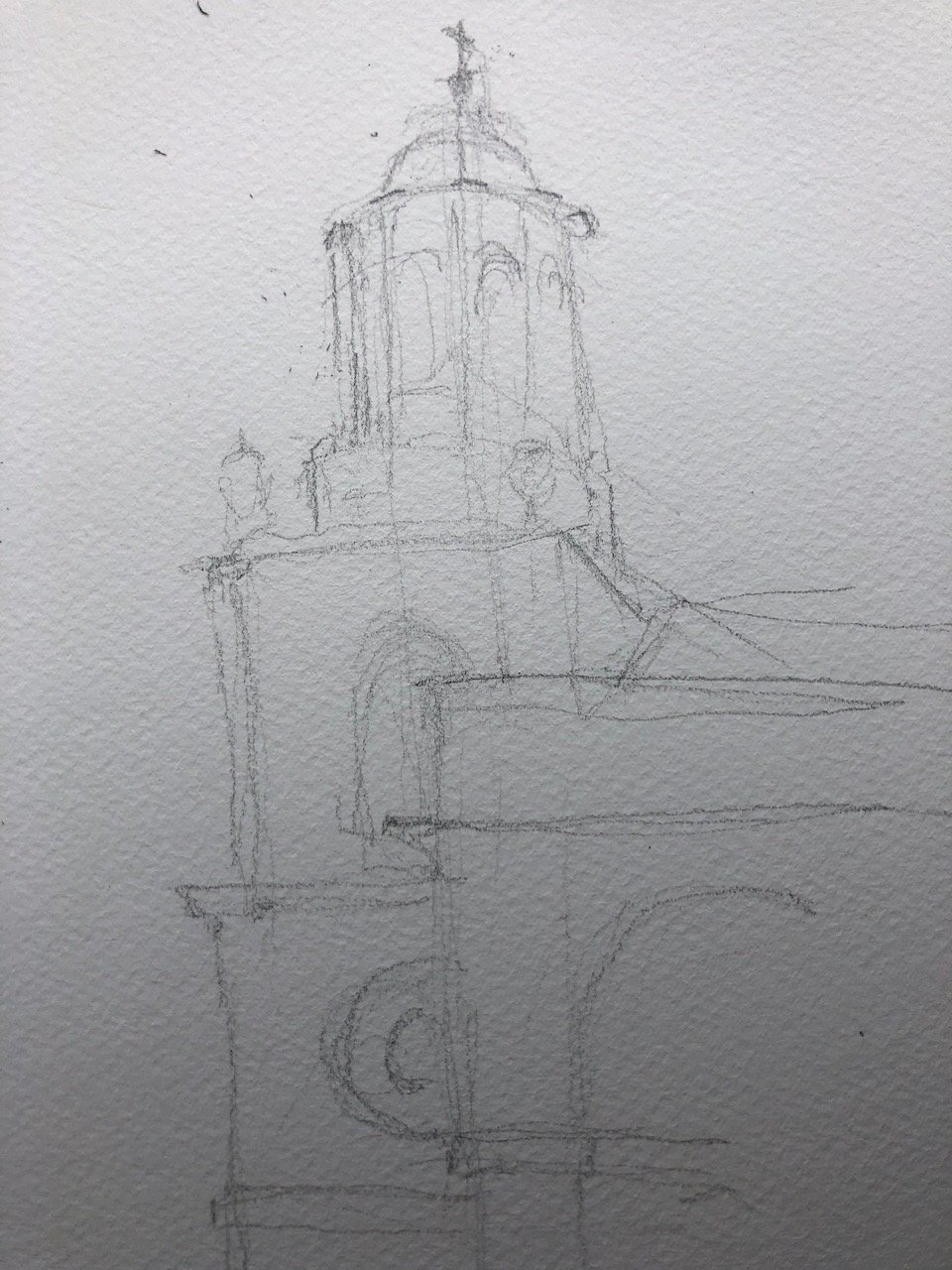
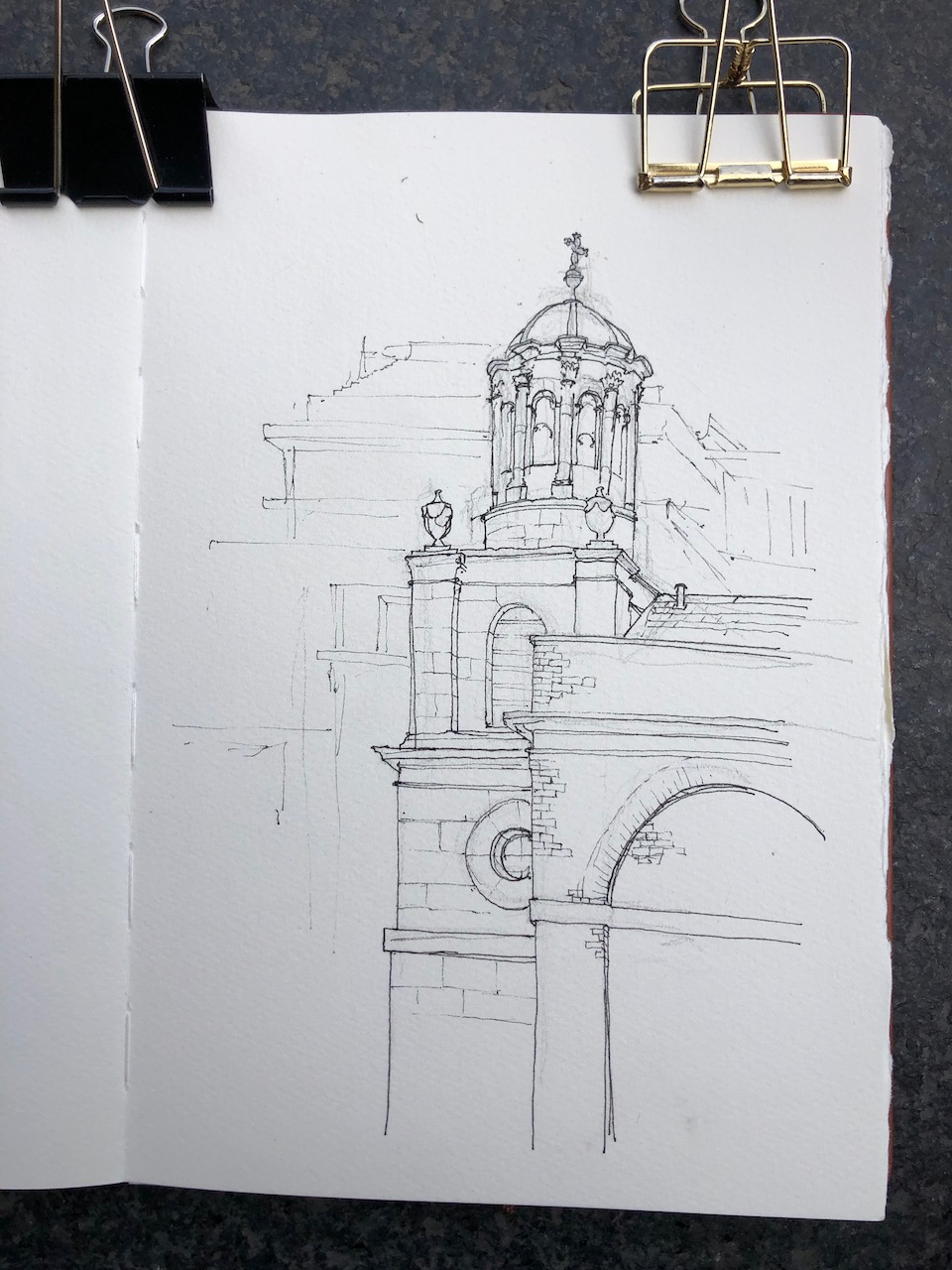
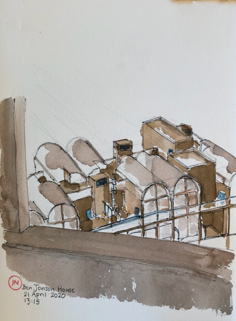
Here is “The Triangular Building” in West Smithfield. I have sketched it from the South. This is its South West corner.

Triangular Building, West Smithfield.

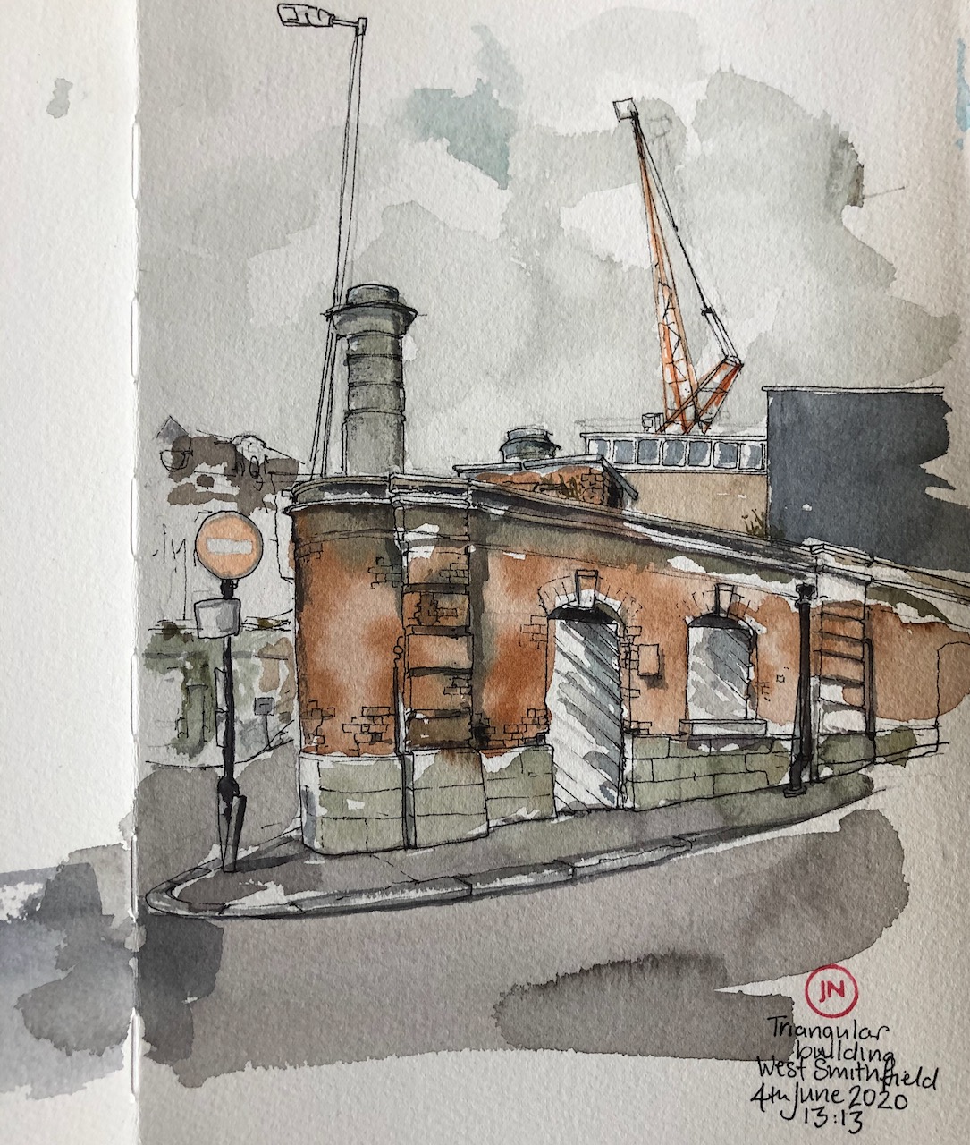
The question is: what is it? It has three vertical columns above, which look like chimney stacks, but might be vents of some sort. One is shown on the left of the drawing and another is just visible above the roof.

I found a marvellous document online, published by English Heritage: Western Markets, London Central Markets Smithfield, A Report by the Historical Research and Conservation Support London Team, June 20031

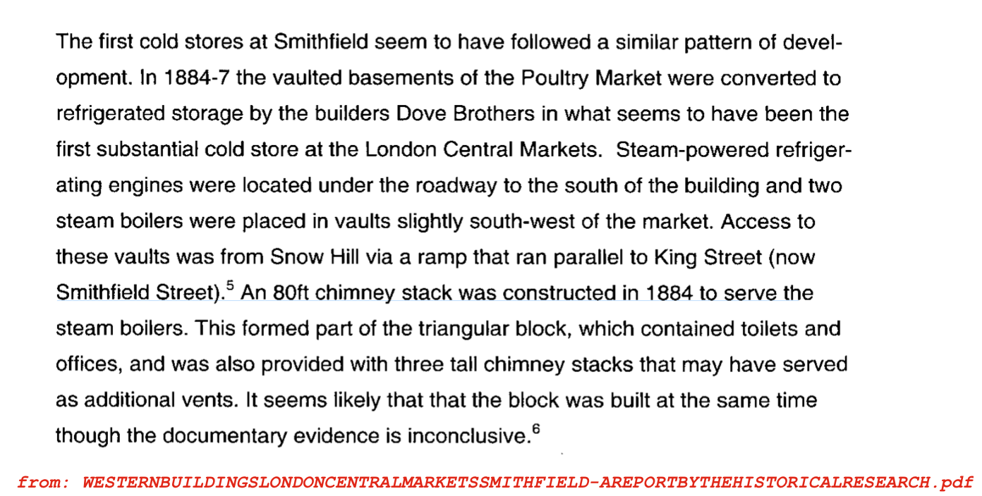
This suggests that the Triangular Block might have housed the base of a tall chimney stack. The chimney was for the boiler room of the Cold Store, which is adjacent. It was built around 1884. Certainly there were toilets in there, either originally or later, as there is a neat sign saying “GENTLEMEN” on the other side. The door is blocked up.

It is clear that whoever funded, designed and used this building cared about it, and was proud of it. The windows have key-stones, and there are stripes of decoration in the brickwork, now very much eroded. The chimney stacks also are decorated with bands. The building is on a sloping road, and must have been quite hard to build.

from the English Heritage report – see note (1) at the end of this article.

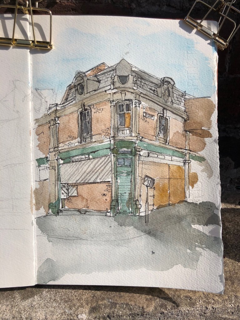
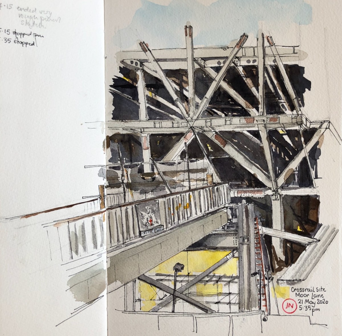
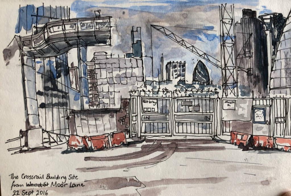
This whole area is due to be redeveloped2. In the distance on the left you can see “Denton Bros”, which I drew in a previous post. The crane in the background is from the Crossrail site at Farringdon. The buildings in the background are the Central Markets, still very much operational.

For more on Smithfield Market (and much more besides) , I recommend the wonderful “A London Inheritance” website. The article about West Smithfield is on this link: https://alondoninheritance.com/london-buildings/buildings-smithfield-market/

Location of the Triangular Building. Arrow shows my sightline in the drawing. Map © OpenStreetMap contributors
  1. NBR File no: 92219, NGR: TQ 3161 8163, Reports and Papers B/013/2003, Report by Joanna Smith and Jonathan Clarke, Photographs by Derek Kendall and Nigel Corrie. The document in full is on the following link as a pdf (53 pages).
  1. Here is a leaflet About the redevelopment. The leaflet is not dated, but must be fairly recent as it was lodged in people’s letterboxes as I walked through Smithfield today. I picked this one up off the pavement.
Timescale of the redevelopment, as set out in the leaflet.

Here is a collection of my other drawings in Smithfield:

West Poultry Avenue, Smithfield EC1

I set off to go and draw the architecture of the South Bank. Walking through West Smithfield on the way, I thought, The South Bank will always be there, but Smithfield is about to be redeveloped. Draw it Now.

Green painted iron protectors for the door posts.

So here is Denton Bros , on the corner of West Poultry Avenue and West Smithfield. I like this building. The green objects at the base of the doorposts are made of iron. I think they must be to protect the brickwork from being bashed by market trolleys. The windows are well made and ornate. The lower panes are wood, which must have been for some specific purpose. I wonder if it is so the supervisors can open a wooden door and lean out to examine proceedings below. Or perhaps it was to stop lowly clerks on the first floor from wasting time looking out of the window.

Denton Bros. West Smithfield.

Smithfield is the main wholesale Meat Market in London. The East part of the Market is fully operational. Opening hours are 2am to about 7am, Monday to Friday. It sells meat to restaurants and butchers, and also to any members of the general public who show up. It has been open right through the pandemic, which has been very useful.

The West part of the market is dilapidated, as you see in the picture. It was due to be demolished in 2012 and replaced by restaurants, offices. The demolition was prevented by campaigning groups, ‘Save Britain’s Heritage’, and others. Now the plan is that the Museum of London will relocate there, from its current site in the Barbican. They will preserve the façade of the existing buildings. See the picture below. The place I drew will be part of the “portal” welcoming visitors in. Here is a an extract from the Museum of London website, downloaded 2nd June.

Visitors will enter through West Poultry Avenue. It will be both part of the city and a portal to the museum, and its character will remain that of a street. It will be a place of arrival, orientation and promise. Our team will welcome visitors and help them to navigate the museum – and, if they need it, the city itself. From here, visitors will move into the General Market or the Poultry Market, or they can stop awhile for a drink in The Cocoa Rooms café. This space will reflect London in real time – the present not the past, the London we experience today, the 24-hour city, constantly on the move. Data visualisations incorporated into the street will reflect London in the moment.

Here is where the new Museum of London will be, and what it will look like. You can recognise the building I drew.

The existing wholesale Meat Market, in the eastern part of the site, will relocate to Barking, that’s the plan. I don’t know what will go where the eastern market is now.

I had better do some more sketching around Smithfield, before the whole thing is swathed in plastic and transformed. Here is work in progress on the sketch. It took one and a half hours. The colours are: Phthalo Turquoise, Mars Yellow, Perylene Maroon and a bit of Transparent Pyrrol Orange.

Here are some maps to show you where it is. Click to enlarge.

Here is a collection of my drawings of Smithfield: click on the words to see more information.

All Hallows on the Wall

London Wall is the old Roman Wall around the City of London. It is also the name of a road. In normal times London Wall is a very busy road, an arterial route in the City, full of buses and cars and bikes, with people thronging the pavements looking at mobile phones. Now it is empty, and you can see the scenery. Here is a view All-Hallows-on-the-Wall, sketched from the opposite pavement, outside Deutsche Bank. The church occupies a narrow site, between the present-day road and the old London Wall.

The “Friends of City Churches” site says: “The previous church on this site escaped destruction in the Great Fire but was rebuilt by George Dance the Younger in 1765/67. He was just 24 years old, but achieved an exquisite small interior of neo-classical simplicity regarded by Betjeman as one of the most successful of the London interiors.”

The Church is only open at certain times, and in the pandemic not atall. It has been the headquarters of various groups seeking to help people. Currently it is the headquarters of “XLP” and has their banners outside. Here is an extract from the XLP website:

“XLP is about creating positive futures for young people growing up on inner-city estates, struggling daily with issues such as family breakdown, unemployment and educational failure, and living in areas that experience high levels of anti-social behaviour and gang violence. Every year XLP helps thousands of young people recognise their full potential. We believe positive, long-term relationships can restore a young person’s trust in people, nurture the belief that things can change and encourage them to set positive goals and work hard to achieve​ them”

Here is work in progress on the sketch. See how empty the road is.

You can see the old London Wall under the big tree. Here is a picture from over there near the church.

Old London Wall is on the left. The modern street called “London Wall” is on the right. All Hallows main entrance is in the centre, below the tree. I did my sketch from the pavement on the other side of the road, on the right. The pale-coloured offices there are Deutsche Bank.

Sketch took about an hour, drawn and coloured on location.

Liverpool Street Station from Exchange Square

Here are the magnificent 19th Century arches of Liverpool Street Station, seen from Exchange Square.

Liverpool Street Station opened in 18751

Liverpool Street Station from Exchange Square

Now the question is: what curve is that arch? I thought it might be a CYCLOID. A cycloid is the shape made by a dot on the edge of a rolling wheel. I made an experiment.

An experiment to see if the arch of Liverpool St Station is a cycloid (silent video).

If you can’t see the video, here is a series of stills:

I imagine that the person2 who designed Liverpool St Station considered that a cycloid was an appropriate form for an arch that was going over rolling stock.

Exchange Square is to the North of Liverpool Street Station. It was opened as part of the Broadgate development in 1991, and covers the railway lines which lead out of Liverpool Street. Before this, the railway lines were uncovered.

My sketching at Exchange Square was interrupted by torrential rain. Twice. I finshed the drawing at home.

1Dates are from “The history of Liverpool Street Station” on the Network Rail website: (downloaded 23rd May 2020)

The history of London Liverpool Street station

2 The buildings of Liverpool St Station were designed by Edward Wilson, Chief Engineer of the Great Eastern Railway, according to Victorian Web (http://www.victorianweb.org/technology/railways/69.html) and other sources. Some of his office buildings which surround the station are listed, and his name is in the listing. I can’t ascertain whether this was the same person who designed the arches at the other end of the station. Here’s the listing page from the Historic England site.

Crossrail site, Moor Lane EC2

Here is the view from the Barbican Podium of the construction site on Moor Lane.

Bridge over Moor Lane, and the Crossrail construction site.

These huge triangular structures look immensely strong. This structure is above the Crossrail station at Moorgate. Below this is a huge shaft, down into Crossrail. Above will be offices and shops. I think it must be constructed this way, with so many struts, because it spans the vast station hall, like a bridge.

This construction site is in operation, and has been, for much of the lockdown. There are workers there. I could not see them but I could certainly hear them.

On the left you see a truncated pedestrian bridge, which used to be the route to Moorgate Station. I hope they reconnect it. At the moment it is sealed off, and there are plants on there, in pots. While I was drawing, a woman came and tended the plants. You can see some of the plants coming through the railings in my drawing.

Here is work in progress. I was standing on the Barbican Podium, by Willoughby House.

Here are some sketches I made in 2016, in the same area. You can see the bridge across Moor Lane. Click to enlarge.

Here is a a post from 2017, with a sketch done from the other side of the site, the Moorgate side.

Crossrail site from Moorgate

I wanted to draw this view before it disappeared. Today, Moorgate was closed completely to motor traffic, so it was calm to draw, though windy and cold. It rained, as you see from the droplets on City Point.  The Globe Pub, 19th Century, is on the left. The small square notice says: “In a House…

From Mitre Square

From today, Wednesday, in England we are allowed to take exercise for “unlimited time” and allowed to sit on benches in a public space. So that means I can go out and sketch. I quickly did so today, in case these permissions are revoked in the coming days.

Walking round the City was a joy: the air is clear, and the streets are empty. Mostly, the people about are working on construction sites, of which there are quite a few in the City. Construction workers are visible as they are wearing their special hi-vis outfits. I walked about enjoying the architecture, and the air, and the birdsong. I came to a small empty parklet: Mitre Square. A notice said that here was the site of the Priory of the Holy Trinity, founded 1108. There’s not a sign of it now. The nave of the abbey is now Mitre Street, said the notice.

I sat on one of the benches and drew the view.

From Mitre Square: Sir John Cass School, and the spire of St Botolphs.

I enjoyed the sequence of TV aerials – Spire – Cupola.

A woman in a face mask with a child in a face mask appeared. They both removed their face masks. She carefully placed a plastic bag on the bench, and then she sat down. The child wandered about. Then they both ate apples, and the child continued to wander about while the woman interacted with her mobile phone. A man came out of one of the nearby offices and stood on the grass, did some stretching for a few minutes, stared into the distance, and then went indoors again. While all this was going on, a large van backed onto the square, and a man unloaded a lawn mower. He then proceeded to cut the little patches of grass on the square. At the same time, two street sweepers arrived. They swept part of the square, then went to have their break. This was logical, as the person mowing was spreading grass cuttings everywhere. After he had finished, which only took about 10 minutes – it is not a large square,and there is not much grass – the street sweepers came back and swept up after him. Then they went away, and the woman and child went away, silence descended and I had the square to myself again.

In the square was a strange statue called “Climb” by Juliana Cerqueira Lake. It was white and, according to the notice, it was a cast of the tunnel she made by burrowing through a cylinder of clay. You can see it on the left of this photo:

In Mitre Square: “Climb” by Juliana Cerqueira Lake is on the left.

Today’s announcement:


https://www.bbc.co.uk/news/explainers-52530518 downloaded 13th May 19:17

Map of where I was:

Arrow shows the sightline of the drawing.

Looking South to St Giles’

I drew St Giles’ Cripplegate, as seen from the window of the flat.

St Giles Cripplegate, from the North

The church is surrounded by the buildings of the Barbican estate. To the right of the church is the City of London School for Girls. Behind it in the picture you see a representation of the Barbican block called “Wallside”, and then behind that, are the office blocks of the City. In the foreground is Frobisher Crescent.

St Giles’ was damaged by enemy action in the 1939-45 conflict. Artists showed the damage. I was particularly struck by the work of Sam Carter, and William Coldstream, shown by the East London Group in their excellent and informative Twitter stream (@EastLondonGroup) – their tweets are embedded below, if you scroll down. Here’s the picture by William Coldstream, 1946:

St Giles Cripplegate (1946) by William Coldstream, in the Arts Council Collection. Thanks to @EastLondonGroup twitter stream for showing this work.

As you see in the picture above by William Coldstream, in 1946 the church itself was damaged, and it was surrounded by rubble. This picture must have been painted from the current location of the Museum of London. The damage was done in a bombing raid in about 1940. The plants have had 6 years to grow.

The Barbican was built on the area destroyed by bombing. St Giles was rebuilt.

Here is my view and my drawing in progress.

I have drawn St Giles before:

A quick sketch of St Giles Church

Here is St Giles Church from the Lakeside Terrace of the Barbican. While I drew this, three men were shovelling mud from the bottom of the lake. The mud is black and viscous and the men were remarkably cheerful in their task. They would have made good subjects for a drawing too. But for now,…

St Giles and Bastion House

Today Urban Sketchers London held a “sketch crawl” in the Barbican. So I joined them. An astonishing number and diversity of people assembled inside the entrance of the Barbican Centre at the appointed time of 11am. I counted about 35 and then another dozen or so joined. All shapes and sizes of people, tall, short,…

St Giles’ and Cromwell Tower

Here is today’s sketch showing: London Wall – 2nd century AD Barber-Surgeons Hall – current building 1969, first hall, on this site 1441 St Giles Church – current building 1966, first church on this site by 1090 Barbican, Cromwell Tower,  Wallside and Arts Centre – 1965-82 Braithwaite House – completed around 1963 White Collar Factory…

St Giles’ Church and Shakespeare Tower

Here is a sketch from a staircase from the Barbican Podium, just outside the Dentists but just inside the old London Wall. Parts of the Roman London Wall are in the foreground, 2nd century AD. St Giles’ has Roman foundations and is much rebuilt. The church we see now is the 1966 restoration following designs…

Here are the tweets from the East London Group:

Ben Jonson House

Sketching from the window, here is Ben Jonson, part of the Barbican estate.

The people who live on the top floor of Ben Jonson have sunlit roof gardens. You can see one person enjoying his garden. He sits just at the bottom of the blue fire escape ladder.

There is also an interesting void space shown in the lower right of the picture. It was empty when I was drawing, but sometimes someone’s legs are visible, using the space for sunbathing. Sometimes they set up a table and chairs there.

Here is work in progress. I used colours: Mars Yellow, Burnt Umber, Prussian Blue and a bit of Perinine Orange.

Sun on the Podium

The view looking west:

This is looking down on the Barbican Podium.

The tower in the foreground is part of Frobisher Crescent. Frobisher Crescent itself is on the left. Ben Jonson House is on the right. On the horizon you can see Centrepoint, and the Post Office Tower.

This took 2 hours. The sun moved, of course.

Colours: Mars Yellow, Perylene Maroon, Prussian Blue, all Daniel Smith watercolours.

Barbican Lakeside

A view from the residents’ gardens.

Barbican Lakeside

The building in the background is the Heron Building, luxury flats above the Milton Court Concert Hall, Guildhall School of Music and Dance. This building opened in September 2013. It replaced a public building, which was in the brutalist design of the Barbican and designed by Chamberlain Powell and Bon, It housed a fire station, Coroner’s Court, mortuary, office of weights and measures and a civil defence school, and was connected to the Barbican by a bridge at Podium level. This building was demolished in 2008, in the face of opposition from the Twentieth Century Society amongst others, and was replaced by the steel and glass tower. This new building has no bridge to the Barbican, which is a pity, in my view.

At the extreme right is City Point.

Here is work in progress:

This drawing took ages. I couldn’t get the steps right. After 30 minutes of drawing and rubbing out I restarted at 12:10 and finished 1hour30mins later.