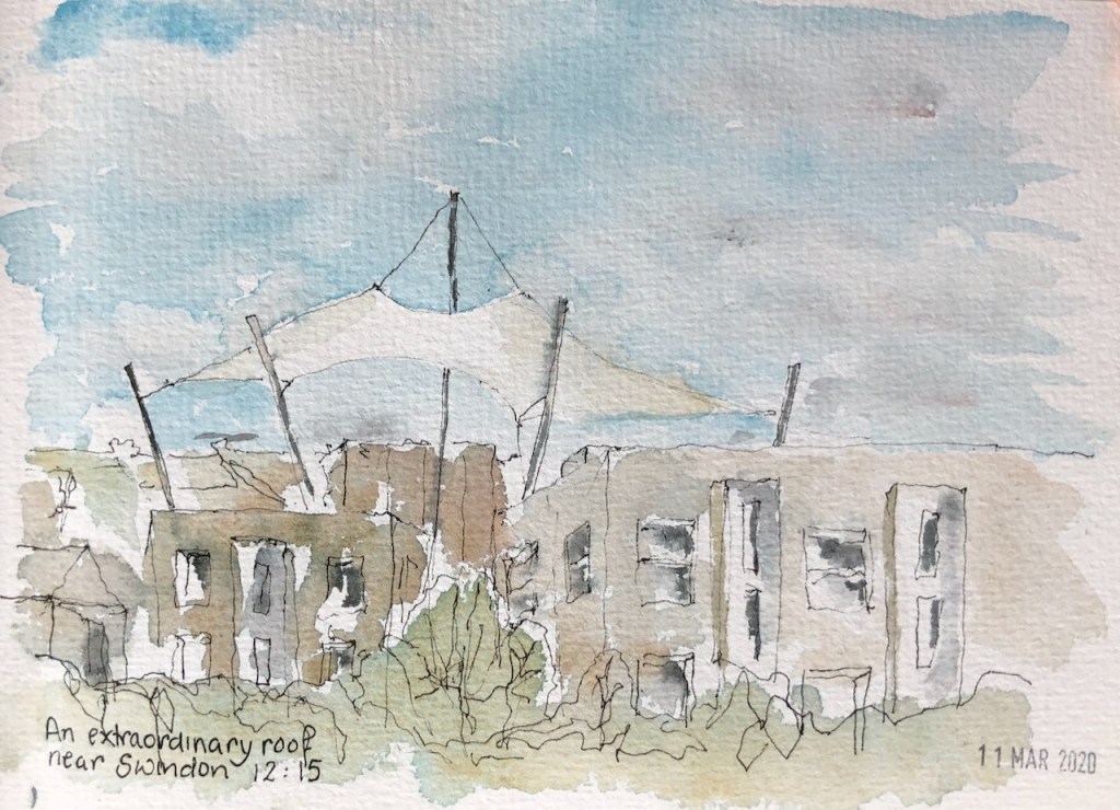
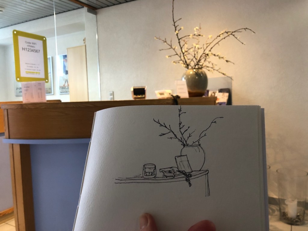
Here are some experimental monoprints I made using the technique demonstrated by John Carbery:


I am still experimenting with this technique.
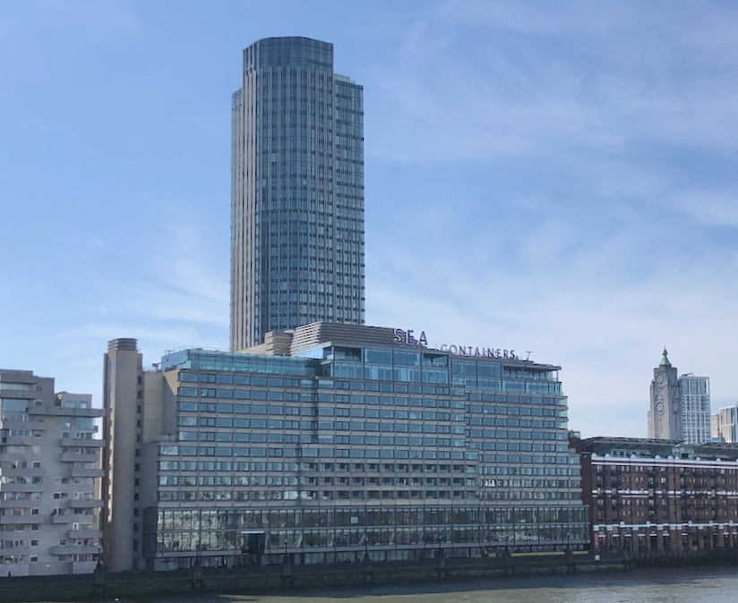
Here’s the South Bank seen from the Victoria Embankment on the North Bank.
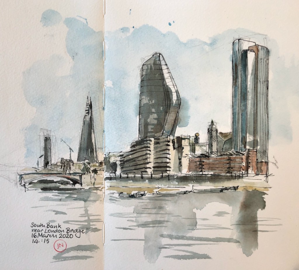
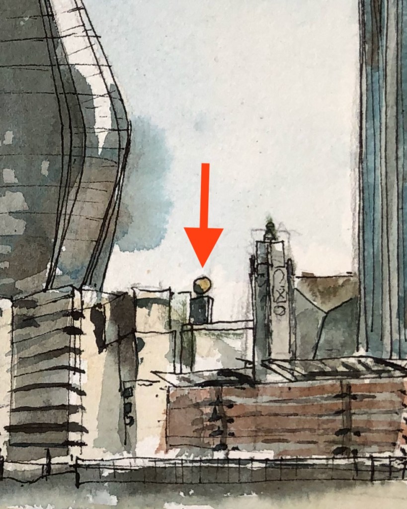
Here you see the modern blocks, with the older wharves in front. The low red building towards the right is Oxo Tower Wharf, formerly a factory making OXO cubes, now a place with workshops for jewellers, a restaurant and various cafés. The building was designed for the Liebig Extract of Meat Company by Albert Moore in the 1920s. It was derelict in the 1970s. In the 1980s the Coin Street Community Builders saved it from demolition and with great determination gradually renovated it in stages over the next twenty years.
The tall tower on the right is the South Bank Tower, a residential block. Its height was increased recently, adding about a third on top. You can see the “seam” on the building, and I have shown it in the drawing on the right of the tower. One Blackfrairs is the asymmetrical tower in the middle, mostly residential, and completed last year.
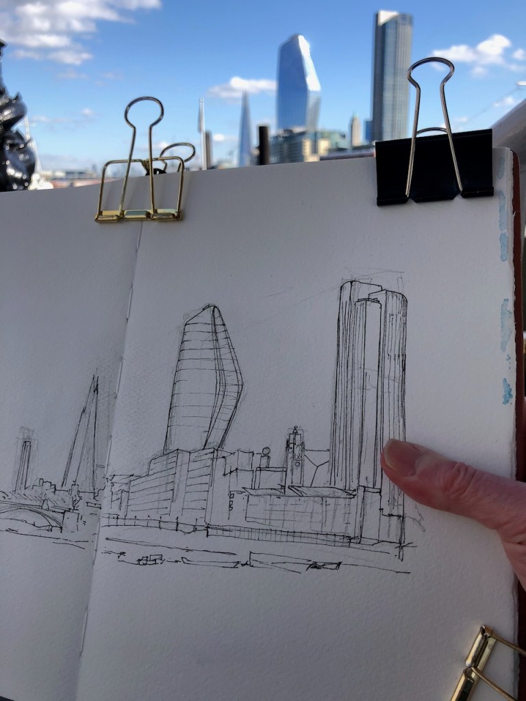
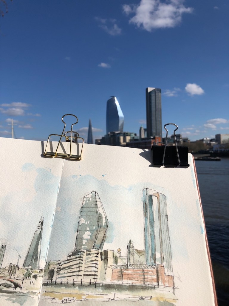
Here is work in progress.
Here’s a map.
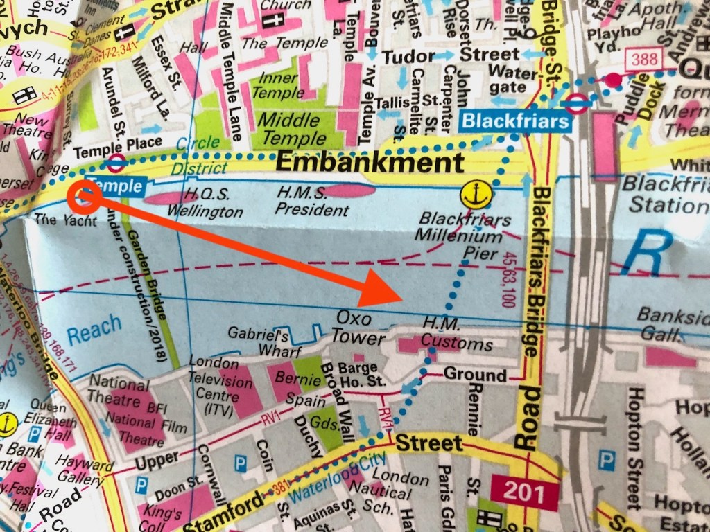
There is a building to the South West of Blackfriars Bridge, labelled “HM Customs” on the map. This is next to Oxo Tower Wharf, on the river front in the centre of the drawing.
HM Customs and Excise were there from 1987, when the building was called “New Kings Beam House”. In an early part of my career they were a client of mine. This was the 1980s. I remember stepping over mud in my nice business shoes, and picking my way between derelict buildings with my briefcase, feeling rather conspicuous. After this hazardous journey, I was always glad to see the uniformed commissionaire at the door of New Kings Beam House. He was, of course, in full Customs uniform, with a white shirt and gold buttons. The entrance was from Upper Ground then. The meetings were in bright offices overlooking the river, fully carpeted and quite unlike the offices of any other of my government clients. HM Customs and Excise merged with the Inland Revenue in 2005 to form “Her Majesty’s Revenue and Customs” (HMRC). They must have moved out of the building around then. It was refurbished in 2011, and is now called “Sea Containers House”, with a hotel and the offices of media and marketing companies.
This drawing took about an hour drawn leaning on a stone pillar on the Victoria Embankment. Phthalo Blue (W&N), Burnt Umber (DS) and a bit of Mars Yellow (DS) and Perinone Orange (DS).
I put more information about Sea Containers House in this post: From Oxo Tower Wharf. In the 1980s there were the gold spheres on top of the pillars facing the river. These have since vanished from the riverside façade.
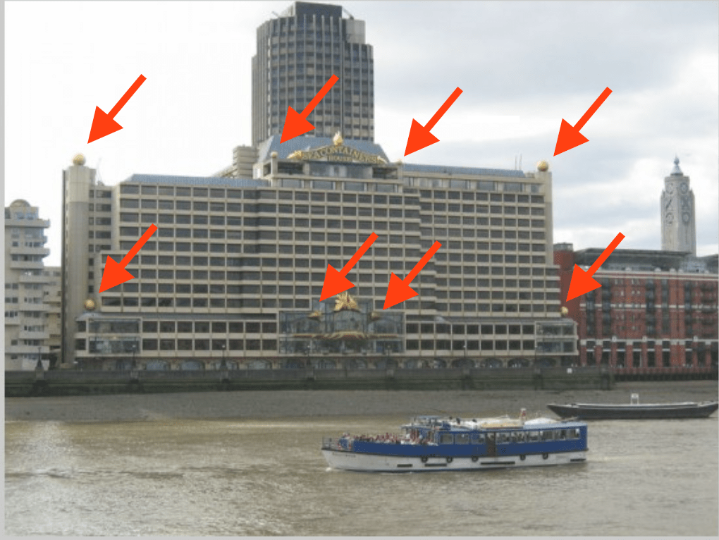
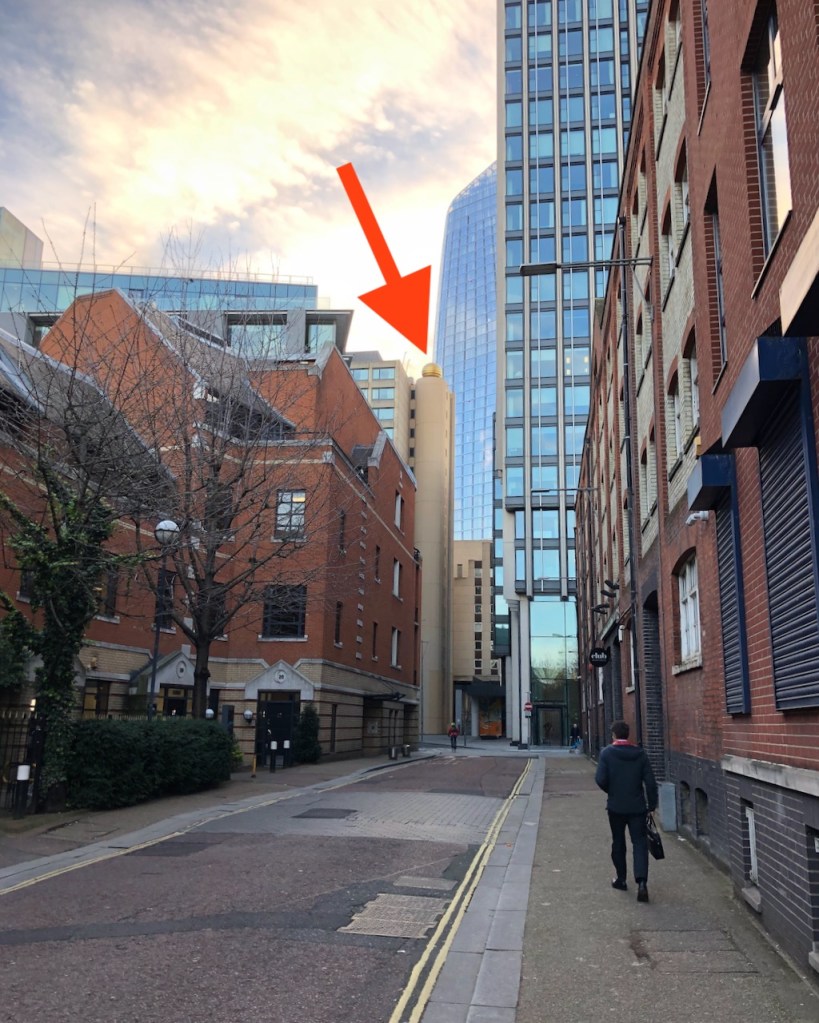
When I was sketching, I thought I could see one of them, hidden at the back. You can see it in the drawing, between the Oxo tower and South Bank Tower. Intrigued, I went looking for it later, and found a view of it from Upper Ground. It’s very odd that they kept that one, and discarded all the others.

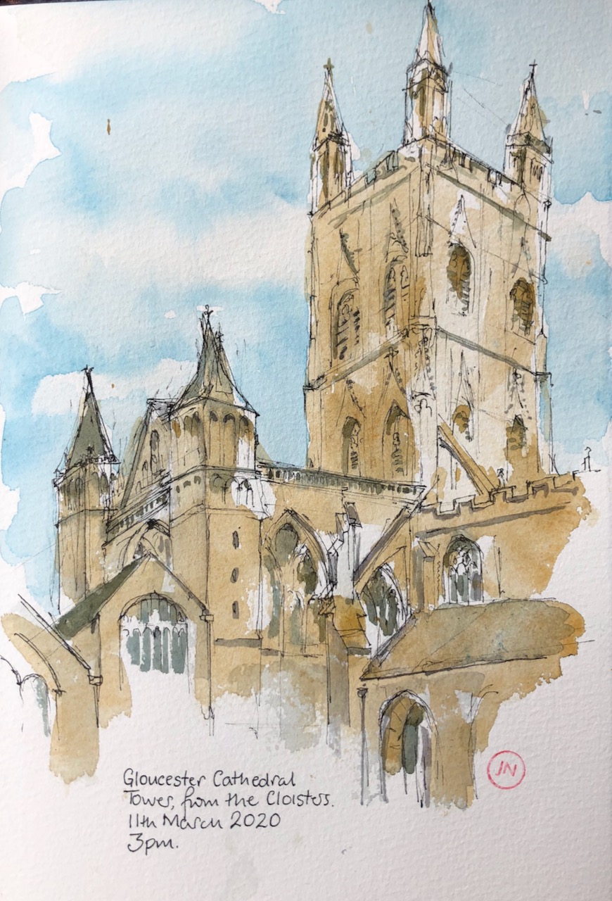
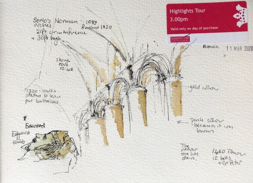
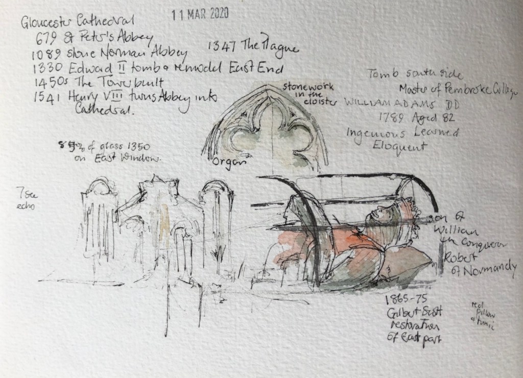
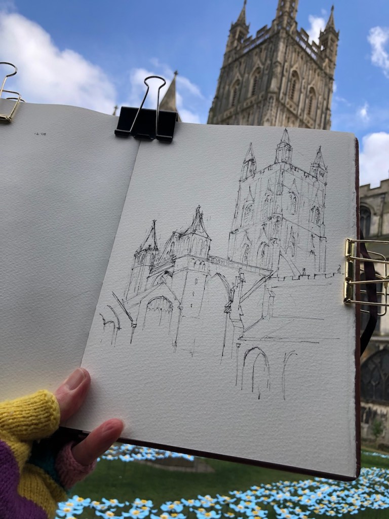
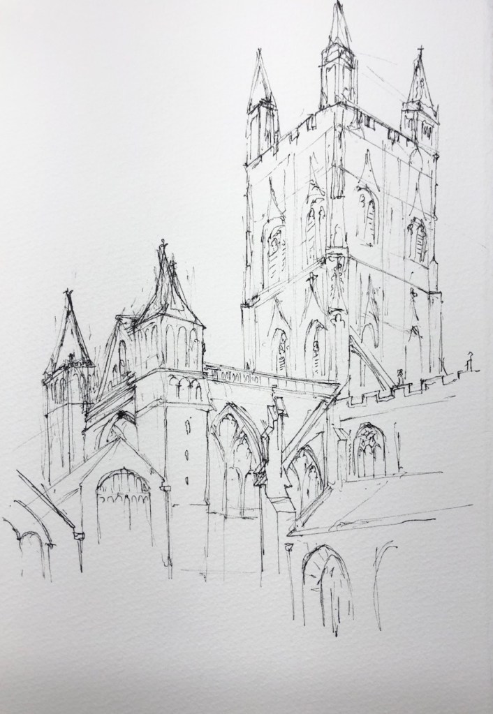
This is Gloucester Cathedral Tower from the cloisters.

It’s an amazing place. Inside there are huge Norman pillars from 1089. They seem so solid and magnificent that you’d think no-one would ever want to change them. But someone did. At the East End, there are a few pairs of pillars in a totally different style: the “perpendicular” style, which means they are fluted, like vertical clusters of pipes. This remodelling project was started in around 1330, but didn’t get far. Our guide, Rebecca, offered several explanations for why this project was stopped. There was a war with France, the start of the “Hundred Years War”. France invaded Dover and Folkestone in 1339 . And on the north border, English armies were attempting to stop Scotland from going independent. So there was a lot going on, and remodelling a cathedral might have gone down the list of economic priorities. Then, to cap it all, there was the Plague in 1347-51 which must have depleted the workforce and caused economic disruption. So best leave the Norman pillars as they are.
Here are some sketches as we toured the cathedral. Thank you to Rebecca, who was a brilliant guide: patient with our questions and interruptions, and extremely knowledgeable.
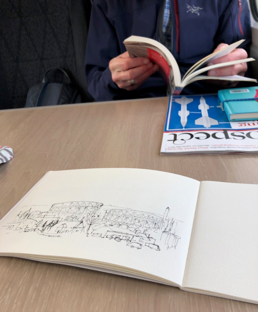
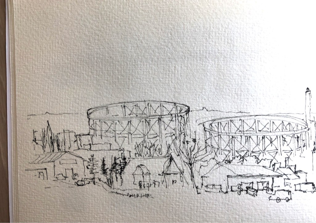
It’s 1hr45mins from Paddington to Gloucester. Here are some drawings done on the train.
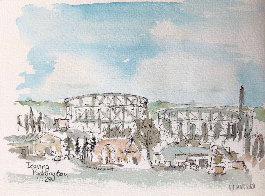
The drawing of the Tower was a quick pen and ink sketch, coloured later. The pen and ink took about 45 minutes. The colours are: Phthalo Turquoise (W&N), Mars Yellow (DS) and Perinone Orange (DS). Here is work in progress, including some of the drawing on the train.
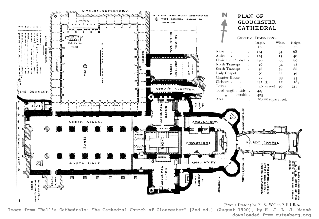
Map of Gloucester Cathedral (1900):
Footnote: Concerning things that were going on in the 1330s: the Butchers Guild was granted the right to regulate the meat trade in London in 1331. See this post for a picture of the Butchers Hall:
Continuing my exploration of Barts Square, EC1, today I drew Butchers’ Hall. Butchers’ Hall is the building with the arched windows, in the centre left of the picture. It is the headquarters of The Worshipful Company of Butchers. This livery company is very old, the Arms were granted in 1540 and the charter by James…
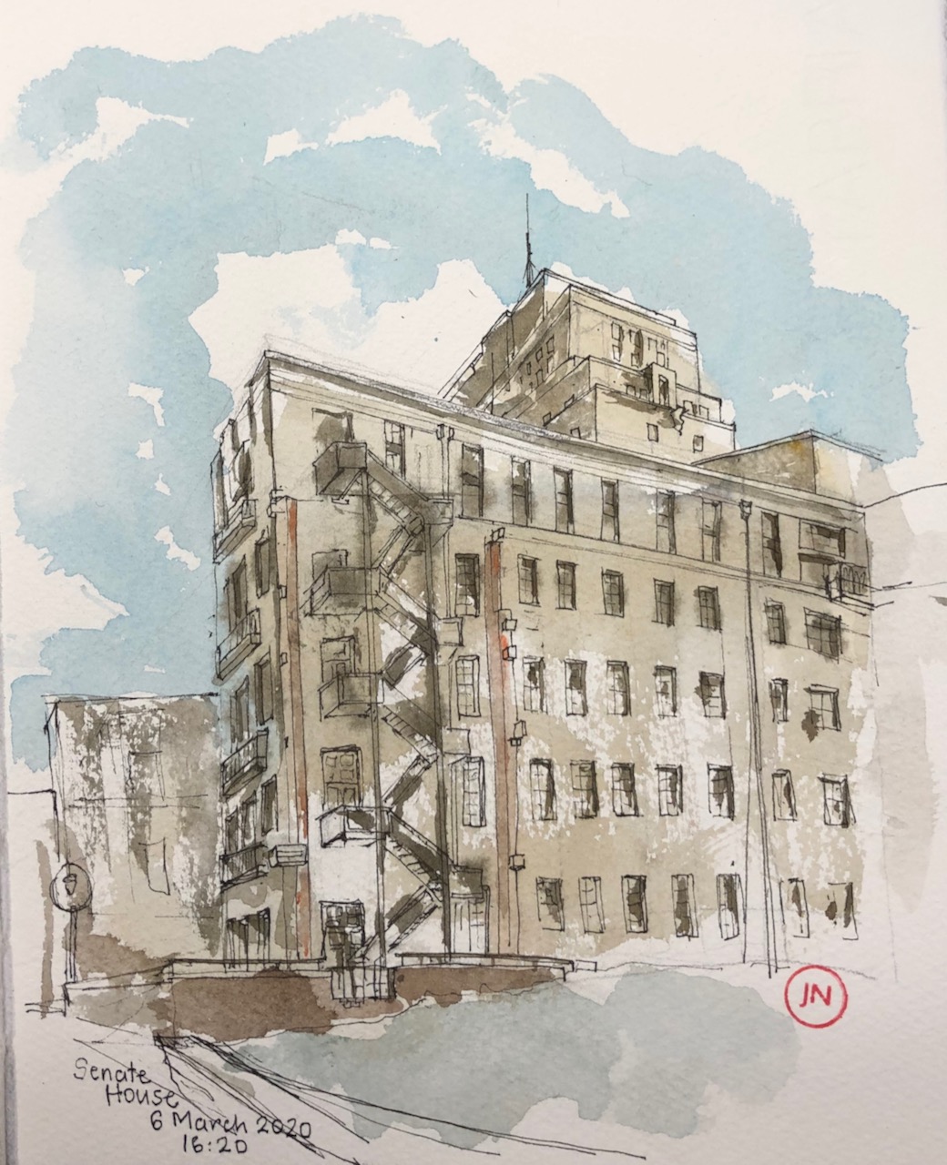
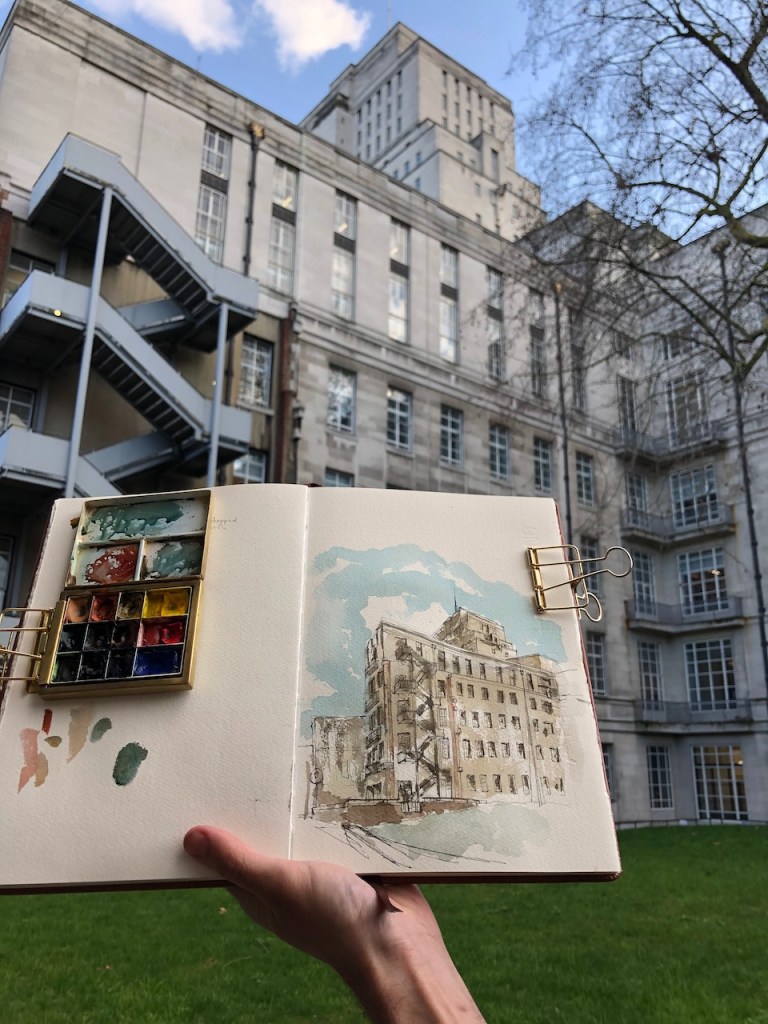
The original plan, by the architect Charles Holden in 1931, proposed University of London buildings which extended all the way up Malet Street, with 17 courtyards and two huge towers. This plan was revised a number of times, becoming less magnificent with each revision. We are left with just three of the original 17 courtyards, and just one of the towers. What I find interesting is that evidently one of these downward revisions of the magnificence must have occurred rather suddenly, while building was in progress. Here are maps:


An unfinished fourth courtyard is evident in the fabric of the building, shown in the drawing below. Strange parts of walls just out like ragged lego bricks from the clean white facades. I imagine the construction workers being suddenly told “Stop! We’ve changed our minds about that next courtyard.” And the workers climbed down the ladders and downed their tools, there and then. Eventually grass covered what would have been the courtyard.

I learned about Charles Holden from a walking tour on 5th October 2019, led by Chris Rogers. The title of the walk was “Best Laid Plans….Uncompleted London 1925-1995”. Chris Rogers is a writer and speaker on architecture, film, and on architecture in film. His website is here: http://www.chrismrogers.net. It was Chris Rogers who led us to the place where I made this drawing. He drew my attention to the startling unfinished walls in this otherwise polished building. My thanks to him and to the Twentieth Century Society for organising the walk.
Holden’s plan for the site was abandoned in 1937. The main tower is 210 feet high “at that time [1937] the tallest building in the capital after St Paul’s” comments Chris Rogers. He also points out that the upper floors of the tower were for the book stacks of the library “the London Building Act forbidding permanent occupation of any part of a building over 100 feet in height for fire safety reasons.” The laws were first initiated after the Great Fire of London, and subsequently modified, with sections being repealed, modified and replaced with Building Regulations.
If you want to, you can walk right underneath the tower, West-East from Malet St to Russell Square. Although it looks private, it is a public route. No-one stopped me as I wandered through with my backpack, looking for this vista to draw. It’s worth going through, as you catch a glimpse of the interior.
As I was drawing the picture, two construction workers stopped and admired the picture. Given their trade, I thought they might be interested in the reason why I was drawing here and the story of the unfinished courtyard. They knew it already. Yes, they said, there was going to be two towers. We agreed it was still a magnificent building. “But inside, ” they told me, “it’s all been ripped out.” I was interested. “Yes,” they continued, “all the sinks and taps, all taken out.” With a hand gesture, they conveyed the former beauty of the Art Deco bathroom fittings, marble floors, decorated tiles. “It’s like an airport terminal in there now,” they said, with resignation and sadness. I knew exactly what they meant.
The drawing took 2 hours. Here are some photos of work in progress, and the lettering from the top of the drainpipe.

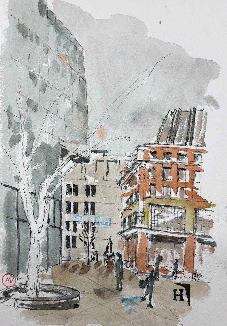
Continuing my exploration of Barts Square, EC1, today I drew Butchers’ Hall.


Butchers’ Hall is the building with the arched windows, in the centre left of the picture. It is the headquarters of The Worshipful Company of Butchers. This livery company is very old, the Arms were granted in 1540 and the charter by James I in 1605. The current hall is surprisingly new: built in 1960, and refurbished in 2015-2019. The mansard roof, just visible in grey at the top of the hall, was completed in 1996.
On the left the red brick building is 90 Bartholomew Close, which is offices. In the background is Percival House, residential flats built as part of the Barts Square development. Behind the tree is a building site. People are still working on other residential blocks in this development.

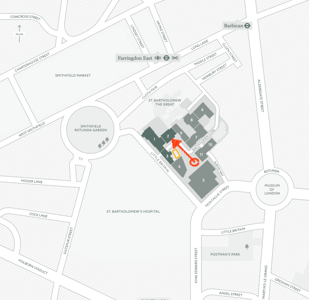
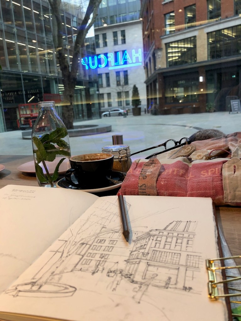
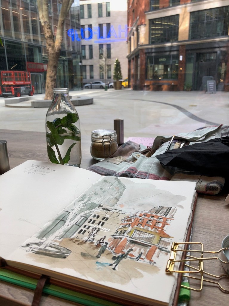
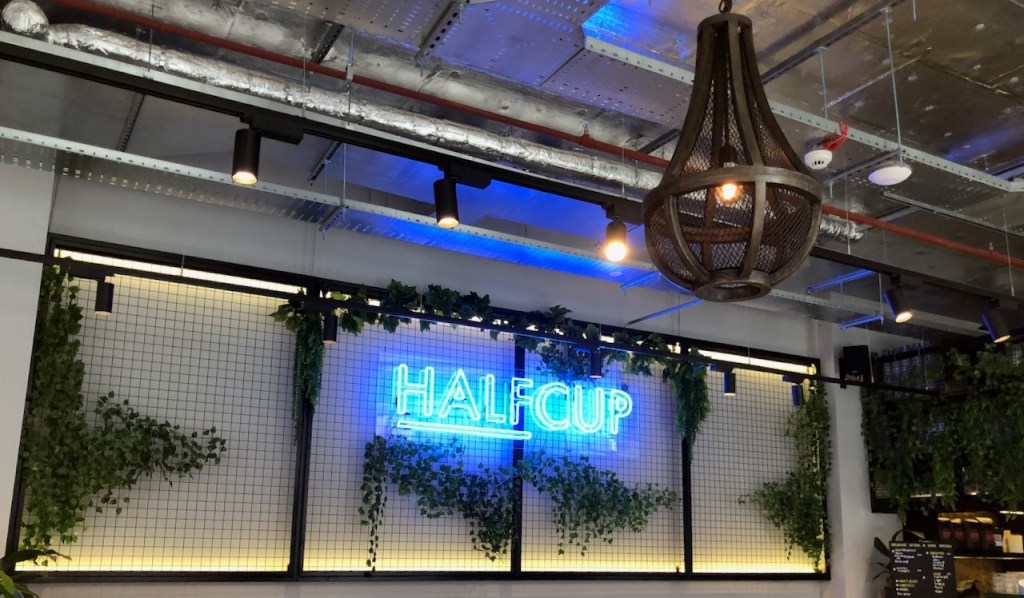
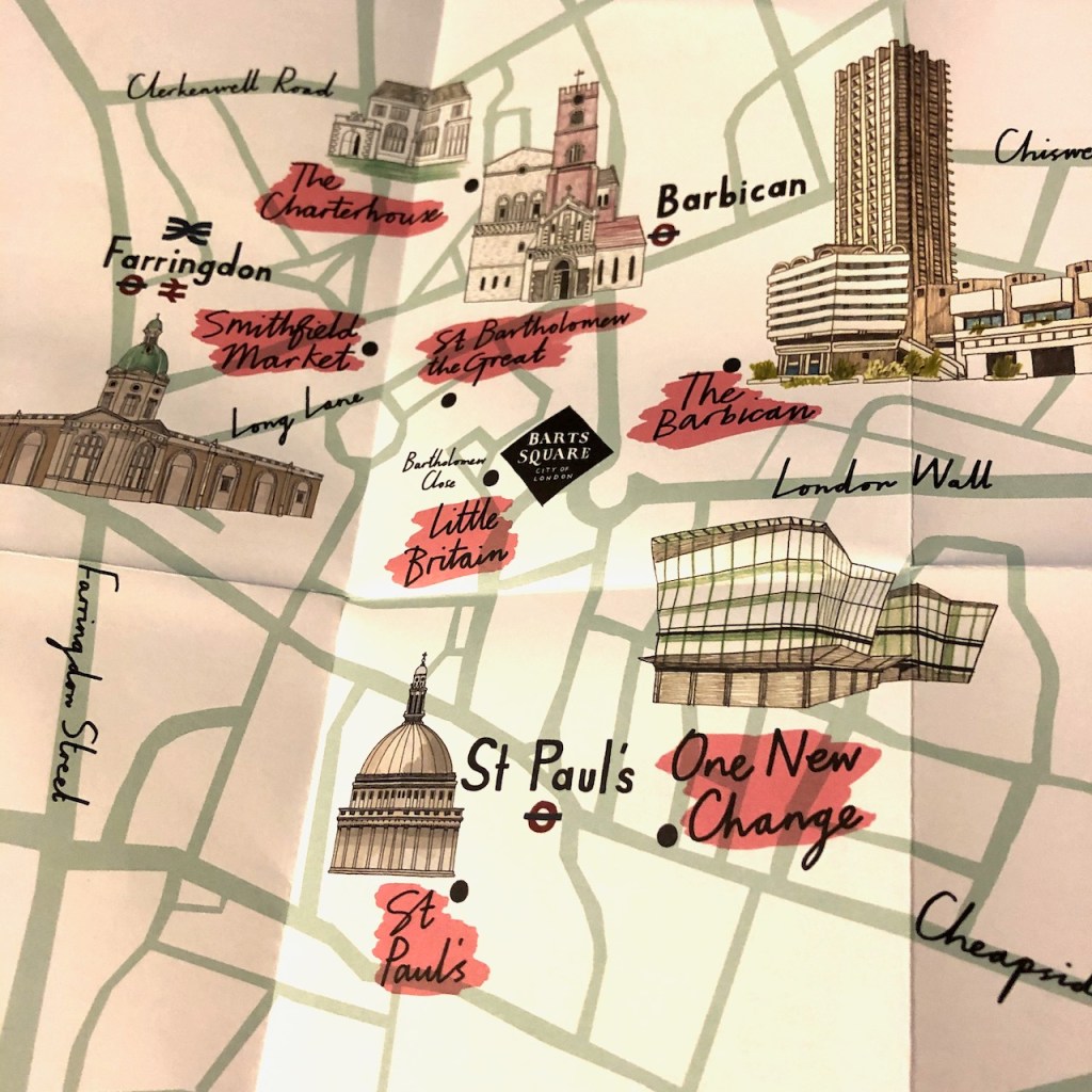
I drew this picture from beside a tree in the middle of the square, as you see from the map above. It was extraordinarily cold. There was slight rain, or more likely sleet. So after the pen-and-ink stage, I beat a retreat to the warmth of the café “Halfcup” to do the colouring indoors. They kindly found me a table with a view in approximately the right direction. All was going well until the delivery van arrived.
I peered round the edges of the van and surprised other guests in the restaurant by pacing erratically to get a better view. Then the van driver completed their deliveries and drove off. I worked quickly in case another van appeared.
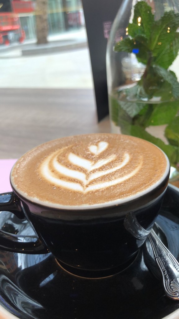
Here is work in progress and a bigger map. Thank you to the staff of Halfcup who made me very welcome and brought hot tea to thaw out my hands.


Drawing took about 2 hours. Main colours used: Phthalo Turquoise (W&N), Mars Yellow (DS), Burnt Umber (DS), Perinone Orange (DS), Naples Yellow Red (R). The sky is the Phthalo Turquoise and Burnt Umber, very dilute. Blue and brown make grey.
I sketched in Barts Square yesterday as well:
Today I went to try out “Halfcup”, a new coffee place which has opened on Bartholomew Close. It’s part of the new “Barts Square” development. These are new buildings in an area that was previously St Bartholomew’s Hospital. Some of the external features of the original hospital buildings have kept, as you see in the…
Today I went to try out “Halfcup”, a new coffee place which has opened on Bartholomew Close. It’s part of the new “Barts Square” development. These are new buildings in an area that was previously St Bartholomew’s Hospital. Some of the external features of the original hospital buildings have kept, as you see in the centre and right of the drawing.

The building at the back, with the tall windows, is the existing Bartholomew’s Hospital, new building. The building on the right has a restaurant, “Lino”, on the ground floor, and offices above.
Here are some pictures of the drawing in progress, and a photo of a map provided by the Barts Square development.
The drawing took 1hour50mins. The main colours are: Phthalo turquoise(W&N), Burnt Umber (DS), with Perinone Orange (DS) and Mars Yellow (DS) for the “Lino” brick building.
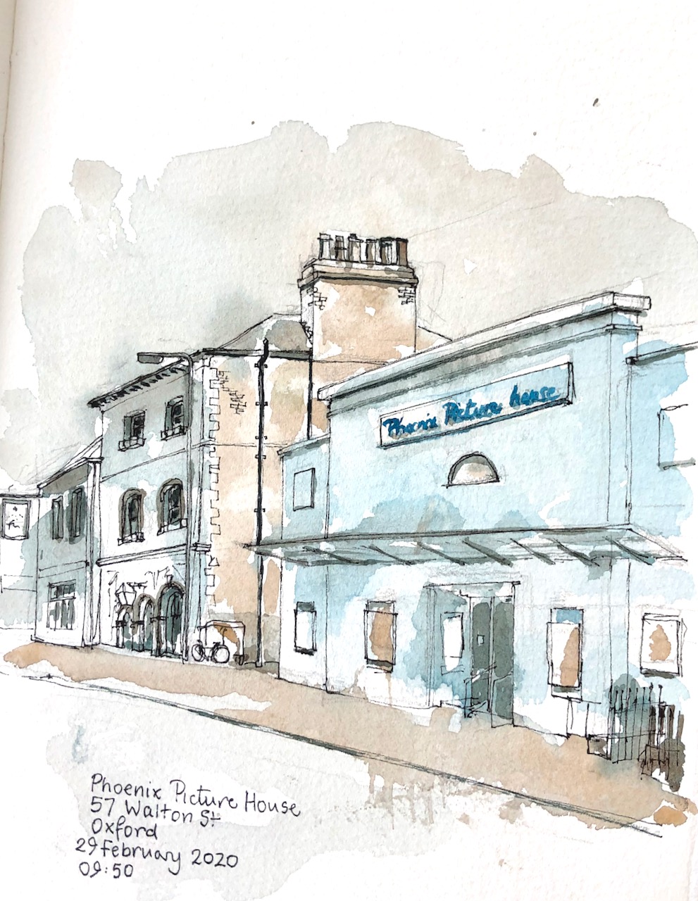
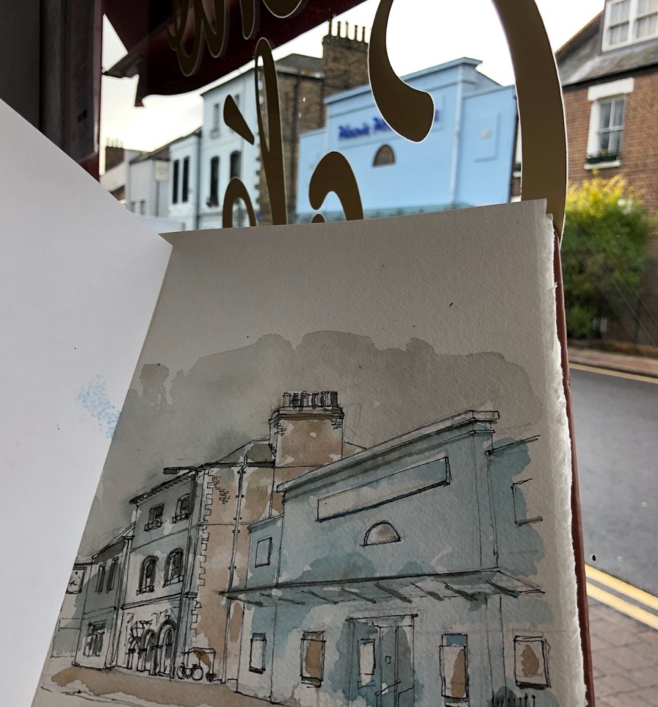
Here is a view looking south down Walton Street, from The Jericho Café, Oxford.

It was raining outside. People peered in through the windows. One person actually came inside the café to look at my picture. Or maybe it was to escape temporarily from the rain. They looked at the picture, in any case, and made cheerful and encouraging comments. Then they went out in the rain again.
The Phoenix Picture house is a cinema. On the left is The Jericho Tavern, a pub and music venue.
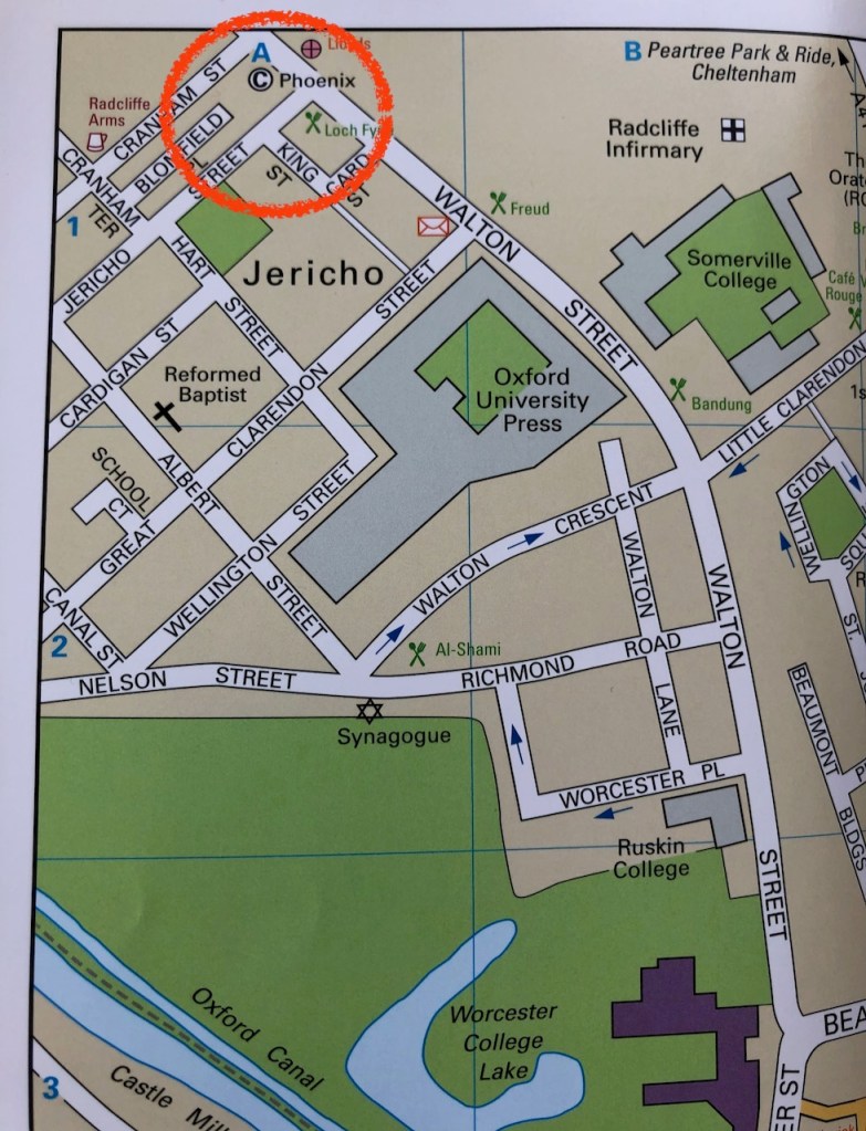
Here is work in progress on the picture, and a map. As you see, Jericho is on the fringes of the map. The Jericho Cafe is at the junction of Observatory Street (off the top of the map) and Walton Street. This map is out of date. The place labelled “Radcliffe Infirmery” (top left) has now been redeveloped as the Radcliffe Observatory Quarter. On this site are the Mathematical Institute (opened in 2013) and the Blavatnik School of Government (opened in 2015). You can walk through the site to the Woodstock Road, past the Radcliffe Observatory which has the signs of the zodiac carved around it, including a realistic large-size crab.
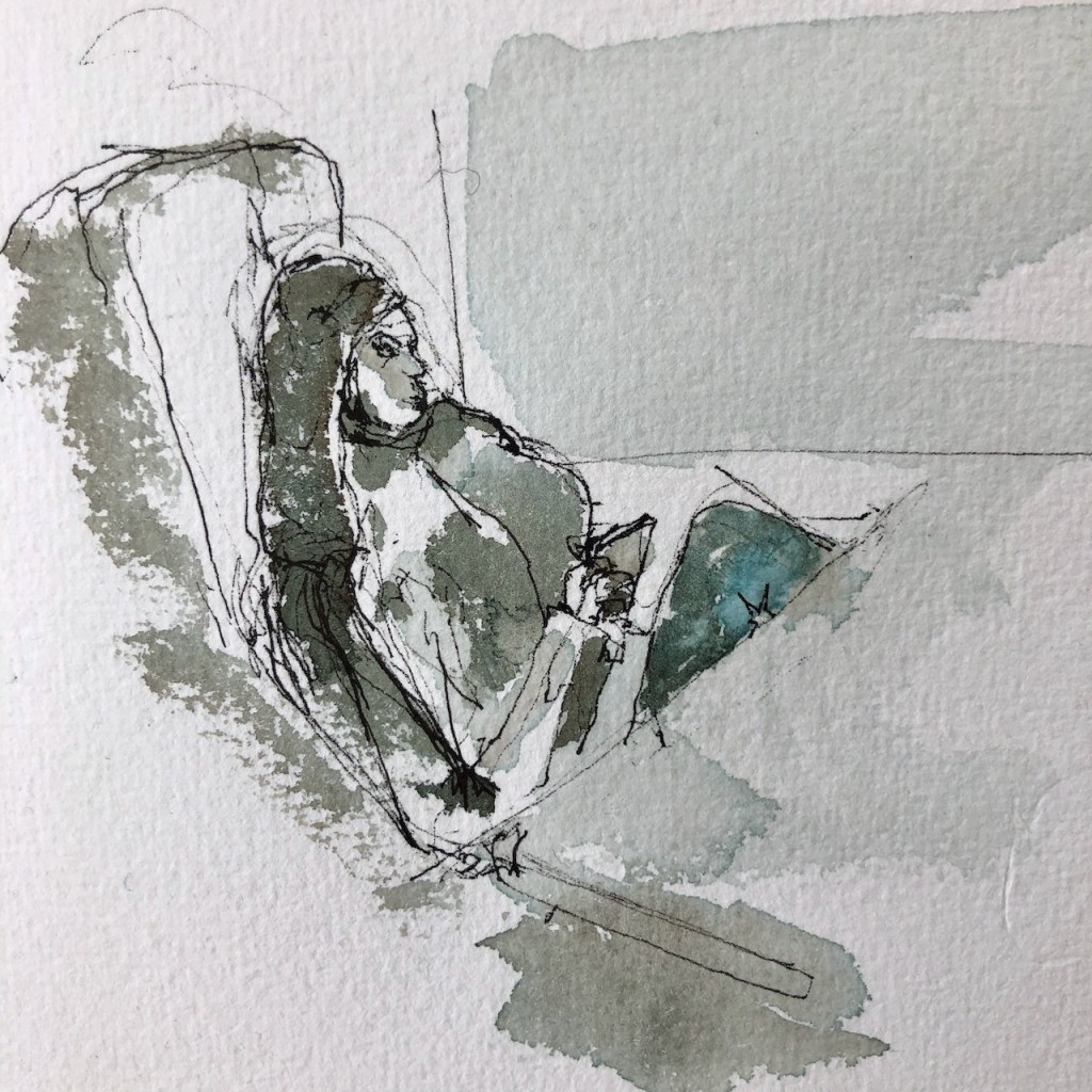
I was also practising drawing people.
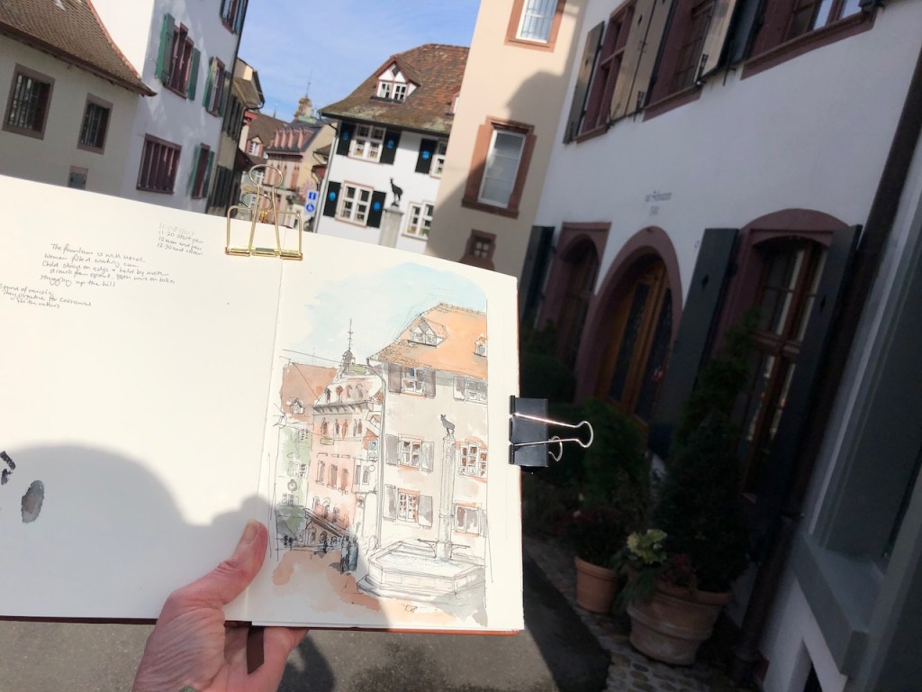
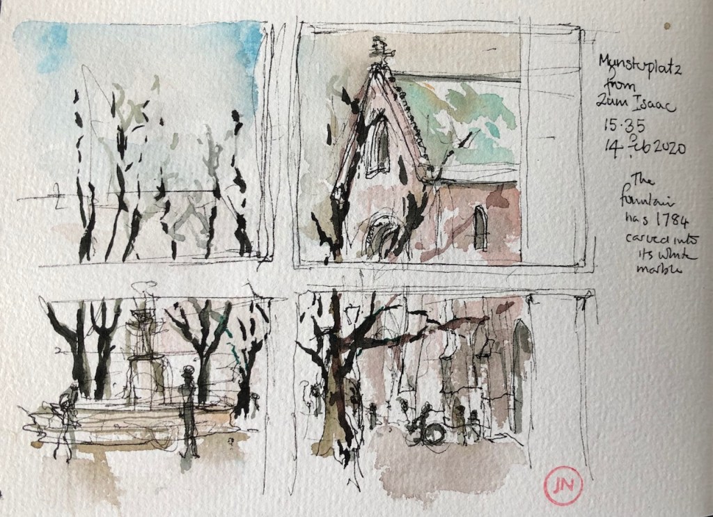
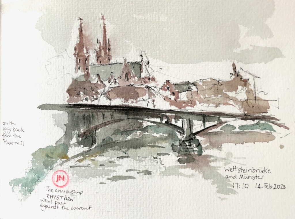
In the streets of Basel, you can hear your own footsteps.
There are fountains.

In the hour and half that it took me to draw this picture, people made use of the fountain. Someone came out of one of the adjacent houses and filled a watering can. A woman helped a child to stand on the white marble edge and then to walk cautiously on the iron bars across the water. The child dipped her hands in the flowing water and drank. She played with the water that came from the spouts. Then the woman and the child returned to their bicycles, and continued their ascent of the hill. Elderly people, climbing the hill, paused here to rest. A runner lent over the water and sluiced his face, before pacing on up the slope towards me.
This part of town is very old. Basel has the fine custom of telling you a little about each street, on the street sign. The one for Gemsberg says:
“Zum Gemsberg, 1661 erstmals erwähnter Hausname”
So this street was named after a house which stood here in 1661. [German speakers reading this: please correct me if I got that wrong!]
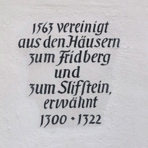
The house on the right has an inscription in magnificent script. My German-speaking consultant enables me to state with some confidence that this reads as “In 1563 [this house was created] by joining together two houses: “To the Fridberg” and “To the Slifstein”, both mentioned in 1300-1322″
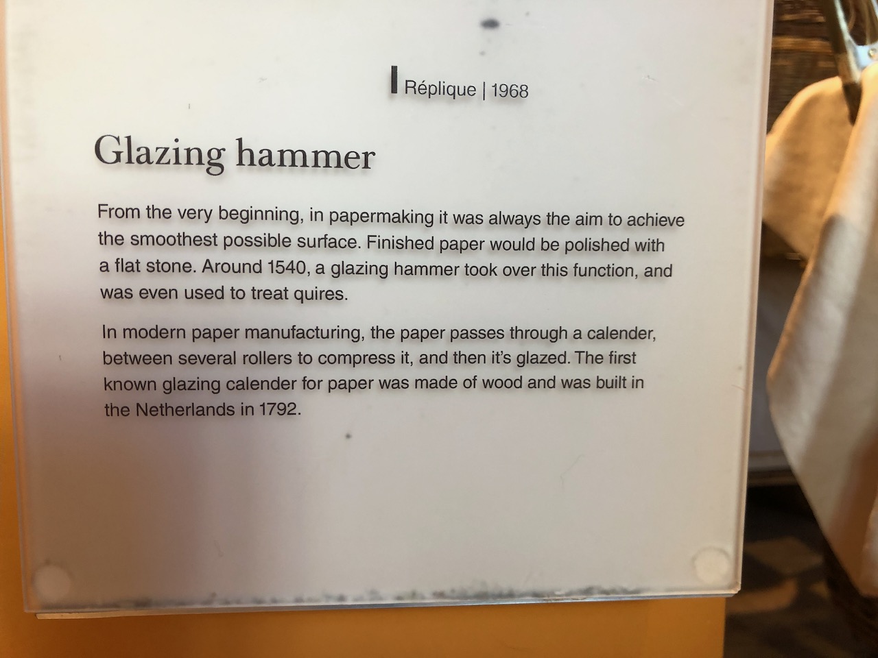
“Fridberg” might mean “Tranquil mountain” and “Slifstein” might mean polishing stone, or polished stone. Perhaps these were people’s names. I learned at the Basel Paper Mill that in those times smooth stones were used to polish paper, so may be Herr or Frau Slifstein was a paper polisher. But that’s just surmise.
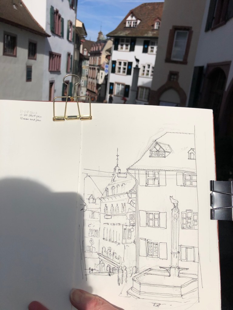
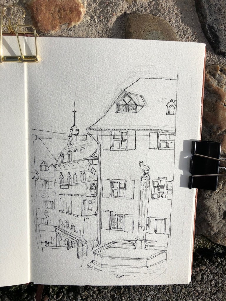
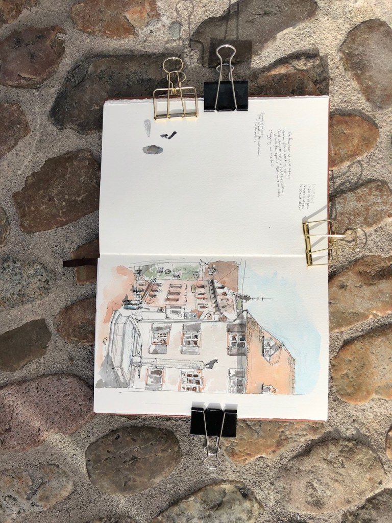
Here’s work in progress on the drawing.
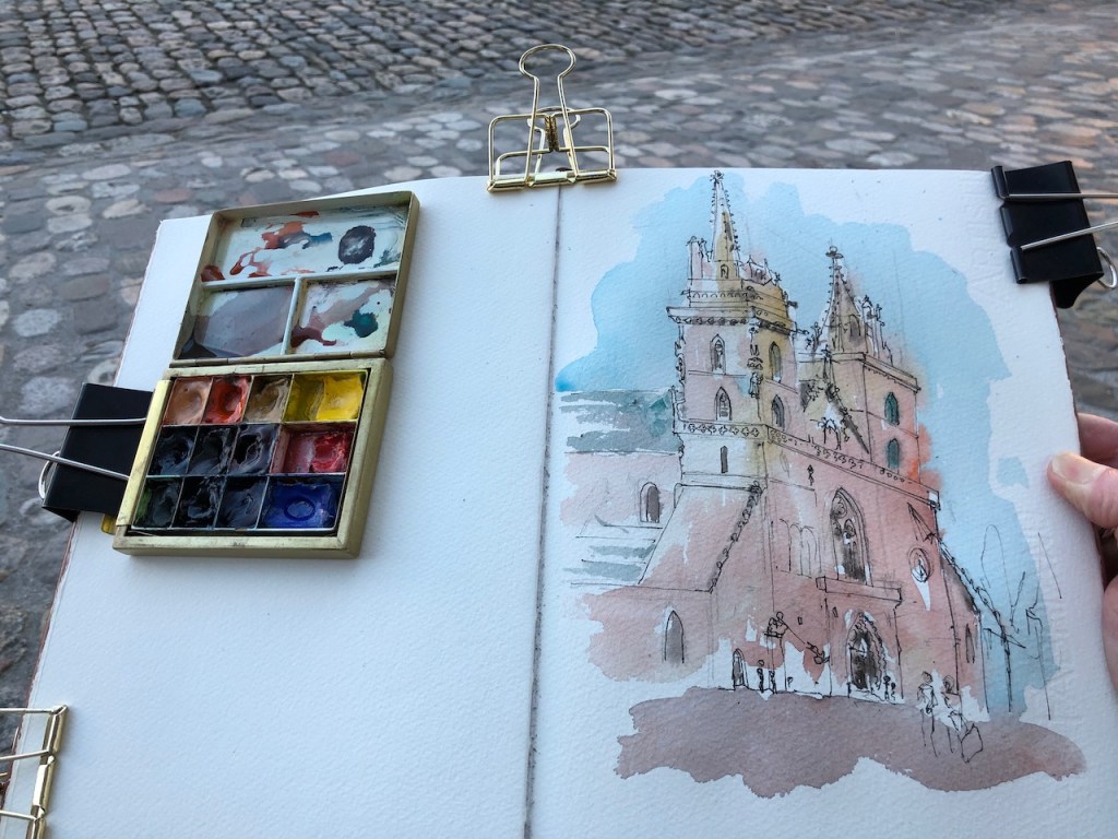
Later I tackled a tough assignment: Basel Cathedral, “Basler Münster”.
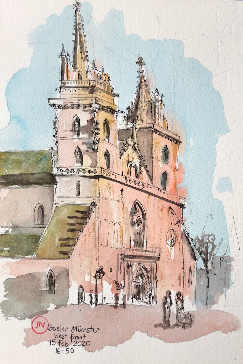
This is a magnificent medieval construction, the present building dates from about 1500. It is a real challenge for the Urban Sketcher. Each edge is decorated. Each corner hosts a saint, or often two. Every planar surface has decoration, low relief, a statue. Not content with simply a sundial, they added also a clock. And on top of all this, the two towers are by no means identical. They each support a forest of spires, some octagonal. The main spire on the right seems to have curving edges, unless that was a cunning optical illusion. Even the roof is decorated with a pleasing coloured diamond pattern in tiles. I did my best, but those medieval stonemasons got the better of me.
To the left of the door is St George and the Dragon, a very realistic statue which I had to put in. St George’s horse prances on a firm plinth. St George himself wields a real metal lance, copper or some copper-containing alloy, since it is green. The dragon, some distance away, is made to balance on a precarious shelf, endangered by the thrust of the lance. It’s a dynamic and three dimensional scene.
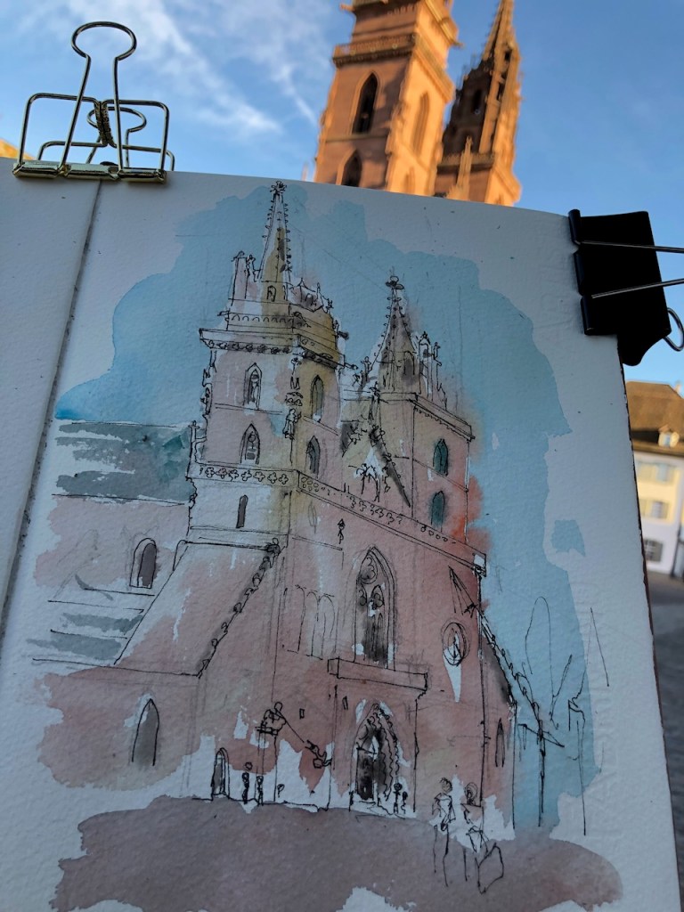
Here is work in progress on the drawing.
I made more sketches around the city:
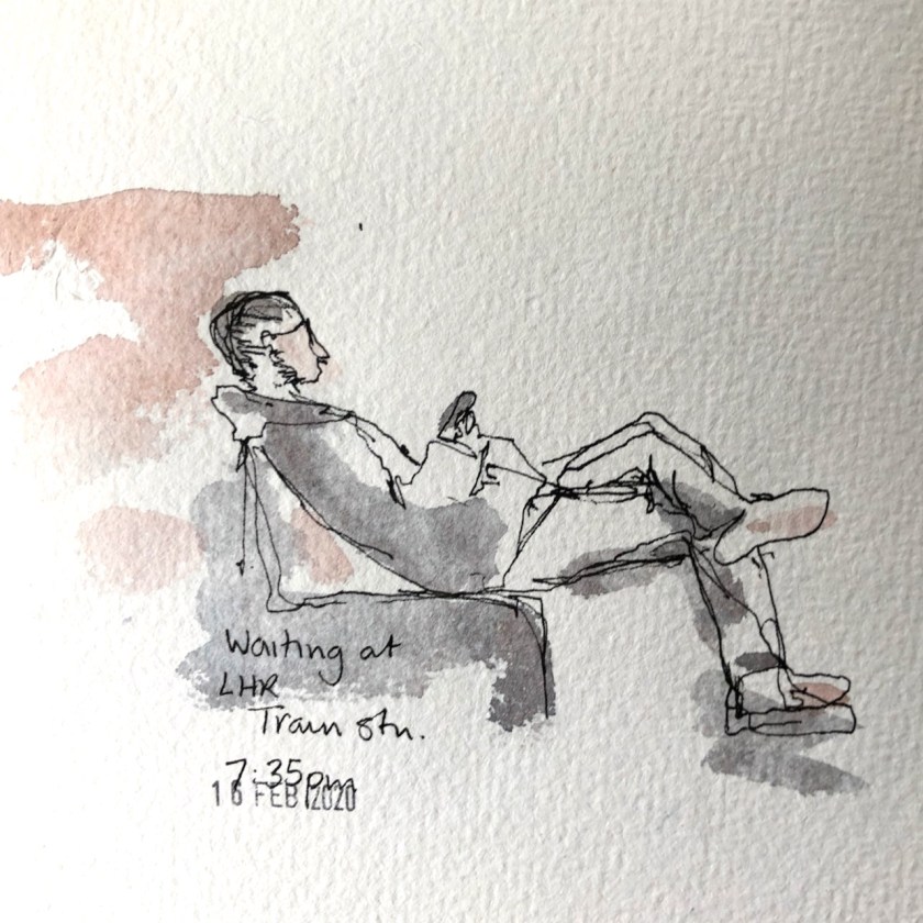
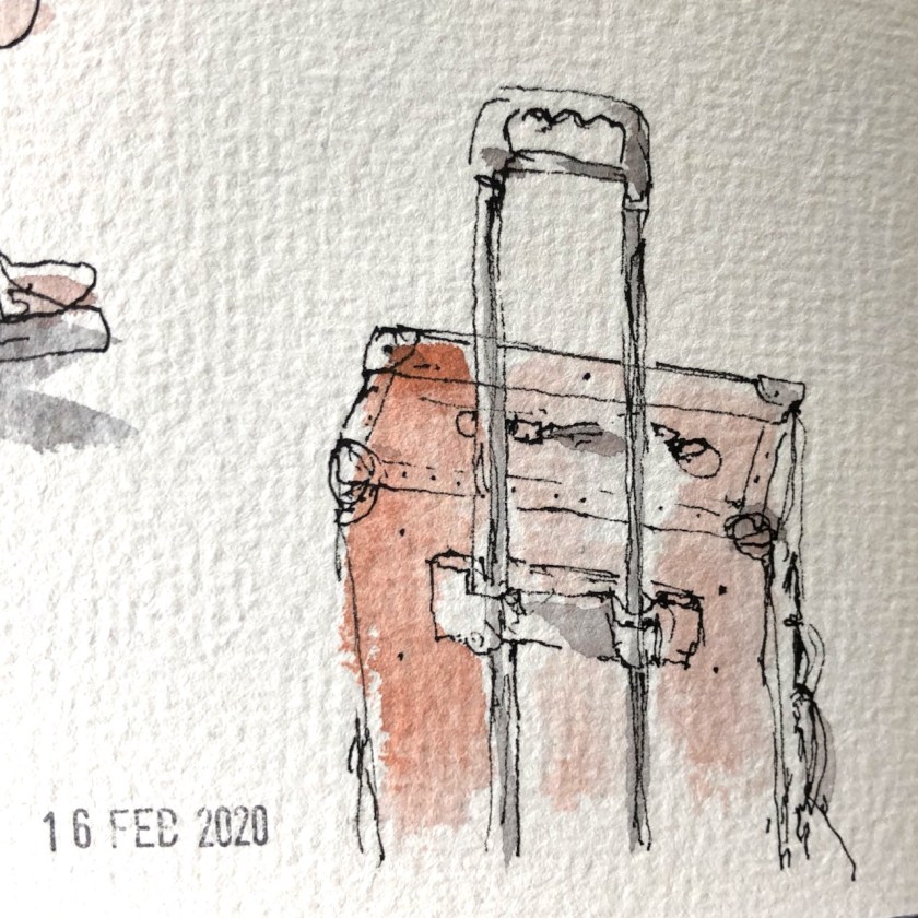
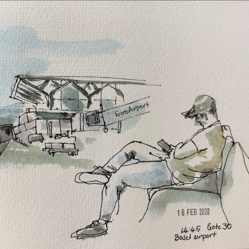
On the long journey home, I sketched the people, and my luggage.
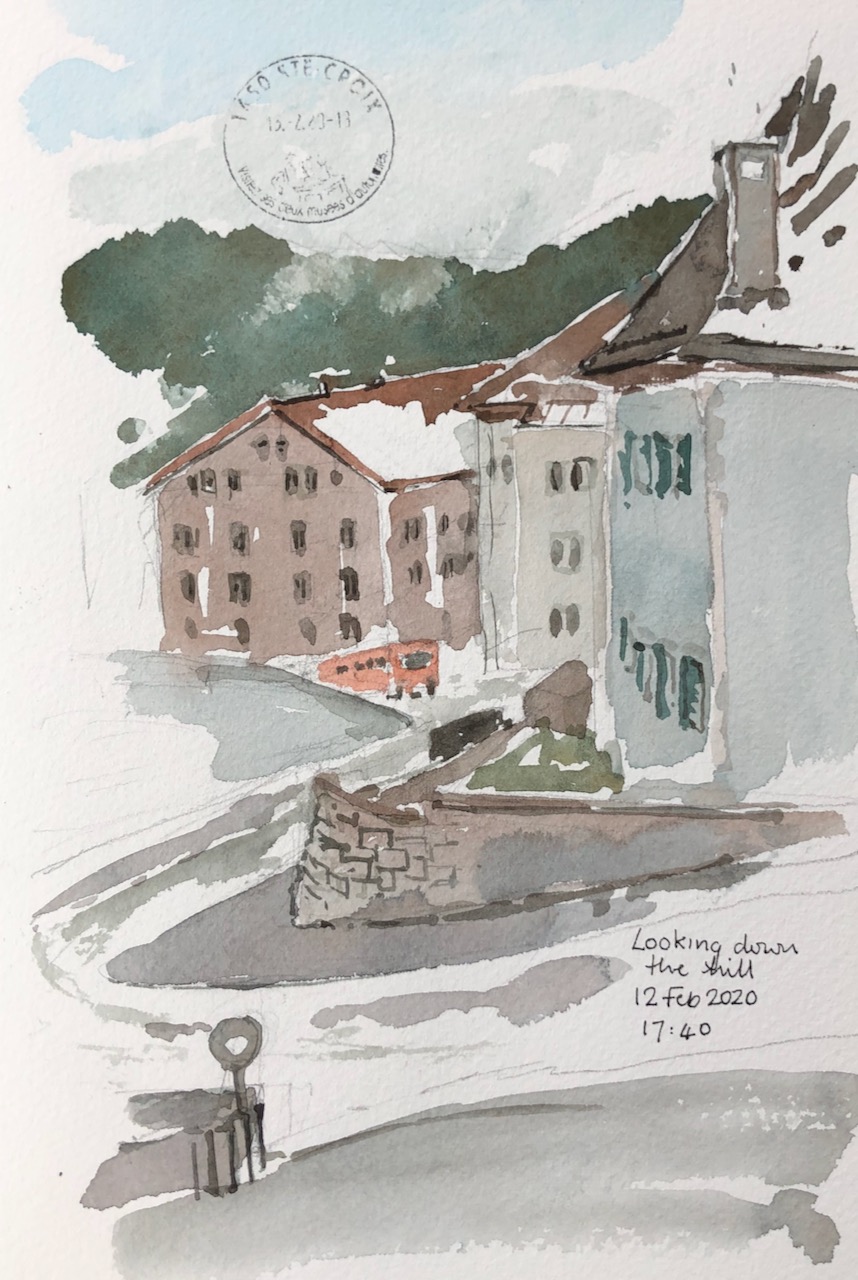
The weather in the Jura mountains is changing. This is climate change, the residents tell me. Once, the snow came reliably every year, bringing skiers. Now, the snow is unreliable. “It shouldn’t be like this,” they said, looking out at the slushy rain. This is February: high skiing season. “It should not be like this,” they say again, sadly.
Here is a sketch made looking out of the window into the rain and melting snow. The lady at the Post Office added the stamp.
I made that picture with just watercolour: no pen.
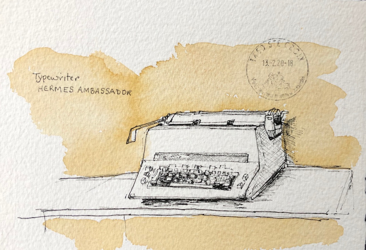
The Hôtel de France celebrates the fine engineering expertise of the area with a collection of typewriters. There were several in the meeting room where we worked. Here is one of them.
This was a busy visit. My arrival had been delayed by a storm, and so work was compressed into a few hours. My next sketching opportunity was while I waited for a lift to the station.

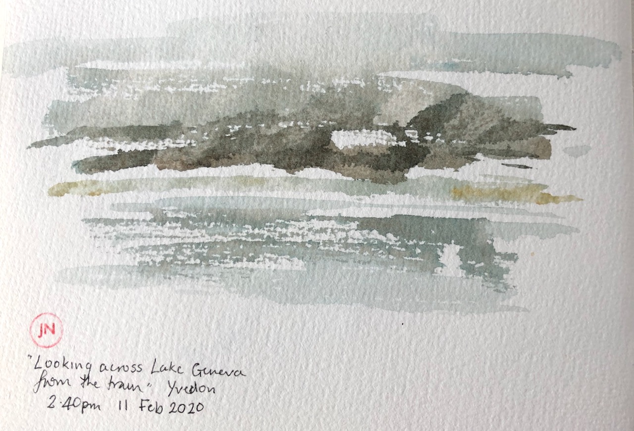
Here’s a view across Lake Geneva in the rain.
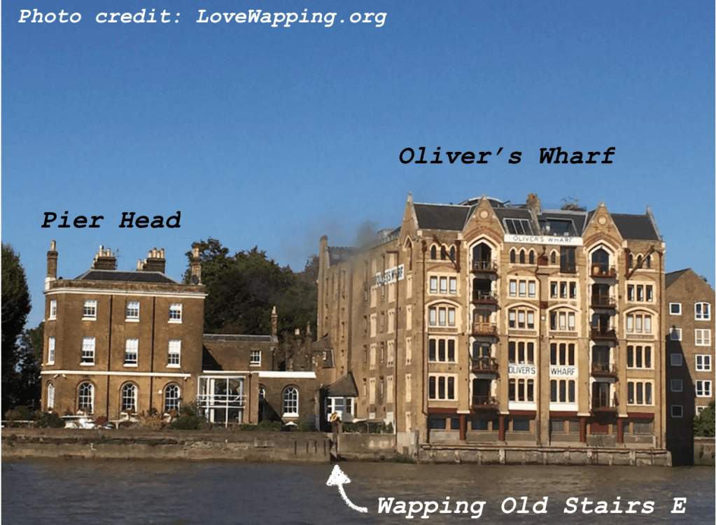
On a radiantly bright day I walked East from the City in search of horizons. Wapping, east of Tower Bridge, is where the buildings at last are of human size, and you can see the sky.
Next to the pub called “Town of Ramsgate” on Wapping High Street, there is a small passage, a slot between buildings. I darted down there, and found a long view over the Thames, and the stone steps leading down to the river. This is Wapping Old Stairs E. Turning round, to go back, I saw this mix of buildings.

On the right, with the blue window, is the “Town of Ramsgate”. High above it are the walls of the former warehouse “Oliver’s Wharf”, built in 18691 The warehouse was turned into flats in 1970-1972, making it one of the very early warehouse conversions. Warehouse conversions later extended all the way down the river on both sides.
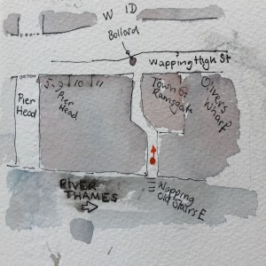
On the left are the backs of the houses on “Pier Head”, which is a wide elegant road joining Wapping High Street to the river. There is a chain across the road to deter those of us who would like to look at the river from there.
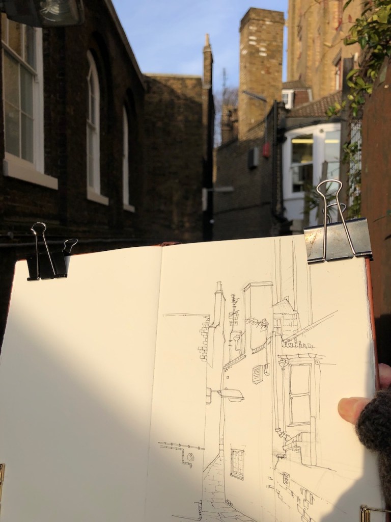
One of the things I notice doing these sketches is the amazing number of television aerials that persist on rooftops, in defiance of the proliferation of broadband services. In this view there are two, both seriously complex and business-like examples of the genre. I think it is time for a exhibition of Television Aerials, as Art. If you are the V&A reading this, consider it now, before they all disappear, or become very valuable.
Wapping Old stairs is not a lonely place. It must feature in books. During the hour and a quarter I was there four couples and individuals walked along the passageway, looked out to the river, took photos and walked back. A man came with his tiny dog. The dog showed an unwise interest in my water pot, which by that time contained an unhealthy mix of Perinone Orange, Phthalo Turquoise and Mars Yellow. I tried to deter the dog from drinking it, and then had to explain to the dog’s owner that I didn’t mind the dog atall, but I didn’t think he should drink that particular water. They were going to go for a walk on the foreshore, but the tide was still high and sloshing over the steps, which put paid to that idea.
Here is work in progress.

(1) F. & H. Francis. 1869-70. Wapping, London E1. Built for George Oliver “in the Tudor gothic style, this wharf handled general cargo but had special facilities for tea” [Craig, Charles, et al. London’s Changing Riverscape: Panoramas from London Bridge to Greenwich. London: Francis Lincoln, 2009. Quoted in “victorianweb.org”]