Bastion House from Podium Level

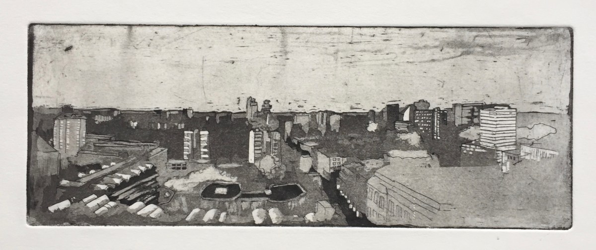
Bastion House aka 140 London Wall is a huge modernist monolith, reminiscent of the monolith in “2001 – A Space Odyssey”. I couldn’t find a site to draw the monolith part today, so here is a view at Podium Level, looking West towards the Museum of London.

IMG_1348

You see the dark undercroft, walkways and a road to a car park. Also you see the bridge that crosses London Wall.

http://postwarbuildings.com describes it thus:

“London Wall was part of a movement of amazing optimism and faith in the ideology of architectural modernism and its promise of a new built form for the city following the devastation of the blitz. It demonstrates what was possible within the breadth of vision following the Second World War and the new powers of centralised planning control. The London that emerged from the ruins of war was to be the remedy to the haphazard milieu of previous. London Wall emerged as a segment of architectural clarity, symbolic of the efforts of the public body to exercise control over the built environment and crucially attempts on the private sector.”

Architects: Powell and Moya, 1972

Here are some images of the monolith in the film “2001 – A Space Odyssey” (1968) which surely influenced, or was influenced by, architecture of the period.


I recently learned that Bastion House is going to be demolished, along with the Museum of London which is adjacent. That’s why I rushed out to draw it. The building is not listed. Here is the “immunity” listing, which is the reverse of a listing:

Screen Shot 2017-09-19 at 16.32.36
downloaded from: https://historicengland.org.uk/listing/the-list/list-entry/1427161

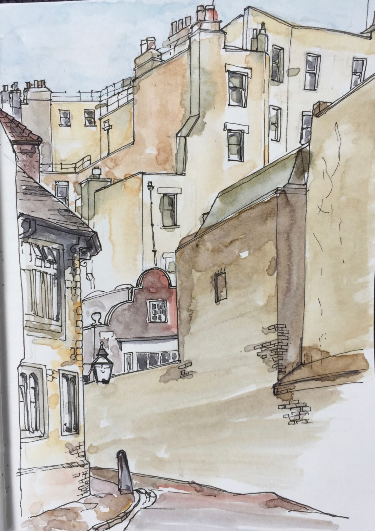
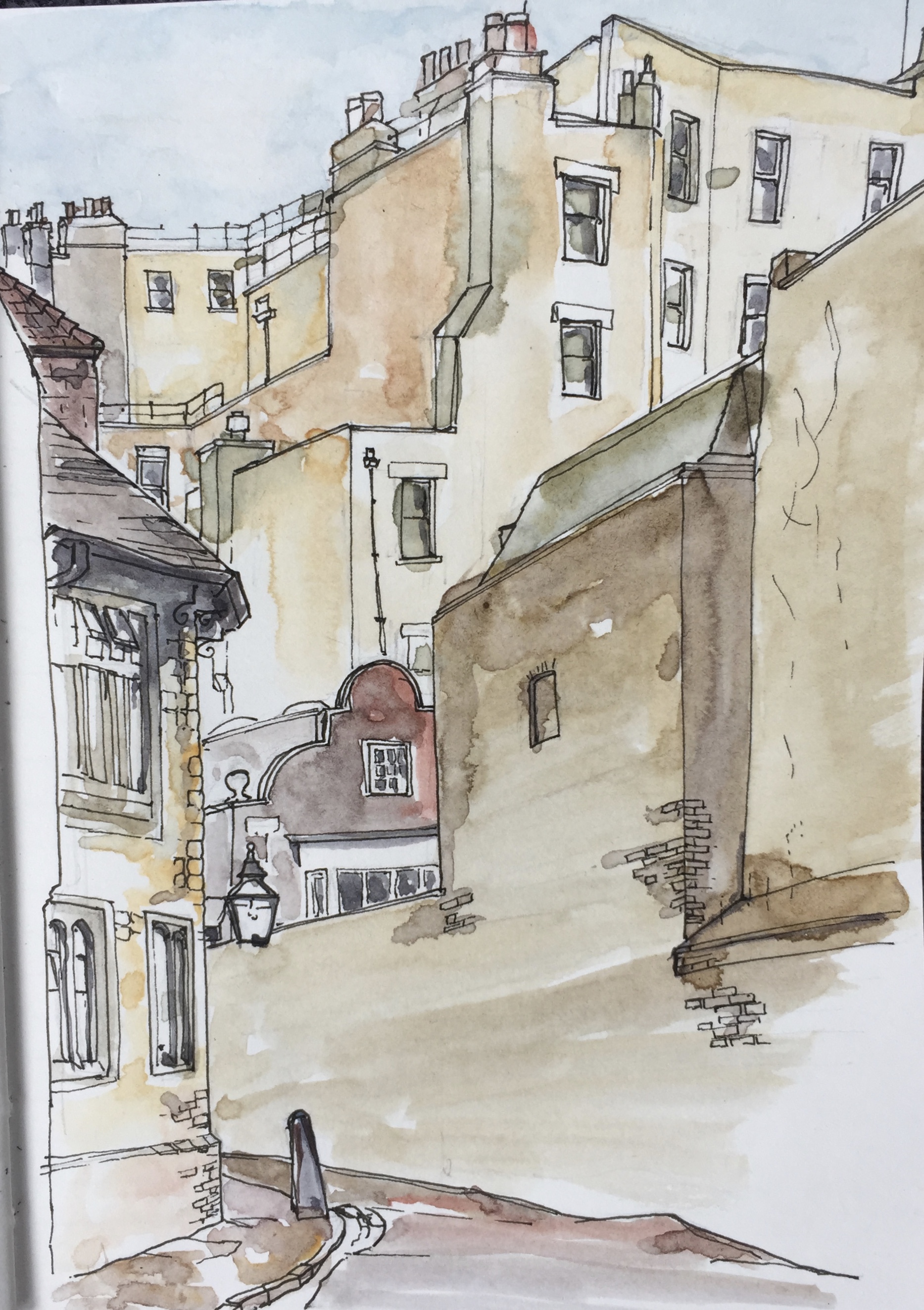
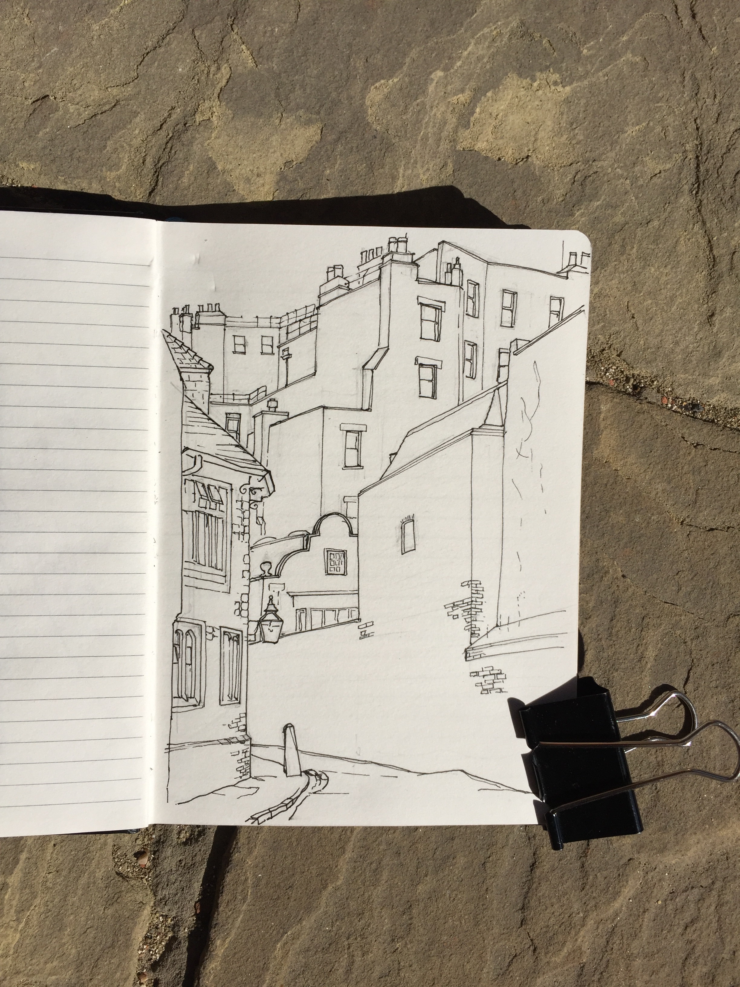
I drew Bastion House from a very convenient ledge behind an iron gate. About an hour and 20mins.

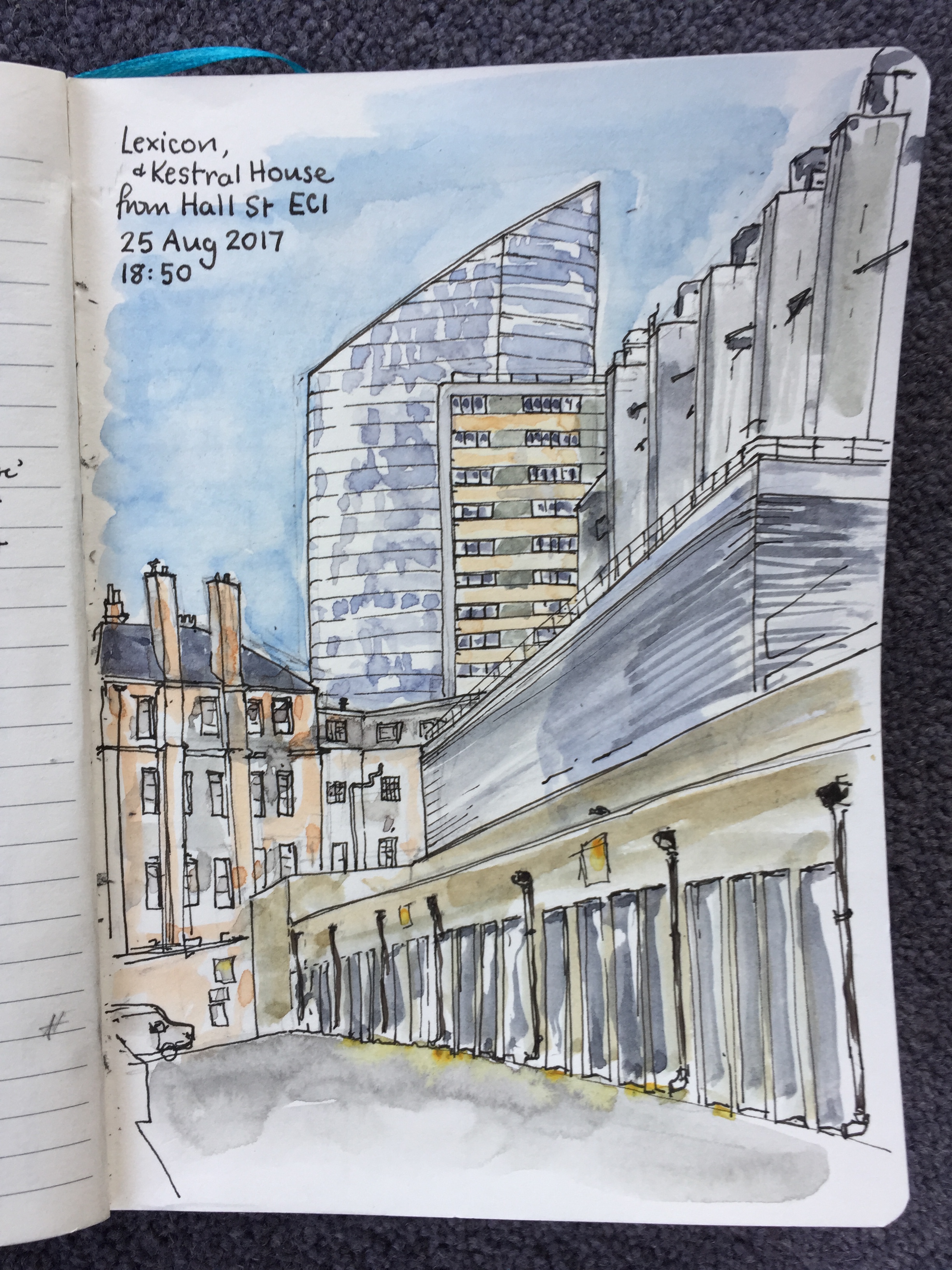
Here is a drawing of the Museum of London which I did last year:

IMG_1349

Bastion House is just off to the right.

London Wall Place from Salters Hall Garden

I sketched this after a visit to Salters Hall as part of “Open House London”.
Salters Hall is one of the London Livery companies, very ancient. The building was completed in 1976 to the designs of Sir Basil Spence. It was refurbished, with substantial alterations, in 2014. The architects for the alterations were de Metz Forbes Knight. There is a new entrance pavilion added on the East side, and they filled in the “undercroft” or open area that had been created by the 1970s architect. The Hall is off the drawing, to the left. I shall return to draw it.

The garden is open to the public. It will be even more accessible and obvious once the London Wall Place development is done.

No. 1 London Wall Place is in the back of the drawing. It is a development by Brookfields, The original Roman London wall is on the right, partly covered in scaffolding and plastic sheeting.
“London Wall Place is a 500,000 sq ft scheme designed by MAKE” says the website.

I have previously drawn the new bridge across Wood Street, which is part of this development.

Towers of North London

I have a project to draw all the towers I can see from my window. These are the towers of Finsbury, Hackney and Camden in North London.

To identify the Towers, I made an etching of the sky line. This is the view from my window. I look North.

fullsizeoutput_18c2

This is an aquatint, made at East London Printmakers. Later I am going to put all the names on.

Here’s an earlier stage of the same picture.  This is the hard ground etching.

fullsizeoutput_18c3

This is Charbonnel Doux printing ink on Fabriano Unica Printing Paper from Great Art. Copper plate etched in Edinburgh etch for 25 minutes.


The Charterhouse, West Wall

fullsizeoutput_18bc

Here is a sketch looking towards the Main Gate of The Charterhouse. The building with the curved gables is now the Pavior’s House, which is occupied by the Pavior’s Livery Company:

The Worshipful Company of Paviors moved into a new home in 2010. The Company has a long lease on a Grade 1 listed property formerly known as ‘The Master’s Cottage’ at Sutton’s Hospital in the Charterhouse. The property has been refurbished and is now known as Paviors’ House. – From the website of the Worshipful Company of Paviors, 14 Sept 2017.

Pavior means one who lays paving stones, and the modern livery company retains links with the paving industry.

This drawing was a lot more difficult than I expected. I was very pleased to get all the high walls in the background onto the one page. I liked the way they tower above the lower buildings. And all the architecture is different periods. The Tudor buildings of Charterhouse are on the left.

The drawing took 2hours45minutes.

Here is what it looked like before I coloured it:

IMG_1300

Charterhouse have now created notecards using my pictures.

fullsizeoutput_18bb

Montcigoux

IMG_1242

The red tiled roofs are a characteristic of the area. The low roof of the Old Forge is rickety. Mme Sauté cultivates tomatoes in the plastic greenhouse on the left.

Here is Steve’s house. His Audi is parked conspicuously, because he is expecting a visitor, and he told them to look out for the car.

IMG_1271

See all the overhead cables. There is a plan to put all these underground: both the electricity and the telephone cables.

On the Sunday I set out to draw a picture of the Old Forge from another angle. An elderly man trundled his walking frame all across the grass to come and talk to me. He described how Steve’s house had previously been the grocer, café and ballroom. There were dances there. The man had a long career. He was the son of the gardener in the château. He had installed electricity in the local town, Limoges. There was a whole narrative about the maquis,  which word I couldn’t understand in context. I knew it was a description of the land in the South of France: the dried out grass and low bushes. Then, as he was talking, I remembered it was also the word for a fighting force. He had fought all the way up to La Rochelle. This was Resistance fighters in the Second World War.

I had managed only the pencil outline of my picture.

I finished it on the Monday. By then it was raining.

IMG_1267

When I got home I painted one of the tomatoes Mme Sauté had given me.


Tomato from Montcigoux

fullsizeoutput_18ae

I had to sketch it before we ate it.

This tomato was cultivated by Madame Sauté of Montcigoux, in the commune of Saint-Pierre-de-Frugie in Dordogne, France.

Watercolour on Fabriano Studio Watercolour 300gsm Hot press paper. 8″x10″. About 30minutes.

IMG_1276

Towers of Finsbury – Rahere and Kestrel

I have been trying to find good views of Rahere and Kestral Houses,  two Towers of Finsbury which I can see from my window.

Screen Shot 2017-08-30 at 10.25.24
From “King Square Estate Regeneration, Summer 2015 Issue 4” by Islington Council.

Rahere is in the King Square Estate. This estate was built by Islington Council in 1959-61. The architects were Emberton, Franck and Tardew. Franck had worked for Tecton, the firm who designed the Spa Green Estate. King Square Estate is currently subject of improvements including addition of new dwellings.In between all the blocks is St Clements Church.

fullsizeoutput_18a0

Rahere House is just visible to the left. The new tower, Lexicon, is above it on the left. Carerra House, of the 250 City Road development, is under construction, visible to the right of the spire.

I couldn’t find a distant view of Rahere House, so here is a close-up.

fullsizeoutput_18a2

This is one of the back doors. The architects thoughtfully provided lead-lined troughs, at waist height, for flower pots, I assume. One of these is shown in the drawing, to the right of the door. Off the picture to the left, these continue as long boxes, like water-troughs. None of them are used, presumably because the council don’t do flowers and the temptation for vandals is too great.

Instead, residents have their own plants, inside their windows and out on the balcony. See also the feral plant, growing out of the concrete above the door, top left.

Turnpike House is on the same King Square estate. Turnpike I have drawn before.

Turnpike House
Turnpike House, King Square Estate, from the Goswell Road

To the North of Rahere is Kestrel House. This tower is on Moreland Street and City Road. It is currently surrounded by building work associated with the Bunhill Heat and Power. This scheme takes energy from braking Tube trains and uses it to heat local houses and schools.

Kestrel House is on the “City Road Estate”. I found a view of of it from Hall Street: it’s the rectangular tower block in the middle. The Lexicon, otherwise known as “Chronicle Tower”, a new development by “Mount Anvil” is the sloping building behind.
IMG_1200

The building which dominates this drawing, on the right, is the premises of “Level(3)”. I walked round the block a couple of times to see what it was. The windows on the street side are high, and there are serious steel shutters over every entrance. Note the huge ventilation shafts. It looks somehow as though it’s ventilating a larger volume than the building, as though it goes down a number of stories below ground. The business of Level(3), according to a web search, is “Connecting and Protecting the Networked World”.

The red-brick building straight ahead was previously “St Marks Hospital Nurses Home”. This is cast into the stone work above a former door on Pickard Street. The door is no longer in use, and fenced off. “Founded 1835, Erected 1853”. The main entrance now is on City Road. It looks disused. Fallen leaves clutter the steps, the grass wafts unmown. But there is a car park, so perhaps there’s another entrance from there that I couldn’t see. It’s “300 City Road”, which appears online as Citidines Serviced apartments.

Behind me when I drew this was Peregrine House, another tower, very high.

Later I went back to try to get views of Peregrine House.

IMG_1216
President House, left, Peregrine House, centre.

I forgot to take my drawing book.

I’ll have another go at these towers.

Bunhill Heat and Power
Buildings served by “Bunhill Heat and Power 2” – in green.

Outer Hebrides 2017

I took my sketching things on a swimming expedition to the Outer Hebrides with Swimtrek. We were on the wonderful Lady of Avenel 102ft square rigged brigantine.

IMG_1169

We started in Oban.IMG_1166

It was raining when I drew this picture, as you can see from the way the pen has drifted a bit, round the chimneys. I coloured it inside the café called “Kranks”.

There was a lot of weather.

IMG_1173

IMG_1174

I drew pictures while balancing on the quarterdeck. The picture below was painted with sea water.

IMG_1066

Here is a drawing of the beach at Vatersay. We swam to this beach, and surfed in the waves on the other side. The small dots on the beach are cows.

IMG_1170

Here is an attempt to draw the sails.

IMG_1177

IMG_1064

For more drawings of this expedition please see the “Outer Hebrides 2017” gallery.

For drawings from last year’s trip please see the “Outer Hebrides 2016” gallery.

Chequer Court and Braithwaite House EC2

IMG_0984

The drawing shows the lovely brick building, now called “Chequer Court”, with Braithwaite House behind.

I drew the picture from Whitecross Estate East, in a quiet courtyard off Chequer Street. A record three people came to talk to me. Arabella was tending her garden flowers in pots and crumbling wooden boxes, on the other side of the courtyard. She came over and told me that the brick building used to be the community centre. She had done oil painting there. Previous to that, it had been a school. She described the marvellous high windows, and large rooms. There was a café.

She said, “Do you like the buildings?”, indicating the Peabody buildings surrounding us. When I said that I did, she said they were “like prisons”. “They are all different inside, of course.” she added. She explained that there were going to be changes, they were going to build another block on top of the low-level office in front of us. “So you should come back,” she said, “This is a historic view.”

She said that underneath the square was all hollowed out, for bomb shelters. Construction work was going on behind us. “They have demolished the pram sheds”. Arabella was irritated that, in doing so, they had strewn rubble over the planted boxes.

Another woman approached me much later. She also remembered the community centre. She did yoga there. “It was only 20 years ago.” She was concerned lest I was the harbinger of “another plan”.

“No,” I said, “Not another plan. Just a drawing.” I showed her the drawing, to reassure her.

As I packed up my things, a third woman came to say hello. She wanted to see the drawing, and said it was very good. Her small white dog tugged at her and slowed her up as we walked. Eventually he stopped her altogether and I walked on.

Later, online, I found the plan to which the second woman referred. There is a plan by Islington dated March 2017 to improve the public areas of the West and East Whitecross Estates.

http://planning.islington.gov.uk/NorthgatePublicDocs/00421223.pdf

The brick building was indeed a school. It seems to have  been known as Northampton Secondary Technical School,  which was in existence in 1924, and certainly up to the early 1960s. Searching online I found references to a “Bunhill Row Chequer Street Council School” whose records, 1928-1933 are in the National Archive, Kew ref ED 21/34646, but no further details. In 1998 “negotiation was completed for the sale of the Bunhill Row site for £22 million” according to “City and Islington College, the First 20 years” by Tom Jupp and Andrew Morris. Now it is luxury flats, and is called Chequer Court.

I have sketched Braithwaite House before:
View from Chequer Street EC1
Braithwaite House from Fortune Park
It has now had all its cladding removed.

About 2hr 15min, including conversations. Drawn and coloured on location.

From the Rotunda, Kings Place N1

IMG_0955

I drew this from the Rotunda restaurant in Kings Place, looking across Battlebridge Basin. The low building in the middle with the pointed roof is the London Canal Museum.

IMG_0956

The coffee was excellent, and we were made very welcome by the restaurant manager Mark.

After this, we went for a walk around the new Kings Cross developments on the other side of York Way.