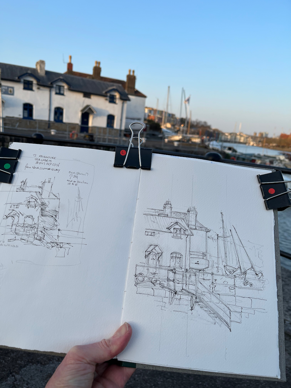
Wandering in a warm Bristol evening I rounded the harbour and found myself in Nova Scotia Place. This is a secluded domain, enclosed by water, and main roads. There is a pub, the Nova Scotia Hotel. People occupied the outdoor tables, with pints and conversation. I walked onto the small promontory and looked at the little cottages opposite.
Sketching at Nova Scotia Place, 22nd March 2022, 6pm
The warm evening became rather cooler. I packed up when I’d done the pen sketch. The bench that I had been using was a memorial bench:
In memory of Alan Helliwell (German) remembered by family, freinds and work colleagues of Underfall Yard who died too early. 7/2/1961 – 03/10/2009 after several near misses.
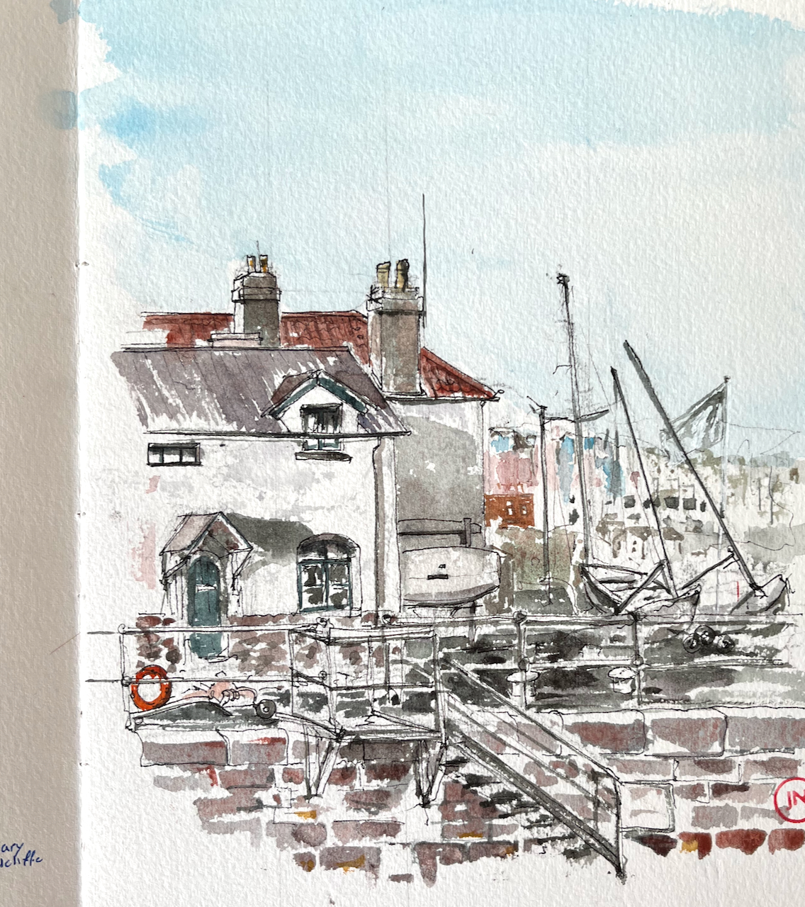
Later I put on some colour:
“TS Adventure Sea Cadets” cottages seen from Nova Scotia Place
Click a button below to share this post online, email it, or print it:
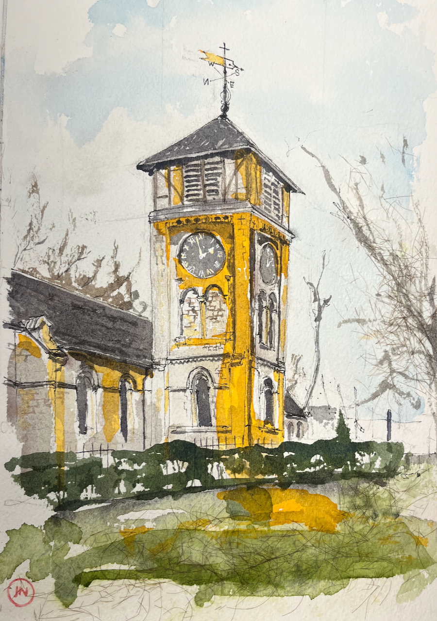
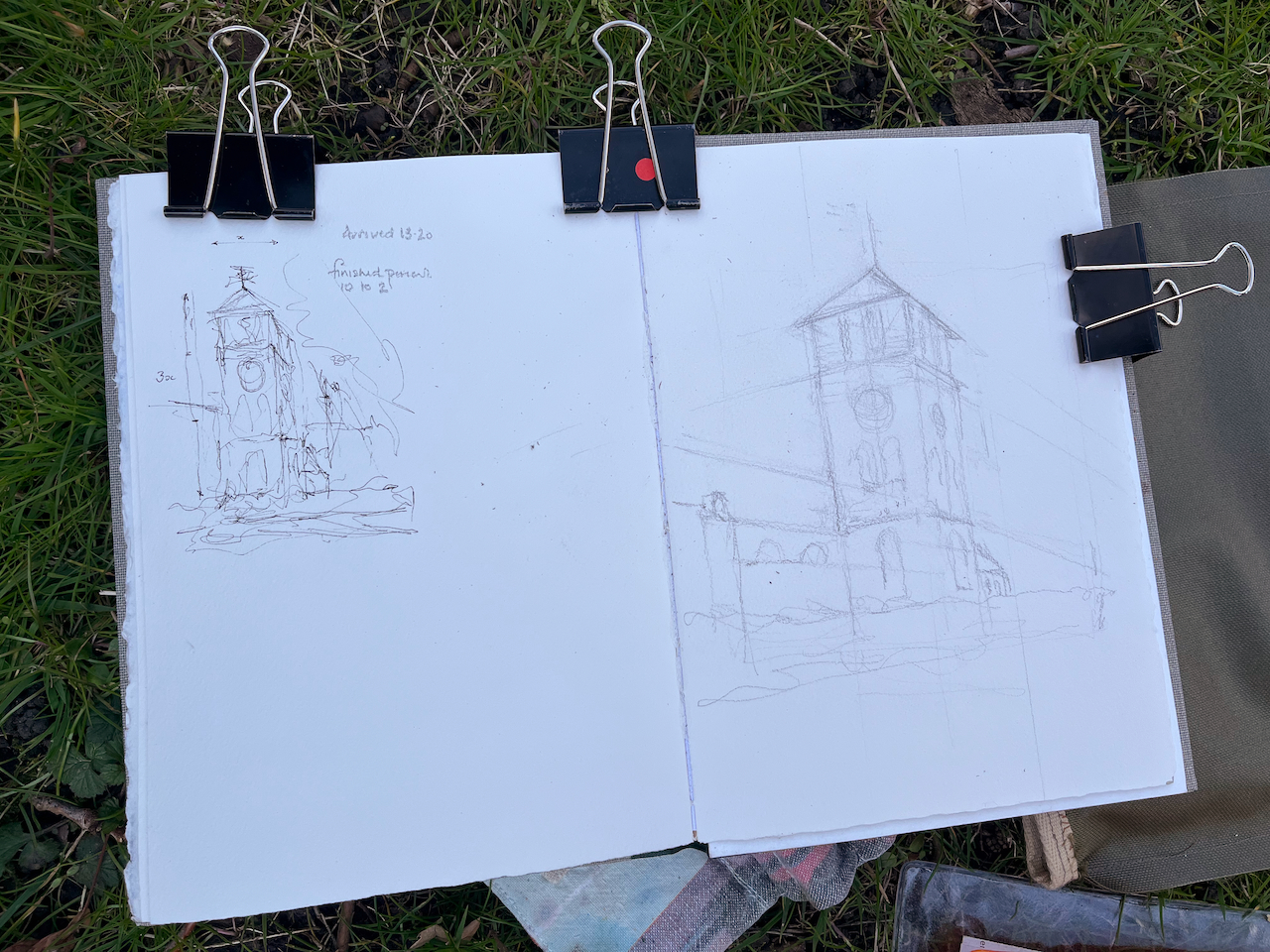
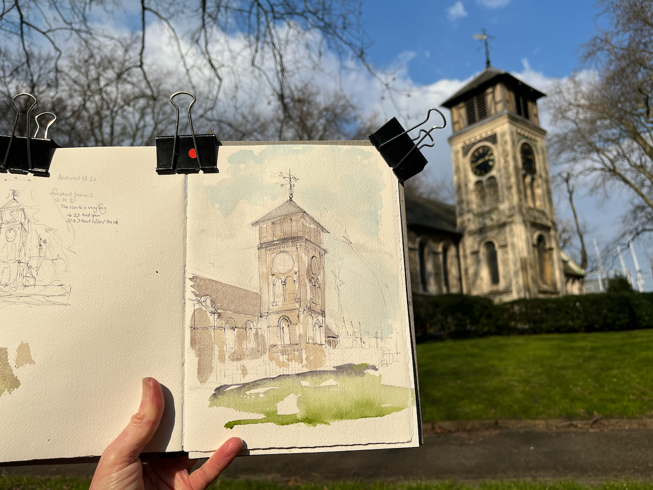
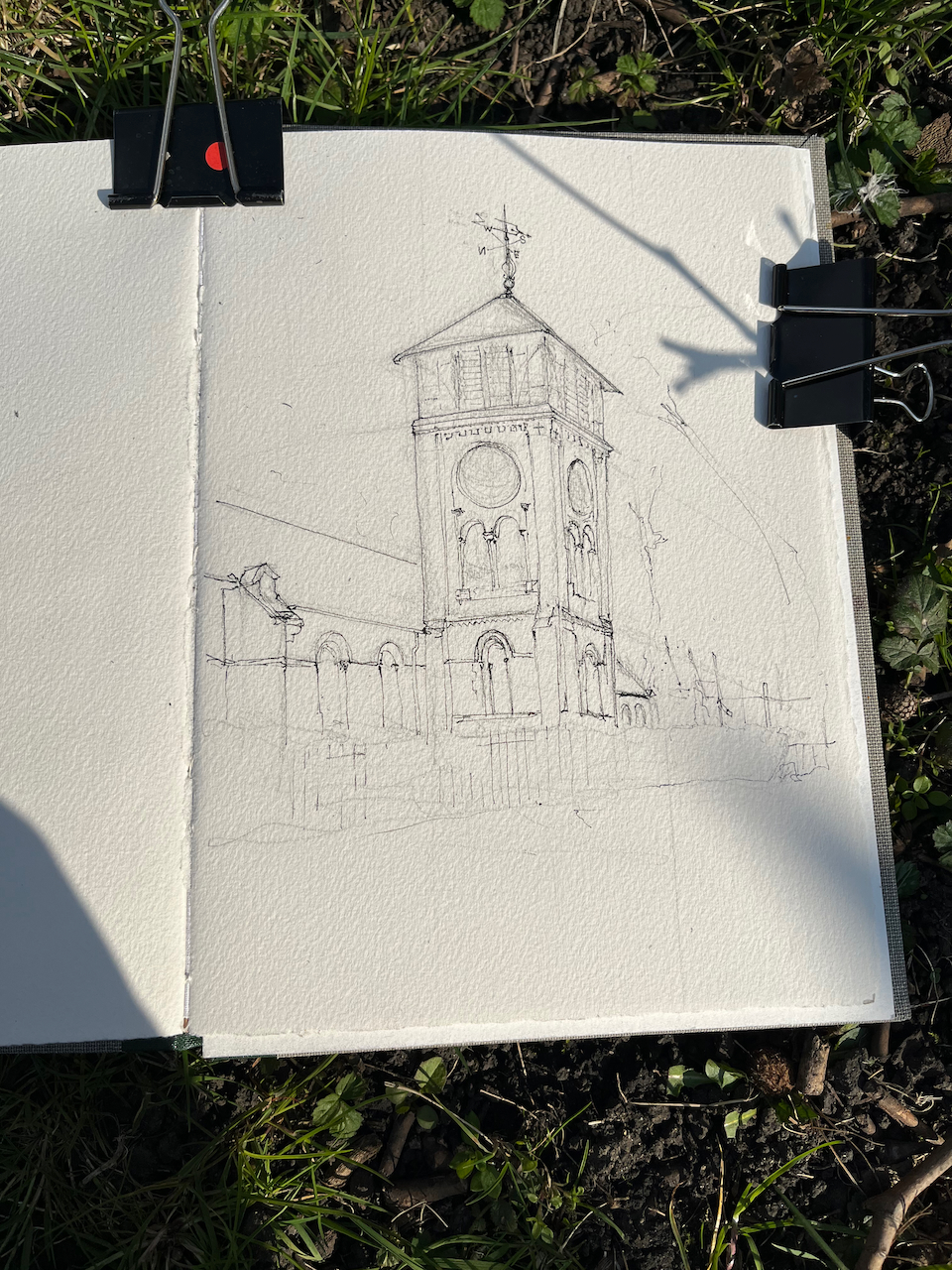
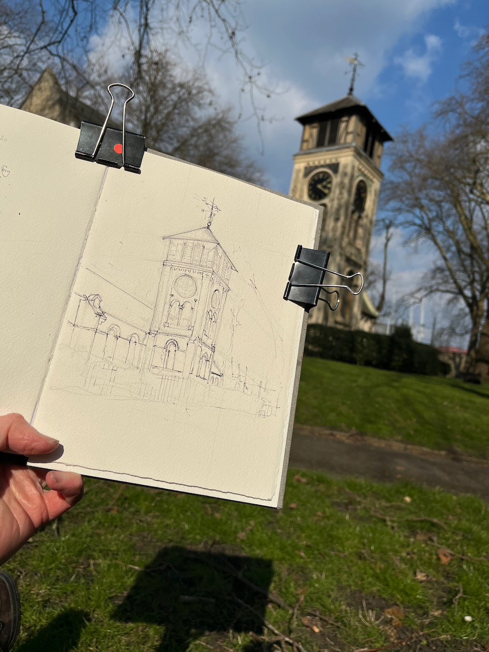
On a sunny day I went to draw a church tower in a country churchyard. The churchyard is near Kings Cross and the church tower is that of St Pancras Old Church.
St Pancras Old Church, tower. 20th March 2022 10″ x 7″ in Sketchbook 11
I sketched sitting on the grass beside the River Fleet, while the river flowed behind me, in my imagination.
It’s a real river though. These days it’s under St Pancras Way. But it used to flow by the church.
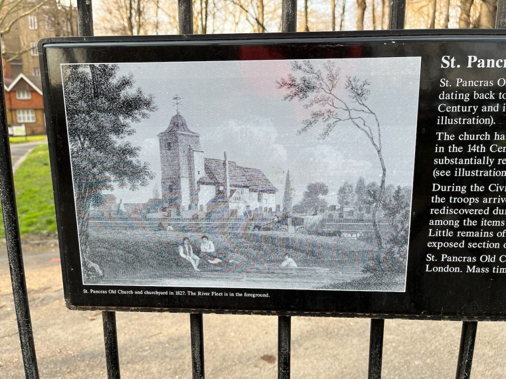
“St Pancras Old Church and churchyard in 1827. The River Fleet is in the foreground.” notice on the railings of the churchyard.
As you see from that picture, in 1827 the church looked very different. The south tower which I sketched is not as ancient as it looks. It was constructed in 1847 to the designs of A.D. Gough.
The church site itself is very ancient. According to the church website, this is one of the oldest sites of Christian worship in London, possibly dating back to the 4th century:
The suggestion that St Pancras Old Church dates back to Roman times has a long tradition, with most suggesting that it was founded in 313 or 314. Most churches in England named for the martyr St Pancras have, or may have, ancient origins, suggesting that veneration of the saint spread quickly after his death in 304.
Today it is an active church, and a music venue. The churchyard is a glorious green space, much used. Many people wandered past on the paths. No-one paid any attention to me drawing. The dogs did though. I was inspected and approved by each dog that went past.
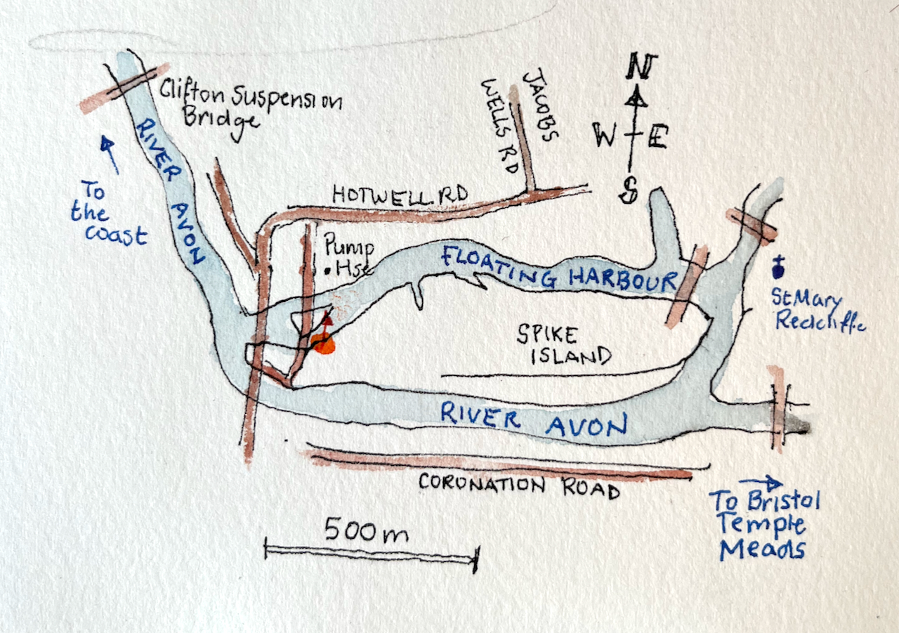
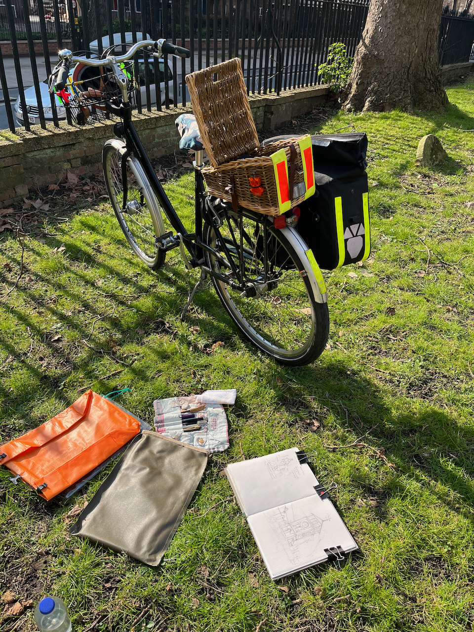
Here is work in progress and a map (click to enlarge the image)
Click a button below to share this post online, email it, or print it:
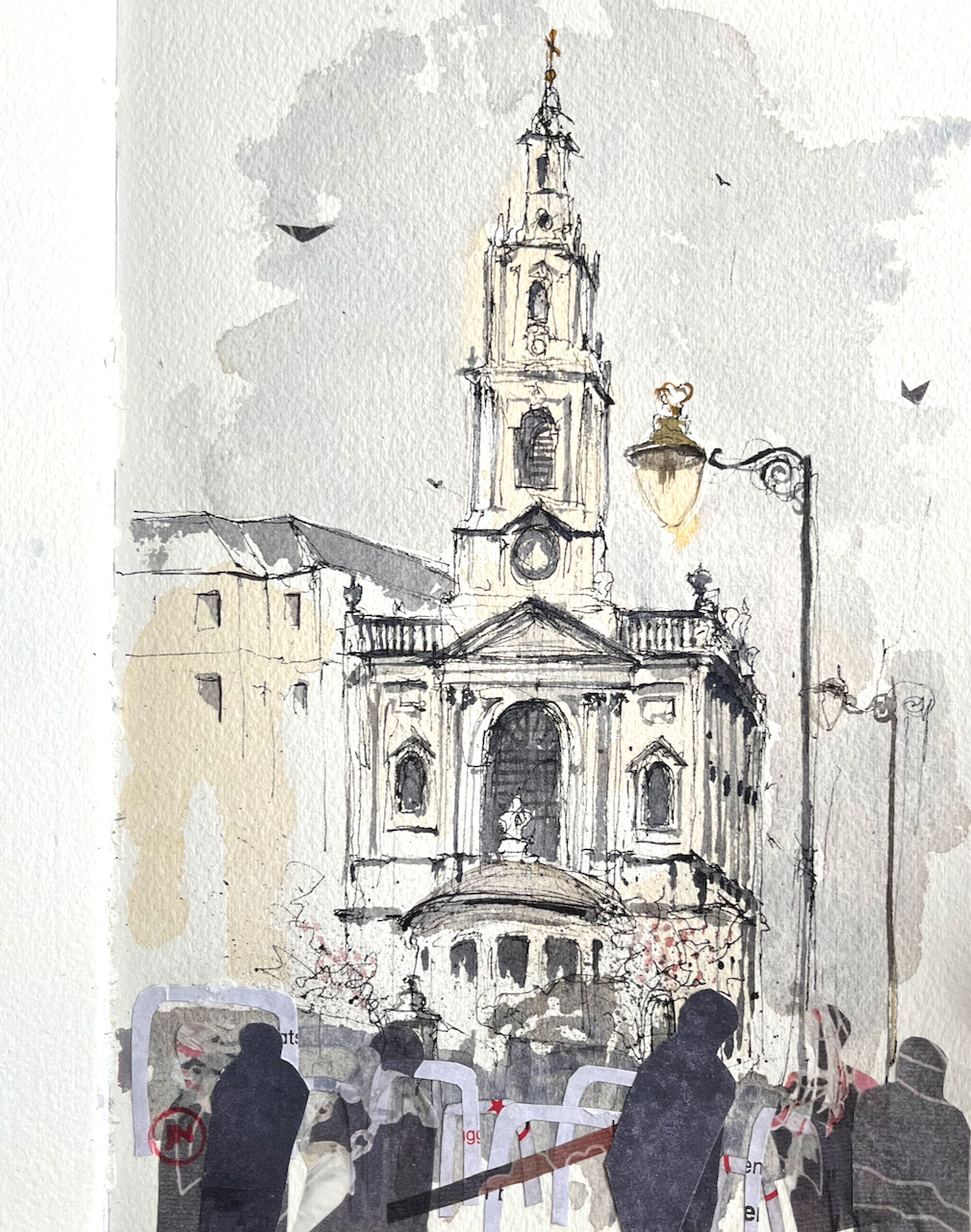
Here is a sketch of St Mary Le Strand, which is the church in the middle of the Strand at Aldwych. I sketched this from outside Somerset House. As you see it was really busy there. The south part of Aldwych is being closed off to motor traffic and made a pedestrian-only route. It will be great when it’s finished, but right now it means that the busy pavements are narrowed with barriers and there are many types of confusion.
St Mary Le Strand WC2, 1st March 2022, 10″ x 7″ in Sketchbook 11
The foreground is collage, added after the drawing.
Here is work in progress and a map.
Click a button below to share this post online, email it, or print it:
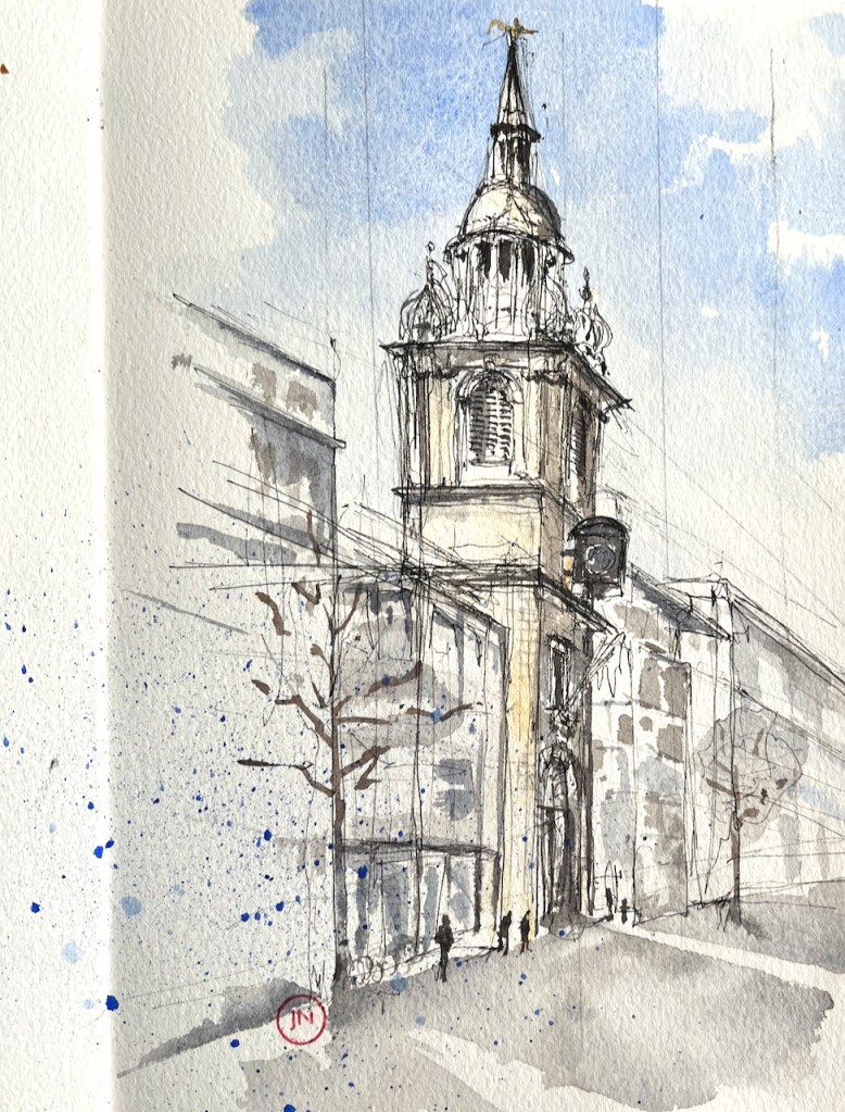
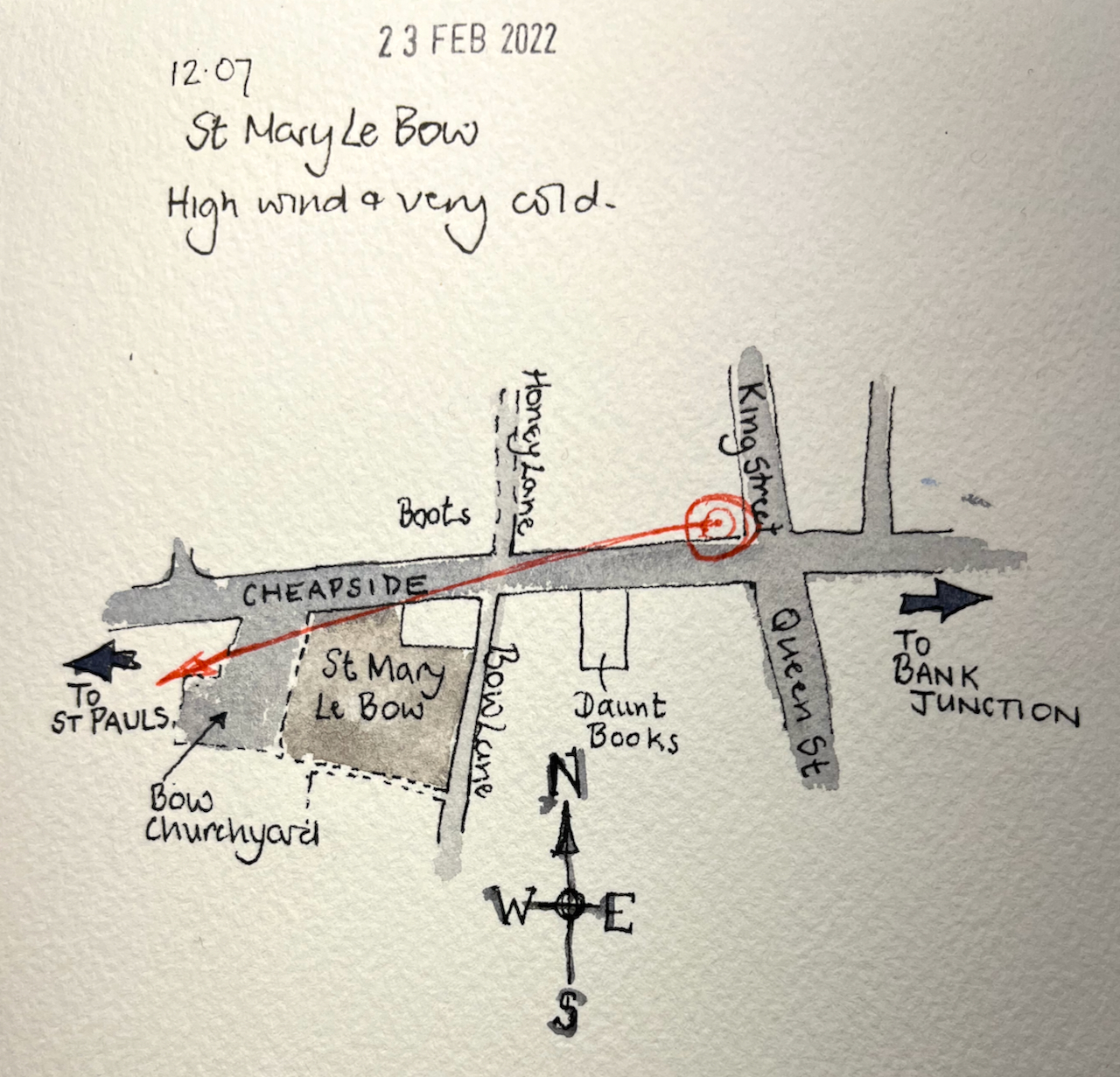
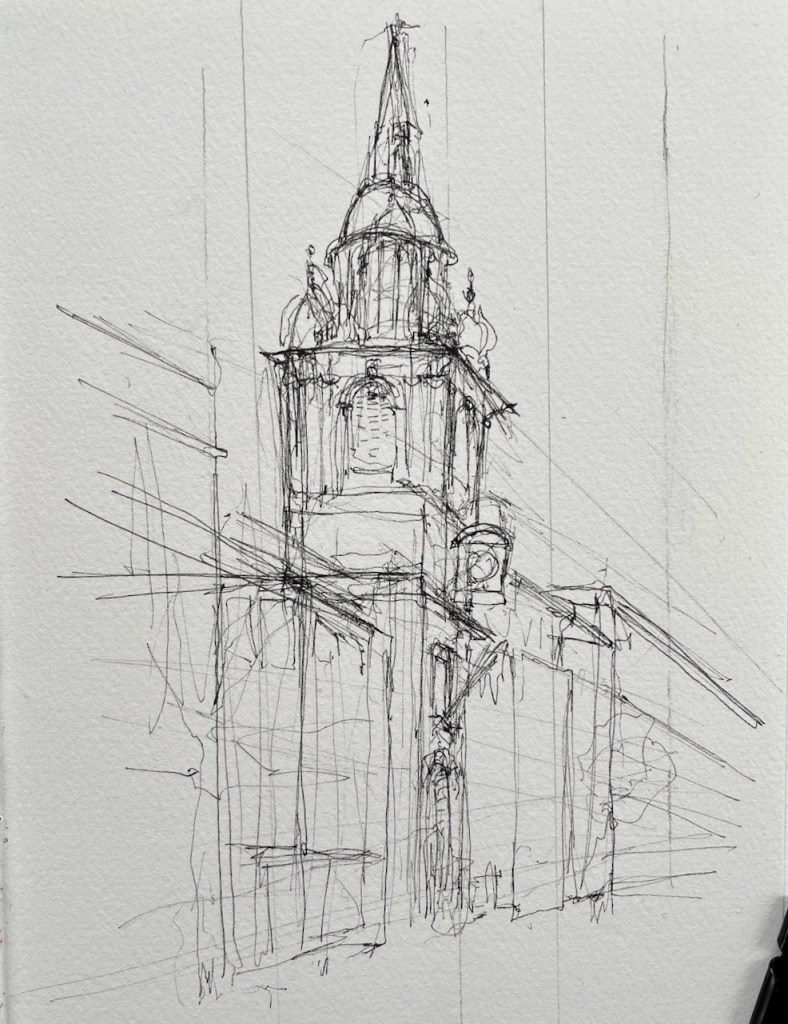
A quick sketch of St Mary Le Bow on Cheapside, London EC2
St Mary Le Bow, from Cheapside 23 Feb 2022 10″ x 7″ in Sketchbook 11
I drew this from the corner of Cheapside and King Street. This seemed like a really good place to stand, since there was a tall junction box next to me, and I could fit myself into a corner of a window. It rapidly became apparent that I chosen the windiest corner in London. My eyes streamed. Everyone coming round the corner took a short cut my side of the junction box, and funnelled past me, their heads down, phones in hand. I felt in the way.
But I persisted. I finished the pen. I did not put the colour on using the convenient top of the junction box, as I had planned, since no paper was going to stay still for a moment in that wind. I retreated, and coloured it at my desk.
Click a button below to share this post online, email it, or print it:
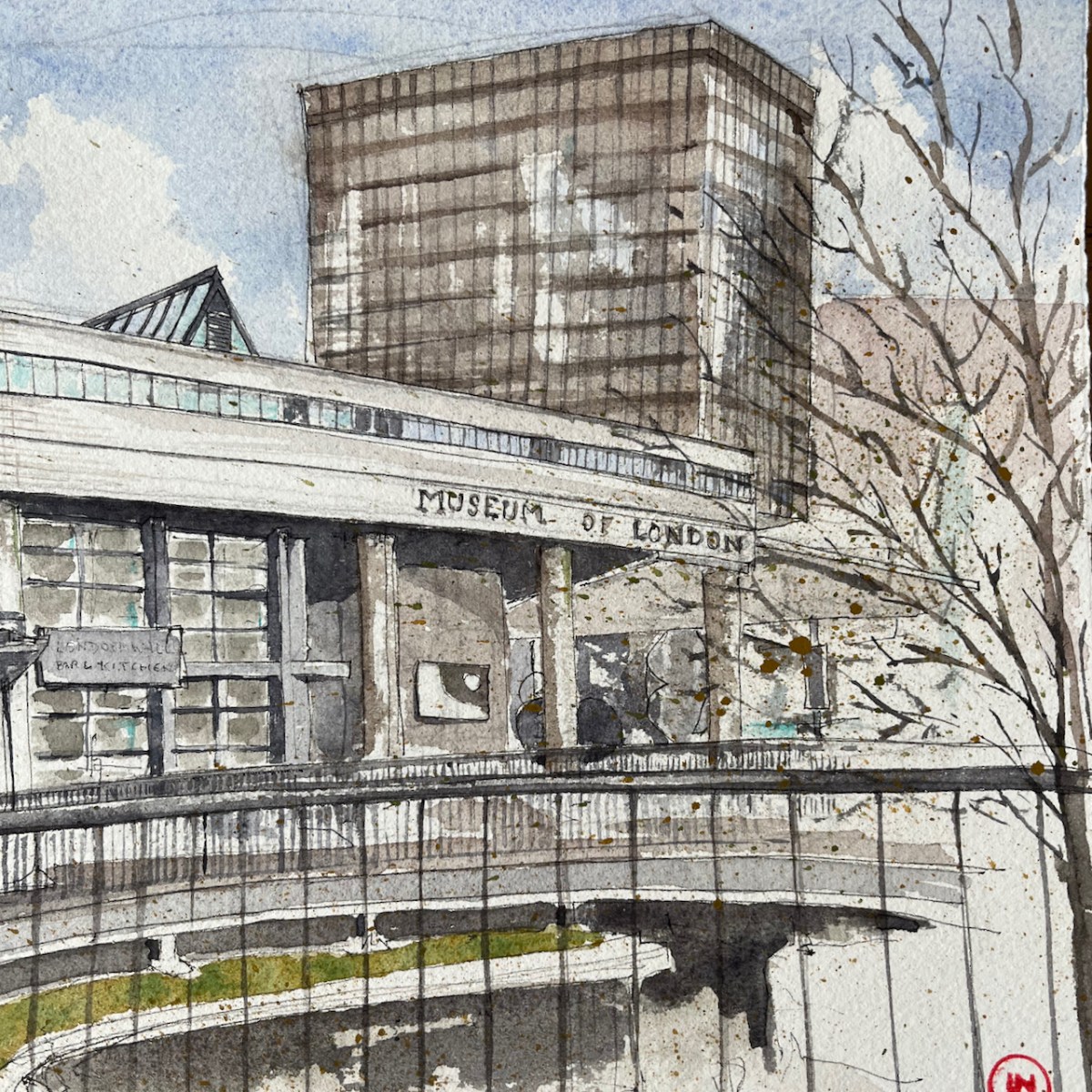
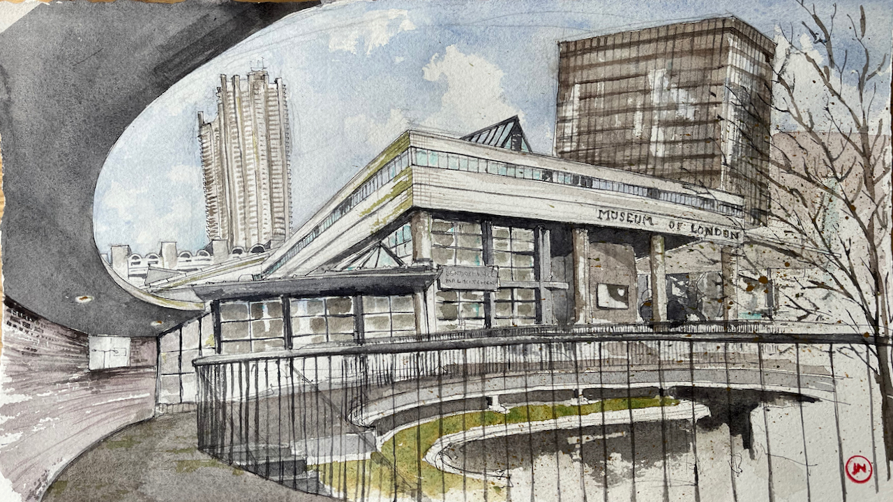
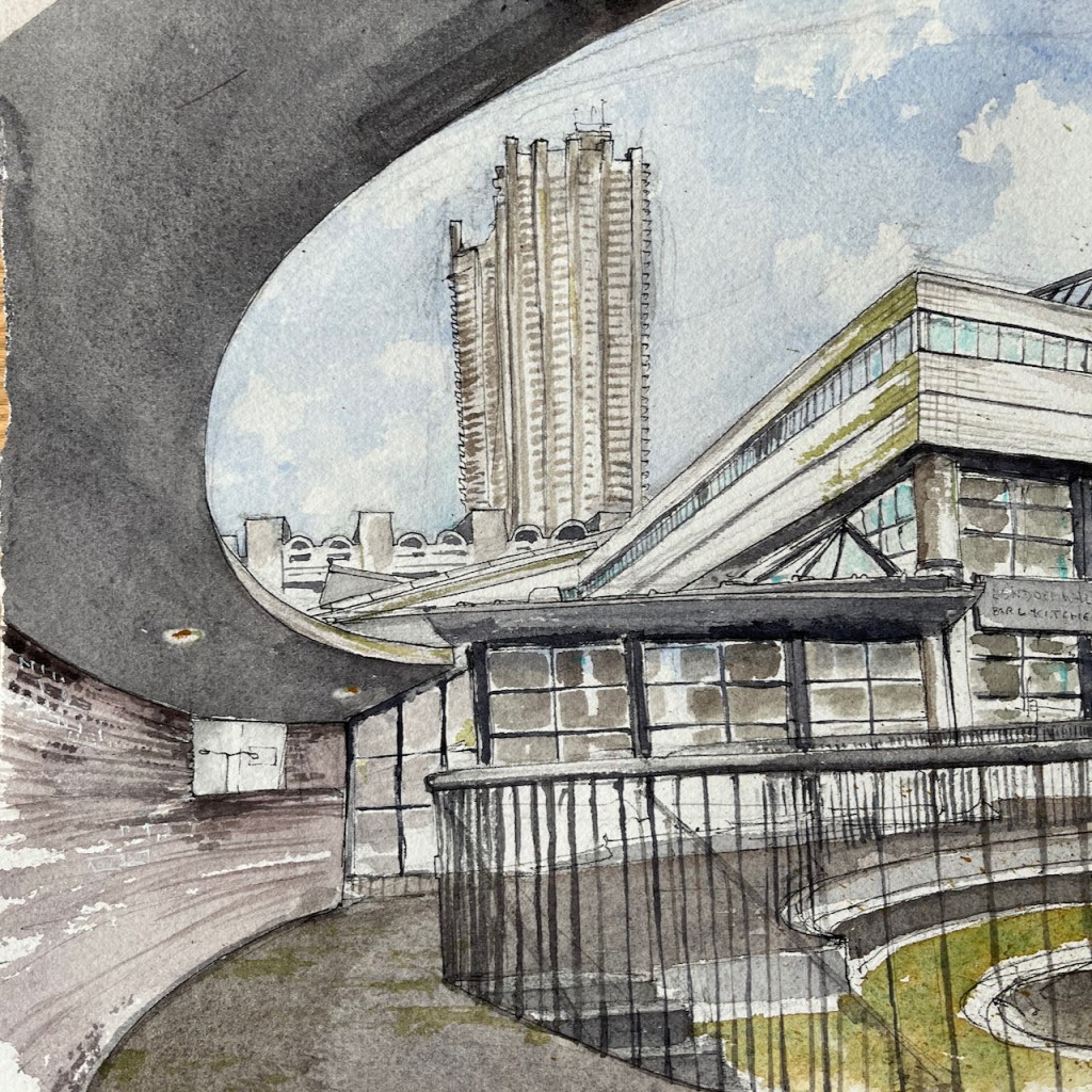
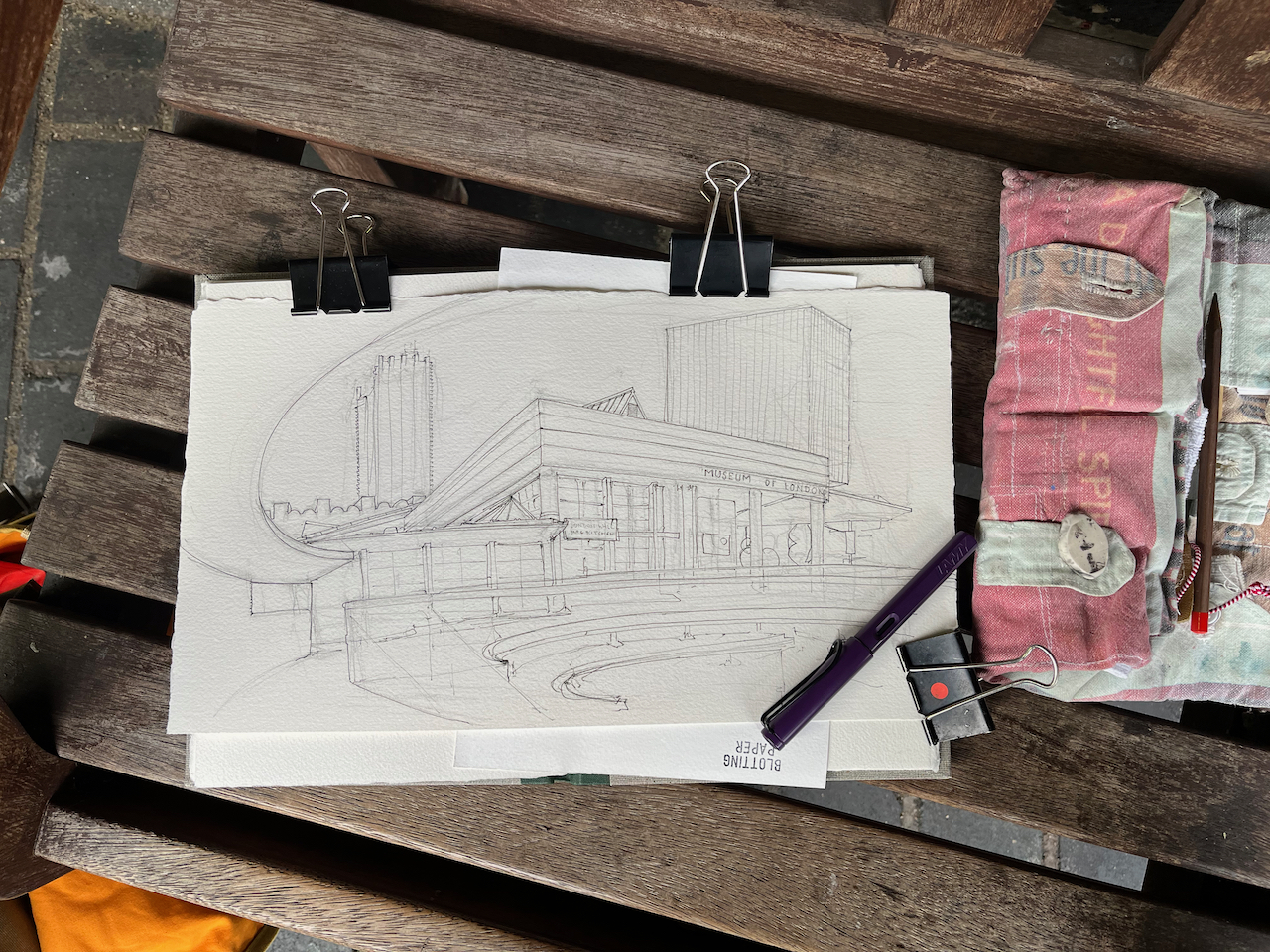
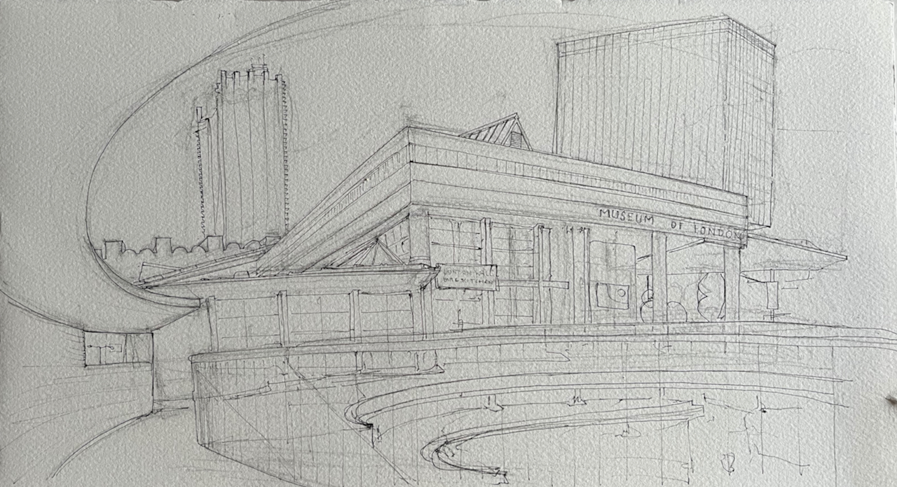
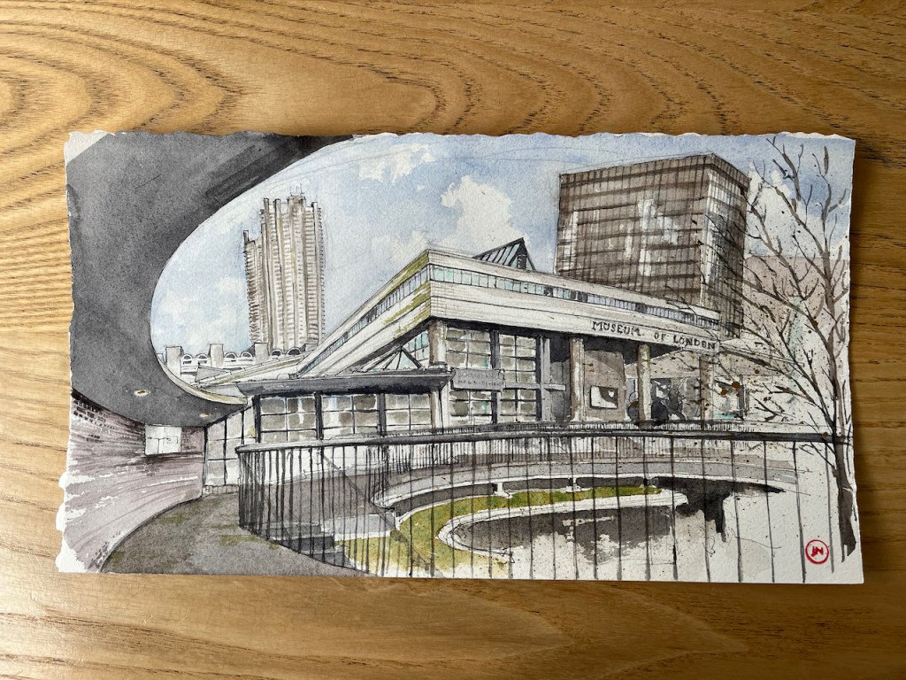
From the highwalk on the Rotunda there is a really amazing view of the Museum of London and Bastion House. This whole view going to change radically, if the City of London plans are approved.
Museum of London from the Rotunda, 15″ x 8.5″ on Arches watercolour paper
The Museum of London is in the South West corner of the Barbican. It was designed by Philip Powell and Hidalgo Moya.
The Museum opened in 1976. The City of London plan to close it in December this year (2022), and then to demolish it, along with the surrounding highwalks and pedestrian bridges over London Wall.
The dark-coloured block in the background on the right is Bastion House. This 17 storey tower block was built to the designs of architects Powell & Moya between 1972 and 1977 as part of the Barbican development. It is on top of part of the Museum of London’s display space.
The City of London now plan to demolish it.
So if the plans go ahead, this view will no longer exist. I rushed to sketch it.
Museum of London and Lauderdale TowerMuseum of London and Bastion House
This drawing is in an aspect ratio new to me: 15″ x 8.5″ or 38cm x 22cm. I wanted to get the whole of the front of the museum in the picture.
Here is comparison of the pen and ink and the the colour versions:
The architecture practice which designed The Barbican is “Chamberlain, Powell and Bon”. This “Powell” is Geoffrey Powell and not the Philip Powell of the Museum of London. The architects involved in designing the Barbican were:GeoffryPowell, Peter “Joe” Chamberlin, Christoph Bon, and Charles Greenberg.
The architects who designed the Museum of London and Bastion House are Philip Powell and Hidalgo Moya of the architecture practice “Powell and Moya”.
Thank you to the reader who clarified this for me.
Click a button below to share this post online, email it, or print it:
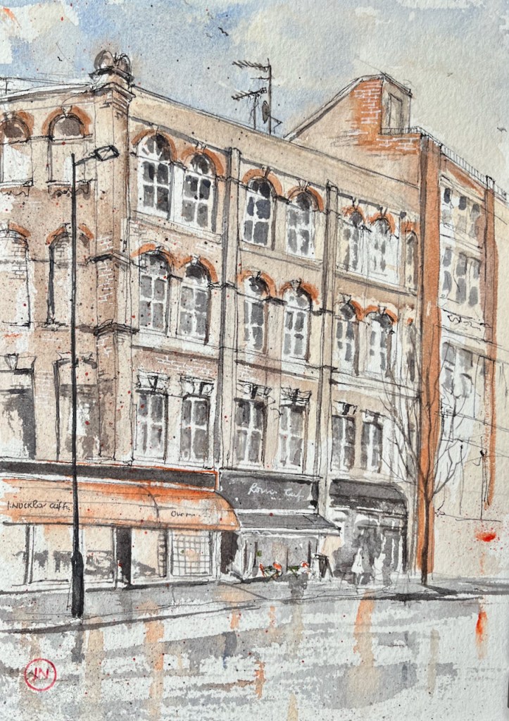
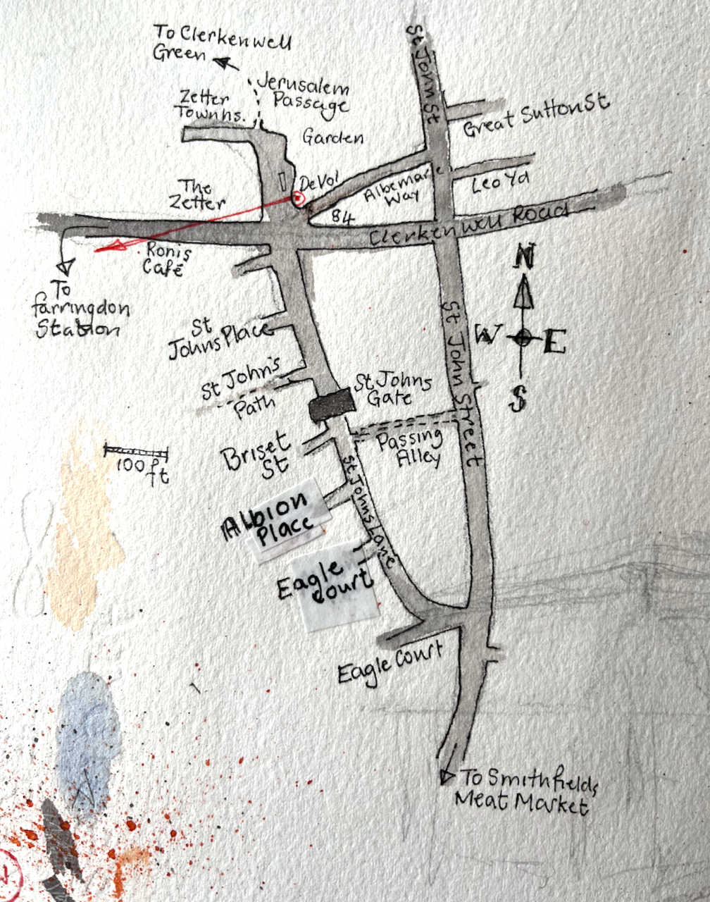
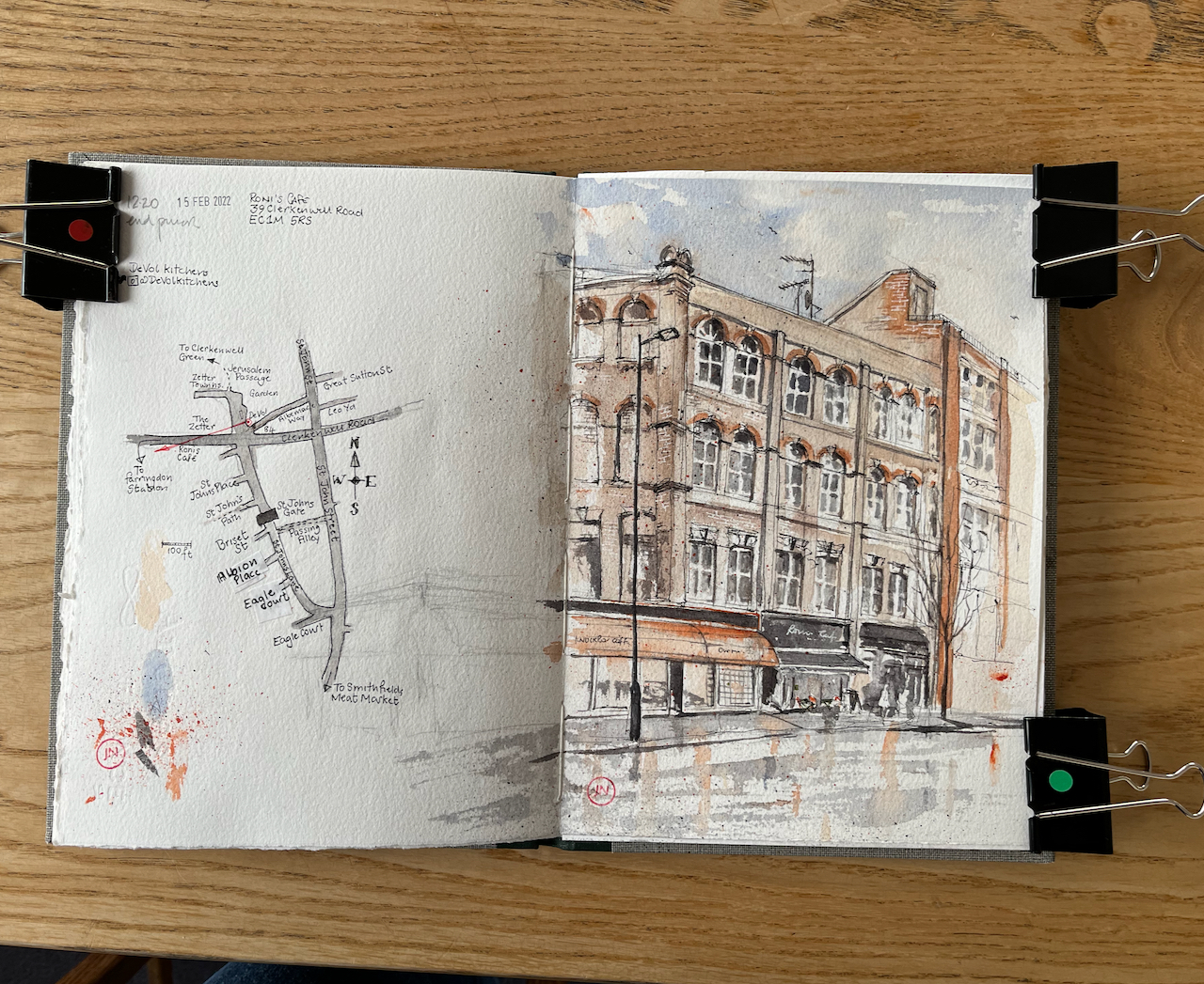
Roni’s Café, 39 Clerkenwell Road, 15th Feb 2022, 10″ x 8″ in Sketchbook 11
In the centre of the picture is Roni’s Café, where I sheltered to finish my drawing of 84 Clerkenwell Road.
My idea was to draw the view looking West along the Clerkenwell Road, from number 84. By the time I reached the spot, the rain was falling heavily. I spotted a large window. The people inside kindly agreed to host me for 45 minutes while I sketched my lines. Then I went out into the rain. I finished the picture at my desk.
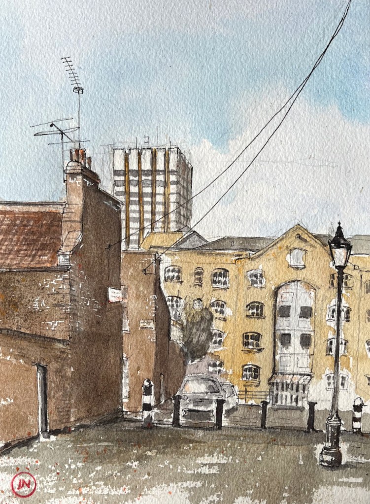
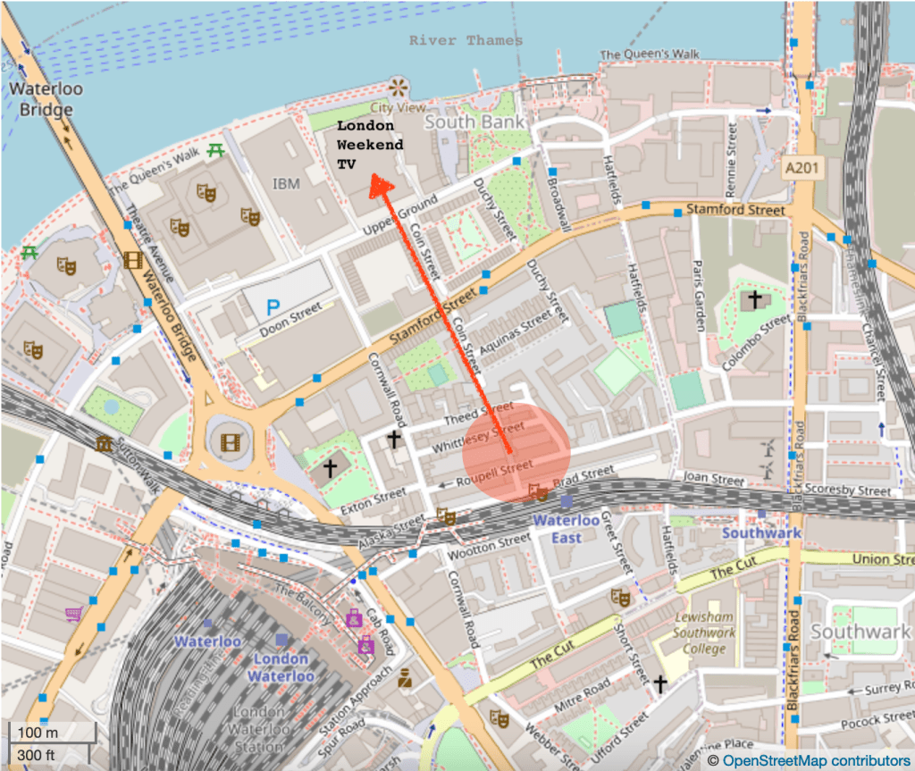
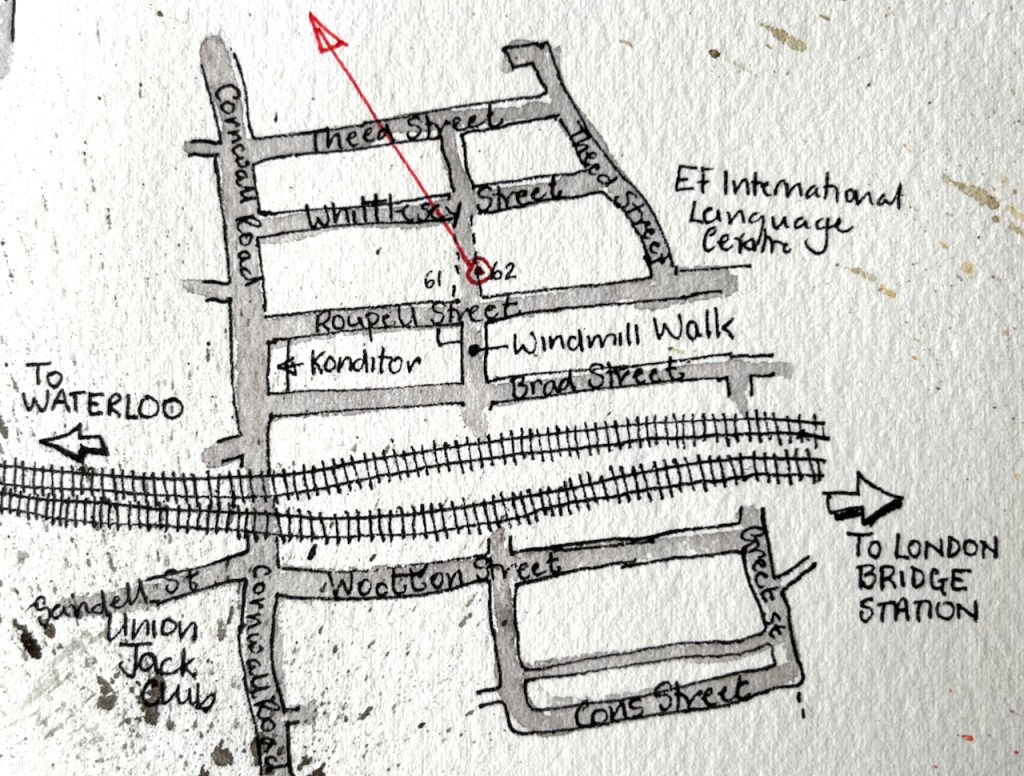
Here is a view of the tower of former London Television Centre building, seen from Windmill Walk, off Roupell Street near Waterloo Station.
LWT Building from Windmill Walk, 7th Feb 2022, in sketchbook 11
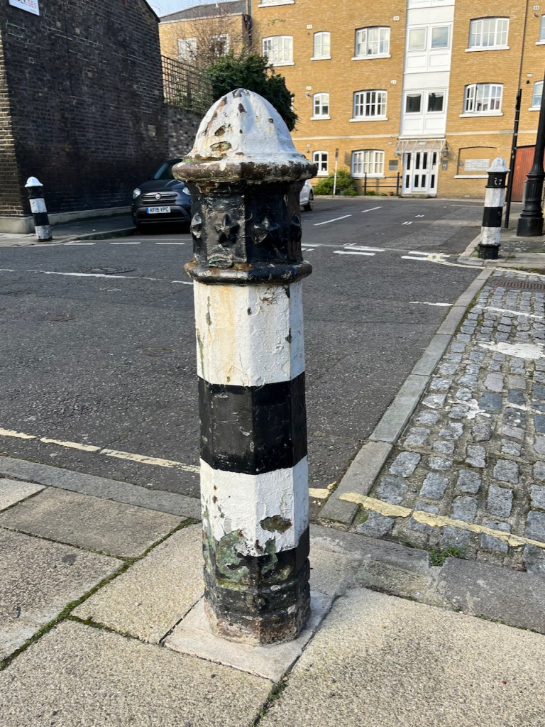
Bollard with stars.
I enjoyed all the wires and aerials! The swooping wire from the top right is a telephone wire or electrical cable. It’s unusual to see them above ground in London. Note also the marvellous bollards, which are mentioned in the Conservation Area Statement (Note 1).
Here you see layers of London development. In the foreground is Windmill Walk, part of the Roupell Street residential area built around 1824, and still residential. The paler building in the mid-distance is on Theed Street. It is a converted factory. It now contains some residential properties which I found listed on a holiday lettings site, and some offices listed on an estate agents’ site. Different accounts list it as a Violin Factory and/or a “Komptulicon Works”. Komptulicon was a sort of floor covering made of cork and rubber.
On the skyline is the London Television Centre, 1972, which I have drawn previously:
Here is a view of the London Television Centre, 60-72 Upper Ground, SE1. It is on the South Bank of the river Thames, a little to the East of the National Theatre and the Royal Festival Hall. It was completed in 1972 to the design of…
“[Roupell] street was laid out and construction started around 1824….. Roupell had built the street for what were described as “artisan workers” and the 1841 census provides a view of the professions of what must have been some of the first people living in the street. This included; painters, labourers, clerks, printers, bakers, carpenters, bricklayers, compositors, paper hanger, hatter, an excise officer, lighterman, warehouseman – all the typical jobs that you expect to find in such a street in 1840s London.” (A London Inheritance)
“Roupell Street Conservation Area” statement by Lambeth Council, 2007, describes the streets and details what can and cannot be done in modifications to the houses. It also mentions the “Komptulicon Works”, north of Windmill Walk.
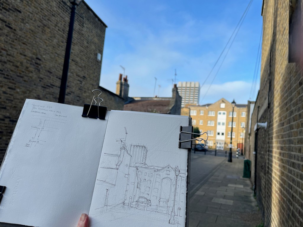
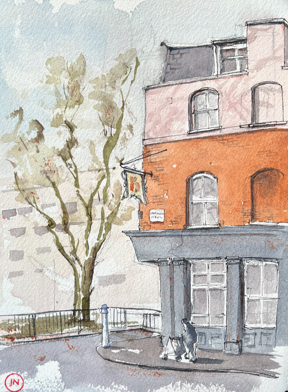
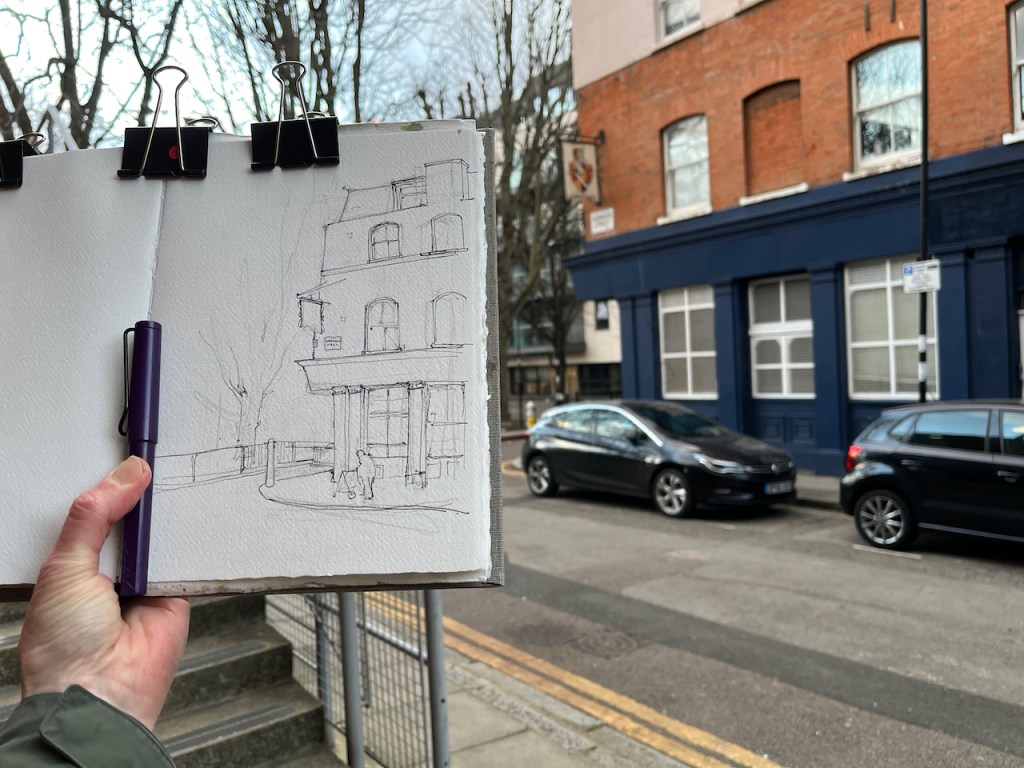
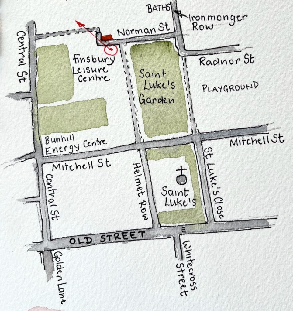
In the late afternoon, I walked round a corner near St Luke’s, and noticed the pub sign.
Langton Arms, Norman Street, EC1 sketched 29 Jan 2022, 4:15pm, in Sketchbook 11
The pub closed sometime around 1989, according to https://pubwiki.co.uk. It is now residential flats.
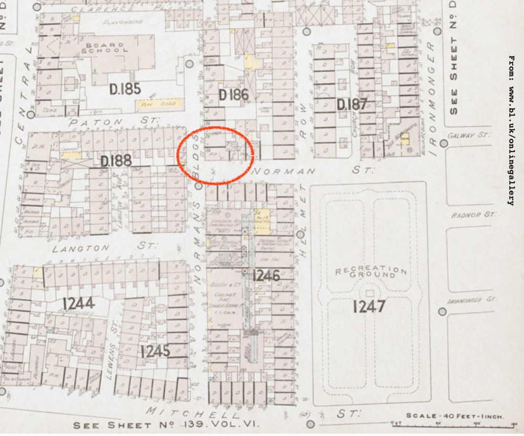
The pub was in existence in 1842, according to “closedpubs.co.uk”. There was a nearby Langton Street, shown on a map from the British Library dated 1901. The Langton Arms is marked “PH”.
1901 map. Langton Arms circled. Insurance Plan of London North District Vol. D: sheet 17 (British Library) Shelf mark: Maps 145.b.23.(.d)
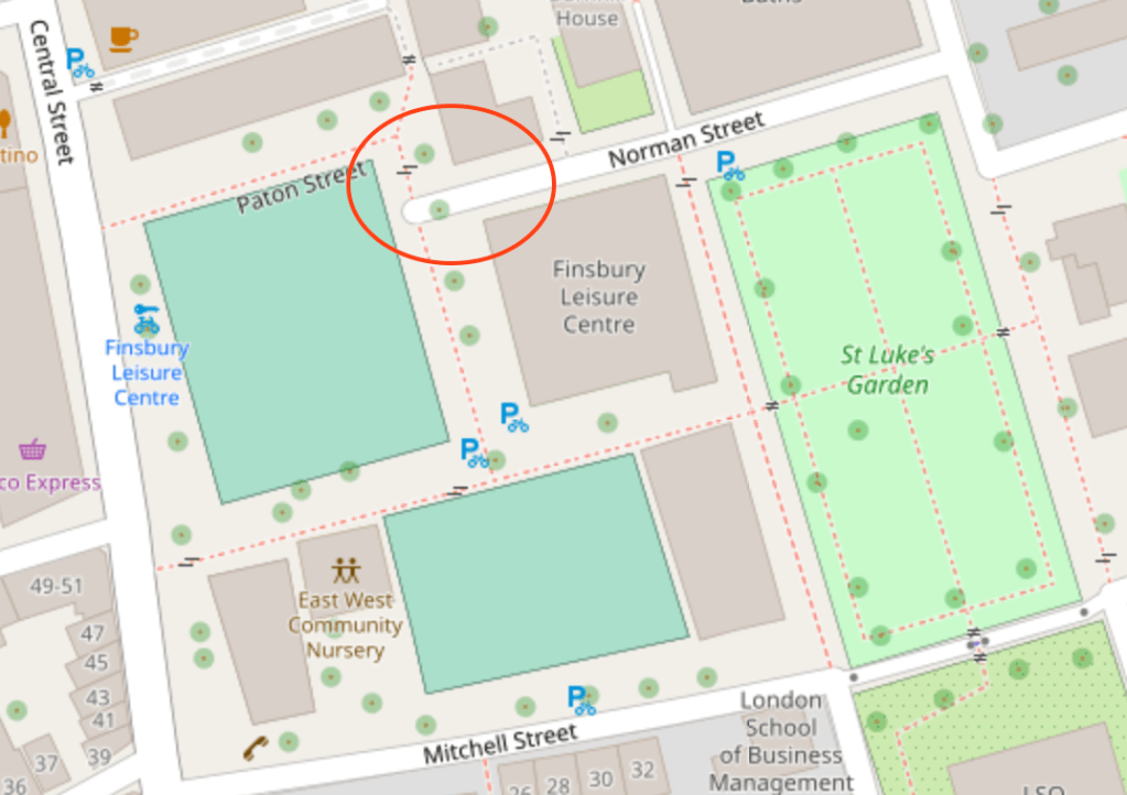
See how dense the housing was in this area in 1901. Here is the same area today. Langton Street has disappeared.
Norman Street area, 2022 (c) Open StreetMap, Langton Arms circled
Pub sign today
I sketched the closed-down pub at around 4:30pm, as the light faded. The pub sign is still there, but eaten away at the lower edge now. The street sign “Norman Street” is the same one as shown in a photo from 1958. It has “Borough of Finsbury” written above the street name. The Borough of Finsbury was absorbed into Islington in 1965.
This picture is a story of vanishing: vanishing street, eaten away pub sign, closed down pub, a missing borough, sun setting in January. Behind me as I sketched I could hear the squeak of gym shoes on hard floors, the other side of the closed steel doors to Finsbury Leisure Centre.
1958
Click a button below to share this post online, email it, or print it:
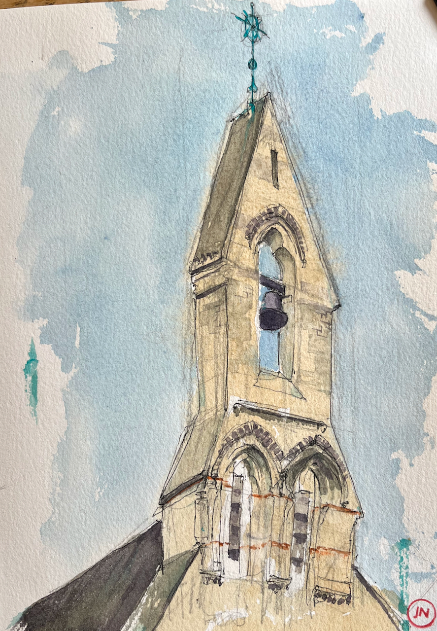
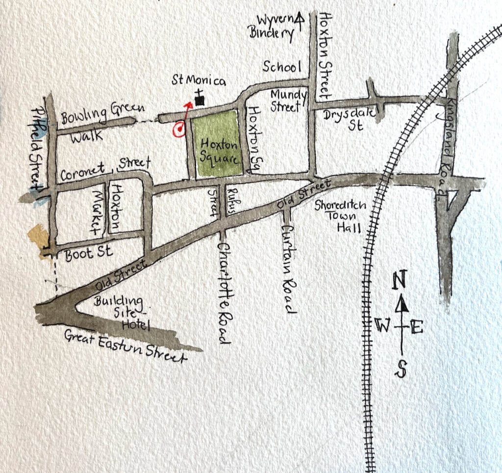
On a cold day, suddenly the sun came out and lit up the stone of St Monica’s Church.
Bell tower of St Monica’s Church, Hoxton Square. 26th January 2022, 13:40 in Sketchbook 11
This church was built in 1866, to the design of E.W. Pugin. It was part of the Augustinian Priory on this side of Hoxton Square.
E.W. Pugin (1834-75) is the son of A.W. Pugin, who collaborated with Charles Barry on the design of the Houses of Parliament. E.W. Pugin designed a large number of churches, 60 English churches are listed in his Wikipedia entry, with another 6 or so in Wales and Scotland and 16 in Ireland.
Click a button below to share this post online, email it, or print it: