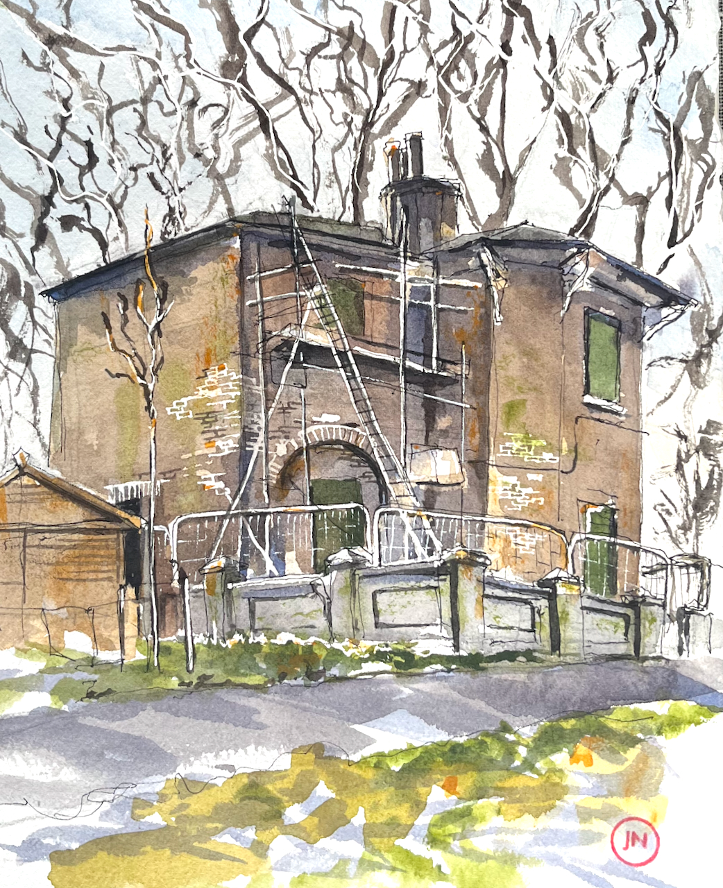
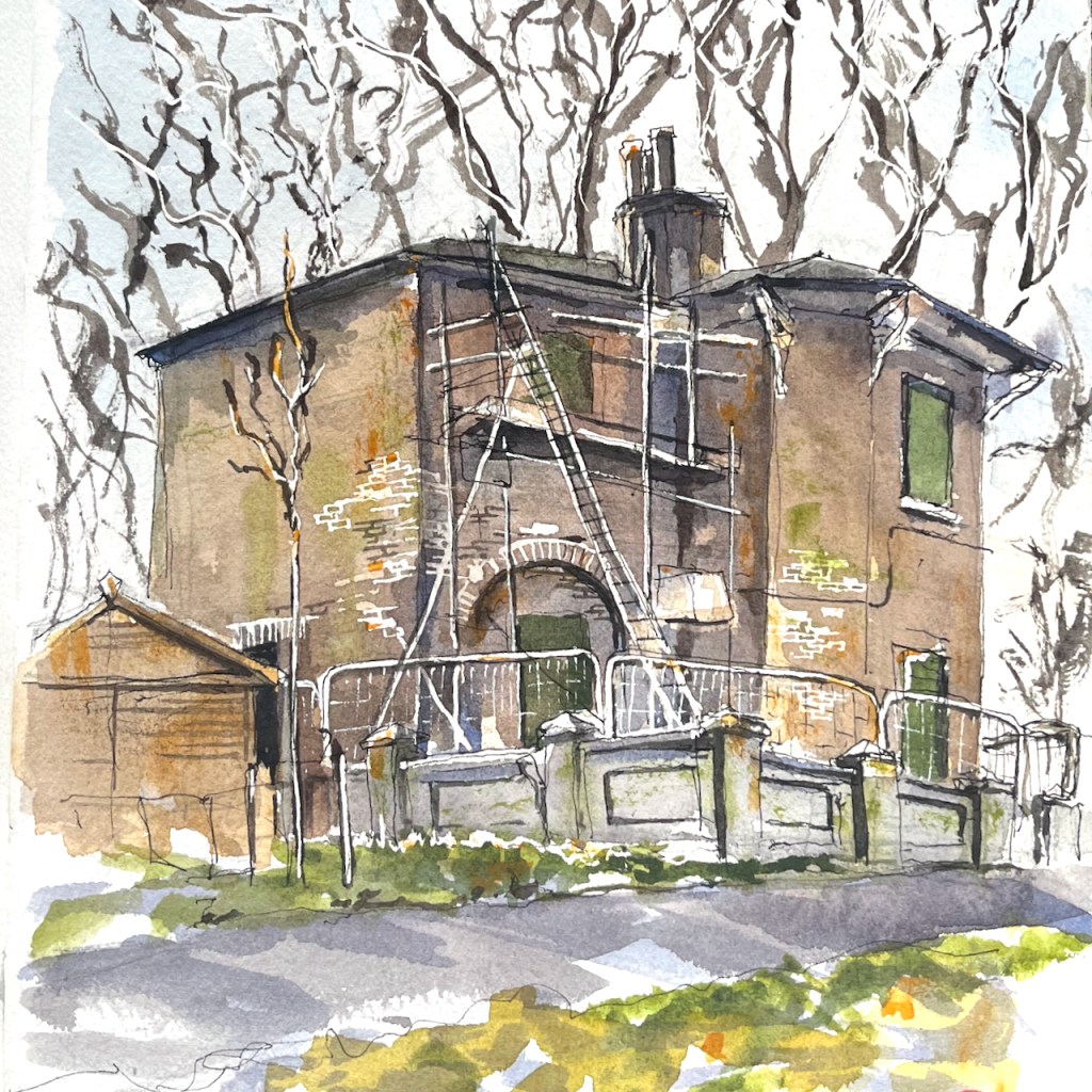
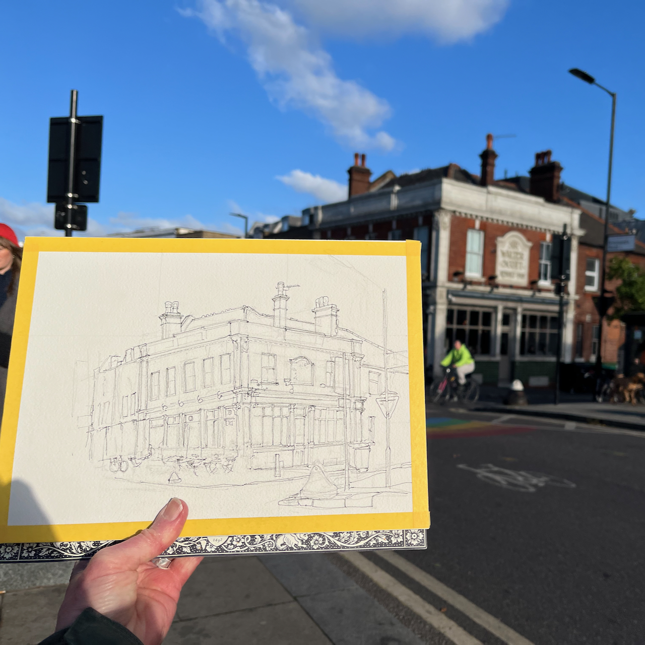
A house stands by Jesus Lock on the River Cam. I have walked by it so many times, over decades, that it holds a magical place in my mind. In the dimness of a childhood memory, I am looking over the wall. I remember flowers in the window boxes, a garden. Then somehow it became ignored, scruffy, derelict, vandalised. Then nothing happened, and it just stood there. Each time I saw it, it was slightly more dilapidated. But it remained in my memory, a beautiful house, in a lovely location. Surely someone will do something with it?
And last time I visited Cambridge, I found that, miraculously, yes!, someone is renovating it.
Jesus Green Lock House being renovated. Sketched from Jesus Lock, 24 January 2025, in sketchbook 15
This picture from the website of Michelle Bullivant1 shows Jesus Green in the 1700s. The little house by the river, arrowed, looks to me to be in the same position as the current Lock House, and you can see a bridge or ford across the river Cam at this point. I recognise the houses on the bottom right, which look like the terrace of houses on Chesterton Road which is still there.
Image from Michelle Bullivant, Local Historian
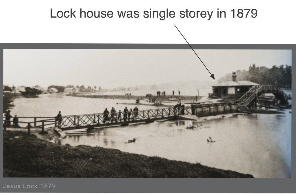
This photo of an old postcard shows that, in 1879, the lock house was single story.
Jesus Lock in 1879 – showing the floods. Image from capturingcambridge.org licensed under creative commons CC BY-NC-SA 4.0
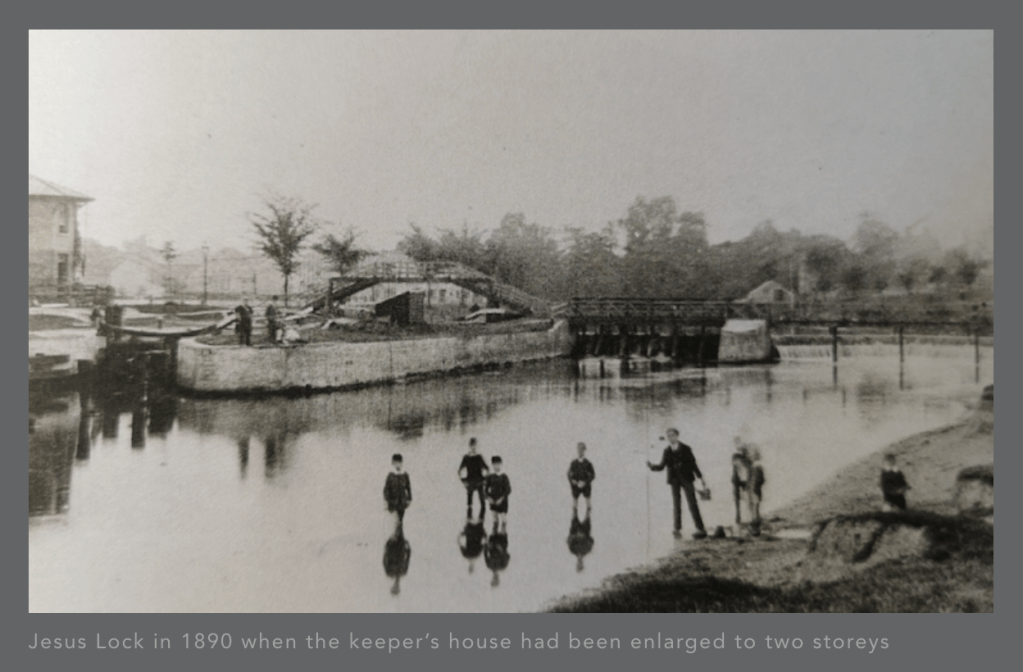
During the 19th century, it was rebuilt. This picture shows the two-storey lock-keeper’s house on the left:
Image from capturingcambridge.org licensed under creative commons CC BY-NC-SA 4.0
It was listed Grade II in 19722. In the 1990’s the final lock keeper moved away3 The house then became a house of multiple occupation (HMO), for students. These was an application in 2016 to turn it into a café, reference 16/0001/FUL. Its use was listed as “HMO” at that time. But this application was refused.
In 2021, the house was bought by its current owners, who have been bravely going ahead with a renovation to transform this listed building once again into a residential dwelling, with an aspiration also to host community events4
“Eventually it will be a beautiful place and a better place”
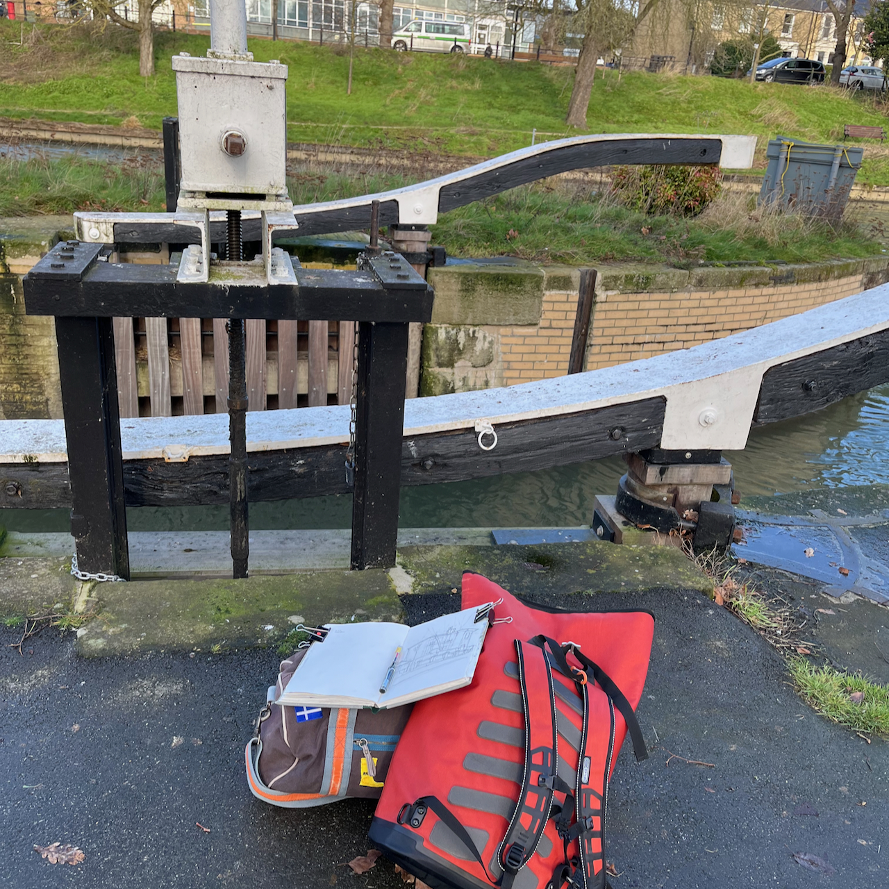
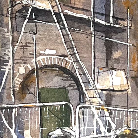
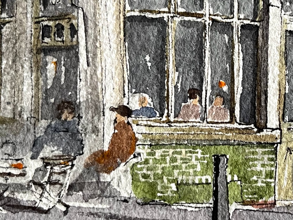
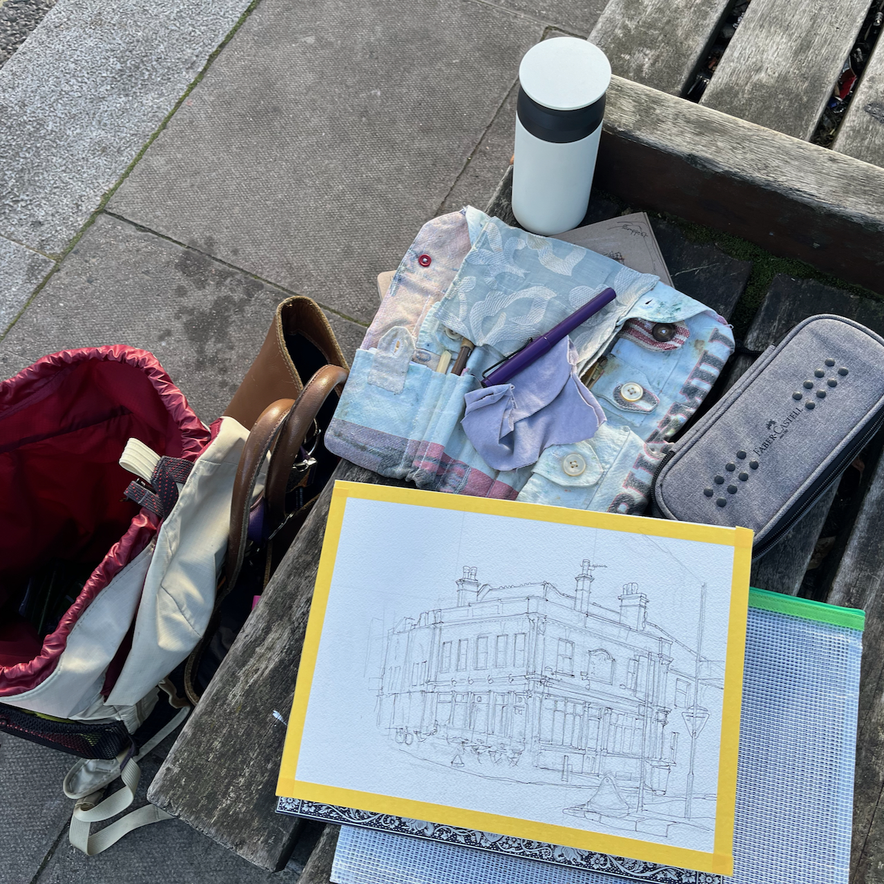
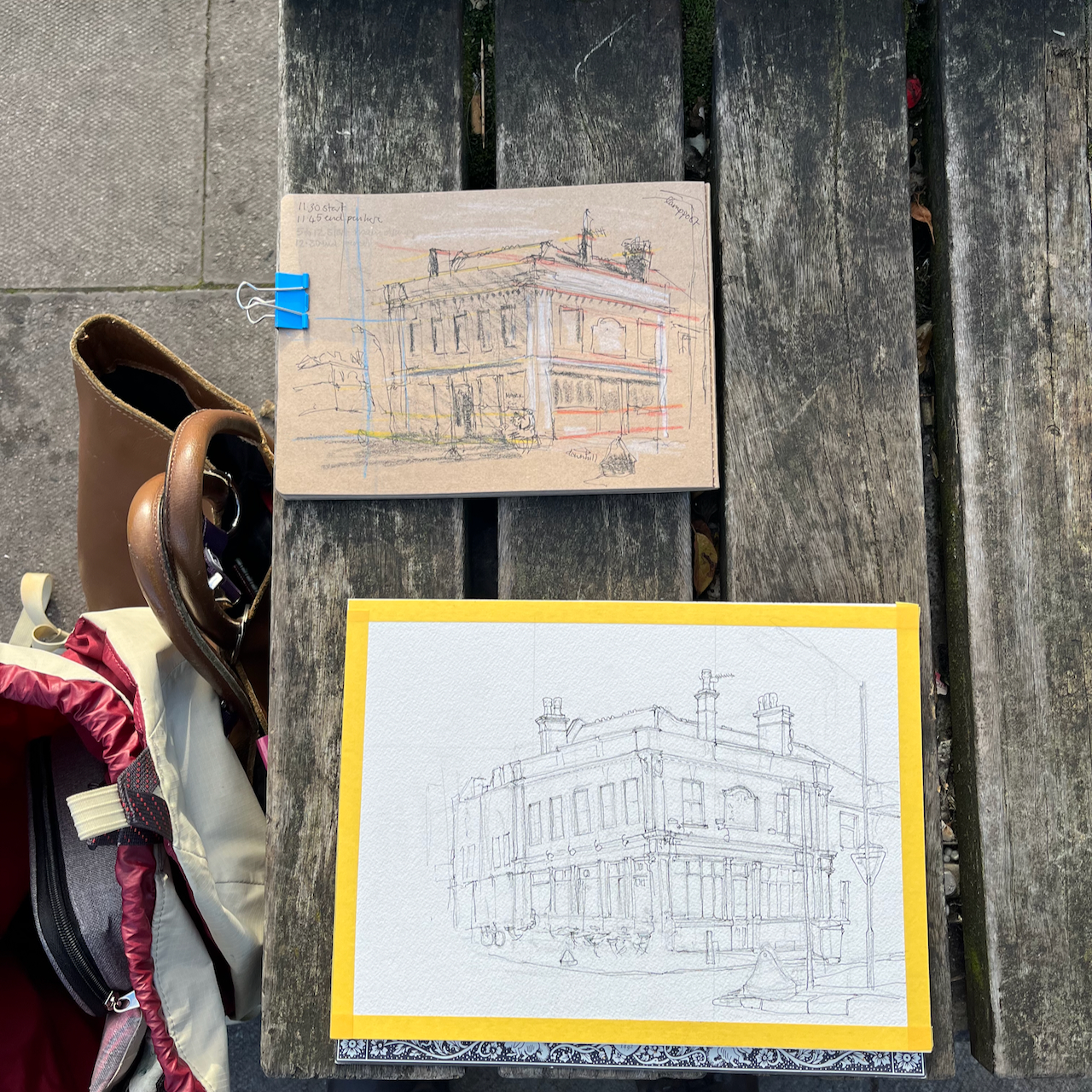
I sketched the house on a very cold day in January. There was a strong wind which not only threatened to throw my sketchbook into the Cam, but also made my eyes water so I couldn’t see properly. I finished the pen and ink, and decided that was enough. Then, by a happy chance, I encountered the current owner unlocking the fence gate. Hence I learned about the efforts of this mother and daughter team, who are determinedly navigating the difficulties of an old building, listed consents, and many other obstacles. But they make amazing progress! See their instagram account for more information.
Sketching the Jesus Green Lock Housesketching by Jesus lockdetail from the sketch
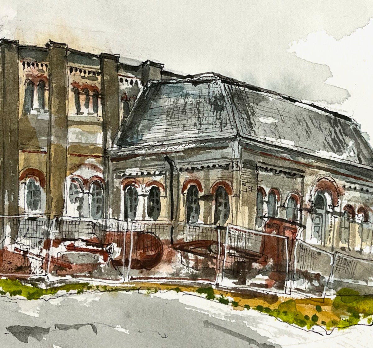
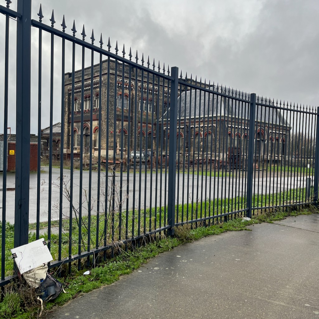
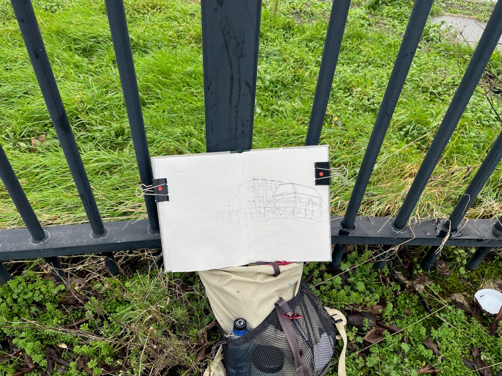
Here is a view of the old engine house of Crossness Pumping Station, on the South bank of the River Thames.
Crossness Engine House, sketched 5th January 2025 from the Thames Path
This is a former sewage pumping station. It was designed by the engineer Joseph Bazalgette and opened on the 4th April 18651 . It is the equivalent for South London of the Abbey Mills sewage pumping station on the North side of the Thames, which I have sketched previously.
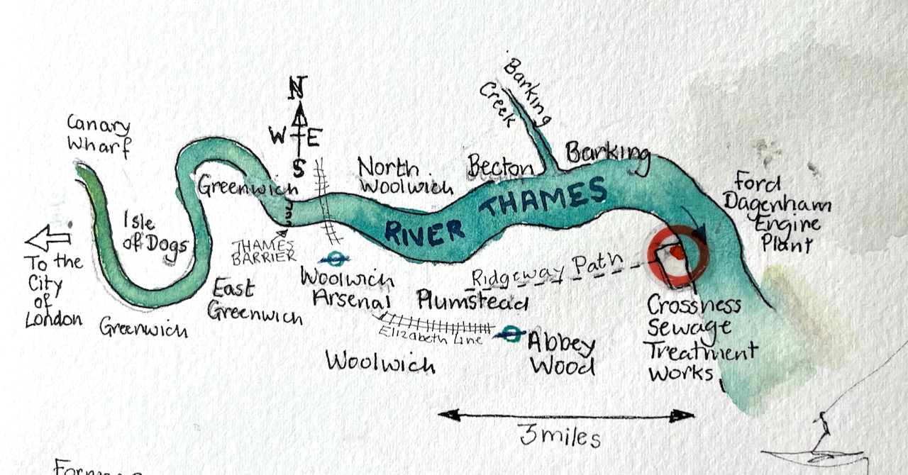
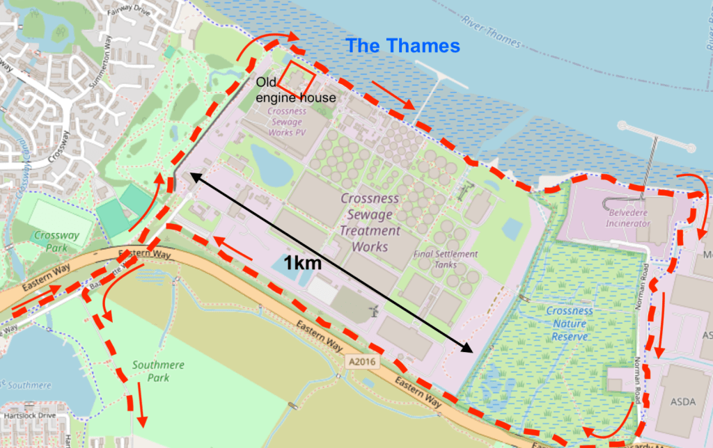
Sketch map showing the location of Crossness Sewage Treatment Works
These two pumping stations were important components of Bazalgette’s plan to rid London of cholera by removing sewage from central London. His idea was to pump the sewage from the conurbations in central London and shift it to Crossness and Beckton. This did indeed solve the problem of cholera in the city. It did not solve the problem of untreated sewage in the Thames: it just moved it downstream and away from the main residential areas of the time. Untreated sewage was pumped into the river at Crossness and Beckton on the ebb tide.
The exact number of passengers on board the Princess Alice during that fatal voyage is unknown, as is the number lost, but it is thought that around 640 people drowned, making this Britain’s worst inland waterway disaster.
This terrible tragedy and the consequent public outcry prompted the authorities to shift the problem even further downstream. Sewage boats were used to transport raw sewage into the Thames estuary and dump it in the North Sea. Amazingly, this continued until 1998:
The tragedy prompted the introduction of what became known as ‘Bovril boats’ (due to the unfortunate colour and consistency of their cargo), which carried sewage sludge out to the Thames Estuary and North Sea, disposing of it there.This continued until 1998, when EU legislation forbade it due to contamination of beaches.
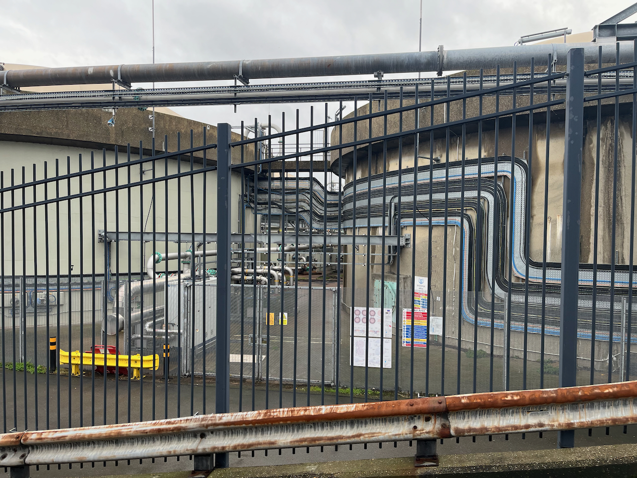
These days the sewage is treated3 (mostly). Next to the Victorian pumping station I sketched, there is a vast modern sewage treatment works belonging to Thames Water. Sewage is transformed by bacterial action and filtering. It becomes water and “sludge”. The water goes into the Thames. The sludge is used as agricultural fertiliser or burned for electrical power generation.
Modern sewage treatment works, Crossness, seen from the Thames path.
On my walk I circumnavigated this enormous treatment plant. It hardly smelt atall.
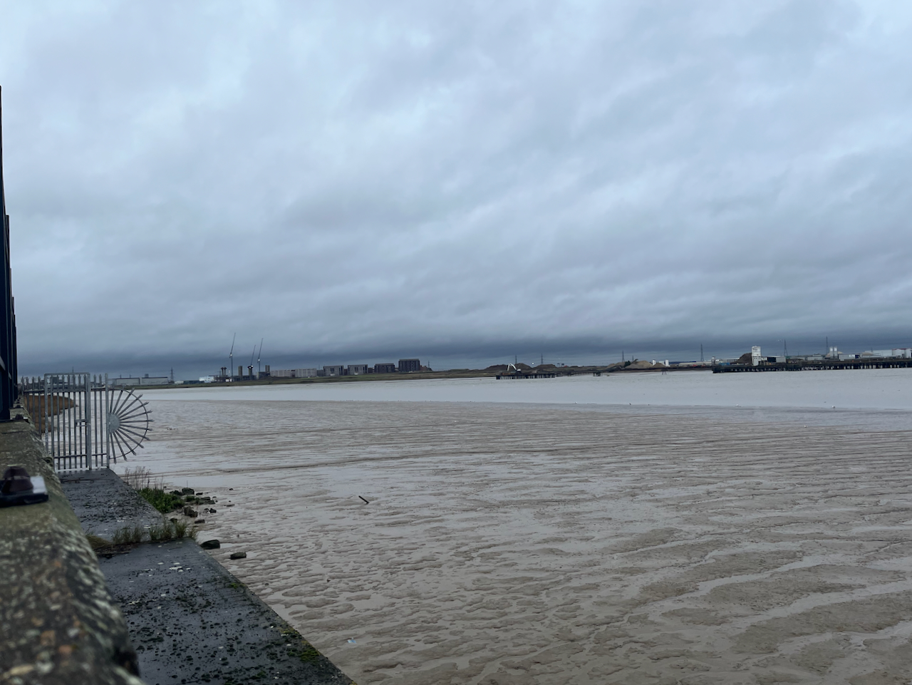
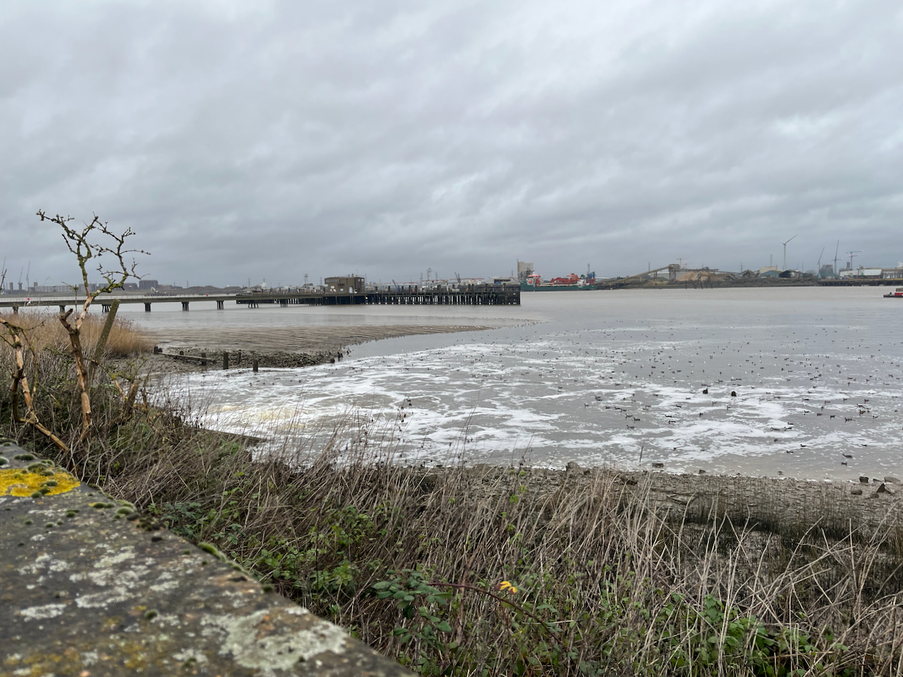
The Thames is vast here.
Looking across to North WoolwichBirds flock on the outfall from the treatment worksViews from the Thames path at Crossness Sewage works
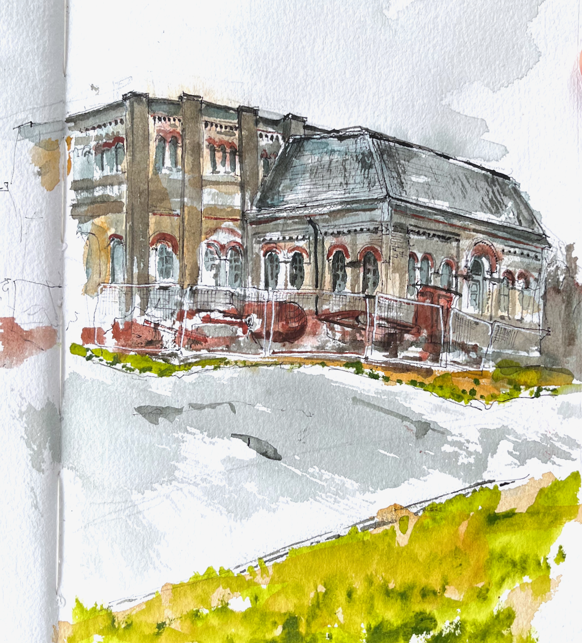
I sketched the Engine House from the Thames Path. It is behind some tall and strong fencing, which I did not put in the picture.
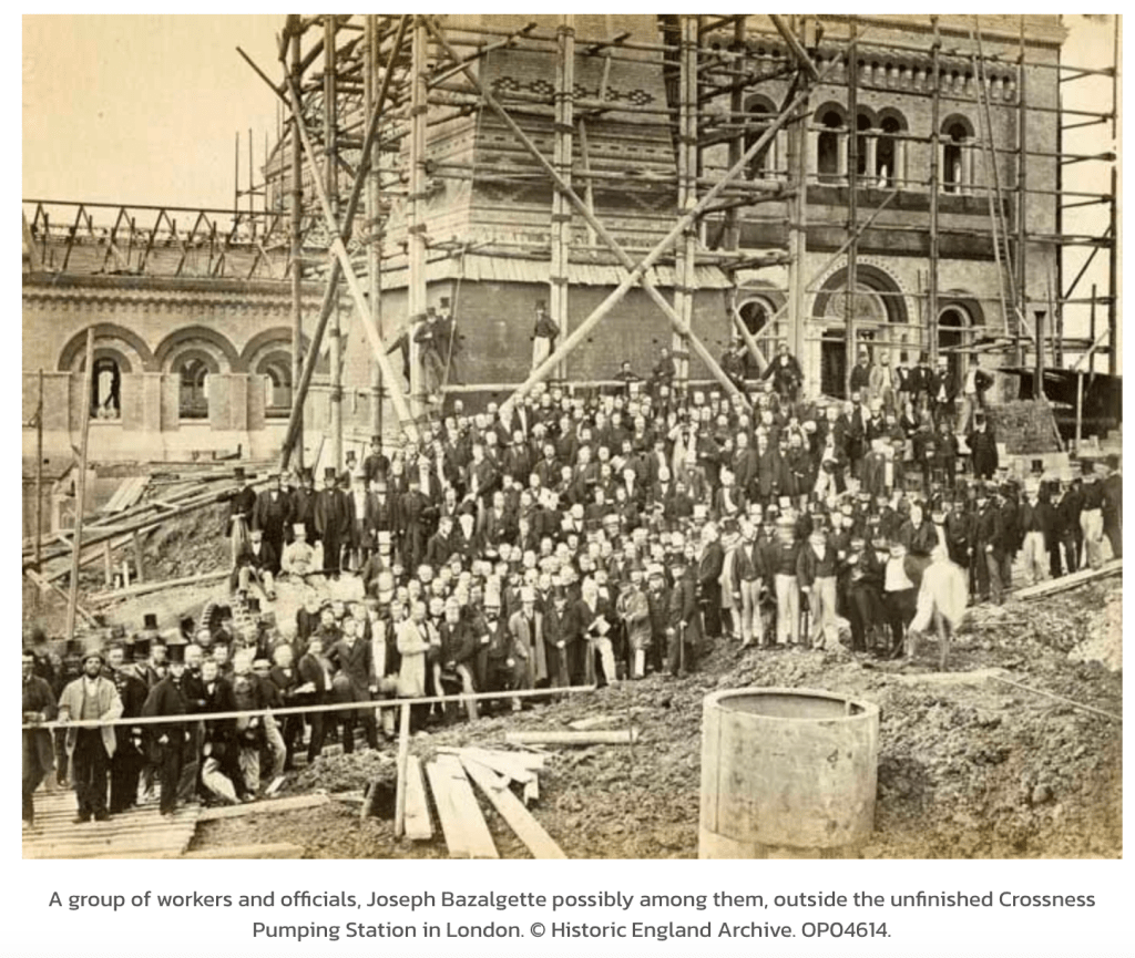
Source: Historic England Archive, used with permission.
The photo is more-or-less the same viewpoint as my sketch. I hope that the workers in this picture felt proud of their achievement, and would be glad to know that their work has been honoured, and building continues on the site.
20th century sludge incinerator, Crossness, and a further incinerator plant under construction, far left
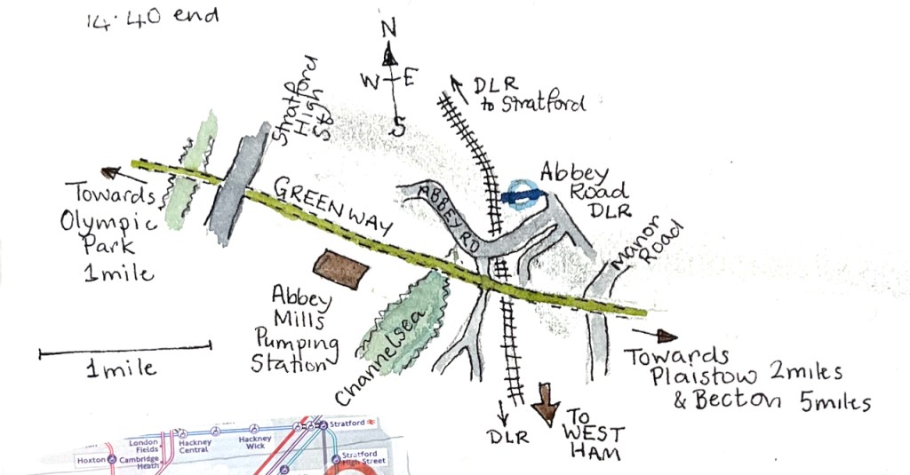
Here is Abbey Mills Pumping Station, seen from The Greenway.
Abbey Mills Pumping Station, London E15, sketched from The Greenway, January 2025 in Sketchbook 15
Abbey Mills is a sewage pumping station1. It lifts the sewage from lower level sewers, and pumps it 40 feet uphill to the Northern Outfall Sewer. The Greenway path is on top of the Northern Outfall Sewer.
This system was created by the visionary Victorian engineer Joseph Bazalgette (1819 – 1891). The pumping stations and the Northern Outfall Sewer are part of a grand construction of sewers and water management works instigated in the 1860s after the “Great Stink” of 1858. The problem of untreated sewerage being discharged into the Thames had been causing disease and bad smells for some time. When the smell and fear of disease affected Parliament, which is located next to the Thames, the government of the day took action.
“On 15 June Disraeli tabled the Metropolis Local Management Amendment Bill, a proposed amendment to the 1855 Act; in the opening debate he called the Thames “a Stygian pool, reeking with ineffable and intolerable horrors”. The Bill put the responsibility to clear up the Thames on the MBW [Metropolitan Board of Works], and stated that “as far as may be possible” the sewerage outlets should not be within the boundaries of London; it also allowed the Board to borrow £3 million, which was to be repaid from a three-penny levy on all London households for the next forty years.”
So this loan, and the 3d levy on Londoners was used in 1865 to construct the pumping stations and a new sewerage system.
The Victorian sewers are still in use, and are now gradually being upgraded by Thames Water.2 According to the video on their site, the Northern Outfall Sewer constructed by Bazalgette’s team is being left in place. Thames Water are pushing a lining into it, made of 21st century materials. They reckon this will last another 100 years. 3
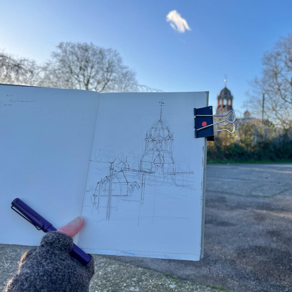
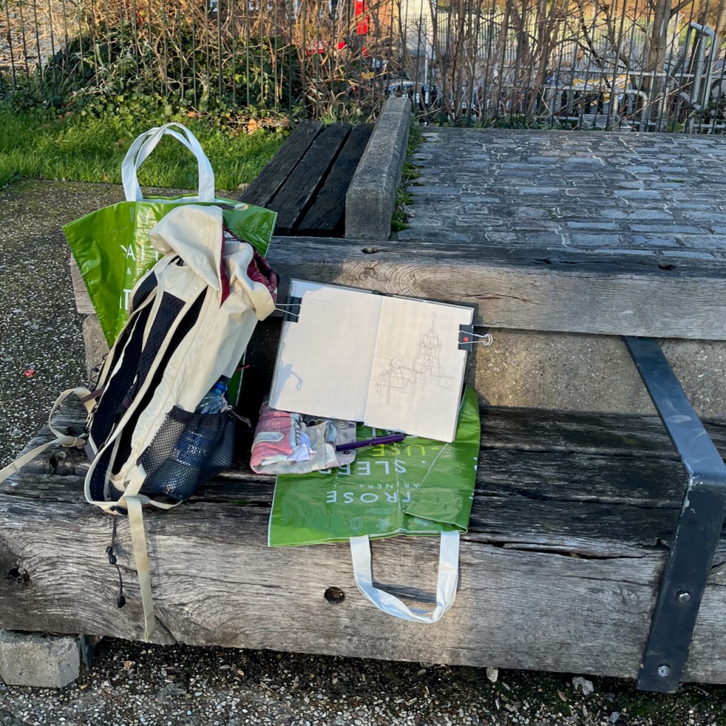
I sketched Abbey Mills Pumping Station while exploring the Greenway from Hackney Wick to Becton.
“Thank you Sadiq”
The Greenway is a well-used pathway and running route. While I was sketching, a wiry grey-haired runner stopped to chat. He was a cheerful person, sharing my enthusiasm for the transformation of Hackney Wick. He had much praise for the improvements in London, specifically on air quality. Air quality is much better, he said. “I no longer get asthma,” he told me, “even though I still run!” He surveyed the clean path and the view, ” Thank you Sadiq!” he exclaimed. Sadiq Khan is the Mayor of London, and has introduced and supported air quality improvement measures such as the congestion charge and the Ultra-Low Emission Zone (ULEZ).
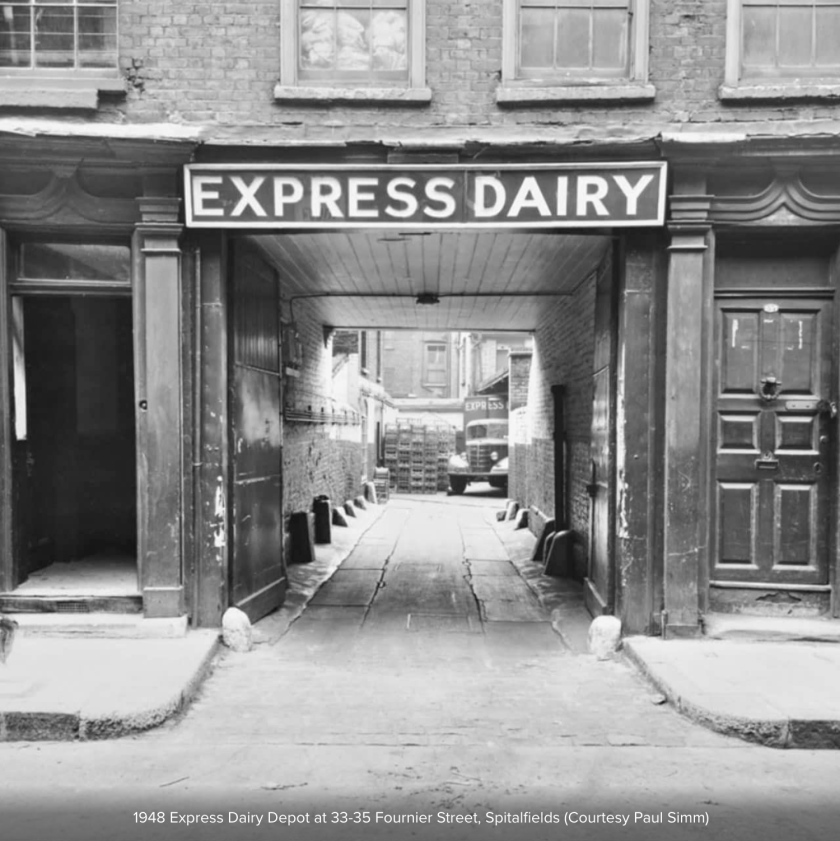
My new friend had been a skip-truck driver. He’d worked everywhere, he told me. Constructing the Olympic Park had been a big job. Examining my sketchbook, he saw the sketch of Fournier Street. “I recognise that!” he said. And then, looking closer, “There’s an Express Dairy depot just up the street.”
If you know Fournier Street, you will know that this seems extremely unlikely. Fournier Street is in a residential area, somewhat densely packed, and apparently not a place for a goods yard of any type. However he seemed sure, and I didn’t contradict him. I thought he might have mistaken the location: there are a lot of Georgian terraces in London.
35 Fournier St (1948)
When I was back at my desk I did a search4. Sure enough, just a few houses along from my sketch, there had been an Express Dairy Depot, just as he said. It’s shown in the “history” section of the Express Dairy site. The London Picture Archive shows it. I should not have doubted him. The wide entrance is still there.
I completed the ink sketch on location and then packed up to continue my walk. I still had a good 3 miles to go and it was getting dark, and cold.
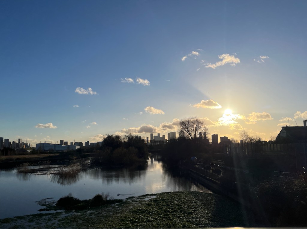
View from The Greenway: Channelsea
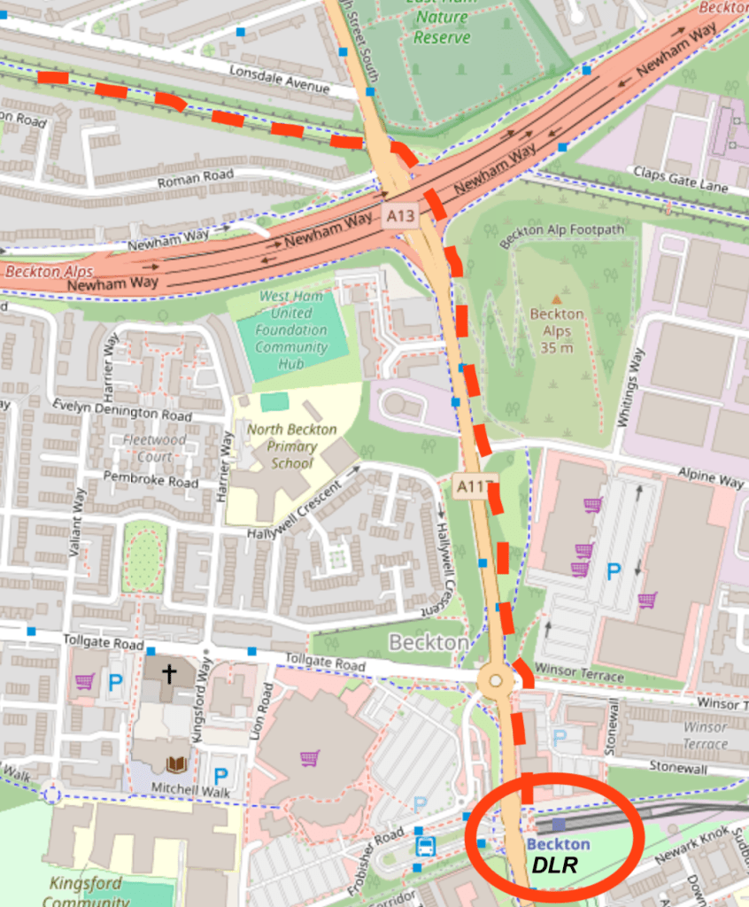
It was dark when I reached Beckton. I left the Greenway as it crossed the A13.
Greenway to Beckton DLR. Map (c) OpenStreetMap contributors.
If you’d like to follow my route along the Greenway, in the file below is my idiosyncratic description of the route and my walk. The below file is 6 pages printable pdf. The Greenway is part of the Capital Ring, a long-distance walking route.
Abbey Mills is a working Pumping station and not open to individual visitors. It is open to groups from time to time. The organisation “Subterranea Britannica” was invited for such a visit in 2012, which they wrote up in their journal Subterranea, Issue 30. The article describing their visit is by Martin Williams and Alex Lomas. See this link: https://www.subbrit.org.uk/sites/abbey-mills-pumping-station/ ↩︎
Major £70million upgrade to Stratford’s Victorian sewer system Press release from Thames Water: Tuesday 17 January 2023 13:09. https://www.thameswater.co.uk/news/70million-stratford-sewer-upgrade “A giant Victorian sewer in East London is being upgraded as Thames Water continues its investment in infrastructure across the capital. The UK’s largest water and wastewater company is investing £70million over the next three years to upgrade the Northern Outfall Sewer and ensure its pipes are resilient for future generations. The sewer, which serves over 4 million people, runs from Wick Lane to Beckton Sewage treatment works, the largest in Europe. ….” ↩︎
YouTube video “on Tap” from Thames Water, describes the work being done in 2023 to upgrade the Northern Outfall Sewer. It also contains great photos of the inside of Abbey Mills Pumping Station, and amazing aerial views of the Greenway. https://youtu.be/d628Y0dh2sA↩︎
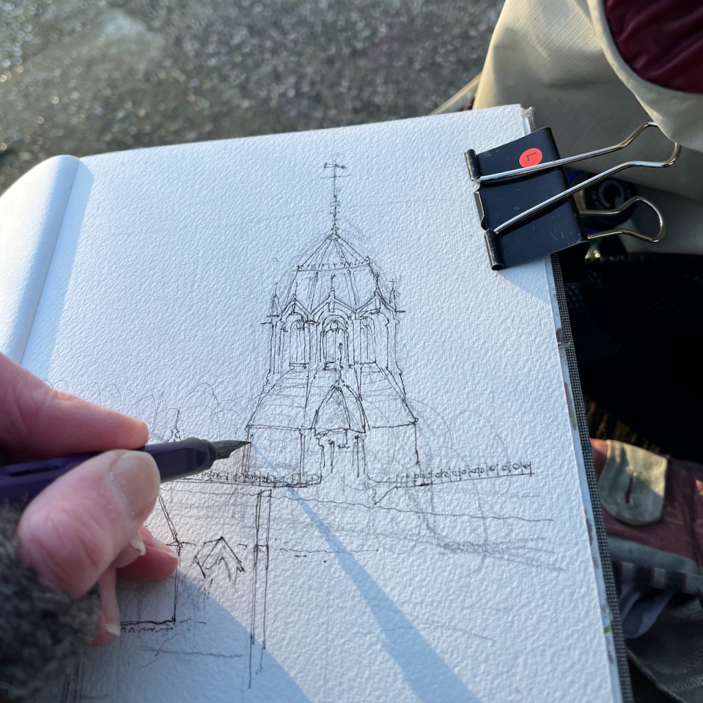
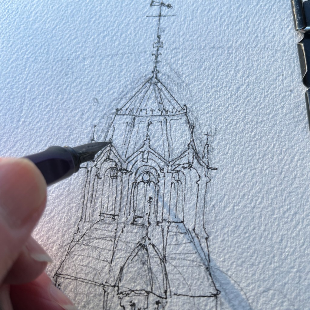
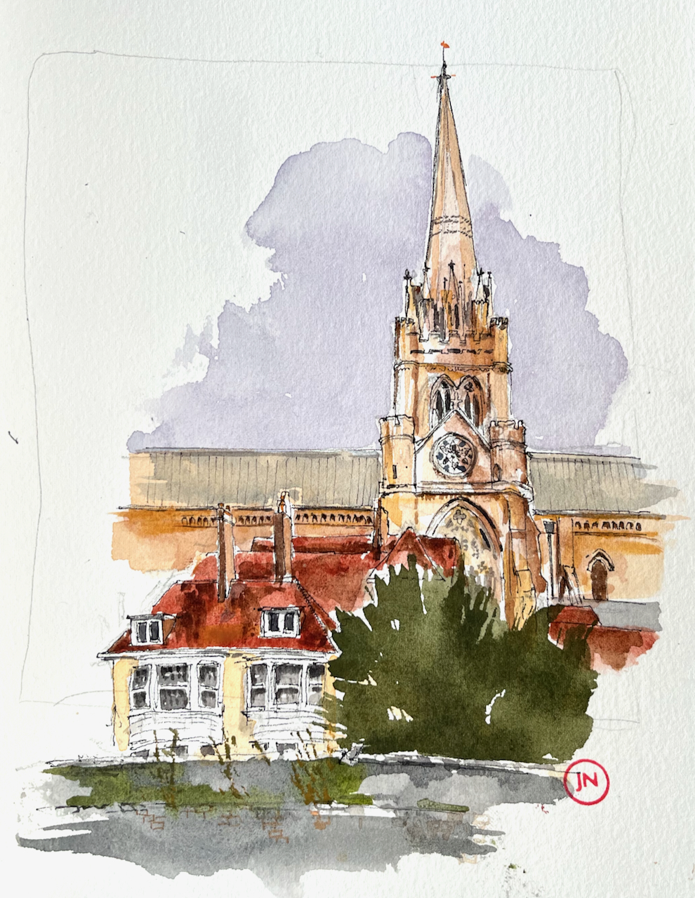
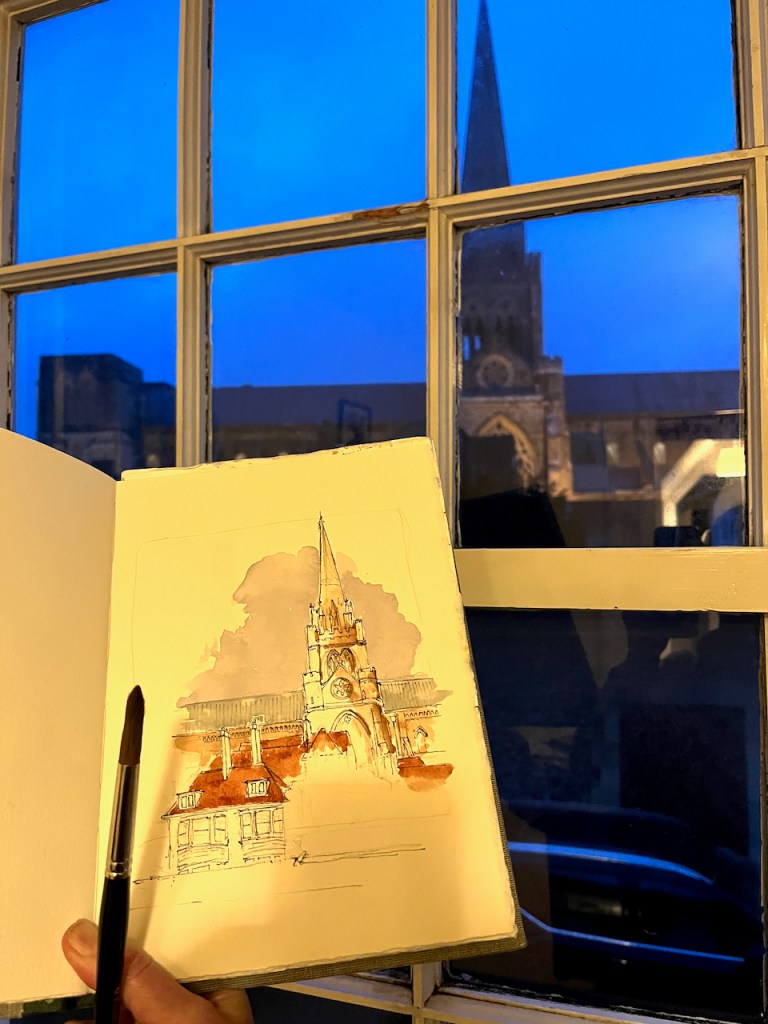
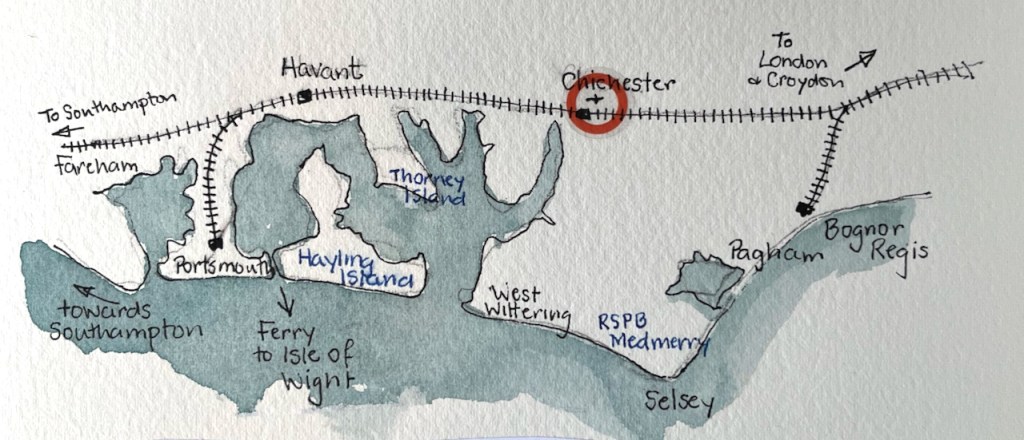
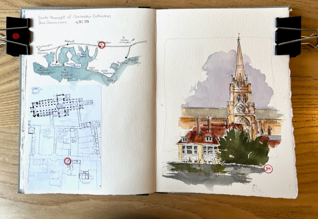
Here is a view of the south transept of Chichester Cathedral.
Chichester Cathedral, South transept, sketched 5th December 2024 from Canon Lane, in Sketchbook 15.
The first spire was built around 1500. There are no bells in the spire: the medieval builders put the bells in a separate little building in the cathedral grounds. This was just as well. The spire collapsed in 18611. It was rebuilt to the designs of Sir George Gilbert Scott, and that’s the spire in my drawing.
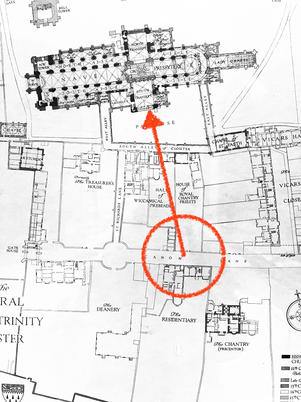
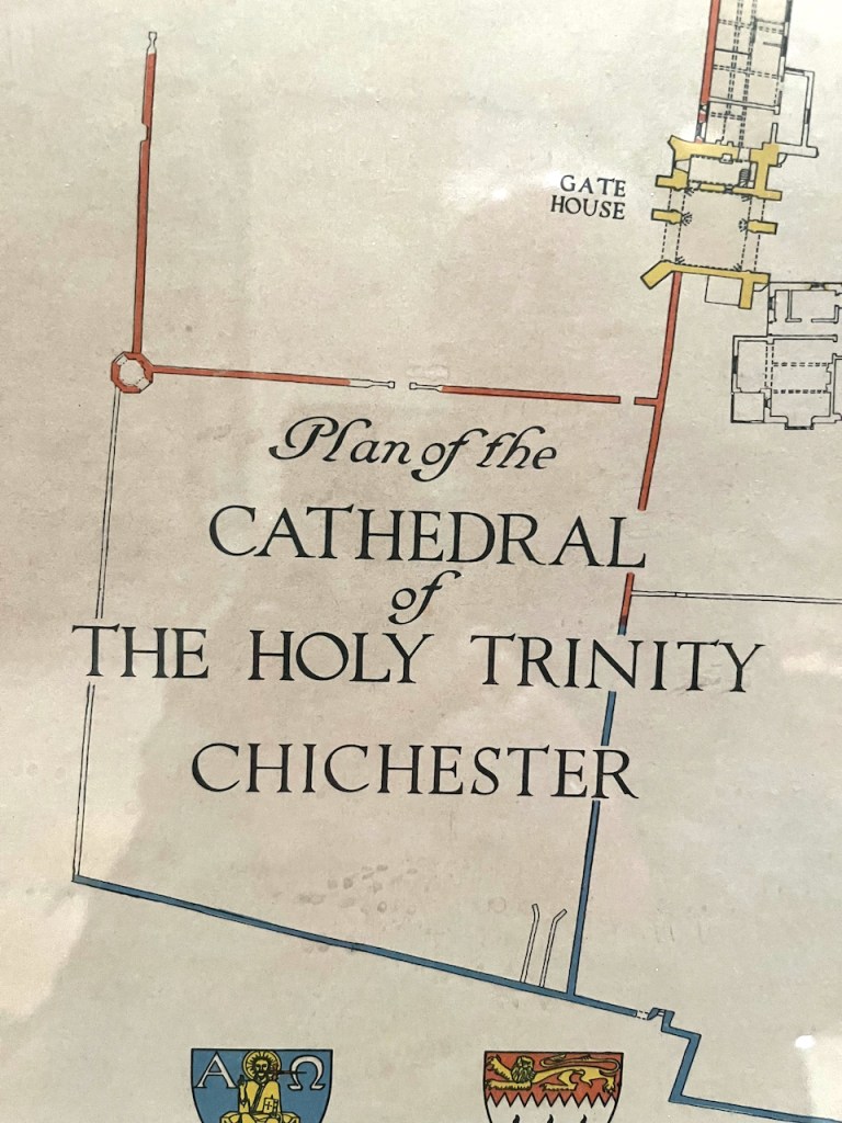
From a beautiful framed plan in the Cathedral, which had no date or artist’s name.Chichester: locationSketchbook 15
George Gilbert Scott was a prolific 19th century architect. I have sketched his work before:
Here is a view of the south transept of Chichester Cathedral. The first spire was built around 1500. There are no bells in the spire: the medieval builders put the…
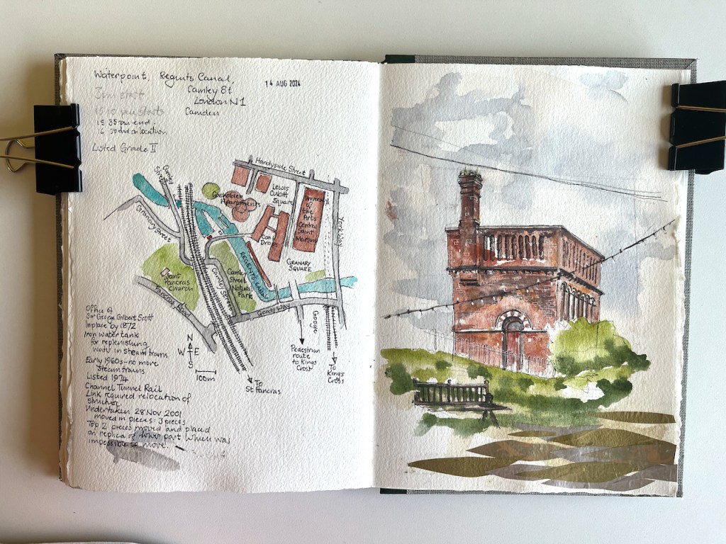
This structure is visible from the North side of the Regents Canal at Coal Drops yard. It was a “water point” for replenishing the boilers of steam engines. The top…
“What is that spire?” It’s just visible, on the horizon between office blocks. Some work with the binoculars and the map established that it must be St Mary Stoke Newington,…
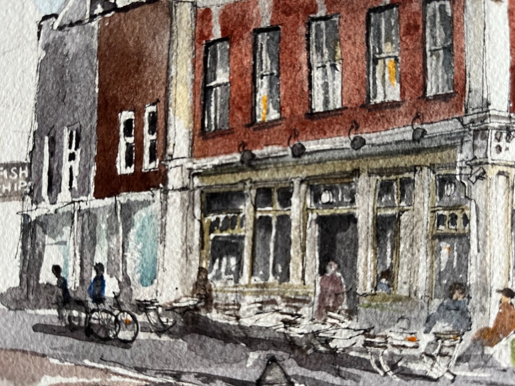
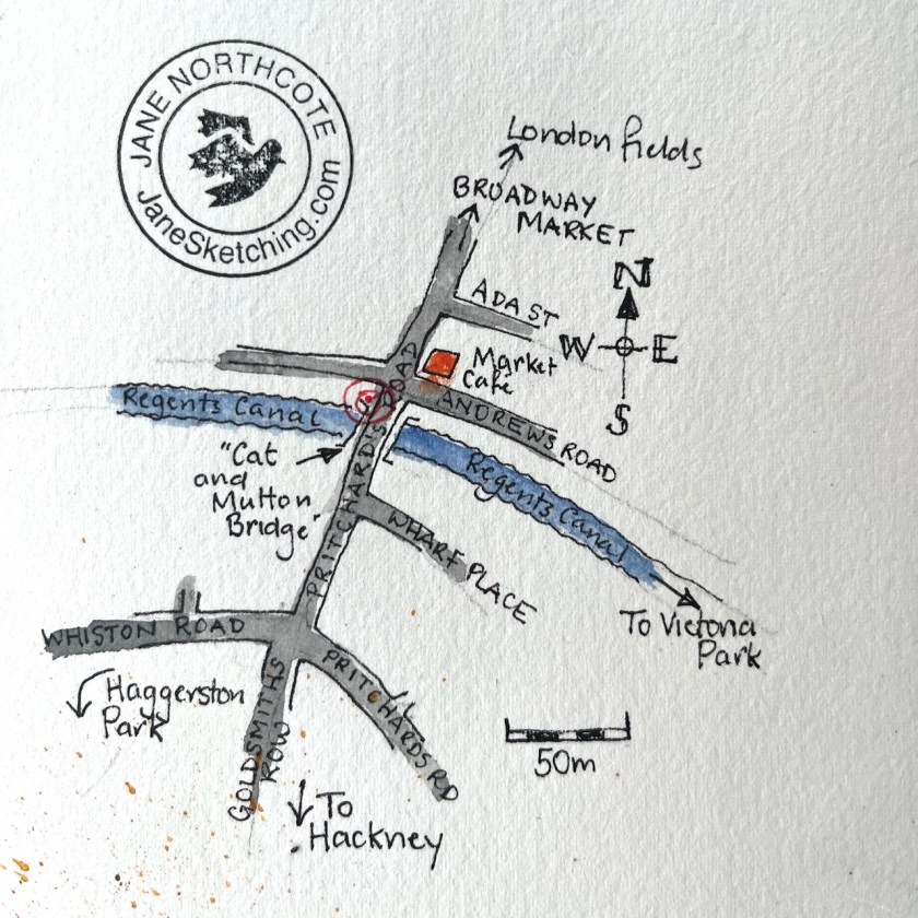
Here is the Market Café, which is at the South end of Broadway Market, near the canal.
Market Café, Broadway Market, Hackney E8, sketched 12 November 2024, 12″ x 9″ [sold]
I’ve sketched the Market Café before, and written about it on this post. This latest sketch was a commission to celebrate a happy event which took place there.
Here are some details from the sketch:
It was a bright and cold day. I did the pen and ink on location.
preliminary sketchPacking up.Working on location
The photographer Nick Hillier came by and took some photographs of me working, which he kindly sent me later.
Sketching on location, image credit: Nick Hillier. Pen is a Lamy Safari.
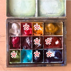
I added the colours at my desk. The colours are:
for the brickwork: Fired Gold Ochre
all the greys and blacks are: Ultramarine Blue plus Burnt Umber
the sky is Phthalo Blue Turquoise
the green tiles are Serpentine Genuine
there’s a bit of Permanent Yellow Deep on some of the highlights and some dots of Transparent Pyrrol Orange
the fine white lines are made by using a rubber resist gum. I use Pebeo drawing gum.
For my current palette see this link. I have 12 colours in my palette. For most pictures I fewer colours. This picture used about 7 colours.
Thank you to my client H for the commission and for allowing me to post this image here.
I’ve sketched around the Broadway Market area before. See this link for a sketch of Climpson Coffee, and here is a sketch done at E5 bakery on the other side of London Fields.
Sketch location
Click a button below to share this post online, email it, or print it:
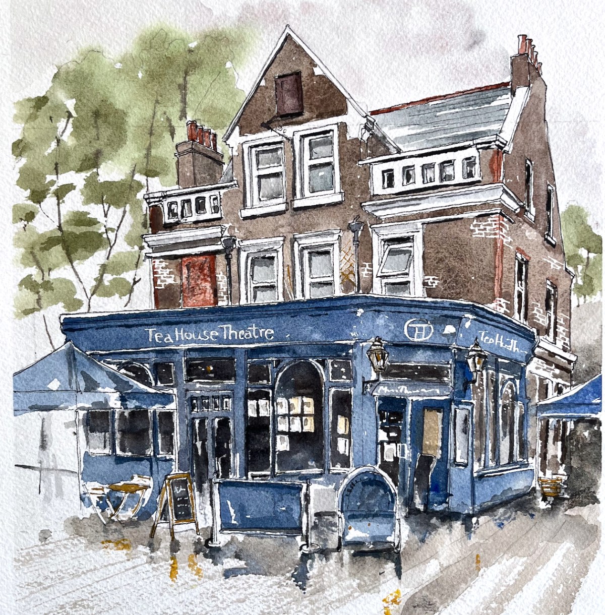
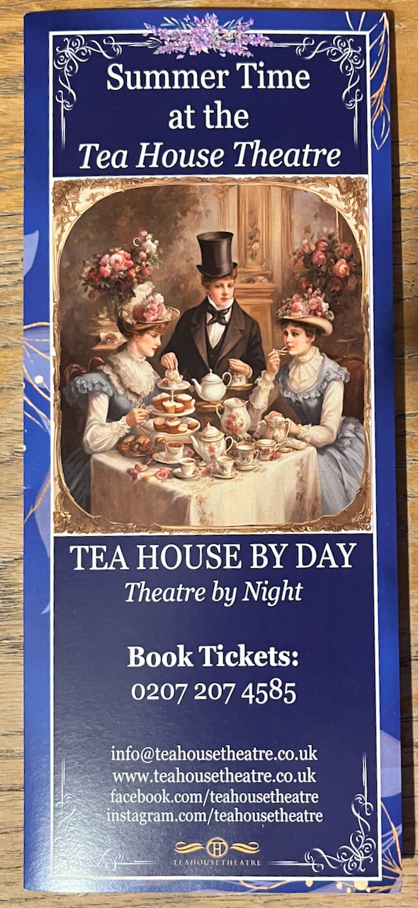
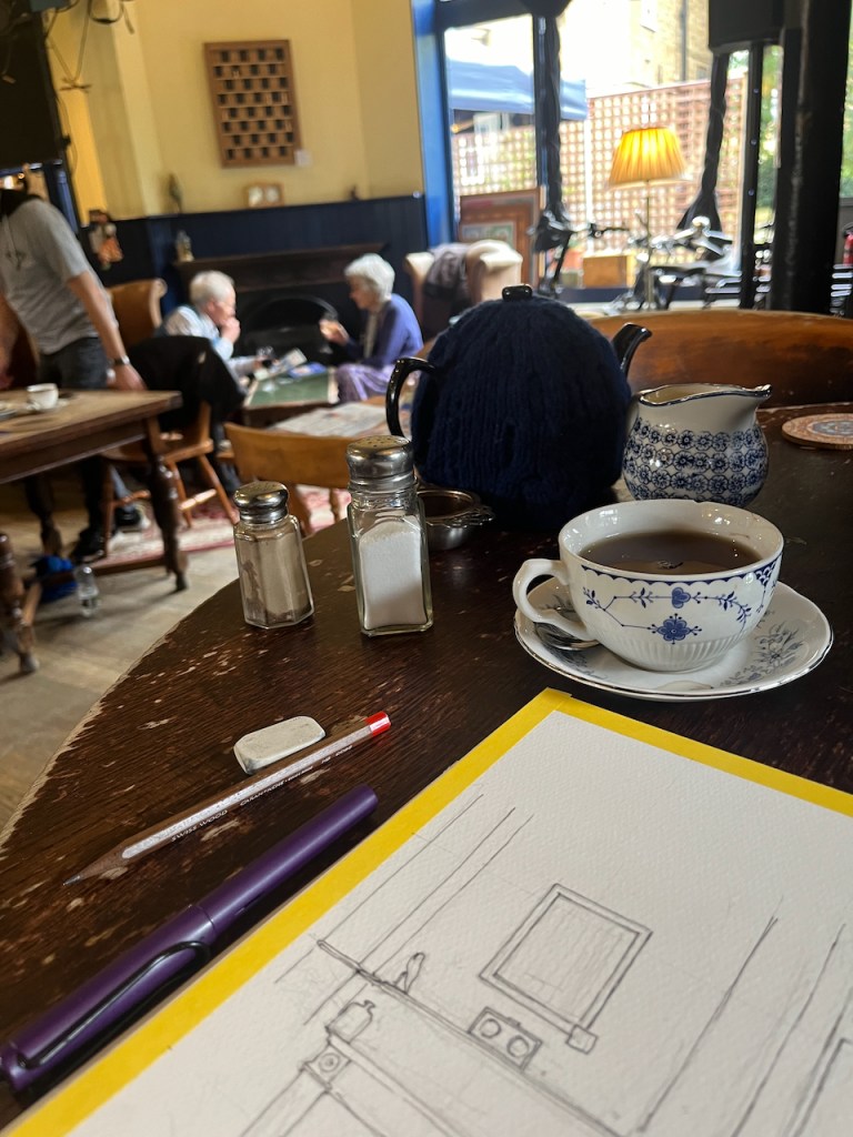
The Vauxhall Tea House Theatre is one on my favourite places. It is a “tea house by day, theatre by night”. Here is a sketch of the outside:
Vauxhall Tea House Theatre, 12″ x 9″ pen and wash original. [sold]
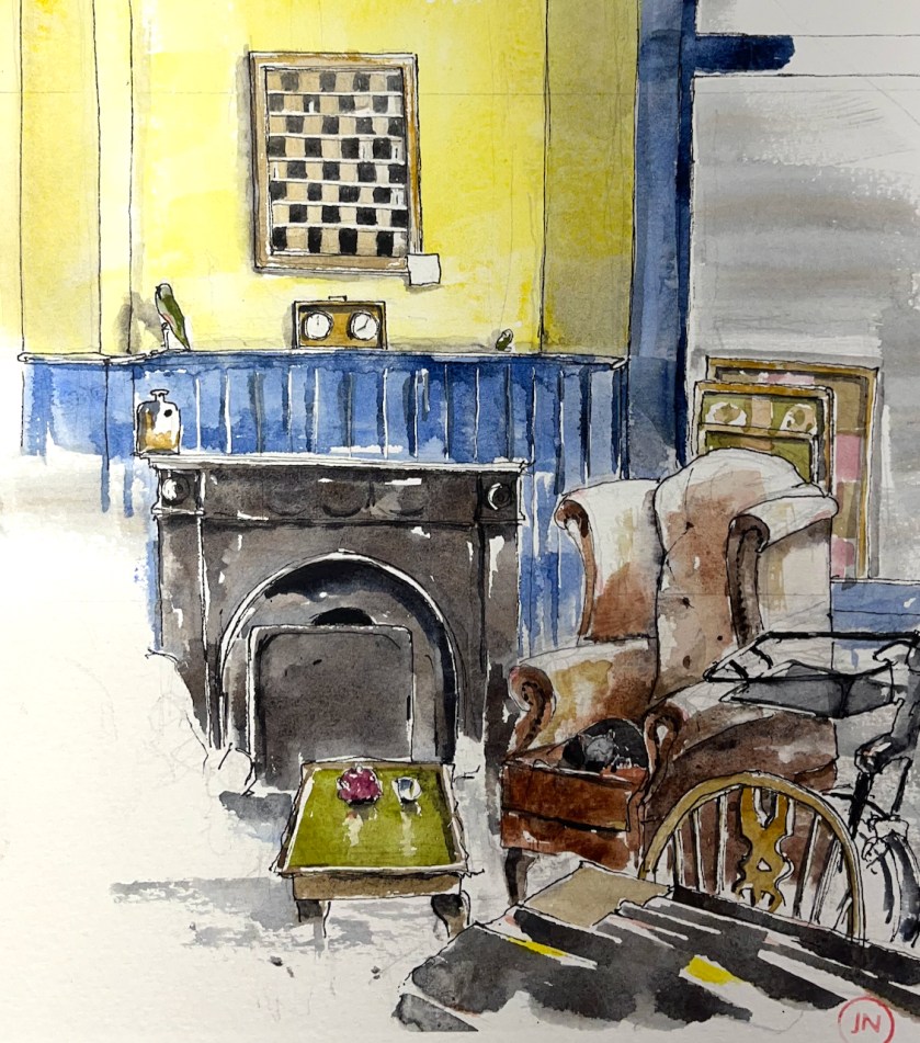
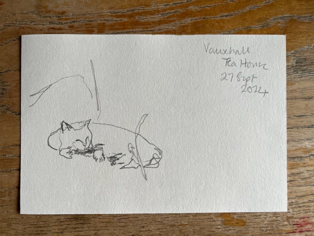
Here is a sketch of the interior by day:
Vauxhall Tea House Theatre, interior with cat. 12″ x 9″ pen and wash original. [Sold]
There are winged chairs you can sink into, wooden tables you can work at, magazines and newspapers you can read. There is tea. There is cake. There is at least one cat.
It’s a short walk from Vauxhall station. Definitely worth a visit.
“We are trying to be different. We will not hurry you. If you visit us on your lunch break, then have one, you will be more productive in the afternoon. If you want to have a meeting, we will not disturb you. If you are ‘working from home’, we have wifi. If you have children, we have highchairs, a chest of toys, and milkshakes. We always have the daily papers, so please, relax, and share in what we are trying to create, take a load off, and have a cuppa.”
Magnificent!
Click a button below to share this post online, email it, or print it:
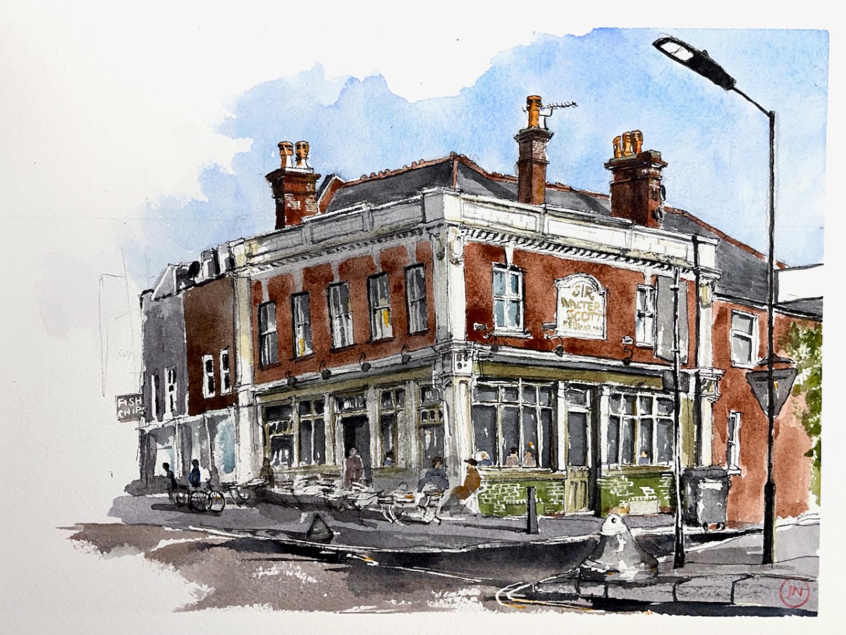
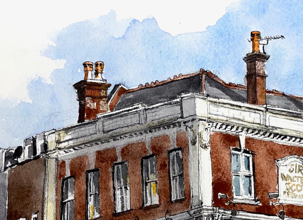
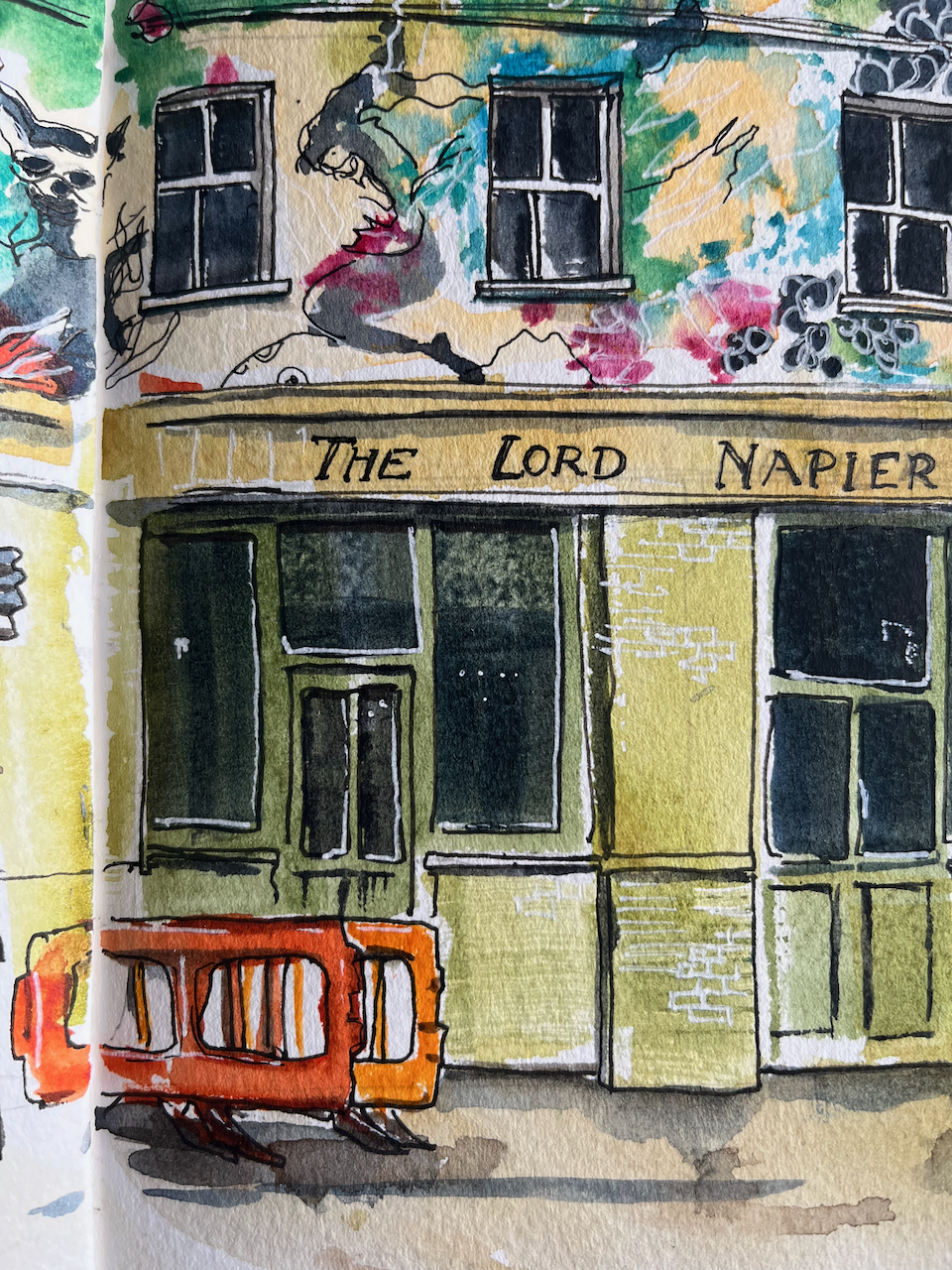
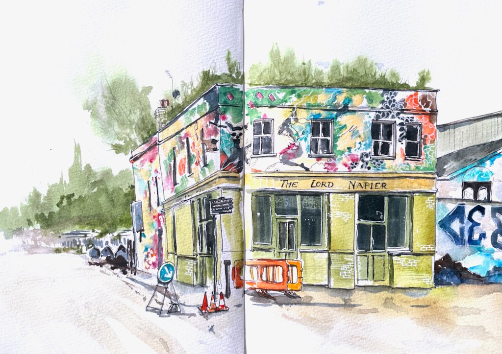
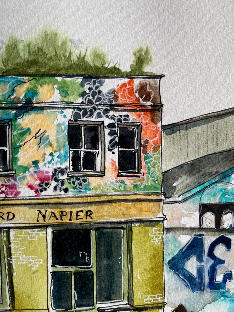
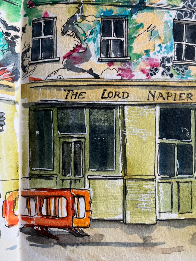
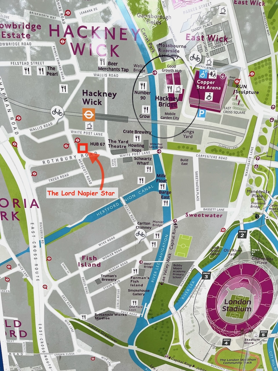
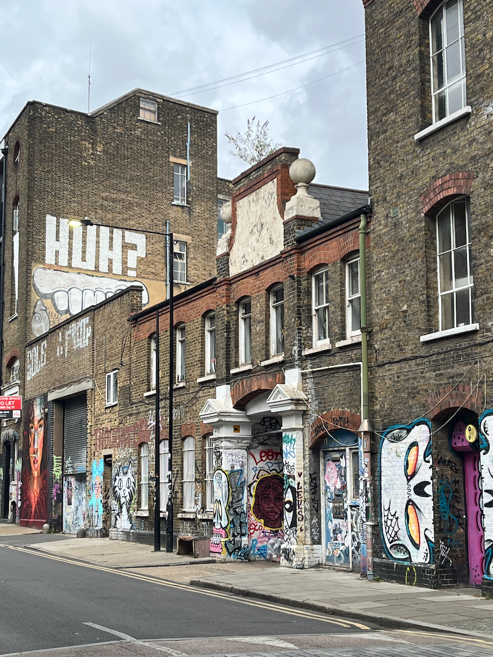
Here is a sketch of the remarkable pub, The Lord Napier, now the Lord Napier Star.
As you see, the top of the pub is covered in street art. I had fun trying to copy it. The original art is done at large scale with a spray can. My drawing is at small scale with watercolour and gel pens.
The pub has history. It has been a working pub, derelict, a rave venue, a squat. Now it is back to being a pub again.
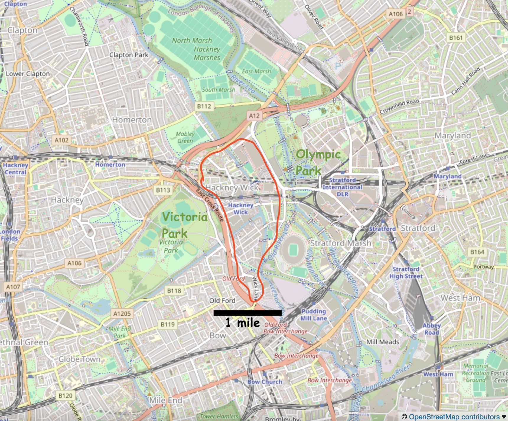
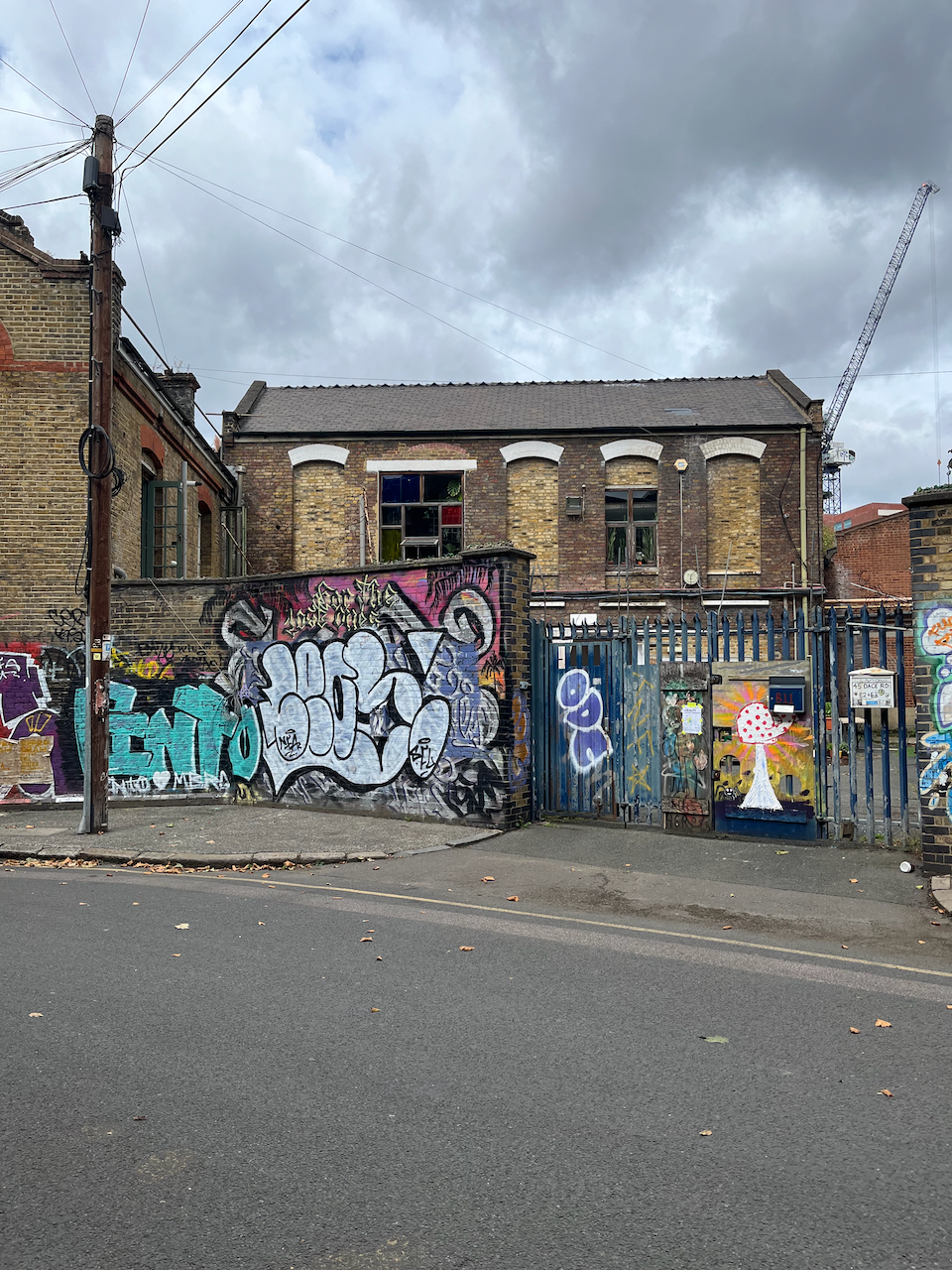
Hackney Wick is in East London between Victoria Park and the Olympic Park.
Hackney Wick is on the East side of London, 20 min walk from the Stratford railway station, and on the Hackney Wick overground.Hackney Wick is between the Olympic Park and Victoria Park.
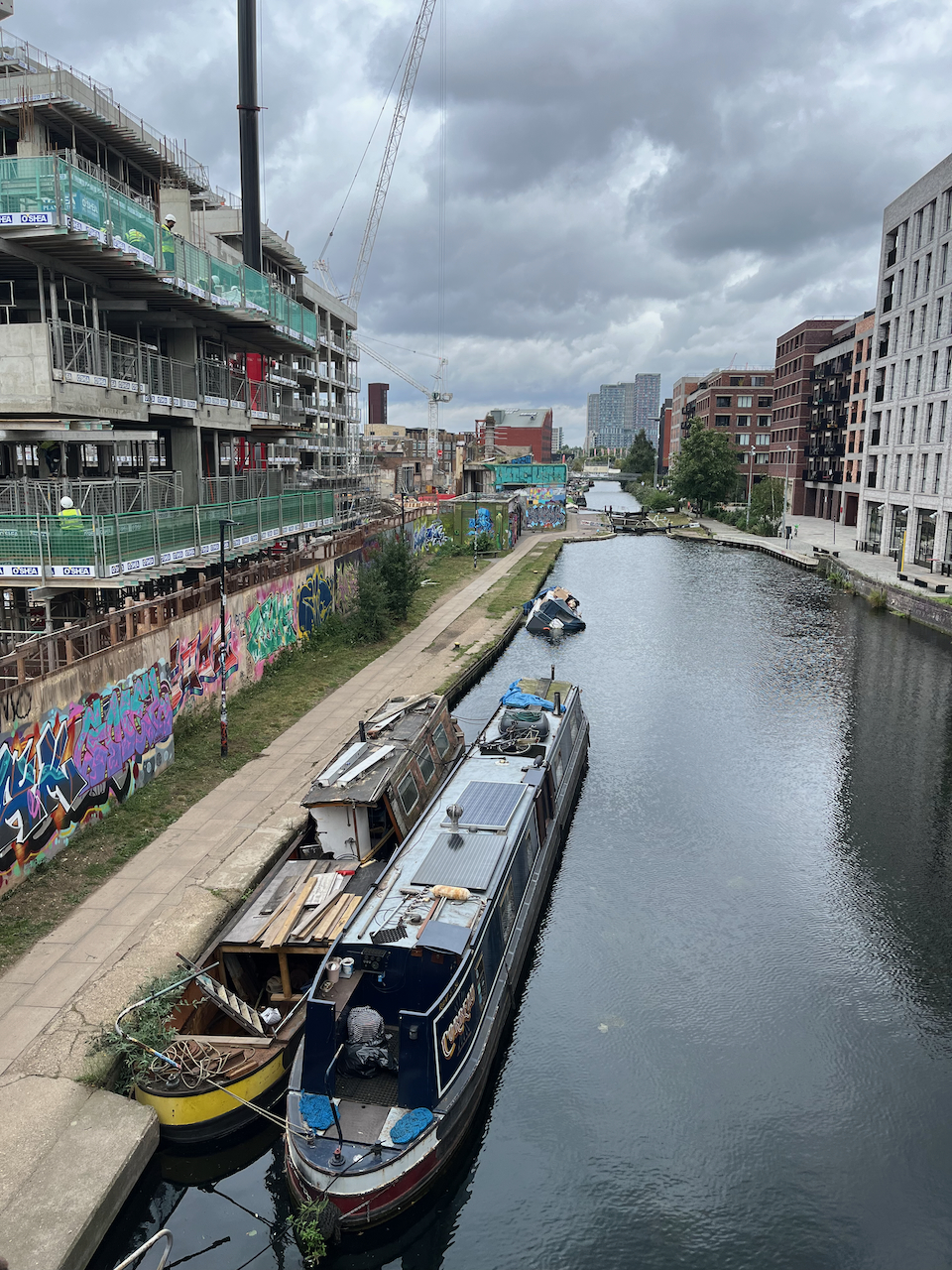
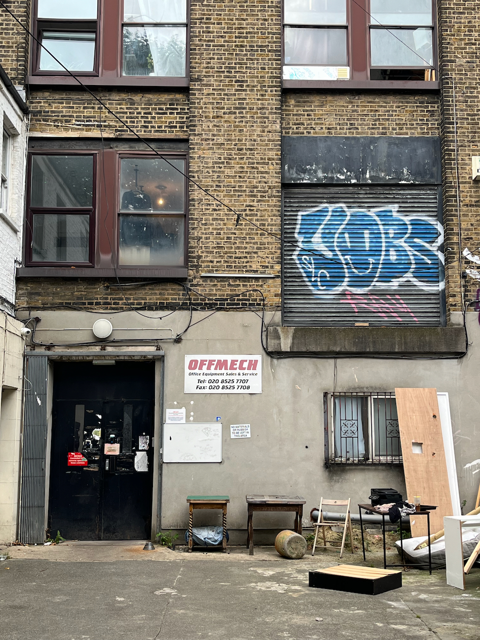
I have walked and run through there at intervals over the last twenty years. It has changed remarkably. The company I use for printing my artwork moved over there about 5 years ago, from a location in central London. I thought “what!” and “why?”. Now I realise that they were at the start of a trend. They were wise. The area is on the up. It used to be somewhat derelict and somewhat dodgy. Now the old buildings are taken over by new businesses, and there are cranes everywhere, constructing buildings where there were coal depots, docks, builders yards, heavy industry.
Map at the bridge to the Olympic Park.
There are new residential buildings, at human scale of 3 to 5 stories, with footpaths and green spaces in between, and commerce at ground level. The commerce is, yes, coffee shops, but also gyms, shared office spaces, businesses to do with the film industry, music and film studios, a bakery, and what looked like scenery painting studios. It felt as though real things happened there, new businesses moving in, people living near where they worked, businesses springing up to serve the people who live there.
New businesses adapting the spacesNew housing, built and under constructionNew businesses in old buildingsDwellings in old buildingsNew businesses in old buildingsA peaceful cafe “The Ethical Bean” Dace RoadA walk around Hackney Wick
I found it cheering and energising. And I recommend the café I found: “The Ethical Bean” on Dace Road.
Click a button below to share this post online, email it, or print it:
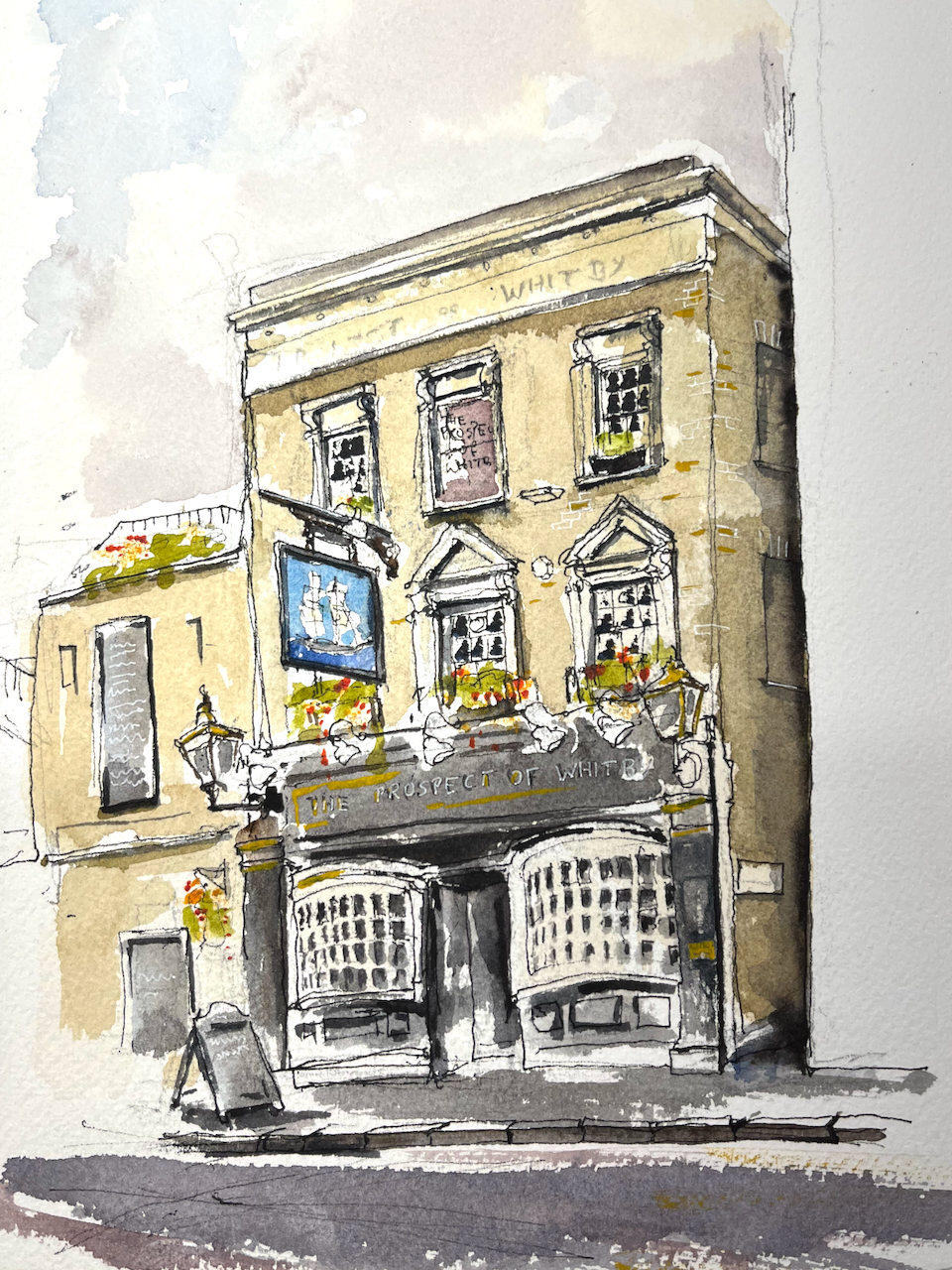
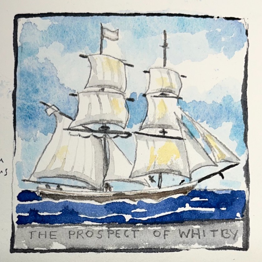
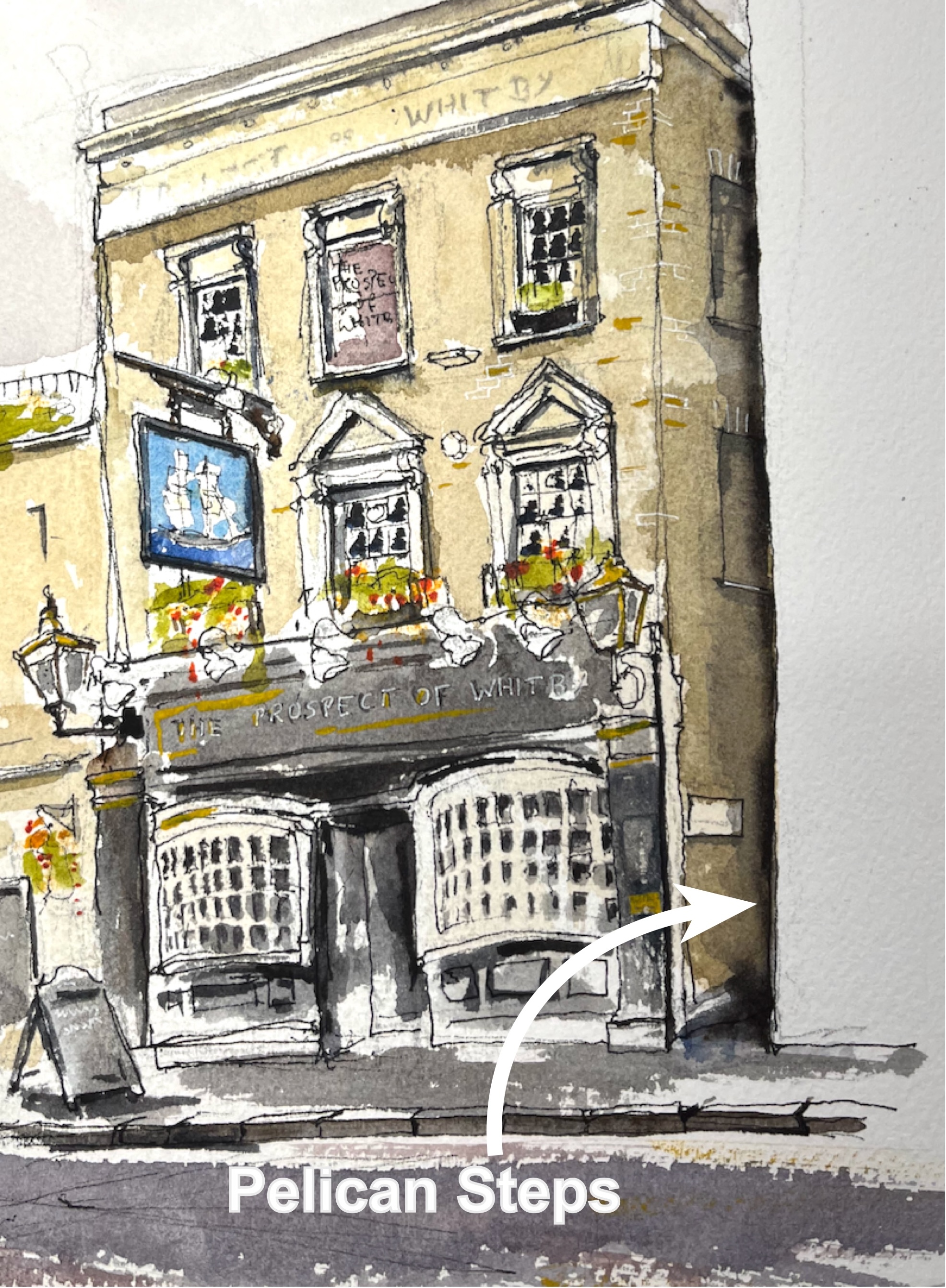
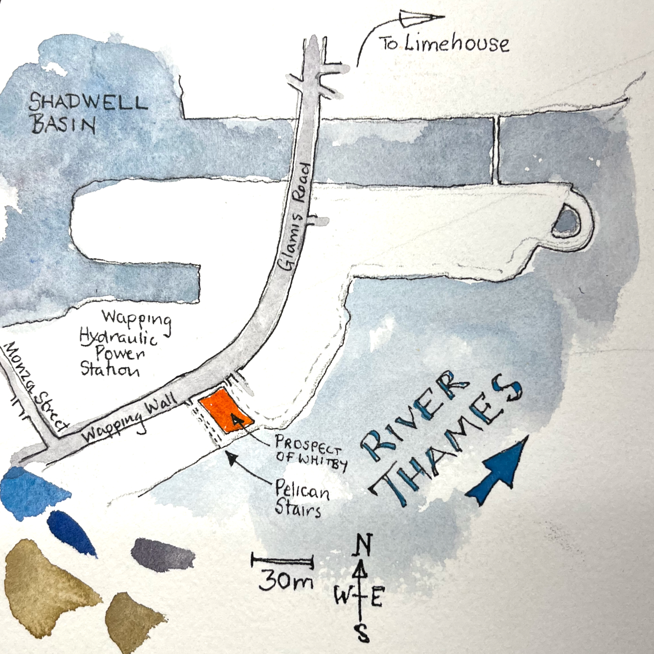
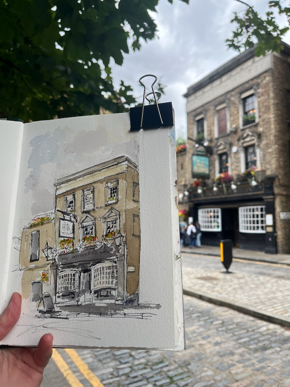
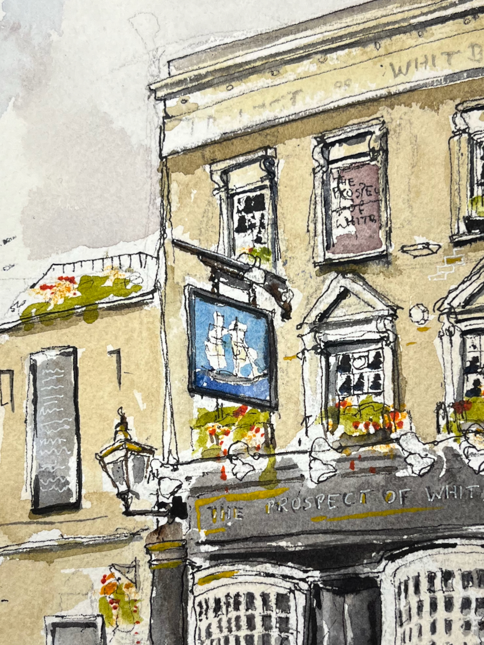
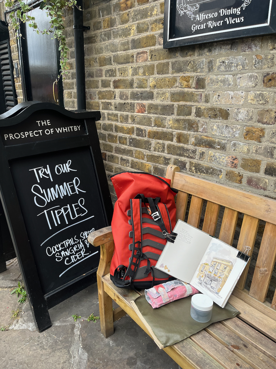
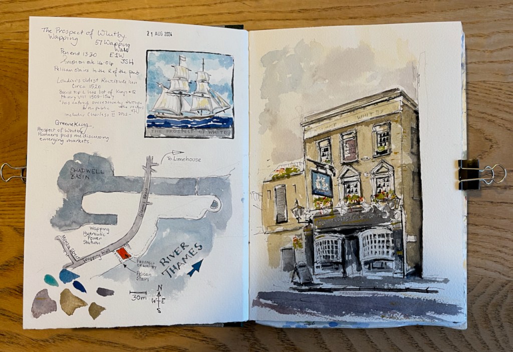
Here is the “Prospect of Whitby” pub by the Thames in Wapping.
“The Prospect of Whitby” sketched 21 August 2024 at 2pm, the first picture in Sketchbook 15
The “Prospect of Whitby” is the name of a ship.
The coal boat, “Prospect of Whitby”, from the pub sign.
There is an informative entry about the whole area in “The London Inheritance” website. He writes:
“The pub was originally called The Pelican and the alley and stairs down to the river at the side of the pub to the right are still named Pelican Stairs.“
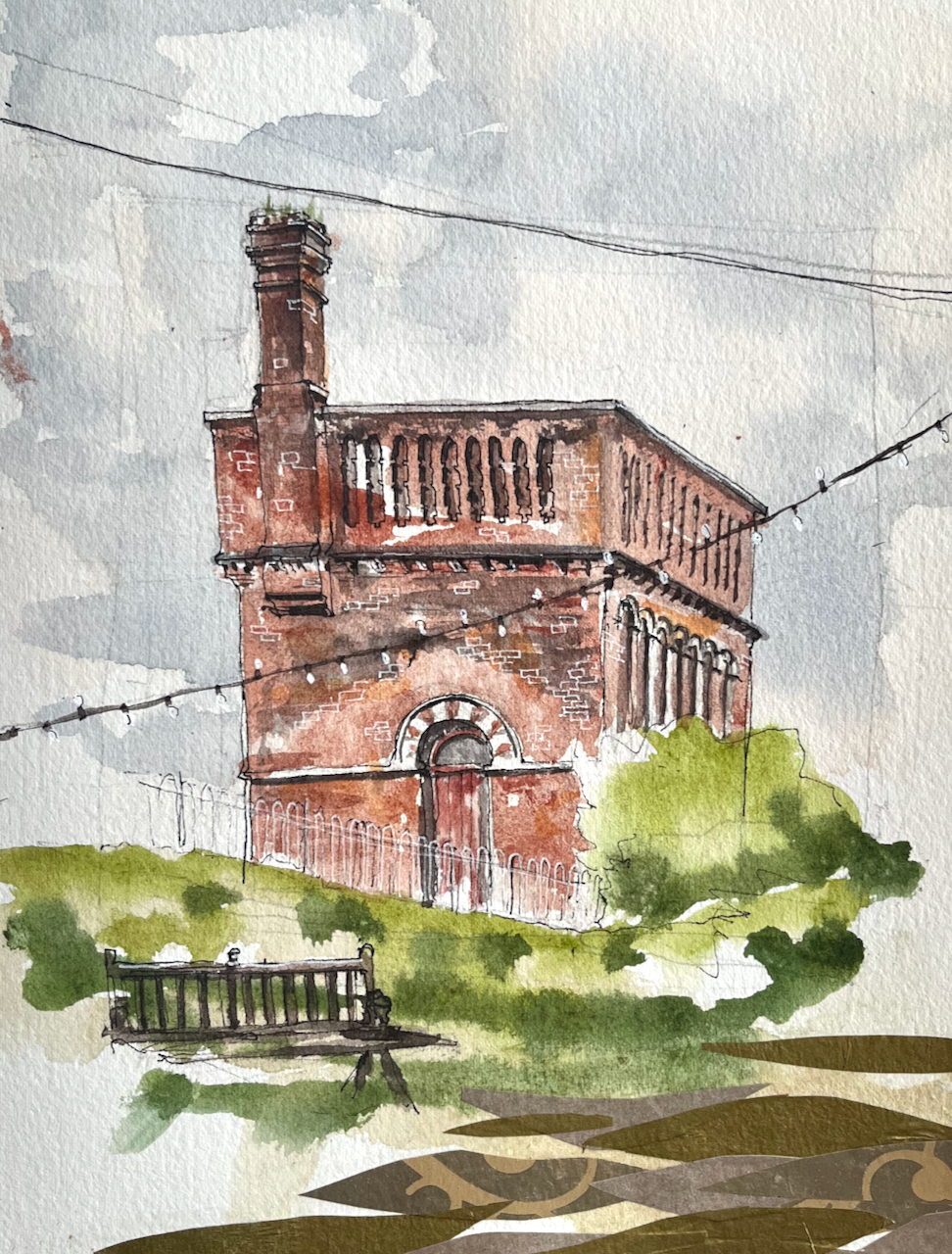
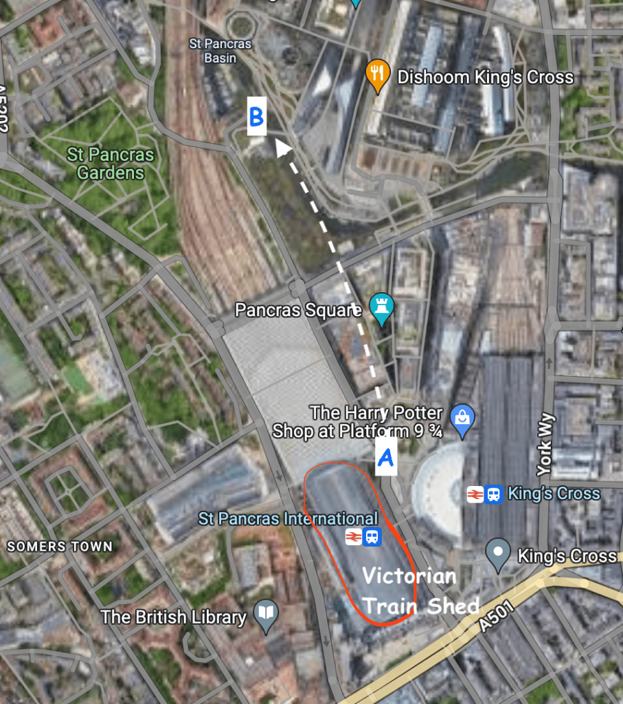
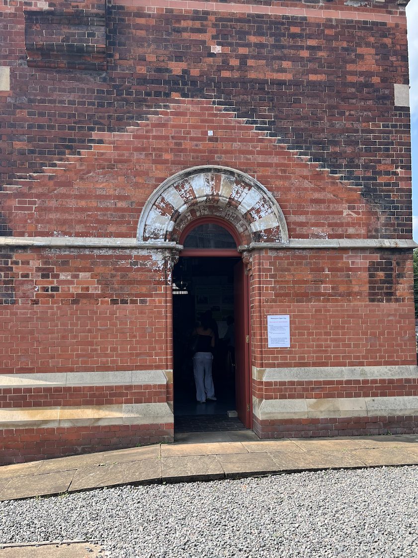
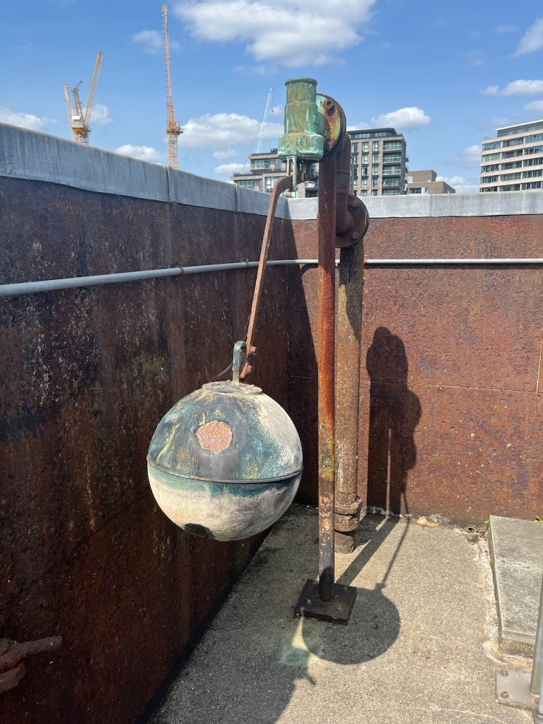
This structure is visible from the North side of the Regents Canal at Coal Drops yard. It was a “water point” for replenishing the boilers of steam engines. The top housed a water tank.
Waterpoint, seen from the Regents Canal towpath at Coal Drops. August 14th 2024, in sketch book 14
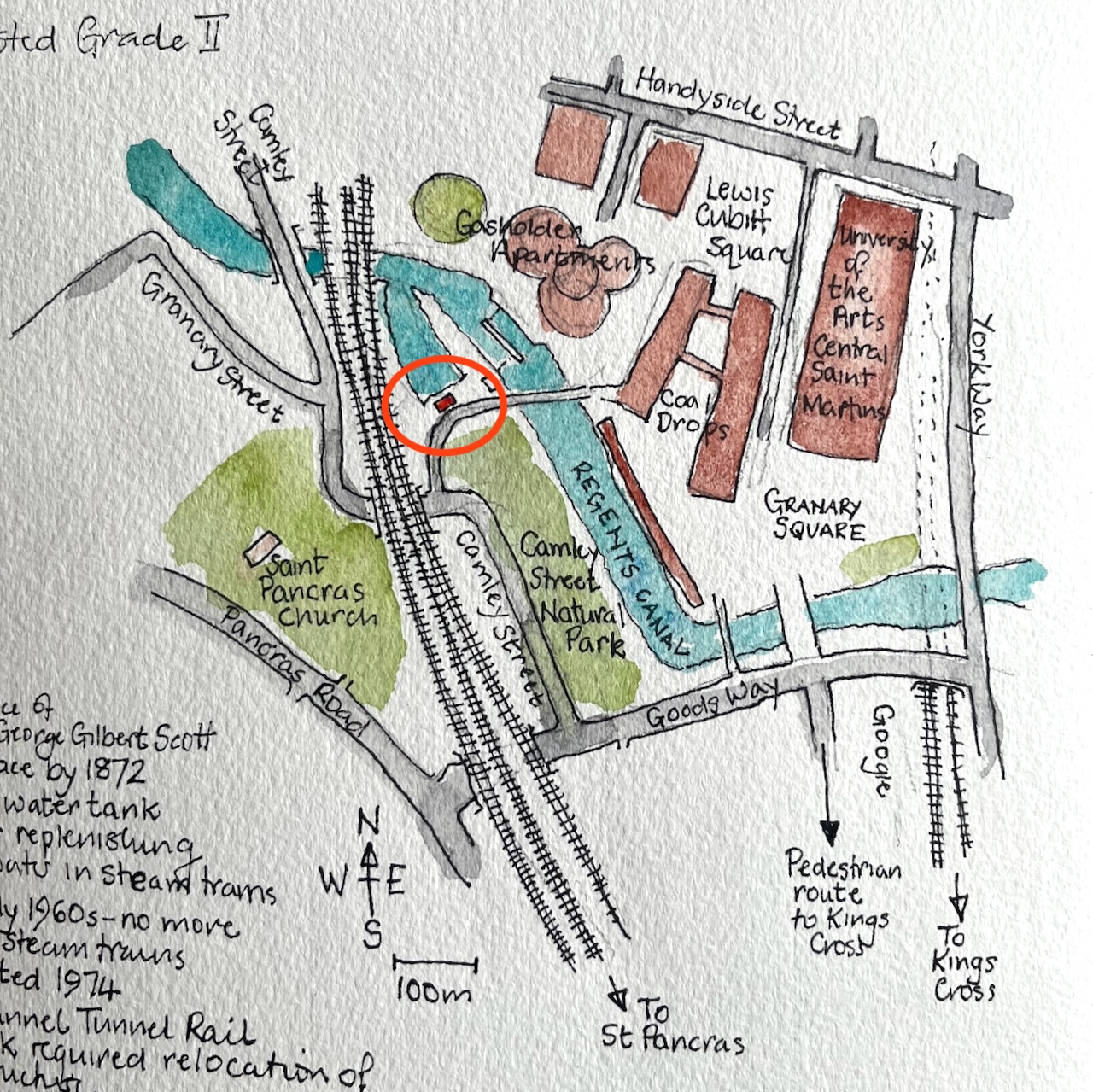
Here’s a map to show where it is. I’ve seen this structure often when walking along the canal, and it’s been on my “sketch-list” for a while, so I was glad that a co-incidence of weather and time gave me the opportunity to sketch it.
Waterpoint, circled.
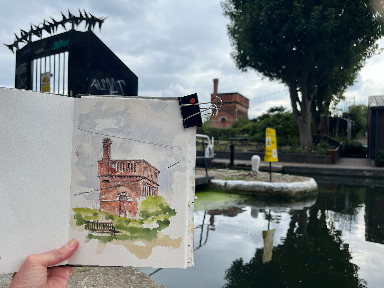
I was sketching from the Regents Canal towpath right next to St Pancras Lock.
Sketching Waterpoint, looking south across St Pancras Lock.
It turns out that this structure is open to visitors from time to time. By an amazing co-incidence, one of the visiting days was the weekend after I did my sketch. The kind and informative guides there patiently answered the many questions I had, and allowed me to photograph their video and their display boards.
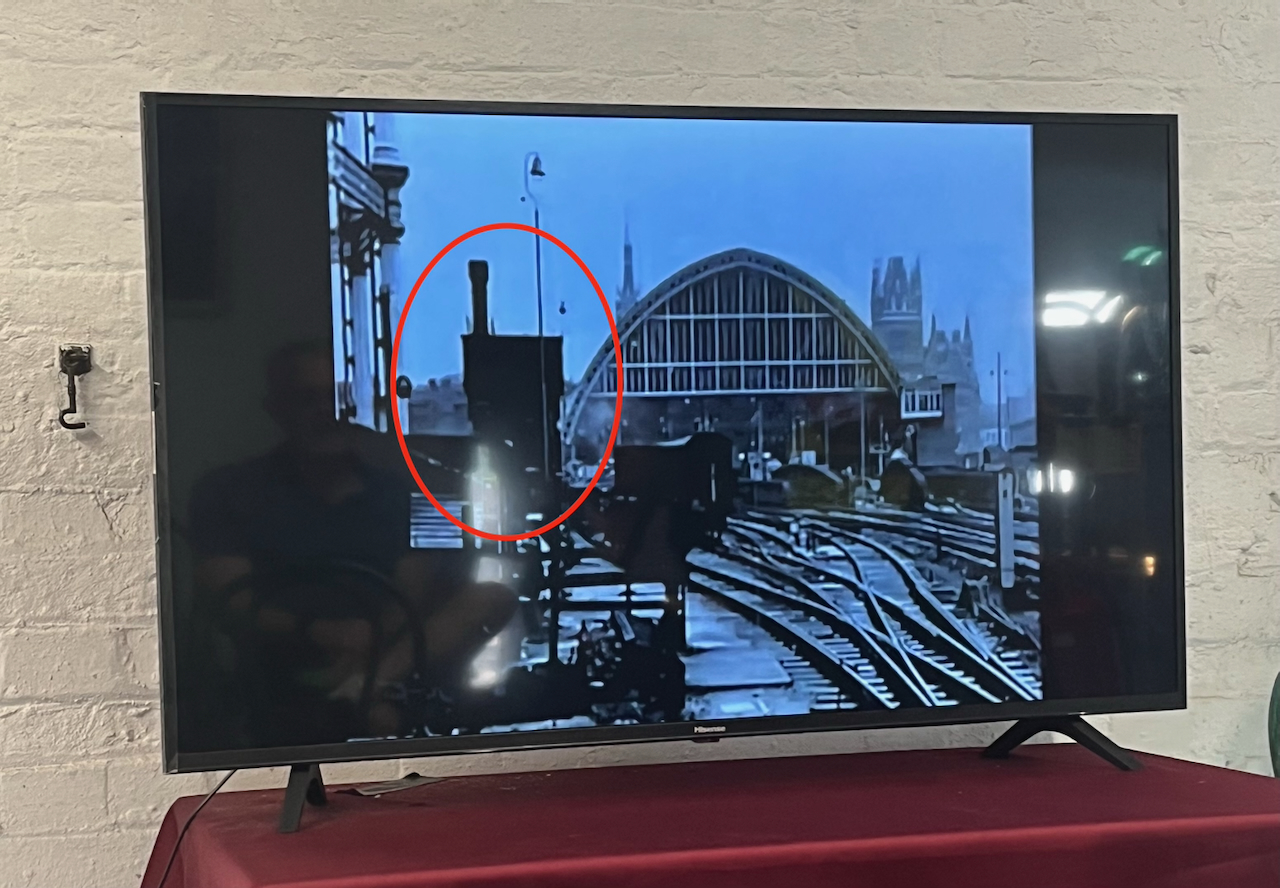
For me, the really fascinating thing about this structure is that it has moved. It was not always in this location. It used to be next to St Pancras Station. It was built around the same time as the station, 1870. In 2001 it was moved North, to its current location.
It was designed by team of Sir George Gilbert Scott, who designed the St Pancras Hotel. Since its purpose was to fill the tanks of steam trains, it was right next to the railway lines. You can see it here:
Photo of a video shown at the Waterpoint.
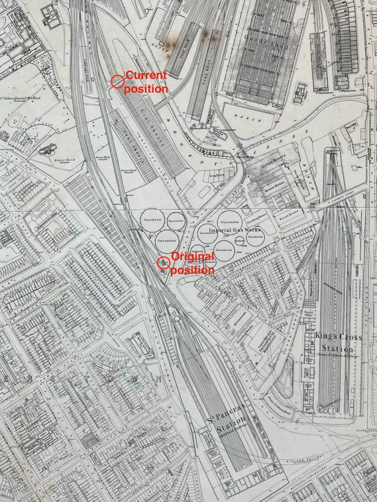
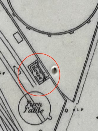
Here it is on an 1871 map: (click to enlarge)
my annotations to show the original position next to St Pancras, and the current positionOn the 1871 map it is labelled “Pumping House”1871 map on display at the Waterpoint (copyright National Library of Scotland)
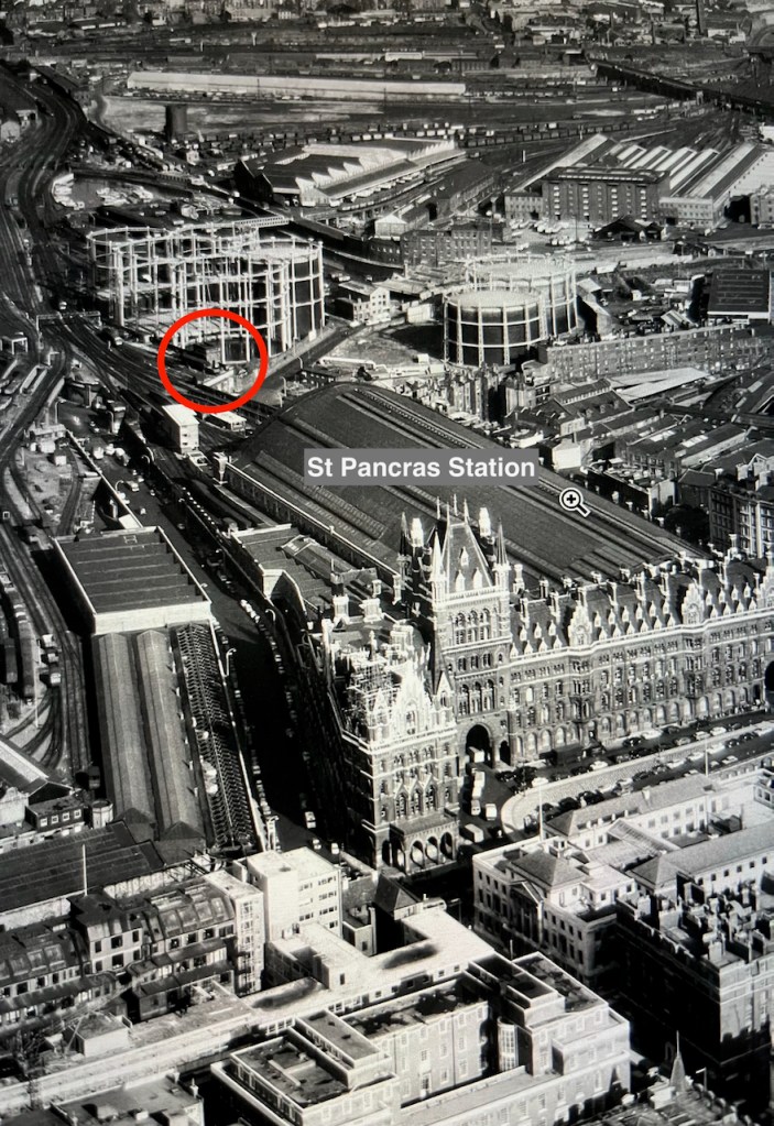
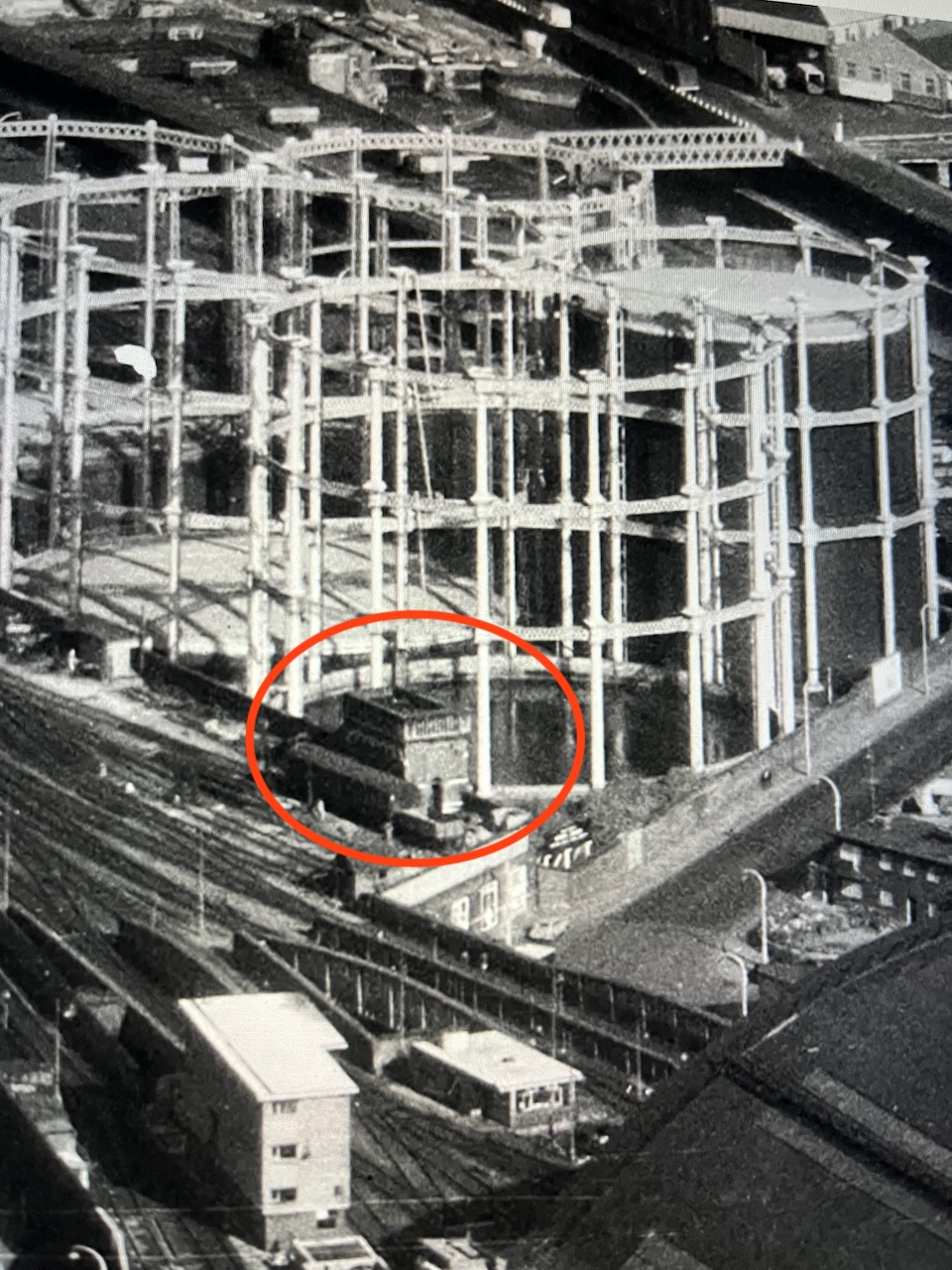
I think I can spot it on this archive aerial photo from 1964. Here is the link to the picture:
The water point is just beyond the far right hand edge of the St Pancras train shed, in the centre left of the photo on the link above.
Here are some low resolution images to help you find it.
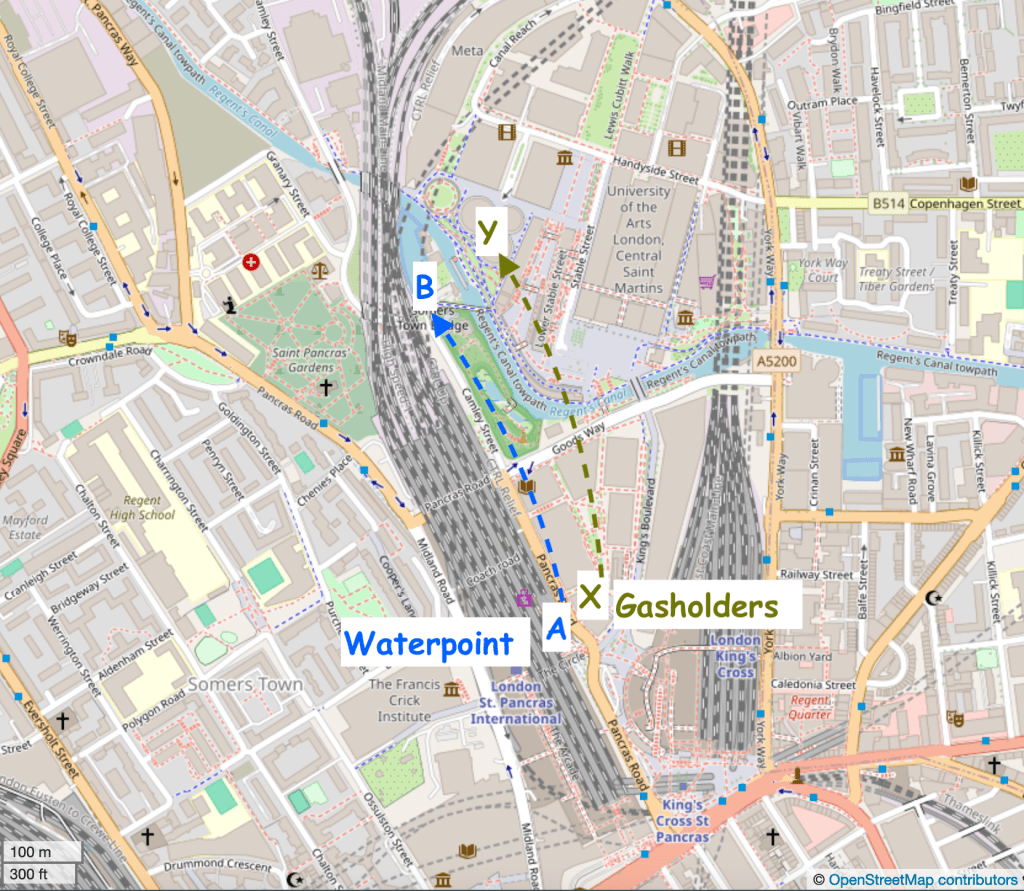
Detail from the aerial photo above. The gas holders shown in these photos have also moved.
Here are modern maps annotated to show the original position and the current position:
Google map. Waterpoint moved A to B.Waterpoint moved A to B. Gasholders moved X to Y. map (c) openstreetmap contributors
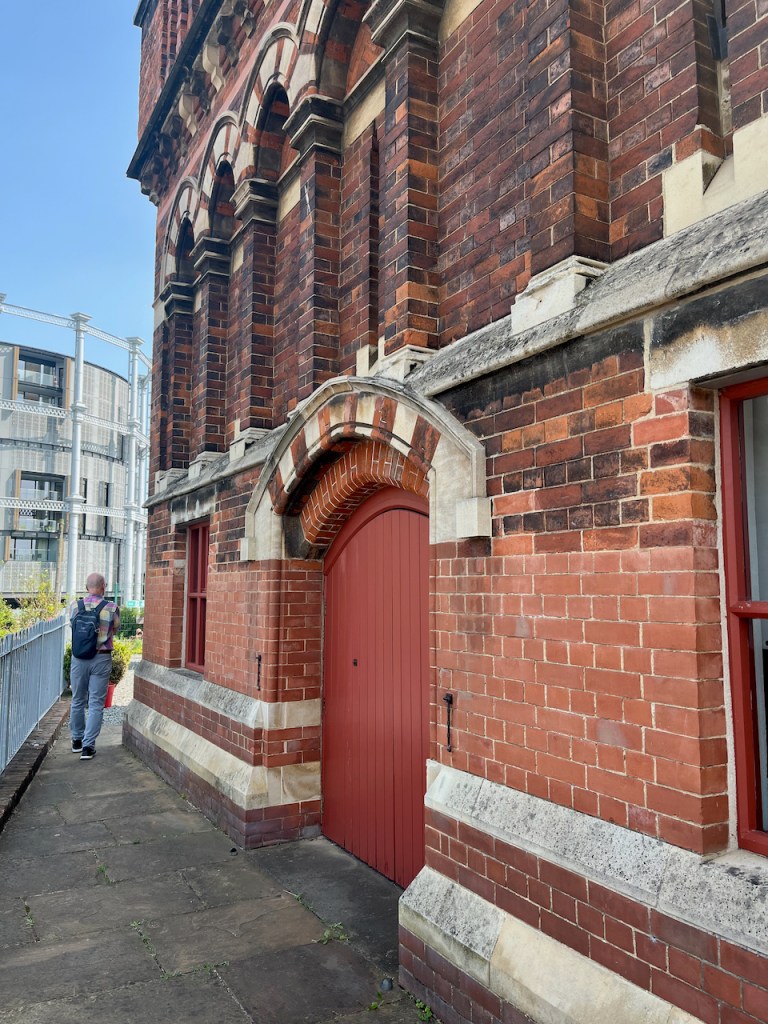
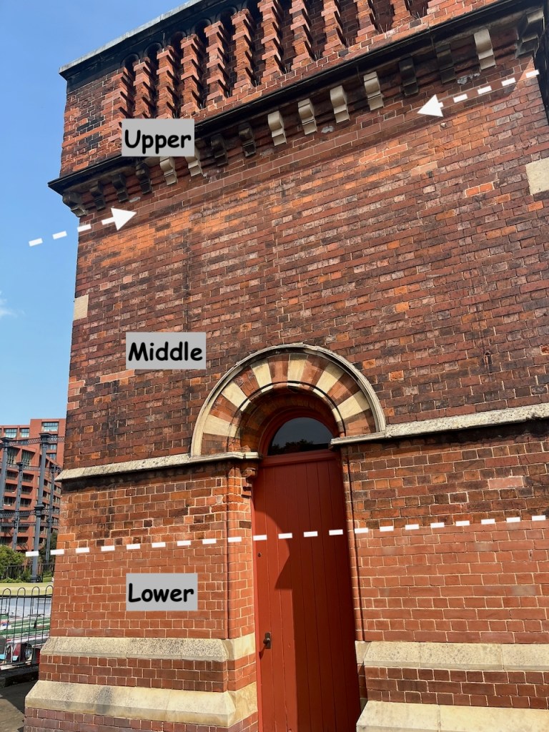
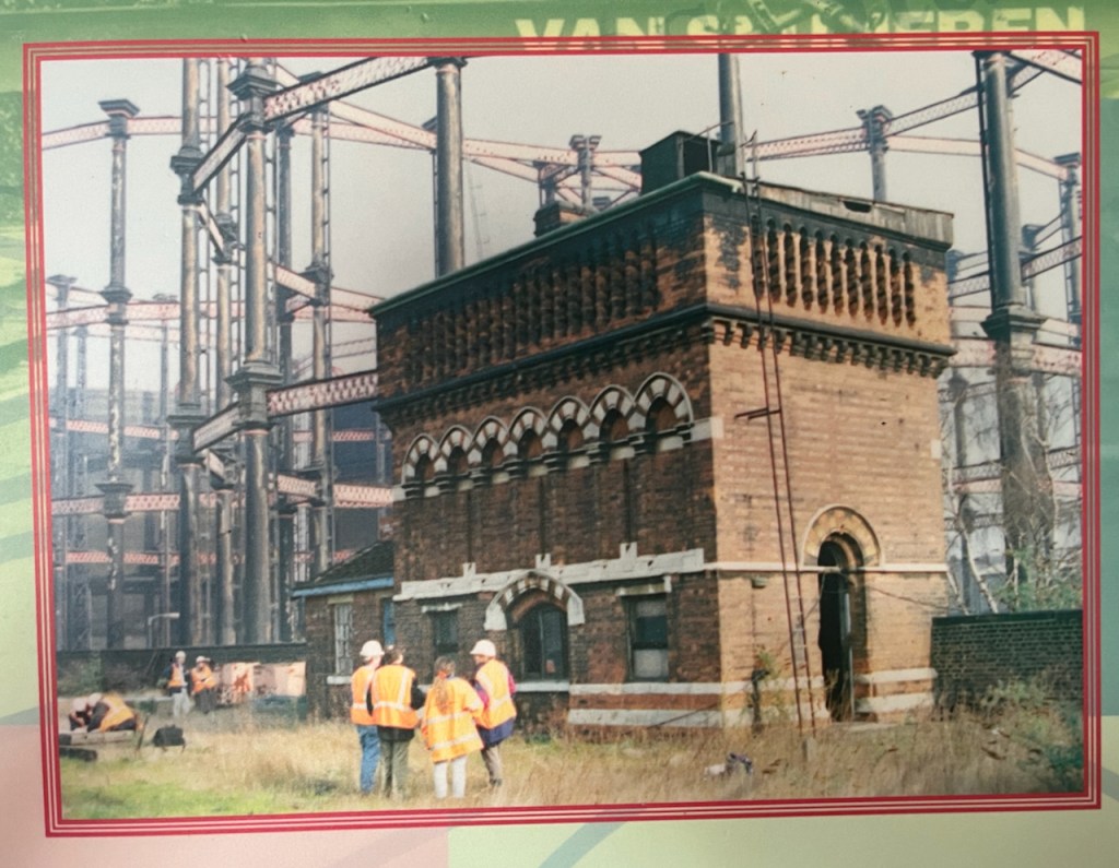
To move it, the original Water Point was cut horizontally into three sections. The lower section was left behind. A new lower section was built in the new location. The middle and upper sections went by road to the new location and were stacked on top of the newly built lower section. You can see, by changes in the bricks, the joins between the sections.
The new lower section is clearly visible.The line of new bricks at the top marks the join between the middle and upper sectionsView of the south side of the Waterpoint, annotated to show the sections
On the side of the Waterpoint visible from the canal, there is a clear “roof” pattern in the bricks, which I noticed when sketching it.
This marks the position of a shed that was fastened to the structure in its original position. See the pictures below.
Original position – note the shed on the left What was left when it was moved.The display boards show the project to move the Water Point. These are 2001 photos.
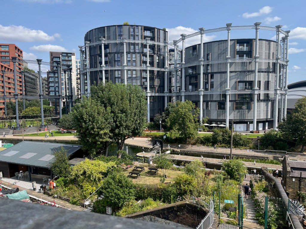
These photos and maps show how much the area has changed. See all the gas holders! They were constructed on the south side of the Regents Canal, because that’s where the gas works was. They originally held coal gas, which is carbon monoxide and hydrogen, manufactured from coal. Until 2010 they were a landmark for anyone who made this journey into Kings Cross regularly.
Here’s a frame from the 1963 film “Alfie” captured by @runningthenorthernheights, showing the gasholders in their original position.
Thanks to @runningthenorthernheights
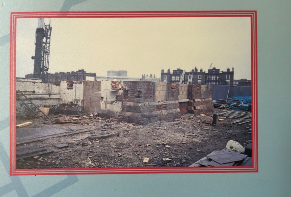
The gasholders were decommissioned in 2000, but several of them couldn’t be destroyed because they were listed, so they just stood there for ten years. Then they were dismantled, stored, preserved and reconstructed in the years 2010-2015. They are now on the north side of the Regents Canal. Gas holder No. 8 was the first to be reconstructed, in 2015. It surrounds a small park. Gas holders 10, 11 and 12 followed, surrounding luxury apartments, part of the Kings Cross development. (https://www.kingscross.co.uk/gasholder-park)
Gasholders seen from the top of the Waterpoint, August 2024. I did the sketch from the far side of the canal.
Here are more photos from my visit to Waterpoint in August 2024.
Ball cock in the (now empty!) tank on the topView from the topView from the topThe “chimney” up close. The guide is explaining that it is purely decorative. It is solid: there’s no “chimney”.
I was very glad to have the opportunity to visit this quirky building. Recommended!
Click a button below to share this post online, email it, or print it:
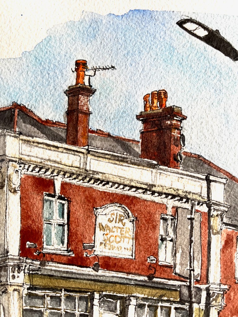
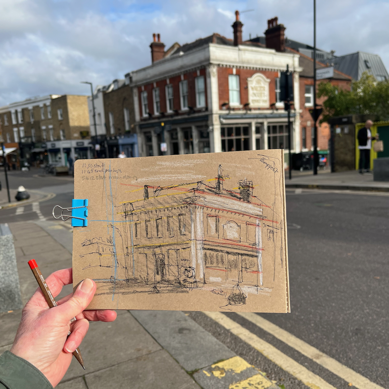
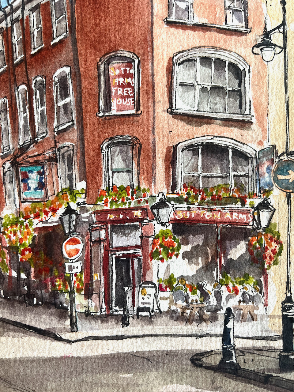
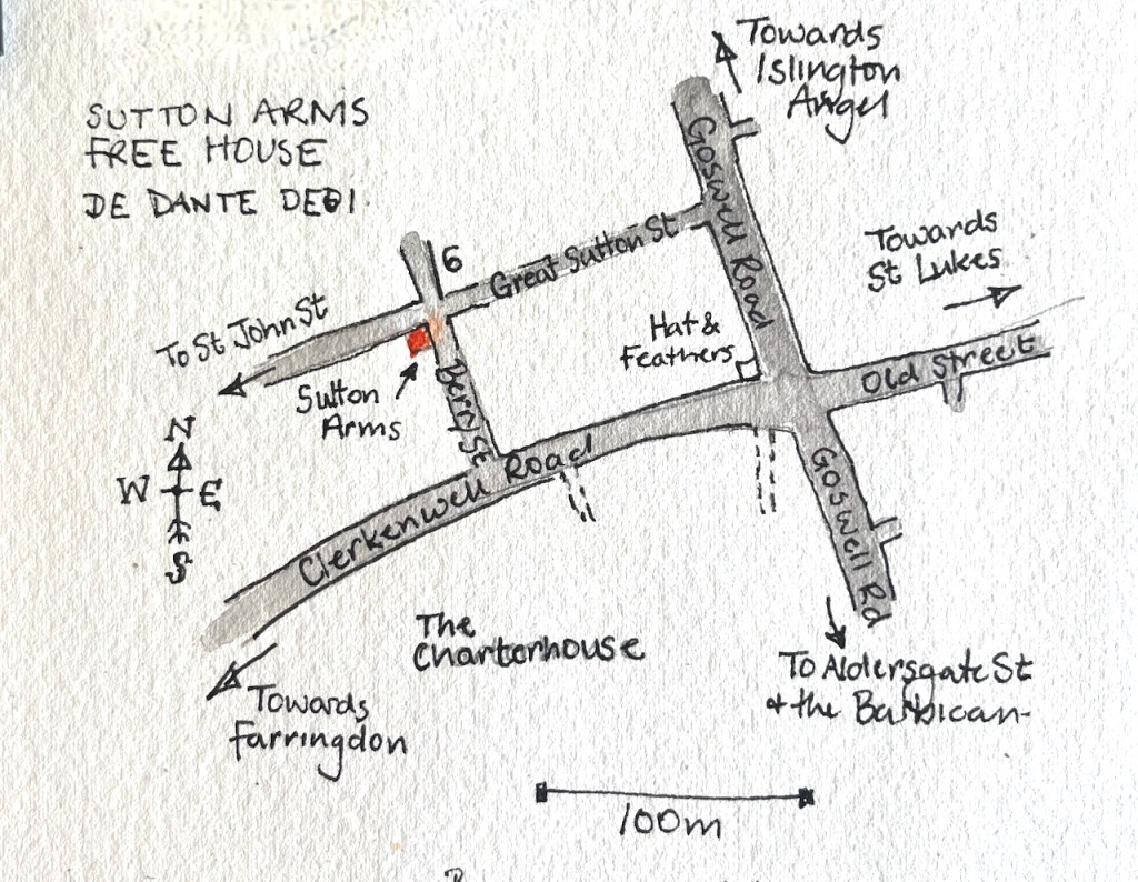
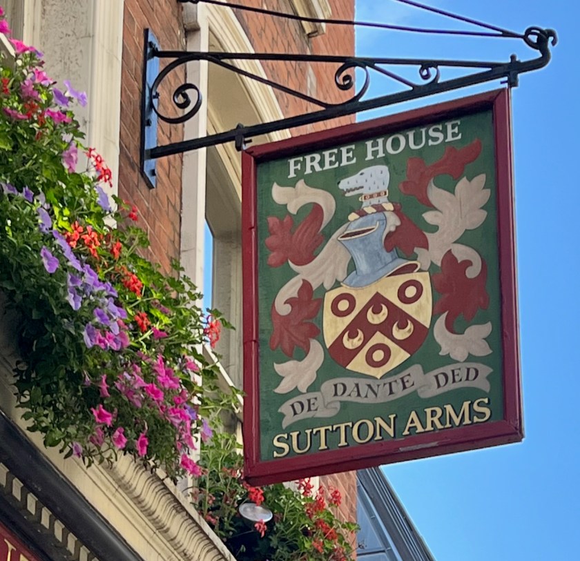
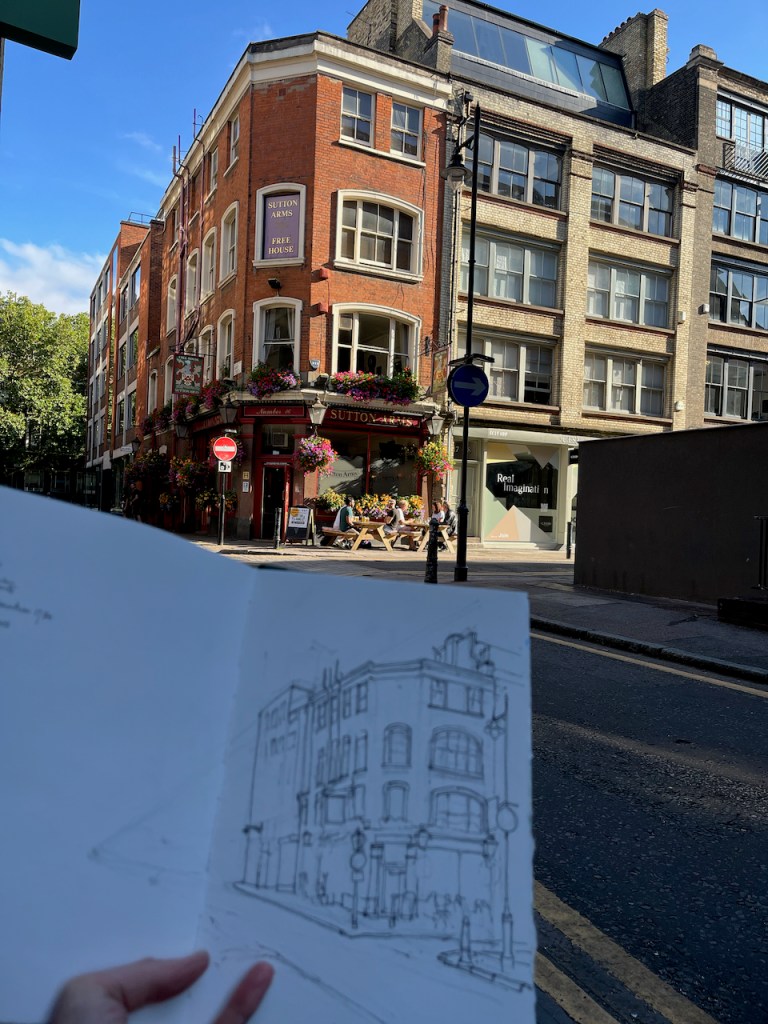
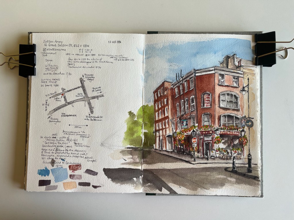
This is the Sutton Arms in Clerkenwell, 16 Great Sutton Street, EC1.
Sutton Arms, 16 Great Sutton Street, EC1V 0DH, sketched 10 August 2024 in Sketchbook 14
I sketched it towards the end of a sunny afternoon in August, sitting on steps outside number 6 Berry Street. As you see, the sun streamed in from the west. The trees in the distance, on the left of the drawing, are on Clerkenwell Road. Behind them is The Charterhouse, fulfilling its ancient tradition as an arms house and sanctuary for the elderly and frail.
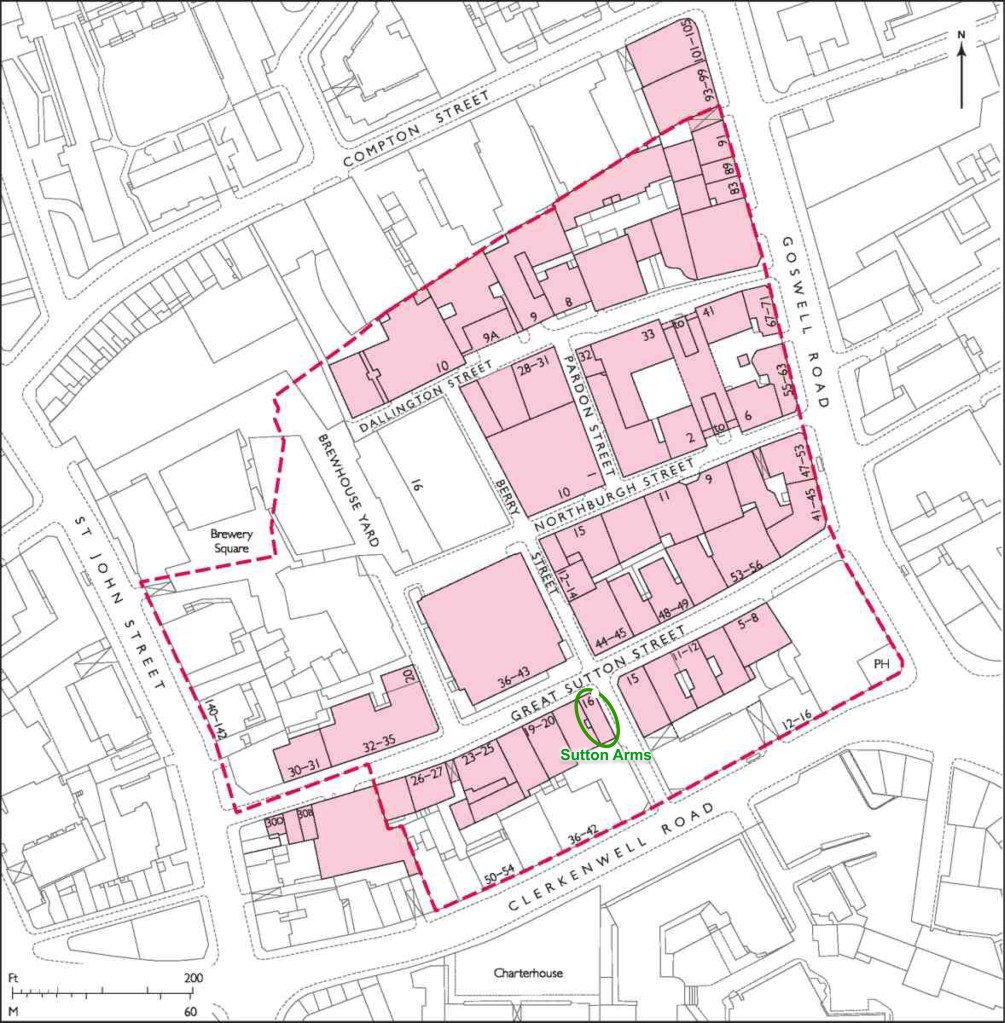
From 1611 to 1995, The Charterhouse owned the whole of this area.
Great Sutton Street area. The broken red line indicates the extent of the former Charterhouse estate. Image from British History Online [reference 2] annotated.
The Charterhouse sold this land in 1995. A developer bought up the land and built factories and warehouses. In the 21st century a new wave of developers transformed former warehouse blocks into apartments and offices. I sketched sitting outside one such: 6 Berry Street is residential apartments. This is now an area for architects and interior designers.
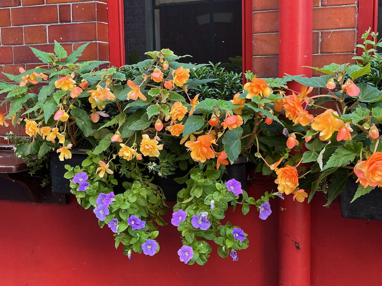
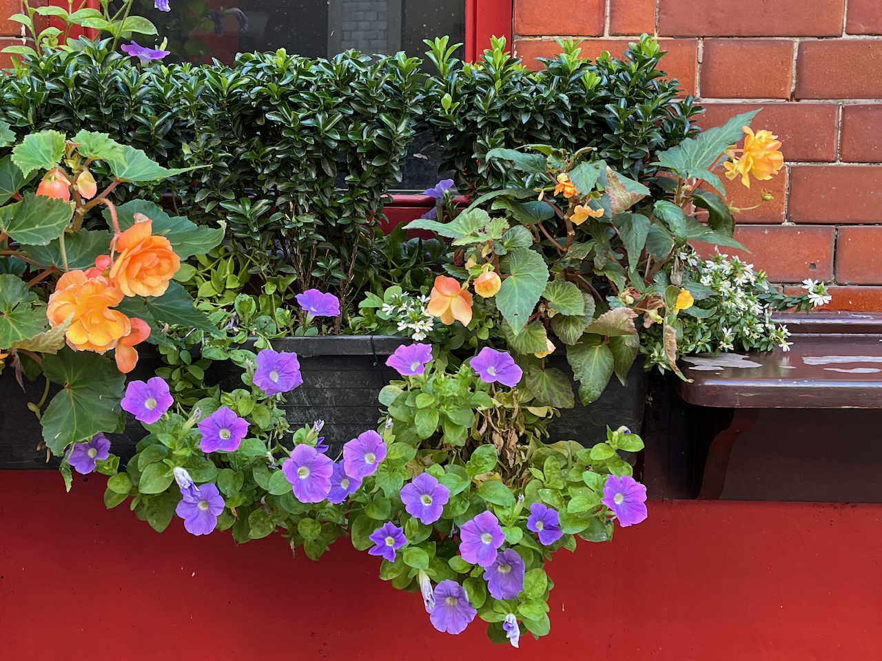
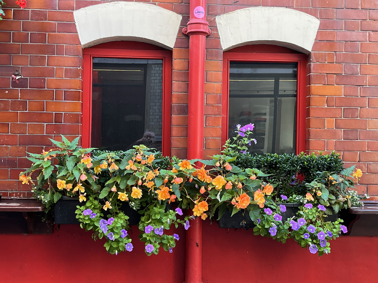
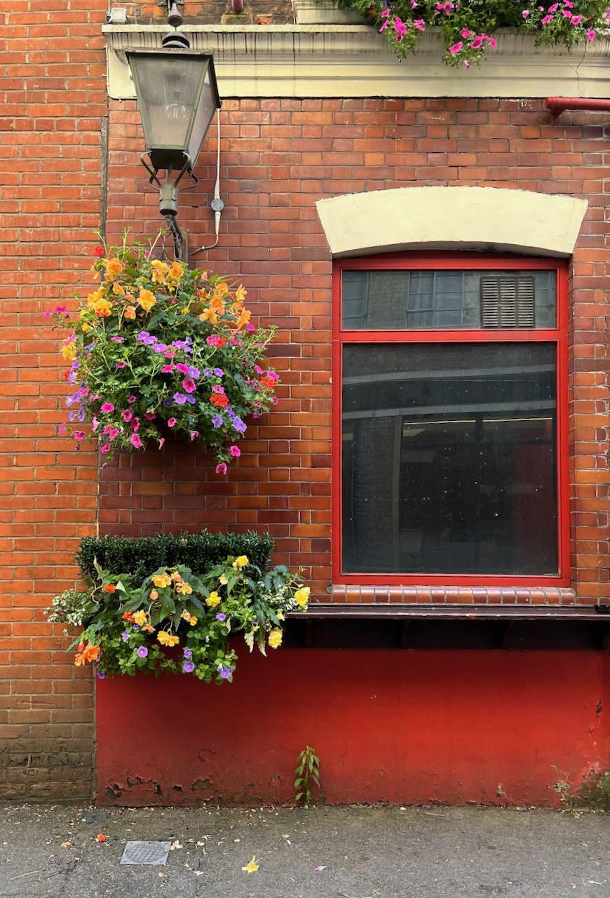
There was a pub here by 1825 [1]. It was rebuilt in 1897 [2]. It’s now a Free House. It’s clearly well looked after and well patronised. Definitely to be visited! The flowers are spectacular.
Spectacular flowers of the Sutton Arms.
Thomas Sutton (1532-1611) was the founder of the Charterhouse, hence the name of the road and the name of the pub. This is the Sutton Arms in Clerkenwell, north of The Charterhouse. There is also a Sutton Arms south of The Charterhouse, in Carthusian Street, near Barbican tube.
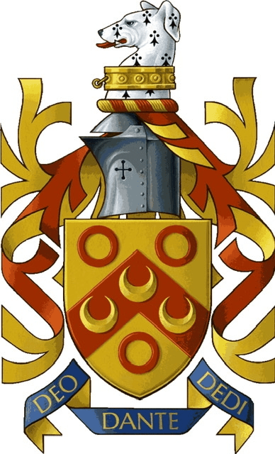
The pub sign is Sutton’s coat of arms. His motto is:
DEO DANTE DEDI
The translation is “God having given, I give”, or “As God has given to me, so I give in my turn”, a good motto for the benefactor that he was. The pub sign misses off the “O” in DEO and the “I” in DEDI.
Sutton Arms pub sign: “DE[o] DANTE DED[i]”Thomas Sutton’s Coat of Arms. See the greyhound. Source: Charterhouse School on Wikipedia
The “Survey of London ” [2] gives a detailed history of this area, which has alternately flourished and decayed over the centuries. It is currently flourishing.
I completed the ink on location and finished the colour at my desk. The colours are:
Fired Gold Ochre (bricks)
Ultramarine Blue and Phthalo Blu (Green shade) (sky)
Serpentine Genuine (trees)
Mars Yellow (road and bricks)
Ultramarine Blue plus Burnt Umber (blacks and greys)
Transparent Pyrrole Orange (flowers, street signs)
The changing fortunes of the Great Sutton Street area.
In the 14th century this area was fields, owned by a Carthusian Priory. There was a mortuary chapel, called “Pardon Chapel” for saying the last rites for criminals and suicides. Henry VIII eradicated the Carthusian Priory in 1538 (“Dissolution of the Monasteries”) and it passed into private hands, along with the land. It became known at “The Charterhouse”. Thomas Sutton, a wealthy businessman, bought the Charterhouse in 1611. He died that year. His will provided for the hospital and almshouse that are still there. The Charterhouse leased the land outside its walls to developers, who built houses. “By 1687, when the Charterhouse estate was thoroughly mapped by William Mar, almost the whole had been laid out in streets of small terrace houses—242 houses in all, with yards, gardens and sheds.” [2] These terraces set the street pattern for the small streets that are there today. The lattice continued to the walls of The Charterhouse. Clerkenwell Road was cut through much later, in the 1870s. Then commerce moved in and a hundred years passed. By the 1700s, the area was a mix of residences and industries: “In 1731 Philip Humphreys, the Charterhouse gardener [..]complained of the adverse effect on his crops of smoke ‘from so many neighbouring Brewhouses, Distillers and Pipe-makers lately set up’ in the vicinity.” Thus we see that NIMBYism is not a new phenomenon. A new developer (Pullin) came in and rebuilt, and more and larger factories were built. Again, the neighbours complained: “Already by the 1820s some houses were giving way to further industrial developments, including slaughterhouses, a dye-house, breweries, and vinegar, vitriol and gas works. Complaints were made to the Charterhouse in 1832 about the nuisance of these works and their steam engines, and to the Vestry in the 1850s about the ‘boiling of putrid meat and other offal’ and blood running into the drains.” Building continued. Eventually government intervened: “Extensive redevelopment of the Charterhouse estate followed remarks in 1884–5 by the Royal Commission on the Housing of the Working Classes as to the badness of the houses there. […] Charterhouse was criticized for allowing [..]the incidence of house-farmers, severe overcrowding and badly constructed, poorly ventilated housing to continue on its property. One house in Allen Street was found to be occupied by thirty-eight people, eleven of them in one small room; similar conditions were found in the cottages of Slade’s Place. Many of these properties were occupied by costermongers with ‘very precarious’ earnings (whom the Commission felt would do better ‘if they kept from drink’).[2]” The Charterhouse governors eventually took action. The small houses were demolished, and replaced by factories and warehouses. This time the trades were less polluting: “Among early occupants were clothing manufacturers: milliners, mantle-makers and collar-makers, leather manufacturers, glove-makers and furriers. The printing trade was also well represented, along with book-binding, engraving and stationery manufacture. Continuing a long-standing tradition were several butchers and tripedressers.” By now we are in the early 1900s. About a dozen buildings were destroyed by bombing in the 1939-45 conflict, and replaced in the 1950 and 1960s by factories and warehouses. The Survey of London [2] reports that the area was “considerably run down” in 1995 when the Charterhouse sold it to developers. The developers started a programme of warehouse conversions, to apartments and offices, which transformed the area, and moved it back upmarket. And that’s where we are today. (The above is my summary of the more detailed description in reference [2])
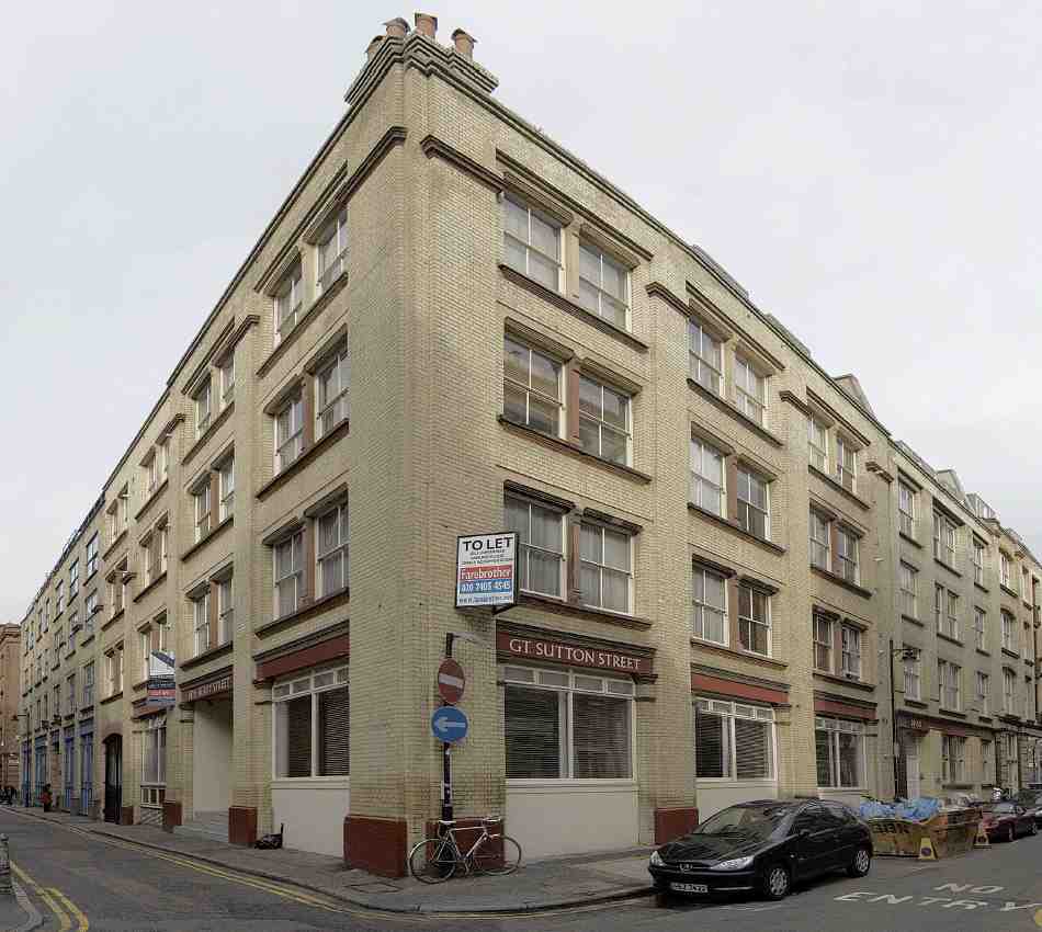
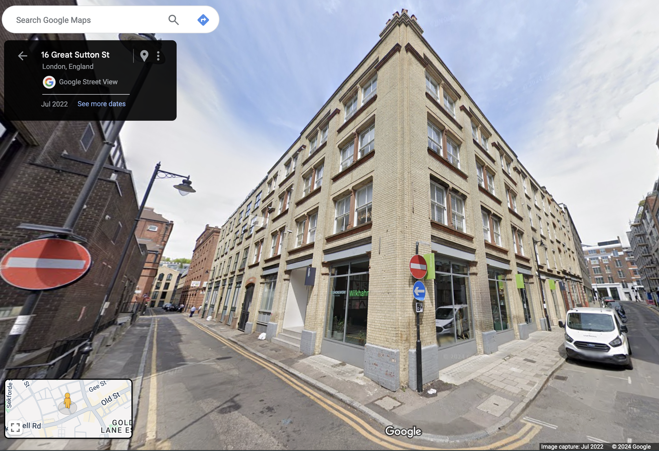
[Reference 2 fig 402] Warehouse developments of the 1890s by Mark and Albert Bromet and others at the corner of Berry Street (Nos 12–14, left) and Great Sutton Street (Nos 44–49)The same site today. (Google Street view). Above street level, this is residential. I met one of the residents while sketching. I was sitting on the steps of the entrance to her block, centre left.
[2] British History Online: ‘Great Sutton Street area’, in Survey of London: Volume 46, South and East Clerkenwell, ed. Philip Temple( London, 2008), British History Online https://www.british-history.ac.uk/survey-london/vol46/pp280-293 [accessed 2 September 2024].