The Horse & Groom, EC2

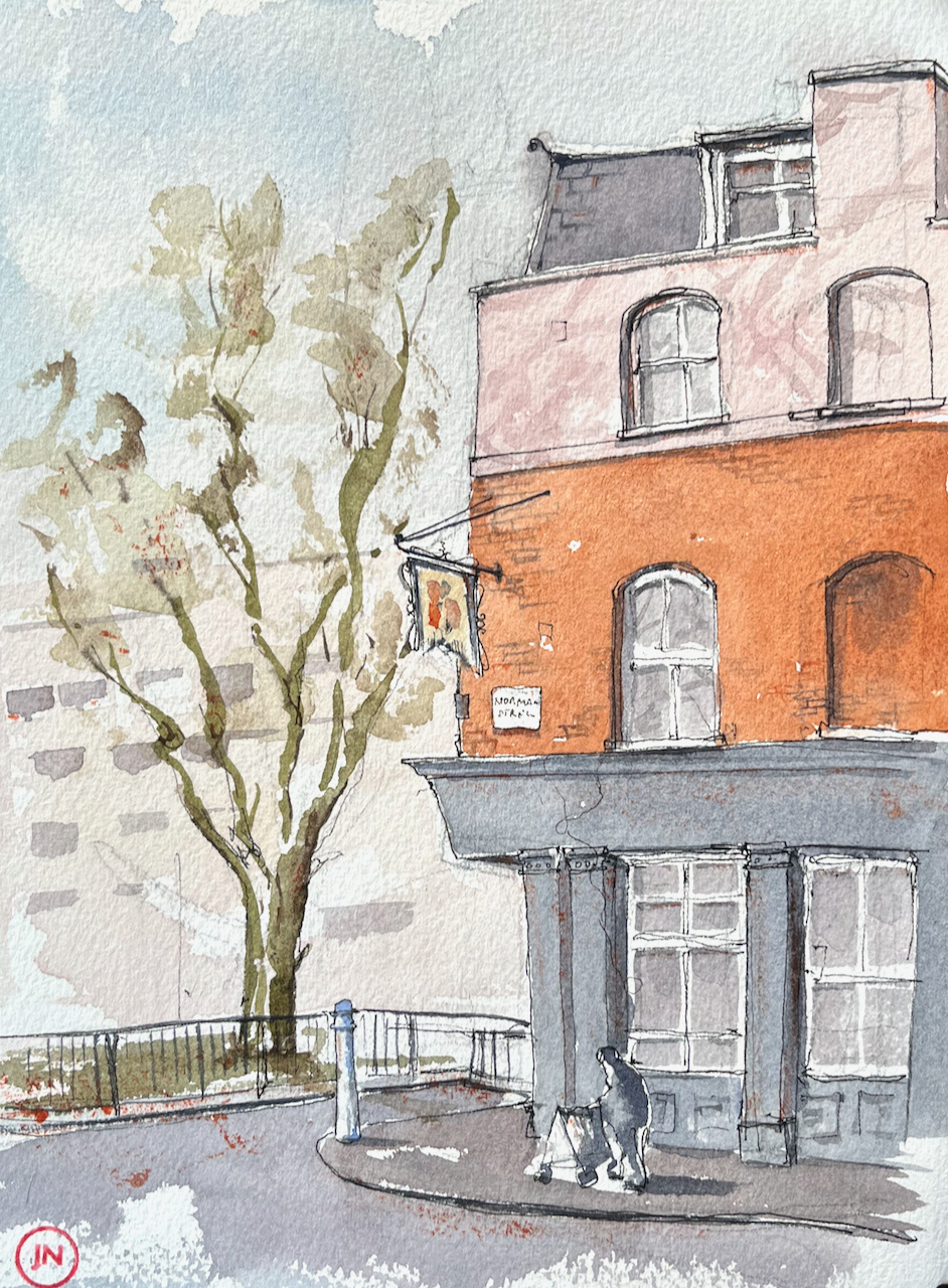
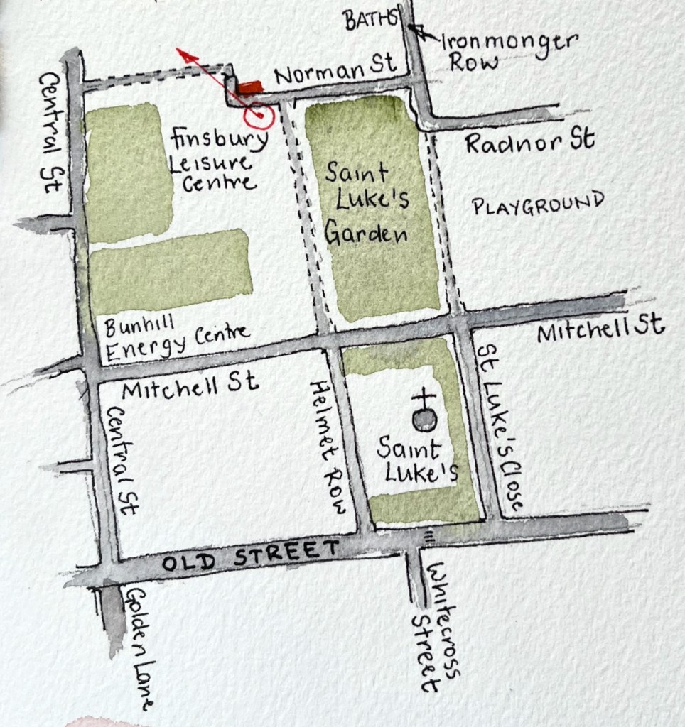
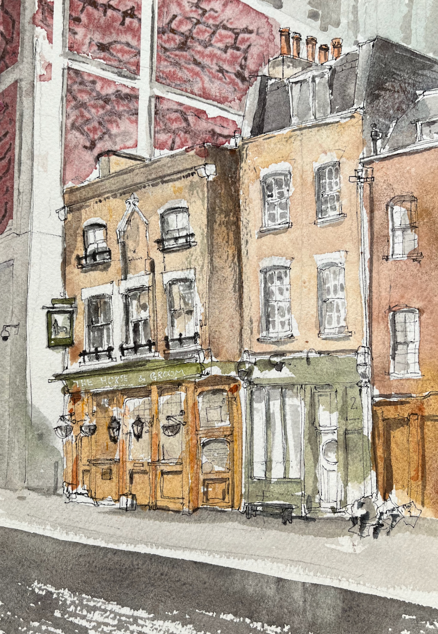
The Horse & Groom pub is on Curtain Road in Shoreditch.

The Horse & Groom, EC2. 10″ x 7″ in Sketchbook 12. Friday 10 June 2022 12:05

The Horse and Groom describes itself on its website :

Since opening our doors in 2007 the Horse and Groom has grown to be one of East London’s best loved pubs. Recognised as the original entrance for Shakespeare’s Curtain Theatre, in 2012 we were protected as a venue and we look to keep Shoreditch drinking and dancing for a long time yet

TheHorseandGroom.net

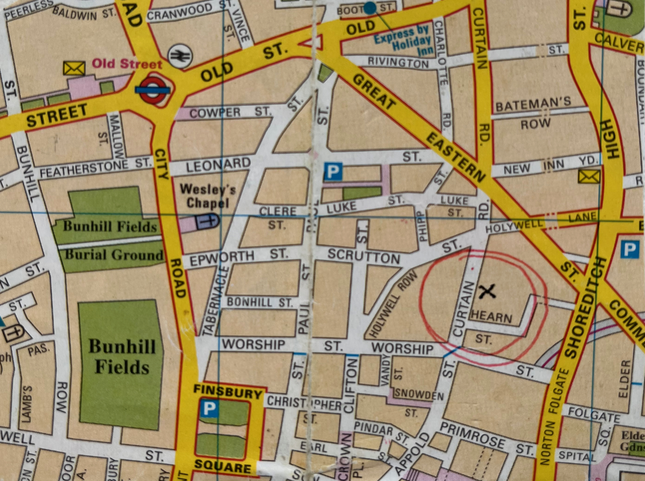
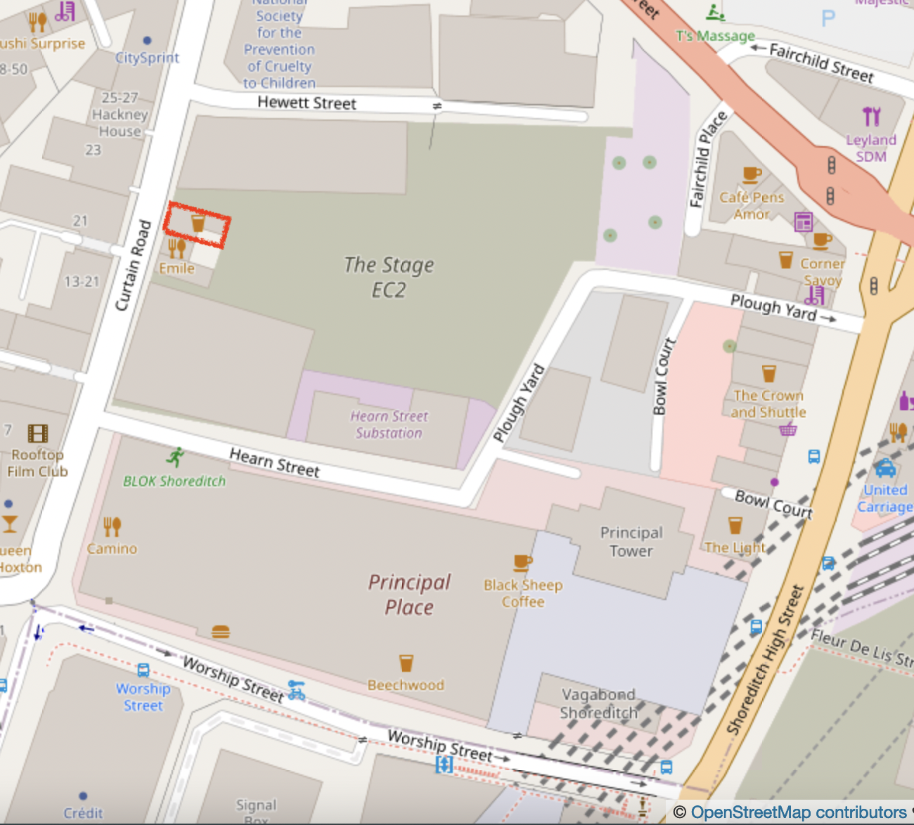
The reason why the pub’s future might need to be mentioned is clear from the modern map. As you see from the 2022 street map, the pub and its neighbours are surrounded on three sides by a huge office and residential development “The Stage”.

The Horse & Groom (left) and its neighbours are surrounded by new build.

The pub not only survives, it thrives. Squaremeal.co.uk, a review site, says “The rickety Georgian boozer’s twin dance floors get hectic and steamy at weekends, when house, funk, and rare garage rule….”

Sketching in Curtain Road

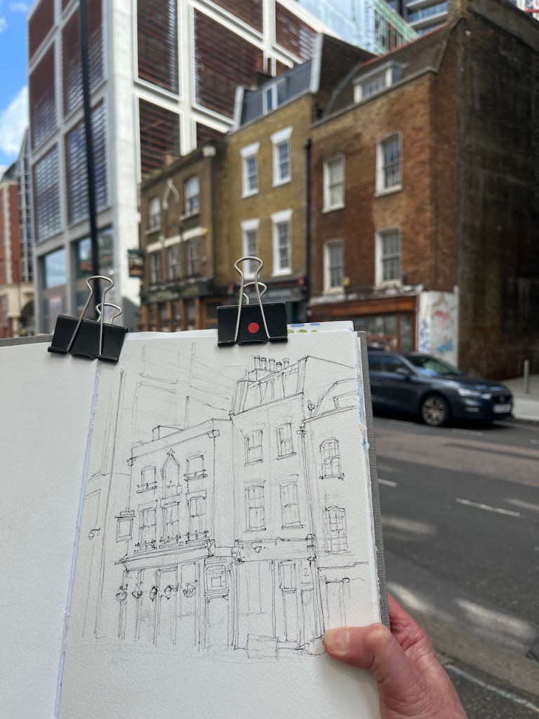
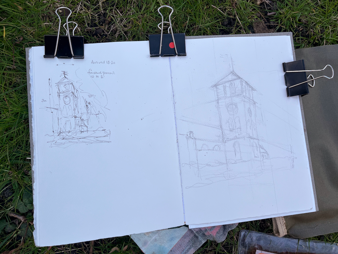
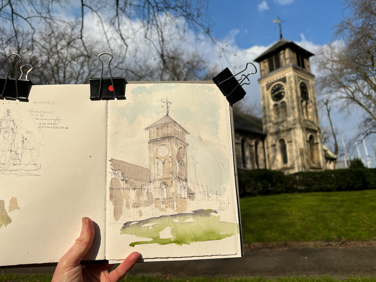
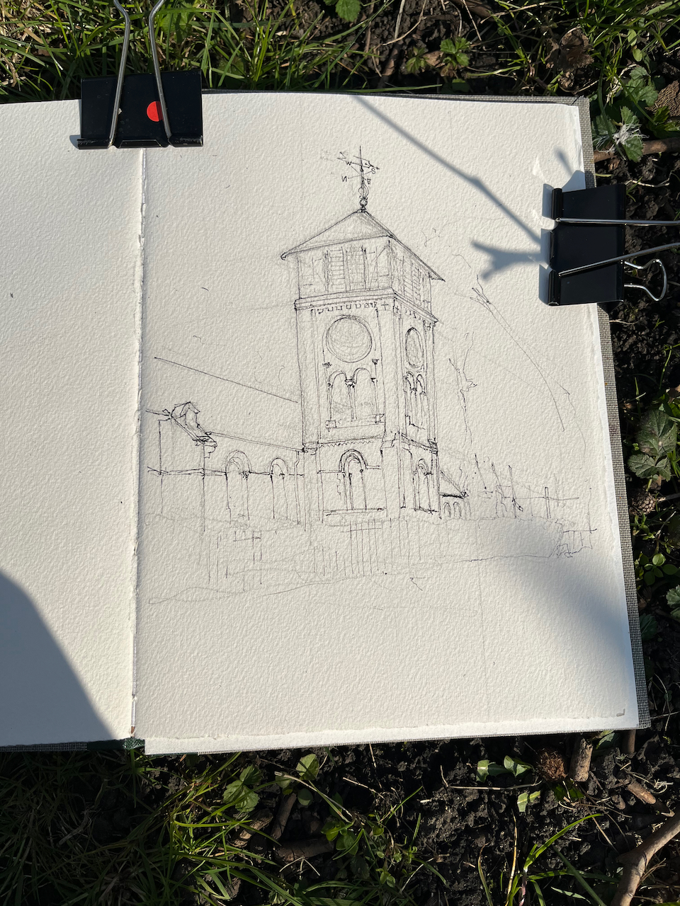
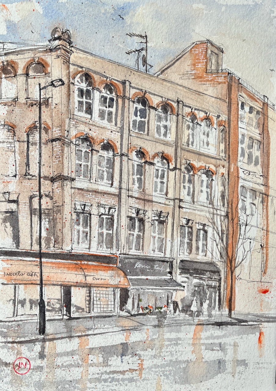
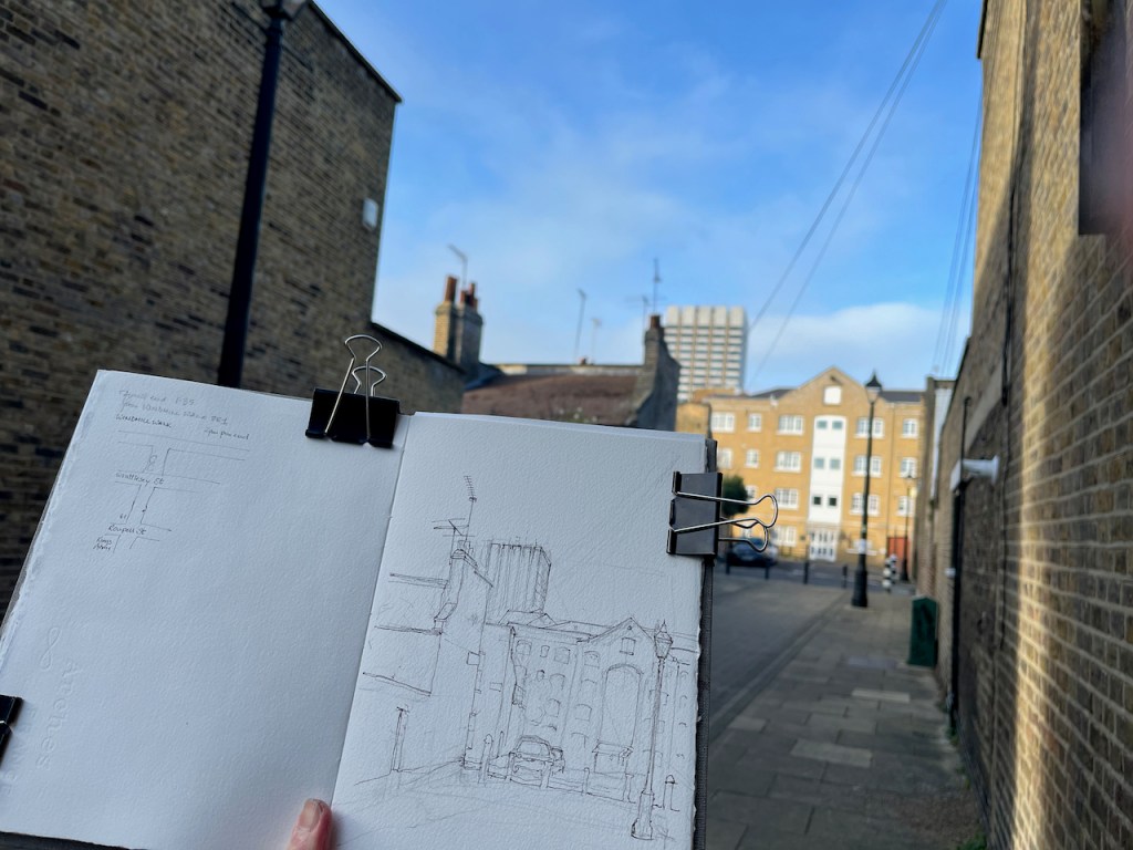
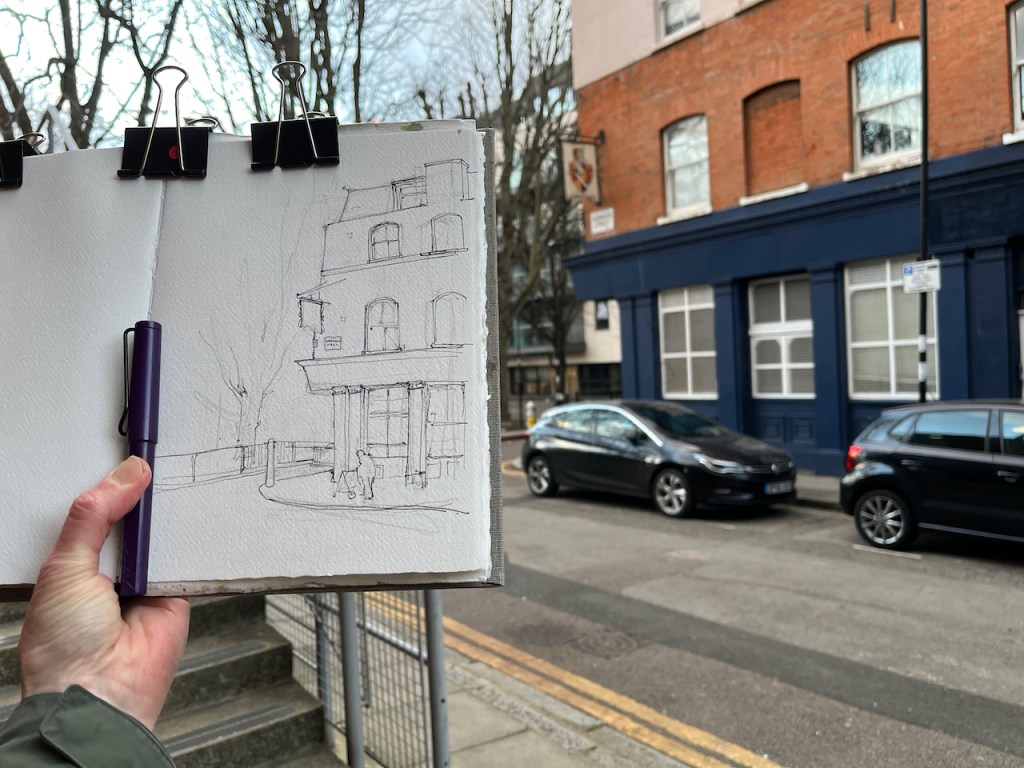
I sketched The Horse & Groom standing in Curtain Road. At first I had a clear view, but cars gradually arrived, and vans, and delivery vehicles. I finished the drawing at my desk.

The pub is number 28. The building next door, number 26, is, or was, “Cincinnati Chilibomb”. One of the vans that arrived discharged a consignment of building materials. Construction workers started shifting tools and materials into number 26. So maybe there will be a change of use.

The building next to that, on the right of my drawing, must be number 24. Numbers 24 and 26 are listed, Grade II, Listing NGR: TQ3326982177. I cannot find any listing for the pub.

No 24: early C18, 3 storeys and attic, 2 windows. Rounded gambrel roof, tiled, with dormer. Painted brick with parapet front. Gauged segmental arches to later sash windows. Early-mid C18 shop front, with slightly altered glazing, on ground floor. No 26: house of early C19 appearance, possibly with older core, 3 storeys and attic, 2 windows. Stock brick with parapet, slated mansard with dormer, Gauged near-flat brick arches to modern plate glass windows. Ground floor mid-late C19 shop front.

Historic England listing

Number 24 is a fascinating building. What will happen to it? Currently it is gradually falling derelict:

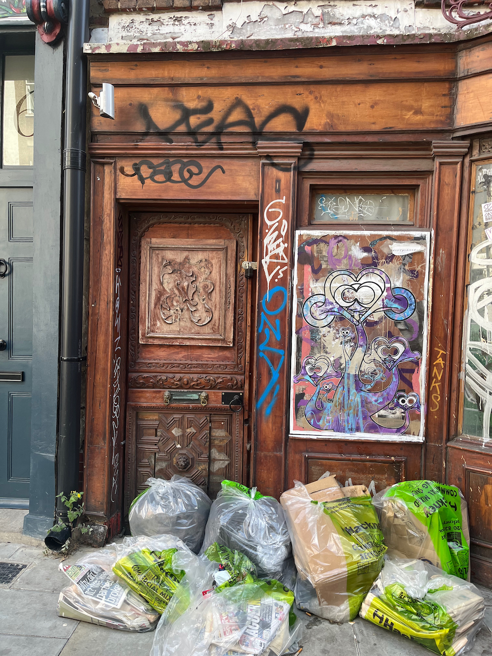
Click and enlarge the pictures to appreciate the amazing carved woodwork on the door.

The huge buildings behind are described on the website for “The Stage”. The development has “over an acre of public space and landscape gardens surrounded by luxury apartments, cutting edge office space and prime retail…”

London is certainly a city of contrasts.

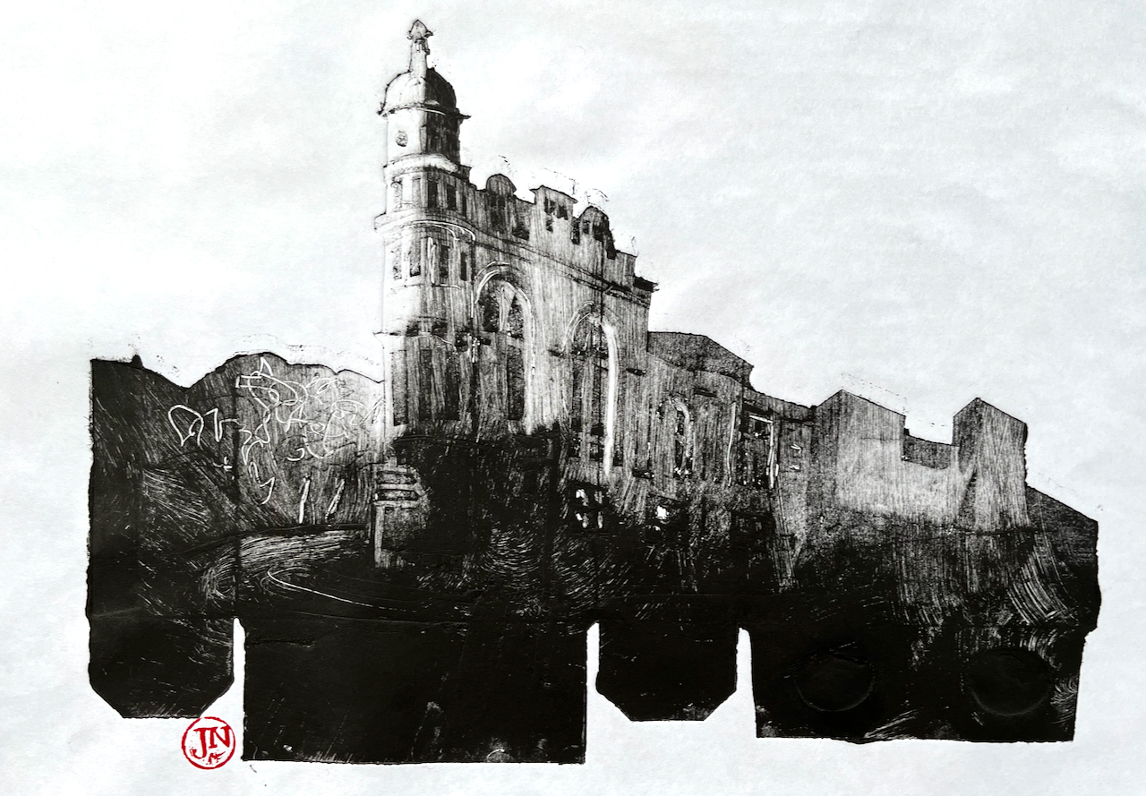
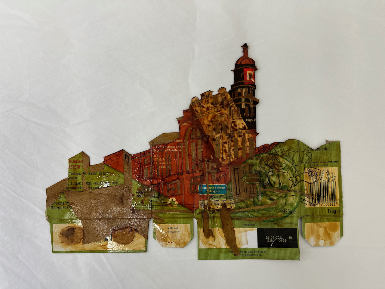
Here you can see the pen-and-ink drawing and the colour side-by-side:

pages in Sketchbook 12

The Artillery Arms EC1

Here is The Artillery Arms, a local pub, on Bunhill Row, London EC1

The Artillery Arms EC1, 10″ x 7″ in Sketchbook 12, 30th May 2022

I sketched this standing outside the fence which surrounds Bunhill fields.

The Artillery Arms is near the Honourable Artillery Company. The Honourable Artillery Company is a regiment of the Army Reserve, and has occupied its current location since 1641, according to their website. It is very active: helicopters land there. Every so often there is a firework display which we can hear from our flat. At least I hope it is a firework display, and not the firing of actual artillery.

The pub is more recent. Up to at least 1852 it was known as the “Blue Anchor”, and became “The Artillery Arms” sometime before 1856 [1].

Here are some photos showing work in progress on the drawing:

I have sketched several other pubs in the area and further afield. Here is a collection:

The Crown Tavern EC1

Here is The Crown Tavern in Clerkenwell Green. The pub frontage dates from 1900, according to the historic buildings listing1. The building is Grade II listed. There has been a pub here for…

Keep reading

The Fox and Anchor EC1

I set off on a warm afternoon intending to sketch a pub in Clerkenwell Green. On the way there, I walked along the north side of Smithfield. Down a side street I spotted…

Keep reading

The Horseshoe, Clerkenwell

Here is The Horseshoe, in Clerkenwell Close. I enjoyed the way the pub is slotted into that corner space, amongst the taller buildings. The building behind it looks as though it might be…

Keep reading

The Old Red Cow, from Cloth Fair

Here is a view of the pub “The Old Red Cow”, seen from Cloth Fair. The front of the pub is on Long Lane. When CrossRail opens, it will be very well placed…

Keep reading

Rose and Crown, SE1

Here is the Rose and Crown, just south of Blackfriars Bridge. This pub stands amongst modern blocks: linking past, present and future in a swirling area of change. Behind the pub, unexpectedly, is…

Keep reading

The Palm Tree, E3

Here is “The Palm Tree” pub, seen from the south. I have often puzzled about this pub. I pass it as I’m cycling or running on the Regent’s Canal towpath. It stands alone,…

Keep reading

The Eagle, 2 Shepherdess Walk

Here is The Eagle. This is a very old pub, located at a significant junction on City Road. In the picture above, the alley on the right of the pub is called “Shepherdess…

Keep reading

Note 1: Change of name of “The Artillery Arms”: https://pubwiki.co.uk/LondonPubs/StLuke/ArtilleryArms.shtml

3-5 St John Street – William Harris

These glorious buildings are at the south end of St John’s Street. This is the view looking north from the Smithfield Meat Market, Central Avenue.

3-5 St John St EC1, 18th March 2022 3:30pm, in Sketchbook 11

It’s a busy corner. I tried to show some the street life: couriers cycling, people sitting at the café, and people, like me, standing and looking. A little further up St John Street, on the right, is construction work.

There was a blue sky as I drew. But do not be deceived: it was cold, as you see from the person on the right, hunched under their coat.

Here is a work-in-progress photo and a map:

This is an ornate buildings: lots of fluting and complicated brickwork. Who thought all that was a good idea? Who could afford it? Number 1, on the left, slightly more restrained, was built for a Frederick Goodspeed, a grocer, in the mid 1880s. The architect was S.C. Aubrey. (reference 1 below)

Numbers 3-5, the building on the corner, has chimneys with all kinds of complicated brickwork, and a highly decorative frontage onto Smithfield. It was built in 1897 for William Harris, the “Sausage King”. He was a sausage manufacturer, and proprietor of a chain of restaurants specialising in sausage and mash. Mr Harris was evidently quite a character. He named all his three sons William, and all his four daughters Elizabeth (reference 2 below). This may have had practical problems, but it meant he and his sons could have fun with the Magistrates:

Woolwich Gazette – Friday 10 November 1905 from “https://www.britishnewspaperarchive.co.uk”

The “Sausage King” was somewhat eccentric, but this was to a large extent due to his love of “personal advertising,” which was his motto for business success. At all times of the day he wore a sort of evening dress, with an opera hat, and a blazing diamond in his white shirt, even when buying in the market, and he used not a scrap of writing or wrapping paper that did not bear his photograph. His trade mark, which he registered about forty years ago, depicts him winning the “Pork Sausage Derby” on a fat porker. His principal catch-phrase was “Harris’s sausages are the best,” and it spread the fame of his sausages all over the world. He also composed a lot of poetic advertisements, which caused much amusement.

This snippet from “London Standard, via the Montreal Gazette, 3 May 1912” reporting his death (reference 2).

He died in April 1912, leaving a considerable fortune. His death was reported far and wide, including papers in many parts of England and Ireland.

London Evening Standard – Thursday 06 June 1912 from “https://www.britishnewspaperarchive.co.uk”.

Note the reference to “William Harris No. 2”, that is, his second son, to whom he left all his property. I wonder what all the other sons thought – and the four daughters?

I am glad that the flamboyant house of this extraordinary man still stands. The architect was Francis John Hames, who also designed Leicester Town Hall. So you see what kind of league Mr Harris was in.

Reference 1: Thanks to British History Online who alerted me to The Sausage King: ‘St John Street: Introduction; west side’, in Survey of London: Volume 46, South and East Clerkenwell, ed. Philip Temple (London, 2008), pp. 203-221. British History Online http://www.british-history.ac.uk/survey-london/vol46/pp203-221 [accessed 8 April 2022].

Reference 2: The piece from the Montreal Gazette is online at https://charlespearce.org/people/william-harris.html

I have drawn extensively in this area, both in St John St and around the meat market.

Here are my drawings of and around Smithfield meat market:

Bristol – Jacobs Wells Road Dance Centre and former baths

Here is the Bristol Community Dance Centre on the Jacobs Wells Road.

Bristol Community Dance Centre, Jacobs Wells Road. 12:15, 23rd March 2022 in Sketchbook 11

This is building is special for me. Here I learned how to stand up straight, and I learned where my feet were. Or rather, I learned how to learn those physical things, or I learned that they could be learned. My teacher was a dancer, Helen Roberts.

Earlier on, many years previously, in another town, in a different life, I had been to a performance by London Contemporary Dance Theatre. There I saw, for the first time, movement as language. The way I described it to myself was: “First they teach you a language, then they talk to you in it.” That, for me, was Contemporary Dance. Once I’d seen it, I wanted to do it.

Life events unfolded and I was in another town, another life. And still, the idea of Contemporary Dance remained. Searching through printed events listings, in fuzzy type on thin paper, I found a Contemporary Dance class, for beginners. It was in Bristol, half an hour’s train journey from Bath, where I was living. So I turned up to this building, with shoulders hunched from stress and aching from desk work, and body strong from running and swimming, but uncoordinated. Without ceremony or introduction, the class started. This was the early 1980s.

I kept on with the beginners’ class, for years. It didn’t get any easier, but I felt that I was learning something. Recently I found a word for what I was learning: kinaesthesia, awareness of where my hands and feet are.

Helen Roberts was up at the front, calmly demonstrating the movements. Sometimes there was recorded music, once or twice a drummer. Sometimes she simply counted or sung a rhythmic click-type song. I copied the movements as best I could, and tried to follow her directions. Arms up, arms wide. “Arms wide” she repeated, with a bit of a glance my way. I was concentrating. My arms are wide. “My arms are wide” I said to myself, “just like Helen’s!”.

“Look at your shadow” suggested Helen, gently. There weren’t any mirrors. I looked at my shadow and I saw me. Rather than ‘soaring bird’, I was ‘drooping tree’. I lifted up my arms. It felt far too high, far too difficult. And that was the beginning. Holding your arms out wide is hard, it takes practice, it takes proprioception, which (I now know) is the sense of where your limbs are in space. It can be learnt, improved, refined, made easier, made more intuitive. I’m still learning.

I learned what it feels like to stand up straight, to line up my spine, to tauten my legs. I learned to “uncurl” from a deep fold into this upright standing position. It’s a pleasant feeling. We did it again and again in this beginners’ class. I did it again and again also outside the class, and it helped me: movement as medicine.

Life moved on again, another town, a different life, moving from place to place.
Now it’s 35 years later. I’m getting older and need to stretch stiffening muscles, aching joints. I have a sequence of exercises given to me by an NHS physio after an injury. In the sequence was that very same uncurling exercise: medicine as dance. With the remembered movement came Helen Roberts’ voice, instructing me, encouraging me.

I incorporate several more of Helen Roberts’ movements into my routine now. I reach upwards, the energy “flowing along the arm and out of the fingertips” as she described all those years ago. Although I don’t know quite what that means, I find it makes a difference to think of it that way: a static movement made dynamic.

I hold my arms out wide, and catch a glimpse of my shadow. I check that my arms are really out there, in the widest possible preparation for an embrace. Even if I don’t do it perfectly, I know now how to learn. I know there is something there to learn, even in this simple movement. And I do it again, and again, with more knowledge, more awareness. It is strangely satisfying.

Helen Roberts – if you are reading this, thank you!

Here are some photos of the dance centre now, and work in progress on the drawing. It seems that the dance centre is closed. It looked closed when I saw it.

Here’s a map:

Sketch map of Bristol Harbour area showing the Jacob Wells Road and sightline of the drawing.

Here is a 2012 video of Helen dancing and describing her work:
https://www.youtube.com/watch?v=TJxSshFh6PM&ab_channel=JudithJarvisgyroscopic

St Pancras Old Church NW1

On a sunny day I went to draw a church tower in a country churchyard. The churchyard is near Kings Cross and the church tower is that of St Pancras Old Church.

St Pancras Old Church, tower. 20th March 2022 10″ x 7″ in Sketchbook 11

I sketched sitting on the grass beside the River Fleet, while the river flowed behind me, in my imagination.

It’s a real river though. These days it’s under St Pancras Way. But it used to flow by the church.

“St Pancras Old Church and churchyard in 1827. The River Fleet is in the foreground.” notice on the railings of the churchyard.

As you see from that picture, in 1827 the church looked very different. The south tower which I sketched is not as ancient as it looks. It was constructed in 1847 to the designs of A.D. Gough.

The church site itself is very ancient. According to the church website, this is one of the oldest sites of Christian worship in London, possibly dating back to the 4th century:

The suggestion that St Pancras Old Church dates back to Roman times has a long tradition, with most suggesting that it was founded in 313 or 314. Most churches in England named for the martyr St Pancras have, or may have, ancient origins, suggesting that veneration of the saint spread quickly after his death in 304.

https://stpancrasoldchurch.posp.co.uk/history/church-history/

Today it is an active church, and a music venue. The churchyard is a glorious green space, much used. Many people wandered past on the paths. No-one paid any attention to me drawing. The dogs did though. I was inspected and approved by each dog that went past.

Here is work in progress and a map (click to enlarge the image)

The Boston Arms – monoprint

The Boston Arms is in Tufnell Park, London, 178 Junction Road N19. I love the way this building presides over the junction.

Boston Arms monoprint 1, packaging print, paper size 21″ x 17″, on Shiramine Select Japanese paper

This is one of five prints I made with this plate made from a cardboard box of biscuits, experimenting with the “packaging print” technique.

The technique produces a twilight atmosphere, which I like very much, and seems suitable for a pub in winter. Here is a different print using the same plate.

Boston Arms monoprint 2, packaging print, paper size 14″ x 10″ Awagami Washi Masa Japanese paper

The Boston Arms is a Grade II listed building. The listing says “Dated 1899 in a panel on the Junction Road front. Designed by Thorpe and Furniss”, and goes on to describe its “Corinthian pilasters to the flat frontages, engaged Corinthian columns to the bow, all of black polished granite, supporting a fascia; scrolled pediments over former entrances with subsidiary pedimented panels between the scrolls,…”. It concludes on rather a flat note: “The interior has no original features of interest.”

It looks like a good pub. I’ve passed it lots of times, usually on an early-morning run, but I’ve never been inside.

Here is the map from the listing, showing the location:

Location of the Boston Arms (Historic England, listing)

Here is the plate from which I made the prints:

Print plate made from a soup carton
Boston Arms print, detail

39 Clerkenwell Road, EC1

Here is a row of shops on the Clerkenwell Road.

Roni’s Café, 39 Clerkenwell Road, 15th Feb 2022, 10″ x 8″ in Sketchbook 11

In the centre of the picture is Roni’s Café, where I sheltered to finish my drawing of 84 Clerkenwell Road.

My idea was to draw the view looking West along the Clerkenwell Road, from number 84. By the time I reached the spot, the rain was falling heavily. I spotted a large window. The people inside kindly agreed to host me for 45 minutes while I sketched my lines. Then I went out into the rain. I finished the picture at my desk.

Colours are: Ultramarine Blue, Burnt Umber, Transparent Pyrrol Orange.

Windmill Walk, SE1

Here is a view of the tower of former London Television Centre building, seen from Windmill Walk, off Roupell Street near Waterloo Station.

LWT Building from Windmill Walk, 7th Feb 2022, in sketchbook 11
Bollard with stars.

I enjoyed all the wires and aerials! The swooping wire from the top right is a telephone wire or electrical cable. It’s unusual to see them above ground in London. Note also the marvellous bollards, which are mentioned in the Conservation Area Statement (Note 1).

Here you see layers of London development. In the foreground is Windmill Walk, part of the Roupell Street residential area built around 1824, and still residential. The paler building in the mid-distance is on Theed Street. It is a converted factory. It now contains some residential properties which I found listed on a holiday lettings site, and some offices listed on an estate agents’ site. Different accounts list it as a Violin Factory and/or a “Komptulicon Works”. Komptulicon was a sort of floor covering made of cork and rubber.

On the skyline is the London Television Centre, 1972, which I have drawn previously:

London Television Centre SE1

Here is a view of the London Television Centre, 60-72 Upper Ground, SE1. It is on the South Bank of the river Thames, a little to the East of the National Theatre and the Royal Festival Hall. It was completed in 1972 to the design of…

Click to read more

Here are some maps and work in progress on the drawing:

A London Inheritance article provides a carefully researched and fascinating history of the area:

[Roupell] street was laid out and construction started around 1824….. Roupell had built the street for what were described as “artisan workers” and the 1841 census provides a view of the professions of what must have been some of the first people living in the street. This included; painters, labourers, clerks, printers, bakers, carpenters, bricklayers, compositors, paper hanger, hatter, an excise officer, lighterman, warehouseman – all the typical jobs that you expect to find in such a street in 1840s London.(A London Inheritance)

Note 1: Conservation Area Statement

“Roupell Street Conservation Area” statement by Lambeth Council, 2007, describes the streets and details what can and cannot be done in modifications to the houses. It also mentions the “Komptulicon Works”, north of Windmill Walk.

Langton Arms, Norman St, EC1

In the late afternoon, I walked round a corner near St Luke’s, and noticed the pub sign.

Langton Arms, Norman Street, EC1 sketched 29 Jan 2022, 4:15pm, in Sketchbook 11

The pub closed sometime around 1989, according to https://pubwiki.co.uk. It is now residential flats.

The pub was in existence in 1842, according to “closedpubs.co.uk”. There was a nearby Langton Street, shown on a map from the British Library dated 1901. The Langton Arms is marked “PH”.

1901 map. Langton Arms circled. Insurance Plan of London North District Vol. D: sheet 17 (British Library) Shelf mark: Maps 145.b.23.(.d)

See how dense the housing was in this area in 1901. Here is the same area today. Langton Street has disappeared.

Norman Street area, 2022 (c) Open StreetMap, Langton Arms circled
Pub sign today

I sketched the closed-down pub at around 4:30pm, as the light faded. The pub sign is still there, but eaten away at the lower edge now. The street sign “Norman Street” is the same one as shown in a photo from 1958. It has “Borough of Finsbury” written above the street name. The Borough of Finsbury was absorbed into Islington in 1965.

This picture is a story of vanishing: vanishing street, eaten away pub sign, closed down pub, a missing borough, sun setting in January. Behind me as I sketched I could hear the squeak of gym shoes on hard floors, the other side of the closed steel doors to Finsbury Leisure Centre.

St Monica’s Church, Hoxton N1

On a cold day, suddenly the sun came out and lit up the stone of St Monica’s Church.

Bell tower of St Monica’s Church, Hoxton Square. 26th January 2022, 13:40 in Sketchbook 11

This church was built in 1866, to the design of E.W. Pugin. It was part of the Augustinian Priory on this side of Hoxton Square.

E.W. Pugin (1834-75) is the son of A.W. Pugin, who collaborated with Charles Barry on the design of the Houses of Parliament. E.W. Pugin designed a large number of churches, 60 English churches are listed in his Wikipedia entry, with another 6 or so in Wales and Scotland and 16 in Ireland.