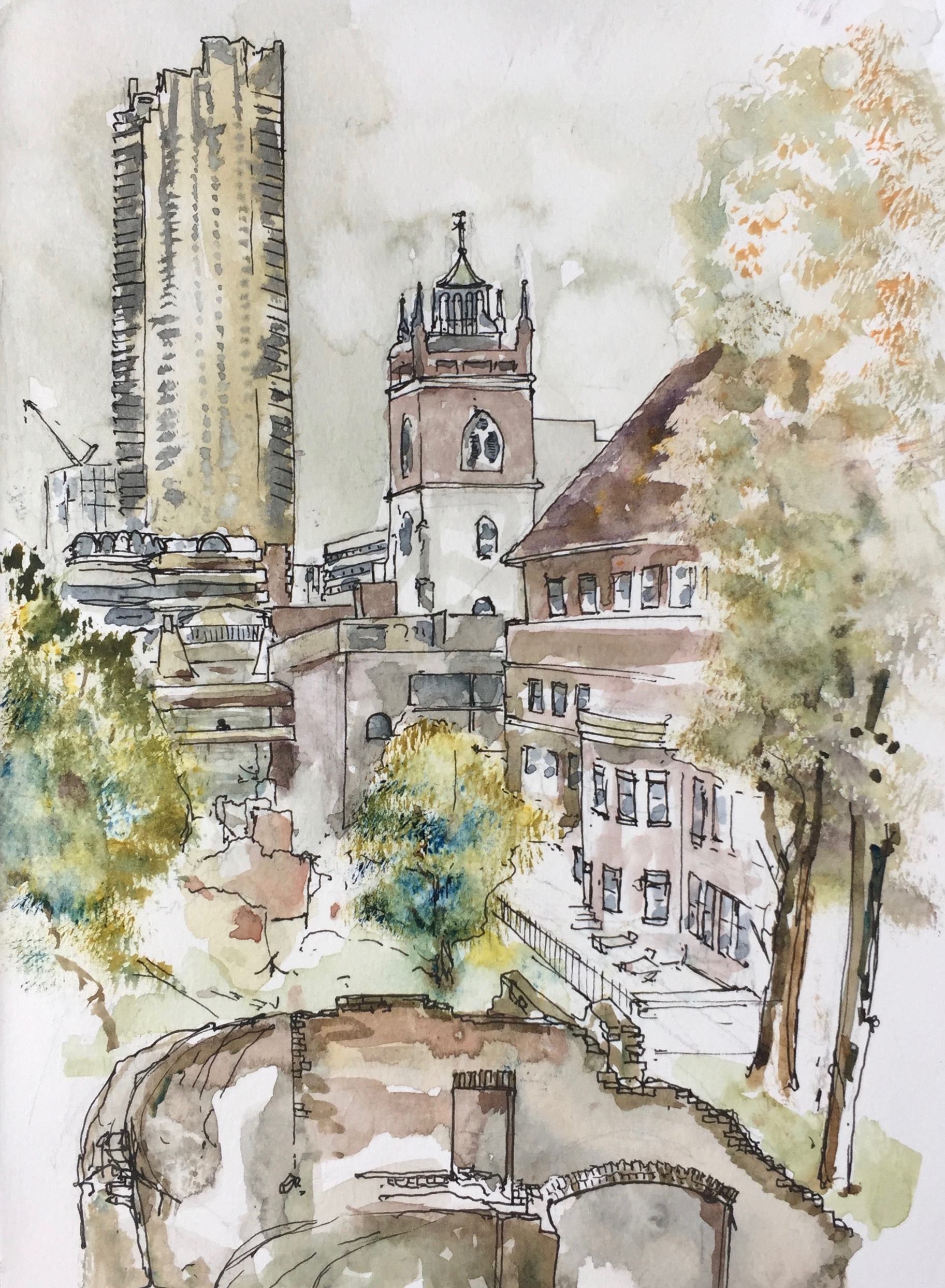
Here is a sketch from a staircase from the Barbican Podium, just outside the Dentists but just inside the old London Wall.
Parts of the Roman London Wall are in the foreground, 2nd century AD.
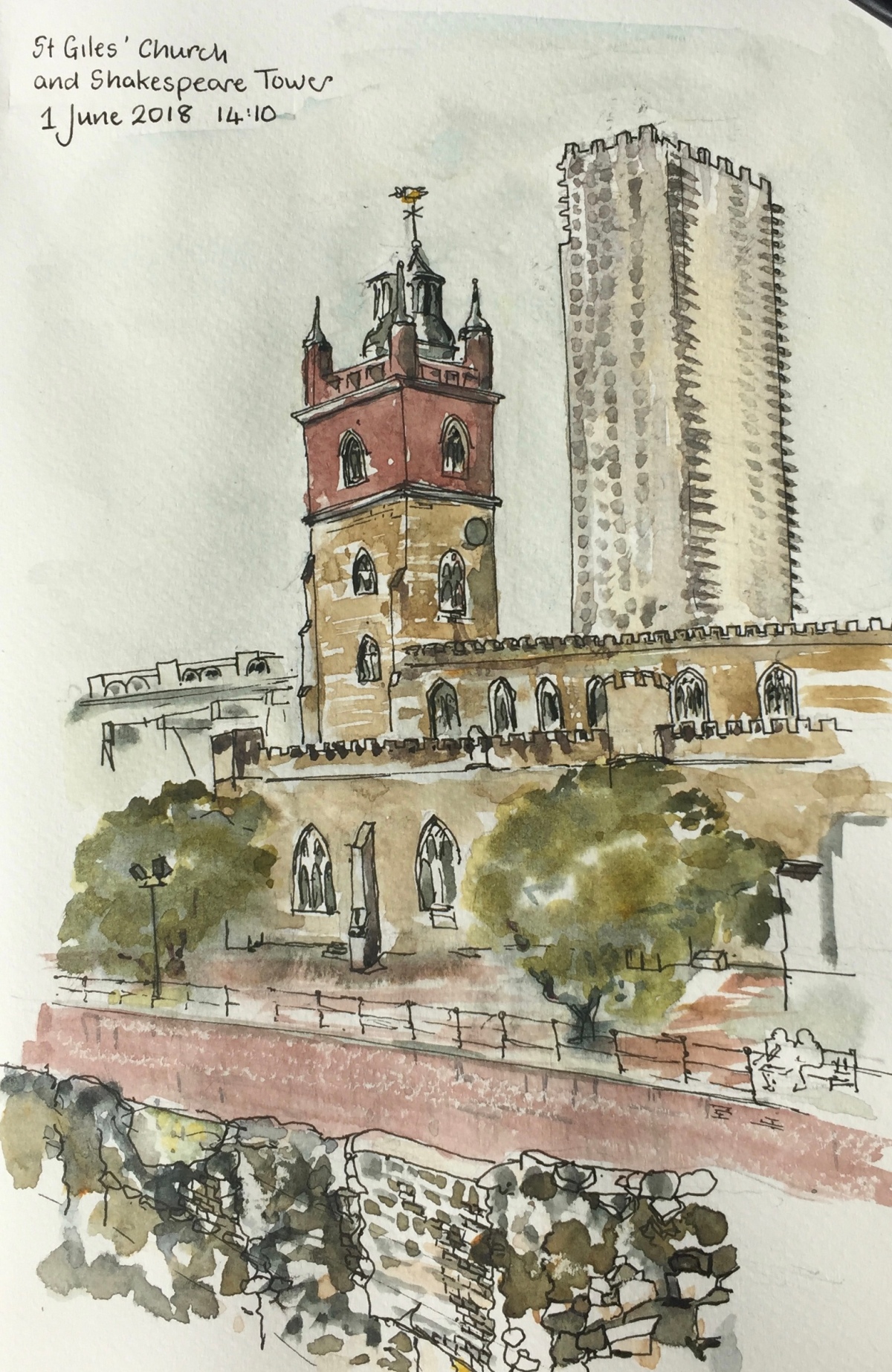
St Giles’ has Roman foundations and is much rebuilt. The church we see now is the 1966 restoration following designs of architect Godfrey Allen (1891-1986). He used historic plans to make the church as much as possible like the medeival original. It had been burned by incendiary bombs in 1940.
In the background is Shakespeare Tower, Barbican, completed 1976, to the designs of Chamberlain, Powell and Bonn.
St Giles’ Church is “St Giles’-without-Cripplegate”. As you can see from the picture, the Church is outside London Wall. Here is an extract from the St Giles’ website.
The foundations are generally Roman but higher up, the structure dates from various times as it was regularly strengthened and rebuilt…. As the population of the parish increased, the church was enlarged and it was rebuilt in the Perpendicular Gothic style in 1394, during the reign of Richard II. The stone tower was added in 1682. The church was damaged by fire on three occasions – in 1545, 1897 and 1940…The church was designated a Grade I listed building on 4 January 1950 and it was extensively restored in 1966.
…
The bombing of Cripplegate in 1940 was so extensive that barely any buildings remained standing in the entire ward. By 1951, only 48 people were registered as living within the ward. It was this widespread devastation which led to planners envisaging and eventually building the modern Barbican estate and arts centre, starting in 1965.
As I was drawing, I saw that the crenellations on St Giles were echoed high up on Shakespeare Tower.
The drawing took two hours, pen and wash, in a Jackson’s Watercolour Sketchbook.
At 27 stories, Peregrine House and Michael Cliffe House are the two tallest towers owned by Islington Council. This sketch shows Peregrine House, an Islington Council residential tower, visible from my window. It is on Hall St, just off the Goswell Road. The view is looking North towards Peregrine House. I was standing in the Kings Square Estate, another Islington Council Estate, next to Rahere House.
Peregrine House was finished in 1969. It is part of the City Road Estate, together with Kestrel Tower. I have drawn Kestrel Tower previously, see this link: Towers of Finsbury – Rahere and Kestrel. See the different brick colours on Peregrine Tower: the more yellow brick for most of the balconies, and the more red-coloured brick for the balconies across the top and around the sides.
The solid neo-Georgian block in front of Peregrine House is “Level 3 communications” a data centre and communications hub. In 2011 they applied to Islington Council for permission to install 5 steel flues. The permission was granted and the flues are on the back (north) of the building, not shown in the sketch. As part of the consideration of the permission, the building is described as “1930s”. I haven’t yet found out what it was before it was a data centre. It looks like a telephone exchange or electricity substation. (Update: 6 February 2019 – it was a Gordon’s Gin Factory – see comments below) I drew the back of this building in the Kestrel Tower sketch: Towers of Finsbury – Rahere and Kestrel
Photo from the Level 3 application to install satellite dishes. I think that’s Micheal Cliffe House in the distance.
Level 3 also applied for permission to install 4 satellite dishes on the south side of the building. The application is undated, and no indication is given of the outcome. This application was “retrospective”. Link to their application is here: Level 3 Application for Satellite Dishes
I was looking at the South face of the Level 3 building and I couldn’t see any satellite dishes.
In the foreground, right, of my sketch, is the blank end-wall of 6 Moreland Street, an Arhag Housing Association residential building, which looks like a late 1970s development.
The Kings Square Phase 2 development, picture from the Higgins Construction website. It’s a bit hard to tell, but I think that’s a similar sightline to the one in my sketch, with Peregrine House in the background. Picture credit: Pollard Thomas Edwards architects.
In the foreground on the left, work is in progress on “Kings Square Phase 2” which a hoarding informed me was “93 new homes”, which are “51 council homes and 42 for private ownership”. Completion is due in 2020, and they’ve already got the concrete frame up. The construction workers were working hard and calling to each other while I sketched, issuing instructions and shouting warnings in several languages, including English. The contract was awarded to Higgins Construction plc in February 2017: £30 million.
The sketch took 90 minutes: half an hour each for pencil, pen and watercolour. Done in Jackson Watercolour sketch book, 8 by 10 inches.
If the lighting looks flat and there is a complete absence of shadows, that’s because the lighting was flat and there was a complete absence of shadows. It was that kind of a day.
Later note:
I saw the satellite dishes on the Level 3 building, they are high up on the roof and not visible from ground level.
Here they are:
Sketch 28 May 2018, from my window.
Click a button below to share this post online, email it, or print it:
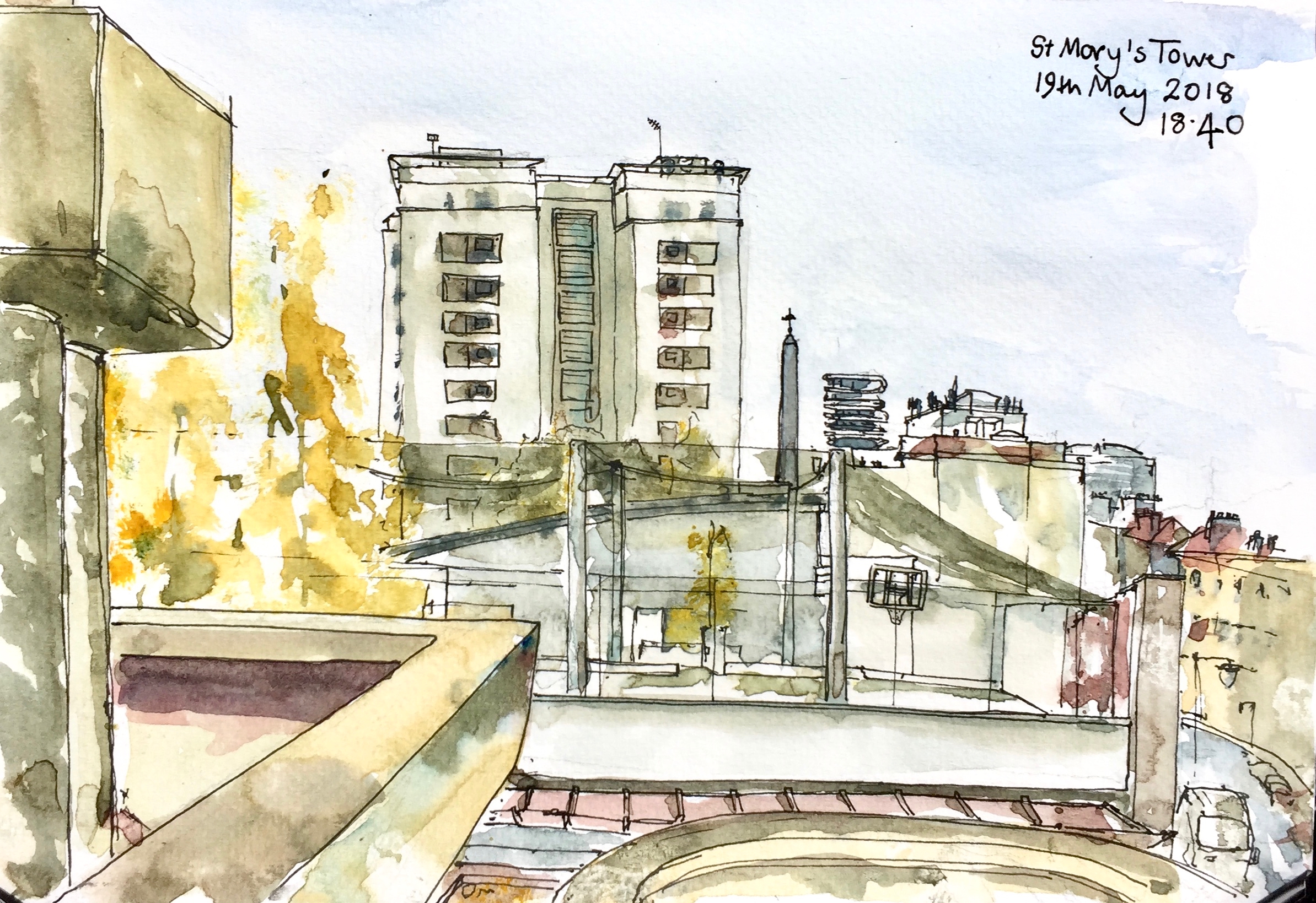
This sketch shows St Mary’s Tower, in the Roscoe Street Estate. Prior Weston School is in front, with its first floor playing pitches festooned in black net. The pinnacle of St Luke’s is just to the right of St Mary’s Tower, followed by “Cannaletto” the black and white striped modern tower block, then Coltash Court, the tower block at the north end of Whitecross Street . The south of Whitecross St is to the far right of the picture. The tower block in the background on the right is Godfrey House.
St Mary’s Tower was built on church land by the Peabody Trust. It was completed in 1957. The architect was John Grey and Partner.
St Mary’s Church was built in 1868, but was then demolished having been badly damaged in the Second World War.
The Tower now forms part of the Roscoe Street Estate, managed by Islington.
Sketched from the Barbican podium, in about 2 hours. A cool, sunny spring afternoon, with the wind curling the paper. Jackson’s watercolour sketchbook, 7 inches by 10 inches.
St Mary’s Tower features in my etching “Towers East”.
Click a button below to share this post online, email it, or print it:
On a lovely warm day I walked into the gardens of St Luke’s and drew a picture.
The red brick building is the Ironmonger Row Baths designed by AWS Cross, opened in 1931 as public baths (for washing – not swimming!) and laundry. They were needed because:
“The case seemed unarguable given the statistics presented by the new Baths and Washhouses Committee. Of 20,005 families in the borough, 4917 shared a single room and 7253 lived in two rooms. Of 12,000 dwellings, just 500 – only 4 per cent – had private baths.”
This was less than 90 years ago – my parents’ generation. The data is quoted by the wonderful website “Municipal Dreams” on the link below:
The Baths have recently (c. 2013) been refurbished and now have swimming pools and a spa and gym. They are still owned and run by the local authority, Islington.
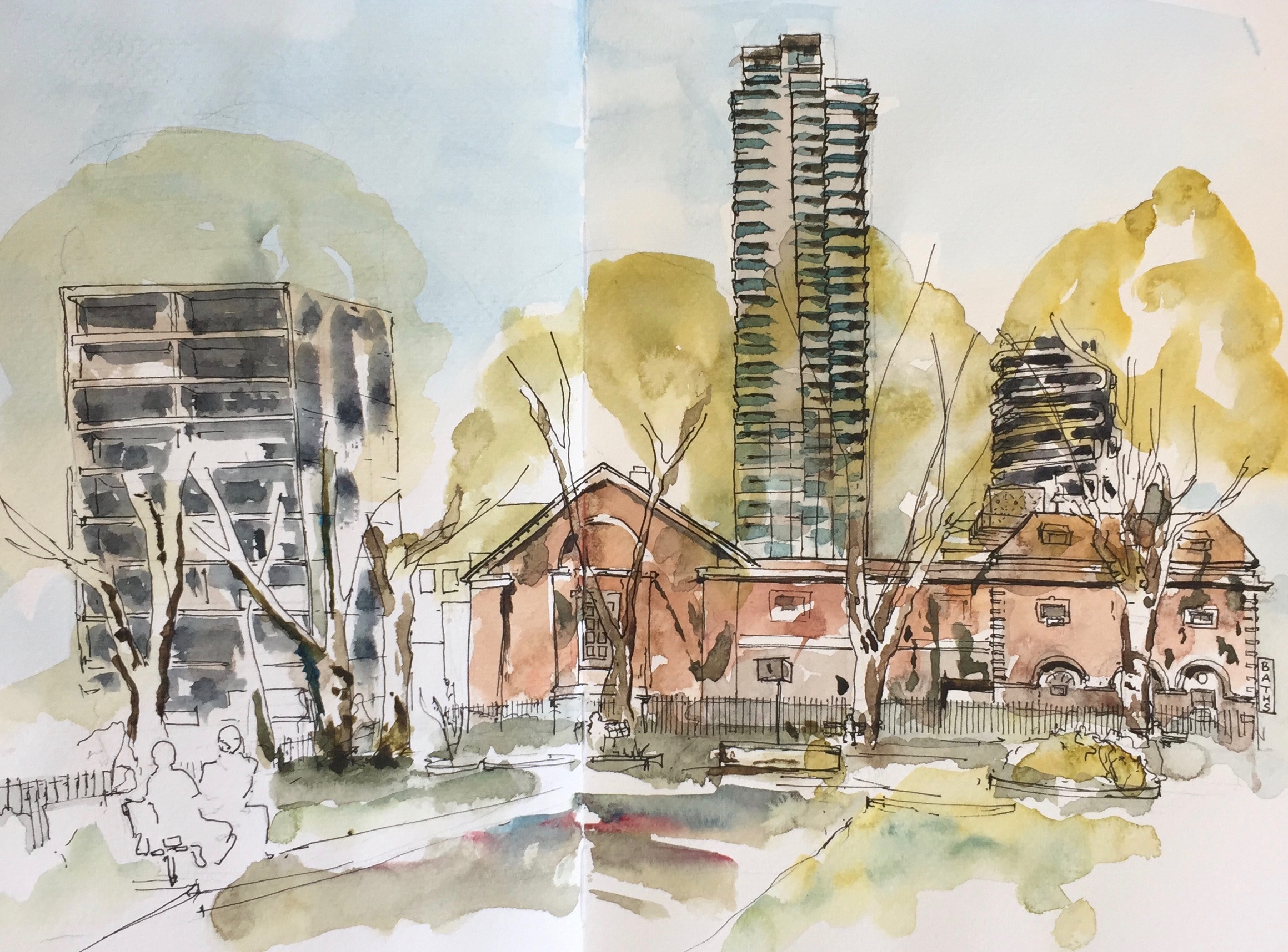
The tall tower is the 42-storey Carrara Tower of the 250 City Road development, by Foster + Partners, under construction.
The shorter tower at the back on the right is Canaletto, which must be one of the hardest towers in London to draw. Those weird curved structures defeat my sense of perspective. Perhaps that’s the idea.
This architectural masterpiece, created by internationally-acclaimed UNStudio, has set a new standard for residential developments in London. (CanalettoLondon.com)
The building on the left of the picture is Burnhill House, run by Keniston Housing Association. Residents here are running a campaign to try to moderate plans to redevelop Finsbury leisure centre, which is off to the left of my drawing, and in front their building. Their banners adorn their balconies.
Protest banners at Burnhill House. From Camden new Journal, September 2017.
I continue to work on my “Towers Project”. The idea is to document the towers of Finsbury, Islington and Camden, or at least the ones I can see from my window.
I did a “Skyline” previously which you can see on this link.
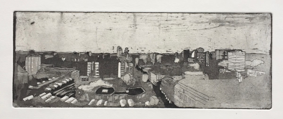
Here are two smaller etchings, Towers East and Towers West, both 10.5cm by 15cm. I finished Towers West yesterday.
Towers West
Towers East
These two together form a panorama. I used Towers East in a Chine Collé course. See this link.
The two prominent towers at the front are part of a Peabody Estate, the “Roscoe Estate” on Roscoe Street. The one on the left is “Peabody Tower” and the one on the right is “St Mary’s Tower”. The low house at the very front on the left is Fortune House, on Fortune Street. I have drawn Peabody Tower in an urban sketch, see this link.
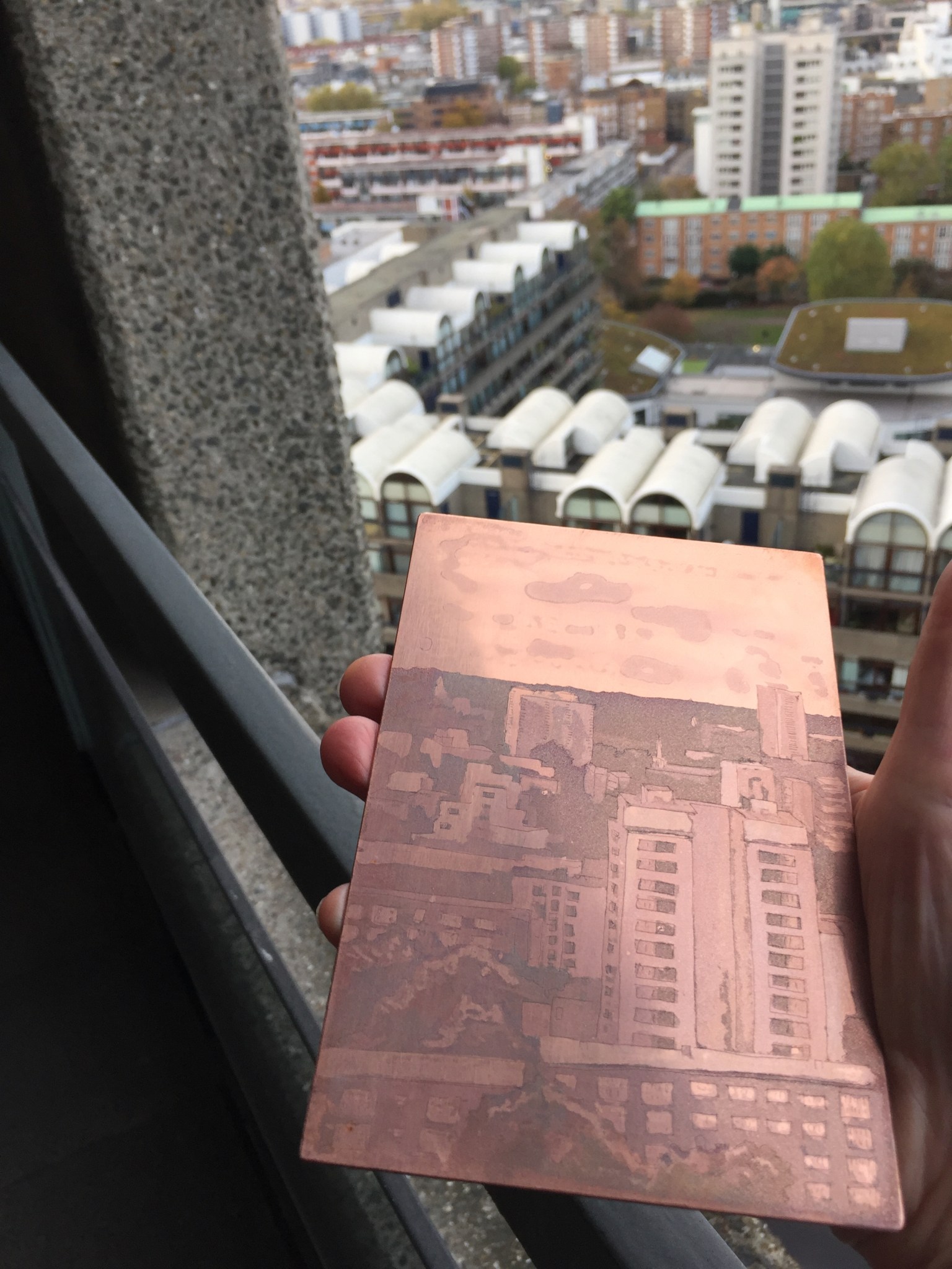
These etchings are aquatint on copper. Here is work in progress on “Towers West”.
Drawing “Towers West” on hard ground using an etching spike.
“Towers West” print: hard ground etching
I drew the picture in hard ground using an etching spike, then etched it in acid called “Edinburgh Etch” for 20minutes. The resulting print is shown above on the right.
Then I put resin dust, called Aquatint, on the plate, and set it with a gas burner. I paint varnish on top of the Aquatint, to make the shapes, then dip in acid, then paint more, then dip. Towers West is 6 dips. The sky is a technique called “spit bite”: I just paint the acid on, wait 20 seconds, and wash it off.
Here’s the copper plate for Towers West:
Towers West, copper plate
Click a button below to share this post online, email it, or print it:
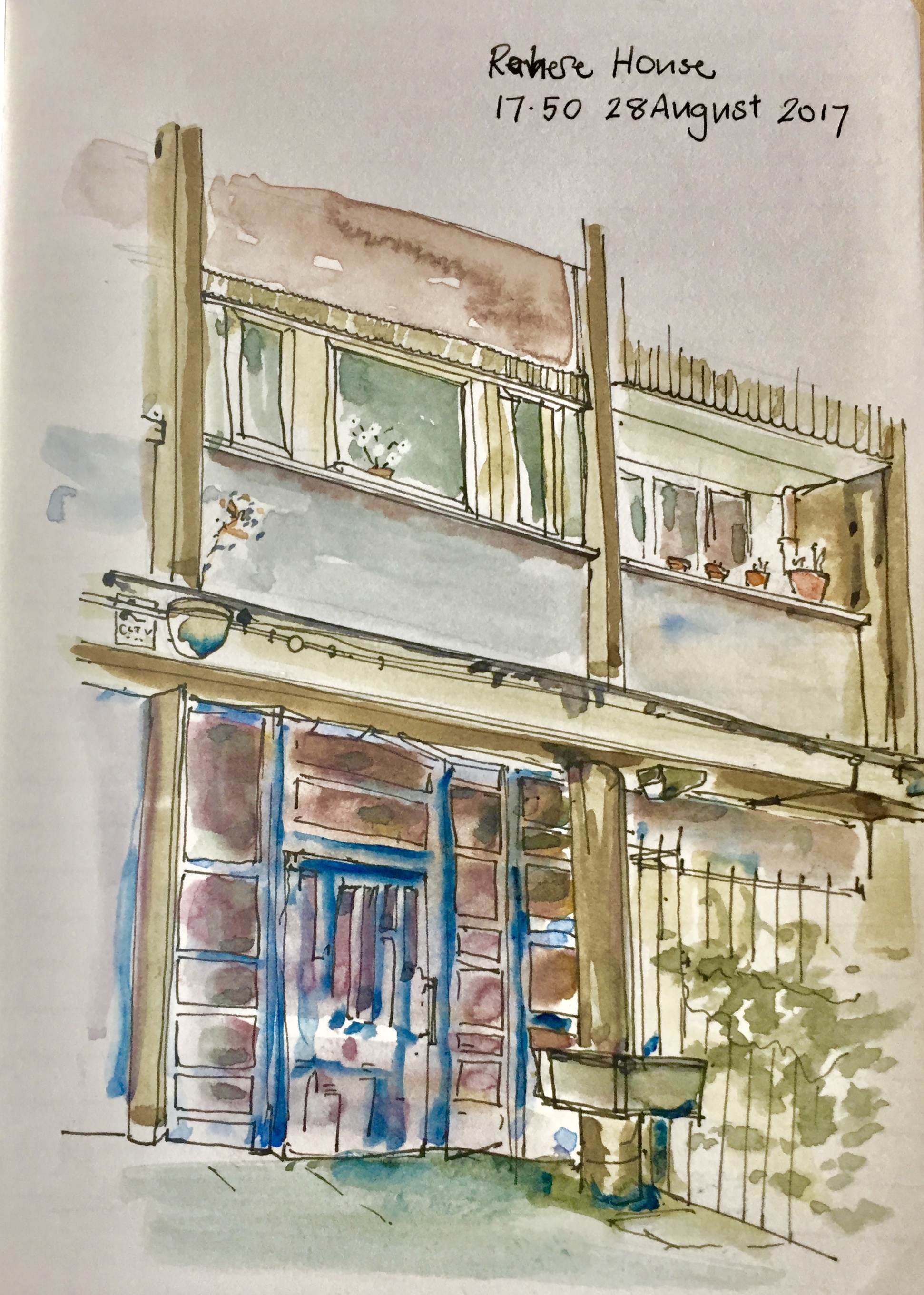
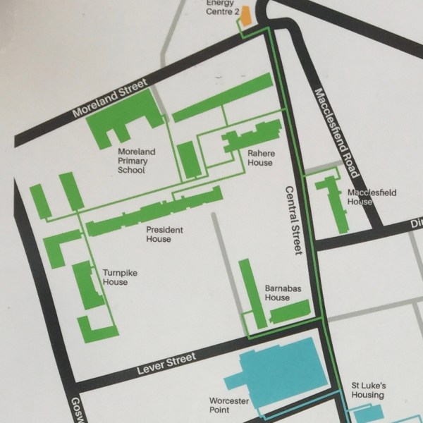
I have been trying to find good views of Rahere and Kestral Houses, two Towers of Finsbury which I can see from my window.
From “King Square Estate Regeneration, Summer 2015 Issue 4” by Islington Council.
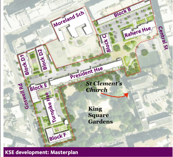
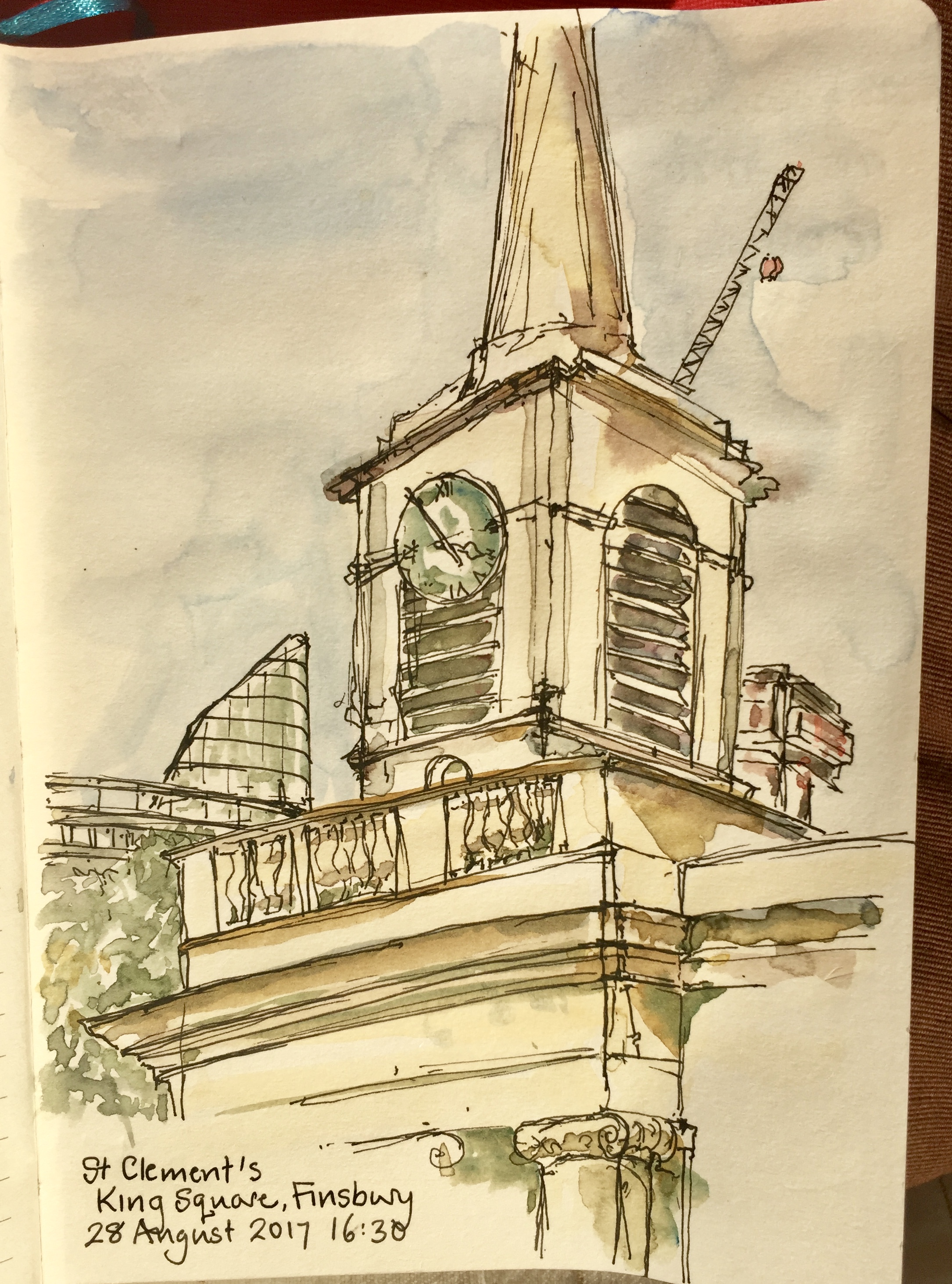
Rahere is in the King Square Estate. This estate was built by Islington Council in 1959-61. The architects were Emberton, Franck and Tardew. Franck had worked for Tecton, the firm who designed the Spa Green Estate. King Square Estate is currently subject of improvements including addition of new dwellings.In between all the blocks is St Clements Church.
Rahere House is just visible to the left. The new tower, Lexicon, is above it on the left. Carerra House, of the 250 City Road development, is under construction, visible to the right of the spire.
I couldn’t find a distant view of Rahere House, so here is a close-up.
This is one of the back doors. The architects thoughtfully provided lead-lined troughs, at waist height, for flower pots, I assume. One of these is shown in the drawing, to the right of the door. Off the picture to the left, these continue as long boxes, like water-troughs. None of them are used, presumably because the council don’t do flowers and the temptation for vandals is too great.
Instead, residents have their own plants, inside their windows and out on the balcony. See also the feral plant, growing out of the concrete above the door, top left.
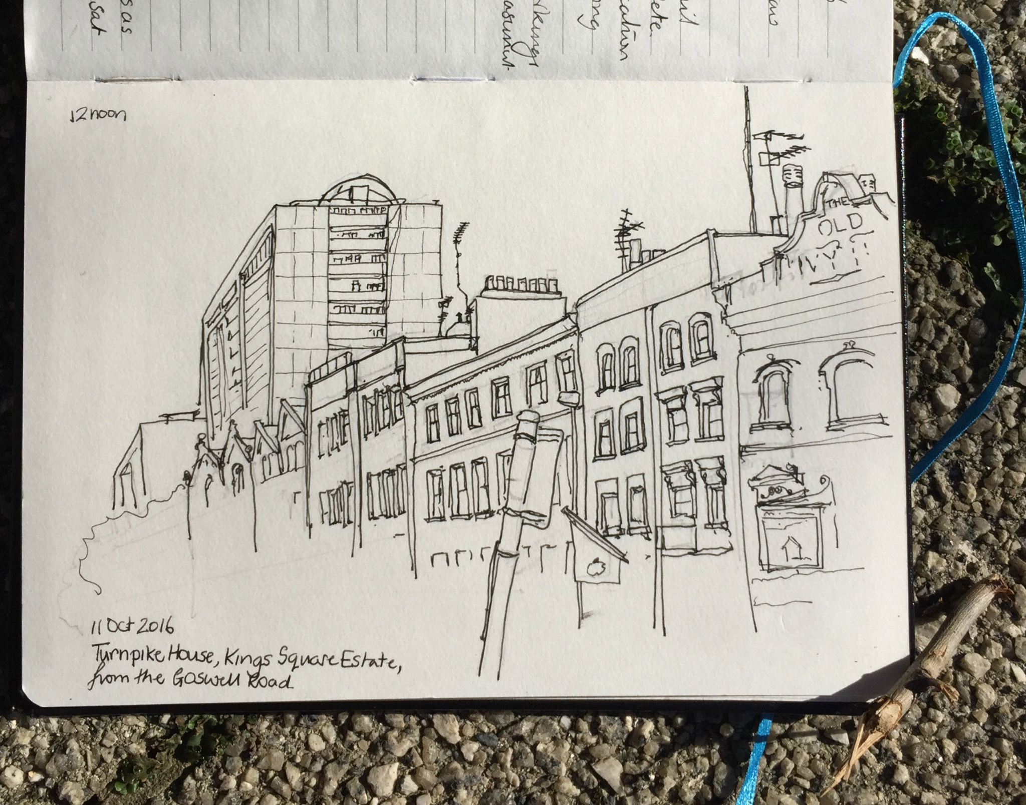
Turnpike House is on the same King Square estate. Turnpike I have drawn before.
Turnpike House, King Square Estate, from the Goswell Road
To the North of Rahere is Kestrel House. This tower is on Moreland Street and City Road. It is currently surrounded by building work associated with the Bunhill Heat and Power. This scheme takes energy from braking Tube trains and uses it to heat local houses and schools.
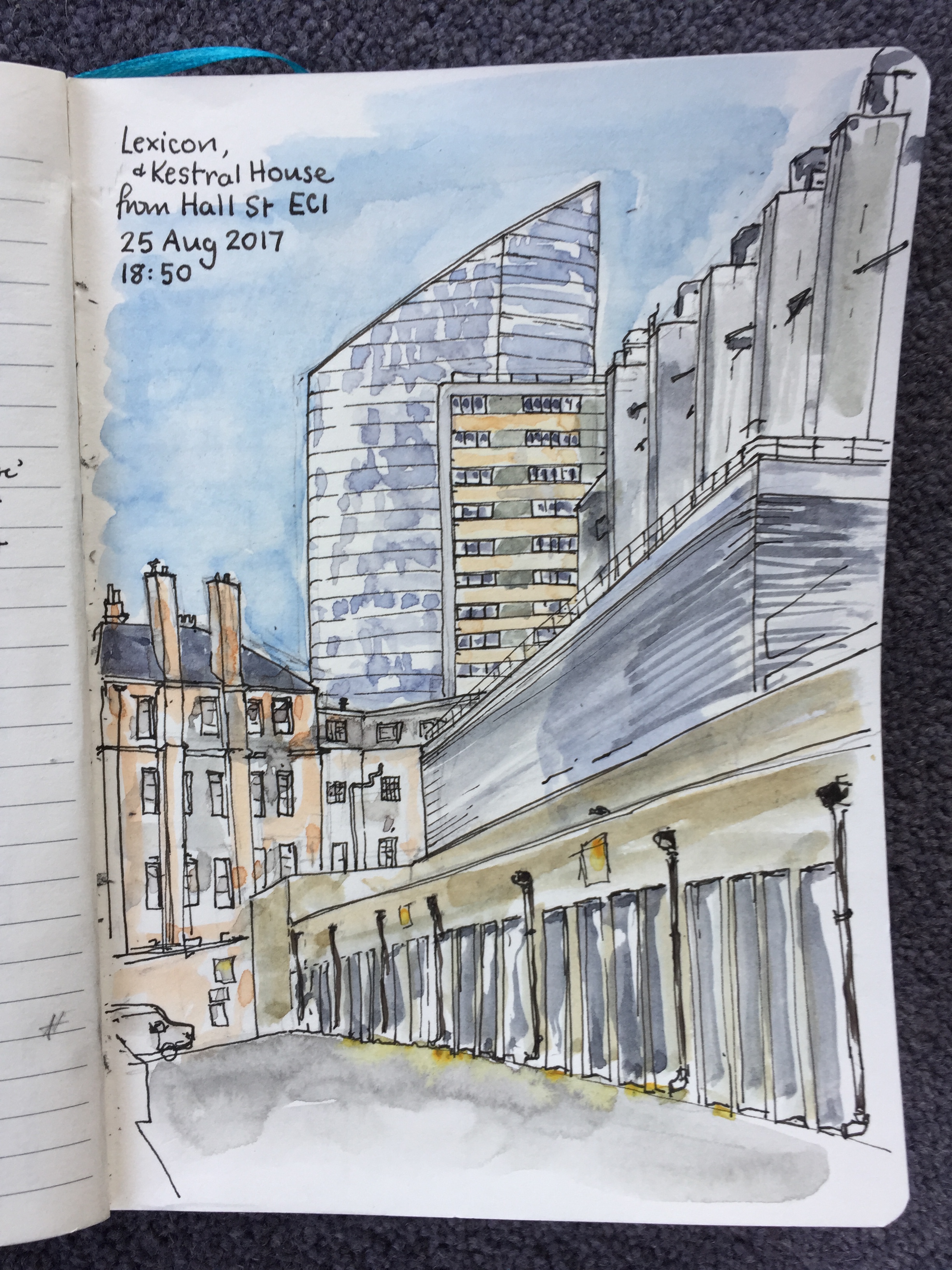
Kestrel House is on the “City Road Estate”. I found a view of of it from Hall Street: it’s the rectangular tower block in the middle. The Lexicon, otherwise known as “Chronicle Tower”, a new development by “Mount Anvil” is the sloping building behind.
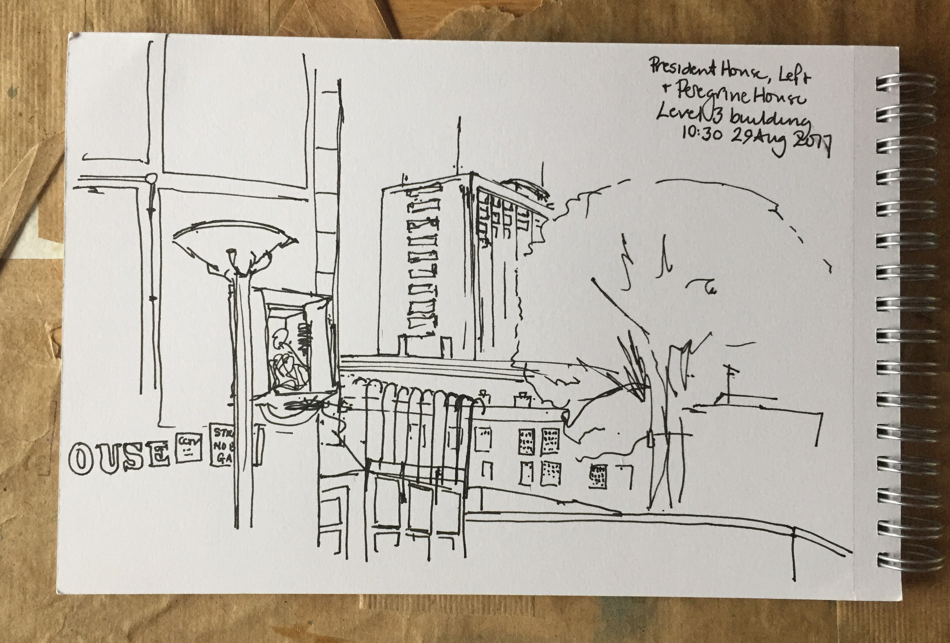
The building which dominates this drawing, on the right, is the premises of “Level(3)”. I walked round the block a couple of times to see what it was. The windows on the street side are high, and there are serious steel shutters over every entrance. Note the huge ventilation shafts. It looks somehow as though it’s ventilating a larger volume than the building, as though it goes down a number of stories below ground. The business of Level(3), according to a web search, is “Connecting and Protecting the Networked World”.
The red-brick building straight ahead was previously “St Marks Hospital Nurses Home”. This is cast into the stone work above a former door on Pickard Street. The door is no longer in use, and fenced off. “Founded 1835, Erected 1853”. The main entrance now is on City Road. It looks disused. Fallen leaves clutter the steps, the grass wafts unmown. But there is a car park, so perhaps there’s another entrance from there that I couldn’t see. It’s “300 City Road”, which appears online as Citidines Serviced apartments.
Behind me when I drew this was Peregrine House, another tower, very high.
Later I went back to try to get views of Peregrine House.
President House, left, Peregrine House, centre.
I forgot to take my drawing book.
I’ll have another go at these towers.
Buildings served by “Bunhill Heat and Power 2” – in green.
Click a button below to share this post online, email it, or print it:
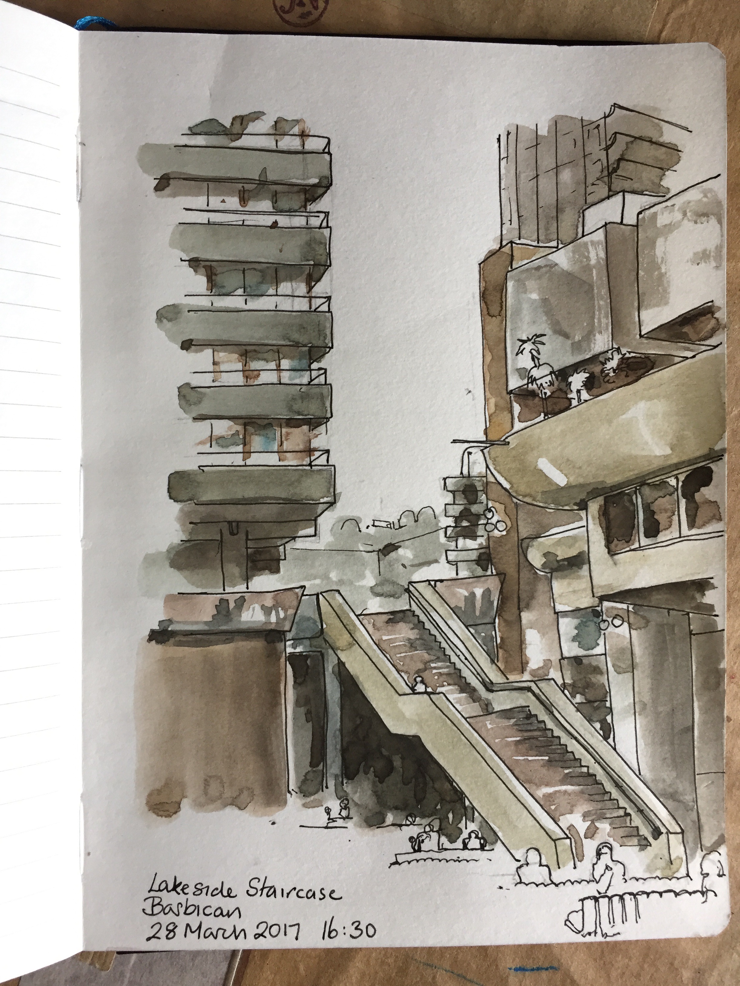
This is the staircase from Podium Level down to the Lakeside. It’s a magnificent sculptural piece of architecture: it appears free floating, a mass of concrete in the air.
Drawn in the sun after a lunch in the Barbican Kitchen. The wind kept shifting my art equipment around, and the shadows changed as the clouds came and went.
About an hour and 15 minutes, drawn and coloured on location.
Click a button below to share this post online, email it, or print it:
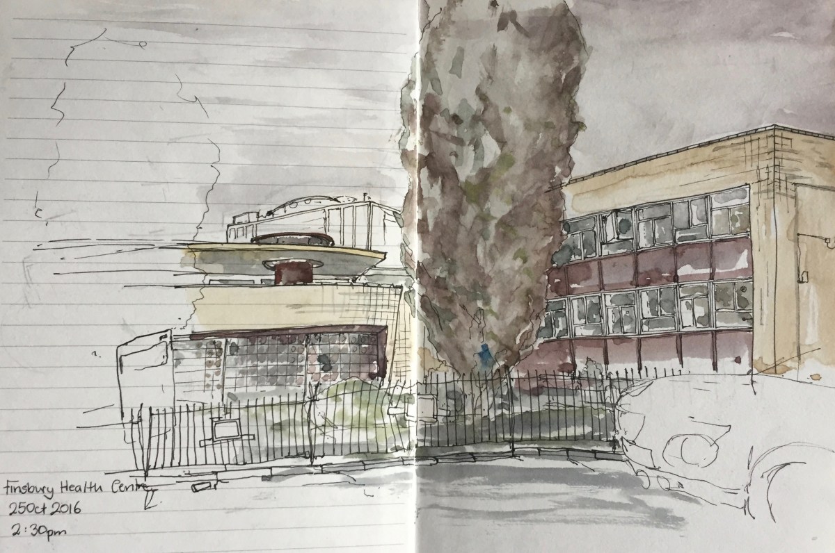
Built 1935-38 designed by Lubetkin and the Tecton Architectural Practice.
Partly restored mid 1990s, but still looks dilapidated, especially round the back.
Evidently still in use as a medical centre. While I drew the picture, ambulances arrived and departed, carrying elderly and disabled patients. A mother and child looked at my drawing. The mother encouraged the child to see how slowly I was drawing.
Posting this in 2019, after I went to the Wellcome Collection “Living Buildings” exhibition, and learned how carefully this health centre had been thought about. There was a mural inside, which was destroyed in the Second World War.
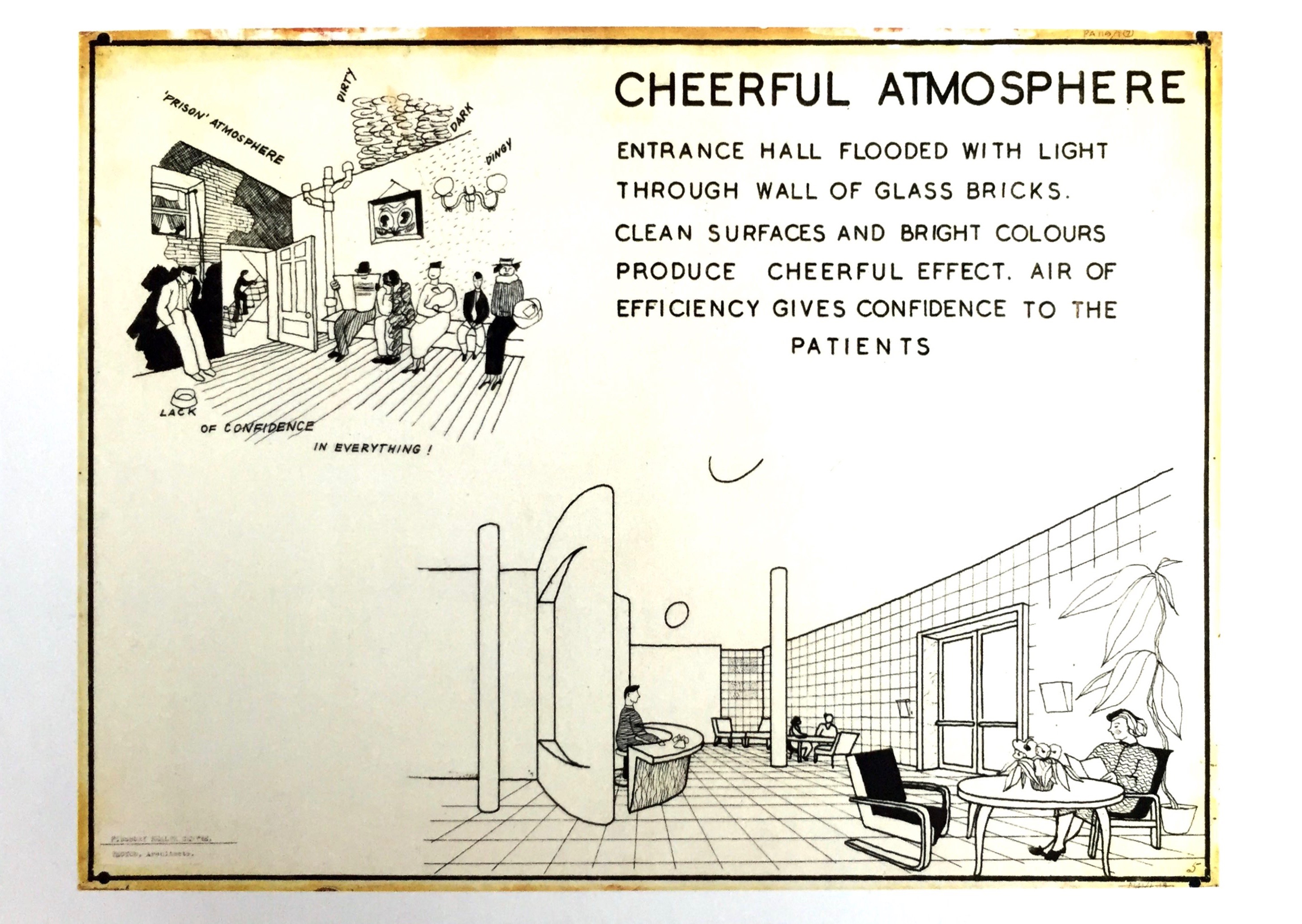
Postcard from wellcomecollection.org, “Exhibition display panels explaining features of the design of the Finsbury Health Centre, Pine Street, Finsbury London. Cheerful atmosphere. Lubetkin and tectonic. 1938. RIBA collection.”
Click a button below to share this post online, email it, or print it:


 The shorter tower at the back on the right is Canaletto, which must be one of the hardest towers in London to draw. Those weird curved structures defeat my sense of perspective. Perhaps that’s the idea.