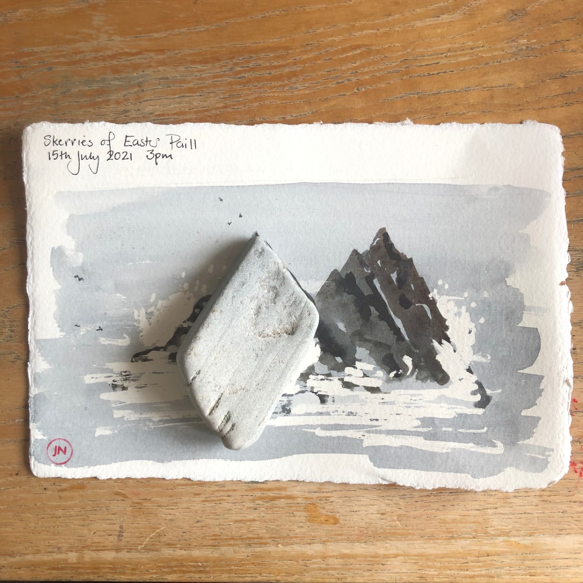
The rocks on the Shetland west side cleave at a very specific angle.
Skerries of Easter Paill, 15th July 2021 on Amatruda paper.
I picked up a pebble on the beach. Many of the pebbles show this pointed regular shape. It gave me great pleasure to find that the angle matched my drawing. It is approximately 70 degrees.
The rocks are at an angle of 70 degrees
The angle is visible even in the large cliffs.
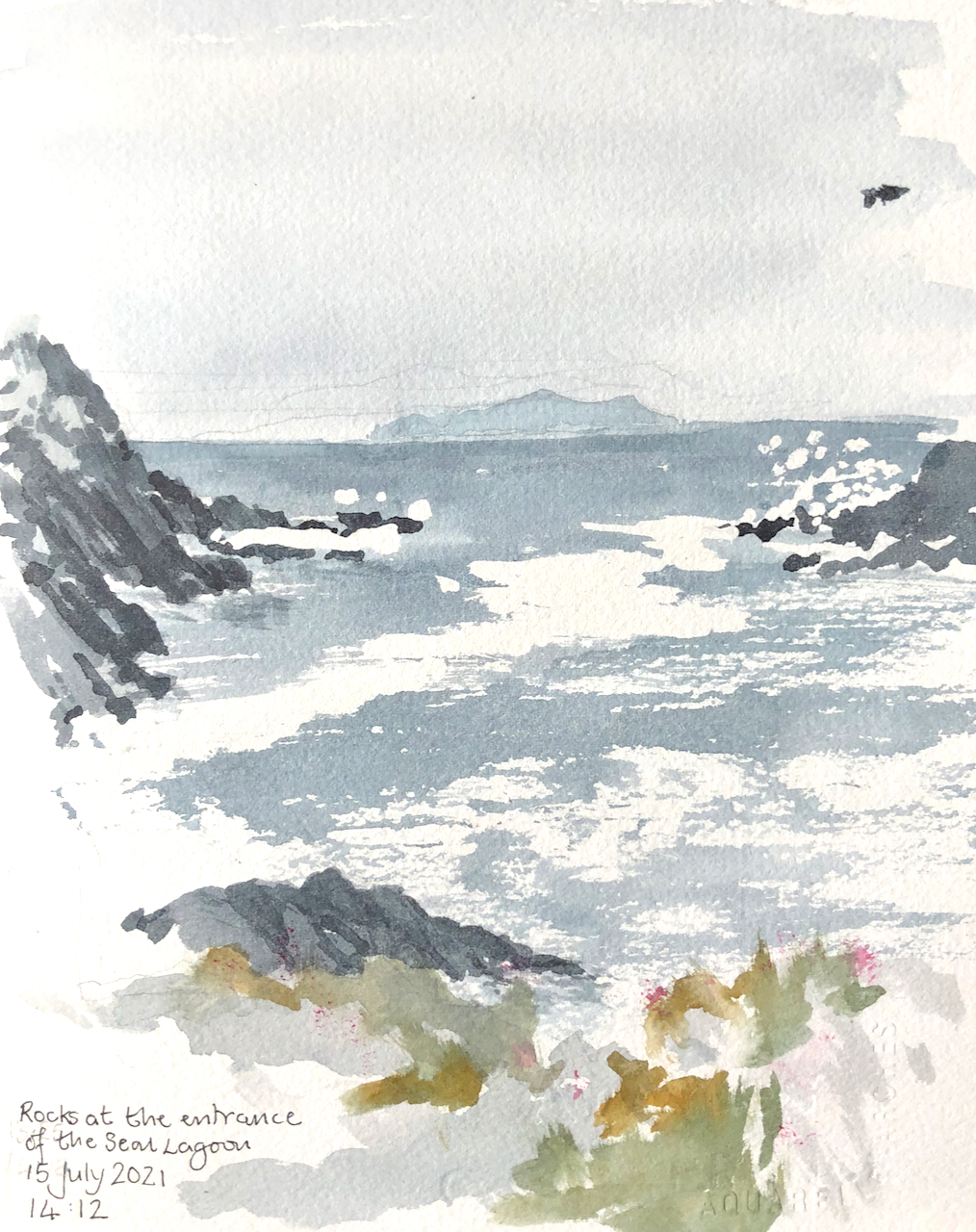
Rocks at the entrance to the Seal Lagoon, 15th July 2021
Here is this sketch in progress:
Sketching at the entrance to the Seal Lagoon, on Arches Aquarelle 300gsm CP, in PrintUrchin Sketchbook 1
The strange object in the top right of the drawing is not a drone, a cormorant, a flying fish or a small airship. It is a mistake. When I closed the sketchbook to continue my walk, some wet paint transferred itself from the left hand page to the right.
Click a button below to share this post online, email it, or print it:
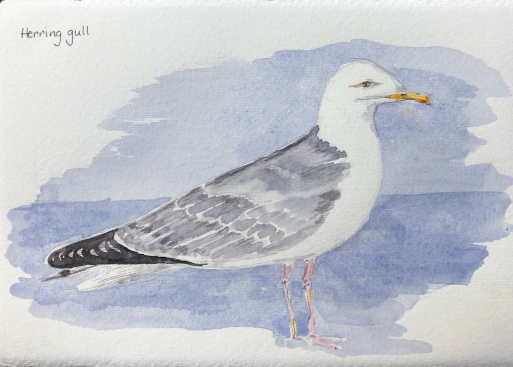
Here is a herring gull. These are numerous and float on the sea as well as fly in the air. They also stand on cars and on chimneys. This one stands on a wall, waiting for someone to come out of the kitchen, ideally with a slice of bread.
Herring gull
Then there are the oystercatchers. They fly but don’t swim. They poke around in the seaweed, and, amazingly, also use those long beaks on the lawn, to dig up worms.
Oystercatcher
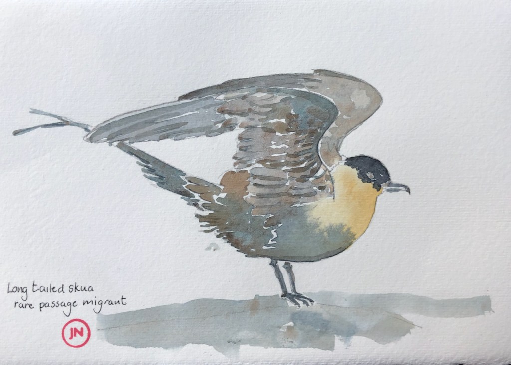
I started drawing the birds when I saw a wonderful picture in The Shetland Times. It showed a “Long tailed Skua”, described as a “rare passage migrant”. Here is my version, inspired by the photo in The Shetland Times by Jim Nicholson.
Long tailed Skua, rare passage migrant
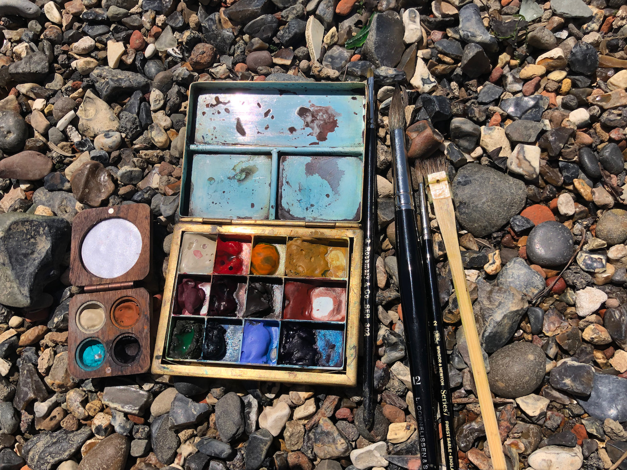
All drawn in watercolour on Amatruda paper, size A5, using Daniel Smith watercolours.
Click a button below to share this post online, email it, or print it:
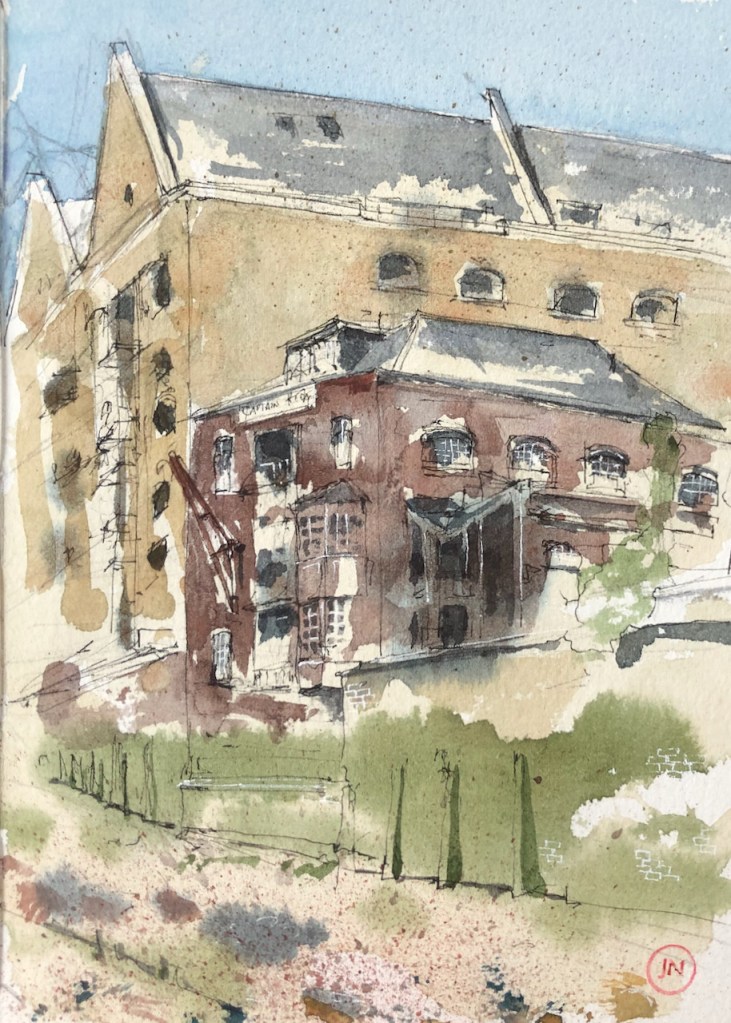
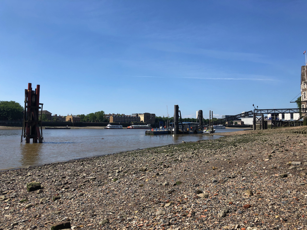
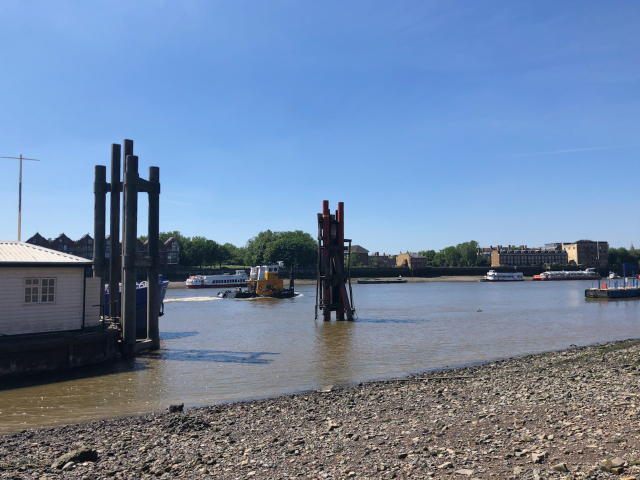
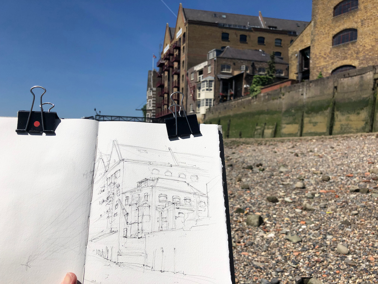
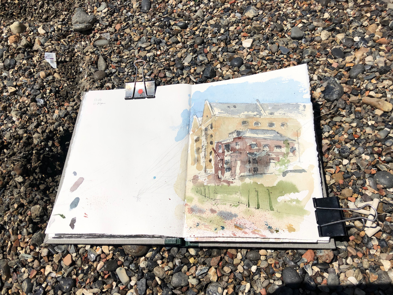
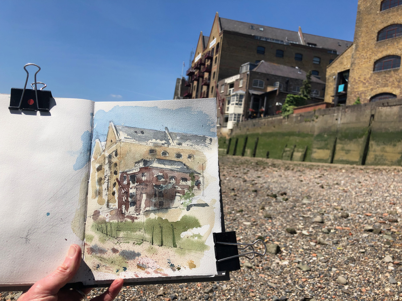
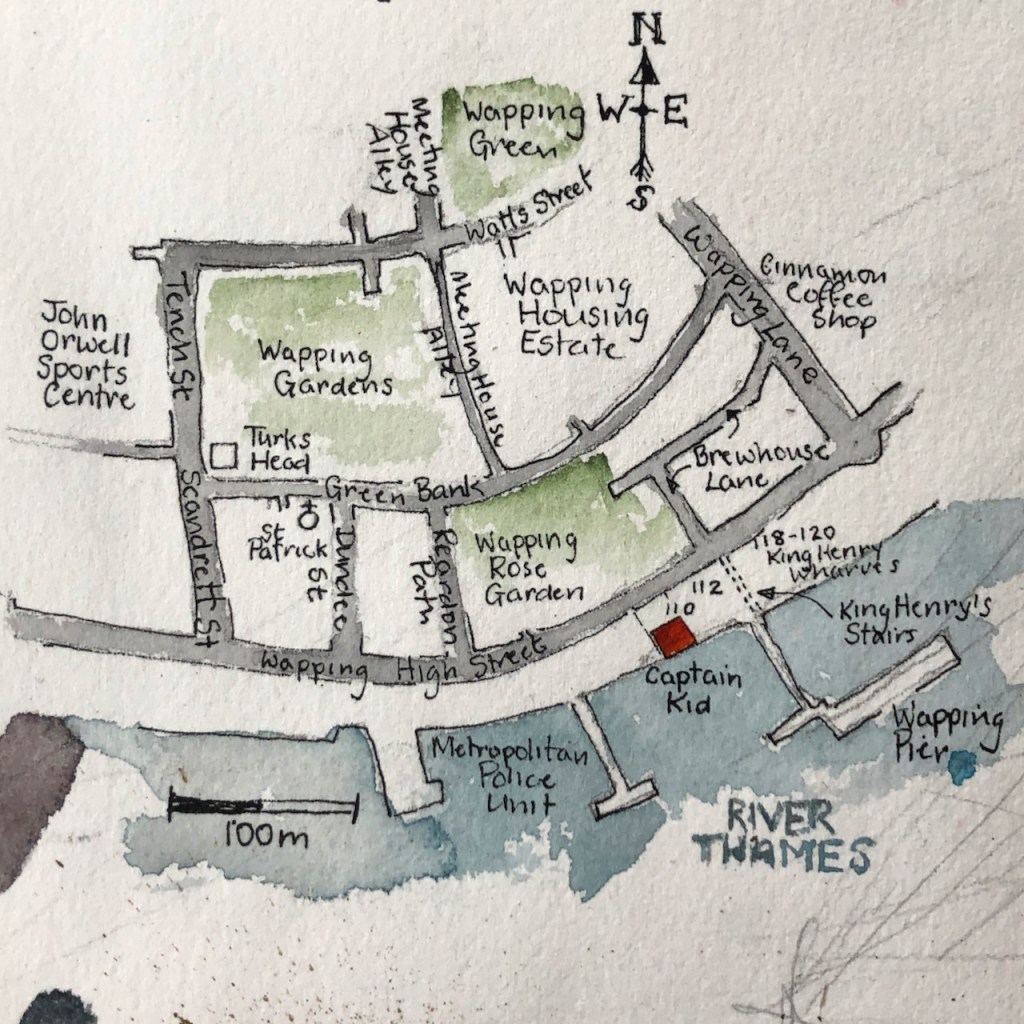
After breakfast at the Turk’s Head ( see this post ) I went down to the river. The tide was out. I sat on the Thames foreshore and sketched The Captain Kidd.
The Captain Kidd, Wapping E1. 12.10pm 14 June 2021. 7″ x10″ in Sketchbook 10
The Captain Kidd is the building at the front. It’s a pub and restaurant. The larger building behind is “St John’s Wharf”, a warehouse now converted into flats.
The “Captain Kidd” is named after a “seventeenth century pirate William Kidd who was executed [in 1701] at the nearby Execution Dock” according to various websites e.g. The Londonist.
However there is no “nearby Execution Dock”. The carefully researched article on “London Inheritance” concludes that “King Henry’s Stairs” were formerly “Execution Dock” (see note 2). The name was changed in the early 19th century to be better in line with the burgeoning use of the area for trade. The London Inheritance author cannot discover a specific “King Henry” connection. He includes a list of some of the people who were executed here, for crimes at sea including piracy, fighting on board ship, murdering shipmates, and treason.
I note with interest that, these days, the headquarters of the Marine Police are just a few hundred yards upstream. This is a very ancient establishment, which started with a one-year trial in 1798 (note 1).
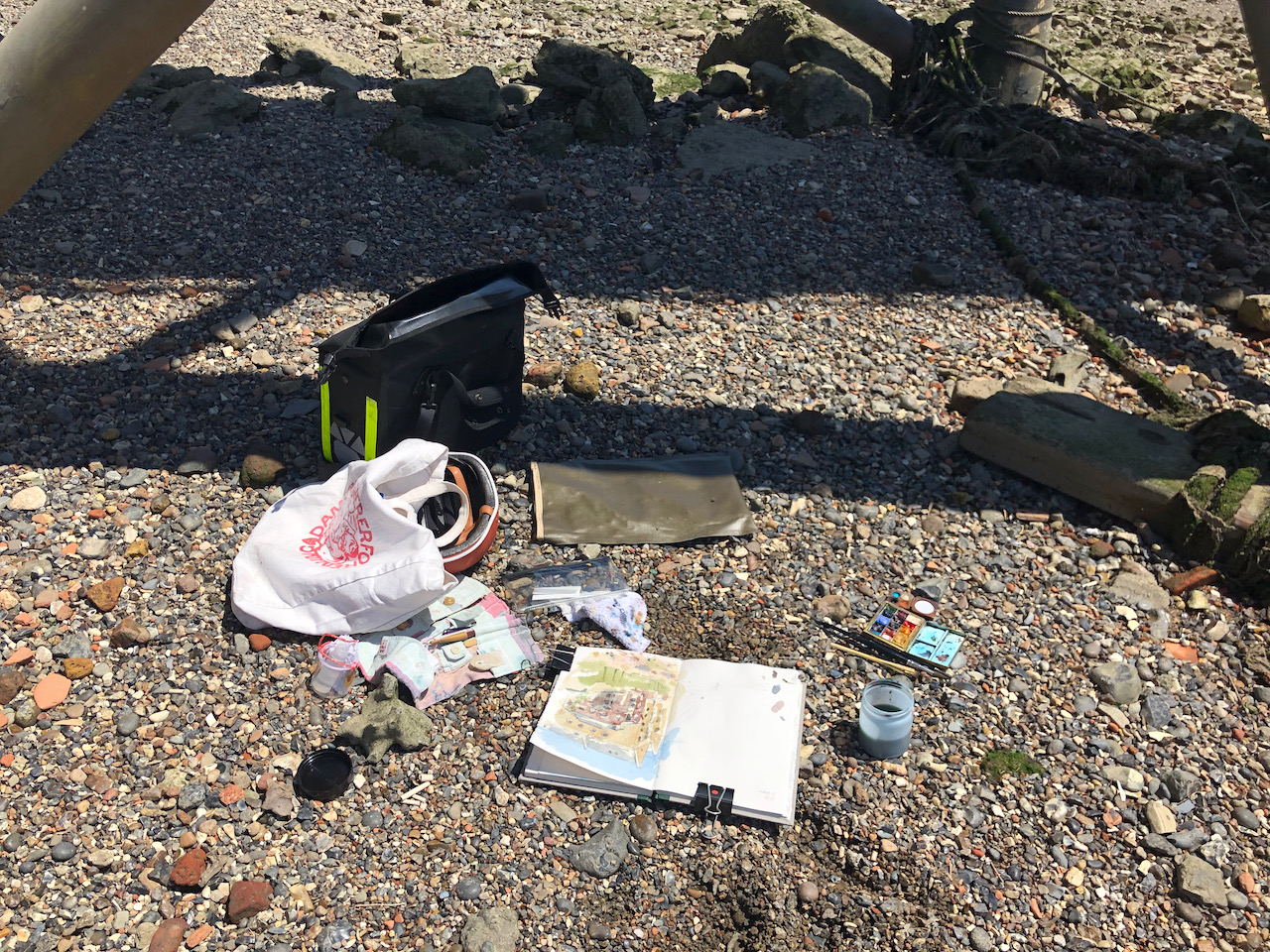
Here is work in progress on the drawing. See the wonderfully clean Thames foreshore.
I drew my picture in the shade under Wapping pier. Here is a map:
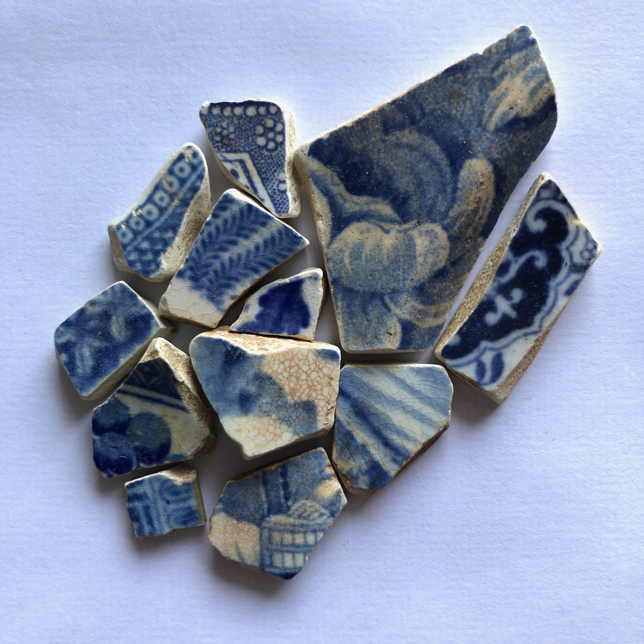
Walking back to the ladder, I collected a handful of porcelain pieces, blue and white. It was as though, years ago, someone threw a china bowl onto the foreshore, and the pieces somehow stayed in the same vicinity, through many tides. Or perhaps it is several bowls.
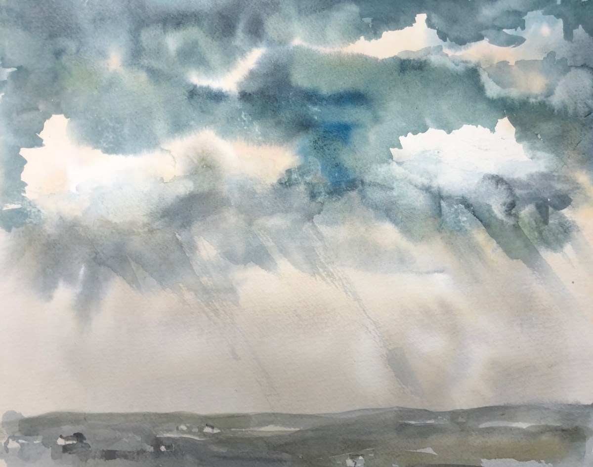
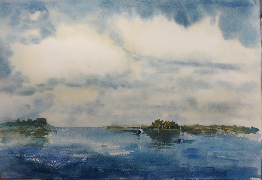
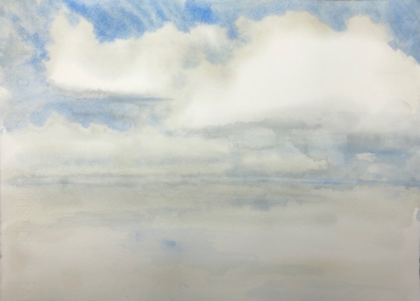
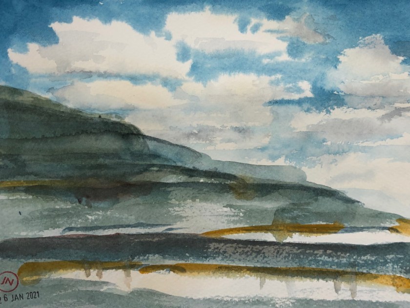
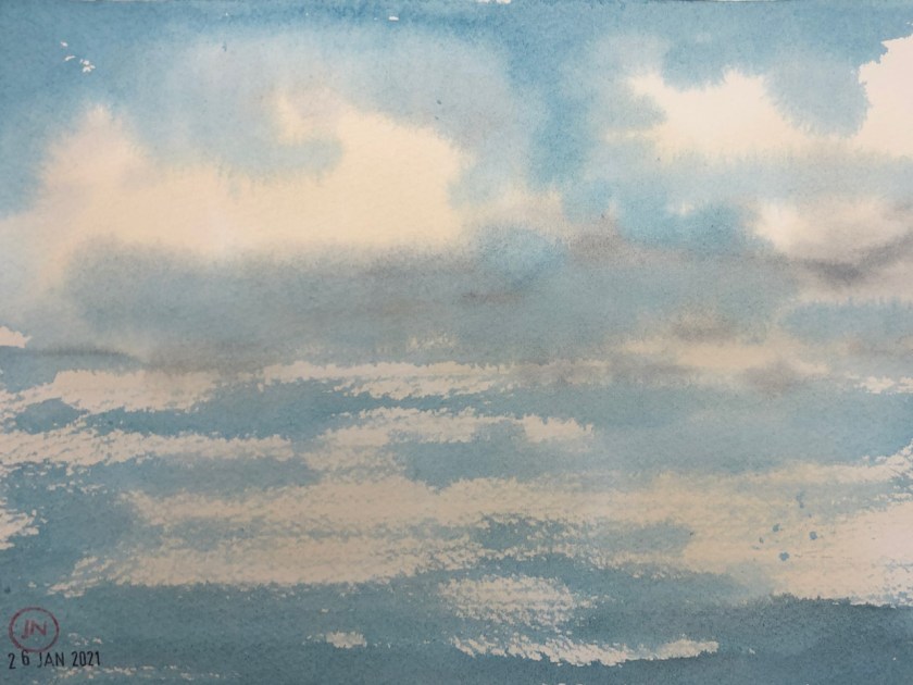
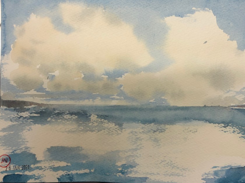
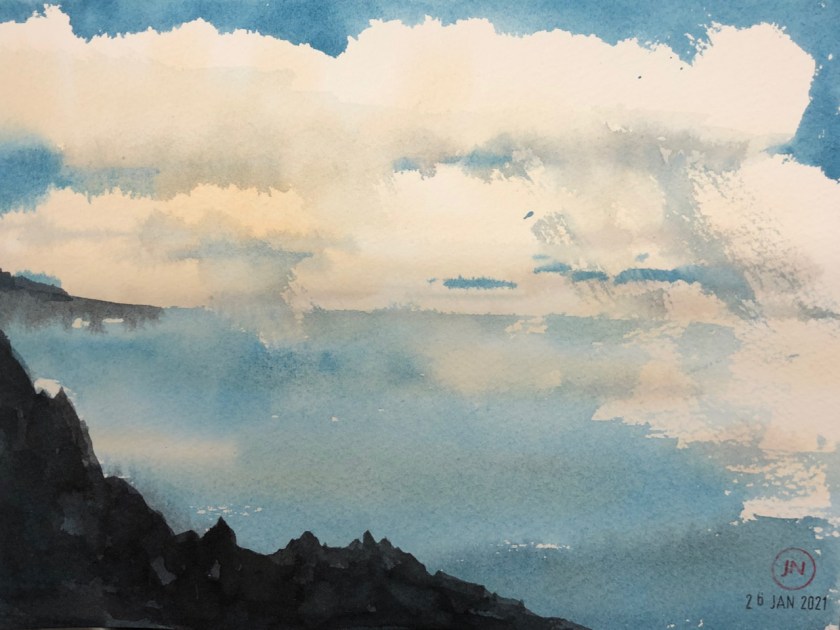
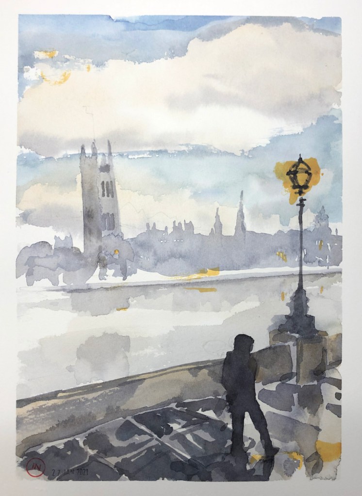
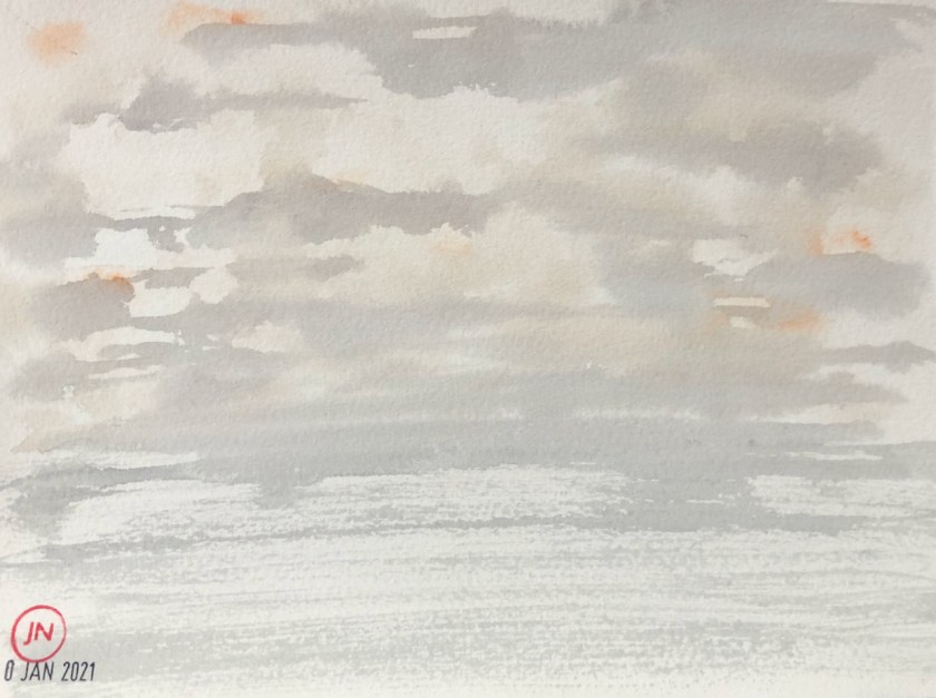
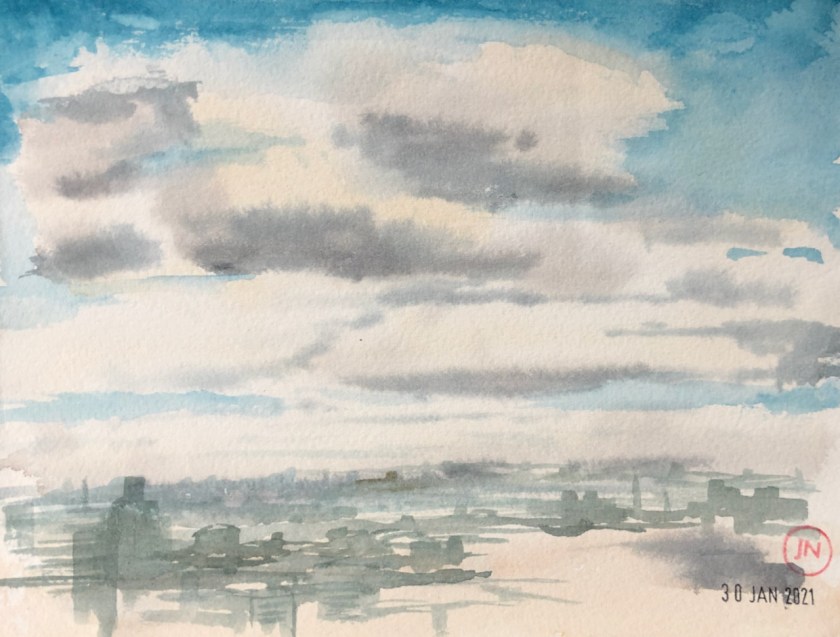
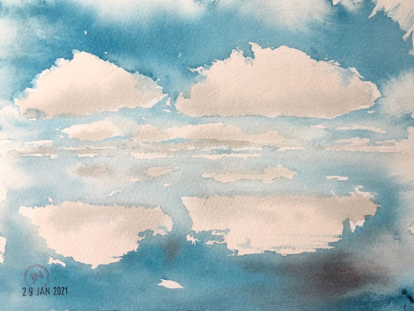
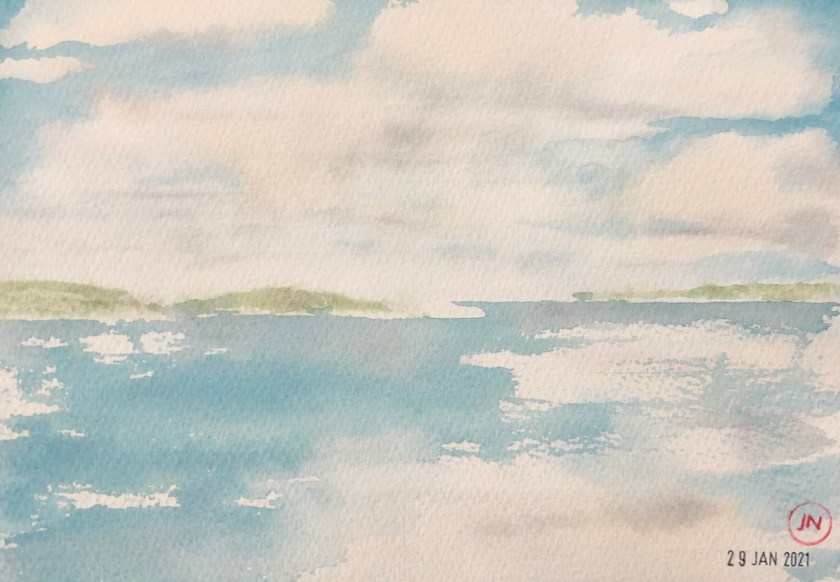
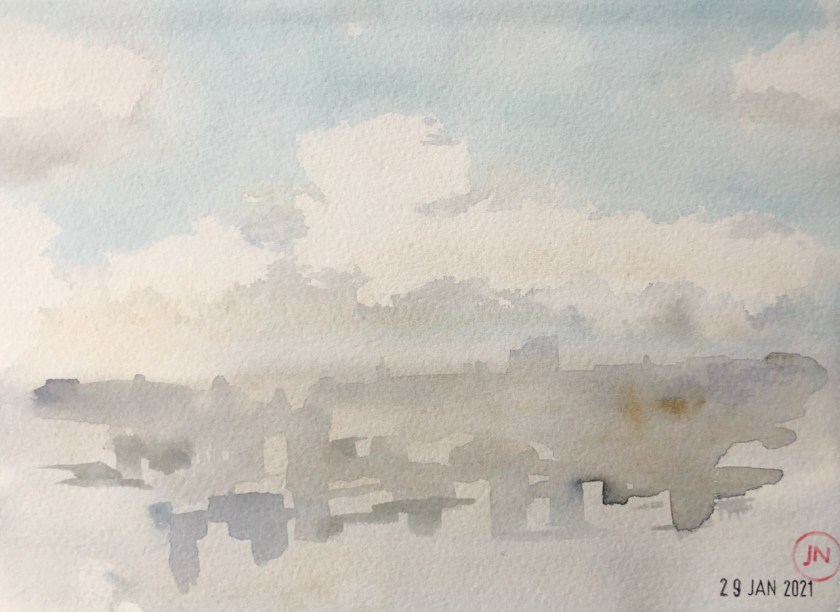
Here is a collection of cloud studies. This is me experimenting with “wet on wet” watercolour technique, from my desk. Click the image to see it bigger.
(1) Scene with boat (8″x11″)
(2) Clouds and sea (15″x11″)
(3)Shetland (12″x10″)
(4) Walk on the cliffs (9″x6″)
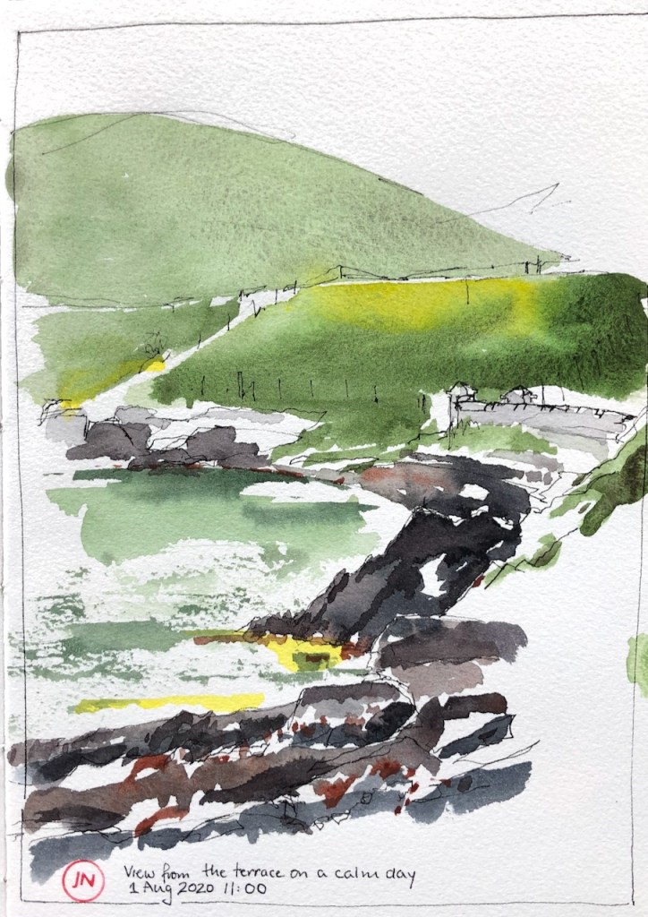
(5) A calm day (9″x6″)
(7) Headlands (9″x6″)
(8) Clouds and rocks (9″x6″)
(9) Westminster (9″x12″)
(10) The North Sea (7″x5″)
(11) “..clearing from the West later” (7″x5″)
(12) Clouds in the sea (7″ x5″) [NFS*]
(13) Headlands (8″x6″)
(14) Mist over the city (7″x5″) [NFS*]
This wet-on-wet technique is a learning curve. For one thing, it makes my desk where I’m working all wet. I’m not yet sure how I’m going to translate this technique into a method I can use on location. I’m working on it. It’s certainly fun to see how the watercolour flows. The technique is a bit unpredictable, like tie-dying, or sourdough baking or surfing. One has to learn to guide rather than control.
I’m learning this wet-on-wet technique from the talented watercolour artist Matthew White in a video I’ve been watching.
Click a button below to share this post online, email it, or print it:
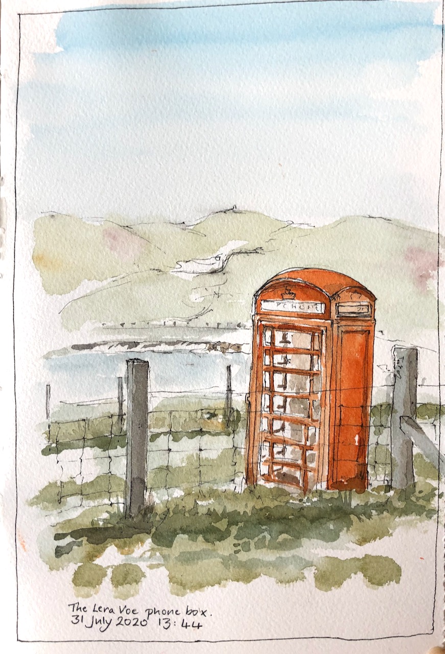
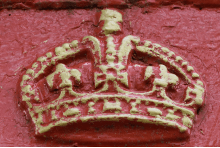
This is the Lera Voe phone box, which is on the road between Burrastow and Walls.
The Lera Voe phone box
The phone box is a landmark. This year it was renovated, and fitted out as a sanctuary and small room. There is no phone in there any more, unless you bring your mobile phone with you.
Henry Anderton did the renovation. His project was partly financed by a reward he obtained for having found a message in a bottle on one of his beach-cleaning outings. You can read about it in this article from the BBC, published in February 2020.
The article says of Mr Anderton: “He has bought the phonebox, near Walls, for £1 and been supplied with the regulation red paint from BT. He said: “We’ve now launched a crowd funding operation to help out the renovations – we’ve got to find a door first.”“
Evidently he found a door, because when I visited in July the phone box was complete, bright red and in great shape. There are shelves and a seat inside.
I wanted to draw the phone box with Lera Voe in the background. This is the view from the field behind the phone box. You can see the voe, and the hills beyond. The road is just behind the phone box in my drawing. “Voe” is a Shetland word meaning “sea inlet”.
Here is work in progress on the drawing.
Here is the article from the BBC mentioned above, as a PDF file.
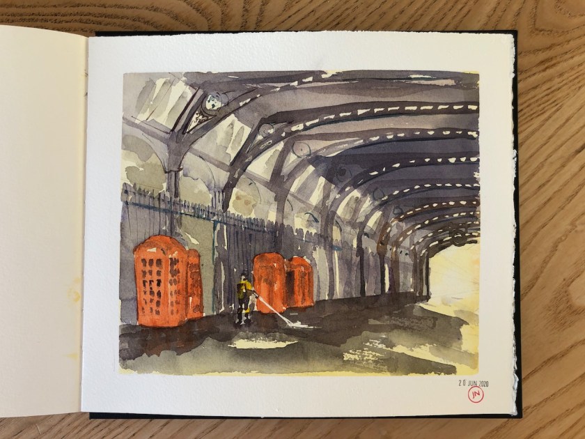
Here is a group of phone boxes in Smithfield, London:
Phone boxes in Smithfield, EC1, London. See this blog post.
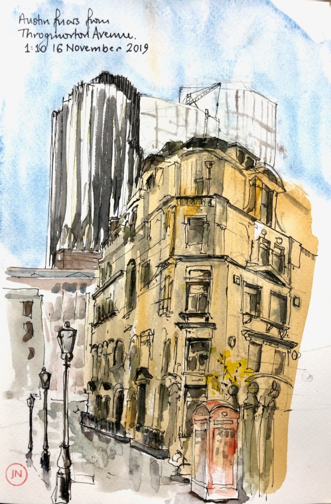
Here is one in Austin Friars, EC2, London: see this blog post.
These phone boxes , which were called Telephone Kiosks, were designed by Giles Gilbert-Scott in the 1920s and 30s. Giles Gilbert-Scott was a prolific architect, who also designed Cambridge University Library, the North Wing of the Guildhall in the City of London, and Bankside Power Station which is now Tate Modern.
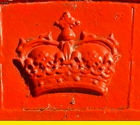
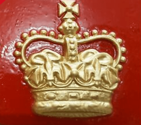
The phone box at Lera Voe is a “K6” phone box, designed by Gilbert-Scott for the jubilee of George V in 1935, following his successful design of the K2 phone box in 1924. The K6 is distinguished from the K2 by the embossed crown, and the fact that it has 8 rows of windows, rather than the 6 rows of the K2.
It would be possible to date the phone box had I been more careful in drawing the crown. The crown is painted red on the Lera Voe phone box, as it was on the original phones boxes. Only in the 1990s did BT start painting the crowns gold.
This is the North Atlantic, latitude 60 degrees N. The temperature of the water is 11 degrees C. Very refreshing! There is a lot of sun between the rain.
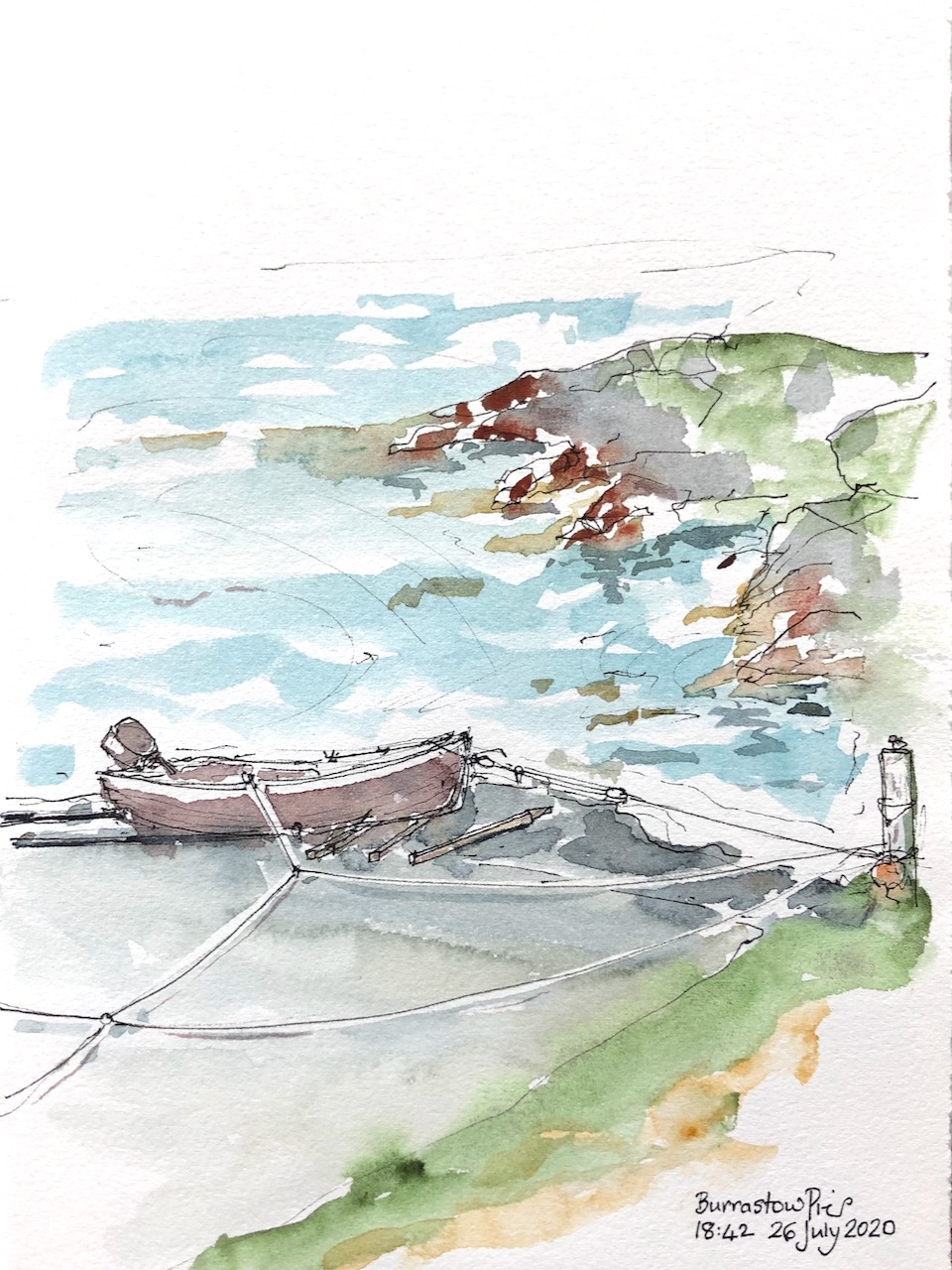
Here is another sketch of the pier, this time watercolour only, no pen. It is evening.
Burrastow Pier, evening.
Latitudes: Burrastow is 60 degrees North. The Arctic Circle is 66 degrees North. London is 51 degrees North. The Equator is zero degrees, and the North Pole is 90 degrees.
Click a button below to share this post online, email it, or print it:
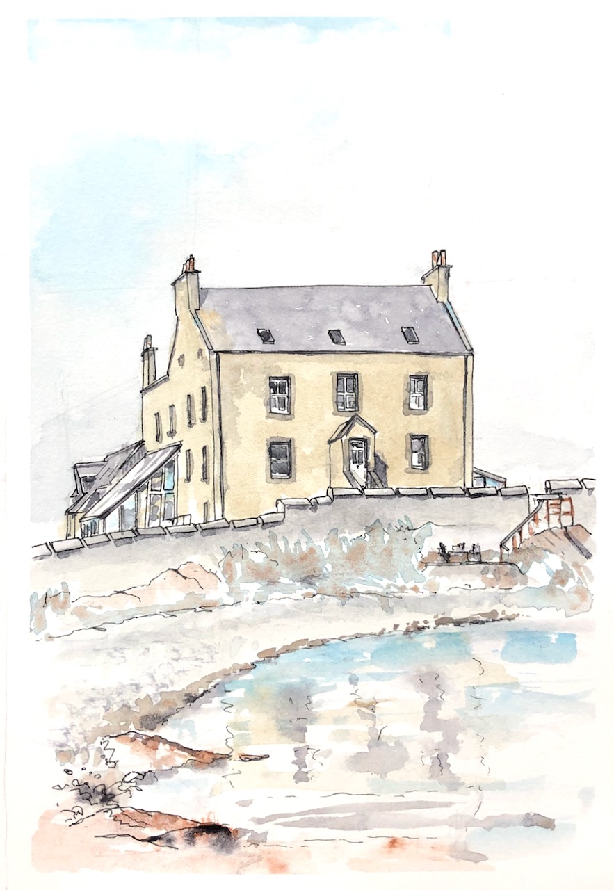
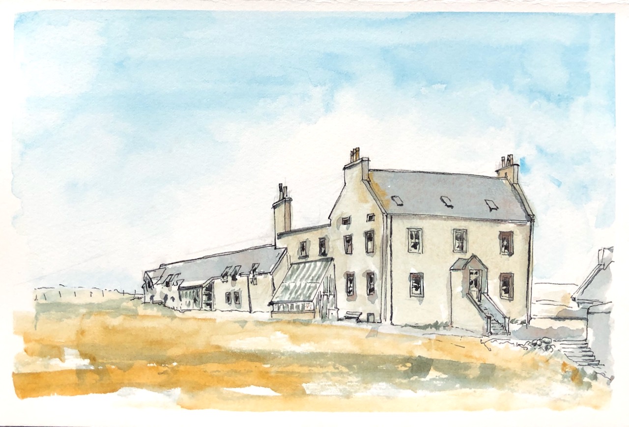
“On the remote west side of Shetland you can find spectacular scenery, peace and the ideal refuge for the escapist. The guest house welcomes you with peat fires, a cosy library and all the marvellous food you could want after a day of exploring….” This is Burrastow House , near Walls.
Burrastow House from the front garden
The house is right next to the sea. Here’s a view across the bay.
Burrastow House from the beach
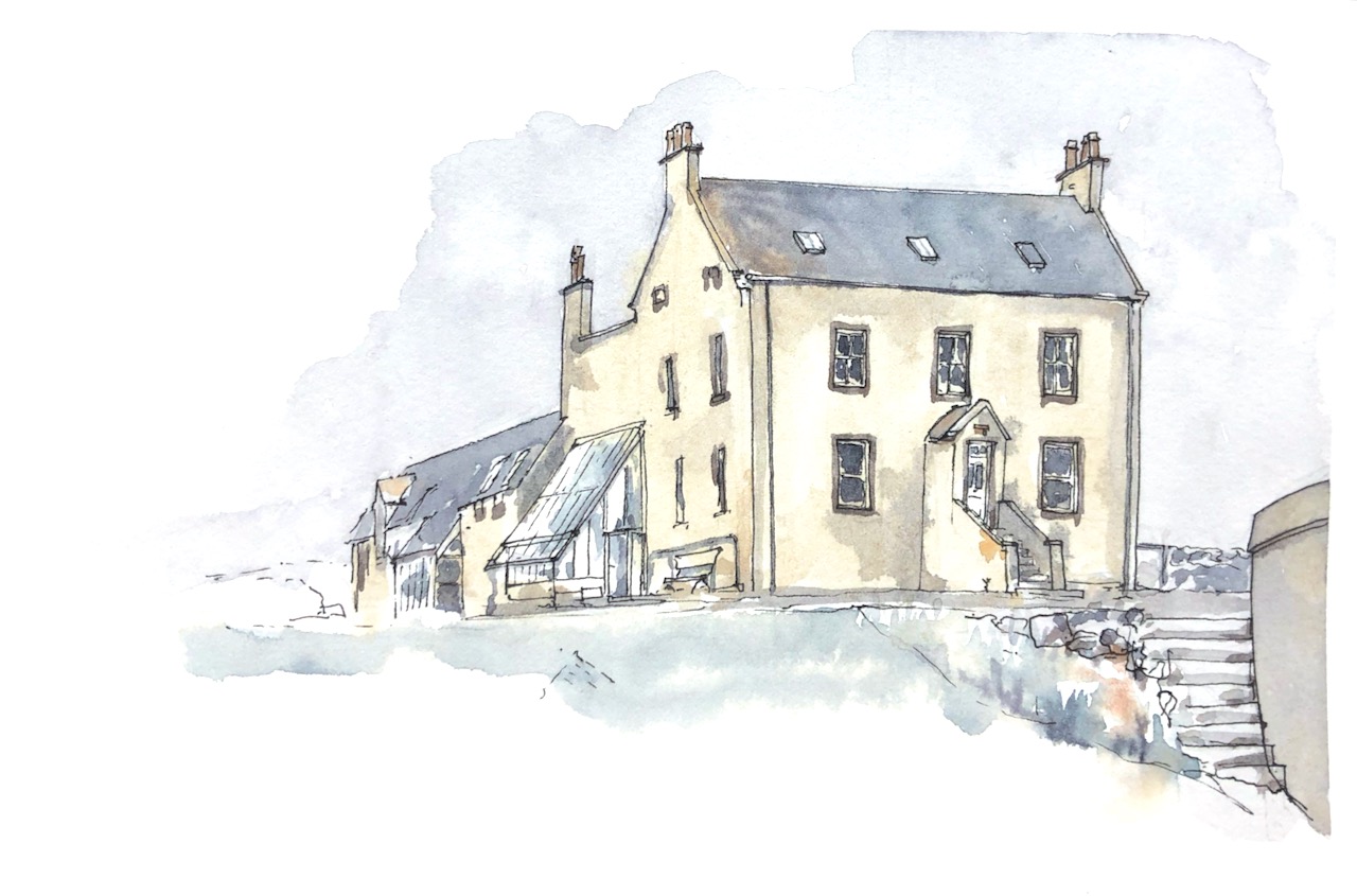
Around the back is a vegetable garden and polytunnel with herbs in. Here’s the view from the back. See all the chimneys!
Burrastow House from the vegetable garden
And here’s another view from the front garden.
Burrastow House from the garden, near the wall.
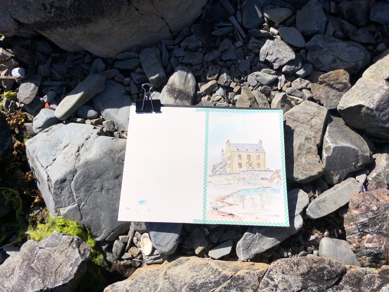
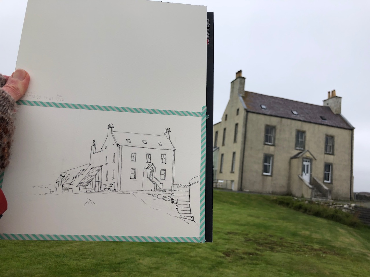
Here is work in progress on these pictures.
All pictures drawn and coloured on location, using a paper block by Saunders Waterford “St Cuthberts Mill” 300gsm Hot Press and Daniel Smith Watercolours over De Atramentis waterproof ink.
Thank you to my hosts, Pierre and Han.
Click a button below to share this post online, email it, or print it:
Here is the view from the Historic Site near Pinhoulland.
Voe of Browland from the Historic Site
The lines on the right are a mussel farm. Here is another sketch from the same place. Here you can see the cottages in the distance, near the Bridge of Walls.
Voe of Browland, distant cottages
Further towards the sea, the view widens out. Here is the view from another walk, looking towards the island of Vaila.
Looking to Vaila, from the Nettle Beach.
I drew this having scrambled up the hill. Four hikers had arrived, and were on the beach. Four people seemed like a huge number, a crowd, more people together than I had seen in a week.
Click a button below to share this post online, email it, or print it:
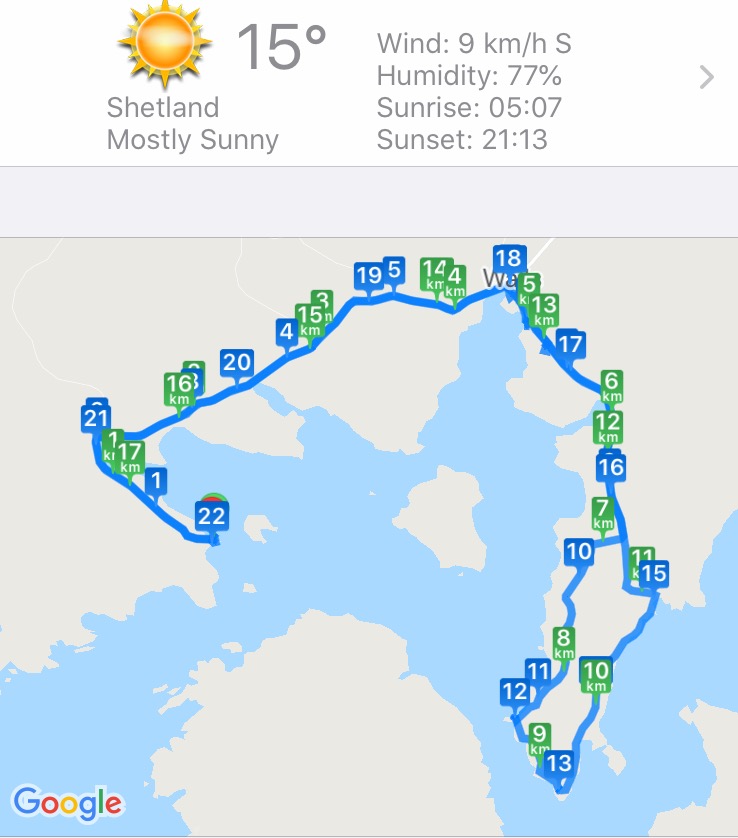
I walked over to the distant headland, called Whites Ness. It was a long walk.
OS App (edited)
Cyclemeter App
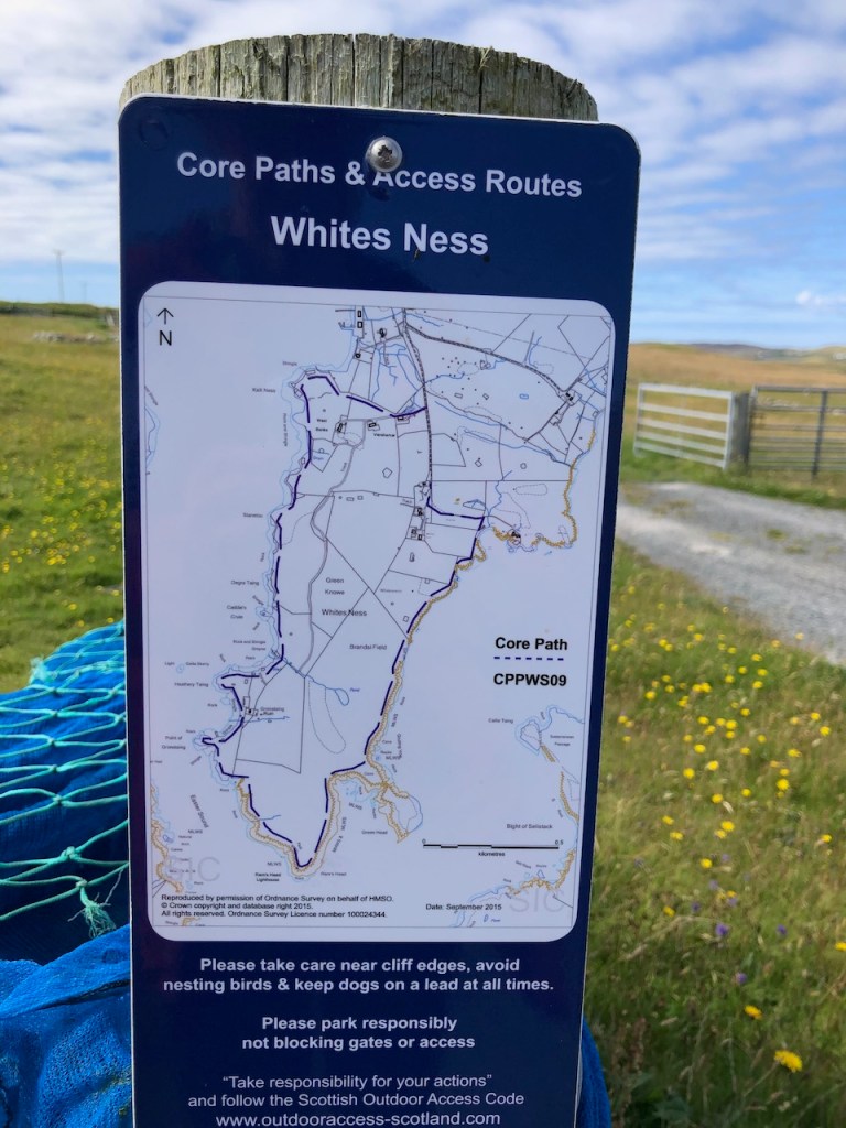
The walk round the peninsula of Whites Ness is way-marked.
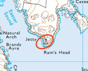
OS Maps: lighthouse, Vaila Sound
When I reached the end of the peninsula, I saw that there was a lighthouse marked on the map.
I wondered if it were really there. Would it be a real lighthouse, or maybe simply a buoy off the rocks?
The path was not very well marked, and seemed to be mainly uphill. I was a good way through what was already quite a long walk. And I had to walk back. But I kept on going. It seemed an unlikely location for a lighthouse. Of course I had in my mind those lighthouses I have seen, built by the Stevenson family in the 18th Century, red and white striped, towering over cliffs.
Here there were relatively mild rocks, smooth grass and a few sheep.
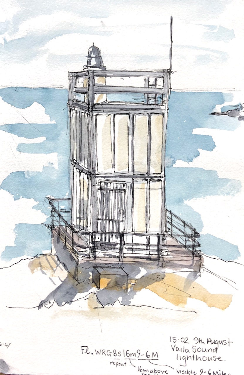
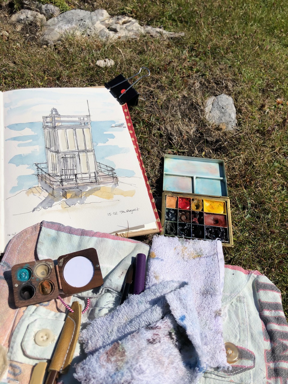
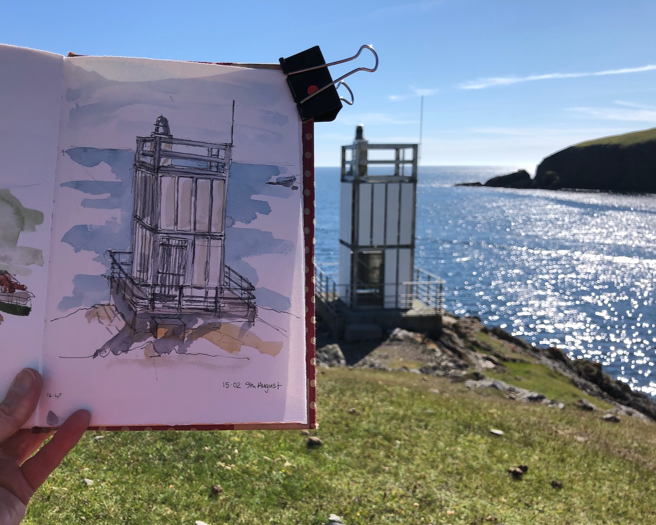
But then, against all expectation, there was the lighthouse. I was delighted. There was no-one around to whom I could exclaim: Look! Look! There really is a lighthouse.
It was not a lighthouse like the one in your head. It looked a bit like a prop from a Dr Who episode of the 1960s, or perhaps some construction which had been assembled from assorted parts of IKEA flat-packs. But it was a lighthouse, beyond all doubt. I sat down and drew it.
It was hard to find somewhere to sit down so that I could be sure that my art supplies were not going to take an impromptu roll down the slope and into the sea. There were a selection of rocks, none at quite the right angle. I chose the safest, and drew my picture.
Then I packed up my things and started on the long trek back.
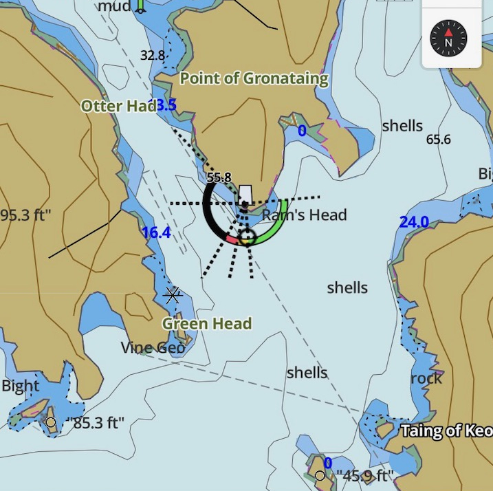
That evening a friend produced a useful coastal navigation guide, which informed me that this lighthouse was: “Fl.WRG8s16m9-6M”. We decoded this as: Flashing, White Red and Green, with an 8 second repeat, 16 metres above sea level, visible 6-9 nautical miles out at sea, on a good day. Anyone who is more familiar with the notation, please correct me if I have this wrong. I also found a map online.
From the fishing app: i-boating
From the fishing app: i-boating
Click a button below to share this post online, email it, or print it: