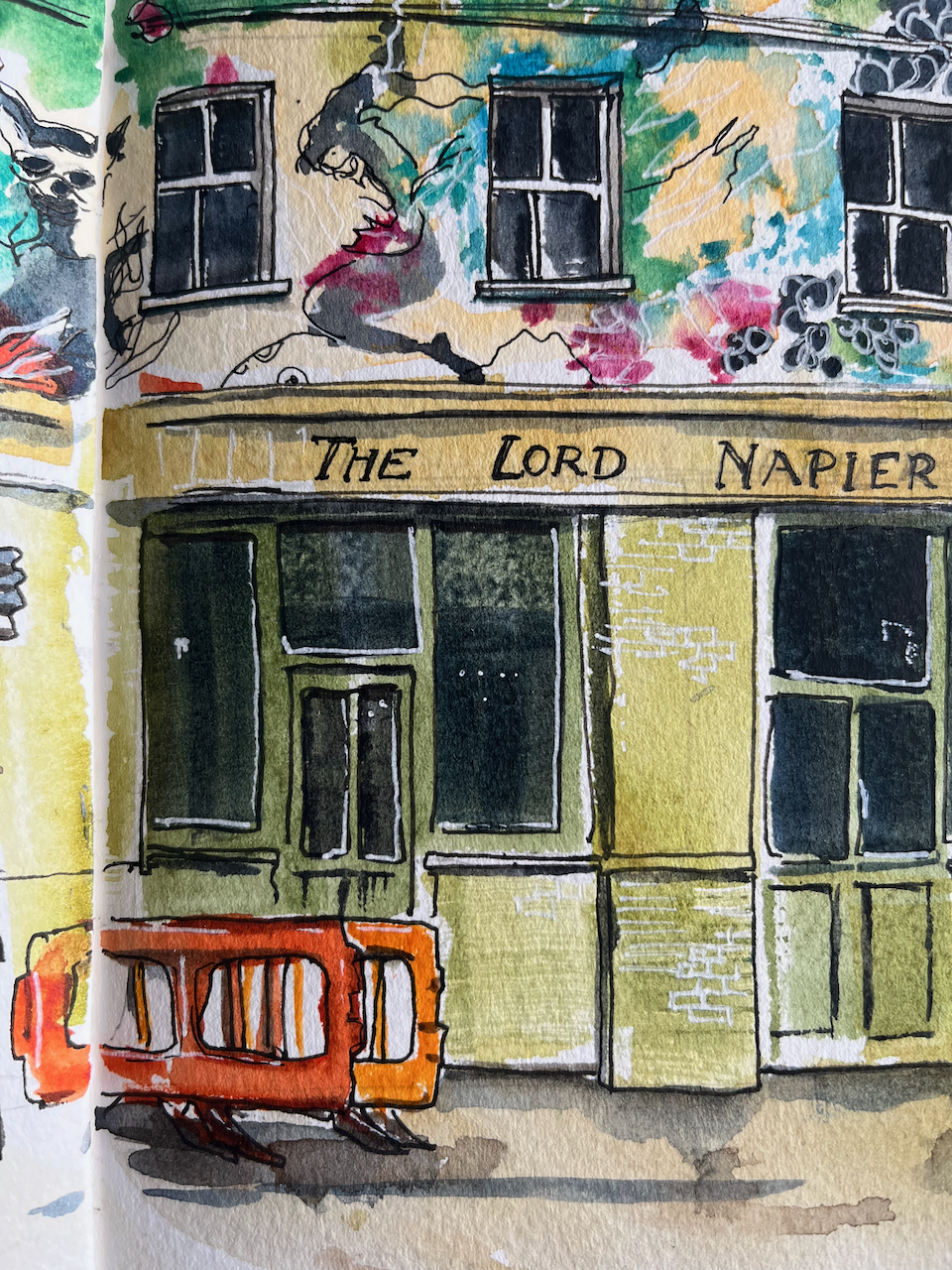
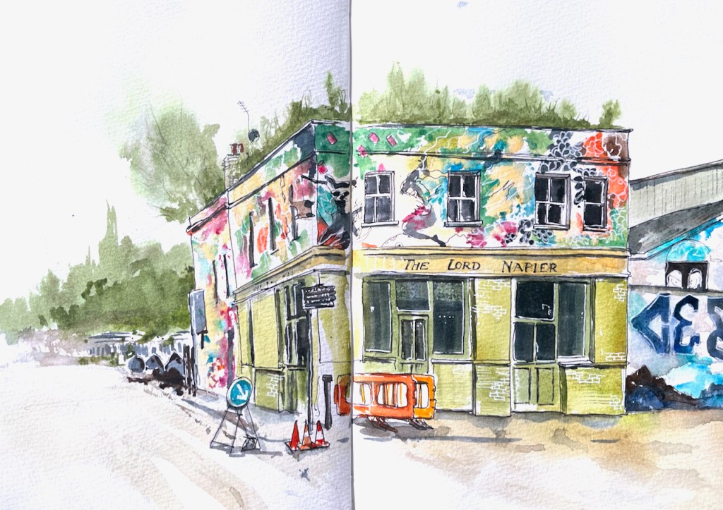
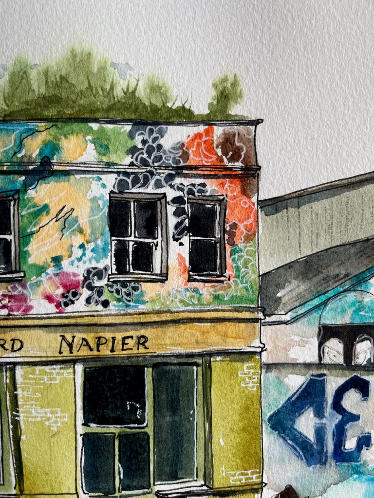
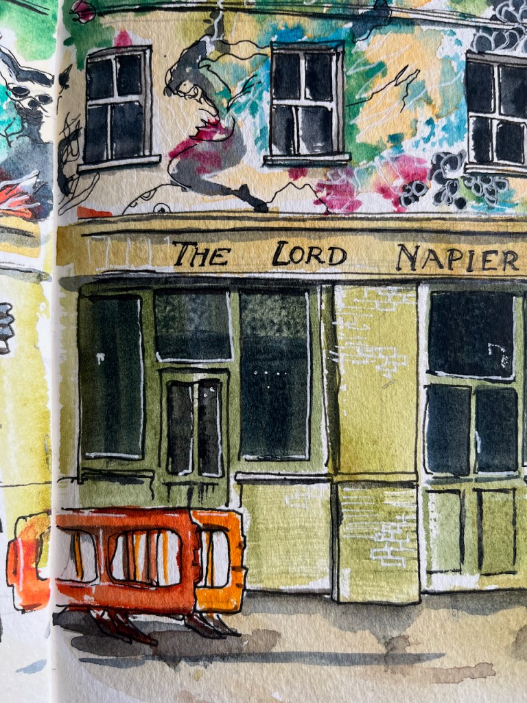
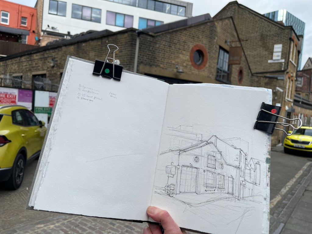
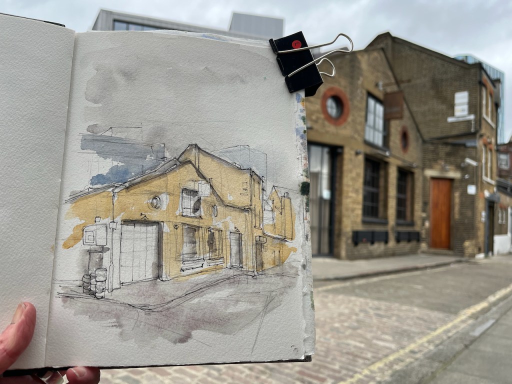
Here is a sketch of the remarkable pub, The Lord Napier, now the Lord Napier Star.
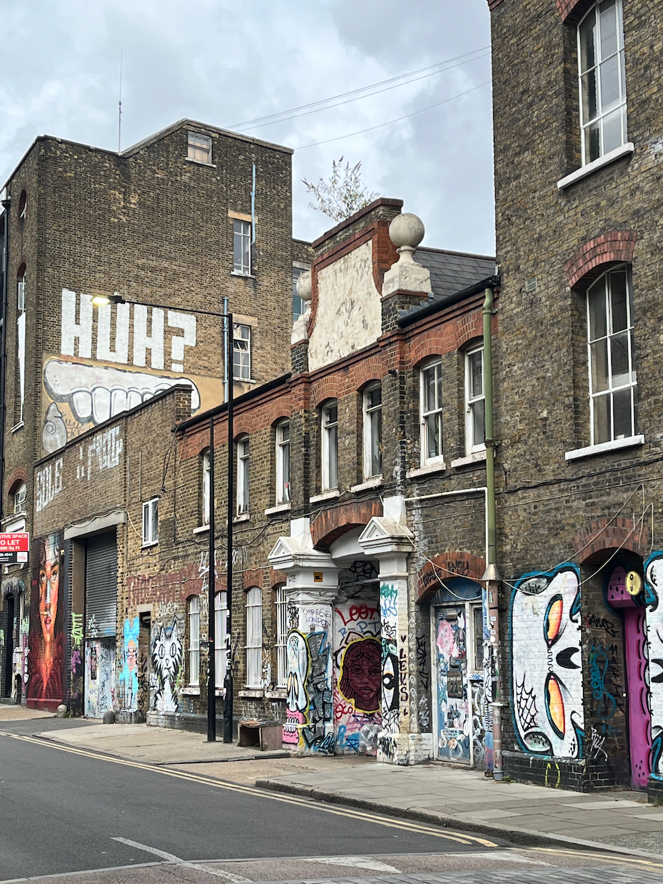
As you see, the top of the pub is covered in street art. I had fun trying to copy it. The original art is done at large scale with a spray can. My drawing is at small scale with watercolour and gel pens.
The pub has history. It has been a working pub, derelict, a rave venue, a squat. Now it is back to being a pub again.
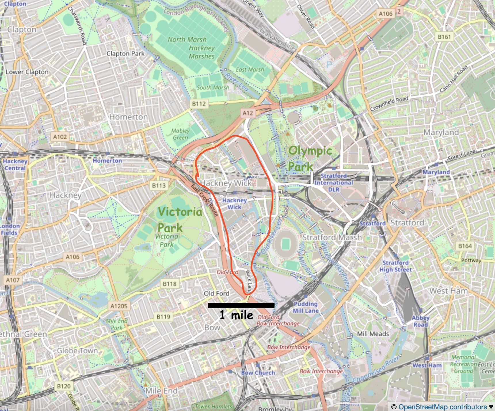
Hackney Wick is in East London between Victoria Park and the Olympic Park.
Hackney Wick is on the East side of London, 20 min walk from the Stratford railway station, and on the Hackney Wick overground.Hackney Wick is between the Olympic Park and Victoria Park.
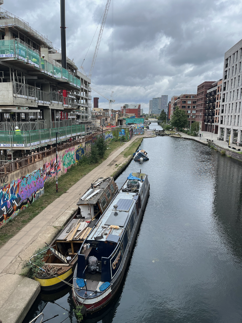
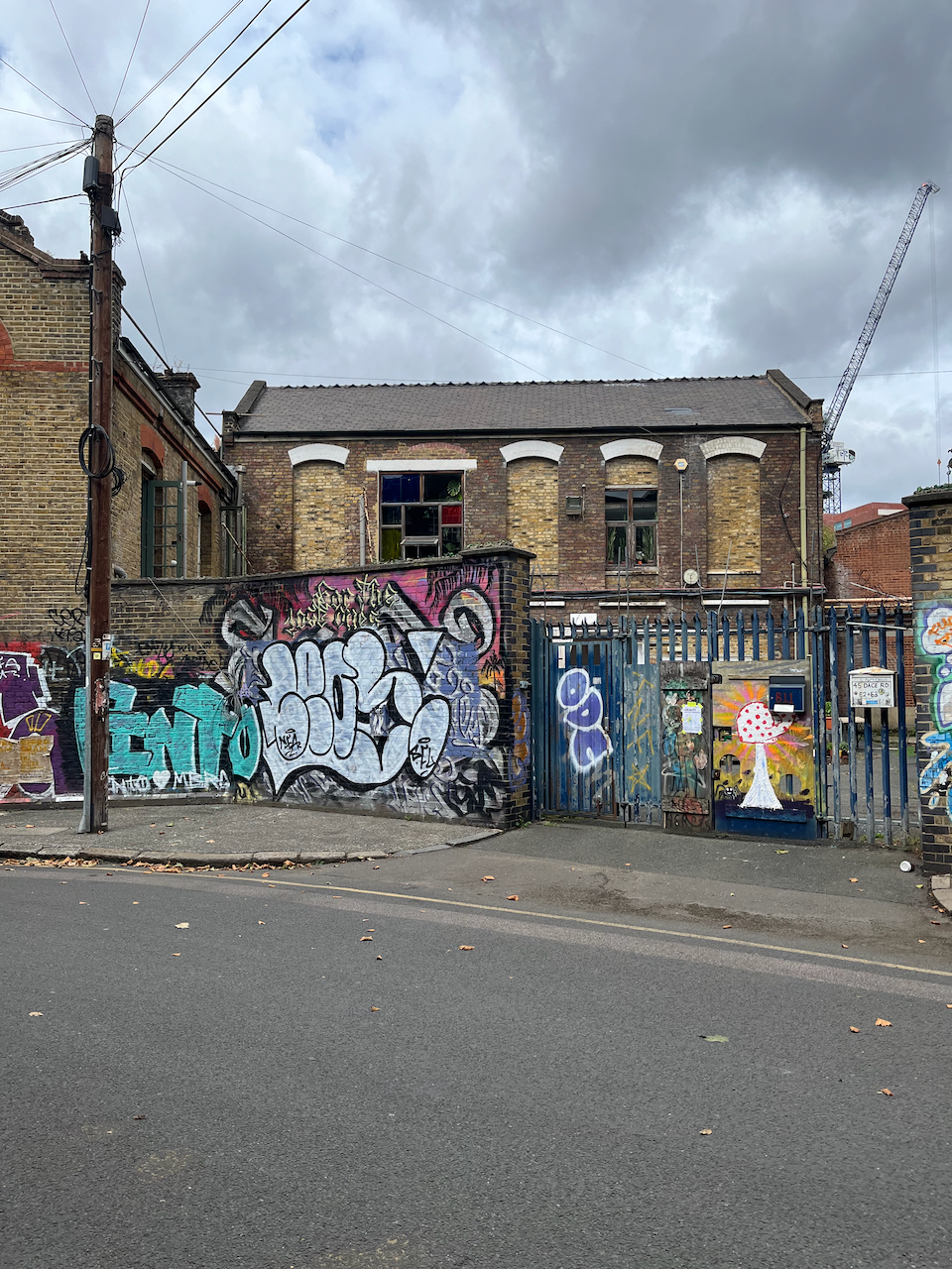
I have walked and run through there at intervals over the last twenty years. It has changed remarkably. The company I use for printing my artwork moved over there about 5 years ago, from a location in central London. I thought “what!” and “why?”. Now I realise that they were at the start of a trend. They were wise. The area is on the up. It used to be somewhat derelict and somewhat dodgy. Now the old buildings are taken over by new businesses, and there are cranes everywhere, constructing buildings where there were coal depots, docks, builders yards, heavy industry.
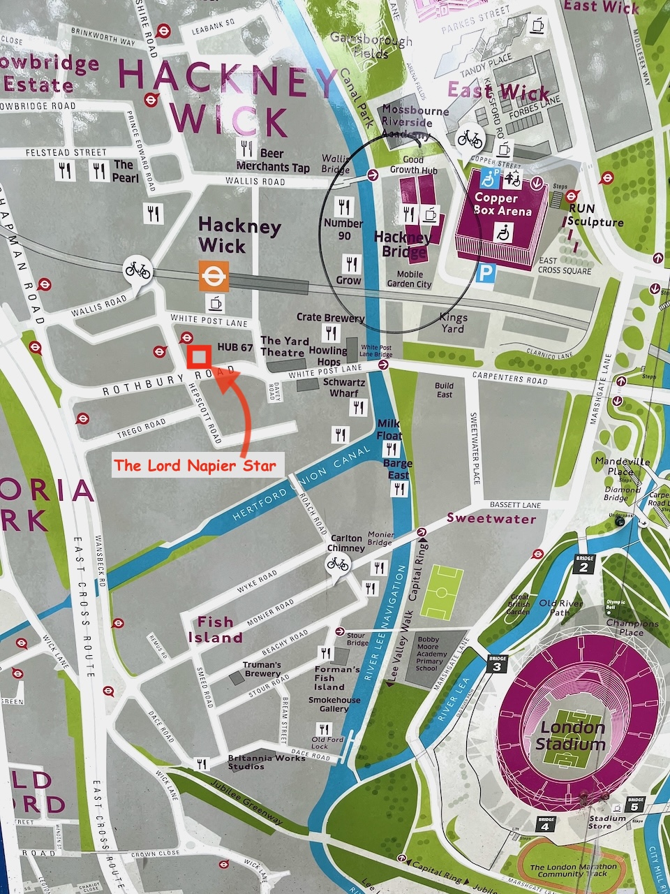
Map at the bridge to the Olympic Park.
There are new residential buildings, at human scale of 3 to 5 stories, with footpaths and green spaces in between, and commerce at ground level. The commerce is, yes, coffee shops, but also gyms, shared office spaces, businesses to do with the film industry, music and film studios, a bakery, and what looked like scenery painting studios. It felt as though real things happened there, new businesses moving in, people living near where they worked, businesses springing up to serve the people who live there.
New businesses adapting the spacesNew housing, built and under constructionNew businesses in old buildingsDwellings in old buildingsNew businesses in old buildingsA peaceful cafe “The Ethical Bean” Dace RoadA walk around Hackney Wick
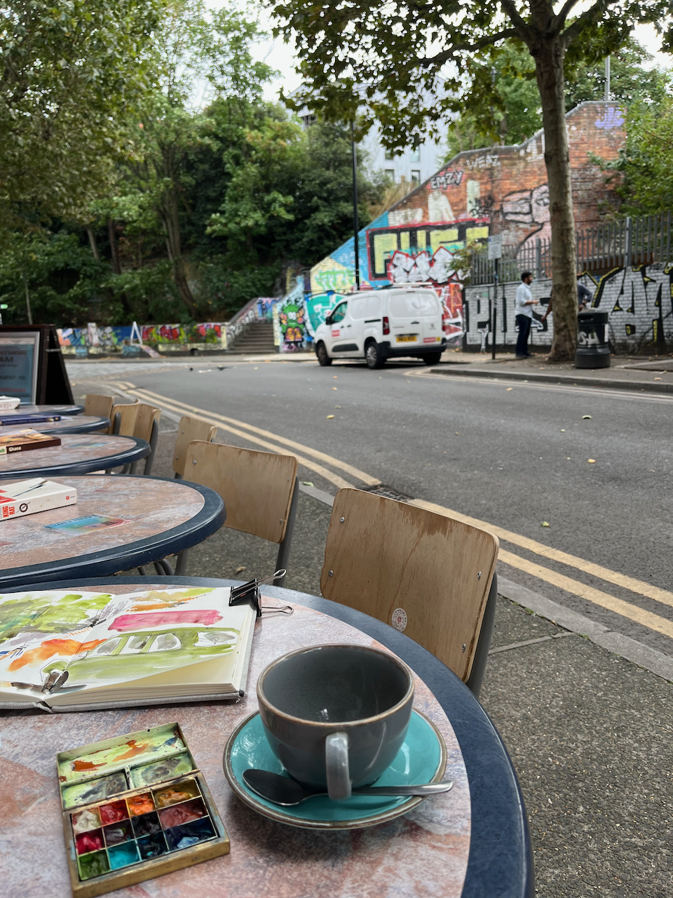
I found it cheering and energising. And I recommend the café I found: “The Ethical Bean” on Dace Road.
Click a button below to share this post online, email it, or print it:
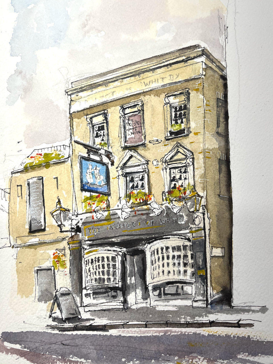
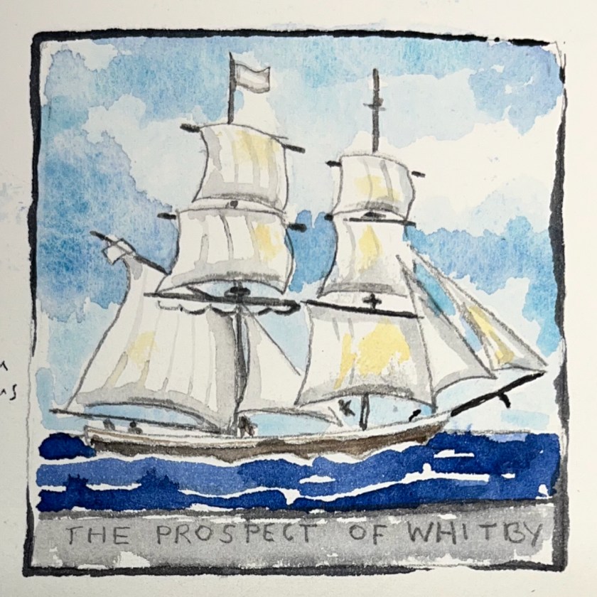
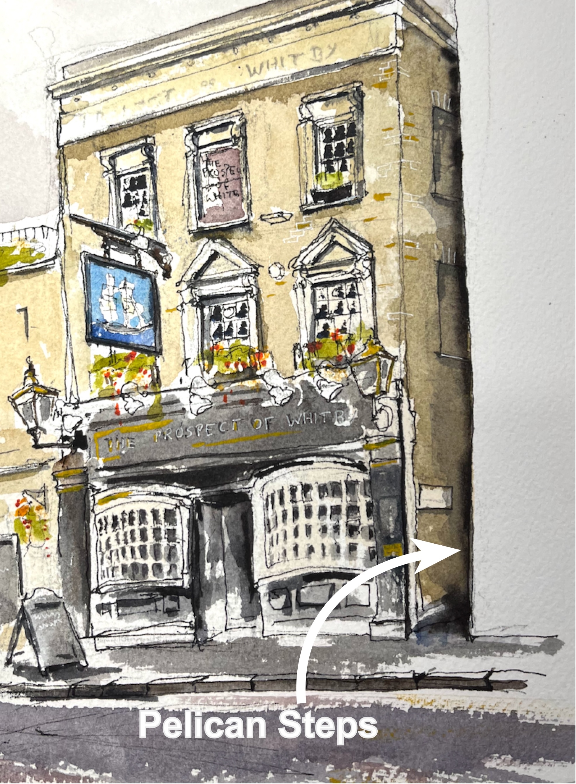
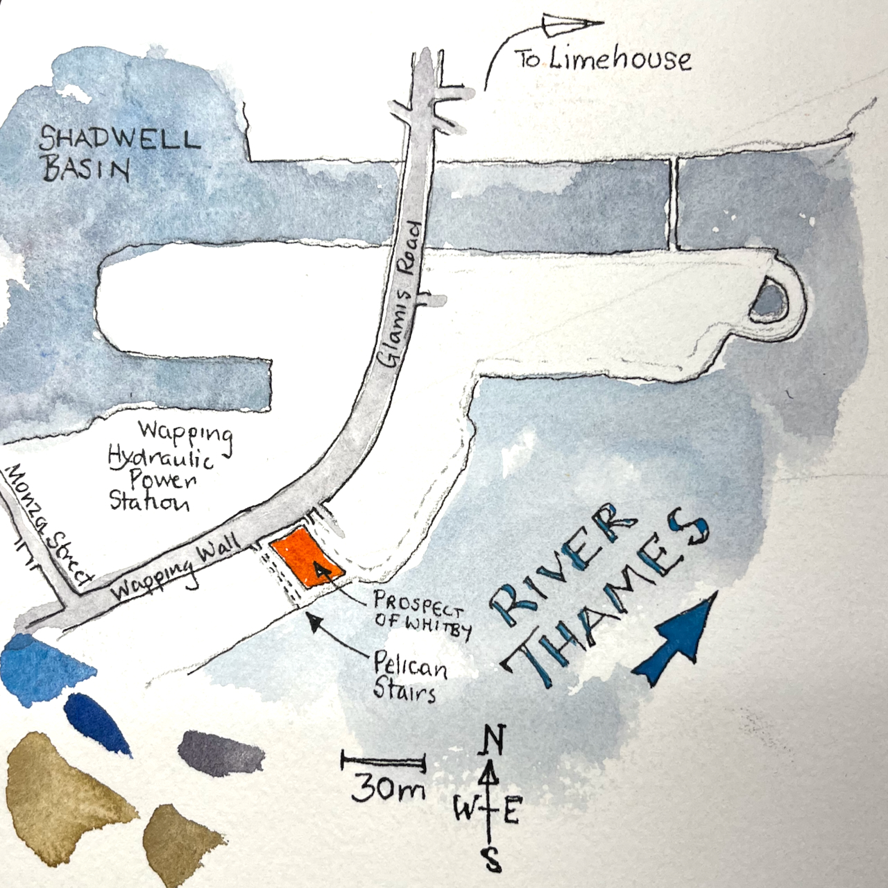
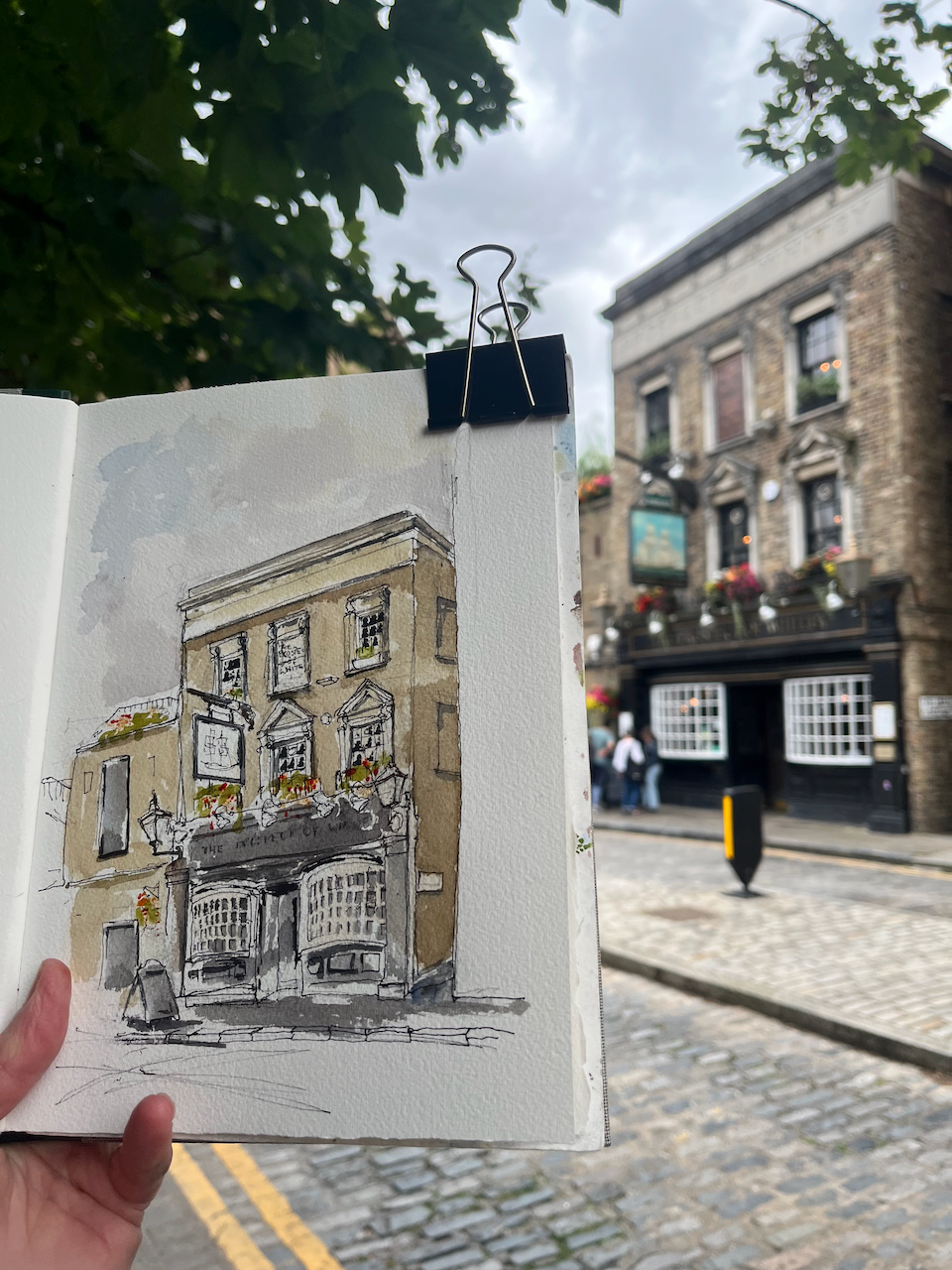
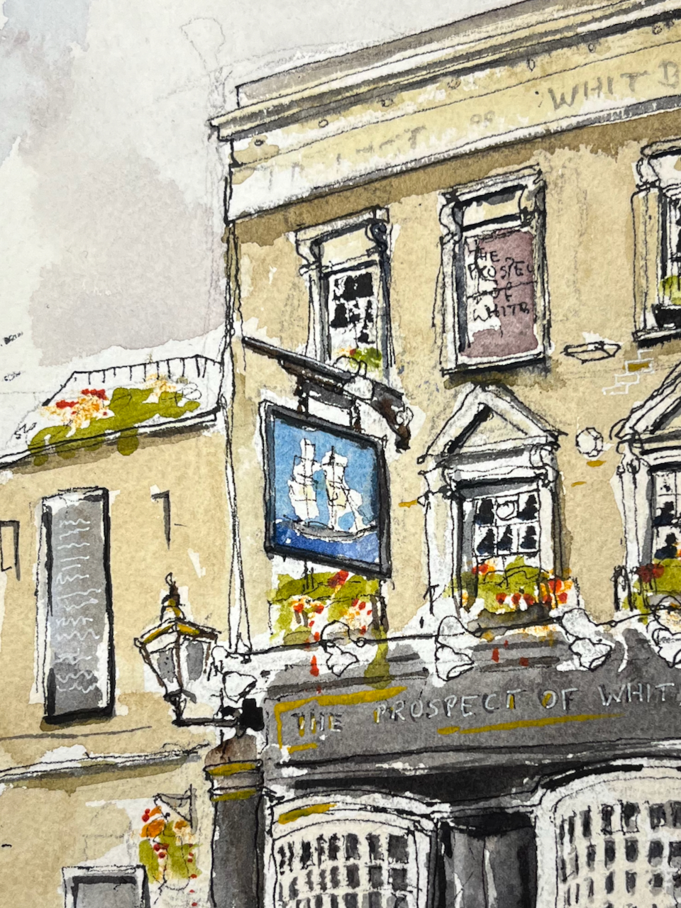
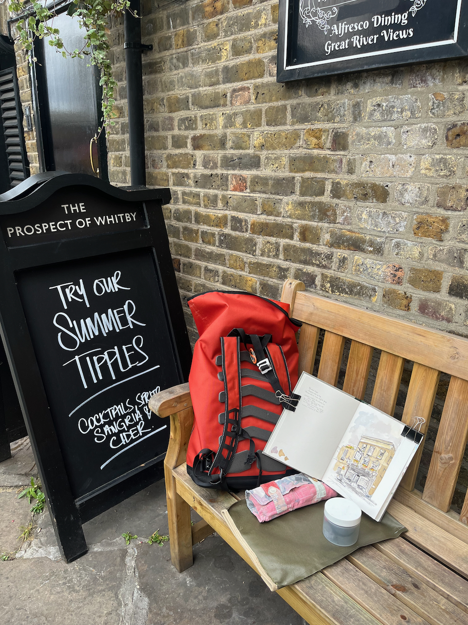
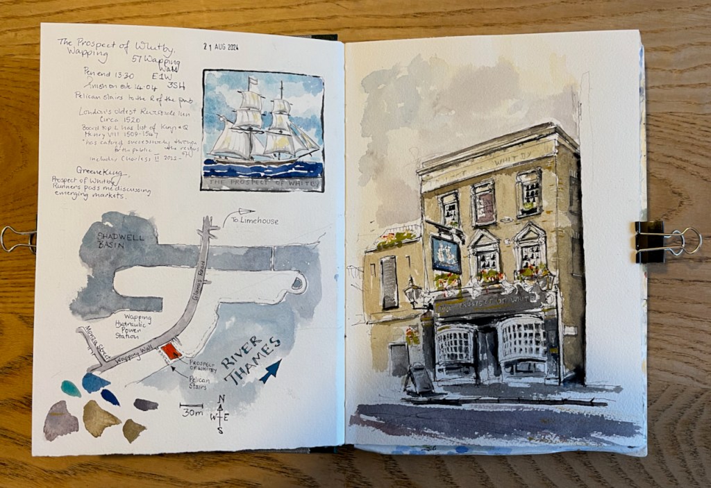
Here is the “Prospect of Whitby” pub by the Thames in Wapping.
“The Prospect of Whitby” sketched 21 August 2024 at 2pm, the first picture in Sketchbook 15
The “Prospect of Whitby” is the name of a ship.
The coal boat, “Prospect of Whitby”, from the pub sign.
There is an informative entry about the whole area in “The London Inheritance” website. He writes:
“The pub was originally called The Pelican and the alley and stairs down to the river at the side of the pub to the right are still named Pelican Stairs.“
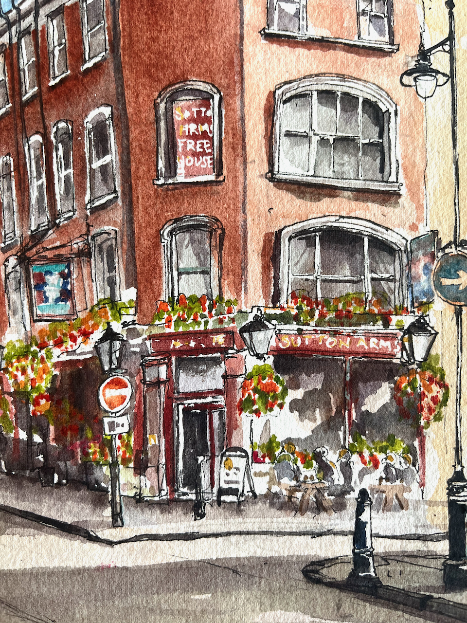
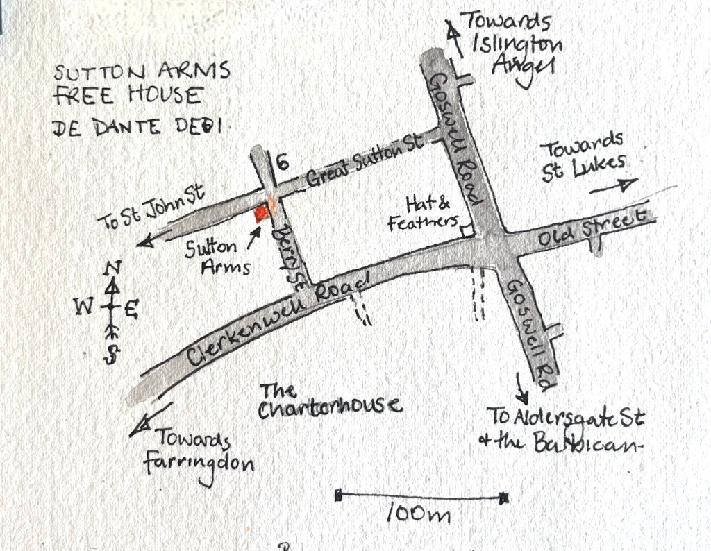
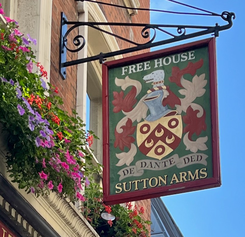
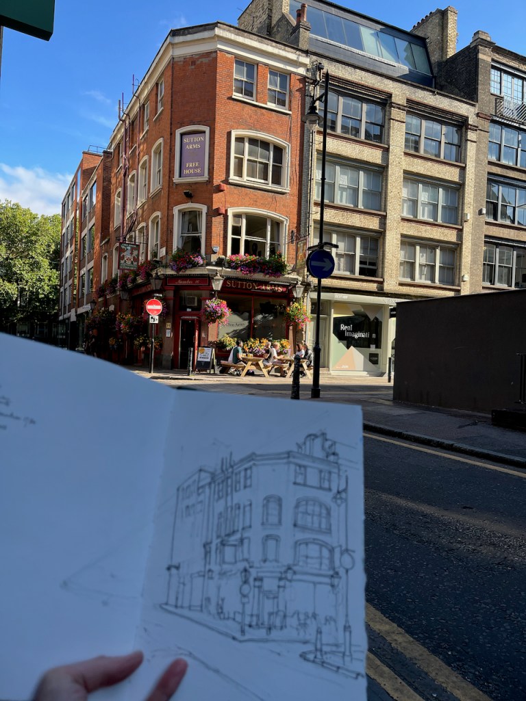
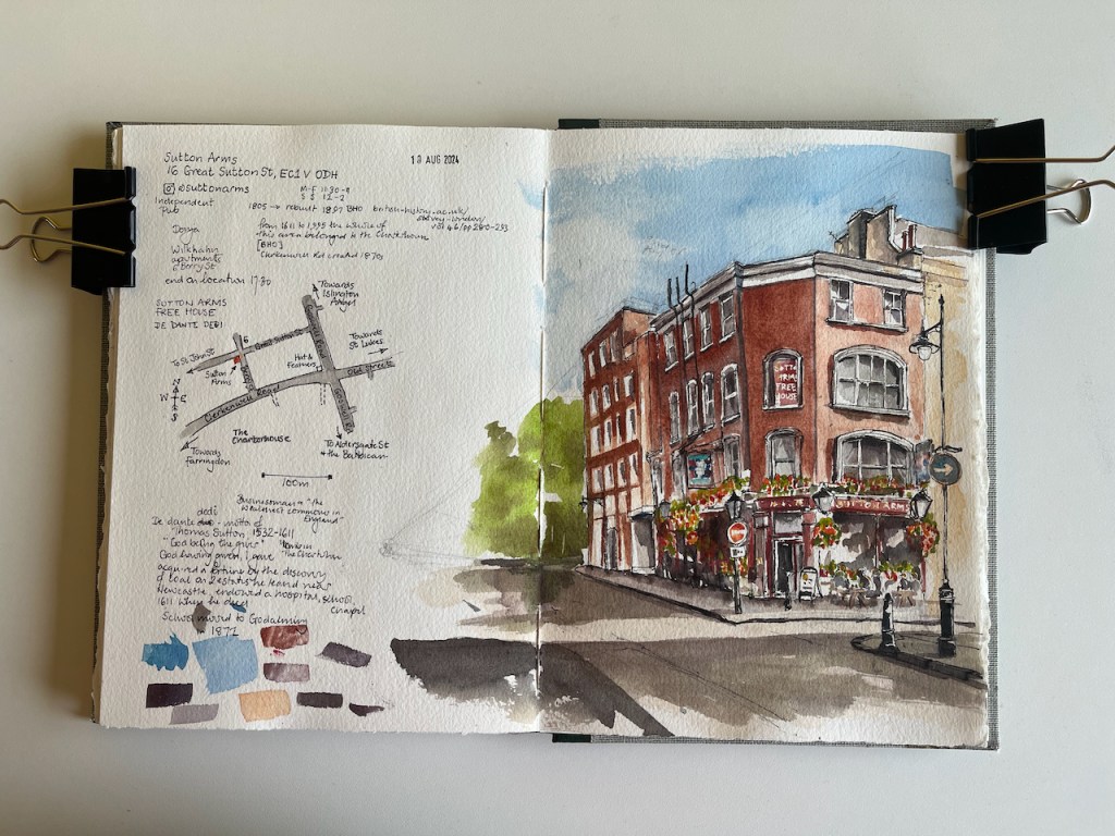
This is the Sutton Arms in Clerkenwell, 16 Great Sutton Street, EC1.
Sutton Arms, 16 Great Sutton Street, EC1V 0DH, sketched 10 August 2024 in Sketchbook 14
I sketched it towards the end of a sunny afternoon in August, sitting on steps outside number 6 Berry Street. As you see, the sun streamed in from the west. The trees in the distance, on the left of the drawing, are on Clerkenwell Road. Behind them is The Charterhouse, fulfilling its ancient tradition as an arms house and sanctuary for the elderly and frail.
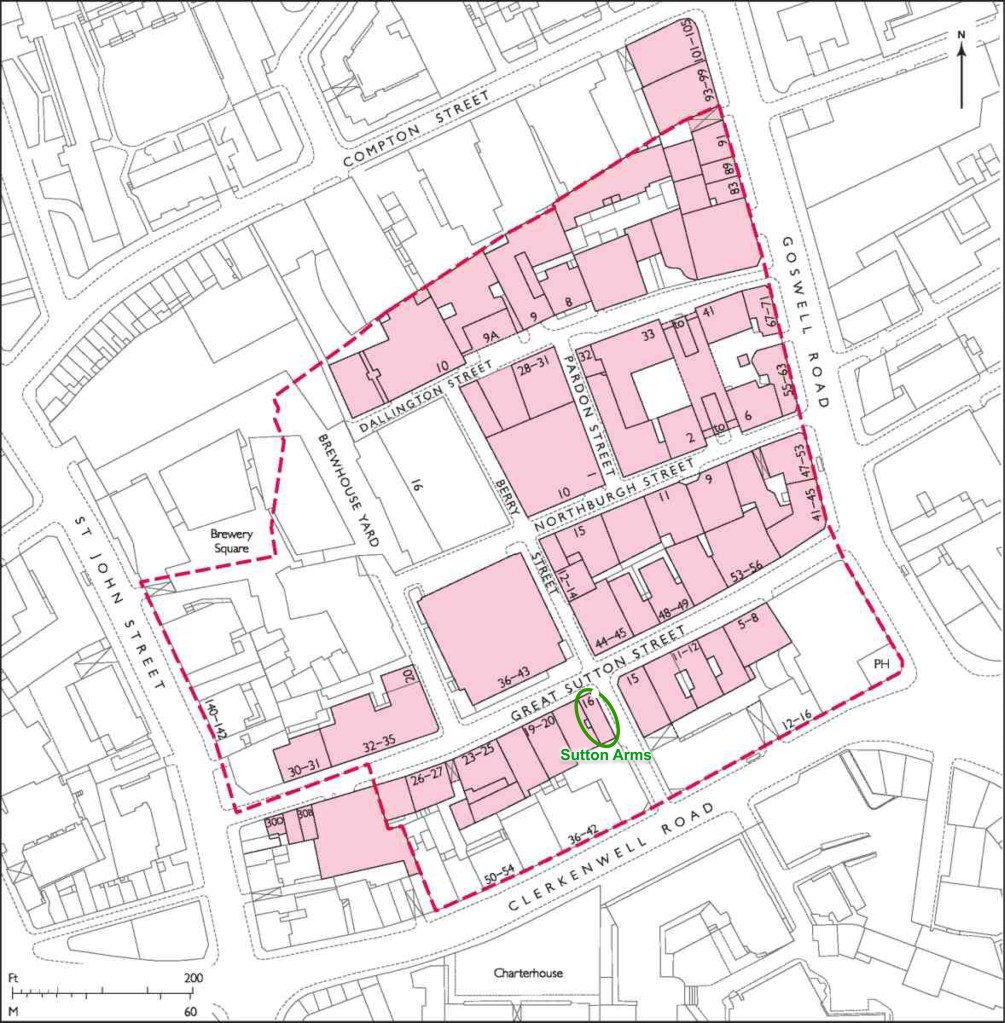
From 1611 to 1995, The Charterhouse owned the whole of this area.
Great Sutton Street area. The broken red line indicates the extent of the former Charterhouse estate. Image from British History Online [reference 2] annotated.
The Charterhouse sold this land in 1995. A developer bought up the land and built factories and warehouses. In the 21st century a new wave of developers transformed former warehouse blocks into apartments and offices. I sketched sitting outside one such: 6 Berry Street is residential apartments. This is now an area for architects and interior designers.
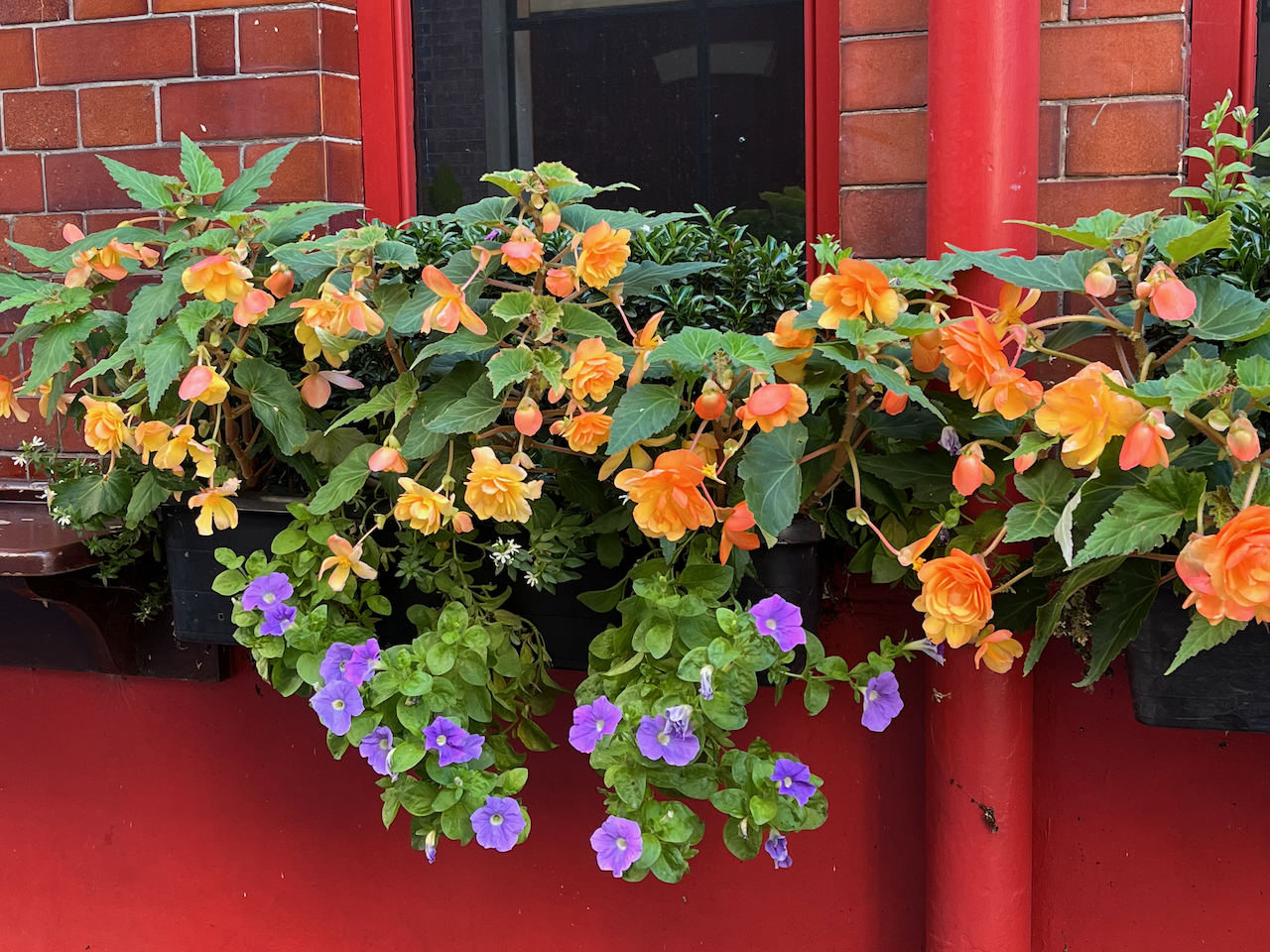
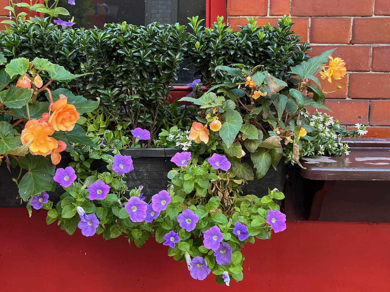
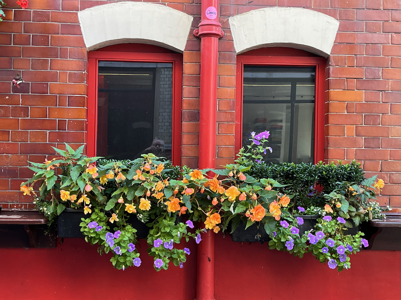
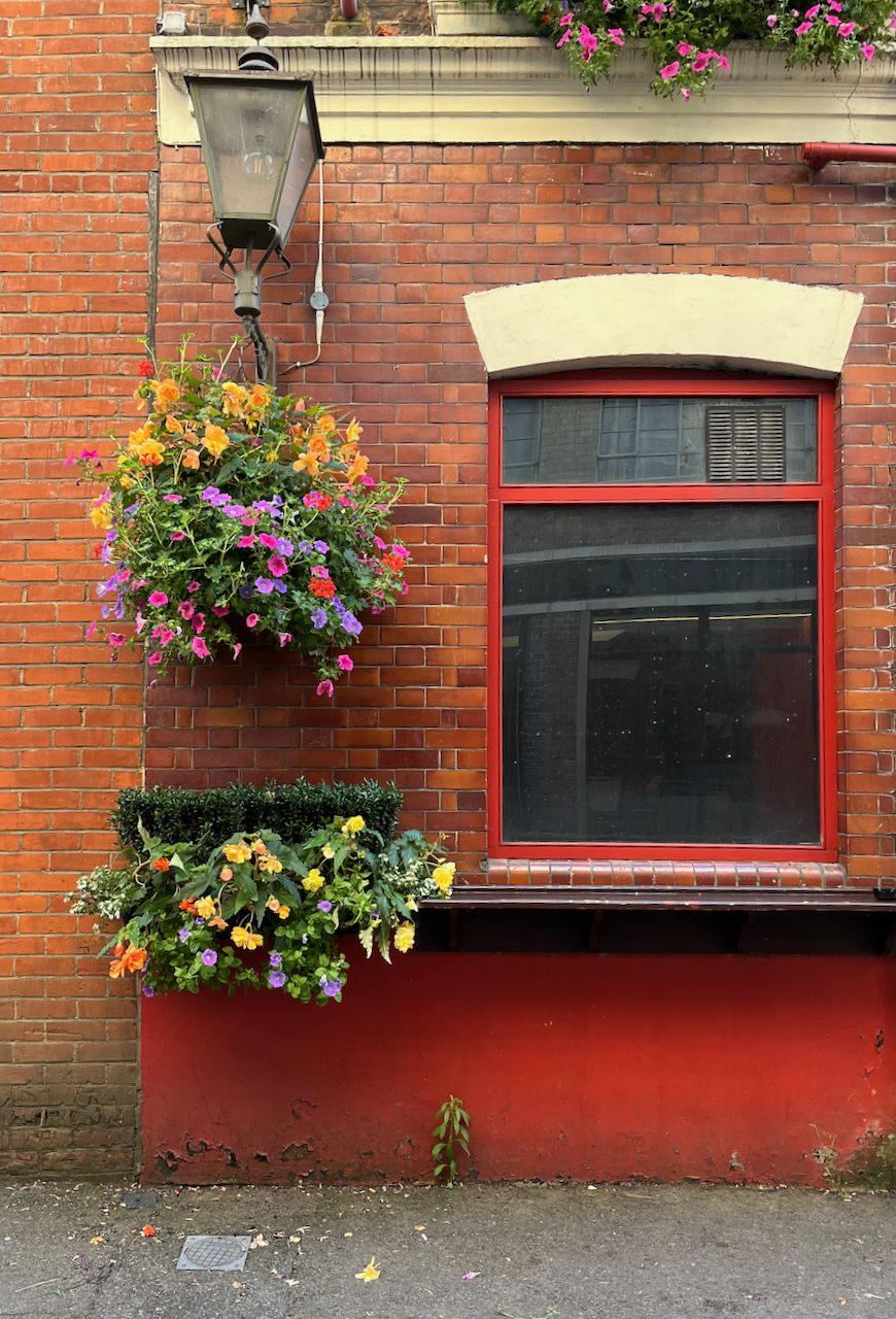
There was a pub here by 1825 [1]. It was rebuilt in 1897 [2]. It’s now a Free House. It’s clearly well looked after and well patronised. Definitely to be visited! The flowers are spectacular.
Spectacular flowers of the Sutton Arms.
Thomas Sutton (1532-1611) was the founder of the Charterhouse, hence the name of the road and the name of the pub. This is the Sutton Arms in Clerkenwell, north of The Charterhouse. There is also a Sutton Arms south of The Charterhouse, in Carthusian Street, near Barbican tube.
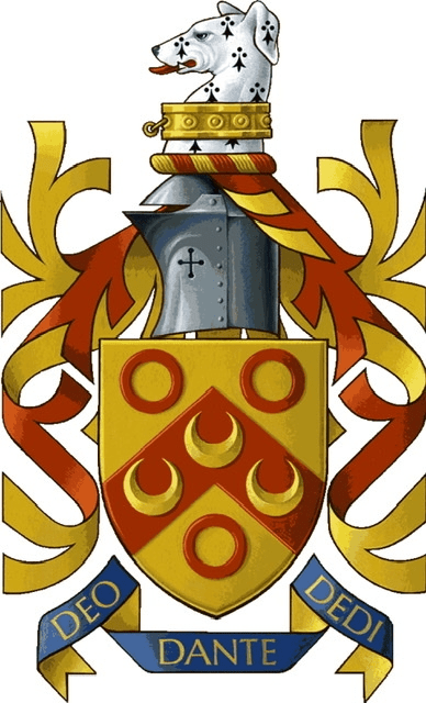
The pub sign is Sutton’s coat of arms. His motto is:
DEO DANTE DEDI
The translation is “God having given, I give”, or “As God has given to me, so I give in my turn”, a good motto for the benefactor that he was. The pub sign misses off the “O” in DEO and the “I” in DEDI.
Sutton Arms pub sign: “DE[o] DANTE DED[i]”Thomas Sutton’s Coat of Arms. See the greyhound. Source: Charterhouse School on Wikipedia
The “Survey of London ” [2] gives a detailed history of this area, which has alternately flourished and decayed over the centuries. It is currently flourishing.
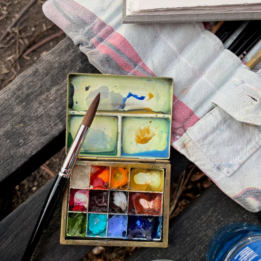
I completed the ink on location and finished the colour at my desk. The colours are:
Fired Gold Ochre (bricks)
Ultramarine Blue and Phthalo Blu (Green shade) (sky)
Serpentine Genuine (trees)
Mars Yellow (road and bricks)
Ultramarine Blue plus Burnt Umber (blacks and greys)
Transparent Pyrrole Orange (flowers, street signs)
The changing fortunes of the Great Sutton Street area.
In the 14th century this area was fields, owned by a Carthusian Priory. There was a mortuary chapel, called “Pardon Chapel” for saying the last rites for criminals and suicides. Henry VIII eradicated the Carthusian Priory in 1538 (“Dissolution of the Monasteries”) and it passed into private hands, along with the land. It became known at “The Charterhouse”. Thomas Sutton, a wealthy businessman, bought the Charterhouse in 1611. He died that year. His will provided for the hospital and almshouse that are still there. The Charterhouse leased the land outside its walls to developers, who built houses. “By 1687, when the Charterhouse estate was thoroughly mapped by William Mar, almost the whole had been laid out in streets of small terrace houses—242 houses in all, with yards, gardens and sheds.” [2] These terraces set the street pattern for the small streets that are there today. The lattice continued to the walls of The Charterhouse. Clerkenwell Road was cut through much later, in the 1870s. Then commerce moved in and a hundred years passed. By the 1700s, the area was a mix of residences and industries: “In 1731 Philip Humphreys, the Charterhouse gardener [..]complained of the adverse effect on his crops of smoke ‘from so many neighbouring Brewhouses, Distillers and Pipe-makers lately set up’ in the vicinity.” Thus we see that NIMBYism is not a new phenomenon. A new developer (Pullin) came in and rebuilt, and more and larger factories were built. Again, the neighbours complained: “Already by the 1820s some houses were giving way to further industrial developments, including slaughterhouses, a dye-house, breweries, and vinegar, vitriol and gas works. Complaints were made to the Charterhouse in 1832 about the nuisance of these works and their steam engines, and to the Vestry in the 1850s about the ‘boiling of putrid meat and other offal’ and blood running into the drains.” Building continued. Eventually government intervened: “Extensive redevelopment of the Charterhouse estate followed remarks in 1884–5 by the Royal Commission on the Housing of the Working Classes as to the badness of the houses there. […] Charterhouse was criticized for allowing [..]the incidence of house-farmers, severe overcrowding and badly constructed, poorly ventilated housing to continue on its property. One house in Allen Street was found to be occupied by thirty-eight people, eleven of them in one small room; similar conditions were found in the cottages of Slade’s Place. Many of these properties were occupied by costermongers with ‘very precarious’ earnings (whom the Commission felt would do better ‘if they kept from drink’).[2]” The Charterhouse governors eventually took action. The small houses were demolished, and replaced by factories and warehouses. This time the trades were less polluting: “Among early occupants were clothing manufacturers: milliners, mantle-makers and collar-makers, leather manufacturers, glove-makers and furriers. The printing trade was also well represented, along with book-binding, engraving and stationery manufacture. Continuing a long-standing tradition were several butchers and tripedressers.” By now we are in the early 1900s. About a dozen buildings were destroyed by bombing in the 1939-45 conflict, and replaced in the 1950 and 1960s by factories and warehouses. The Survey of London [2] reports that the area was “considerably run down” in 1995 when the Charterhouse sold it to developers. The developers started a programme of warehouse conversions, to apartments and offices, which transformed the area, and moved it back upmarket. And that’s where we are today. (The above is my summary of the more detailed description in reference [2])
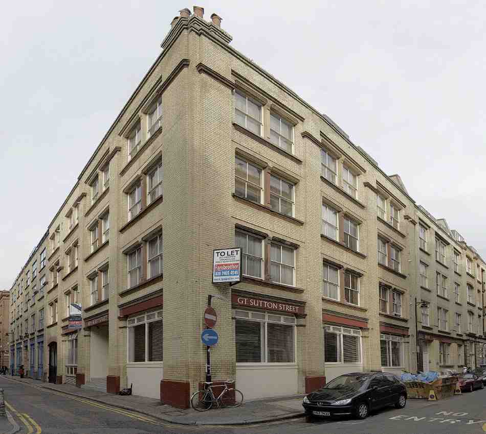
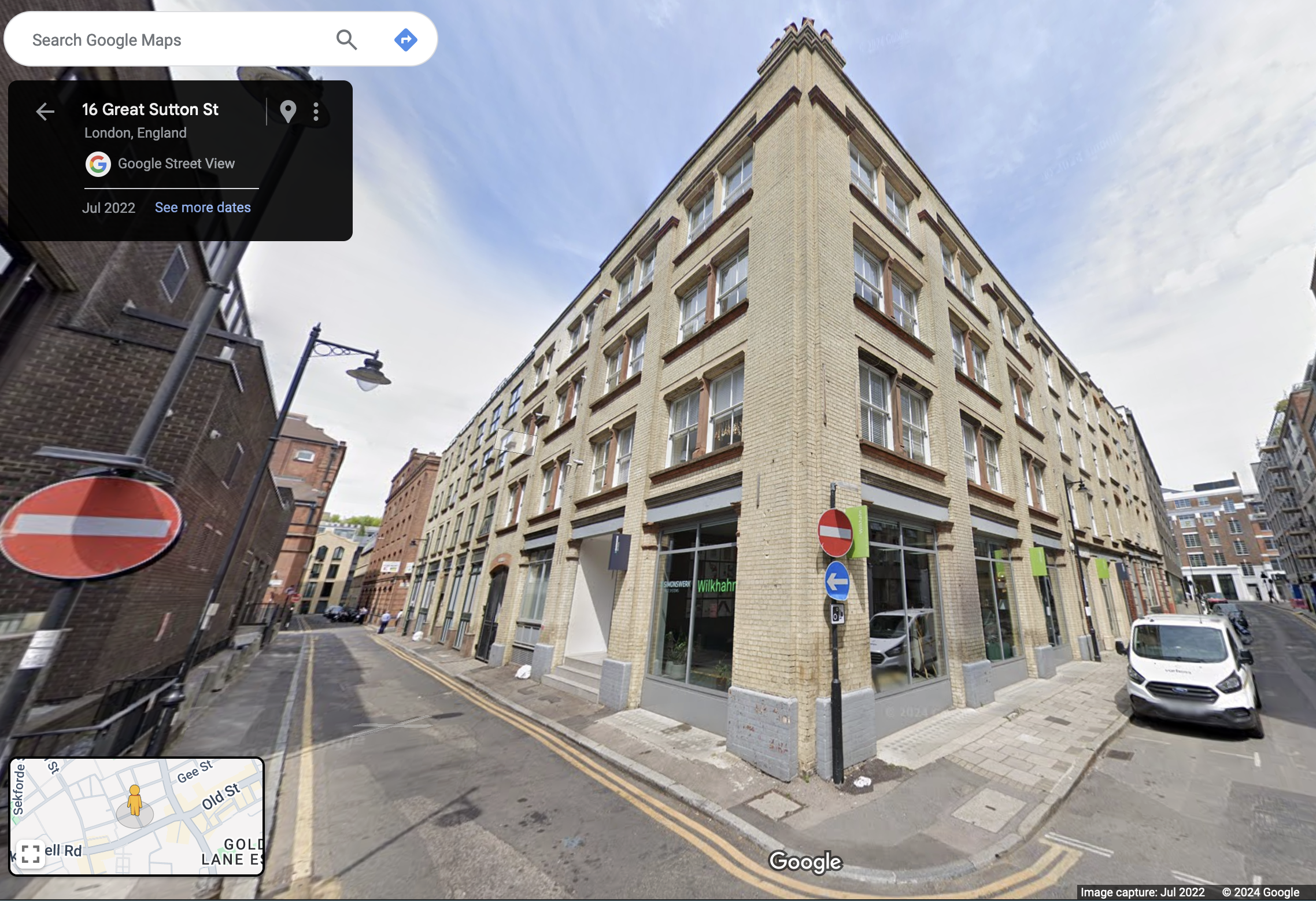
[Reference 2 fig 402] Warehouse developments of the 1890s by Mark and Albert Bromet and others at the corner of Berry Street (Nos 12–14, left) and Great Sutton Street (Nos 44–49)The same site today. (Google Street view). Above street level, this is residential. I met one of the residents while sketching. I was sitting on the steps of the entrance to her block, centre left.
[2] British History Online: ‘Great Sutton Street area’, in Survey of London: Volume 46, South and East Clerkenwell, ed. Philip Temple( London, 2008), British History Online https://www.british-history.ac.uk/survey-london/vol46/pp280-293 [accessed 2 September 2024].
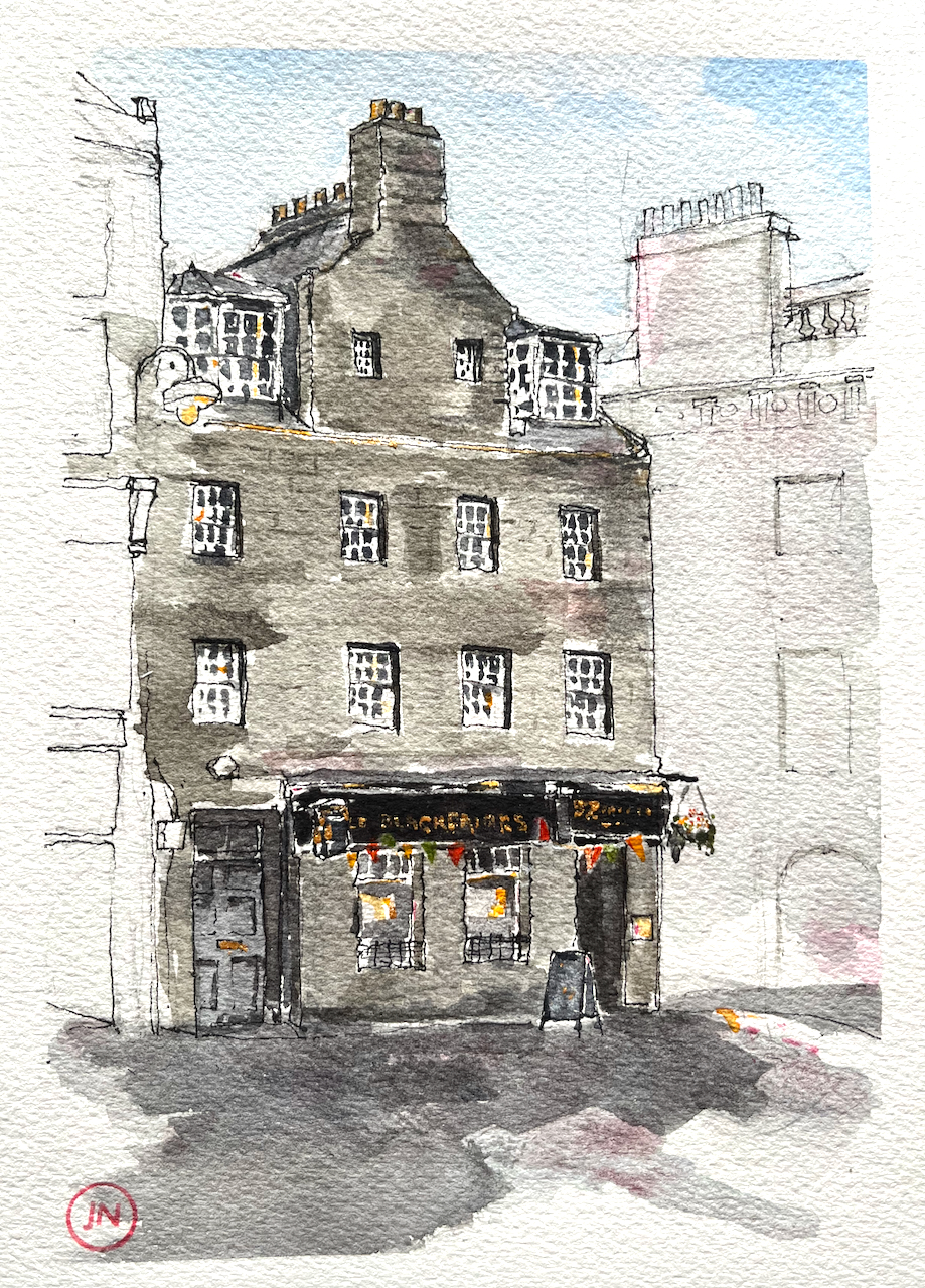
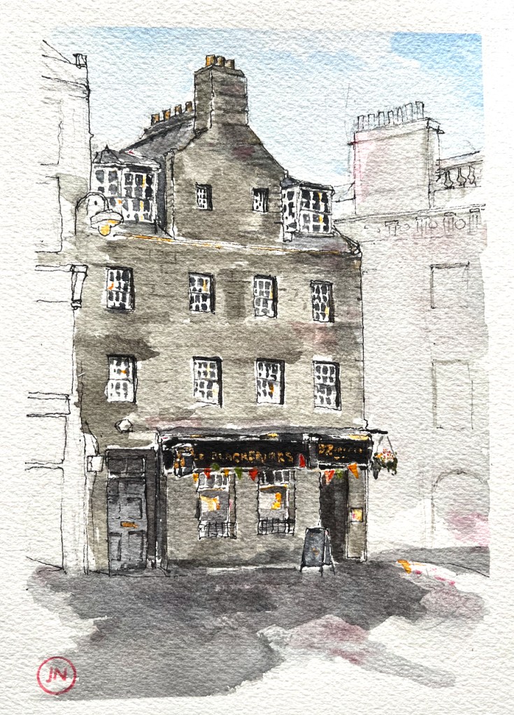
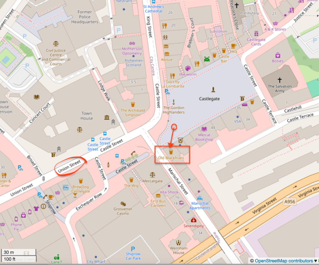
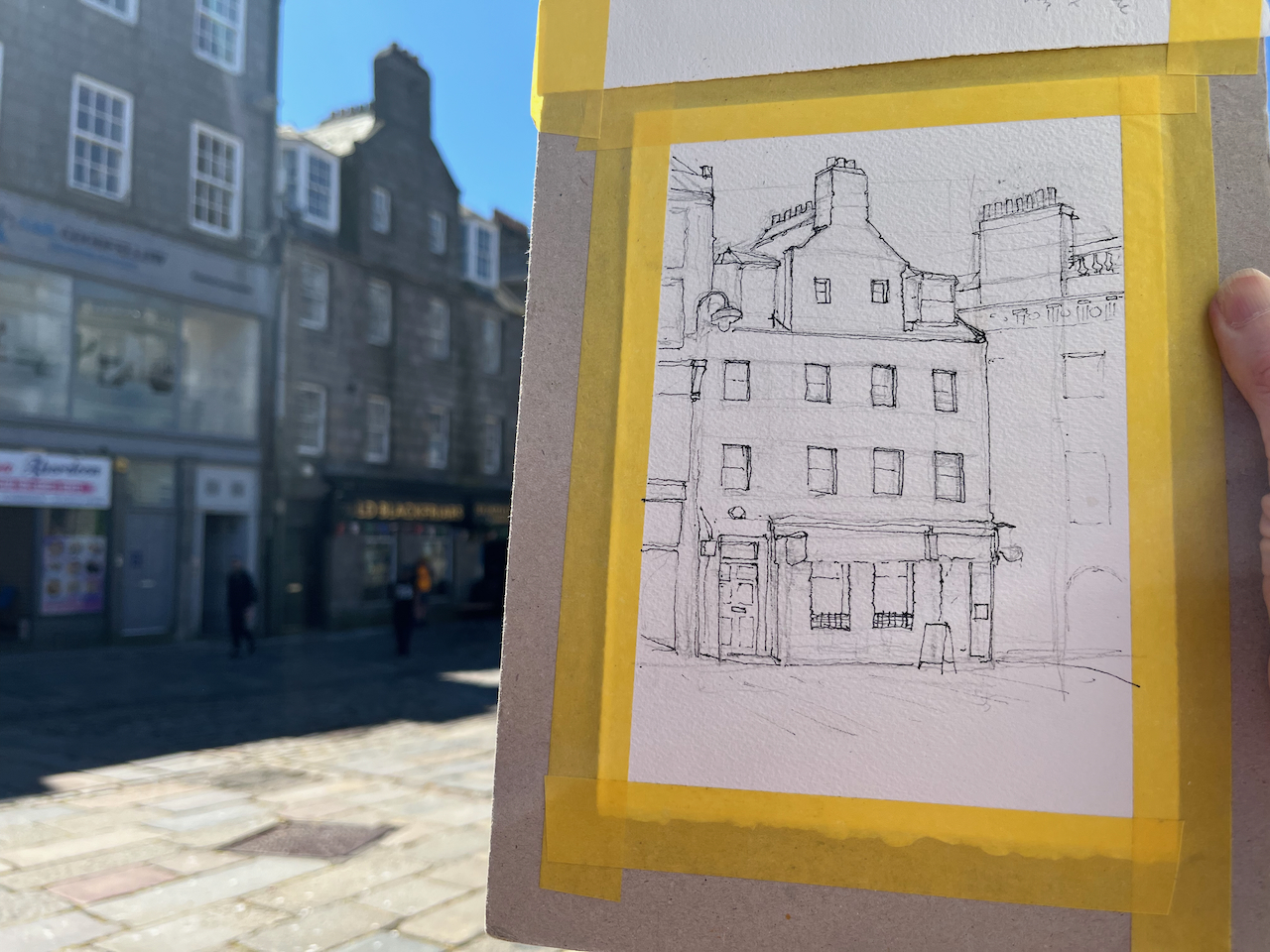
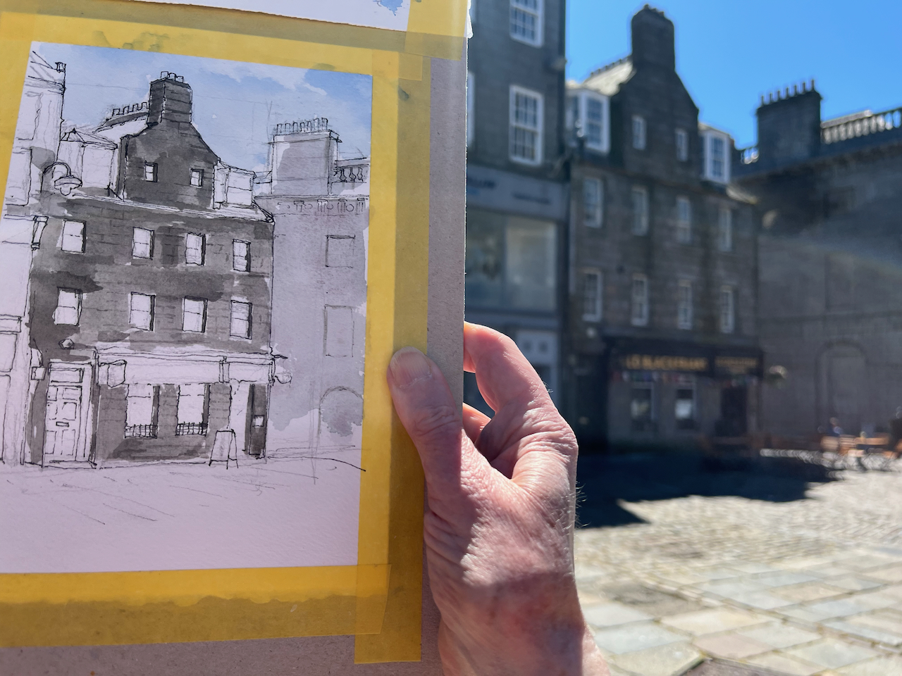
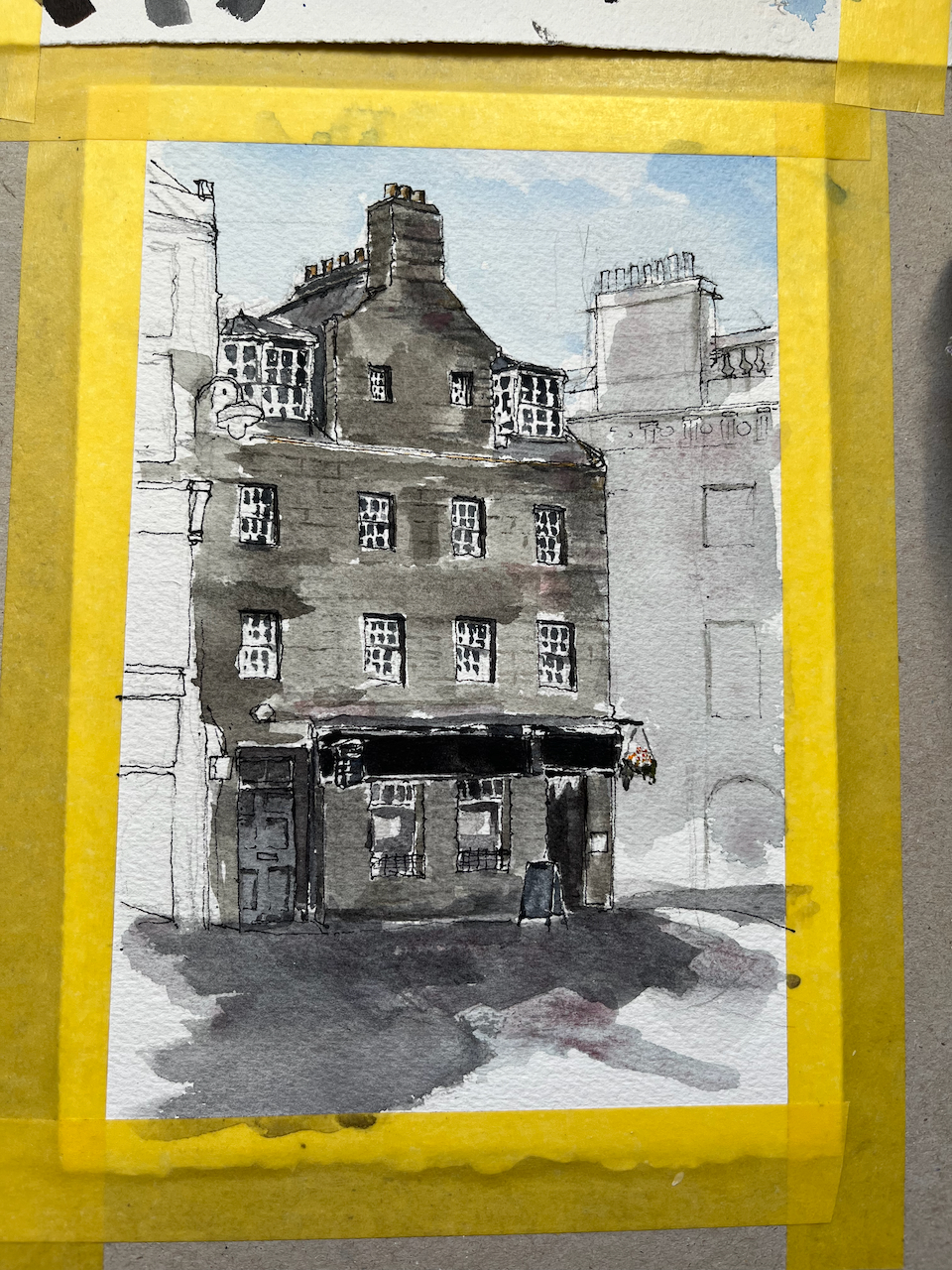
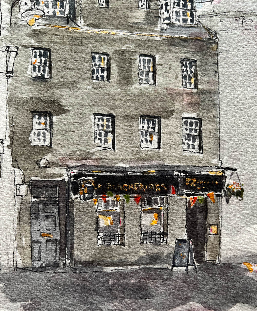
This is the Old Blackfriars, 52 Castle St, Aberdeen.
The Old Blackfriars, Aberdeen AB11 5BB, sketched 24 June 2024, 20cmx14cm (A5), [commission]
I worked on this drawing standing in the large cobbled square called Castlegate. A passer-by walked up to where I was standing, and took an interest in the picture. I’ll call him Campbell. He had much to tell me, a visitor, about the city of his birth. He had been brought up in what he described as the “tenements” on the dock. “Six of us to a room,” he said. He’d trained as a coppersmith, and found work in the engine rooms of ships and submarines, making “boilers, pipes and flanges”.
I was sketching this pub at the request of a client who had happy memories of their time there. Campbell also had happy memories of his lively times at the pub, although his experiences pre-dated those of my client by some decades. It was a pub for folk working the docks Campbell told me, and “they had a hard life”.
Uncharacteristically for British people, we talked politics. The general election was coming up. My new friend had little time for politicians of any stripe. They don’t know what they are doing, he asserted. “It’s like watching a drunk man trying to walk down Union Street”. He indicated the wide straight street across the cobbles, and with an articulate hand gesture demonstrated the erratic movements of the inebriated.
I enjoyed his entertaining stories as I sketched. He went on his way when I was at the pen-and-ink stage. I hope that some of his stories made it into the finished drawing.
Sketching on location in Castlegate, Aberdeen
The main colours are: (DS=Daniel Smith watercolour) – ultramarine blue finest (Schmincke) – burnt umber (DS) – haze pink (Schminke) – in the stones – rose madder permanent (DS) – in the stones For the details: – permanent yellow deep – pyrrole red – mars yellow – acrylic gold paint
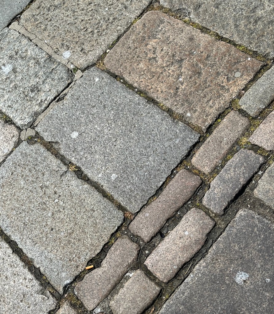
Aberdeen is “The Grey City” for some. But for anyone who doubts that there really is pink in the stone, I include a photo of the cobbles.
Cobbles at my feet
This was a commission. Thank you to my client for inspiring me to draw this historic pub, and for their permission to post the pictures here. They kindly sent me a photo of the picture in its frame:
photo credit: my client G.
Click a button below to share this post online, email it, or print it:
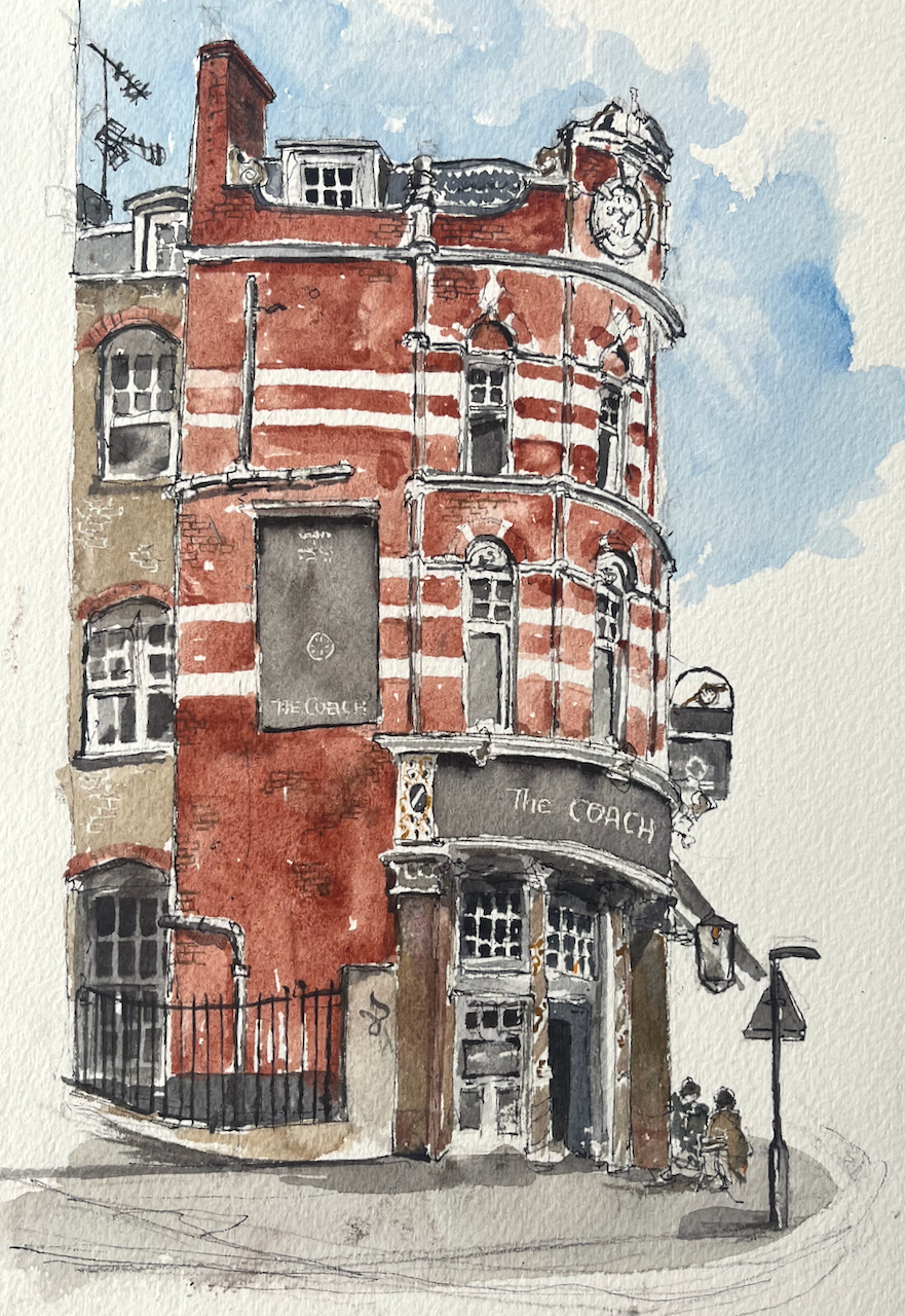
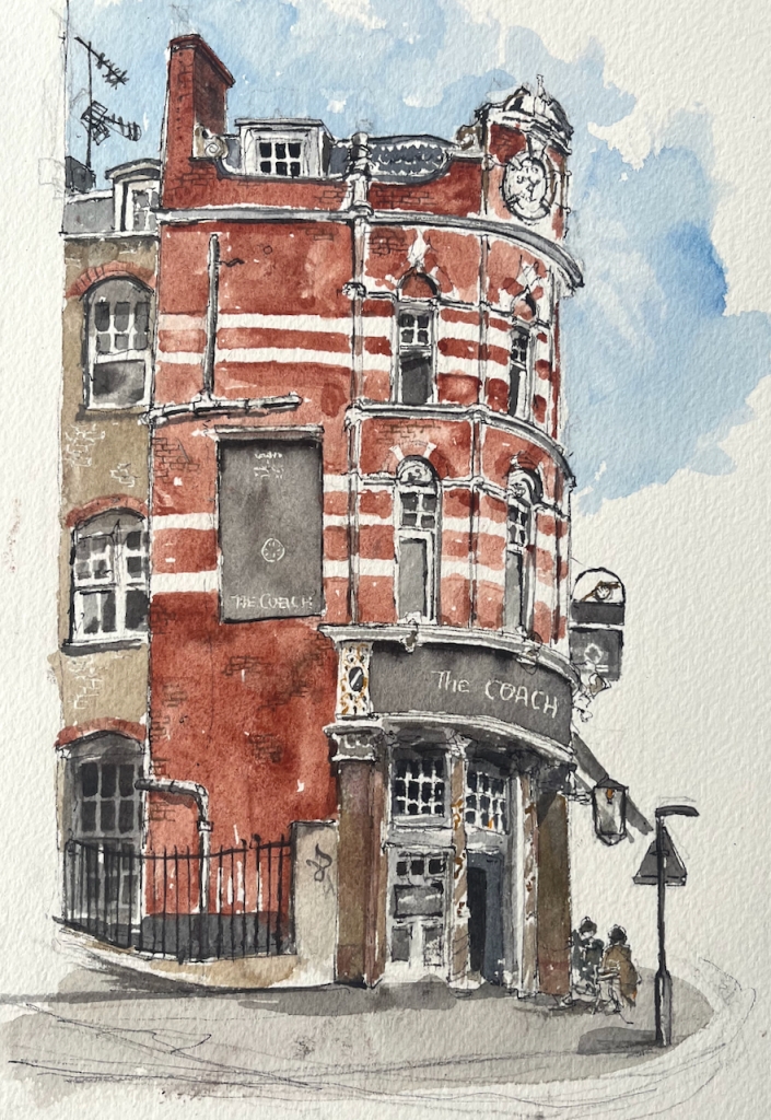
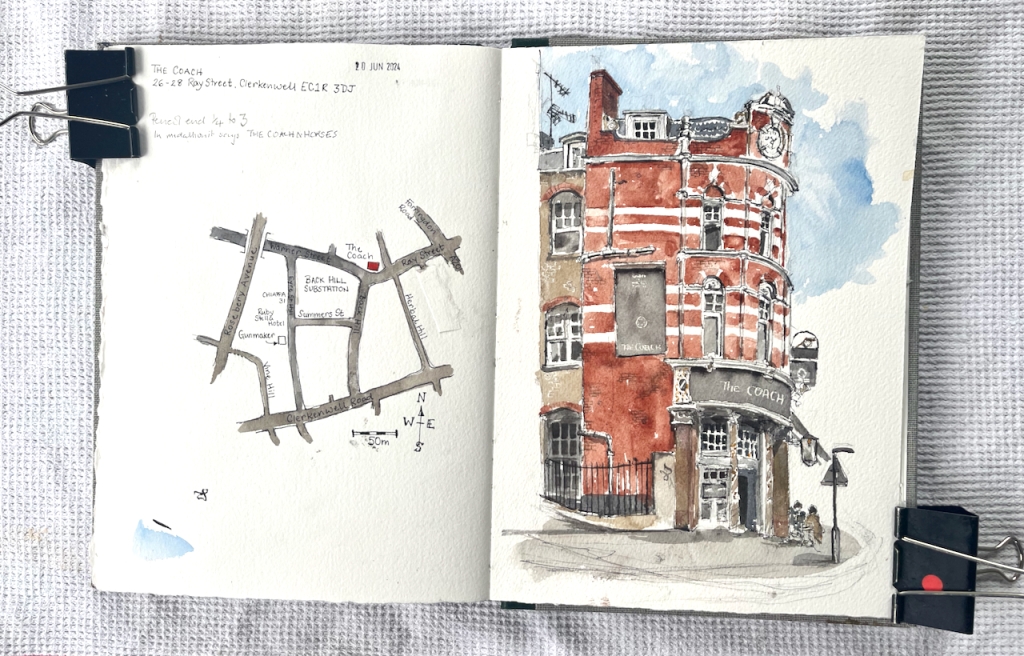
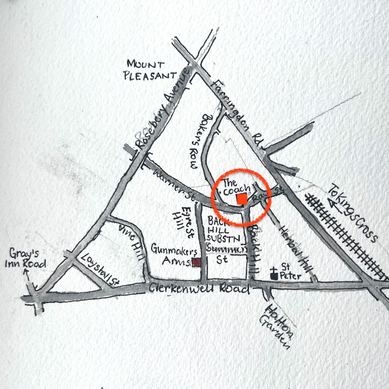
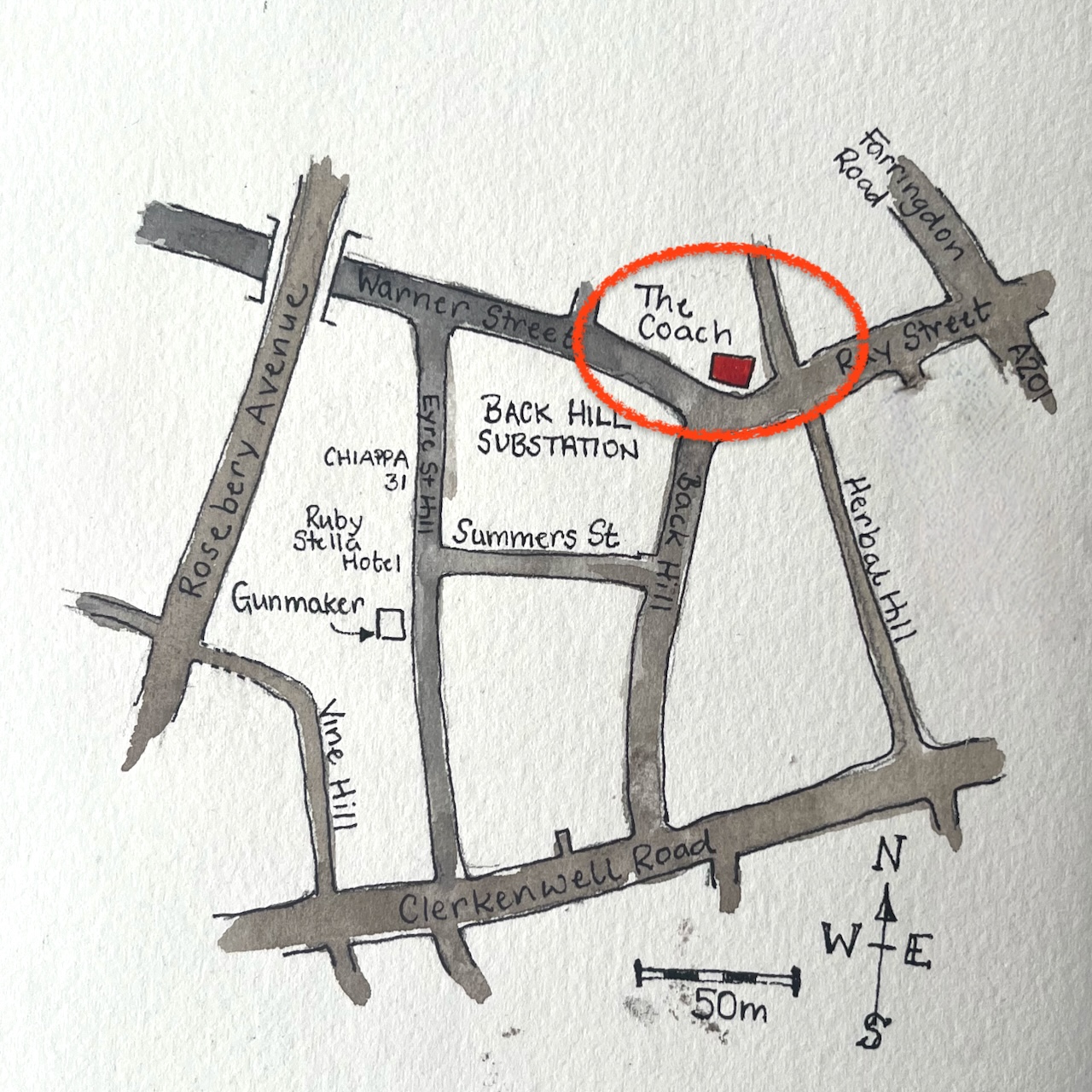
“The Coach” Clerkenwell, Sketched 20th June 2024 in Sketchbook 14
I sketched this after I had sketched “Gunmakers” in nearby Eyre Street Hill. Above the pub sign is a model, just visible on the right of my drawing.
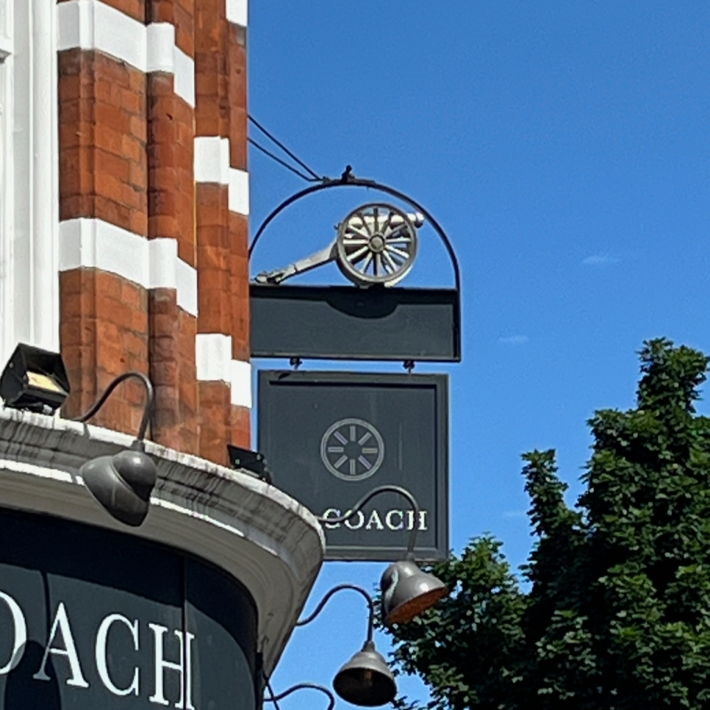
The Coach pub sign: a gun carriage?
The model is a gun carriage. I wondered what the connection was to The Coach, and if there was any connection to Gunmakers on Eyre Street Hill. But no, it is the symbol of The Cannon Brewery. This brewery was founded 1720, in nearby St John Street. It was acquired by Taylor Walker in 1930. I have this information from http://breweryhistory.com. So that explains the cannon.
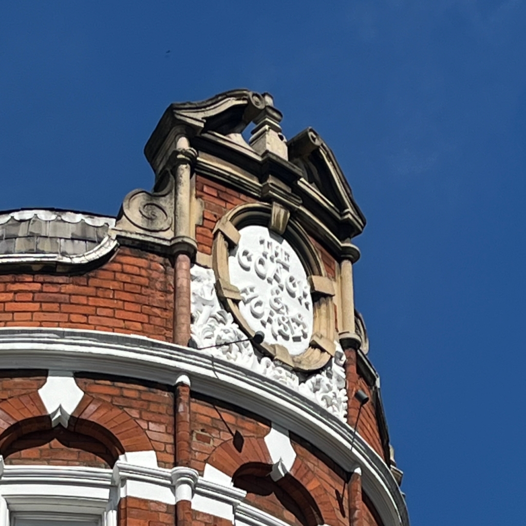
At the top of the pub, the medallion names the pub as “The Coach and Horses” in white relief work.
The pub website says: “The Coach was established in 1790, and has been at the heart of the lively Clerkenwell community for generations.”
British History Online describes a pub called The Cock Inn, which was part of a sale in 1695:
At the time of the sale [1695], the land was mostly taken up by two fields of pasture: Gardiner’s Field to the north and the larger Sir John Oldcastle’s Field to the south. There was a cluster of buildings and a large rubbish dump or laystall in the south-eastern corner, in the area of Hockley-in-the-Hole. Chief of these buildings was the Cock inn, the forerunner of the present-day Coach and Horses in Ray Street.
The current building dates from 1897 according to this source:
All the eighteenth-century public houses in the area have been rebuilt or have disappeared entirely. The Apple Tree in Mount Pleasant was rebuilt in the 1870s, and the Coach and Horses in Ray Street in 1897
So it looks as though the pub was there already in 1695 as the Cock Inn, was established as The Coach and Horses in 1790 (according to the pub website) and rebuilt in 1897. It was renamed The Coach in 2018.
Having closed on 31st July 2015, this pub reopened on 16th January 2018 as the Coach with its Taylor Walker/Cannon Brewery sign frame retained.
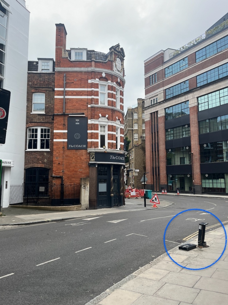
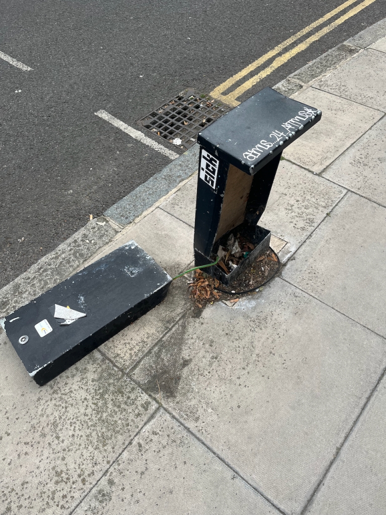
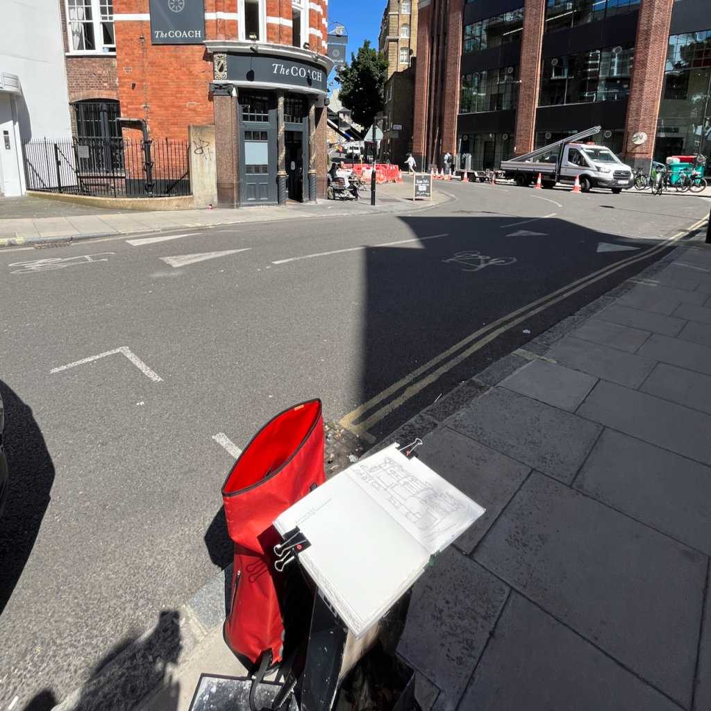
People sometimes ask me how I determine the viewpoint in my sketches. Often, as here, it is determined by practical rather than artistic considerations. I need somewhere to sketch, out of the way, not in the road, and with a clear view. I don’t carry a seat, though sometimes I wish that I did. But here, like a miracle, a seat presented itself.
This perhaps had been a phone junction box, but no more. Now it was a seat. I commandeered it.
I did the pen-and-ink on location and then added the colour back at my desk.
The colours here are:
Fired Gold Ochre for the bricks
Ultramarine Blue plus Phthalo Blue Turquoise for the sky
All greys and blacks are Burnt Umber with the blues
There’s a bit of Mars Yellow in some of the brickwork and the pillars.
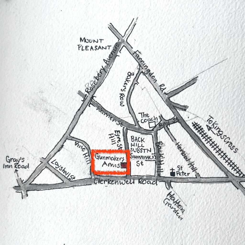
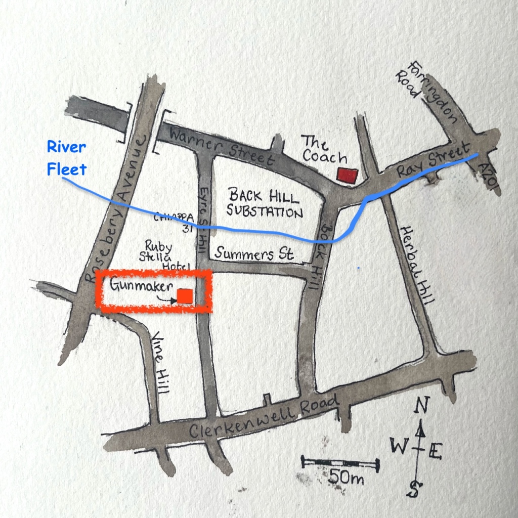
Here is the pub “Gunmakers” in Eyre Street Hill, Farringdon.
“Gunmakers” in Eyre Street Hill EC1R, sketched 20th June 2024 in sketchbook 14
Eyre Street Hill is a small sloping street in Farringdon, within the triangle made by Rosebery Avenue, Clerkenwell Road, and the Farringdon Road.
It slopes down to the River Fleet which is now below ground. I marked the approximate route of the Fleet on the map below:
It is a very old street, laid out in the 1720s as “Little Bath Street”. “British History Online” contains a detailed history of the area. This tells me that here and to the north was called “Coldbath Fields” in around 1719. The small houses in Eyre St were beside the Cold Bath, “a privately run hydropathic establishment opened in the late 1690”. This was on the edge of town. But then the came a distillery, a smallpox hospital and a workhouse.
“On the north-western ground, now largely occupied by Mount Pleasant Sorting Office, a distillery was built in the 1730s, and a smallpox hospital in the 1750s. These were joined towards the end of the eighteenth century by the prison, the Middlesex House of Correction, which became notorious for the brutality of its regime. South of the Cold Bath, near the old and insalubrious quarter called Hockley-in-the-Hole, the parish workhouse, built in the 1720s, was greatly enlarged in 1790.”
Then Rosebery Avenue and Farringdon Road were built, with much demolition and reconstruction. By the beginning of the twentieth century, this area became part of “Little Italy”, a centre of the Italian Community. St Peter’s Church, on Clerkenwell Road, is still “the Italian Church”.
I can find no reference to this pub, or to gunmaking in the area. The building looks like one of the ones built in 1812:
The sun catches the castellated building.
“Today the oldest structures are the small, single-bay houses with shopfronts at Nos 33–37, dating from the early nineteenth century and fairly typical of the rebuilding that took place in the area at that time. Nos 33 and 35 were erected as a pair around 1812 by Thomas Abbott, builder, of Leather Lane.”
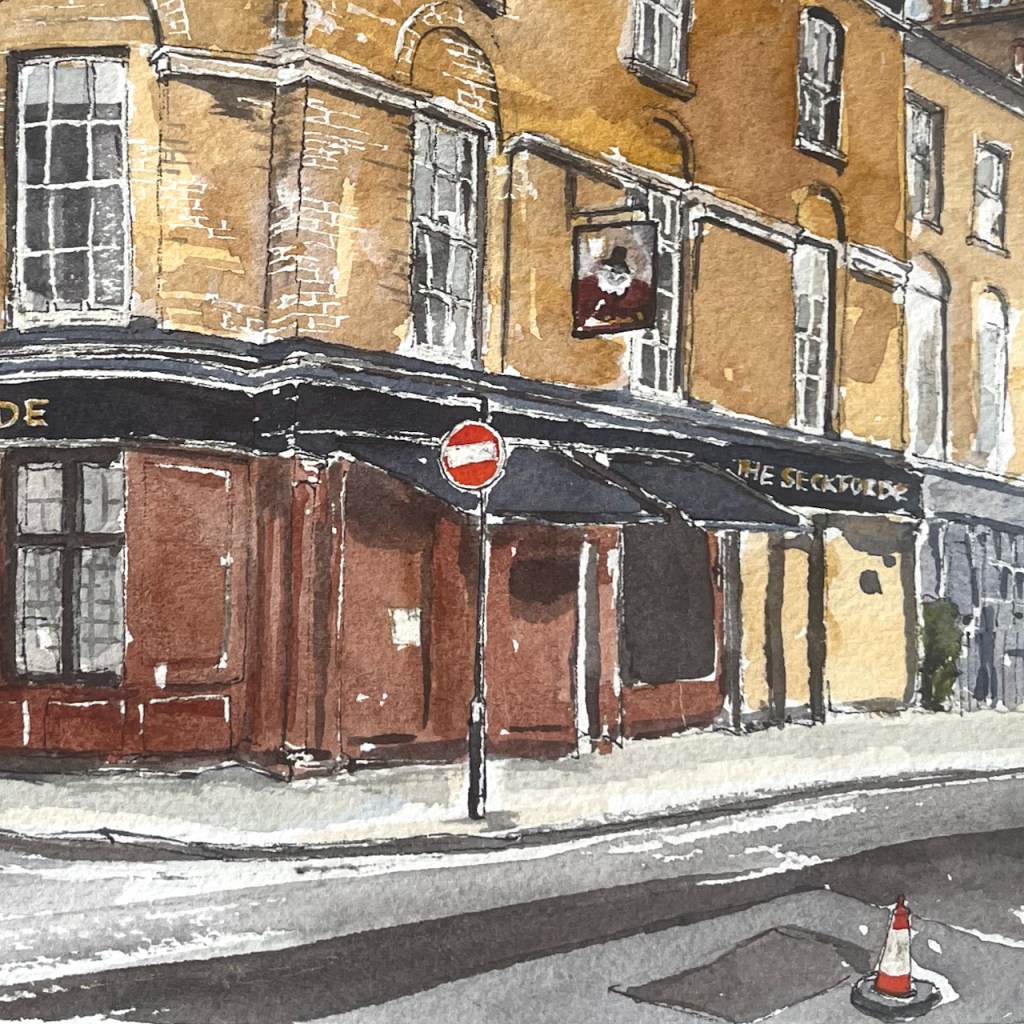
The Sekforde EC1R 0HA, Clerkenwell, sketched March 2024 12″ x 9″ [commission]
This watercolour was specially commissioned to celebrate a happy event.
The colours are:
Mars Yellow
Fired Gold Ochre
Ultramarine Blue
Burnt Umber
plus some Horadam Random Grey, some Daniel Smith Green Serpentine Genuine, and Pyrrol Red for the street sign and road marker.
Gold paint for the lettering.
Admire the bricks! I am very pleased with this effect. It was done by applying a rubber resist, “pebeo drawing gum” to the paper before I did any painting. The paint does not adhere to the rubber resist. When I had done all the colour, I rubbed off the rubber resist and hey presto! bricks.
Thank you to my client for their encouraging words and for inspiring me to make this picture of The Sekforde. Here are some details of the drawing.
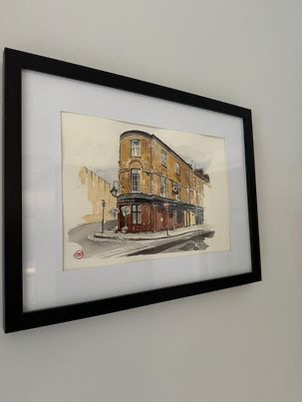
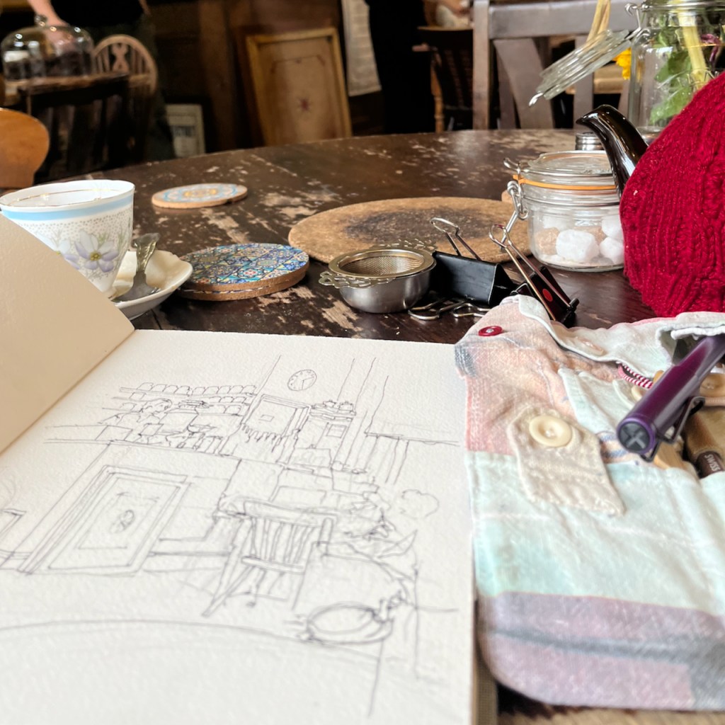
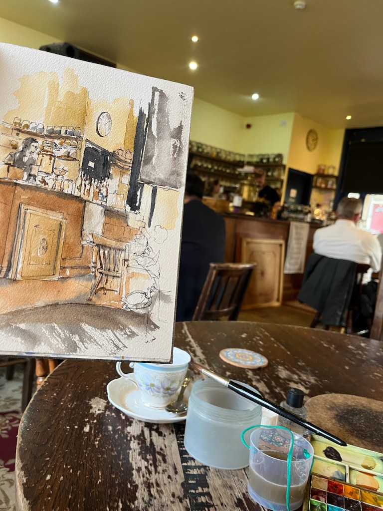
Vauxhall Tea House – 2:30pm 7 March 2024, in sketchbook 14
The tea I drank was their “Russian Smoky Tea”.
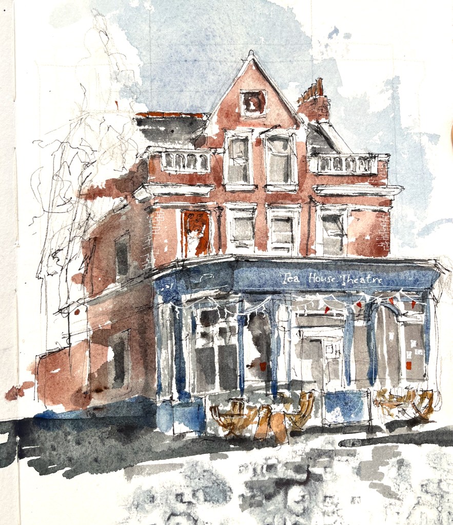
I’ve visited the Tea House many times. Here is an outside view from June 2022
Tea House Theatre, external view, June 2022 in Sketchbook 12
They have all sorts of theatrical events on their tiny stage. I enjoy “Don’t Go Into The Dungeon” where talented actor Jonathan Goodwin plays all of the characters to amazing effect. He specialises in Victorian mysteries. The next one is “The Hound of the Baskervilles”. Dinner is served before the performance. With scones for dessert.
Here’s where it is, just a 5 minute walk from Vauxhall Station.
And in more detail:
Here’s my sketchbook page:
Sketchbook 14
Click a button below to share this post online, email it, or print it:
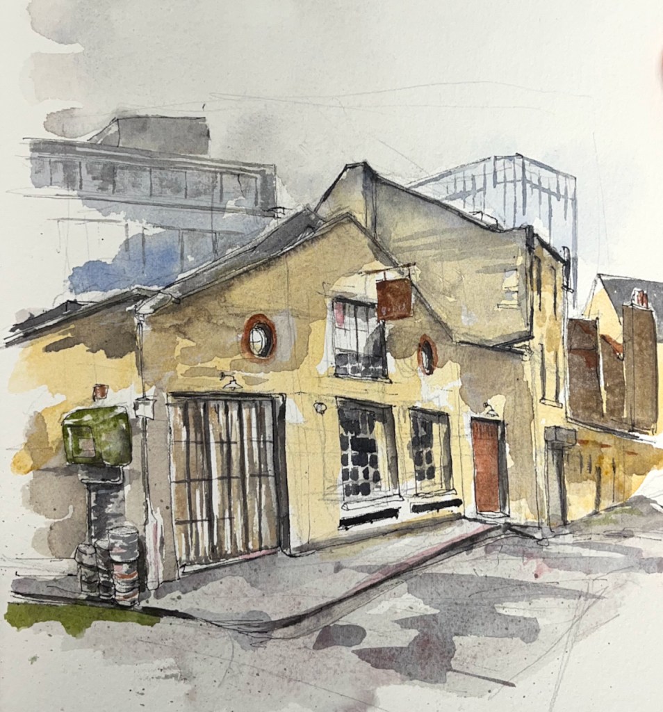
I was expecting the hidden alleyway to be deserted on a Tuesday lunchtime, and so it was for the first hour. But then it became suddenly busy. A small ambulance backed carefully down the alleyway in front of me and parked. Its doors opened and two paramedics went round to the back of the car. They lifted out their equipment and walked calmly off down the alley. After that excitement, a certain calm returned to the alley, insofar as calm is possible a few hundred metres from Kings Cross.
I carried on sketching, now working on the beer barrels to the left of the picture. But the calm did not last long. Two cars arrived and people dressed in orange hi-vis vests scrambled out. They unlocked a gate off the picture to the left, and went in, leaving their car on the pavement. Then a van arrived, it parked directly in front of me, and a further person in a hi-vis outfit got out. He looked across the bonnet of his van and saw me sketching. “Oh, sorry,” he said, “Am I in your way?” I said that yes, he kind of was. I stood ready, however, to concede the space to him, as he looked important and determined in his bright orange overalls and hard hat. But to my surprise he grinned at me, “Ten minutes! I’ll be just ten minutes!”. He rushed off through the gate where the other people had gone. I abandoned the beer barrels and worked on the roofs.
The roofs were quite a challenge, and they productively occupied the 8 minutes until the driver came rushing back out, looking triumphant, accompanied by a selection of the people who’d arrived earlier. “I told this woman I’d be ten minutes,” he explained to his entourage. He raised a hand to me in greeting, got into his car and rumbled off, leaving the other people standing on the cobbles. I asked them what they were working on. “The bridge,” they said. Oh yes, I was standing on a bridge. The train lines were below.
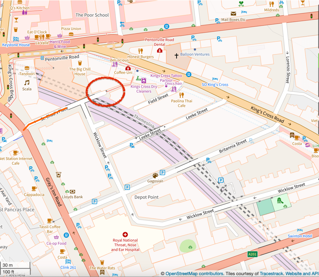
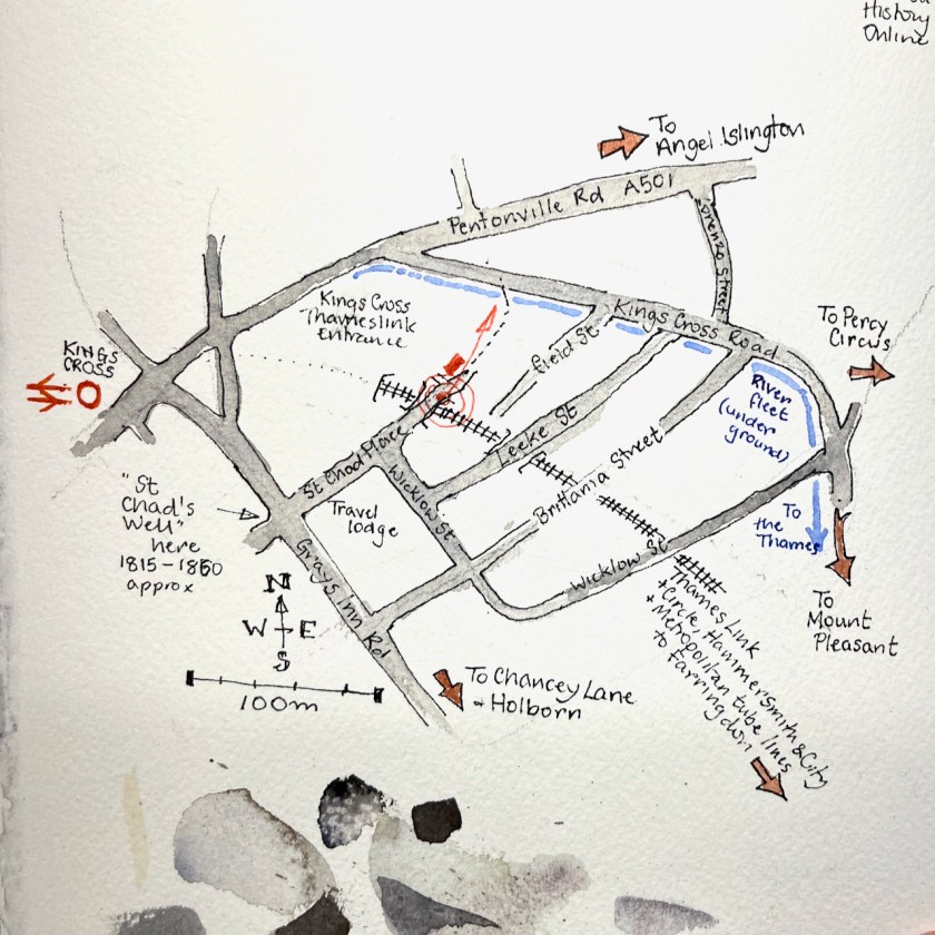
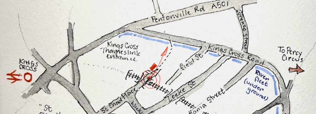
Annotated Google map of the location.
It’s in a labyrinth of roads and railway lines just to the east of Kings Cross mainline station.Here are some maps to show the location. Walk east from Kings Cross, about 10 minutes.
On the maps, the blue line represents the River Fleet, which is alongside the Kings Cross Road, underground. It flows from left to right across the map (West to East) and then heads South down to join the Thames beneath Blackfriars Bridge.
The river Fleet, before it became an underground sewer in 1825, flowed along the western side of Pancras Road and then eastward along the south side of the common, crossing the old highway (now Gray’s Inn Road) north of St. Chad’s Place.
‘Battle Bridge Estate’, in Survey of London: Volume 24, the Parish of St Pancras Part 4: King’s Cross Neighbourhood, ed. Walter H Godfrey and W McB. Marcham (London, 1952), pp. 102-113. British History Online http://www.british-history.ac.uk/survey-london/vol24/pt4/pp102-113 [accessed 7 February 2024].
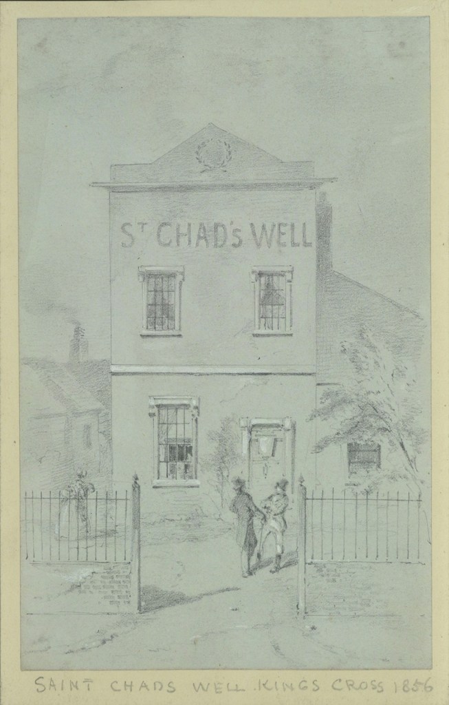
St Chad’s Place slopes down towards the River Fleet. This area was once the location of St Chad’s Well, a spring said to have health-giving properties. It operated from about 1815 to 1860. I found a picture in the London Picture Archives, reproduced below with their permission.
A river, a bridge, a well, a passage and a music venue. It’s amazing what you find.
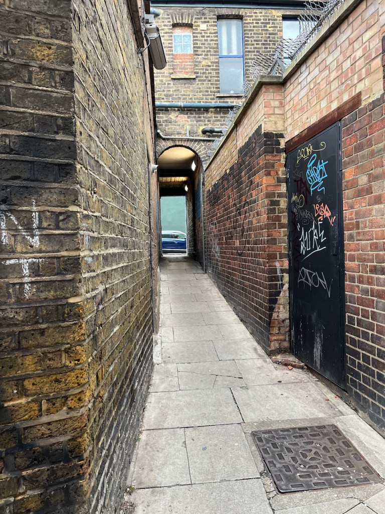
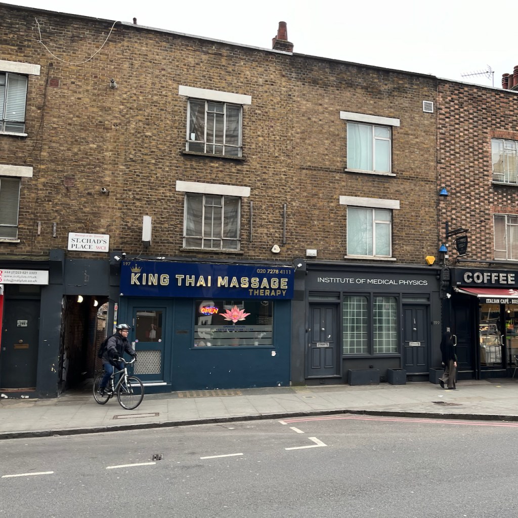
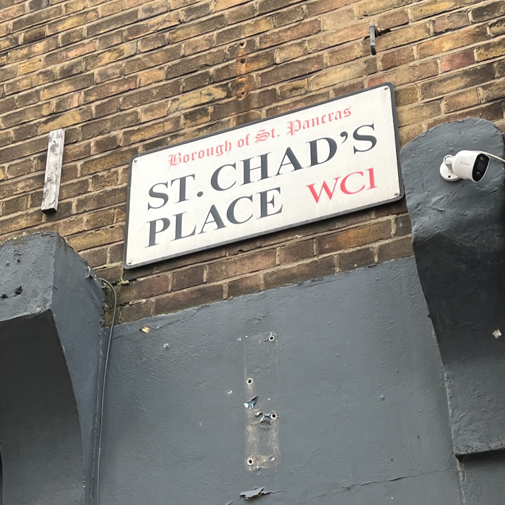
Looking east from where I was sketching. Street art in St Chad’s PlaceIn St Chad’s Place, looking North towards the Kings Cross Road.North entrance of St Chad’s Place. The cyclist is coming out of St Chad’s Place and into the Kings Cross Road.Street name in the Kings Cross Road
Here is work in progress on the sketch:
The colours are:
For the sky and pavement – a special new colour, Schminke Horadam “Random grey” – “formulated each year from surplus pigments”. This is the 2022 edition.
Rose madder permanent – also on the pavement
Mars Yellow
Ultramarine Blue
Green Serpentine Genuine
Buff Titanium
Fired Gold Ochre in the brickwork
Burnt Umber
Arches Aquarelle paper in a sketchbook made by Wyvern Bindery (Sketchbook 14).
Click a button below to share this post online, email it, or print it:
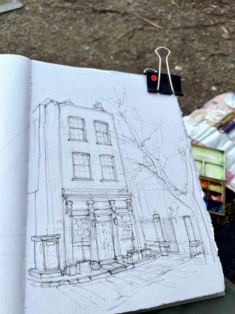
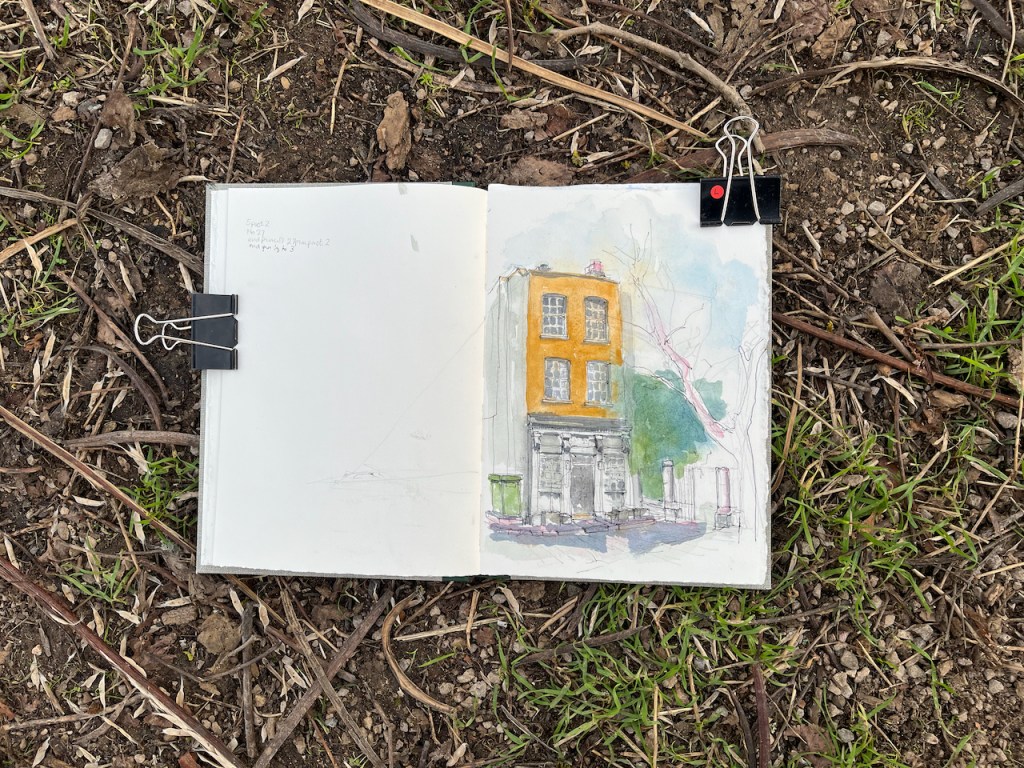
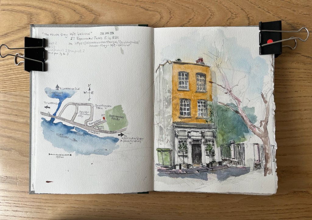
“The House they left Behind”, 27 Ropemakers Fields, London E14 8BX, sketched in Sketchbook 14 28th Jan 2024 at 2pm (Image copyright JaneSketching.com)
The London Inheritance article shows a 1986 photo taken by the author’s father. Painted on the side of the building was the sign:
THE HOUSE THEY LEFT BEHIND
BUILT 1857
RESTORED 1985
The sign has now been painted over. The wall, which is on the left of my drawing, is now completely white. But the name lives on and appears on current maps. Here is a map showing where the house is.
The building is now residential, but was previously a pub. It was “left behind” by the bombs dropped on London by the Luftwaffe in the 1939-45 conflict. The website “Layers of London” provides maps of bomb damage in London. Here is the area.
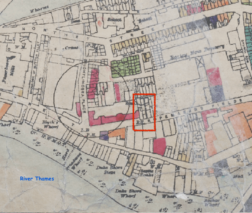
Map showing bomb damage. Classified from Total Destruction (Black), through Seriously Damaged (Dark Red) to Clearance Areas (Green). credit: https://www.layersoflondon.org/map/overlays/bomb-damage-1945 Map provided by London Metropolitan Archives. Geo-referenced with the support of the National Library of Scotland
The map is based on 1:2500 Ordnance Survey sheets originally published in 1916. The bomb damage was recorded on these maps by hand soon after it happened. The circle represents where a V2 rocket landed. The red area shows buildings that were classified as “seriously damaged – doubtful if repairable”. As you see, the pub, labelled “P.H.”and outlined in red, is shown as undamaged.
I found more information on Bomb Damage Maps from a National Geographic article on a book about the maps. This article also provides a detailed key to the colours on the map. The book is “The London County Council Bomb Damage Maps” by Laurence Ward.
“A diary entry included in the book, from architect Andrew Butler on April 20, 1941, gives an idea of what the work was like:
For the block I have started on—eight floors high with two flats on each floor—has had its whole face ripped off … I found it possible to stand on part of the roof. So, clutching a broken chimney, I surveyed the damage there. My notebook became very messy. What with the dust and soot, wet filth and the perspiration of fluster on my hands, it was difficult to read what I wrote. The notes served their purpose however when, after drying the book, I had to transcribe them into a report.”
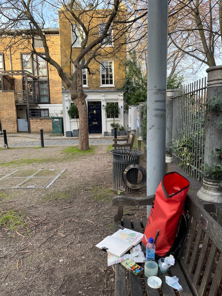
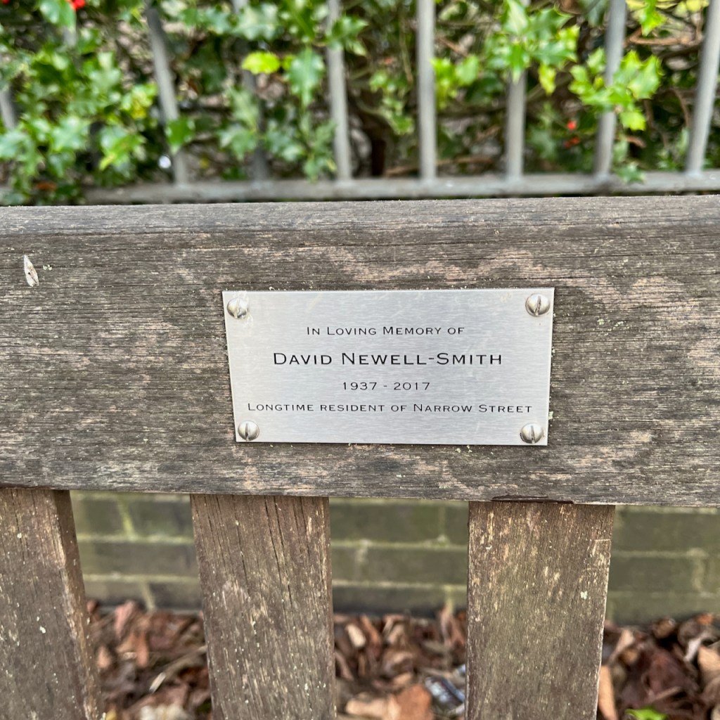
Here is my work in progress on the sketch. Thank you to the author of “A London Inheritance” for providing the stimulus for this expedition. Thank you also to the friends and family of local resident David Newell-Smith, on whose memorial bench I completed the sketch. His dates are given as 1937-2017. He would have been a boy when the bombs were falling.
Click a button below to share this post online, email it, or print it: