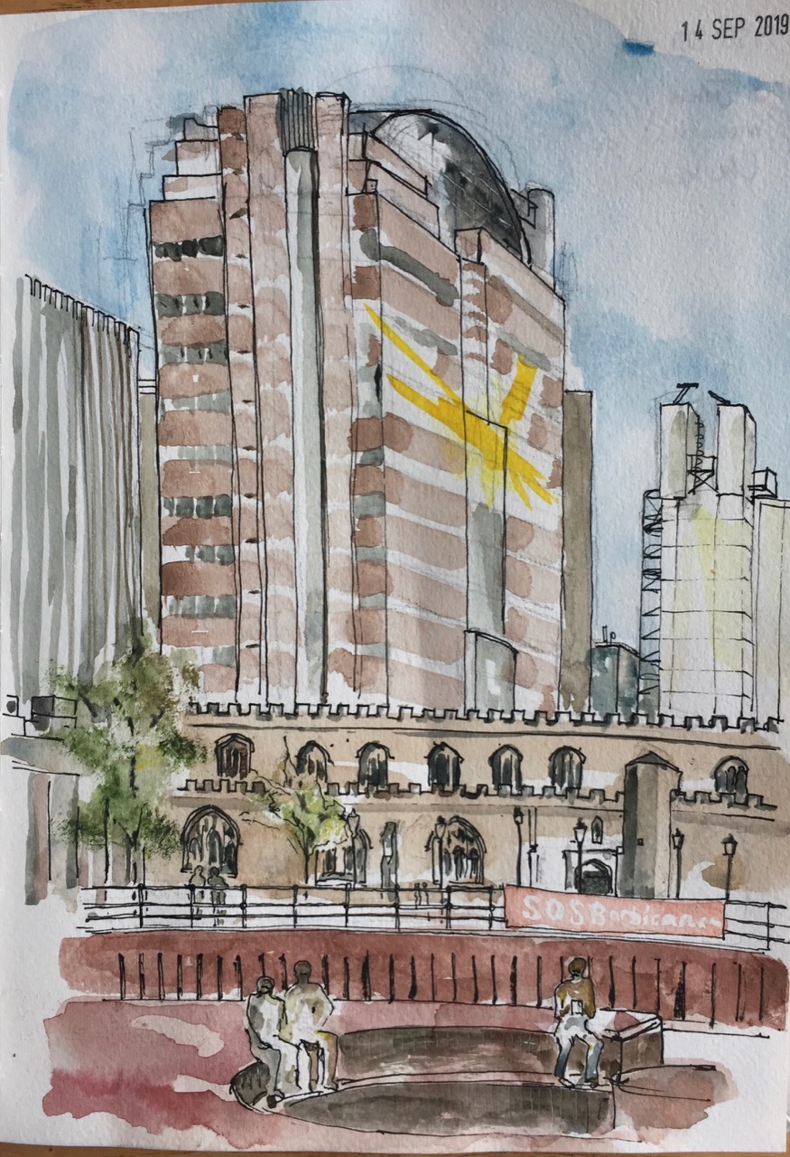
This is a drawing on one of those hot days last week.
I sat at one of the tables on the Barbican Lakeside Terrace and drew what I saw. The massive building is 125 London Wall, a multi-occupancy monolith. Behind, to the right is 88 Wood Street, designed by Richard Rogers (“Rogers Stirk Harbour + Partners”). It’s a bit like the Lloyds Building, with transparent walls and lifts you can see going up and down. On the left is the new building at One London Wall Place.
In front of all that is the side of St Giles’ church, with its castellations. There was a celebration going on: Barbican@50.
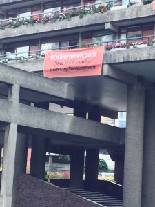
The banner you can see fastened to the railings says “SOSBarbican.com”. It is placed by objectors to the proposed extension of the Girls School.
1 hour 20.
Click a button below to share this post online, email it, or print it:
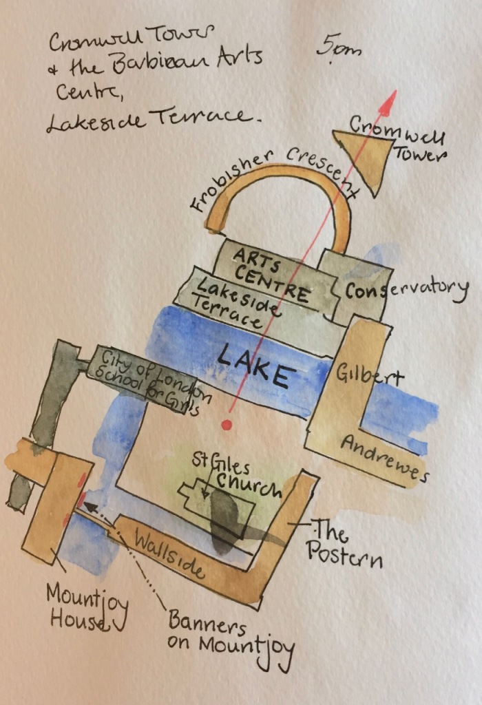
Here is the Guildhall School of Music and Drama, seen from across the Barbican Lake. I drew this sitting on a ventilator grille in an alcove of the residential flats in Andrewes House.
The Tower in the distance is Cromwell Tower. The sloping glass roof is the Barbican Conservatory. Gilbert House is the residential block on the left. In the foreground is the magical sunken garden, a planted area whose walkways are below the level of the lake.
As I drew, I was watched with interest by mallard ducks. One settled at my feet, in a proprietorial way.
I had not noticed before that the Guildhall School is built as a series of blocks, rather like a container park. The top row and the bottom row don’t quite match. The second row has a series of upright concrete beams, which I’ve shown, between the blocks.
I saw that the windows are angled. The inhabitants of one block must be able to see, in a sideways sort of way, into the next block. I’ve never been inside the School, so I don’t know how this works out in practice. But after all, this is a school of performing arts, so it’s rather good if you can see your fellow students through a window: every window a stage.
However the angling of the windows meant that from outside I couldn’t see inside. I have to wait until the performers are ready to present their pieces on a public stage. Still, from time to time I heard a flight of notes on a saxophone. Perhaps they had opened the window of one of the practice rooms.
About 2 hours, including a chat to a fellow resident who stopped by.
Predominantly just two colours: Perinone Orange and Prussian Blue, with a tiny bit of Mars Yellow in the rushes.
Click a button below to share this post online, email it, or print it:
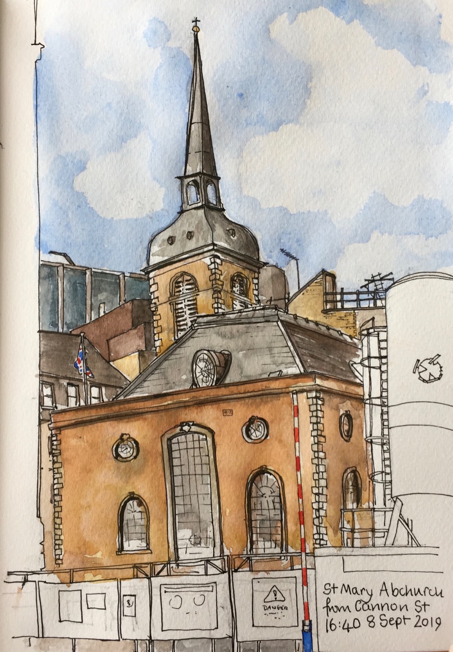
Here is St Mary Abchurch, a view from Cannon Street, London EC4. There was a church here from about 1198. It was destroyed by the Great Fire in 1666. The current church was built to the design of Christopher Wren in 1681-86. It is the headquarters of the “Friends of City Churches” who make the City Churches accessible.
This is one of those ephemeral views. There is a huge building site in front of the church, and so when the building is done, this view will disappear.
The notices on the hoardings say:
“DANGER! No climbing. Fall behind”
“Dragados SA (UK) Considerate Contractor Scheme, 30th Anniversary Winner 2018”
“No Pedestrian Access or Egress Apart From Plant Movements or in an Emergency”
I enjoyed the use of “Egress”, and puzzled over the phrase “Fall behind”. It must mean “There is a big drop behind this notice”, but it sounds like “We are delayed, and falling behind schedule.” There is also a huge Health and Safety notice, mandating in detail the protective clothing you must wear, including, rather ominously:
“Flame retardant clothing must be worn near buried services”
What’s this building? Well, according to the notice:
” We’re transforming Bank Station to improve your journey. Completion 2022. Search TFL Bank”
I searched “TfL Bank” as instructed, and found a vast amount of information. TfL (Transport for London) is making Bank Station bigger – a “capacity upgrade” as they term it. The building site I’ve spent this afternoon looking at is described thus:
“The Cannon Street worksite consists of the area bounded by King William Street, Nicholas Lane, Cannon Street and Abchurch Lane. The proposed new station entrance and infrastructure such as new escalators will be constructed on this site, which is currently occupied by six buildings. Demolition will be required to allow the worksite to be established before the start of any ground treatment, piling or work on the station entrance. The façade of 20 Abchurch Lane will be retained and will partially screen Abchurch Yard from the works. The worksite is over the proposed new Northern line platform tunnel. The site provides access to the work below ground through the new station entrance box and escalator barrel. During the works there will be site office and welfare facilities within 20 Abchurch Lane. The proposed worksite provides a minimum of space for storage of some materials and equipment for construction operations. It will also be used to store excavated material, before it is transported off site.”
They provide wonderful maps. Here’s an extract:
From “Bank Station Capacity Upgrade – fact sheet 2”
It’s somewhat reassuring to know they have such detailed maps, as the area round St Mary Abchurch looks medieval. I walked through there, down “Sherbourne Lane” and back home though the alleyways of the City.
Here’s my map, and some work-in-progress photos.
My map
Pencil
Pen
About to add the colour
Pen, close up
Watercolour in progress
Just finished it
Drawing on location
About two hours, drawn from the steps of 108 Cannon Street.
Click a button below to share this post online, email it, or print it:
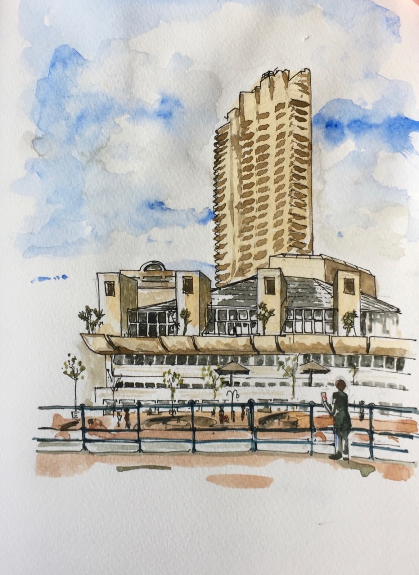
Here is a picture of someone looking across the Barbican Lake. Their mobile phone is telling them that the Barbican Arts Centre, the Lakeside Restaurant, the Art Gallery and the Cinemas are all over there in the sunlight. Such delights! But how do I get there? In between here and there is some murky water, and a big drop down.
What they need to do is to turn their back on where they want to go, walk, go up an obscure staircase that looks private, and then proceed across Gilbert Bridge which is high up to their right and invisible from where they are standing. I would have told them all this, but they obviously worked it all out for themselves before I could put my paintbrush down and descend from the tiled stone monument where I was sitting. Perhaps the mobile phone app is, by now, educated on the Barbican geography.
The tower in the picture is Cromwell Tower, and the glass building is part of the Barbican Conservatory.
“SOSBarbican.com” banner on Mountjoy House
Today there are banners outside some of the flats in Mountjoy House in the Barbican. They are there to draw attention to the proposal by the City of London School for Girls to build an extension, including kitchens, right underneath these flats. I have drawn pictures to illustrate the proposal, and to show why many of us object. See this link: Under Mountjoy House, Barbican
Information about the campaign is here: Objection to CLSG expansion. If you appreciate the Barbican architecture, please consider signing the petition.
Here is a map:
Map showing the direction of the view in the picture, and the location of the banners.
Click a button below to share this post online, email it, or print it:
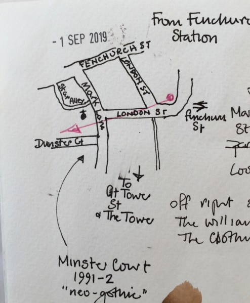
From Fenchurch St Station there is a stunning architectural view. I sketched it, standing outside the station. This was not a great place to stand. I put the colour on later, sitting down in the wooden seats nearby. A woman with a bike came by and told me someone had let down both her tyres. Why would they do that, she asked me. Why indeed. She went off, pushing her bike on its flat tyres. Her dog followed on its lead, disgruntled, catching the mood of its mistress, deprived of a ride in the special dog-basket on the back of the bike.
From Fenchurch St Station, looking West, along London Road
Shown in the picture on the left is “Minster Court” a pinkish coloured Neo-gothic building built in 1991. It contains, amongst other things, the “London Underwriting Centre” and “Proud Cabaret City”, and a branch of “Balls Brothers”, a pub.
Sketch map, showing the direction of the view from Fenchurch St Station.
The glass building is “Plantation Place” built 2004, by Arup Group. Accenture is in there.
Behind I hope you recognise the “Walkie Talkie” skyscraper. In front and centre is the Clothworkers Guild. The little building at the bottom is St Olave’s Church Hall. St Olave’s Church itself is a lovely tower, which I would have seen if I’d moved slightly to the left. It’s behind the ponderous dark building on the right. I’ll go back and sketch it another time. This is the church where Samuel Pepys worshipped.
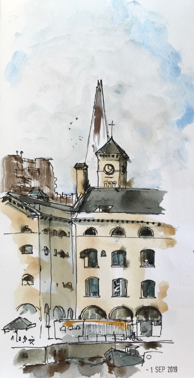
I walked towards the river and sketched in St Katharine’s Dock.
This is the view looking West, from the East side of the dock.
St Katharine’s Docks, looking West (IMG3517)
In the background on the left is “Guoman Hotels The Tower”, which is right next to the Tower of London. This hotel was built in 1973, one of the first buildings of the dockland re-furbishment. The Shard is in the background, centre.
The main building in the picture, former warehouses, is now called “The Ivory Building”. It appears to be residential. There were lots of bells to push, but I didn’t. I envy the person who has that turret. The clock was showing the correct time.
On the lower left is a restaurant with a sun umbrella. Its name was so tangled up in the fancy script of its logo that I couldn’t read it, something like “docole”.
Off the picture to the right a large rectangular stone was embedded at eye height. People rushed past, to the cafés and restaurants. The writing on the stone said:
“The foundation stone of Commodity Quay World Trade Centre London, laid on St Katharine’s Day 1985”
St Katharine’s Day is 25th November, in case you were wondering. Also spelt with a C.
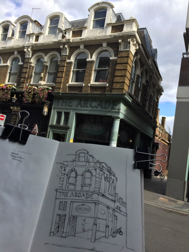
Here is my favourite picture of the walk, done on the way back.
The Arcade, Liverpool Street
This is an astonishing construction, left over from an earlier epoch, and now surrounded by new-build and glass and steel office buildings. It is a corridor of shops, like the famous passages in Paris. But actually, not like them. Since it was Sunday, the Arcade was not trading. It was looking rather dilapidated. As I sketched, I saw tourists make their way in there uncertainly, in a characteristic pose of staring at the mobile phone and glancing about. Evidently Google was telling them that Liverpool Street Station could be accessed was down there. It cannot, not on a Sunday. As they entered the Arcade, they looked about. Then they really looked about, rather than comparing the world to the mobile phone map. They suddenly saw the broken glass, dusty shop fronts and cardboard, and the feet and legs of someone lying on the ground. They abruptly turned around and came out again into the sunlight, staring accusingly at the phone.
The script which says “The Arcade” is beautiful.
I particularly like the curved foot of the R, as though the letter is about to dance.
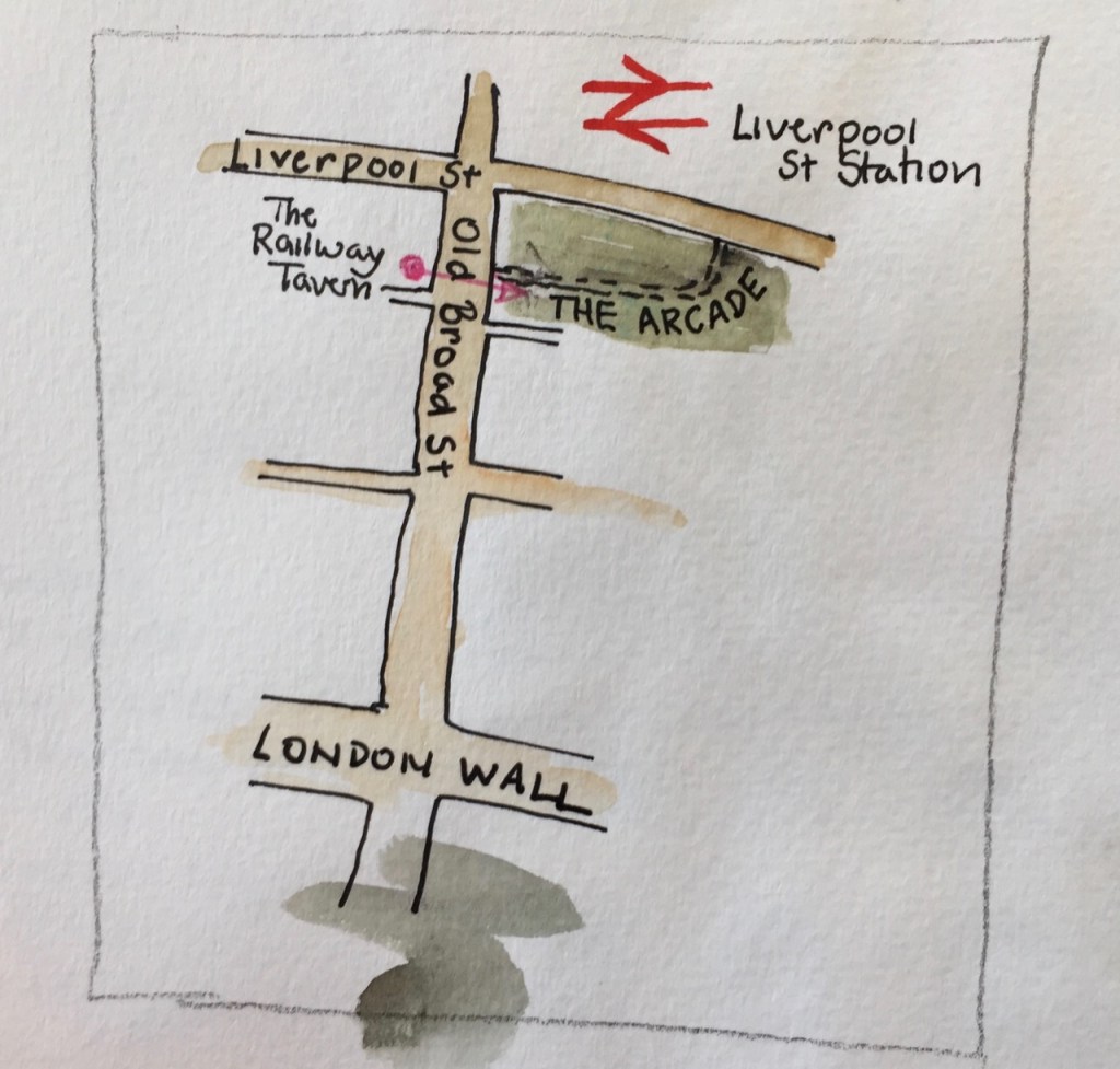
Here is work in progress, and a map:
“The Arcade” work in progressMap showing The Arcade
Homelessness is a problem in London, even right in the centre of the financial district.
Click a button below to share this post online, email it, or print it:
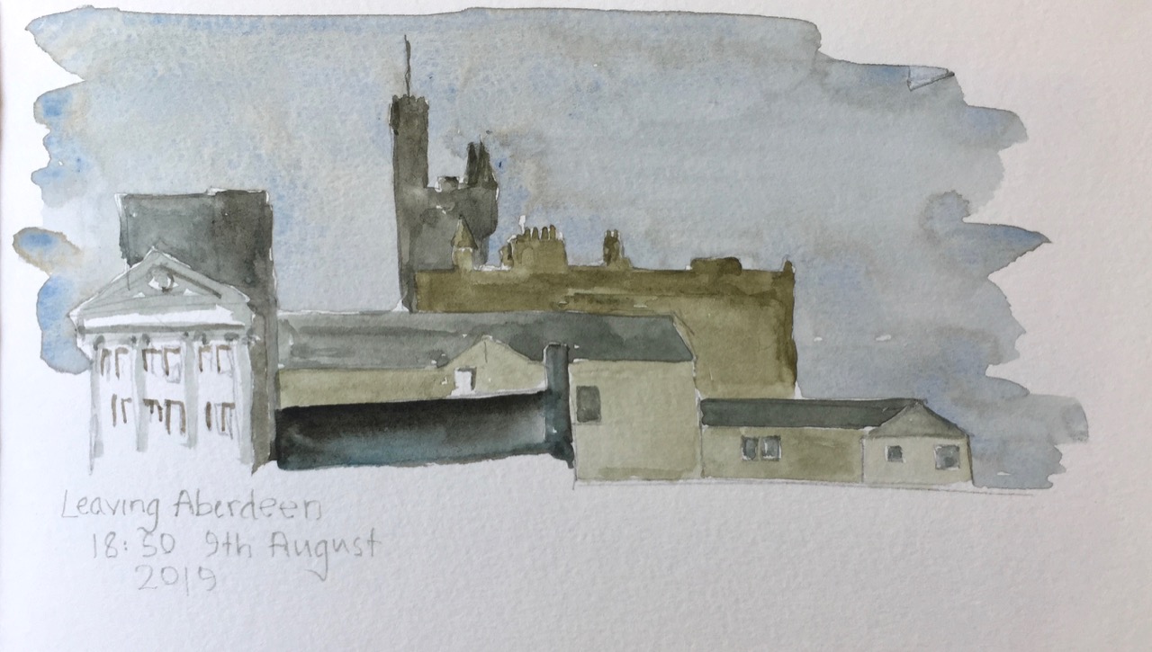
I went through Aberdeen on the way out to Shetland, and on the way back.
On the way out I drew St Machar’s Cathedral then proceeded south to find the excellent coffee shop Kilau Coffee recommended by the church guardian, who knew her coffee shops. By then I was in the University. It was still raining. So I sketched Kings College Chapel, from a convenient cloister.
Kings College Chapel, Aberdeen, from the cloister. 9th August 2019 15:21
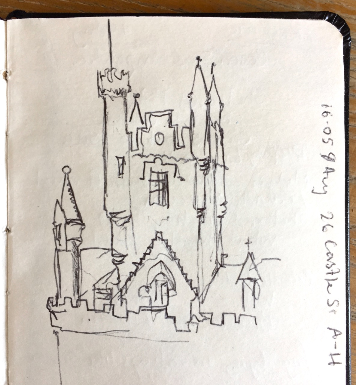
Then I walked back to the ferry terminal, still in the rain. Here’s a sketch of a building on the main square.
Aberdeen Market Square, 26 Castle St, 9th August 2019
I was taken by the multiple levels of bartizan, which are the towers fastened to the side of the building. These are also called courbelled tourelles. I was sketching from the doorway of a charity shop, in biro, which was the only medium that worked in the sluicing dampness. I tried to find out what this magnificent building was. It seemed only to have a number: “26 Castle Street A-H”, so I guess it is residential.
From the window of my cabin on the ferry I saw the same building from a distance.
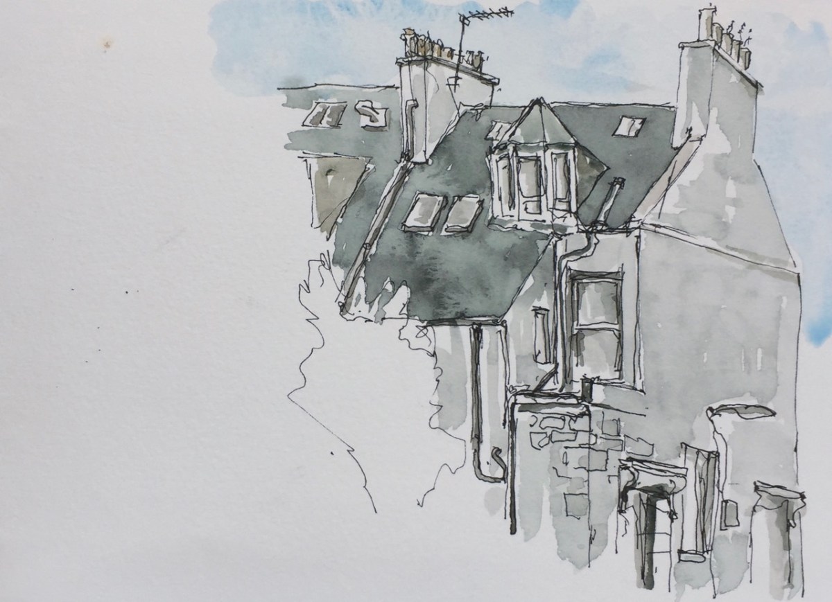
On the way back, two weeks later, I took a walk round what I termed the “Starbucks side of town”. This is the part south of the railway station. There is indeed a Starbucks, on Union Street. The houses are grand here, and in orderly terraces. Here’s a glimpse of an end house, a quick sketch as I was on my way to the bus station.
Aberdeen Houses, Rosebank Terrace numbers 2 and 4, 11am, 25th August 2019
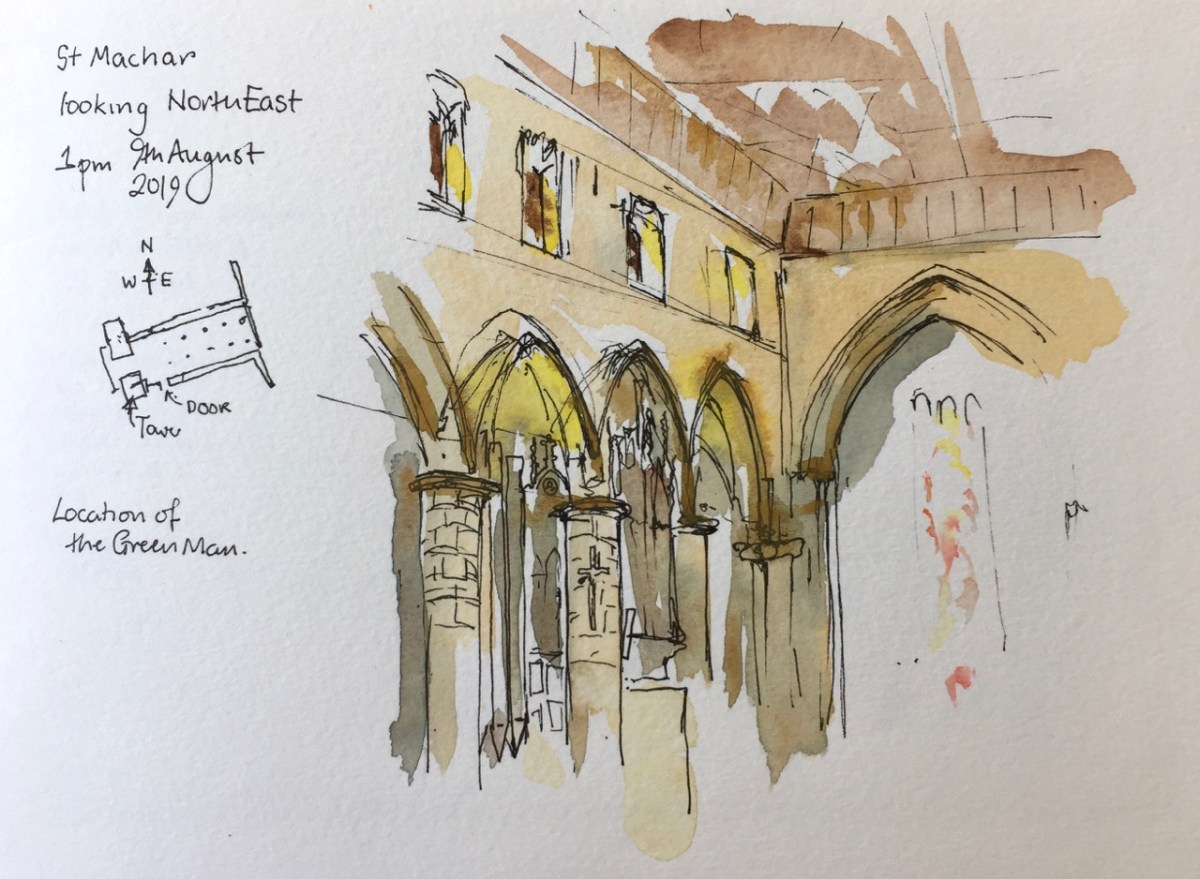
St Machar’s is in Old Aberdeen, North of the University.
I went to look for a medieval carving, a “Green Man”. According to my instructions it was in the “North East Crossing” on the “west side”. I had a good look around. This is a very plain church, solid granite columns, no carving. I could see no “North East Crossing”. The church is rectangular, not cross-shaped like most churches. The enthusiastic guardians welcomed me, and told me about the church. It is very ancient, and many different peoples have worshipped there, including the Celts, whose 7th century stone cross stands at the west end.
After I had listened and chatted, I showed them my instructions: “North East Crossing, west side”. Ah, they said, but there is no longer any “North East Crossing”, it’s been demolished, for centuries, since the Reformation.
I felt a shiver as though someone was telling me a ghost story. My instructions came from a printed book, much later than the Reformation, clearly. But the guardian was still talking. “You can see the ruins,” she was telling me, “Outside”.
Outside it was raining, a heavy wet Aberdeen rain. I stomped about in wet grass, between gravestones. I was looking up, which made me more wet. And there he was, the Green Man, staring down. I risked taking my iPhone out of my pocket for an instant, to get a photo.
I couldn’t draw outside, so I went back inside. The picture I drew shows the position of the Green Man, but the inside wall. He is on the outside.
9th August 2019, St Machar’s Cathedral, Aberdeen, now Church of Scotland, formerly Celtic, Roman Catholic, Episcopal.
Click a button below to share this post online, email it, or print it:
The ferry from Shetland arrives in to Aberdeen at 7am. The air feels cool and chemical, like water from a cold tap. I carry my luggage on my back, and it’s heavy.
No, they won’t take my bag at the ferry Left Luggage. Only if I’m travelling on the evening ferry will they take in my luggage. I am not travelling on the evening ferry. I have just arrived on the morning ferry. And I am going to the airport. But that is later. For now I have a heavy bag, and the whole of Aberdeen to explore.
Let’s try the train station.
It is Sunday. Aberdeen is closed. The Union Square shopping centre is closed. So the route to the station is three sides of a rectangle, a circumnavigation of the Union Square, Jury’s Hotel and the Bus Station. Outside the Jury’s Hotel, a cluster of men with beer cans part to let me through. My grim determination is reflected in their faces. Or perhaps it’s something else I’m seeing: their effort to stay vertical.
I spot the “Left Luggage” symbol at the Train station. The door has a dim window which frames a seated man. “I see the Left Luggage operative,” says my optimistic brain. The straps of my luggage are now making permanent furrows in the muscles of my shoulders. The door is locked. I rattle it. “It opens at nine,” comes a voice. It’s the seated man, who is behind me, reflected in the dirty glass. He is sitting on the sunlit steps, waiting.
From the table at “Patisserie Valerie” I can see that he is still there. He hasn’t moved at all. Those steps must be cold, granite. He must be fed up. But he didn’t seem fed up when I spoke to him. Perhaps he is sitting there for some other reason. Perhaps he does not require the services of the Aberdeen Station Left Luggage.
I do, though. I order breakfast at Patisserie Valerie. The glass and steel of the modern shopping centre cuts the view into bits. I can’t draw it all, so I draw a segment.
A bit of the Station Hotel, Aberdeen, from the Union Square Shopping Centre, Patisserie Valerie.
That odd curl in the top right is the “e” of “Union Square” written on the outside in modern 3D lettering.
Here is work in progress.
Line drawing before the tone went on
The view from Patisserie Valerie
Line drawing before the tone went on
The picture and the view
Exactly one hour to draw, including eating breakfast. Patisserie Valerie opens at eight. The Aberdeen Station Left Luggage opened at nine.
When I went there, the seated man had gone.
Click a button below to share this post online, email it, or print it:
Here is St Giles Church from the Lakeside Terrace of the Barbican. While I drew this, three men were shovelling mud from the bottom of the lake. The mud is black and viscous and the men were remarkably cheerful in their task. They would have made good subjects for a drawing too. But for now, here’s the church:
The church features in some of my “Tower” sketches:
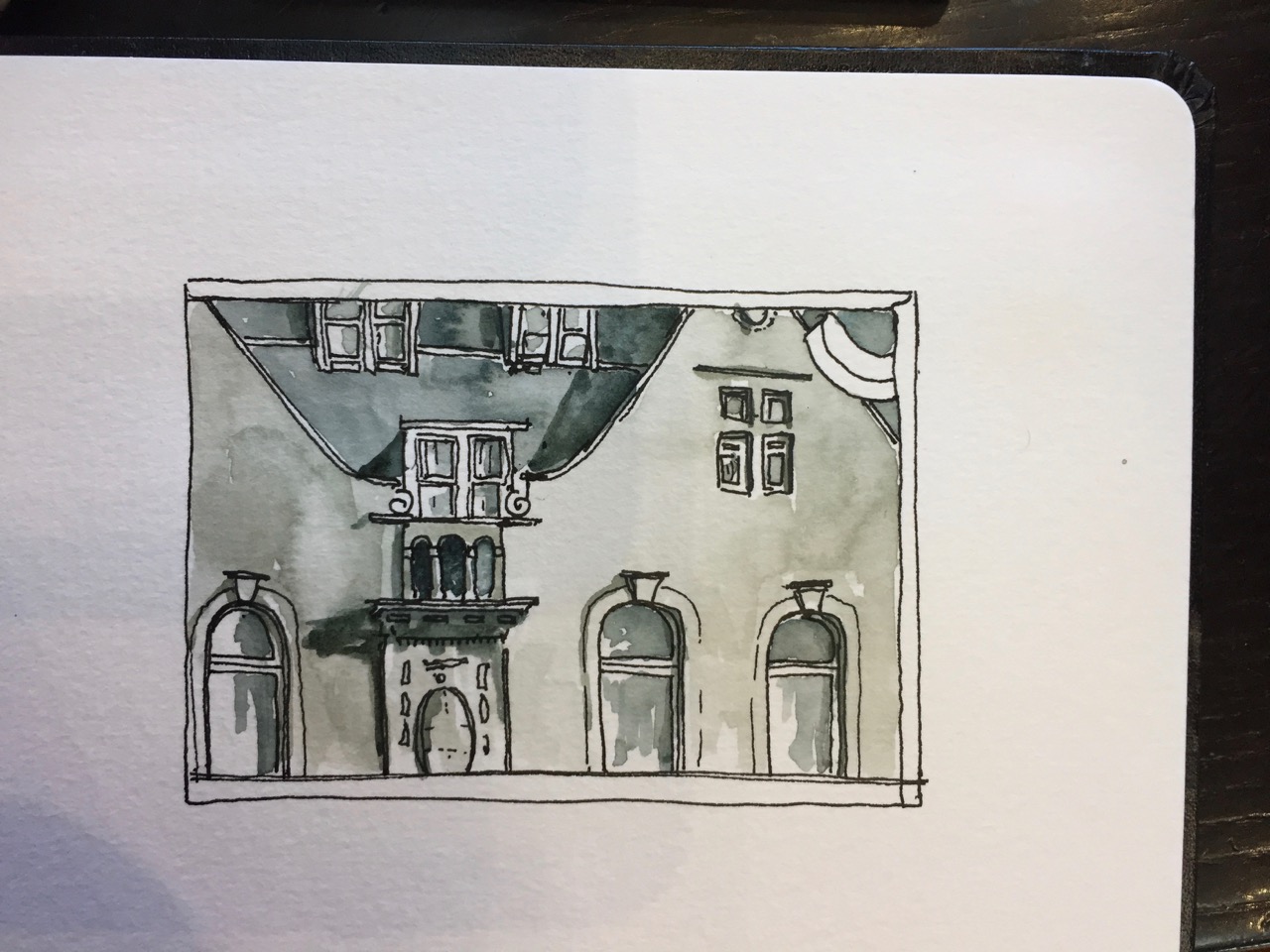
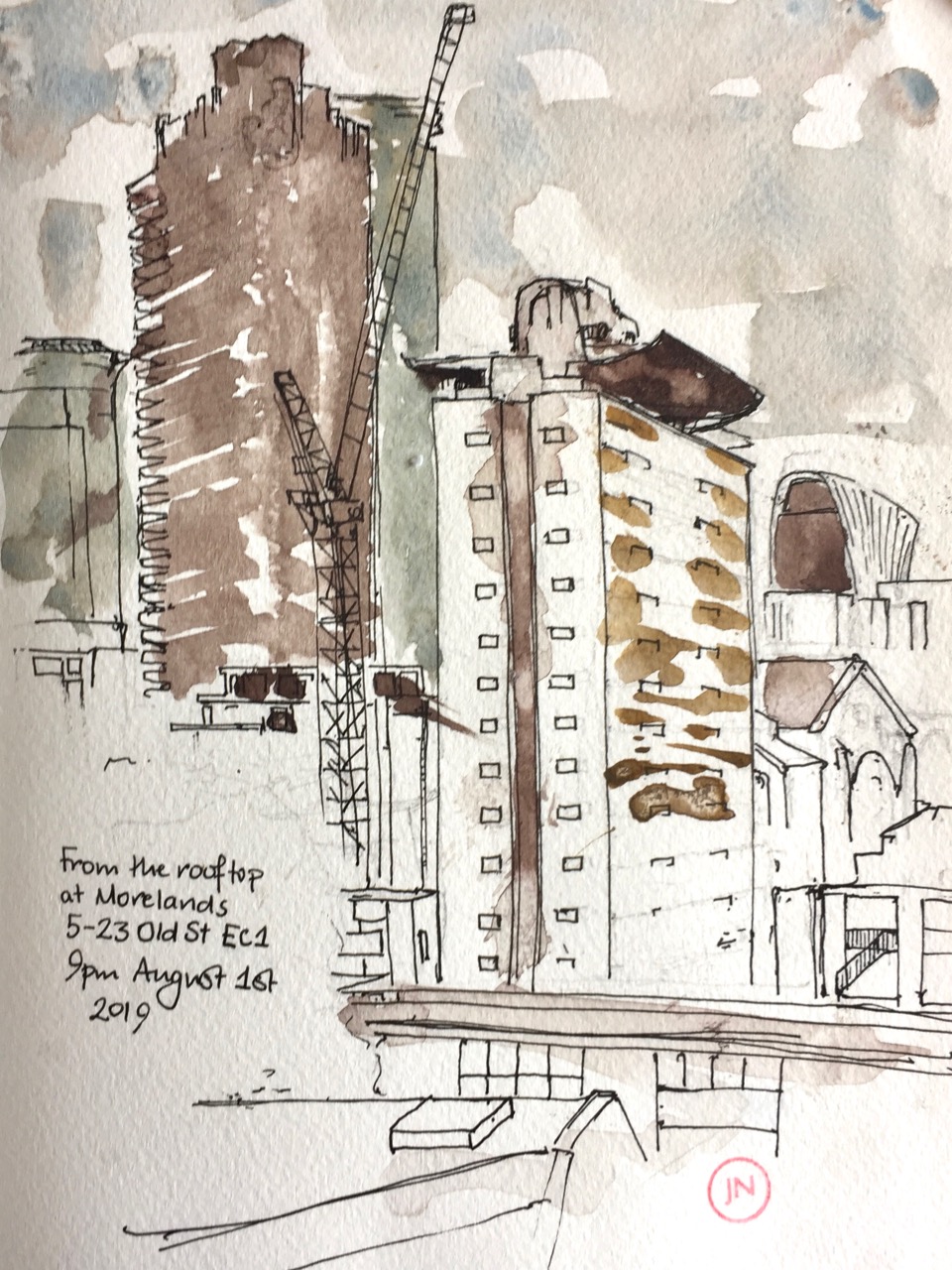
This was an event organised by RIBA* and Phil Dean a.k.a “Shoreditch Sketcher”. Morelands is a modern office block on Old St.
I looked south, and drew Cromwell Tower and Great Arthur House. This sketch took about 45 minutes, as darkness fell.
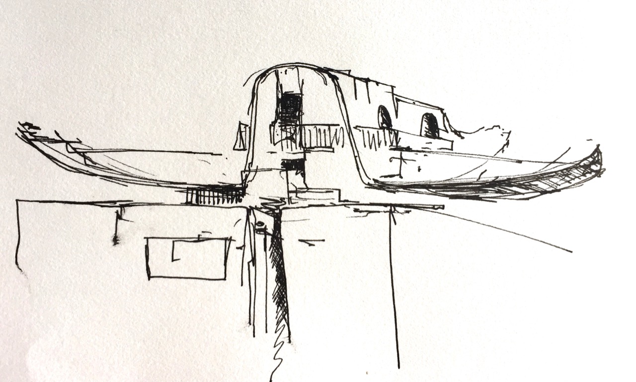
The “brise soleil” on top of Great Arthur House must be one of the most difficult things to draw. That, and the dome of St Pauls. Because it’s curved, and the curve needs to be right.
Earlier, I did a sketch of the “brise soleil” on its own. I had not noticed before that there is a sort of balcony.


 As I drew, I was watched with interest by mallard ducks. One settled at my feet, in a proprietorial way.