Welsh Church and Great Arthur House

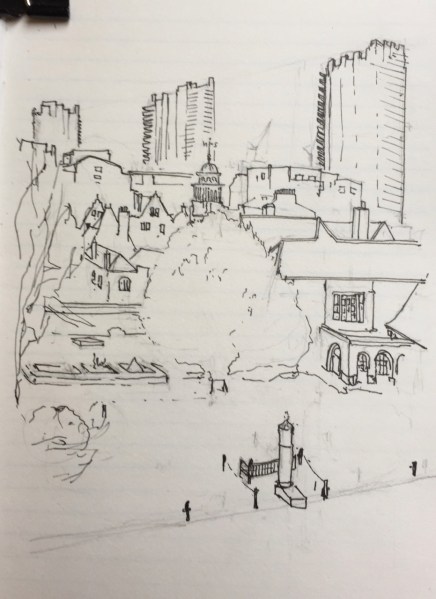
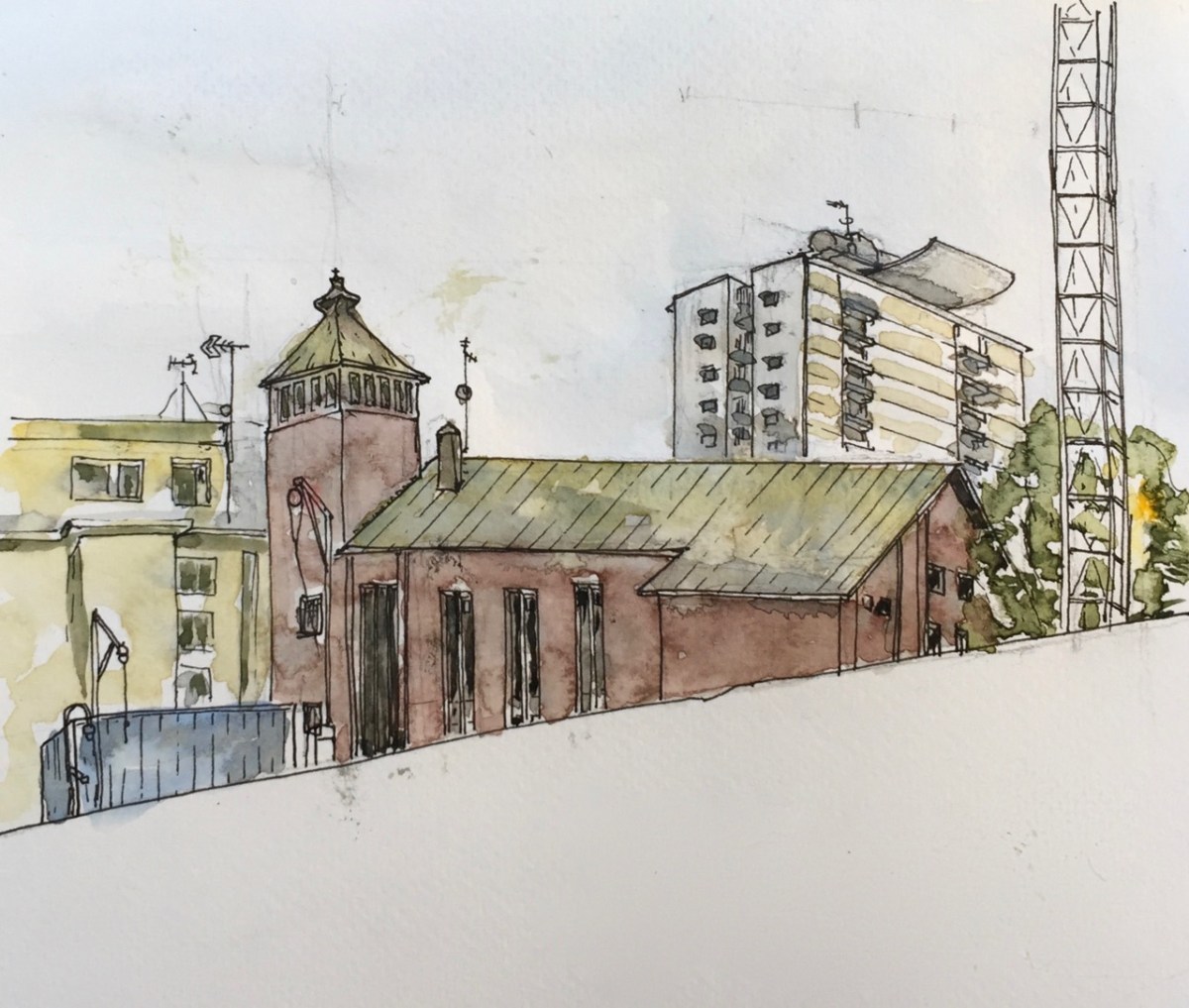
Here is the Welsh Jewin Church seen from Brackley Street.

IMG_5326

This is one of those ephemeral views: a huge new building is about to go up behind the hoarding, and this view will be completely obscured.

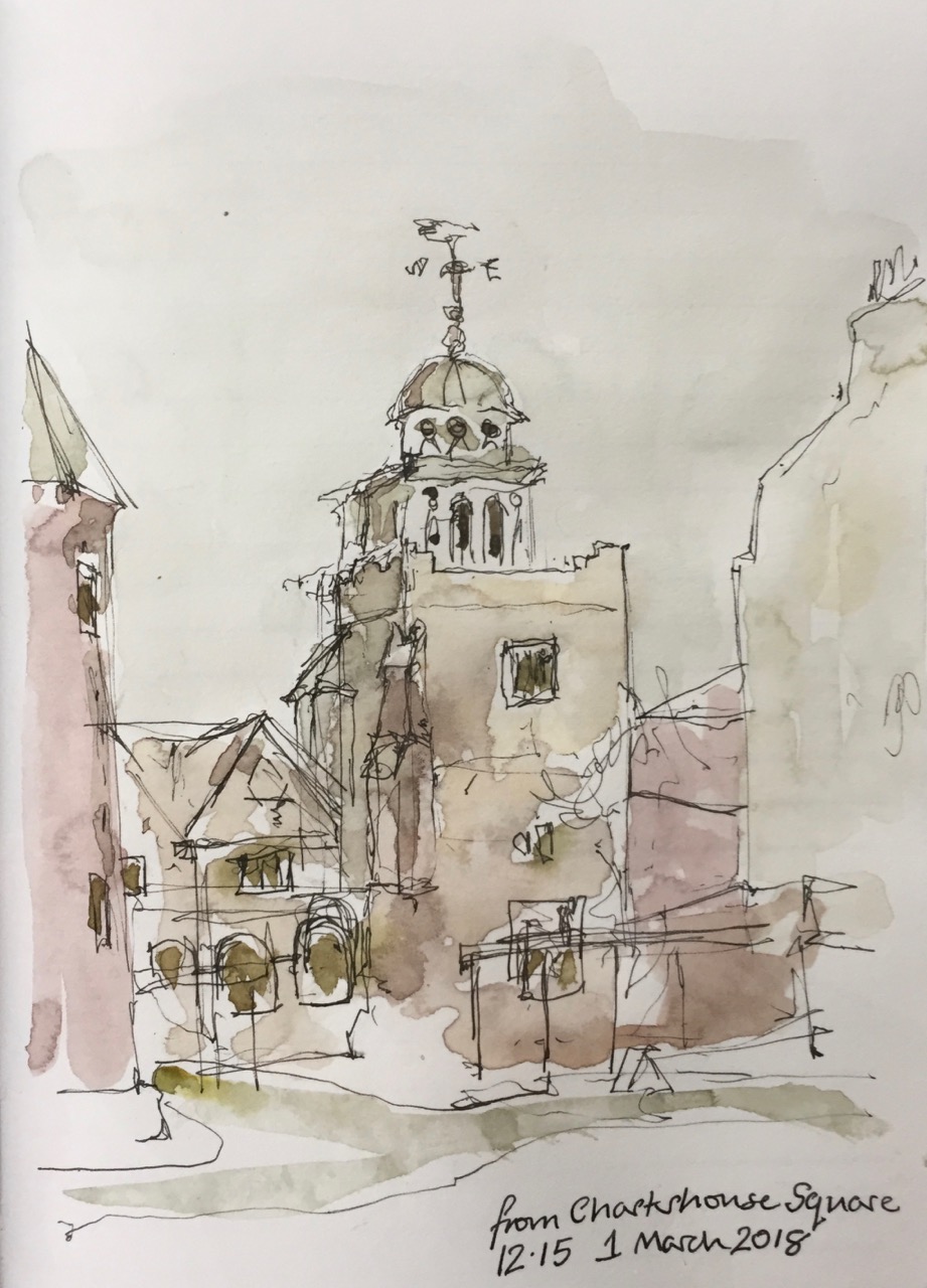
The church is Eglwys Jewin, the Welsh Church. I have drawn it before, from Fortune Park. Here’s the link – Eglwys Jewin from Fortune Park

Golden_Lane,_London
Map showing Golden Lane Estate. credit: Wikipedia.

In the background is Great Arthur House, on the Golden Lane Estate. This estate was designed by Chamberlain Powell and Bon, before they did the Barbican Estate.

As I was drawing, a man came and told me about Great Arthur Tower. It was the tallest residential building at the time of its completion (1957).  At the top is that strange construction which I was told was described by the architects as a “brise de soleil”, a sun shade. Nicholas Pevsner, the architectural writer, was scathing about it, saying that there wasn’t much sun. However, as the man and I agreed, today was very sunny, and the sun shade was needed.

Great Arthur House has recently been refurbished.

“JRA has designed the new curtain walling to replace the original cladding, mirroring the bright yellow panels that have distinguished it since the 1950s. The Grade II listed residential tower had become environmentally inefficient in recent years leading to the residents’ discomfort due to water ingress, heat loss and condensation. Replacement curtain walls for the West and East elevations, double glazed timber balcony doors, external redecorations, localised external concrete repairs, and a cleaning and maintenance system for the new façade are also being provided to help revive the landmark building.” JRA website, 30th Sept 2016

Screen Shot 2018-09-01 at 19.13.00

And then insulation was removed after the Grenfell Tower fire. Here’s a cutting from CityMatters, the local paper:

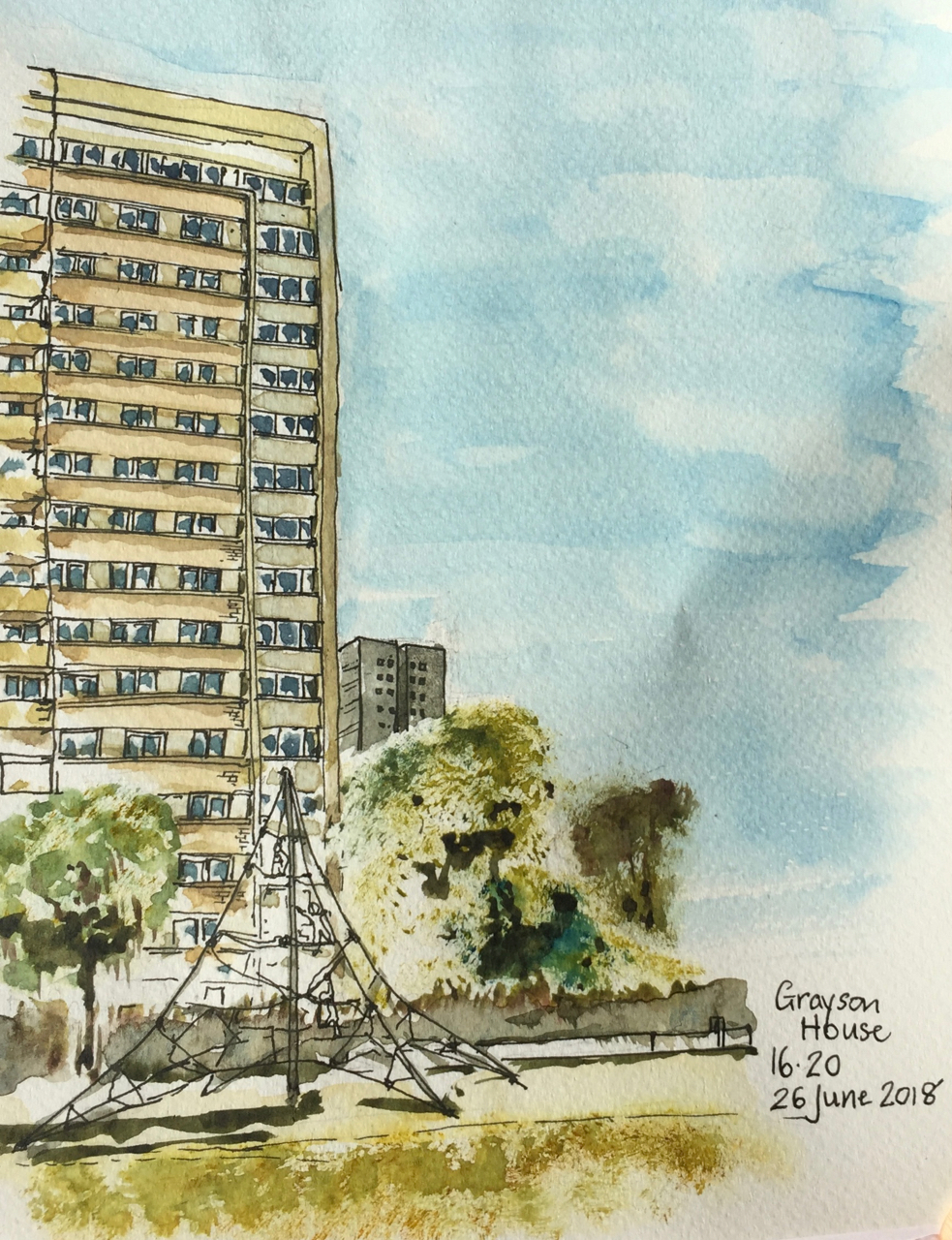
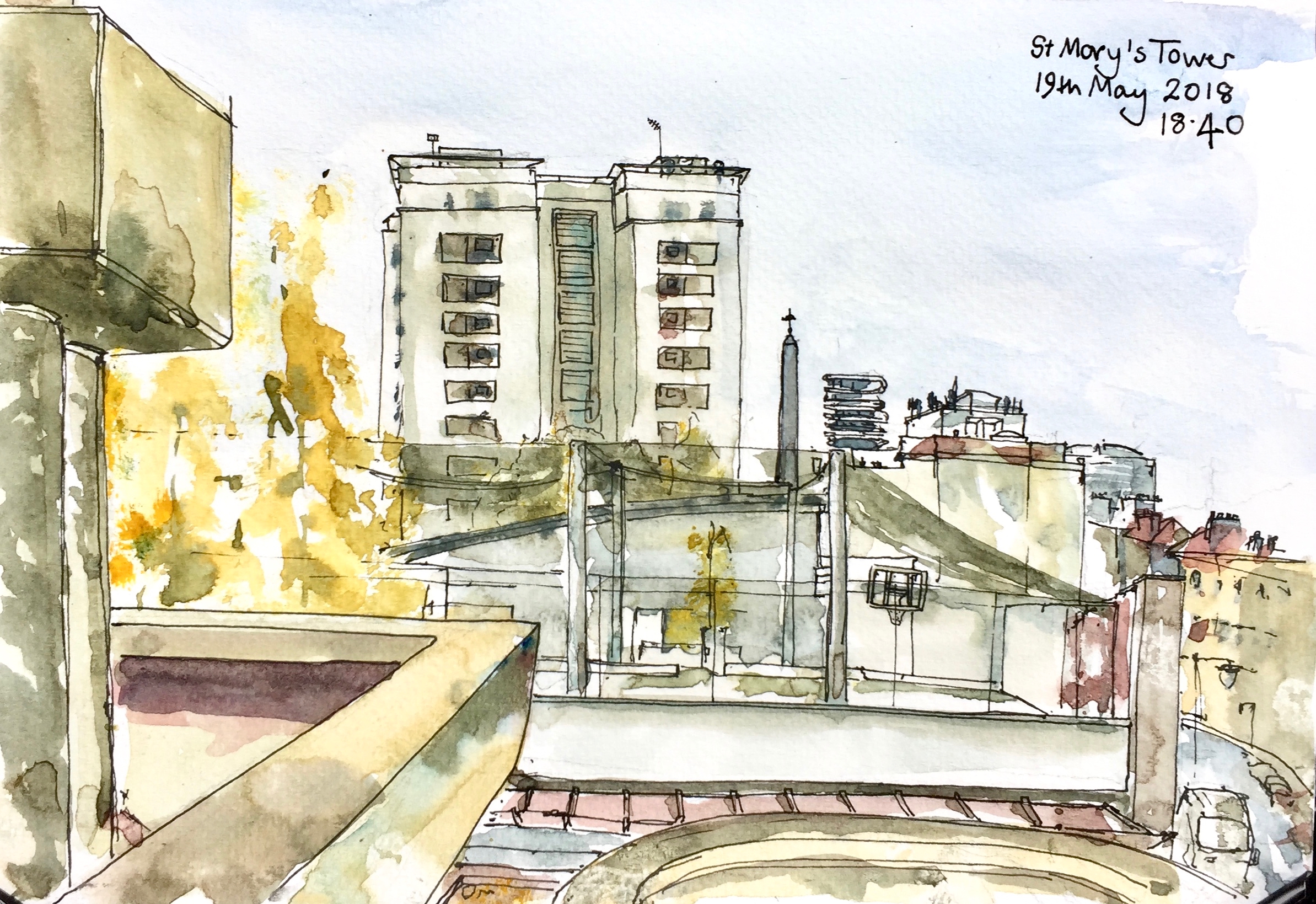
As I was packing up a woman came and asked, “Can I be curious?” I said she could indeed, and showed her the picture, which she admired. She looked at other pictures in the book, including one of Peabody Tower. “I look at that, from my window”, she said, “I’d love to live there. I see a balcony with flowers….”. I said it was called Peabody Tower, and the other, similar one was St Mary’s Tower. “Oh! Are they Peabody buildings?” she asked. I said they were, part of the Banner Estate. She lives in Tudor Rose Court. This is the building on the left of the picture, in yellow brick. She’d just been to see a film. She found the ticket to show me the title. It was “Distant Voices, Still Lives”, about a family in Liverpool, she told me. She loves Liverpool.

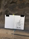
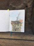
This picture drawn and coloured on location, about 1 hour and 45 minutes.

IMG_5327

Grayson House

Grayson House is part of the Pleydell Estate.

IMG_4325 (1)

1 hr 40 mins from the small park called Radnor Street Gardens.

Grayson House on the left, and Gambier House in the background.

Next to me, for the entire duration of the drawing two men played ping-pong. The children came out of school at 4pm, and wanted to use the ping-pong table. But the men said no.

IMG_4605

I drew Gambier House from the same park, in March, on  a peregrination around City Road

fullsizeoutput_1b96

Later note:
I discover from the amazing “Streets with a story, The book of Islington” by Eric A Willats FLA, that “Grayson House (1961)” was ” named after Frederick George Grayson, a superintendent of Radnor Street Sunday Schools and Mission, formerly in Radnor Street.”

Mr Willats’ book lists streets and some buildings in Islington, including as he says “what has come to my notice up to the early summer of 1986.” It is in the Islington Museum.

Peregrine House from the King’s Square Estate

At 27 stories, Peregrine House and Michael Cliffe House are the two tallest towers owned by Islington Council. This sketch shows Peregrine House, an Islington Council residential tower, visible from my window.  It is on Hall St, just off the Goswell Road. The view is looking North towards Peregrine House. I was standing in the Kings Square Estate, another Islington Council Estate, next to Rahere House.

fullsizeoutput_1ca1

Peregrine House was finished in 1969. It is part of the City Road Estate, together with Kestrel Tower. I have drawn Kestrel Tower previously, see this link: Towers of Finsbury – Rahere and Kestrel. See the different brick colours on Peregrine Tower: the more yellow brick for most of the balconies, and the more red-coloured brick for the balconies across the top and around the sides.

The solid neo-Georgian block in front of Peregrine House is “Level 3 communications” a data centre and communications hub. In 2011 they applied to Islington Council for permission to install 5 steel flues. The permission was granted and the flues are on the back (north) of the building, not shown in the sketch. As part of the consideration of the permission, the building is described as “1930s”. I haven’t yet found out what it was before it was a data centre. It looks like a telephone exchange or electricity substation. (Update: 6 February 2019 – it was a Gordon’s Gin Factory – see comments below)  I drew the back of this building in the Kestrel Tower sketch: Towers of Finsbury – Rahere and Kestrel

Screen Shot 2018-05-25 at 15.13.21
Photo from the Level 3 application to install satellite dishes. I think that’s Micheal Cliffe House in the distance.

Level 3 also applied for permission to install 4 satellite dishes on the south side of the building. The application is undated, and no indication is given of the outcome. This application was “retrospective”. Link to their application is here:  Level 3 Application for Satellite Dishes

I was looking at the South face of the Level 3 building and I couldn’t see any satellite dishes.


In the foreground, right, of my sketch, is the blank end-wall of 6 Moreland Street, an Arhag Housing Association residential building, which looks like a late 1970s development.

Screen Shot 2018-05-25 at 15.31.07
The Kings Square Phase 2 development, picture from the Higgins Construction website. It’s a bit hard to tell, but I think that’s a similar sightline to the one in my sketch, with Peregrine House in the background. Picture credit: Pollard Thomas Edwards architects.

In the foreground on the left, work is in progress on “Kings Square Phase 2” which a hoarding informed me was “93 new homes”, which are “51 council homes and 42 for private ownership”. Completion is due in 2020, and they’ve already got the concrete frame up. The construction workers were working hard and calling to each other while I sketched, issuing instructions and shouting warnings in several languages, including English. The contract was awarded to Higgins Construction plc in February 2017: £30 million.

The sketch took 90 minutes: half an hour each for pencil, pen and watercolour. Done in Jackson Watercolour sketch book, 8 by 10 inches.

If the lighting looks flat and there is a complete absence of shadows, that’s because the lighting was flat and there was a complete absence of shadows. It was that kind of a day.

Later note:

I saw the satellite dishes on the Level 3 building, they are high up on the roof and not visible from ground level.

Here they are:

IMG_4027 (1)
Sketch 28 May 2018, from my window.


St Mary’s Tower

St Mary’s Tower, sketch

This sketch shows St Mary’s Tower, in the Roscoe Street Estate. Prior Weston School is in front, with its first floor playing pitches festooned in black net. The pinnacle of St Luke’s is just to the right of St Mary’s Tower, followed by “Cannaletto” the black and white striped modern tower block, then Coltash Court, the tower block at the north end of Whitecross Street . The south of Whitecross St is to the far right of the picture. The tower block in the background on the right is Godfrey House.

St Mary’s Tower was built on church land by the Peabody Trust. It was completed in 1957. The architect was John Grey and Partner.

St Mary’s Church was built in 1868, but was then demolished having been badly damaged in the Second World War.

The Tower now forms part of the Roscoe Street Estate, managed by Islington.

This information from a report by Publica, 2010, on the Whitecross Street Estate. 20120821FLP38WhitecrossStreetPublicareport2011

Sketched from the Barbican podium, in about 2 hours. A cool, sunny spring afternoon, with the wind curling the paper. Jackson’s watercolour sketchbook, 7 inches by 10 inches.

St Mary’s Tower features in my etching “Towers East”.

Brunswick Place N1

Brunswick Place is a seam in North London, joining the fin-tech offices of Old Street to the social housing estates of the 1950s.

Here is the North side of Brunswick Place, seen from Charles Square.

IMG_3256

You see the Prince Arthur pub in the foreground, behind the ‘No Entry’ sign. The pub looks as though it has been there forever. In “pubshistory.com” (an amazing resource) licensees are listed back to 1841.

In the background, The Atlas Building is under construction.

In between, the pinkish building is an old office block with iron-framed windows, called “Jordan House”, occupied by 4 different businesses. Behind this is a brand new brown building, with groovy vertical windows making little triangular prisms.

A man came by with two bulky bags of shopping. He told me about the brown building in the picture. He said it was originally built to house Kings College staff and students. But that didn’t work. Now it is shared office space on the ground floor. “You know,” he said, the type where you just get a cubicle, battery hens!” And on the top, he said “it’s mostly women…”, he paused, “…from Korea”. The brand name on the side of this building is “Scape”, I had been looking at it. I didn’t put the writing in the picture. The man continued, “And you know the Q hotel? On Corsham Street? The Chinese are in there.” He paused again, waiting to see my reaction. I did my best to look interested. I was wondering where he was going with this. “We don’t get Anti-Social Behaviour!” he said. Good international relations in Shoreditch, evidently.

He had been living in the area for 40 years, he said, working for the Health Service. He had watched that brown building going up. The people in the building opposite, Vince Court*, had complained about the noise. “They were pile driving” he said, “Saturday, Sunday.”.

He pointed to a bright silver anti-climb device on Vince Court, all curved spikes. He had no time for the Local Authority, who had apparently sanctioned this device.  “It’s awful,” he said, “gives a very bad impression.” It did. Not only did it look awful, it was also ineffective. I had a look on my way home after the picture. The spikes are on top of a wall. But you can easily walk around the wall.

Screen Shot 2018-04-01 at 18.46.54
Screen shot from ‘Scape’ website: Is this Korean?

When I was home, I looked up “Scape” on the web. They provide accommodation for students. You rent a room for a year (“51 weeks”). The website is in English and another language.

My drawing is a bit lopsided, with only the right side of the street showing. That is because a white van obscured the left side. While I was drawing, the engine started, and the van stayed there, by the kerb, with the engine running. It was still there, engine running, when I left. I never saw anyone get in or out.

Outside the Prince Arthur pub, there are a collection of bollards. One is shown in the picture. Two of these bollards are cannon. In the background of the middle picture you see the offensive anti-climb spikes on Vince Court.

About 1 hour. Drawn and coloured on location. 6 degrees C.

I have drawn the Atlas Building before. See: this blog post from 16 March this year.

*Vince Court is off the picture, to the left.

From Godfrey House

Here are etchings based on a drawing I did from outside Godfrey House, in the St Luke’s estate, Bath St, EC1V.

This one is done in the new brown ink I bought: “Terre d’Ombre Brulée”

IMG_3069

fullsizeoutput_1b85

This is aquatint.

Here’s what the hard ground etch was like, before the aquatint.

fullsizeoutput_1b83

Here’s the work in progress:


Preachers Court in the snow

It has been snowing now for several days. Robin invited me to sketch The Charterhouse in the snow, and suggested a viewpoint from the second floor of the Infirmary.

March 1st 2018 (Preachers Court in the snow)

From here I could see all three of the Barbican Towers. Someone was clearing snow in the foreground, but they moved on before I could get them in the picture.

It was a good place to sketch, warm and quiet. I could hear the muffled sounds of the nurses moving about below, and of the Brothers who were in the infirmary. Sometimes they called out.

Here is what the picture looked like before the colour went on.

March 1st 2018 (Preachers Court in the snow)BW

This picture took about 2 hours: One hour for the pencil outline, half an hour for the pen, and half an hour for the colour – roughly. It took ages to get the proportions right. Especially in the snow, the eye sees detail in far-away objects, so the temptation is to draw them too big.

After I handed in my visitor’s badge at the gate, I went out into Charterhouse Square. I looked back at the Chapel. And did a quick pen sketch, standing in the snow.

March 1st 2018 (Chapel from Charterhouse Square)

This took about 10 minutes, coloured later on my desk at home.

Thank you to Robin, and to the Brothers, Master and staff at the Charterhouse for their hospitality.


M by Montcalm from Godfrey House EC1

This is a drawing from outside Godfrey House in Islington. Godfrey House was built in the 1960s, as part of the St Luke’s Estate. Drawn and coloured on location, about 45 minutes. It was very cold and windy.

IMG_2854

The pointed building is “M by Montcalm” on the City Road. It is a hotel finished in 2015. On the left is Eagle Point, a recent residential development by Terry Farrell & Partners.

M by Montcalm is exceptionally hard to draw. It has no right angles. Also its outside is a strange irregular diagonal tessellation. I have tried hard to capture the  ” triple glazed skin enlivened with differing patterns of transparency, opacity and solidity to convey diagonal slopes breaking across an underlying vertical structure.” [Squire and Partners website]

The traditional building in front of it, on Peerless Street, provides a reassuring brick-built contrast.

Here is what the Squire and Partners website says about M by Montcalm.

“Squire and Partners’ concept for the M by Montcalm hotel in Shoreditch was delivered in collaboration with Executive Architects 5 Plus, and completed in summer 2015. The site – opposite Moorfields Eye Hospital on City Road – provided inspiration for a striking facade which expresses the idea of the optical and the visual.
Responding to the Moorfields Eye Hospital opposite, and taking inspiration from the 1980′s artworks of Bridget Riley, the facade is expressed as a triple glazed skin enlivened with differing patterns of transparency, opacity and solidity to convey diagonal slopes breaking across an underlying vertical structure.
Manipulation and modulation of light, both internally and externally, give the facade richness and an ever-changing face on this prominent site, as well as assisting solar performance to create a sustainable development. The conjunction of the vertical and the diagonal create a visual effect of depth and movement, and express the activities taking place within the building. At the upper levels the facade openings become larger to express the more social uses and exploit the panoramic views.
At ground and lower ground floors, the building skin ‘lifts’ on the diagonal to reveal the hotel lobby, public bar and restaurant, all clearly visible.”
[Squire and Partners website]


Eglwys Jewin from Fortune Park

The building which was Bernard Morgan House has now been pulled down. This is sad. It had a calm 1960s look, and ceramic tiles on the side.

I looked across the gap and could see the Welsh Church: Eglwys Jewin.

IMG_2671 (2)

The church is the building with the green roofed turret and the long windows. It was founded around 1774. According to its website “capeljewin.org” in the 19th century it was “one of the most powerful and influential churches in the Calvanist Methodist tradition”.  It was very well attended in the 19th century so they built a new and bigger chapel on Fann St in 1879. This was destroyed in the Blitz in 1940. The building I’ve drawn was built in 1960.

Lauderdale Tower is just visible, to the left of the picture, and Blake Tower is on the right. Ahead, behind the church, is Tudor Rose Court, a City of London building providing sheltered housing to people over 60: 16 leased, and 60 social rented flats.

Bernard Morgan House used to be a City of London building too. It was a police house.

I drew it in 2016:

IMG_2680
24 October 2016 – Bernard Morgan House and the Cripplegate institute.

IMG_2683
25 August 2016 – From Brackley Street: the Welsh Church and Great Arthur House (Golden Lane Estate) showing the wall of Bernard Morgan House

Who was Bernard Morgan? There is a Bernard Morgan, born in 1924, who was a code breaker in the Second World War. Was it him?*

JS34912683
Sgt (Retd) Bernard Morgan, an RAF D-Day code and cipher veteran, looking at a Type X machine (Manchester Evening News, 12 April 2014)

The destruction of Bernard Morgan House was opposed by a well-orchestrated campaign of local residents. But the residents did not prevail.

Taylor Wimpey are going to build luxury flats: “The Denizen”. This is how the view I’ve drawn will look after “The Denizen” is built:

17_exterior-street-image
“Street view” from the Taylor Wimpey website

Here’s another view of “The Denizen” from the Taylor Wimpey website. See how big it is! Fortune Park is the trees in the foreground. You can see Blake Tower on the right and Lauderdale Tower in the Centre.

17_park-and-exterior-image
The Denizen (centre), from the Taylor Wimpey Website

*Bernard Morgan
Update, March 2018: John Tomlinson tells me that Bernard Morgan House was named for a councilman. Buildings and streets in the City of London are only named after people who died at least 20 years previously, and Bernard Morgan the codebreaker was evidently fit and healthy in 2014.

Corner of Masters Court, and crane

This morning I was again sketching in The Charterhouse. I’ve wanted to sketch in Masters Court, which has a fine façade on the Great Hall. But when I got there I preferred this view of the dark North West corner. Also there was a convenient seat.

I thought this view would be simple, but it wasn’t. The angle of those two roofs was a challenge.

While I was drawing, Mark came to mend the paving. He removed a heavy section of stone, and reset it. He looked at what I was doing. I asked him whether I should put in the crane, which loomed above the roof, and whose motor was clearly audible in the quiet courtyard. “Well,” said Mark, “it’s there!”

So I put the crane in. Then I met Robin, who asked if I would put in the crane driver, who was also visible at that point. So yes, the crane driver is in there too.

Here’s the picture:

January 30th 2018 (Masters Court)

Here are some pictures of the painting in the location. You can see the colour of the stone. Also there is the picture in pen and ink before the colour went on.


1hour45minutes, drawn and coloured on location. Very cold (6 degrees C), but dry.