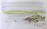
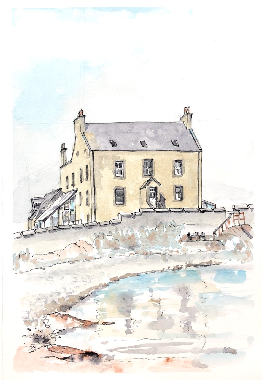
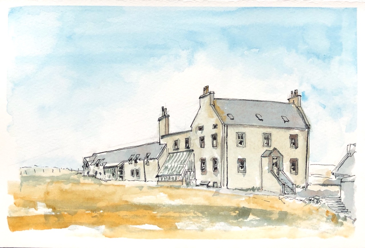
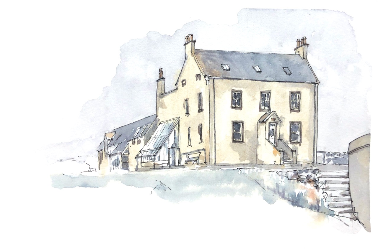
“On the remote west side of Shetland you can find spectacular scenery, peace and the ideal refuge for the escapist. The guest house welcomes you with peat fires, a cosy library and all the marvellous food you could want after a day of exploring….” This is Burrastow House , near Walls.
Burrastow House from the front garden
The house is right next to the sea. Here’s a view across the bay.
Burrastow House from the beach
Around the back is a vegetable garden and polytunnel with herbs in. Here’s the view from the back. See all the chimneys!
Burrastow House from the vegetable garden
And here’s another view from the front garden.
Burrastow House from the garden, near the wall.
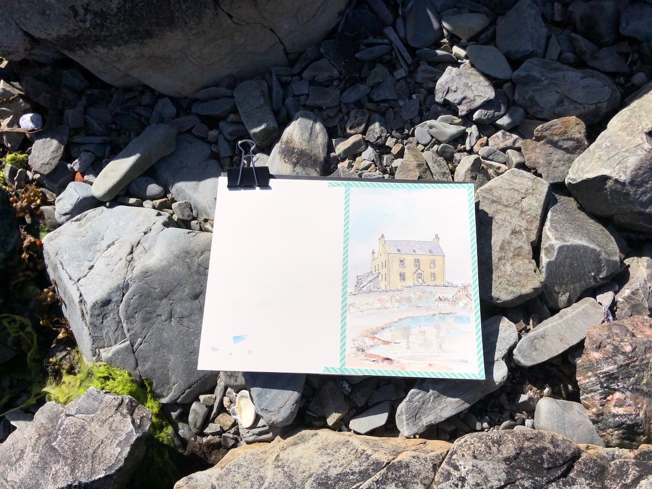
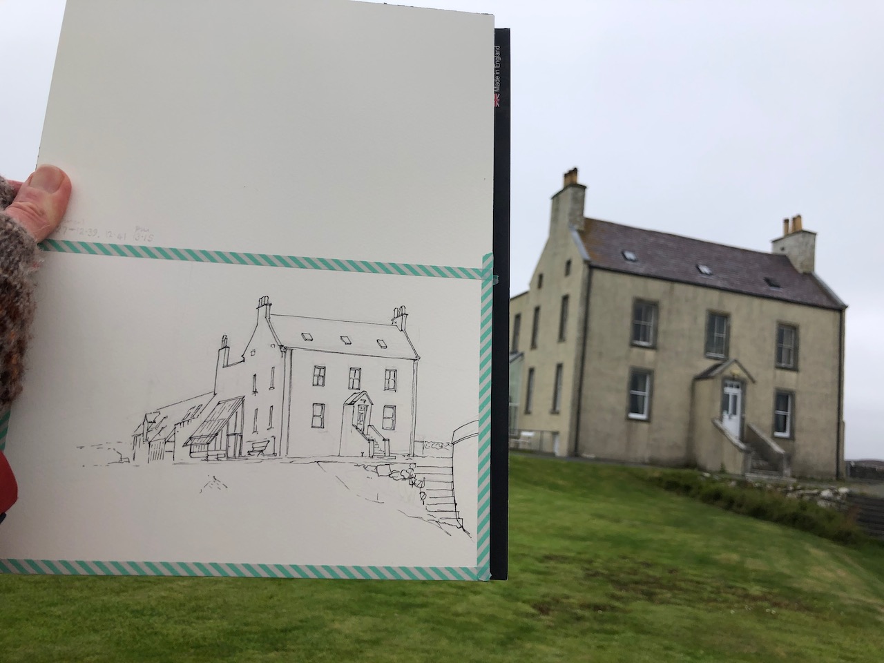
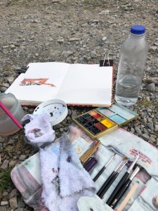
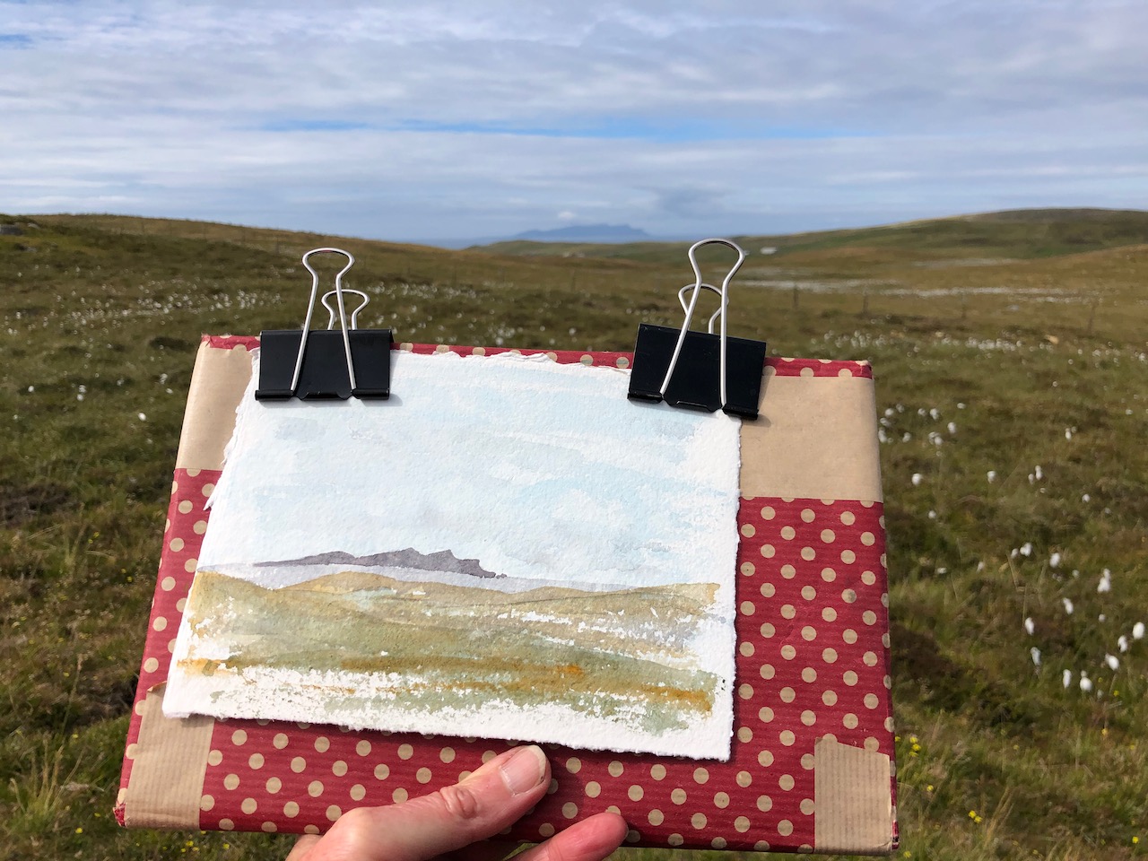
Here is work in progress on these pictures.
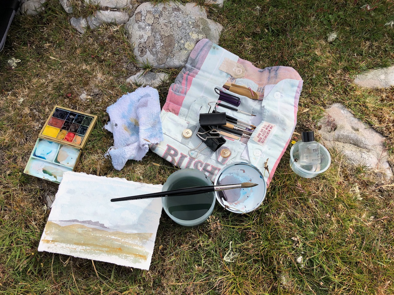
All pictures drawn and coloured on location, using a paper block by Saunders Waterford “St Cuthberts Mill” 300gsm Hot Press and Daniel Smith Watercolours over De Atramentis waterproof ink.
Thank you to my hosts, Pierre and Han.
Click a button below to share this post online, email it, or print it:
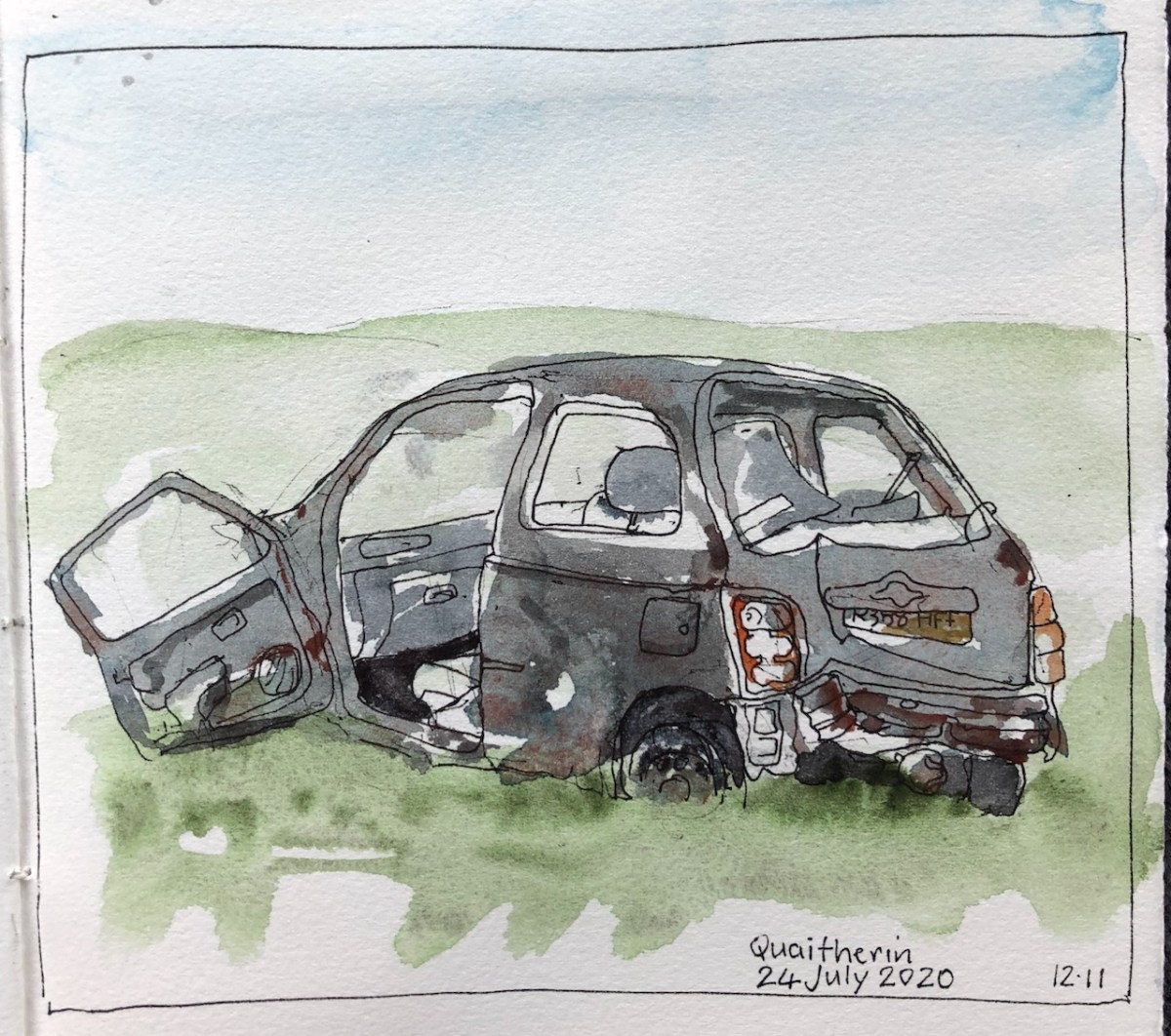
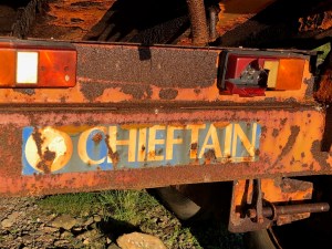
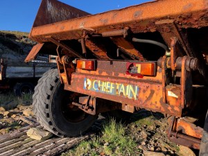
There’s a lot of empty space in Shetland. As I walked around, sometimes I encountered abandoned vehicles. Here is one.
Drawing the car wreck
This was the last of a sequence of such car wrecks on a track. Having passed two, towards the end of a long walk, I encountered this one, the third, and thought I would take a rest and draw it. The car number was even on there.
Here’s “Chieftain”: a huge and solid vehicle. He is out in the wild, perhaps not “abandoned”, but he is evidently not in daily use, which is a pity, since he looks very useful.
I tried very hard to describe the heaviness and strength of Chieftain. He is also very large. I should have put a few birds in too, for scale.
Click a button below to share this post online, email it, or print it:
Here is the view from the Historic Site near Pinhoulland.
Voe of Browland from the Historic Site
The lines on the right are a mussel farm. Here is another sketch from the same place. Here you can see the cottages in the distance, near the Bridge of Walls.
Voe of Browland, distant cottages
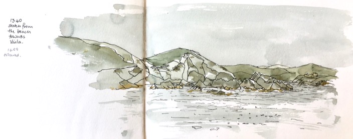
Further towards the sea, the view widens out. Here is the view from another walk, looking towards the island of Vaila.
Looking to Vaila, from the Nettle Beach.
I drew this having scrambled up the hill. Four hikers had arrived, and were on the beach. Four people seemed like a huge number, a crowd, more people together than I had seen in a week.
Click a button below to share this post online, email it, or print it:
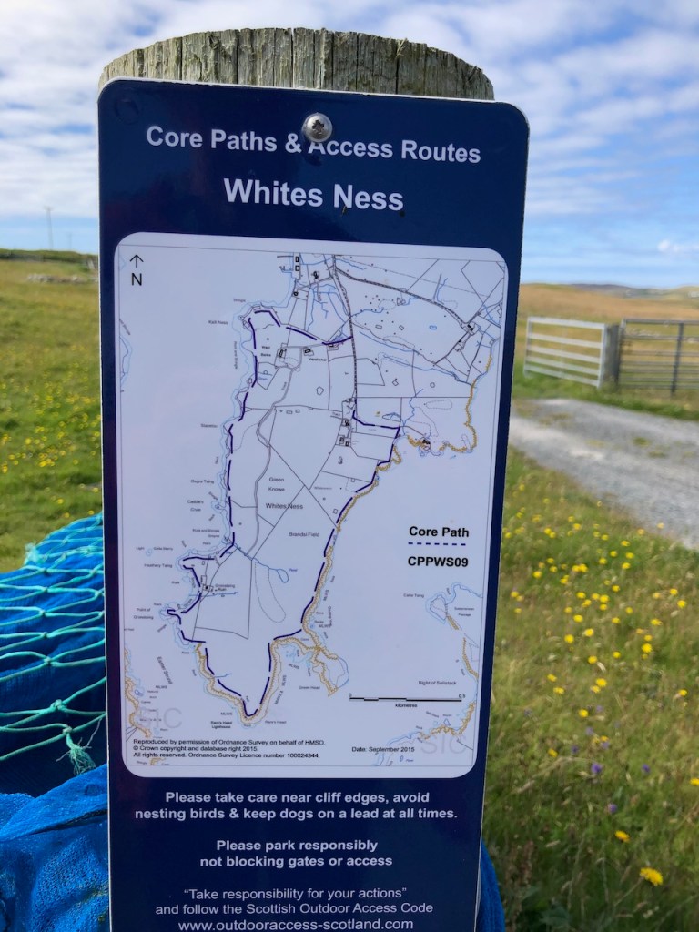
I walked over to the distant headland, called Whites Ness. It was a long walk.
OS App (edited)
Cyclemeter App
The walk round the peninsula of Whites Ness is way-marked.
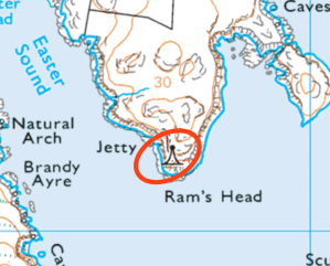
OS Maps: lighthouse, Vaila Sound
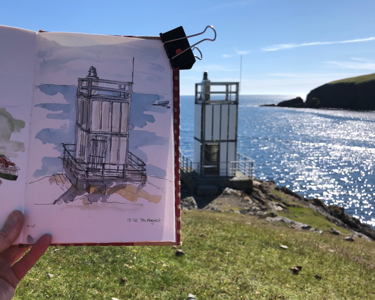
When I reached the end of the peninsula, I saw that there was a lighthouse marked on the map.
I wondered if it were really there. Would it be a real lighthouse, or maybe simply a buoy off the rocks?
The path was not very well marked, and seemed to be mainly uphill. I was a good way through what was already quite a long walk. And I had to walk back. But I kept on going. It seemed an unlikely location for a lighthouse. Of course I had in my mind those lighthouses I have seen, built by the Stevenson family in the 18th Century, red and white striped, towering over cliffs.
Here there were relatively mild rocks, smooth grass and a few sheep.
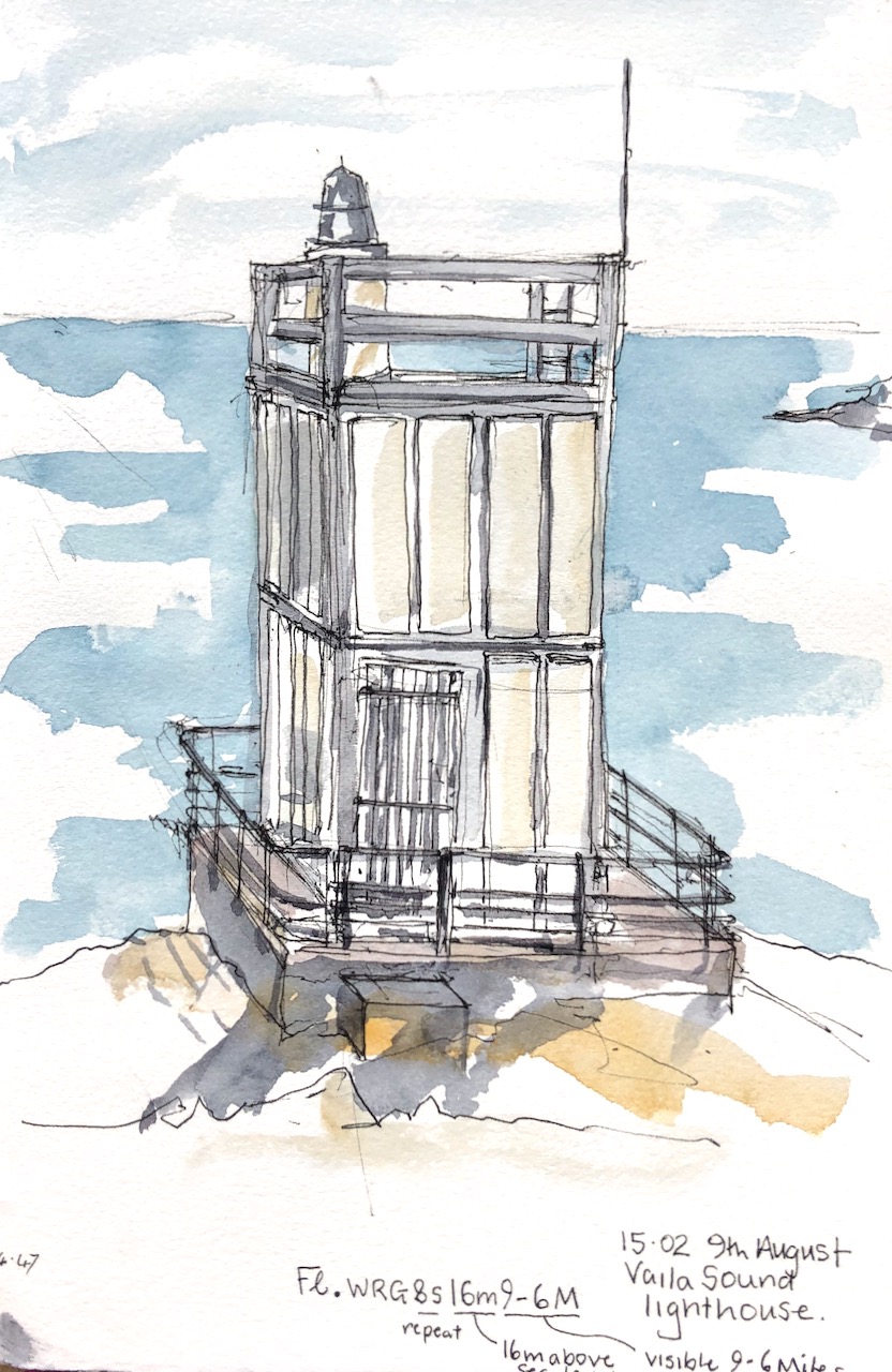
But then, against all expectation, there was the lighthouse. I was delighted. There was no-one around to whom I could exclaim: Look! Look! There really is a lighthouse.
It was not a lighthouse like the one in your head. It looked a bit like a prop from a Dr Who episode of the 1960s, or perhaps some construction which had been assembled from assorted parts of IKEA flat-packs. But it was a lighthouse, beyond all doubt. I sat down and drew it.
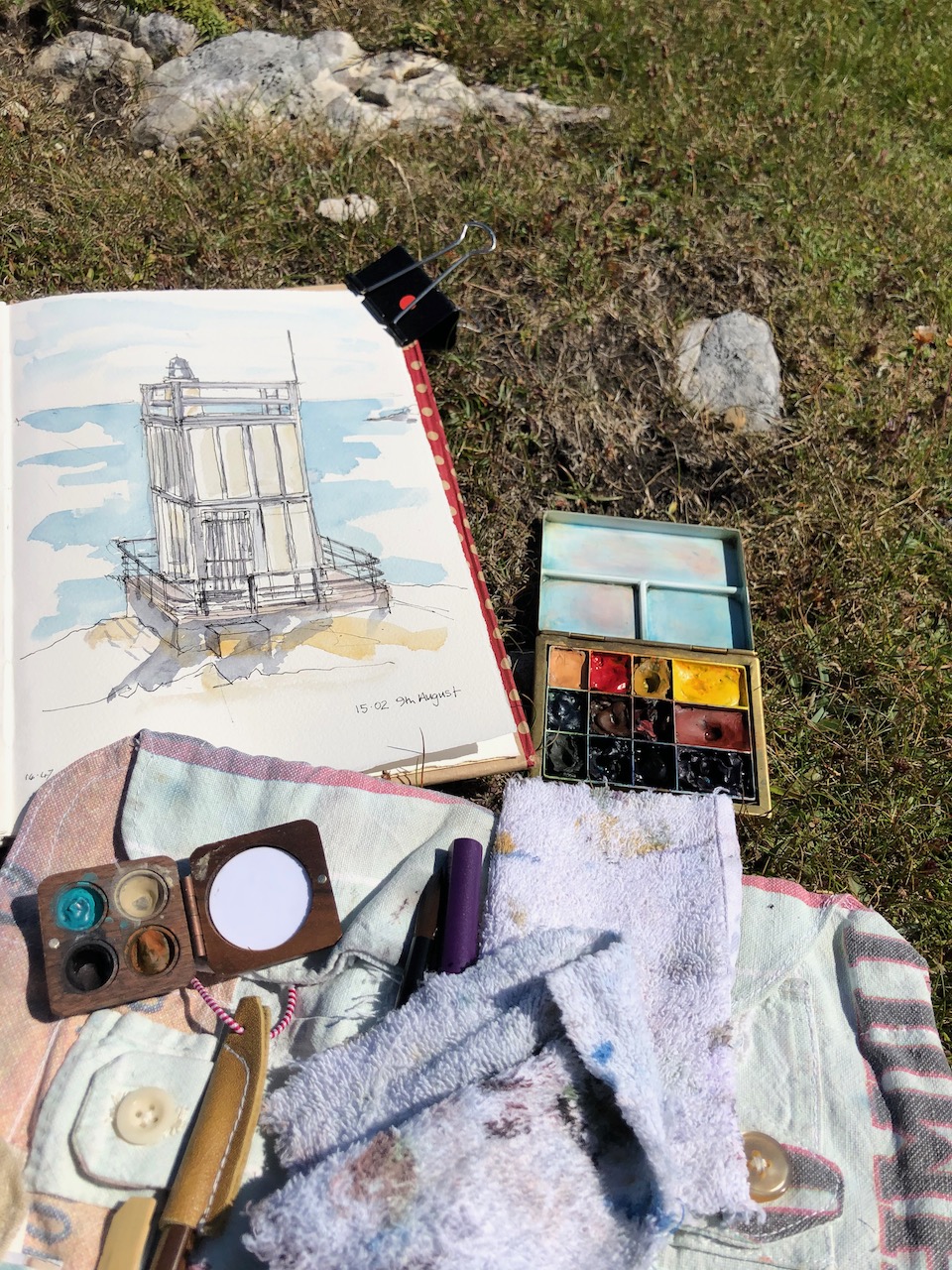
It was hard to find somewhere to sit down so that I could be sure that my art supplies were not going to take an impromptu roll down the slope and into the sea. There were a selection of rocks, none at quite the right angle. I chose the safest, and drew my picture.
Then I packed up my things and started on the long trek back.
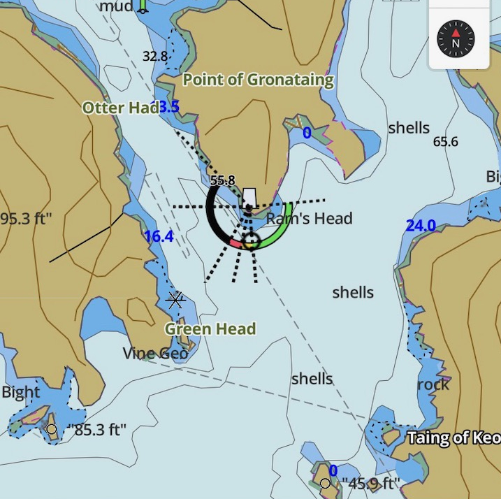
That evening a friend produced a useful coastal navigation guide, which informed me that this lighthouse was: “Fl.WRG8s16m9-6M”. We decoded this as: Flashing, White Red and Green, with an 8 second repeat, 16 metres above sea level, visible 6-9 nautical miles out at sea, on a good day. Anyone who is more familiar with the notation, please correct me if I have this wrong. I also found a map online.
From the fishing app: i-boating
From the fishing app: i-boating
Click a button below to share this post online, email it, or print it:
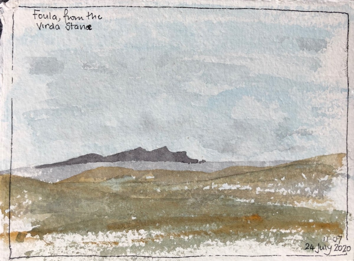
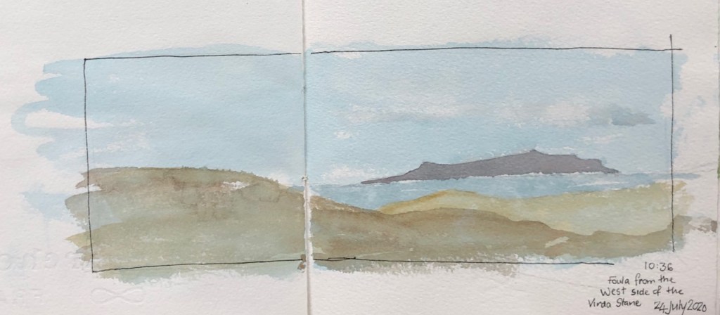
Here is a sketch of the mysterious island of Foula.
Foula on the horizon
Foula is about 20 miles away from Shetland Mainland, so it hovers on the horizon, often with its own special cloud.
This is a view from the Virda Stane, which is at the top of a hill. It’s a rare view: normally at this stage on the walk I would hunkered down on the East side of the stone, with its bulk sheltering me from the howling West wind. However on this particular day, there was eerily little wind. So I could sit on the West side, and observe Foula, before it disappeared in the fog.
Click a button below to share this post online, email it, or print it:
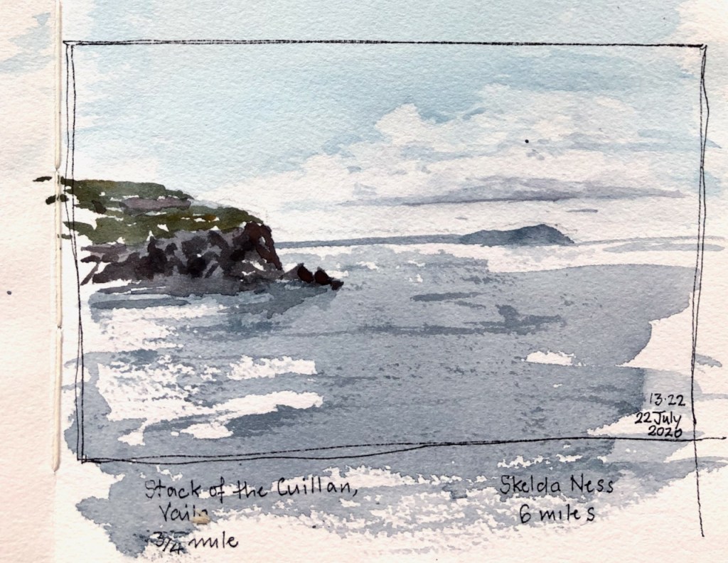
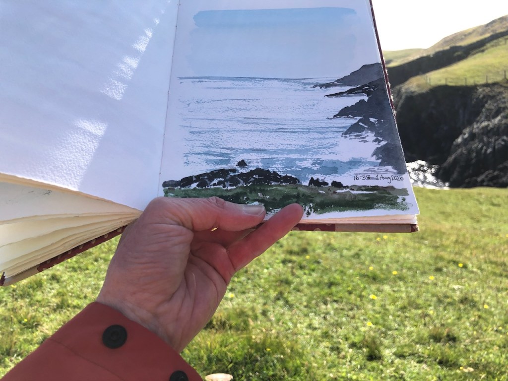
On a long walk to Footabrough, I paused to do a drawing of a distant headland.
From Uskie Geo
The drawing shows the West corner of the island of Vaila, with the wonderfully named “Stack of the Cuillan”, which are the rocks forming a small island at the base of the cliffs. In the distance is a headland. The question is: what is the headland?
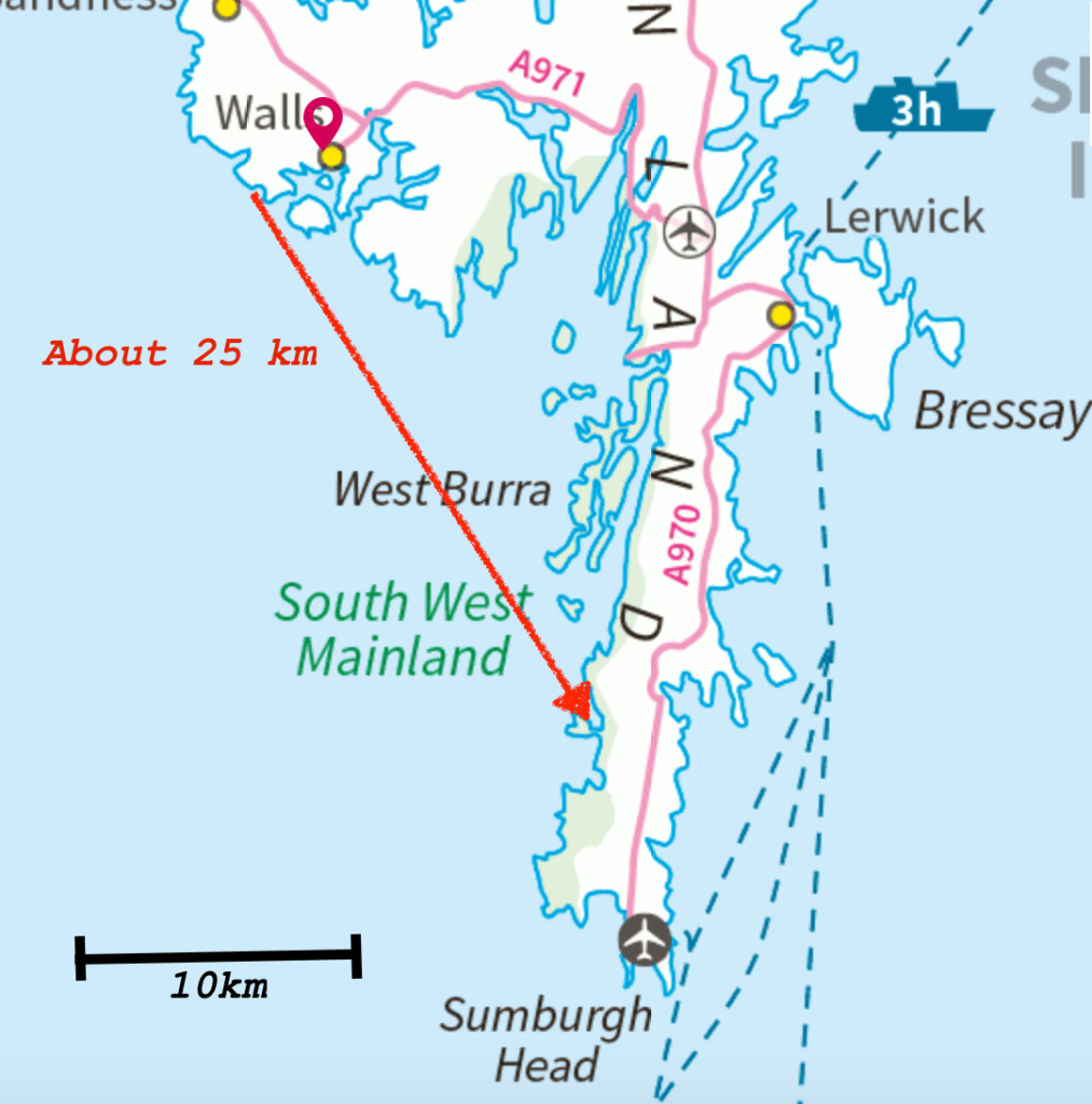
When I was drawing it, I thought it must be Skelda Ness, some 6 or 7 km away. But that might be hidden behind Vaila. So is that distant headland Sumburgh Head, 25km away?
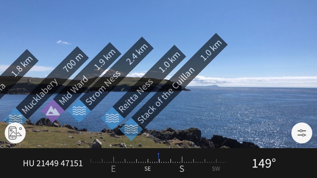
It occurred to me that the phone might know. I have the OS Maps app. But evidently it didn’t think I was interested in any feature so far away.
Screenshot from the OS Maps App. It helpfully identifies the local features, but not the distant headland.
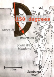
150 degrees bearing from where I drew the picture.
However it did give me the bearing: 149 degrees, as you see. So now back in London I can use my old school protractor.
It’s Sumburgh Head in the picture. I’m glad we sorted that out!
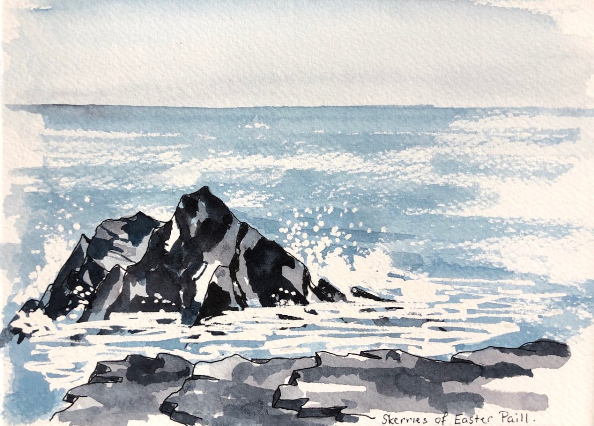
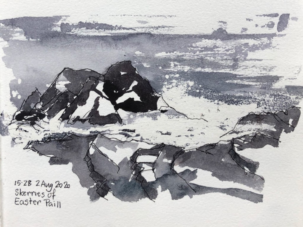
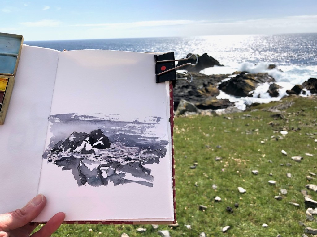
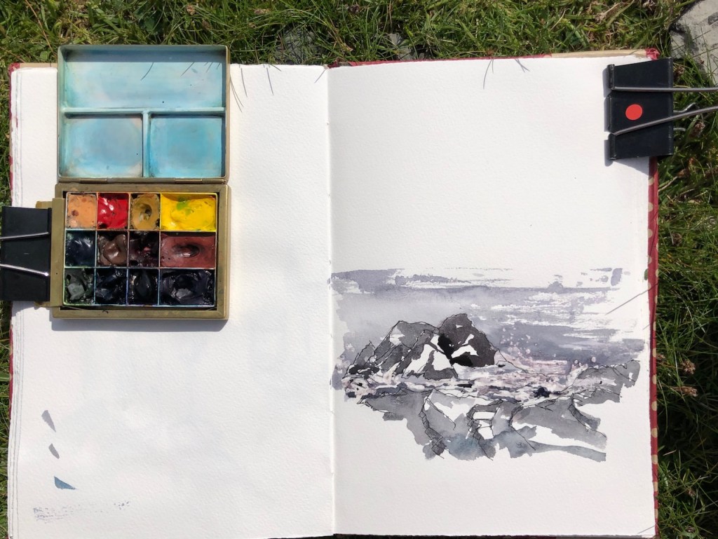
Further on towards Footabrough are the Skerries of Easter Paill.
Skerries of Easter Paill, drawn on location.
The word “Easter” here does not relate to the Christian festival, but to the fact that these small islands are the ones on the East. I guess this implies there must be a “Wester Paill” somewhere but I haven’t found it.
I drew this on location in my sketchbook.
The waves are done with watercolour resist. The resist is a kind of rubber solution a bit like Typex. The air was somewhat damp, despite the fine weather. I applied the resist before the paint was entirely dry, and then the resist didn’t dry properly either. I walked along for while with the sketchbook open, flapping it, much to the consternation of nearby terns. Then the terrain became more complicated, and too rocky to scramble over carrying an open sketchbook in one hand. I sat down on a stone and rubbed the resist off, which reveals the white bits. I was pleased with the result, obtained even in these adverse conditions. The product I was using is “Schminke Rubbelkrepp neutral”, in a tiny 20ml jar, applied with a brush.
In the evening I had another go, this time trying to describe also the brilliant light of the day, and the clarity of the water, as well as the pointedness of the rocks, and their regular angles.
Skerries of Easter Paill, drawn at my desk, based on the sketch on location.
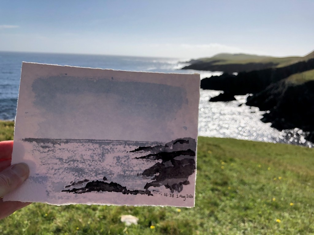
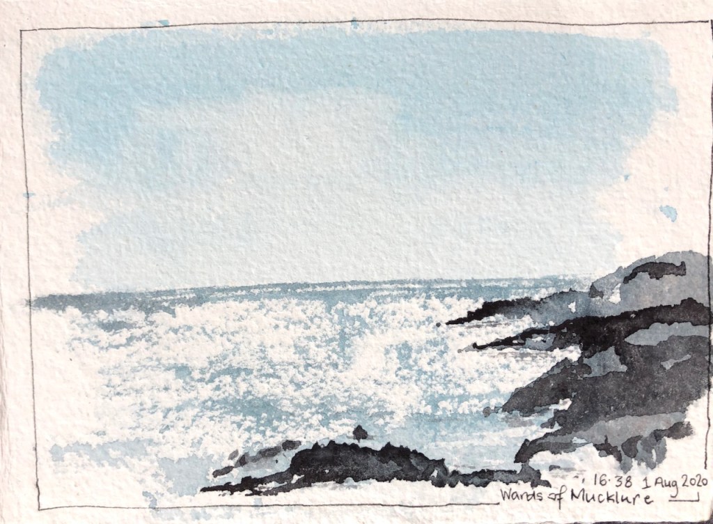
On another walk, I drew the headlands of Mucklure.
The dark is terrifyingly black, and the glitter from the sea is blindingly bright. It’s impossible to draw. But it’s so arrestingly beautiful that I had to have a go.
This scenery demands to be drawn.
Here are some blog posts from previous expeditions to Shetland. You can also see a collection of Shetland Landscapes (2017) on this link.
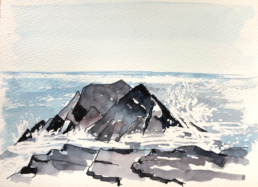
The rocks off the ward of Mucklure are almost geometrical in their formations. They make abrupt right angles. Here are the Skerries of Easter Paill, small rocks in the sea off Dounawall and The Hamar. Here is another drawing of the same location. It’s hard to get an idea of the scale. Here’s a map…
Here are some pictures I drew in pen and wash. I spent a lot of time drawing rocks. The rocks are overwhelming in their detail. Not every thing I saw is in the picture. But every thing in the picture, I saw. Here are some pictures I drew on the journey going back South: And…
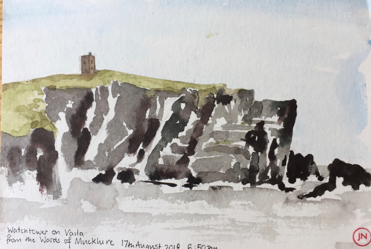
There’s a beach near Burrastow that looks towards the Island of Vaila. Here’s a sketch I made from the cliffs above the beach. Those cliffs look steep and dark. The tower is a “watch tower”, I’m told, built by the Laird back in the day (1700s) to watch over his fishing operations. The story I…
The wooden sign from the main road said “Historic Site”, and pointed up a small road that lead steeply uphill. I was on my morning run and felt energetic, so I set off up there, keen to see the Historic Site. In Shetland, Historic Sites are often at the top of hills. At the top…
Here is a collection of landscapes all done directly in watercolour with no pen and ink. I am using Daniel Smith Watercolours, and trying different mixing combinations. All of these pictures are done with three or fewer colours, alone or mixed together. It seems to me that the fewer the better. The picture hangs together…
Here’s another attempt at the skerries of Easter Paill:
Click a button below to share this post online, email it, or print it:
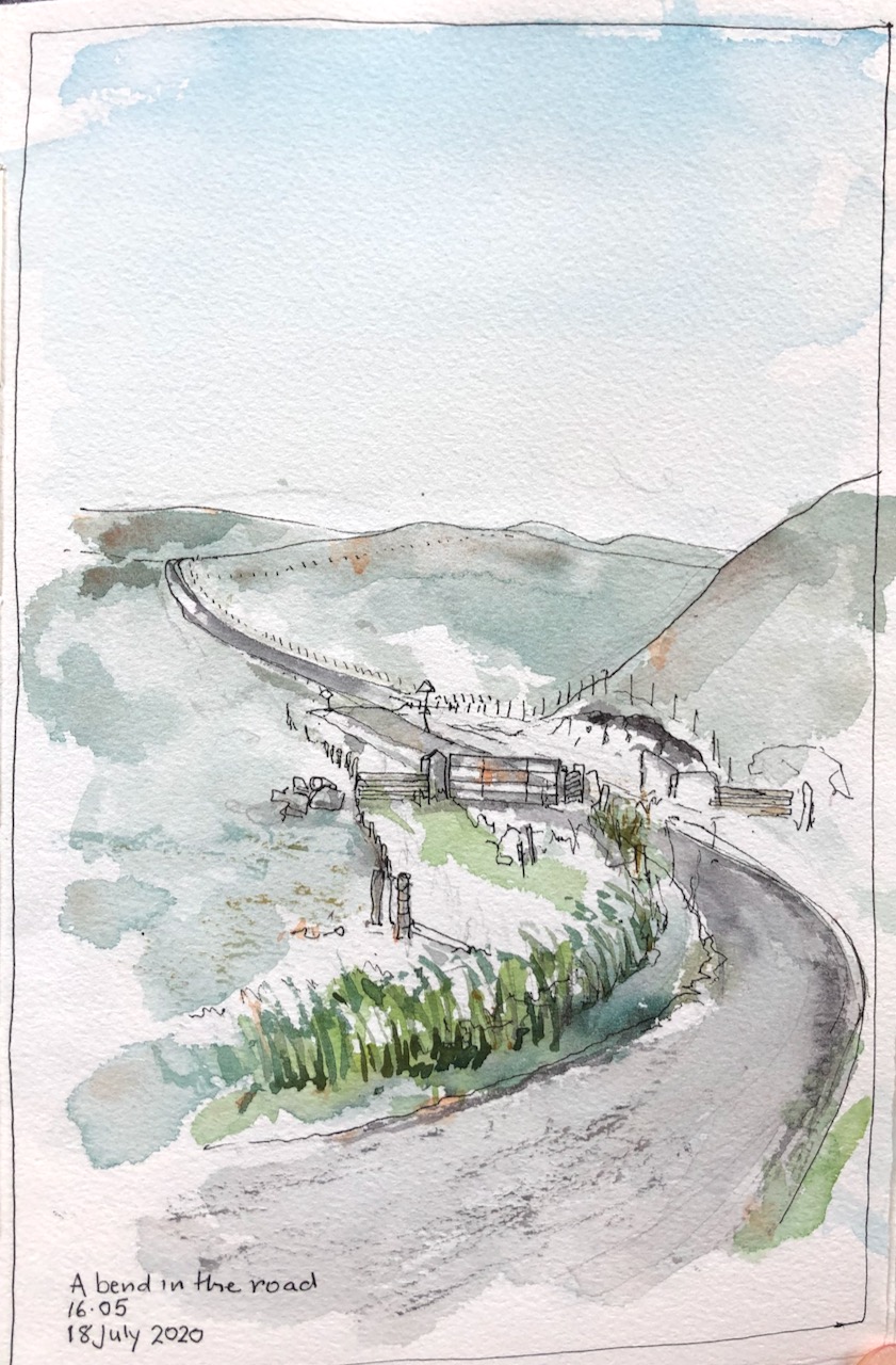
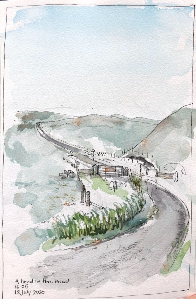
Roads in Shetland trace three-dimensional calligraphy across the landscape. On the West Side, the hills are undulating. The roads loop to and fro, taking a route that yields to the contour, but is not dictated by it. On every visit I try to draw these roads.
Here is a bend in the road. I was walking back from Walls with my groceries. I paused to rest, and draw the route I had just walked. The town of Walls, with its famous Post Office and Shop, is close, but it is not just over the hill you can see, much as you might like it to be when you are walking there. There is yet one more hill after that, and only then you descend to Walls.
A bend in the road: looking towards Walls.
The hill in my drawing, where the road disappears, is owned by the terns. They see you coming and get organised into squadrons. Then as you reach the brow of the hill they start launching themselves at you, in regular swoops, screeching to terrify you. I was there towards the end of the tern season. But they were defending their hill to the end. I feel like an intruder, and walk fast until they are well behind me.
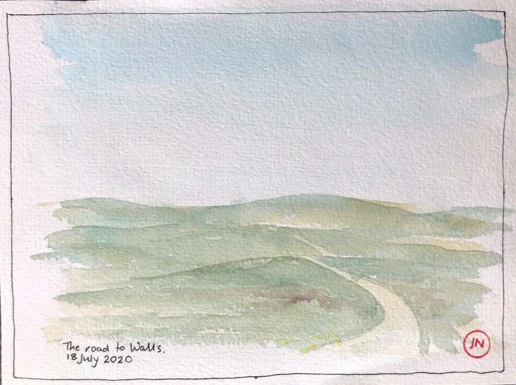
Here is my running route.
Dale -> Walls road, looking east towards Walls
A section of this road falls within the territory of the curlew. He has a different technique from the terns. Rather than terrify you, the curlew’s idea is to entice you away. He flies overhead, making a piping sound, a clear note repeated three times. Having thus secured your attention, he then flies ahead, as much as to say “come this way”. He then courageously lands on the road, and looks conspicuous: “Come and get me!” As you approach, he might bounce up the road a few times, until he is sure you are properly out of his protectorate. Then he goes back home, job done.
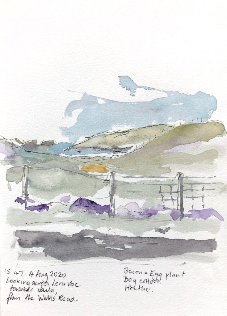
Here is another view from the Walls road, not far from the bend in the first drawing. Walking back from Walls, I was arrested by a bright view of the sea, and an array of colours from the flowers. There was a formidable wind blowing. But I had a go. Ten minutes in, the skies darkened, the temperature dropped. I just managed to get my art materials back inside my waterproof rucksack before the rain came down. Welcome to Shetland.
Click a button below to share this post online, email it, or print it:
There’s a beach near Burrastow that looks towards the Island of Vaila.
Here’s a sketch I made from the cliffs above the beach.
Those cliffs look steep and dark. The tower is a “watch tower”, I’m told, built by the Laird back in the day (1700s) to watch over his fishing operations. The story I was told was that the Laird’s tenants were selling their catch to Icelandic vessels out there in the bay. Then they returned with a meagre stock for the Laird. Or at least he suspected them of doing this. After all, he gave them very little, if anything for their catch. And the Icelanders would pay.
So he made the watchtower for surveillance. I was told this story in the Germattwatt café in Walls. The people made it sound as though it was living memory. But it was many generations ago, even if true. They also pointed out to me the place on the nearby hill where the miscreants were hanged, and left hanging, as an example.
The tower is listed as a project on the website of “Groves Raines Architects” as “Mucklaberry Tower, C19th 2-storey square plan Baronial reconstruction” . Their project was to refurbish it as a retreat, along with renovation of Vaila Hall.
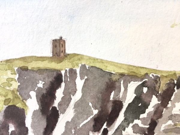
On another day, from the beach, I determined to draw the rocks.
Drawing the rocks. Muckleberry Tower is just visible, on the right in the distance.
Drawing the rocks.
On the beach.
It was a very windy day, the wind blowing over the top of me.
My rule for drawing rocks is this: everything that’s drawn is there, but not everything that’s there is drawn.
Click a button below to share this post online, email it, or print it:
Here is a collection of landscapes all done directly in watercolour with no pen and ink. I am using Daniel Smith Watercolours, and trying different mixing combinations. All of these pictures are done with three or fewer colours, alone or mixed together. It seems to me that the fewer the better. The picture hangs together better if I don’t use many colours. And it’s faster.
Click the picture to expand it.
The Loch of Quinnigeo, drawn from the hill in a Force 5 wind. The dark lines round the edge are the peat.
The young guillemot, by the rocks off Burrastow.
This is the Seal Lagoon, seen from the East, looking across to the Seal Beach where they lounge.
The Standing Stone marks where the road divides. I climbed up there and looked back to Burrastow.
The island of Vaila and the land beyond.
The view across the bay from Burrastow, on a misty day.
The view from the Virda Stane.
Click a button below to share this post online, email it, or print it:


 this. After all, he gave them very little, if anything for their catch. And the Icelanders would pay.