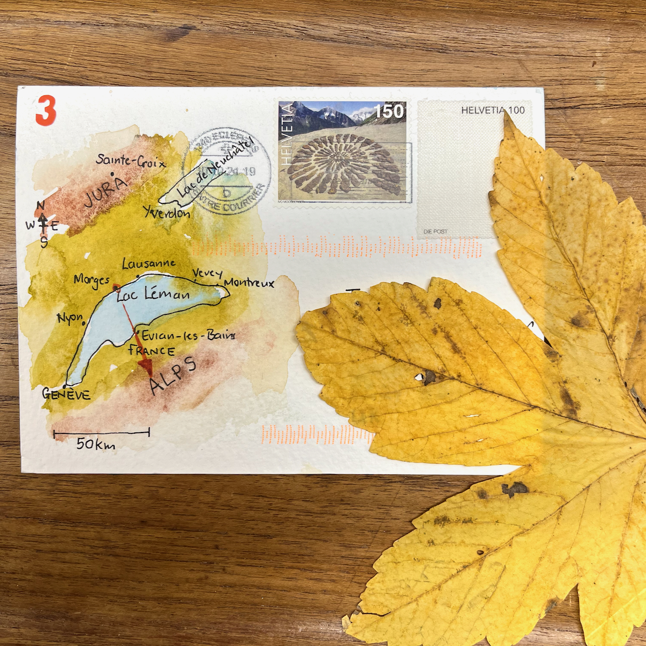
Here are postcards from Switzerland, sketched quickly on 4″ x 6″ watercolour postcards.
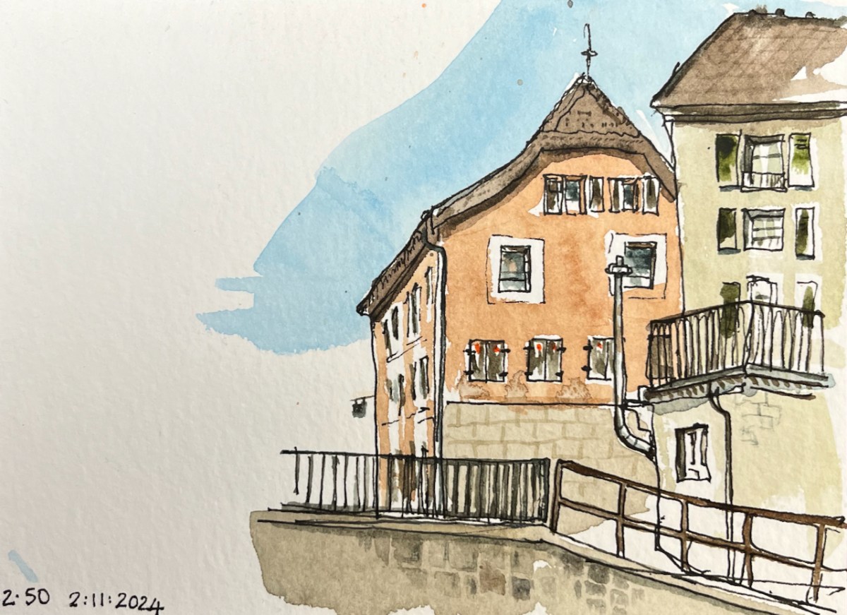
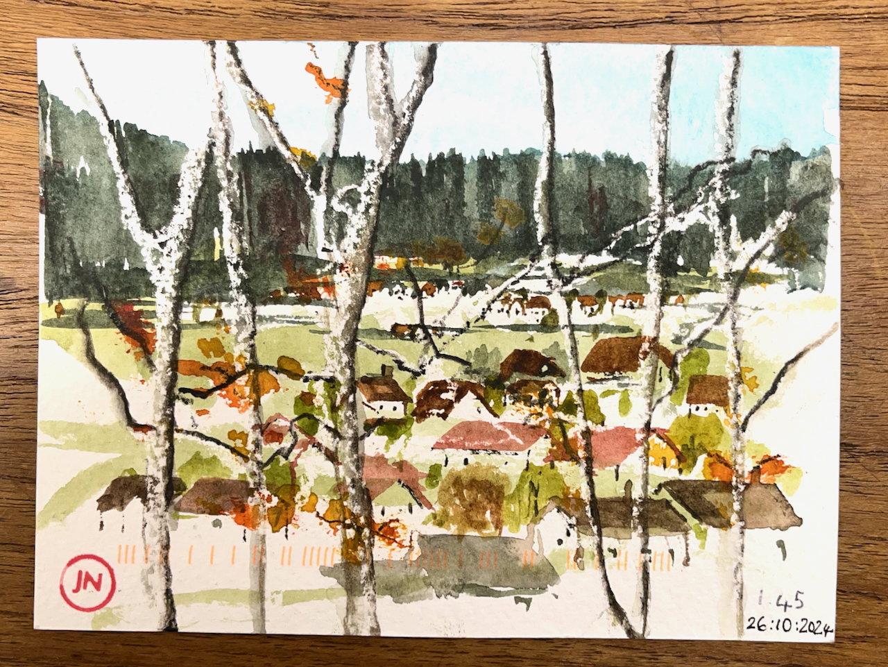
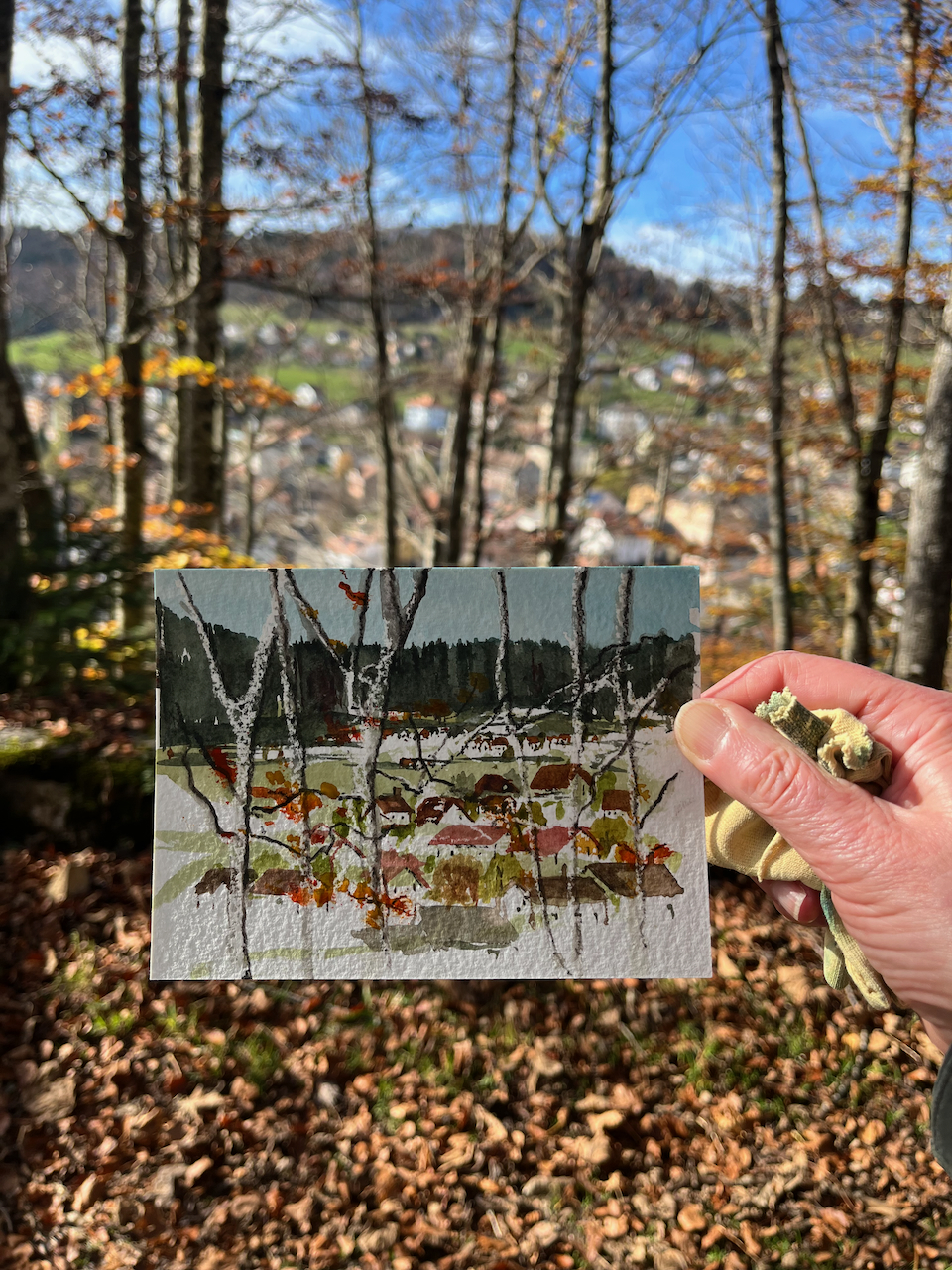
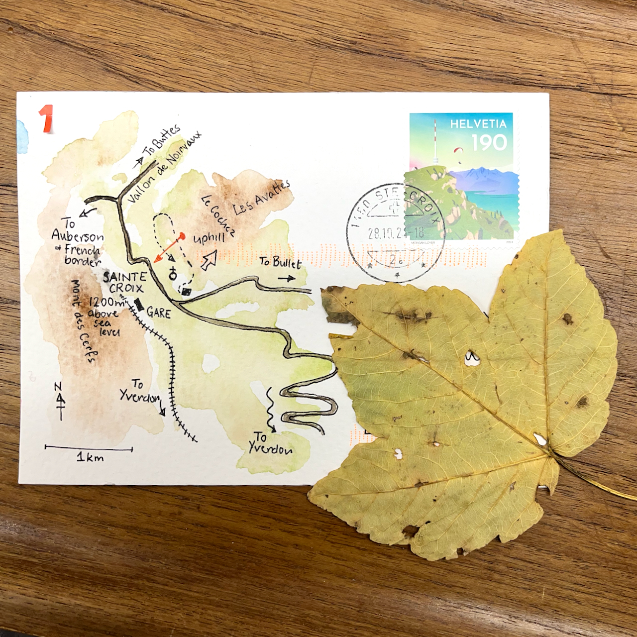
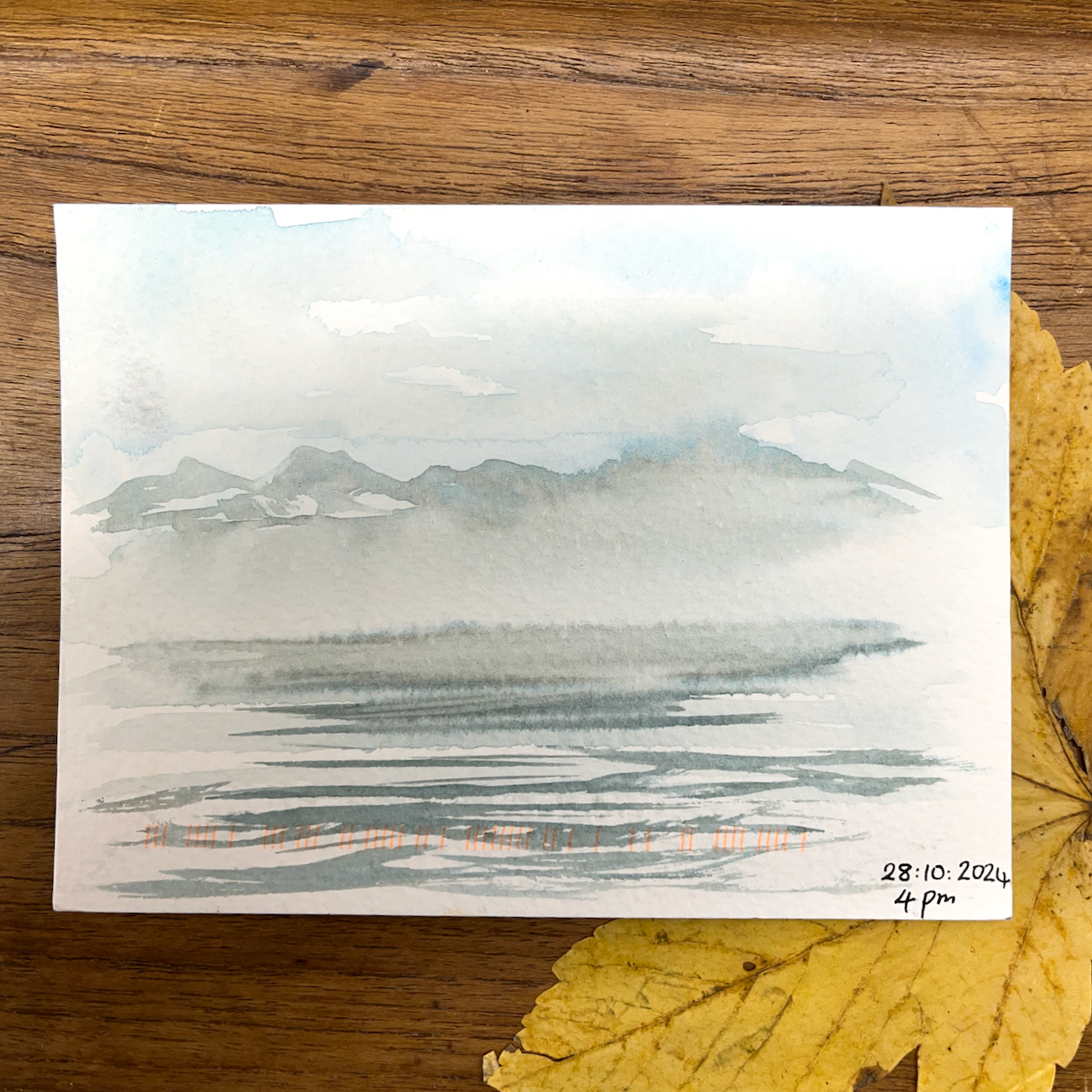
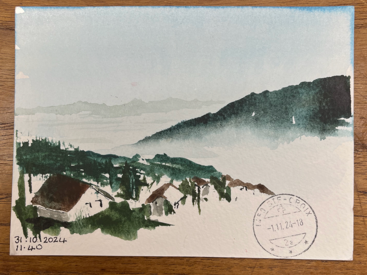
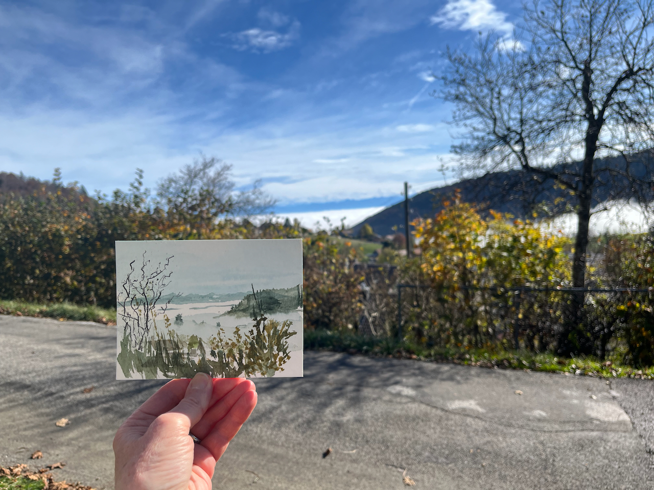
A walk above the villageLooking across Lake Geneva from MorgesFrom Les Praises, looking across to the Alps The Alps above the fogSketching in Sainte-Croix, Vaud (1000m)
It was foggy in the valley, and clear at 1000m.
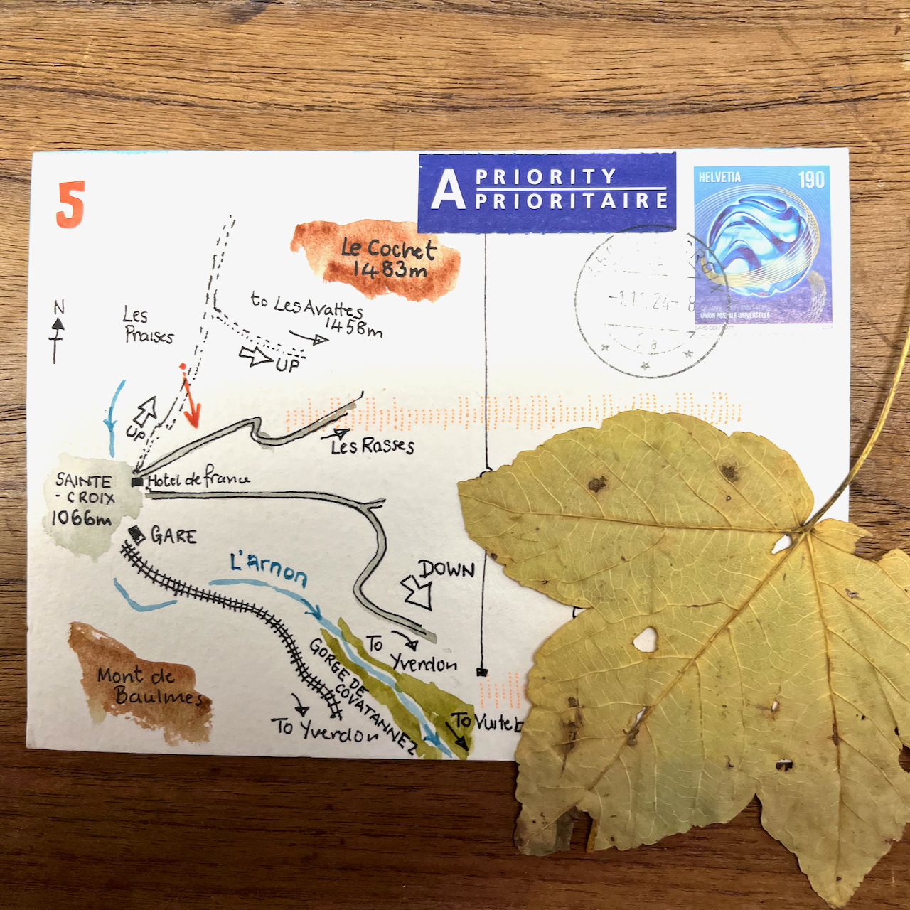
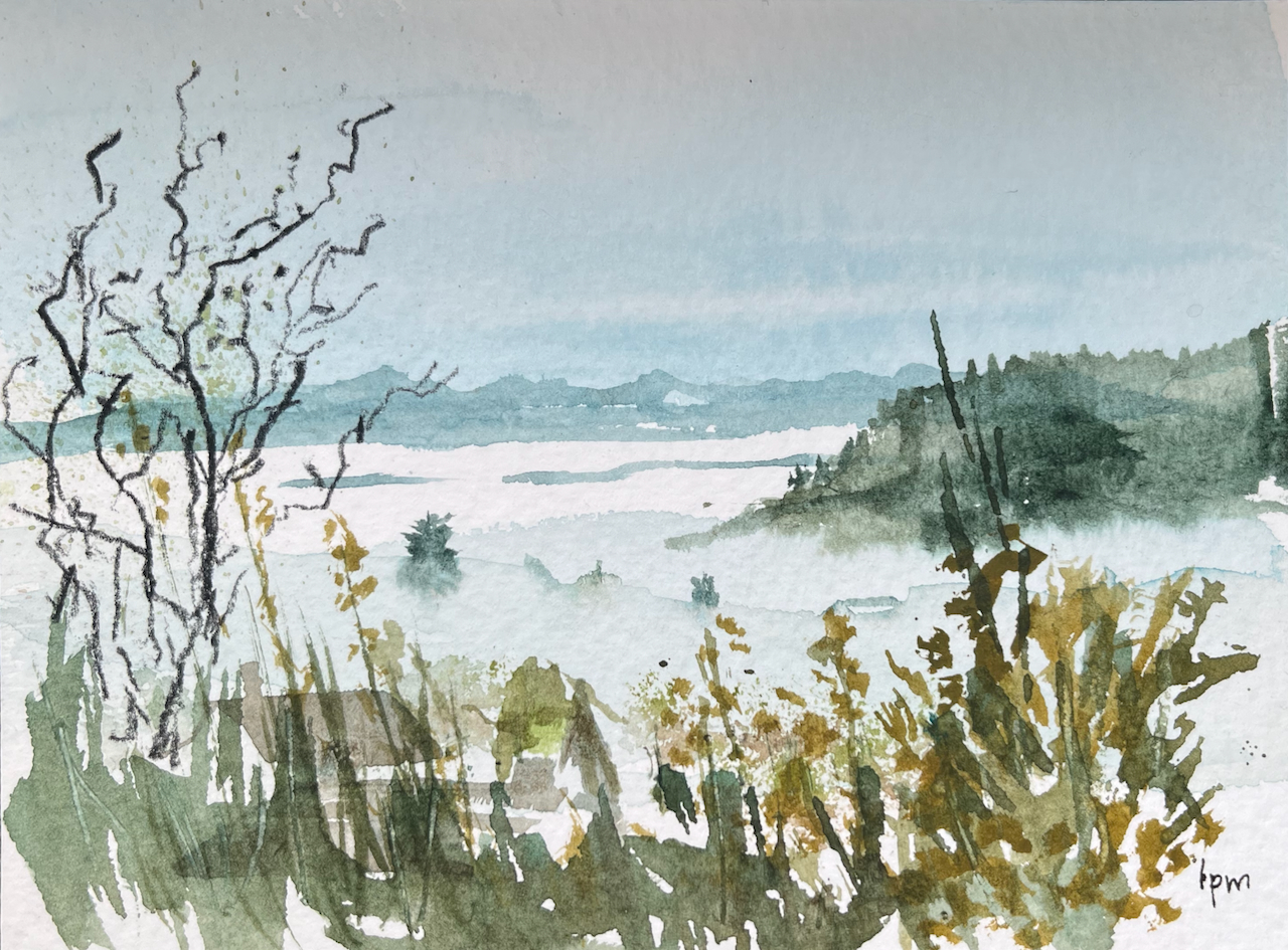
One day, starting early, my hosts dropped me in the village of Vuiteboeuf, which is at the lower end of the Gorges de Covatannaz. I walked up, through the fog. It took about an hour and a half. I’d intended to sketch and I had my watercolours with me. But the fog made it surprisingly cold, and I didn’t want to stop or I would freeze. I was warm so long as I kept walking. So I made very quick sketches using Derwent “inktense” watercolour pencils. Here are my sketches in video format.
Here is the view over the Gorge, from the fields at the top.
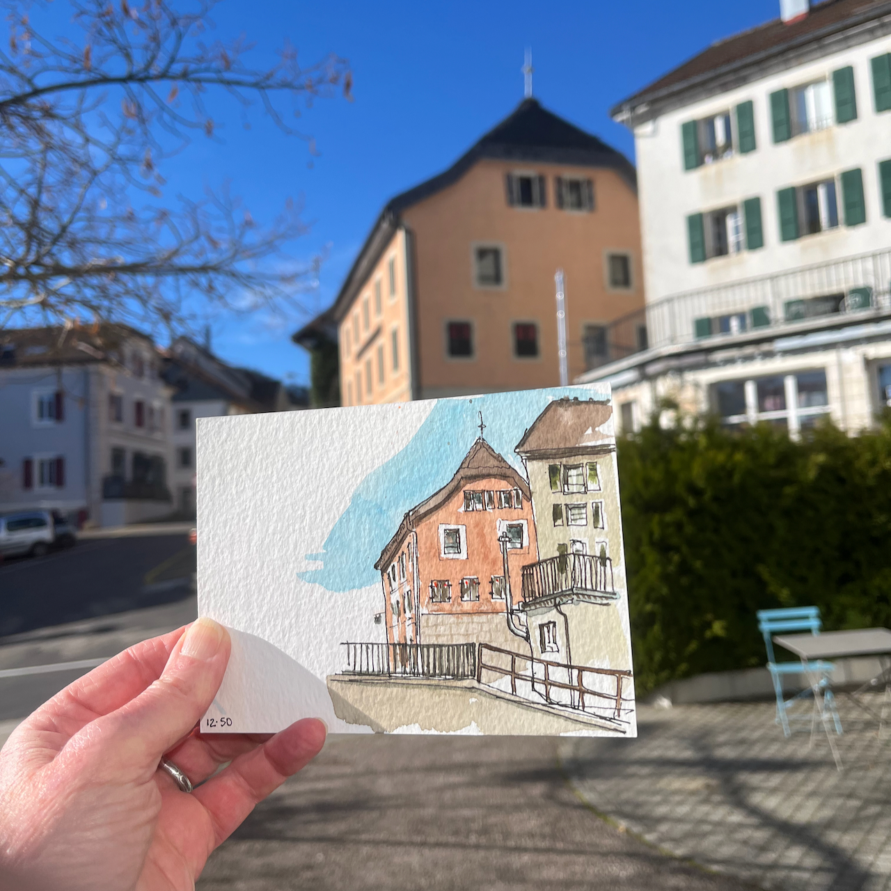
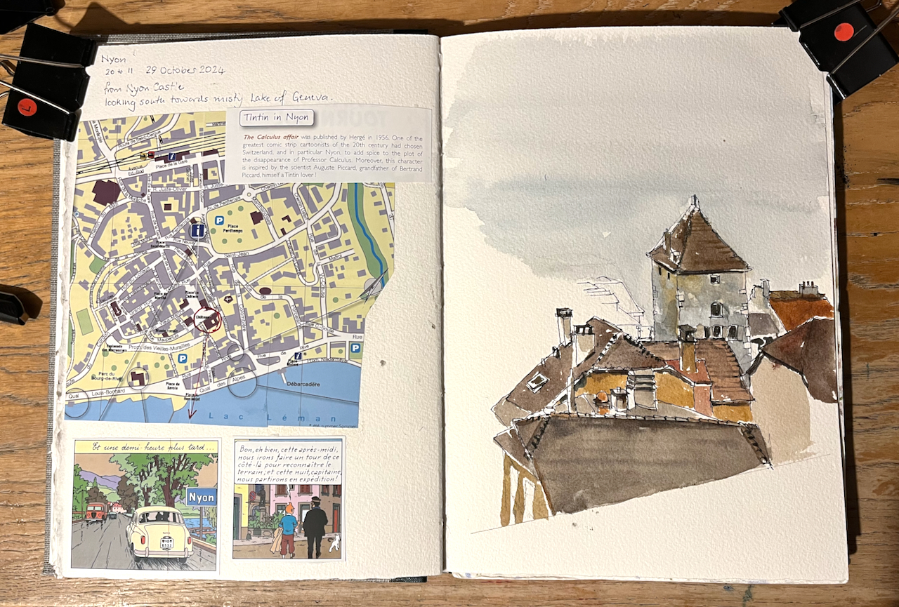
My visit took me to Nyon, on the shores of Lake Geneva. I made a quick sketch from the walls of the castle. Did you know that the Tintin story, “The Calculus Affair” was set in Nyon? The tourist office made much of this connection.
Sketchbook 15, Nyon page spread.
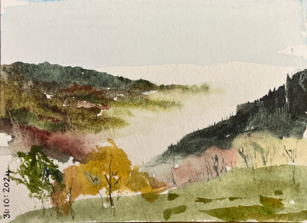
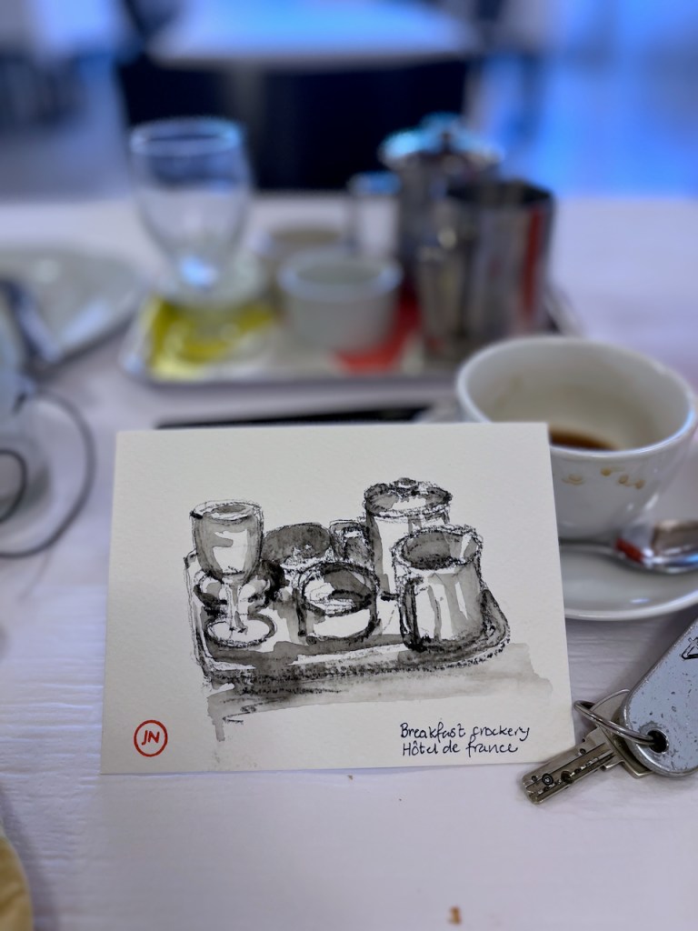
Switzerland is beautiful in the Autumn. Thanks to my hosts at the Hotel de France, Vaud, for their hospitality.
Click a button below to share this post online, email it, or print it:
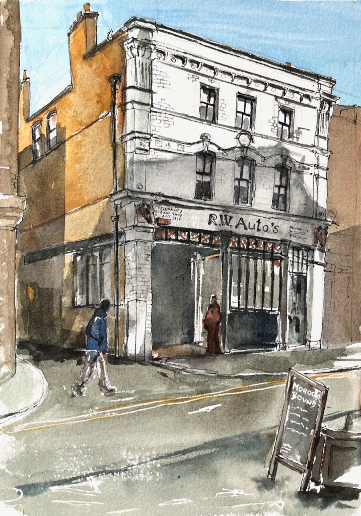
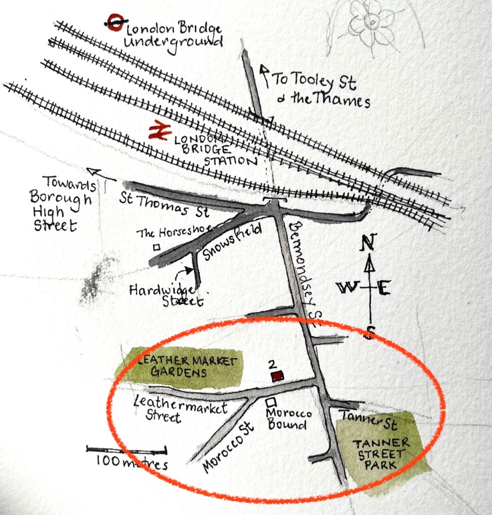
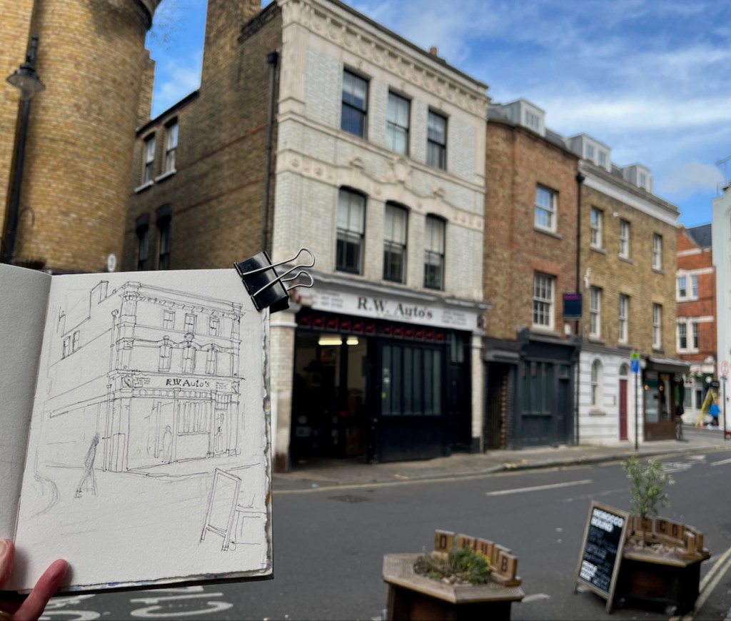
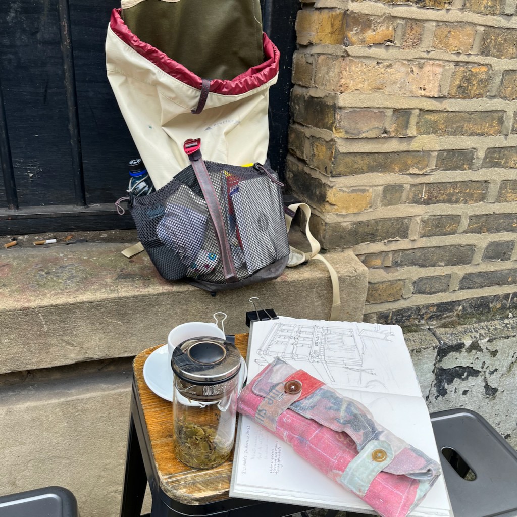
Bermondsey is an area of London just to the south of London Bridge. I had tea at the bookshop and café called “Morocco Bound”. From a table outside Morocco Bound, I sketched the building opposite.
2 Morocco Street, sketched from “Morocco Bound”, 18th October 2024, 2pm in Sketchbook 15
As you see, on the ground floor there is a motor repair shop, “R.W. Auto’s”.
RW Autos is Southwark’s top garage offering a range of car services including MOT’s, repairs and servicing. Our Southwark garage has been established since 1969 and serves a plethora of private and corporate clients. Our team provide you with a friendly, reliable, personal, efficient, and affordable service.
The names of the streets round here indicate the historic industry of the area: tanning and leather making: Leathermarket Street, Tanner Street, Morocco Street.
A 1967 Webster’s dictionary, morocco bound. Source: for sale on James Cummins bookseller website (30 Oct 2024)
I was sketching on Morocco Street. Morocco is a type of soft leather. It is used for gloves and wallets, for example. It is also used for book bindings, hence the name of the café: ‘Morocco Bound”. According to the “Medieval and Early Modern Orients (MEMOs)” scholarly site1, Morocco leather was originally “a kind of extremely fine, soft, hard-wearing, and richly dyed sumac-tanned goatskin, originating in the Sokoto region of northern Nigeria, transported across the Sahara and exported to Europe by Maghrebi, particularly Moroccan, merchants.”. This was in the 16th and 17th centuries.
This luxury product was greatly imitated over the following years, so that “by the turn of the nineteenth century, nearly all obvious distinctions between imported and locally produced morocco leather had been erased, and to many modern curators, ‘morocco’ refers either to the distinctive grain, or simply to goat leather bindings, whatever their origin.”
Books are still bound in “morocco leather” today.
The phrase “Morocco bound” occurs in a song from the 1942 film “Road to Morocco” with Bing Crosby, Bob Hope and Dorothy Lamour. Here is an extract:
We may run into villains but we're not afraid to roam
Because we read the story and we end up safe at home
Certainly do get around
Like Webster's Dictionary we're Morocco bound

We certainly do get around
Like a complete set of Shakespeare that you get
In the corner drugstore for a dollar ninety-eight
We're Morocco bound

Or, like a volume of Omar Khayyam that you buy in the
Department store at Christmas time for your cousin Julia
We're Morocco bound....
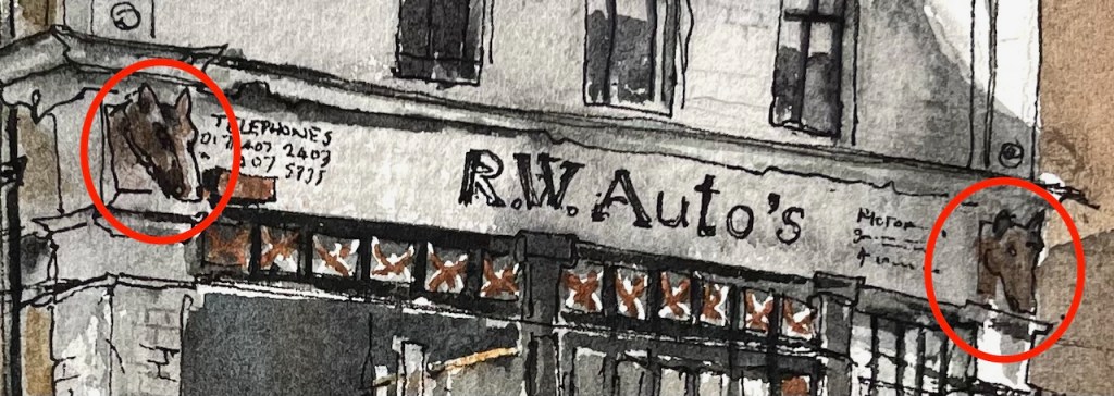
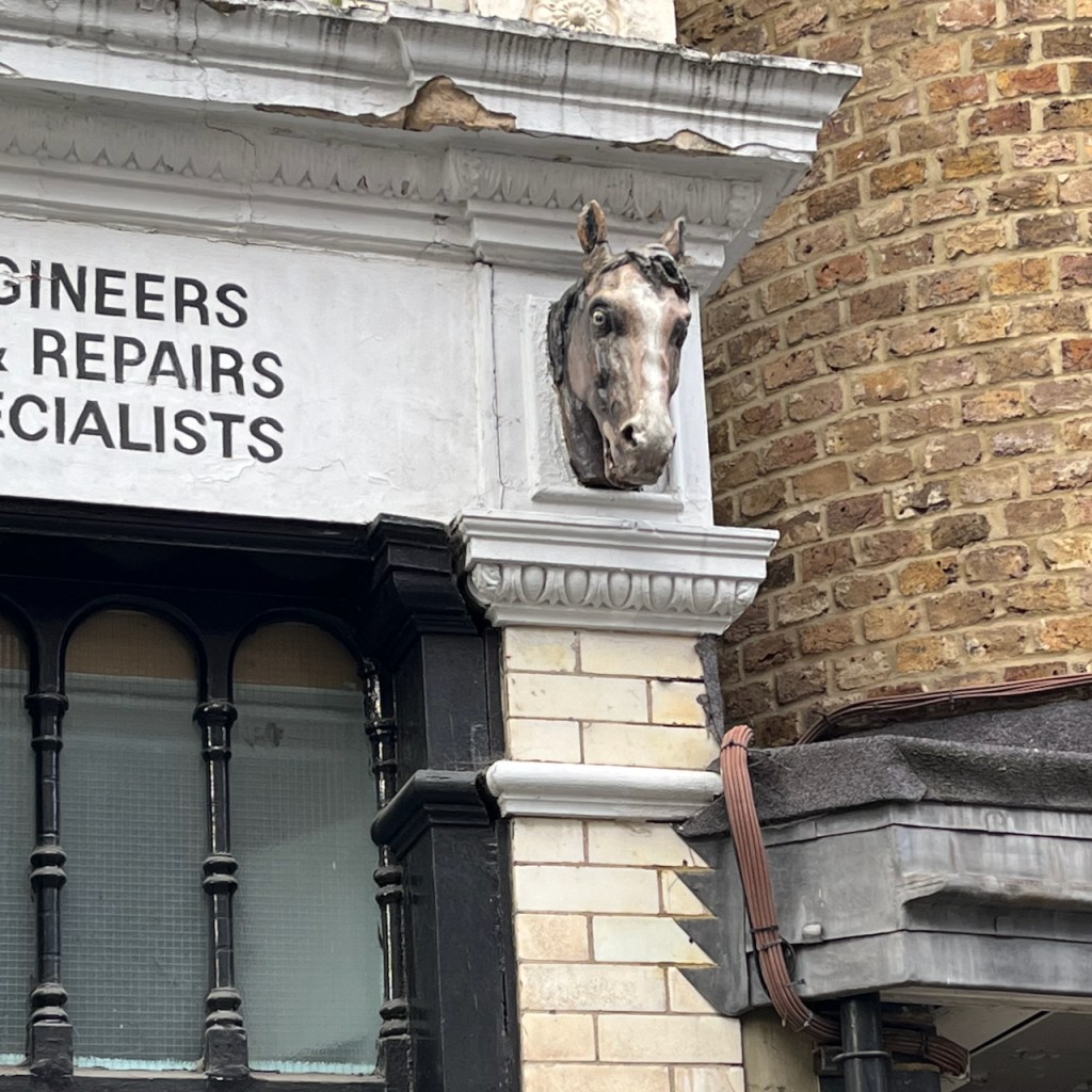
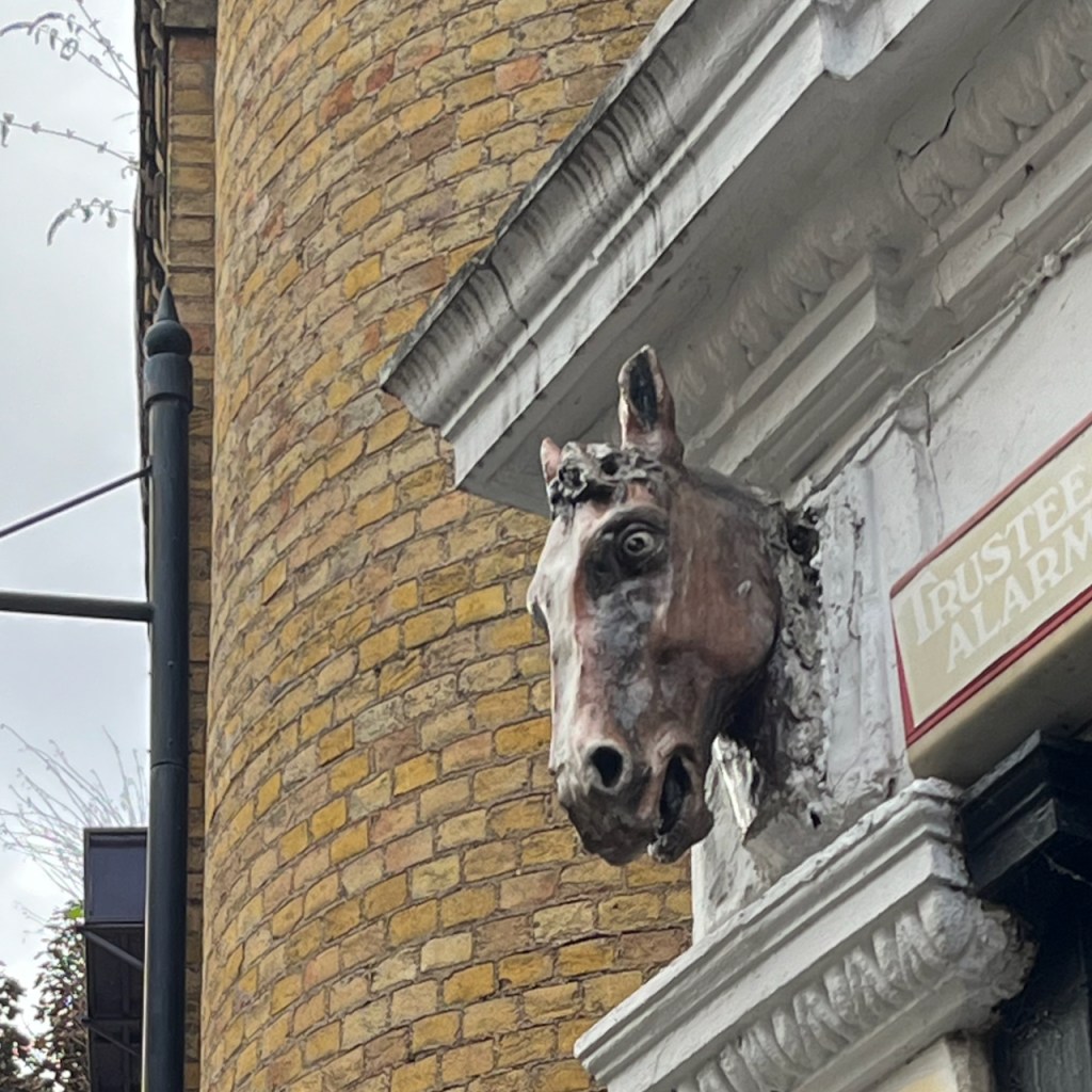
It was only when I started looking at the building carefully that I noticed the horses’ heads. It turns out these are a bit of a mystery.
The mystery of the Horses’ Heads
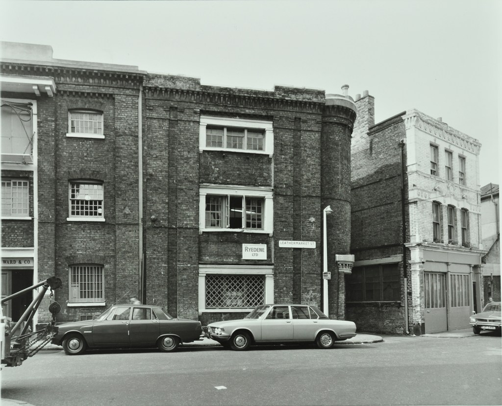
I found this 1976 photo in the London Picture Archives, reproduced here with permission:
You see Number 2 on the right of the photo, looking very much as it does today. Except that there are no horses’ heads. When did they appear?
Various websites2 suggest that Number 2 Morocco Street was “once a smithy”. If this was a smithy with horses’ heads in (say) the early twentieth century, then someone removed them before the photo was taken in 1976, and has put them back some time afterwards. Or the building became a smithy after 1976, in which case it must have been one of the very few left in London at that time. Or the horses’ heads are a recent decorative addition and not related to the original purpose of the building atall. It’s a mystery. Next time I am in the area I will go and enquire at R.W. Auto’s.
Photos of work in progress on the drawing, and the mysterious horses’ heads.
Medieval and Early Modern Orients (MEMOs) is an AHRC-funded decolonial project that seeks to further knowledge and understanding of the early interactions between England and the Islamic Worlds. AHRC is the Arts and Humanities Research Council. The quotations come from an article on their site entitled “Morocco Leather and Material Understandings of the Maghreb in Early Modern Britain” dated 14 November 2022 on this link: https://memorients.com/articles/morocco-leather-and-material-understandings-of-the-maghreb-in-early-modern-britain↩︎
Various websites suggest that this building was once a smithy. Here are the links: Layers of London:https://www.layersoflondon.org/map/records/morocco-street. “2a R.W.Autos with horses heads was a smithy/farrier” Bermondsey Boy:http://www.bermondseyboy.net/viewtopic.php?t=260. This website includes a photo from 2015 – with horses heads, and the commentary. “RW AUTO’S The two horse heads above the front of this garage workshop are the last clue that is was once a smithy – a blacksmiths.” This website also includes a 1968 photo which has no horses heads. ↩︎
Sketchbook 15 page spread
Click a button below to share this post online, email it, or print it:
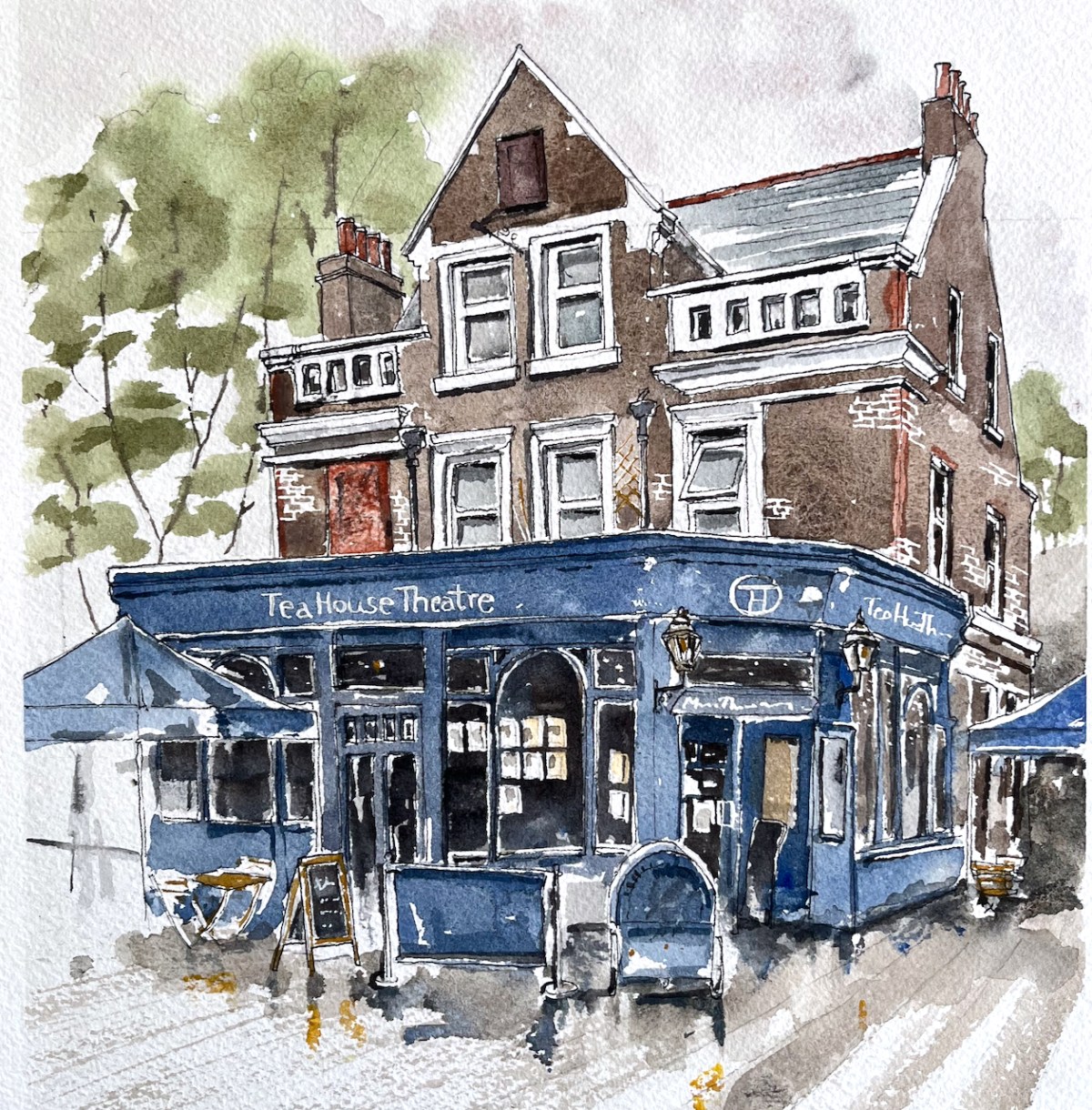
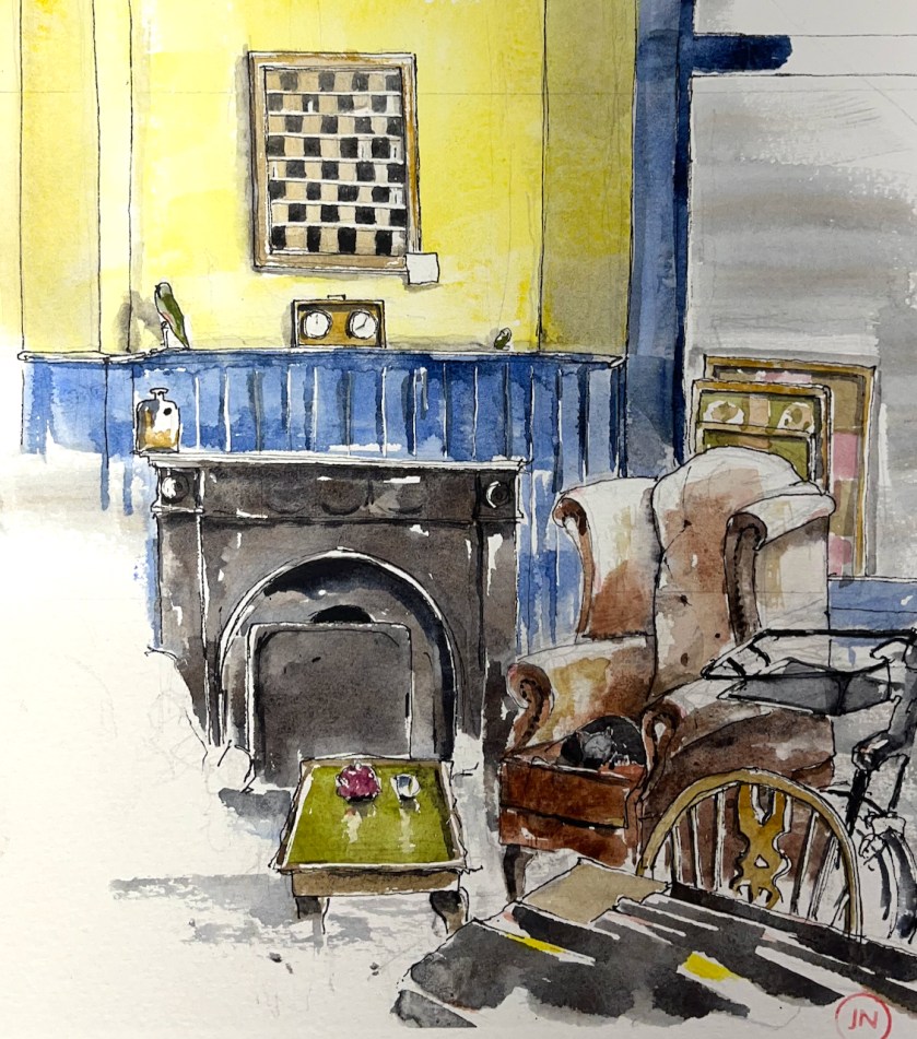
The Vauxhall Tea House Theatre is one on my favourite places. It is a “tea house by day, theatre by night”. Here is a sketch of the outside:
Vauxhall Tea House Theatre, 12″ x 9″ pen and wash original. [sold]
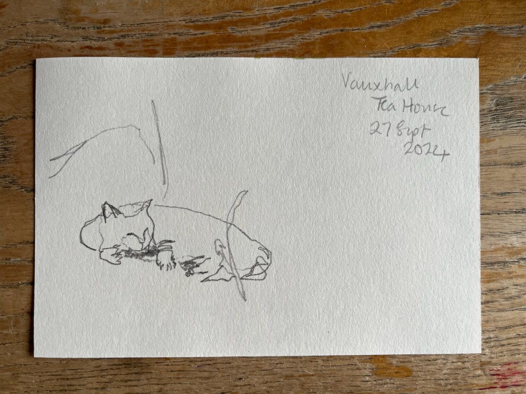
Here is a sketch of the interior by day:
Vauxhall Tea House Theatre, interior with cat. 12″ x 9″ pen and wash original. [Sold]
There are winged chairs you can sink into, wooden tables you can work at, magazines and newspapers you can read. There is tea. There is cake. There is at least one cat.
It’s a short walk from Vauxhall station. Definitely worth a visit.
“We are trying to be different. We will not hurry you. If you visit us on your lunch break, then have one, you will be more productive in the afternoon. If you want to have a meeting, we will not disturb you. If you are ‘working from home’, we have wifi. If you have children, we have highchairs, a chest of toys, and milkshakes. We always have the daily papers, so please, relax, and share in what we are trying to create, take a load off, and have a cuppa.”
Magnificent!
Click a button below to share this post online, email it, or print it:
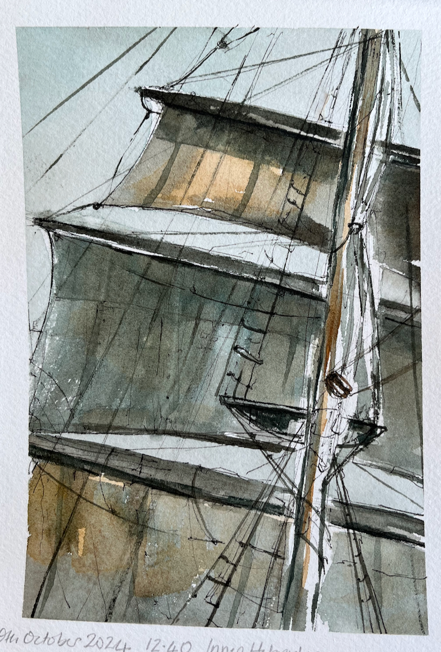
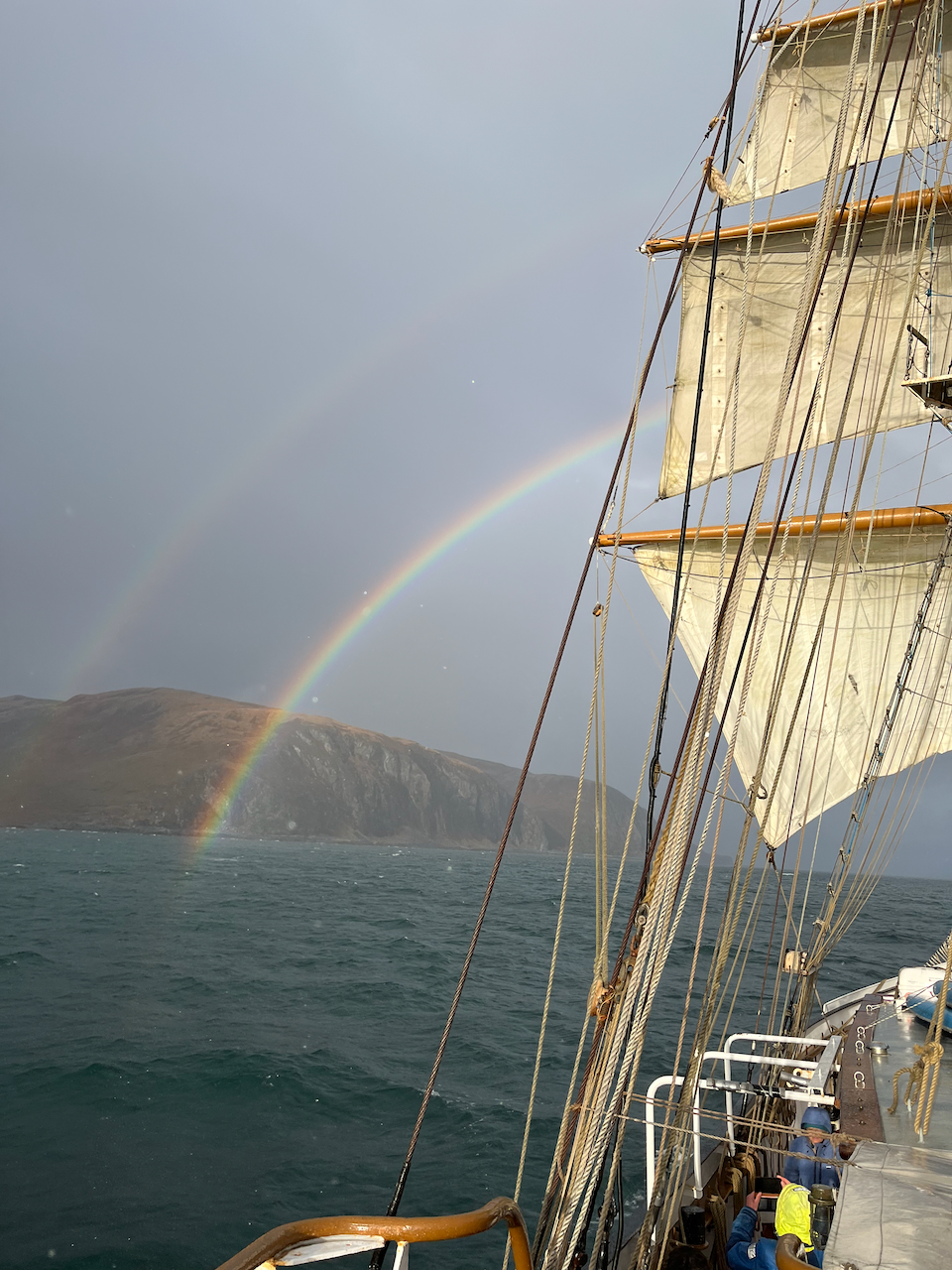
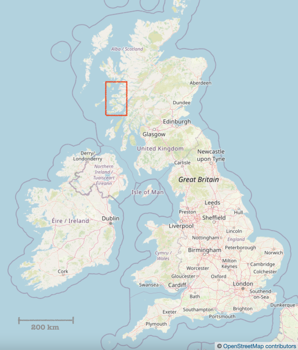
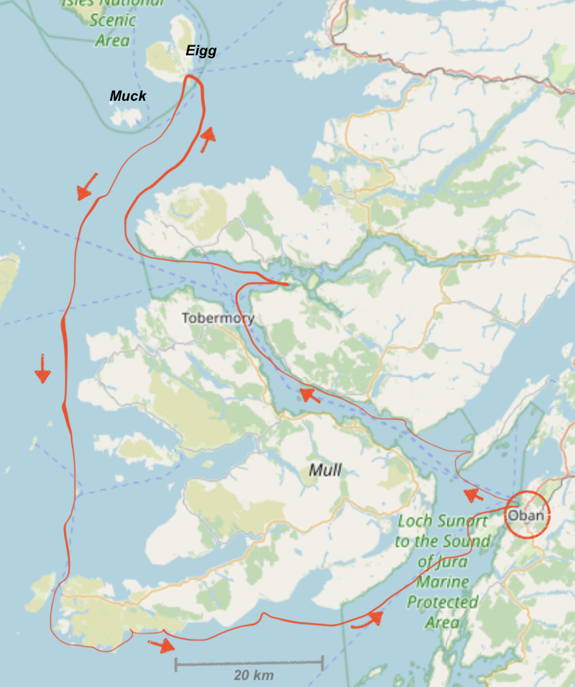
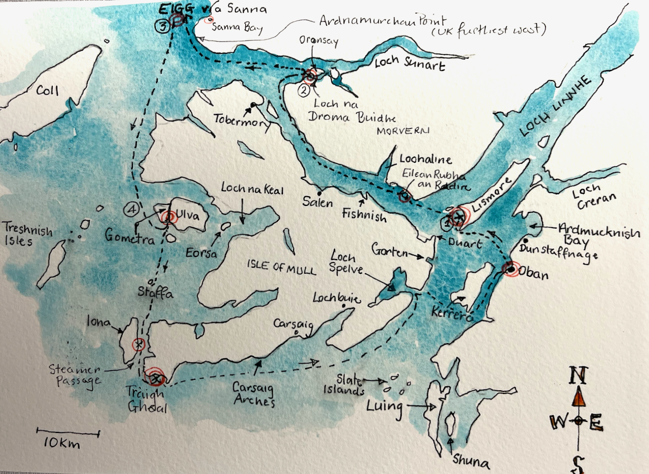
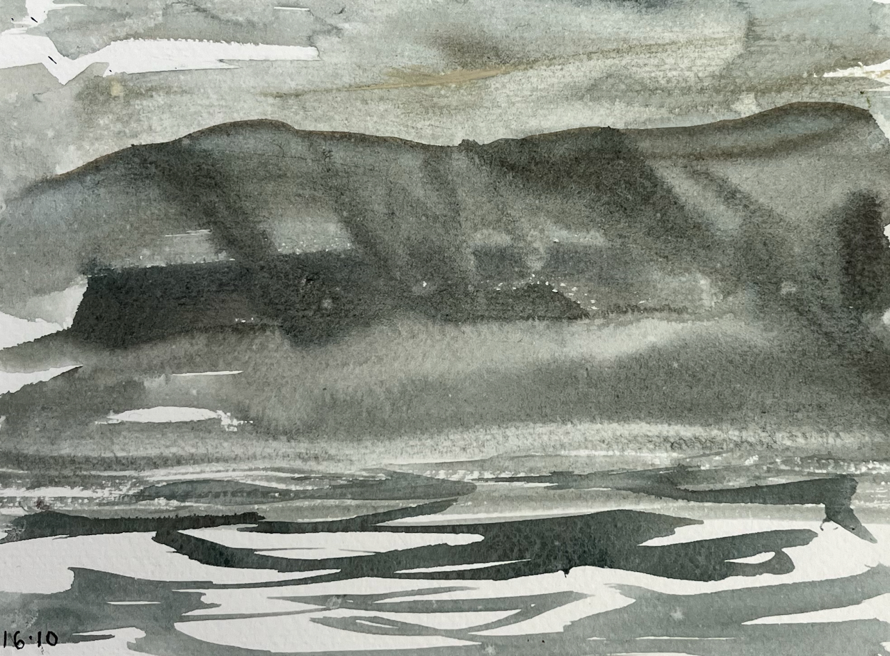
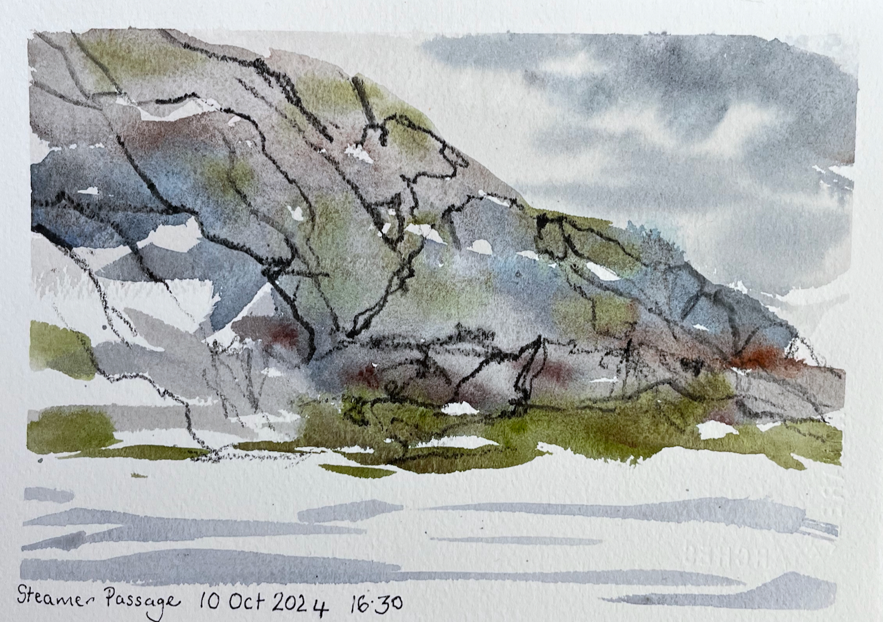
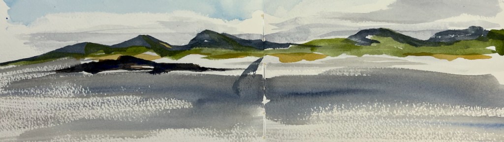
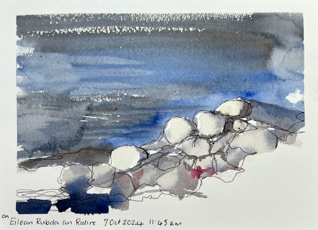
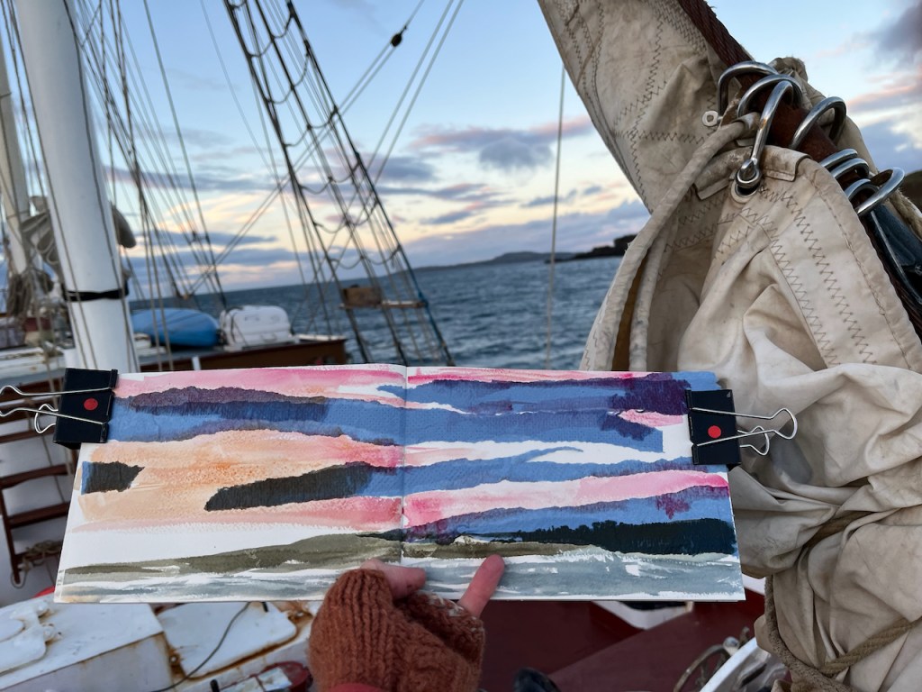
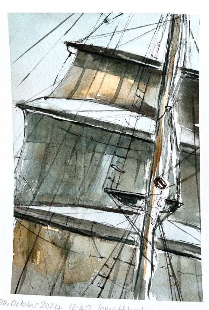
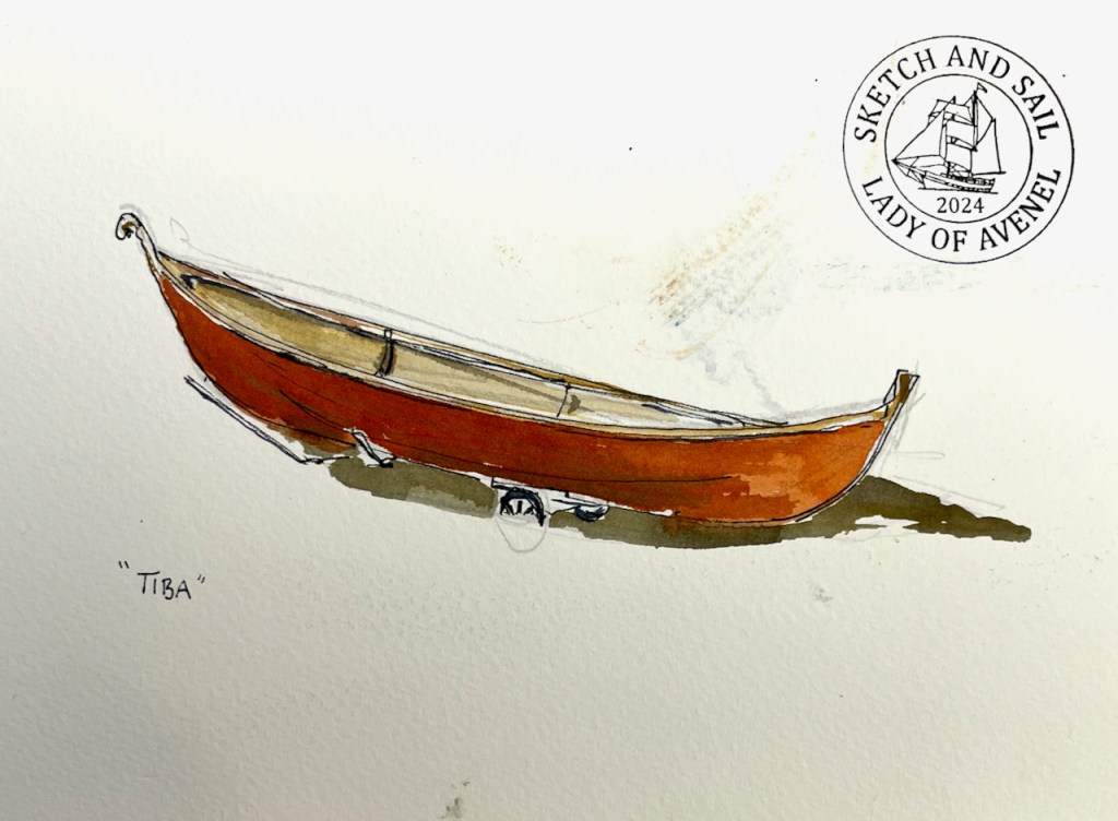
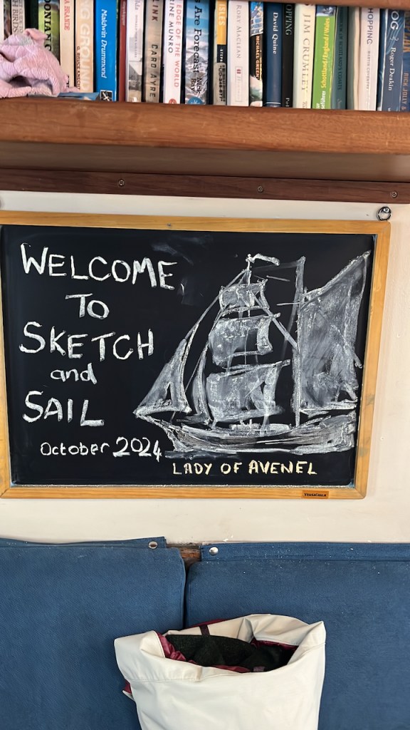
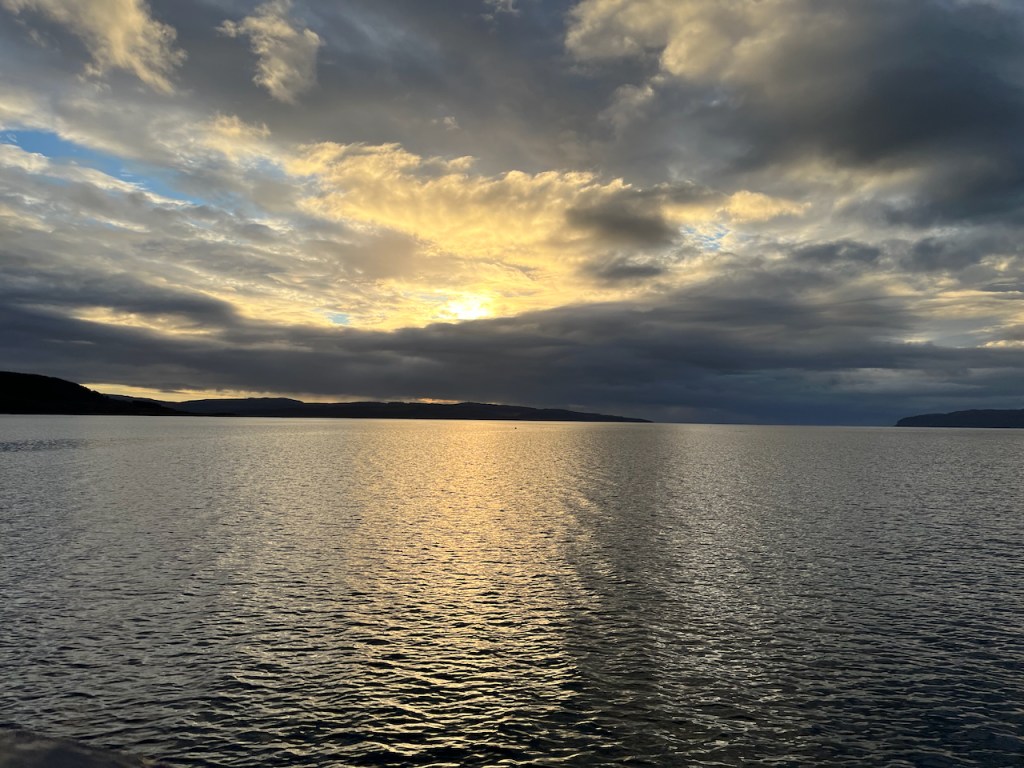
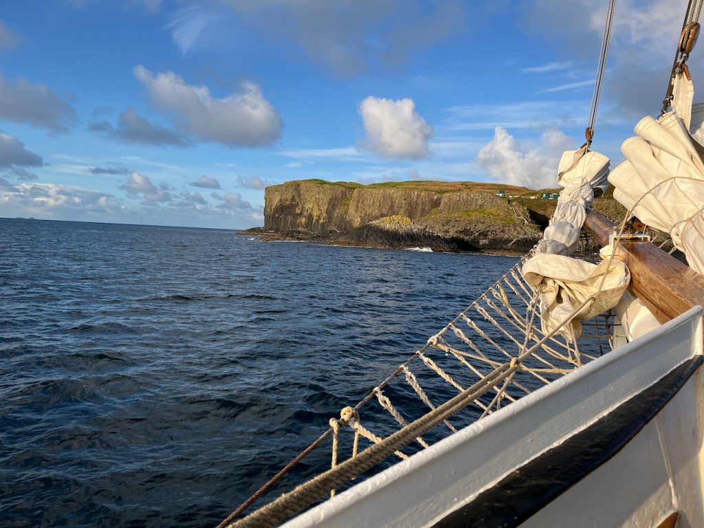
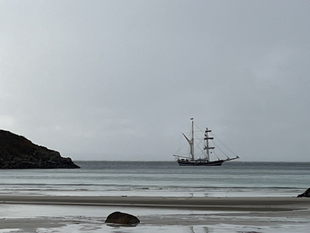
I’m just back from an invigorating week on “Sketch and Sail”with fellow artist Alice Angus and a group of guests, all sketching and learning. We were hosted by the marvellous crew of the Lady of Avenel, who managed the ship and provided all our meals. Our voyage was around the Isle of Mull in the Inner Hebrides, see maps below. We had amazing fun, laughed a lot, got wet, got dry again, got blown about, and enthusiastically sketched the experience. Everyone was very productive: lots of pictures were made, sketchbooks were filled, postcards were painted and sent.
Alice and I ran workshops on brushstrokes, rapid sketching, outline drawing, sketching kit, painting sea and sky and many other exercises. We all shared thoughts and ideas on tools and techniques, and everyone learned a lot, including me. We also did an experimental workshop on sketching in the dark.
Here is a map of where we went.
Maps showing our route [map (c) Open Street Map contributors]
On this post is a selection of my work from this voyage. For more about the ship, and future plans, see the Lady of Avenel website.
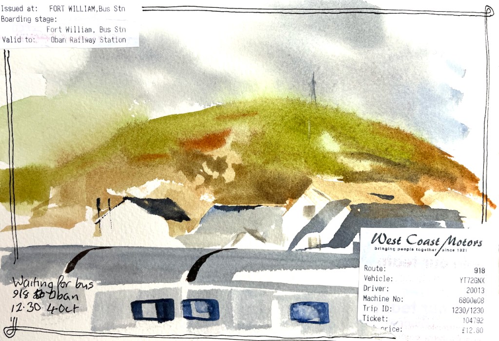
I travelled North on the Caledonian Sleeper, and did some sketching on the train.
Scottish highlands, sketched in the sleeping cabin on the train.Waiting for the bus from Fort William to ObanQuick sketch in a café in ObanSketching on the journey to Oban
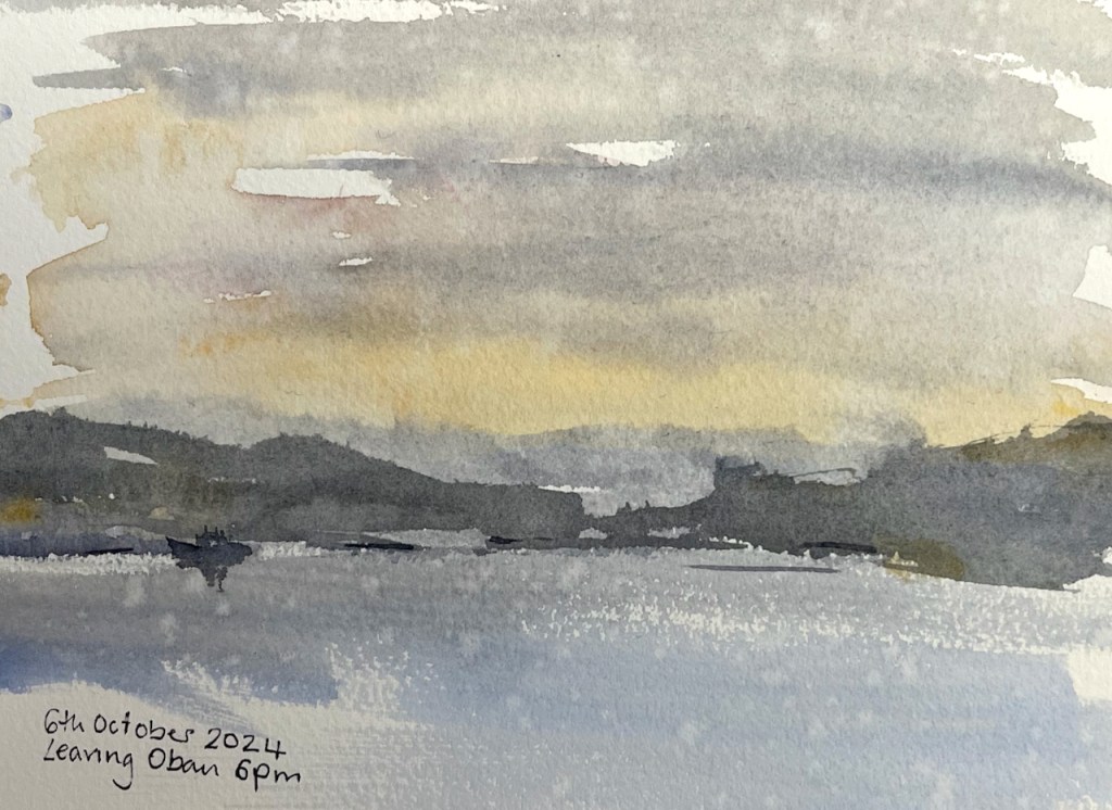
The guests came on board in Oban, and we set off in the evening for the week’s voyage.
Leaving Oban, 6th October 2024. There was fine rain, some of which landed on the picture.Sketch map
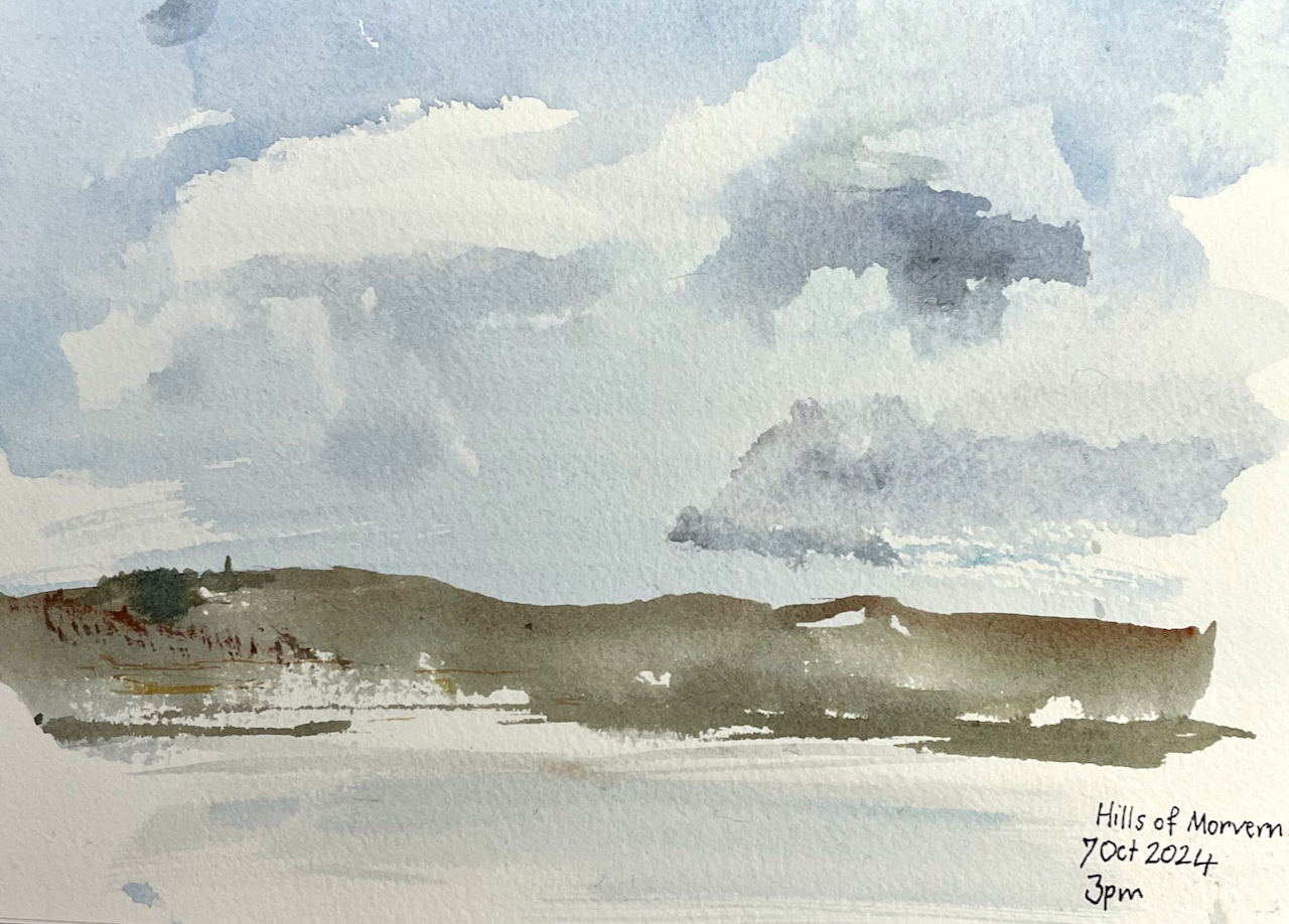
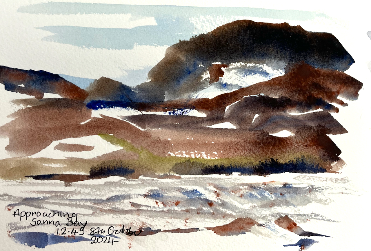
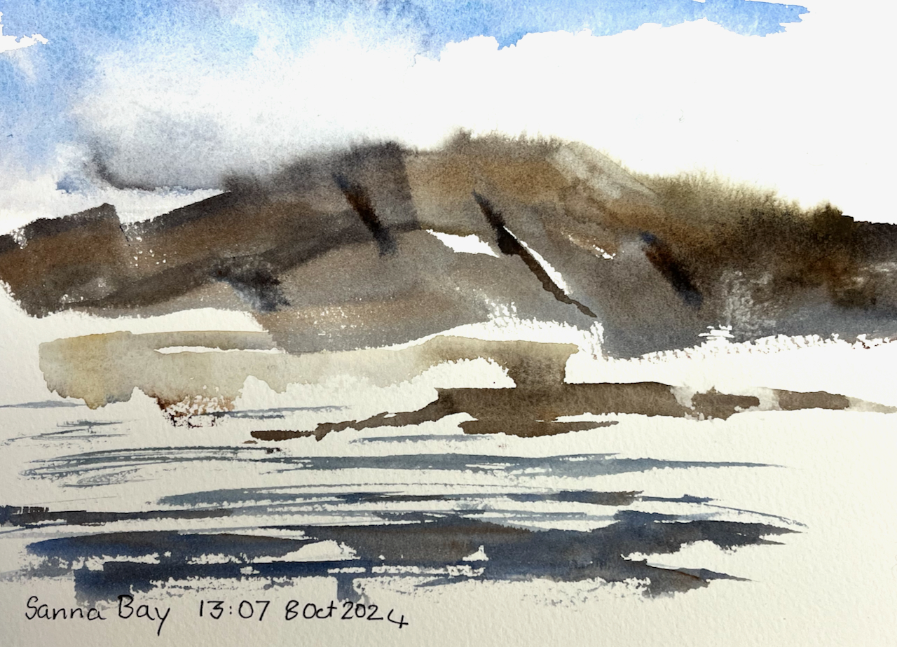
Here is a selection of my sketches from the voyage.
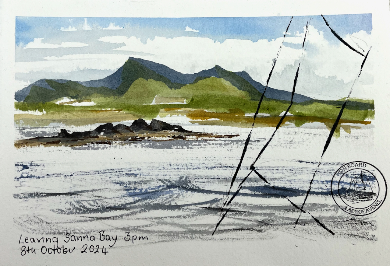
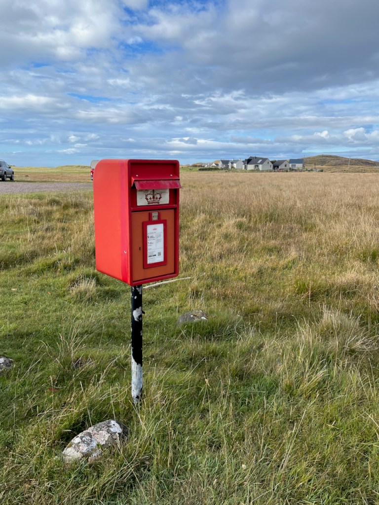
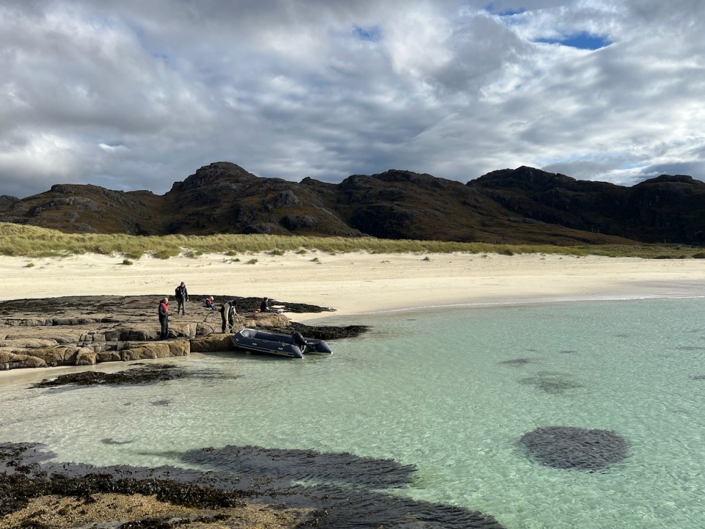
At Sanna Bay there is a large sandy beach, and a settlement of a dozen or so cottages. Here is a sketch made as we approached Sanna Bay:
I walked into that scene, through the sand-dunes, in search of a post box. Against all expectations, I found one.
Here is the post box at Sanna Bay. Collections 9am Monday to Friday, and 7am on Saturday.Here is the card I posted, which reached London in two days.
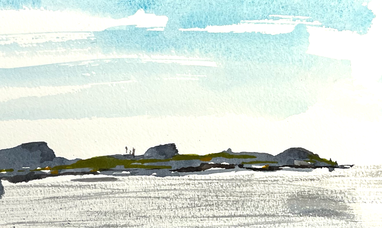
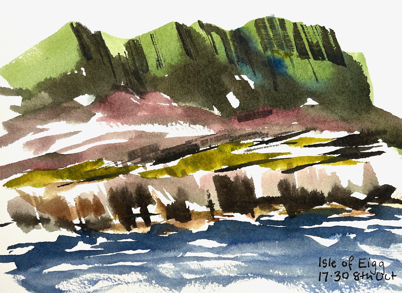
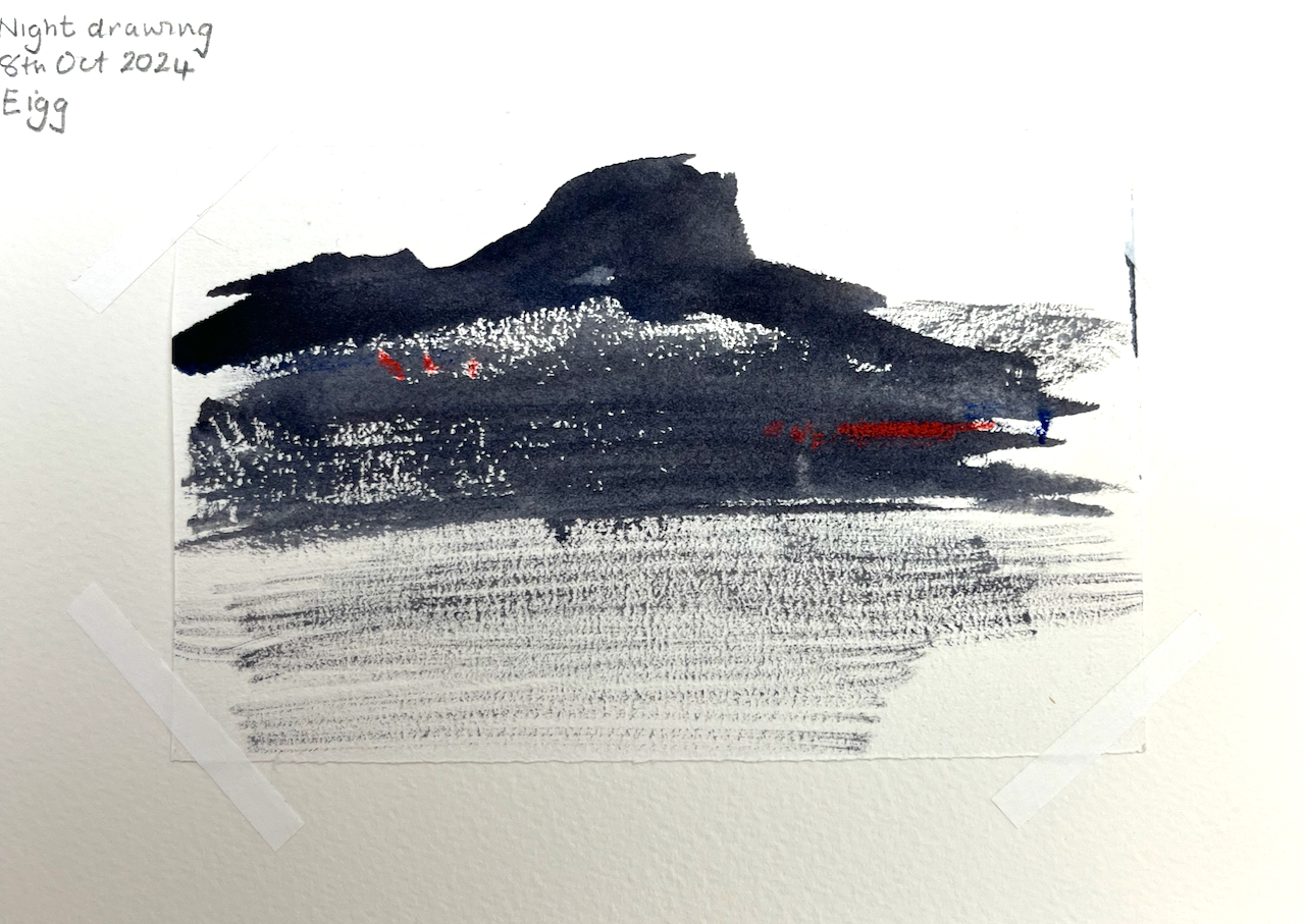
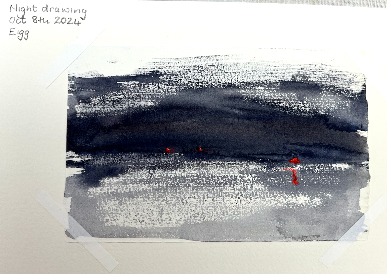
At Eigg there was a spectacular sunrise.
Sunrise over the Isle of Eigg, watercolour and collage.
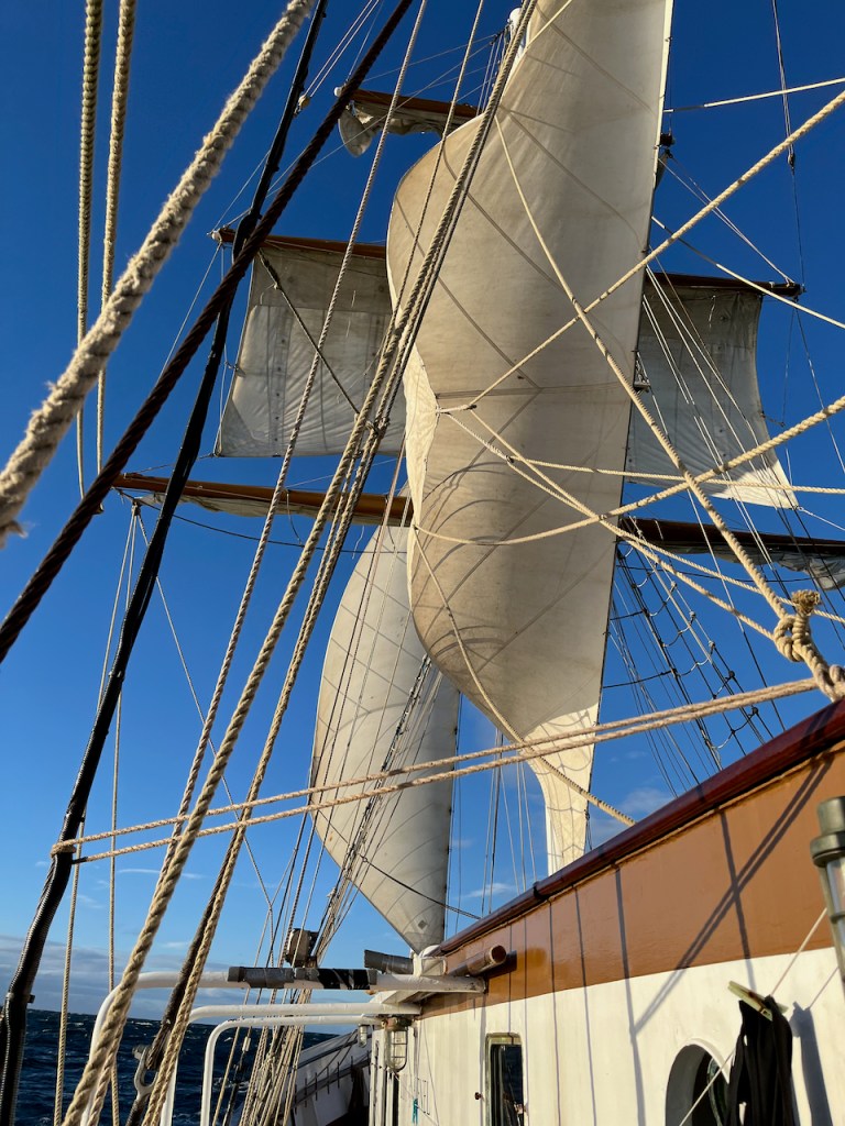
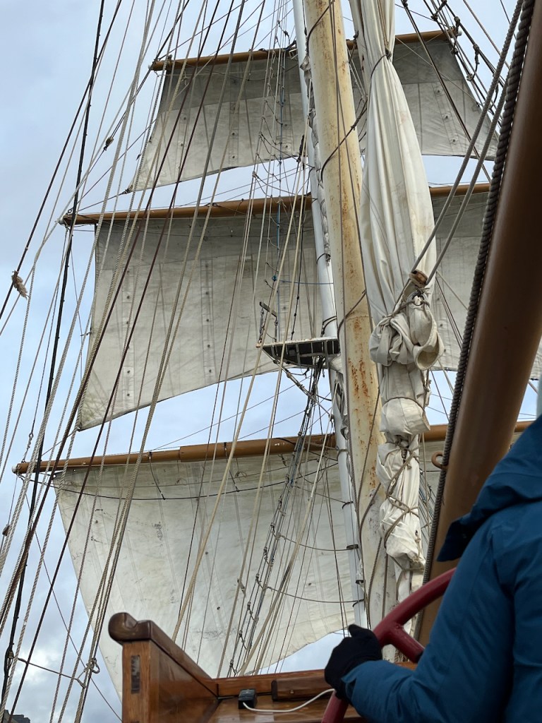
With a strong wind in our sails we reached 8 knots on the journey south from Eigg to Iona.
The sails are full on the journey from Eigg to Iona.
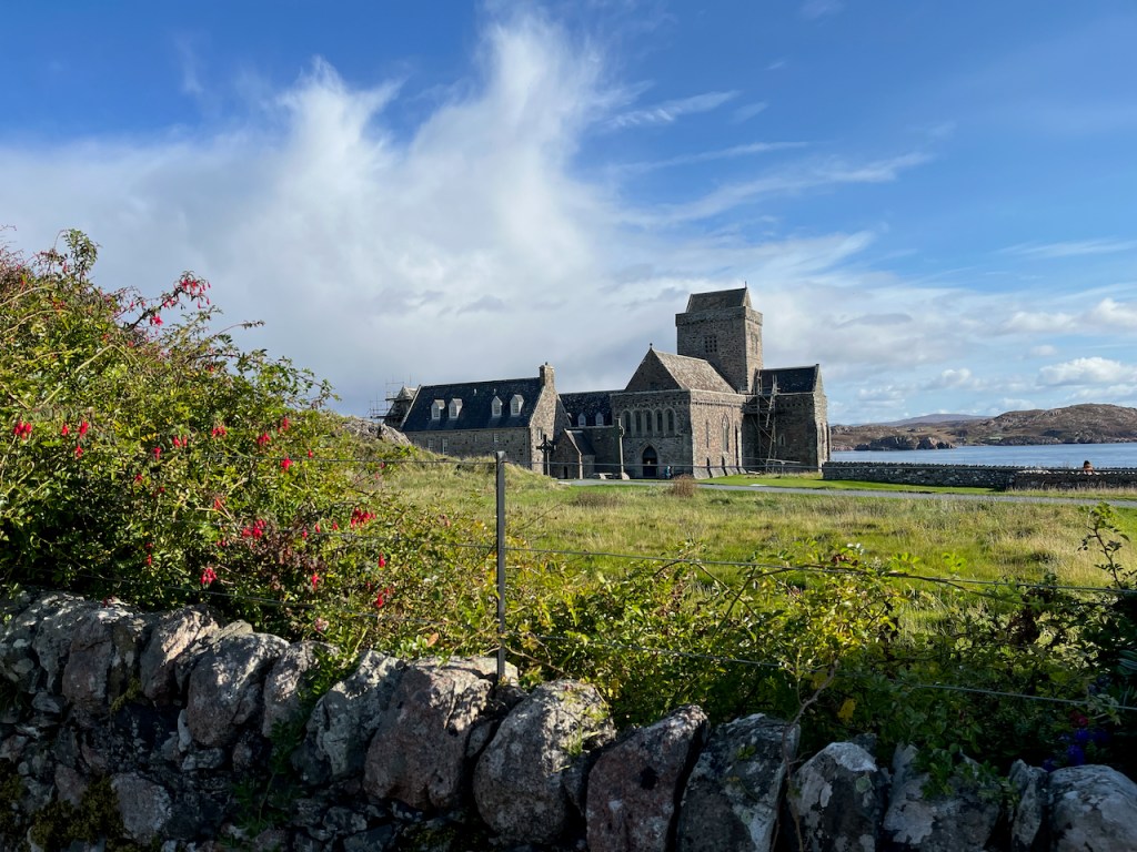
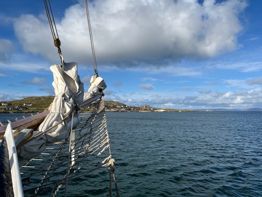
On the island of Iona, I sketched a boat on the beach.
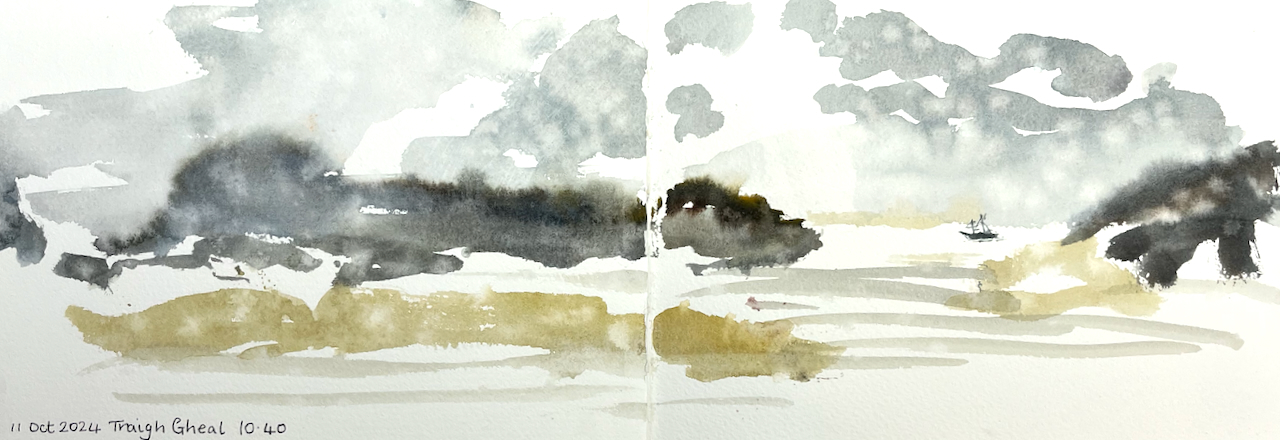
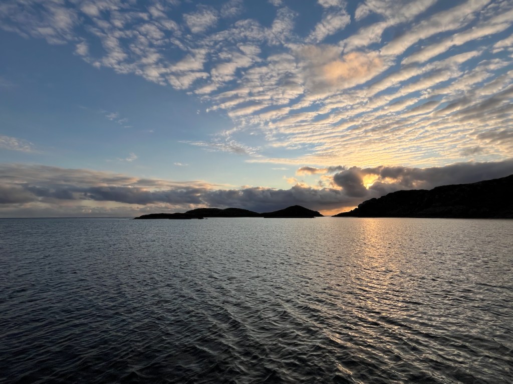
On the way back to Oban from Iona we landed at a vast sandy beach called Tràigh Gheal. There were showers of rain.
Here’s a photo, showing the Lady of Avenel at the anchorage at Tràigh Gheal. We reached the beach by rubber dinghy.
Lady of Avenel at Tràigh Gheal
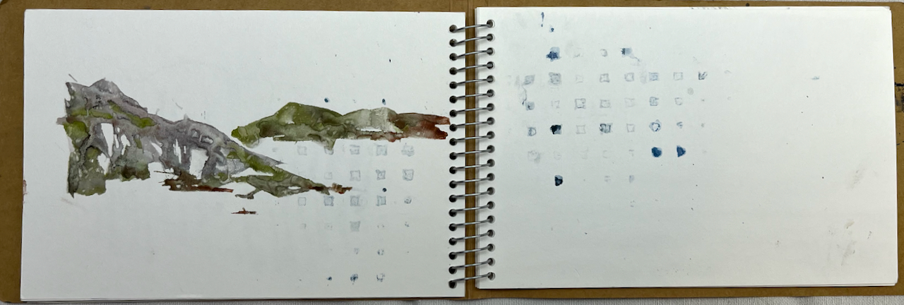
I used a JP Purcell sketchbook. Here’s a quick flick-through:
Sketchbook flick-through
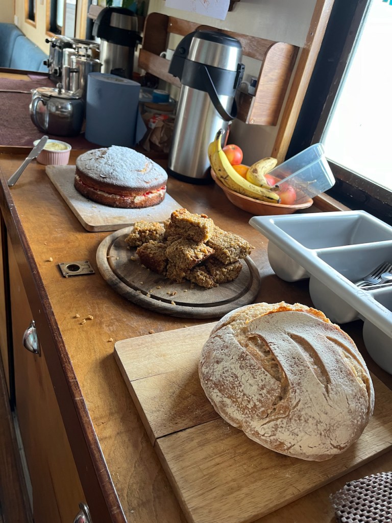
All of this was powered by a strong North Westerly wind, and Tom’s cooking. Tom continued cooking even as the North Westerly gusted Force 7, and produced a hot meal for hungry sailors every evening, soup for lunch and cooked breakfasts. He made the sour dough bread every day in the ship’s galley. I found this hugely impressive.
Tom’s cooking on the ship: cake for hungry sailing sketchers: and sourdough!
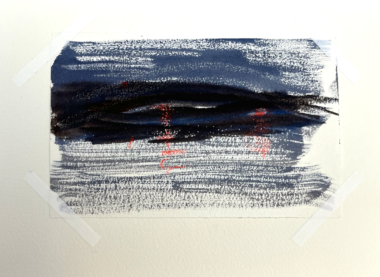
In case you are curious, here are night sketches. The lights are done using wax crayon.
Here are some snapshots from the voyage.
The art gallery on GometraApproaching Staffa, Fingal’s CaveThe abbey on IonaLady of Avenel off Sanna BayWorkshops done and crossed off the list!
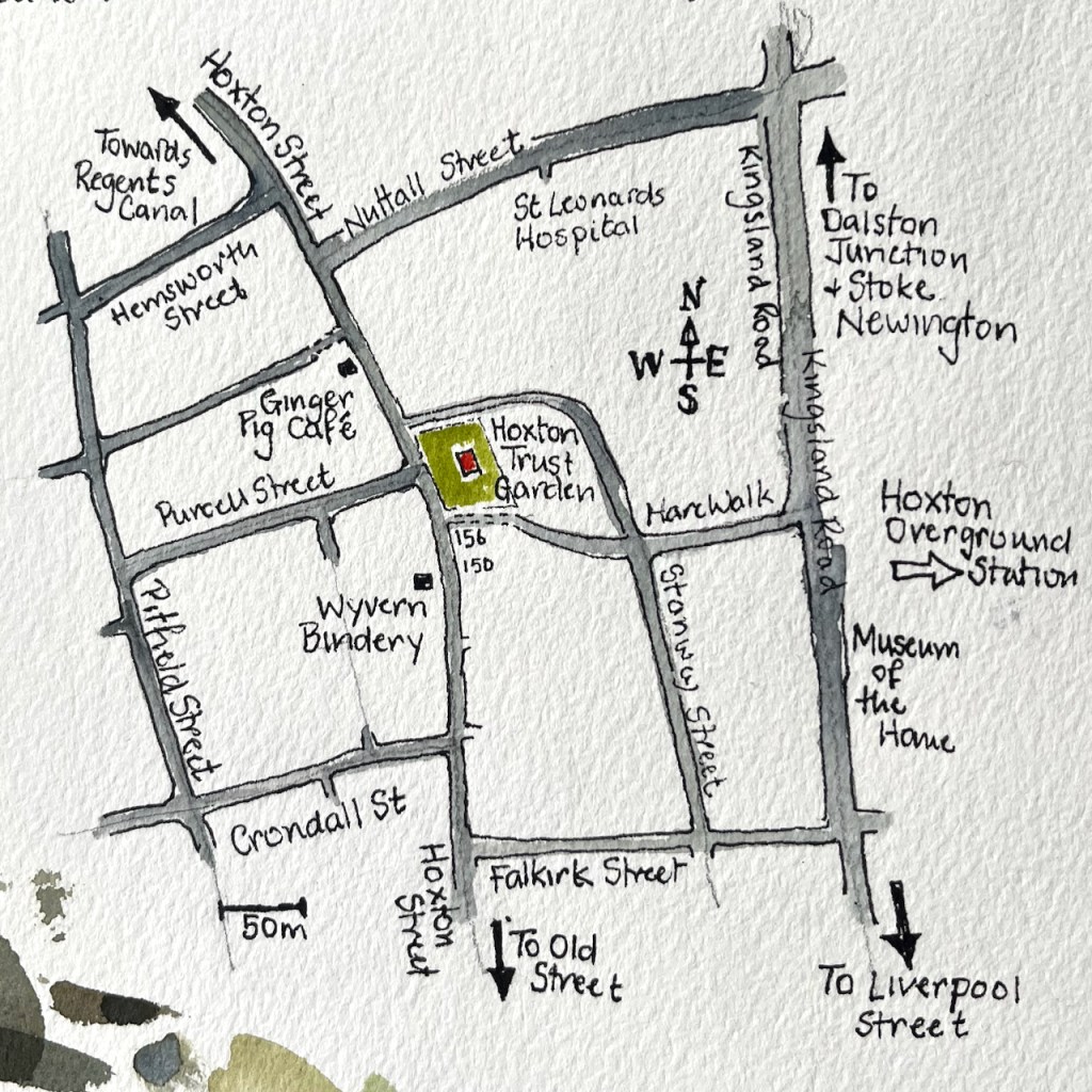
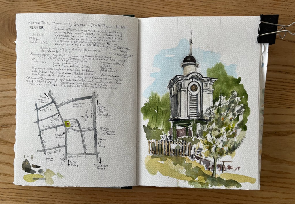
Hoxton Street is busy with market stalls, shops, cafés. People walk to and fro. If you walk North, there’s a small garden on the right, behind a fence. Above the trees there’s this odd white tower. What is it? The gate is open and you can go in.
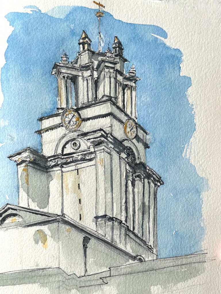
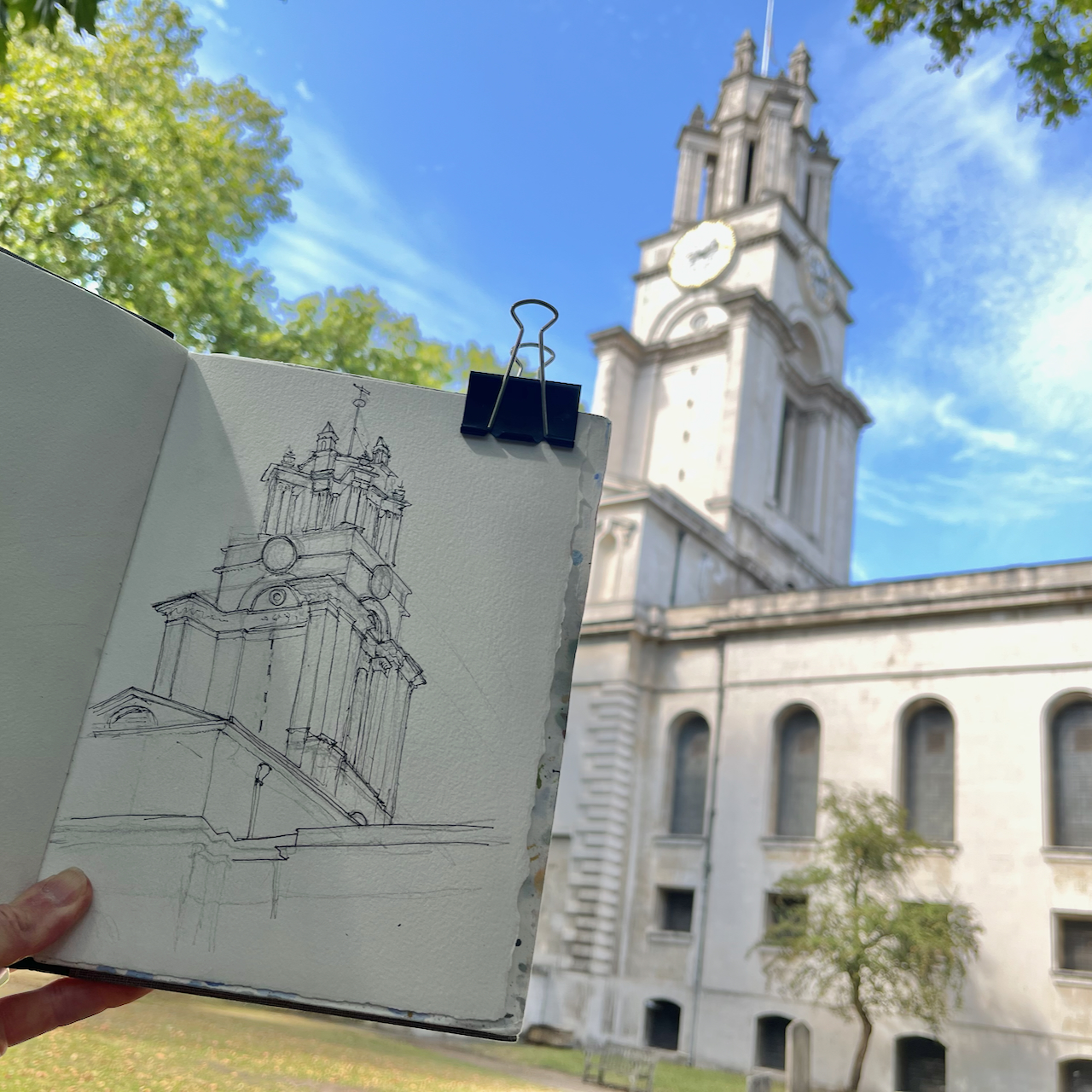
Hoxton Trust Community Garden N1- Clock Tower, sketched 29 August 2024 in Sketchbook 15
This is the Hoxton Trust Community Garden. Their website tells me that the Clock Tower was rescued from the Eastern Fever Hospital which was built 1869-1871. It is made of wood, and is possibly older than the hospital.
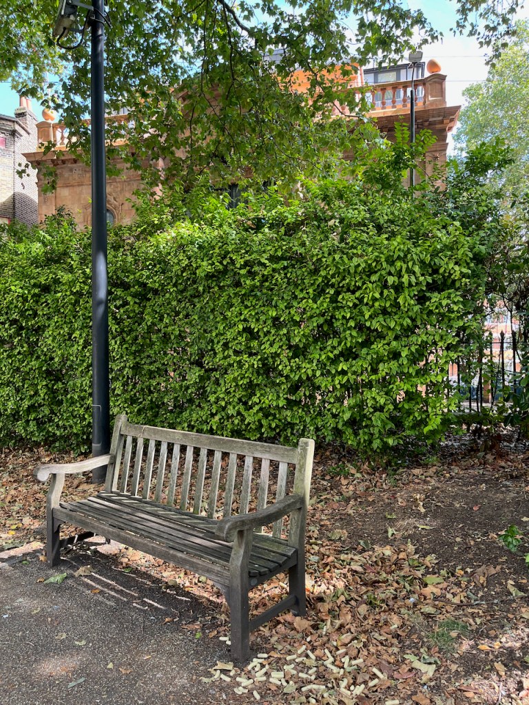
The clock tower sits on a framework made of steel girders. On the day I was there, the clock had stopped at half-past six. So in a timeless interlude, I sketched from a wooden bench amongst the trees.
Near the bench is a small monument to the “Hoxton Five”. Who were they?
“One was stabbed, and his four friends were killed in a car crash returning from the funeral.”
The Hoxton Community Trust is a registered charity “working to make Hoxton and Shoreditch a better place”. According to their website, they provide free legal advice and assistance to people who need it. They maintain this community garden for the benefit of everyone. The charity was established in 1983: “At the time, Hoxton was very unfashionable, with high levels of poverty and a very poor quality urban realm”, their website says. They bought and renovated three buildings, 150-156 Hoxton Street, adjacent to the garden. These buildings are now let out. Rents from these buildings supplement the income of the Hoxton Trust, which is also funded by grants from the National Lottery, Hackney Council, and other sources (2023). The work of the Trust is also supported by volunteers, some of whom work in the garden.
The garden is lovely. There are fruit trees and a herb garden, and plenty of seats. A sanctuary.
Sketching in the Hoxton Community Trust Garden.Sketchbook 15
Click a button below to share this post online, email it, or print it:
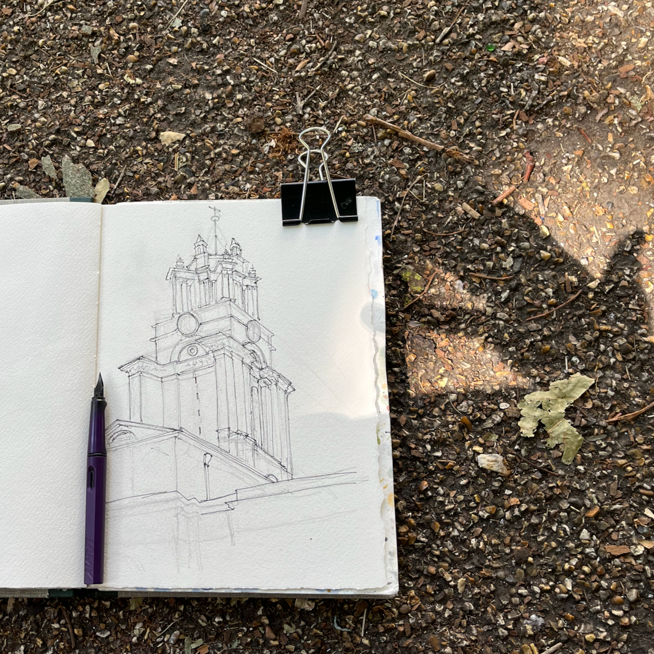
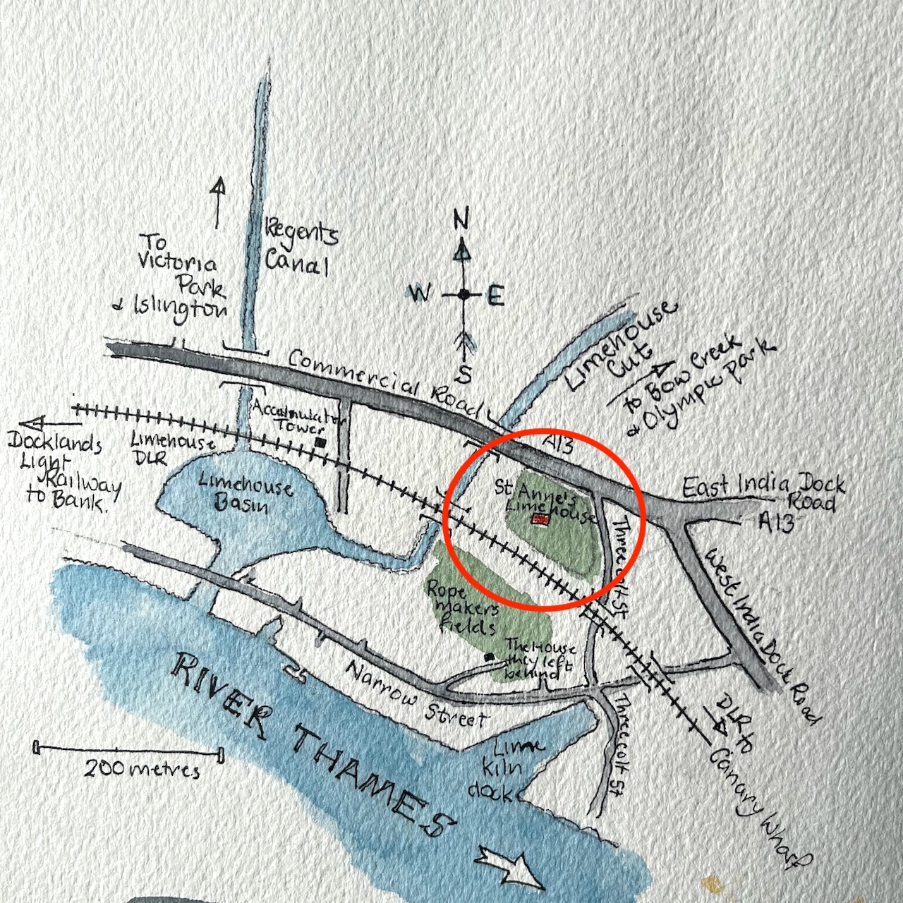
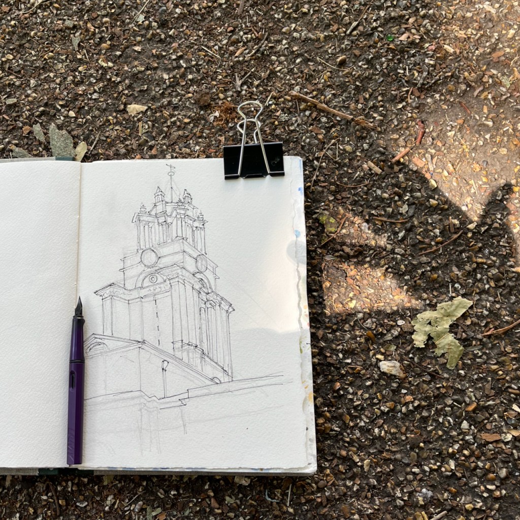
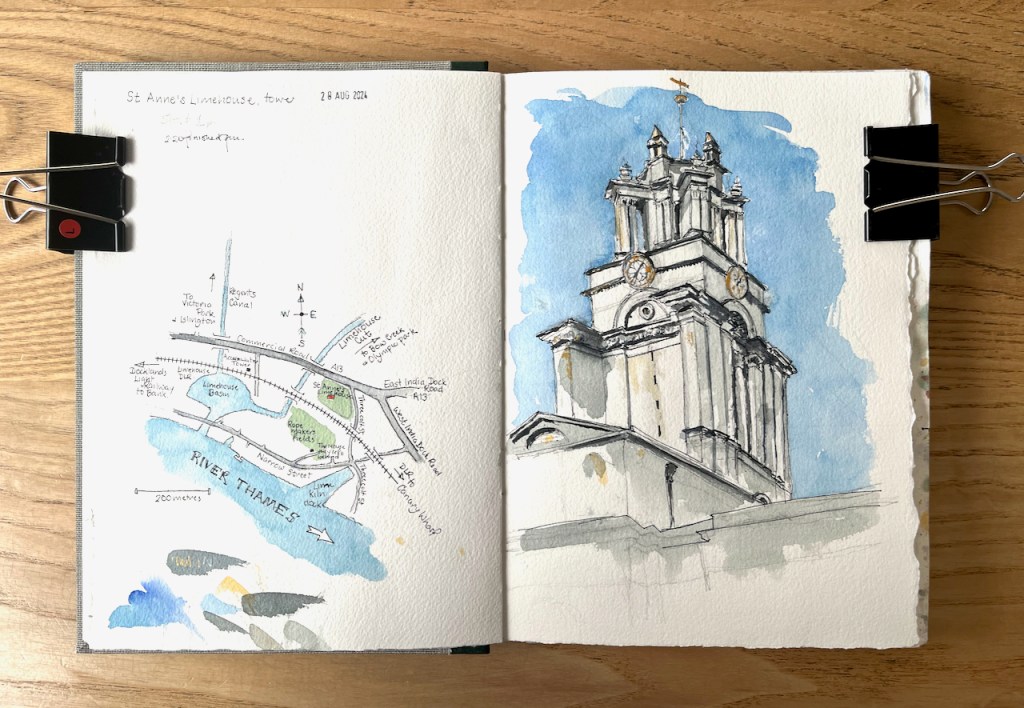
This is the tower of St Anne’s Church Limehouse, seen from the south. St Anne’s is a church designed by Nicholas Hawksmoor, consecrated in 1730.
St Anne’s Church Limehouse tower, sketched 28 August 2024 in sketchbook 15
This tower shows the marine connections of this church:
The prominent tower with its golden ball on the flagpole became a Trinity House “sea mark” on navigational charts and the Queens Regulations still permit St Anne’s Limehouse to display the White Ensign”.
Wikipedia (1 October 2024)
White ensign
The White Ensign is definitely flying. In my drawing the flag is blowing away from me, so you can’t see it well. It is the flag flown by British Navy ships and certain navy-related buildings on land, of which St Anne’s in one.
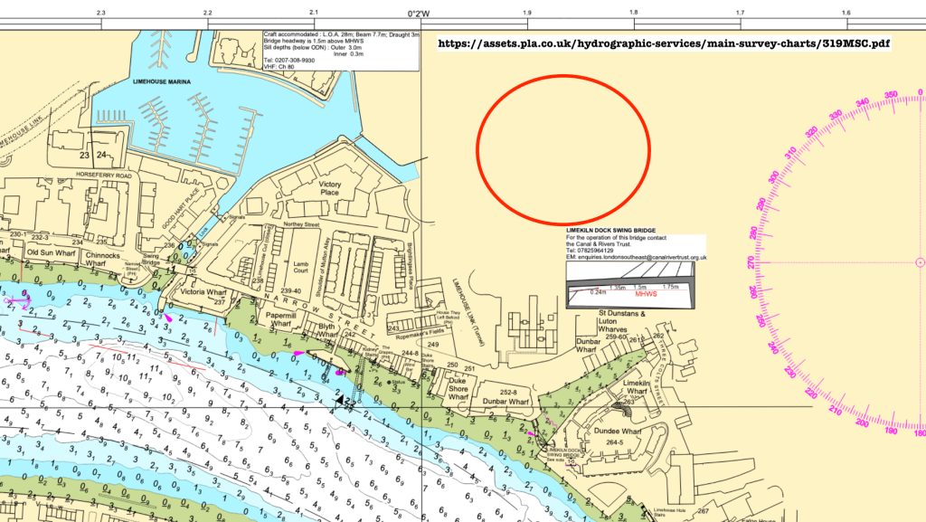
The golden ball is clearly visible on the flagpole, the “sea mark” mentioned in articles about the church. I had a look to see if I could find St Anne’s on a navigational chart. The Port of London Authority offers navigational maps of the Thames – but sadly St Anne’s is not shown as a “sea mark” on any of them.
Detail from Chart 319 from the Port of London Authority. The red circle where St Anne’s is, but it’s not shown as a “sea mark”.
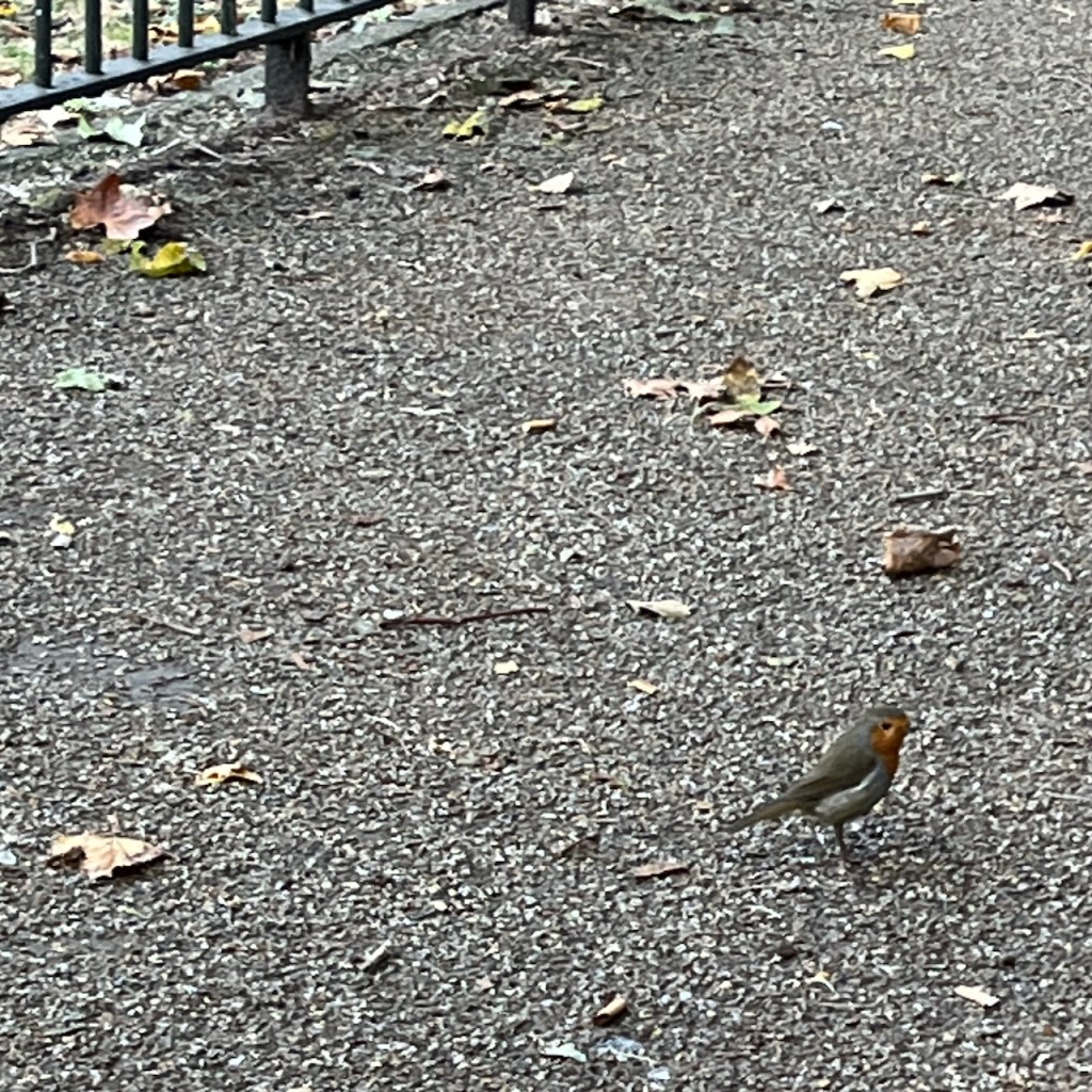
The church has a lovely quiet garden. I sketched from the wooden seat, watched by a robin.
Sketchbook 15
Here are other sketches I’ve done around Limehouse and Wapping, near here:
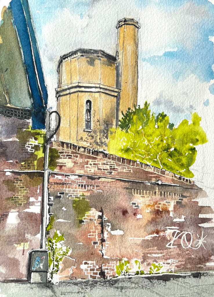
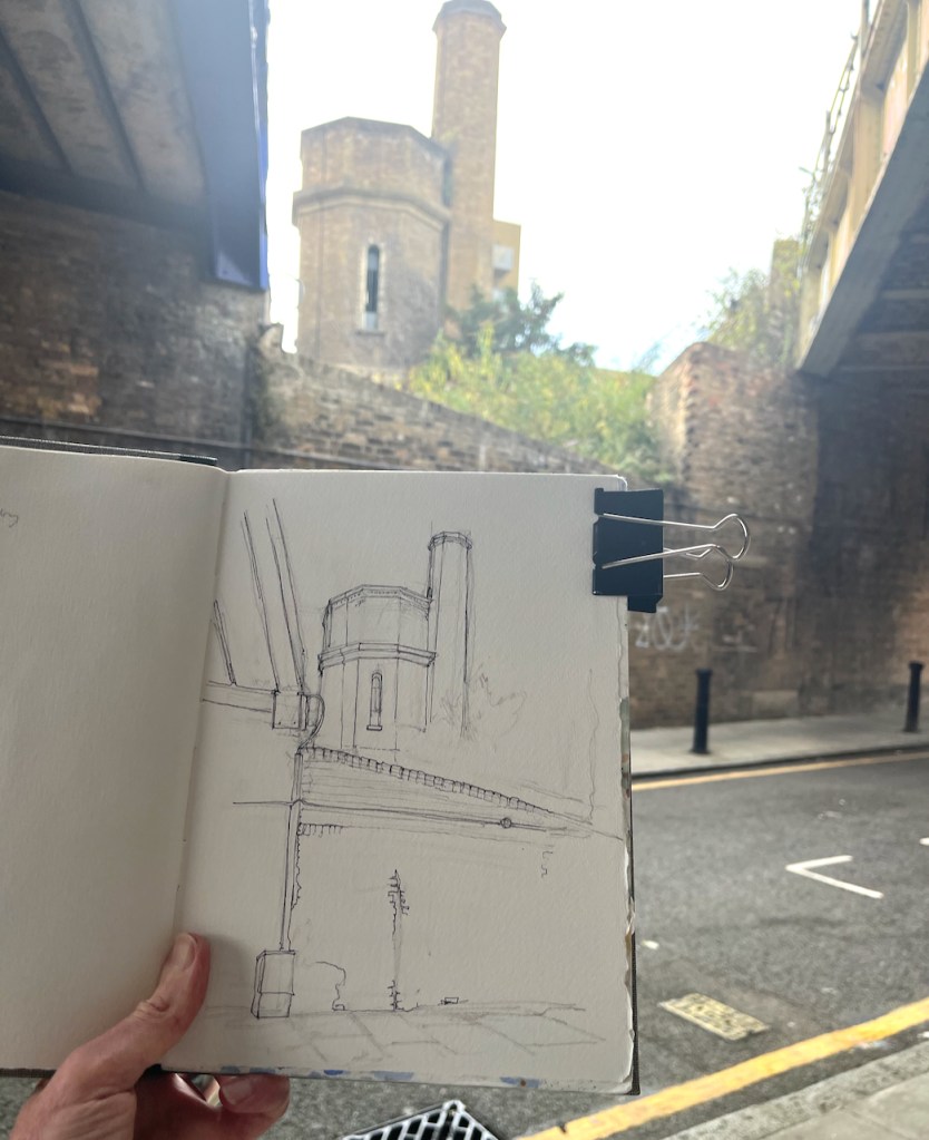
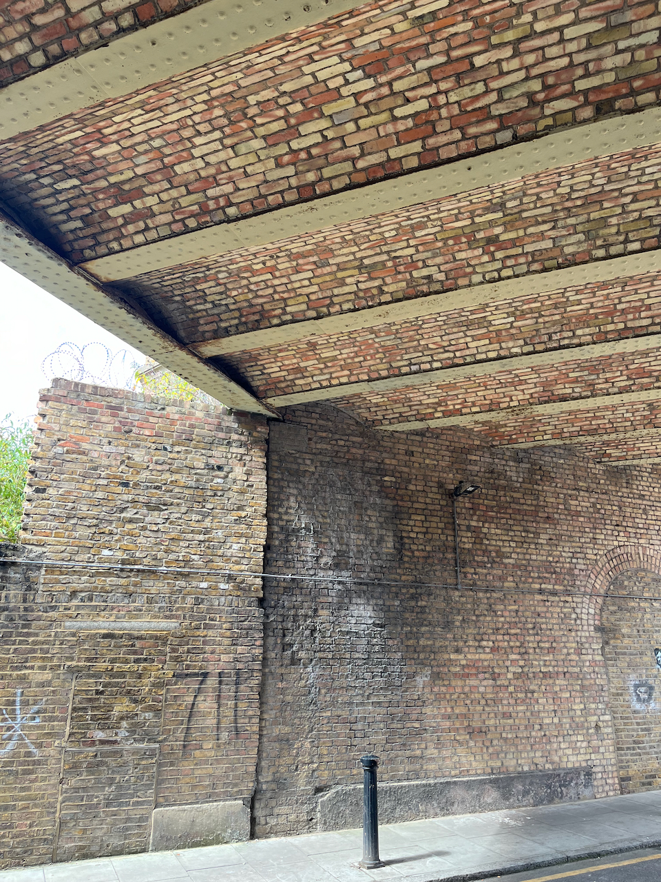
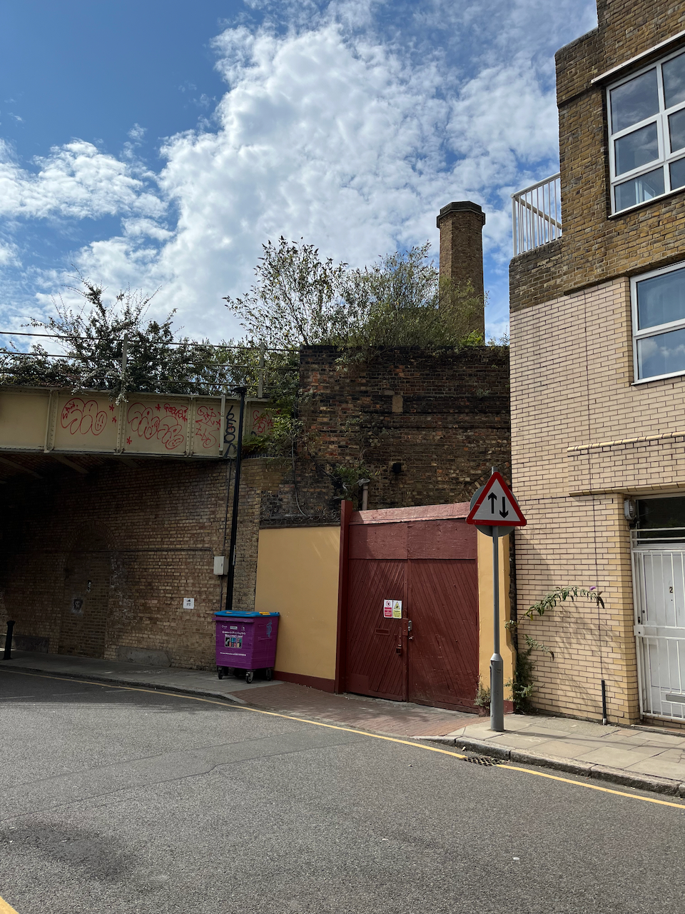
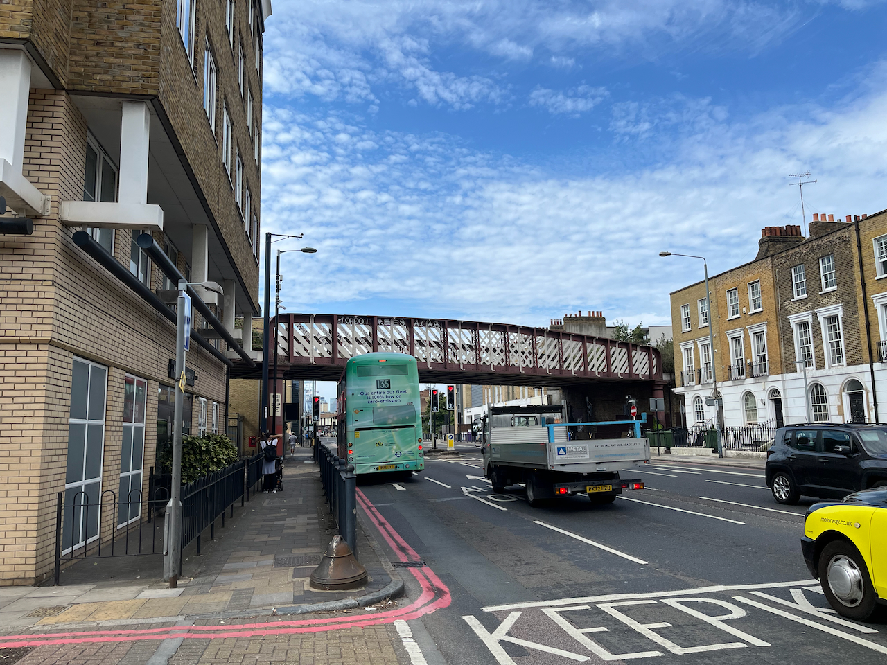
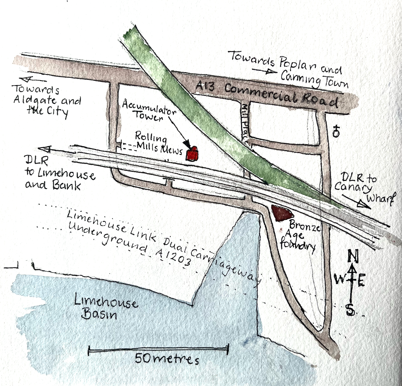
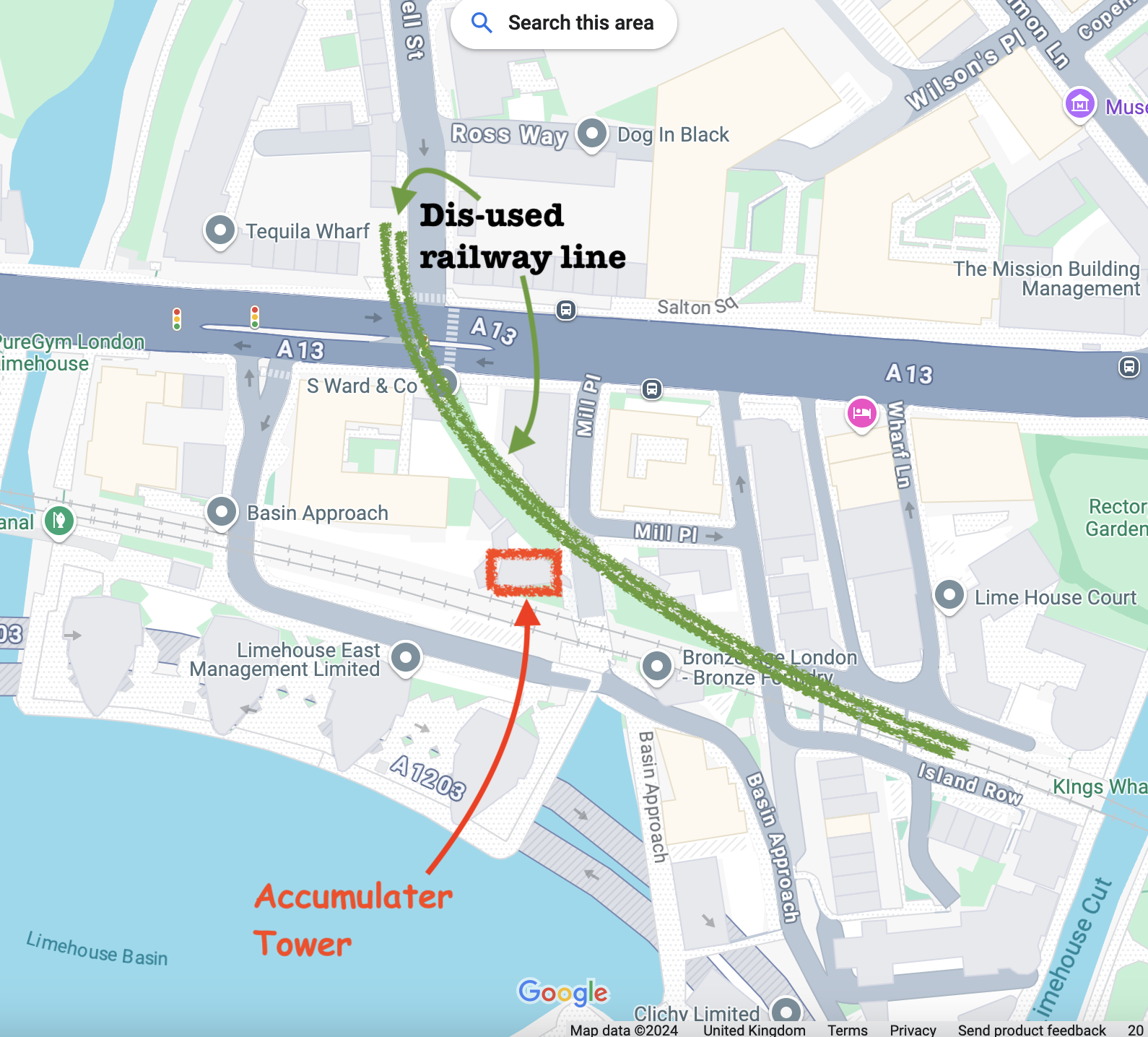
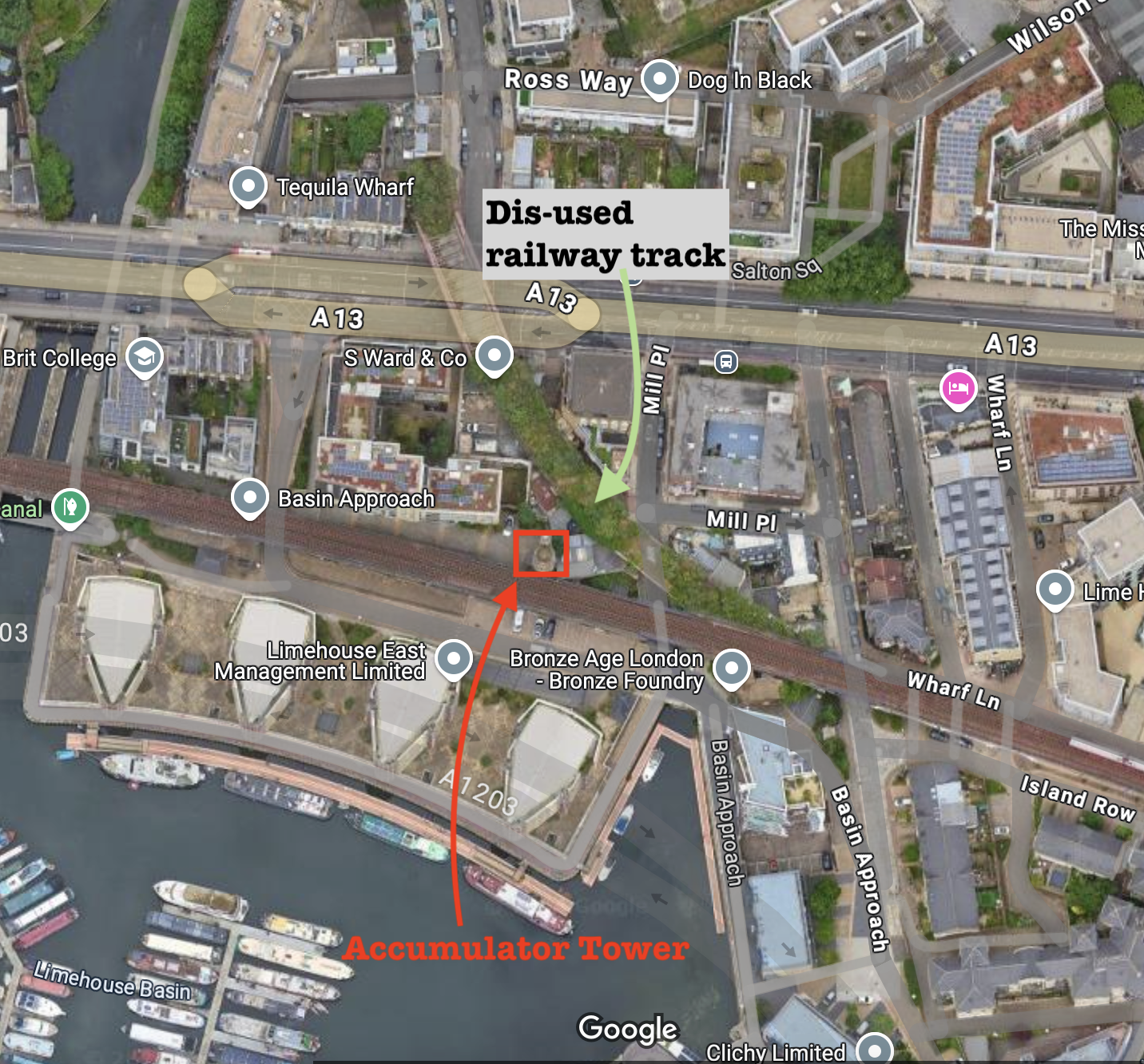
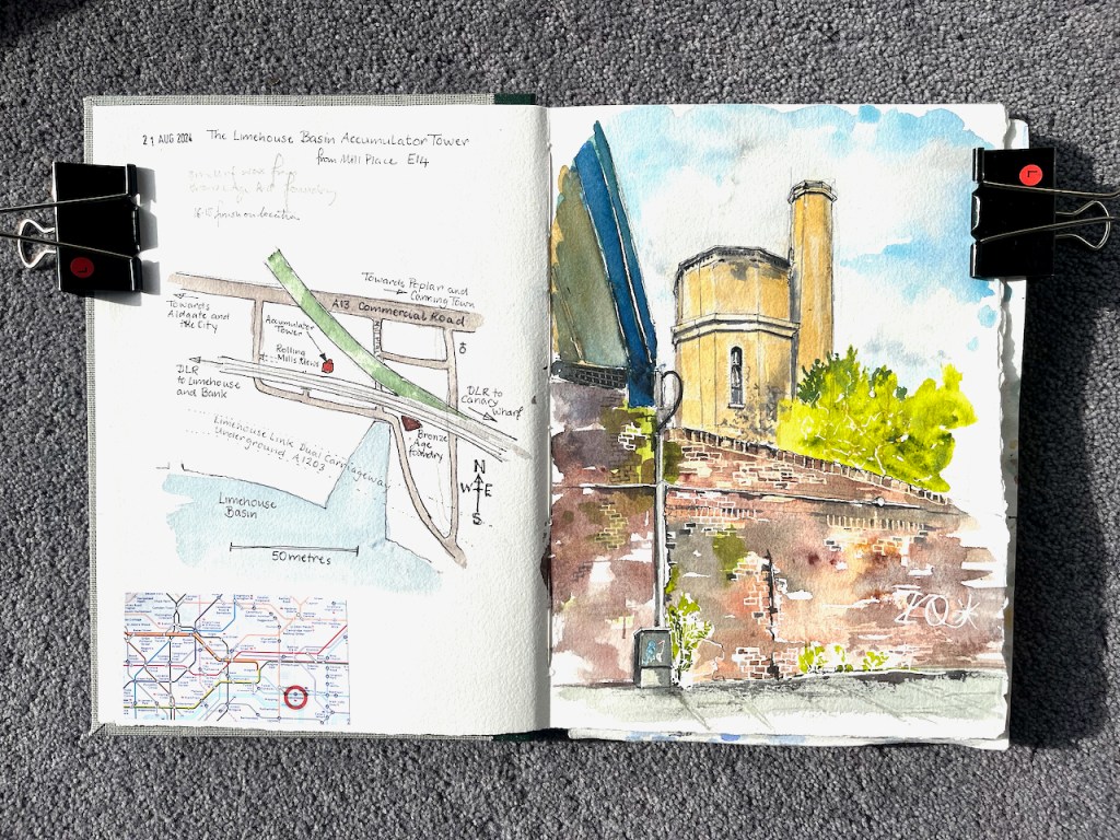
This is the Limehouse Accumulator Tower, seen from Mill Place, London E14.
Limehouse Accumulator Tower, sketched 21 August 2024, in Sketchbook 15
In the 19th century, this building provided hydraulic power to machinery in the Limehouse docks. Hydraulic power is a way of transmitting energy from one place to another.
The problem at the time was that steam engines could generate motive force, but only where they were. You could build a big powerful steam engine, but you couldn’t put a steam engine next to every crane, capstan, or set of lock gates. You also didn’t want to fire up a steam engine every time someone wanted to use the lock gates. So you had to find a way of transmitting the power from the steam engine to the machinery which used it. And you had to find a way of storing the power so it was available on demand. Before the use of electricity was common, power was transmitted using pressurized water.
The steam engine located in this building was used to pump water into the adjacent accumulator tower, by lifting a heavy weight. The heavy weight was a neat fit on top of the water inside the tower and pushed the water down. Water does not compress. So the weight just sat there, applying pressure to the water. The pressurised water was distributed around the docks in thick cast-iron pipes. When the lock-keeper wanted to operate the lock gates they opened a tap and the force of the pressurized water opened the gates. Then they closed the taps. Far away, the weight moved down very slightly in the accumulator tower. Eventually the steam engine was used to pull the weight up to the top again.
That’s 19th century hydraulic power. Power is transmitted by pressurised water in cast-iron pipes: the original, functional, steam-punk.
I find it marvellous. I’ve drawn the much bigger London Hydraulic Power station here. The Limehouse building is smaller. It was built in 1869, one of several in the area at the time. It was restored in 1994/5, but sadly the weight and machinery are removed. There is a detailed history of the building on this link from the Greater London Industrial Archaeology Society.
Sketching the Limehouse Accumulator Tower. The modern Docklands Light Railway lines run over the Victorian bridge to the left, the bridge to the right is disused.
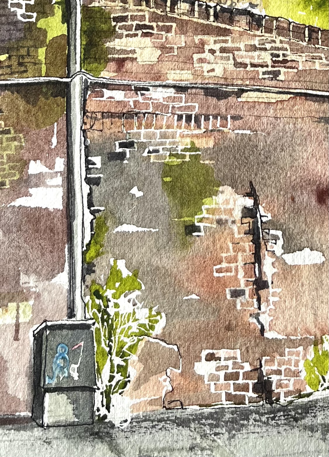
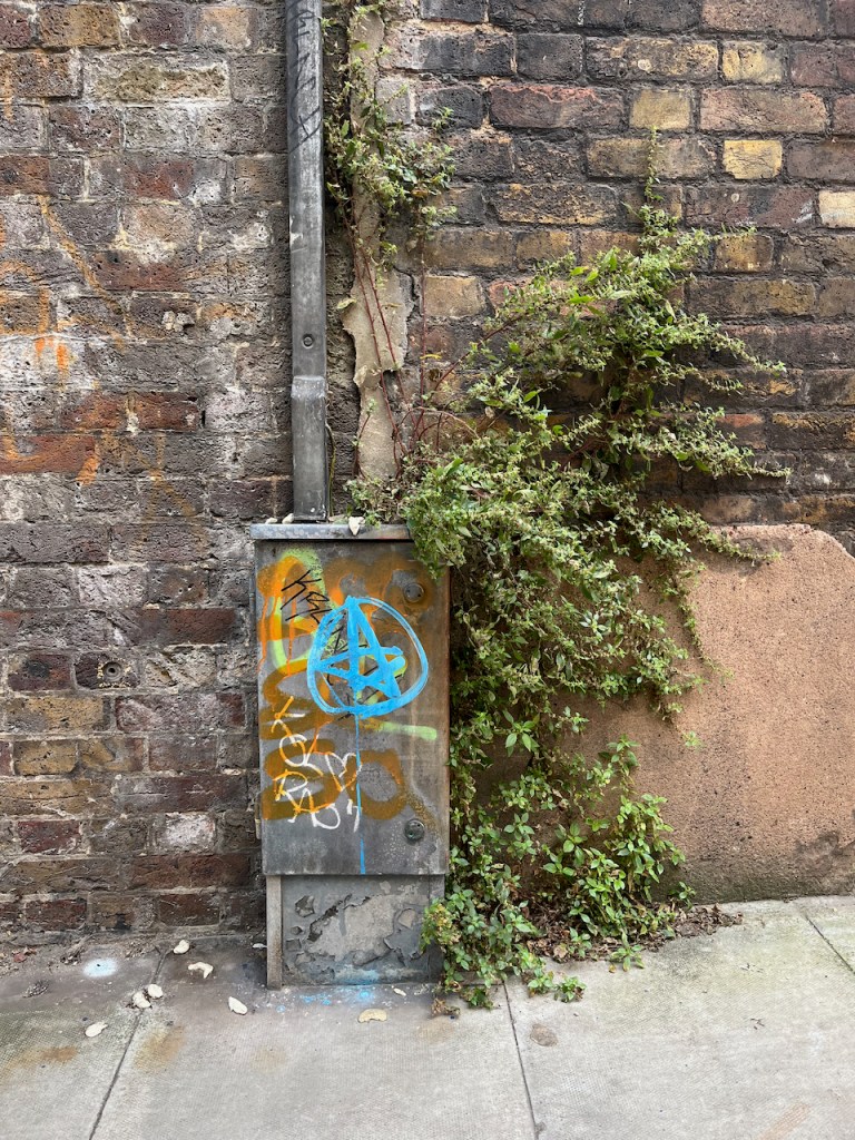
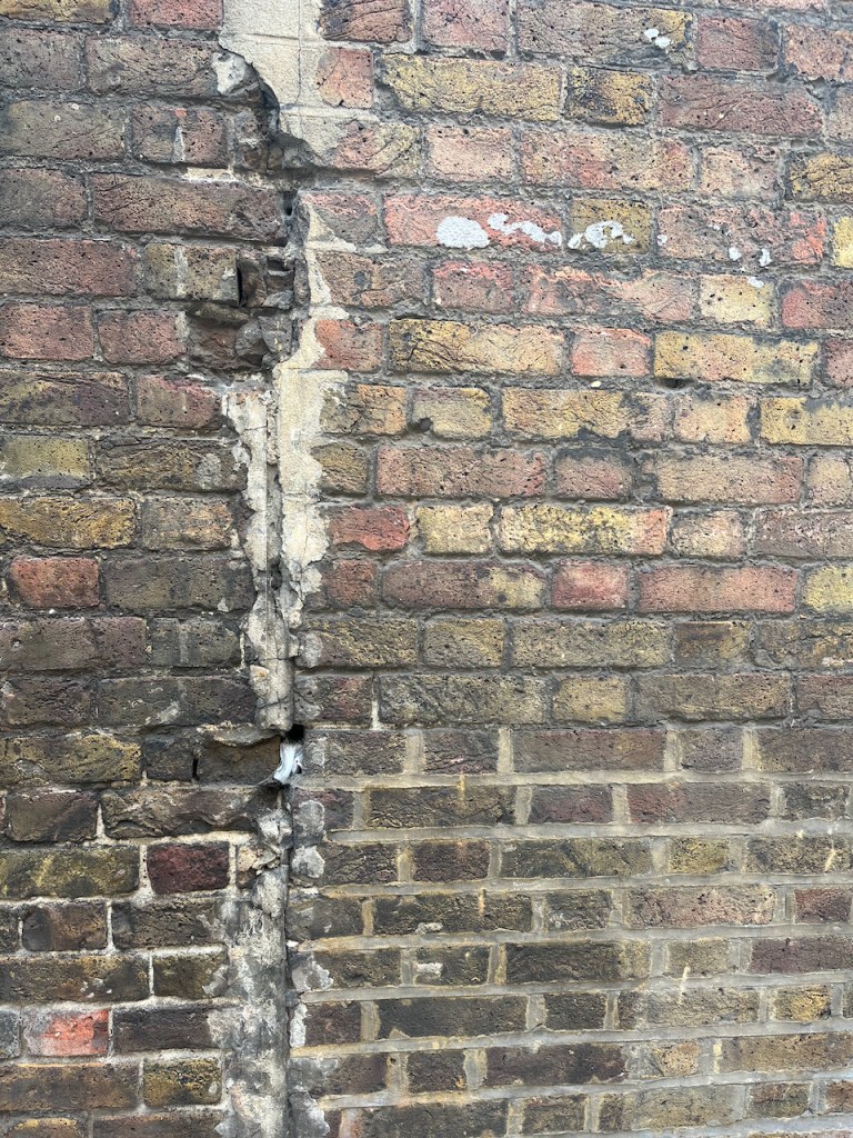
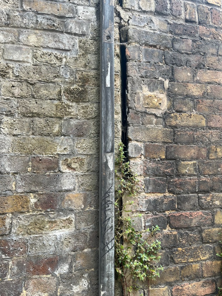
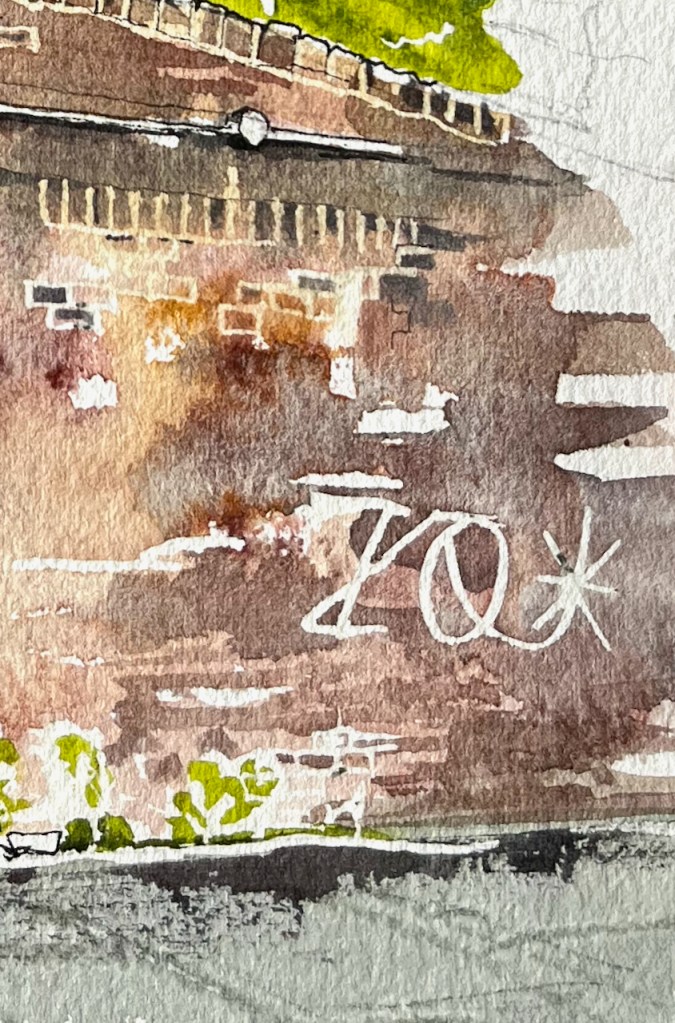
Standing in Mill Place to make this sketch, I became aware of all the history that is embedded in walls. The one in front of me had been altered, rebuilt, and amended several times. A bit had been added on top. Plants lived there. A graffiti artist had made their mark on the crumbling stone.
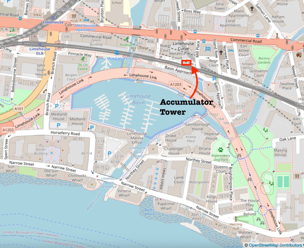
I was standing under two bridges, both 19th century. Both survivors. One holds the modern Docklands Light Railway. The other had wonderful strong vaulting. But it held no railway. I walked around trying to find out where it went. The Google aerial view confirms what I suspected: it is a ghost railway. On the bridge there is verdant greenery where the railway used to be. It goes across a second sturdy bridge, over the A13, and then stops.
Vaulting on the bridge Verdant greenery, but no railway. (Accumulator tower in the background)A sturdy railway bridge across the A13 carries no railway.The railway bridges with no railway
Here are some maps which show the position of the Accumulator Tower and the absence of a railway (click to enlarge).
In this whole area the works of Victorian engineers make themselves felt. Each bridge is a triumph of the bricklayers’ skill: not only strikingly beautiful, with clean curves and neat detailing, but also enduring, powerful and functional 150 years later.
Sketchbook 15map (c) OpenStreetMap contributors: click to go to the map
Click a button below to share this post online, email it, or print it:
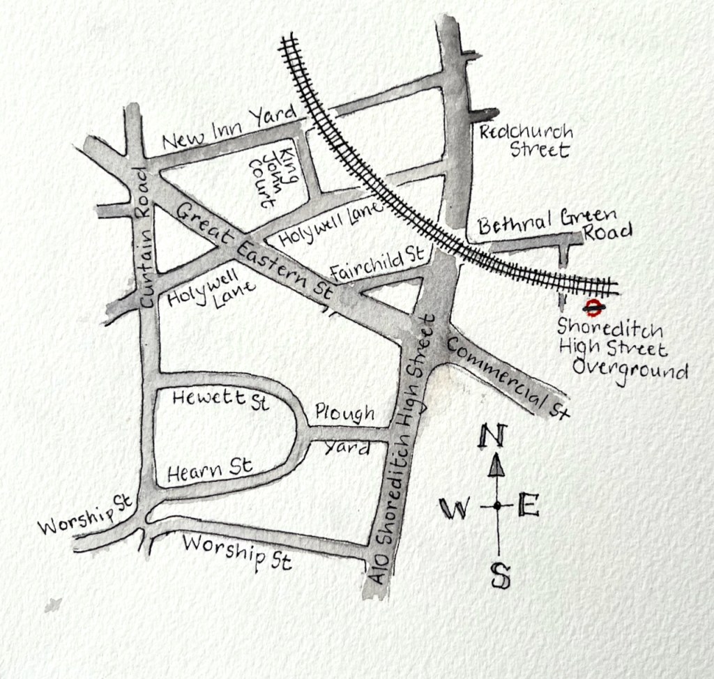
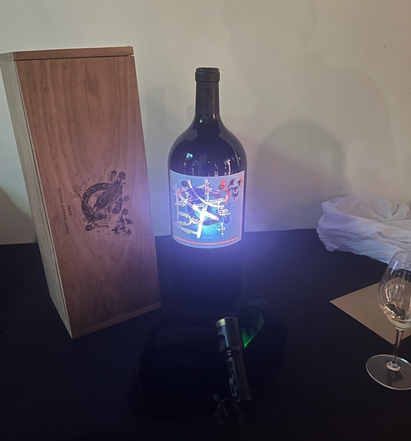
Vanessa from 4G wines saw one of my maps online, and contacted me to ask if I could do a special one for them – for a wine label! I was thrilled at the idea of having my artwork on a wine label, and set to work.
Vanessa was somewhat mysterious about how the map was to be used. I was curious. She invited me to the London launch of their vintage so I could see it in person, when the bottle design was to be unveiled.
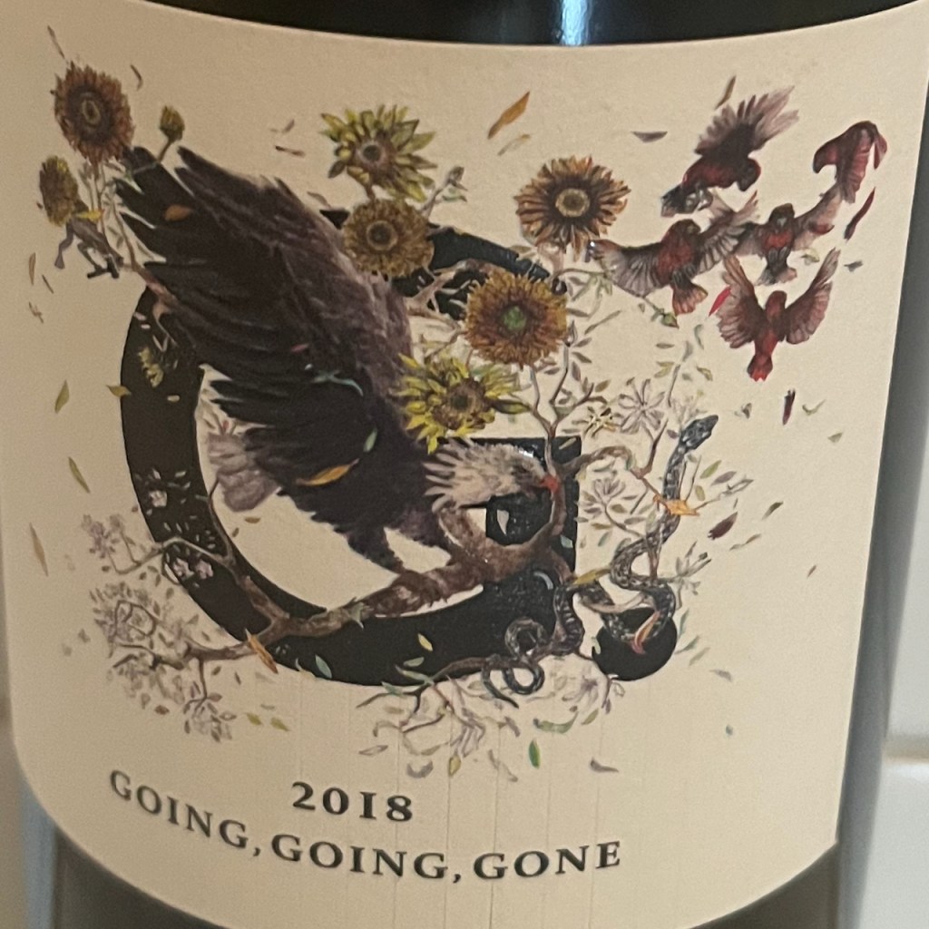
The event was at the Banksy gallery on the Charing Cross Road. On display was the 2018 vintage named “Going, going, gone”. The name is a reference to a 2018 event at an auction house. A Banksy painting, “Girl with a Balloon”, apparently started to self-destruct by feeding itself through a shredder embedded in the picture frame. The shredding process started immediately the auctioneer’s hammer came down to mark the sale of the work, hence “Going, going, gone”.
4G make their bottles into intriguing works of art. The label on the bottle is a beautiful design by the artist Sebastian Blinde, showing elements of South African nature.
label design by Sebastian Blinde
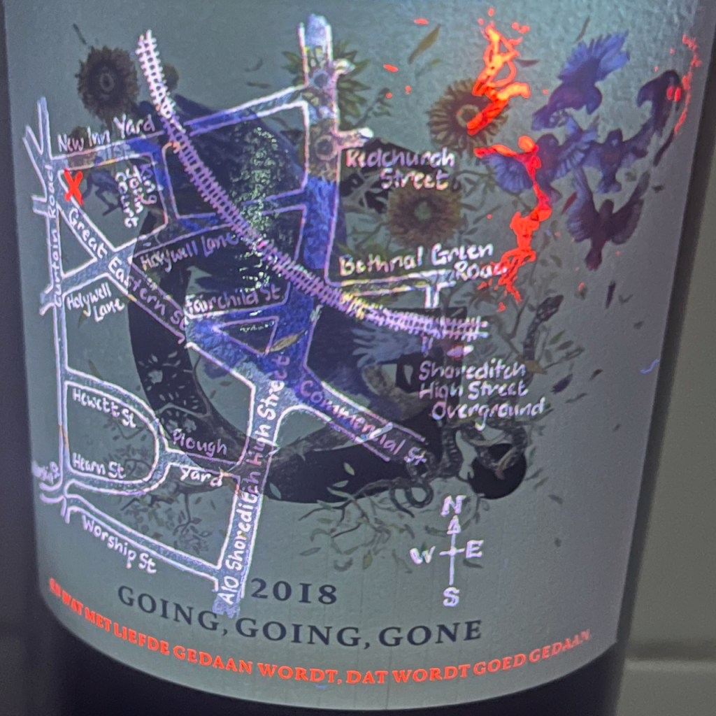
The secret in this vintage is the map – my map! – made visible by shining ultra-violet light onto the label.
Secret map behind the label
It was such fun to see it. There is an X on the map to mark the position of an original Banksy mural “Girl with a Balloon”.
The inscription below the map reads: “EN WAT MET LIEFDE GEDAAN WORDT, DAT WORDT GOED GEDAAN”
This is another subtle artistic reference. It is a quote from a letter of Vincent van Gogh written on 3 April 1878, according to the website of the Vincent Van Gogh Museum in Amsterdam on this page of his letters.
“And what is done with love, is done well.”
An excellent motto, for both wine and art.
Click a button below to share this post online, email it, or print it:
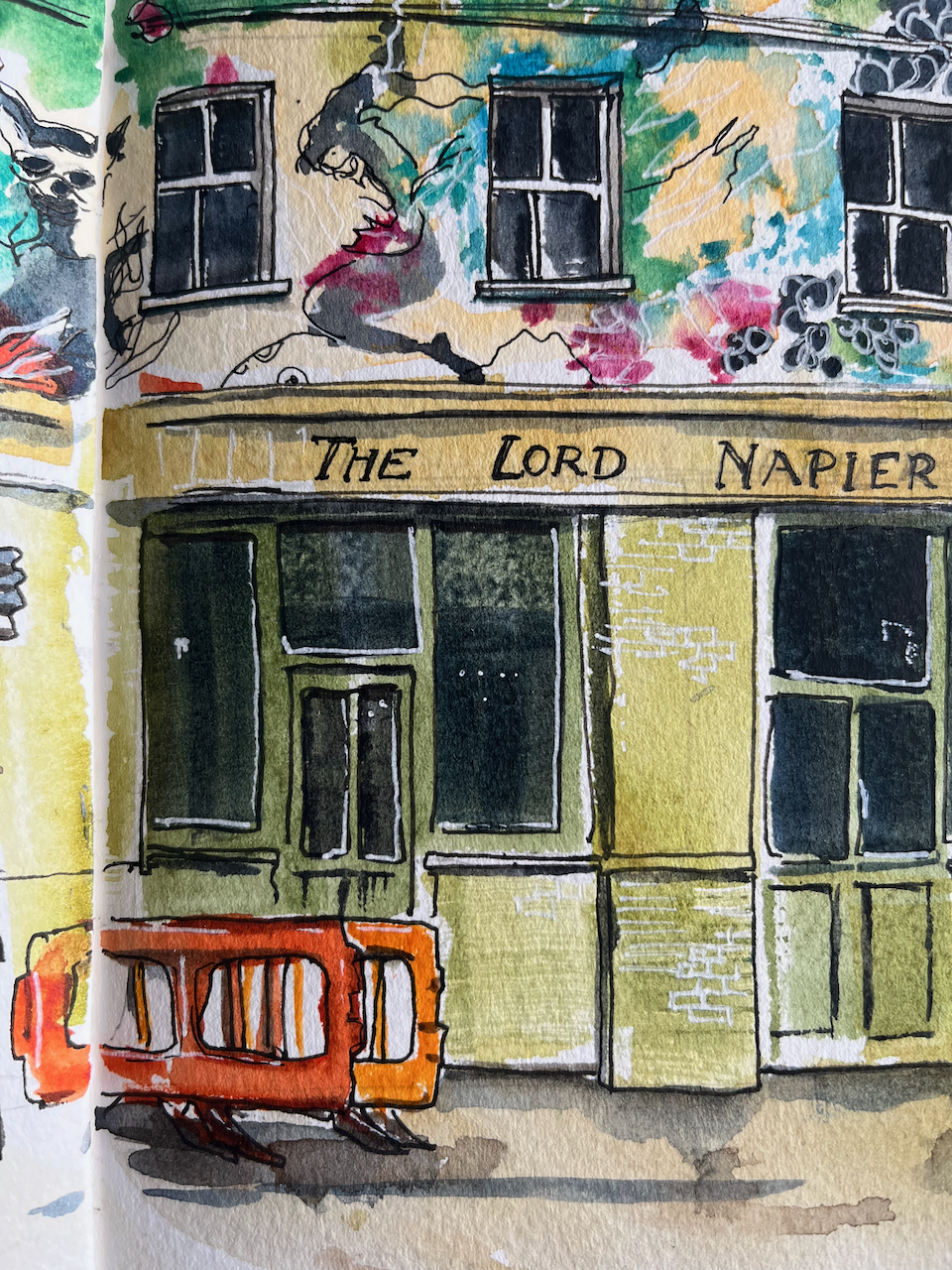
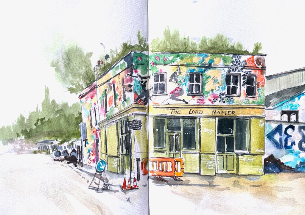
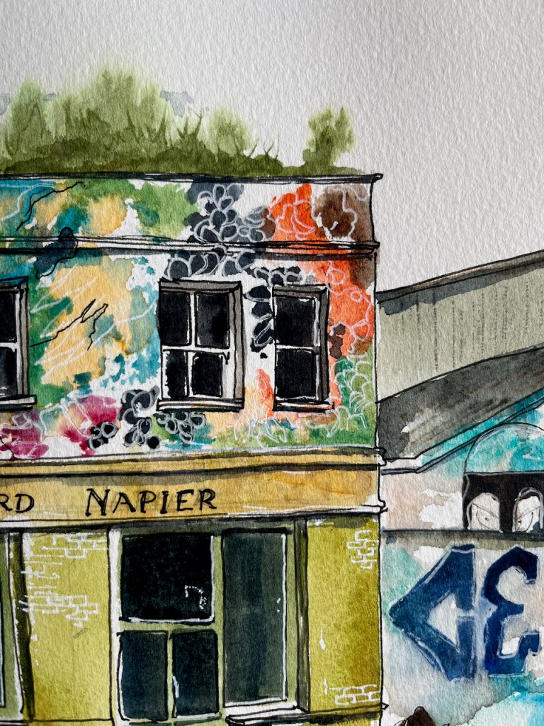
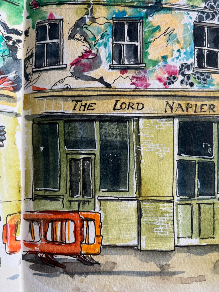
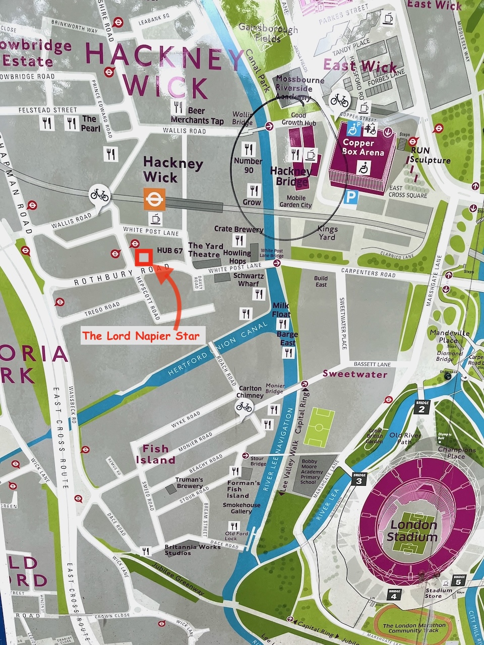
Here is a sketch of the remarkable pub, The Lord Napier, now the Lord Napier Star.
As you see, the top of the pub is covered in street art. I had fun trying to copy it. The original art is done at large scale with a spray can. My drawing is at small scale with watercolour and gel pens.
The pub has history. It has been a working pub, derelict, a rave venue, a squat. Now it is back to being a pub again.
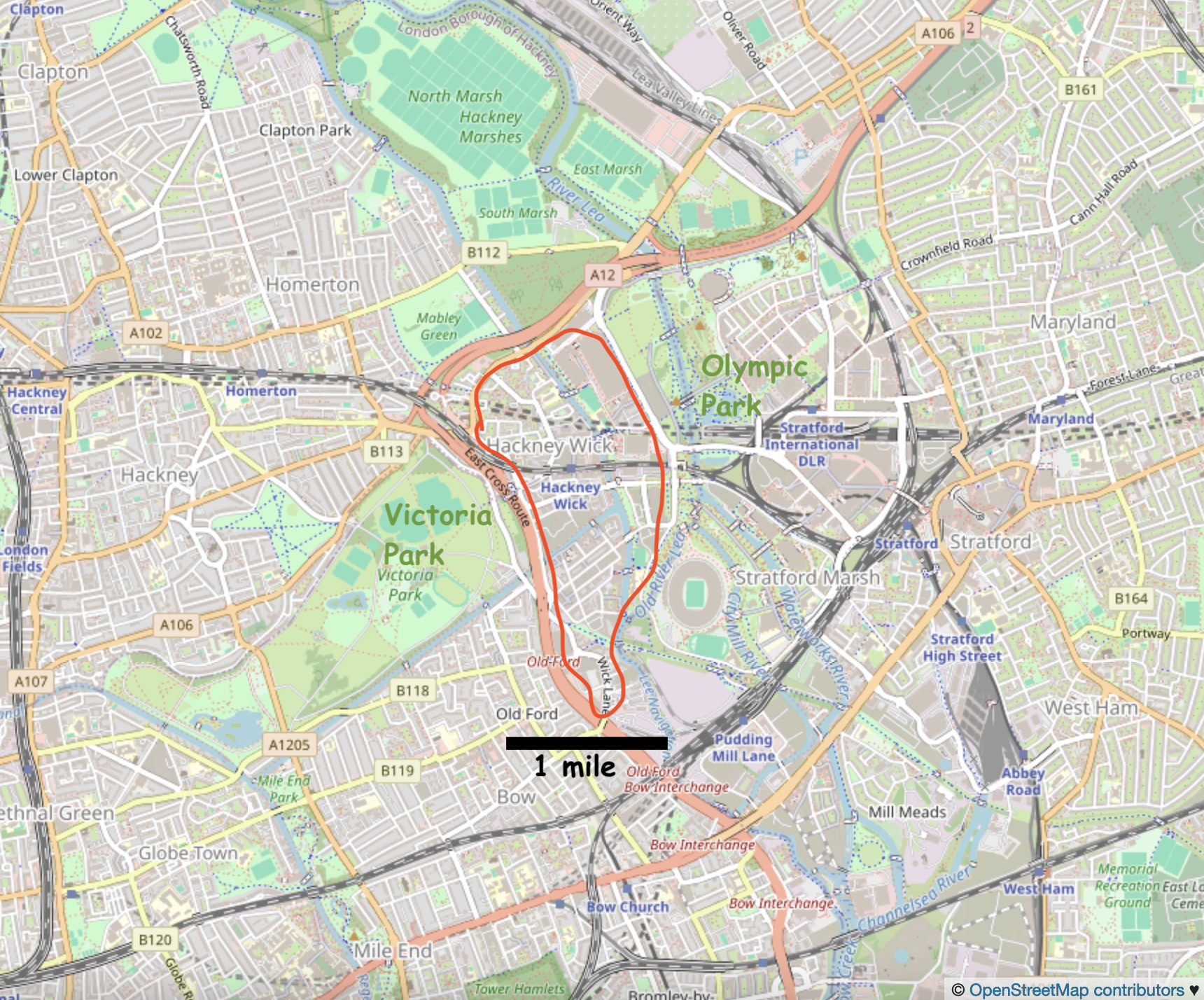
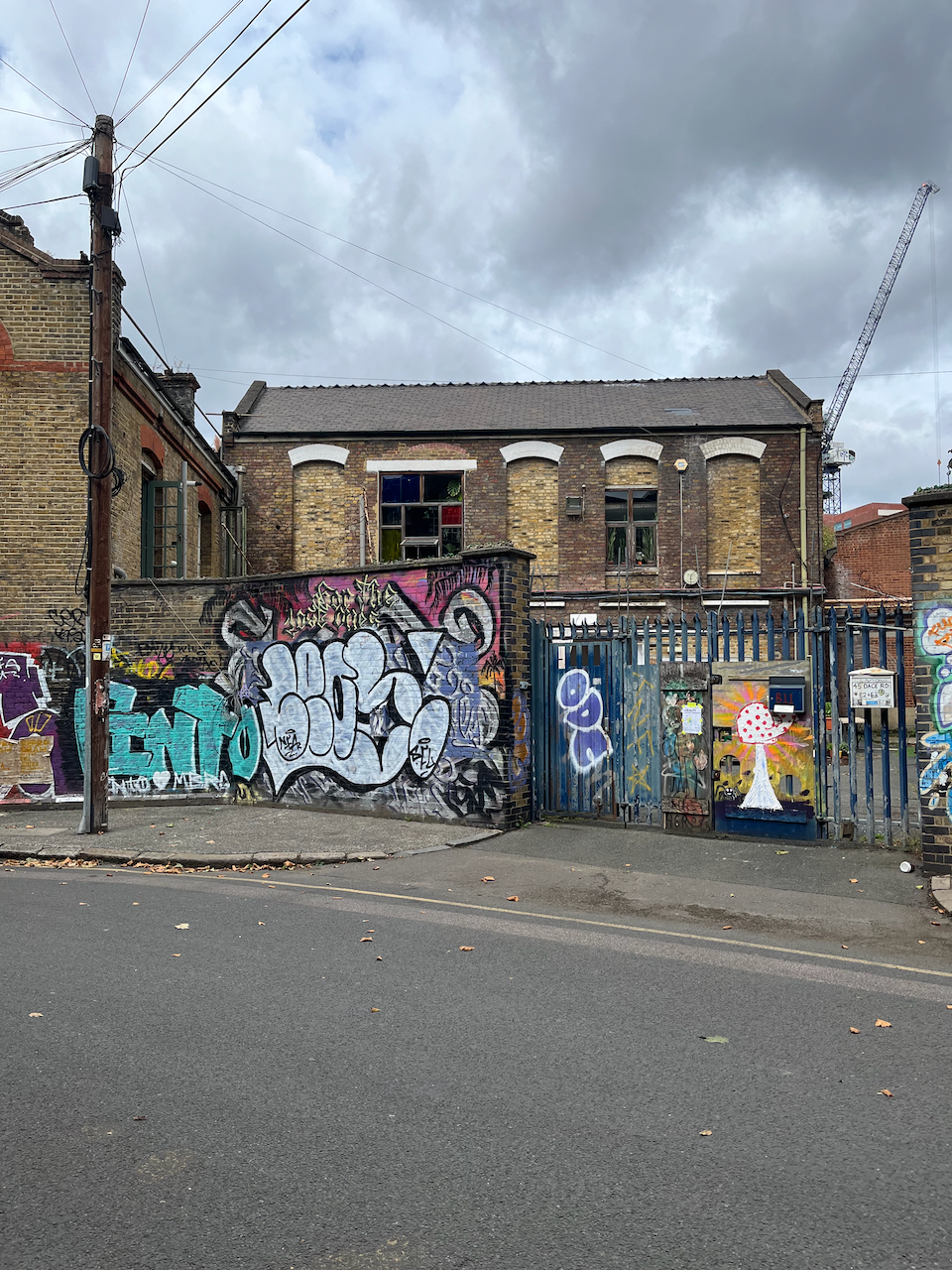
Hackney Wick is in East London between Victoria Park and the Olympic Park.
Hackney Wick is on the East side of London, 20 min walk from the Stratford railway station, and on the Hackney Wick overground.Hackney Wick is between the Olympic Park and Victoria Park.
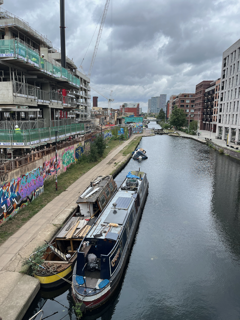
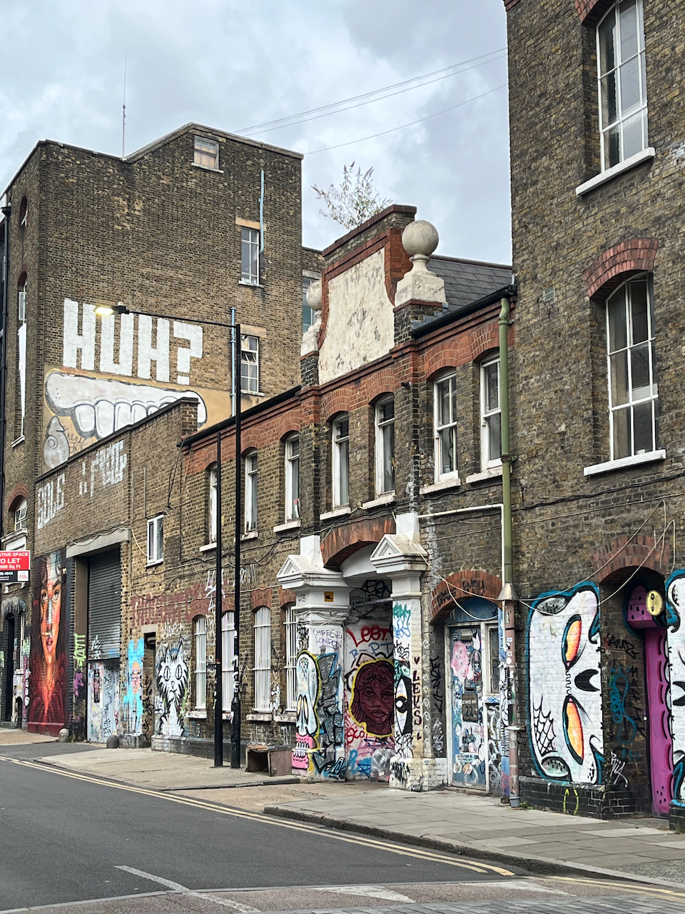
I have walked and run through there at intervals over the last twenty years. It has changed remarkably. The company I use for printing my artwork moved over there about 5 years ago, from a location in central London. I thought “what!” and “why?”. Now I realise that they were at the start of a trend. They were wise. The area is on the up. It used to be somewhat derelict and somewhat dodgy. Now the old buildings are taken over by new businesses, and there are cranes everywhere, constructing buildings where there were coal depots, docks, builders yards, heavy industry.
Map at the bridge to the Olympic Park.
There are new residential buildings, at human scale of 3 to 5 stories, with footpaths and green spaces in between, and commerce at ground level. The commerce is, yes, coffee shops, but also gyms, shared office spaces, businesses to do with the film industry, music and film studios, a bakery, and what looked like scenery painting studios. It felt as though real things happened there, new businesses moving in, people living near where they worked, businesses springing up to serve the people who live there.
New businesses adapting the spacesNew housing, built and under constructionNew businesses in old buildingsDwellings in old buildingsNew businesses in old buildingsA peaceful cafe “The Ethical Bean” Dace RoadA walk around Hackney Wick
I found it cheering and energising. And I recommend the café I found: “The Ethical Bean” on Dace Road.
Click a button below to share this post online, email it, or print it:
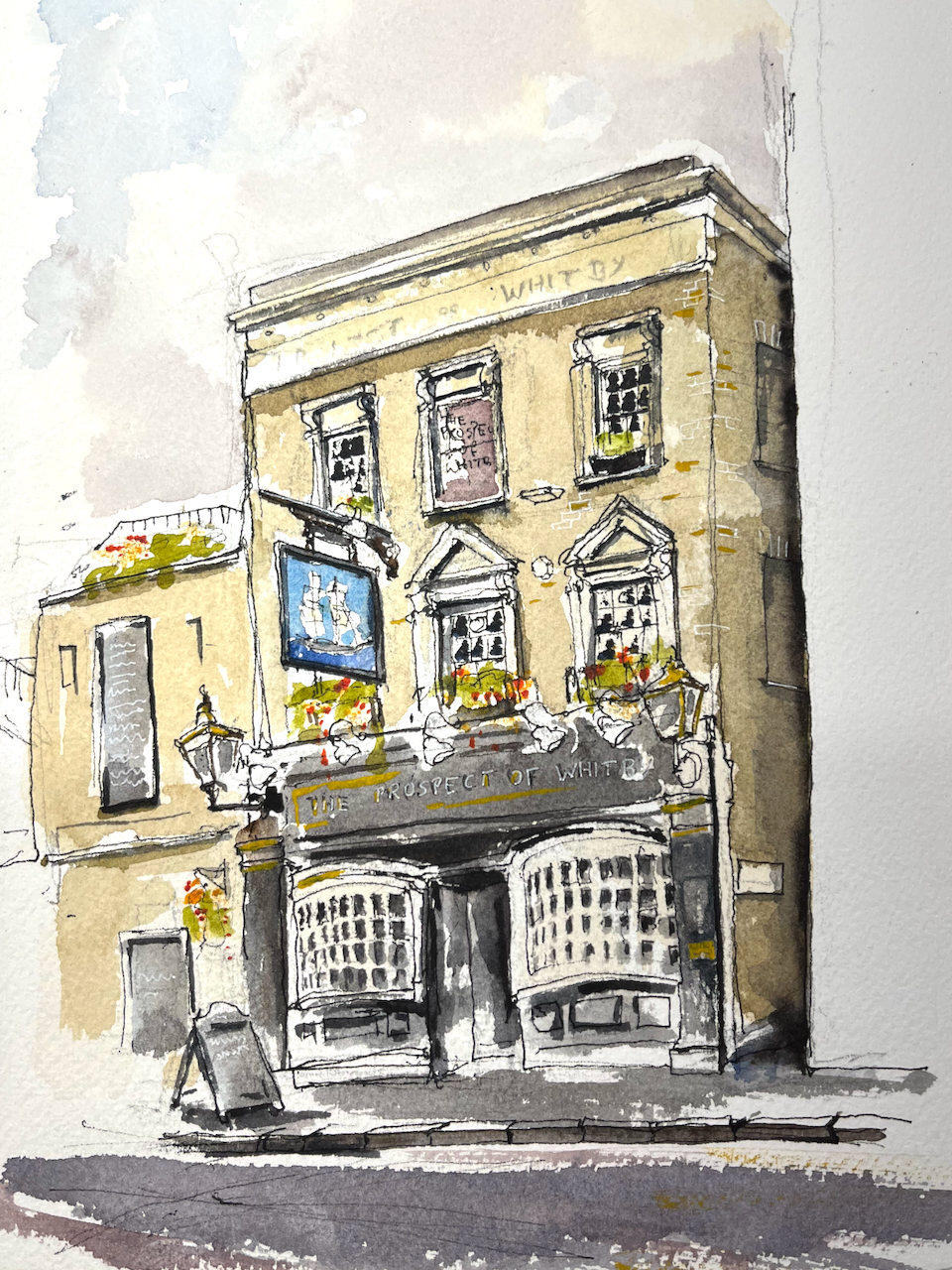
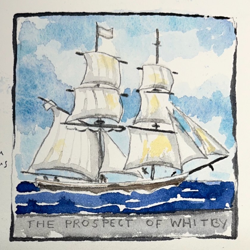
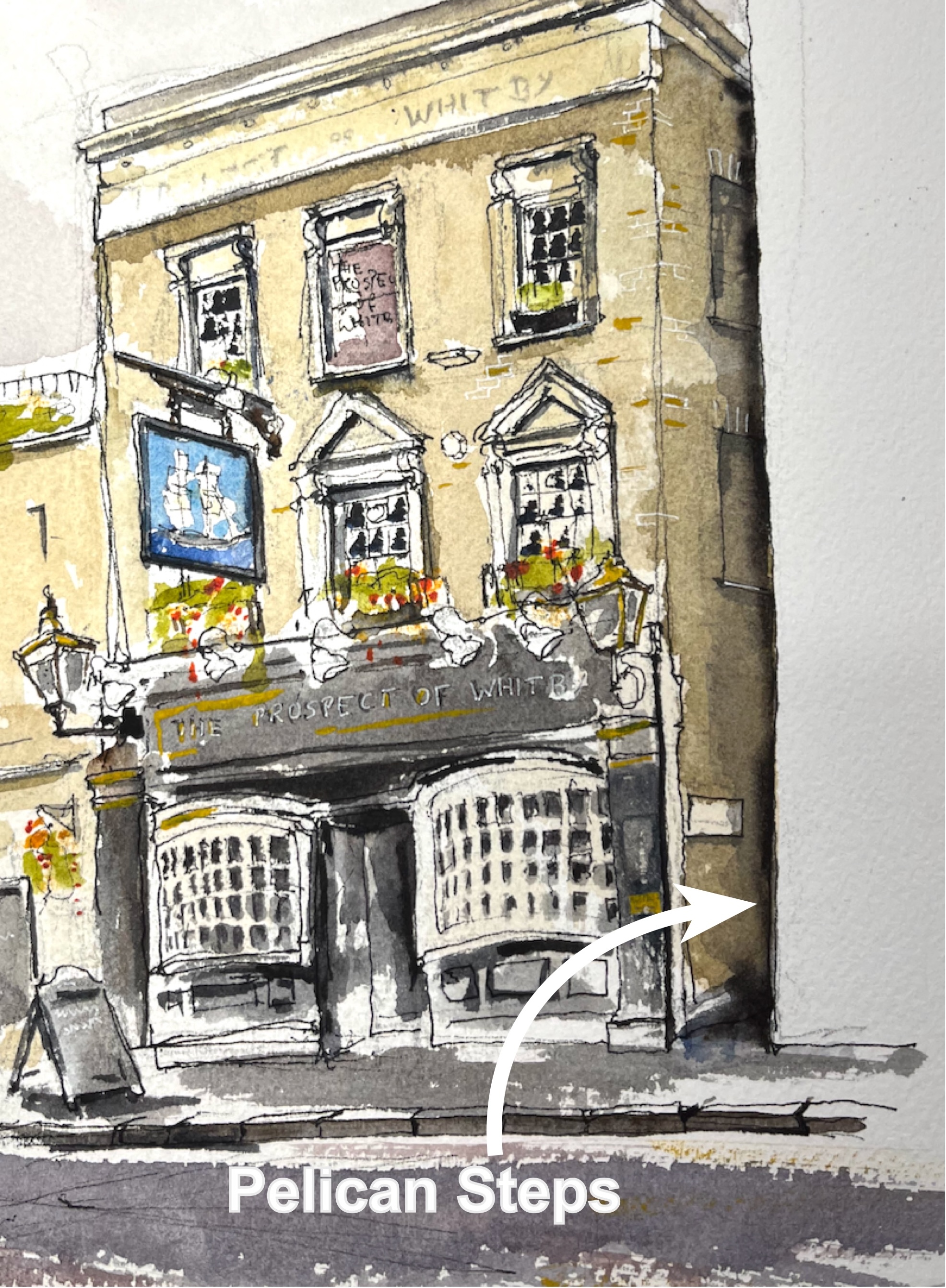
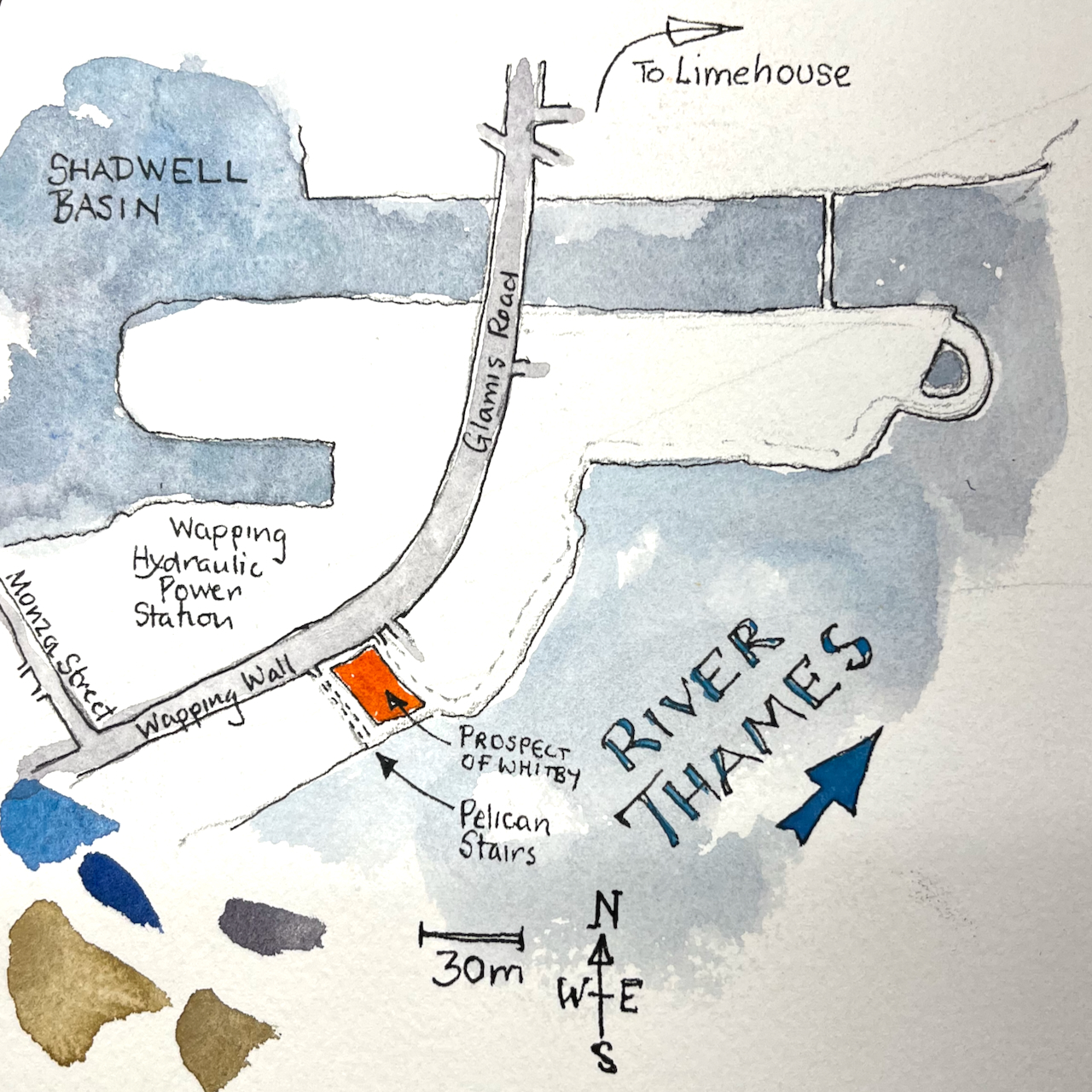
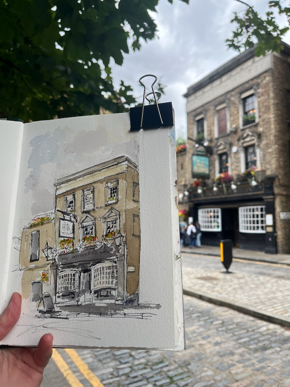
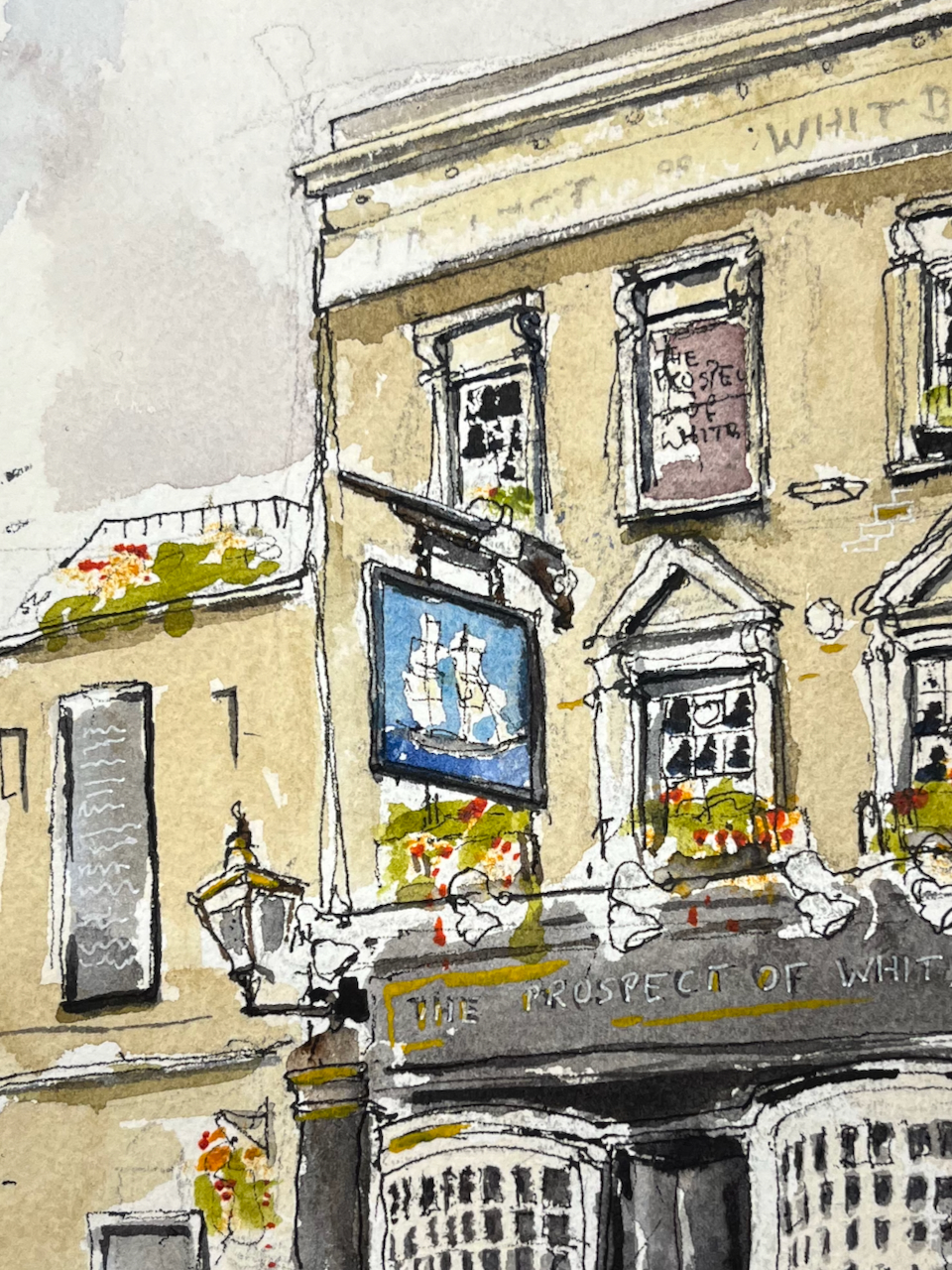
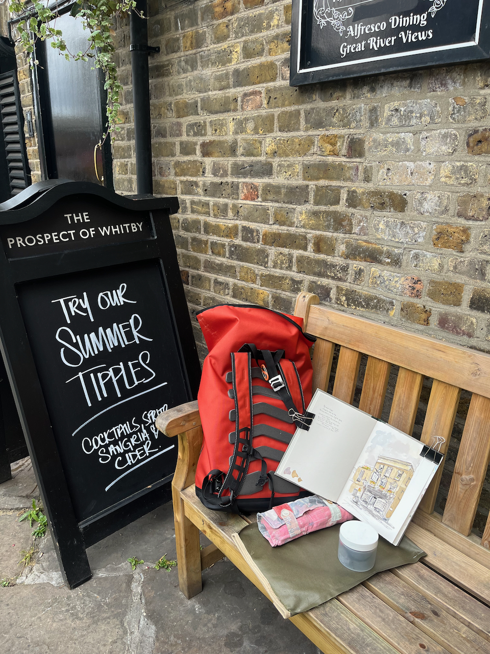
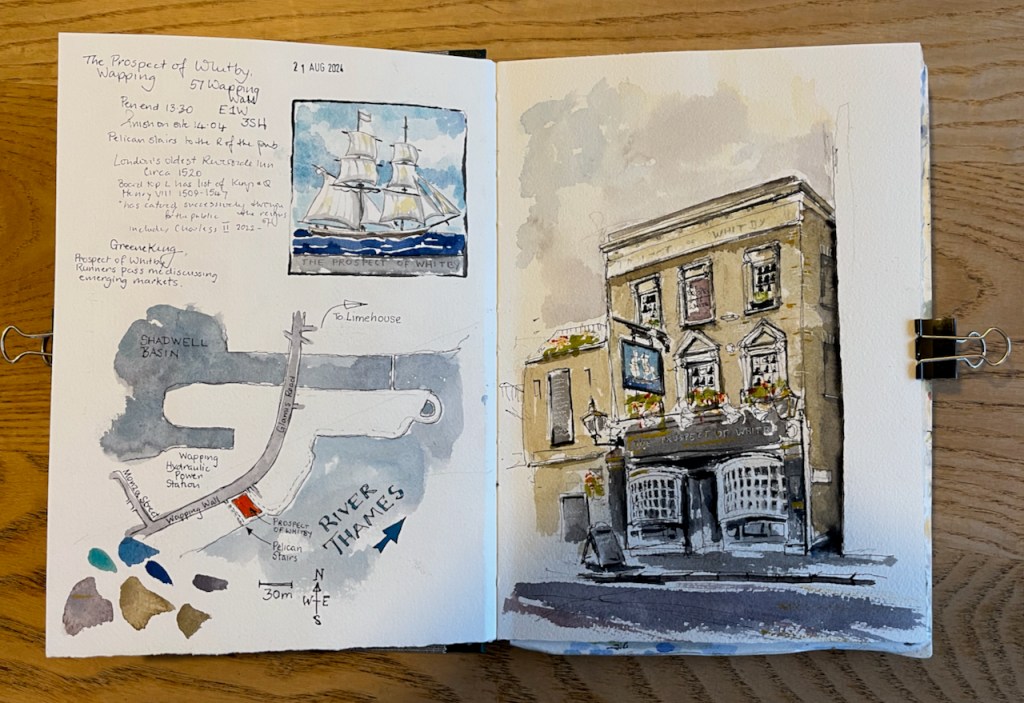
Here is the “Prospect of Whitby” pub by the Thames in Wapping.
“The Prospect of Whitby” sketched 21 August 2024 at 2pm, the first picture in Sketchbook 15
The “Prospect of Whitby” is the name of a ship.
The coal boat, “Prospect of Whitby”, from the pub sign.
There is an informative entry about the whole area in “The London Inheritance” website. He writes:
“The pub was originally called The Pelican and the alley and stairs down to the river at the side of the pub to the right are still named Pelican Stairs.“