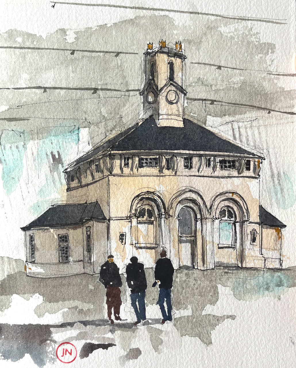
Near Newcastle Central Station there is a new development called the “Centre for Life” Times Square, Newcastle upon Tyne NE1 4EP. It includes scientific research establishments, an interactive science museum for children, and various cafés and events spaces. It was built 1996-2000 to the designs of Terry Farrell and Partners on parts of an old cattle market. In the centre of the wide windswept space is this delightful building, from another era.
Market Keepers’ House, Times Square, Newcastle NE1, sketched from the Centre for Life museum café, 7th April 2023 in Sketchbook 13. About 9″ x 7″.
It is the Market Keepers’ House, 1840, designed by John Dobson, a prolific Newcastle architect of the time. His work is everywhere in the City. He designed the Church of St Thomas the Martyr, for example, and the Central Station. And he also gave us this miniature masterpiece, with its pleasing curves and symmetry. The building was restored in 1998 by Ainsworth Spark. This information is from “Pevsner Architectural Guides, Newcastle and Gateshead” by Grace McCombie 2009. We arrived at Times Square after following “Walk 5” in the book.
The people in the foreground are refuse collectors and cleaners. The two on the right are just coming off shift and the person on the left is just coming on shift. There is a lively exchange of views about their boss, a comparison of anecdotes concerning the unbelievable behaviour of the general public, and an analysis of recent decisions by the manager of Newcastle United. I couldn’t, of course, hear a word they were saying. Their articulate body language inspired me to pay attention to their conversation and include them in the picture.
Click a button below to share this post online, email it, or print it:
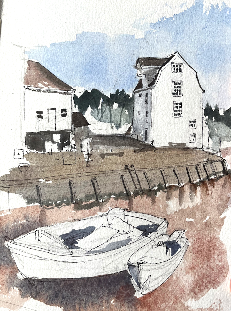
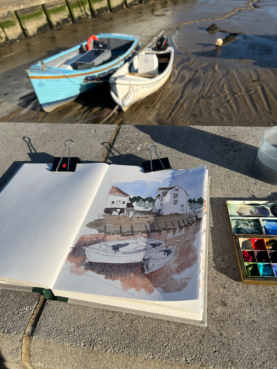
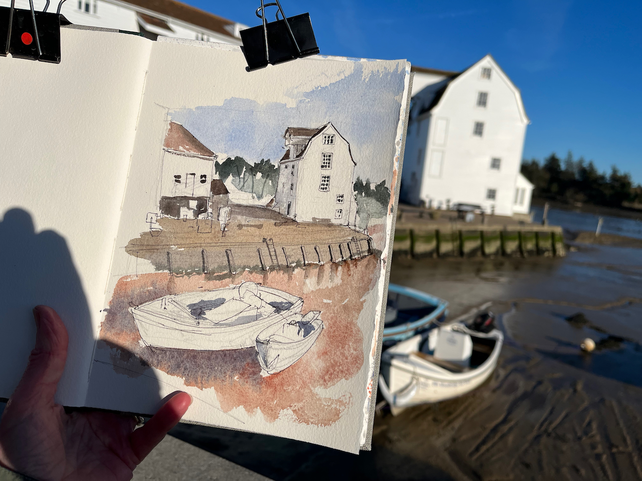
Woodbridge Tide Mill 4th April 2023, in Sketchbook 13, 10″ x 8″
The boats in the foreground are “Oystercatcher” on the left, and “Isla” on the right.
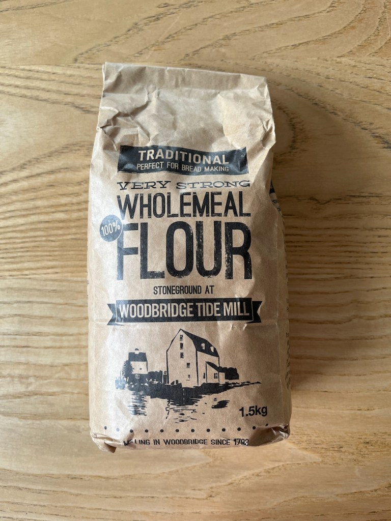
The Tide Mill was working when I visited. Huge wheels turned powerfully as water poured down from the Mill Pond. The water drives a millstone which grinds flour. There is also a tide-operated mobile phone charger in the mill!
Flour from the Mill, ground by tide power
This picture took me about an hour, drawn and coloured on location.
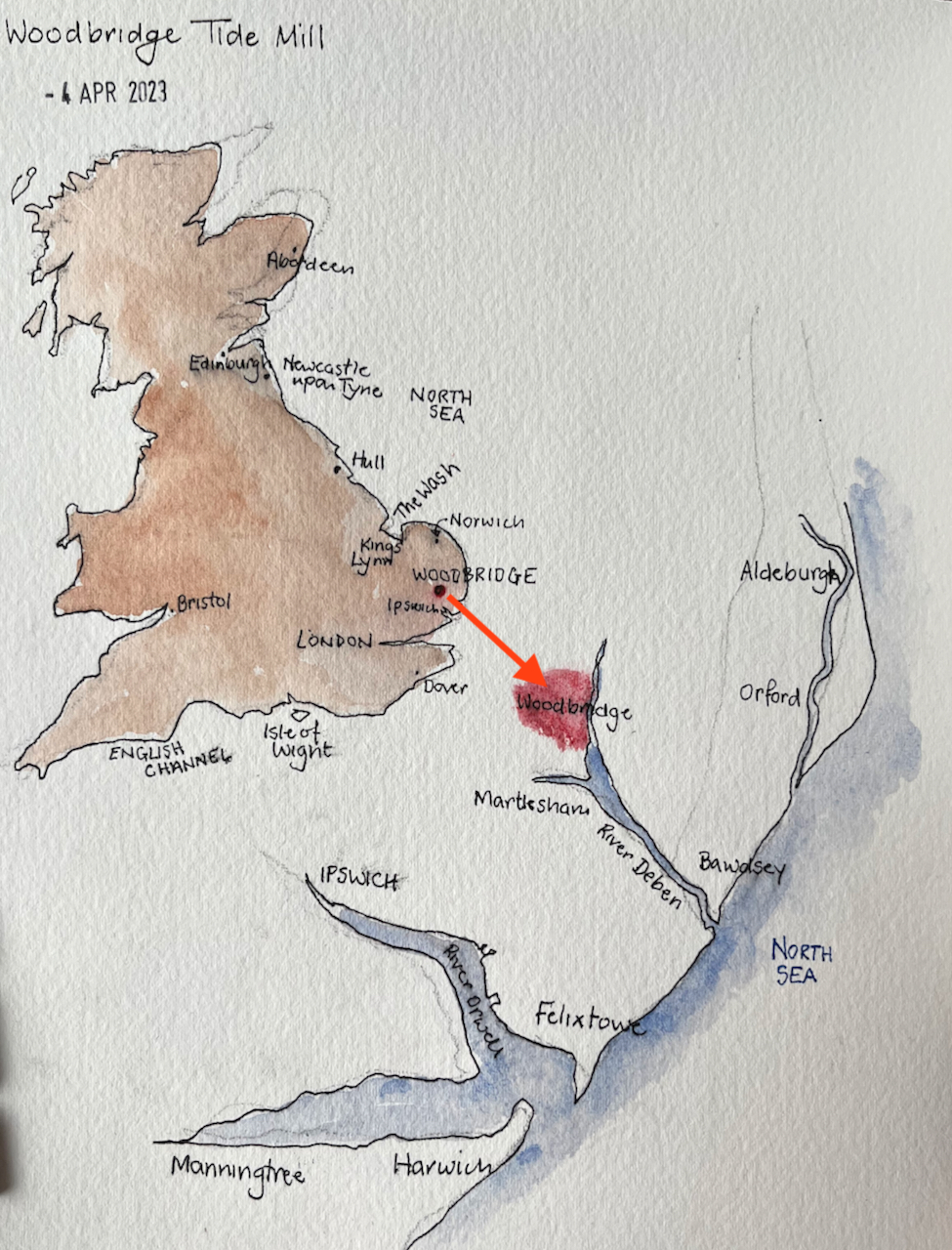
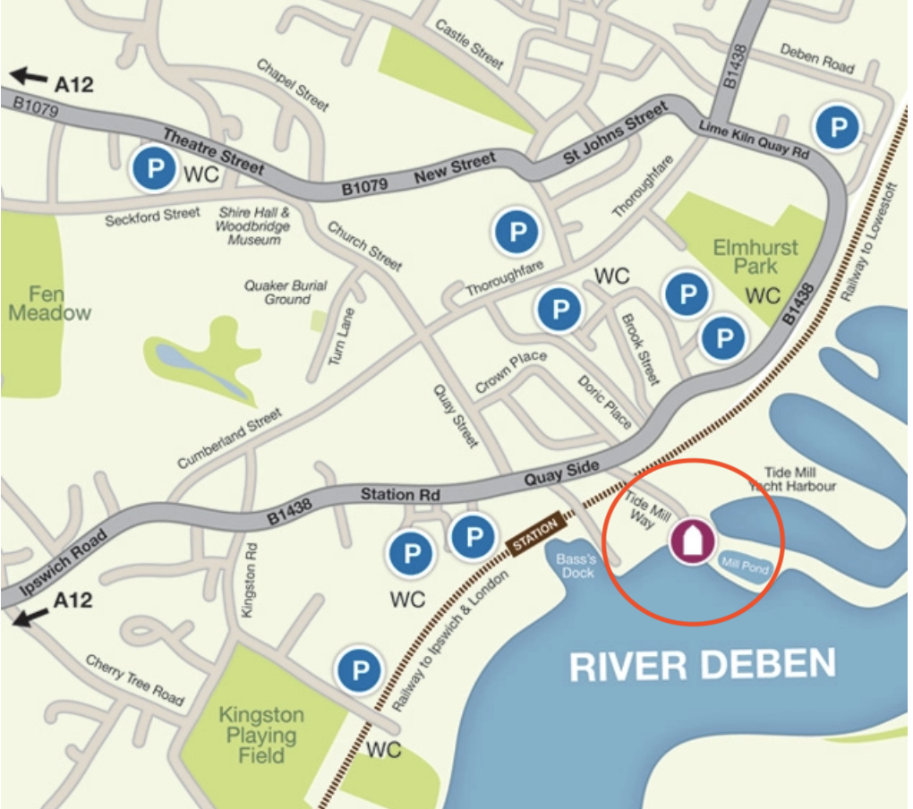
Here are some maps so you can find the Tide Mill. It’s a short walk from the railway station.
(c) openstreetmap contributorssketchmapfrom the tide mill website
Click a button below to share this post online, email it, or print it:
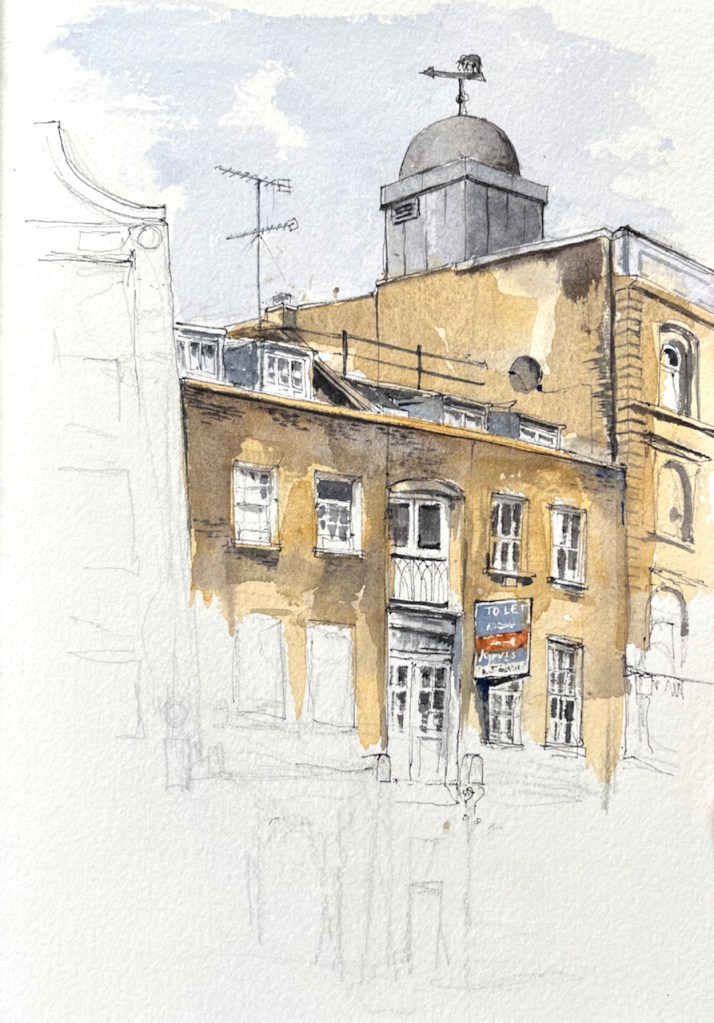
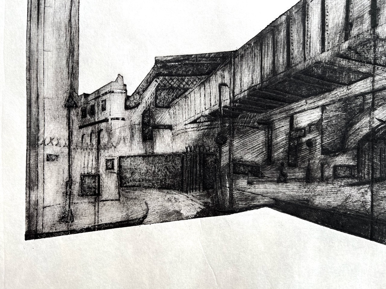
Next time you are walking along St John St, look out for this dome, with the elephant wind vane. It’s on the West side, just a bit further North than the White Bear pub.
77 St John St EC1M, 9″ x 7″ in Sketchbook 13, 17th March 2023
I can’t find out anything about why there’s an elephant up there. The wind vane is on number 77 St John St, currently occupied by, amongst others, ASLEF the train drivers union, and “Liberation – Justice for Colombia”
JFC was set up in 2002 by the British trade union movement to support Colombian civil society in its struggle for human rights, labour rights, peace and social justice.
All JFC work is carried out in response to the demands of our partners in Colombia: the political activists, trade unionists, peasant organisations, human rights defenders, and other civil society groups who are on the front line in demanding peace and social justice.
JFC promotes links of solidarity between British and Irish trade unions and organisations in Colombia and gives a political voice internationally to Colombian civil society through our work in the British, Irish and EU Parliaments
The building in the centre of my drawing is numbers 69, 71 and 73 St John St. These buildings are listed Grade II, list entry no: 1195730.
In 2015 there was an application to build another floor on top of number 69, for residential use. As part of the planning submission, the applicant commissioned a detailed historical study from Paul Edwards, Dip Arch (Oxford) IHBC, Historic Environment Specialist. His 15-page report provides fascinating information about the houses. For example:
Nos 69-73 are depicted in Tallis London Street View, drawn 1838-1840, … There were three bays, at the centre an alley leading to an internal yard flanked by buildings of three storeys and attics, each with two windows each side of the alley. The facades had classical Georgian or Regency proportions, with tall sash windows at 1st and second floor levels and continuous small pane shop windows at ground floor level. A gambrel roof was set behind an eaves parapet. The northern house was leased by John Newton a cork manufacturer who took over the whole premises and whose firm remained there until the First World War. The ground floor front of No 69 was re-modelled in the mid-19th century with arched openings and Ionic pilasters in stucco. The shop front of No 73 dates from 1884. There had been a fire in the cork warehouse in 1882 which was then partly rebuilt with No 69 being extended over the alley between the two houses. In 1896 the two buildings were made into one.
Paul Edwards, 69 St John Street, Islington, Historic Asset Assessment (Version 1) February 2015.
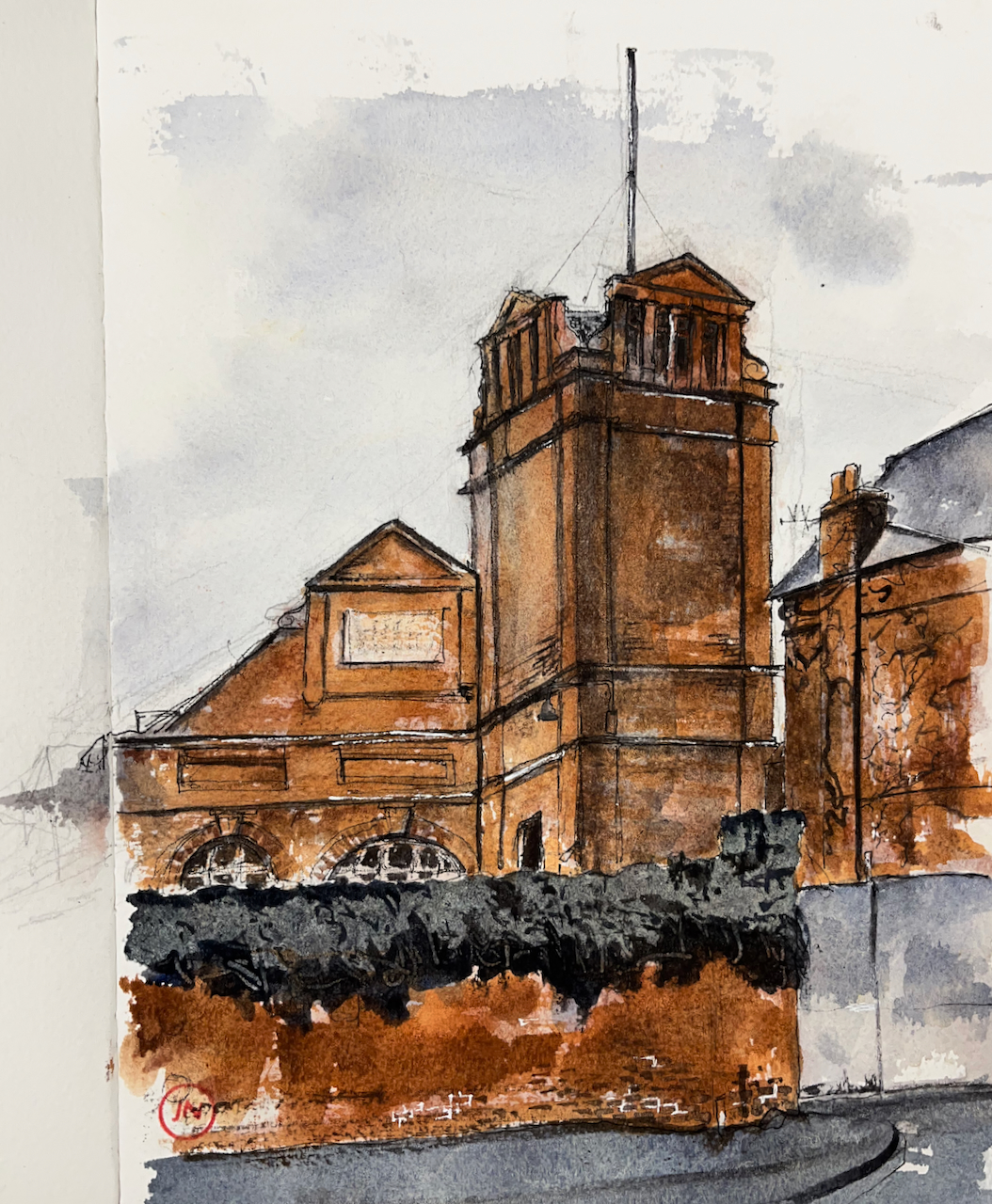
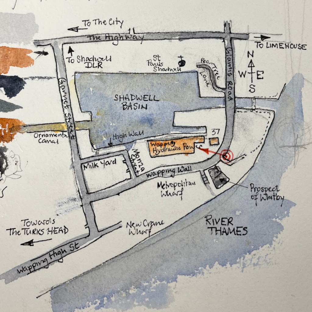
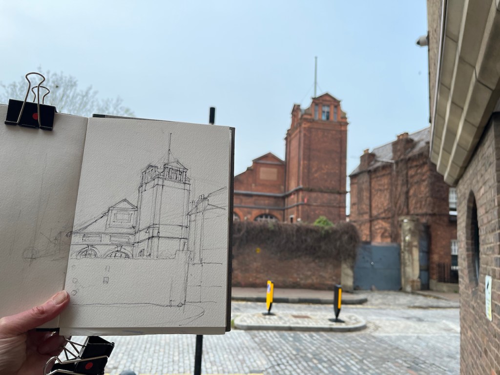
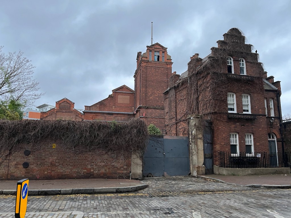
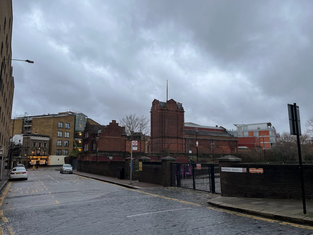
What an amazing building! It presides over a corner of Shadwell Basin, surrounded by a high wall. I spotted it on a long weekend run, and went back later to sketch it.
Wapping Hydraulic Power Station, sketched 1 Jan 2023 in Sketchbook 12, 7″ x 9″
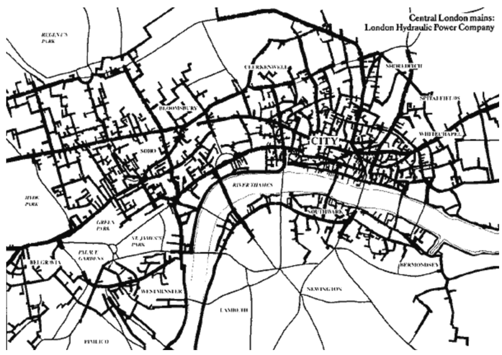
What’s a Hydraulic Power Station? Well, in the late nineteenth century, London’s industry needed a way to exert mechanical force: to operate a printing press for example, or to raise heavy weights, for cranes and metal forming. Also, passenger lifts had been invented, and building engineers needed a way to exert force to operate the lift. One way would be to have a steam engine on site. This wasn’t always practical. Steam engines are noisy and dirty and you don’t want one next to your desirable residence, or even cluttering up your dockyard. So here’s the next idea: instead of lots of little steam engines all over the place, we’ll have a big steam engines in just a few places, and we transmit the power from them by using water. Water? Yes. The big steam engines push water at high pressure down strong cast iron pipes, and the lift engineer at the far end effectively turns on a tap and the force of the water pushes the lift up. That’s the principle.
This sounds utterly implausible, but it worked. At the end of the nineteenth century, there was a great network of pipes all over London, holding water at high pressure. This water was used to raise passenger lifts, operate curtains at theatres, and to drive printing presses. It was used for cranes and other static machinery which required a strong, steady force. It’s a steampunk dream. Here’s a map. These pipes were everywhere.
The plaque you can see in the centre of my drawing says “London Hydraulic Power Company 1890”. This was one of the big power stations driving the water along the pipes. The power came from a coal-fired steam engine.
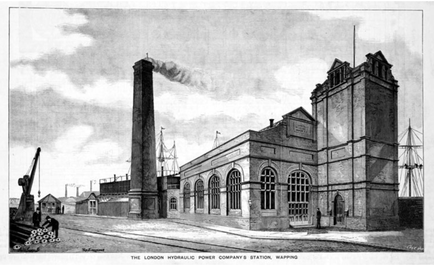
This is a picture from the early twentieth century. The chimney is from the steam engine room. The tall tower houses the “accumulator” where water under pressure is stored as a buffer against variation in demand. It is a sort of “battery”. A big weight sits at the top of a column of water. The weight is raised by pumping water in using steam power. The big weight then rests on the top of the water, keeping it under pressure and forcing it down the pipes. This drawing is from roughly the same place where I did my drawing. Note the sailing boats in Shadwell basin, to the right and in the background. The Thames is off the picture, to the left. Picture from: https://www.gracesguide.co.uk/File:Im1893EnV75-p43.jpg#file (creative commons)Map showing where I stood to do the drawing, which is also the approximate view point of the early twentieth century picture above.
Here is a summary of the history of the building, gleaned from various web searches:
1890: completed and started working. In use until 1977.
September 1973: first listing
June 1977: use discontinued
December 1977: Grade II* listed, including the machinery (listing ref 1242419)
1993-2013 – owned and operated by Jules Wright as “The Wapping Project”: an art and entertainment venue.
2013: Sold to UK Real Estate Limited
March 2019: planning application for an office building in the courtyard, retail and restaurant space and changes to the interior
October 2020: planning permission approved (ref PA/19/00564/NC and PA/19/00571/A1), despite objections from The Victorian Society and the Turks Head Charity.
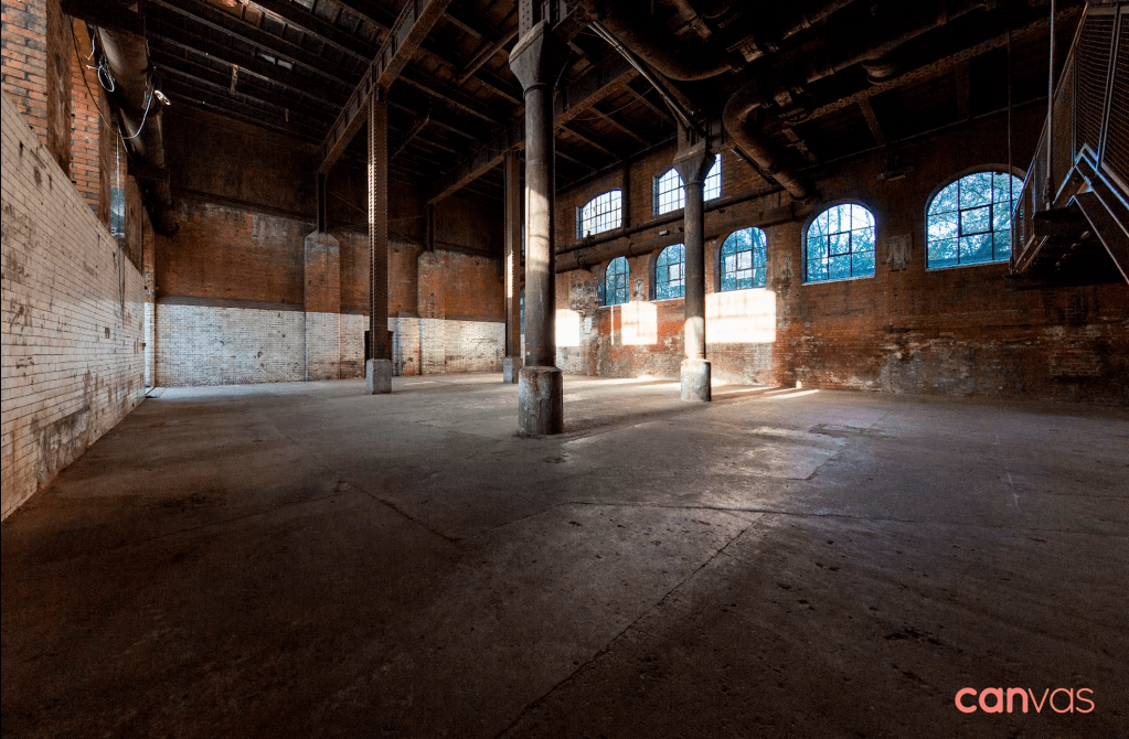
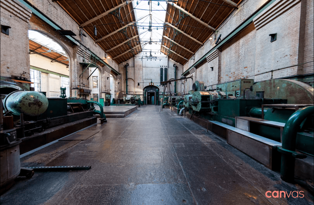
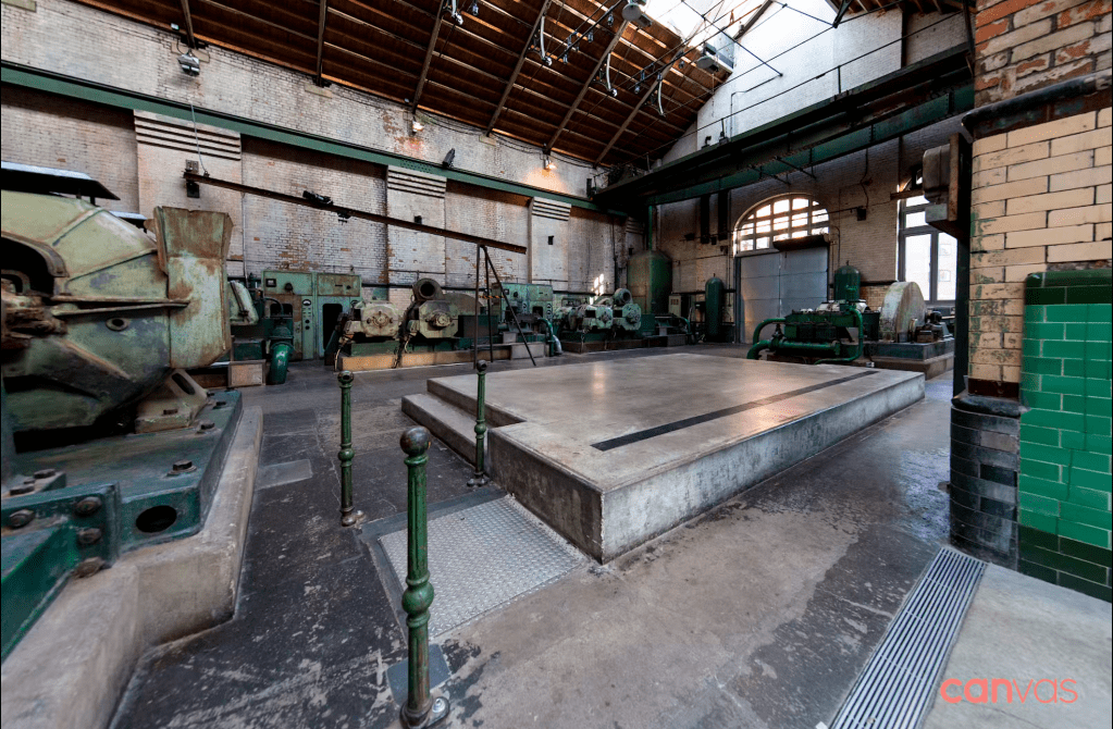
Meanwhile – it’s an event space.
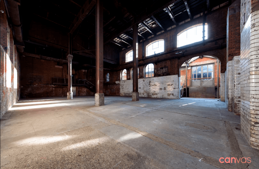
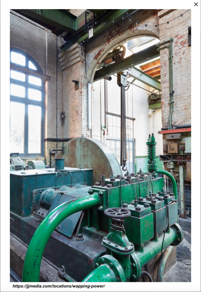
The Wapping building still has its machinery inside. It’s awaiting redevelopment. You can hire it for your fashion shoot, Christmas Party or product launch. The photos below are from the agencies advertising the use of the space: Canvas Events, and JJ Media It looks totally amazing! If you book your event there, please can I come and sketch?
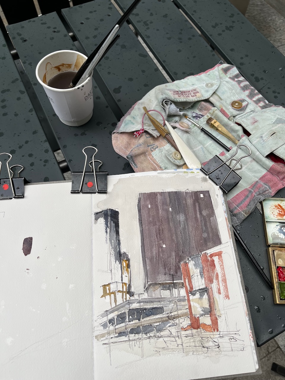
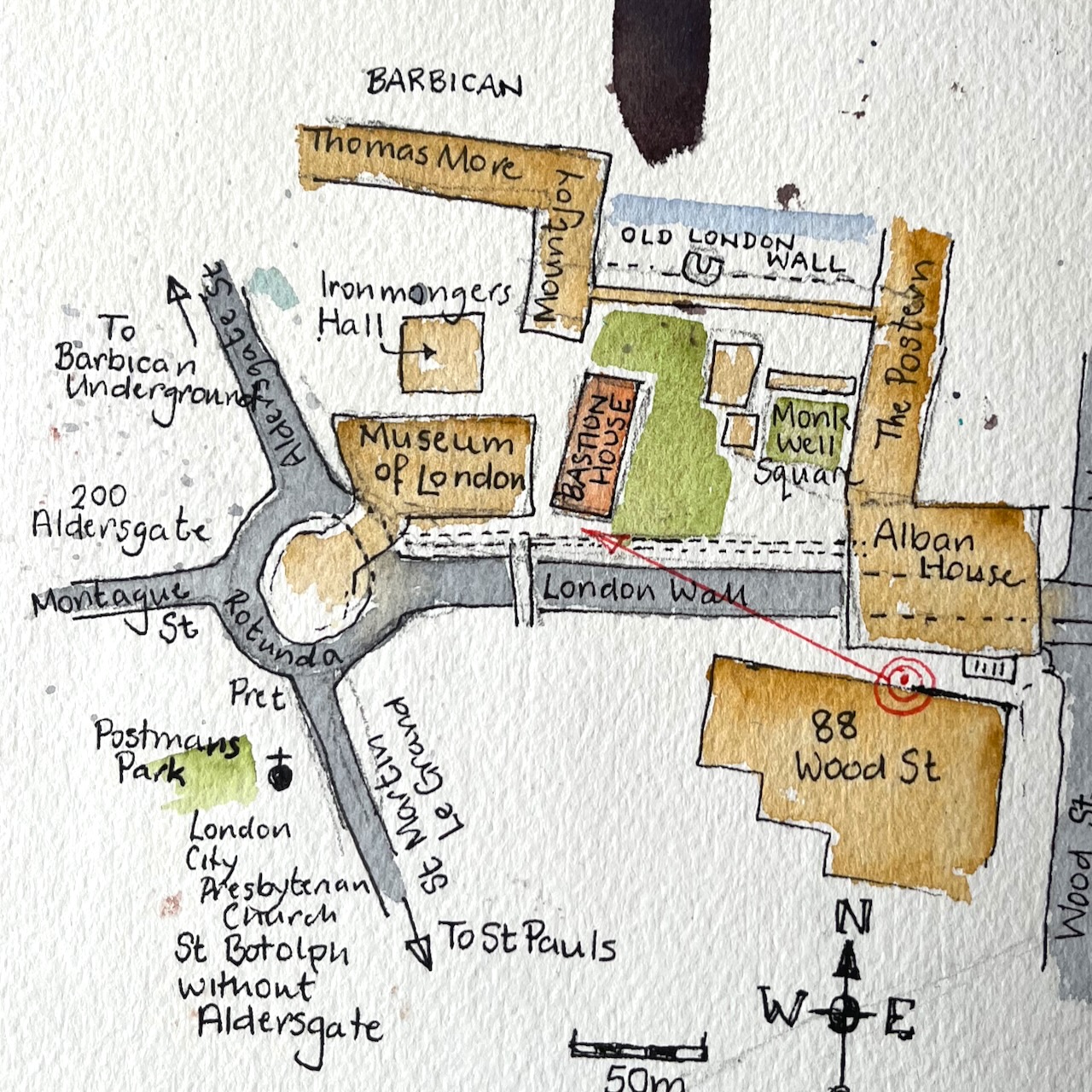
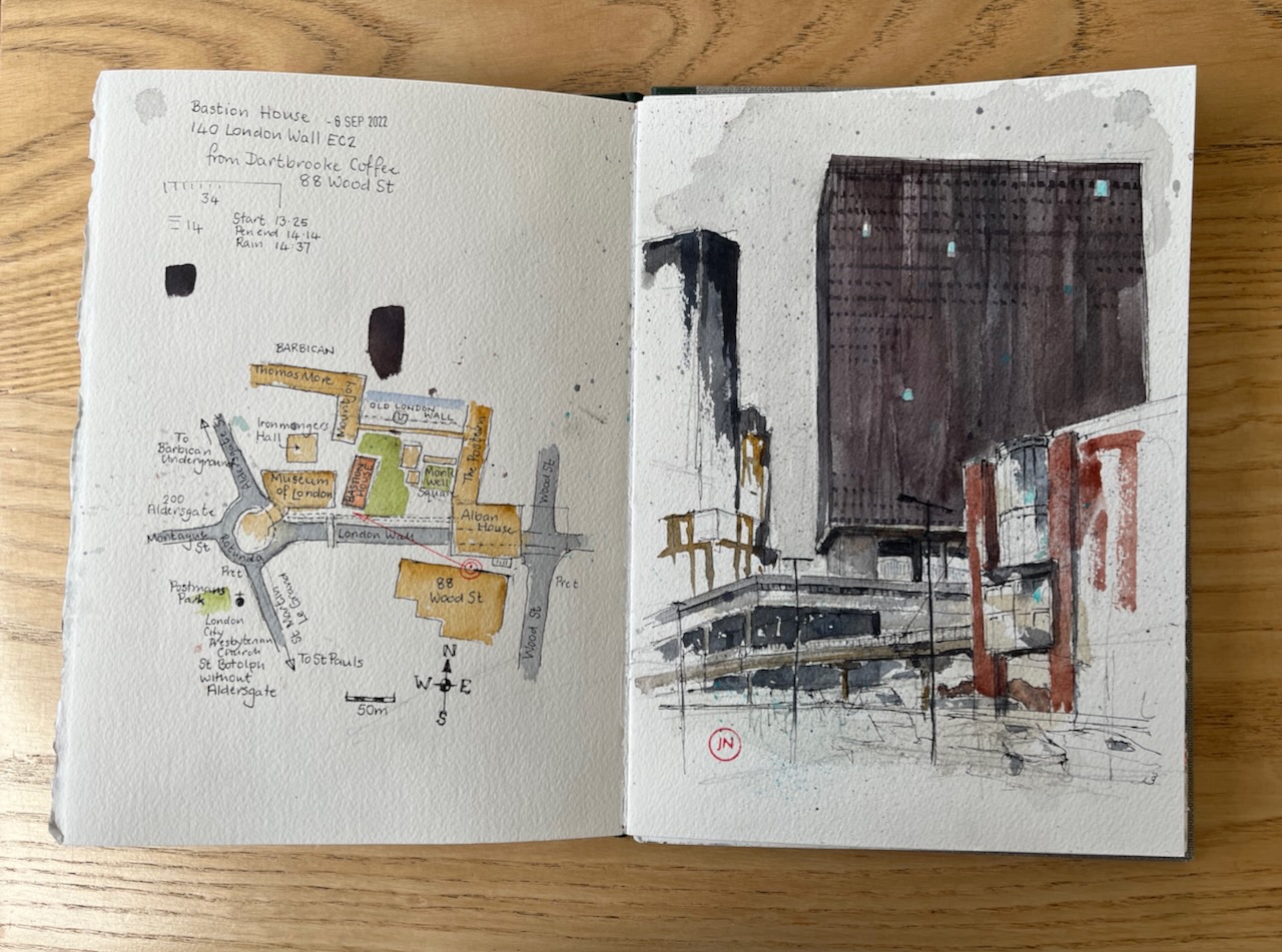
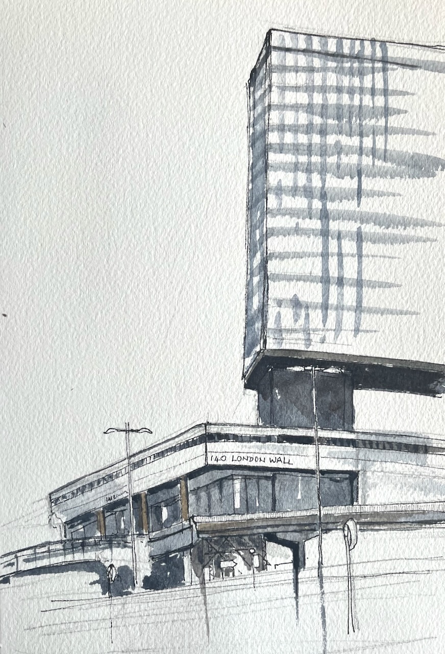
I sketched this from the outside tables at 88 Wood Street. A small coffee shop run by Dartbrooke Coffee has opened in this office block. The coffee was superb, the welcome warm, and they had a selection of food. Also they had tables both indoors and out. Here’s the view from an outdoor table overlooking London Wall.
Bastion House EC2 from 88 Wood Street, 6th September 2022 in Sketchbook 12
I liked all the angles.
That’s rain you see in the sky. I had to pack up quickly as the rain came down.
Rain on the painting!
This picture took 1hour 10 minutes up to the point in the photo above when it started raining. Then another 20 minutes at my desk to finish off.
Here’s a map. The building on the left of my drawing is 200 Aldersgate, a huge office block.
Map showing where I was sketching and my viewpoint.
Bastion House is the monolith in the centre of the picture, with the Barbican Highwalks below leading to the Museum of London.
Bastion House, the Highwalks, and the Museum of London are all under threat of demolition by the City of London and replacement with three huge office blocks, overshadowing the Barbican. All the bridges will be removed, and all the highwalks in this area. This is not a good idea, in my view, and I support the residents’ call to the City to stop and think. Do we need yet more huge office blocks…really? Can we not refurbish the existing buildings, as has happened successfully to nearby blocks?
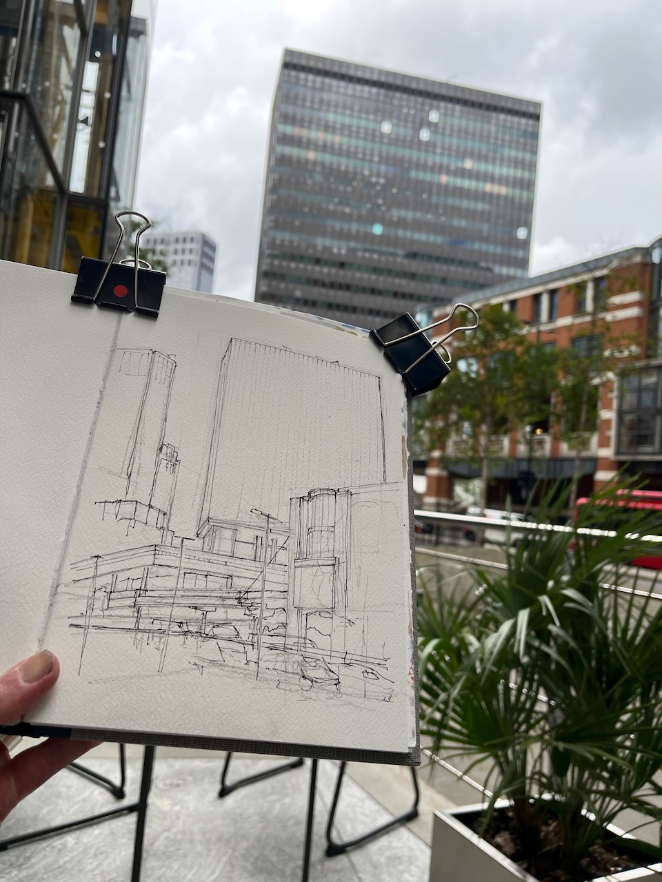
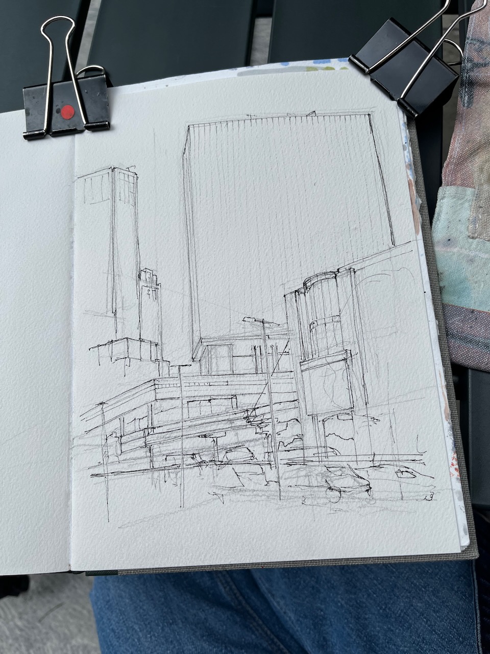
Earlier this month, I made a quick sketch of Bastion House, from London Wall. Here’s a map: The architect was Philip Powell of Powell and Moya. The building…
Bastion House aka 140 London Wall is a huge modernist monolith, reminiscent of the monolith in “2001 – A Space Odyssey”. I couldn’t find a site to draw…
I hastened to draw the magnificent Bastion House, on London Wall. It is due for demolition. In the foreground you see the balcony and privacy screen of the…
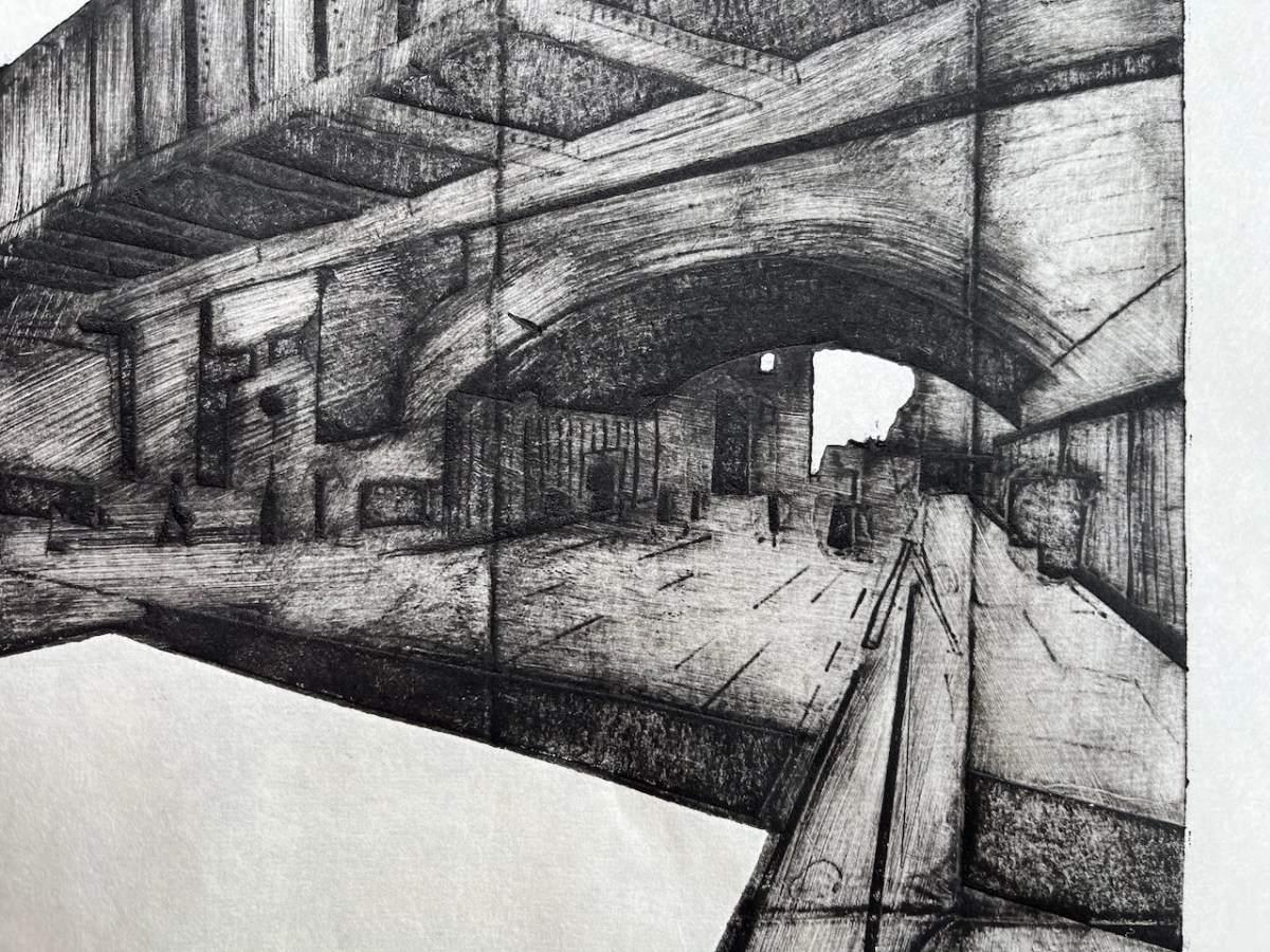
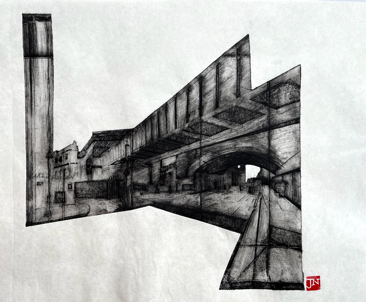
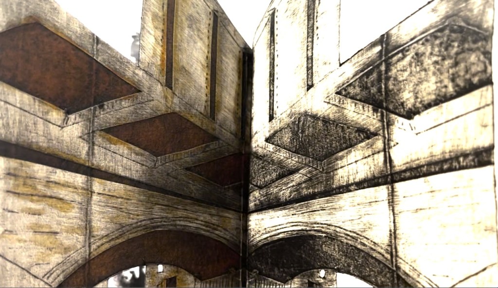
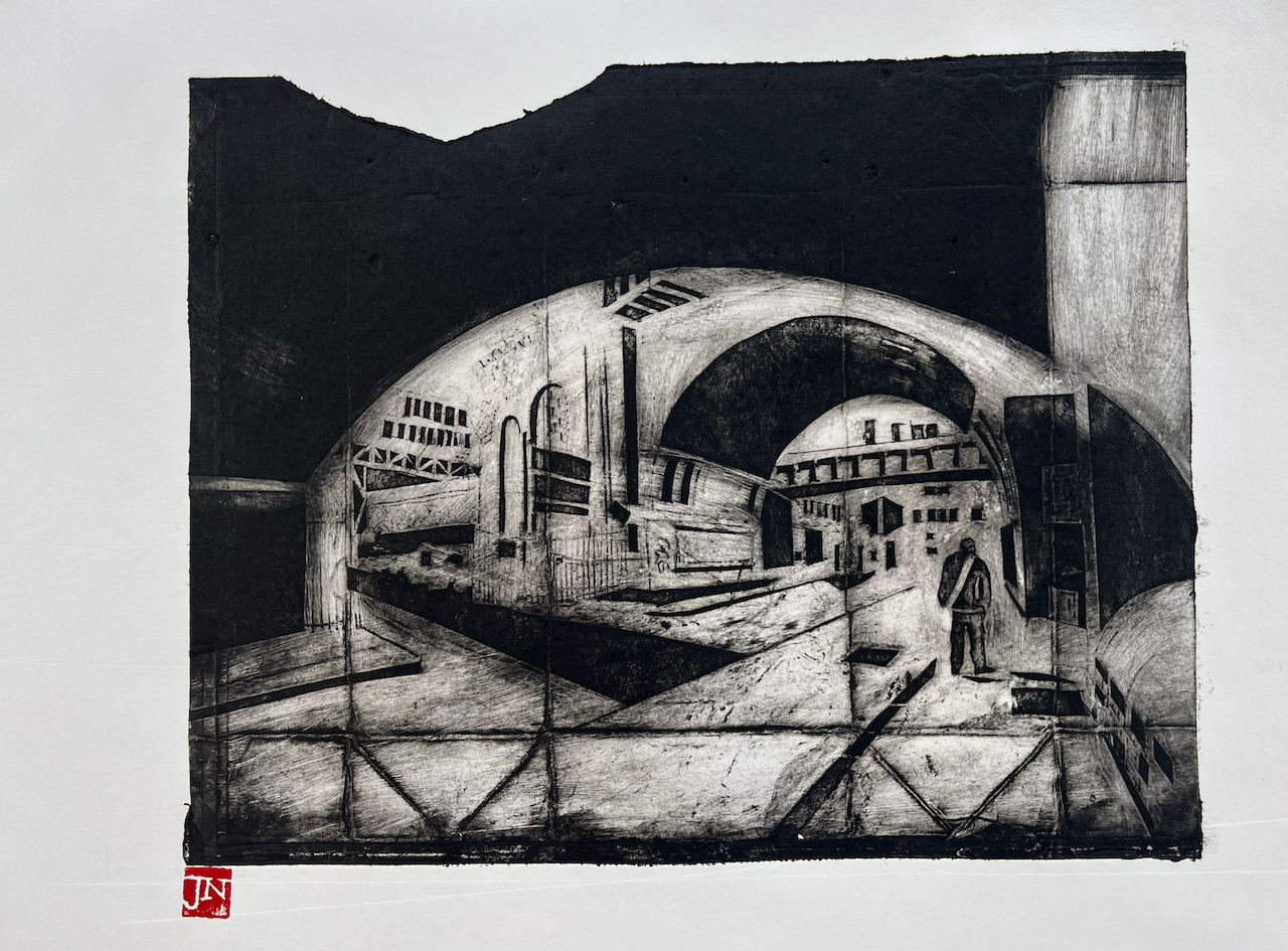
Here is another packaging print. This one shows Bridge ELR-XTD Structure 20 on Cornwall Road (N) between Charing Cross and Waterloo East, South East London. The road that leads off to the left is Sandell Street SE1. The road under the bridge is Cornwall Road.
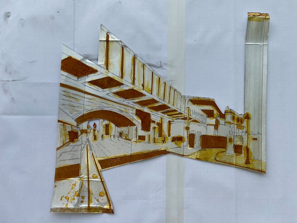
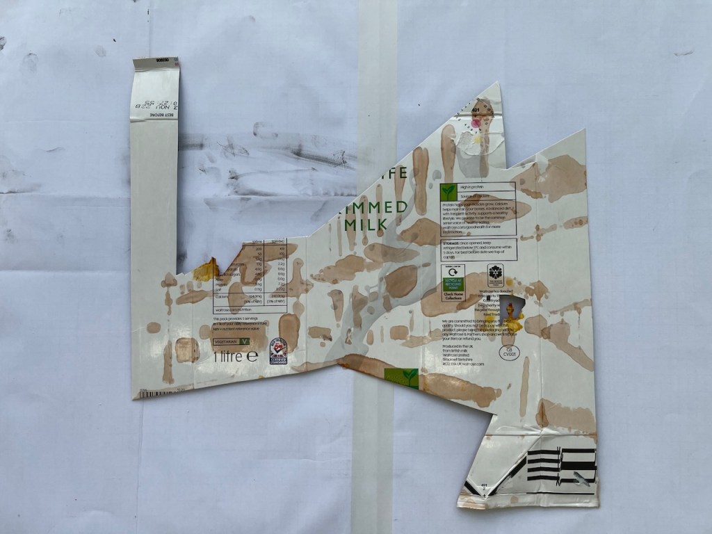
The print is made using the intaglio process. The plate is a milk carton.
Railway bridge on Cornwall Road, SE1, Packaging print made on 3rd September 2022, about A3 size
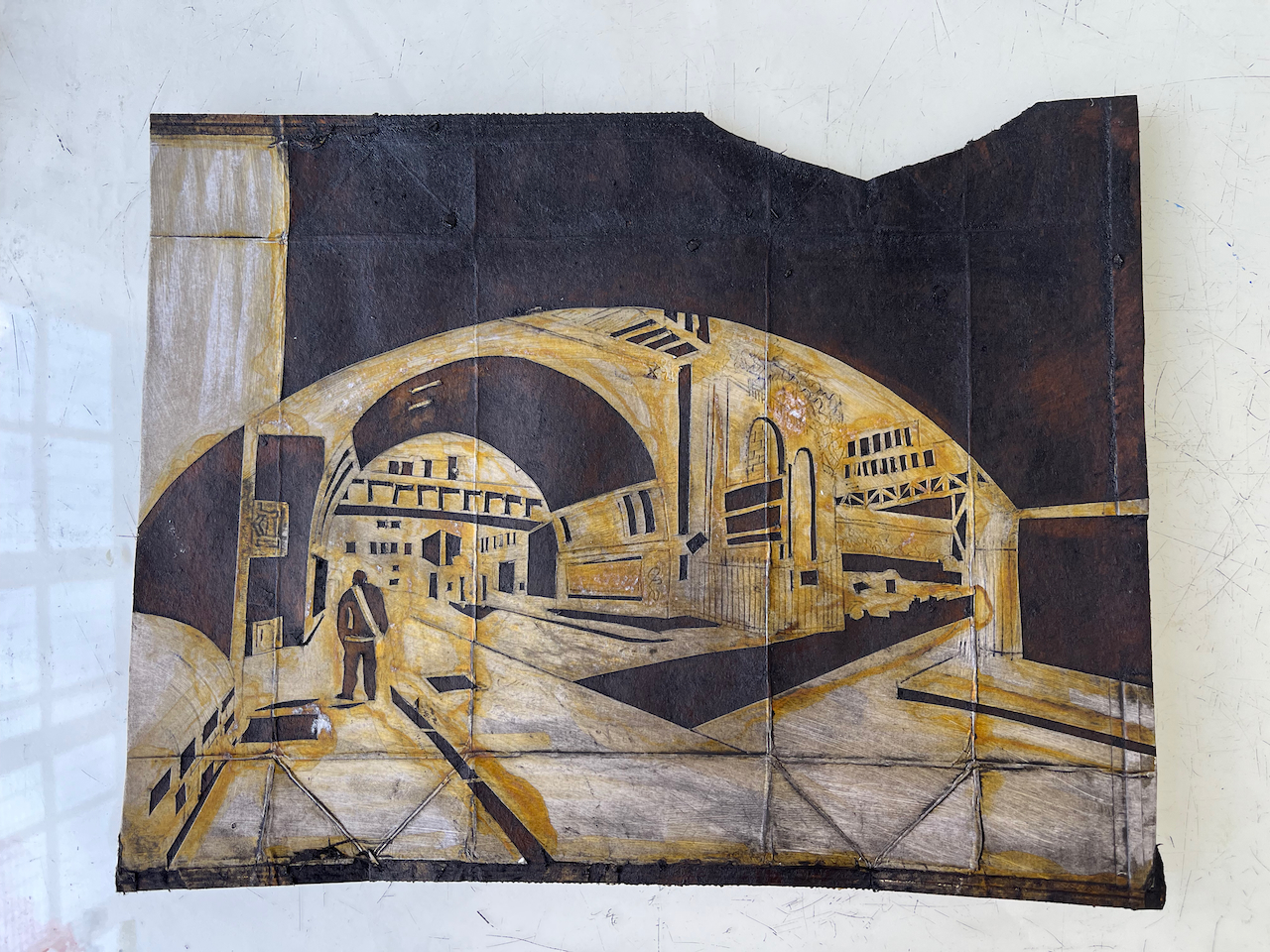
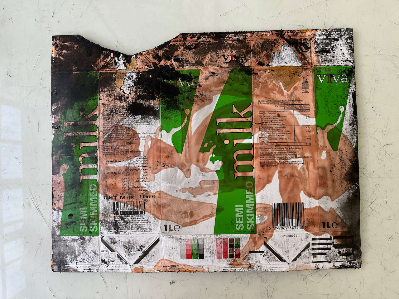
Here is the plate, front and back:
Plate: print sidePlate: back
The plate is made by peeling away the metallic substance inside the milk carton, then painting it with shellac to make it stronger. I describe the process in this post.
I used traditional etching ink, “Shop mix – Bone Black” from Intaglio Printmaker, whose shop, as it happens, is not far from this railway bridge.
Here’s a video of the print being peeled away:
Here is the print and the plate:
Plate (left) and print (right)
Print (left) and plate (right)
The plate made 8 prints.
Here is detail of the print:
For more of my prints made with packaging material, click on this link:
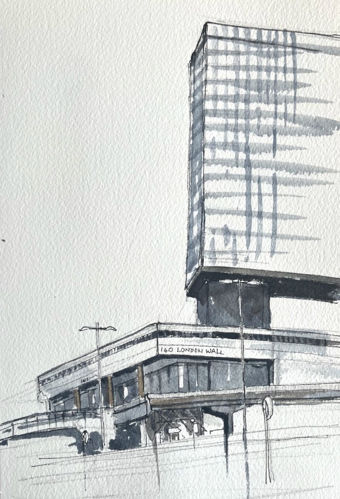
Earlier this month, I made a quick sketch of Bastion House, from London Wall.
140 London Wall, Bastion House, sketched 2nd August 2022 from London Wall, in sketchbook 12
Here’s a map:
The architect was Philip Powell of Powell and Moya. The building was completed in 1976. I like this building. It reminds me of the “obelisk” in the film “2001 – A Space Odessey”.
The City of London have the idea that they are going to demolish this building, and the Museum of London next to it, and build three large office blocks: bigger and wider than the existing buildings, providing some 750sq ft of commercial office space.
This mystifies many of us, as we witness empty office blocks all around this location. It also angers us, as such huge buildings will take sun from the residential estate to the North. There seems to be a case for pausing the proposed project, and considering renovation of the existing buildings. Renovation would be better from a carbon emissions point of view, as demolition and construction are a large source of carbon dioxide emissions.
I hastened to draw the magnificent Bastion House, on London Wall. It is due for demolition. In the foreground you see the balcony and privacy screen of the flat in Andrewes, whose leaseholder had kindly hosted me. The line of red brick, and what looks like chimneys, in the foreground are the rooftops of a part of the Barbican, “The Postern”. Behind them is the Barber-Surgeons’ Hall on Monkwell Square,…
Bastion House aka 140 London Wall is a huge modernist monolith, reminiscent of the monolith in “2001 – A Space Odyssey”. I couldn’t find a site to draw the monolith part today, so here is a view at Podium Level, looking West towards the Museum of London. You see the dark undercroft, walkways and a road to a car park. Also you see the bridge that crosses London Wall. http://postwarbuildings.com…
I am sketching the views out of the window. Just visible over the top of Bastion House is the top of “OneBlackfriars”. In the foreground: Mountjoy House, Barbican, on the right. Along the bottom is the Barbican Highwalk which joins Mountjoy House and Wallside. I have drawn Bastion House before: This drawing took rather a long time as I stopped a couple of times. As a result, by the time…
Today Urban Sketchers London held a “sketch crawl” in the Barbican. So I joined them. An astonishing number and diversity of people assembled inside the entrance of the Barbican Centre at the appointed time of 11am. I counted about 35 and then another dozen or so joined. All shapes and sizes of people, tall, short, studious-looking or flamboyant, quiet or talkative, smart or windblown, old or young, all were there.…
From the highwalk on the Rotunda there is a really amazing view of the Museum of London and Bastion House. This whole view going to change radically, if the City of London plans are approved. The Museum of London is in the South West corner of the Barbican. It was designed by Philip Powell and Hidalgo Moya. The Museum opened in 1976. The City of London plan to close it…
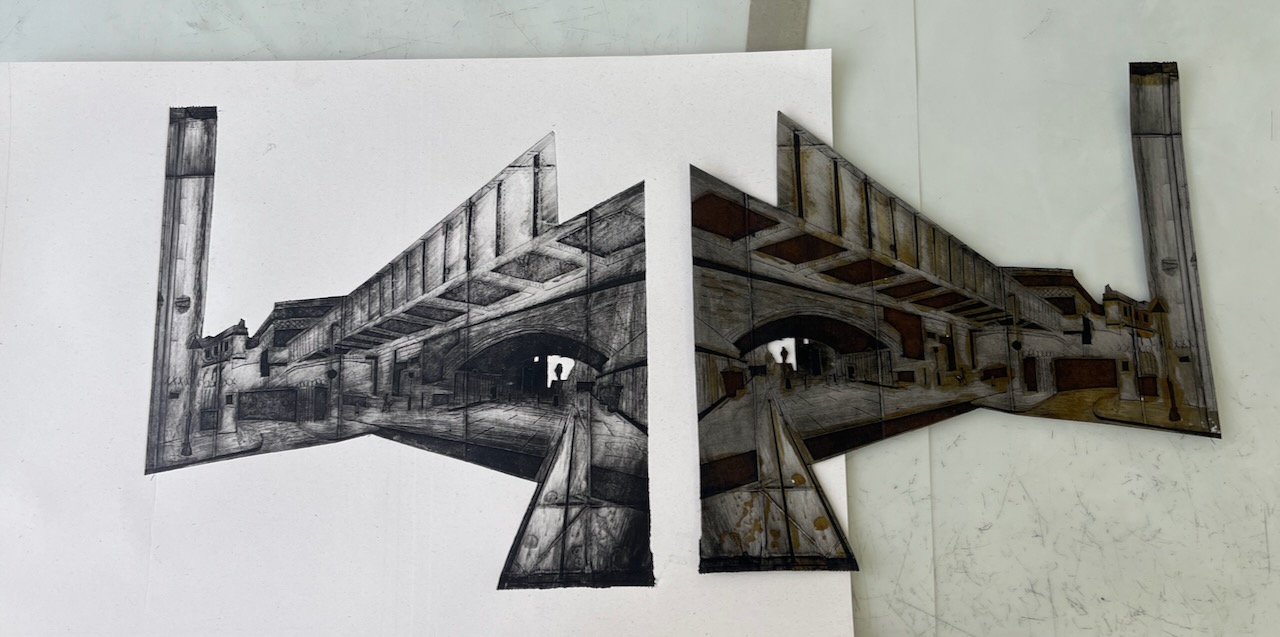
Huge brick arches carry the railway lines into Waterloo Station. Here is a view looking North up Great Suffolk Street.
Great Suffolk Street railway arch, monoprint #3 of 6. Printed image size 12″ x 9″. On Fabriano Unica paper, 20″ x14″
This is a packaging monoprint. It is an intaglio print from a “plate” made from a milk carton. Here is the plate:
Inked plate (front)Inked plate (back)
I’ve described the process in this blog post: Print plates made of packaging. The basic method is to use the shiny metallic surface inside the carton. I cut out the shapes I want and peel back the shiny surface to reveal a rougher surface which takes the ink. The yellow colour you see on the plate is shellac, a varnish that I paint on to make the plate last a little longer.
The plates are quite fragile, and can only make a limited number of prints. Here is number 6:
Great Suffolk Street railway arch, monoprint #6 of 6. Printed image size 12″ x 9″. On Agawami Washi Kitakata Japanese paper, 20″ x1 4″
I made all the prints on the Henderson press at East London Printmakers, Stepney. I used Chabonnel F66 traditional oil-based etching ink.
Click a button below to share this post online, email it, or print it:
Norwich describes itself as “A Fine City”. Indeed it is. The city centre streets are clean, car-free, and lined with a huge variety of shops, restaurants, and service providers such as key-cutters and barbers. All very interesting. And there’s a lovely river too.
The City of Norwich website tells me: “On 17 July 1967, London Street became the first shopping street in the UK to be pedestrianised. It started a revolution that saw people given priority over traffic in city centres.”
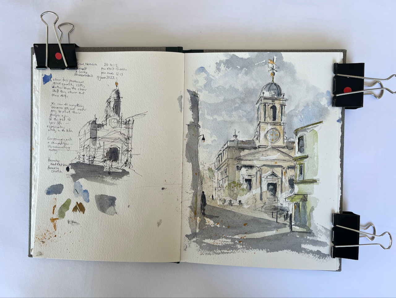
This building stands in London Street, at the junction with St Andrews Hill. It was designed by FCR Palmer for the National Provincial Bank, and was completed in 1925 [1]. The National Provincial became NatWest after a series of mergers and takeovers. NatWest moved out in 2017.
“Cosy Club” 45-51 London St, Norwich NR2 1AG, 19th June 2022 12:15, in Sketchbook 12
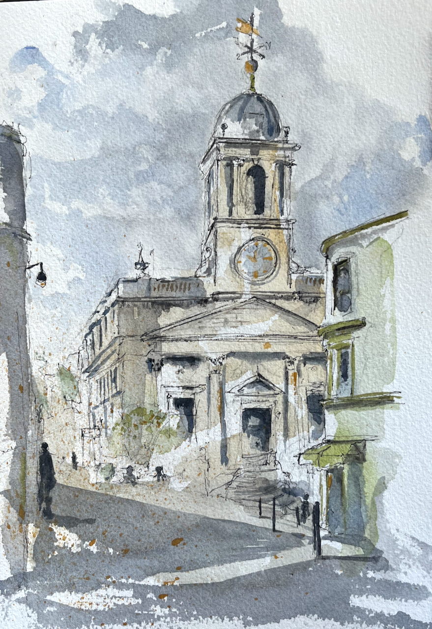
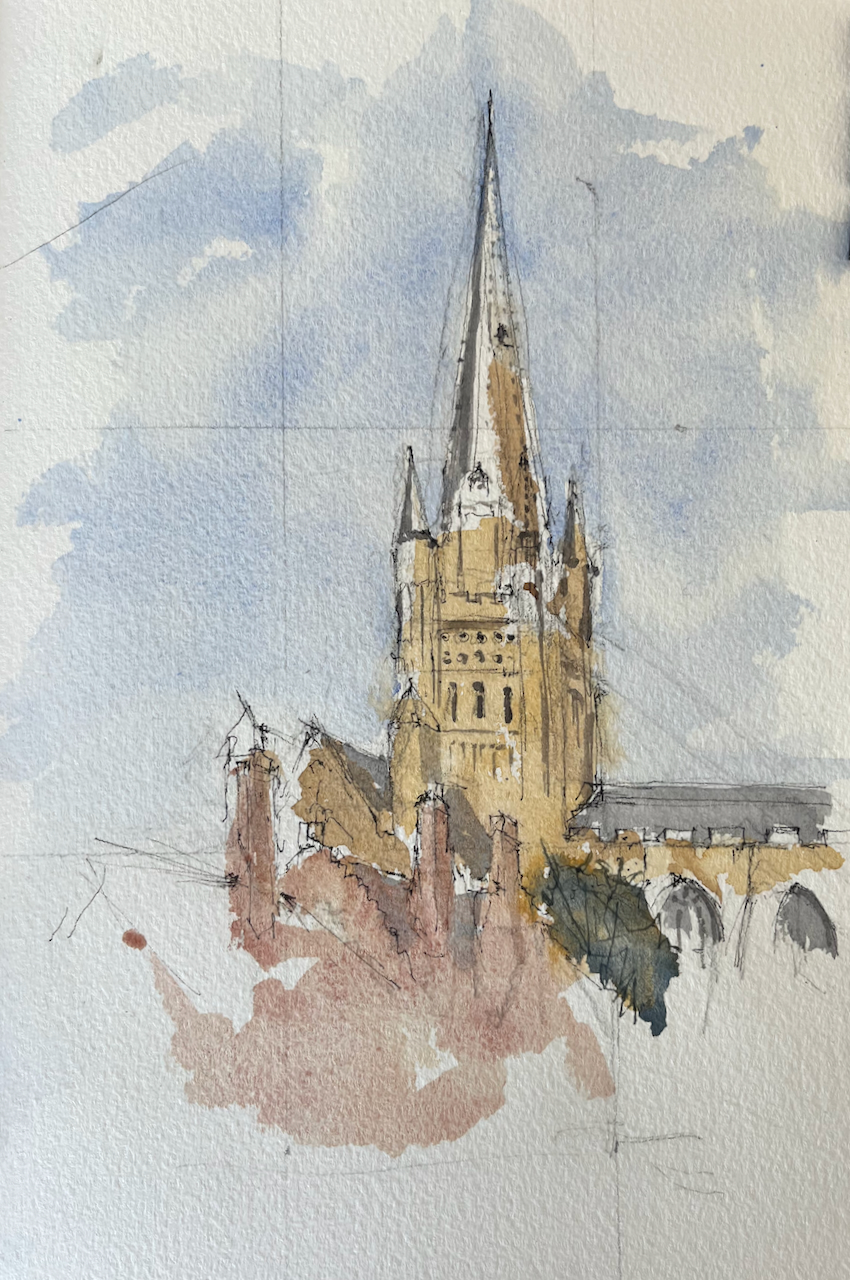
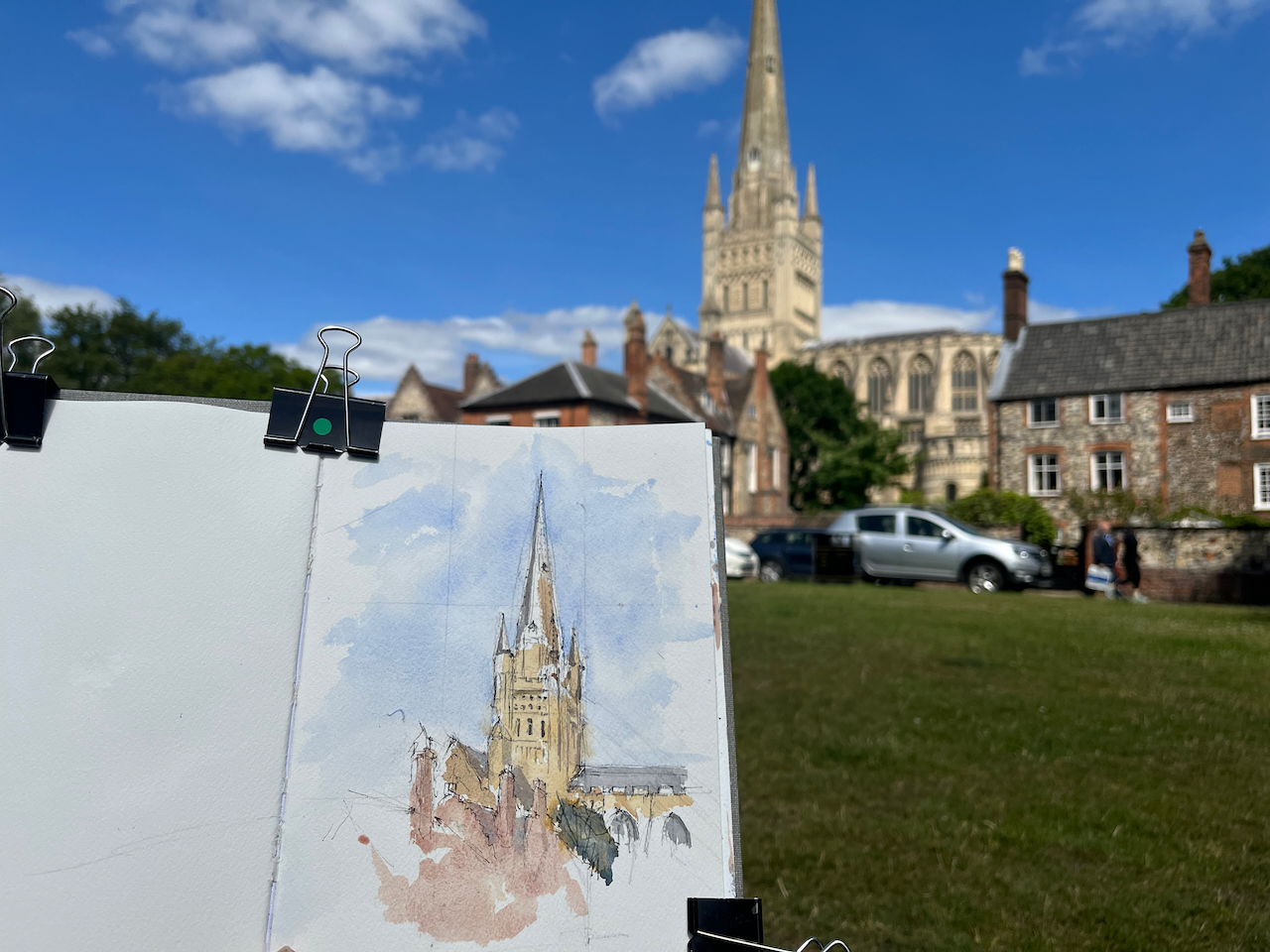
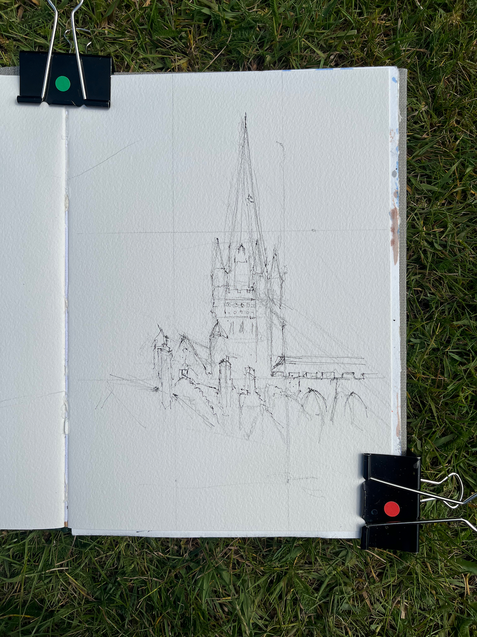
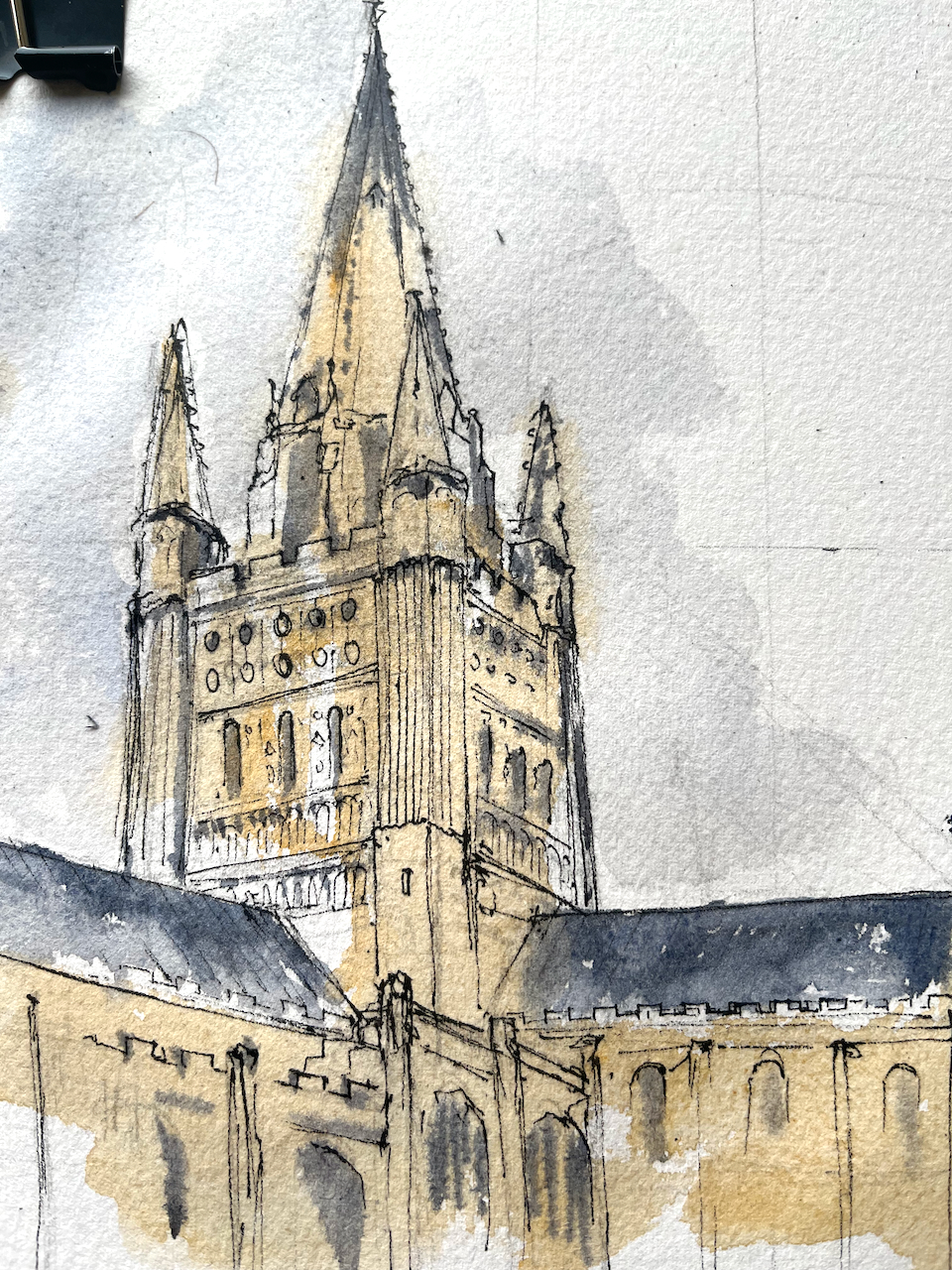
I also sketched Norwich Cathedral, from the Cathedral Close.
Norwich Cathedral from the Cathedral Close 40min sketch, 11:15 19th June 2022, Sketchbook 12
Certainly a fine city, and one to which I hope to return.
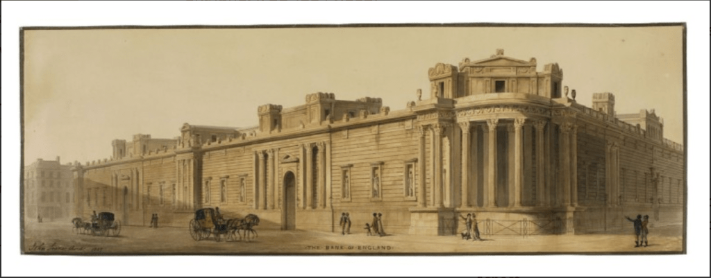
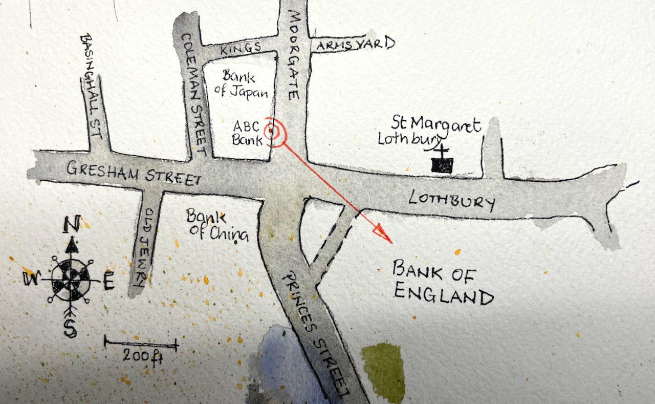
I took advantage of the road closures for the Queen’s Platinum Jubilee to sketch this corner of the Bank of England.
Bank of England – Tivoli Corner, 2nd June 2022, in Sketchbook 12
Temple of Vesta, Tivoli, modern photo from Wikipedia Commons on this link
This is the North-West corner of the Bank of England. The perimeter wall was designed by John Soane in 1805. The design of the corner was inspired by the Temple of Vesta at Tivoli.
The John Soane museum has a marvellous digital archive with detailed notes on his work on the Bank of England. John Soane was surveyor to the Bank of England for 45 years, from 1788 to 1833. During that time the role of the Bank of England changed from a small bank helping out the government with the national debt, to a significant national institution, printing money and managing Income Tax. The Soane museum archive notes:
Since its foundation in 1694, the Bank of England had financed Britain’s wars and managed the national debt. War, therefore, resulted in more business for the Bank, demanding extensive alterations and additions. Soane’s vast building work was largely the result of the French Revolutionary and Napoleonic Wars that lasted from 1793 to 1815. More space was required as the staff doubled during this time and the bank note printing process was carried out on site. In addition, new offices were required as the Bank’s responsibilities and roles changed, such as a place for managing the newly instituted Income Tax of 1799.
John Soane’s 3-storey building was demolished to make way for a new 7-storey building constructed 1925-39 by Herbert Baker. Soane’s perimeter wall was retained, but everything else was replaced. It is Herbert Baker who is responsible for that dome in my drawing, and also for the marvellous walk-through passage at this corner. You can see the North side of the passage in my drawing. For more photos of this passage and a description, I recommend the wonderful “IanVisits” site. Ian visits Tivoli Corner on this link. Or go there! And look up.
I took advantage of the road closure to sketch standing in Moorgate.
As I sketched, people walked past either side of me, in extraordinary hats. Everyone was cheerful and the sun shone. I enjoyed chatting to the various people who stopped to examine my drawing or comment on the view.
Pen, before the colour went on
You see the traffic bollards in the drawing. Those were patiently removed by a security guard every time a police vehicle approached, and equally patiently replaced. This must have happened about six times in the hour and half I was there.
The John Soane archive notes on Tivoli corner are on this link. This site has some lively “work-in-progress” drawings of the construction of the Bank of England. Here is one. See how modern it looks! It was drawn in 1798, the same year that Nelson fought Napoleon in the Battle of the Nile.
Click a button below to share this post online, email it, or print it: