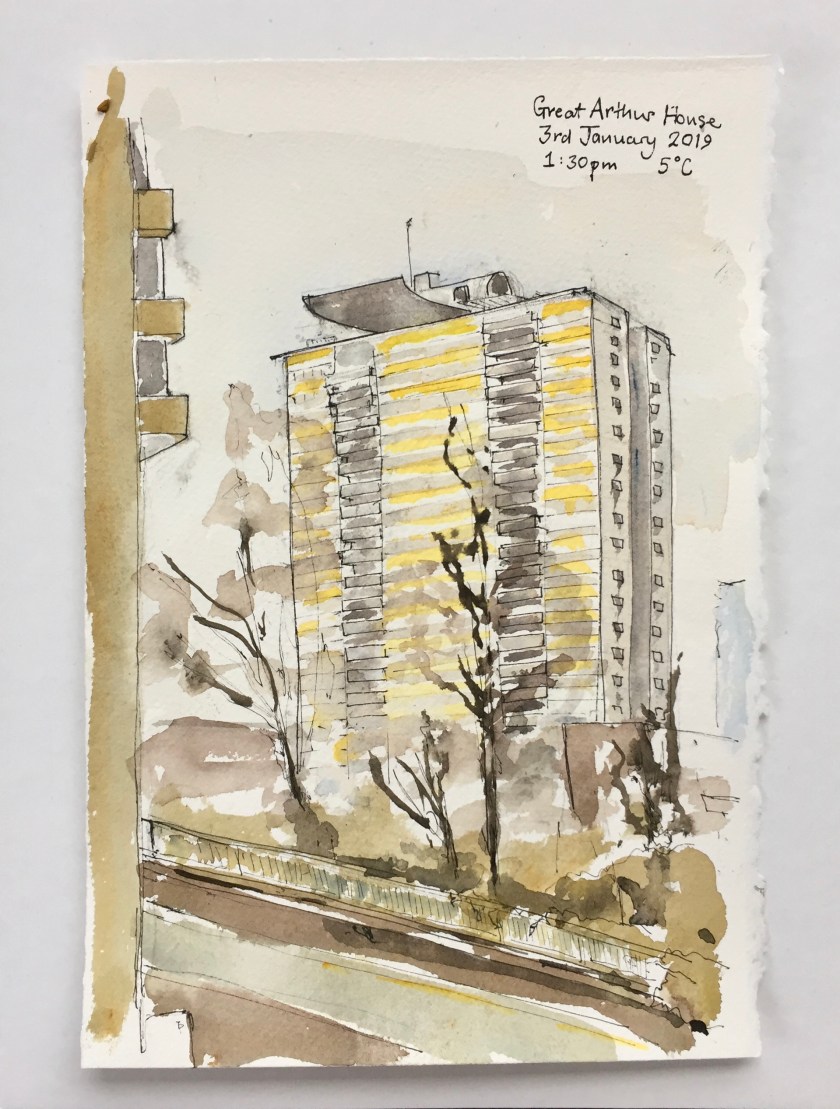
Here is Great Arthur House from the podium ramp near Blake Tower. You can see Blake Tower on the left. At the bottom of the picture is the ramp that goes down into the Car Park at Bunyan Court.
Several stories below me, at ground level, there was an assortment of discarded furniture and paint tins, and a huge skip full of Christmas Trees being collected for recycling.
It was really cold out there. I saw a black cat sliding in between the debris.
This picture done on Fabriano Artistico loose sheet, 8inches by 10 inches. About an hour, on location.
Click a button below to share this post online, email it, or print it:
Captain Horatio Nelson, painted by John Francis Rigaud in 1781, with Fort San Juan in the background.
For our Boxing Day walk, John researched places in London associated with Vice-Admiral Horatio Nelson (29 September 1758 – 21 October 1805).
First we saw some houses of the period, and then went to the various places that Nelson lived or visited in London. My mission was to draw very quick pictures. We had a lot of places to visit, and I didn’t want to hold up the expedition. Here are my sketches, in the order of our visits.
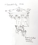
11 Cavendish Square, a Georgian House of the period
Stratford House built 1771-6, another example of a Georgian House of the period
103New Bond Street. Nelson lived here in 1798
147 New Bond Street. Nelson lived here later.
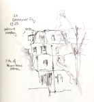
22 Grosvenor Square. Lord and Lady Hamilton lived in a house on this site.
A window in 37 Dover Street, opposite Nelson’s House
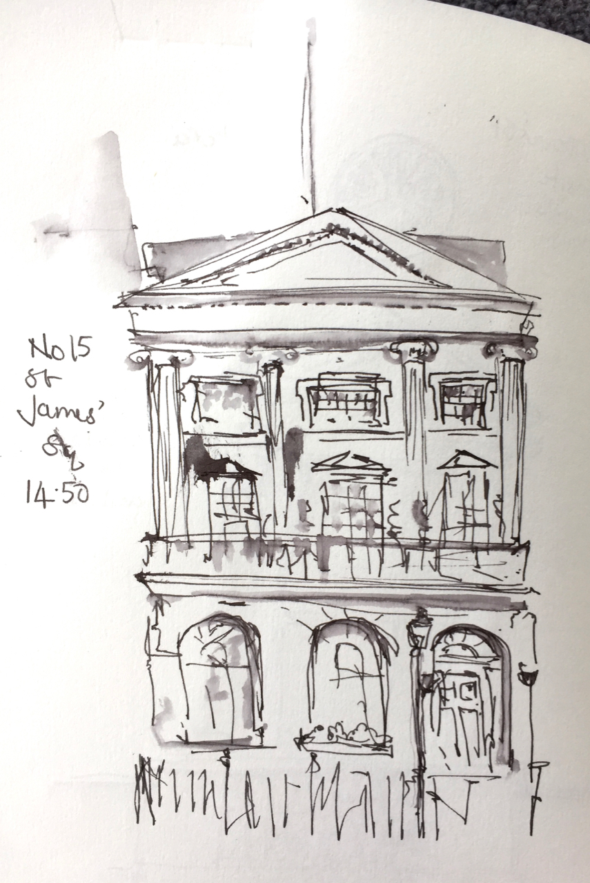
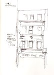
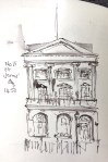
Number 15 St Jame’ Square, a “pure Palladian mansion” of the period.
We saw and named architectural details. On 11 Cavendish Square we noted the “blocked vermiculated columns”
“Vermiculated” means wormlike. It’s a really useful adjective. “I found it impossible to follow his vermiculated arguments.” ” After navigating the vermiculated back alleys, we emerged at last onto the main square.”
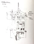
We saw ionic columns on Stratford House. These are the ones with scrolls at the top. Above the columns is the “metope” or frieze. On this there were “bucrania” which are bulls skulls.
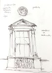
An “aedicule” is a house shape with columns each side. At 37 Dover Street we saw a window in an aedicule.
A window in 37 Dover Street, opposite Nelson’s House
Here is our route:
It took us 5 hours and was 14km.
After the Georgian London visits in the West End, we walked to Trafalgar Square to see Nelson’s Column, and then along the Strand, where we saw the site of a silversmith he visited. Nelson went along the Strand in his carriage to receive his “Freedom of the City of London”. At Temple, the cheering crowds unhitched his horses and hauled his carriage themselves.
We arrived at St Paul’s Cathedral, where Nelson is interred.
I used Organics Studio arsenic gray ink, and a Lamy Safari pen with fine nib, from The Writing Desk. The book is a sketchbook from Seawhite of Brighton.
Ink: it’s not waterproof. It does not contain arsenic.
Lamy Safari pen.
Seawhite of Brighton sketchbook
Sketchbook: hardbook.
Click a button below to share this post online, email it, or print it:
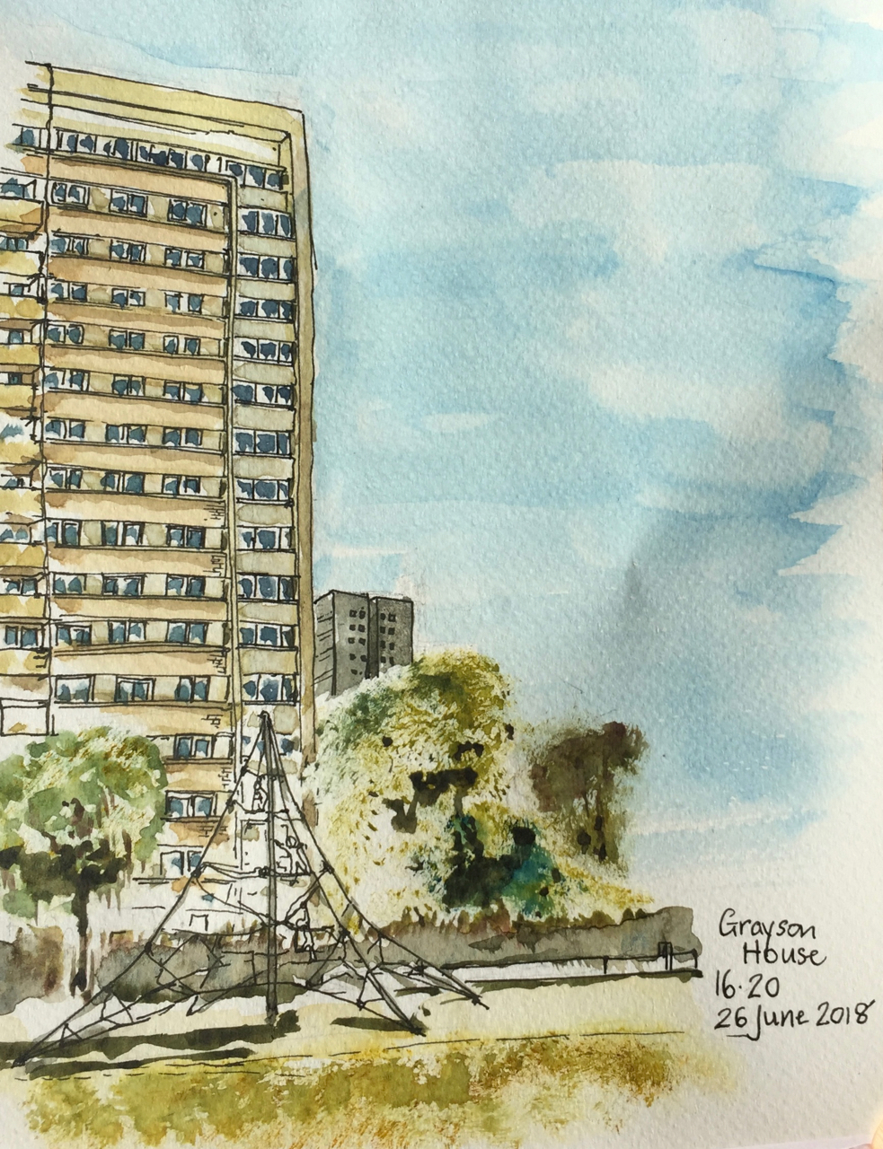
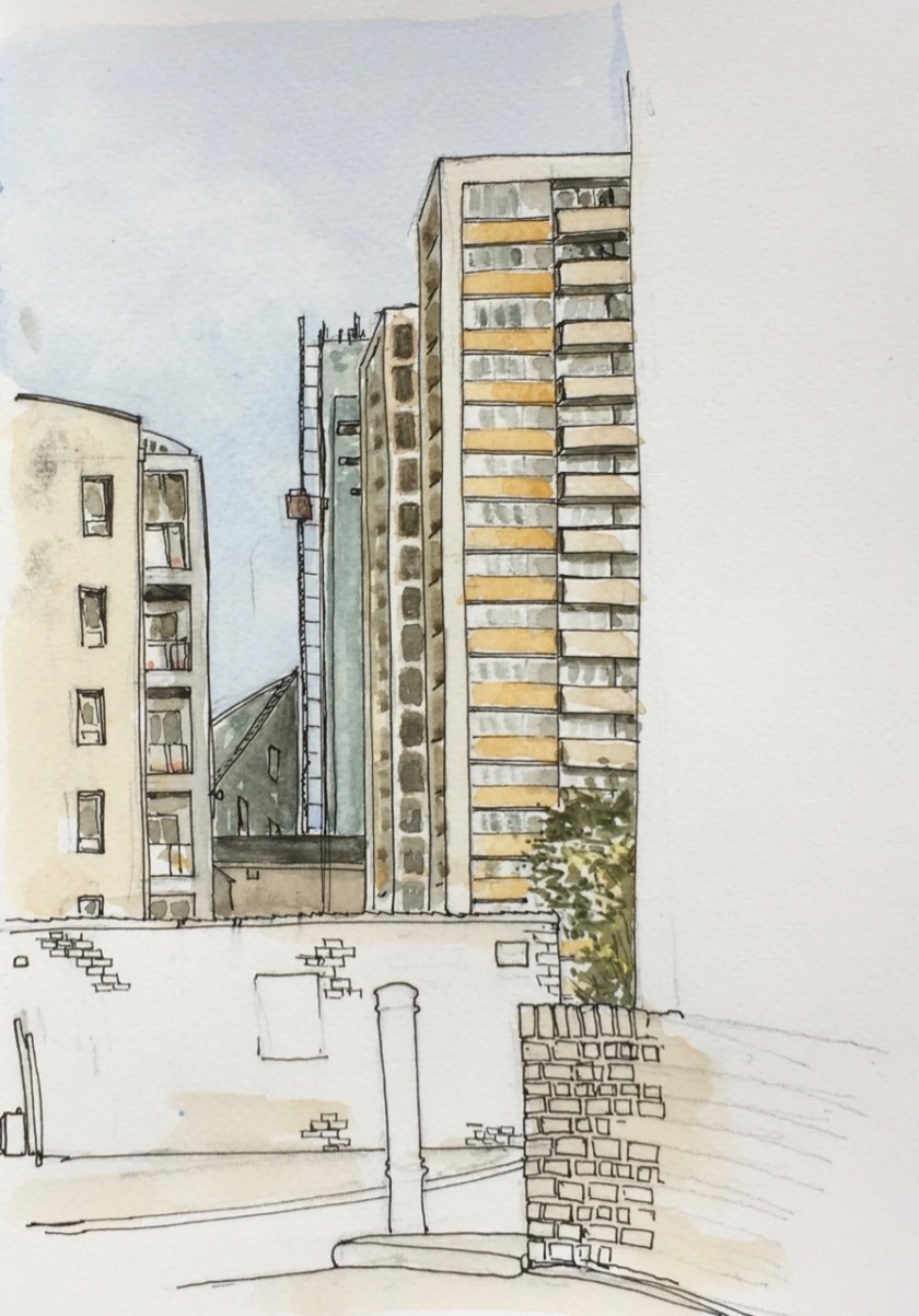
Galway House is one of the two Towers on the Pleydall Estate just North of Old Street. The other tower is Grayson.
I drew this from behind Grayson House. There was a ferocious cold wind. I seemed to have picked the place where all the winds met. Here are maps showing the direction I was looking.
Here are the blocks in the picture. It almost looks as though the Atlas Building continues the march of these majestic 1960s blocks. But it doesn’t, not really.
In the drawing you can see the scaffolding on the Atlas Building, and the external lift that was going up and down as I was drawing.
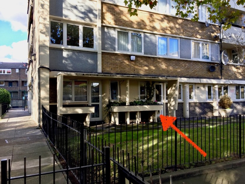
I was interested to see that the inhabitants of Galway Tower made use of their flower beds.
Raised flower beds in Galway House, South side.
I’ve seen the same arrangement of raised flower beds next to the flats in Rahere House, where the beds were more exposed, and not used.
This whole area underwent huge changes in the twentieth century, although the street layout is unchanged.
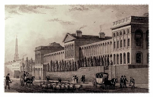
From 1751, on Old Street, there was a huge hospital for the mentally ill: St Luke’s Hospital for Lunatics.
St Luke’s Hospital for Lunatics on Old Street. The obelisk in St Luke’s Gardens is in the background. Image credit: Wikipedia
This hospital was closed in 1916 and the residents moved out. The building was acquired by the Bank of England and used for printing bank notes.
Bank of England Printing Works on Old Street, 1925, image credit: Bank of England Museum.
You see Galway Street on the crease of the map, in the centre about a quarter of the way down. Below it, to the right is the “Bank Printing Works”.
In 1959 the London County Council sought to purchase the Printing Works site and use it as an annexe to Covent Garden. This was opposed by Michael Cliffe, MP for Finsbury and Shoreditch, on the grounds that it would create unacceptable traffic congestion, especially at the Old Street Roundabout.
Mr Cliffe is quoted in Hansard:
“…London County Council (General Powers) Bill, …. The Council, through the Bill, sought powers to acquire and redevelop St. Luke’s Printing Works as an annexe of Covent Garden Market….. I would ask the Minister what is the point of spending millions of pounds in trying to solve the problem of congestion in Central London if we are to convert the St. Luke’s Printing Works as an annexe to Covent Garden in an area where we know it must inevitably cause the kind of congestion that we are trying to avoid and which we are discussing every day. As the number of vehicles increases, further problems will have to be solved. Surely we do not want to create further difficulties after our experience gained in the past?” [Hansard: HC Deb 17 December 1959 vol 615 cc1738-47]
Mr Cliffe must have prevailed. I feel an affinity with him because earlier this week I drew Michael Cliffe House.
The Printing Works building was demolished in 1963. At around that time Finsbury Council was building council houses, including the 4 tower blocks in the area: Gambier House, Grayson House, Godfrey House and Galway House. So somehow the Council must have acquired the Print Works site. I can’t find the history online so I’m going to visit the London Metropolitan Archives and the Islington Museum.
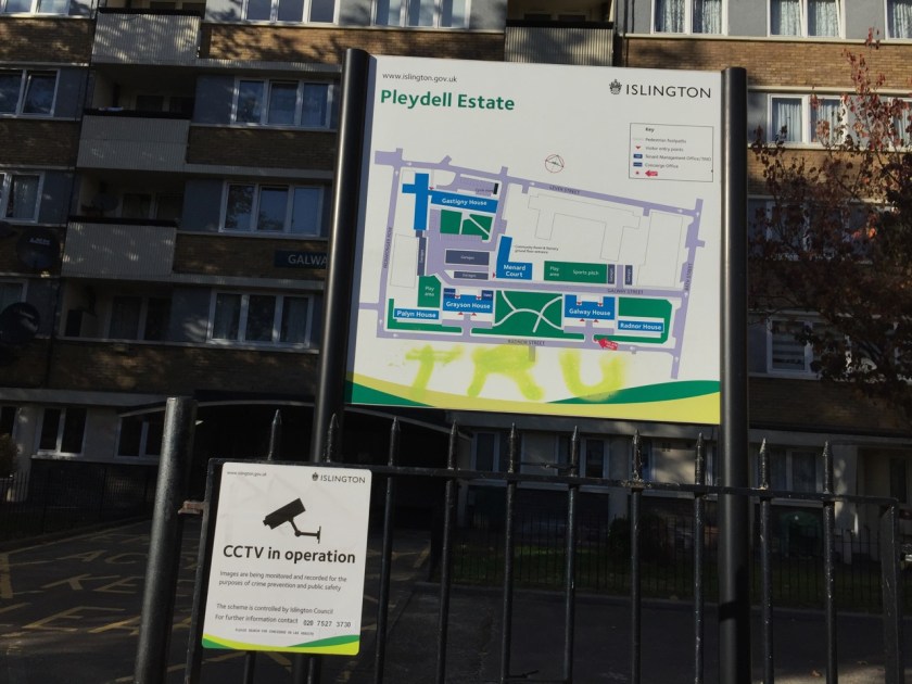
The Towers also were allocated to different Estates: Galway is in the “St Luke’s Estate” which includes the Printing works Site, Gambier is in the City Road Estate and Grayson and Galway are in the Pleydell Estate.
From “Streets with a story, The book of Islington” (1986) by Eric A Willats FLA I learn that: “Messrs. Emberton, Franck & Tardrew were the architects of Galway House (Pleydell Estate)”.
From a map sent to Mr I Agar in 2010 in response to a Freedom of Information request [FOI 340742.pdf]The Pleydell Estate, Galway House in the Background.
Click a button below to share this post online, email it, or print it:
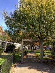
Here is Michael Cliffe House, in the Finsbury Estate, from Tysoe Street.
The lower level block in the low centre of the picture is Joseph Trotter Close, also part of the Finsbury Estate.
While I was drawing the picture a man came and told me that he had seen the original architect’s drawing of this low level block. In the architect’s vision it was “sleek and wonderful”. But the man said the reality was very different. The concrete had worn badly and the building had not succeeded, in his opinion.
Earlier a woman came when I was at the pen-and-ink stage. She said that her 11 year old grandson had started painting, which pleased her very much. She bought paints for him. I asked if she painted too. She said no, but she was inspired by her grandson and might now have a go herself. “After all,” she said, ” he just paints anything, and I could do that too!”. I agreed.
The drawing took two hours. After I finished I went to have a look at Joseph Trotter Close. I saw a low-level set of bungalows, all very much inhabited, with children’s play things and outdoor chairs on the lawn. It may not be sleek, but it looked as though people enjoyed living there.
The entrance to Michael Cliffe House was cramped and congested, with cars manoeuvring awkwardly and a dark, obscured, entrance. Lovely typeface though.
Joseph Trotter Close on the left
Entrance to Michael Cliffe House
Entrance to Michael Cliffe House
The real surprise was inside the entrance. There, uncelebrated in the underpass, were some amazing mosaics of dancers.
Michael Cliffe (1903-1964) was a Labour councillor for Finsbury, Mayor of Finsbury (1956-7), and an active Labour MP (1958-64).
The Finsbury Estate was built by Finsbury Borough Council in 1965. The architects were Emberton, Franck & Tardrew. Finsbury Borough council was absorbed by Islington.
Later note (7th Feb 2019): There is detailed information on the Finsbury Estate on “British History online” – try this link, which starts with a history of Spa Green, and goes on to describe the Finsbury Estate.
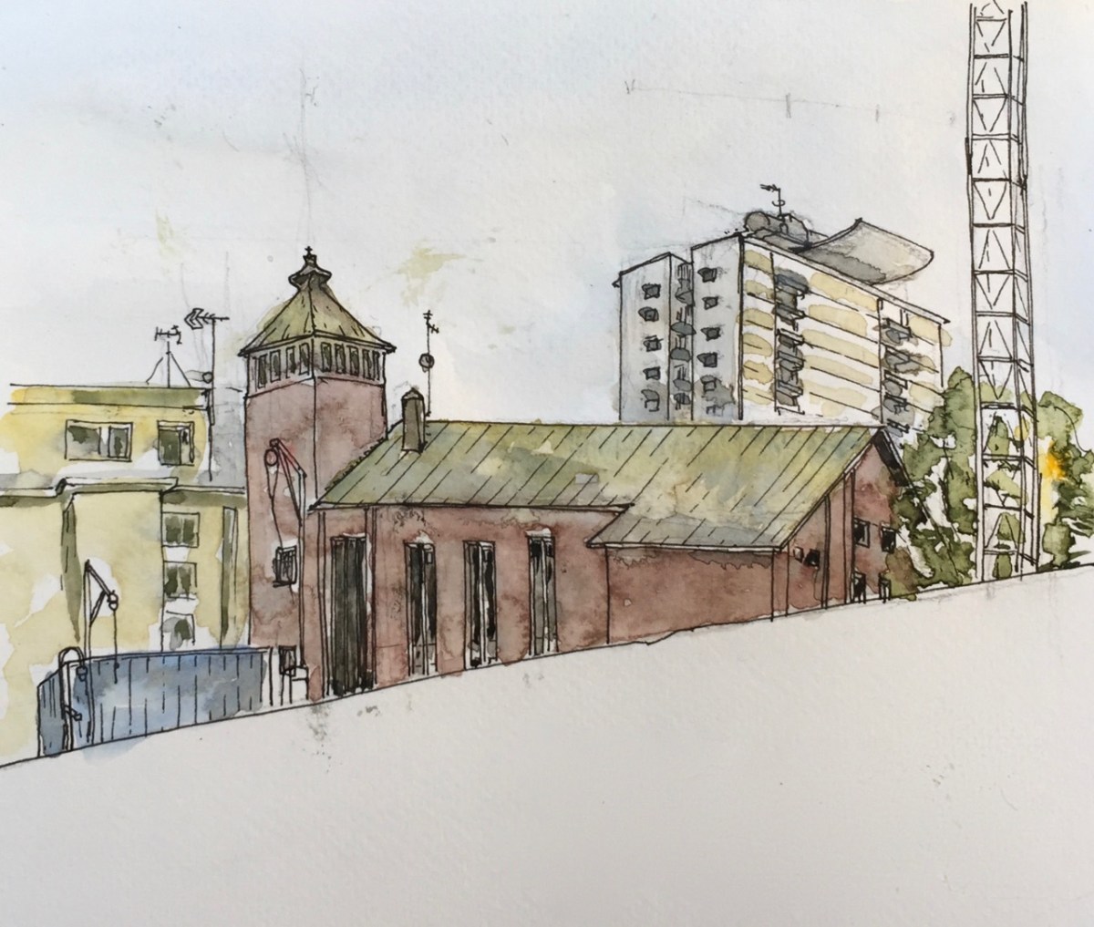
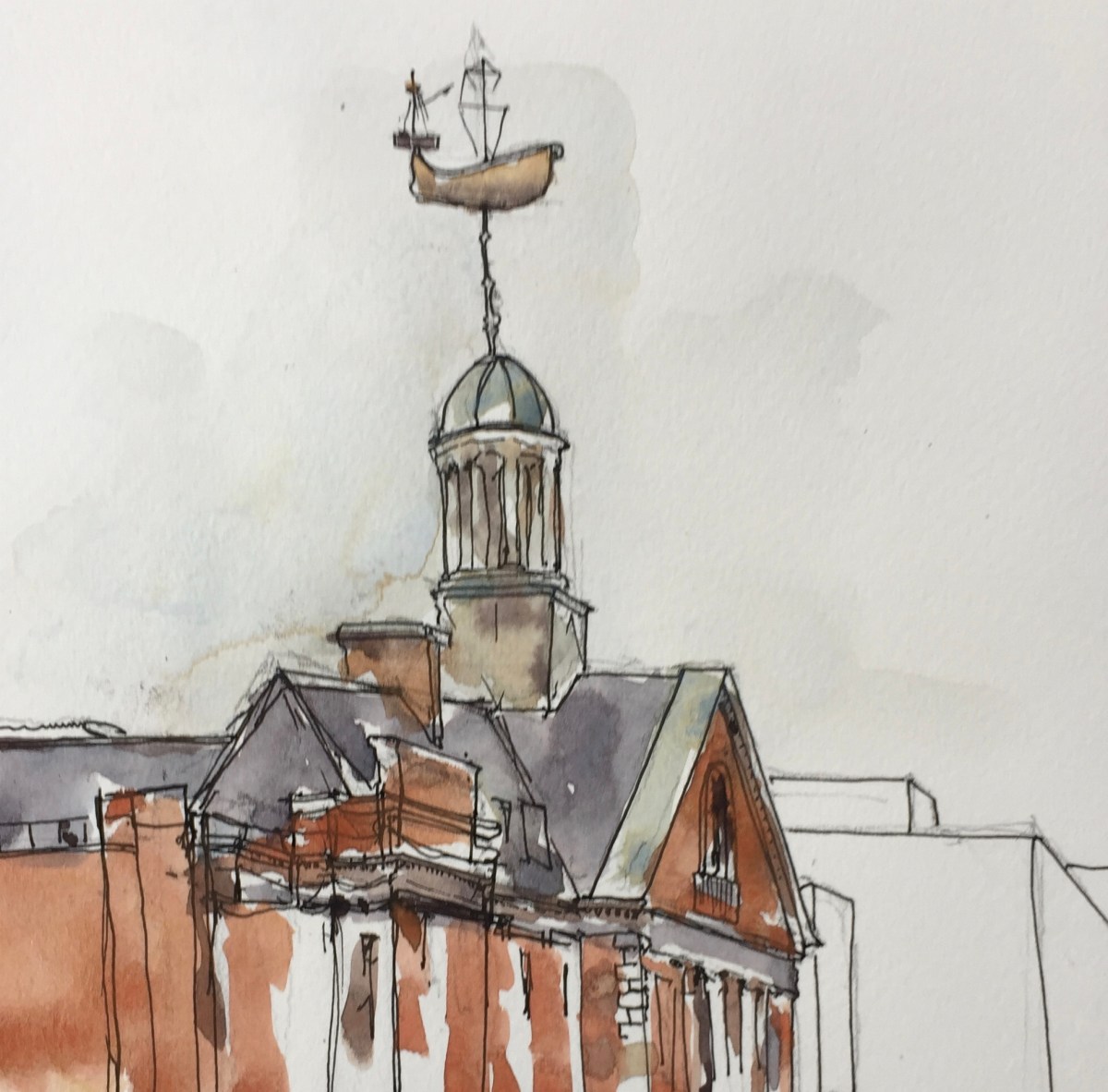
I cycled down Whiston Road last week and spotted this amazing boat, high up above the roofs. Today I returned to sketch it, and investigate further.
Whiston Road E2 is in Hackney, going off the Queensbridge Road.
I sketched outside Bryant Court. Then I went down “Swimmers Lane” and had a look at the back of the building. It’s a huge place. Clearly a former swimming pool, hence, presumably, Swimmers Lane.
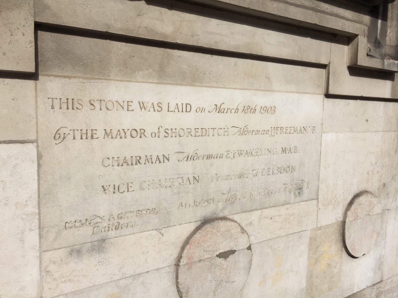
On the front is the Foundation stone, laid in 1903.
Foundation Stone (click to enlarge image)
There are also huge entrance doors labelled “MEN” and “WOMEN”.
The whole place is sadly neglected.
I went and looked at the ship from the other side.
Boat on Haggerston Baths, from the Queensbridge Road
While I was drawing, birds settled on the rigging.
At home, I found that this is “Haggeston Baths”. It closed in 2000, due to underfunding and neglect. Many were sad and they protested. In November 2017 Hackney Council accepted a proposal to redevelop the building. But it will not be a pool any more. Here is the Mayor of Hackney, Philip Glanville, writing on the Hackney website November 28th 2017:
“Hackney Council has chosen a preferred bidder to refurbish and redevelop the Haggerston Baths building. The agreement to lease will allow Castleforge Partners to apply for listed building consent and planning permission for a scheme to incorporate space for businesses, shops and a café, as well as community uses such as a clinic, health centre, day care centre or public hall.”
Mr Glanville continues:
“I know that local residents were keen to restore the swimming pool, so the council spent the best part of a year negotiating with a bidder whose proposals included a pool. As I said when we consulted on the shortlist, we could not get the reassurances we needed that the scheme with a pool would actually be delivered.”
He makes no mention of the boat. What will happen to it?
Stone, art, in Swimmers Lane
Someone found some money for strange stone artworks, clearly referencing the pool.
Both sketches done on location, the first one about an hour, the second one 35minutes.
Click a button below to share this post online, email it, or print it:
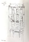
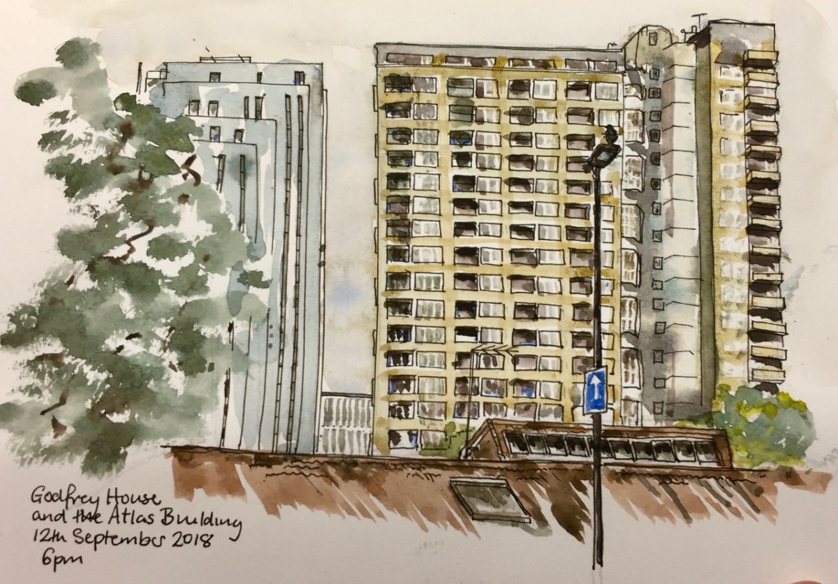
On the right is Godfrey House, Bath Street, Islington, part of the St Luke’s Estate managed by the London Borough of Islington. It’s former “council housing” built in 1965. Today many of the flats are privately owned, as is evident from the number listed for sale.
On the left is the Atlas Building, on City Road, nearing completion. Atlas is taller than Godfrey House, but further away. Atlas Building is 52 floors, of which 38 are residential, Godfrey House is 21 floors.
“Atlas epitomises luxury-living in an exciting and vibrant urban landscape. Standing tall with 38 residential floors of exquisite apartments, Atlas stretches across London’s prominent skyline” (from the Atlas Building website)
In the foreground is the roof of Saint Luke’s Church of England School.
I drew this picture sitting on a stone in Radnor Street Gardens, off Lizard Street. After a while I noticed that the place smelt of dog excrement. It has rained recently, after a dry spell.
At 6pm a personal training session started behind me. A large man was training a slim woman. They were doing kick-boxing. Between rounds, she told him about government procedures to find out about your earned income, and thus check your tax payments. They can access your bank accounts, she warned him. He laughed and said, “Hey, that’s not making me feel good. I thought you’d have some good news for me.”
“Tower Block UKis a project supported by the Heritage Lottery Fund, bringing together public engagement and an openly-licensed image archive in an attempt to emphasise the social and architectural importance of tower blocks, and to frame multi-storey social housing as a coherent and accessible nationwide heritage.”
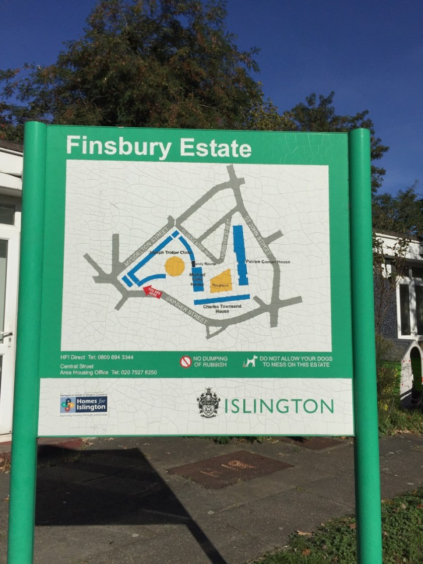
Here is a link to a Freedom of Information request which gives a very detailed map of the estates in Islington (2010): FOI request from Mr I Agar
Click a button below to share this post online, email it, or print it:
Here is the Welsh Jewin Church seen from Brackley Street.
This is one of those ephemeral views: a huge new building is about to go up behind the hoarding, and this view will be completely obscured.
The church is Eglwys Jewin, the Welsh Church. I have drawn it before, from Fortune Park. Here’s the link – Eglwys Jewin from Fortune Park
Map showing Golden Lane Estate. credit: Wikipedia.
In the background is Great Arthur House, on the Golden Lane Estate. This estate was designed by Chamberlain Powell and Bon, before they did the Barbican Estate.
As I was drawing, a man came and told me about Great Arthur Tower. It was the tallest residential building at the time of its completion (1957). At the top is that strange construction which I was told was described by the architects as a “brise de soleil”, a sun shade. Nicholas Pevsner, the architectural writer, was scathing about it, saying that there wasn’t much sun. However, as the man and I agreed, today was very sunny, and the sun shade was needed.
Great Arthur House has recently been refurbished.
“JRA has designed the new curtain walling to replace the original cladding, mirroring the bright yellow panels that have distinguished it since the 1950s. The Grade II listed residential tower had become environmentally inefficient in recent years leading to the residents’ discomfort due to water ingress, heat loss and condensation. Replacement curtain walls for the West and East elevations, double glazed timber balcony doors, external redecorations, localised external concrete repairs, and a cleaning and maintenance system for the new façade are also being provided to help revive the landmark building.” JRA website, 30th Sept 2016
And then insulation was removed after the Grenfell Tower fire. Here’s a cutting from CityMatters, the local paper:
As I was packing up a woman came and asked, “Can I be curious?” I said she could indeed, and showed her the picture, which she admired. She looked at other pictures in the book, including one of Peabody Tower. “I look at that, from my window”, she said, “I’d love to live there. I see a balcony with flowers….”. I said it was called Peabody Tower, and the other, similar one was St Mary’s Tower. “Oh! Are they Peabody buildings?” she asked. I said they were, part of the Banner Estate. She lives in Tudor Rose Court. This is the building on the left of the picture, in yellow brick. She’d just been to see a film. She found the ticket to show me the title. It was “Distant Voices, Still Lives”, about a family in Liverpool, she told me. She loves Liverpool.
This picture drawn and coloured on location, about 1 hour and 45 minutes.
Click a button below to share this post online, email it, or print it:
1 hr 40 mins from the small park called Radnor Street Gardens.
Grayson House on the left, and Gambier House in the background.
Next to me, for the entire duration of the drawing two men played ping-pong. The children came out of school at 4pm, and wanted to use the ping-pong table. But the men said no.
Later note:
I discover from the amazing “Streets with a story, The book of Islington” by Eric A Willats FLA, that “Grayson House (1961)” was ” named after Frederick George Grayson, a superintendent of Radnor Street Sunday Schools and Mission, formerly in Radnor Street.”
Mr Willats’ book lists streets and some buildings in Islington, including as he says “what has come to my notice up to the early summer of 1986.” It is in the Islington Museum.
Click a button below to share this post online, email it, or print it:
At 27 stories, Peregrine House and Michael Cliffe House are the two tallest towers owned by Islington Council. This sketch shows Peregrine House, an Islington Council residential tower, visible from my window. It is on Hall St, just off the Goswell Road. The view is looking North towards Peregrine House. I was standing in the Kings Square Estate, another Islington Council Estate, next to Rahere House.
Peregrine House was finished in 1969. It is part of the City Road Estate, together with Kestrel Tower. I have drawn Kestrel Tower previously, see this link: Towers of Finsbury – Rahere and Kestrel. See the different brick colours on Peregrine Tower: the more yellow brick for most of the balconies, and the more red-coloured brick for the balconies across the top and around the sides.
The solid neo-Georgian block in front of Peregrine House is “Level 3 communications” a data centre and communications hub. In 2011 they applied to Islington Council for permission to install 5 steel flues. The permission was granted and the flues are on the back (north) of the building, not shown in the sketch. As part of the consideration of the permission, the building is described as “1930s”. I haven’t yet found out what it was before it was a data centre. It looks like a telephone exchange or electricity substation. (Update: 6 February 2019 – it was a Gordon’s Gin Factory – see comments below) I drew the back of this building in the Kestrel Tower sketch: Towers of Finsbury – Rahere and Kestrel
Photo from the Level 3 application to install satellite dishes. I think that’s Micheal Cliffe House in the distance.
Level 3 also applied for permission to install 4 satellite dishes on the south side of the building. The application is undated, and no indication is given of the outcome. This application was “retrospective”. Link to their application is here: Level 3 Application for Satellite Dishes
I was looking at the South face of the Level 3 building and I couldn’t see any satellite dishes.
In the foreground, right, of my sketch, is the blank end-wall of 6 Moreland Street, an Arhag Housing Association residential building, which looks like a late 1970s development.
The Kings Square Phase 2 development, picture from the Higgins Construction website. It’s a bit hard to tell, but I think that’s a similar sightline to the one in my sketch, with Peregrine House in the background. Picture credit: Pollard Thomas Edwards architects.
In the foreground on the left, work is in progress on “Kings Square Phase 2” which a hoarding informed me was “93 new homes”, which are “51 council homes and 42 for private ownership”. Completion is due in 2020, and they’ve already got the concrete frame up. The construction workers were working hard and calling to each other while I sketched, issuing instructions and shouting warnings in several languages, including English. The contract was awarded to Higgins Construction plc in February 2017: £30 million.
The sketch took 90 minutes: half an hour each for pencil, pen and watercolour. Done in Jackson Watercolour sketch book, 8 by 10 inches.
If the lighting looks flat and there is a complete absence of shadows, that’s because the lighting was flat and there was a complete absence of shadows. It was that kind of a day.
Later note:
I saw the satellite dishes on the Level 3 building, they are high up on the roof and not visible from ground level.
Here they are:
Sketch 28 May 2018, from my window.
Click a button below to share this post online, email it, or print it:
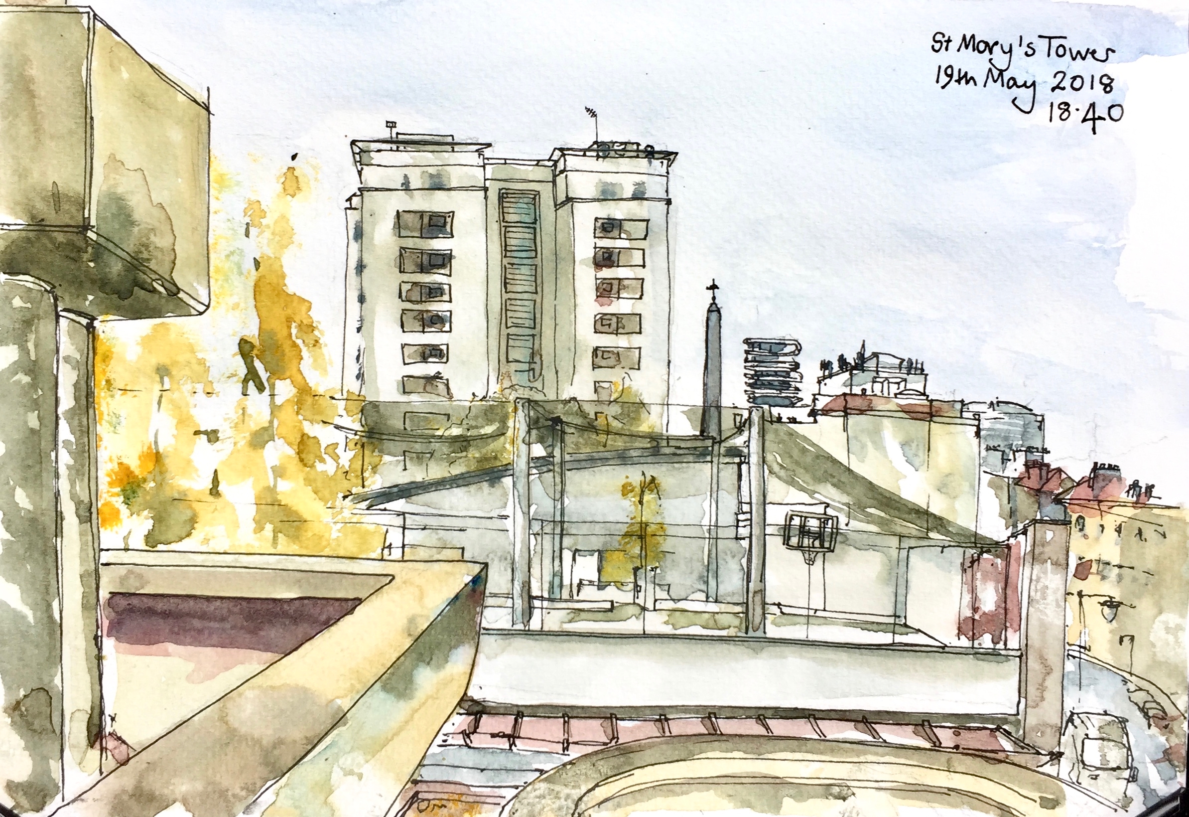
This sketch shows St Mary’s Tower, in the Roscoe Street Estate. Prior Weston School is in front, with its first floor playing pitches festooned in black net. The pinnacle of St Luke’s is just to the right of St Mary’s Tower, followed by “Cannaletto” the black and white striped modern tower block, then Coltash Court, the tower block at the north end of Whitecross Street . The south of Whitecross St is to the far right of the picture. The tower block in the background on the right is Godfrey House.
St Mary’s Tower was built on church land by the Peabody Trust. It was completed in 1957. The architect was John Grey and Partner.
St Mary’s Church was built in 1868, but was then demolished having been badly damaged in the Second World War.
The Tower now forms part of the Roscoe Street Estate, managed by Islington.
Sketched from the Barbican podium, in about 2 hours. A cool, sunny spring afternoon, with the wind curling the paper. Jackson’s watercolour sketchbook, 7 inches by 10 inches.
St Mary’s Tower features in my etching “Towers East”.
Click a button below to share this post online, email it, or print it:


")


 I drew this picture sitting on a stone in Radnor Street Gardens, off Lizard Street. After a while I noticed that the place smelt of dog excrement. It has rained recently, after a dry spell.