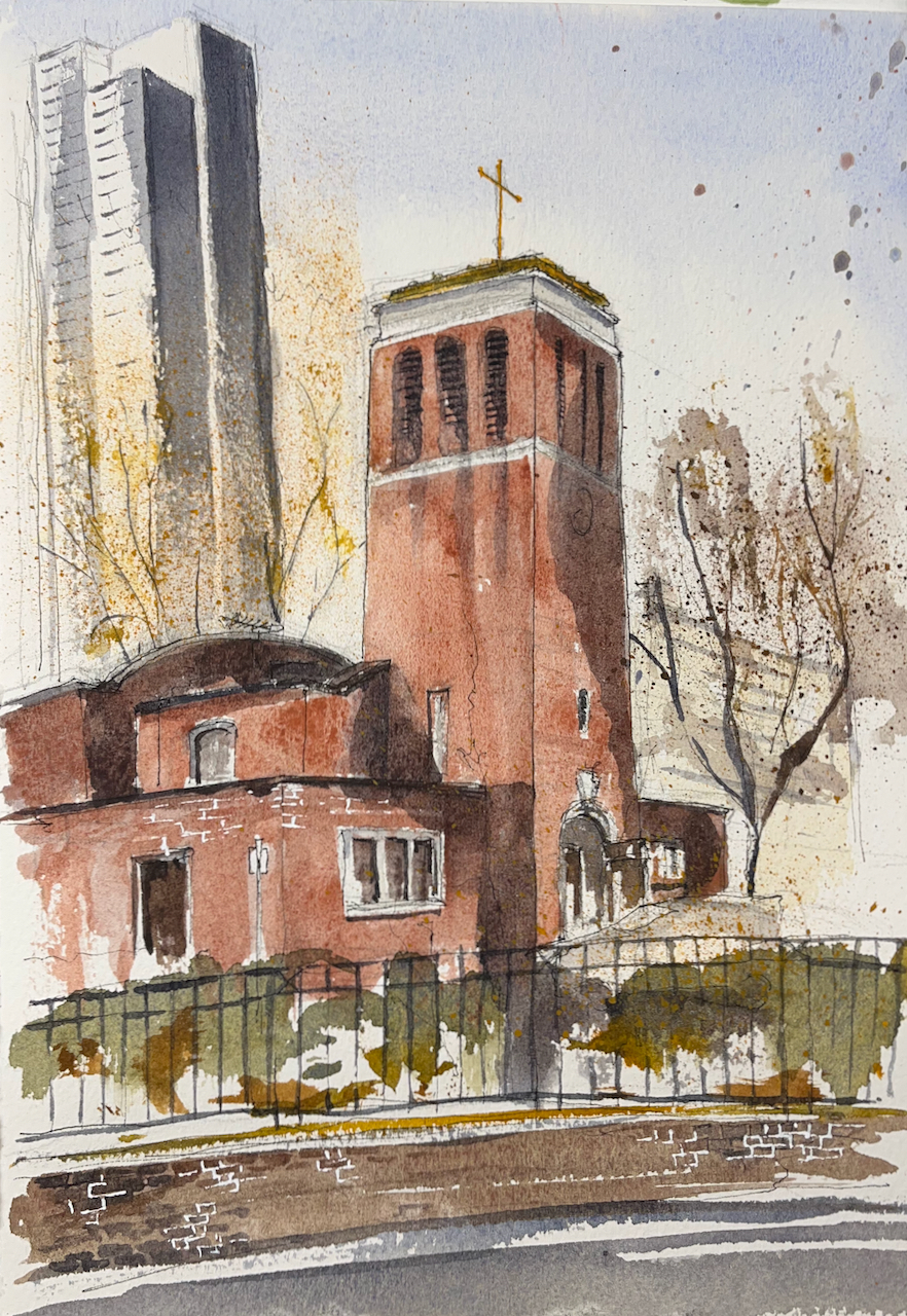
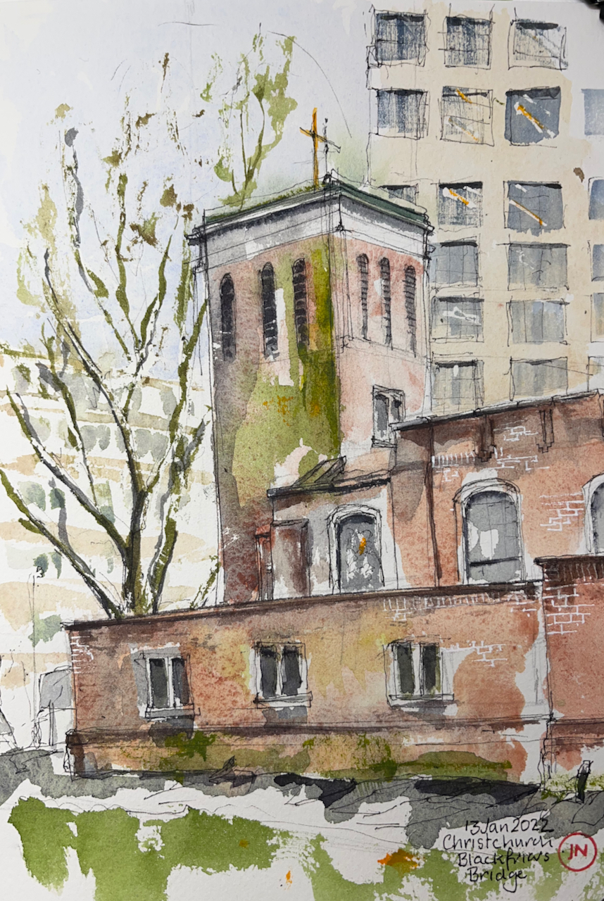
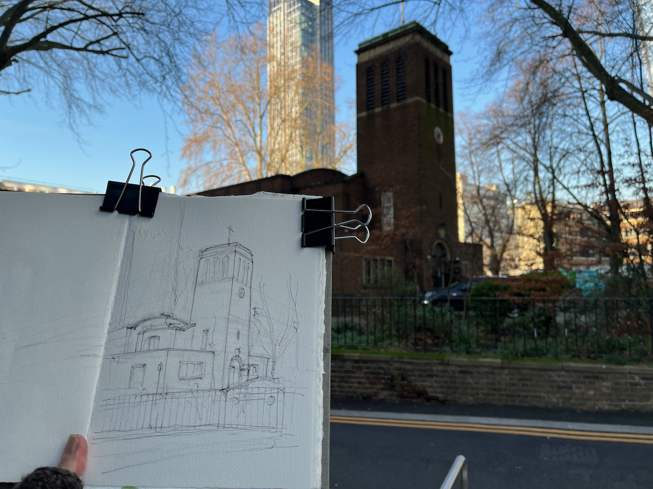
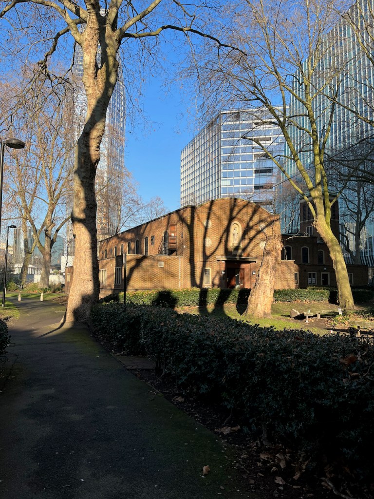
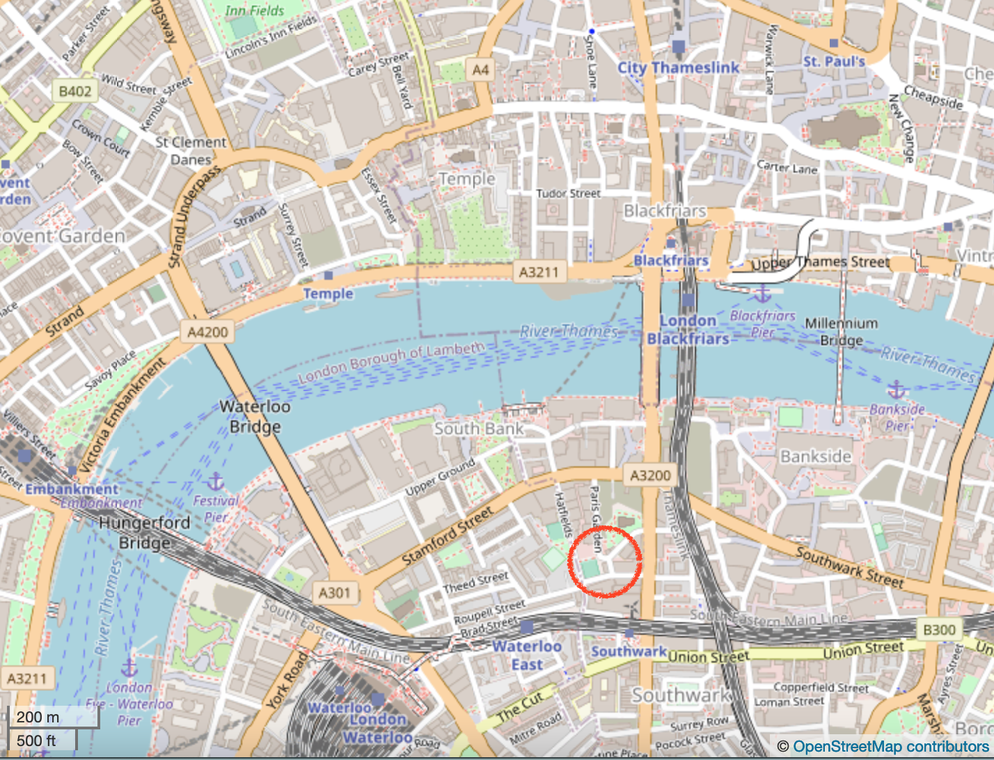
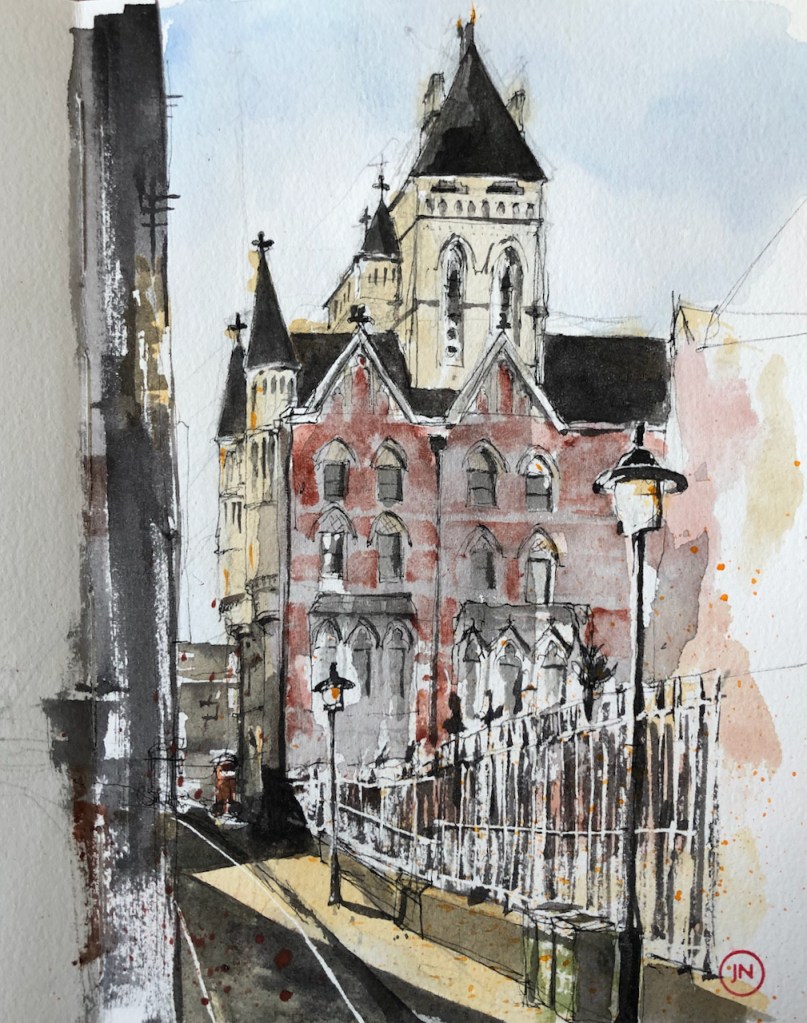
On the South side of Blackfriars Bridge there is a church amongst trees. This is Christchurch Blackfriars Bridge.
Christchurch Blackfriars Bridge, 14th January 2022, 2pm 10″ x 7″ in Sketchbook 11
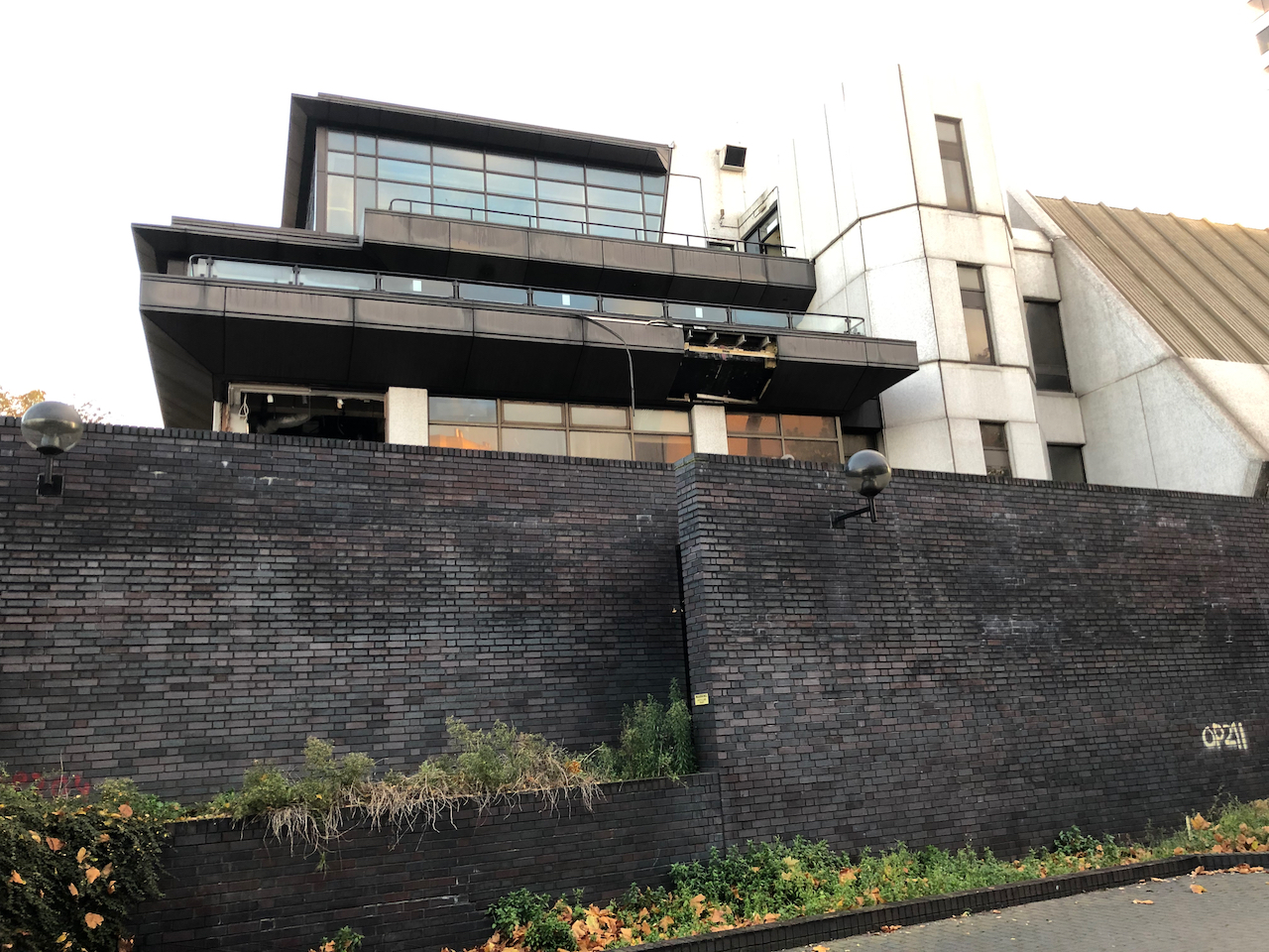
A window showing construction workers
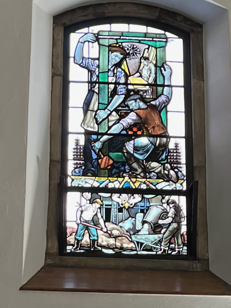
This is the south side of the church, showing its open door. I went in. This is a very welcoming church. I passed three separate notices telling me I was welcome. Inside it is calm, warm and light. There are benches to sit on. There are marvellous stained glass windows. They show not saints and Bible stories, but Londoners. They show builders and printers, river workers, and engineers. There is a power station worker looking at a bank of rotary dial telephones, and a queue of people waiting for a red London bus. All these are beautifully done in stained glass.
This church accepts the idea that people might be “spiritual not religious”. Between 12noon and 2pm: they offer a “lunch time silent space”, and there are other events that include meditation and silence.
A detailed history of the church is in British History Survey of London: ‘Christ Church’, in Survey of London: Volume 22, Bankside (The Parishes of St. Saviour and Christchurch Southwark), ed. Howard Roberts and Walter H Godfrey (London, 1950), pp. 101-107. British History Onlinehttp://www.british-history.ac.uk/survey-london/vol22/pp101-107 [accessed 16 January 2022].
Here is how it looked before 1941.
‘Plate 67: Christ Church. Exterior and watchhouse’, in Survey of London: Volume 22, Bankside (The Parishes of St. Saviour and Christchurch Southwark), ed. Howard Roberts and Walter H Godfrey (London, 1950), p. 67. British History Onlinehttp://www.british-history.ac.uk/survey-london/vol22/plate-67 [accessed 16 January 2022].
It was completely gutted by incendiary bombing in April 1941. The 1950 “Survey of London” cited above describes it as a “shell”. The present church was completed in 1960, according to Pevsner (The Buildings of England, London 2: South, by Nicolaus Pevsner and Bridget Cherry, page 275). The architects were R Paxton Watson & B Costin.
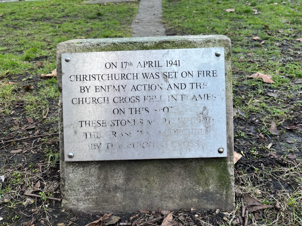
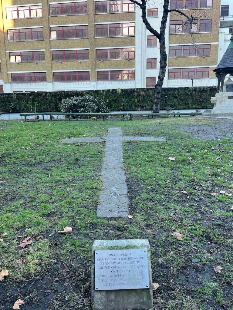
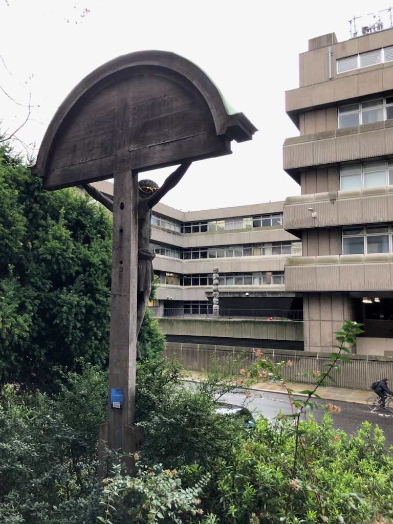
“On 17th April 1941 Christchurch was set on fire by enemy action and the church Cross fell on this spot. These stones mark where the grass was scorched by the burning Cross”A monument on the West side of the church, photographed 6th March 2025. The cross referenced here can be seen in the black and white 1941 photo above.
The church is now surrounded by buildings and trees and is very much alive. Here is the view from the North:
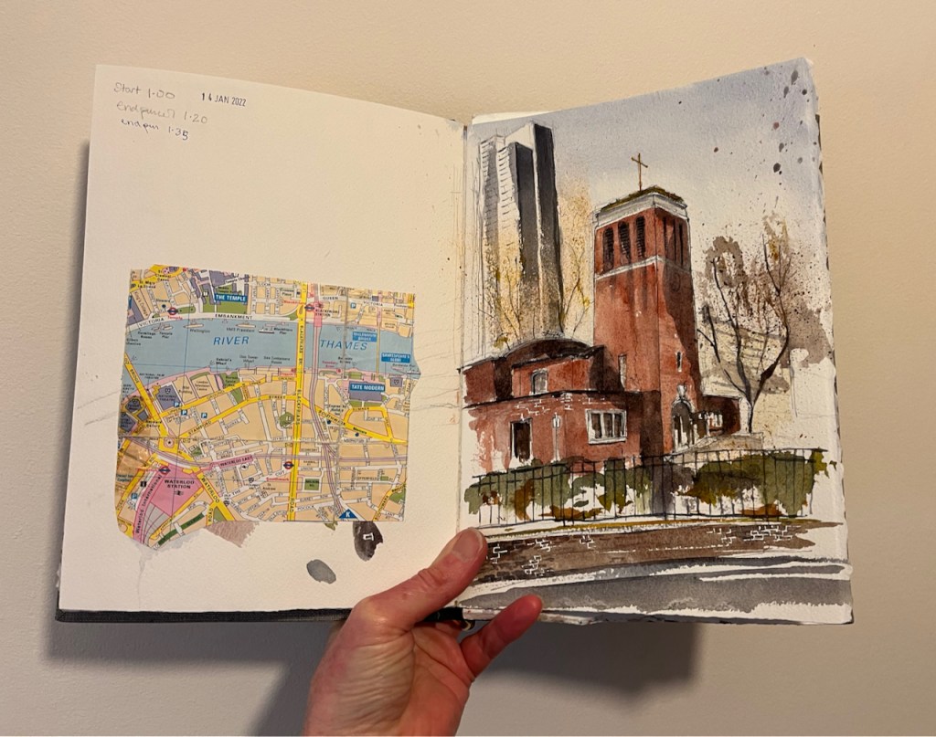
Christchurch Blackfriars Bridge, 13th January 2022, 12:30pm 10″ x 7″ in Sketchbook 11
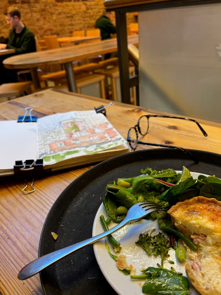
The outside air temperature was 3 degrees C and the paint wasn’t drying. Also I was very cold. I went for lunch in “Greensmiths”in Lower Marsh, and finished the painting there.
“Greensmiths” in Lower Marsh Waterloo.
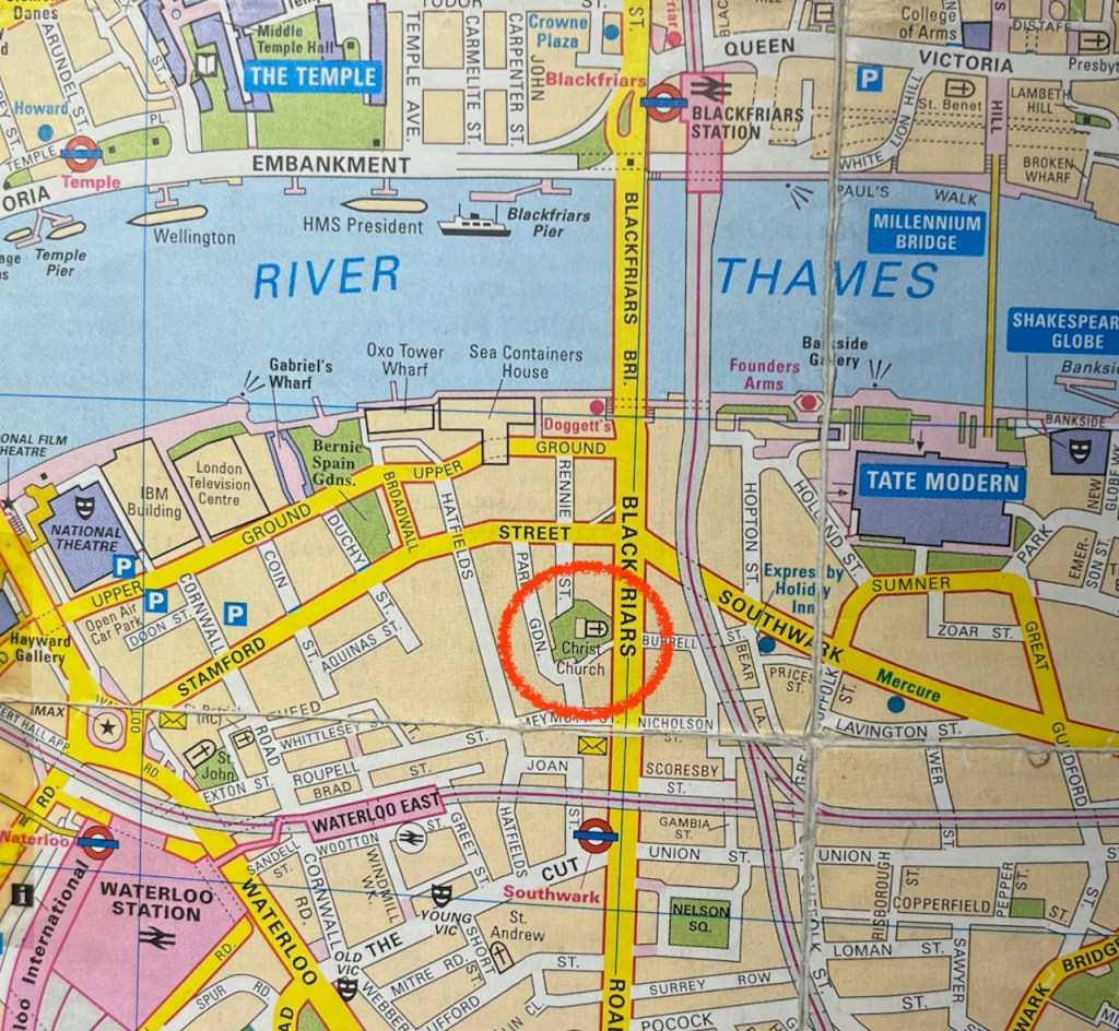
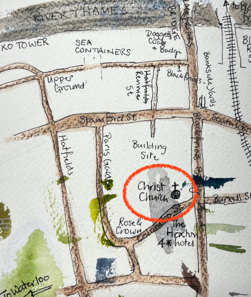
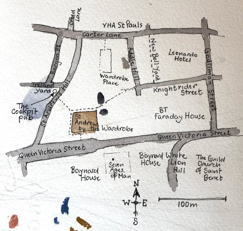
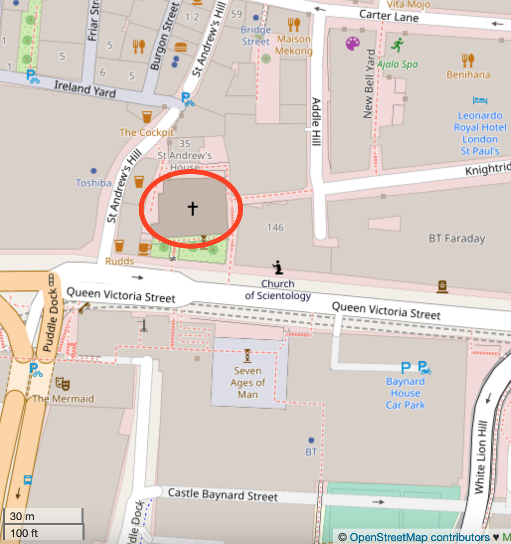
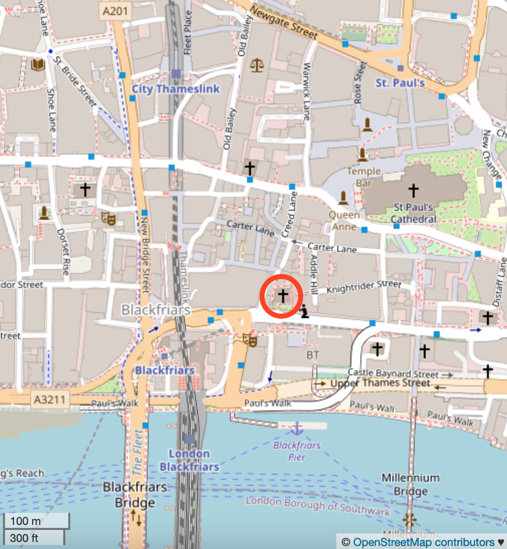
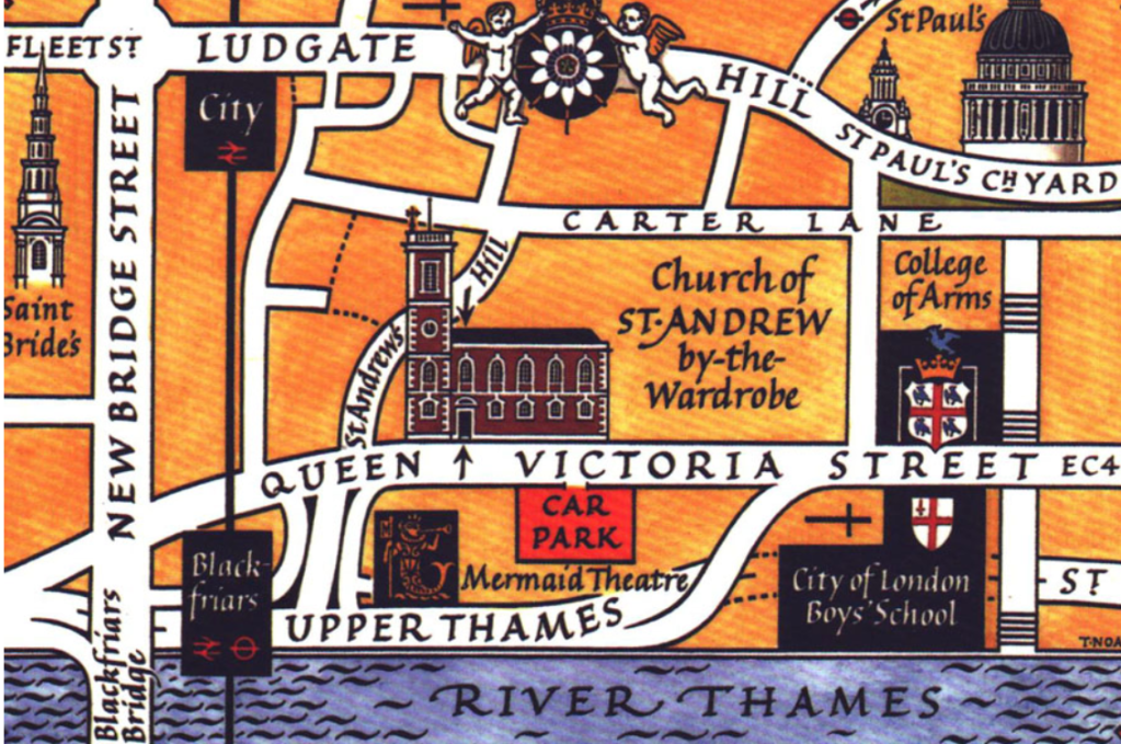
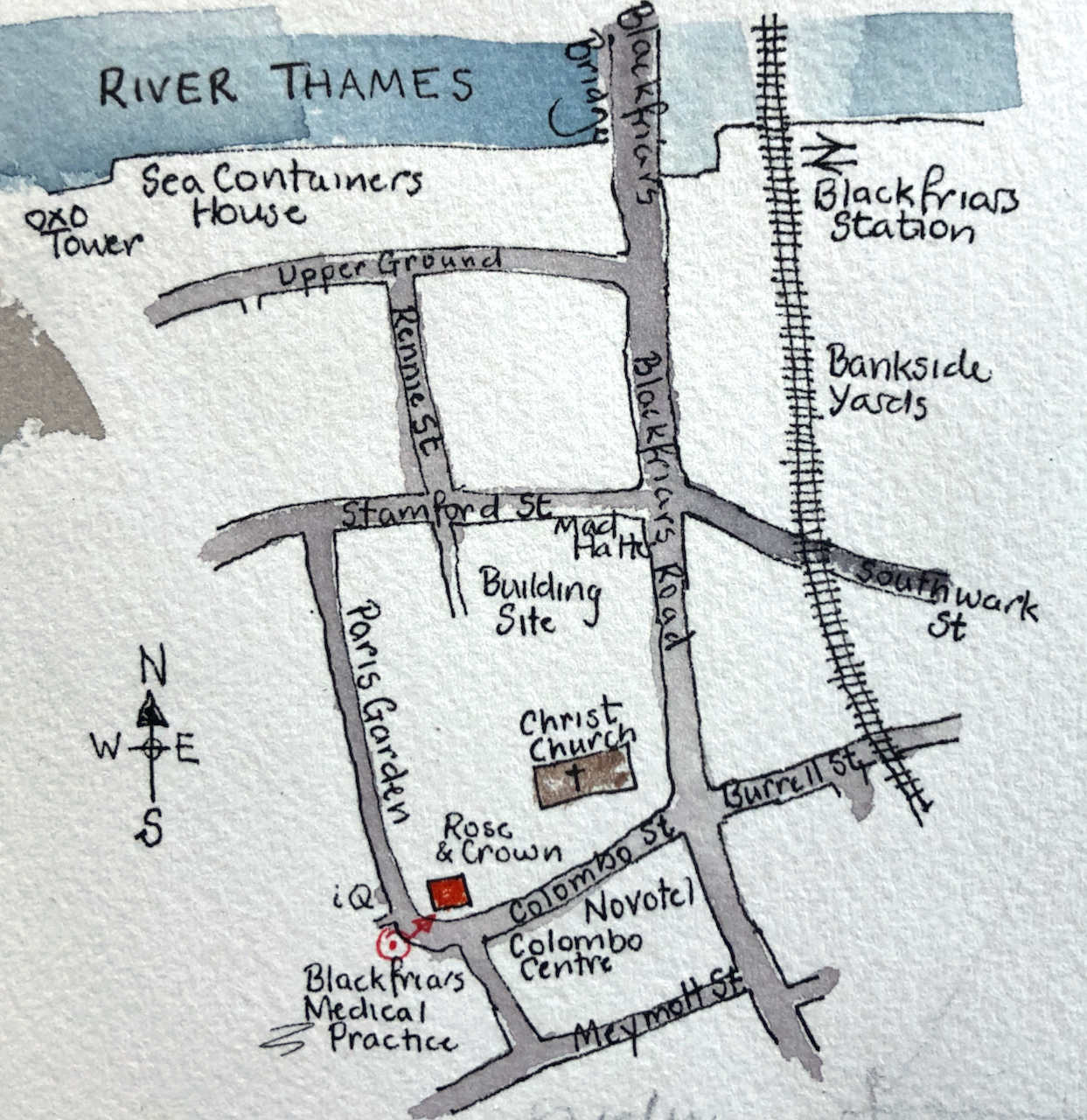
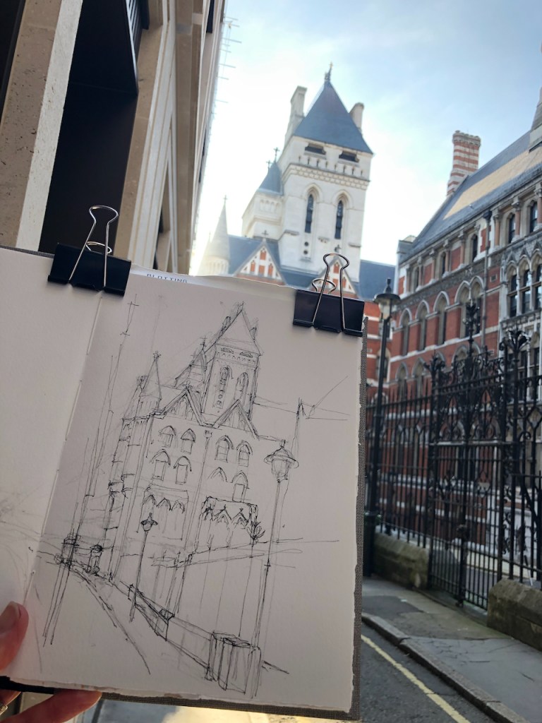
Here is work in progress on the sketches, and some maps to show where this church is.
There were some spectacular shadows that day:
Christchurch Blackfriars Bridge, from the South, 14th January 2022 about 2pm.
The church community hold some of their events in the adjacent pub, the Rose and Crown:
I was commissioned to paint a picture of this lovely house.
House in South West London , 12″ x 9″ on Arches 300gsm paper, [commission]
This interesting commission took me to a part of London I had not previously explored. Many thanks to the new owner of this painting for allowing me to post it online.
One of the delights of these houses is the chimneys. They sit up there like chess pieces, or individual characters in a play. I tried to show their personalities.
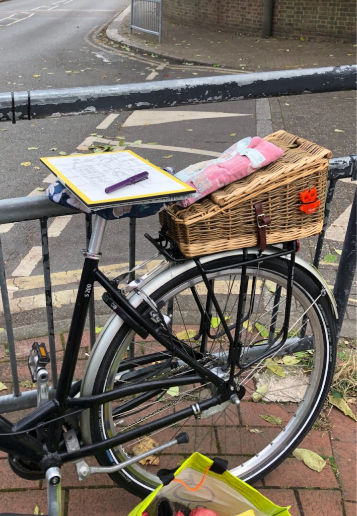
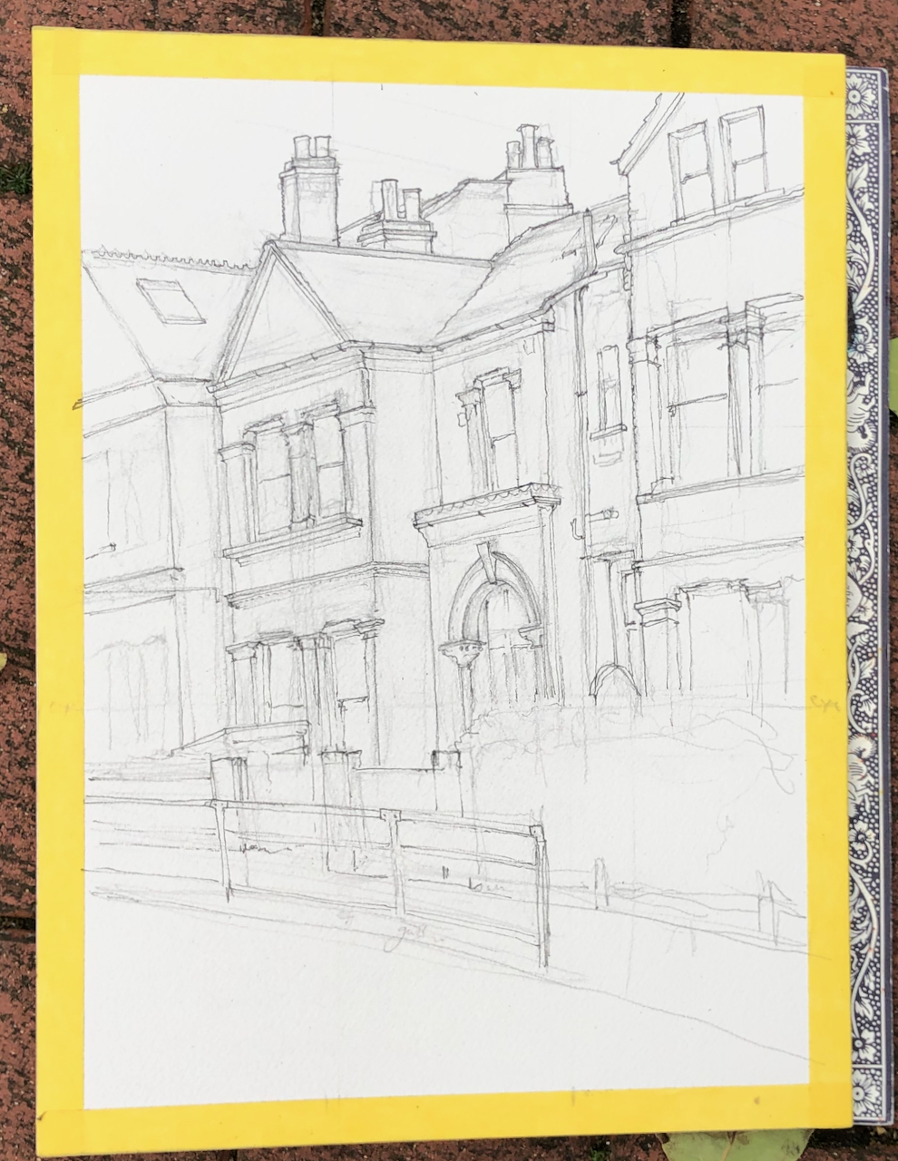
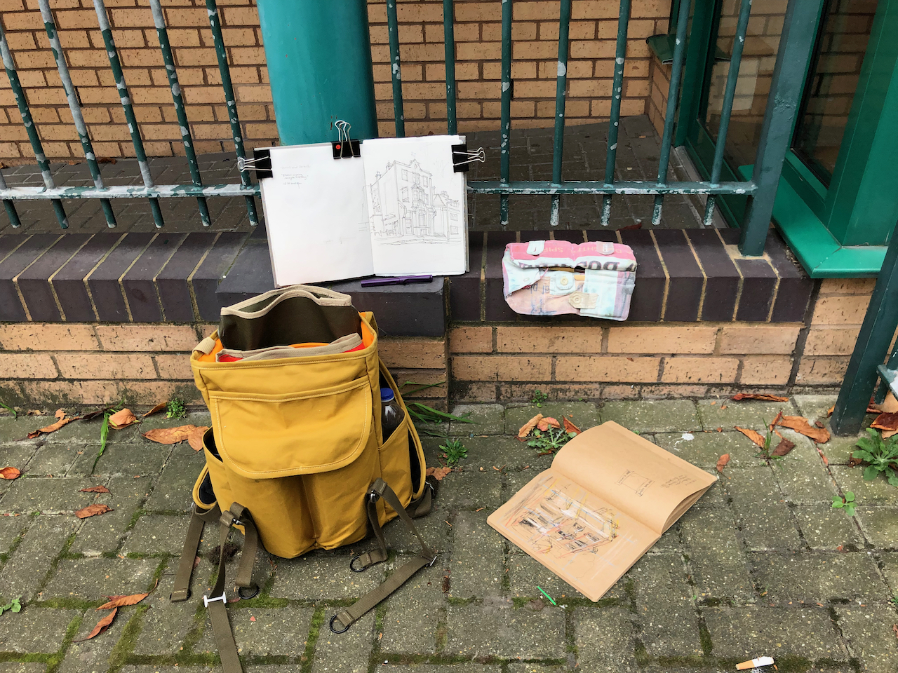
I painted this in November. It was cold, but there were still leaves on the trees. They blew around in the wind and scattered on the road. A road sweeper, a café proprietor, and a woman with a pram all came over at different times to look at my work. I made a preliminary sketch on brown paper to understand how to compose the picture, how the perspective worked and where the light and dark should be. The next stage is the pencil underdrawing, then the pen, then watercolour.
Pen drawing. The yellow tape is to frame the picture, and for me to hold on to while I sketch.Pen drawing. I also make annotations on the yellow tape. Here it says”eye line”Using the bike as a table. The pen is a Lamy Safari fountain pen.Trusty bike Pencil under-drawingPreliminary sketch on brown paper to work out the perspective lines, which are shown here in yellow and red.
Here you see the difference the colour makes:
“before” and “after” the colour went on: move the slider.
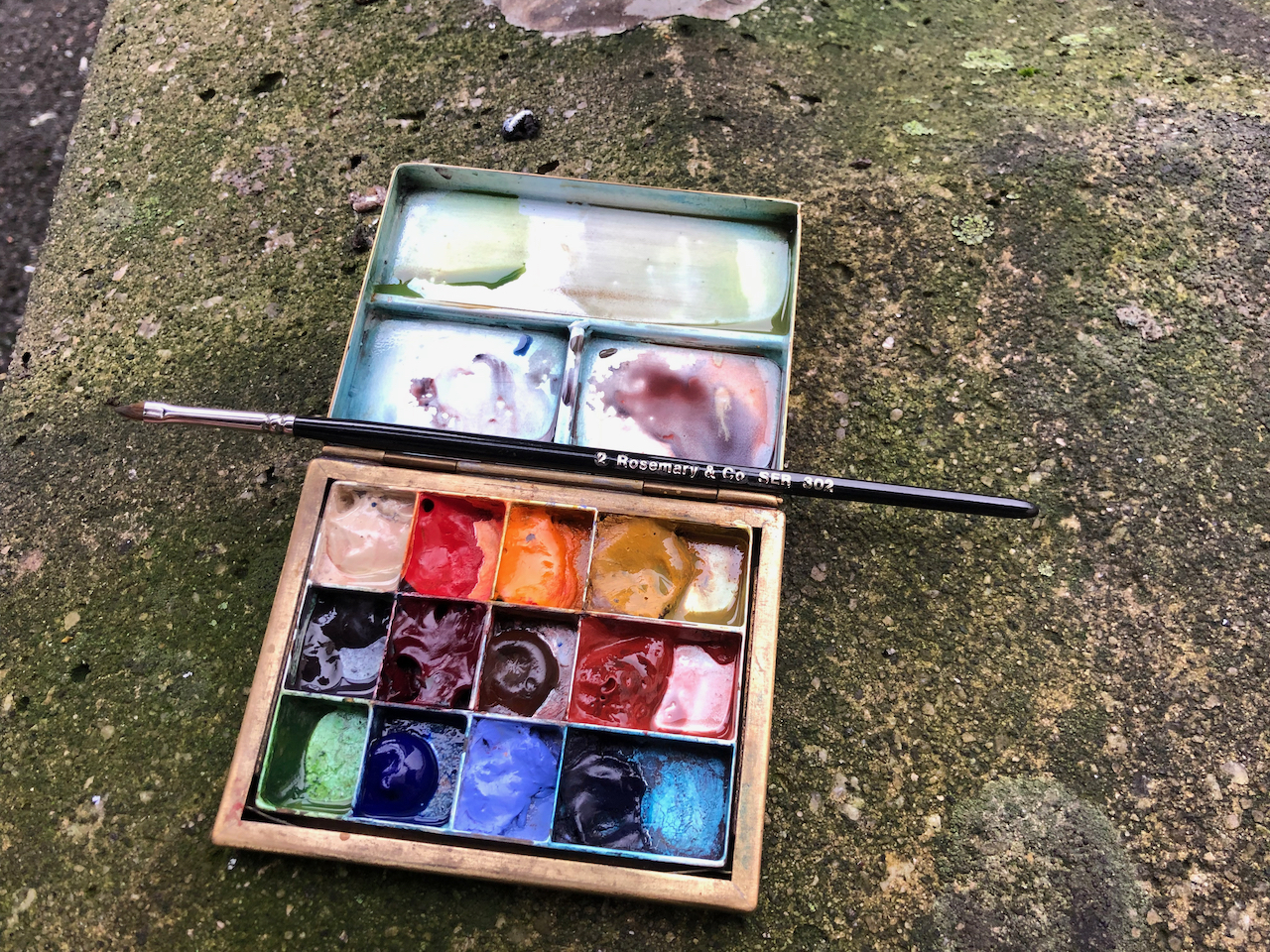
The colours are: Buff Titanium, Perylene Maroon, Prussian Blue, Hansa Yellow Mid, Burnt Umber, Fired Gold Ochre. Fired Gold Ochre is “granulating” – it dries unevenly into a pattern of dots. You can see the effect in the brick texture of the house nearest us. The chimneys are Fired Gold Ochre with some Transparent Pyrrol Orange. The greys and black are mixed from Prussian Blue and Perylene Maroon. All the watercolours are Daniel Smith.
The ink I use is De Atramentis Document Ink, Black, which is waterproof, supplied by The Writing Desk. The paper is Arches Aquarelle 300gsm cold-pressed, in a block 12″ x 9″. All paints and paper are from Jacksons Art.
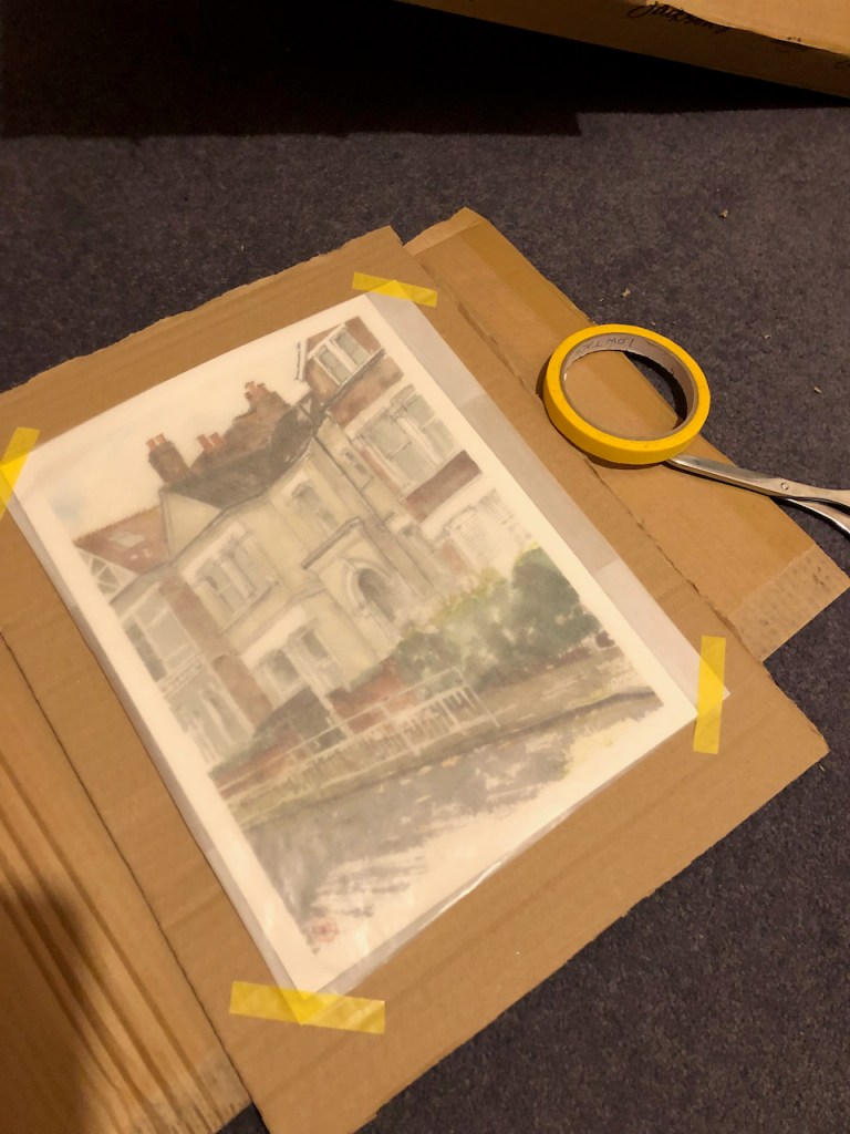
Here is the picture being wrapped ready to go to its new home.
Click a button below to share this post online, email it, or print it:
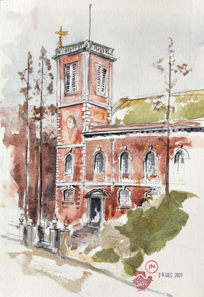
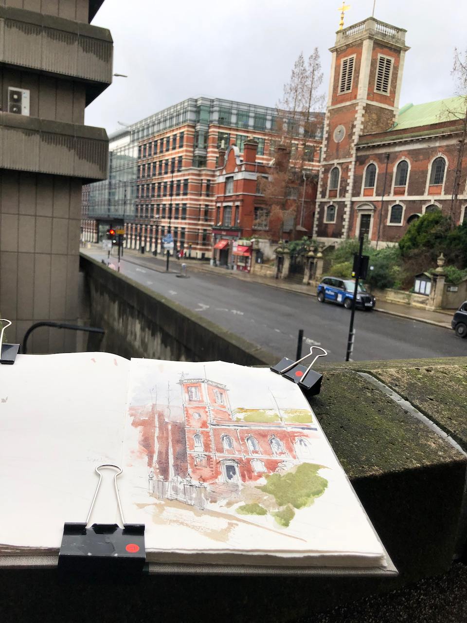
This lovely church is on Queen Victoria Street, a busy thoroughfare in the City of London.
St Andrew by the Wardrobe EC4, 29th December 2021 2pm. 10″ x 7″ in Sketchbook 11
This church was first recorded in 1244, destroyed in the fire of London 1666, rebuilt by Christopher Wren in 1685-93, then destroyed again in the 1939-45 conflict, rebuilt again, and re-hallowed in 1961. It is now closed for refurbishment, and due to reopen in May 2022. When it re-opens it will become the London Headquarters of the Egyptian Coptic Orthodox Church, this use being shared with the Anglican parish activities. I read this news on the church website.
Note the magnificent trees! These trees should feature on any London Tree Tour. I think they are larches but I am not an expert.
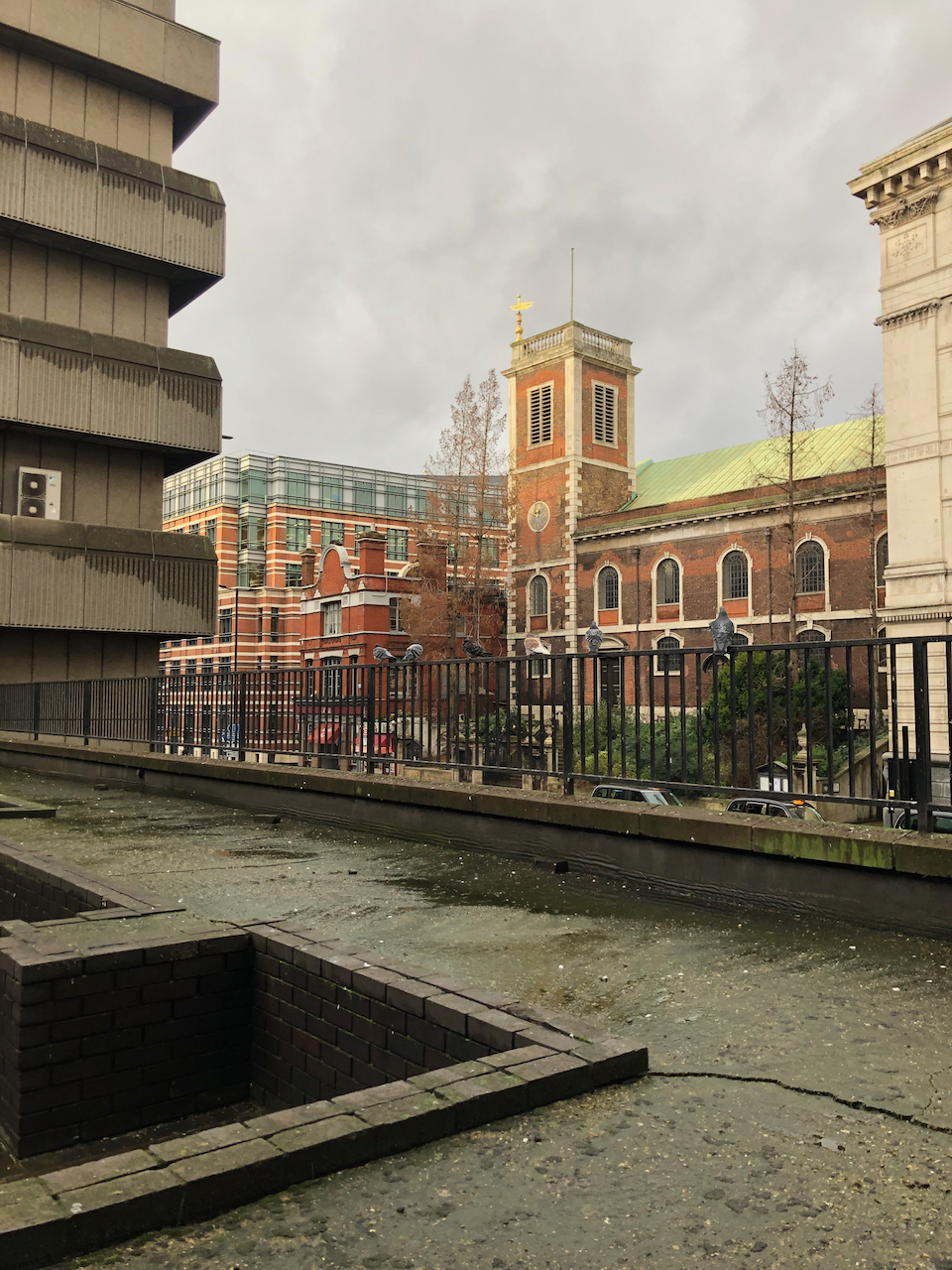
Yesterday, London was quiet. I sketched the church from podium level on Baynard House on the other side of the road. Baynard House is a 1970s office block currently occupied by BT (British Telecommunications, as was). Next to St Andrews on the East is the Church of Scientology. On the West side of St Andrews is a cocktail bar, Rudds.
map from the website of Slovenia in London
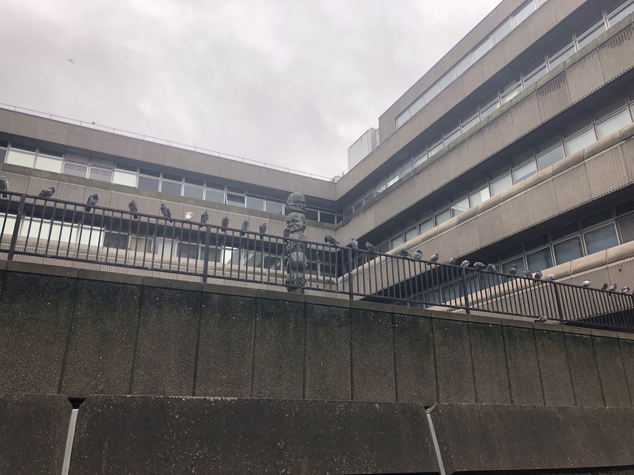
Baynard House, where I was sketching, is a strange and mysterious place. There is a podium-level walkway through the block. There are odd structures, like remnants of a lost civilisation.
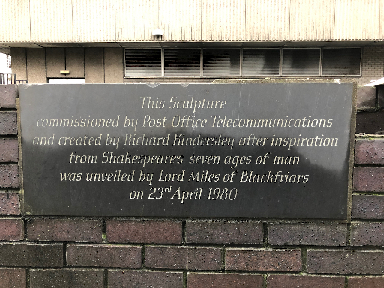
The church has a steeply sloping garden, with a wooden crucifix, just visible in the drawing. This looks across to the “seven ages of man” sculpture on Baynard House.
Looking South from St Andrews towards Baynard House, “Seven Ages of Man” sculpture by David Kindersley is visible in the centre of the picture.
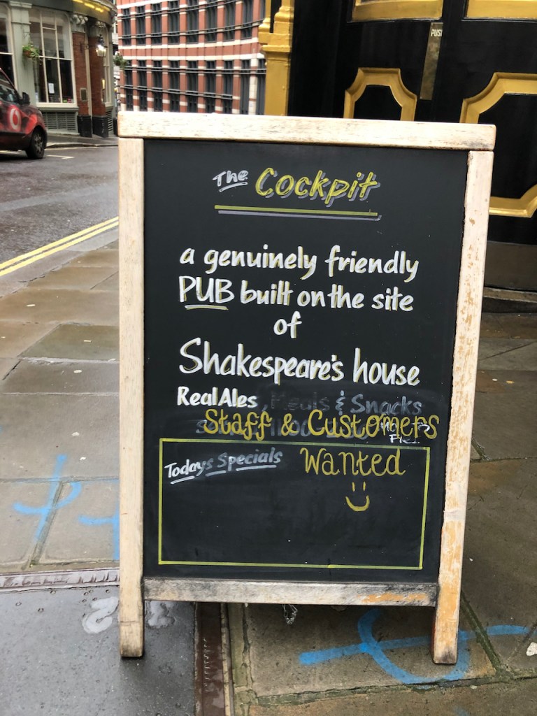
Walking up St Andrew’s Hill, I passed the “Cockpit” pub, on the site of Shakespeare’s house. It had a notice outside: “Staff and CustomersWanted“.
Click a button below to share this post online, email it, or print it:
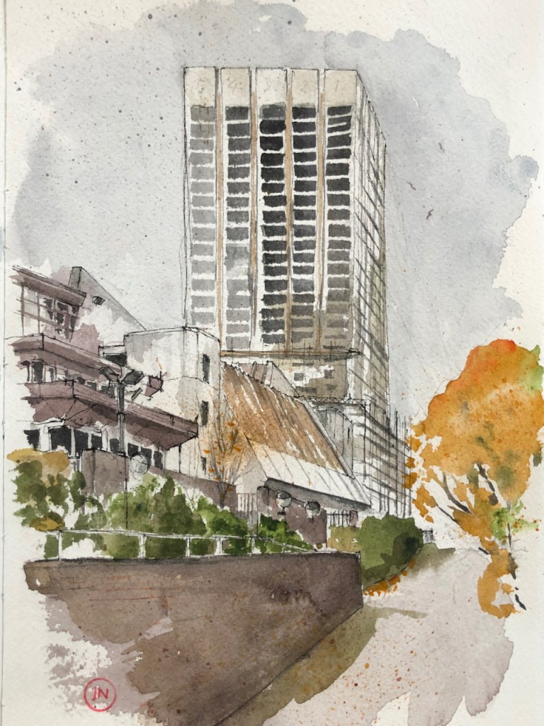
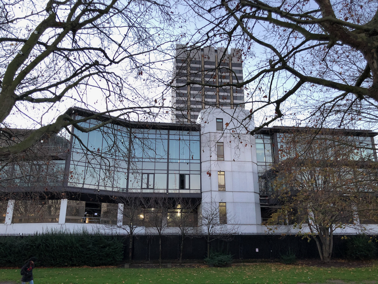
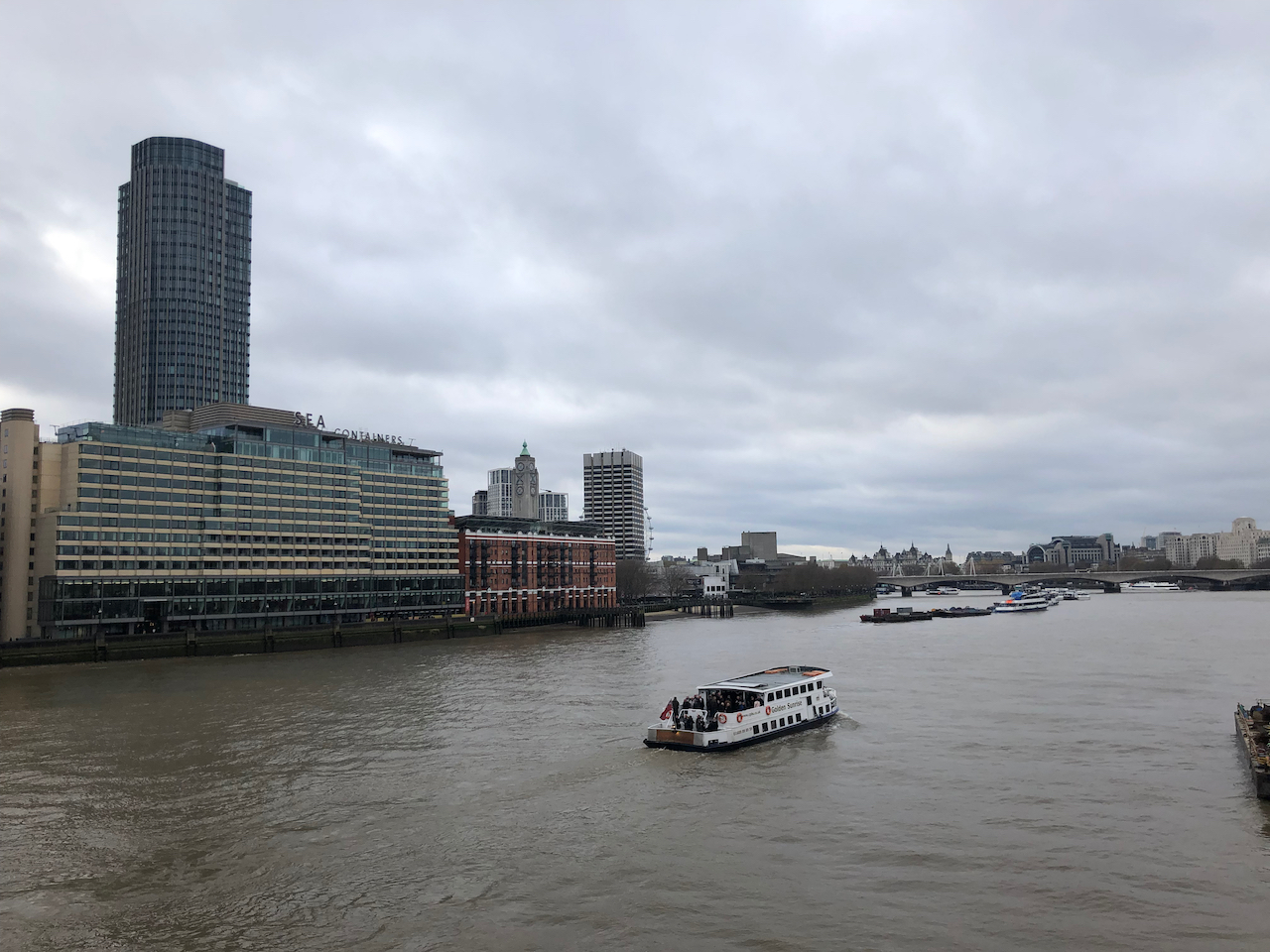
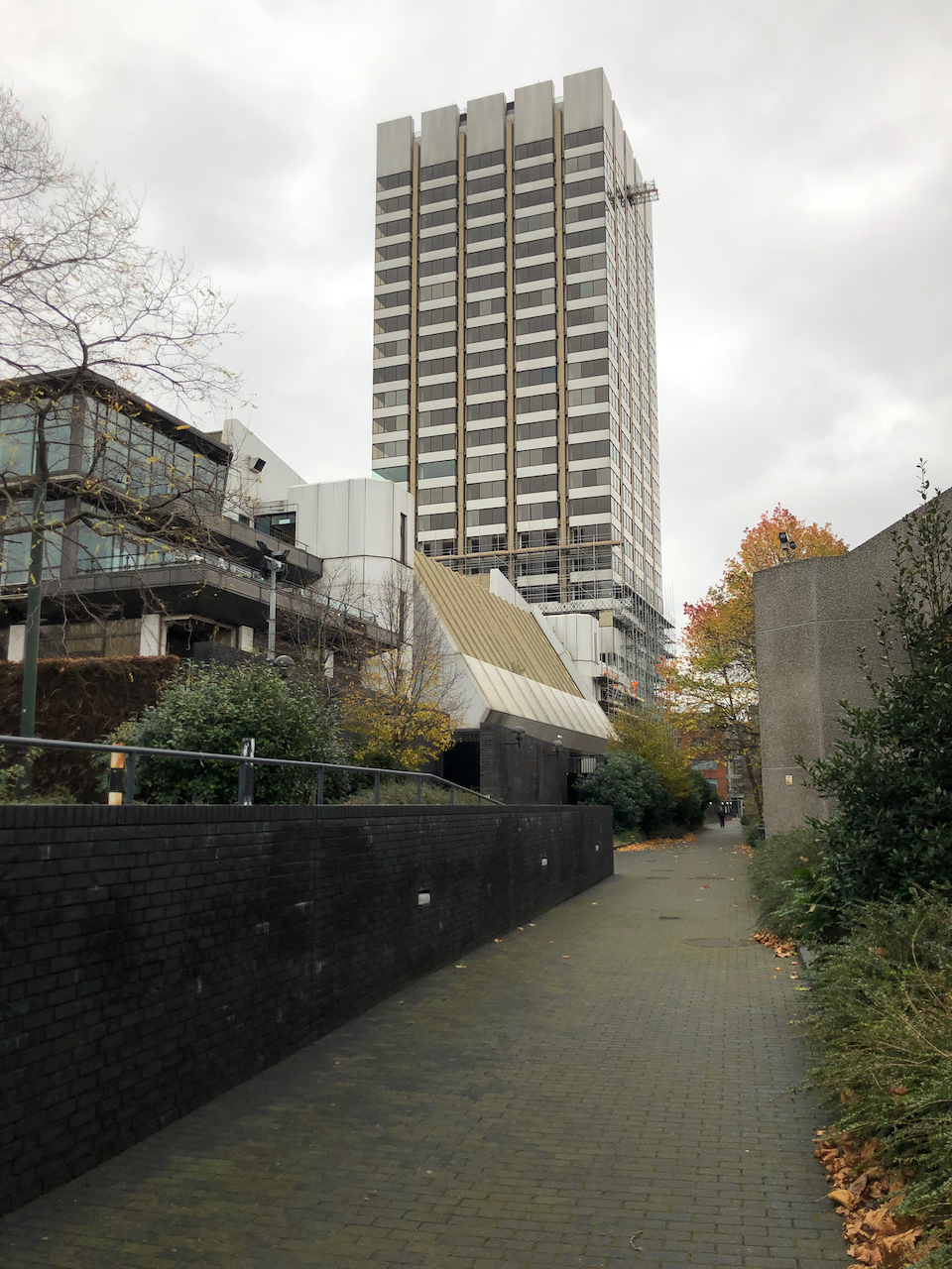
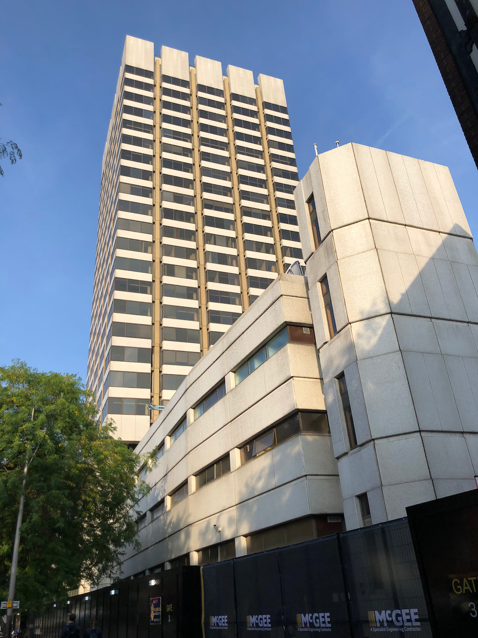
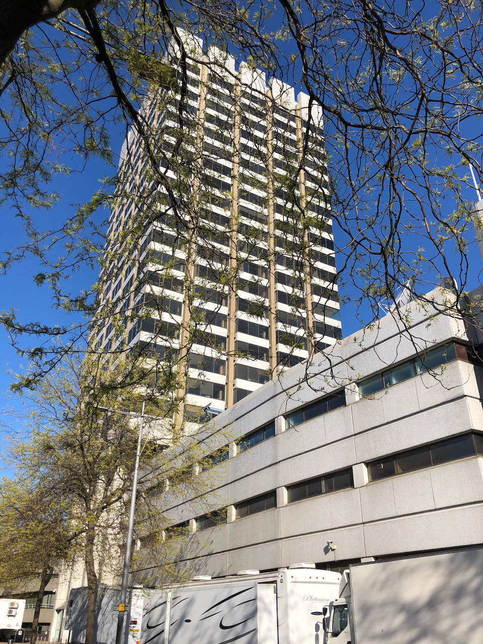
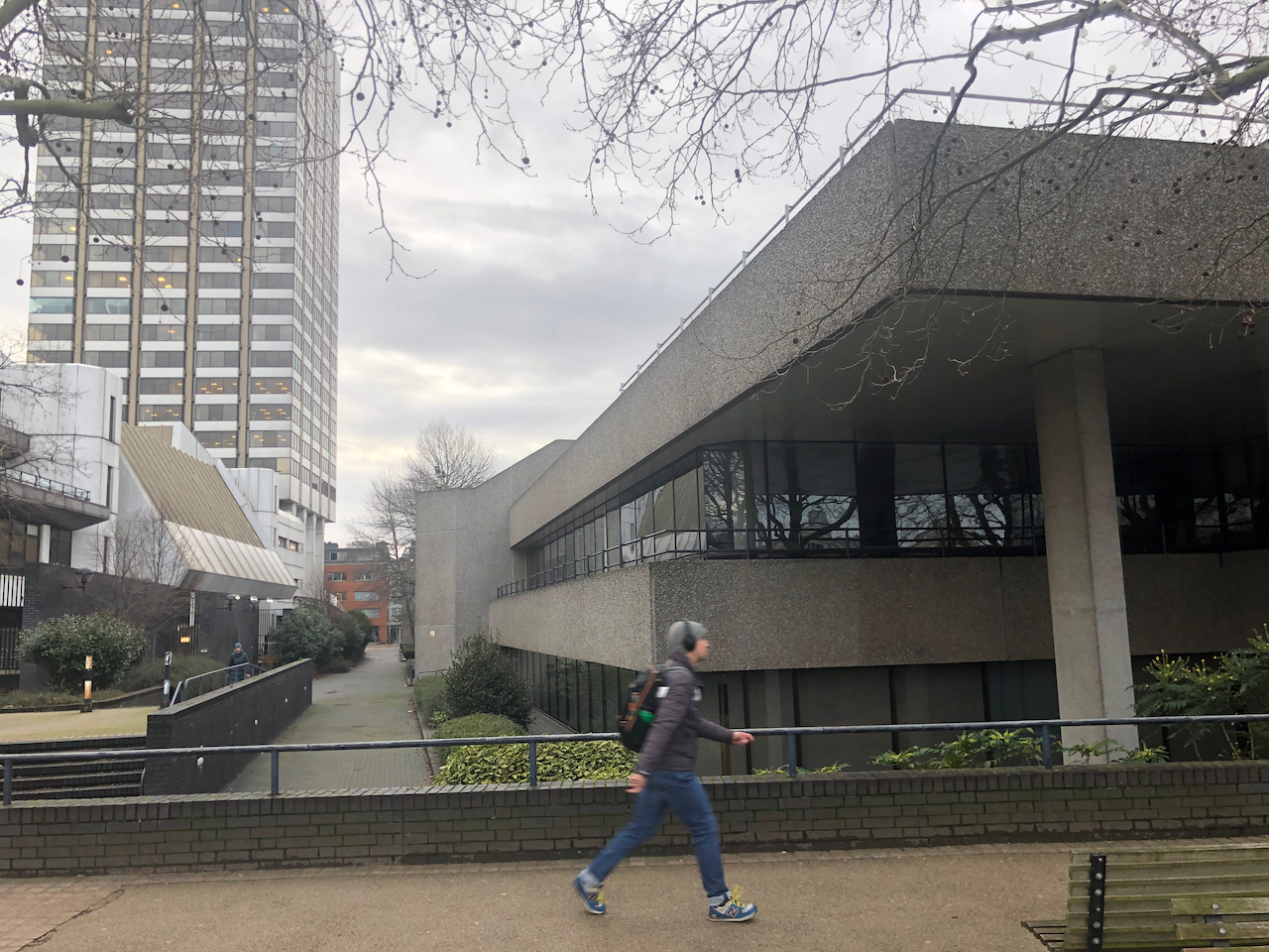
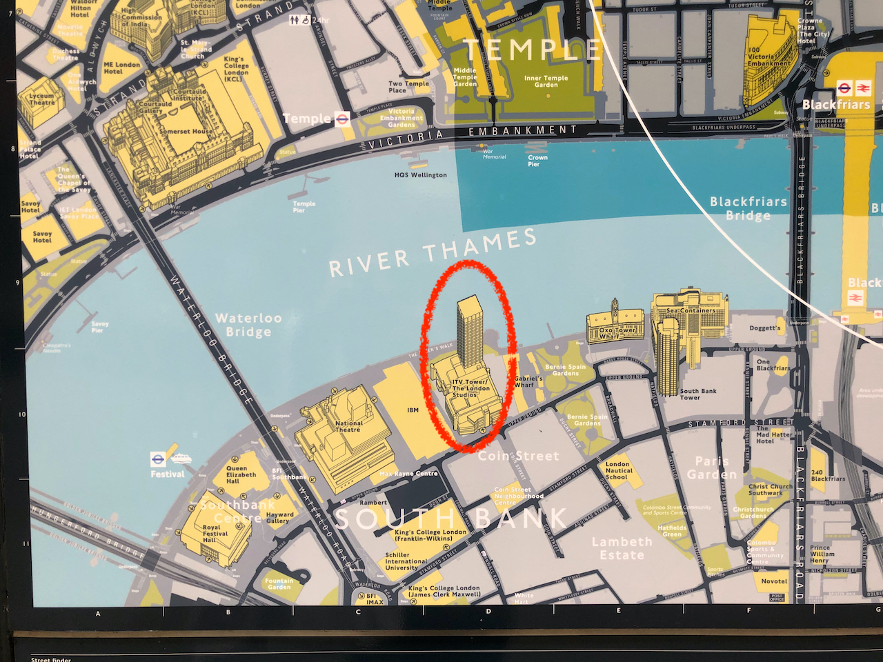
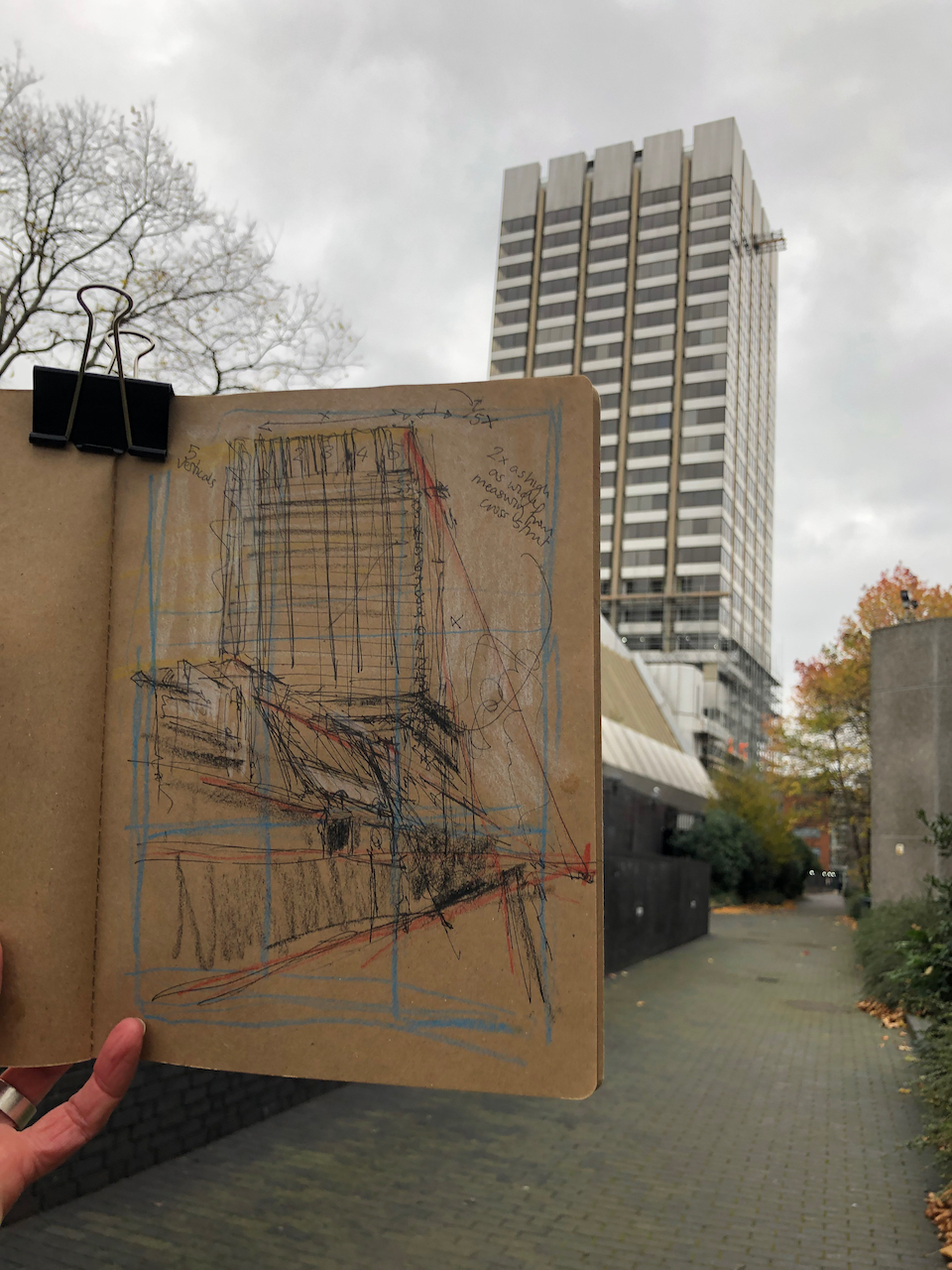
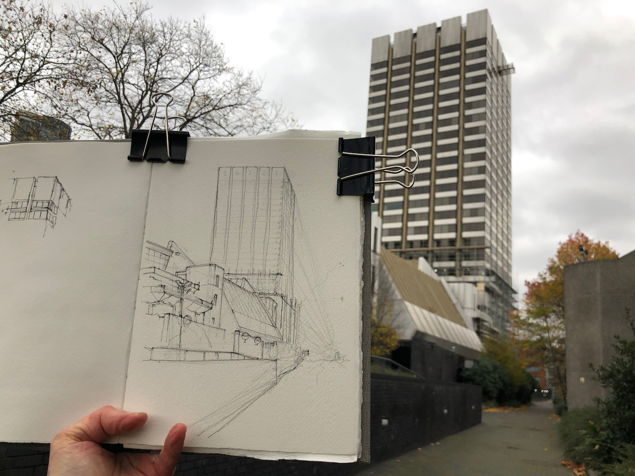
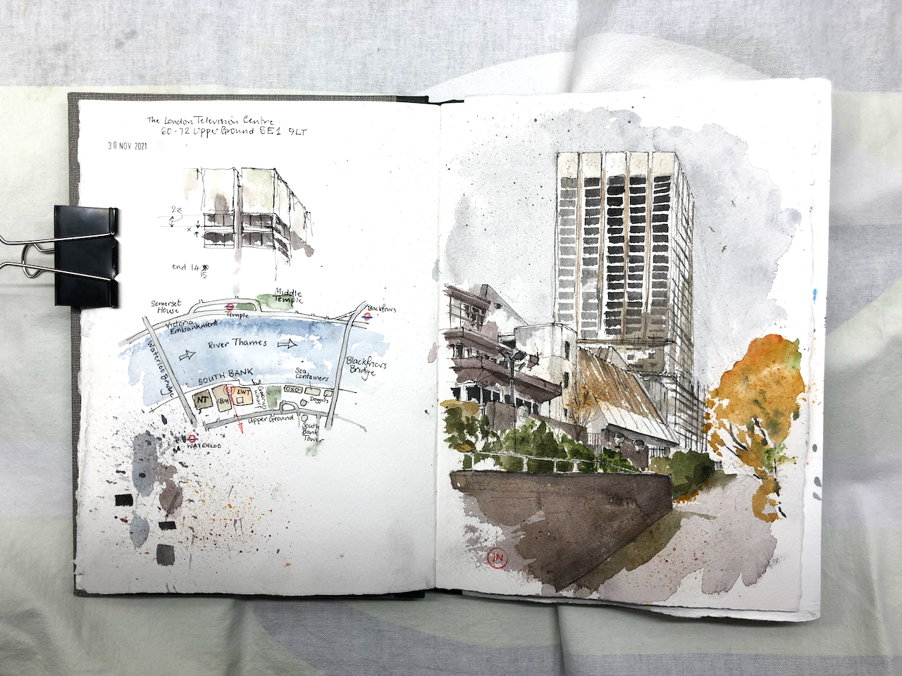
Here is a view of the London Television Centre, 60-72 Upper Ground, SE1. It is on the South Bank of the river Thames, a little to the East of the National Theatre and the Royal Festival Hall. It was completed in 1972 to the design of Elsom Pack & Roberts.1
London Television Centre, 30 November 2021, 10″ x 7″ in Sketchbook 11
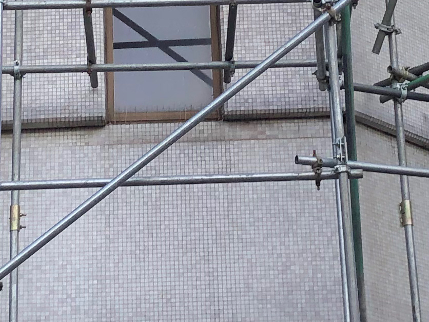
Appreciate this building while you can – it is bring demolished. Admire the variety of the sloping roofs, the unexpected angles, the terraces overlooking the river. Appreciate the unexpected finish: it is covered in tiny, white, glistening tiles.
The planning application reference is “21/02668/EIAFUL” submitted to Lambeth Council on 5th July 2021. It says:
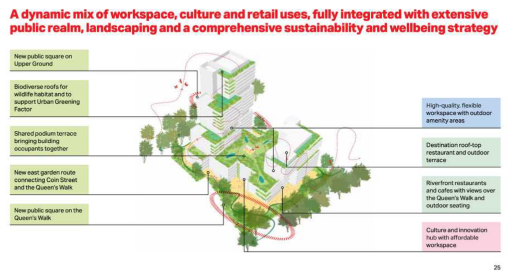
Demolition of all existing buildings and structures for a mixed-use redevelopment comprising offices, cultural spaces and retail uses with associated public realm and landscaping, servicing areas, parking and mechanical plant.
Interestingly the status, as of today, is “awaiting decision”, which is strange because when I was sketching the site earlier this week, demolition was definitely in progress: both visible and audible.
For the record, here are some pictures of the current building (click to enlarge):
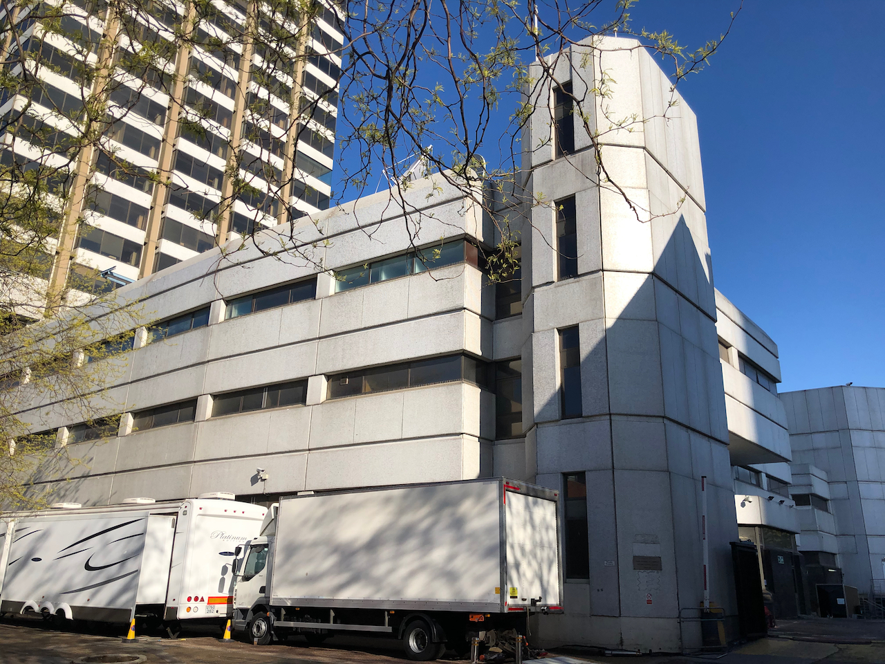
View from “the Queens Walk” riversideFrom the riversideThe low level balconies along the riverView from Blackfriars BridgeLooking West along Upper GroundLooking West along Upper GroundNov 30th 2021, demolition in progressLooking South from the riverMay 2021May 2021 – from Upper GroundMay 2021, Upper GroundView from the river, IBM building on the rightExisting building (2021, May and November)
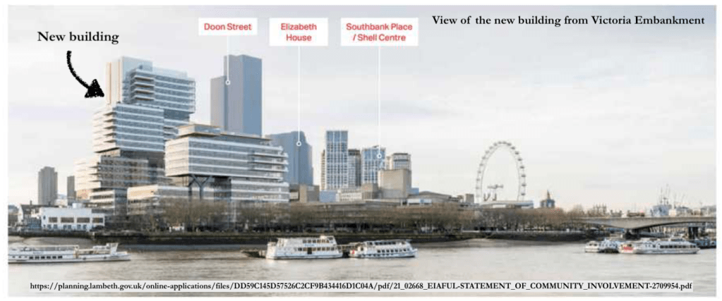
The proposed new building will be taller than the current tower, and the current low-level buildings are to be replaced by a wide block.
The proposed new building will be wider and taller than the existing buildings.It seems as though we will be able to walk through the new development. And there will be cafés and restaurants on the river side. (Picture ref: see Note 2)
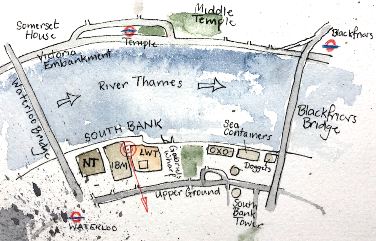
Here are some maps to show where this is:
Sketch map showing viewpoint of the drawing. NT= National Theatre, IBM = the IBM building, LWT = London Television building, OXO = the OXO TowerPhoto of a public map in the City of London. [Oddly, they have got the building reversed. The tower is not by the river, as shown on the City of London Map, but on the inland side.]
I drew the picture from the inclined plane leading up to Queens Walk by the river. There must be a splendid view from the adjacent IBM building. If you work there and you’d be prepared to host me so I could draw from the balcony, then do please get in touch.
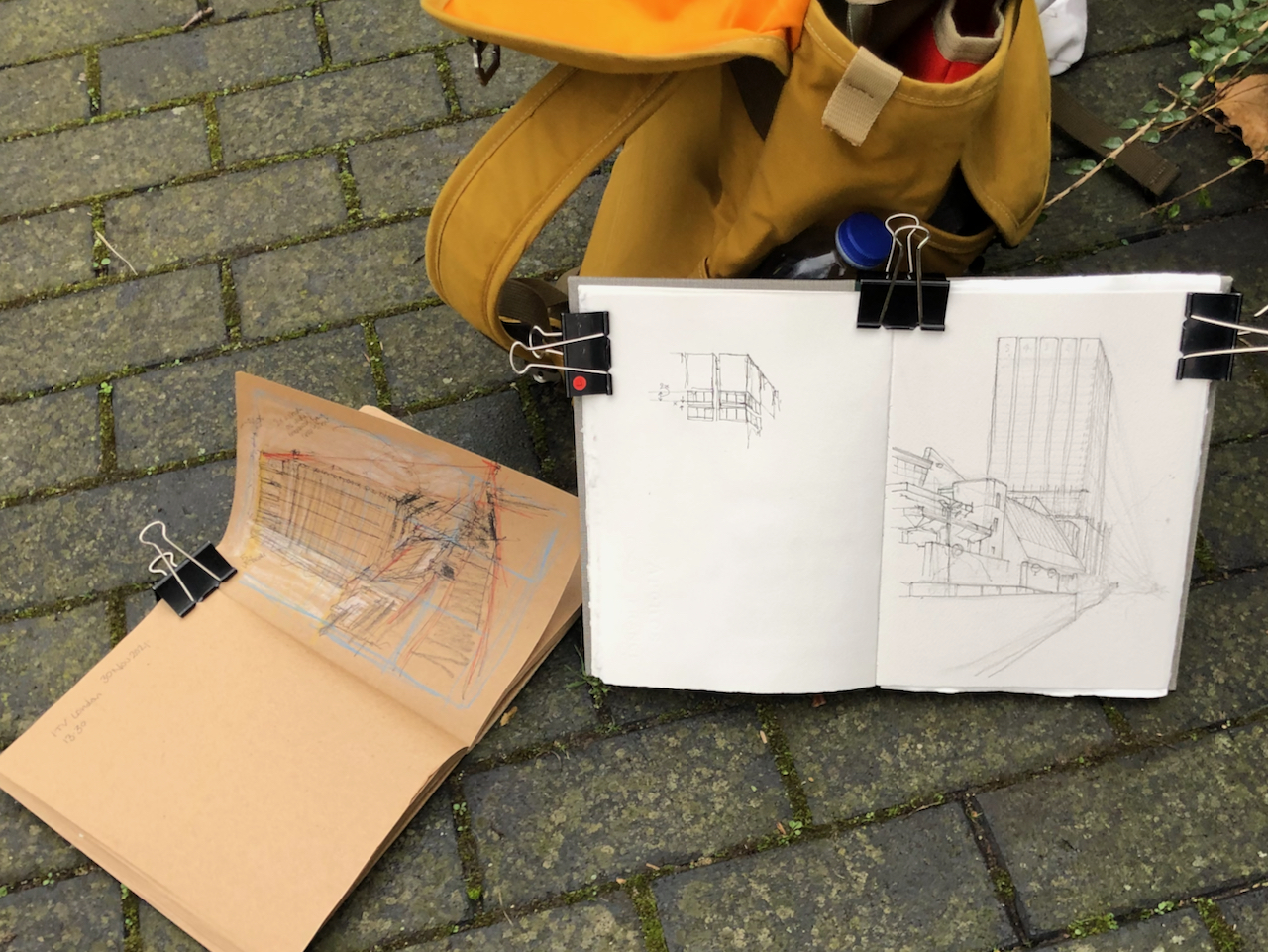
Here are some photos of my work in progress on the picture. It was cold, wet and windy, and there were a lot of seagulls. I put the seagulls in the picture, to the right of the tower. I finished the colour at my desk.
I have also drawn Colechurch House, another 20th Century building in the area due for demolition:
Aficionados of 20th Century brutalist architecture need to hasten to appreciate Colechurch House. It is due for demolition and redevelopment. This month’s post in the marvellous “London Inheritance” site informed me about the planning application, so I rushed over there to draw a picture before the building became swathed…
“When London Weekend Television decided to build its own modern studios, it chose a site on the South Bank close to the National Theatre. The architectural practice of Elsom Pack and Roberts were commissioned to design the building. Originally known as Kent House, their building involved a 21 storey tower rising above a podium that houses the television studios. Construction started in 1970 and the first transmission was in 1972. It became known as The South Bank Television Centre and it was considered to be the most advanced television centre in Europe at that time.”
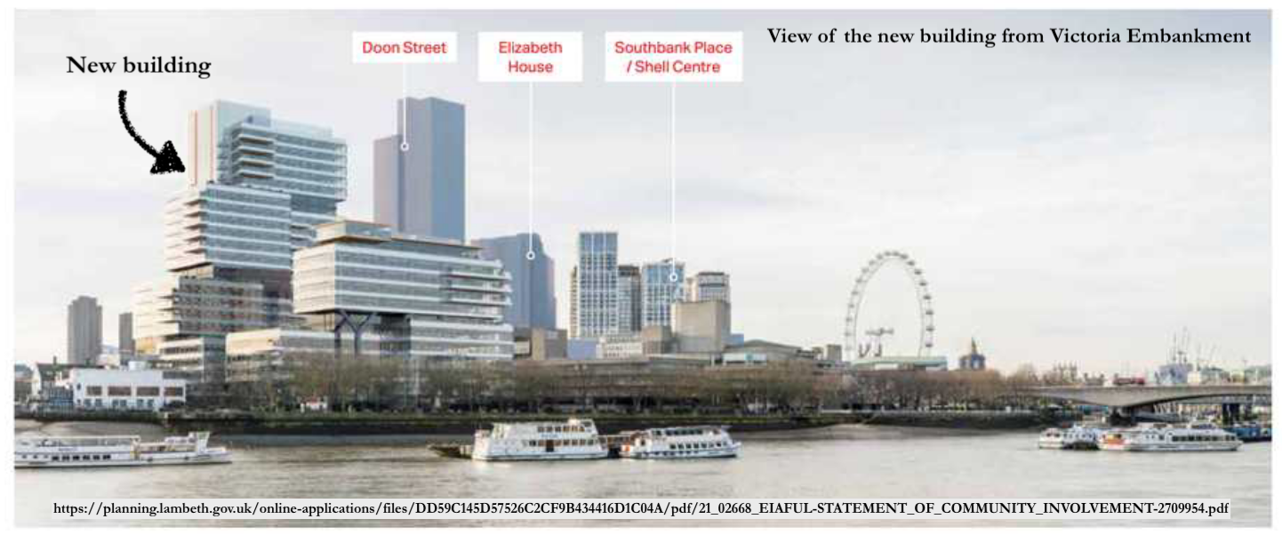
Note 2: Picture of the new building and plan from the Statement of Community Involvement, downloaded 2 Dec 2021.
For comparison, here are the two views – the proposed development and the current view from Victoria Embankment. The visual of the proposed development shows various tall buildings which do not yet exist. The “Doon St Tower” is a proposed 43 storey tower on the inland side of Upper Ground from the National Theatre. It has planning permission (2010) but has not been built. Another tall building shown on the view of the proposed development is “Elizabeth House” a.k.a “One Waterloo”. This is set of buildings, 15 to 31 floors, next to Waterloo Station. It also has planning permission (19/01477/EIAFUL Feb 2021) but has not been built.
Click a button below to share this post online, email it, or print it:
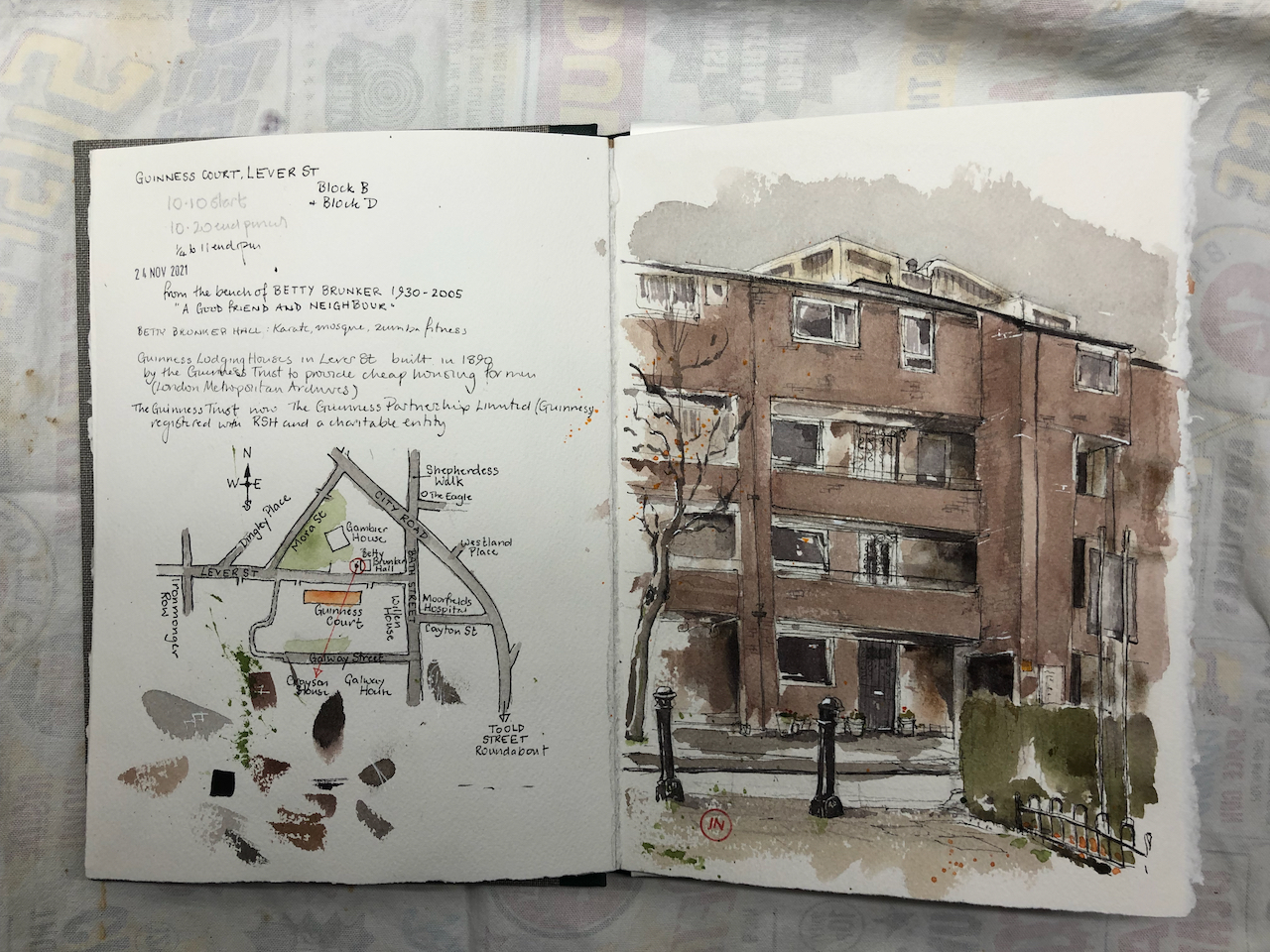
Guinness Court is a group of low-rise blocks between Gambier House and Galway House, in Finsbury. A resident writes that it is a lovely place to live, with an “inner communal garden with trees and squirrels”.
Here is Guinness Court from Lever Street:
Guinness Court, Lever Street, EC1 24th November 2021, 10:45am.
You see Grayson House just peeping over the roof.
Guinness Court is owned and managed by Guinness Partnership Limited1.
“Guinness was founded in 1890 to improve people’s lives. And that’s still what we’re about today. In 1890, philanthropist Sir Edward Cecil Guinness donated £200,000 to set up the Guinness Trust in London, with an additional £50,000 for the Dublin Fund, which later became the Iveagh Trust. He wanted to help improve the lives of ordinary people, many of whom couldn’t afford decent homes. He wanted to improve people’s lives and create possibilities for them. We’re proud that thousands of families have benefited from this vision.” [https://www.guinnesspartnership.com/about-us/what-we-do/our-history/]
Sir Edward Cecil Guinness was the grandson of the founder of the Guinness brewery.
The original Guinness Court on Lever Street was built in 1890. Here is what it looked like in 1950:
The current building was constructed in 1976, according to “Streets with a Story – The Book of Islington” by Eric A Willats FLA. I cannot discover anything about the architect or the plans – or why the Victorian building was demolished. If anyone has access to the current building and can spot a foundation stone or information plaque, please let me know?
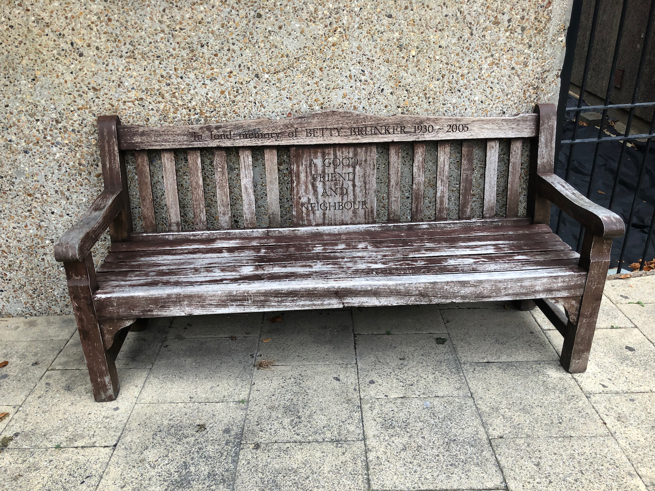
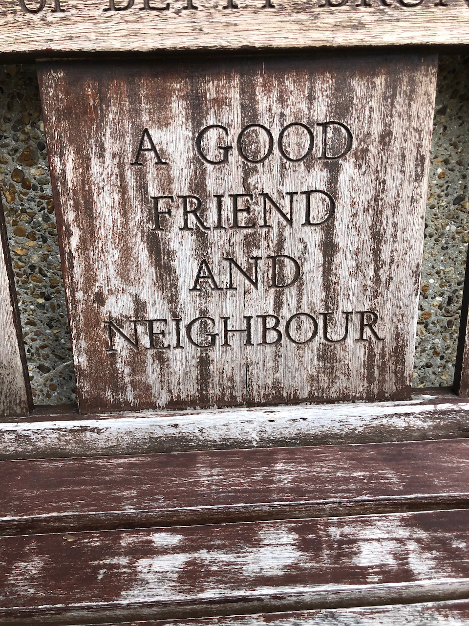
I made the sketch from a bench dedicated to the memory of Betty Brunker, “a good friend and neighbour”, 1930-2005.
Note 1: The Guinness Partnership Limited is a charitable Community Benefit Society No. 31693R registered in England and is a Registered Provider of Social Housing No. 4729. [https://www.guinnesspartnership.com]
Note 2: There are a number of buildings called “Guinness Court” in London. For example there is Guinness Court in Mansell Street E1, not far away, and Guinness Court, Snowsfields, Southwark SE1, on the other side of the river.
I have done a number of sketches in the Finsbury area:
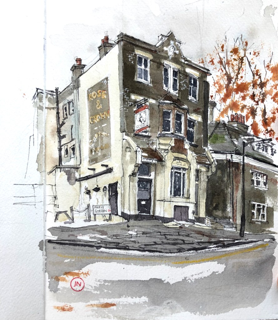
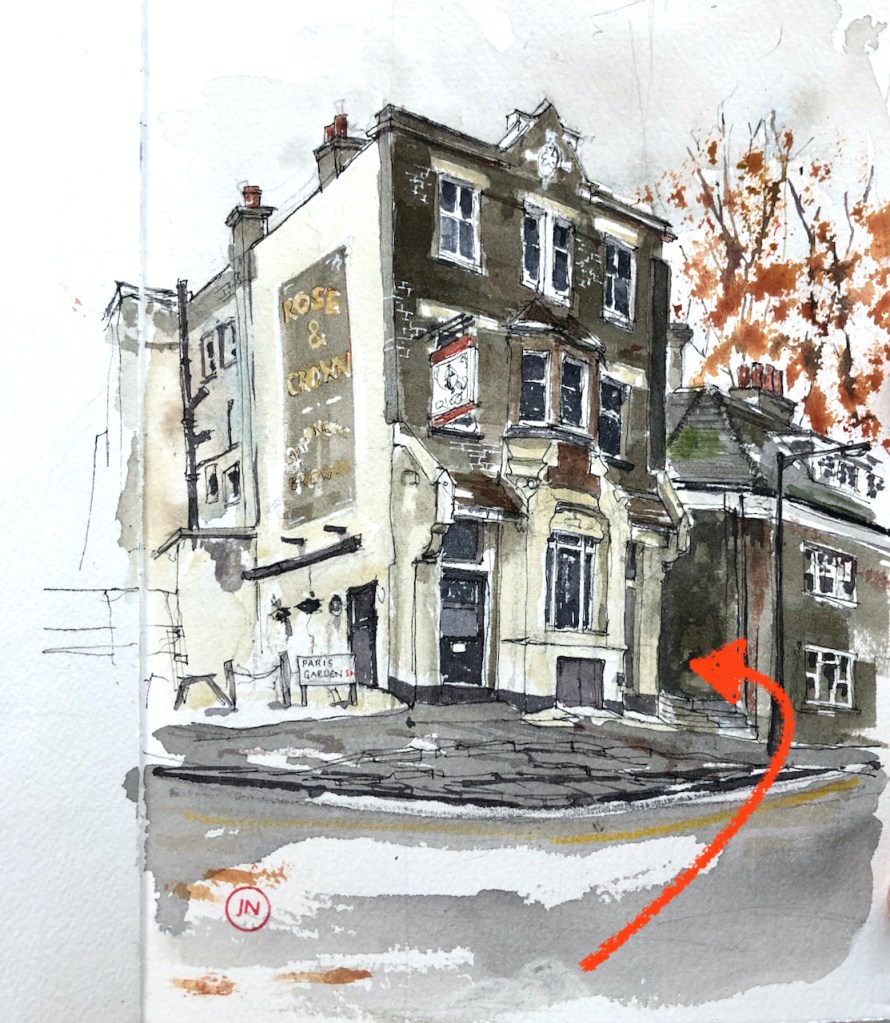
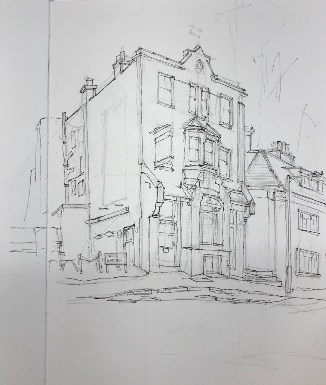
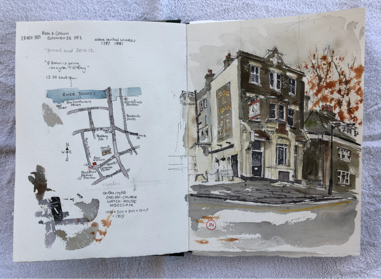
Here is the Rose and Crown, just south of Blackfriars Bridge.
Rose and Crown, Blackfriars SE1, 20 November 2021, 10″ x 7″ in Sketchbook 11
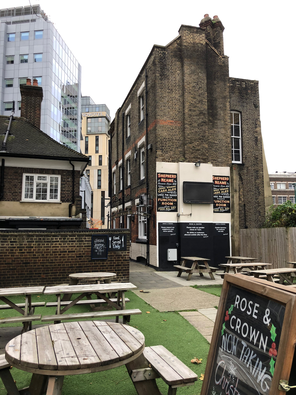
This pub stands amongst modern blocks: linking past, present and future in a swirling area of change. Behind the pub, unexpectedly, is a beer garden, giving onto a wooded area around the nearby church, Christ Church.
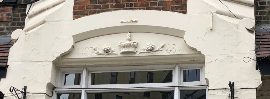
Above the arched window of the pub, two dates are carved in the stone work: 1787 and 1887
Above the arched window: 1787 and 1887 (or 1881?)
The pub’s website says the building “is thought to date back to the late 1800s”. The marvellous “pubwiki” entry tells me that the pub “was established in 1787, re-built in its present form in 1887″. They trace the landlords’ names and dates through census and insurance records, and note a John” Clark, victualler at this location, in 1789.
“1789/John Clark/victualler/../../Sun Fire Office records held at the London Metropolitan Archives” (data from Ewan of “pubwiki”)
Sketch map showing the Rose and Crown, SE1, and the viewpoint of my drawing, 20th November 2021
The roads round here have changed names. Colombo Street was “Collingwood Street” until 1937 (London Metropolitan Archives, notes on photos). Before that it was “Green Walk” in the 1789 insurance records quoted above. Paris Garden was previously “Brunswick Street”. The area in front of the pub, now the Colombo Centre and a Novotel, is a bombsite in a 1951 photo in the London Picture Archive.
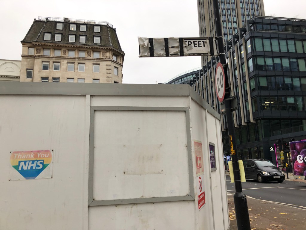
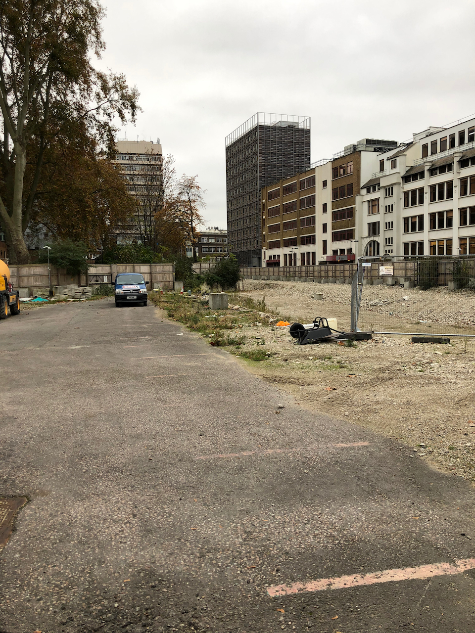
The area continues to undergo change. North of the pub is a huge empty lot. Buildings were demolished in or around 2019, and construction has not yet started.
This sign should say “Rennie Street”. Now this part of Rennie Street is inside the empty building lot, and inaccessible.Looking South along “Rennie Street” from Stamford Street across the empty building lot. The Rose and Crown is just visible in the back. I took this photo through the wire fencing which blocks Rennie Street.
The planning application (2019) is for 4 levels of basement and 6 buildings from 5 to 53 floors.
Planning application 19/AP/0414 from “planning.southwark.gov.uk”
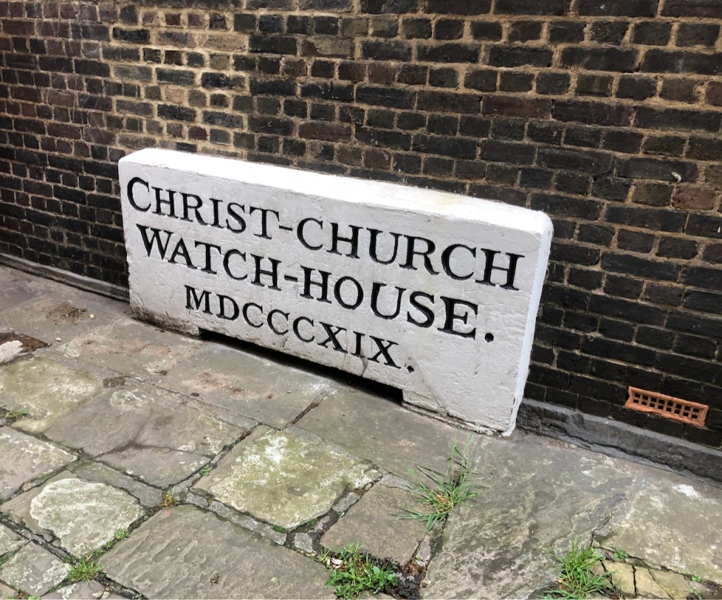
If you walk into my drawing and turn into the dark passage to the right of the pub, you find this notice, written in stone. Recently another notice has been added, asking patrons to leave quietly.
Walk into the passage to the right of the pub…..and find this notice (May 2021 photo)November 2021 photo.
By my calculation MDCCCXIX is 1000(M) + 500(D) + 300(CCC) + 10(X) + 9 (IX) = 1819
The purpose of the watch house was to guard the adjacent burial ground from body snatchers, according to the note on the London Metropolitan Archive Picture Gallery. Here is the watchhouse in 1932. The pub would be immediatly to the left of this photo:
“The Parish Watchhouse was built in 1809 and stood in the Church Yard until demolished in 1932. The Watchhouse was used to guard new burials against body snatchers. The Rectory, a new building similar in style, stands on the same site. Colombo Street was previously known as Collingwood Street.”
Here is work in progress on the drawing. You see the current rectory, which replaced the watch-house, on the right.
Location:
The pub cat, sleeping.
Click a button below to share this post online, email it, or print it:
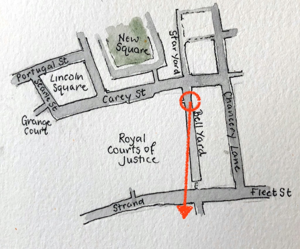
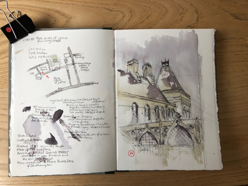
It was morning. As I walked down Bell Yard the sun streamed into the alley.
Royal Courts of Justice from Bell Yard, 16th November 2021, 10:45
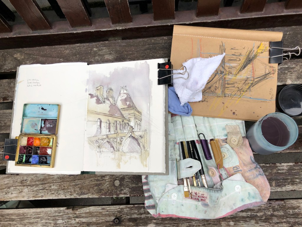
Later, I visited the Royal Courts of Justice. During the week, the Courts are open, and you can go in. I put my backpack on the conveyor belt. The friendly security guard asked me to drink from my water bottle: “The Sip Test” he called it, to check that my bottle did not contain a noxious substance. It didn’t. The equally friendly and welcoming person at the enquiry desk issued a photocopied information sheet setting out a self-guided walk around the building, which I followed.
It’s well worth a visit. It is an extraordinary example of Victorian architecture. And, of course, it contains working law courts. Photography is not allowed, and they were not enthusiastic when I suggested I might do a drawing inside, so I didn’t. People are at work, and court sessions are in progress, so respect is in order. The Café was not open, which was a pity.
My drawing shows the Eastern part of the building. I sketched it on location in about 40 minutes and did the colour later at my desk.
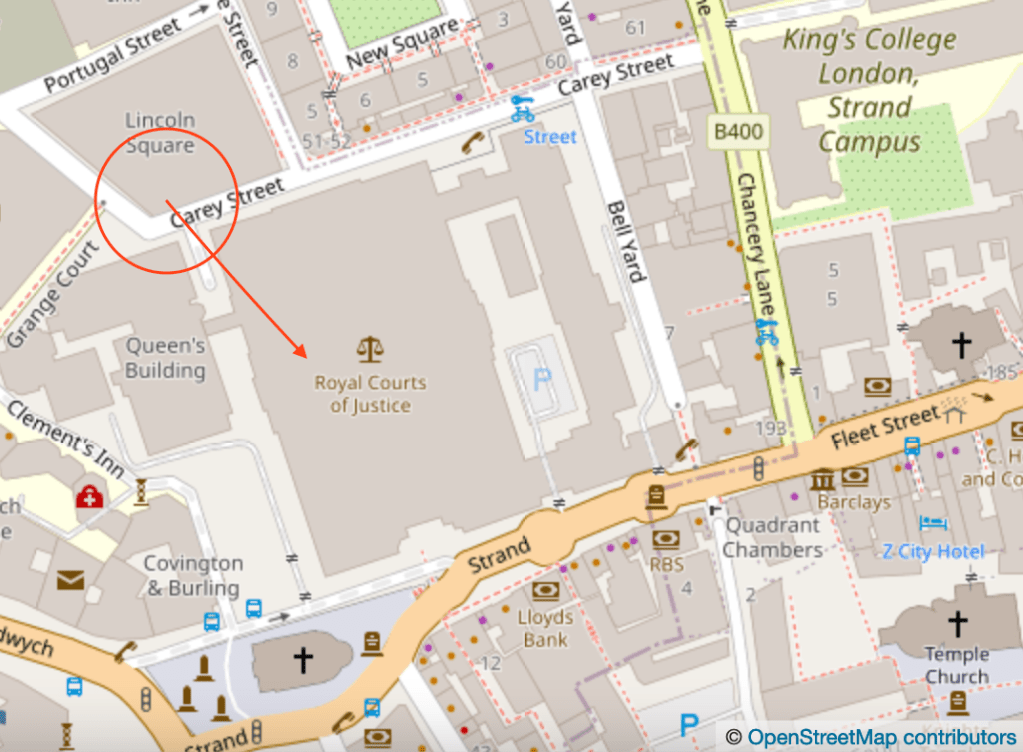
I sketched the Royal Courts of Justice from Carey Street earlier in the week, under an overcast sky:
The Royal Courts of Justice are a huge campus of buildings of Victorian gothic style, between The Strand to the south to Carey Street to the north. Here is a view from Carey Street. The Royal Courts of Justice are the High Courts for England and Wales, and the Court of Appeal. The High Courts…
Click a button below to share this post online, email it, or print it:
The Royal Courts of Justice are a huge campus of buildings of Victorian gothic style, between The Strand to the south to Carey Street to the north.
Here is a view from Carey Street.
Royal Courts of Justice from Carey Street, 12 November 2021, 1:45pm 10″ x 7″
The Royal Courts of Justice are the High Courts for England and Wales, and the Court of Appeal. The High Courts are for civil cases, such as breaches of contract, personal injury claims, libel and slander. There is also a family division for cases of matters such as marriage annulments and care of children. Criminal cases, such as murder, are tried in the Old Bailey, down the road. Criminal cases are appealed in the Royal Courts of Justice Appeal Court. I learned this from an entry in Chambers Student website.
The construction of this building started in 1873. It was opened by Queen Victoria on December 4th 1882. The architect was George Edmund Street. The main contractor was Messrs Bull and Sons of Southampton.
Drawn and coloured on location. I used Buff Titanium for the Portland stone, and the grey is a mix of Perylene Maroon and Prussian Blue. This drawing took about 1 hour 15 mins. I also did a preliminary sketch to explore the perspective.
Preliminary sketch with yellow and red perspective lines
Finishing the colour on a bench in Grange Court
Map (c) Open Street Map contributors.
Sketchbook made by Wyvern Bindery, Hoxton.
Click a button below to share this post online, email it, or print it:
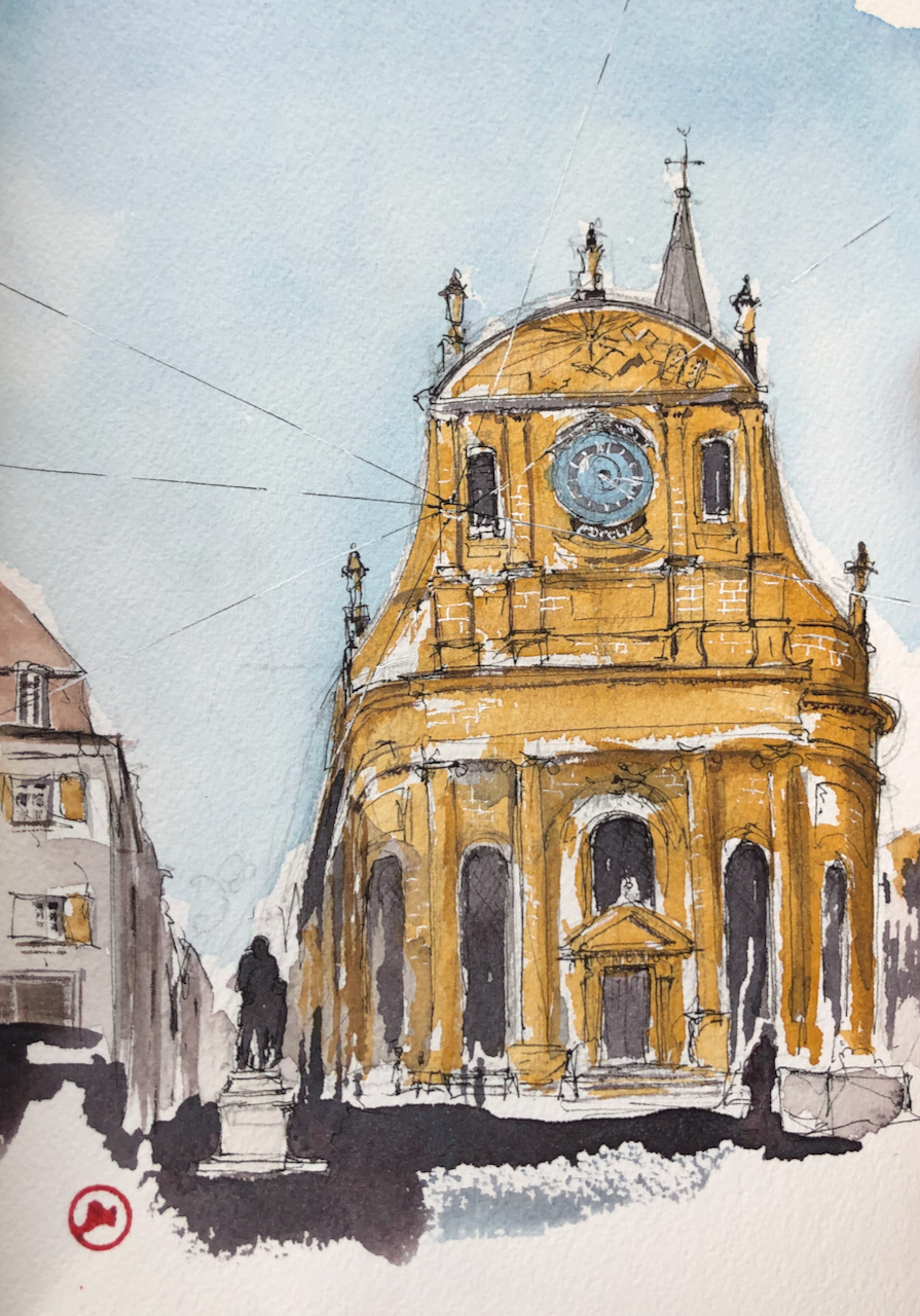
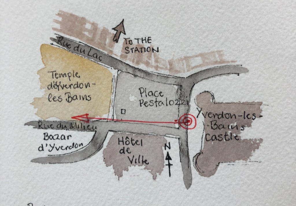
Here is a view from a bench in the main square in Yverdon-les-Bains, Vaud, Switzerland.
Temple d’Yverdon-les-Bains, 27 October 2021, 3.30pm, 10″ x7″ in Sketchbook 11
This is a protestant church, built in 1757. The wonderful yellow stone is from Hauterive in the canton of Neuchâtel.
On the left you see the statue of Johann Heinrich Pestalozzi, for whom this central square in named. He lived 1746-1827. He was an educator, and established the idea that the process of teaching needs to be thought about. He was an early practitioner of the study of teaching: pedagogy. This is why on his statue there are also children.
Pestalozzi’s idea was “Learning by head, hand and heart”. He thought that education was a good idea, in general, for everybody, including the poor. It was good for people as individuals, and good for society in general. Education meant people contributed more, were healthier and happier, and generally better citizens. [My paraphrase of what I’ve read on the website of the JH Pestalozzi Society and elsewhere]. This all sounds very modern. The current ideas of “child-centred learning” for example, can be traced back to Pestalozzi, I read, as well as the concept of state education.
He initiated the Pestalozzi Children’s villages in Switzerland and elsewhere, specifically to help the poor and displaced. This work is still continuing as Pestalozzi World.
So Pestalozzi was a very influential person.
The lines in my drawing are wires suspended across the square for hanging banners and decorations. I like to think they also symbolise the rays of hope that education brings.
Later note:
Above the clock is the Latin inscription: SUPERNA QUAERITE
This roughly translates as “Seek higher things” or “Enquire upon matters of a higher order”.
It occurs in the Letters of Paul to the Colossians, Chapter 3 verse 2, which is rendered in my St James’ Bible as:
If then ye were raised together with Christ, seek the things that are above, where Christ is, seated on the right hand of God. Set your mind on the things that are above, not on the things that are on the earth.
Or if you prefer the Latin, from “Novum Testamentum Domini Nostri Jesu Christi”(“The New Testament. A Latin version prepared by Theodore Beza”[2010], via GoogleBooks):
Itaque si resurrexistis cum Christo superna quaerite ubi Christus est ad dextrum Dei sedens. Superna satagite non terrestria.
Below the clock are the Roman numerals: MDCCLV
1000+500+100+100+50+5 = 1755
Click a button below to share this post online, email it, or print it:
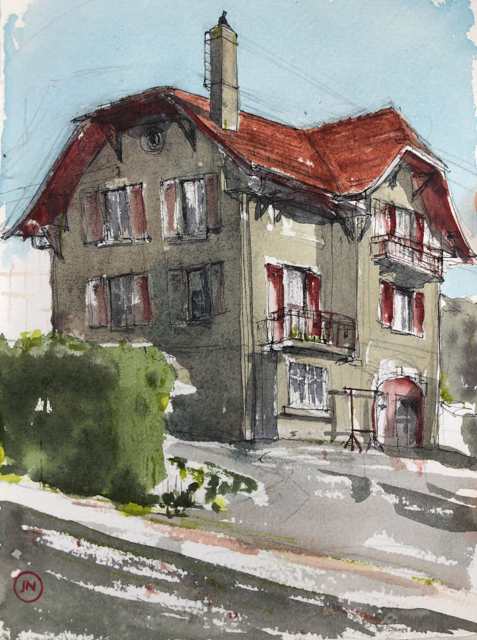
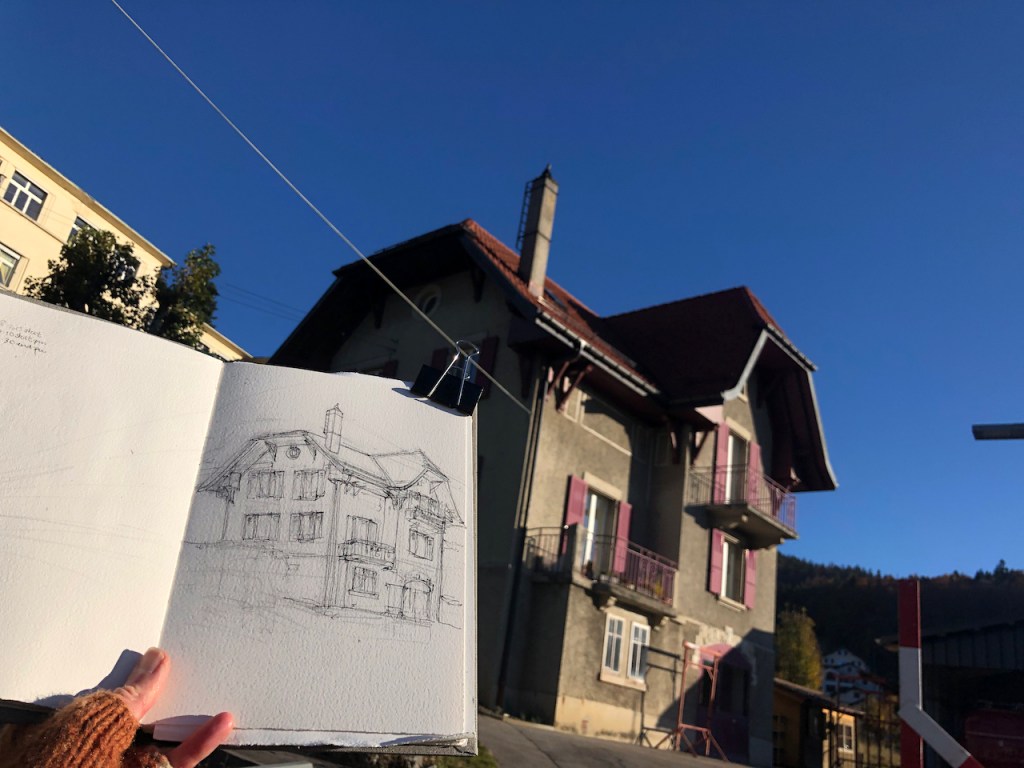
Here is 23 rue du Petit-Montreux, Sainte-Croix, Vaud.
23 rue du Petit-Montreux, Sainte-Croix, Vaud 24 October 2021, 10″ x 7″ in Sketch book 11
I sketched this house after breakfast. The sun was bright and I rushed out into the crisp morning. It took me about one hour and 15 minutes outdoors, and then I completed it in my hotel room. The outside air temperature was 20 C.
A few pencil lines
Pen and ink
Pen and ink done
Work in progress on the colour
Looking east to the house
Perhaps I should draw the scene looking the other way too?
Work in progress in rue du Petit-Montreux
“…the ladder that goes up the chimney…”
I particularly admired the ladder that goes up the chimney. So practical.
The sky is Phthalo Blue Turquoise, with some Lavender. The roof is mostly Fired Gold Ochre. The house walls, and the road, are a mix of Phthalo Blue Turquoise and Perylene Maroon, with a bit of Transparent Brown Oxide and Buff Titanium. The shutters are a mix of Fired Gold Ochre and Perylene Maroon. The hedge is Sap Green with those other colours mixed in to make it darker.
Here are some maps:
Click a button below to share this post online, email it, or print it: