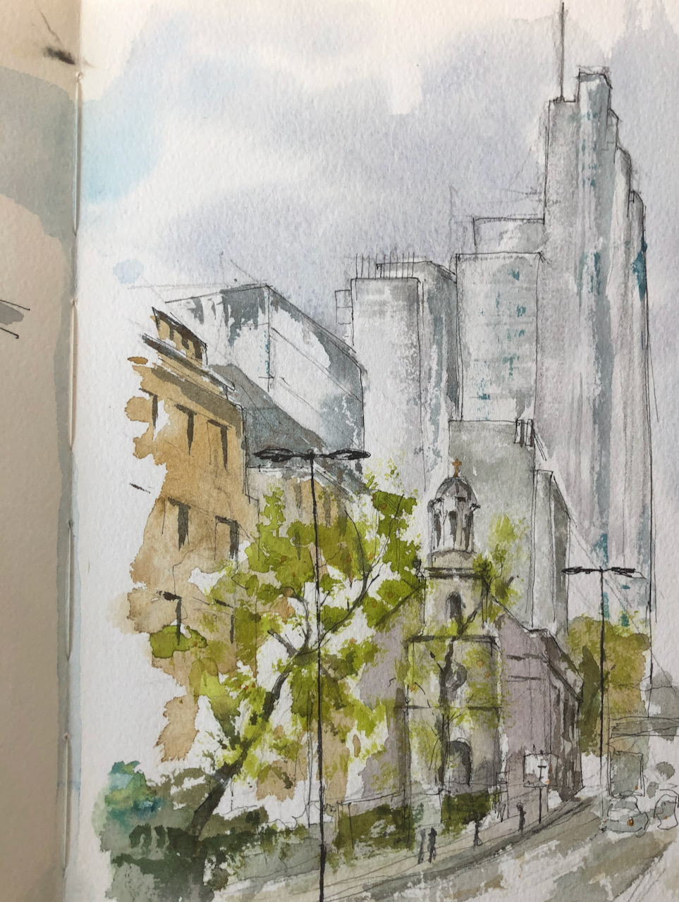
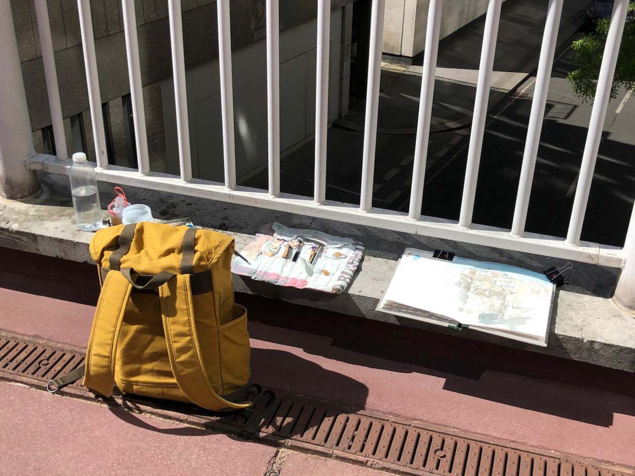
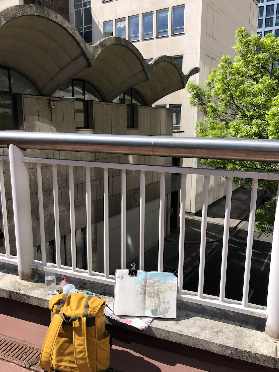
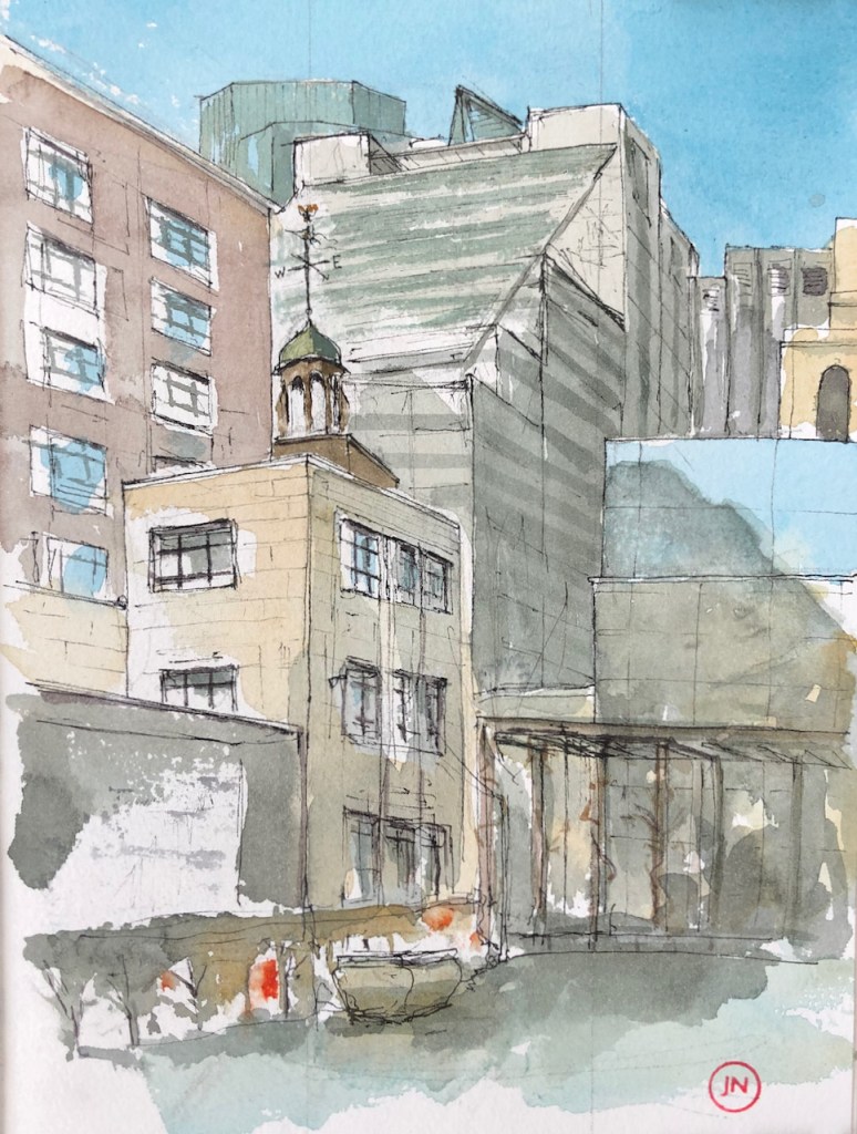
London Wall is the old Roman wall around the City of London. It is also the name of a street. Here is the church All Hallows on the Wall, drawn from outside the Carpenters’ Hall.
All Hallows on the Wall, with 110 Bishopsgate behind, drawn 30th April 2021, 12:35. 10″ x 8″ in Sketchbook 10
I drew All Hallows last year, from across the street, see this post:
London Wall is the old Roman Wall around the City of London. It is also the name of a road. In normal times London Wall is a very busy road, an arterial route in the City, full of buses and cars and bikes, with people thronging the pavements…
Viewpoint of the drawing.
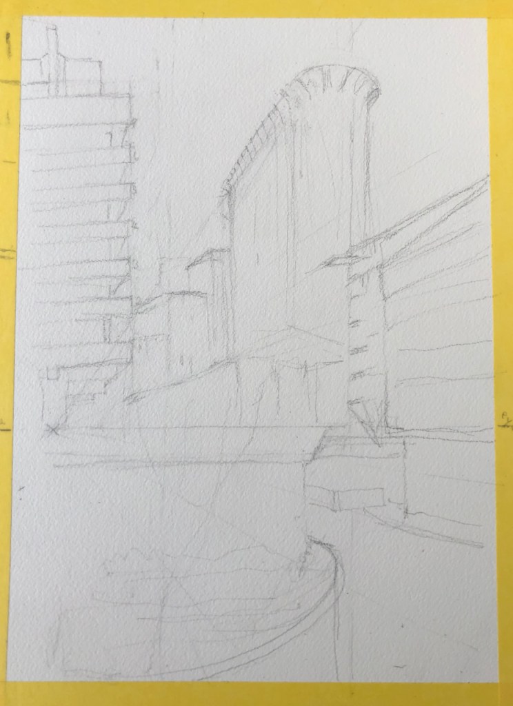
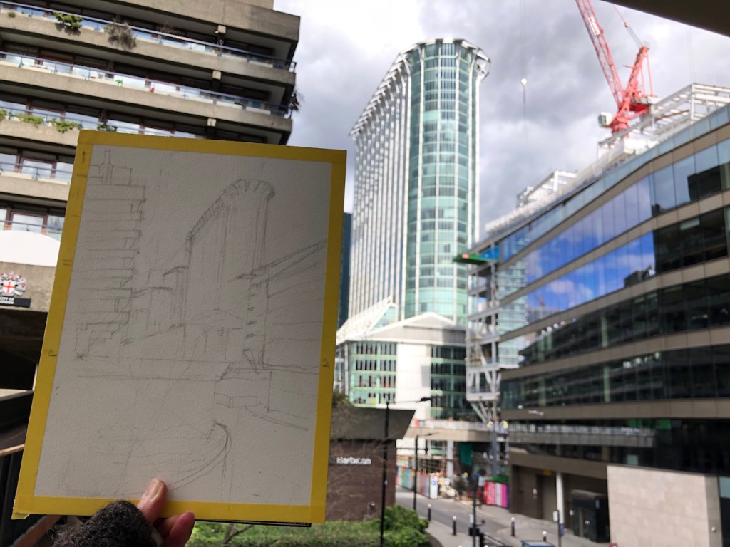
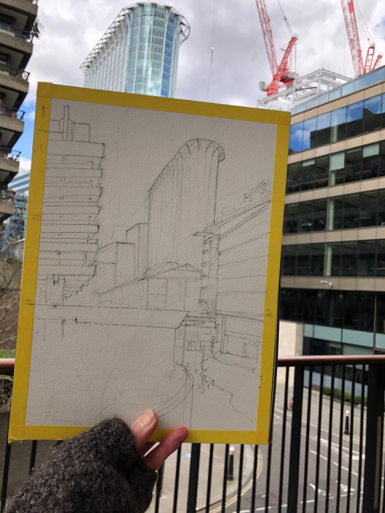
Today’s drawing was with a viewpoint looking east along London Wall, towards the tower blocks on the eastern part of the City. The tower block on the right is “Salesforce Tower” also known as “Heron Tower” and “110 Bishopsgate”. It was completed in 2011. The architect was Kohn Pedersen Fox.
The colours in the drawing are Phthalo Blue Turquoise, Perylene Maroon, Mars Yellow. The bright green is Green Gold. There some Iridescent Silver on the towers.
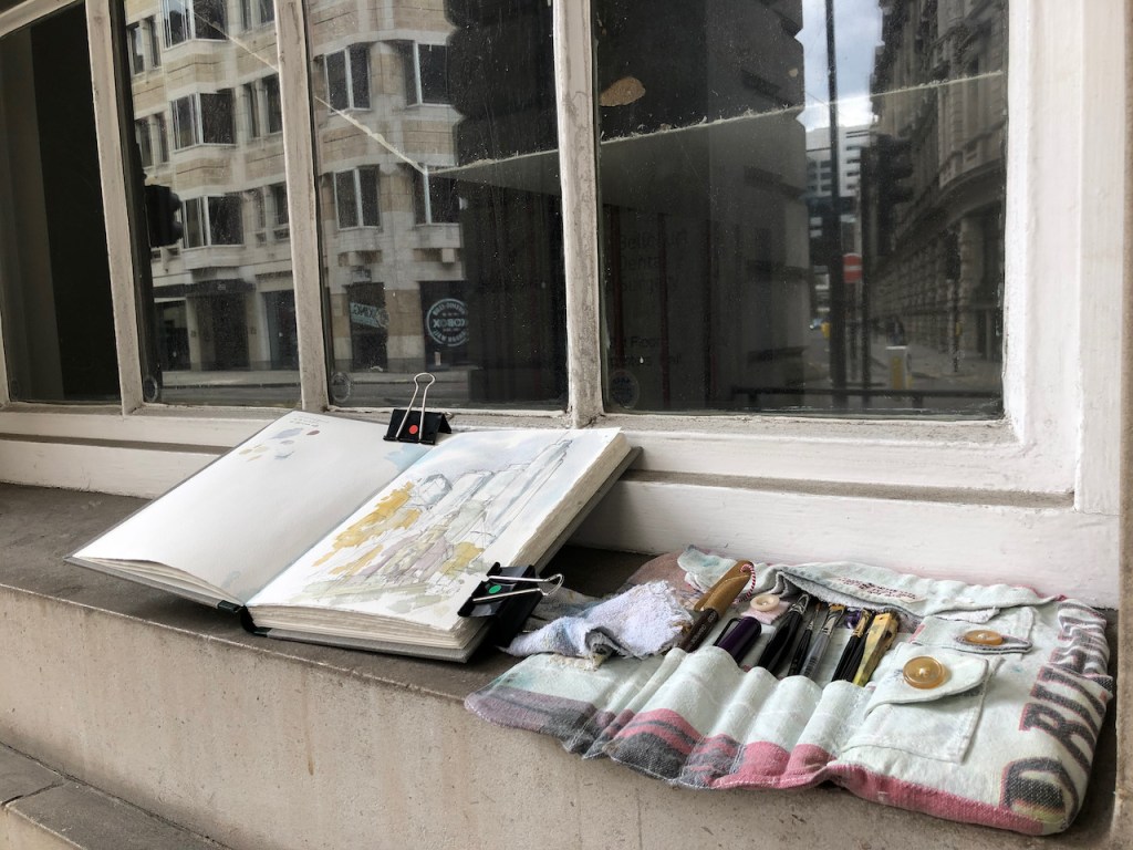
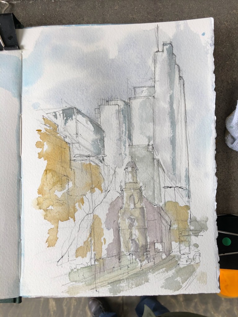
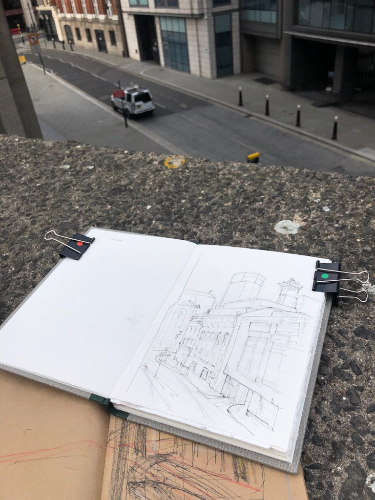
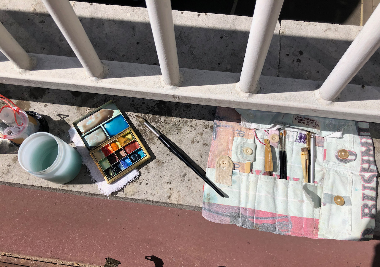
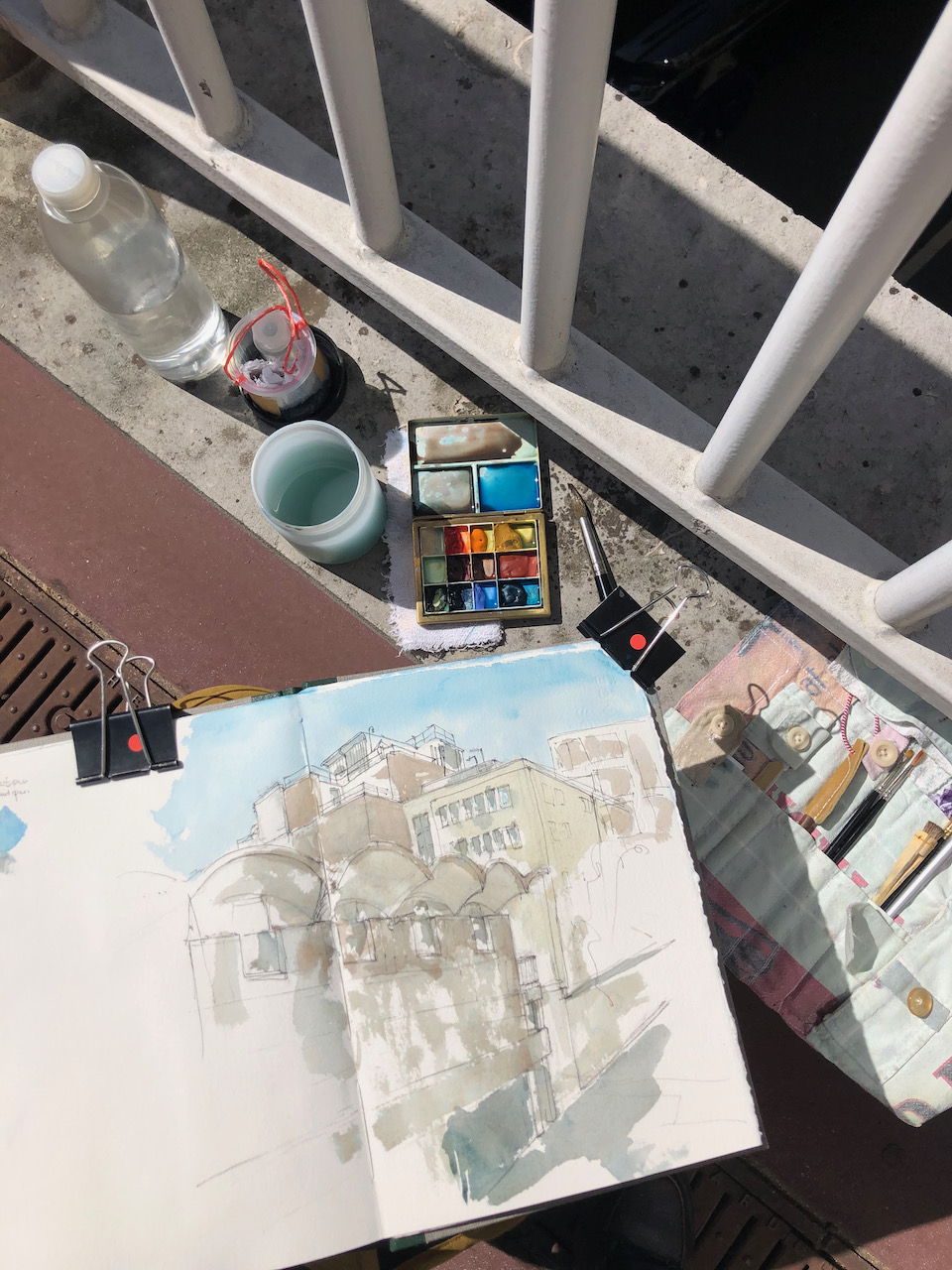
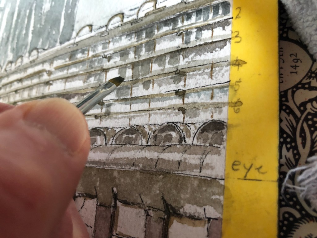
Here is work in progress on location.
Click a button below to share this post online, email it, or print it:
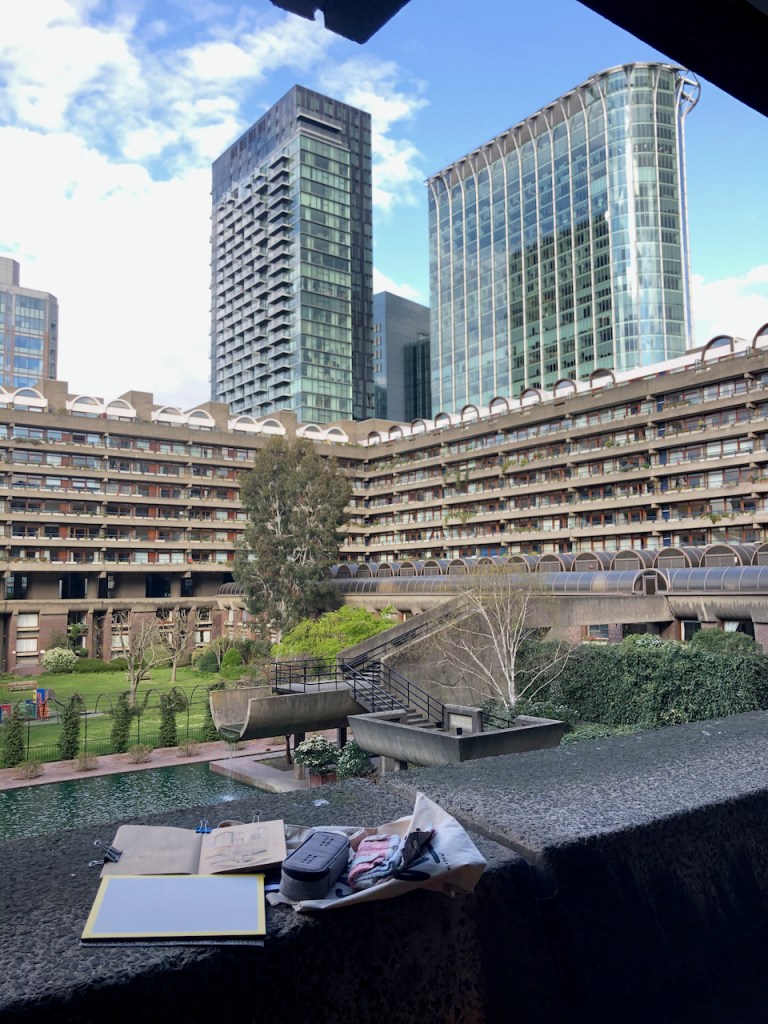
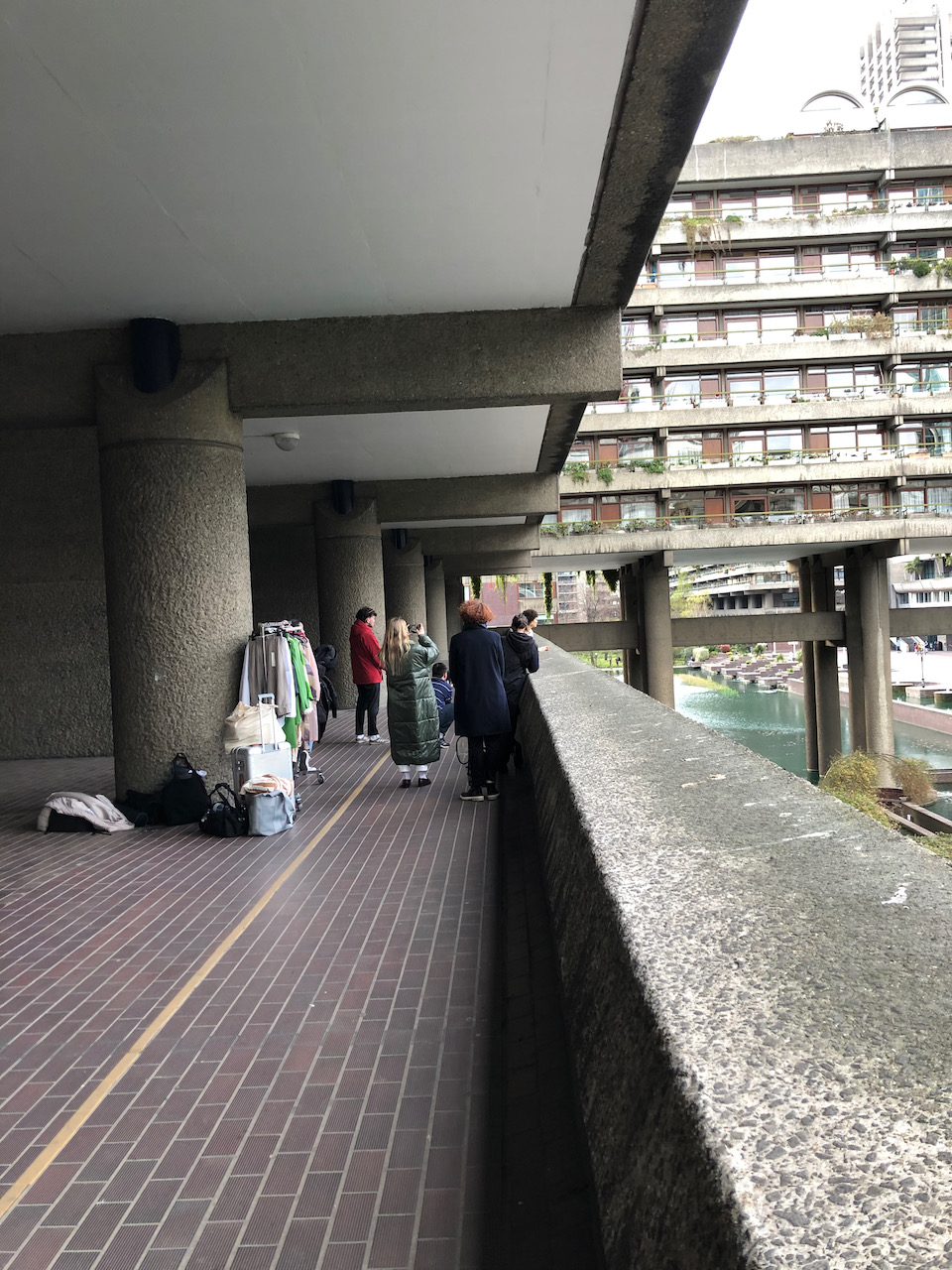
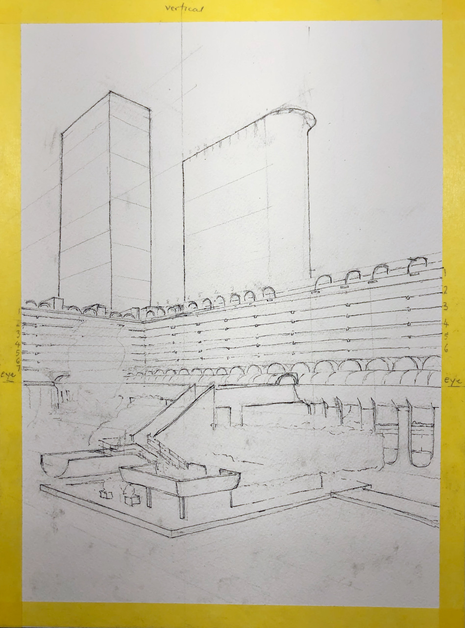
Here is the view looking North along Silk Street, from the Barbican Podium, next to Cromwell Tower.
The Jugged Hare from the Podium, 29 April 2021, 6pm, 7″ x 10″ in Sketchbook 10
The buildings are, from left to right:
the operations centre of a bank, the building with the arch
The Jugged Hare, on the corner, with the pub sign
The Brewery, the red-brick building
Linklaters, a legal firm, on the right with the squarish windows.
On the sky line, the tall building is “HyLo” (or HiLo?) under construction on Bunhill Row, and the magnificent chimney of The Brewery.
In front of the chimney there is a whole superstructure on the roof of the Brewery which covers various industrial kitchen fans and ducts. These fans and ducts made a lot of noise, irritating neighbours. So last year they put a fence round, as you see in the picture in grey. Currently, both the Brewery and the Jugged Hare are closed, so it remains to be seen if the fence reduces the noise.
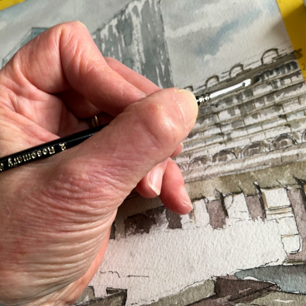
I drew this picture from the podium. Here is work in progress.
Here’s a rough sketch map, showing the viewpoint of the drawing.
Click a button below to share this post online, email it, or print it:
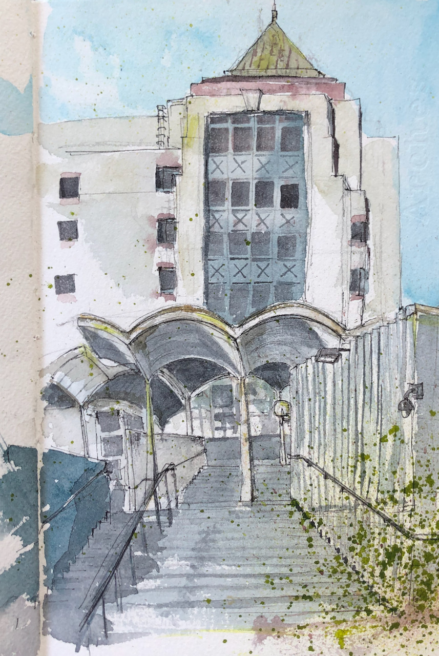
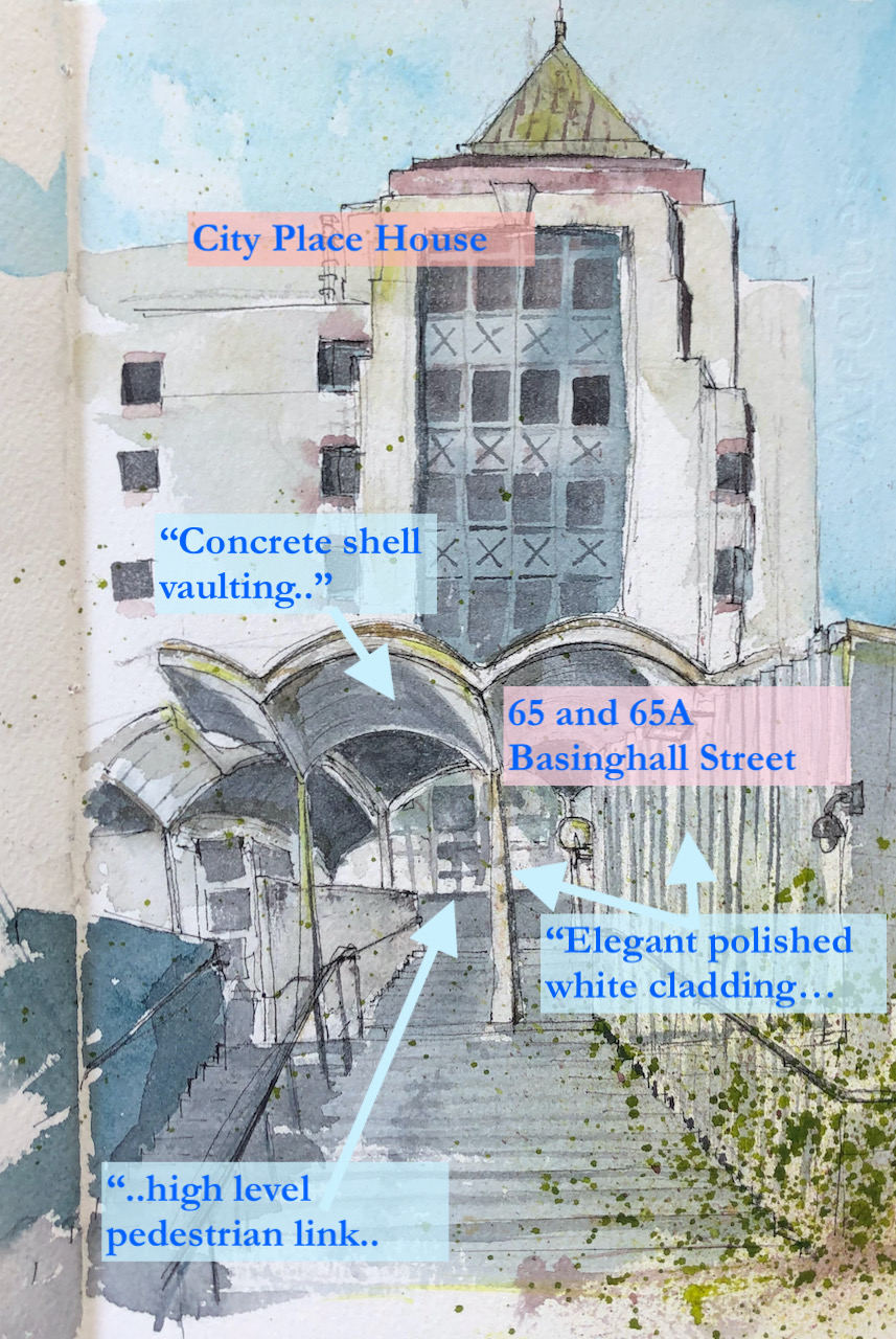
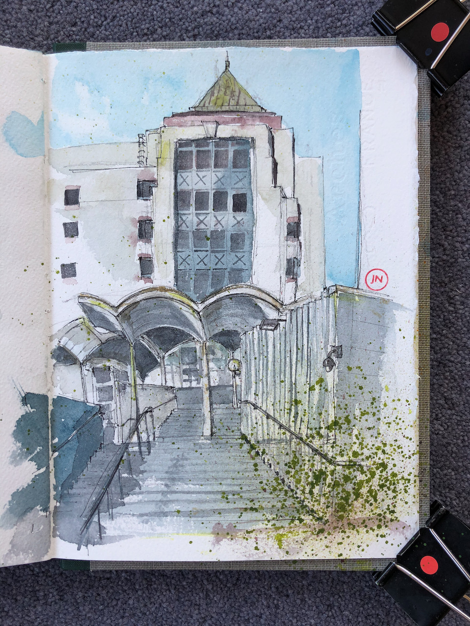
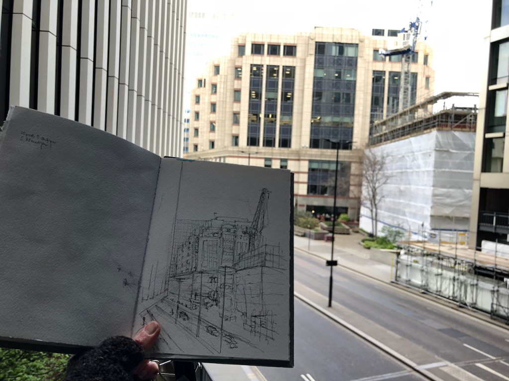
In a previous post I presented a drawing of 65 Basinghall Street done from the bridge which is on the North side of the building. Here is the south side.
65 Basinghall Street is the building in front, with the scalloped arches. Behind it is City Place House.
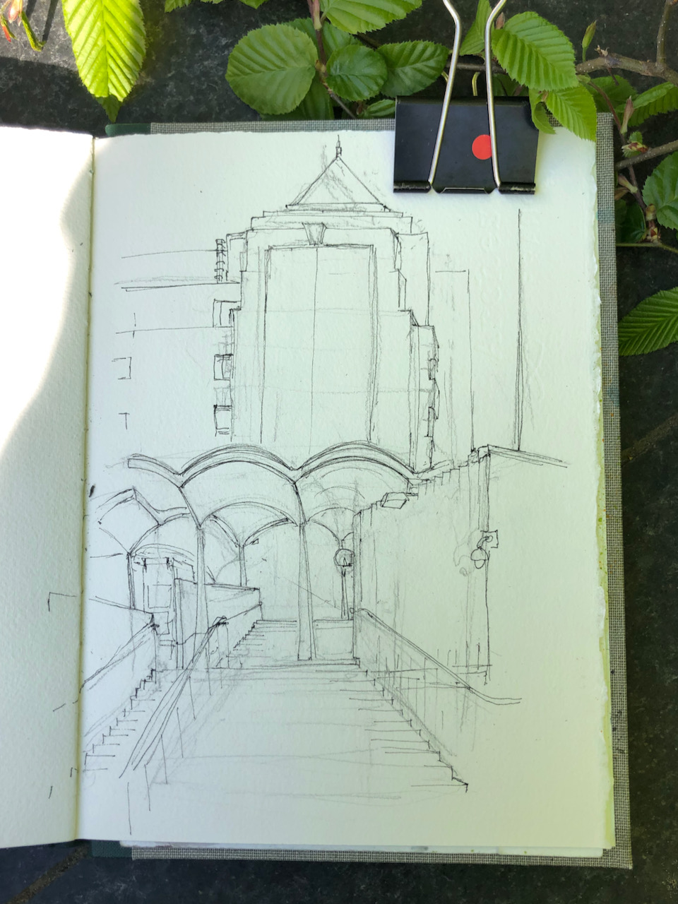
65 Basinghall Street EC1 (foreground), City Place House (background) 8″ x 10″ in Sketchbook 9. 23rd April 2021
City Place House was built in 1992, and is due for demolition and replacement by a building which is taller and broader.
65 Basinghall Street is listed Grade II. The Historic England website gives the reason for the listing:
No 65 and 65a Basinghall Street, 1966-69, by Richard Gilbert Scott, is listed at Grade II for the following principal reasons:
Architectural interest:
for its creative composition of plane, form and interconnected masses;
for its use of materials, in particular the elegant polished white cement cladding and distinctive, celebratory, concrete shell-vaulting;
in its skilful planning, providing varied accommodation, open space and a high-level pedestrian link, on a corner plot.
Historic interest:
as the first part of the architect’s most significant secular commission, distinctively expressing his personal style and establishing his creative, Modern, response to the medieval Gothic of this important site;
as one element of the contribution made to the site over a period of almost seventy years by England’s most celebrated architectural dynasty.
The “celebrated architectural dynasty” is the Gilbert Scotts, 4 generations of architects down the male line.
Richard Gilbert-Scott was the fourth in line. He also designed the Guildhall Art Gallery and Guildhall Library.
George Gilbert-Scott (1811-78) – Albert Memorial, Midland Hotel, St Pancras Station
George Gilbert-Scott Junior (1839-1897)- St Agnes Kennington, [In 1884, he was declared ‘of unsound mind’]
Giles Gilbert-Scott (1880-1960) – Guildhall North Wing, Battersea Power Station, Telephone Kiosk, LMH Chapel, Bankside Power Station (=Tate Modern), Cambridge University Library, Cropthorne Court (Maida Vale)
Richard Gilbert-Scott (1923-2017) Guildhall Art Gallery, Guildhall Library, 65 Basinghall Street.
65 Basinghall Street was originally an exhibition hall and offices with two temporary magistrates’ courts (with cells) and a records store over basement car parking.
The Historic England website also notes the alterations made to the site in recent years:
The principal alterations to the building’s interior since its construction are the conversion of 65a Basinghall Street (the former exhibition hall) into office space, and the opening-up of the magistrates’ courts (part of 65 Basinghall Street) also to form office space. The hard landscaping has also been altered, the raised terrace to the south has been repaved, losing the original pattern of hexagonal paving and glass lenses, and the flight of steps leading up to the exhibition hall has been reconfigured to create a light well and lifts from the terrace down into the office space below. A scheme of retaining walls and plant boxes which were part of this landscaping has also been lost.
Here is a photo from the Historic England website, and a photo I took yesterday for comparison. I could not stand in exactly the same place as the photographer of 1974, because the walkway has changed. This is the view from the North.
Photo from the Historic England Website, taken in 1974-5 by John Gay A similar view yesterday65 Basinghall Street from the highwalk
Spot the differences?
The bridge has been replaced with something more chunky
The little canopy above the entrance to the Magistrates Court has vanished.
The building on the right (City Place House) has been rebuilt (1992)
You can no longer get a good view of 65 Basinghall Street from the highwalk!
There are many more differences on the South side. I can’t find a picture pre-2002, which was when a major refurbishment started on the Guildhall North wing. As part of this refurbishment, changes were made to the plaza and walkway. If you have a old photo – I’d be very interested to see it.
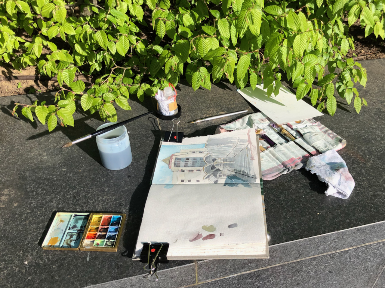
I made the drawing on a brilliant sunny day, 23rd April 2021, sitting on a bench on the plaza. 65A is currently in use as a non-symptomatic Covid testing centre. It didn’t seem to have many customers. I counted two in the time I was there, about 1½ hours. But I might have missed some.
Here are photos of work in progress.
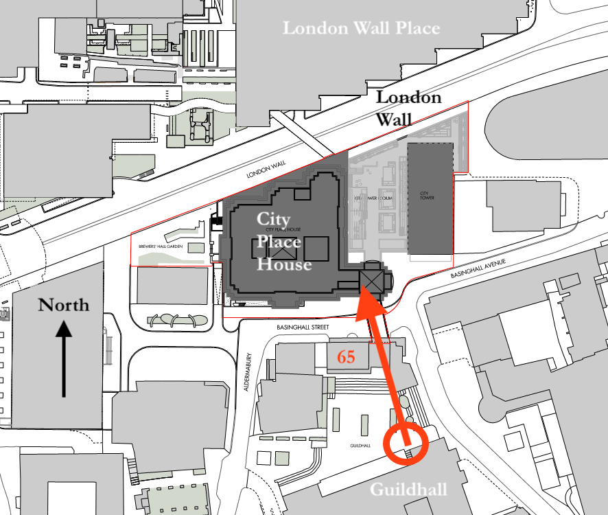
Map showing location of drawing and viewpoint. From the planning application for City Place House (map drawn by Allies and Morrison LLP, 18/3/2021 [Detail, annotated])
Here are other drawings I’ve done in the area, click the title to read more.
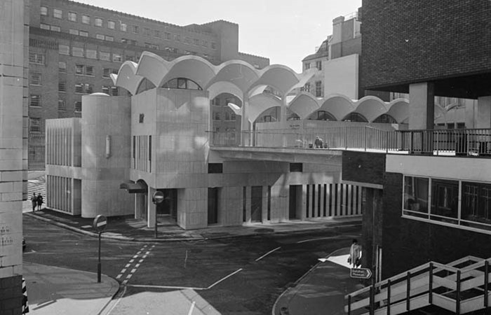
I found a photo on Flickr by Peter Marshall, taken in 1986. Click the picture to go to Peter Marshall’s Flickr album and see a more detailed picture.
For comparison, here is a photo of the same view in 2021.
The clear horizontal run of steps is now interrupted by various lifts and black blocks. The statue has been moved, and no longer looks North towards Richard Gilbert-Scott’s masterpiece, but West towards St Mary Aldermary. And all the interesting hexagonal tiling on the piazza has gone.
Click a button below to share this post online, email it, or print it:
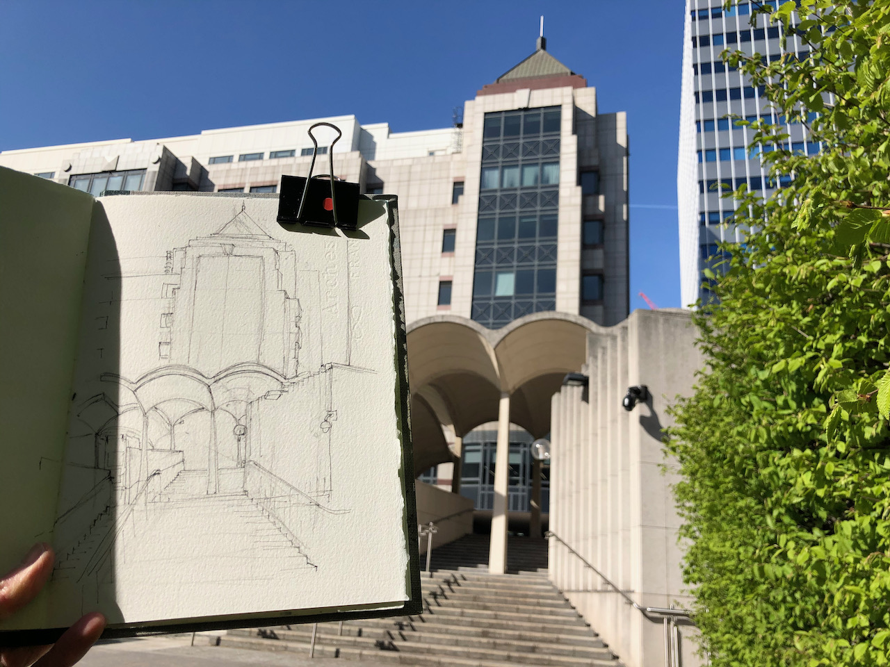
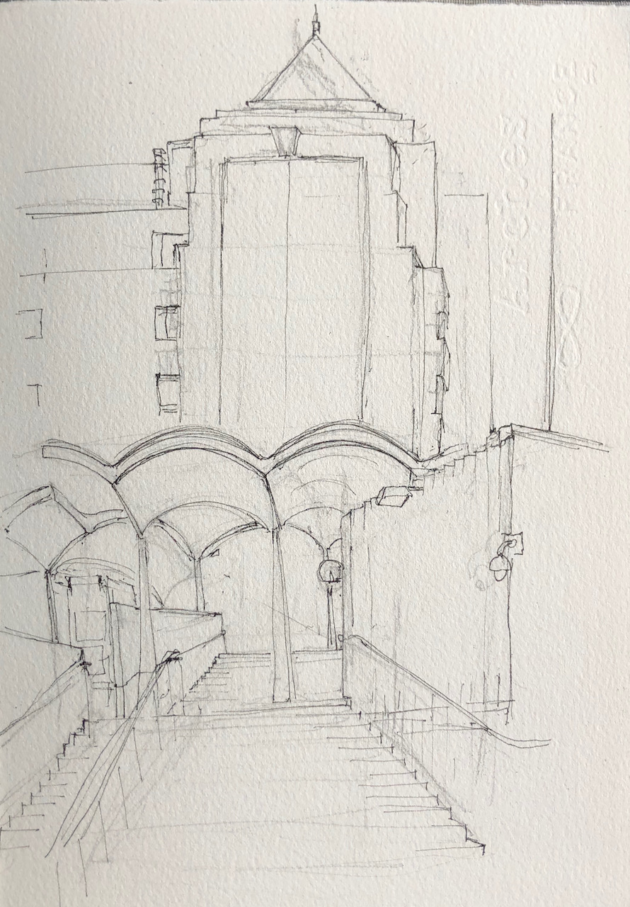
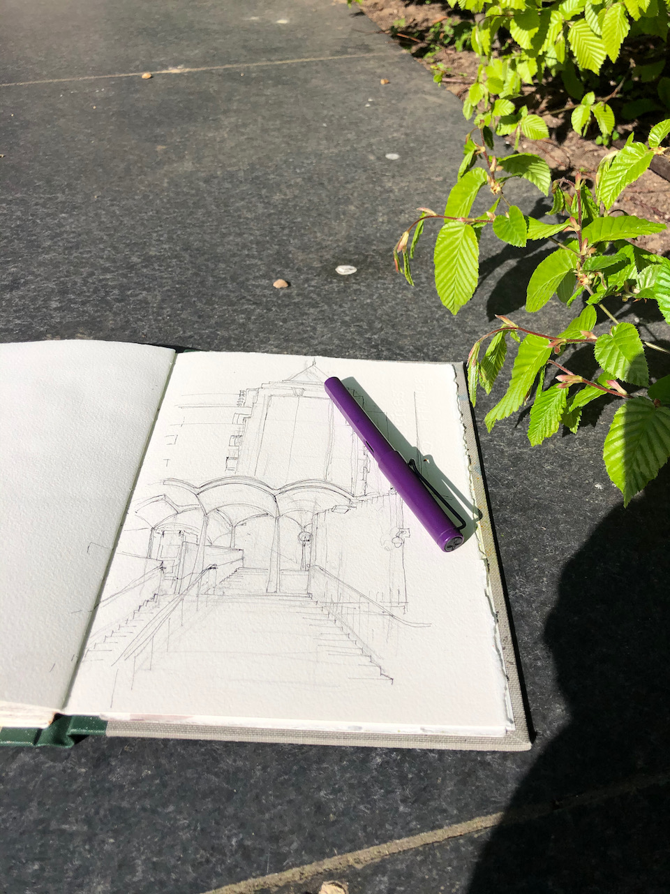
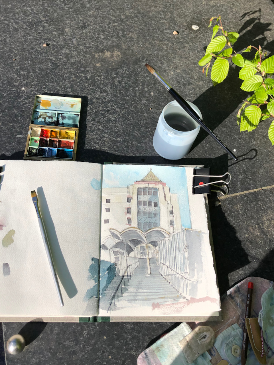
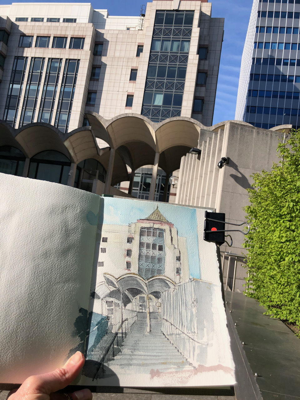
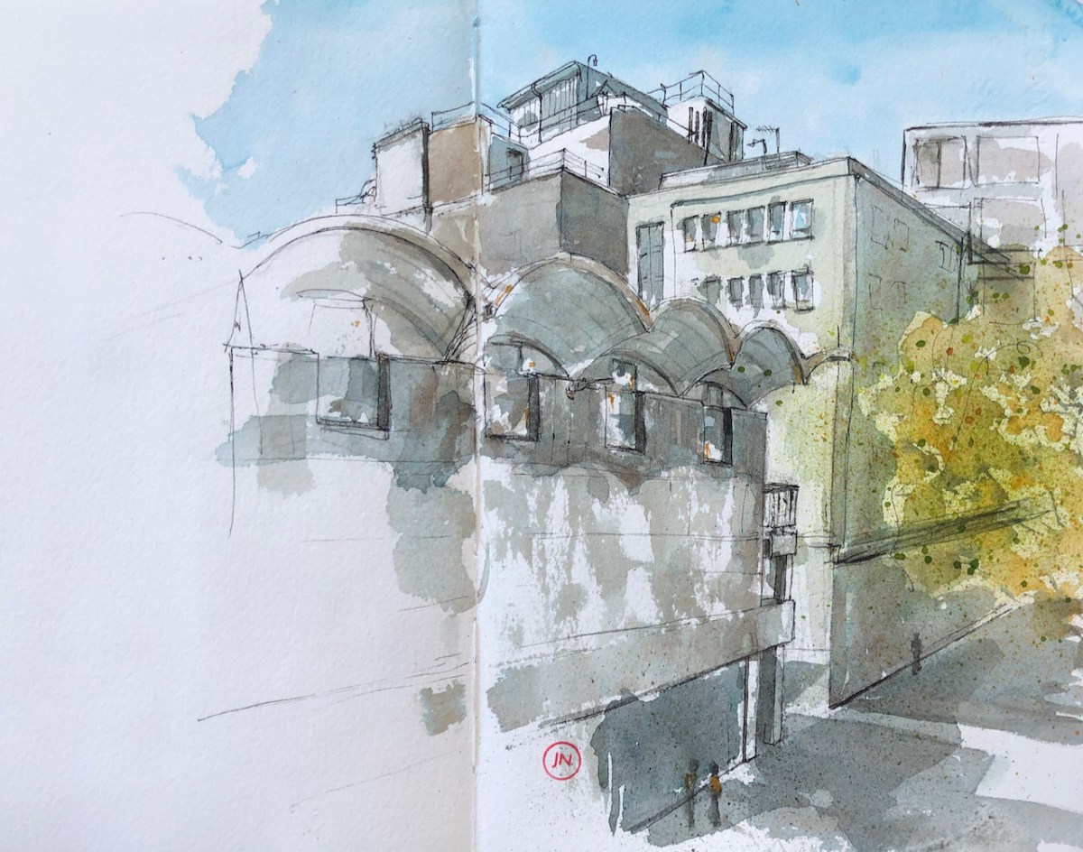
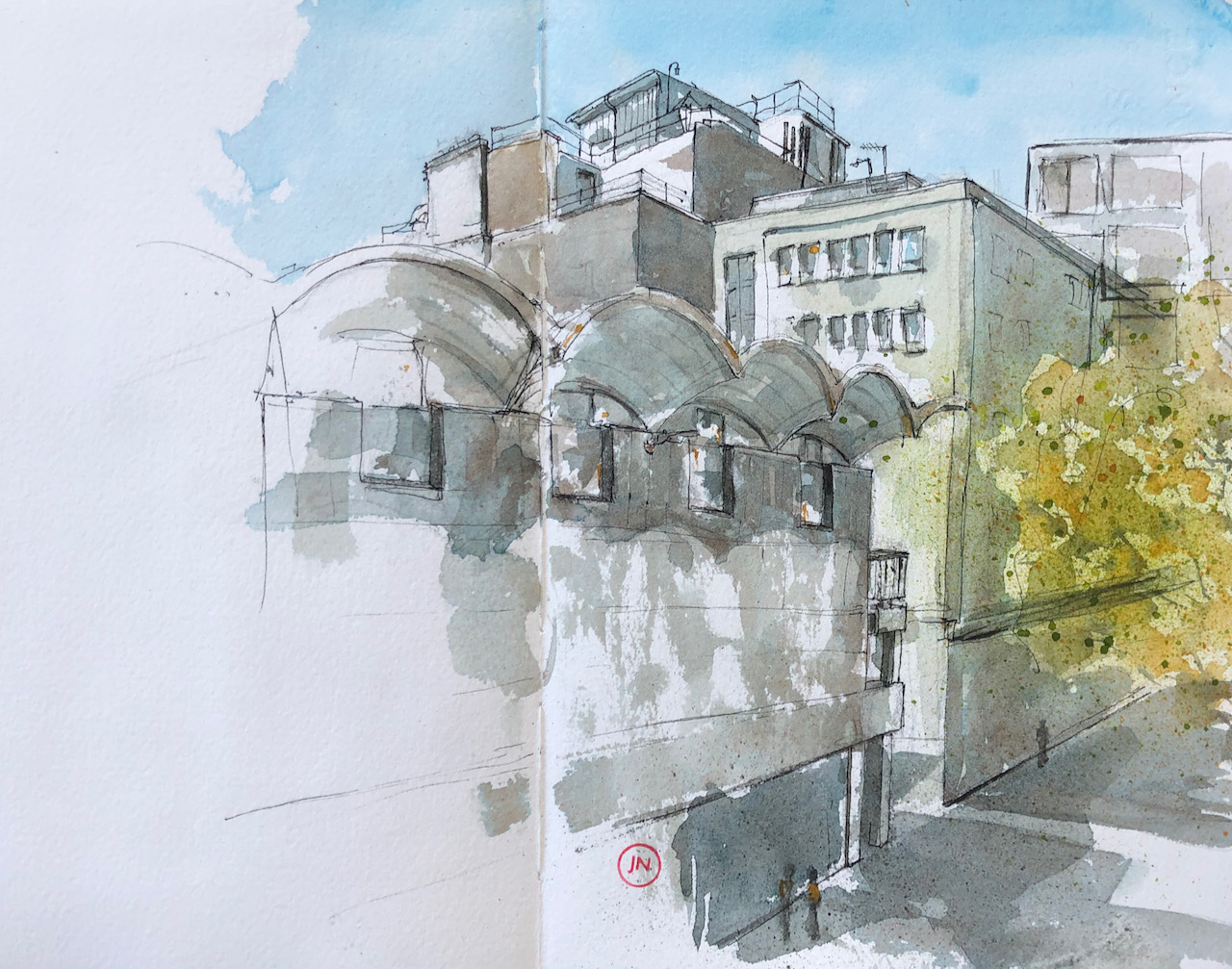
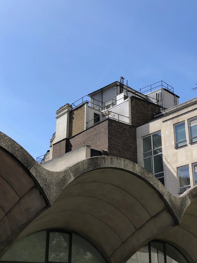
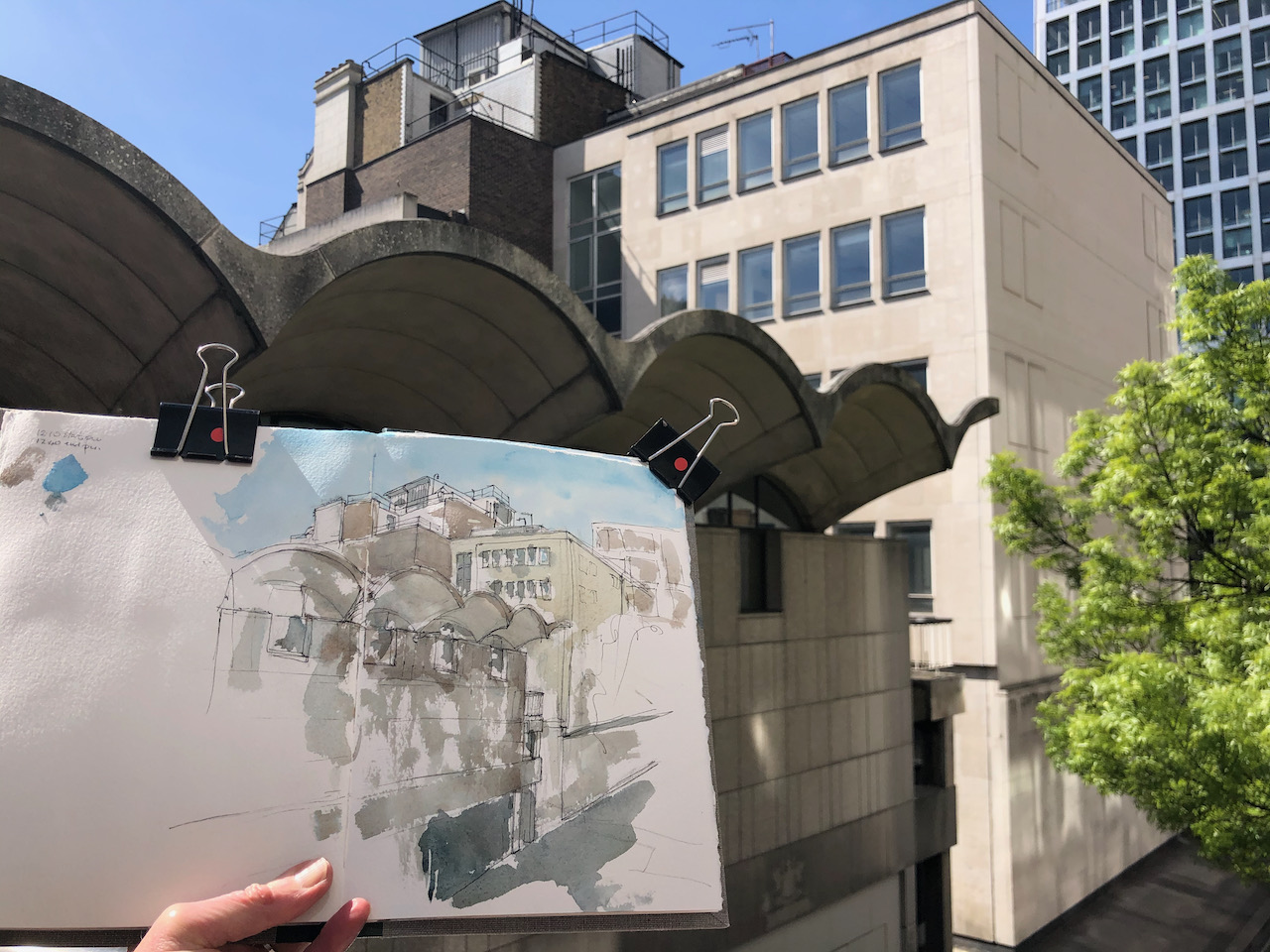
This is a view from the bridge over Basinghall Street, looking at the back of 65 Basinghall Street.
65 Basinghall Street from the bridge, 11″ x 10″ in Sketchbook 9. 22 April 2021, 12:40pm
There is much of interest in this view. There are the wonderful arching shell-like structures of 65 Basinghall Street. This was built in 1966-7 to the designs of Richard Gilbert Scott1
Above the arches is an extraordinary building in the style of steam punk. In my drawing it was not possible to capture the magnificent complexity of all the pipes and railings and ventilators and intersecting walls.
This sky-level structure is on top of the Chartered Insurance Institute, whose hall is on the right of my drawing.
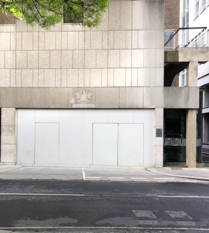
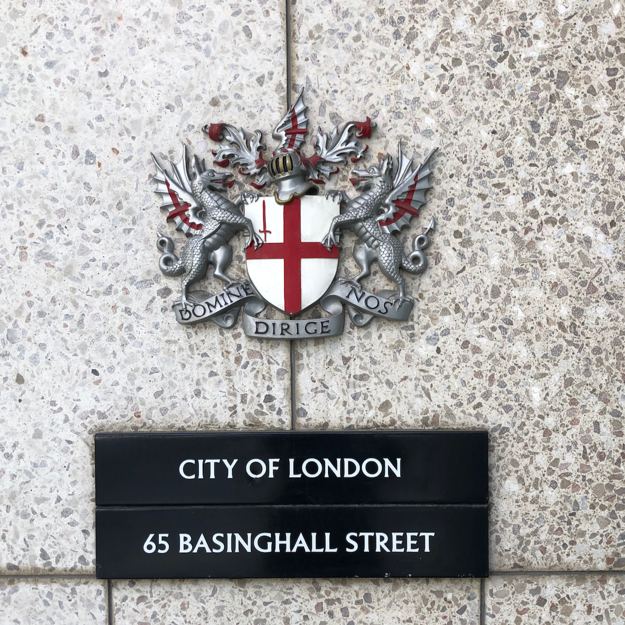
Then there is the mystery of the missing city crest. Above a door at street level is an obvious blank space, where the crest of the City of London has evidently been removed. I wonder why.
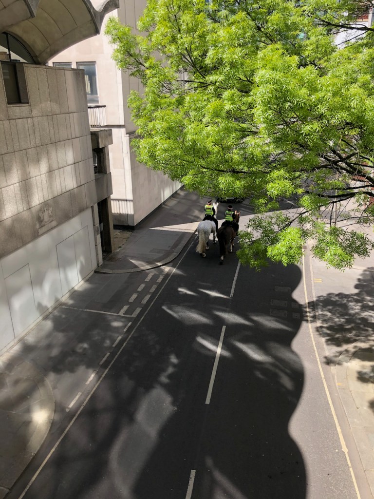
As I was drawing, there was the sound of hooves, and two police horses went by under the bridge. See the marvellous wavy shadows in the photo!
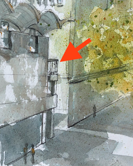
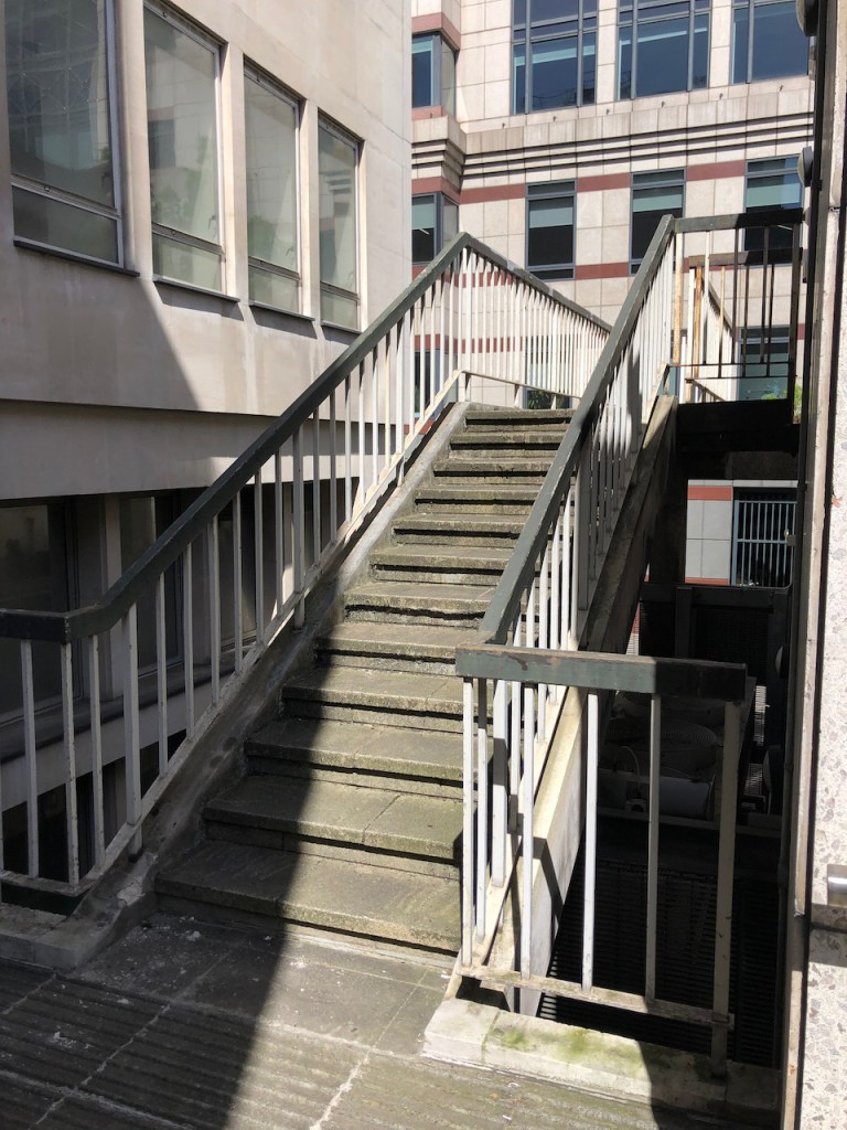
I have walked over this bridge many times, but only recently have I spotted the little balcony, half way up the side of the building.
It is possible to get to this balcony. You just go around the building and up some stairs. It looks like part of a public walkway which has now been cut off. But the early pictures of the building show this balcony just as it is today.
Up these stairs..
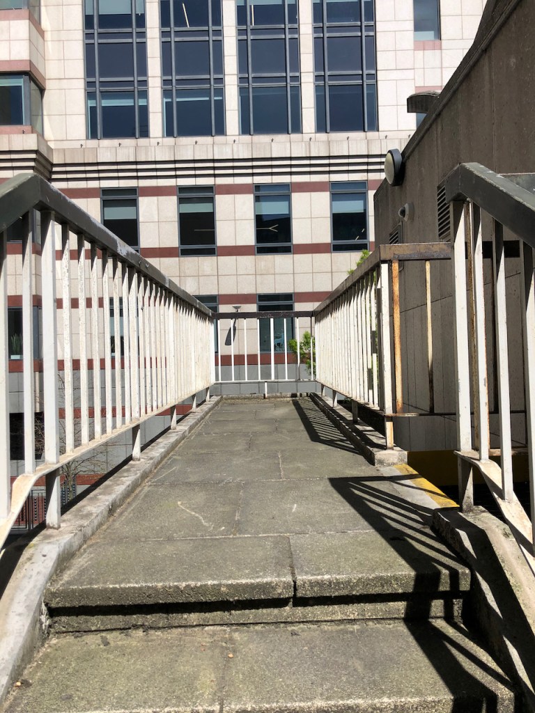
Along this walkway..
To the end.
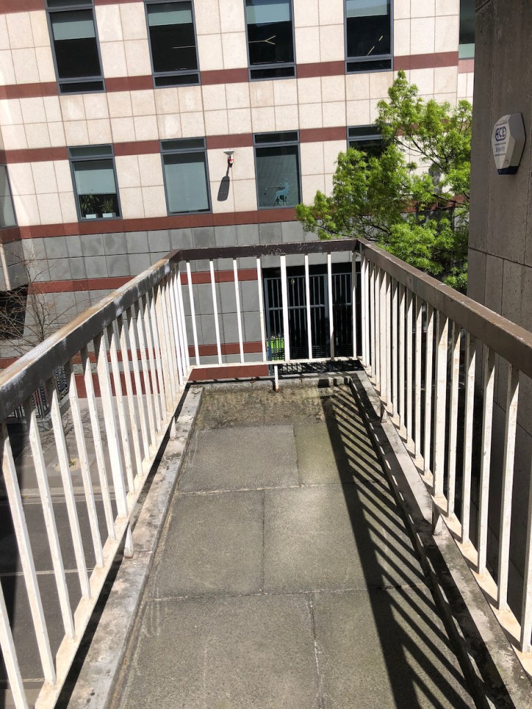
View from the balcony towards my drawing spot.
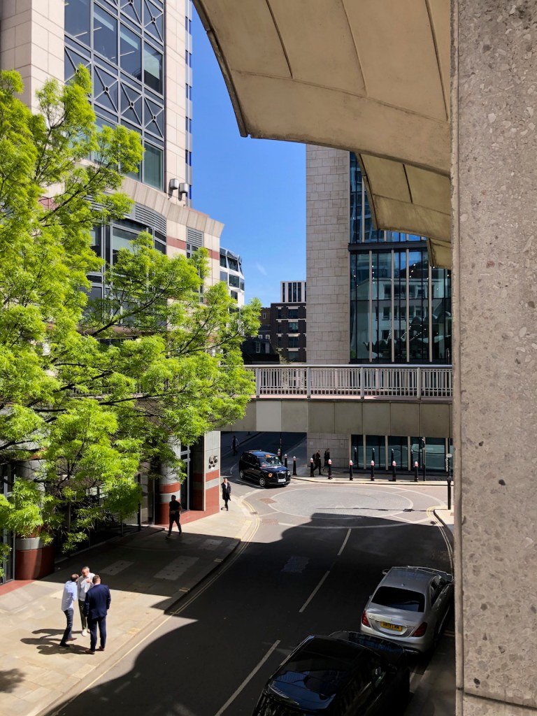
The balcony on 65 Basinghall Street
I will write more about 65 Basinghall Street in my next post. It was originally a Magistrates Court (with cells!), an exhibition hall and offices.
Here are photos of the locality, and work in progress on the drawing.
This drawing took about 1½ hours on location. I put some finishing touches at my desk. The colours are Phthalo Blue Turquoise, Lavender, Perylene Maroon, and Mars Yellow. There is some Green Gold on the tree.
—
1Richard Gilbert-Scott was the fourth in a dynasty of architects. He also designed the Guildhall Art Gallery and Guildhall Library.
From father to son here is the line:
George Gilbert-Scott (1811-78) – Albert Memorial, Midland Hotel, St Pancras Station
George Gilbert-Scott Junior (1839-1897)- St Agnes Kennington, [In 1884, he was declared ‘of unsound mind’]
Giles Gilbert-Scott (1880-1960) – Guildhall North Wing, Battersea Power Station, Telephone Kiosk, LMH Chapel, Bankside Power Station (=Tate Modern), Cambridge University Library, Cropthorne Court (Maida Vale)
Richard Gilbert-Scott (1923-2017) Guildhall Art Gallery, Guildhall Library, 65 Basinghall Street.
Click a button below to share this post online, email it, or print it:
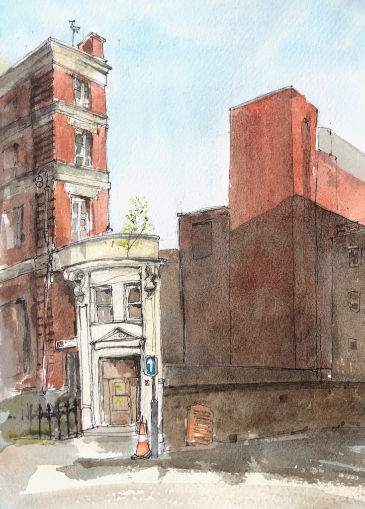
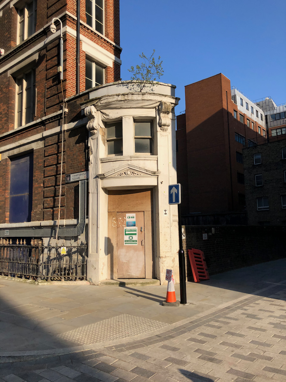
This is a little white building I always enjoy walking past. It is the westernmost end of a thin terrace of warehouses and showrooms, lodged in a triangle between the road and the railway. As I passed it the other day I saw that the tree which has taken root above the door was putting out leaves, and flourishing in its unlikely place.
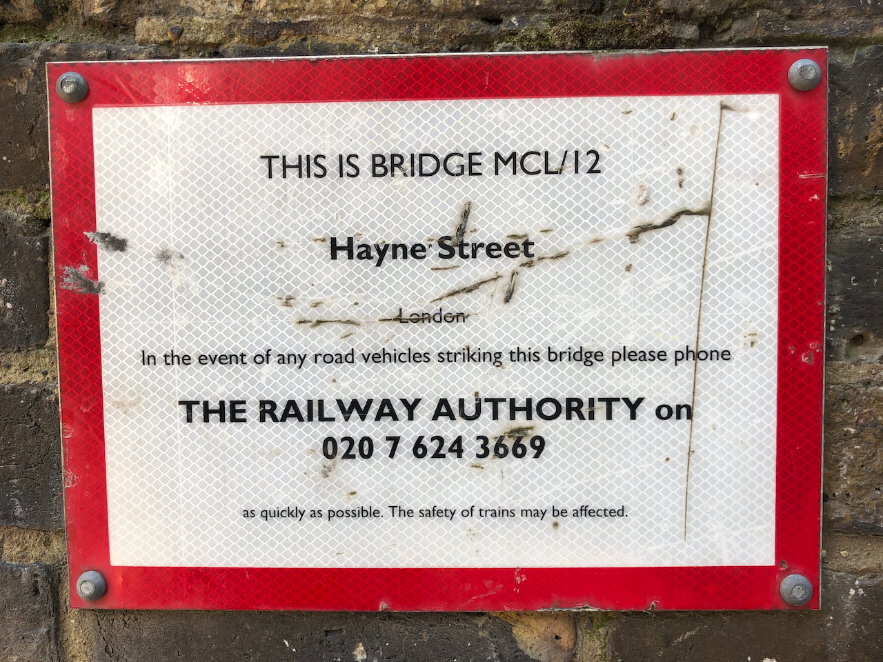
On the bottom right is Hayne Street, which forms a bridge over the railway lines. There is a dark deep gap. The buildings on the right are the other side of the railway. The railway lines are the Hammersmith and City, Circle, and Metropolitan underground lines, which emerge briefly into the open air at this point . This is good to know, in case you are trying to send a text message from the tube train.
33 Charterhouse Square (left) and Hayne Street EC1. 10″ x 7″ in sketchbook 9. 19 April 2021
Recently this building has been used as some sort of office or headquarters of the Farringdon Crossrail development which is now completed. The construction workers have left, and this building looks vacated and rather sad, but noble in its sadness.
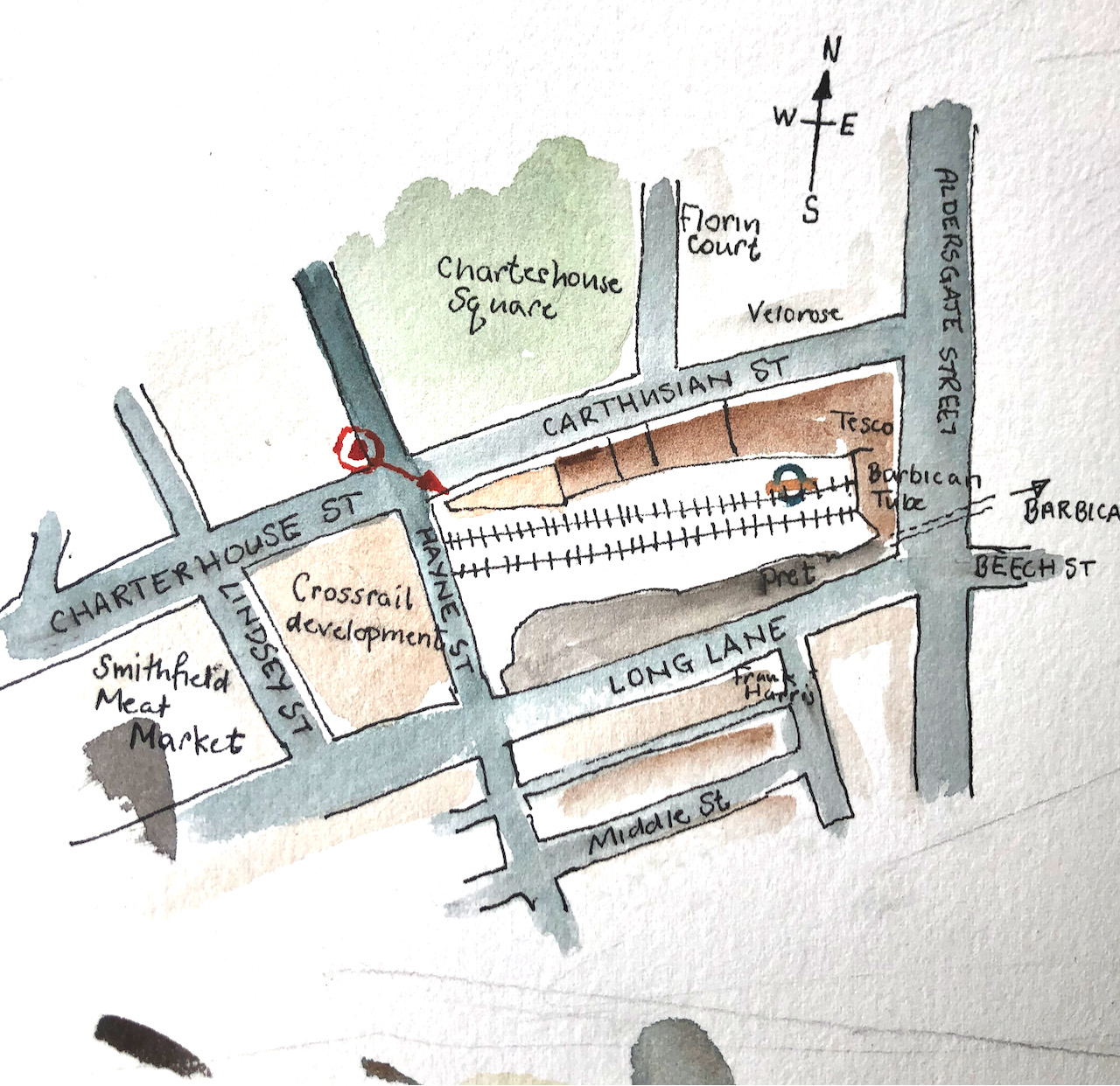
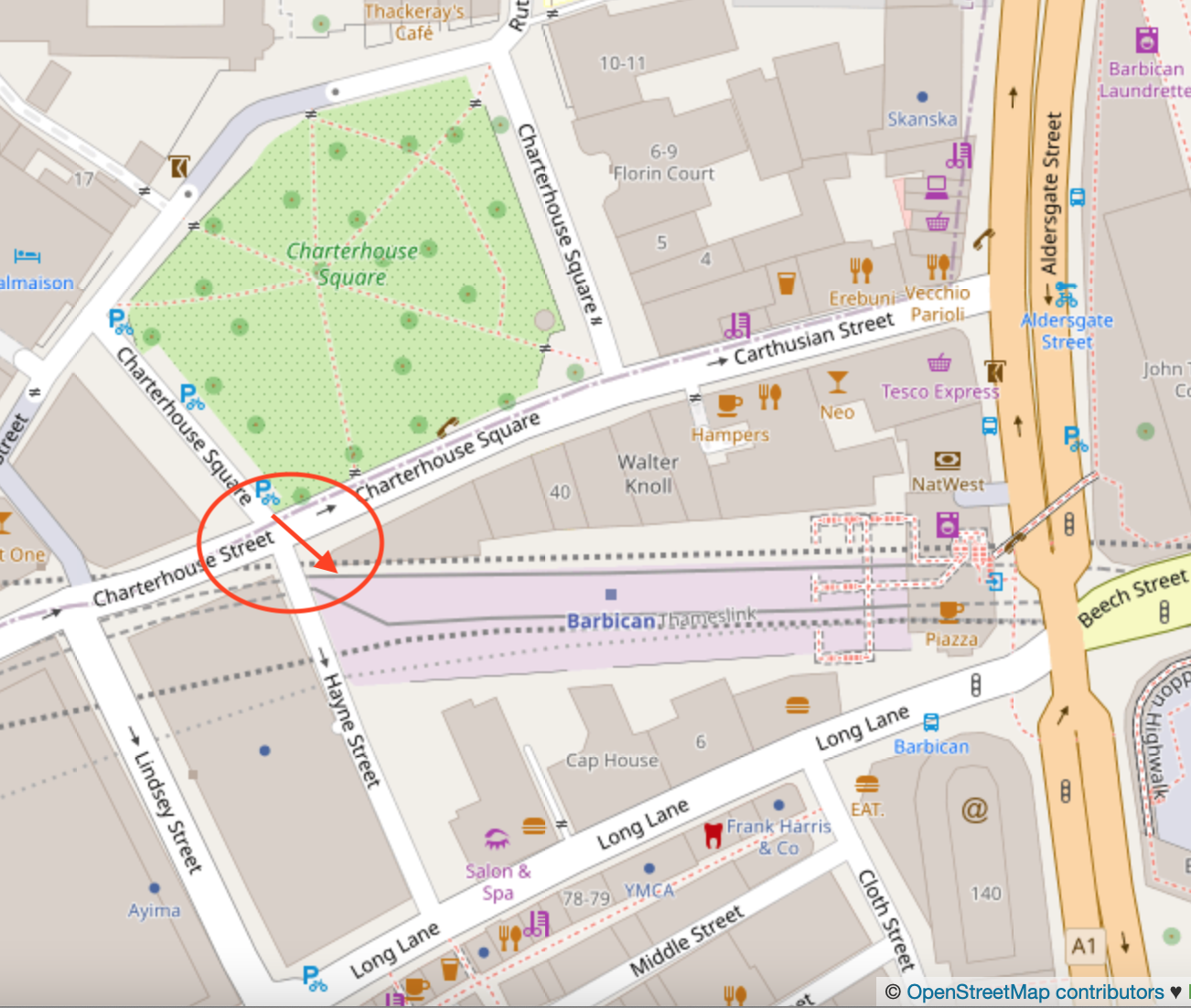
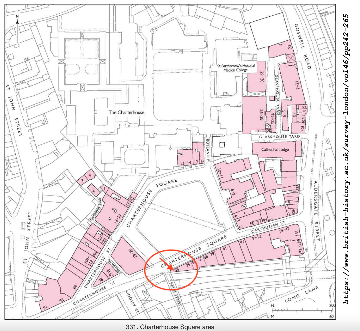
Here are some maps1 (click to enlarge):
Here are some photos of the location and work in progress.
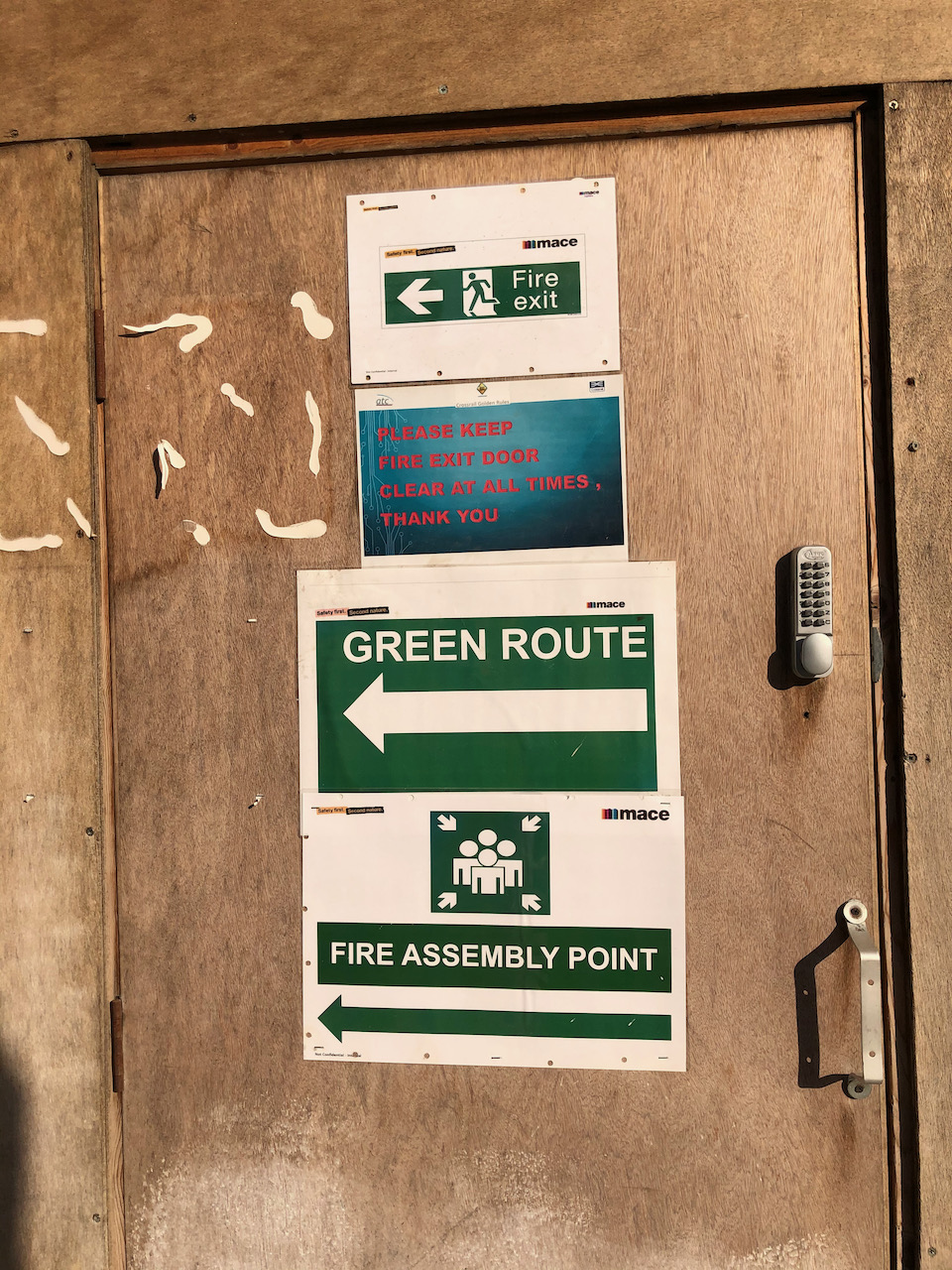
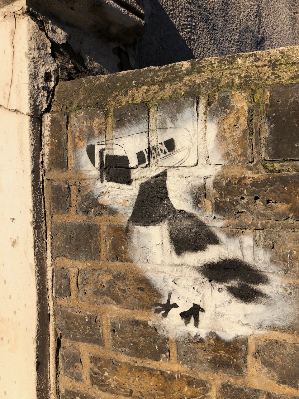
No. 33 Charterhouse SquareWork in progress on the drawing.Here’s what’s written on the door.You can see the Barbican Towers from the bridge, Hayne StreetThe notice on the bridgeAnd street art on the bridge.
The drawing was done at about 17:30 at the end of a gloriously sunny day. The colours here are: Transparent Brown Oxide, Fire Gold Ochre, Phthalo Blue Turquoise, Buff Titanium, Mars Yellow. There is Transparent Pyrrol Orange for the road sign and the leaves of the tree are Green Gold. The paper is Arches Aquarelle 300gsm.
This building was completed in 1875-6. The architect was the aptly named Coutts Stone. This and other fascinating and detailed information is in the scholarly “Survey of London” 2008 edition.
Here is their entry on the row of houses on the South side of Charterhouse Square. I have drawn number 33, the westernmost section.
“Nos 33–43
The Metropolitan Railway acquired the whole of the south side of Charterhouse Square and emptied the properties in order to construct their extension from Farringdon to Moorgate in 1864–5. The cutting of the railway entailed the demolition of Nos 32–38 on the south side of the square, along with the whole of Thomas Neale’s Charterhouse Street. Nos 39–43 were briefly left standing, but the operation left the whole south side as an awkward set of narrow sites whose amenities were further diminished by the new east—west thoroughfare completed in front of them in 1873–4 (Ill. 338).
In 1875 the railway company sold the whole frontage to Tubbs, Lewis & Co., manufacturers of elastic fabric, silk throwsters, warehousemen and ‘smallware agents’, with premises in the City, Birmingham and Manchester, and a manufacturing base in Gloucestershire. The firm also had a line in the speculative building of warehouses at this period, on which they spent about a quarter of a million pounds. The row which they erected here was one of several local developments they carried out during the mid-1870s, including Charterhouse Buildings at the corner of Goswell and Clerkenwell Roads . The company chose as its architect Coutts Stone, a friend of George Devey. Early drawings suggest there was some thought of rebuilding from No. 38 eastwards with houses , but in the event the whole block became warehousing. Construction took place in 1876–7. Andrew Killby was the builder for Nos 33–42, with interior structural ironwork provided by H. Young & Co.; Scrivener & White took on the separate No. 43.
Nos 33–42 (Ill. 341) stand four storeys above a basement protected by heavy iron railings. The block is divided into three sections. The front elevation, faced in red brick, has a strong horizontal emphasis, with broad banks of mullioned windows relieved by some minor brick detailing. No. 43 has a narrower frontage and an extra storey topped by a pediment, while its main windows are of iron and flanked by decorated pilasters.
Tenants for these warehouses were mainly involved in the textile trades. At No. 41 one of the original occupants was Griswold & Hainworth Ltd, early specialists in portable knitting machines for domestic use. In the early 1890s the whole of No. 40 was occupied by David Marcus, importer and agent of Eastern manufactured goods: ‘The basement is reserved as a show-room for Oriental carpets and furniture; the ground floor is divided in front into a splendid show-room, and at the rear forms the wellappointed office; while the upper floors are fully utilised as show and stock-rooms’. In 1917 No. 42 became the first premises of J. Collett Ltd, ladies’ hat makers; they gradually took in Nos 41 and 43 and spread elsewhere in the square. The projecting clock which survives at No. 43 was put up by them in 1930. Though there were still four clothing firms here in the mid-1970s, there had been a shift towards printing, illustration and white-collar work. Since then most of the row has been fitted out as offices and studios, including No. 41 by Campbell Zogolovitch Wilkinson Gough (CZWG) in 1980 for the pop artist Allen Jones. “
1 Citation for text above and map: BHO Chicago MLA ‘Charterhouse Square area: Introduction; Charterhouse Square’, in Survey of London: Volume 46, South and East Clerkenwell, ed. Philip Temple (London, 2008), pp. 242-265. British History Onlinehttp://www.british-history.ac.uk/survey-london/vol46/pp242-265 [accessed 20 April 2021].
Update: here is a tweet from @nicholas_sack, (4th Sept 2021) with a wonderful photo of the same building, 20 years ago.
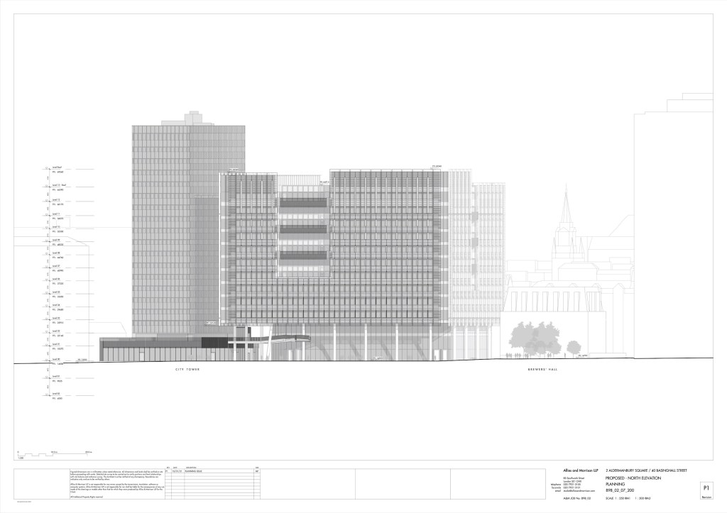
An email from an ever-vigilant neighbour alerted me to the Planning Application for City Place House and the adjacent tower, City Tower. This application is currently under consideration. I hastened to go and have a look at the buildings, before they get swathed in white plastic.
City Tower has been there since 1967. It is going to have its lower floors redeveloped but will remain standing. However the more recent City Place House, completed in 1992, is going to be demolished and replaced.
City Place House is a post-modern block of 10 storeys, 8 above ground. It currently houses 1750 workers in 176 600 sq ft. It is going to be replaced by a higher and wider building, which will more than double the capacity, housing 4000 workers in 320 000 sq ft, by more efficient servicing. This is according to the planning application: 21/00116/FULMAJ, “Statement of Community Involvement”. My neighbour comments, “The City’s unerring confidence that numbers of office workers will rebound back to and then exceed previous levels continues to amaze and baffle me given the growing pile of evidence to the contrary. However, that may just be me…”. I have to agree.
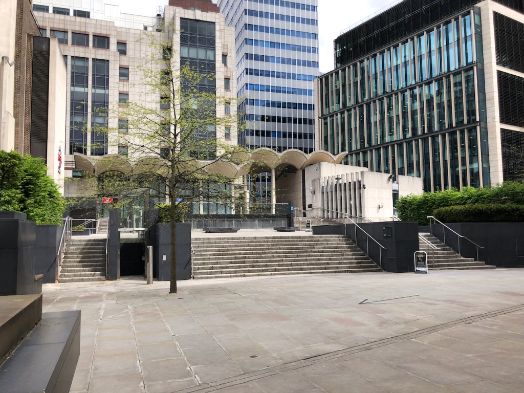
Here is what it looks like now:
City Place House from the podium level near the former “Jamies” restaurant. The building to the right, wrapped in plastic, is Brewers Hall.
Here’s a map, also from the planning application. London Wall Place is the building on the left hand side of my drawing.
The line of sight of my drawing is shown by the blue arrow.Work in progress on the drawing.
City Tower is in the background of my drawing, It is interesting because it is one of the last two towers in a grand design. The other tower still standing is Bastion House. The post war development plan had six towers along London Wall:
“In 1954, frustrated at the contemporary efforts of largely piecemeal reconstruction, a group calling itself ‘The New Barbican Committee,’ headed by architect Sergei Kadleigh, unveiled a plan of comprehensive redevelopment on the long derelict site north of St Paul’s. The scheme proposed a vast network of interlocking hexagonal structures of towers and decks over the 40-acre site owned by the City Corporation. This utopian mega structure proved hugely influential and by 1955 a collaborative scheme of comprehensive redevelopment was unveiled by the City’s head of planning H.A. Mealand and the LCC’s Leslie Martin.”
The six towers, their original names, and their fates1:
LONDON WALL (NORTH-SIDE, WEST TO EAST)
Bastion House, 140 London Wall, EC2 1976: Completed. Still standing: Now known as 140 London Wall.
Lee House, 125 London Wall, EC2: 1962: Completed. 1988-92: Replaced by Alban Gate. Now known as 125 London Wall.
St Alphage House, 2 Fore Street, EC2: 1962: Redeveloped as 1 and 2 London Wall Place
Moor House, 120 London Wall, EC2: 1961: Completed. 2002-05: Demolished in 2001 and replaced by a new Moor House.
LONDON WALL (SOUTH-SIDE, WEST TO EAST)
Royex House, 5 Aldermanbury Square, EC2: 1962: Completed. Replaced in 2008 by 5 Aldermanbury Square, EC2.
Britannic House, 40 Basinghall Street, EC2: 1964: Completed. Still standing: Refurbished as City Tower in 1990.
The building which will replace City Place House will look like this. These are drawings from the planning application. City Tower is in the background, its shape is unchanged from now. There will be a new bridge across Basinghall Street. Demolition is due to start soon: 2022. The highwalk route will be out of service until 2025.
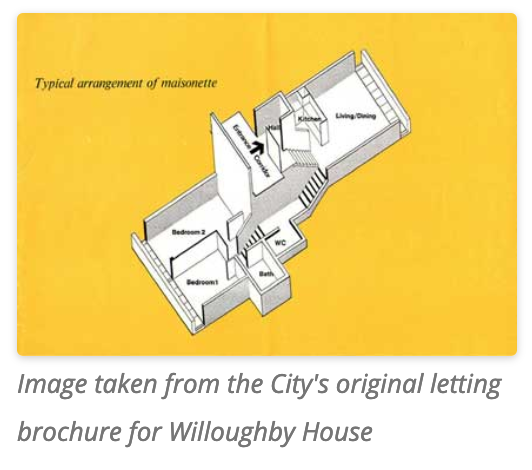
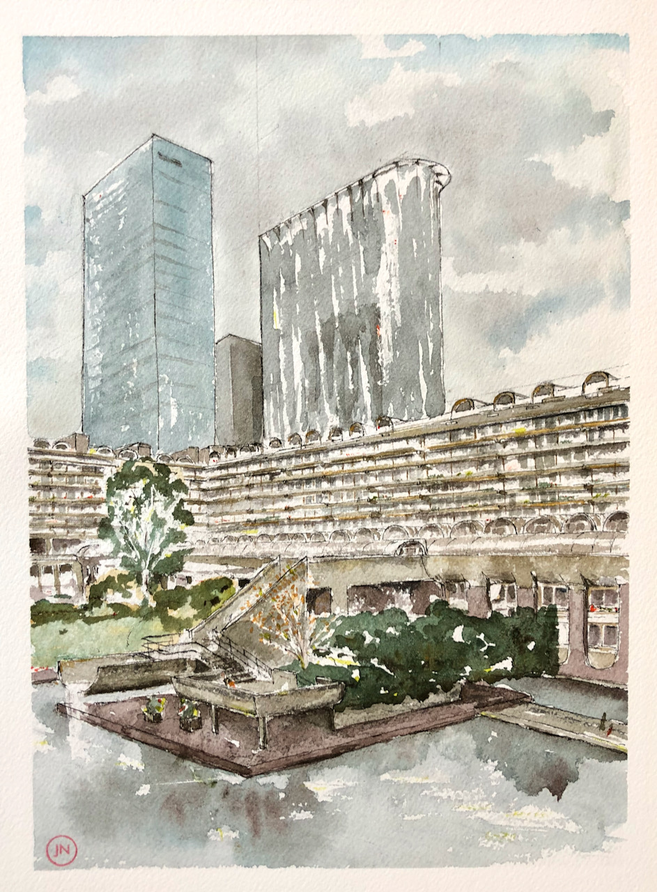
A client asked for two pictures. The first was of CityPoint. Here is the second, Willoughby House.
Willoughby House from the highwalk by Andrewes. 9″ x 12″ [original SOLD]
This is a view from the public highwalk under Andrewes House. You see the waterfall into the Barbican Lake, and Speed Garden in the background. That marvellous tree is a feature of Speed Garden. It has white bark.
Willoughby House is a terrace block in the Barbican. The multi-storey flats inside have interesting intersecting shapes, and long views across the water. It was completed in 1971.
Here is work in progress on the drawing.
On the skyline the two towers are the Heron residential tower on the left and CityPoint on the right. City Point predates Willoughby House – it was completed in 1967, although it looked different then. The curved top is a 2000 addition. In the middle is Ropemaker Place. The Heron residential tower replaced the original Chamberlain, Powell and Bon utility building on the same site. This was a brutalist concrete building, matching the Barbican, which housed a Fire Station, registry office, coroners court and mortuary. Milton Court was integral to the Barbican, linked aesthetically and by highwalks. It was destroyed in 2008.
The Heron residential tower which replaced Milton Court was finished in 2013. It is 36 stories and 122 metres high. Its lower floors house the Guildhall School of Music and drama. The upper stories are luxury flats.
CityPoint (1967, refurbished 2000) is office space, with bars and coffee shops at ground level. It is 35 stories and 127 metres high. Ropemaker Place (2009) is 23 stores of office space. It looks smaller because it is further away. It has no bars, no coffee shops, just a straight cliff down to the street.
Floors
Height
Contents
Date
Willoughby
7 + podium
Residential
1971
Citypoint
35
127m
Office space, bars at ground level
1967, and 2000
Ropemaker
23
127m
Office space
2009
Heron
36
122m
Guildhall School and residential
2013
Fashion shoot
While I was drawing, a fashion shoot arrived. It was a jangling cavalcade of clothes rails, photographic equipment, and a music system on wheels. They set up camp a little way away and starting photographing the scenery, which included me. They turned their attention to the model who placed herself carefully against the concrete wall. Then they upped and went on towards Gilbert Bridge, their music and conversation fading into the perspective lines.
Here is the ink stage. You can compare with the colour by moving the slider.
The colours here are mostly Mars Yellow, Phthalo Blue Turquoise, and Perylene Maroon. The red dots are Transparent Pyrrol Orange. There’s a bit of Green Gold in there too. I started this on location and finished it at home.
Click a button below to share this post online, email it, or print it:
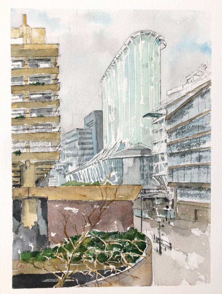
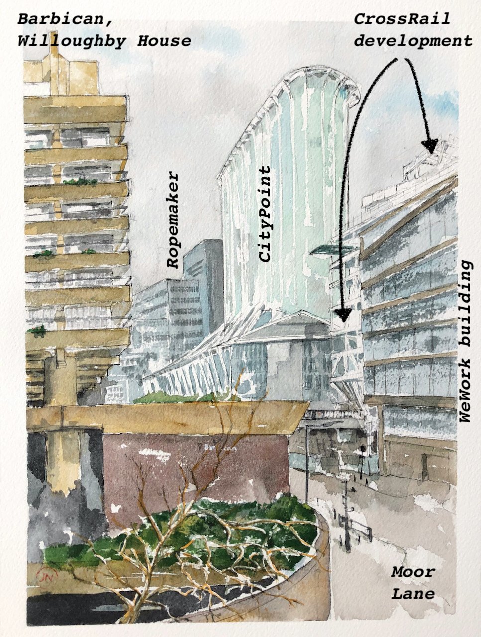
Here is CityPoint, seen from the highwalk next to 2 London Wall Place.
Citypoint from London Wall Place. 12″ x 9″ [original SOLD]
On the left is the south side of Willoughby House, Barbican. Down in the street you see the gate which closes Moor Lane at certain times, and also various lamp posts, bollards and a pole holding three CCTV cameras. Beyond that, on the right, is a construction site on top of the Moorgate Crossrail station.
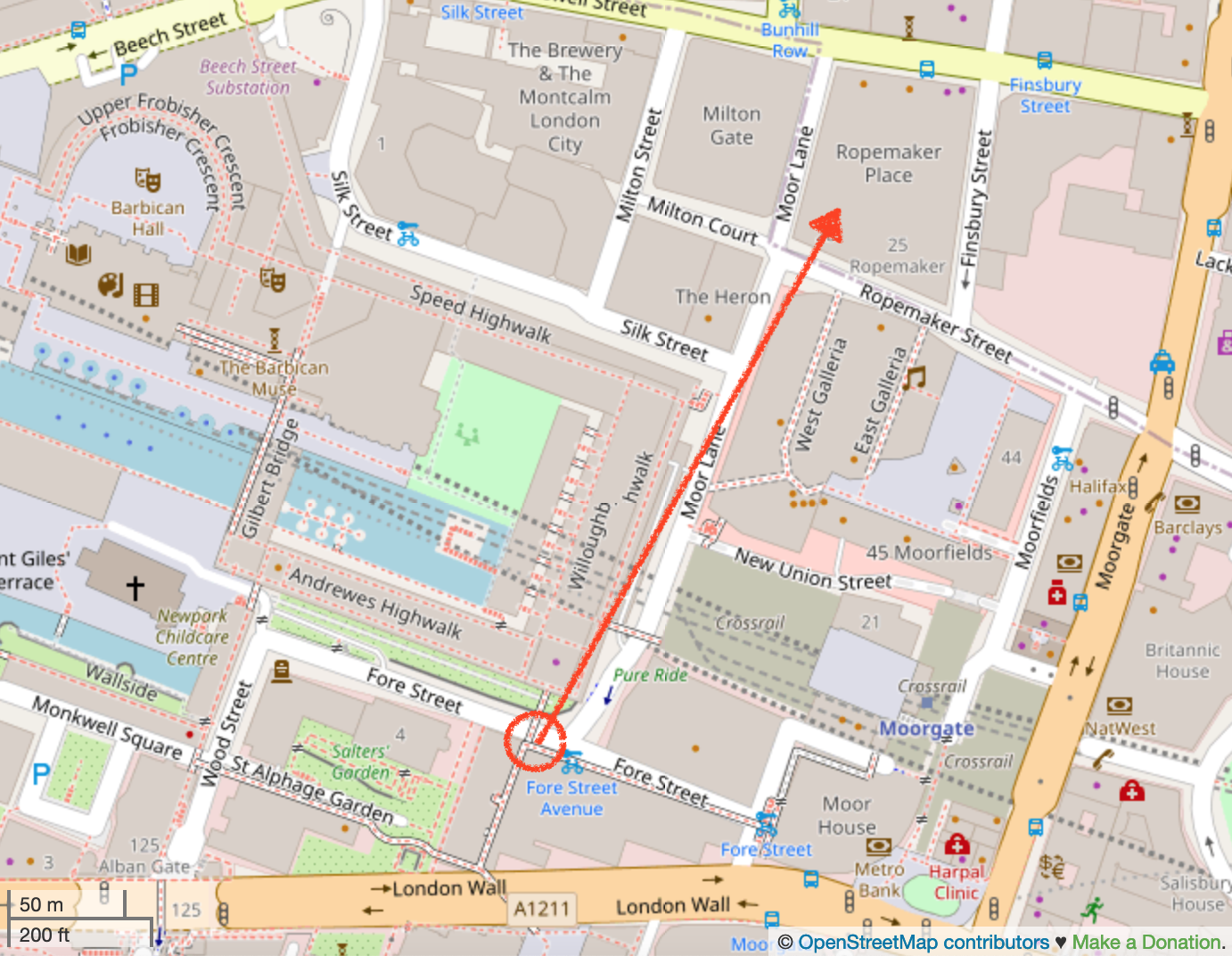
Here is a map and an annotated sketch to identify the buildings.
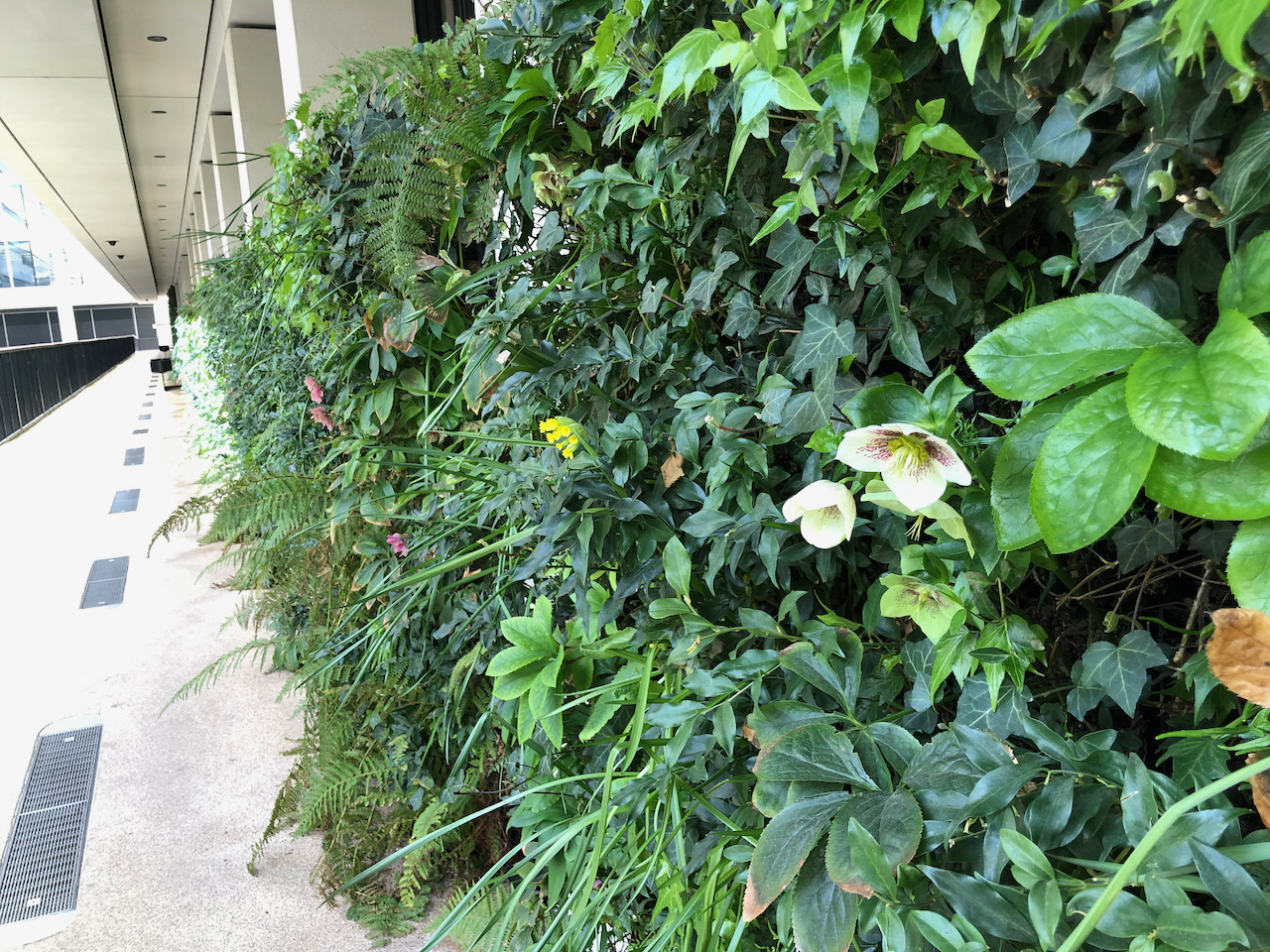
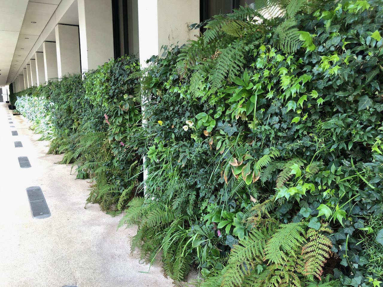
To draw this, I was standing above street level, on a public walkway next to a new office development, 1 and 2 London Wall Place. This walkway has walls with plants. The plants are doing really well.
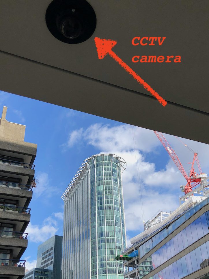
As you see from those photos, the walkway was also empty and calm. The security guard came past, once in one direction, and once back. He smiled and greeted me politely. I was also watched by less friendly security: a CCTV camera, right over my head. I wonder what they made of my sketch?
CityPoint, 1 Ropemaker St, London EC2Y 9HT, was originally called “Britannic House”. The original architect was F. Milton Cashmore & Partners. It has 36 floors above ground. The website “www.emporis.com” tells me:
“The building was built in 1967 as Brittanic House, a 122m (399ft) headquarters for British Petroleum. An extensive refurbishment, designed by Sheppard Robson International and completed in 2000, increased the floorplates and added height to the top floor. Britannic House was then renamed CityPoint.“
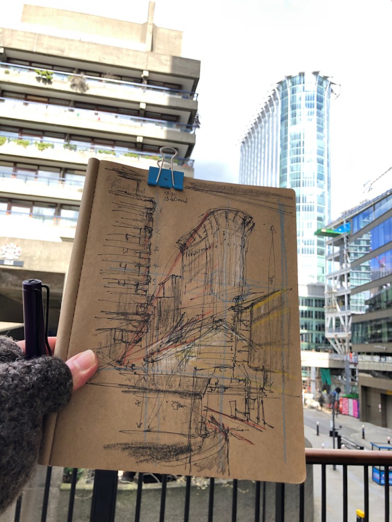
Here are some photos of this drawing in progress. I did a preliminary sketch. The perspectives were fiendish. That “WeWork” building on the right has a weird sloping balcony and a strange sort of tilt in its orientation.
Preliminary sketch
Pencil underdrawing
Pen
Pen
This drawing was a commission. It is the first of two. The next one will show Willoughby House.
Click a button below to share this post online, email it, or print it:
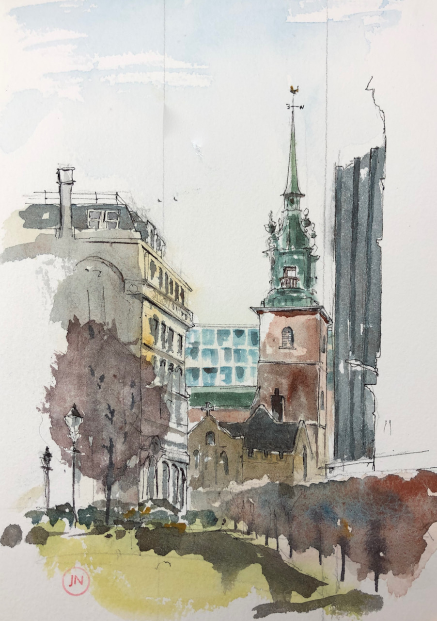
In my previous post, I looked South from Seething Lane Gardens. I was sitting with my back to a strange cubical building. Yesterday I went back to Seething Lane Gardens and looked North towards the City.
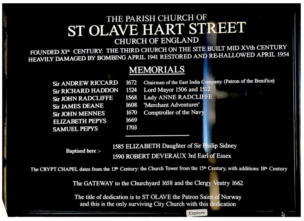
City Buildings and St Olave Hart Street, from Seething Lane Gardens. 7″ x 10″ in Sketchbook 9. 29 March 2021
On the right of my drawing is a part of the cubical building mentioned in my previous post.
The spire with the weathervane is St Olave Hart Street, which was Pepys’ church. It is just visible in between the more modern buildings.
Above the spire of St Olave Hart Street is the very tall building 122 Bishopsgate. The point to the right of that is “The Scalpel” which is on Leadenhall.
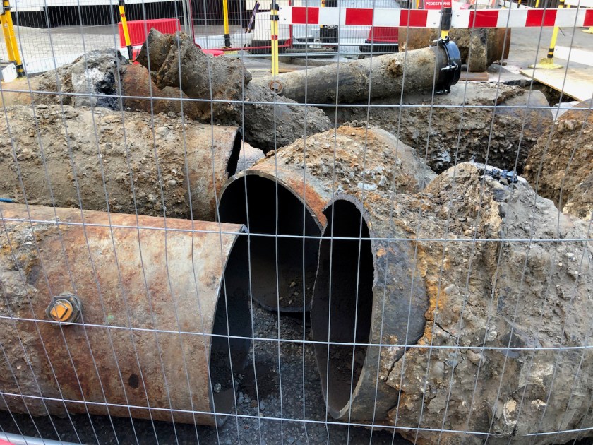
You see dashes of red through the hedge on the left of the drawing. That is because the gas mains are being replaced on Seething Lane, and red barriers surround the site. As I walked back home I stopped to admire the ancient metal pipes which have been excavated from the site.
Metal gas mains, Seething Lane
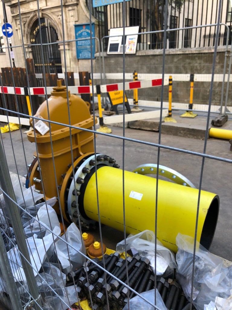
Modern gas main. The gate to St Olave Hart Street is in the background.
A man coming the other way was looking at the pipes too. He spoke from a mouth that had no teeth, and he carried a crushed paper cup. “They look like art,” he said. “How old do you think they are?” I said that I thought they looked Victorian.
“Over a hundred years old, ” I suggested.
“They look like they would last another hundred years,” observed the man. It was true, the metal was nearly an inch thick. Where the pipe had been cut the metal gleamed as though freshly cast.
A little further on I passed the modern version.
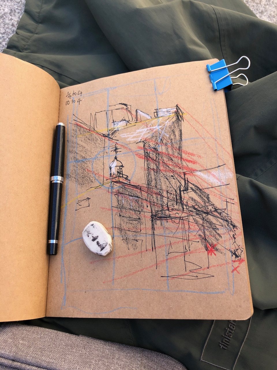
Here is work in progress on the drawing and a photo of the bust of Pepys which is in the garden.
Click a button below to share this post online, email it, or print it:
This is the view looking South along Seething Lane. The ground falls away quite steeply here, towards to the Thames. On the left, out of the picture, is “Ten Trinity Square” a 2017 Four Seasons development in the 1912-22 offices of the Port of London Authority. Behind me as I drew this picture was an incongruous 21st century cubical building, which seems to house utilities or a power plant of some sort, possibly communicating with chambers below ground. From time to time it emitted whirring and pumping noises.
Above ground is Seething Lane Gardens, and this view of All Hallows by the Tower.
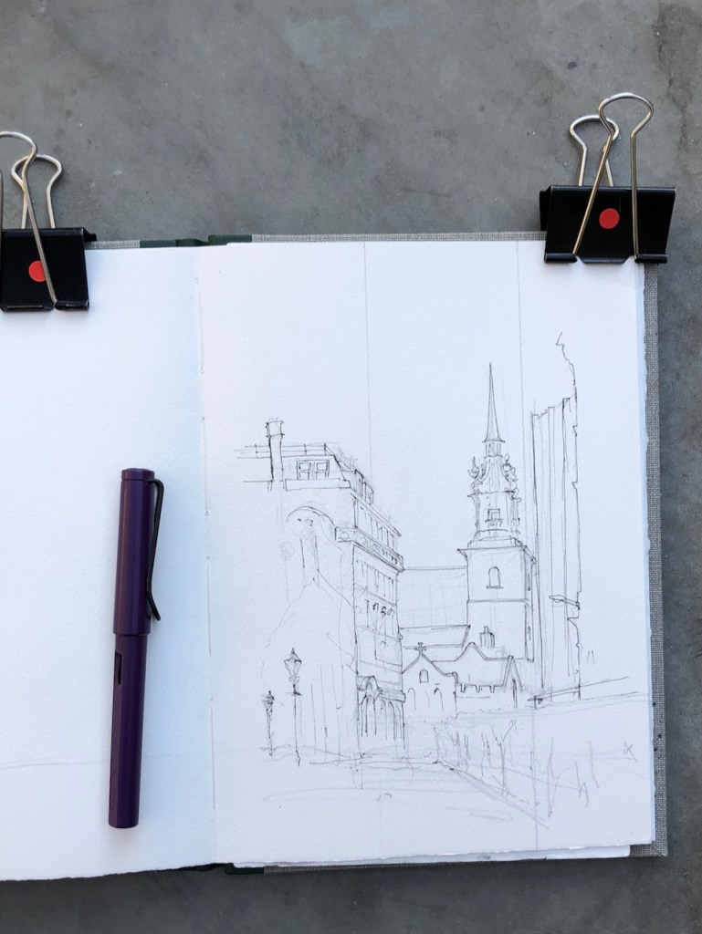
All Hallows by the Tower, 7″ x 10″, 22 March 2021, in Sketchbook 9
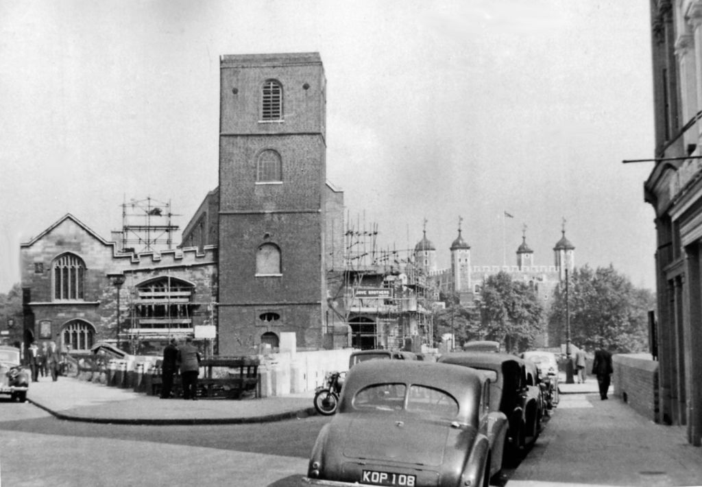
All Hallows by the Tower describes itself as “the oldest church in the City”, referring to evidence that it existed 675AD. It is near the Tower of London and former docklands. Like many City Churches, it has been reconstructed several times in its long history, most recently after severe bomb damage in the 1939-45 conflict. The tower you see in my drawing was built in 1955, and the “spiritedly Baroque copper-clad spire” (Pevsner1) was added in 1958. Here is a photo during the reconstruction process. You see the Tower of London in the background to the right.
Church of Allhallows-by-the Tower and view along Great Tower Street to the Tower of London, 1955. View eastward, with Byward Street to the left. Picture credit: Ben Brooksbank, CC BY-SA 2.0, https://commons.wikimedia.org/w/index.php?curid=20592839 [Permission details: Creative Commons Attribution Share-alike license 2.0]
For comparison, here is the same view today. I had to stand a bit further back to get the whole tower in shot.The single lamp-post in the distance in 1955 is still there today, but now it is joined by a host of other street furniture. And there’s a tree in front of the church now.
All Hallows by the Tower, 29 March 2021
Once again the marvellous “A London Inheritance” site has a fascinating article on the church.
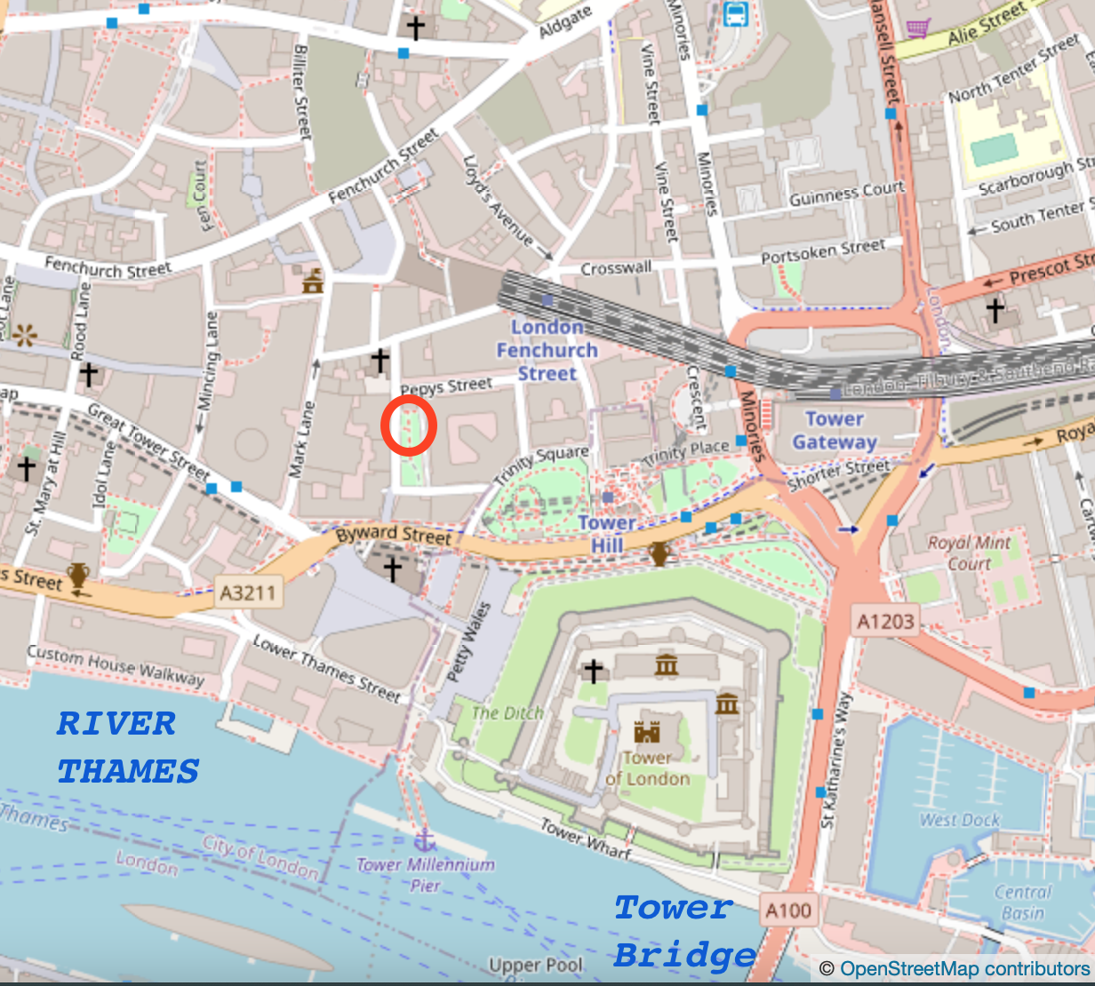
The church is on Byward Street, which becomes Tower Hill.
1888 map showing Mark Lane Station (note 2)
Maps showing where I was drawing.
The building to the left of my drawing is number 16 Byward Street. There’s an “All Bar One” at ground level. According to Pevsner1 below this building is the former “Mark Lane Underground Station” (1p440). This was closed when the current Tower Hill Station replaced it in 1967.
The building to the right, with the dark vertical fins, is ‘Knollys House’, described by Pevsner1 as “a slab” (p439). The architect was Howard, Souster and Fairburn. The fins are a 1985 refurbishment.
Seething Lane Gardens, where I was sitting, were re-opened in 2018 after a two year closure. According to the City of London Press release at the time (6 July 2018)
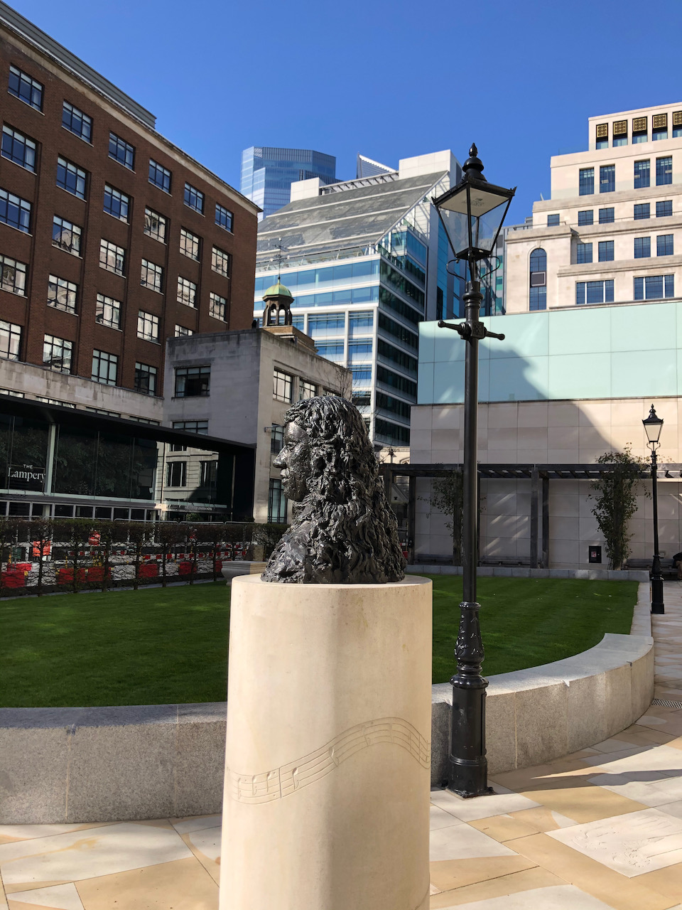
“Rainwater harvested from the roof of the 10 Trinity Square will be used to irrigate the garden. The garden has a long association with the 17th century diarist, Samuel Pepys, who lived and worked in the Navy Office which once stood on the site. It is marked by a Blue Plaque and a bust of Pepys by late British sculptor Karin Jonzen, which stood in the former garden, has been relocated as a centrepiece of the new garden.”
No mention is made of the cubical structure which makes the whirring noises. I must investigate further.
Cubical building (outlined) – Ten Trinity Square on the right.
Cubical building: Ten Trinity Square behind to the right.
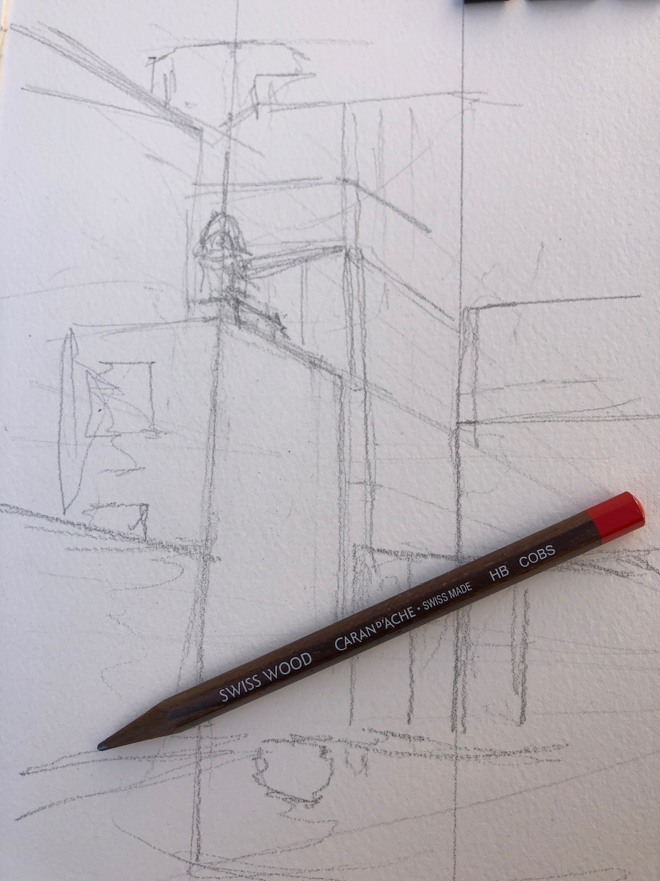
Here is work in progress on the drawing:
REFERENCES
Pevsner: London 1, The City of London by Simon Bradley and Nicholas Pevsner 1997 edition.
Mark Lane Station on an 1888 plan: “This file is from the Mechanical Curator collection, a set of over 1 million images scanned from out-of-copyright books and released to Flickr Commons by the British Library, Public Domain, https://commons.wikimedia.org/w/index.php?curid=32674842”
Click a button below to share this post online, email it, or print it: