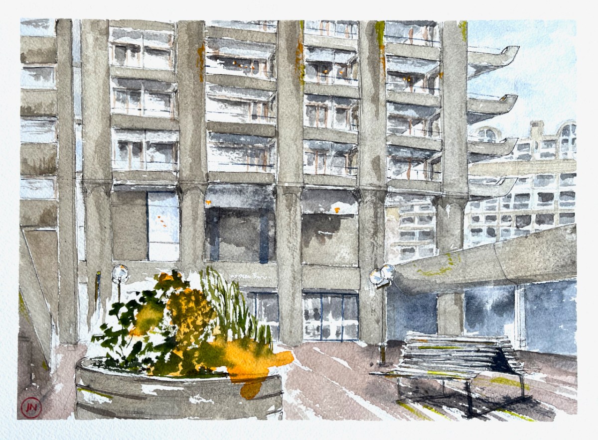
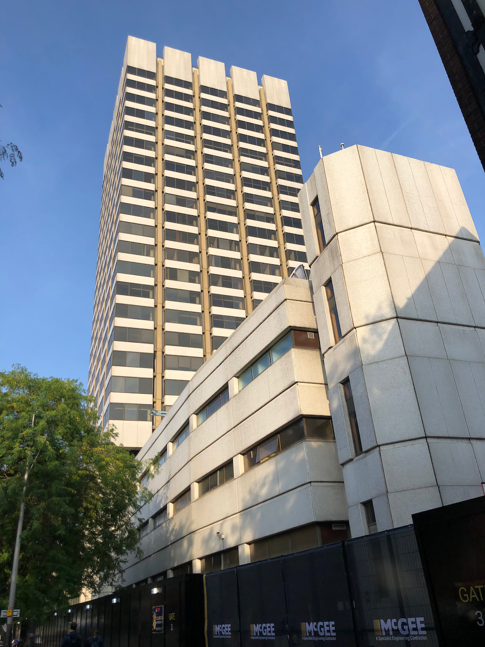
Here is a view of the east face of Shakespeare Tower, Barbican, from Defoe Place, near the Barbican Centre. You can see the main entrance to the tower. On the right is Cromwell Highwalk, and Ben Jonson House beyond. On the left you can just see the stairs that go down into Defoe Place from the highwalk.
Shakespeare Tower from Defoe Place, 12″ x 9″ [commission]
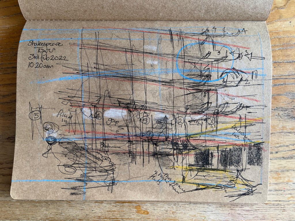
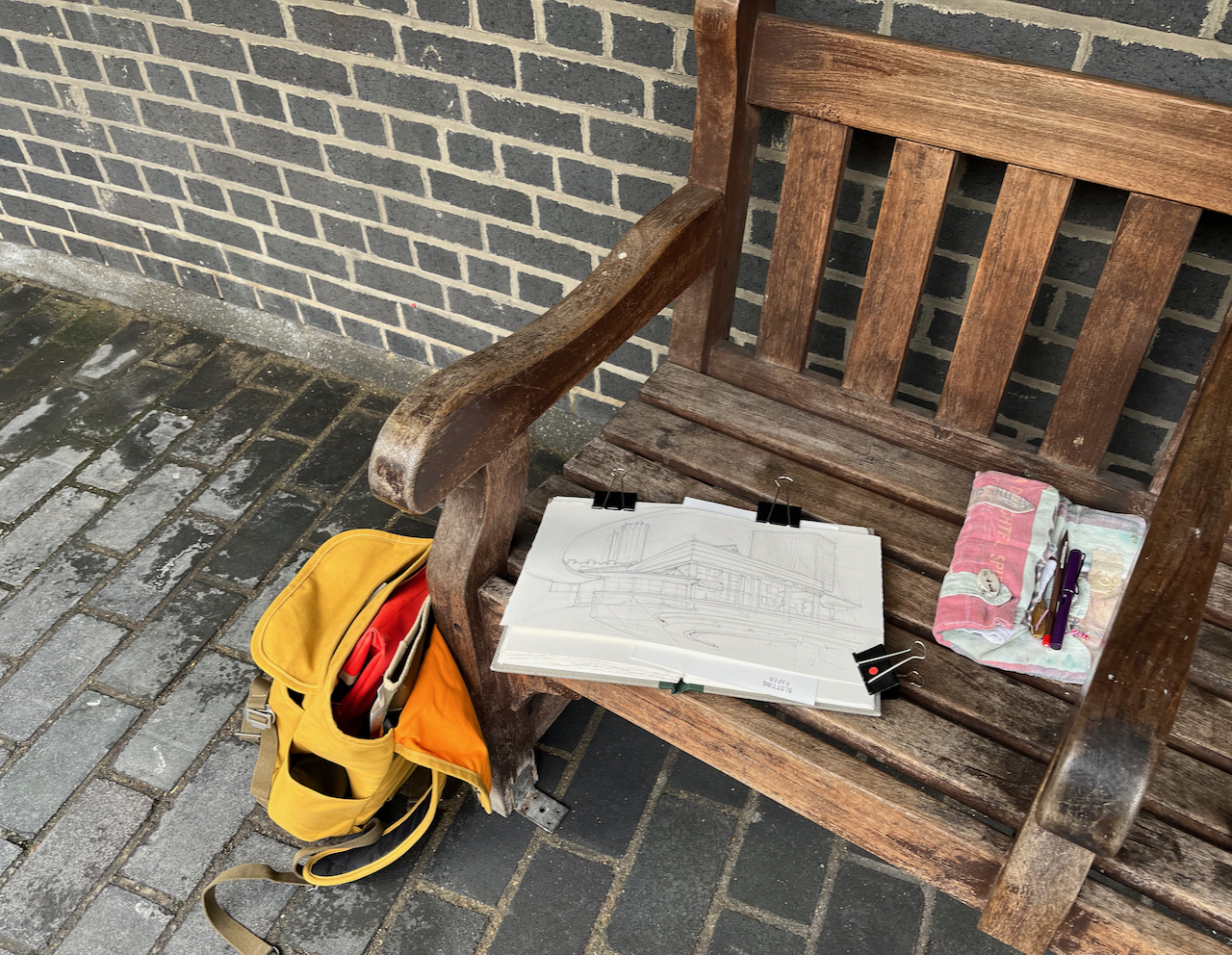
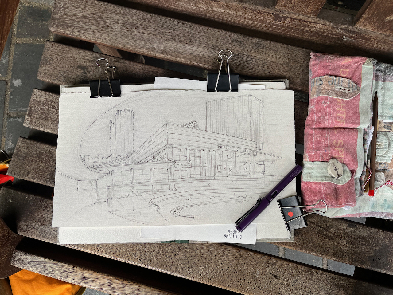
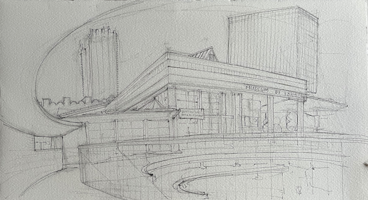
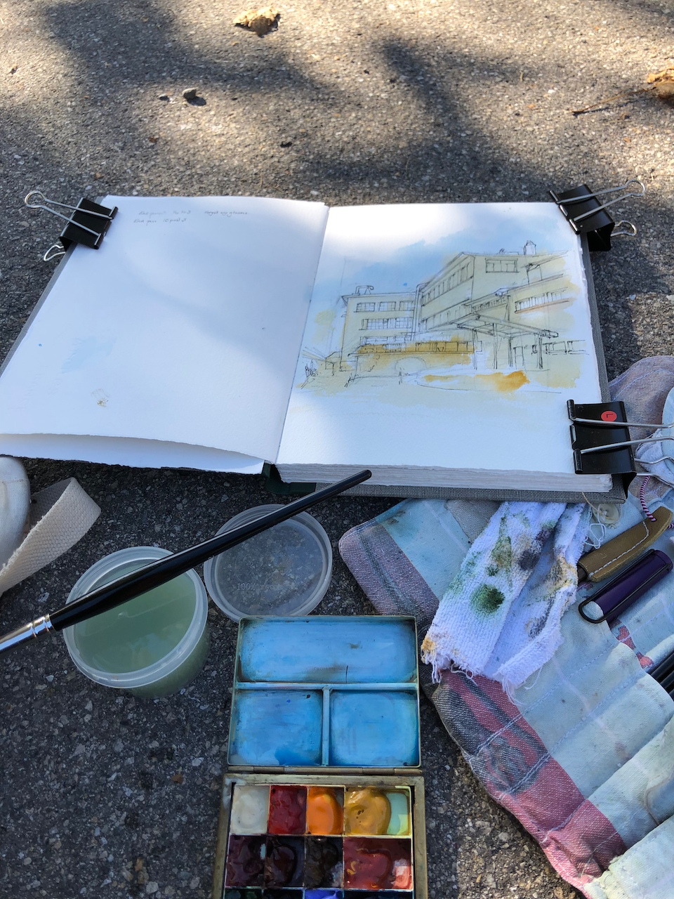
Preliminary sketch
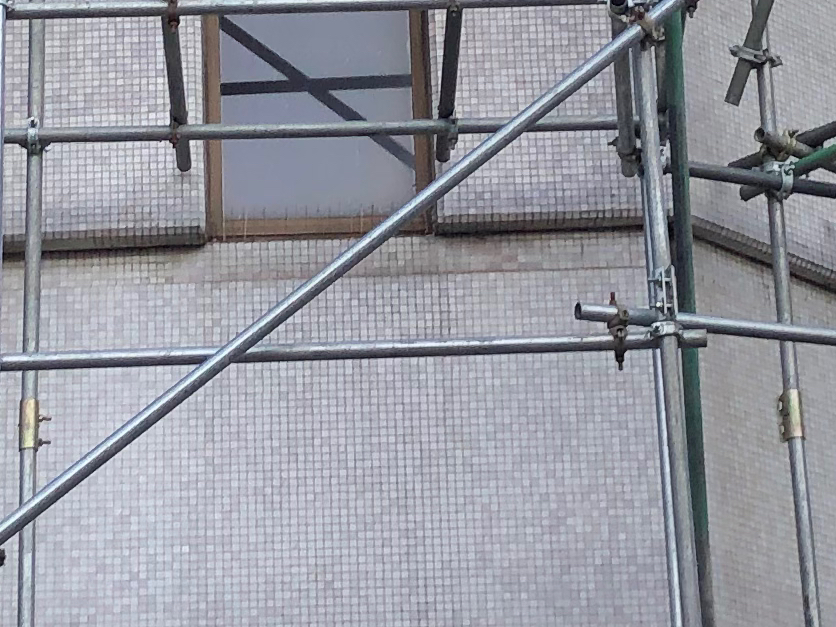
I wanted this picture to give an impression of what it is like to walk around the Barbican. There are different depths, and sharp contrasts of dark and light, and large open spaces. Workers from the library looked out of their windows, saw me drawing and came to look at the picture. This was drawn in February, but still there were some flowers in the planters, even though this particular planter was in a shaded and windy place. The smell, however, was not of flowers but cigarette ends. People evidently use the area under the stairs as a smoking area, and drop their butts. So that’s the Barbican: people who talk to you, soaring towers, great perspective views, wide open spaces and a certain shabbiness around the edges.
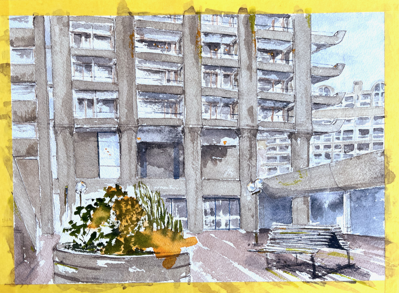
Here is the pen-and-ink compared with the colour:
Before and after the colour went on
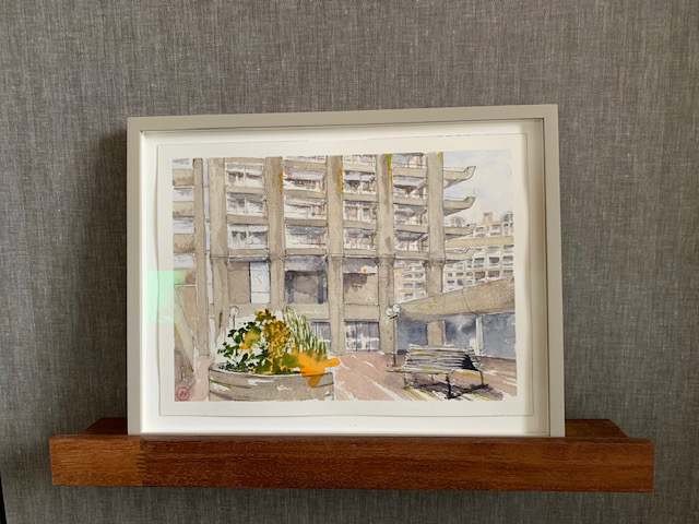
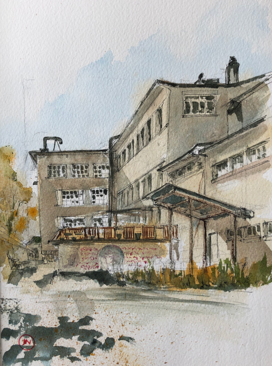
This was a commission. I am grateful to my client for the prompt to examine the Tower from this unusual angle. And also for sending me this photo of the framed watercolour:
Framed watercolour. Photo credit: NM
A collection of my drawings of the Barbican is here:
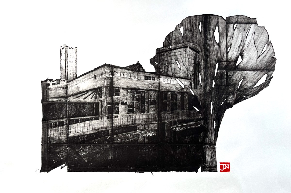
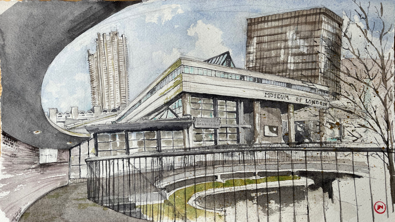
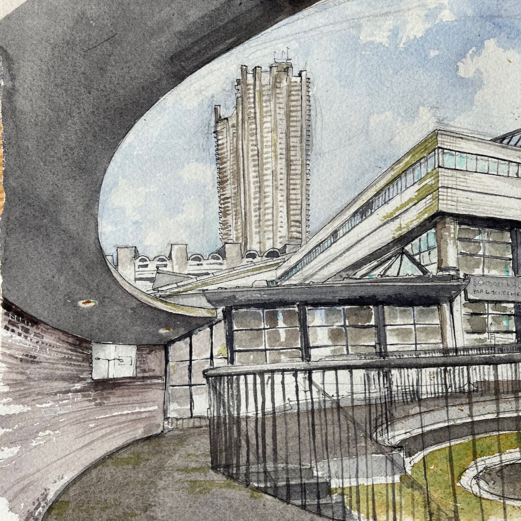
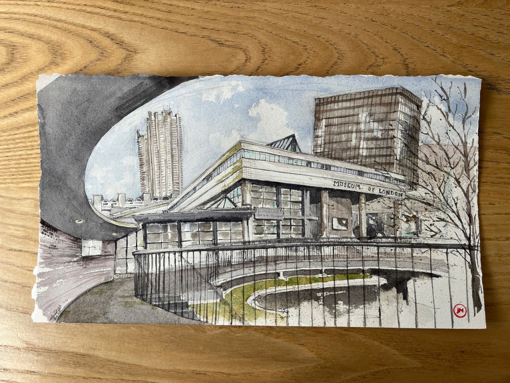
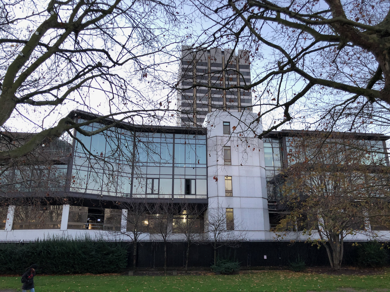
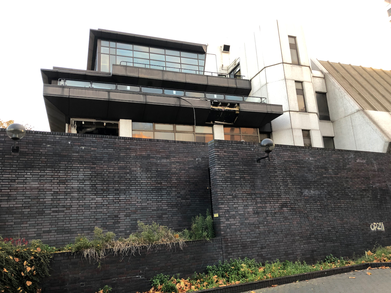
From the highwalk on the Rotunda there is a really amazing view of the Museum of London and Bastion House. This whole view going to change radically, if the City of…
I hastened to draw the magnificent Bastion House, on London Wall. It is due for demolition. In the foreground you see the balcony and privacy screen of the flat in Andrewes,…
From the highwalk on the Rotunda there is a really amazing view of the Museum of London and Bastion House. This whole view going to change radically, if the City of London plans are approved.
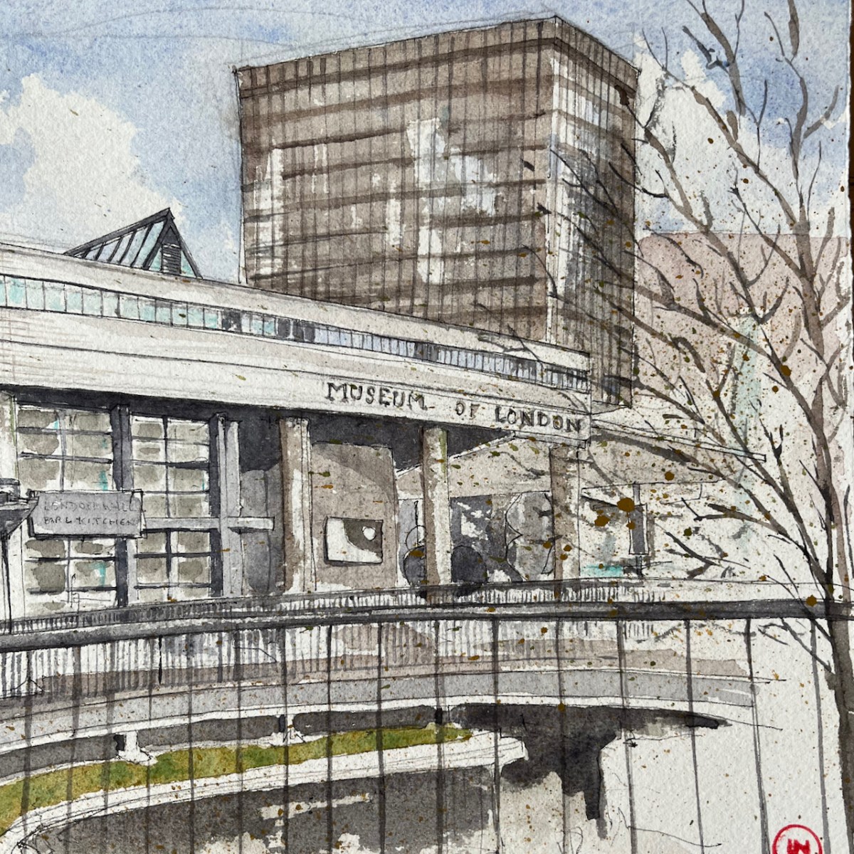
Museum of London from the Rotunda, 15″ x 8.5″ on Arches watercolour paper
The Museum of London is in the South West corner of the Barbican. It was designed by Philip Powell and Hidalgo Moya.
The Museum opened in 1976. The City of London plan to close it in December this year (2022), and then to demolish it, along with the surrounding highwalks and pedestrian bridges over London Wall.
The dark-coloured block in the background on the right is Bastion House. This 17 storey tower block was built to the designs of architects Powell & Moya between 1972 and 1977 as part of the Barbican development. It is on top of part of the Museum of London’s display space.
The City of London now plan to demolish it.
So if the plans go ahead, this view will no longer exist. I rushed to sketch it.
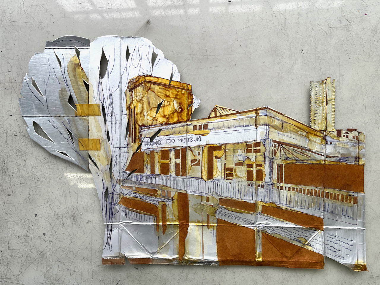
Museum of London and Lauderdale TowerMuseum of London and Bastion House
This drawing is in an aspect ratio new to me: 15″ x 8.5″ or 38cm x 22cm. I wanted to get the whole of the front of the museum in the picture.
Here is comparison of the pen and ink and the the colour versions:
The architecture practice which designed The Barbican is “Chamberlain, Powell and Bon”. This “Powell” is Geoffrey Powell and not the Philip Powell of the Museum of London. The architects involved in designing the Barbican were:GeoffryPowell, Peter “Joe” Chamberlin, Christoph Bon, and Charles Greenberg.
The architects who designed the Museum of London and Bastion House are Philip Powell and Hidalgo Moya of the architecture practice “Powell and Moya”.
Thank you to the reader who clarified this for me.
Click a button below to share this post online, email it, or print it:
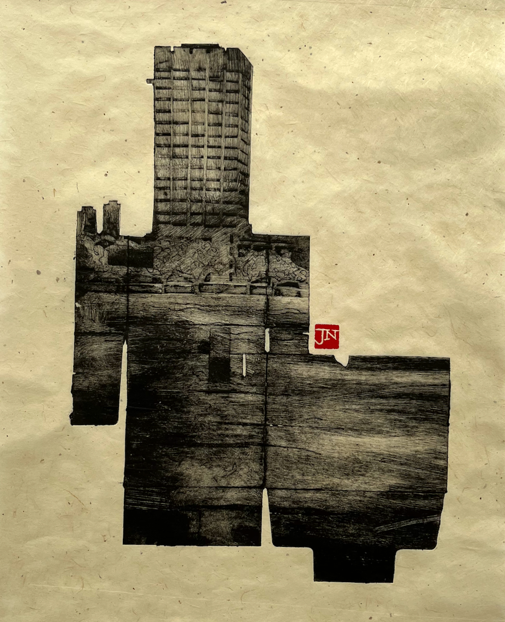
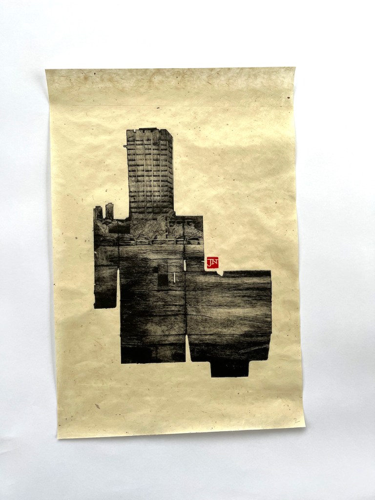
Here is a view of the tower of former London Television Centre building, seen from Windmill Walk, off Roupell Street near Waterloo Station. I…
It’s due for demolition. So using discarded packaging to make an image of this building seemed to be appropriate. The building, though made of concrete and steel, is yet ephemeral, like my fragile plate.
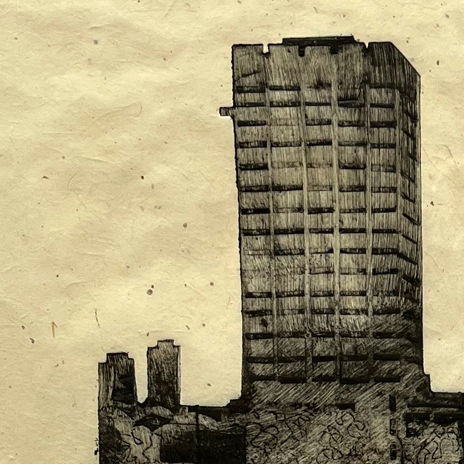
I made the print on “Gampi smooth” paper from Shepherds of London. This handmade paper is thin, translucent, and has small inclusions and imperfections as you see on this detail photo:
The sky in this part of London is never empty. There are always seagulls, falling leaves, windswept paper, aeroplanes, police helicopters. And rain.
The ink for this print is Charbonnel F66 Black traditional etching ink from Intaglio Printmakers. I made the print at East London Printmakers on the Henderson etching press.
London Weekend Television, London South Bank. Paper is a bit over A3 size.
Here are some other prints made using the same technique:
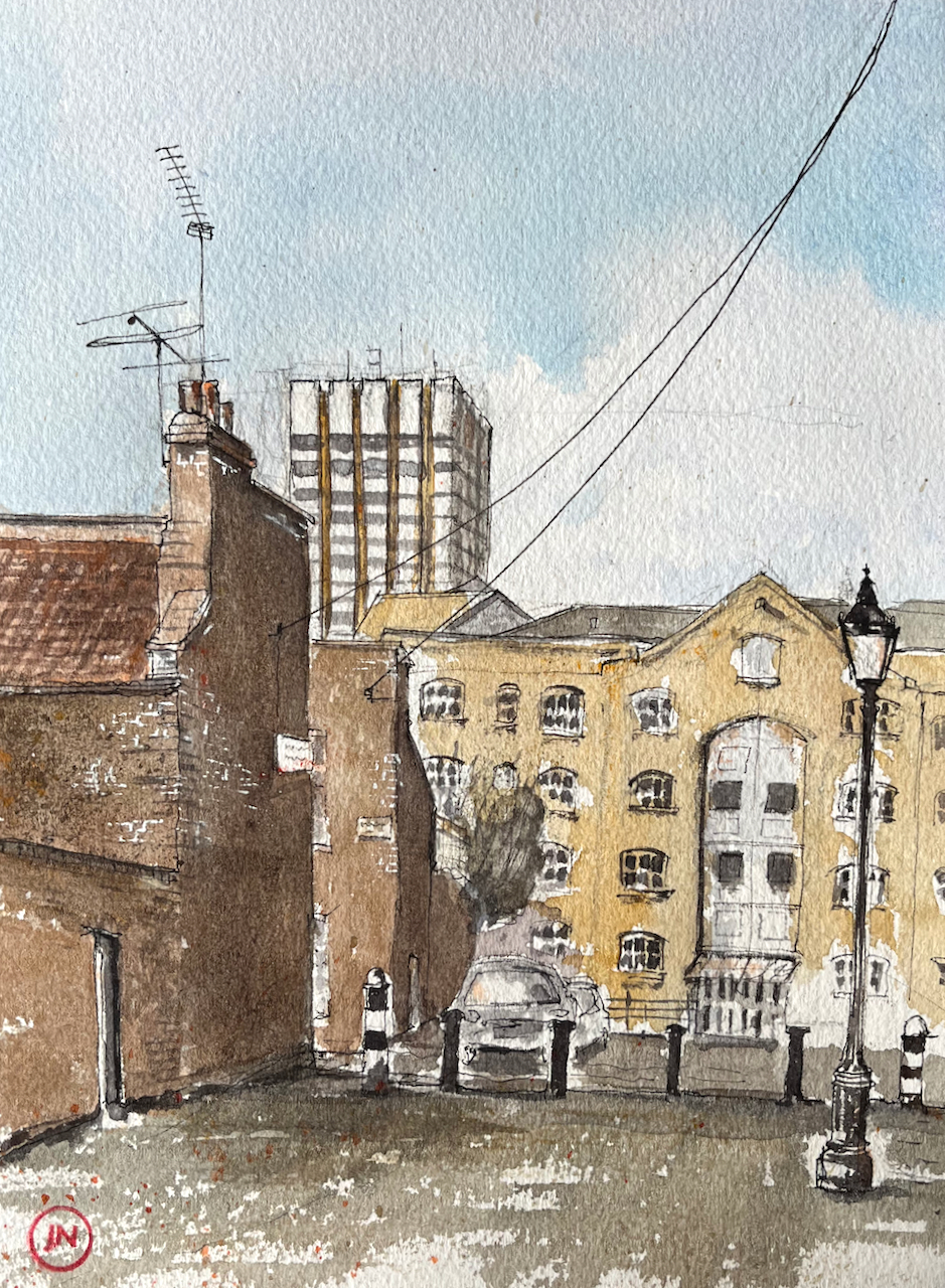
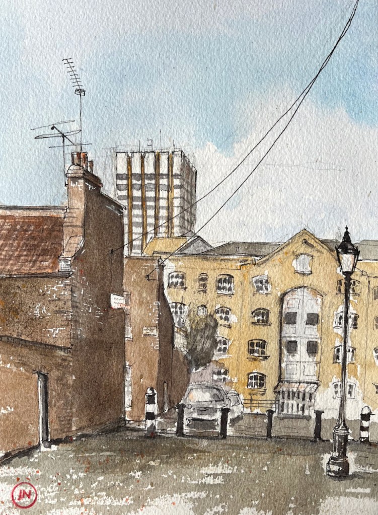
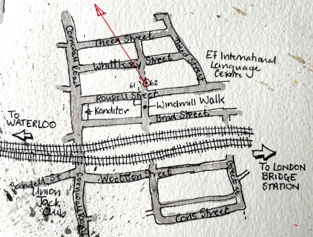
Here is a view of the tower of former London Television Centre building, seen from Windmill Walk, off Roupell Street near Waterloo Station.
LWT Building from Windmill Walk, 7th Feb 2022, in sketchbook 11
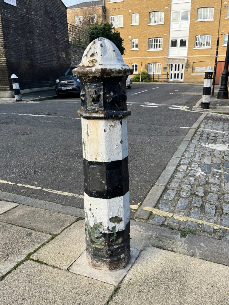
Bollard with stars.
I enjoyed all the wires and aerials! The swooping wire from the top right is a telephone wire or electrical cable. It’s unusual to see them above ground in London. Note also the marvellous bollards, which are mentioned in the Conservation Area Statement (Note 1).
Here you see layers of London development. In the foreground is Windmill Walk, part of the Roupell Street residential area built around 1824, and still residential. The paler building in the mid-distance is on Theed Street. It is a converted factory. It now contains some residential properties which I found listed on a holiday lettings site, and some offices listed on an estate agents’ site. Different accounts list it as a Violin Factory and/or a “Komptulicon Works”. Komptulicon was a sort of floor covering made of cork and rubber.
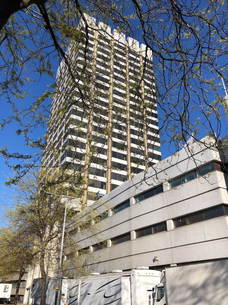
On the skyline is the London Television Centre, 1972, which I have drawn previously:
Here is a view of the London Television Centre, 60-72 Upper Ground, SE1. It is on the South Bank of the river Thames, a little to the East of the National Theatre and the Royal Festival Hall. It was completed in 1972 to the design of…
“[Roupell] street was laid out and construction started around 1824….. Roupell had built the street for what were described as “artisan workers” and the 1841 census provides a view of the professions of what must have been some of the first people living in the street. This included; painters, labourers, clerks, printers, bakers, carpenters, bricklayers, compositors, paper hanger, hatter, an excise officer, lighterman, warehouseman – all the typical jobs that you expect to find in such a street in 1840s London.” (A London Inheritance)
“Roupell Street Conservation Area” statement by Lambeth Council, 2007, describes the streets and details what can and cannot be done in modifications to the houses. It also mentions the “Komptulicon Works”, north of Windmill Walk.
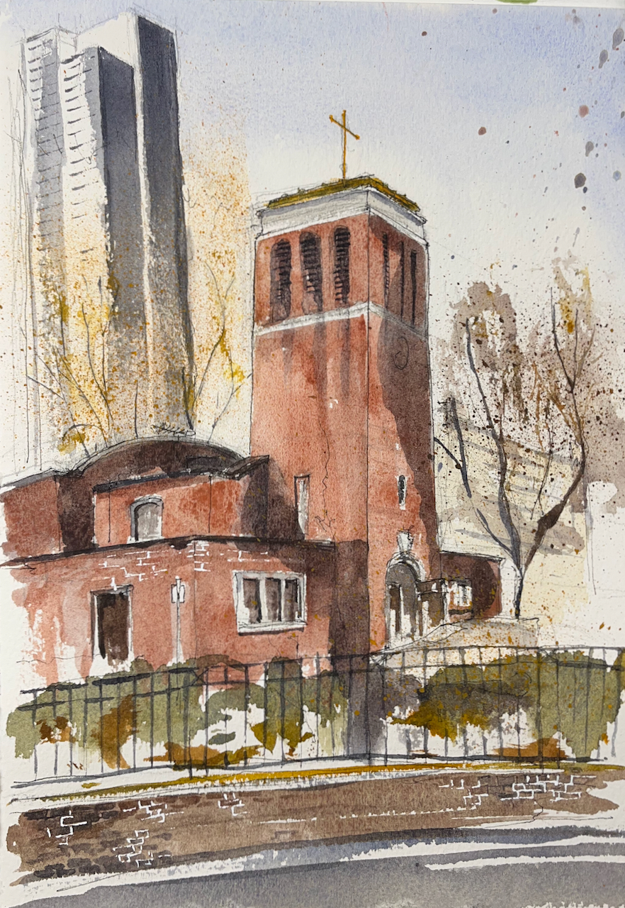
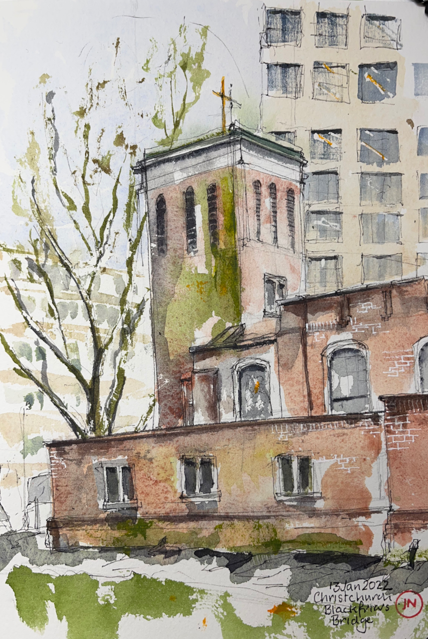
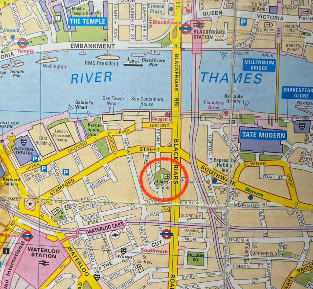
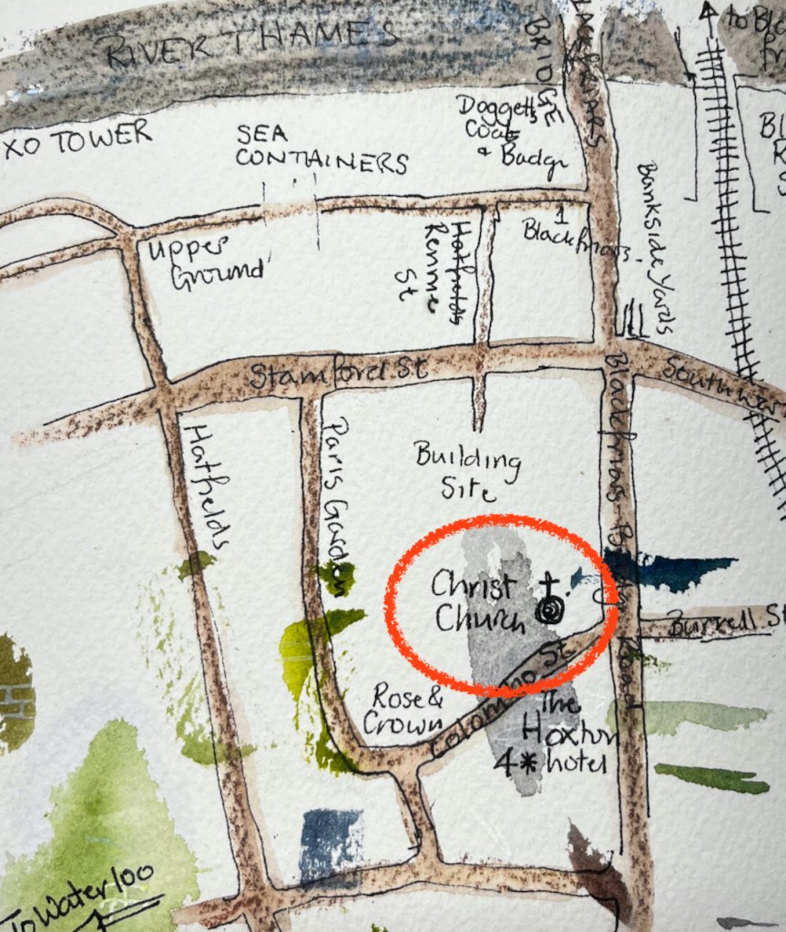
On the South side of Blackfriars Bridge there is a church amongst trees. This is Christchurch Blackfriars Bridge.
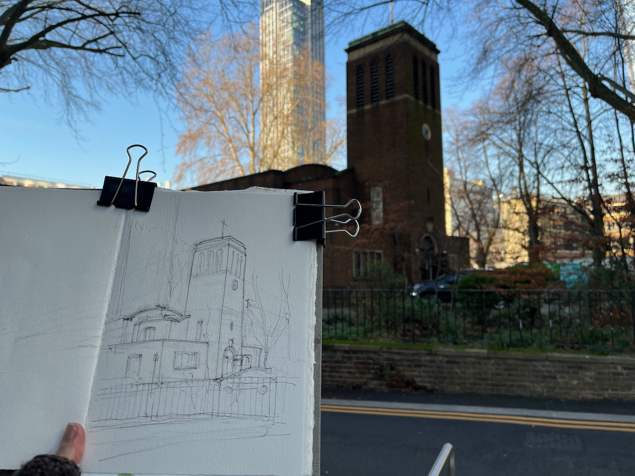
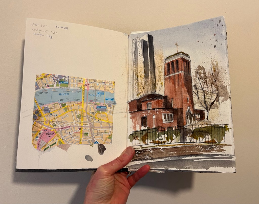
Christchurch Blackfriars Bridge, 14th January 2022, 2pm 10″ x 7″ in Sketchbook 11
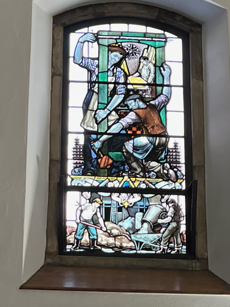
A window showing construction workers
This is the south side of the church, showing its open door. I went in. This is a very welcoming church. I passed three separate notices telling me I was welcome. Inside it is calm, warm and light. There are benches to sit on. There are marvellous stained glass windows. They show not saints and Bible stories, but Londoners. They show builders and printers, river workers, and engineers. There is a power station worker looking at a bank of rotary dial telephones, and a queue of people waiting for a red London bus. All these are beautifully done in stained glass.
This church accepts the idea that people might be “spiritual not religious”. Between 12noon and 2pm: they offer a “lunch time silent space”, and there are other events that include meditation and silence.
A detailed history of the church is in British History Survey of London: ‘Christ Church’, in Survey of London: Volume 22, Bankside (The Parishes of St. Saviour and Christchurch Southwark), ed. Howard Roberts and Walter H Godfrey (London, 1950), pp. 101-107. British History Onlinehttp://www.british-history.ac.uk/survey-london/vol22/pp101-107 [accessed 16 January 2022].
Here is how it looked before 1941.
‘Plate 67: Christ Church. Exterior and watchhouse’, in Survey of London: Volume 22, Bankside (The Parishes of St. Saviour and Christchurch Southwark), ed. Howard Roberts and Walter H Godfrey (London, 1950), p. 67. British History Onlinehttp://www.british-history.ac.uk/survey-london/vol22/plate-67 [accessed 16 January 2022].
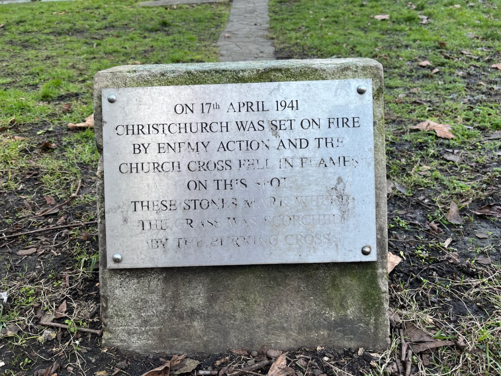
It was completely gutted by incendiary bombing in April 1941. The 1950 “Survey of London” cited above describes it as a “shell”. The present church was completed in 1960, according to Pevsner (The Buildings of England, London 2: South, by Nicolaus Pevsner and Bridget Cherry, page 275). The architects were R Paxton Watson & B Costin.
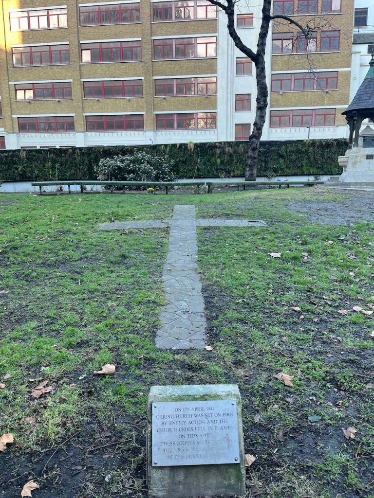
“On 17th April 1941 Christchurch was set on fire by enemy action and the church Cross fell on this spot. These stones mark where the grass was scorched by the burning Cross”A monument on the West side of the church, photographed 6th March 2025. The cross referenced here can be seen in the black and white 1941 photo above.
The church is now surrounded by buildings and trees and is very much alive. Here is the view from the North:
Christchurch Blackfriars Bridge, 13th January 2022, 12:30pm 10″ x 7″ in Sketchbook 11
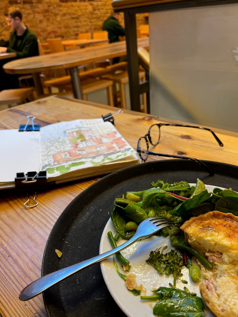
The outside air temperature was 3 degrees C and the paint wasn’t drying. Also I was very cold. I went for lunch in “Greensmiths”in Lower Marsh, and finished the painting there.
“Greensmiths” in Lower Marsh Waterloo.
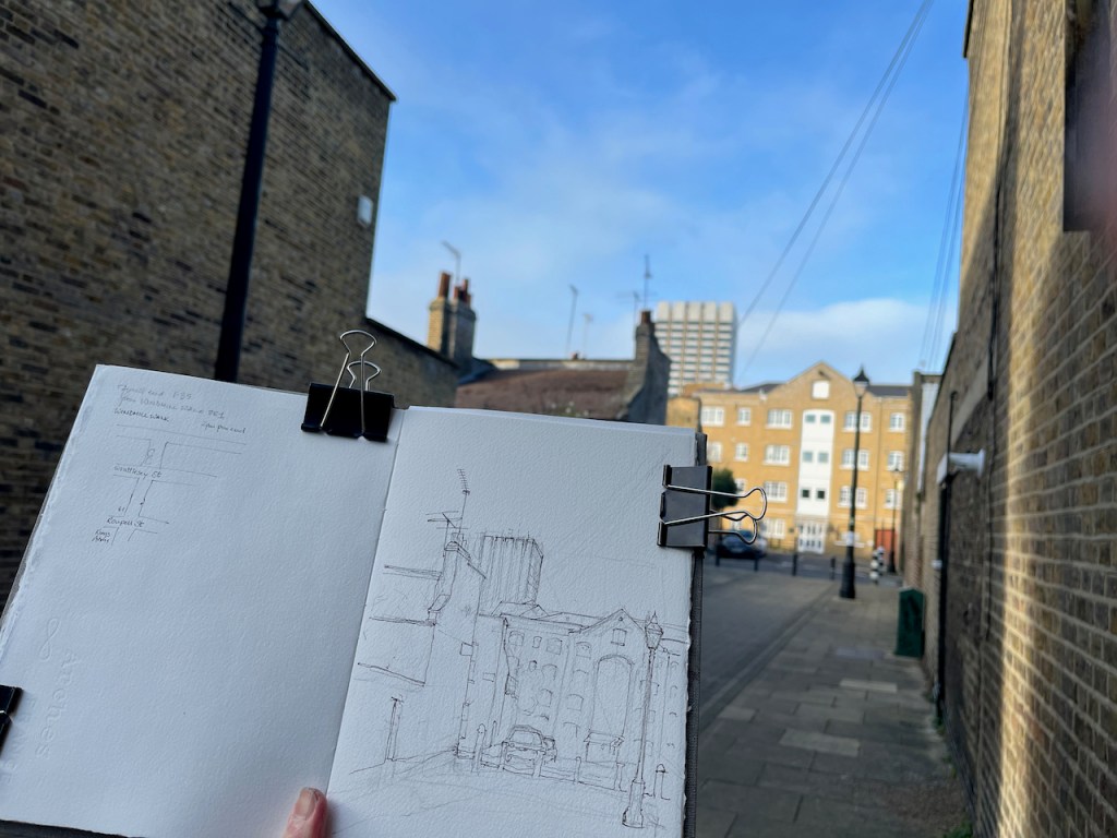
Here is work in progress on the sketches, and some maps to show where this church is.
There were some spectacular shadows that day:
Christchurch Blackfriars Bridge, from the South, 14th January 2022 about 2pm.
The church community hold some of their events in the adjacent pub, the Rose and Crown:
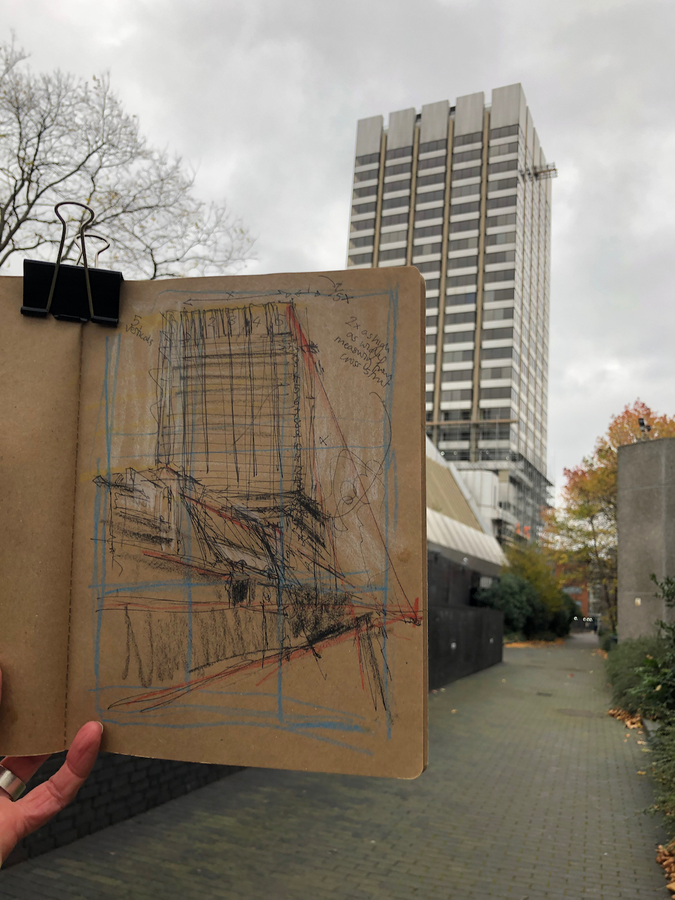
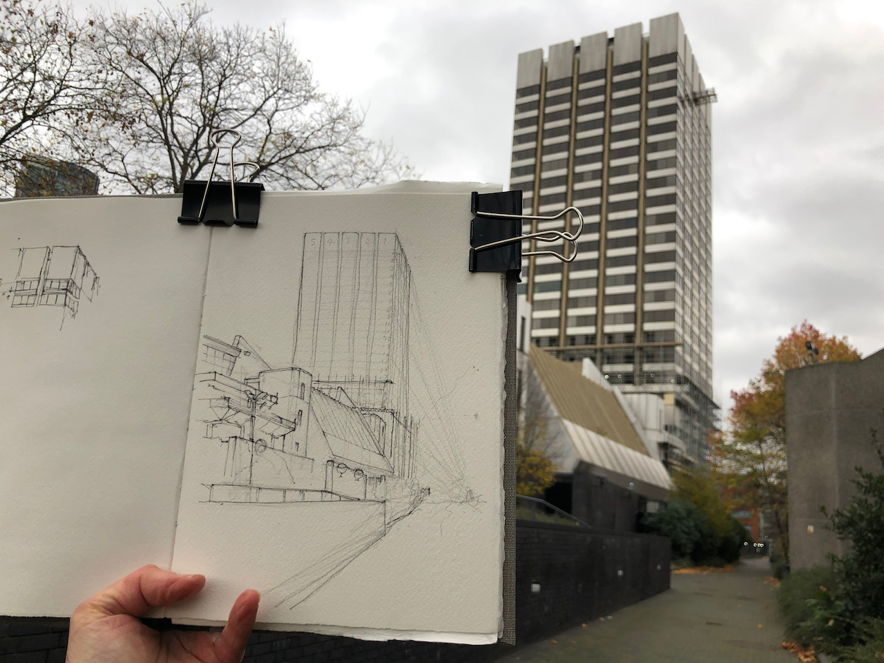
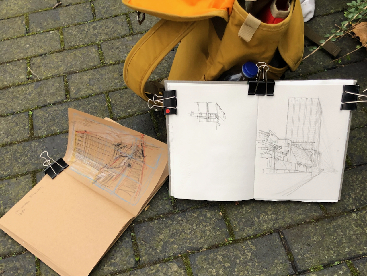
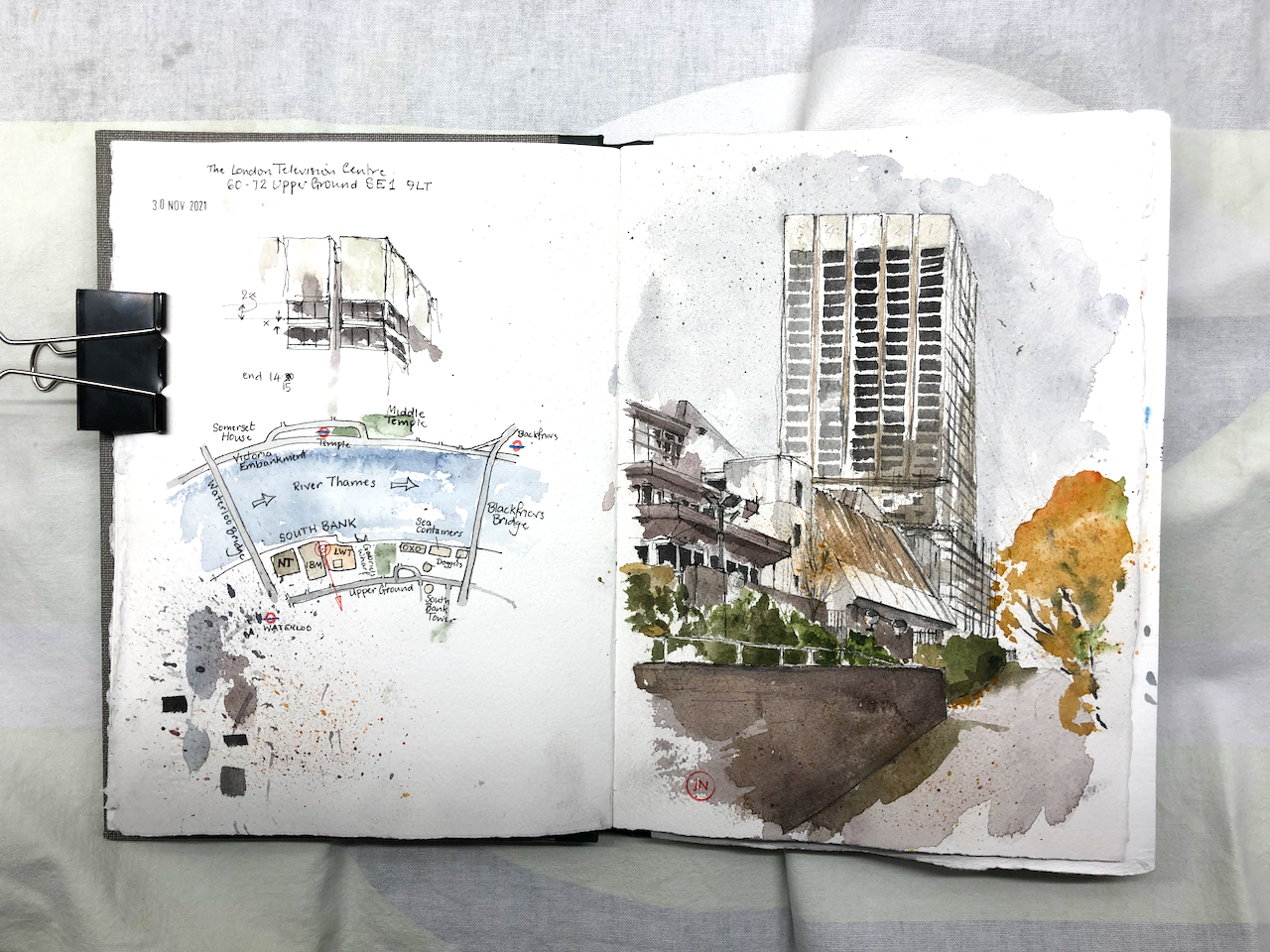
Here is a view of the London Television Centre, 60-72 Upper Ground, SE1. It is on the South Bank of the river Thames, a little to the East of the National Theatre and the Royal Festival Hall. It was completed in 1972 to the design of Elsom Pack & Roberts.1
London Television Centre, 30 November 2021, 10″ x 7″ in Sketchbook 11
Appreciate this building while you can – it is bring demolished. Admire the variety of the sloping roofs, the unexpected angles, the terraces overlooking the river. Appreciate the unexpected finish: it is covered in tiny, white, glistening tiles.
The planning application reference is “21/02668/EIAFUL” submitted to Lambeth Council on 5th July 2021. It says:
Demolition of all existing buildings and structures for a mixed-use redevelopment comprising offices, cultural spaces and retail uses with associated public realm and landscaping, servicing areas, parking and mechanical plant.
Interestingly the status, as of today, is “awaiting decision”, which is strange because when I was sketching the site earlier this week, demolition was definitely in progress: both visible and audible.
For the record, here are some pictures of the current building (click to enlarge):
View from “the Queens Walk” riversideFrom the riversideThe low level balconies along the riverView from Blackfriars BridgeLooking West along Upper GroundLooking West along Upper GroundNov 30th 2021, demolition in progressLooking South from the riverMay 2021May 2021 – from Upper GroundMay 2021, Upper GroundView from the river, IBM building on the rightExisting building (2021, May and November)
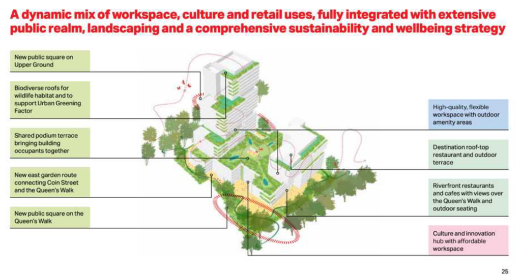
The proposed new building will be taller than the current tower, and the current low-level buildings are to be replaced by a wide block.
The proposed new building will be wider and taller than the existing buildings.It seems as though we will be able to walk through the new development. And there will be cafés and restaurants on the river side. (Picture ref: see Note 2)
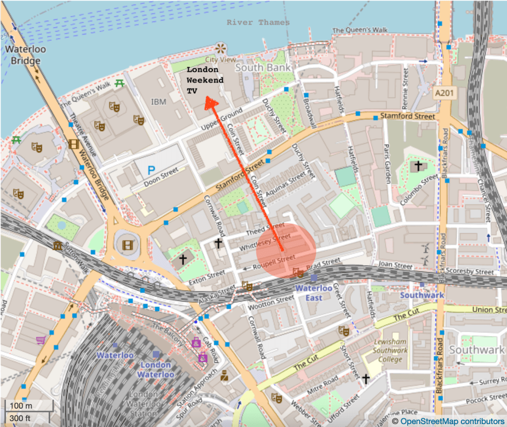
Here are some maps to show where this is:
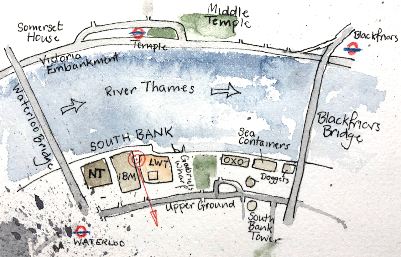
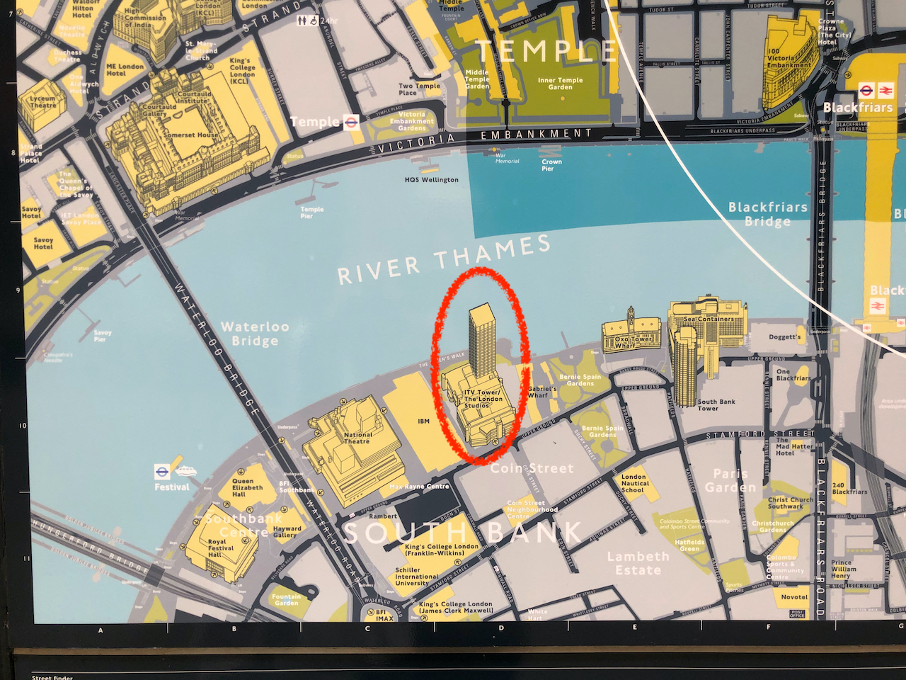
Sketch map showing viewpoint of the drawing. NT= National Theatre, IBM = the IBM building, LWT = London Television building, OXO = the OXO TowerPhoto of a public map in the City of London. [Oddly, they have got the building reversed. The tower is not by the river, as shown on the City of London Map, but on the inland side.]
I drew the picture from the inclined plane leading up to Queens Walk by the river. There must be a splendid view from the adjacent IBM building. If you work there and you’d be prepared to host me so I could draw from the balcony, then do please get in touch.
Here are some photos of my work in progress on the picture. It was cold, wet and windy, and there were a lot of seagulls. I put the seagulls in the picture, to the right of the tower. I finished the colour at my desk.
I have also drawn Colechurch House, another 20th Century building in the area due for demolition:
Aficionados of 20th Century brutalist architecture need to hasten to appreciate Colechurch House. It is due for demolition and redevelopment. This month’s post in the marvellous “London Inheritance” site informed me about the planning application, so I rushed over there to draw a picture before the building became swathed…
“When London Weekend Television decided to build its own modern studios, it chose a site on the South Bank close to the National Theatre. The architectural practice of Elsom Pack and Roberts were commissioned to design the building. Originally known as Kent House, their building involved a 21 storey tower rising above a podium that houses the television studios. Construction started in 1970 and the first transmission was in 1972. It became known as The South Bank Television Centre and it was considered to be the most advanced television centre in Europe at that time.”
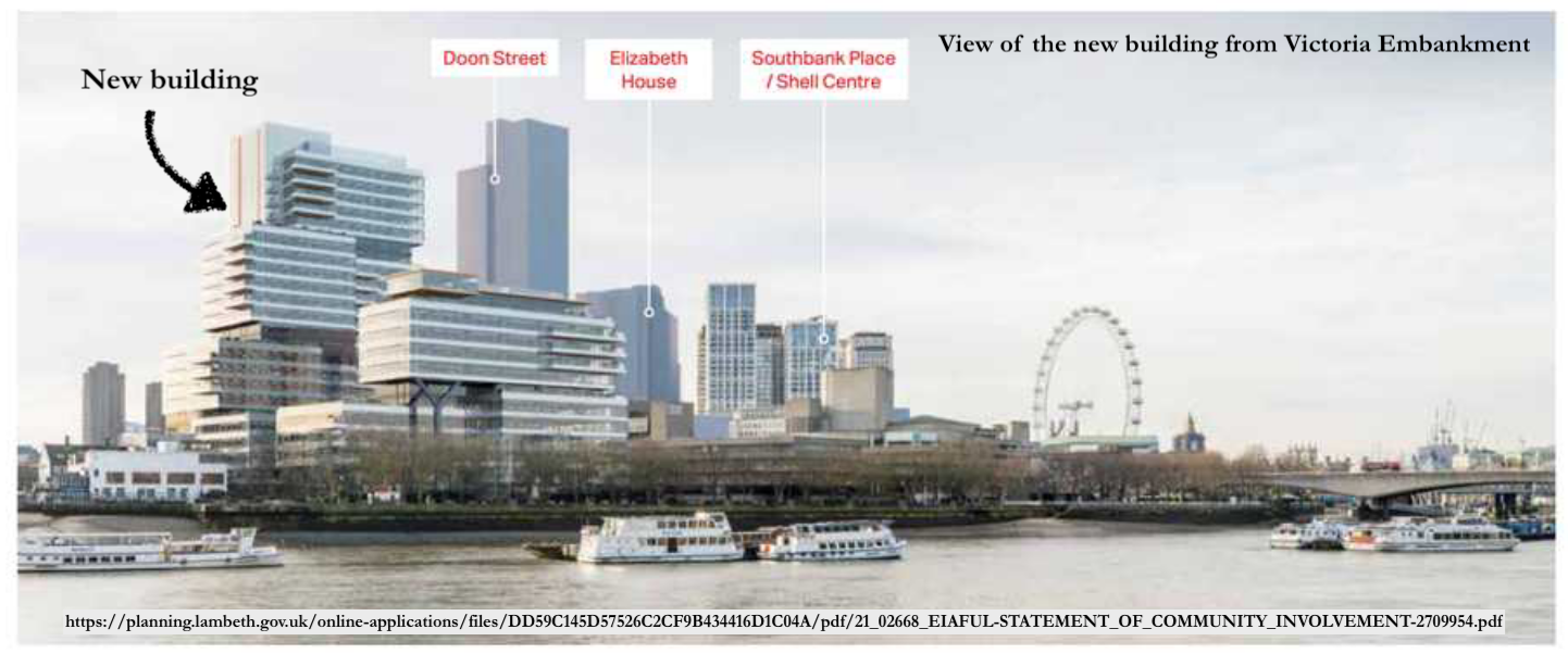
Note 2: Picture of the new building and plan from the Statement of Community Involvement, downloaded 2 Dec 2021.
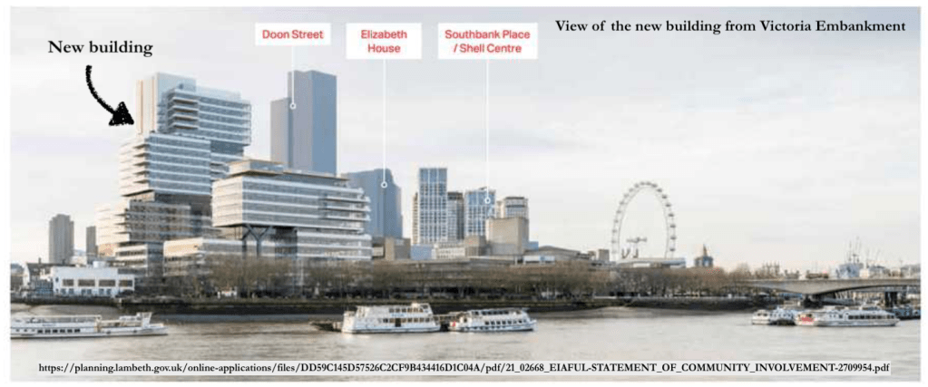
For comparison, here are the two views – the proposed development and the current view from Victoria Embankment. The visual of the proposed development shows various tall buildings which do not yet exist. The “Doon St Tower” is a proposed 43 storey tower on the inland side of Upper Ground from the National Theatre. It has planning permission (2010) but has not been built. Another tall building shown on the view of the proposed development is “Elizabeth House” a.k.a “One Waterloo”. This is set of buildings, 15 to 31 floors, next to Waterloo Station. It also has planning permission (19/01477/EIAFUL Feb 2021) but has not been built.
Click a button below to share this post online, email it, or print it:
Guinness Court is a group of low-rise blocks between Gambier House and Galway House, in Finsbury. A resident writes that it is a lovely place to live, with an “inner communal garden with trees and squirrels”.
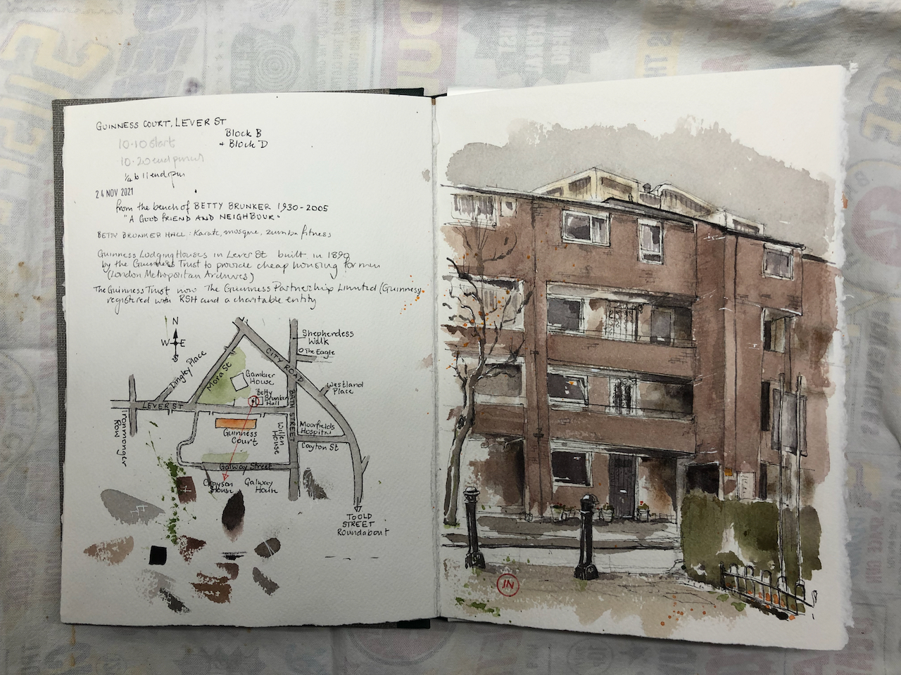
Here is Guinness Court from Lever Street:
Guinness Court, Lever Street, EC1 24th November 2021, 10:45am.
You see Grayson House just peeping over the roof.
Guinness Court is owned and managed by Guinness Partnership Limited1.
“Guinness was founded in 1890 to improve people’s lives. And that’s still what we’re about today. In 1890, philanthropist Sir Edward Cecil Guinness donated £200,000 to set up the Guinness Trust in London, with an additional £50,000 for the Dublin Fund, which later became the Iveagh Trust. He wanted to help improve the lives of ordinary people, many of whom couldn’t afford decent homes. He wanted to improve people’s lives and create possibilities for them. We’re proud that thousands of families have benefited from this vision.” [https://www.guinnesspartnership.com/about-us/what-we-do/our-history/]
Sir Edward Cecil Guinness was the grandson of the founder of the Guinness brewery.
The original Guinness Court on Lever Street was built in 1890. Here is what it looked like in 1950:
The current building was constructed in 1976, according to “Streets with a Story – The Book of Islington” by Eric A Willats FLA. I cannot discover anything about the architect or the plans – or why the Victorian building was demolished. If anyone has access to the current building and can spot a foundation stone or information plaque, please let me know?
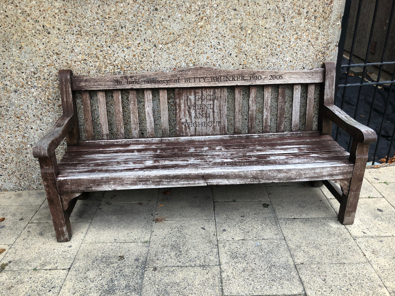
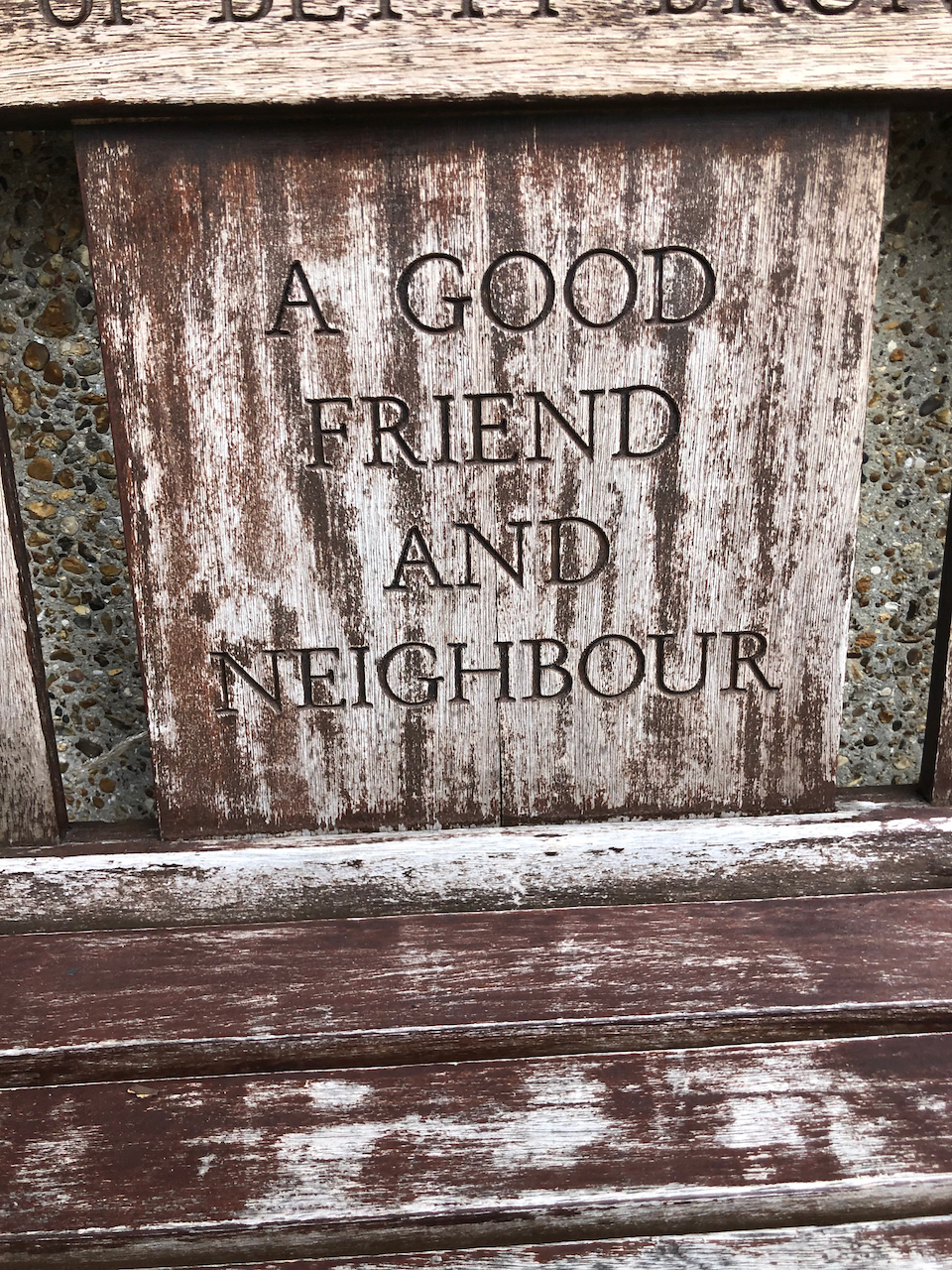
I made the sketch from a bench dedicated to the memory of Betty Brunker, “a good friend and neighbour”, 1930-2005.
Note 1: The Guinness Partnership Limited is a charitable Community Benefit Society No. 31693R registered in England and is a Registered Provider of Social Housing No. 4729. [https://www.guinnesspartnership.com]
Note 2: There are a number of buildings called “Guinness Court” in London. For example there is Guinness Court in Mansell Street E1, not far away, and Guinness Court, Snowsfields, Southwark SE1, on the other side of the river.
I have done a number of sketches in the Finsbury area:
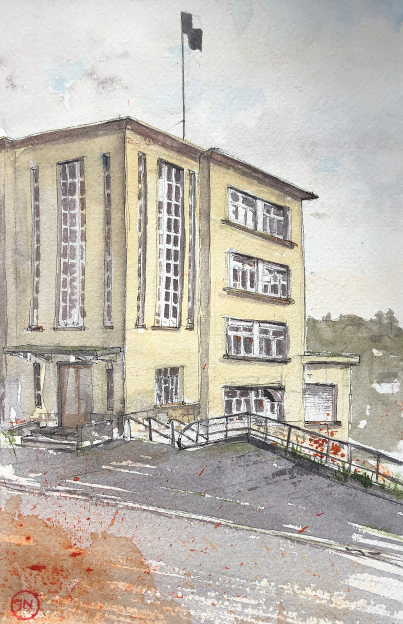
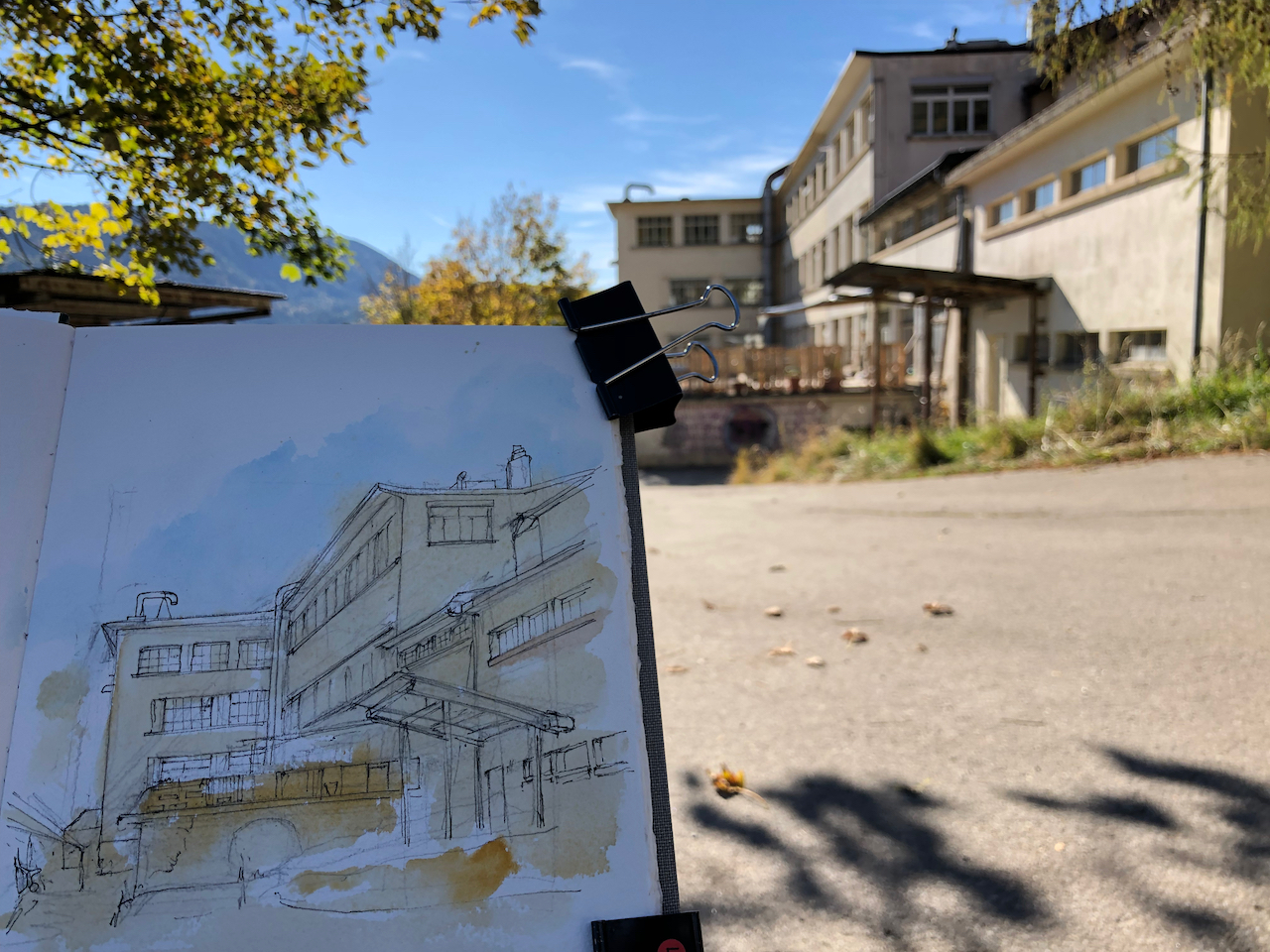
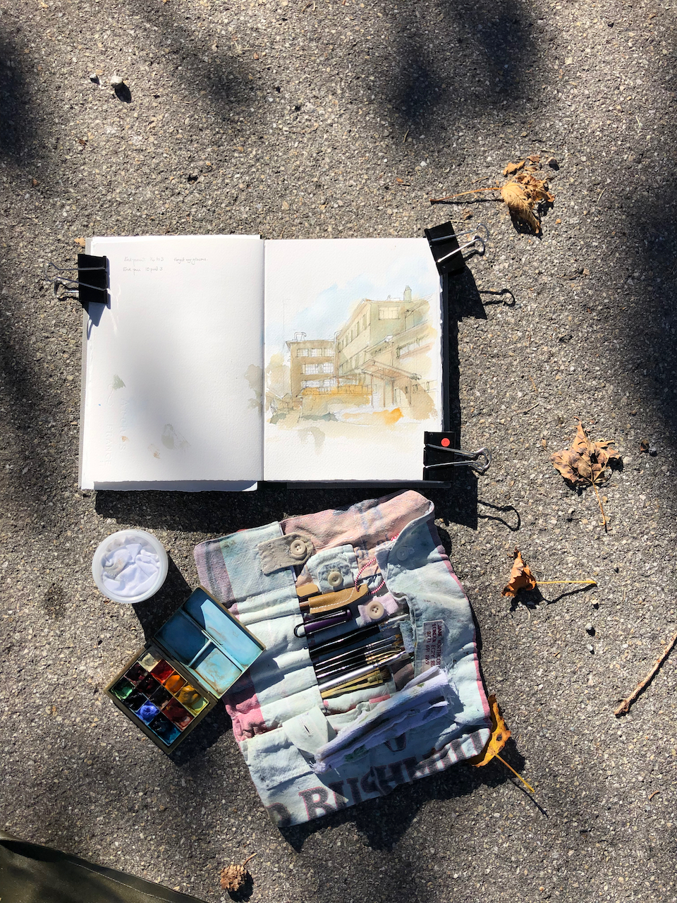
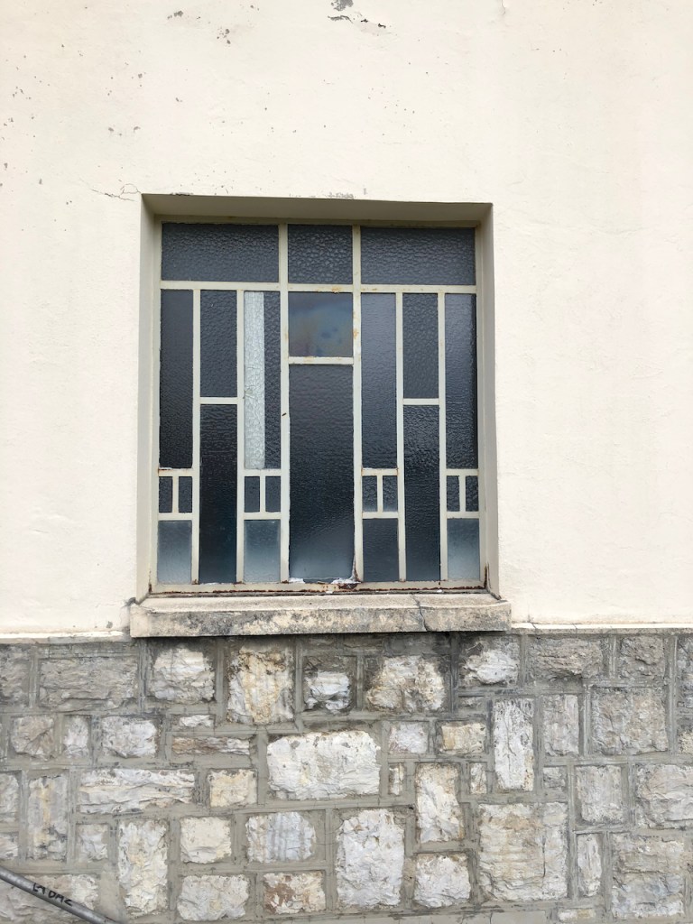
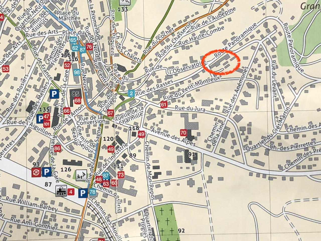
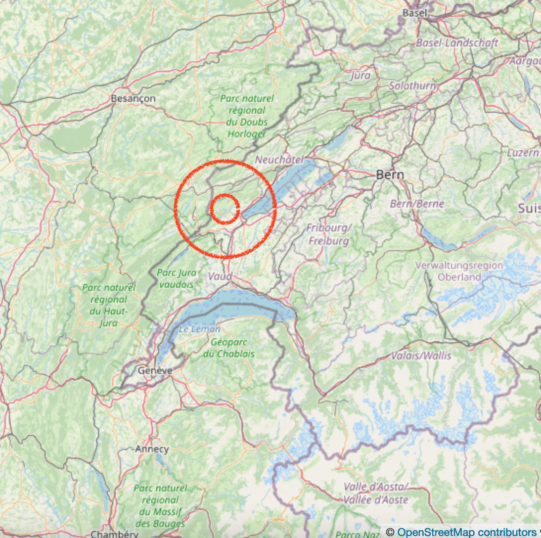
This building is on the Rue des Rasses, in Sainte-Croix, Vaud, Switzerland. For maps, see end of this article.
26 rue des Rasses, Sainte Croix, Vaud. Front entrance. 20 October 2021 in Sketchbook 11
There is much that is interesting about this building: there is the building itself, a 1930s marvel, there are the original occupiers, and there are the current occupiers.
The building was constructed in 1929-1930 as a factory for Reuge, the music-box makers. Reuge had already been operating for some 55 years by that time, starting with a pocket-watch shop in 1865. The factory operated for 85 years, until 2015, then they moved production to another site. Here is a picture of the factory fully operational, from a Reuge publication dated 2007 1
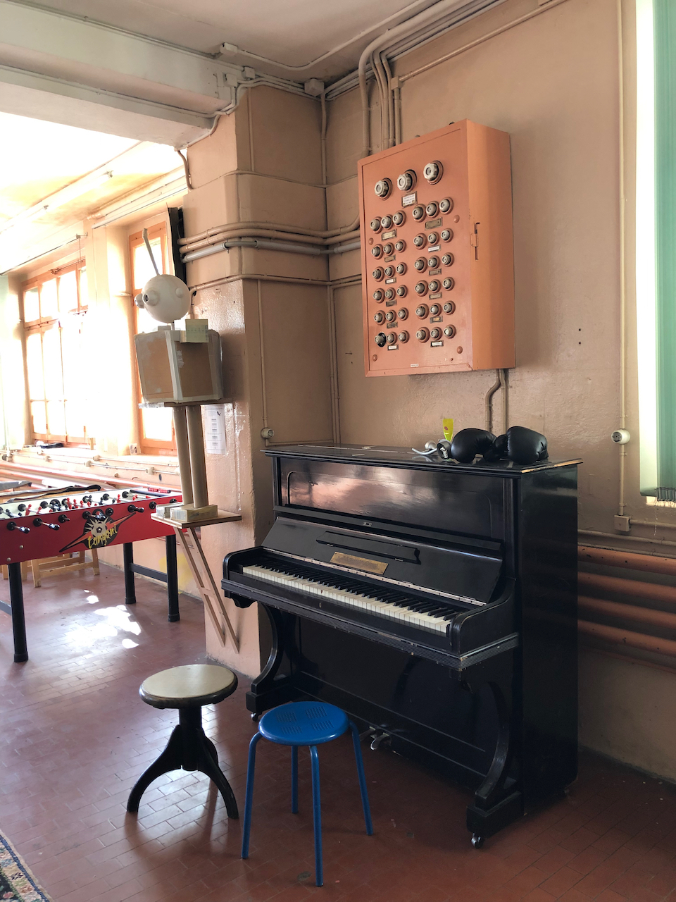
In June 2016, Reuge still owned the building, even though they’d moved their production out. They still used the wood-panelled showroom to demonstrate their music boxes. Here are some pictures from when I visited the empty building at that time:
Music box demonstration room
Former Reuge Factory, visit June 2016
Since around November 20193 the building has been occupied by a group called “le Baz”. They are a self-governing collective, who have created a “ZàB” in the former Reuge building. “ZàB”, their website2 explains, stands for “Zone libre à Bâtir”:
C’est une zone autogérée d’expérimentation, d’émancipation, de solidarité et de lutte, et pas un espace de consommation passive. Elle est ouverte à toutes et tous à toute heure décente. Et ce pour souffler, partager, apprendre ou transmettre de manière spontanée. Toute personne présente devrait pouvoir répondre à vos questionnements concernant le fonctionnement. Tout comme vous, elles ne sont ni responsables, ni programmateurices, ni animateurices, mais ni plus ni moins que les acteurices d’une création collective.
It is a self-organised space for experiment, emancipation, solidarity and struggle, and not a place for passive consumption. It is open to everybody, at any reasonable time. It’s where you can breath, share, learn or communicate at will. All the people here should be able to answer your questions about how it works. Just like you, they are not the managers, nor the schedulers, nor the facilitators, but no more and no less than the participants in a collaborative creation.
[My translation]
I took them at their word, and showed up at an “heure décent”, which as it happened was about midday. As I hesitated in front of the door, a young man asked if he could help me. I said yes, would it be possible to go in? He said yes of course, had I not read the notice on the door? I said I had. But he was already about his business, rushing ahead of me, and had left the door open. So I went in.
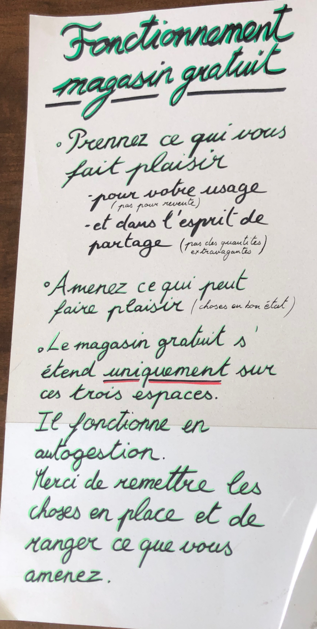
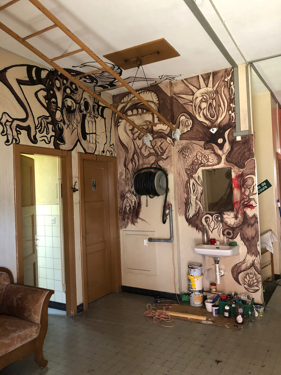
I walked around the empty spaces. It was all clean and organised. Someone had recently been working on the wall murals: there was a smell of paint. There are huge areas of blank wall and vast empty rooms. There is a “magasin gratuit” where you are invited to take what you need or bring goods to donate. A handwritten notice explains how it works.
I didn’t meet anybody.
On the way out, I did meet someone. This was a young woman, who smiled and asked if I was visiting: “Vous faites le tour?” I said yes I was. She recognised me, because she’d seen me drawing, three days previously. We chatted for a bit. She explained some of the history. The town had been opposed to their use of the site. Some people thought we were squatters, she said: “ils pensent qu’on fait le squatte”. But no, she said, we are not squatters. In principle, “no-one sleeps here the night”. And they have the permission of the owner. Well, they had the permission of the owner. But things have changed…. so the situation now is, well, “un peu ambigue”, a bit ambiguous.
She smiled. She liked it there. She said that it was surprising how little one needed, just “les un ou deux trucs” a few things needed for existence.
“And friends,” I suggested.
“Yes,” she agreed, “and friends.” She told me her name and asked me mine. “Come back,” she said, “any time. Boir un café.” And she set off down the slope, towards a young man waiting patiently below, by the collection of wooden outhouses.
Here is the picture I had been drawing when I first met the woman.
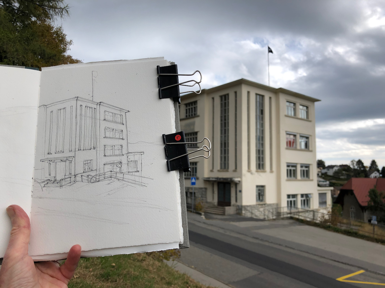
26 rue des Rasses, rear entrance (view from the South). 17th October 2021, 4pm. In Sketchbook 11
In this view you can see evidence of the current occupiers. They have built a fence, made of wooden pallets, on top of a concrete platform which is part of the original building. On the concrete wall are inscriptions in a flowing calligraphic script I did not recognise, and a large symbol in a roundel.
Here are some external views and work in progress on the drawings:
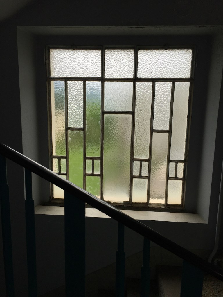
Window from inside, June 2016
Window from outside, October 2021
Building exterior, October 2021
Here are maps:
References:
Reuge, the Art of Mechanical Music, Secrets of the Reuge Manufacture, published by Reuge in 2007. Picture of the factory in the snow is from the frontispiece.
Website describing Le Baz, and the Zone libre à Bâtir: https://pantographe.info/ downloaded 22 Oct 2021
The local newspaper <<24 heures>> carries articles about how the current occupiers took over the buildings and disputes between the current occupiers and local residents. See for example the article by Frédéric Ravussin, 22.11.2019, 06h51. These newspapers are available on the marvellous digital resource: Scriptorium from the University of Lausanne.
Click a button below to share this post online, email it, or print it:
Location of Broadstairs, Kent. Map from openstreetmap
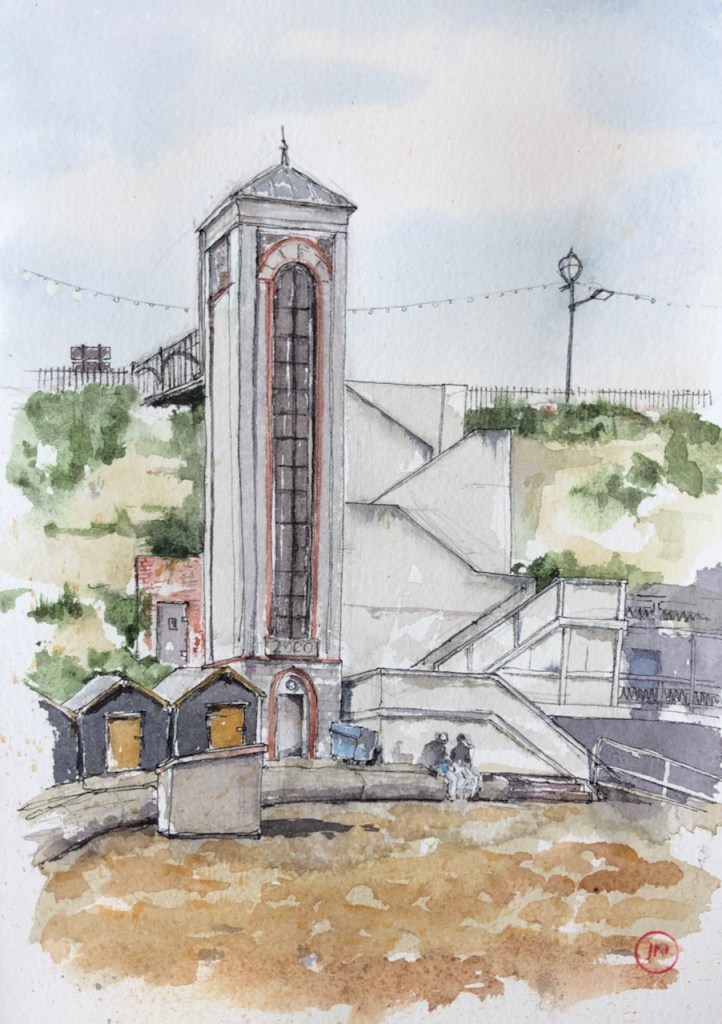
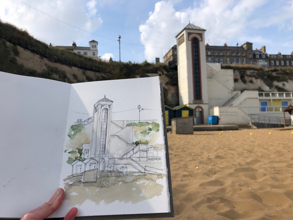
It is a Victorian seaside resort, with a sandy beach, and parks and a bandstand. The beach is below chalk cliffs, and those earnest Victorians provided their citizens with a fine lift to bring people between the sandy beach and the cliff top attractions. I was delighted, and surprised, to find this lift in full working order. While I made the drawing, the lift was used by a continuous stream of people.
The lift at Viking Bay, 17th September 2021, 8″ x 10″ in Sketchbook 10
The whole time I was drawing, music floated down from above, a series of 1950s and 1960s classics, including Elvis’ rendering of “You were always on my mind”. This seemed somehow very poignant as I sat there in the sun on the sand.
Work in progress on the drawing.
When I finished the drawing, I used those sculptural stairs on the right of the lift to climb up to the top. A young family were waiting at the bottom. One of their number, a lad of about 8, came rolling along the boardwalk in his bright green wheelchair. He expertly negotiated the narrow door to the lift and shot inside. I reached the top as they all emerged, and the lad zoomed off along the smooth tarmac into the labyrinth of parks and bandstands at the higher level.
Access Thanet has protested against the closures of the Viking Bay lift since 2019 (Image Access Thanet)
The citizens of Broadstairs have fought hard to keep their lift open. The lift was declared “permanently closed” earlier this year (2021), and only re-opened after a sustained campaign by local people, notably “Access Thanet” (pictured)