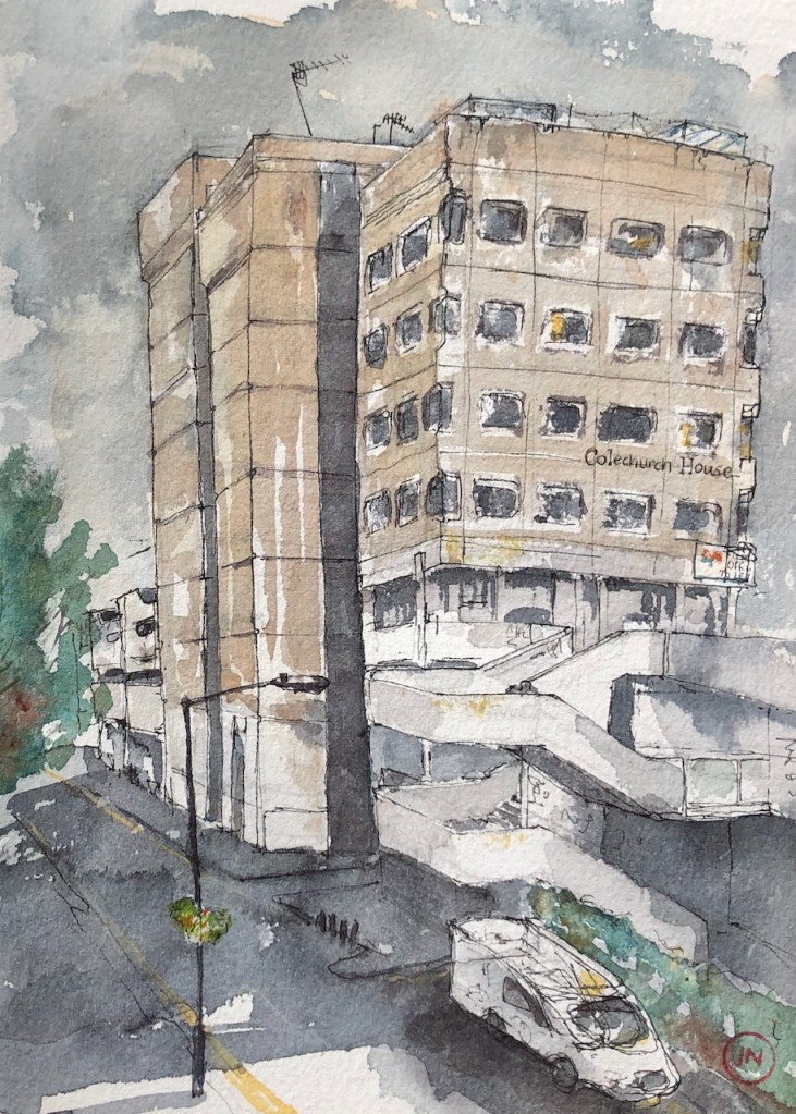
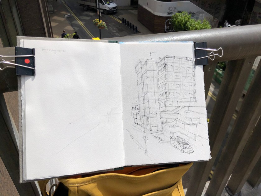
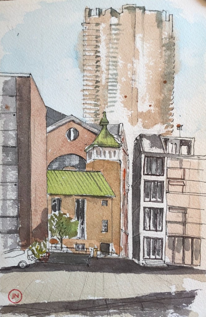
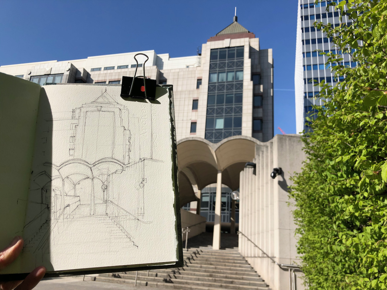
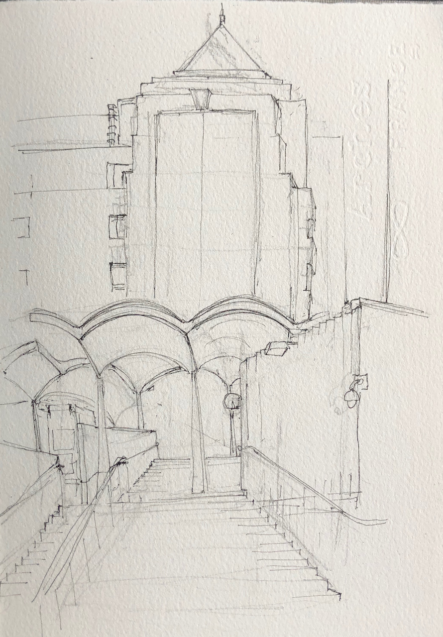
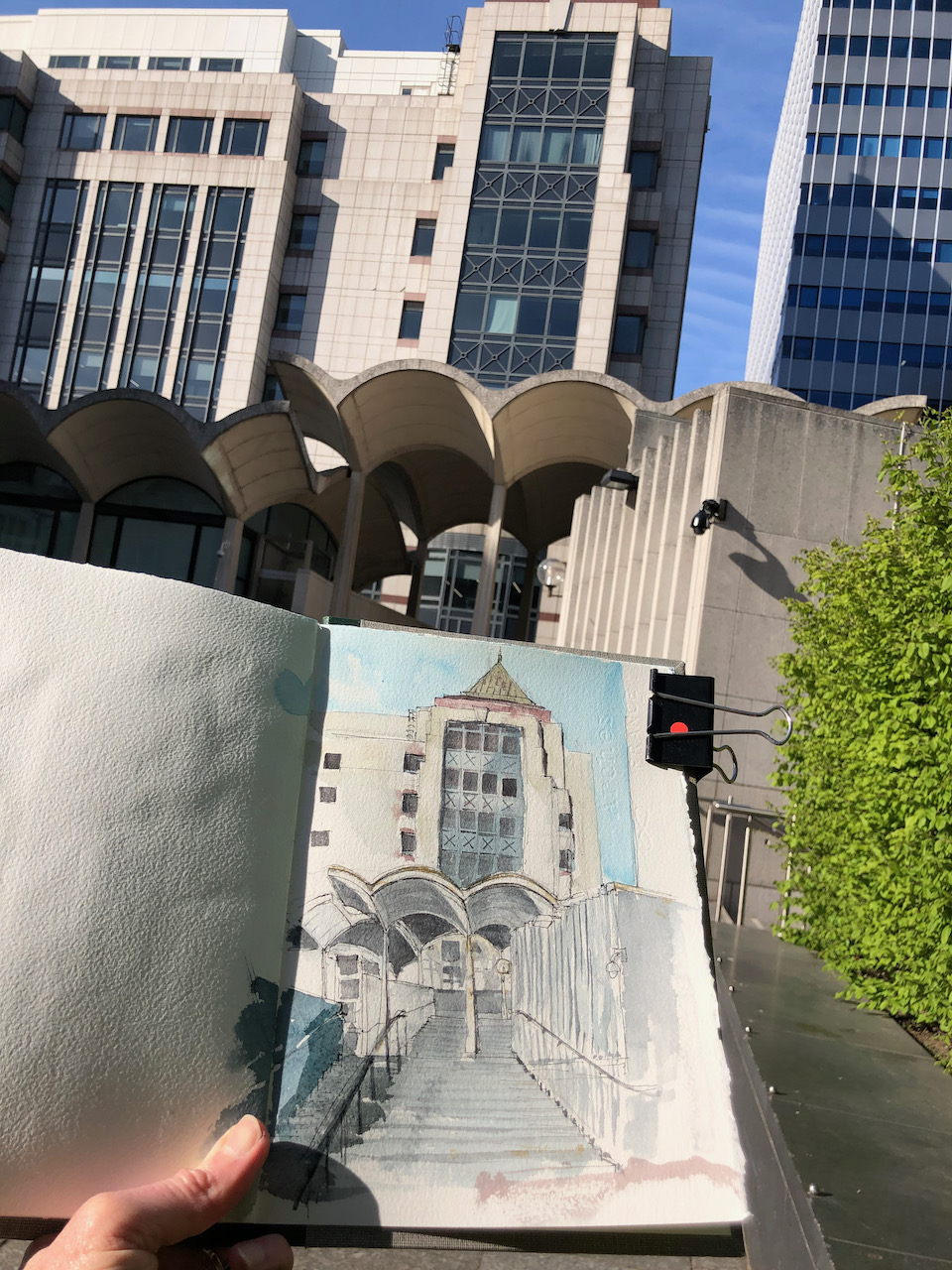
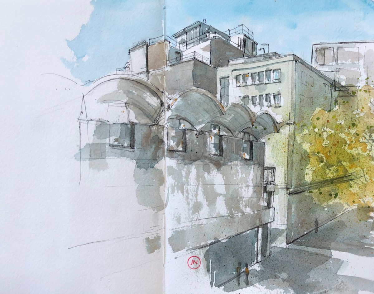
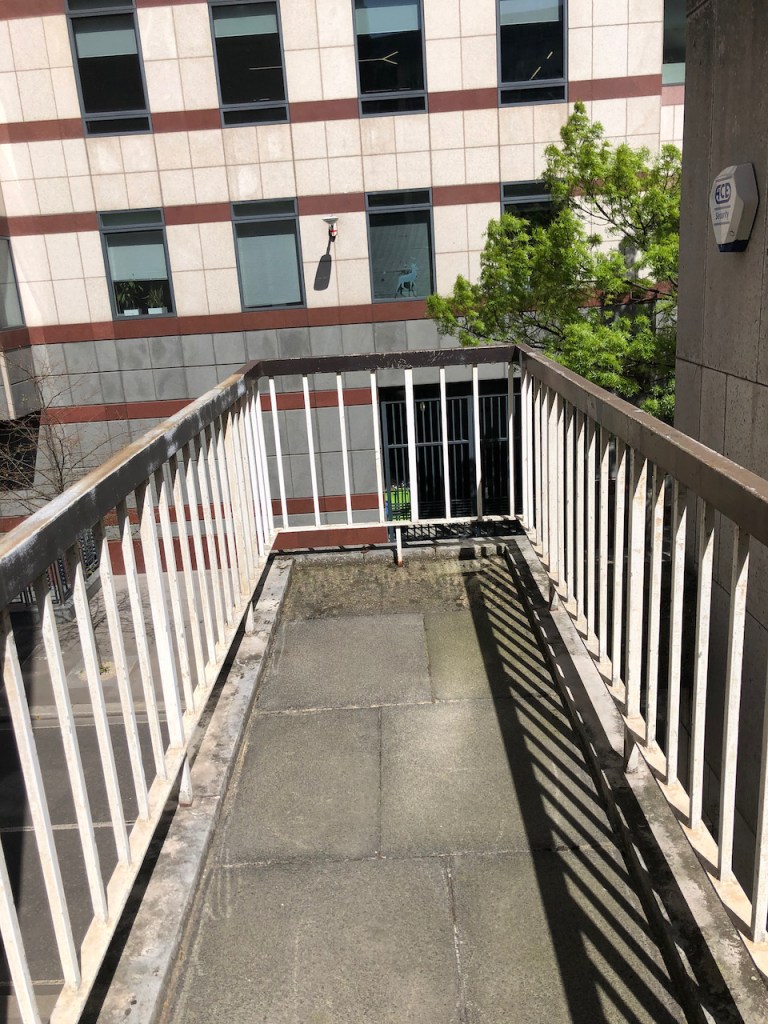
Aficionados of 20th Century brutalist architecture need to hasten to appreciate Colechurch House. It is due for demolition and redevelopment. This month’s post in the marvellous “London Inheritance” site informed me about the planning application, so I rushed over there to draw a picture before the building became swathed in plastic.
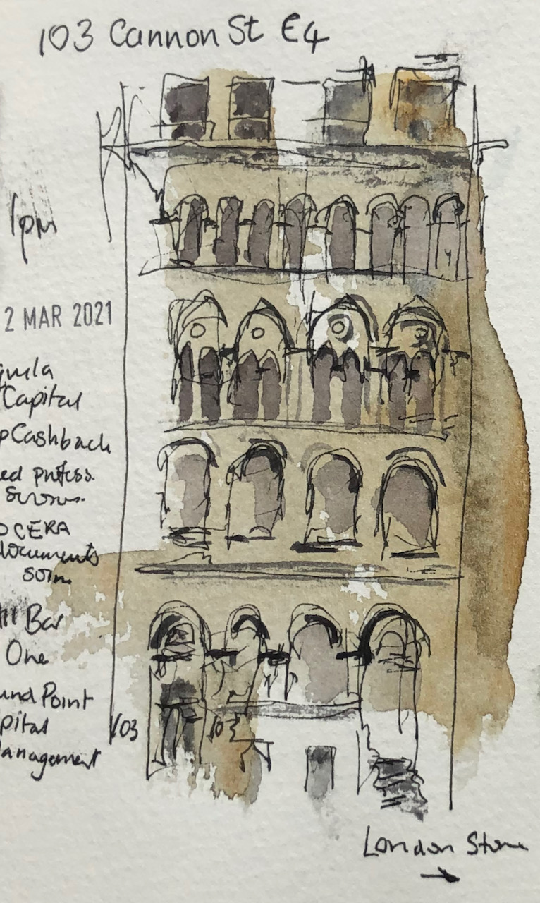
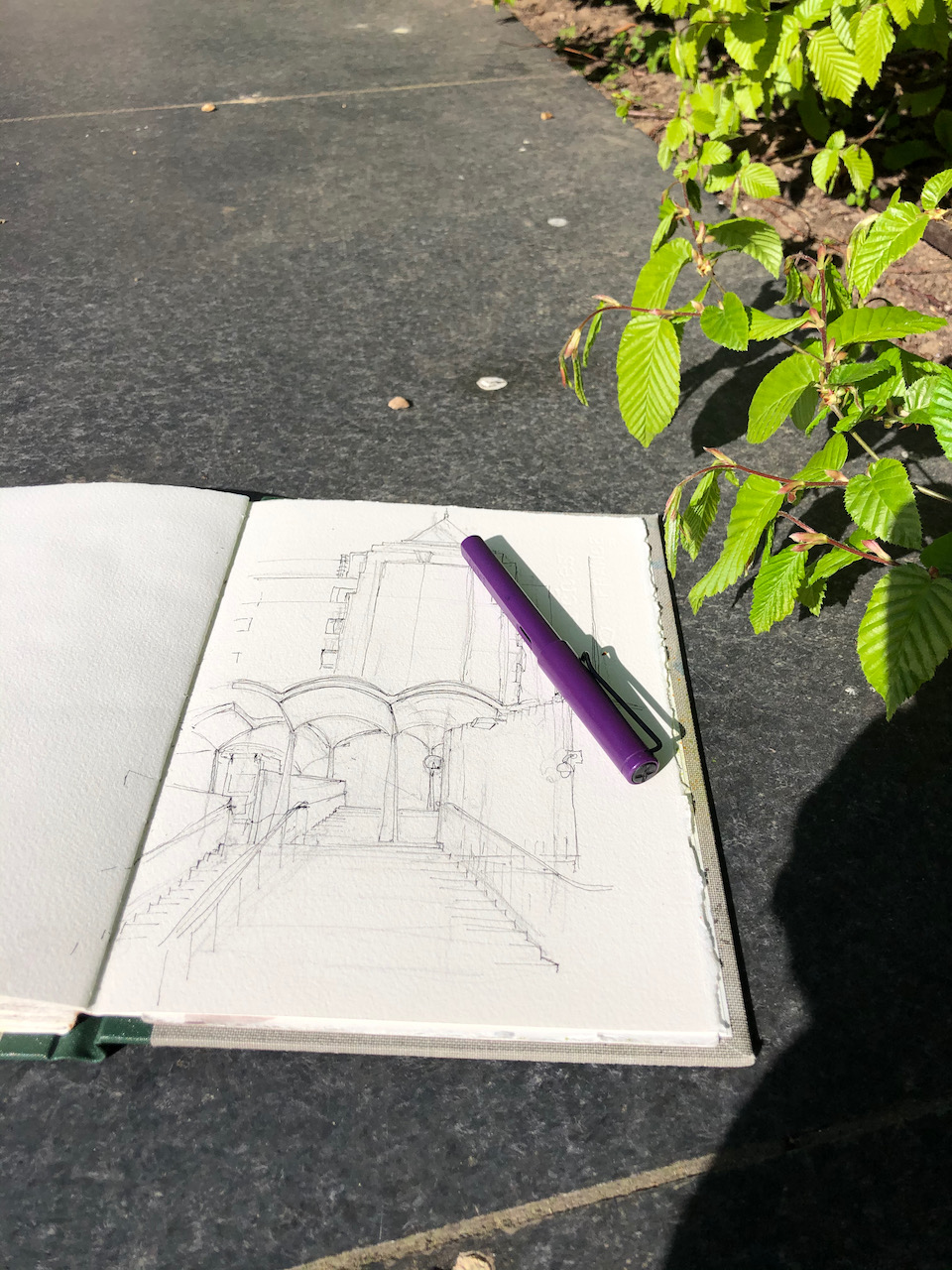
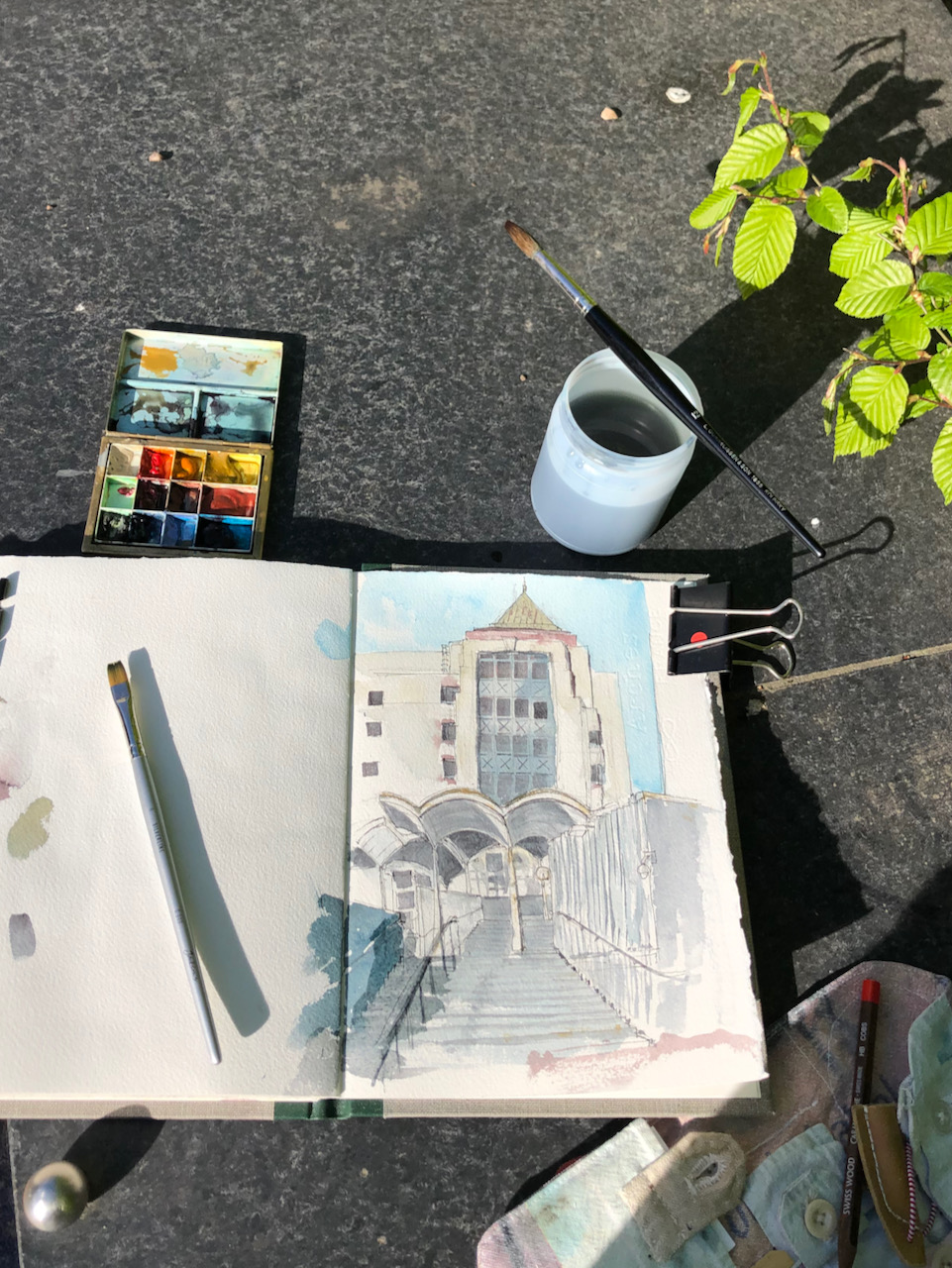
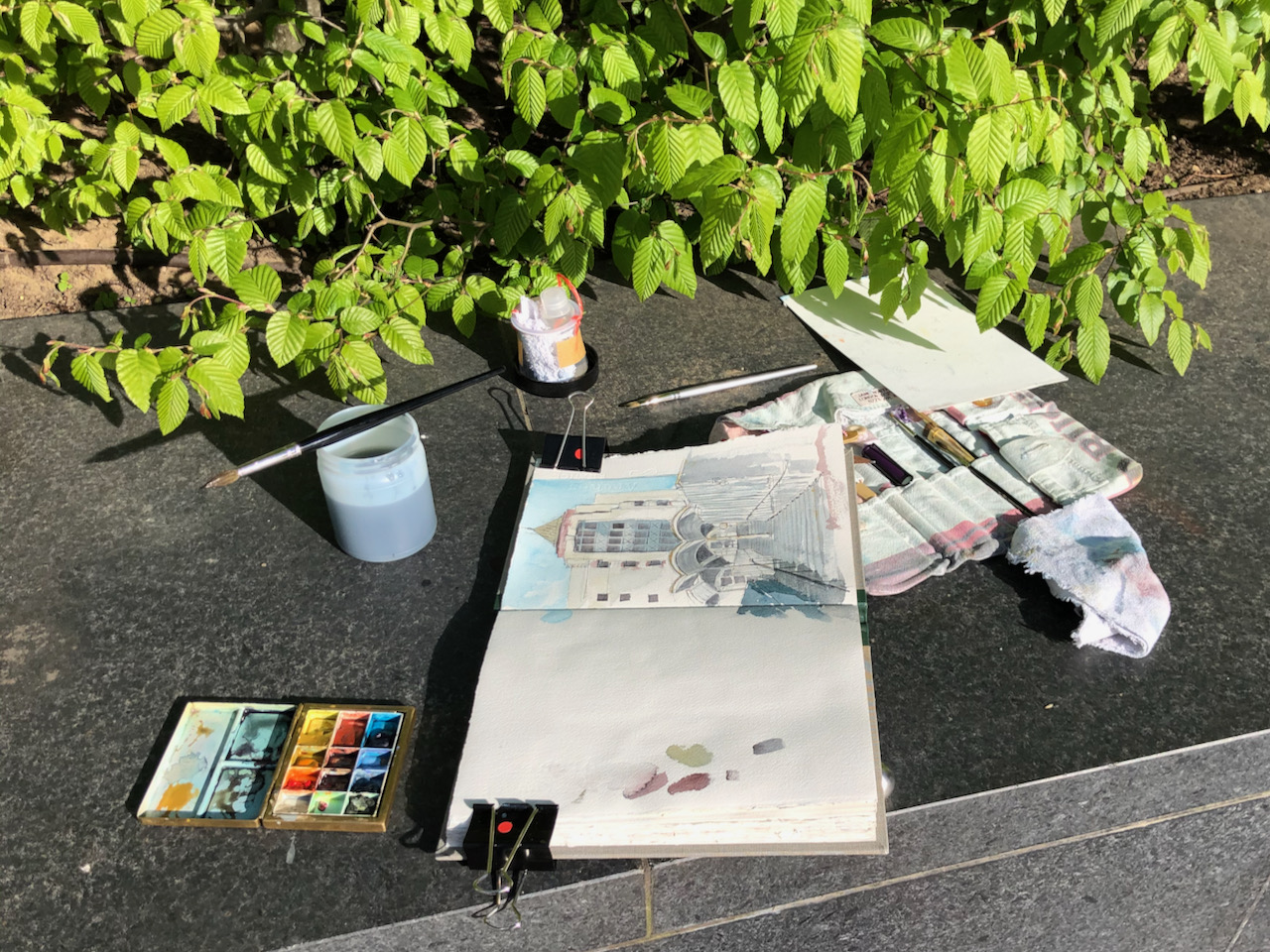
Colechurch House SE1, 18th May 2021, 12:30pm. 7″ x 10″ in Sketchbook 10
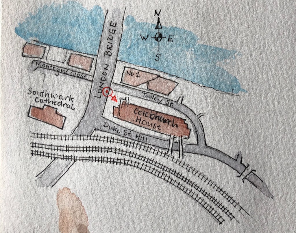
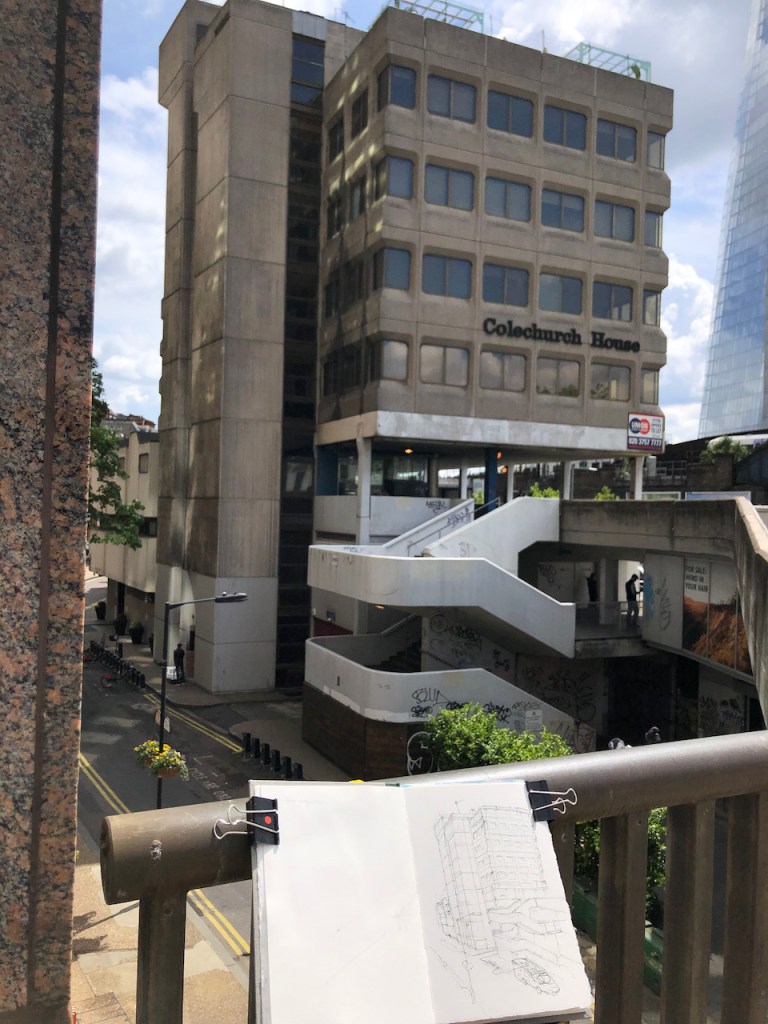
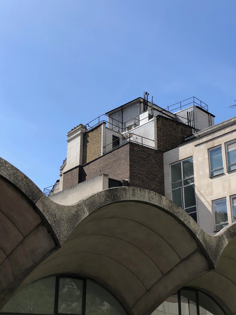
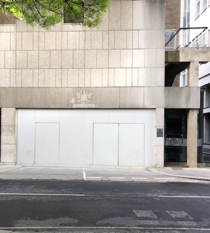
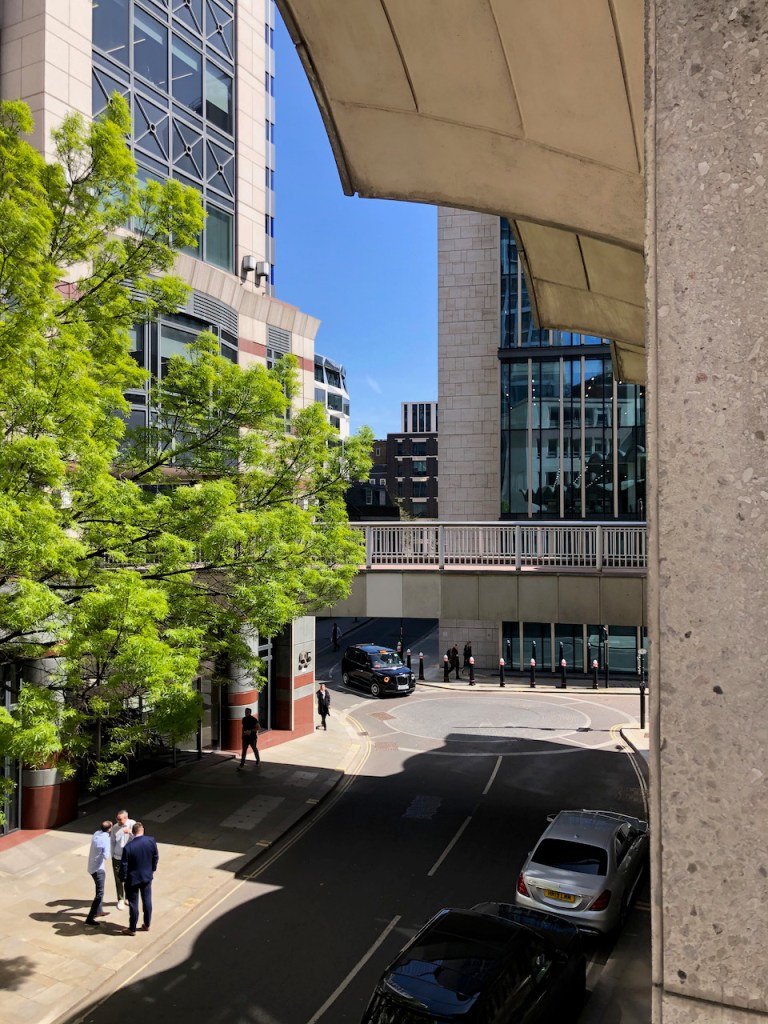
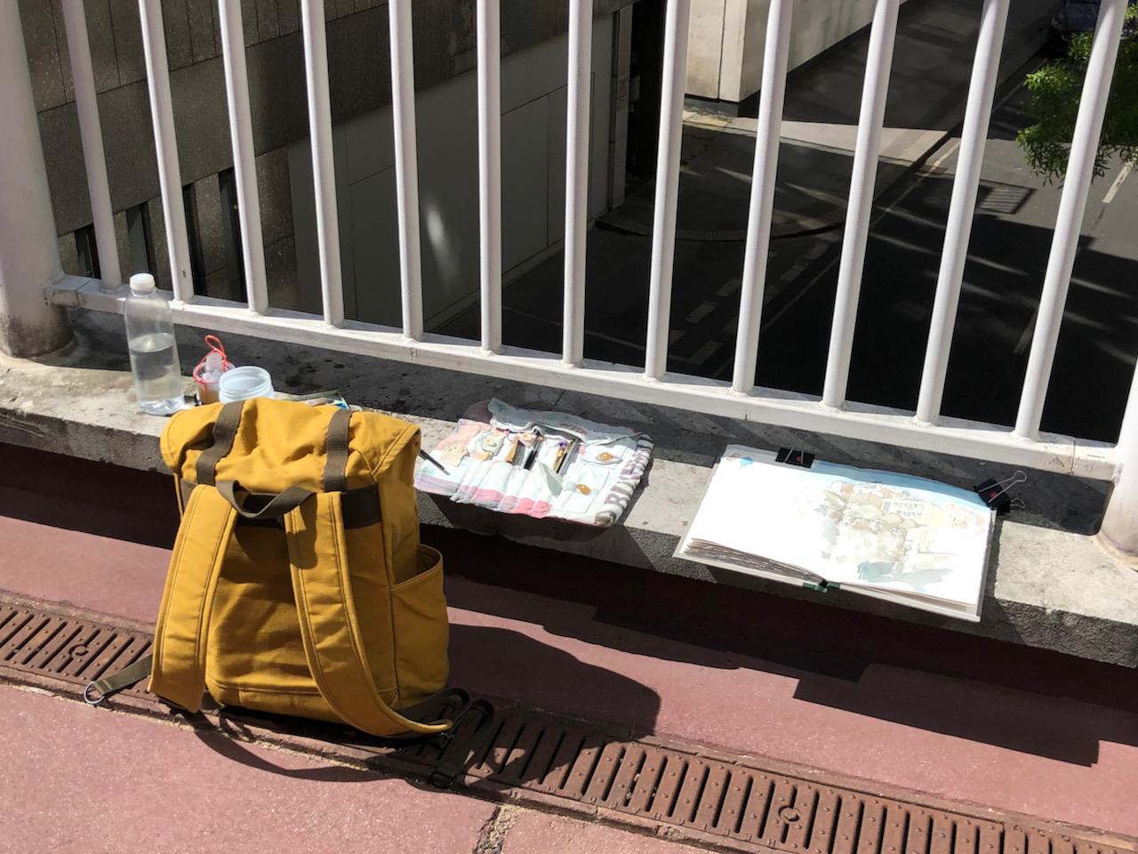
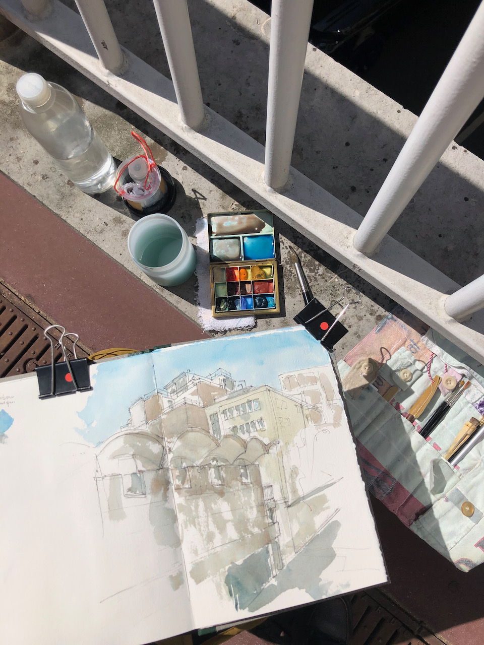
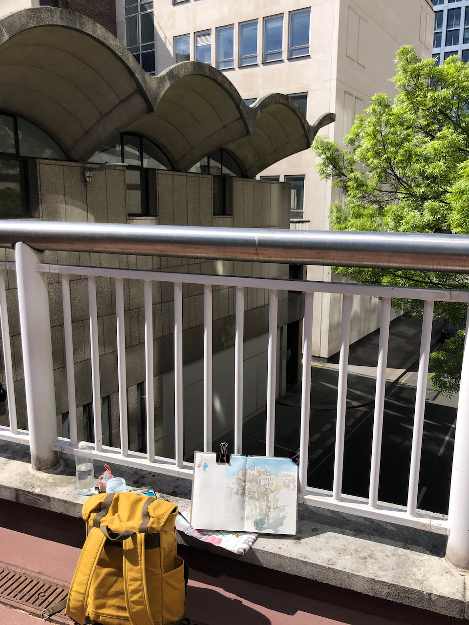
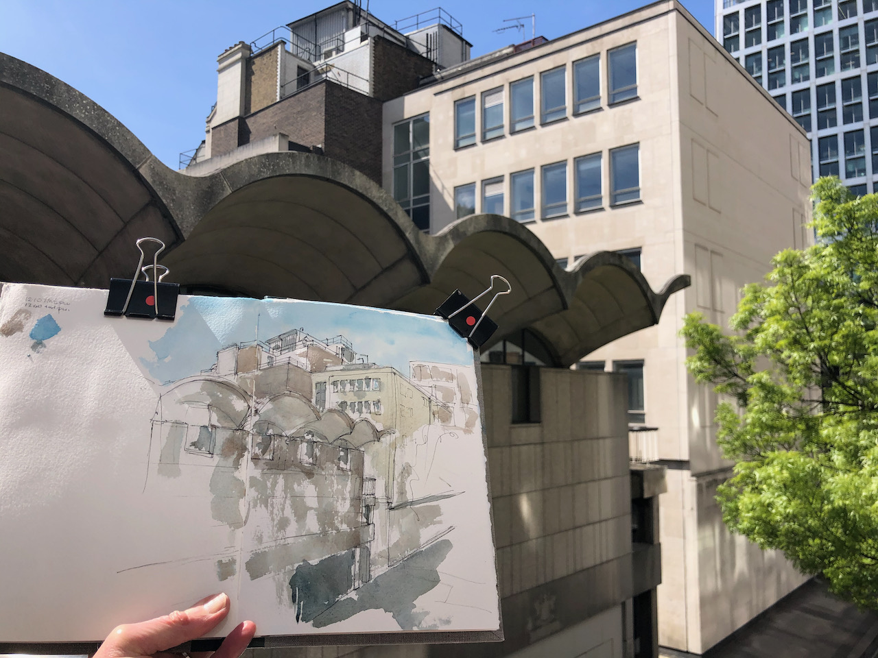
I drew this picture looking over the railings from London Bridge. This position commanded an excellent view of Colechurch House, but it meant I had my back to the passers-by on the pavement, which made me nervous. I strapped my rucksack to the railing and worked quickly. My drawing makes the building look a little precarious, perhaps that reflects my own nervousness standing in the wind on London Bridge, or perhaps it reflects the nervousness of the building as it awaits imminent demolition.
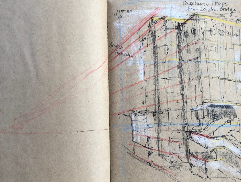
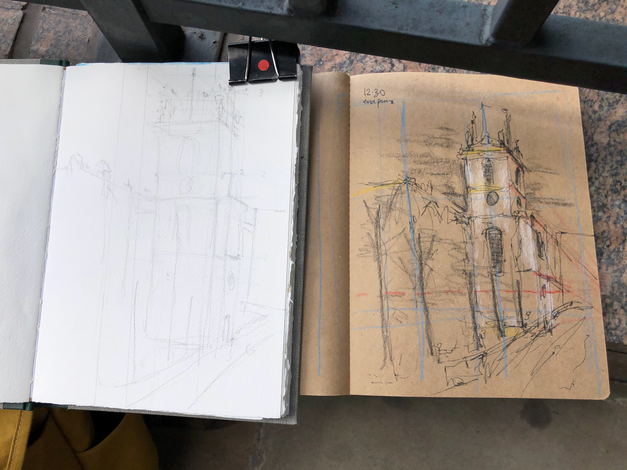
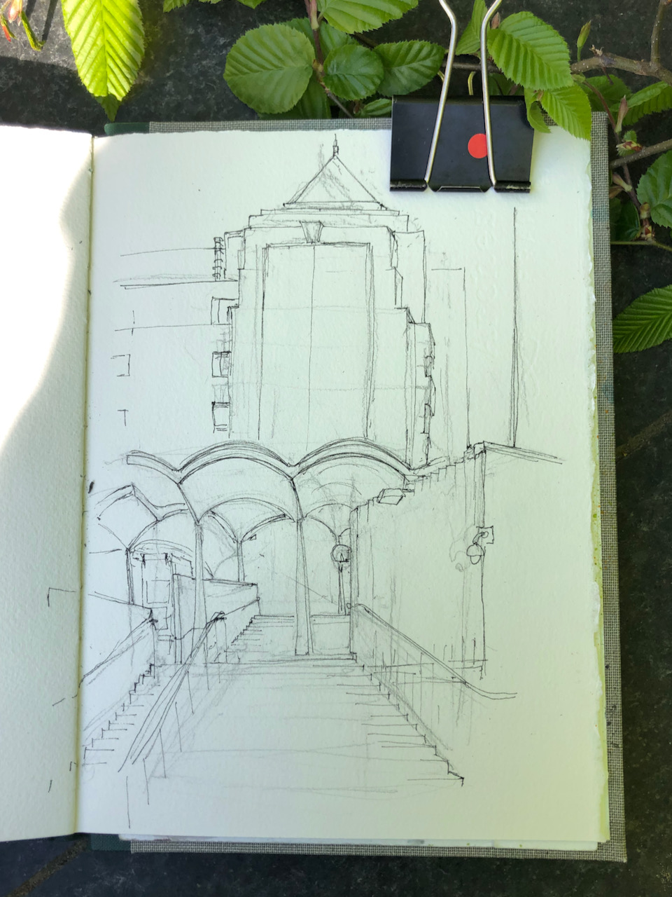
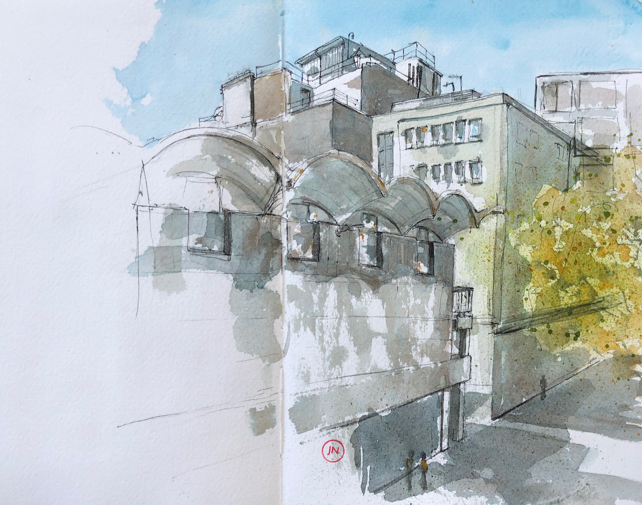
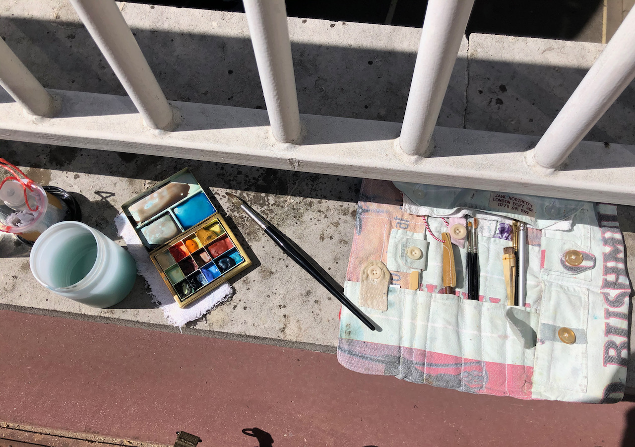
Here is work in progress. I completed the pen-and-ink on location and the colour at my desk.
Preliminary sketch
Colechurch House was completed in the late 1960s* to the designs of E G Chandler. Pre-pandemic, the area under the building at podium level contained a tidal flow of commuters walking between London Bridge Station and the City of London. The City of London Corporation entity known as “Bridge House Estates” owns the freehold. The site is in the London Borough of Southwark (called “LBS” in the press release below). The planning application is GLA reference 2020/6867/S1 and has been approved. Here’s the plan, according to the summary in the planning application:
“Redevelopment of the site to include demolition of Colechurch House, pedestrian footbridge and walkway and erection of an elevated 22-storey building (+ 4-storey basement) above a public park and providing office floorspace, retail floorspace, restaurant/café floorspace, leisure floorspace (all Use Class E), theatre and a bar (Sui Generis), delivered alongside public realm improvements, roof gardens, cycle parking, servicing, refuse, plant areas and other associated works incidental to the development.”
Here’s a press release from the City of London last year, announcing the development.
*Completion date “late 1960s” according to https://colechurchhouse.com/site, the website of the new development. It also says “It is named after Peter of Colechurch who designed the first stone bridge across the Thames here.”
Click a button below to share this post online, email it, or print it:
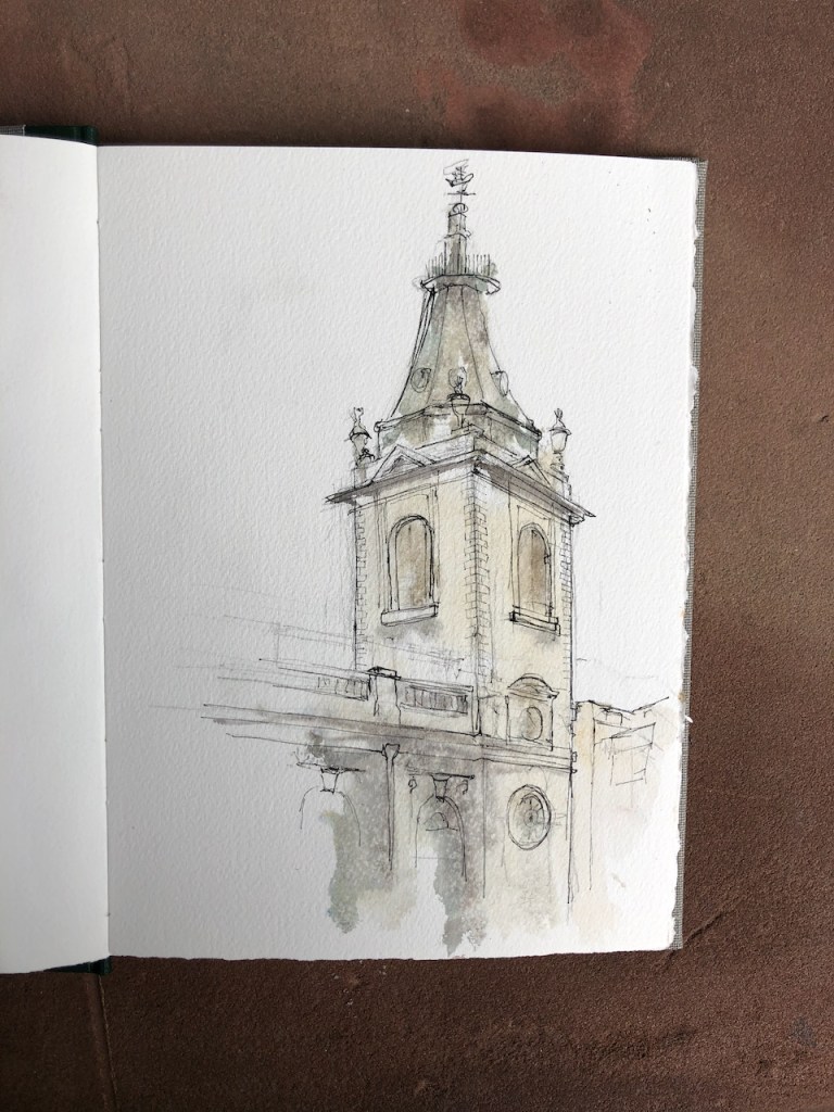
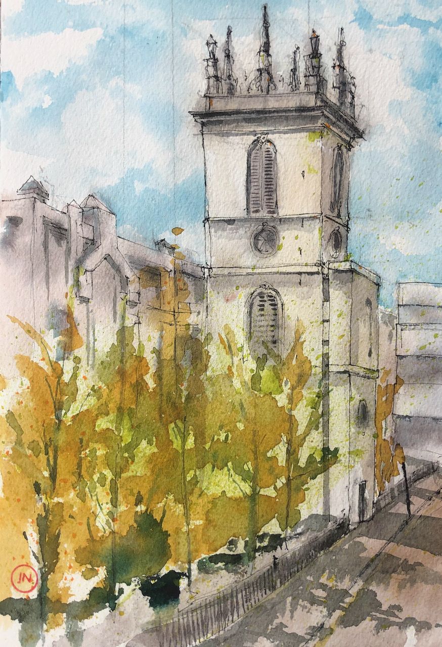
The church is dedicated to the 4th century St Nicholas of Myra. The name “Cole Abbey” is derived from “coldharbour”, a medieval word for a traveller’s shelter or shelter from the cold.
It still performs this sheltering function. There is a large squarish space inside, very open and light, with stained glass, tables, gentle murmurings. And there is the wonderful Wren café, a welcoming place. St Nicholas Cole Abbey is an active church, offering “workplace ministry” according to its website.
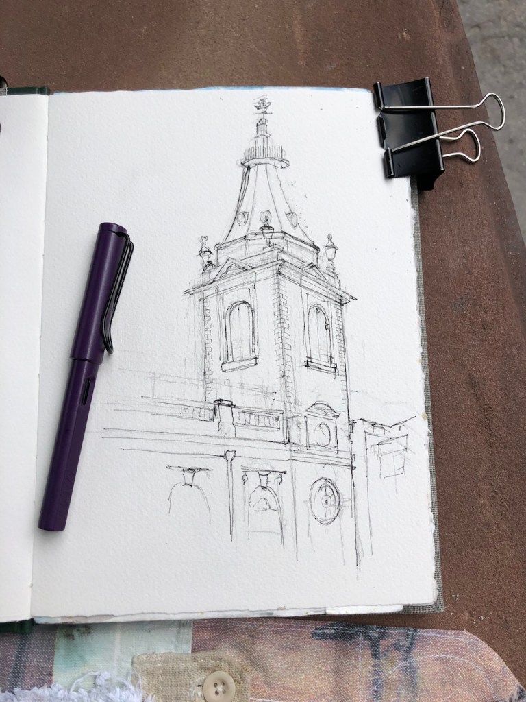
Yesterday, however, the church and the café were closed. I found shelter from the rain in the overhang of 1 Distaff Lane, Bracken House, and drew this picture.
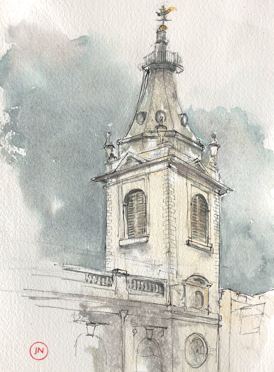
St Nicholas Cole Abbey, EC4. 16th May 2021, 7″ x 10″ in Sketchbook 10
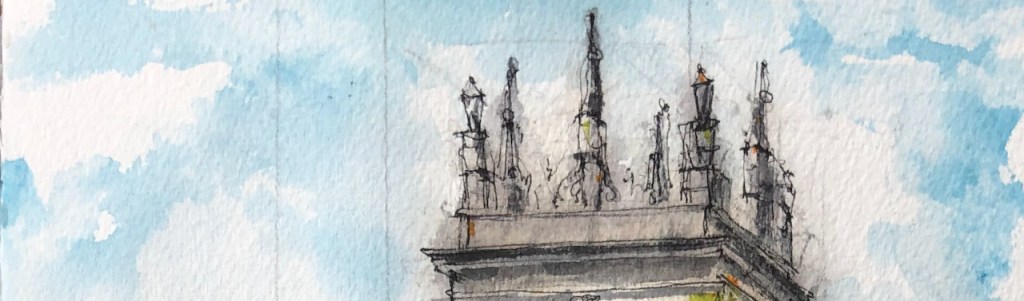
You see the magnificent trumpet shape of the spire. There is a boat on top! According to the Wikipedia entry:
This [weathervane] came from St Michael Queenhithe (demolished 1876), and was added to the spire in 1962.
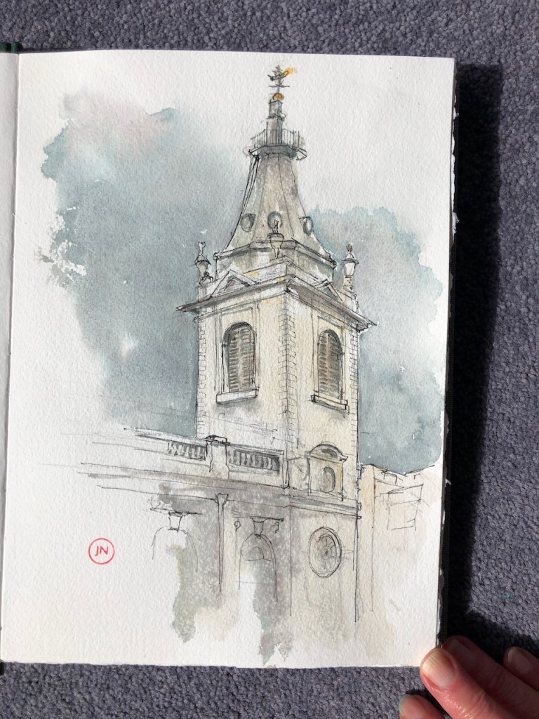
Here is work in progress on the picture, and a map:
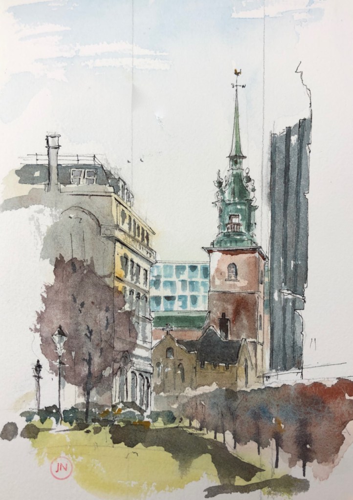
On sunnier days, I have drawn St Paul’s Cathedral from a bench to the south of the church:
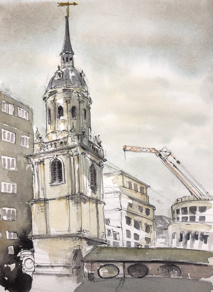
Wren Coffee has re-opened! This is a marvellous coffee shop in the Church of St Nicholas Cole Abbey, on Queen Victoria St. I went there and sat on the raised terrace, sketching the view Northwards towards St Paul’s Cathedral. The grey building in the foreground is a nightclub. It has dark windows, and a barred…
City Churches
This is one of an emerging collection of drawings of City churches. You can see the drawings so far by clicking this link:
In a narrow sliver of land between Upper Thames Street and Lambeth Hill is the tower of St Mary Somerset. This is a Wren church, built in 1886-94. The body of the church was demolished in 1871, leaving only the tower. The tower was listed Grade I in January 1950. It is now being converted into a single private home, according to the website of architects Pilbrow & Partners.
St Mary Somerset, Upper Thames Street EC4, 7″ x 10″ in Sketchbook 10. 11 May 2021, 2pm.
I drew this picture from the footbridge over Upper Thames Street, on the North side, where it becomes Fye Foot Lane.
Map showing the position of St Mary Somerset, and where I was standing.
From this angle, Upper Thames Street is hidden behind the trees. The building on the left of the drawing is 1 High Timber Street. It’s an enormous post-modern building, which looks like offices.
I enjoyed the top of St Mary Somerset. There is no spire, instead there are eight huge stone monuments. The Historic England describes it in the listing: “Parapet with 8 tall pedestals supporting urns at the corners and obelisks in between.” It looks as though it might be a board game, laid out on a huge square board, for giants of immense strength to play.
Top of St Mary Somerset: a fantasy board game?
The sketch took about 45 minutes on location. I completed it at my desk after lunch. The colours are: Phthalo Blue Turquoise, Permanent Yellow Deep, Green Gold, Mars Yellow, Perylene Maroon. Here are snapshots of work in progress.
I have drawn various City churches. I enjoy the way they co-exist with the modern buildings.
Walking back from the Little Bread Pedlar with my bag of goodies, I came to a standstill in front of St James’ Church, Bermondsey.
This is a magnificent 19th Century church, with a dragon as a weathervane. There is a generous park around the church, and benches. I made a quick sketch.
After my lunch, I walked along the West side of the church and passed between huge stone gateposts. Looking back, the church was spectacular against a moody sky.
There were some convenient benches stacked outside a closed pub, so I sat down and made a longer sketch.
St James’ Church, Bermondsey, 7″ x 10″ in Sketchbook 10. 5th May 2021 14:15
From this angle, the church might be in the countryside. What you can’t see in the drawing is the half-timbered pub, which is just off to the left. It is called “The Gregorian”. The pub sign is a heraldic shield, with a black dragon facing a white dove. The motto below the shield reads “SHALOM”. I can find no explanation for why a pub in Bermondsey should have a greeting in Hebrew on its coat of arms. But there it is. The pub was closed, so I couldn’t ask them.
The church is remarkable in many ways. For one thing, it is enormous, and very solidly built. Walking along the West wall, I could see that there was a crypt along the entire length. The steeple has clocks on each of its four faces, which is commendable and generous, in my view. All of the clocks were working, and showed the right time, including the one which was facing North over the roof of the Nave, and thus invisible except by a narrow angle.
As I was drawing this, the rain started, and then stopped, and started again. Eventually I packed up and finished the drawing at my desk when I got home. I also found out more about the church. The first stone was laid in 1827 and it was consecrated in 1829. The church was built as part of a huge Church building programme, funded by central government after the Napoleonic wars. The fund was called the “million-pound fund” and the churches built are called “Waterloo Churches” or “Commissioners’ Churches” for the Church Commissioners who managed the programme. Wikipedia has a whole article on the subject. I found it interesting that the government would embark on such expenditure when surely its funds were depleted after the wars? Information on a notice board by the church says that the fund was established as a thank-offering for peace, and a memorial to the soldiers who had fallen. Wikipedia offers two additional explanations.
The demographics of the country were changing substantially in the first part of the 19th century. There were churches where there were insufficient people, and people where there were insufficient churches. This was certainly the case in Bermondsey, where the population quadrupled during the 19th century, from roughly 17 thousand in 1801 to over 80 thousand in 1901. The people were engaged in trades associated with the docks, such as ropemaking.
It was seen by the government as important to provide churches in order to prevent insurrection (note 1). Churches provided guidance, stability, and social control. The French revolution of 1789-99 lived in people’s memories.
St James’ Church accommodated 2000 people, when built. It continues to offer services and describes itself as an Anglican evangelical church, with a “vibrant and active congregation of all ages and backgrounds, drawn from many countries in the world.” This is from the information leaflet on the church website. (Note 3) This information leaflet contains the following picture of the restored dragon weathervane, which I couldn’t resist including here:
“Restored and regilded, St James’s dragon weathervane, returns to Bermondsey in 2018” (from St James Bermondsey History leaflet, Note 3, and vicar’s blog: Note 4)
According to the church website (note 2), the bells were cast by Mears of Whitechapel from the canon left behind by Napoleon. The architect was James Savage.
Here is work in progress on the drawing:
Wikipedia article quotes Port, M. H. (2006), 600 New Churches: the Church Building Commission 1818-1856 (2nd ed.), Reading: Spire Books, pages 15 and 16 ISBN978-1-904965-08-4
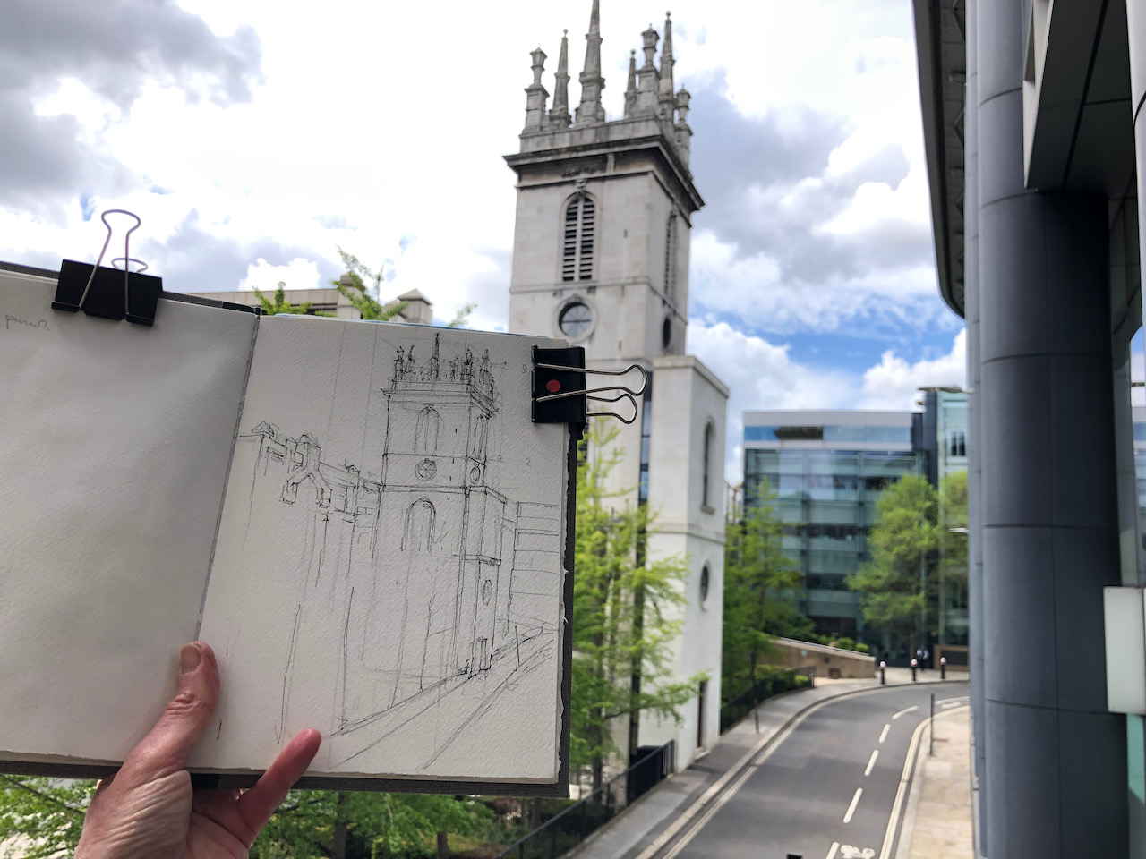
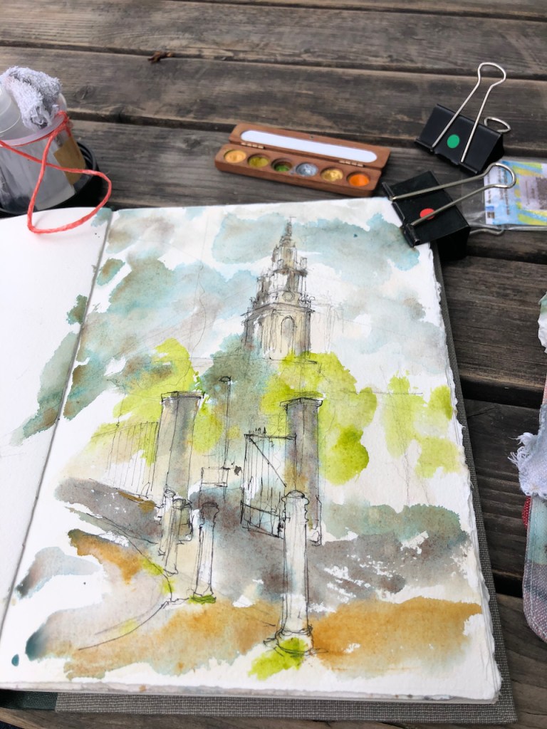
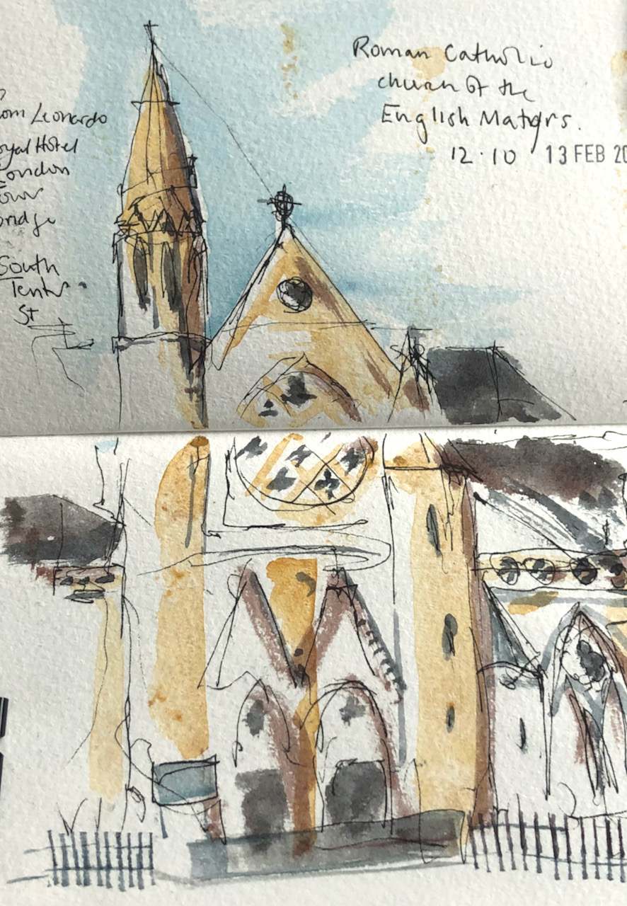
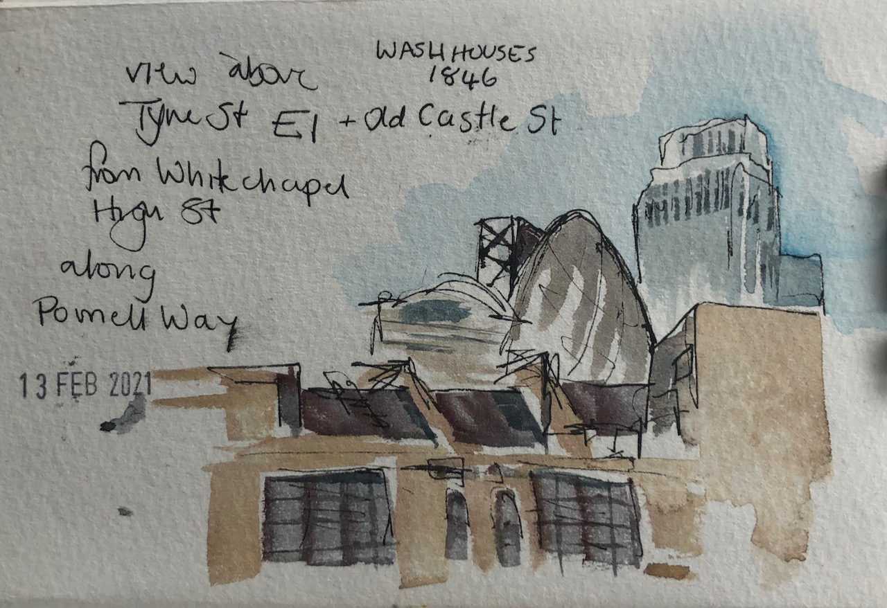
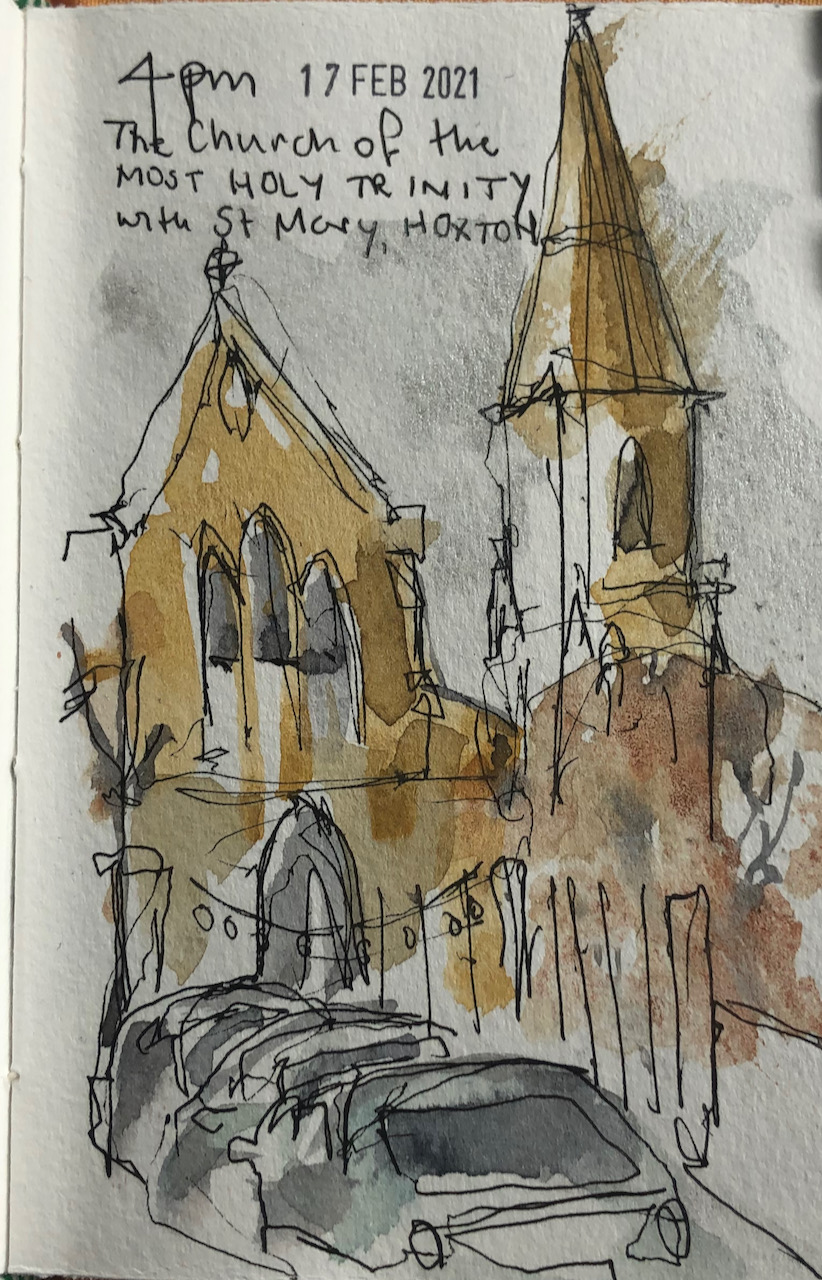
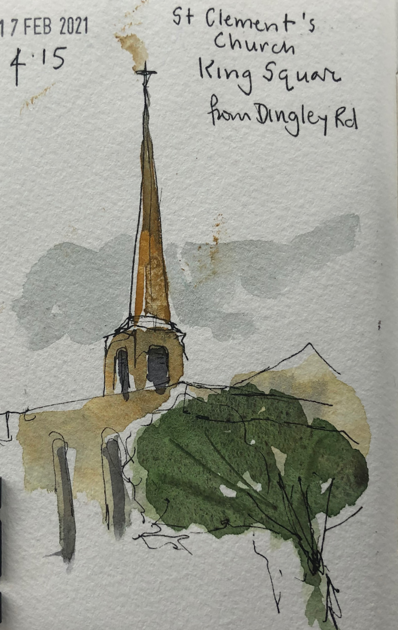
On my walks around the City, as lockdowns have eased, I carry a tiny sketchbook and make quick drawings. I’ve just finished microsketchbook number 2.
Here are some pictures from this sketchbook. Mostly I draw buildings.
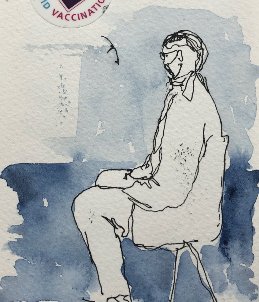
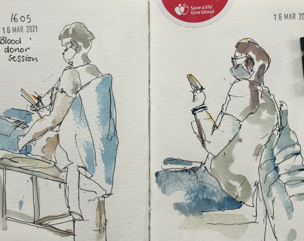
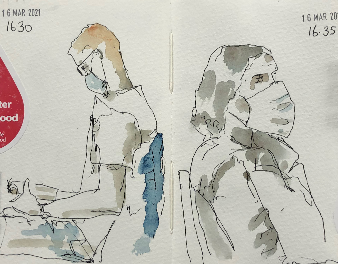
Sometimes I draw people, especially if I’m in a waiting room.
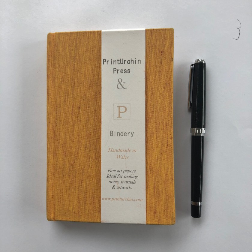
Microsketching sketchbook number 2 is 6″ x 4″ and came from “Print Urchin Press and Bindery” . The paper is real watercolour paper: Bockingford. I use De Atramentis document ink, black, which is waterproof, in a Sailor fountain pen with a fine nib. Then I put a watercolour wash over.
Microsketchbook number 2, Sailor pen, clips.
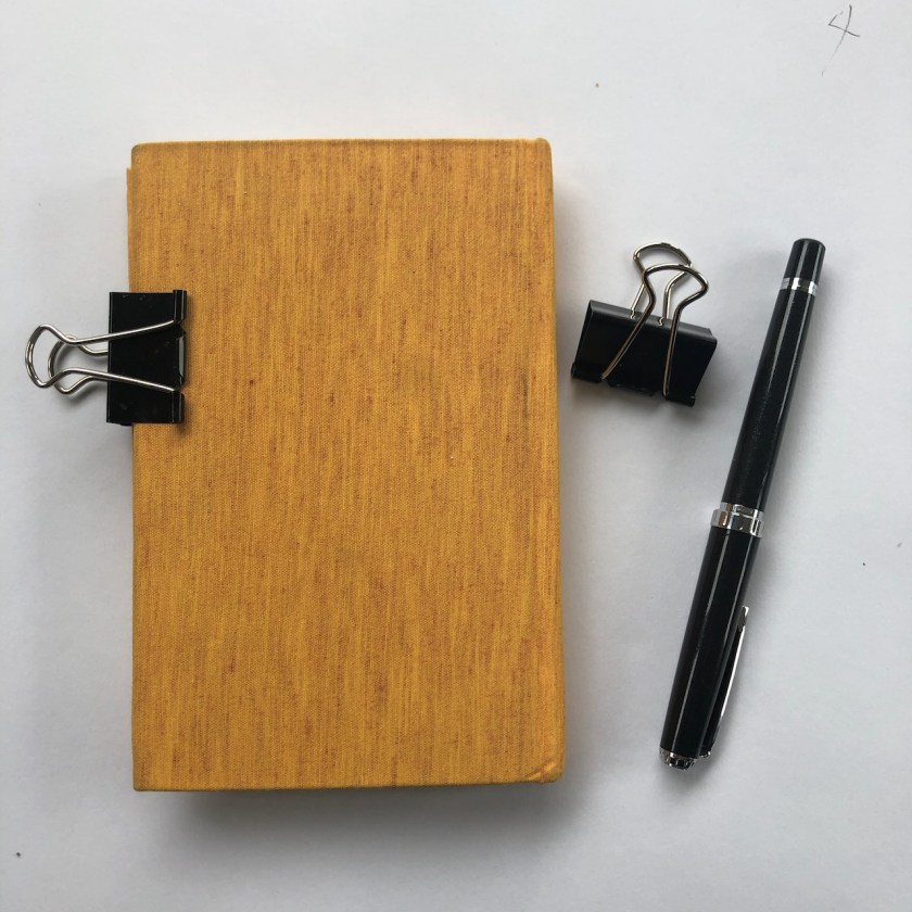
Now I am starting microsketchbook number 3.
Microsketchbook number 3, from Print Urchin press and bindery.
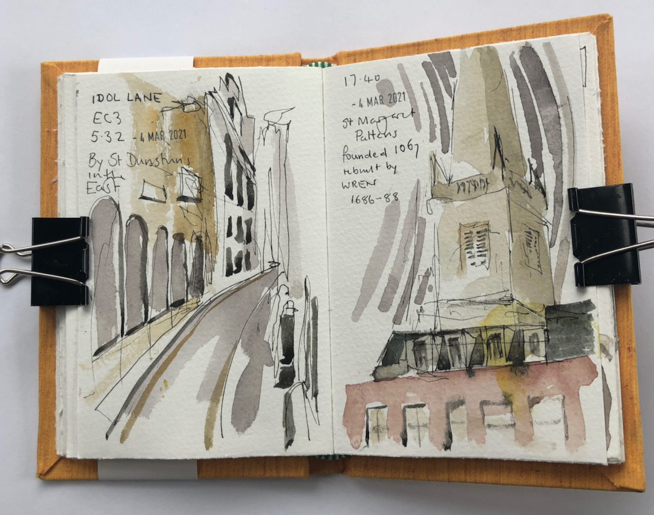
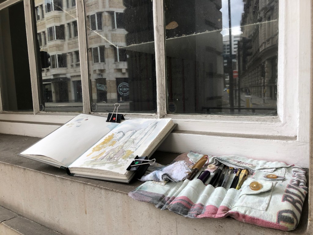
Here are some tiny sketches I made as a result of local walks. I have a small sketchbook, about 3½ inches by 5½ inches, the size of a big mobile phone. On my walks, I pause for…
London Wall is the old Roman wall around the City of London. It is also the name of a street. Here is the church All Hallows on the Wall, drawn from outside the Carpenters’ Hall.
All Hallows on the Wall, with 110 Bishopsgate behind, drawn 30th April 2021, 12:35. 10″ x 8″ in Sketchbook 10
I drew All Hallows last year, from across the street, see this post:
London Wall is the old Roman Wall around the City of London. It is also the name of a road. In normal times London Wall is a very busy road, an arterial route in the City, full of buses and cars and bikes, with people thronging the pavements…
Viewpoint of the drawing.
Today’s drawing was with a viewpoint looking east along London Wall, towards the tower blocks on the eastern part of the City. The tower block on the right is “Salesforce Tower” also known as “Heron Tower” and “110 Bishopsgate”. It was completed in 2011. The architect was Kohn Pedersen Fox.
The colours in the drawing are Phthalo Blue Turquoise, Perylene Maroon, Mars Yellow. The bright green is Green Gold. There some Iridescent Silver on the towers.
Here is work in progress on location.
Click a button below to share this post online, email it, or print it:
Here is the view looking North along Silk Street, from the Barbican Podium, next to Cromwell Tower.
The Jugged Hare from the Podium, 29 April 2021, 6pm, 7″ x 10″ in Sketchbook 10
The buildings are, from left to right:
the operations centre of a bank, the building with the arch
The Jugged Hare, on the corner, with the pub sign
The Brewery, the red-brick building
Linklaters, a legal firm, on the right with the squarish windows.
On the sky line, the tall building is “HyLo” (or HiLo?) under construction on Bunhill Row, and the magnificent chimney of The Brewery.
In front of the chimney there is a whole superstructure on the roof of the Brewery which covers various industrial kitchen fans and ducts. These fans and ducts made a lot of noise, irritating neighbours. So last year they put a fence round, as you see in the picture in grey. Currently, both the Brewery and the Jugged Hare are closed, so it remains to be seen if the fence reduces the noise.
I drew this picture from the podium. Here is work in progress.
Here’s a rough sketch map, showing the viewpoint of the drawing.
Click a button below to share this post online, email it, or print it:
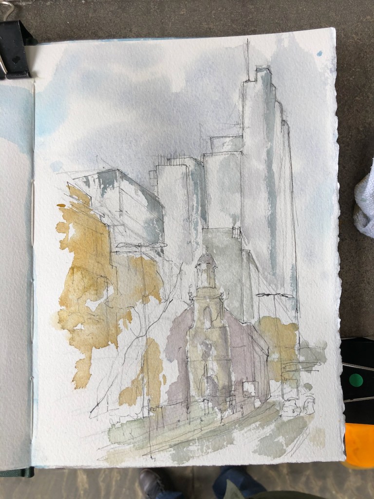
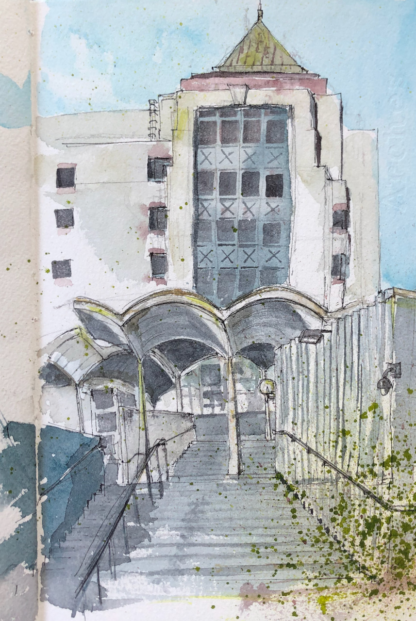
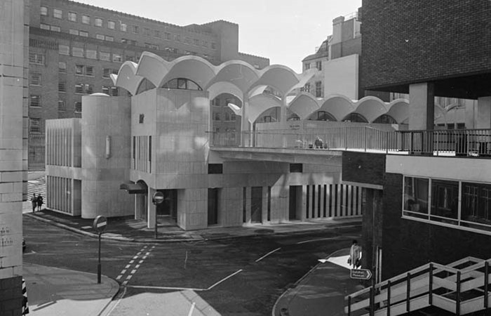
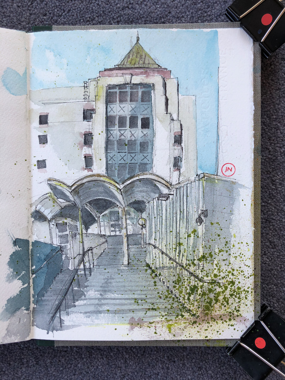
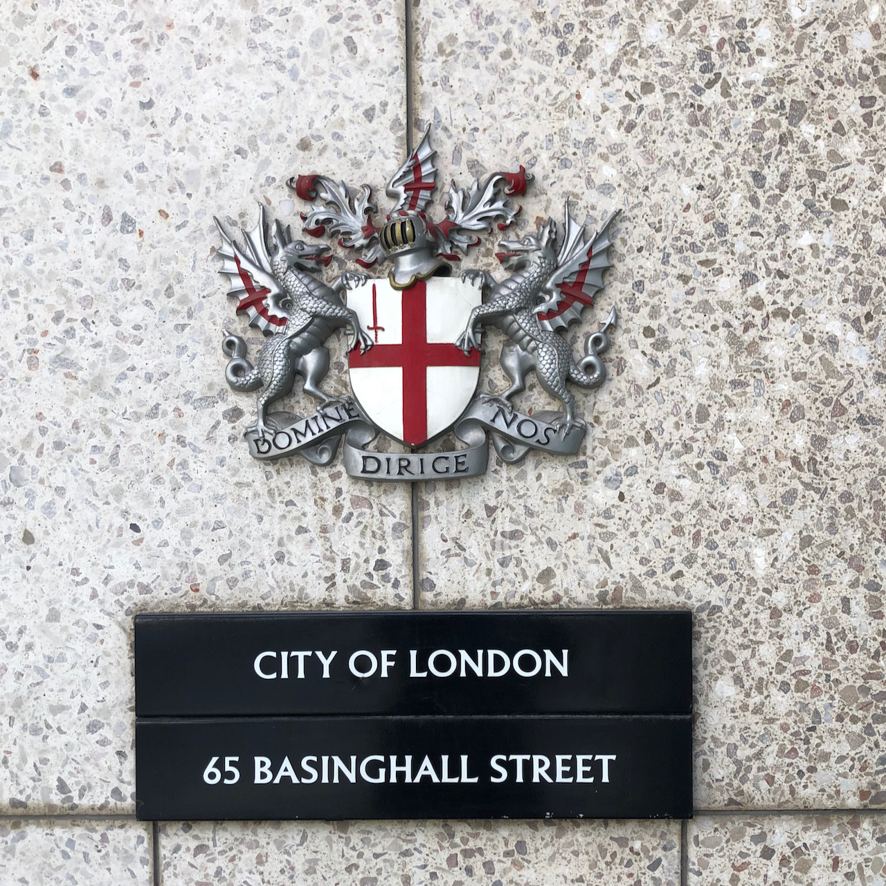
In a previous post I presented a drawing of 65 Basinghall Street done from the bridge which is on the North side of the building. Here is the south side.
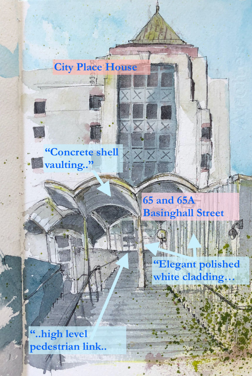
65 Basinghall Street is the building in front, with the scalloped arches. Behind it is City Place House.
65 Basinghall Street EC1 (foreground), City Place House (background) 8″ x 10″ in Sketchbook 9. 23rd April 2021
City Place House was built in 1992, and is due for demolition and replacement by a building which is taller and broader.
65 Basinghall Street is listed Grade II. The Historic England website gives the reason for the listing:
No 65 and 65a Basinghall Street, 1966-69, by Richard Gilbert Scott, is listed at Grade II for the following principal reasons:
Architectural interest:
for its creative composition of plane, form and interconnected masses;
for its use of materials, in particular the elegant polished white cement cladding and distinctive, celebratory, concrete shell-vaulting;
in its skilful planning, providing varied accommodation, open space and a high-level pedestrian link, on a corner plot.
Historic interest:
as the first part of the architect’s most significant secular commission, distinctively expressing his personal style and establishing his creative, Modern, response to the medieval Gothic of this important site;
as one element of the contribution made to the site over a period of almost seventy years by England’s most celebrated architectural dynasty.
The “celebrated architectural dynasty” is the Gilbert Scotts, 4 generations of architects down the male line.
Richard Gilbert-Scott was the fourth in line. He also designed the Guildhall Art Gallery and Guildhall Library.
George Gilbert-Scott (1811-78) – Albert Memorial, Midland Hotel, St Pancras Station
George Gilbert-Scott Junior (1839-1897)- St Agnes Kennington, [In 1884, he was declared ‘of unsound mind’]
Giles Gilbert-Scott (1880-1960) – Guildhall North Wing, Battersea Power Station, Telephone Kiosk, LMH Chapel, Bankside Power Station (=Tate Modern), Cambridge University Library, Cropthorne Court (Maida Vale)
Richard Gilbert-Scott (1923-2017) Guildhall Art Gallery, Guildhall Library, 65 Basinghall Street.
65 Basinghall Street was originally an exhibition hall and offices with two temporary magistrates’ courts (with cells) and a records store over basement car parking.
The Historic England website also notes the alterations made to the site in recent years:
The principal alterations to the building’s interior since its construction are the conversion of 65a Basinghall Street (the former exhibition hall) into office space, and the opening-up of the magistrates’ courts (part of 65 Basinghall Street) also to form office space. The hard landscaping has also been altered, the raised terrace to the south has been repaved, losing the original pattern of hexagonal paving and glass lenses, and the flight of steps leading up to the exhibition hall has been reconfigured to create a light well and lifts from the terrace down into the office space below. A scheme of retaining walls and plant boxes which were part of this landscaping has also been lost.
Here is a photo from the Historic England website, and a photo I took yesterday for comparison. I could not stand in exactly the same place as the photographer of 1974, because the walkway has changed. This is the view from the North.
Photo from the Historic England Website, taken in 1974-5 by John Gay A similar view yesterday65 Basinghall Street from the highwalk
Spot the differences?
The bridge has been replaced with something more chunky
The little canopy above the entrance to the Magistrates Court has vanished.
The building on the right (City Place House) has been rebuilt (1992)
You can no longer get a good view of 65 Basinghall Street from the highwalk!
There are many more differences on the South side. I can’t find a picture pre-2002, which was when a major refurbishment started on the Guildhall North wing. As part of this refurbishment, changes were made to the plaza and walkway. If you have a old photo – I’d be very interested to see it.
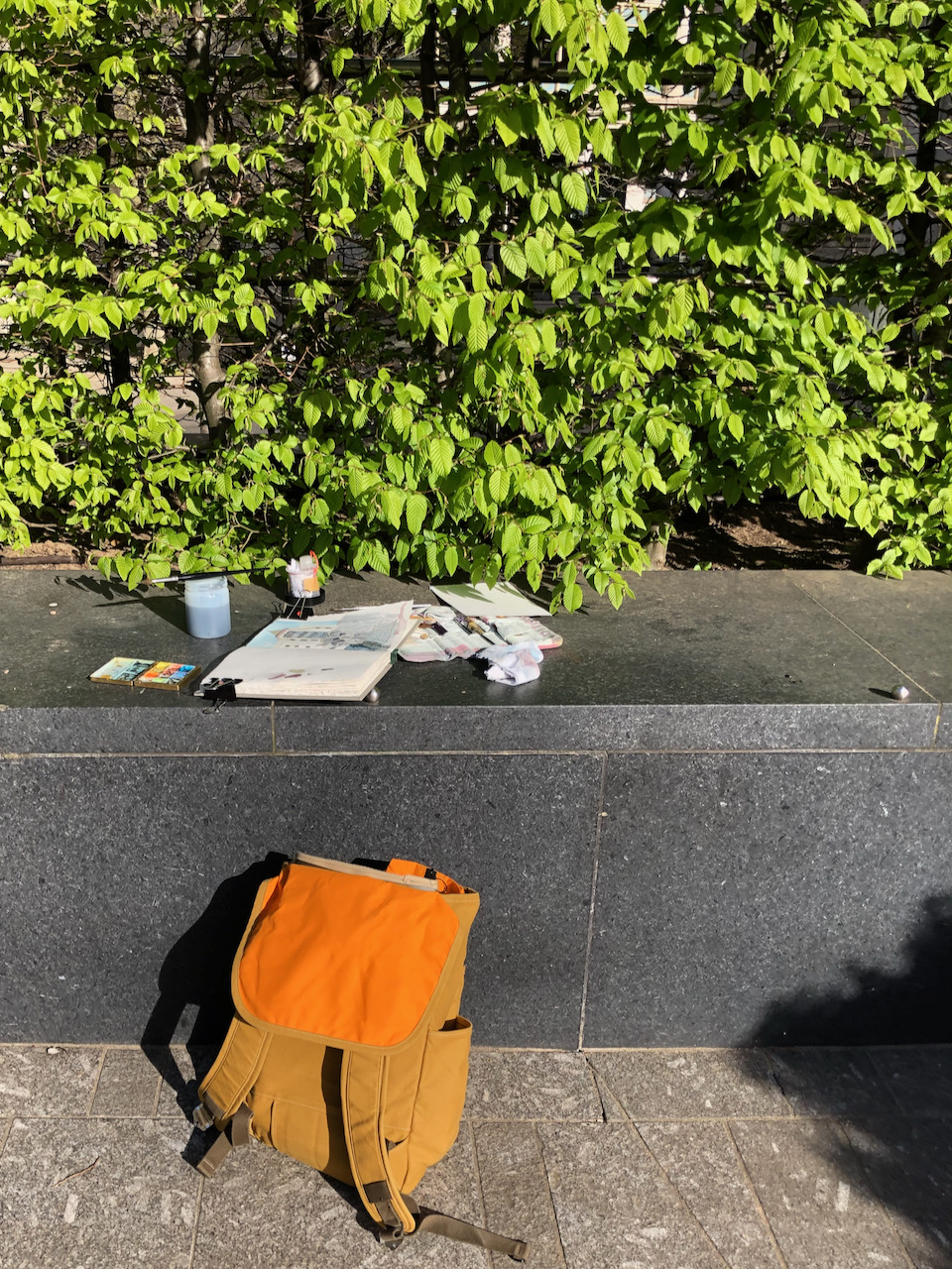
I made the drawing on a brilliant sunny day, 23rd April 2021, sitting on a bench on the plaza. 65A is currently in use as a non-symptomatic Covid testing centre. It didn’t seem to have many customers. I counted two in the time I was there, about 1½ hours. But I might have missed some.
Here are photos of work in progress.
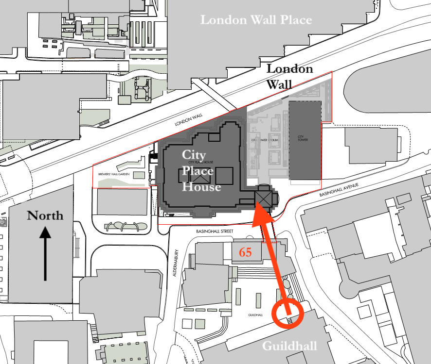
Map showing location of drawing and viewpoint. From the planning application for City Place House (map drawn by Allies and Morrison LLP, 18/3/2021 [Detail, annotated])
Here are other drawings I’ve done in the area, click the title to read more.
I found a photo on Flickr by Peter Marshall, taken in 1986. Click the picture to go to Peter Marshall’s Flickr album and see a more detailed picture.
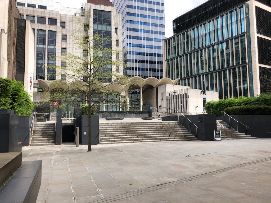
For comparison, here is a photo of the same view in 2021.
The clear horizontal run of steps is now interrupted by various lifts and black blocks. The statue has been moved, and no longer looks North towards Richard Gilbert-Scott’s masterpiece, but West towards St Mary Aldermary. And all the interesting hexagonal tiling on the piazza has gone.
Click a button below to share this post online, email it, or print it:
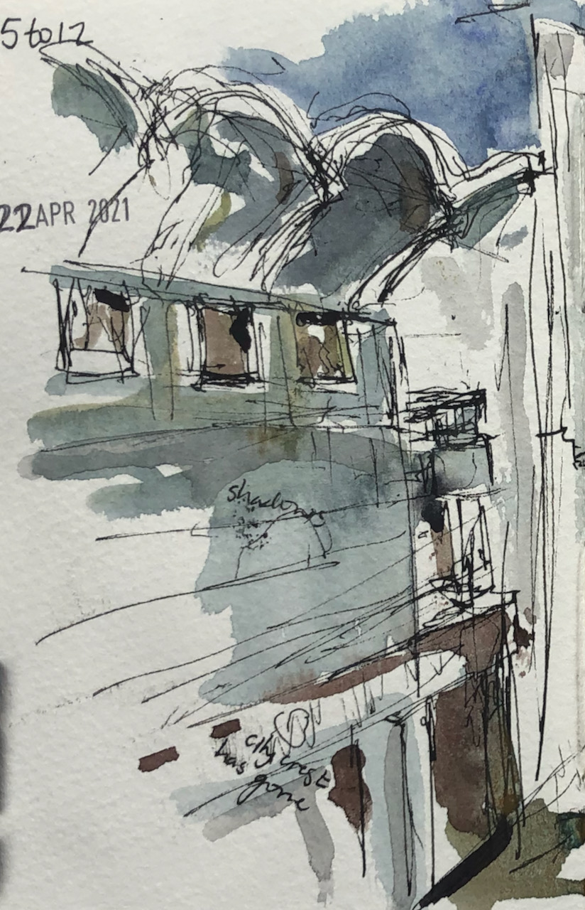
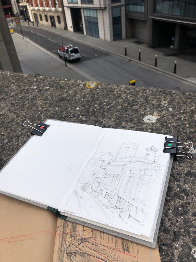
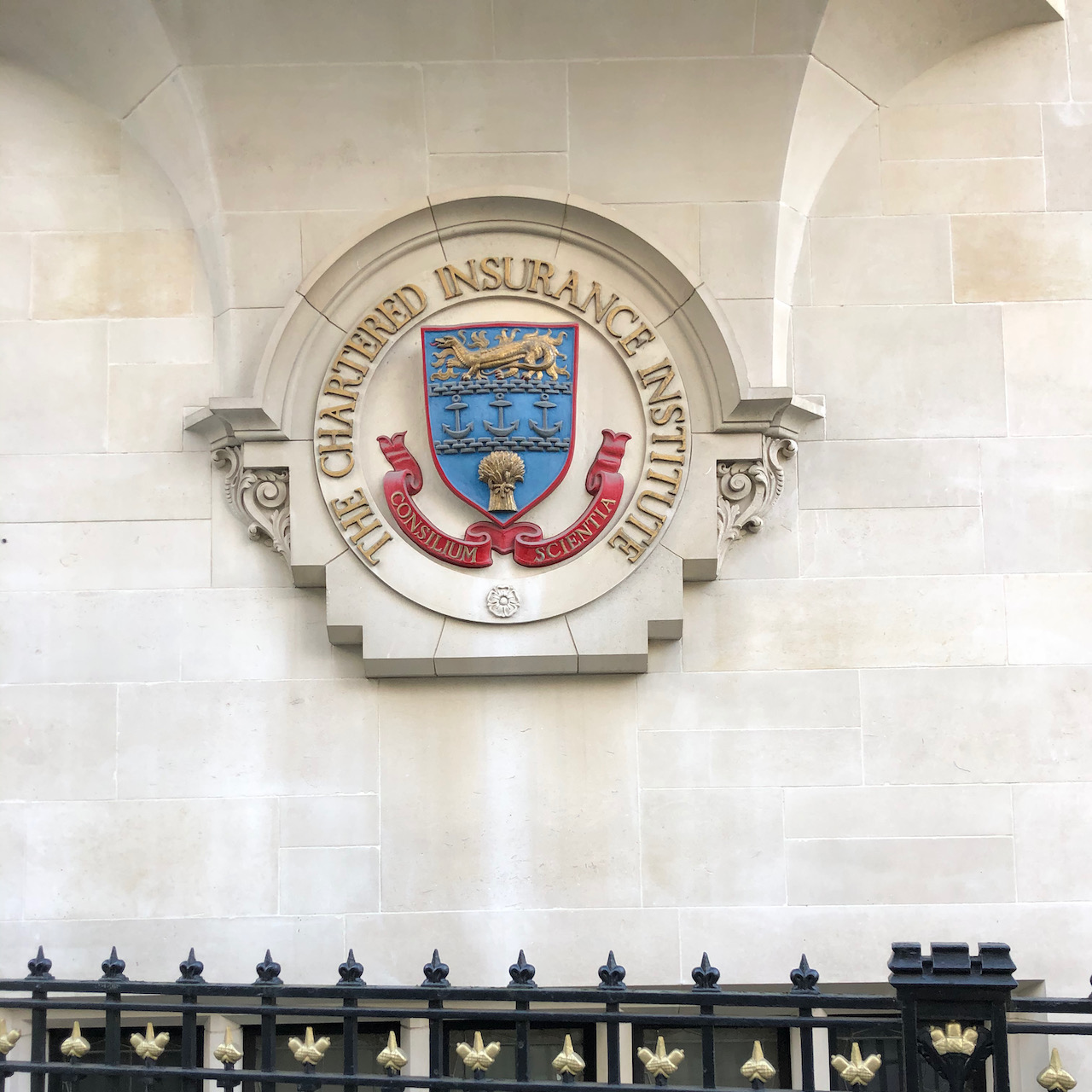
This is a view from the bridge over Basinghall Street, looking at the back of 65 Basinghall Street.
65 Basinghall Street from the bridge, 11″ x 10″ in Sketchbook 9. 22 April 2021, 12:40pm
There is much of interest in this view. There are the wonderful arching shell-like structures of 65 Basinghall Street. This was built in 1966-7 to the designs of Richard Gilbert Scott1
Above the arches is an extraordinary building in the style of steam punk. In my drawing it was not possible to capture the magnificent complexity of all the pipes and railings and ventilators and intersecting walls.
This sky-level structure is on top of the Chartered Insurance Institute, whose hall is on the right of my drawing.
Then there is the mystery of the missing city crest. Above a door at street level is an obvious blank space, where the crest of the City of London has evidently been removed. I wonder why.
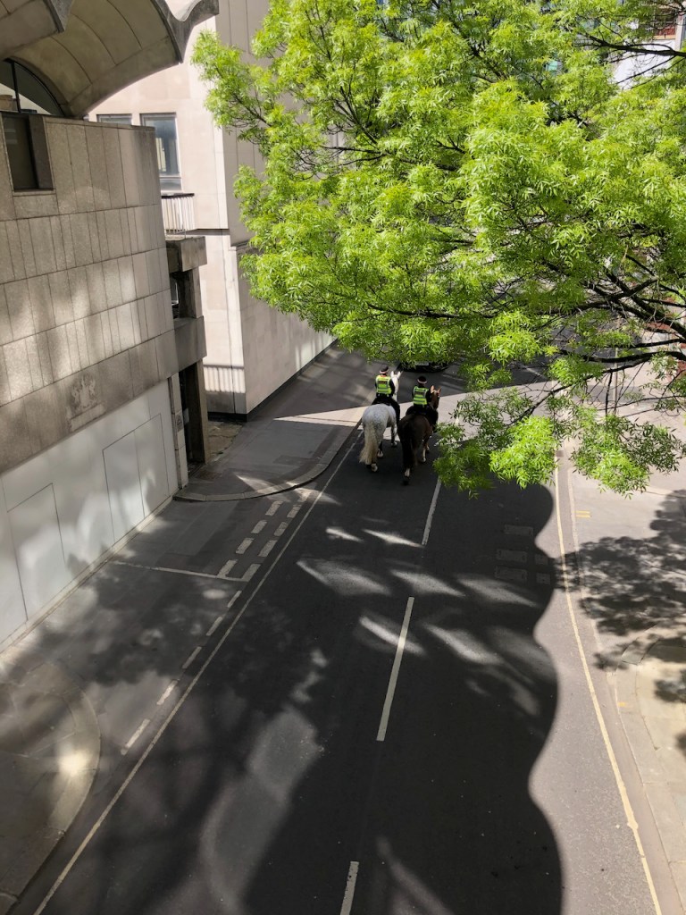
As I was drawing, there was the sound of hooves, and two police horses went by under the bridge. See the marvellous wavy shadows in the photo!
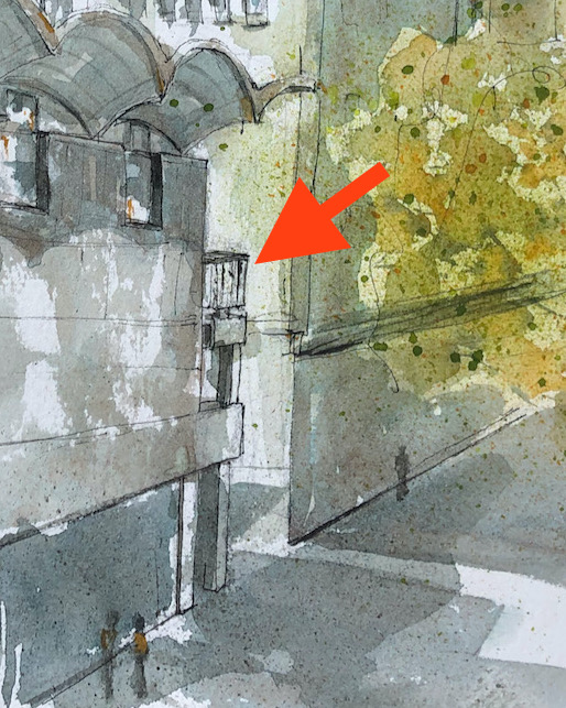
I have walked over this bridge many times, but only recently have I spotted the little balcony, half way up the side of the building.
It is possible to get to this balcony. You just go around the building and up some stairs. It looks like part of a public walkway which has now been cut off. But the early pictures of the building show this balcony just as it is today.
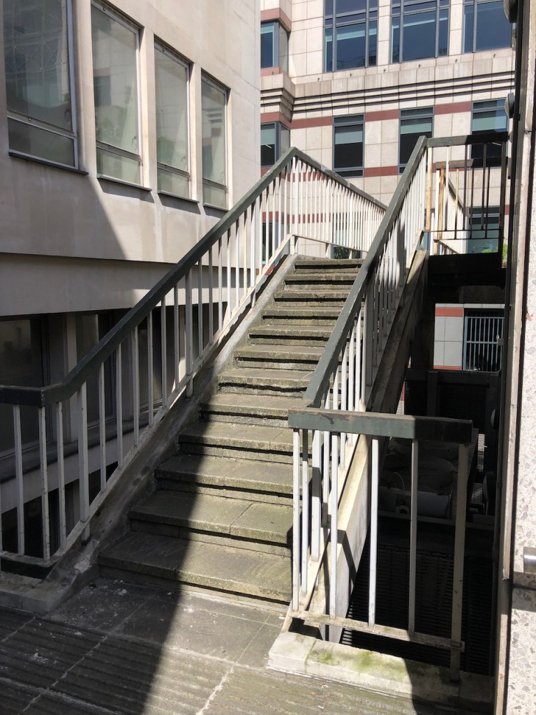
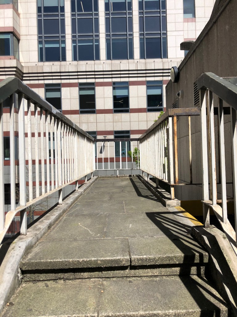
Up these stairs..
Along this walkway..
To the end.
View from the balcony towards my drawing spot.
The balcony on 65 Basinghall Street
I will write more about 65 Basinghall Street in my next post. It was originally a Magistrates Court (with cells!), an exhibition hall and offices.
Here are photos of the locality, and work in progress on the drawing.
This drawing took about 1½ hours on location. I put some finishing touches at my desk. The colours are Phthalo Blue Turquoise, Lavender, Perylene Maroon, and Mars Yellow. There is some Green Gold on the tree.
—
1Richard Gilbert-Scott was the fourth in a dynasty of architects. He also designed the Guildhall Art Gallery and Guildhall Library.
From father to son here is the line:
George Gilbert-Scott (1811-78) – Albert Memorial, Midland Hotel, St Pancras Station
George Gilbert-Scott Junior (1839-1897)- St Agnes Kennington, [In 1884, he was declared ‘of unsound mind’]
Giles Gilbert-Scott (1880-1960) – Guildhall North Wing, Battersea Power Station, Telephone Kiosk, LMH Chapel, Bankside Power Station (=Tate Modern), Cambridge University Library, Cropthorne Court (Maida Vale)
Richard Gilbert-Scott (1923-2017) Guildhall Art Gallery, Guildhall Library, 65 Basinghall Street.
Click a button below to share this post online, email it, or print it:
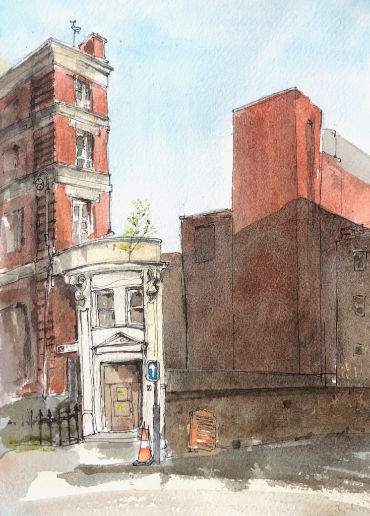
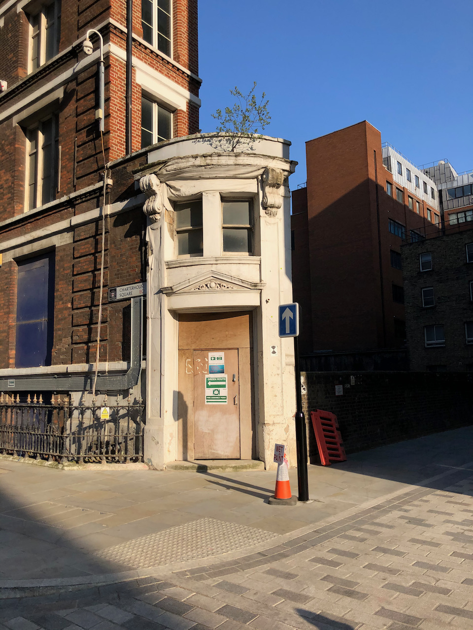
This is a little white building I always enjoy walking past. It is the westernmost end of a thin terrace of warehouses and showrooms, lodged in a triangle between the road and the railway. As I passed it the other day I saw that the tree which has taken root above the door was putting out leaves, and flourishing in its unlikely place.
On the bottom right is Hayne Street, which forms a bridge over the railway lines. There is a dark deep gap. The buildings on the right are the other side of the railway. The railway lines are the Hammersmith and City, Circle, and Metropolitan underground lines, which emerge briefly into the open air at this point . This is good to know, in case you are trying to send a text message from the tube train.
33 Charterhouse Square (left) and Hayne Street EC1. 10″ x 7″ in sketchbook 9. 19 April 2021
Recently this building has been used as some sort of office or headquarters of the Farringdon Crossrail development which is now completed. The construction workers have left, and this building looks vacated and rather sad, but noble in its sadness.
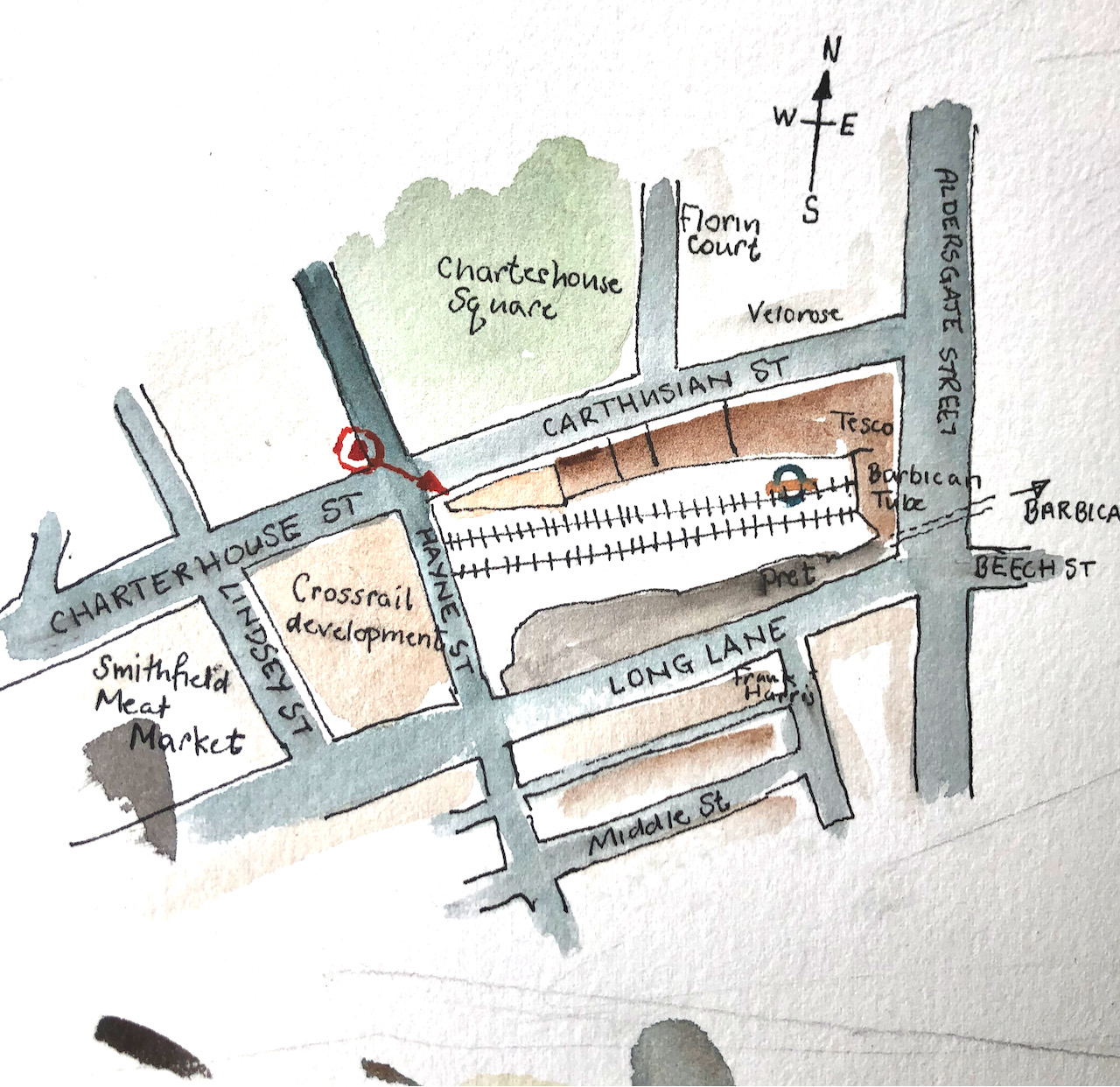
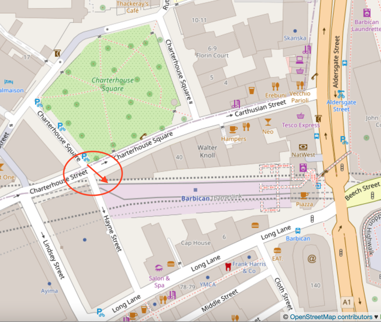
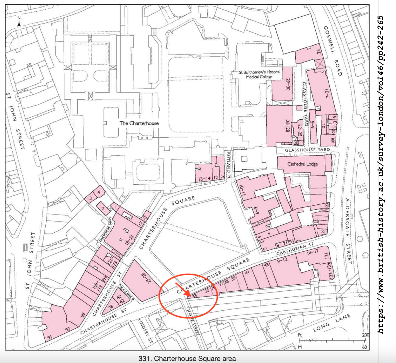
Here are some maps1 (click to enlarge):
Here are some photos of the location and work in progress.
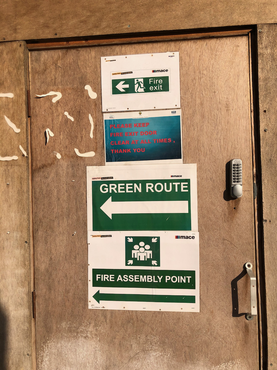
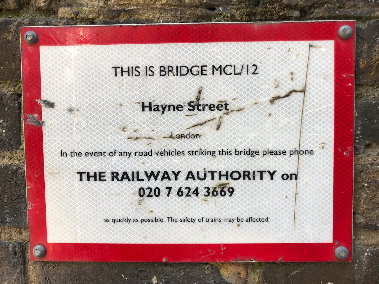
No. 33 Charterhouse SquareWork in progress on the drawing.Here’s what’s written on the door.You can see the Barbican Towers from the bridge, Hayne StreetThe notice on the bridgeAnd street art on the bridge.
The drawing was done at about 17:30 at the end of a gloriously sunny day. The colours here are: Transparent Brown Oxide, Fire Gold Ochre, Phthalo Blue Turquoise, Buff Titanium, Mars Yellow. There is Transparent Pyrrol Orange for the road sign and the leaves of the tree are Green Gold. The paper is Arches Aquarelle 300gsm.
This building was completed in 1875-6. The architect was the aptly named Coutts Stone. This and other fascinating and detailed information is in the scholarly “Survey of London” 2008 edition.
Here is their entry on the row of houses on the South side of Charterhouse Square. I have drawn number 33, the westernmost section.
“Nos 33–43
The Metropolitan Railway acquired the whole of the south side of Charterhouse Square and emptied the properties in order to construct their extension from Farringdon to Moorgate in 1864–5. The cutting of the railway entailed the demolition of Nos 32–38 on the south side of the square, along with the whole of Thomas Neale’s Charterhouse Street. Nos 39–43 were briefly left standing, but the operation left the whole south side as an awkward set of narrow sites whose amenities were further diminished by the new east—west thoroughfare completed in front of them in 1873–4 (Ill. 338).
In 1875 the railway company sold the whole frontage to Tubbs, Lewis & Co., manufacturers of elastic fabric, silk throwsters, warehousemen and ‘smallware agents’, with premises in the City, Birmingham and Manchester, and a manufacturing base in Gloucestershire. The firm also had a line in the speculative building of warehouses at this period, on which they spent about a quarter of a million pounds. The row which they erected here was one of several local developments they carried out during the mid-1870s, including Charterhouse Buildings at the corner of Goswell and Clerkenwell Roads . The company chose as its architect Coutts Stone, a friend of George Devey. Early drawings suggest there was some thought of rebuilding from No. 38 eastwards with houses , but in the event the whole block became warehousing. Construction took place in 1876–7. Andrew Killby was the builder for Nos 33–42, with interior structural ironwork provided by H. Young & Co.; Scrivener & White took on the separate No. 43.
Nos 33–42 (Ill. 341) stand four storeys above a basement protected by heavy iron railings. The block is divided into three sections. The front elevation, faced in red brick, has a strong horizontal emphasis, with broad banks of mullioned windows relieved by some minor brick detailing. No. 43 has a narrower frontage and an extra storey topped by a pediment, while its main windows are of iron and flanked by decorated pilasters.
Tenants for these warehouses were mainly involved in the textile trades. At No. 41 one of the original occupants was Griswold & Hainworth Ltd, early specialists in portable knitting machines for domestic use. In the early 1890s the whole of No. 40 was occupied by David Marcus, importer and agent of Eastern manufactured goods: ‘The basement is reserved as a show-room for Oriental carpets and furniture; the ground floor is divided in front into a splendid show-room, and at the rear forms the wellappointed office; while the upper floors are fully utilised as show and stock-rooms’. In 1917 No. 42 became the first premises of J. Collett Ltd, ladies’ hat makers; they gradually took in Nos 41 and 43 and spread elsewhere in the square. The projecting clock which survives at No. 43 was put up by them in 1930. Though there were still four clothing firms here in the mid-1970s, there had been a shift towards printing, illustration and white-collar work. Since then most of the row has been fitted out as offices and studios, including No. 41 by Campbell Zogolovitch Wilkinson Gough (CZWG) in 1980 for the pop artist Allen Jones. “
1 Citation for text above and map: BHO Chicago MLA ‘Charterhouse Square area: Introduction; Charterhouse Square’, in Survey of London: Volume 46, South and East Clerkenwell, ed. Philip Temple (London, 2008), pp. 242-265. British History Onlinehttp://www.british-history.ac.uk/survey-london/vol46/pp242-265 [accessed 20 April 2021].
Update: here is a tweet from @nicholas_sack, (4th Sept 2021) with a wonderful photo of the same building, 20 years ago.