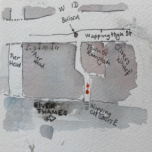
The original plan, by the architect Charles Holden in 1931, proposed University of London buildings which extended all the way up Malet Street, with 17 courtyards and two huge towers. This plan was revised a number of times, becoming less magnificent with each revision. We are left with just three of the original 17 courtyards, and just one of the towers. What I find interesting is that evidently one of these downward revisions of the magnificence must have occurred rather suddenly, while building was in progress. Here are maps:

The current Senate House: 3 courtyards, with the vestiges of a fourth. 
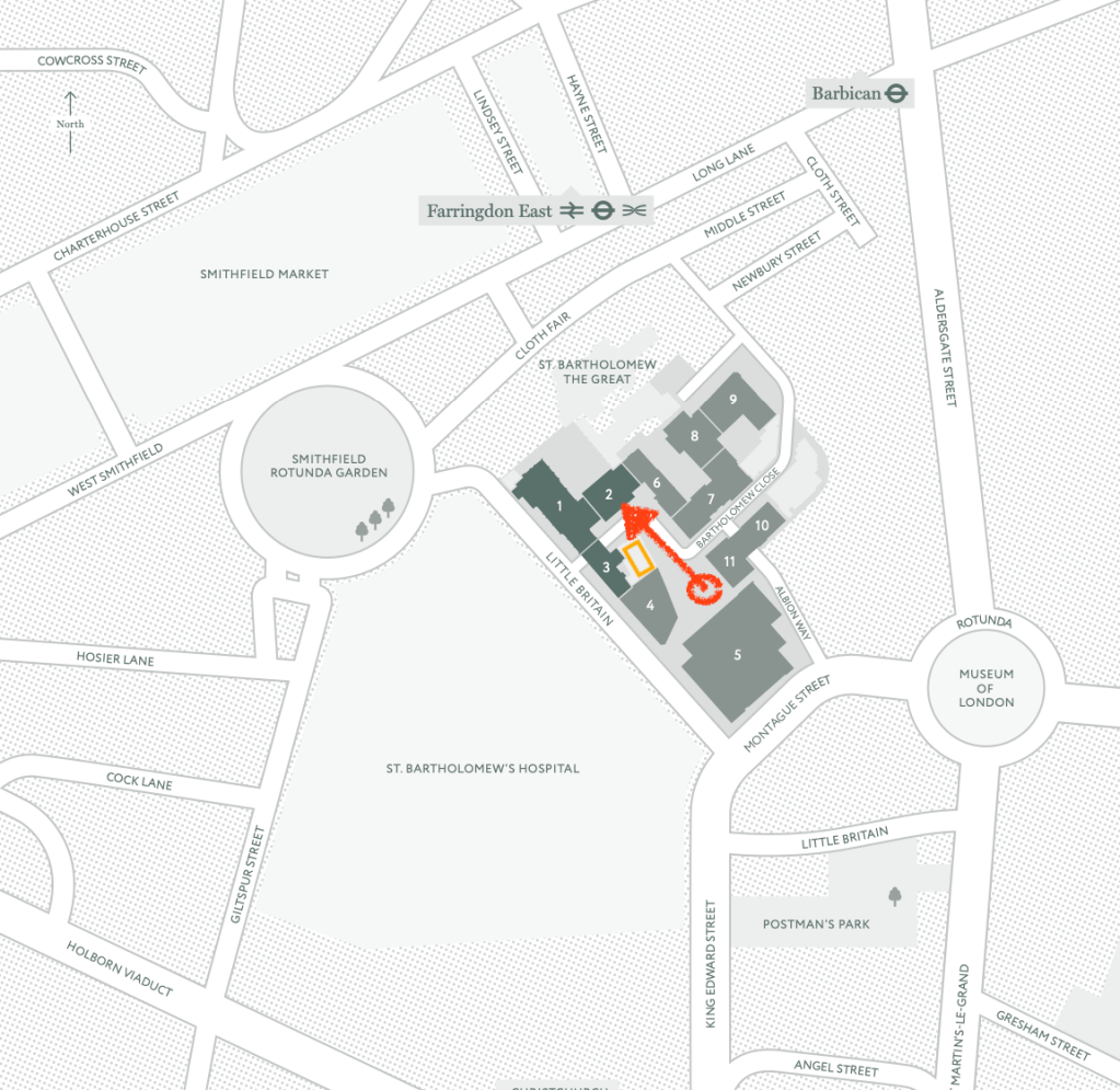
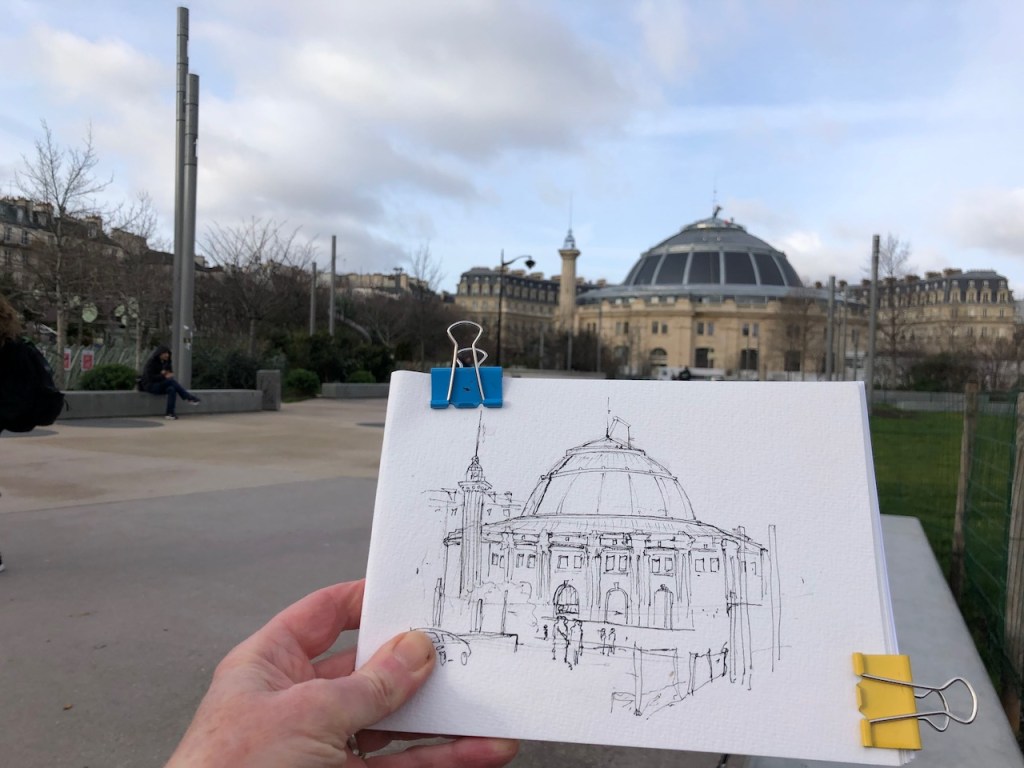
Location of the Senate House. Sightline of the drawing is in red.
An unfinished fourth courtyard is evident in the fabric of the building, shown in the drawing below. Strange parts of walls just out like ragged lego bricks from the clean white facades. I imagine the construction workers being suddenly told “Stop! We’ve changed our minds about that next courtyard.” And the workers climbed down the ladders and downed their tools, there and then. Eventually grass covered what would have been the courtyard.

I learned about Charles Holden from a walking tour on 5th October 2019, led by Chris Rogers. The title of the walk was “Best Laid Plans….Uncompleted London 1925-1995”. Chris Rogers is a writer and speaker on architecture, film, and on architecture in film. His website is here: http://www.chrismrogers.net. It was Chris Rogers who led us to the place where I made this drawing. He drew my attention to the startling unfinished walls in this otherwise polished building. My thanks to him and to the Twentieth Century Society for organising the walk.
Holden’s plan for the site was abandoned in 1937. The main tower is 210 feet high “at that time [1937] the tallest building in the capital after St Paul’s” comments Chris Rogers. He also points out that the upper floors of the tower were for the book stacks of the library “the London Building Act forbidding permanent occupation of any part of a building over 100 feet in height for fire safety reasons.” The laws were first initiated after the Great Fire of London, and subsequently modified, with sections being repealed, modified and replaced with Building Regulations.
If you want to, you can walk right underneath the tower, West-East from Malet St to Russell Square. Although it looks private, it is a public route. No-one stopped me as I wandered through with my backpack, looking for this vista to draw. It’s worth going through, as you catch a glimpse of the interior.
As I was drawing the picture, two construction workers stopped and admired the picture. Given their trade, I thought they might be interested in the reason why I was drawing here and the story of the unfinished courtyard. They knew it already. Yes, they said, there was going to be two towers. We agreed it was still a magnificent building. “But inside, ” they told me, “it’s all been ripped out.” I was interested. “Yes,” they continued, “all the sinks and taps, all taken out.” With a hand gesture, they conveyed the former beauty of the Art Deco bathroom fittings, marble floors, decorated tiles. “It’s like an airport terminal in there now,” they said, with resignation and sadness. I knew exactly what they meant.
The drawing took 2 hours. Here are some photos of work in progress, and the lettering from the top of the drainpipe.

Work in progress, pen and ink stage 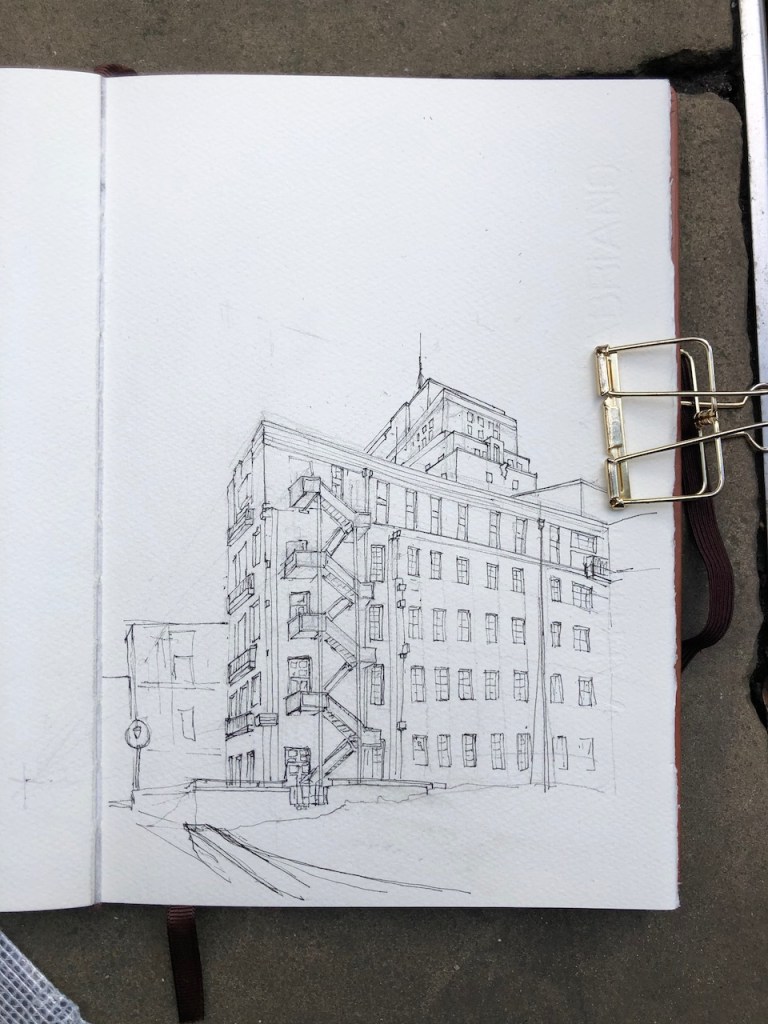
Pen and ink stage, on the pavement. 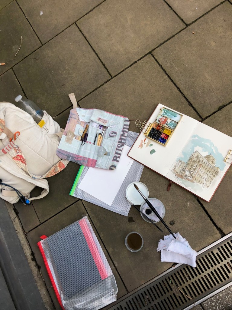
Drawing kit. The black book (lower left) is for me to sit on. 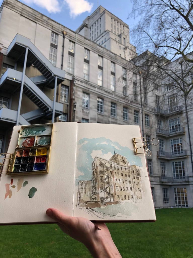
Coloured on location. Thanks to a passer-by for holding the book. 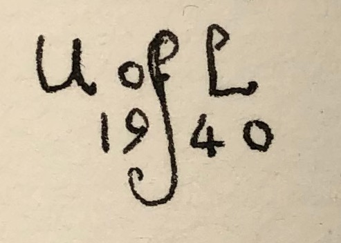
What it says at the top of the drainpipe.