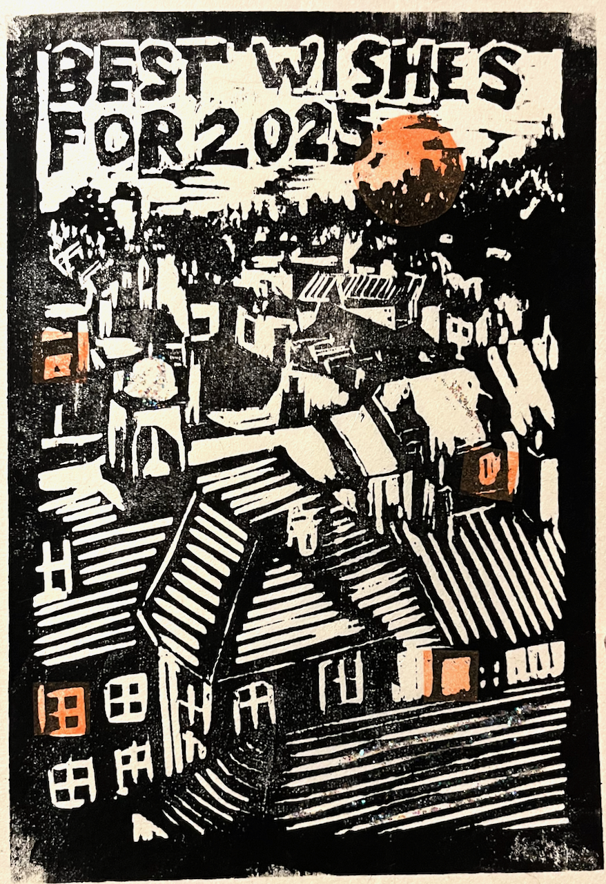
Happy New Year!
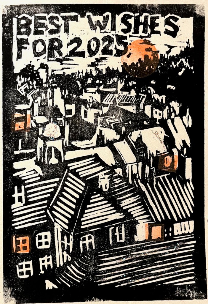
This is a woodcut, based on the rooftops of the town of Rye, in East Sussex.
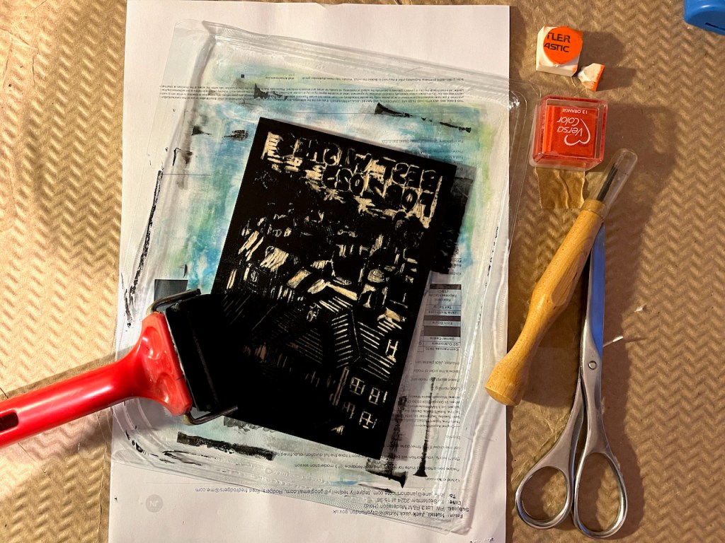
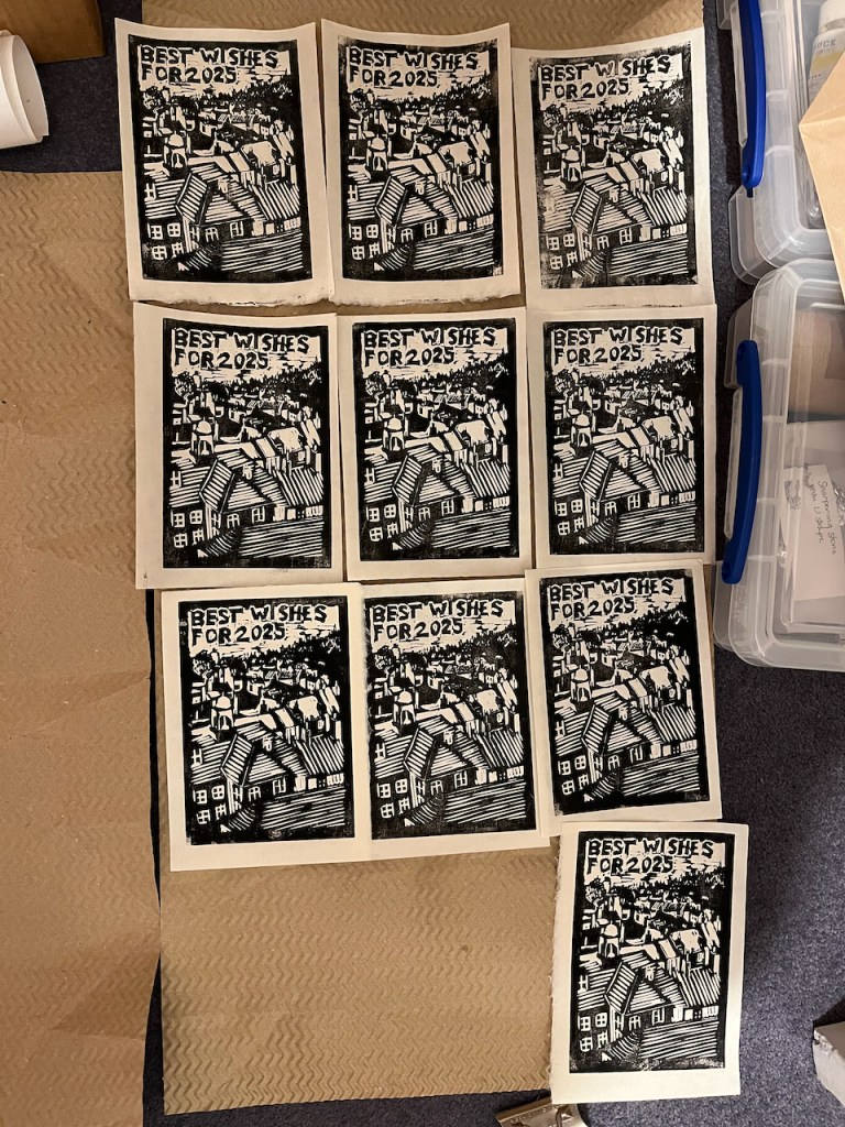
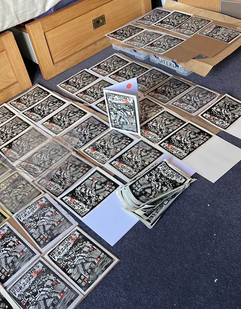
Bedroom becomes print studio.
Many good wishes for 2025!
Glad, as the years pass,
that I am granted
another evening.
Happy New Year!
This is a woodcut, based on the rooftops of the town of Rye, in East Sussex.
Bedroom becomes print studio.
Many good wishes for 2025!
Glad, as the years pass,
that I am granted
another evening.


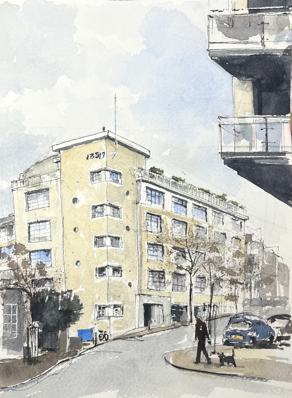
Esher is an area of Greater London, half an hour’s train ride from Waterloo. It is a place of diverse architecture: magnificent Arts-and-Crafts villas, modernist mansions, and a row of “stockbroker Tudor” houses.

On the other side of the railway tracks, in the low ground near the industrial estate and the waterworks, there is a council estate. This is “Lower Green”. It was built towards the end of the 1940s. This was an era of visionary town planning and utopian ideals, eloquently described in the book “Municipal Dreams” by John Boughton, Chapter 3. On page 66 Boughton quotes the town planner Patrick Abercrombie who sought a plan for Plymouth
“which allows for a higher standard of living well within our grasp, with its call for space and beauty rather than for mere economy”
J. Paton Watson and P. Abercrombie “A Plan for Plymouth” 1943.
The new towns were built around this time, including Stevenage, Crawley, Hemel Hempstead, Harlow, Welwyn Garden City, and Hatfield. Lower Green has many characteristics of those new towns: two storey “cottage style” houses with a front garden and a back garden, arranged behind wide verges, with trees and plenty of green space. The houses were designed by the architect George Blair Imrie (1885–1952), for Esher Urban District Council.

My watercolours show houses on Douglas Road, Lower Green. Here, the land was acquired by the council in 1949. It was a compulsory purchase under the 1936 Housing Act. The vendor was the farmer, Sydney Edward Parkes. I have this detailed information thanks to an owner and resident of one of the houses, who kindly showed me their title deeds.
Here is the basic design of the houses.
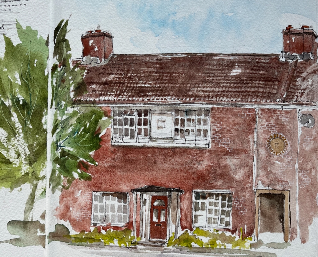

The geometry is perfect: the side edges of the upper windows are aligned with the centres of the lower windows. The upper edges of the lower windows, the door lintel and the passage are all in a neat line.
What you can’t see in my painting is that this house stands behind a wide verge and trees, which separate it from the road.
There is a passage through the terrace of houses, on the right in my picture. This passage takes you through to “the back” where you can store your bicycle, and your dustbins.

Another feature of the estate is the arrangement of houses round a square.
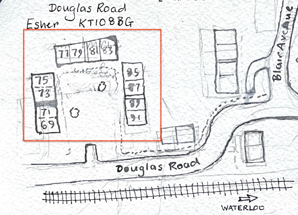
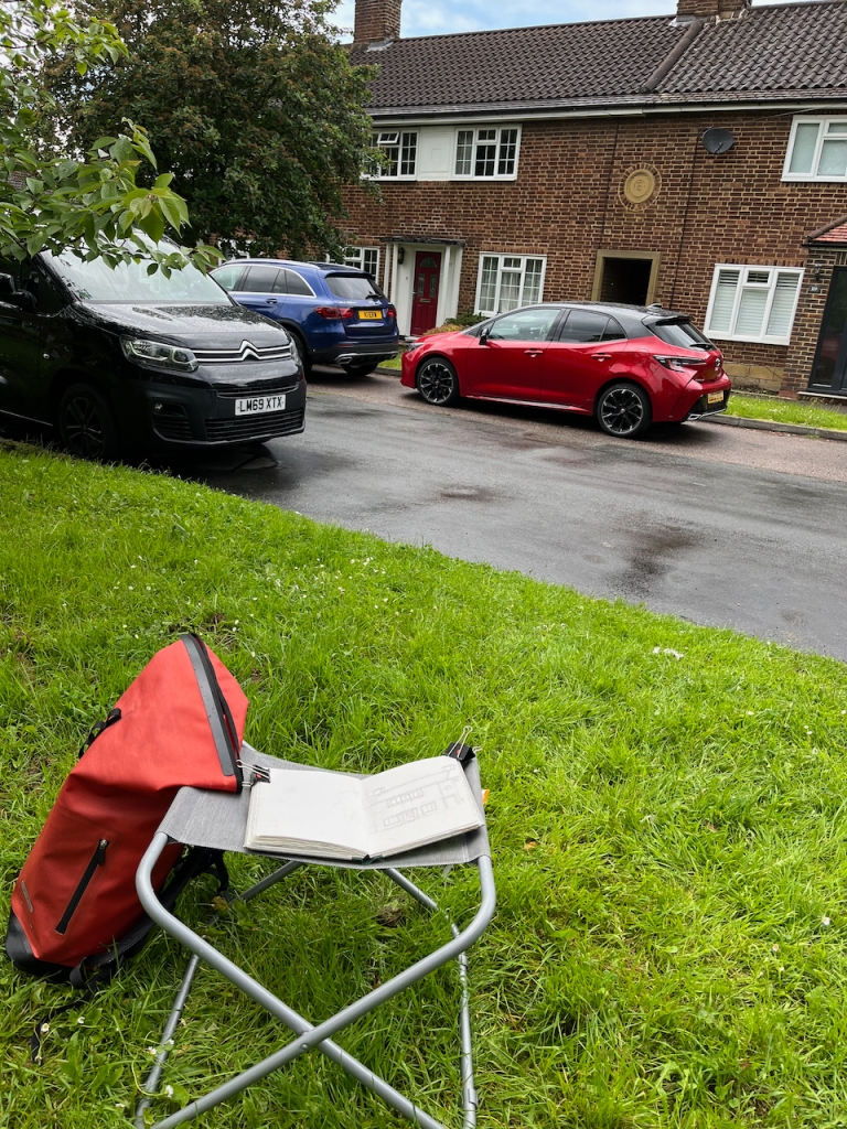
Here is a painting of some of the houses round the corner of a square: numbers 69 to 77 (odd numbers) Douglas Road:


There are three such squares, all large green spaces. It’s one of the “patterns” in this estate, to use the concept described by Christopher Alexander, in the 1977 book “A Pattern Language”.

I didn’t see anyone using the green space. But this was a Tuesday afternoon, in term time, and it was raining. Perhaps they were enjoying looking out across it from their windows. If they were, they were probably wondering what the strange woman was doing, sitting there on a metal camping stool under the tree, staring at their house.
This estate was originally intended as rental accommodation. It was owned by Esher Urban District Council and residents paid rent to the council. Nowadays, some of these former council houses are in private freehold ownership, having been sold under the “right to buy” scheme. There are also a lot more cars. The estate was built at a time when most people did not not own cars. The houses do not have garages.
The architect, George Blair Imrie, designed many houses in the area. His wikipedia page lists the large houses he designed for the wealthy. His work on the council housing estate of Lower Green is also remarkable, and not mentioned. So I am glad of the opportunity to draw attention to it here.
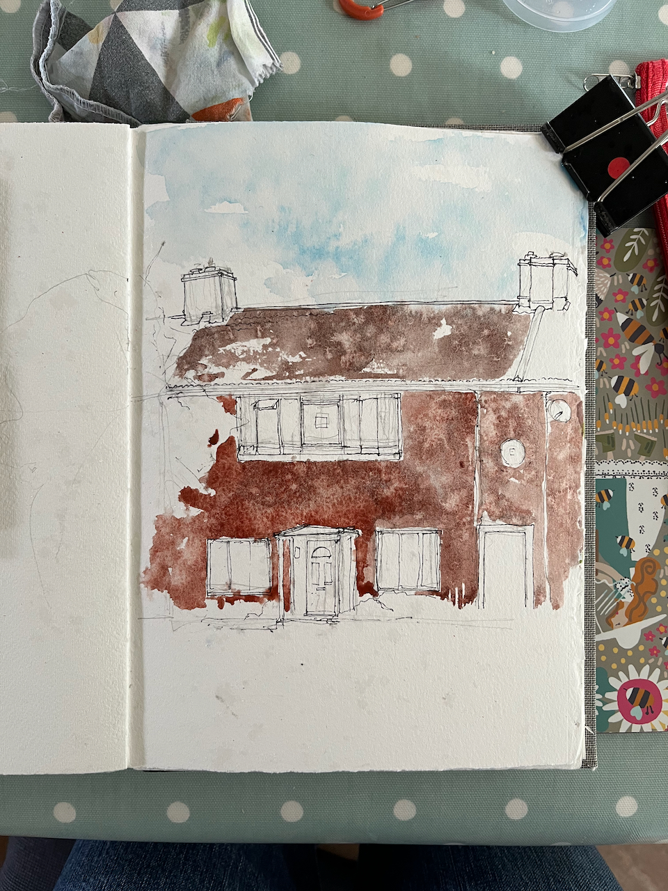
I drew these pictures between rainstorms, finally completing them under a borrowed umbrella.


Blair Imrie’s work, including his work on Lower Green, is mentioned the 100th newsletter of the The Esher Residents Association, January 2020. See pages 4 and 5:
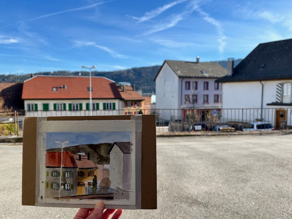
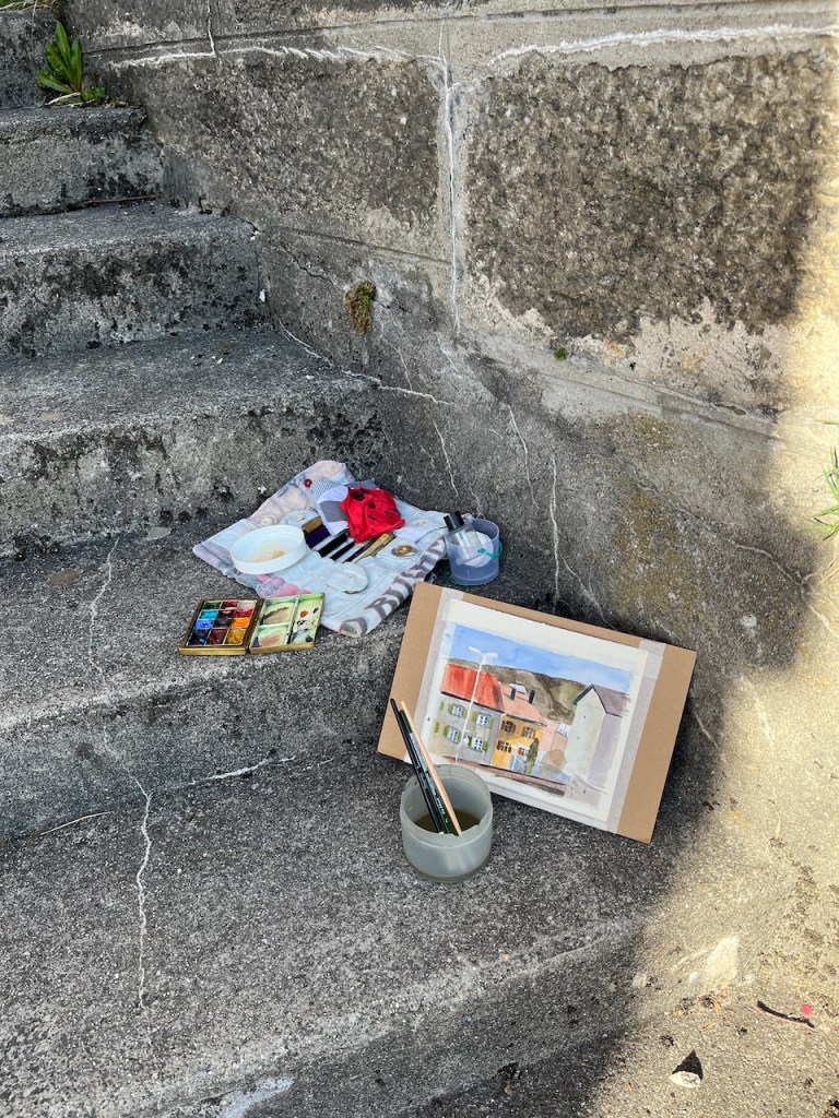
In the afternoon I sat down on the stone steps and sketched the houses that were in front of me.

I was struck by how the afternoon sun cast shadows on that glass screen, centre left, and illuminated the little greenhouse-type roof on the house in the centre. These are solid Swiss houses, with heavy tiled roofs and properly operational shutters. Some of the metalwork, such as the guttering and the surroundings of the chimney stacks, is in actual copper. Even the downpipes are copper.
One tree was a fir tree and was opaque. The other tree was twigs, and was transparent.
Although it was spring, this is at 1200m, and it was cold. The deciduous trees are still bare. The hill is the background is Mont-de-Baulmes. Many of the trees up there are deciduous larch.
I painted this picture in watercolour-only. Usually I use pen. Here, I did a quick pencil sketch and then straight on with the colour. It was too cold to try to get any details or do any penmanship. The solid plainness of the houses seemed to demand flat colour washes. I deliberately left lines of white between the slabs of colour – the sun always catches edges.
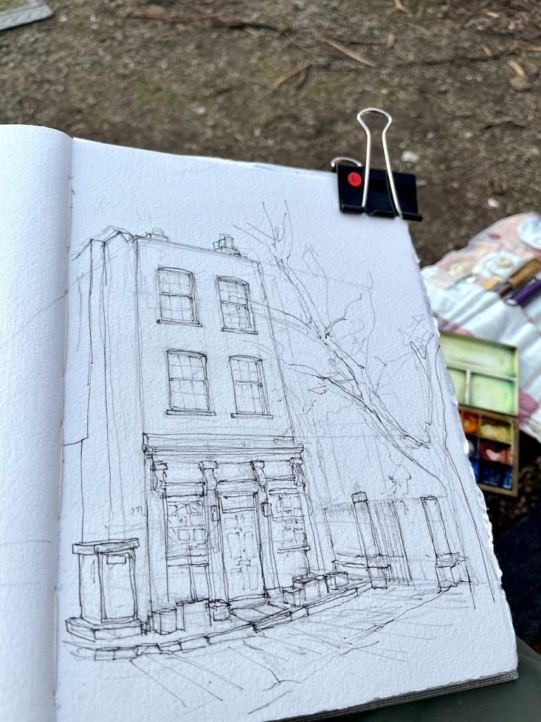
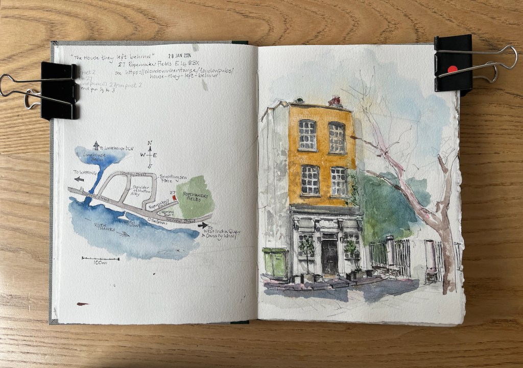
I read an article in “A London Inheritance” about this house, and went off on an expedition to find it.

The London Inheritance article shows a 1986 photo taken by the author’s father. Painted on the side of the building was the sign:
THE HOUSE THEY LEFT BEHIND
BUILT 1857
RESTORED 1985
The sign has now been painted over. The wall, which is on the left of my drawing, is now completely white. But the name lives on and appears on current maps. Here is a map showing where the house is.


The building is now residential, but was previously a pub. It was “left behind” by the bombs dropped on London by the Luftwaffe in the 1939-45 conflict. The website “Layers of London” provides maps of bomb damage in London. Here is the area.
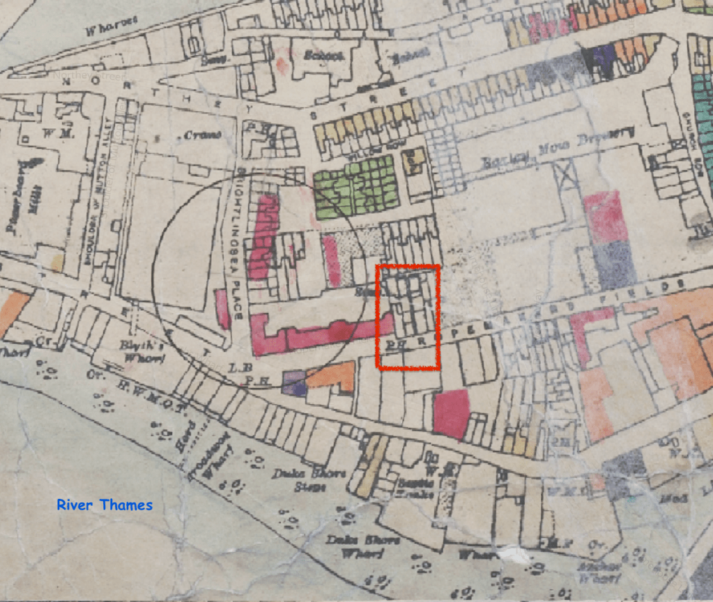
The map is based on 1:2500 Ordnance Survey sheets originally published in 1916. The bomb damage was recorded on these maps by hand soon after it happened. The circle represents where a V2 rocket landed. The red area shows buildings that were classified as “seriously damaged – doubtful if repairable”. As you see, the pub, labelled “P.H.”and outlined in red, is shown as undamaged.
I found more information on Bomb Damage Maps from a National Geographic article on a book about the maps. This article also provides a detailed key to the colours on the map. The book is “The London County Council Bomb Damage Maps” by Laurence Ward.
“A diary entry included in the book, from architect Andrew Butler on April 20, 1941, gives an idea of what the work was like:
For the block I have started on—eight floors high with two flats on each floor—has had its whole face ripped off … I found it possible to stand on part of the roof. So, clutching a broken chimney, I surveyed the damage there. My notebook became very messy. What with the dust and soot, wet filth and the perspiration of fluster on my hands, it was difficult to read what I wrote. The notes served their purpose however when, after drying the book, I had to transcribe them into a report.”
https://www.nationalgeographic.com/science/article/bomb-damage-maps-reveal-londons-world-war-ii-devastation
The original maps are in the London Metropolitan Archives.
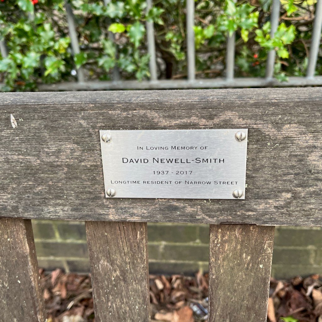
Here is my work in progress on the sketch. Thank you to the author of “A London Inheritance” for providing the stimulus for this expedition. Thank you also to the friends and family of local resident David Newell-Smith, on whose memorial bench I completed the sketch. His dates are given as 1937-2017. He would have been a boy when the bombs were falling.


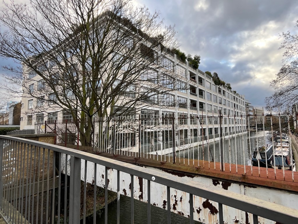
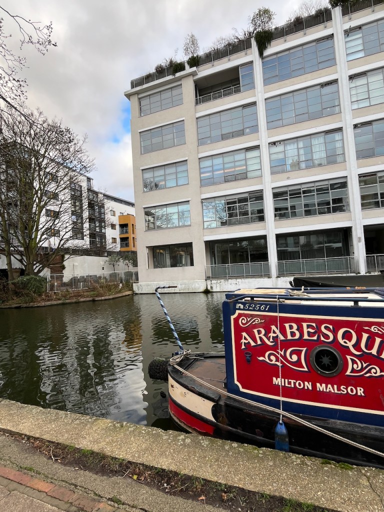
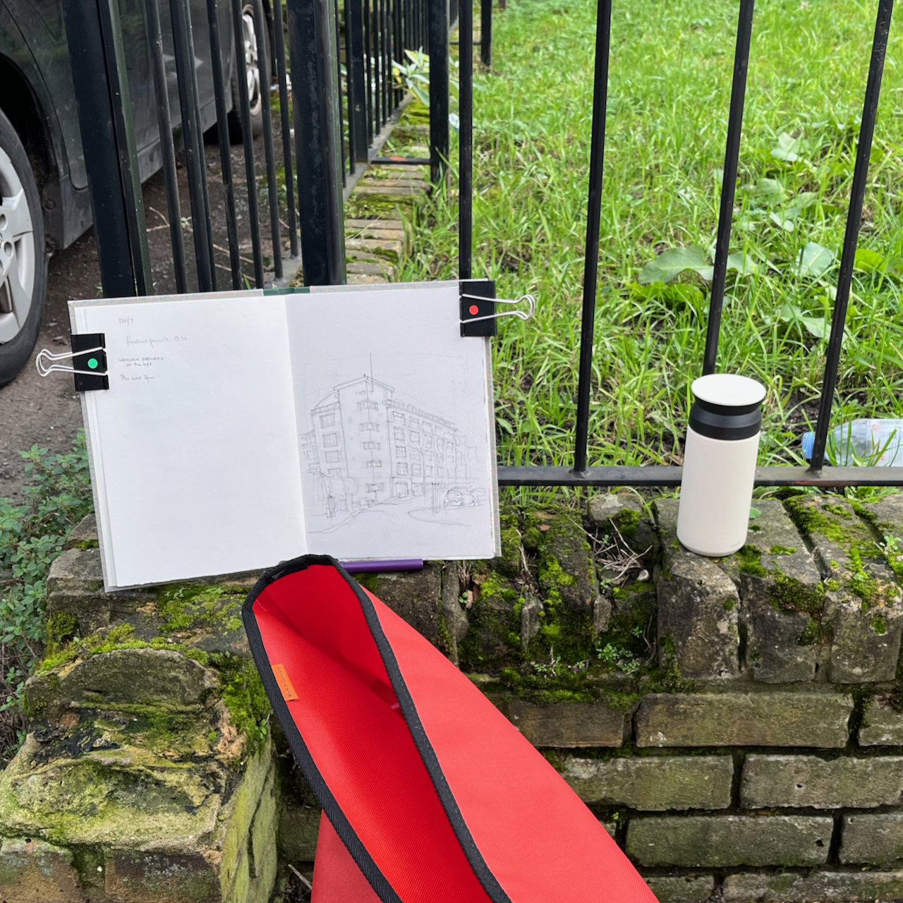
Here is The Canal Building, at the north end of Shepherdess Walk, sketched yesterday from the junction with Eagle Wharf Road.

The building overhanging, in the top right of the drawing is part of Angel Wharf, 164 Shepherdess Walk. Shepherdess Walk leads over the Regents Canal, the bridge is just behind the cars in the picture. The buildings you see above the cars are on the other sidee of the canal. On the left is the “Wenlock Brewery”.
There is a tiny object on the roof of the Canal Building, next to the flagpole. It was hard to see what it was, but it looked like a wooden owl.
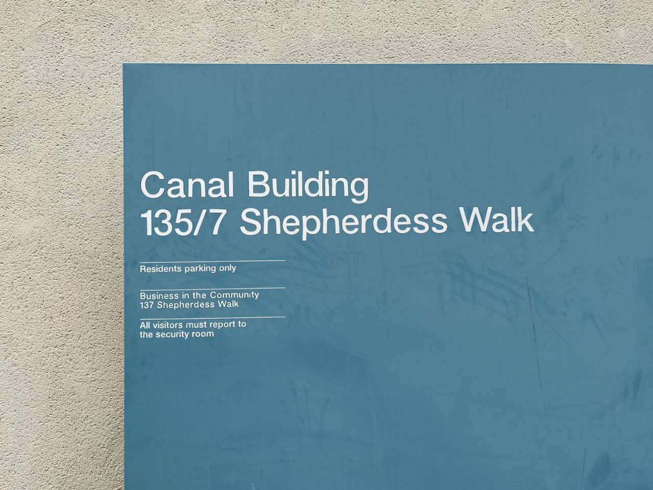
The Canal Building is a former 1930s Art Deco warehouse. In 2000, it was converted into apartments and commercial space to the design of the architects Child Graddon Lewis. This building gained the architects a place amongst the finalists for the 2023 Architecture Today Awards, in the category “Mixed Use and Retail”. There are 35 new apartments, 45 live/work units and 1100 sq metres of commercial space. Here are photos of the building from the canal side.
I did the pen on location and added the colour at my desk later. It was cold outside and I was sitting on a damp stone wall. Many people were out and about in the area, and two of them stopped to say hello and look at the drawing.


There are just three main colours in the sketch: Buff Titanium, Burnt Umber and Ultramarine Blue.
All colours are Daniel Smith except the blue, which is Schminke Horadam.
This is my first sketch in a new sketchbook!

Here are some other sketches I’ve done in Shepherdess Walk:
Here is The Eagle. This is a very old pub, located at a significant junction on City Road. In the picture above, the alley on the right of the pub is called “Shepherdess Place”. It leads to a police car park, and several…
Read more…Here is Plumage House, 106 Shepherdess Walk, London N1. This was a feather factory. According to Spitalfields Life this operated until 1994. The building is now rather shabby, though in a dignified way. I wonder what will happen to it? In the drawing,…
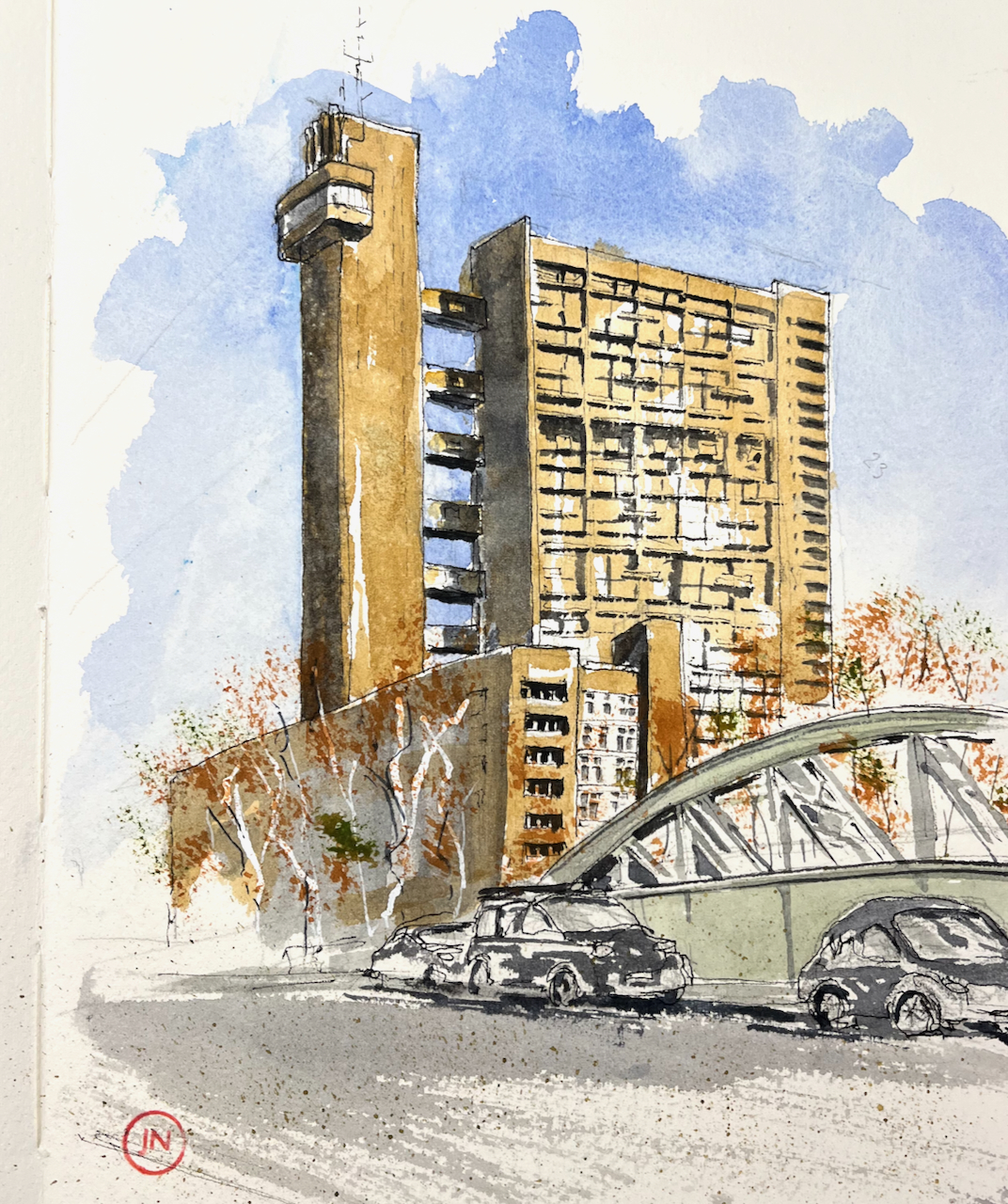
Read more…Here is the magnificent Trellick Tower in West London.

This tower is 271 flats, 31 stories, completed in 1972 to the design of Ernő Goldfinger (note 1). It is in the Royal Borough of Kensington and Chelsea, near the Grand Union Canal and the A40 trunk road out of London. It is Grade II* listed (note 2)

After sketching, I was really cold. I found warmth and excellent food in the Sicilian Café “Panella” shown on the map above, recommended!


I have previously sketched the Balfron Tower in East London, also designed by Ernő Goldfinger.
Note 1: Information on the Balfron Tower and Trellick Tower is from the RIBA website: https://www.architecture.com/explore-architecture/inside-the-riba-collections/trellick-tower-turns-50
Note 2: Grade II* listing: https://historicengland.org.uk/listing/the-list/list-entry/1246688?section=official-list-entry
The RIBA site gives the number of flats as 271, the Historic England Site as 217.
I enjoy the marvellous trigonometry of this roof, and the encouraging slogan on the wall.

The slogan is for a brewery, Courage.
This house was built in 1820 for the managers of the Anchor Brewery, then on this site. The Anchor pub is on the river Thames nearby.

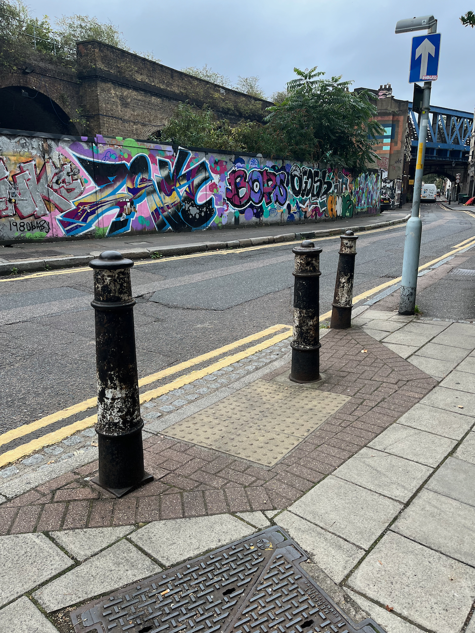
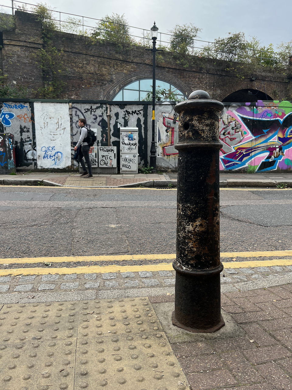
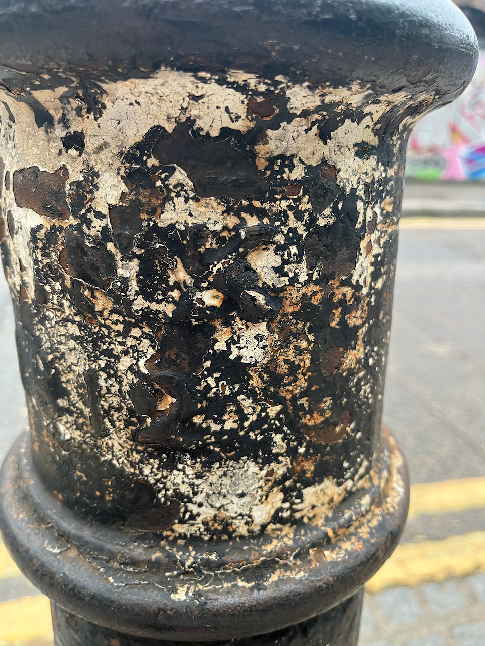
The building, and its cast iron railing, is listed Grade II, number 1385752. When I searched for the list entry in the Historic England register, I found, to my surprise, that the bollards in my picture have their own special listing, number 1385753 “
“5 cast iron Canon posts 1 inscribed “CLINK 1812”
https://historicengland.org.uk/listing/the-list/list-entry/1385753?section=official-list-entry
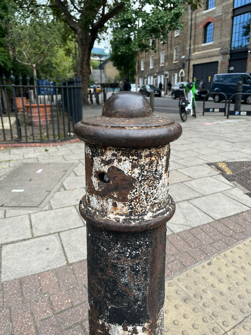
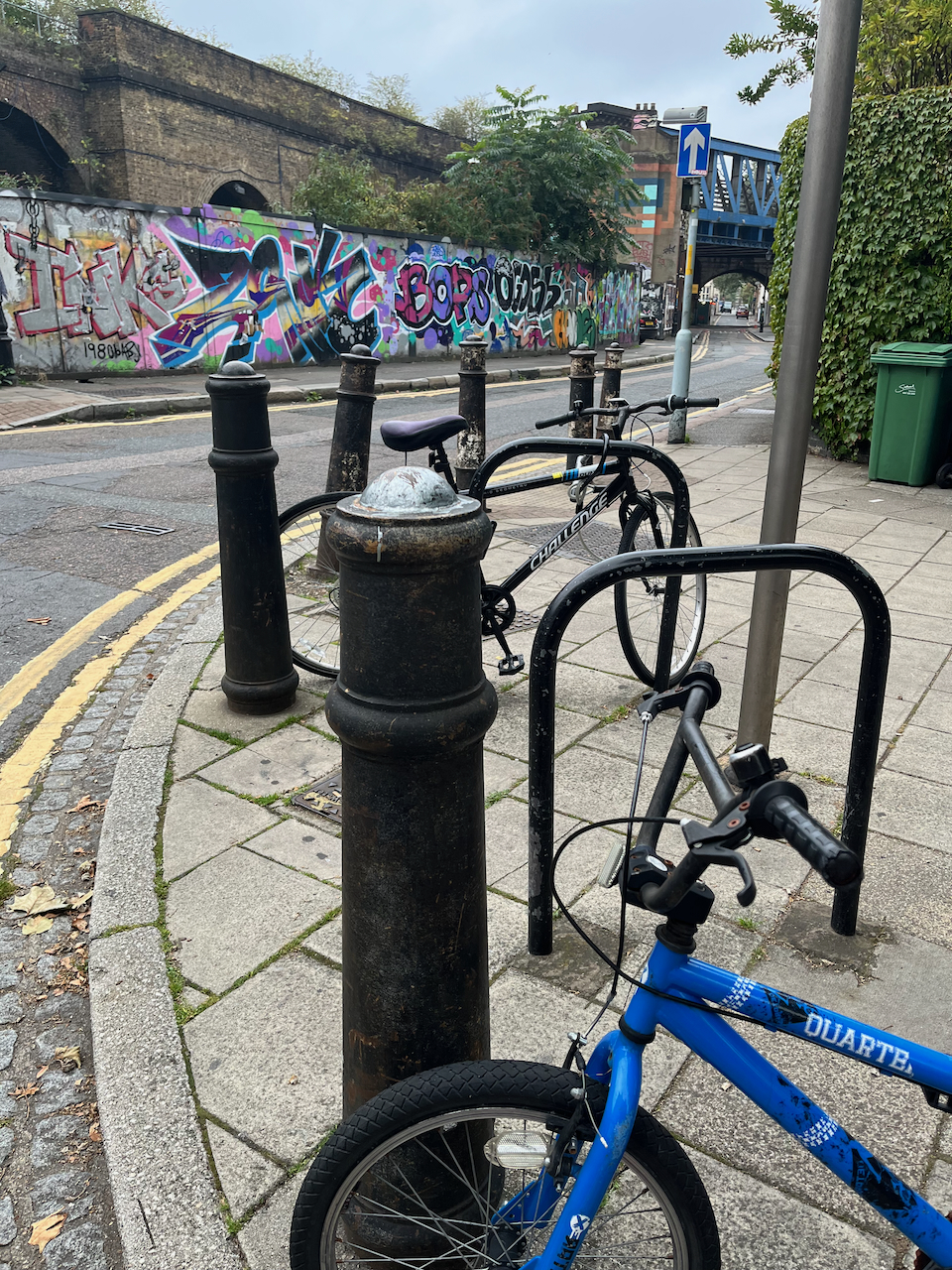
So I had to go back and have a closer look at them. Why were they listed? The list entry does not say. There are some bollards in London which are former cannon. It’s always a delight to discover them. They can be positively identified because you can see the indentation or hole near the base, which is where the gunpowder used to be poured in. Also they sometimes have protrusions about two-thirds down where they used to pivot on their gun-carriage. Sometimes the base is flattened on one side. Here are some examples of cannon (click the image to enlarge and see location):

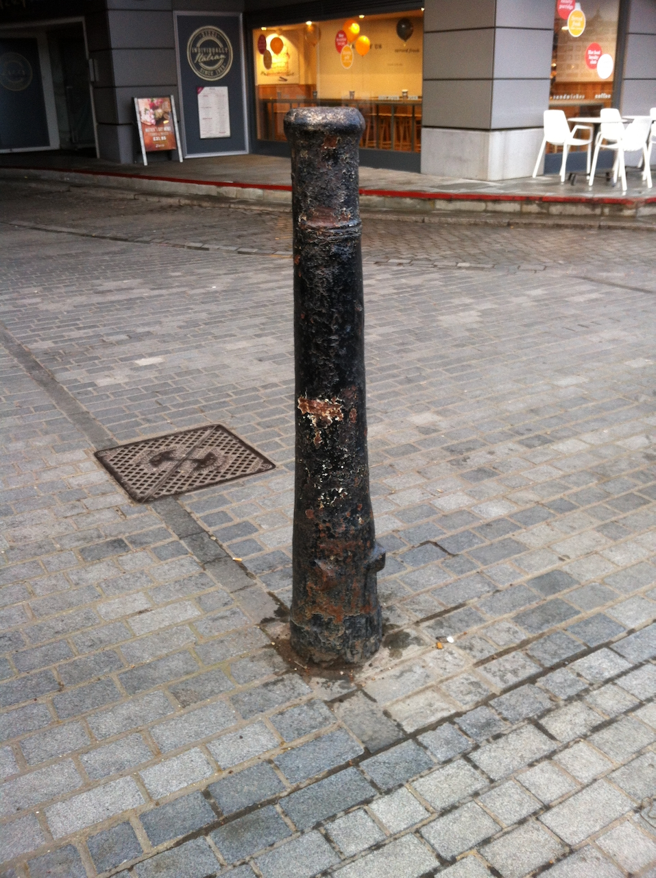

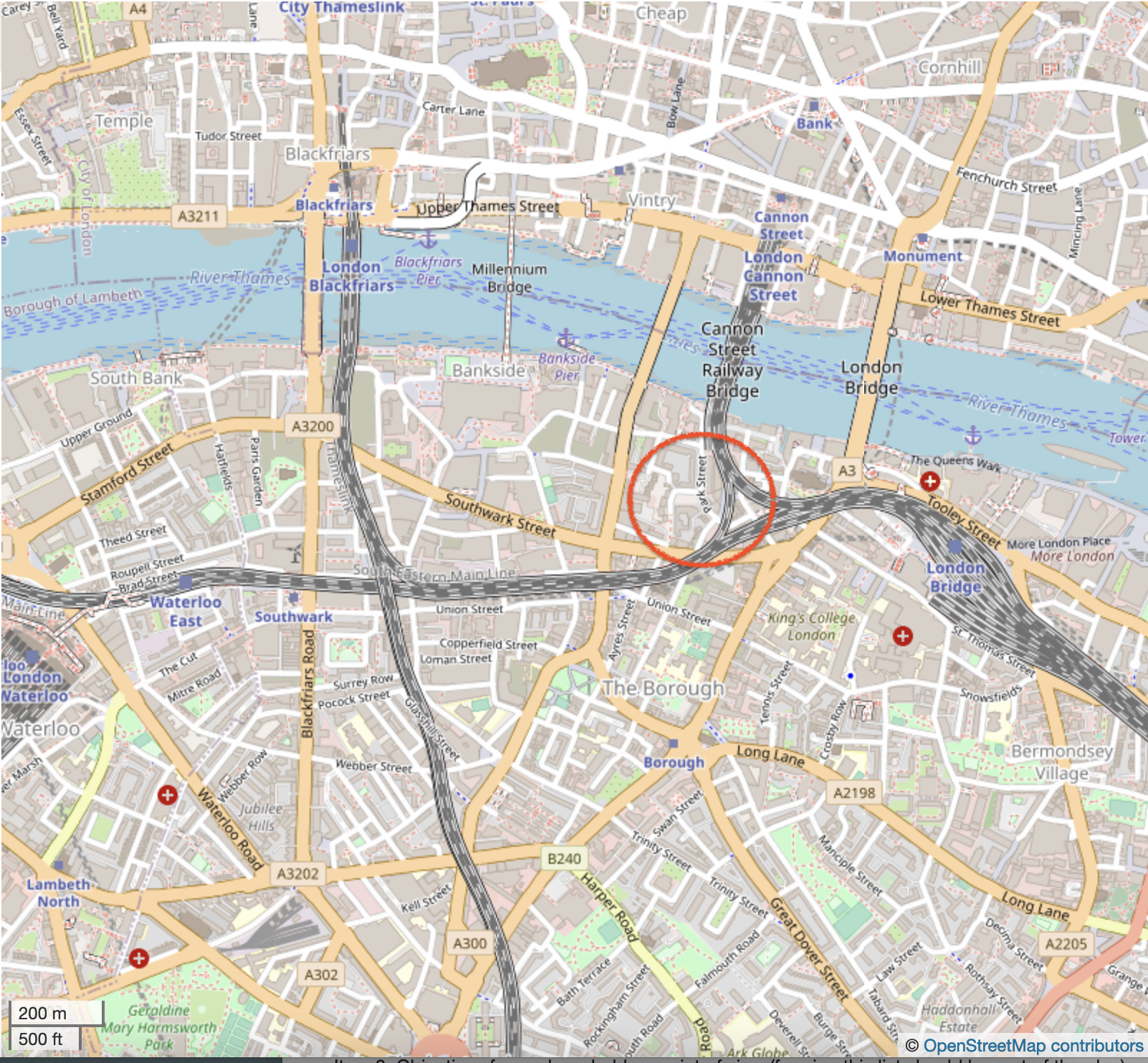
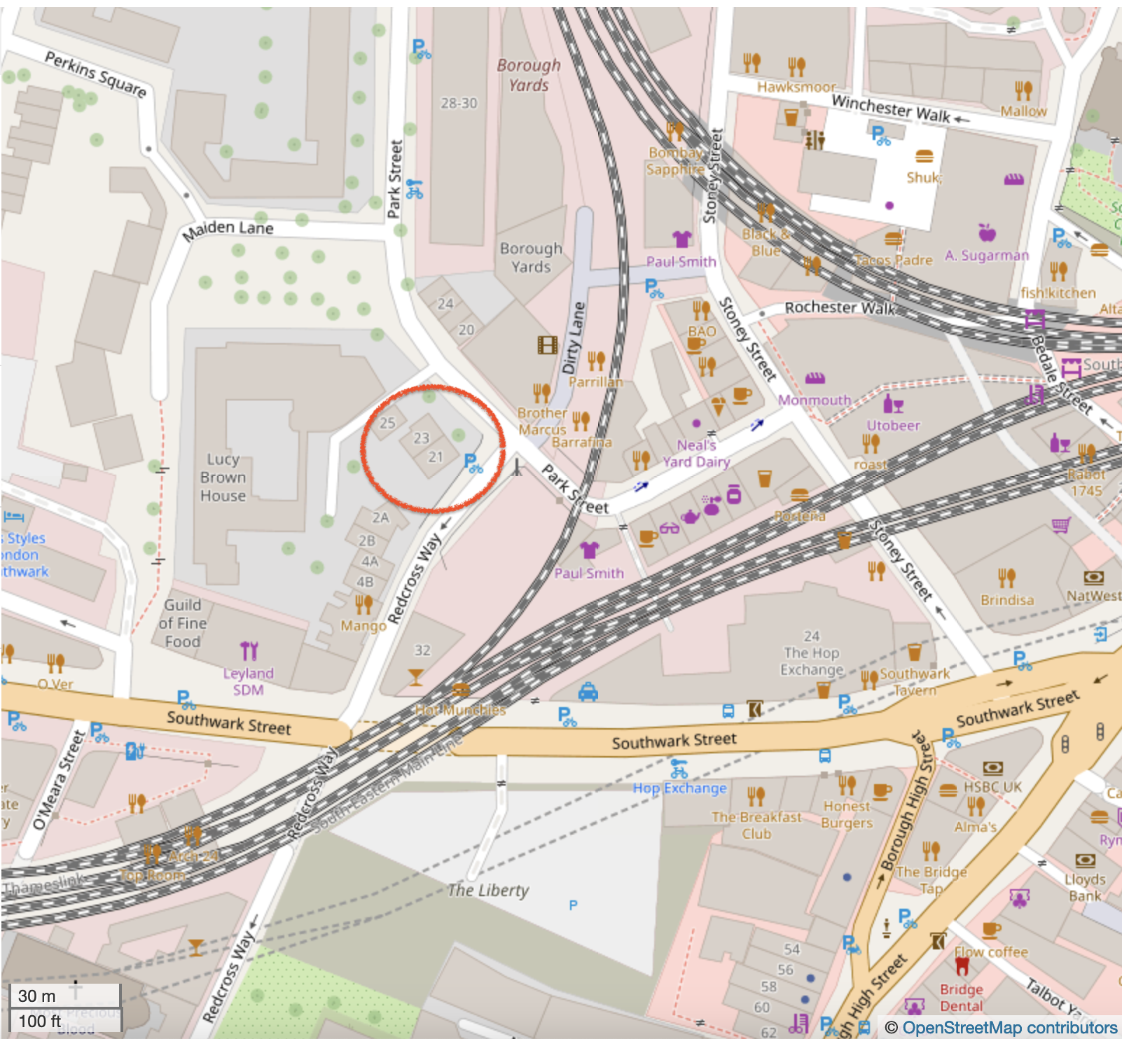
I was unable to find on these 21 Park Street bollards any characteristic which confirmed they might have been cannon. The listing says they are “canon posts” – “canon” spelt like that – not “cannon”. The words “CLINK 1812” were still just about visible on the bollard which is on the right in my drawing. Here are some photos of the posts outside 21 Park Street. Click to enlarge and see captions. Do you think they might be real cannon, or perhaps the word “canon” simply describes a design of post.

“Clink” was the name of the area, from about 1127. It was called the “Liberty of Clink”. The designation “Liberty” implied that it was a civic area under the jurisdiction of the local manor, rather than the King, or the City of London. Famously, certain activities, including theatres, which were forbidden in the City of London were permitted here. The Liberty of Clink was abolished in 1889 and amalgamated into the Southwark in the County of London.
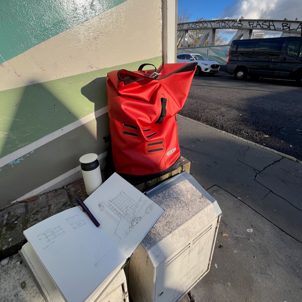
Here are some photos of work in progress on the drawing:

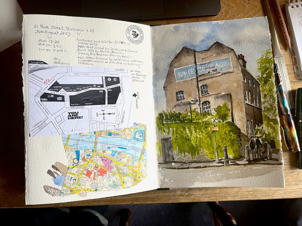
Drawing size 10″ x 8″ on Arches papers 300gsm NOT watercolour paper, in a sketchbook made by Wyvern Bindery.
Watercolours by Daniel Smith:
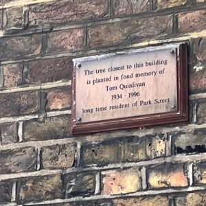
A notice on 21 Park Street reads:
The tree closest to this building
 is planted in fond memory of
Tom Quinlivan 1934-1996
long time resident of Park Street.
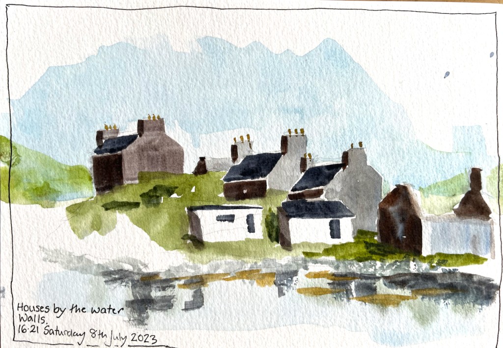
Here is a postcard which I made at the end of a long hot walk. It shows the houses in Walls, on Shetland West Side.
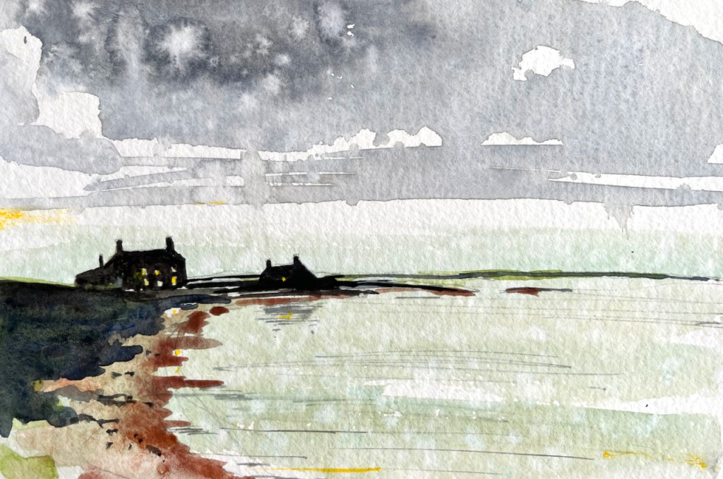
Here is Burrastow House and Burrastow Cottage, an evening view. I sketched this on top of a sky view I’d sketched earlier, but which had been spotted by rain, as you see.
This is a restaurant in Lerwick: “C’est la vie”.
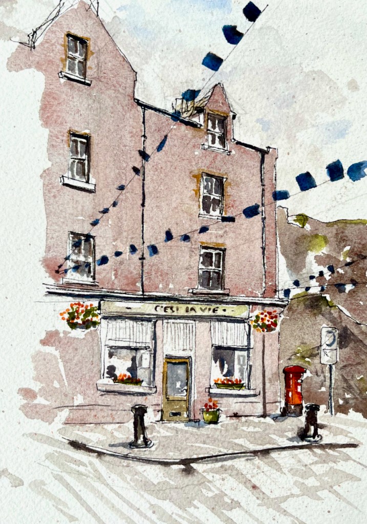
The flags are to welcome the “Tall Ships” which came to Lerwick earlier in the week. The restaurant was closed, I was waiting to see if it opened. Then the rain started. Then the restaurant opened and I finished the sketch inside. Then I walked to the Ferry Terminal.
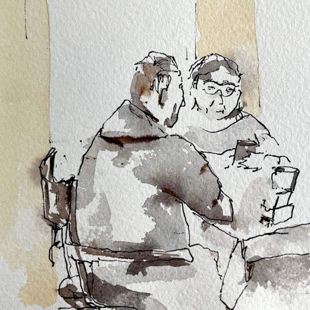
On the ferry, I made quick sketch of people at breakfast.
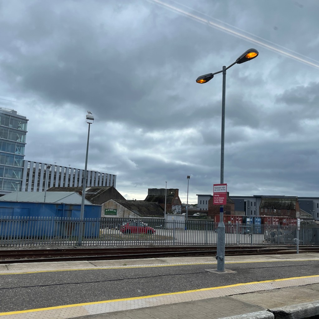
Here is my final sketch of the expedition. On the train at Aberdeen, I looked out of the window.

I have a sketchbook full of images. Here’s a quick flip through showing random glimpses of the visit: (19 second silent video)
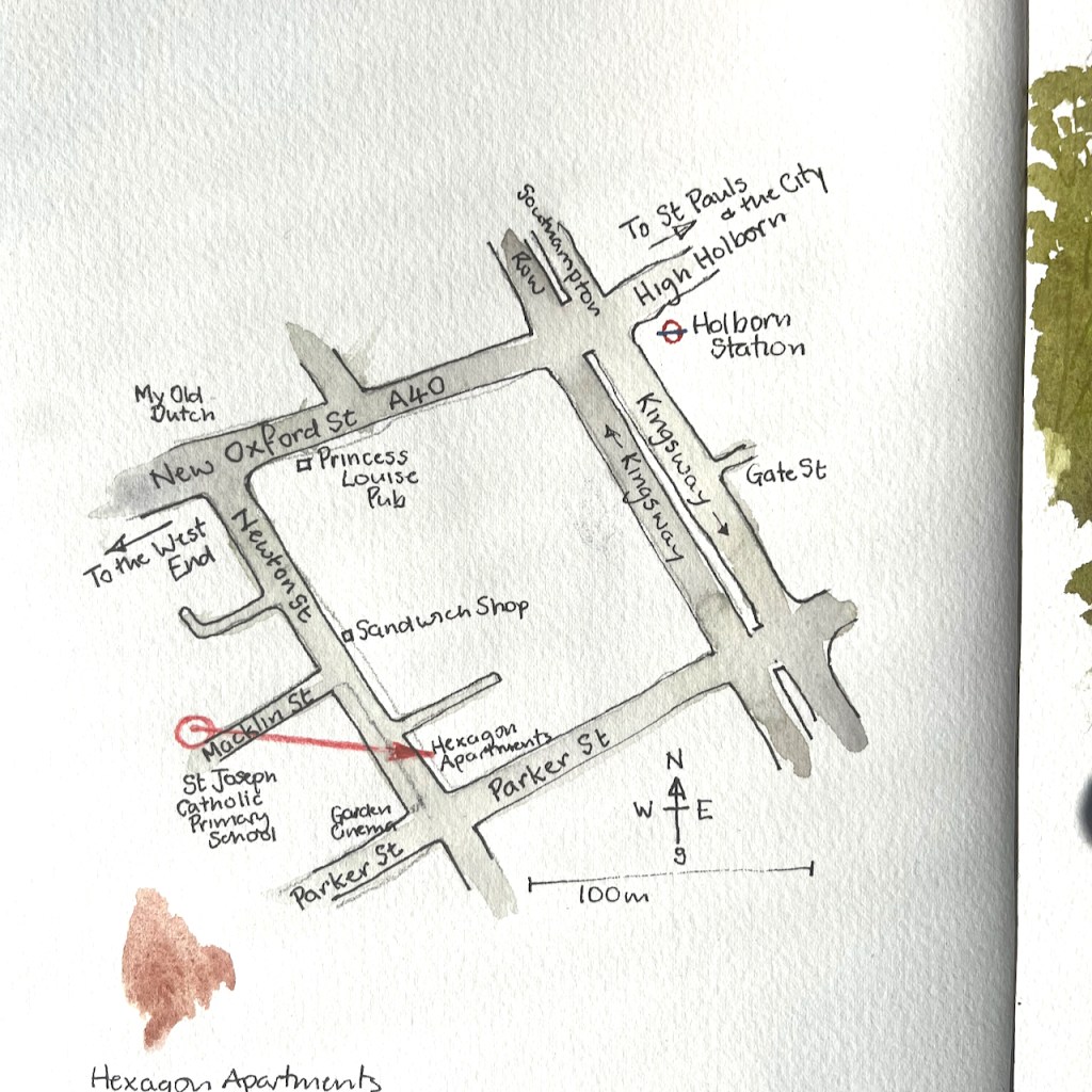
Walking through the back streets of Covent Garden, I came across a row of Victorian brick-built houses. This is Macklin Street. I made a quick sketch of the roofs.
While sketching I noticed a peculiar thing. There are no doors onto the street. It turns out the entrance to this row of buildings is on the nearby Newton Street, overhung by greenery and climbing plants.

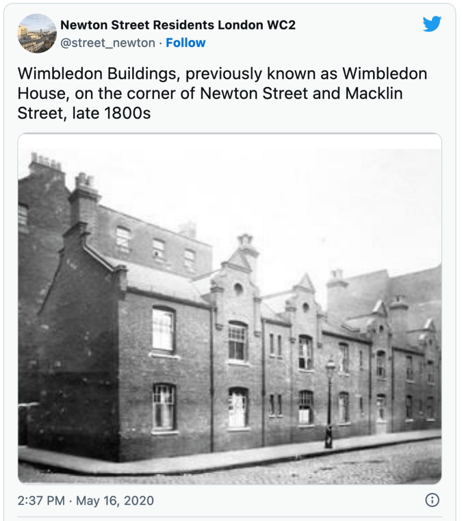
The brick building in my sketch is Wimbledon Buildings, formerly Wimbledon House, built in 1893.
In 1893 the Parker Street Lodging House was
page 9, Camden Conservation Area Statement (undated) [https://www.camden.gov.uk/documents/20142/7905860/Seven+Dials+Estate+CAS.pdf]
completed for 345 people. In 1896 Aldwych, Cotterell
and Lindsey (demolished in the 1960s), Powis and
Wimbledon buildings were completed for 284 people.
Twenty workshops were also provided. The scheme also
widened Parker Street and Macklin Street.
It is now part of a “Central London residential street with a community of social housing and owner occupying flats”, with its own Twitter account. Here is a interesting picture from that Twitter feed, showing the roof gable I sketched. This is the view from Newton Street, with Macklin Street going off to the right. Note the absence of front doors. The entrances are through a gate at the left of the photo.
St Joseph’s Primary School is on Macklin Street. Its former name, Macklin Street Catholic School, is still clearly inscribed in the stonework high up. As I sketched, the children came out into the street at the end of their school day.

The Camden Conservation Area statement mentioned above is on this link . If that doesn’t work, you can download it from the link below. It is 36 pages.
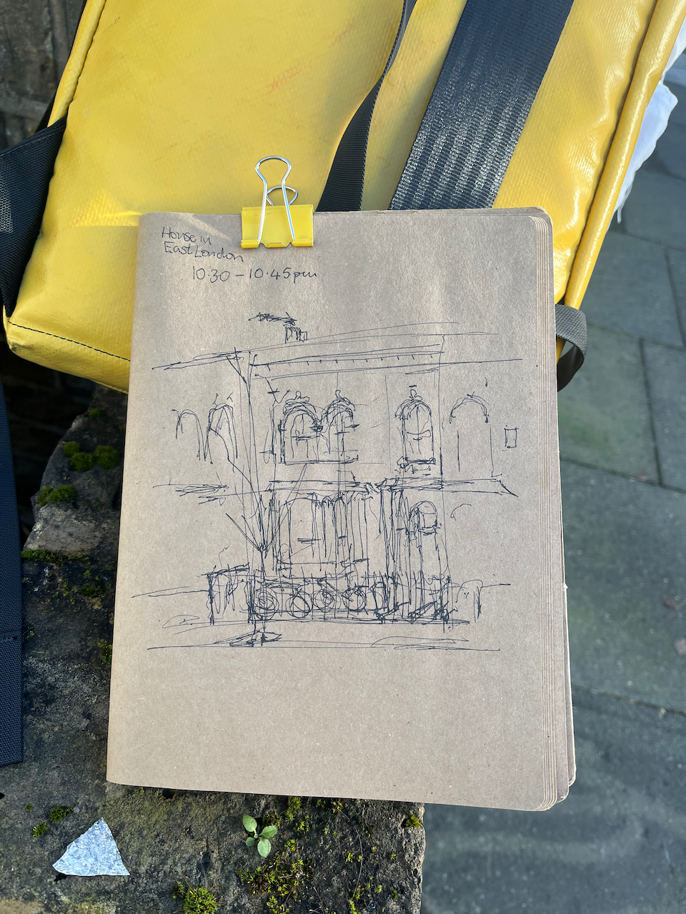
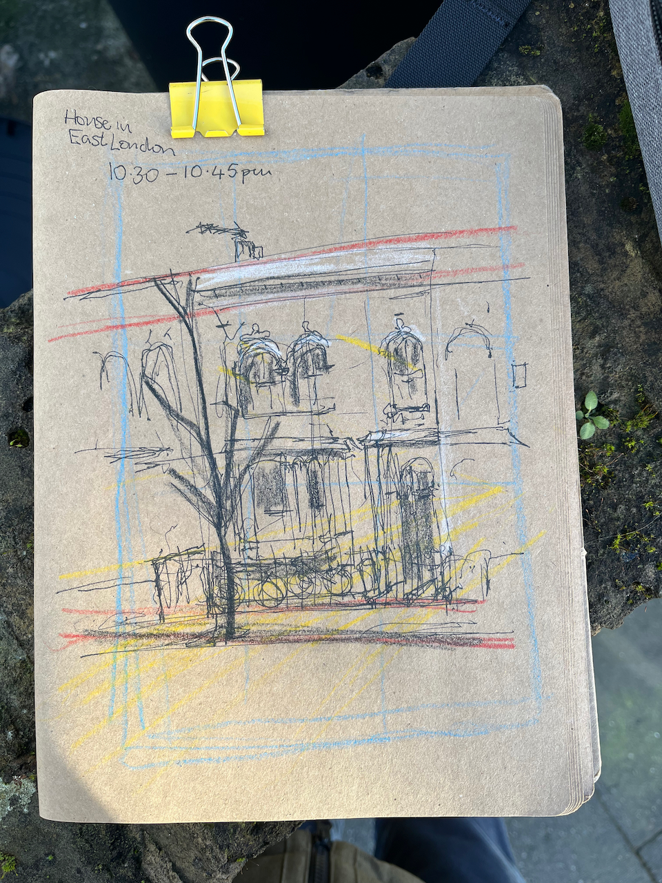
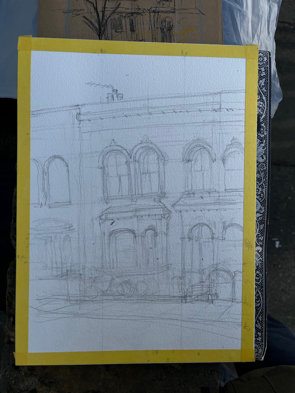
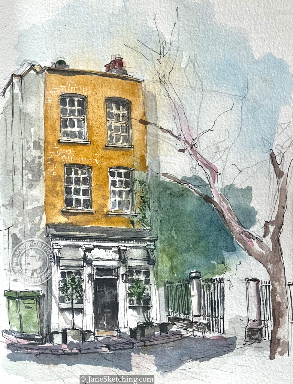
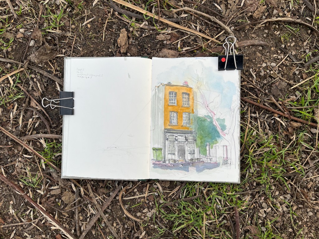
Here is a Victorian terraced house in East London.
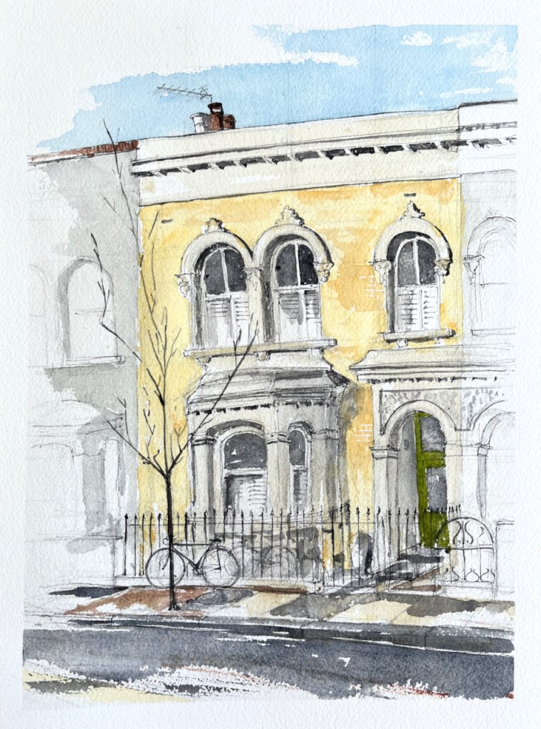
This was a commissioned drawing. Thank you to my client for the commission and for their permission to post the picture here.
There were two interesting challenges in this drawing. One was the fact that the front of the house was obscured by parked cars. The other was the characteristic colour of the brickwork: a clean and lively yellow. I wanted to draw the fence without the cars, so as to show the whole house. And I wanted to get that yellow right.
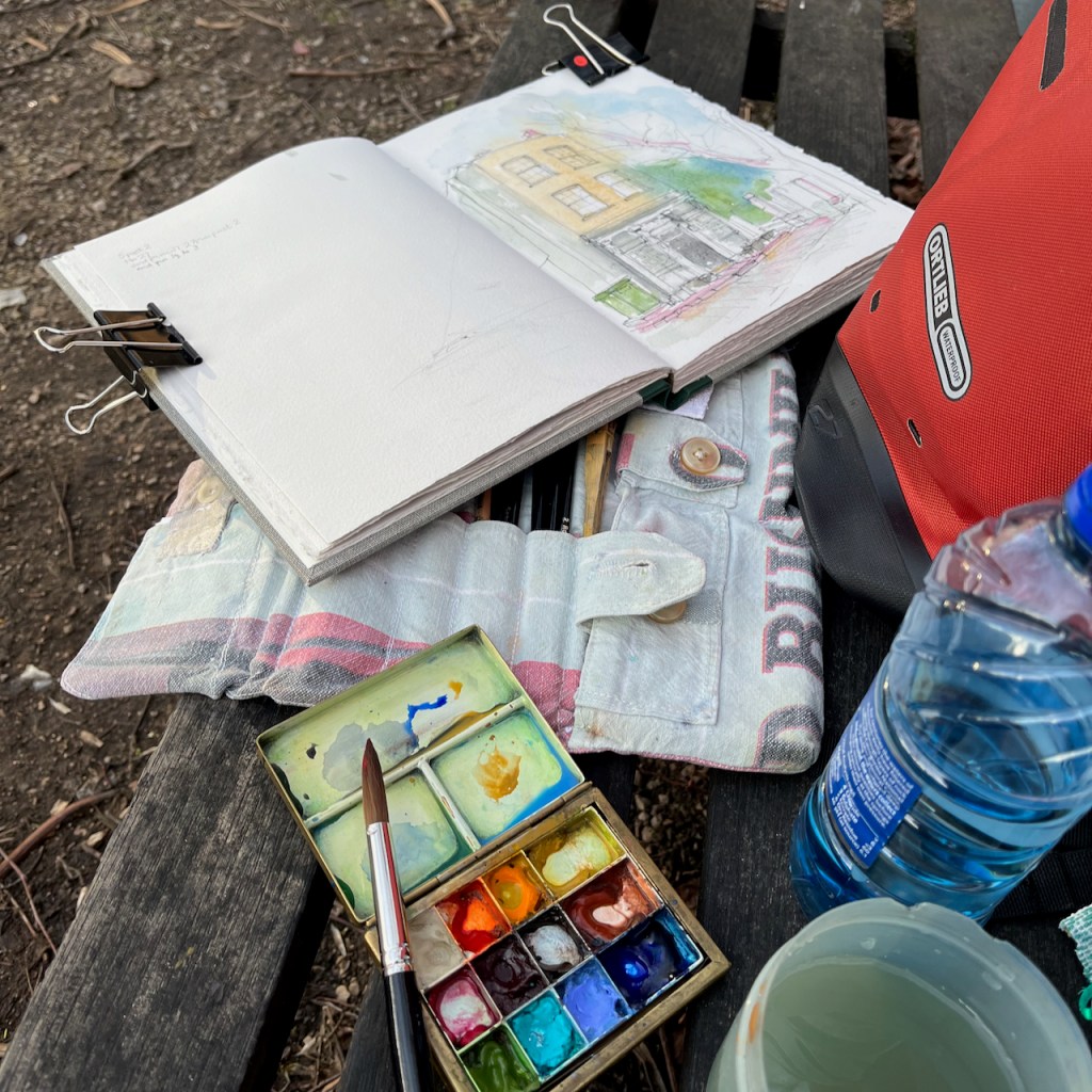
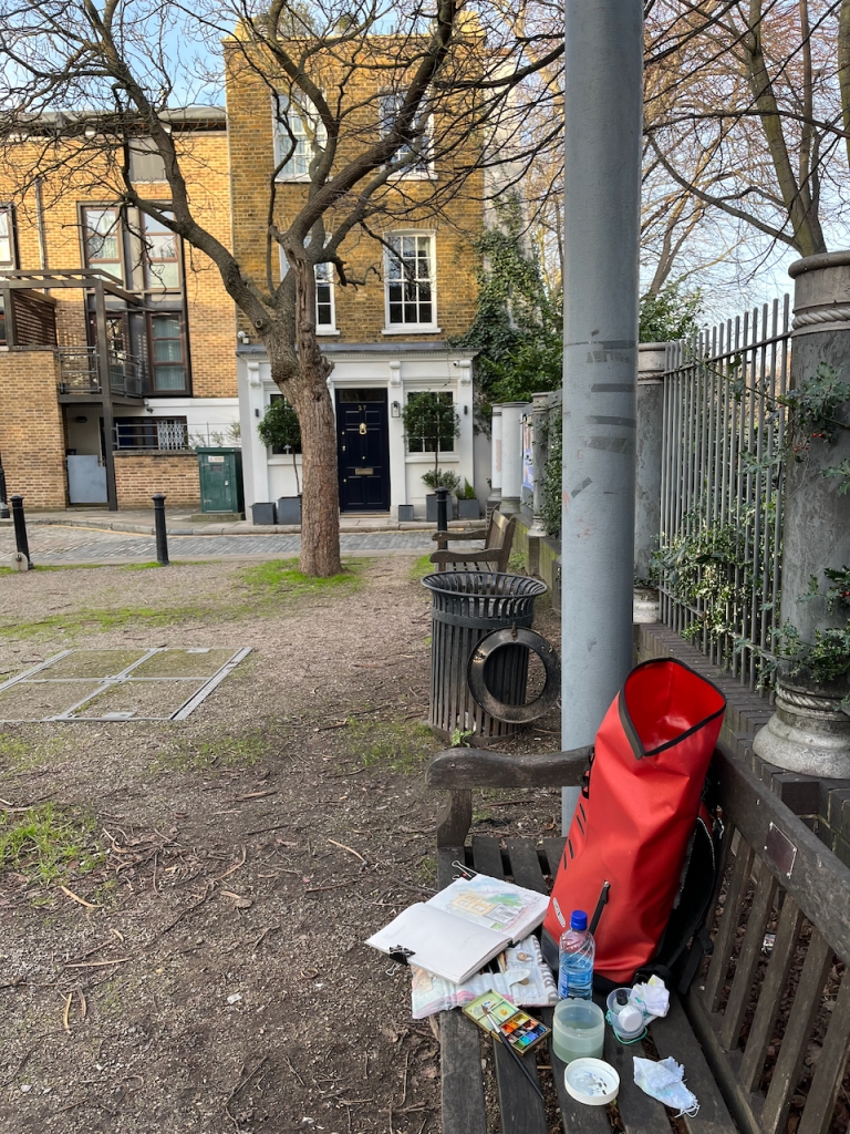
I was stationed on the other side of the road. There were cars parked nose-to-tail on both sides of the road. To draw the part behind the parked cars, I crossed the road and had a look then come back and sketched and then wandered about sketching and trying to get it right, gradually becoming skilled at envisaging the fence behind the car. Fortunately it was a quiet road. The few passers-by took a friendly interest, bemused by an itinerant artist in their street.
To match the colour of the brickwork, I equipped myself with a colour chart of all the yellows I possess. Usually, old London brickwork is Mars Yellow. But in this case I discovered that it was Naples Yellow, a cleaner, paler colour, less orange than Mars Yellow, more orange than Nickel Titanate Yellow. Naples Yellow also has a pleasant chalky texture, which made it perfect for this brickwork .
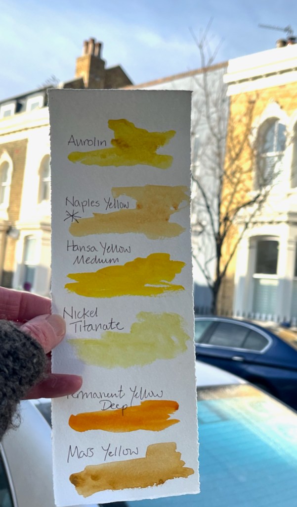
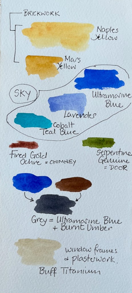
Most of this picture was painted in 3 basic colours: Ultramarine Blue, Naples Yellow and Burnt Umber. Here are the detailed colours, all Daniel Smith:
The paper is Arches Aquarelle 300gsm Cold Pressed in a block. The ink is De Atramentis Document Black, applied with a fountain pen.
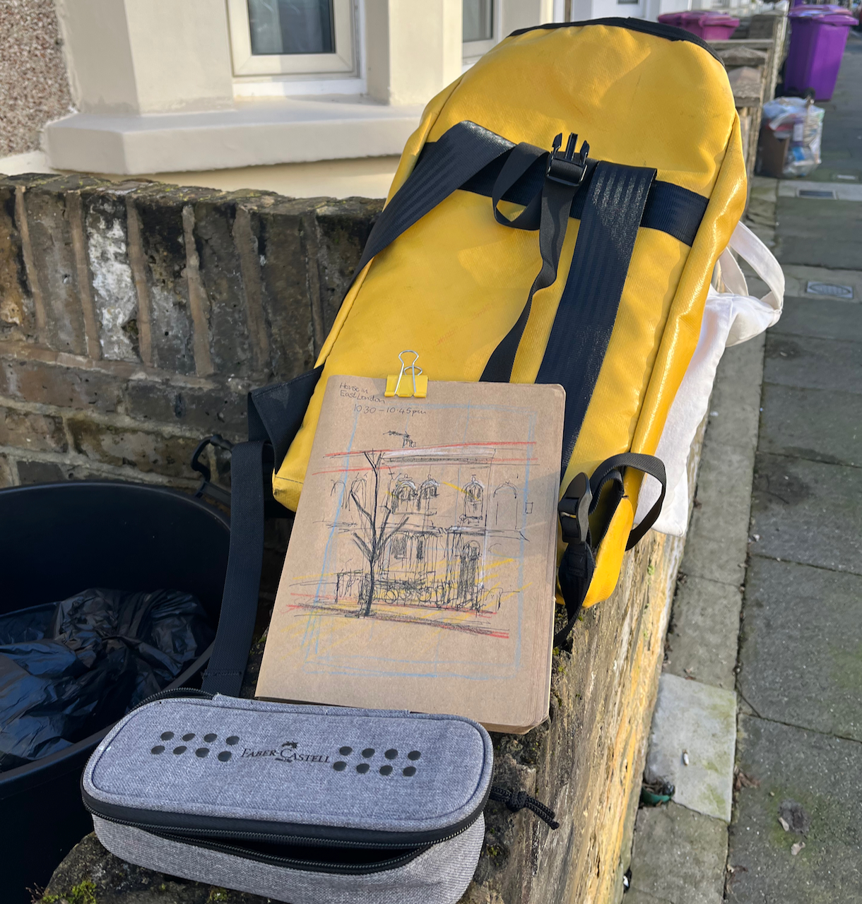
I did a preliminary sketch to understand the perspective and the proportions. Here are some images of work in progress. This was January and very cold. I managed to complete the pen and ink on location and then added the colour at my desk in the warm when I returned home.