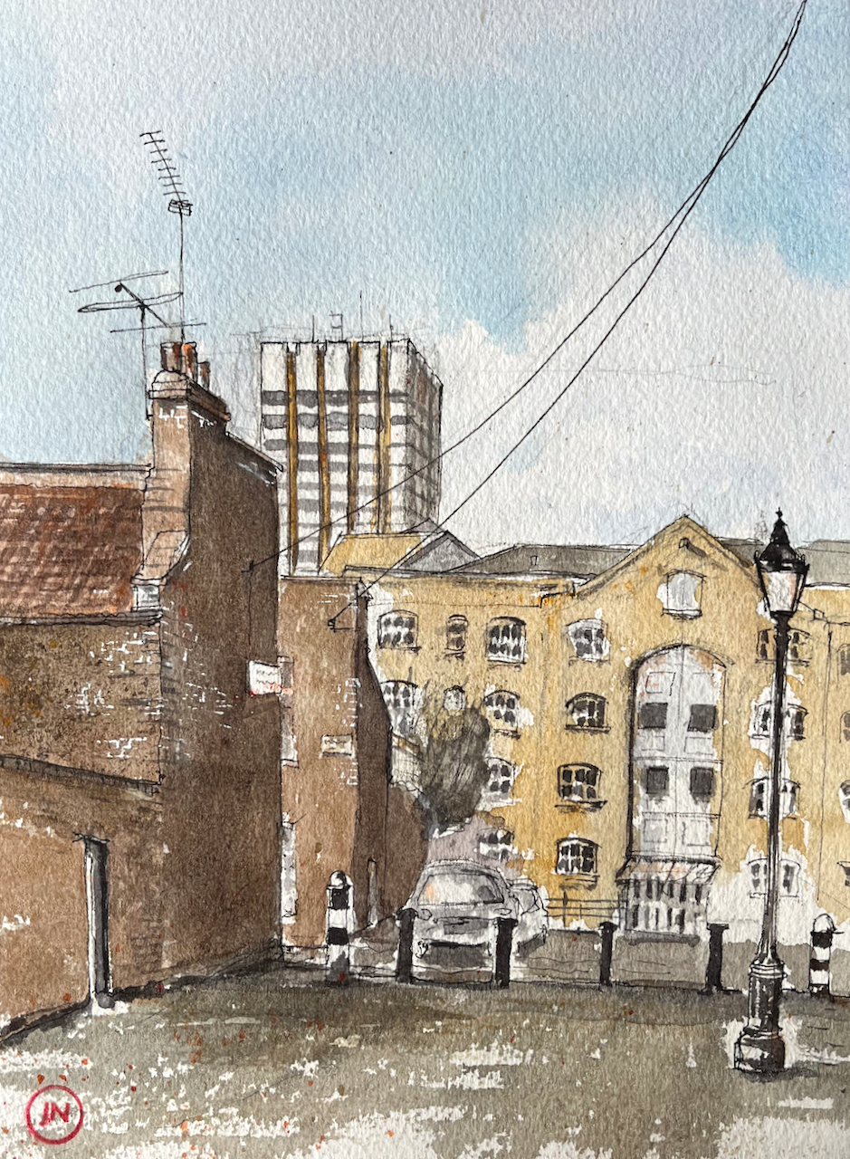
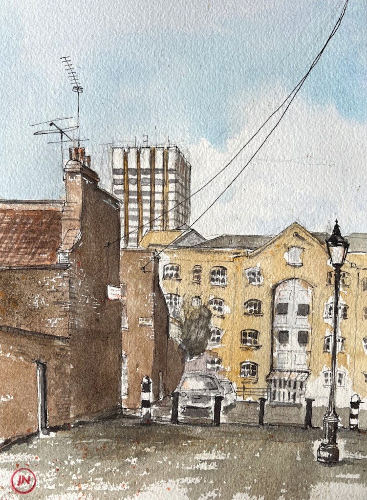
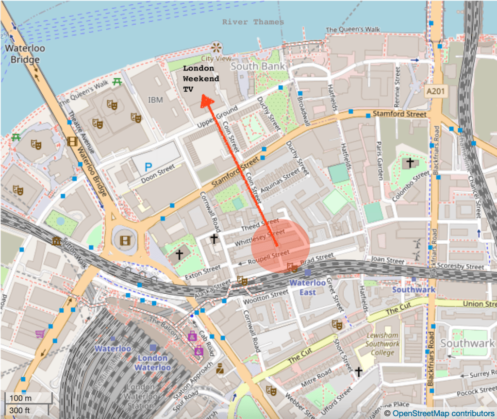
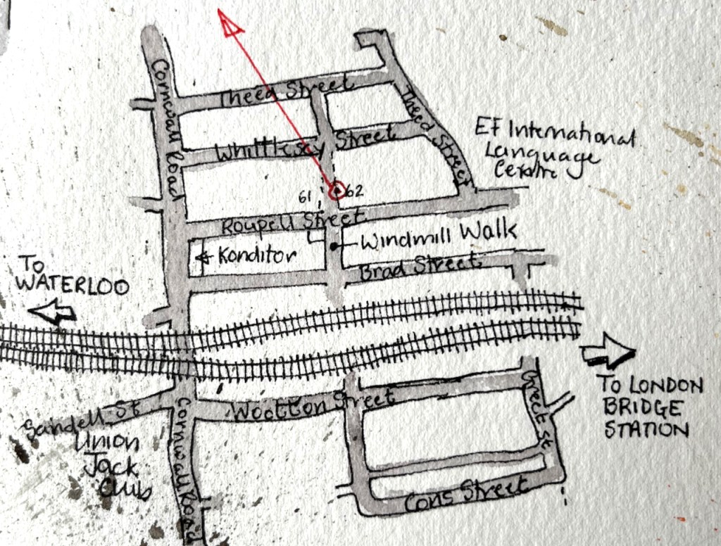
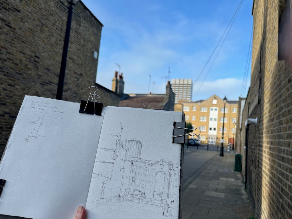
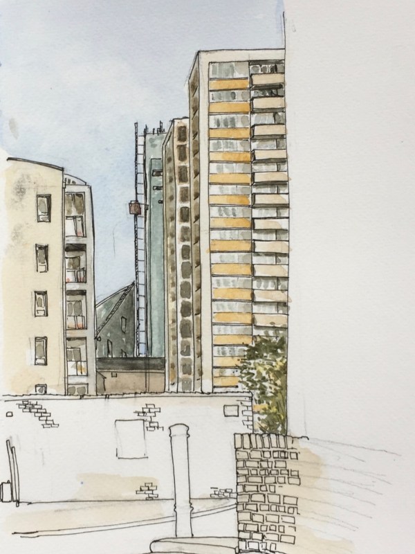
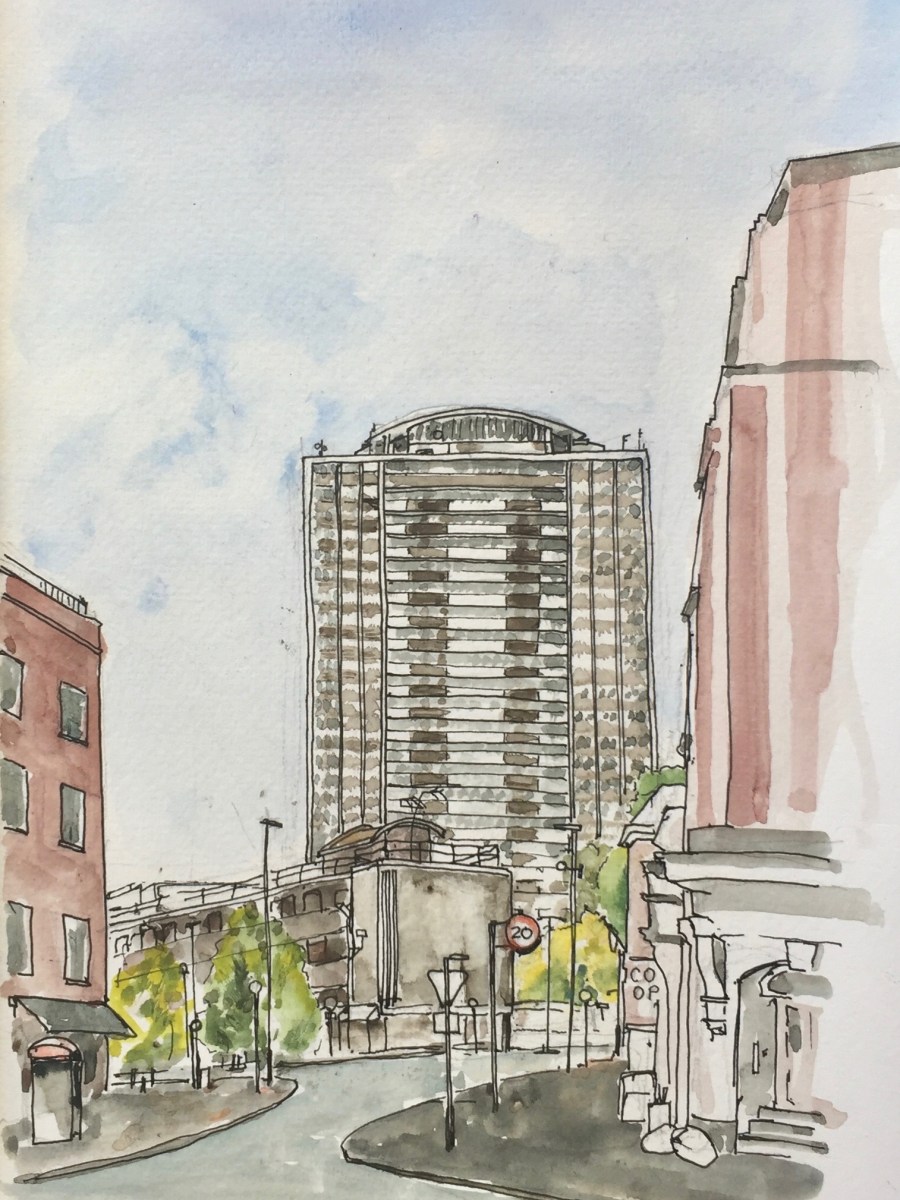
Here is a view of the tower of former London Television Centre building, seen from Windmill Walk, off Roupell Street near Waterloo Station.
LWT Building from Windmill Walk, 7th Feb 2022, in sketchbook 11
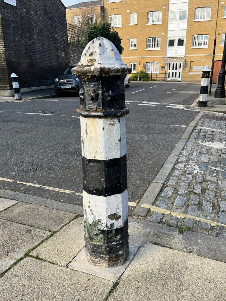
Bollard with stars.
I enjoyed all the wires and aerials! The swooping wire from the top right is a telephone wire or electrical cable. It’s unusual to see them above ground in London. Note also the marvellous bollards, which are mentioned in the Conservation Area Statement (Note 1).
Here you see layers of London development. In the foreground is Windmill Walk, part of the Roupell Street residential area built around 1824, and still residential. The paler building in the mid-distance is on Theed Street. It is a converted factory. It now contains some residential properties which I found listed on a holiday lettings site, and some offices listed on an estate agents’ site. Different accounts list it as a Violin Factory and/or a “Komptulicon Works”. Komptulicon was a sort of floor covering made of cork and rubber.
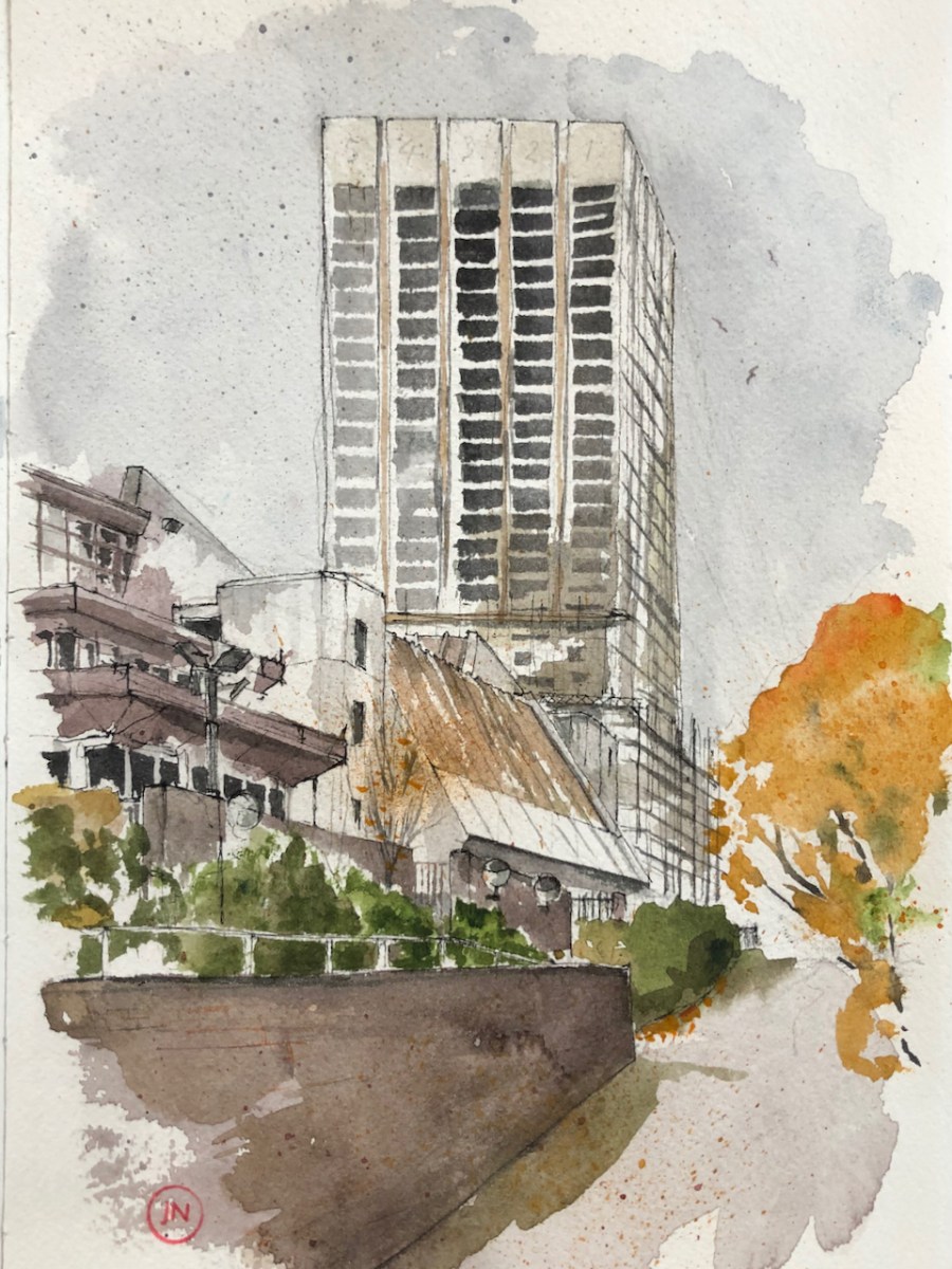
On the skyline is the London Television Centre, 1972, which I have drawn previously:
Here is a view of the London Television Centre, 60-72 Upper Ground, SE1. It is on the South Bank of the river Thames, a little to the East of the National Theatre and the Royal Festival Hall. It was completed in 1972 to the design of…
“[Roupell] street was laid out and construction started around 1824….. Roupell had built the street for what were described as “artisan workers” and the 1841 census provides a view of the professions of what must have been some of the first people living in the street. This included; painters, labourers, clerks, printers, bakers, carpenters, bricklayers, compositors, paper hanger, hatter, an excise officer, lighterman, warehouseman – all the typical jobs that you expect to find in such a street in 1840s London.” (A London Inheritance)
“Roupell Street Conservation Area” statement by Lambeth Council, 2007, describes the streets and details what can and cannot be done in modifications to the houses. It also mentions the “Komptulicon Works”, north of Windmill Walk.
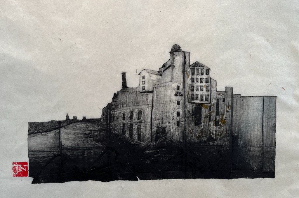
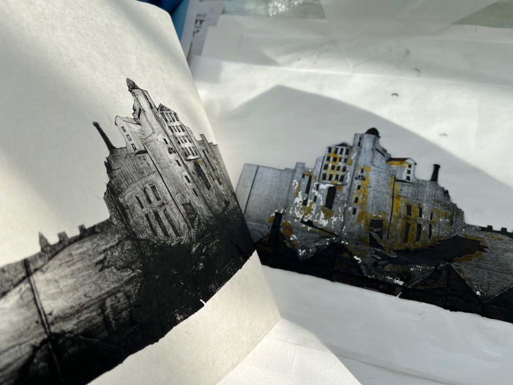
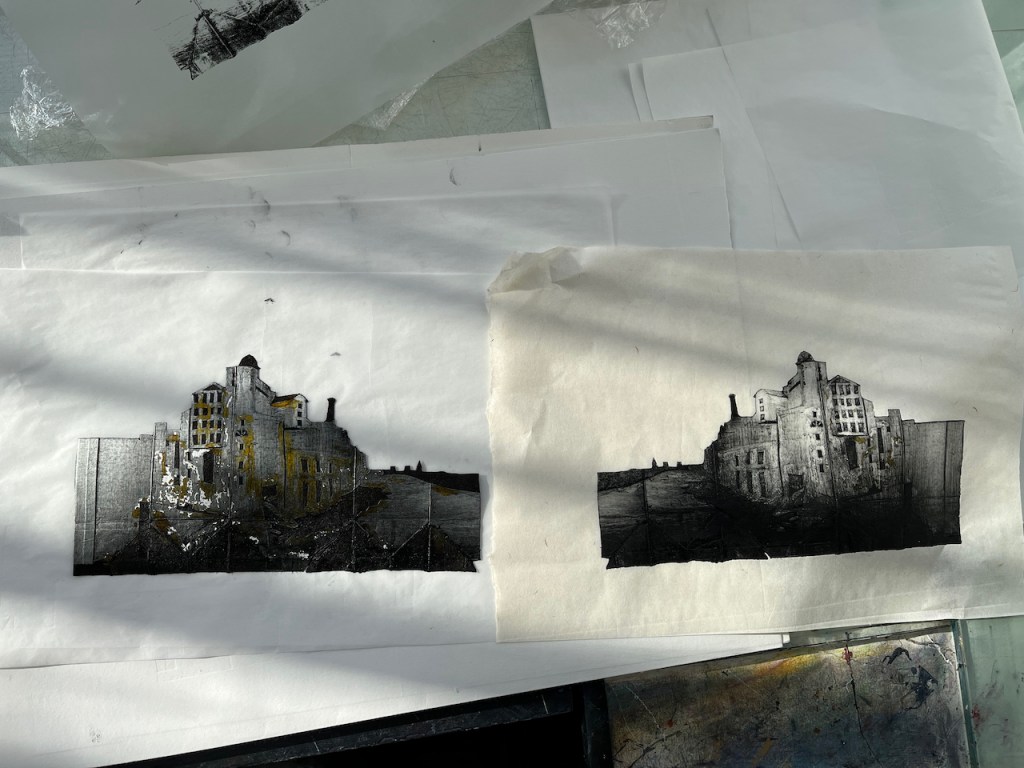
I am trying an experimental monoprint technique. The idea is to use packaging material to make intaglio “plates” which are then printed using an etching press. This is the first one. I printed it yesterday on the Henderson Press at East London Printmakers.
Anchor Brewhouse and Horselydown Old Steps, Monoprint. Image size 10″ x 6″
This is a real building, a former brewery, just to the South and East of Tower Bridge. That’s the river Thames you see on the left of the picture.
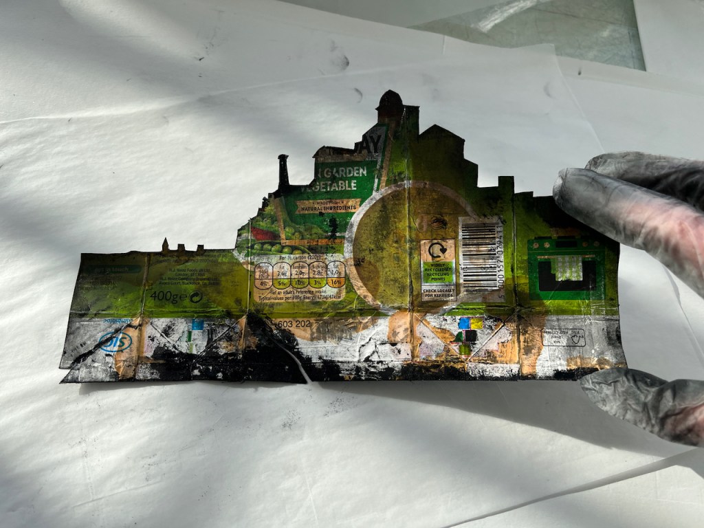
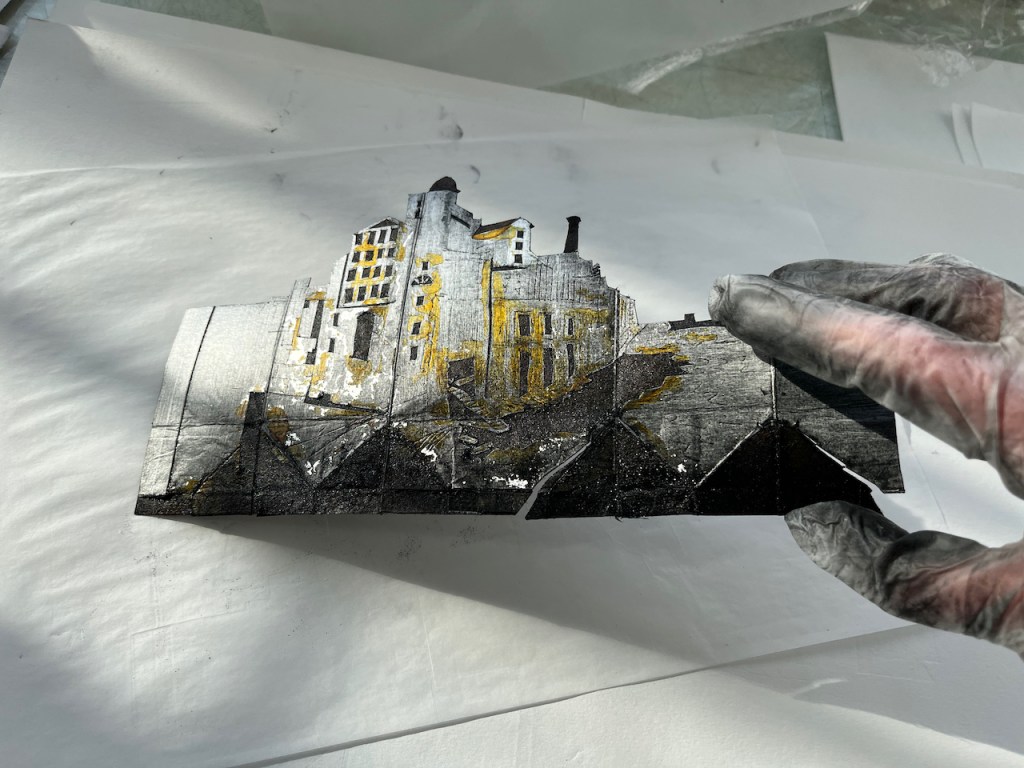
The “plates” are fragile, so I could only make 6 prints before the plate started deteriorating and the contrast started to go. Here is a picture of the plate, front and back. It is made out of a box of soup. I made the picture on the shiny, metallic-looking side, which is the former inside of the soup box.
Back of the plateFront (print side) of the plate, after inking and printing
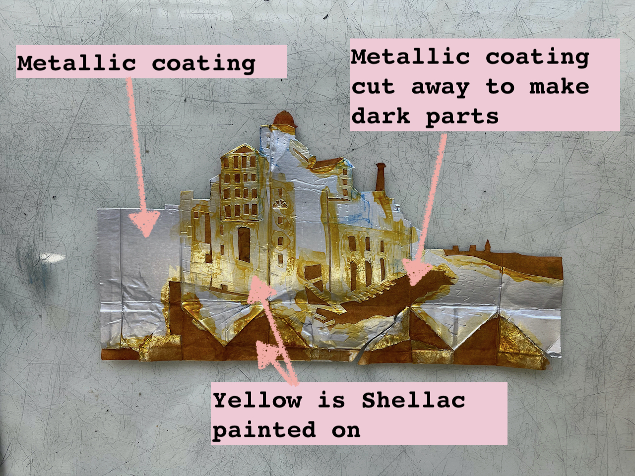
The parts which print dark are made by cutting out the metallic coating of the soup box, leaving the rough cardboard underneath. I painted the plate with button varnish (shellac in alcohol) to make it a bit stiffer and more durable. Here’s what the plate looked like before printing:
Plate before printing, with annotations
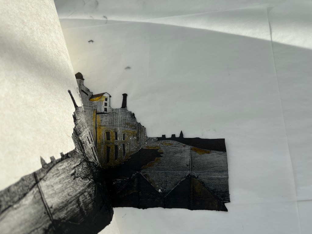
Here is one of the prints peeling off the plate:
Plate (left) and print (right)
I tried making a video, but it was too difficult to hold the plate, the paper and the phone all at once. And there’s ink everywhere which I was trying to avoid getting on my phone. Next time I’ll see if I can get a fellow printmaker to hold the phone.
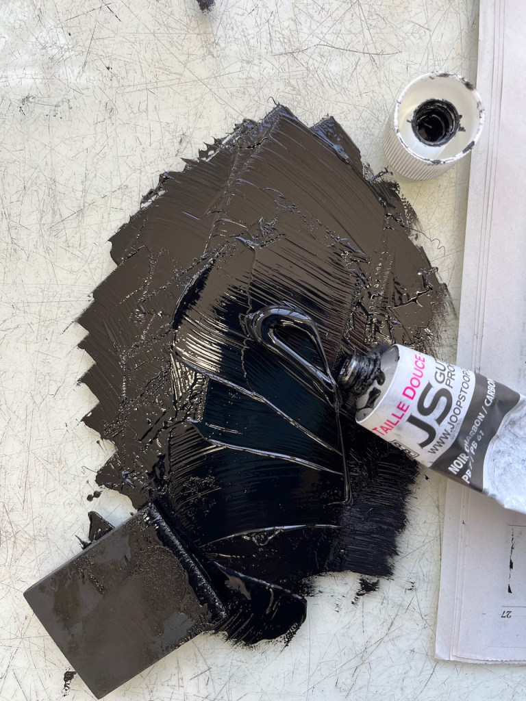
Ink: “JS”carbon black
The ink is traditional black etching ink from Intaglio Printmaker in Southwark. The paper is Zhao Zhe Chinese paper ref 11369 from Great Art on the Kingsland Road. The red seal on the finished print is made with a Japanese stone seal with red ink gifted to me by my friend and mentor Katsuhisa Toda 戸田勝久.
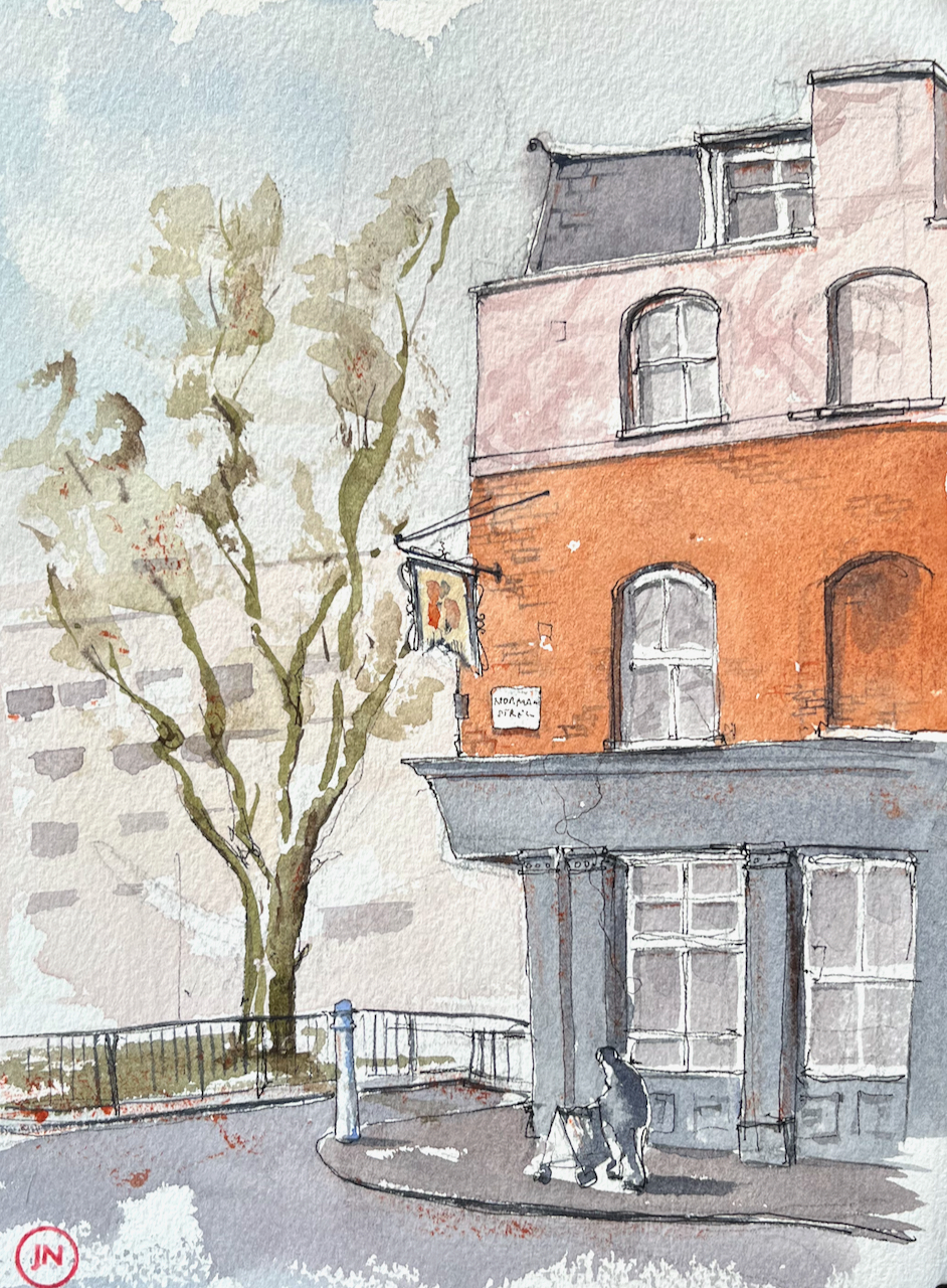
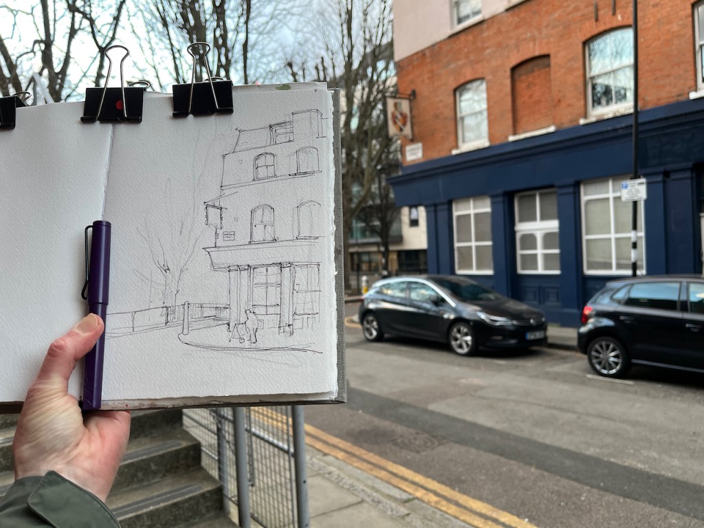
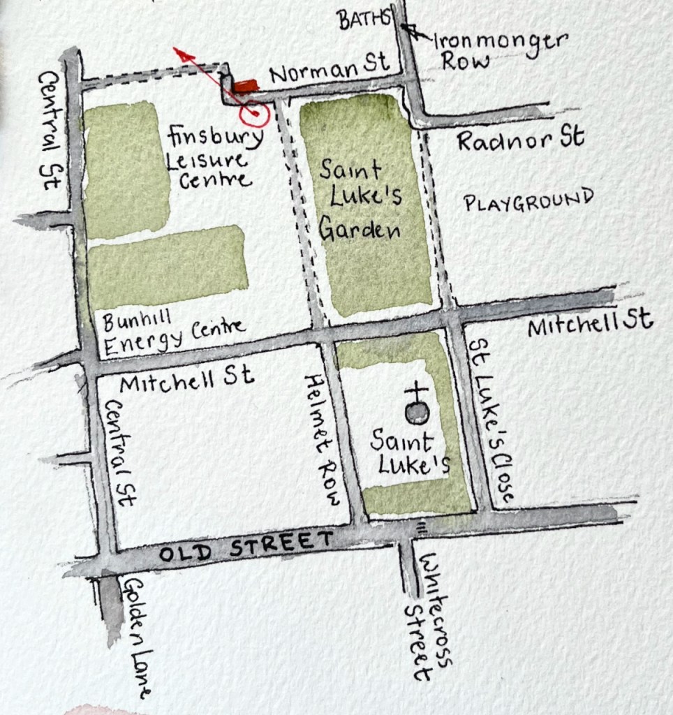
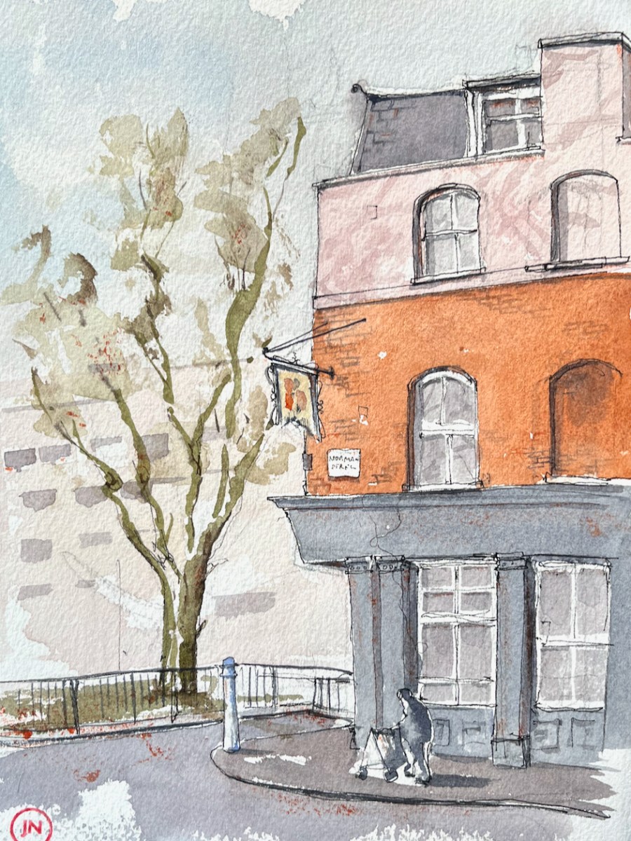
In the late afternoon, I walked round a corner near St Luke’s, and noticed the pub sign.
Langton Arms, Norman Street, EC1 sketched 29 Jan 2022, 4:15pm, in Sketchbook 11
The pub closed sometime around 1989, according to https://pubwiki.co.uk. It is now residential flats.
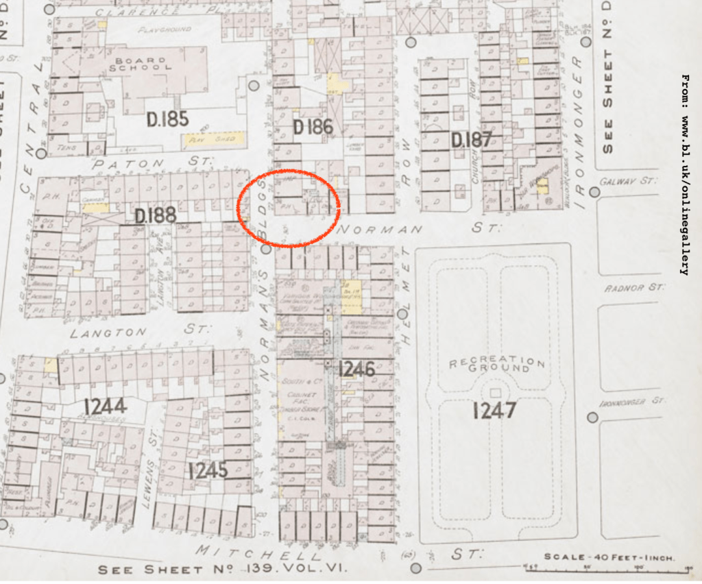
The pub was in existence in 1842, according to “closedpubs.co.uk”. There was a nearby Langton Street, shown on a map from the British Library dated 1901. The Langton Arms is marked “PH”.
1901 map. Langton Arms circled. Insurance Plan of London North District Vol. D: sheet 17 (British Library) Shelf mark: Maps 145.b.23.(.d)
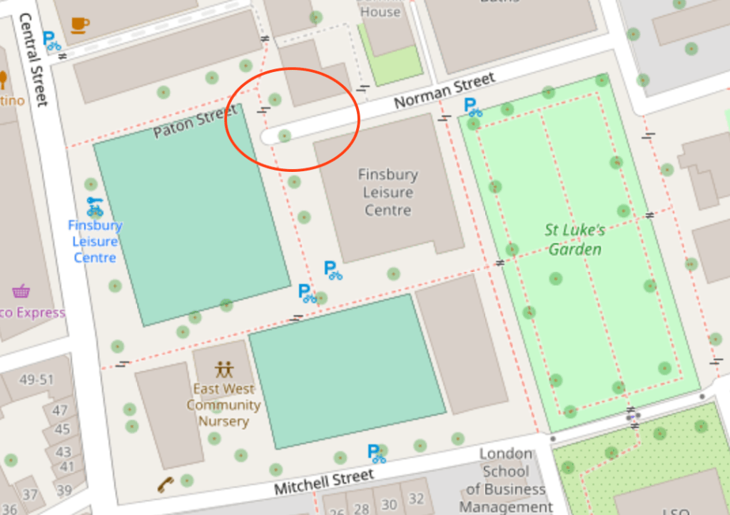
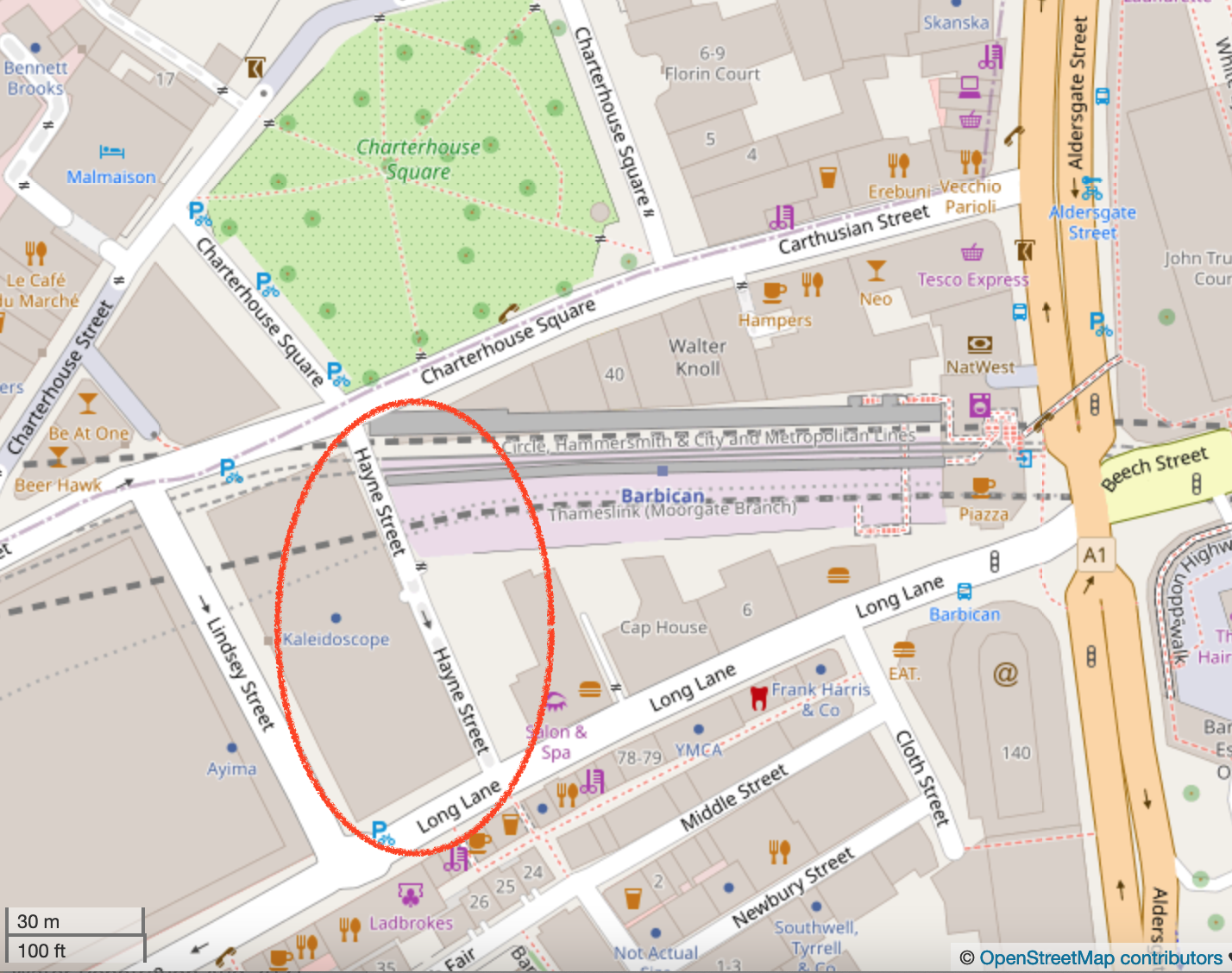
See how dense the housing was in this area in 1901. Here is the same area today. Langton Street has disappeared.
Norman Street area, 2022 (c) Open StreetMap, Langton Arms circled
Pub sign today
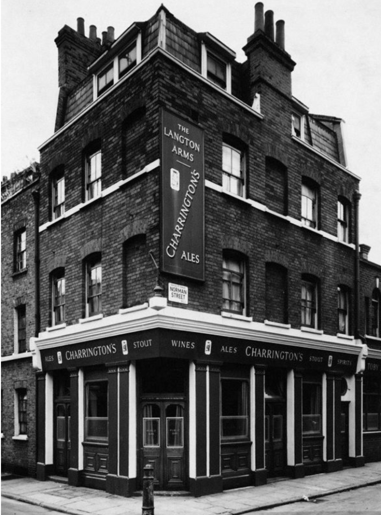
I sketched the closed-down pub at around 4:30pm, as the light faded. The pub sign is still there, but eaten away at the lower edge now. The street sign “Norman Street” is the same one as shown in a photo from 1958. It has “Borough of Finsbury” written above the street name. The Borough of Finsbury was absorbed into Islington in 1965.
This picture is a story of vanishing: vanishing street, eaten away pub sign, closed down pub, a missing borough, sun setting in January. Behind me as I sketched I could hear the squeak of gym shoes on hard floors, the other side of the closed steel doors to Finsbury Leisure Centre.
1958
Click a button below to share this post online, email it, or print it:
Hayne Street is a North-South lane just to the East of the new Crossrail station at Smithfield. It has been closed for some time, while the station was built and the office block on top of the station was constructed.
On the west side of Hayne street is this house:
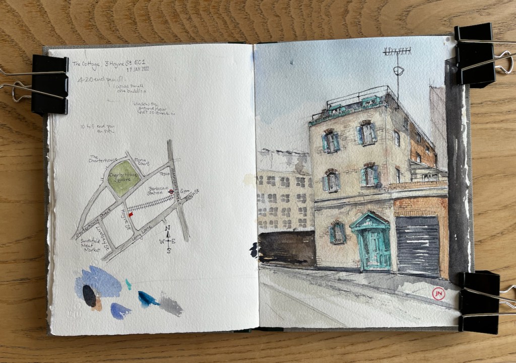
The Cottage, Hayne Street EC1, 17th January 2022, 5pm. 10″ x 7″ in Sketchbook 11
As I sketched, around 4:30 to 5pm, construction workers were coming off shift from the CrossRail site. They walked past me, lighting cigarettes, jostling, and talking in various languages. One person stopped to talk to me: “It’s a funny old building!” he observed. I agreed that it was, and wondered if anyone lived there. “I’ve not seen anyone go in or out,” he told me, “And I’ve been here four weeks.” Another person joined the conversation.
“I’ve seen a car,” said the newcomer. He indicated the black roller door, and made a sweeping gesture, showing how the car went in and out.
We all looked to see if there were lights in the windows at the side of the house. There were none. “It’s railway property,” declared the first person.
“It’s big, isn’t it?” said the second person, “It goes way back!”.
It does go way back. I’ve tried to show this in my drawing.
It’s a bit of a miracle that it has survived. This house is about 150 years old. There are jagged modern offices all around it. The Pevsner guide has a small paragraph on Hayne Street, in the section labelled “Long Lane and Hayne Street”. He says this:
“Long Lane and Hayne Street Long Lane first recorded in 1440[……] The N side, shorter because of the market buildings at the W, is mostly undistinguished medium-sized post-war offices. Not 18-19 are by Morrison, Rose & Partners, 1972-4, brick with smoked gland window bands. The upper storeys step back down Hayne Street, named after its developer in the early 1870s. Of this date the unpretentious brick warehouse at Nos. 8-10 W side and No. 3 opposite, a little house perched on the brink of the railway cutting.”
The Buildings of England London 1: The City of London by Simon Bradley and Nicolaus Pevsner (first published 1997, republished with corrections 1999) page 546
The “unpretentious brick warehouse” which was on the west side of Hayne Street in 1999 has now been replaced by the building above CrossRail. The “little house” remains.
It was there in 1873. At that time it had neighbours! See this map, from the marvellous British History online resource.
‘Charterhouse Square area: Introduction; Charterhouse Square’, in Survey of London: Volume 46, South and East Clerkenwell, ed. Philip Temple (London, 2008), pp. 242-265. British History Online http://www.british-history.ac.uk/survey-london/vol46/pp242-265 [accessed 17 January 2022].
Aldersgate Street Station is now Barbican Station. See the huge number of railway lines in 1873. Today there is just one line on the surface. The new CrossRail line is 40metres below.
Here is a modern map of the area:
Hayne Street Area 2022, from Open Street Map, (c)OpenStreetMap contributors
Here are some views looking up and down Hayne Street, and my sketch map and sketching location. Click to enlarge.
Sketch map. The small red rectangle shows the location of “The Cottage” Sketching locationSketching in the darkLooking South down Hayne Street towards “The Red Cow”. The new Crossrail building is on the right.Looking North along Hayne Street towards Charterhouse Square, glimpsed on the left. The long wall on the right is above the railway line.
3 Hayne Street has intrigued people. Mr Tim Dunn on Twitter found an “environmental statement” from Crossrail saying they were going to demolish the building. But it doesn’t seem to have happened, so far…..Mr Dunn’s research also contradicts the construction worker’s assertion that the building is “railway property”. From what he’s found, it’s privately owned. Here is his Tweet thread:
Many years ago, I found an odd little house on a @cityoflondon backstreet; The French House, we called it. It’s been hidden by Crossrail works for YEARS but recently 3, Hayne Street has been revealed… and uh-oh! A @Crossrail document says it’s scheduled for demolition… (1/6) pic.twitter.com/Rt2g6KCfES
“The City Gent” published photos of The Cottage in his “Symbols and Secrets” blog on the 6th of January.
I’m glad so many people appreciate this strange building in a back street.
I have sketched in this area before. The building in the back left of my picture is on the other side of the railway line. It is now swathed in plastic and being restored or redeveloped. I sketched the West edge of this building in April last year.
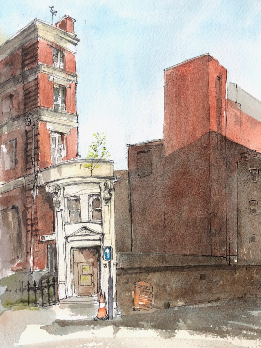
This is a little white building I always enjoy walking past. It is the westernmost end of a thin terrace of warehouses and showrooms, lodged in a triangle between the road and the railway. As I passed it the other day I saw that the tree which has taken root above the door was putting…
I was commissioned to paint a picture of this lovely house.
House in South West London , 12″ x 9″ on Arches 300gsm paper, [commission]
This interesting commission took me to a part of London I had not previously explored. Many thanks to the new owner of this painting for allowing me to post it online.
One of the delights of these houses is the chimneys. They sit up there like chess pieces, or individual characters in a play. I tried to show their personalities.
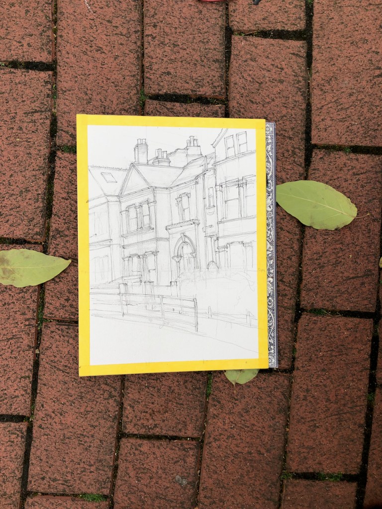
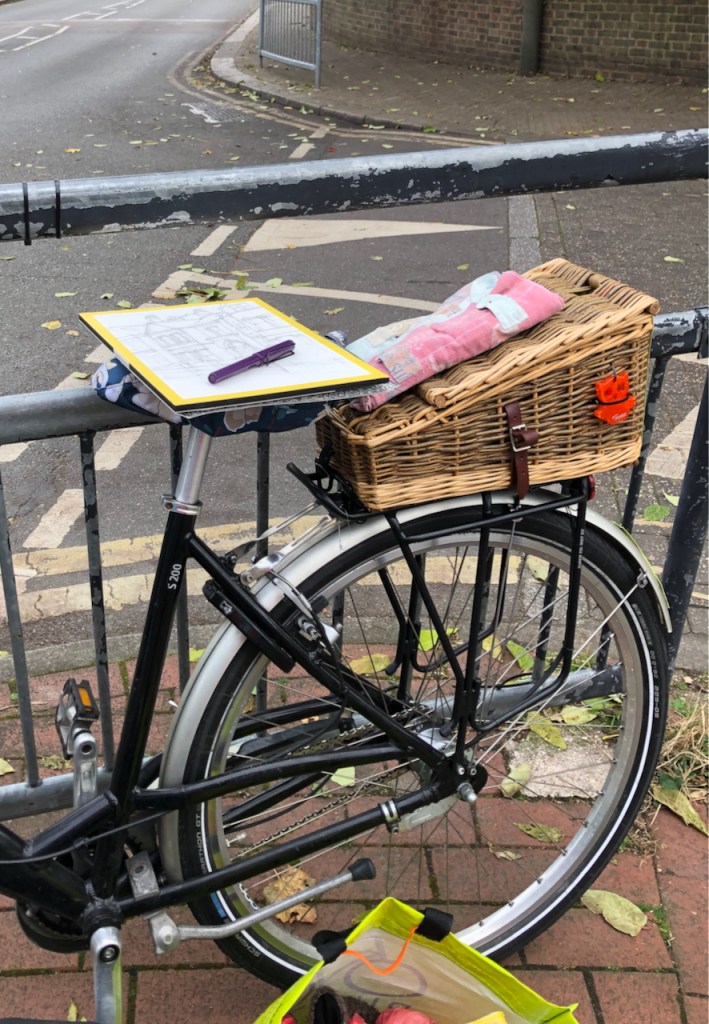
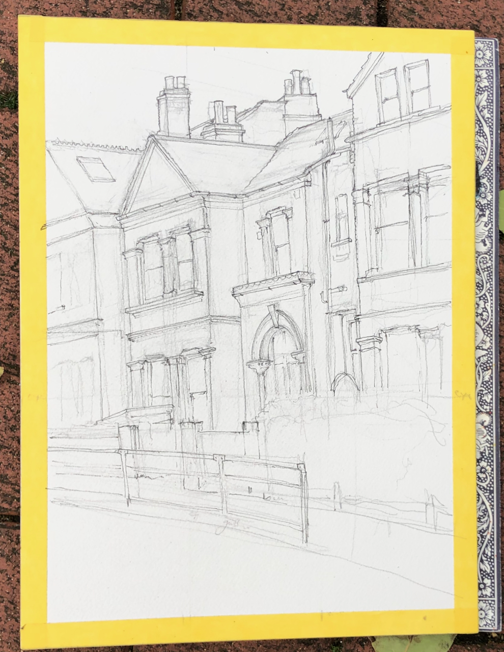
I painted this in November. It was cold, but there were still leaves on the trees. They blew around in the wind and scattered on the road. A road sweeper, a café proprietor, and a woman with a pram all came over at different times to look at my work. I made a preliminary sketch on brown paper to understand how to compose the picture, how the perspective worked and where the light and dark should be. The next stage is the pencil underdrawing, then the pen, then watercolour.
Pen drawing. The yellow tape is to frame the picture, and for me to hold on to while I sketch.Pen drawing. I also make annotations on the yellow tape. Here it says”eye line”Using the bike as a table. The pen is a Lamy Safari fountain pen.Trusty bike Pencil under-drawingPreliminary sketch on brown paper to work out the perspective lines, which are shown here in yellow and red.
Here you see the difference the colour makes:
“before” and “after” the colour went on: move the slider.
The colours are: Buff Titanium, Perylene Maroon, Prussian Blue, Hansa Yellow Mid, Burnt Umber, Fired Gold Ochre. Fired Gold Ochre is “granulating” – it dries unevenly into a pattern of dots. You can see the effect in the brick texture of the house nearest us. The chimneys are Fired Gold Ochre with some Transparent Pyrrol Orange. The greys and black are mixed from Prussian Blue and Perylene Maroon. All the watercolours are Daniel Smith.
The ink I use is De Atramentis Document Ink, Black, which is waterproof, supplied by The Writing Desk. The paper is Arches Aquarelle 300gsm cold-pressed, in a block 12″ x 9″. All paints and paper are from Jacksons Art.
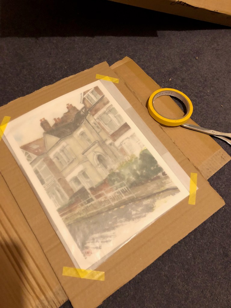
Here is the picture being wrapped ready to go to its new home.
Click a button below to share this post online, email it, or print it:
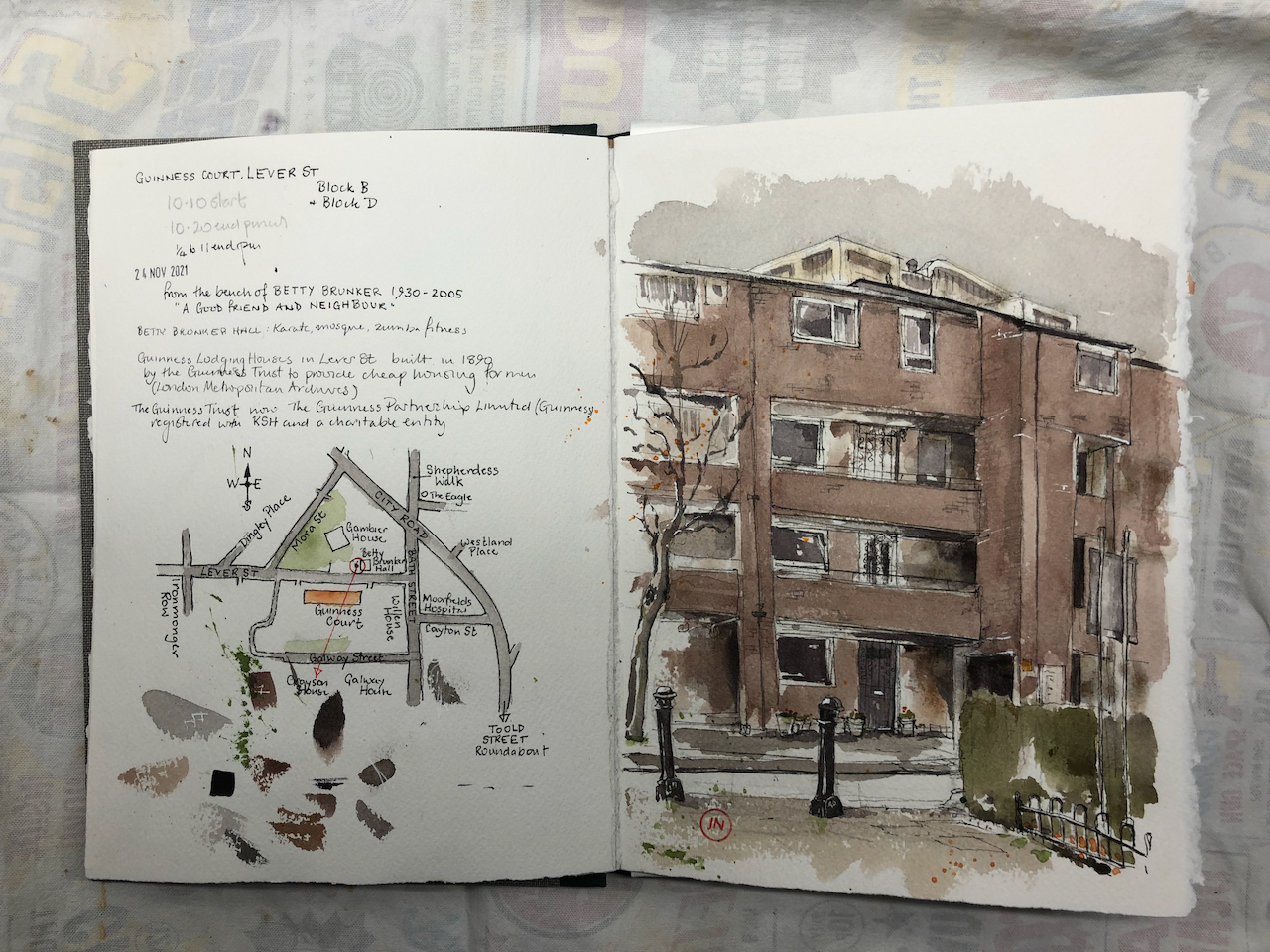
Guinness Court is a group of low-rise blocks between Gambier House and Galway House, in Finsbury. A resident writes that it is a lovely place to live, with an “inner communal garden with trees and squirrels”.
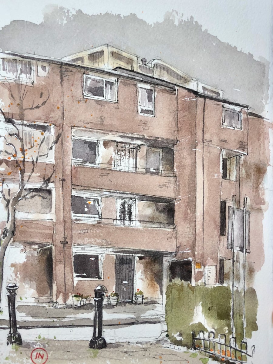
Here is Guinness Court from Lever Street:
Guinness Court, Lever Street, EC1 24th November 2021, 10:45am.
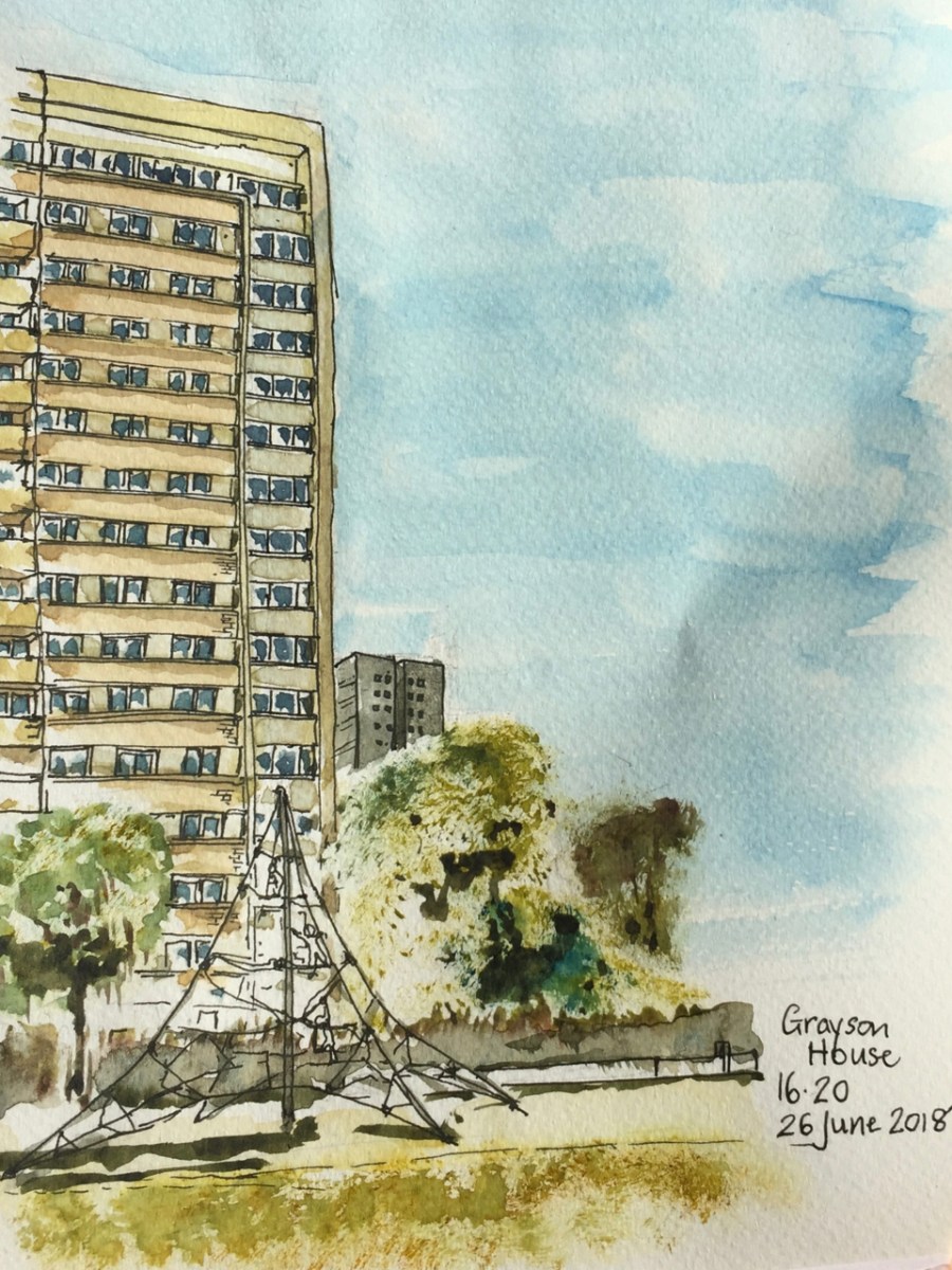
You see Grayson House just peeping over the roof.
Guinness Court is owned and managed by Guinness Partnership Limited1.
“Guinness was founded in 1890 to improve people’s lives. And that’s still what we’re about today. In 1890, philanthropist Sir Edward Cecil Guinness donated £200,000 to set up the Guinness Trust in London, with an additional £50,000 for the Dublin Fund, which later became the Iveagh Trust. He wanted to help improve the lives of ordinary people, many of whom couldn’t afford decent homes. He wanted to improve people’s lives and create possibilities for them. We’re proud that thousands of families have benefited from this vision.” [https://www.guinnesspartnership.com/about-us/what-we-do/our-history/]
Sir Edward Cecil Guinness was the grandson of the founder of the Guinness brewery.
The original Guinness Court on Lever Street was built in 1890. Here is what it looked like in 1950:
The current building was constructed in 1976, according to “Streets with a Story – The Book of Islington” by Eric A Willats FLA. I cannot discover anything about the architect or the plans – or why the Victorian building was demolished. If anyone has access to the current building and can spot a foundation stone or information plaque, please let me know?
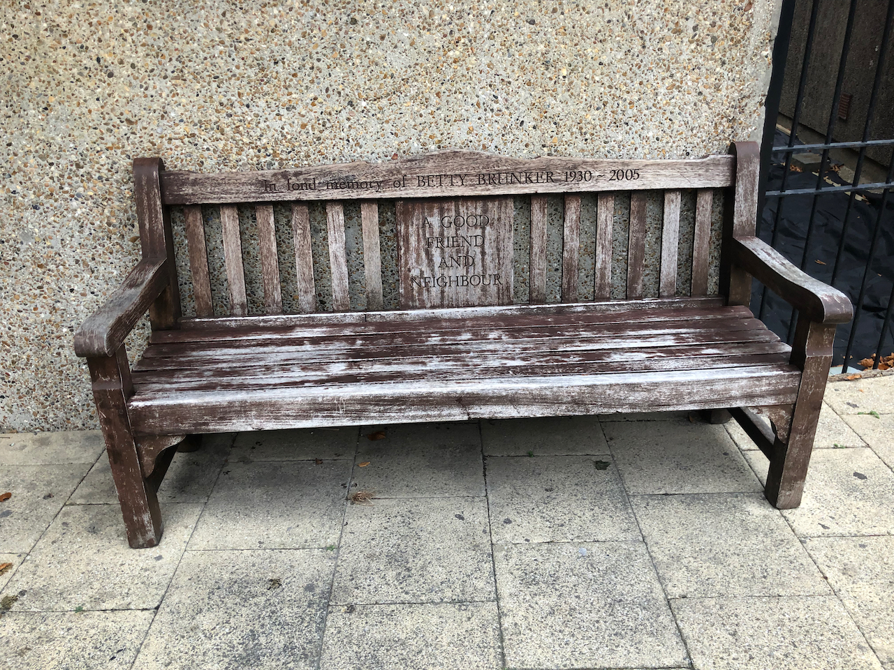
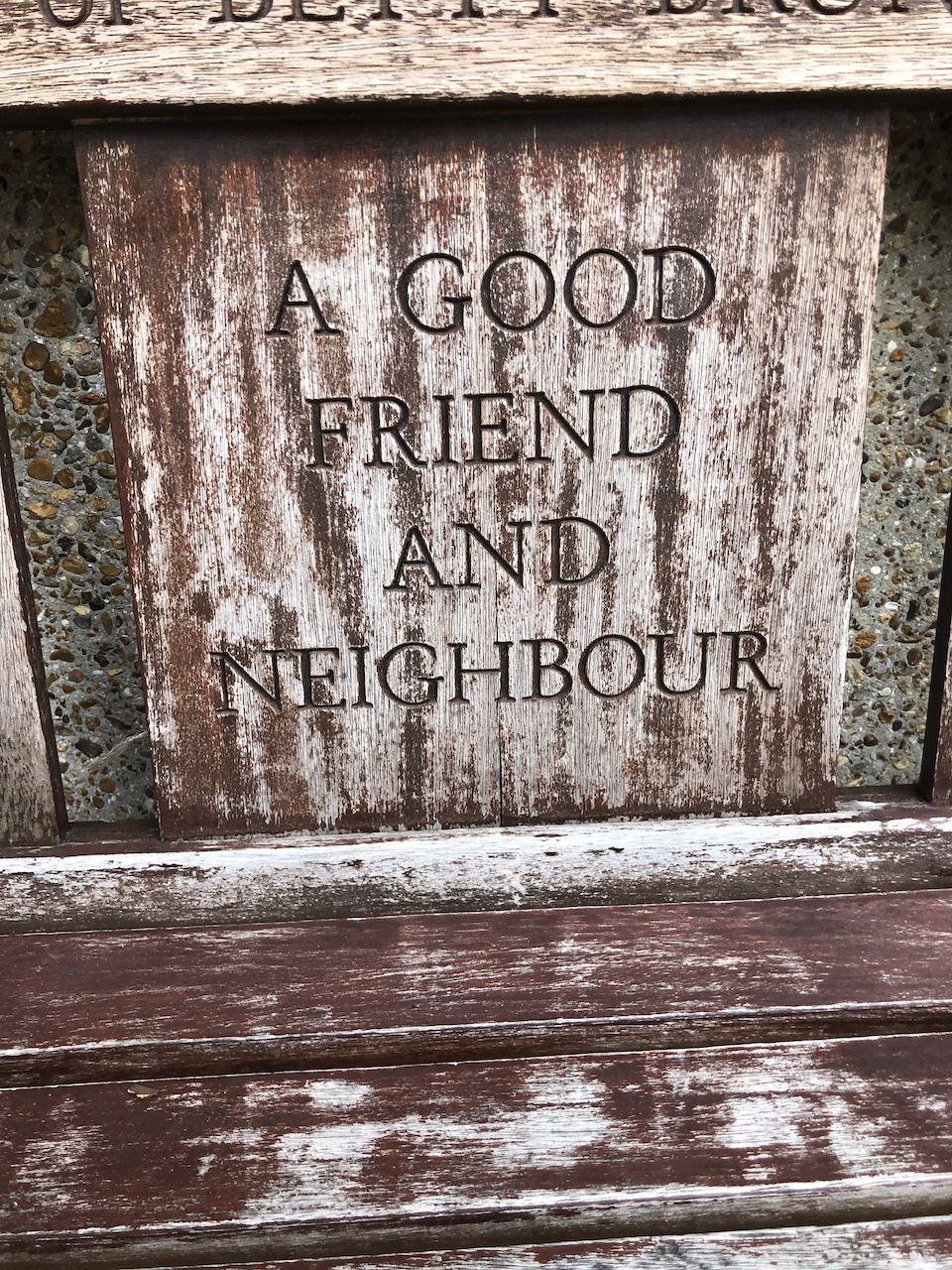
I made the sketch from a bench dedicated to the memory of Betty Brunker, “a good friend and neighbour”, 1930-2005.
Note 1: The Guinness Partnership Limited is a charitable Community Benefit Society No. 31693R registered in England and is a Registered Provider of Social Housing No. 4729. [https://www.guinnesspartnership.com]
Note 2: There are a number of buildings called “Guinness Court” in London. For example there is Guinness Court in Mansell Street E1, not far away, and Guinness Court, Snowsfields, Southwark SE1, on the other side of the river.
I have done a number of sketches in the Finsbury area:
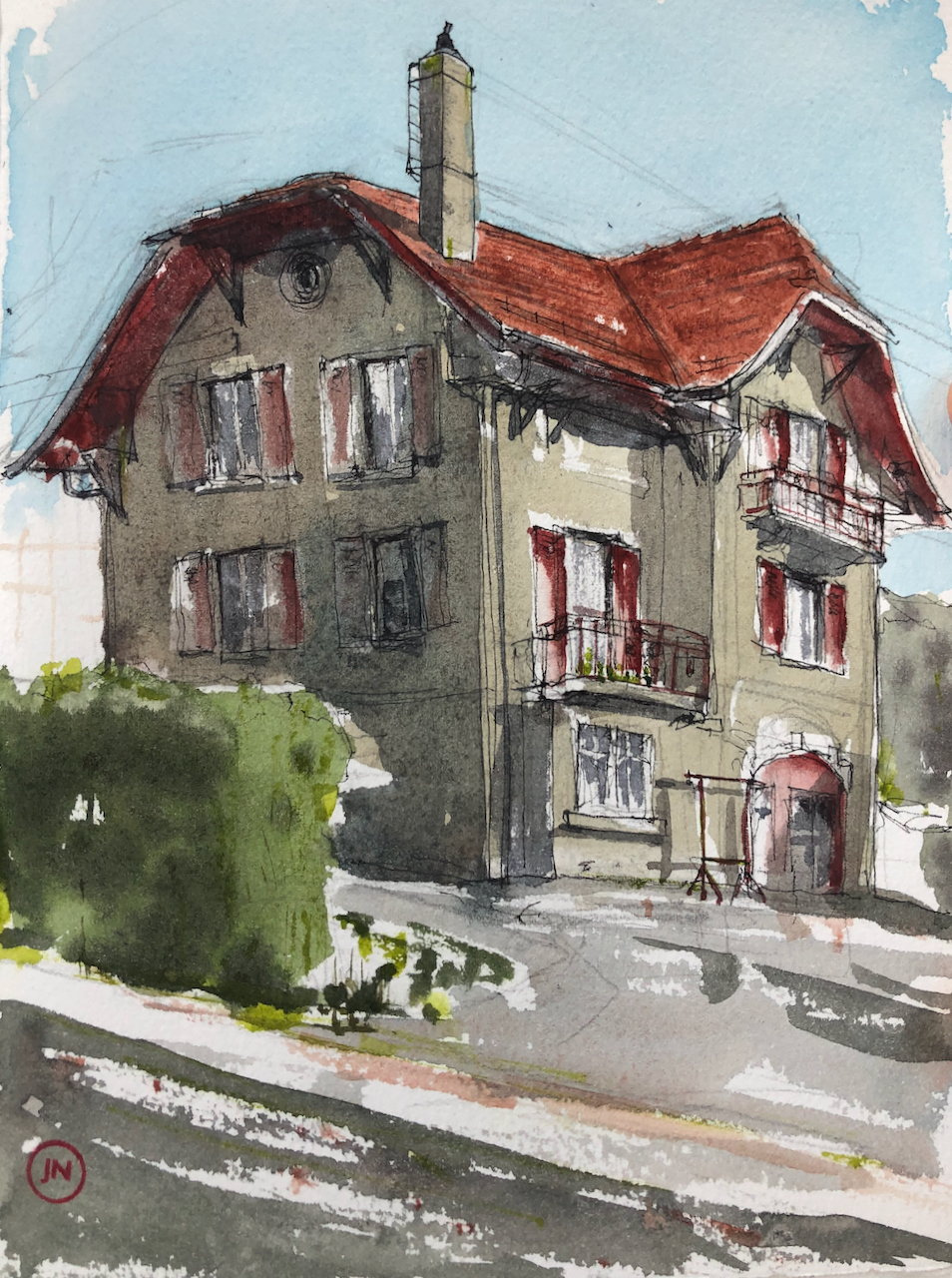
Here is 23 rue du Petit-Montreux, Sainte-Croix, Vaud.
23 rue du Petit-Montreux, Sainte-Croix, Vaud 24 October 2021, 10″ x 7″ in Sketch book 11
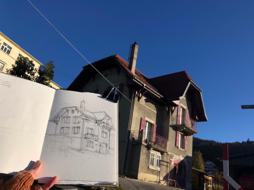
I sketched this house after breakfast. The sun was bright and I rushed out into the crisp morning. It took me about one hour and 15 minutes outdoors, and then I completed it in my hotel room. The outside air temperature was 20 C.
A few pencil lines
Pen and ink
Pen and ink done
Work in progress on the colour
Looking east to the house
Perhaps I should draw the scene looking the other way too?
Work in progress in rue du Petit-Montreux
“…the ladder that goes up the chimney…”
I particularly admired the ladder that goes up the chimney. So practical.
The sky is Phthalo Blue Turquoise, with some Lavender. The roof is mostly Fired Gold Ochre. The house walls, and the road, are a mix of Phthalo Blue Turquoise and Perylene Maroon, with a bit of Transparent Brown Oxide and Buff Titanium. The shutters are a mix of Fired Gold Ochre and Perylene Maroon. The hedge is Sap Green with those other colours mixed in to make it darker.
Here are some maps:
Click a button below to share this post online, email it, or print it:
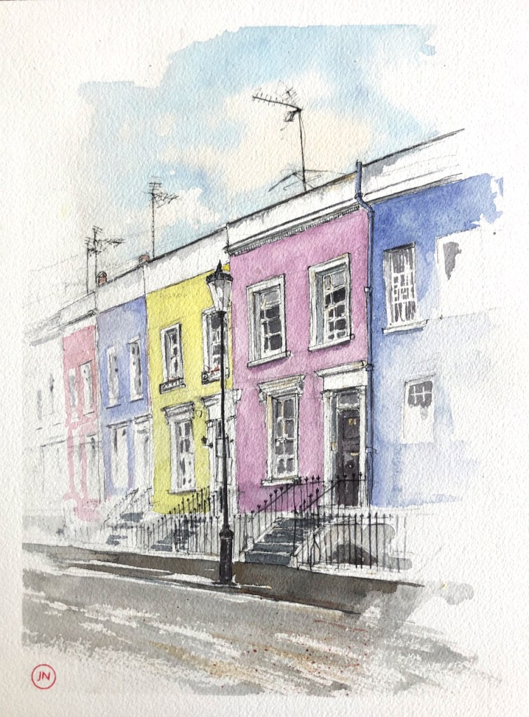
Houses in West London, 12″ x 9″ on Arches Aquarelle CP, [sold]
I enjoyed the television aerials, which look like runes or calligraphy, above the formal lines of the terrace of houses. The street was not as empty as I have drawn it. There were delivery vans coming and going, building work in progress, children being led to school, all manner of arrivals and departures.
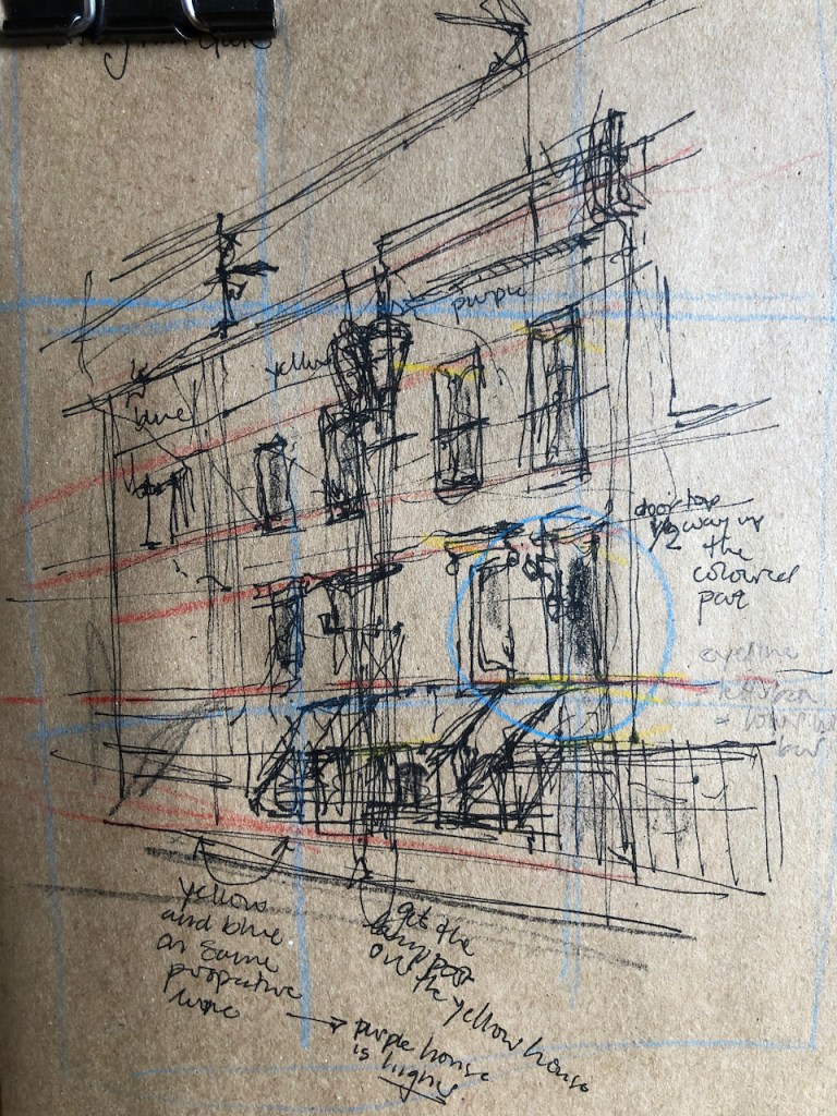
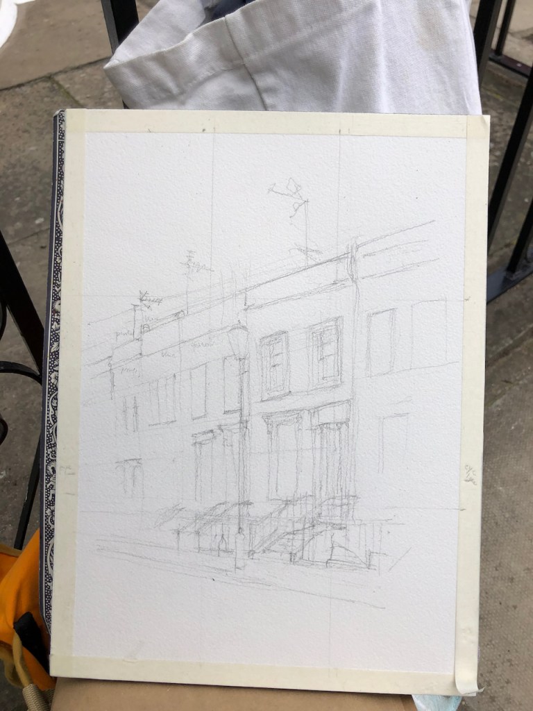
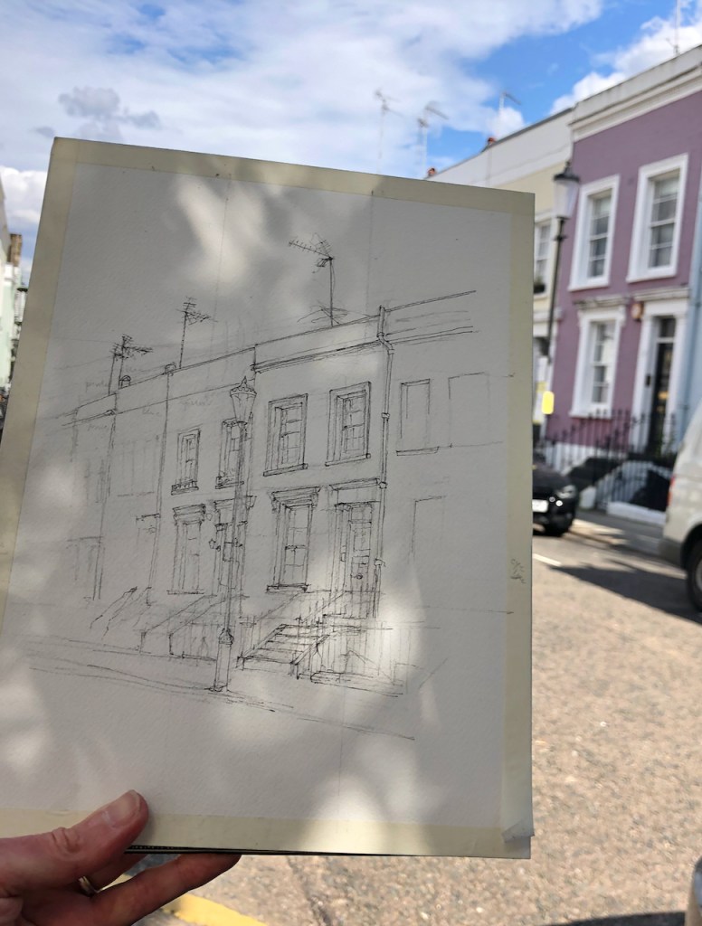
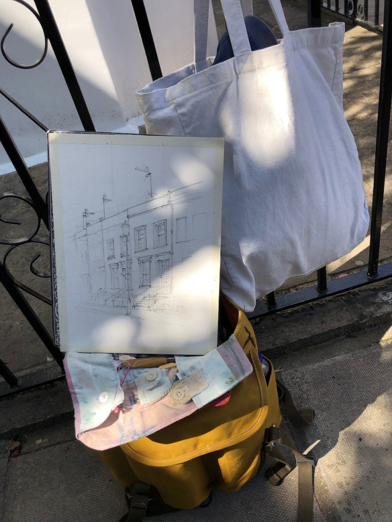
I made a preliminary sketch, to make sure I’d understood the perspective. Here are photos of work in progress:
Preliminary Sketch
Pencil
Pen
Work area
Click a button below to share this post online, email it, or print it:
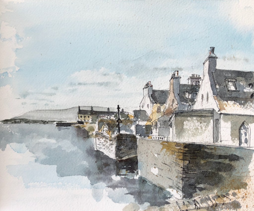
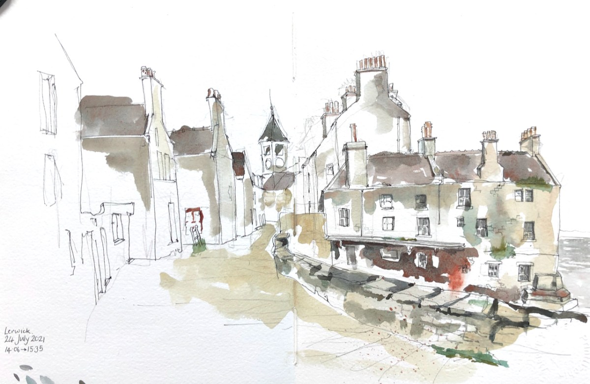
Here is a view of houses in Lerwick known as “lodberries”. They are built into the sea. Lerwick is one of the few capital cities in the world that has a beach. The other I know is Sydney Australia. The beach in Lerwick is somewhat smaller than Bondi beach, and is over the wall to the right of my picture.
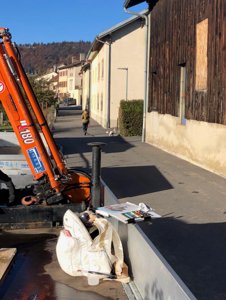
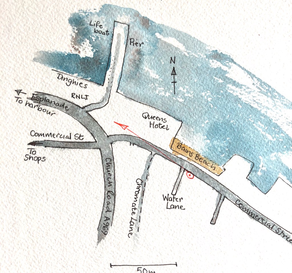
I drew this picture sitting on a bench next to the aptly named “Water Lane”. I was just thinking how peaceful it was, how few people, and how unlike London, when a car came and parked directly in my line of sight, blocking my view of the part I had yet to draw. A small family emerged out of the car. Children ran around with buckets and spades, a woman corralled them down the steps and onto the beach. A man got out of the driver’s seat and saw me. He smiled. It was a sunny day. I smiled a mixed smile. Suddenly he saw that I was drawing. “Oh!” he said, “Shall I move the car?” I said yes, that would be very kind. Without any hesitation he jumped back into the driver’s seat, fired up the engine and parked in a space up the road. He waved to me as he walked to join his family down on the beach. I waved back.
Commercial Street, Lerwick. Lodberries. July 24th 2021, in Sketchbook P1 double spread: 14″ x 10″ approx. 1½ hours on location
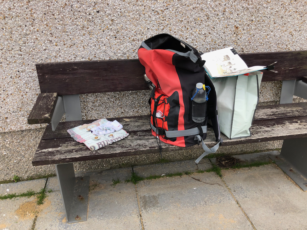
Here is work in progress:
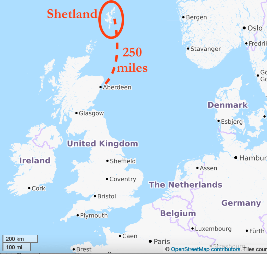
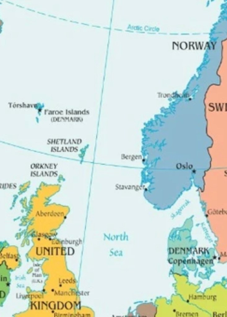
Here are some maps to show the location. I have also included maps showing where Shetland is, since people have asked. It is about 100 miles off the north coast of Scotland. From Aberdeen it is some 250 miles (400km) and takes 13 hours by ferry. Shetland is at a more Northerly latitude than Oslo and Stavanger, nearer Bergen than Aberdeen and nearer Copenhagen (590 miles) than London (600 miles).
Here is a view of the North Sea approaching Aberdeen. See the wind turbines.
Click a button below to share this post online, email it, or print it: